Onkaparinga River National Park, VKFF-402

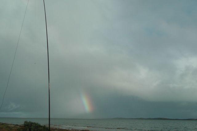
Late yesterday afternoon, my wife Marija and I headed over to the Onkaparinga River National Park.  I had activated Onkaparinga River NP last year for both the VK5 National and Conservation Parks Award & WWFF, but I wanted to increase my tally of QSO’s up over 44 for the global WWFF award.  I had only 10 QSO’s last time I activated this park in July 2013.  Plus, this was a new calendar year, so the park was worth an extra 2 points for me for the VK5 Parks Award.

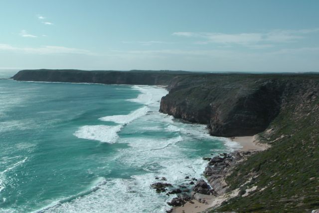
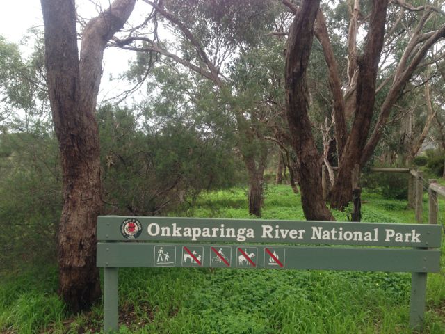
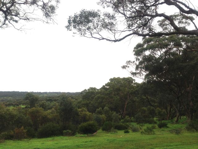
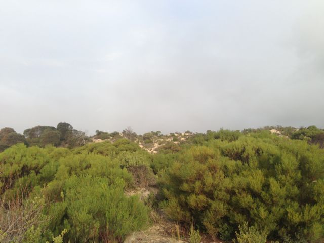
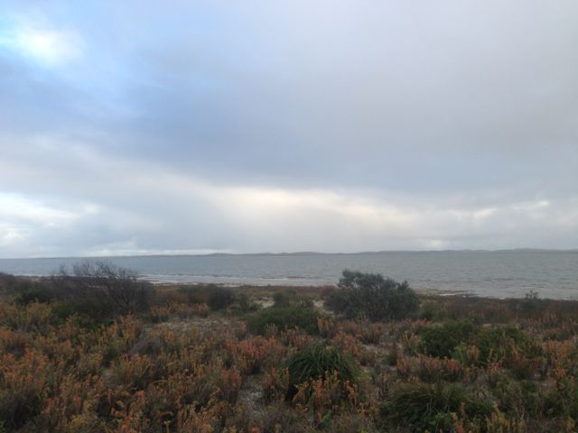
Onkaparinga River NP is 1,544 hectares in size, and is one of South Australia’s largest parks.  It is situated about 32 km south of Adelaide.  It is a beautiful 45 minute drive from my home, through the Adelaide Hills towns of Echunga, Meadows, and Kangarilla.  The park features rounded ridge tops, steep gorge slopes and the narrow river valley of the Onkaparinga Gorge.  The gorge has been cut out slowly over many years by the Onkaparinga River.

Onkaparinga_Estuary_1

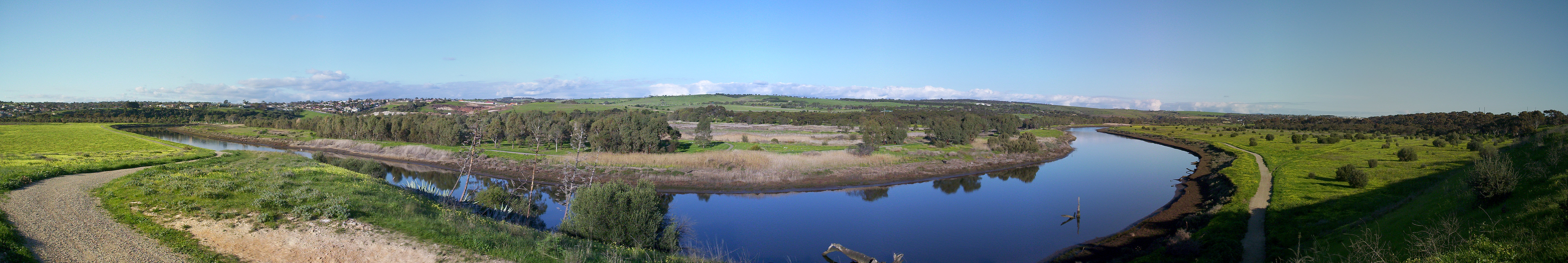
Photo courtesy of Wikipedia.

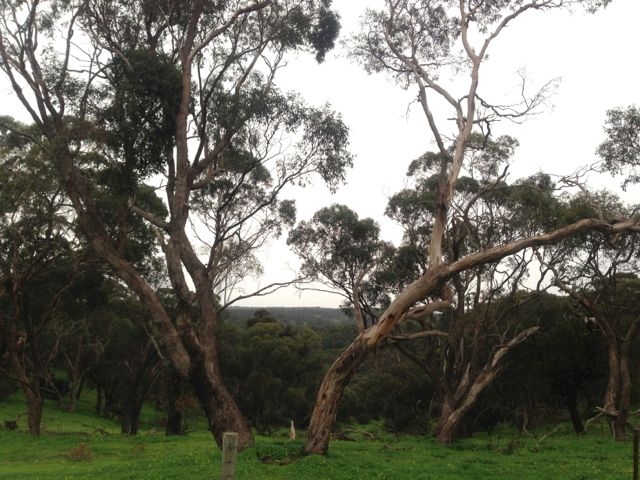
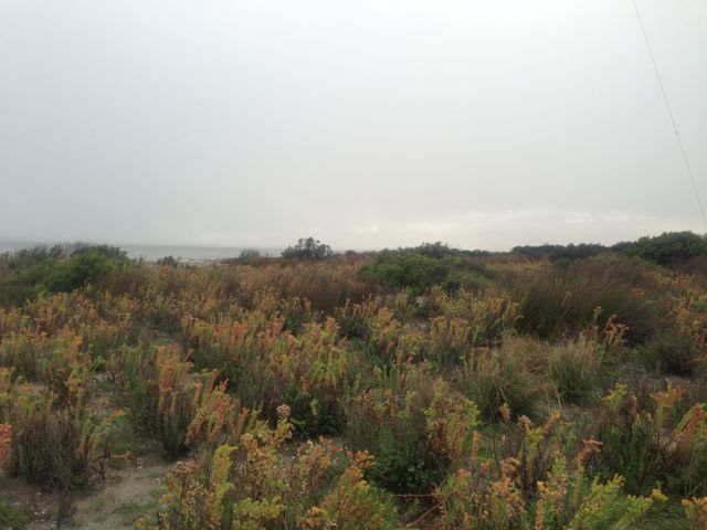
Within the gorge itself there are remnant woodlands of pink gum, mighty river red gum, grey box, sheoak, and native pine.  There are also significant grasslands, all of which have survived 160 years of livestock grazing, harvesting of timber and cropping.

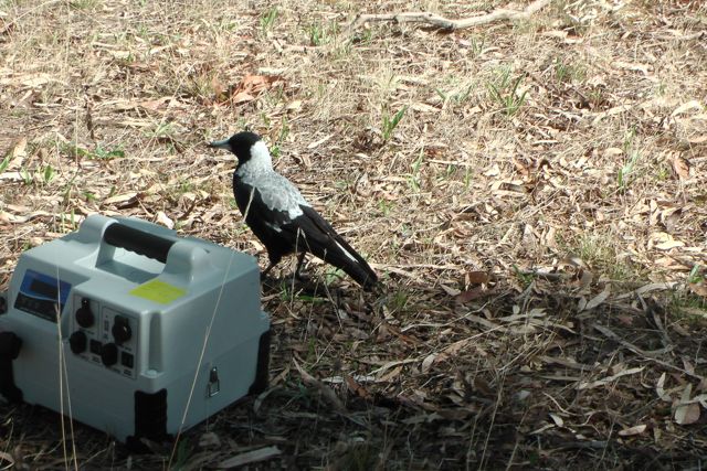
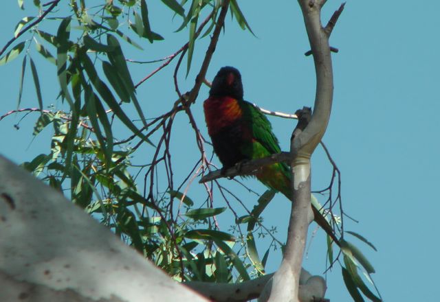
There are over 180 bird species within the park.  This includes Wedge Tailed eagles, Laughing Kookaburras, Sacred Kingfisher, and various lorikeets, rosellas, and parrots.

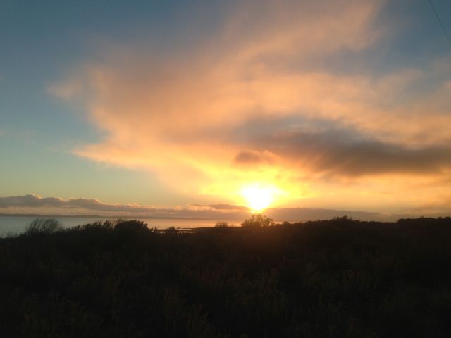
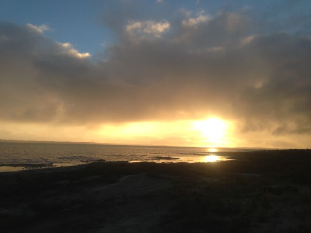
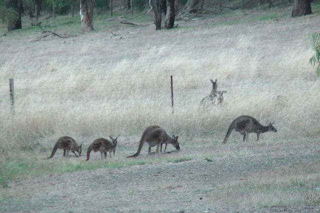
Numerous Australian native animals can be found in the park including Western Grey kangaroos, koala, brush tail possums, and echidnas.  As the sun started to go down, there was no shortage of kangaroos grazing in the open areas surrounding where I was set up.

IMGA0013

Rock climbing is a favourite past time in the park, as is canoeing or kayaking down the Onkaparinga River and the associated estuary channels.  There are a number of well marked walking trails through the park.

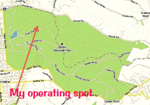
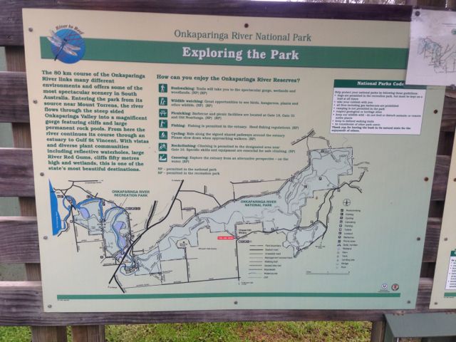
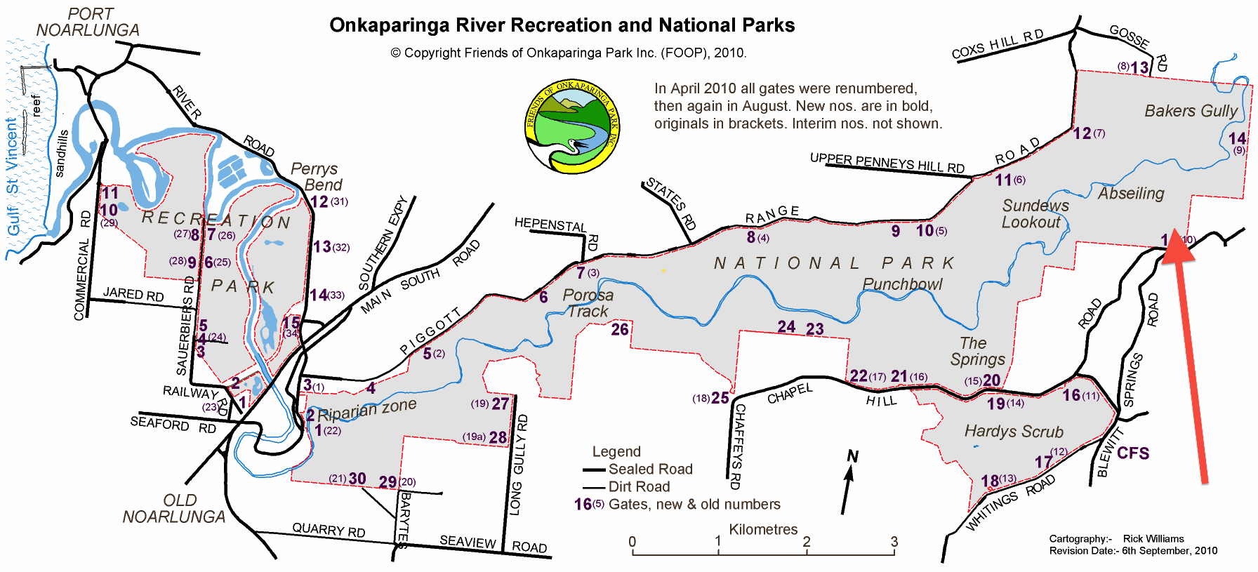
Marija and I accessed the park via Chapel Hill Road.  The map below, shows our operating position (marked with the red arrow).  There are many fantastic wineries in this area as it is very close to the famous wine growing region of McLaren Vale.

Complete_Brochure_New+old-GateNbrs

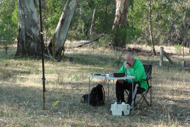
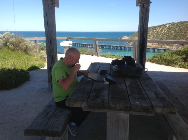
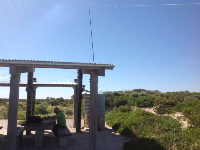
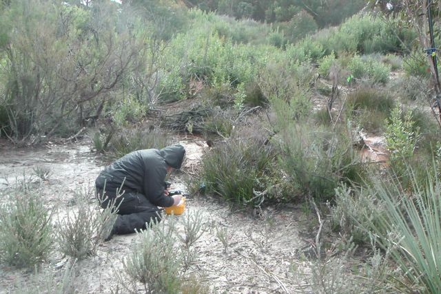
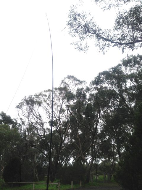
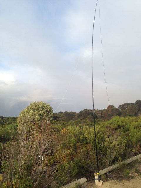
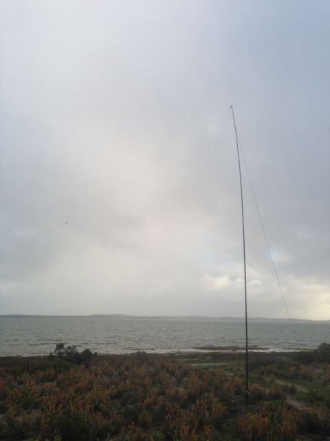
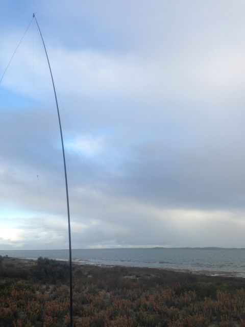
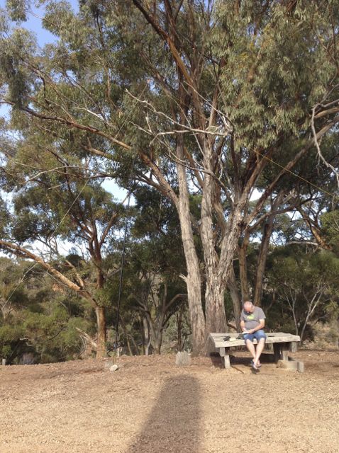
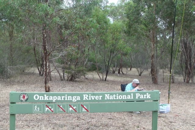
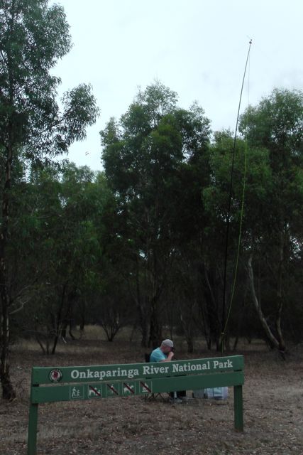
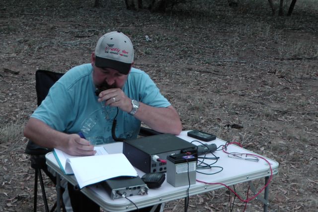
We found a good car parking area on Chapel Hill Road, and unloaded the equipment.  We set up just inside the park boundary, right alongside one of the park signs.  There was a good cleared area here, so I was able to stretch out the 40m / 20 m linked dipole, which I supported on my 7 m squid pole.

I brought 2 radios with me for this activation.  I had the little Yaesu FT-817nd for localAustralian contacts on 40m (running just 5 watts).  And I had my much bigger Yaesu FT-450 for the DX on 20m (running 50 watts).

IMGA0001

After setting up my fold up table and deck chair and making myself comfortable, I tuned to 40m.  Just as I was doing this, I received a text message from my friend, John VK5BJE, who was operating portable in the Mark Oliphant Conservation Park.  This was an opportunity for a ‘Park to Park’ contact for the VK5 Parks Award.  So I quickly tuned to 7.100 and spoke to John who had a beautiful strong 5/8 signal.  I then saw a spot on SOTAWatch for Kevin VK3KAB/p who was portable on SOTA peak, Hyde Hill VK3/ VC-008 on 7.110.  I called Kevin who has a lovely 5/8 signal (5/8 signal report received back from my qrp set up).

IMGA0004

I then headed up to 7.144 and called CQ and was greeted by the masses of Park Hunters.  First cab off the rank was Rod VK5VRB, followed by John VK2AWJ, then Brian VK5FMID, and then Ben VK3WRL.  A steady flow of callers followed from VK3 & VK5.  All with very nice signals.  It appeared that the 40m band was in good shape.  A few guys called me whilst running QRP.  They including Doc VK5BUG using just 3 watts, and Col VK5HCF down in Mount Gambier, 400 km away.

I also worked Tony VK3CAT who gave me a call whilst he was on SOTA peak, Mount Macedon VK3/ VC-007.  Tony was a good strong 5/8 and I received a 5/9 signal report from Tony.  Tony had a slight accident with his thermos while we had our QSO, which put a bit of smile on my face.  Sorry Tony !

Sadly, some VK2’s came up just 2 kc away from me, which made things very very difficult.  I am sure they could hear me.  Other VK2’s were.  It was their daily net, and I guess they were’nt going to move for anyone.  Sadly, this seems to be a common problem with some operators.

When things started to slow down on 40m, I lowered down the antenna and unclipped the alligator clips so I could operate on 20m.  I was keen to work some DX from the park.  I had been inspired by Tony VK3VTH and Peter VK3ZPF, who are both keen park activators for both WWFF and also the Keith Roget Memorial National Parks Award (KRMNPA).  In recent times both Tony & Peter have been working huge amounts of DX during their park activations.

So after setting up the dipole for 20m, I saw a spot on SOTAWatch for Mike 2E0YYY, who was sitting on top of SOTA peak, Gun G/SP-013.  There was a huge amount of QRM from nearby stations, but despite this, Mike was a very good signal into the park.  I called a few times and managed to get through to Mike (4/5 sent and 5/5 received).  It was great to work Mike.  He was my first ever SOTA contact 3 years ago.

After working Mike I headed off to 14.244, but there was a lot of interference from nearby stations, so I went down slightly lower to 14.243 and put out a CQ call, to be answered by DK4RM.  My old mate Peter VK4AAV then called in to say hi.  Peter was kind enough to place me on the DX cluster, and that is when everything went mad.  What followed was a huge pile up from Europe and the United Kingdom.

IMGA0015

It got so busy, that I almost had to go split operation.  I ended up with a total of 84 QSO’s on 20m ssb.  Of those, 73 were DX contacts in England, Germany, Belgium, Spain, Austia, Russia, Ukraine, France, Romania, Italy, Switzerland, Denmark, Czech Republic, Hungary, USA, Slovenia, Belarus, Poland, Baeleric Islands, Finland, Japan, Slovak Republic, and Ireland.

There were some very interesting contacts amongst this.  They included Geni OE7DXT who was mobile and had a beautiful 5/7 signal amongst the pile up.  Tom G0SBW who was pedestrian mobile and QRP with a nice 5/4 signal.  Rich G0OWU who was QRP with 10 watts and had a nice 5/7 signal.

I was also called by Peter ON2WAB/p who was portable in ONFF-370, Meetjeslandse Kreken.  It was a little bit of a struggle with Peter who had a 4/4 signal but we made it.  Peter gave me a 5/5.  And I was also called by Jef DD2CW who was portable in DLFF-039, Augsburg-Westliche Wälder.

My very good mate Bill W1OW from Massachusetts USA also came up to say hi amongst the pile up.  Thankyou to Peter VK3CFA for letting me know he was there.  I would later work Bill on 40m SSB as well.

And an interesting call came from Fuji, 7K1PAS.  It was really great to speak to Fuji, who was my only Asian contact, and with the same suffix as my call sign.  Thanks Fuji.

I would like to say a big thank you to Andrew VK2UZ.  During the pile up I was working, I started to get some bleed over from just above me.  I went up 2 kc and spoke to Andrew & the G station he was working, and they both graciously QSY’d up a little higher.  Thanks guys for your courtesy.  Sadly the same cannot be said for a ZL who subsequently came up just 2 kc away and totally killed the frequency.  I apologise to all the Europeans who were still calling.  I just could not fight off the ZL’s huge signal.

When the 20m band started to close, I headed back to 40m and I booked in to the 7.130 DX Net for about 20 minutes and worked  a further 10 stations in VK2, VK4, VK6, VK7, New Zealand, USA, and French Polynesia.  This included a contact with Doug VK2FMIA/p was portable in Warrabah National Park, VKFF-518.  Also a QSO with Wayne VK5LWR/p who was portable in the Deep Creek Conservation Park (with a 5/9 plus 20 db signal).

But it was starting to get late, and I had pushed my luck far enough with my XYL, so it was time to pack up and head home.  I had managed a total of 120 QSO’s on 40m ssb and 20m ssb.  Of those, 73 were DX contacts on 20m SSB.  And 4 DX QSO’s on 40m ssb.  This was a really enjoyable and very exciting activation.

IMGA0033

The following stations were worked on 40m SSB:-

VK5BJE/p (Park); VK3KAB/p (SOTA); VK5VRB; VK2AWJ; VK5FMID; VK3WRL; VK5EMI; VK5KGP; VK5FBAC; VK5WG; VK5NQP; VK5FAKV; VK5BUG/qrp; VK3ZPF; VK5HCF/qrp; VK3HJ/m; VK5BJE; VK3FABE; VK5JDS; VK3VEK; VK3GMM; VK5AV; VK5MPJ; VK3CAT/p (SOTA); VK3ERW; VK3AMB; VK7ROY; FO5JV; W1OW; VK2FMIA/p (Park); VK7CC; ZL2ASH; ZL2TCR; VK4FAAS; VK5LWR/p (Park); and VK6FNKS.

The following stations were worked on 20m SSB:-

2E0YYY/p (SOTA); DK4RM; VK4AAV; VK6JES; ON5JE; EA4DTV; OE8TLK; UA4PKN; UT5PI; ON5JK; F1RUK; YO3JW; I5FLN; IK2AHU; OE7DXT/m; F5PAU; HB9FLU; OZ7KIM; IZ2GTO; ON5SY; OK2APY; ON4BB; HA0LG; UA9LT; IW2NXI; RA1OD; VK5VRB; DF6EX; OZ4RT; DK3GG; M0WYZ; IZ5ILF; RN3B; DL1EBR; IK2VUC; S52KM; DL1NAX; OK2PAU; R7AY; EV1R; F4HDR; HA8IE; OP7M; DL2ND; RA3PCI; DH1UQ; G0SBW/pm; ON7ZM; OH6RP; DL5XU; SQ9JYK; EA6XQ; ON6YH; US2WU; G4NIF; SP6KEP; I5RMY; S58AL; G0OWU/qrp; IZ2ZQP; VK3NCC/2; OH6JE; SM6CNX; ON2WAB/p (ONFF-370); RD4HZ; OH6IU; DD2CW/p (DLFF-039); VK5ZKT; G0BPK; M0LBJ; G0AWY; VK3CFA; W1OW; 7K1PAS; OM1AX; OM7OM; VK4KDX; G3UUV; VK5MPJ; VK3SX; VK7PSJ; EI4IT; VK6NTE; and EA7BA.

References.

‘Onkaparinga River National and Recreation Parks’, Department of Environment and Natural Resources, June 2010.

Friends of Onkaparinga Park Inc, http://www.communitywebs.org/OnkaparingaParks/.

Belair NP with Larry

On Sunday, 9th March 2014, the first VK5 SOTA & Parks symposium was held at the Adelaide Hills Amateur Radio Society clubrooms.  And Larry VK5LY from Renmark in the Riverland, was one of the guest speakers.  So it had been arranged that Larry and his lovely wife Di, would be guests at our house on Saturday & Sunday nights.

Larry & Di arrived at home on Saturday afternoon, and while the girls went shopping, Larry & I headed back out again to Belair National Park (I had been there earlier in the day).  Larry had not activated this park before and was looking to qualify it for both the VK5 Parks Award and for WWFF.

This time I headed for Sheoak Road at Crafers, which is a higher part of park, and we entered the park at Waverley Lodge.  Larry and I walked down the track a short distance and set up in the bush under some large gum trees.  It was a warm day, approaching 35 degrees C.  We used my 40m/20m linked dipole and Yaesu FT-817 on the 5 watt setting.

IMG_1354

Because I had activated the park earlier in the day, I sat back and relaxed in the deck chair in the shade, while Larry played on the radio.  Larry’s first contact with with Gerry VK5NMG at beautiful Moonta Bay.  This was followed by Richard VK5ZRY near Port Vincent on the Yorke Peninsula.  Richard told us that he would head over to the Ramsay-Way Conservation Park, just a short distance from home and give us a call.  In fact, Richard advised that he had previously owned the land that this Conservation Park is located on, but had sold it to the Government to be declared as a CP.

I found this to be really interesting, with Richard explaining to us some history of the park.  I had activated Ramsay-Way CP last year for the VK5 Parks anniversary weekend.

IMG_1357

Again, the band seemed to be in very good shape, but it was hard going to fill out the log with very little activity.  Larry & I spent about an hour in the park and managed to get 11 contacts.  Anyway, we were happy with this.  We had achieved a park to Park with Richard, and Larry had got his quota of 10 QSO’s, so he had qualified the park for the VKFF award.  We decided to head over to nearby Mount Lofty summit and Cleland Conservation Park.

The following stations were worked:-

Gerry VK5NMG; Richard VK5ZRY; Ian VK5IS; David VK5LSB; David VK5KC; Peter VK5KPR; Andy VK5LA; Ron VK5VH; Richard Vk5ZRY/p; and Nigel VK5NIG.

Belair National Park

On Saturday morning, 8th March, 2014, I headed over to the Belair National Park, to do an activation for both the VK5 Parks Award and WWFF.  This was my first activation of Belair NP for 2014, so it was 2 extra activator points for the VK5 Parks Award.  And I needed to try to get a few more QSO’s to head towards 44 for the global WWFF award.

I have activated Belair NP previously and have talked about this beautiful park in other posts.  But very briefly, it is located about 13 km south east of Adelaide and is about 835 hectares in size.  Belair NP was the first dedicated National Park in South Australia, having been established in 1891.  About 250,000 visitors enjoy the park each year.

map adelaide

My ever faithful wife Marija came along, who enjoyed a bush walk through the park, whilst I played on the radio.  I set up near Pines Oval 2 just off Pines Oval Road.  Marija became all sentimental, because this is where we had our engagement party years ago.  Plenty of fond memories and lots of stories from that day which probably should not be mentioned here !

00Belair copy

I set up my 40m/20m linked dipole on the top of the 7m squid pole, and for this activation I used by Yaesu FT-450, and ran 30 watts.

Band conditions seemed extremely good, however, there were not many stations on the 40m band at all.  My first contact was with Rod VK2ZRD who had a very strong 5/8 signal, with a 5/8 coming back to me.  This was followed by one of the regulars, Col VK5HCF down in Mount Gambier (5/9 both ways).  And then Nick VK3ANL called in with his QRP 5 watts with a nice 5/8 signal.  I also worked Ian VK3VIN, and David VK5NQP.  But the surprise call came from Neil VK8ZCU who was mobile 30 km south of Alice Springs with a very nice 5/7 signal from his mobile.

IMGA0008_2

I kept calling CQ for a while but there were no takers, so I headed down to the Riverland Radio Group Net where I spoke with Ron VK5BRL and a further 7 stations, including Col VK5FCDL/2.

After the UTC rollover I headed to 7.095 and called CQ and was called by Roy (VK5NRG) who was operating VK5BAR at the Adelaide Hills Amateur Radio Society clubrooms at nearby Blackwood.  This was followed by some of the regular Park Hunters including Nev VK5WG, Tim VK5AV, Bernard VK3AMB/m, and Don VK5NFB.  New to the park’s log was Murray VK5BWA.

IMGA0017_2

Things really slowed down on 40m, so I headed over to 20m and called CQ for about 5 minutes but there were absolutely no takers.  I think this is due to the fact that we have no audible alert system for the parks, like SOTAGoat and Rucksack Radio.  This is something we really need to work on.  So I tuned across the band and heard quite a few USA guys but their signals were down a bit so I didn’t bother calling.  But I did find John VK5TD calling CQ who was incredibly strong, so I had a chat with him.  I then worked felix VK4FUQ in Ingham in Queensland with a beautiful 5/9 signal, and then Ron VK6KRC who was a good 5/7 into Belair NP.

IMGA0023_2     IMGA0009_2

After about 90 minutes in the park, it was time to pack up.  I had a total of 24 QSO’s in the log.

The following stations were worked before the UTC rollover:-

Rod VK2ZRD; Col VK5HCF; Nick VK3ANL; Ian VK3VIN; Neil VK8ZCU/m; David VK5NQP; Ron VK5BRL; Grant VK5VGC; John VK5NJ; Dennis VK5LDM; Tim VK5AV; Daniel VK5DF; Col VK5FCDL/2; and Keith VK5ND.

The following stations were worked after the UTC rollover:-

Roy VK5BAR; Roy VK5NRG; Nev VK5WG; Tim VK5AV; Murray VK5BWA; Bernard VK3AMB/m; Don VK5NFB; John VK5TD; Felix VK4FUQ; and Ron VK6KRC.


References.

National Parks South Australia, http://www.environment.sa.gov.au

Innes National Park

My last activation for Saturday, 19th October, was the Innes National Park, which is located on the southern tip of the Yorke Peninsula, about 295 km from Adelaide.

Fishing-Trips-South-Australia copy

Innes National Park comprises 9,415 hectares of natural coastal vegetation, and represents one of only a few pockets of significant vegetation on the Yorke Peninsula.  As such it is a very important National Park for biodiversity.

The Narungga aboriginal people have lived on the Yorke Peninsula for thousands of years.  They were made of of four clan, the Kurnara in the north of the peninsula, Windera in the east, Wari in the west, and Dilpa in the south.  In 1847, European colonisation of the Innes area commenced, with land occupied for sheep grazing near Cape Spencer.  Small scale cropping increasingly occurred throughout the 19th and early 20th centuries.

Innes National Park takes its name from William Innes, who discovered commercial quantities of gypsum in the area during the early 1900’s.  In 1913, he established the mioning township of Inneston, where gypsum was produced up until 1930.  Inneston had a population of about 200 people during its boom phase.  Despite being isolted, the township of Inneston was completely self sufficient, having its own school, post office, bakery, general store, and tennis court.

    IMGA0083      IMGA0150

About 333 native plants have been recorded in the park.  Of these, 115 are of conservation significance.  Innes NP is home to about 140 species of birds, with many of these being of conservation significance.  They include the shy Western Whipbird, and the Malleefowl.  Western Grey kangaroos and emus roam freely in the park, as we found out.  The speed limit throughout the park is generally 40 kph for good reason, as the road is often dotted by kangaroos and emus.  A wide variety of reptiles also call the park home, including the deadly Brown snake, sleepy lizards (of which we saw numerous), and Eastern Bearded Dragons.  Southern Right whales pass along the coast from May to September, whilst dolphins are also regular visitors to the park’s waters.

There are a large number of shipwrecks on the ocean floor off the coast of the Yorke Peninsula and Innes National Park.  In fact, the remains of about 40 ship wrecks can be found.  Many of these fell victim to the unpredictable storms that frequent the area.  There were certainly no storms on the peninsula today.  The temperature was about 35 deg c.

Marija and I drove into the park via the seaside town of Marion Bay.  Marion Bay has a small population of approximately 130 people.  This swells to 500-900 during holiday periods.  We stopped at Stenhouse Bay and decided to set up the radio gear here.  There was a terrific view of the Bay, and more importantly there was a big timber shelter that looked very inviting, to shelter us from the hot afternoon sun.

IMG_0620

The township of Stenhouse Bay is at the western tip of Yorke Peninsula, and was named after Andrew Stenhouse, who in the 1920s had a business called the Permascite Manufacturing Company.  Stenhouse helped commence the gypsum industry in this location.  The Waratah Gypsum Company had works here for the quarrying and exporting of rock gypsum.  Gypsum after being washed, roasted and ground, was used in the manufacturing of plaster of paris and cement.   The quality of the gypsum in this area was exceptionally high class and most of Australia’s needs were supplied from here.  The Waratah Gypsum Company closed its works and the town was sold to the South Australian Government which demolished the town except for the few houses required for the rangers of the National Parks and Wildlife Organization who look after Innes National Park.

Our operating spot overlooked the Bay and the Stenhouse Bay jetty which was constructed to enable ships to berth and load the bagged gypsum.

IMG_0112     IMG_0114

It was very difficult to find a clear frequency on 40m as the band was very busy with JOTA stations.  Unfortunately a few times I was forced to move, because JOTA stations came up on my frequency and started calling CQ.  Clearly they couldn’t hear my little QRP signal.  But I did find 7.085 clear and I put out a call, to be greeted by regular Park Hunter Colin VK3UBY, with his normal terrificly strong 5/9 plus signal.  I then spoke with Sandra VK3LSC, Colin’s wife, and this was followed by a chat with Maitland VK5AO.  Another dedicated Hunter to call in was John VK5BJE with a great 5/9 signal.  I managed one Park to Park contact and that was with Larry VK5LY who was portable in the Mokota Conservation Park in the mid north of S.A. (5/9 exchanged both ways)

After an hour of operating, Marija and I decided to pack up.  There was a lot to see in the park, and we still had to drive back to Corny Point, where we had plans to go out for tea at the Howling Dog Tavern.  I was relatively happy with 17 QSO’s in the logbook from VK3 & VK5.

IMGA0133     IMGA0132

The following stations were worked:-

Colin VK3UBY; Sandra VK3LSC; Maitland VK5AO; John VK5BJE; Andy VK5AKH; David VK5KC; David VK5BAR; Ian VK5CZ; Mark VK5QI; Brian VK5FMID; Larry VK5LY/p (Park to Park); Peter VK3PF; Bill VK5MBD; Tim VK5AV; Robin VK5TN; Col VK5HCF; & Bsil VK5BK.

I have placed some video on You Tube of the activation…..

Bulyong Island, Murray River National Park

On Sunday morning, 22nd September, 2013, myself, my wife Marija, Larry VK5LY, & Ivan VK5HS, launched Ivan’s boat from Renmark and travelled upstream to Bulyong Island, part of the Murray River National Park.  Larry and Ivan had told me they had always wanted to activate the island, so my visit to Renmark gave them an opportunity to do so.

The Murray River National Park is located in the Riverland region of South Australia, about 240 km north east of Adelaide.  The Park covers an area of about 13,000 hectares and consists of three separate sections of land – Katarapko, Lyrup Flats, and Bulyong Island.  It was proclaimed in 1991 to conserve the unique Murray wetlands and their flora and fauna, which includes the threatened Regent Parrot, Golden Bell Frog, Murray Cod, and Murray Darling Carpet Python.

Bulyong Island map

The area was originally home to the Erwirung aboriginal people who were a relatively small Aboriginal group that lived on the fertile plains of the Murray.  By 1851, the land surrounding Renmark was held under Pastoral Lease No. 95 by A.B. Cator.  In July 1859, a portion of this lease was taken by William Finke and was subsequently divided into 2 properties named ‘Bookmark’ and ‘Chowilla’.  During the 1860’s and 1870’s the leases transferred hands on a number of occasions.  In 1887 the land was acquired from Bookmark Station by the Commissioner of Crown Lands for the establishment of the Renmark Irrigation Trust by the Chaffey Brothers.  The Chaffey Brothers Irrigation Works Act, 1887, gave the legal right to develop 200,000 acres of land from Spring Cart Gully to the border for irrigation purposes.

At the conclustion of World War One, Bulyong Island was leased by the Returned Serviceman’s League (RSL) as part of its returned soldier repatriation program.  Primarily it was used for agisting horses while they were not being used for agricultural work.  During the mid 1960’s the Renmark Irrigation Trust entered into negotiations with the RSL to obtain the northern portion of the Island for use as an evaporation basin.  The RSL acceded to these moves and by the late 1960’s a series of embankments and an inlet/outlet structure had been established.  On the 20th June, 1991, the island was established as part of the Murray River National Park.

The Murray River NP has an abundance of wildlife including kangaroos, echidnas, sand goannas, emus, and brushtail possums.  Over 140 species of birds can be located within the Park.  It is a valuable breeding and refuge area for numerous birds including the Australian Reed Warbler, Little Grassbird, Superb Fairy Wren, and the threatened Regent Parrot.

During our trip up river we certainly saw a huge array of birdlife including Pelicans, rosellas, Black Swans, Cormorants, Herons, Dusky Moorhens, and Grebes.

IMGA0006_2     IMGA0005_2

The park’s woodlands are dominated by mallee with an understorey of saltbush and bluebush, while the flood plain and swamp areas feature River Red Gums with a tangled under storey of Lignum.

We boated upstream from Renmark to the mouth of the Bulyong Creek.  Access to this Section of the Murray River NP can only be reached via boat.  The Bulyong Creek is a little tributory of the Murray River.  It was a beautiful day, with not a cloud in the sky and an expected top temperature in the high 20’s, so short sleeves and even shorts were in order.

IMGA0014_2     IMGA0007_2

We moored at Bulyong Creek and stepped onto the island which is separated from the mainland by the Ral Ral Creek.  Because it was such a sunny day, we kept an ever alert vigil for snakes.  There are at least 12 species of snake located here including some dangerous snakes including the King Brown.  So we made as much noise as possible, hoping that this might scare any unwanted visitors off into the scrub.

      IMGA0036    IMGA0021

IMGA0051

We set up my 20m/40m linked dipole in an inverted vee configuration, supported by a 7m squid pole.  We secured the squid pole to a ‘Bulyong Creek’ sign using some octopus straps.  We rested the Yaesu FT-817nd on the Bulyong Creek sign.  Ivan also set up his end fed and Codan HF transceiver.

IMGA0041     IMGA0028

The first contact from the park was with John VK5BJE who had a very strong signal.  This was followed by Andy VK5LA, Brian VK5FMID, and Nev VK5W, all of whom had good signals.  But callers were few and far between so we often took a breather and enjoyed the views whilst listening to the WIA broadcast.

Whilst on the island we had 2 Summits on the Air (SOTA) contacts.  The first was with Andrew VK1NAM/p who was portable on South Black Range, VK2/ ST-006.  And our second SOTA contact was with Mitch VK3FMDV who was on Flinders Peak, VK3/ VC-030.

Unfortunately we did not have as many callers as usual.  This was despite the band conditions being good.  Perhaps everyone was enjoying a Sunday morning sleep in.

After the activation we headed down the Bulyong Creek, and then back out onto the Murray.  The Bulyong Creek was something special, and the seclusion was only spoiled by the occasional passing boat.  The bird life along the Creek was amazing.  Eagles, hawks, a variety of water birds, rosellas, cockatoos, and parrots, were all out enjoying the morning sun.  We also saw a couple of kangaroos taking a drink on the banks of the creek, who quickly jumped back into the scrub as we approached.  We also spotted a goanna just starting to scramble up a nearby gum tree, so we moored the boat and I jumped off the boat to get a photo.  But the goanna was camera shy, so ever time I walked around to one side of the gum tree to take a photo, he/she decided they would crawl around to the other side.  Much to the amusement of Marija, Ivan, & Larry !

IMGA0060     IMGA0064

We travelled further downstream along the Murray and travelled passed the Renmark foreshore, and onto Paringa and the lock, before turning back and heading back passed Renmark.  Our only drama of the morning was Larry loosing his hat overboard, which was quickly retrieved.

This was a great morning & a huge thanks goes out to Ivan VK5HS and Larry VK5LY.

The following stations were worked:-

John VK5BJE; Andy VK5LA; Brian VK5FMID; Nev VK5WG; Colin VK3UBY; Andrew VK1NAM/p; Ian VK5CZ; Tony VK5ZAI; Sandra VK3LSD; Mitch, VK3FMDV; Allen Vk3HRA; Ron VK3AFW; Mike VK3XL; and Rik VK3KAN.

I have posted a video on You Tube of the activation…..

VK5/ SE-018 & Flinders Chase National Park

On Sunday, 18th August, 2013, Andy VK5AKH and I drove down to the western end of Kangaroo Island, OC-139, and activated an un-named summit, VK5/ SE-018 which is contained within the Flinders Chase National Park.

It was a 2 hour drive from the Cape Willoughby lighthouse at the eastern end of the island, where we were staying as part of the International Lighthouse & Lightship Weekend (ILLW).  The weather on Friday and Saturday had been very severe, with heavy rain, hail, lightning and very strong winds.  In fact the wind speeds had gusted to 140 kph on the Saturday.  The road from the lighthouse back to Penneshaw was totally impassable by 2wd traffic, so Andy and I had to take some dirt backroads, to get onto the bitumised Hog Bay Road, and then the Playford Highway.  In fact some parts of the main bitumen roads were also flooded, and there was lots of debris on the road.

IMGA0054_2

We drove west along Playford Highway, through Parndana and continued on passed the West End Highway, following the northern side of the Flinders Chase National Park.

The Flinders Chase National Park is a vast area of wilderness which features the spectacular Remarkable Rocks and Admirals Arch as well as a colony of New Zealand fur-seals at Cape du Couedic.  A network of walking trails and boardwalks enable you to enjoy the park and its diverse wildlife.  The park which was established in 1919, is 328 km2 in size.  It is situated about 110 km west of Kingscote, the largest town on Kangaroo Island.  A large amount of wildlife can be located in the park including kangaroos, echidnas, koalas, platypus, and wallabies.  About 267 species of birds have been recorded.

IMGA0059_2     IMGA0078_2

Andy I parked the car on the Playford Highway and walked 100 metres or so to the south, into the thick scrub of the park.  We found a clearing and this is where we decided to set up, as there was a bit of room to stretch out the antenna.  We didn’t want to go to far, because the weather was very threatening.  As much as I wanted to test out my new bothy bag, the thought of cuddling up close to Andy in an enclosed space didn’t really appeal.

The summit is not really a traditional summit.  It is simply the highest point on the island.  VK5/ SE-018 is about 310 metres above sea level and is worth just 1 point.  It is situated on the southern side of the Playford Highway and is contained within the Flinders Chase NP.

We hastily set up my Yaesu FT-817nd, and my 40m/20m linked dipole.  There were no rocks present which we could use to support the 7m squid pole, so we quickly attached it to a small nearby gum tree using about 4 octopus straps.  The weather was getting worse and it was very windy.  The squid pole was on a real lean.

IMGA0065_2 IMGA0063_2

We turned the radio on to 40m, and went to 7.090 and I put out a call, only to be greeted with a massive pile up of hungry Chasers.  Initially Andy and I operated by swapping the mic, but there were so many calling that we decided to work 10 and then swap operators.

My first 4 QSO’s were with Brian VK5FMID; Larry VK5LY; Gary VK5ZK; and Andy VK5LA, all of whom had very strong 5/9 signals.

Things were going great guns, but that was not to last long.  A combination of antenna problems and poor weather put a quick halt to our activation.  The BNC connection on my dipole gave up the ghost and signal strengths went down the gurglar.

I ended up with 19 QSO’s on 40m SSB.

I worked the following stations:- Brian VK5FMID; Larry VK5LY; Gary VK5ZK; Andy VK5LA; Ian VK5CZ; Mal VK3AZZ;  Trevor VK5BAR (at the Cape Willoughby lighthouse); Tom VK5EE; Col VK5HCF; Nev VK5WG; Nick VK3ANL; Marc VK3OHM; Ernie VK3DET; Warren VK3BYD; Graham VK5KGP; Roy VK5NRG/p; Colin VK3UBY; Tony VK3CAT; and James VK2IB/p (qrp).

Apologies to all those that were calling and who missed out.  The wet weather and a very sick antenna lead had triumphed.

I have added a video to You Tube of the activation.

Onkaparinga River National Park

Following the activation at the Mark Oliphant Conservation Park, I drove a bit further to the south and activated the Onkaparinga River National Park which is situated about 32 kms south of Adelaide.

IMG_3255

The park, which is 1544 hectares in size, incorporates the Onkaparinga River Recreation Park (284 hectares).  The park follows the Onkaparinga River to the sea.  The river enters the park in a steep sided valley and flows into a magnificent gorge with cliffs up to 50 metres high and large permanent rock pools.

The Onkaparinga River is South Australia’s second longest river.  It is 95 kms in length and runs from its source between the towns of Mount Torrens and Charleston, here in the Adelaide Hills, not far from my home qth.  The river then flows south westerly to an estuary at Port Noarlunga.

The name of the river comes from ‘Ngangkiparinga’, a Kaurna Aboriginal word meaning ‘The Women’s River’.  It was during about 1840 that Europeans commenced settling in the area which resulted in rapid displacement of the Aboriginal inhabitants.

In 1837 Surveyor General Col William Light named it Field’s River, or the Field River, after Lieut William George Field RN (1804-1850) of the brig Rapid, who carried out the first surveys in the vicinity, but subsequent Governor George Gawler soon reinstated the Indigenous name.

IMG_3252     IMG_3258

The vegetation of the park has been greatly perturbed by human activity, but remnant patches remain. The most intact area is the Hardy’s Scrub section of the reserve.  Unfortunately 160 years of livestock grazing, timber harvesting and cropping has cleared most of the park of native understorey species and in many areas invasive grasses are the main vegetation type.

A variety of remnant Eucalypts are the most noticeable native species in the reserve: Eucalyptus microcarpa (Grey Box), Eucalyptus fasciculosa (Pink Gum), Eucalyptus porosa (Mallee box), Eucalyptus Cameldulensis (Red Gum), and Eucalyptus leucoxylyn (Blue Gum).

IMG_3261 IMG_3262

The European Olive (Olea europaea) which is a noxious weed here in South Australia has invaded the park.

A variety of wildlife including kangaroos, echidnas, are common in the park.  About 180 species of birds have been found in the park.

Rock climbing is permitted in the park at the designated cliff climbing area.  You can also canoe or kayak down the river.

I entered the park via the southern side of the park, off Chapel Hill Road, about 1 km east of the well known Chapel Hill winery.  This is deep in the heart of the McLaren Vale & McLaren Flat wine region, where some of Australia’s best wines are grown, particularly Shiraz.  As a lover of red wine, it was really hard driving passed some of the wineries, and not going in for a tasting !

I found a nice little carpark off the road with plenty of room for me to string out the dipole.  I secured the 7m squid pole on a permapine post and tied off the ends of the dipole to some gum trees.

IMG_3253

I turned the radio and tuned to 7.100 and heard some of the regular ‘Hunters’ John VK5BJE, Col VK5HCF, & Steve VK5AIM, having a chat waiting for me to come up on frequency.  Spoke to both John and Col, and I then had a few more QSO’s with a few other regular ‘Hunters’ Brian VK5FMID, Nev VK5WG, & Bill VK5MBD.

I spoke again with Larry VK5LY who was operating QRP on just 4 watts (5/9 send and 5/8 received).  This was followed by a QRP contact with Tony VK3CAT who had just finished assembling his Elecraft.  Tony was using just 3 watts and had a terrific 5/8 signal into the park.  And my last QSO of the day was another QRP to QRP contact, this time with Michel VK3KVW who was operating with hust 5 watts (5/9 both ways)

I worked a total of 10 stations on 40m SSB.

Stations worked:- John VK5BJE; Col VK5HCF; Steve VK5AIM; Brian VK5FMID; Nev VK5WG; Larry VK5LY/qrp; Tony VK3CAT; Bill VK5MBD; John VK5FMJC; and Michel VK3KVW.

Coffin Bay National Park

My last activation for the Friday, 14th June, 2013, was the Coffin Bay National Park.  I was a bit puffed out after 2 SOTA activations during the day, so I thought a quick activation of the park would be good before heading back to Port Lincoln, for a feed and a beer or two.

Coffin Bay National Park is situated about 46 kms west of Port Lincoln on the Eyre Peninsula, and about 703 kms west of Adelaide.  The park consists of about 31,000 hectares.  The beautiful town of Coffin Bay is located near the entrance to the National Park.  Coffin Bay is renowned for its oyster farming, and I couldn’t resist buying a few dozen fresh oysters.  Coffin Bay was named by explorer Matthew Flinders after his friend the naval officer, Isaac Coffin.

The Coffin Bay NP features a long peninsula with a sheltered bay, coastal dunes, swamps and a spectacular coastline of islands, reefs, limestone cliffs and white surf beaches.

IMG_3128

To the east of Point Avoid are Almonta and Gunyah Beaches, used for surfing.  Reefs extend out to sea from Point Avoid to Golden Island with Price Island further out.

There is a great variety of wildlife in the national park.  Numerous seabirds can be seen including White-bellied Sea Eagles and Ospreys was well as various albatross and petrels.

The area covered by the national park is also classified by BirdLife International as an Important Bird Area.  It supports over 1% of the world populations of Pied and Sooty Oystercatchers, as well as significant numbers of Fairy Terns, Hooded Plovers, Western Whipbirds, Rock Parrots, and Blue breasted Fairy wrens.

IMGA0038     IMG_3136

I pulled into an area of the park called Middle Well and started setting up the equipment.  I almost had to move because of a rather inquisitive emu.  The weather was holding up okay, but there was the threat of rain out to the east.

IMG_3133

I ended up working a total of 9 stations on 40m SSB, before having to pack up due to the weather.

The following stations were worked:- Col VK5HCF; Nev VK5WG; Peter VK3PF; Brian VK5FMID; David VK5KC; Larry VK5LY; John VK5BJE; David VK5UG; and John VK5FTCT.

Coorong National Park

My last activation for Sunday was the Coorong National Park.  After packing up at the Mowantjie Willauwar CP, I drove down the Princes Highway and into the town of Meningie, which sits on the shores of Lake Alexandrina, which is Australia’s largest frehwater lake.

I stopped in at the Meningie bakery for lunch, which I can highly recommend.  After devouring a locally made pie and cream bun, whilst enjoying the view of the lake, I journeyed on down the road to the Coorong.

The Coorong National Park, which was established in 1966, stretches for a distance of about 130 kms.  The western end of the Coorong is located at the mouth of the Murray River near Hindmarsh Island, whilst the eastern end is located near Kingston.  The Coorong is approximately 142,500 hectares in size.  You may remember this National Park from the 1977 movie called ‘Storm Boy’.

The Coorong consists of a string of lagoons which are protected from the Southern Ocean by the sweeping sand dunes of the Younghusband Peninsula.  The area supports a huge array of bird and wild life. In fact some of the birds here are migratory and come from as far away as Siberia.

coorong1

The exact meaning of the name ‘Coorong’ is open to discussion.  It is thought to be a corruption of the local Aboriginal people’s word kurangh, meaning “long neck”; which is a reference to the shape of the lagoon system. The name is also thought to be from the Aboriginal word Coorang, meaning “sand dune”, a reference to the sand dunes that can be seen between the park and the Southern Ocean.

IMGA0040          IMGA0033

About 5 kms out of Meningie, I turned down Seven Mile Road, and travelled 2kms down to the waterfront, and then headed south along a dirt track through the scrub.  It was a little bit boggy and sandy in parts but the Falcon XR6 handled it just fine.  The photos below show the operating spot, amongst the low lying coastal vegetation.

IMG_2579          IMG_2576

Because the area was so sandy & soft I used the squid pole holder to drive into the sand to hold the squid pole in place.  No trees here, so the ends of the legs of the dipole were pretty close to the ground.  I was set up only about 30 feet from the water.

IMG_2578          IMG_2577

Compared to the 2 previous activations further inland, the weather was very different here.  I was just 30 feet from the freshwater of the Coorong, and the sand dunes and the Southern Ocean were not that far away.  I could actually hear clearly the pounding of the waves.  So the weather off the ocean was pretty fresh and quite windy.  And there was also annoying drizzly rain whilst I set up the antenna.

IMGA0035

But for the most part I stayed dry, and had some good contacts on 40m.  I managed 2 more SOTA contacts, with Mark VK3PI/p on VK3/VS-033; and then Kevin VK3KAB/p on the top of Gentle Annie VK3/ VT-078.

I also spoke with John VK5BJE/p who was operating from the Onkaparinga River National Park.  I had spoken to John earlier from Mowantjie, so obviously John got itchy feet and went out to activate a park, which was great.

After a bit of a run on 40m, I decided to try 20m to see if I could work any DX, but I was a little disapointed.  There didn’t seem to be too much activity on 20m.  But I did manage to have a very enjoyable QSO with Paul EA5/GM0OPK in Spain, who was romping in, and also my good mate Phil ZL2TZE in New Zealand.

The waters of the Coorong are popular for fishermen, and indeed while I was there I saw about 3 boats heading off, and then returning with their catch.  There was a large group of Pelicans waiting to be fed.  Over the years I’ve had a good feed of fish that have come from the Coorong area, which is renowned for its Coorong Mullet and Mulloway.

After packing up the gear, I sat back and enjoyed the sunset and then headed home to the Adelaide Hills.

IMG_2584   IMG_2581

I had a total of 19 QSO’s.  Most of those were on 40m.  I did manage 3 on 20m into NSW, Spain, and NZ.

The following stations were worked:- Mark VK3PI/p (SOTA); John VK5BJE/p; Ron VK3AFW; Nick VK3ANL; Allen VK3HRA; Brian VK5FMID; Peter VK3PAH; Andy VK5LA; Peter VK3ZPF/m; David VK5KC; Scott VK7NWT; Kevin VK3KAB/p (SOTA); Gerard VK2JNG; Shaun VK5FAKV; Dave VK3VCE; Roy VK5NRG; Adam VK2YK; Paul EA5/GM0OPK; and Phil ZL2TZE.

A really beautiful spot and a good fun afternoon.

Mount Remarkable National Park

IMG_0074

I activated the Mount Remarkable National Park on the morning of Sunday 5th May, 2013, before heading home to Adelaide after 3 nights at Melrose in the southern Flinders Ranges.

I used my Yaesu FT-817nd, 5 watts, and my BandHopper 40m/20m linked dipole supported by a 7m squid pole.

I made contact with 7 stations, all on 40m including 3 SOTA QSO’s.

Stations worked were:- Andrew VK1NAM/p (SOTA VK1/AC-027); Larry VK5LY; Alan VK3HRA; Al VK1RX/p (SOTA VK1/AC-021); Ian VK1DI/p (SOTA VK1/AC-031); Ron VK3AFW; & David VK5LSB.