Wyperfeld National Park VKFF-0549

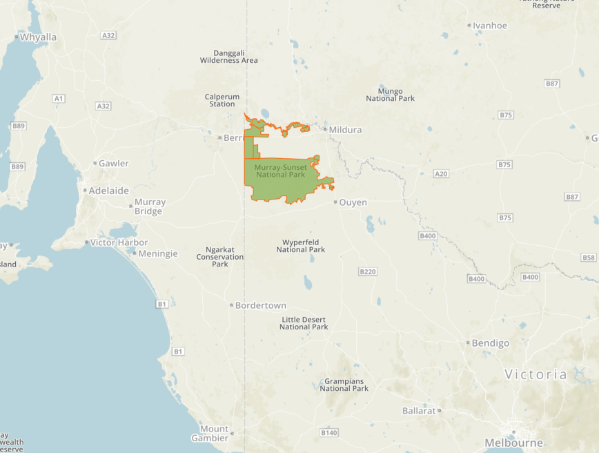
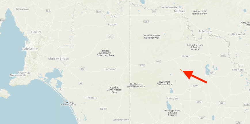
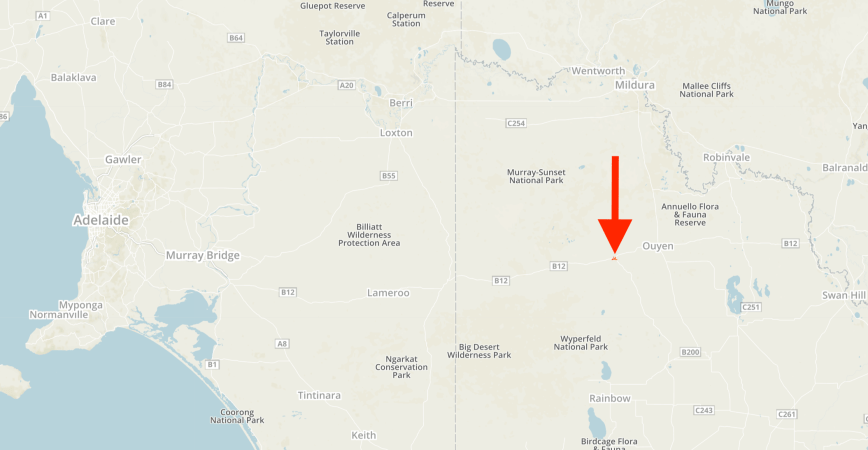
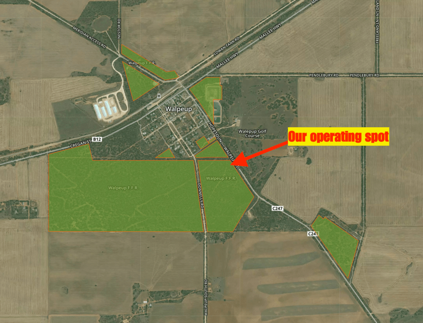
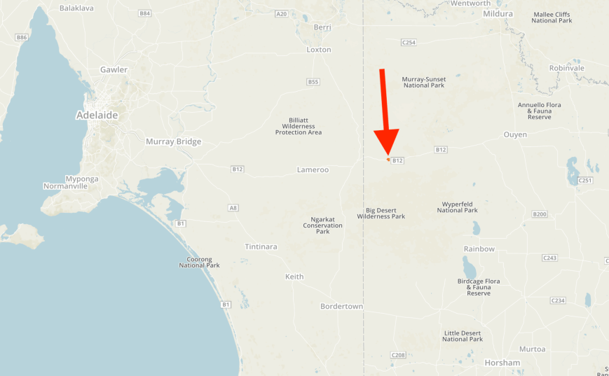
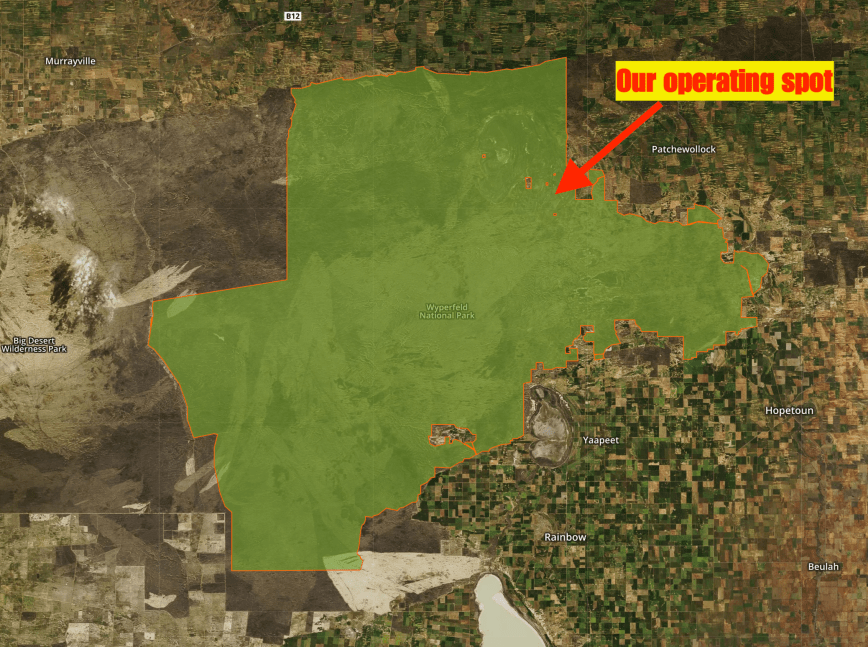
After leaving Bronzewing we travelled south on the Sunraysia Highway, through the little town of Tempy, and then on to Speed.  Our destination was the Wyperfeld National Park VKFF-0549 which is situated about 436 km north west of Melbourne.

Screen Shot 2018-11-15 at 8.05.49 pm.png

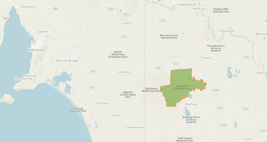
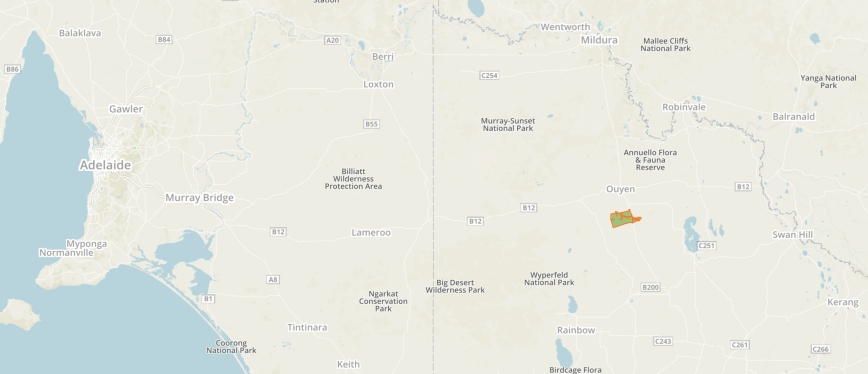
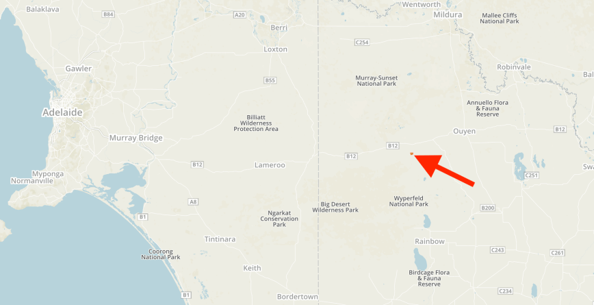
Above:- Map showing the location of the Wyperfeld National Park.  Map courtesy of Protected Planet.

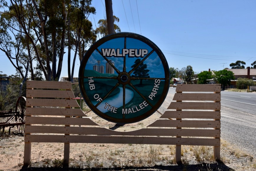
The town of Speed was named after William, Harold and Gordon Speed, who settled in the district in 1903. Settlement by the Speed brothers coincided with the opening of the railway line and the opening up of the Mallee lands for farm selection. The Speed township was surveyed in 1910.  Speed is the venue of the Mallee Machinery Field Days.  Speed was once notable for the roadsigns on the highway each side of the town reading “WELCOME TO SPEED” but these have been replaced with council signs “Welcome to Speed – Where Time Ticks Faster.”  In January 2011, the residents of Speed started a safety campaign to get the name of the town to be renamed “SpeedKills” to raise awareness of the dangers of speeding. By mid-February 2011 the Facebook campaign had exceeded the designated 32,000 “likes” required to rename the town “SpeedKills”.  The outcome was to rename the town for one month.

DSC_3419

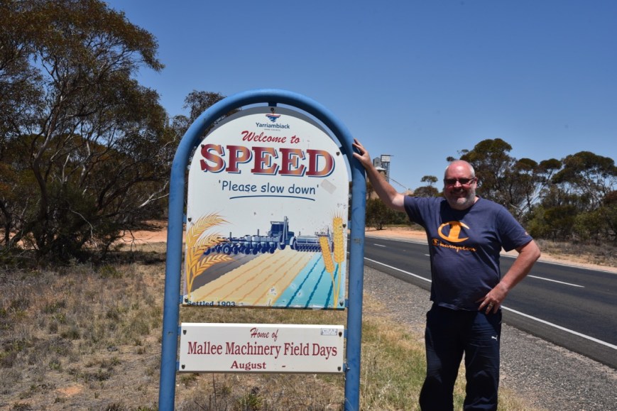
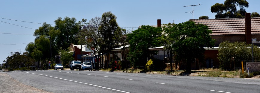
Above:- at the town of Speed.

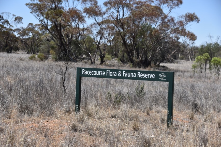
We then took the Patchewollock-Sea Lake Road and soon reached the town of Patchewollock.  There is a sign in the town indicating that Wyperfeld is located to the west of the town.  And at the western end of the town there is an information board about the Wyperfeld National Park.

DSC_3420

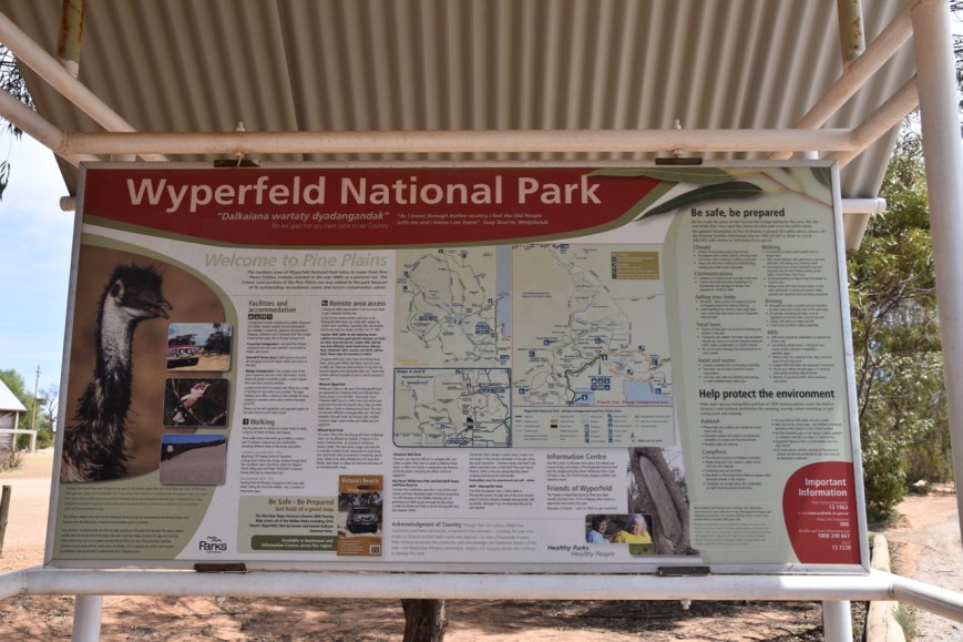
Above:- Park information board at Patchewollock.

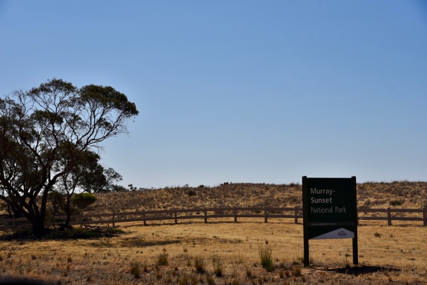
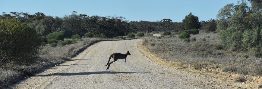
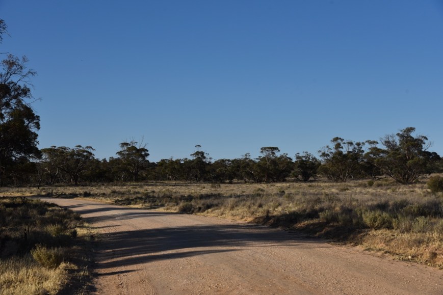
We travelled out of Patchewollock on the Baring Road, and then the Pine Plains Road.  About 25 km out of Patchewollock we reached the park, which was well signposted.

DSC_3421

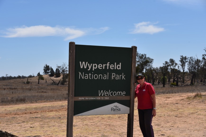
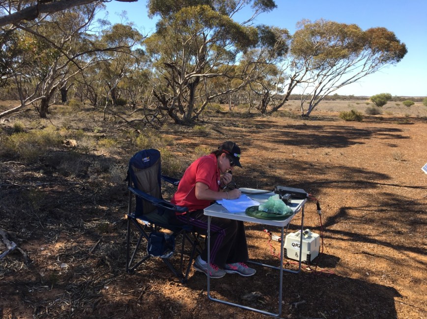
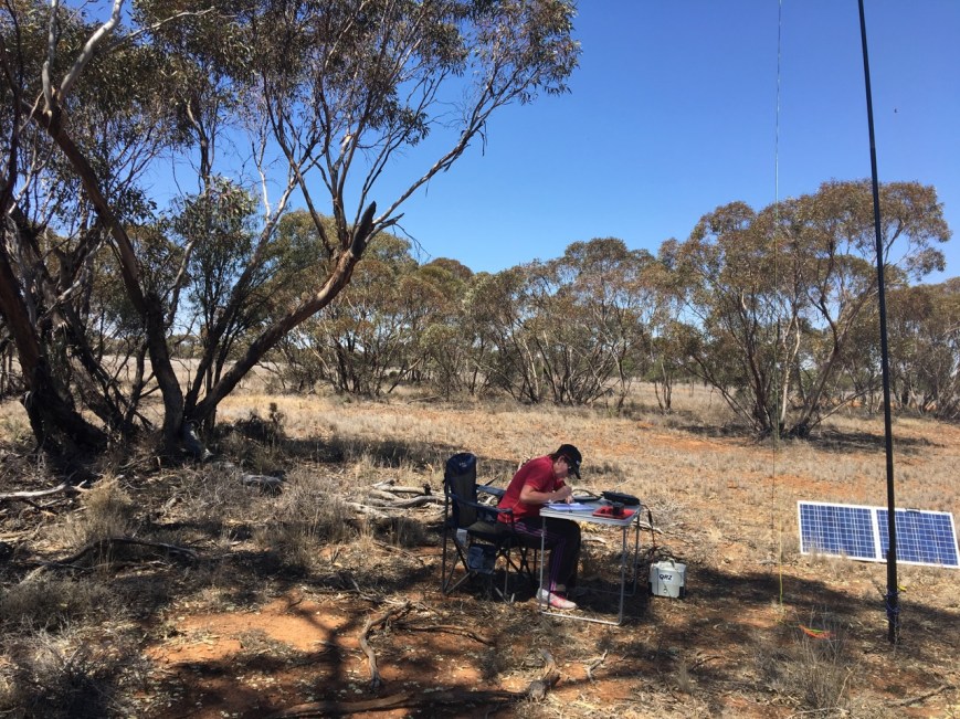
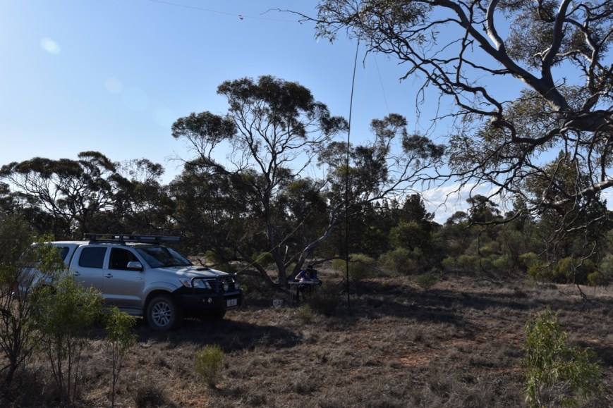
Above:- Marija at the entrance to Wyperfeld.

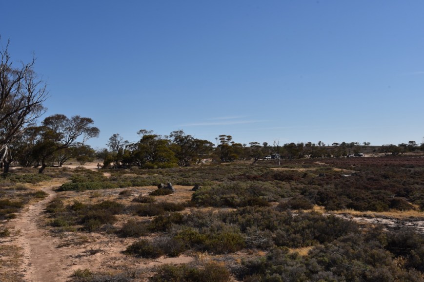
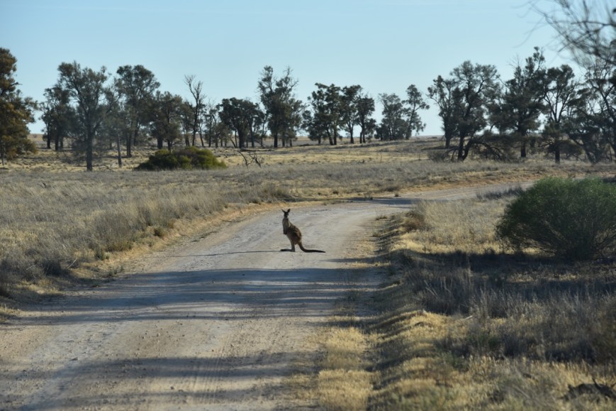
We headed south on the Meridian Track, heading for the Casuarina campground.  The Meridian Track is dirt/gravel, and was in very good condition.  It is easily passable in a conventional vehicle.

DSC_3436

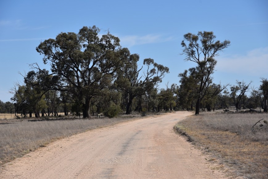
Above:- The Meridian Track.

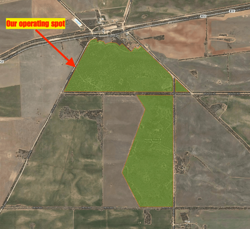
The Wyperfeld National Park is a large park, being 3,570 km2 in size.  It is the third largest National Park in Victoria.  The history of national park reservation in the Mallee dates back to 20 October 1909, when the first part of Wyperfeld (38.9 km2 ) was temporarily reserved as a site for a national park.  Following the initial reservation in 1909, permanent reservation and subsequent additions were made in the 1920s, 30s and 40s. The Park increased from 565 km2 to 1000 km2 in 1979, to 3237 km2 in 1991 and to 3568 km2 in 1992.

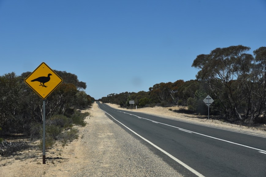
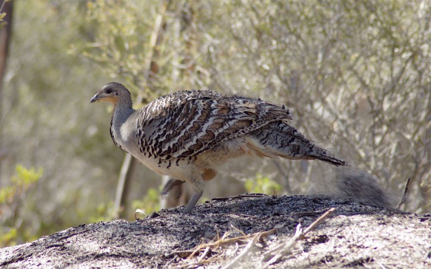
The park is part of the Wyperfeld, Big Desert and Ngarkat Important Bird Area, identified as such by BirdLife International, due to its importance for the conservation of Malle Fowl and other species of mallee birds.

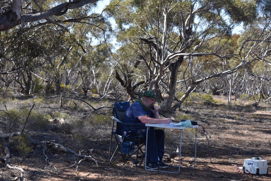
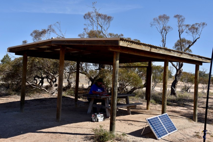
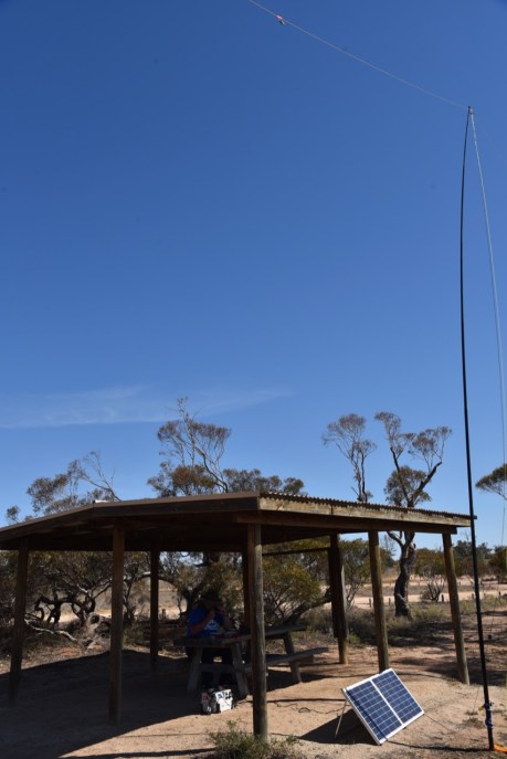
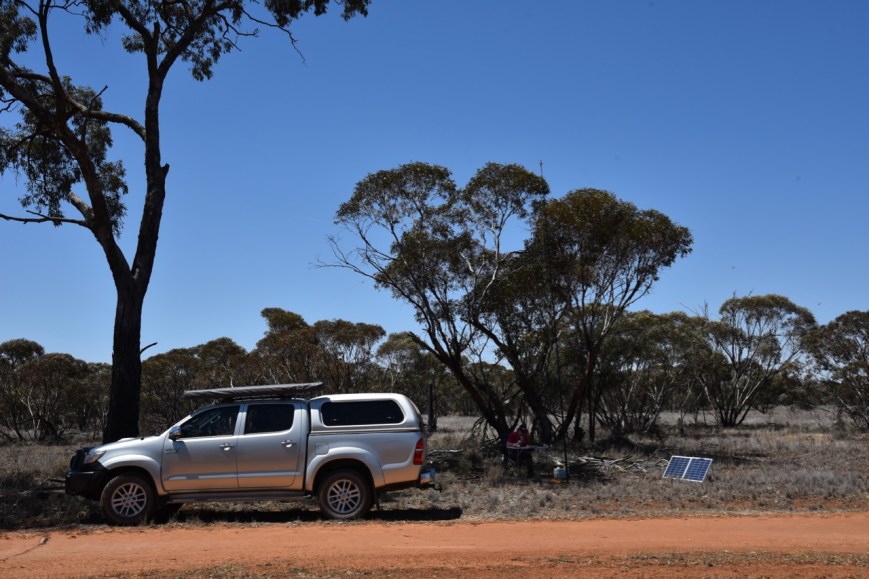
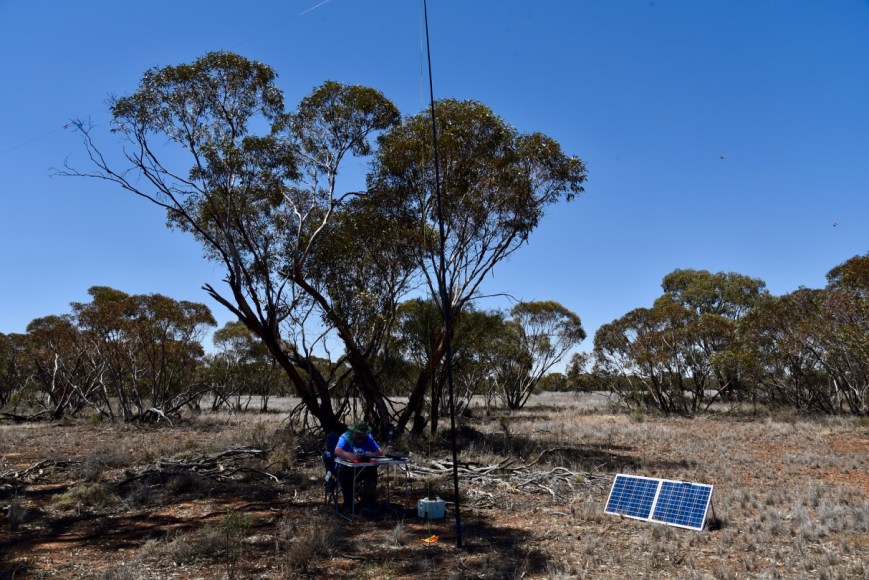
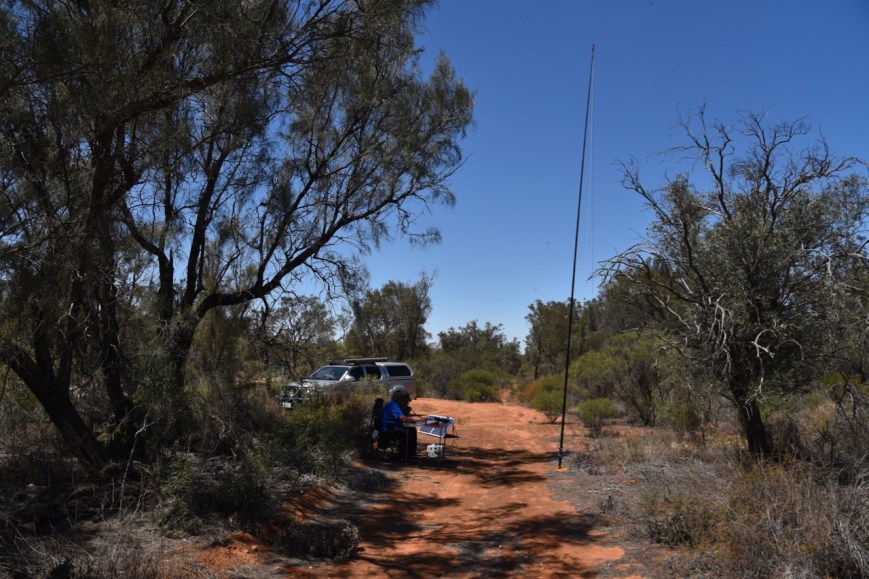
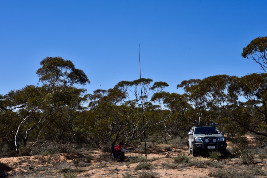
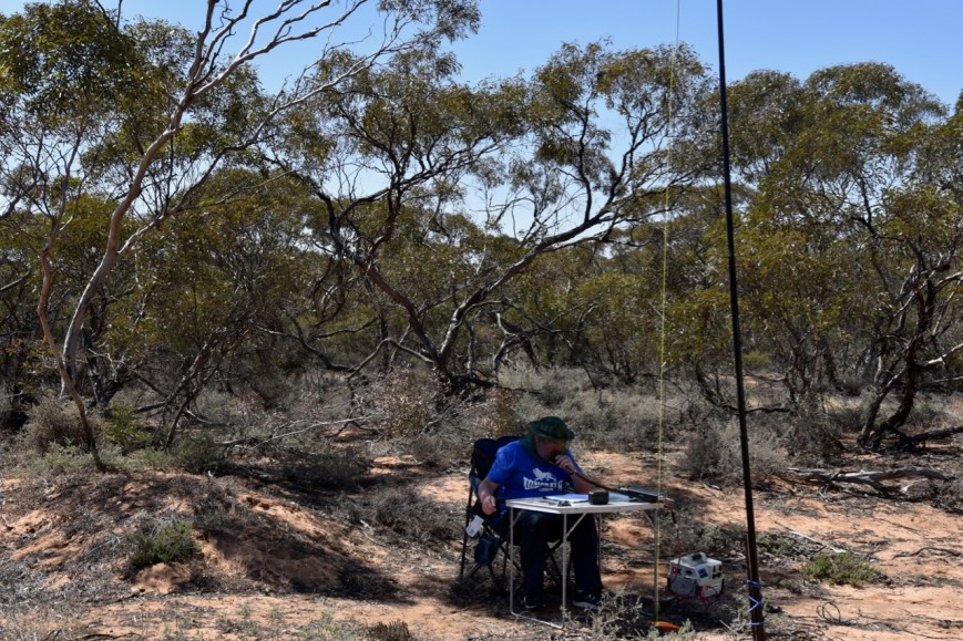
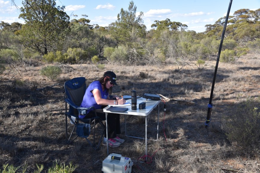
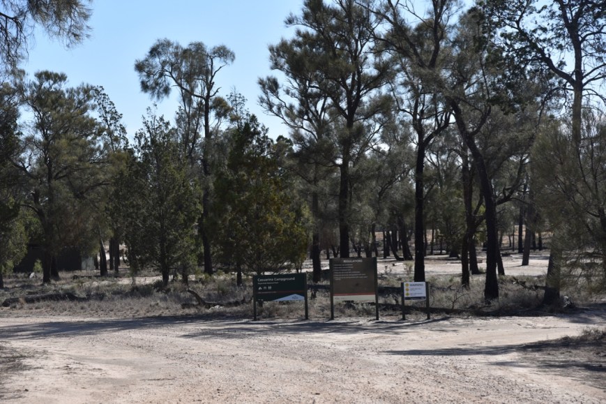
We set up in the Casuarina campgound.

Screen Shot 2018-11-15 at 8.05.29 pm.png

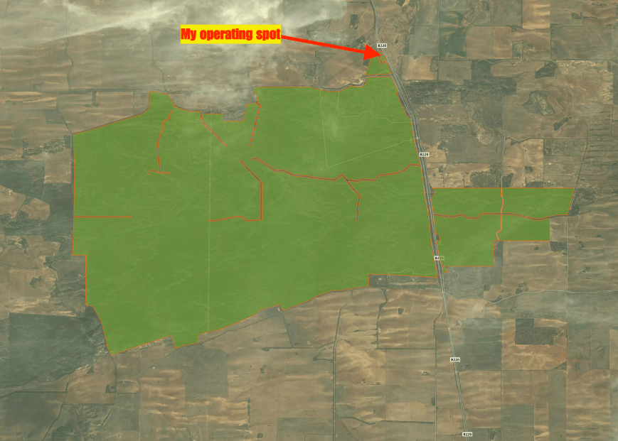
Above:- Aerial show of the Wyperfeld National Park.  Image courtesy of Protected Planet.

There was only one other vehicle in the campground, so we had plenty of choices for operating.

DSC_3433

I used the special call of VI100PEACE for this activation.

To kick off the activation, Marija and I logged Rob VK4HAT/VI4PEACE who was activating the Bribie Island National Park VKFF-0053.  Next was Bill VK3CWF/p who was in the Brisbane Ranges National Park VKFF-0055.  And our third contact was another Park to Park, with Gerard VK2IO/p in the Brisbane Water National Park VKFF-0056.

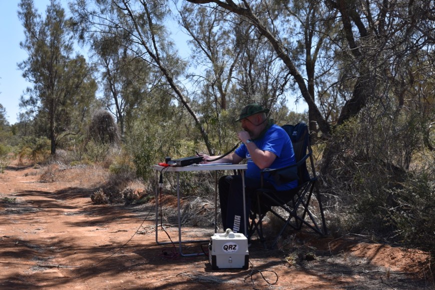
Marija then called CQ on 7.139 and this was answered by Alan VK3ALN/p at Rye, followed by Marc VK3OHM, and then Ray VK4NH.  Marija’s 10th contact was a QSO with Keith VK2PKT.  Marija logged a total of 15 stations before I jumped into the operator’s seat.

DSC_3422

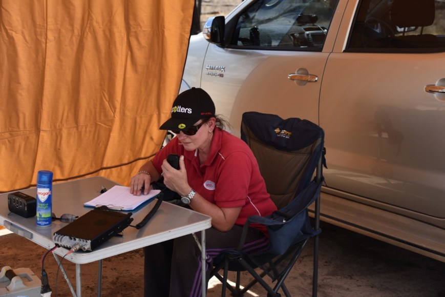
I worked a total of 35 stations on 40m from VK2, VK3, VK4, VK5, VK7, and New Zealand.  This included a Park to Park with Peter VK3PF/p who was activating the Tarra Bulga National Park VKFF-0480.

I then moved to 14.183 on the 20m band and joined the ANZA DX Net, where I logged 6 stations from VK3, VK4, VK8, and New Zealand.

I then moved back to 40m and logged a further 10 stations from VK1, VK2, VK4, VK5, and VK7, including a Park to Park with Andy VK5LA who was in the Ridley Conservation Park VKFF-0932.

To conclude the activation I tried my luck on 3.610 on the 80m band.  Unfortunately we had no internet coverage, so we were unable to place a post on parksnpeaks.  So I was very pleased when Hans VK5YX gave me a shout on 80, with an excvellent 5/9 signal.

Marija had qualified the park for VKFF with 15 contacts.  I had qualified the park as VI100PEACE for VKFF and WWFF with a total of 56 contacts.

It was time to pack up and hit the road, as we had a 3 hour trip to get home.

Marija worked the following stations on 40m SSB:-

  1. VI4PEACE (Bribie Island National Park VKFF-0053)
  2. VK3CWF/p (Brisbane Ranges National Park VKFF-0055)
  3. VK2IO/p (Brisbane Water National Park VKFF-0056)
  4. VK3ALN/p
  5. VK3OHM
  6. Vk4NH
  7. VK4DXA
  8. ZL4TY/VK4
  9. VK7FRJG
  10. VK2PKT
  11. VK2FPAR
  12. VK2HRX
  13. VK3DOU
  14. VK2KT
  15. VK3MRO/m

I worked the following stations on 40m SSB as VI100PEACE:-

  1. VI4PEACE (Bribie Island National Park VKFF-0053)
  2. VK4HAT (Bribie Island National Park VKFF-0053)
  3. VK3CWF/p (Brisbane Ranges National Park)
  4. VK2IO/p (Brisbane Water National Park VKFF-0056)
  5. VK4NH
  6. VK4DXA
  7. ZL4TY/VK4
  8. VK3SQ
  9. VK2PKT
  10. VK3OHM
  11. VK3UH
  12. VK3MKE
  13. VK3UP
  14. VK2UXO
  15. VK3ALN/p
  16. VK4SMA
  17. VK3SX
  18. VK3PF/p (Tarra Bulga National Park VKFF-0480)
  19. VK7FJFD
  20. VK2AB
  21. VK3UCD
  22. VK7ZGK
  23. VK2MT
  24. VK5MAS
  25. VK2NP
  26. VK3TNL
  27. VK2YK
  28. VK3TKK/m
  29. VK3PTE
  30. VK2AR
  31. VK2HMV
  32. ZL1TM
  33. VK3LTL
  34. VK7FRJG
  35. VK2YE
  36. VK3VRA
  37. VK2KYO
  38. VK2ZRD
  39. VK4AJR/m
  40. VK7FTAS
  41. VK5LA/p (Ridley Conservation Park VKFF-0932)
  42. VK1FMGG
  43. VK5MJ
  44. VK4GSF
  45. VK7DX
  46. VK2EMI
  47. VK2PEZ
  48. VK4MAY
  49. VK7ALH

I worked the following station on 80m SSB as VI100PEACE:-

  1. VK5YX

I worked the following stations on 20m SSB as VI100PEACE:-

  1. VK7XX
  2. ZL1ANF
  3. VK8KMD
  4. VK4PDX
  5. VK4LMB
  6. VK3SX


References.

Wikipedia, 2018, <https://en.wikipedia.org/wiki/Speed,_Victoria>, viewed 15th November 2018

Wikipedia, 2018, <https://en.wikipedia.org/wiki/Wyperfeld_National_Park>, viewed 15th November 2018

Bronzewing Flora and Fauna Reserve VKFF-2280

After leaving the Welshmans Plain Nature Conservation Reserve, Marija and I headed towards Walpeup, hoping to get some diesel before heading to our next intended atcivation, the Wyperfeld National Park.  Unfortunately we found the service station at Walpeup closed.  So our next option was to travel a further 30 km to the east to Ouyen.

So it was off to Ouyen, a commercial, cultural and transport centre for the surrounding grain farming region.  The name is believed to be derived from the Wergaia word “wuya-wuya”, which some believe means “pink-eared duck”, whilst others claim it means “ghost waterhole”.

We took the time out to have a look at a few of the attractions in Ouyen.  One of those is the old Ouyen Courthouse.  It was built in 1914 and was used up until the 1980’s.

We also had a look at the Ouyen mural on Oke Street.

Our final stop in Ouyen was the Big Mallee Stump, which was relocated from Tiega to Ouyen.  The stump is estimated to be hundreds of years old and is believed to be the largest mallee stump in Australia.

DSC_3414

We then decided to head to the Bronzewing Flora & Fauna Reserve VKFF-2280, for a quick activation from the car.  Bronzewing is located about 21 km south of Ouyen on the Calder Highway.

Screen Shot 2018-11-15 at 7.32.23 pm.png

Above:- Map showing the location of the Bronzewing Flora & Fauna Reserve VKFF-2280.  Map courtesy of Protected Planet.

The Bronzewing Flora & Fauna Reserve is about 123.62 km2 in size.  eBird Australia have recorded about 77 species of native bird in the park, including the park by which it takes its name, the Common Bronzewing Pigeon.

Phaps_chalcoptera_-_Australian_National_Botanic_Gardens.jpg

Above:- A female Bronzewing.  Image courtesy of Wikipedia.

The park was well signposted on the Calder Highway.

DSC_3417

We pulled off the road on a 4WD track and I started calling CQ.  First in the log was Peter VK3PF who is the leading VKFF hunter in Australia.  This was followed by Gerard VK2IO/p who was activating the Brisbane Water National Park VKFF-0056.  It was slow going, but I eventually had my required 10 contacts in the log, with a QSO with John VK2AWJ/3 in the Dandenong Ranges National Park VKFF-0132.  My final contact was with Peter VK3TKK/p who was activating the Organ Pipes National Park VKFF-0627.

Screen Shot 2018-11-15 at 7.32.10 pm.png

Above:- Aerial shot of the Bronzewing Flora & Fauna Reserve, showing our operating spot.  Image courtesy of Protected Planet.

Thanks to everyone who called me during this ‘lightning quick’ activation.

I worked the following stations on 40m SSB:-

  1. VK3PF
  2. VK3KAI
  3. VK2IO/p (Brisbane Water National Park VKFF-0056)
  4. VK3SQ
  5. VK2EMI
  6. VK5FANA
  7. VK3TJC
  8. VK3OHM
  9. VK3IP
  10. VK2AWJ/3 (Dandenong Ranges National Park VKFF-0132)
  11. VK3TKK/p (Organ Pipes National Park VKFF-0627)


References.

Wikipedia, 2018, <https://en.wikipedia.org/wiki/Ouyen>, viewed 15th November 2018

Welshmans Plain Nature Conservation Reserve VKFF-2482

Our first park for Sunday 11th November 2018 was the Welshmans Plain Nature Conservation Reserve VKFF-2482, which is located about 71 km east of Murrayville, and about 487  km north west of Melbourne.

This was again, to be a brand new park for all hunters in the WWFF program.  It had never previously been activated.

Screen Shot 2018-11-15 at 6.42.25 pm.png

Above:- Map showing the location of the Welshmans Plain Nature Conservation Reserve.  Map courtesy of Protected Planet.

The Welshmans Plain Nature Conservation Reserve is about 2.34 km2 in size.  It is located on Welshmans Plain Road south of Underbool.  I was unable to find very much information on the park on the internet.

During our visit to the park we spotted two Rainbow Bee Eaters.  Unfortunately they were quite skittish, so I wasn’t able to get all that close.  I was relying upon the zoom lens for the 2 photos below.  Were we set up, the gum trees were alive with Swallows.

We set up on the eastern side of Welshman Plains Road, north of Lynch Road.

Screen Shot 2018-11-15 at 6.55.53 pm.png

Above:- Aerial shot of the Welshmans Plain NCR, showing our operating spot.  Image courtesy of Protected Planet.

There was a cleared area here, where we could drive off the road and get underneath the shade of some gum trees.

Marija started off the activation, logging Alan VK3ALN/p who was activating the Point Nepean National Park VKFF-0628.  After logging Alan, Marija moved up to 7.160 and started calling CQ.  This was answered by Peter VK3PF, then Brett VK2VW, and then Keith VK2PKT.  Marija soon had 10 contacts in the log, with a QSO with Les VK5KLV in Port Augusta.  Marija’s final contact, was another Park to Park, with Tony VK3XV/p in the Gunbower National Park VKFF-0740.

IMG_1447

I then jumped on the mic and started calling CQ.  Peter VK3PF was first in the log, followed by Greg VK2EXA, and then Andrew VK7DW.  Contact number 10 for me was a QSO with Cliff VK2NP.  I logged 22 stations on 40m, before the VK4 WIA broadcast came up on 7.158, 2 kc below me.  The signal was so strong, that I moved up to 7.165 where I logged a further 4 stations, including special event station VI2LWF, and a Park to Park with Tony VK3XV/p in the Gunbower National Park VKFF-0740.

DSC_3369

Whilst I was on air, Fred VK4FE phoned and spoke with Marija, and gave me permission to use VI100PEACE.

Marija and I took some time out at 11.00 a.m. local time for 2 minutes of silence for Remembrance Day.

I then operated as VI100PEACE for about 45 minutes and logged a total of 34 stations on 20m, 40m, & 80m.  This included a Park to Park on 40m with Alan VK3ALN/p in the Point Nepean National Park VKFF-0628, and a Park to Park on 80m with John VK5FLEA/p in the Giles Conservation Park VKFF-0884.  I also logged Geoff ZL3GA/p who was activating SOTA peak ZL3/ CB-806.  Geoff was running QRP 5 watts and was a good 5/5 signal.  He gave me a 5/9 to his New Zealand summit.  Below are some photos which Geoff took during his activation.

Marija worked the following stations on 40m SSB:-

  1. VK3ALN/p (Point Nepean National Park VKFF-0628)
  2. VK3PF
  3. VK2VW
  4. VK2PKT
  5. VK4SMA
  6. VK2IO/m
  7. VK3TNL
  8. VK2KYO
  9. VK2HHA
  10. VK5KLV
  11. VK3XV/p (Gunbower National Park VKFF-0740)

I worked the following stations on 40m SSB as VK5PAS:-

  1. VK3PF
  2. VK2EXA
  3. VK7DW
  4. VK2KYO
  5. VK2HHA
  6. VK2PKT
  7. VK3HSB
  8. VK2SR
  9. VK5KLV
  10. VK2NP
  11. VK4TJ
  12. VK4/AC8WN
  13. VK4/VE6XT
  14. VK7FRJG
  15. VK2KEL
  16. VK1DI
  17. VK4SMA
  18. VK3FIAN
  19. VK5PL
  20. VK2XXM
  21. VK3MAB
  22. VK2FBKR
  23. VI2LWF
  24. VK3LTL
  25. VK3XV/p (Gunbower National Park VKFF-0740)
  26. VK3HOT

I worked the following stations on 20m SSB as VK5PAS:-

  1. ZL3GA/p (SOTA ZL3/ CB-806)

I worked the following stations on 40m SSB as VI100PEACE:-

  1. VK3ALN/p (Point Nepean National Park VKFF-0628)
  2. VK2VW
  3. VK2PKT
  4. VK3FLEZ
  5. VK3PF
  6. VK3LTL
  7. VK2NP
  8. VK5KLV
  9. VK3LJD
  10. VK2UXO
  11. VK3UH
  12. VK3MKE
  13. VK3CWF
  14. VK3MET
  15. VK2NN
  16. VK3TKK/m
  17. VK5KPR
  18. VK5DW
  19. VK3JDA
  20. VK5HS
  21. VK3FIAN
  22. VK3NCC
  23. VK3PZ
  24. VK2EXA
  25. VK7KT/m

I worked the following stations on 80m SSB as VI100PEACE:-

  1. VK3MKE
  2. VK5HS
  3. VK5FANA
  4. VK3SQ
  5. VK5FLEA/p (Giles Conservation Park VKFF-0884)

I worked the following stations on 20m SSB as VI100PEACE:-

  1. ZL3GA/p (SOTA ZL3/ CB-806)
  2. VK4TJ
  3. VK2YK
  4. VK6ADF


References.

Protected Planet, 2018, <https://www.protectedplanet.net/welshmans-plain-f-f-r-nature-conservation-reserve>, viewed 15th November 2018

VI100PEACE in the Murrayville Flora Reserve VKFF-2407

On Saturday night (10th November 2018), after tea at the Murrayville Hotel, I headed out to the Murrayville Flora Reserve VKFF-2407, for a quick activation using the special call of VI100PEACE.

This is a special call to commemorate the 100 year anniversary since the signing of the armistice, to end the hostilities of World War One.

file.jpg

I spent about 1 hour in the park and made a total of 45 contacts from the park.  The majority of these, 37 QSOs, were on the 80m band.  Stations worked were from VK1, VK2, VK3, VK4, VK5, VK6, VK7, and VK8.  This included special event calls VI2LWF (Lest We Forget), and VI8PEACE.

Band conditions on 80m were pretty tough with the over the horizon radar and static crashes.

Below is a short video which Marija took of some of my contacts.

I worked the following stations on 80m SSB:-

  1. VI2LWF
  2. VK3MKE
  3. VK7BC
  4. VK3PF
  5. VK3STU
  6. VK3BY
  7. VK5FANA
  8. VK2IO
  9. VK3OHM
  10. VK3DQ
  11. VK3UCD
  12. VK3FDZE
  13. VK2KJJ
  14. VK5LA
  15. VK5DW
  16. VK5HS
  17. VK3VIP
  18. VK4SMA
  19. VK4TJ
  20. VK2MOP
  21. VK5PE
  22. VK2XXM
  23. VK4GSF
  24. VK3FKAR
  25. VK2CAB
  26. VK4HAT
  27. VK4HNS
  28. VK3SQ
  29. VK5KLV
  30. VK5FMLO
  31. VK2KYO
  32. VK3LGS
  33. VK1FMCG
  34. VK4PZZ
  35. VK3ANL
  36. VK3MPR
  37. VK3FSPG

I worked the following stations on 40m SSB:-

  1. VK4PZZ
  2. VI8PEACE
  3. VK8GM
  4. VK6XN
  5. VK6RZ
  6. VK2XXM
  7. VK2WY
  8. VK3ANL

Murray Sunset National Park VKFF-0373

Our fourth park for Saturday 10th November 2018, was the Murray Sunset National Park VKFF-0373, which is located about 66 km east or Murrayville, and about 496 km north west of Melbourne.

This was to be our first Victorian National Park activation for the 2018 Activation Weekend for the Keith Roget Memorial National Parks Award (KRMNPA).

Screen Shot 2018-11-15 at 3.03.37 pm.png

Above:- Map showing the location of the Murray Sunset National Park in north western Victoria.  Map courtesy of Protected Planet.

After packing up at Dering, we travelled a short distance down to the town of Patchewollock.  This little town was established in 1914.  The name Patchewollock is derived from two aboriginal words “putje” meaning plenty and “wallah” meaning porcupine grass.  This ‘the place of plenty porcupine grass’.  Despite this being a sleepy little town, there is a bit to see here.  Each year, Patchewollock holds a Music Festival, which commenced in 2012.  More information can be found at….

https://www.patchewollockmusicfestival.com.au/

One of the attractions of Patchewollock is the silo art on the local silo grains.  Brisbane artist, Fintan Magee based himself at the local hotel, and met a local sheep and grain farmer, Nick ‘Noodle’ Hulland.  Hulland’s image appears on the silo.  Why Hulland? According to Magee, the rugged, lanky local exemplified the no-nonsense, hardworking spirit of the region.

Another attraction is the Mallee Fowl sculptures in the grounds of the old railway yards.  The sculptures were installed by artist Phil Rigg in 2013.

A railway line once ran out to Patchewollock, but is was closed in 1986.  What remains is the historic railway station, constructed in 1919.  Sadly, the goods shed platform and loading platform have been removed.

Whilst in Patchewollock Marija worked special event call VI1LWF from the vehicle.

After leaving Patchewollock we drove back north on the Hopetoun-Walpeup Road into Walpeup.  We then travelled west along the Mallee Highway, passing through Torrita, and Underbool.  At Linga we turned right onto Pink Lakes Road.  Aas we drove along Pink Lakes Road I worked Peter VK3YE who was pedestrian mobile.  Marija and I soon reached the park boundary.

DSC_3304

The Murray-Sunset National Park is the second largest national park in Victoria, Australia, located in the Mallee district in the northwestern corner of the state, bordering South Australia.  The park is large, comprising 633,000-hectares (1,560,000-acres).  The park was established in 1979, and expanded to encompass the Pink Lakes State Park in 1999.  Over 600 species of plants have been recorded in the park, and 300 species of birds.  Most of the park lies within the Murray-Sunset, Hattah and Annuello Important Bird Area (IBA).

As we entered the Pink Lakes area of the park, our first lake which we encountered was Lake Hardy which is one of four lakes in the park.  Lake Hardy was glowing pink for us.  The lake’s water is actually crystal clear with the bed being made of solid salt. A red pigment called carotene is secreted from the algae that grows in the water which gives the lakes their pink hue.

We continued on to the Lake Crosbie camping area.  There are some nice walks from this point, with interpretive signs along the way.  The camping ground has toilets, gas barbecues, fireplaces and picnic tables.

DSC_3321

Above:- View from one of the walking trails back towards the Lake Crosby campground

There were a few caravaners in the camping area, but we found a spare shelter, which offered us some shade from the very hot sun.  It had a nice outlook, overlooking Lake Crosby.

DSC_3309

I started off the activation by calling CQ on 7.47.  First in the log was Dean VK3DAE, followed by Geoff VK3SQ, Peter VK3JRT, and then Keith VK2PKT.  By the 13 minute mark I had contact number 10 in the log, a QSO with Gerard VK2IO/p in the Rouse Hill Regional Park VKFF-2784.  I logged a total of 25 stations on 40m from VK2, VK3, VK4, VK5, VK7, and New Zealand.  This included 3 other Park to Park contacts: Peter VK3PF/p in the Morwell National Park VKFF-0626; Alan VK2MG/p in the Hunter Wetlands National Park VKFF-0595; and Neil VK4HNS/p in the Springbrook National Park VKFF-0463.  Regular park hunter, Andrei ZL1TM also made it into my log.

DSC_3310 (1)

It was time to swap the mic and allow Marija to qualify a new park for her.  Marija’s first contact was Geoff VK3SQ, followed by Neil VK4HNS/p in the Springbrook National Park VKFF-0463, and then Alan VK2MG/p in the Hunter Wetlands National Park VKFF-0595.  Marija’s 10th contact, qualifying the park for VKFF, was a QSO with Glenn VK4FSCC.

We then headed to the 80m band, where Marija made a total of 9 QSOs, whilst I made 4, including a Park to Park with Peter VK3PF/p in the Morwell National Park VKFF-0626.

Marija worked the following stations on 40m SSB:-

  1. VK3SQ
  2. VK4HNS/p (Springbrook National Park VKFF-0463)
  3. VK2MG/p (Hunter Wetlands National Park VKFF-0595)
  4. VK2FBRU
  5. VK2IO/p (Rouse Hill Regional Park VKFF-2784)
  6. VK2PKT
  7. VK2VK
  8. VK3PF
  9. VK5KLV
  10. VK4FSCC
  11. VK3FIAN
  12. VK1DI
  13. VK3UH

Marija worked the following stations on 80m SSB:-

  1. VK5HS
  2. VK5PE
  3. VK5LA
  4. VK5DW
  5. VK3NLK
  6. VK5YX
  7. VK5FANA
  8. VK3ANL
  9. VK5FMLO

I worked the following stations on 40m SSB:_

  1. VK3DAE
  2. VK3SQ
  3. VK3JRP
  4. VK2PKT
  5. VK5KLV
  6. VK3JDA
  7. VK3ZMD
  8. VK7QP
  9. VK3PF/p (Morwell National Park VKFF-0626)
  10. VK2IO/p (Rouse Hill Regional Park VKFF-2784)
  11. VK2MG/p (Hunter Wetlands National Park VKFF-0595)
  12. VK1DI
  13. VK7AN
  14. VK7KT/m
  15. VK3BCM
  16. VK4BR
  17. VK4HNS/p (Springbrook National Park VKFF-0463)
  18. VK3YE/p
  19. VK4NH
  20. VK4DXA
  21. ZL4TY/VK4
  22. VK3TKK/m
  23. VK7DW/m
  24. VK4FSCC
  25. ZL1TM
  26. VK3UH
  27. VK4SMA
  28. VK7FRJG
  29. VK3DOU
  30. VK4CZ

I worked the following stations on 80m SSB:-

  1. VK5LA
  2. VK3PF/p (Morwell National Park VKFF-0626)
  3. VK5HS
  4. VK5PE

We packed up around 6.00 p.m. local time and then drove around the park on Pioneer Drive.  As the day was starting to get a little cooler (but not by much), some of the local park dwellers were out, including kangaroos.

DSC_3329

Both Western Grey and Red Kangaroos can be found in the Murray Sunset National Park.  Murray Sunset is home to a number of rare and threatened species. These include the Paucident Planigale (a small carnivorous mouse-sized marsupial), the Regent Parrot and the Millewa Skink.

DSC_3332

Above:- A Western Grey kangaroo

There are a number of 4WD tracks through the park, but Pioneer Drive, which is dirt/gravel, is easily navigated using a conventional vehicle.  The first stage of the Drive took us around Lake Crosbie.

We stopped to have a look at the outdoor salt museum on the eastern side of Lake Crosbie.  There was once a thriving commercial salt industry here, which commenced in 1916 and concluded in 1979 when the area was declared as a State Park.

We continued along Pioneer Drive to the northern edge of Lake Crosbie.

We then stopped to have a look at Lake Kenyon.

A little further along the drive are a number of interpretive signs which detail the history of salt mining within the park.  During the 1920’s and 1930’s there was a small township at this location for the salt workers and their families.  This included houses, a school, and Otto the cook’s underground house.  Seasonal workers and local farmers also came on foot or by bicycle, horse, or car wo work on salt harvesting.  Camels carried sale to the railway at Underbool and Linga.  A short lived tramway was constructed but later abandoned and replaced by trucks.  Salt was shovelled into bags weighing up to 180 pounds (abt 60 kg) and loaded onto trucks by hand.  Very little remains today.

It was a slow drive along the track as there was quite a bit of local wildlife.

DSC_3355

Marija and I highly recommend this drive.  We intend to come back to Murray Sunset, to explore the park further on the many 4WD only tracks.

DSC_3354

Above:- Pioneer Drive in the Murray Sunset National Park.

Marija and I then headed back into Murrayville and off to the hotel for a meal.  On the way back to Murrayville I was really pleased to work Juan EA5CTE in Spain, and also Manuel EA8DO in the Canary Islands.  I was cruising along the Mallee Highway at the time, with the cruise control set at about 100 kph.


References.

Aussie Towns, 2018, <http://www.aussietowns.com.au/town/patchewollock-vic>, viewed 15th November 2018

Parks Victoria, 2018, <https://parkweb.vic.gov.au/explore/parks/murray-sunset-national-park/things-to-do/pink-lakes-lake-hardy-day-visitor-area>, viewed 15th November 2018

Silo Art Trail, 2018, <http://siloarttrail.com/works/patchewollock/>, viewed 15th November 2018

Wikipedia, 2018, <https://en.wikipedia.org/wiki/Murray-Sunset_National_Park>, viewed 15th November 2018

Dering Flora and Fauna Reserve VKFF-2307

Our third park for Saturday 10th November 2018 was the Dering Flora & Fauna Reserve VKFF-2307, which is about 114 km east of Murrayville, and about 431 km north west of Melbourne.

Again, this was the very first time that the park would be activated and put on air as part of the World Wide Flora Fauna (WWFF) program.

Screen Shot 2018-11-14 at 2.03.27 pm.png

Above:- Map showing the location of the Dering Flora & Fauna Reserve.  Map courtesy of Protected Planet.

After activating the Walpeup Nature Conservation Reserve, we headed south on the Walpeup-Hopetoun Road.  This is Malle Fowl country, and was indicated as such by the signs.  Sadly we didn’t see any, it was way too hot for them to be out and about.  In all of my park activations I have only ever seen Mallee Fowl once, and that was in the Mount Boothby Conservation Park in South Australia.

DSC_3277

Above:- The Walpeup-Hopetoun Road.

The Mallee Fowl is a stocky ground-dwelling bird about the size of a domestic chicken.  Mallee Fowl are shy, wary, solitary birds that usually fly only to escape danger or reach a tree to roost in. Although very active, they are seldom seen as they freeze if disturbed, relying on their intricately patterned plumage to render them invisible, or else fade silently and rapidly into the undergrowth

Leipoa_ocellata_-Ongerup,_Western_Australia,_Australia-8.jpg

Above:- Mallee Fowl.  Image courtesy of wikipedia.

On the way we logged John VK2AWJ/3 who was activating the Mornington Peninsula National Park VKFF-0333.  John had a good 5/7 signal into our mobile and gave us a 5/3 signal report.

We had placed the park in the GPS, and we soon reached the northern section of the park which is on either side of the road.  BUT…….the sign said Racecourse Flora & Fauna Reserve.  This really threw us, because the maps and GPS showed we were at Dering.  A quick check on the internet wasn’t able to help us either.

I have since phoned Parks Victoria and the sign came as a surprise to them as well.  According to their records, the park is Dering.  They advised me that they would contact the local ranger and let him/her know.

DSC_3278

I was unable to find much information, if any about this park.  Protected Planet shows that the Dering Flora & Fauna Reserve is about 3.62 km2 in size.  It is a typical mallee park with sandy loam soil and eucalyptus which grow as multiple saplings from a large root or ‘lignotuber’.  It is thought that the name Mallee was derived from an Aboriginal word describing the scrub or thickets.

We accessed the park via a dirt track on the western side of the Walpeup-Hopetoun Road.  We travelled a few hundred metres along the track and found a large gum tree.  As it was a very hot day, it was an ideal spot to set up, and there was plenty of room to stretch out the 20/40/80m linked dipole.

Screen Shot 2018-11-14 at 2.03.43 pm.png

Above:- Aerial shot of the Dering Flora & Fauna Reserve, showing our operating spot.  Image courtesy of Protected Planet.

We had some internet coverage in this park, so Marija placed a spot for me on parksnpeaks, and I then commenced calling CQ on 7.145.  This was soon answered by Geoff VK3SQ in Beechworth.  Next was Alan VK2MG/p who was activating the Hunter Wetlands National Park VKFF-0595.  Four QSOs later I had another Park to Park in the log, this time a contact with Alan VK3ALN/p who was in the Mornington Peninsula National Park VKFF-0333.  This was followed by a contact with Peter VK3PF/p in the Morwell National Park VKFF-0626, and then Gerard VK2IO/p who was activating the Rouse Hill Regional Park VKFF-2784.

DSC_3285

After logging 8 contacts, Marija and I swapped the mic.  Marija called CQ and this was answered by Linda VK7QP, followed by Dennis VK2HHA, and then Geoff VK3SQ.  Marija soon had her 10 contacts in the log for VKFF, and another unique park under her belt as an activator.  A further 3 stations were logged, before I jumped back into the operator’s chair, hoping to get my 44 to qualify the park for the global WWFF program.

IMG_1442

I called CQ and Andrew VK3LTL came back to my call, followed by Keith VK2PKT who was contact number 10 for me.  I logged a further 33 stations on 40m, including some interesting stations, and a few more Park to Park contacts.  They included David VK5PL/p in the Para Wirra Conservation Park VKFF-1739, and Mark VK4SMA/p in the Daisy Hill Conservation Park VKFF-1525.  I also logged special event call VI6PAX mobile, a special call to mark the centenary of the Armistice that ended World War One on the 11th November 1918.  Two further special event calls were logged, VI3PEACE and VI3LWF (Lest We Forget).  These 2 special calls are also to commemorate the 100 year anniversary of the signing of the armistice.

I was now just 1 contact shy of my 44 contacts.  But callers had slowed down on 40m, so we lowered the squid pole and inserted the 80m links for that band.  Marija placed a fresh spot for me on parksnpeaks and I started calling CQ on 80m.  Terry VK3UP came back to my call, and resulted in me qualifying the park for WWFF.  I logged a further 6 stations on 80m, including 2 Park to Park contacts: Norm VK3XCI/p in the Hattah-Kulkyne National Park VKFF-0231, and Peter VK3PF/p in the Morwell National Park VKFF-0626.

To complete the activation I headed up to the 20m band where I logged 4 stations including 2 Park to Park: Alan VK2MG/p in the Hunter Wetlands National Park VKFF-0595, and Gerard VK2IO/p (Rouse Hill Regional Park VKFF-2784.

DSC_3279

It was now a bit after 3.00 p.m. local time, so Marija and I packed up and headed off to the Murray Sunset National Park, for an activation for the 2018 Keith Roget Weekend.  Marija had qualified Dering for VKFF, with 12 contacts.  And I had qualified Dering for VKFF & WWFF, with 54 contacts in the log.

Marija worked the following stations on 40m SSB:-

  1. VK2MG/p (Hunter Wetlands National Park VKFF-0595)
  2. VK3ALN/p (Mornington Peninsula National Park VKFF-0333)
  3. VK3PF/p (Morwell National Park VKFF-0626)
  4. VK2IO/p (Rouse Hill Regional Park VKFF-2784)
  5. VK7QP
  6. VK2HHA
  7. VK3SQ
  8. VK2KYO
  9. VK2PKT
  10. VK3LTL
  11. VK4SMA/p (Daisy Hill Conservation Park VKFF-1525)

Marija worked the following station on 80m SSB:-

  1. VK3XCI/p (Hattah-Kulkyne National Park VKFF-0231)

I worked the following stations on 40m SSB:-

  1. VK3SQ
  2. VK2MG/p (Hunter Wetlands National Park VKFF-0595)
  3. VK4TJ
  4. VK4/AC8WN
  5. VK4/VE6XT
  6. VK3ALN/p (Mornington Peninsula National Park VKFF-0333)
  7. VK3PF/p (Morwell National Park VKFF-0626)
  8. VK2IO/p (Rouse Hill Regional Park VKFF-2784)
  9. VK3LTL
  10. VK2PKT
  11. VK2HHA
  12. VK5PL/p (Para Wirra Conservation Park VKFF-1739)
  13. VK7DW/m
  14. VK3EMI
  15. VK3FRAB
  16. VK3TKK
  17. VK5LG
  18. VK2LB
  19. VK5KLV
  20. VK2VW
  21. VK3UH
  22. VI6PAX/m
  23. VK4NH
  24. VK4DXA
  25. ZL4TY/VK4
  26. VK5YX
  27. VK1DI
  28. VK4SMA/p (Daisy Hill Conservation Park VKFF-1525)
  29. VK7QP
  30. VK3IDM
  31. VI3PEACE
  32. VI3LWF
  33. VK2IPK
  34. VK3ANL
  35. VK3TNL
  36. VK2GPT
  37. VK2VX
  38. VK5KSW
  39. VK2FPAR
  40. VK3UP
  41. VK3MDH/m
  42. VK5MR
  43. VK5FANA

I worked the following stations on 80m SSB:-

  1. VK3UP
  2. VK3XCI/p (Hattah-Kulkyne National Park VKFF-0231)
  3. VK5LA
  4. VK5FANA
  5. VK7QP
  6. VK3PF/p (Morwell National Park VKFF-0626)
  7. VK2KYO

I worked the following stations on 20m SSB:-

  1. VK2MG/p (Hunter Wetlands National Park VKFF-0595)
  2. VK3MB
  3. VK2IO/p (Rouse Hill Regional Park VKFF-2784)
  4. VK4HAT


References.

Protected Planet, 2018, <https://www.protectedplanet.net/dering-f-f-r-nature-conservation-reserve>, viewed 15th November 2018

Victorian Places, 2018, <https://www.victorianplaces.com.au/mallee>, viewed 15th November 2018

Wikipedia, 2018, <https://en.wikipedia.org/wiki/Malleefowl>, viewed 15th November 2018

Walpeup Nature Conservation Reserve VKFF-2471

Our second for park for Satuday 10th November 2018, was the Walpeup Nature Conservation Reserve VKFF-2471, which is located about 80 km east of Murrayville, and about 459 km north east of Melbourne.

This was to be another unique park for both Marija and I, and a brand new park for all of the WWFF hunters.

Screen Shot 2018-11-14 at 12.48.41 pm

Above:- Map showing the location of the Walpeup Nature Conservation Reserve.  Map courtesy of Protected Planet.

Walpeup, pronounced wol’pee UP, is a small town with a population of about 200 people.  The town was settled, following the arrival of the railway during the 1910’s.  The Walpeup Primary School was established in June 1912, followed by the Post Office which commenced in Walpeup in December 1912.

DSC_3261

In its heyday in 1920, Walpeup had a population of about 400 people, with a general store, blacksmith, butcher, a bank branch, and other businesses.  ‘Walpeup’ is derived from an Aboriginal word with several meanings including ‘stumpy tailed lizard’ and another is an indigenous acacia.

DSC_3262

The Walpeup Nature Conservation Reserve is about 1.78km2 and is located in 9 autonomous blocks, on both the southern and northern side of the Mallee Highway in the town of Walpeup.

Marija and I headed out of town on the Walpeup-Hopetoun Road.  As it was a warm sunny day, there were plenty of Shingleback or ‘Stumpy’ lizards on the road.

We found a small track running off the bitumen, with a small clearing amongst the scrub.  It appeared to be ain ideal spot to set up.  Little were we to know that when we turned on the transceiver, the noise on the 40m band was strength 7 to 8.  I suspect we were just a little too close to the town.  My recommendation for those wanting to activate this park in the future, is to try the south western part of the park away from the town.

Screen Shot 2018-11-14 at 1.33.26 pm.png

Above:- Aerial shot of the Walpeup NCR, showing our operating spot.  Image courtesy of Protected Planet.

To kick off the activation Marija and I had a Park to Park contact with Nik VK3NLK/p who was activating the Grampians National Park VKFF-0213.  We then moved up the band to 7.155 and I started calling CQ.  Greg VK2EXA came back to my call, followed by Peter VK3TKK, and then Keith VK2PKT.  Fortunately they all had strong signals, as the strength 7 to 8 was making it very difficult to hear the lower down stations.

I logged 5 stations, including another Park to Park, with Gerard VK2IO/p in the Rouse Hill Regional Park VKFF-2784, with Marija also logging Gerard.  As Marija had the mic, we decided to swap operators.

DSC_3265

Next in the log, was a third Park to Park, with Mark VK4SMA/p who was activating the Daisy Hill Conservation Park VKFF-1525.  Marija soon qualified the park for the VKFF program, with her 10th contact being with Linda VK7QP.  Marija logged a total of 14 stations, before the noise got so annoying that she had enough.  This included a 4th Park to Park, with David VK5PL/p who was in the Para Wirra Conservation Park VKFF-1739.

I then tried to pick up a few more contacts on 40m, under pretty trying conditions.  Thoe noise was awful, so I apologise to anyone who was calling that I could not hear.  I logged a further 10 stations on 40m including Alan VK3ALN/p who was at Arthurs Seat State Park VKFF-0750.

Feeling a little frustrated I headed down to the 80m, but it was no better there, with a strength 8 noise on that band.  As a result I logged just one contact there, with Andy VK5LA in the Riverland.

To complete the activation I called CQ on 14.310 on the 20m band and logged a total of 13 stations from VK2, VK4, VK7, VK8 and New Zealand.  I was really pleased to be able to speak with Stuie VK8NSB in Darwin, and also Andrei ZL1TM in New Zealand.  I also made another Park to Park contact, with Gerard VK2IO/p in VKFF-2784.

DSC_3267.jpg

With just 31 contacts in the log for me, and 14 for Marija, we decided not to persevere with the noise, and pack up and head off to another park.

Marija worked the following stations on 40m SSB:-

  1. VK3NLK/p (Grampians National Park VKFF-0213)
  2. VK2IO/p ( Rouse Hill Regional Park VKFF-2784)
  3. VK4SMA/p (Daisy Hill Conservation Park VKFF-1525)
  4. VK5BJE
  5. VK3OHM
  6. VK2EXA
  7. VK3PF
  8. VK5KLV
  9. VK5YX
  10. VK7QP
  11. VK2NP
  12. VK5PL/p (Para Wirra Conservation Park VKFF-1739)
  13. VK3SQ
  14. VK3TKK

I worked the following stations on 40m SSB:-

  1. VK3NLK/p (Grampians National Park VKFF-0213)
  2. VK2EXA
  3. VK3TKK
  4. VK2PKT
  5. VK3PF
  6. VK2IO/p (Rouse Hill Regional Park VKFF-2784)
  7. VK5PL/p (Para Wirra Conservation Park VKFF-1739)
  8. VK5BJE
  9. VK3OHM
  10. VK5KLV
  11. Vk2KYO
  12. Vk2YK
  13. VK3ALN/p (Arthurs Seat State Park VKFF-0750)
  14. VK3SQ
  15. VK5LA
  16. VK2VW
  17. VK3WAC/m

I worked the following station on 80m SSB:-

  1. VK5LA

I worked the following stations on 20m SSB:-

  1. VK4NH
  2. VK4DXA
  3. ZL4TY/VK4
  4. VK8NSB
  5. VK2MBA
  6. VK4RF
  7. VK4HA
  8. VK4TJ
  9. VK4/AC8WN
  10. VK4/VE6XT
  11. VK7PSJ
  12. VK2IO/p (Rouse Hill Regional Park VKFF-2784)
  13. ZL1TM


References.

Protected Planet, 2018, <https://www.protectedplanet.net/walpeup-f-f-r-nature-conservation-reserve>, viewed 14th November 2018

Victorian Places, 2018, <https://www.victorianplaces.com.au/walpeup>, viewed 14th November 2018

Wikipedia, 2018, <https://en.wikipedia.org/wiki/Walpeup>, viewed 14th November 2018

Torrita Flora and Fauna Reserve VKFF-2460

It was now day two (Saturday 10th November 2018) of our 2018 KRMNPA trip.  The weather forecast was for a beautiful day in the low 30’s (deg C).  Marija and I had a bit of a sleep in and left the caravan park at around 7.30 a.m. and headed towards the Cobb & Co Cafe in Murrayville for some breakfast.

First though, we stopped briefly to have a look a the old shops in Reed Street, Murrayville.  Sadly many are now empty.  One of the old shops of note is the old Nana’s Deli, which still has the old Holstens aerated drinks sign on the front window.

Murrayville is a small town with a population of about 350 people.  It is located about 22 km east of the South Australian/Victorian State border.  The town was named in honour of John Murray (1851-1916), the Premier of Victoria from 1909-1912.  The town was surveyed in 1910, with the post office opening that year, and the hotel built in 1911.  Murrayville’s main industry is cereal crops, sheep and cattle.  However, tourism is now an important income for the town.  It is an ideal base to explore the many nearby parks.

DSC_3222

Above:- Outside the Murrayville Hotel.

We paid a quick visit to the old Murrayville railway station, an old timber weatherboard building, which opened in 1912 and ceased operating a number of years ago.  In the park opposite the hotel, there are a number of information boards and an old horse drawn wagon which was used to cart bags of grain during the early years of settlement of Murrayville.

Murrayville is the birth place of former Olympic basketballer Rachael Sporn.  She played for the Adelaide Lightning and the Detroit Shock, and competed at three Olympic Games.

DSC_3224.jpg

After a quick look around the town we headed to the Cobb & Co Cafe for breakfast.  We enjoyed a nice brekkie of bacon and eggs.  The shop was originally run way back in 1911 as a Fruit & Vegetable shop.

After breakfast we headed east along the Mallee Highway.  Our first stop was Cowangie, about 19 km east of Murrayville.  The name “cowangie” comes from the Wergaia Aboriginal word “cow” meaning “white”.  There are a few points of interest here, including one of Victoria’s first Bush Nursing Centres, and the old Bakehouse which was opened in 1912.  The bakers oven has now been restored.

Our next stop was the town of Underbool on the Mallee Highway.  The town name is thought to come from the German word underbolt given to it by surveyor Dr. Neumayer when he camped there in October 1861.  The town was proclaimed in 1911.  There is a pioneer memorial here and a number of other displays.

We also travelled a short distance out of town to the Underbool cemetery to view the gates which came from the Botanic Gardens in Melbourne.

We decided on our first park activation of the day to be the Torrita Flora & Fauna Reserve VKFF-2460, which is located about  76 km east of Murrayville, and about 467 km north west of Melbourne.

Screen Shot 2018-11-14 at 11.18.30 am.png

The Torrita Flora & Fauna Reserve is about 2.52 km2 in size.  It is located on the southern side of the Mallee Highway at the small town of Torrita.

DSC_3303

The park appears on some maps as the Nyang Flora Reserve.  A Post Office was opened at Torrita in July 1912, providing a regular mail service as a result of the opening of the railway from Ouyen to Murrayville a month earlier in June 1912.  The railway stop was originally known as Nyang until 1921.

Marija and I drove down Pole Road and found a track leading into the park.  It was a warm morning, so we set up underneath the shade of some trees and competed with the flies.

Screen Shot 2018-11-14 at 11.18.15 am.png

Above:- Aerial shot of the Torrita Flora & Fauna Reserve, showing our operating spot.  Image courtesy of Protected Planet.

I started off the activation, calling CQ on 7.150 after Marija had thrown up a spot on parksnpeaks.  First in the log was Rod VK7FRJG in Tasmania, followed by the ever reliable John VK4TJ, and then Ray VK4NH.  I reached my 10 QSOs, qualifying the park for the VKFF program, in 10 minutes.  Contact number 10 being a QSO with Dennis VK2HHA.  This included a Park to Park with Alan VK3ALN/p who was activating SOTA peak Arthurs Seat VK3/ VC-031 in the Arthurs Seat State Park VKFF-0750.

Marija and I then swapped the mic, after I had lowered the power back down to 10 watts PEP for Marija.  Marija’s first contact was with VK3ALN/p in VKFF-0750 , followed by Ken VK2KYO, Dennis VK2HHA, and then Ian VK5IS.  Marija’s 10th contact came 16 minutes into her being on air, a contact with Ray VK4NH in Queensland.  Marija logged a total of 19 stations before we swapped the mic.

DSC_3254

The flies here were absolutely relentless, and no matter how much Aerogard we applied, we couldn’t keep them at bay.  I ended up getting out my netting.

My first contact was with Gerard VK2IO/p who was activating the Rouse Hill Regional Park VKFF-2784.  I logged a further 17 stations on 40m from VK2, VK3, VK5 and VK7, before callers dried up.  I now had 27 contacts in the log, and was hoping to get my 44 to qualify the park for the global WWFF program.  We lowered the squid pole, and inserted the 80m links and headed off to 3.610.  Adrian VK5FANA had kindly placed a post for us, advising that we were about to head to 80.  John VK5BJE was first in the log on 80m, with a strong 5/8 signal from the Adelaide Hills.  This was followed by Ivan VK5HS, Peter VK2UXO, and then Ian VK5IS.

I logged 13 stations on 80m, and I was now just 4 contacts short of my 44.   So it was off to 20m.  I called CQ on 14.310 and Ray VK4NH came back to my call with a good 5/5 signal.  Contact number 44 was a QSO with John VK4TJ.

DSC_3260

Much to my surprise I had qualified the park for WWFF, with 46 contacts in the log.  Marija had also qualified the park for VKFF, with 19 contacts in the log.  It was time to pack up and head off to our next park.

Marija worked the following stations on 40m SSB:-

  1. VK3ALN/p (SOTA VK3/ VC-031 & Arthurs Seat State Park VKFF-0750)
  2. VK2KYO
  3. VK2HHA
  4. VK5IS
  5. VK2FHIT
  6. VK3ANL
  7. VK5FANA
  8. VK3PF
  9. VK2PKT
  10. VK4NH
  11. VK4DXA
  12. ZL4TY/VK4
  13. VK3MKE
  14. VK3WAC/m
  15. VK3MAB
  16. VK2IO/p (Rouse Hill Regional Park VKFF-2784)
  17. VK3SQ
  18. VK1DI
  19. VK7QP

I worked the following stations on 40m SSB:-

  1. VK7FRJG
  2. VK4TJ
  3. VK4/AC8WN
  4. VK4/VE6XT
  5. VK4NH
  6. VK4DXA
  7. ZL4TY/VK4
  8. VK3ALN/p (SOTA VK3/ VC-031 & Arthurs Seat State Park VKFF-0750)
  9. VK2KYO
  10. VK2HHA
  11. VK2IO/p (Rouse Hill Regional Park VKFF-2784)
  12. VK7QP
  13. VK5FANA
  14. VK5BJE
  15. VK5KLV
  16. VK5YX
  17. BK3BCM
  18. VK2UXO
  19. VK5SFA
  20. VK3SQ
  21. VK2VW
  22. VK5EMI
  23. VK3WAC/m
  24. VK3FRAB
  25. VK3MAB
  26. VK3LTL
  27. VK3PF

I worked the following stations on 80m SSB:-

  1. VK5BJE
  2. VK5HS
  3. VK2UXO
  4. VK5IS
  5. VK5YX
  6. VK3WAC/m
  7. VK5FANA
  8. VK3SQ
  9. VK5SFA
  10. VK3MAB
  11. VK3MKE
  12. VK7QP
  13. VK5NPP

I worked the following stations on 20m SSB:-

  1. VK4NH
  2. VK4DXA
  3. ZL4TY/VK4
  4. VK4TJ
  5. VK4/AC8WN
  6. VK4/VE6XT


References.

Aussie Towns, 2018, <http://www.aussietowns.com.au/town/murrayville-vic&gt;, viewed 14th November 2018

Murray Mallee Touring Route, 2018, <http://www.malleehighway.com.au/html/torrita.html>, viewed 14th November 2018

Wikipedia, 2018, <https://en.wikipedia.org/wiki/Murrayville,_Victoria>, viewed 14th November 2018

Wikipedia, 2018, <https://en.wikipedia.org/wiki/Rachael_Sporn>, viewed 14th November 2018

Wikipedia, 2018, <https://en.wikipedia.org/wiki/Underbool>, viewed 14th November 2018

A quick mobile activation of Murrayville Flora Reserve VKFF-2407

After tea on Friday night (9th November 2018), I decided to head out for a quick activation of the Murrayville Flora Reserve VKFF-2407, and book in to the 7130 DX Net.

I activated this park again on Saturday evening, and I will place info on the town of Murrayville and the park in that post.

Screen Shot 2018-11-14 at 10.54.41 am.png

Above:- Map showing the location of the Murrayville Flora Reserve.  Map courtesy of Protected Planet.

I drove out of Murrayville on the Murrayville North Road, and found a small clearing in the scrub.  I ran the Icom IC-7000 from the Toyota Hil Lux, with 100 watts, and the Codan 9350 self tuning antenna mounted on the rear of the vehicle.

Unfortunately there wasn’t much DX around, but I did log 5 stations on the net, from VK2, VK4 and VK7.  I then moved up the band to 7.180 where I had a great chat for about 20 minutes with Ted VK6NTE in Western Australia.  Ted was 5/9 plus into the mobile.  Kelly VK2KEL then gave me a shout, followed by Hauke VK1HW.

I then headed back to the cabin at the caravan park.  Marija had already headed off to bed, so I stayed up for a while watching Clint Eastwood in Dirty Harry.

Screen Shot 2018-11-14 at 10.54.26 am.png

Above:- Aerial shot of the Murrayville Flora Reserve, showing my operating spot.  Image courtesy of Protected Planet.

I worked the following stations on 40m SSB:-

  1. VK7RN
  2. VK4GSF
  3. VK2FALL
  4. VK7VZ/2
  5. VK4BOB
  6. VK6NTE
  7. VK2KEL
  8. VK1HW

Boinka Flora Reserve VKFF-2270

Our third park for the day (Friday 9th November 2018) was the Boinka Flora Reserve VKFF-2270.  The park is located about 39 km east of Murrayville on the Mallee Highway, and about 500 km north west of Melbourne.

This was to be another unique park for both Marija and I, and the very first time that the park had been activated for World Wide Flora Fauna (WWFF).

Screen Shot 2018-11-14 at 9.39.03 am.png

Above:- Map showing the location of the Boinka Flora Reserve in north western Victoria.  Map courtesy of Protected Planet.

The Boinka Flora Reserve can be located on the northern and southern side of the Mallee Highway, at the little town of Boinka.  Don’t blink, as there is not much here.  The name Boinka means “flat black beetle” in the language of the aboriginal people of Lake Hindmarsh.

The town of Boinka was established in the early 1910’s, with the Post Office opening on 15th July 1912 when a regular mail service was provided by the opening of the railway from Ouyen to Murrayville a month earlier.  Town blocks became available for sale in 1912, with the average price at Boinka being £48.45.

Sadly, as is the case with many towns that Marija and I have visited, with the closing of the railway, came the death of Boinka as a town.  The town once boasted a grocers shop, blacksmith, boarding house and coffee palace.  The very first store was operated from tent where groceries were sold.

We stopped in briefly to take a look at the old Boinka State School which is listed by Heritage Victoria.  The school operated from 1913-1979.  Unfortunately we could not get inside the school, but were able to peer in through the windows.  The old school, which is now the community centre, contains the original school desks and a photo display.

The park itself is relatively small, being about 1.41 km2.  The Boinka Flora Reserve is listed within the Victorian Flora and Fauna Guarantee Act of 1988 as being one of only two places in Victoria where Pale Myoporum, an erect shrub of up to 2 metres in height (widespread in South Australia), is known to grow indigenously outside of that location.

As we drove into the park I spoke with Tommy VK2IR who was operating portable on Windang Island, south of Wollongong.  Tommy was running just 5 watts, and had a beautiful 5/9 signal into the mobile.  Some photos of Tommy’s operation are below.

Marija and I found a clearing in the scrub and set up underneath the shade of some gum trees.  We ran the Yaesu FT-857d for this activation, set at 10 watts PEP for Marija, and 40 watts for me.  Our antenna was the 20/40/80m linked dipole, inverted vee, 7 metres at the apex.

Screen Shot 2018-11-14 at 9.37.20 am.png

Above:- Aerial view of the Boinka Flora Reserve showing our operating spot.  Image courtesy of Protected Planet.

Prior to calling CQ I tuned across the 40m band and logged Ade VK4SOE/p who was in the Sundown National Park VKFF-0471.  Ade had an excellent 5/9 signal to north western Victoria from Queensland.

It was starting to get late in the afternoon, and the band was opening up to Europe, so it was quite hard finding a clear frequency.  I eventually proppped on 7.170 and called CQ.  First in the log there was Simon VK2JAZ, followed by Peter VK2UXO with his normal booming signal, and then John VK4TJ.

DSC_3213

The 40m band was in good condition, although it was interesting to note that we worked very few Victorian stations and no South Australian stations.  I suspect we were a little too close for the propagation to be working for the closer in stations.  I logged a total of 17 stations on 40m from VK1, VK2, VK3 and VK4, before swapping the mic with Marija.

Marija was keen to get her 10 contacts to qualify the park for the VKFF program, and then hand back the mic.  And it didn’t take her long to do that.  Within 6 minutes, Marija had contact number 10 in the log, with a QSO with George VK4GSF.

We then lowered the squid pole and inserted the links for the 80m band.  I called CQ on 80m and this was answered by Peter VK3PF with an excellent 5/9 signal.  George VK4GSF followed, then Adrian VK5FANA, and finally David VK3FDZE.

To complete the activation I called CQ on 14.310 on the 20m band, where I logged George VK4GSF, for a third band, and then Mark VK4SMA.

DSC_3212

It was now a little after 6.00 p.m. local time and Marija and I were getting hungry, so we packed up, with a total of 36 stations in the log between the 2 of us.  We will need to come back here to get our 44 contacts.  Hopefully we were able to give a few hunters a brand new park.

Marija worked the following stations on 40m SSB:-

  1. VK4NH
  2. VK4DXA
  3. ZL4TY/VK4
  4. VK4PDX
  5. VK2NP
  6. VK2HBO
  7. VK2IO
  8. VK3PF
  9. VK2POP
  10. VK4GSF
  11. VK3FDZE

I worked the following stations on 40m SSB:-

  1. VK4SOE/p (Sundown National Park VKFF-0471)
  2. VK2JAZ
  3. VK2UXO
  4. VK4TJ
  5. VK4/AC8WN
  6. VK4/VE6XT
  7. VK4NH
  8. VK4DXA
  9. ZL4TY/VK4
  10. VK2IO
  11. VK1DI
  12. VK7AN
  13. VK2HHA
  14. VK4FARR
  15. VK4GSF
  16. VK4PDX
  17. VK3PF

I worked the following stations on 80m SSB:-

  1. VK3PF
  2. VK4GSF
  3. VK5FANA
  4. VK3FDZE

I worked the following stations on 20m SSB:-

  1. VK4GSF
  2. VK4SMA

As we drove back to Murrayville, we stopped briefly to have a look at the lone grave just off the Mallee Highway near Cowangie.  The grave is the resting place of a railway worker who died in 1913.

We headed back to the cabin to freshen up and then headed off to the Murrayville Hotel for a meal.

DSC_3218

Thanks to everyone who called us on day one of our trip.


References.

Mallee Highway Touring Route, 2018, <http://www.malleehighway.com.au/html/boinka.html>, viewed 14th November 2018

Protected Planet, 2018, <https://www.protectedplanet.net/boinka-f-r-nature-conservation-reserve>, viewed 14th November 2018

Victorian Places, 2018, <https://www.victorianplaces.com.au/boinka>, viewed 14th November 2018

Wikipedia, 2018, <https://en.wikipedia.org/wiki/Boinka,_Victoria>, viewed 14th November 2018