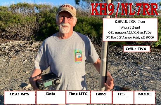
Here are some of the QSL cards received direct in the past week for VK5MAZ and VK5PAS.


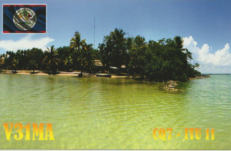
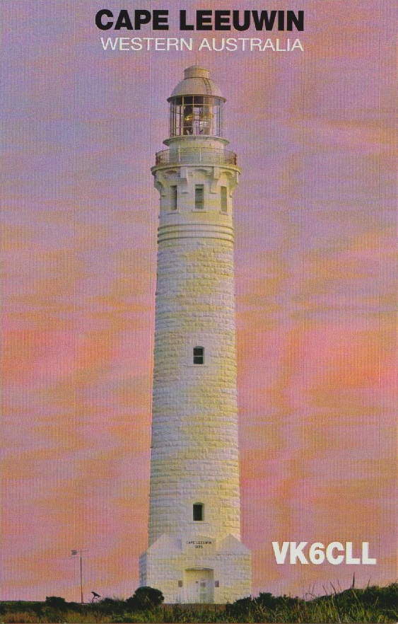
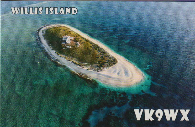

Here are some of the QSL cards received direct in the past week for VK5MAZ and VK5PAS.
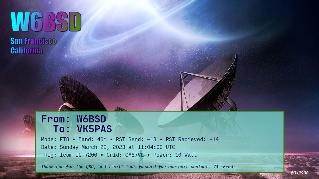
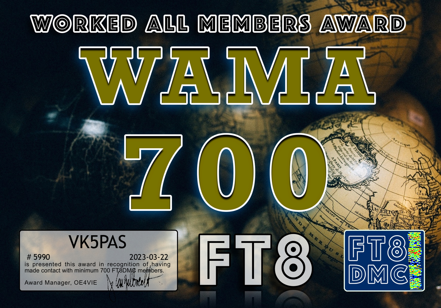
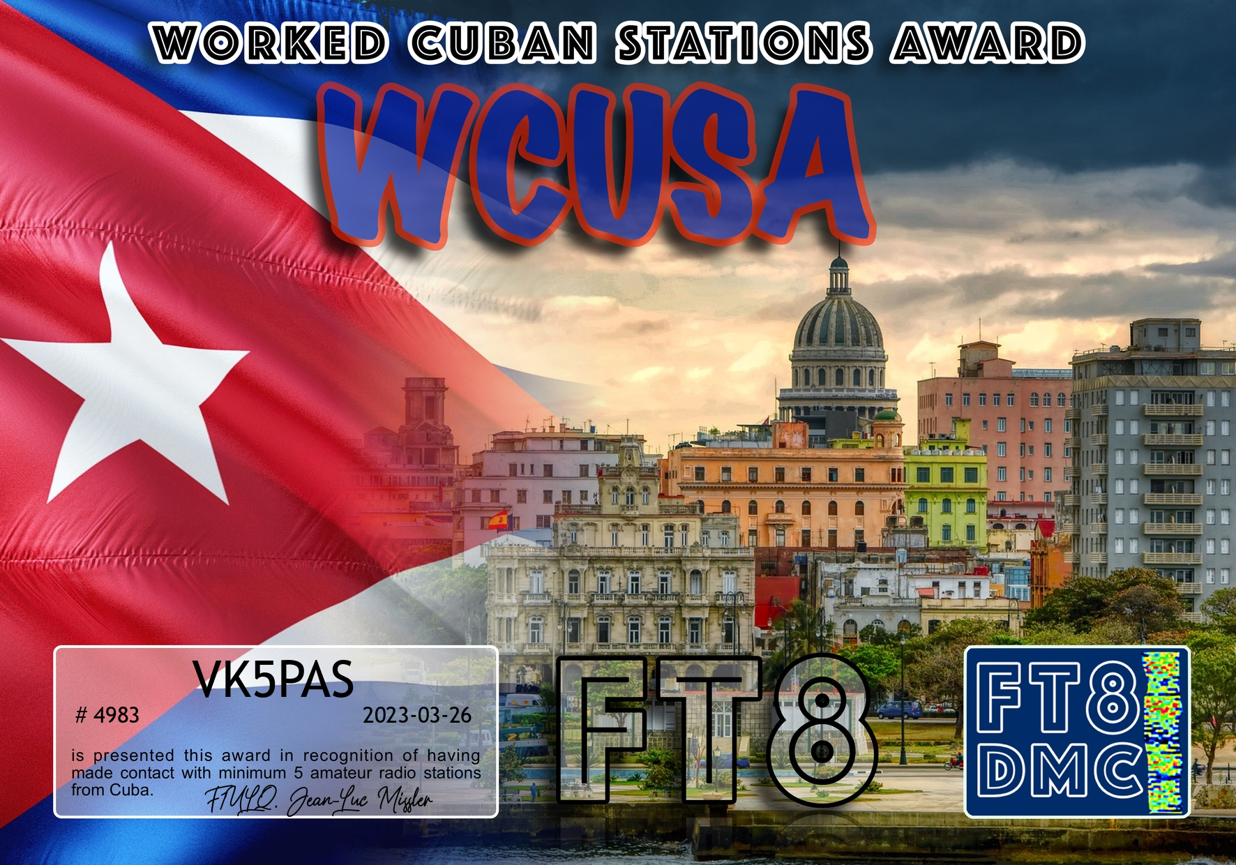
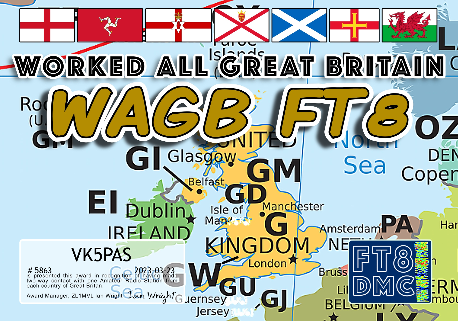
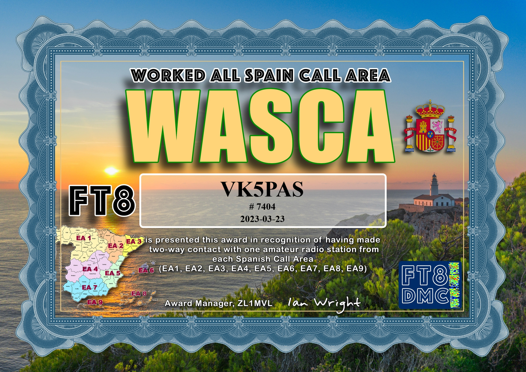
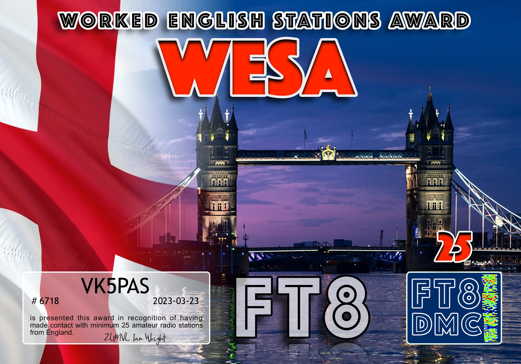
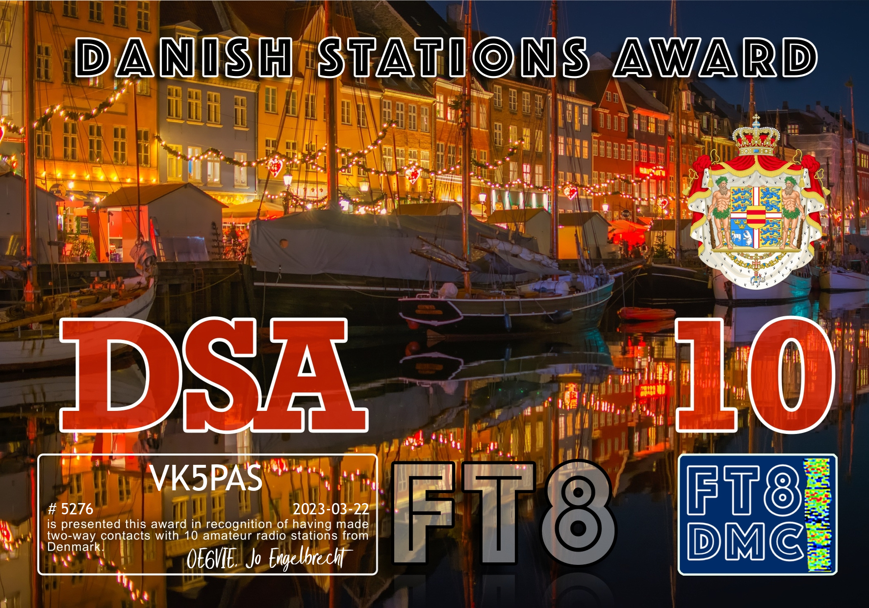
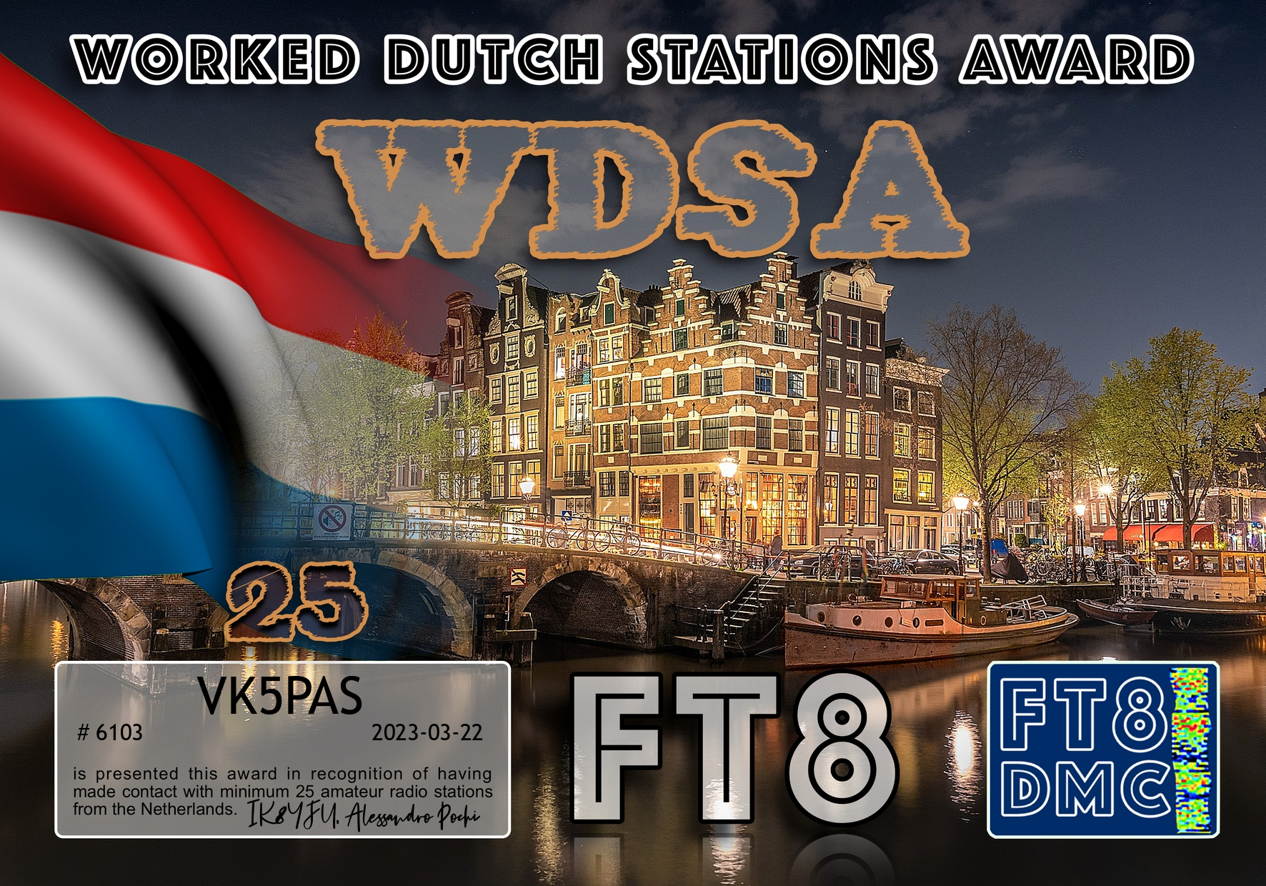
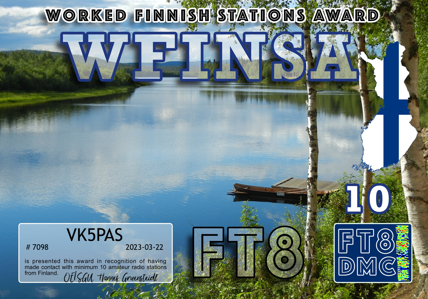
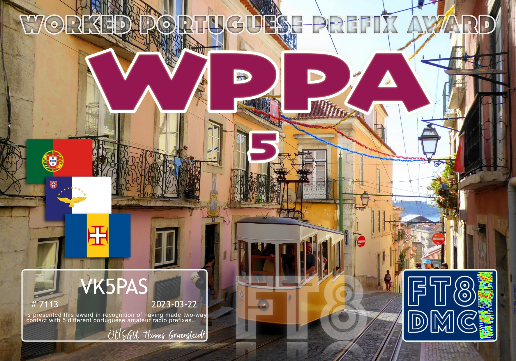
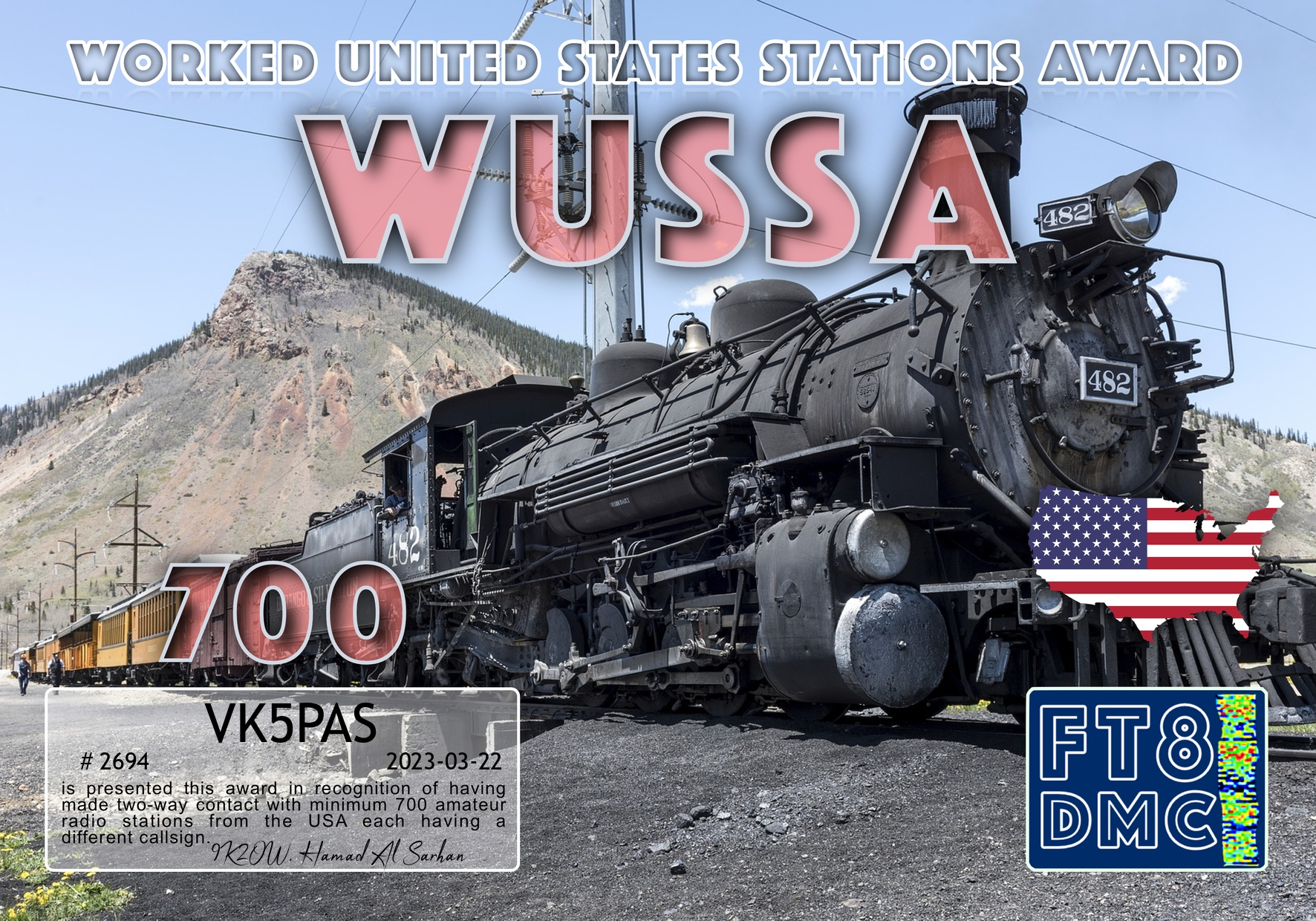
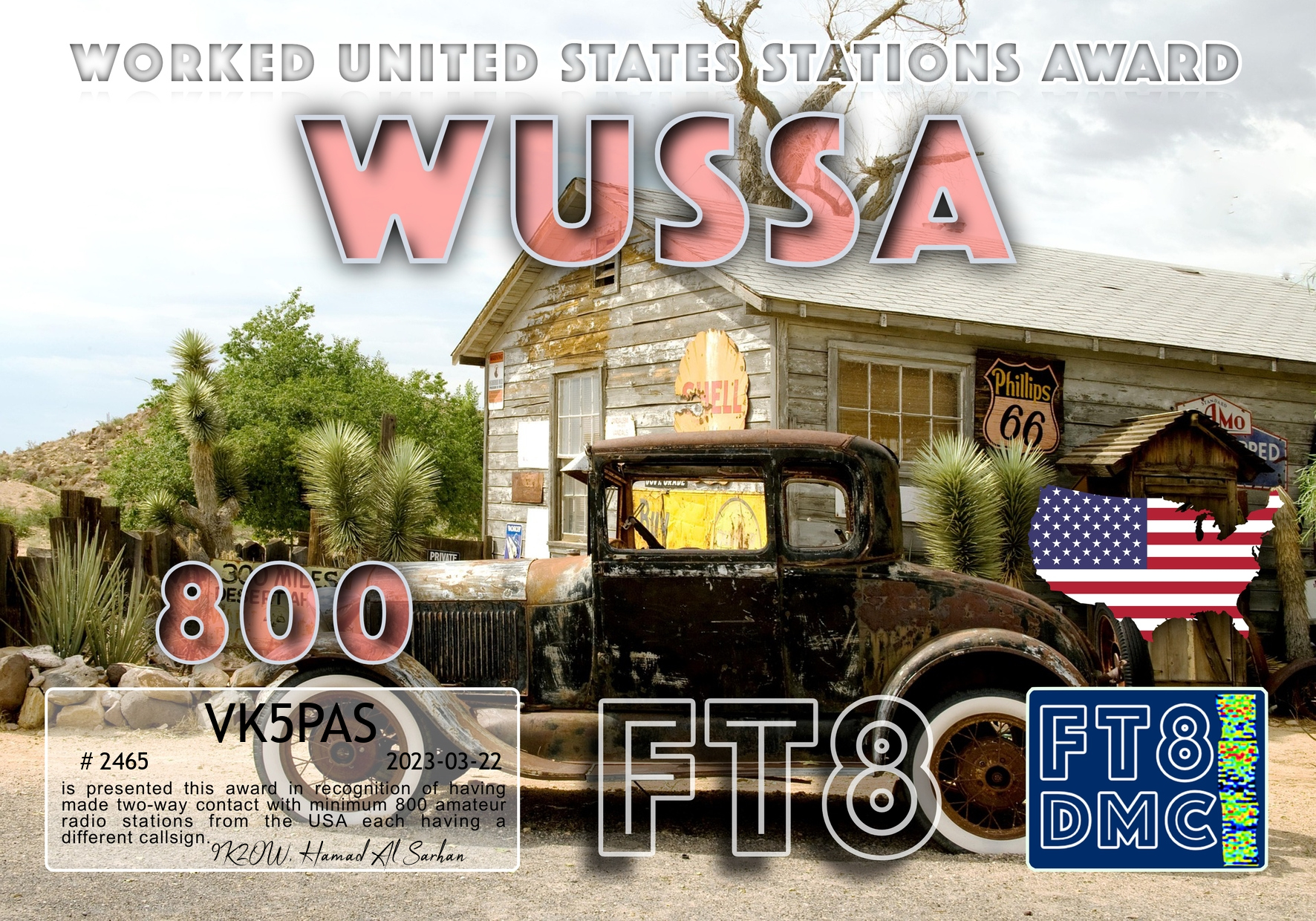
Here are my latest FT8 award certificates.


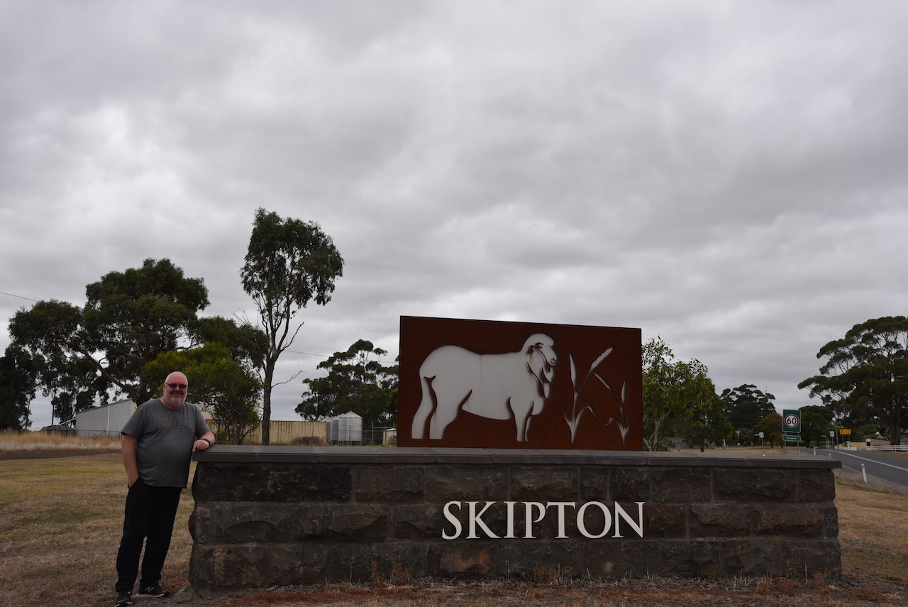
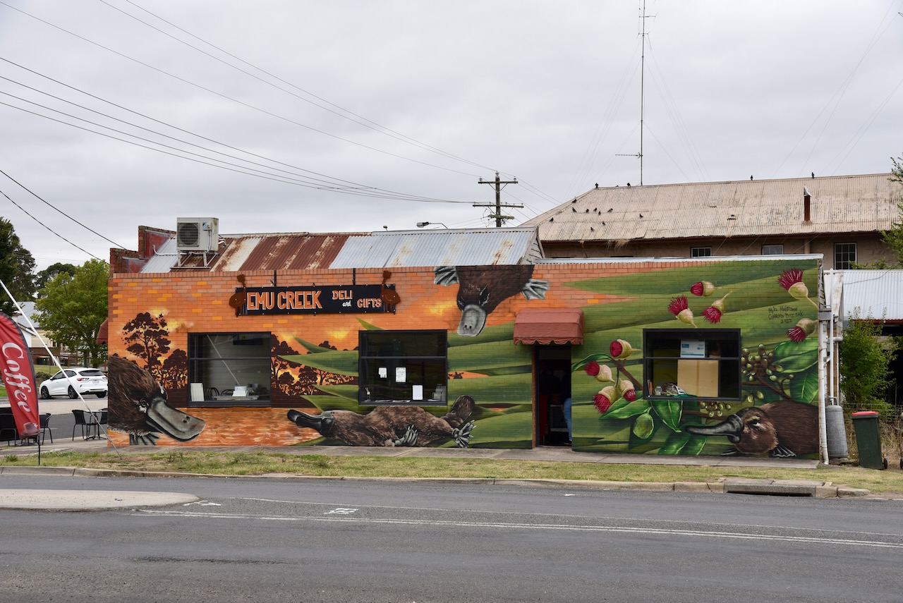
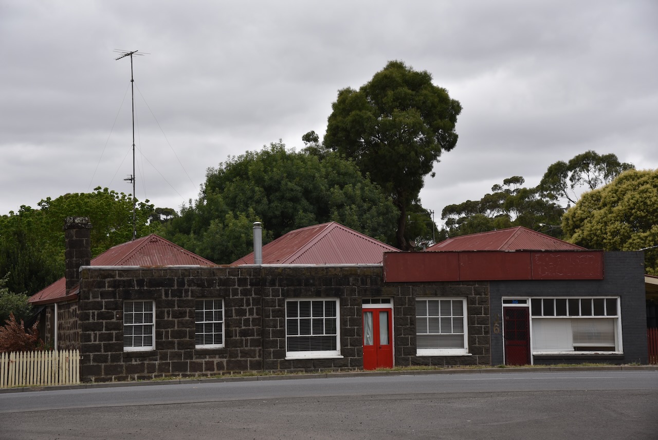
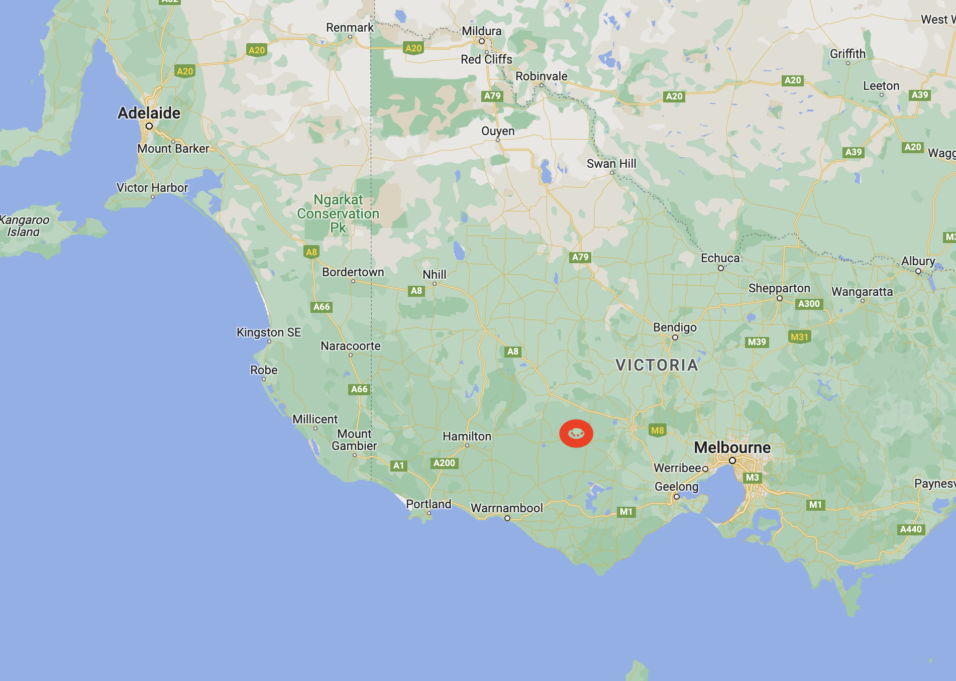
Our next stop for 28th February 2023 was the town of Skipton, about 183 km (by road) west of the city of Melbourne, and 48 km southeast of Ballarat.
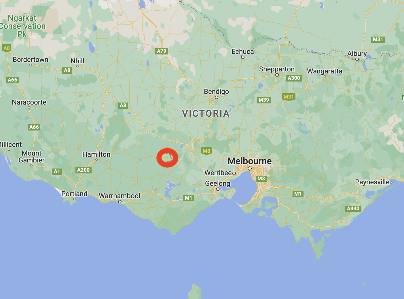
Above:- Map showing the location of Skipton. Map c/o Google maps.
We last stopped at Skipton late last year on our way home from Geelong after visiting Tasmania.
Marija and I stopped at the Skipton cafe and had a very nice lunch and a cup of coffee. The meal was excellent and the owners were very friendly.
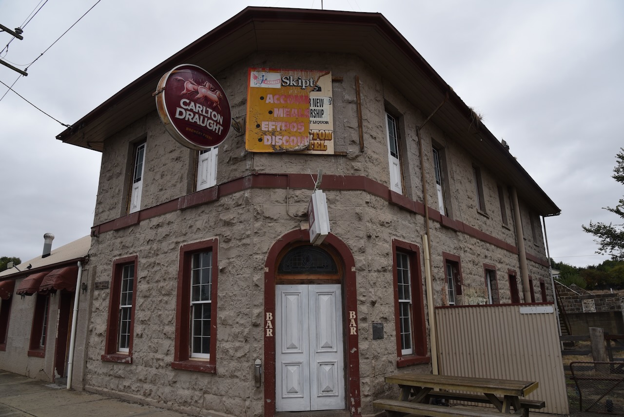
In 1838 a pastoral run was established in the Skipton area. A hut was built beside Mount Emu Creek which became the site of the township of Skipton which was surveyed in 1852. It is believed that Skipton was named after Skipton in Yorkshire in England. The old English Scip-tun means sheep town. In 1858 the Skipton Hotel was built.
Francis Ormond was the owner of Borriyalloak station near Skipton. In 1853 he became a territorial Magistrate and he regularly sat on the Common Bench at Skipton and other nearby towns. In 1855 he and two other prominent landowners in the area formed the Skipton Agricultural and Pastoral Association. During the mid-1850s he started a class for the children of the employees at Borriyalloak station, as they were often left to their own devices whilst their parents worked the land. In 1856 Ormond commenced lengthy talks with the Presbytery of Melbourne, with a view to the establishment of a parish in Skipton. This resulted in the opening of a small brick church in 1857 at Skipton.
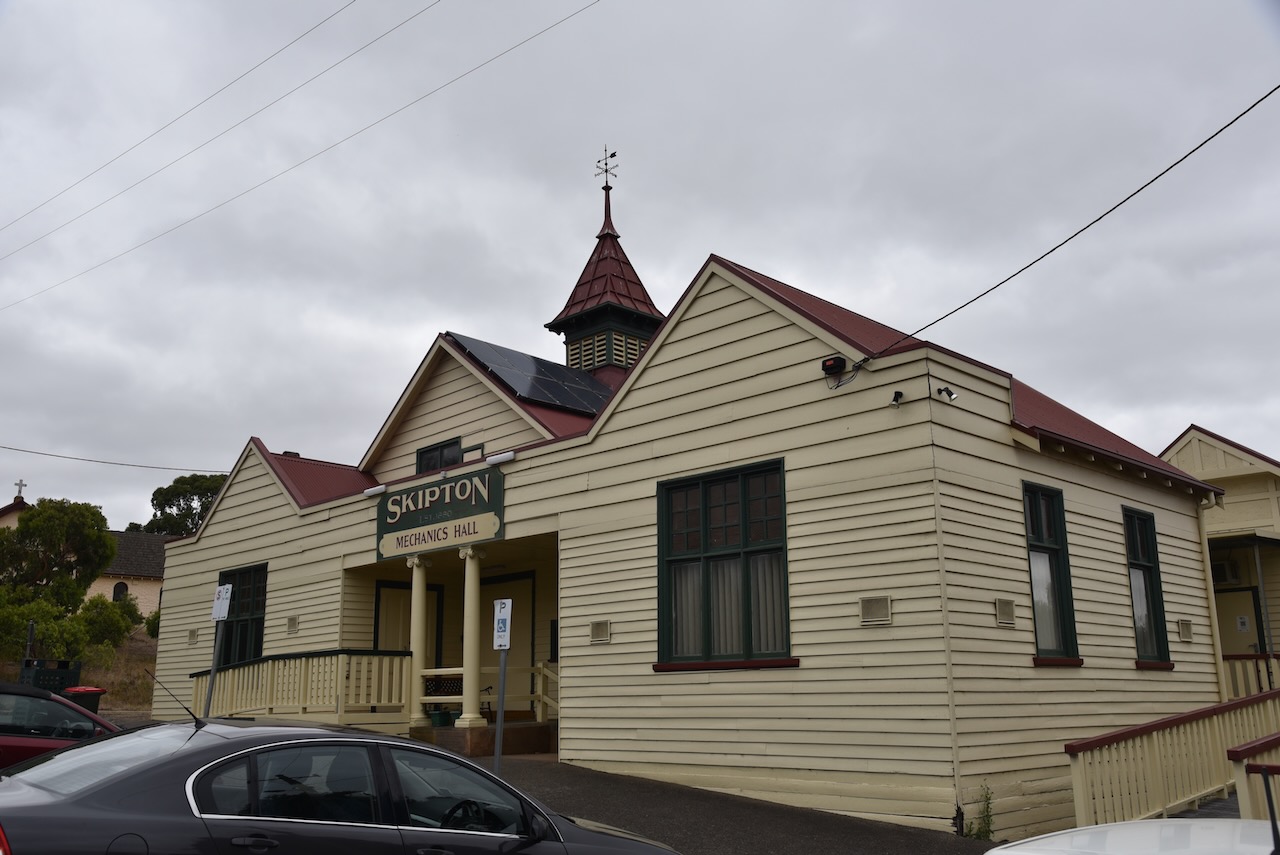
In 1864 a school was built at Skipton. Between 1865-1870 a Methodist church was established, a Mechanics Institute in 1880, and a Catholic Church in 1897. Until the 1890s Skipton’s population barely exceeded 150 people, but it gained a school (1864), a Methodist church (1865-70), a mechanics’ institute (1880) and a Catholic church (1897). Following the First World War, there was a Soldier Settlement in the area.
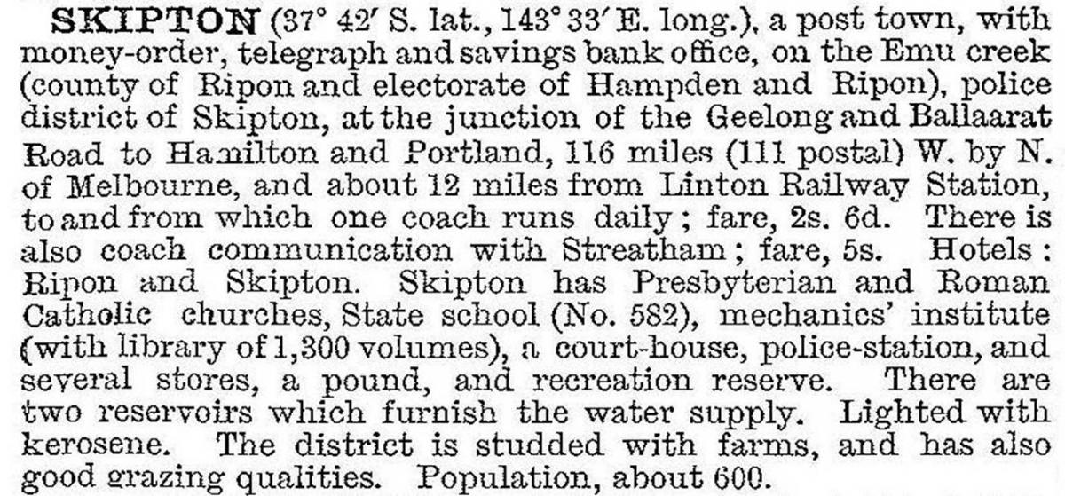
The 1903 Australian Handbook described Skipton as follows:-
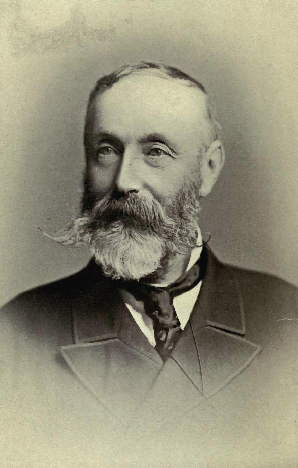
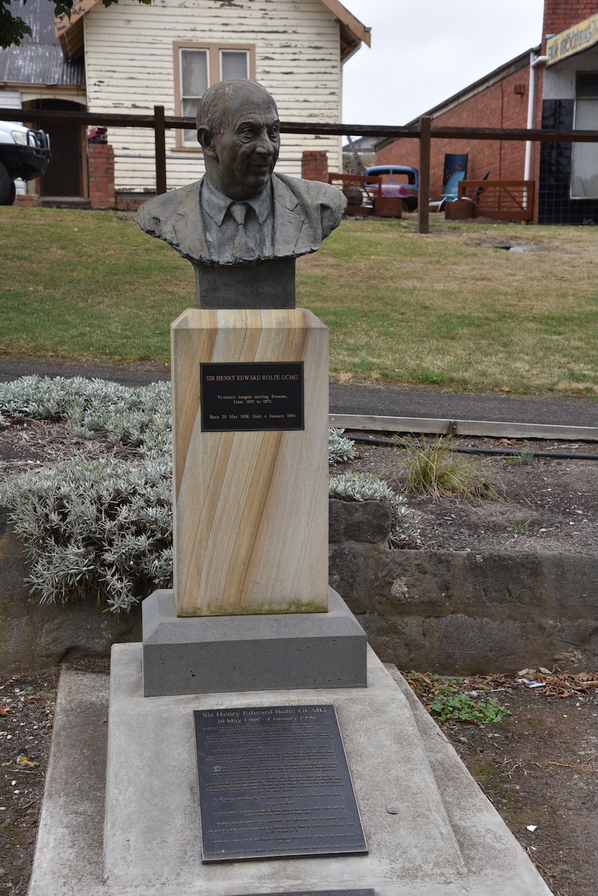
Sir Henry Edward Bolte GCMG (b. 1908. d. 1990) served as the 38th Premier of Victoria. To date he is the longest-serving Victorian premier, having been in office for over 17 consecutive years. He spent the first 24 years of his life in Skipton and attended the Skipton Primary School. There is a bust/monument in Skipton to honour Bolte.
Melbourne Cup and Victoria Derby winning horse Skipton, is named after the little town. Skipton’s owner Myrtle Kitson was given the horse as a yearling by her husband after he had purchased the horse for 25 guineas. Kitson intended to name the horse Monaco, after visiting that country. However, relations with the British Empire were strained at the time, so she named the horse Skipton. She and her husband owned the Grand Central Hotel in Hamilton, and they would often travel through Skipton on their way to Melbourne. Mrs. Kitson is reported to have said: “This town is a pretty little place with a river and overhanging willows’.
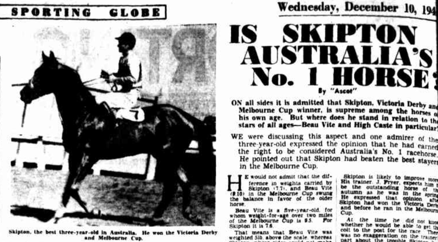
Above:- Portion of an article from the Sporting Globe, Melbourne, Wed 10 Dec 1941. c/o Trove.
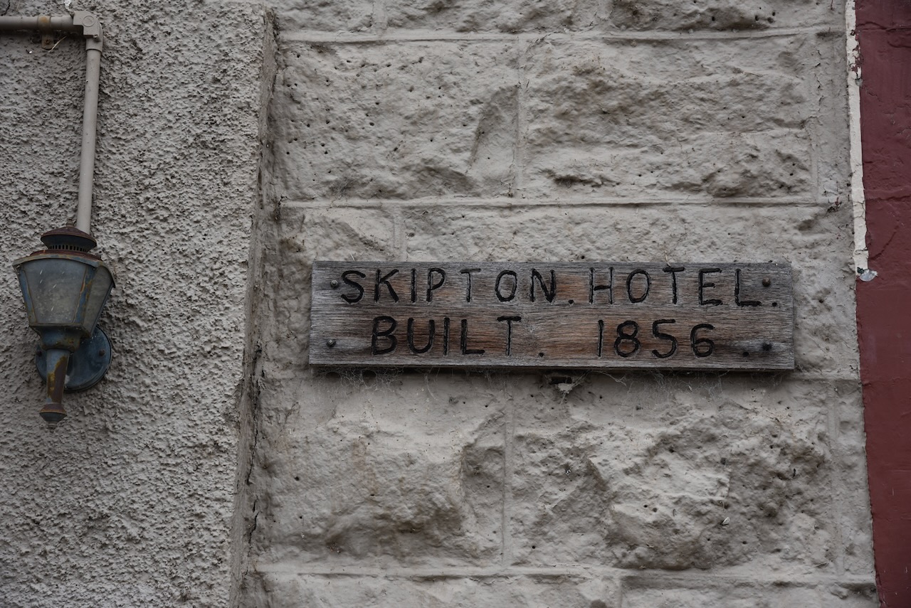
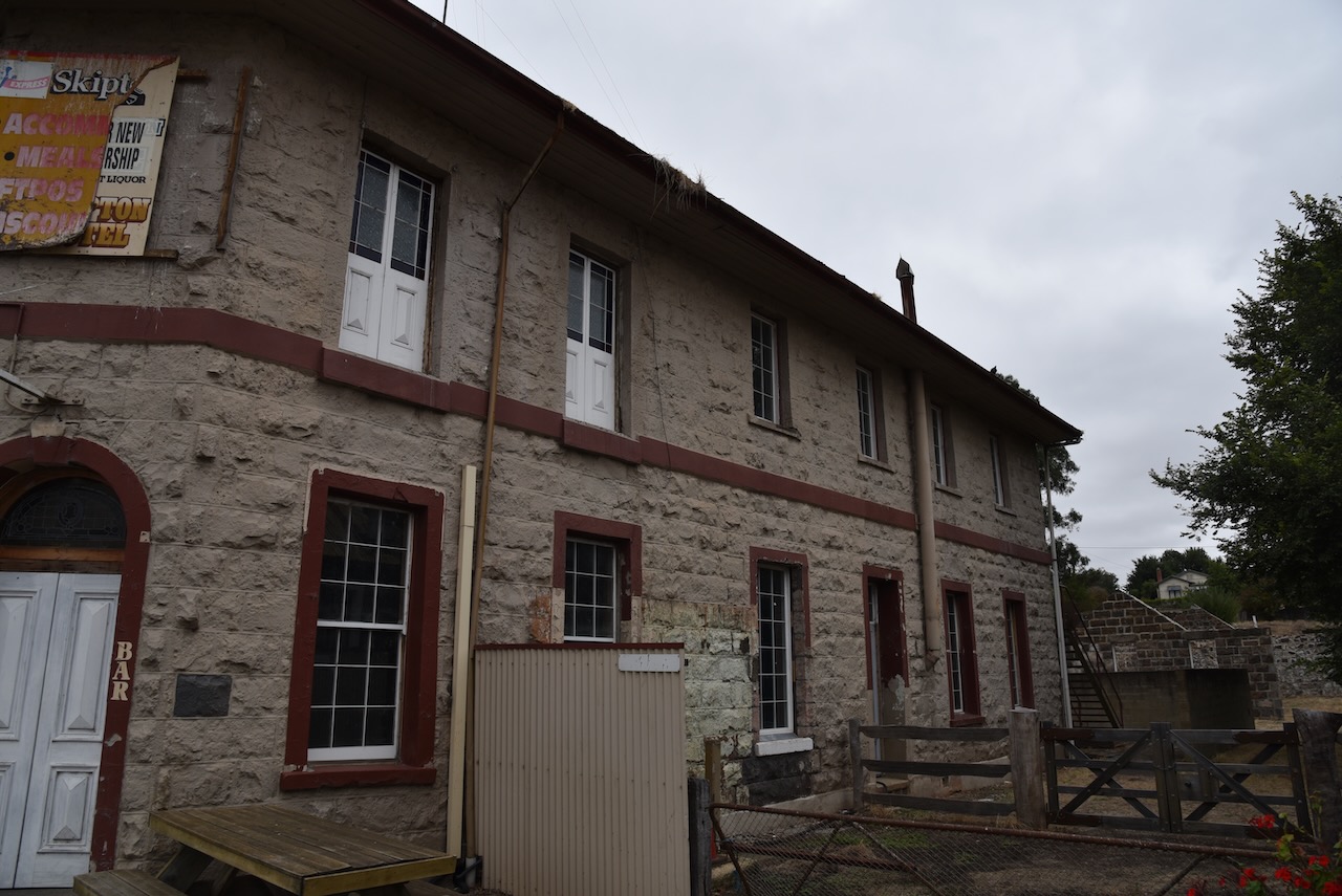
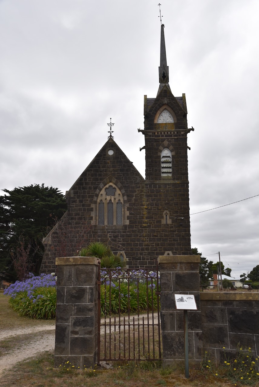
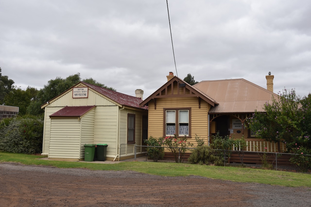
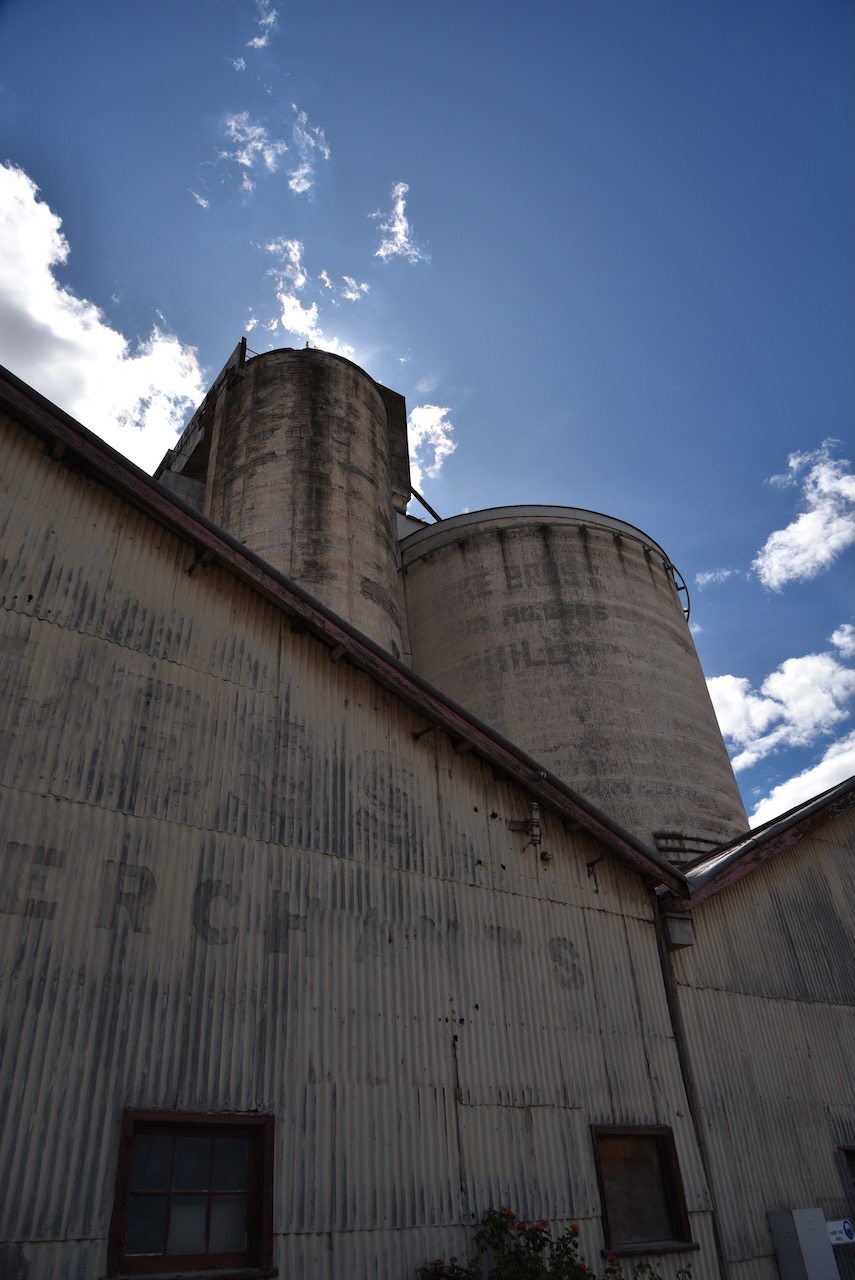
According to the sign out the front, the Skipton Hotel was built in 1856. Various websites have the construction year as 1859. Sadly this beautiful bluestone watering hole is now closed. I suspect those bar walls could tell some stories. The stables at the rear were used by Cobb & Co as a staging point.
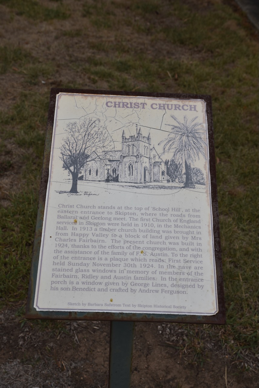
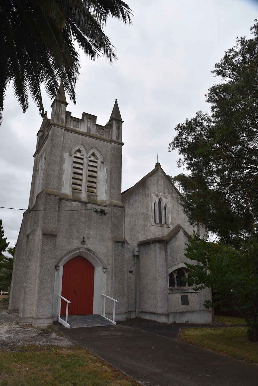
Christ Church in Skipton stands at the top of ‘School Hill’ at the eastern entrance to Skipton. The church was built in 1924, with the first service held on Sunday the 30th day of November 1924.
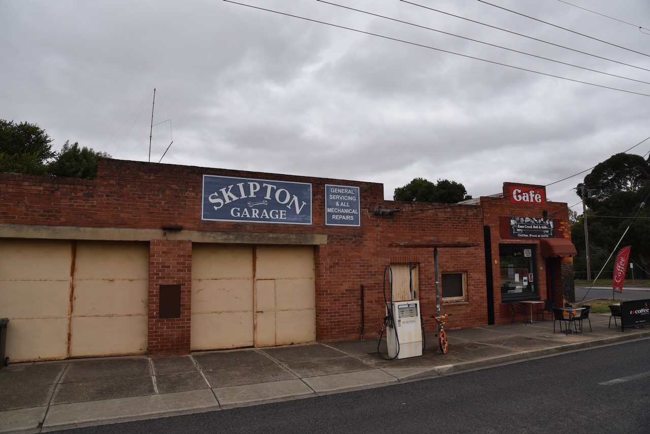
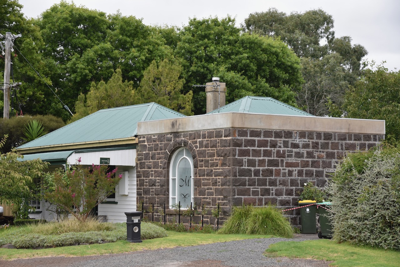
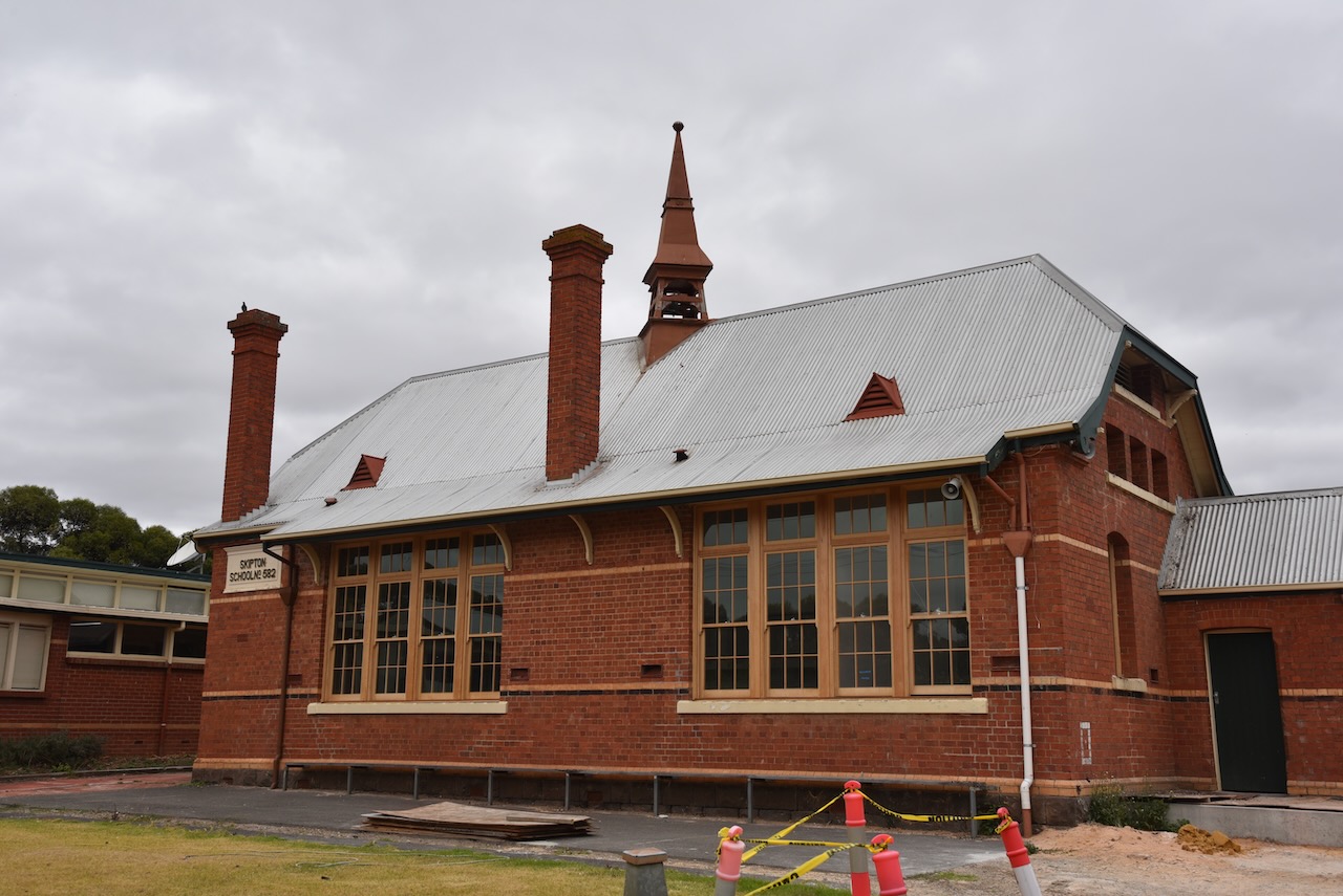
There are numerous other historic buildings in Skipton, and it is certainly well worth a stop and a wander around this historic little town.
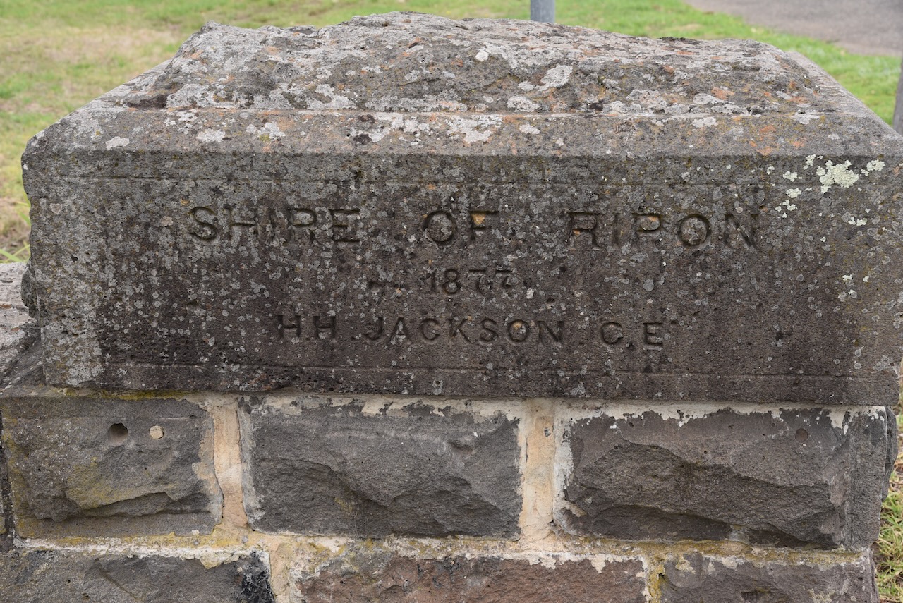
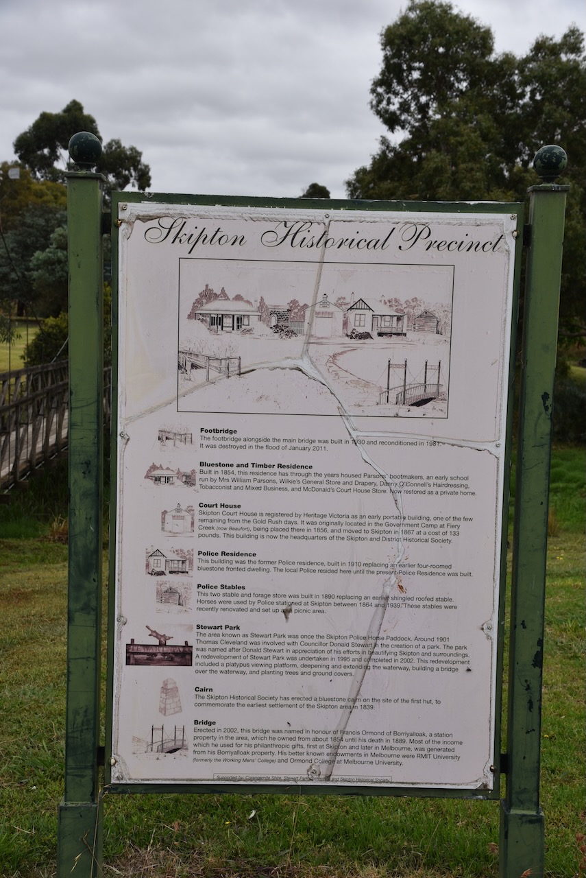
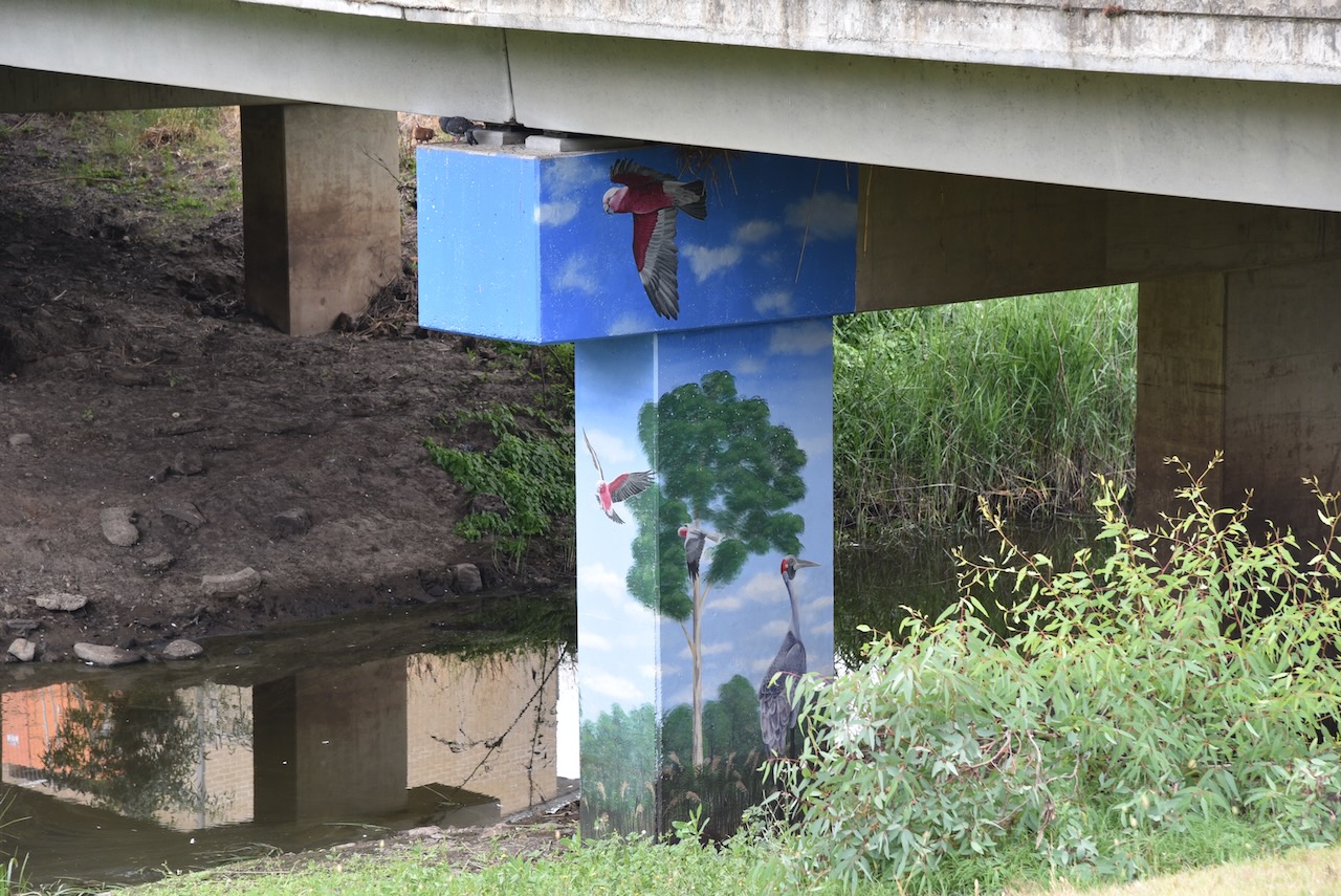
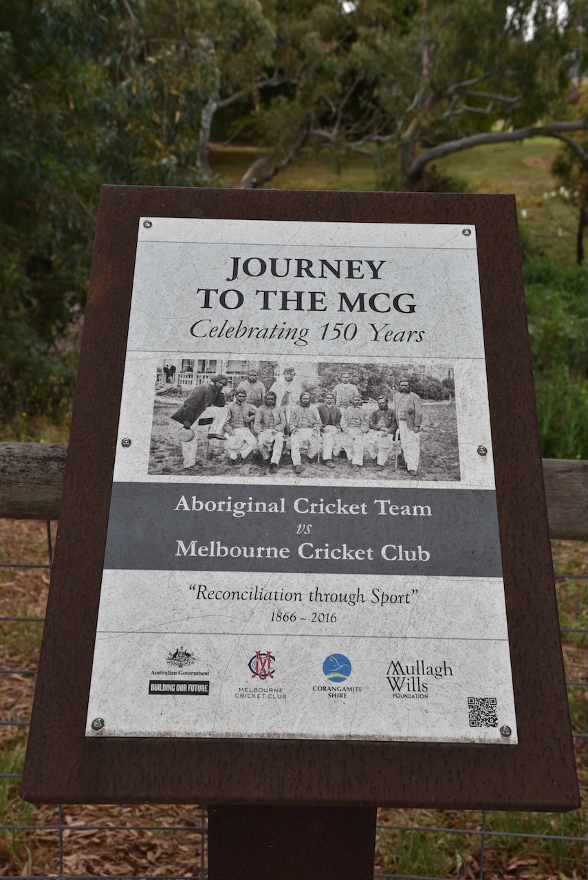
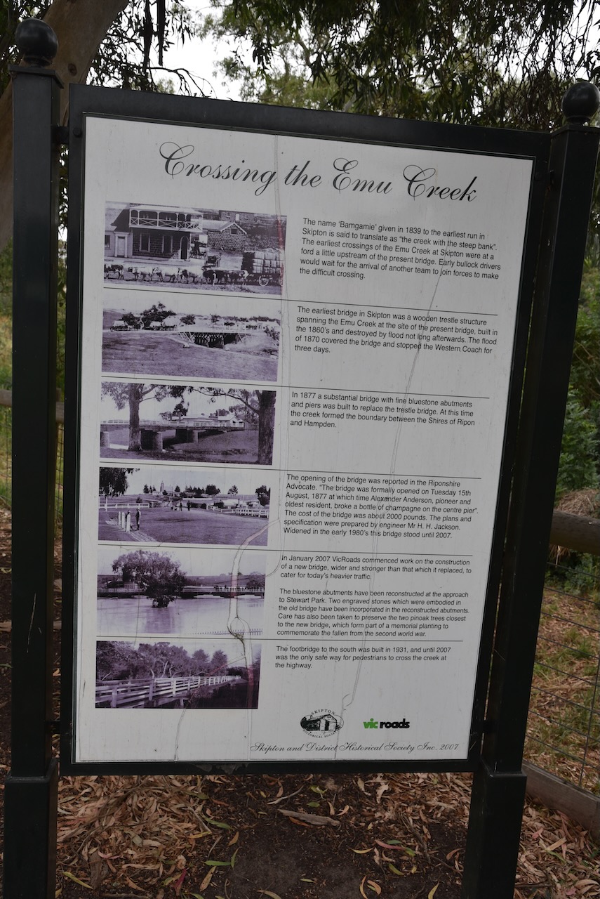
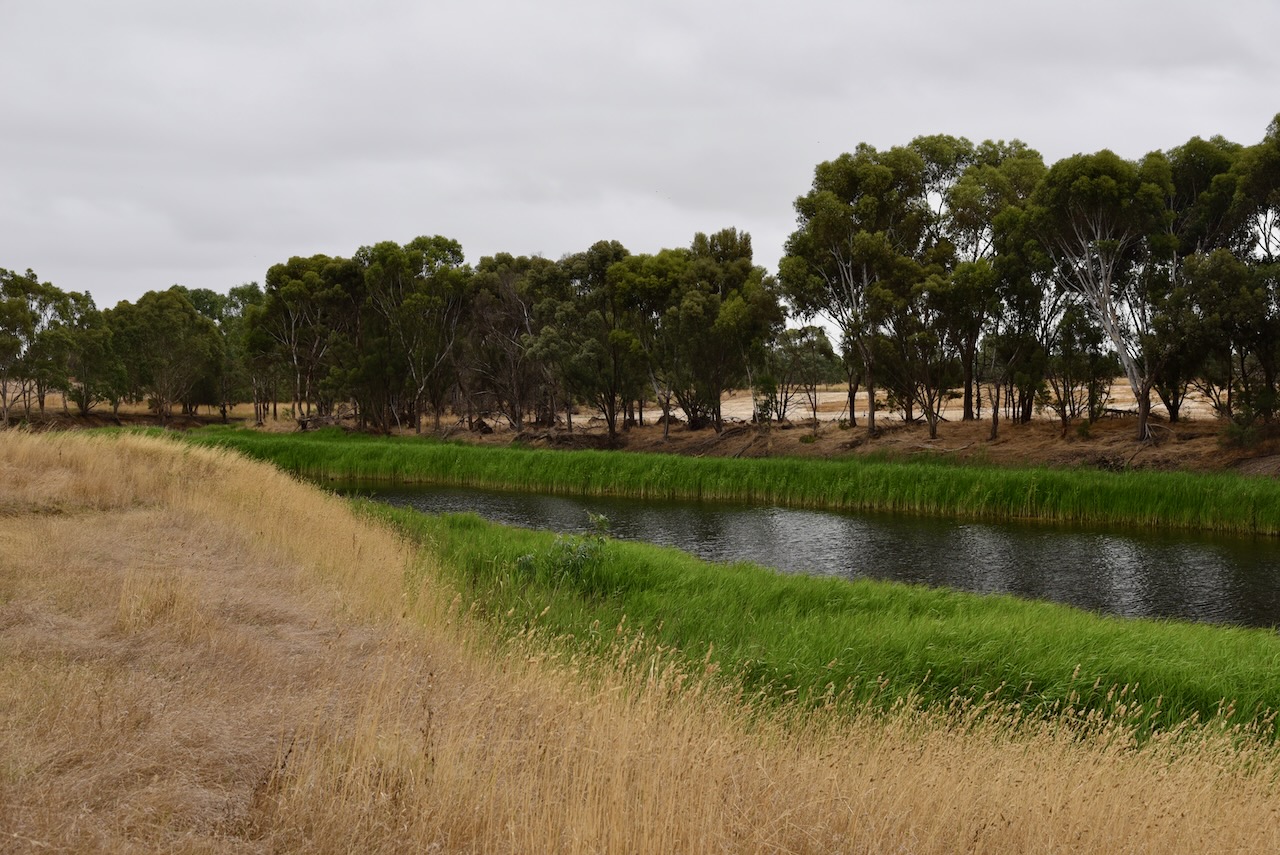
On the bridge that crosses Emu Creek, there is some artwork on the bridge pylons and information boards with history about Skipton.
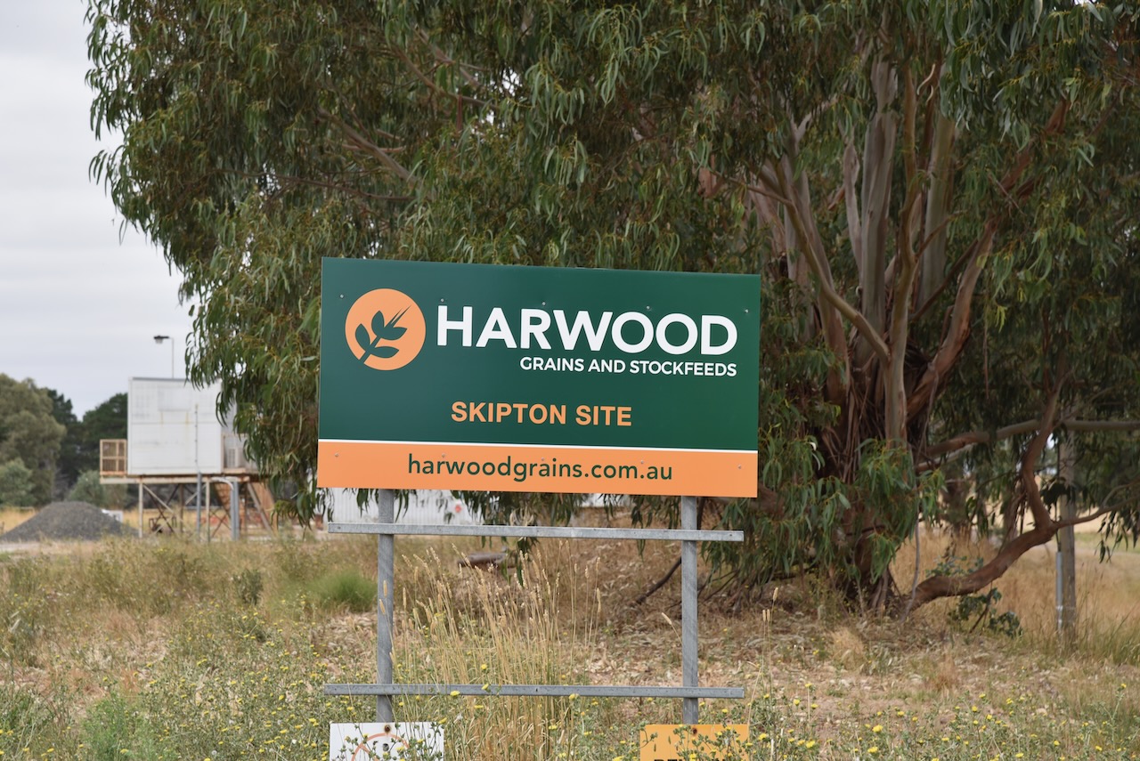
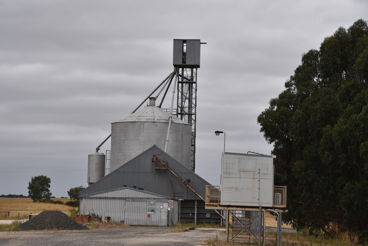
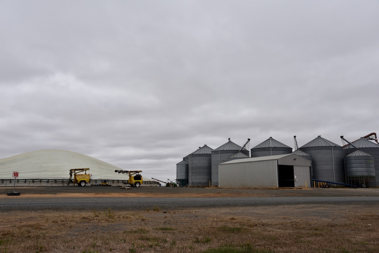
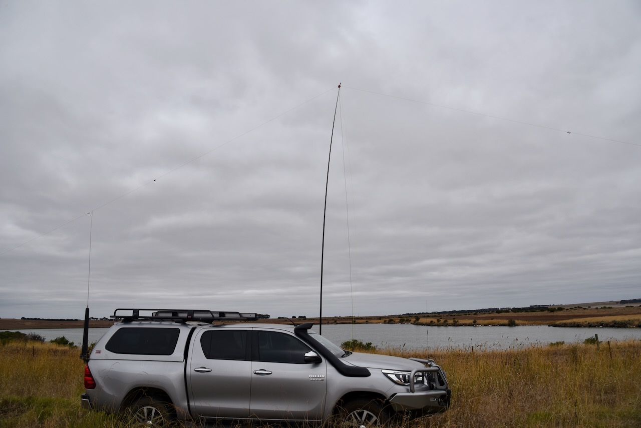
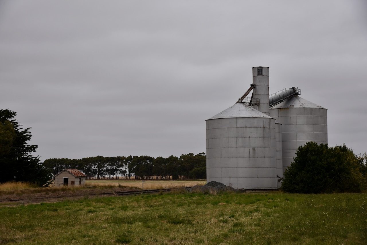
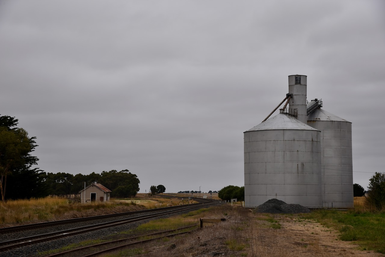
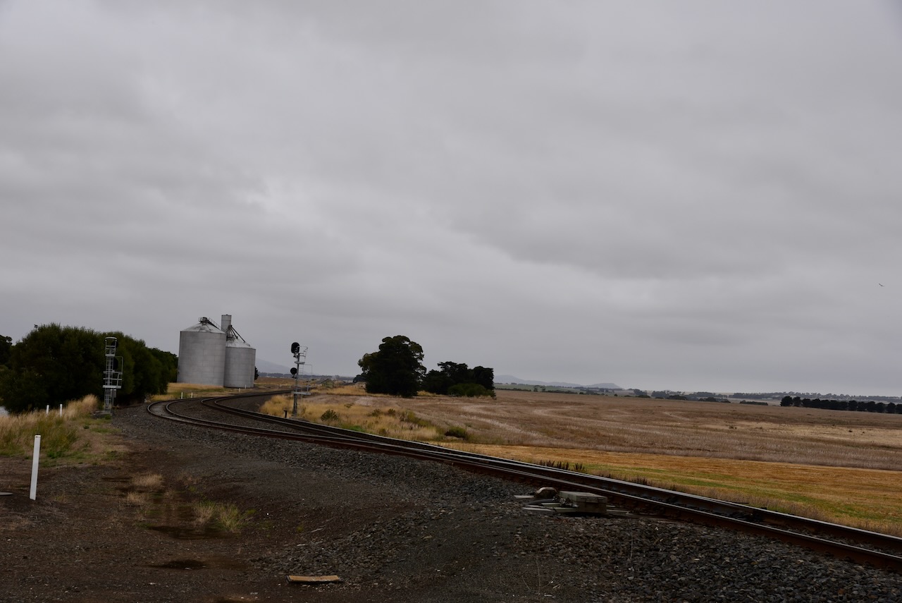
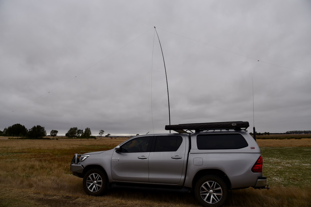
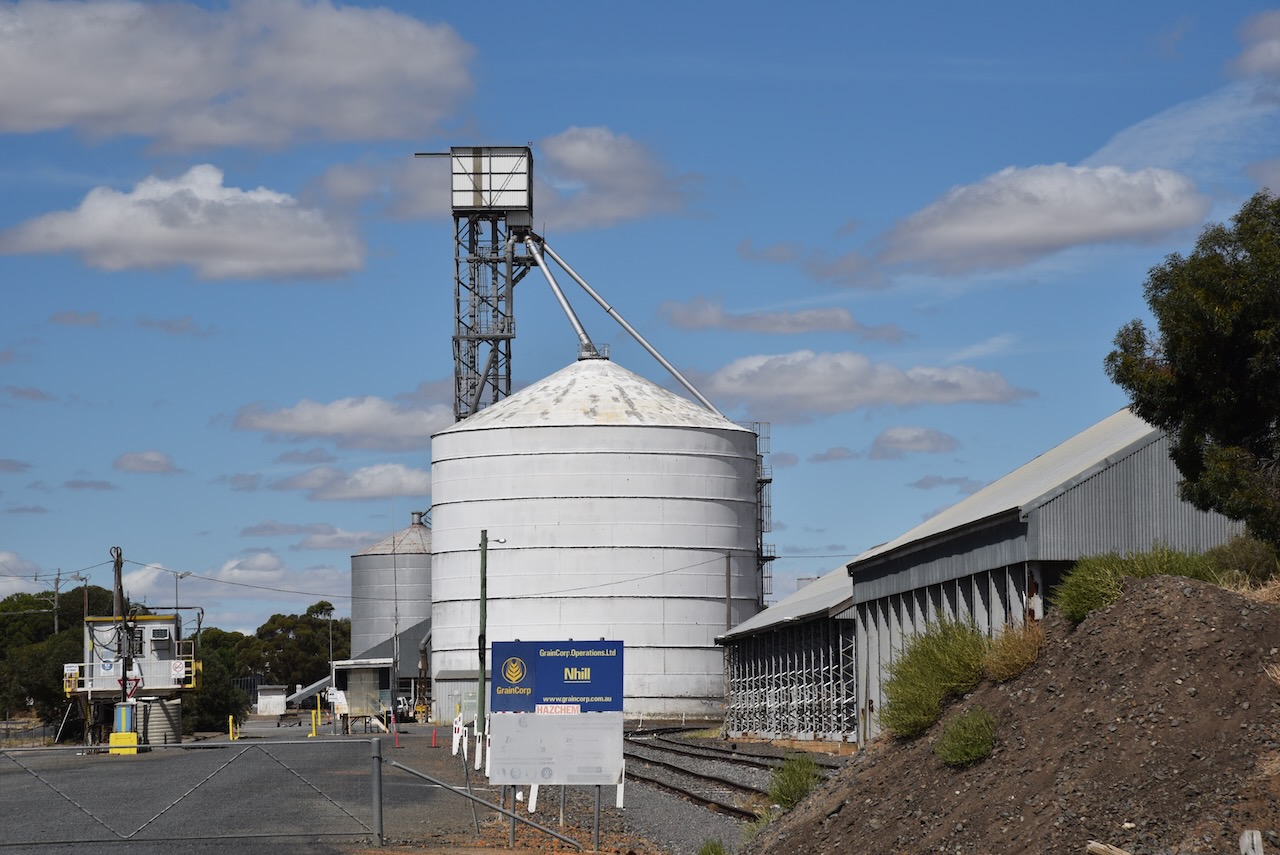
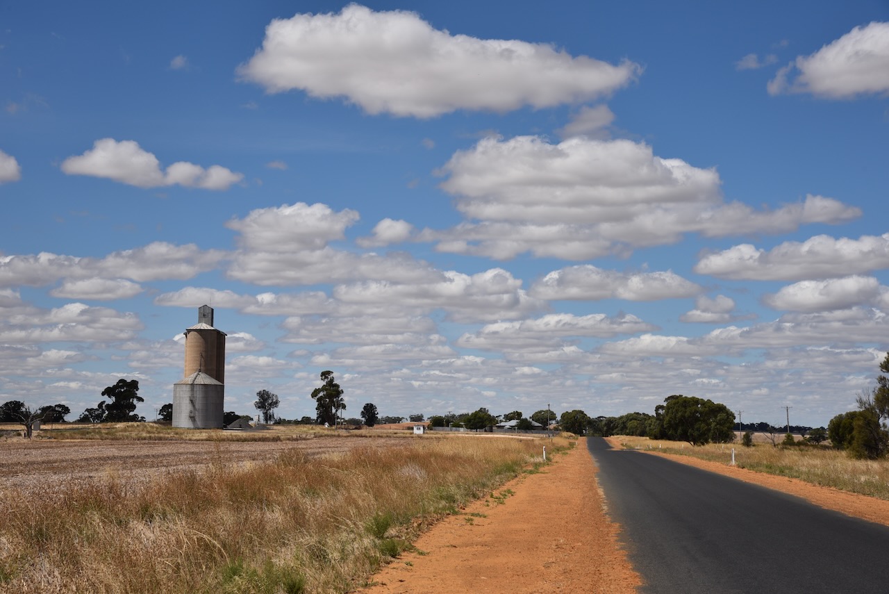
We then drove to the Skipton silo on Station Street, on the southern side of the town, and activated the silo for the Silos On The Air (SiOTA) program. The silo is operated by Harwood Grains and Stockfeeds. We operated from within the 4WD, running the Icom IC7000, 100 watts, and the Codan 9350 antenna.
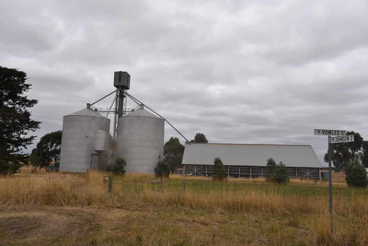
Marija worked the following stations on 40m SSB:-
I worked the following stations on 40m SSB:-
I worked the following station on 80m SSB:-
References.
Marija and I left the Tatyoon silo and headed to Stonleigh in Victoria where we planned to activate the Stonleigh silo VK-STH3 and the Salt Lagoon Wongon Wildlife Reserve VKFF-2433. Stoneleigh is about 187 km (by road) northwest of the city of Melbourne.
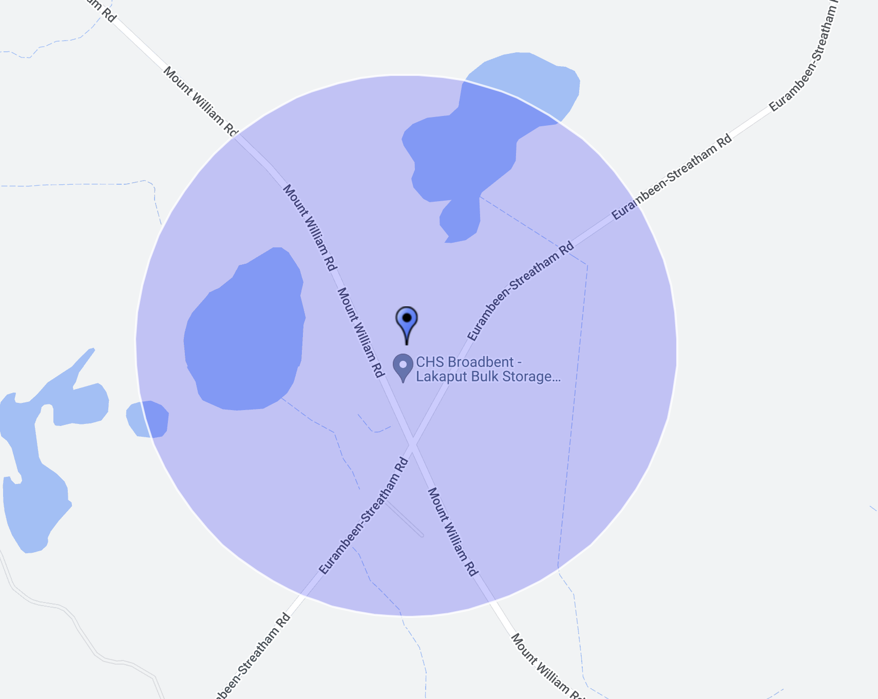
Above:- Map showing the location of Stoneleigh. Map c/o Google maps.
The Salt Lagoon Wongon Wildlife Reserve is not to be confused with Lake Wongan Wildlife Reserve. Salt Lagoon WR is located on Mount William Road, while Lake Wongan WR is located a little further to the south on the eastern side of Eurambeen – Streatham Road. The Lake Wongan WR currently is not listed with the VKFF program.
The Salt Lake Wongon Wildlife Reserve is 24 acres in size and was gazetted on the 22nd day of November 1983.
The park is located within the activation zone of the Stoneleigh silo.
Above:- the activation zone at the Stoneleigh silo. Image c/o SiOTA website.
The park appears to be surrounded by farming land. However, there is a small section accessible on the western side of Mount William Road.

Above:- An aerial view of the park and the silo complex, showing our operating spot. Image c/o Google Earth.
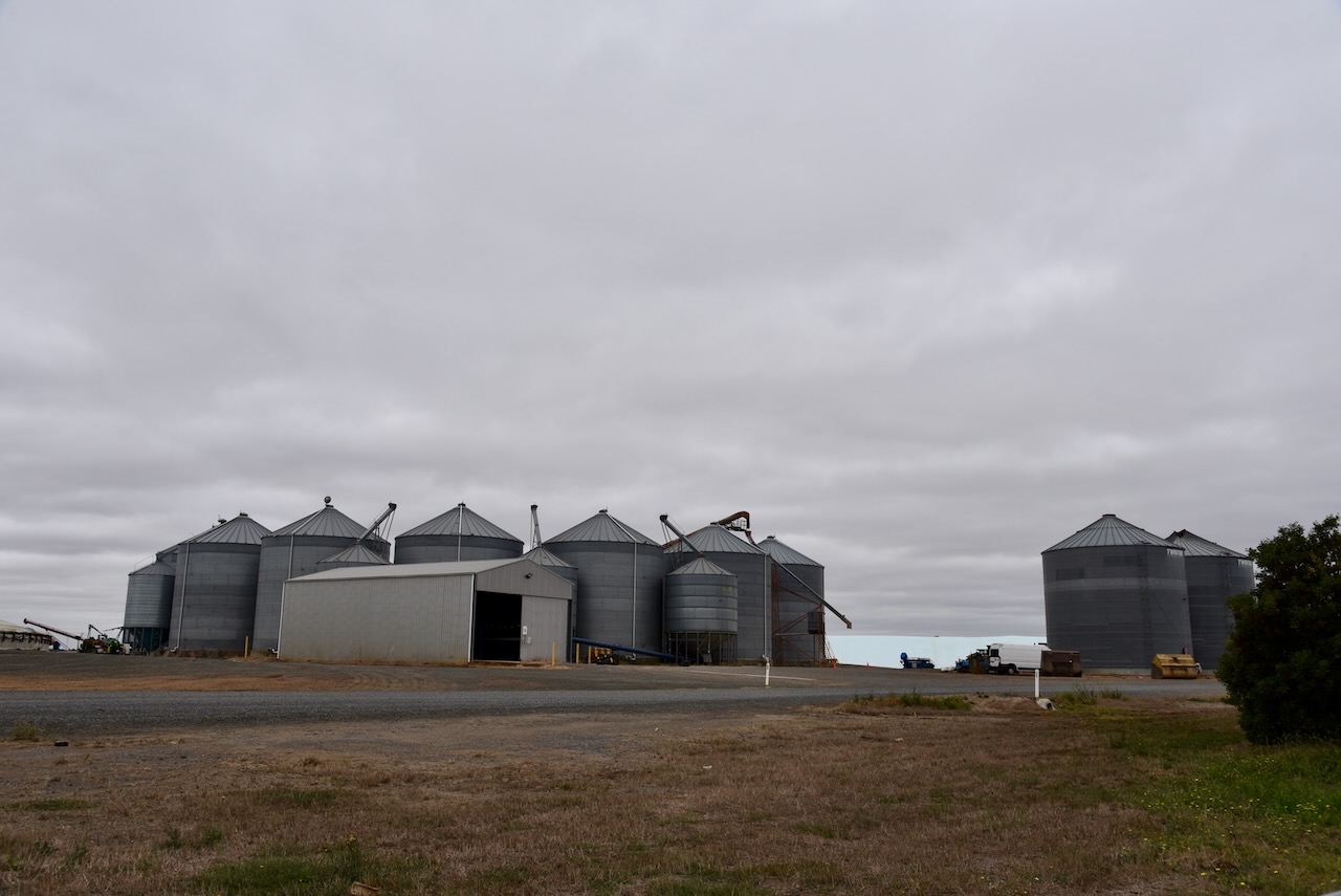
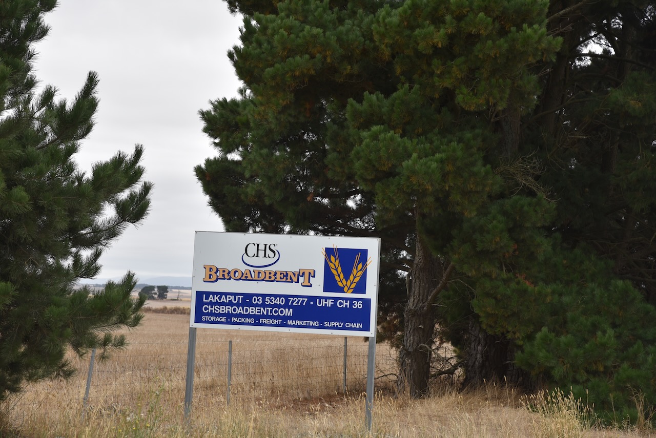
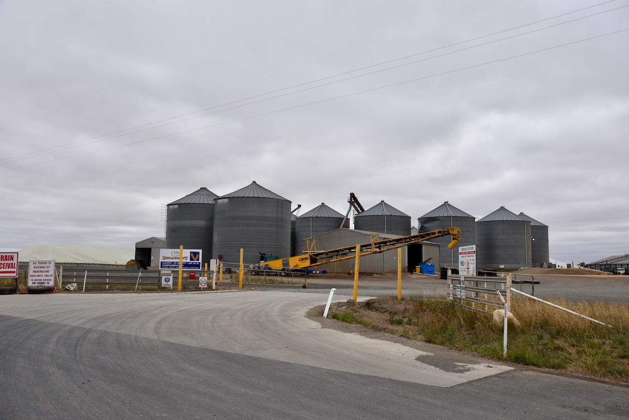
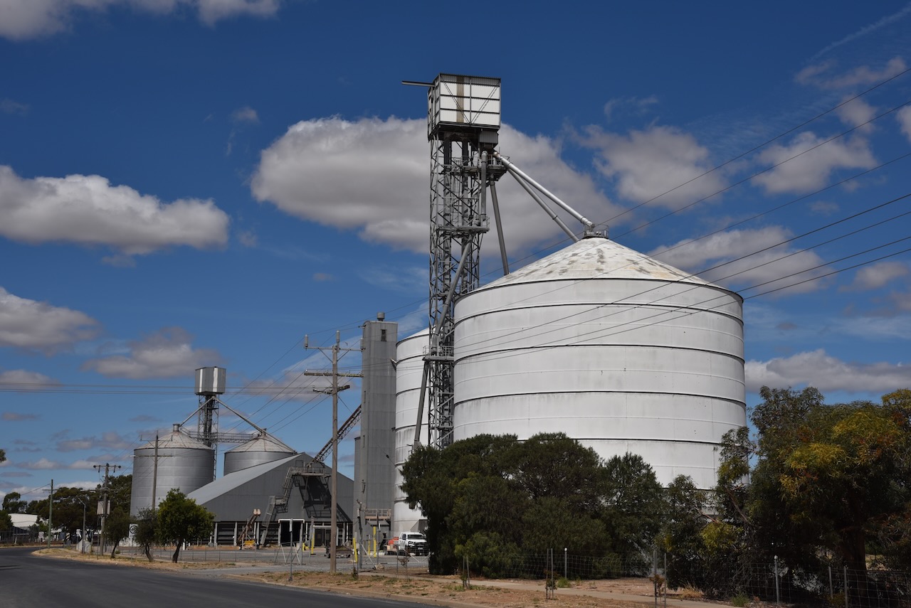
The Stoneleigh silo is a working silo and is run by CHS Broadbent, a grain marketing, logistics, storage, and export company.
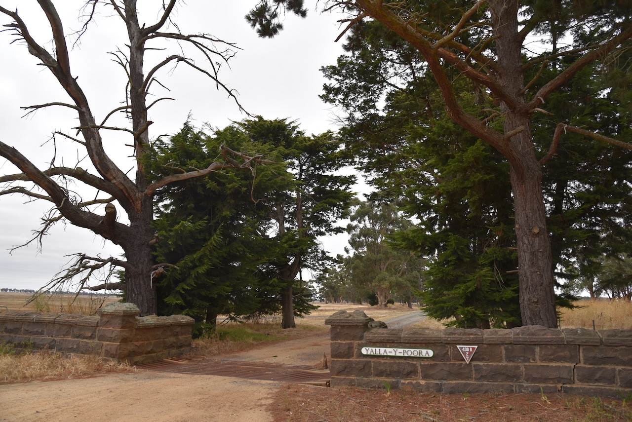
The park is located in a district called Yalla-Y-Poora, while the silo across the road is located in the district of Stonleigh.
Yalla-Y-Poora is believed to be aboriginal for trees by water. The land was taken up by squatters Thompson and Stevens in 1841. They had made a five-month journey from Yass in New South Wales to overland their sheep on the banks of Fiery Creek. By 1854 the property had been sold to James Austin. In 1856 he sold the property to Jeremiah Ware. Jeremiah and his brothers John and Joseph had moved from Tasmania to establish their sheep property. Yalla-Y-Poora consisted of 66,493 acres.
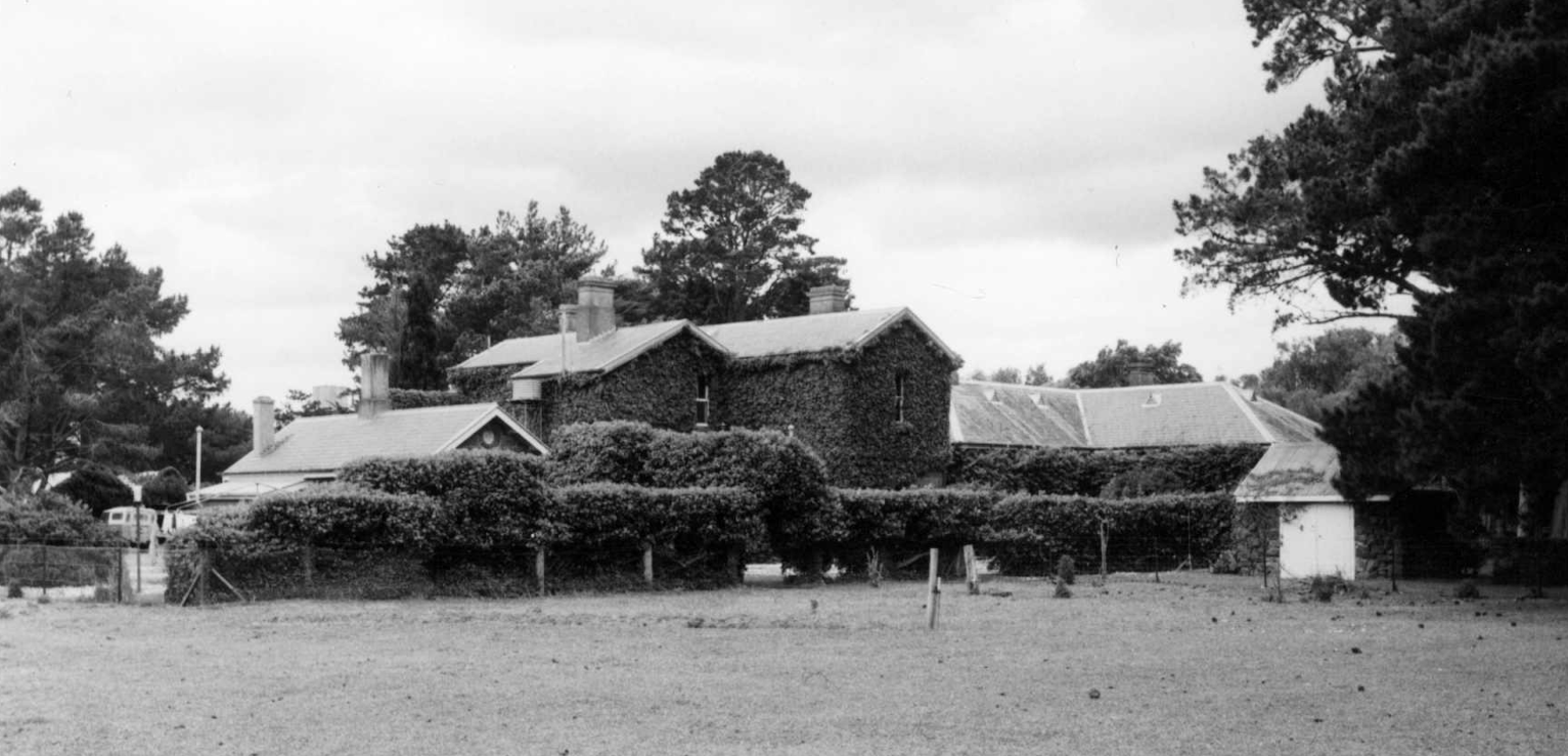
The original Yalla-Y-Poora homestead was built in 1857. The property at its peak ran 60,000 sheep. It took the shearing team in the 20-stand shed a total of 2 months to complete the annual clip. The station buildings included a Manager’s cottage, and a Coach house and Stables.
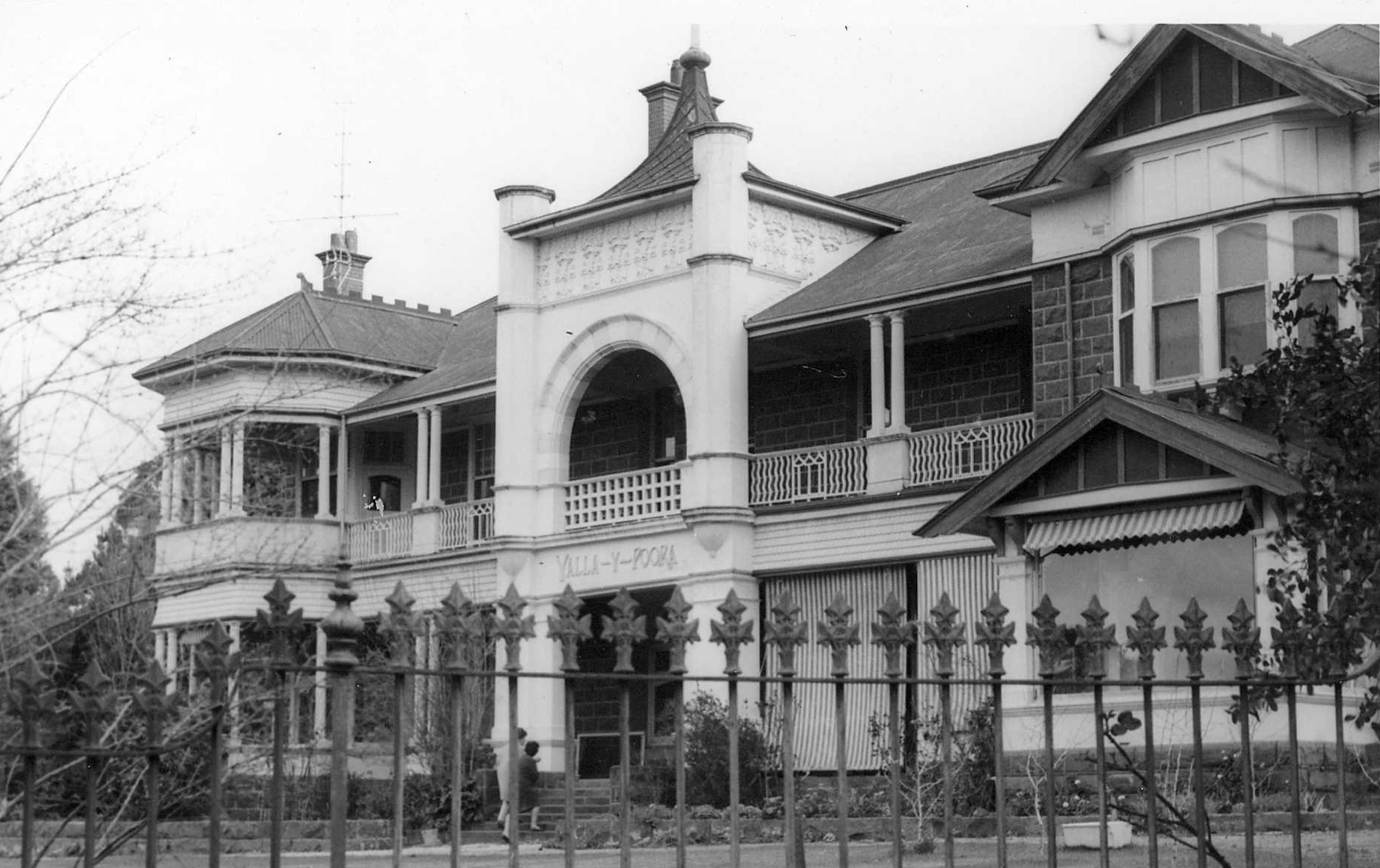
Above:- Yalla-Y-Poora homestead. Image c/o State Library Victoria
After our activation, we drove to have a look at the Yalla-Y-Poora homestead, but it is set a long way off the road so we were unable to get a glimpse of this magnificent homestead.
Austrian-born artist Eugene von Guerard was a friend of the Ware family and frequently visited Yalla-Y-Poora station, and painted many works during his visits. One of those paintings was completed in 1864 and shows the Yalla-Y-Poora homestead and the shearing shed.
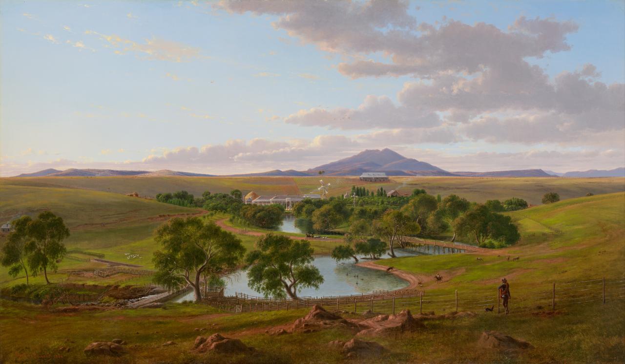
Above:- Yalla-Y-Poora, 1864. Image c/o https://www.ngv.vic.gov.au/
The Yalla-Y-Poora property holding diminished in size over the years due to the Lands Act of 1862, land taxes in the 1890s, and soldier settlement following both the First and Second World Wars. In 1924 a world record was set from wool from the Yalla-Y-Poora flock. During the 1950s and 1960s, the last descendant of the Ware family declared bankruptcy and the Yalla-Y-Poora property was sold.
Stoneleigh also has a homestead. It commenced its life as a flat-roofed weatherboard cottage during the 1840s. In about 1864 the cottage was incorporated into a house for William Lewis, and in 18876 a two-storey addition was added to the rear of the home. The original 1840s cottage is the entrance to the homestead.
Above:- Stoneleigh homestead. Image c/o State Library Victoria.
Marija and I pulled off the side of the road and ran out the 20/40/80m linked dipole. As it was a cold day we decided to operate from within the 4WD. We used the Yaesu FT-857 and 40 watts output.
Marija worked the following stations on 40m SSN:-
Marija worked the following station on 20m SSB:-
I worked the following stations on 40m SSB:-
I worked the following stations on 80m SSB:-
I worked the following station on 20m SSB:-
References.
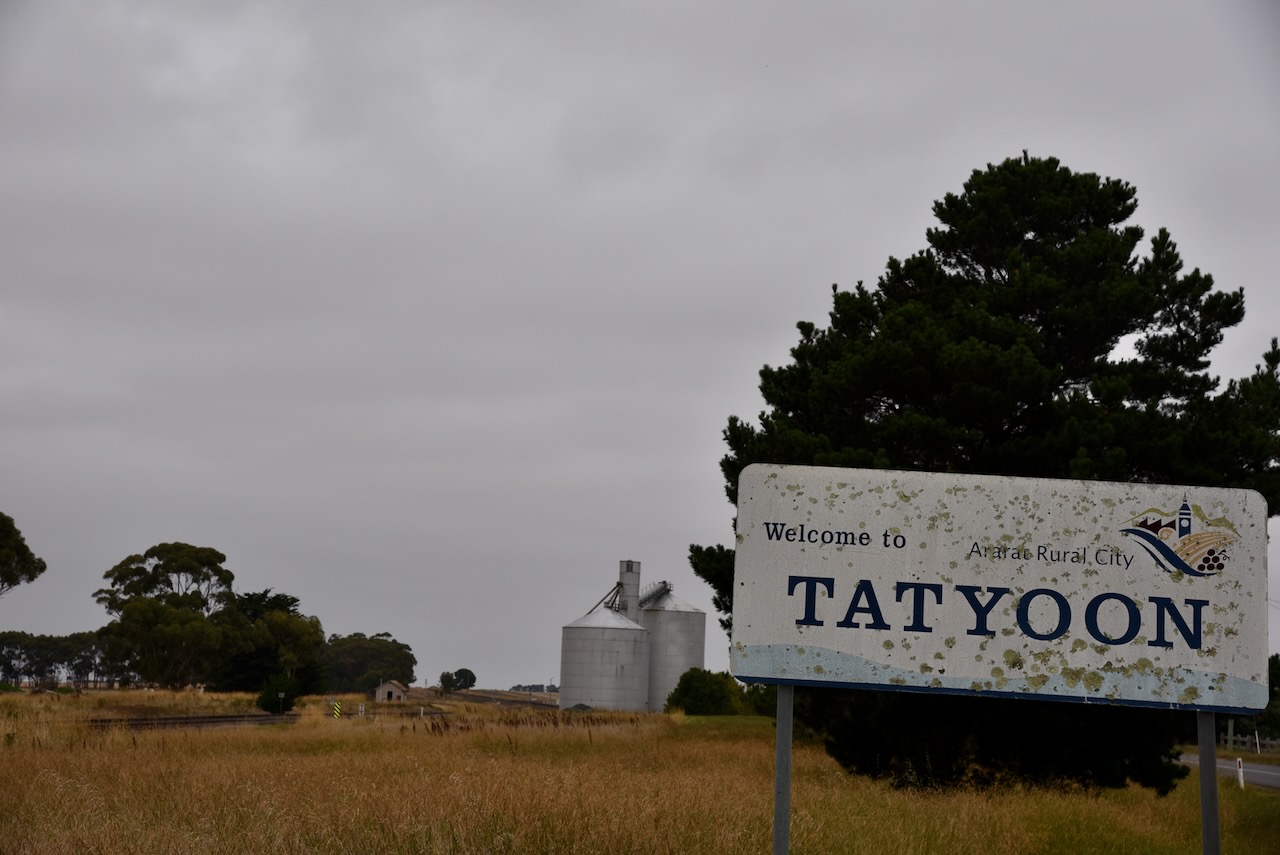
Marija and I packed up at Rossbridge Wildlife Reserve and drove a short distance to the little town to Tatyoon where we planned to activate the Tatyoon silo VK-TTN3 for the Silos On The Air (SiOTA) program.
Above:- Map showing the location of Tatyoon. Map c/o Google maps.
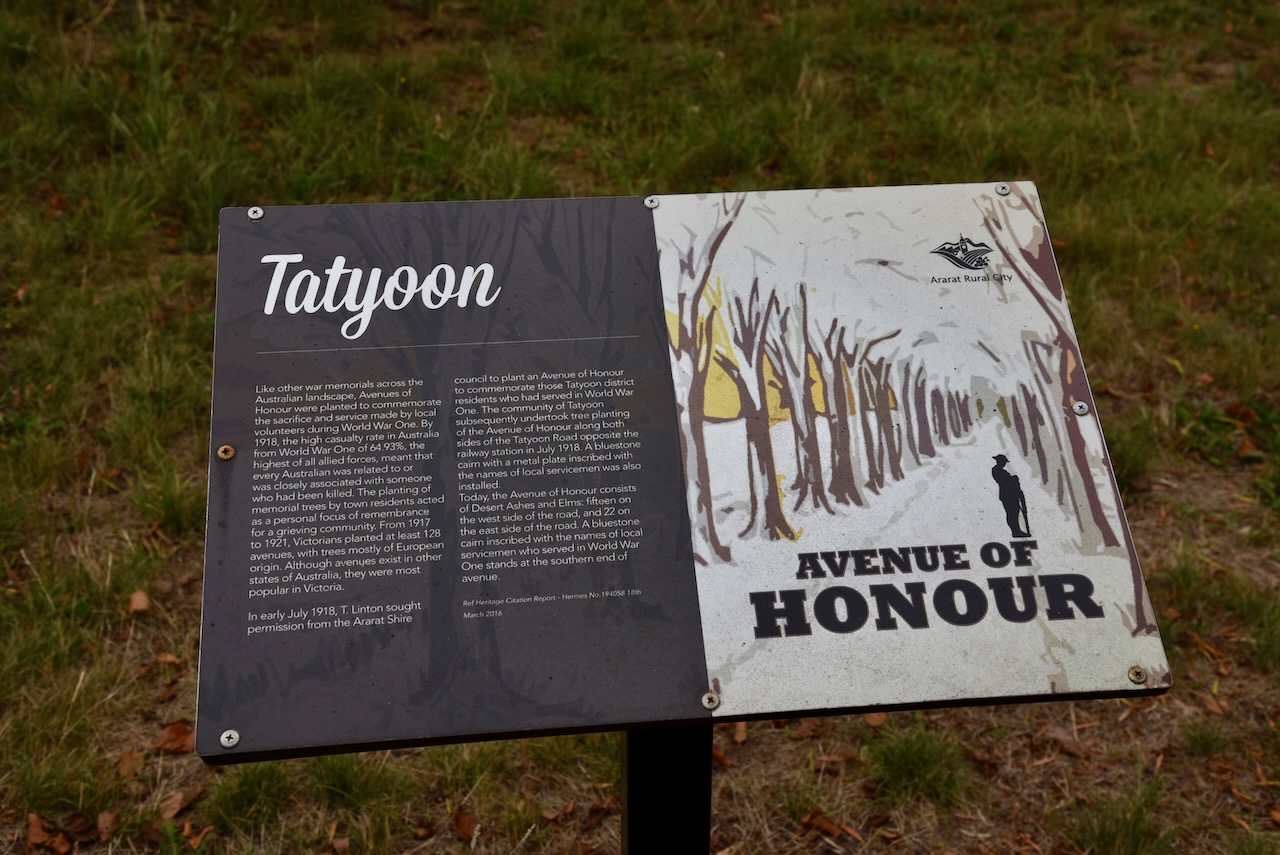
Tatyoon is located about 28 kilometres south of the town of Ararat, and about 180 kilometres northwest of the city of Melbourne. It is believed that Tatyoon is an aboriginal word describing water or a water catchment.
The first Tatyoon settlement was established near Fiery Creek and by 1872 contained a school, a Presbyterian church, and various other buildings.
In 1913 a railway reached Tatyoon. Tatyoon’s population increased following a Soldier Settlement scheme that was introduced following the Second World War.
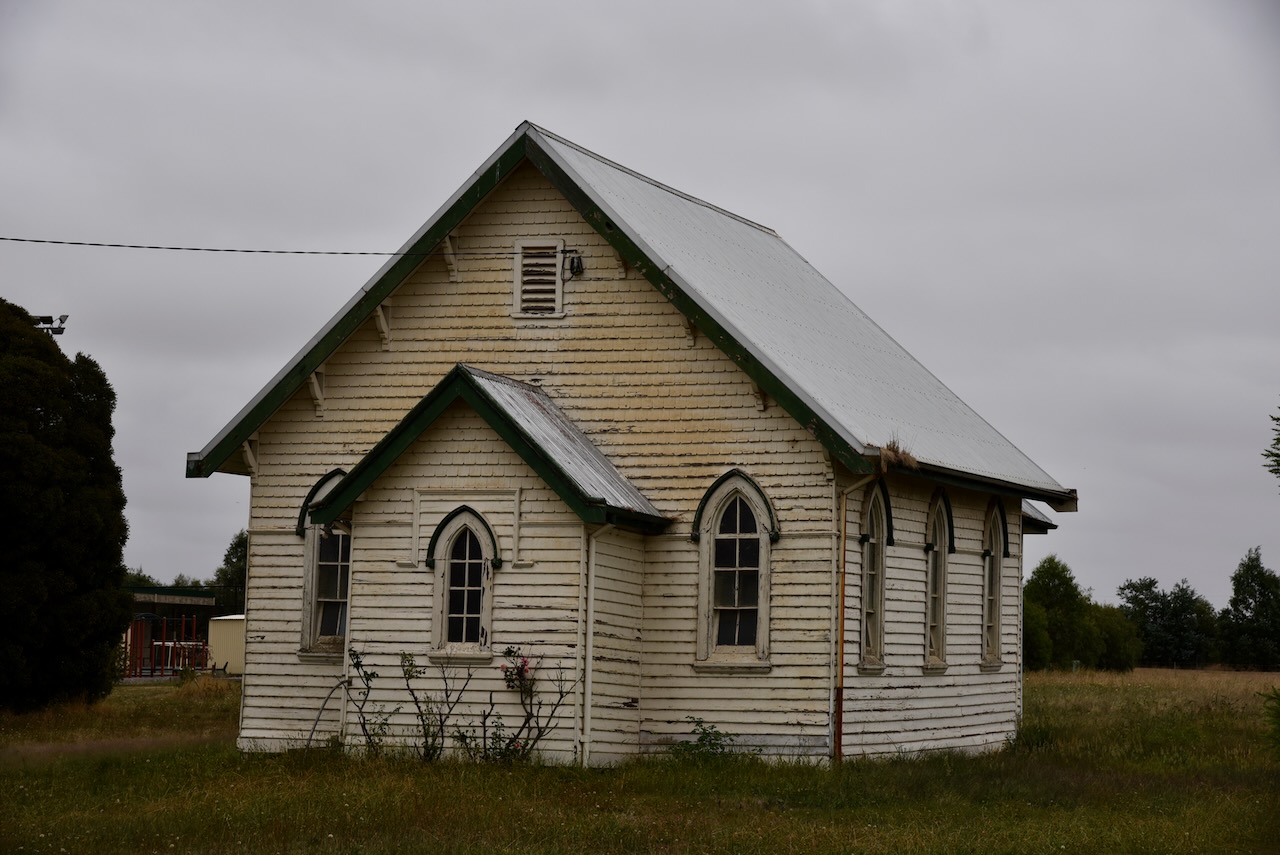
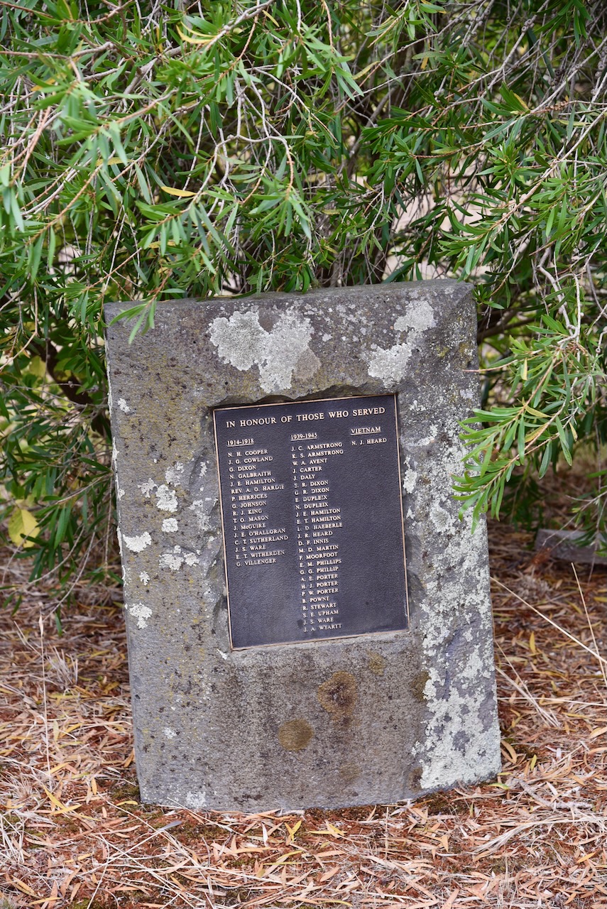
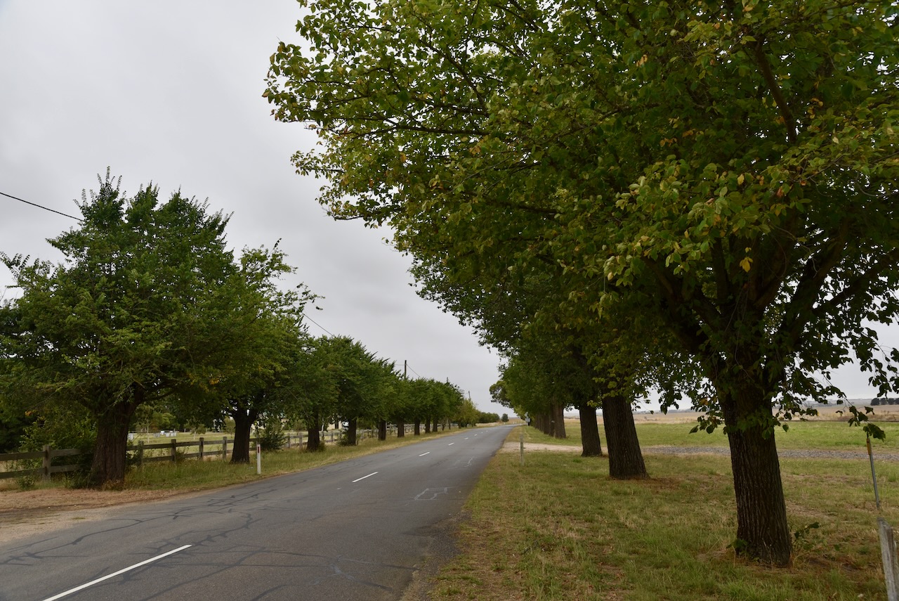
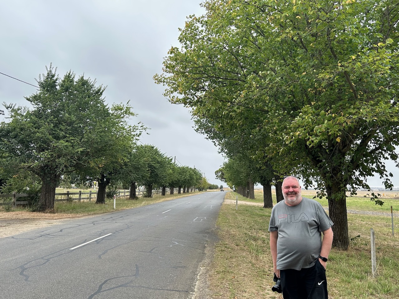
Nowadays, Tatyoon is a small settlement with a rural supplies store, an old church, and an oval. There is also an Avenue of Honour to honour those from Tatyoon who served in the First World War.
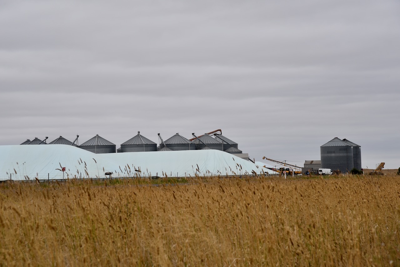
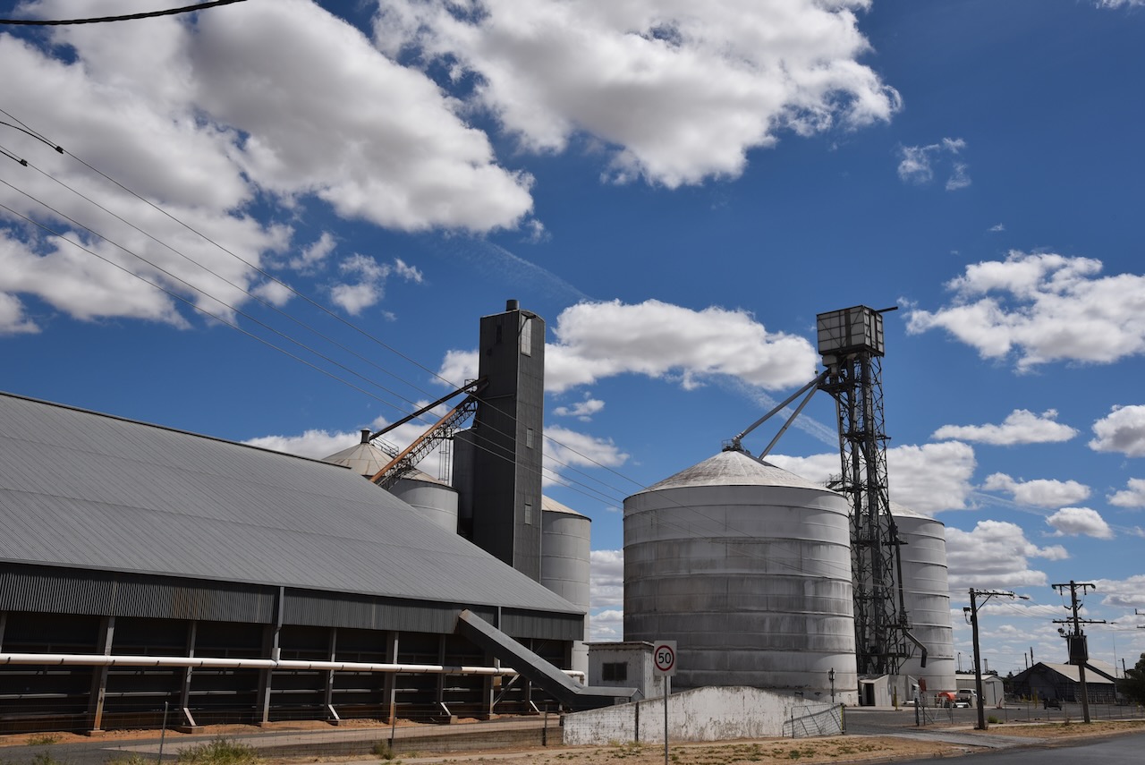
The silos at Tatyoon were constructed in the town adjacent to the railway station due to the expansion of wheat growing in the district.
We operated from the 4WD alongside the silos. We ran the Icom IC-7000, 100 watts, and the Codan 9350 antenna. We found the band conditions to be extremely poor. In fact some of the worst conditions that we have ever experienced whilst out in the field. We squeezed in 4 contacts each, qualifying the silo, before we headed off for another activation.
Marija worked the following station on 40m SSB:-
Marija worked the following station on 80m SSB:-
Marija worked the following stations on 20m SSB:-
I worked the following station on 40m SSB:-
I worked the following station on 80m SSB:-
I worked the following stations on 20m SSB:-
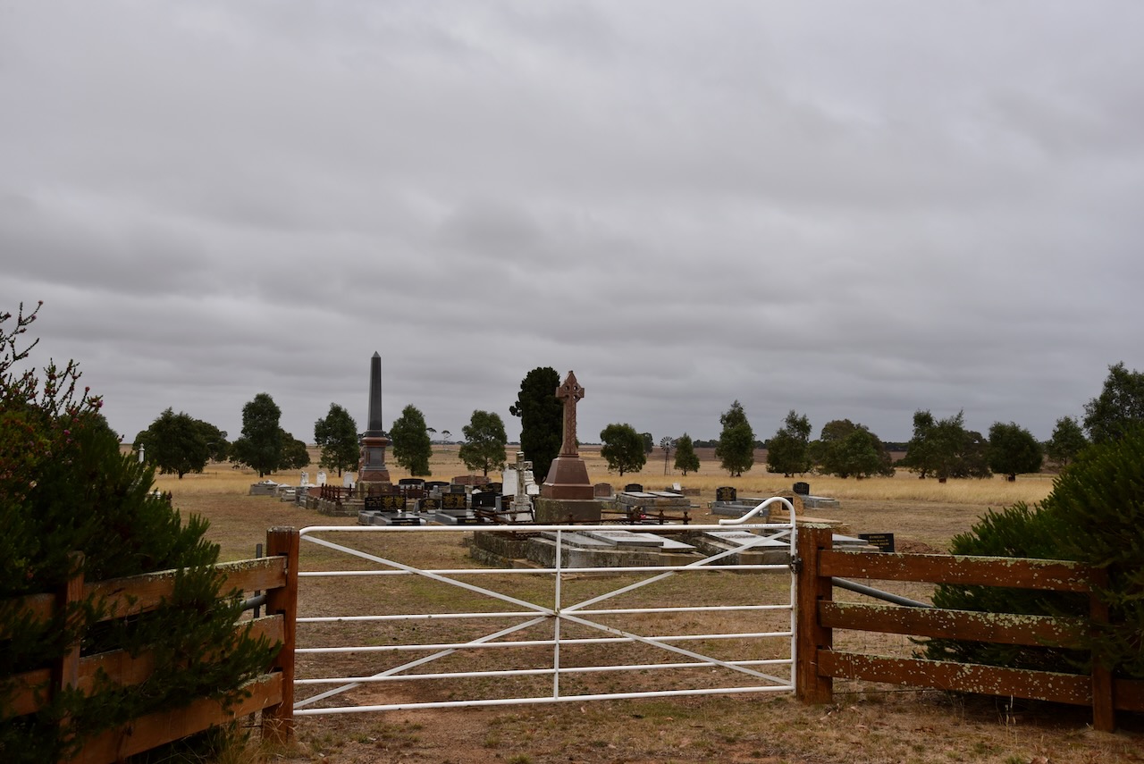
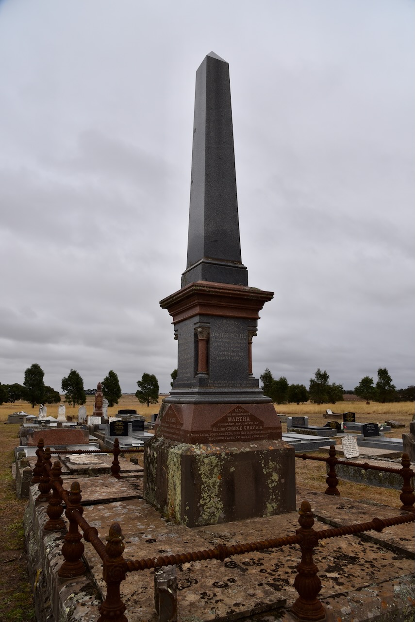
Marija and I then briefly visited the Tayoon cemetery where many of the pioneers of the district are buried.
References.
It was now Tuesday 28th February 2023, and we would be leaving Stawell and heading to Geelong. Along the way we planned on activating a number of parks for the World Wide Flora Fauna (WWFF) program and silos for the Silos On The Air (SiOTA) program.
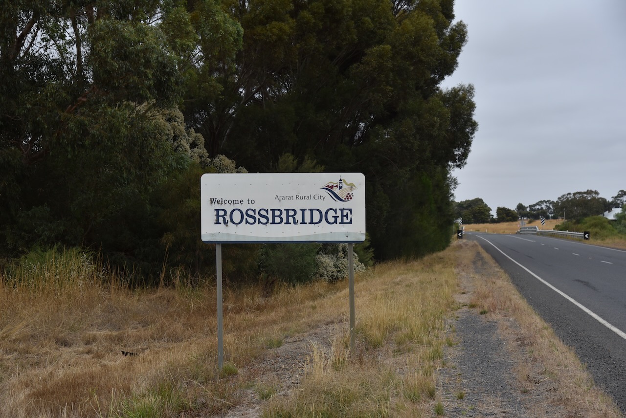
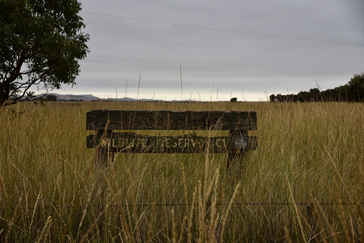
After having breakfast in Stawell, Marija and I travelled to the Rossbridge Wildlife Reserve VKFF-2429
Above:- Map showing the location of Rossbridge. Map c/o Google maps.
The town of Rossbridge was established on the Ararat to coast Road during the 1860s. It was named after Ross’s Bridge at the crossing of the Hopkins River. The bridge was named after John Ross, the selector of the Mount William Plains 20,000-acre pastoral run.
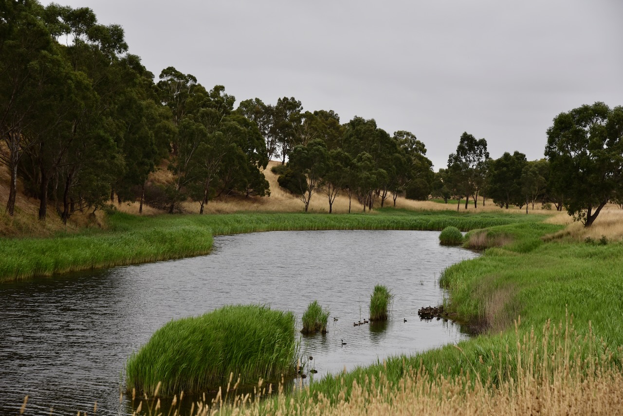
The Hopkins River is a perennial river of the Glenelg Hopkins catchment which rises below Telegraph Hill near Ararat and flows south for 271 km and is joined by twelve tributaries. This includes Mount Emu Creek. The Hopkins River eventually joins its mouth and empties into Bass Strait at Warnambool.
A church, a school and numerous residences had been established at Rossbridge by the 1870s. The Rossbridge Post office opened on the 21st day of November 1873. It closed in March 1962.

Above:- the township of Rossbridge. Image c/o Trove.
On the 9th day of February 1863, a tragedy struck the Rossbridge area when four children died after the shepherd’s hut they were sleeping in caught fire. The children john aged 9, William aged 6, Elizabeth aged 4, and Michael aged 2, were the children of Michael Murphy and Catherine Murphy nee Toland. They were buried on the bank of Hopkins River at what was then Gledefield Station. There is a memorial on private property on the Mortlake-Ararat Road. The actual burial site remained unmarked for many years until a landowner became aware of the death of the children and erected a fence around the site. The Ararat Historical Society subsequently erected a plaque.
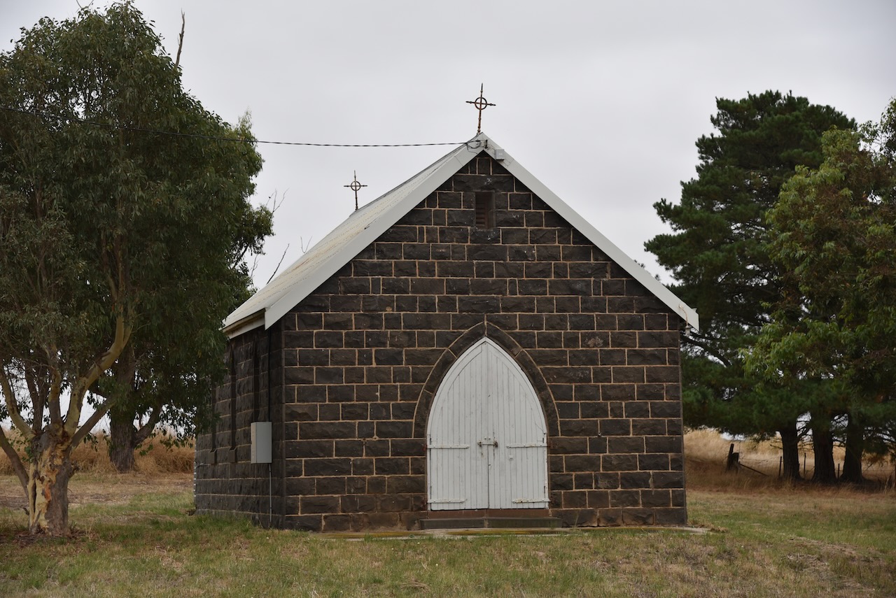
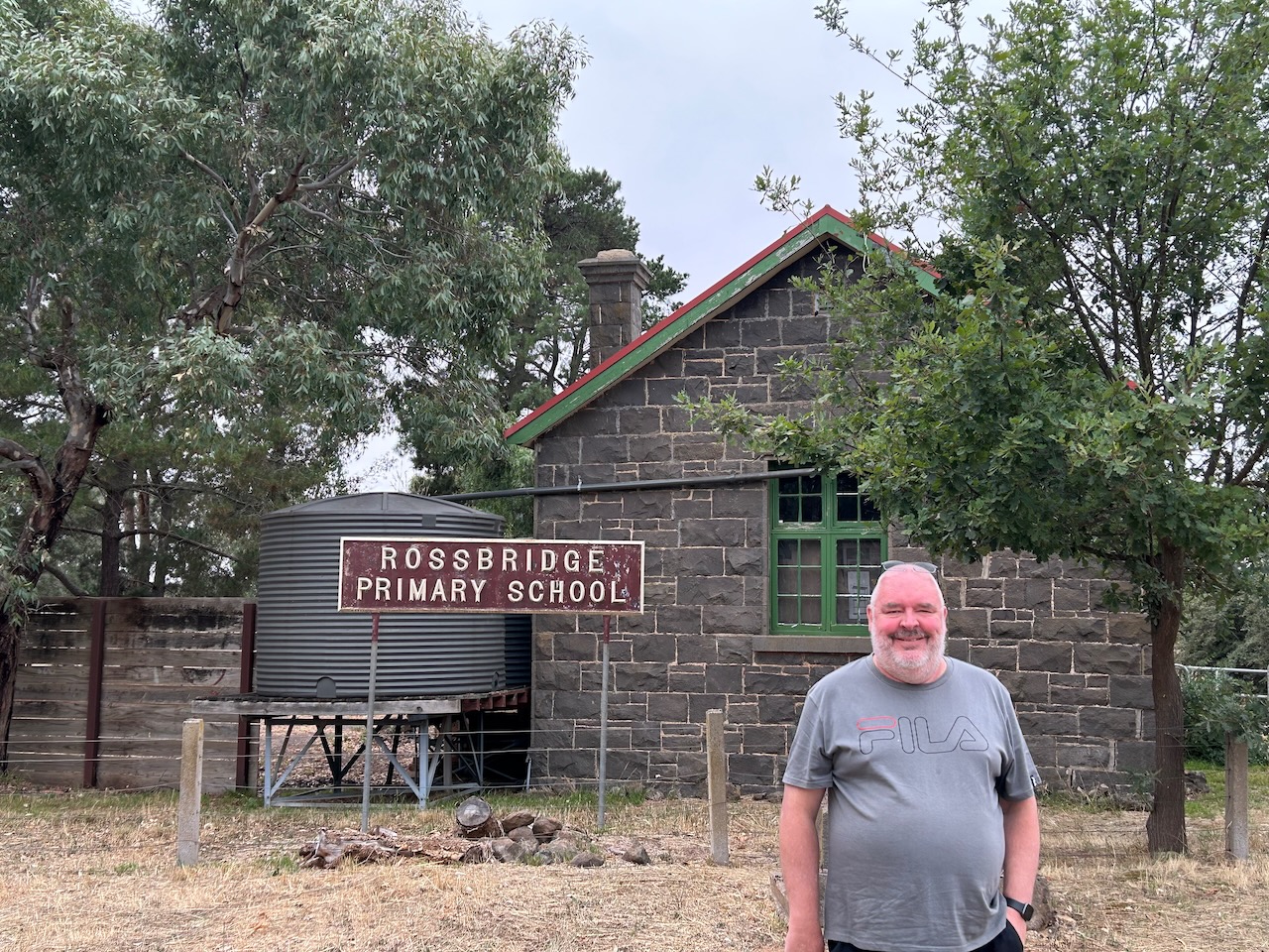
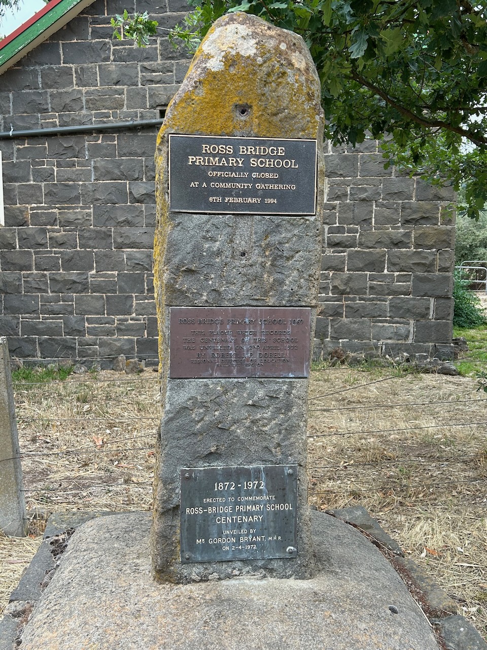
The old Rossbridge school and church remain today. The school is a private residence.
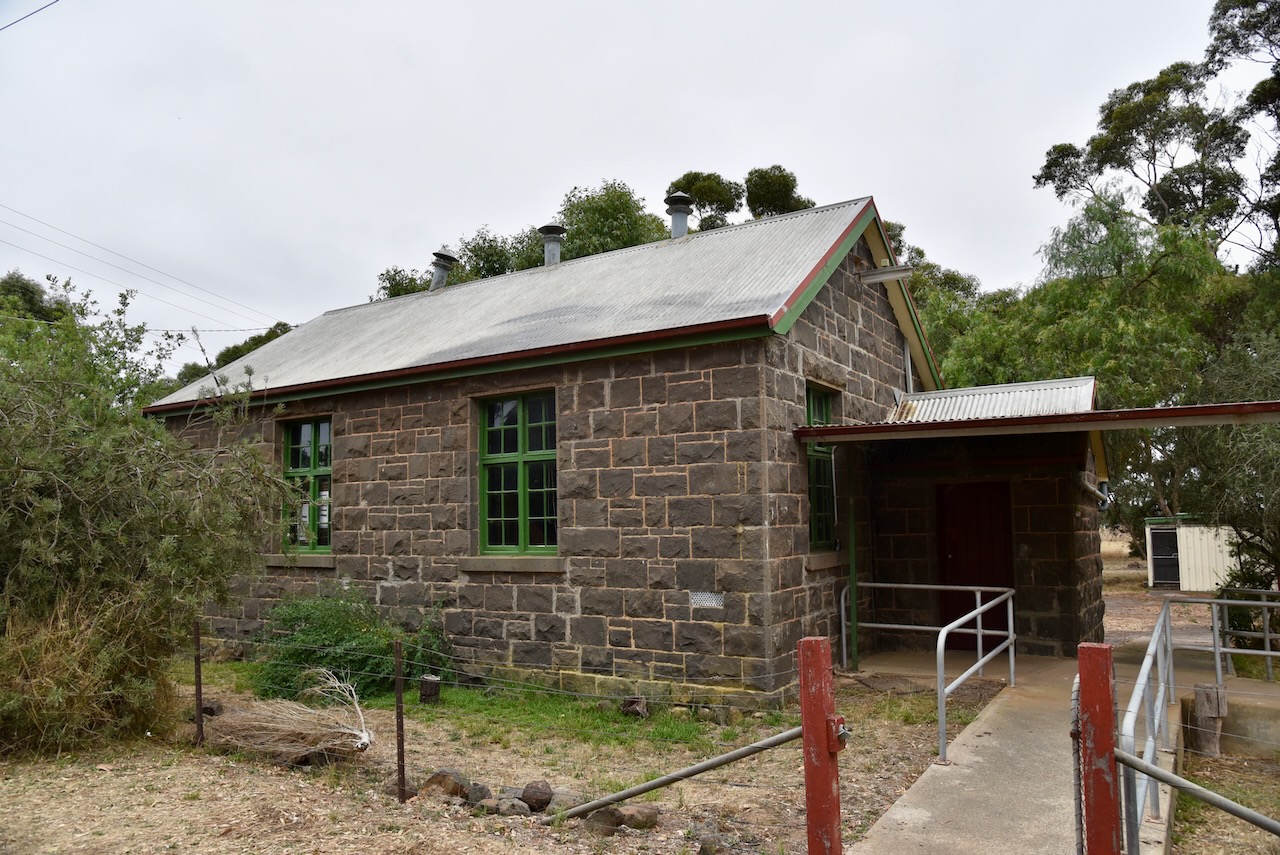
The Rossbridge Wildlife Reserve is about 148 acres in size. It is located on the northern side of Grange Road. Its northern boundary abuts the Hopkins River.
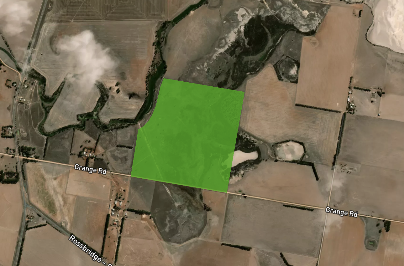
Above:- An aerial shot showing the Rossbridge Wildlife Reserve. Map c/o Protected Planet
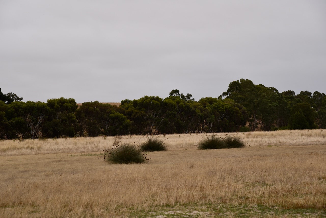
There is a park sign, but it is in poor condition and could be easily missed. The park is generally grassland with some low-lying trees.
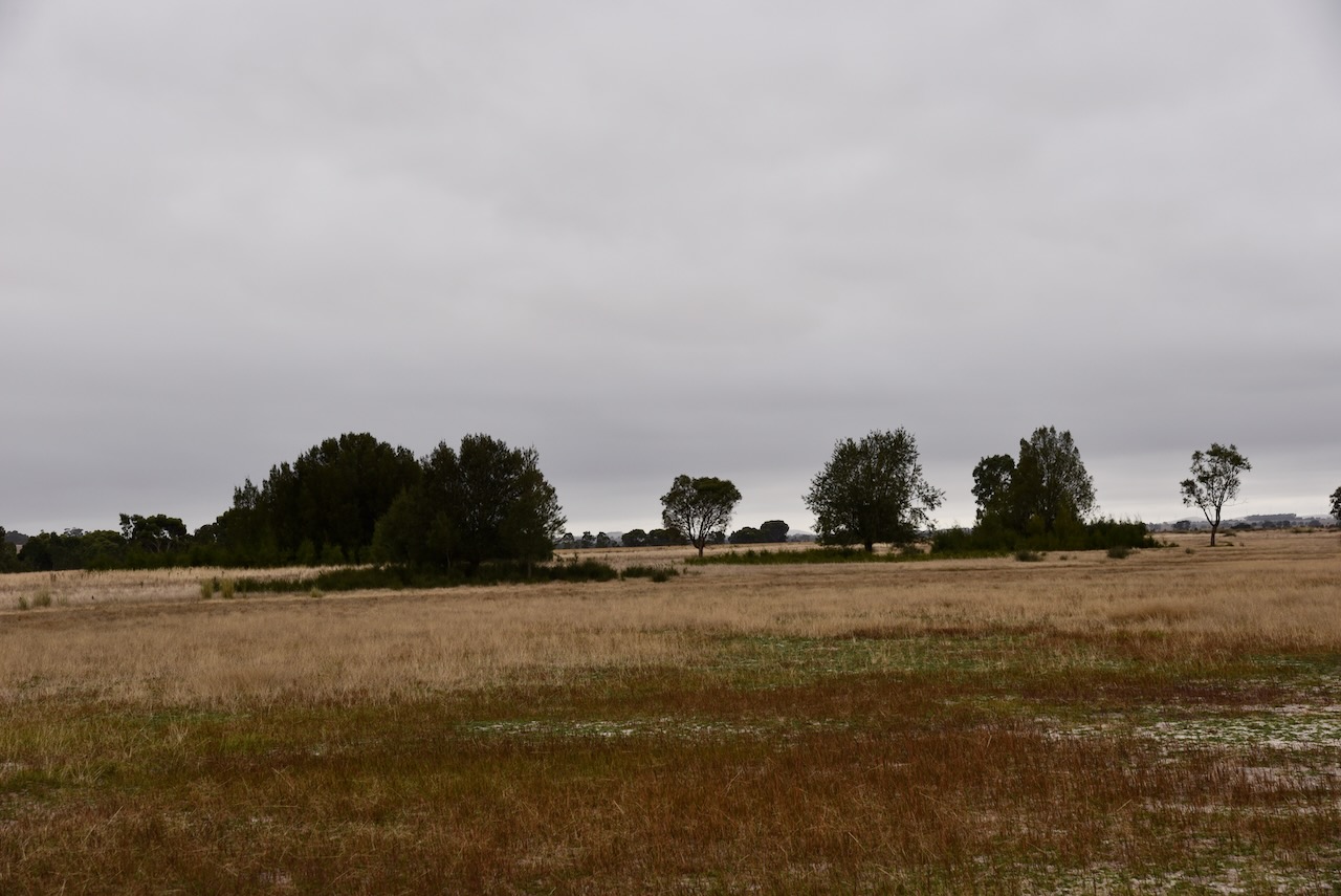
Marija and I found an open gate and a track at the southwestern corner of the park. We drove along the track and set up the 20/40/80m linked dipole. It was an overcast and chilly morning, so we operated from inside the 4WD.
We found band conditions to be very poor, although we both managed to get 10 QSOs to qualify the park for the VKFF program.
Marija worked the following stations on 40m SSB:-
I worked the following stations on 40m SSB:-
I worked the following stations on 80m SSB:-
I worked the following stations on 20m SSB:-
References.
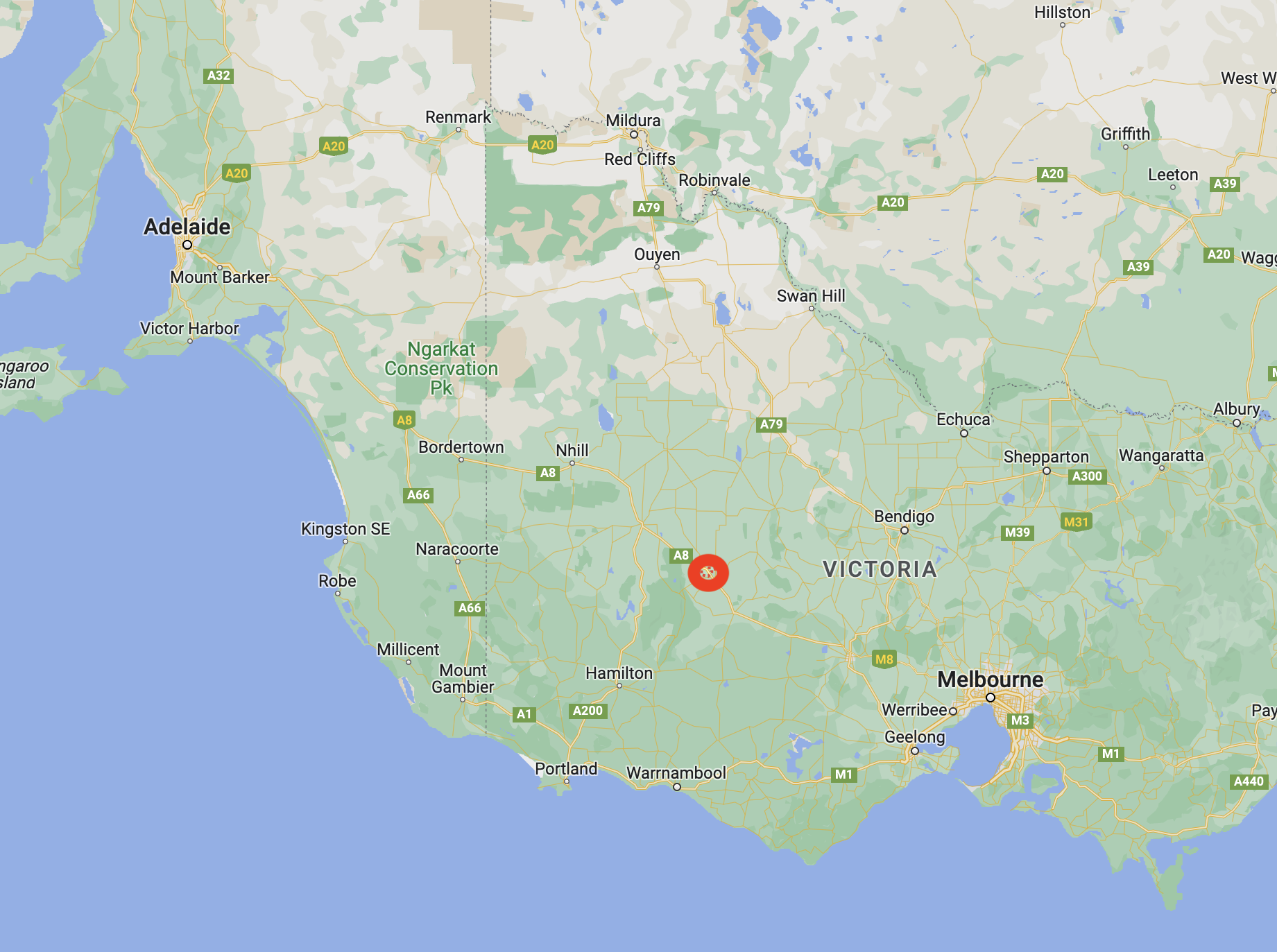
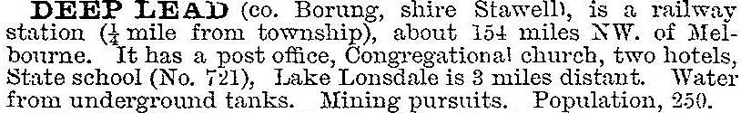
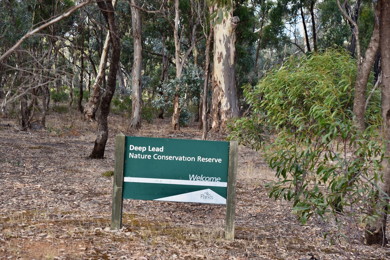
Our next stop on Monday 27th February 2023, was the Deep Lead Nature Conservation Reserve (NCR) VKFF-2078, which is located about 8 kilometres northwest of the town of Stawell in western Victoria.
Above:- Map showing the location of the Deep Lead NCR. Map c/o Google maps.
In July 1857, gold was discovered between Deep Lead and Stawell. Within a year of the discovery, mining was located almost the distance between Deep Lead and Stawell. ‘Deep Lead’ described the run of gold gravel which was uncovered at great depth that ran normally north-south. At the time it was one of Victoria’s richest alluvial gold fields.
By 1858 Deep Lead had a population of about 12,000 people and it appeared to be the likely administrative centre for the district, above Stawell. By 1860 the majority of gold had been removed from the area and a community of Chinese gold fossickers remained in the area. The Junction Hotel was run by one of the Chinese miners.
In 1857 the Deep Lead schools were opened. In 1858 Catholic and Presbyterian churches were opened. In 1862 a Common School was built. In 1861 the Pleasant Creek Hospital was opened. By 1878 the railway had reached Deep Lead. Between 1921 to the 1940s a eucalyptus distillery ran at Deep Lead.

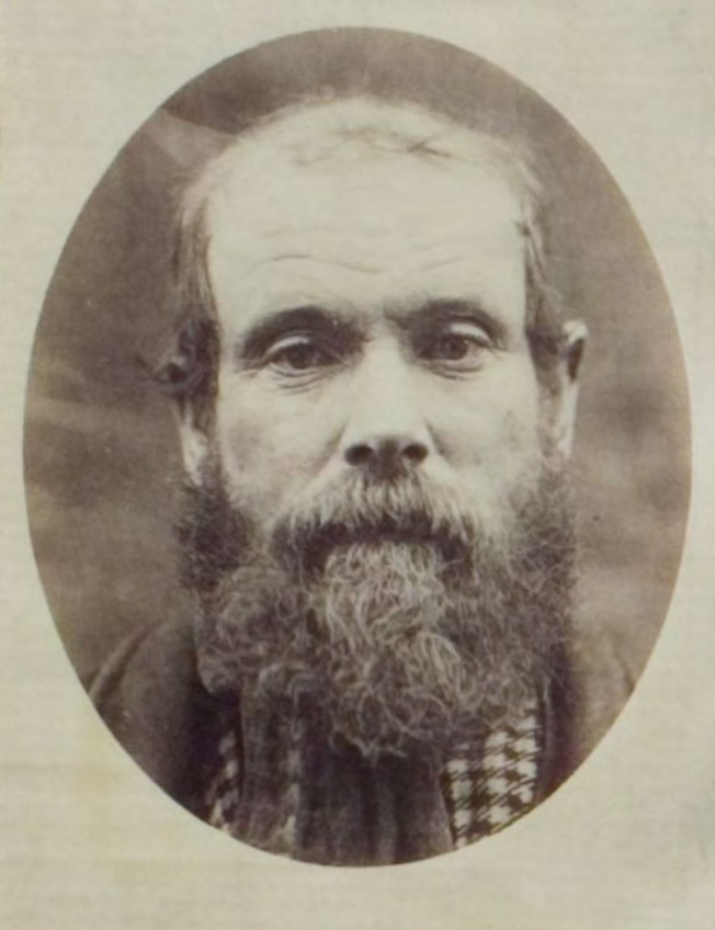
Above:- A miner at Deep Lead. Image c/o https://victoriancollections.net.au/items/6052a342c9704ed38a6f7d7e
Deep Lead was described in the 1903 Australian handbook as follows:
Deep Lead does have some infamy attached to it. It is the story of Robert Francis Burns (b. 1840. d. 1883) who was a convicted murderer and probable serial killer.
On the 17th day of January 1882, a miner came across the headless naked corpse at Deep Lead. Police subsequently determined that the head of the victim had been severed by ‘some sharp instrument’. A few months later in April 1882, the Police identified the victim as being Charles Forbes aka Scotty or Charley, and that he had last been seen in company with Robert Francis Burns.
On the 12th day of April 1882, Burns was arrested by Police at Rupanyup near Stawell. On the 28th day of April 1882, Burns was charged in the Stawell police court with the murder of Charles Forbes on or about the 19th day of December 1991. He appeared in court the following day where there was legal argument that the police had failed to prove that Forbes was dead and that ‘he might turn up at any day to confound the police’.
Leading up to the Burns’ trial, the Police undertook extensive enquiries regarding Charles Forbes, particularly if he was still alive. His details were published in various police and government gazetted throughout Australia and New Zealand.
A police officer from the town of Murtoa, Mounted Constable Mullaney was tasked with visiting various settlements in Victoria with printed notices containing a photograph and description of Forbes. Constable Hilliard who was stationed t Deep Lead was dispatched on various trips as far afield as Hobart and New Zealand to make enquiries to locate Forbes. Detective Forster also carried out enquiries in South Australia and other colonies.

Above:- Article from NSW Govt Gazette, Fri 16 Jun 1882. Image c/o Trove.
Burns’ murder trial was held between the 16th and 18th day of August 1882 in the Central Criminal Court, Melbourne, before Justice Williams. A total of 45 witnesses gave evidence, but the identity of the murder victim was never proved beyond doubt and Burns was acquitted. If today’s DNA technology existed back in 1882, the result would most likely have been very different.
Upon leaving the court, Burns was arrested for another murder, that of Michael Quinlivan. Police commenced enquiries into other deaths which were suspected to be connected to Burns.
Burns was held in the Hamilton gaol on remand. He was described by the warders as volatile and savage. During his last three months imprisoned, he barely slept at night with “his rest being broken by most hideous roars and cries”. The police barracks were just a few hundred metres from the gaol and they were “nightly disturbed by his roaring’.
He was subsequently convicted of the murder of Quinlivan and was sentenced to death. He was held at the Ararat Gaol. A Roman Catholic priest, Father Meade was “in constant attendance on him” and efforts were made to elicit a confession from him. This was to no avail and he was described as being “callously indifferent to all the entreaties”.
Burns was hung at the Ararat Gaol on Tuesday the 25th day of September 1883. It was reported that Burns claimed to the hangman, Elijah Upjohn, that he had murdered a total of eight people – five in Victoria, and three in New South Wales. Burns was alleged to have said: “I have cooked eight, five in Victoria and three in Sydney, and now you are going to cook me”.
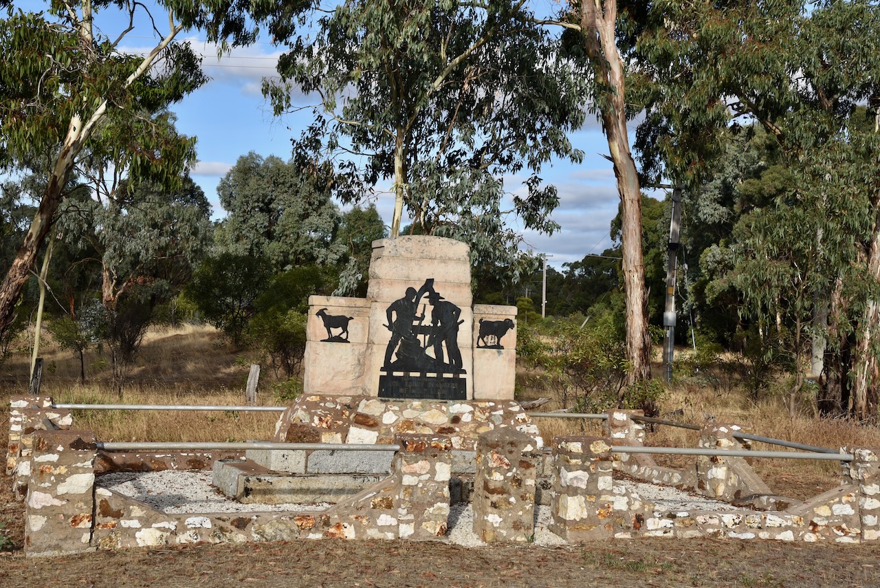
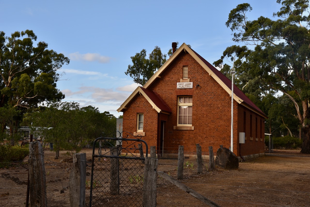
Very little remains of Deep Lead today. There is the Deep Lead Hall and a memorial to the early pioneers of the district.
The Deep Lead Nature Conservation Parks consists of two distinct parks, No. 1 and No. 2. The Deep Lead NCR No. 2 has three separate sections. One is located on either side of Deep Lead Road, another on either side of Deap Lead Park Road, and the third on the southern side of Germania Mine Road.
Above:- Map showing the location of Deep Lead No. 2 NCR. Map c/o Protected Planet.
The park provides a habitat for a variety of native birds and mammals, including some endangered species including the Swift parrot and the squirrel glider. The park contains about 350 species of native plants, including several species of rare ground orchids. The park was first established in 1982 when 2,800 acres were set aside. In 2002 a further 1,855 acres were added to the park.
The absolute highlight of this activation was being called by Tom KH9/NL7RR on Wake Island. Yes he called us. We couldn’t believe it. Wake Island is listed as the 33rd most-wanted DXCC entity in the world.
Marija worked the following stations on 40m SSB:-
I worked the following stations on 40m SSB:-
I worked the following stations on 20m SSB:-
I worked the following stations on 80m SSB:-
With a total of 65 QSOs in the log, Marija and I packed up and headed to get a bite to eat and back to our accommodation in Stawell. We had one night in Stawell before heading off for Geelong.
References.
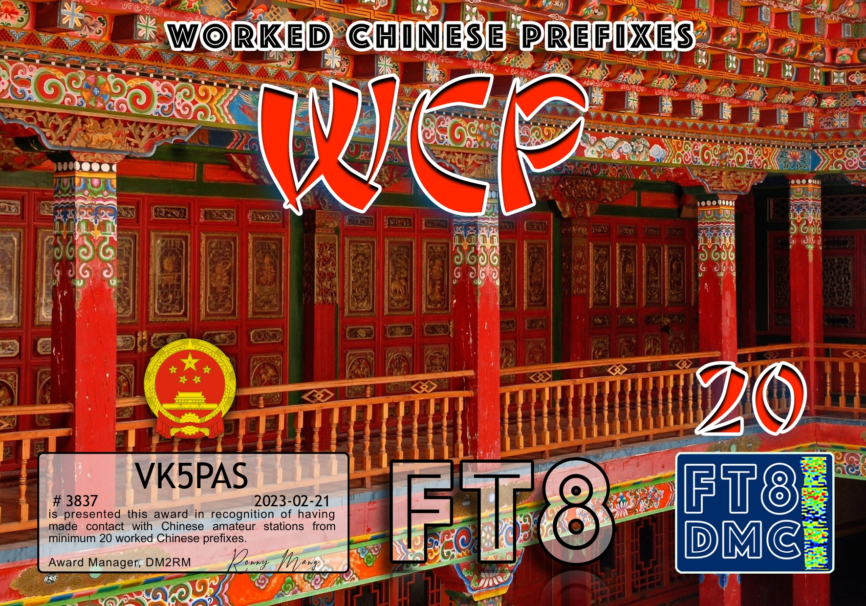
Here are my latest FT8 award certificates.


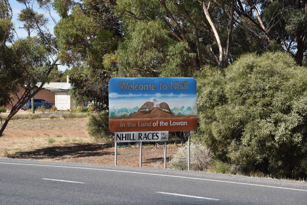
After leaving the Tarranginnie silo (27th February 2023), Marija and I drove a little further to the east to the town of Nhill. Nhill is located in the Wimmera region of Victoria, about 352 kilometres southeast of the city of Adelaide, and 340 kilometres northwest of the city of Melbourne.
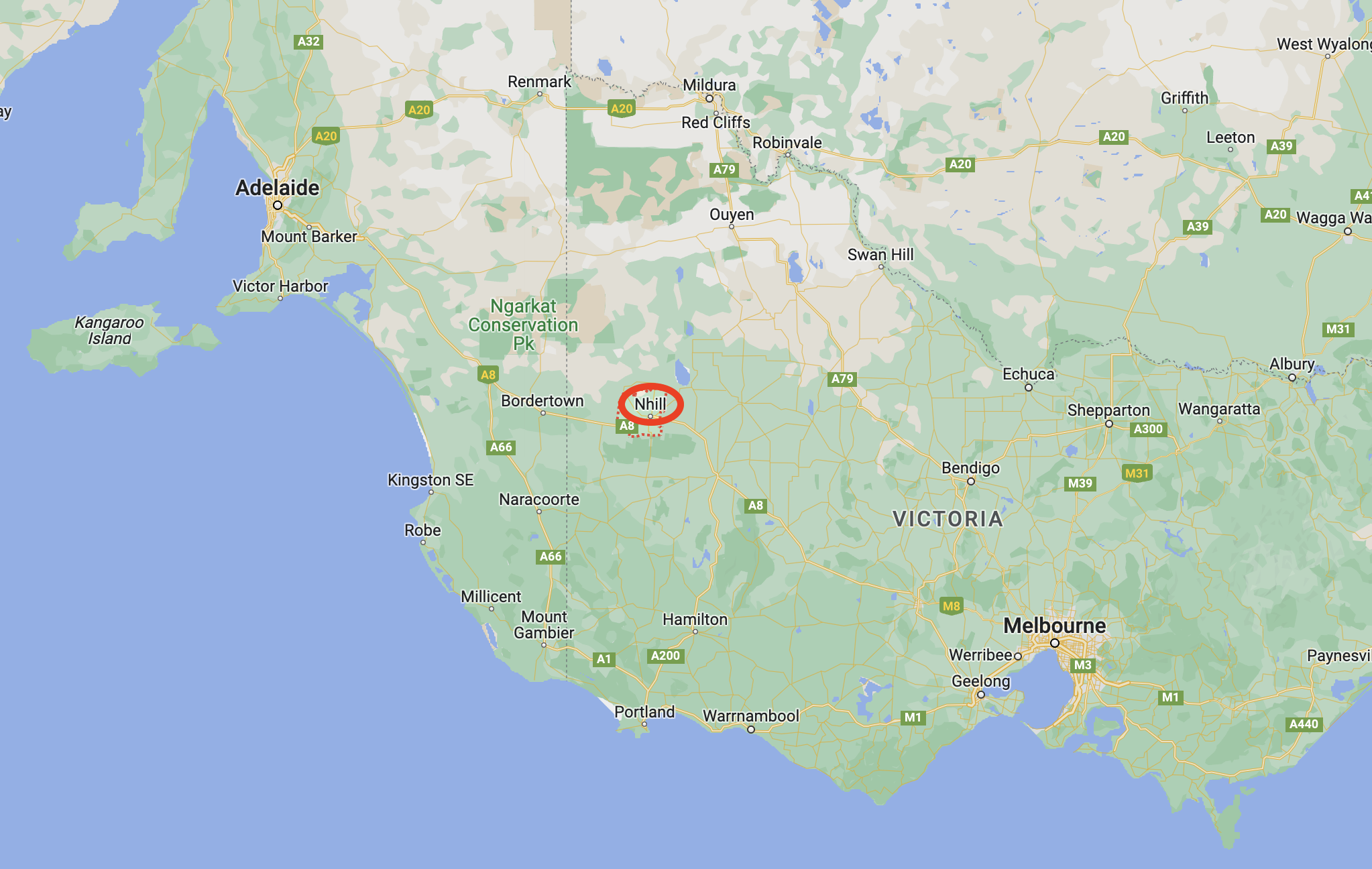
Above:- Map showing the location of Nhill. Map c/o Google maps.
The first known Europeans in the area were squatters George Belcher and Dugald Macpherson who arrived in the area in 1844/1845. They located a large swamp and lagoon. They spoke with the local Wotjobaluk aboriginal people who called the area Nyell which is believed to mean mist or spirits over water. Belcher and Macpherson called it Nhill swamp. Macpherson also named his pastoral run as Nhill.
During the 1850s the famous gold escort route between the Victorian goldfields and Adelaide passed within 6 kilometres of the homestead which became a postal receiving and dispatch location.
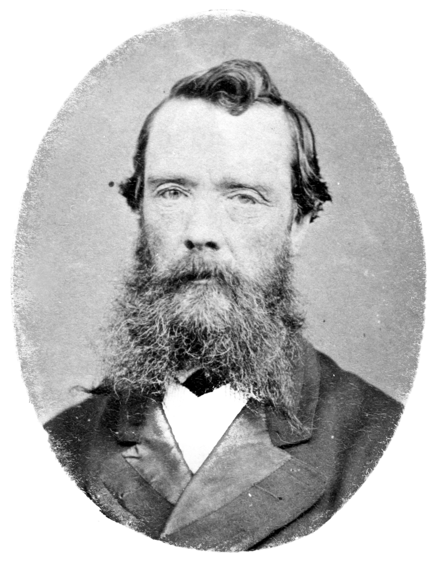
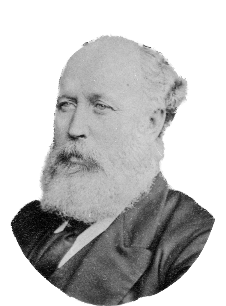
Above:- George Belcher and Dugald Macpherson. Images c/o Wikipedia.
From around 1875, other settlers arrived in the district and commenced to select their freehold farm selections. Following the town survey, a flour mill and a store were built in 1880. By 1881, the town had a police station, a Wesleyan church and two further hotels. This was followed by the opening of a school in a Bible Christian church, a hospital in 1882, a racing club in 1883, and an agricultural and pastoral society in 1884.
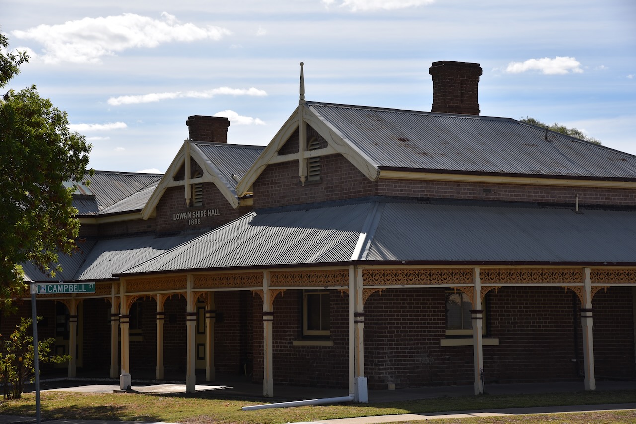
By 1886 the railway had reached Nhill following the introduction of the Victorian ‘Octopus Act’. This was a bill that authorised the construction of 59 new railway lines to connect all of the major towns in Victoria. As a result, there was substantial development in the town. In 1888 the Lowan Shire Hall was built and in 1889 a large flour mill was opened.
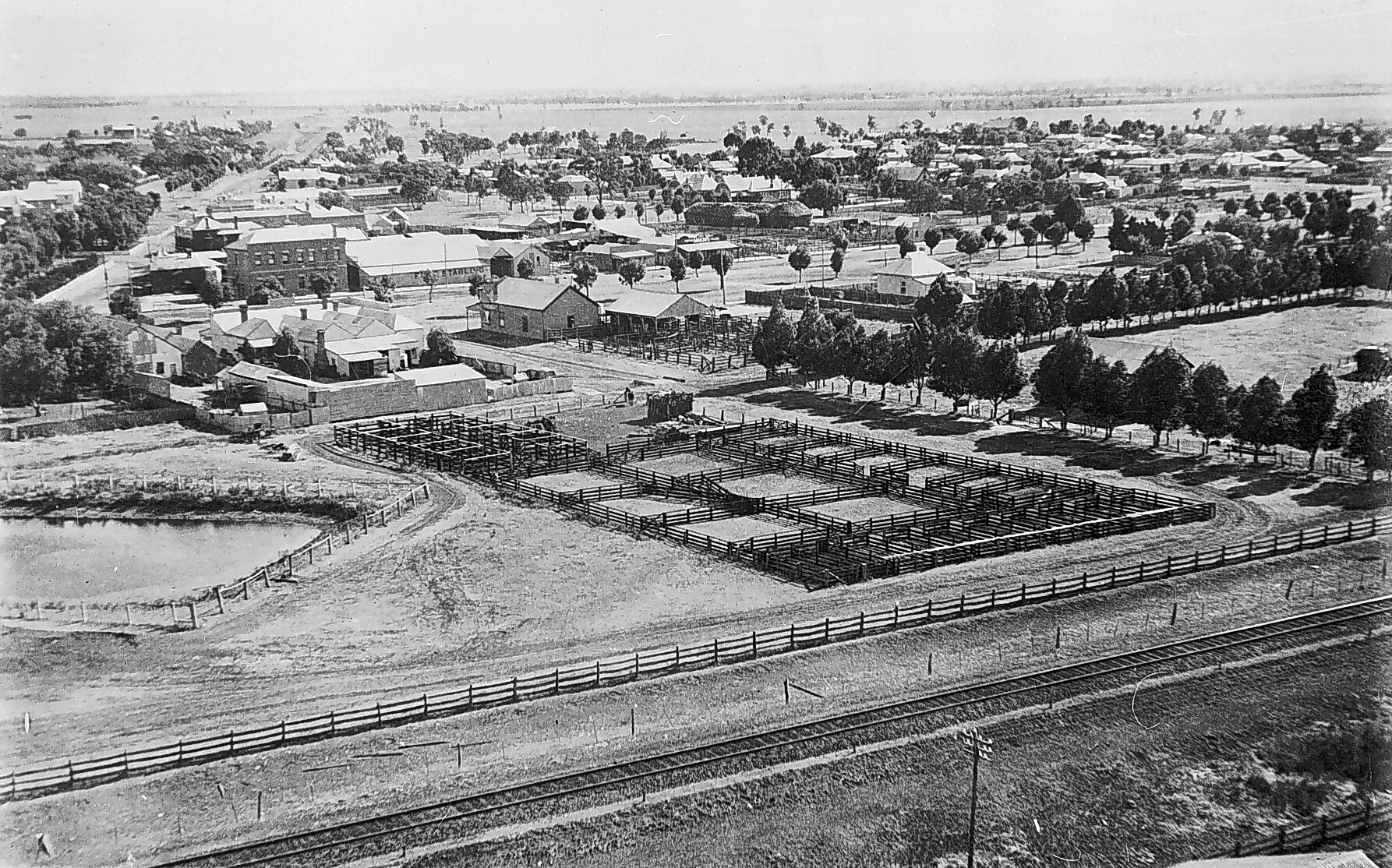
Above:- a view of Nhill in 1920 from the top of the Noske flour silo. Image c/o State Library Victoria.
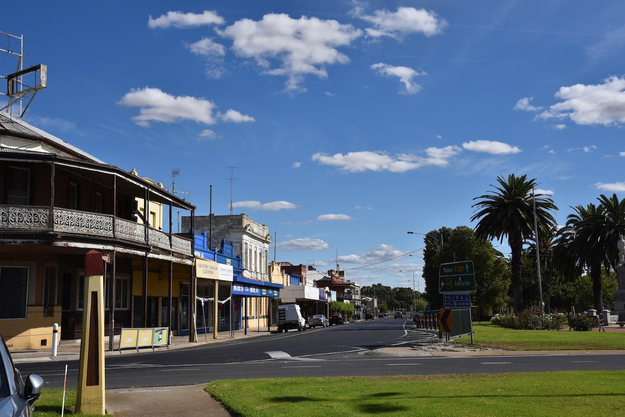
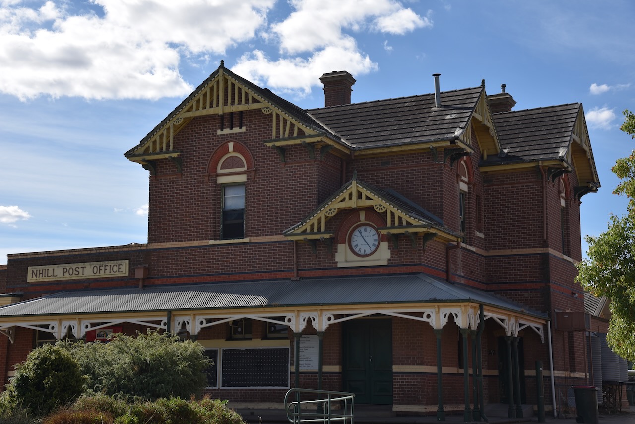
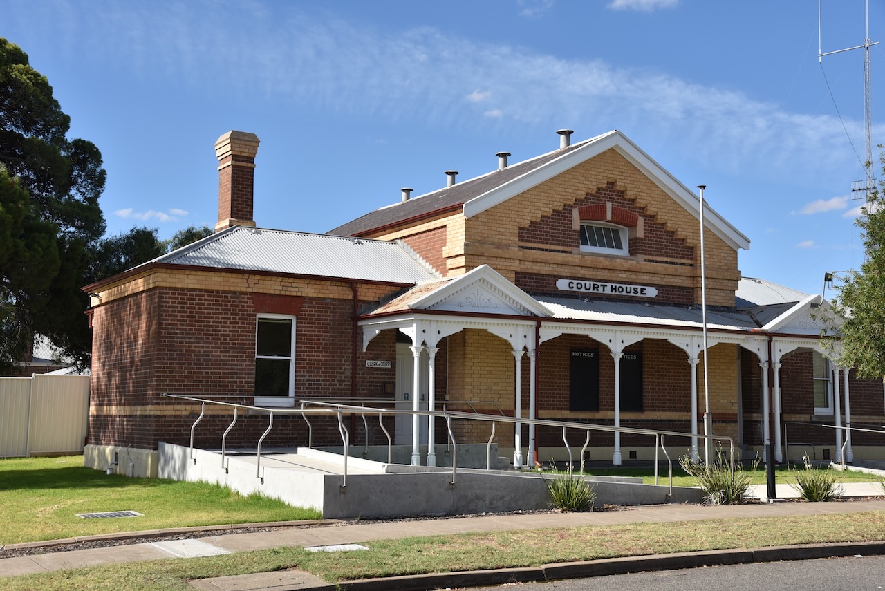
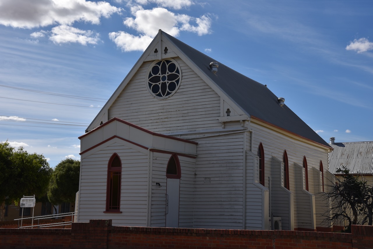
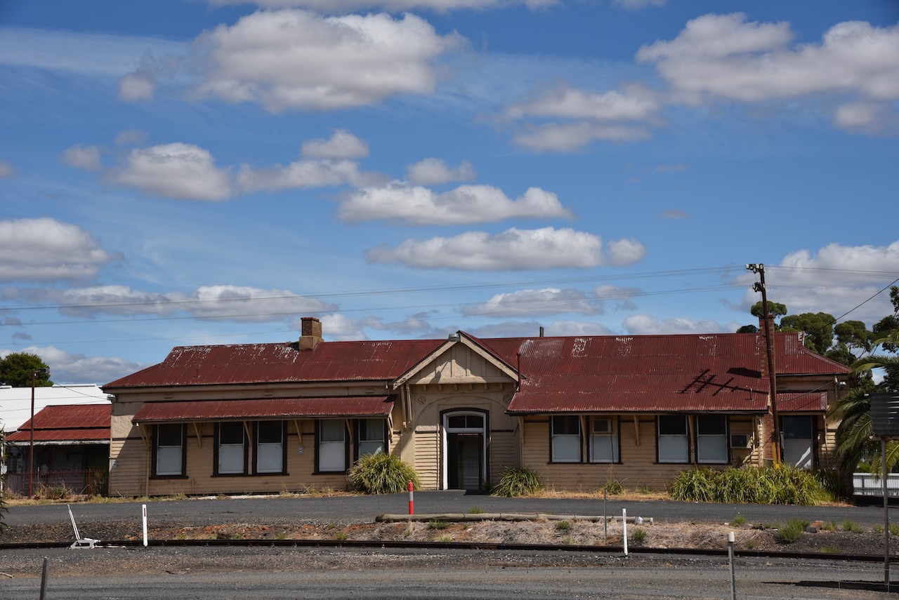
A walk around Nhill will reveal many of the historic buildings.
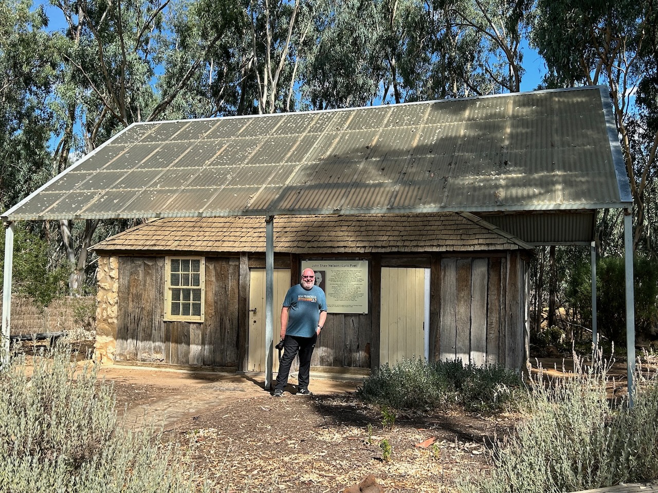
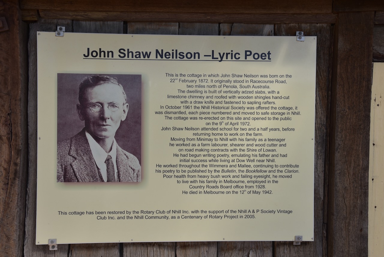
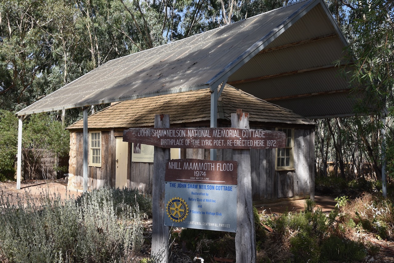
Nhill is the birthplace of one of Australia’s most admired Lyric Poet, John Shaw Neilson. His cottage in which he was born on the 22nd day of February 1872, can be found in the town. It was originally located on Racecourse Road but was relocated and restored by the Rotary Club of Nhill. In October 1961 the cottage was offered to the Nhill Historical Society and it was dismantled, with each piece being numbered and then moved to safe storage in Nhill. It was then re-erected and opened to the public on the 9th day of April 1972. It can be found at the Nhill Jaypex Public Park on the Western Highway.
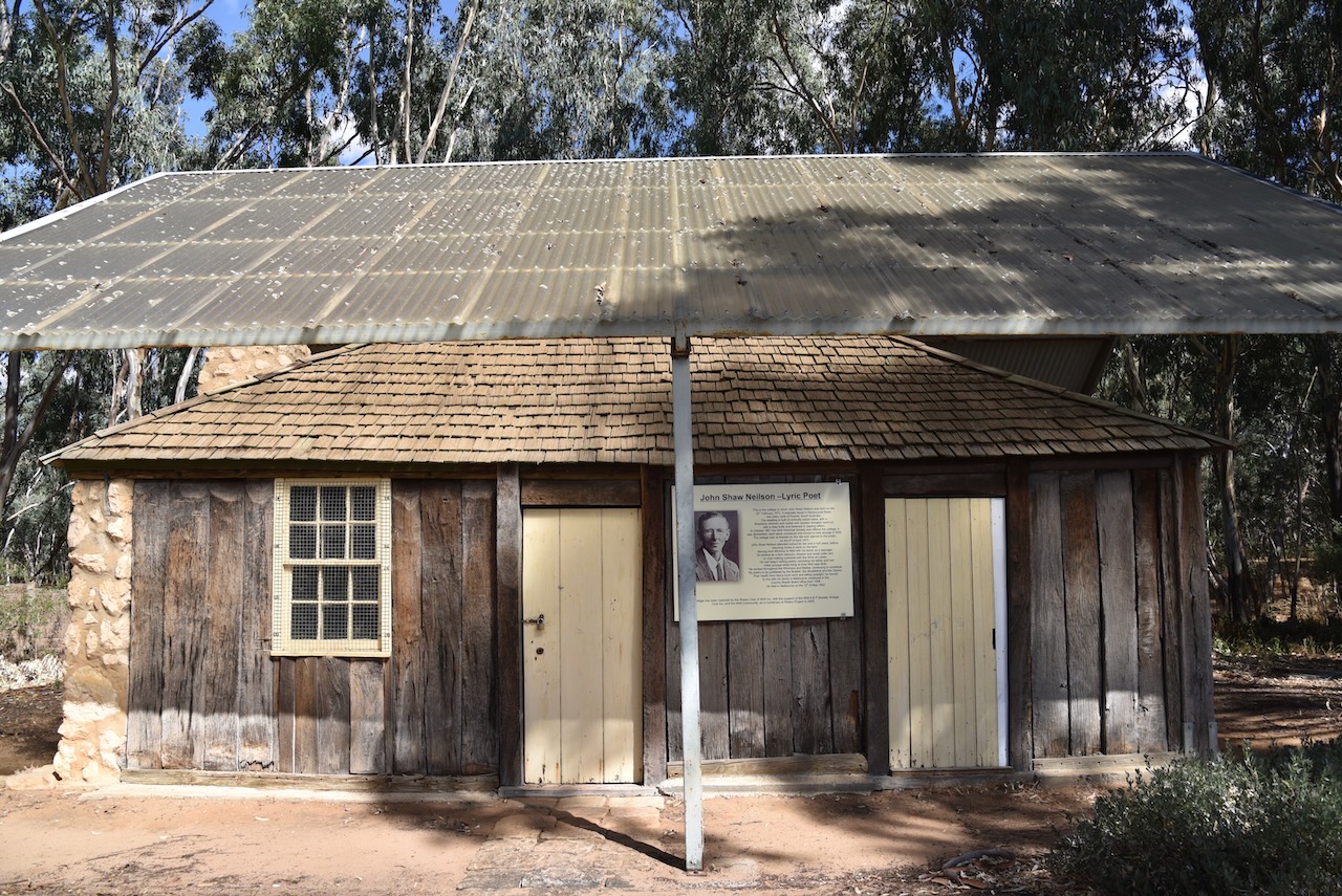
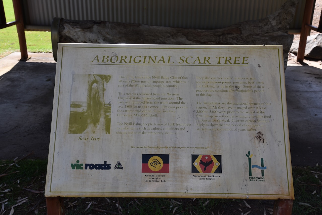
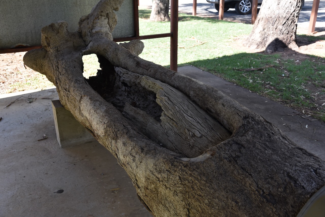
Also at the park, you can find an aboriginal scar tree. It was removed from the Western Highway at the Jeparit Road junction. It is believed the bark was removed from the tree trunk in about 1800 for use as a canoe. This was prior to the earliest European exploration of the area by Major Mitchell.
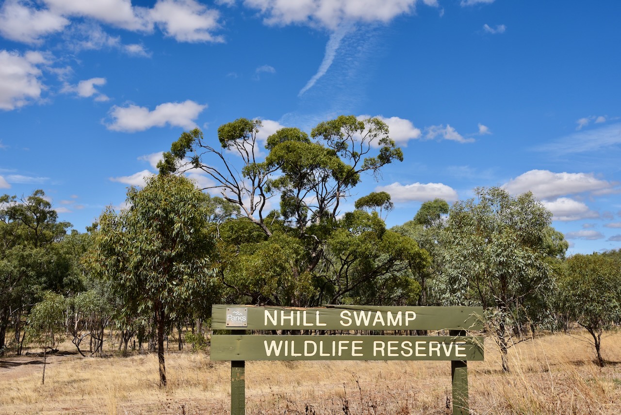
Marija and I decided to do a joint park and silo activation at Nhill. The northern section of the Nhill Swamp Wildlife Reserve VKFF-2412 is within the activation zone for the silo.
The Nhill Swamp Wildlife Reserve is 160 acres in size and is located on the southern side of the Western Highway, just beyond the Jaypex Public Park, and on the eastern side of the Nhill-Harrow Road.
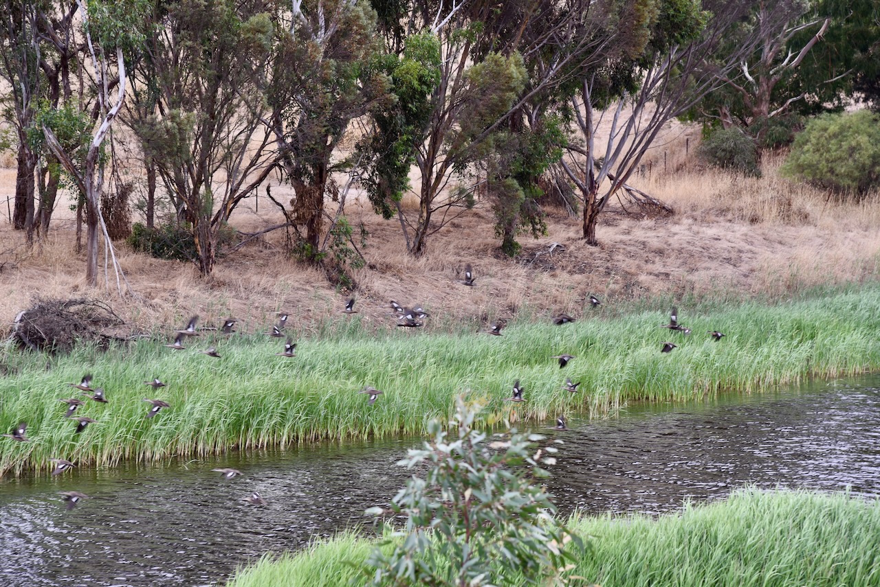
There is an excellent boardwalk that crosses the swamp and a birdhide.
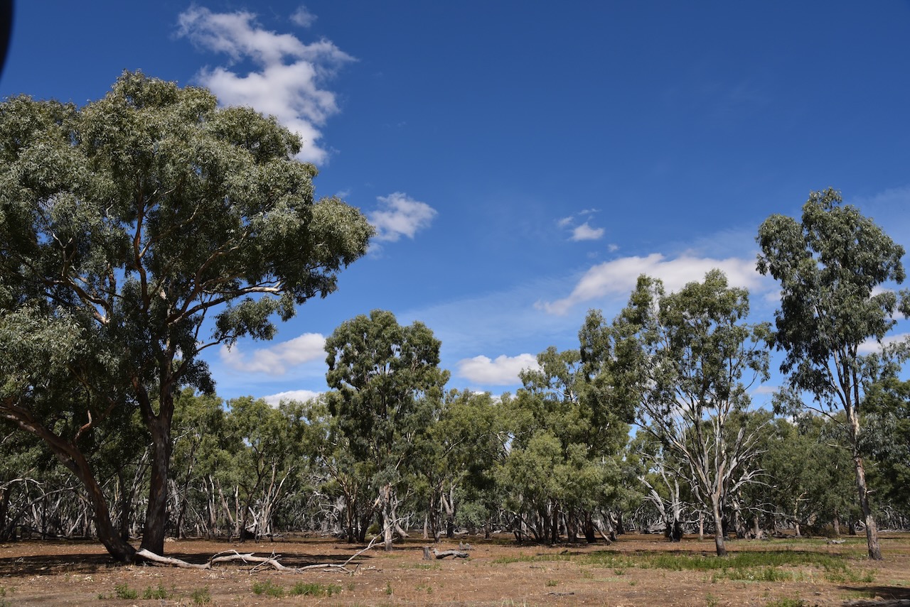
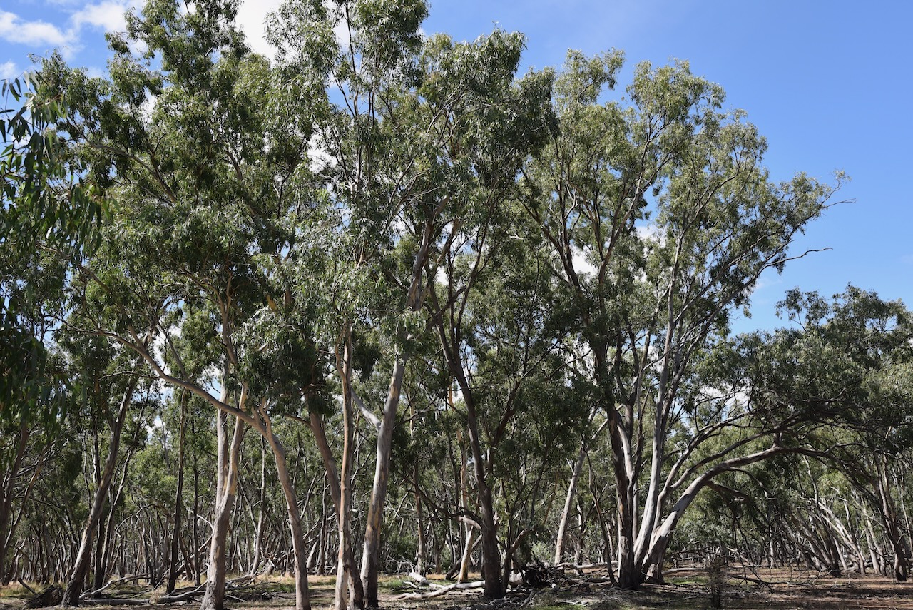
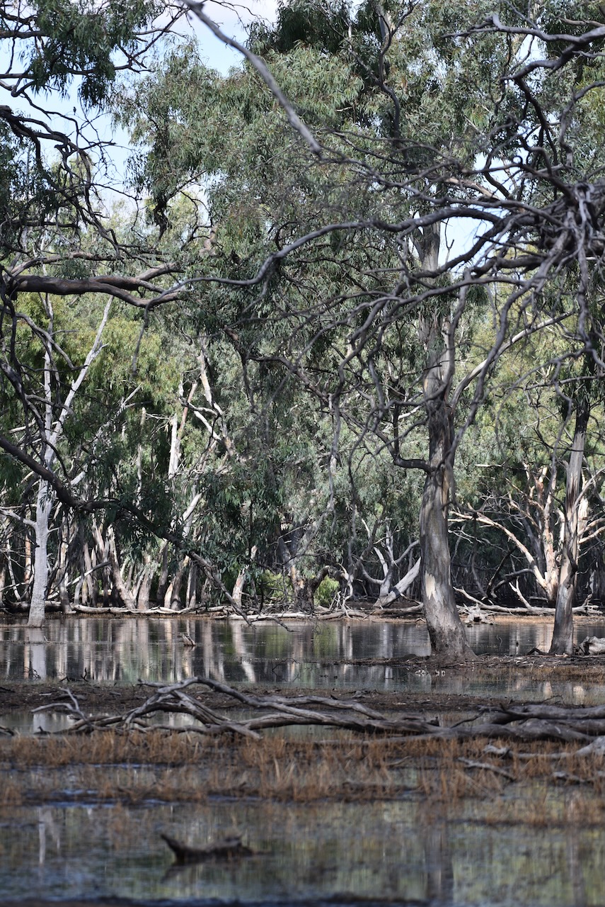
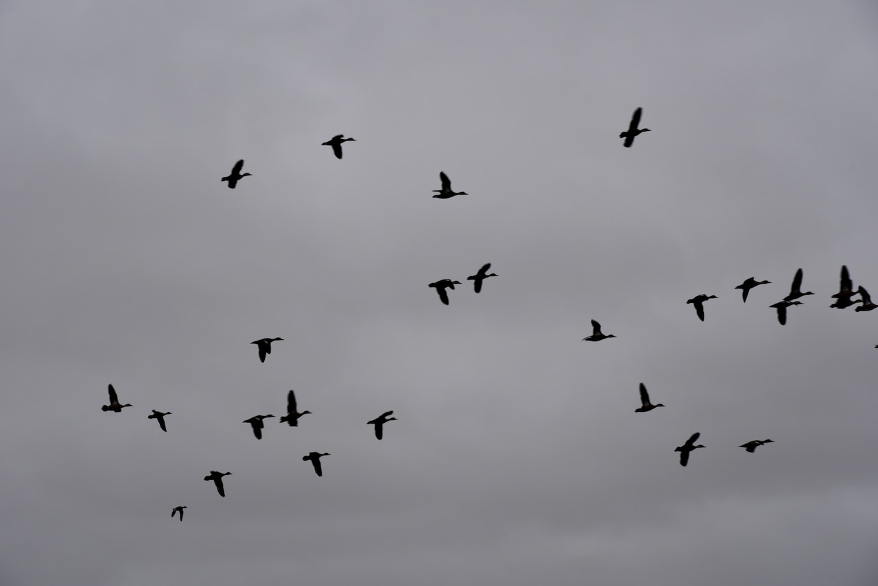
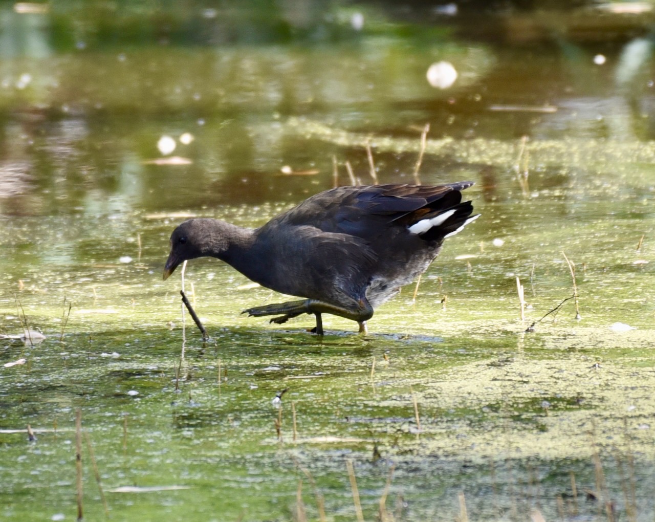
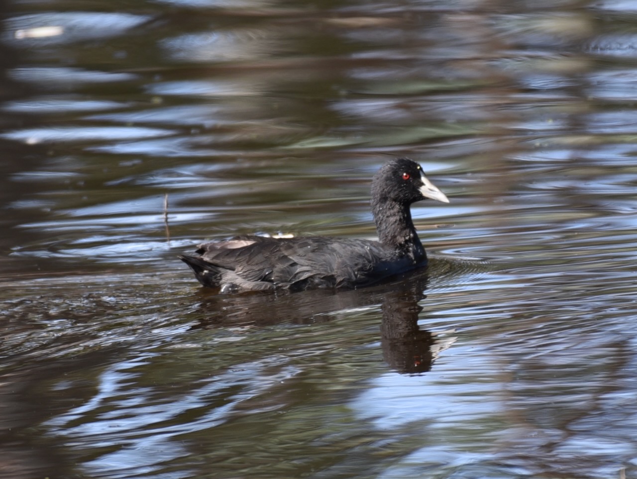
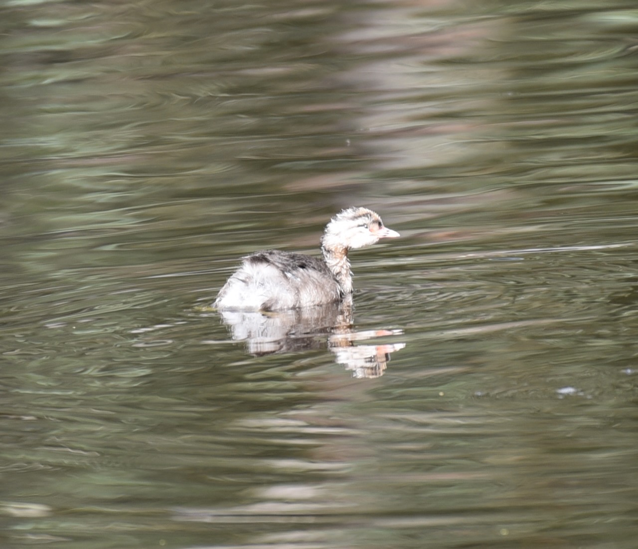
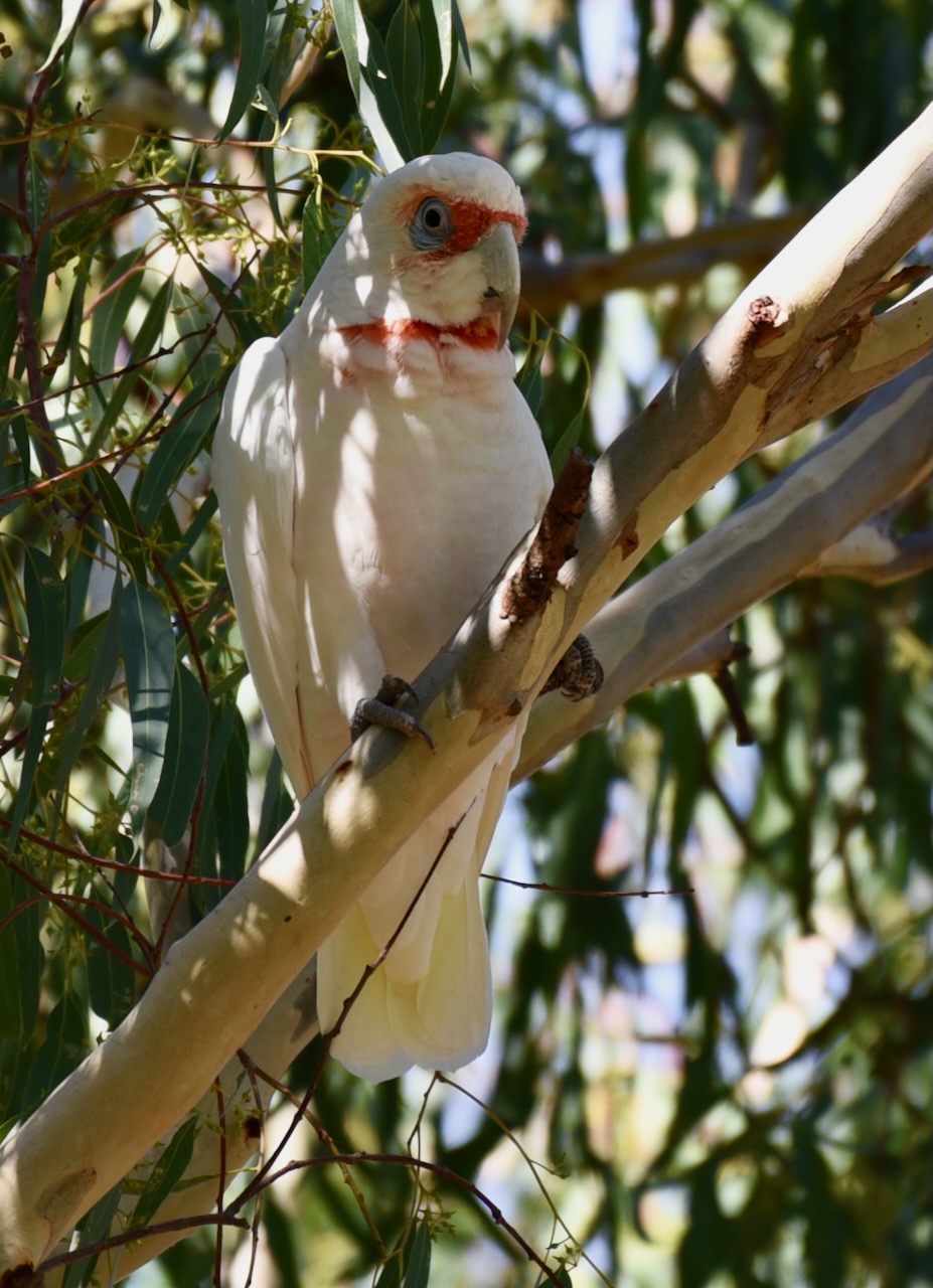
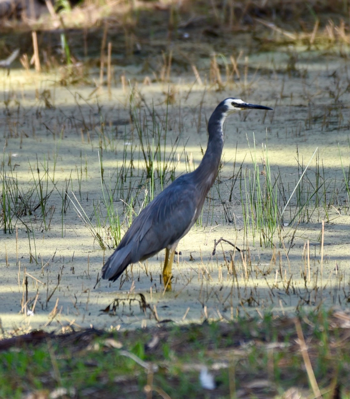
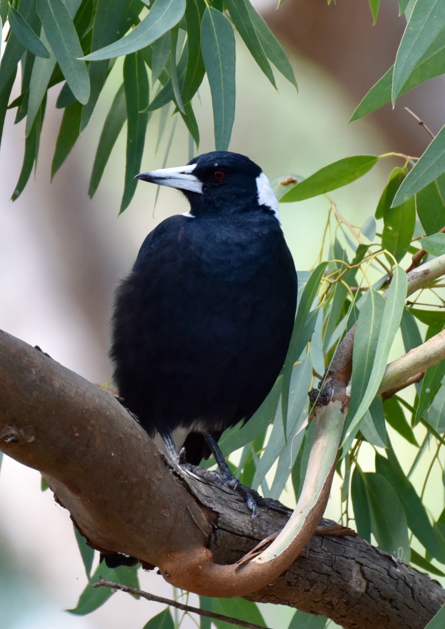
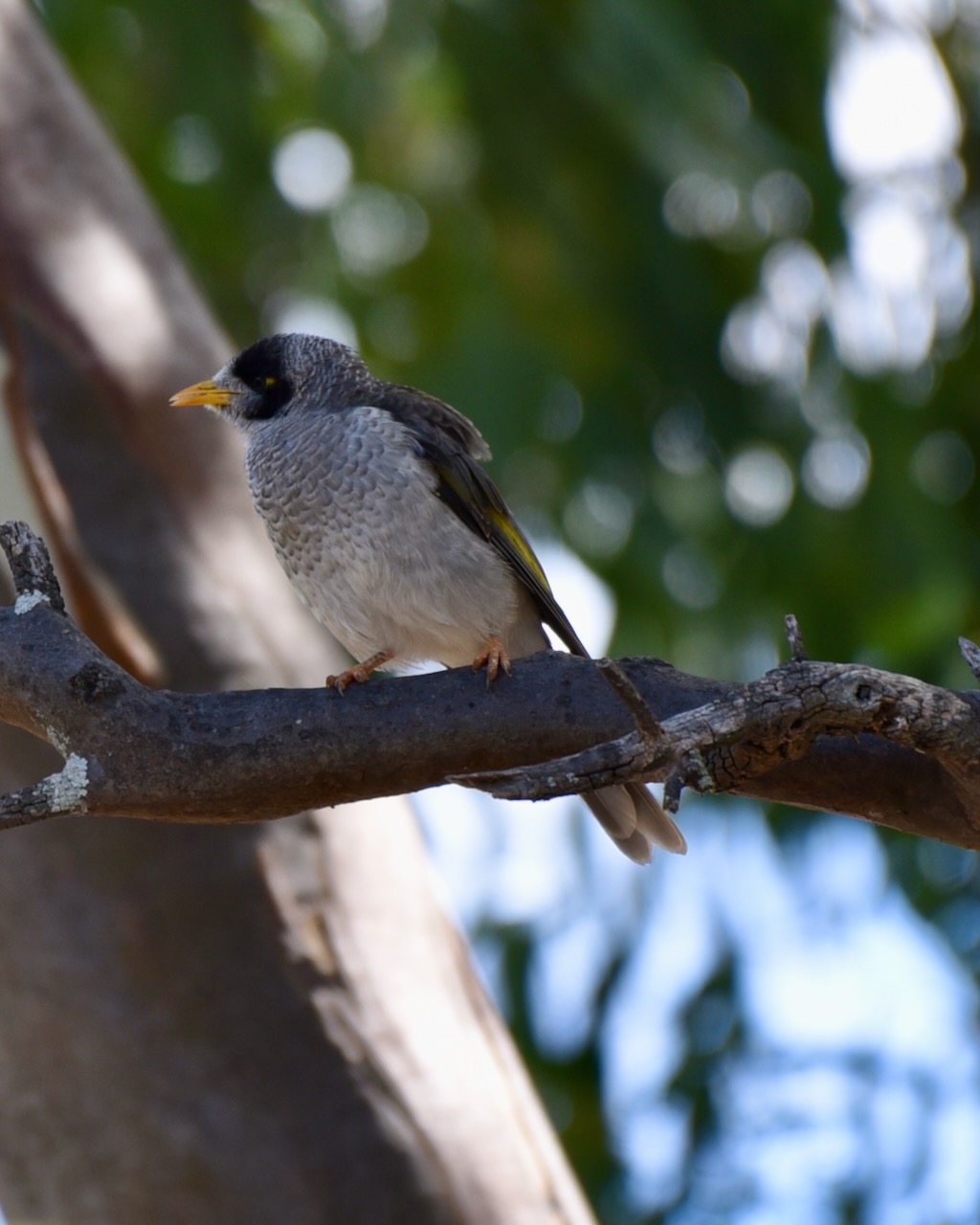
During our visit, there was a lot of water in the swamp, and as a result, there was an abundance of birdlife. I didn’t get to spend as long as I would have liked here, but below you can see some of the bird photographs which I took.
It is believed that the last large corroboree in the Wimmera region of Victoria was in 1866 at the Nhill swamp, when the Lake Hindmarsh, Dimboola, Mortat and Tyatyalla tribes gathered to dance and celebrate at the swamp.
It was probably 1941 before a similar type of “white man” gathering was held at the swamp in the form of the NHILL Scout regatta. Another ritual of sorts was Guy Fawkes night by the Swamp.
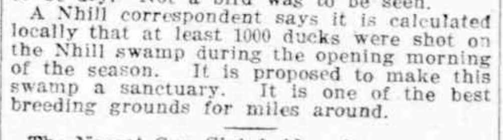
During the 1900s the swamp saw a considerable amount of duck shooting during Duck Season. It was not uncommon for 1,000 ducks to be shot in the opening day. As early as the early part of the 1900s attempts were made to have the swamp declared a sanctuary. Opponents stated that ducks required culling as they destroyed farmer’s crops and that ducks would spread disease amongst the congested wildlife as there were too many ducks.
Above:- part of an article from the Weekly Times, Melbourne, Sat 21 Feb 1914. c/o Trove
In 1911 a typhoid outbreak in Nhill was blamed on the Nhill swamp. In March 1911 the Ballarat Star stated:-
“The Nhill Swamp, during the last three or four weeks developed an all-pervading and ominous odour, while the water has taken on the tinge of pale mustard.
As the whole of the filth of the town is carried by the gutters and drains into the Swamp in which the boys and youths bathe, and from which they take sackful’s of yabbies for the family supper, it does not seem illogical to connect the outbreak of typhoid with this unsavoury state of affairs.
Five cases are in the NHILL hospital, but all are doing well. Captain Matsen, B.Sc. a veterinary surgeon, has a culture farm of bacteria taken from the delectable compound which turgidly oozes into the Swamp and he states that the microcosms are the most truculent villains he has seen.”
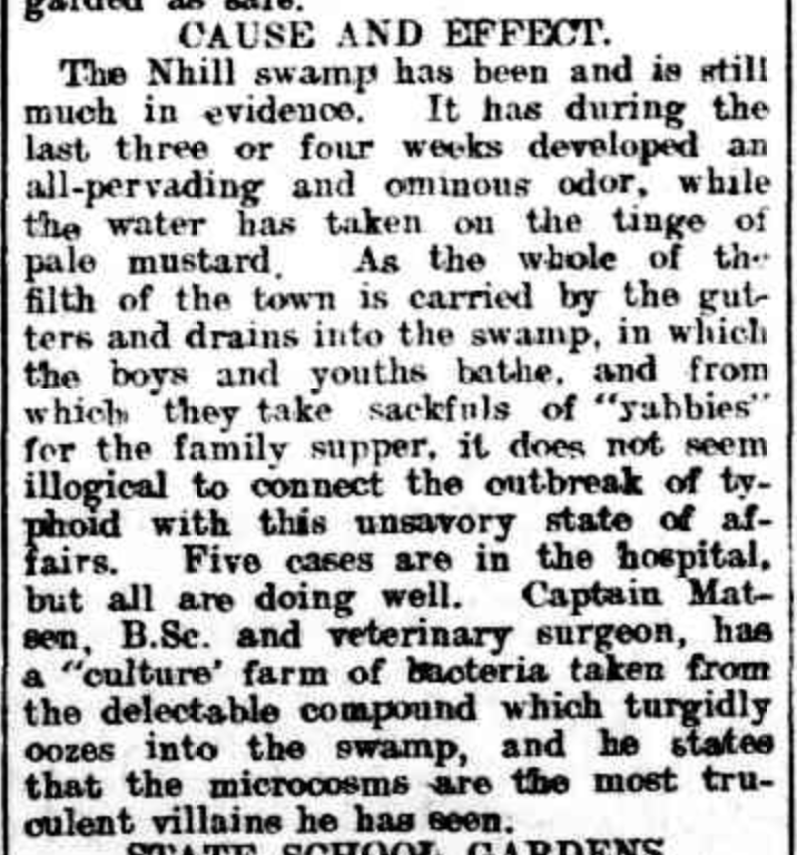
Above: Article from the Ballarat Star, Wed 15 Mar 1911. Image c/o Trove.
It was at about this time that it was suggested that the Nhill swamp be cleared of trees and made into a common and that ‘a considerable amount of revenue’ could be obtained by having cows paddocked there. It was suggested that ornamental trees could be planted around the swamp to make it ‘an attractive lake.’

Above:- Item from the Nhill Free Press, Tue 20 Oct 1914. Image c/o Trove.
In 1914 the beautification of the swamp was called for. The local Member Parliament for Lowan, James Menzies gave examples of Ballarat’s Lake Wendouree. He stated that with the clearing of timber and some landscape gardening, the swamp could be turned into a spot of beauty.
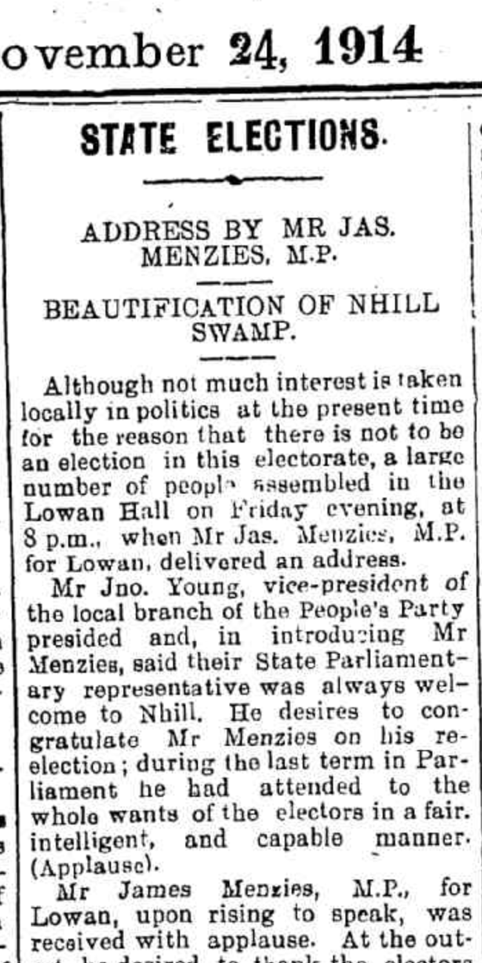
Above:- part of an article from the Nhill Free Press, Tue 24 Nov 1914. Image c/o Trove.
During 1915 the local Council did in fact clear about 32 large gum and box trees from the swamp. They used a ‘Bunyip Forest Devil’ for the job. It was a machine used for light and heavy timber felling. It pulled down a tree by mechanical leverage, sometimes with a winch.
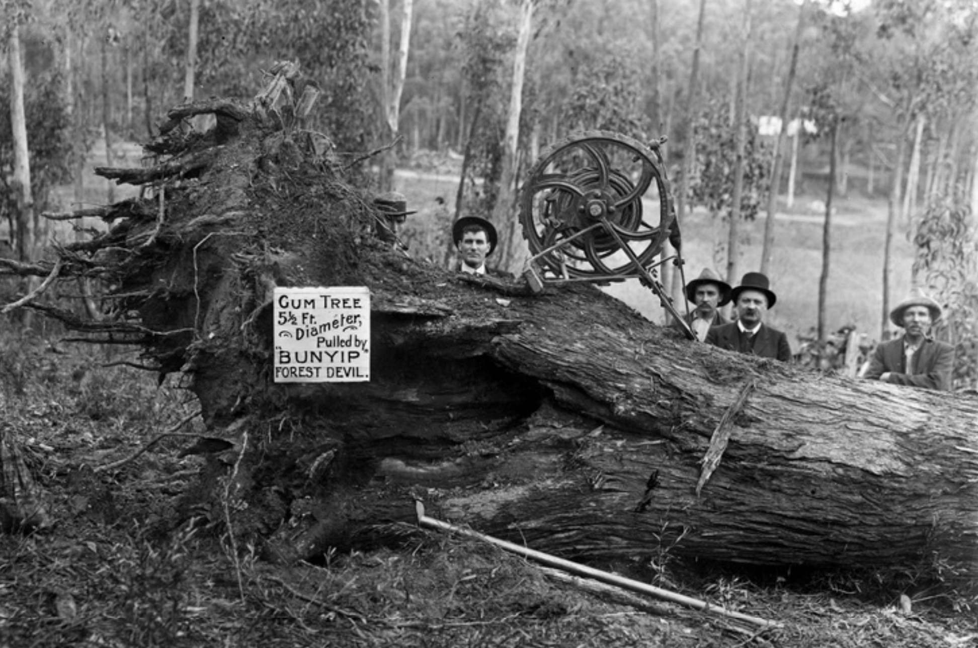
Above:- A Bunyip Forest Devil in action. Image c/o State Library South Australia.
Prior to the establishment of the Nhill public baths, the Nhill swamp was used as the local swimming hole and featured a diving board. In 1917, a letter to the Editor of the Nhill Free Press, suggested that a ‘proper dressing place’ be erected at the swamp and that ‘a number of young men and women who are good swimmers, volunteer each evening to coach our boys and girls in the art of swimming’.
Local stores including the Goldsworthy & Coles Big Store saw their opportunity and took advantage of the popularity of swimming at Nhill swamp, and commenced advertising bathing costumes.

Above:- A letter to the editor, Nhill Free Press, Tue 16 Jan 1917. Image c/o Trove.
During the mid 1930s a malaria scare occurred at Nhill which was blamed on the swamp. A local doctor urged that the council treat the swamp with crude oil.
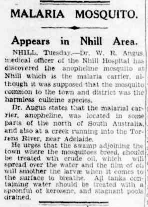
Above:- article from The Age, Melbourne, Wed 24 Feb 1937. Image c/o Trove.
The swamp has been the scene of some very interesting cases over the years.
In 1910 the Chronicle reported a ‘horse suicide’ at the swamp, claiming a horse broke through a fence and ‘dashed straight into a swamp close b and was drowned’.

Above:- Article from the Chronicle, Adelaide, Sat 31 Dec 1910. Image c/o Trove.
In 1909 an alligator escaped from a sideshow and was found at the Nhill swamp.
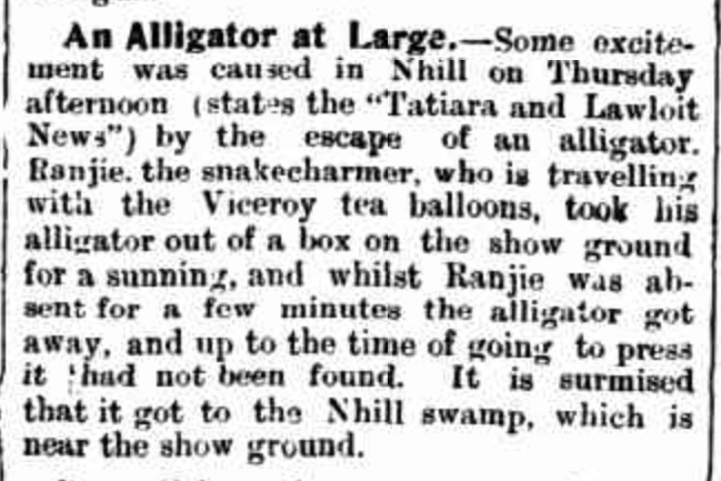
Above:- Article from The Narracoorte Herald, Tue 16 Nov 1909. Image c/o Trove
The swamp has also been home to a motoring gymkhana, and has been the backdrop to a Country Fire Authority film.
Flooding from the swamp has occurred many times over the years. In 1910 it was reported that:
“our so called swamp is now a fine sheet of water, approaching nine miles in circumference, and in parts from 12 to 15 feet deep”.
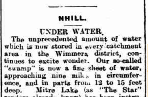
Above:- Article from The Ballarat Star, Thu 13 Oct 1910. Image c/o Trove
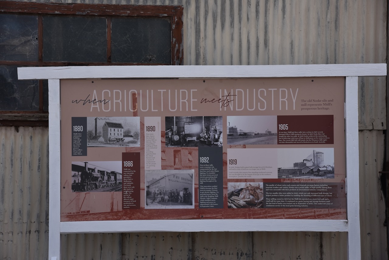
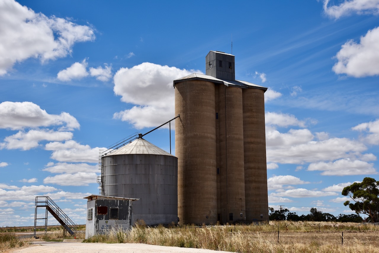
The history of the flour mill and silo at Nhill is interesting, and even more so for me as it involves the Noske family. My grandfather was a Noske and directly related to the Noske family who were involved in the mill and silo at Nhill.
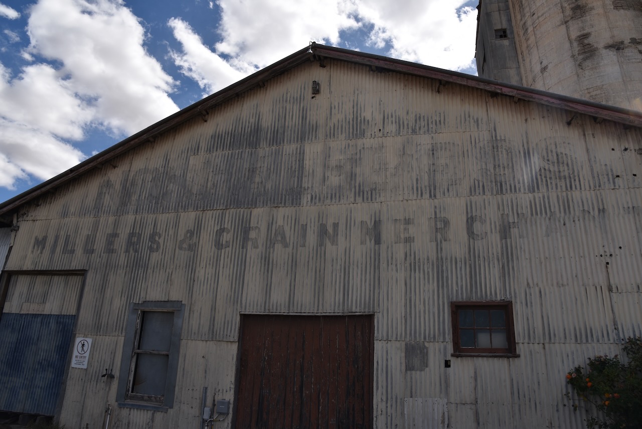
In 1900 Traugott Johann Noske (b. 1866. d. 1948) purchased the Horsham flour mill which had been built in 1873 by John Gillies. In 1903 Traugott formed a partnership with W.A. Gunn and W.H. Nichterlein and they purchased a mill at Warracknabeal. In 1905 that mill was sold and the Wimmera and Lowan mills at Nhill were purchased. He also purchased the Arapiles mill at Natimuk which was destroyed by fire in 1920. The company became Noske Bros in 1909 and in 1919 a Proprietary company.
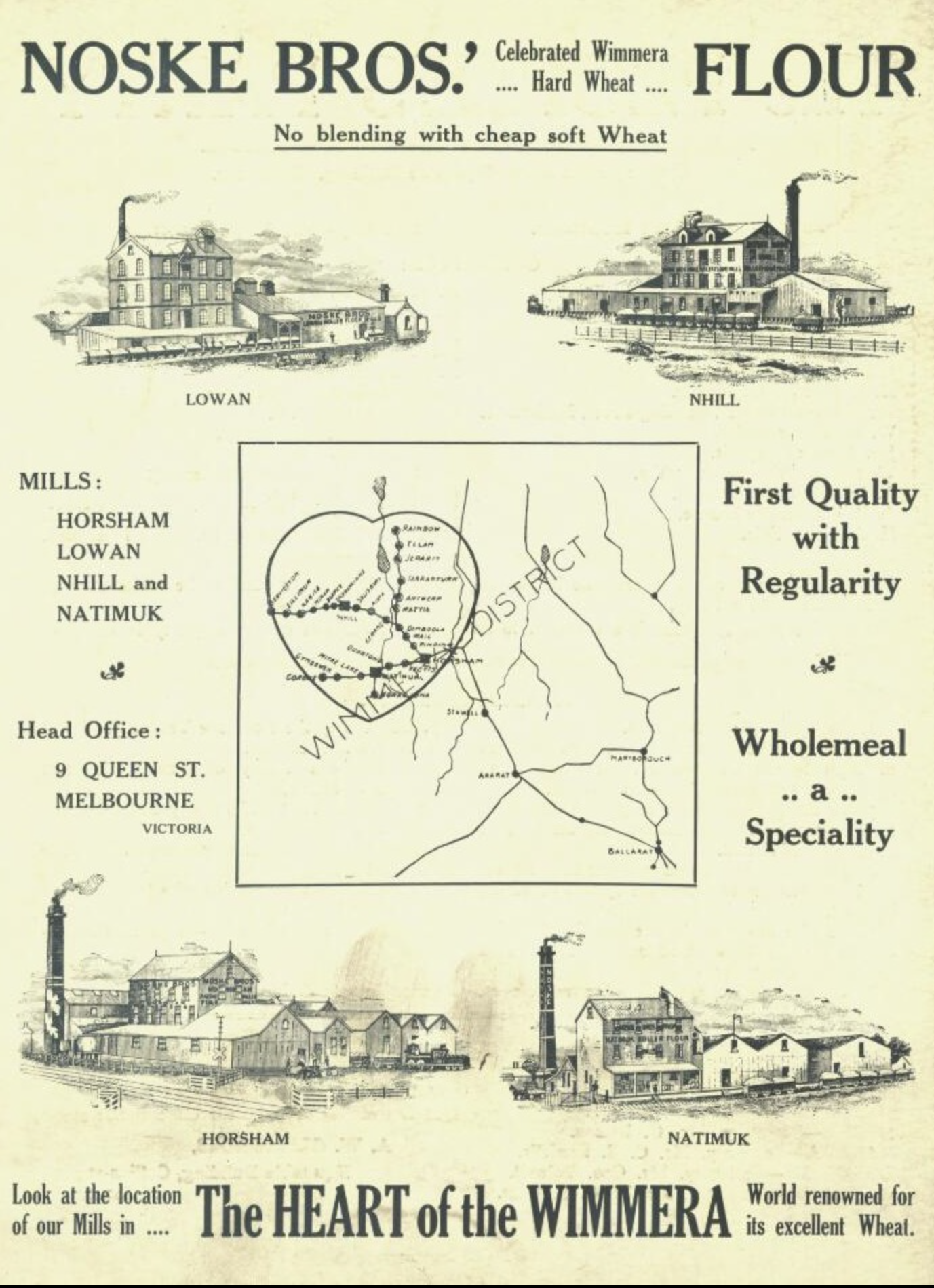
Above:- Noske Bros advertisement. Image c/o Treasures of Nhill & Districts Facebook page.
In 1914 the flour mill at Bordertown in South Australia was purchased. This was sold in 1920 not long after the flour mills at Charlton and Wycheproof had been purchased.
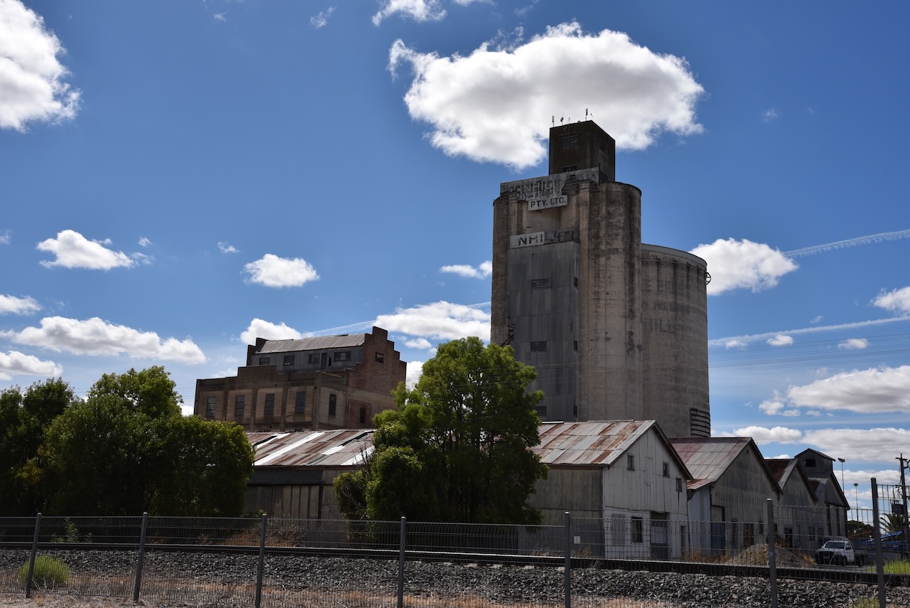
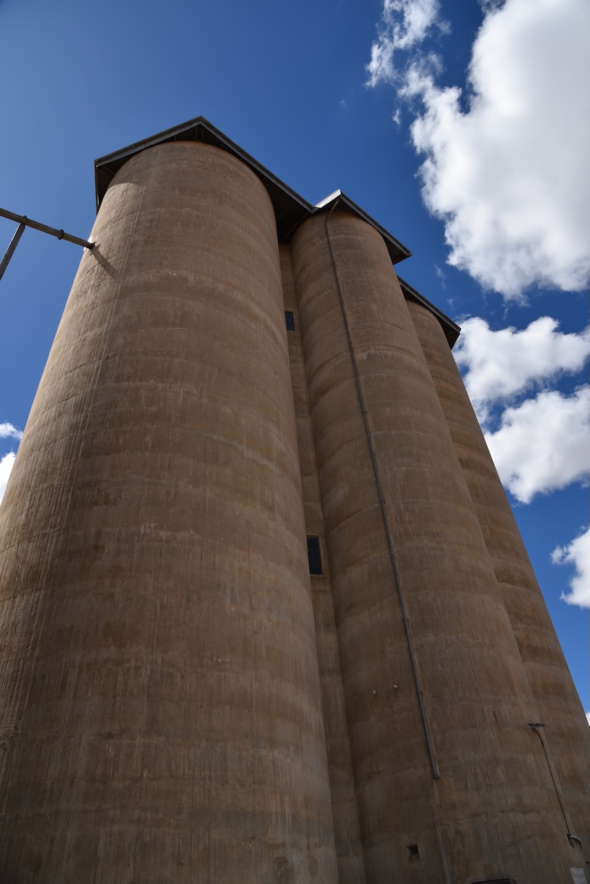
In 1918 Traugott Noske and his brother Ernest Noske arranged to have built a large bulk storage bin built at their Horsham mill. In 1919 they built an even larger one at Nhill. It was designed by James Batson. The silo at Nhill is the largest single-cell concrete grain silo in the Southern Hemisphere. The silo is 100 feet tall with a diameter of 50 feet. It has a capacity of 135,000+ bushels (3,674t) of wheat. The silo cost £7,000 to build which in today’s costs is the equivalent of about $AUD 676,784.49.
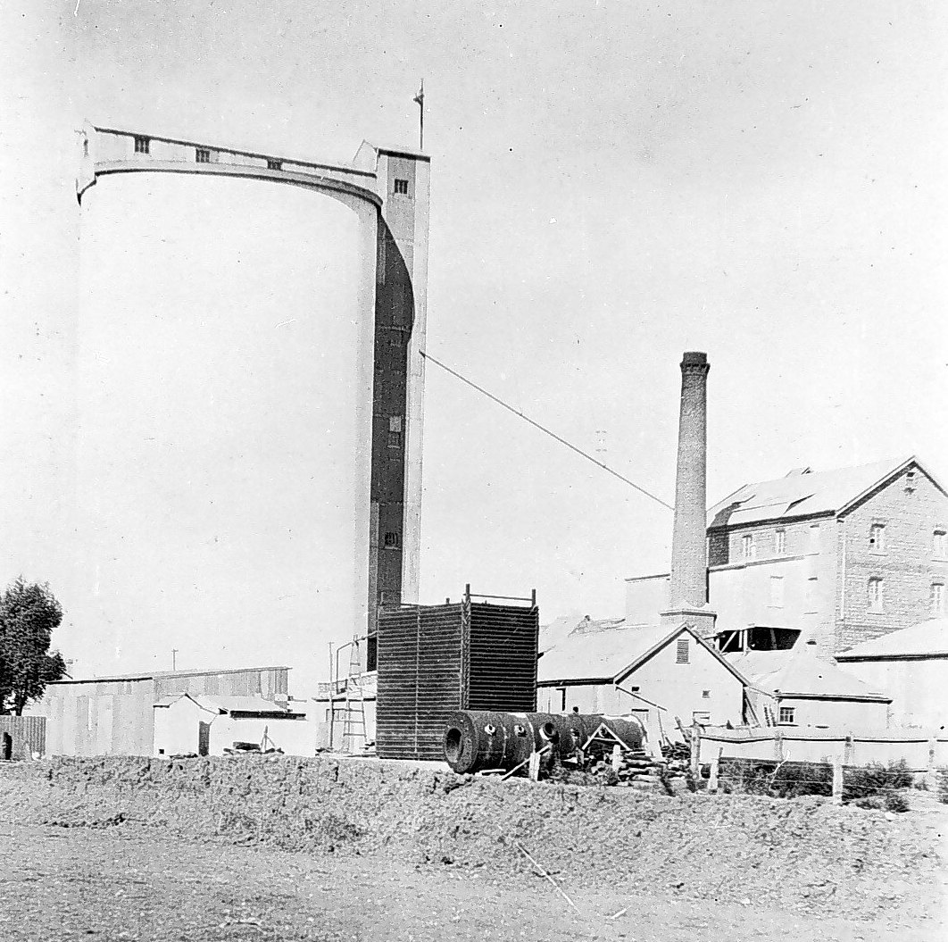
Above:- the Noske silo and mill at Nhill. Image c/o Museums Victoria.
In 1925 the flour mill in Murray Bridge was purchased. During the 1920s the Noske brothers had also invested in the Portland Cement Company. In 1927 a new flour mill was built at Charlton.
During the 1930s and the Great Depression, the Noske brothers faced bankruptcy but the business continued to trade. By the 1950s the Noske Company still had mills in Horsham, Nhill, Charlton, and Murray Bridge. The Nhill silo closed in 1958. In 1973 Noske Pty Ltd moved into stock feeding from flour milling, and the Murray Bridge mill closed.
The Nhill Silo Heritage Project seeks to purchase the silo complex on behalf of the Nhill & Districts community.
https://nhillsiloheritageproject.org/
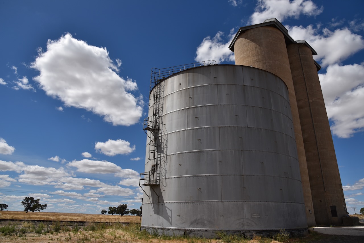
The more modern silos which are controlled by Graincorp can be located on Whitehead Road, a little further to the east of the old silos.
We parked at the Jaypex park and operated from the northern side of the park within the silo activation zone.
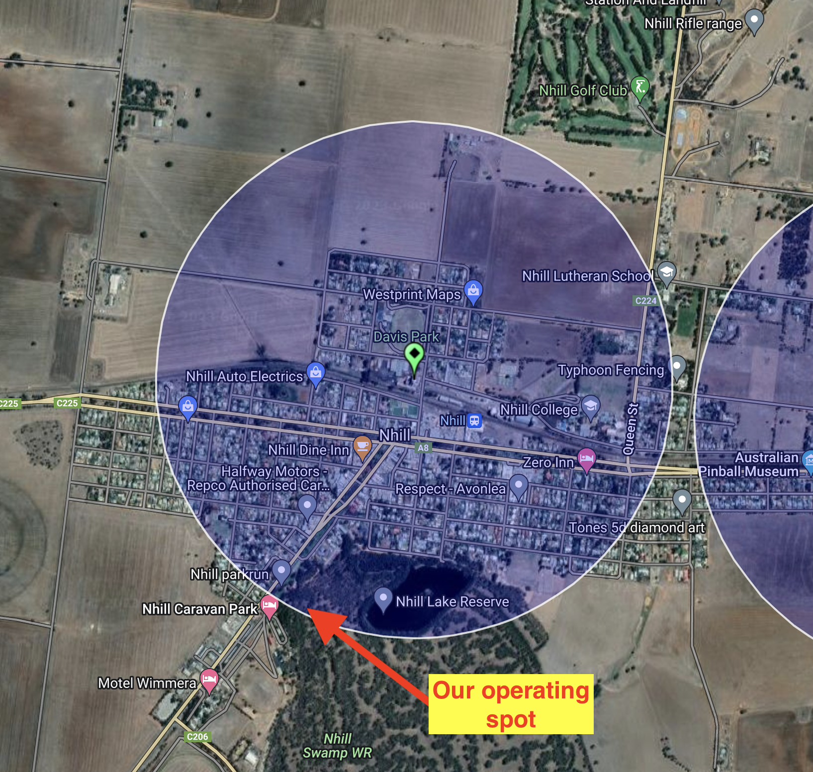
Above:- the silo activation zone at Nhill. Image c/o SiOTA website.
Marija worked the following stations on 40m SSB:-
Marija worked the following stations on 20m SSB:-
I worked the following stations on 40m SSB:-
I worked the following stations on 20m SSB:-
References.
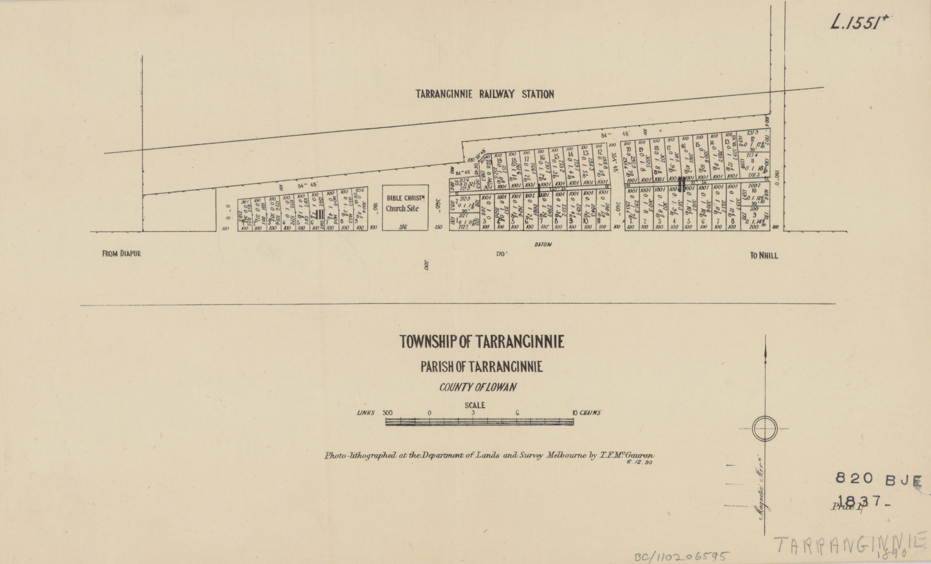
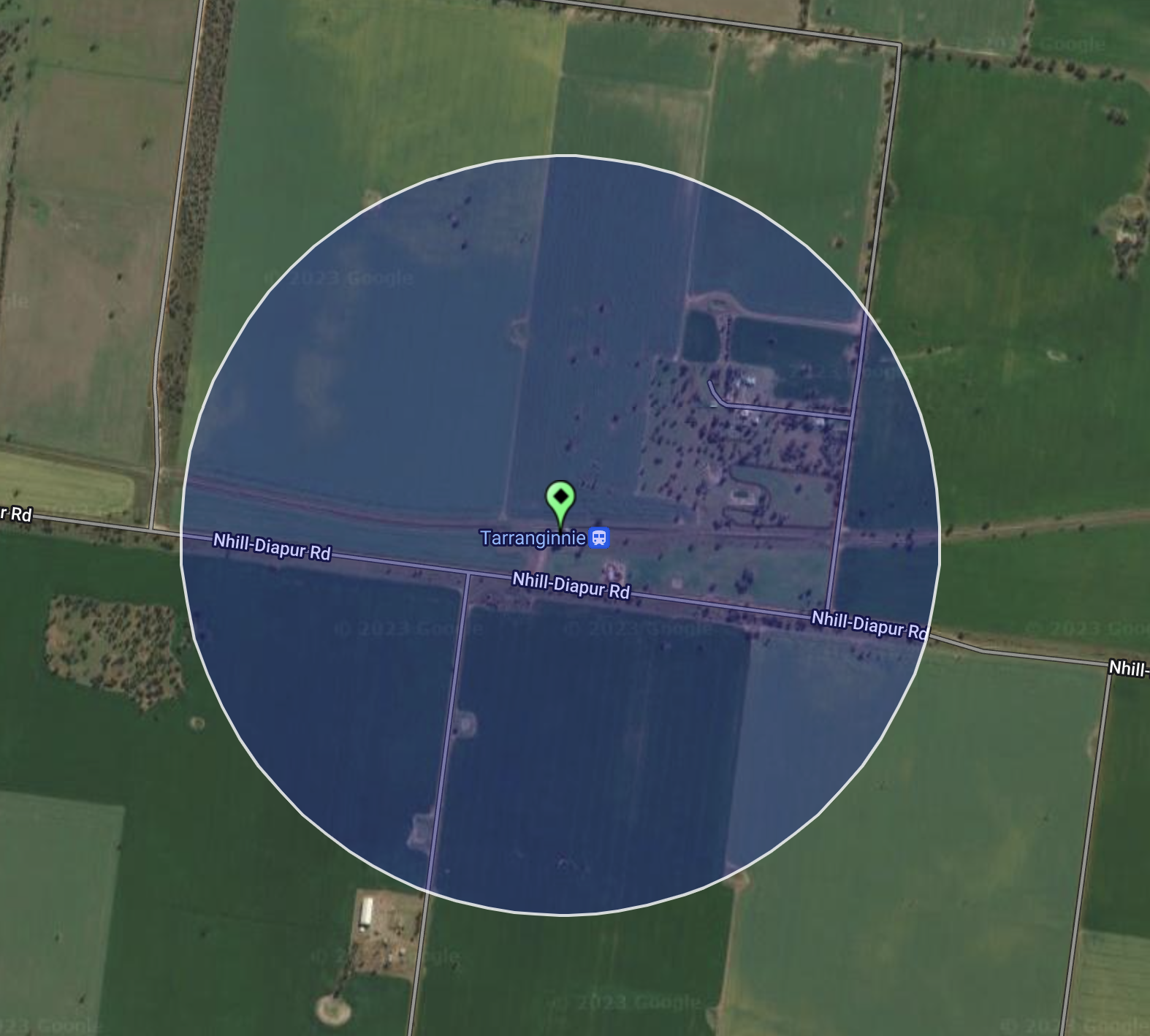
After leaving Diapur, we drove a short distance along the Nhill-Diapur Road and soon reached the Tarranginnie silo VK-TRE3.

Above:- Map showing the location of Tarranginnie. Map c/o Google maps.
Tarranginne is a rural district about 12 kilometres west of the town of Nhill. It is believed that Tarranginnie is an aboriginal word describing a man with sore feet. European settlement of the Tarranginnie area commenced in the 1870s with wheat-growing areas opened up for farming. In 1870 the Tarranginnie school was opened. By the 1880s there were four schools that carried the name Tarranginnie with a suffix to indicate their direction on the compass. Tarranginnie was located on the railway line from Serviceton to Adelaide which was completed in 1887. By 1890 the town of Tarranginnie was surveyed.
Above:- Department of Crown Lands & Survey document, 1890. Image c.o State Library Victoria.
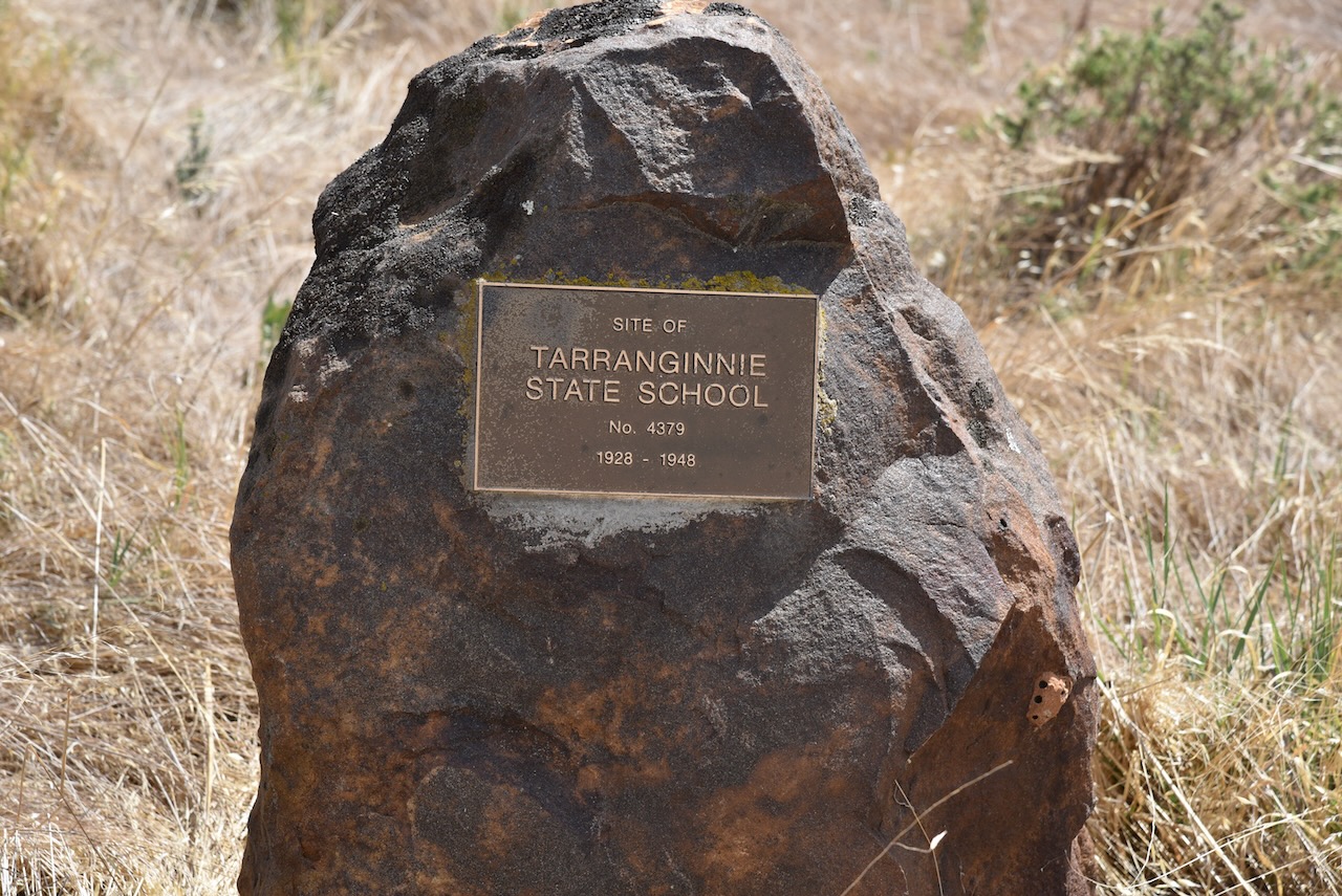
By 1948 the Tarranginnie schools had closed with students from the area being bussed to Nhill for their schooling.
The Australian pet, John Shaw Neilson, attended the Tarranginnie East School between 1885 – 1886.
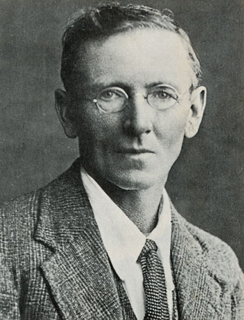
Above:- Show Shaw Neilson. Image c/o Wikipedia.
You can find a memorial cairn at Tarranginnie to commemorate the Tarranginnie State School which closed in 1948.
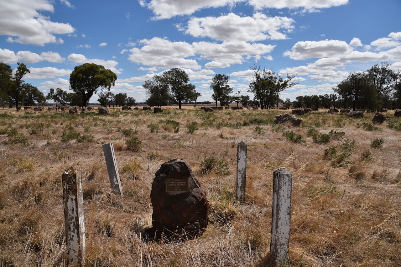
The wheat silos at Tarranginnie were constructed in 1939.
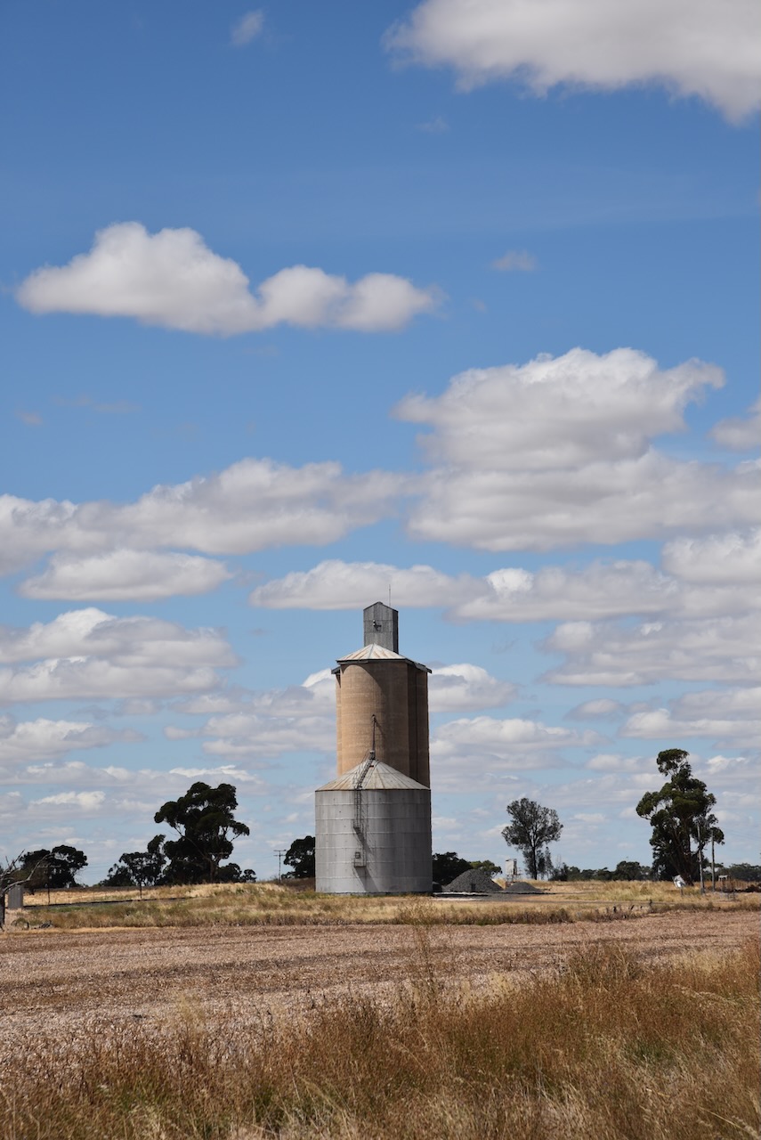
We pulled up right alongside the silo and operated from the 4WD, running the Icom IC-7000, 100 watts, and the Codan 9350 antenna. We found band conditions to be extremely poor.
Above:- the activation zone at the Tarranginnie silo. Image c/o SiOTA website.
Marija worked the following stations on 40m SSB:-
I worked the following stations on 40m SSB:-
Feeling very disappointed with band conditions, we left with just 11 stations in the log, and headed into the town of Nhill.
References.
Amateur Radio, Short Wave Listening, travel and history
Amateur radio experiences with VK1DA
Brisbane - Australia
german amateur radio station
Summits On The Air
SOTA on the peaks, wilderness QRP and some bushwalking
A fine WordPress.com site
Amateur Radio Adventures
Summits on the Ai
Radio craft, homebrew, QRP/SOTA, AM
Ego loqui ad viros super montes
My adventures with Amateur Radio and Geocaching!
The rantings of VK2GAZ on his SOTA experiences in Australia
A survivor, with minor cuts and abrasions.
The Art and Craft of Blogging
The latest news on WordPress.com and the WordPress community.
Blog of Justin Giles-Clark VK7TW's SOTA and amateur radio adventures.
Occasional SOTA & Microwave operation
Some accounts of SOTA and other radio outings
