For a variety of reasons, this year, 2018, has been a very quiet year for me as a Park and SOTA activator. So yesterday (Sunday 11th February 2018), my wife Marija VK5FMAZ and I decided to head out to enjoy the sunshine. We drove down to Port Adelaide to activate the Mutton Cove Conservation Reserve VKFF -2246. This was to be the first time that the park had been put on the air for the World Wide Flora Fauna (WWFF) program.
The Mutton Cove Conservation Reserve is located on the LeFevre Peninsula, north of the city of Adelaide, and is adjacent to the Port River. The reserve is part of the Adelaide Dolphin Sanctuary.
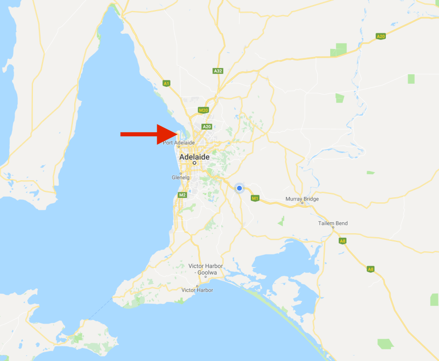
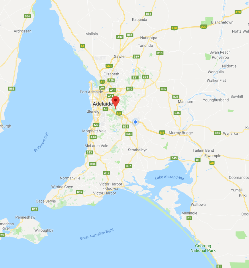
Above:- Map showing the location of the Mutton Cove Conservation Reserve. Map courtesy of google maps.
Mutton Cove is about 48 hectares in size and is the last remaining biodiverse area of salt marsh and Grey Mangrove woodland on the LeFevre Peninsula, about 15 km northwest of the Adelaide city centre. The peninsula is a narrow sand spit of around 30 square km running north from its connection to the mainland. The peninsula is bounded to the west by Gulf St Vincent and to the north and the east by the Port River.
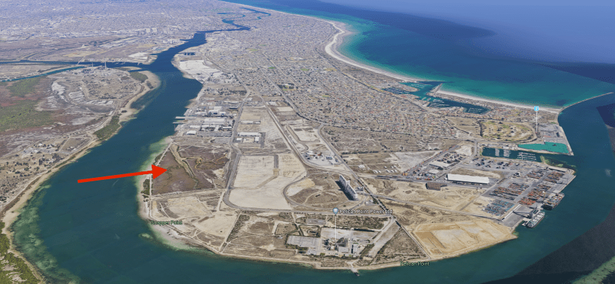
Above:- Aerial shot of the LeFevre Peninsula showing the Mutton Cove Conservation Reserve. Image courtesy of google maps
The earliest recorded European to see the Port River was Captain Collet Barker. In 1831 Barker was on his quest to find the Murray Mouth, at the request of Governor Darling of New South Wales. On the 19th April 1831, Barker spotted the Port River from the top of Mount Lofty (not far from my home). The LeFevre Peninsula was named by Governor John Hindmarsh on the 3rd June 1837, after Sir John George Shaw-Lefevre, who was one of South Australia’s Colonisation Commissioners. Mutton Cove was named after Mutton Cove in Devonport in the United Kingdom.
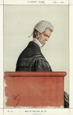
Above:- Sir John George Shaw-Lefevre. Image courtesy of Wikipedia
The salt marsh in the park is comprised of Beaded Samphire, Austral Seablite, Shrubby Glasswort and Grey Samphire low shrubland. There are three branches of the Mutton Cove creek located in the park.
The Le Fevre Peninsula was considerably smaller when Europeans first settled the area. The land has been raised by large amounts of fill and dumping. Most of this fill was placed between the early 1940’s and 1992, when dumping ceased. The area of Mutton Cove is one of the few areas along the edges of the Peninsula that remains at natural surface level.
Mutton Cove is identified with the Commonwealth government’s Environment Protection and Biodiversity Conservation Act (1999), as an important migratory bird habit. A total of 89 bird species have been recorded in the park including White-faced Heron, Sharp-tailed Sandpiper, Silver Gull, Spur-winged Plover, White-fronted Chat, Singing Honeyeater, Welcome Swallow, Musk Duck, Pacific Reef Heron, Australian Pelican, Rock Parrot, Grey Shrikethrush, and Brown Songlark.
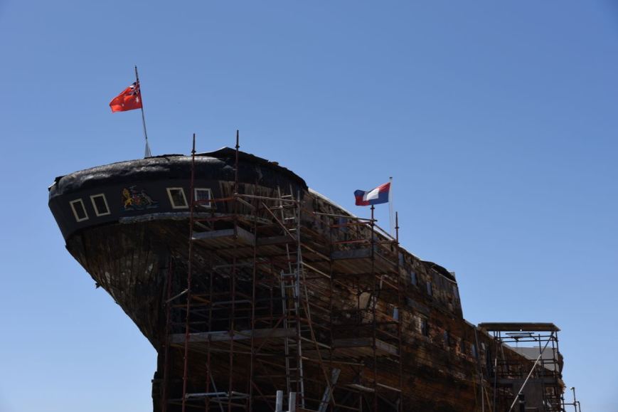
The Mutton Cove Conservation Reserve contains a ship’s graveyard. It is on of five abandonment sites within the Port Adelaide area, including Garden Island, Jervois Basin, Angas Inlet, and Broad Creek.
In around 1945 an embankment was constructed across the entrance to Mutton Cove. However prior to this two ships were abandoned within Mutton Creek, the Excelsior and the Jupiter. The Excelsior’s remains can be found in the north western corner of the park, whilst the Jupiter is mostly covered in mud. To give an indication of how deep the original Mutton Cove Creek was may be gained from the fact that Excelsior was floated right up the Cove to its current position.
The steel hulled Excelsior was built in 1897 by Gourlay Brothers of Dundee, Scotland, and measured 39.9 m in length and 7.3 m in breadth, 3.3 m depth and was 310 gross tons. The Excelsior was originally registered in Sydney in 1897 and worked on the north coast of New South Wales. In the 1930’s it was converted to a coal hulk, lightering coal to the steam powered dredges working in Port Adelaide.
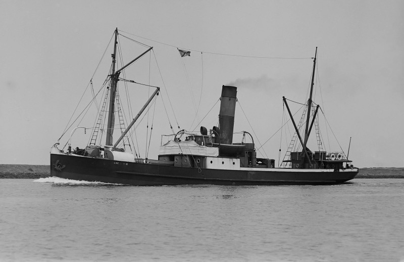
Above:- The Excelsior. Image courtesy of Ship Spotting
Prior to heading to the park Marija and I decided to take a quick walk around Port Adelaide. There is a lot to see down here. Our first stop was the clipper ship, the City of Adelaide. This is the world’s oldest surviving clipper ship, having been built in 1864 to carry passengers to Adelaide. About 250,000 Australians can trace their ancestry to the ship.
‘The City of Adelaide’.
The Port Adelaide area has some of the finest colonial buildings in Australia. Many date back to the mid and late 1880’s when the ‘Port’ was at its peak.
The wharf precinct at Port Adelaide was very busy, as it was such a lovely sunny day, with a temperature of about 26 deg C. We viewed the Dolphin Explorer returning to the Port after a 2 hour trip down the Port River to view the dolphins. The One and All sailing ship was open for inspection. This tall ship was launched in 1985 and took part in the First Fleet Re-enactment Voyage as part of Australia’s bicentenary celebrations.
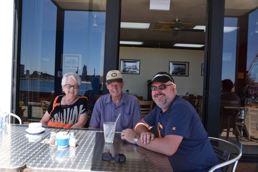
And despite the Port being very busy and Adelaide having a population of nearly 1.2 million people, it is amazing who you bump in to. As we were walking along the wharf area we found my Dad and stepmum enjoying some pancakes and a coffee at one of the many cafes overlooking the Port River. What a bonus for the day out.
After enjoying a milkshake with Dad & Dorthy, Marija and I travelled north along Victoria Road and then turned right into Veitch Road and then left onto Mersey Road North. Unfortunately we soon encountered a number of bollards and fences and found that the road was blocked off. I suspect due to security for the Australian Submarine Corporation (ASC). The ASC is notable for the construction and maintenance of the Collins-class submarine fleet operated by the Royal Australian Navy (RAN) and the construction of Hobart-class destroyers.

Hobart Class destroyer under construction at the ASC

Containers being loaded onto container ships
So we headed back out onto Victoria Road and then took Pelican Point Road which continues in to Mersey Road North. There is a carpark for the park on Mersey Road North, but we had noted the huge powerlines and decided this was not going to be a great place to operate from. So we followed a dirt track which runs down the northern side of the reserve. This takes you down to a small car parking area right alongside of the Port River.

The carparking area on Mersey Road North
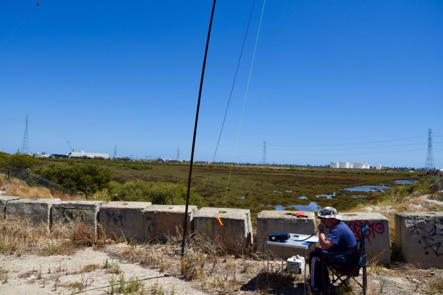
We set up at this location, as there are not too many other options. Sadly there was rubbish everywhere and we had to put up with the continual sound of ‘burnouts’ by the hoons who use the nearby roads as a racetrack. There was also no shade and it was quite blustery, with the squid pole flexing in the wind.
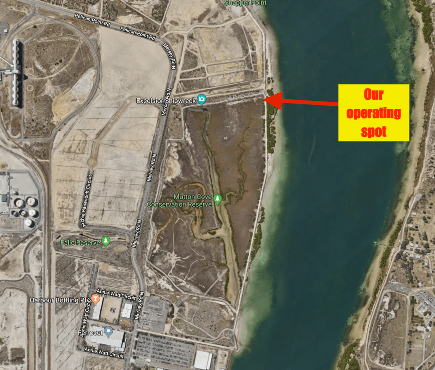
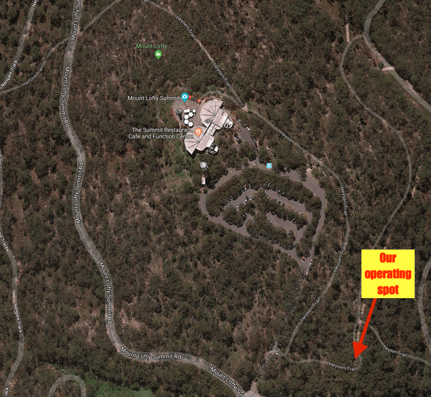
Above:- An aerial shot of the Mutton Cove Conservation Reserve showing our operating spot. Image courtesy of google maps
After setting up, we tentatively turned on the transceiver and our worst fears were realised, with a strength 8 noise floor. The park is surrounded by industry, including the Australian Submarine Corporation, so it was no surprise.
Marija and I were keen to qualify the park for the VKFF program, which required 10 contacts in the log, and for us to then ‘get out of there’. So we decided to run just the 10 watts PEP, due to Marija’s Foundation licence, and share the mic. I called CQ for around 2 minutes with no takers, whilst Marija spotted me on parksnpeaks. Our first caller was Les VK5KLV at Port Augusta, north of Adelaide, who fortunately had a strong 5/8 signal, above the noise. Geoff VK3SQ from Beechworth was next. But Geoff’s signal was right on the threshold, but we made it.
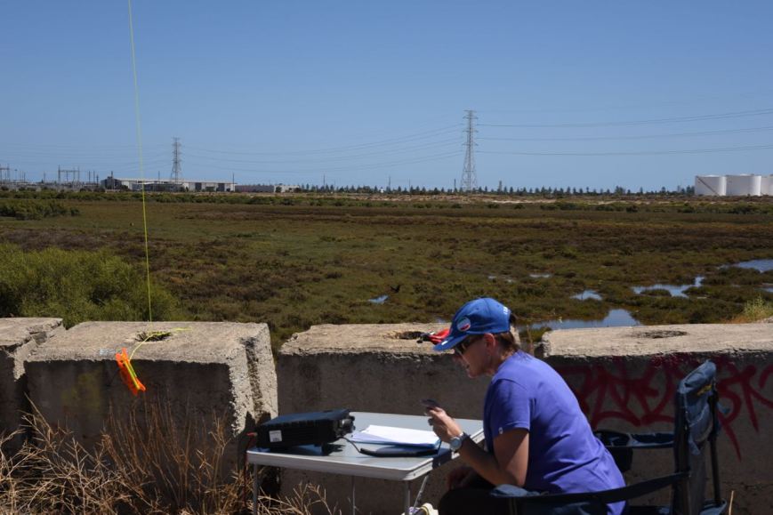
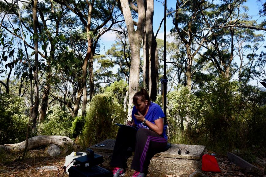
Above:- Marija on air in the park.
Band conditions were terrible for us due to the noise floor and we could hear quite a few stations calling, but just couldn’t pull them through. Our sincere apologies if you were one of those stations calling. We persevered and within 15 minutes had 10 contacts in the log. Contact number 10 was Ian VK5KKT at Two Wells north of Adelaide, who was 5/9 plus. Once Marija had her 10 contacts in the log, she sat back and enjoyed watching some of the fishing boast, yachts and the Dolphin Explorer sailing passed us on the Port River.

The Dolphin Explorer
I logged a further 6 stations on 40m, making my tally of contacts on 40m, 16 QSOs into New South Wales (VK2), Victoria (VK3), South Australia (VK5), and Tasmania (VK7). We then lowered the squid pole and removed the links in the antenna, and I tried my luck on the 20m band. I headed to 14.310 and found Jonathan VK7JON who was in contact with another station. Jonathan was just below the noise and I was only just able to make him out, so I decided not to call. I am sure that Jonathan would have hear me, but the noise on 20m for me was strength 6, making it very difficult.
Dennis VK2HHA in Albury was my first contact on 20m with a strong 5/8 signal, followed by VK3GSG and then Gerard VK2JNG/p who was activating the Dooragan National Park VKFF-0143. It was nice to get a Park to Park contact in the log. I logged a further 5 stations on 20m, before the noise, the heat, and the wind, became just too much. Marija and I packed up and headed back to the Adelaide Hills, with the intention of activating Mount Lofty, where we knew the noise floor would be very low.

Looking across the Port River to the old quarantine station on Torrens Island

A view along the Port River from our operating spot
So after 45 minutes on air, we had both qualified the park for the VKFF program. I had 24 contacts in the log, which meant I required a further 20 to qualify the park for the global WWFF program. I’m not sure that I will rush back here to get my 20 QSOs, as this is a very noisy park with no real options of finding an RF noise free location.
Marija worked the following stations on 40m SSB:-
- VK5KLV
- VK3SQ
- VK3PMG
- VK3GGG
- VK3ANL
- VK2IO
- VK3CWF
- VK2UH
- VK7ME
- VK5KKT
I worked the following stations on 40m SSB:-
- VK5KLV
- VK3SQ
- VK3GGG
- VK3PMG
- VK3ANL
- VK2IO
- VK3CWF
- VK2UH
- VK7ME
- VK5KKT
- VK3HKV/m
- VK5FDRW/p
- VK5TT
- VK5FMWW
- VK2PKT
- VK3TKK/m
I worked the following stations on 20m SSB:-
- VK2HHA
- VK3GSG
- VK2JNG/p (Dooragan National Park VKFF-0143)
- VK4TJ
- VK4/AC8WN
- VK4/VE6XT
- VK3SQ
- VK4AAC/2
References.
Birds SA, 2018, <https://birdssa.asn.au/location/mutton-cove-conservation-reserve/>, viewed 11th February 2018
City of Adelaide, 2018, <https://www.cityofadelaide.org.au/>, viewed 12th February 2018
Friends of Mutton Cove, 2018, <http://friendsofmuttoncove.noticeboard.net.au/>, viewed 12th February 2018
Ship Spotting, 2018, <http://www.shipspotting.com/gallery/photo.php?lid=2315386>, viewed 12th February 2018
Wikipedia, 2018, <https://en.wikipedia.org/wiki/Lefevre_Peninsula>, viewed 12th February 2018