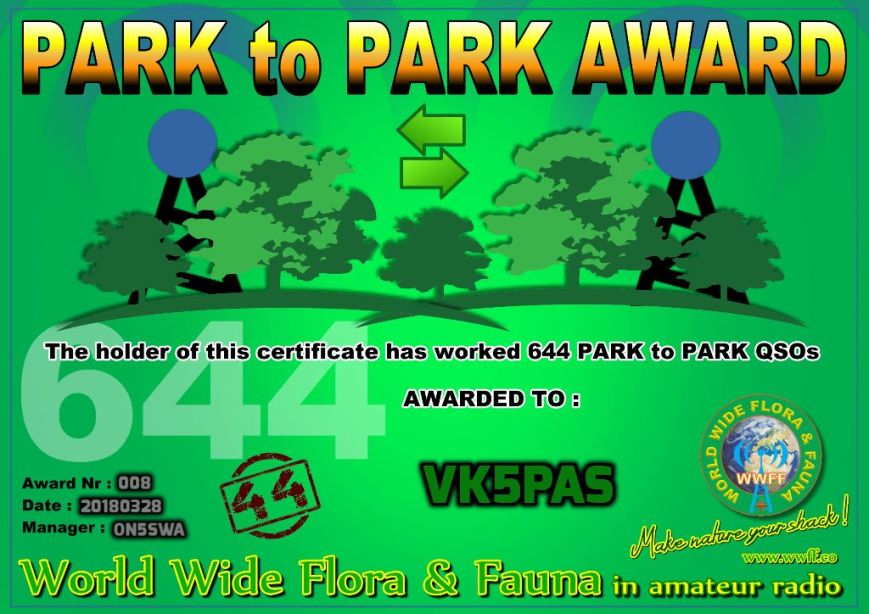
This morning I received my Park to Park (P2P) 644 certificate, in the World Wide Flora Fauna (WWFF) program.
Many thanks to Swa ON5SWA the P2P Award Manager, and many thanks to all of the WWFF activators.

This morning I received my Park to Park (P2P) 644 certificate, in the World Wide Flora Fauna (WWFF) program.
Many thanks to Swa ON5SWA the P2P Award Manager, and many thanks to all of the WWFF activators.
Last weekend (Saturday 24th & Sunday 25th March 2018) I took part in the CQ World Wide WPX Contest. The WPX Contest is based on an award offered by CQ Magazine for working all prefixes. Held on the last weekend of March (SSB) and May (CW), the contest draws thousands of entries from around the world.

My equipment was a Yaesu FT-2000, 100 watts and a TET Emtron TE-53 tri bander on 10, 15, & 20m, and my home brew 40m 1/2 wave dipole for 40m.
I found band conditions to be very poor. Long path propagation to Europe on 20m was very poor. The majority of my contacts were made on the 15m band.
I did not hear many South American stations, and those that I did, I was unable to get through to. This included a Peruvian station on 40m. That would have been a new country for me. Nor did I hear many African stations.
But admittedly I did not make it an all nighter on either night during the contest. So I probably missed the best time for the Africans on the short path to Australia.
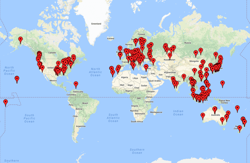
My final tally was a total of 252 contacts on 10, 15, 20 & 40m SSB, with a claimed score of 152,663 points.
I picked up a few new countries on 40m. But I missed out on many other new ones, with my 100 watts and dipole just not making it.
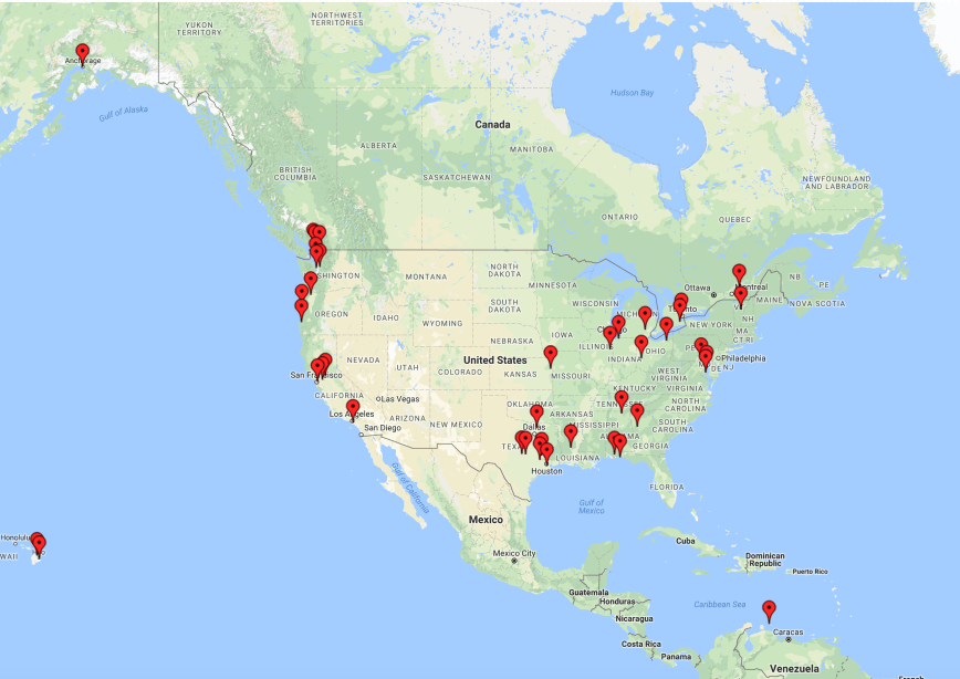
Below is a map showing my contacts during the contest.
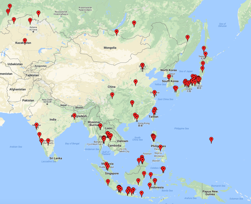
Below are my contacts in the Asian region. The majority of these were made on 15m SSB.
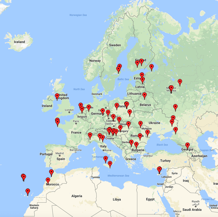
Below are my contacts in Europe and northern Africa. The European contacts were made on 20m long path and 15m short path. The two Moroccan stations (CN2AA & CN3A) had huge signals on 40m
And finally here are my contacts in North America. Most of these were made on 40m SSB during ‘our’ evening. Some of the signals from the USA were huge.
So it was only a meager effort on my part compared to the big gun stations. Those in Australia who I heard active and doing very well included VK4KW, VK2AU, and VK4QH.
Good luck to all in the 2018 CQ WW WPX Contest
The John Moyle Memorial Field Day (JMMFD) is held annually in March in memory of the late John Moyle, VK2JU. The aim of the JMMFD is…..
“The aim is to encourage and provide familiarisation with portable and field operation, and provide training for emergency situations. The rules are therefore specifically designed and focussed to encourage field operations.”
For those who might be interested to read some history behind the man, in whose name the field day is named, you might find one of my previous posts interesting. It can be found at…..
https://vk5pas.org/2016/03/20/john-moyle-memorial-field-day-2016/
There are a number of photographs there of John Moyle and lots of interesting history on this gentleman.
I normally head out into the field to a park and operate portable for the JMMFD, but unfortunately this year I had to work dayshift on the weekend. I was hoping to get out into the field on Saturday afternoon, but Saturday was rated as extreme for the potential of bushfires, so I decided to stay home.
I handed out a few numbers from home, going between the shack and the living room to get an update on the South Australian State election which was held that weekend. I made a total of 78 contacts, all on 40m, with a claimed score of 108 points.
As of today (28th March 2018), a total of 124 logs have been received. This includes fifteen (15) logs from South Australia (VK5).
Good luck to everyone who took part in the 2018 JMMFD.
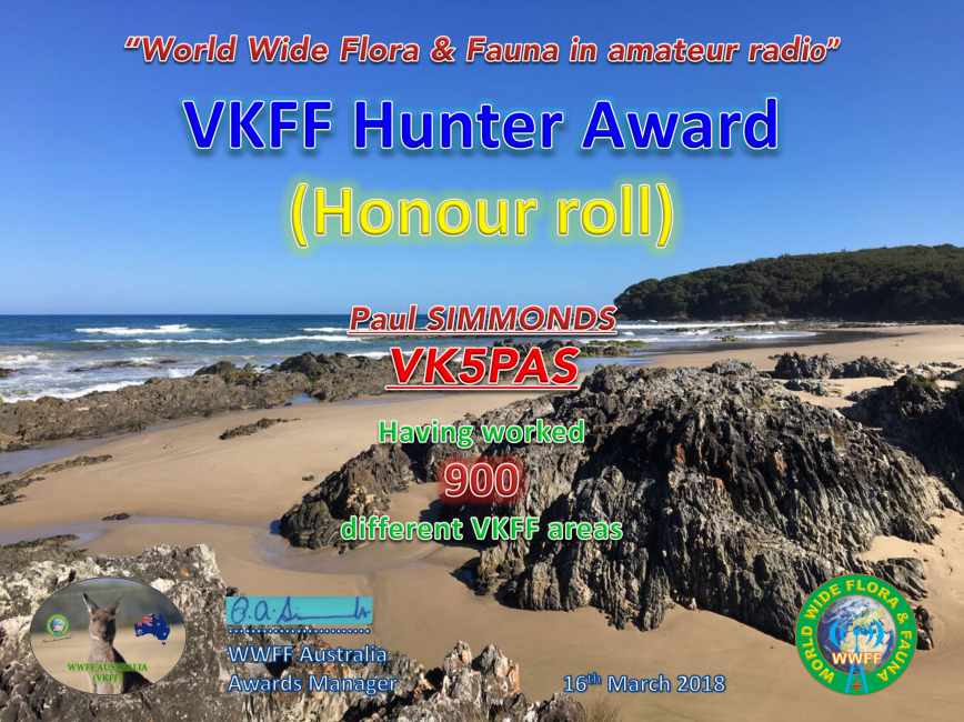
Tonight I applied for and received my latest certificate in the World Wide Flora Fauna program. It is the VKFF Hunter Honour Roll 900 certificate, issued for having worked 900 different VKFF references.
Many thanks to all of the VKFF activators.
After leaving the Little Dip Conservation Park and reinflating our tyres, we headed back towards Robe to refuel, before continuing on our way home.
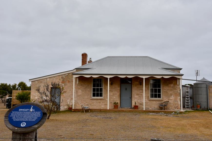
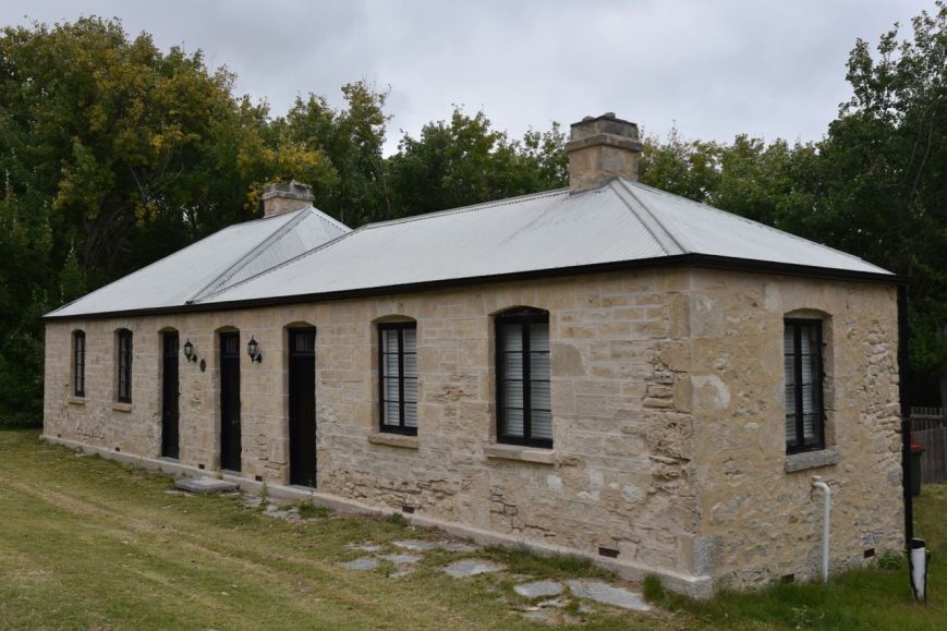
As we travelled north on the Nora Creina Road we stopped briefly to have a look at ‘Dingley Dell’, a little freestone cottage which was built by George Kendle in 1861. It was named after Mr. Wardle’s home in Charles Dickens’ novel, ‘The Pickwick Papers’. Alexander Tolmer, previously Robe’s Superintendent of Police, moved here in 1865 when he became Crown Lands Ranger for the Guichen Bay district. The poet Adam Lindsay Gordon, was a frequent visitor. From the mid 1870’s Dingley Dell was the home of William and Anna Maria Dawson and their eleven children. Their great grand daughter Helen, and her husbamd Ray Fulbohm have restored the old homestead.
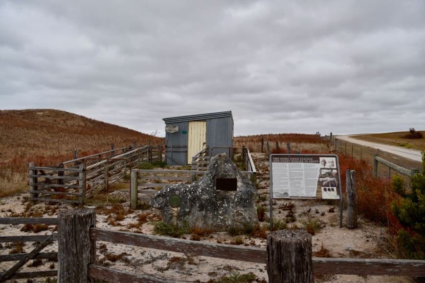
A little further up the road we stopped to have a look at the old CSIRO Field Station and Research Farm which operated between 1935 and 1976, was the site of research on pasture trace minerals deficiency in the diet of local sheep.
We headed back into Robe and refuelled. As we left Rove we stopped to have a look at the old Bush Inn, which was built in 1852 and licensed in 1855. It was also known as Mac’s Hotel and Carrier’s Arms to 1871.
We left Robe, travelling north on the Southern Ports Highway, and took a detour to Cape Jaffa to have a look at the new marina which is in development. Whilst there we decided to do a quick activation of the Bernouilli Conservation Reserve VKFF-1684, from the vehicle.
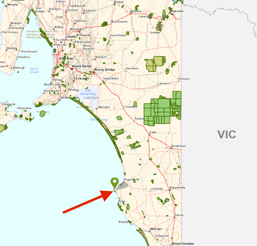
Above:- Map showing the location of the Bernouilli Conservation Park. Map courtesy of Location SA Map Viewer.
Bernouilli Conservation Park is located just south of Cape Jaffa and extends south and south-east for just over 7km. The park is about 266 hectares in size and was proclaimed on the 11th November 1993. The park consists of a coastal dune system. It is dominated by Tall Shrubland with Coast Beard-heath), Coast Wattle and Coast Daisy-bush.
The name of the park is derived from Cape Bernouilli, the former name of the headland of Cape Jaffa.
Over 40 species of bird have been recorded in the park including Musk Duck, Hooded Plover, Superb Fairywren, Singing Honeyeater, Rufous Bristlebird, Orange-bellied Parrot, Red-capped Plover, Spiny-cheeked Honeyeater, Striated Fieldwren, and White-browed Babbler.
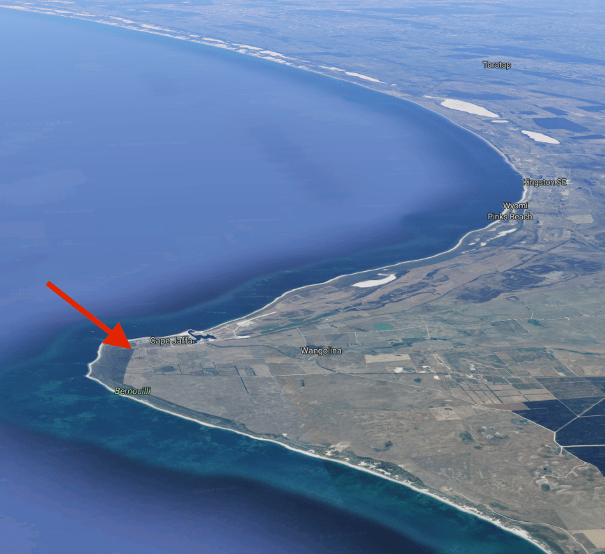
Above:- Aerial shot of the Bernouilli Conservation Park. Image courtesy of google maps.
We travelled to the end of Rothalls Road and soon found a park sign at the north eastern corner of the park.


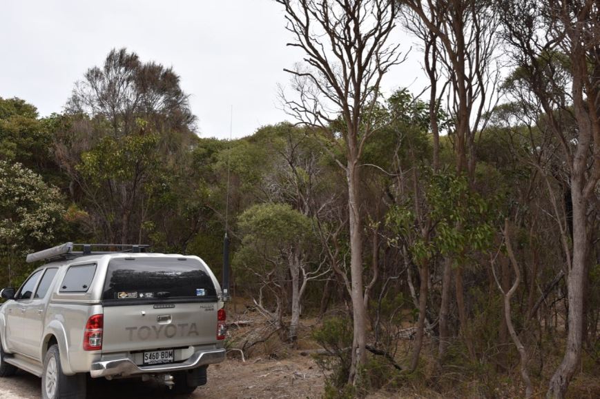
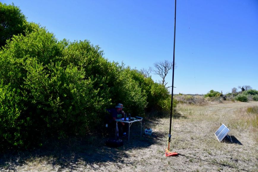
Depending on what maps you look at, you may or may not see a road which follows the eastern boundary of the park. We followed that road until we found a gap in the scrub and pulled the vehicle into the clearing. We operated from the vehicle using the Icom IC-7000 and the Codan 9350 self tuning antenna mounted on the rear of the Toyota Hi Lux.
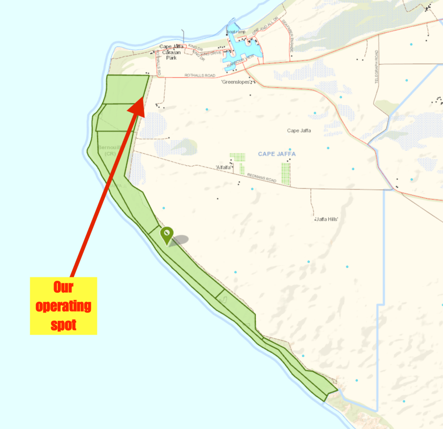
Above:- Map of the park showing our operating spot. Map courtesy of Location SA Map Viewer.
Upon turning on the transceiver we found Liz VK2XSE/p on 7.144 calling CQ from Barren Grounds Nature Reserve VKFF-1885. Both Marija and I logged Liz, Park to Park.
We then moved down to 7.139 and I started calling CQ whilst Marija spotted me on parksnpeaks. My first caller was Ron VK3AHR, followed by Peter VK3PF, and then Brian VK3BBB. Contact number 10, qualifying the park for VKFF, was with Allen VK3ARH, about 10 minutes into the activation. I logged just one more station, Geoff VK3SQ, before we decided we had better pack up and hit the road again.
This is a park that Marija and I will need to go back to, so that Marija can qualify the park, and I can get my remaining contacts towards the 44 required to qualify the park for the WWFF global award.
Marija worked the following station on 40m SSB:-
I worked the following stations on 40m SSB:-
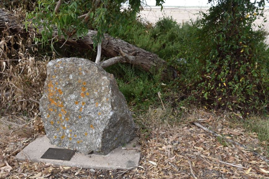
After leaving the park we drove down to the foreshore area of Cape Jaffa. We stopped briefly to have a look at the seafarers memorial. This recognises lighthouse keepers, seafarers, and fisherman who have lost their lives in the Cape Jaffa area.


We took the Cape Jaffa Road out of town and soon reached the Southern Ports Highway and headed north. At Reedy Creek we stopped to have a look at the police memorial re the murder of Trooper Harry Edmonds Pearce way back in 1881.
In 1881 Trooper Pearce who was stationed at Kingston was ordered to escort a Robert Johnson alias William Nugent to court to appear on charges of having sold liquor to aborigines, and also for having been in possession of a stolen horse. Trooper Pearce had escorted his prisoner for about 2 miles when Johnson dismounted from his horse and refused to go any further. Johnson then tackled the trooper with a long knife and during the struggle Pearce’s hands were cut and he was unable to use his revolver. Johnson proceeded to strike Pearce a number of times and attempted to cut his throat as the two wrestled together. Upon being slashed to the abodomen Pearce became faint and then collapsed. Johnson then turned the trooper’s horse adrift and left him to die. Pearce was found the next morning but died from his wounds on the 18th May 1881. Many years ago I worked in the Police Force with the gt gt gt grand daughter of Pearce.
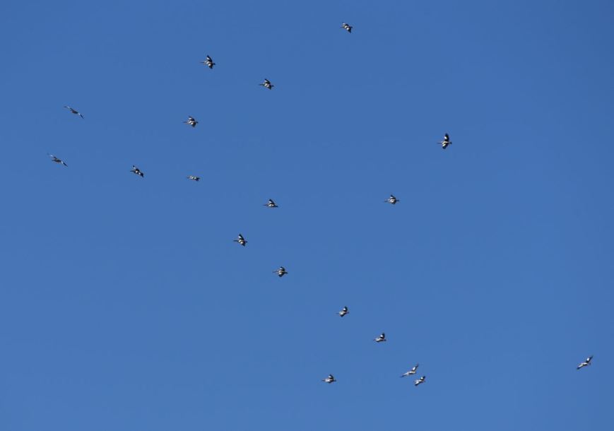
We continued on to Kingston, where we stopped for a bite to eat and then continued on the Princes Highway, passing the Coorong. Our next stop was at Jack Point where there is a Pelican Observatory Walk. The bird hide overlooks a cluster of small islands where pelicans, terns, seagulls have established large permanent breeding colonies. Sadly we didn’t see any pelicans. We did observe some other waterbirds.


We had noticed during our trip that the Coorong was incredibly dry. We have only had 10mm of rain this Summer and no doubt that has had a big impact.


But we did see dozens of Singing Honeyeaters. And they were not easy to photograph. They were very quick and just as I was about to take a shot, they would dart off to another shrub. But I did manage to capture a few shots.


Once we got back onto the Princes Highway we did see a large flock of pelicans soaring in the breeze. Perhaps they were heading to Jack Point?
We arrived home around tea time on Monday night and commenced unpacking. It had been a terrific 4 days away. We had activated 8 South Australian parks and had made 531 contacts, which included about 124 Park to Park contacts.
THANKYOU to everyone who called us during our activations.
References.
Birds SA, 2018, <https://birdssa.asn.au/location/bernouilli-conservation-reserve/>, viewed 16th March 2018
Coorong Country, 2018, <https://coorongcountry.com.au/coorong-walking-trails/>, viewed 16th March 2018
National Trust, 2018, <https://www.nationaltrust.org.au/places/robe-csiro-research-station/>, viewed 16th March 2018
Wikipedia, 2018, <https://en.wikipedia.org/wiki/Bernouilli_Conservation_Reserve>, viewed 16th March 2018
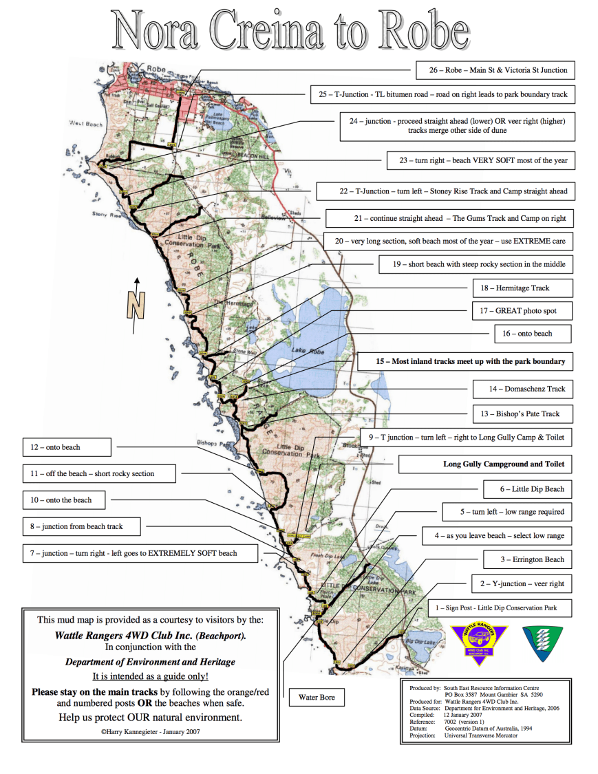
It was now Monday 12th March 2018 and time for us to head home. After a relatively early start Marija and I headed down to the main street of Robe for a bite to eat. We went to the Union Cafe and enjoyed a very nice cooked breakfast. We then decided to head back to the Little Dip Conservation Park to do some 4WDing. We had toyed with the idea of getting down onto the beach in the Coorong National Park, but decided on Little Dip instead. And I’m pleased we did. We were to have a great time.
We accessed the park via the Douglas Dawson Track which is at the end of Beacon Hill Road. We took the short detour first to the top of Beacon Hill where there is a lookout which offers some great views of Robe and the surrounding countryside.


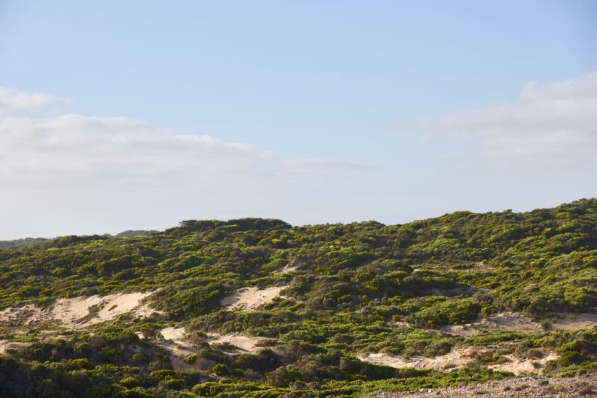
It was then into Little Dip. We deflated the tyre pressure down to about 15 psi and headed off down the track, which initially started off quite rocky, but soon became sandy.
We decided whilst we were travelling through the park that Marija would put out a few calls on 40m to log a few stations from the mobile. Marija was only on air for a short time, as the track became very bumpy and we decided 4 eyes on the track were better than 2.
Marija worked the following stations on 40m SSB:-
A short distance along the track we came to a junction and sat there for a while pondering on which direction to go. It was at that time that another 4WD pulled up. It was a couple from Victoria, Phil and Bianca, and their son Mitchell. They told us they had got bogged the day before, and we decided to team up and do the track together.
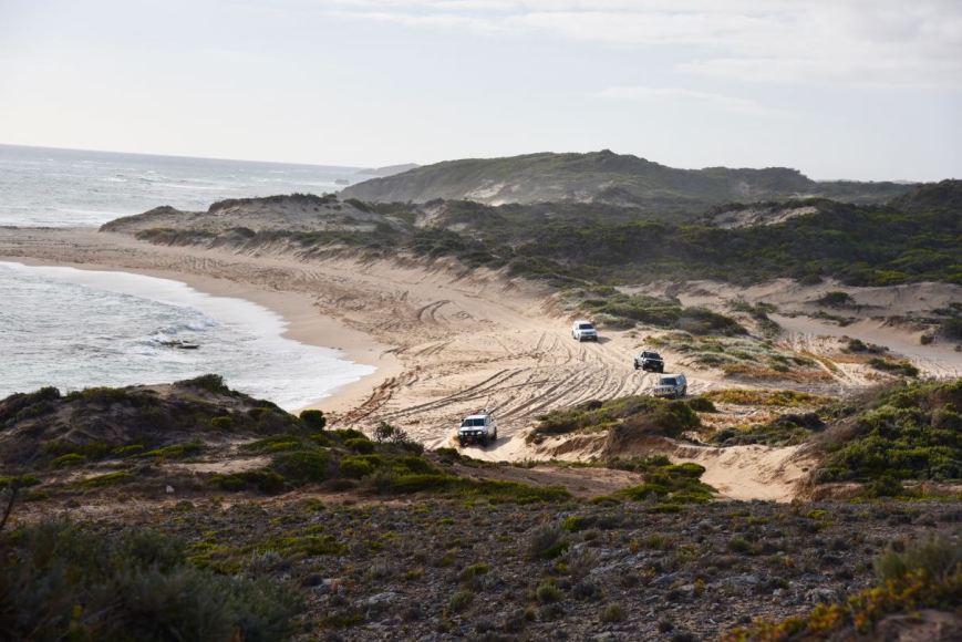
The track from Robe to Nora Creina is about 21 km. We found it a little challenging in 2 parts, both of these being dune climbs. The beach is also quite soft and boggy in parts. The track takes you through sand dunes, rocky trails, and down onto the beach on a number of occasions.
We would highly recommend this 4WD trip if you are in the Robe area. If you do decide to do the trip, remember:-
After leaving the Lake Hawdon South Conservation Park, Marija and I headed down to the town of Beachport, about 47 km south of Robe. As we travelled along Clay Wells Road on our way to the Southern Ports Highway we spoke to Ian VK1DI/p from the mobile. Ian was activating the Cuumbeun Nature Reserve VKFF-1920 and had a strong 5/8 signal into the mobile.
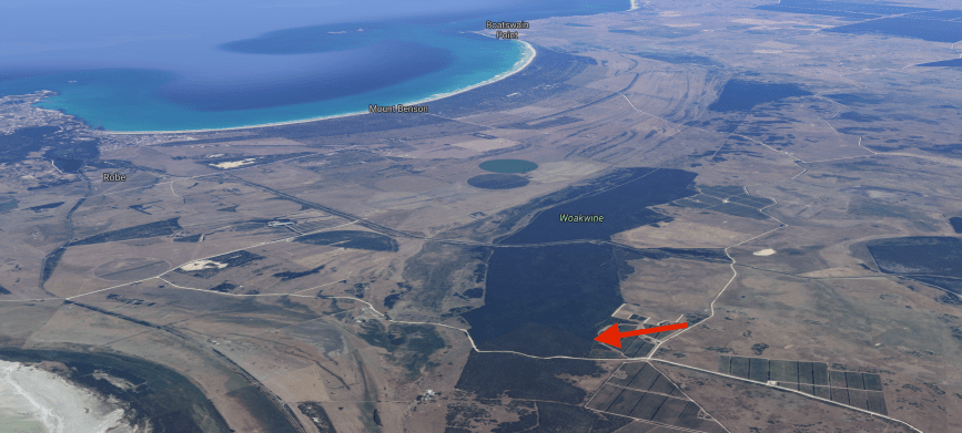
We travelled south on the Southern Ports Highway and then took a short detour off the highway to have a look at the Woakwine Cutting. This said to be Australia’s largest one man engineering feat. The cutting was excavated to drain land behind the Woakwine Range. During the 1880’s the McCourt family moved into the Woakwine area. It was soon realised that without richer land to compliment the rocky high country, making a living on the land would be difficult. In 1957 Murray McCourt commenced the construction of a channel from the swamp through the range to Lake George with a view fo draining a large swamp on his property.
There is a display of machines used to make the cutting and a viewing platform, but this was closed. I had to drive down the road and then make my way through the scrub to get a view of the cutting. It is an amazing piece of engineering.


Below is a video which gives you a good idea of this amazing feat.
We soon reached Beachport, a small town of around 880 people. The town was named on 23 May 1878 for the then British Secretary of State for the Colonies, Michael Hicks Beach, 1st Earl St Aldwyn. Beachport has a large crayfishing fleet, and is known for its 772-metre (2,533 ft)-long jetty.
We stopped off first to have a look at the Beachport Customs House which was used between 1879-1900. It was originally located at the railway yards and was used to record incoming and outgoing goods. Following Federation, the buidling was used as a railway office for goods and for men who travelled down in front of the train on a trolley to ensure that the tracks were clear. Men would sleep overnight in the buidling and return back ahead of the train the following day.


We then drove along the Scenic Road in Beachport taking in some of the great views of the lighthouse, the town itself and the surrounding coastline.


There was plenty of activity down on the beach by 4WD enthusiasts.
We decided to do a very quick activation of the Beachport Conservation Park 5CP-014 & VKFF-0791, but from the vehicle.
Above:- Map showing the location of the Beachport Conservation Park. Map courtesy of Location SA Map Viewer.
Beachport Conservation park is about 875 hectares (1.160 acres) in size and was established on 1st January 1959. The conservation park was originally created as a reserve in 1959, declared as a National Park in 1959 and was re-proclaimed as a conservation park under the National Parks and Wildlife Act 1972 for the purpose of setting ‘aside to preserve and protect a representative sample of the coastal environment of south east South Australia.’
We travelled along a sandy track at the end of Scenic Way and found a small clearing off the side of the track. We didn’t want to venture too far, as the sand was very boggy and I didn’t plan on spending an hour or two digging our way out.
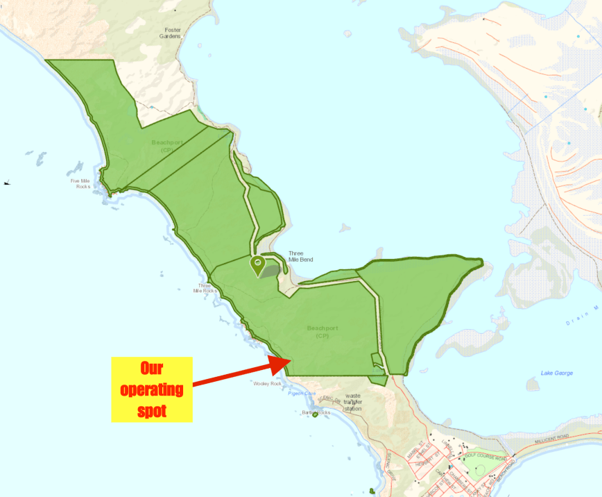
Above:- Map of the Beachport Conservation Park showing our operating spot. Map courtesy of Location SA Map Viewer.
I called CQ on 7.135 and this was answered by Hans VK5YX/2 who was in the Kosciuszko National Park VKFF-0269. It was relatively slow going from the vehicle, with signals being a bit down with my mobile antenna compared to the linked dipole. But within about 13 minutes I had contact number 10 in the log, with a QSO with Bill VK4FW/p who was activating the Reinke Scrub Conservation Park VKFF-1634. Marija also logged Bill.
I worked a further 4 stations before heading down to 80m very quickly where I logged my good mate Ivan VK5HS, who was booming in from the Riverland region of South Australia. Marija also logged Ivan.
Marija worked the following station on 40m SSB:-
Marija worked the following station on 80m SSB:-
I worked the following stations on 40m SSB:-
I worked the following station on 80m SSB:-
We then drove back into Robe and out along the Lake George Road and back into the Beachport Conservation Park. This part of the park is suitable for conventional vehicles.


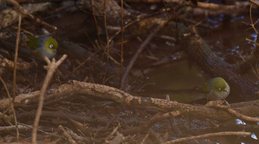
We stopped briefly to have a look at Wooley Waterhole. Native birds including Superb Fairy Wrens, Red-browned finches and Yellow-rumped Thornbills depend on this waterhole for fresh water. It is beieved the waterhole was dug during the late 1800’s. I captured a shot of a Grey Fantail at the waterhole.


I also caught these two Silvereyes heading down for a drink.
We then stopped to have a look at the memorial plaque in the park which recognises the old Robe to Beachport track, which was once used by mail coaches and travelleres passing through what is now known as Wooley Lake. The waters of the lake often quenched the thirst of horses and travelleres, but today only the waterhole remains fresh.


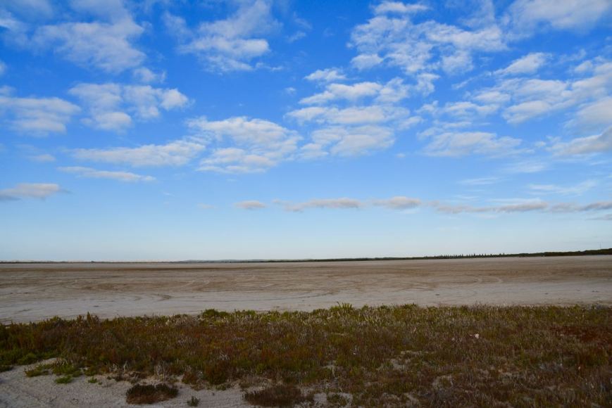
We then took a short detour off road to have a look at Lake George. It was bone dry during our visit, but each year high tides and fresh water run off into drains that fill the lake. During these periods you can often see windsurfers on the lake and people swimming. But not during our visit.
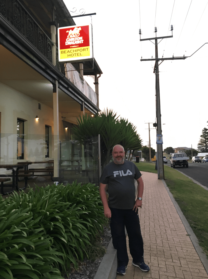
We headed back in to Beachport and headed to the local hotel for a feed and a few cold beverages. It was a great meal.
On our way back to Robe we stopped off to have a look at the memorial for two Able Seaman, W.L.E. Danswan and T.W. Todd who lost their lives on the beach at Beachport when a German mine they were destroying exploded on 14th July 1941. These men were the first casualties due to enemy action on Australian soil during World War Two. There is also a memorial here to all fishermen who have died in the Beachport area.


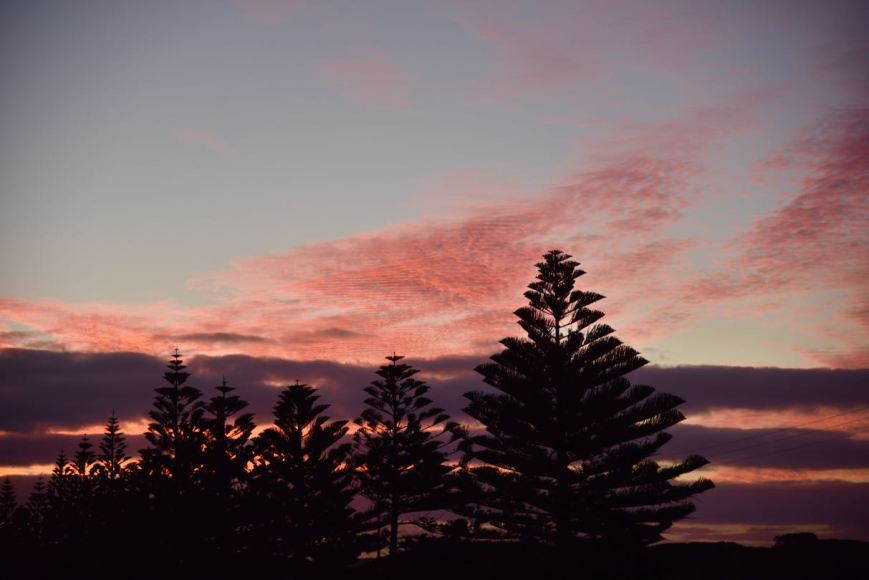
It was the end of another great day, with an amazing sunset. This is certainly a very beautiful part of South Australia.
References.
Wattle Range Council, 2018, <http://www.wattlerange.sa.gov.au/page.aspx?u=2341>, viewed 15th March 2018
Wikipedia, 2018, <https://en.wikipedia.org/wiki/Beachport>, viewed 15th March 2018
Wikipedia, 2018, <https://en.wikipedia.org/wiki/Beachport_Conservation_Park>, viewed 15th March 2018
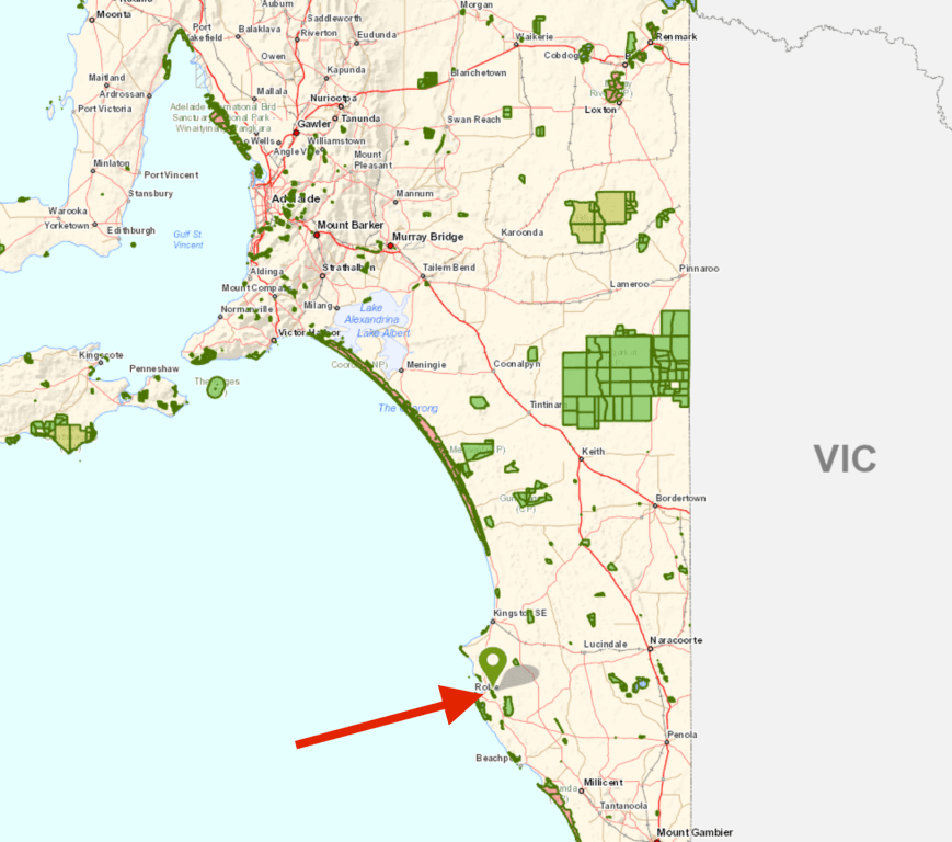
Our second park for Sunday 11th March 2018 was the Lake Hawdon South Conservation Park 5CP-110 & VKFF-1045. The park is located about 12 km east of the town of Robe and about 388 km south east of the city of Adelaide.
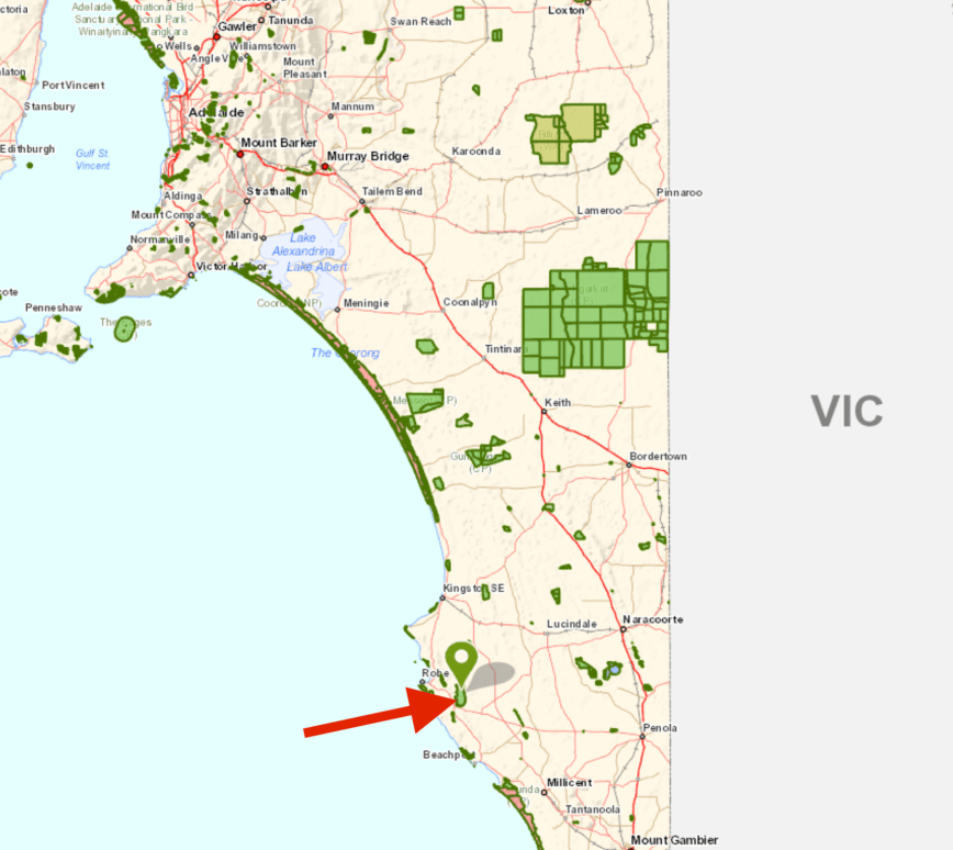
Above:- Map showing the location of the Lake Hawdon South Conservation Park. Map courtesy of Location SA Map Viewer.
The Lake Hawdon Conservation Park was gazetted in February 2010 and is about 3,190 hectares in size. The park is part of the Lake Hawdon System Important Bird Area, which comprises an area of 374 square kilometres covering a series of five coastal lakes: Lake Hawdon, Lake Robe, Lake Eliza, Lae St Clair, and Lake George.
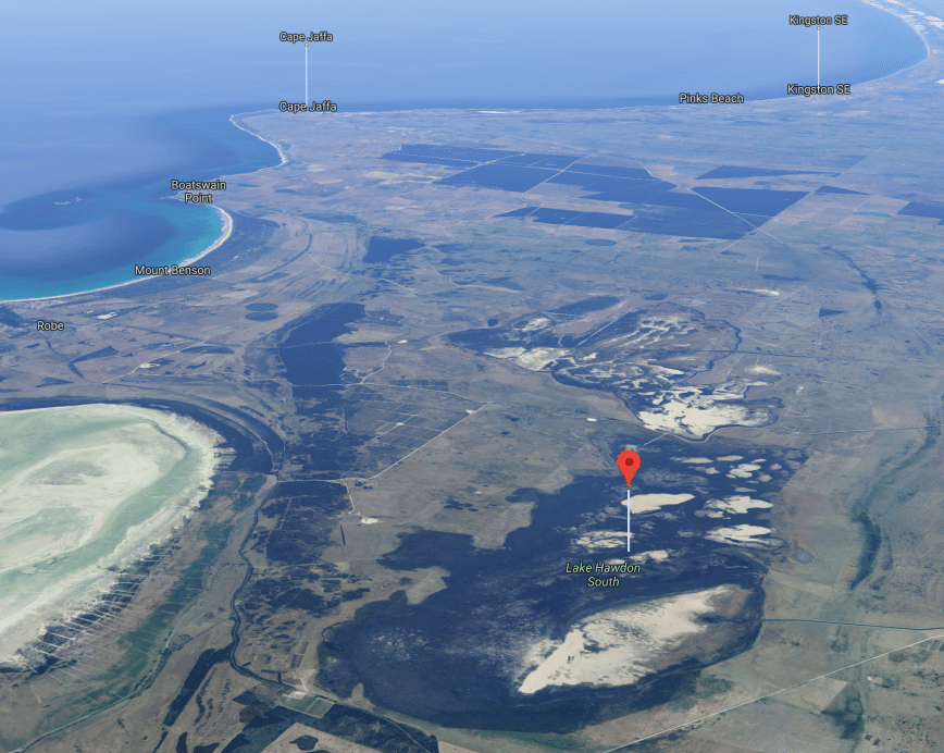
Above:- An aerial shot of the Lake Hawdon South Conservation Park. Image courtesy of google maps.
The wetland system was identified by BirdLife International as an IBA because it regularly supports over 1% of the world populations of red-necked stint, and often of sharp-tailed sandpipers, double-banded plovers and banded stilts. It also provides habitat for orange-bellied parrots, Australasian bitterns, rufous bristlebirds and striated fieldwrens.
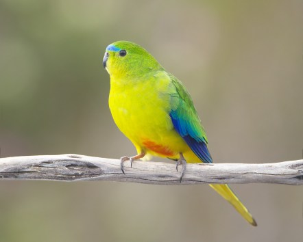
Above:- Orange-bellied parrot. Image courtesy of eikipedia
Lake Hawdon is an ephemeral wetland, meaning it lasts for a very short time. It is typified by seasonal brackish swamps surrounded by cleared grazing land. It contains large expanses of sedgelands which are of high conservation value as there are no comparable areas of sedgeland remaining in the South East of South Australia.


The park is home to a number of native animals including the Western Grey Kangaroo, the Swamp Rat, and the Swamp Antechinus. The now extinct Toolache Wallaby is believed to have previously been found at Lake Hawdon South. They were once widespread through south eastern South Australia and south western Victoria. A combination of numerous threats caused the decline and eventual extinction of the toolache wallaby. One of the largest factors was the destruction of its habitat. Very sad indeed.
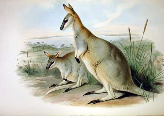
Above:- the now extinct Toolache Wallaby. Image courtesy of wikipedia.
On our way to the park we worked Peter VK3TKK/p who was portable in the Timor Nature Conservation Reserve VKFF-2211. Peter was an excellent 5/9 into the mobile.
Lake Hawdon South was one park that we were concerned about access. A study of maps the previous night had not shown any obvious access points, except perhaps off the Old Narracoorte Road. Peter VK3PF had previously activated this park and had activate the park from the point we were looking at, off the Old Narracoorte Road.
So after leaving the Woakwine Conservation Park, Marija and I drove east on the Old Narracoorte Road and within a few km we reached the northern boundary of the park. There were no signs for the park, but we were relying on mapping in the vehicle. Maps show a road in the north western corner of the park, but that did not exist in reality. So we continued east, passed the Lake Hawdon Connecting Drain, and on to the north eastern corner of the park.
In amongst the scrub we found a little clearing which lead to an unlocked farmers gate. Just to the right of this was another set of gates which lead to the park. The second set of gates were old and rickety and were tied together with some old rope.


We parked the vehicle and climbed over the second set of gates into the park. There is a fenceline following the road side of the park and an area between the fence and the road, and some breaks in the fence. But, the grass here was very long and as it was a hot day we weren’t keen to walk through the long grass. So climbing the fence appeared to be the best option.
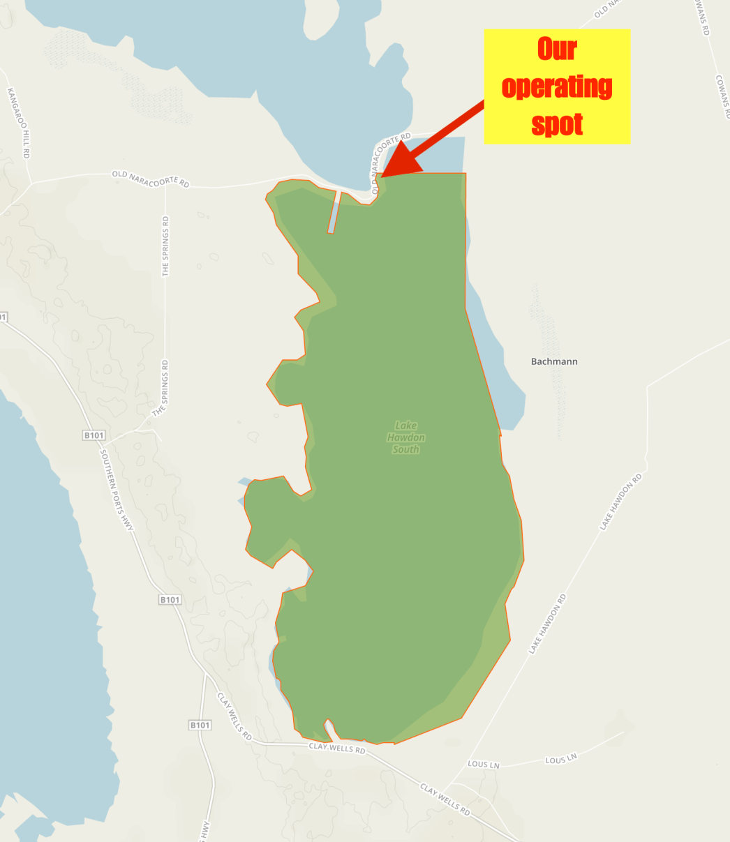
Above:- A map showing the Law Hawdon Conservation Park, and our operating spot in the northern section of the park. Map courtesy of Protected Planet.
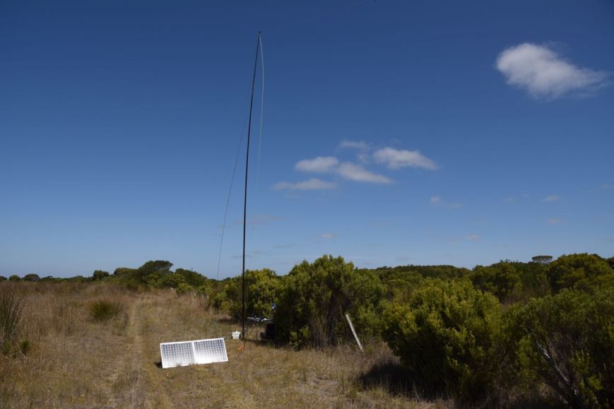
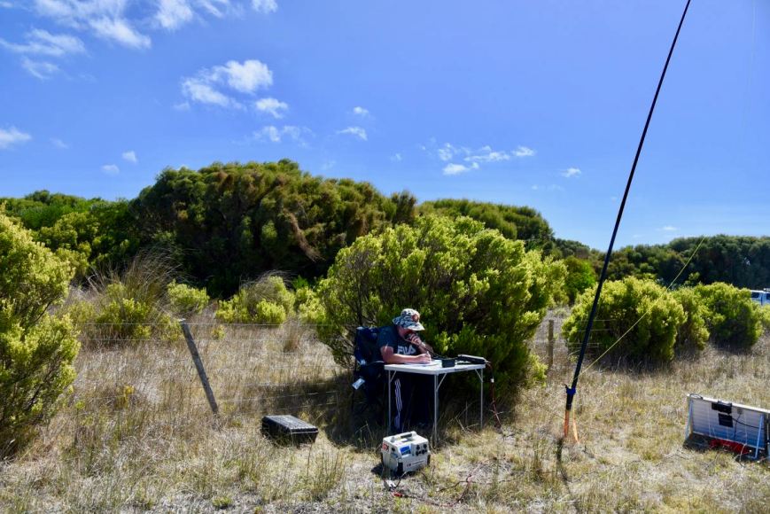
We walked about 50 metres down a cleared area along the fenceline and set up the fold up table and deck chair hard up against a small shrub, hoping to get some shade from the hot afternoon sun.
I kicked off the activation by calling CQ on 7.155. This was answered by Peter VK5ZPG at Quorn in the north of South Australia. Peter was running QRP 5 watts and was an excellent 5/8 to Lake Hawdon. This was followed by Karl VK2GKA, Ken VK3UH, and then Gerard VK2IO. Contact number 10 came ten minutes into the activation with a contact with Colin VK3LO.
After logging 11 contacts and qualifying the park for the VKFF program, I lowered the power on the Yaesu FT-857d down to 10 watts, and Marija jumped into the operators chair. Her first contact was with Peter VK3PF/p who was activating the Wonthaggi Heathlands Nature Conservation Reserve VKFF-2235, followed by Peter VK3ZPF, and then Stef VK5HSX/3 in the Mount Alexander Regional Park VKFF-0973. Dennis VK2HHA also called, and this was followed by another two Park to Park contacts with Nick VK3ANL/p who was in the Ironbark Road Nature Conservation Reserve VKFF-2113, and then Les VK5KLV/p in the The Dutchmans Stern Conservation Park 5CP-228 & VKFF-0817.
Marija logged a total of 14 stations and had the park under her belt for the VKFF program. I then jumped back on the mic hoping to get my 44 contacts to qualify the park for the WWFF global program. First in the log was Peter VK5KPR/p in the The Dutchmans Stern Conservation Park 5CP-228 & VKFF-0817, followed by Stef VK5HSX/3 in the Mount Alexander Regional Park VKFF-0973.
I logged a further 34 stations on 40m from VK1, VK2, VK3, VK4, VK5, VK6, and VK7. This included 5 further Park to Park contacts:
Contact number 44 was a QSO with John VK4TJ in Queensland.
I then put out a few calls on 80m and I was really pleased to get John VK5BJE and Mick VK3GGG/VK3PMG in the log. Conditions were quite good on 80m but sadly as is often the case there weren’t too many callers.
To finish off the activation I called CQ on 14.310 on the 20m band and logged Mike VK6MB/p in the Midgergoroo National Park VKFF-0650 who had a strong 5/9 signal. And then Hans VK6XN who was 5/9 plus. But sadly they were my only takers on that band.
It was now just after 3.30 p.m. local time and we decided to pack up and go for a drive to Beachport for a look around. Between us, Marija and I had 73 contact in the log from Lake Hawdon South, including 19 Park to Park contacts.
Marija worked the following stations on 40m SSB:-
I worked the following stations on 40m SSB:-
I worked the following stations on 80m SSB:-
I worked the following stations on 20m SSB:-
References.
Wikipedia, 2018, <https://en.wikipedia.org/wiki/Lake_Hawdon_System_Important_Bird_Area>, viewed 15th March 2018.
Wikipedia, 2018, <https://en.wikipedia.org/wiki/Toolache_wallaby>, viewed 15th March 2018
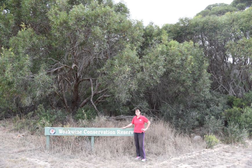
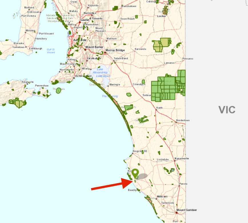
Our first activation for Sunday 11th March 2018 for day two of the 5th year anniversary activation weekend for the VK5 Parks Award was the Woakwine Conservation Park 5CP-257 & VKFF-1124. The park is located about 8 km east of the town of Robe and about 343 km south east of Adelaide.
Above:- Map showing the location of the Woakwine Conservation Park. Map courtesy of Location SA Map Viewer.
The Woakwine Conservation Park is about 424 hectares in size and was proclaimed in 2010. It was formally known as the Woakwine Conservation Reserve (the old sign is still there). In the mid 1980’s moves commenced to establish the park following applications for vegetation clearance through the Native Vegetation Branch. Fortunately the applications were refused and the Minister for Environment and Planning purchased the land. In 1993 two allotments were gazetted as the Woakwine Conservation Reserve to ‘conserve a remnant area of mallee vegetation’. Some 17 years later it became a Conservation Park.


Woakwine is an aboriginal word meaning ‘elbow’ or ‘bent arm’. and refers to the shape of the large watercourse near the Woakwine Homestead. In fact, Woakwine is the only Aboriginal place name still used along the lower South East’s coastal region.
The park is a remnant area of mallee on the Woakwine Range that varies from coastal mallee, to Blue Gum, and Pink Gum woodlands from north to south. The park forms an integral part of the Woakwine Range which is an area almost completely cleared of natural vegetation. Woakwine is bisected by Drain L which moves surface waters south-westerly from Lake Hawdon North, to the ocean at Robe.
Above:- Aerial shot of the Woakwine Conservation Park. The red arrow shows our operating position. Image courtesy of google maps
The Woakwine Conservation Park is an important habitat for the vulnerable Painted Button-Quail and Rufous Bristlebird, and the rare Red-necked Wallaby, Common Wombat, Beautiful Firetail and Peregrine Falcon. The nationally endangered Orange-bellied Parrot can also be found in the park.
After breakfast Marija and I headed out of Robe on the Southern Ports Highway and then turned left onto Boomaroo Park Road and then right onto the Old Naracoorte Road. After a few km we reached the south western corner of the park, which still has the old Conservation Reserve sign. Google maps showed a track at this location which headed north following the western boundary of the park. But reality was that the track was completely overgrown and access was not possible.
We drove a little further along the old Narracoorte Road until we reached the south eastern corner of the park. There was another fire track here which followed the eastern boundary of the park. This track was accessible. But only in a 4WD. Don’t try it in a conventional vehicle as the track is very rocky and you will bottom out. We drove about 500 metres along the track until we encountered a fallen tree, preventing us from going any further. A small chainsaw is our next investment.
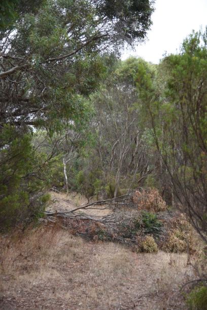
Above: the blocked track with the fallen tree
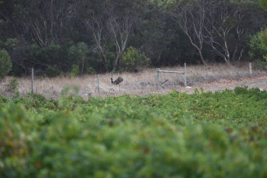
As we drove along the track we disturbed some emus who quickly took off. I managed to get the camera just as they were pushing their way through a fence in an adjacent vineyard.
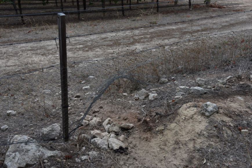
The photo below shows the damage caused to fences on the edge of the park by emus and kangaroos. This is why farmers are not fond of them.
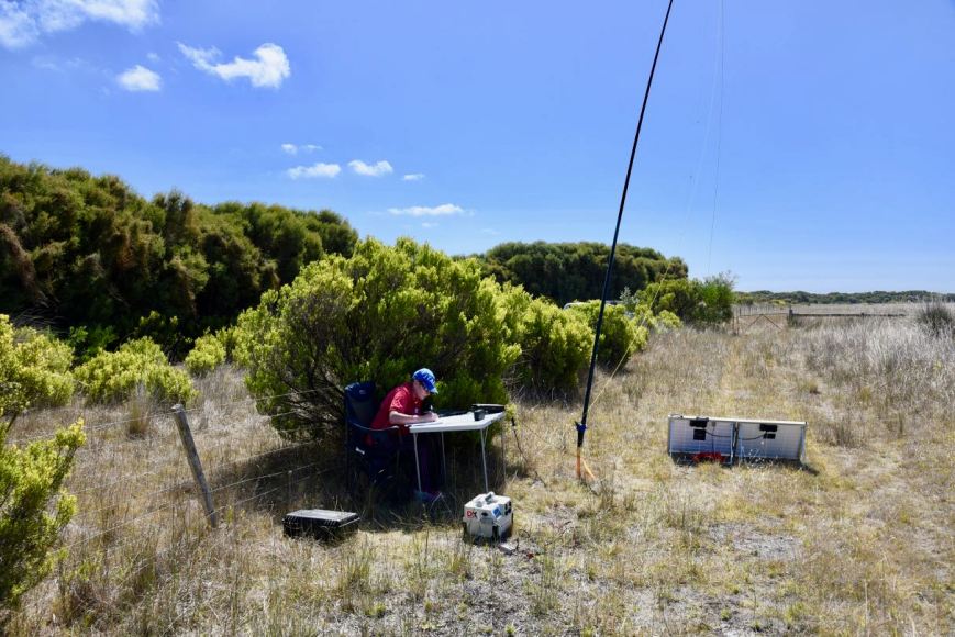
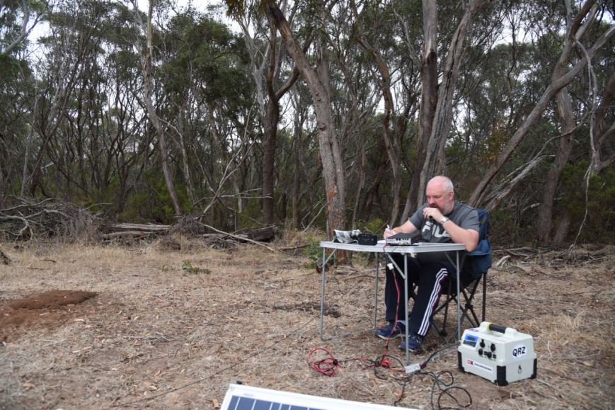
We found a small clearing in the scrub just off the track and set up there. We ran the Yaesu FT-857d and the 20/40/80m linked dipole for this activation, and also the 15m 1/2 wave dipole. Marija ran 10 watts PEP whilst on air, while I ran 40 watts output power.
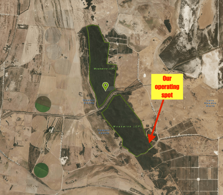
Above:- Aerial shot of the Woakwine Conservation Park, showing our operating spot towards the south eastern corner of the park. Image courtesy of Location SA Map Viewer.
It was a nice spot to active from, with thick scrub on one side of the track and a vineyard on the other side.
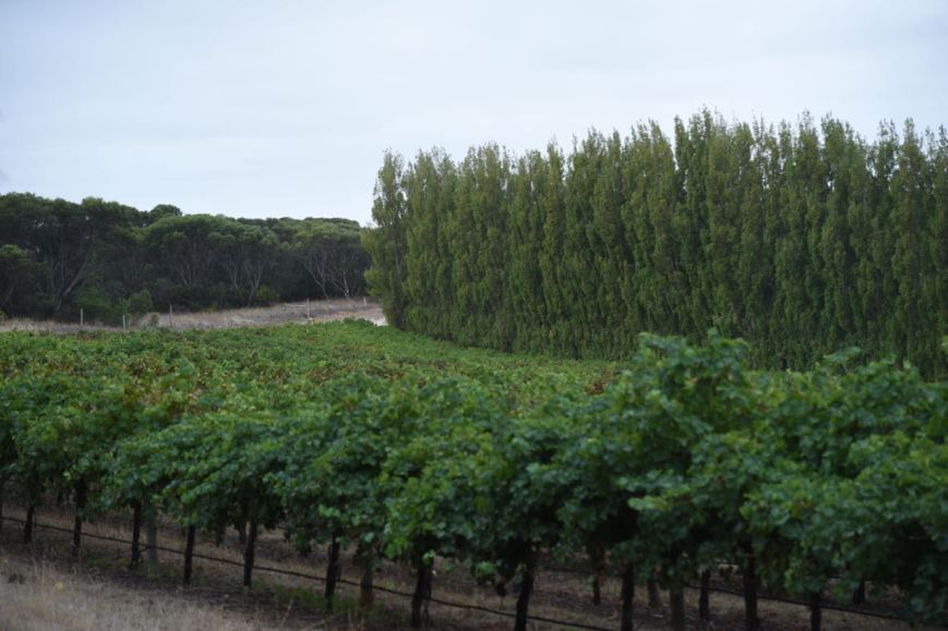
Above:- the vineyard opposite our operating position.
It initially started off as quite an overcast morning, but the cloud cover burnt off quite quickly and the sun had a fair degree of sting, so we rolled out the awning on the Toyota Hi Lux. I kicked off the activation with the first station in the log being Rod VK7FRJG, followed by Gerard VK2IO, Rob VK4FFAB and then Geoff VK3SQ. Band conditions were poor, with huge amounts of fading (QSB) noted on signals, with a whooshing sound on the band. Apparently there had been a solar flare in the preceding 24 hours which accounted for the poor band conditions.
Within about 12 minutes I had contact number 10 in the log, thus qualifying the park for the VKFF program. That being a QSO with Ray VK4DXA. It was very slow going on the band, and after logging 13 stations it went quiet. This was good timing as I had seen a spot on 20m for Warren ZL2AJ on a SOTA summit in New Zealand. I headed off to 14.310 after removing the links in the dipole and logged Warren who was on SOTA peak ZL1/ WK-151. We exchanged 5/5 signal reports.


We reinserted the links and headed back to 40m. It was time for Marija to qualify the park. Marija’s first contact was with Ray VK4NH. Contact number 10 came 11 minutes later, that being with John VK4TJ using his call of VK4/AC8WN. Marija logged a total of 19 contacts from VK1, VK2, VK3, and VK4, including two Park to Park contacts, with Peter VK3PF/p in the Kilcunda Nature Conservation Reserve VKFF-2125, and Liz VK2XSE/p operating in the Ingalba Nature Reserve VKFF-1940. Marija took a break and I jumped back into the operators chair.


I logged a further 16 stations on 40m including the following Park to Park contacts:
Band conditions proved to be very challenging with very severe fading on most signals. It had now just passed the UTC rollover and callers had slowed down, so I took the opportunity of tuning across the band. We found Tony VK3XV/5 who was activating the Penola Conservation Park 5CP-177 & VKFF-0803. Tony had a good 5/5 signal despite being close by, and Marija and I were very happy to get Tony in the log Park to Park.
Whilst on air I head what I thought was Marija hammering a peg into the ground. I looked up as the sound got louder, only to see a large sheaok tree about 7 metres away crashing to the ground. Fortunately it fell in the opposite direction. It is a timely reminder to be vigilant on where you set up your station. Fortunately it only partially blocked the track, and we were able to get out of the park later that morning.


We then headed to the 80m band where we called CQ on 3.610. First in the log was Ivan VK5HS in the Riverland region of South Australia, with an excellent 5/9 signal. We then quickly headed up to 3.620 to log Peter VK3PF/p Park to Park in the Kilcunda Nature Conservation Reserve VKFF-2125. We then moved back down to 3.610 and logged a number of stations in VK3 and VK5 including the following Park to Park contacts:
I now had 41 contacts in the log and needed just 3 more to qualify the park for the global WWFF program. Marija was also rapidly approaching her 44, with 35 contacts in the log.
I called CQ on 7.155 and this was answered by Stef VK5HSX/3 in the Hepburn Regional Park VKFF-0968, followed by Chris VK5FR/p (Cleland Conservation Park 5CP-042 & VKFF-0778. Jim VK5KOB was next, being the magical 44th contact.
Marija then took control of the mic and soon had 44 contacts in the log, with a QSO with Allen VK3ARH. We logged a few further Park to Park contacts:
I then tuned across the band and made two further Park to Park contacts on 40m:
I then headed to 20m where I logged 3 stations on 14.310 from VK2 and VK3. Marija and I then had one final listen on 40m and picked up a few more Park to Park contacts:
To finish off the activation I put out a few quick CQ calls on 15m and logged Cliff VK2NP.
Marija worked the following stations on 40m SSB before the UTC rollover:-
Marija worked the following stations on 40m SSB after the UTC rollover:-
Marija worked the following stations on 80m SSB:-
I worked the following stations on 40m SSB before the UTC rollover:-
I worked the following station on 20m SSB:-
I worked the following stations on 80m SSB:-
I worked the following station on 15m SSB:-
As we were leaving the park we worked Mark VK4SMA on 40m, Park to Park. Mark was activating the Tamborine National Park VKFF-0475. We also logged Tony VK5MRT/op in the Bullock Hill Conservation Park 5CP-265 & VKFF-0873. Tony was down quite low at the start and it was quite a challenge to break through the pile up.
We then drove out of the park and headed off the our second park of the day, the Lake Hawdon South Conservation Park.
References.
Department for Environment and Heritage, 2000, ‘Woakwine Conservation Reserve Management Plan’.
Wattle Range Council, 2018, <http://www.wattlerange.sa.gov.au/page.aspx?u=2341>, viewed 14th March 2018
Our second park for Saturday 10th March 2018 was the Lake St Clair Conservation Park 5CP-112 & VKFF-1047. The park is located about 20 km south of the town of Robe and about 350 km south east of Adelaide.
Above:- Map showing the location of the Lake St Clair Conservation Park. Map courtesy of Location SA Map Viewer.
Lake St Clair Conservation Park is about 189 hectares in size and was proclaimed on the 29th June 2006. The park was established to protect remnant Swamp Antechinus habitat of Silky Tea-Tree/Cutting Grass that fringes the lake. The park protects the largest remaining example of intact native vegetation around the Lake St Clair wetland and lagoon, providing an important habitat for many rare and threatened native wildlife species.
Lake St Clair, a shallow, saline lake below sea level, forms the middle lake in a series of three large coastal salt lakes between Robe and Beachport. It contained water during our visit, although we did not get close to the water’s edge.
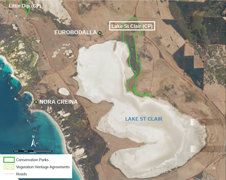
Above;- Aerial shot of Lake St Clair, showing the park to the north east of the lake. Image courtesy of National Parks SA.
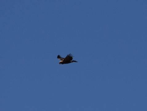
The park is a haven for bird species, with the swamp providing habitat for many waders. Two nationally significant birds can be found in the park, the Orange-bellied parrot and the Hooded plover. Nationally significant numbers of the migratory Golden Plover have been recorded at Lake St Clair. During our visit we spotted a number of Wedge Tailed Eagles soaring high in the breeze. Unfortunately they weren’t quite close enough for great photos.
The park is also frequented by Eastern grey kangaroos, Red-necked wallabies, Common wombats, Swamp Wallabies, and echidnas.


After leaving the Little Dip Conservation Park, Marija and I travelled south on the Nora Creina Road and then turned left onto Powells Road. Lake St Clair soon came into view on the right of the vehicle.


We continued along Powells Road and finally found a gate, which of course was locked. The only way in to the park was to scramble over a rickety barbed wire fence. We stopped briefly to check this location out but found no real shade, and as it was such a hot afternoon (in the mid 30 deg C), we decided to continue on to see if we could find an alternative operating spot.

We turned right onto the Southern Ports Highway and travelled south, keeping an eye out for possible spots to set up. But they appeared to be non existant, and we soon reached the southern boundary of the park. We continued on to Bog Land and drove all the way back around the lake again. We decided to head back to the gate we had come across and try to find some shade.
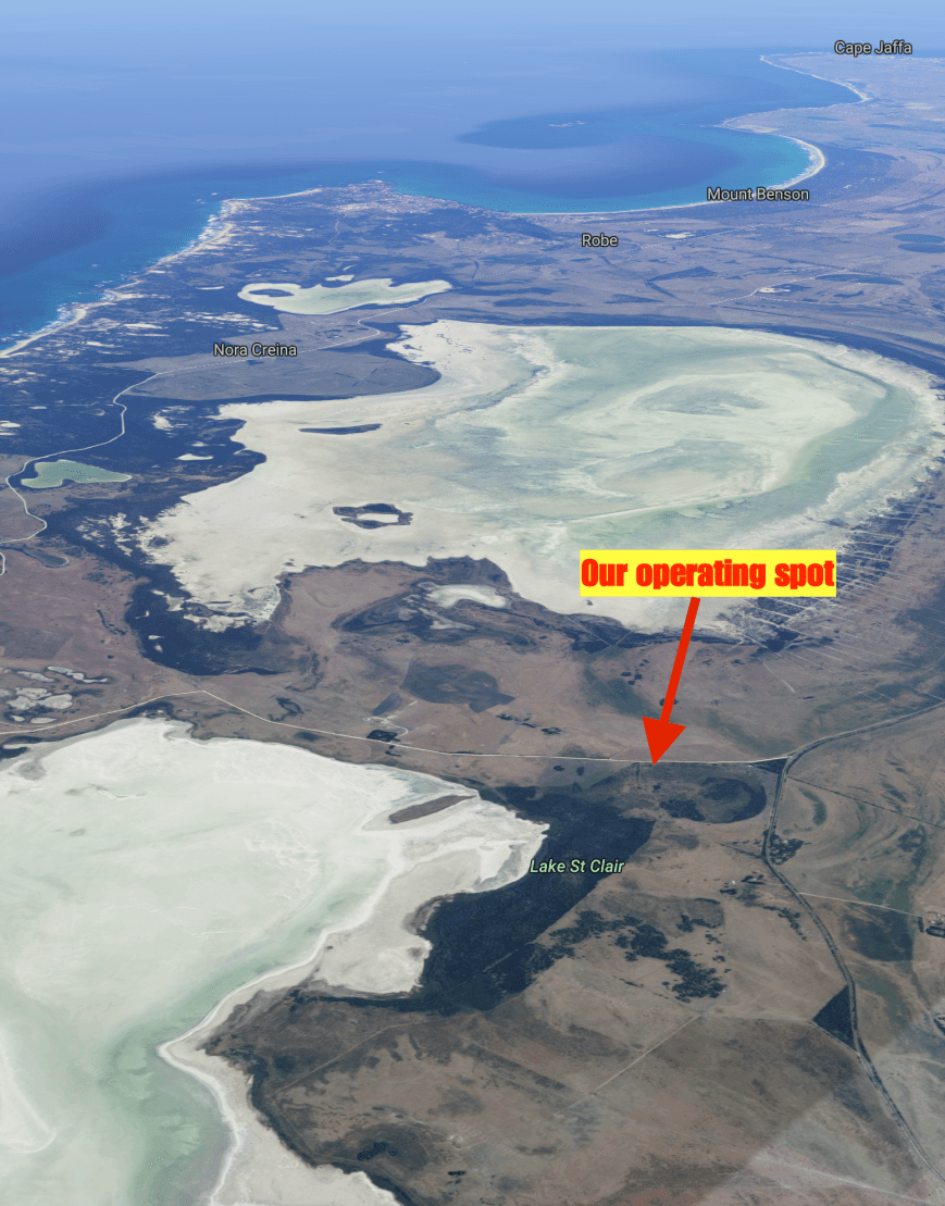
Above:- Aerial shot of the Lake St Clair Conservation Park. Image courtesy of google maps
The Department of Environment Water & Natural Resources (DEWNR) website has very limited detail on the park, and actually states “Go bushwalking and experience the park’s diverse range of flora species….“. Sadly, the reality is that access to the park is not easy. Okay if you are prepared to scramble over the barbed wire fence, but if you were elderly or disabled, there is no chance of accessing this park. There were also no apparent walking trails.
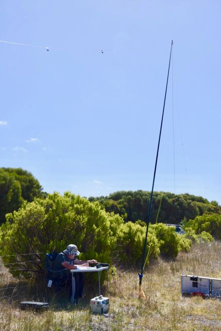
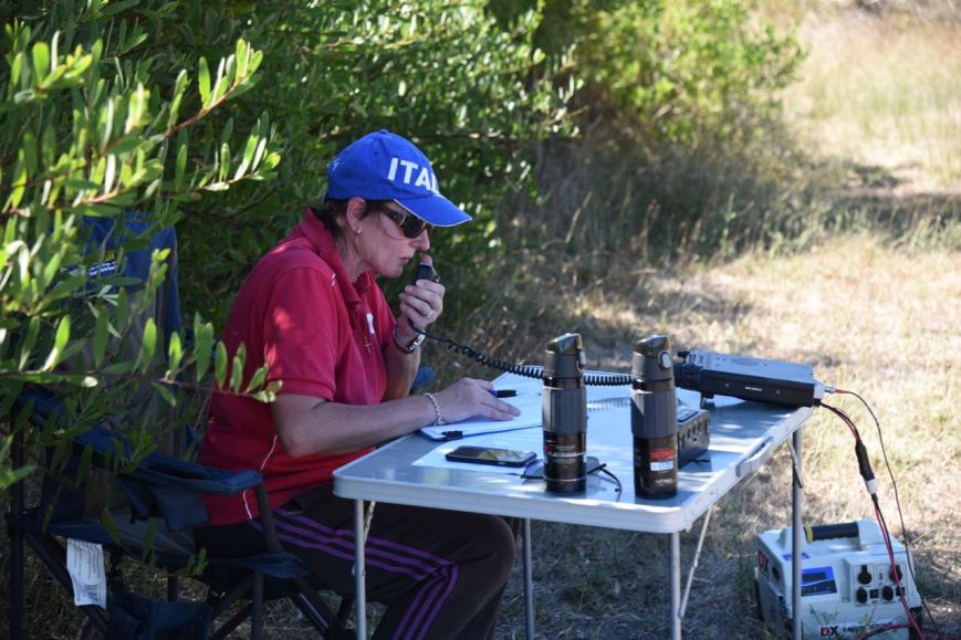
In any event, we set up the fold up table and deck chair, hard up against some shrubs, trying to get a little shade from the very hot afternoon sun. We ran the Yaesu FT-857d and the 80/40/20m linked dipole for this activation. There was a nice cleared area here to stretch out the antenna.


Prior to propping on a frequency we tuned across the 40m band and made two Park to Park contacts. The first being with Ian VK1DI/p in the Old Naas Travelling Stock Route (TSR) Nature Reserve VKFF-0992, and then Gerard VK2IO/p who was activating the Heathcote National Park VKFF-0232.
I then called CQ on 7.155. This was answered by Fred VK3DAC/p who was in the Lerderderg State Park VKFF-0763, and then Peter VK3PF/p who was activating the Glenmaggie Nature Conservation Reserve VKFF-2094. I made my 10 contacts, qualifying the park for the VKFF program, and then swapped the mic with Marija who soon also had 10 contacts in the log. Contact number 10 being with Peter VK5ZPG at Quorn in the north of South Australia. Marija made a total of 18 contacts, before we again swapped operating positions. I was hoping to get my 44 to qualify the park for the global WWFF program.
The band conditions were okay and there was a welcomed steady flow of callers. We were keen to get out of the park asap, as it was a hot afternoon. Contact number 44 for me was a QSO with Malcolm VK3OAK. I logged a total of 58 contacts on 40m including some further Park to Park contacts (Marija also logged the P2P contacts):
Callers then dried up, so I tuned across the band and logged Wade VK1MIC/p who was activating SOTA peak Mount Ainslie VK1/ AC-040 in the Mount Ainslee Nature Reserve VKFFF-0850. Wade was activating the summit as part of a regular VK/ZL/EU/JA SOTA event.
I then headed over to the 20m band where I logged a total of 5 stations, including John VK6NU/p who was on the top of SOTA peak Mount Randall VK6/ SW-039. I also logged two Japanese stations, Tadashi JA1VRY and Etsuro JH1IED. The strongest station worked was Hans VK6XN in Perth who was 5/9 +. I saw 2 spots on parksnpeaks for Jonathan VK7JON and Wynne ZL2ATH, both on SOTA summits, but sadly they were not readable.
To finish off the activation for me I put a few calls out on 80m and logged Tony VK5MRT and Nik VK3NLK.
Marija had 22 contacts in the log and I talked her into getting back on air to get another 22 to qualify the park for the global WWFF program. And that was done quite quickly, within about 25 minutes. Contact number 44 being with Peter VK2KNV.
So with a total of 113 contacts in the log between us, including 17 Park to Park contacts, it was time to pack up and head back into Robe to freshen up and get some dinner.
Marija worked the following stations on 40m SSB:-
I worked the following stations on 40m SSB:-
I worked the following stations on 20m SSB:-
I worked the following stations on 80m SSB:-
As we drove back into Robe I spoke with John VK6NU/p who was activating SOTA peak VK6/ SW-039. John was a good 5/5 into the mobile.
After getting back into Robe we decided to get some Chinese take away and head back to the motel. Whilst waiting for the order I took a stroll down Smillie Street which contains a number of very historic buidlings.


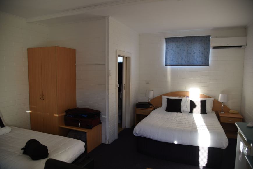
We then headed back to our accomodation at the Robe Harbour View Motel, which we would recommend for anyone visiting Robe. Very friendly staff and clean and tidy rooms.
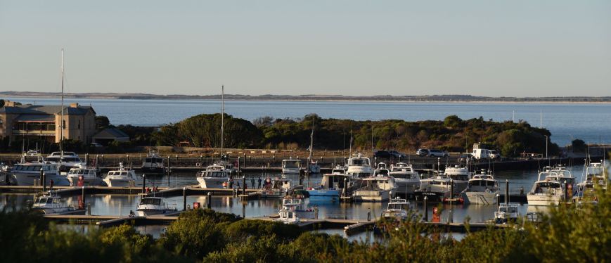
There is also a nice view of the Lake Butler Marina across from the motel.
References.
Department of Environment and Natural Resources, 2011, ‘Lake St Clair Conservation Park Supplementary Document to Management Plan 2011’.
National Parks South Australia, 2018, <https://www.environment.sa.gov.au/parks/find-a-park/Browse_by_region/Limestone_Coast/lake-st-clair-conservation-park>, viewed 13th March 2018
Amateur Radio, Short Wave Listening, travel and history
Amateur radio experiences with VK1DA
Brisbane - Australia
german amateur radio station
Summits On The Air
SOTA on the peaks, wilderness QRP and some bushwalking
A fine WordPress.com site
Amateur Radio Adventures
Summits on the Ai
Radio craft, homebrew, QRP/SOTA, AM
Ego loqui ad viros super montes
My adventures with Amateur Radio and Geocaching!
The rantings of VK2GAZ on his SOTA experiences in Australia
A survivor, with minor cuts and abrasions.
The Art and Craft of Blogging
The latest news on WordPress.com and the WordPress community.
Blog of Justin Giles-Clark VK7TW's SOTA and amateur radio adventures.
Occasional SOTA & Microwave operation
Some accounts of SOTA and other radio outings
