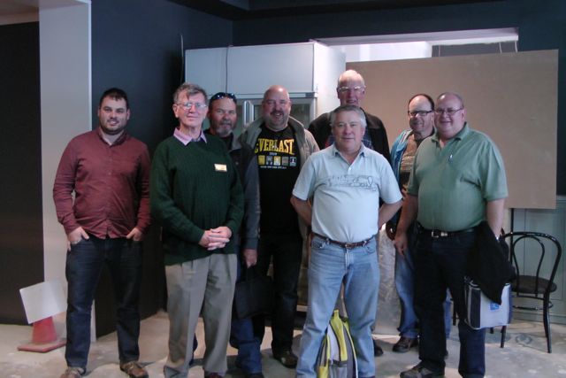
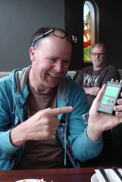
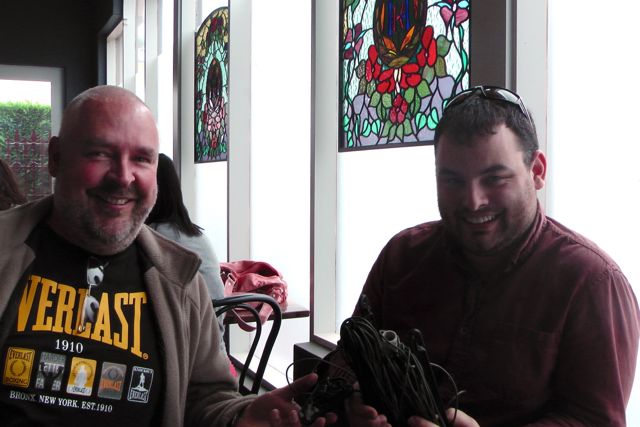
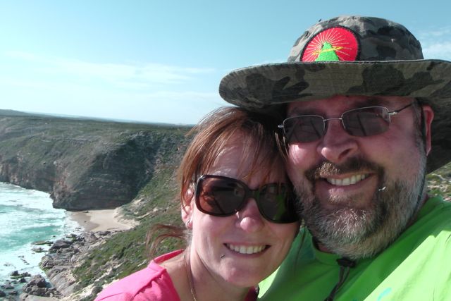
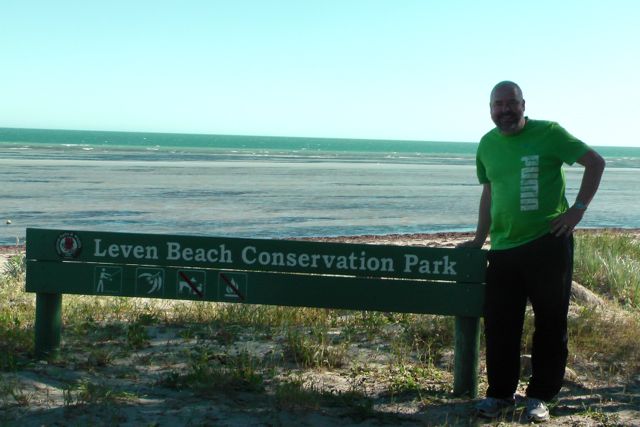
Yesterday, Sunday 27th October, 2013, a group of 8 attended the Kingsford Hotel at Gawler for a lunch to celebrate the 1st year anniversary of SOTA in VK5.
Attendees were:-
Ian VK5CZ.
John VK5BJE
Larry VK5LY
Andy VK5LA
Andy VK5AKH
Keith VK5OQ
Mike VK5MCB
Paul VK5PAS
Special thanks to Larry 5LY and Andy 5LA who travelled all the way from the Riverland, and Mike 5MCB, who also travelled to the lunch from Pt Pirie.
Larry 5LY & Andy 5LA even activated Mt Gawler, VK5/ SE-013, on the way to the lunch. John 5BJE and I received a phone call from Andy to advise that they were on the summit. So John and I pulled the car over, on Lower Portrush Road, and made contact with Larry and Andy from the mobile. John was a bit more generous with his signal report than me.
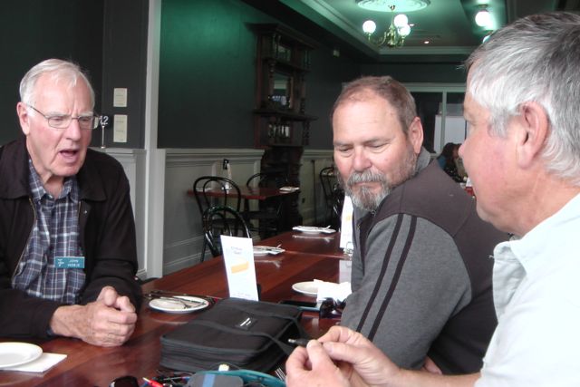
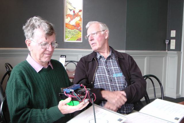
We decided that the afternoon at the pub, would be a show and tell, so a selection of transceivers, antennas, and other gadgets were brought along. It was good to see and hear what equipment everyone was using.
It was a really good fun afternoon with a nice meal, a few beers, plenty of laughs, and a few war stories from a summit or two.
Yesterday, Wednesday 23rd October, 2013, I saw a SOTAWatch spot from VK2DAG for Austrian station, OE4JHW, and that he was looking for VK/ZL. So I went up to the radio room and turned the radio on and tuned to 20m. And there he was…..Juergen, OE4JHW, on SOTA peak OE/ ST-252, with an excellent 5/8 signal.
Juergen was initially working other Europeans, but within a minute or so, he again asked for VK’s / ZL’s, so I gave him a shout and got through straight away with a 5/9 signal report being returned back to me. I quickly respited Juergen, and soon after I did hear Mal VK3AZZ get through. Not sure how many other VK’s managed to work Juergen, but he certainly had a very good signal here in the Adelaide Hills.
And then today, thanks to an initial sms message from Larry VK5LY, I managed to work Ivan, VK5HS/9 on SOTA peak, VK9/ NO-001, on Norfolk Island. Ivan was initially calling on 40m but I couldn’t hear him at all. I then saw him re spotted on 15m so I had a listen there, and got through to Ivan straight away as there were no apparent Chasers. Ivan was 5/5-7 with QSB and he returned the same signal report to me. There weren’t many chasers for Ivan, so he and I had quite a chat, and Ivan got out his video recorder and filmed a bit of the QSO, as did I at this end.
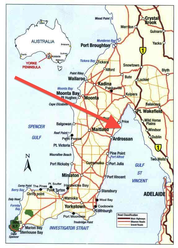
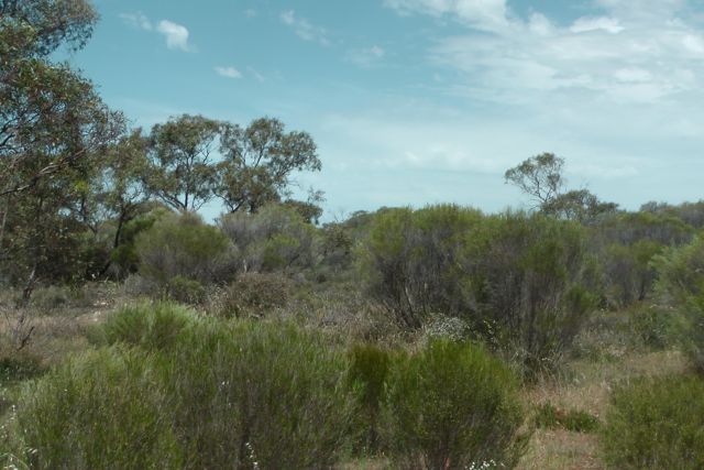
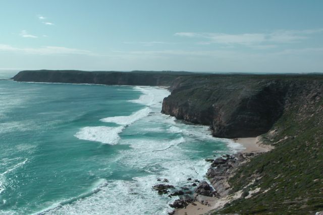
My last activation of the weekend was the Wills Creek Conservation Park, which is situated near the little town of Price on the upper Yorke Peninsula, about 133 km from Adelaide. After the activation at the very hot and windy Ramsay Way Conservation Park, Marija and I headed towards the coast, and in to the seaside town of Port Vincent, where we enjoyed an ice cream from the Ice Cream Parlour. We then travelled north on the Yorke Highway towards Price. As we did, we could see South Hummocks SOTA peak in the distance, which I had climbed earlier in the year. Behind that you could see the SOTA peaks, Bumbunga Hill, and Illawarra Hill.
Price township, which was proclaimed on the 3rd August 1882, is near the northern boundary of the Hundred of Cunningham. The principal local industries here are grain farming and salt production. In the case of the latter, sea salt is harvested from coastal salt pans. There is not much in the way of facilities here, and the population is only about 250 people. Major landmarks are the Wheatsheaf Hotel, established in 1886, and a caravan park.
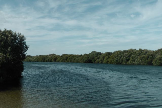
Price, although not right on the coast, has a causeway running to the Wills Creek CP, which of course contains Wills Creek itself, a mangrove fringed tidal creek, which is connected with the sea, Gulf St Vincent. At the end of the causeway there is a public boat ramp. Once outside the creek, fishing is plentiful. Wills Creek is a very sheltered anchorage for boats and in earlier times it was from here that bagged salt and grain was loaded onto ketches for export. These products are now transported in bulk form by road.
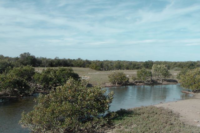
Wills Creek Conservation Park consists of 2,130 hectares of mangrove, and was proclaimed in 2006. Prior to this, the area was Crown land. The park is situated at Mangrove Point on the north-western shores of Gulf St Vincent and is a significant coastal wetland/estuary area supporting mangroves and intertidal habitats. The park extends south from the township of Port Clinton to the town of Price.
Wills Creek Conservation Park consists of mangrove and samphire habitats along the coastal fringe. Wills and Shag Creeks are known fish nursery areas and as an important habitat for seabirds. To the north, the mangrove woodland is somewhat atypical, being backed by eroding limestone cliffs topped with mallee and dryland tea-tree vegetation. Wills Creek Conservation Park is subject to active mining leases.
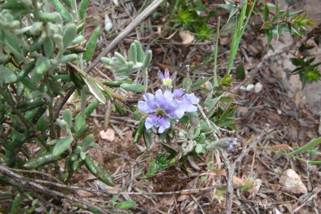
Wills Creek Conservation Park incorporates a nationally listed wetland and estuary of interest, including an extensive area of Grey Mangrove woodland and adjoining shrubland habitat dominated by Scrubby Samphire and Beaded Samphire. The limestone escarpment north of the township of Price supports low woodland of Red Mallee, Dryland Tea-tree and Spear Grass. Only six native plants have been recorded thus far, none of which have a conservation rating. However, there have been observations of Bead Samphire in the park and this species is considered to be of high conservation significance.
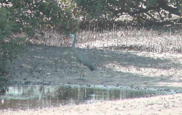
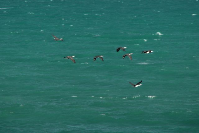
The park is a haven for a variety of birdlife including White faced herons, Cormorants, Pied Oystercatchers, Thornbills, and Gulls.
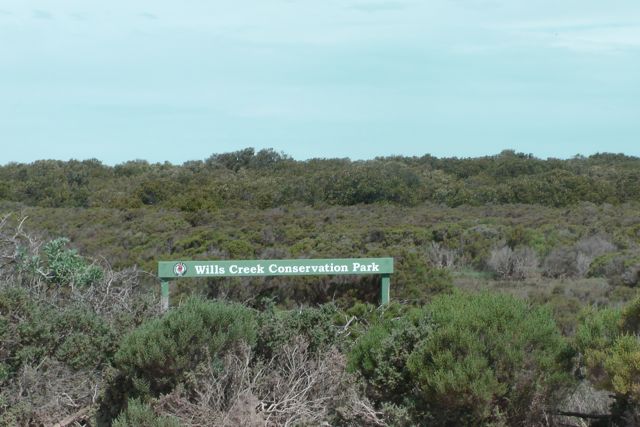
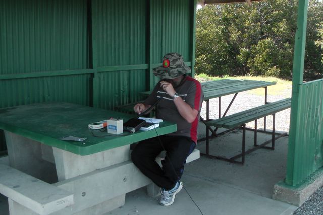
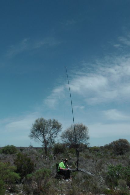
We travelled passed the old Wheatsheaf pub, and down along the dirt causeway, through the mangroves. At the end of the dirt road, there is a large parking area which adjoins Wills Creek. We were surprised at the number of people that were here, either launching boats or going swimming in Wills Creek. By this stage of the afternoon the weather had become really hot and the wind was still quite strong and gusty. Fortunately there was a tin shelter at the eastern end of the carpark which had tables and benches in it. So it was an ideal place to set up the gear and escape from the hot afternoon sun. The bush flies however did not want to co-operate. They were still out in force, and Marija and I needed to wear our face netting ! We used an adjacent concrete table to the shelter, to strap the squid pole to.
On the way to the park I had received a message from Col VK5HCF that he was in Telford Scrub Conservation Park, down in the south east of S.A.. So after we had set up, I tuned to 40m and heard Tim VK5AV calling CQ from Telford Scrub CP with a nice signal. I believe this was Tim’s first ever activation. He has become an active Parks Hunter, but it was great to see him actually out & about in a park himself. During this QSO, a big gust of wind caught the squid pole, and pulled it over, almost bringing the radio with it, as you will see from the video below. After re erecting the antenna, Col VK5HCF also called in from Telford Scrub, and it was nice to bag another Park to Park QSO.
The band conditions seemed to have improved a bit, and of course, this time of the day the 40m band generally comes alive again anyway. So as a result I worked a steady flow of callers from VK2, VK3, & VK5. Ron VK5MRE from the Riverland called in using his old ‘boat anchor’ transceiver with a strong 5/9 signal. Regular Park Hunters Colin VK3UBY and his wife Sandra VK3LSC also called in with their usual very strong 5/9 plus signal/s. Sandy suggested there should be an Award for the ladies/wives ‘for sticking it out’. I think she probably has a very good valid point, considering that Marija tolerated my 8 park activations under trying circumstances.
On a few occasions I heard Peter VK3YE calling me, who was pedestrian mobile & QRP. Sadly we could not get through to each other. I spoke with Peter a few days later and he told me that he had a weak copy on me, and that there was very bad QSB. This was a good reflection of what the 40m band was like over the weekend.
Larry VK5LY also called in. He had just arrived home at Renmark with his wife Di, after activating a number of parks in the mid north of S.A. Congratulations Larry, and well done Di, for putting up with the park activations.
I also had a contact with Bernard VK2IB who was using a new Yaesu FT-817, and he was giving it its first run on air. Bernard was operating from his bush block at Talmalmo, on the Murray River, east of Albury, and was using a linked dipole about 6 m from the ground in an inverted fee configuration. Bernard and I exchanged 5/3 signal reports.
I was getting close to packing up and calling CQ for last callers, when much to my surprise, Phil VK3BHR called in. He was portable on SOTA peak, un-named summit, VK3/ VC-032. It was great to be able to make contact with Phil, who initially was struggling to get his 4 contacts.
My last contact of the weekend was with Garry VK3FREQ who was mobile in the Flinders Ranges National Park (5/3 both ways).
I had a few people approach Marija and I whilst I was operating. One gentleman was familiar with amateur radio, whilst another one saw my squid pole and asked if I was having an success in catching anything. Maybe I should have brought the fishing rod and thrown a line into the Wills Creek whilst I was operating.
As mentioned, this was a much more productive park as far as contacts. I ended up with 24 QSO’s on 40m SSB into VK2, VK3, & VK5.
The following stations were worked:-
Tim VK5AV/p (Park to Park); Col VK5HCF/p (Park to Park); Brian VK5FMID/qrp; Ron VK5MRE; Colin VK3UBY; Sandra VK3LSC; Peter VK3PF; Andrew VK3BQ/m; Ray VK3YAR; David VK5NQP; Dave VK2JDS; Larry VK5LY; Noel VK3FI; Dennis VK5FDEN; Andy VK5AKH; Shaun VK5FAKV/m; Bernard VK2IB/p; Ted VK5KBM; Tony VK3CAT; David VK5KC; Phil VK3BHR/p (SOTA); Trevor VK5ATQ; Paul VK5MAP; and VK3FREQ/p.
This was the end of a thoroughly enjoyable, but challenging weekend. I had activated all 8 planned parks, and had a total of 90 QSO’s. Band conditions were very flakey. Weather conditions were hot and windy. The flies were amazing…hundreds of them. And then there was the antenna problems. But I had filled plenty of pages in the notebook, and the scenery on the Yorke Peninsula was quite amazing. Thanks certainly go to my very tolerant wife, Marija for accompanying me on the trip.
I have placed some video on You Tube of my activation at the Wills Creek CP…..
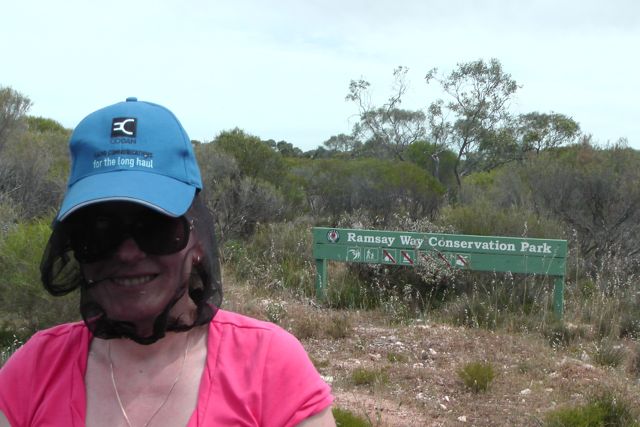
From Barker Rocks CP, Marija and I headed back inland from the west cost of the Yorke Peninsula, to our third activation of the day, the Ramsay Way Conservation Park.
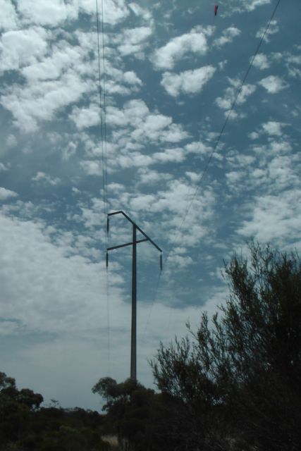
We travelled back to Minlaton and then west along the Port Vincent Road towards the eastern coast of the Yorke Peninsula. We then travelled west along the Old Coast Road, until we saw the park on our right hand side. On this northern side, the park was set some distance off the road and to gain access, you needed to travel over private property. So we continued east, and then turned right onto Power Line Road.
Just the name of the road should have set off alarm bells. It was not until I travelled down the road for a few hundred metres that I saw large powerlines following the eastern boundary of the park. Immediate though was….NOISE !
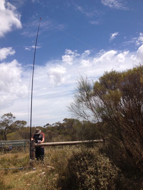
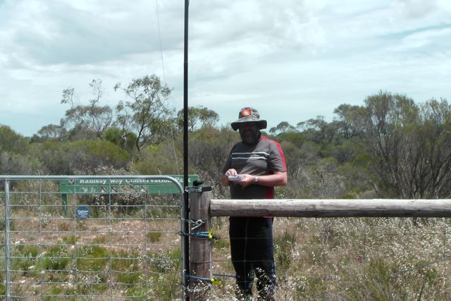
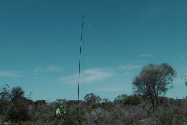
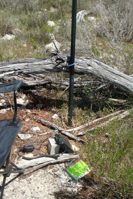
There was an access gate into the eastern side of the park, but this was locked. So we found what little shade there was and parked the car. It was starting to get really hot and the wind was still quite strong. I used the eastern boundary fence to secure the 7m squid pole, with some octopus straps, and ran the 40m/20m linked dipole, along the fence line. I rested the Yaesu FT-817nd on a permapine post.
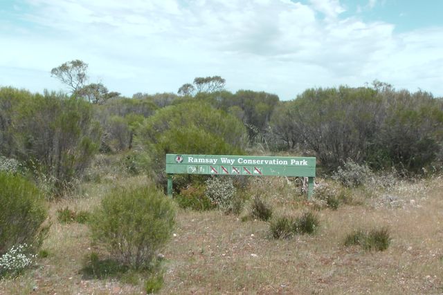
All of the maps I have seen refer to this park as the Ramsay CP. However the park sign refers to it as the Ramsay Way Conservation Park.
Ramsay Way Conservation Park is 147.2 hectares in size and was proclaimed in 2008. It is a small park in the Minlaton-Curramulka Threatened Habitat Area. Over 80 native plant species have been recorded in the park. Its dominant vegetation is sheoak and mallee, with very low woodlands and a grassy understorey. It occurs in a high priority bioregion and conserves some species of conservation significance, including the nationally and state endangered Jumping-jack Wattle, which has not been recorded thus far in any other National Parks and Wildlife Act reserves on Yorke Peninsula.
A large proportion of Ramsay Way Conservation Park supports Mallee Box, Drooping Sheoak woodland with intact grassy understorey in generally good condition. Temperate grassy woodland such as this is a rarity in South Australia because this vegetation has been largely cleared for agriculture.
Upon turning the radio on my fears were realised. The noise floor was really high…..a constant S7 Obviously due to the power lines. I could have ventured further into the park away from the power lines, but I didn’t fancy doing this, as it was a hot day and I am sure there would have been plenty of snakes around.
My first contact in the park was with Greg VK5ZGY who was portable in the Tantanoola Caves Conservation Park (5/7 both ways). I was then called, much to my surprise, by Andrew VK2UH who had a good 5/8 signal coming in from NSW. This was my first VK2 contact during the weekend. I then managed another Park to Park contact with John VK5BJE who was portable in the historic Fort Glanville Conservation Park.
Before packing up I had three more Park to Park QSO’s. One with Col VK5HCF who was with Greg, in the Tantanoola Caves CP; then Ian VK5CZ who was portable in the Spring Gully Conservation Park near Clare; and finally with Larry VK5LY who was portable in the Brookfield Conservation Park.
I operated on 40m SSB for about 45 minutes in the park, and ended up with 11 QSO’s into VK2, VK3, & VK5. It was time to head into Port Vincent for some refreshments.
The following stations were worked:-
Greg VK5ZGY/p (Park to Park); Andrew VK2UH; John VK5BJE/p (Park to Park); Tim VK5AV; Col VK5HCF (Park to Park); Colin VK3UBY; Sandra VK3LSC; Trevor VK5ATQ; Ian Vk5CZ (Park to Park); Tom VK5FTRC, and Larry VK5LY/p (Park to Park).
I have posted a video on You Tube of this activation…..
After the activation at Minlacowie Conservation Park, Marija and I headed off towards our 2nd park of the day, the Barker Rocks Conservation Park, which is situated on the coast, on the western side of Yorke Peninsula. It is just south of Port Rickaby.
We travelled back along the dirt to the Minlaton-Yorketown Road and headed north into the little town of Minlaton. We stopped at the Visitor Centre at Minlaton and found the 2 ladies there to be very friendly & helpful. We couldn’t go passed the local bakery and a susage roll and orange juice. We then headed out towards the coast on the Rickaby Road, and then turned left into Barker Rocks Road which took us down to the coast and the park.
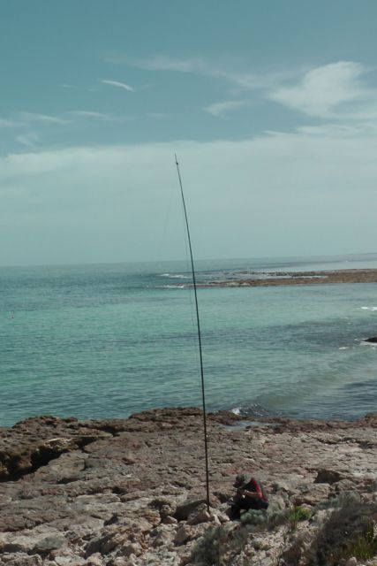
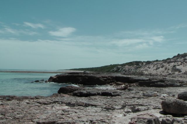
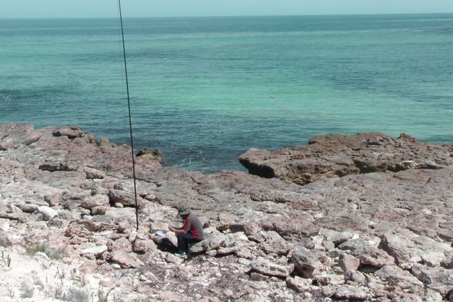
There is a large carpark and camp ground area at the end of the road, and a path leading down to the beach. Well, in fact there is no beach. It is all rock. That’s how the park got its name. So I secured the squid pole between some rocks and stretched out the 40m/20m linked dipole. There were quite a few fisherman on the foreshore. I must have been the only guy using a squid pole for a different reason !
Sadly the VSWR on the dipole was high again, and despite all my best efforts I could not resolve the issue. So I planned on just getting as many contacts as possible and heading off to the next park.
I called CQ on 7.110 and was greeted by Tim VK5AV who had an excellent 5/9 signal. This was followed by John VK5BJE who was portable in the Marino Rocks Conservation Park. So I was happy. I had 2 contacts. But despite a number of CQ calls, I had no more takers. So I tuned across the band and found Col VK5HCF who was portable in the Gower Conservation Park in the south east of S.A.
I spent about 30 minutes in the park and managed to scrape up 6 QSO’s on 40m SSB, including 2 Park to park contacts. It was good to hear from Tom again, VK5FTRG, who has just acquired his Foundation licence.
The following stations were worked:-
Tim VK5AV; John VK5BJE/p (Park to Park); Col VK5HCF/p (Park to Park); Eddie VK5EDM; Tom VK5FTRG; and John VK5DJ.
I have posted a video on You Tube of the activation…..
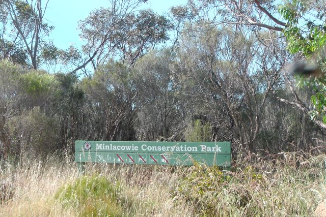
My first of 4 activations for Sunday 20th October, was the Minlacowie Conservation Park, which is located on the Yorke Peninsula, about 13 km west of Stansbury, and about 218 km from Adelaide. So bright and early Marija and I got up, and enjoyed a coffee and breakfast on the porch of the cabin at the Corny Point Caravan Park. It was a beautiful morning. Already very warm, with an expected top temperature of 35 deg C. Following breakfast we headed off after 2 enjoyable nights in Corny Point. Marija and I highly recommend the caravan park here. It was clean and tidy, and the owners were very friendly.
Before heading off to the park, we detoured to the local general store and purchased some fly nets to cover our faces. The bush flies on Saturday had been intolerable. We then headed out onto the Yorke Highway and into the little town of Warooka, and then on to Hardwicke Bay. We continued north on the Yorke Highway and passed through the little settlement of Brentwood. Not far out of Brentwood, we then turned right onto Rogers Road (a dirt road), and followed this through to the old Minlacowie South school, which is now a ruin. After a brief stop to have a look at the old school, we continued west on Rogers Road until we saw the Park on her right hand side.
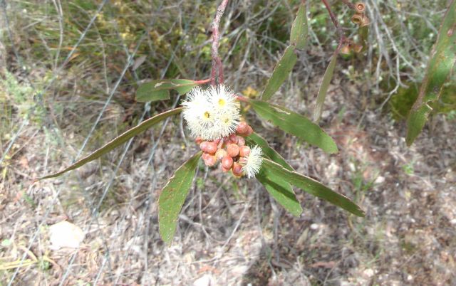
Minlacowie Conservation Park, which was proclaimed in 2008, consists of 28.5 hectares of native bush which is now rather rare on Yorke Peninsula. The park is an area of high biodiversity, with at least 87 native plant species observed. The park comprises a small patch of remnant mallee / broombush vegetation in very good condition, and conserves a number of significant plant species including the nationally and state vulnerable Winter Spider-orchid. The park is dominated by Ridge-fruited Mallee together with Narrow-leaf Red Mallee and Beaked Red Mallee and Dryland Tea-Tree and Broom-bush. There is a good ground cover including Mallee Bitter-pea, Rosemary Damperia and Common Stylewort.
We could not find any access to the park on the northern side, so we turned right onto Savage Hut Road (a dirt road) which followed the western boundary of the park. Again there was no visible access point to the park. So Marija and I stopped on the side of the road, and set up just of the roadway, not far from the intersection.
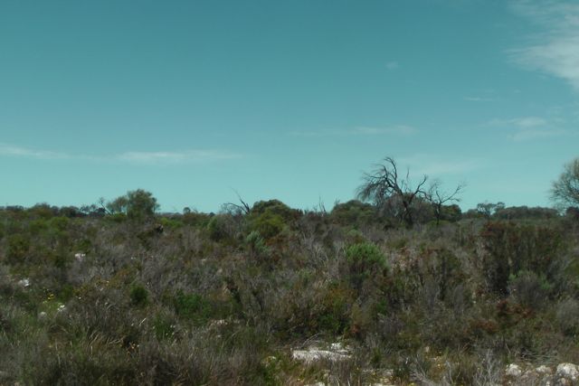
Sunday was shaping up to be a very hot day and it was already stifling with a very stiff breeze. The mallee scrub of the park is very thick and I didn’t fancy walking to far in through fear of snakes and goannas. And it would have been physically impossible to set up the dipole.
So I attached the 7 m squid pole to the dead branches of a tree, utilising some octopus straps. I set up my little fold up table and deck chair, and I checked the antenna with the antenna analyser. And to my surprise, the VSWR was through the roof. The linked dipole can be a little. But despite, the VSWR was still really high.
I put a few calls out on 40m but got no answer so I hunted around the band and found Larry VK5LY who was portable in the Spring Gully Conservation Park, near Clare. Larry was a good strong 5/9 signal and was using his new Wouxon X1M transceiver. I breathed a sigh of relief. I ahd one contact. I had qualified the park. Larry told me that John VK5BJE was up 5 kc, so I headed up to 7.110 and found John calling CQ from the Hallet Cove Conservation Park with a good strong 5/8 signal.
At the conclusion of the QSO with John, Graham VK5KGP asked me to QSY up 5. So I obliged and had a chat with Graham, before I decided that the heat, the flies, and the antenna issues, were not worth sitting in the sun for. So I packed up hoping that Barker Rocks Conservation Park, which was on the coast, would be a little bit more pleasant, and that I might be able to solve the antenna issues.
During the activation I had a local farmer drive by and ask me what I was researching. So I explained to him that I was a silly amateur radio operator sitting in the heat with the flies talking to other hams. He was quite interested, but warned me not to venture too far into the scrub because of all the snakes.
After just 15 minutes in the park, I had 3 QSO’s in the log. This is the lowest number of contacts I have ever had from a park.
The following stations were worked:-
Larry VK5LY/p (Park to Park); John VK5BJE/p (Park to Park); and Graham VK5KGP.
I have posted a video on You Tube of the activation…..
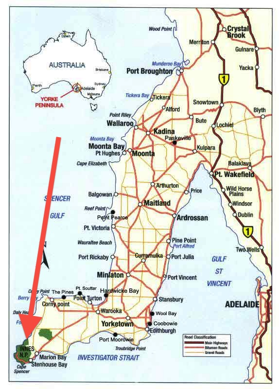
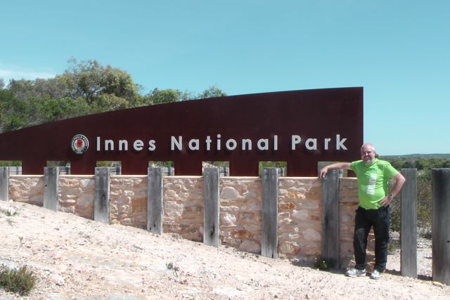
My last activation for Saturday, 19th October, was the Innes National Park, which is located on the southern tip of the Yorke Peninsula, about 295 km from Adelaide.
Innes National Park comprises 9,415 hectares of natural coastal vegetation, and represents one of only a few pockets of significant vegetation on the Yorke Peninsula. As such it is a very important National Park for biodiversity.
The Narungga aboriginal people have lived on the Yorke Peninsula for thousands of years. They were made of of four clan, the Kurnara in the north of the peninsula, Windera in the east, Wari in the west, and Dilpa in the south. In 1847, European colonisation of the Innes area commenced, with land occupied for sheep grazing near Cape Spencer. Small scale cropping increasingly occurred throughout the 19th and early 20th centuries.
Innes National Park takes its name from William Innes, who discovered commercial quantities of gypsum in the area during the early 1900’s. In 1913, he established the mioning township of Inneston, where gypsum was produced up until 1930. Inneston had a population of about 200 people during its boom phase. Despite being isolted, the township of Inneston was completely self sufficient, having its own school, post office, bakery, general store, and tennis court.
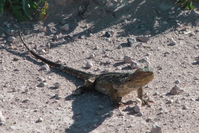
About 333 native plants have been recorded in the park. Of these, 115 are of conservation significance. Innes NP is home to about 140 species of birds, with many of these being of conservation significance. They include the shy Western Whipbird, and the Malleefowl. Western Grey kangaroos and emus roam freely in the park, as we found out. The speed limit throughout the park is generally 40 kph for good reason, as the road is often dotted by kangaroos and emus. A wide variety of reptiles also call the park home, including the deadly Brown snake, sleepy lizards (of which we saw numerous), and Eastern Bearded Dragons. Southern Right whales pass along the coast from May to September, whilst dolphins are also regular visitors to the park’s waters.
There are a large number of shipwrecks on the ocean floor off the coast of the Yorke Peninsula and Innes National Park. In fact, the remains of about 40 ship wrecks can be found. Many of these fell victim to the unpredictable storms that frequent the area. There were certainly no storms on the peninsula today. The temperature was about 35 deg c.
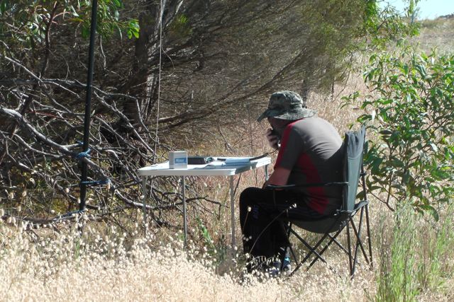
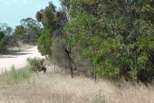
Marija and I drove into the park via the seaside town of Marion Bay. Marion Bay has a small population of approximately 130 people. This swells to 500-900 during holiday periods. We stopped at Stenhouse Bay and decided to set up the radio gear here. There was a terrific view of the Bay, and more importantly there was a big timber shelter that looked very inviting, to shelter us from the hot afternoon sun.
The township of Stenhouse Bay is at the western tip of Yorke Peninsula, and was named after Andrew Stenhouse, who in the 1920s had a business called the Permascite Manufacturing Company. Stenhouse helped commence the gypsum industry in this location. The Waratah Gypsum Company had works here for the quarrying and exporting of rock gypsum. Gypsum after being washed, roasted and ground, was used in the manufacturing of plaster of paris and cement. The quality of the gypsum in this area was exceptionally high class and most of Australia’s needs were supplied from here. The Waratah Gypsum Company closed its works and the town was sold to the South Australian Government which demolished the town except for the few houses required for the rangers of the National Parks and Wildlife Organization who look after Innes National Park.
Our operating spot overlooked the Bay and the Stenhouse Bay jetty which was constructed to enable ships to berth and load the bagged gypsum.
It was very difficult to find a clear frequency on 40m as the band was very busy with JOTA stations. Unfortunately a few times I was forced to move, because JOTA stations came up on my frequency and started calling CQ. Clearly they couldn’t hear my little QRP signal. But I did find 7.085 clear and I put out a call, to be greeted by regular Park Hunter Colin VK3UBY, with his normal terrificly strong 5/9 plus signal. I then spoke with Sandra VK3LSC, Colin’s wife, and this was followed by a chat with Maitland VK5AO. Another dedicated Hunter to call in was John VK5BJE with a great 5/9 signal. I managed one Park to Park contact and that was with Larry VK5LY who was portable in the Mokota Conservation Park in the mid north of S.A. (5/9 exchanged both ways)
After an hour of operating, Marija and I decided to pack up. There was a lot to see in the park, and we still had to drive back to Corny Point, where we had plans to go out for tea at the Howling Dog Tavern. I was relatively happy with 17 QSO’s in the logbook from VK3 & VK5.
The following stations were worked:-
Colin VK3UBY; Sandra VK3LSC; Maitland VK5AO; John VK5BJE; Andy VK5AKH; David VK5KC; David VK5BAR; Ian VK5CZ; Mark VK5QI; Brian VK5FMID; Larry VK5LY/p (Park to Park); Peter VK3PF; Bill VK5MBD; Tim VK5AV; Robin VK5TN; Col VK5HCF; & Bsil VK5BK.
I have placed some video on You Tube of the activation…..
My 3rd planned activation for Saturday 19th October, 2013, was the Warrenben Conservation Park, which is situated on the Yorke Peninsula, north east of Marion Bay.
Warrenben Conservation Park is a large park consisting of 4,065 hectares. It was constituted by statute in 1972. Together with nearby Innes National Park, it conserves a substantial proportion of the natural habitat remaining on southern Yorke Peninsula. The park comprises an area of undulating limestone plains and low, stabilised dunes that remain well vegetated with mallee and tea-tree scrub and some sheoak woodlands.
The Park provides habitat for a number of threatened species including the nationally and state vulnerable Annual Candles, state rare Goldsack’s Leek-orchid, and the nationally and state vulnerable Malleefowl and Western Whipbird. A large population of Western Grey kangaroos call the park home, and Marija and I saw quite a few of these.
Warrenben CP constitutes a major proportion of the only large remnant area of native vegetation left on southern Yorke Peninsula. The understorey has high biodiversity with 233 native plant species recorded, although a number of introduced species are also found on the park. Mallee plant community covers the north-eastern and southern sections of the park and includes species such as Coastal White Mallee, Red Mallee, Mallee Box and Sessile-fruit White Mallee . The understorey includes species of Calytrix, Acacia, Correa and Templetonia. The north-western section of the park includes tracts of low open woodland dominated by Drooping Sheoak and Dryland Tea-tree as well as stands of Scrubby Cypress Pine. The central section is a mix of the two habitat types.
Annual Candles and numerous other species of conservation significance occur in this park. Annual Candles ‘Stackhousiaceae’ is a small, upright herb with conspicuous, cylindrical groups of white-cream flowers at the top of the stems. The name ‘v\candles’ refers to the resemblance from a distance, of these flower heads to candlelight in the night.
Sadly the park is also home to several feral special including Goats, foxes, and rabbits.
Warrenben Conservation Park also supports stands of Sour-bush, the larval food plant for the Small Brown Azure Butterfly. This butterfly is now only found within or near large, pristine Mallee areas and evidently has been targeted by collectors.
The park was ravaged by fire in April this year. The Department of Environment, Water and Natural Resources (DEWNR) intended to burn around 100 to 300 hectares when it lit up a prescribed burn in the northern part of the Park. But a wind change saw the fire break containment lines and burn around 500 to 600 hectares, double the intended amount.
As Marija and I later left the park, in what were very hot and windy conditions we wondered how anything would survive in the park. But we learnt that Warrenben Conservation Park is located over a known groundwater basin. Groundwater is sourced on the park for fire-fighting purposes and a water-bore, windmill and tank are located there.
We accessed the northern side of the park via Ilfracombe Road, a dirt rack off the Marion Bay Road. The road was in good condition and follows the northern boundary of the park. There is no public access roads leading into the park. All of the access gates are locked for use by emergency service vehicles and DEWNR vehicles only. So we parked the car on Ilfracombe Road, and climbed the fence that forms the park boundary. I found a fallen tree limb and I used it to secure the squid pole.
I didn’t want to venture into the park too far because it was extremely hot. The temperature had already reached 35 deg C, and it was also extremely windy. The bush flies were almost intolerable, and I was forever concerned by snakes. The park is home to a number of snake species including the deadly Brown snake and Tiger snake.
But I did remain in the park for a short time and my saviour, John VK5BJE, was my first contact, as had been the case in the previous 2 parks. John is an active Parks Activator, and I think that John must have a sense of just how oppressive activations can sometimes be. So there he was, patiently waiting for me again with a strong 5/8 signal. This was followed by staunch Parks award Hunters Tim VK5AV, Colin VK3UBY and his wife Sandra VK3LSC, and then Peter VK3PF. My last contact was with Robin VK5TN down in Mount Gambier (5/8 both ways).
The band conditions on 40m SSB were quite poor. This was combined with very hot weather (35 deg C) and very strong winds. So I only spent about 15 minutes in the park, and ended up with a total of 6 contacts on 40m SSB.
I worked the following stations:-
John VK5BJE; Tim VK5AV; Colin VK3UBY; Sandra VK3LSC; Peter VK3PF; and Robin VK5TN.
I have posted a video on You Tube of the activation…..
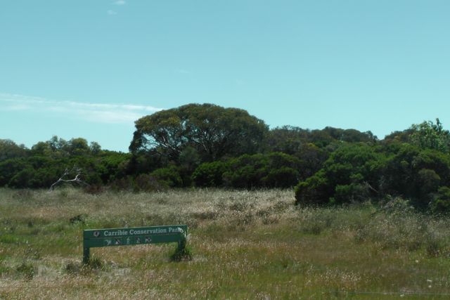
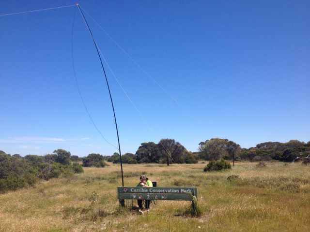
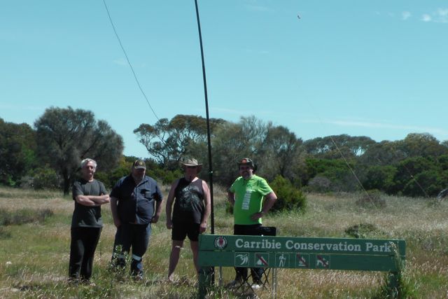
My second activation for Saturday 19th October, 2013 was the Carribie Conservation Park which is situated on the Yorke Peninsula, about 281 km from Adelaide, and just north of the little settlement of White Hut.
I accessed the Park via Gleesons Road, which runs off the eastern side of the Marion Bay Road. There is no public access road for vehicles into the park itself, so I simply climbed the fence to get into the park. Carribie CP is a small park, with no visitor facilities. It consists of 19.5 hectares of remnant sheoak and mallee, and is surrounded by farm land. The Park was constituted by statue in 1972.
The vegetation of Carribie Conservation Park comprises open scrub dominated by Coastal White Mallee and Red Mallee with an understorey that includes species of Calytrix, Acacia and Correa. Some sections of the park contain Drooping Sheoak woodland. There are 81 native plant species recorded from this park, though the only known species of conservation significance is the Western Daddy-long-legs.
Because the park is located about 7 km inland from the ocean, it was much hotter here than at Leven Beach Conservation Park on the coast. And to make things worse there was no shade, and the bush flies were absolutely out in force. I could have gone deeper into the park to possibly get some shade, but I wasnt keen to do this as it was a hot day and I figured the goannas and snakes would have been enjoying the sunshine. And they would probably have enjoyed even more, having a chomp on my lilly white legs.
So I set up my deck chair and foldable table in a cleared area on the southern side of the park. I used the wooden permapine post park sign to secure the 7 m squid pole, and then ran out the legs of the dipole, using some rocks to hold them down in place
As was the case at Leven Beach CP, my first contact in Carribie CP, was John VK5BJE who had a beautiful strong signal. This was followed by John VK5FTCT, and then dedicated Park Hunters Colin VK3UBY and his wife Sandra VK3LSC.
I managed one Park to Park contact whilst in Carribie, and that was with Larry VK5LY, who was portable in the Caroona Creek Conservation Park, in the mid north of S.A. with his dedicated wife Di. Larry and I exchanged 5/9 signal reports.
Another enjoyable QSO was with Tom, VK5FTRG. I had met Tom in September, when I travelled down to Mount Gambier to deliver a presentation to the South East Radio Group on SOTA & the VK5 Parks Award. At that time Tom was patiently awaiting his Foundation call yo come through. So ti was a pleasure to speak with Tom with his new call of VK5FTRG. Congratulations Tom.
Sadly conditions on 40m SSB were quite poor, and there was quite a bit of activity from the Jamboree on the Air (JOTA) stations, so finding a clear frequency with a little QRP signal was a little difficult.
Whilst I was operating in the Park, I was visited by one of the locals, Colin, VK5FCJM, and also two other fellas who were staying on an adjacent property. They were not all that familiar with amateur radio, so I showed them the set up and explained all about the hobby.
I worked the following stations on 40m SSB, in about 45 minutes in the park:-
John VK5BJE; John VK5FTCT; Colin VK3UBY; Sandra VK3LSC; Peter VK3PF; Larry VK5LY/p (Park to Park); Tim VK5AV; Tom VK5FTRG; David VK5KC; and Ian VK5CZ.
Here is a short video of the activation which I have placed on You Tube…..
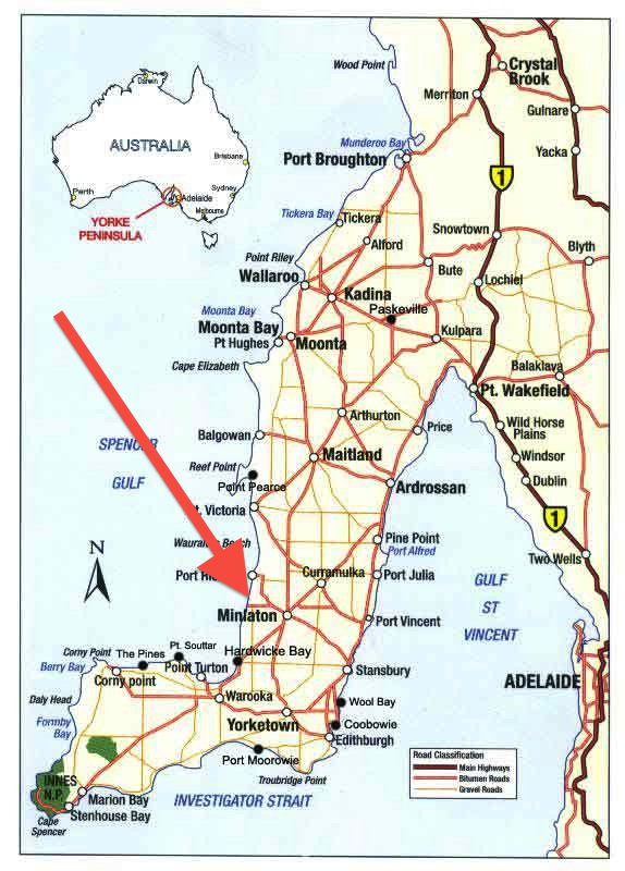
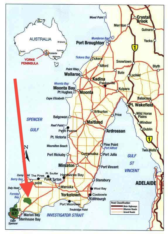
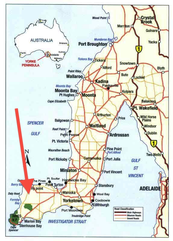
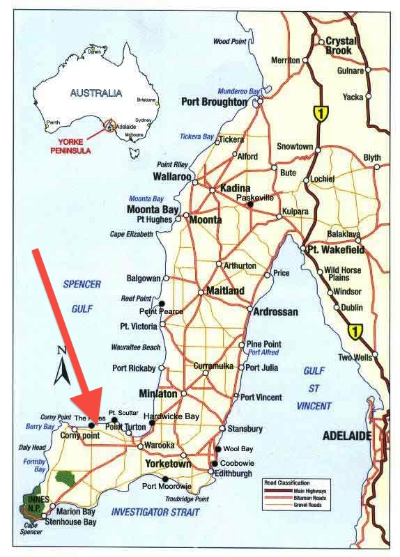
On Saturday 19th & Sunday 20th October, we celebrated the 6 month anniversary of the VK5 National and Conservation Parks Award. In its short history the award has proved to be very popular with both Activators and Hunters. To celebrate the special activity weekend, I headed over to the Yorke Peninsula, with my wife Marija. We stayed at the Corny Point Caravan Park on Friday and Saturday night, and activated 8 parks over the weekend
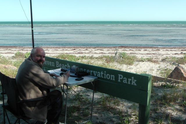
My first activation was on Saturday morning, and was the Leven Beach Conservation Park, which is located close to the little coastal town of Corny Point, on the Yorke Peninsula, about 265 km by road from Adelaide.
Yorke Peninsula comprises a total area of approximately 4,265 square kilometres, which is contained within about 560 kilometres of coastline extending 240 kilometres from north to south. The surface topography is gently undulating, with an average elevation about 90 metres above sea level. Yorke Peninsula was named by Captain Matthew Flinders after the Right Honourable Charles Philip Yorke, narrowly beating French navigator Captain Nicholas Baudin who preferred the name ‘Cambaceres Peninsula’.
It is interesting how Corny Point was named. It was named this by Matthew Flinders in March 1802 because it appeared to be a growth on the toe of Yorke Peninsula.
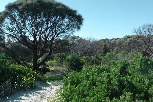
Leven Beach Conservation Park was proclaimed in 1988, and consists of 502 hectares of coastal dune system vegetation. Over 127 native species of plants have been recorded in park. There are various plants on the foredune aea including Coast Saltbush and Rolling Spinifex. Behind the foredune area is a diversity of species which form a low scrubland community with Coast Daisy-bush, Common Boobialla and Sea Box prominent. Further inland from the coast there are Drooping Sheoak, and Dryland Tea-tree woodlands with an understorey including Coast Daisy-bush and Coast Salt Bush. The Park has a 6 km beach frontage backed by low cliffs and a hinterland of undulating, vegetated dunes.
The Park provides habitat for a nationally endangered species of butterfly, the Yelow Sedge-skipper Butterfly, which feed on stands of Smooth Cutting-grass. This grass is required by the larva that feed only on this species of grass. There are a number of threats to the survivial of butterfly due to issues with the grass including overgrazing by Western Grey kangaroos, chemical drift spray from farming, and the removal of nectar plants.
I set up up at the end of Roe Road, near Couch Beach, on the western end of the Park. There was a convenient car park at the end of Roe Road, and an even more convenient park sign, which I used to secure my 7m squid pole to with some octopus straps. It was a warm morning (already 28 deg C) with a stiff breeze coming off the ocean, but I managed to get some shade out of the hot sun. I set up my deck chair and fold up table, and put a call out on 7.095 on 40m, to be greeted by John VK5BJE, my first contact in the park. This was followed by a good signal from Allen VK3HRA who was setting up for JOTA, Tim VK5AV with a very strong signal from the SE of S.A., and Colin VK3UBY and his wife Sandra VK3LSC from Mildura. They always have a booming signal coming in from the Sunraysia district.
My 6th contact of the morning was my first Park to Park QSO for the weekend, and this was with Larry VK5LY who was with his wiffe Di, portable in the Red Banks Conservation Park, near Burra in the mid north of S.A. Larry had a genuine 5/9 signal with 5/9 being returned to me by Larry. Hats off to you Di, for being another dedicated XYL like Marija.
I then tuned around the band and was really pleased to make contact with David VK5NQP who was portable in the Hale Conservation Park. This was David’s second attempt at this park, and it was a pleasure to get David in the log with a Park to Park contact. Although a bit low (5/3), David was perfectly readable, and was using a Yaesu FT-707 and a squid pole.
Conditions on 40m seemed to be very poor, particularly into the eastern states. Even the interstatge Jamboree on the Air (JOTA) stations were well down. But it is certainly all about antenna, even if conditions are down. Colin VK3UBY was his normal very strong 5/9 plus signal coming in from Mildura, with 5/9 being returned. After 45 minutes in the park I had worked a total of ‘unlucky 13’ on 40m SSB. It was time to move on to Carribie Conservation Park.
I worked the following stations:-
John VK5BJE; Allen VK3HRA; Tim VK5AV; Colin VK3UBY; Sandra VK3LSC; Larry VK5LY/p (Park to Park); VK3SAW (JOTA station in the Grampians NP); David VK5NQP/p (Park to Park); Graham VK5KGP; Peter VK3PF; Ian VK5CZ; Shaun VK5FAKV; and Brian VK5FMID.
Marija took some video of the activation. I have added a short video to You Tube which can be found at…..