Trig points and access to private property

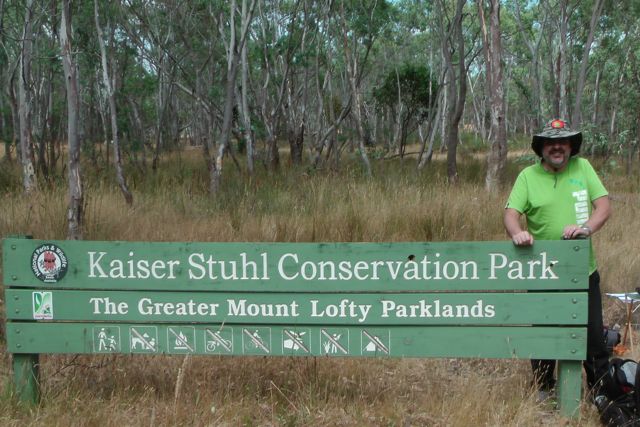
Today I contacted the South Australian Lands Titles Office, Department of Planning, Transport, and Infrastructure, and also the SA Legal Services Commission, and queried them re the legality of access to privately owned land which has a trig point situated on it.  I had heard rumours that if there was a trig point, then the land owner was required to allow access to the public to the trig point.  So today I sought some official clarification on the South Australian perspective.

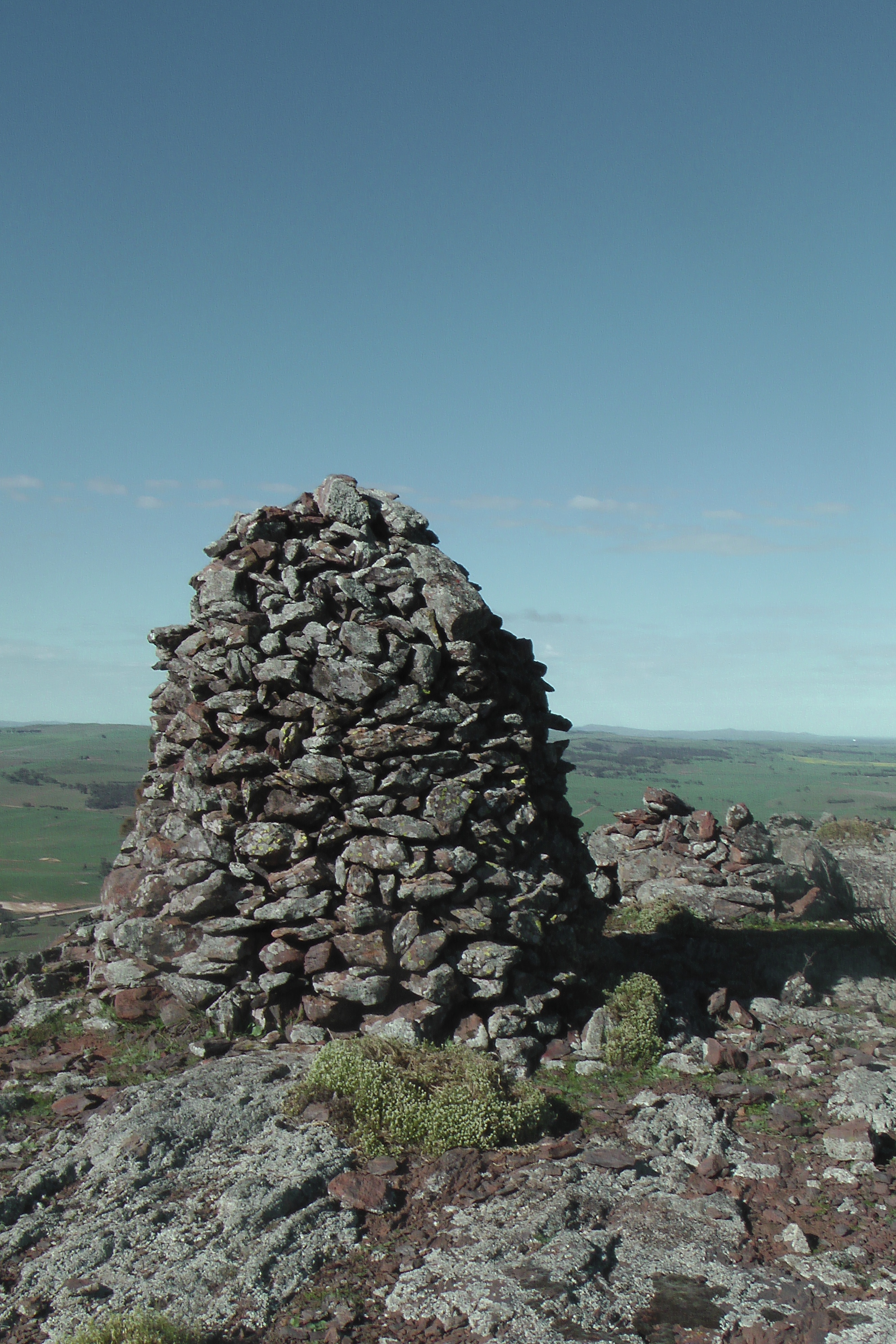
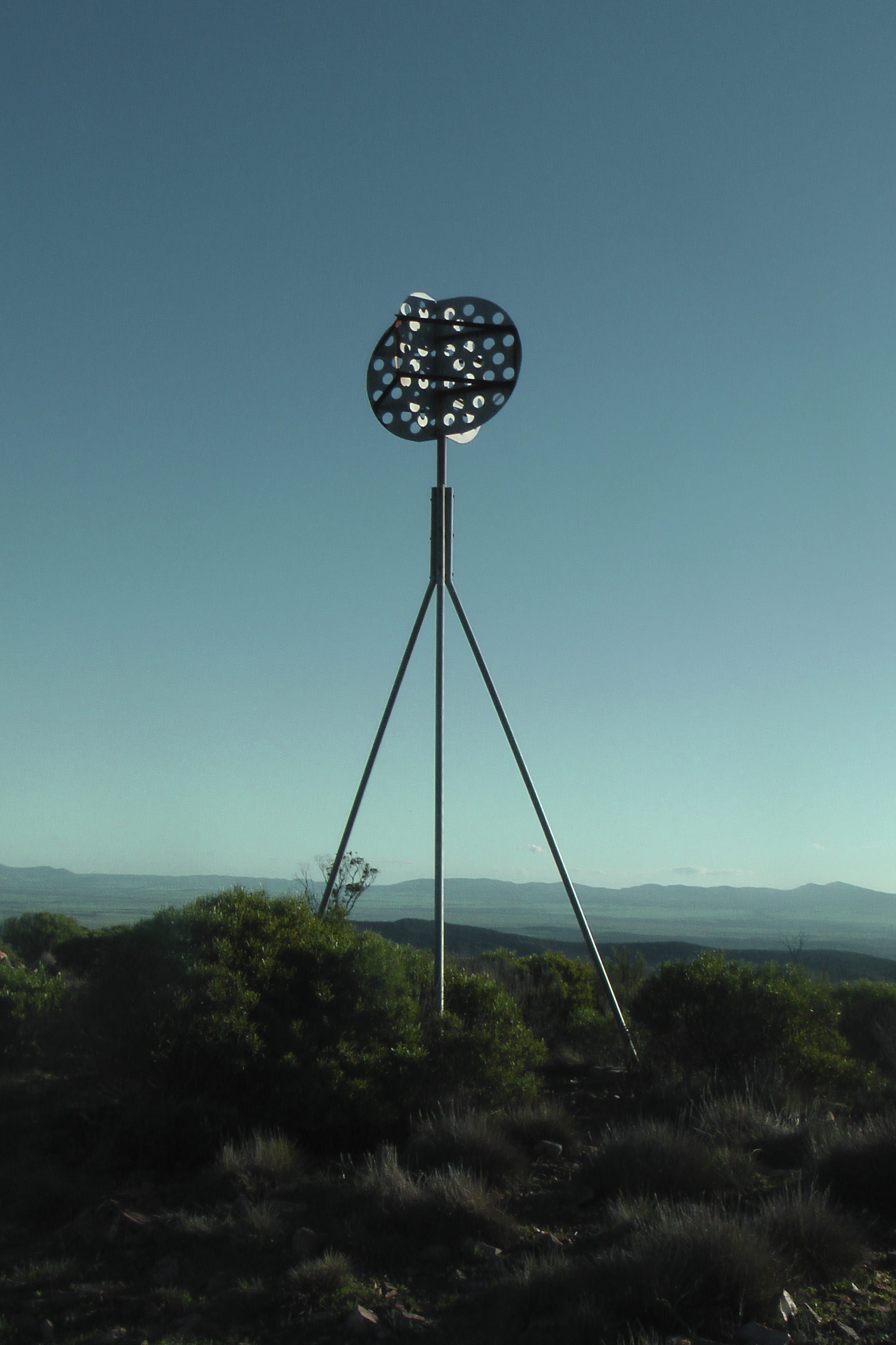
Firstly, what is a trig point ?  Trig points, sometimes called Trig Stations are hilltop survey marks.  They are so called because trigonometry is used to calculate their positions.  Their full and correct name is Trigonometric Points of Stations.   In Australia, trig points consist of a permanently marked point on the ground, and usually have a beacon or a cairn of rocks directly above them so that the trig point can be seen from a distance.

IMG_2442      IMG_3450

IMGA0046     IMGA0156_2

Trig points are known as trigonometrical stations in North America, triangulation pillars in the UK, trig beacons in South Afirca, and trig points or stations here in Australia.

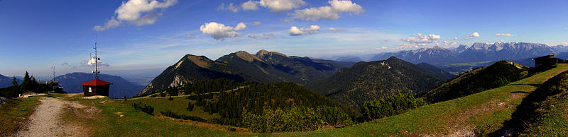
Trig points are built on the most prominent geological formation in the surrounding countryside so that they are visible for many kilometres.  By sighting two or more trig points, and then taking a compass bearing, surveyors can accurately determine their position on a map when plotting boundary lines of property, etc.

The early explorers of Australia plotted their position by observations of the sun and stars and related this to visible landmarks such as prominent hills, rivers or local settlements.  However, as the colony of Australia expanded, so did the need for accurate maps.

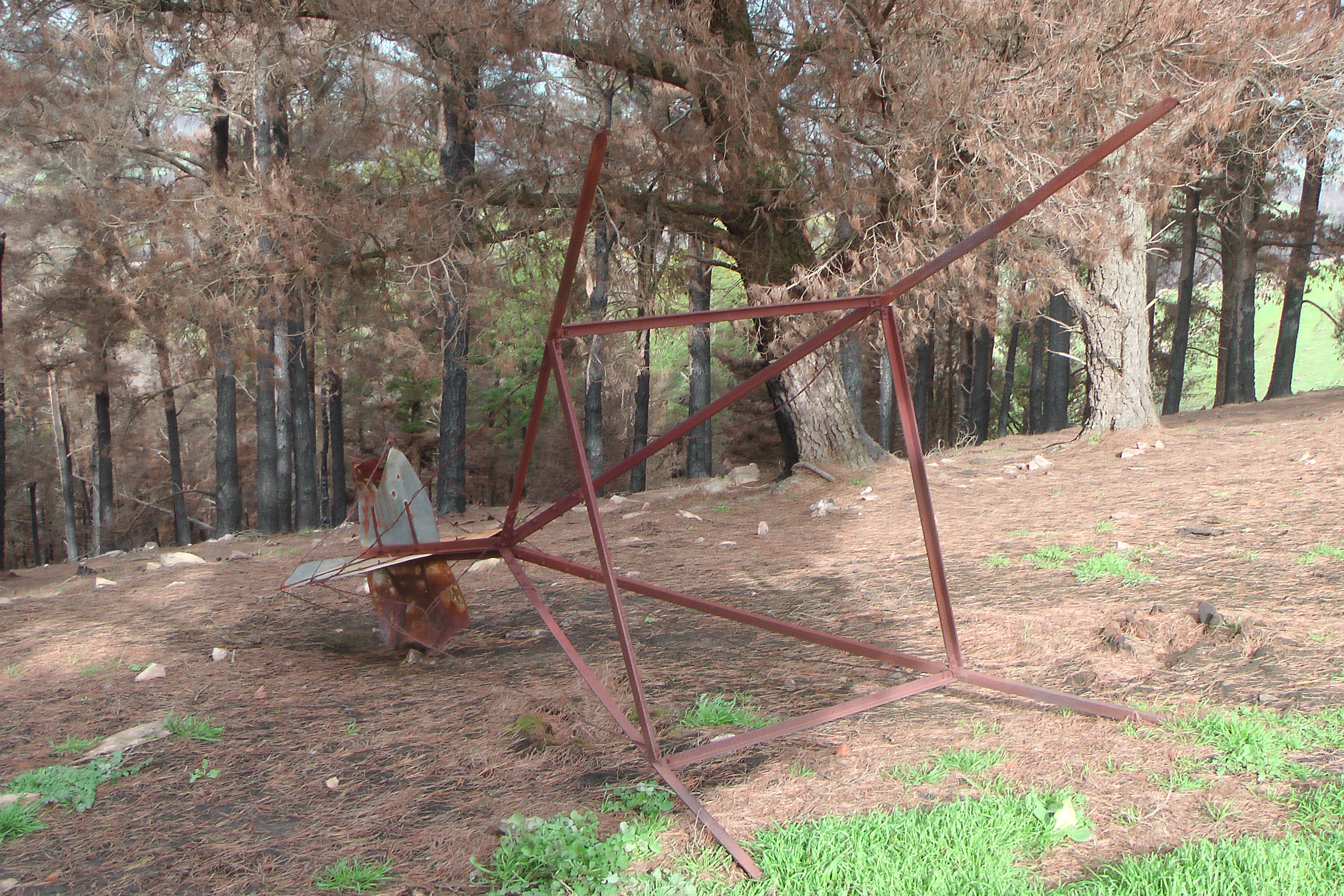
In the early days, trig stations consisted of a brass plug which was fixed into concrete.  It had a large cairn of rocks erected over the top of it, and a pillar with metal vanes standing upright over the mark.  To access the brass plug, surveyors ere required to dismantle the cairn and then reassemble it afterwards.

B60681_30

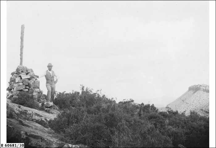
A man standing beside the trig, Mt Samuel, Flinders Ranges, S.A. c. 1898.

Photo courtesy of State Library, S.A.

B73363_16

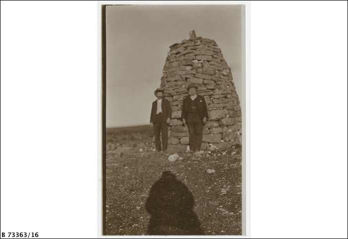
Two men standing beside the trig, Mt Wudinna, SA, c. 1911.

Photo courtesy of State Library, S.A.

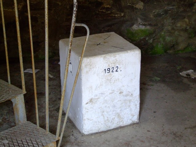
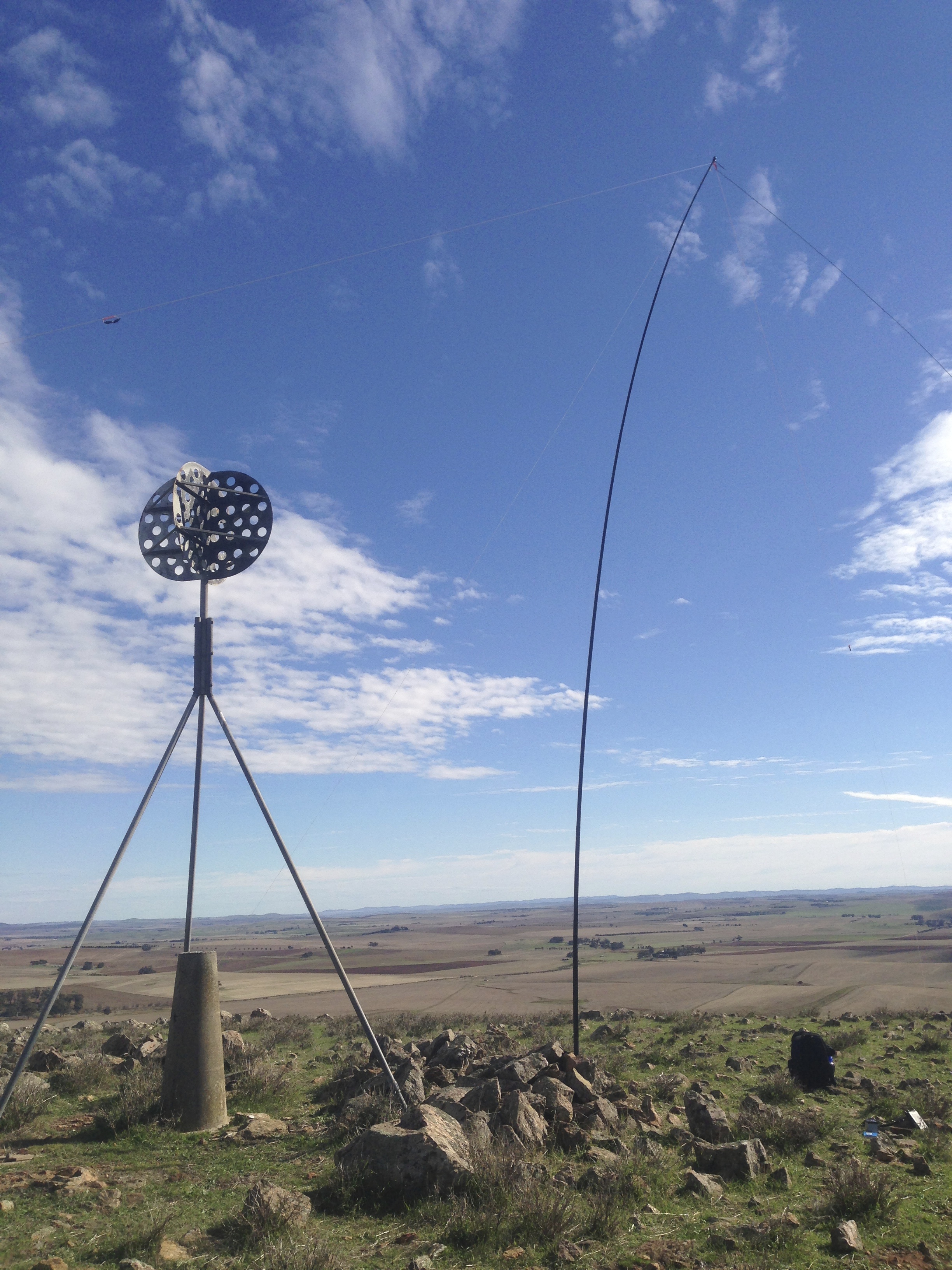
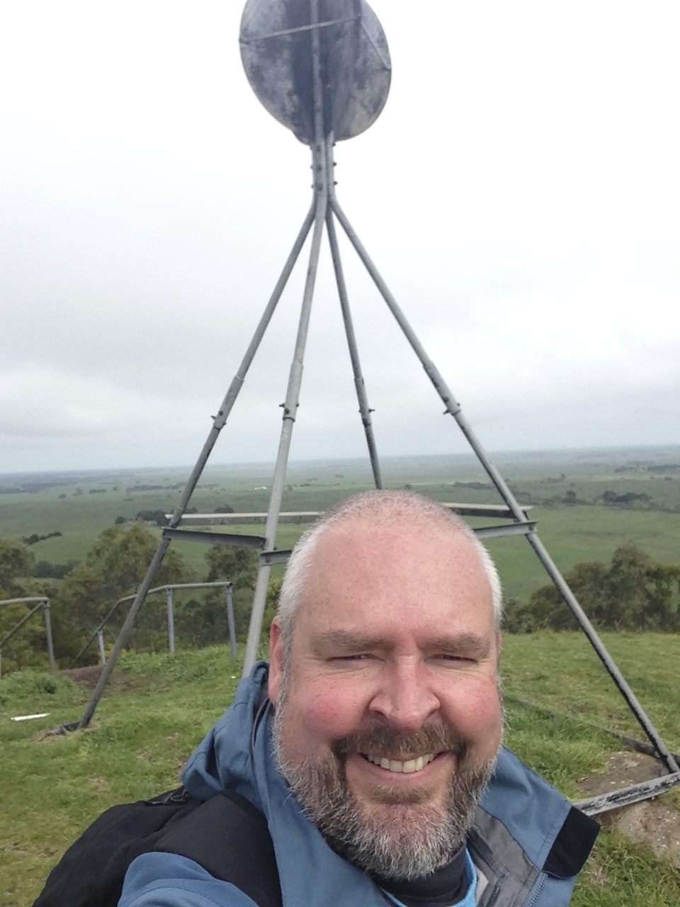
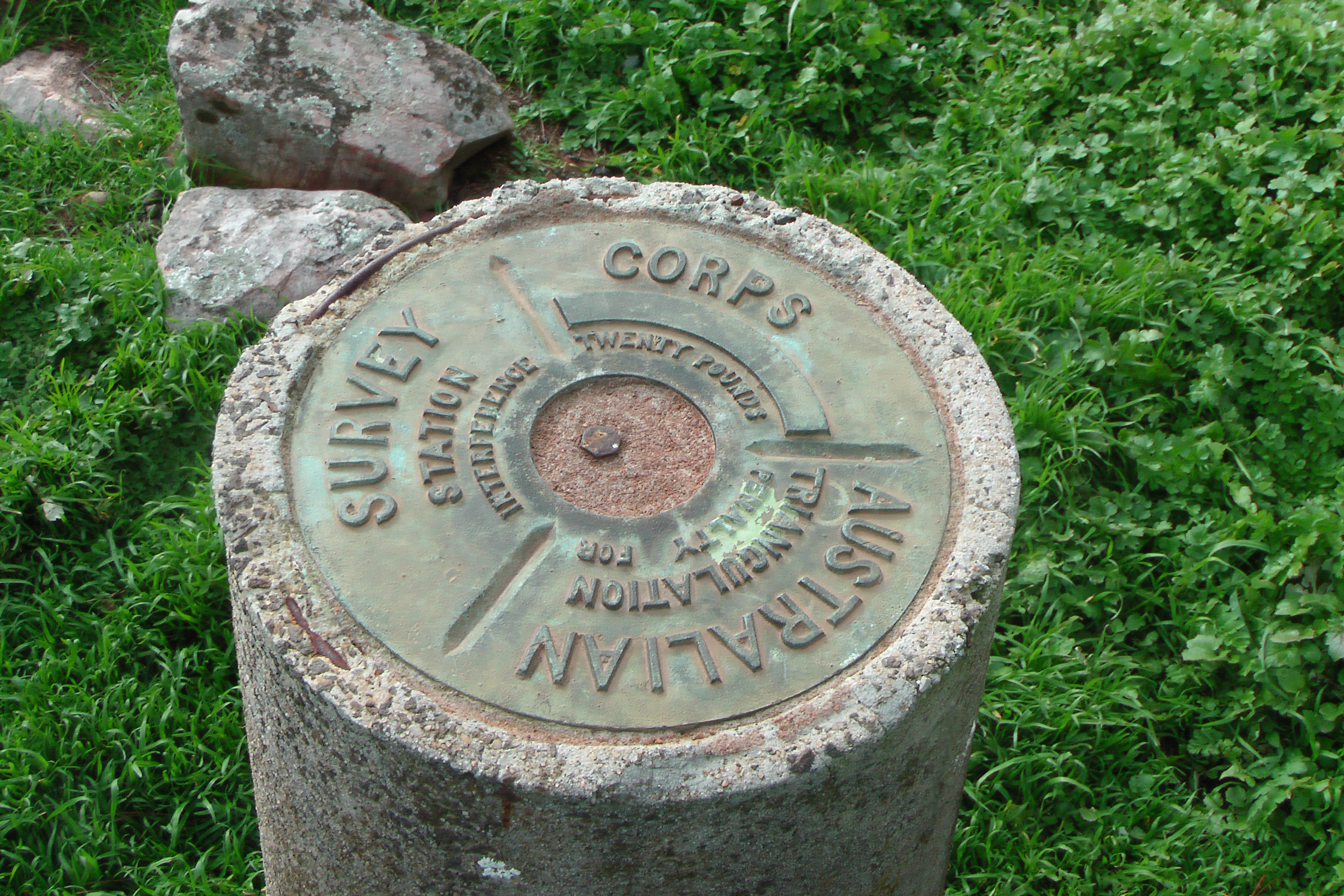
This resulted in a concrete pillar version which has a solid concrete foundation and a pillar which is about 1.3 metres high.  It has a vane on the top which can be removed by surveyors to access a threaded spigot on top to mount survey equipment such as theodolites, Electronic Distance Measuring devices, and GPS antennas.

IMGA0110

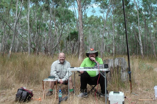
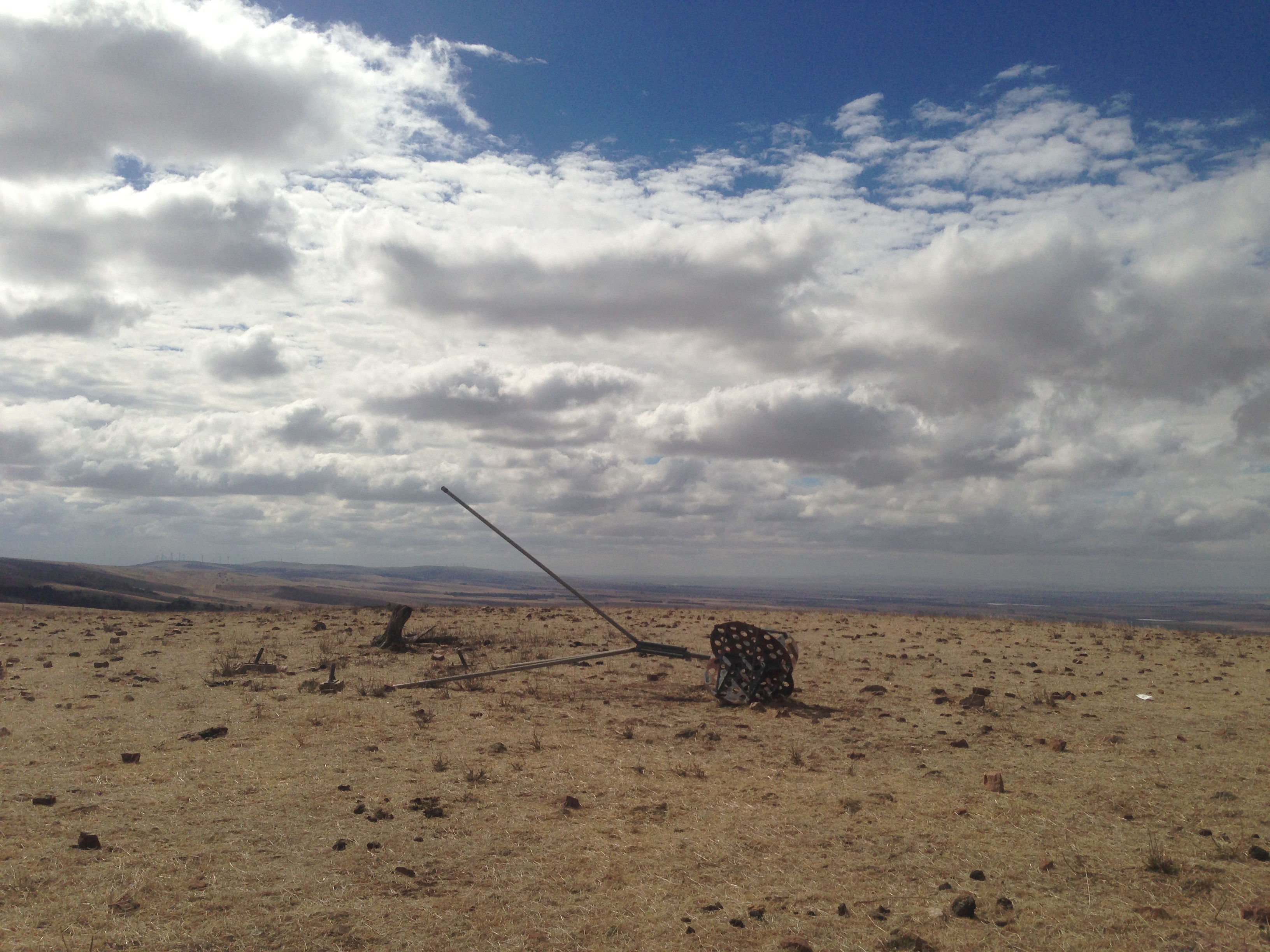
I have noted in my SOTA travels, that many trig points are in dire need of some tender loving care.  Apparently this is a national trend, from what I read on the internet.  With all the modern technology available such as Global Navigational Satelite Systems (GNSS) and Continuosly Operating Refernce Station (CORS) networks, trig stations are become less relevant to surveyors.  Governments are loath to spend money as the upkeep required on trig stations has proved to be unmanageable.

IMGA0112

 2013-04-14 13.18.17

There is an excellent resource on the Queensland Govt website, entitled ‘Surveying history’…..

http://www.nrm.qld.gov.au/museum/surveying_history/index.html

And another one entitled, ‘Life of the surveyor in the field’….

http://www.nrm.qld.gov.au/museum/surveying_history/surveyors-work.html

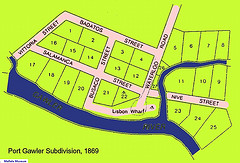
And should you wish to view where all the trig points are in South Australia…check out the map at the DPTI website, at the following link…..

http://maps.sa.gov.au/plb/

Going back to my original question about access to privately owned land which has a trig point on it……….Under the Survey Act 1992, land surveyors have the right to enter onto private land to access trig points.

The Act states that a survey mark is…..

(a)  a mark or peg of a kind specified in survey instructions ion force under this Act that is placed on or in land for the purposes of defining a boundary of the land; or

(b)  a permanent survey mark.

Section 46 of the Survey Act 1992 states…..

A surveyor, or a person authorised in writing by a surveyor, may-

(a)  at any reasonable time, enter any land for the purpose of carrying out work in connection with a survey; and

(b)  take such action as is necessary to enable the survey to be carried out effectively (including excavating or breaking the surface of land to the extent necessary to uncover or place a survey mark).

It is also an offence under the Act to hinder or obstruct a person in the exercise of a power conferred by the Act.

So, the rumours are INCORRECT !  

You cannot enter land that has a trig point on it, unless you have the permission of the land owner.

In England, there is the freedom to roam, or everyman’s right.  This relates to the general public’s right to access certain public of privately owned land for recreation and exercise.  In both England and Wales, public access rights apply to certain categories of mainly uncultivated land—specifically “mountain, moor, heath, down and registered common land.”   Developed land, gardens and certain other areas are specifically excluded from the right of access.   Agricultural land is accessible if it falls within one of the categories described above.  Some other European countries have similar rights of access.  Here in Australia, we have no such rights of access.

There are some exceptions to access across privately owned land here in South Australia.  This includes the Heysen Trail, which is a long distance walking trail (1,200 km) stretching from the Flinders Ranges, via the Adelaide Hills, to the Fleurieu Peninsula.  Part of the trail traverses private property.  However this access would be documented and possibly included as right of way in the Title.

images

Section 17 of the Summary Offences Act 1953 of South Australia states…..

(1)  Where-

(a)  a person trespasses on premises; and

(b)  the nature of the trespass is such as to interfere with the enjoyment of the premises by the occupier; and

(c)  the trespasser is asked by an authorised person to leave the premises,

the trespasser is, if he or she fails to leave the premises forthwith or again trespasses on the premises within 24 hours of being asked to leave, guilty of an offence. 

References.

Australian Lesson Activities – Maths, viewed 31 January 2014, http://www.expedition360.com/australia_lessons_maths/2001/09/trig_points_and_geometry.html

State Library of South Australia, viewed 31 January 2014, http://www.slsa.sa.gov.au

The Friends of the Heysen Trail and Other Walking Trails, viewed 31 January, 2014, http://www.heysentrail.asn.au/heysen_trail/faq.php

The Intergovernmental Committee on Surveying and Mapping, viewed 31 January, 2014, http://www.icsm.gov.au

Wikipedia, 2014, Heysen Trail, viewed 31 January 2014,  http://en.wikipedia.org/wiki/Heysen_Trail

Wikipedia, Triangulation station, viewed 31 January 2014, http://en.wikipedia.org/wiki/Triangulation_station

Great website

Today I was doing a bit of research on trig points in South Australia, and I found a really neat website, which I hope you also find interesting.  It is called ‘Place Names Online.  South Australian State Gazetteer’.

It can be found at…..

http://www.placenames.sa.gov.au/pno/index.jsf

gaz

The Gazetteer is a database of place names in South Australia. The general aim of the database is to record of any place name that is, or has been used, in South Australia. Associated with each name is up to 38 fields of information relating to feature type, classification, location, derivation and cross-reference to current, previous and alternative names.

I have a great book here as well called ‘South Australia.  What’s in a Name?” written by Rodney Cockburn.  It is the third edition and seventh printing of Rodney Cockburn’s book which was first released in 1908.  It contains the origins of the names of nearly 4,000 of South Australia’s cities, towns, islands and other geographical features.

IMG_1288


VK5 SOTA and Parks symposium

On Sunday 9th March, 2014, there will be a VK5 SOTA & Parks symposium, which is to be held at the Guides Hall / AHARS shack, at Hannaford Road, BLACKWOOD.

map_shack

The doors will open at 8.30 a.m. and the symposium will officially commence at 9.00 a.m. by the AHARS President.  This will be followed by a number of guest speakers, who will give talks on a variety of aspects of SOTA, parks awards, and portable operation.

There will be morning tea, and the presentations will complete at 12.40 p.m. and a BBQ will follow.

A ‘donation’ of $4.00 would be asked for the cost of morning tea (tea, coffee, cake, biscuits), and the BBQ which will include bread & salads.

If you do intend to attend, please RSVP to me prior to 1st March, 2014, so that I can arrange suitable catering.

VK5 SOTA & Parks symposi105

Please find attached the program…..

0830–0900……….Doors to venue open.  Mingle with the  crowd/introductions.

0900 -0905……….Welcome.  President AHARS

0905–0925……….An overview of SOTAs progress in VK5 & VK  overall–Ian VK5CZ

0925–0945……….Tips for activators/Hunters of VK5 Parks Award  –Larry VK5LY

0945 – 1005………Overview of World Wide Flora & Fauna (WWFF)  program – Paul VK5PAS

1005–1025………Using lithium phosphate chemistry batteries, a  beginners perspective – John VK5BJE

1025 -1045………Morning tea

1045 – 1105 ……….The failed attempts at an end fed wire antenna –  Ian VK5CZ

1105–1125………SOTA for the beginner – Stu VK5STU

1125 – 1145……….Parksnpeaks spotting/alert program –Nigel VK5NIG

1145 –1205 ……….What is prominence ?– Paul VK5PAS

1205–!225……….TenTec Argonaut 6 -V- Yaesu FT817nd –John VK5BJE

1225– 1240……….General questions & Closure of symposium

1240………. BBQ lunch

!

3,000 Chaser points

On Saturday morning, I eagerly awaited the first of a number of SOTA activations.  I was sitting on 2,976 Chaser points, and was hoping to get across the 3,000 point line.

My first contact of the day was with Nick VK3ANL who was on an un-named summit, VK3/ VC-032, which is situated north of Ballan.  Another 4 points to the tally.

I then worked Nick another two times during the day, whilst he was on Mount Warrenheip VK3/ VC-019 and then Mount Buninyong VK3/ VC-018.  Nick activated 4 summits that day.  Great effort Nick.

I then saw a spot for Hans WN6E W6/ CT-026 on 15m and decided to have a listen.  And to my surprise, there he was, with a good signal (5/5).  So I gave Hans a call and got through first time with a 5/1 signal report received.

I then worked Phil VK2FPJR who was on un-named summit VK2/ IL-006, in the Illawarra region of NSW.  This took me to 2,992 points.

And then thanks to Rod VK2TWR, who was on VK2/ SM-036, a 10 pointer, I nudged over the 3,000 point mark.  I went on to work a further 17 SOTA activators that day and ended up with 3,097 SOTA Chaser points.

What was really enjoyable this day, was to get VK2 SOTA activators in the log.  It has been a real slog the past 6 months with the VK1 & VK2 Activators on 40m.

I have printed out & mailed off a certificate for Rod VK2TWR, just to say thanks.

Slide2

Port Gawler Conservation Park

My second activation for the day was a confirmed Conservation Park, the Port Gawler Conservation Park.

Marija and I headed off the LeFevre Peninsula and along the Port River Expressway, and then north on Port Wakefield Road.  We then turned left onto Port Gawler Road, and headed west towards the coast of Spencer Gulf.  As we were travelling towards the park, it brought back a lot of fond memories.  When I was a child, I often went to Port Gawler with my grandfather and went ‘raking’ for Blue Swimmer crabs.  Grandpa came to live with us when I was just a young boy, following the death of my Grandma.  And Grandpa was a keen crabber and he & I would often drive to Port Gawler beach in his old Hillman Hunter to go crabbing.

murray-river

Port Gawler Conservation Park consists of vast tidal flats and fringing mangrove forests that are crossed by a multitude of tidal channels.  Shell-grit ridges occur along a well-defined belt within the mangrove forest.  I remember well, that each time we visited the park all those years ago, we would always bring back a bucket of shell grit and cuttlefish.  A that time my Dad was a breeder of finches and parrots.  The birds loved the shell grit and cuttlefish, which were also a source of calcium.

The Gawler River, which has its source over 40 km to the east, flows through the park and forms a long, narrow estuary at Port Gawler.  Fish can be caught in the River, including Bream & Mullett.

      IMGA0028

As we drove along Port Gawler Road, the sounds of off road vehicles and motorcycles became louder and louder.  There are a few Off Road Parks in the area, and sadly the area is also used as a bit of a dumping ground for rubbish.  I found the following article in the local newspaper which shows that this is an ongoing problem…..

http://www.plainsproducer.com.au/?p=513

Plans to build a settlement at Port Gawler at the mouth of the Gawler River estuary, commenced in 1869.  Below is a map dated 23rd March, 1869 from the South Australian Lands Department.  It is signed on behalf of the surveyor-general, Mr George W. Goyder  and his Excellency Sir James Fergusson, Governor of South Australia.  It shows that Port Gawler was subdivided into various allotments with the street names, named after the Spanish campaign of General Wellington (of Waterloo fame).

3874152548_ef56f83d2b_m

In 1869, the ‘Lisbon’ wharf and Waterloo Road were constructed with a grant of £6,000 made to the District Council of Port Gawler.  In its heyday, Port Gawler was an extremely busy place.  Cargoes of grain and various other produce were loaded onto ketches that were able to sail into the wharf across the sand bar at the mouth of the creek at high tide.  It is reported that between December 1874 to November 1875, about 295 boats were loaded at Port Gawler.

The final cargo to leave the port was a shipment of strainer posts to the Peninsula in 1920.  However the arrival of the railway made the use of the port obsolete.  Following this, the blocks within the township were sold to prospective speculators, and the majority of those were reverted to the Crown due to unpaid taxes.  The final ‘freehold’ blocks were held until 1960.  Very little now remains of what was once a very important port.

Marija and I drove to the very bottom of Port Gawler Road, where there is a parking area and a small shelter.  The shelter was a welcome sight, as the weather had really warmed up.  At least there was a spot that we could park the car, and Marija could remain in some shade while I activated the park.

The carpark was really busy, so this was out of the question to erect the antenna.  We set up the gear just to the south of the carpark, where I found some shade under some mangrove vegetation on the shore of the Gawler River.  I was only about 10 feet from the water.  I brought along the Yaesu FT-450 for this action, and ran about 30 watts, into the 40m/20m linked dipole.  The squid pole holder for the 7m squid pole, was easy to push into the tidal sand.

IMGA0037

My first contact in the park was with Ian VK1DI who was portable on SOTA peak, Pheasant Hill, VK1/ AC-021.  Ian’s signal was quite low down, only 5/2.  However, because the noise floor at Port Gawler was so low, I was able to hear Ian perfectly.  Not a bad start…a SOTA contact.

Following my QSO with Ian I went up to 7.100 and put out a CQ call.  First taker was the ever reliable John VK5BJE from the Adelaide Hills.  John’s signal was not as loud as I expected.  A good 5/8, but I expected louder.  I received a 5/4 from John.  My VSWR was up a little high for this activation, for whatever reason.  But it wasn’t that high that it should affect my signal that much.

 IMGA0038     IMGA0029

Col VK5HCF then called in from Mount Gambier and gave me a 4/3 signal report.  And this was followed by Brian VK5FMID, also from Mount Gambier, who also gave me a rather poor report of 4/4.  This prompted me to look at the antenna quickly before the next QSO.  The alligator clip links appears okay.  Marija had accidentally stepped on the coax at Mutton Cove, and I started to wonder whether some damage had been done, and that was the reason why the VSWR was up a bit, and why signals were down a bit ?

But then Larry VK5LY from Renmark in the Riverland gave me a call, with a beautiful 5/9 signal.  And I received 5/8 back from Larry.  Larry advised that he couldn’t even hear me when I was in Mutton Cove.  Now I started to think that it was just propagation conditions.  They had been so good 90 minutes earlier at Mutton Cove, and had obviously taken a real step backwards.

John VK2AWJ from Gol Gol in New South Wales, came up to say hello.  John’s signal was a solid 5/8 with no QSB.  Obviously the propagation gods on 40m were playing with the band.

And to prove this, I had some interesting VK3 contacts.  I spoke with Phil VK3BHR from Bendigo who was 5/5 and I received a 5/8.  But just 15 minutes later I received a call from Ron who was stronger at 5/7 but I only received a 3/3 report back from Ron.  Ron reported that there was a lot of QSB on my signal.  A further 9 mintes later I received a call from Tony VK3KKP from Castlemaine.  Tony was running just 15 watts.  Tony’s signal was a constant 5/7 and I received a 5/9 signal report from Tony.

I also spoke with Bill VK5MBD from Red Hill in the mid north of South Australia, with his normal beautiful 5/9 plus signal.  I don’t think I have ever spoken with Bill when his signal has been below 5/9 +.

John VK5DJ from Millicent in the south east also called.  John’s signal was an excellent 5/9 plus and I received a 5/9 from John.  And yet 30 minutes earlier I was receiving 4/3 and 4/4 signal reports from the same geographical area.

Another good contact was with Frank VK5KV who was mobile between Port Augusta and Port Pirie, on his way to a trap shooting meeting.

My final QSO from Port Gawler was with Ian VK5CZ from Clare who had an excellent constant 5/9 signal.  I received a 5/9 signal report from Ian.

Whilst I was sitting back enjoying the day, quite a few kayakers paddled passed me.  One of those was a young lad who had his fishing gear on board.  He paddled up to me and asked if I was an amateur.  Apparently one of his mates has a licence, so he recognised that my squid pole wasn’t for fishing.  Backing up my earlier comments about the state of the area, he advised that there was now very little fish in the area due to pollution.  He stated that car bodies and general dumping of rubbish in the area, had significantly degraded the area.

IMGA0030     IMGA0040

From what Marija and I saw of the area, it certainly does need a good clean up.  I find it very sad how some people have a total disregard for their environment.  There were quite a few 4WD enthusiasts in the area at the time.  Some of those we witnessed speeding along the sandy flats with total disregard for their safety and that of others.

I found a post on the internet that probably sums up the park and the area…..

“Today, the main activities seen in the area are fishing, vandalism and burning of stolen cars……..there is a boat ramp and access for kayaking, I am not sure how much of your car would still be there upon your return. Given the funding cuts to the Department for Environment and Heritage I don’t expect this to improve.”

The following stations were worked:-

Ian VK1DI/p; John VK5BJE; Col VK5HCF; Brian VK5FMID; Roy VK5NRG; Larry VK5LY; John VK2AWJ; Phil VK3BHR; Tim VK5AV; David VK5KC; Nev VK5WG; Andrew VK5KET; Ron VK3AFW; Bill VK5MBD; John VK5DJ; Tony VK3KKP; Frank VK5KV/m; and Ian VK5CZ.

This was a very enjoyable activation under some unusual propagation conditions.  It wasn’t until I got home and started to read some of the posts on the SOTA Yahoo group, that I saw that the band was in rather port shape.

The day was finished off with a nice meal & a few Bundies and coke, at the Southern Hotel at Gawler.

IMG_1287

References.

http://www.environment.gov.au

http://mallala.nowandthen.net.au/index.php?title=Port_Gawler

Mutton Cove Conservation Park

This morning I headed out early with Marija and headed down to Osborne to activate what I believed was Mutton Cove Conservation Park.  Everything was going smooth sailing until I found out during the activation, that Mutton Cove was not a Conservation Park, and was actually a Conservation Reserve.

Mutton Cove Conservation Reserve is located in the industrial/residential suburb of Osborne, about 19 km north west of the Adelaide CBD.  It is located on the Lefevre Peninsula, which was named by Governor John Hindmarsh in 1837, after Sir John George Shaw-Lefevre, who was one of South Australia’s Colonisation Commissioners.

location map

On driving down Mersey Road North passed the Adelaide Submarine Corporation, we found a small parking area on the eastern side of the road, which appeared quite new, and which had a ‘Mutton Cove’ sign.  We stopped here briefly to have a look at the park.  There was a break in the fence line and a walking track, but in the distance to the north, we could see a car parked at the end of a dirt road, close to the Port River.  So we decided to try to head in that direction.

We continued north along Mersey Road North, and found a dirt road just to the north of the Australian Submarine Corporation installation and Archie Badenoch Ct.  We travelled to the end of the road, where there was a parking area on the shores of Light Passage, a section of the Port River.

There was a sign which read ‘Mutton Cove Conservation Reserve’.  This should have set off the alarm bells for me.  However I had checked the internet the night before.  Google Maps showed Mutton Cove as a Conservation Park.  However from past experience I have learned not to rely on Google Maps.  I have found that numerous South Australian Conservation Parks are not even recorded on Google maps.  But what really threw me, was Mapcarta.  I have found this to be an excellent resource.  Mapcarta showed Mutton Cove to be a Conservation Park.  And even ‘Weekend Notes’ which is also an excellent resource, referred to Mutton Cove as a Conservation park.

It wasn’t until just after my first QSO with Col VK5HCF, who tried to spot me on the parksnpeaks site but couldn’t find Mutton Cove, that I thought to myself “Oh Oh !“.  I immediately jumped on the trusty i-phone to check the parks list, and sure enough, Mutton Cove was not on the list.

Lesson learned…..check the ‘official’ parks list.  Don’t rely on the internet !

IMGA0009     IMGA0017

Netherless, this was an interesting place to visit.  Although it is not the most aesthetically pleasing place, it does have a very good walking track around it, with interpretive signs.

Sadly, the Mutton Cove area has been significantly degraded since European settlement in the area.  Industrial development and dumping of rubbish has impacted on the area.  During our visit, it was evident that many people have absolutely no concern whatsoever for the environment.  Mutton Cove is the last remaining area of samphire and mangrove woodland remaining on the Le Fevre Peninsula.  Three branches of Mutton Cove Creek weave their way through the park.  However, during our visit, these were mostly dry.

The history of the Le Fevre Peninsula itself is very interesting.  The peninsula was considerably smaller when Europeans first settled the area back in the 1800’s.  A large amount of fill has been placed on the peninsula between the early 1940’s and 1992 when dumping ceased.  The Mutton Cove area is one of the few areas on the edges of the Peninsula that remains at natural surface level.

Mutton Cove takes its name from Mutton Cove in Devonport in Devon, England.  That being an area that looks very similar to the South Australian Mutton Cove.  Captain Collet Barker, is the earliest recorded European to see the Port River and the Mutton Cove area.  He had been sent by Governor Darling of New South Wales to locate the Murray Mouth.  In 1831, from the top of Mount Lofty he spotted the Port River and believed that it was make a good harbour.

IMGA0015                                                  IMGA0016

I set up on the northern side of the park, under the shade of some mangrove vegetation. It was already very warm, despite being early in the morning.  The expected temperature was to be 38 degrees C.  After putting out a’is the frequency in use’ call on 7.095, I was greeted by the dulcet tones of Col VK5HCF from Mount Gambier with a beautiful 5/9 signal.  This was followed by Ivan VK5HAS who was initially 5/5, but suddenly crept up to 5/9.  It was like somebody had turned on a switch.  David VK5KC, John VK5BJE, Brian VK5FMID, and Tim VK5AV followed, all of whom had very good signals.

IMGA0013

After packing up, Marija and I decided to go for a walk around the park.  There are some interesting shipwrecks within the park including the ‘Excelsior‘ and the ‘Jupiter‘.  Looking around at the park, and the relatively dry Mutton Cove inlet, I wondered how the ships even got to where they were ?  The original Mutton Cove Creek was quite deep.

The first wreck is that of the ‘Excelsior’ which initially worked in New South Wales and Tahiti before arriving in South Australia during the early 1900’s.  The Excelsior was originally owned by flour millers John Darling and Sons, and later the SA Farmers Union Co-operative.  By 1933, she had been purchased by the SA Harbors Board and had been converted to a coal hulk to service the steamer dredges working in the Port Adelaide region.  However when diesel powered ships replaced coal fired vessels, the Excelsior was laid up, and abandoned at Mutton Cove.  She was floated right up the Cove to her current resting position on the spring tides.

IMGA0019     IMGA0020

There is also the wreck of the ‘Jupiter’ but we did not find this.  Apparently it is located mostly buried in the mud in the southern section of the park.

I worked a total of 6 stations, before deciding to pack up and head off to Port Gawler.  I decided it wasn’t worth the effort of explaining that Mutton Cove was not a Conservation Park to all the ‘hungry’ Park Hunters.  Sad really, because conditions on 40m SSB at this time appeared to be very good.

I worked the following stations:-

Col VK5HCF; Ivan VK5HS; David VK5KC; John VK5BJE; Brian VK5FMID; and Tim VK5AV.

There are some very interesting sites on the internet regarding this park, and the associated shipwrecks that can be found within it.

The park also has a Management Plan, which has some very interesting information on the park.  It can be found at…..

Click to access Mutton_Cove_web.pdf

References.

Wikipedia, http://en.wikipedia.org/wiki/Lefevre_Peninsula

Weekend Notes, http://www.weekendnotes.com/mutton-cove-shipwrecks/

Click to access Mutton_Cove_web.pdf

Problems with WebSDR

Thanks to Pieter, PA3FWM, today I have overcome the issues with the WebSDR system not working.  For anyone not familiar, the WebSDR is a Software-Defined Radio receiver connected to the internet, allowing many listeners to listen and tune it simultaneously.  It can be found at…..

http://websdr.org

websdr1

But as of January this year, there have been some problems.  Oracle released Java 7 update 51, and with that update, using WebSDR receivers has become increasingly more difficult.  But thanks to Pieter, and a bit of jiggling around this morning, the system is working fine again now.

Please refer to the notes below…..

On January 14, 2014, Oracle released Java 7 update 51, and with that update using WebSDR receivers has become more difficult.

Cause and background

The WebSDR project has, since its beginning, used Java applets to play sound and show the waterfall display. These are so-called “unsigned” applets, which run in a restricted environment (called “sandbox”), where they cannot do any harm to your computer and thus are totally safe, in principle.
Java and this sandbox are made by Oracle, and apparently Oracle has trouble making this sandbox totally safe. These bugs can be exploited by malicious applets to harm your computer. In the latest Java release, they apparently gave up the hope of fixing all sandbox bugs; instead, they now make it as difficult as possible to run unsigned applets at all, both the malicious and the good ones.

Short-term solution

Fortunately, it still is possible to run unsigned applets, but only if you explicitly tell your computer from which websites applets should be accepted. So in order to use a WebSDR, you first have to add its URL to a list of acceptable Java sites. (Applets from other sites, including malicious ones, will still be blocked.)

On Windows/Mac, you can find this list by going to the system control panel or System Preferences and choosing Java (you may want to use the control panel’s search function); then choose the Security tab, and click on “Manage Site List”. Then there’s an “Add” button to add a URL to the list. Put the complete URL there, like http://websdr.ewi.utwente.nl:8901/ , so including the http part.

On Linux/Solaris, open a terminal and type jcontrol there; then choose the Security tab, and the rest of the instructions are as for Windows/Mac.

More detailed instructions can be found here: https://blogs.oracle.com/java-platform-group/entry/upcoming_exception_site_list_in.

Longer-term solution

Of course, the above situation is pretty inconvenient. For the future, there are two options, assuming Oracle’s policy does not change:

  • Oracle now wants every applet to be “signed”. This means that the applet gets a cryptographic “signature” by which it can be verified that the applet was written by a specific person (e.g., me), so if you trust that person, you can trust the applet. Unfortunately, this signature apparently would cost me several hundred dollars/euros per year…
  • At my own WebSDR site at http://websdr.ewi.utwente.nl:8901, I’m testing a WebSDR version which no longer needs Java but uses recent HTML5 features instead. There are still some problems with it, which is why I have not yet distributed this update to the other sites, but in due time, I will.
    However, it is not a total solution either: it doesn’t work on Internet Explorer, and generally not on older versions of browsers.


Some more DX activators

On Sunday night, 19th January, 2014, I stayed up a little late again to work some DX on 15m.  And when the 15m band went quiet I decided to venture over to 20m to have a listen.  And I am pleased I did.  I managed to work some more European SOTA activators on the short path, and also two more WorldWide Flora and Fauna activators from Europe.

My first contact was with Mike, OE4MXB who was portable on SOTA peak, Geschriebenstein, OE/ BL-001 and Irott-kö, HA/ ND-001.  Why 2 summits ?  Mike was on the Austrian and Hungarian border.  This is the highest mountain of the Koszeg Mountain Range.  It is 884 metres above sea level according to Austrian sources, but Hungarian references mostly place the summit at 883 metres.  SOTA shows the OE/ BL-001 summit to be 884 metres ASL and worth 2 SOTA points, while HA/ ND-001 is shown as 882 metres ASL and worth 8 points.  Either way, it is the highest mountain of Western Hungary and of Burgenland.

The summit’s former names were Fenyőhegy and Szálkő.  Its present name (Írottkő in Hungarian, and Geschriebenstein in German) can be translated as ‘written stone’.  It is believed this is derived   from border stones with inscriptions between the properties of the Batthyany and Esterhazy  families.  On the summit, there is an observation tower built in 1913 which stands exactly on the border between Austria and Hungary.

450px-Irottko-kilato-1

Photo courtesy of Wikipedia.

The photograph below, is of a stone located within the lookout tower.  Its left side is in Austria (denoted by the Ö for Österreich), while the right side is in Hungary (denoted by an M for Magyarország, cannot be seen in the photo).

Irottko-kilato-2

Courtesy of Wikipedia.

Since December 2007 the Austrian-Hungarian border can be crossed without formalities as Hungary joined the Schengen Agreement.  The closest towns on the Austrian side of the border are Rechnitz and Lockenhaus.  On the Hungarian side of the border, the closest municipality is Velem and the closest town is Koszeg.   

Mike was very strong with a genuine 5/9 signal coming into VK on the short path.  With such a great signal, as you would expect, Mike had quite a big pile up.  But I persisted and got though and received a 5/7 signal report from Mike.  Mike was running 150 watts, from a Yaesu FT-857 into a mono band vertical.

Below is a video of Mike’s activation…..

My second contact was with Jana DG5WU who was portable on SOTA peak, Wank, DL/ EW-001.  The summit which is pronounced as vanjk, is 1,780 metres above sea level and is worth 6 points.  It is located in the German (Alpine) Association and is in the Estergebirge/Walchenseeberge Region. It is situated in the Loisach valley, near to the Austrian border in the southwestern Ester Mountains range.

794px-Wank_Loisachtal

Courtesy of Wikipedia.

The summit can be reached via a cable car system called the Wankbahn which generally operates during the summer season, or via an extensive network of paths.  Construction of the cable car system commenced in 1928, and commenced service in 1929.  It is 3 kilometres (1.9 mi) long and rises from 740 metres (2,430 ft) to 1,750 metres (5,740 ft) above sea level.

Wankbahn_poster

A 1930 poster of the cable car.  Courtesy of Wikipedia.

The mountain has a grassy summit, that offers spectacular views over Gamisch-Partenkirchen and the surrounding region.  A cross can be found at the top of the summit which was established in July, 1904 by the Werdenfelser Heimat Partenkirchen Society.   Nearby is an observatory and the Wank-Haus, also known as the Alois Huber Haus, which is a mountain hut built in 1911, that provides accommodation and meals for visitors to the summit.

800px-Wank_Gipfelkreuz     15740362-garmisch-germany--august-12-the-wank-haus-on-mount-wank-in-garmisch-germany-on-august-12-2012-mounta

The summit is a popular destination for paragliders.  The paragliding enthusiast take off from the summit plateau and fly south into the Gamisch-Patenkirchen valley or to peaks in the Wettersteingebirge.  The thermals make the summit particularly popular, as they enable paragliders to make exceptionally long flights when conditions are favourable.

800px-Paraglider_Wettersteingebirge

800px-Wank_Panorama2

I had actually heard Jana before Mike, but unfortunately Jana’s signal was very low and she was working a big pile up from Europe.  I tried calling numerous times but just couldn’t get though.  And Jana was that low that I wasn’t quite sure if I could get a signal report back from her anyway.  After working Mike, I decided to go back and have another listen.  Jana’s signal had come up a little and I was more confident this time that  I would be able to receive a signal report from her.

Jana was still busy working lots of Europeans, but I patiently waited for a break in the callers, and snuck in my call sign.  To my surprise, Jana called me in and gave me a 5/7 signal report.  Sadly Jana’s signal was still 3/3 (an honest signal report).  But I could hear her, and that is all that mattered.

My third contact was with the Silesian Amateur Radio Group, operating as SP9YFF for the World Castles Award at Rabsztyn Castle WCA-SP0832 and for World Wide Flora & Fauna (WWFF) at Krajobrazowy Orlich GniazdSPFF-093.

banSILESIAN

Translated to English, Krajobrazowy Orlich Gniazd means Eagle’s Nest Landscape Park.  It is a protected area in south western Poland, consisting of 597 km2, and was established in 1980.  It covers much of the area of the Trail of the Eagle’s Nest.  The trail passes by some 25 medieval castles called the Eagles’ Nests, built on large tall rocks by the order of King Casimir III the Great (1310-1370).  This includes Rabsztyn Castle.  The area is visited by approximately 400,000 visitors per year.

800px-Ruiny_zamku_Rabsztyn_-_przemasban71

I got through to SP9YGG first time I called which was really encouraging.  The club were using 100 watts, and a multi band dipole at 8 metres from the ground and had a very nice 5/7 signal.  I received a 5/9 signal report.

My fourth contact was with Juergen OE4JHW who was portable on OE/ BL-001 and HA/ ND-001.  He was doing a dual activation with Mike, OE4MXB.  Jueergen had a beautiful strong 5/8 signal and I received a 5/9 signal report back.  I had a good chat with Juergen, who then called for any other VK Chasers.  Sadly there weren’t any.  This is the second time that I have now worked Juergen on a summit.

And my final portable contact was with Levi YO2MNC who was operating portable as part of the WWFF program in Drocea de lângă, YOFF-258, in ROMANIA   I had stumbled across Levi by accident.  I heard him asking if the frequency was in use and when he started calling CQ I gave him a call.  Levi’s response when I called him was priceless.  When he heard me call he said, “Oh my god….Australia”.  Levi told me that I was his first ever VK from a WWFF activation.  He said “I am very very glad”.  I was really pleased to get Levi in the log.

PICT0791     PICT0771

Photos courtesy of YO2MNC

During the evening I also heard SOTA activators OE5RTP and OE5IRO from AUSTRIA.  But they were working an Italian station who was portable for the Italian Abbeys award, and then QSY’d, and I could not find them after that.

I also heard EB2GKK who was portable on a SOTA summit in SPAIN.  But I didn’t call him as his signal was so weak, that I didn’t think we would be able to exchange signal reports.

Kaiserstuhl Conservation Park

On Saturday morning, 18th January, 2014, my wife Marija, and I headed off to the Barossa Valley, for Marija to get her hair done by a friend.  So I tagged along with the intention of activating a new park, the Kaiserstuhl Conservation Park.

Kaiserstuhl CP is located about 12 km south-east of Tanunda in the Barossa Valley.  It is 390 hectares in size and was dedicated in 1978 to protect one of the last remnants of native vegetation in the Barosa Valley region.  It also protects important seasonal creek and wetland habitats.

IMGA0021_2

The park is located about 15 km from the devastating bush fires from last week that swept through the Eden Valley destroying about 5 homes.  On Saturday morning before leaving home, I mulled over whether I should activate the park.  Based on info from people in the area, I decided that it was safe to activate the park.  The fire threat had significantly reduced the night before, and we were going to be sufficiently far enough away from any fire activity.

The area where the park was located was discovered in the mid 19th century by the prominent naturalists, H.H. Behr, F.J.H Von Muller, J.G.O. Tepper, and J. Menge.  The Tanunda Creek Bullock Track originally crossed the creek several times within the park but was closed around 1885 in favour of the more direct route along Tanunda Creek Road.  I accessed the park via Tanunda Creek Road.

A plaque within the park records the bequest to the Field Naturalists’ Society of South Australia by Mr Leo Wakem Nicholls (1894-1971).  Nicholls was a keen bushwalker whose bequest to the Field Naturalists Society of S.A. enabled that organisation to contribute $30,000 towards the purchase in 1978 of the park.  The official dedication ceremony took place in December, 1983.

IMGA0006

The park includes granite features such as Horse Head Rock.   Weathering and erosion have produced this rock formation which, as the name suggests, resembles a horse’s head.  Capped Rock, a horizontal rock slab perched on a vertical outcrop, is another interesting feature within the park.

The park is home to native birds such as blue wrens, parrots, honeyeaters, finches and thornbills.  In the late afternoon or early morning, western grey kangaroos can be seen in the open grassland areas of the park, while Euros can occasionally be seen on the rocky ridges of the higher sections of the park.  Other animals to be found in the park include echidnas, possums, bats, and a variety of snakes and lizards.

About 400 plant species are supported within the park.  The park was principally established to preserve the most northerly occurrence of the brown stringybark, Eucalyptus baxteri. Their multi-stemmed, mallee-like appearance is the result of earlier, regular trimming to provide wood for the Nuriootpa brick kilns.

IMGA0011     IMGA0014_2

Large blue gums, river red gums, native pines and sheoaks provide shady cover for the diverse understorey of yaccas, wattles, tea-trees and silver banksias.   Many of the banksias were out in flower during my visit to the park.  Many plants, such as lavender grevilleas and fringe myrtles flower in spring. The green flowered hairy correa is an unusual plant that grows in the shelter of the large granite outcrops. The rare prickly tree violet also occurs in the park and is often mistaken for the African boxthorn. This native plant provides protected nesting sites for small birds.

IMGA0028     IMGA0010

You may see mistletoe growing on the eucalypts, acacias and casuarinas in the park. These are parasitic native plants, which provide food and shelter for many bird species. The lichens growing on the rocks are also an important part of the ecosystem helping to weather the rocks to form soil.

I ran a little late in getting to the park and setting up.  Mostly because we travelled all the way along Rifle Range Road, on the western side of the park, only to find that the road fell short of the park.  So we then drove all the way back and around to Bethany, and then up Menglers Hill Road, and access the park on the eastern side of Tanunda Creek Road.

There is a gate at this point to enter the park, and I set up the station just inside the park boundary near the gate.  There is a walking track from here which leads to an interpretative sign and some walking tracks through the park.  Soon after setting up David arrived, and Marija headed off for her hairdressing appointment.

I was running behind schedule and I knew the Hunters would be getting hungry, so I quickly jumped onto 40m, only to realise a little later that I had not secured the ends of the dipole.  Nether mind.  It still worked.  My first QSO was with Brian VK5FMID at Mount Gambier, followed by Col VK5HCF also in Mount Gambier, and then Dave VK3VCE near Echuca.  After working 6 stations, I handed over the mic to David, who made contact with 8 stations in VK3 & VK5.  Despite the fact that wee were not on a summit, David had his little fluffy goat as his mascot.  I then took over the reigns again & spoke with Larry VK5LY and Ian VK5CZ prior to the UTC roll over.

IMGA0002     IMGA0016_2

After the UTC rollover I worked a further 7 stations before again handing the mic over to David, whilst I went for a walk through the park.  David worked a further 6 stations in VK3 & VK5, including Mark VK5QI who was portable in Deep Creek Conservation Park.  The VK5 Parks award allows ‘Hunters’ to work activators for points every UTC day.  So a few operators called us back for a second bite at the cherry.

IMGA0020_2

The weather was starting to warm up, band conditions were fading, and Marija had arrived to pick me up.  So it was time to pack up the gear and head home.  This was a beautiful park and a good fun activation with David.

A total of 29 QSO’s were made on 40m SSB.

The following stations were worked by me, VK5PAS:-

Before UTC roll over:- Brian VK5FMID; Col VK5HCF; Dave VK3VCE; Paul VK5FUZZ; Andrew VK5KET; Bill VK5MBD; Larry VK5LY; & Ian VK5CZ.

And after UTC roll over:- Larry VK5LY; Basil VK5BK; Dale VK5DC; Mike VK5MCB; Mal VK3AZZ; & Ian VK3VIN.

The following stations were worked by David, VK5NQP:-

Before UTC roll over:- Kevin VK3VEK; Brian VK5FMID; Bill VK5MBD; Joe VK3YSP; Julie VK3FOWL; Larry VK5LY, Dennis VK5LDM; Graham VK5KGP

And after UTC roll over:- Larry VK5LY; Maitland VK5AO; Ian VK5CZ; Nev VK5WG; Bob VK5AK; Frank VK3GFS; & Mark VK5QI/p.

2,500 point Chaser certificate

And I also received my 2,500 point Chaser certificate as well.

I would like to thank all the keen SOTA activators that have allowed me to reach this level.  I have now crept up to 2,918 points, with 643 Activators worked.

However I have a long way to go to reach the lofty heights of Peter VK3PF who has 5,278 points.  That’s a great effort Peter.  Peter is being chased down by another Peter, VK3FPSR on 3,884 points, and Ernie VK3DET on 3,846 points.  Not far behind is Ron on 3,698 points.

And even more impressive is Roy G4SSH, who is the world’s leading SOTA Chaser.  Roy has worked a total of 19,390 Activators and has a total of 91,000 points.  That is truly mind boggling.  He mustn’t move from the radio !

2,500 point Chaser certi076