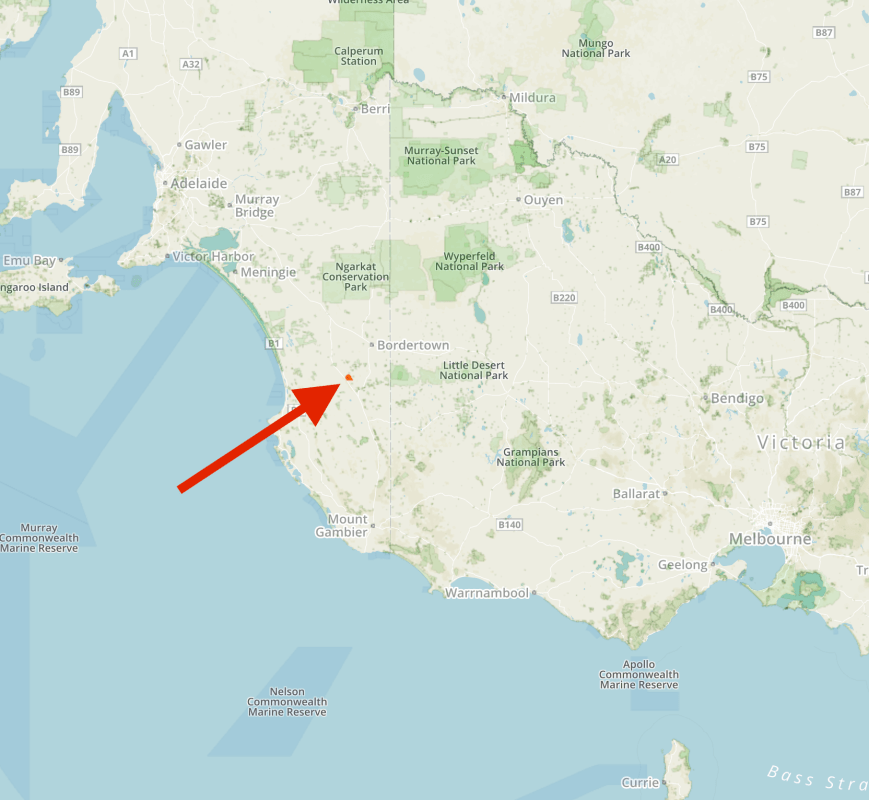
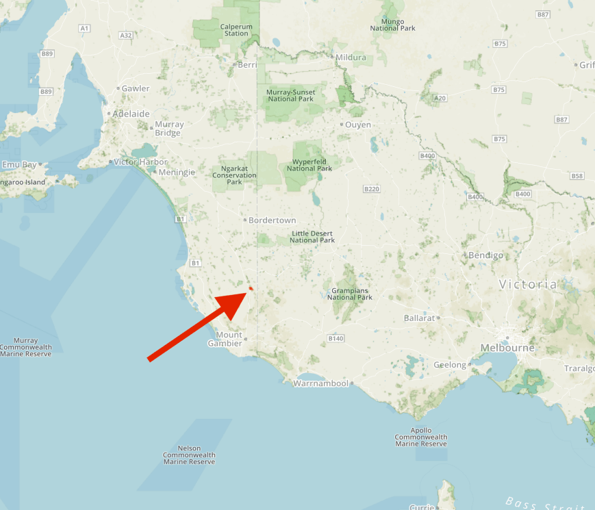
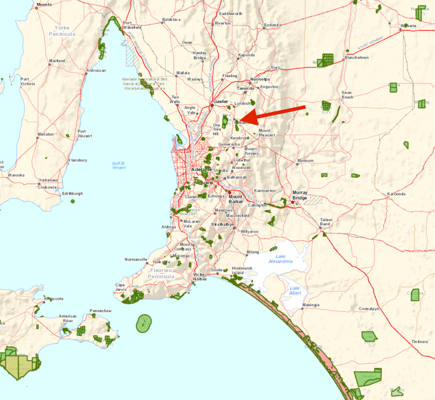
After leaving Hale Conservation Park, I headed for the Kaiserstuhl Conservation Park 5CP-097 & VKFF-0897, which is located about 80 km north east of Adelaide and about 12 km south east of Tanunda.
Map showing the location of the Kaiserstuhl Conservation Park. Map courtesy of Location SA Map Viewer.
I stopped off briefly at the junction of Warren Road and Springton Road at Williamstown where there is a small display, including an old timber jinker. The old horse drawn timber jinker was used in the Mount Crawford area during the early 1900’s to haul logs out of the forest to small ‘bush’ sawmills.
I then travelled north out of Williamstown on the Lyndoch Valley Road towards Lyndoch. This is the southern area of the famous wine growing region, the Barossa Valley. The Barossa is one of the world’s great wine regions and is certainly the most famous in Australia.
I stopped briefly at Mengler’s Hill which offers fantastic panoramic views of the Barossa. Although it was generally a fine day, there were some very threatening dark clouds out to the west as can be seen in the photographs below.
I initially travelled out along Krondorf Road with access to the western side of the park showing on the GPS. Sadly, this was not to be the case. Although showing on the GPS and maps as a road, there is no access to the park along Little Kaiser Stuhl Road. I had to detour around to Bethany and then up Mengler’s Hill Road. At the junction with Tanunda Creek Road, there is a sign indicating the park.

The Kaiserstuhl Conservation Park is located about 12 km south east of the town of Tanunda and is nestled amonst the Barossa Ranges. The park is 390 hectares in size and was dedicated in 1978 to protected one of the last remnants of native vegetation in the region, in particular the northern-most population of Brown Stringybark. More than 360 species of native plant are found in the park, many of which are of conservation significance.
The park is named after the nearby 600 metre high Kaiserstuhl summit. Kaiserstuhl means ’emperor’s chair’. The summit was named by geologist Johann Menge (1788-1852) after the Kaiserstuhl mountain range near Freiburg in south western Germany, a famous winegrowing region. The summit is known by the local aboriginals as Patpoori, meaning ‘big grass hill’. During the First World War, the name of the summit was changed to Mount Kitchener, as part of the anti German sentiment. It has since reverted back to Kaiserstuhl.
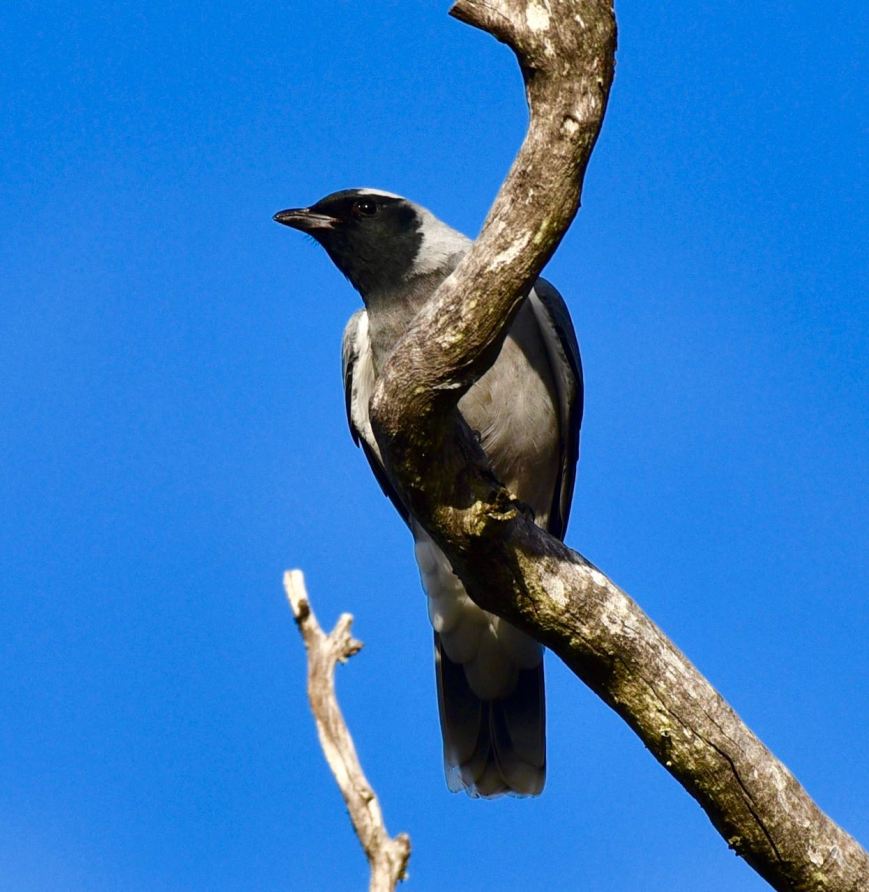
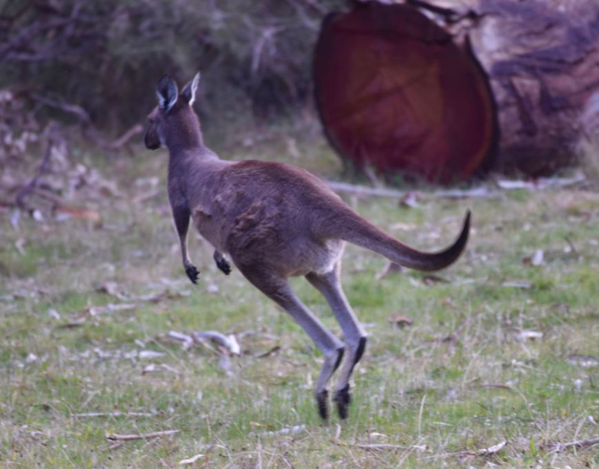
The park is home to a large amount of native wildlife including Western Grey Kangaroos, Euros, Short-beaker Echindas, Common Brushtail Possums, and Common Ringtail Possums. More than 135 species of bird have been recorded in the park including Lauching Kookaburra, Superb Fairywren, Yellow-rumped Thornbill, New Holland Honeyeater, Yellow-faced Honeyeater, White-naped Honeyeater, Crescent Honeyeater, and Grey Shrikethrush. Reptiles that call the park home include Eastern Bearded Dragons, Sleepy Lizards, Eastern Brown Snake, and Red-bellied Black Snake.
Kaisertuhl was first proclaimed on 3rd May 1979 with further areas of land being added on 5th June 1986 and again on the 3rd December 1987.
Between 1958-1962, the South Australian Field Naturalists Society recommended that an area of land near Kaiserstuhl, which was then known as Mount Kitchener, be acquired for conservation purposes. In 1970, while surrounding bushland was still being cleared for agriculture, Mr C.W. Bonython made a submission to the National Parks Commission seeking the creation of a national park in the Mount Kitchener region, where an area of approximately 1,000 hectares was still available. Both the Chairman of the Land Board, Mr C.E. Rix, and Director of National Parks, Mr R.G. Lyons inspected the land separately and reported favourably to the Commissioner in October 1971. Following the Commissioner’s recommendations, in November 1971 an approach was made to the principal landowner without success.
In 1974, in a submission to the Commonwealth Government for a grant under the State Grants (Nature Conservation) Act, a report was included on the Kaiserstuhl proposed area. However, because the assessor from the Federal Department of Environment did not inspect this locality, no further action was taken and no funds to purchase land in the Barossa Ranges were made available.
In March 1975, the Society for Growing Australian Plants wrote to the Premier of South Australia expressing concern that the (then) Woods and Forest Department had acquired land in the Kaiserstuhl region that they felt would be better suited for a national park. The Society had previously presented a submission, included in the Mount Lofty Ranges Study released by the State Planning Authority in August 1974, recommending that a new national park be established in the Barossa Ranges. The Outer Metropolitan Planning Area Development Plan had also recommended investigations of areas around the Tanunda Creek headwaters for possible acquisition for open space purposes.
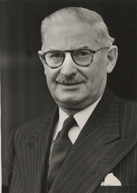
In February 1978, Mr M.A. Picard, Project Officer with the Nature Conservation Society of SA, presented a report to the Society on the conservation value of land known as the Pohlner Estate, situated in the vicinity of Kaiserstuhl. When the area became available for sale, a portion was purchased at auction with funds provided by Mr Leo Wakem Nicholls (1894-1971), who left the sum of $30,000 to the Field Naturalists’ Society of SA Inc in a bequest. There is a small plaque in the park which is dedicated to the memory of the late Mr Nicholls who was a keen bushwalker.
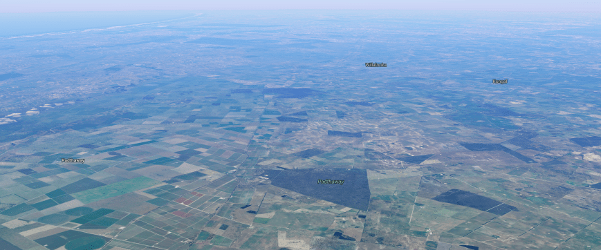
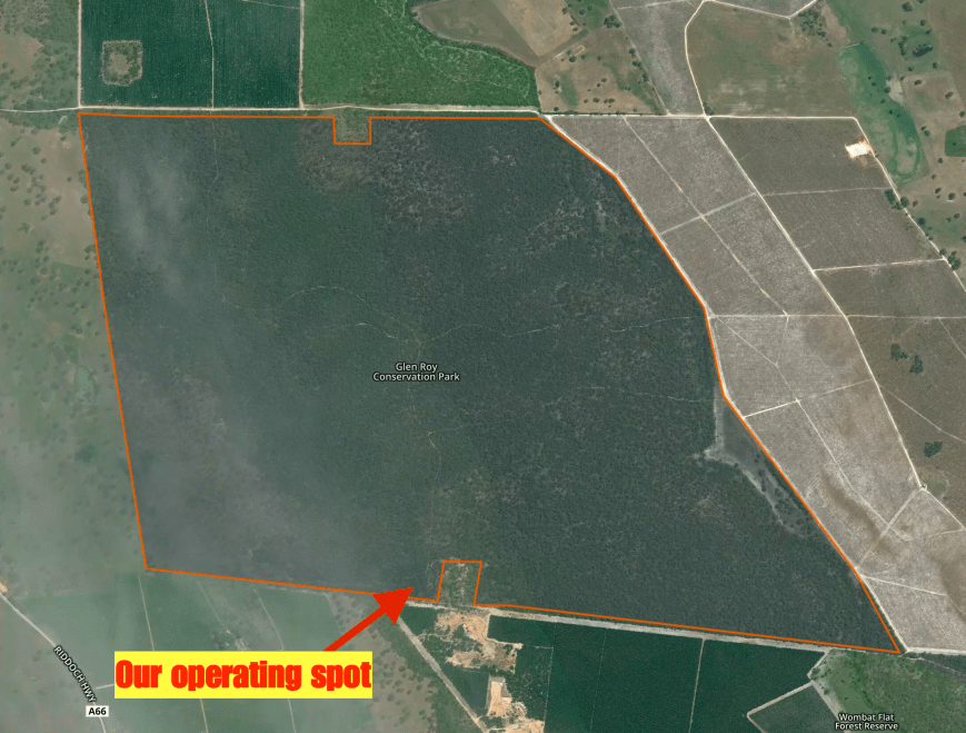
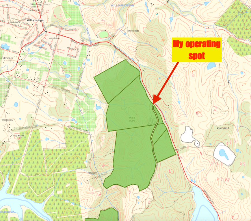
I set up just inside gate 1 on Wallowa Track. As there were signs specifying that people should remain on the paths, I set up about 1 foot off the main walking trail. As a result I had a lot of interaction with members of the public during the afternoon. One couple in particular showed great interest and were amazed that I was talking to people all around Australia.
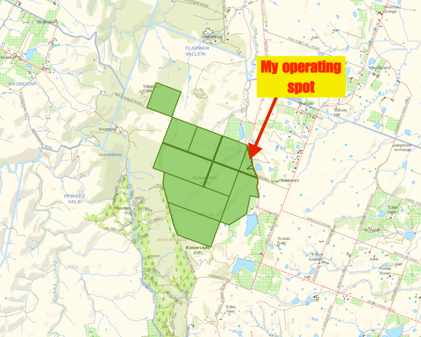
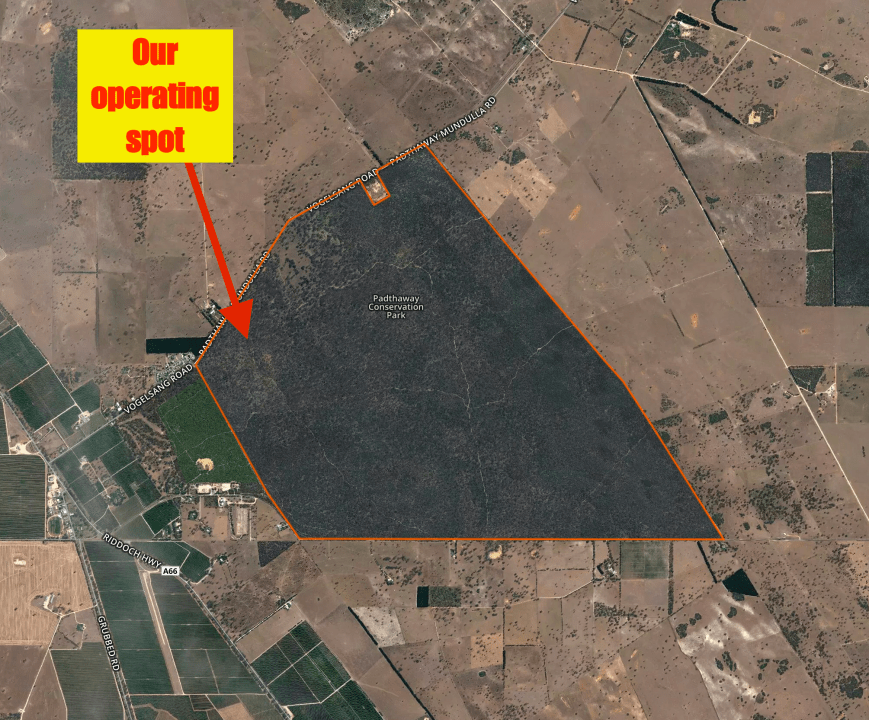
Map showing my operating spon in Kaiserstuhl. Map courtesy of Location SA Map Viewer.
I was set up and ready to go by just before 3.30 p.m. South Australian local time. As is the case each day at this time of the year, the 40m band was open to Europe, the USA and the Carribean. It was hard to find a clear spot on the band. Pedro NP4A was operating on 7.143, so 7.144 was out of the question. I headed up to 7.155 and started calling CQ. Unfortunately there was no mobile phone coverage with Telstra in the park (amazing!), so I could not self spot.
I called CQ for a few minutes and finally David VK3UCD came back to my call, running his newly put together Bitx40 transceiver. Andrew VK7DW was next, followed by Stef VK5HSX/2 and then Mike VK3ZMD. After 14 minutes, I had contact number 10 in the log, a QSO with Darrin VK3ER.
Band conditions had picked up very well since my earlier activation, with excellent signals from the east coast. Contact number 20 of the activation was a Park to Park QSO with Mark VK4SMA/p who was activating the Mount Perry Conservation Park VKFF-1609 in Queensland.
Just when I thought that local propagation was not working on 40m, I heard my wife Marija VK5FMAZ call in with an excellent 5/9 signal. I also logged a few more VK5’s including Andrew VK5MR, Sue VK5AYL, Ivan VK5HS, and Trevor VK5TW, before the band fell out again for local contacts. It was also nice to log my good mate Greg VK8GM in Alice Springs, who had a very strong 5/9 + signal.
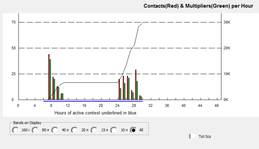
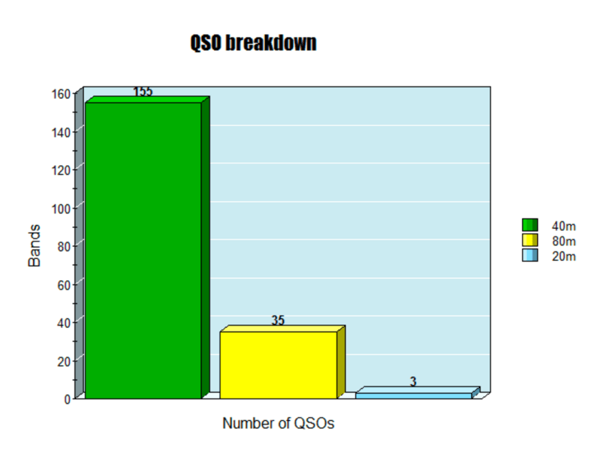
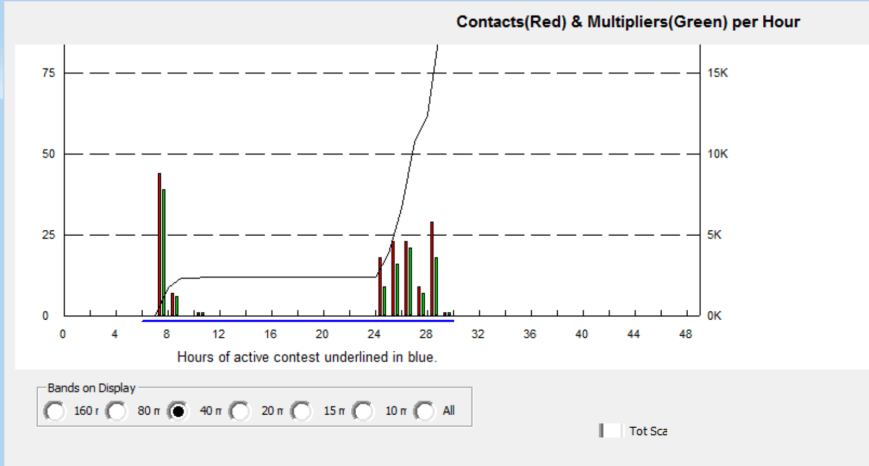
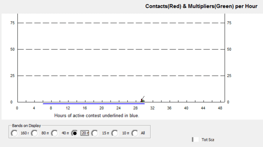
I logged a total of 42 stations on 40m from VK2, VK3, VK4, VK5, VK7, and VK8 before heading to the 20m band.
I headed to 14.310, the normal park & SOTA calling frequency on 20m, and asked if the frequency was in use. Much to my surprise, Hans VK6XN/p came back, stating he had taken a break from his activation to take a few photographs. I logged Hans who was in the Gooseberry Hill National Park VKFF-0201, with a strong 5/8 signal. Hans kindly spotted me on 14.305 and that is where I headed. Fred VK4FE was the first in the log on that frequency, followed by Daniel VK6WE, and then Tadashi JA1VRY in Japan. But that was the limit of my callers, and about 5 minutes of CQ calls went unanswered.
I then moved to 3.610 on the 80m band and called CQ for around 5 minutes with no takers. Unfortunately I was unable to self spot due to no phone coverage. So I decided to head back to 40m and hopefully work someone who could spot me. I was lucky, because I found Hans VK6XN had QSYd to 7.144 from 20m. I logged Hans and then asked if Hans could spot me on 3.610, which he kindly did.
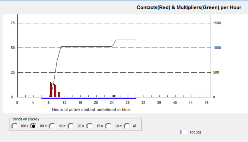
I headed back to 3.610 and it was clear that the spot had worked well, as there were a lot of stations who came back to my CQ call. I logged a total of 18 stations on 80m from VK2, VK3, VK4, and VK5.
It was now approaching 5.30 p.m. local time and the temperature had dropped very quickly to 6 deg C. I had a total of 65 contacts in the log.
I worked the following stations on 40m SSB:-
- VK3UCD
- VK7DW
- VK5HSX/2
- VK3ZMD
- VK2FADV
- VK3ATC
- VK3ZPF
- VK3GGG
- VK3PMG
- VK3ER
- VK3FRAB
- VK3PF
- VK2BHO
- VK3VIN
- VK2HHA
- VK2GPT
- VK2VX
- VK4AAC/2
- VK3SFG
- VK4SMA/p (Mount Perry Conservation Park VKFF-1609)
- VK3UH
- VK3FSPG
- VK3MPR
- VK5FMAZ
- VK5MR/m
- VK3HBG
- VK3KAI
- VK5AYL
- VK5HS
- VK3SQ
- VK8GM
- VK5TW
- VK4PDX
- VK3KMH
- VK3BBB
- VK3FOTO/m
- VK4XAC
- VK3FPSR
- VK6AHR
- VK5PET
- VK3NXT
- VK2VE/p
- VK6XN/p (Gooseberry Hill National Park VKFF-0210)
I worked the following stations on 20m SSB:-
- VK6XN/p (Gooseberry Hill National Park VKFF-0210)
- VK4FE
- VK6WE
- JA1VRY
I worked the following stations on 80m SSB:-
- VK5MK
- VK3ZPF
- VK5FANA
- VK2JDR
- VK3PF
- VK5FMAZ
- VK2GPT
- VK2VX
- VK2EMU/p
- VK3VIN
- VK3MCK
- VK2FSAV
- VK4TJ
- VK5KLV
- VK2YX
- VK2IO
- VK3LPG
- VK5ARC
References.
Birds SA, 2017, <http://www.birdssa.asn.au/location/kaiserstuhl-conservation-park/>, viewed 25th June 2017
Department of Environment and Natural Resources, 2010, ‘Kaiserstuhl Conservation Park’.
Department for Environment and Heritage. Kaiserstuhl Conservation Park Management Plan, 2006.
Wikipedia, 2017, <https://en.wikipedia.org/wiki/Kaiserstuhl_Conservation_Park>, viewed 25th June 2017


")