Peakery

I have spoken about the Peakery website previously, but thought it was worth mentioning once again.  Peakery is a great site where you can ‘explore and share your mountain experiences.

logo

The site features over 330,000 peaks from all around the globe.  In Australia, a total of 4,028 peaks are listed.

  • ACT – 87 peaks
  • NSW – 701 peaks
  • NT – 213 peaks
  • QLD – 1566 peaks
  • SA – 344 peaks
  • TAS – 382 peaks
  • VIC – 183 peaks
  • WA – 543 peaks

screen-shot-2017-01-31-at-8-03-09-pm

You can view the world’s mountains in 3 different views: List View, Map View, and Photo View.  Or you can browse mountains by location on the Regions page.  The regions are broken into: North America, Europe, Asia, South America Africa, Oceania (including Australia), and Antarctica.

screen-shot-2017-01-31-at-8-46-53-pm

Above:- a Map View of part of South Australia.

Peakery offers photographs, 3D fly-around views, trip reports, peak statistics, route info, and maps.  You can read the Summit Log to get a feel on the experience of other peakery users that have climbed the summit.  Peakery also gives you a sense of the surrounding area by browsing the nearest and highest peaks.

If you happen to find a peak that is not located on Peakery, you simply notify Peakery by clicking on ‘Can’t find a peak? Add it”.  I have found that the peaks are added very quickly.  When adding a peak, you need to specify the name of the peak, its elevation in either feet or metres, its prominence (if known), and its latitude or longitude.

On Peakery you can log all of your summit conquests, adding trip details, route info and photos, and obtain summit badges.

screen-shot-2017-01-31-at-8-12-00-pm

On your very own Peak page you can view a variety of information including the number of peaks that you have climbed, details and photos on those peaks, your summit badges, and a map showing your summitted peaks.

screen-shot-2017-01-31-at-8-14-19-pm

Other stats that are shown are your ranking, the highest peak you have summitted,  the summit you have climbed the most, and a breakdown on summits in Regions that you have climbed.

screen-shot-2017-01-31-at-8-18-50-pm

You can ‘follow’ other people registered with Peakery.

screen-shot-2017-01-31-at-8-35-34-pm

A number of Peakery Challenges are on offer.  They include the Australia 2000m Peaks Challenge, where you need to visit all Australian peaks at least 200m high with a minimum of 60m prominence, and the Australia State 8 Peak Challenge, where you need to climb the highest peaks in each of Australia’s 8 States/Territories.

Peakery can also be found on Facebook and Twitter.

Peakery is well worth a look.  You may find it of help during your next Summits on the Air (SOTA) adventure.

Restructure of WWFF

The World Wide Flora Fauna (WWFF) program is currently looking to revise its structure.

WWFF is seeking a new Chairman and Continental representatives from Africa (AF), Asia (AS), Europe (EU), North America (NA), Oceania (OC), and South America (SA) who together will form a WWFF Committee.

we-want-you-image1-274x300

You can nominate via the WWFF Forum which can be found at…..

 
http://wwff.co/forums/forum/elections-2017/

 
Nominations close on 31st January 2017.

 
During the first week of February, voting will commence. Voting instructions will be announced on the WWFF website at…..

 
http://wwff.co/

 
I will also post here.

 
I have nominated as the Chairman, and I see that Peter VK3ZPF has nominated as the OC Continental rep.

Warren Conservation Park 5CP-247 and VKFF-0941

For yesterday’s Friday afternoon/evening event (Friday 20th January 2016) for the VK5 National and Conservation Parks Award, I headed out to the Warren Conservation Park 5CP-247 and VKFF-0941.  The park is situated about 60 km north east of Adelaide and about 5 km south east of the town of Williamstown, in the Mount Lofty Ranges ‘Adelaide Hills’.

Screen Shot 2017-01-20 at 1.18.40 pm.png

Above:- Map showing the location of the Warren Conservation Park, north east of Adelaide.  Map courtesy of Protected Planet.

I last activated the Warren Conservation Park in August 2015 and on that occasion, due to very poor band conditions, I only managed to work a total of 14 stations.  So I needed a total of 30 more contacts to qualify the park for the World Wide Flora Fauna (WWFF) program.  For WWFF, a total of 44 contacts are required for the park to be qualified for the global WWFF program.  I had also activated the park way back in July 2013 as part of the VK5 Parks Award (prior to the park being added to WWFF).  So this was to be my third time to the park.

Details on my prior activations can be found at…..

https://vk5pas.org/2015/08/28/warren-conservation-park-vkff-941/

https://vk5pas.org/2013/07/24/warren-conservation-park/

Warren Conservation Park is 364 hectares in size and was first proclaimed in 1966.  It was re-proclaimed as Warren Conservation Park on the 27th April 1972.  The park is named after the Hundred of Warren, which in turn was named in honour of John Warren (1830-1914), who was an Australian pastoralist and politician.  More information can be found at: http://oa.anu.edu.au/obituary/warren-john-1198

john_warren_mha

Above:- The Hon. John Warren.  Image courtesy of wikipedia.

The park is characterised by steep country with views over forests, the nearby Warren and South Para Reservoirs, pastures and bushland, above the spectacular Warren Gorge.  The park comprises Messmate stringybark, Pink Gum, Hakeas, Native Currant, Flame Heath, and long-leaved box woodland.  The park contains numerous native orchids, rock ferns, and lilies.

The park is a haven for some of Australia’s rarest animals.  Native animals that call the park home include Western Grey kangaroos, echidnas, and lizards.  Numerous birds can be spotted in the park including Superb Fairywrens, Crescent Honeyeaters, Australian Golden Whistler, White-throated Treecreepers, Bassian Thrush and Grey Currawongs

There are a number of spectacular walks through the park.  This includes the famous Heysen Trail.  On a clear day, the Yorke Peninsula on the other side of Gulf St Vincent can be seen.

I left home after placing an alert on parksnpeaks, and the various Facebook sites and headed north through Nairne, Woodside and on to Lobethal.  I then took the Kenton Valley Road to Gumeracha, the home of the Big Rocking Horse, and then north on the Forreston Road, passing through the little town of Forreston, which is about 9 km south of the park (by road).  The town was named after Alexander Forrest who arrived in South Australia in 1848, and settled in the Forreston area by 1850.  By 1858, the village of Forreston had been laid out, with a post office, store, wine shop (every town has to have one of these), wheelwright, blacksmith (run by Forreston himself), butcher, and school.

In 1884, gold was found by John Watts in nearby Watts Gully, near the current day Warren Conservation Park.  In fact it was Watts Gully Road that I was headed for.  The area yielded gold nuggets as large as 14 ounces.  As a result, Forreston boomed as a little town.  From articles I have read on TROVE, it appears the area’s population swelled, with around 350-400 persons working on the diggings.  Today very little remains, and don’t blink because you may miss the town.

Screen Shot 2017-01-21 at 2.13.22 pm.png

Above: – Article from the ‘Evening News’ dated Sat 20 June 1885.  Courtesy of Trove.

This is a beautiful part of the Adelaide Hills with quite steep terrain and it wasn’t long before I reached the Mount Crawford Forest, a grouping of several forest areas controlled by the South Australian Government.  The largest of those encompasses the area around Mount Crawford.   The forest consists of both pine and native eucalypt plantations.

dsc_4943

The Warren Conservation Park can be accessed by walkers from the nearby Hale Conservation Park or from the Tower Track in the nearby Mount Crawford Forest.  Or there is a small parking area off Watts Gully Road in the south western corner of the park, which is where I accessed the park.

Screen Shot 2017-01-20 at 1.18.19 pm.png

Above:- Aerial shot of my operating spot in the south western corner of the Warren Conservation Park.  Image courtesy of Protected Planet.

I parked the Hi Lux just outside the entry to the park, and started unpacking, carrying the gear to a shaded area under a large gum tree.  There is a boardwalk at the entry to the park and this leads to the Heysen Trail.  The area either side of the boardwalk was quite overgrown compared to the last time I was in the park.  And due to the fact it was a warm day I made a point of making a bit of noise to hopefully scare of any snakes that may have been in the area enjoying the afternoon sun.

As I was setting up it was immediately noticeable that the park was absolutely alive with Superb Fairy wrens. They were everywhere.  They are a small insect eating bird, who often come quite close to humans.  The male has rich blue and black plumage on the upper body, whilst the female is mostly brown.

I ran my normal set up for this activation, comprising the Yaesu FT-857, 40 watts output, and the 80/40/20m linked dipole, supported on the 7 metre telescopic heavy duty squid pole.  I headed to my nominated operating frequency of 7.144 on the 40m band and started calling CQ.  This was immediately answered by Peter VK5KPR at Port Augusta in the north of the state, which a beautiful strong 5/9 signal.  This was followed by Les VK5KLV who was operating portable in the Upper Spencer Gulf Marine Park VKFF-1757.  Les was also booming through, and it was nice to get a Park to Park contact in the log.  This was followed by a call from Deryk VK4FDJL/2 who was in the Goulburn River National Park VKFF-0211.  Deryk was not specifically participating in the WWFF from the park, and I explained to him about the WWFF program.  Hopefully I can recruit another park activator.

Band conditions on 40m seemed to be down a little, with signals from Victoria being much lower than usual.  There were strength 6-7 static crashes present, but as is the case in the vast majority of park and SOTA activations, there was absolutely no man made noise, e.g. plasma TV noise, solar inverter, etc

Unfortunately around 10 contacts into the activation I started to experience some interference (QRM) from a net on 7.146.  I have politely asked these gentlemen to move in the past and sadly they have declined to move.  So I grit my teeth and grinned and bared the bleedover, being able to comfortably work most stations that were calling me.

Fortunately the interference held off just long enough for me to work Adrian VK5FANA who was portable in the Eastern Spencer Gulf Marine Park VKFF-1706 on the Yorke Peninsula.  Adrian was very weak, but was perfectly readable due to the non existant man made noise in Warren.  I went on to work a total of 35 stations on 40m from VK1, VK2, VK3, VK4, VK5, and VK7.

I then headed over to 20m where I called CQ on 14.310.  This was answered by John VK6NU in Western Australia who was quite weak, but a successful exchange of signal reports meant that the contact was good.  I only logged a further 3 stations on 20m.  They being Alan VK4ALA, and then park stalwart Rick VK4RF/VK4HA.  Signals from Queensland on the 20m band were noticeably lower than usual.

I then inserted the links in the linked dipole and headed off to the 80m band, hoping to get some South Australian hams in the log.  It was apparent from conditions on 40m, that close in propagation was non existant on that band.  My first contact on 80m was with John VK5BJE in the Adelaide Hills (5/9 both ways).  This was followed by Trevor VK5TW (5/9 both ways) and then Mick VK3GGG/VK3PMG in western Victoria (5/8 sent and 5/7 received).  Adrian VK5FANA called in, with another Park to Park logged from the Eastern Spencer Gulf Marine Park (5/5 both ways).  Despite conditions being quite good on 80m, I only logged 2 further contacts, they being with Mike VK5FMWW/VK5FVSV.

dsc_4961

Time was marching on, and it was now 7.30 p.m. local time (0830 UTC).  I hadn’t planned on being in the park this long and I was absolutely starving hungry.  But I put out a few more CQ calls on 40m hoping to pick up some of the park hunters that had missed me on the first go around on 40m.  I logged 7 contacts on 7.144, including Lewis VK6LDX who was portable on SOTA peak Mount Shadforth VK6/ SW-054.  Lewis had an excellent 5/8 signal coming in from south western Western Australia, near Albany.

But callers were few and far between, so I had a quick look across the band and found Robert VK7VZ speaking with Beth MW0VOW in Wales.  I tried giving Beth a call but sadly she was not able to pull me out of the noise.  I was a little disapointed as this would have been a new country for me on 40m whilst operating portable.

John VK6VZZ mobile gave me a shout and we moved a little higher up the band for a quick chat.  As it was just a little before 8.00 p.m. local time I then headed to 7.130 for the 7130- DX Net.  I remained on the net for 2 rounds, logging 6 contacts in VK2, VK4 and VK7, before packing up.  I did try calling on the net, Bill W1OW from Massachusetts USA, who I know is a keen park hunter.  I have worked Bill many times before, but it was not to be tonight, as he was experiencing a very high level of static and also other stations on the frequency.

The sun was just starting to go down, and as a result the Western Grey kangaroo population in the park was quite active with many keeping a watchful eye on me.

dsc_4968

I had exceeded the 30 required contacts I needed to qualify the park, with a total of 60 contacts in the log on 40m, 20m, and 80m.  Thankyou to everyone who called me, and many thanks to those who took the time to spot me on parksnpeaks, Facebook, etc.

I worked the following stations on 40m SSB:-

  1. VK5KPR
  2. VK5KLV/p (Upper Spencer Gulf Marine Park VKFF-1757)
  3. VK4FDJL/2 (Goulburn River National Park VKFF-0211)
  4. VK2HHA
  5. VK3GGG
  6. VK3PMG
  7. VK4RF
  8. VK4HA
  9. VK3ZPF
  10. VK3OHM
  11. VK1DI
  12. VK7VZ/p
  13. VK3VBI
  14. VK3NUC
  15. VK3SFG
  16. VK4HNS/p
  17. VK2YW
  18. VK1AT
  19. VK3HKV/p
  20. VK5FANA/p (Eastern Spencer Gulf Marine Park VKFF-1706)
  21. VK3VIN
  22. VK3UH
  23. VK2IO/m
  24. VK3KMH
  25. VK7AN
  26. VK3FLCS
  27. VK2NEO
  28. VK3FSPG
  29. VK3MPR
  30. VK3AXF
  31. VK3FCMC
  32. VK3PF/m
  33. VK2QR
  34. VK3JK
  35. VK3ARH
  36. VK3IP
  37. VK2FGLB
  38. VK3QB
  39. VK3BBB
  40. VK6LDX/p (SOTA Mount Shadforth VK6 SW-054)
  41. VK3KRH
  42. VK3PI/p
  43. VK6VZZ/m
  44. VK7ROY
  45. VK4PDX
  46. VK2STO
  47. VK2FOUZ
  48. VK7CC
  49. VK1MTS

I worked the following stations on 20m SSB:-

  1. VK6NU
  2. VK4ALA
  3. VK4RF
  4. VK4HA

I worked the following stations on 80m SSB:-

  1. VK5BJE
  2. VK5TW
  3. VK3GGG
  4. VK3PMG
  5. VK5FANA/p (Eastern Spencer Gulf Marine Park VKFF-1706)
  6. VK5FMWW
  7. VK5FVSV

References.

Birds SA, 2017, <http://www.birdssa.asn.au/location/warren-conservation-park/&gt;, viewed 20th January 2017

Cockburn, 2002, ‘South Australia. What’s in a Name?’

National Parks South Australia, 2017, <https://www.environment.sa.gov.au/parks/Find_a_Park/Browse_by_region/Adelaide_Hills/warren-conservation-park&gt;, viewed 20th January 2017

Walking SA, 2017, <http://www.walkingtrailssupportgroup.org.au/documents/leaflets/WarrenTowerbrochureNov2009tmsnewrmnsmallerpics.pdf&gt;, viewed 20th January 2017

Wikipedia, 2017, <https://en.wikipedia.org/wiki/John_Warren_(Australian_politician)&gt;, viewed 20th January 2017

Wikipedia, 2017, <https://en.wikipedia.org/wiki/Forreston,_South_Australia&gt;, viewed 21st January 2017

Wikipedia, 2017, <https://en.wikipedia.org/wiki/Mount_Crawford_(South_Australia)&gt;, viewed 21st January 2017

Trans Tasman Low Band Challenge

The aim of the Trans Tasman Low Band Challenge is to encourage low band activity in Australia and New Zealand.  The applicable bands are 160, 80 and 40m.  Amateurs in VK and ZL contact other amateurs in VK and ZL in three individual 2 hour blocks.  Points are awarded for valid contacts between VK & ZL stations.

The 2016 contest was held on Saturday 16th July 2016.

I called in to the Mowantjie Willauwar Conservation on the way home from the Coorong and spent about 90 minutes on air for this contest.  I made a total of 90 contacts on 40m and 80m.

As it turned out 55 of those were in period one, whilst a further 35 were in period two.  I packed up before the conclusion of period 2.  My total score was 795 points.  I came in at position 11.

For more information on the activation, please see my previous post at…….

https://vk5pas.org/2016/07/17/mowantjie-willauwar-conservation-park-5cp-152-and-vkff-0919/

VK5PAS Trans Tasman Low Band Challenge 2016.png

Top Operator certificates

Each year the World Wide Flora Fauna (WWFF) program acknowledges the Top 44 Activators around the world and certificates are issued.  Certificates are issued in the Top Activator (by references) and Top Activator (by number of QSOs).

In 2016 I came in at second place in Oceania in the Top Activator (by references) category.  I was ranked number 12 in the world.  I activated a total of 86 references, but only 74 of those qualified for the WWFF global program due to not reaching the 44 QSO threshold.

A big congratulations to Rob VK4AAC who was in first place in Oceania, and who came in at number 5 in the world.  Rob activated a total of 106 references, with all 106 qualifying for WWFF with 44 QSOs.  A terrific effort Rob.

In the Top Activator (by number of QSOs) I came in first place in Oceania and number 33 in the world, with a total of 6,593 QSOs.  Rob VK4AAC was close on my hells in position 36 with a total of 6,319 QSOs.

Here are the lists showing the Top 44 in each Activator category.

Encounter Marine Park VKFF-1707

Yesterday (Sunday 15th January 2017) I headed down to the Encounter Marine Park VKFF-1707 with Chris VK5FR and David VK5KC and enjoyed a very relaxing afternoon on the beach nof far from the Murray Mouth.  This was the first time the park had been activated for the World Wide Flora Fauna (WWFF) program.

The park is located south of Adelaide and we decided to travel along the beach at Goolwa towards the Murray Mouth and operate from the beach.

screen-shot-2017-01-16-at-10-13-38-am

Above:- The Encounter Marine Park stretches along the southern coast.  This map shows our operating spot in relation to Adelaide.  Map courtesy of Location SA Viewer. 

It was quite a warm day with the expected top temperature being in the high 20’s, so it was an ideal day to be out and about.  Chris and David arrived at my home at around 10.00 a.m. and after packing the Toyota Hi Lux we headed south through the little town of Strathalbyn and on to Goolwa.  The drive took us through some beautiful countryside on the Fleurieu Peninsula and the wine growing region of Currency Creek.

Once we reached the town of Goolwa, we drove down Beach Road to the coastline.  We deflated the tyres a little on the Hi Lux and then drove down onto the beach and headed east towards the Murray Mouth.  As it was such a lovely day there was a lot of activity on the beach.

As we drove along the beach we observed dozens of Sooty Oystercatchers and Pied Oystercatchers.  The Sooty Oystercatcher is the only all black shorebird in Australia.

The Encounter Marine Park encompasses the waters off southern metropolitan Adelaide and the Fleurieu Peninsula.  It extends past the Murray Mouth to the Coorong coast.  At its western boundary, the park includes all waters of Backstairs Passage and the eastern shores of Kangaroo Island.  The park is 3,119 km2 in size and represents 12% of the marine park network in South Australia.

The park contains some of Australia’s best preserved ocean wilderness, including amazing dive sites and spectacular reefs which provide refuge for vitally important fish breeding and shelter areas.  Fishing is very popular within the park, along with diving, and surfing.  Leafy Sea Dragons are found in the park, along with Sea Lions, and Southern Right Whales.

Screen Shot 2017-01-16 at 10.37.06 am.png

Above:- Map showing the location of the Encounter Marine Park.  Map courtesy of National Parks SA.

Below is a terrific video to give you a feel of what this spectacular part of South Australia offers.

We drove down along the beach to the Murray Mouth, where the mighty Murray River flows out into the Southern Ocean.  This is about 10 km south east of Goolwa.  It was very pleasing to see the mouth wide open, which it often is not.  But due to all of the recent rain upstream, it was flowing well out to sea.

The mouth of the Murray River is an opening in the coastal dune system  which separates the river system from the Southern Ocean and which extends from near in a south-easterly direction along the continental coastline for about 145 kilometres.  This is known as the Coorong, which is a National Park.

The Murray mouth divides the dune system into two peninsulas. The peninsula on the west side is known as Sir Richard Peninsula,  which terminates at the mouth with a point named Pullen Spit.  While the peninsula on the east side is known as Younghusband Peninsula,  which terminates at the mouth with a point known in some sources as Sleepy Hollow.

Water flows throughout the mouth from two directions. Firstly, the flow from the west passes along a passage known as the Goolwa Channel which is bounded by Hindmarsh  Island to its north side and secondly, the flow from the east passes along a passage known as the Coorong Channel. 

We found a spot a little away from the people undertaking various activities including fishing and swimming, and rolled out the awning on the side of the Hi Lux.  We erected the fold up table and deck chairs, and the 80/40/20m linked dipole on the 7m squid pole.  As it was a sunny day, the solar panels came out to top up the 44 amp hour power pack charging the radio.  We ran 40 watts output from the Yaesu FT-857d.

Screen Shot 2017-01-16 at 10.02.12 am.png

We were all set up and ready to go by around 0140 UTC (12.10 p.m. South Australian local time).  I jumped on the mic first and headed to 7.144 where we found Marc VK3OHM calling CQ from the Cobboboonee National Park VKFF-0728 in south western Victoria.  Marc had a strong 5/8 signal and reciprocated with a 5/8 for us.  Chris, David and I swapped the mic and logged the Park to Park contact with Marc.  It was a nice way to start our activation.

We then headed down to 7.139 and I started calling CQ.  Steve VK3FSPG/VK3MPR was the first responder to my CQ call, followed by Mick VK3GGG/VK3PMG, and then Tim VK3TJK.  Signals were down a little compared to normal which was not a good sign of things to come.

Ian VK1DI/2 then called us from the Majors Creek State Conservation Area VKFF-1346, and again we swapped the mic to log the Park to Park contact with Ian.

Sergio VK3SFG  was number 10 in the log for me, and I had qualified the park for the VKFF awards.  I jumped out of the ‘drivers seat’ and in went Chris VK5FR.

Chris also qualified the park for VKFF in quite quick time, and David VK5KC soon followed.  But it was very slow going from that time on, on 40m.  The band conditions seemed to be well down and the number of callers was much lower than usual.  We did log a splendid contact with Andrew VK1AD in Canberra who was running just 500 milliwatts.  Andrew was 5/2 to us and he gave us a 5/8 over to the ACT.  Personally there would be no way I could work Andrew on such QRP power from home, as the noise floor is too high.  But from the park, it was ‘armchair’ copy.

We also logged Gerard VK2IO who was operating portable from SOTA peak VK2/ CT-004 in the Central tablelands region of New South Wales.

We then headed over to 20m and Chris started calling CQ on 14.310.  This was answered by Steve VK3MEG who was a beautiful 5/9 from Melbourne.  This was followed by Geoff in Beechworth in north eastern Victoria who also had a nice signal, and then Andrew VK1AD running QRP again, this time 1 watt.  Andrew was peaking 5/7 with us, with some QSB on his signal.  Andrew gave us a 5/8 signal report on our 40 watts, so we lowered our power down to 5 watts and this resulted in a drop of around 3 S points for us.

Again Chris, David, and I swapped the mic on 20m, working into VK1, VK2, VK4, VK4, VK6, and VK8, whilst enjoying a bit of banter amongst the three of us between contacts.

We moved back to 40m where we logged a number of further contacts, mostly on the eastern seaboard of Australia.  It was quite apparent that the close in propagation was not working at all on 40m, with only one VK5 logged and that was Greg VK5GJ at Meadows in the Adelaide Hills.

We logged a few more portable operators, and this included Gerard VK2IO who was portable on SOTA peak VK2/ CT-002 in the Kanangra-Boyd National Park VKFF-0256.  And also .  We alsoAngela VK7FAMP who was portable in the Notley Gorge State Reserve VKFF-1145.  Chris, David and I had all qualified the park, with in excess of 44 contacts each.

Prior to going QRT for the day we also tried 80m where we logged a handful of VK5 stations.  We also played a bit with my Chinese version of the Buddistick without any success.  We had major problems in bringing down the VSWR.  So any contacts on that antenna will have to wait for another day.

It was a great afternoon out in the Encounter Marine Park, but we were starting to get a little thirsty for a beer, so we packed up and made our way back down along the beach to Goolwa.

dsc_4935

Above:- View looking east along Goolwa Beach, back down towards the Murray Mouth

We stopped off at the Corio Hotel in Goolwa for a couple of beers, and then drove on to Strathalbyn where we stopped for tea at the Victoria Hotel, before heading back to my home QTH at Mount Barker.

Below is a short 5 minute video of our activation…..

I worked the following stations on 40m SSB:-

  1. VK3OHM/p (Cobboboonee National Park VKFF-0728)
  2. VK3FSPG
  3. VK3MPR
  4. VK3GGG
  5. VK3PMG
  6. VK3TJK
  7. VK1DI/2 (Majors Creek State Conservation Area VKFF-1346)
  8. VK3SQ
  9. VK7CW
  10. VK3SFG
  11. VK1AD (QRP 500 mw)
  12. VK2IO/p (SOTA VK2/ CT-004)
  13. VK2PDW
  14. VK1AT
  15. VK3NAL
  16. VK3FT
  17. VK7DW
  18. VK3AFB
  19. VK3PAT/m
  20. VK2NEO
  21. VK5EE
  22. VK2GKA
  23. VK3IRM
  24. VK3ARH
  25. VK3HRA
  26. VK5GJ
  27. VK7QB
  28. VK2VV
  29. VK3DMZ
  30. VK3FMAA
  31. VK3RV
  32. VK2IO/p (SOTA VK2/ CT-002 & Kanangra-Boyd National Park VKFF-0256)
  33. VK7FAMP/p (Notley Gorge State Reserve VKFF-1145)
  34. VK3MCD

I worked the following stations on 20m SSB:-

  1. VK3MEG
  2. VK3SQ
  3. VK1AD (QRP 1 watt)
  4. VK2IG
  5. VK4DMC
  6. VK3TKK
  7. VK4HNS/p
  8. VK8GM
  9. VK4RF
  10. VK4HA
  11. VK3AUR
  12. VK6GLX
  13. VK3FT
  14. VK2YK

I worked the following stations on 80m SSB:-

  1. VK5BJE
  2. VK5FMWW
  3. VK5FVSV
  4. VK5YX


References.

Birdlife Australia, 2017, <http://birdlife.org.au/bird-profile/sooty-oystercatcher&gt;, viewed 16th January 2017

National Parks South Australia, 2016, ‘Marine Park 15 Encounter Marine Park’

Wikipedia, 2017, <https://en.wikipedia.org/wiki/Murray_Mouth&gt;, viewed 16th January 2017

Salt Lagoon Islands Conservation Park 5CP-203 and VKFF-1092

It was another Friday afternoon and time for another Friday afternoon/evening session for the VK5 National and Conservation Parks Award.  For the past couple of years, a small group of South Australian amateurs have headed out into the field on each Friday afternoon and into the evening, to promote the award.  So yesterday (Friday 13th January 2016) I headed south and activated the Salt Lagoon Islands Conservation Park 5CP-203 and VKFF-1092.  The park is located about 110 km south of Adelaide (by road) and about 14 km south west of the little town of Narrung.

Screen Shot 2017-01-11 at 2.40.42 pm.png

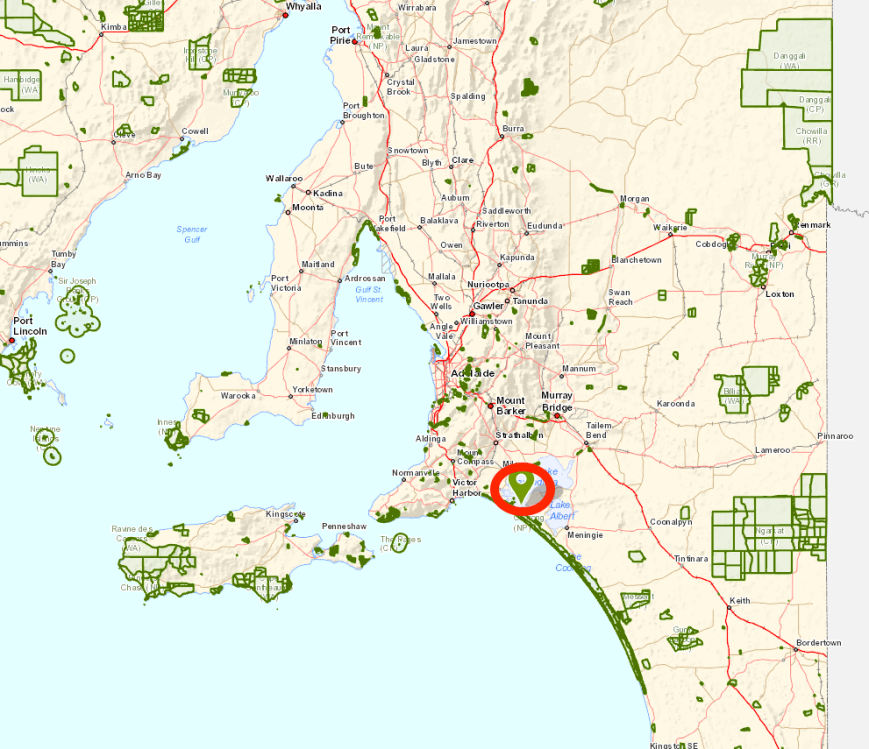
Above:- Map showing the location of the Salt Island Lagoons Conservation Park, south east of Adelaide.  Map courtesy of Location SA Map Viewer.

Last year my wife Marija VK5FMAZ and I headed down south in the hope that we could activate this park via Pelican Point Road, but sadly access was an issue and we were unable to do so.  In the interim I have been so busy on WIA issues and other commitments, that I hadn’t progressed any further enquiries regarding access.  But in the last few days I was able to speak with the land owner, Mr. David Harvey, who kindly allowed me to access the park via his property.  The only other way into the park is via boat.

This was to be a unique park for me as an activator, and the very first time that Salt Lagoon Islands Conservation Park had been activated.

Salt Lagoon Islands Conservation Park is located at the south east extent of Lake Alexandrina which is a large freshwater ephermal lake.  Lake Alexandrina adjoins the smaller Lake Albert, and together they are known as the Lower Lakes.  Lake Albert was named after Prince Albert, the Consort of Queen Victoria, by Governor George Gawler.  Lake Alexandrina was named after Princess Alexandrina, niece and successor of King William IV of Great Britain and Ireland.

The park comprises two islands and some adjoining waters.  These two small islands are one of the main breeding sites for a number of the larger water birds in South Australia. Species known to breed there include two species of spoonbill, three species of egret, four species of cormorant, three species of ibis and the Nankeen night heron.

screen-shot-2017-01-11-at-2-34-38-pm

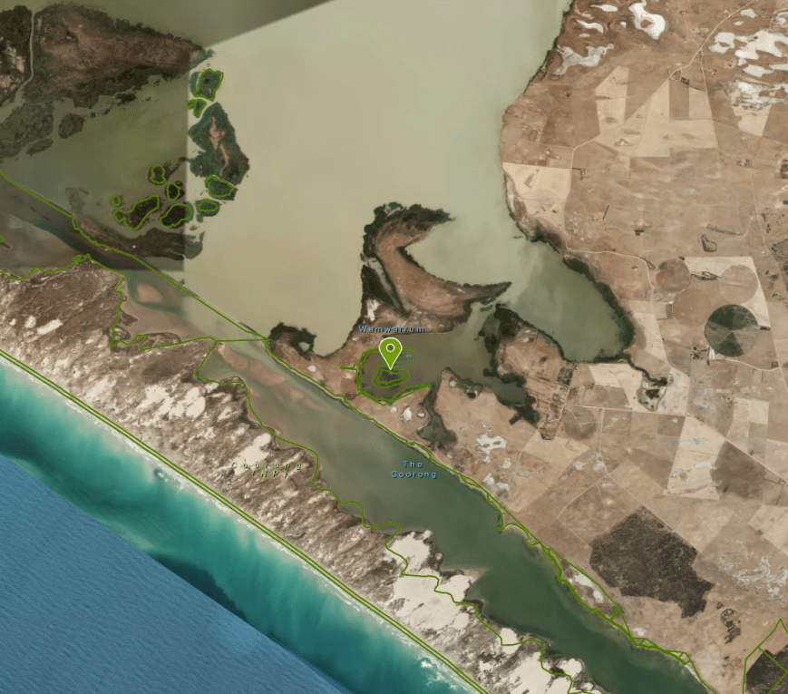
Above:- Aerial shot showing the location of the park.  Image courtesy of Location SA Map Viewer.

This is Tiger snake and Red-bellied Black snake country, so I made as much noise as possible whilst setting up, hoping that any that were in the area slithered away from my operating spot.  Tiger snakes are extremely dangerous to humans, with its venom being strongly neurotoxic and coagulant.  The Red-belliwed Black’s venom has predominantly anticoagulant and myotoxic effects.

Above:- Tiger snake (left) & Red bellied Black snake (right).  Images courtesy of wikipedia

There are two main ways to get down to the park from my home.  The first is via the South Eastern Freeway, down past Murray Bridge and on to Tailem Bend and then to Meningie.  Or via Langorne Creek, Wellington and Narrung.  This is the more picturesque of the two drives and the one I chose.  It took me down through the wine growing region of Langhorne Creek and then on to Wellington.

After leaving Langhorne Creek I travelled east on theLanghorne Creek-Wellington Road, passing the Tolderol Game Reserve VKFF-1752 and the turn off to the Ferries McDonald Conservation Park VKFF-0881.  I soon reached the little town of Wellington which is situated on the banks of the mighty Murray River.  It is just upstream from where the Murray empties into Lake Alexandrina.

Wellington was the original crossing of the Murray River for people, livestock, and goods travelling overland between Melbourne and Adelaide, until a bridge was built in 1879 at nearby Murray Bridge.  During the years 1852-1853, gold was escorted through this are by South Australia Police troopers from the Victorian gold fields, and there is a plaque here to commemorate that.  You can also view the original bell which was used to summon the ferry.  The impressive old Wellington courhouse, dating back to the 1840’s, is now a cafe and museum.

I boarded the ferry and crossed the Murray River.  The ferry was absolutely brim full, and I noticed a lot of interstate number plates on the vehicles, so tourism appears to be doing well down in this area.

After crossing the Murray River on the ferry I drove south on the Princes Highway towards the town of Meningie.  Rather than continuing on to Meningie, I turned right onto Pottalloch Road and followed the southern border of Lake Alexandrina.  There are some great views to be enjoyed of the lake along this drive.

I also drove passed the  Point Malcolm lighthouse which is Australia’s only inland lighthouse, and also believed to be the only inland lighthouse in the Southern Hemisphere.  The lighthouse was built in 1878 on the eastern side of the narrows between Lake Alexandrina and Lake Albert.  It was last operated in 1931 due to a decline in river traffic.

I crossed the ferry and entered the little town of Narrung, which was established in 1907.  Narrung is local aboriginal language for ‘place of big sheoaks’.  It was pleasing to see a lot of caravaners camping along the banks of the lake.

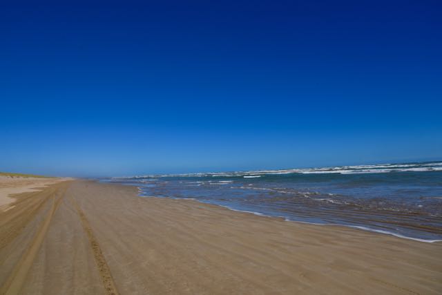
I left Narung and travelled south on Loveday Bay Road until I reached Mark Point Road.  I then travelled south until I reached Pelican Point Road.  The very impressive Coorong National Park was now directly in front of me.  The Coorong is a 130 km stretch of saltwater lagoons protected from the Southern Ocean by sweeping sand dunes.  The Coorong is a wetland of international importance, and supports many significant and endangered flora and fauna.

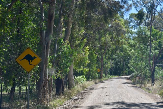
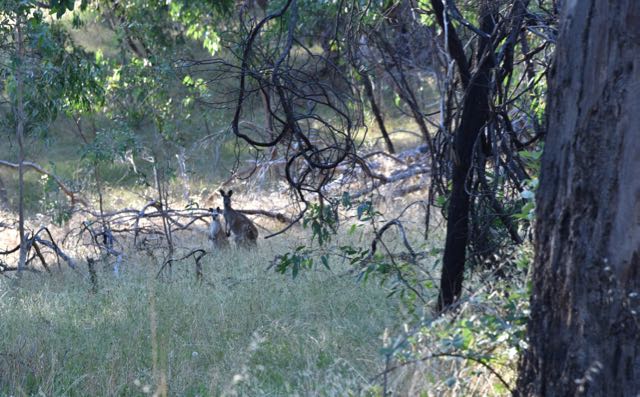
I then travelled a few km along Pelican Point Road until I reached a set of unlocked double gates.  This is where I needed to enter to access the park.  Please remember, this is is PRIVATE PROPERTY!.  DO NOT access the land unless you have the specific permission of the landowner.  I followed a track around the western edge of the lagoon, enjoying the scenery and wildlife, including numerous Western Grey kangaroos and various birdlife.

Once I got around to the northern side of the lagoons, the lagoons themselves came into view.  Access to the water’s edge was not possible as the soil was very boggy to walk on.

I was very cognisant of snakes so I found an area where the grass wasn’t too tall, and a few metres from the reeds and the water.  I set up the fold up table, deck chair, and used the Yaesu FT-857d set at 40 watts output, and the 80/40/20m linked dipole supported on the 7 metre squid pole.  It was quite a nice sunny afternoon but there was a very strong southerly blowing directly off the nearby Southern Ocean, and the squid pole certainly had a huge flex in it.  Sadly, the band was also a little noisy, with some loud static crashes.

Screen Shot 2017-01-11 at 2.34.59 pm.png

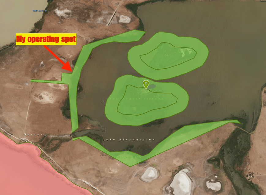
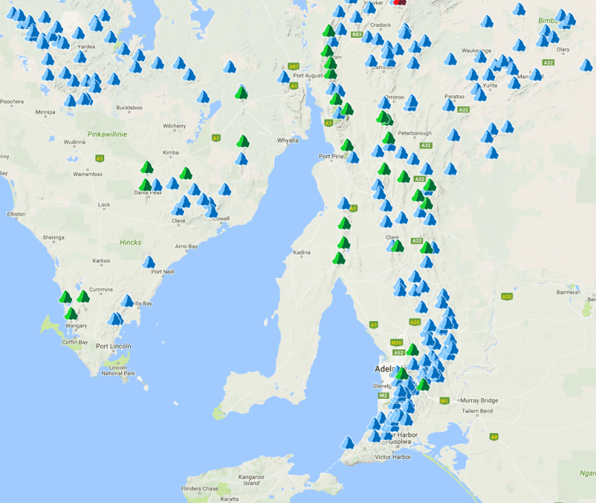
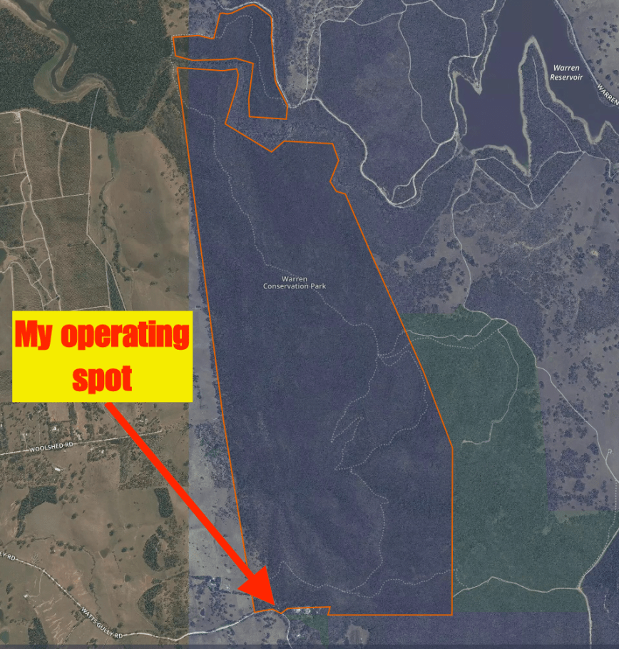
Above:- Aerial shot of the park showing my operating position.  Image courtesy of Location SA Map Viewer.

I was a little late from my posted activation time, as I had stopped off along the way to take a few photos.  In fact I was around one hour late, but that did not seem to deter the park hunters.  I called CQ on 7.144 and it did not take long for a mini pile up to ensure, with park hunters wanting to log a unique park.  Mike VK5FMWW was my first station logged, followed by Steve and then Marc VK3OHM/p who was activating the Port Campbell National Park VKFF-0420.

I continued to work through the pile up, asking at one point for portable, mobile, and QRP stations, to give them a chance through the calls of the higher powered stations.  This included logging Rob VK4FFAB/p who was activating the Bunyaville Conservation Park VKFF-1493.  I also worked Phil VK6ADF/p who was in the Yarra Yarra Lake Conservation Park.

I worked a total of 36 stations on 40m from VK2, VK3, VK4, VK5, VK6, and VK7, before QSYing to 14.310 on the 20m band.  My first caller there was Gary VK5ZK at nearby Goolwa who had a good 5/8 signal on ground wave no doubt.  The 20m band was open to Victoria and I logged Peter VK3PF, Ian VK3AXF, Peter VK3TKK/p and Joe VK3MAB.  I also logged another Park to Park contact with Phil VK6ADF/p in the Yarra Yarra Lake Conservation Park.

Sadly there was no opening to Europe for me on the long path and no DX was logged, other than Ken ZL4KD, the ZLFF co-ordinator.  Prior to heading off to 80m I tuned across the 20m and heard very little activity, certainly no Europe.  There were a few weak JA stations and also a BG8 from China who was calling CQ.  I gave him a shout, but unfortunately he was unable to hear me.

I then moved to 3.60 on the 80m band and worked a total of 9 stations amongst the very loud static crashes, which made it particularly difficult at times.  The first station logged on 80m was the every reliable Adrian VK5FANA on the Yorke Peninsula with a very strong 5/9 ++ signal.  States worked on 80m were VK2, VK3, VK4, and VK5.  I even worked Rick VK4RF/VK4HA who was a good 5/7 signal.

I then lowered the squid pole and erected the 15m dipole and called CQ on 21.244.  I believe Mick VK3GGG called me and I heard a 4/1 signal report, but sadly I was not able to be heard well enough at the other end for it to be a valid contact.  I called CQ for around 10 minutes on 15m, but had no takers.  Despite this, it was quite enjoyable sitting back admiring the view, and watching the many waterbirds flying overhead, including Ibis, Cormorants, and Pelican.

I moved back to 40m with the local time now approaching 8.00 p.m.  I hadn’t really planned on being out this late, but was it was approaching 0930 UTC I decided to stick around and book into the 7130 DX Net.

I headed to 7.130 and had asked if the frequency was in use, with no response, and I had just self spotted myself on that frequency on parksnpeaks.  When a JA8 started calling CQ.  Mal VK5MJ the Net Control of the 7130 DX Net then called in and due to the frequency being occupied, the net was moved up to 7.135.  I worked a total of 12 stations on the net including William FO5JV in French Polynesia (5/8 sent and 5/2 received), and Bill W1OW in Massachusetts USA ((5/7 sent and 4/5 received).  I was pleased to make contact with Bill as he is an avid park hunter.

Other good contacts on the net including a QSO with Damien VK5FDEC who was running QRP (1/2 watt).  Damien was a good 5/8 signal to Salt Lagoon Islands.  I also made contact with Tim VK8LLA in Darwin.

After a few rounds on the net I moved up the band to 7.146.  It was starting to get dark and I wanted to be out of the park before it was pitch black, as I did not want to get lost.  I logged a further 18 stations from VK2, VK3, VK5, VK7, and VK8.  This included Greg VK8GM in Alice Springs.

So after 3 and 1/2 hours in the park I had a total of 88 contacts in the log.  Of those, 65 were on 40m, 14 on 20m, and 9 on the 80m band.  I safely manouevered my way out of the park and headed back home.  This time I drove back into Meningie, and then on to Tailem Bend, and along the South Eastern Freeway to home.  Below is a map showing my route for the day.

Screen Shot 2017-01-14 at 11.24.03 am.png

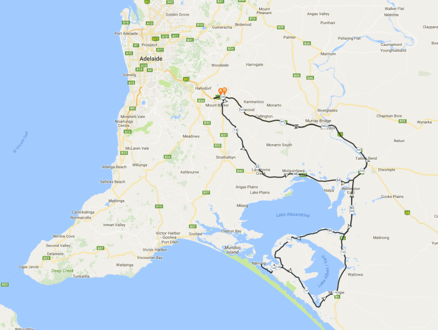
Above:- Map showing my route for the day.  Map courtesy of plotaroute.com

I worked the following stations on 40m SSB:-

  1. VK5FMWW
  2. VK5FVSV
  3. VK4KUS
  4. VK3OHM/p (Port Campbell National Park VKFF-0420)
  5. VK4HNS/p
  6. VK4FRAL
  7. VK3PF
  8. VK5EE
  9. VK5KLV
  10. VK3ARH
  11. VK7AN
  12. VK4RF
  13. VK4HA
  14. VK2IO
  15. VK4FFAB/p (Bunyaville Conservation Park VKFF-1493)
  16. VK5ZK
  17. VK3FORD
  18. VK3FBAA
  19. VK4GSF
  20. VK3GGG
  21. VK3PMG
  22. VK7BC
  23. VK5HS
  24. VK6MB
  25. VK2YK
  26. VK3FEVT
  27. VK6ADF/p (Yarra Yarra Lake Conservation Park VKFF-1443)
  28. VK6BSAm
  29. VK3FPWH
  30. VK3NAL
  31. VK5FRSM
  32. VK5PL
  33. VK7VZ/p
  34. VK5FANA
  35. VK5FAKV
  36. VK3AXF
  37. VK5MJ
  38. VK3OB
  39. FO5JV
  40. VK5ML
  41. VK2SK
  42. VK7VEK
  43. W1OW
  44. VK5FDEC
  45. VK8LLA
  46. VK2XRC
  47. VK5AFZ
  48. VK3FLCS
  49. VK6NTE
  50. VK7FRJG
  51. VK3RU
  52. VK3FSPG
  53. VK3MPR
  54. VK5NFT
  55. VK3FCMC
  56. VK8GM
  57. VK3MIJ
  58. VK2JNG/p
  59. VK5DO
  60. VK2EMI
  61. VK5DC
  62. VK3SOT
  63. VK2QK
  64. VK5ND
  65. VK3FPHG

I worked the following stations on 20m SSB:-

  1. VK5ZK
  2. VK6NU
  3. VK3PF
  4. VK6ADF/p (Yarra Yarra Lake Conservation Park VKFF-1443)
  5. VK4RF
  6. VK4HA
  7. VK3AXF
  8. VK2YK
  9. VK6XN
  10. VK3TKK/p
  11. VK7DW
  12. ZL4KD
  13. VK6MB
  14. VK3MAB

I worked the following stations on 80m SSB:-

  1. VK5FANA
  2. VK4RF
  3. VK4HA
  4. VK5BJE
  5. VK3GGG
  6. VK3PMG
  7. VK2PDW
  8. VK2YK
  9. VK2VU

References.

Australian Museum, 2017, <http://australianmuseum.net.au/tiger-snake&gt;, viewed 12th January 2017

Australian Museum, 2017, <http://australianmuseum.net.au/red-bellied-black-snake&gt;, viewed 12th January 2017

Coorong Country, 2017, <http://coorongcountry.com.au/narrung/&gt;, viewed 14th January 2017

Lighthouse of South Australia, 2017, <http://www.lighthouses.org.au/lights/SA/Point%20Malcolm/Point%20Malcolm.htm&gt;, viewed 14th January 2017

National Parks South Australia, 2017, <http://www.environment.sa.gov.au/parks/Find_a_Park/Browse_by_region/Limestone_Coast/coorong-national-park&gt;, viewed 14th January 2017

Wikipedia, 2017, <https://en.wikipedia.org/wiki/Lake_Alexandrina_(South_Australia)&gt;, viewed 12th January 2017

URFF certificate

I received the certificate below a few days ago from the Ukraine URFF Awards Team.

Back on the 29th December 2016 I worked EM8RFF on 20m, in Regional Landscape Park Yalivschyna, URFF-0173.  Everyone who worked EM8RFF in this new reference, received one of the certificates.

VK5PAS.jpg

From 25th December 2016 to 30th December 2016 a team of Ukrainian hams operated from the park.

em8rff_300dpi

Yalivschyna is located in northern Ukraine, to the north east of the capital Kiev.

Top VKFF Activator and Top VKFF Hunter

It is the start of a new year and the time to announce the Top VKFF Activator and the Top VKFF Hunter for 2016 for the World Wide Flora Fauna (WWFF) program.

CONGRATULATIONS to the following…….

Rob VK4AAC – Top VKFF Activator (having activated 106 VKFF references).

Mick VK3PMG – Top VKFF Hunter (having worked 498 VKFF references).

I came in at number 6 as a Hunter and number 2 as an activator.

Certificates have been forwarded to both Rob and Mick.