Tolderol Game Reserve VKFF-1752 and the 2018 VKFF Team Championship

Yesterday (Saturday 27th October 2018) was the annual VKFF Team Championship.  The idea of the event is to form a team of 2-4 people and head out to a qualifying VKFF park or parks, and log as many stations as you can in a 6 hour period.  A number of amateurs have kindly donated money towards trophies for the winners.  Future Systems and Pages of Cobram kindly sponsor the event, and offer prizes.  Thankyou very much for your support.

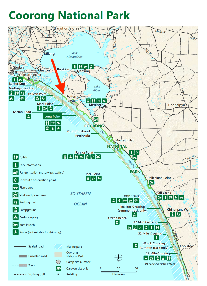
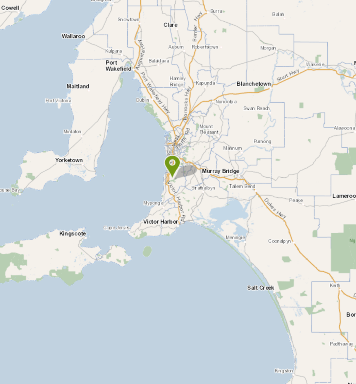
Marija and I took part in the Championship, and activated the Tolderol Game Reserve VKFF-1752, which is located about 77 km south east of Adelaide, and about 11 km south east of the town of Langhorne Creek in the Langhorne Creek wine region.

Screen Shot 2018-10-28 at 1.31.06 pm

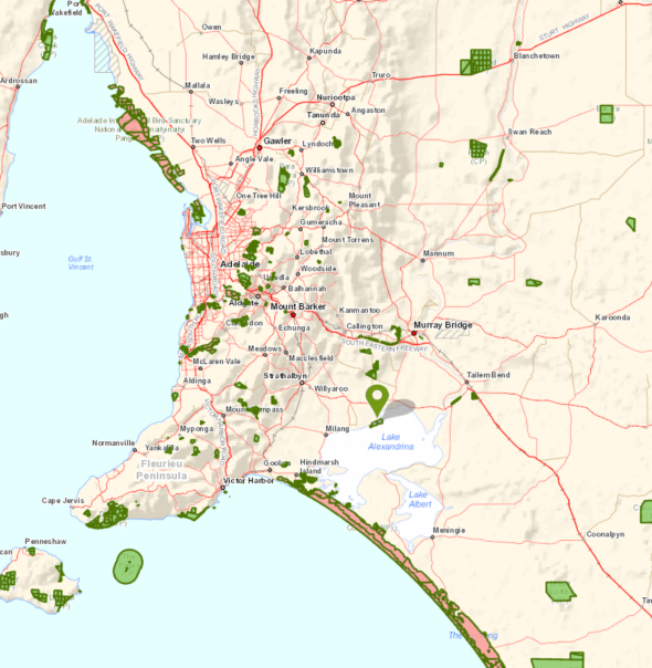
Above:- Map showing the location of the Todlerol Game Reserve, south east of Adelaide.  Map courtesy of Location SA Map Viewer.

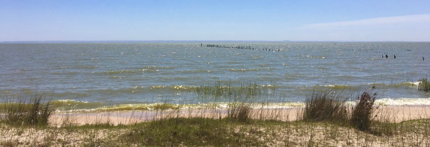
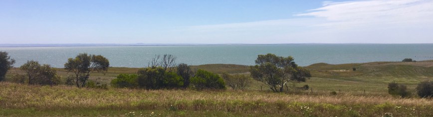
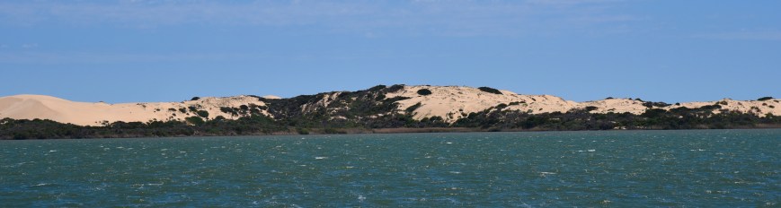
Tolderol is about 428 hectares in size and is situated on the north-western side of Lake Alexandrina.  It was proclaimed in 1970 and consists of a series of man made open and shallow basins, with connecting channels and levee banks.

Screen Shot 2018-10-28 at 1.33.50 pm.png

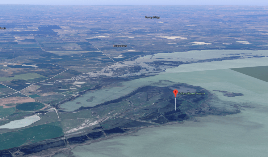
Above:- Aerial shot of the Tolderol Game Reserve.  Image courtesy of google maps

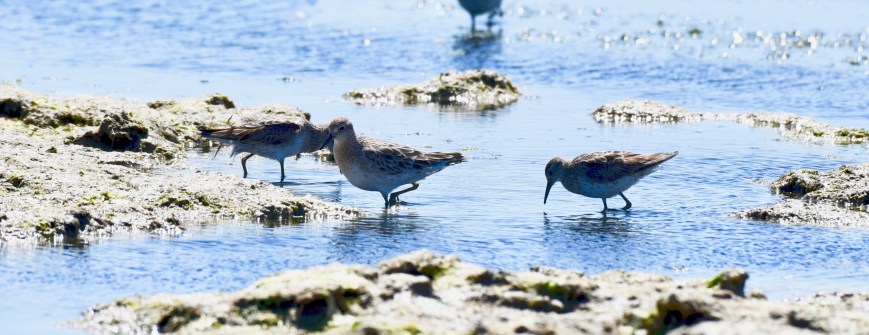
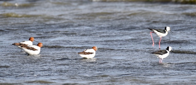
Tolderol is a highly regarded bird watching location,  The shallow basisns, reed beds, lake shore and grassy banks, attract a wide range of birds.  Tolderol is part of the internationally significant RAMSAR wetlands.  Tolderol is open for hunting during gazetted dates, however it remains a critical habitat for protected birds.  About 180 species of birds have been recorded in the reserve.

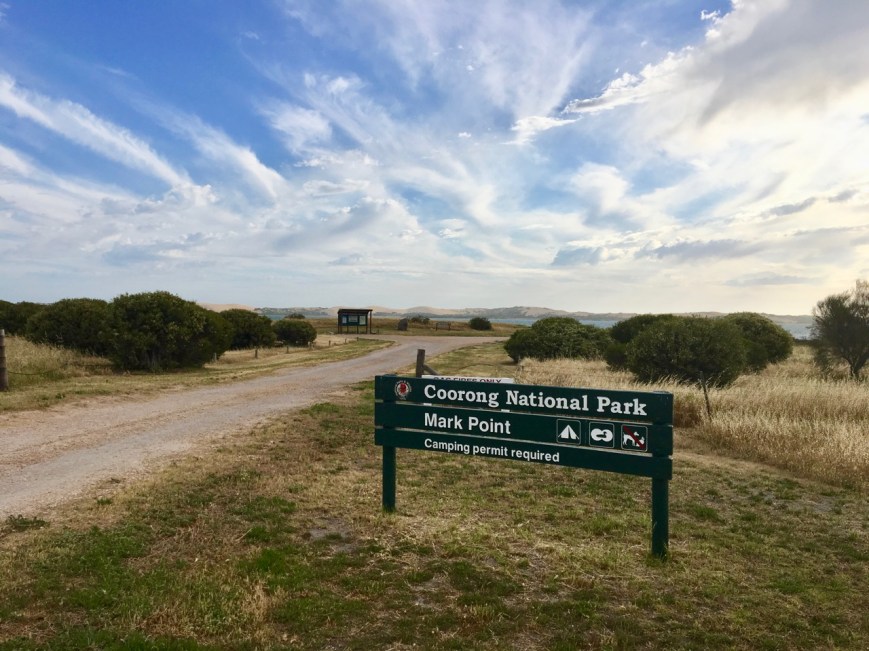
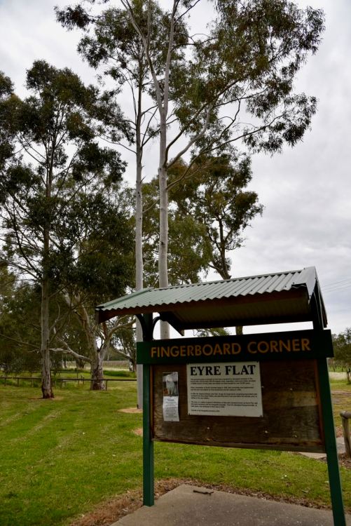
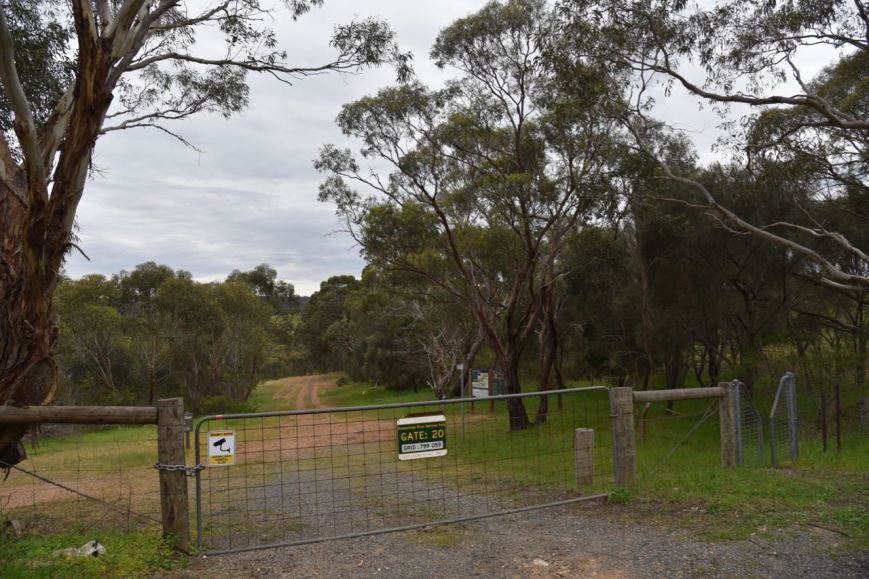
The park is well signposted off the Langhorne Creek-Wellington Road.  Travel south along Dog Lake Road, and after crossing Mosquito Creek Road, you will come to a set of gates.  These are sometimes shut, but unlocked.  On our visit they were open.  Continue along Dog Lake Road and you will come to a second gate, which is normally shut, but unlocked.  There is a park sign at this location.

DSC_2695

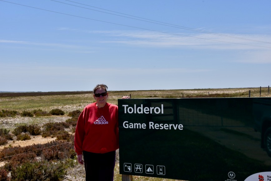
Above:- Marija at the park entrance.

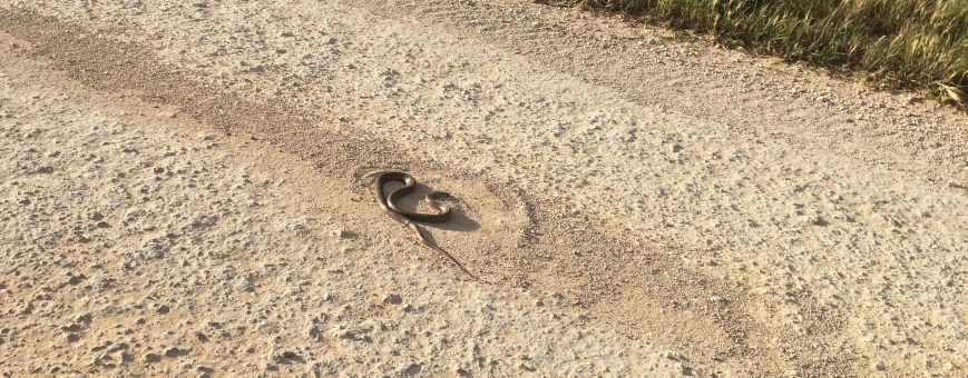
We soon came across out first lot of feathered friends, some Australian White Ibis.  Whilst taking these photos, I heard a slight rustle in the reeds on the side of the road.  It was a large red-bellied black snake.  It was  reminder that this was a warm day, and we were in snake territory.  In fact the information board at the start of the park reminds visitors that Tolderol is home to many snakes, including the deadly Tiger Snake.  So if you head down this way, be vigilant and do not walk through long grass.

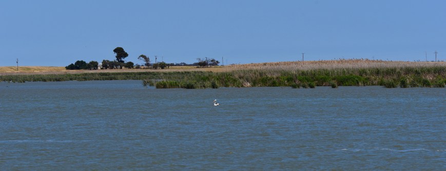
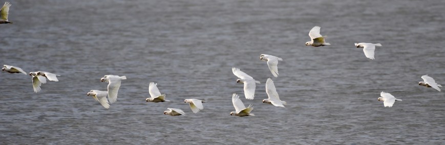
Ponds 7, 6 & 5 soon came into view and they were alive with birds including Black Swans and hundreds of Whiskered Terns.

I also spotted a number of other birds including Purple Swamphens, Sandpipers, Caspian Terns, and Ibis.

We continued on to the camp ground area in the reserve.  There are tables and chairs here, and importantly, a cleared grassed area, allowing the spotting of snakes more easy.  We had the campground all to ourselves.

Screen Shot 2018-10-28 at 1.28.33 pm.png

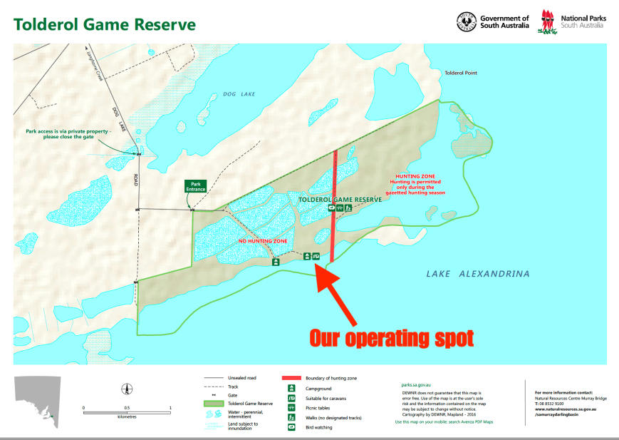
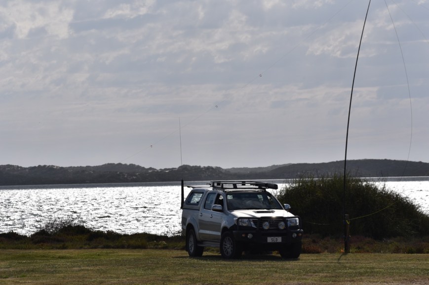
It was a beautiful sunny day with a stiff and refreshing breeze coming off the lake.  We set up underneath the awning of the Toyota Hi Lux.  We ran the Yaesu FT-857d and the 20/40/80m linked dipole for this activation.  Marija ran her allowed 10 watts PEP whilst on air, while I ran about 50 watts PEP.

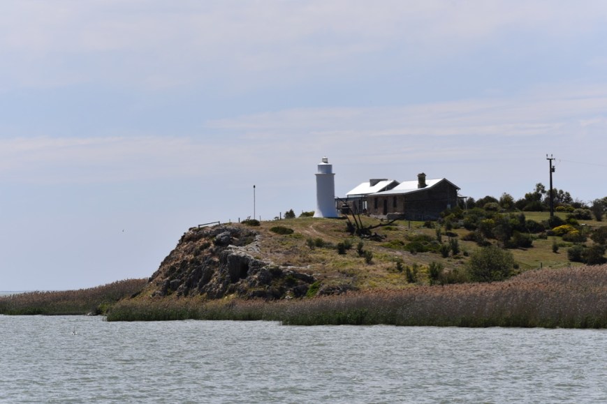
Our operating spot was right on the banks of Lake Alexandrina, a large freshwater lake, which was named after Princess Alexandrina, niece and successor of King William IV of Great Britain and Ireland.  Lake Alexandrina adjoins the smaller Lake Albert, and together they are known as the Lower Lakes.

Marija and I had entered into the 40 & 80m/single transceiver/wire antenna/100 watts or less section of the Championship.  Our team name was ‘The Walky Talkies’.

Marija kicked off the activation first, with a Park to Park contact with Nick VK3ANL/p who was in the Gresswell Forest (part b) Nature Conservation Reserve VKFF-2103.  But it was a very slow start and in the early stages of the activation it did not look promising for the remainder of the day.  Fortunately propagation improved as the day went on.

DSC_2909

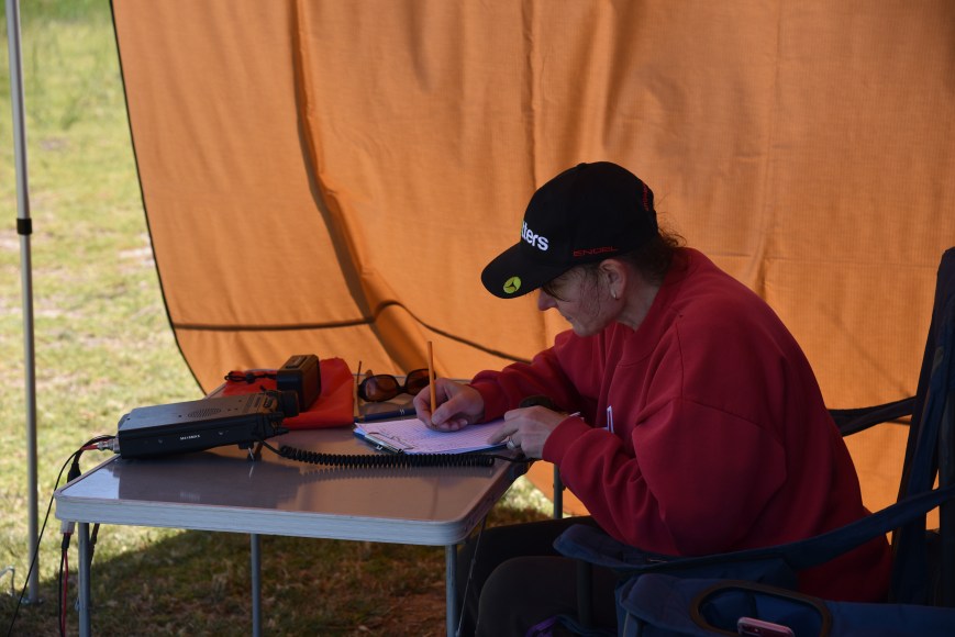
Marija and I alternated operating on air, and tried our luck on both the 40m and 80m bands.  By around 4.00 p.m. local time, 40m was very difficult work due to the CQ World Wide DX Contest which also fell on this weekend.  But it did present some opportunities of working some DX on 40m.  However our ‘straight up and down’ antenna was not great for DX.  Despite hearing some excellent signals from Europe, the Carribean, and the USA, I was only able to log 5 USA stations and Chris YJ0CA in Vanuatu.

IMG_1391

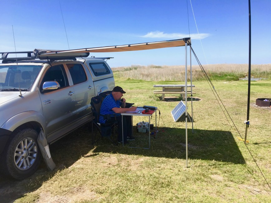
Despite operating conditions not being ideal, it was a magnificent location, with some sensational views.

Whilst Marija operated on air, I went off for walks, trying to snap some of the local birdlife.  It was the weekend of the National Twitchathon and National Bird Week, so it was appropriate to be in Tolderol.

Between the 2 of us, Marija and I managed a total of 122 x QSOs, which included 31 x Park to Park contacts.  We were really pleased to log 4 of the 5 other participating teams:

  • Mark VK4SMA and Murray VK4MWB, ‘The VK4WIPeouts’
  • Les VK5KLV and Steve VK5MSD, ‘Voices of the Gulf’.
  • Gerard VK2IO and Alan VK2MG, ‘Central Coast Lightning Bolts’
  • Peter VK3PF and Allen VK3ARH, ‘The BallaRats’.

Unfortunately we missed Hans VK6XN and Phil VK6ADF, ‘The Gooseberry Hillbillies’.  We saw a spot come up on 40m for Hans and Phil but with all the contest activity, it was a challenge to hear them.

All in all, Marija and I had a very enjoyable day.

Marija worked the following stations on 40m SSB:-

  1. VK3ANL/p (Gresswell Forest (part b) Nature Conservation Reserve VKFF-2013)
  2. VK5KLV/p (Upper Spencer Gulf Marine Park VKFF-1757)
  3. VK5MSD/p (Upper Spencer Gulf Marine Park VKFF-1757)
  4. VK3NSC
  5. VK3AHR
  6. VK3SQ
  7. VK3VAR
  8. VK2MG/p (Wyrrabalong National Park VKFF-0550)
  9. VK2IO/p (Wyrrabalong National Park VKFF-0550)
  10. VK3PF/p (SOTA VK3/ VC-019 &Warrenheip Flora Reserve VKFF-2402)
  11. VK7AN
  12. VK3FRC
  13. VK2BV
  14. VK3ALN/p
  15. VK3HN
  16. VK3NBL
  17. VK3NLK
  18. VK3LTL
  19. VK4SMA/p (Ravensbourne National Park VKFF-0427)
  20. VK4FDJL
  21. VK7DW
  22. VK3PF/p (Woowookarung Regional Park VKFF-1879)
  23. VK3ARH/p (Woowookarung Regional Park VKFF-1879)
  24. VK4MWB/p (Ravensbourne National Park VKFF-0427)
  25. VK3ANL
  26. VK2PEZ
  27. VK2ZEP
  28. VK4PDX
  29. VK3APP
  30. VK6IQ

Marija worked the following stations on 80m SSB:-

  1. VK5AYL
  2. VK5BJE
  3. VK3PF/p (SOTA VK3/ VC-019 & Warrenheip Flora Reserve VKFF-2402)
  4. VK3ARH/p (SOTA VK3/ VC-019 & Warrenheip Flora Reserve VKFF-2402)
  5. VK5KC
  6. VK5KLV/p (Upper Spencer Gulf Marine Park VKFF-1757)
  7. VK5MSD/p (Upper Spencer Gulf Marine Park VKFF-1757)
  8. VK5NRG
  9. VK5FMWW
  10. VK5WU
  11. VK5VCR
  12. VK5LEX
  13. VK5YX
  14. VK2WG
  15. VK2MG/p (Wyrrabalong National Park VKFF-0550)
  16. VK3FLCS/p (Langley Flora Reserve VKFF-2366)

I worked the following stations on 40m SSB:-

  1. VK2IO/p (Wyrrabalong National Park VKFF-0550)
  2. VK2HHA
  3. VK3AHR
  4. VK5KLV/p (Upper Spencer Gulf Marine Park VKFF-1757)
  5. VK5MSD/p (Upper Spencer Gulf Marine Park VKFF-1757)
  6. VK3SQ
  7. VK1DA/2 (SOTA VK2/ ST-005 & Brindabella National Park VKFF-0054)
  8. VK1MIC/2 (SOTA VK2/ ST-005 & Brindabella National Park VKFF-0054)
  9. VK3PAT
  10. VK5WG
  11. VK3LTL
  12. VK2RP/m
  13. VK2BDR/m
  14. VK3ALN/p
  15. VK3ANL/p (Gresswell Forest (part b) Nature Conservation Reserve VKFF-2103)
  16. VK1BL/2 (SOTA VK2/ ST-005 & Brindabella National Park VKFF-0054)
  17. VK3FLCS
  18. VK5AYD
  19. VK5AYL
  20. VK2PKT
  21. VK3VAR
  22. VK3NLK
  23. VK2UXO
  24. VK2MG/p (Wyrrabalong National Park VKFF-0550)
  25. VK3XPT/m
  26. VK4SMA/p (Ravensbourne National Park VKFF-0427)
  27. VK4FDJL
  28. VK2WWV
  29. VK3CRG
  30. VK3TKK/m
  31. VK7ZGK
  32. VK3PF/p (Woowookarung Regional Park VKFF-1879)
  33. VK3ARH/p (Woowookarung Regional Park VKFF-1879)
  34. VK3MAB
  35. VK3FSPG
  36. VK3MPR
  37. VK3ELH
  38. VK4TJ
  39. VK4/AC8WN
  40. VK4/VE6XT
  41. VK7DW
  42. VK3HBG
  43. VK3TP
  44. VK4MWB/p (Ravensbourne National Park VKFF-0427)
  45. VK7KR
  46. VK5MR
  47. VK2PEZ
  48. VK2ZEP
  49. ZL1TM
  50. VK2FHQQ
  51. ZL2AJ
  52. VK2MOR
  53. ZL1RQ
  54. K7RL
  55. N3AD
  56. YJ0CA
  57. K3LR
  58. K1TTT
  59. K9CT

I worked the following stations on 80m SSB:-

  1. VK5MRT
  2. VK5KLV/p (Upper Spencer Gulf Marine Park VKFF-1757)
  3. VK5MSD/p (Upper Spencer Gulf Marine Park VKFF-1757)
  4. VK5BJE
  5. VK5PL
  6. VK3SQ
  7. VK5FMWW
  8. VK5YX
  9. VK3FLCS/p (Langley Flora Reserve VKFF-2366)
  10. VK3DHW
  11. VK2WG
  12. VK2YW
  13. VK2KJJ
  14. VK2TH
  15. VK2FBKT
  16. VK2HMV
  17. ZL2AJ

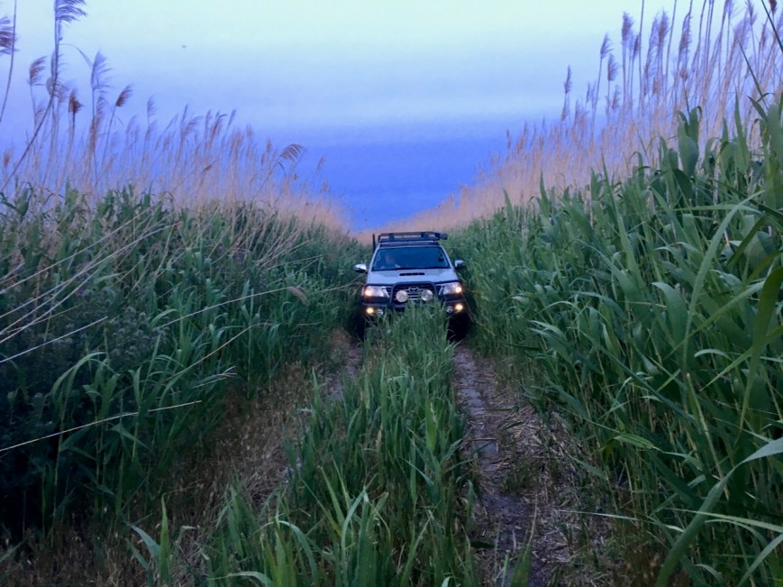
At the end of the activation, Marija and I did some exploring of the park down its many tracks.  Access to the main section of the park can be made in a conventional vehicle, but if you are going to explore the less driven tracks, a 4WD is required.

IMG_1397

We drove down to some of the other ponds and spotted more birds including Red-kneed Dotterel, & Black tailed native hens.

As we left the park we enjoyed a magnificent sunset. 


References.

National Parks South Australia, 2018, <https://www.parks.sa.gov.au/find-a-park/Browse_by_region/Limestone_Coast/tolderol-game-reserve>, viewed 28th October 2018

Wikipedia, 2018, <https://en.wikipedia.org/wiki/Lake_Alexandrina_(South_Australia)>, viewed 28th October 2018


Coorong National Park 5NP-005 and VKFF-0115

Yesterday (Monday 22nd October 2018) was the commencement of National Bird Week in Australia.  This coincides with the Aussie Backyard Bird Count.  So being on 2 days off, after working 7 straight, I packed the radio gear and headed down to the Coorong National Park 5NP-005 & VKFF-0115.

2018

The VKFF program had a special National Bird Week certificate on offer for any park activation in Australia during the week.  As a result I qualified for the special activator certificate.  I had activated and qualified the Coorong previously for WWFF/VKFF/VK5 Parks Award, so my main reason for heading down there was for some bird photography.

Screen Shot 2018-10-23 at 11.13.05 am.png

Above:- the special activator certificate for National Bird Week, on offer by the VKFF program.

The Coorong National Park covers a lagoon ecosystem officially known as the Coorong and the Younghusband Peninsula on the Coorong’s southern side.  The western end of the Coorong lagoon is at the Murray Mouth near Hindmarsh Island and the Sir Richard Peninsula, and it extends about 130 kilometres (81 mi) southeast. The national park area includes the Coorong itself, and Younghusband Peninsula which separates the Coorong from Encounter Bay in the Southern Ocean.  The park was made famous in Colin Thiele’s book ‘Storm Boy’.

Screen Shot 2018-10-23 at 12.52.27 pm.png

Above:- Map showing the location of the Coorong National Park.  Map courtesy of Location SA Map Viewer.

To get to the park I travelled down the South Eastern Freeway, passing the town of Murray Bridge, and over the mighty Murray River, and on to Tailem Bend.  I then turned off at the Princes Highway and travelled south.  Rather than continuing on to the town of Meningie, I decided to turn off and head to Narung, and follow the Coorong Birdwatchers Trail, hoping to get some good bird photographs along the way.

Screen Shot 2018-10-23 at 11.36.15 am.png

Above:- The Coorong Birdwatchers Trail.  This is the route I took during the day.  Image courtesy of Coorong Country

The Potalloch Road which runs off Princes Highway follows the south eastern boundary of Lake Alexandrina, and there are a number of wetland areas between the roadway and lake.  Unfortunately these are contained on private property.  As a result I was unable to get close to the birds, and had to rely on the zoom lens.

I wasn’t keen on venturing too far off road, as it was a warm day, with an expected temperature of 30 deg C.  As a result, there were plenty of snakes about.

IMG_1390.jpg

Above:- one of a number of snakes I observed on the roads

I continued along Potalloch Road and soon the Point Malcom lighthouse came into view.  The Point Malcolm lighthouse, also known as Mundoo Light, is Australia’s only inland light station.  It is also Australia’s smallest lighthouse.  It operated between 1878 to 1931 to mark the narrow passage between Lake Albert and Lake Alexandrina.

DSC_2416.jpg

Above:- the Point Malcolm lighthouse

The Narrows is a small channel which links Lake Alexandrina and Lake Albert.  In its day, this was a very busy location.  By the early 1900’s numerous paddle steamers, including the Judith, the Milang, and the Murray, were carrying passengers, goods, and mail up to 3 times a week between Milang, Narrung, and Meningie.  This was also a point for the Royal Mail which travelled by stage coach from Adelaide.

DSC_2422 (1).jpg

Above:- The Narrows

I boarded the ferry and took the short ride from one side of The Narrows to the other.  This is a free service which operates 24/7.

IMG_1370.jpg

Above:- Crossing the ferry at The Narrows

Once off the ferry I stopped briefly at the Narrung Jetty Reserve, where there were a number of caravaners enjoying the spectacular scenery.  It was an opportunity for me to take a few more bird shots.

I then continued on to the small town of Narrung.  In the local aborignal language Narrung means ‘place of large sheoaks’.

I then drove along Alexandrina Drive and into the little town of Raukkan, which is a small aboriginal community situated on the south eastern shore of Lake Alexandrina.   Raukkan in the Ngarrindjeri language means ‘meeting place’ and is considered to be the home and heartland of the aboriginal Ngarringjeri aboriginal people.

In 1860 the Aborigines’ Friends’ Association was granted 107 hectares in the area and established a mission at Raukkan, which had been named “Point McLeay” by T. B. Strangways in 1837.  George Taplin had selected the site, and with others such as the Rev. F. W. Cox helped build the school, church and mission station to care for the local Aboriginals.  It was intended by the Aborigines’ Friends’ Association to help the Ngarrindjeri people, but could never be self-sufficient farming due to the poor quality of the soil in the area.  Land clearing by farmers nearby also limited the ability for hunting, and other crafts and industries also met with difficulties due to changing environment and competition from nearby towns.  In 1916, responsibility for Raukkan moved to South Australia’s Chief Protector of Aborigines, and since 1974 it has been administered by the Ngarrindjeri people themselves and renamed Raukkan in 1982.

There are some nice views here to be enjoyed of Lake Alexandrina, which was was named after Princess Alexandrina, niece and successor of King William IV of Great Britain and Ireland.  It adjoins the smaller Lake Albert, named after Prince Albert, the Consort of Queen Victoria, by George Gawler, the Governor of South Australia.

IMG_1375.jpg

IMG_1379.jpg

Raukkan was home to James Unaipon and his son David.  James Unaipon was the first Australian Aboriginal deacon and co-authored writings on the Ngarrindjeri language.  His son David was a writer and inventor, who along with the Raukkan Church, is featured on the Australian fifty-dollar note.

After leaving Raukkan, I returned back to Narrung and then travelled south on the Loveday Bay Road.  The sand dunes of the Younghusband Peninsula at the Coorong soon came into view.

DSC_2503.jpg

I headed to Mark Point which is located in the National Park.  There is a nice campground here, with plenty of room to stretch out the dipole.  And I had the entire campground all to myself.

IMG_1389

Screen Shot 2018-10-23 at 1.05.18 pm.png

Above:- Map of the Coorong.  The red arrow indicates ny operating spot at Mark Point.  Image courtesy of DEWNR,

Prior to getting on air I took a few photos of the local birds, including dozens of Sandpipers who were busy looking for food in the shallows.

DSC_2555.jpg

To kick off the activation I made a Park to Park contact with Rob VK4AAC/2 who was activating the Warrumbungle National Park VKFF-0520.  I then moved down the band to 7.139 and started calling CQ after spotting myself on parksnpeaks.  Rod VK7FRJG was the first to call me, followed by another Park to Park, with Geoff VK3SQ/p who was doing his first ever park activation in the Chiltern-Mount Pilot National Park VKFF-0620.

Despite it being a week day, there was a steady flow of callers at the start of the activation, but this tapered off quite quickly.  I logged a total of 21 stations on 40m from VK2, VK3, VK4, VK5, and VK7.

I then moved to the 20m band and called CQ on 14.310 for around 5 minutes with no takers.  I was competing with the Over the Horizon Radar which was at strength 8, making it veery difficult.  So with no takers, I headed down to the ANZA DX Net and checked in.  I worked 3 stations on the net, Mike VK4LMB, Greg VK8KMD in Alice Springs, and Ted VK6NTE over in Western Australia.

DSC_2599.jpg

I saw a comment on Facebook from Andrew VK6AS that he was listening on 14.310 so I headed back there, and comfortably logged Andrew wi was a 5/5 signal.  I then lowered the squid pole and inserted the 80m links and moved to 3.610.  I asked if the frequency was in use, and John VK5BJE came back to advise me that the frequency was all mine.  John was an excellent 5/9 plus signal.  I also logged Trevor VK5TW and Ivan VK5HS in the Riverland, both being 5/9 plus signals.  But despite a call out on the Crafers repeater (I was surprised to be able to key the repeater from where I was), and a spot on parksnpeaks, I had no further callers.

With 29 stations in the log, it was time to pack up and start the journey home.

I worked the following stations on 40m SSB:-

  1. VK4AAC/2 (Warrumbungle National Park VKFF-0520)
  2. VK7FRJG
  3. VK3SQ/p (Chiltern-Mount Pilot National Park VKFF-0620)
  4. VK2HHA
  5. VK7QP
  6. VK4FDJL
  7. VK3PF
  8. VK3ANL
  9. VK3CM
  10. VK4HNS
  11. VK3WAR
  12. VK3FBKS
  13. VK4TJ
  14. VK4/AC8WN
  15. VK4/VE6XT
  16. VK2IO
  17. VK2EXA
  18. VK4CPS
  19. VK2KYO
  20. VK5MR
  21. VK3PAT
  22. FK4QX

I worked the following stations on 20m SSB:-

  1. VK4LMB
  2. VK8KMD
  3. VK6NTE
  4. VK6AS

I worked the following stations on 80m SSB:-

  1. VK5BJE
  2. VK5YW
  3. VK5HS

At the conclusion of the activation I made a small detour down to the Mark Point Well which is located in the park.  This is one of four wind operated pumps originally built on the Yalkuri property around 1880.  Stock to and from Victoria, and the south-east of South Australia travelled along the Coorong which contained many freshwater springs.  Crossings were made at the Murray Mouth and at Pelican Point, a few km north west from Mark Point Well.

Here, cattle and horses were driven from the mainland to the Younghusband Peninsula and back again.  Tanks and troughs were made from local limestone with mortar from locally burnt lime.  The length of the Mark Point trough was originally 28 metres, but shortened in 1959 to 15 metres.

I then drove out along Pelican Point Road until I reached the end of the Narrung Peninsula.  This is as far as you can go by road, and the start of the Tauwitchere Barrages, near the Mouth of the Murray River.  The main purpose of the barrages at the Murray mouth is to maintain the freshness of the River Murray as far downstream as the town of Wellington.  There was plenty of birdlife here with lots of photo opportunities.

DSC_2670

Above:- Red necked Avocets and Black winged Stilts.

DSC_2674.jpg

Above:- Corellas.

I then drove back along Mark Point Road, to Loveday Bay Road and the Narrung Road, and into the town of Meningie.  Just as you enter Meningie there is an area where there is always a lot of Pelican activity, so I stopped off briefly to take some photos.

I then hit the road again, travelling home via Tailem Bend and Murray Bridge.


References.

Coorong Country, 2018, <https://coorongcountry.com.au/point-malcolm-lighthouse/>, viewed 23rd October 2018

Wikipedia, 2018, <https://en.wikipedia.org/wiki/Raukkan,_South_Australia>, viewed 23rd October 2018

Wikipedia, 2018, <https://en.wikipedia.org/wiki/Coorong_National_Park>, viewed 23rd October 2018

Wikipedia, 2018, <https://en.wikipedia.org/wiki/Lake_Alexandrina_(South_Australia)>, viewed 23rd October 2018

2018 Oceania DX Contest

The Oceania DX Contest is an annual competition with the aim of radio amateurs making contacts on the HF bands, specifically DX contacts with stations in Oceania.  It is one of the contests on the amateur radio calendar which I enter into each year.

There were a few things against me this year.  Firstly work!  Secondly a very high noise floor at home, particularly on 40m.  Thirdly, no dedicated 80m antenna at home.  And finally, poor band conditions.  Despite this, I had a lot of fun.

I ended up with a total of 281 contacts and a claimed score of 108,046 points.  I worked a total of 49 different DXCC entities on 10, 15, 20, 40 & 80m SSB.  This was down quite a bit compared to my 506 QSOs during the 2017 Oceania DX Contest.

  • 80m- 3 different DXCC entities worked
  • 40m – 11 different DXCC entities worked
  • 20m – 47 different DXCC entities worked
  • 15m – 3 different DXCC entities worked
  • 10m – 1 DXCC entity worked worked
Screen Shot 2018-10-08 at 1.40.37 pm.png

Above:- Map showing my contacts during the 2018 Oceania DX Contest.  Map courtesy of QSOmap.org

My first contact during the contest was with VK6NE on 40m.  My final contact was with OA4/XQ3SA in Peru in South America.

The majority of my contacts were on the 20m band, followed by 40m.  I found 15m to be very poor.  I heard very little from South East Asia, and virtually no Japanese stations.

Screen Shot 2018-10-08 at 1.34.28 pm.png

Above:- Bar graph showing my QSOs per band during the contest.

On Saturday night there was an excellent opening on the long path to Europe on the 20m band.  I started to hear some Scandanavian stations on 20m at about 8.30 p..m local time, so I thought the band might behave.  And it did.

Screen Shot 2018-10-08 at 1.42.41 pm.png

Above:- Map showing my contacts into Europe on the short path on Saturday night.

As I had no dedicated 80m antenna at home, I had to tune up the 40m dipole to make a handful of contacts on that band.  In recent months my noise floor at home on 40m has gone from strength 5 to strength 8.  This meant I did not call CQ contest on that band.  I just worked those that I could hear.

Although not up there with the ‘big guns’, I was really pleased with the outcome of the weekend.


References.

Oceania DX Contest, 2018, <http://www.oceaniadxcontest.com/index.html>, viewed 8th October 2018

Onkaparinga River National Park 5NP-019 and VKFF-0402

Yesterday (Monday 1st October 2018) I activated the Onkaparinga River National Park 5NP-019 & VKFF-0402.  I have activated and qualified this park previously, so this was just going to be a fun late afternoon of activating from the park.

The Onkaparinga River National Park is about 35 km (by road) south of Adelaide, near the famous McLaren Vale wine growing region.

Screen Shot 2018-10-02 at 7.30.02 pm.png

Above:- Map showing the location of the Onkaparinga River National Park.  Map courtesy of Location SA Map Viewer.

The Onkaparinga River National Park is about 15.42 km2 in size, and was established on the 5th August 1993.  The name ‘Onkaparinga’ comes from ‘Ngangkiparinga’, an indigenous word meaning ‘The Women’s River’.  The park extends over the floodplain of the Onkaparinga River, east of Main South Road.  The Onkaparinga River, known as Ngangkiparri in the Kaurna aboriginal language, flows from the slopes of the Mount Lofty Range between Mount Torrens and Charleston, and flows generally southwesterly, south of Adelaide, to reach its mouth at Port Noarlunga.  The park features rugged ridge tops and the narrow river valley of the spectacular Onkaparinga Gorge.

Below are two short videos which really give you a good impression of the spectacular nature of the Onkaparinga River National Park.

Most of the land now dedicated to the national park was purchased in the period 1973 to 1977 by the former State Planning Authority.  The purpose of the land acquisition was ‘to provide open space for recreational purposes’, ‘to preserve the natural character of the landscape, including the native flora and fauna’ and thirdly, ‘to function as a buffer between areas of urban and rural land.’

In 1982, the majority of the land was transferred to the then Department for Environment and Heritage which established the Onkaparinga River Recreation Park in 1985.  In 1993, all of the land east of Main South Road (known as the gorge section’) was reclassified as the Onkaparinga River National Park.

Screen Shot 2018-10-02 at 5.57.42 pm.png

Above:- Map of the Onkaparinga River National Park.  Image courtesy of DEWNR.

Due to European settlement, much of the vegetation of the park has been greatly impacted.  The most intact part of the park is the Hardy’s Scrub section of the park.   Sadly, 160 years of livestock grazing, timber harvesting and cropping has cleared most of the reserve of native understorey species.  Remnant eucalypts are the most noticeable native species in the reserve.

Native animals found in the park include the Western Grey kangaroo , Common brushtail possum, Common ringtail possum, echidna, Lesser long eared bat, and the Southern forest bat.

Birds SA have recovered about 84 native species of bird in the park including Superb Fairywren, Yellow-faced Honeyeater, Brown Thornbill, Striated Thpornbill, Australian Magpie, Black-winged Currawong, Brush Bronzewing, Peregrine Falcon, and White-throated Gerygone.

Approximately 20 fish species  are  recorded for the  estuary and river.  The major fish species include jumping mullet, black  bream and yellow-eye mullet.  Amphibians found in the park include common froglet, banjo frog, spotted marsh frog and brown tree frog. At least 20 reptile species have been recorded in the park including cunningham’s skink, eastern bearded dragon and barking gecko.

To get to the park I travelled through Meadows and on to the little town of Kangarilla.  The town was originally called Scaldwell, then Eyre Flat, and then Kangarilla in 1862.  Kangarilla is a Kaurna aboriginal word meaning ‘place of two springs’.

I then stopped briefly to have a look at the information board at Fingerboard Corner at Eyre Flat.  It details the history of the area and states that in a radius of about 5 km from this point, the area became known as Eyres Flat, until the township of Kangarilla was established.

DSC_2254

I took Bakers Gully Road and then Chapel Hill Road, travelling through beautiful rolling green countryside and vineyards.

My preferred operating spot near the Pink Gum campground was swarming with people, so I continued along Chapel Hill Road until I reached gate 20.  I parked the vehicle in the carpark on the opposite side of the road, and set up about 20 metres down a walking track.

DSC_2261

There was plenty of room here to string out the 20/40/80m linked dipole, without encroaching on other park users.  I ran the Yaesu FT-857d at 40 watts for the activation.

Screen Shot 2018-10-02 at 5.58.07 pm.png

Above:- Map showing my operating spot near the Sundews Trail.  Image courtesy of DEWNR.

Once I had set up I turned on the transceiver and tuned to 7.144.  Along the way I found Gerard VK2IO/p on 7.143, activating the Garigal National Park VKFF-0191.  It was a nice way to start the activation with a Park to Park.  It was 4.00 p.m. local time and I thought I may have left my run a little too late to log any other park activators.

After working Gerard I moved down to 7.130 and started calling CQ.  Peter VK2UXO was first in the log, with a very big signal from near Griffith in New South Wales.  Rob VK4SYD then gave me a shout, followed by Steve VK4VCO, and then Mark VK4SMA.  All the signals from Queensland were nice and strong.

Contact number seven was another Park to Park QSO, this time with Peter VK3ZPF/p who was activating the Nyora Nature Conservation Reserve VKFF-2169.  I logged a total of 15 stations on 40m until things slowed down.  Callers were from VK2, VK3, VK4, VK5, and New Zealand.  Regular park hunter, Andrei ZL1TM gave me a shout from Auckland, with a good 5/5 signal.

I was hoping to get some DX in the log, so I then lowered the squid pole and removed the links in the antenna for the 20m band.  I called CQ on 14.310 for a good 10 minutes, but had absolutely no takers.  I was competing with the Over the Horizon Radar, and a tune across the 20m band revealed only a few low down European signals.

I then called CQ on 3.610 after self spotting on parksnpeaks.  First in the log on 80m was Andy VK5LA in the Riverland region of South Australia.  This was followed by Adrian VK5FANA on the Yorke Peninsula, Barry VK5BW in the Adelaide Hills, and then Gerard VK2IO/p in the Garigal National Park VKFF-0191.  I ended up logging a total of 16 stations on 80m which was really pleasing.  Callers were from as far afield as Brisbane.

I then moved back to 7.130 on 40m and called CQ again.  This was answered by Dennis VK2HHA, followed by Matt VK4PZZ and then Kimberly VK2KMI.  I logged a further 6 stations on 40m from VK2, VK4, VK5, and VK6.  I put out a few more unanswered CQ calls, before having a tune across the band.  And I am very pleased I did.  I heard Darren 5W0DJ calling CQ on 7.152 with a good 5/8 signal.  And he wasn’t busy.  I got through on my first call, with a 5/5 signal report received back from Samoa.  This was a new country for me whilst operating portable.  I am trying to get DXCC whilst operating portable, and I am currently sitting on 82 different DXCC entities worked (whilst in a park or on a summit).  Just 18 more to go to pick up ‘portable’ DXCC.

To complete the activation I headed back to 80m where I was hoping to log John VK5BJE.  And sure enough I did.  John was first in the log after returning to 80.  I logged a further 5 stations from VK2, VK3 and VK5.

After 2 very enjoyable hours in the park I had a total of 47 contacts in the log, including 4 Park to Park contacts.  Whilst in the park I had a number of conversations with passers by, explaining to them the hobby of amateur radio.

I worked the following stations on 40m SSB:-

  1. VK2IO/p (Garigal National Park VKFF-0191)
  2. VK2UXO
  3. VK4SYD
  4. VK4VCO
  5. VK4SMA
  6. VK3SQ
  7. VK3ZPF/p (Nyora Nature Conservation Reserve VKFF-2169)
  8. VK5FMWW
  9. VK4NH
  10. VK4DXA
  11. ZL4TY/VK4
  12. VK2XSE/p (Cocopara National Park VKFF-0104)
  13. ZL1TM
  14. VK2WOW
  15. VK5YX
  16. VK2HHA
  17. VK4PZZ
  18. VK2KMI
  19. VK5BJE
  20. VK2SR
  21. VK2NZ
  22. VK4FDJL
  23. VK6YTS
  24. VK4HNS
  25. 5W0DJ

I worked the following stations on 80m SSB:-

  1. VK5LA
  2. VK5FANA
  3. VK5BW
  4. VK2IO/p (Garigal National Park VKFF-0191)
  5. VK3PF
  6. VK5ZK
  7. VK5FMWW
  8. VK5FMAZ
  9. VK3FJHR
  10. VK2NP
  11. VK4CZ
  12. VK4HNS
  13. VK3SQ
  14. VK3ANL
  15. VK3KWB
  16. VK2MWK
  17. VK5BJE
  18. VK2HHA
  19. VK5FRSM
  20. VK2KMG
  21. VK3ZSG
  22. VK3FXBR


References.

Birds SA, 2018, <https://birdssa.asn.au/location/onkaparinga-river-recreation-park-2/>, viewed 2nd October 2018

City of Onkaparinga, 2018, <http://onkaparingacity.com/onka/discover/history_heritage/history_of_onkaparinga.jsp>, viewed 2nd October 2018

Wikipedia, 2018, <https://en.wikipedia.org/wiki/Onkaparinga_River_National_Park>, viewed 2nd October 2018

Wikipedia, 2018, <https://en.wikipedia.org/wiki/Onkaparinga_River>, viewed 2nd October 2018

Wikipedia, 2018, <https://en.wikipedia.org/wiki/Kangarilla,_South_Australia>, viewed 2nd October 2018


Anstey Hill Recreation Park VKFF-1683

Yesterday morning (Sunday 30th September 2018) Marija and I made an early start from home and we headed to just outside of Gummeracha in the Adelaide Hills to watch the Bay to Birdwood.  The Bay to Birdwood Classic Car Rally is the largest, continually held motoring event for veteran, vintage and classic vehicles held anywhere in the world.

The Bay to Birdwood consists of two events held on alternative years – the Classic and the Run.  The Classic is an event for vehicles manufactured between 1 January 1956 to 31 December 1981. This event is held in ‘odd’ numbered years ie. 2019, 2021, 2023 etc.  The Run is an event for vehicles manufactured up to to 31 December 1959. This event is held in ‘even’ numbered years ie. 2018, 2020, 2022, etc.

This slideshow requires JavaScript.

We spent about 2 & 1/2 hours watching these classic cars drive by on their way from Glenelg ‘The Bay’ to Birdwood in the Adelaide Hills.  We then headed to my Dad and Step mum’s place for a very enjoyable lunch, sitting outside underneath the pergola.  It was a beautiful sunny day with the temperature being about 22 deg C.

On the way home we decided to do a quick activation of the Anstey Hill Recreation Park VKFF-1683.  I have activated and qualified this park previously, but this was to be a new park for Marija.

Screen Shot 2018-10-01 at 12.14.46 pm.png

Above:- Map showing the location of the Anstey Hill Recreation Park.  Map courtesy of Location SA Map Viewer.

Anstey Hill Recreation Park was established in 1989 and comprises 362 hectares of steep gullies, creek lines with various walking trails.  It was dedicated as park in response to public demand that the State Government protect the land from development.  The Anstey Hill summit which is located within the park is 371 metres above sea level.

As the park is in close proximity to metropolitan Adelaide, there are some terrific views of the city of Adelaide.

About 290 native flora species have been recorded in Anstey Hill.  The western end of the park is dominated by Pink Gums, while the eastern end is dominated by the Box Tree, a species which has rarely been rpeserved in Adelaide.  A number of plants which are now rare on the Adelaide plains are found in the park.  This includes Leamon beauty-heads, Pussy-tails, Dwarf Hakea, Silky guinea-flower and Black Rapier sedge.  The steep areas of the park support native pine, Drooping Sheaok and Pink Gums.  Understorey species include Kangaroo thorn, Rock Grass-tree, Sticky Hop-bush, and Heath Tea-tree.  Manna Gums which are found mostly in the east of the park are home to koalas.  Over 39 species of native orchids have been recorded in Anstey Hill, including the King Spider-orchid and Wax-lip orchid.

Native animals found in the park include Western Grey kangaroos, echidnas, koalas, and Brush-tailed possums.  Up to 35 species of reptiles and amphibians call the park home including Brown Tree frogs, Bearded Dragons, and the rarely seen Cunninghams Skink.

We initially set up just inside gate 16 on Range Road, but sadly when we turned on the transceiver, we had strength 9 noise.  I suspect from the nearby power lines.  So we decided not to worry about persevering in this spot, and then moved a little further down Range Road.

DSC_2228

As there was no gap in the fence here, we climbed over the barbed wire fence, and set up just off a walking trail/BMX track.  But we were to be sadly disappointed again, as the noise floor was still strong, with S8 noise.

Screen Shot 2018-10-01 at 1.00.45 pm.png

Above:- Map of the Anstey Hill Recreation Park, showing our operating spot in the south eastern corner of the park.  Map courtesy of DEWNR

As I had previously qualified the park, Marija kicked off the activation with a Park to Park contact with Peter VK3ZPF/p who was in the North Western Port Nature Conservation Reserve VKFF-2166.  Marija then moved up to 7.144 and called CQ.  Ray VK4NH called in, followed by Gerard VK2IO, and then Al VK7AN.  George VK4GSF was Marija’s 10th contact, thus qualifying the park for the VKFF program.

Marija made a total of 18 contacts on 40m into VK2, VK3, VK4, VK5, and VK7.

I then jumped onto the mic and made a total of 17 contacts on 40m into VK1, VK2, VK3, VK4, and New Zealand.  I then moved to the 20m band and called CQ on 14.310 with no contacts being logged.  Marija and I did hear a European station calling, but unfortunately the noise was too high for us to pull them out.

To complete the activation, I called CQ on 3.610 on the 80m band, which was answered by Andy VK5LA in the Riverland with a S9 plus signal.  Peter VK3PF then gave me a shout, but despite band conditions being good on 80m, they were my only 2 takers.

We had spent about 1 hour in the park and had a total of 37 contacts between the 2 of us.  It had been a long day, so we packed up and headed home.

Marija worked the following stations on 40m SSB:-

  1. VK3ZPF/p (North Western Port Nature Conservation Reserve VKFF-2166)
  2. VK4NH
  3. VK4DXA
  4. ZL4TY/VK4
  5. VK2IO
  6. VK7AN
  7. VK5KC
  8. VK2HHA
  9. VK3PF
  10. VK4GSF
  11. VK2NP
  12. VK3ZMD
  13. VK5FO
  14. VK3NXT
  15. VK4BYE
  16. VK4FDJL
  17. VK5TT
  18. JR2GIA/VK5

I worked the following stations on 40m SSB:-

  1. VK3ZPF/p (North Western Port Nature Conservation Reserve VKFF-2166)
  2. VK3OHM
  3. VK2PKT
  4. VK7QP
  5. VK2HMV
  6. VK3XPT
  7. VK3PF
  8. VK4SMA
  9. VK4FDJL
  10. VK2UXO
  11. VK2NP
  12. VK2UH
  13. ZL1TM
  14. VK4FARR
  15. VK1FJBC
  16. VK4AAC/2
  17. VK2HHA

I worked the following stations on 80m SSB:-

  1. VK5LA
  2. VK3PF


References.

Bay to Birdwood, 2018, <http://baytobirdwood.com.au/>, viewed 1st October 2018

National Parks South Australia, ‘Anstey Hill Recreation Park’ brochure