Nurragi Conservation Reserve VKFF-2247

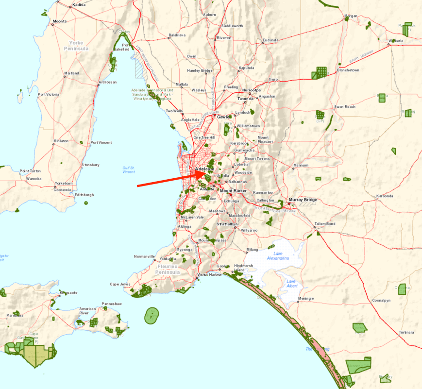
This morning (Saturday 30th September 2017) I headed out to activate the Nurragi Conservation Reserve VKFF-2247, which is located about 70 km south east of Adelaide.  It was a beautiful Spring day and I had a few hours to spare before the commencement of the AFL Grand Final, in which my team, the Adelaide Crows played.  I shouldn’t have rushed home!  Sadly they were beaten.

Screen Shot 2017-09-30 at 7.55.26 pm.png

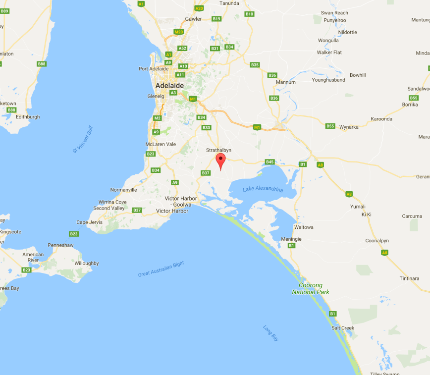
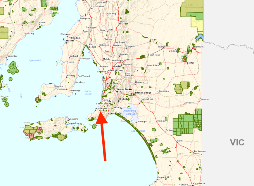
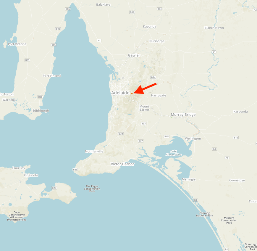
Above:- Map showing the location of the Nurragi Conservation Reserve.  Map courtesy of Google maps

The Nurragi Conservation Reserve follows the old branch railway line to Milang and runs a distance of about 12 km, from Sandergrove to Milang.  The park is about 65 hectares in size.  The Friends of Nurragi was established in 1988 to protect and restore the reserve and in 1991 the Minister of Lands dedicated the area as a Nature Conservation and Plantation Reserve under the Crown Lands Act 1929.

The park commences at the town of Milang, which is located on the banks of Lake Alexandrina.  Between 1860 and 1880 Milang was one of South Australia’s busiest ports.  It connected Adelaide with the thriving river trade.  Wool from the Darling and Upper Murray stations was landed at Milang and then transported by horse and bullock teams to Port Adelaide. Wheat was transported to Milang, processed at its flour mills and then shipped back as flour.

Screen Shot 2017-09-30 at 8.07.36 pm.png

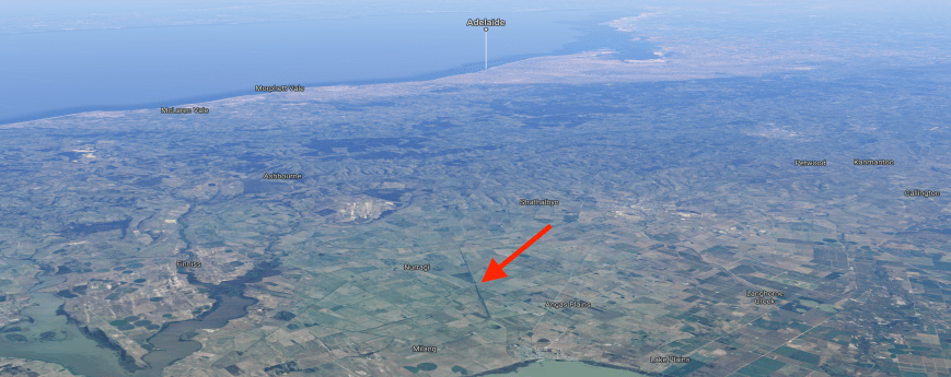
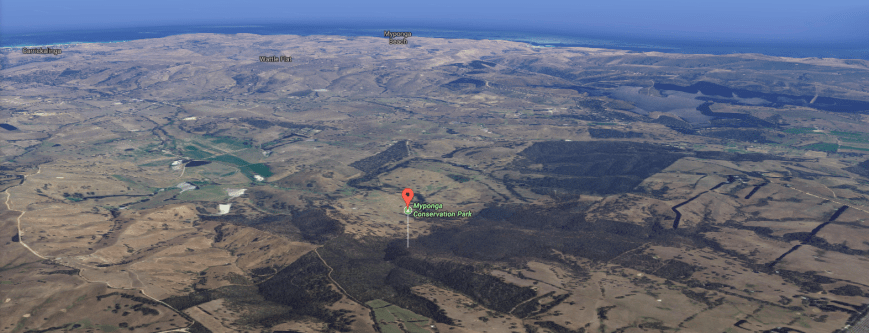
Above:- Aerial shot showing the park, looking north west, with Adelaide in the background.  Image courtesy of Google maps

The reserve forms a wildlife corridor linking the eastern Mount Lofty Ranges with Lake Alexandrina and contains extremely important vegetation in a region that has been cleared of over 98% of its original cover.   More than 300 native plant species are present, with over 50 of those being of particular conservation significance (eg rare or endangered).   It preserves remnant mallee vegetation including square-fruited mallee, narrow-leaved red mallee, peppermint box, and native apricot.  Understorey plants include wallowa, needle bush wattle and broombush.

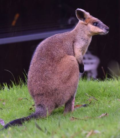
Over 95 species of birds have been recorded in the park including Peaceful Dove, Weebill, Australian Magpie, Little Raven, Grey Shrikethrush, Diamond Firetail, Southern Boobook, Red-capped Robin, Hooded Robin, and Rufous Whistler.  Native mammals found in the park include Western Grey kangaroos, Brush-tailed possums and bats.  About 11 reptile species have been recorded including the Sand Goanna.

During my visit to the park, Superb Blue Wrens and New Holland Honeyeaters were in abundance.

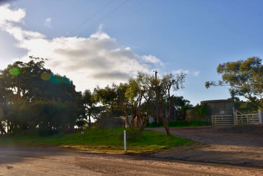
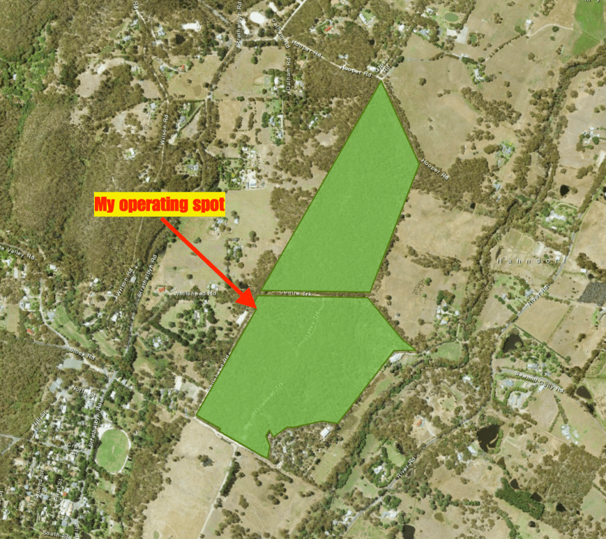
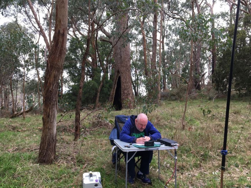
I have activated the park previously, in August this year, and I headed roughly to the same location as my previous activation, on Nurragi Road.  This time I activated from the eastern side of the road.

There were some wooden benches already in place in the park, so the deck chair remained in the back of the Toyota Hi Lux.  I ran the Yaesu FT-857d, set at 40 watts output, and the 20/40/80m linked dipole for this activation.

Screen Shot 2017-09-30 at 7.54.57 pm

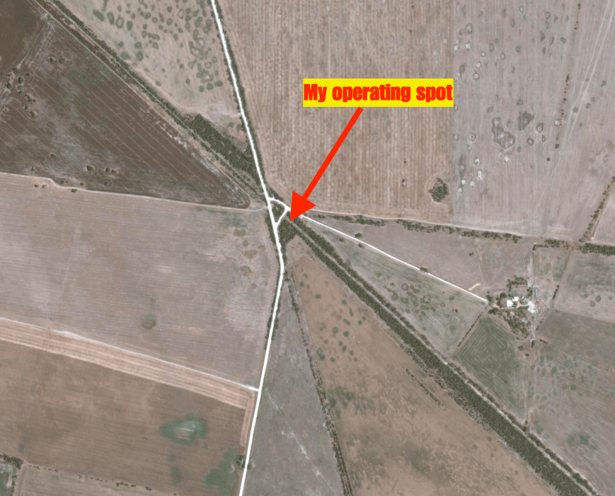
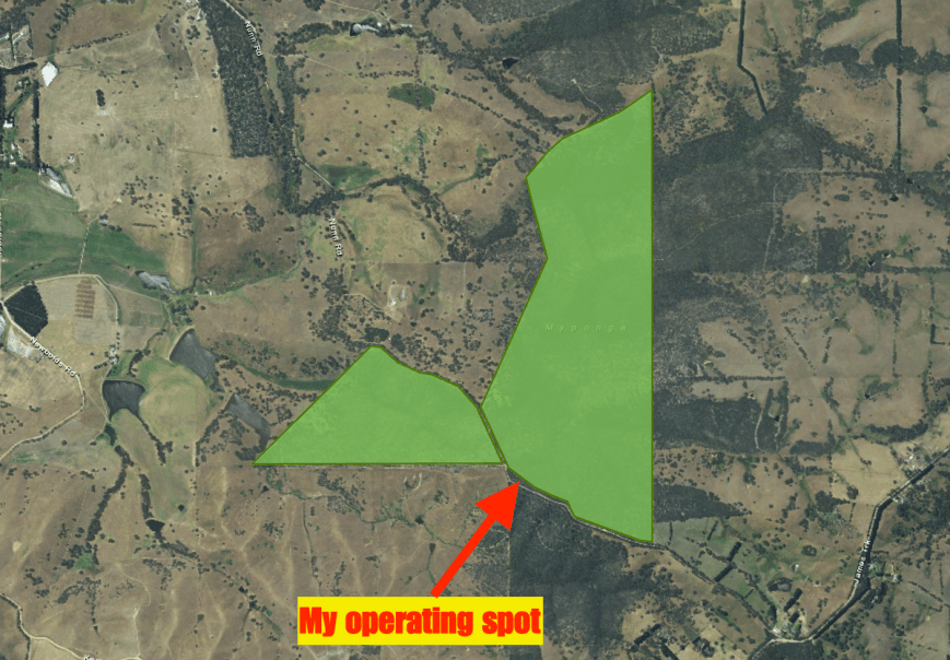
Above:- Aerial shot showing my operating spot in the park.  Image courtesy of Google maps

Before calling CQ I had a tune around the band and worked Tony VK3CAB/p in the Pauline Toner Butterfly Nature Conservation Reserve VKFF-2175. I had heard Tony on my way to the park, but he was not quite strong enough from the mobile for me to work.  I then found Gerard VK2JNG/p calling CQ from the Rawdon Creek Nature Reserve VKFF-1990.  It was a nice way to start the activation, with two Park to Park contacts.

I then headed to 7.149 and called CQ.  This was answered by Mike VK3KMH, followed by Geoff VK3SQ and then Keith VK2PKT.  A little pile up soon ensued, with callers from VK2, VK3, VK4, VK5 and VK7.  Band conditions were okay, but there was a little fading (QSB) noted on some signals.  Close in propagation on 40m was not brilliant again, with just Marija VK5FMAZ and Greg VK5GJ logged.  Both were within 40 km from the park.  Greg was running QRP, just 4 watts and Marija was using her allocated 10 watts PEP.

A number of stations calling me were struggling with noise.  Fortunately from the park I had zero man made noise.  I would encourage anyone who has never undertaken a park or a SOTA activation to give it a try.  There is generally no noise, and you can literally hear a pin drop.

I logged a total of 36 stations on 7.149 before callers slowed down.  I took the opportunity of having a look around the 40m band and found Chris VK5FR/p on 7.100 operating portable from the Black Hill Conservation Park VKFF-0766.  Chris was quite low down, as I was to him, but due to the low noise floor we were able to comfortably work each other.  I was really pleased to get Chris in the log.  Chris commenced his 900km bike riding journey of the Mawson Trail this morning, with a number of park activations along the way.  You can follow the journey of Chris at…….

https://share.findmespot.com/shared/faces/viewspots.jsp?glId=1Rep6cPUFdfzsmXl0By86ZQZzWXrEA0PQ

(Password is vk5fr).

Screen Shot 2017-09-30 at 8.40.59 pm.png

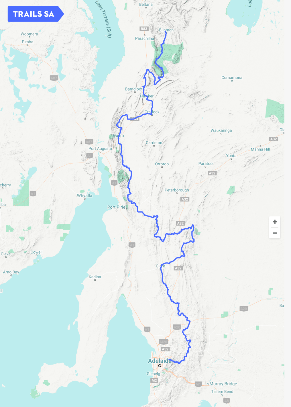
Above:- The Mawson Trail, c/o Trails SA

I then headed to 3.610 on the 80m band, where first in the log was my lovely wife Marija VK5FMAZ, followed by Greg VK5GJ and then Hans VK5YX.  Despite the band being wide open to South Australia (VK5), I only worked a further 2 stations….Adrian VK5FANA and John VK5BJE.

I then headed to 14.310 on the 20m band where I logged a total of 5 stations from Queensland (VK4) and Western Australia (VK6).

To complete the activation I moved back to 40m.  I had seen a spot on parksnpeaks for Neil VK4HNS/p, so I headed to 7.160 where I logged Neil who was activating the Bendidee National Park VKFF-0030.  I then worked Joe VK3YSP/7, Julie VK3FOWL/7 and Anthony VK3YSA/7, all of whom were in the Narawntapu National Park VKFF-0005 in Tasmania.  I then called CQ on 7.150 and this was answered by Les VK5KLV, followed by Bruce VK3PNG/p.

It was about this time that I had some bushwalkers come by.  They stopped and sat on the bench alongside of me to enjoy their lunch and have a listen to what I was up to.  I logged a further 9 stations from VK2 and VK3, before I had to go QRT for the day and head home to watch the footy.

It was a great morning out in the park, with a total of 65 contacts in the log, including 7 Park to Park QSOs.  Shame about the footy.  But I am still proud of the Crows for making the Grand Final.  There is always next year and the world still turns.

I worked the following stations on 40m SSB:-

  1. VK3CAB/p (Pauline Toner Butterfly Nature Conservation Reserve VKFF-2175)
  2. VK2JNG/p (Rawdon Creek Nature Reserve VKFF-1990)
  3. VK3KMH
  4. VK3SQ/p
  5. VK2PKT
  6. VK3SFG
  7. VK3ARH
  8. VK3ANP
  9. VK2HHA
  10. VK3ZLD
  11. VK3ZIP
  12. VK2XXM
  13. VK3FSPG
  14. VK3MPR
  15. VK3MRH
  16. VK3WAC/m
  17. VK5FMAZ
  18. VK3DAC
  19. VK3GMC
  20. VK5WAT/3
  21. VK5GJ
  22. VK3FQ
  23. VK3UH
  24. VK3PF
  25. VK3FONZ/m
  26. VK3UCD
  27. VK2KYO
  28. VK2NP
  29. VK2MTC
  30. VK3ZE
  31. VK3FCMC
  32. VK3MSQ
  33. VK2VRC
  34. VK7PRN
  35. VK3MKM
  36. VK7JN
  37. VK2SVN
  38. VK3VGB
  39. VK5FR/p (Black Hill Conservation Park VKFF-0766)
  40. VK4HNS/p (Bendidee National Park VKFF-0030)
  41. VK3YSP/7 (Narawntapu National Park VKFF-0005)
  42. VK3FOWL/7 (Narawntapu National Park VKFF-0005)
  43. VK3YSA/7 (Narawntapu National Park VKFF-0005)
  44. VK5KLV
  45. VK3PNG/p
  46. VK3FAHS/p
  47. VK2IO
  48. VK3GGG
  49. VK3PMG
  50. VK3ANL
  51. VK3PAT
  52. VK3JP
  53. VK2GSP
  54. VK3MB
  55. VK2VW

I worked the following stations on 80m SSB:-

  1. VK5FMAZ
  2. VK5GJ
  3. VK5YX
  4. VK5FANA
  5. VK5BJE

I worked the following stations on 20m SSB:-

  1. VK4AAC
  2. VK6NI
  3. VK4RF
  4. VK4HA
  5. VK6MMB


References.

Birds SA, 2017, <http://www.birdssa.asn.au/location/nurragi-conservation-reserve/&gt;, viewed 11th August 2017

National Trust, 2017, <https://www.nationaltrust.org.au/places/nurragi-conservation-reserve/&gt;, viewed 11th August 2017

Walking SA, 2017, <https://www.walkingsa.org.au/walk/find-a-place-to-walk/nurragi-conservation-reserve-walking-trail/&gt;, viewed 11th August 2017

Myponga Conservation Park 5CP-157 and VKFF-0921

Yesterday (25th September 2017) I started 2 days off after working 7 straight, so I decided to head out into the field to activate the Myponga Conservation Park 5CP-157 & VKFF-0921.  I have activated and qualified this park previously back in April 2016, so this was another park to go towards the recently released Boomerang Award for the World Wide Flora Fauna (WWFF) program.

Myponga is about 56 km south west of my home, and about 68 km south of the city of Adelaide.

Screen Shot 2017-09-25 at 9.42.45 pm

Above:- Map showing the location of the Myponga Conservation Park.  Map courtesy of Location SA Map Viewer.

The Myponga Conservation Park is 167 hectares in size and was proclaimed on the 17th February 1997.  It is a hilly park and has several rocky outcrops and waterfalls.  Several habitats exist in the park including Open Forest Over Wet Heaths in the gullies – messmate stringybark and cup gum over prickly tea-tree and heath tea-tree.  Also found is Low Very Open Woodland – cup gum and pink gum over cranberry heath and common fringe-myrtle.

Screen Shot 2017-09-25 at 9.39.27 pm.png

Above:- Aerial shot of the park, looking west towards the ocean.  Image courtesy of Google maps.

More than 68 species of native bird have been recorded in the park including Crescent Honeyeater, New Holland Honeyeater, Australian Golden Whistler, Scarlet Robin, Grey Shrikethrush, Red Wattlebird, Magpielark, Jacky Winter, and Hooded Robin.

The park is located about 9 km to the south of the little town of Myponga which is at the centre of rich grazing and dairy country.  The name Myponga is derived from the Aboriginal word ‘maippunga‘ meaning locality of high cliffs.  Myponga is a sleepy little town with a population of about 550 people.  Many years ago, large gum trees were felled here and prepared for use in the Broken Hill mines.  A cheese factory was also established and its produce was noted for its high quality, much of which was exported.  This is now part of the Farmers Market.  Another worthwhile place to visit is the Smiling Samoyd Brewery.  In the early 1950s uranium was discovered and mining prospects investigated, however no mines were developed.

The nearby Myponga Reservoir is fed by the Myponga River and other rivers in the Myponga catchment area.  The Reservoir provides about 5% of the water supply for Adelaide.  Construction of the reservoir commenced in 1958 and was completed in 1962.  The total capacity of the reservoir is 26 800 ML.

Myponga_panorama_1.jpg

Above:- The Myponga Reservoir.  Courtesy of wikipedia.

The park is about a 50 minute drive from home and took me through the beautiful Adelaide Hills.  I travelled from Mount Barker in the Hills to Echunga and on to Meadows.  I then took Brookman Road to Willunga and then Pages Flat Road.  After reaching the town of Myponga I headed out along James Track towards the park, enjoying some of the sensational views.

I accessed the park via James Track which heads south out of the town of Myponga.

DSC_8154.jpg

Above:- View of the town of Myponga and Reservoir from James Track.

I travelled along James Track, passing Springmount Road and on to Martinga Park.  There is no sign for the park, but keep an eye out for the old dairy.

DSC_8153

Above:- this is where you need to turn to get to the park.

Upon reaching Martina Park, I drove about 1 km along the 4WD track and soon reached the south eastern corner of the park.  A park sign exists at this point.

DSC_8111 (1).jpg

I continued down the track until I reached the end of the track where there is a turn around area.  I checked out the site to see if there was enough room to stretch out the 20/40/80m linked dipole, an decided the area was probably a little too small.  There are some great views to be had along the track of the park and the adjacent cleared farming land, and out towards the ocean.

The track through the park is passable by conventional vehicle, to the south east corner of the park.  But I doubt if a normal car would be able to reach the end of the track as it is quite steep and rocky in places.  Certainly not in winter time.

DSC_8119.jpg

As it was spring time, many of the native plants in the park were in flower.

I headed back down the track a short distance and set up on the edge of the track on the southern boundary of the park.

Screen Shot 2017-09-25 at 9.43.18 pm.png

Above:- Aerial shot of the park showing my operating spot on the southern boundary.  Image courtesy of Location SA Map Viewer.

For this activation I ran the Yaesu FT-857d, 40 watts output, and the 20/40/80m linked dipole, supported on the 7m heavy duty telescopic squid pole.

I commenced the activation by calling CQ on 7.144.  It didn’t take long before my first caller was in the log, that being Les VK5KLV at Port Augusta who was 5/9.  This was a good sign with at least some local propagation working.  Port Augusta is about 365 km north of Port Augusta.  Next was Geoff VK3SQ in Beechworth, followed by Mick VK3GGG/VK3PMG, and then Hans VK5YX.  Hans was 5/9 from Hallett Cove, about 41 km to the north of Myponga.

Despite it being a weekday I was happy that there was a constant stream of callers.  Generally conditions were quite good, with some of the Victoria (VK3) stations reporting that there was fading (QSB) on my signal.  What was very pleasing was that the band was behaving for local contacts.  Other than Les VK5KLV and Hans VK5YX, I logged a further : Tom VK5EE at Mount Gambier (about 450 km to the south east); Terry VK5ATN at Balaklava (about 150 km to the north); John VK5BJE in the Adelaide Hills (about 60 km to the north east); Roy VK5NRG in the Adelaide Hills (about 55 km to the north); Danny VK5DW at Loxton (about 280 km to the north east); Ian VK5IS at Beetaloo Valley (about 275 km to the north); Rob VK5TRM/m in the Riverland (about 320 km to the north east); Adrian VK5FANA on the Yorke Peninsula (about 150km as the crow flies-across the Gulf); and David VK5PL in the southern Barossa Valley (about 100 km to the north).

I logged a total of 44 stations on 40m from VK1, VK2, VK3, VK4, VK5 and VK7, before heading to the 20m band.  Unfortunately the Over the Horizon Radar was across the band and was strength 9 when it came on.  Fortunately it didn’t last long.  I self spotted on parksnpeaks and Facebook and started calling CQ on 14.310.  This was answered by Anthony VK6MAC in Western Australia with a nice 5/7 signal, followed by Peter VK6YV who was 5/9 and then Jim ZL1BOS on the North Island of New Zealand.  The 20m band appeared to be in good shape, with a steady flow of callers.  Some of the Queensland (VK4) stations were S9 plus, whilst the Western Australian (VK6) stations some 2,600 km to the west were ranging between strength 7 to 8.

During the callers I was very surprised to get a call from Ed ZS6UT in Pretoria in South Africa.  I initially thought Ed was a ZL, but when he called me a second time and I heard he was from Africa, I was very excited.  Ed was a good 5/5 and was hearing me quite well across the Indian Ocean.  It is not every day that I work Africa whilst out portable, so I was very pleased to receive the call from Ed.

Screen Shot 2017-09-26 at 9.44.16 am.png

I logged a total of 33 stations on 14.310 from VK2, VK4, VK5YX, VK6, New Zealand, South Africa, and Japan.  It was nice to log Kio JA8RJE, who has become a regular park hunter.  I then headed down the band and booked in to the ANZA DX Net.  This was the busiest I had heard the net in some time.  I was very pleased to work Grant (VK5GR) E6AG on Nieue in the Pacific Ocean.  During the net I quickly slipped off to tune across the 20m band and I found A25BE in Botswana in Africa calling CQ on 14.207.  I gave him a call and much to my surprise I got though.  Now I was really excited.

bandeira-de-botswana.jpg

I headed back to the ANZA DX Net and tried to make contact with V63YAH in Micronesia, but sadly just couldnt quite get through.  I then headed back to 14.310 and called CQ, where I logged a further 3 stations from VK4 and VK6.

I then headed to 3.610 on the 80m band and asked if the frequency was in use.  A familiar voice came back and said ‘No Paul, I’ve been waiting for you”.  It was John VK5BJE with a good 5/9 signal.  Hans VK5YX then called in, followed by Peter VK3PF and then Adrian VK5FANA.  Despite conditions being good, they were the only stations logged on the 80m band.

I decided to head back to the 40m band for another round.  I logged a total of 18 stations from VK2, VK3, VK4, VK5, and VK7.  To complete the activation I headed back to 80m where I logged my wife Marija VK5FMAZ who had arrived home from work.

It was time for me to pack up and head home.  I had about a 50 minute drive home and it was off to the gym for me.  This was a great activation, with a total of 104 contacts in the log, including some very memorable contacts into Africa.

I worked the following stations on 40m SSB:-

  1. VK5KLV
  2. VK3SQ
  3. VK3GGG
  4. VK3PMG
  5. VK5YX
  6. VK3PF
  7. VK3ZZS
  8. VK4FW
  9. VK2YK
  10. VK3NLK
  11. VK3SFG
  12. VK2PKT
  13. VK2HHA
  14. VK3OHM
  15. VK5EE
  16. VK4HNS
  17. VK5ATN
  18. VK4RF
  19. VK4HA
  20. VK1DI
  21. VK5BJE
  22. VK3BBB
  23. VK7EE
  24. VK5NRG
  25. VK5DW
  26. VK5IS
  27. VK2AWJ
  28. VK4NH
  29. VK4DXA
  30. VK5TRM/m
  31. VK2NP
  32. VK4TJ
  33. VK3NAD
  34. VK3HSR
  35. VK5FANA
  36. VK3YH
  37. VK3ANL
  38. VK5PL
  39. VK7JON
  40. VK3FMKE
  41. VK2UH
  42. VK3ZE
  43. VK3FARO
  44. VK3FVKI
  45. VK3QA
  46. VK3FADM/1
  47. VK4FDJL
  48. VK4FARR
  49. VK2EMI
  50. VK3FREB
  51. VK2FUO
  52. VK3MRH
  53. VK3AJA/5
  54. VK4MWB
  55. VK2QK
  56. VK3KLB
  57. VK7AN
  58. VK2KT
  59. VK3FTRI/m
  60. VK7FRJG
  61. VK3VGB
  62. VK6KRC

I worked the following stations on 20m SSB:-

  1. VK6MAC
  2. VK6YV
  3. ZL1BOS
  4. VK2IO
  5. VK6AEK/p
  6. VK4RF
  7. VK4HA
  8. VK4FW
  9. VK2NP
  10. VK4GSF
  11. VK4NH
  12. VK4DXA
  13. VK6NU
  14. VK6AAV
  15. VK6ZMS/m
  16. VK4NBX
  17. VK2TCL/6
  18. VK4SJD
  19. ZL1AQ
  20. VK4GRZ
  21. VK2JNG/p
  22. VK2MOR
  23. VK5YX
  24. VK6KRC
  25. VK6TU
  26. VK2VW
  27. VK5NRG
  28. ZS6UT
  29. VK4TTB
  30. VK4PDX
  31. VK4HNS
  32. VK4TJ
  33. JA8RJE
  34. E6AG
  35. A25BE
  36. VK6NSA
  37. VK4GCS
  38. VK6MSC

I worked the following stations on 80m SSB:-

  1. VK5BJE
  2. VK5YX
  3. VK3PF
  4. VK5FANA
  5. VK5FMAZ


References.

Australia’s Guide, 2017, <http://www.australias.guide/sa/location/myponga/&gt;, viewed 26th September 2017

Birds SA, 2017, <http://www.birdssa.asn.au/location/myponga-conservation-park/&gt;, viewed 25th September 2017

Department of Environment and Natural Resources, 2011, ‘Parks of the Fleurieu Peninsula’.

Wikipedia, 2017, <https://en.wikipedia.org/wiki/Myponga,_South_Australia&gt;, viewed 26th September 2017

Wikipedia, 2017, <https://en.wikipedia.org/wiki/Myponga_Reservoir&gt;, viewed 26th September 2017

Giles Conservation Park 5CP-076 and VKFF-0884

Following my activation of the Horsnell Gully Conservation Park I headed the short distance to the adjacent Giles Conservation Park 5CP-076 & VKFF-0884.  The park is located about 12 km east of the city of Adelaide.

This was another park that I had activated and qualified previously, so it was going to be another activation for the Boomerang Award for the World Wide Flora Fauna (WWFF) program.

Screen Shot 2017-09-17 at 1.59.35 pm.png

Above:- Map showing the location of the Giles Conservation Park, east of Adelaide.  Map courtesy of Protected Planet.

The Giles Conservation Park is about 109 hectares in size and was set aside as a conservation park in 1964 to conserve vegetation associations of the Hills Face Zone.  The park was previously the eastern section of the Horsnell Gully Conservation Park. In 2007 the eastern section of the park was renamed as Giles Conservation Park to honour the Gile’s family’s historical connections to the park.  More on Charles Giles to follow.

Screen Shot 2017-09-17 at 11.09.57 am

Above:- Aerial shot showing the location of the Giles Conservation Park, with Adelaide in the background.  Image courtesy of Google maps.

The rugged slopes of this park are clothed with Brown Stringybark and Messmate Stringybark.  The lower slopes are dominated by South Australian Blue Gum, Pink Gum, Manna Gum and River Red Gum.  The understorey is made up of native cherry, golden wattle, native orchids, and dusty miller – a white flowering bush.

As it was the start of spring, the park was alive with native flowers during my visit.

Over 60 species of native birds have been recorded in the park including Adelaide Rosella, White-throated Treecreeper, Superb Fairywren, New Holland Honeyeater, Crescent Honeyeater, Black-winged Currawong, Brown-headed Honeyeater, Black-capped Sittella, and Rufous Whistler.

Native animals found in the park include Western Grey kangaroo, koala, brush tailed possums, yellow footed antechinus, and short beaked echidnas.

The area in which the park is now located was settled by Charles Giles, a pioneer of the horticultural and floricultural industry of South Australia.  Giles arrived in the Colony of South Australia in 1838 on board the Recovery.  He had trained as a horticulturalist in Devon, England.  He purchased land in the Adelaide Hills while living at another property at Black Forest in the city, and walked to the Summit every Monday morning with his week’s provisions, returning home on Saturdays.  As there was no road leading to the valley back in the 1800’s, Giles had to cross Third Creek a total of 21 times.

Screen Shot 2017-09-17 at 12.20.50 pm

Giles established the Reedbeds Nursery in the valley on his Grove Hill property.  The focus of the nursery was flowers and trees, with an orchard nearby.  The men who worked at the nursery lived with their families in cottages built by Charles Giles along Third Creek.  The three attached cottages were called ‘Faith’, ‘Hope’ and ‘Charity’ and there was a free-standing cottage a little to the west.  Giles built Grove Hill house, a substantial two storey residence.

Today, Grove Hill continues as a winery.

slide-1.jpg

As I travelled to the park from Norton Summit along Woods Hill Road, there were some nice views of the northern side of the park to be enjoyed.

I set up just inside the park boundary off Woods Hill Road, on Ridge Track.

Screen Shot 2017-09-17 at 1.59.18 pm.png

Above:- Aerial shot of the park showing my operating spot.  Image courtesy of Protected Planet.

My first contact was with Rob VK4AAC/p who was in the D’Aguillar National Park VKFF-0129.  This was followed by another Park to Park, with Gerard VK2IO/p in the Muogamarra Nature Reserve VKFF-1973.  I then worked Mitch on SOTA peak VK3/ VC-001.  I then propped on 7.150 and started calling CQ.  This was answered by Karl VK2GKA, followed by my good wife Marija VK5FMAZ, and then Ken VK3HKV.

The 40m band had improved since the morning, with signals much stronger and more stable with less fading.  I worked a total of 32 contacts on 40m including a Park to Park with Mick VK3PMG/VK3GGG in the Alex Chisholm Nature Conservation Reserve VKFF-2035, and Tony VK3CAB/p in the Pauline Toner Butterfly Nature Conservation Reserve VKFF-2175.

It was approaching that time of the day when the 40m band started opening up to Europe and the USA, and I was soon experiencing some QRM from an Italian station on the frequency, who sadly could not hear my little 40 watt signal.  I headed over to 14.310 on the 20m band where I worked 4 stations including JA8RJE in Japan.

I then moved to 3.610 on the 80m band where I logged 4 stations, all from VK5, and including Marija VK5FMAZ.  To finish off the activation I headed back to 40m where I worked a further 13 stations from VK2, VK3, and VK4.  This included Peter VK3YE/p who was portable at Chelsea Beach, and VK3DX at the Warnambool Maritime Museum.  Sadly a VK2 decided to park himself just 2 kc below me, and I decided it wasn’t worth competing with him, so I called it quits for the day.

I had a total of 53 QSOs in the log including 5 Park to Park contatcs.

I worked the following stations on 40m SSB:-

  1. VK4AAC/p (D’Aguillar National Park VKFF-0129)
  2. VK2IO/p (Muogamarra Nature Reserve VKFF-1973)
  3. VK3XDM/p (SOTA VK3/ VC-001)
  4. VK2GKA
  5. VK5FMAZ
  6. VK3HKV
  7. VK2VW
  8. VK3PF
  9. VK2EXA
  10. VK2VU
  11. VK4AAW/2
  12. VK4KY/p
  13. VK3PMG/p (Alex Chisholm Nature Conservation Reserve VKFF-2035)
  14. VK3GGG/p (Alex Chisholm Nature Conservation Reserve VKFF-2035)
  15. VK3CAB/p (Pauline Toner Butterfly Nature Conservation Reserve VKFF-2175)
  16. VK3SQ
  17. VK3PWG
  18. VK4NH
  19. VK4DXA
  20. VK1DI
  21. VK3MRH
  22. VK2VKB
  23. VK2YMU
  24. VK5LG
  25. VK3PAT
  26. VK4TJ
  27. VK3RV
  28. VK2MTM
  29. VK2PKT
  30. VK3AWG
  31. VK3FPSR
  32. VK7DW
  33. VK2TMC
  34. VK3YE/p
  35. VK3GMC
  36. VK3MIJ
  37. VK4GSF
  38. VK3TKK/m
  39. VK4QQ
  40. VK4SMA
  41. VK2YK
  42. VK2VRC
  43. VK3DX
  44. VK4RF
  45. VK4HA

I worked the following stations on 20m SSB:-

  1. VK6XN
  2. VK5TT
  3. VK5DC
  4. JA8RJE

I worked the following stations on 80m SSB:-

  1. VK5FANA
  2. VK5FMAZ
  3. VK5GJ
  4. VK5PL


References.

Birds SA, 2017, <http://www.birdssa.asn.au/location/giles-conservation-park/&gt;, viewed 17th September 2017

Flinders University, 2017, <http://www.flinders.edu.au/ehl/fms/archaeology_files/research/HFZCHP/PDF/VoS%20Ch%2018%20Two%20Nurseries.pdf&gt;, viewed 17th September 2017

Horsnell Gully Conservation Park 5CP-094 and VKFF-0894

Yesterday (Saturday 16th September 2017) I activated the Horsnell Gully Conservation Park 5CP-094 & VKFF-0894.  As I have activated this park previously, and qualified it, this activation was to go towards the newly released Boomerang Award for the World Wide Flora Fauna (WWFF) program.

The park is located about 11 km east of the city of Adelaide, and about 33 km north west of my home.

Screen Shot 2017-09-17 at 10.22.20 am.png

Above:- Map showing the location of the Horsnell Gully Conservation Park in the Adelaide Hills.  Map courtesy of Protected Planet.

The Horsnell Gully Conservation Park is about 137 hectares in size and was first proclaimed on 1st January 1947 as the Horsnell Gully Pleasure Resort.  The park adjoins the Giles Conservation Park which was formerly Horsnell Gully’s upper eastern section.  Giles was set aside in its own right as a Conservation Park in 1964.

Screen Shot 2017-09-17 at 12.01.23 pm.png

Above: Article from The Advertiser, Wed 6 Aug 1947.  Courtesy of Trove.

Horsnell Gully Conservation Park protects some of the most rugged terrain in the Mount Lofty Ranges ‘Adelaide Hills’.  It features steep gullies, wooded hillsides and a 15m waterfall.  The park contains the watershed for Third Creek, one of the five main tributaries of the River Torrens.  There are a number of walking trails in the park including the Heysen Trail.

Numerous native bird species can be found in the park including Adelaide Rosella, Rainbow Lorikeet, White-throated Treecreeper, Superb Fairywren, New Holland Honeyeater, Crescent Honeyeater, White-naped Honeyeater, Yellow-faced Honeyeater, Black-winged Currawong, Silvereye, Painted Buttonquail, Purple-crowned Lorikeet, White-winged Chough, and Hooded Robin.

Fourteen species of native mammals have been recorded in the park including Western Grey Kangaroo, Koala, Ringtail possum, Brush tail possum, Southern Bush Rat and the Yellow footed antechinus.

Screen Shot 2017-09-17 at 12.32.10 pm.png

Above:- Aerial shot of the Horsnell Gully Conservation Park.  Image courtesy of Google maps.

The park is named after the State Governor’s coachman, John Horsnell.  Horsnell was born in Essex in 1812 and emigrated in 1839 at age 27 to South Australia with his wife Elizabeth aboard the SS Lysander.  Enroute to Australia the couple fell ill with smallpox, along with many others aboard the ship.  Sadly, Elizabeth died at sea of the diesease.  Following Horsnell’s arrival in Adelaide, he was quarantined at Torrens Island until he was well enough to leave.  Horsnell visited the infirmary on North Terrace Adelaide and saw the Colonial Surgeon Dr. Cotter.  It is reported that he removed all of Horsnell’s finger nails and toe nails, in an effort to rid him of smallpox.

Screen Shot 2017-09-17 at 10.37.04 am.png

Above:- John Horsnell.  Courtesy of State Library SA.

It was at this time that Horsnell had just a few shillings to his name.  James Cobbledick, a friend of the Governor of South Australia, George Gawler, found John Horsnell his first job as coachman to the Governor and his wife.  Whilst driving Governor Gawler along Coach Road checking on the progress of surveys, it is reported that Horsnell spotted the gully now known as Horsnell Gully and the sources of the Five Creeks.   At this time, Horsnell resided at Belair working on Government Farm, taking care of the horses and tending the gardens.  Horsnell then moved to Waterfall Gully, where he grazed dairy cattle, prior to establishing a garden and grazing property at Woodvale off Third Creek near Magill.

In 1842 John acquired 10 acres of land near Magill plus the Gully, where he built a house and farm stocked with animals from the Government Farm, and established a garden and orchard with plants from the Botanic Gardens, donated by James Cobbledick.  The property was named ‘Wood Vale’.   Horsnell continued to purchase more land for lease in Ashton, Basket Range, Uraidla, Carey’s Gully, Morialta and Deep Creek.

Prior to European settlement the Kaurna aboriginal people inhabited the area.  They were quickly displaced as European settlers fenced the land into farms and properties.  The lack of adequate provisions and the rapid spread of European diseases decimated the aboriginal population.  A small group of Kaurna aboriginals lived in a cave in Horsnell Gully during the first years of Horsnell’s settlement of the area.  Between 1842 to 1853, two brothers known by the Horsnell’s as ‘Billy’ and ‘Jimmy’, their wives and two teenagers used their hunting skill to help Horsnell hunt for wildlife.  They also collected wood for the Horsnell’s neighbours, the Ghandis in exchange for wine.  The family eventually left the valley and was last seen by John Horsnell in Norwood in late 1853.

In 1844 when Horsnell was gored by a bull, he sought medical treatment from neighbour Dr Penfold.  Following his treatment Horsnell returned and shot the bull with a glass marble from a bottle in his stores.  Horsnell was employed him as his gardener until 1856.  Horsnell planted the historic vines for Dr Penfold, which still flourish today.

In 1848, John married his second wife Elizabeth Smyth who had been working for Dr & Mrs Penfold as a maidservant.  In 1860 Horsnell built a new home which is now part of the Horsnell Gully Conservation Park and has an onsite caretaker.   At the time of his death  on 23rd November 1895, John Horsnell owned 1,420 acres of land, and left an estate valued at £18,209/13s/6d equivalent to more than $2.5 million.

Screen Shot 2017-09-17 at 12.52.38 pm.png

Above:- from The Register, 27 Nov 1895.  Courtesy of Trove

At the start of the walking trails at the end of Horsnell Gully Road you can find the remains of the coaching sheds, stable and dairy.  A little further along the trail you can find the old homestead.

On my way to the park I stopped briefly on Old Norton Summit Road to watch the rock climbers.  Not for the faint hearted.

I also stopped briefly to have a look at some of the interpretive signs along Old Norton Summit Road.

I accessed the park via Horsnell Gully Road.  The park is well signposted.

I wasn’t quite sure whether to set up in the picnic ground or head back up old Norton Summit Road to the eastern side of the park at Coach Road, from where I have operated previously.  The picnic grounds offered plenty of shade, but I wasn’t able to utilise the two benches/seats as there were trees overhead and this prevented me from erecting the 7m telescopic squid pole.  It was also quite busy.  As it was a beautiful sunny day, there were lots of bushwalkers out and about, and the 80/40/20m linked dipole does take up some room.  I decided to stay put, and I walked a short distance uphill to the old dairy and set up there underneath the shade of some gum trees.

Screen Shot 2017-09-17 at 10.22.05 am.png

Above:- Aerial shot of the park showing my operating spot.  Image courtesy of Protected Planet.

I headed to 7.144 and heard VK2BNN calling CQ from the Sydney Harbour National Park.  They were very very weak, but I decided to try my luck and gave them a shout.  Sadly they were unable to hear me.  So I headed to 7.140 and started calling CQ.  Greg VK2MTC at Cooma was first in the log with a good 5/8 signal.   This was followed by Tony VK5TT and then a Park to Park, with Les VK5KLV/p who was activating the Whyalla Conservation Park VKFF-0808 on the west coast of South Australia.

Band conditions were quite poor, with signals from Victoria being way down compared to normal.  It took me around 15 minutes to get contact number 10 in the log, that being with Lee VK3BSP (VK3FLJD at the mic).  I went on to work a total of 21 stations on 40m from VK1, VK2, VK3, VK4, and VK5, including another Park to Park, with Dave VK2ZK/p who was in the Blue Mountains National Park VKFF-0041.  Andew VK7DW had told me Gerard VK2JNG was in a park a little further up the band, and when things slowed that is where I headed.

I logged Gerard VK2JNG who was in the Tapin Tops National Park VKFF-0477, with a nice 5/6 signal.  I then headed back to 7.140 and called CQ again.  Mark VK7MPR was my first caller, followed by Rob VK4AAC/p in the D’Aguilar National Park VKFF-0129.  Although we were quite low to each other, Rob and I were able to work each other comfortably due to the non existant man made noise in both parks.  I worked a further 12 stations on 40m including Ron VK3DX at the Warnambool Maritime Museum, and Neil VK4HNS/p who was activating the Bendidee National Park VKFF-0030.

I then headed to 3.610 on the 80m band.  But despite 5 minutes of CQ calls there, my only contact was with my wife Marija VK5FMAZ.  I then tried my luck on 14.310 on the 20m band where I logged Rob VK4AAC in the D’Aguilar National Park VKFF-0129, and Ray VK4NH.  To complete the activation I headed back to 40m where I logged 5 stations including Gerard VK2IO/p who was in the Muogamarra Nature Reserve VKFF0-1973.

It was time to pack up and head off to my second park of the day, Giles Conservation Park.  I had a total of 45 QSOs in the log including 7 Park to Park contacts.

I worked the following stations on 40m SSB:-

  1. VK2MTC
  2. VK5TT
  3. VK5KLV/p (Whyalla Conservation Park VKFF-0808)
  4. VK3KMH
  5. VK2LL
  6. VK3OHM
  7. VK2VU
  8. VK3IRM
  9. VK2VW
  10. VK3BSP
  11. VK3SQ
  12. VK3PF
  13. VK5GJ
  14. VK4XAC
  15. VK1TX
  16. VK2SR
  17. VK3LY
  18. VK7DW
  19. VK2ZK/p (Blue Mountains National Park VKFF-0041)
  20. VK4RF
  21. VK4HA
  22. VK2JNG/p (Tapin Tops National Park VKFF-0477)
  23. VK7MPR
  24. VK4AAC/p (D’Aguilar National Park VKFF-0129)
  25. VK7JON
  26. VK2HHA
  27. VK3KLB
  28. VK3DX
  29. VK5JDS
  30. VK7FOLK
  31. VK3MBW
  32. VK4TJ
  33. VK2EXA
  34. VK3ZPF
  35. VK3FMKE
  36. VK4HNS/p (Bendidee National Park VKFF-0030)
  37. VK2IO/p (Muogamarra Nature Reserve VKFF-1973)
  38. VK3ELH
  39. VK2BHO
  40. VK2YK
  41. VK3QA
  42. VK3OAK

I worked the following stations on 80m SSB:-

  1. VK5FMAZ

I worked the following stations on 20m SSB:-

  1. VK4AAC/p (VKFF-0129)
  2. VK4NH

References.

Birds SA, 2017, <http://www.birdssa.asn.au/location/horsnell-gully-conservation-park/&gt;, viewed 17th September 2017

The Pioneers Association of South Australia, 2017, <http://www.pioneerssa.org.au/files/42%20Horsnell%20APPROVED.pdf&gt;, viewed 17th September 2017

Wikipedia, 2017, <https://en.wikipedia.org/wiki/Horsnell_Gully_Conservation_Park&gt;, viewed 17th September 2017

Mylor Conservation Park 5CP-156 and VKFF-0785

Today (Sunday 3rd September 2017) I had a terrific day with the family for Fathers Day.  We headed over to the Great Eastern Hotel at Littlehampton for lunch.  Once we got home I had a tune across the 40m band and saw that it was another busy day for park activations, as it was yesterday.  The weather was less than ideal, but Marija and I decided to head over to the Mylor Conservation Park 5CP-156 & VKFF-0785 for a quick activation.

I have activated Mylor a number of times previously, so this was going to be another activation for the recently released Boomerang Award for the World Wide Flora Fauna (WWFF) program.

Screen Shot 2017-09-03 at 6.24.26 pm.png

Above:- Map showing the location of the Mylor Conservation Park in the Adelaide Hills.  Map courtesy of Location SA Map Viewer.

The Mylor Conservation Park is about 49 hectares in size and was proclaimed on the 27th day of February 1997.  It is located just outside the little town of Mylor in the Mount Lofty Ranges ‘Adelaide Hills’.

Screen Shot 2017-09-03 at 6.34.40 pm.png

Above:- Aerial shot of the park, looking west.  Image courtesy of Google maps.

Much of the region surrounding Mylor Conservation Park has been cleared for residential and agricultural purposes, but the park preserves a little slice of remnant bushland.  The park is mostly Open Forest with Candlebark Gum, Brown Stringybark, Messmate Stringybark, Cup Gum, Pink Gum and Manna Gum.  Understory plants include Myrtle Wattle, Spiny Wattle, Narrow-leaf Bitter-pea, Large-leaf Bush-pea and Silver Banskia.

As we are now in the early stages of Spring, many of the native plants in the park were starting to come out in flower.

Over 50 species of native birds have been recorded in the park including Adelaide Rosella, White-throated Treecreeper, Superb Fairywren, Grey Fantail, Australian Golden Whistler, Eastern Spinebill, Brown-headed Honeyeater, Scarlet Robin, Rufous Whistler, &  Red-brown Finch.

A number of native animals call the park home including Western Grey kangaros and the endangered Southern Brown bandicoot.  During our visit we sighted a Tammar Wallaby.

DSC_8020

The park is well signposted on the Strathalbyn Road and access is via Whitehead Road at the northern end of the town of Mylor.

The park is located in close proximity to the little town of Mylor which was surveyed in 1885, with a plan to develop the land as a focal point for orchard development in South Australia.   The town was proclaimed in 1891 by Acting Governor of South Australia, Sir James Boucaut who named it after his Cornish birthplace.

James_Boucaut_4

Above:- Sir James Boucaut.  Image courtesy of wikipedia.

We headed for my normal operating spot which is Centre Track which runs off Whitehead Road.

Screen Shot 2017-09-03 at 6.25.02 pm.png

Above:- Aerial shot of the park showing my operating spot.  Image courtesy of Location SA Map Viewer.

My first contact was with Bill VK4FW/p who was activating the Mudlo National Park VKFF-0697.  I then headed up to 7.150 and asked if the frequency was in use.  Peter VK3PF came back to advise that it was clear.  Peter was kind enough to spot me and as a result a small pile up ensued.  I had contact number 10 in the log after just 6 minutes.

The 40m band was in excellent condition with all signals 5/9 or better.  I worked a total of 48 stations on 40m including two further Park to Park contacts, with Mark VK4MSA/p in the Esk National Park VKFF-0677 and Adam VK2YK in the Werakata State Conservation Area VKFF-1391.

The weather was starting to move in quite quickly and we were experiencing the occasional drop of rain.  I headed off to 14.310 on 20m and I was rewarded with just one contact after 5 minutes of CQ calls.  That was with Tadashi JA1VRY in Japan.  I tuned across the 20m band and heard a few faint European signals and also some faint signals from Japan as the All Asian Contest was in full swing.

As it was almost about to rain, we lowered the squid pole and inserted the links for 80m and called CQ on 3.610, with Marija spotting me on parksnpeaks.  My CQ call was answered by Peter VK3ZPF who was a good 5/7, followed by Adrian VK5FANA on the Yorke Peninsula.  Sadly, the heavens opened up and it was a made scramble to pack up the gear and head back to the vehicle.

I had a total of 52 contacts in the log, including three Park to Park contacts.

Marija did not jump on air during this activation, and was happy to go for a walk through the park.  We will have to return so she can qualify the park.  This won’t present a problem as the park is just a short drive from home.

On the way home I had a nice chat on 40m from the mobile with Chris VK2SR, Peter W5FP, and Gordie W5AZ.  Peter gave me a 5/9 with his stacked arrays and I was 5/5 with Gordie.

I worked the following stations on 40m SSB:-

  1. VK4FW/p (Mudlo National Park VKFF-0697)
  2. VK3PF
  3. VK3GGG
  4. VK3PMG
  5. VK3ZPF
  6. VK5IK
  7. VK5FUZZ
  8. VK3ANL
  9. VK3FSPG
  10. VK3MPR
  11. VK7DW
  12. VK7VZ/3
  13. VK4SMA/p (Esk National Park VKFF-0677)
  14. VK7AN
  15. VK2YK/p (Werakata State Conservation Area VKFF-1391)
  16. VK5NJ
  17. VK5FMWW
  18. VK3BBB
  19. VK3UH
  20. VK2VW
  21. VK3HSR
  22. VK1MA
  23. VK2KT
  24. VK3ZMD
  25. VK3EGR
  26. VK5XD
  27. VK5FANA
  28. VK2VRC
  29. VK2VU
  30. VK4KUS
  31. VK7ZGK
  32. VK5FDEC
  33. VK2HHA
  34. VK4NH
  35. VK5MR
  36. VK5KLV
  37. VK3OAK
  38. VK2NP
  39. VK5NEM
  40. VK2PKT
  41. VK3FRAB
  42. VK2LEE
  43. VK3VZX
  44. VK7JON
  45. VK2LEZ
  46. VK5IS
  47. VK2BHO
  48. VK3FAHS
  49. VK2FOUZ

I worked the following station on 20m SSB:-

  1. JA1VRY

I worked the following stations on 80m SSB:-

  1. VK3ZPF
  2. VK5FANA


References.

Birds SA, 2017, <http://www.birdssa.asn.au/location/mylor-conservation-park/&gt;, viewed 3rd September 2017

Wikipedia, 2017, <https://en.wikipedia.org/wiki/Mylor,_South_Australia&gt;, viewed 3rd September 2017

The Knoll Conservation Park 5CP-229 and VKFF-0937

I didn’t plan on doing a park activation today (Saturday 2nd September 2017), but with a number of other park activators out in the field, and my wife Marija having an afternoon with her girlfriends, I decided to head down the road to The Knoll Conservation Park 5CP-229 & VKFF-0937.  Although I have activated the park previously, this activation was to go towards the recently released Boomerang Award for the World Wide Flora Fauna (WWFF) program.

Screen Shot 2017-09-02 at 8.20.58 pm.png

Above:- Map showing the location of The Knoll Conservation Park in the Adelaide Hills.  Map courtesy of Location SA Map Viewer.

The Knoll Conservation Park is located at Crafers West, about 20 kms south east of Adelaide, in the Mount Lofty Ranges ‘Adelaide Hills’.  Access to the park is via Upper Sturt Road, slightly south of Sheaok Road.  The Knoll sits on a small crest, about 640 metres above sea level.

Screen Shot 2017-09-02 at 8.26.42 pm.png

Above:- Aerial shot showing the park, looking north west towards the northern suburbs of Adelaide.  Image courtesy of Google Maps.

The Knoll is quite a small park, being only 2 hecatres in size.  The park was originally known as the Knoll Wildlife Reserve, being dedicated in 1963.  The park was re-named the Knoll National Parks Reserve with the introduction of the National Parks Act in 1966.  It is now known as The Knoll Conservation Park.

The area was originally donated to the South Australian State Government in 1917 by James George Russell (1848-1918), a lawyer and public servant.  He was a master of the Supreme Court and the Commissioner of Taxes.

James_George_Russell.jpg

Above:- James George Russell.  Courtesy of wikipedia.

The park is surrounded by private properties.  Due to the relatively steep sides of the park, it renders the area unsuitable for agricultural purposes, and as a result, the scrub is intact.

On the edge of the park is a large Manna gum, known locally as the Waverly Ridge Tree.  It is believed the tree’s date of germination is January 1714 and as a result it is classified with the National Trust.  The tree is about 24 metres in height and has a diameter of 2 metres.  There are only five other trees of this sub-species on the register and only one is larger in girth. The sub-species is rated “Rare” in South Australia in the National Parks and Wildlife Act 1972.

There are some very nice views to be had from the park, looking east through the trees out towards Victoria (VK3).

There is a tower in the park which hosts Telstra and CFS services, however no noticeable noise from it can be heard on the bands.

IMG_0521

I parked the vehicle in the small car parking area out the front of the park.  I then walked a short distance along the track leading to the tower, and set up.  I ran the Yaesu FT-857d, and the 20/40/80m linked dipole for this activation.  My power output was 40 watts.

Screen Shot 2017-09-02 at 8.20.37 pm.png

Above:- Aerial shot showing my operating spot in the park.  Image courtesy of Location SA Map Viewer.

Sadly there was an S5-6 noise in the park, most likely due to the nearby houses.  So it wasn’t the pristine conditions I normally experience in parks.  Before calling CQ I hunted around the band for the park activators I knew were out and about.  My first four contacts were with:-

  • Neil VK4HNS/p in the Samford Conservation Park VKFF-1639
  • Andrew VK7DW/p in the Holwell Gorge State Park VKFF-1806
  • Rob VK4AAC/p in the Bunyaville Conservation Park VKFF-1493
  • Gerard VK2JNG/p in the Bulahdelah State Conservation Area VKFF-1287

I then propped on 7.110 and called CQ and it wasn’t long before I had a little pile up going.  First in the log was Rob VK2QR with a very strong signal, followed by Peter VK3TKK mobile, Dennis VK2HHA, and then Sergio VK3SFG.

My next Park to Park contact, was QSO number 13, with Peter VK3ZPF/p who was in the Upper Beaconsfield Nature Conservation Reserve VKFF-2219, one of the newly added Victorian parks to the World Wide Flora Fauna program.  I worked a handful more stations and when things slowed down I took the opportunity of sliding down the band to log Helen VK7FOLK/p on 7.090 who was in the Ferndene State Reserve VKFF-1802.

I headed back to 7.110 and logged a further 25 stations including a Park to Park with Jonathan VK7JON in the Ferndene State Reserve VKFF-1802.  It was now around 3.30 p.m. local time and the band was starting to open up with DX stations.  PI4ZU from the Netherlands came up on the frequency and started calling CQ, but his signal was not all that strong, so it didn’t present a huge problem.

Much to my surprise Marija then arrived at the park and I convinced her to pick up the mic to get her 10 contacts to qualify the park for VKFF.

It seems a ladies voice on air certainly stirs up the hunters, as it did not take long for quite a large pile up to ensue.  First in the log for Marija was Geoff VK3SQ, followed by Michael VK3IRM, and then Les VK5KLV/p who was in the Upper Spencer Gulf Marine Park VKFF-1757.  Whilst Marija was on air I went for a bit of a walk through the park to take some photographs.  Unfortunately I had left the good camera at home, so I relied on the i-phone.

Marija logged a further 29 QSOs including the following Park to Park contacts:-

  • Rob VK4AAC/p in the Bunyaville Conservation Park VKFF-1493
  • Hans VK6XN/p in the Len Howard Conservation Park VKFF-1429
  • Peter VK3ZPF/p in the Upper Beaconsfield Nature Conservation Reserve VKFF-2219

Marija decided to head home, so I jumped back on the mic and logged a further 11 stations on 04m including a Park to Park with Les VK5KLV/p in the Upper Spencer Gulf Marine Park VKFF-1757.

At about 4.30 p.m. local time I headed off to the 80m band where I called CQ on 3.60.  This was answered by Geoff in Beechworth, followed by Mick VK3GGG/VK3PMG in western Victoria, and then Adrian VK5FANA on the Yorke Peninsula.  All had strong signals and highlighted again that the 80m band is definitely worth giving a shout during an activation.  I logged a further 4 stations on 80m including Les VK5KLV/p in the Upper Spencer Gulf Marine Park, and Marija VK5FMAZ who had now arrived home.

I then lowered the squid pole and removed the links and headed to 14.310 on the 20m band.  Once there I heard Fred VK4FE/p chatting to Phil VK6ADF/p.  I logged both of these gentlemen for two more Park to Park contacts.  Fred VK4FE was in the Undara Volcanic National Park VKFF-0506, and Phil VK6ADF/p was in the Beekeepers Nature Reserve VKFF-1845.

To finish off the activation I headed back to 40m where I logged a total of 8 QSOs including Mike ZL1MRC in New Zealand and a Park to Park with VK6ADF/p in the Beekeepers Nature Reserve.

It was now about 5.30 p.m. and starting to get a bit cool, so it was time to pack up and head home.  I had a total of 73 contacts in the log, including 13 Park to Park QSOs.  It had been a terrific afternoon.

IMG_0503

Marija worked the following stations on 40m SSB:-

  1. VK3SQ
  2. VK3IRM
  3. VK5KLV/p (Upper Spencer Gulf Marine Park VKFF-1757)
  4. VK3PWG
  5. VK2HHA
  6. VK5FANA
  7. VK4KUS
  8. VK1DI
  9. VK3VIN
  10. VK4AAC/p (Bunyaville Conservation Park VKFF-1493)
  11. VK5BJE
  12. VK5KC
  13. VK5PL
  14. VK5MRE
  15. VK6XN/p (Len Howard Conservation Park VKFF-1429)
  16. VK3ZPF/p (Upper Beaconsfield Nature Conservation Reserve VKFF-2219)
  17. VK3BBB
  18. VK2YK
  19. VK3FRAB
  20. VK4RF
  21. VK4HA
  22. VK3AXH
  23. VK2FOUZ
  24. VK4HNS
  25. VK3UH
  26. VK5KIK
  27. VK3GGG
  28. VK3PMG
  29. VK3AJA
  30. VK7JON/m
  31. VK7FOLK/m

I worked the following stations on 40m SSB:-

  1. VK4HNS/p (Samford Conservation Park VKFF-1639)
  2. VK7DW/p (Holwell Gorge State Park VKFF-1806)
  3. VK4AAC/p (Bunyaville Conservation Park VKFF-1493)
  4. VK2JNG/p (Bulahdelah State Conservation Area VKFF-1287)
  5. VK2QR
  6. VK2SWL
  7. VK3TKK/m
  8. VK2HHA
  9. VK3SFG
  10. VK3SQ
  11. VK2EXA
  12. VK3OAK
  13. VK3ZPF/p (Upper Beaconsfield Nature Conservation Reserve VKFF-2219)
  14. VK3PWG
  15. VK2HPN/m
  16. VK3ARH
  17. VK7FOLK/p (Ferndene State Reserve VKFF-1802)
  18. VK3LCW
  19. VK3CWF
  20. VK4TJ
  21. VK2NP
  22. VK3BBB
  23. VK2KJJ
  24. VK2VRC
  25. VK2KV
  26. VK4GSF
  27. VK5TBC
  28. VK2VU
  29. VK5NAL
  30. VK5FGFK
  31. VK3FOTO/m
  32. VK7JON/p (Ferndene State Reserve VKFF-1802)
  33. VK3ZMD
  34. VK2PKT
  35. VK5NRG
  36. VK3VBI/m
  37. VK3EMI
  38. VK3TFD
  39. VK4FDJL
  40. VK3BSG
  41. VK2FOUZ
  42. VK2IO
  43. VK6XN/p (Len Howard Conservation Park VKFF-1429)
  44. VK5KLV/p (Upper Spencer Gulf Marine Park VKFF-1757)
  45. VK3ZZS/2
  46. VK4HNS
  47. VK2FABE
  48. VK3GGG
  49. VK3PMG
  50. VK3UH
  51. VK4MAY
  52. VK7DW
  53. VK5FAKV
  54. VK3AJA
  55. VK2VW
  56. ZL1MRC
  57. VK7FRJG
  58. VK2LEE
  59. VK6XL/m
  60. VK6ADF/p (Beekeepers Nature Reserve VKFF-1845)
  61. VK3FMPC
  62. VK2LEZ

I worked the following stations on 80m SSB:-

  1. VK3SQ
  2. VK3GGG
  3. VK3PMG
  4. VK5FANA
  5. VK5KLV/p (Upper Spencer Gulf Marine Park VKFF-1757)
  6. VK5FAKV
  7. VK5FMAZ
  8. VK5KS

I worked the following stations on 20m SSB:-

  1. VK4FE/p (Undara Volcanic National Park VKFF-0506)
  2. VK6ADF/p (Beekeepers Nature Reserve VKFF-1845)
  3. VK4SMA


References.

Heddle; E, 1975, ‘Effects of Man on the vegetation in the National Parks of South Australia’.

National Trust, 2017, <http://www.trusttrees.org.au/tree/SA/Crafers_West/On_Road_Reserve_At_Margin_Of_%22The_Knoll%22_Conservation_Park_At_The_Intersection_Of_Waverley_Ridge_Road_And_Upper_Sturt_Road_Crafers_West_Intersection_Waverley_Ridge_Rd_&_Upper_Sturt_Road&gt;, viewed 2nd September 2017