On the webpage for the German Mountain Activity Group, you can click on GMA Map View. There are a number of different options that you can view on the map.
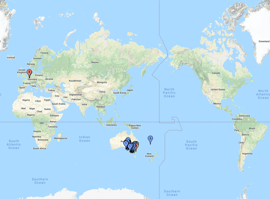
Below are my activations for the Summits on the Air (SOTA) program. I have activated a total of 82 unique summits around the world.
Above:- World map showing my SOTA activations in Europe, the Australian mainland, and on Norfolk Island. Image courtesy of cqgma.org
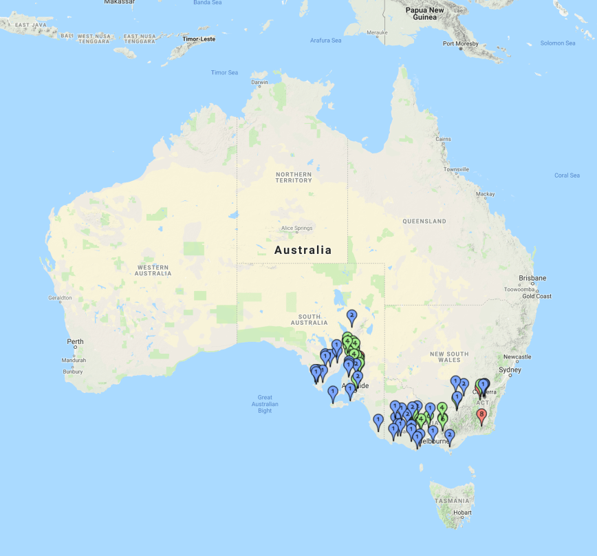
I have activated SOTA summits in VK1, VK2, VK3, & VK5.
Above:- My SOTA activations in VK. Image courtesy of cqgma.org
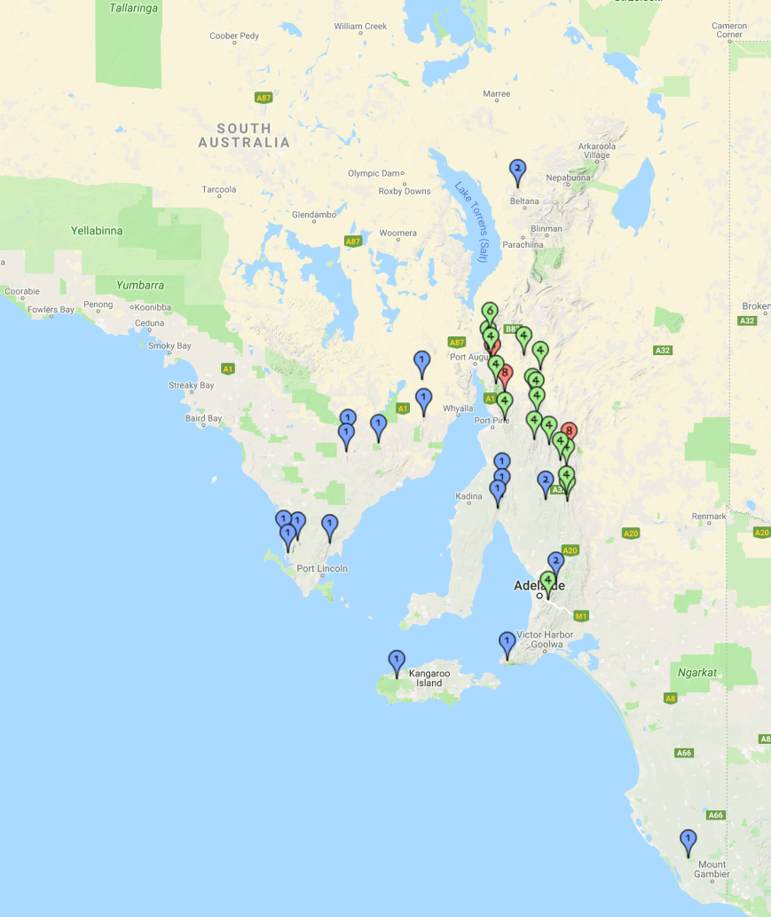
The majority of my activations have been in my home State of South Australia (VK5).
Above:- Map of South Australia showing my SOTA activations. Image courtesy of cqgma.org
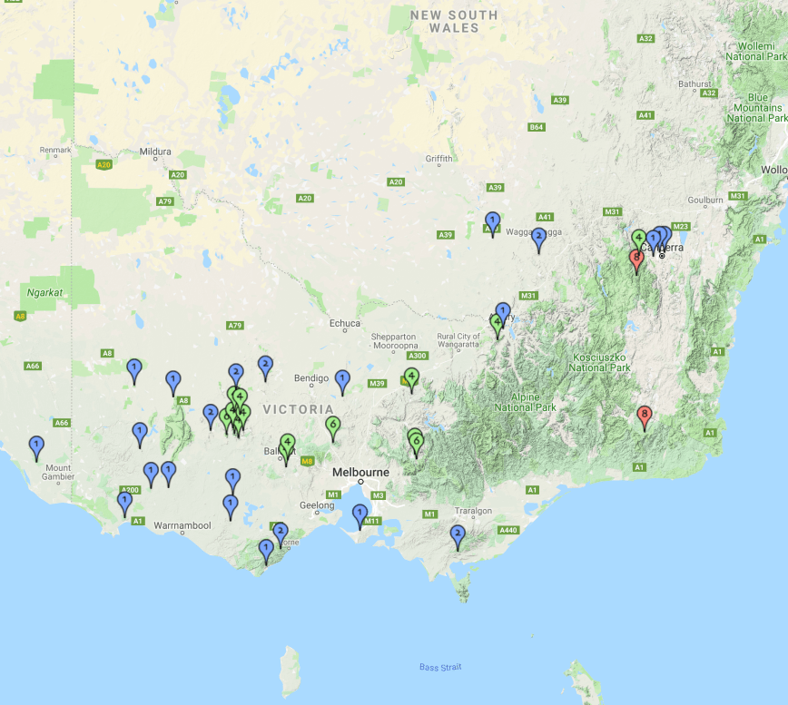
I have also activated a number of SOTA summits in Victoria (VK3), New South Wales (VK2) and in the Australian Capital Territory (VK1).
Above:- My interstate SOTA activations. Image courtesy of cqgma.org
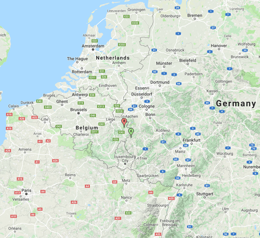
During my 2014 visit to Europe, I was fortunate to activate two SOTA summits. One in Belgium, and one in Germany.
Above:- Map showing my two SOTA activations in Europe. Image courtesy of cqgma.org
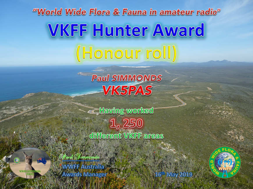
Today I revisited the website of the Global Mountain Activity Group and after uploading my SOTA activator log, I found that I had qualified for another award.
It is issued for having reached 1,000 points in the Activator category.
More information on the Global Mountain Activity Group can be found at……..
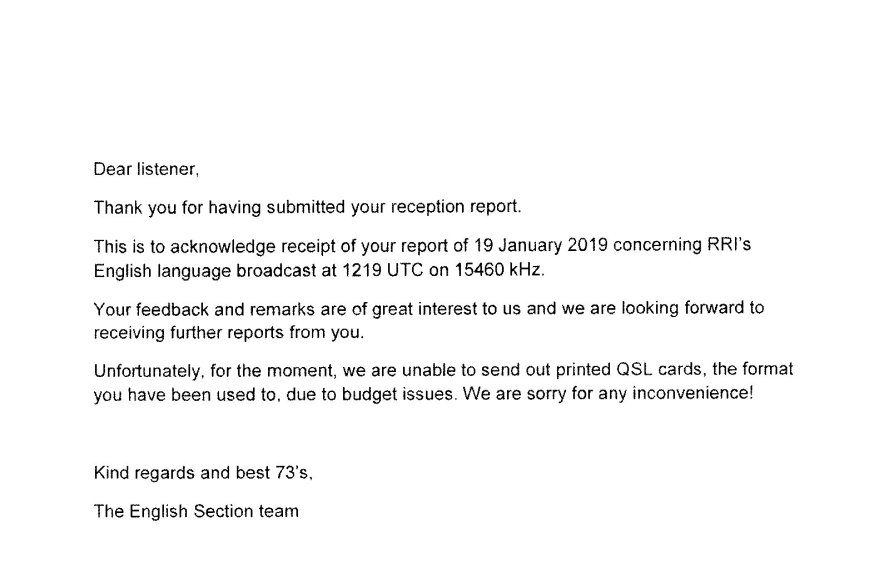
Also received was a letter from Radio Romania International in response to an SWL report I forwarded in January 2019. Sadly, there was no QSL card and the letter read ‘Unfortunately, for the moment, we are unable to send out printed QSL cards….due to budget issues’.
Yesterday I received a letter in the mail from China Radio International (CRI) in Beijing, in response to two SWL reports I sent to CRI in January 2019.
It included 2 QSL cards from the English service of CRI.
Also included in the envelope were three decorative paper cuts.
Today (Monday 20th May 2019) is my first of two days off, after working seven straight at work. Despite the weather forecast not being great, I decided to head down to the Fleurieu Peninsula to activate the Springs Road Native Forest Reserve VKFF-2895. This is one of the newly added parks to the World Wide Flora Fauna (WWFF) program, and this would be a first-time activation of the park.
Above:- Map showing the location of the Springs Road Native Forest Reserve. Map courtesy of Protected Planet.
I left home at around 11.30 a.m. local time. This was about a 90 km drive for me down through the southern Adelaide Hills and onto the Fleurieu. My first stop was at the town of Myponga where I grabbed a bite to eat. It is believed the name Myponga comes from the aboriginal word ‘maitpangga’ meaning ‘place of animal food’. There are however other versions of how the town was named.
After picking up a pie and a drink at one of the local bakeries, I stopped a short distance down the road at the Myponga Reservoir which provides about 5% of the city of Adelaide’s water supply. The area where I stopped is known as Lovely Valley. There is a small information board here showing Lovely Valley before it was flooded by the waters of the Myponga Reservoir. The valley was named by Governor Hindmarsh on his way through the district in 1838.
Myponga Reservoir
Lovely Valley info sign
I continued along Main South Road, with the next town reached being Yankalilla. I worked here back in the mid to late 1980s. There are a number of opinions on how Yankalilla obtained its name. It is suggested that it takes its name from the aboriginal word ‘jankalan’ meaning ‘falling’. This is from an incident in the myth of Tjibrke, whose sister’s mummified body began to fall into pieces here, as he was carrying it from Brighton to Cape Jervis for burial.
View of land around Yankalilla
The town of Yankalilla
I then took Inman Valley Road, stopping briefly at the Torrens Vale lookout. This is well worth a stop. The view here extends from Mount Hayfield in the west where the legendary aboriginal figure ‘Tjilbruke’ rose from the ground to Mount Robinson in the southeast. The area in between these two landmarks is known as Torrens Vale, formerly called Dairy Flat.
The view from the lookout
The information board at Torrens Vale
Torrens Vale was an important early settlement from the 1850s. In its heyday, there were six churches, four cemeteries, a butter factory, post office, blacksmiths shop, store, and a school. Lieutenant William George Field R.N. first mate of Colonel William Light’s ship the ‘Rapid’, built is homestead ‘Hillside’ near the foot of Mount Hayfield.
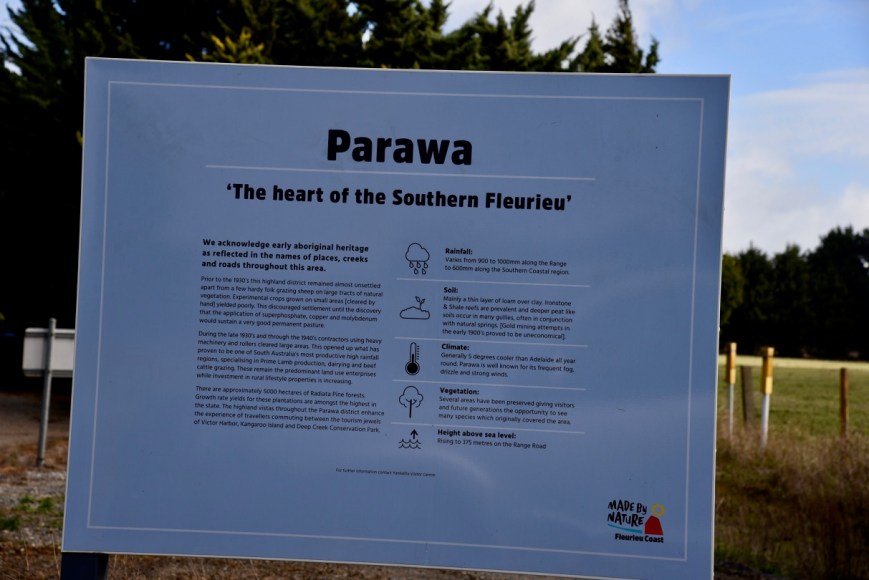
From Torrens Vale Road, I took Parawa Road, stopping briefly at the Parawa information board near the Range Road junction. Prior to the 1930s, the Parawa area remained almost unsettled, except a few hardy folks who grazed sheep. During the late 1930s and through the 1940s, contractors using heavy machinery and rollers cleared large areas of land for farming. Today Parawa is of South Australia’s most productive high rainfall regions, supporting Prime Lamb production, dairying and beef cattle grazing.
Above:- Parawa information board
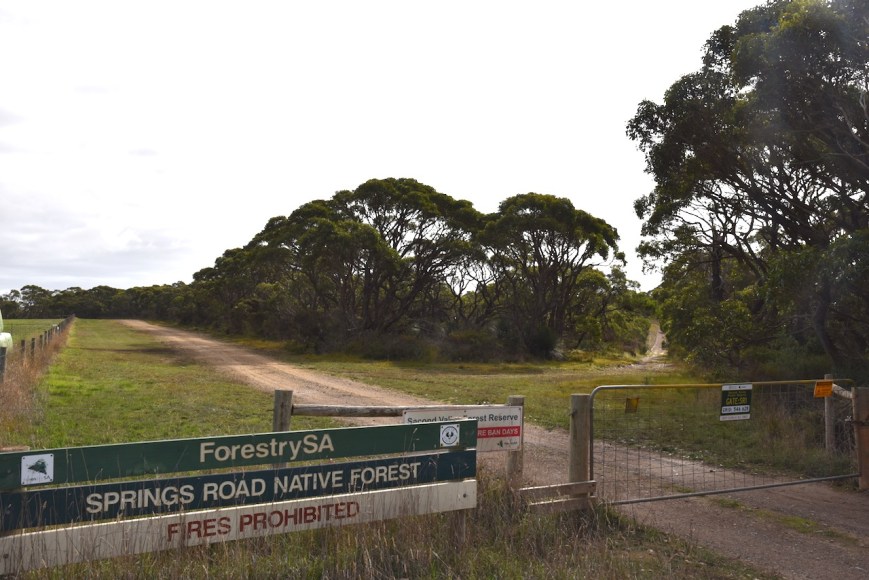
I travelled west along Range Road and then turned right into Springs Road. I soon reached the park which was well signposted.
The Springs Road Native Forest Reserve is about 89.6 hectares in size and forms part of the Second Valley Forest Reserve on the Fleurieu Peninsula, south of Adelaide. The park is surrounded by cleared farming land and pine forest.
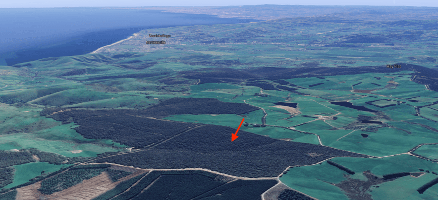
Above:- An aerial shot of the park looking north back towards the towns of Normanville & Yankalilla. Image courtesy of Google maps
The park protects native scrub on the Fleurieu Peninsula which has suffered in the past by activities such as grazing and timber felling. Less than 15% of the original native scrub remains.
Native animals that call the park home include the Western Grey kangaroo, Short-beaked Echidna, and the nationally endangered Southern Brown Bandicoot.
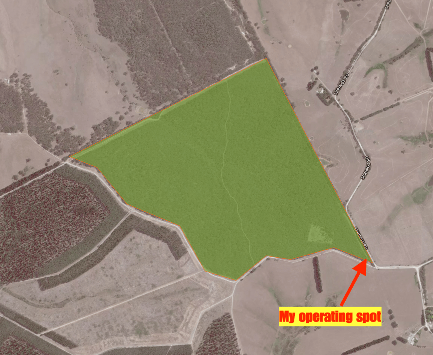
I set up in the southeastern corner of the park off Springs Road, a short distance from Mount Hayfield Road. There was an area here where I could pull off the road and park at the locked gate. I walked about 30 metres in along a fire track and set up, running the Yaesu FT-857d, 40 watts and my 20/40/80m linked dipole.
Above:- An aerial shot of the park showing my operating spot in the southeastern corner. Image courtesy of Protected Planet.
After setting up I headed to 7.144 and asked if the frequency was in use. Peter VK3PF came back to my call to advise that the frequency was clear. After logging Peter I was called by Mark VK4SMA, then Geoff VK3SQ and John VK4TJ. It took me just 6 minutes to qualify the park for the VKFF program, with contact number ten being with Ray VK4NH.
Despite it being a weekday, it was pleasing to see a steady flow of callers. I logged a total of 24 stations on 40m before callers dried up. I had not logged any local South Australian stations on 40m and it appeared there was no close in propagation on that band. So I headed down to 80m and called CQ on 3.610. First in the log was David VK5PL with a strong 5/9 plus signal. David had posted on Facebook that he was unable to hear me on 40m so it was good to be able to get David in the log on 80m.
Unfortunately, I only logged 3 stations on 80m, all VK5’s, despite the band being in very good shape. I then headed off to the 20m band. I called CQ on 14.310 and logged Mark VK4SMA, followed by Kevin VK6AB/p. To my surprise, my tenth contact on 20m was with Karl VE6KDX in Albert Canada. This was followed by Bobby AJ4EN in South Carolina in the USA. I also logged Paul ZL2CQ and Ken ZL4KD in New Zealand.
With 15 stations in the log on 20m and small drops of rain, it was time to head back to the 40m band to pick up 2 more contacts for my 44 QSOs required to qualify the park for the global WWFF program.
I called CQ on 7.144. Joseph VK5WU came back to my call, followed by Brett VK2VW, and then Peter VK3KAI/VK3GV. The rain was starting to get heavier. I put out a last quick call and logged Ken VK3UH and then Alan VK2MG. Sadly I had to go QRT, as the rain was really starting to come down heavy now. I’m sorry to anyone else who was there waiting to work me. I will return to the park.
I had qualified the park, got wet in the process, and it was time to head home, having qualified the park with 48 contacts in a little over one hour.
Thank you to everyone who called and a big THANKYOU to those who took the time to spot me. Sadly it continues to be the same people over and over again who spot on parksnpeaks. Many use it to their advantage, but never spot, which is rather disappointing.
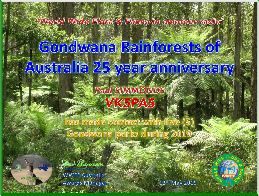
The Gondwana Rainforests of Australia include the most extensive areas of subtropical rainforest in the world, extending past Newcastle to the south-east of Queensland. The Gondwana Rainforests of Australia are World Heritage listed, thriving with plants and wildlife, and an outstanding example of the major stages of Earth’s evolution.
To celebrate the 25th anniversary of the Gondwana Rainforests of Australia, the VKFF program is offering the Gondwana Rainforests Award.
The award is issued to activators and hunters who during 209, activate/work:-
On Sunday (12th May 2019) Marija and I had booked a tour of the old Government Treasury building in Adelaide. This was as part of History Month being held in South Australia.
The building was built in stages between 1839 to 1907. During the Victorian gold rush of the 1850s, about 17,000 South Australian’s travelled to Victoria to make their fortune. A gold escort route was established and 327,000 ounces of gold was brought to Adelaide and stored in the Treasury building.
The old Treasury building was the centre of South Australia’s administrative and government affairs for around 130 years, and up until 1968 housed the Government Cabinet Room.
This was a very interesting tour. And importantly, the building is now the Adina Hotel and home of the Treasury Bar, Kitchen and Courtyard. Why important? This is where I met my lovely wife Marija.
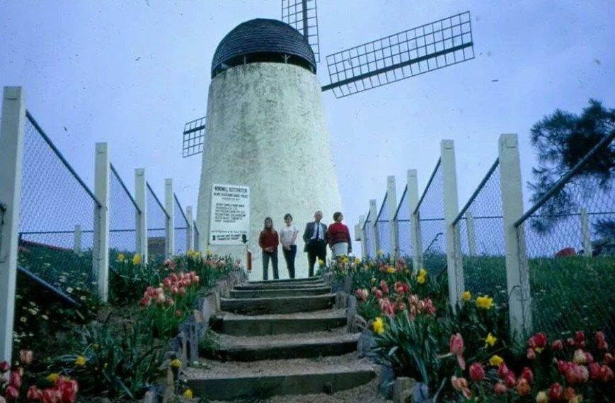
After leaving Adelaide, we headed back up into the Adelaide Hills to Nixons Mill at Hahndorf, for a quick activation for the Mills on the Air Weekend.
The Mills on the Air Weekend is held each year in May and is a great way to promote the hobby of amateur radio, whilst also highlighting the preservation of these very historic structures. The Mills on the Air Weekend is timed to coincide with National Mills Weekend. The event is organised in conjunction with the Society for the Protection of Ancient Buildings (SPAB).
The Mills on the Air Weekend commenced about 9 years ago when Jasmine G4KFP, a member of the Denby Dale Amateur Radio Society, submitted an item in the RSGB news asking if any amateur was willing to put on a station at a windmill or watermill. Jasmine also contacted SPAB and initially agreed for 6 groups of amateurs to establish stations at 6 mills. The word soon spread, and participants increased to 30.
The Mills on the Air Weekend is NOT a contest. It is just a great opportunity of promoting the hobby of amateur radio and promoting heritage.
The Mount Barker district developed as a milling centre with the establishment of early flour mills during the 1840s. This was just a few years after the proclamation of South Australia in December 1836. In 1842, John Dunn constructed the first wind-powered mill for grinding wheat at Hay Valley near Nairne. The first steam-powered flour mill outside Adelaide was established in 1844 at Mount Barker, also by John Dunn, which ceased operations in 1894.
Between 1841-1842, construction was undertaken of a wind-powered mill at Hahndorf for Frederick Robert Nixon (1817-1860), who was part of Colonel William Light’s team or surveyors. The mill was located on a small hill overlooking the road between Hahndorf and Mount Barker, referred to as West Hill, and subsequently known as “Windmill Hill”. Nixon had purchased the land on the 6th of May 1841. Nixon’s mill opened up an important agricultural area of the State, grinding over half a million bushels of wheat in one season. It was the second wind-driven flour mill in the Mount Barker district.
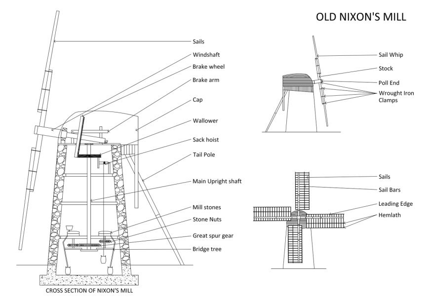
The tower structure of the mill, which is 9.05 metres high, is constructed of random coursed stone rubble and is about 75cm thick. There were four working levels in the mill, with one window at the second level and two windows at the third level. Two doors existed at ground level, with one of those having been bricked up. A circular cap structure was located at the top of the tower which sat on a base of two large horizontal beams called sheer tress. A movable boat-shaped cap rested on a track that rotated around the top of the tower on a well-greased metal curb.
The sail frames were constructed of hardwood and canvas sheets were furled like a curtain to cover different areas of the frames dependant on wind velocity. The sails had a sweep of 17 metres in diameter. The mill contained a large wooden brake wheel which was connected to the wind shaft that was driven by the wind in the sails. A wallower was fixed to the main shaft and this was driven by wooden teeth on the brake wheel. The millstones were rotated as a result of the great spur gear which was connected to the lower end of the main shaft which drove the smaller wooden gears.
During 1844, Walter Paterson, a farmer from Mount Barker purchased the property. Then in 1853, Johann Friedrich Wittwer purchased the windmill for £320. He and his son Friedrich Wilhelm Wittwer operated the mill along with other mills in the area.
Milling at Nixon’s site ceased in 1864 as it was no longer able to compete with steam mills. Friedrich Wittwer closed the mill following the death of his father and moved the millstones and machinery to a steam mill that he had built in Hahndorf. The mill was subsequently purchased by the Braendler family in 1880.
Since this time the mill has been subjected to bushfires, storm damage and sadly vandalism and neglect. Various attempts at repair and restoration have been carried out over the years.
During a large bushfire in 1912, the Sheaok timbers and working parts of the windmill were destroyed. It remained in a derelict state until 1928, when the mill was converted into a lookout tower as a result of the efforts of a group of prominent businessmen, funded by public subscription.
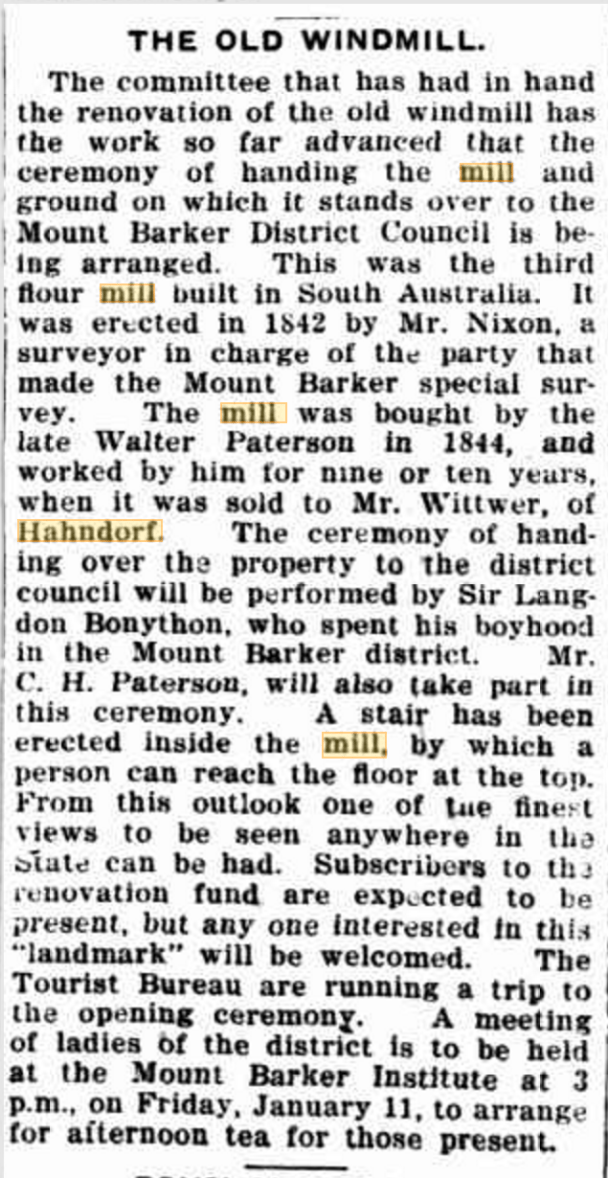
Article from The Mount Barker Courier, Fri 11 Jan 1929
At this time A.E. Braendler donated the windmill and some surrounding land to the Mount Barker District Council. A bushfire destroyed the staircase and the upper portion of the windmill during 1939.
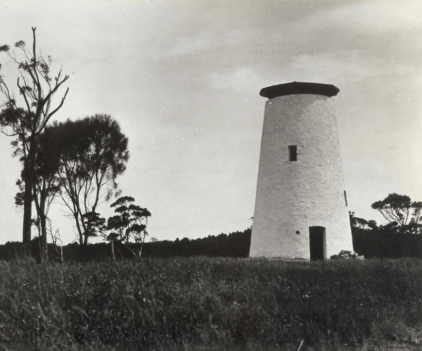
Nixon’s Mill, 1929, as a lookout. Image courtesy of localwiki.org
Between 1961 and 1966, a major restoration was carried out by the Mount Barker Apex Club, which included the installation of a dome roof and four dummy sail-spars. The Honourable Steele Hall opened the restored windmill to the public on the 20th November 1966.
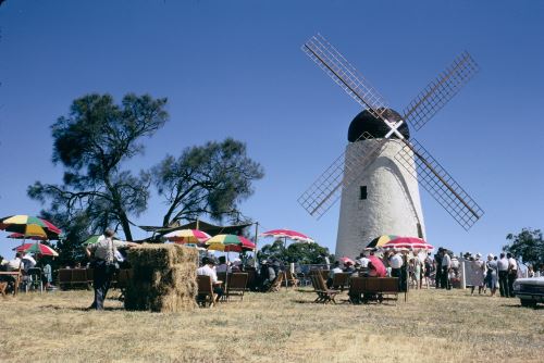
Opening ceremony in 1966 of Nixon’s Windmill.
Nixons Mill, c. 1960’s, prior to storm damage and vandalism attacks. Image courtesy of localwiki.org
In 1975 a severe storm resulted in one of the sail arms being torn off. This was followed by a number of vandalism attacks. In 1980 an $80,000 appeal to restore the mill was officially launched at a fundraising dinner where Mr David Wotton, the Minister for Environment and Planning was the guest speaker. A Windmill Restoration Committee was established at this time, but unfortunately, the required funds were not obtained.
The windmill in 1975 showing the sheared off sail arm. Image courtesy of localwiki.org
During 1983 stabilisation of the windmill structure, masonry repair, waterproofing and repairs to the doors and windows were carried out. In 1988, requests for a grant of $100,000 from the South Australian State Government were sought. The proposal included the replacement of the mill sails and restoration of the interior of the mill to working order. Additionally, it was suggested that a cottage, shop and historic display centre could be built. Sadly, funding did not eventuate.
In 2016, painting, signage and major site upgrading was conducted by the Mount Barker District Council in collaboration with the Apex Club of Mount Barker.
Steam cleaning of the tower prior to repainting, 2016. Image courtesy of localwiki.org
Marija and I set up only a few metres away from the structure. We had plenty of onlookers during the activation, but not those who asked us questions. The Hahndorf Farm barn is right next door to the mill.
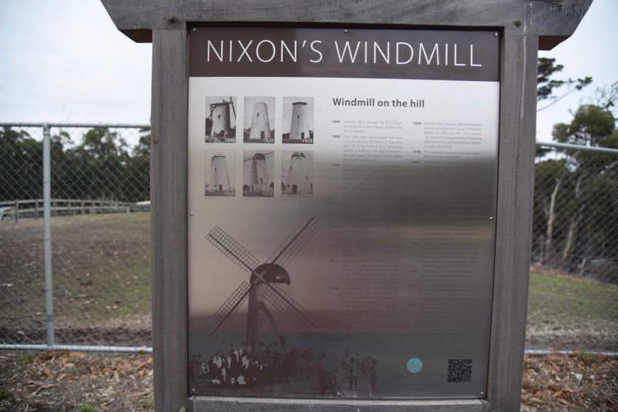
There are a number of information boards at the site, which tells the interesting history of Nixon’s Windmill.
I kicked off the activation by calling CQ on 7.150. Chris VK2SR was first in the log, followed by Keith VK3MKE, John VK2JON, and then Rick VK4RF. The 40m band seemed to be in pretty good shape and a small pile up soon ensued. Sadly a lot of people didn’t hang around to break the pile up. Folks, please be patient. It might take a few minutes, but I will get to you.
During the activation, Paul VK5PH turned up to have a look at out portable set up. Whilst Marija chatted to Paul I continued to work the callers, logging a total of 36 stations before swapping the mic with Marija. This included a contact with Jonathan VK7JON who was activating the Don Heads Conservation Area VKFF-2903.
Marija’s first contact was with Brodie VK3FMGI/4, followed by Rick VK4RF, and then Peter VK2KNV/m. Marija logged a total of 11 stations before I jumped back into the ‘driver’s seat’. Marija’s contacts were made with her 10 watts PEP into VK2, VK3, and VK4.
I logged a further 6 stations on 40m, including Gary ZL3SV in New Zealand who was a big signal. It was getting very cold, with the temperature down to 10 deg C and I was pushing my luck on Mothers Day. So it was down with the squid pole and in with the 80m band links.
I called CQ on 3.610 where I logged 10 stations, including Gary ZL3SV who was strong on 80m just as he was on 40m. I also spoke with Scott VK3FSPN/p who was initially running 1 watt and then dropped his power down to 100 milliwatts. The video below shows the contacts with ZL3SV on 40m and 80m and the contact with VK3FSPN.
Marija and I then packed up and headed off to the supermarket and then home for dinner. Many thanks to everyone who called. We had logged 63 stations from VK2, VK3, VK4, VK5, VK7, and New Zealand, in around 90 minutes. Hopefully next year we don’t have as much on our social calendar, and I can devote some more time at the Mill.
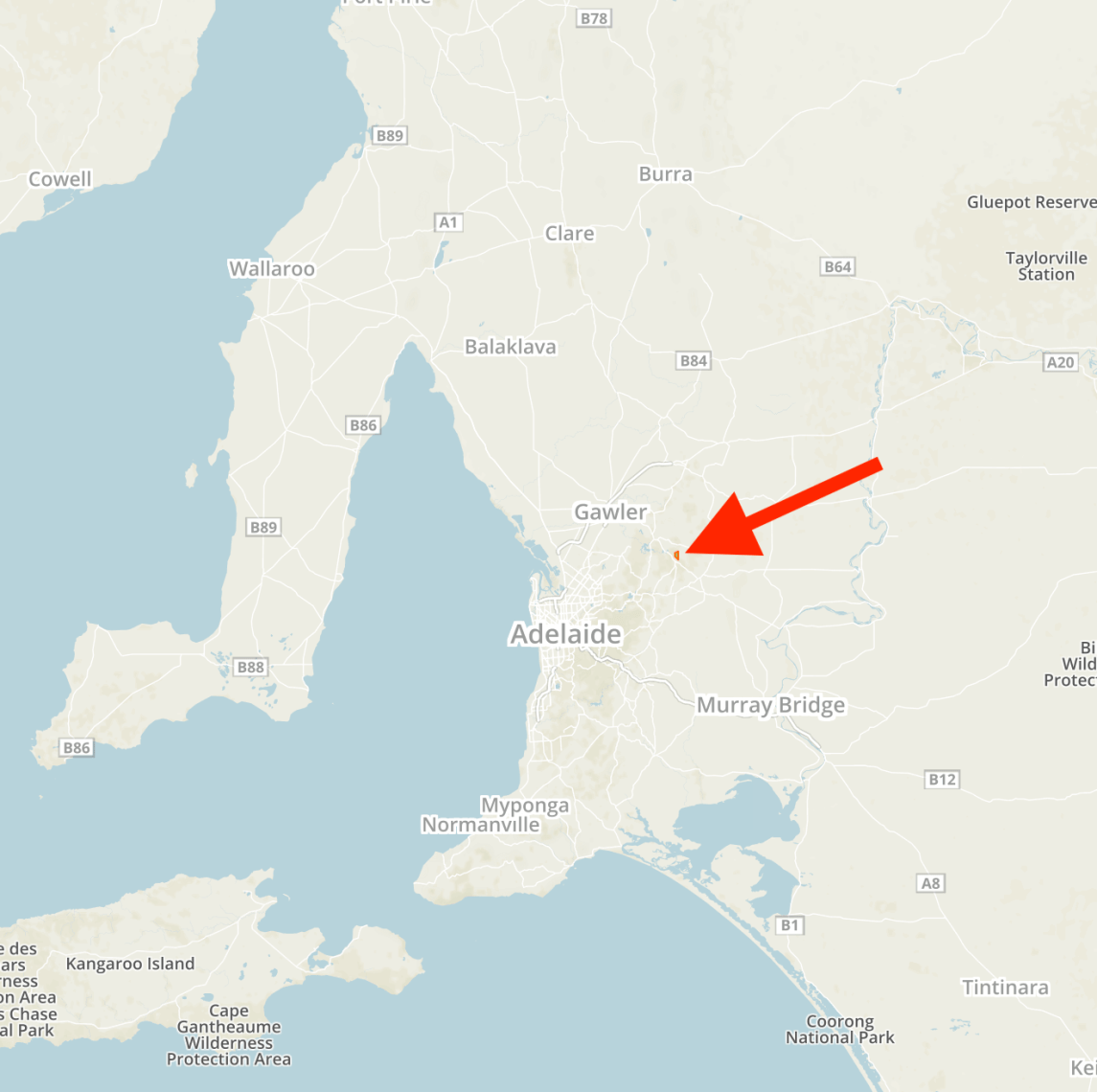
Yesterday (Monday 6th May 2018) was my first of 2 days off from work after working 7 straight. The weather forecast was for a fine and sunny day with lots of rain to follow on Tuesday. So I packed the 4WD and headed to the Little Mount Crawford Native Forest Reserve VKFF-2884.
The reserve is located about 50 km northeast of the city of Adelaide, and about 8 km southeast of the town of Williamstown which is on the southern fringe of the Barossa Valley wine growing region.
This would be a unique park for me, and a park which has only just been added to the World Wide Flora Fauna (WWFF) program.
Above:- Map showing the location of the Little Mount Crawford Native Forest Reserve
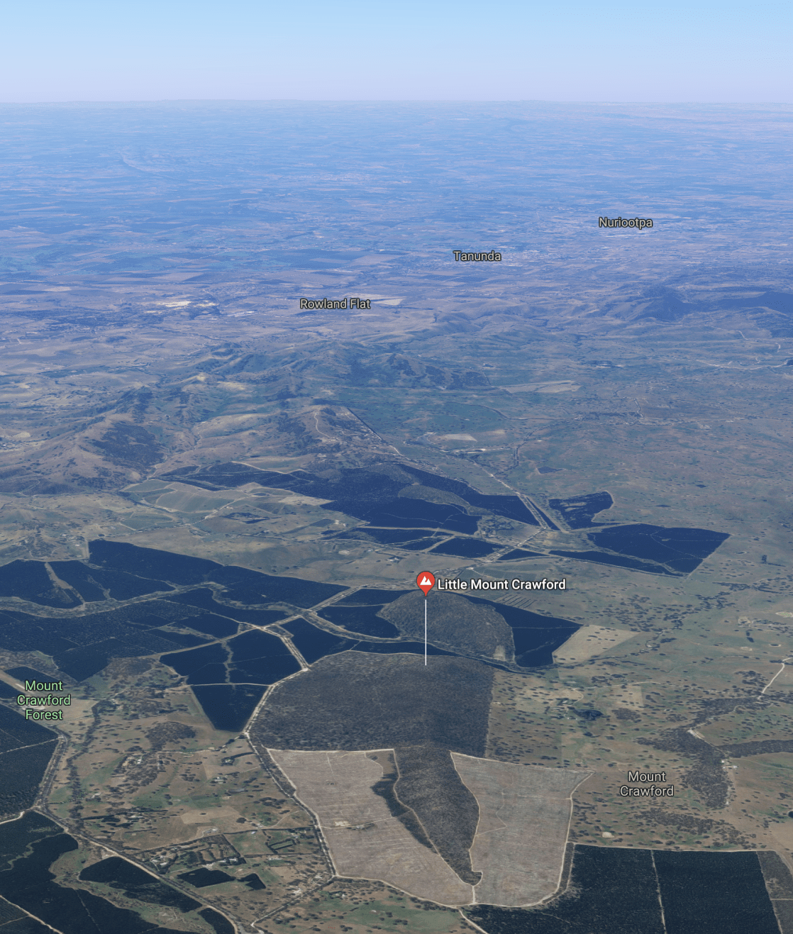
The Little Mount Crawford Native Forest Reserve is about 177 hectares and consists of native vegetation which is located in the Mount Crawford Forest Reserve. The park is surrounded by pine plantations and farmland. The reserve was proclaimed on the 15th day of March 2001. The reserve was formerly known as ‘Jenkins Scrub’ as the land was owned by the Jenkins family. It is assumed that Little Mount Crawford was named due to its close proximity to Mount Crawford which rises to 562 metres above sea level.
Above:- An aerial view of the Little Mount Crawford Native Forest Reserve, looking north towards the famous Barossa Valley. Image courtesy of google maps.
The aboriginal name for Mount Crawford was Teetáka. However, there are various versions of how Mount Crawford was named by the Europeans. It is believed however that it was named in 1839 by explorer Charles Sturt after James Coutts Crawford (1817 – 1889) who arrived overland from New South Wales with his drovers in April 1839 with 700 cattle. They set up a hut and cattle run at the base of the mount.
Above:- James Coutts Crawford. Image courtesy of Wikipedia
The park contains plant species of high conservation value including Banksia marginata (Silver Banksia) Woodland. The Nationally Vulnerable Pale Leek-orchid can be found in the park. The reserve is characterised by a large number of hollow trees and logs which provide important fauna habitat. This has mainly occurred due to the area not being burnt since about 1920. Firewood cutting has not occurred since the early 1970s, and grazing has not occurred since the early 1950s.
This is a particularly beautiful part of the northern section of the ‘Adelaide Hills’ Mount Lofty Ranges, with rolling hills, scrub, and vineyards.
Native birds located in the park include the Yellow-tailed black cockatoo, Scarlet Robin, and White-winged Chough. Native mammals which call the park home include Western Grey Kangaroo, Short-beaked Echidna, Bush Rat, Common Brushtail possum, and Common Ringtail possum.
I travelled from home through the towns of Nairne and Woodside, and then on to Charleston. I then headed north to Birdwood, the home of the National Motor Museum, and then north on Warren Road. I soon reached the reserve which is well signposted on Mount Road.
Cleared pine plantation near the south western part of the park.
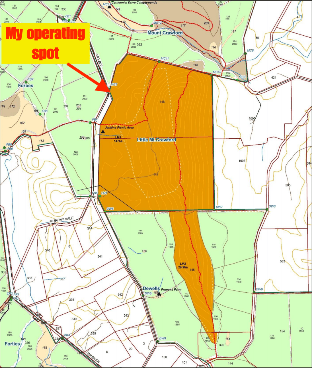
There are a number of potential operating spots along Mount Road. I headed to the northwestern section of the park. There is a large area here where you can pull in off the road, and plenty of room to stretch out a dipole.
Above:- A map showing the Little Mount Crawford Native Forest Reserve, showing my operating spot in the northwestern part of the park. Map courtesy of Forestry SA.
I ran the Yaesu FT-857d and the 20/40/80m linked dipole for this activation. Power output was 40 watts.
I headed for the WWFF operating frequency of 7.144 and asked if the frequency was in use. Peter VK3PF came back to me advising that it was all clear. After logging Peter who had a strong 5/9 signal, I spoke with Tom VK3ATO and then Geoff VK3SQ.
Despite it being a weekday it did not take me long to get the required 10 contacts to qualify the park for the VKFF program. Contact number ten was with Alex VK3MPC who had a strong 5/9 signal.
Band conditions were average, with some good strong signals to and from Victoria, but apparent average-poor conditions down to Tasmania. I logged a total of 34 stations on 7.144 from VK2, VK3, VK4, VK5, and VK7. This included some local stations: David VK5PL at nearby Williamstown, Adrian VK5FANA on the Yorke Peninsula, Ian VK5CZ in the Clare Valley, and Les VK5KLV/p who was activating the Upper Spencer Gulf Marine Park VKFF-1757.
Above:- ‘the shack’ in the Little Mount Crawford Native Forest Reserve.
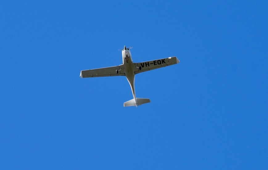
It was a beautiful sunny morning with hardly a cloud in the sky. The serenity of the park was only broken occasionally by light aircraft on their way to the Parafield Airport in the northern suburbs of Adelaide.
With just 10 contacts to go for my 44, I headed to 14.310 on the 20m band. After a self spot on parksnpeaks I called CQ. Brett VK2VW, who I had worked on 40m, came back to my call. Although we were both low down to each other, we were able to comfortably exchange signal reports. I logged a further 8 stations, all from Queensland, bar Cliff VK2NP in Sydney.
I was now just one short of 44, and it was off to the 80m band. Les VK5KLV/p in VKFF-1757 was first in the log on 80m and credited for getting me over the line with 44 QSOs. I logged a further 5 stations on 80m, all from South Australia, excluding Mike VK6MB/3 who is on a trip through Victoria.
I then moved back to 40m and called CQ on 7.139, logging a further 10 stations from VK2, VK3, and VK4. I then lowered the squid pole and replaced the linked dipole with my 15m dipole. I spotted on parksnpeaks and called CQ on 21.244 for about 10 minutes, but sadly had no takers. I tuned across the band and did not find a single signal on the band.
I then saw a post on Facebook from Hans VK5YX to say he was listening on 15m but could not hear me. I arranged to give Hans a call on 80m. It was quickly down with the 15m antenna, and back up with the linked dipole. I logged Hans on 80m from the southern suburbs of Adelaide, with a 5/9 plus signal.
I had been in the park for about 2 & 1/2 hours and it was time to pack up. I had qualified the park for WWFF and VKFF with 60 contacts in the log, including two Park to Park QSOs.
I worked the following stations on 40m SSB:-
VK3PF
VK3ATO
VK3SQ
VK6MB/3
VK7JON
VK5PL
VK4FDJL
VK3MCK
VK2IO/m
VK3MPC
VK3MIJ
VK2NP
VK2VK
VK4SYD
VK5FANA
VK4AAC/2
VK2BH
VK3MKE
VK3FMKE
VK2KNV/m
VK7EI
VK3MKM
VK5VZ
VK4TJ
VK4/AC8WN
VK4/VE6XT
VK3ANX
VK4NH
VK4DXA
ZL4TY/VK4
VK3UH
VK5KLV/p (Upper Spencer Gulf Marine Park VKFF-1757)
VK3FPSR
VK2VW
VK3AHR
VK3FPEM
VK3TKK/m
VK4RF
VK4HA
VK2CA
VK3WRL/p
VK3ELH
VK2XSE/m
VK3PAT
I worked the following stations on 20m SSB:-
VK2VW
VK2NP
VK4TJ
VK4/AC8WN
VK4/VE6XT
VK4SYD
VK4YKI
VK4MWB
VK4SMA
I worked the following stations on 80m SSB:-
VK5KLV/p (Upper Spencer Gulf Marine Park VKFF-1757)
VK6MB/3
VK5FANA
VK5PL
VK5BJE
VK5WU
VK5YX
After packing up I drove along Mount Road to the old Murray Vale Presbyterian Church. All that remains are the stone ruins of this church which was built in 1843. The church served several denominations until it was destroyed by a bushfire in 1869. Remedial works to preserve the remains of the church were undertaken by the Barossa Council in July 2018.
The adjacent Mount Crawford cemetery was established in 1845 and is still being used as a public cemetery.
I then travelled back along Mount Road to the Jenkins Scrub Walking Trail, and took a walk along the 2.9 km circuit. There is an information board here with lots of interesting facts about Forest Reserves and this section of scrub.
This is an easy walk which takes between 30-60 minutes. I highly recommend it if you are visiting Little Mount Crawford.
The track is well signposted and parts of the track form the famous Heysen Trail.
I took the zoom lens with me during my walk and took the time to take a few bird photographs along the way.
In the top section of the walk, you can see an old mine shaft. Gold mining commenced in 1884 and continued into the early 1900s. Small quantities of gold were found here, but this mine was not profitable. The Gummeracha Goldfields to the southwest produced significant amounts of gold and are still visited by many keen fossickers.
Above:- Mine shaft in the park.
I then headed home for a late lunch. Thanks to everyone who called me during the activation, and a big thanks to those who took the time to spot me.


")

