Cootamundra South silo VK-CTH2

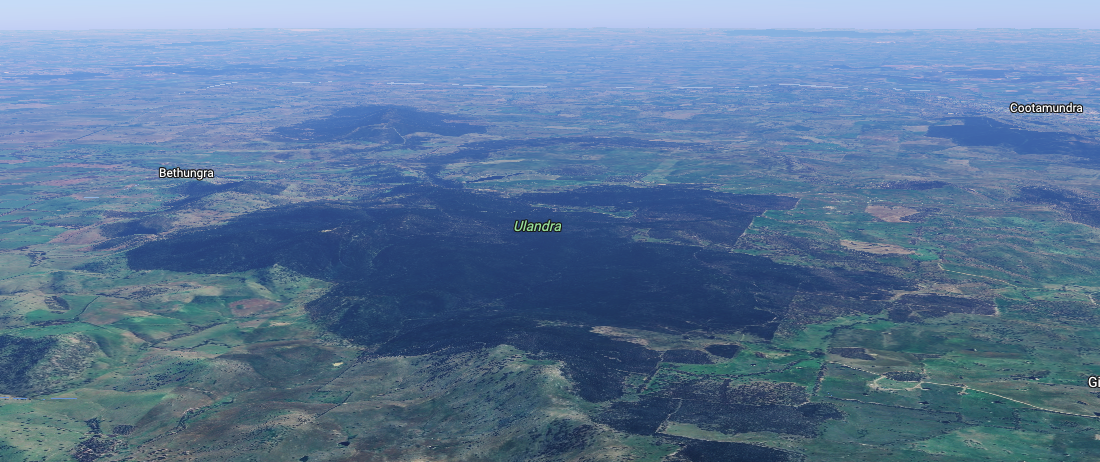
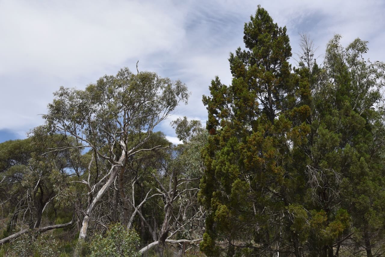
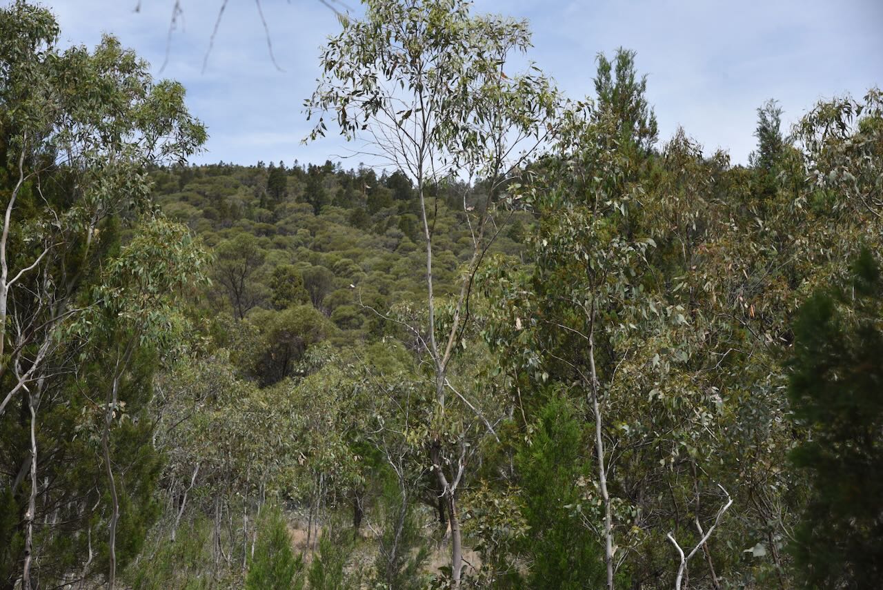
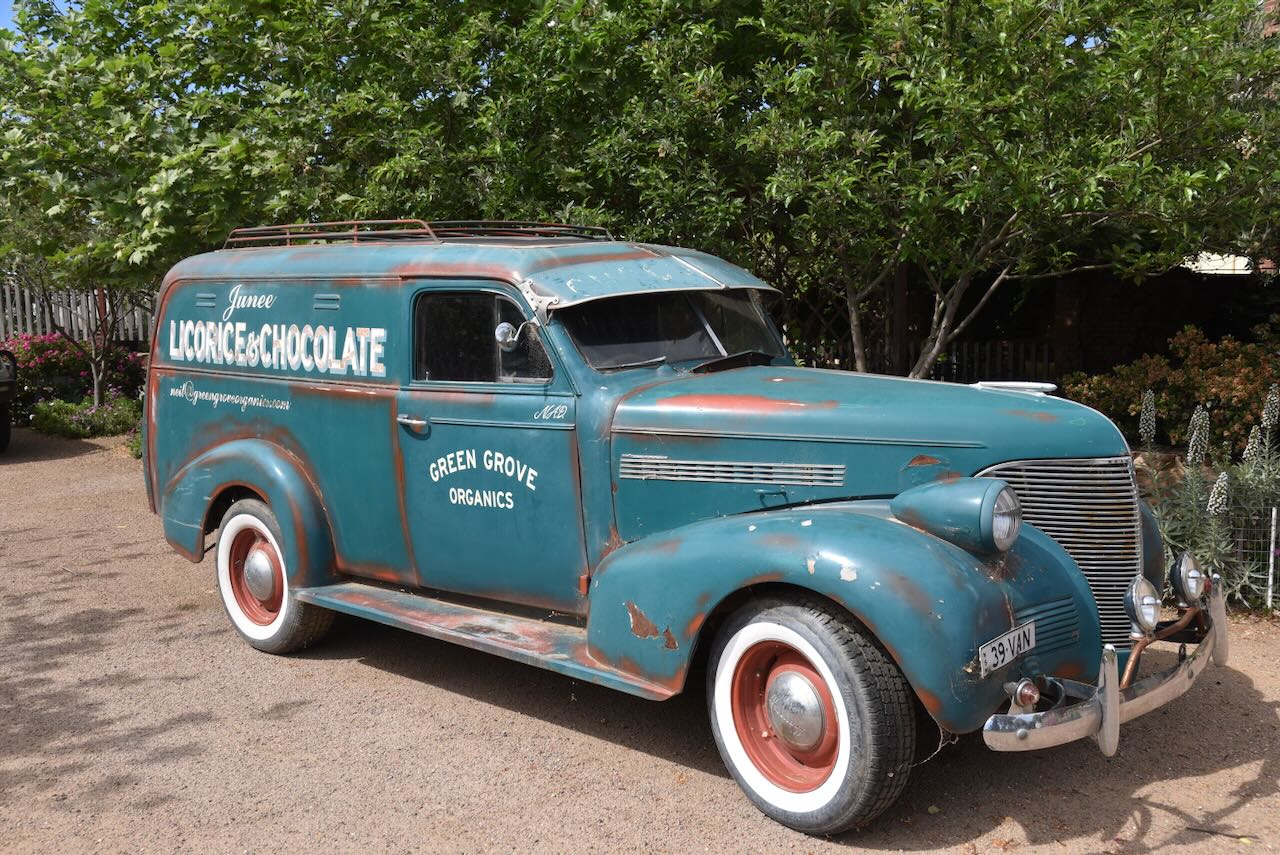
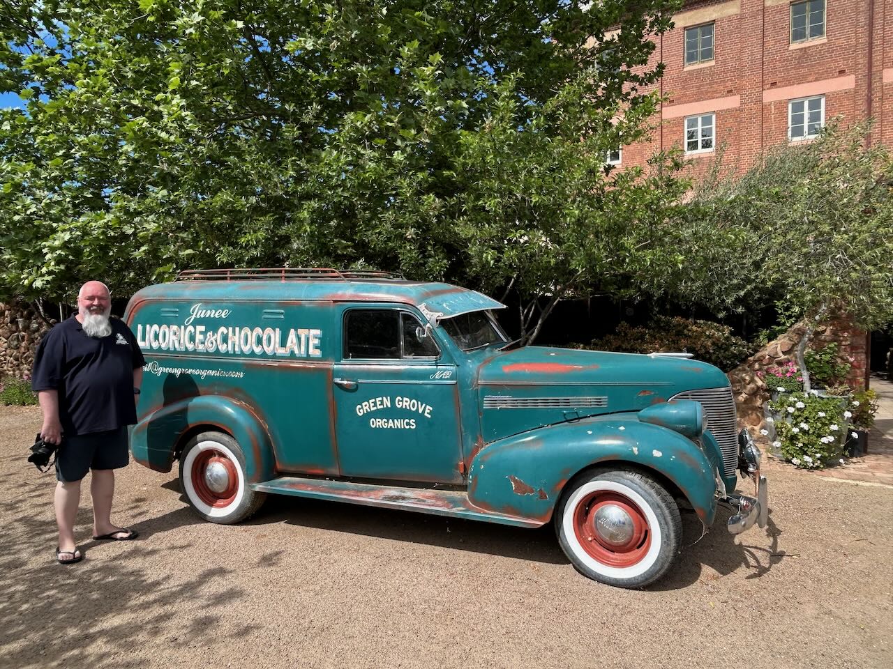
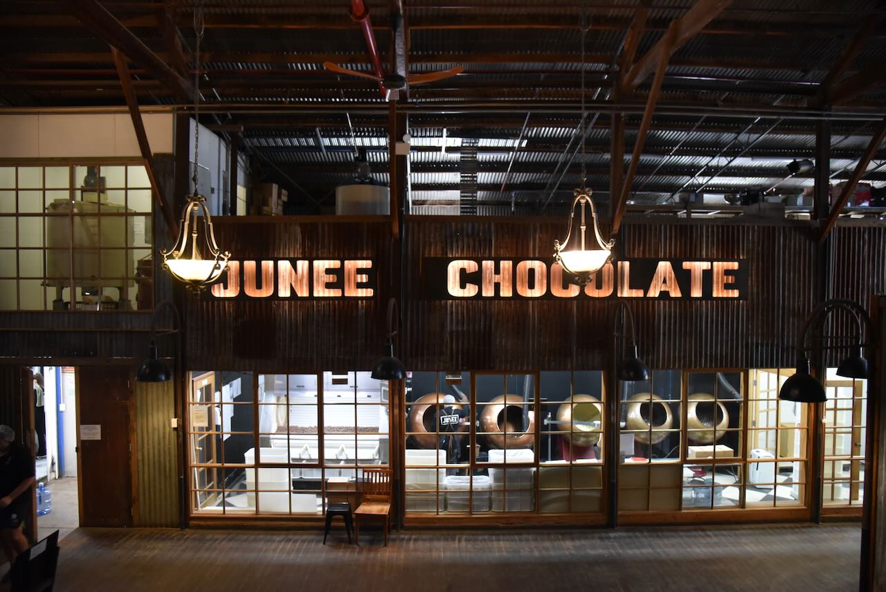
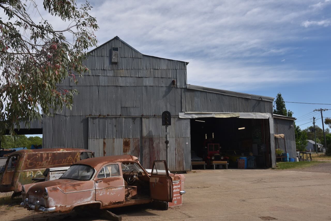
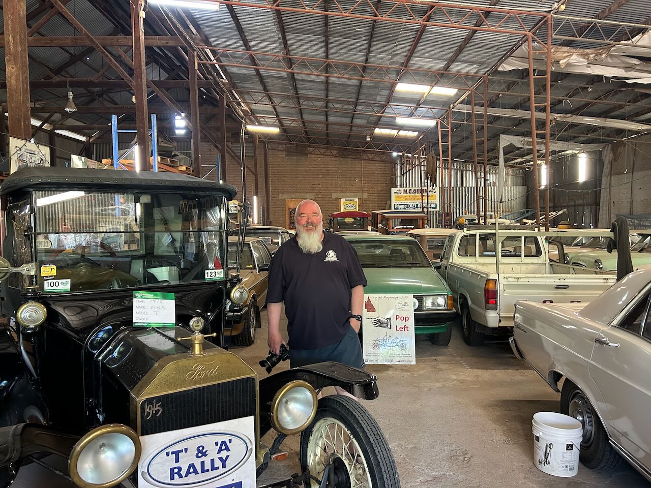
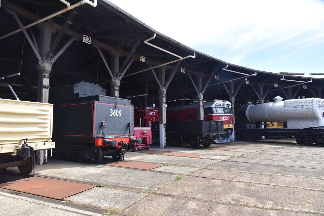
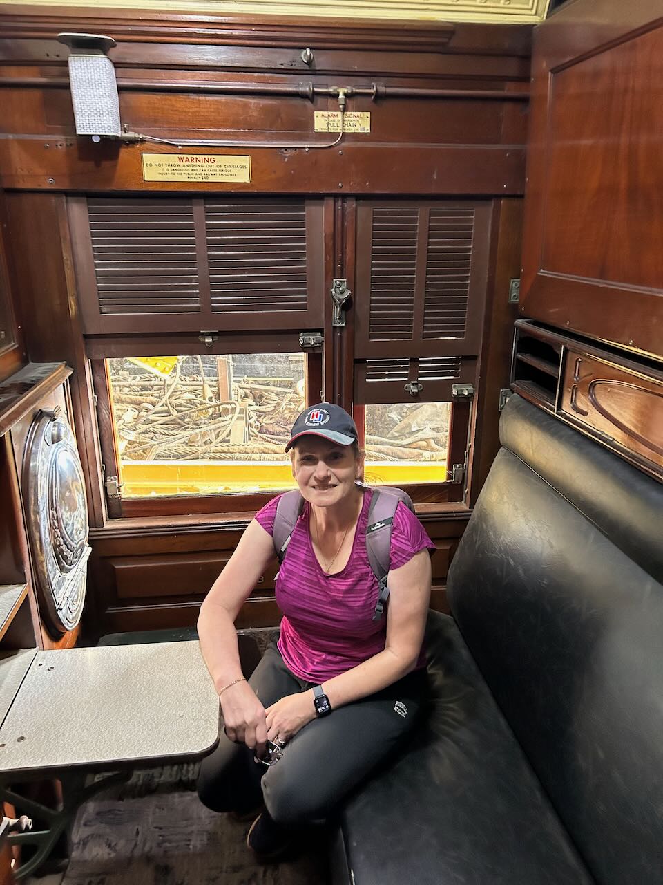
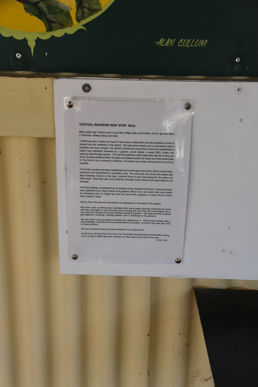
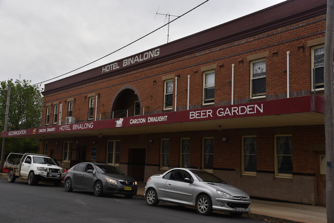
After leaving the Ulandra Nature Reserve on Thursday, 23rd October 2025, Marija and I drove towards Cootamundra. Our intention was to visit the Bradman Museum at Cootamundra.

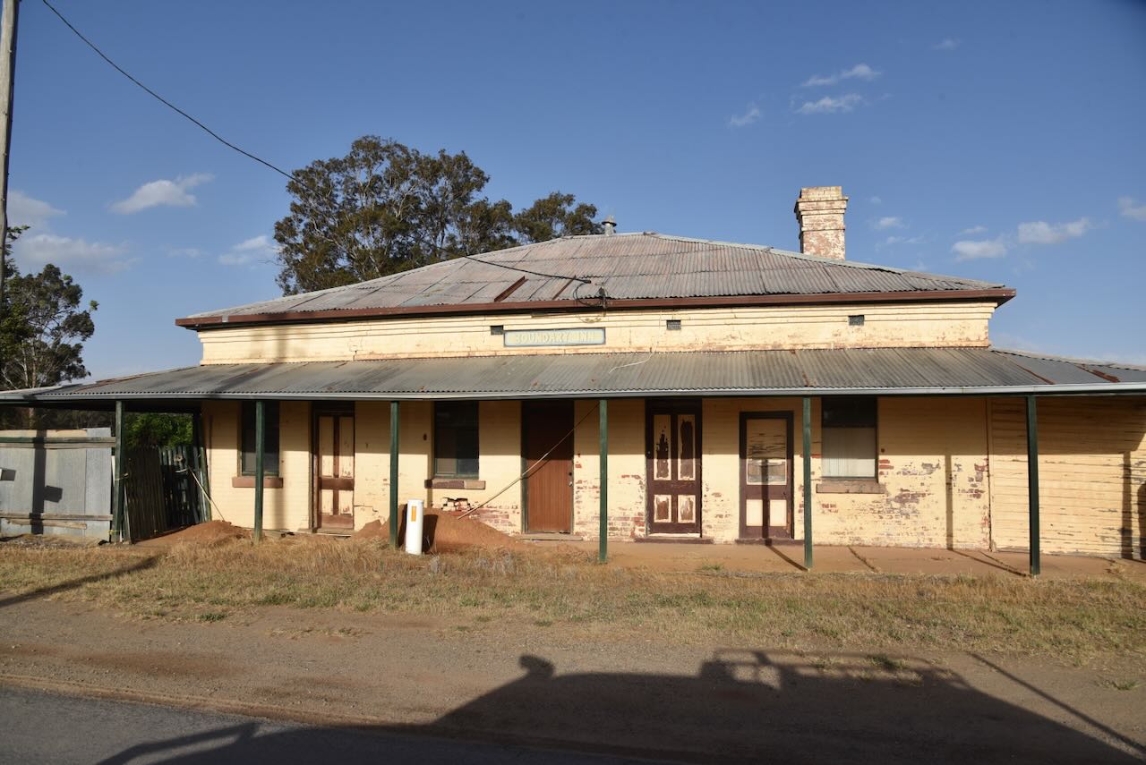
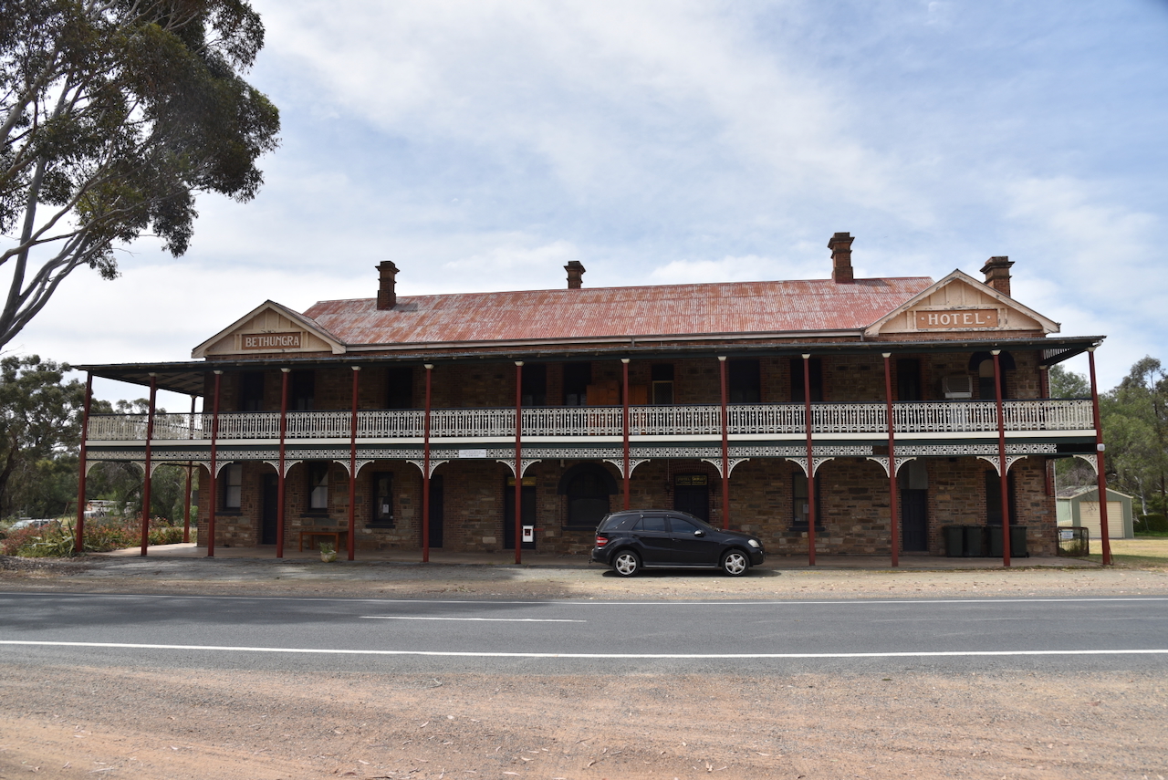
Along the way, we stopped to admire the old Bethungra Hotel, which was established in 1886. The hotel was used as a Cobb & Co. changing station. In 1999, the hotel was closed. (Chirp 2026)

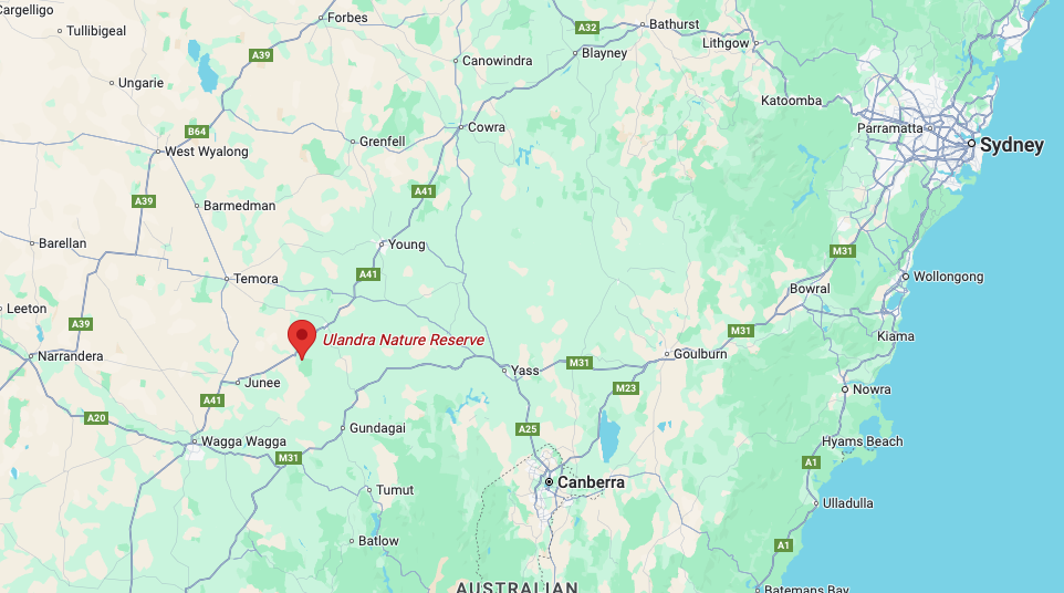
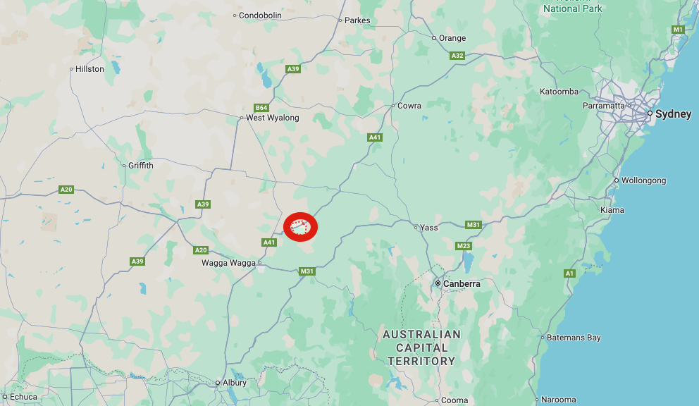
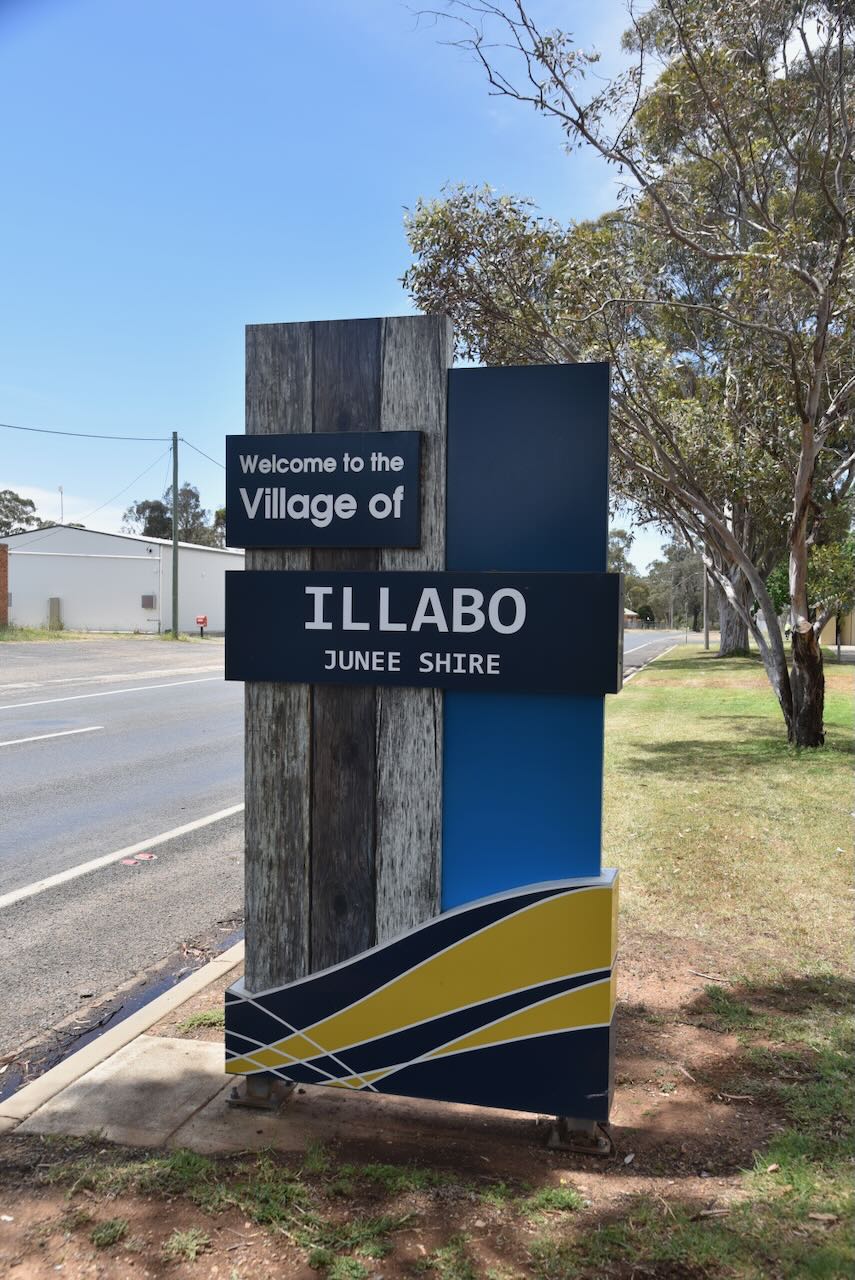
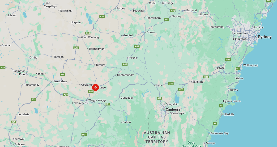
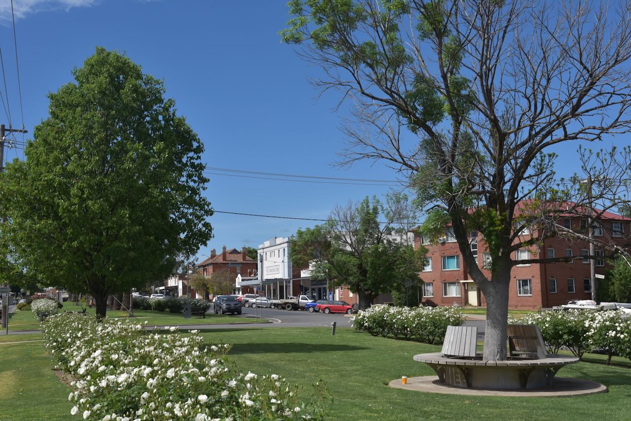
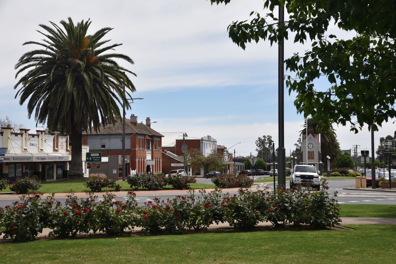
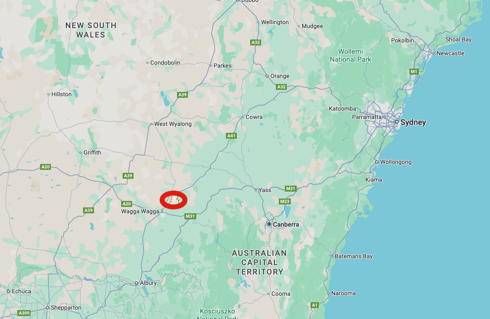
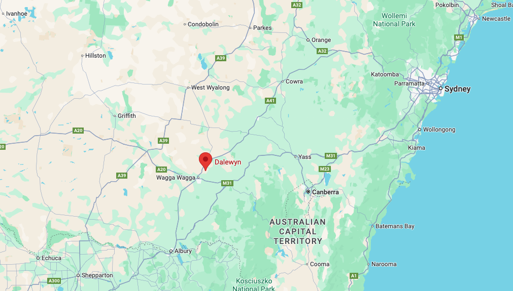
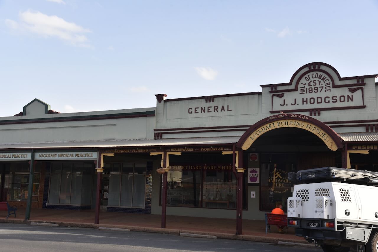
Cootamundra, known as Coota, is located in the Riverina region of New South Wales, about 379 km southwest of the city of Sydney.

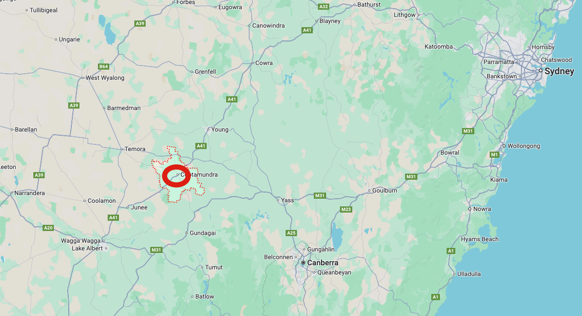
Above: Map showing the location of Cootamundra, NSW. Map c/o Google Maps

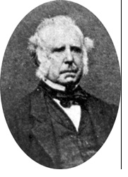
In 1837, John Hurley and Patrick Fennell were licensed to graze stock on Coramundra Run. (Wikipedia 2021) (Wikipedia 2025)

John Hurley was born in 1796 in Limerick, Ireland. In October 1823, he was convicted of insurrection and sentenced to 7 years’ transportation to Australia. He arrived in Sydney in 1824, and by 1830, he was freed from servitude. By 1837, he had purchased his first pastoral lease. By 1849, he had acquired 40,000 acres at Houlahan’s Creek and 50,000 acres known as the Coramundra Run. (Rutledge 1972)

Above: John Hurley. Image c/o Parliament NSW

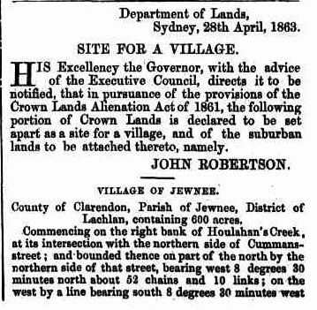
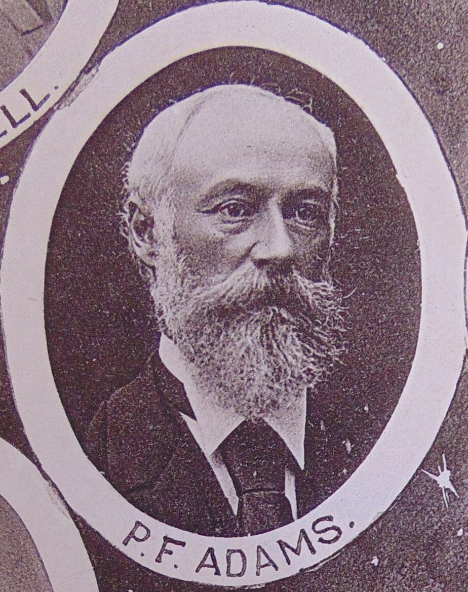
In 1860, Surveyor Philip Francis Adams drew up plans of the village of Cootamundry. The name is derived from an Aboriginal word meaning ‘place below’ or ‘low-lying.’ (Trove 2026)

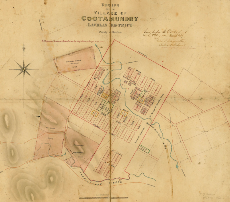
Above: design of the village of Cootamundry. Image c/o Trove

Philip Francis Adams was born in 1828 in Suffolk, England. He initially emigrated to Canada and then to the United States of America, where he worked as a surveyor. In 1854, he emigrated to Australia, where he was appointed the District Surveyor for Maitland. In 1864, he was appointed Deputy Surveyor General, and in 1868, he became the Surveyor General. Adams was one of the official observers of the transit of the planet Venus in 1874 in the Blue Mountains and on Lord Howe Island in 1882. Following retirement, he established a successful vineyard near Liverpool, NSW. He died in Sydney in June 1901, aged 73. (McIntyre, 1969)

Above: Philip Francis Adams. Image c/o Wikipedia

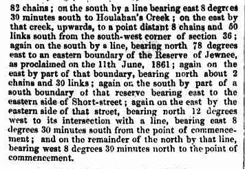
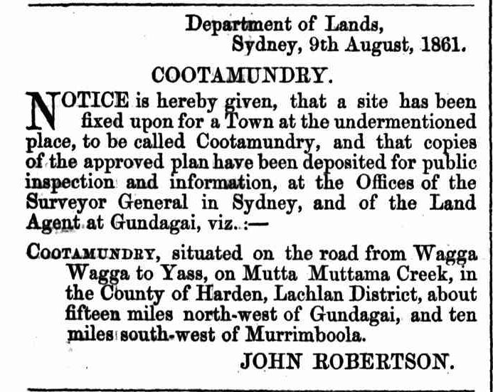
The township of Cootamundry was gazetted on the 9th day of August 1861. Cootamundry was described as “…..situated on the road from Wagga Wagga to Yass, on Mutta Muttama Creek, in the County of Harden, Lachlan District, about fifteen miles north-west of Gundagai, and ten miles south-west of Murrimboola”. (Trove 2026)

Above: from the NSW Govt Gazette, Tue 13 Aug 1861. Image c/o Trove

In early 1862, the first settlers purchased their lots. The town was established due to those attracted by the gold rush activity of the 1860s at the nearby Muttama goldfields. Muttama is about 24 km south of Cootamundra and is an Aboriginal word meaning ‘like it’ or ‘take it’. (Wikipedia 2021) (Wikipedia 2025)

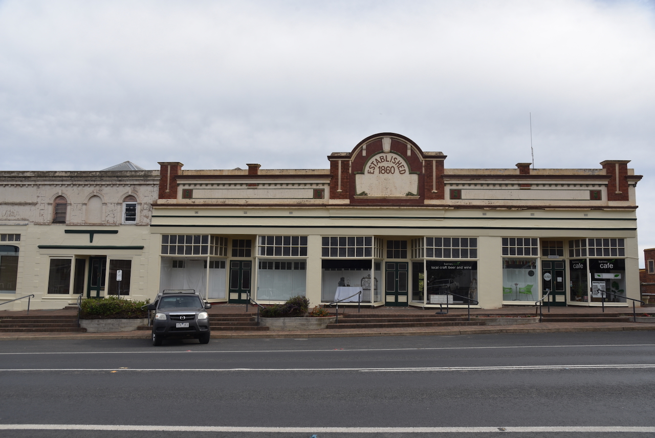
By 1879, Cootamundra had several stores, business premises, hotels, churches, a courthouse, police barracks and private residences. The Cootamundra Herald in 1879 described Cootamundra as follows:

“Cootamundra is really a natty little town, one of the best places in the colony, sheltering a real go-ahead die-hard community. who deserve great credit for the energy and determination with which they drive their town along.” (Trove 2026)

In 1952, it was decided that the town would solely be known as Cootamundra. Mr Hawkins, the Minister for Lands, made the decision to change the official spelling of Cootamundry to Cootamundra, a spelling adopted as far back as 1885. (Trove 2026)

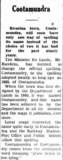
Above: part of an article from The Western Herald, Bourke, Fri 16 May 1952. Image c/o Trove

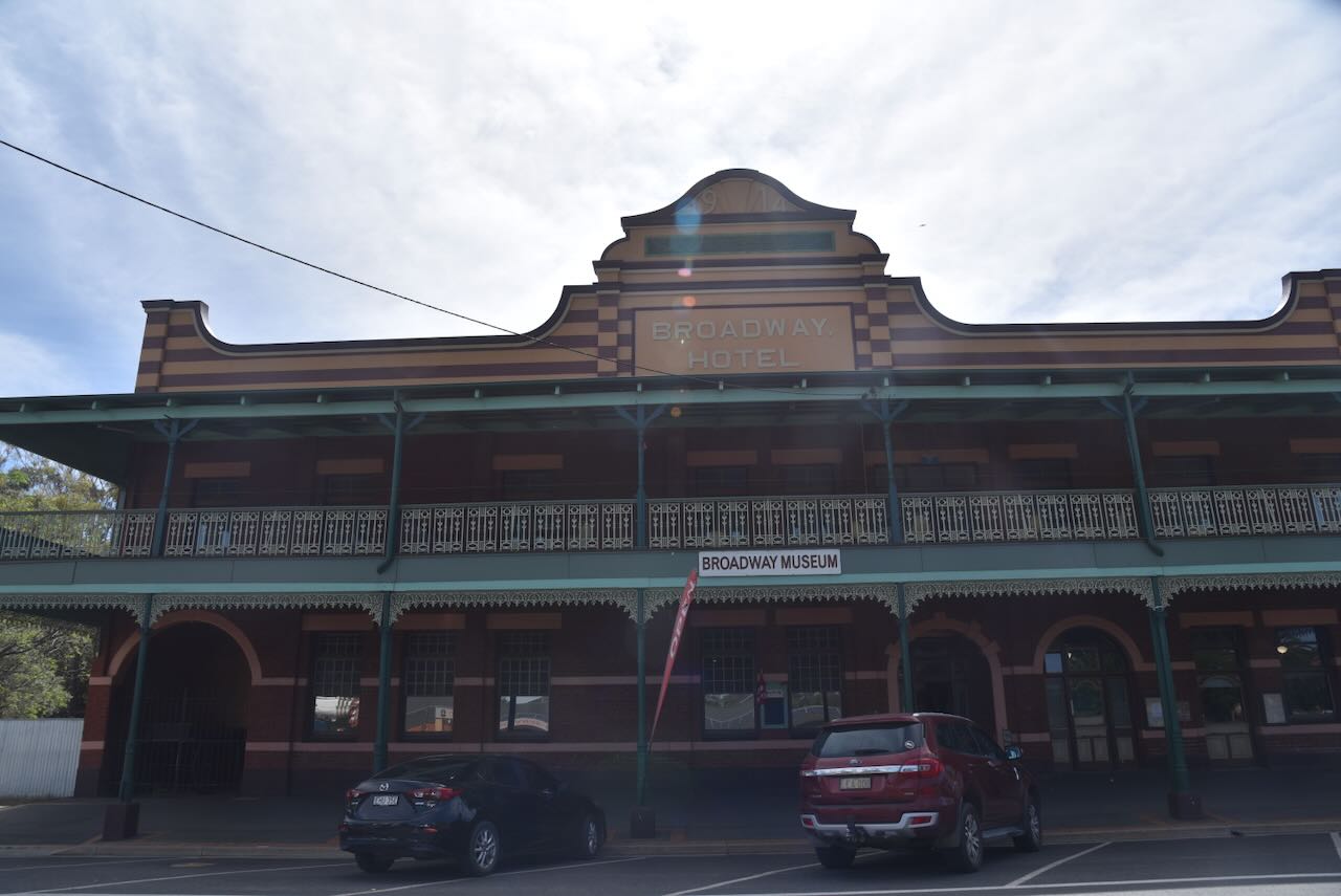
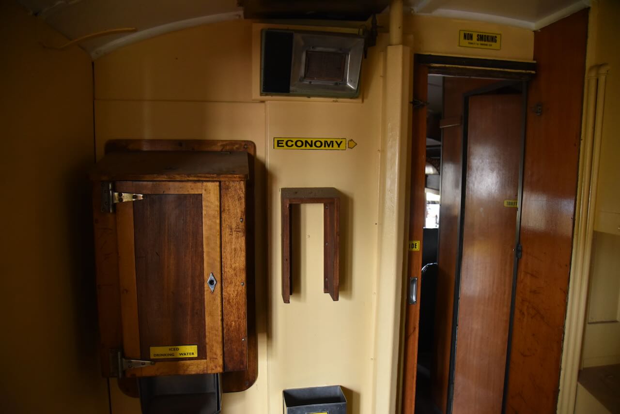
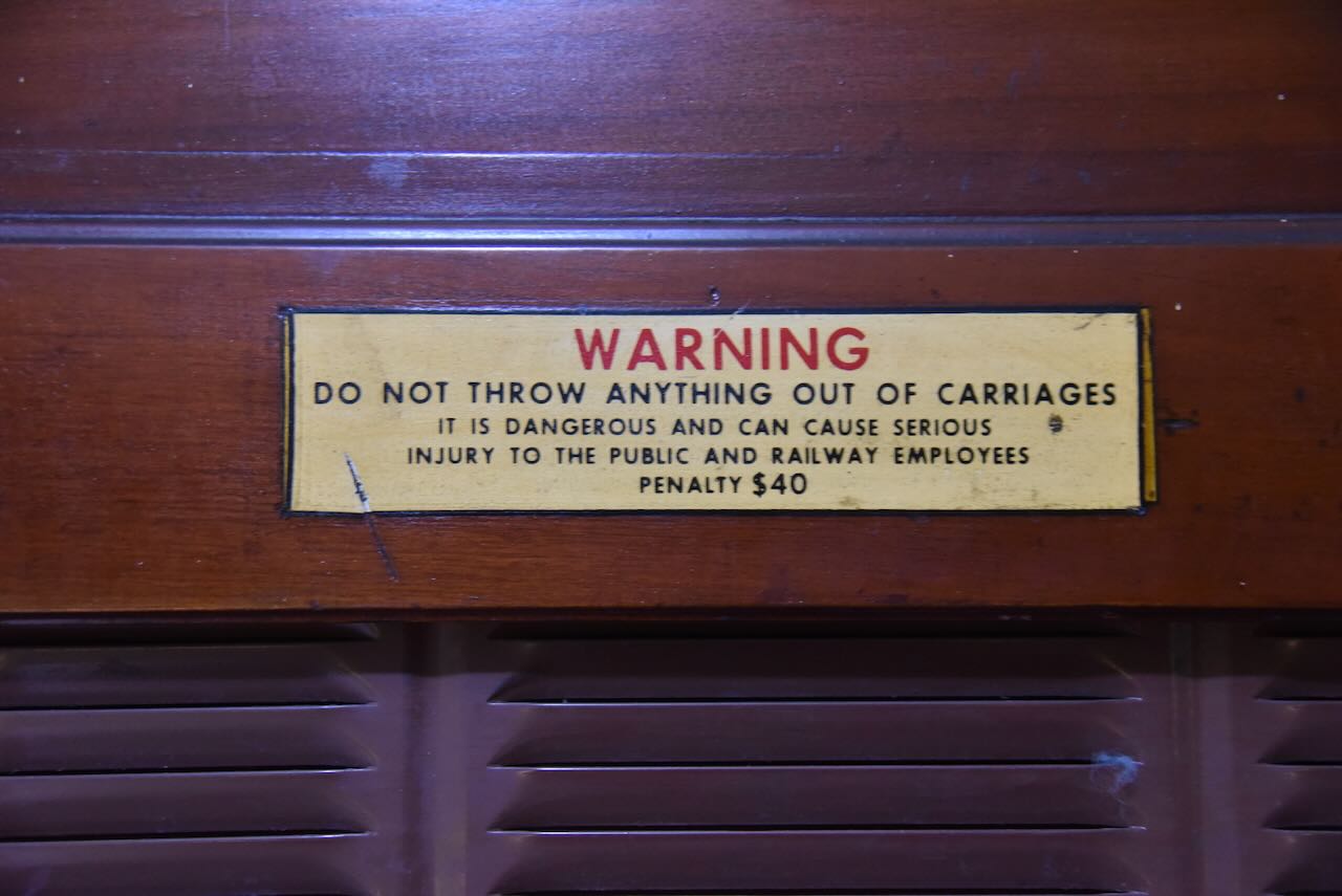
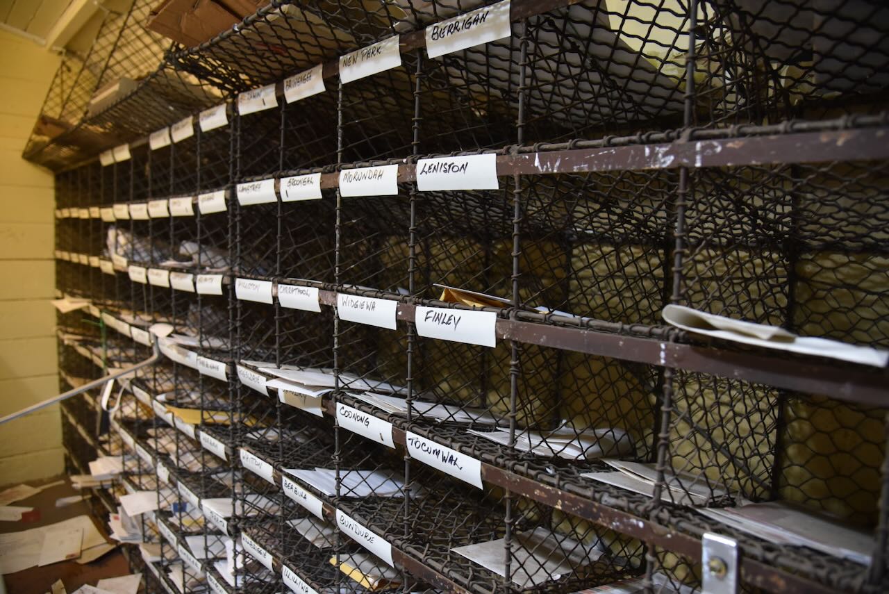
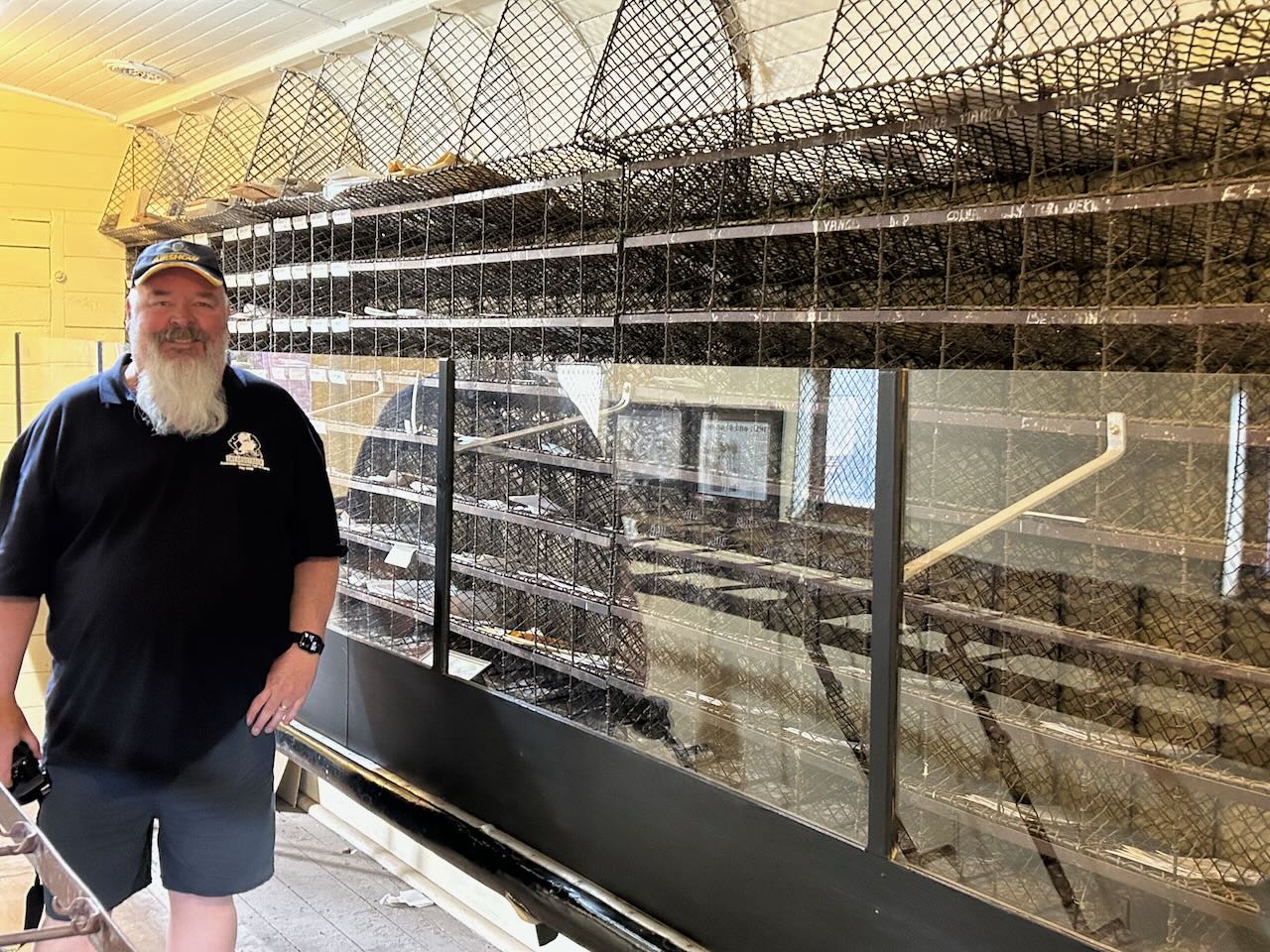
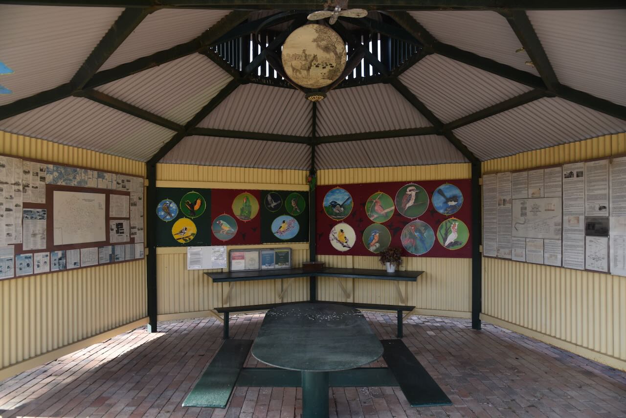
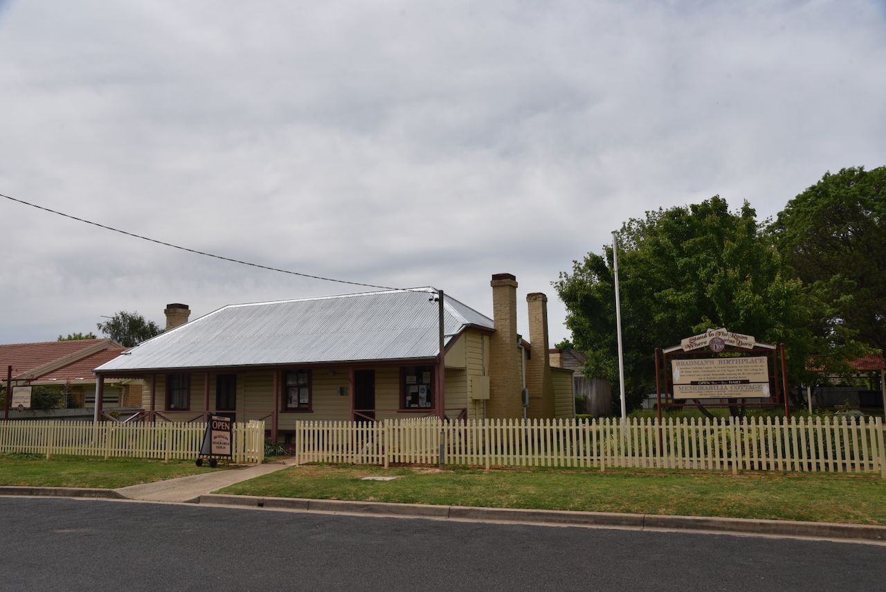
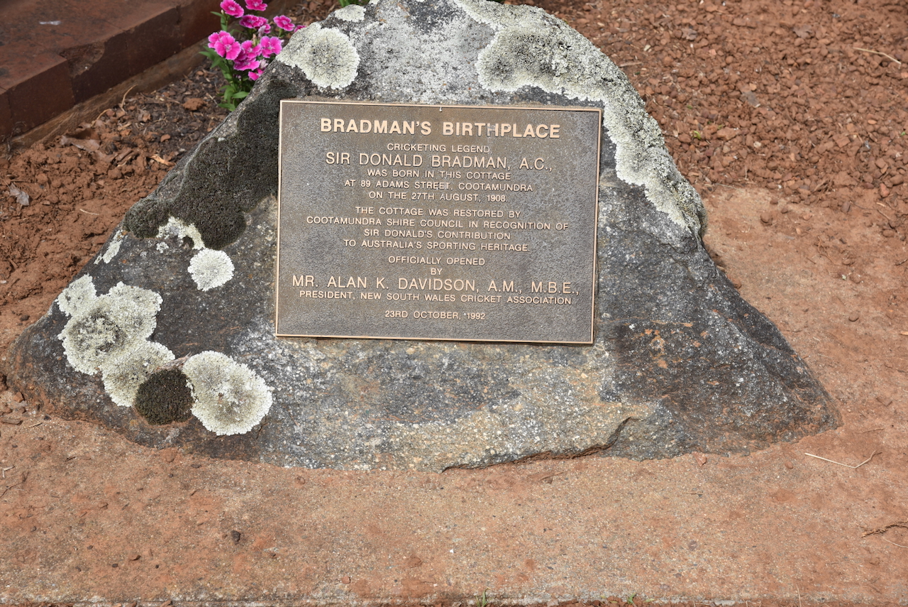
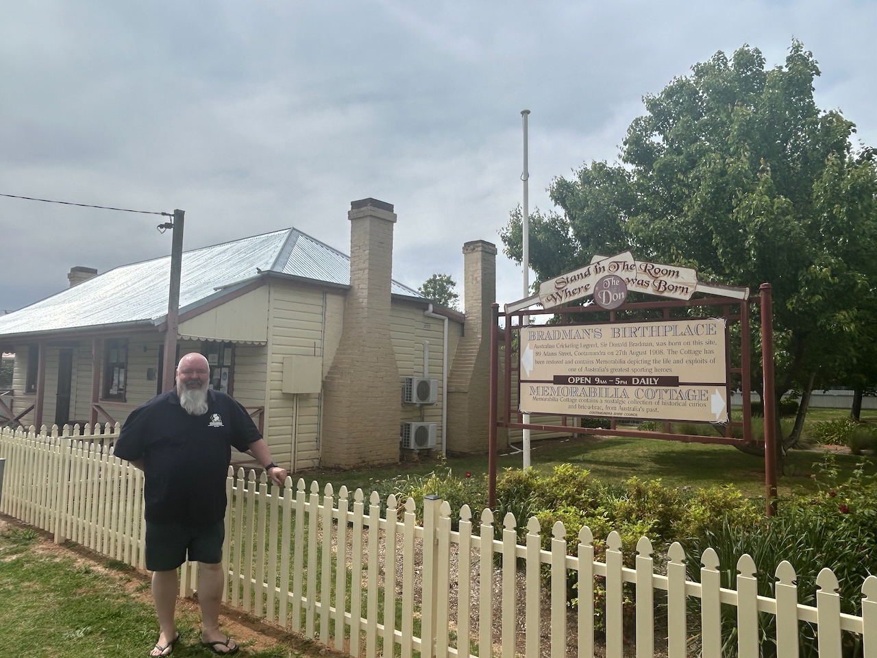
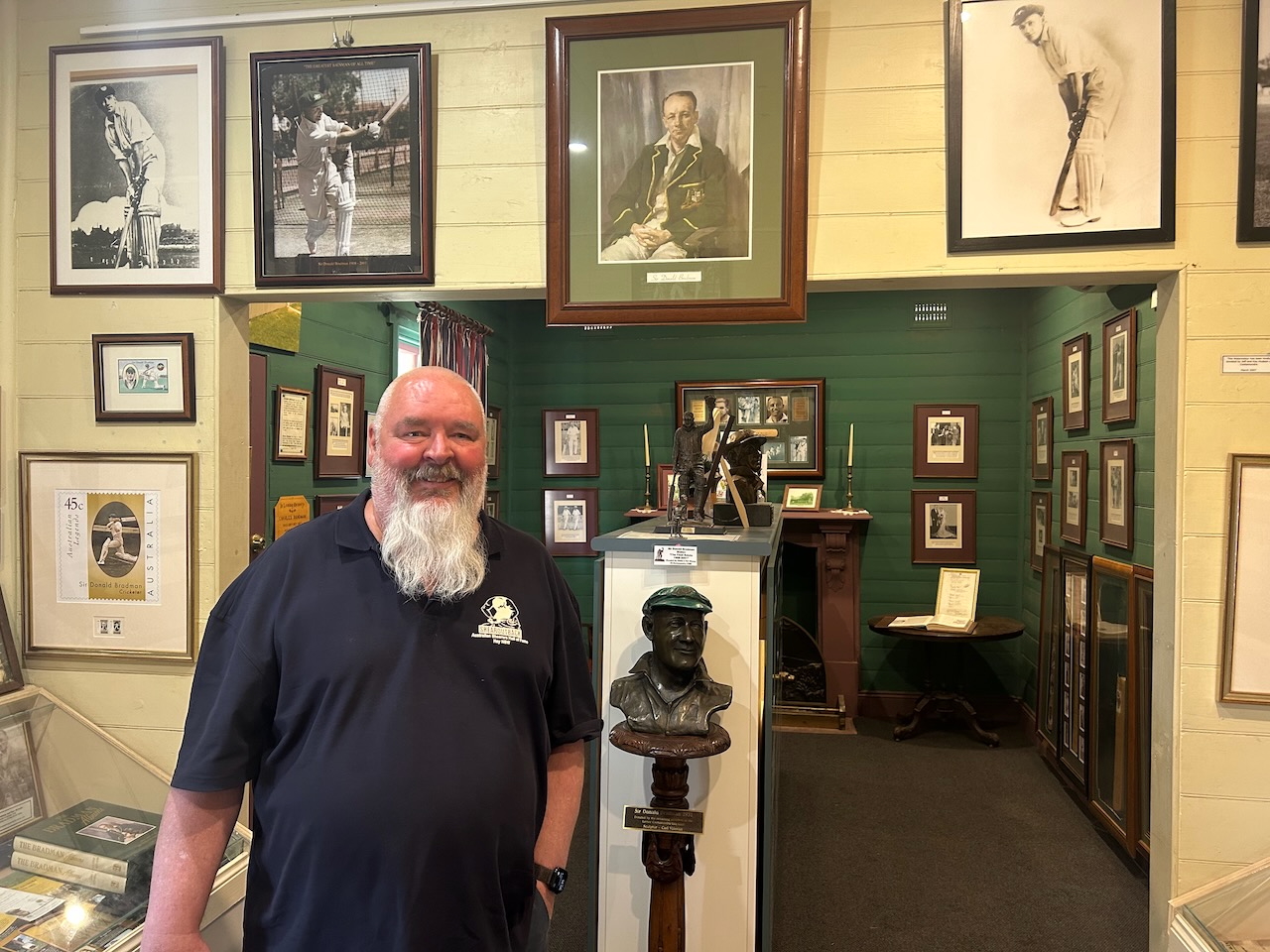
Bradman’s Birthplace Museum is located at 87 Adams Street, Cootamundra. (Service 2023)

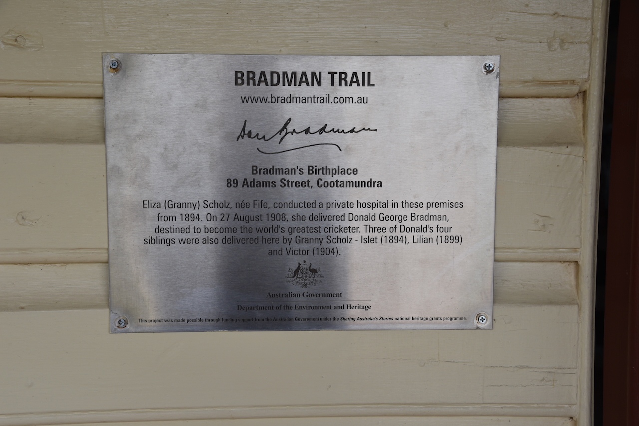
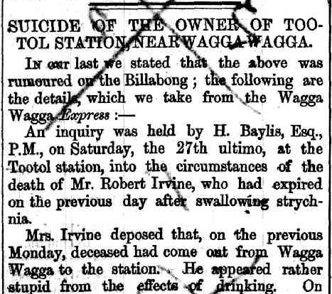
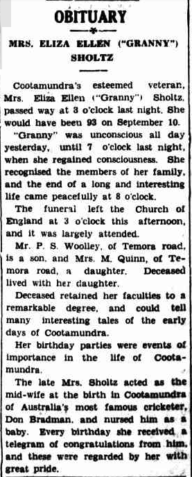
Eliza Ellen ‘Granny’ Fife was born in September 1846 at Drumcullion, Northern Ireland. She arrived in Sydney in November 1865 aboard the Africana. In June 1890, she married John Ergott Scholz, who was a farm labourer at Cootamundra. (ancestry 2016) (Trove 2026)

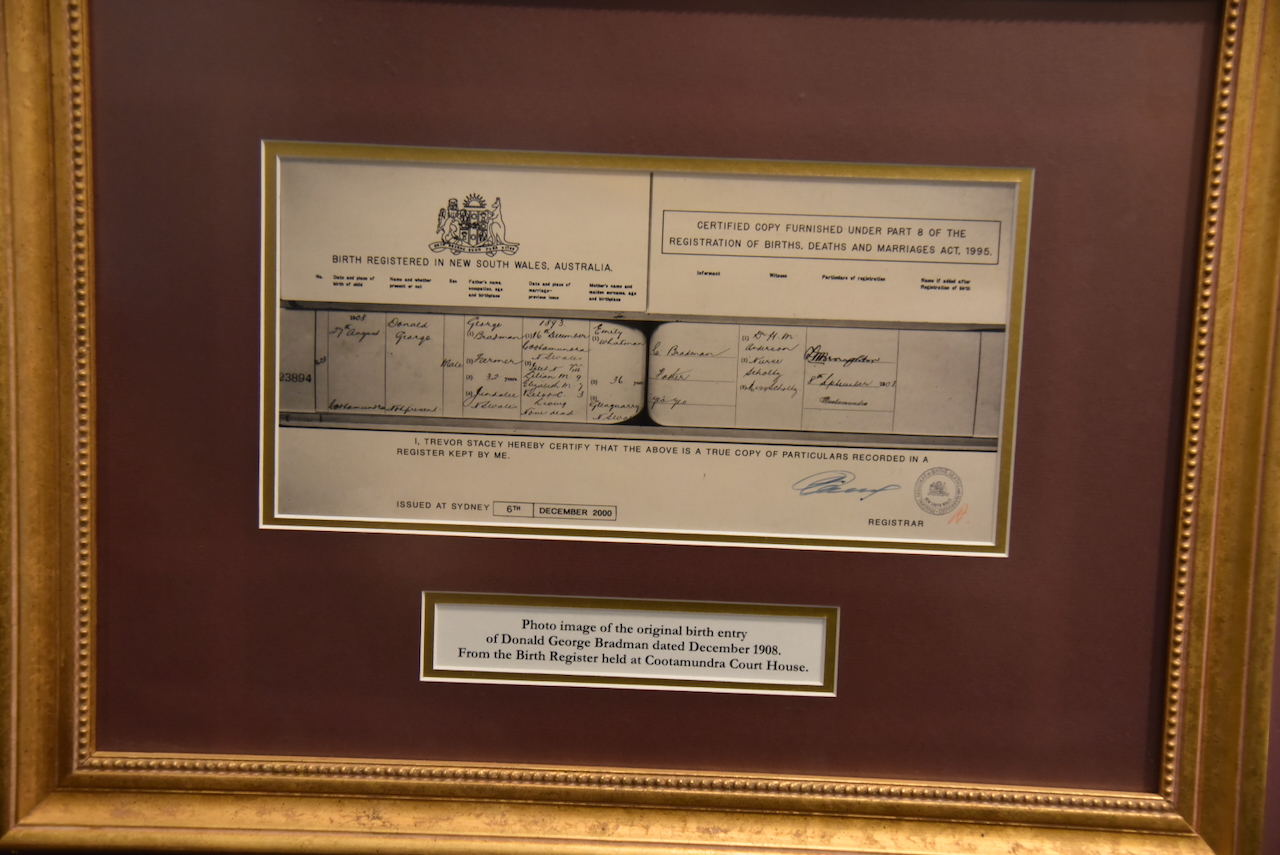
Eliza was a midwife and ran a small hospital called Irena, contained in a small wooden cottage. On the 27th day of August 1908, at Irena, she delivered a young baby named Donald George Bradman, who would become Australia’s most famous cricket player. (Trove 2026) (Wikitree 2025)

Each birthday, Eliza would receive a telegram of congratulations from Bradman. Eliza died in August 1939, at Cootamundra. She was 92 years old. (Trove 2026)

Above: article from the Cootamundra Herald, Thu 3 Aug 1939. Image c/o Trove

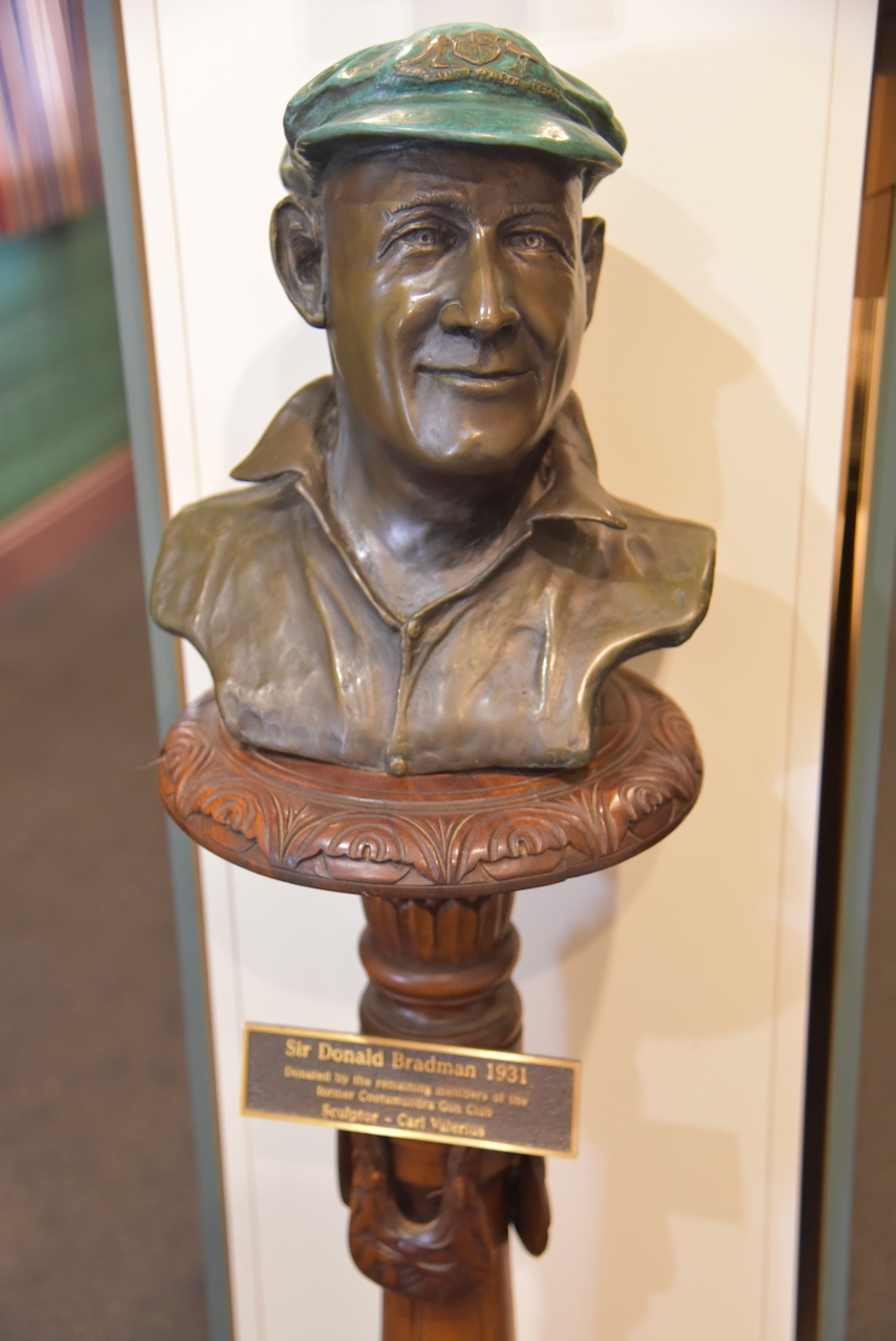
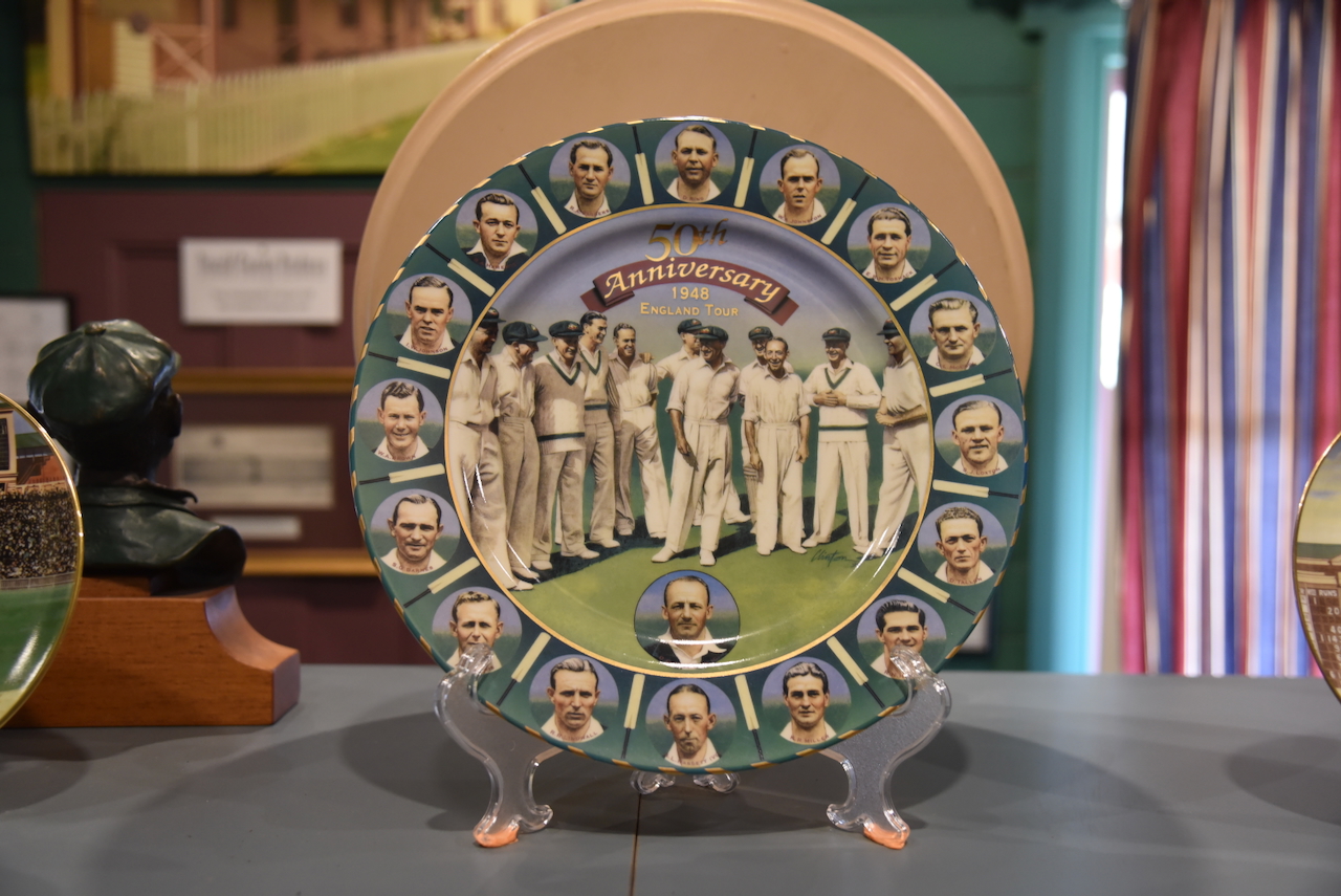
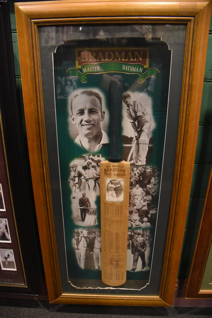
Sir Donald George Bradman, known as ‘The Don’, is widely acknowledged as the greatest batsman of all time in the sport of cricket. Hits Test batting average was 99.94. He died in February 2001 at Kensington Park, South Australia, aged 92 years of age. (Wikipedia 2019)

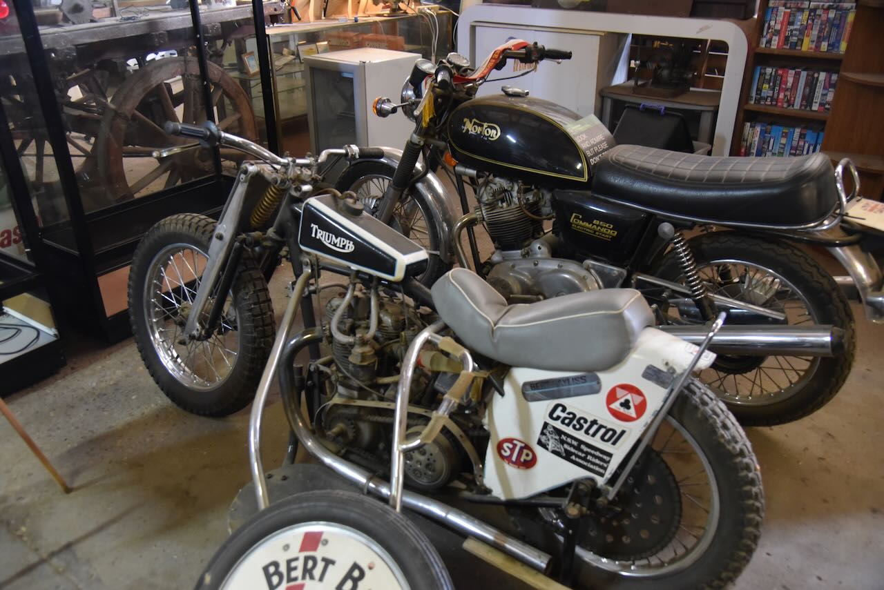
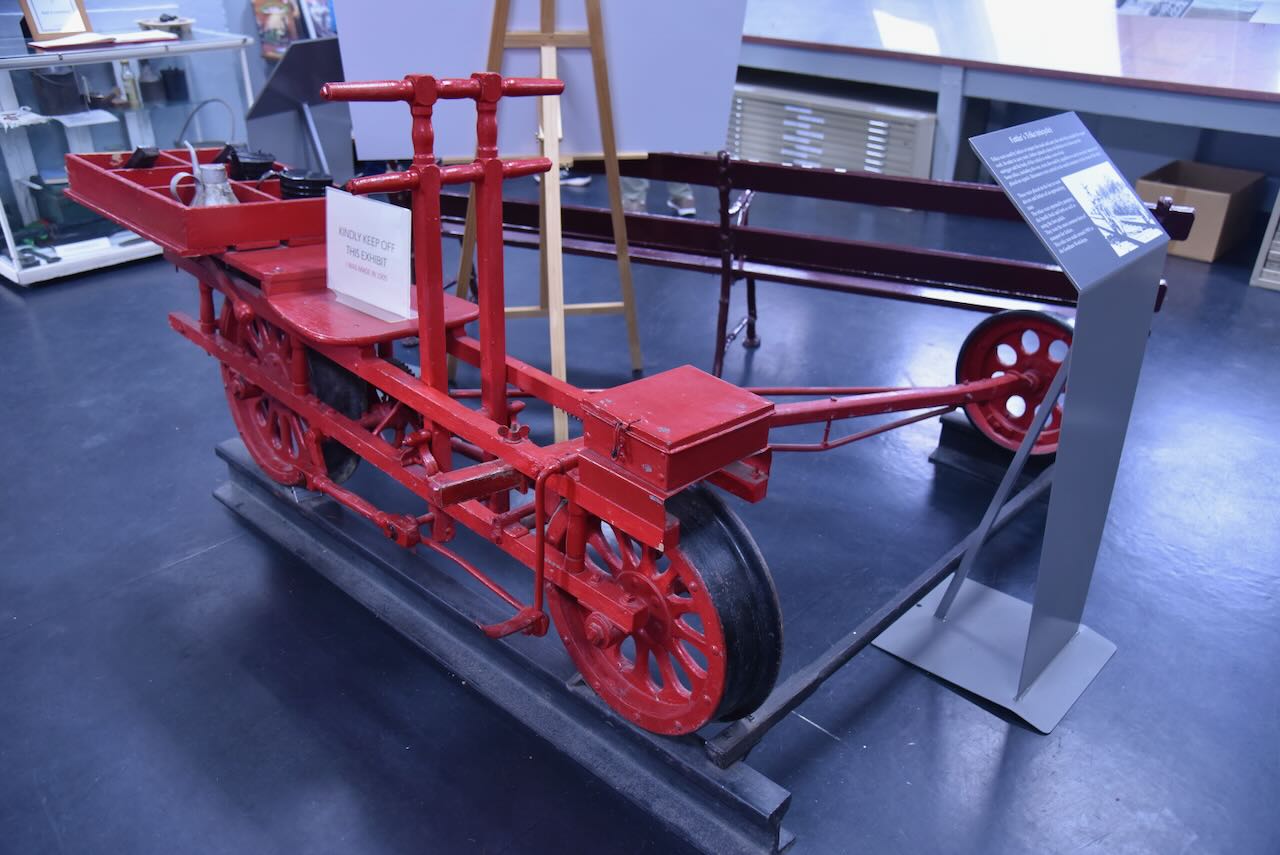
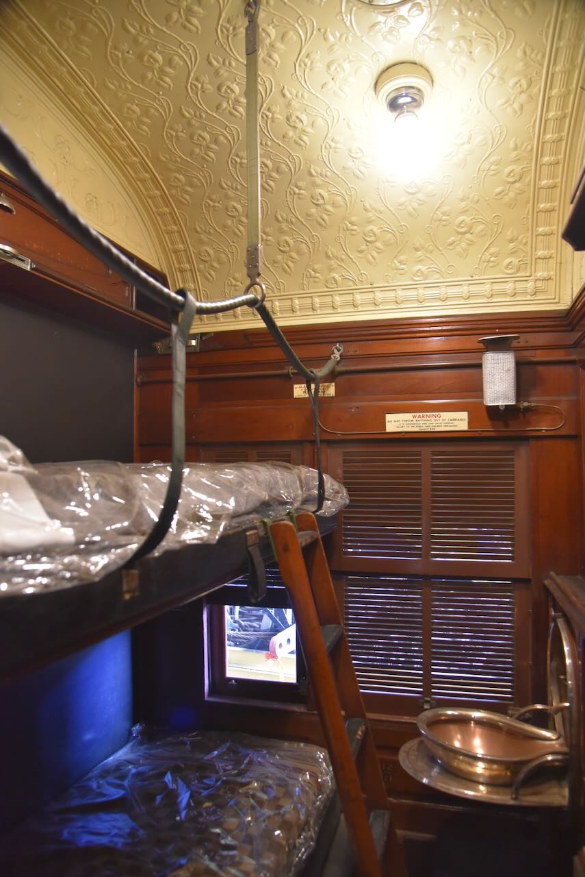
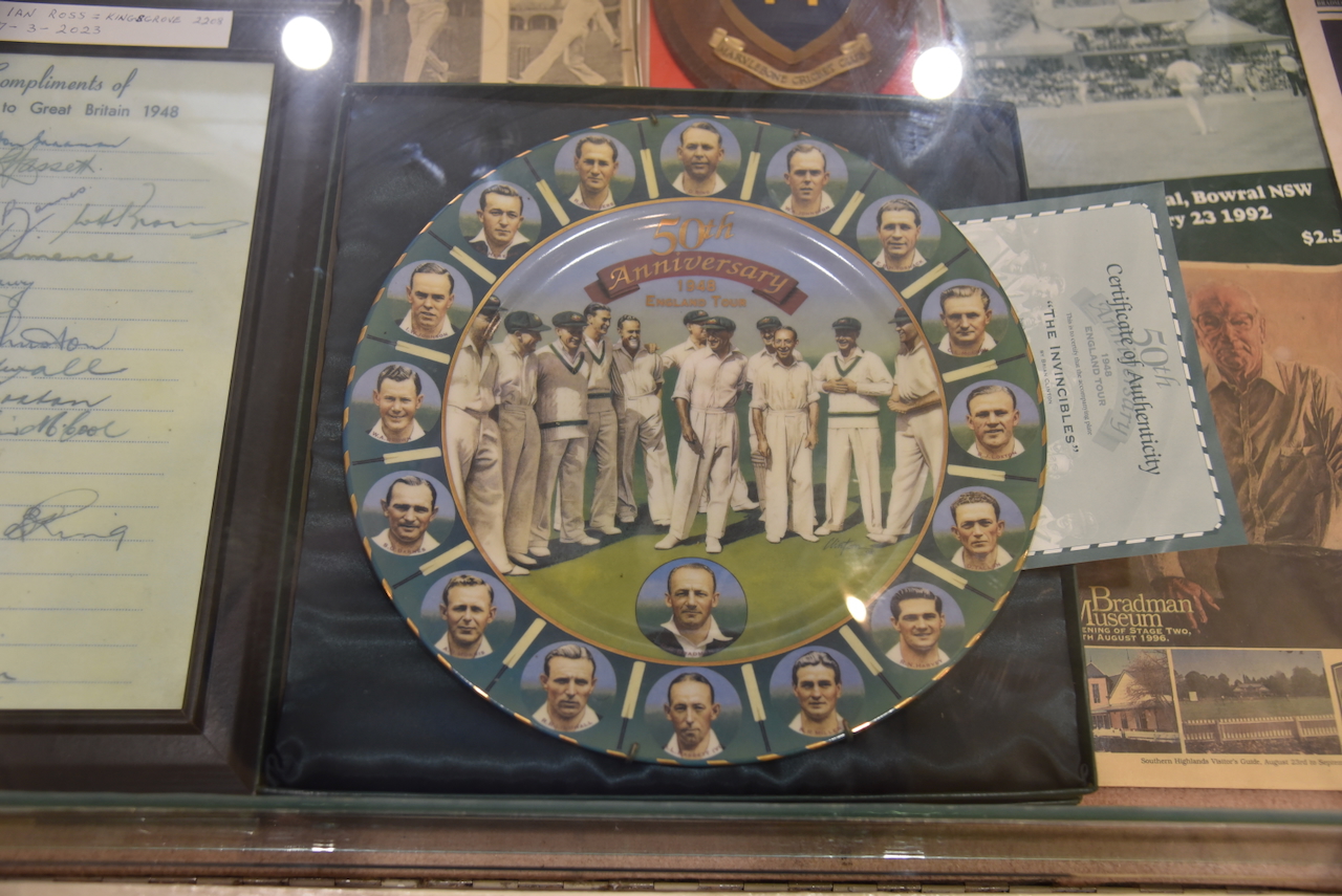
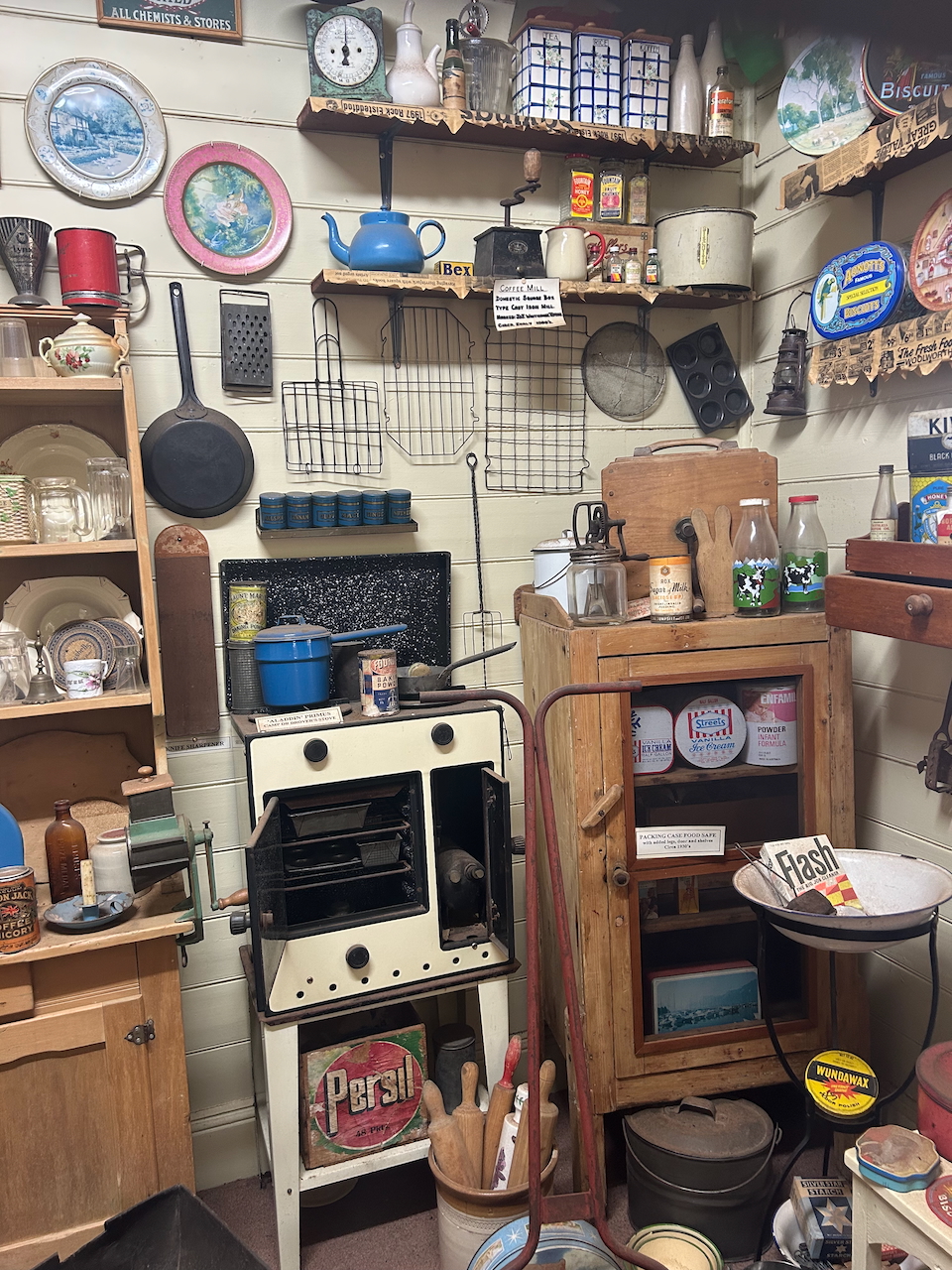
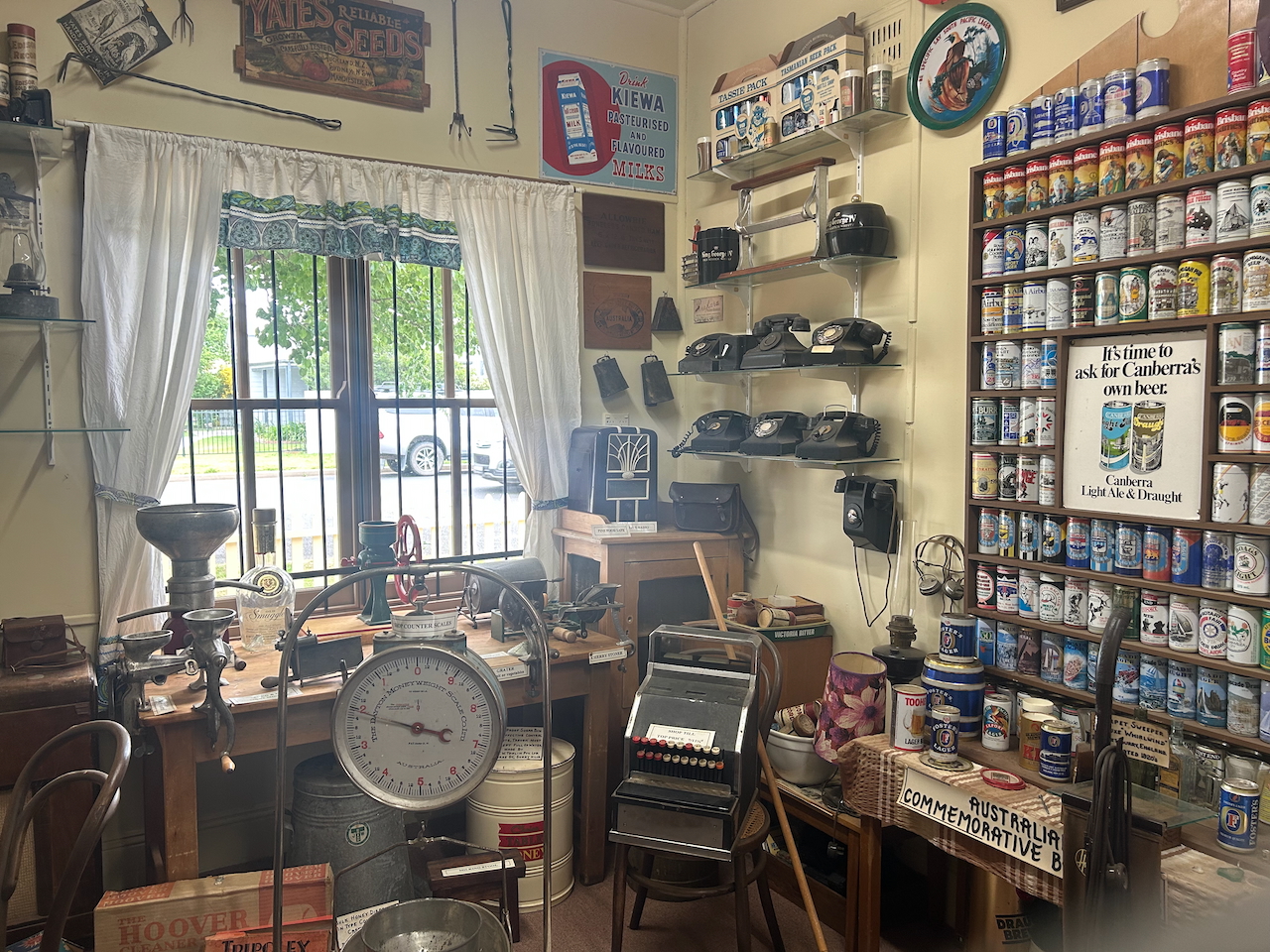
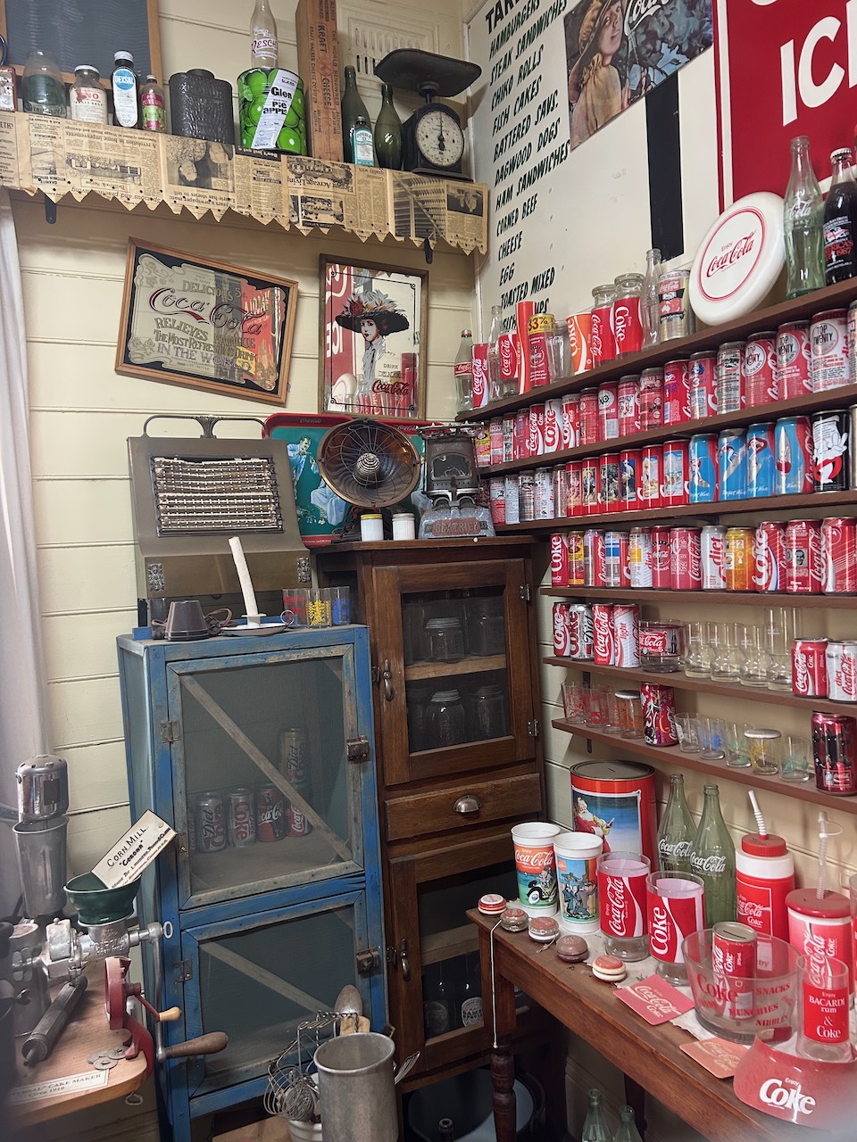
The museum features a magnificent collection of Bradman memorabilia. This includes a cricket bat signed by Bradman and English bowler Harold Larwood from the 1932-33 Test Series known as the ‘Bodyline Series.’ (Service 2023)

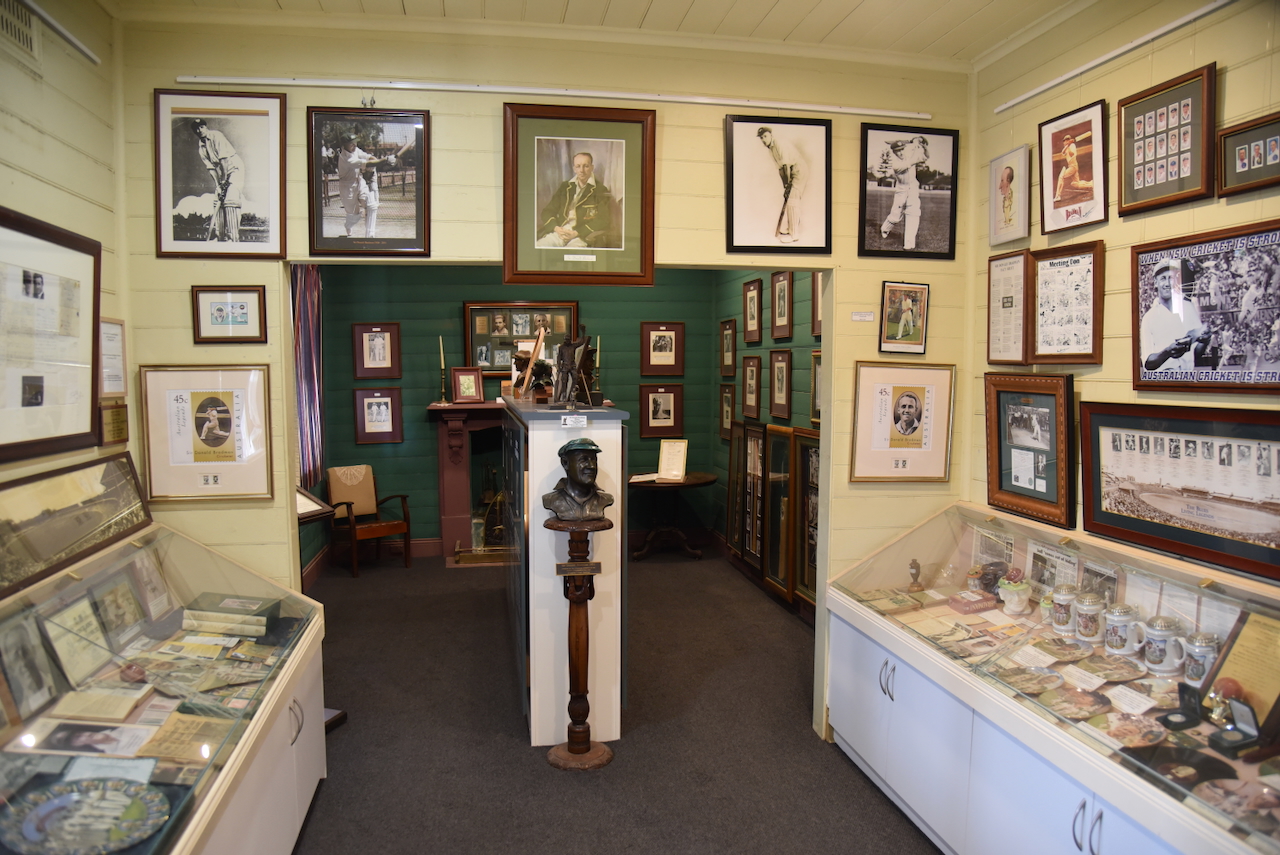
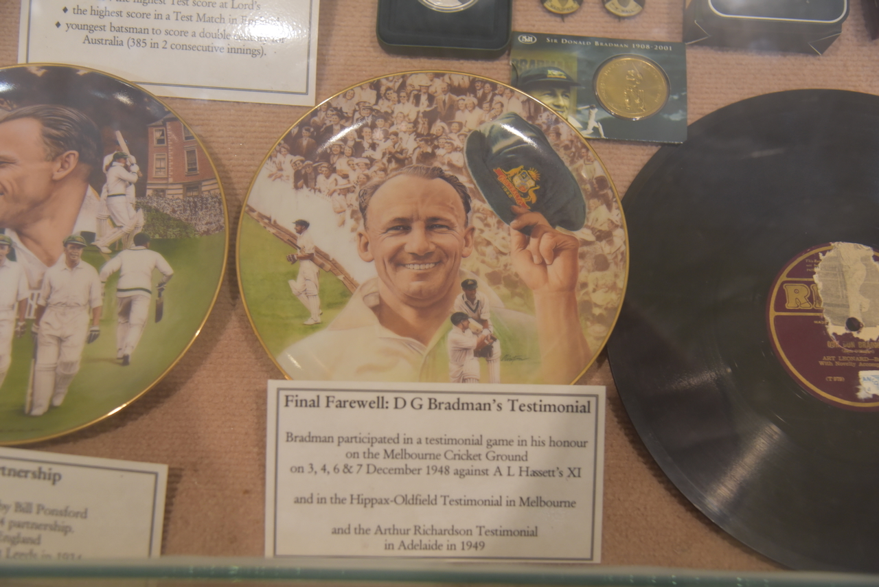
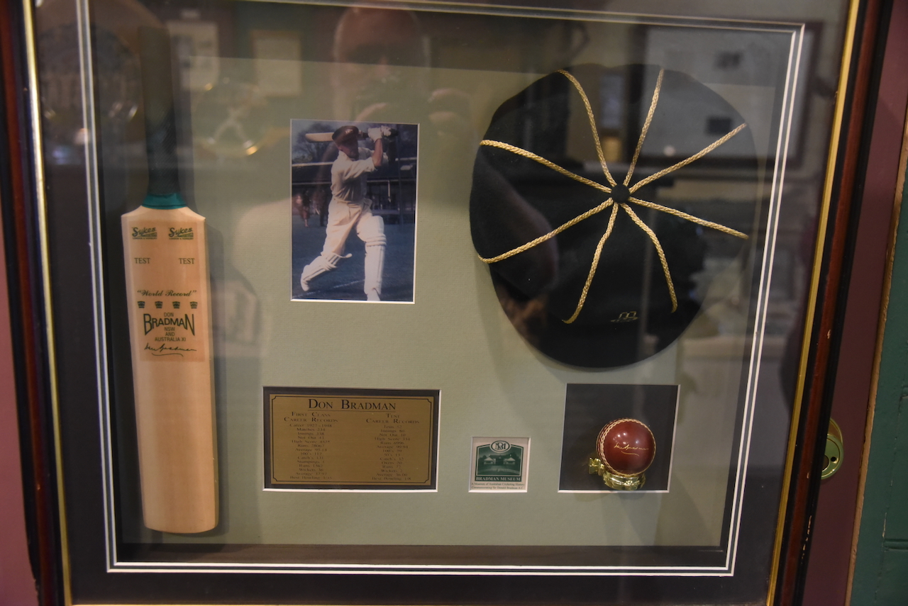
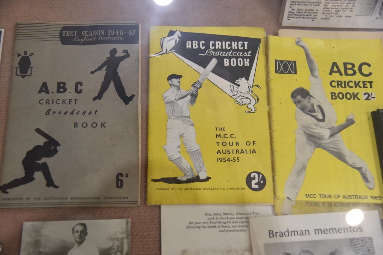
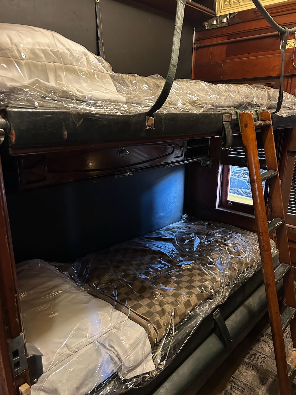
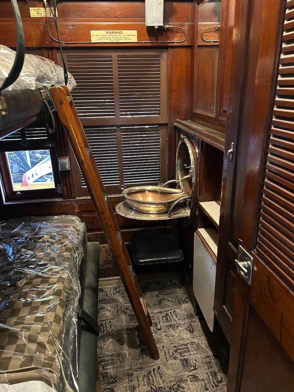
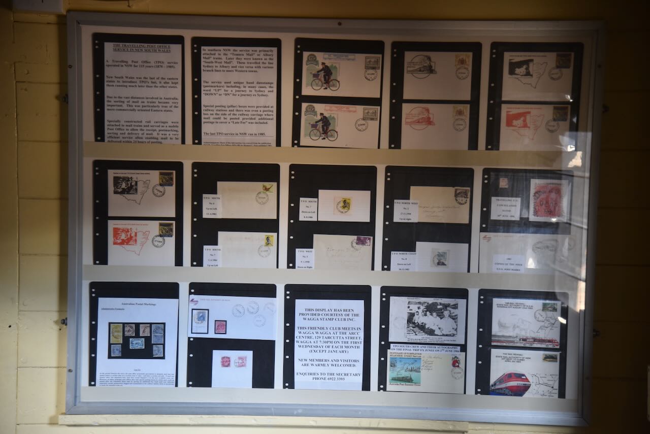
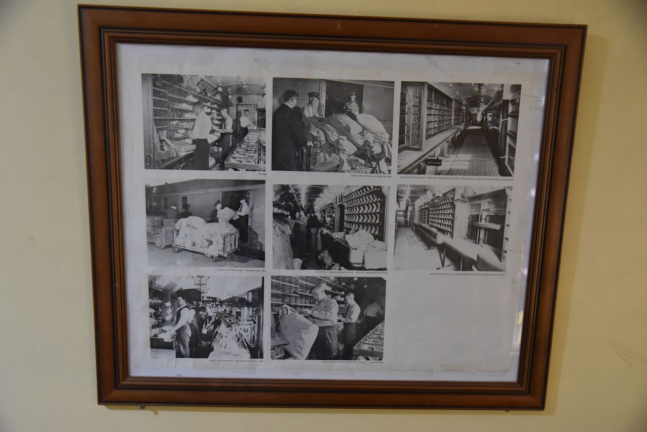
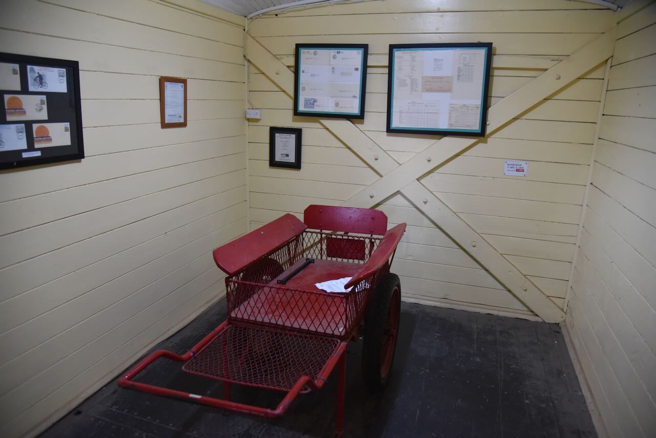
At the rear of the Bradman cottage is the Memorabilia Cottage. It features a magnificent collection of Australian memorabilia, curios and bric-a-brac from the era of Don Bradman’s birth. (Service 2023)

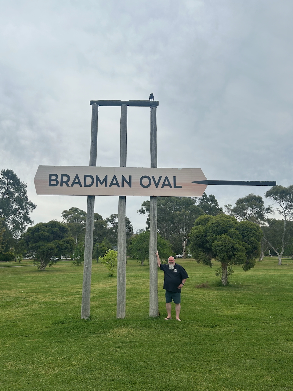
After a very interesting visit to the Bradman museum, Marija and I headed to the Bradman Oval at Cootamundra to view “The Big Stumps.” The stumps stand eight metres tall.

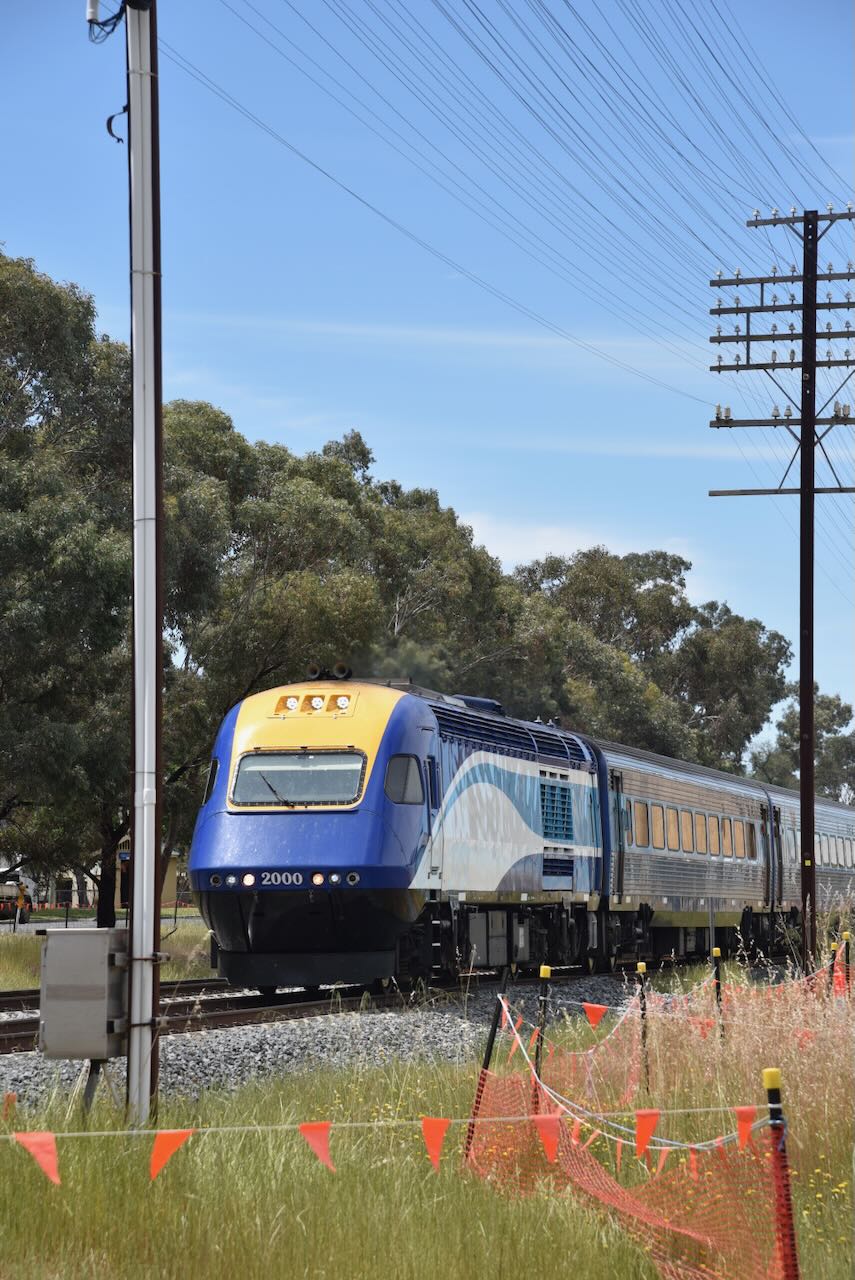
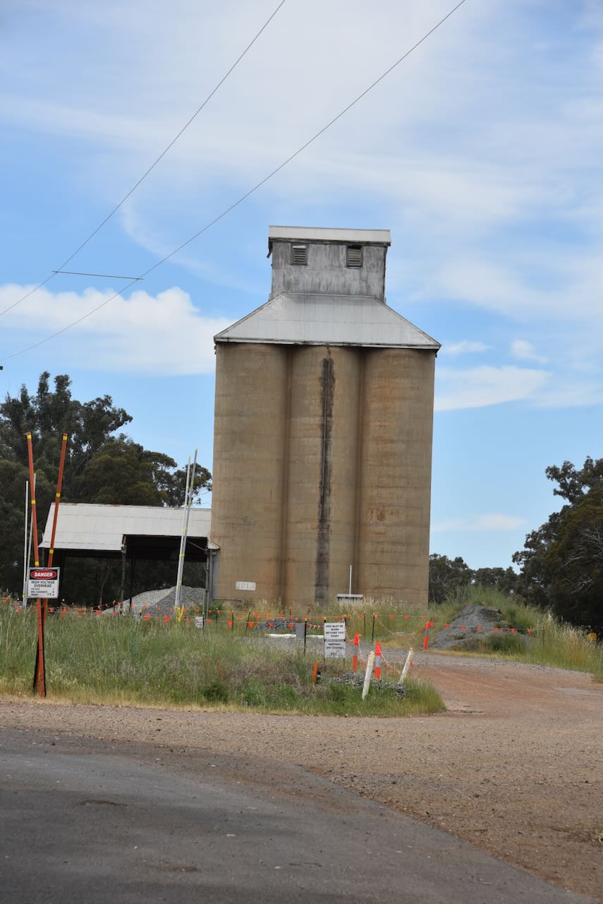
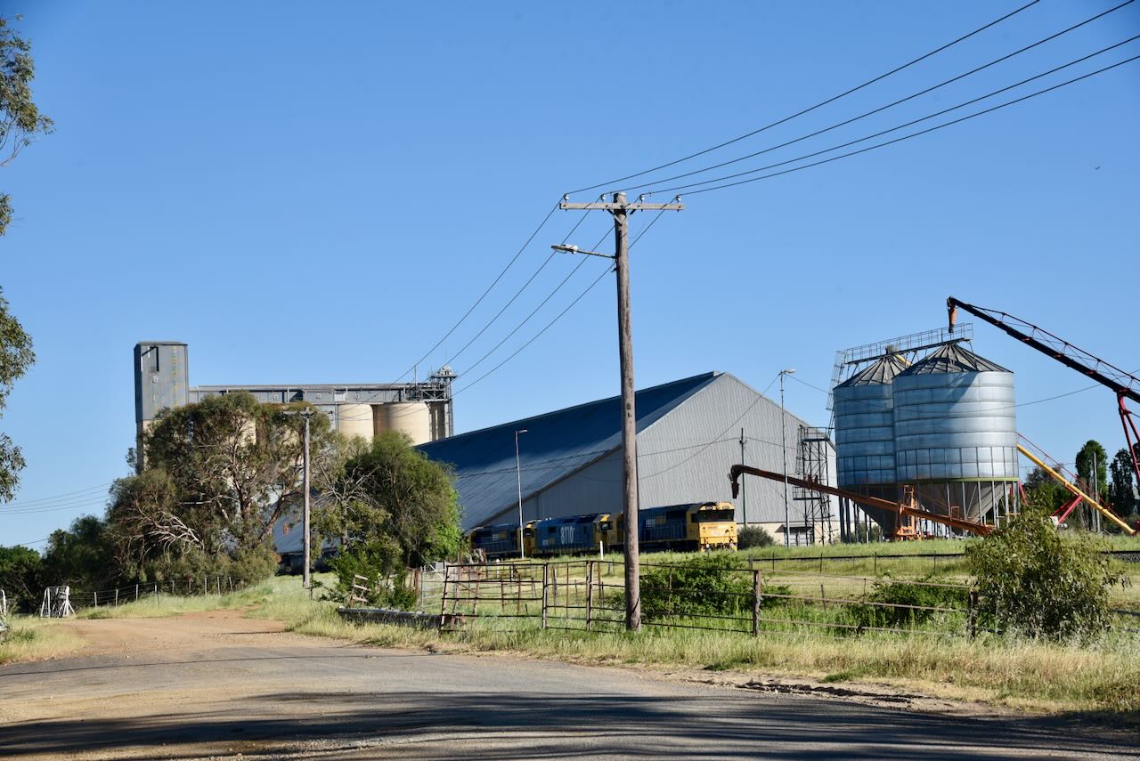
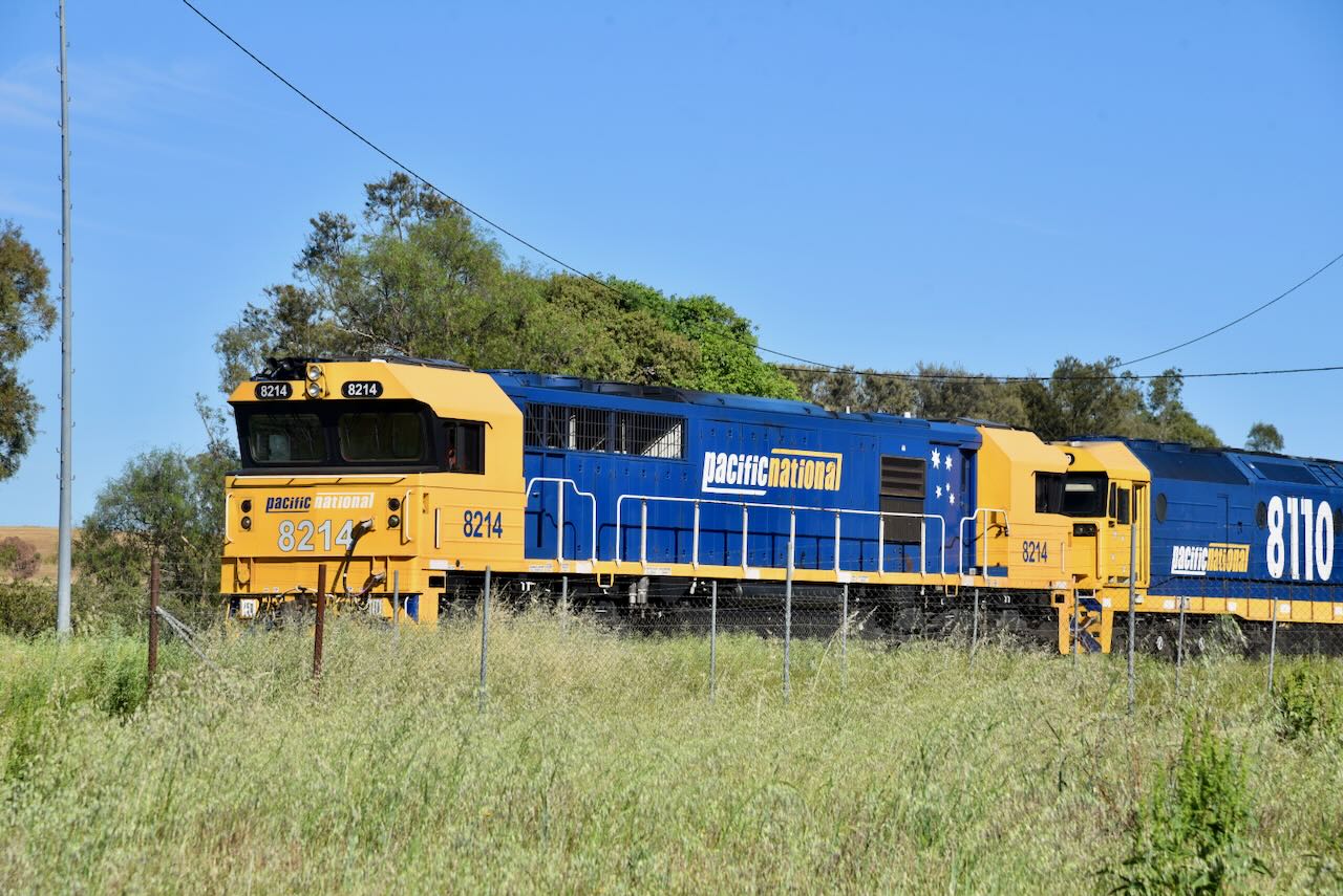
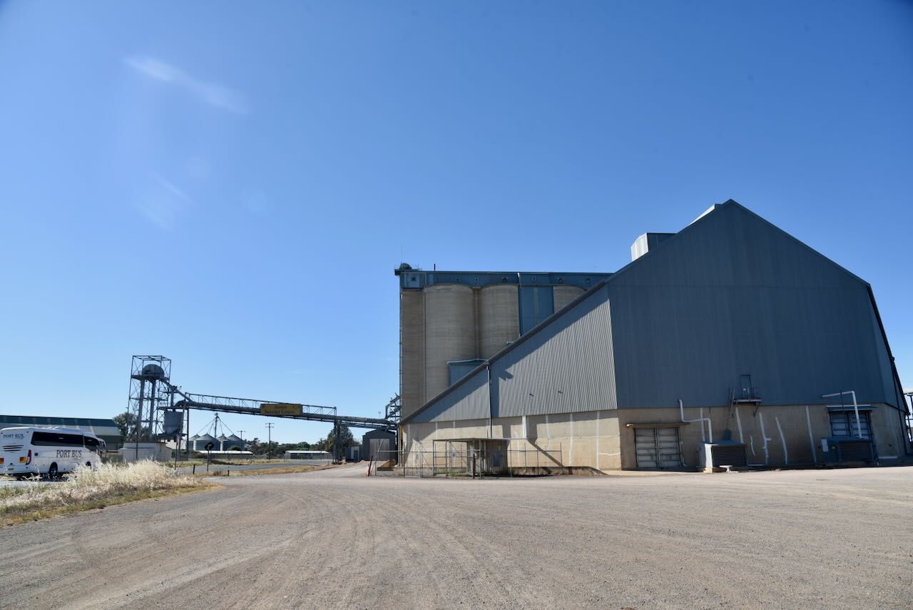
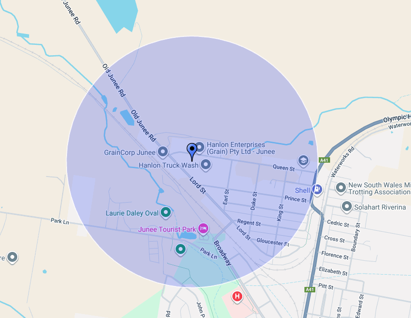
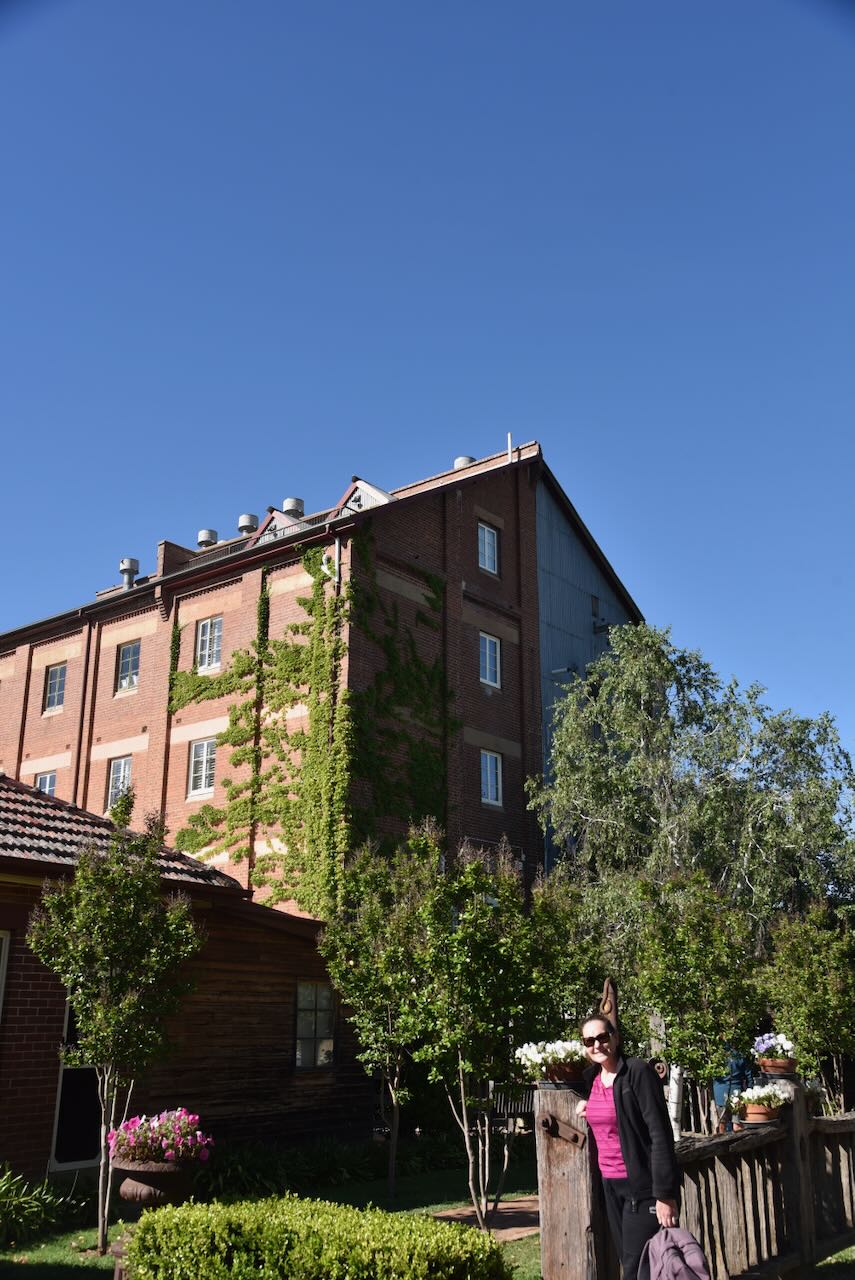
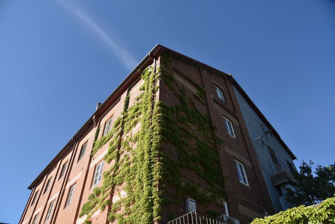
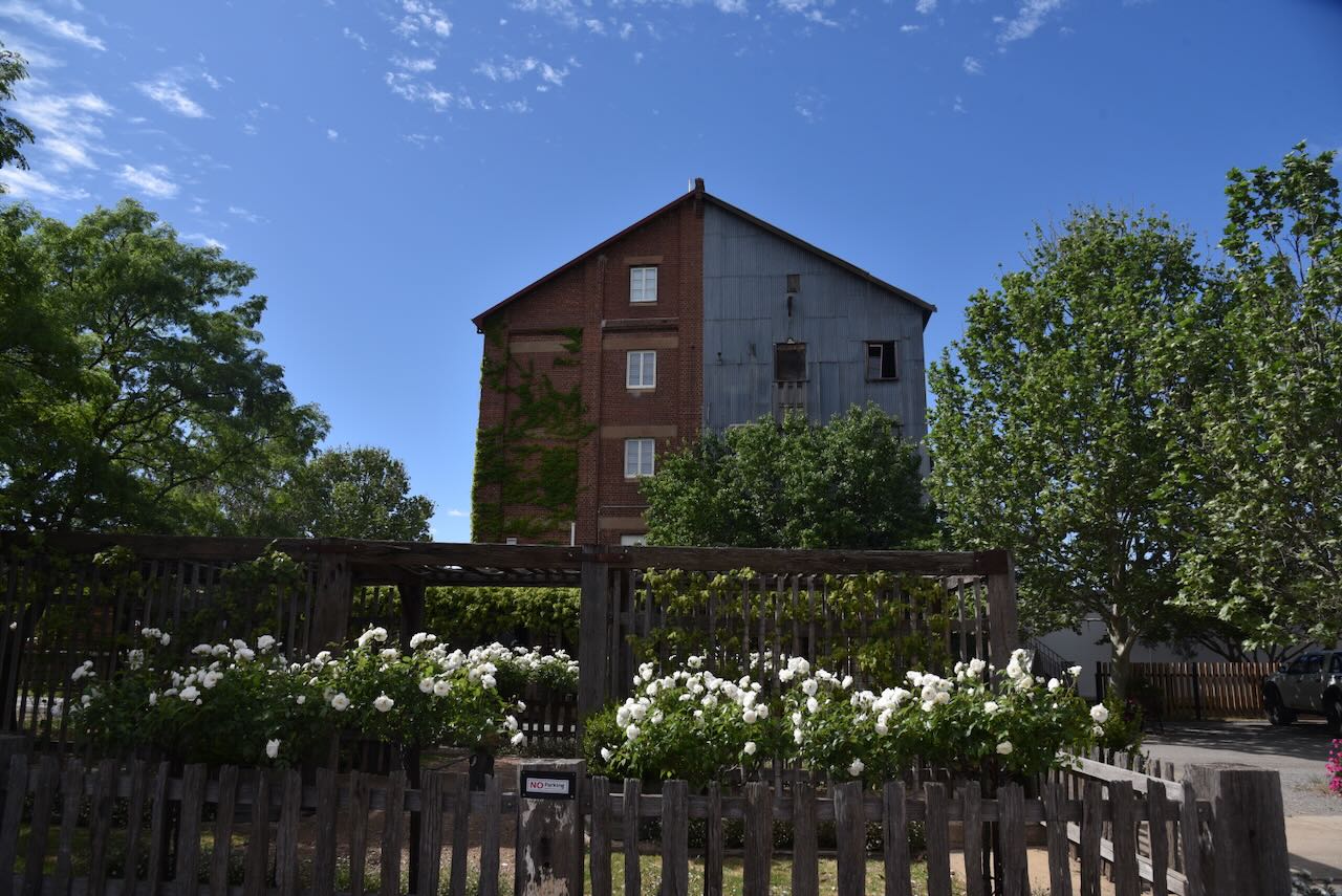
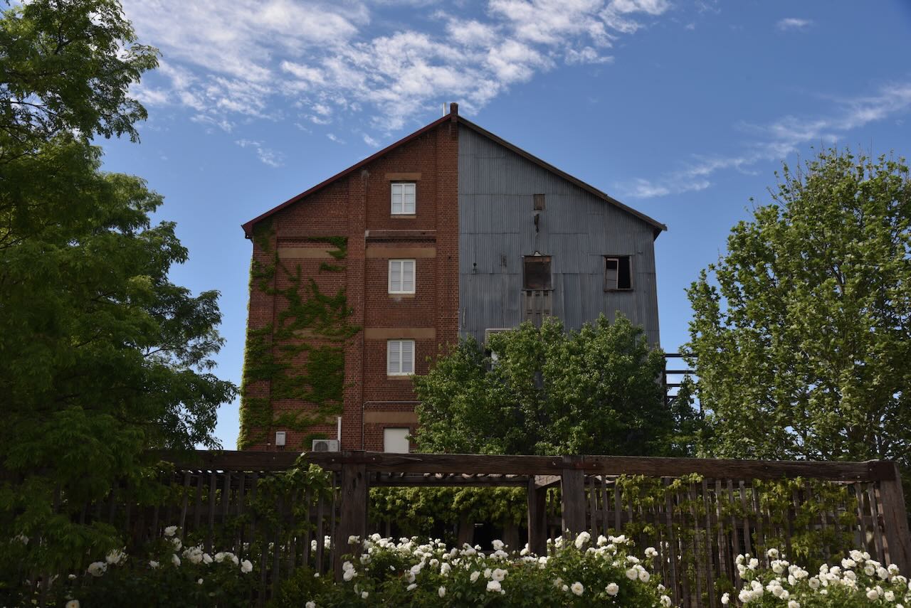
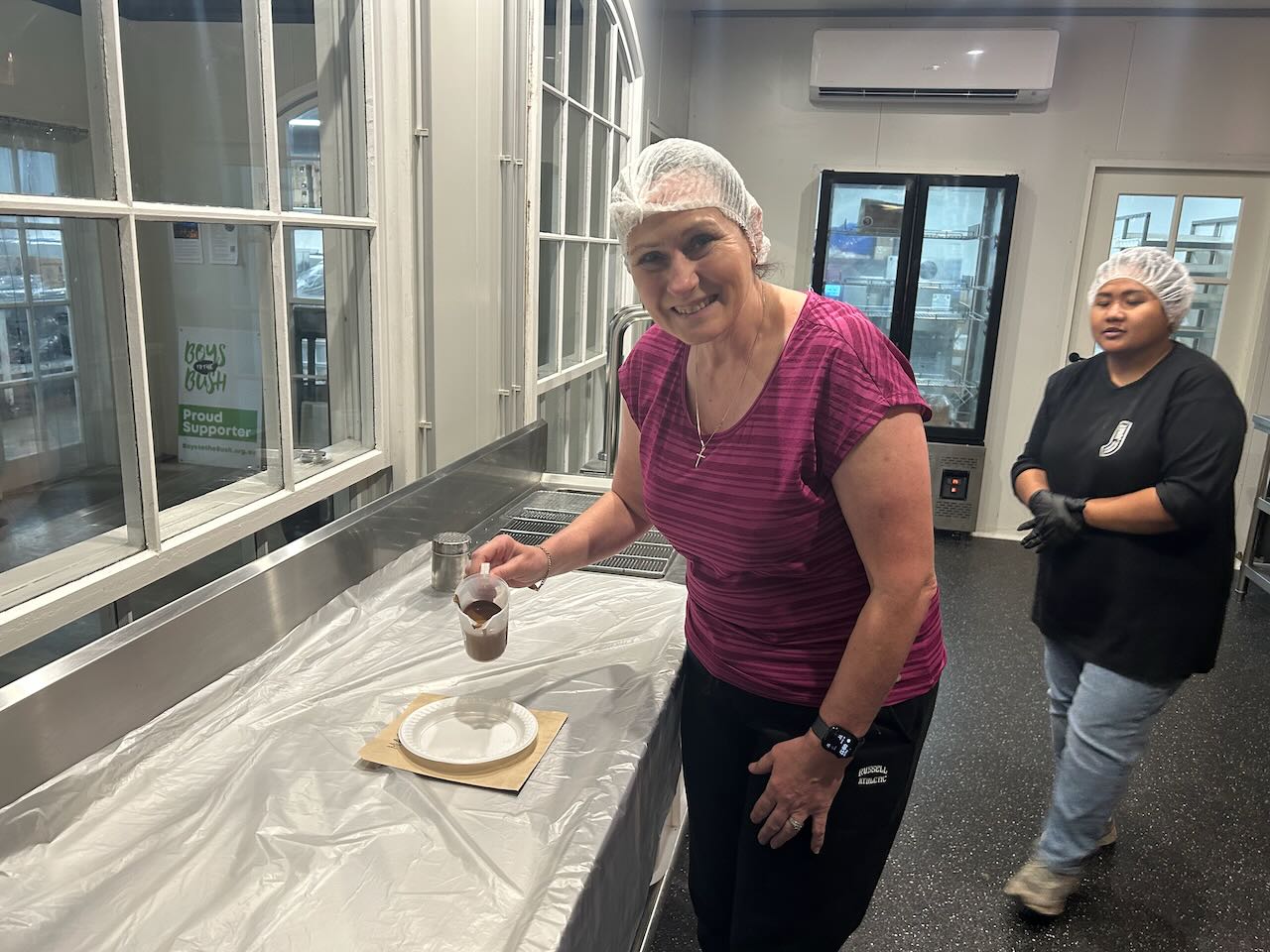
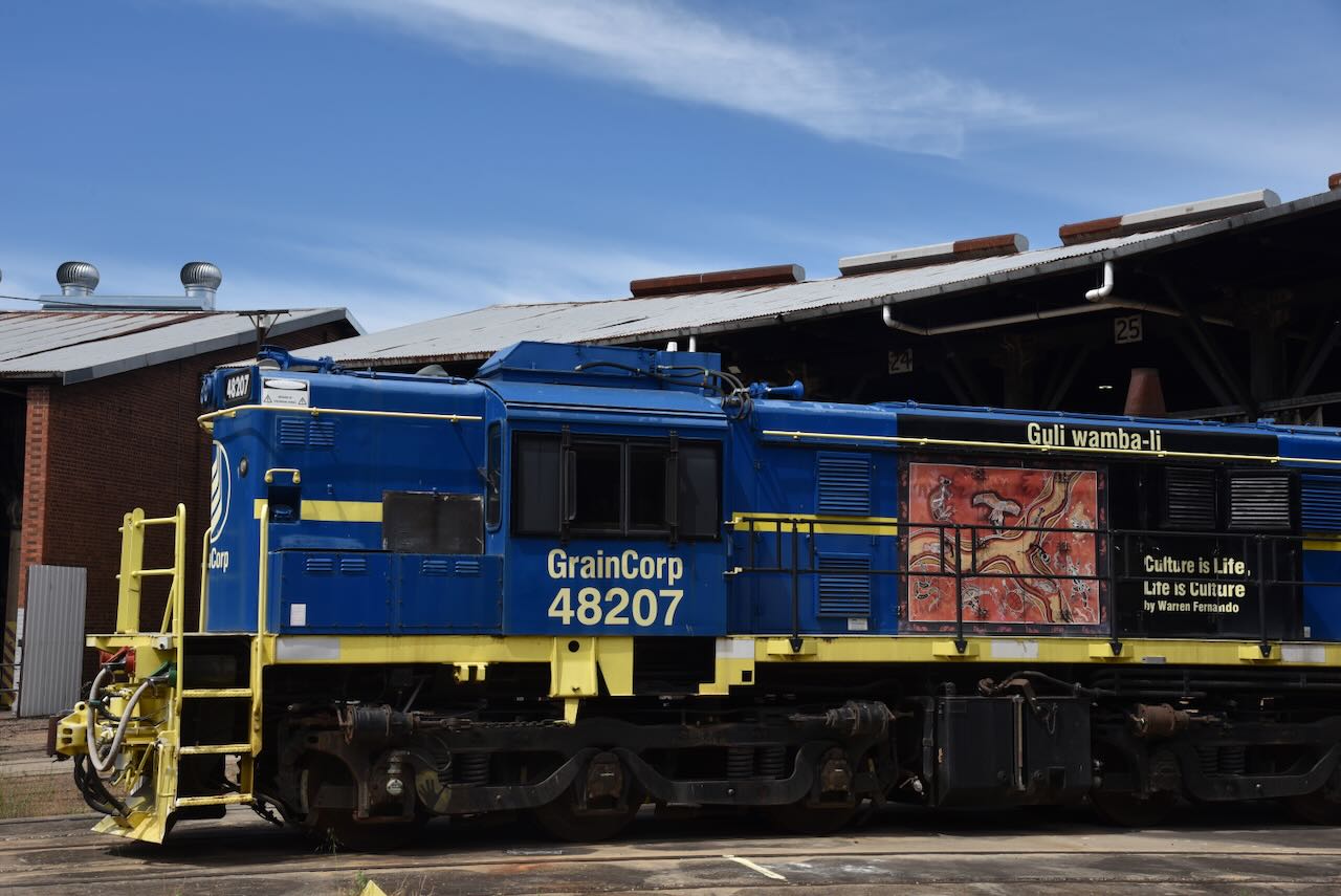
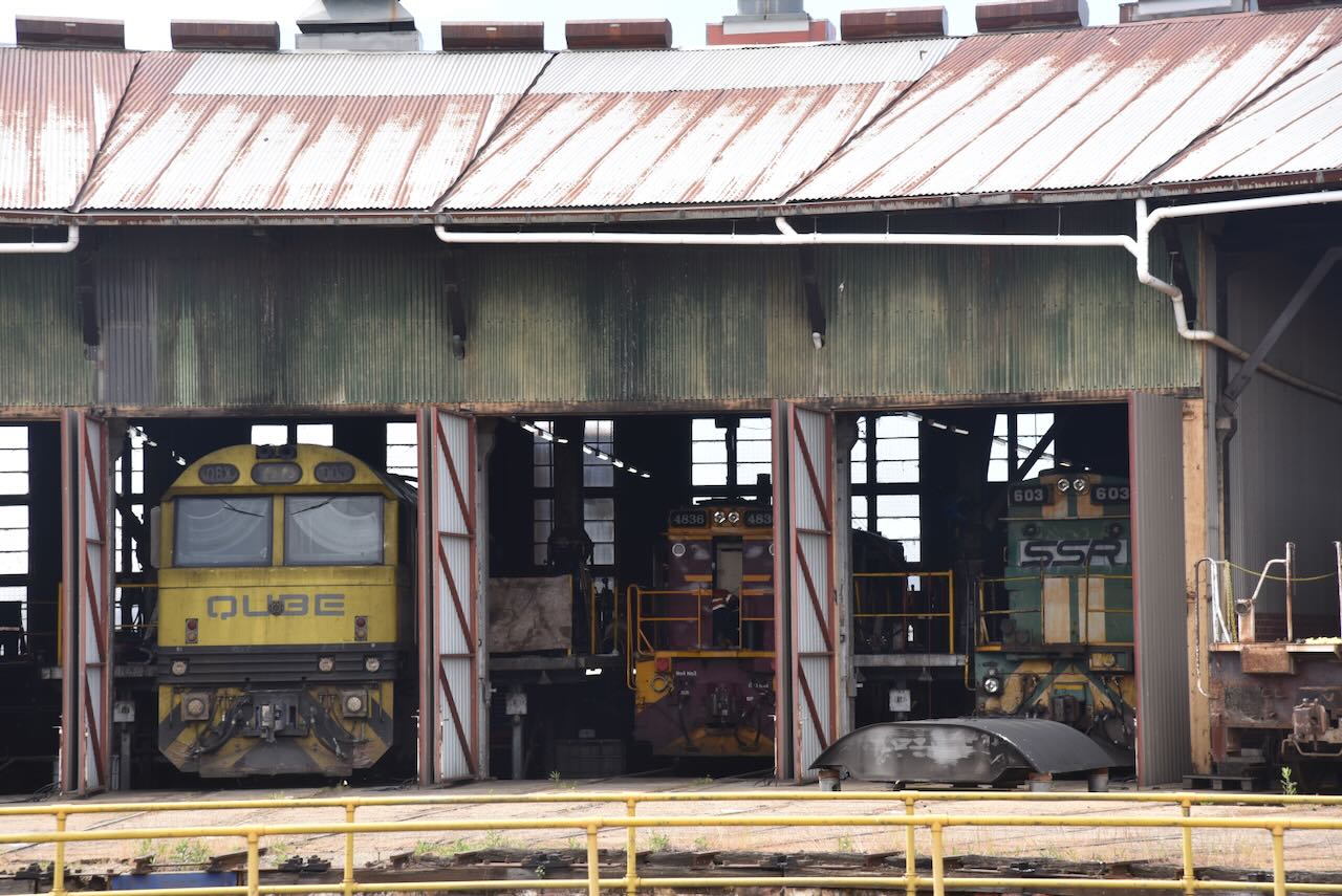
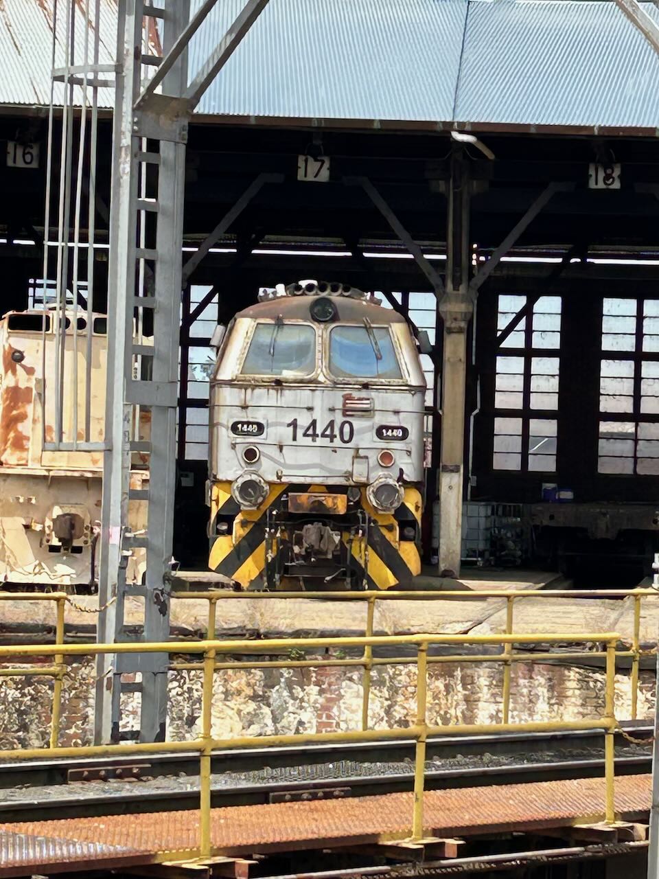
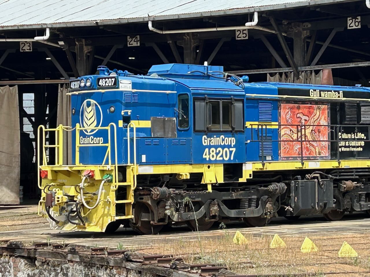
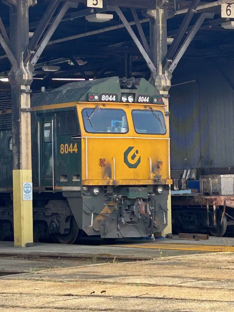
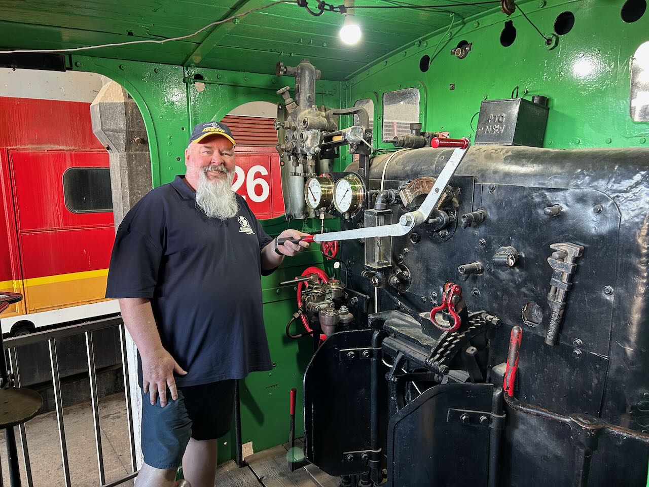
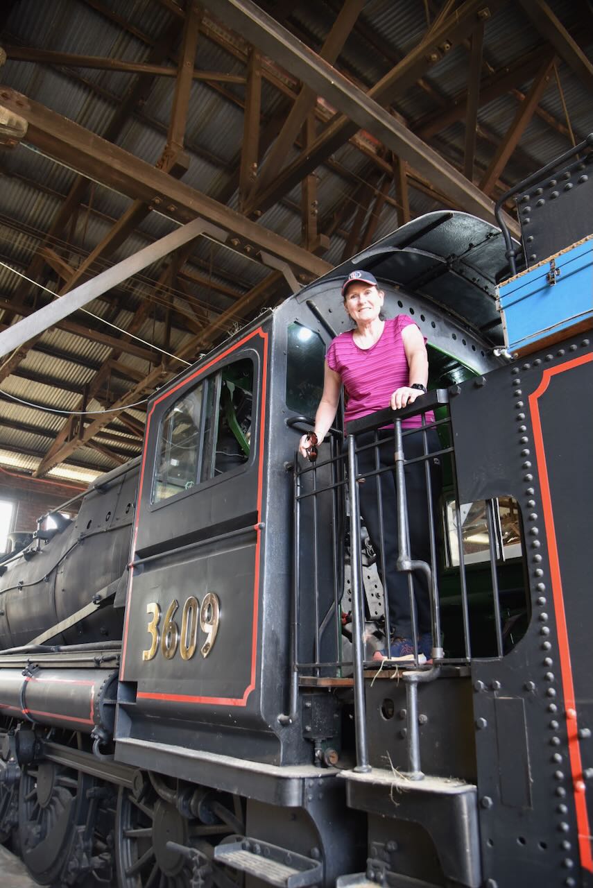
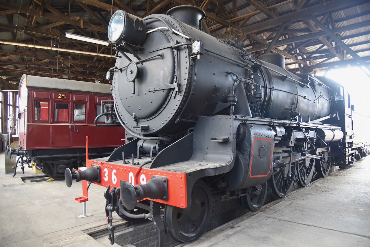
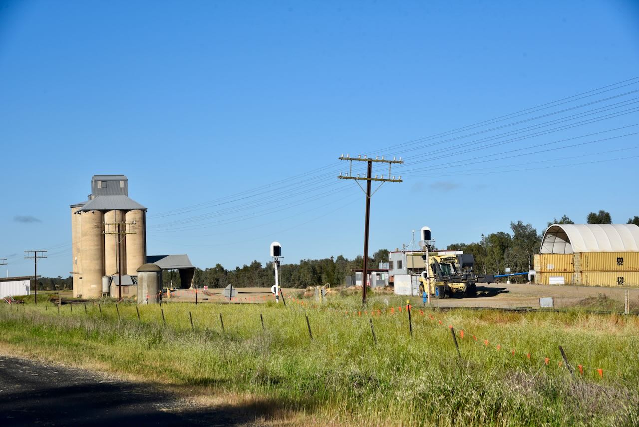
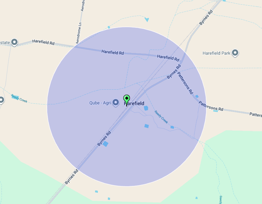
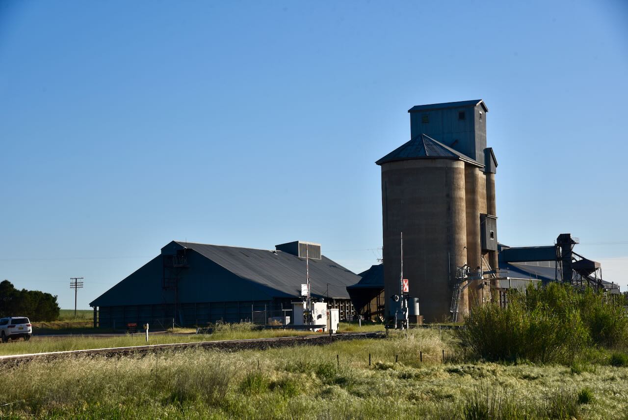
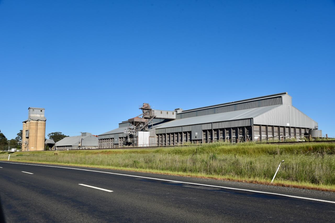
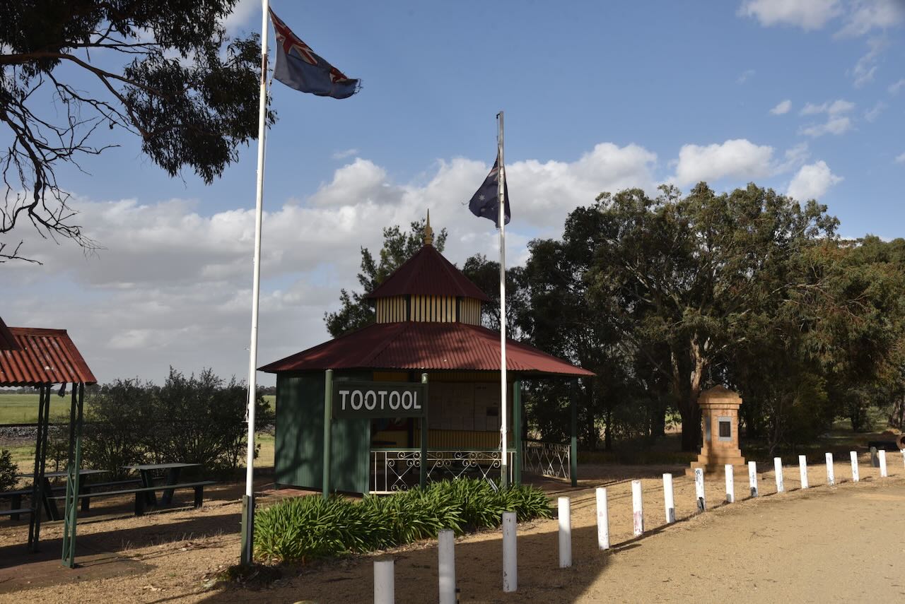
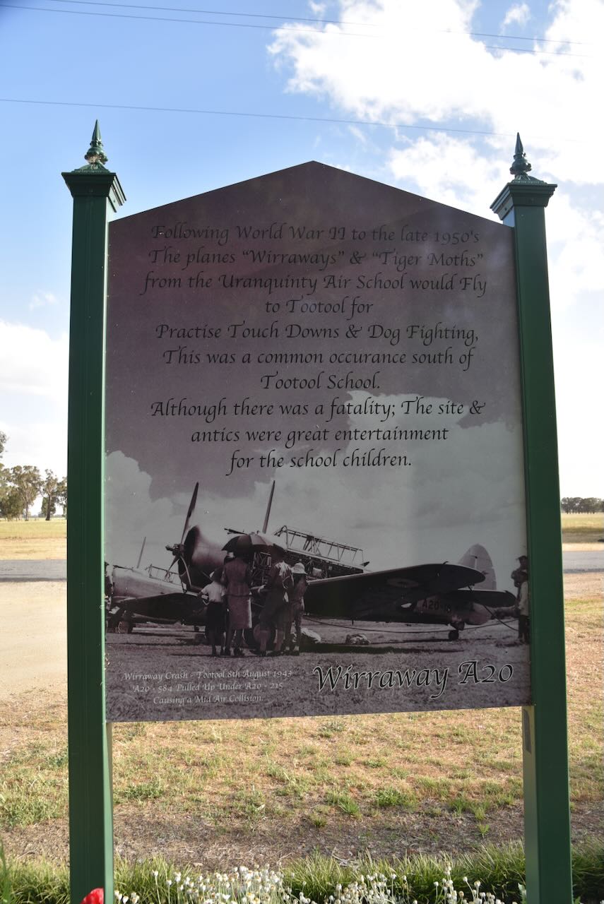
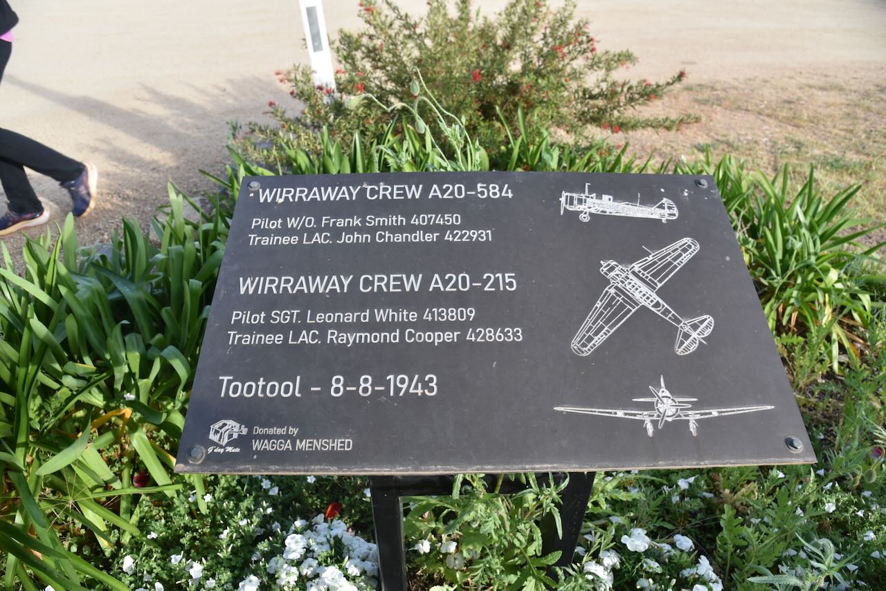
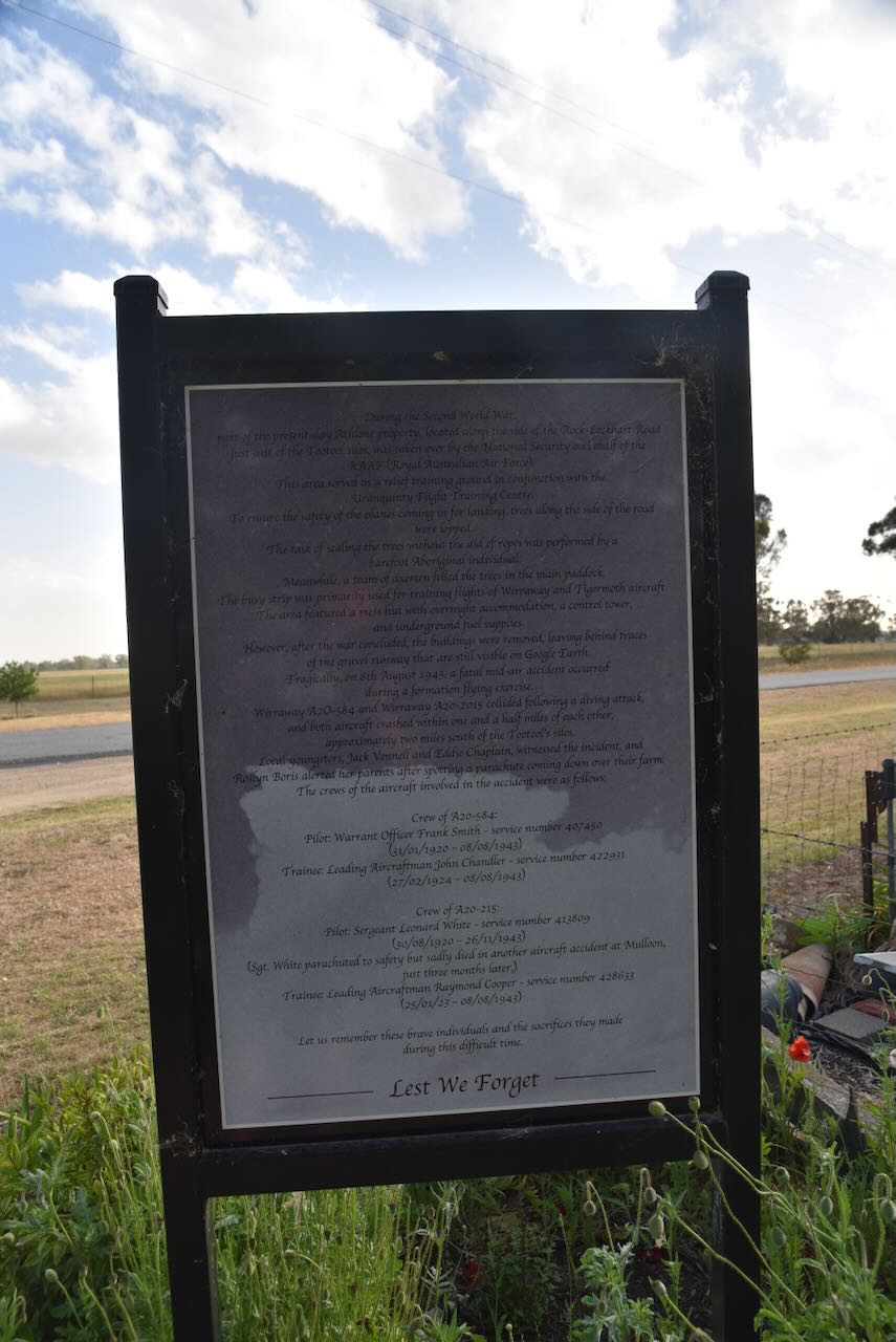
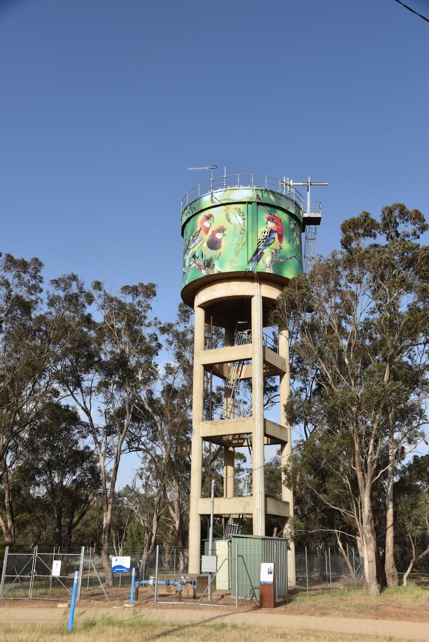
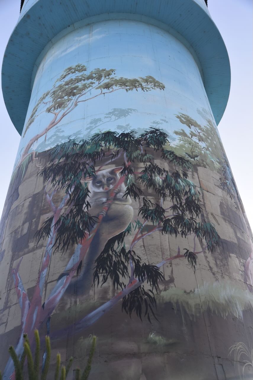
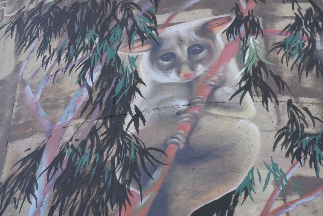
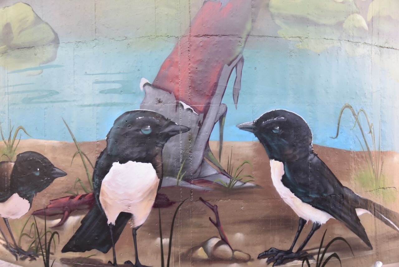
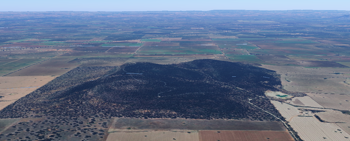
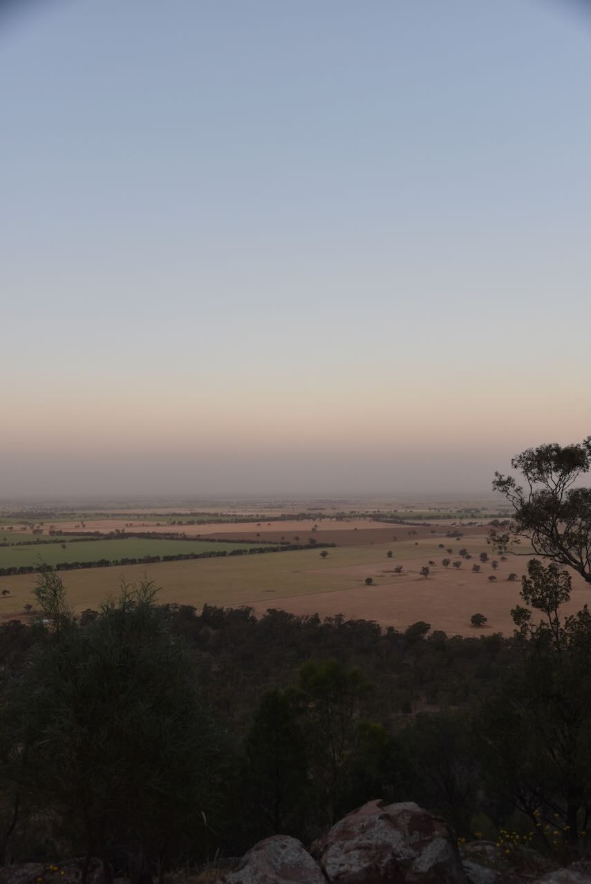
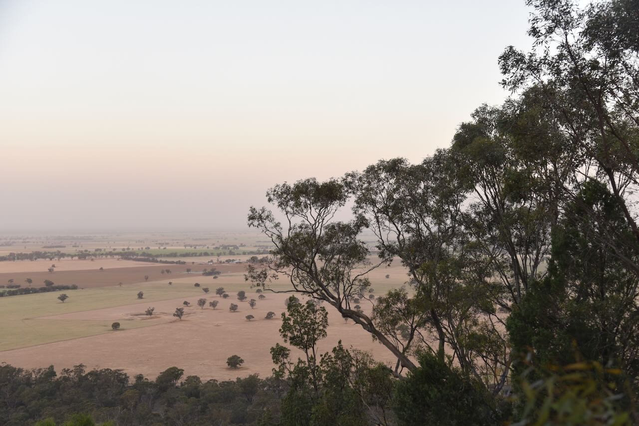
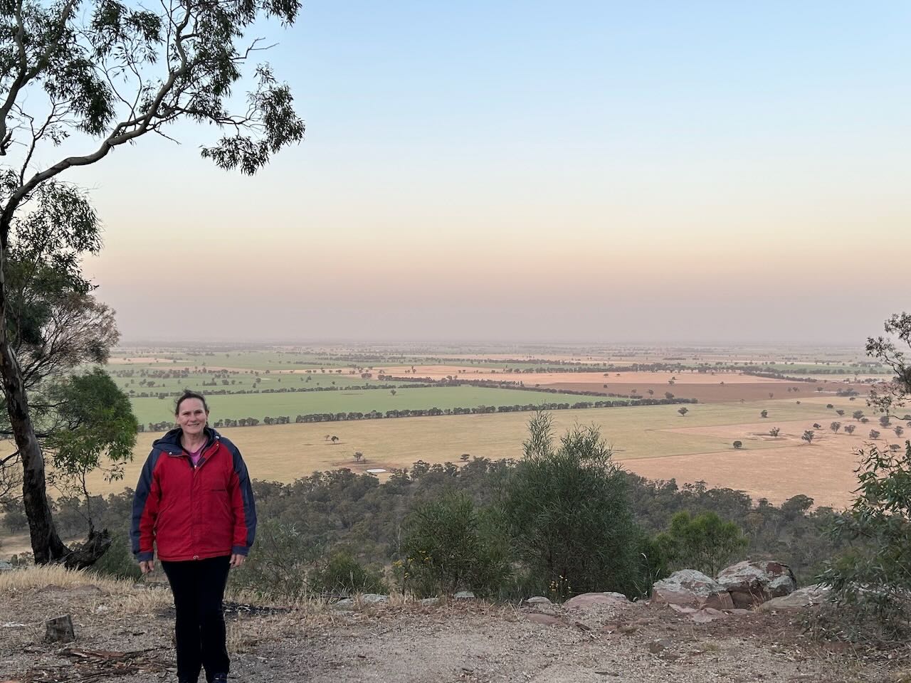
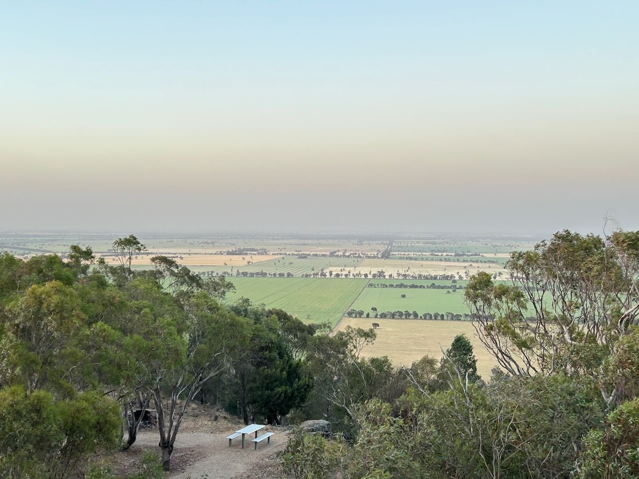
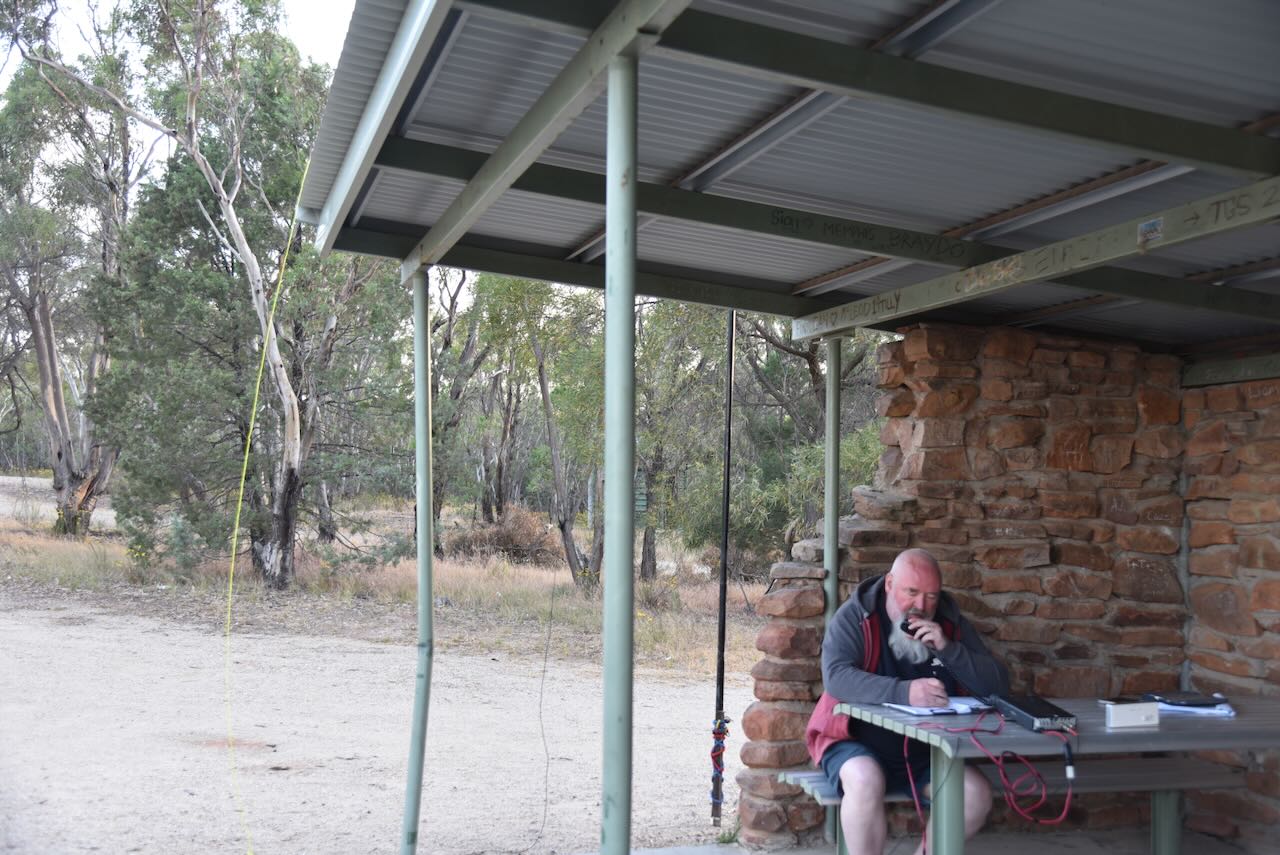
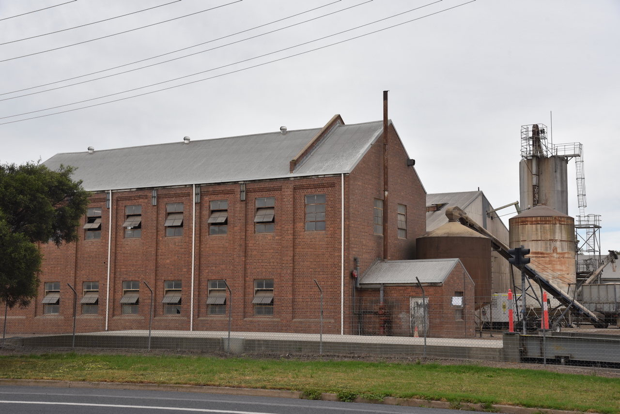
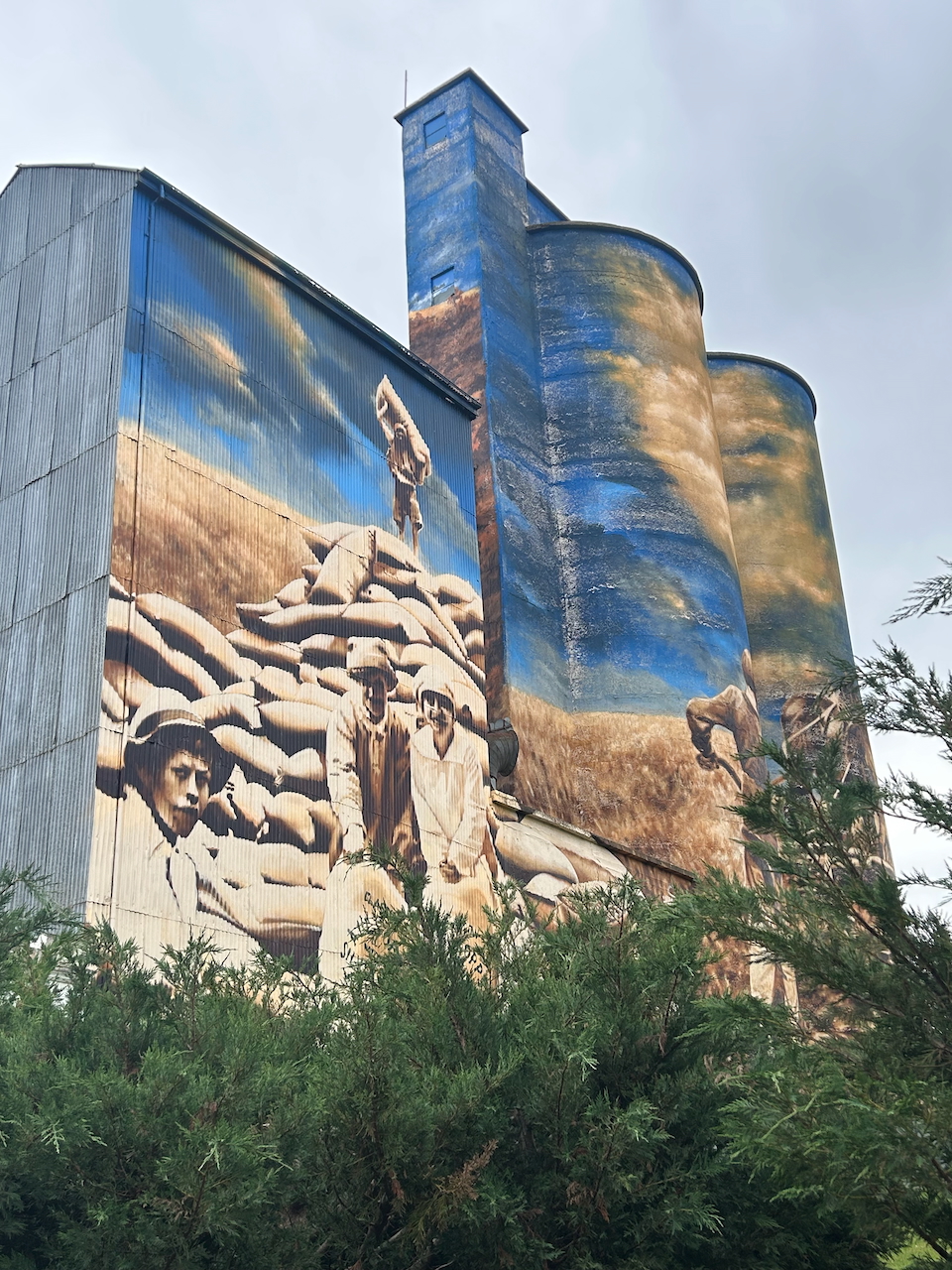
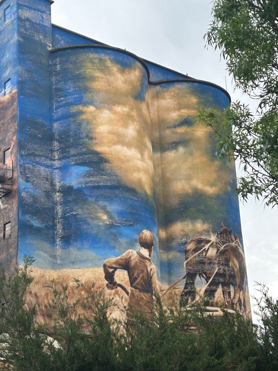
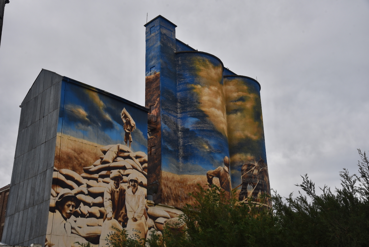
We then headed to the Cootamunda South silo VK-CTN2 for an activation for the Silos On The Air (SiOTA) program. There are two sets of silos at Cootamundra, but we were running very short of time, so we only had the opportunity of activating one of the two.

The Cootamundra South silos are located on the southern side of the Olympic Highway, between the highway and the railway line.

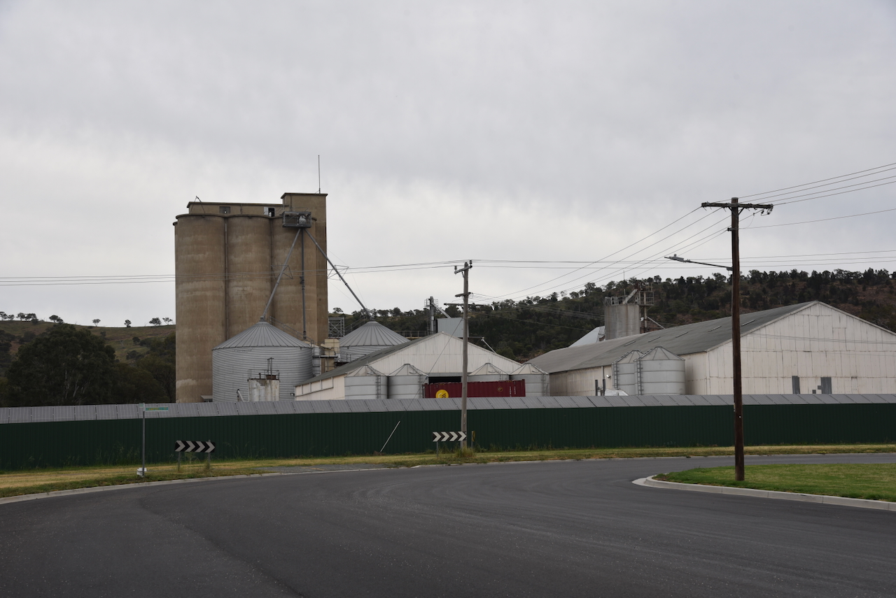
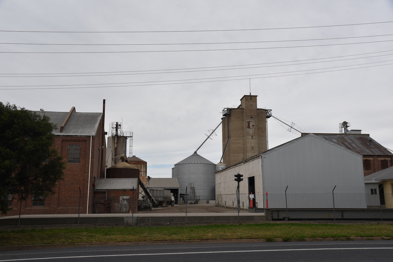
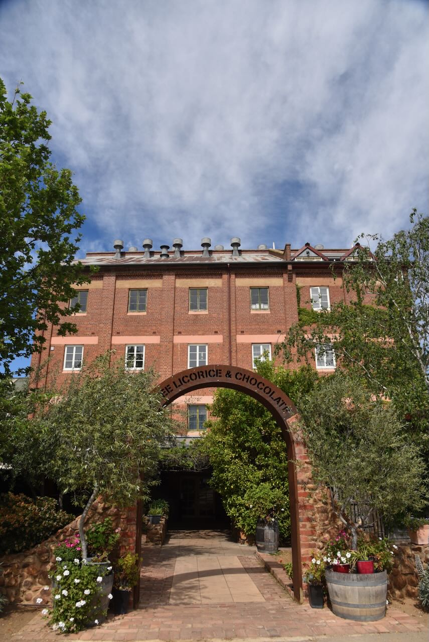
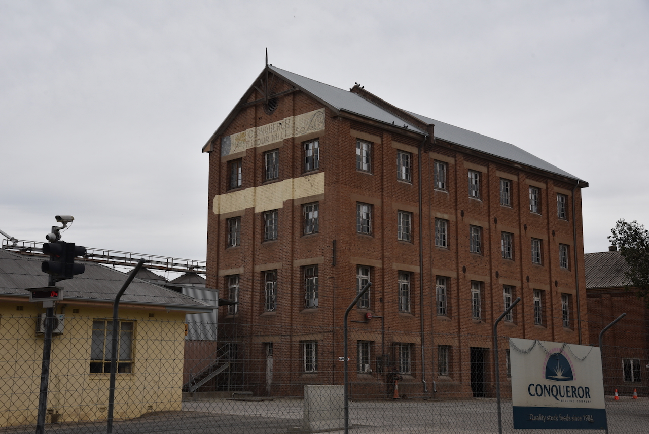
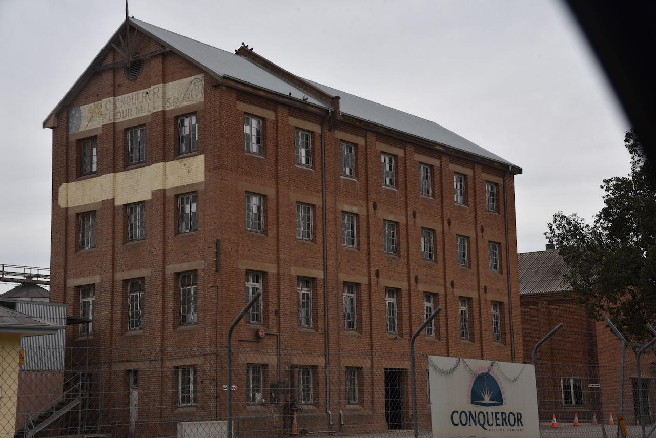
They are located on the site of the historic mill site now run by the Conqueror Milling Company. The mill was built in 1875.

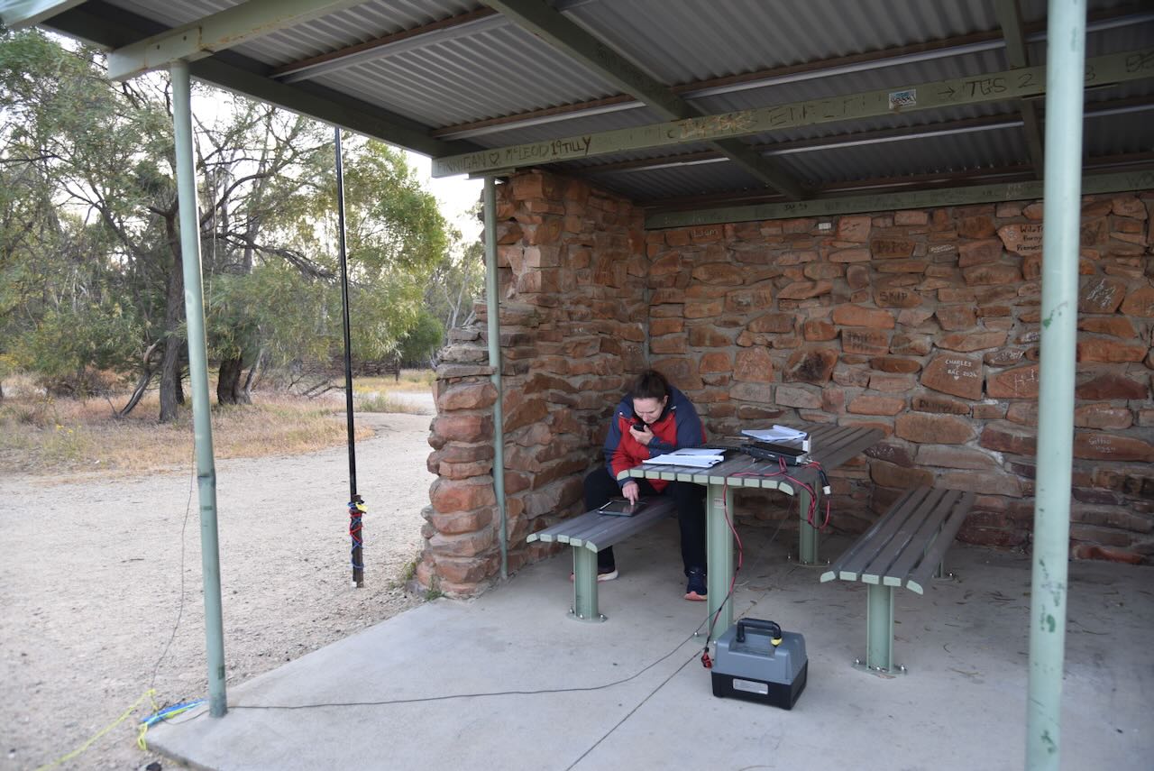
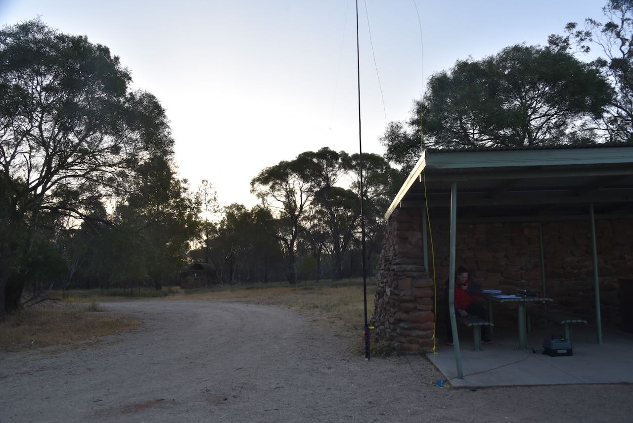
Marija and I parked in Hovell Street and operated from the 4WD, running the Icom IC-7000, 100 watts, and the Codan 9350 antenna with the 1.5 metres stainless steel whip.

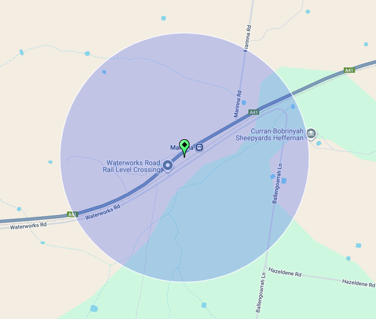
Unfortunately, the other silo is just outside the activation zone. And I mean ‘just outside’.

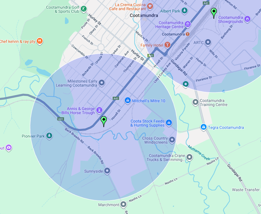
Above: the activation zone at the Cootamunda South silo. Image c/o SiOTA website

Marija worked the following stations on 40m SSB:-

  1. VK3PF/p (VKFF-4428)
  2. VK3CLD
  3. VK5QA
  4. VK2DBF
  5. VK1AO
  6. VK2MET
  7. VK3WSG

I worked the following stations on 40m SSB:-

  1. VK3PF/p (VKFF-4428)
  2. VK3CLD
  3. VK5QA
  4. VK2DBF
  5. VK1AO
  6. VK2MET
  7. VK3WSG
  8. VK3AUN
  9. VK3BWS
  10. VK3HJW
  11. VK3NCR
  12. VK2LEE
  13. VK3EJ
  14. VK5AYL
  15. VK3FS
  16. VK3ATT

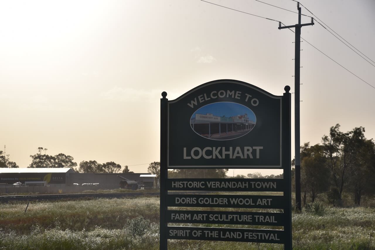
After leaving Cootamundra, Marija and I continued along the Olympic Highway to the town of Wallendbeen and then east on Burley Griffin Way until we reached the town of Harden-Murrumburrah.

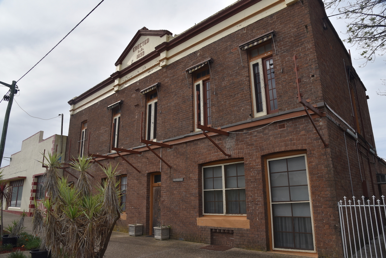
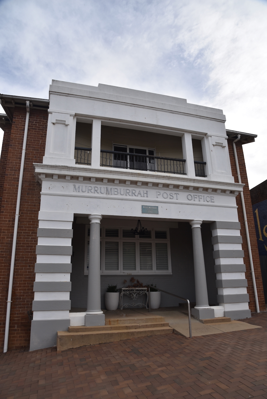
The town contains several historic buildings.

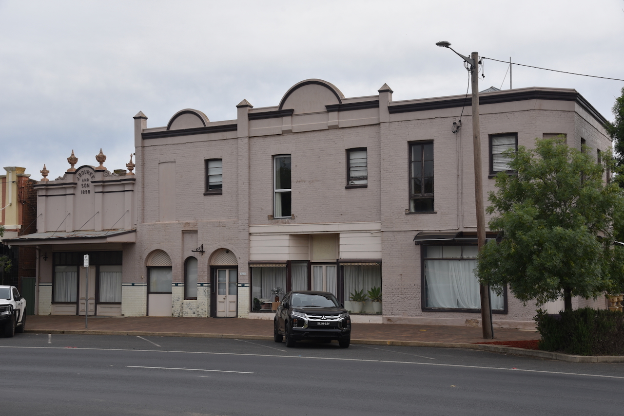
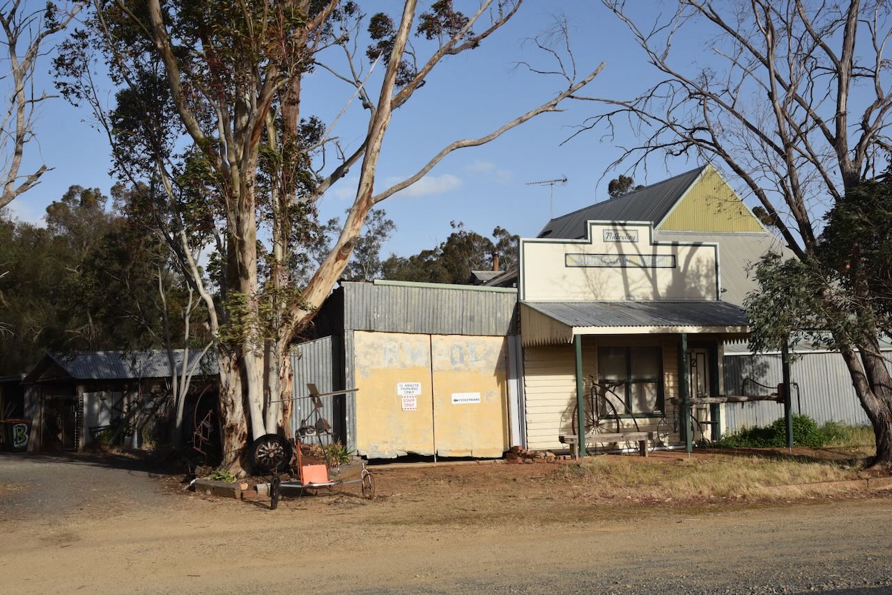
The former Exchange Hotel was built in 1899.

The Murrumburrah Post Office was built in 1905.

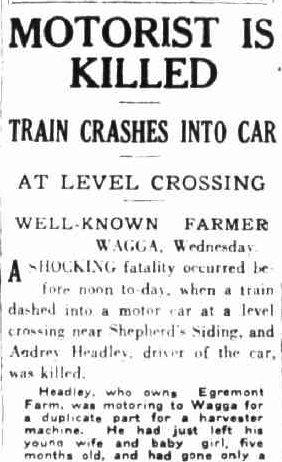
In the main street, you can find an information board on an incident which occurred in August 1863.

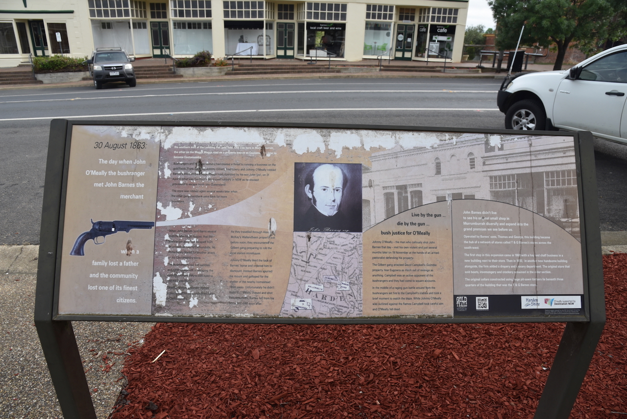
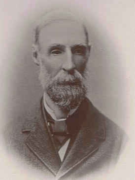
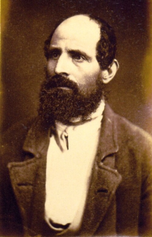
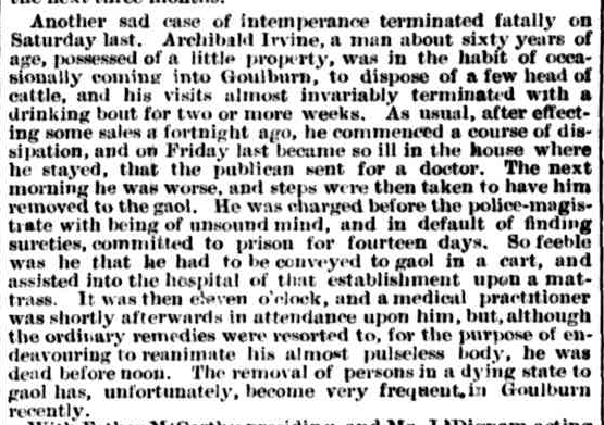
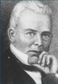
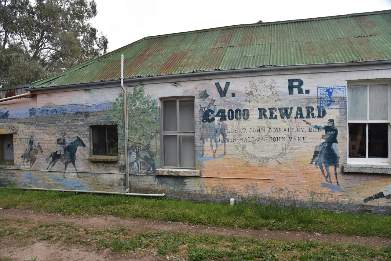
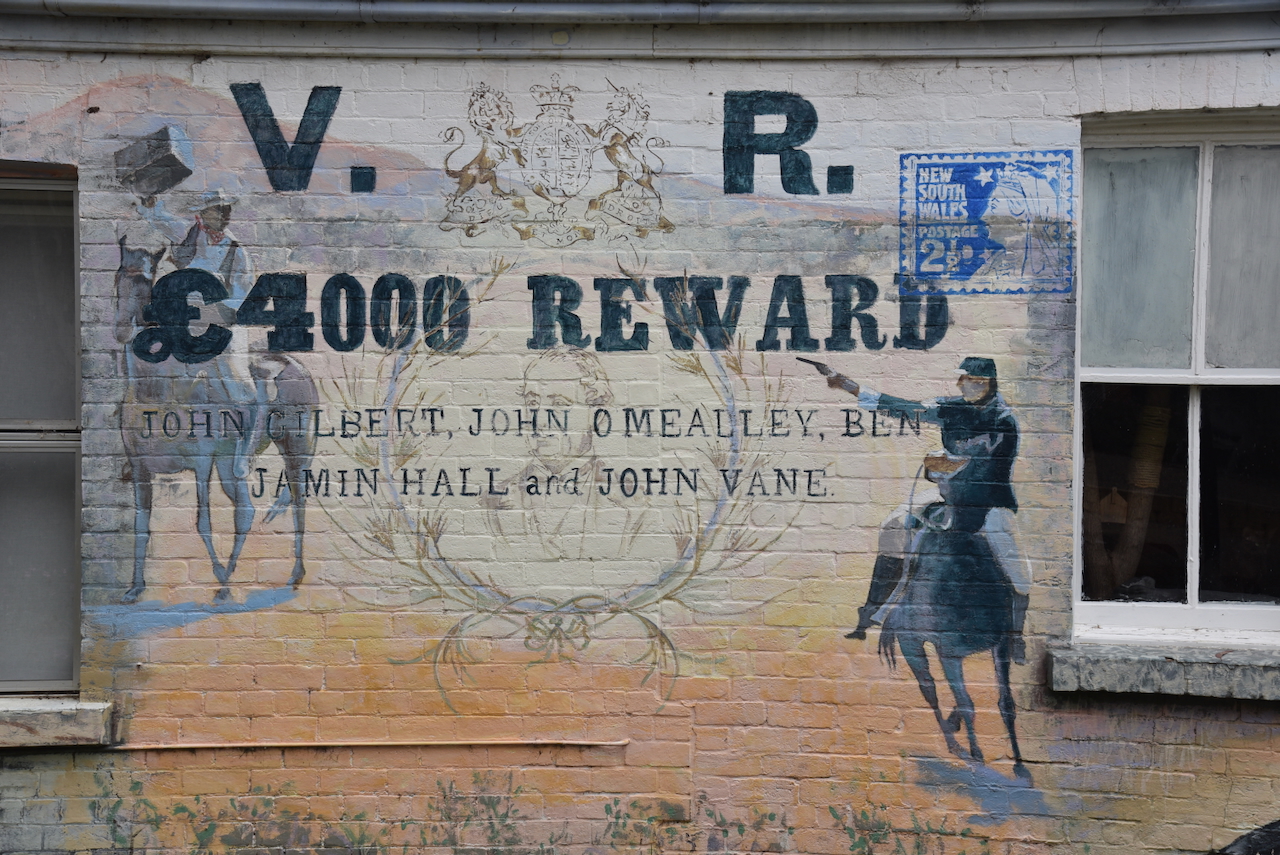
John Barnes was born in June 1812 in Bedfordshire, England. He emigrated to Australia in 1841 aboard the Abbortsford with his wife and family. Barnes was a merchant who owned two stores. One at Murrumburrah and the other on the Wagga Wagga Road on the Cootamundry Run. On the 31st day of April 1863, bushrangers Frank Gardiner, John Gilbert, Fred Lowry and John O’Meally robbed the store at Cootamundry. Several weeks later, the store was robbed again. (ancestry 2016)
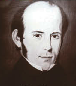
Above: John Barnes.

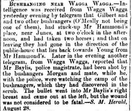
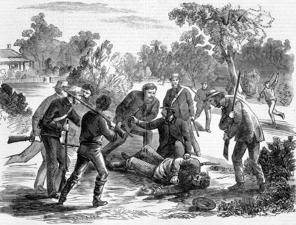
Barnes became aware of the robberies, and upon learning that the bushrangers had escaped from an ambush on 30th August 1863, he feared that there would be another attack on his store. A police officer was shot and wounded during that incident. Barnes then saddled up and rode towards Cootamundry. At Wallendbeen, he encountered the Gilbert gang, who were preparing to rob the local station storehouse.

O’Meally ordered Barnes to dismount from his horse, as he liked the look of the horse. Rather than obeying the order, Barnes spurred his mount and galloped for the protection of the nearby homestead. Sadly, he did not make it. O’Meally chased Barnes and shot him several times.

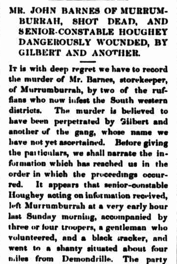
Above: part of an article from The Golden Age, Thu 10 Sept 1863. Image c/o Trove

Barnes was originally buried at Yass, but was later reinterred in the family vault at the Cootamundra cemetery. (ancestry 2016)

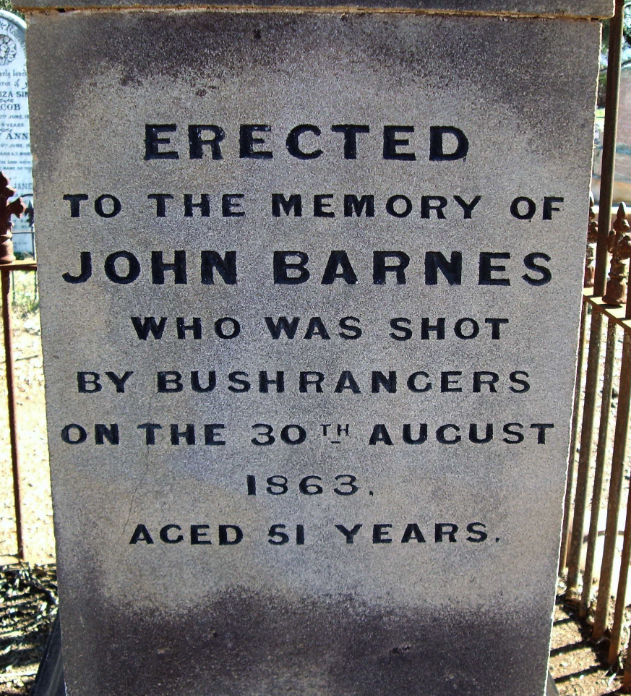
Above: the headstone of John Barnes. Image c/o ancestry.com.au

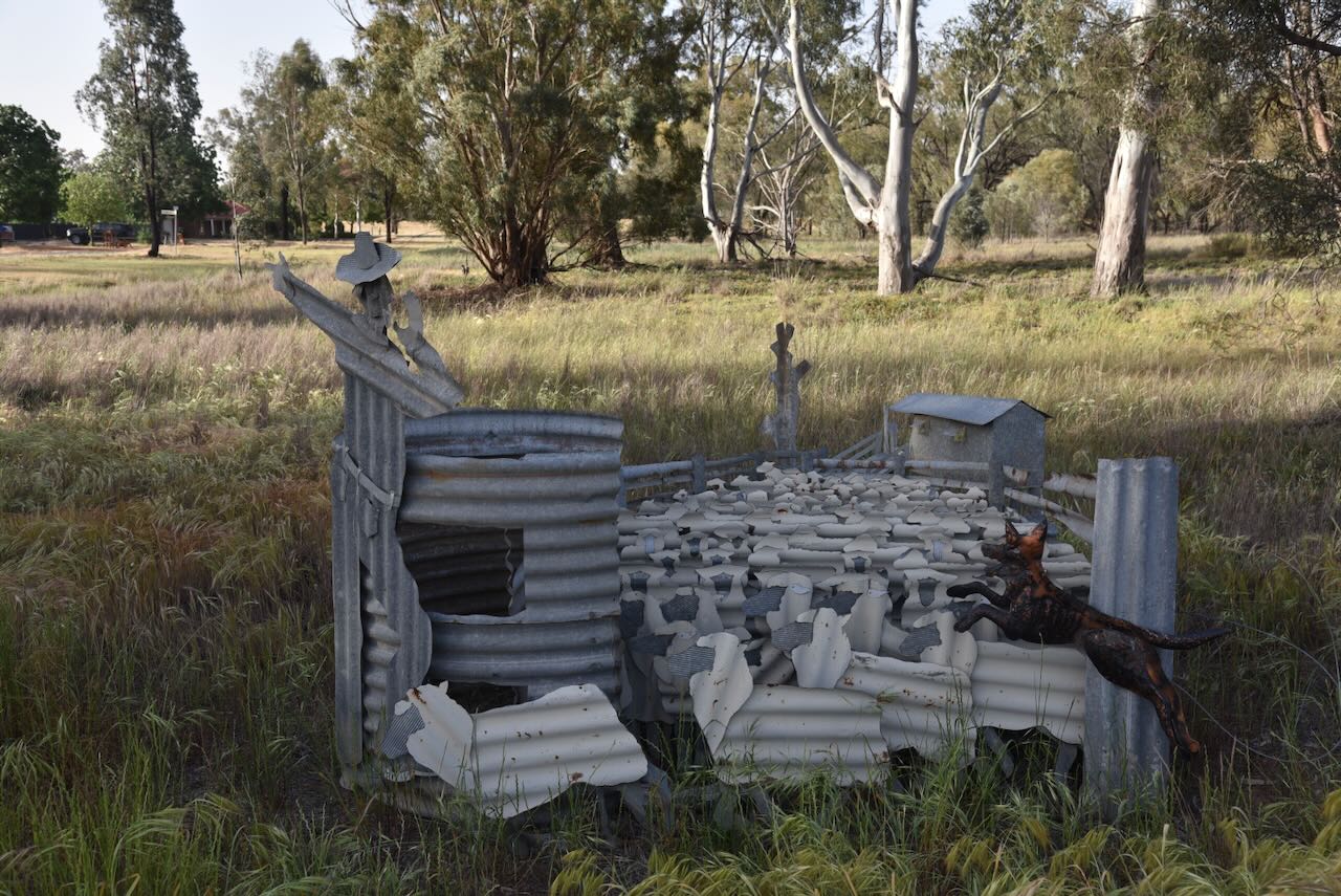
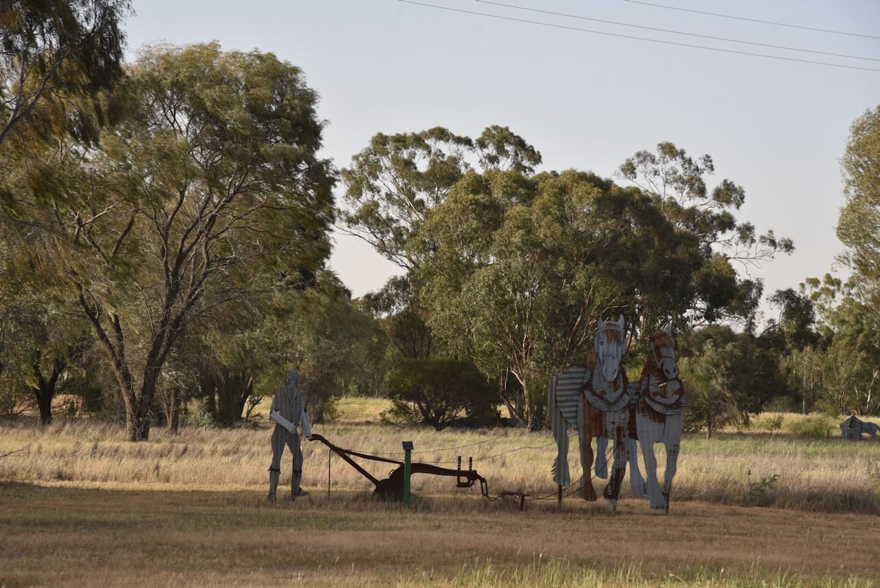
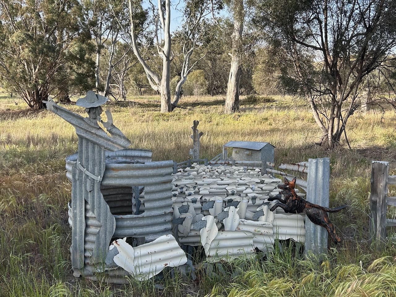
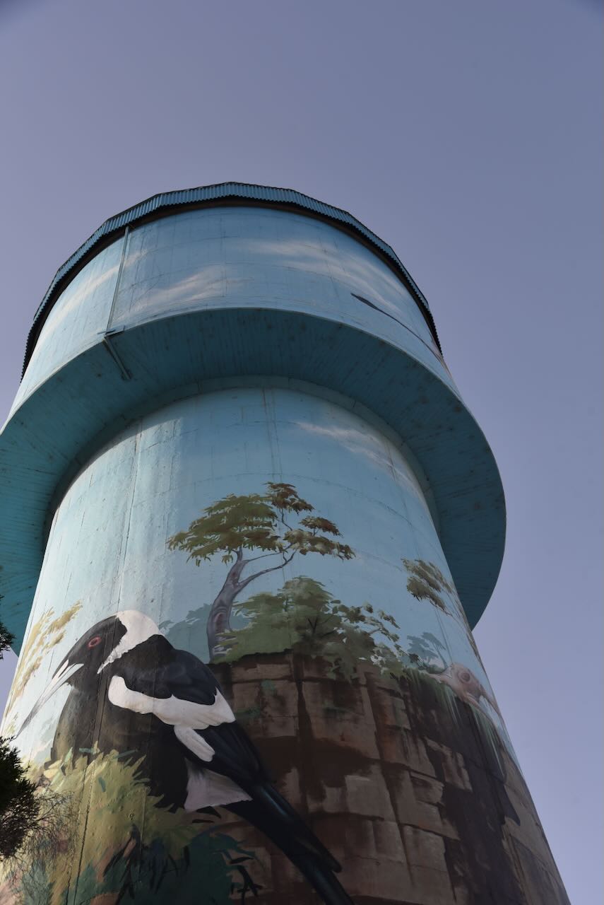
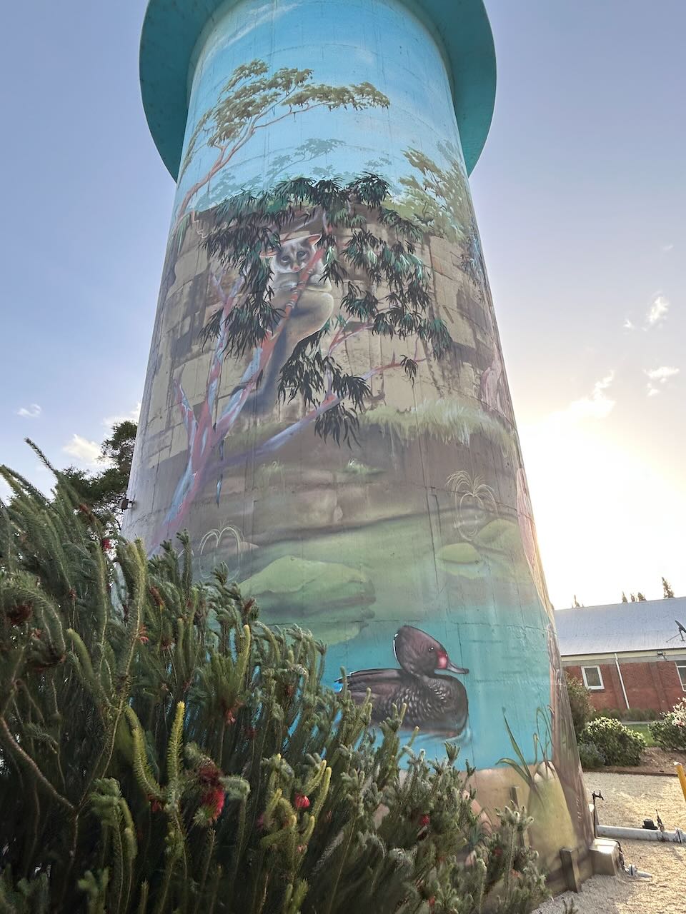
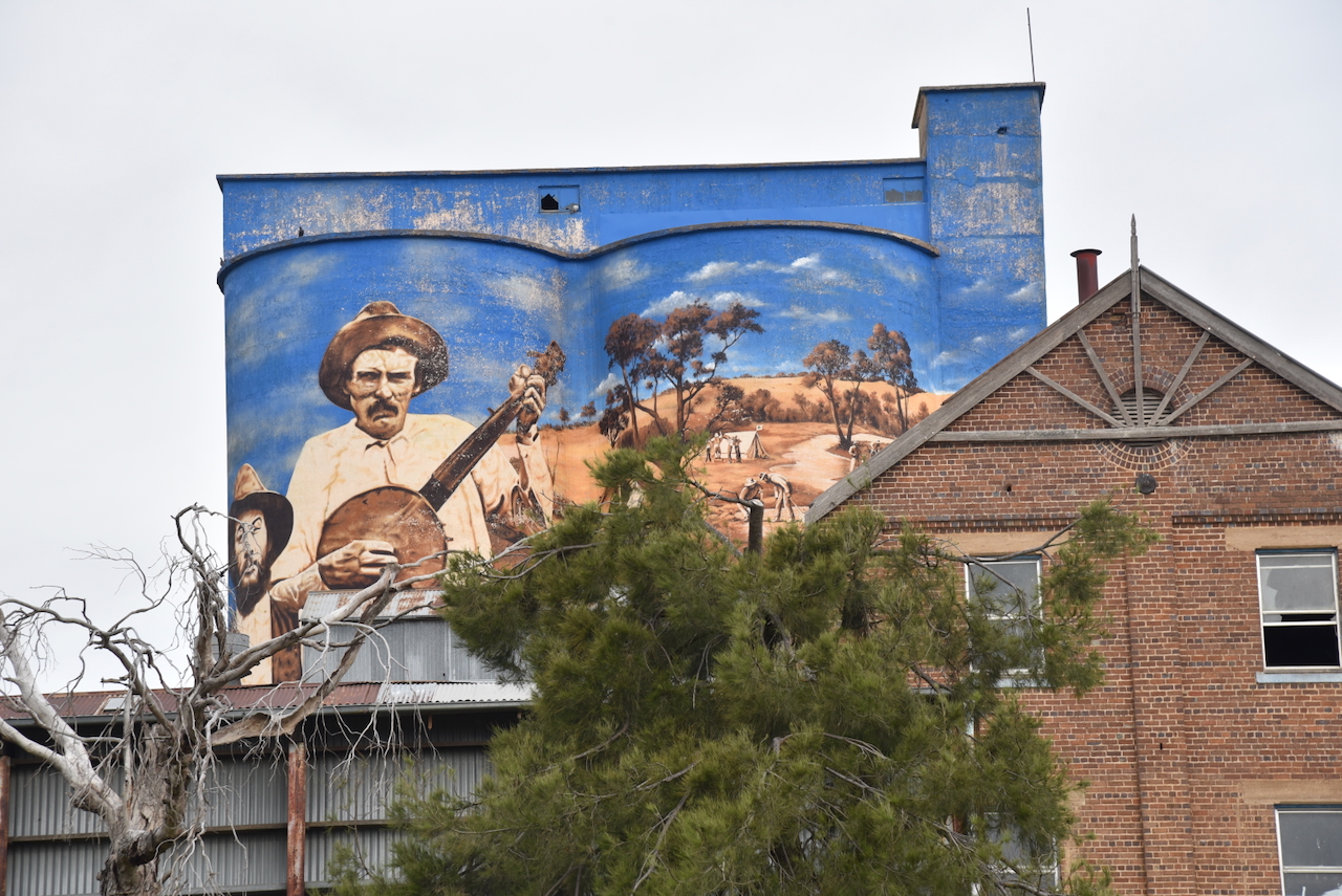
Murrumburrah has a silo that qualifies for the SiOTA program, but we just did not have enough time to activate it. We did, however, admire the magnificent silo art that it features. The art is the work of Melbourne-based Mongolian street artist Heesco Khosnaran. He commenced the silo art in January 2021 and completed the work at the end of February 2021.  The artwork features rural life in Australia in the late 1800s and early 1900s. (Australiansiloarttrail.com, 2020)

Below is a video on the Murrumburrah silo

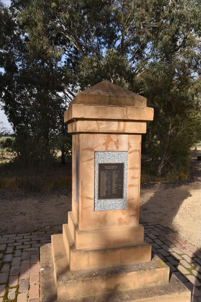
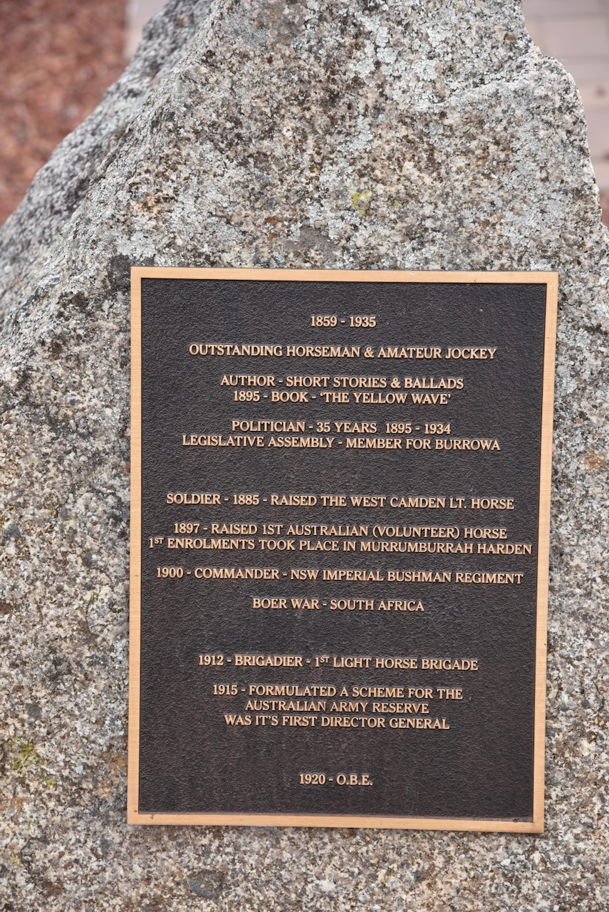
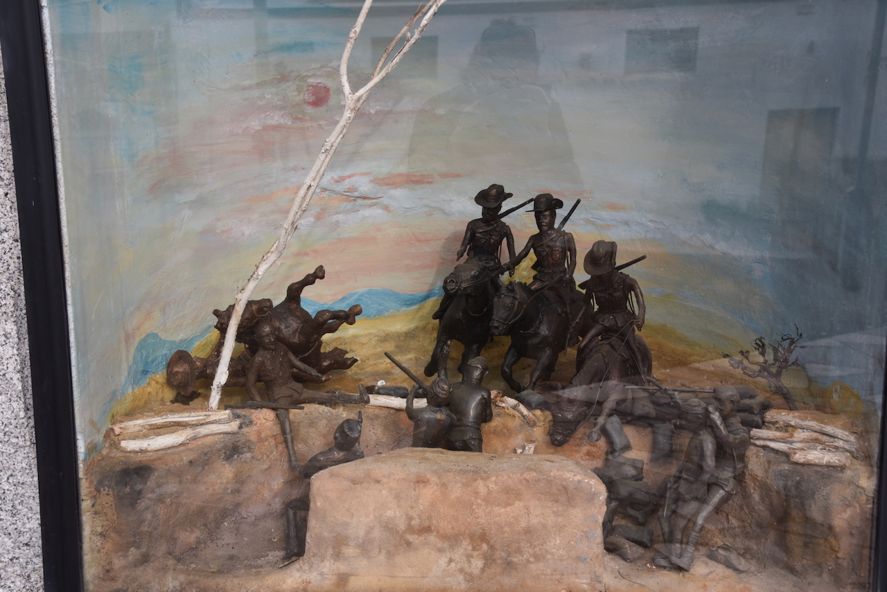
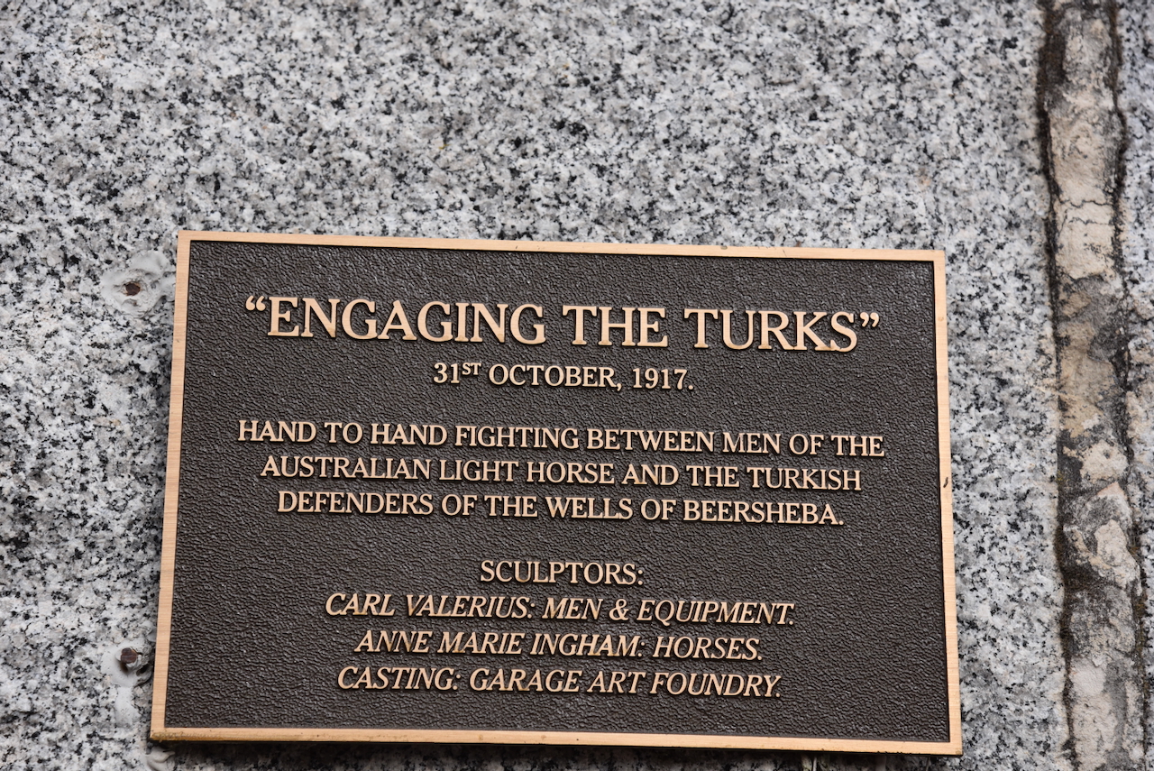
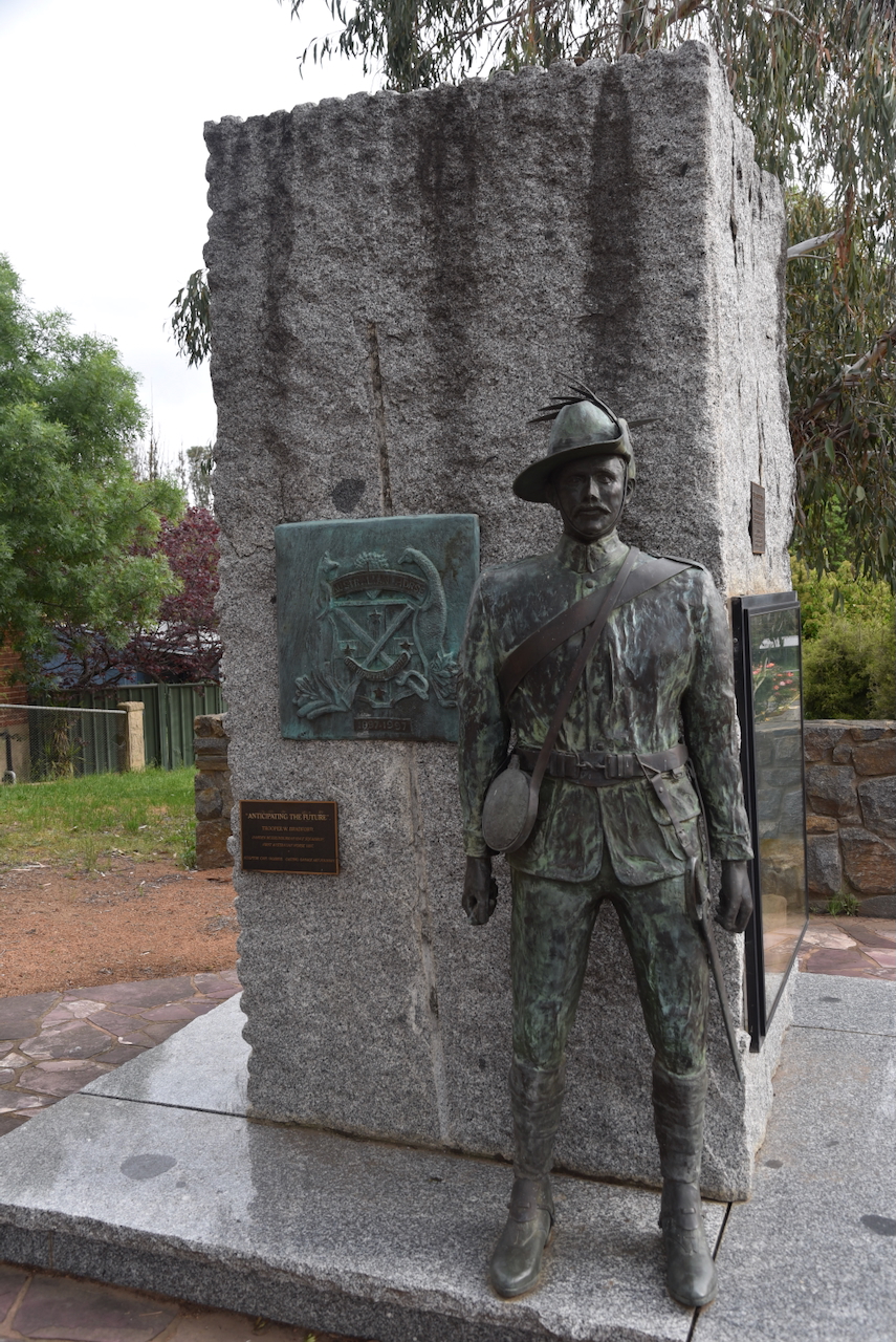
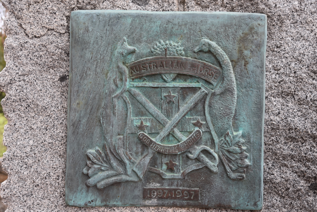
In the main street is a statue of Major-General James Alexander Kenneth Mackay C.B., O.B.E., V.D., F.R.G.S. He created the First Australian Light Horse troop. (Office 2019)

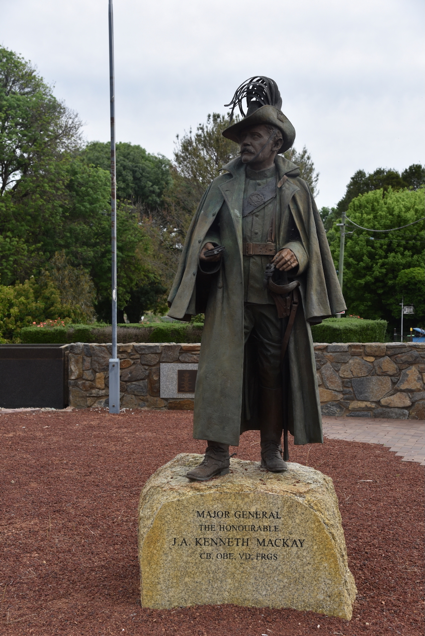
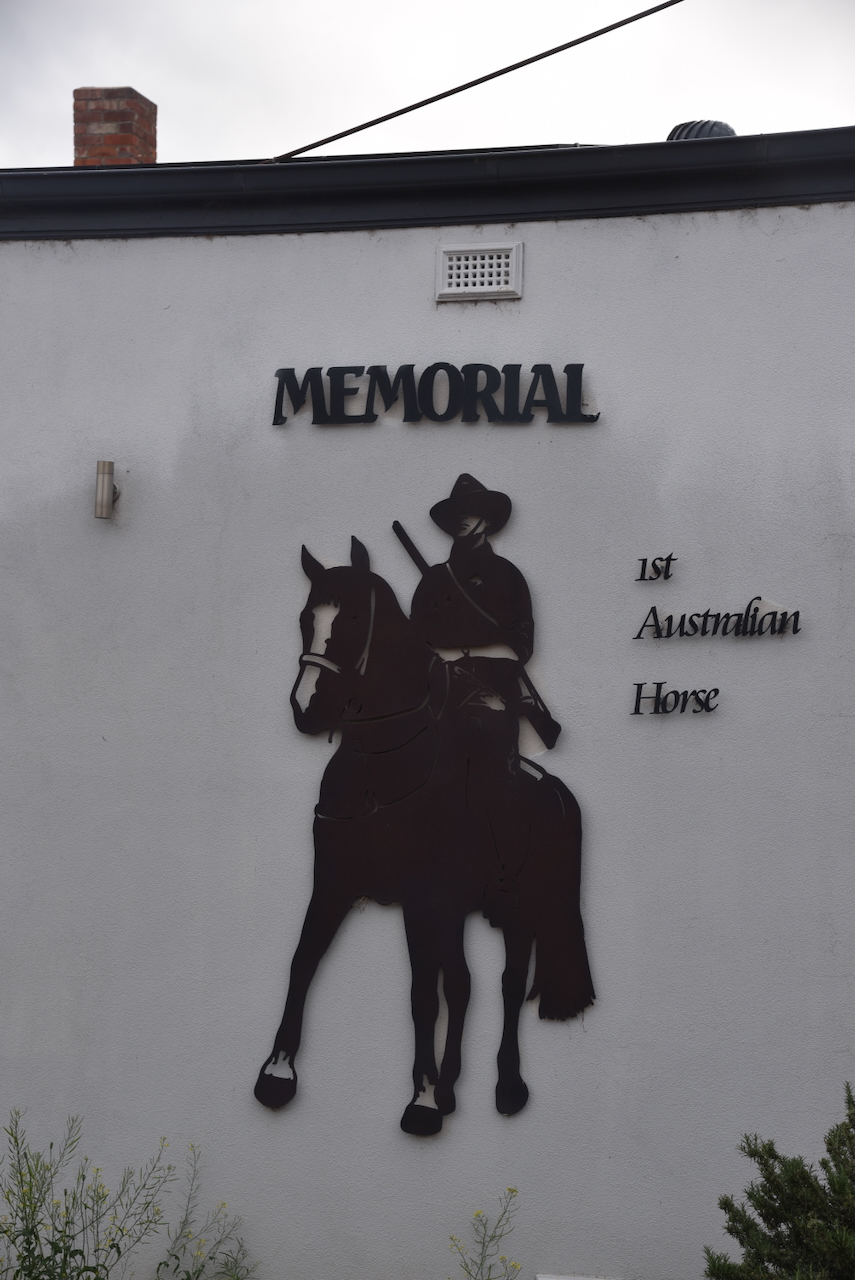
The Light Horse Memorial commemorates the birthplace of the First Australian Light Horse at Murrumburrah in 1897.

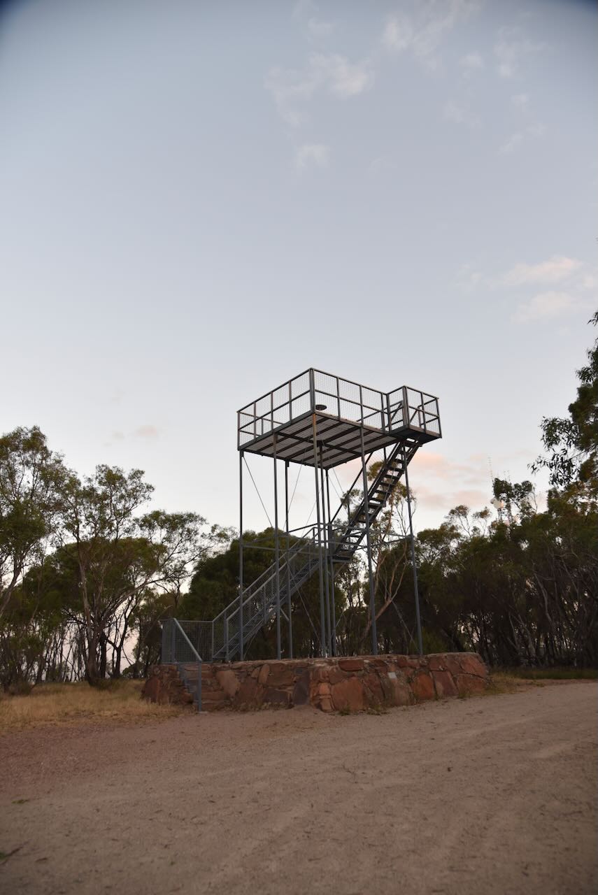
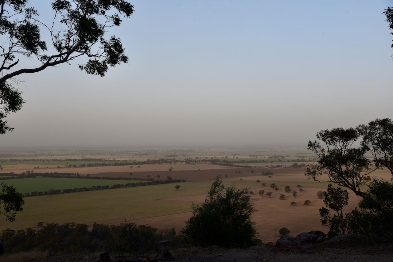
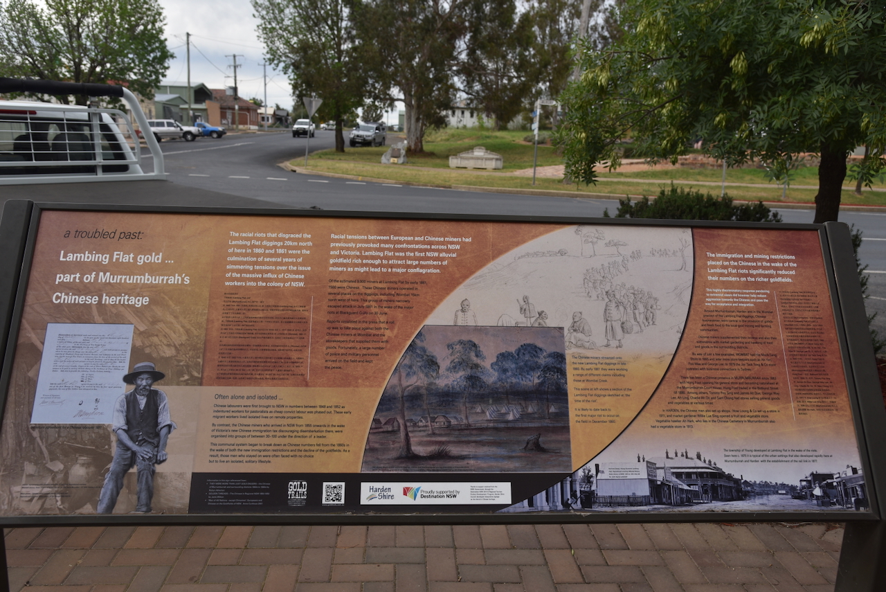
There is also an excellent information board on the Lambing Flat goldfields, about 20 km north. Lambing Flat was the scene of a series of violent anti-Chinese demonstrations that took place in the early 1860s.

Below is a video on the Lambing Flat Riots.

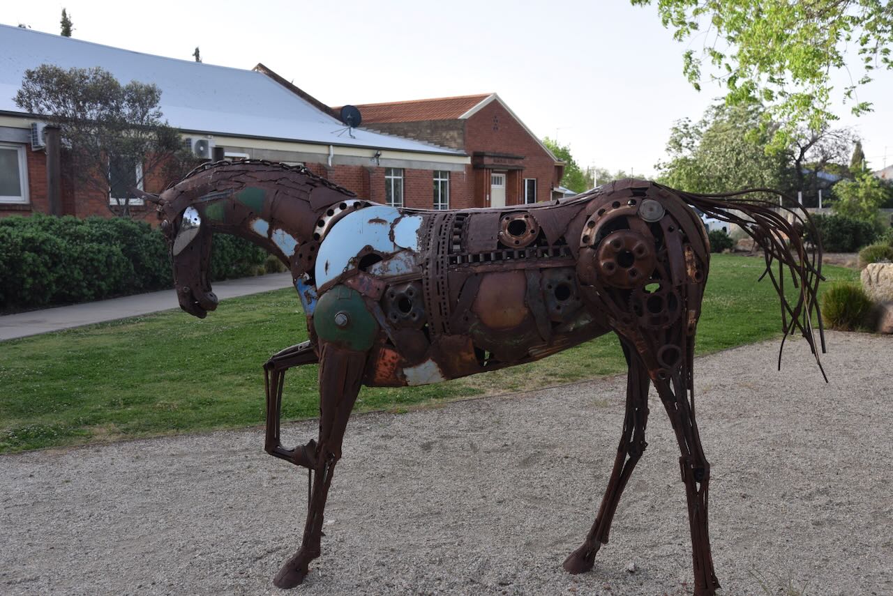
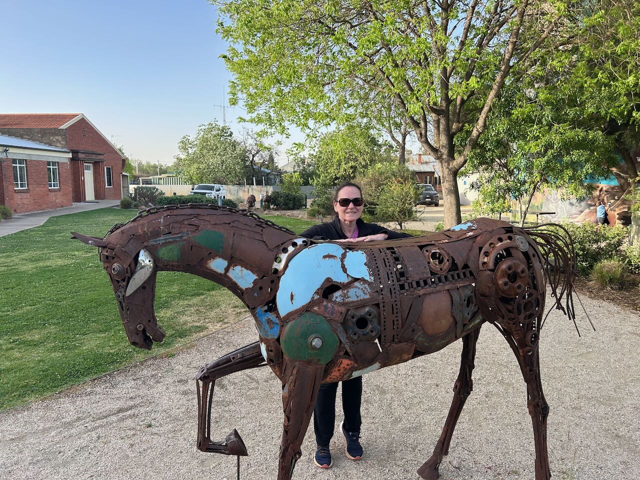
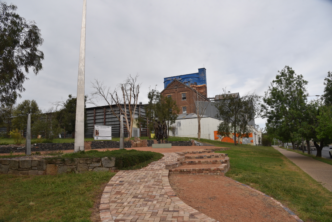
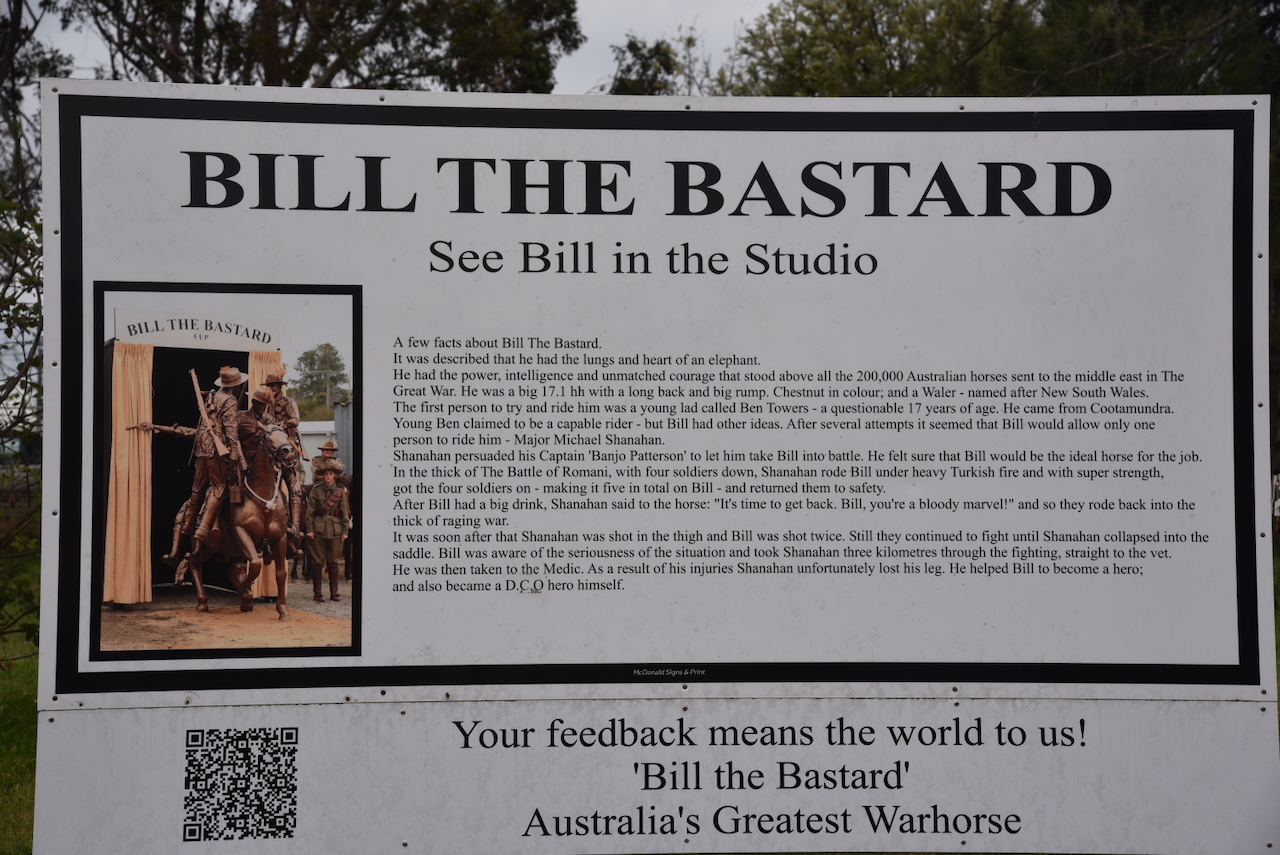
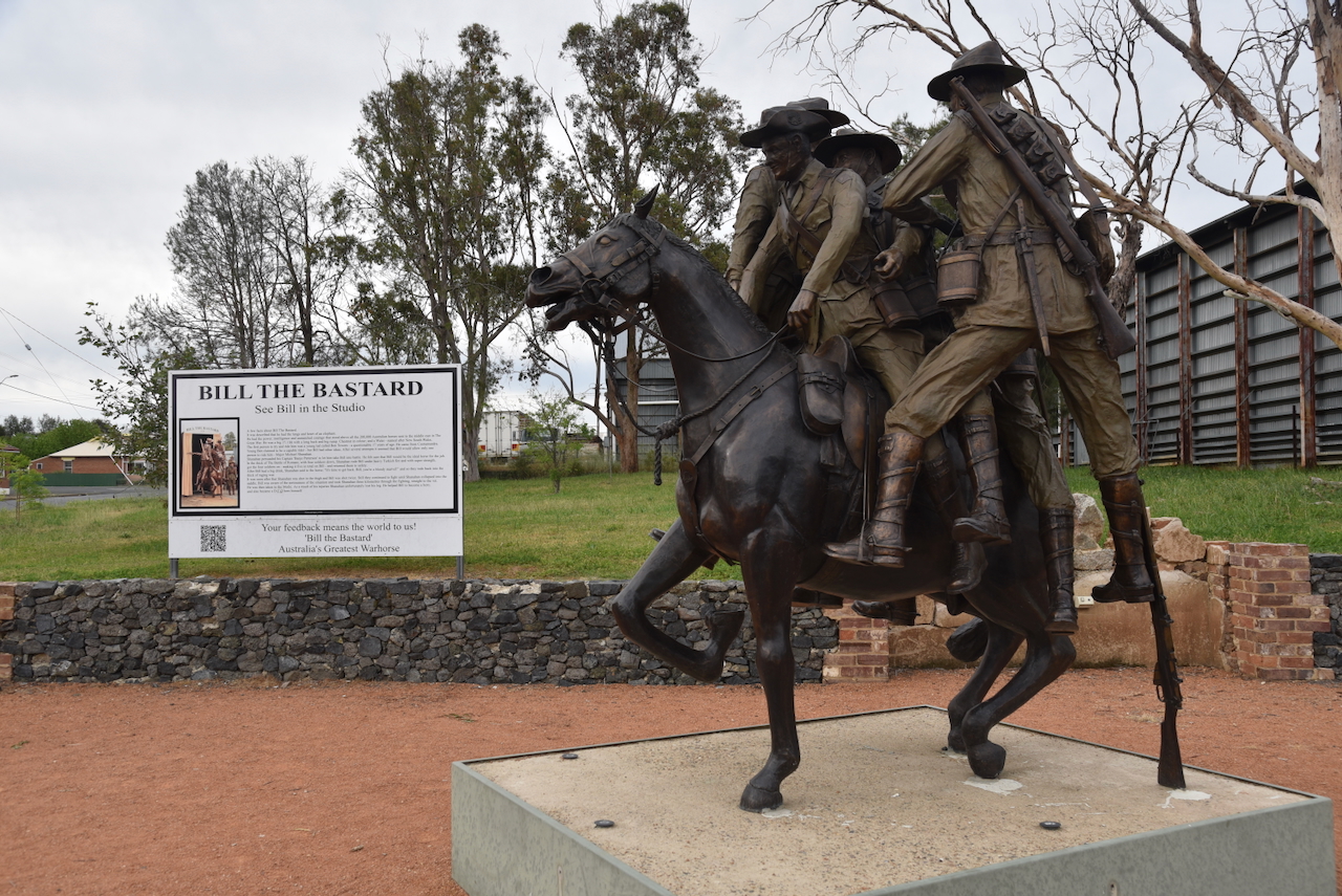
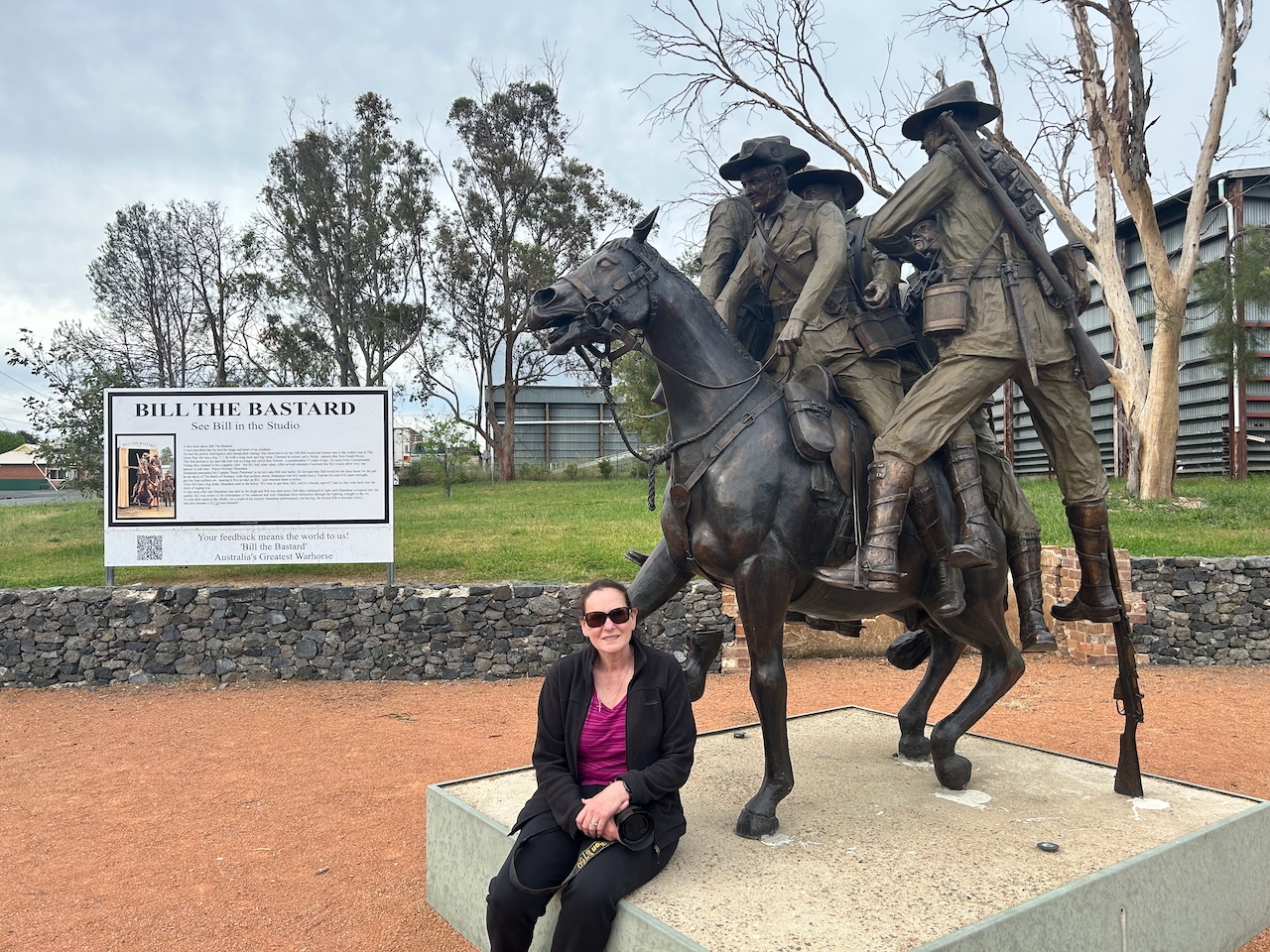
Harden is home to the life-size sculpture of Australia’s best-known war horse, ‘Bill the Bastard’. Bill was a 730 kg chestnut stallion, one of 130,000 Australian horses that served during the First World War. However, Bill was no average horse. He was described as having the lungs and heart of an elephant.

Below is an excellent video on Bill the Bastard.

And of course, Harden has a Bill’s horse trough. For more information on the interesting background of Bill’s horse troughs, please have a look at my previous post:

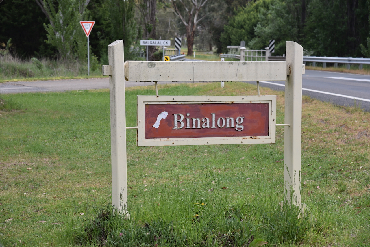
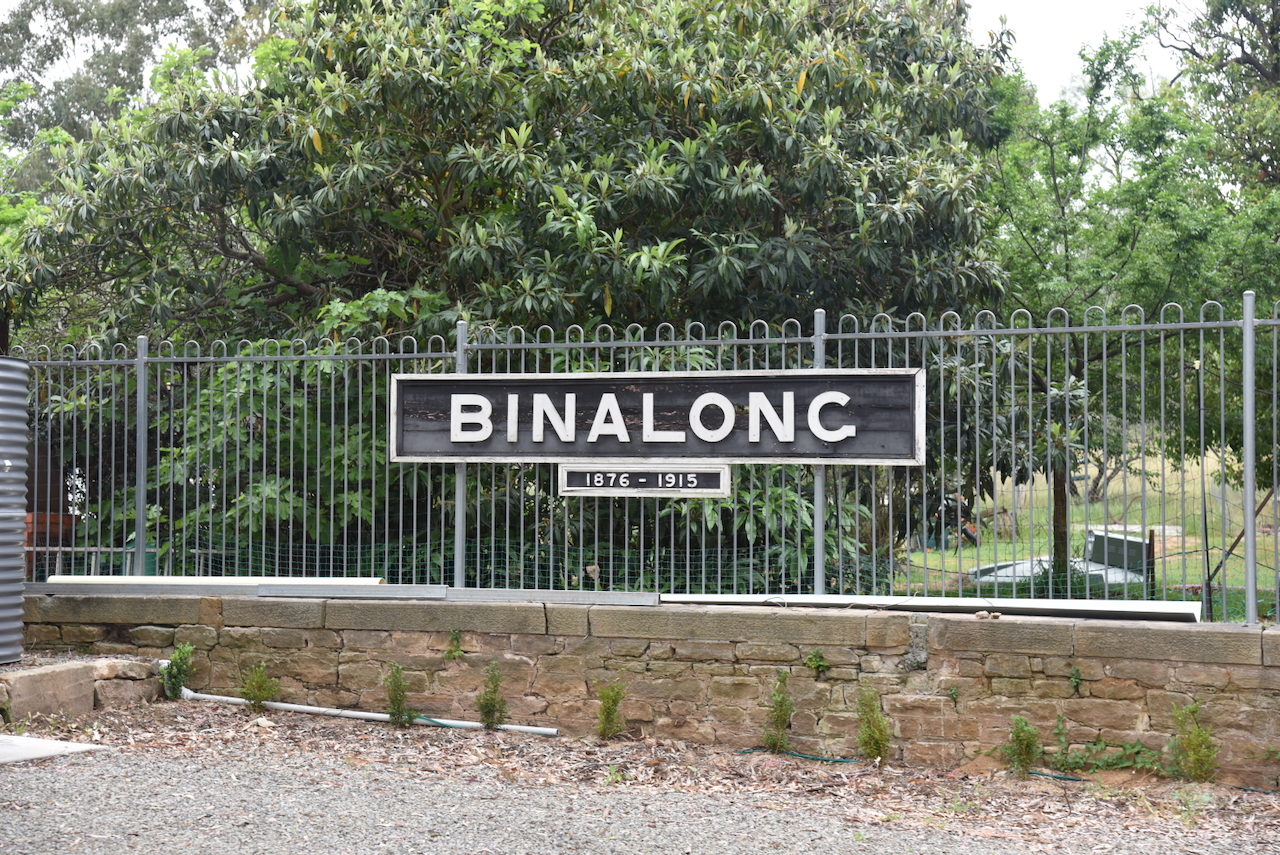
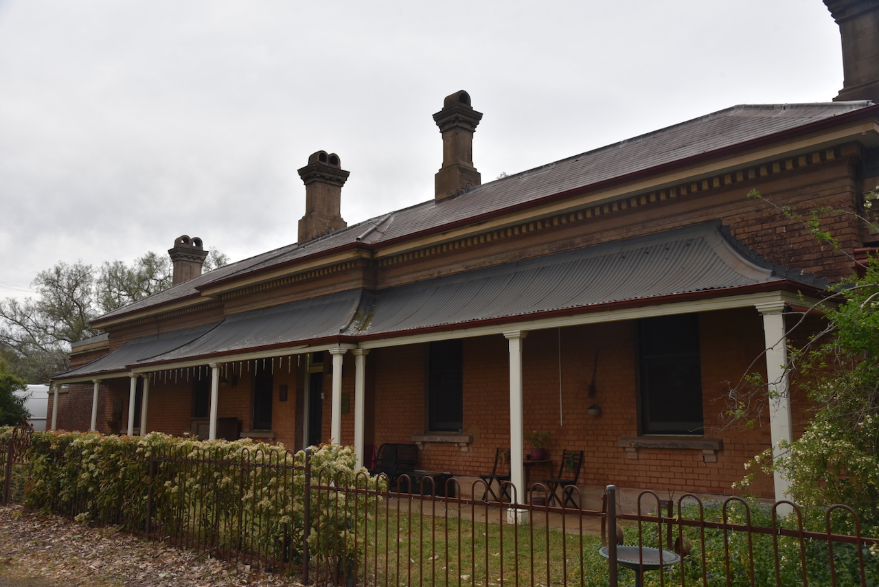
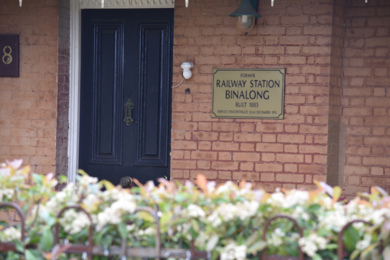
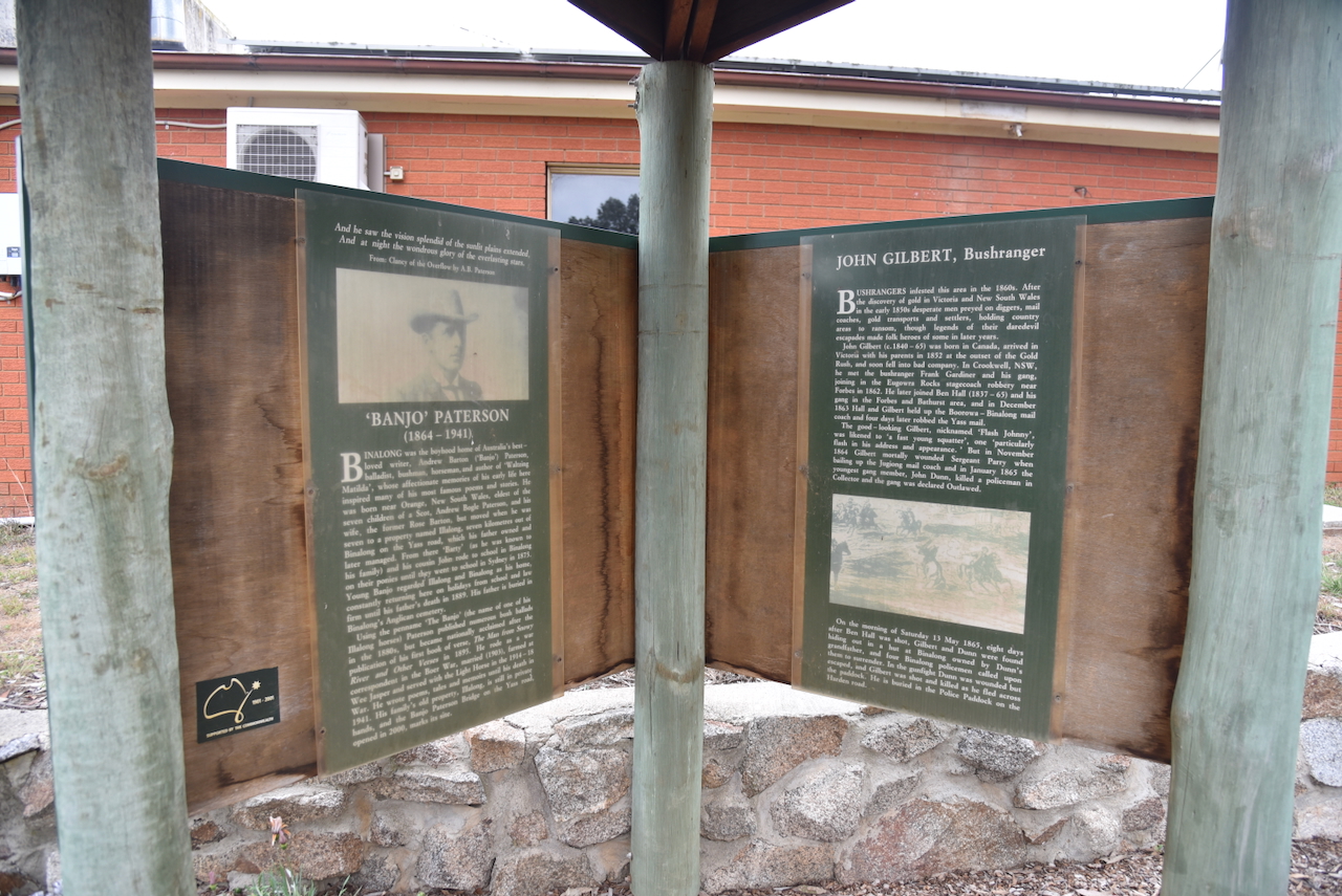
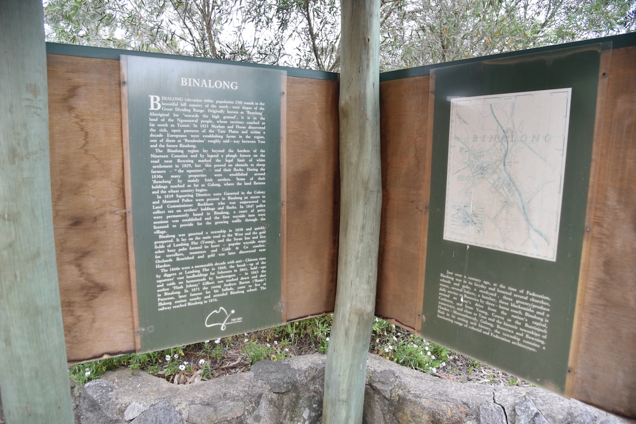
We continued on to Binalong, a small village about 37 km northwest of Yass. It is believed the name is derived from an Aboriginal word meaning ‘under the hills’, ‘surrounded by hills’ or ‘towards a high place.’ (Wikipedia 2025)

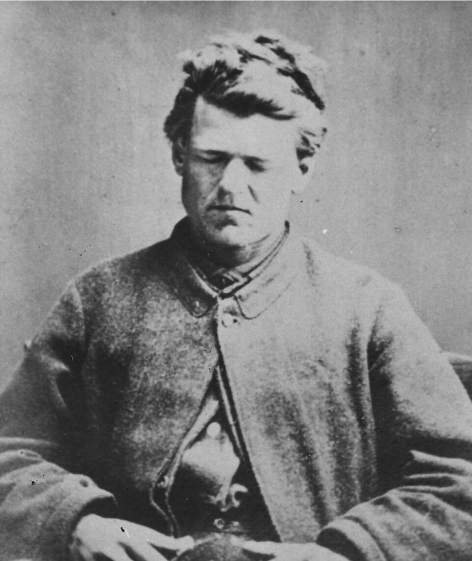
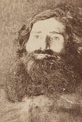
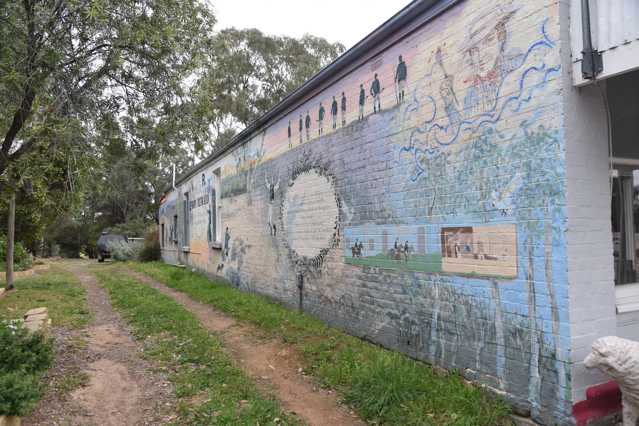
On the outskirts of Bingalong, on the western side of Burley Griffin Way, you can find the grave of the bushranger John Gilbert.

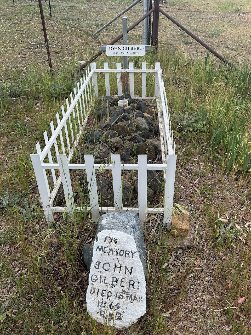
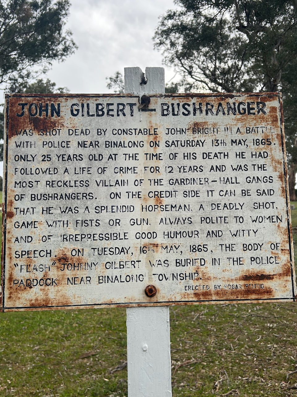
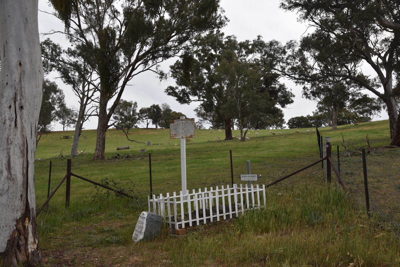
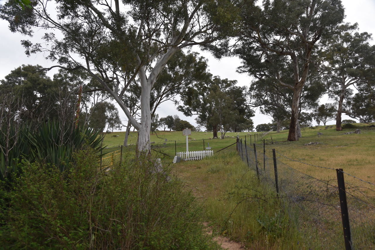
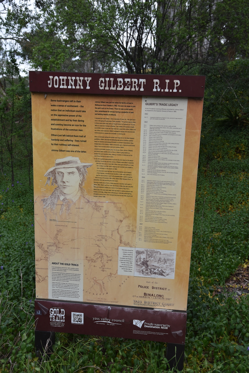
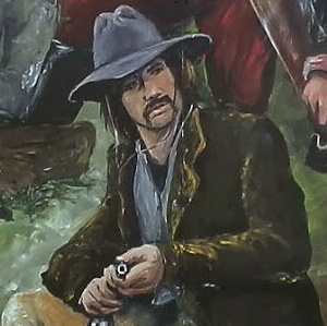
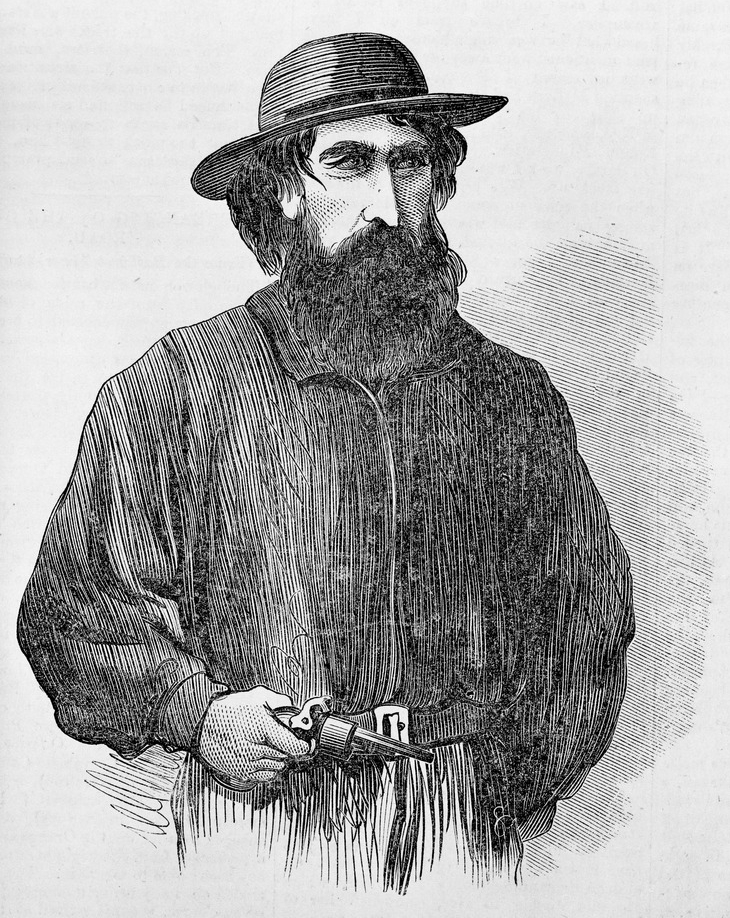
Gilbert was born in c. 1842 in Canada. He was shot dead by police on the 13th day of May 1865, aged just 23 years. (Wikipedia 2025)

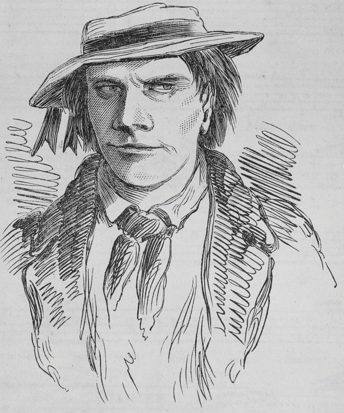
Above: John Gilbert. Image c/o WIkipedia

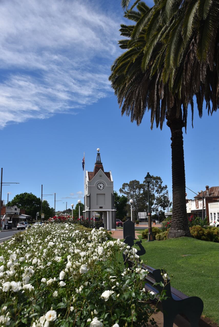
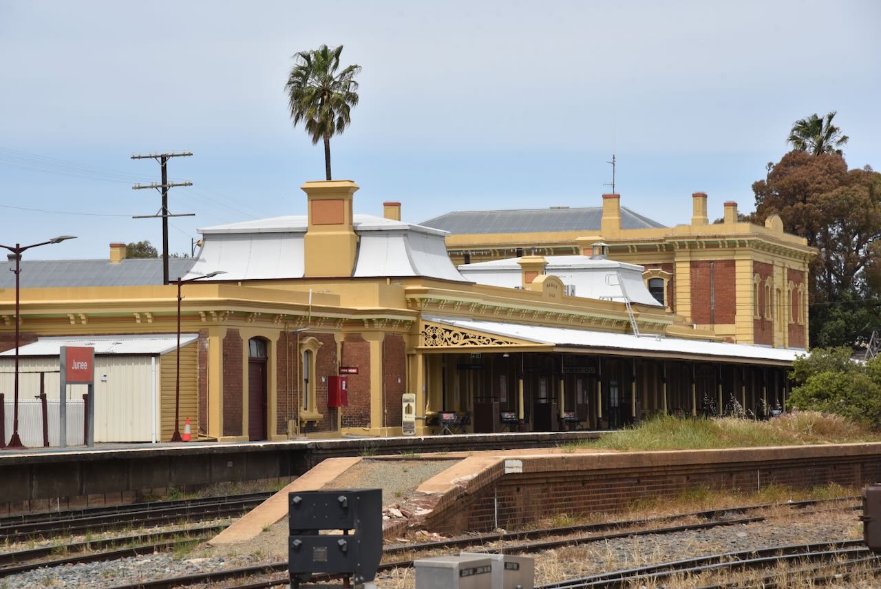
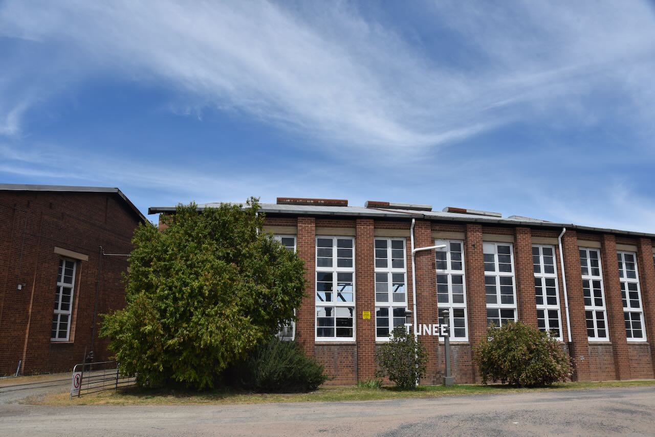
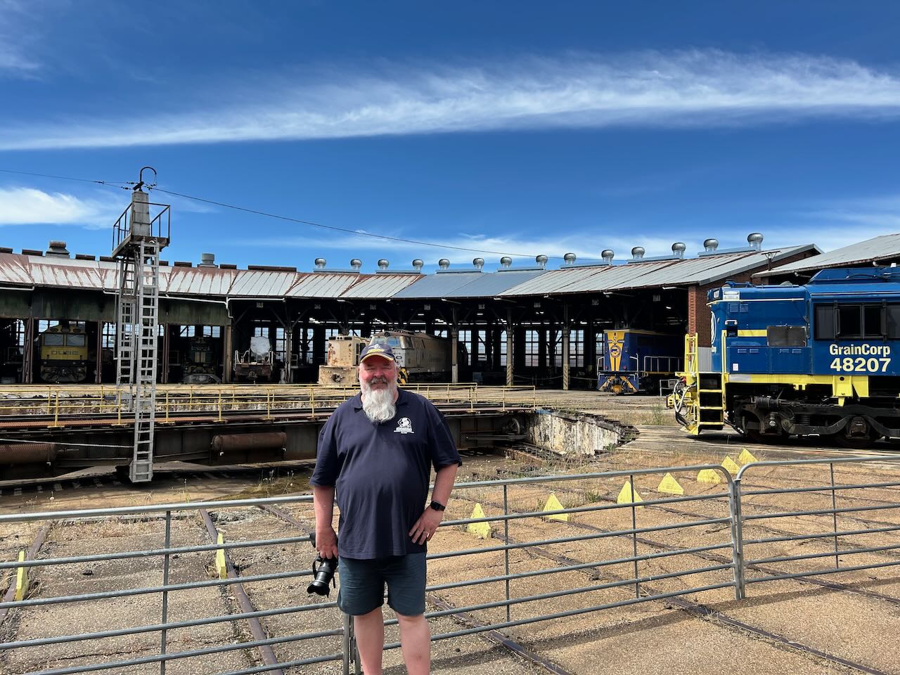
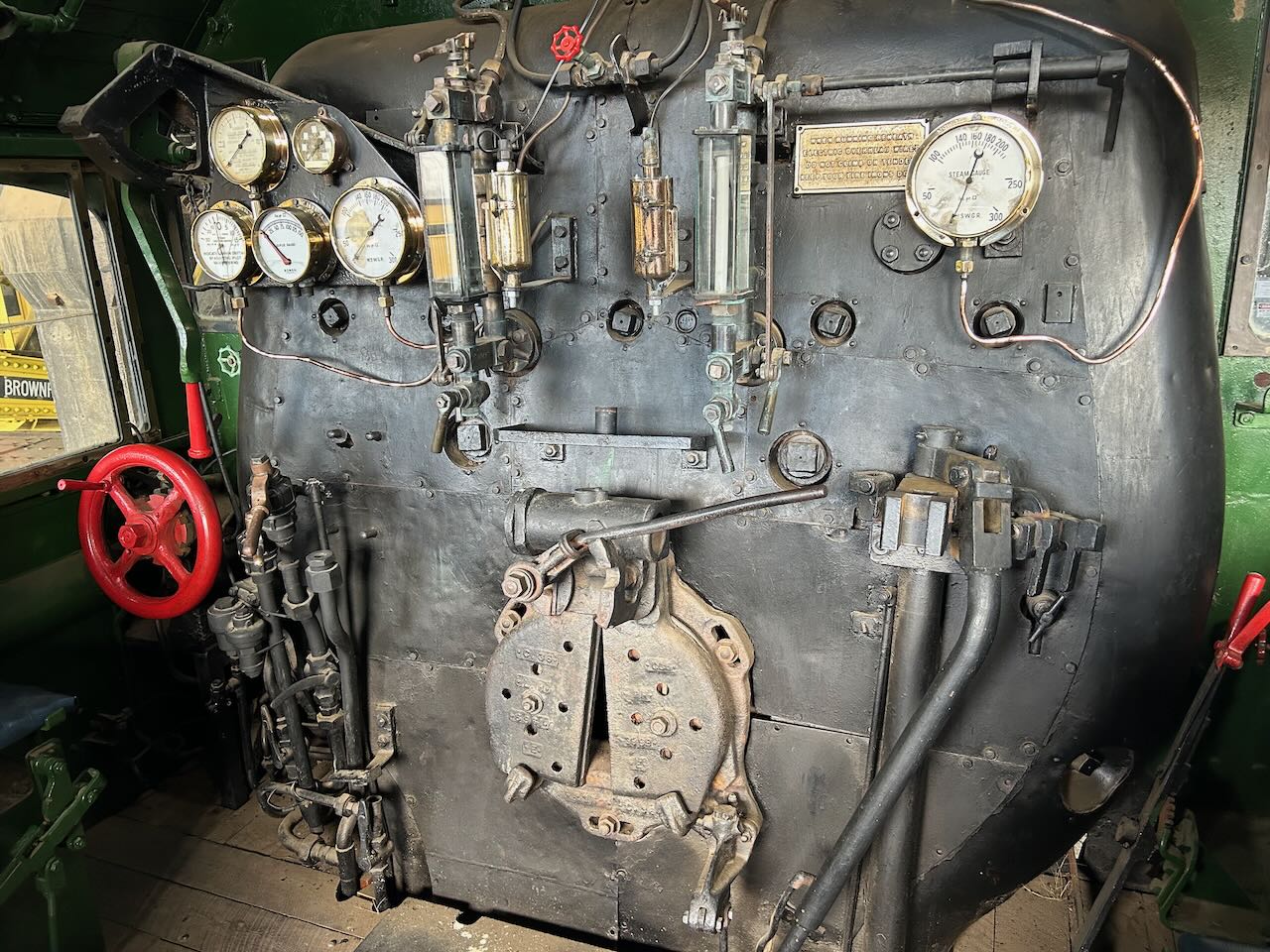
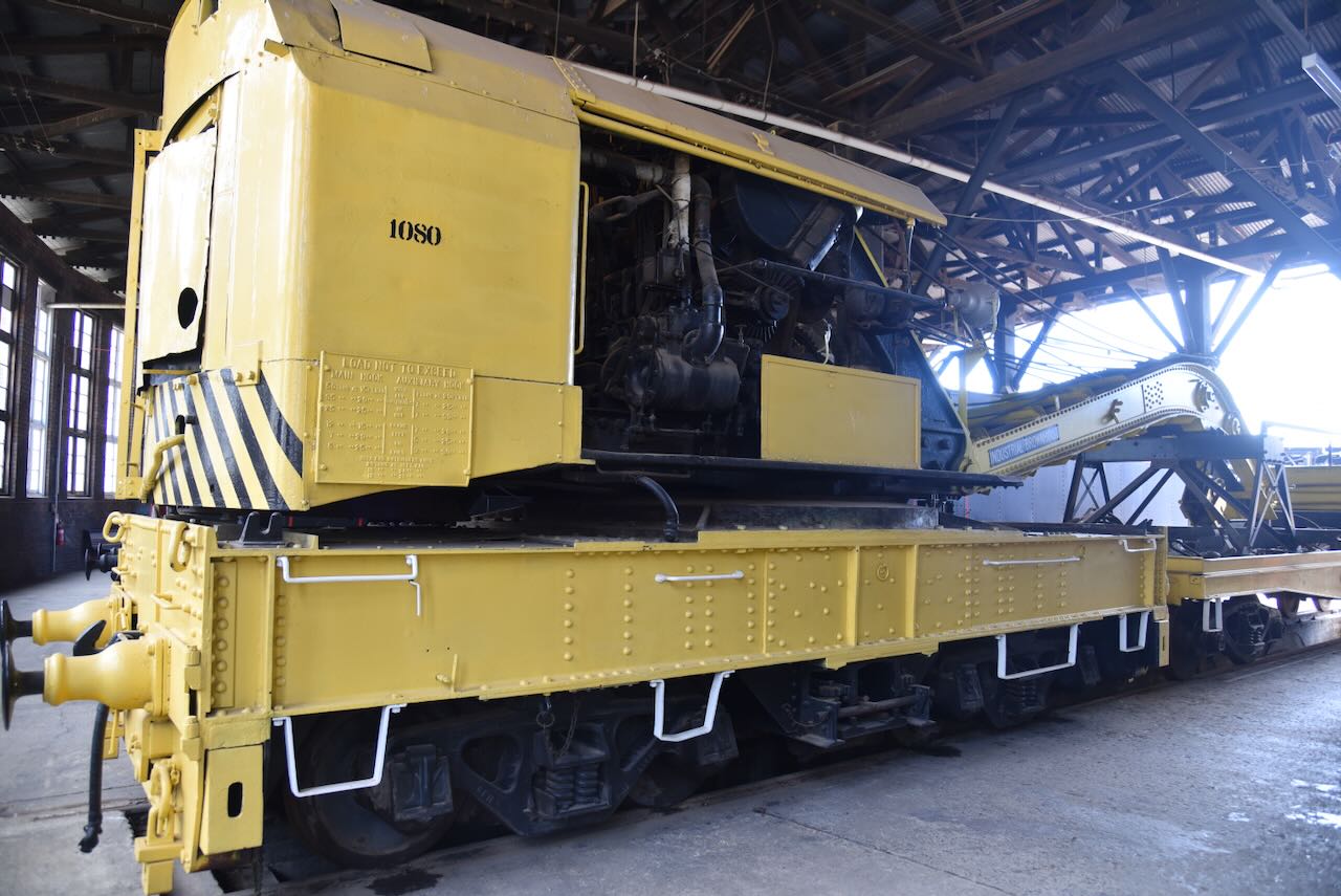
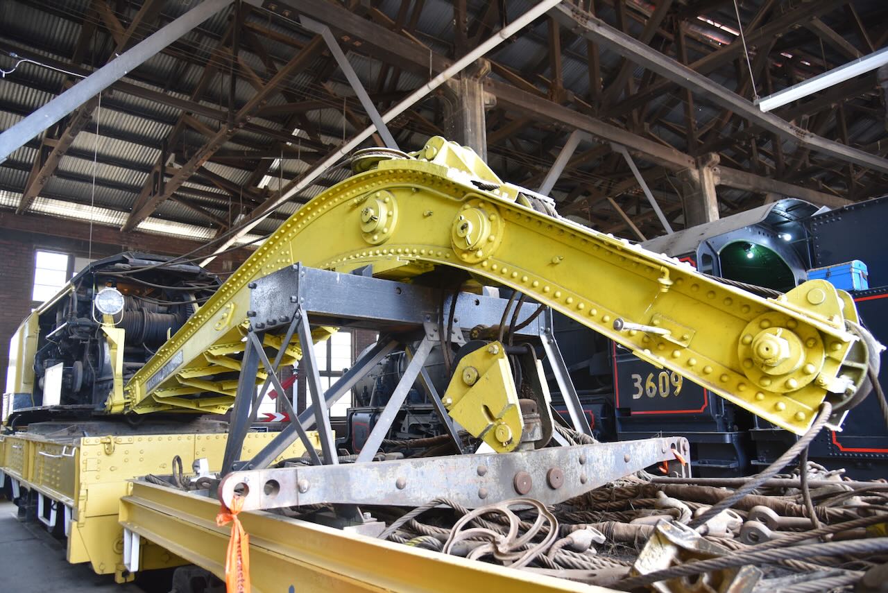
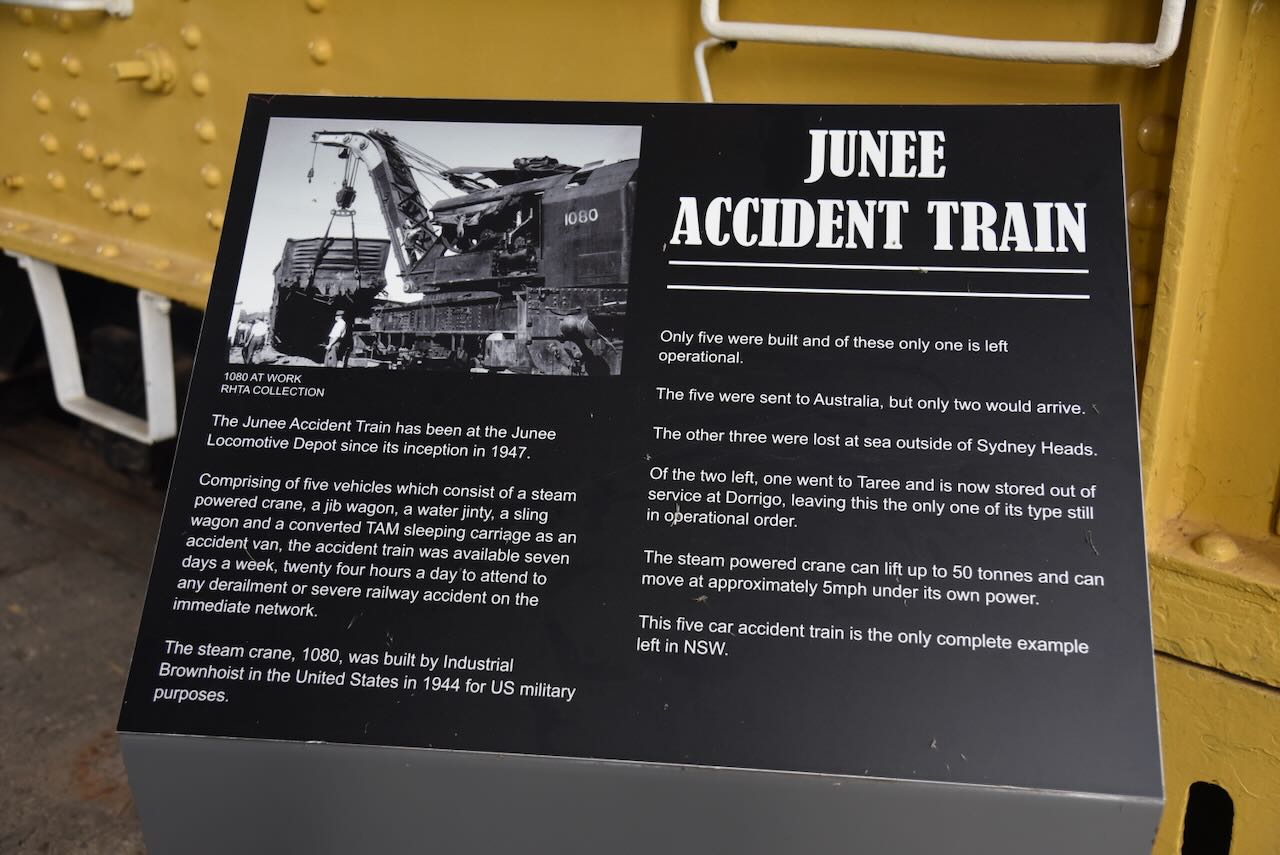
I wrote a little about Gilbert in a previous post about Junee:

Below is an excellent video on the life of John Gilbert.

On the side of the old Produce Store in Binalong is an excellent mural on the shooting of John Gilbert.

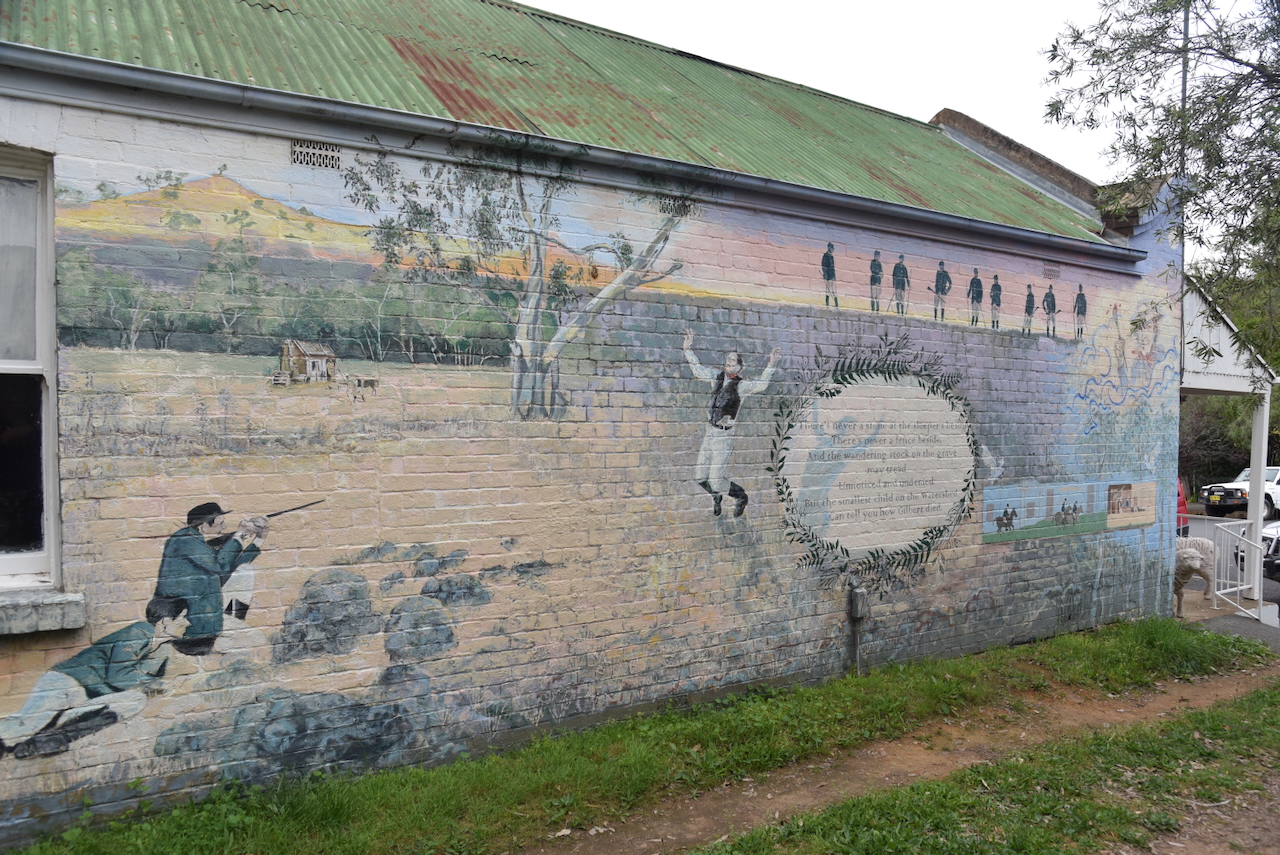
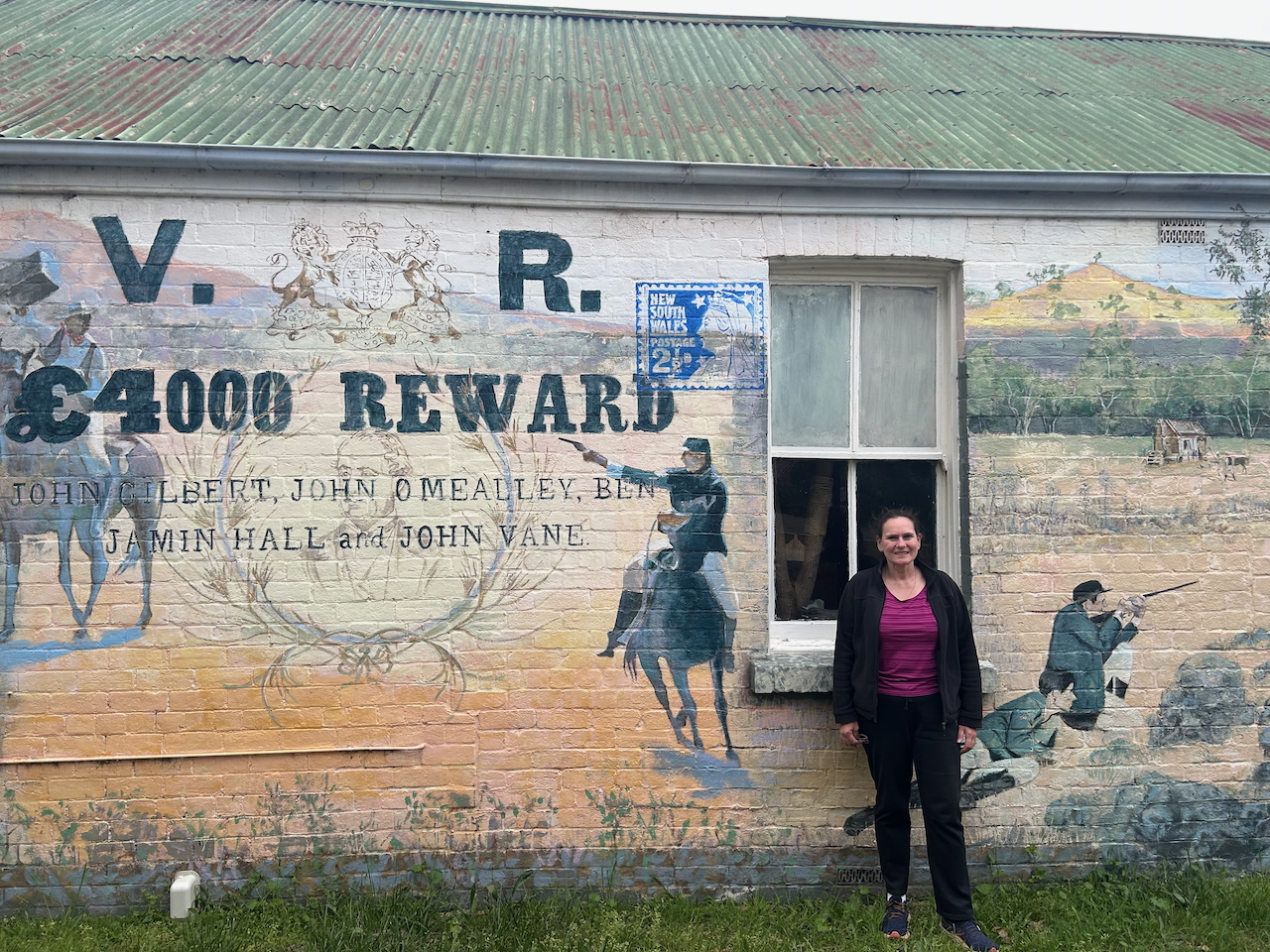
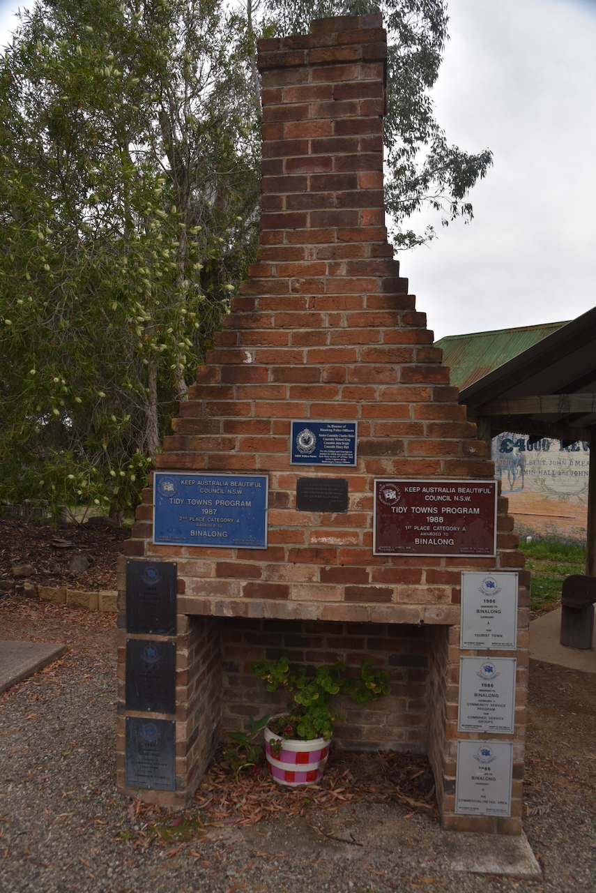
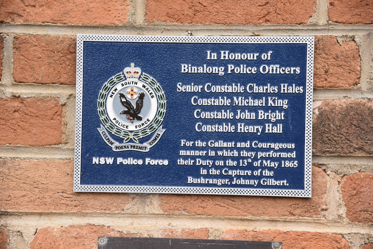
There is also a monument in honour of Senior Constable Charles Hales, Constable Michael King, Constable John Bright, and Constable Henry Hall, for the gallant and courageous manner in which they performed their duty on the 13th day of May 1865 in the capture of Gilbert.

There is also a bust of the Australian poet, Banjo Patterson, who spent part of his childhood at nearby Yass. Patterson drew inspiration from the rural life of the area and the bushranger John Gilbert.

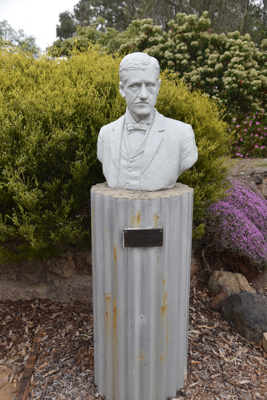
Patterson wrote a poem about Gilbert. Part of it reads:

But Gilbert walked from the open door
In a confident style and rash;
He heard at his side the rifles roar,
And he heard the bullets crash.
But he laughed as he lifted his pistol-hand,
And he fired at the rifle-flash.

Then out of the shadows the troopers aimed
At his voice and the pistol sound,
With rifle flashes the darkness flamed,
He staggered and spun around,
And they riddled his body with rifle balls
As it lay on the blood-soaked ground.

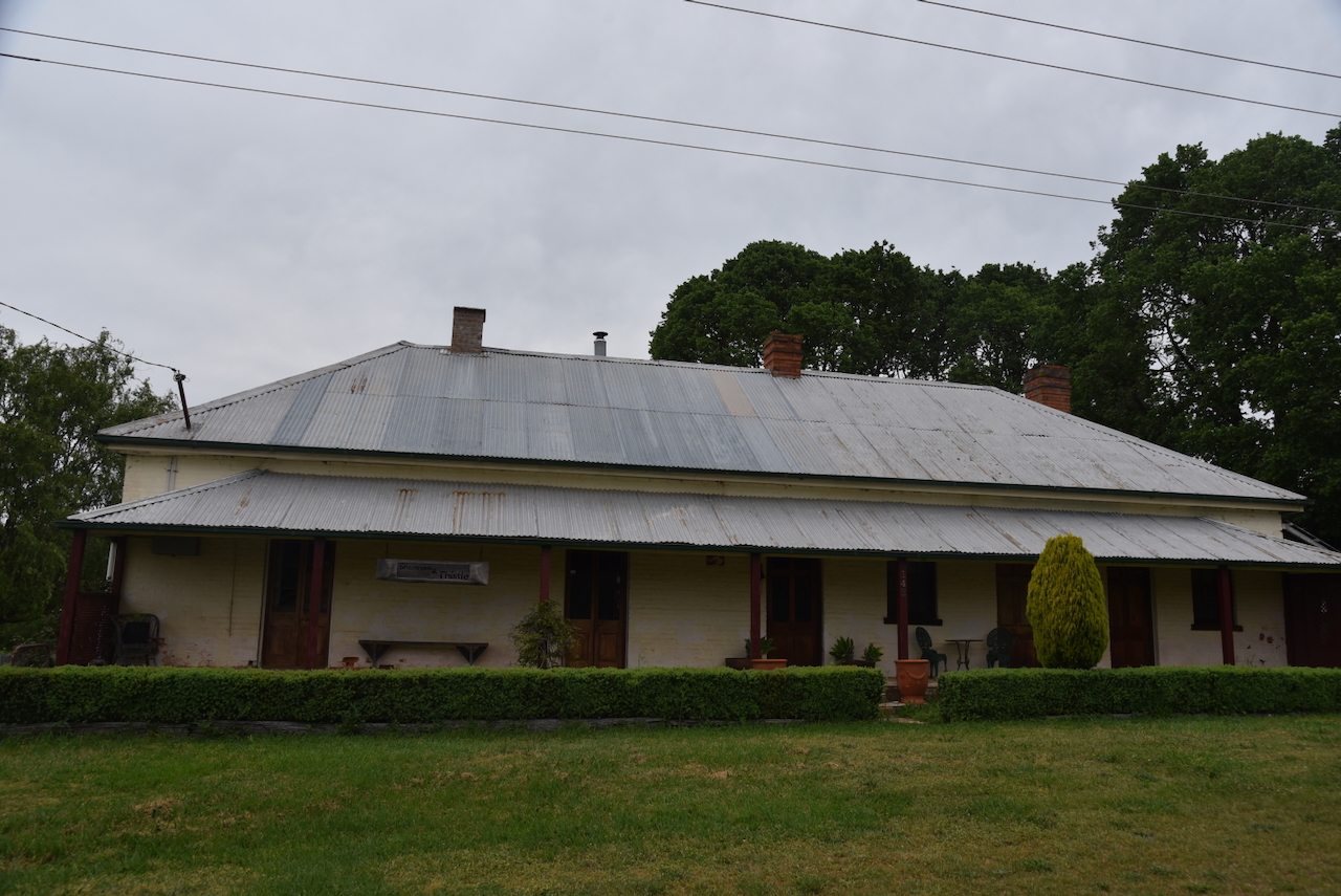
We continued on to the town of Bowning, about 14 km west of Yass. Bowning is believed to be an Aboriginal word meaning ‘big hill’. The explorers Hume and Hovell mentioned Bowning Hill in their journal of 1824. Bowning is one of the earliest settlements in the district. There are a number of historic buildings in Bowning, including the former Shamrock and Thistle Hotel. (Wikipedia 2025)

Marija and I then continued on to Canberra, where we booked into our accommodation, the Ibis Styles Canberra.

It had been a long day. But after freshening up, we headed off for dinner and then back to the motel room to finalise some issues for the 2025 VKFF National Get Together.

References.

  1. ancestry (2016). Ancestry® | Genealogy, Family Trees & Family History Records. [online] Ancestry.com.au. Available at: https://www.ancestry.com.au/. [Accessed 16 Jan. 2026]
  2. ‌Australiansiloarttrail.com. (2020). \r\n \n Murrumburrah Silo Art\n \r\n. [online] Available at: https://www.australiansiloarttrail.com/murrumburrah [Accessed 17 Jan. 2026].
  3. ‌Chirp Internet (2026). Former Hotel Shirley in Bethungra < New South Wales | Gday Pubs – Enjoy our Great Australian Pubs. [online] Gdaypubs.com.au. Available at: https://www.gdaypubs.com.au/NSW/bethungra/51160/former-hotel-shirley.html [Accessed 16 Jan. 2026].‌
  4. Hilltops Region – Young, Jugiong, Boorowa, Harden. (2026). Bill the Bastard- Australia’s Greatest Warhorse – Hilltops Region – Young, Jugiong, Boorowa, Harden. [online] Available at: https://visithilltopsregion.com.au/see-do/local-attractions/historical-sites-and-heritage-locations/bill-the-bastard-australias-greatest-warhorse/ [Accessed 17 Jan. 2026].
  5. ‌McIntyre, J. (1969). Adams, Philip Francis (1828–1901). [online] Anu.edu.au. Available at: https://adb.anu.edu.au/biography/adams-philip-francis-2867 [Accessed 17 Jan. 2026].
  6. ‌Office (2019). Murrumburrah to unveil Mackay Sculpture – Hilltops Council. [online] Hilltops Council. Available at: https://www.hilltops.nsw.gov.au/murrumburrah-to-unveil-mackay-sculpture/ [Accessed 17 Jan. 2026].
  7. ‌Rutledge, M. (1972). Hurley, John (1796–1882). [online] Anu.edu.au. Available at: https://adb.anu.edu.au/biography/hurley-john-3826 [Accessed 16 Jan. 2026].‌
  8. Service, C. (2023). Bradman’s Birthplace Museum Cootamundra. [online] NSW Government. Available at: https://www.nsw.gov.au/visiting-and-exploring-nsw/locations-and-attractions/bradmans-birthplace-museum-cootamundra [Accessed 16 Jan. 2026].‌
  9. Trove. (2026). OBITUARY – MRS. ELIZA ELLEN (. [online] Available at: https://trove.nla.gov.au/newspaper/article/144484044 [Accessed 16 Jan. 2026].‌
  10. Trove. (2026). The Western Herald (Bourke, NSW : 1887 – 1893; 1895 – 1903; 1906 – 1914; 1916 -1976) – 16 May 1952 – p9. [online] Available at: https://trove.nla.gov.au/newspaper/page/10630088?searchTerm=cootamundra [Accessed 16 Jan. 2026].
  11. ‌Trove. (2026). New South Wales Government Gazette (Sydney, NSW : 1832 – 1900) – 13 Aug 1861 – p1725. [online] Available at: https://trove.nla.gov.au/newspaper/page/12570694?searchTerm=cootamundry [Accessed 17 Jan. 2026].
  12. ‌Trove. (2026). DESCRIPTION OF COOTAMUNDRA. – Cootamundra Herald (NSW : 1877 – 1954) – 18 Jan 1879. [online] Available at: https://trove.nla.gov.au/newspaper/article/143905889?searchTerm=cootamundra [Accessed 17 Jan. 2026].
  13. ‌Wikitree.com. (2025). Eliza Ellen (Fife) Scholz (1846-1939) | WikiTree FREE Family Tree. [online] Available at: https://www.wikitree.com/wiki/Fife-1368 [Accessed 16 Jan. 2026].‌
  14. Wikipedia Contributors (2019). Don Bradman. [online] Wikipedia. Available at: https://en.wikipedia.org/wiki/Don_Bradman. [Accessed 16 Jan. 2026].‌‌
  15. Wikipedia Contributors (2025). Cootamundra. Wikipedia.‌
  16. Wikipedia. (2021). Cootamundra Domestic Training Home for Aboriginal Girls. [online] Available at: https://en.wikipedia.org/wiki/Cootamundra_Domestic_Training_Home_for_Aboriginal_Girls. [Accessed 16 Jan. 2026].‌‌
  17. ‌Wikipedia Contributors (2025). Muttama, New South Wales. Wikipedia.‌
  18. Wikipedia Contributors (2025). John Gilbert (bushranger). Wikipedia.‌
  19. Wikipedia Contributors (2025). Bowning. Wikipedia.‌

Ulandra Nature Reserve VKFF-2009

Our next activation for Thursday, 23rd October 2025, was the Ulandra Nature Reserve VKFF-2009, for the World Wide Flora Fauna (WWFF) program.

The reserve is located just to the southeast of the town of Bethungra. It is about 25 km southwest of Cootamunda and about 403 km southwest of the city of Sydney. (NSW NPWS 1994)

Above: Map showing the location of the Ulandra Nature Reserve VKFF-2009. Map c/o Google Maps

The park is located in close proximity to the town of Bethungra, which was officially established in December 1875 following the opening of the Post Office. (Wikipedia 2024)

Above: the boundaries of the Ulandra Nature Reserve. Image c/o Google Earth

The reserve is located on the western foothills of the Southern Tablelands and Alpine mountains of New South Wales. The reserve consists of a series of ridges, hills and valleys. Mount Ulandra, which is located in the reserve, rises to 761 metres. The summit qualifies for the Summits On The Air (SOTA) program as VK2/ RI-011, but we had nowhere near enough time to climb the summit. It has only been activated once before, back in 2014. (NSW NPWS 1994) (Wikipedia 2025)

Above: an aerial view of the Ulandra Nature Reserve. Image c/o Google Maps

Ulandra Nature Reserve was established in June 1981 and covers an area of about 3,931 hectares. It was dedicated to protect a number of stands of Cootamunda Wattle and Black Cyprus Pine. (NSW NPWS 1994) (NSW National Parks 2026)

The threatened Superb Parrot can be found in the park, along with the vulnerable Turquoise Parrot. Other bird species include Little Eagle, Gang-gang cockatoo, Diamond firetail, and Scarlet Robin. (www.environment.gov.au, n.d.) (Wikipedia 2025)

Native animals found in the reserve include Grey Kangaroos, Swamp Wallabies, Brushtail possums, and Ringtail Possums.

We accessed the reserve via Mahomets Road, which runs off the Olympic Highway. There is no vehicular access to the park.

We ran the Yaesu FT857, 40 watts, and the 20/40/80m linked dipole supported on a 7 metre heavy-duty squid pole. Sadly, we found the band conditions during the activation to be quite poor.

Marija worked the following stations on 40m SSB:-

  1. VK3AUN/P (VKFF-2122)
  2. VK2IO/P (VKFF-1271)
  3. VK2GEZ/P (VKFF-1271)
  4. VK2HRX/P (VKFF-0054)
  5. VK1AD/P (SOTA VK1/ AC-043)
  6. VK1AO
  7. VK2MET
  8. VK1MA
  9. VK3PF/P (VKFF-4984)
  10. VK2VW
  11. VK2HFI
  12. VK2AKA
  13. VK2BUG

I worked the following stations on 40m SSB:-

  1. VK3AUN/P (VKFF-2122)
  2. VK2HRX/P (VKFF-0054)
  3. VK2IO/P (VKFF-1271)
  4. VK2GEZ/P (VKFF-1271)
  5. VK1AD/P (SOTA VK1/ AC-043)
  6. VK1AO
  7. VK2MET
  8. VK1MA
  9. VK3PF/P (VKFF-4984)
  10. VK2VW
  11. VK2HFI
  12. VK2AKA
  13. VK2BUG
  14. VK3ZSC
  15. VK3CEO
  16. VK3WSG
  17. VK3VIN
  18. VK3UH
  19. VK3CLD
  20. VK2DBF
  21. VK5QA
  22. VK5WU
  23. VK2HLM
  24. VK5CZ/M
  25. VK5XE/M

References.

  1. NSW National Parks. (2026). Ulandra Nature Reserve. [online] Available at: https://www.nationalparks.nsw.gov.au/visit-a-park/parks/ulandra-nature-reserve [Accessed 13 Jan. 2026].
  2. ‌NSW National Parks and Wildlife Service, 1994, Ulandra Nature Reserve Plan of Management
  3. http://www.environment.gov.au. (n.d.). Australian Heritage Database. [online] Available at: https://www.environment.gov.au/cgi-bin/ahdb/search.pl?mode=place_detail. [Accessed 13 Jan 2025]‌
  4. Wikipedia Contributors (2025). Ulandra Nature Reserve. Wikipedia.‌
  5. Wikipedia Contributors (2024). Bethungra. Wikipedia.‌

Illabo silo VK-ILO2

Our next silo activation for Thursday, 23rd October 2025, was the Illabo silo VK-ILO2.

Illabo is located about 53 km northeast of Wagga Wagga, and about 413 km west of the city of Sydney.

Above: Map showing the location of Illabo, NSW. Map c/o Google Maps

It is unclear where the name of the town originated from. Some suggest that the word is derived from an Aboriginal word meaning ‘where’, while others say it is a clipping of billabong. (Wikipedia 2025)

The first Europeans in the area were squatters laying claims in the early 1840s. The original town of Illabo was situated near the stone quarry on the hill behind the present cemetery, about 2 km towards Junee. A railway station was constructed in 1878 and remained until the 1970s. The Illabo Post Office opened on the 1st day of July 1879. Illabo has an annual agricultural show which is considered to be one of the best one-day shows in New South Wales for its size. (Visitnsw.com 2024) (Wikipedia 2025)

The Illabo silos are located alongside the railway line on the southern side of the Olympic Highway.

Construction of the silos commenced in 1918. (Trove 2025)

Above: article from the Cootamunda Herald, Tue 5 Nov 1918. Image c/o Trove

Marija and I parked in the rest area adjacent to the silos and operated from the 4WD. We ran the Icom IC-7000, 100 watts, and the Codan 9350 with the 1.5 metre stainless steel whip.

Above: the activation zone at the Illabo silo. Image c/o SiOTA website.

Marija worked the following stations on 40m SSB:-

  1. VK2IO/p (VKFF-1271)
  2. VK3CLD
  3. VK2DBF
  4. VK5QA
  5. VK2NP
  6. VK2VW
  7. VK2HFI
  8. VK2AKA
  9. VK2BUG
  10. VK2COS
  11. VK3PF/P (VKFF-4984)

I worked the following stations on 40m SSB:-

  1. VK2IO/p (VKFF-1271)
  2. VK3CLD
  3. VK2DBF
  4. VK5QA
  5. VK2NP
  6. VK2VW
  7. VK2HFI
  8. VK2AKA
  9. VK2BUG
  10. VK2COS
  11. VK3PF/P (VKFF-4984)

References.

  1. Visitnsw.com. (2024). Illabo Show. [online] Available at: https://www.visitnsw.com/destinations/country-nsw/riverina/junee/events/illabo-show [Accessed 13 Jan. 2026].
  2. ‌Wikipedia Contributors (2025). Illabo. Wikipedia.‌

Marinna silo VK-MRM2

After leaving Junee on Thursday, 23rd October 2025, Marija and I travelled east out of Junee on the Olympic Highway until we reached the Marinna silo VK-MRM2.

The Olympic Highway was originally known as Olympic Way. It was renamed in 1996, and the route between Wagga Wagga and Cowra was used for the 2000 Sydney Olympic Games torch relay. (Wikipedia 2025)

The Boree Siding railway station opened in February 1897. In September 1910, it was renamed Marinna. It closed in 1975. The Marinna Post Office opened on the 7th day of December 1925 and closed in 1968. Marinna is believed to be an Aboriginal word meaning ‘son’. (Nswrail.net 2026) (Wikipedia 2021)

Above: Article from the Daily Advertiser, Wagga Wagga, Wed 21 Oct 1925. Image c/o Trove

A newspaper article in August 1939 recorded that Marinna had a population of 58 people, comprising 30 males and 28 females, and a total of 14 dwellings. Marinna once had its own football club and an Agricultural Bureau. (Trove 2026)

Above: Article from the Daily Advertiser, Wagga Wagga, Tue 30 May 1933. Image c/o Trove

The Marinna silo is located alongside the Main South Railway line, on the southern side of the Olympic Highway.

The silo at Marinna was built in 1927. (Trove 2026)

Above: article from the Daily Advertiser, Wagga Wagga, Thu 24 Nov 1927. Image c/o Trove

In 1949, it was announced that additional storage bins would be constructed at seven elevators in New South Wales. This included Marinna, where two additional bins, each with a 50,000 bushel capacity, would be constructed. (Trove 2026)

Above: part of an article from the Cootamundra Herald, Fri 14 Jan 1949. Image c/o Trove

Marija and I parked the 4WD alongside the silos and operated from the vehicle, running the Icom IC-7000, 100 watts, and the Codan 9350 antenna with the 1.5 metre stainless steel whip.

Above: the activation zone at the Marinna silo. Image c/o SiOTA website

Marija worked the following stations on 40m SSB:-

  1. VK2IO/P (VKFF-1271)
  2. VK2NP
  3. VK2HBG/P (Silo VK-PMA2)
  4. VK1AO
  5. VK2MET
  6. VK3BWS
  7. VK2VW
  8. VK2HFI
  9. VK2AKA
  10. VK2BUG
  11. VK3CLD
  12. VK2DBF
  13. VK5QA
  14. VK3PF/P (VKFF-4984)

I worked the following stations on 40m SSB:-

  1. VK2IO/P (VKFF-1271)
  2. VK2NP
  3. VK2HBG/P (Silo VK-PMA2)
  4. VK1AO
  5. VK2MET
  6. VK3BWS
  7. VK2VW
  8. VK2HFI
  9. VK2AKA
  10. VK2BUG
  11. VK3CLD
  12. VK2DBF
  13. VK5QA
  14. VK3PF/P (VKFF-4984)
  15. VK2HBR

References.

  1. Nswrail.net. (2026). Marinna Station. [online] Available at: https://www.nswrail.net/locations/show.php?name=NSW:Marinna [Accessed 13 Jan. 2026].
  2. ‌Trove. (2026). MARINNA – Daily Advertiser (Wagga Wagga, NSW : 1911 – 1954) – 27 Mar 1935. [online] Available at: https://trove.nla.gov.au/newspaper/article/144551857?searchTerm=marinna [Accessed 13 Jan. 2026].
  3. ‌Trove. (2026). ‘Marinna’ – AUSTRALIAN TOWN’S OPPORTUNITY. – Mount Barker and Denmark Record (Albany, WA : 1929 – 1949) – 14 Aug 1939. [online] Available at: https://trove.nla.gov.au/newspaper/article/240451443?searchTerm=marinna [Accessed 13 Jan. 2026].
  4. ‌Trove. (2026). Cootamundra Herald (NSW : 1877 – 1954) – 14 Jan 1949 – p1. [online] Available at: https://trove.nla.gov.au/newspaper/page/16443367?searchTerm=marinna [Accessed 13 Jan. 2026].
  5. ‌Trove. (2026). Daily Advertiser (Wagga Wagga, NSW : 1911 – 1954) – 24 Nov 1927 – p2. [online] Available at: https://trove.nla.gov.au/newspaper/page/15656371?searchTerm=marinna%20silo [Accessed 13 Jan. 2026].
  6. ‌Wikipedia Contributors (2025). Olympic Highway. Wikipedia.‌
  7. Wikipedia Contributors (2021). Marinna. Wikipedia.‌

Junee silo VK-JNE2

Our next activation for Thursday, 23rd October 2025, was the Junee silo VK-JNE2, for the Silos On The Air (SiOTA) program.

Junee is located in the Riverina region of New South Wales, about 432 km southwest of the city of Sydney.

Above: Map showing the location of Junee, NSW. Map c/o Google Maps

The exact origin of the name Junee is unknown. Some suggest that it derives from the Aboriginal word Jewnee, which means ‘speak to me’. Another theory is that it originates from the Aboriginal word Choo-nee, meaning ‘frog.’ (Trove 2025) (Trove 2026)

The traditional people of the Junee district are the Wiradjuri Aboriginal people. One of the first Europeans to settle in the district was Leopold Fabius Dietegan Fane De Salis. He was born in April 1816 in Florence, Italy. He arrived in Sydney in 1840 aboard the Royal George. He acquired Darbalara station on the Murrumbidgee, where he built a public house and a station store. In 1844, he married Charlotte MacDonald. In that same year, he became a Magistrate. In 1845, he established the Jewnee pastoral run, which he held for a period of 3 years before several other squatters held the licence. Thomas Hammond and Richard Gwynne purchased the licence in 1857. In 1864, he was elected to the Legislative Assembly for Queanbeyan. In 1874, he was appointed to the Legislative Council. He died in 1898. (Anu.edu.au, 1972) (Elder 2025)

Above: Leopold De Salis. Image c/o Wikipedia

In 1861, the Jewnee Hotel was opened by James Harris. It was a stagecoach stop for people travelling between Temora, Wagga Wagga, and Cootamundra. (Elder 2025) (Junee Council 2021)

In 1862, a Post Office opened in the hotel. At this time, the population of Jewnee was just 12 people. (Elder 2025) (Junee Council 2021)

On the 28th day of April 1863, the village of Jewnee was gazetted. (Elder 2025) (Trove 2026)

Above: NSW Govt Gazette, Tue 28 Apr 1863. Image c/o Trove

At this time, there was a significant amount of bushranger activity in the district. This included the Gardiner-Hall, who roamed the central west of the Colony of New South Wales during the 1860s. The gang was named after their leaders, Frank Gardiner and Ben Hall. The gang included John Gilbert, John Vane, John O’Meally, and Michael Burke. (Wikipedia 2025)

John Gilbert was born in c. 1842 in Hamilton, Canada West. He arrived in Australia in 1852. He joined the Ben Hall Gang and was shot dead by police in May 1865, aged just 23 years. (Wikipedia 2025)

Above: John Gilbert. Image c/o Wikipedia

John Vane was born in 1842 in Jerry’s Plains, New South Wales. He was a childhood friend of the bushranger Michael Burke. Vane’s first armed robbery was committed in 1863. He died in 1906 in Cowra Hospital. (Wikipedia 2025)

Above: John Vane, c. 1880. Image c/o WIkipedia

John ‘Jack’ O’Meally was born in June 1840 at Cunningham Creek, New South Wales. He was considered to be the most violent and hot-headed of the Gardiner-Hall gang. He was shot and killed in November 1863. (Wikipedia 2025)

Above: John O’Meally. Image c/o Ikeshut2, Wikipedia

Michael Burke was born in 1843 at Fell Timber Creek, New South Wales. In October 1864, he took part in an assault on the residence of a Gold Commissioner at Dunn’s Plains. He sustained a gunshot wound during the incident and announced he would not be taken alive. He then shot himself in the head with his revolver. (Wikipedia 2025)

Above: Michael Burke. Image c/o Wikipedia

On the 8th day of July 1863, John Gilbert and John O’Meally committed a robbery on the public house & store at Junee. Whilst armed with firearms, they robbed the store of goods and money of about £50. (Trove 2025)

On the 27th day of August 1863, John Gilbert, John Vane, and another male committed a raid on Hammond’s store, while O’Meally and Burke robbed William’s Hotel. Upon leaving Junee, the gang stole two of Hammond’s horses, five packhorses and goods and cash to the value of £250. (Elder 2025) (A Guide to Australian Bushranging, 2019)

At Hammond’s store, the family were at dinner when the three bushrangers struck. They were recognised as Gilbert, Vane, and possibly Gardiner. Gilbert was described as being the ‘mouthpiece’ while the other two ransacked the rooms, taking outfits of wearing apparel, a watch, jewellery, and gunpowder. They also demanded Hammond’s horses. (Trove 2026)

Above: article from the Mount Alexander Mail, Tue 8 Sept 1863. Image c/o Trove

In 1867, Robert Cotterell @ Bluecap and his gang robbed a hotel in Jewnee. Cotterell was born in 1847 in Sydney. He commenced bushranging in 1867 and led a gang responsible for numerous robberies throughout the Riverina region of New South Wales. Cotterell suffered from the condition of ophthalmia, an inflammation of the eyes that made him sensitive to light. He wore a piece of cloth to protect his eyes from sunlight, and as a result, he was given the alias of Bluecap. (Wikipedia 2025)

Above: Robert Cotterell @ Bluecap. Image c/o WIkipedia

By 1876, when the branch railway line reached Hay, the town of Jewnee moved to the south around the north of the Railway Station. The population of Jewnee was 20 people. However, over 200 people resided in the surrounding district. (Junee Council 2021)

By the 1880s, Jewnee had a hotel, a store, a provisional school with over thirty pupils, a private school, two churches and a post office. By 1890, the town had a butcher and a blacksmith. (Junee Council 2021)

The bushranger, Captain Moonlite and other well-known bushrangers often stopped over at the Jewnee Hotel. (Junee Council 2021)

In October 1885, the village was renamed Old Junee. (Junee Council 2021)

The Junee silos are located at the end of Lord Street on the northwestern side of Junee. It is operated by GrainCorp, which is Australia’s largest grain storage and handling company. One of its largest sites is Junee, where there is a capacity of 3000,000 tonnes of grain. The facility also receives wheat, barley and canola from local growers. (Facebook 2026)

Marija and I parked at Loftus Oval on Sunnyside Road and operated from the 4WD, running the Icom IC-7000, 100 watts, and the Codan 9350 antenna with the 1.5 metre stainless steel whip.

Above: the activation zone at the Junee silos. Image c/o SiOTA website

Marija worked the following stations on 40m SSB:-

  1. VK1AO
  2. VK2MET
  3. VK1CHW
  4. VK2CHW
  5. VK3CLD
  6. VK5QA
  7. VK2DBF
  8. VK2IO
  9. VK2LEE

I worked the following stations on 40m SSB:-

  1. VK1AO
  2. VK2MET
  3. VK1CHW
  4. VK2CHW
  5. VK3CLD
  6. VK5QA
  7. VK2DBF
  8. VK2IO
  9. VK2LEE
  10. VK6ASK/M
  11. VK3PF/M
  12. VK2VW
  13. VK2HFI
  14. VK2AKA
  15. VK2BUG
  16. VK3CEO
  17. VK3VIN
  18. VK5NJ
  19. VK3TBS
  20. VK2HBG/M
  21. VK2HLM
  22. VK5GY
  23. VK2BR
  24. VK3WSG

Following our silo activation, Marija and I visited the Junee Licorice & Chocolate Factory. Marija is a huge fan of licorice. The factory is located in the old Junee flour mill, which was built in 1934.

This is definitely somewhere that you need to visit if you are in Junee.

Marija even got to make her own spinkle biscuit for our grandchildren.

And of course, I got to indulge in a chocolate thickshake in the cafe.

We left with a bag of goodies, including Marija’s very own spinkle biscuit.

Next to the Licorice & Chocolate factory is the GasWorks Garage Museum. Looks are deceptive. From the outside, this museum does not look like much, but if you are a car buff like me, it is well worth stepping inside.

The museum contains an impressive collection of motor vehicles.

And a collection of old lawnmowers.

Marija and I then headed to the main street of Junee for a look at some of the several historic buildings.

The Athenium Theatres was built in 1929 by J. Nyssen and was designed by Kaberry and Chared, an Australian architectural firm who were well known for designing theatres, picture theatres and town halls. In 2004, it was added to the New South Wales State Heritage Register. (Wikipedia 2025)

The Junee War Memorial Clock Tower was unveiled on Empire Day on the 24th day of May 1928. It honours those who fell during the First World War. (Nsw.gov.au 2020)

The Junee Railway Station opened on the 6th day of July 1878. In 1999, it was added to the New South Wales State Heritage Register. (Wikipedia 2026)

In Dobyn Park at Junee, you can also find a statue to commemorate sports commentator Ray ‘Rabbits’ Warren, who was born in Junee. (UBC Web Design 2026)

Our next stop was the Junee Roundhouse Museum.

Inside the museum, you will find an extremely impressive model train display. The model railway was initially built by Mr Greg Gibson, who was the Australian High Commissioner to Malta. He was also a well-known jazz musician. Greg died in 1998, and following his death, the model railway was donated to the Roundhouse Museum. Since then, museum volunteers have extended the model. (The Junee Roundhouse Museum n.d.)

The museum also houses a large variety of railway memorabilia.

And of course, outside is the 100-foot Junee turntable. (The Junee Roundhouse Museum n.d.)

The Junee Roundhouse was opened in 1947, and at the time was the largest in the Southern Hemisphere. Construction commenced in 1943. It features 42 repair bays and is still operational. (The Junee Roundhouse Museum n.d.)

Above: Article from The Gundagai Independent, Wed 1 Oct 1947. Image c/o Trove

Also outside is the very impressive collection of trains.

You can board several of the old trains and carriages and step back in time.

Branch Line diesel electric locomotive 4872 was built by A.E. Goodwin under licence from the American Locomotive Company. It was delivered in 1959. Locomotive 4872 entered service in 1964 and is displayed in the ‘Red Terror’ livery applied by the State Rail Authority during the late 1980s.

One of the very interesting trains on display is Mail Van KP 1942. It was placed in service in August 1914.

The LFX 1776 Second Class Express Lavatory Carriage was built by Clyde Engineering Ltd in 1913. It had six compartments, each of which had access to a lavatory.

Mainline Diesel Electric Locomotive 44666 is painted in the ‘Candy’ livery as it was when operating out of the Junee depot during the 1980s. The 442 class were built from 1971 to replace the 40 class locomotives that dated from 1951. They were known as ‘Jumbo’ to enginemen, as they were constructed at the samw time as the 747 jumbo jets.

Steam Locomotive 2413 was built for the NSWGR by Dubs & Company, Glasgow, Scotland, in 1891. They were used on mainline goods workings until displaced by ‘Standard Goods’ 2-8-0 engines. This particular locomotive was used right up until 1975 for shunting duties at Bunnerong Power Station at Port Botany.

Locomotive 3609 is a C36 class that was introduced into service in 1928. It was built by the NSWGR’s Eveleigh Workshops. It was withdrawn from service in 1965.

The Junee Accident Train has been at the Junee depot since its opening in 1947. It comprises five vehicles: a steam-powered crane, a jib wagon, a watery jinty, a sling wagon, and a converted TAM sleeping carriage as an accident van. The accident train was available 24/7 to attend to any derailment or railway accident. The steam crane is one of only five that were built, and of those, only this one at Junee is operational.

After an incredibly interesting visit to the Junee Roundhouse Museum, it was time for us to head off and activate another silo.

References.

  1. A Guide to Australian Bushranging. (2019). Johnny Gilbert: An Overview. [online] Available at: https://aguidetoaustralianbushranging.wordpress.com/2019/08/14/johnny-gilbert-an-overview/ [Accessed 13 Jan. 2026].
  2. ‌Anu.edu.au. (1972). de Salis, Leopold Fabius (1816–1898). [online] Available at: https://adb.anu.edu.au/biography/de-salis-leopold-fabius-3402 [Accessed 12 Jan. 2026].
  3. ‌Elder, B. (2025). A complete guide to Warrnambool, VIC. [online] Australian Geographic. Available at: https://www.australiangeographic.com.au/news/2025/05/a-complete-guide-to-junee-nsw/ [Accessed 13 Jan. 2026].
  4. ‌Facebook.com. (2026). Michael McCormack MP. [online] Available at: https://www.facebook.com/MichaelMcCormackMP/posts/with-its-roots-going-back-more-than-100-years-graincorp-is-australias-largest-gr/1230750091754561/ [Accessed 13 Jan. 2026].
  5. ‌Junee Council, 2021, Old Junee Village Improvement PLan
  6. Nsw.gov.au. (2020). Junee War Memorial Clock Tower | NSW War Memorials Register. [online] Available at: https://www.warmemorialsregister.nsw.gov.au/content/junee-cenotaph [Accessed 13 Jan. 2026].
  7. ‌The Junee Roundhouse Museum. (n.d.). The Junee Roundhouse Museum. [online] Available at: https://roundhousemuseum.com.au/. [Accessed 13 Jan. 2026]
  8. ‌Trove. (2025). PLACE NAMES – The Romance of Australian – The Australian Women’s Weekly (1933 – 1982) – 13 May 1964. [online] Available at: https://trove.nla.gov.au/newspaper/article/55185386. [Accessed 13 Jan. 2026]‌
  9. Trove. (2026). Village of .Junee – ORIGINALLY PART OF JUNEE RUN – Daily Advertiser (Wagga Wagga, NSW : 1911 – 1954) – 28 Sept 1936. [online] Available at: https://trove.nla.gov.au/newspaper/article/144622102 [Accessed 13 Jan. 2026].
  10. ‌UBC Web Design (2026). Ray Warren | Monument Australia. [online] Monumentaustralia.org. Available at: https://www.monumentaustralia.org/themes/people/sport/display/95386-ray-warren [Accessed 13 Jan. 2026].
  11. ‌Wikipedia Contributors (2025). Bluecap (bushranger). Wikipedia.‌
  12. Wikipedia Contributors (2025). Gardiner–Hall gang. Wikipedia.‌
  13. Wikipedia Contributors (2025). John Gilbert (bushranger). Wikipedia.‌
  14. Wikipedia Contributors (2024). Michael Burke (bushranger). Wikipedia.‌
  15. Wikipedia Contributors (2025). Athenium Theatre. Wikipedia.‌
  16. Wikipedia Contributors (2026). Junee railway station. Wikipedia.‌

Harefield silo VK-HRD2

After leaving the Shepherds silo on Thursday, 223rd October 2025, Marija and I drove a little further north on Byrnes Road until we reached the Harefield silo VK-HRD2.

Harefield is located about 11 km south of Junee and about 35 km north of Wagga Wagga.

Above: Map showing the location of Harefield, NSW. Map c/o Google Maps

Harefield was originally known as Gerilgambeth. The Post Office opened on the 1st day of September 1879 and was renamed Wallaceton in 1880. It became Harefield in 1882 and closed in 1980. (Wikipedia 2025)

The Harefield Railway Station opened on the 3rd day of September 1878, following the extension of its previous terminus at the Junee Railway Station to Bomen Railway Station. It was known as Wallace Tow, but was renamed Harefield on the 1st day of March 1882, shortly after the renaming of the Post Office. Up until its closure in 1983, Harefield served passengers. The station fell into a state of disrepair and was demolished. In 2012, Harefield became a freight container terminal. (Wikipedia 2025)

Sadly, Harefield has seen some accidents over the years. In 1913, a railway porter was killed.

Above: article from The Sydney Morning Herald, Tue 4 Mar 1913. Image c/o Trove

In 1917, the night officer at the railway station was knocked down during shunting operations, resulted in a severely broken arem.

Above: article from the Daily Advertiser, Wagga Wagga, Fri 25 May 1917. Image c/o Trove

The silos are located on the western side of Byrnes Road, just south of Patterson’s Road.

Marija and I parked on a dirt track running off Byrnes Road. We operated from the 4WD running the Icom IC7000, 100 watts, and the Codan 9350 antenna with the 1.5 metre stainless steel whip.

Above: the activation zone at the Harefield silo. Image c/o SiOTA website.

Marija worked the following stations on 40m SSB:-

  1. VK3PF
  2. VK5NJ
  3. VK2IO
  4. VK1AO
  5. VK2MET
  6. VK4SMA
  7. VK5HS/M
  8. VK1AD
  9. VK1NAM
  10. VK4SOE/P
  11. VK4CO

I worked the following stations on 40m SSB:-

  1. VK3PF
  2. VK5NJ
  3. VK2IO
  4. VK1AO
  5. VK2MET
  6. VK4SMA
  7. VK5HS/M
  8. VK1AD
  9. VK1NAM
  10. VK4SOE/P
  11. VK4COA/P
  12. VK3KRL

References.

  1. Wikipedia Contributors (2025). Harefield. Wikipedia.
  2. ‌Wikipedia Contributors (2024). Harefield railway station. Wikipedia.‌

Shepherds silo VK-SHS2

Our first activation for Thursday, 23rd October 2025, was Shepherds silo VK-SHS2 for the Silos On The Air (SiOTA) program.

The silo is located at Brucedale, about 18 km northeast of Wagga Wagga, and about 453 km southwest of the city of Sydney.

Above: Map showing the location of Shepherds silo, NSW. Map c/o Google Maps

The silo is located at the intersection of Byrnes Road and Shepherds Siding Road at Brucedale. The silos take their name from Shepherds railway station on the Main Southern line. (Wikipedia 2025)

Shepherds Railway Station opened on the 10th day of March 1893 as Shepherds Siding. It was renamed Shepherds on the 31st day of October 1925. It was closed on the 19th day of July 1975 and served passengers right up until its closing. The station was subsequently demolished. (Wikipedia 2025)

Sadly, the rail crossing at Shepherds Siding saw a tragedy in 1925, when a local farmer driving his car collided with a train at the crossing. (Trove 2026)

Above: article from The Labor Daily, Sydney, Thu 10 Dec 1925. Image c/o Trove

Marija and I parked on Shepherds Siding Road and operated from the 4WD. We ran the Icom IC-7000, 100 watts, and the Codan 9350 antenna with the 1.5 metre stainless steel whip.

Above: the activation zone at Shepherds silo. Image c/o SiOTA website

Marija worked the following stations on 40m SSB:-

  1. VK3PF
  2. VK2IO
  3. VK4SMA
  4. VK3VIN
  5. VK1AO
  6. VK2MET
  7. VK5WU
  8. VK5NJ

I worked the following stations on 40m SSB:-

  1. VK3PF
  2. VK2IO
  3. VK4SMA
  4. VK3VIN
  5. VK1AO
  6. VK2MET
  7. VK5WU
  8. VK5NJ

References.

  1. Trove. (2026). The Labor Daily (Sydney, NSW : 1924 – 1938) – 10 Dec 1925 – p1. [online] Available at: https://trove.nla.gov.au/newspaper/page/25632508?searchTerm=shepherds%20siding%20railway%20station%20%2B%20headley [Accessed 12 Jan. 2026].‌

Galore Hill VK2/ RI-047

Our next activation for Wednesday, 22nd October 2025, was Galore Hill VK2/ RI-047 for the Summits On The Air (SOTA) program.

Along the way, we stopped off in the tiny locality of Tootool, about 16 km west of The Rock.

The town takes its name from the Tootool Run, which was established by Robert and Archibald Irvine. Archibald Irvine was born in 1815 in Fermanagh, Ireland. Robert was born in c. 1823 in Fermanagh, Ireland. They emigrated to Australia in 1841 aboard the Berkshire. (ancestry 2016)

Both Robert and Archibald died under very sad circumstances.

Robert died in 1862 at Tootool Station. His cause of death was suicide as a result of the ingestion of strychnine. It appears from an item in The Pastoral Times in 1863 that Robert was an alcoholic and had been discussing suicide. (Trove 2026)

Above: part of an article from The Pastoral Times, Sat 10 Jan 1863. Image c/o Trove.

Archibald died in 1874 in the hospital at the Goulburn Gaol. In February 1874, he had been brought before the Goulburn Police Court, having been charged with being of unsound mind through excessive drinking.

Above: article from Australian Town and Country Journal, Sydney, Sat 7 Mar 1874. Image c/o Trove

The run was then acquired by Edward Ashcroft. He was born in December 1828 in Campbelltown, New South Wales. By 1864, he was living at Tootol Station. His eighth child, Alfred, was born there. He died in July 1896 at Tootool Station. (ancestry 2016)

Above: the Ashcroft family. Edward Ashcroft is 2nd from the left in the back row. Image c/o ancestry.com.au

In November 1901, a fire broke out at the Tootool run homestead. This resulted in the total destruction of the eight-roomed homestead. (Trove 2026)

Above: article from the Wagga Wagga Express, Thu 21 Nov 1901. Image c/o Trove

The Tootol Public School opened in 1887 and closed in 1968. The Tootool Post Office opened on the 1st day of August 1901. It closed in 1966. Tootool had its own cricket team. (Trove 2026) (Wikipedia 2021)

Above: a letter which appeared in The Albury Banner & Wodonga Express, Fri 4 Jul 1913. Image c/o Trove

Some interesting events have occurred at Tootool or been linked to Tootool. In 1906, an elderly man, David Wallace, was arrested and charged with having wilfully and maliciously set fire to natural grass at Tootool. He was convicted and sentenced to two years’ hard labour in the Goulburn Gaol.

Above: part of an article from the Wagga Wagga Advertiser, Thu 22 Feb 1906. Image c/o Trove

In February 1910, Christopher James Bolger was born at Tootool. Chris was a keen sportsman and was well known as a child for his tightrope walking. His family had a farming property known as Mount Austin and Toronto at Tootool.

Above: part of an article from the Daily Advertiser, Mon 29 Oct 1917. Image c/o Trove

Sadly, Chris was murdered at his property near Wagga Wagga. His body was found in a well, with two bullet wounds to the head, and his feet were tied, and a bag was over his head. Roy Soutar, who had been employed by Chris as a dairy hand, was charged with his murder. He was convicted and sentenced to death, which was commuted to life imprisonment. (Trove 2026)

Above: part of an article from The Truth, Sydney, Sun 5 Jan 1936. Image c/o Trove

On a happier note, the Tootool rest area is certainly well worth a visit. In 2000, a Tootool and French Park reunion celebration was held with a book being published. With some money left over, it was decided that a roadside rest stop complex would be built. Hats off to all those involved as this is a great little place to step out of your vehicle, stretch your legs, and read about this hsitoric little place.

The rest area includes a rotunda which contains an extensive amount of information about the district.

There is an old windmill and an old tree stump adorned with coourful bird nesting boxes.

The Tootool War Memorial is also located at the rest area. The memorial consists of a cement pillar on a four-stepped base, set on brick paving surround with each face inlaid with grey polished granite. On each granite face are the names of Tootool residents who served, with their fate marked with a + meaning killed in action, * died of wounds, X died of sickness, and ☒ cause of death unknown. (NSW.gov.au 2025)

There is also a memorial for the fatal collision of two Wirraways in August 1943. Both aircraft were from the RAAF 5 Service Flying School at Uranquinty. Three members of the RAAF were killed: Leading Aircraftsmen Frank Kenneth Smith, John Christopher Chandler and Raymond Thomas Cooper. St Leonard Hardy White, the pilot, successfully parachuted out of one of the aircraft. Sadly, he was killed in another air accident only three months later. (Nsw.gov.au 2019)

A little further up the road from the rest area, you will find the Tootool Telstra Telephone Exchange building mural. The artwork on the building was created by Australian-USA-based artist Damien Mitchell. He is originally from the Riverina region of New South Wales. The artwork features an old telephone, the Tootool Public School badge, the historic Tootool Bridge, native flora and fauna, and a swaggie. The artwork commenced on the 25th day of May 2023, and was completed the following day. (Visitnsw.com 2016)

We continued on to the little town of Mibrulong. This is an Aboriginal word meaning ‘rosella parrot.’ (Visit Lockhart 2022)

The Boundary Inn was built c. 1900 by Mr John Henry Menz. The hotel closed in November 1999. (Chirp Internet 2026)

Johann ‘John’ Henirich ‘Henry’ Herman Menz was born in November 1856 at Light Pass, South Australia. During his life, he was engaged in the hotel industry and farming at Jindera, Burrambuttock, Albury, and Mibrulong. He died in May 1901 at Albury, New South Wales. (Findagrave.com 2019)

On Tuesday, 7th December 1880, whilst living at Jindera and being the licensee of the local hotel, a brutal crime occurred at the home of his father, Martin Johann Menz. A swagman called Henry Wilkinson had been drinking at John’s hotel. The swaggie left the hotel to head to Albury. Later that night, John’s father was murdered, his daughter Maria Dorothea ‘Mary’ mortally wounded, and the house was set on fire. (Findagrave.com 2019)

Above: part of an article from Australian Town and Country Journal, Sat 11 Dec 1880. Image c/o Trove

After the house had been set alight, Mary, who had been shot three times with a revolver, fled the house with her 10-month-old son. She arrived at a nearby house owned by Mrs Douglass, suffering from a gunshot wound. She informed the homeowner that a male believed to be Wilkinson had shot her father and herself, robbed them, and then set fire to the house. (Findagrave.com 2019) (Trove 2026)

Following the murder, Wilkinsonson continued drinking at Jindera, using the money he had stolen. (Findagrave.com 2019)

Wilkinson was arrested at Jindera the following day. On Thursday, 16th December 1880. Mary died at the Albury Hospital from her injuries. (Findagrave.com 2019) (Trove 2026)

A trial took place at Albury, where Wilkinson was convicted and sentenced to death. He was hanged in the Albury Gaol on 4th June 1881. This was the only execution that took place at the Albury Gaol. (Findagrave.com 2019) (Trove 2026)

Above: article from The Australasian, Melbourne, Sat 4 Jun 1881. Image c/o Trove

The Mibrulong Post Office opened on the 7th day of August 1899 and closed in 1976. The Mibrulong Railway Station was opened in late 1900. In its heyday, Mibrulong had its own football club. (Wikipedia 2025)

Mibrulong has an excellent water tower tank art project. It was painted by Scott Nagy and Krimsone in May 2020. It features the Eastern Rosella, which is native to the Mibrulong district. (Australiansiloarttrail.com, 2020)

We then continued on to the town of Lockhart, which is known as the historic verandah town. We had a very quick look around the town (we did come back about a week later for a much better look).

Lockhart has a very interesting attraction called Pastoral Shadows of Brookong. It features a series of rural scenes that have been created with rusted iron, metal scraps and natural materials.

CWA Park in Lockhart features a series of metal sculptures.

Lockhart also has an excellent water tank mural art project. This project was also undertaken by artists Scott Nagy and Janne Birkner @ Krimsone. It was completed in October 2018, and was completed in just over 2 weeks. The artists used freehand spray cans and cost about $28,000.00. (Australiansiloarttrail.com 2026)

We then left Lockhart and headed to Galore Hill. As we drove along the Lockhart Kywong Road, Marija and I were able to get some nice views of Galore Hill across the paddocks.

Marija and I soon reached the Galore Hill Scenic Reserve. Sadly, the reserve does not qualify for the World Wide Flora Fauna (WWFF) program, as it is a council reserve under the control of the Lockhart Shire Council. The reserve is about 500 hectares in size and was proclaimed in 1968. Over 140 species of birds have been recorded in the reserve. Native mammals include kangaroos, wallabies, and echidnas. The reserve is home to rare ground-dwelling orchids, including Pink Fingers and Blue Fairies. (Lockhart Shire Council n.d.)

The first European to sight Galore Hill was the explorer, Captain Charles Sturt.

Above: Captain Charles Sturt. Image c/o WIkipedia

It is believed that Henry Osborne, who was an early settler, is responsible for the naming of the hill. In 1847, he climbed the hill, and it has been recorded that following climbing to the top, he shouted, “There’s land enough and galore for me.”

Osborne was born in February 1803 in County Tyrone, Ireland. He emigrated to Australia in 1829, arriving in Sydney. By 1839, he had acquired large land holdings in New South Wales. In 1851, he became a member of the Legislative Council, and in 185,6 he was elected to the Legislative Assembly. Sadly, just 3 years later, in March 1859, he died at Wollongong, New South Wales. (Osborne, 1967)

Above: Henry Osborne. Image /co Lockhart Shire Council

It is reputed that the most feared bushranger in Australia, Daniel ‘Mad Dog’ Morgan, used caves on Galore Hill as hideouts from the authorities.

John Owen @ Daniel Morgan, was born in April 1830 in Appin, New South Wales. He attended a Catholic school in Campbelltown, NSW, but was characterised as a ‘n’er-do-well’ with antisocial tendencies. He became a horse and cattle stealer in the late 1840s. In 1854, he was captured by police after robbing two travelling hawkers in the Castlemaine district. He was sentenced to 12 years’ hard labour. Following his release, Morgan commenced his bushranging activities and murder. (Wikipedia 2023)

Above: Daniel ‘Mad Dog’ Morgan. Image c/o Wikipedia

On the 9th day of April 1865, Morgan was shot at Peechelba Station near Wangaratta. He initially survived, but died from his wounds later that day. (Wikipedia 2023)

Above: the capture and death of Morgan. Image c/o Wikipedia

Immediately following his death, a crowd of about 50 onlookers arrived at Peechelba Station. Some commenced to cut locks from his hair. On the 11th day of April, Morgan’s body was conveyed to Wangaratta and placed on public display. Rather morbidly, his head was removed, and his beard and the underlying skin from his face were flayed. It was reported that this was used to make a tobacco pouch. His headless body was buried in a pine coffin in the Wangaratta cemetery. (Wikipedia 2023)

Above: a post-mortem photograph of Morgan. Image c/o Wikipedia

Below is an excellent video on Morgan

Galore Hill is 386 metres above sea level and is worth just 1 point in the SOTA program. It has been activated 9 times since 2013. I was the second person to activate the summit, back in October 2015. (Sotadata.org.uk 2026)

Above: an aerial view of Galore Hill. Image c/o Google Maps.

On the top of Galore Hill, you can find an observation tower which offers spectacular views of the surrounding countryside.

We were on the hill a little late, but we were still rewarded with some brilliant views of the countryside surrounding Galore Hill.

It was a fine late afternoon, but it was absolutely blowing a gale. So we took advantage of the shelter shed on the hill. We were very concerned during the activation that we would end up with a snapped squid pole. Fortunately, that did not occur.

We ran the Yaesu FT857, 40 watts, and the 20/40/80m linked dipole, supported on a 7 metre telescopic heavy-duty squid pole.

Marija worked the following stations on 40m SSB:-

  1. VK3WSG
  2. VK1CHW
  3. VK3PF
  4. VK5IS
  5. VK3GOW
  6. VK2ETI
  7. VK1AO
  8. VK2IO
  9. VK5FR/p (VKFF-1178)
  10. VK5LA/p (VKFF-1974)

I worked the following stations on 40m SSB:-

  1. VK3WSG
  2. VK1CHW
  3. VK3PF
  4. VK5IS
  5. VK3GOW
  6. VK2ETI
  7. VK1AO
  8. VK2IO
  9. VK3ACZ
  10. VK4GAP
  11. VK2MFW
  12. VK5FR/p (VKFF-1178)
  13. VK3AMO
  14. VK3TDK
  15. VK3NYC
  16. VK4SMA
  17. JG0AWE
  18. VK5LA/p (VKFF-1974)
  19. VK4SOA/p
  20. VK4COA/p
  21. VK2HBG
  22. VK4DJF
  23. VK2JPB
  24. VK2HEY

With the summit activated, it was time to head off to Wagga Wagga.

References.

  1. ancestry (2016). Ancestry® | Genealogy, Family Trees & Family History Records. [online] Ancestry.com.au. Available at: https://www.ancestry.com.au/. [Accessed 10 Jan. 2026].
  2. ‌Australiansiloarttrail.com. (2020). \r\n \n Milbrulong Water Tank Art\n \r\n. [online] Available at: https://www.australiansiloarttrail.com/milbrulong [Accessed 11 Jan. 2026].
  3. ‌Australiansiloarttrail.com. (2026). Lockhart Water Tower Art. [online] Available at: https://www.australiansiloarttrail.com/lockhart [Accessed 11 Jan. 2026].
  4. ‌Chirp Internet (2026). Former Boundary Inn Hotel in Milbrulong < New South Wales | Gday Pubs – Enjoy our Great Australian Pubs. [online] Gdaypubs.com.au. Available at: https://www.gdaypubs.com.au/NSW/milbrulong/51164/former-boundary-inn-hotel.html [Accessed 11 Jan. 2026].
  5. ‌Findagrave.com. (2019). John Henry Menz (1856-1901) – Find a Grave… [online] Available at: https://www.findagrave.com/memorial/203769211/john-henry-menz [Accessed 11 Jan. 2026].
  6. ‌Nsw.gov.au. (2025). Tootool District First and Second World Wars Memorial | NSW War Memorials Register. [online] Available at: https://www.warmemorialsregister.nsw.gov.au/content/tootool-and-district-war-memorial [Accessed 10 Jan. 2026].
  7. ‌Nsw.gov.au. (2019). Available at: https://www.parliament.nsw.gov.au/Hansard/Pages/HansardResult.aspx#/docid/HANSARD-1323879322-134323 [Accessed 10 Jan. 2026].
  8. ‌Osborne, B. (1967). Osborne, Henry (1803–1859). [online] Anu.edu.au. Available at: https://adb.anu.edu.au/biography/osborne-henry-2527. [Accessed 10 Jan. 2026].
  9. Sotadata.org.uk. (2026). Sotadata3. [online] Available at: https://www.sotadata.org.uk/en/summit/VK2/RI-047 [Accessed 10 Jan. 2026].
  10. ‌Trove. (2026). Tootool Notes. – The Lockhart Review and Oaklands Advertiser (NSW : 1910 – 1954) – 7 Mar 1911. [online] Available at: https://trove.nla.gov.au/newspaper/article/138527877?searchTerm=tootool%20run [Accessed 10 Jan. 2026].
  11. ‌Trove. (2026). Wagga Wagga Express (NSW : 1875 – 1876; 1879; 1890; 1892 – 1917) – 21 Nov 1901 – p2. [online] Available at: https://trove.nla.gov.au/newspaper/page/15882050?searchTerm=tootool%20fire [Accessed 10 Jan. 2026].
  12. ‌Trove. (2026). The Pastoral Times and Deniliquin and Moama Reporter (NSW : 1863) – 10 Jan 1863 – p4. [online] Available at: https://trove.nla.gov.au/newspaper/page/30687436?searchTerm=irvine%20%2B%20tootal [Accessed 10 Jan. 2026].
  13. ‌Trove. (2026). FARMER FOUND IN WELL – His Feet Were Tied, Bag Over Head – Truth (Sydney, NSW : 1894 – 1954) – 5 Jan 1936. [online] Available at: https://trove.nla.gov.au/newspaper/article/169590628/16108325 [Accessed 10 Jan. 2026].
  14. ‌Trove. (2026). The Jindera Tragedy. – Newcastle Morning Herald and Miners’ Advocate (NSW : 1876 – 1954) – 22 Dec 1880. [online] Available at: https://trove.nla.gov.au/newspaper/article/136707785?searchTerm=menz%20%2B%20wilkinson%20%2B%20jindera [Accessed 11 Jan. 2026].
  15. ‌Trove. (2026). The Jindera Gap Tragedy. – Newcastle Morning Herald and Miners’ Advocate (NSW : 1876 – 1954) – 16 Dec 1880. [online] Available at: https://trove.nla.gov.au/newspaper/article/136702390?searchTerm=menz%20%2B%20wilkinson%20%2B%20jindera [Accessed 11 Jan. 2026].
  16. ‌Trove. (2026). THE ALBURY MURDER. – EXECUTION OF WILKINSON. | ALBURY, WEDNESDAY – The Australasian (Melbourne, Vic. : 1864 – 1946) – 4 Jun 1881. [online] Available at: https://trove.nla.gov.au/newspaper/article/137815603?searchTerm=wilkinson%20%2B%20hanged%20%2B%20albury [Accessed 11 Jan. 2026].
  17. ‌Visit Lockhart. (2022). Milbrulong – Visit Lockhart. [online] Available at: https://www.visitlockhartshire.com.au/explore/milbrulong/ [Accessed 11 Jan. 2026].
  18. ‌Visitnsw.com. (2016). Tootool Telstra Telephone Exchange Building Mural. [online] Available at: https://www.visitnsw.com/destinations/country-nsw/riverina/lockhart/attractions/tootool-telstra-telephone-exchange-building-mural [Accessed 10 Jan. 2026].
  19. ‌Wikipedia Contributors (2021). Tootool, New South Wales. Wikipedia.‌
  20. Wikipedia. (2023). Daniel Morgan (bushranger). [online] Available at: https://en.wikipedia.org/wiki/Daniel_Morgan_(bushranger). [Accessed 10 Jan. 2026].‌