Kyeema Conservation Park 5CP-107 and VKFF-0826

Yesterday (Saturday 24th August 2019) I headed to the Kyeema Conservation Park 5CP-107 & VKFF-0826, which was to be another park towards the South Australia National Parks & Wildlife Service certificate which is on offer during August 2019.

I have activated and qualified Kyeema on numerous previous occasions.

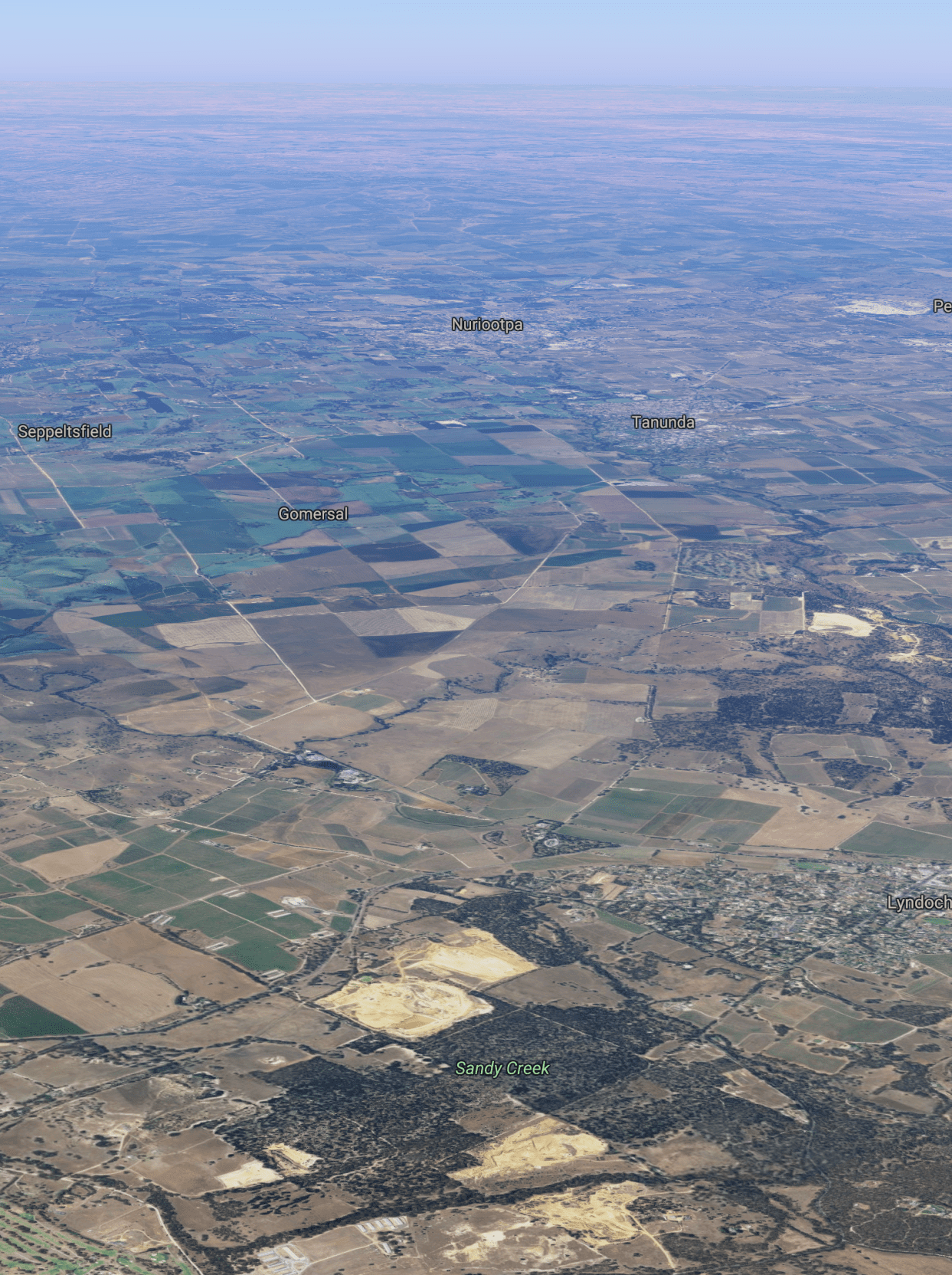
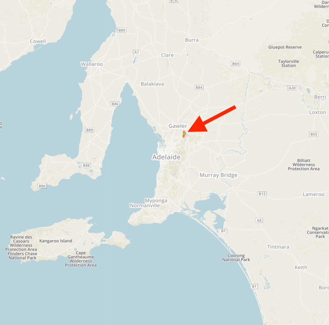
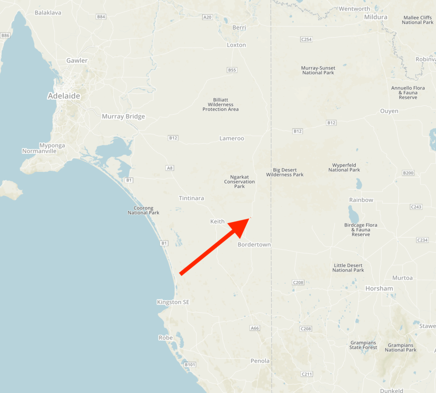
Kyeema is located about 62 km (by road) south of the city of Adelaide and about 15 km east of the town of Willunga.

Screen Shot 2019-08-25 at 9.50.41 am

Above:- Map showing the location of the Kyeema Conservation Park.  Map courtesy of Protected Planet.

The Kyeema Conservation Park is about 346 hectares (850 acres) in size and was established on the 12th day of November 1964.  The park was first proclaimed as a Wild-Life Reserve on the 12th day of November 1964.  It became the Kyeema National Park on the 3rd day of August 1967.  It was reconstituted as the Kyeema Conservation Park on the 27th day of April 1972.  A further 25 hectares of land was added to the park in 1974.

Screen Shot 2019-08-25 at 9.49.32 am.png

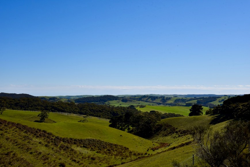
Above:- An aerial shot of the Kyeema Conservation Park looking back towards my home (marked with the blue pin).  Image courtesy of Google Maps.

The area surrounding the park was mined for alluvial gold back in the 1880s and was abandoned in 1890 due to a low yield.  A few years later, some the scrub was cleared for pine plantations and in 1932 a labour prison reserve was established here.  The camp which opened on 22nd March 1932 was South Australia’s first prison camp.  It was originally known as the Kyeema Afforestation Camp and was later known as the Kyeema Prison Camp.

The Prison Camp was used by low-security risk prisoners and on average, around 13 prisoners worked in the area at any one time, guarded by only 2 prison guards.  The prisoners cut a road through the stringybark forest to the camp, and sank wells, grew their own vegetables, carted water from the creek when the wells failed, showered from buckets, cut firewood, planted trees, put up fences and built bridges.   

The camp soon developed the reputation of being the most humane’ development in the history of the South Australian penal system’.  As was the case with other inmates a prison camps, the prisoners were called by name, not number, and were paid at a higher rate for their labours than other prisoners.  Upon completion of their work, the prisoners were allowed to yarn, read or play dominoes.  The prison camp was closed during the mid 1950s.

The park consists of thick scrub including messmate stringybark, pink gum, cup gum and candle bark gum. The name Kyeema is believed to be local Kaurna aboriginal language meaning ‘dawn’.

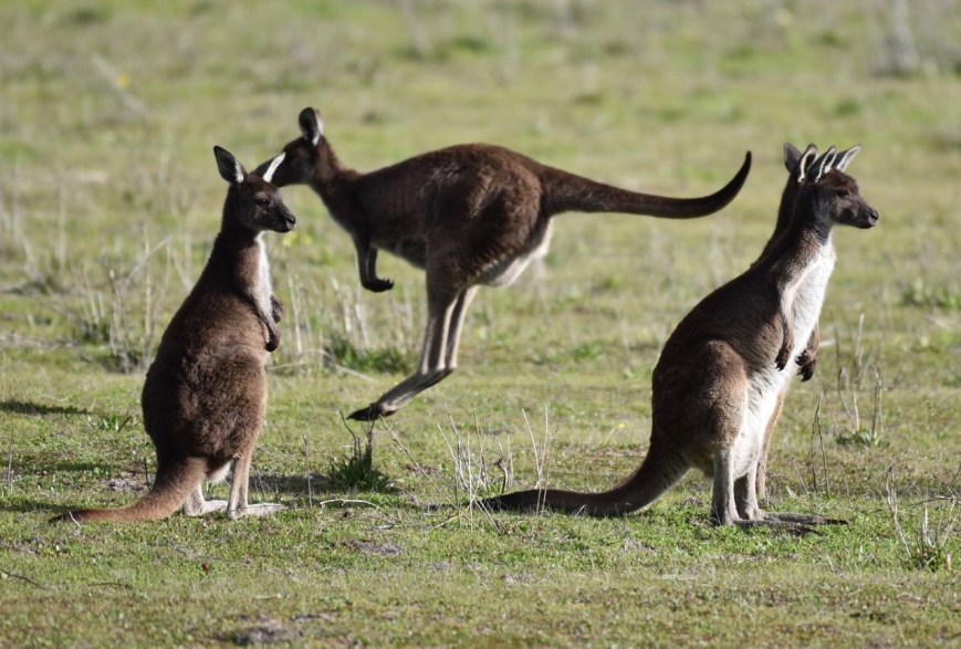
Numerous native mammals can be found in the par including Western Grey kangaroos and Southern Brown Bandicoot.

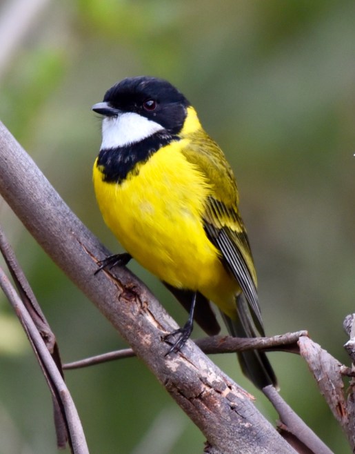
Birds SA have recorded about 88 species of bird in the park including Superb Fairywren, Striated Thornbill, Brown Thornbill, White-browed Scrubwren, Crescent Honeyeater, Yellow-faced Honeyeater, Grey Shrike-thrush, Southern Boobook, Elegant Parrot, Eastern Shriketit, Willie Wagtail, and Bassian Thrush.

The park was devastated during the 1983 Ash Wednesday bushfires, and a number of the eucalypt trees located in the southwestern part of the park were planted by school students during the 1980s as part of a long-term revegetation program.  About 20,000 seedlings were planted in the first three years.  The area is known as the ‘Children’s Forest’ to recognise the many children who helped to re-create the valuable habitat.

screen-shot-2016-07-30-at-1-03-14-pm.png

Above:- Article from the Victor Habour Times newspaper, Wednesday Sept 28 1983.  Courtesy of trove.nla.gov.au.

Another significant fire burnt the park during November 2015.  During my visit to the park, I noted a lot of burnt scrub.  It appears the park has been subject to another recent fire, however, there was a lot of regrowth.

The famous Heysen Trail passes through the park.  The 1,200 km Heysen Trail runs from Cape Jervis on the Fleurieu Peninsula to Parachilna Gorge in the Flinders Ranges.  There are other walks in the park including the Myrtaceae Hike (6km return – 3 hours) and the Mulurus Hike (1.2 km return – 30 minutes).

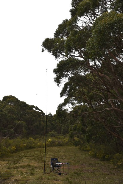
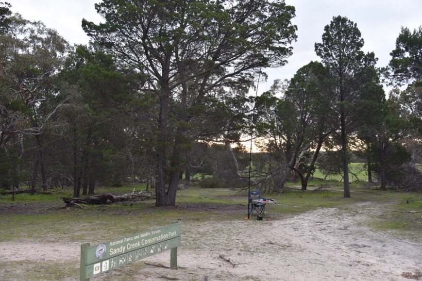
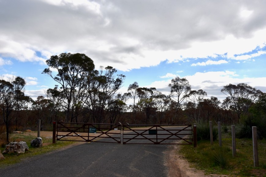
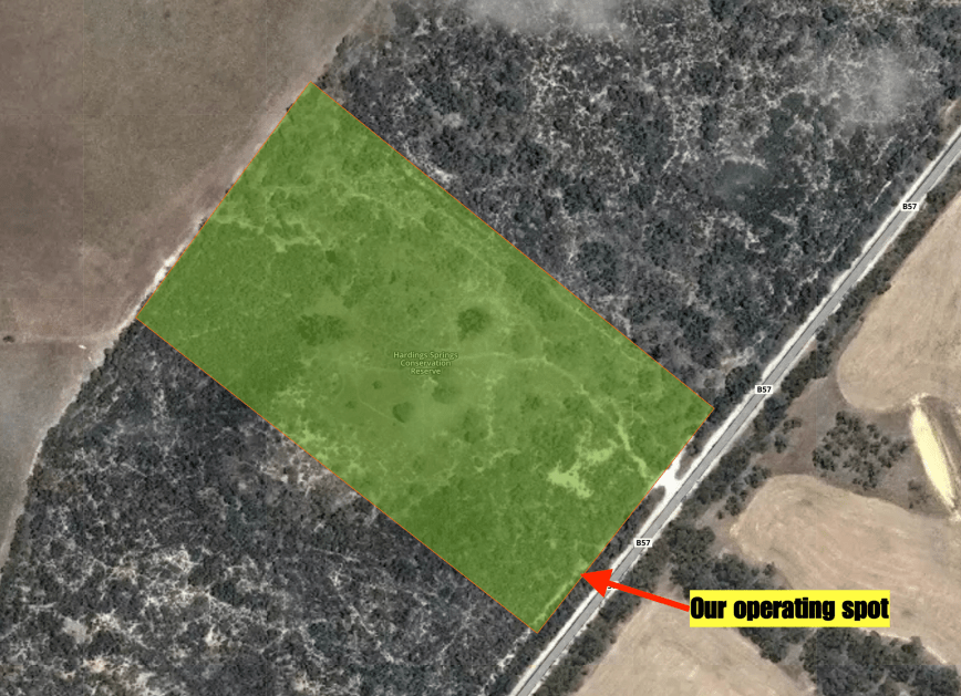
There is a large car parking area off Woodgate Hill Road and a cleared area between the roadway and the scrub which is an ideal operating spot.

DSC_0010

For this activation, I ran the Yaesu FT-857d, 30 watts, and the 20/40/80 m linked dipole supported on the 7-metre heavy duty telescopic squid pole.

Screen Shot 2019-08-25 at 9.50.25 am.png

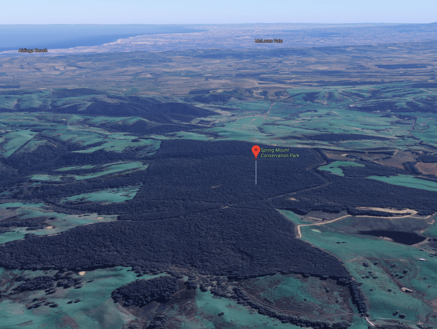
Above:- Aerial shot of the Kyeema Conservation Park showing my operating spot.  Image courtesy of Protected Planet.

After setting up and turning on the transceiver I tuned across the band to find a clear frequency.  The 40m band was very much alive with lots of stations, including some very strong signals coming out of Europe.  I found 7130 clear and asked if the frequency was in use.  Steve VK4JSS came back to my call to advise he was about to start calling CQ and was in the Venman Bushland National Park.  It was a good way to start off the activation with a Park to Park contact.

After logging Steve I moved right up the band to 7.175 and started calling CQ.  Rob VK2VH came back to my call with a strong 5/9 signal.  This was followed by Bruce VK2HOT, Peter VK2UXO, and Marija VK5FMAZ.

DSC_0008

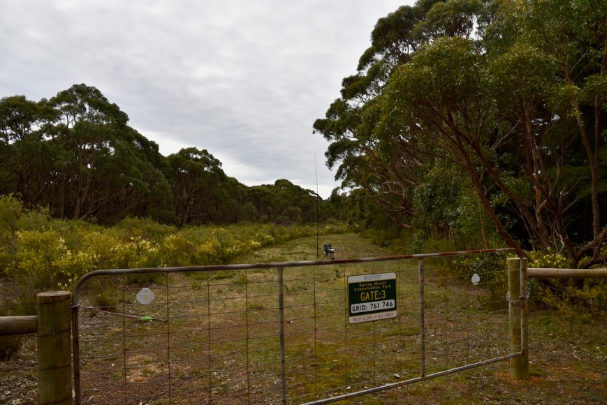
Above:- View of gate three and my operating spot.

In between contacts, I managed to place up a self spot on parksnpeaks.  It didn’t take long for this to drag in some of the regular park hunters.  I ended up logging a total of 43 contacts on 40m from VK1, VK2, VK3, VK4, VK5, VK7, and New Zealand.

The 40m band was in reasonable shape.  Signals from Victoria were very strong, although signals from New South Wales seemed to be down a little.  I was called by Max IK1GPG amongst the Australian callers.  Sadly on this occasion, I was not able to make it to Italy on 40m.

IMG_2413.JPG

I then lowered down the squid pole and removed the links for the 20m band and headed to 14.310.  I placed up a self spot on parksnpeaks and soon had my first caller in the log, Bob VK6POP in Western Australia.  Unfortunately, Bob was my only caller on 20m.  However, he had qualified the park for me for the global WWFF awards, being contact number 44 in my log.

To conclude the activation I moved down to the 80m band and called CQ on 3.610.  John VK5BJE at Scott Creek was first in the log on that band with a strong 5/9 signal.  This was followed by Andy VK5LA and Danny VK5DW in the Riverland, and then Marija VK5FMAZ.  I logged a further 9 stations on 80m

The temperature had dropped from 14 deg C down to 8 deg C and it was time for me to pack up and go for a quick walk in the park.  I had a total of 57 contacts in the log,

DSC_0009

I worked the following stations on 40m SSB:-

  1. VK4JSS/p (Venman Bushland National Park VKFF-0507)
  2. VK2VH
  3. VK4AAC/2
  4. VK2HOT
  5. VK2UXO
  6. VK5FMAZ
  7. VK2VW
  8. VK3PF
  9. VK5GJ
  10. VK3MKE
  11. VK4SMA
  12. VK3SQ
  13. VK4GSF
  14. VK5BJE
  15. VK4CZ
  16. VK2QK
  17. VK3FIAN
  18. VK7ROY
  19. VK4HNS
  20. VK5VBR
  21. VK3XON
  22. VK3DOU
  23. VK1TX
  24. VK2LEE
  25. VK2RSB
  26. VK3MCK
  27. ZL1TM
  28. VK3MPR
  29. VK4MGL
  30. VK3FRC
  31. VK7QP
  32. VK4FOMP
  33. VK3FVRN
  34. VK3ANL
  35. VK7WN
  36. VK3GER/4
  37. VK3FJAC
  38. VK4TJ
  39. VK4/AC8WN
  40. VK4/VE6XT
  41. VK4SSN
  42. VK2PKT
  43. VK4MWB

I worked the following station on 20m SSB:-

  1. VK6POP

I worked the following stations on 80m SSB:-

  1. VK5BJE
  2. VK5LA
  3. VK5DW
  4. VK5FMAZ
  5. VK5PL
  6. VK5FANA
  7. VK2RSB
  8. VK3MVP
  9. VK5GJ
  10. VK2LEE
  11. VK3DEK
  12. VK4HNS
  13. VK5MRE


References.

Birds SA, 2019, <https://birdssa.asn.au/location/kyeema-conservation-park/>, viewed 25th August 2019

Taylor; B, 2010, ‘Prisons without Walls: Prison Camps and Penal Change in Australia, c. 1013-c. 1975’.

Wikipedia, 2019, <https://en.wikipedia.org/wiki/Kyeema_Conservation_Park>, viewed 25th August 2019

Spring Mount Conservation Park 5CP-219 and VKFF-0789

Yesterday (Saturday 17th August 2019) I drove down to the Fleurieu Peninsula and activated the Spring Mount Conservation Park 5CP-219 & VKFF-0789.  My noise floor at home has dropped from strength 9 down to strength 7, but it is still annoying enough that every opportunity I get I like to head out and activate portable.

This weekend was the International Lighthouse & Lightship Weekend (ILLW) and the Remembrance Day Contest (RD).  Unfortunately, in my opinion, the two events clash.  Some may disagree, but I believe the two events should remain autonomous and should be held on different dates.  I was hoping to log some of the ILLW operators but was happy to hand out some numbers for the RD contest.

I have activated and qualified Spring Mount previously.  This is one of my favourite parks.  It is a beautiful stringybark forest which has a number of great walks within the park.

The park is located about 72 km south of the city of Adelaide and about 15 km (by road) south-east of the town of Myponga.

Screen Shot 2019-08-17 at 9.03.26 pm.png

Above:- Map showing the location of the Spring Mount Conservation Park.  Map courtesy of Protected Planet.

I drove down to Willunga along Brookman Road and onto the Victor Harbor Road.  I then turned right onto Pages Flat Road and then left onto Hindmarsh Tiers Road.  I soon reached Springmount Road and headed up towards Spring Mount.  There are some very nice views of the surrounding countryside to be enjoyed from Springmount Road.

DSC_0066

Above:- View of the countryside from Springmoutn Road.

Spring Mount Conservation Park is about 2.79 square km in size and was established on the 3rd day of February 1966.  Spring Mount preserves a relatively undisturbed mature stringybark forest and is located in an undulating ironstone plateau with a handful of small but quite steep valleys.

Screen Shot 2019-08-18 at 1.16.05 pm.png

Above:- Aerial shot of the Spring Mount Conservation Park, looking north back towards the wine-growing region of McLaren Vale.  Image courtesy of Google maps.

The park first acquired protected area status as a Wild-Life Reserve on the 3rd day of February 1966.  On the 27th day of April 1972, the Wild-Life Reserve was reconstituted as the Spring Mount Conservation Park under the National Parks and Wildlife Act 1972. In 1973 and 2013, additional land was added to the park.

During my visit to the park, some of the native flowers were out in bloom.

The park’s large trees provide breeding habitat for the Yellow-tailed Black Cockatoo, a large cockatoo with is native to the southeast of Australia.  Its plumage is mostly brownish-black and it has prominent yellow cheek patches and a yellow tail band. 

The park also contains some nice walks through the stringybark forest.

Birds SA have recorded about 90 species of bird in the park including Adelaide Rosella, White-throated Treecreeper, Superb Fairywren, Crescent Honeyeater, Grey Shrike-thrush, Grey Fantail, Scarlet Robin, Brush Bronzewing, Sacred Kingfisher, Yellow-faced Honeyeater, Buff-rumped Thornbill, Bassian Thrush, and Beautiful Firetail.

During my visit, I observed a number of birds, many of which were too quick for me.  But I did manage to snap the shots below of a female Superb Fairy Wren and a Scarlet Robin.

I parked the 4WD in the carpark on Springmount Road and claimed a small fence and set up on a boundary rail that ran parallel to Springmount Road.  There was plenty of room here to string out the 20/40/80m linked dipole.  The park is very heavily forested and the gap between the forest and the roadway offered a good operating spot.

Screen Shot 2019-08-17 at 9.13.48 pm.png

Above:- Aerial shot of the Spring Mount Conservation Park, showing my operating spot.  Image courtesy of Protected Planet.

Before calling CQ I tuned across the band to log some of the ILLW operators.  First in the log was VK3ILH at the Port Albert Museum Citadel Light AU0110.  Next was VK2MB at the Barrenjoey Lighthouse AU0046, followed by Dick VK7DIK/p at the Table Cape Lighthouse AU0039.

I then propped on 7.135 and logged a total of 52 stations from VK1, VK2, VK3, VK4, VK6, and VK7 before 0300 UTC which was the scheduled starting time of the RD Contest.  This included a further 5 lighthouses and 3 Park to Park contacts.

I took a few minutes off-air with some radio silence for the RD Contest and about 3 minutes after 0300 UTC I started calling CQ again.  I logged 15 stations, and although I wasn’t really competing in the RD, I handed out a few numbers for those who were taking part.  I also logged Patrick (VK5MPJ) operating as VK5BAR from the Marino Conservation Park VKFF-1056 and Allen VK3ARH/p who was activating SOTA peak VK3/ VW-002 in the Grampians National Park.

DSC_0069

Above:- View from gate 3 to my operating spot.

I then tuned across the band and logged three more ILLW stations: Brad VK3SPL at the Split Point Lighthouse AU0032, Tony VK3WI at the Williamstown Timeball Tower AU0036, and Ken VK3ATL at the Point Lonsdale Lighthouse AU0028.

I then moved down to the 80m band where I called CQ on 3.610.  I logged 5 stations from VK3 and VK5 including Allen VK3ARH who was activating SOTA peak VK3/ VW-002 in the Grampians National Park VKFF-0213.

I then headed up to 14.310 on the 20m band and logged 8 stations including Nick VK6CNL at the Cape Naturaliste Lighthouse AU0010 & Leuwin-Naturaliste National Park VKFF-0283, and Anthony VK6CLL at the Cape Leeuwin Lighthouse AU0008 & Leuwin-Naturaliste National Park VKFF-0283.

I moved back to 40m and logged Ray VK4XXX/p at the Sea Hill Point Lighthouse AU0060.  To complete the activation I propped on 7.142 and logged a further 31 stations including Ian VK3ATL at the Point Lonsdale Lighthouse AU0028, and Alan VK2MG/p at the Bemboka National Park VKFF-0049.

DSC_0070

Above:- My operating spot in the park.

Lighthouses worked on 40m SSB:

  1. VK3ILH – Port Albert Museum Citadel Light AU0110
  2. VK2MB/p – Barrenjoey Lighthouse AU0046
  3. VK7DIK/p – Table Cape Lighthouse AU0039
  4. VK3CSH/p – Cape Schanck Lighthouse AU0012
  5. VK6CLL – Cape Leeuwin Lighthouse AU0008
  6. VK6XN/p – Cape Leeuwin Lighthouse AU0008
  7. VK2HBG/p – Warden Head Lighthouse AU0035
  8. VK3EG/p – Point Hicks Lighthouse AU0027
  9. VK3SPL – Split Point Lighthouse AU0032
  10. VK3WI – Williamstown Timeball Tower AU0036
  11. VK3ATL – Point Lonsdale Lighthouse AU0028
  12. VK4XXX/p – Sea Hill Point Lighthouse AU0060

Lighthouses worked on 20m SSB:-

  • VK6CNL – Cape Naturaliste Lighthouse AU0010
  • VK6CLL – Cape Leeuwin Lighthouse AU0008

Park to Park contacts worked on 40m SSB:-

  1. VK6CLL – Leuwin-Naturaliste National Park VKFF-0283
  2. VK6XN/p – Leuwin-Naturaliste National Park VKFF-0283
  3. VK3EG/p – Croajingolong National Park VKFF-0119
  4. VK4HNS/p – Cape Byron State Conservation Park VKFF-1295
  5. VK5BAR/p – Marino Conservation Park VKFF-1056
  6. VK3ARH/p – Grampians National Park VKFF-0213 (also SOTA VK3/ VW-002)
  7. VK2MG/p – Bemboka National Park VKFF-0049

Park to Park contacts on 20m SSB:-

  1. VK6CNL – Leuwin-Naturaliste National Park VKFF-0283
  2. VK6CLL – Leuwin-Naturaliste National Park VKFF-0283

Park to Park contacts on 80m SSB:-

  1. Allen VK3ARH/p – Grampians National Park VKFF-0213 (also SOTA VK3/ VW-002)

I worked the following stations on 40m SSB:-

  1. VK3ILH (Port Albert Museum Citadel Light AU0110)
  2. VK2MB (Barrenjoey Lighthouse AU0046)
  3. VK7DIK/p (Table Cape Lighthouse AU0039)
  4. VK3FIAN
  5. VK3MKE
  6. VK2PKT
  7. VK3MPC
  8. VK3PF
  9. VK2LEE
  10. VK7QP
  11. VK3FLCS
  12. VK2MOP
  13. VK3MCK
  14. VK1MA
  15. VK4CZ
  16. VK3BNR
  17. VK3SIM
  18. VK3PKY/m
  19. VK3CSH/p (Cape Schanck Lighthouse AU0012)
  20. VK6CLL (Cape Leeuwin Lighthouse AU0008 & Leuwin-Naturaliste National Park VKFF-0283)
  21. VK6XN/p (Cape Leeuwin Lighthouse AU0008 & Leuwin-Naturaliste National Park VKFF-0283)
  22. VK2HBG/p (Warden Head Lighthouse AU0035)
  23. VK2EXA
  24. VK2VH
  25. VK4AAC/2
  26. VK3MPR
  27. VK3EG/p (Point Hicks Lighthouse AU0027 & Croajingolong National Park VKFF-0119)
  28. VK2NP
  29. VK2XXM
  30. VK3ELH
  31. VK2ADB
  32. VK3LK
  33. VK7OT/p
  34. VK3PNG
  35. VK3MB
  36. VK3SQ
  37. VK3ER
  38. VK7MMT/p
  39. VK4JSS
  40. VK3ACT
  41. VK7EE
  42. VK3FADM/1
  43. VK4TJ
  44. VK4/AC8WN
  45. VK4/VE6XT
  46. VK4SSN
  47. VK3AWG/m
  48. VK3AHR
  49. VK2MOR
  50. VK3ANL
  51. VK5VCR
  52. VK3YSA
  53. VK3RW
  54. VK3MDH
  55. VK3FTJS
  56. VK4HNS/2 (Cape Byron State Conservation Park VKFF-1295)
  57. VK3UH
  58. VK3AZZ
  59. VK5BAR/p (Marino Conservation Park VKFF-1056)
  60. VK2MB (Barrenjoey Lighthouse AU0046)
  61. VK3SIM
  62. VK2RSB
  63. VK7HSD
  64. VK3JK
  65. VK3ASU
  66. VK2VW
  67. VK3TNL
  68. VK3ARH (SOTA VK3/ VW-002 & the Grampians National Park VKFF-0213)
  69. VK6CLL (Cape Leeuwin Lighthouse AU0008 & Leuwin-Naturaliste National Park VKFF-0283)
  70. VK3OB
  71. VK3SPL (Split Point Lighthouse AU0032)
  72. VK3WI (Williamstown Timeball Tower AU0036)
  73. VK3ATL (Point Lonsdale Lighthouse AU0028)
  74. VK4XXX/p (Sea Hill Point Lighthouse AU0060)
  75. VK3ATL (Point Lonsdale Lighthouse AU0028)
  76. VK3ER
  77. VK2MG/p (Bemboka National Park VKFF-0049)
  78. VK3TNL
  79. VK7FOLK/p
  80. VK3NCC
  81. VK3MDH
  82. VK3ZAP
  83. VK2LX
  84. VK3AMW
  85. VK2MT
  86. VK4QH
  87. VK3ADW
  88. VK7JON/p
  89. VK2UXO

I logged the following stations on 80m SSB:-

  1. VK5FANA
  2. VK3ARH/p (SOTA VK3/ VW-002 & the Grampians National Park VKFF-0213)
  3. VK5CB
  4. VK5CZ
  5. VK5BJE

I logged the following stations on 20m SSB:-

  1. VK2LEE
  2. VK4TJ
  3. VK4/AC8WN
  4. VK4/VE6XT
  5. VK4SSN
  6. VK6CNL (Cape Naturaliste Lighthouse AU0010 & Leuwin-Naturaliste National Park VKFF-0283)
  7. VK4CZ
  8. VK6CLL (Cape Leeuwin Lighthouse AU0008 & Leuwin-Naturaliste National Park VKFF-0283)

With 118 stations in the log, I packed up and took a walk through the park for about 30 minutes. 

I then travelled down Mount Alma Road to Inman Valley Road.  I stopped briefly to log ZL6CC at the Cape Campbell lighthouse NZ0001.  ZL6CC was a genuine 5/9 into the mobile and gave me a 5/9 signal report which I was incredibly surprised with.  A big thank you to Greg VK2GJC who allowed me in to call the New Zealand lighthouse station.

I continued down Mount Alma Road enjoying some nice views of the Inman Valley which takes its name after Inspector Henry Inman, founder and first commander of the South Australia Police.

DSC_0109

I stopped briefly to have a look at Selwyn Rock, a glaciated pavement in the bed of the Inman River.  The rock was first described in 1859 and was named after ARC Selwyn, a Victorian Government geologist.  The rock dates back to the Permian period and was exposed when the Inman River eroded the topography to its present-day surface.

I then took Sawpit Road, and headed back towards Hindmarsh Tiers Road, stopping every now and again to view the dozens of Western Grey kangaroos grazing in the paddocks.

My next stop was Hindmarsh Falls which can be located at the end of Hindmarsh Falls Road.  A short walk from the carpark takes you to the falls.  The falls are located in the Hindmarsh Falls Recreation Reserve.

Along the way, I took the photo below of an Australian Golden Whistler.

DSC_0050

Above:- Golden Whistler at Hindmarsh Falls

It was then back to the 4WD and back off to home after a great day out.


References.

Birds SA, 2019, <https://birdssa.asn.au/location/spring-mount-conservation-park/>, viewed 18th August 2019

Wikipedia, 2019, <https://en.wikipedia.org/wiki/Spring_Mount_Conservation_Park>, viewed 18th August 2019

Wikipedia, 2019, <https://en.wikipedia.org/wiki/Yellow-tailed_black_cockatoo>, viewed 18th August 2019

Wikipedia, 2019, <https://en.wikipedia.org/wiki/Inman_Valley,_South_Australia>, viewed 18th August 2019

WWFF Activator 264 certificate

In the past few days, I received in my Inbox my latest global World Wide Flora & Fauna certificate.

It is issued for having activated a total of 264 different references where 44 QSOs were logged.  I have activated 318 different references, and I have reached the 44 QSO threshold in 264 of those.

Thanks to everyone who has called me during my activations, and thank you to Friedrich DL4BBH the Awards Manager.

Screen Shot 2019-08-16 at 6.04.44 pm.png

Sandy Creek Conservation Park 5CP-204 and VKFF-0933

My final park for Tuesday 13th August 2019 was the Sandy Creek Conservation Park 5CP-204 & VKFF-0933.  This is another park which I have previously activated and qualified.

The park is located about 56 km north of the city of Adelaide and about 3 km west of the town of Lyndoch in the southern Barossa Valley.

Screen Shot 2019-08-15 at 8.12.23 pm.png

Above:- Map showing the location of the Sandy Creek Conservation Park.  Map courtesy of Protected Planet.

The Sandy Creek Conservation Park is about 142 hectares in size and was established on the 7th day of October 1965.  It is one of the few remaining tracts of undisturbed and undeveloped native bushland in the Barossa Valley.  As a result, it plays a vital role in providing habitat for various native wildlife and birds.  The park is surrounded by sand quarries, cleared farmland and vineyards.

The park is located in the localities of Lyndoch and Sandy Creek.  Nearby Cockatoo Valley is named for the flocks of corellas.  The park takes its name from the nearby town of Sandy Creek just a few km down the road.  The settlement of Sandy Creek grew around the Irish Harp Hotel which was built c. 1850.  It takes its name from the soil in the area which is deep, loose sand.

Screen Shot 2019-08-15 at 8.16.51 pm.png

Above:- An aerial view of the Sandy Creek CP looking north towards the wine-growing region of the Barossa Valley.  Image courtesy of Google maps.

On the 7th day of October 1965 Section 72 of the Hundred of Barossa was proclaimed as a Wildlife-Reserve.  Further sections of land were added on the 25th day of May 1967 and the park was gazetted as the Sandy Creek National Park.  It was re-proclaimed as Sandy Creek Conservation Park on the 27th day of April 1972.  Further parcels of land were added to the park in 1991, 1994, and 2006.

During the first half of the 1900s much of the Sandy Creek Conservation Park was cleared and planted with vines.  The vineyards were subsequently abandoned due to low soil fertility.  Sections of the park were named after life-long ornithologists and conservationists, Cecil Rix and Mark Bonnin who identified many native bird species in the area.

Cecil Rix was a former Commissioner of the National Parks Commission.   The following is taken from his obituary:-

“One of the many parks that Cecil sought to be dedicated, I must tell you of Sandy Creek in 1962.  It was a nasty hot day with a north wind and Cecil was working in the Barossa area.  He drove down a narrow lane into some shady scrub to east his lunch.  At once he discovered the beautiful bushland to be a haven of numerous species of birds.  A delight for Cecil.  He sought to get Sandy Creek purchased as a Park, but treasury would not provide the money.  At the end of the year, the Minister of Lands, Mr Quirke, officially thanked Cecil on behalf of the Premier Tom Playford for all of his good work during the year.  Cecil, never stuck for a quick reply said; ‘Tell Tom that if he wants to thank me he could buy Sandy Creek land for a national Park’.  Next day, at a meeting of the Cabinet, Mr QUirke passed on Cecil’s words to the Premier.  At 2 p.m. Cecil’s phone rang. The caller said, ‘Quirke here.  We’ve bought your birds.'”

Today many areas that Cecil Rix identified have become National Parks and Conservation Parks.  This includes Sandy Creek, Para Wirra, Innes, Spring Gully, Cape Gantheaume, Ngarkat, Hambidge, Hincks, Mount Remarkable, Coorong, Coffin Bat, Canunda, and Cox Scrub.  In 1938 there were just three National Parks in South Australia.  But by 1972, when Rix retired from the National Parks Commission, there were 109 parks.

Screen Shot 2019-08-16 at 10.19.43 am.png

Above:- Plaque in the park to commemorate Cecil Rix.

The Sir Keith Wilson section of the Sandy Creek Conservation Park was a gift from the Wilson family and the Nature Foundation of SA Inc.  Sir Keith Cameron Wilson (3 September 1900 – 28 September 1987) was an Australian lawyer and politician.

Keith_Wilson-1950-an23530385.jpg

Above:- Sir Keith Cameron Wilson.  Image courtesy of Wikipedia.

The park conserves a rare patch of plains/valley vegetation.  It is dominated by stands of native Southern Cypress-pine and Pink Gum.  Blue Gums and Peppermint Box also provide a canopy to a rich variety of shrubs such as Silver Broom, Guinea Flower and Sticky Hopbush.

There are two walks in the park: the Wren Walk which is a 3.5 km loop, and the Boundary Walk which is a 4 km loop.

Birds SA have recorded about 45 species of bird in the park including Peaceful Dove, Common Bronzewing, Superb Fairywren, Yellow-rumped Thornbill, Yellow Thornbill, Black-winged Currawong, Willie Wagtail, Diamond Dove, Brush Bronzewing, Australian Owlet-nightjar, Chestnut-rumped Thornbill, White-winged Triller, and Zebra Finch.

A number of native animals call the park home including Echidnas and Western Grey kangaroos.  The kangaroos were out in force enjoying the afternoon sun during my visit.

DSC_0054

The park can be accessed via Pimpala Road (southern section of the park) or via Conservation Park Road (northern section of the park).  I accessed the park from the north and parked in the carpark at the end of Conservation Park Road.  It was just a  short walk from the vehicle through the park gate to where I set up.

I ran the Yaesu FT-857d and the 20/40/80m linked dipole for this activation.  Power output was just 20 watts.

Screen Shot 2019-08-15 at 8.09.57 pm.png

Above:- Aerial shot of the Sandy Creek Conservation Park showing my operating spot.  Image courtesy of Protected Planet.

I was set up and ready to go by around 0645 UTC, 4.15 p.m. South Australian local time.  It was starting to get a bit cool now with the temperature dropping to around 12 deg C.  The sun was also starting to go down and the 40m band had really opened up to Europe.  As a result, it was quite hard to find a clear spot on the band.

I started calling CQ on 7.145 and it didn’t take long for one of the park regulars to give me a shout.  It was Rick VK4RF/VK4HA with a strong 5/9 signal from Queensland.  Peter Vk3PF was next, followed by Rob VK2MZ and then Glen VK4FARR.

Contact number ten came 7 minutes into the activation.  It was Andrei ZL1TM in New Zealand who is a regular park hunter.  I continued on and eventually logged a total of 20 stations on 40m from VK1, VK2, VK3, VK4, VK5, VK6, VK7, and New Zealand.

DSC_0055

I then moved down to the 80m band and started calling CQ on 3.610.  There was quite a little pile up waiting for me.  First in the log on 80m was Lee VK2LEE, followed by John VK5BJE, Adrian VK5FANA, and then John VK5FLEA/p who was activating the Mark Oliphant Conservation Park VKFF-0782.

In the end, I logged a very pleasing total of 16 stations on 80m from VK2, VK3, and VK5.

DSC_0056

As it approached 5.30 p.m. local time I made the decision to pack up and head home.  I had qualified the park for VKFF which was my main goal, and I now had 5 South Australian parks activated during the month of August.  This meant that I had qualified for the special National Parks & Wildlife Award.

Screen Shot 2019-08-13 at 8.15.26 pm

Megan VK3AAK provided this short piece of audio of me operating…..

I worked the following stations on 40m SSB:-

  1. VK4RF
  2. VK4HA
  3. VK3PF
  4. VK2MZ
  5. VK4FARR
  6. VK6JES
  7. VK4TJ
  8. VK4/AC8WN
  9. VK4/VE6XT
  10. ZL1TM
  11. VK3MPR
  12. VK3YW
  13. VK2UXO
  14. VK7OT/p
  15. VK4FDJL/6
  16. VK7MMT/p
  17. VK3UH
  18. VK7VZ
  19. VK1DI
  20. VK5CB

I worked the following stations on 80m SSB:-

  1. VK2LEE
  2. VK5BJE
  3. VK5FANA
  4. VK5FLEA/p (Mark Oliphant Conservation Park VKFF-0782)
  5. VK3BBB
  6. VK5SFA/m
  7. VK5IJ
  8. VK5DO
  9. VK3PF
  10. VK5CB
  11. VK2SLB
  12. VK5CZ
  13. VK5JW
  14. VK3UH
  15. VK2HRX
  16. VK5PL

As I drove home I was rewarded with a magnificent sunset.

DSC_0065


References.

Birds SA, 2019, <https://birdssa.asn.au/location/sandy-creek-conservation-park/>, viewed 16th August 2019

Birds SA, 2019, <https://birdssa.asn.au/images/saopdfs/Volume33/1998V33P031.pdf>, viewed 16th August 2019

Department of Environment and Natural Resources, 2010, ‘Sandy Creek Conservation Park’ brochure.

State Library South Australia, 2019, <http://www.slsa.ha.sa.gov.au/digitalpubs/placenamesofsouthaustralia/S.pdf>, viewed 16th August 2019

Wikipedia, 2019, <https://en.wikipedia.org/wiki/Sandy_Creek_Conservation_Park>, viewed 15th August 2019

Wikipedia, 2019, <https://en.wikipedia.org/wiki/Sandy_Creek,_South_Australia>, viewed 16th August 2019

Wikipedia, 2019, <https://en.wikipedia.org/wiki/Keith_Wilson_(South_Australian_politician)>, viewed 16th August 2019

Para Wirra Conservation Park 5CP-275 and VKFF-1739

My third park for Tuesday 13th August 2019 was the Para Wirra Conservation Park 5CP-275 & VKFF-1739.  I have activated and qualified this park previously.

Para Wirra is located about 38 km northeast of the city of Adelaide and about `12 km (by road) south-west of the town of Williamstown.

Screen Shot 2019-08-14 at 9.10.50 pm.png

Above:- Map showing the location of the Para Wirra Conservation Park.  Map courtesy of Protected Planet.

The Para Wirra Conservation Park is 1,417 hectares (3,500 acres) in size and was established on the 21st day of June 1962.  It is located in the foothills of the Mount Lofty Ranges at the corner end of the Adelaide metropolitan area.  The conservation park is part of a larger, 2,573-hectare (6,360-acre) block of contiguous native vegetation, the remainder of which is owned by Forestry SA, SA Water and private landholders.   Only 26% of the Mount Lofty Ranges remains uncleared.

The conservation park takes its name from the Aboriginal words, Para meaning “river” and Wirra meaning “forest”.

Screen Shot 2019-08-15 at 7.46.49 pm.png

Above:- Map of the Para Wirra Conservation Park.  Map courtesy of National Parks & Wildlife Service.

The park is predominately covered in eucalyptus; however, there is a wide variety of vegetation types including Woodland – Open Woodland (low open woodland) – Low open forest – Closed scrub – Eucalyptus open scrub – open scrub – Melaleuca uncinata closed heath.

On the 21st day of June 1962, the park was proclaimed under the Crown Lands Act 1929 as the Para Wirra National Park.  The national park was officially opened on 24th September 1963 by the then Premier of South Australia, Sir Thomas Playford.  It was the second reserve in the State of Australia to be proclaimed as a National Park.  On the 27th day of April 1972, the national park was reconstituted as a recreation park.  This reconstitution reflected the park’s role as a natural area catering to a wide range of recreational activities.  On the 2nd day of November 2015, Environment Minister Ian Hunter announced that to better recognise and protect the recreation park’s natural and heritage values, it would be upgraded to Conservation Park status.  The recreation park was abolished on 19 May 2016 and on the same day, its landholding was constituted as the Para Wirra Conservation Park.

Playford_1956.jpg

Above:- Sir Thomas Playford, c. 1956.  Image courtesy of wikipedia

Numerous native mammals can be found in the park including Western Grey kangaroos, Euros,  Yellow-footed antechinus,  Short-beaked Echidna, the Common ringtail possum and the Brushtail possum.

Over 120 species of birds have been recorded in the conservation park including the emu which was introduced into the park in 1967.  Other native birds include White-faced heron, White-browned Babbler, Black-chinned honeyeater, Scarlet Robin, Laughing Kookaburra and Red-rumped parrot.

A total of 38 recorded reptiles and amphibians can be found in the park including the long-necked tortoise, Bearded Dragon, Brown tree frog, Yellow-faced whip snake and Red-bellied black snake.

I set up on a track at the East gate on Humbug Scrub Road.  There were two locked gates here so I could not travel into the park along Wirra Road.  However, there was a small car parking area, and a dirt track leading to a water tank.

DSC_0039

Above:- the locked gates at the East gate entrance.

For this activation I ran the Yaesu FT-857d, 20 watts output and the 20/40/80m linked dipole, inverted vee, supported by the 7-metre telescopic squid pole.

Screen Shot 2019-08-14 at 9.10.37 pm.png

Above:- An aerial view of the Para Wirra Conservation Park showing my operating spot.  Image courtesy of Protected Planet.

As it was starting to get a little late in the afternoon, the 40m band had opened up into Europe, so I was unable to get onto 7.144.  I dropped down the band a little to 7.140 and started calling CQ.  Ian VK3BUF mobile came back to my call.  Ian had a strong 5/9 signal from about 40 km north of Wagga.  Next in the log were some of the park regulars, Geoff VK3SQ, David VK5PL, Peter VK3PF, and Ken VK3UH.

Unfortunately, it didn’t take long for a strong European station to pop up on my frequency.  They were a good 5/7 signal and I just couldn’t compete, so with 9 contacts in the log, I moved down the band to 7.130.

John VK5BJE had followed me down and was logged.  John was 5/5 from the Adelaide Hills and gave me a 5/1 signal report.  I then logged Lee and Robbie VK5FRSM in the Adelaide Hills who was very low down.  Next was Neil VK3VZE.  I was Neil’s first SSB contact in many years.

DSC_0041

Next in the log was Perrin VK3XPT who was using an old Wagner transceiver which was a former State Emergency Services transceiver.  My last contact on 40m was with Rick VK5VCR in the Adelaide Hills.

I then moved down to 3.610 on 80m and started calling CQ.  John VK5BJE had followed me down from 40m and was first in the log on that band, followed by Rick VK5VCR, David VK5LSB, and Perrin VK3XPT.

To complete the activation I called CQ on 14.310 on the 20m band.  I logged Rick VK4RF/VK4HA and Andrei ZL1TM in New Zealand.

69233636_10156129038597234_1053070348267814912_o.jpg

Above:- Perrin VK3XPT’s old Wagner transceiver.  Image courtesy of VK3XPT.

With 22 contacts in the log, it was time to pack up and head off to my final park for the day, the Sandy Creek Conservation Park.

I worked the following stations on 40m SSB:-

  1. VK3BUF/m
  2. VK3SQ
  3. VK5PL
  4. VK3PF
  5. VK3UH
  6. VK4FARR
  7. VK4TJ
  8. VK4/AC8WN
  9. VK4/VE6XT
  10. VK5BJE
  11. VK2LEE
  12. VK5FRSM
  13. VK3ZVE
  14. VK3XPT
  15. VK5VCR

I worked the following stations on 80m SSB:-

  1. VK5BJE
  2. VK5VCR
  3. VK5LSB
  4. VK3XPT

I worked the following stations on 20m SSB:-

  1. VK4RF
  2. VK4HA
  3. ZL1TM


References.

Wikipedia, 2019, <https://en.wikipedia.org/wiki/Para_Wirra_Conservation_Park>, viewed 15th August 2019

Hale Conservation Park 5CP-086 and VKFF-0889

My second park for Tuesday 13th August 2019 was the Hale Conservation Park 5CP-086 & VKFF-0889.  I have activated and qualified this park previously.

Hale is located about 52 km northeast of Adelaide and about 3km southeast of the town of Williamstown which is regarded as the southern gateway to the winegrowing region of the Barossa Valley.

Screen Shot 2019-08-14 at 5.46.56 pm.png

Above:- Map showing the location of the Hale Conservation Park.  Map courtesy of Protected Planet.

The Hale Conservation Park is and was established on the 9th of January 1964.  The park is well signposted on Warren Road.

The park is located in rugged hills country of the north-central Mount Lofty Ranges.    The park habitat is mostly Woodland comprised of Long-leaf Box, Pink Gum and Messmate Stringybark over Golden Wattle and Yacca.

The park contains old mica diggings.  Mica is used in the electrical industry due to its unusual ability to act as a thermal conductor and electrical insulator at the same time.

There is a 4km circuit in the park which is rated as moderate in difficulty.

Screen Shot 2019-08-14 at 9.03.26 pm.png

Above:- The walking trail in the Hale CP.  Map courtesy of Walking SA.

Various native mammals can be found in the park including Western Grey kangaroo and echidna.

Birds SA have recorded about 87 species of bird in the park including Superb Fairywren, Eastern Spinebill, New Holland Honeyeater, Crescent Honeyeater, Yellow-faced Honeyeater, Australian Golden Whistler, Black-winged Currawong, Painted Buttonquail, Tawny-crowned Honeyeater, Little Wattlebird, Noisy Miner, Black-capped Sittella, and Black-faced Cuckooshrike.

The park first gained protected status as a Wild-Life Reserve on 9th January 1964 under the Crown Lands Act 1929.  Additional land was added n 4th January 1965 and the park was proclaimed as the Hale Wild-Life Reserve.  On 9th November 1967, the park was proclaimed under the National Parks Act 1966 as the Hale National Park.  The park was re-proclaimed under the National Parks and Wildlife Act 1972 as the Hale Conservation Park on 27th April 1972.

The park is named in honour of Herbert Mathew Hale who was the Director of the South Australian Museum from 1931 to 1960.  He took part in numerous South Australian Museum Expeditions as well as the Board for Anthropological Research expeditions.  During these trips, he participated in anthropological research, took motion picture film, still photography, phonographic recordings, as well as conducting zoological studies.  Hale was a prominent member of many societies and associations including the Royal Society of South Australia; the Royal Zoological Society of South Australia, the Anthropological Society of South Australia, and was secretary (1928-1956) to the Board for Anthropological Research.

Screen Shot 2019-08-13 at 10.03.12 pm

Above:- Herbert Mathew Hale.  Image c/o Trove

I parked the 4WD in the small carpark on Warren Road and set up on the edge of the walking track in the park.  I ran the Yaesu FT-857d, 20 watts, and the 20/40/80m linked dipole for this activation.

Screen Shot 2019-08-14 at 5.48.45 pm.png

Above:- An aerial shot of the Hale Conservation Park.  Image courtesy of Protected Planet.

After setting up I turned on the transceiver and tuned to 7.144 and heard Ian VK5CZ/p calling CQ from Mokota Conservation Park VKFF-1062.  After logging Ian Park to Park I moved down to 7.139, and after placing a spot on parksnpeaks, I started calling CQ.  Park regular Peter VK3PF came back to my call, followed by another park regular John VK4TJ and then Geoff VK3SQ who is another committed park hunter.

Band conditions were still quite poor with lots of deep fading noticed on most signals.  It took me a little longer to get the required 10 QSOs in the log for VKFF qualification.  Contact number ten came 14 minutes into the activation and was with Steve VK3HK.

I logged 13 stations on 40m and then moved to 3.610, calling CQ after placing a self spot on parksnpeaks.  First in the log was Hans VK5YX with a strong 5/9 signal, followed by John VK5BJE in the Adelaide Hills who had a strong 5/9 signal.

To complete the activation I called CQ on 14.310 on the 20m, logging only John VK4TJ and his USA and Canadian calls.

I had qualified another park for VKFF and now had 3 VK5 parks for the month of August.  Just 2 more to go to qualify for the National Parks and Wildlife Service Award.

DSC_0032

Above:- My shack in the Hale CP.

I worked the following stations on 40m SSB:-

  1. VK5CZ/p (Mokota Conservation Park VKFF-1062)
  2. VK3PF
  3. VK4TJ
  4. VK4/AC8WN
  5. VK4/VE6XT
  6. VK3SQ
  7. VK3MKE
  8. VK4PZZ
  9. VK5PL
  10. VK3HK
  11. Vk2ON
  12. VK7NWT
  13. VK5BJE

I worked the following stations on 80m SSB:-

  1. VK5YX
  2. VK5BJE

I worked the following stations on 20m SSB:-

  1. VK4TJ
  2. VK4/AC8WN
  3. VK4/VE6XT


References.

Birds SA, 2019, <https://birdssa.asn.au/location/hale-conservation-park/>, viewed 14th August 2019

South Australian Museum, 2019, <http://www.samuseum.sa.gov.au/collections/information-resources/archives/hale-herbert-matthew-aa-124>, viewed 13th August 2019

Walking SA, 2019, <https://www.walkingsa.org.au/walk/find-a-place-to-walk/hale-conservation-park-loop/>, viewed 14th August 2019

Wikipedia, 2019, <https://en.wikipedia.org/wiki/Hale_Conservation_Park>, viewed 14th August 2019

Warren Conservation Park 5CP-247 and VKFF-0941

Today (Tuesday 13th August 2019) I activated four parks.  My intention was to activate the 4 parks and get 10 contacts in each.  These 4 parks would go towards the special South Australia National Parks and Wildlife certificate which is on offer in August 2019 by the VKFF program.

My first park was the Warren Conservation Park 5CP-247 & VKFF-0941.  I have activated and qualified the park previously.

The park is located about 36 km northeast of the city of Adelaide and about 10 km southeast of the town of Williamstown.  It is located in the lower section of the Barossa Valley.

Screen Shot 2019-08-13 at 8.56.33 pm.png

Above:- Map showing the location of the Warren Conservation Park.  Map courtesy of Protected Planet.

The Warren Conservation Park is 364 hectares in size and was established on the 14th July 1966.  The park is well signposted on the corner of South Para Road and Watts Gully Road.  The park itself also has a sign on Watts Gully Road.

The best access to the park is via the Watts Gully trailhead on Watts Gully Road.  There is a small car parking area here and a pedestrian entrance to a boardwalk into the park.  Otherwise, you can hike into the park from other points including the walking track from the nearby Hale Conservation Park or the Tower Track through Mount Crawford Forest.

The park is situated in rugged hilly country in the Mount Lofty Ranges.  The major habitat in the park is Woodland with Pink Gum and Long-leaf Box.

The park has four challenging walking trails, including a section of the long-distance Heysen Trail. The tracks are steep and difficult and should be used by experienced bushwalkers only.

The park first gained protected area status as a wildlife reserve proclaimed under the Crown Lands Act 1929 on the 14th July 1966.  On the 9th November 1967, the land in the wildlife reserve was proclaimed under the National Parks Act 1966 as the Warren National Park.  On the 27th November 1969, section 321 was added to the national park. On the 27th April 1972, the national park was reconstituted as the Warren Conservation Park upon the proclamation of the National Parks and Wildlife Act 1972.   In 1980, it was listed on the now-defunct Register of the National Estate.

The park is named after the Hundred of Warren, which in turn was named in honour of John Warren (1830-1914), who was an Australian pastoralist and politician.

john_warren_mha.jpg

Above:- The Hon. John Warren.  Image courtesy of wikipedia.

There is a wide variety of native animals found in the park including Western Grey kangaroos, koalas, Southern Brown bandicoots, and echidnas.

Birds SA have recorded about 75 species of bird in the park including Superb Fairywren, New Holland Honeyeater,  Crescent Honeyeater, Striated Thornbill, Australian Golden Whistler, Grey Fantail, Peaceful Dove, Brown Treecreeper, Black-chinned Honeyeater, Yellow-rumped Thornbill, Buff-rumped Thornbill, and White-winged Chough.

In 1884, gold was found by John Watts in nearby Watts Gully, near the current day Warren Conservation Park.  In fact, it was Watts Gully Road that I was headed for.  The area yielded gold nuggets as large as 14 ounces.  As a result, Forreston boomed as a little town.  From articles I have read on TROVE, it appears the area’s population swelled, with around 350-400 persons working on the diggings.

screen-shot-2017-01-21-at-2-13-22-pm-1.png

Above: – Article from the ‘Evening News’ dated Sat 20 June 1885.  Courtesy of Trove.

I drove along Watts Gully Road and set up just off the boardwalk.  I ran the Yaesu FT-857d, 20 watts, and the 20/40/80m linked dipole for this activation.

Screen Shot 2019-08-13 at 8.56.53 pm.png

Above:- The Warren Conservation Park showing my operating spot in the southern section of the park.  Image courtesy of Protected Planet.

I commenced calling CQ on 7.144 and this was soon answered by Ian VK3FIAN with a good strong 5/8 signal.  This was followed by a Park to Park contact with Ian VK5CZ/p who was activating the Mokota Conservation Park VKFF-1062 in the mid-north of South Australia.  Peter VK3PF followed, then Terry VK6ATM in Western Australia, and then Owen VK7OR.  Next in the log was Ken VK3UH who kindly spotted me on parksnpeaks.

Within about 13 minutes I had contact number ten in the log, with a QSO with John VK5BJE in the Adelaide Hills.  This was followed by Deryck VK4FDJL/6 who was in the Mangkili Claypan Nature Reserve VKFF-2941.

Band conditions were quite poor, with lots of fading noted on most signals.  Signals from Victorian stations were well down compared to normal.  My last station logged on 40m was Liz VK2XSE/m who kindly placed a spot up for me on parksnpeaks.

With 20 contacts in the log I headed off to the 80m band.  I placed a self spot on parksnpeaks and started calling CQ on 3.610.  Unfortunately, I logged just the two stations: John VK5BJE, and Ian VK5CZ in the Mokota Conservation Park for a second band.

To complete the activation I moved to the 20m band after putting up a spot on parksnpeaks, and called CQ on 14.310.  I logged John VK4TJ, along with his USA and Canadian callsigns.

With 25 contacts in the log, including 3 Park to Park contacts, it was time to pack up and head off to my next park, the Hale Conservation Park.

I worked the following stations on 40m SSB:-

  1. VK3FIAN
  2. VK5CZ/p (Mokota Conservation Park VKFF-1062)
  3. VK3PF
  4. VK6ATM
  5. VK7OR
  6. VK3UH
  7. VK5BQ
  8. VK3SQ
  9. VK1TX
  10. VK5BJE
  11. VK4FDJL/6 (Mangkili Claypan Nature Reserve VKFF-2941)
  12. VK2KNV/m
  13. VK5FBIC
  14. VK7OT/p
  15. VK2UXO
  16. VK4TJ
  17. VK4/AC8WN
  18. VK4/VE6XT
  19. VK7MMT/p
  20. VK2XSE/m

I worked the following stations on 80m SSB:-

  1. VK5BJE
  2. VK5CZ/p (Mokota Conservation Park VKFF-1062)

I worked the following stations on 20m SSB:-

  1. VK4TJ
  2. VK4/AC8WN
  3. VK4/VE6XT


References.

Birds SA, 2019, <https://birdssa.asn.au/location/warren-conservation-park/>, viewed 13th August 2019

National Parks and Wildlife Service, 2019, <https://www.parks.sa.gov.au/find-a-park/Browse_by_region/Adelaide_Hills/warren-conservation-park>, viewed 13th August 2019

Wikipedia, 2019, <https://en.wikipedia.org/wiki/Warren_Conservation_Park>, viewed 13th August 2019

Wikipedia, 2017, <https://en.wikipedia.org/wiki/John_Warren_(Australian_politician)&gt;, viewed 13th August 2019

NPWS certificate

Today I activated four South Australian Conservation Parks to bring my tally of VK5 parks activated in August to five.

As a result, I have qualified for the special National Parks & Wildlife Service South Australia certificate.

This special certificate is on offer during August for anyone who activates or works at least five different South Australian VKFF references during August.  More information can be found on the WWFF Australia website at…….

https://www.wwffaustralia.com/national-parks–wildlife-service-vk5.html

Thanks to everyone who called me.

Screen Shot 2019-08-13 at 8.15.26 pm.png

2019 John Moyle Memorial Field Day

I took part in the 6 hour portable category of the 2019 John Moyle Memorial Field Day.  I activated the Coorong National Park.

I made a total of 187 QSOs with a score of 374 points.

There were 14 amateurs who entered this category in the Field Day.

I came first in this category.  Peter VK3ZPF came in 2nd position, followed by Tony VK3XV in third.

JMMFD 2019.jpg

Hardings Springs Conservation Reserve VKFF-1714

Our final intended park activation for our 2 days away was the Hardings Springs Conservation Reserve VKFF-1714.  This was the first time that Marija and I had activated the park.

The park is located about 35 km by road north of Bordertown and about 260 km southeast of the city of Adelaide.

Screen Shot 2019-08-07 at 12.39.25 pm.png

Above:- Map showing the location of the Hardings Springs Conservation Reserve.  Map courtesy of Protected Planet.

To get to the park we travelled northwest on the Dukes Highway and turned right onto the Ngarkat Highway and headed north towards Pinnaroo.  The Highway takes its name from the Ngarkat (Ngargad) who were an indigenous Australian people of the state of South Australia, now believed to be extinct.

The park is located about 24 km north of the Dukes Highway and Ngarkat Highway junction.  The park is well signposted.

The Hardings Springs Conservation Reserve is 7 hectares in size and is located on the western side of the Ngarkat Highway in the locality of Sherwood.  The park was established on the 24th day of April 1997.  It takes its name from the natural soak or spring located in the park.

The area was originally part of the ‘Tatiara Station’.  The park was named after William Harding (ca.1824-1874), an early pastoralist.  Hardings Springs was first used by surveyors in the late 1800s.  It was then called ‘175 Mile Camp’ referring to its distance from Adelaide.

In about 1909 Fred Lampert took up land around the soak and farmed it until about 1928 when falling wheat prices made is unviable.  Lampert planted the tall sugar gums in 1911 as a narrow gateway to his property for a horse and cart.  The water in the soak provided enough water for domestic use, a modest vegetable garden and for two horses each day, all carried by bucket.  Today the soak is usually dry, the water level probably lowered by the roots of the trees,

500px-Harding-2927

Above:- William HARDING.  Image courtesy of Wikitree

The park has an active Friends of the Parks group.  An information board can be found in the park, along with a nature trail to the natural soak located in the park, a picnic table, and also a bird hide.  A brochure can be found in the park pointing out interesting spots along the walking trail.

Numerous native birds can be found in the park including Yellow-rumped Thornbill, Shy Heath-wren, White-browned Babbler, Rufous Whistler, Misstleoebird, Red Wattlebird, Eastern Rosella, and Brown Falcon.  Some of the birds I spotted during our visit can be seen in the photographs below.

We parked in the carpark off the Ngarkat Highway and set up just inside the park boundary.  Again we ran the Yaesu FT-857d and the 20/40/80m linked dipole for this activation

Screen Shot 2019-08-07 at 12.37.15 pm.png

Above:- An aerial view of the Hardings Springs Conservation Reserve showing our operating spot.  Image courtesy of Protected Planet.

We had no internet coverage in the park so we were unable to self spot.  I started calling CQ on 7.139 and this was answered by Greg VK2GJC, followed by Kevin VK2HMV.  Matt VK1MA then called in and was kind enough to spot me on parksnpeaks.  As a result, a number of the regular park hunters then called in.

Within ten minutes I had qualified the park, with contact number ten being with Andrei ZL1TM in New Zealand.

I logged a total of 16 stations on 40m from VK1, VK2, VK4, VK7, and New Zealand.  This included Rob VK4SYD/p who was activating the Kurwongbah Nature Reserve VKFF-2868.

DSC_9978

After logging Rob VK4SYD and bagging the park for VKFF, Marija jumped into the operator’s chair and also spoke with Rob whilst I went for a bit of walk through the park.  Next in the log for Marija was Cliff VK2NP who spotted Marija on parksnpeaks, followed by Robert VK2XXL and then Ray VK4NH.

It only took 7 minutes for Marija to qualify the park for VKFF.  Contact number 10 was a QSO with Greg VK4VXX/p who was activating the Albinia National Park VKFF-0661.

When I came back from my short walk Marija was very quick to point out that she had worked Max IK1GPG in Italy.  This was Marija’s first-ever contact into Italy.

DSC_9980

We then moved down to the 80m band and I started calling CQ on 3.615.  First in the log was John VK5BJE, followed by Ian VK5CZ/p who was activating the Mimbara Conservation Park VKFF-1060.  Marija also logged Ian for a Park to Park.

I logged a total of 7 stations on 80m including a further Park to Park, with Brett VK3FLCS/p who was activating the Whroo Nature Conservation Reserve VKFF-2229.  Marija also jumped in to get the Park to Park with Brett.

I then moved up to the 20m band.  Mark VK4SMA had spotted me on parksnpeaks to advise that I would be on this frequency.  I logged Anthony VK6MAC, Andrei ZL1TM, and Paul VK2HDX/4 who was on Cape York in Far North Queensland.

I now had 29 QSOs in the log and required a few more to get to my 44.  I moved back to 7.144 on 40m and logged a further 19 stations.  Contact number 44 was a QSO with Murray VK4MWB.  I also logged Andrew VK1AD/p who activating SOTA peak Mount Stromlo VK1/ AC-043, looking for some European Summit to Summit contacts.

It was now 4.30 p.m. and we still had more than a 2-hour drive to get home, so we packed up and hit the road.

Marija worked the following stations on 40m SSB:-

  1. VK4SYD/p (Kurwongbah Nature Reserve VKFF-2868)
  2. VK2NP
  3. VK2XXL
  4. VK4NH
  5. VK4DXA
  6. ZL4TY/VK4
  7. VK4SMA
  8. VK2GJC
  9. IK1GPG
  10. VK4VXX (Albinia National Park VKFF-0661)

Marija worked the following stations on 80m SSB:-

  1. VK5CZ/p (Mimbara Conservation Park VKFF-1060)
  2. VK3FLCS/p (Whroo Nature Conservation Reserve VKFF-2229)

I worked the following stations on 40m SSB:-

  1. VK2GJC
  2. VK2HMV
  3. VK1MA
  4. VK1AT
  5. VK2RSB
  6. VK7OT
  7. VK2RU/4
  8. VK2IPK
  9. VK7OR
  10. ZL1TM
  11. VK4NH
  12. VK4DXA
  13. ZL4TY/VK4
  14. VK2NP
  15. VK4SMA
  16. VK4SYD/p (Kurwongbah Nature Reserve VKFF-2868)
  17. VK4VXX/p (Albinia National Park VKFF-0661)
  18. VK7KW
  19. VK2FABE
  20. VK2QM
  21. VK2LEE
  22. VK2LX
  23. VK7TU
  24. VK1AD/p (SOTA VK1/ AC-043)
  25. VK4CZ
  26. VK2YK
  27. VK2IO/5
  28. Vk2ISO
  29. VK2VW
  30. VK4PDX
  31. VK4TJ
  32. VK4/AC8WN
  33. VK4/VE6XT
  34. VK4MWB
  35. VK4RF
  36. VK4HA
  37. VK4HNS
  38. VK3UH

I worked the following stations on 80m SSB:-

  1. VK5BJE
  2. VK5CZ/p (Mimbara Conservation Park VKFF-1060)
  3. VK3PF
  4. VK5PL
  5. VK5FANA
  6. VK3FLCS/p (Whroo Nature Conservation Reserve VKFF-2229)
  7. VK3SQ

I worked the following stations on 20m SSB:-

  1. VK6MAC
  2. ZL1TM
  3. VK2HDX/4

It soon started to get dark and we enjoyed a magnificent sunset as we headed west along the Dukes Highway.

On the way home, we stopped off at the Riverside Hotel at Tailem Bend.  It is always a great meal here and a regular watering hole for Marija and me.

IMG_2393.JPG

We arrived home about 45 minutes after leaving Tailem Bend.  It had been a great 2 days away.  We had activated a total of eight (8) parks and made a total of 518 QSOs on 20, 40, & 80m SSB into VK1, VK2, VK3, VK4, VK5, VK6, VK7, New Zealand, Italy, & the Canary Islands.  This included 35 Park to Park contacts.  Seven of the eight parks were first time activations.


References.

Bordertown Field Naturalists, ‘Harding Springs Nature Track’ brochure

State Library South Australia, 2019, <http://www.slsa.ha.sa.gov.au/digitalpubs/placenamesofsouthaustralia/H.pdf>, viewed 7th August 2019

Wikipedia, 2019, <https://en.wikipedia.org/wiki/Conservation_reserves_of_South_Australia>, viewed 7th August 2019

Wikipedia, 2019, <https://en.wikipedia.org/wiki/Ngarkat>, viewed 7th August 2019