Shepherds Hill Recreation Park VKFF-1744

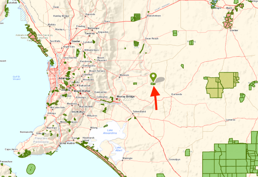
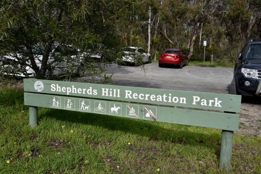
Today (Tuesday 30th July 2019) I decided to head down to town to activate two new parks for me.  The first being the Shepherds Hill Recreation Park VKFF-1744.

The park is located in the foothills of the Mount Lofty Ranges, about 9 km south of the city centre of Adelaide.

Screen Shot 2019-07-30 at 6.21.31 pm.png

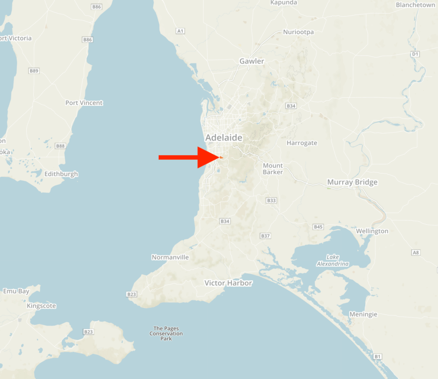
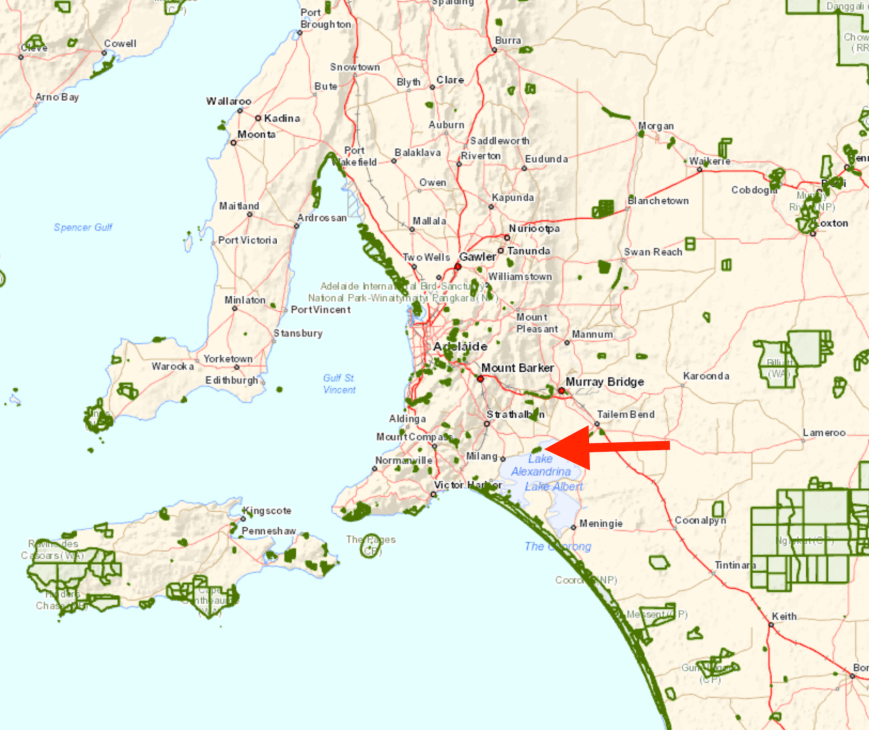
Above:- Map showing the location of Shepherds Hill Recreation Park.  Map courtesy of Protected Planet.

The Shepherds Hill Recreation Park is 77 hectares in size and was established on the 1st January 1955.  The park is located in the south-west extremity of a much larger area of remnant native vegetation stretching across the foothills to Brownhill Creek. Much of that remnant vegetation is on reserved land and Shepherds Hill Recreation Park is part of a complex of public open-space land that protects native vegetation and provides a range of opportunities for outdoor recreation. In particular, it adjoins the Watiparinga Reserve managed by the National Trust of South Australia, and the Saddle Hill and Ellis Avenue Reserves managed by the City of Mitcham

Screen Shot 2019-07-30 at 5.33.08 pm.png

Above:- An aerial view of the Shepherds Hill Recreation Park, looking north back towards the Adelaide CBD.  Image courtesy of Google maps.

The park was originally known as St Marys Reserve and was acquired by the South Australian State Government in 1953 as ‘public open-space for recreation purposes’ and was managed by the South Australian Government Tourist Bureau as a dedicated National Pleasure Resort from 1955 until 1972.  In 1972 it became the Shepherds Hill Recreation Park.

Screen Shot 2019-07-30 at 6.36.58 pm.png

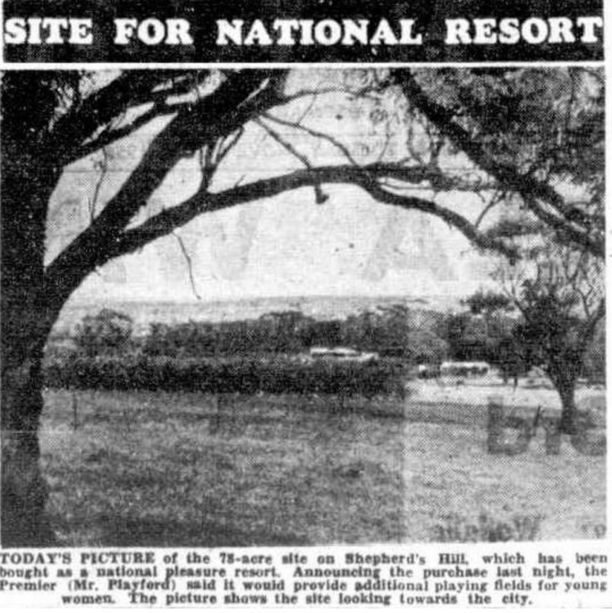
Above:- Article from The News, Tues 3rd November 1953

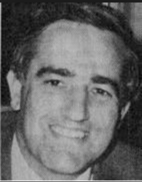
The park takes its name from William Henry Shephard (c. 1812-1848) who arrived on board the Tam O’Shanter in 1836.  In April 1842 he registered the purchase of section 8, ‘Survey B’, adjacent to the hill that was mapped as ‘Shepherd’s Hill’.

Screen Shot 2019-07-30 at 9.11.18 pm.png

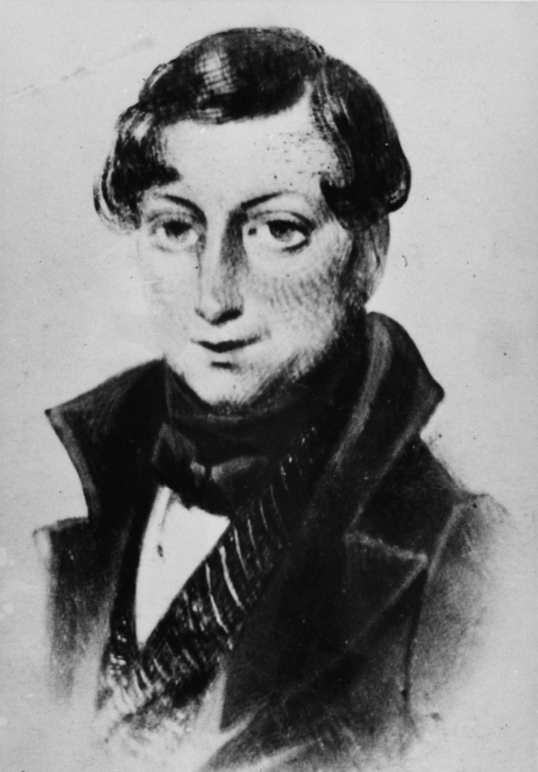
Above:- William Henry Shephard.  Image courtesy State Library SA

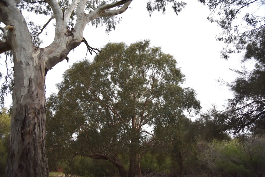
The park preserves old-growth Grey Box Woodland and creeks lined with old-growth River Red Gums.  The park includes the confluence of Walkers and Wattiparringga Creeks.  The park also includes native grasses and a number of rare plants occur in Shepherds Hill.   Grey Box is considered to be uncommon in the Southern Mount Lofty Ranges and Grey Box Woodlands are limited in their distribution to the foothills and hill slopes south of Adelaide.  Referred to in colonial times as the ‘Black Forest’ they have borne the brunt of suburban settlement and invasion by exotics.  There are only a few degraded examples in other nearby parks including Belair National Park, Sturt Gorge Recreation Park and Onkaparinga River National Park.  The Shepherds Hill Recreation Park, together with Watiparinga Reserve, has the last substantial remnant of River Red Gum Woodland in the southern Hills Face Zone.

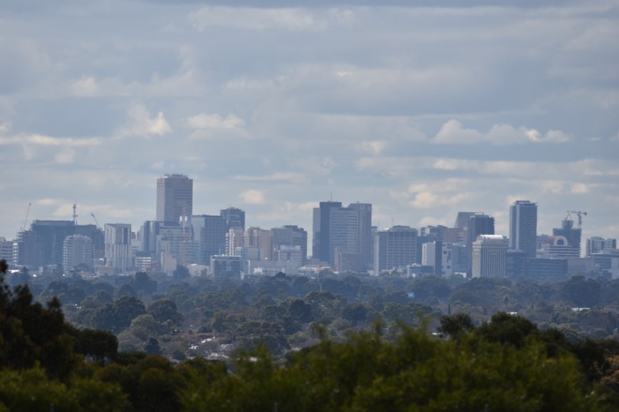
There are some nice views of the city of Adelaide from the high points within the park.

DSC_9742

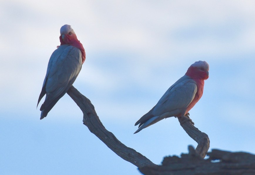
Native mammals that call the park home include the Common Brushtail Possum, Common Ringtail Possum, Yellow-footed Marsupial Mouse, Echidna, Koala, and Bush Rat.  About 15 species of reptile have been recorded in the park including Cunningham’s Skink which is rated as endangered in South Australia.  About 38 species of bird have been found in the park including the Tawny Frogmouth, Nankeen Kestrel, Red Wattlebird, Laughing Kookaburra, Superb Fairy Wren, and Brown Falcon.  The park was alive with Rainbow Lorikeets and Eastern Rosellas during my visit.  Some of the birds I observed are shown in my photos below.

After leaving home I travelled west on the South Eastern Freeway and down into the suburbs of Adelaide.  I travelled down Fiveash Drive and on to Ayliffes Road and soon reached the northern section of the park.  The carpark here was full so I decided to try the other side of the park.

DSC_9717

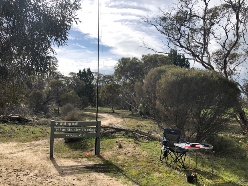
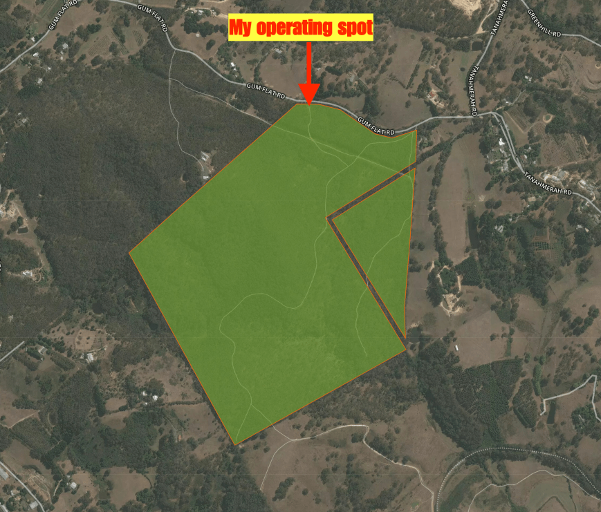
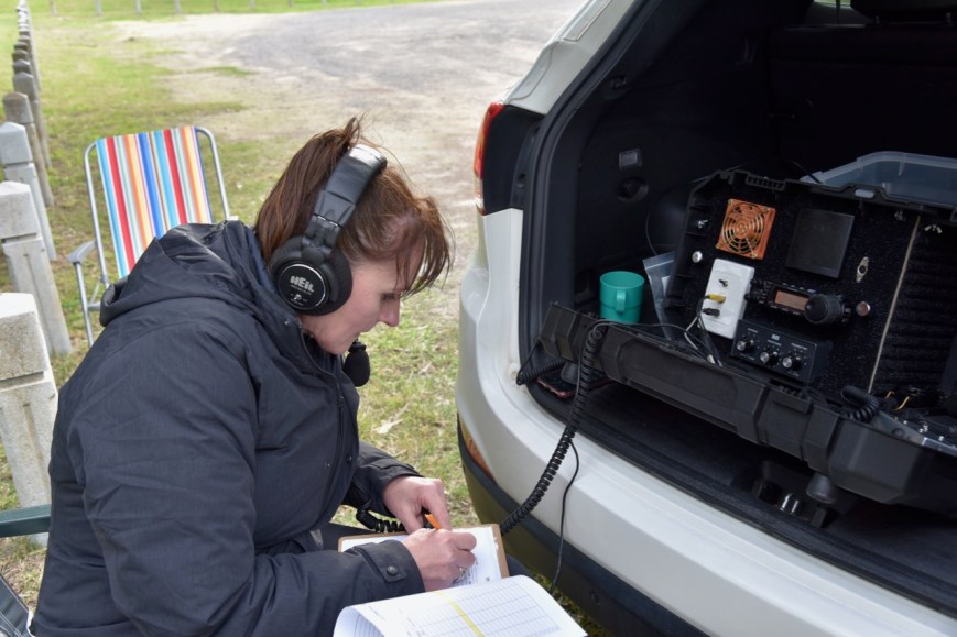
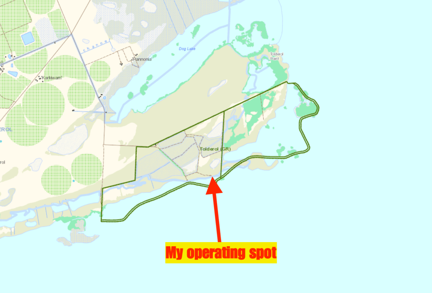
I was hoping to access the park through the Women’s Playing Fields on Shepherds Hill Road, but the gates were locked.  So I then turned onto Mill Terrace and parked at the end of Springwood Close.  There is an access point to the park here.

Screen Shot 2019-07-30 at 5.31.48 pm.png

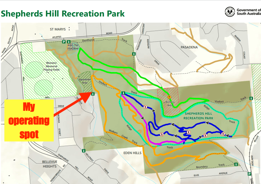
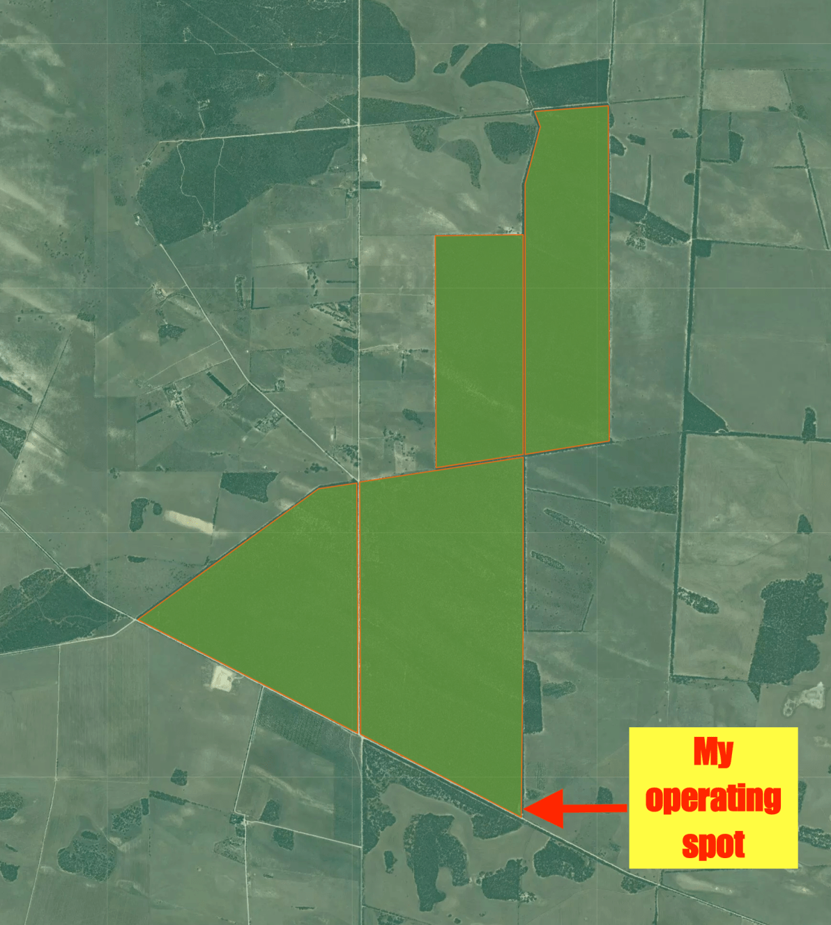
Above:- Map of the Shepherds Hill Recreation Park showing my operating spot.  Image courtesy of National Parks SA.

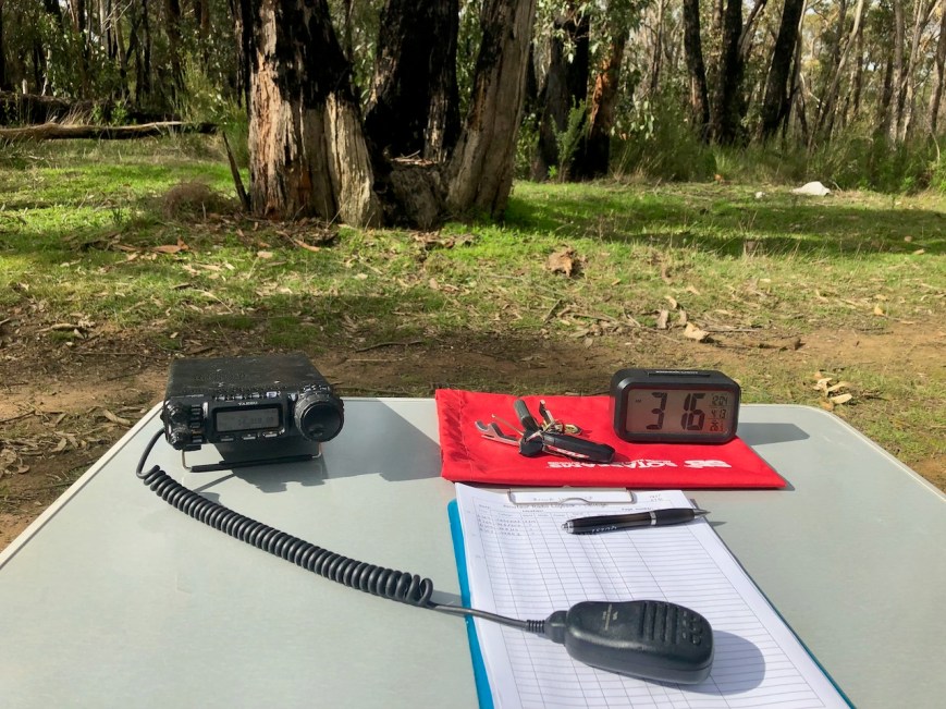
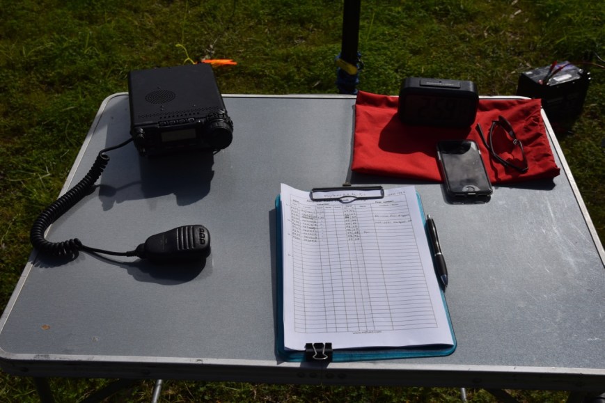
This appeared to be a quiet section of the park and there was plenty of room to string out my 20/40/80m linked dipole without interfering with any other park users.

Screen Shot 2019-07-30 at 5.32.00 pm.png

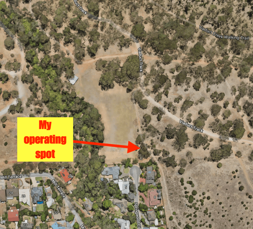
Above:- An aerial view of the park showing my operating spot.  Image courtesy of Google maps. 

Sadly when turning on the transceiver I saw that the noise floor was strength 7 to 8 on the 40m band.  I realised then, why I had not activated this park before, as I always expected that it would be noisy and busy with people.

First in the log was Peter VK3PF, followed by Liz VK2XSE mobile, and then Gerard VK2IO/5 who was near Oodnadatta in the Far North of South Australia.  Deryck VK4FDJL/8 followed, with a good signal from near Alice Springs.

It took me about 12 minutes to get 10 contacts in the log, qualifying the park for the VKFF (Australian) program.  There were a lot of stations calling, but many I was unable to pull out of the noise.

I logged a total of 24 stations on 40m from VK2, VK3, VK4, VK5, and VK8.  This included a Park to Park contact with Mike VK6MB/3 who was in the Boort Nature Conservation Reserve VKFF-2052.

DSC_9654

I then headed to the 80m band and logged 4 stations there, John VK5BJE, Steve VK5SFA, Adrian VK5FANA, and Mike VK6MB/3 in VKFF-2052 for a second band.  Unfortunately, I had to put up with strength 7 to 8 noise on this band also.

The 20m band was my next stop and surprisingly the noise floor was strength 2.  I logged 8 stations on 20m from VK2, VK3, and VK4.

To conclude the activation I moved back to 40m, with 36 stations in the log and a further 8 stations for the magical 44 QSOs.  To my listening pleasure, the noise floor had dropped down to strength 3 to 4 on 40m.  I logged 8 stations just getting me over the line.  Contact number 44 was with Keith VK3MKE.  I also logged Ian VK1DI/2 who was activating the Washpool National Park VKFF-0521, one of the Gondwana parks.

Thank you to everyone who called and a BIG THANK YOU to those who took the time to spot me.

DSC_9656

I worked the following stations on 40m SSB:-

  1. VK3PF
  2. VK2XSE/m
  3. VK2IO/5
  4. VK4FDJL/8
  5. VK3GA
  6. VK4NH
  7. VK4DXA
  8. ZL4TY/VK4
  9. VK5BJE
  10. VK2YW/m
  11. VK2KTG
  12. VK2VW
  13. VK2NP
  14. VK2LEE
  15. VK3YW
  16. VK4RF
  17. VK4HA
  18. VK3MCK
  19. VK2ADB
  20. VK5SFA
  21. VK6MB/3 (Boort Nature Conservation Reserve VKFF-2052)
  22. VK3SQ
  23. VK3OHM
  24. VK3ZMD
  25. VK2KNV/m
  26. VK4MWB
  27. VK1DI/2 (Washpool National Park VKFF-0521)
  28. VK3BBB/m
  29. VK7FRJG
  30. VK3MJR
  31. VK2SLB
  32. VK3MKE

I worked the following stations on 80m SSB:-

  1. VK5BJE
  2. VK5SFA
  3. VK5FANA
  4. VK6MB/3 (Boort Nature Conservation Reserve VKFF-2052)

I logged the following stations on 20m SSB:-

  1. VK3OHM
  2. VK4RF
  3. VK4HA
  4. VK2XXM
  5. VK4TJ
  6. VK4/AC8WN
  7. VK4/VE6XT
  8. VK2VW


References.

Department for Environment and Heritage, 2008, Shepherds Hill Recreation Park Management Plan.

State Library South Australia, 2019, <http://www.slsa.ha.sa.gov.au/digitalpubs/placenamesofsouthaustralia/>, viewed 30th July 2019

Wikipedia, 2019, <https://en.wikipedia.org/wiki/Shepherds_Hill_Recreation_Park>, viewed 30th July 2019

Ferries McDonald Conservation Park 5CP-067 and VKFF-0881

On Sunday 28th July 2019 I decided to do another quick park activation before heading off to work on afternoon shift.  I chose the Ferries McDonald Conservation Park 5CP-067 & VKFF-0881.

This is another park I have activated and qualified many times before, so this activation would count towards the Boomerang Award.

Ferries McDonald is located about 71 km south-east of Adelaide and about 20 km southwest of the town of Murray Bridge.

Screen Shot 2019-07-29 at 2.41.05 pm.png

Above:- Map showing the location of the Ferries McDonald Conservation Park.  Map courtesy of Protected Planet.

I travelled east along the South Eastern Freeway and took the Monarto exit and then travelled south on the Ferries McDonald Road.  I travelled passed the Monarto Conservation Park and soon was bisecting the park.  I then turned left onto Chauncey’s Line Road.

Chauncey’s Line Road was surveyed in 1854 for the Government by civil engineer William Snell Chauncey (1820-1878).  It commenced at Hahndorf and proceeded to Wellington on the Murray River.  The road was planned for anticipated trade between the River Murray and Adelaide.  The official designation of the proposed road was ‘The South Eastern Road, Hahndorf to the Wellington Ferry’ but it is frequently referred to in records as ‘Chauncey’s Line’.   Chauncey had arrived in South Australia in 1840 aboard the Appoline and surveyed the Adelaide-Port Adelaide railway in 1848.

WSChauncy.jpg

Above:- William Snell Chauncey.  Image c/o Wikipedia

Eventually, a road and a railway bridge were built at Murray Bridge and the use of the historic ferry at Wellington decreased.  This effectively saw Chauncey’s line sink into obscurity and the Woodchester locality becoming a quiet backwater.

IMG_2375

Above:- Chaunceys Line Road

The Ferries McDonald Conservation Park is about 880 hectares in size and consists of dense mallee habitat.  During spring the park is alive with native orchids.  The park contains numerous sandy ridges forming part of the Murray Plains.  They provide evidence that this area was once part of the ocean bed.

The park is home to a variety of rare and endangered plant species.  Resin Wattle is a compact, resinous spreading shrub that grows up to 2 metres in height with bright yellow flowers. It is endemic to South Australia and is only found in a few locations across the state including three populations in Ferries McDonald.


The park was once part of a vast area of mallee bushland which was cleared for farming during the late 1800s.  Fortunately, a few rocky outcrops were unsuitable for farming and were preserved in their original state.  In January 1938, an area of 1,600 acres was gazetted under the Animals and Birds Protection Act, as a closed area for birds and animals, thus creating the first reserve in South Australian specifically for mallee fauna.  A total of 233 acres were made available by Robert Sweet McDonald of ‘Preamimma’, Monarto, 583 acres made available by Mr. G Lemmey of Two Well, whilst a further 779 acres allocated by the State.  It was initially known as Chauncey’s Line Scrub.

IMG_2371.jpg

Above:- Plaque in the park

An addition to the park was made in 1953 from a bequest from James Ferries, thus creating the Ferries-McDonald Conservation Park.

Screen Shot 2019-07-29 at 7.13.26 pm.png

Above:- Obituary of James Ferries from the Southern Argus, 1951.  c/o Trove.

Birds SA have recorded about 89 species of bird in the park including Galah, Variegated Fairywren, Weebill, Southern Scrub-Robin, Australian Magpie, Australian Golden Whistler, Grey Shrike-thrush, Spotted Nightjar, Tawny-crowned Honeyeater, Chestnut-rumped Hornbill, White-browed Scrubwren, and White-winged Triller.

A focus within the park has been the protection of the Malleefowl (Leipoa ocellata), a native bird species that originally inhabited much of the natural mallee environment. Malleefowl are easy prey for common predators such as foxes and feral cats and are now only found at a handful of sites across Australia, including Ferries McDonald.

IMG_2373

Above:- Cleared farming land on the eastern side of the park.

I set up in my normal spot in the southeastern corner of the park.  There is a carpark at this location.  I ran the Yaesu FT-857d, 40 watts, and the 20/40/80 m linked dipole for this activation.

Screen Shot 2019-07-29 at 2.40.51 pm.png

Above:- An aerial view of the Ferries McDonald Conservation Park showing my operating spot.  Image courtesy of Protected Planet.

I called CQ on 7.144 and this was answered by Rod VK3OB who was mobile and had a strong 5/8-9 signal.  This was followed by Rob VK4SYD, Cliff VK2NP, and then Ian VK5CZ/p who was activating the Hopkins Creek Conservation Park VKFF-0893 in the Mid North of South Australia.

A few QSOs later I had another two Park to Park contacts in the log.  The first was with Gerard VK2IO/8 who was activating SOTA summit VK8/ AL-100 in the West McDonnell Ranges National Park VKFF-0532.  And then Ian VK1DI/2 who was in the Broken Head Nature Reserve VKFF-1898.

The 40m band was very unstable and there was lots of fading on most signals, but this did not deter callers as on occasions I had quite a little pileup going.

I logged a total of 39 stations before a visitor arrived at the park.  It was Steve, a member of the Friends of the Parks who was there to take photos of native orchids.  As it turned out Steve follows my blog.  He is not an amateur radio operator.

IMG_2369

After having a quick chat with Steve I got back to the radio and logged a further 9 stations on 40m.  Contact number 44 was with Adam VK2YK.  I also snared another Park to Park, with Mike VK6MB/3 who was activating the Waitchie Flora & Fauna Reserve VKFF-2469.

With 48 contacts in the log on 40m I headed down to the 80m band and started calling CQ on 3.610.  First in the log was John VK5BJE, followed by Ivan VK5HS mobile 3 at Birchip, and Adrian VK5FANA.  I logged a total of 7 stations on 80m from VK2, VK3, and VK5.  This included my wife Marija VK5FMAZ.

I then moved to the 20m band and called CQ on 14.310.  John VK7XX was first to call with a 5/5 signal with lots of fading.  John was struggling to hear me and gave me a 3/1 signal report.  I then logged Greg VK4VXX mobile, followed by Alan VK4XAC, and Mike VK6TX mobile.  In total, I logged 10 stations on 20m from VK2, VK4, VK6, VK7, and New Zealand.

To complete the activation I moved back to the 40m band.  Prior to calling CQ I tuned across the band and logged Ian VK1DI/2 who had moved into another park, the Cape Byron State Conservation Area VKFF-1295.

I then moved down to 7.139 and called CQ.  Deryck VK4FDJL/8 was the first to give me a shout, followed by Lee VK2LEE, and then Ross VK7ALH.  I logged a further 4 stations before it was time to call it quits for the day and head home for a shower and some lunch and off to work.

IMG_2370

For this activation, I made a total of 73 contacts which included 5 Park to Park contacts.

I worked the following stations on 40m SSB:-

  1. VK3OB/m
  2. VK4SYD
  3. VK2NP
  4. VK5CZ/p (Hopkins Creek Conservation Park VKFF-0893)
  5. VK5FLEA
  6. VK3ARH
  7. VK2IO/8 (SOTA VK8/ AL-100 & West McDonnell Ranges National Park VKFF-0532)
  8. VK1DI/2 (Broken Head Nature Reserve VKFF-1898)
  9. VK3PF
  10. VK3IH/m
  11. VK3AFW
  12. VK3SQ
  13. VK2PKT
  14. VK3JM
  15. VK4RF
  16. VK4HA
  17. VK2HHA
  18. VK2ADB
  19. VK4CZ
  20. VK3MPR
  21. VK7FRJG
  22. VK3NXT
  23. VK2KJJ
  24. VK3CLR/m
  25. VK3MAB
  26. VK2UXO
  27. VK3FPSR/m
  28. VK4TJ
  29. VK4/AC8WN
  30. VK4/VE6XT
  31. VK4AZZ/m
  32. VK3SX
  33. VK2KYO
  34. VK7FJFD
  35. VK2SLB
  36. VK3LTL
  37. VK3FT
  38. VK3MKE
  39. VK3FIAN
  40. VK7QP/m
  41. VK3HN
  42. VK2WR
  43. VK7ME
  44. VK2YK
  45. VK6MB/3 (Waitchie Flora & Fauna Reserve VKFF-2469)
  46. VK2VW
  47. VK2EZT
  48. VK3OHM
  49. VK1DI/2 (Cape Byron State Conservation Area VKFF-1295)
  50. VK4FDJL/8
  51. VK2LEE
  52. VK7ALH
  53. VK3ZPF
  54. VK3ANL
  55. VK7LH
  56. VK3RW

I worked the following stations on 80m SSB:-

  1. VK5BJE
  2. VK5HS/3
  3. VK5FANA
  4. VK5LA
  5. VK5FMAZ
  6. VK3SQ
  7. VK2NSS

I worked the following stations on 20m SSB:-

  1. VK7XX
  2. VK4VXX/m
  3. VK4/AG7WB/m
  4. VK4XAC
  5. VK6TX/m
  6. VK2HOT
  7. ZL1TM
  8. VK6XN
  9. VK4CZ
  10. VK6GLX


References.

Birds SA, 2019, <https://birdssa.asn.au/location/ferries-mcdonald-conservation-park/>, viewed 29th July 2019

National Parks and Wildlife Service, 2019, <https://www.parks.sa.gov.au/find-a-park/Browse_by_region/Fleurieu_Peninsula/ferries-mcdonald-conservation-park>, viewed 29th July 2019

State Library South Australia, 2019, <http://www.slsa.ha.sa.gov.au/manning/pn/c/c6.htm>, viewed 29th July 2019

State Library South Australia, 2019, <http://www.slsa.ha.sa.gov.au/digitalpubs/placenamesofsouthaustralia/W.pdf>, viewed 29th July 2019

Wikipedia, 2019, <https://en.wikipedia.org/wiki/Ferries_McDonald_Conservation_Park>, viewed 29th July 2019

Kenneth Stirling Conservation Park 5CP-104 and VKFF-0781

On Saturday 27th July 2019 I was on afternoon shift at work so I decided to head out to activate the Kenneth Stirling Conservation Park 5CP-104 & VKFF-0781 before I headed off to work.

I have activated and qualified this park previously, to this activation was to go towards the Boomerang Award.

The Kenneth Stirling Conservation Park is located about 17 km east of Adelaide in the Mount Lofty Ranges ‘Adelaide Hills’.

Screen Shot 2019-07-29 at 2.36.11 pm.png

Above:- Map showing the location of the Kenneth Stirling Conservation Park in the Adelaide Hills.  Map courtesy of Protected Planet.

The Kenneth Stirling Conservation Park consists of four autonomous sections: Wotton Scrub, Filsell Hill, White Scrub, and Burdett Scrub.  The largest section being Filsell Hill.

Screen Shot 2019-07-29 at 2.35.38 pm.png

Above:- Map showing the four sections of the Kenneth Stirling Conservation Park.  Map courtesy of Protected Planet.

The park is about 253 hectares in size and protects valuable remnant eucalypt vegetation.  The park habitat includes Messmate Stringybark, Bracken, Heaths, Pea-flowers, Guinea-flowers, and Wattles.  There is a 4.7 loop walking circuit in the park.  More details on that can be found on the Walking SA website.

The park is named in honour of Kenneth George Stirling, who was an accountant and benefactor.  He died suddenly in 1973, of heart disease, aged just 38.  Stirling earnt considerable wealth due to shareholding in mining interests, and apparently, this paper value embarrassed him.  According to his wife, ‘he believed he hadn’t earned the money the mining boom brought him’ and ‘his main concern was to use it for the good of the community’.  He was a member of the Nature Conservation Society of South Australia and other organisations and over the years made several anonymous gifts including $200,000 to the Australian Conservation Foundation (ACF) to establish national parks in South Australia. The money he gave to the A.C.F. helped to establish national parks at Montacute and Mount Scott, both near Adelaide, and in the extension of existing reserves at Scott Creek, in the Mount Lofty Ranges, and Warrenben, on Yorke Peninsula.  In 1990 the State government acquired land in the Adelaide Hills for the Kenneth Stirling Conservation Park.

screen-shot-2018-09-04-at-8-58-14-pm.png

Above:- Kenneth George Stirling.

I set up in the Wotton Scrub section of the park which is 82 hectares in size.  Access is via Gum Flat Road.  There is a carpark at the northwestern corner of the park.  There is also a nice cleared fire access track with plenty of room to string out a dipole.

I ran the Yaesu FT-857d, 40 watts output and the 20/40/80m linked dipole for this activation.

Screen Shot 2019-07-29 at 2.35.55 pm.png

Above:- Aerial shot of the Wotton’s Scrub section of the park, showing my operating spot.  Image courtesy of Protected Planet.

Once I turned the transceiver on it was already set to 7.144.  I asked if the frequency was in use and Peter VK3PF came back to me to advise it was free.  So Peter was once again first in the log, followed by Geoff VK3SQ, Wade VK1MIC/2, and then Peter VK2KNV.

Contact number 8 was a Park to Park contact with Gerard VK2IO/8 who was activating the Kuyynba Conservation Reserve VKFF-1243 in the Northern Territory.

Although I have activated and qualified Kenneth Stirling many times previously, it is always nice to get 10 contacts (the threshold required to qualify the park for the VKFF program) and 44 contacts (to qualify the park for the global WWFF program).  And for this activation, I soon reached the 10 QSO level after 8 minutes in the park, with a QSO with Ken VK2KYO.

As it was a weekend, I had a steady flow of callers from across Australia.  This included another Park to Park, this time with Ade VK4SOE/p who was in the Sundown National Park VKFF-0471.  I logged a total of 30 stations on 40m from VK2, VK3, VK4, VK5 and VK8.  This included Alexi VK3FAXI.  I was Alexi’s first HF contact.

I had logged just three local VK5 stations on 40m: Ian VK5CZ in the Clare Valley, John VK5BJE at Scott Creek in the Adelaide Hills and Marija VK5FMAZ at Mount Barker in the Adelaide Hills.  It was clear that my signal for John and Marija was via ground wave.  Ian’s signal up in the Clare Valley about 150 km away was quite low down, but as we both had low noise floors we were able to copy each other very well.

IMG_2339

I then lowered the squid pole and inserted the links for the 80m band and headed to 3.610.  I asked if the frequency was in use and this was responded to by John VK5BJE to let me know that he was waiting for me for a second band.  John was a beautiful strong signal.  This was followed by Andy VK5LA and Danny VK5DW with equally strong signals from the Riverland region of South Australia.

This was followed by my third Park to Park for the activation, a contact with Mike VK6MB/3 who was activating the Passage Camp Nature Conservation Reserve VKFF-2173.  My good wife Marija VK5FMAZ followed Mike.

With 8 stations in the log on 80m and 38 contacts in total for the activation, I headed off to the 20m band.  I called CQ on 14.310 and this was answered by Andrei ZL1TM in New Zealand, followed by John VK4TJ.

I now had just 2 contacts to go to get to the 44, so once callers had dried up on 20m I headed back to 40m.  I tuned across the band and worked Neil VK4HNS/p who was in the Mount Barney National Park VKFF-0338, and then Ian VK1DI/2 who was activating the Whian Whian State Conservation Area VKFF-1394.  I then logged Rob VK4AAC/2 who was in the Murray Valley Regional Park VKFF-1785.

I then headed down to 7.133 and called CQ.  This was answered by Peter VK3ZPF and then followed by VK2RSB.  Initially, I thought I had copied this callsign incorrectly as this appeared to be a repeater callsign, but the caller repeated it.  However I was not able to get a name, so I suspect this may have been a bogus call.

I logged a further 4 stations on 40m and was about to pack up when I saw a spot pop up on parksnpeaks for Rob VK4AAC/2 on 80m in VKFF-1785.  So it was down with the squid pole and in with the links, and another Park to Park logged with Rob on a second band.

IMG_2340

I had 54 contacts in the log including 9 Park to Park QSOs.

I worked the following stations on 40m SSB:-

  1. VK3PF
  2. VK3SQ
  3. VK1MIC/2
  4. VK2MNV
  5. VK2BAI
  6. VK4RF
  7. VK4HA
  8. VK2IO/8 (Kuyynba Conservation Reserve VKFF-1243)
  9. VK2VW
  10. VK2KYO
  11. VK2HHA
  12. VK4SYD
  13. VK2PKT
  14. VK3LAJ
  15. VK2NP
  16. VK3ZNK
  17. VK2KJJ
  18. VK3HN
  19. VK3UH
  20. VK3FLEZ
  21. VK3FAXI
  22. VK4FDJL/m
  23. VK5CZ
  24. VK3ANL
  25. VK3AFB
  26. VK5BJE
  27. VK4SOE/p (Sundown National Park VKFF-0471)
  28. VK2YK
  29. VK5FMAZ
  30. VK2FPAR
  31. VK4HNS/p (Mount Barney National Park VKFF-0338)
  32. VK1DI/2 (Whian Whian State Conservation Area VKFF-1394)
  33. VK4AAC/2 (Murray Valley Regional Park VKFF-1785)
  34. VK2VH (Murray Valley Regional Park VKFF-1785)
  35. VK3ZPF
  36. Vk2RSB
  37. VK7ALH
  38. VK1HW
  39. VK3GL
  40. VK3EIR

I worked the following stations on 80m SSB:-

  1. VK5BJE
  2. VK5LA
  3. VK5DW
  4. VK6MB/3 (Passage Camp Nature Conservation Reserve VKFF-2173)
  5. VK5FMAZ
  6. VK5FANA
  7. VK5HS
  8. VK5CZ
  9. VK4AAC/2 (Murray Valley Regional Park VKFF-1785)
  10. VK2VH (Murray Valley Regional Park VKFF-1785)

I worked the following stations on 20m SSB:-

  1. ZL1TM
  2. VK4TJ
  3. VK4/AC8WN
  4. VK4/VE6XT


References.

Birds SA, 2019, <https://birdssa.asn.au/location/kenneth-stirling-conservation-park-wotton-scrub/>, viewed 29th July 2019.

Friends of Parks, 2019, <http://www.friendsofparkssa.org.au/members-directory/friends-of-kenneth-stirling>, viewed 29th July 2019

2018 Oceania DX Contest

On returning to South Australia from my trip to Perth I found an email from the Oceania DX Contest Committee with the results of the 2018 Oceania DX Contest.

I entered into the Single Operator Low Power All Band-Phone category.  A total of 40 VK operators entered into this category.

I was placed in position 2 in this category and 6th in Oceania, with 279 QSOs and a score of 104,896 points.  Congratulations to Steve VK2NSS who came in 1st position.

Thank you to everyone who called me during the contest, and thanks you to the organisers of the contest.

VK5PAS 2018 Oceania DX Contest

VKFF Hunter Honour Roll 1,300 certificate

In the last few days, I have qualified for my latest VKFF award certificate.

It is the VKFF Hunter Honour Roll 1,300 certificate, issued for having worked 1,300 different VKFF references.

I have not been anywhere near as active this year in the WWFF/VKFF program for a variety of reasons.  One of those is the noise floor here at home.  I have gone from strength 5 noise on 40m to strength 9, making it almost impossible to work activators from home nowadays.  VKFF activators are now logged either from my mobile or when I go out portable myself.

Many thanks to all of the VKFF activators who have made this certificate level possible.

VK5PAS VKFF Hunter Honour Roll 1,300.png

Matilda Bay Reserve VKFF-2825

Marija and I arrived home late this afternoon (Monday 22nd July 2019) from our week away in Perth in Western Australia.  We spent 6 nights at the Hyatt Regency Perth.  This was NOT a radio adventure, but a one week holiday in Perth.

For overseas readers, Perth is about a 2,700 km drive from my home in the Adelaide Hills across the Nullabor Plain.  We flew via Qantas which took us about 2 and 1/2 hours.  The map below shows my home in Adelaide and Perth on the west coast of Australia.

Screen Shot 2019-07-22 at 8.16.30 pm.png

Above:- Map of Australia showing my home in Adelaide, and Perth on the west coast of Australia.  Map courtesy of Protected Planet.

We activated just the one park while we were away, the Matilda Bay Reserve VKFF-2825, which is located about 6 km south-west of the Perth Central Business District.

Screen Shot 2019-07-22 at 8.16.20 pm.png

Above:- Map showing the location of the Matilda Bay Reserve in Perth.  Map courtesy of Protected Planet.

Matilda Bay Reserve is a thin strip of land which covers about 20.6 hectares between Hacket Drive and the Swan River.  The reserve extends from Mount Bay Road in the north to the windsurfing ramp at the southern section of the park.  It is located adjacent to the suburb of Crawley.

Screen Shot 2019-07-22 at 8.15.56 pm.png

Above:- Map showing the location of the Reserve to the south-west of the Perth CBD.  Map courtesy of Protected Planet.

Matilda Bay takes its name from Matilda Elizabeth Roe, the wife of John Septimus Rose, the first Surveyor of Western Australia.

duz95kef_large

Above:- Matilda Elizabeth Roe nee Bennett.  Image courtesy of geni.com

Matilda Bay Reserve incorporates Pelican Point, an important breeding sanctuary for international migratory birds.  It takes its name for the pelicans which rest on sand bars at the end of the point.  Pelican Point was formerly named Point Currie after Captain Mark John Currie who in 1829 received an allotment of land in the area which became known as Crawley.

During the Second World War, the US Navy had a Seaplane Base at Pelican Point.   It was known as Pelican Point Advance Base “A” for “Able”.  QANTAS also used five RAF-supplied PBY-5 Catalinas at the Crawley Sea Base.

43_sqn_(AWM_128022).jpg

Above:- A Catalina.  Image courtesy of Wikipedia.

It is reported that about 20 Bottlenose dolphins inhabit the Swan River and can often be seen from Matilda Bay Reserve.  The reserve is also home to numerous water birds including pelicans, swans, ducks, terns, herons and cormorants.

DSC_9638

Hans VK6XN kindly picked Marija and I up from Optus Stadium after a guided tour we had gone on there.  We drove out to Matilda Bay and set up in the carpark opposite the Royal Perth Yacht Club.

Screen Shot 2019-07-22 at 8.14.54 pm.png

Above:- An aerial view of the park showing our operating spot.  Image courtesy of Protected Planet.

The Royal Perth Yacht Club is the third oldest yacht club in Australia.  It can trace its origins back to 1841 when a group of sailors staged a modest regatta to celebrate Foundation Day.  In 1865 this original group of pioneer sailors formalised the Perth Yacht Club.

In 1983 an Australian syndicate representing the Royal Perth Yacht Club fielded the Australia II, skippered by John Bertrand, against defender Liberty, skippered by Dennis Conner.   Australia II won the match races to win the America’s Cup – the first winning challenge to the New York Yacht Club, which had successfully defended the cup over a period of 132 years.

For this activation, we ran Hans’ equipment, consisting of a Yaesu FT-857d and an end-fed wire and a vertical.

We were set up and ready to go by about 0720 UTC (3.20 p.m WA local time).  Maria placed a spot up for me on parksnpeaks and I started calling CQ.  Sadly we had strength 8 noise on 40m from the park.  It made it incredibly difficult to hear a lot of the stations that were calling.

First in the log was Ivan VK5HS in the Riverland region of South Australia, followed by Adrian VK5FANA on the Yorke Peninsula, and then Peter VK5PE.  I logged five stations before swapping the mic with Marija.  I know there were a lot of stations calling, but sadly the noise was shocking.

Marija’s first contact was with Gary VK6GC/m who was on his way to the park to catch up with us, followed by John VK5BJE in the Adelaide Hills,   Marija battled with the noise and logged a total of 6 stations from VK2, VK3, and VK5, before the noise got just too much for her.

I then tried my luck on 20m, logging 3 stations there, Scott VK4CZ, Allen VK3ARH, and Nik VK3ZNK.  But again I battled with noise, with strength 7 noise on the 20m band.

It was then off to 80m where sadly again we had strength 8 noise.  But this band did result in both Marija and I qualifying the park for VKFF with 10 contacts.  I logged 5 stations on 80m, whilst Marija logged 4.  The biggest signal on 80m was Ted VK6NTE who was strength 9 plus.

To finish the activation I headed back to 40m where I called CQ on 7.130.  Mark VK4SMA was first in the log, followed by Geoff VK3SQ, Peter Vk3PF, Les VK5KLV and then John VK2FALL.  It wasn’t long before an Indonesian station popped up on the frequency, so I moved up to 7.135 where I logged Gerard VK2IO/8 and then Andrei ZL1TM in New Zealand.

DSC_9629

Above:- Marija VK5FMAZ on the mic battling with the noise.

During our activation, Gary VK6GC and his wife Veronica popped out for a chat.

DSC_9634

Above:- L-R: Hans VK6XN, Gary VK6GC, Veronica, & Marija VK5FMAZ

It was starting to get a bit chilly, so we decided to call it a day.  Marija had qualified the park for VKFF with 10 contacts.  I had also qualified the park for VKFF, with 22 contacts in the log.

We packed up just after 5.00 p.m. and Marija and I were dropped back into the city to our motel by Hans.  THANKS, Hans.

I worked the following stations on 40m SSB:-

  1. VK5HS
  2. VK5FANA
  3. VK5PE
  4. VK34PDX
  5. VK6GC
  6. VK5BJE
  7. VK5FRSM
  8. VK4SMA
  9. VK3SQ
  10. VK3PF
  11. VK5KLV
  12. VK2FALL
  13. VK2IO/8
  14. ZL1TM

I worked the following stations on 20m SSB:-

  1. VK4CZ
  2. VK3ARH
  3. VK3ZNK

I worked the following stations on 80m SSB:-

  1. VK6ADF
  2. VK6GC/m
  3. VK6VCK/p
  4. VK6NTE
  5. VK6EA

It was dark as we headed back into the Perth CBD.  I took the photos below in the carpark adjacent to the Royal Perth Yacht Club.

DSC_9648

DSC_9646


References.

Ozatwar.com, 2019, <https://www.ozatwar.com/airfields/crawley.htm>, viewed 22nd July 2019

Parks and Wildlife Service, 2019, <https://parks.dpaw.wa.gov.au/park/matilda-bay-reserve>, viewed 22nd July 2019

Wikipedia, 2019, <https://en.wikipedia.org/wiki/Royal_Perth_Yacht_Club>, viewed 22nd July 2019

Wikipedia, 2019, <https://en.wikipedia.org/wiki/Matilda_Bay>, viewed 22nd July 2019

Tolderol Game Reserve VKFF-1752

Today (Monday 15th July 2019) I packed the 4WD and headed south to the Tolderol Game Reserve VKFF-1752.  I have activated Tolderol previously, so today’s activation would go towards the Boomerang Award.

Tolderol is located about 77 km south-east of Adelaide, and about 12 km south of Langhorne Creek.

Screen Shot 2019-07-15 at 8.33.36 pm.png

After leaving home I headed south on Wellington Road, travelling through the town of Woodchester.  I then took Meechi Road and soon reached the Langhorne Creek wine growing region and then the town of Langhorne Creek which takes its name from Alfred Langhorne, a cattle drover who brought cattle overland from New South Wales during the 1840s.

Langhorne stopped to rest and feed his stock on the fertile local pastures, then referred by ‘overlanders’ as Langhorne’s Station.  The place where Langhorne traversed the Bremer River became known as Langhorne’s Crossing.  The first bridge built over the Bremer River in 1847 and the town surveyed in 1849, becoming known as Langhorne’s Bridge.

Areas known as Bremerton (Bremer Town) and Kent Town were encompassed in the broader area that became Langhorne’s Creek and later renamed Langhorne Creek.

In 1850 Frank Potts settled on the rich ancient flood plain of the Bremer River and planted the first vineyards in the district in the early 1860s.

Today the Langhorne Creek wine region is well known for the production of outstanding Cabernet Sauvignon and Shiraz.  These two red wine grape varieties constitute approximately 70% of the total vineyard plantings in the region.

I headed out of Langhorne Creek on the Langhorne Creek to Wellington Road and soon reached the turnoff to Tolderol.  This is well signposted and is located at the junction with Dog Lake Road.

DSC_8503

After a number of km I reached the intersection of Dog Lake Road, Mosquito Creek Road, and Marandoo Road.  Tolderol is signposted at this location.  I continued south on Dog Lake Road.

DSC_8504

I soon reached the first of two gates.  Today the gate was closed.  Sometimes you will find it open.  As the sign on the gate says, leave the gate as you find it.

DSC_8505

I headed slowly along Dog Lake Road with a number of obstacles along the way in the form of cattle.

DSC_8514

I then turned left at the dog leg in the road.  There is another park sign here.

DSC_8523

I then reached gate one of the park, the start of the Tolderol Game Reserve.

DSC_8529

Tolderol Game Reserve is 428 hectares in size and was first proclaimed on the 8th day of January 1970.  Initially, the reserve consisted of 226 hectares.  On the 26th day of February 1970, the land was re-proclaimed as a fauna conservation reserve.  Two years later on the 27th day of April 1972, it was reconstituted as a game reserve.  An additional 202 hectares were added on the 10th day of January 1980.

The reserve consists of extensive areas of samphire, reed and sedges with large open areas of water.  A series of seventeen ponds have been constructed which provide habitat for a wide variety of waterbirds.  The park is located on the northwestern side of Lake Alexandrina.

Tolderol is a highly regarded bird watching location,  The shallow basins, reed beds, lakeshore and grassy banks, attract a wide range of birds.  Tolderol is part of the internationally significant RAMSAR wetlands.  Tolderol is open for hunting during gazetted dates, however, it remains a critical habitat for protected birds.

As I entered the park a large flock of waterbirds were disturbed.  Initially, I thought it was me and the sound of the 4WD.

DSC_8525

But I then noticed a bird of prey which was flying across the pond and it was the cause of the other birds to take to the sky.

About 182 species of bird have been recorded in the reserve by Birds SA.  This includes Black Swan, Pacific Black Duck, Whiskered Tern, Straw-necked Ibis, Spur-winged Plover, Golden-headed Cisticola, Australia Reed Warbler, Latham’s Snipe, White-winged Tern, Spotless Crake, Baillon’s Crake, Ruff, and Long-toed Stint.

Below is a short documentary showing the wide variety of birds located in the park.

I took quite a few bird photos during my visit to Tolderol.  Some of those appear below.

This slideshow requires JavaScript.

During my visit to the park, I also observed a number of kangaroos.

DSC_8779

I travelled to the picnic area in the park.  There are three tables and benches here and plenty of area to stretch out a dipole.

Screen Shot 2019-07-15 at 8.33.26 pm

My operating spot was right alongside the northern shore of Lake Alexandrina which takes its name after Princess Alexandrina, the niece and successor of King William IV of Great Britain and Ireland.

DSC_8672

For this activation, I ran the Yaesu FT-857d, 30 watts output, and the 20/40/80m linked dipole which was supported by my 7-metre telescopic squid pole.  I secured the legs of the antenna with some tent pegs.

After switching on the transceiver I tuned to 7.144 and asked if the frequency was in use.  Ron VK3AHR came back to my call to advise that the frequency was clear.  This happens quite often where I don’t even get the chance to call CQ.  It appears that some of the park diehards sit on 7.144 waiting for activity.

After logging Ron I spoke with Brett VK2VW, Karl VK2GKA, and then Cliff VK2NP.  This was followed by a Park to Park with Mike VK6MB/3 who was activating the Bolton Flora & Fauna Reserve VKFF-2272.

Contact number ten was with Ray VK4NH, just 9 minutes into the activation.  Although I had previously qualified the park it is always nice to get 10 and then 44 contacts in the log during an activation.

I logged a total of 24 stations on 40m from VK2, VK3, VK4, VK5, and VK7.  It appeared that close in propagation was non-existent again, with just the one South Australian station logged.  That being Adrian VK5FANA on the Yorke Peninsula.  Adrian was very low down, 4/1, but was readable due to the low noise floor in the park.

I moved down to the 80m band and stated calling CQ on 3.610 after placing a self spot on parksnpeaks.  First in the log was Gerard VK2IO/5 who was mobile near Woomera in the north of South Australia.  This was followed by John VK5BJE, Sue VK5AYL, and then Peter VK3PF.  I logged a further 5 stations on 80m before callers on that band dried up.

DSC_8746

With 33 contacts in the log, I lowered the squid pole and removed the links for the 20m band.  I was about to start calling CQ on 20m when I saw a spot pop up on 40m for Mike VK6MB/3 who was now in a different park.

So it was back down with the squid pole and in with the 40m links.  I headed for 7.135 and logged Mike who was in the Moss Tank Flora & Fauna Reserve VKFF-2394.

After working Mike I moved back to 20m and called CQ on 14.310 for about 5 minutes with no callers.  So I headed back to 40m for one final go on that band before packing up for the day.  Ken VK2HBO was the first to come back to my call, followed by Compton VK2HRX/5 mobile near Maree in the Far North of South Australia.

I logged a further 13 stations from VK1, VK2, VK4, and VK7.

DSC_8771

I worked the following stations on 40m SSB:-

  1. VK3AHR
  2. VK2VW
  3. VK2GKA
  4. VK2NP
  5. VK6MB/3 (Bolton Flora & Fauna Reserve VKFF-2272)
  6. VK3PF
  7. VK4HNS
  8. VK4NH
  9. VK4DXA
  10. ZL4TY/VK4
  11. VK4FARR
  12. VK3UH
  13. VK3MCK
  14. VK2ADB
  15. VK4FDJL
  16. VK3AWG/m
  17. VK2MG
  18. VK2AVT
  19. VK3MH
  20. VK5FANA
  21. VK2IO/5
  22. VK7LT
  23. VK2LEE
  24. VK3ZMD
  25. VK6MB/3 (Moss Tank Flora & Fauna Reserve VKFF-2394)
  26. VK2HBO
  27. VK2HRX/m
  28. VK4RF
  29. VK4HA
  30. VK2TM
  31. VK2BHO
  32. VK4SMA
  33. VK2JON
  34. VK4VXX/m
  35. VK4/AG7WB
  36. VK1AMG
  37. VK4CPS
  38. VK2PKT
  39. VK7TU
  40. VK7DM

I worked the following stations on 80m SSB:-

  1. VK2IO/5
  2. VK5BJE
  3. VK5AYL
  4. VK3PF
  5. VK5KLV
  6. VK3DNH
  7. VK3XPT
  8. VK3PTL
  9. VK5BMC


References.

Birds SA, 2019, <https://birdssa.asn.au/location/tolderol-game-reserve/>, viewed 15th July 2019.

Wikipedia, 2019, <https://en.wikipedia.org/wiki/Lake_Alexandrina_(South_Australia)>, viewed 15th July 2019.

Wikipedia, 2019, <https://en.wikipedia.org/wiki/Langhorne_Creek,_South_Australia>, viewed 15th July 2019

WWFF Activator 253 certificate

In the past week, I received another global WWFF certificate.  It is issued for having activated a total of 253 WWFF references and having reached 44 QSOs during each of those activations.

My current park tally is 307 park activations, with 256 where I have reached the 44 QSO threshold for the global WWFF awards.

Thank you to Friedrich DL4BBH the Awards Manager, and thank you to everyone who has called me during those activations.

VK5PAS Global Activator 253.png

Lowan Conservation Park 5CP-121 and VKFF-1052

I left Ettrick Conservation Park and headed for my next park, the Lowan Conservation Park 5CP-121 and VKFF-1052.  Again this was another park I had activated previously, so this activation would go towards the Boomerang Award and count towards my stats for the 2019 Top Activator.

Screen Shot 2019-07-06 at 8.25.34 pm.png

Above:- Map showing the location of the Lowan Conservation Park.  Map courtesy of Location SA Map Viewer.

I travelled along Glenburr Road and then Piggy Back Road and turned left onto Bowhill Road.  It wasn’t long before I reached the intersection with Gribble Bore Road.  There is a cairn here to commemorate the sealing of the Bowhill Road, and an old well and windmill.

I travelled east along Gribble Bore Road and soon reached the park which is well signposted.

The Lowan Conservation Park was established on the 9th day of September 1971 and was formerly known as the Lowan National Park.  The land was purchased by the South Australian State Government on the advice of “the Land Board and National Parks Council” from the owner “who were anxious to see scrub remain on the block.

On the 27th day of April 1972, the park was reconstituted as the Lowan Conservation Park upon the proclamation of the National Parks and Wildlife Act 1972.  On the 2nd day of August 1973, land in section 73 of the Hundred of Bowhill was added to the conservation park.

The park consists of tall open scrubland and open mallee.

Birds SA have recorded a total of 88 species of bird in the park including Common Bronzewing, Spiny-cheeked Honeyeater, White-eared Honeyeater, Yellow-rumped Thornbill, Weebill, White-winged Chough, Striped Honeyeater, Yellow Thornbill, Chestnut Quail-thrush, Gilbert’s Whistler, Magpie-lark, and Southern Scrub-Robin.

The park takes its name from the endangered Malleefowl which is also known as the Lowan.

I entered the park via one of the open gates on Gribble Bore Road and travelled down the 4WD track.

DSC_8459

I found a small clearing and set up my gear, the Yaesu FT-857d and the 20/40/80m linked dipole.

Screen Shot 2019-07-06 at 8.25.04 pm.png

Above:- An aerial shot of the Lowan Conservation Park showing my operating spot.  Image courtesy of Location SA Map Viewer.

Once again I had very little if any phone coverage in the park.  I called CQ on 7.144 and within a short period of time, Deryck VK4FDJL came back to my call.  John VK2MOP followed, then Peter VK1JH on his way to a SOTA summit, and then Warren VK7WN/p on Bruny Island.

My first Park to Park for the activation came 13 QSOs into the activation.  It was with Peter VK3PF/p who was activating the Rokeby Flora Reserve VKFF-2428.  A few QSOs later I was called by Peter VK1JH who was now on top of his SOTA summit, Tuggeranong Hill VK1/ AC-038.  A few QSOs I had another Park to Park in the log, with a QSO with Rob VK4AAC/3 in the Tocumwal Regional Park VKFF-0978.

I logged a total of 51 QSOs on 40m including three more Park to Park contacts: Ian VK1DI/p in the Goorooyaroo Nature Reserve VKFF-0841; Adam VK2YK/p in the Medowie State Conservation Area VKFF-1349; and David VK2JDS/m in the Sturt National Park VKFF-0470.

DSC_8461

I then headed off to 20m where I logged 8 stations from VK2, VK4, New Zealand, and Canada.  I was very surprised to be called by Marvin VE3VEE in Canada.

It was then off to 80m where I called CQ on 3.610.  Andy VK5LA in the Riverland was first in the log, followed by Marija VK5FMAZ, and then John VK5BJE.  I logged a total of QSOs on 80m including three Park to Park contacts with Ian VK1DI/p in the Goorooyaroo Nature Reserve VKFF-0841; Gerard VK2IO/5 in the Upper Gulf St Vincent Marine Park VKFF-1755; and Peter VK3PF/p in the Sweetwater Creek Nature Conservation Reserve VKFF-2200.

To conclude the activation I moved back to 40m.  I now had 68 contacts in the log.  I logged a further 14 stations on 40m including Max IK1GPG in Italy, and two further Park to Parks: Adam VK2YK/p in the Tilligerry State Conservation Area VKFF-1377; and Peter VK3PF/p in the Bull Beef Creek Nature Conservation Reserve VKFF-2055.

It was now 3.30 p.m. and time to head home.  It had been another great activation, with 82 contacts in the log including 12 Park to Park QSOs.

Again, MANY THANKS to those who spotted me.

I worked the following stations on 40m SSB:-

  1. VK4FDJL
  2. VK2MOP
  3. VK1JH
  4. VK7WN/p
  5. VK3SQ
  6. VK4RF
  7. VK4HA
  8. VK4NH
  9. VK4DXA
  10. ZL4TY/VK4
  11. VK2HHA
  12. VK2CZ
  13. VK3PF/p (Rokeby Flora Reserve VKFF-2428)
  14. VK3MPR
  15. VK1JH/p (Tuggeranong Hill VK1/ AC-038)
  16. VK4SMA
  17. VK2NP
  18. VK2VW
  19. VK4AAC/3 (Tocumwal Regional Park VKFF-0978)
  20. VK2VH/2 (Tocumwal Regional Park VKFF-0978)
  21. VK2FGJO
  22. VK5LA
  23. Vk3PAT
  24. VK3MCK
  25. VK4FARR
  26. VK5BJE
  27. VK4CZ
  28. VK3MAB
  29. VK2KNV/m
  30. VK2DJP
  31. VK4TJ
  32. VK4/AC8WN
  33. VK4/VE6XT
  34. VK3ANL
  35. VK3ZNK
  36. VK3BHR
  37. VK5FANA
  38. VK3CWF
  39. VK6EA
  40. VK1DI/p (Goorooyaroo Nature Reserve VKFF-0841)
  41. VK2YK/p (Medowie State Conservation Area VKFF-1349)
  42. VK2PKT
  43. VK2ADB
  44. VK3SWV/p
  45. VK5PE
  46. VK2JDS/m (Sturt National Park VKFF-0470)
  47. VK3FLAK/p
  48. VK5IS
  49. VK5CZ
  50. VK3PF/m
  51. VK2KT
  52. VK7AN
  53. VK4MWB
  54. VK7DW/m
  55. VK4FDJL/m
  56. VK2YK/p (Tilligerry State Conservation Area VKFF-1377)
  57. VK3FRC
  58. VK3MKE
  59. IK1GPG
  60. VK4FGZA/2
  61. VK2ESG
  62. VK3MRO/m
  63. VK2QK
  64. VK3PF/p (Bull Beef Creek Nature Conservation Reserve VKFF-2055)
  65. VK2KJJ

I worked the following stations on 20m SSB:-

  1. VK2VW
  2. VE3VEE
  3. ZL1TM
  4. VK6XN
  5. VK6EA
  6. VK4TJ
  7. VK4/AC8WN
  8. VK4/VE6XT

I worked the following stations on 80m SSB:-

  1. VK5LA
  2. VK5FMAZ
  3. VK5BJE
  4. VK5ZX
  5. VK1DI/p (Goorooyaroo Nature Reserve VKFF-0841)
  6. VK2IO/5 (Upper Gulf St Vincent Marine Park VKFF-1755)
  7. VK5FANA
  8. VK3SQ
  9. VK3PF/p (Sweetwater Creek Nature Conservation Reserve VKFF-2200)


References.

Birds SA, 2019, <https://birdssa.asn.au/location/lowan-conservation-park/>, viewed 6th July 2019

Wikipedia, 2019, <https://en.wikipedia.org/wiki/Lowan_Conservation_Park>, viewed 6th July 2019

Ettrick Conservation Park 5CP-267 and VKFF-1029

Today (Saturday 6th July 2019) was a beautiful sunny day ahead of some wet weather coming in from the west.  So I took the opportunity of heading east to activate some Murray Mallee parks.  The first park was to be the Ettrick Conservation Park 5CP-267 & VKFF-1029.  I have activated and qualified this park previously so today’s activation would go towards the Boomerang Award.

The park is located about 110 km east of Adelaide and about 33 km north east of the town of Murray Bridge.

Screen Shot 2019-07-06 at 7.22.25 pm.png

Above:- Map showing the location of the Ettrick Conservation Park in the Murray Mallee.  Map courtesy of Location SA Map Viewer.

I left home at around 9.30 a.m. and headed east along the South Eastern Freeway to Murray Bridge.  I then headed north on Burdett Road and stopped briefly to admire some of the views of the Murray River.

I then turned right onto Glenburr Road.  This took me past a number of cropping properties and some old abandoned stone farm buildings.

About 4-5 km along Glenburr Road I reached the junction with Boundary Road.  This is the northwestern corner of the park which is not signposted.  I have mentioned this in previous posts, but do not get some of the surrounding scrub confused with the park and end up on private property.  There is a lot of native vegetation around the park which is not part of the Ettrick Conservation Park.

The Ettrick Conservation Park was established on the 31st day of October 2013 and is about 479 hectares in size.

Screen Shot 2019-07-06 at 7.29.03 pm

Above:- An aerial view of the Ettrick Conservation Park looking north.  The Murray River can be seen to the north of the park.  Image courtesy of Google Maps.

The park takes its name after the Hundred of Ettrick which was proclaimed on 4th May 1893. It was named by Governor Kintore who hailed from Scotland where there is a ‘Parish of Ettrick’ in Selkirk, derived from the Gaelic eadar-dha-eas – ‘between two waterfalls’.

b5986

ABove:- Ninth Earl of Kintore, Governor Kintore.  Image courtesy of adb.anu.edu.au

The park is made up of open mallee with several species of Eucalpyt.  It is also home to one of the few remaining examples of tussock grassland in this part of the Murray Darling Basin.  The park is an important refuge for species such as the Malleefowl and Regent Parrot.

Birds SA have recorded about 65 species of bird in the park including Mallee Ringneck, Galah, Spiny-cheeked Honeyeater, Spotted Pardalote, White-browed Babbler, White-winged Chough, Peaceful Dove, Purple-backed Fairywren, Splendid Fairywren, Grey Butcherbird, Black-faced Cuckoo-shrike, and Gilbert’s Whistler.

If you follow the main track through the park it will bring you to an old abandoned farmhouse which I suspect was the original homestead on the property before it was acquired by the South Australian Government as a park.

I travelled along a 4WD track which led into the park via a gateway (minus the gate) on Glenburr Road.  I found a clearing in amongst the scrub and set up my station comprising the Yaesu FT-857d and the 20/40/80m linked dipole.  I ran about 30 watts for this activation.

Screen Shot 2019-07-06 at 7.22.08 pm.png

Above:- Aerial shot of the park showing my operating spot. Image courtesy of Location SA Map Viewer.

I had very little phone coverage in the park so had a lot of difficulty in trying to self-post on parksnpeaks.  I called CQ on 7.144 and this was almost immediately answered by Hans VK5YX with a big signal from the southern suburbs of Adelaide.  I had forgotten to write down the park reference so Hans kindly looked it up for me.  Geoff VK3SQ and Brett VK2VW followed and I was informed that Rob VK4AAC/3 was down on 80m in a park.  So it was down with the squid pole and in with the 80m sections of the antenna and off to 3.640.  I logged Rob who was activating the Tocumwal Regional Park VKFF-0978.

I then headed back to 7.144 on 40m and found that there was quite a pile up waiting for me.  I logged Lee VK2LEE, followed by Mike VK6MB/2 in the Kemendok National Park VKFF-1174.  About 8 QSOs later Rob VK4AAC/3 gave me a shout for a Park to Park on a different band.

DSC_8467

Within an hour I had 44 contacts in the log, with QSO number 44 being with Peter VK2FPAR.  A few QSOs after Pete I had my fifth Park to Park QSO in the log with a contact with Peter VK3PF/p who was activating the Rokeby Flora Reserve VKFF-2428.

I logged a total of 49 stations on 40m before heading over to the 20m band.  I called CQ and this was answered by Scott VK4CZ with a lovely 5/9 signal, although the pesky Over the Horizon Radar was present on 20m once again.  Hans VK6XN then gave me a shout followed by Ian VK6EA who has become a regular park hunter of late.

I logged 12 stations on 20m and then headed down to 3.610 on 80m.  As I had no internet coverage I was hoping there may be someone on that frequency monitoring.  And fortunately, there was.  John VK5BJE was first in the log, followed by Peter VK3PF/p in the Rokeby Flora Reserve VKFF-2428, and finally Gerard VK2IO/5.

DSC_8481

I had 64 contacts in the log in a little under 90 minutes and it was time to pack up and head off to my next park the Lowan Conservation Park.

A BIG THANKS to those who took the time to spot me during this activation.

I worked the following stations on 40m SSB:-

  1. VK5YX
  2. VK3SQ
  3. VK2VW
  4. VK2LEE
  5. VK6MB/2 (Kemendok National Park VKFF-1174)
  6. VK4RF
  7. VK4HA
  8. VK1MA
  9. VK3MCK
  10. VK2HHA
  11. VK2PKT
  12. VK5BJE
  13. VK4AAC/3 (Tocumwal Regional Park VKFF-0978)
  14. VK2VH/3 (Tocumwal Regional Park VKFF-0978)
  15. VK2NP
  16. VK2YK
  17. VK4NH
  18. VK4DXA
  19. ZL4TY/VK4
  20. VK4CZ
  21. VK4FARR
  22. VK2FADV
  23. VK4HNS
  24. VK4TJ
  25. VK4/AC8WN
  26. VK4/VE6XT
  27. VK3MPR
  28. VK2MJW
  29. VK4HAT
  30. VK1AT
  31. VK2CTG
  32. VK7FJFD
  33. VK6EA
  34. VK3XPT
  35. VK3CM
  36. VK3AHR
  37. VK7FEAT/m
  38. VK4MWB
  39. VK2XXM
  40. VK7NSS
  41. VK2MOR
  42. VK3ZNK
  43. VK2FPAR
  44. VK4FDJL
  45. VK3PF/p (Rokeby Flora Reserve VKFF-2428)
  46. VK7FRJG
  47. VK3LTL
  48. VK7VZ

I worked the following stations on 80m SSB:-

  1. VK4AAC/3 (Tocumwal Regional Park VKFF-0978)
  2. VK5BJE
  3. VK3PF/p (Rokeby Flora Reserve VKFF-2428)
  4. VK2IO/5

I worked the following stations on 20m SSB:-

  1. VK4CZ
  2. VK6XN
  3. VK6EA
  4. VK2LEE
  5. VK2NP
  6. VK4NH
  7. VK4DXA
  8. ZL4TY/VK4
  9. ZL1TM
  10. VK4TJ
  11. VK4/AC8WN
  12. VK4/VE6XT


References.

Birds SA, 2019, <https://birdssa.asn.au/location/ettrick-conservation-park/>, viewed 6th July 2019

State Library of South Australia, 2019, <http://www.slsa.sa.gov.au/digitalpubs/placenamesofsouthaustralia/>, viewed 6th July 2019

Wikipedia, 2019, <https://en.wikipedia.org/wiki/Ettrick_Conservation_Park>, viewed 6th July 2019