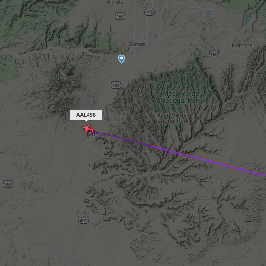
A few weeks ago on the ANZA DX Net I spoke with Denny KN6KNE who was aeronautical mobile. He was in the cockpit of American Airlines 1209 from San Diego to Miami. Following our QSO, Denny sent me an email to let me know that one of the Captains at his base had the same first and last name as me.
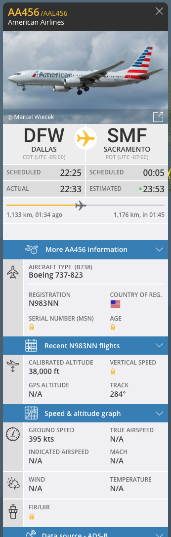
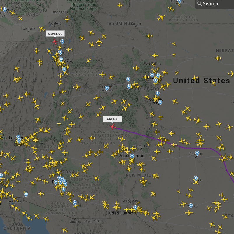
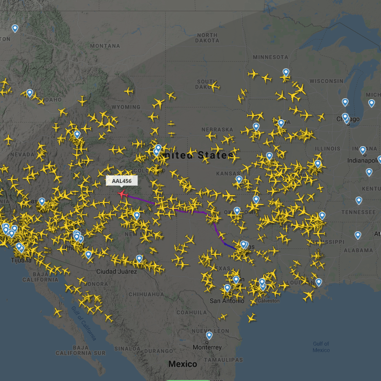
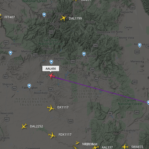
About a week later on 25th May 2021, I spoke with Denny again on the ANZA DX Net on 20m. This time he was in the cockpit of an American Airlines 737.
The flight AAL456 was between Dallas and Sacramento.
While speaking with Denny I was able to track him on Flight Radar 24 as he flew over Utah in the USA. Signal report was 5/6 both ways.
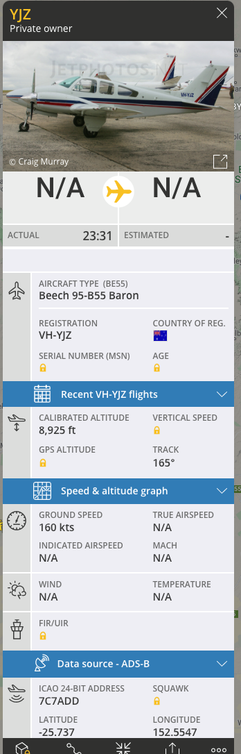
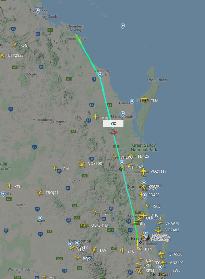
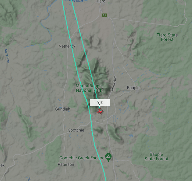
And then a few days later, on 27th May 2021, on 40m, I spoke with Steve VK4VN who was in a Cessna flying over Queensland.
Again, I was able to track Steve on Flight Radar 24.
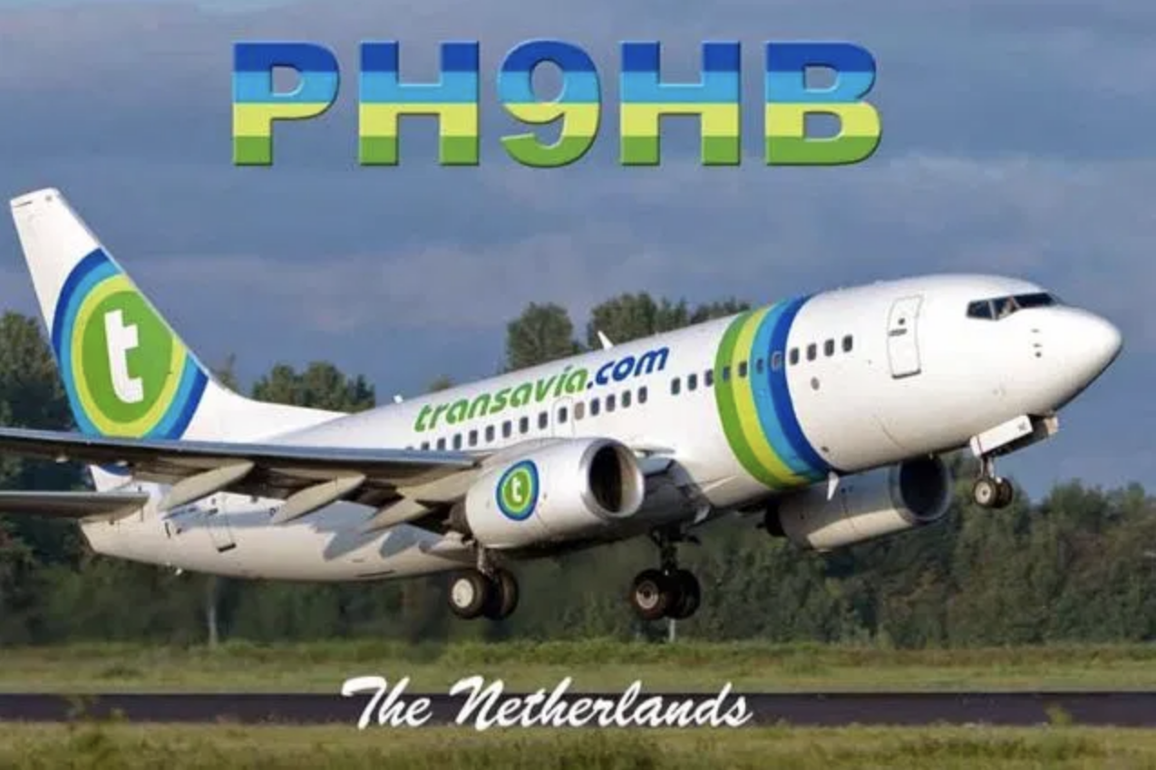
I have spoken with Jerry PH9HB a number of times in the past, while he has been flying over Europe. However, I have not heard Jerry for a few years now. I think the band conditions are starting to pick up, so hopefully my next contact with Jerry won’t be too far away.
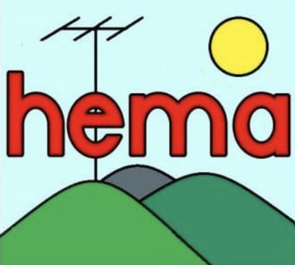
HEMA is the acronym for HuMPs Excluding Marilyns Award. A HuMP is a summit which has at least 100 metres of prominence. A Marilyn is a summit which has 150 metres of prominence. The HEMA program commenced in the British Isles.
Categorisation of mountains and hills in the British Isles
The mountains and hills of the British Isles (England, Scotland, Wales, Ireland, the Isle of Man, the Hebrides and other smaller islands) are categorised into various lists based on different combinations of elevation, prominence, and other criteria including isolation.
This includes:
P600 – the ‘Majors’
Marilyns
HuMPS
Simms
TuMPS
What is a Marilyn?
The Marilyns are mountains and hills in the British Isles that have a topographical prominence of at least 150 metres. As at April 2020, there were 2,011 Marilyns in the British Isles.
The list of Marilyns was first compiled in 1992 by Alan Dawson. The name was coined as a humorous contrast to the designation Munro, which is homophonous with Marilyn Monroe.
A Munro is defined as a mountain in Scotland with a height over 914.4 metres (3,000 feet).
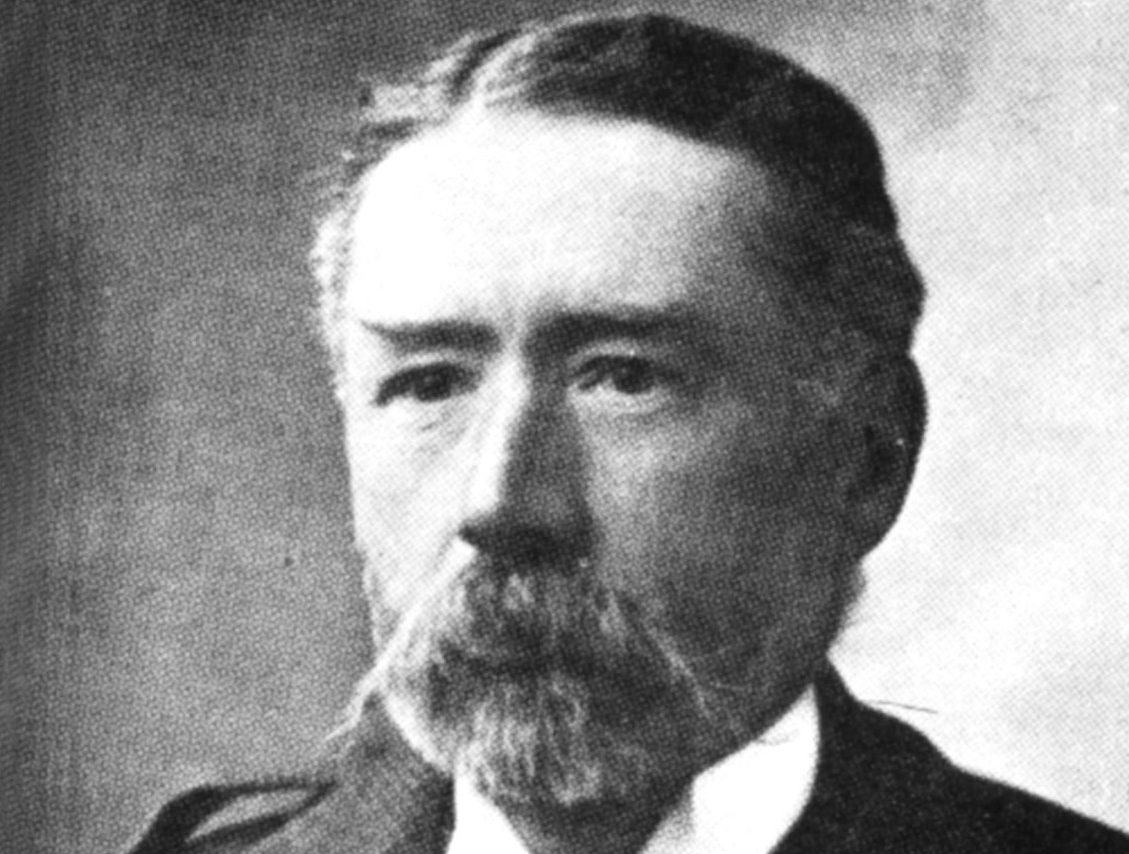
Munros are named after Sir Hugh Munro (1856-1919). In 1891, he produced the first list of such hills, known as Munro’s Tables.
Above:- Sir Hugh Munro. Image c/o Wikipedia.
What is a HuMP?
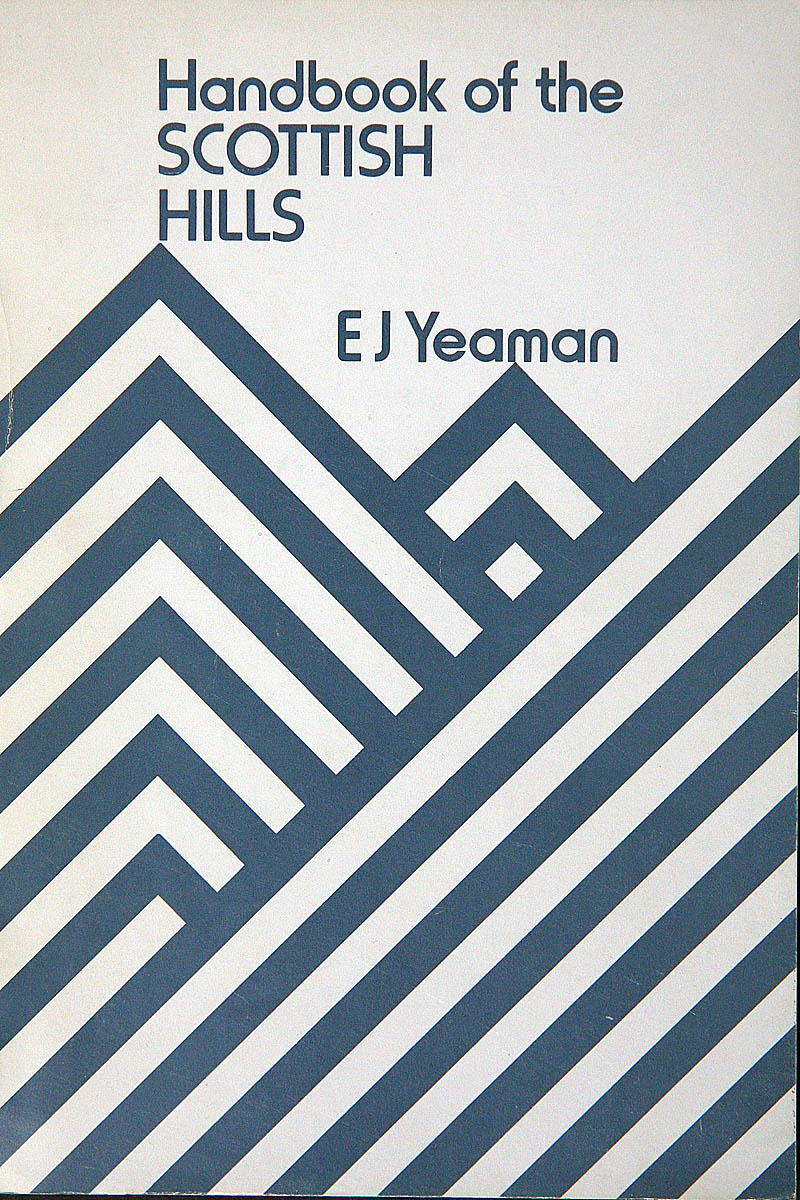
HuMP is an acronym for ‘Hundred and upwards Metre Prominence’. The Marilyns were expanded in 2007 by the HuMPs. Though he did not use the term HuMP, Eric Yeaman’s Handbook of the Scottish Hills (1989) is considered an early source as it included lists of hills with a prominence above 100 m. The name and first formal British Isles list was compiled by Mark Jackson from a number of sources and published online in 2010 in More Relative Hills of Britain. As of April 2020, there were 2,984 HuMPs in the British Isles: 2,167 in Scotland, 833 in Ireland, 441 in England, 368 in Wales and 11 in the Channel Islands.
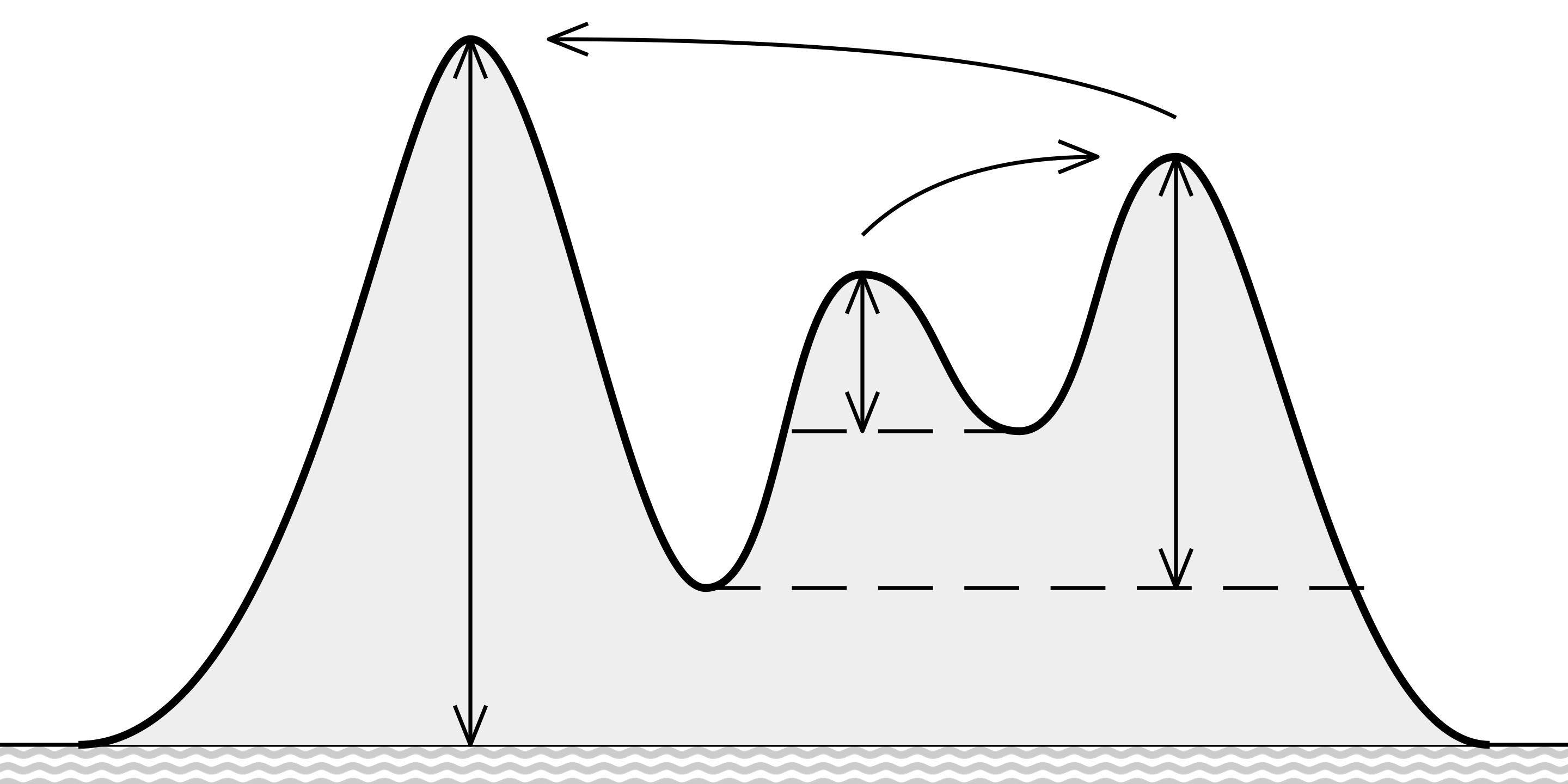
What is prominence?
In topography, prominence (also referred to as autonomous height, relative height, and shoulder drop in US English, and drop or relative height in British English) measures the height of a mountain or hill’s summit relative to the lowest countour line encircling it but containing no higher summit within it.
Above:- Vertical arrows show the topographic prominence of three peaks on an island. The dashed horizontal lines show the lowest contours that do not encircle higher peaks. Curved arrows point from a peak to its parent. Image c/o Wikipedia
How does HEMA differ to SOTA?
In the Summits on the Air (SOTA) program, a summit must have 150 metres (about 492 feet) of prominence. In HEMA, a qualifying summit (a HumP) must have at least 100 metres of prominence. A ‘Marilyn’ is a summit which has 150 metres of prominence and these do not qualify for HEMA. They have their own program, SOTA.
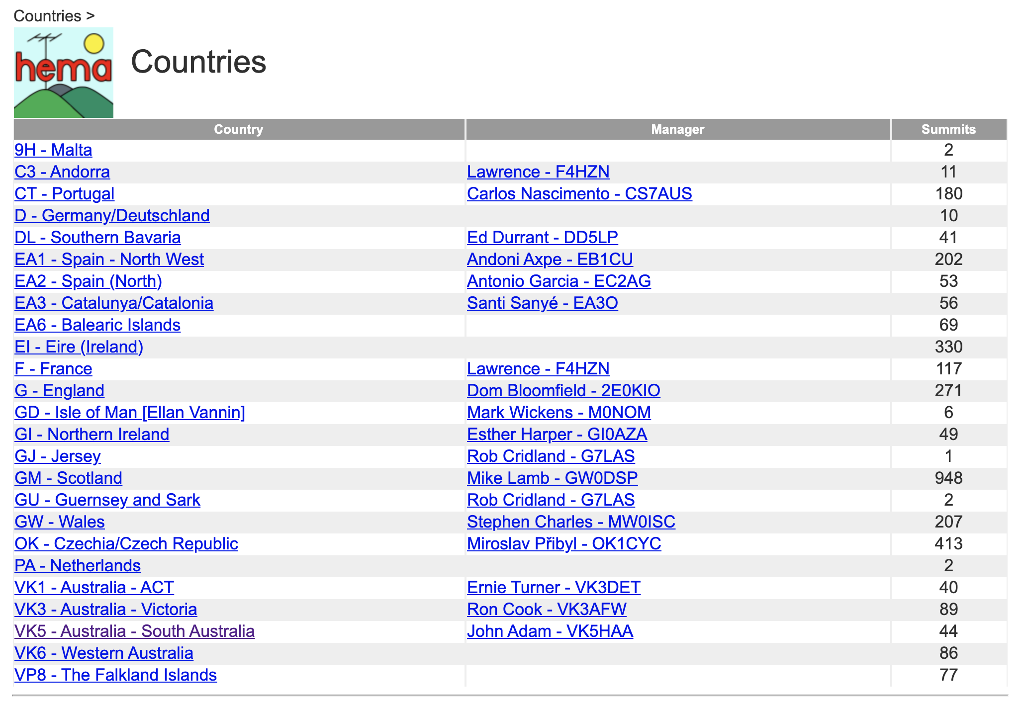
What countries is HEMA operating in?
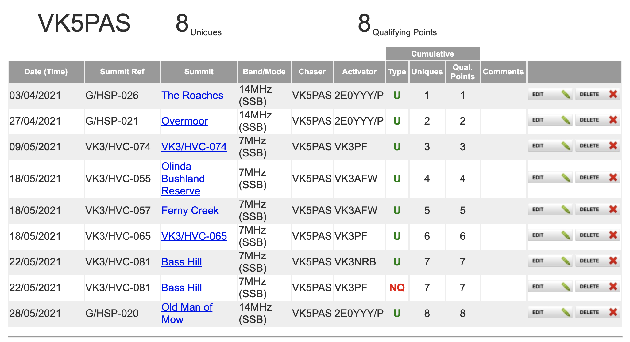
HEMA is active in 19 different DXCC entities, including Australia. In Australia, there are currently qualifying HEMA summits in VK1, VK3, VK5, and VK6.
Activation Zone
As is the case with SOTA, activations must take place within the activation zone. The activation zone is defined as the area within 25 metres vertically of the summit’s highest point.
When is the summit activated?
The HEMA summit is considered to have been ‘activated’ when four ‘successful QSOs’ are obtained. It is important to note that the four QSOs must be with different stations and operators. Previously this was four different callsigns. However the rules have been re-written and different stations and operators must now be logged. The HEMA website states:
“This is a noteworthy revision from previous versions of the rules – where four different callsigns were valid. This will stop multiple “contacts” with the same operator holding many callsigns which, it’s believed, is contradictory to the spirit of the programme.”
What is a ‘successful QSO’?
A ‘successful QSO’ means a contact between a chaser and activator where callsigns and signal reports are correctly exchanged.
What isn’t allowed
Contacts via any ‘relay’ including satellites, repeaters, the internet Echolink, etc, are not allowed.
Gathering points as an activator
Each successful activation will earn you 1 point.
Only your first activation of a summit will qualify for a point in the Uniques Table. You can attract another one point for that summit once per calendar year. You can activate a HEMA summit as many times as you like each year, however points will only be awarded for that summit once per calendar year. Awards are available for both Uniques and Qualifying points. Please see the “awards” section for further details.
Can I drive into a HEMA summit?
The HEMA website states the following:-
“HEMA is a mixture of outdoor pursuit and amateur radio. To this end it’s expected the equipment and operator arrive at the operating position by traditional means (walking, cycling, etc…) and the equipment is powered by a portable energy source (battery, solar panel etc…). The “spirit” of the programme here is key. For example, operating from a vehicle or ascending by quad bike is not permitted as a result.”
Gathering points as a Chaser
Only your first chase of a summit will qualify for a point in the Uniques Table. However, you may repeat your chase and accrue chaser points of the same summit once per day and this will attract a point in the Qualified Points Table. Awards are available for both Uniques and Qualifying points.
Database
In the HEMA database you can keep track of your progress as both an Activator and a Hunter.
Awards
All HEMA awards are free of charge and are sent as a PDF file.
Classic – The ‘Unique Summit’ Awards for Chasers and Activators
This Award is based on the number of unique qualifying HEMA Summits activated or chased.
For each 25 uniques HEMA awards a certificate. There is also a 10 unique activations starter certificate to encourage activity.
Classic – The ‘Qualifying’ Awards for Chasers and Activators
In additon to the Unique Summit awards; additional awards are available based upon ‘Qualifying’ activations and chases. For every 50 qualifying activations a certificate is available and also for every 100 qualifying chases.
First H2H DXCC Award
In cases where two activators have a ‘Successful QSO’ between each other and they are both on HEMA summits – this is called an ‘H2H contact’ (HEMA2HEMA).
Both activators will receive a special certificate where this is the first ever H2H between two DXCCs.
HEMA Facebook page.
There is a HEMA Facebook page which can be found at…..
On Saturday 22nd, Sunday 23rd, Monday 24th, and Tuesday 25th May 2021, Marija VK5MAZ and myself had the special event callsign of VI100AF for 4 days.
We operated from home on Saturday, Sunday, and Tuesday. At home our operating equipment is a Yaesu FT-2000, and 100 watts. The antenna for 80m is a home brew dipole, inverted vee. The antenna for 40m is a rotatable dipole at 55 feet. And the antenna for 10, 15, & 20m is a 5 element yagi at 50 feet.
On Monday I activated from the field – activating a park and two HEMA summits.
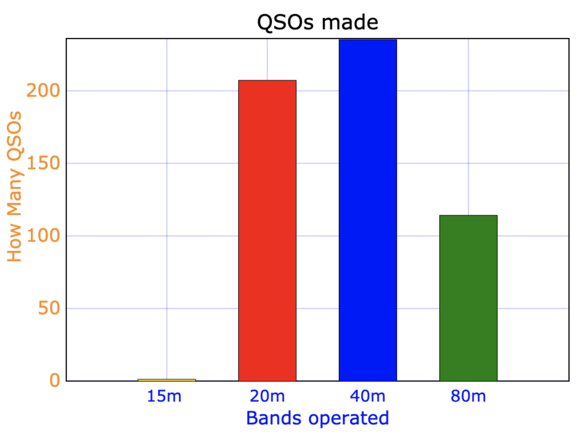
Over the 4 days we made a total of 557 QSOs on 15, 20, 40 & 80m SSB.
Above:- Graph showing our QSOs per band.
A total of 35 different DXCC entities were worked.
Antarctica
Australia
Austria
Balearic Islands
Belgium
Bosnia
Bulgaria
Canada
Canary Islands
Cayman Islands
Croatia
Czech Republic
Denmark
England
European Russia
Germany
France
Greece
Hungary
Italy
Malta
Netherlands
New Caledonia
New Zealand
Panama
Poland
Puerto Rico
Romania
Slovak Republic
Slovenia
South Africa
Spain
Switzerland
Ukraine
USA
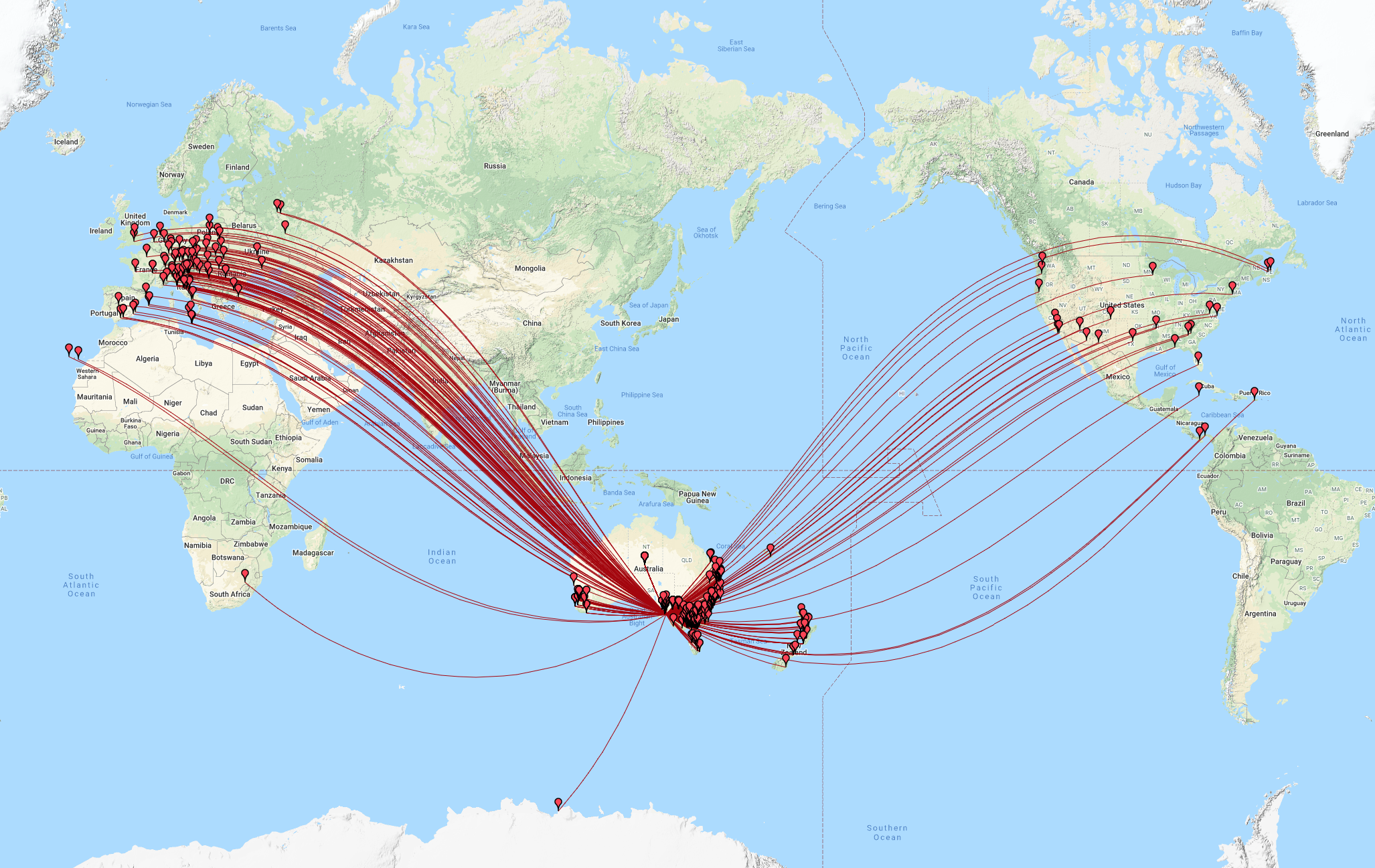
On Saturday and Sunday afternoon there was a nice opening on the long path on 20m into Europe. The callsign proved to be very popular, with some very big European pile-ups. Unfortunately there was no opening at all on Tuesday to Europe.
We also logged a sprinkle of USA and Canadian stations, along with two stations from Panama (HP6DJA and HP6LEF), NP4A in Puerto Rico, and ZF1DM in the Cayman Islands.
Pedro NP4A was a huge signal on 40m.
Despite the callsign having been on air since 1st March 2021, there was a a nice steady flow of callers from Australia and New Zealand.
A number of former RAAF personnel were logged. This included:
Frank VK1VK
Tony VK3CCM
Wayne VK2DWP
Ron VK2MU
Bernard VK3BFH
Overseas former Air Force stations who I spoke to included:
Gerry W5RJJ
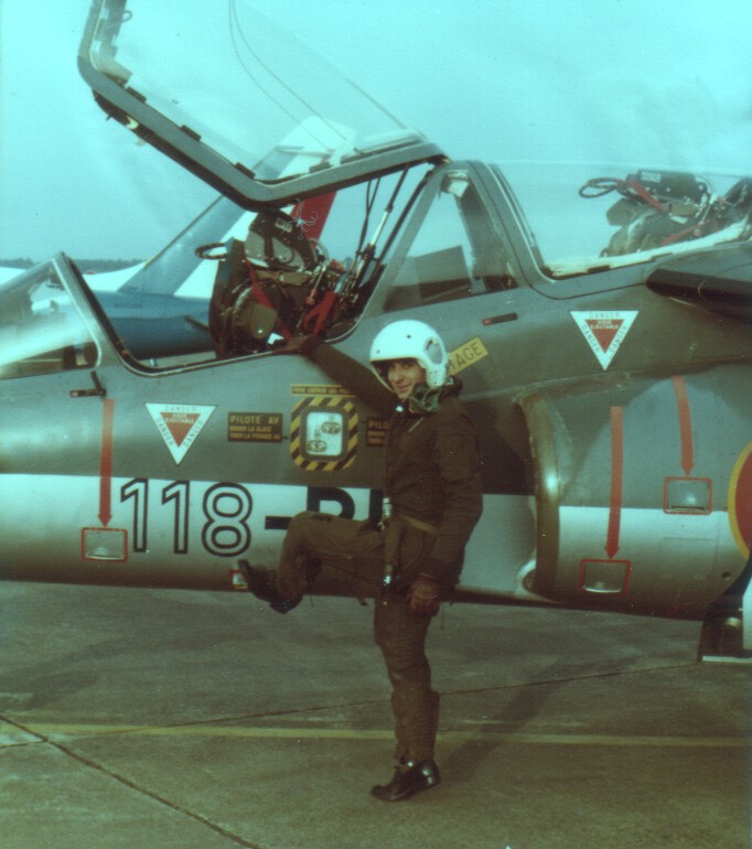
Jack FK8GU
Jacques ‘Jack’ FK8GU and I were 15/9 to each other on 20m and had an interesting chat. He is former French Air Force.
Above:- FK8GU. Image c/o his QRZ.com page
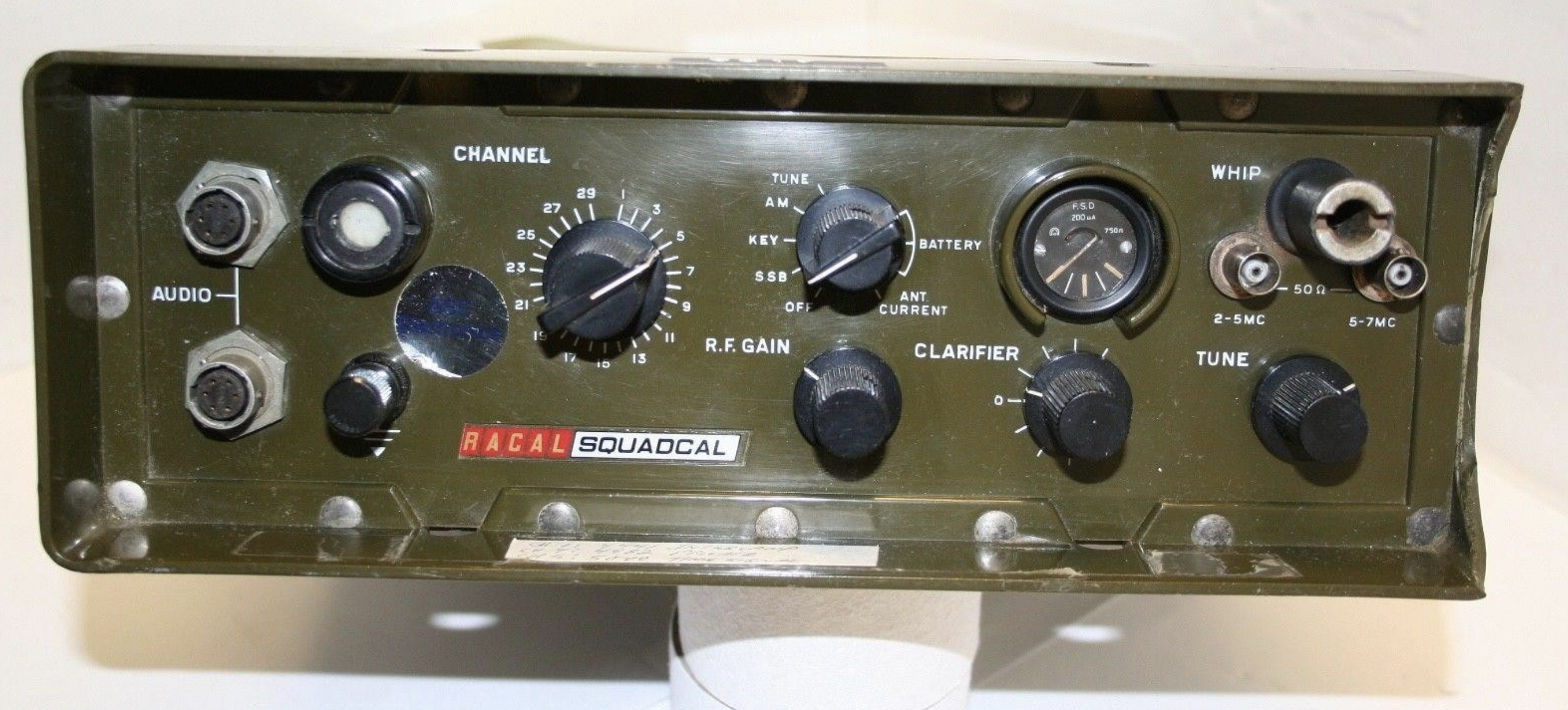
I worked John VK4VT using a former RAAF transceiver, a Racal TRA906, which was another interesting contact.
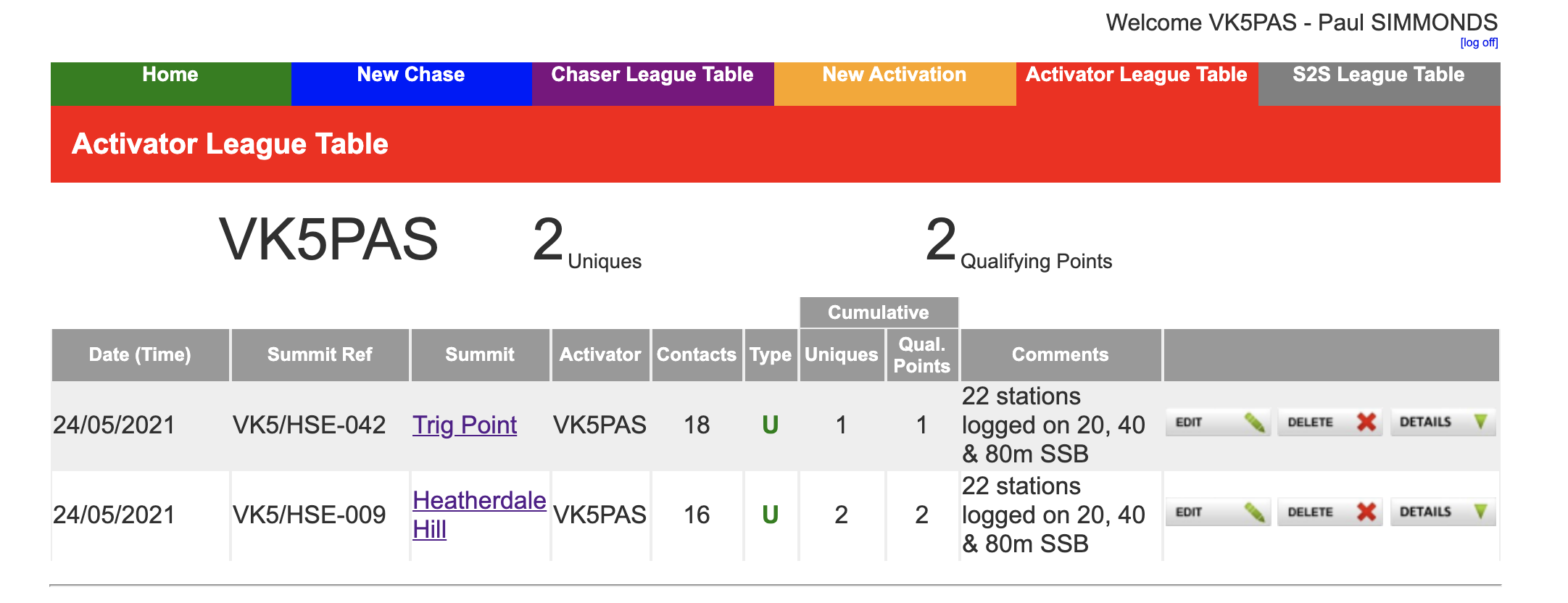
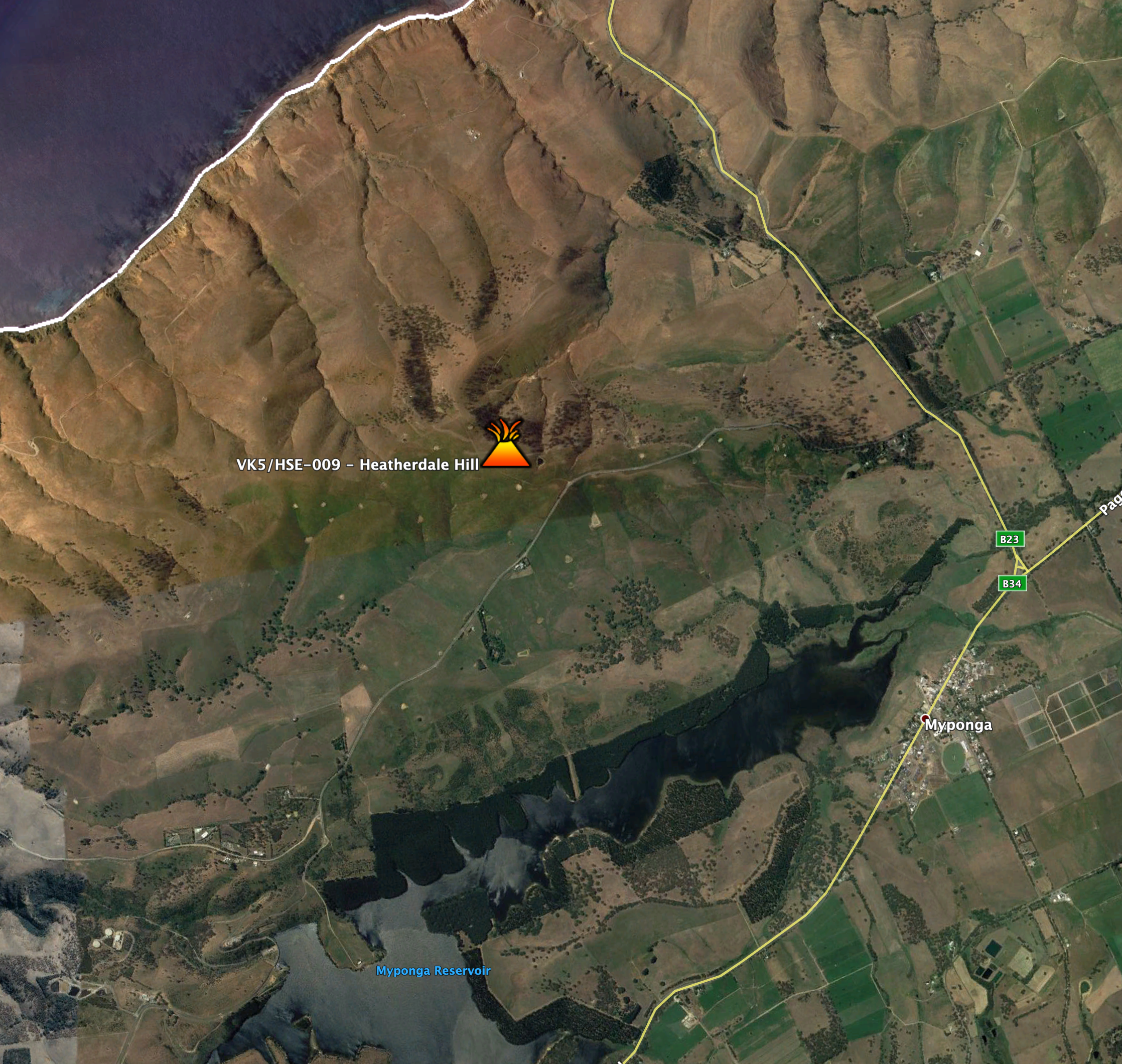
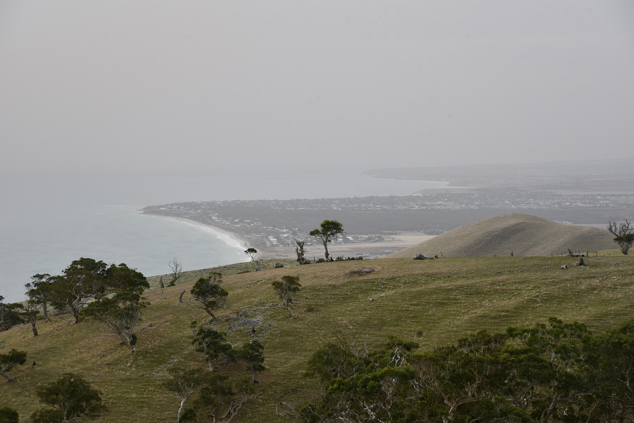
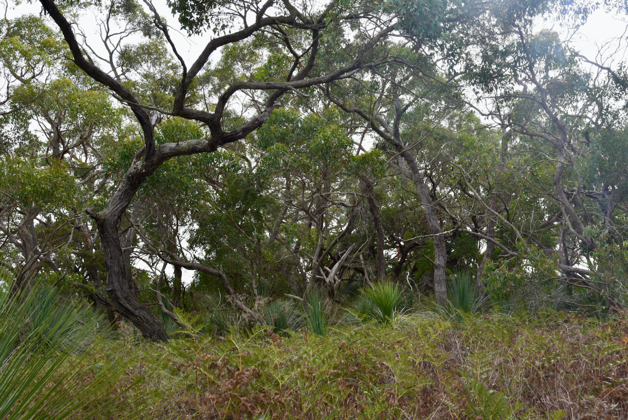
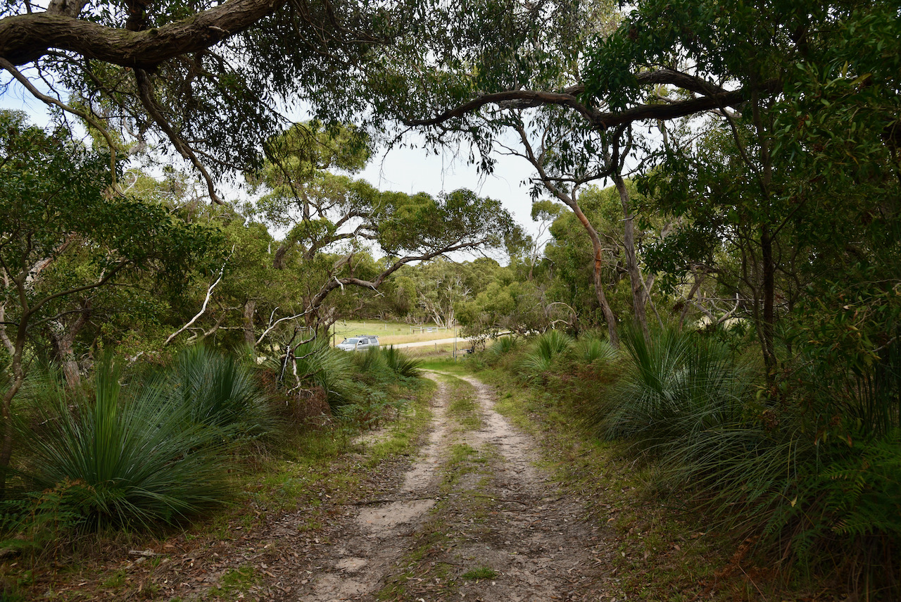
After packing up at VK5/ HSE-042 and having a chat with John VK5HAA, the VK5 HEMA Manager, I decided to head to Heatherdale Hill VK5/ HSE-009 for another HEMA activation.
The summit is located about 71 km (by road) south of the CBD of the city of Adelaide.
Above:- Heatherdale Hill near Myponga. Image c/o Google Earth.
Heatherdale Hill is easily accessible via Reservoir Road at Myponga. The exact summit itself is on private road, but you are well and truly within the activation zone if you operate from the side of the road.
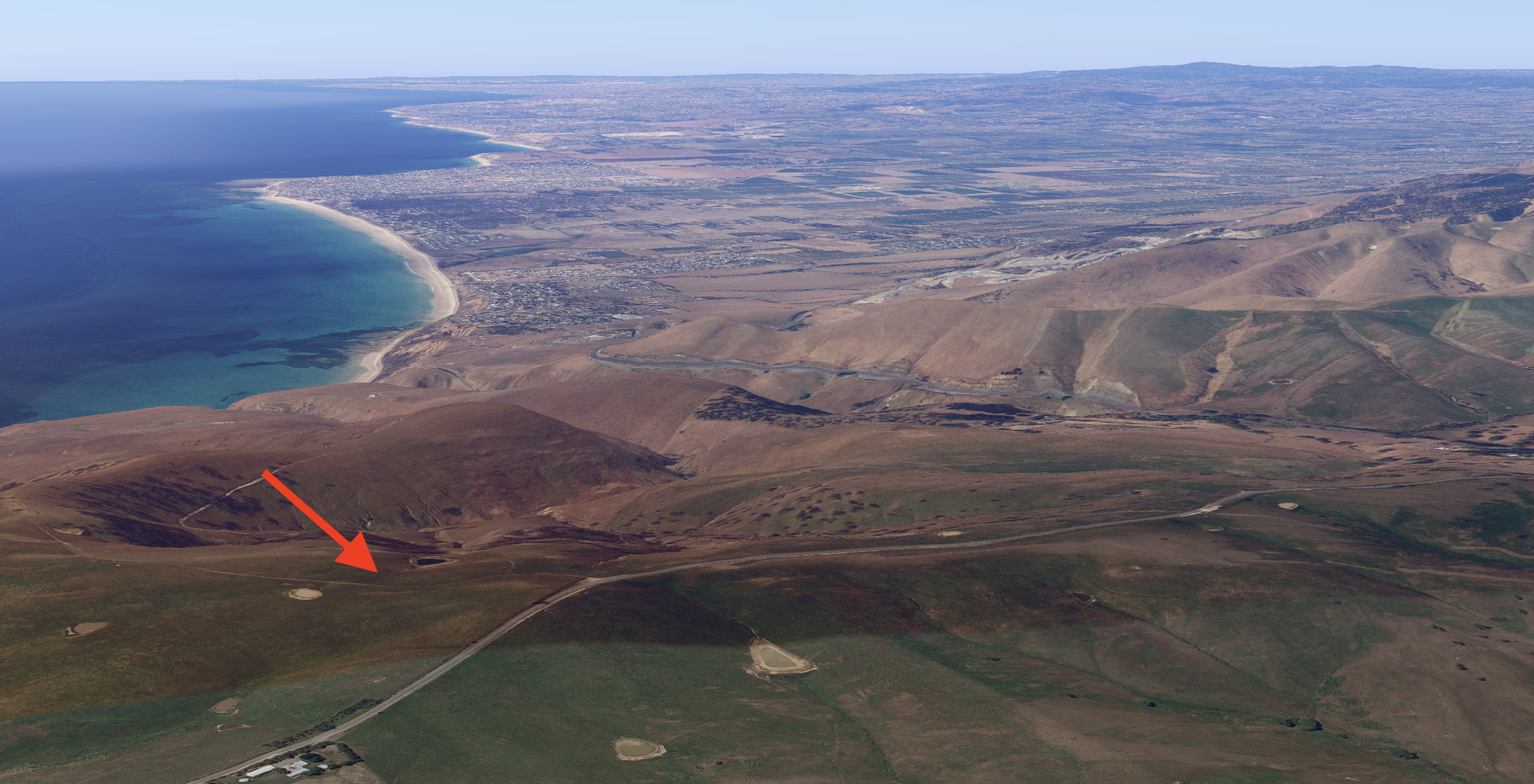
Above:- An aerial view of Heatherdale Hill looking north towards Adelaide. Image c/o Google maps.
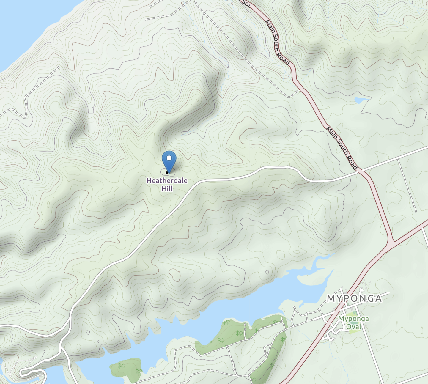
Heatherdale Hill is 353 metres above sea level and has 112 metres of prominence.
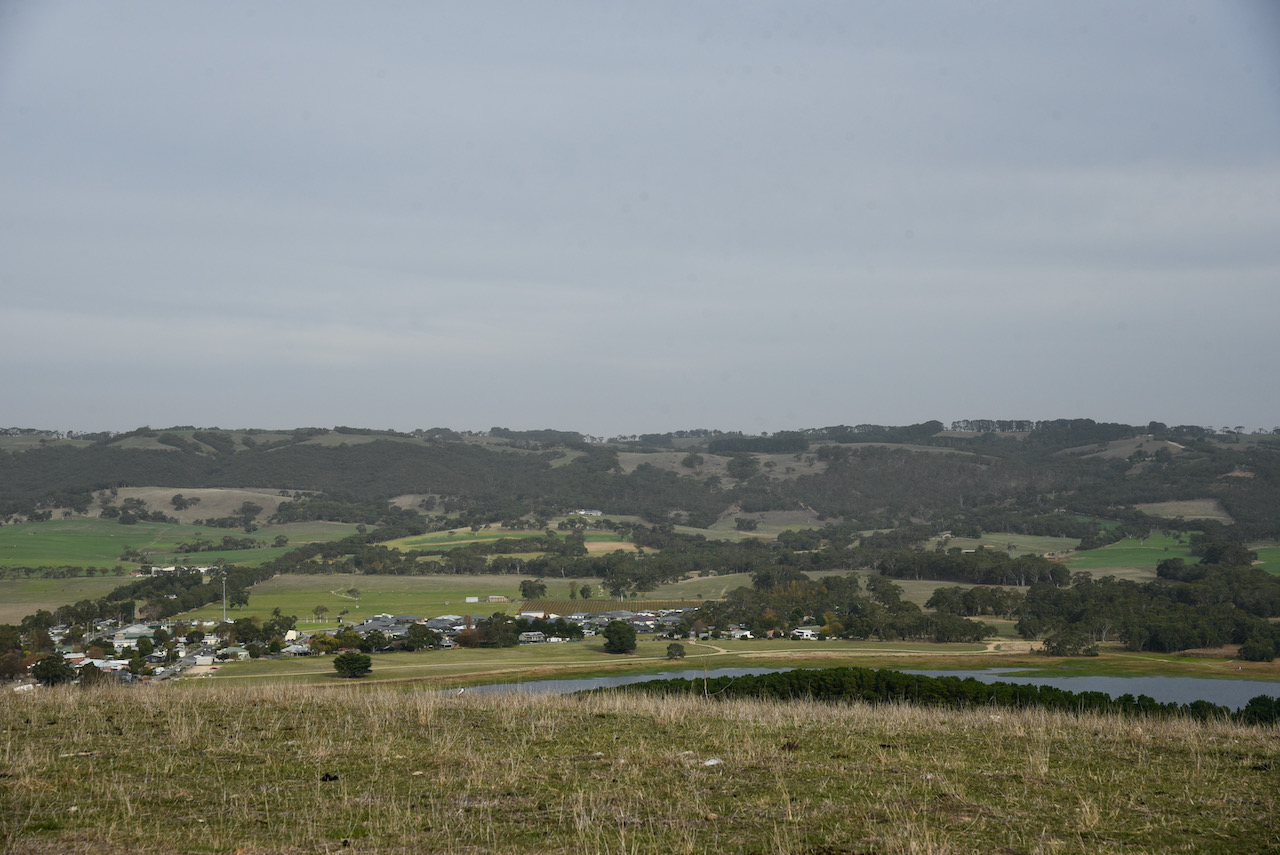
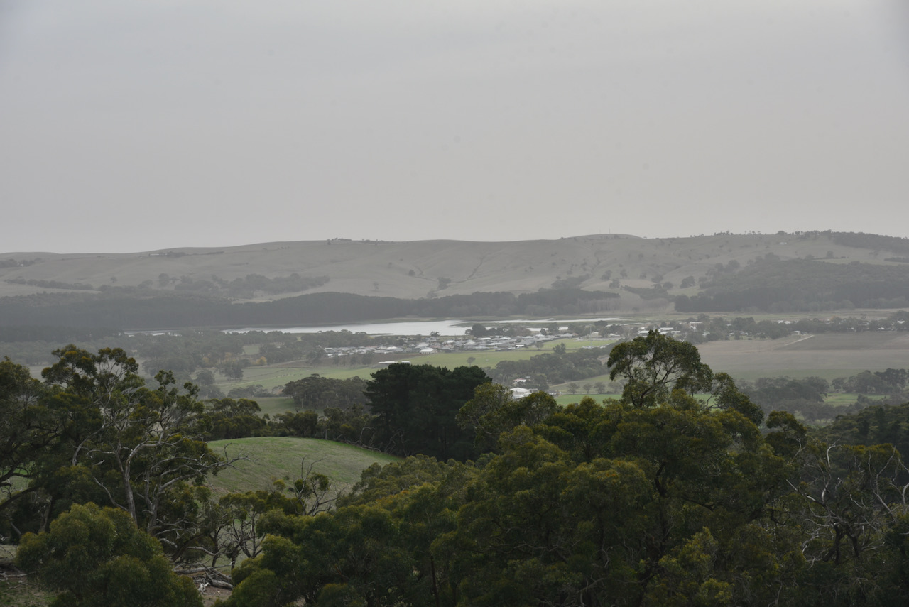
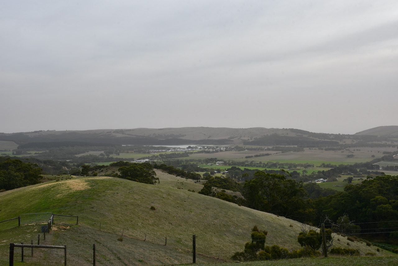
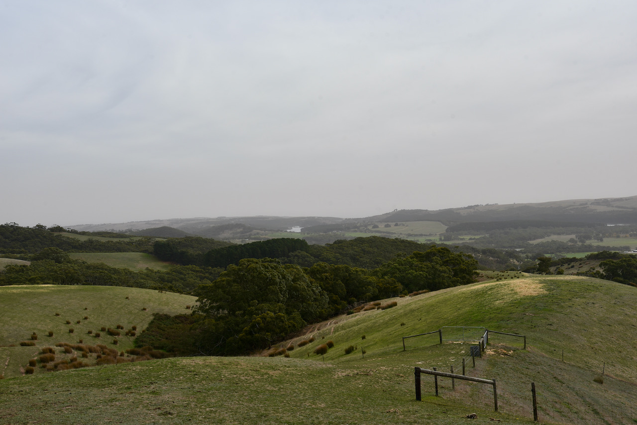
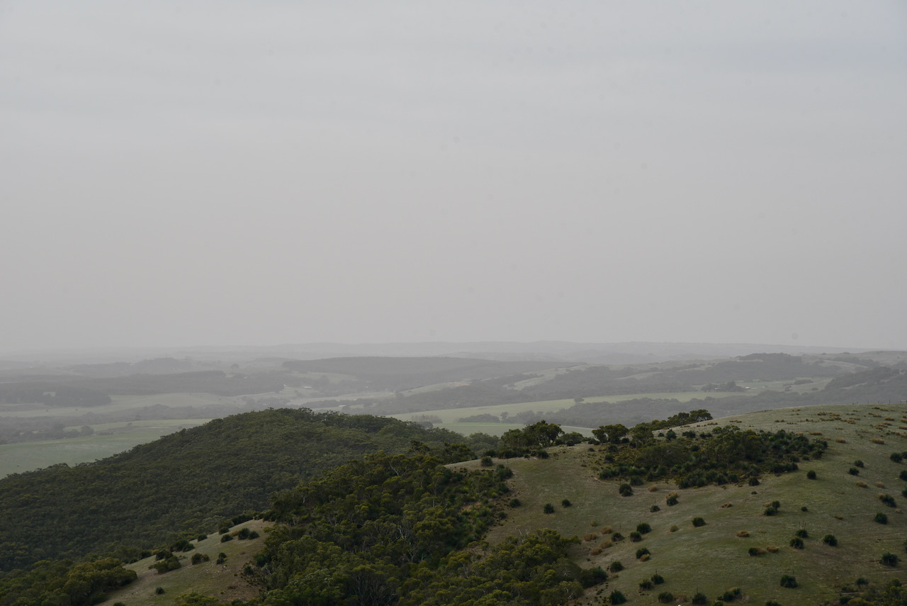
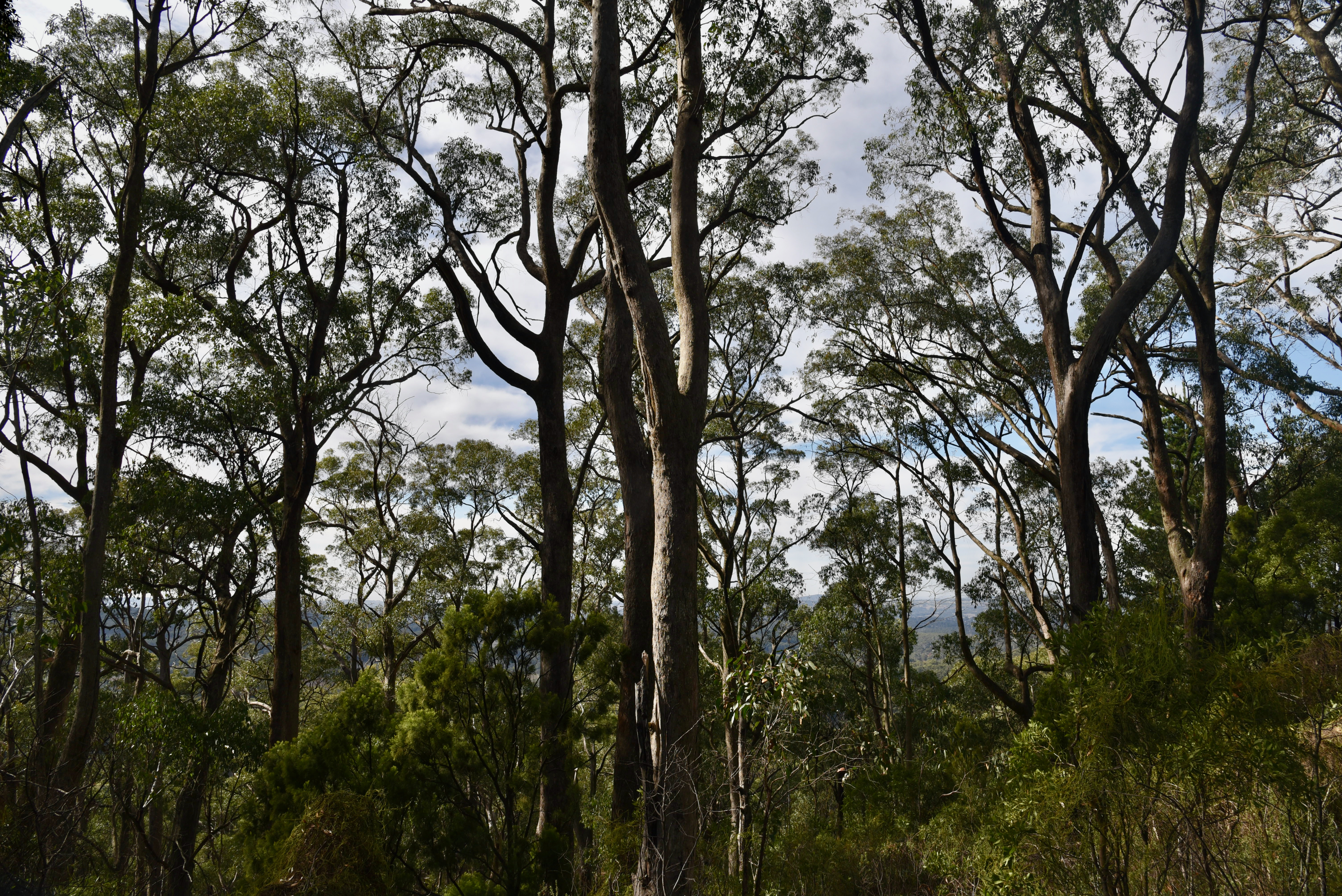
Once at Heatherdale Hill, you can enjoy some terrific views north, back along the coastline of Adelaide and Gulf St Vincent.
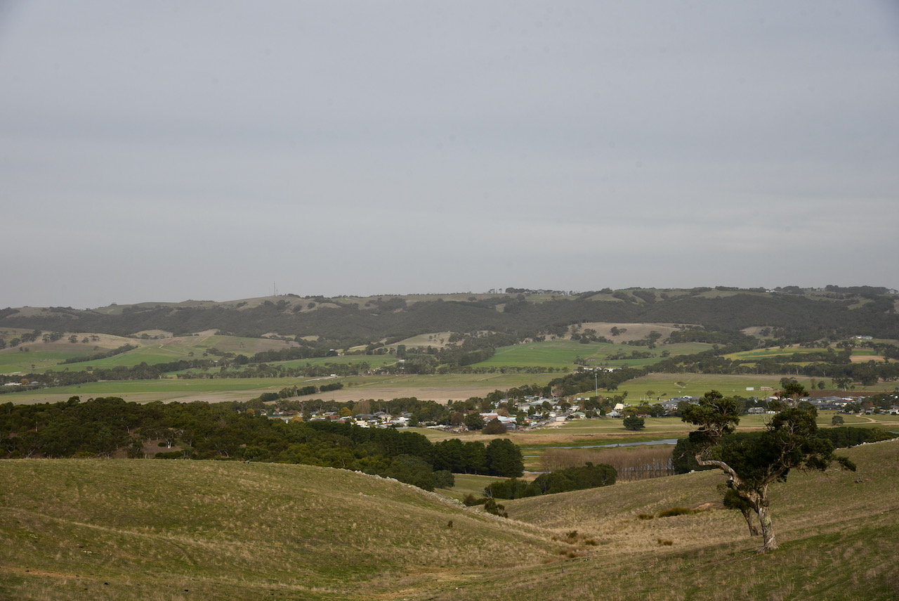
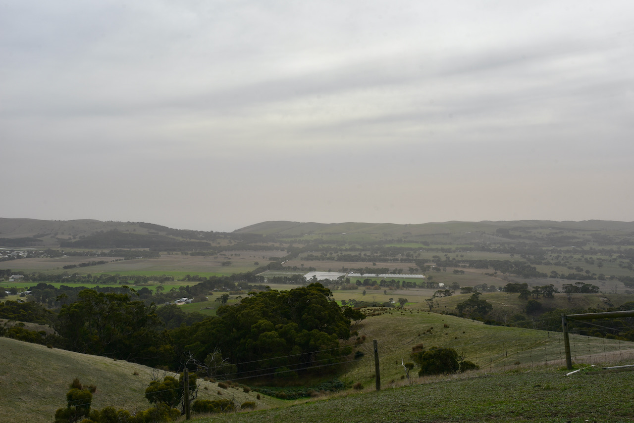
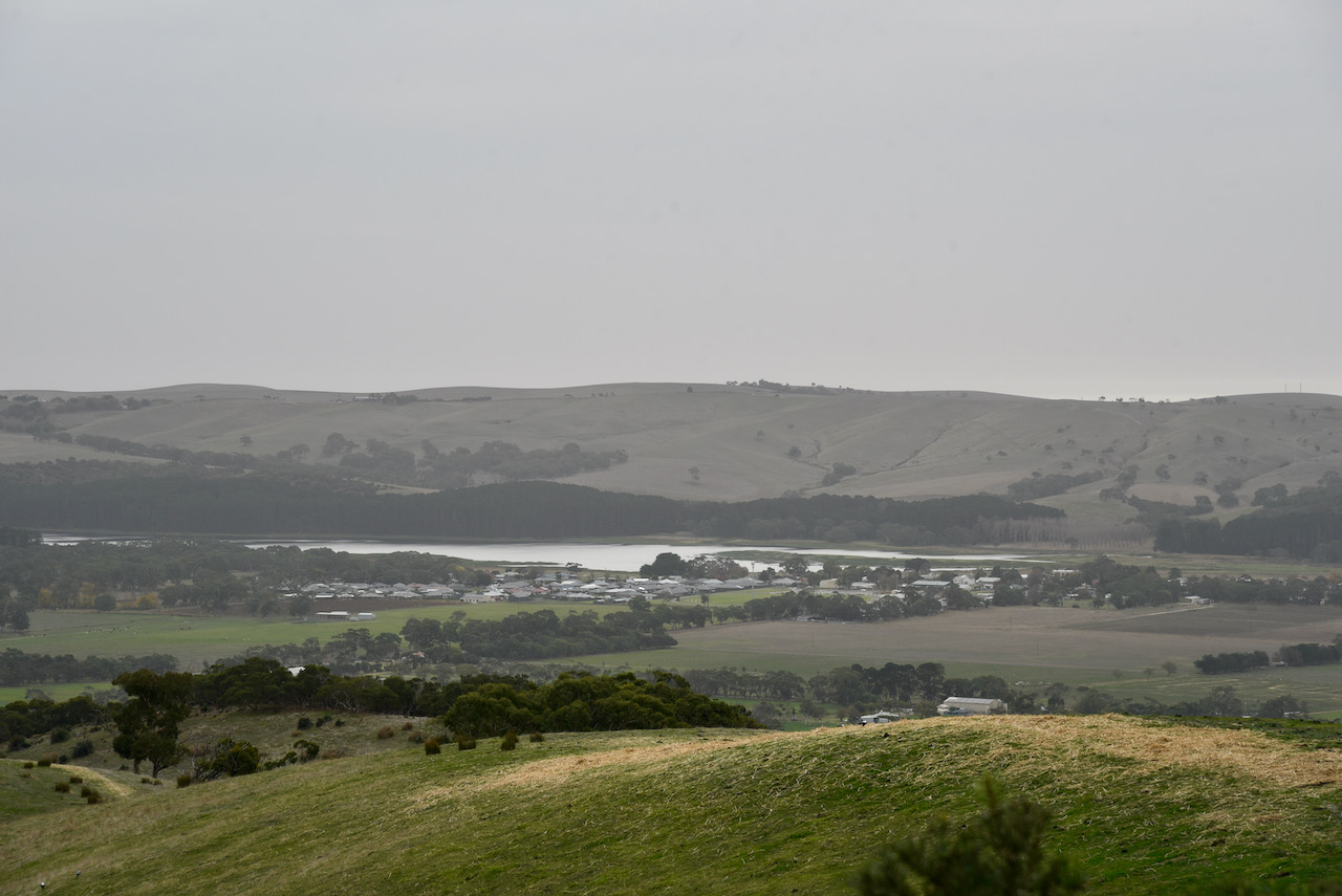
And to the east there are some nice views of the township of Myponga and across the valley to VK5/ HSE-042.
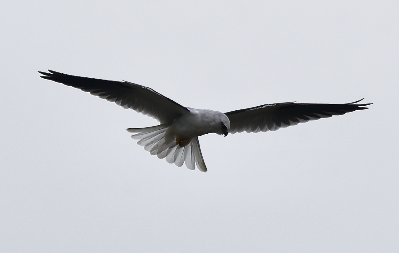
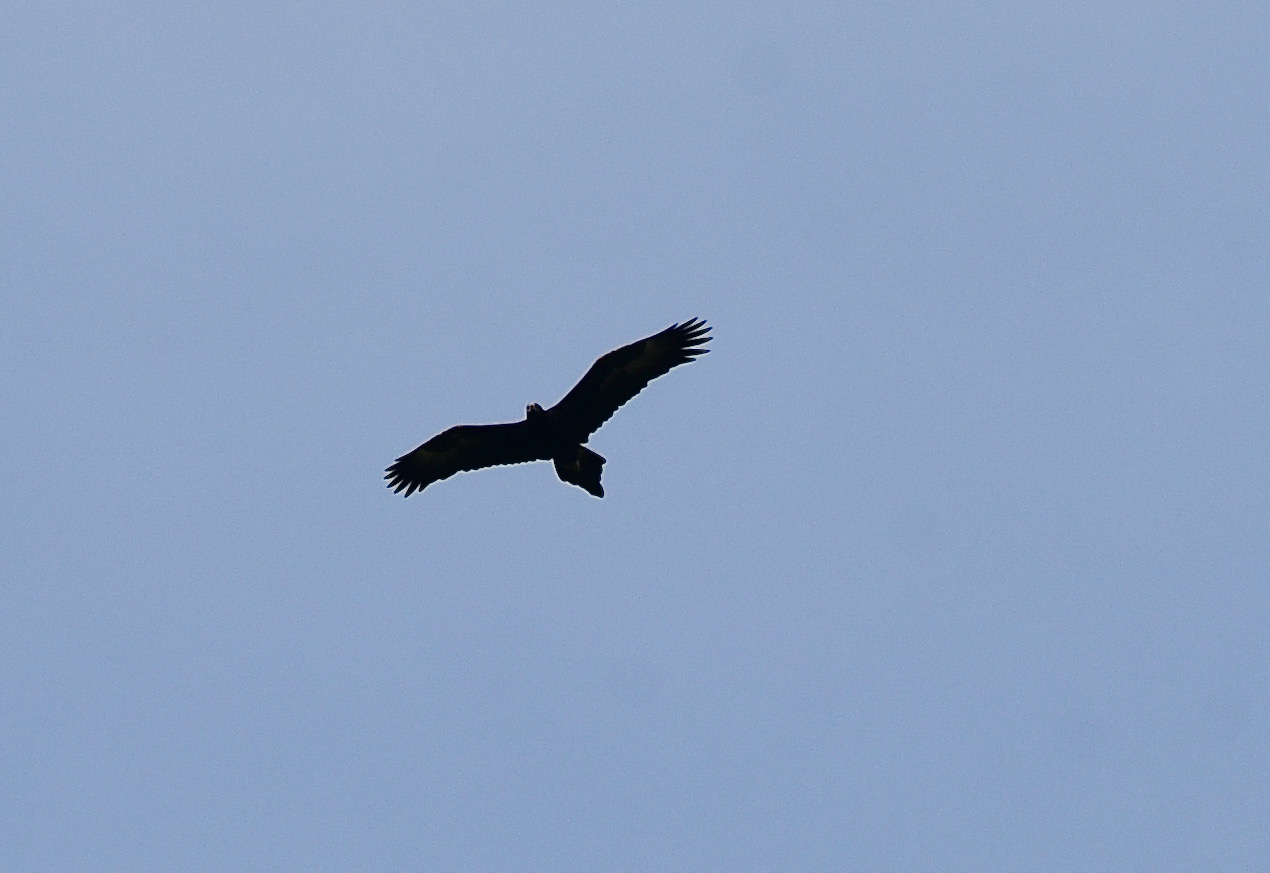
During my activation I had a couple fo Wedge Tailed Eagles soaring above in the thermal currents. I also managed to snap a few photographs of a Black shouldered Kite.
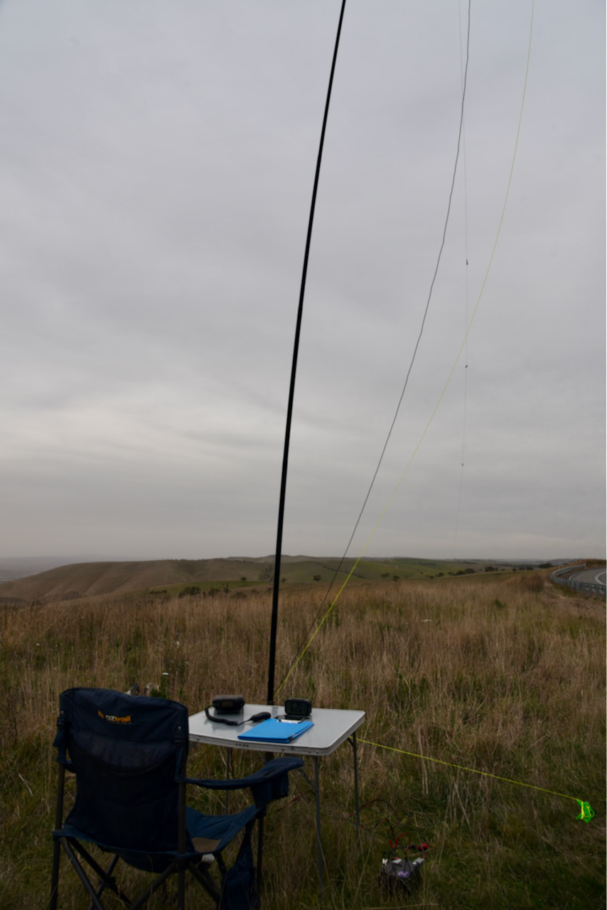
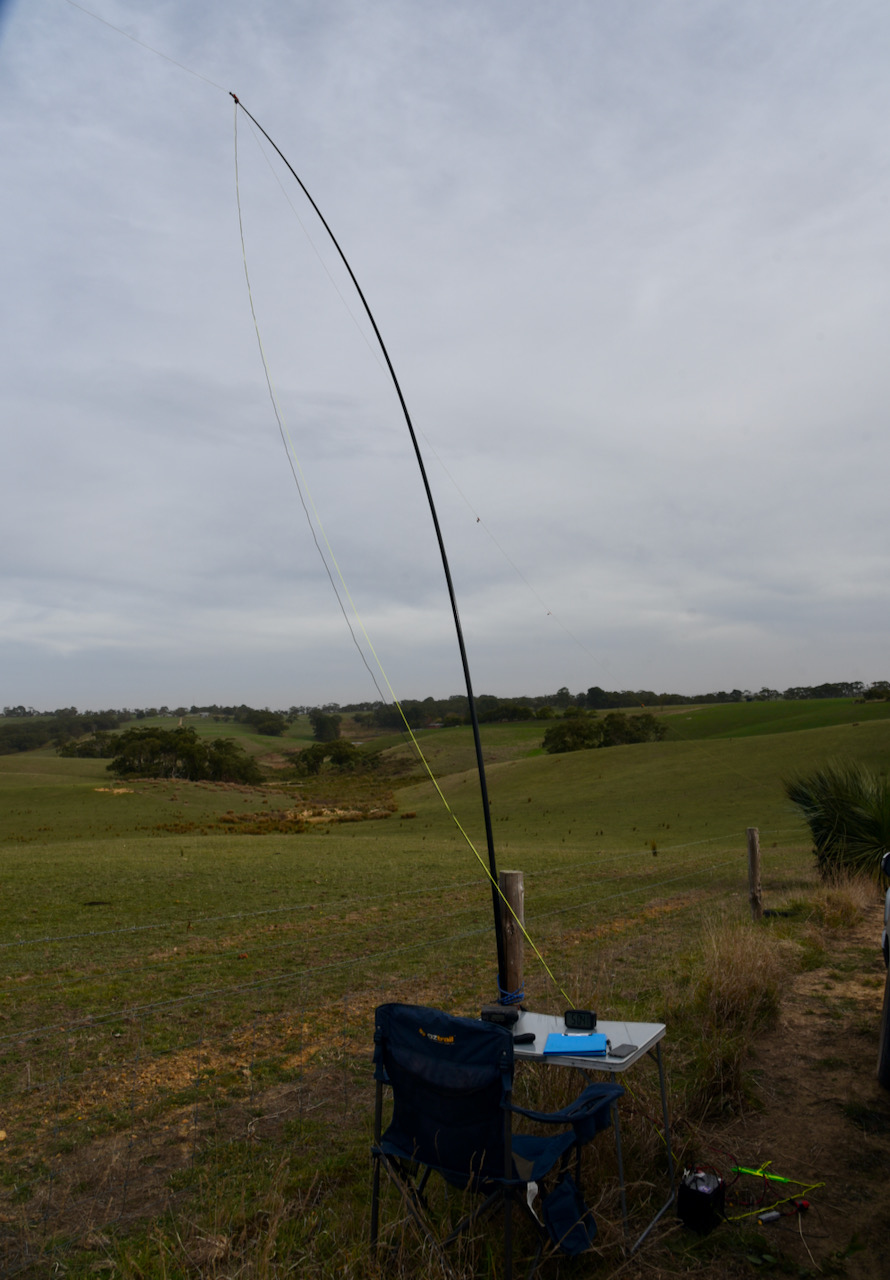
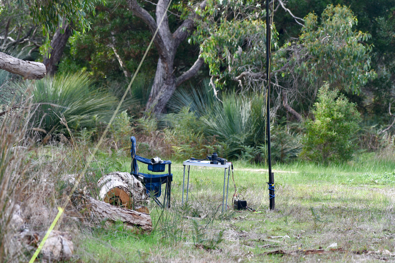
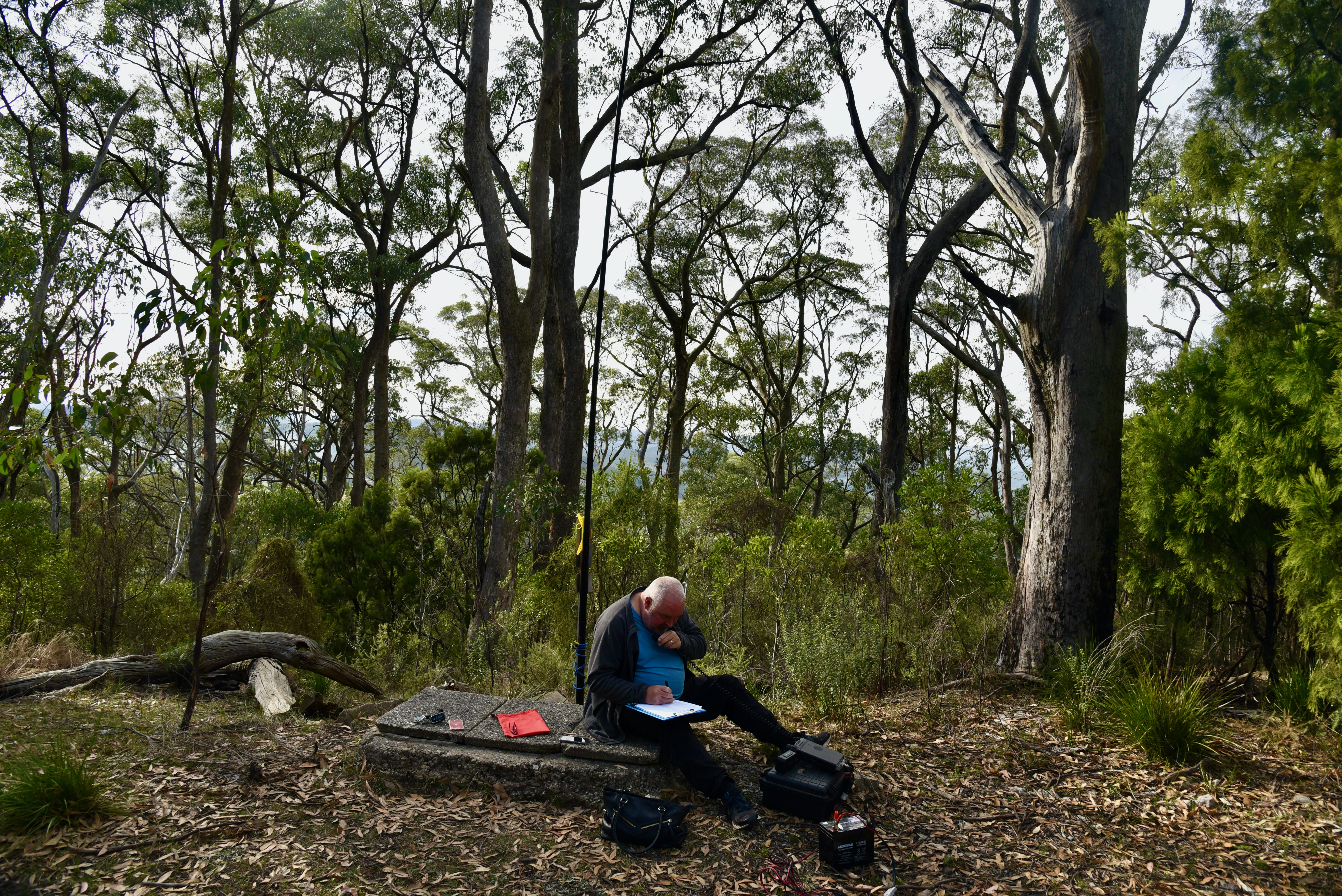
It was extremely windy at Heatherdale Hill and I set up on the side of the road, right alongside of the farmer’s gate which leads into the actual summit.
First in the log was John VK5HAA with a lovely 5/9 signal, followed by Tony VK3YV, and then Marija VK5MAZ. I logged a total of 11 stations on 40m from VK2, VK3, VK4, and VK5. Contact number 4, qualifying the summit for me for HEMA, was with Nev VK5WG.
I then moved to 3.610 on the 80m band where I logged 8 stations from VK3 and VK5. This included Marija VK5MAZ who was super strong from Ashbourne (gave me 5/9 plus 50) and Tony Vk5MRT at Strathalbyn who gave me 5/9 plus 30. Adrian Vk5FANA was also very strong and gave me a 5/9 plus 25 signal report.
I decided to have a quick listen on 20m on 14.310 where I logged 3 stations from VK4, VK5, and Vk6.
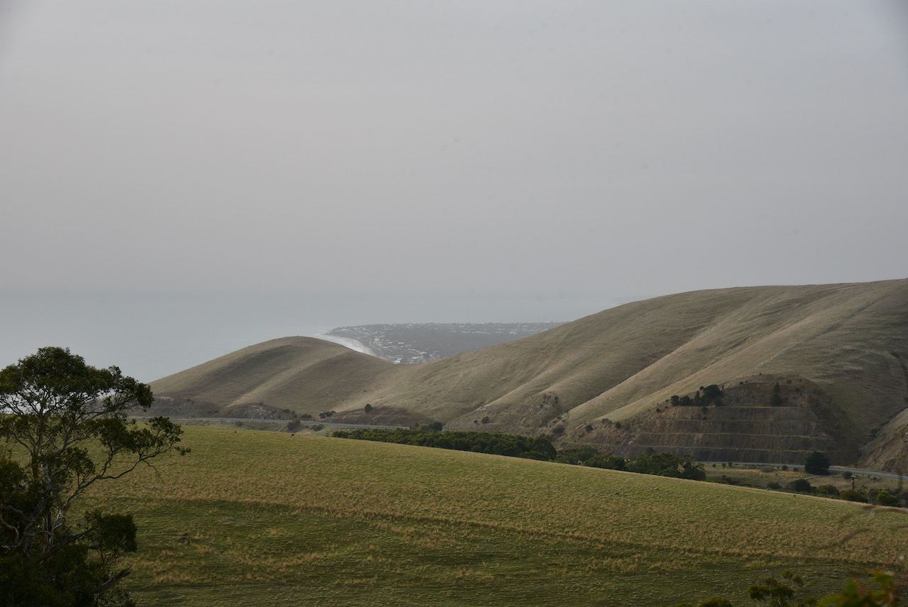
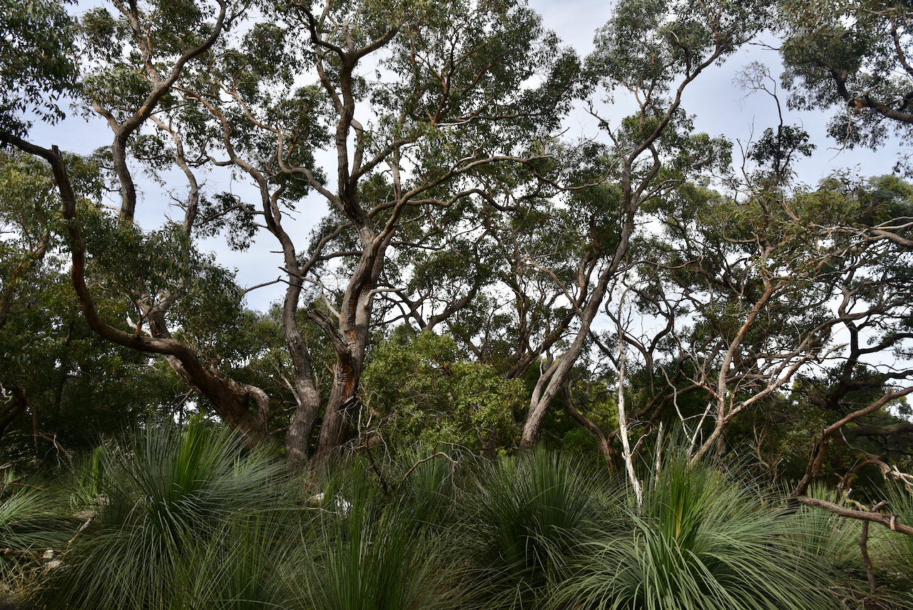
After packing up at the Stipiturus Conservation Park, I headed for my first every HEMA activation, Trig Point VK5/ HSE-042.
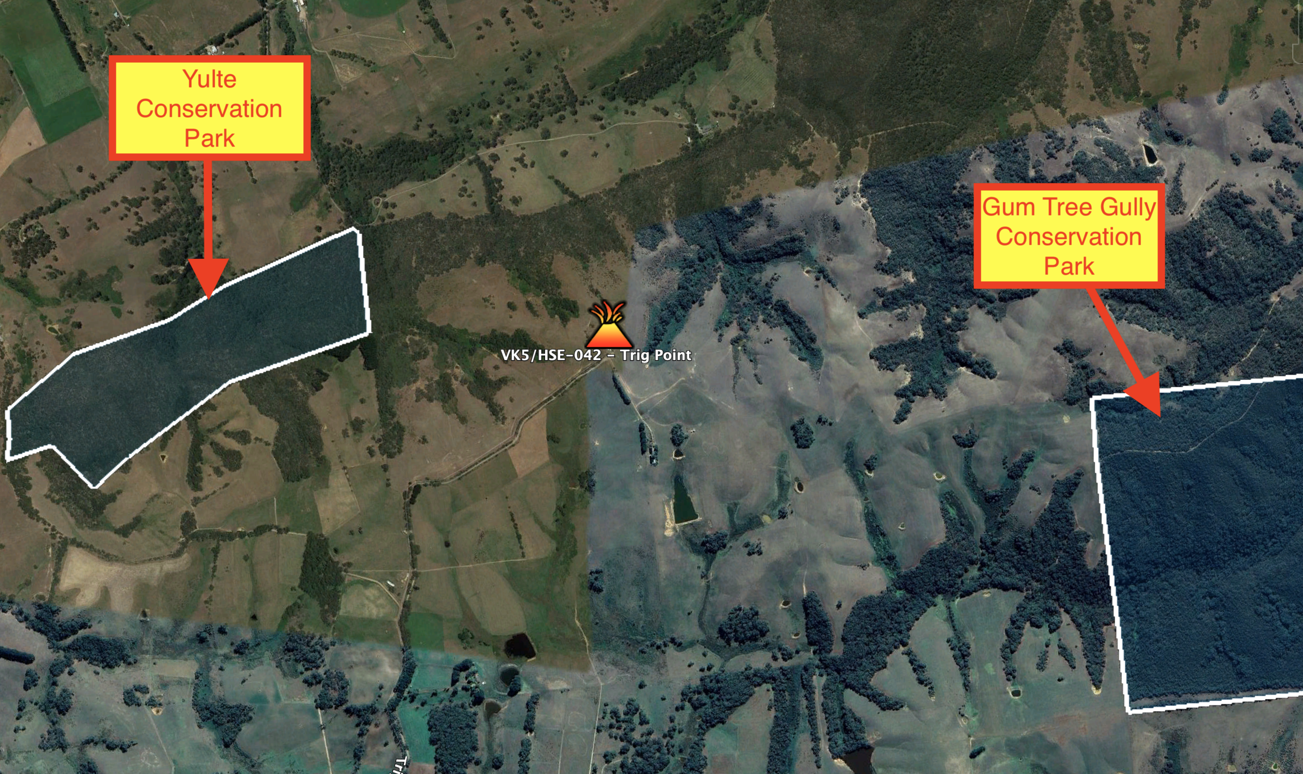
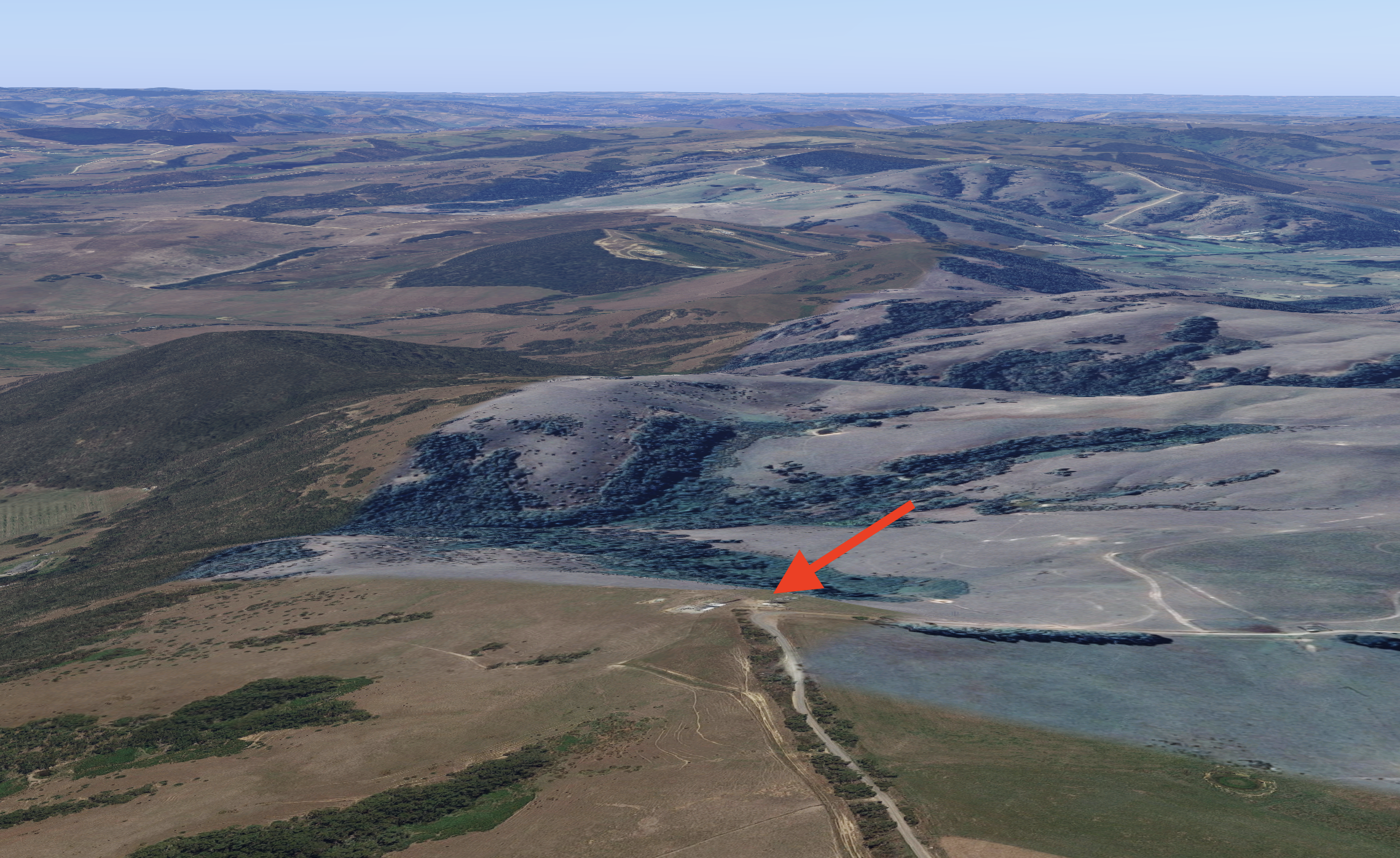
The summit is located in the area of Hindmarsh Valley, right on the border with Myponga, on the Fleurieu Peninsula about 67 km south of Adelaide. The summit is located in between the Yulte Conservation Park and the Gum Tree Gully Conservation Park.
Above:- VK5/ HSE-042, located in between the Yulte CP and the Gum Tree Gully CP. Image c/o Google Earth.
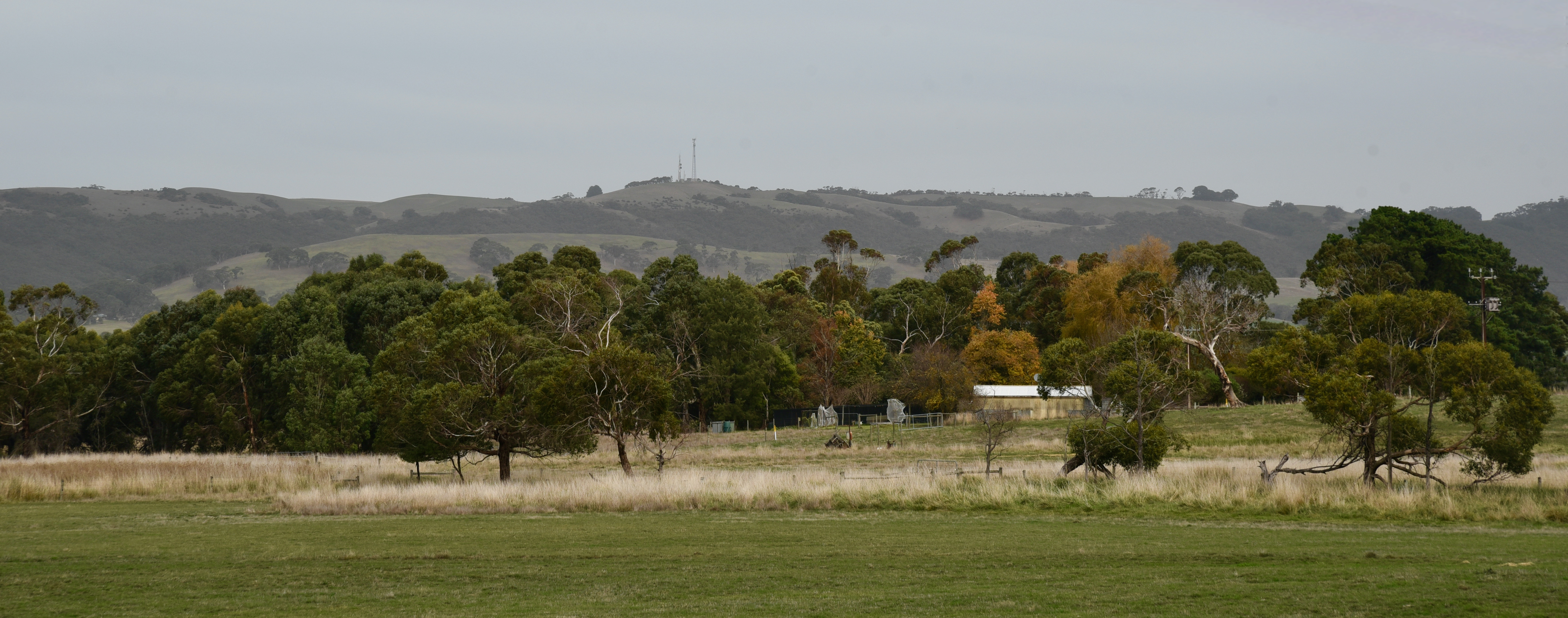
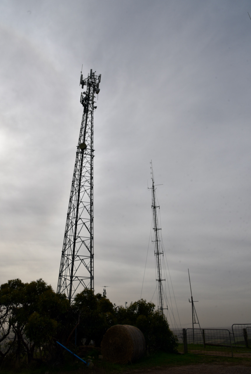
I travelled along Pages Flat Road from the Victor Harbor Road towards the town of Myponga, and was able to see the summit clearly as I travelled towards Myponga. The summit has a number of communication towers on the top.
The summit is referred to as Trig Point on the HEMA website, but it is referred to as Myponga Hill on a number of communication tower sites.
Myponga is an aboriginal word maippunga meaning locality of high cliffs.
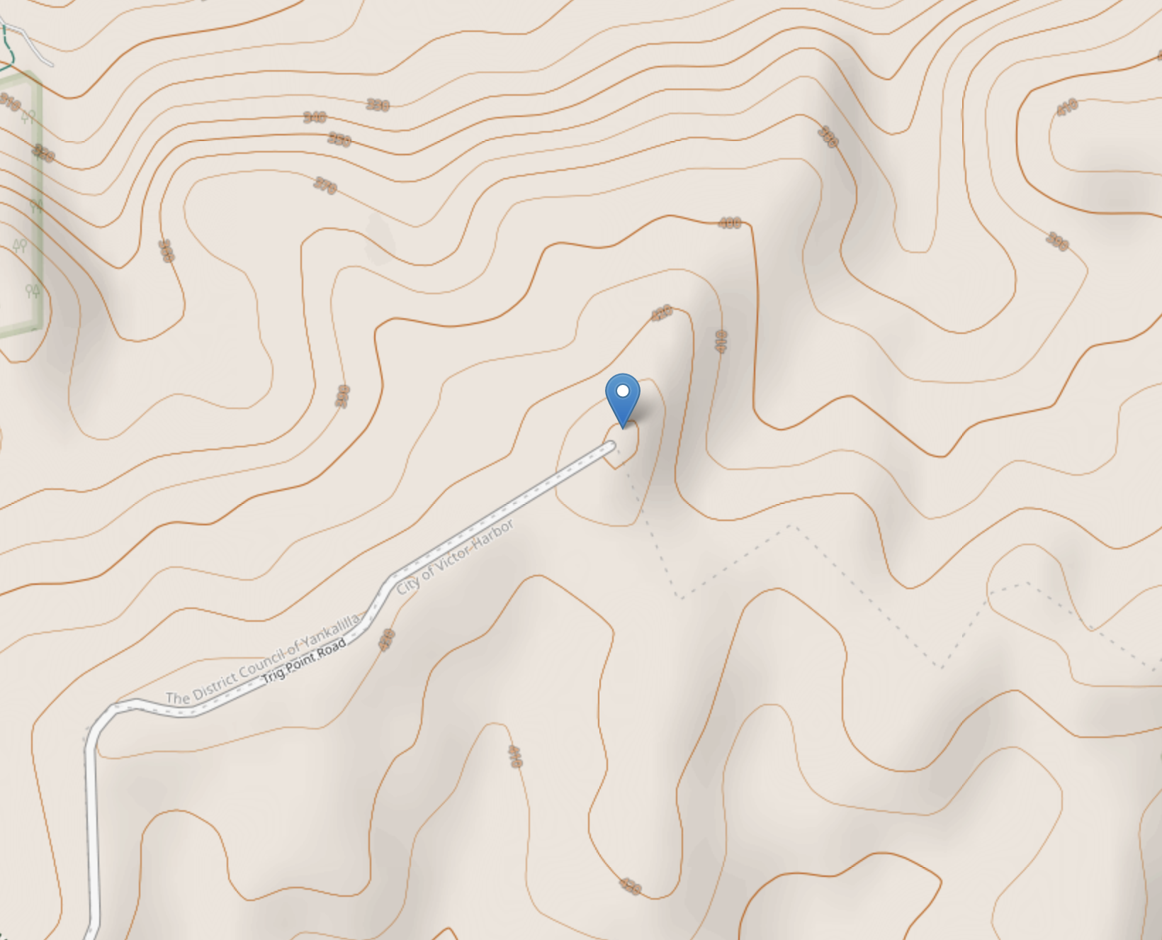
The summit is easily accessible at the end of Trig Point Road which runs off Springmount Road. Trig Point Road is dirt but is in good condition and can be accessed via a conventional vehicle.
Above:- Aerial view of VK5/ HSE-042 at the end of Trig Point Road. Image c/o Google maps.
The summit is 442 metres above sea level and has 148 metres of prominence – just 2 metres short of qualifying for the Summits On The Air (SOTA) program. Yes, just 2 metres!
Above:- VK5/ HSE-042. Image c/o Open Street Map.
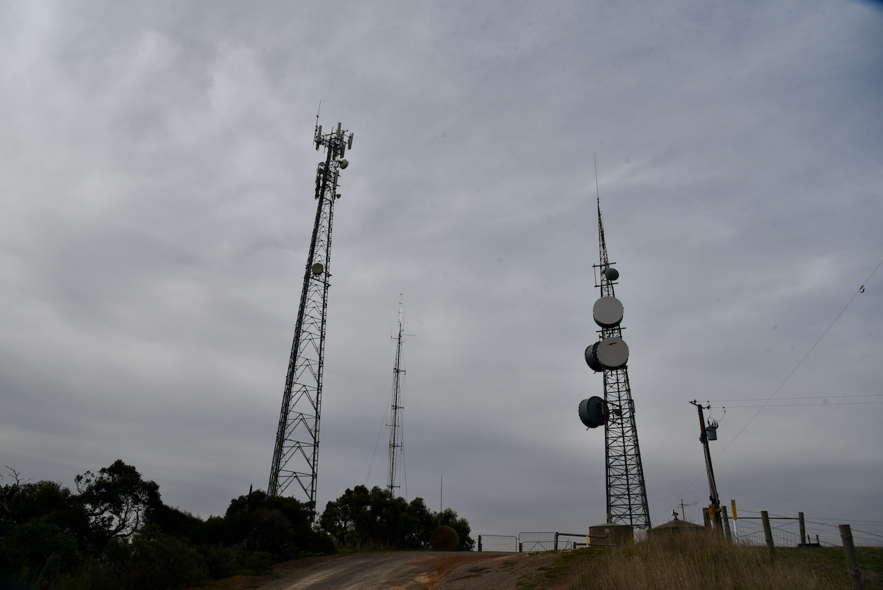
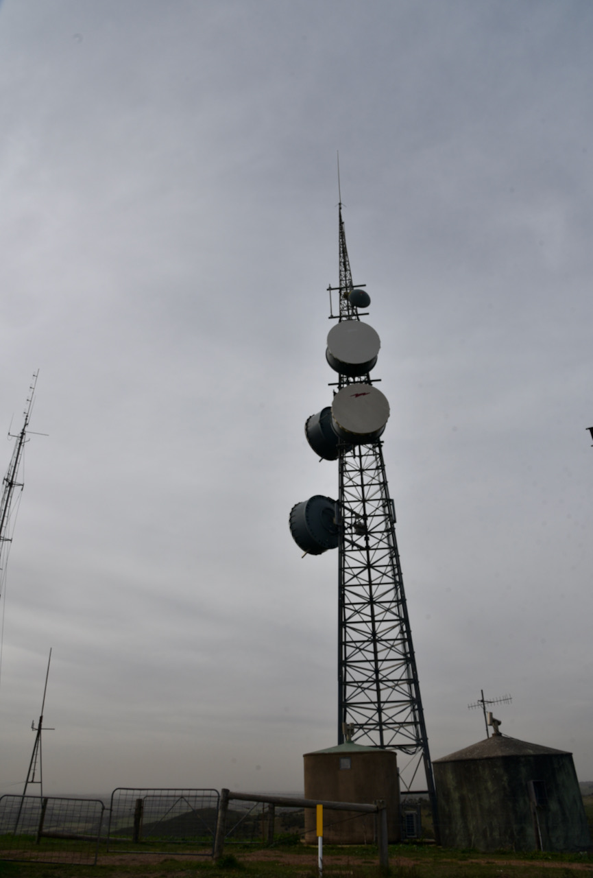
There are a number of communication towers on the top of the summit. This includes a digital TV broadcast site.
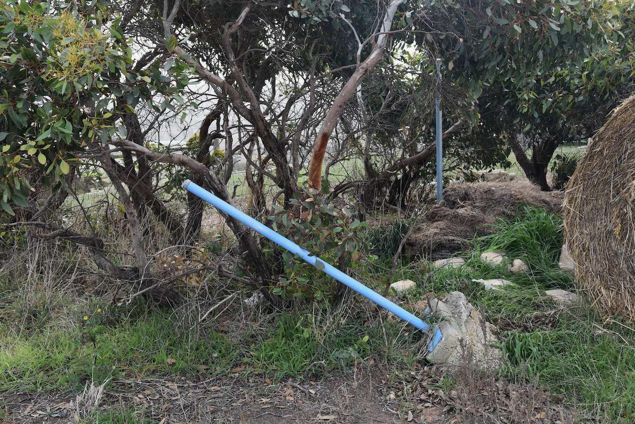
There is also an old trig point at the site, but it is not in great condition. Two of the blue coloured poles can be seen in the photo below, while the third is bent and buckled. A farmers bale of hay sits in the position of the trig point.
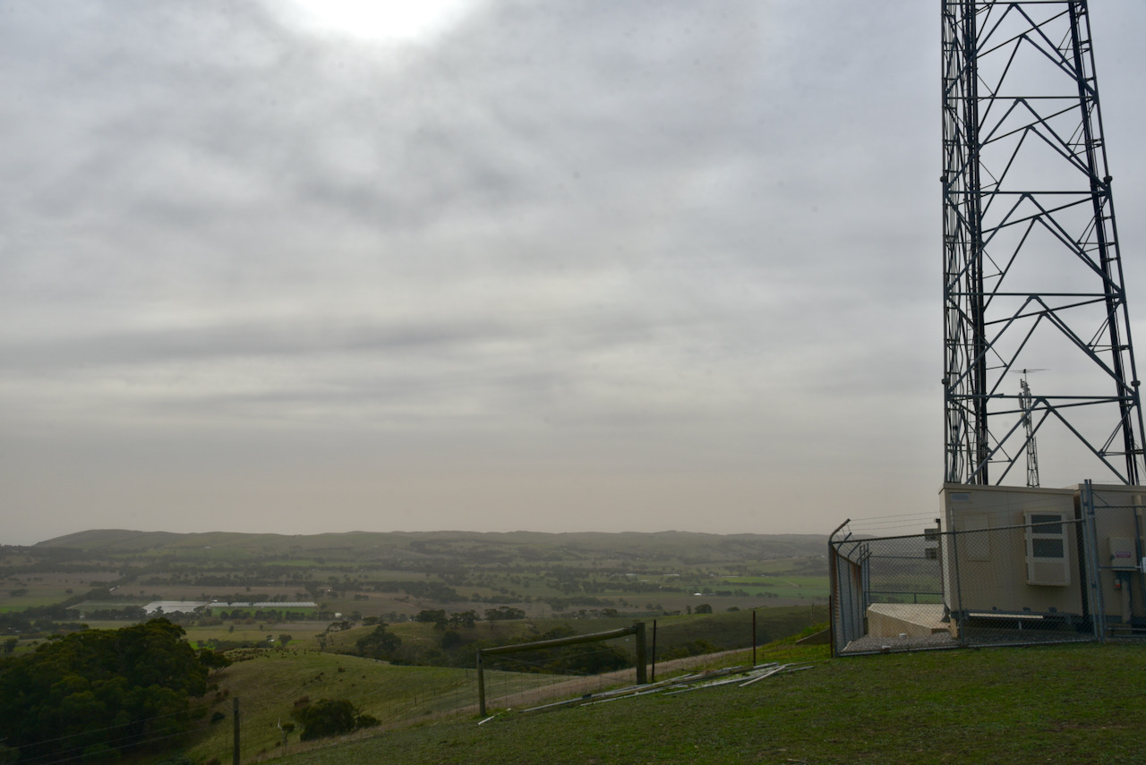
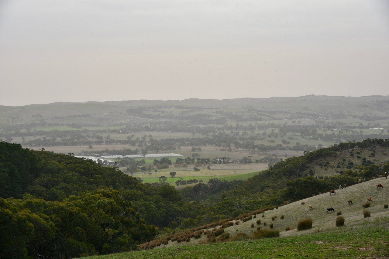
There are some great views out to the south-west, the west, and north-west from the summit. You can see the township of Myponga, the Myponga Reservoir, and across to another HEMA summit, Heatherdale Hill HSE-009. Unfortunately it was a very average day weather-wise and it was blowing a gale and it was very hazy.
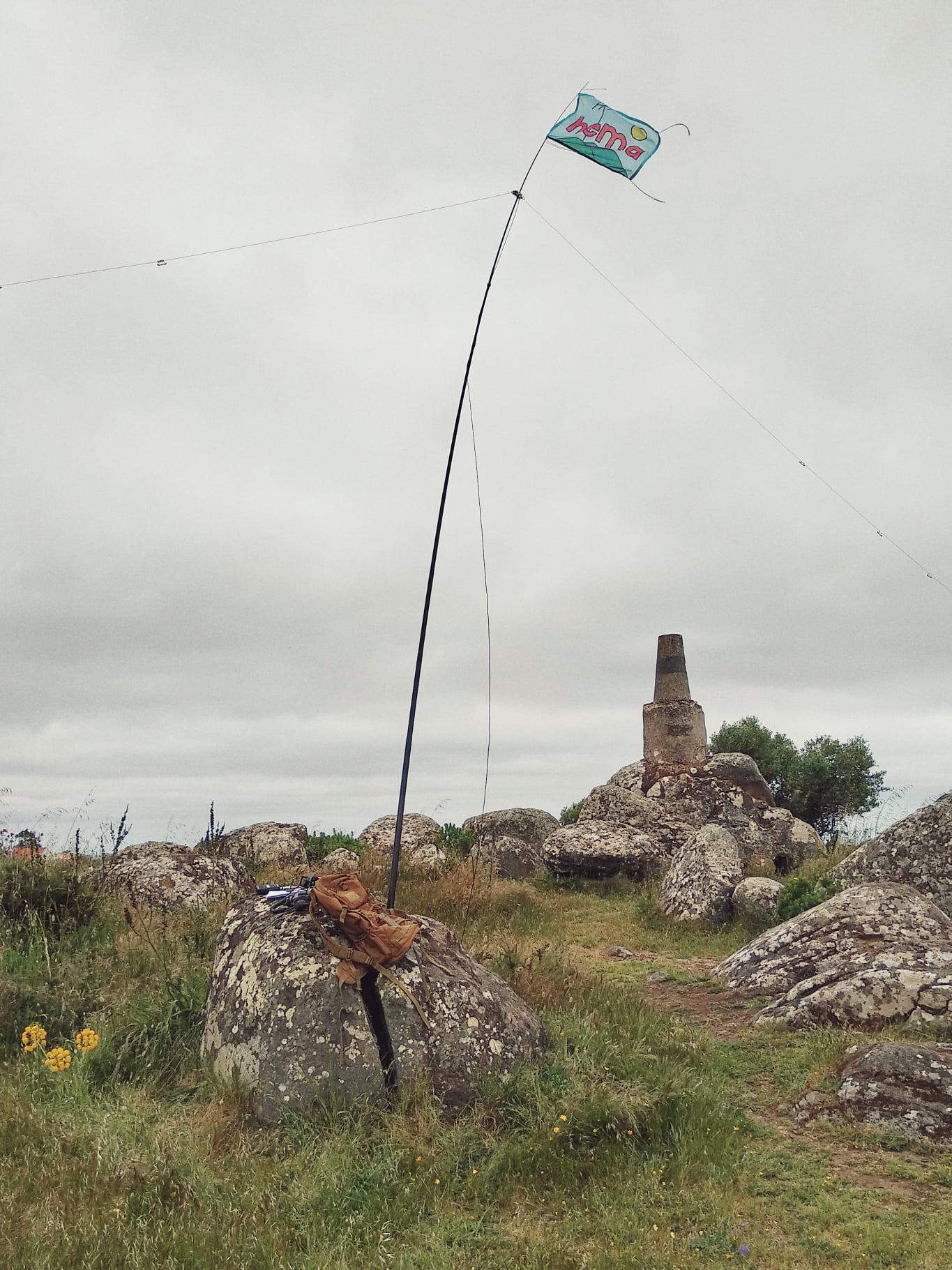
I set up on the side of Trig Point Road. I used a fencepost as an anchor point for the 7 metre telescopic squid pole with the help of an octopus strap. As this was an easy drive up summit I had the comfort of a deck chair and fold up table.
First in the log was Ken VK3HKV, followed by Marija VK5MAZ, and then Adrian VK5FANA. Wal VK2WP then called from a SOTA summit, VK2/ CT-001. Wal was my 4th contact and as a result the HEMA summit was qualified.
It was quite slow going on 40m and with 13 stations in the log, I decided to head to the 80m band. I called CQ on 3.610 and this was answered by Adrian VK5FANA. I logged a further 5 stations on 80m. This included my wife Marija VK5MAZ who had a huge signal on 80m. I also logged John VK5HAA, the VK5 HEMA Manager.
To conclude the activation I headed to 14.310 on the 20m band. The 40m and 80m bands had been quiet, but there was an S5 noise floor on 20m, possibly from the communications towers. I logged 3 stations on 20m from VK3, VK5, and VK6.
With 22 stations in the log, and the HEMA summit well and truly qualified, I decided to pack up and head off to VK5/ HSE-009. I was not upset about packing up as it was extremely windy and quite cold.
On Monday 24th May 2021 I activated the Stipiturus Conservation Park 5CP-220 & VKFF-0936, using the special event callsign of VI1100AF.
VI100AF is one of two special event callsigns on air to celebrate the 100 year anniversary of the Royal Australian Air Force.
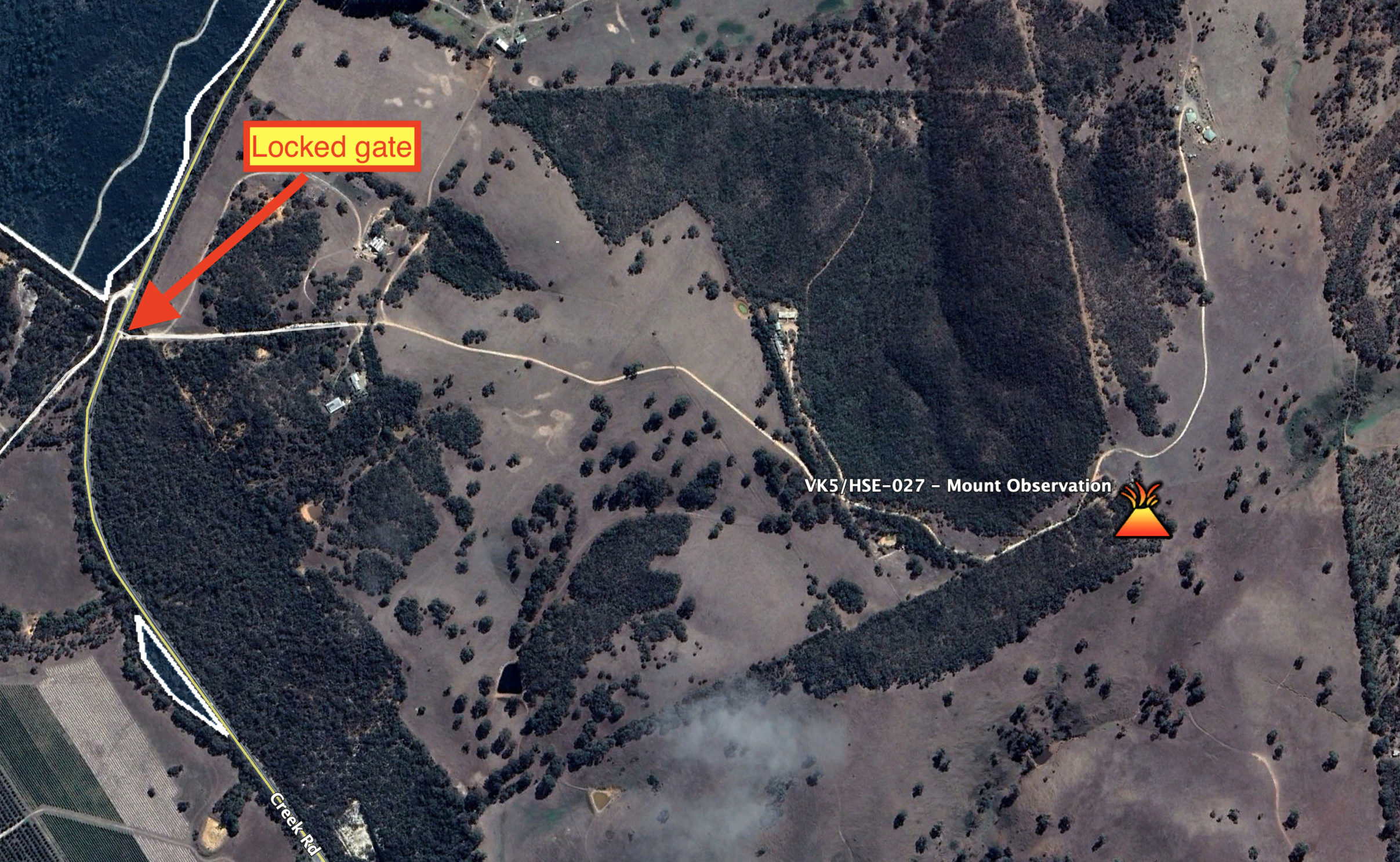
Prior to activating Stipiturus, I checked out Mount Observation which is just a short distance from my home. The HuMPS Excluding Marilyns (HEMA) program has just kicked off in Australia, and Mount Observation qualifies for HUMPS. Its designator is VK5/ HSE-027. What is HEMA?
A HuMP is a summit that has 100 metres of prominence. A Marilyn is a summit which has 150 metres of prominence. The HEMA program is designed for HuMPs with a prominence of less than 150m but at least 100 metres of prominence. Marilyns have their own award scheme through the Summits On The Air (SOTA) program.
John VK5HAA is the VK5 HEMA Manager and recently mapped some South Australian HEMA summits.
Unfortunately I found a locked gate on the dirt road which on maps, appeared to lead to the top of Mount Observation. I will need to do a bit more homework to see whether access might be granted. I phoned John and filled him in on my find.
Above:- Mount Observation showing the location of the locked gate on the access track.
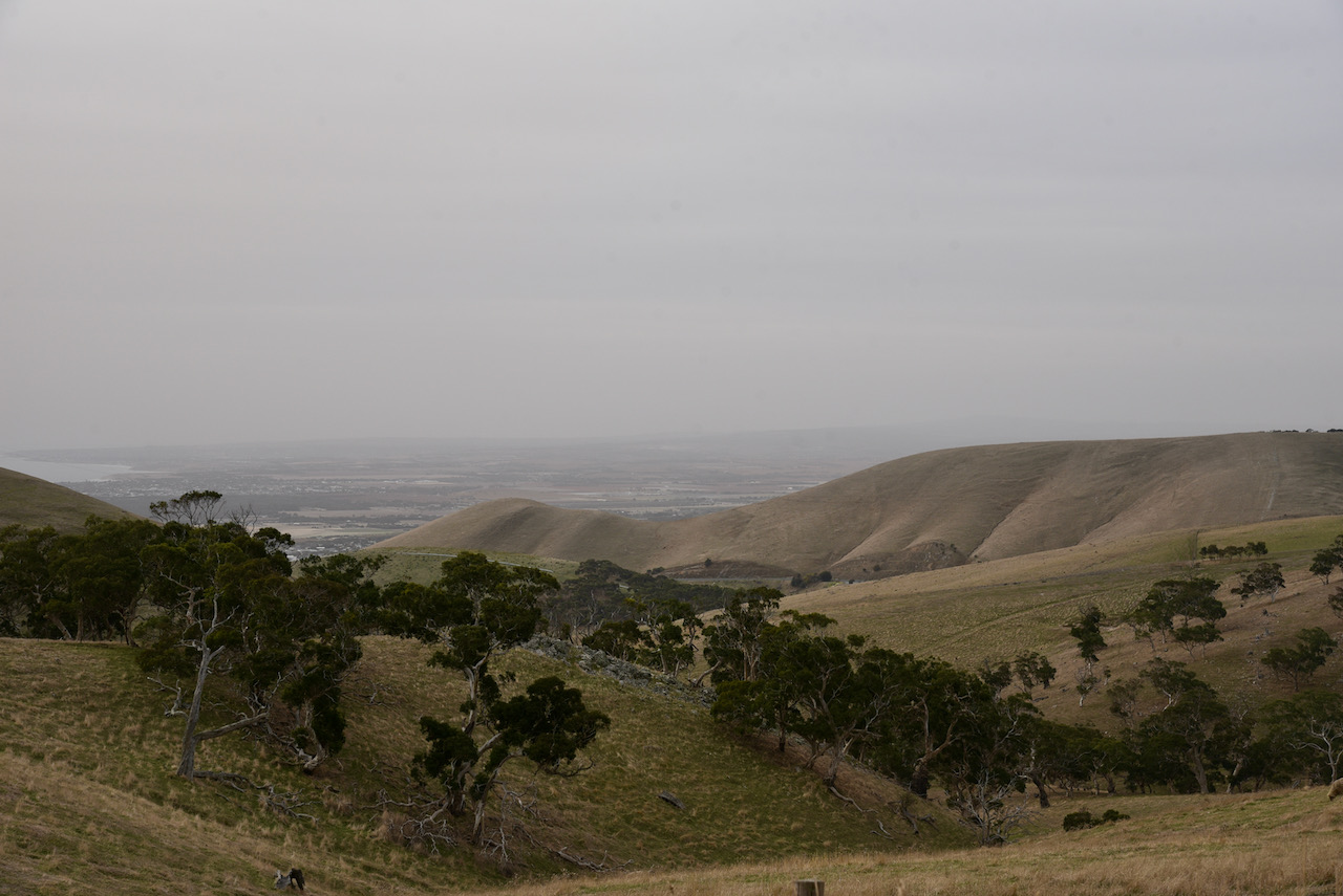
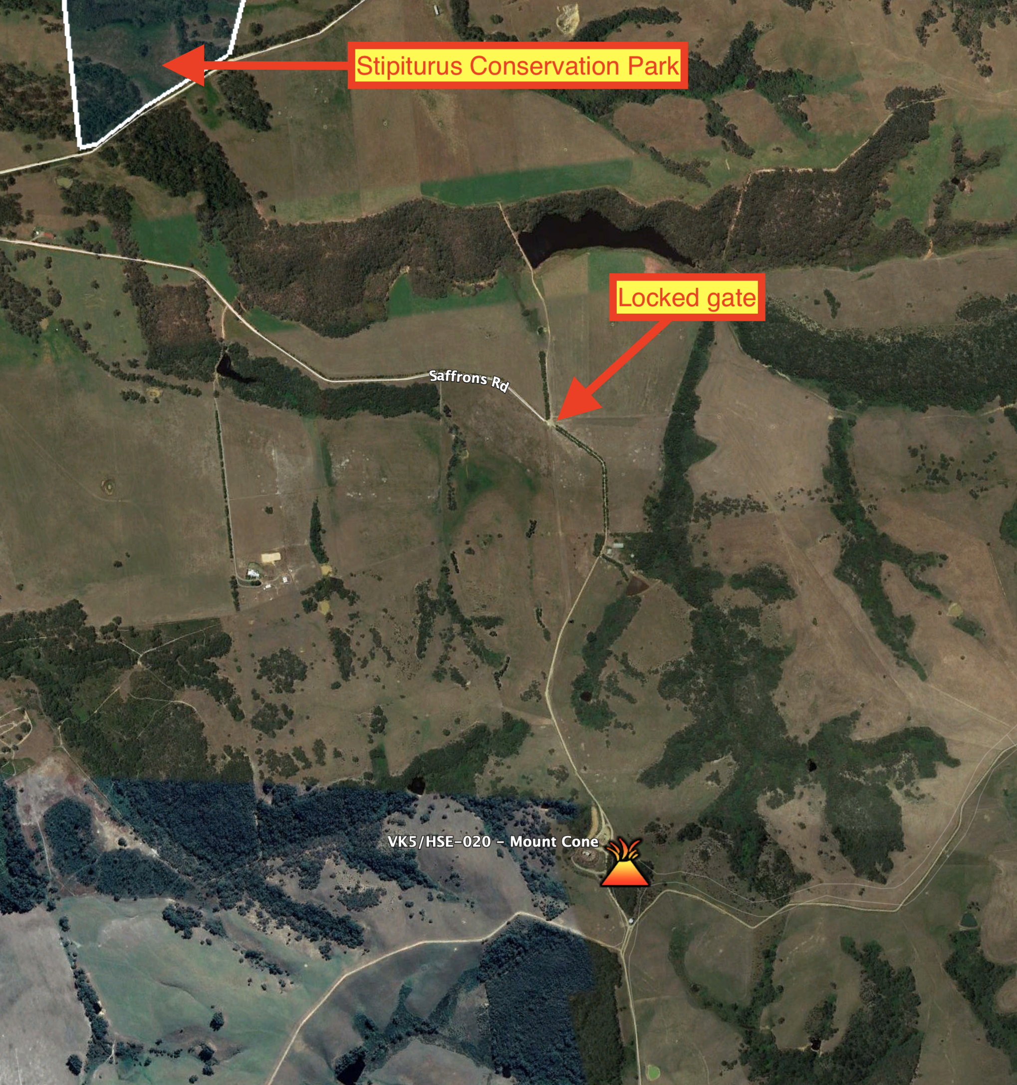
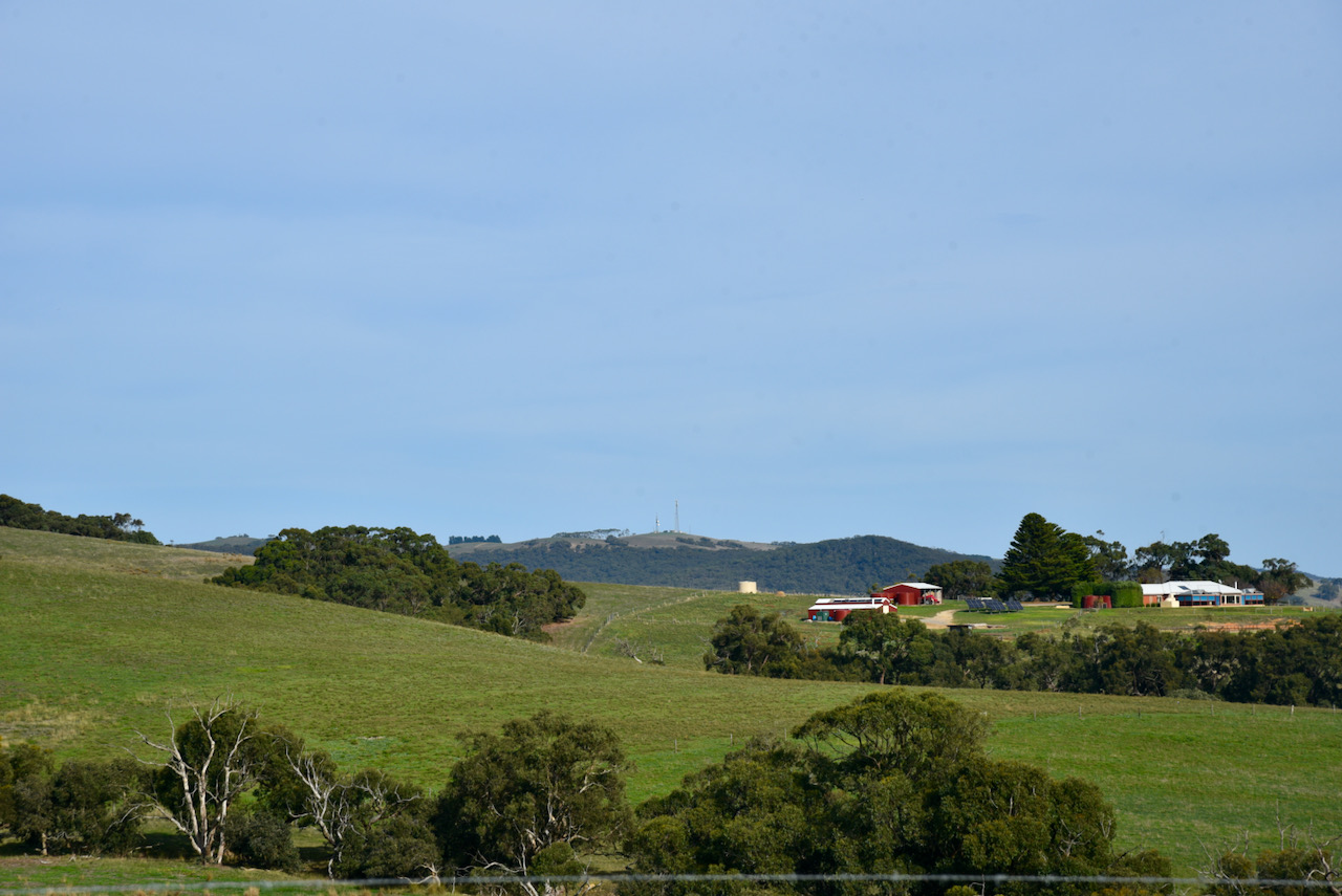
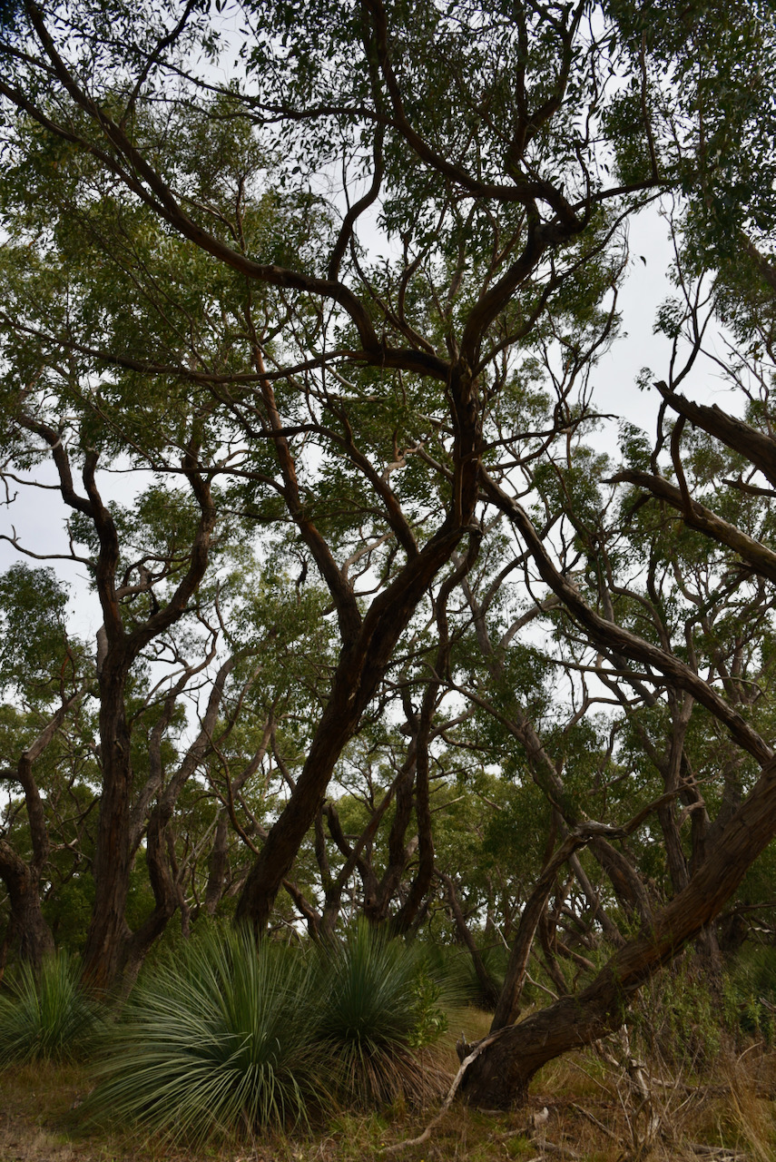
I then headed for another HEMA summit, Mount Cone VK5/ HSE-020 which is located to the south-west of the town of Mount Compass. I headed along Lanacoona Road out of Mount Compass and then onto Saffrons Road, a short distance from the Stipiturus Conservation Park. I then travelled south-east of Mount Cone Road which according to the maps would take me to the summit.
Above:- Mount Cone showing the locked gate and also showing the close proximity of Stipiturus Conservation Park.
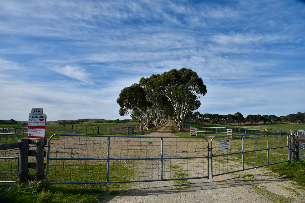
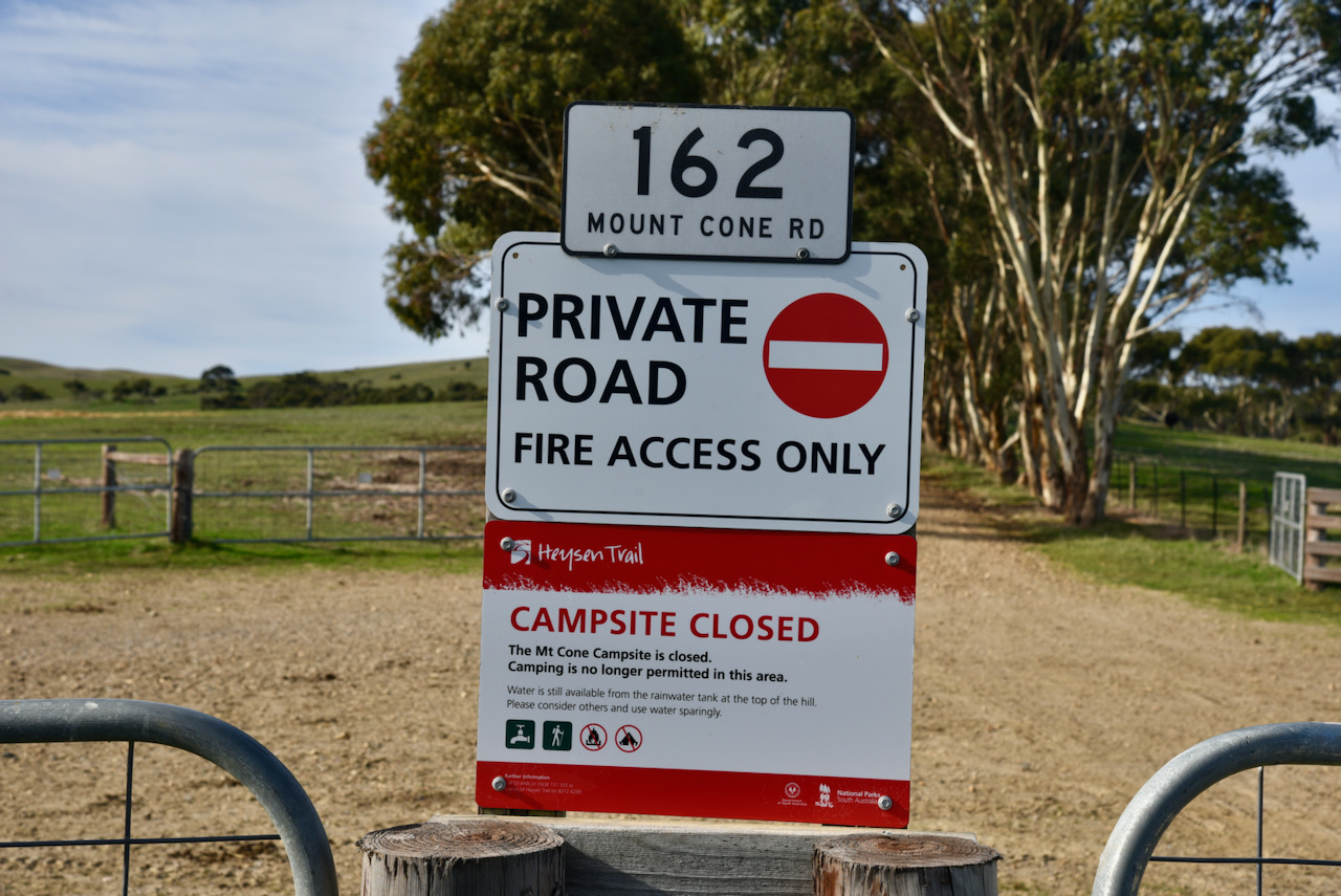
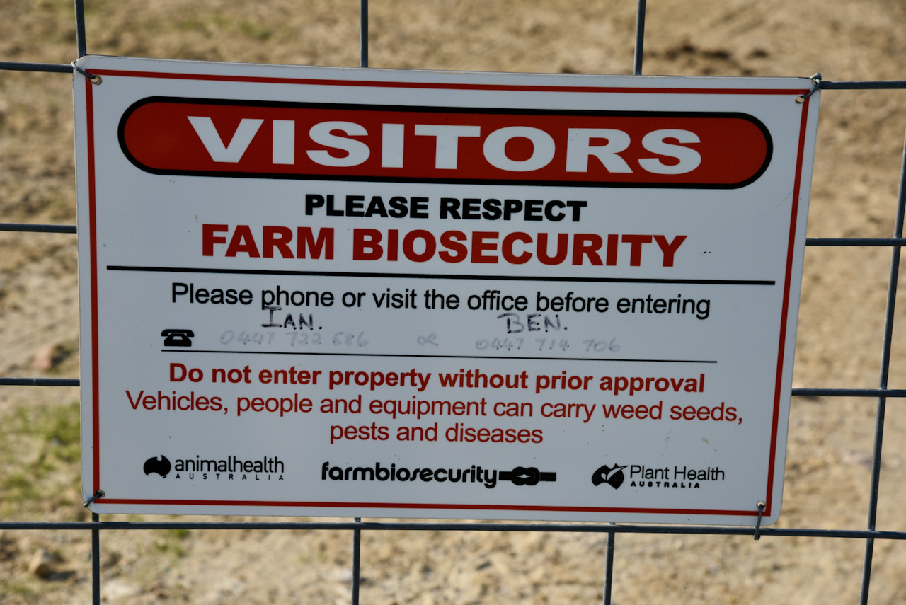
Unfortunately I soon encountered a locked gate which had a ‘Private Road’ sign on the gate and a number of warnings that the Mount Cone campsite was now closed and this was a Farm Biosecurity area. Again I telephoned John and told him about the locked gate.
From this location as I look to the south-west I could see Trig Point VK5/ HSE-042 which was another HEMA summit I had hoped to activate. John and I discussed access to this particular HEMA summit and John was confident that access could be gained right to the top via Trig Point Road.
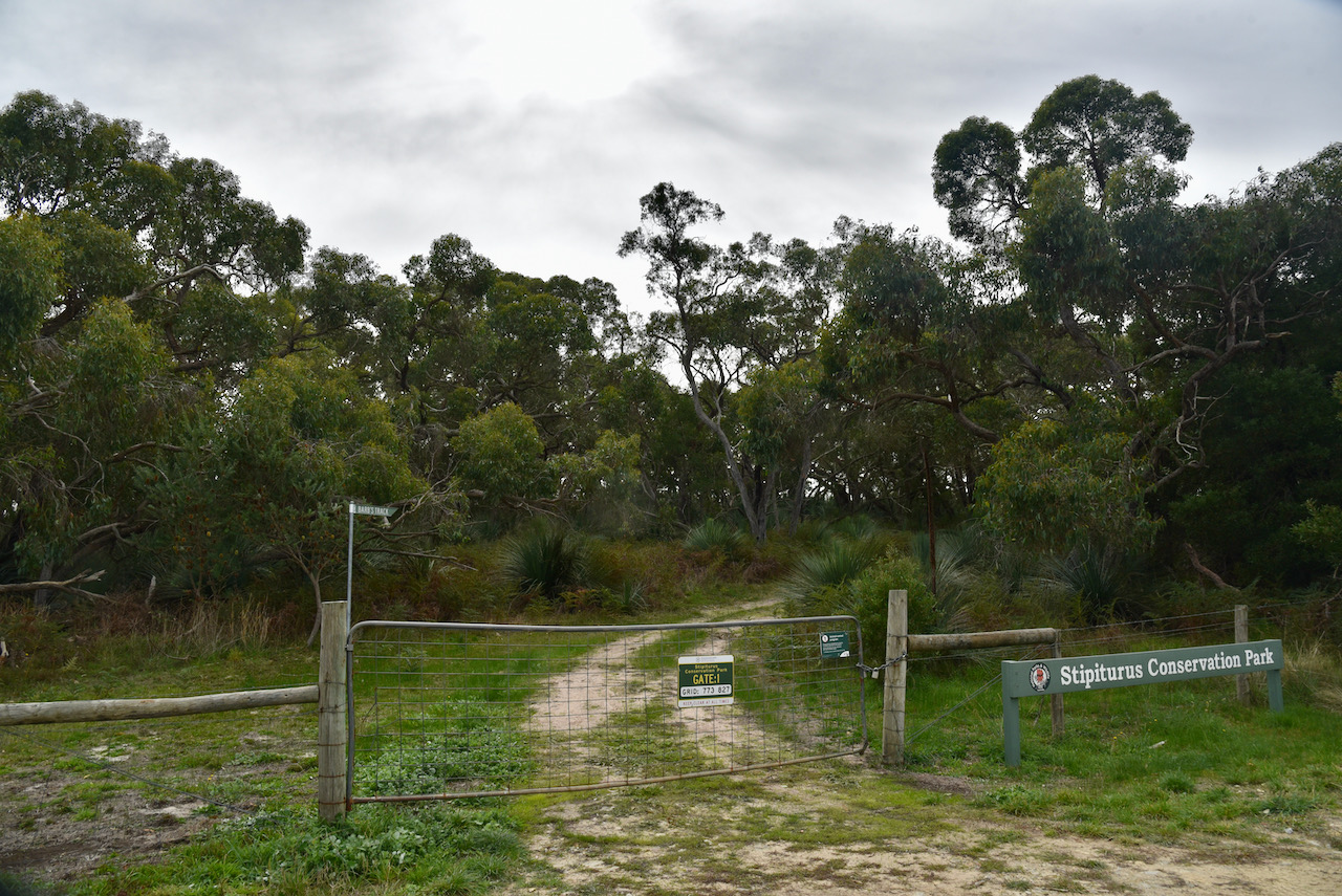
I then drove back down Mount Cone Road and decided to activate the nearby Stipiturus Conservation Park.
I have previously activated the Stipiturus Conservation Park and qualified the park for both the World Wide Flora Fauna (WWFF) and the VK5 National & Conservation Parks Award. But that was many years ago. My last activation at Stipiturus was back in 2015 and then in 2014.
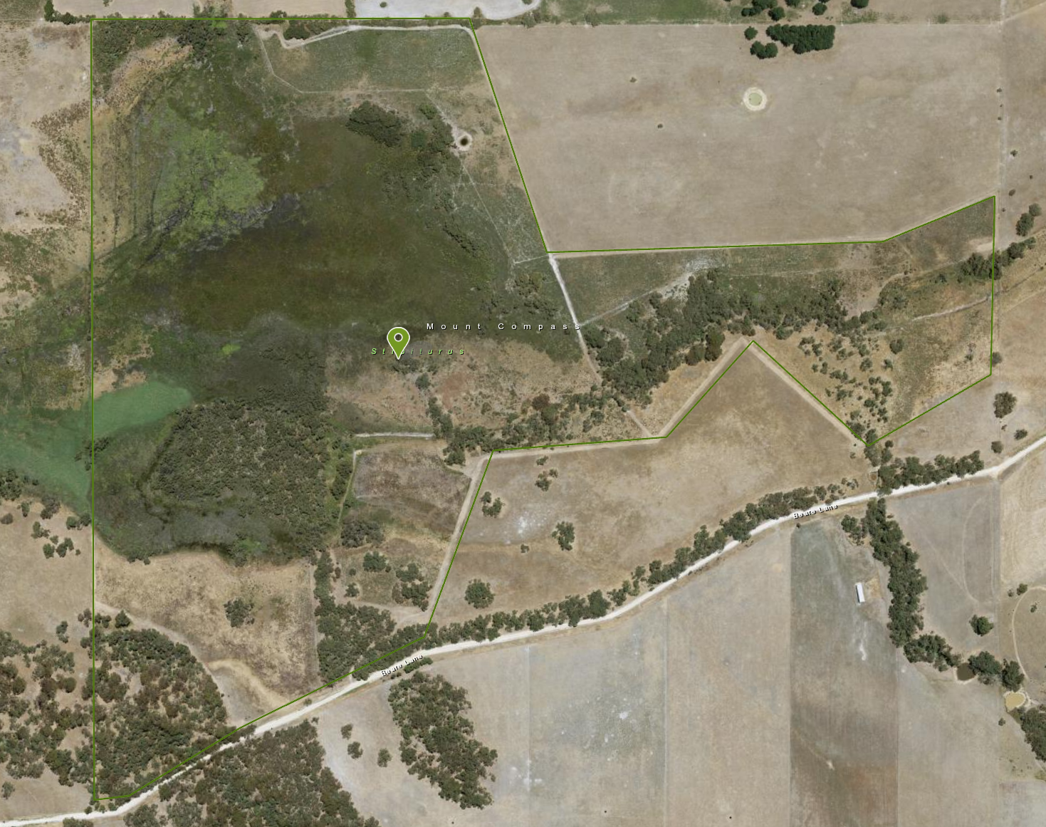
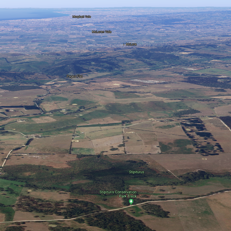
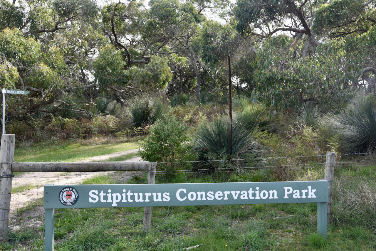
Stipiturus Conservation Park is about 166 acres in size. It was established in 2006. The park can be accessed via Beare Lane which runs off Saffrons Road at Mount Compass.
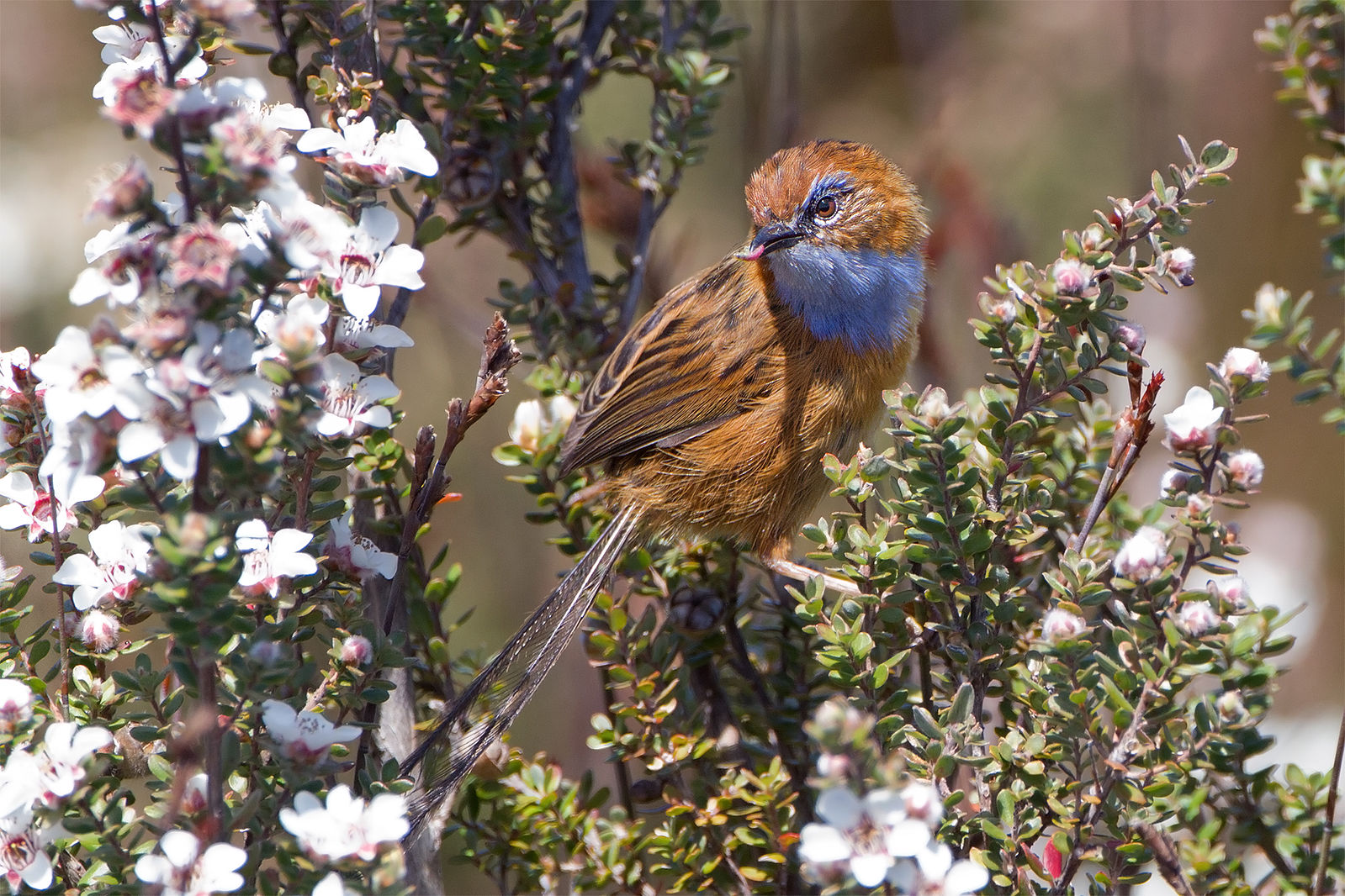
Stipiturus Conservation Park takes its name from the Southern Emu-Wren Stipiturus malachurus, which is a Nationally endangered native bird which can be found in the park.
Above:- The Southern Emu-Wren. Image c/o Wikipedia.
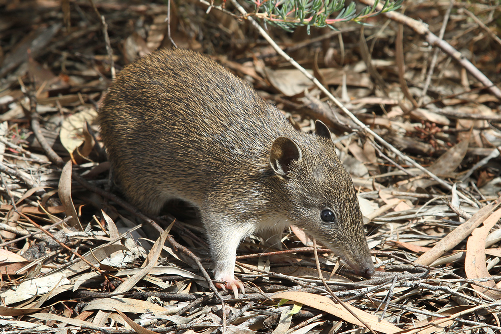
Also found in the park is the Southern Brown Bandicoot, a small marsupial. They were once common throughout most parts of coastal Australia.
Above:- The Southern Brown Bandicoot. Image c/o WIkipedia.
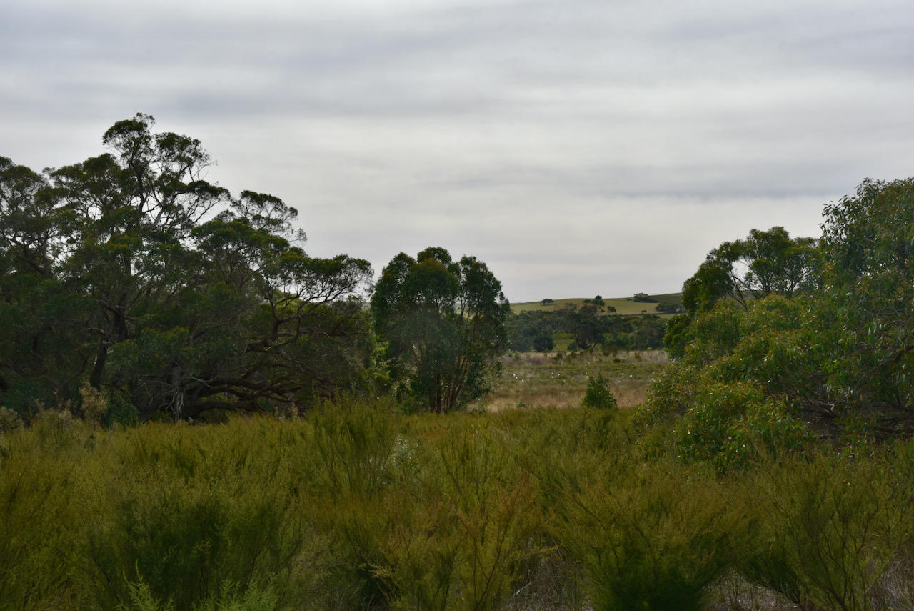
The park contains Glenshera Swamp, one of the last remaining swamps on the Fleurieu Peninsula, south of Adelaide. It is listed nationally as a critically endangered ecological community.
A large amount of hydrological restoration work has been conducted here over the years which has resulted in weed reduction and the re-emergence of native plants. ‘SwampFest’ is an annual planting event which has been held at Stipiturus. More than 3,500 seedlings have been planted in Stipiturus.
If you do activate Stipiturus, be prepared to climb a fence. Unfortunately this is another park which is ‘locked up’. There is no pedestrian access to the park. You will need to climb over the barbed wire fence.
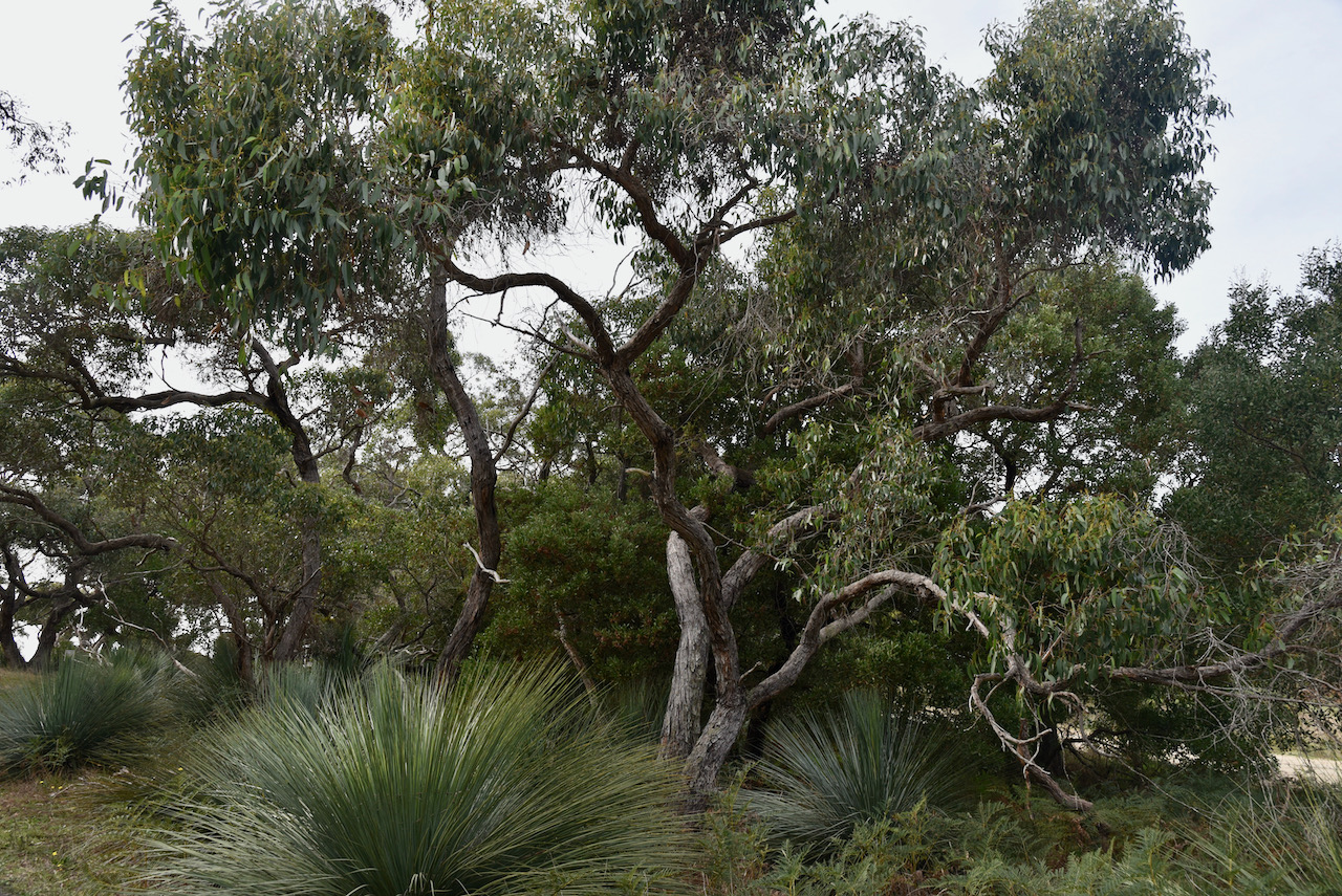
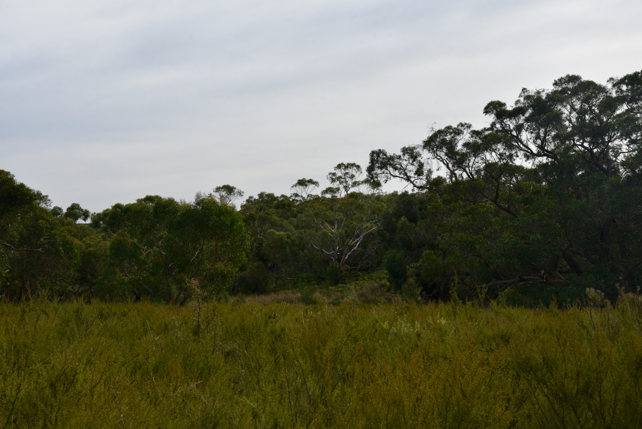
There is a little bit of scrub just off Beare Lane on the southern side of the park. It contains gum trees and an under-storey of ferns. There is another patch of scrub a little further to the north, and if you follow the track from the gate, this will take you to the swamp area.
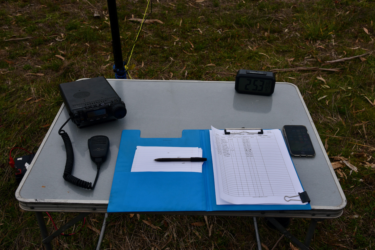
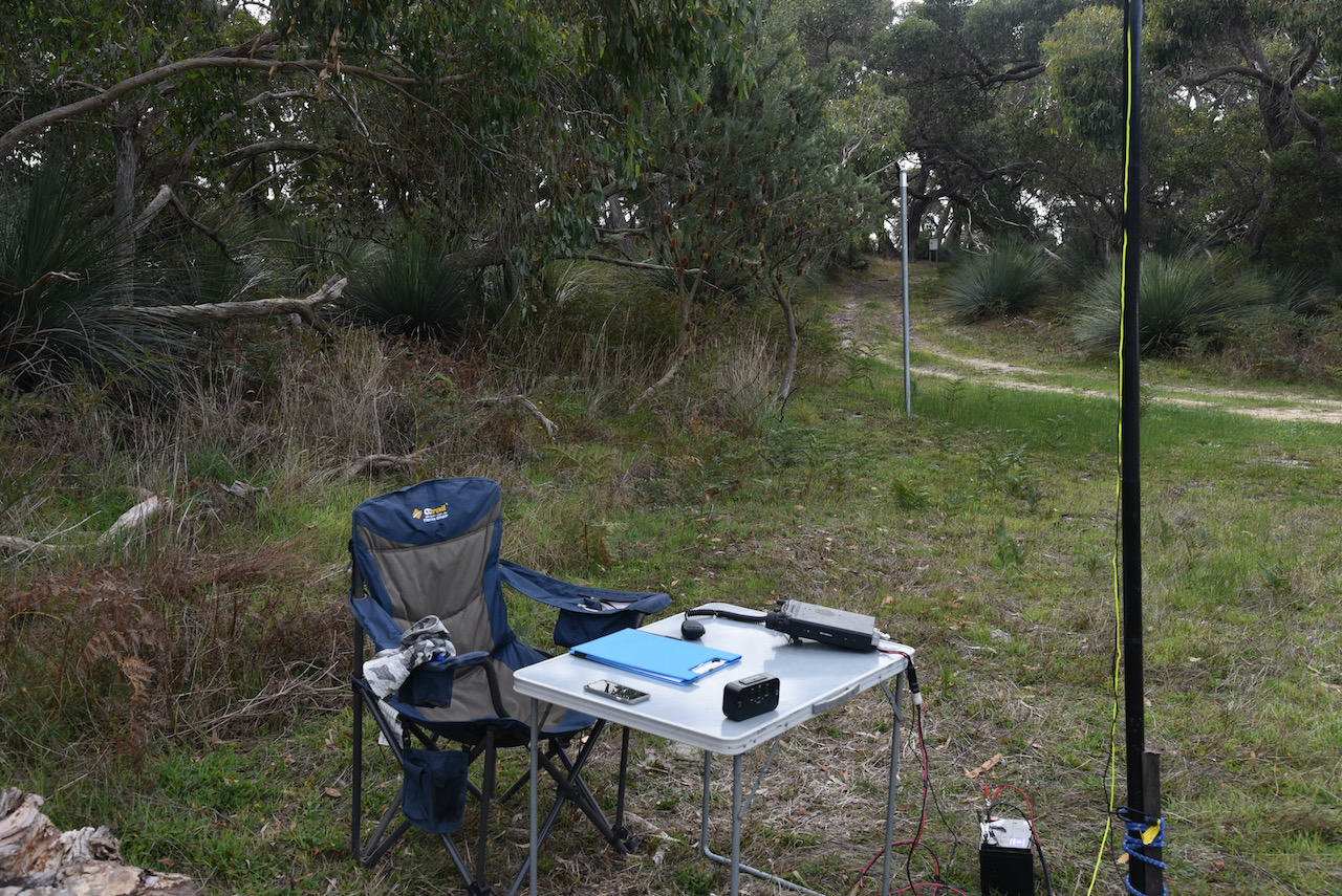
I placed all my gear over the fence and then carefully negotiated the barbed wire fence. I operated a short distance in from the fence-line, running the Yaesu FT-857d, 40 watts output, and the 20/40/80m linked dipole.
Prior to calling CQ I found Bob VK2BYF/p on 7.144 calling CQ from the Morton National Park VKFF-0334.
I then headed down the band a little and called CQ on 7.139. Craig VK3NCR was the first to come back to my CQ call, followed by Marija VK5MAZ, and then Ken VK3UH.
As it was a weekday, I did not develop a ile-up, but had a slow and steady flow of callers. Rob VK1NV mobile was my tenth contact, qualifying the park for VI100AF for VKFF.
I logged a total of 34 stations on 40m before callers dried up. Contacts on 40m were made into VK1, VK2, VK3, VK4, VK5, VK6, and VK7.
I then moved to 20m where I logged 7 stations from VK2, VK3, VK5, VK6, and New Zealand.
To complete the activation I moved to 3.610 on the 80m band where I logged 5 stations, all from VK5. Contact number 44 was with Marija VK5MAZ.
With 46 contacts in the log, it was time to pack up and head to VK5/ HSE-042.
During my activation I had two Wedge-Tailed Eagles soaring above the adjacent scrub and then the park. They are an amazing bird to watch soaring in the thermals.
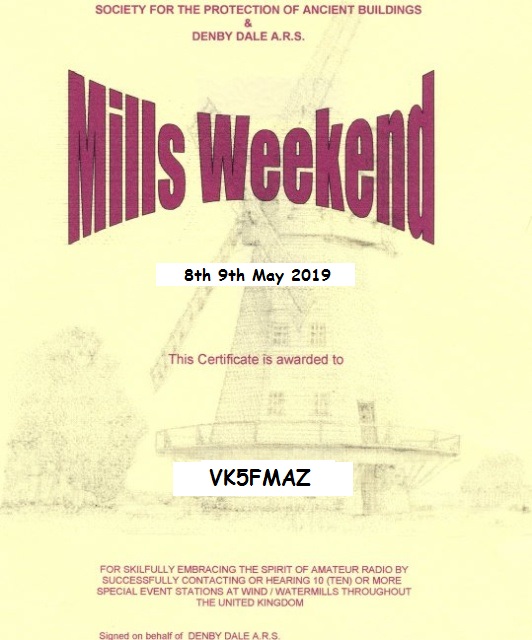
After 2 years in the waiting, a few weeks ago I received via email our certificates from the Denby Dale Amateur Radio Society for the 2019 Mills Weekend.
On Thursday 6th day of May and Friday 7th day of May 2021, Marija and I had the special call of VK100AF for 2 days.
Over the 2 day period we operated from both at home and out in the field. This included an activation for the Summits on the Air (SOTA) program, and two park activations for the World Wide Flora Fauna (WWFF) program and the VK5 National & Conservation Parks Award.
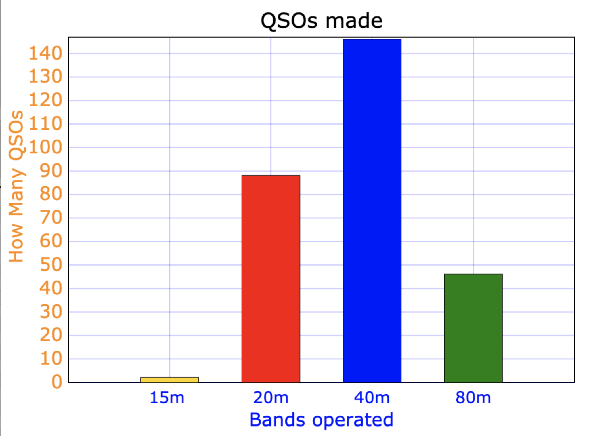
All up we made a total of 282 QSOs on 15, 20, 40, & 80m SSB.
15m……….2 QSOs
20m……….88 QSOs
40m……….146 QSOs
80m……….46 QSOs
The graph below shows our contacts per band.
Above:- Graph showing our contacts on each band.
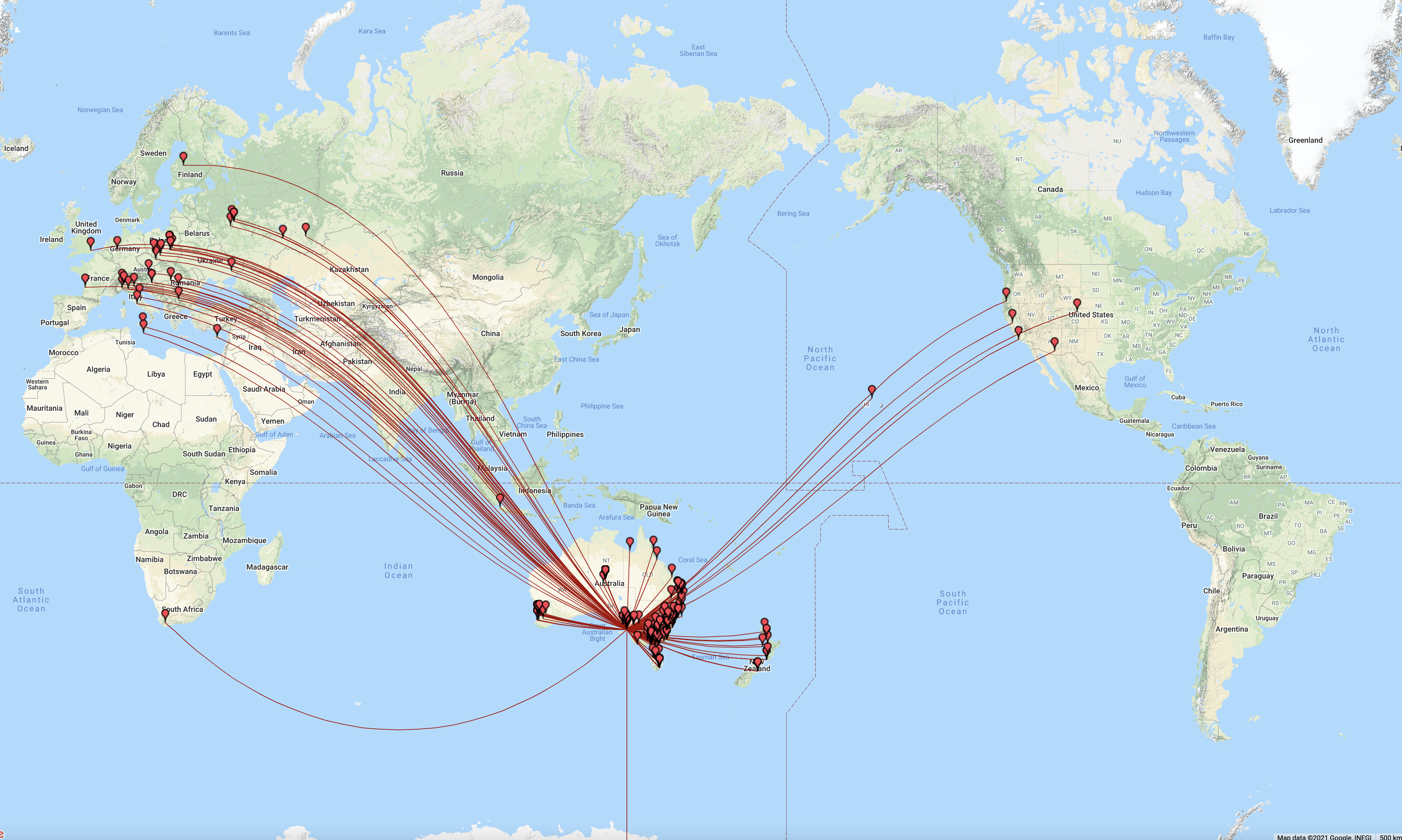
The map below shows our contacts around the world over the 2 day period. We worked 22 different DXCC.
Unfortunately on Sunday afternoon, right in the middle of a pile up, I had significant equipment failure. After an hour or more of trouble shooting, I found that it was an issue with the cable from the tuner to my antenna/transceiver switch. By the time I had found and fixed the problem, the 20m band had closed. Oh well. I still managed to log the following DXCC entities:-
Asiatic Russia
Australia
Austria
Bulgaria
Croatia
Cyprus
Czech Republic
England
European Russia
Germany
Finland
France
Hawaii
Indonesia
Italy
Malta
New Zealand
Poland
Romania
South Africa
Ukraine
USA
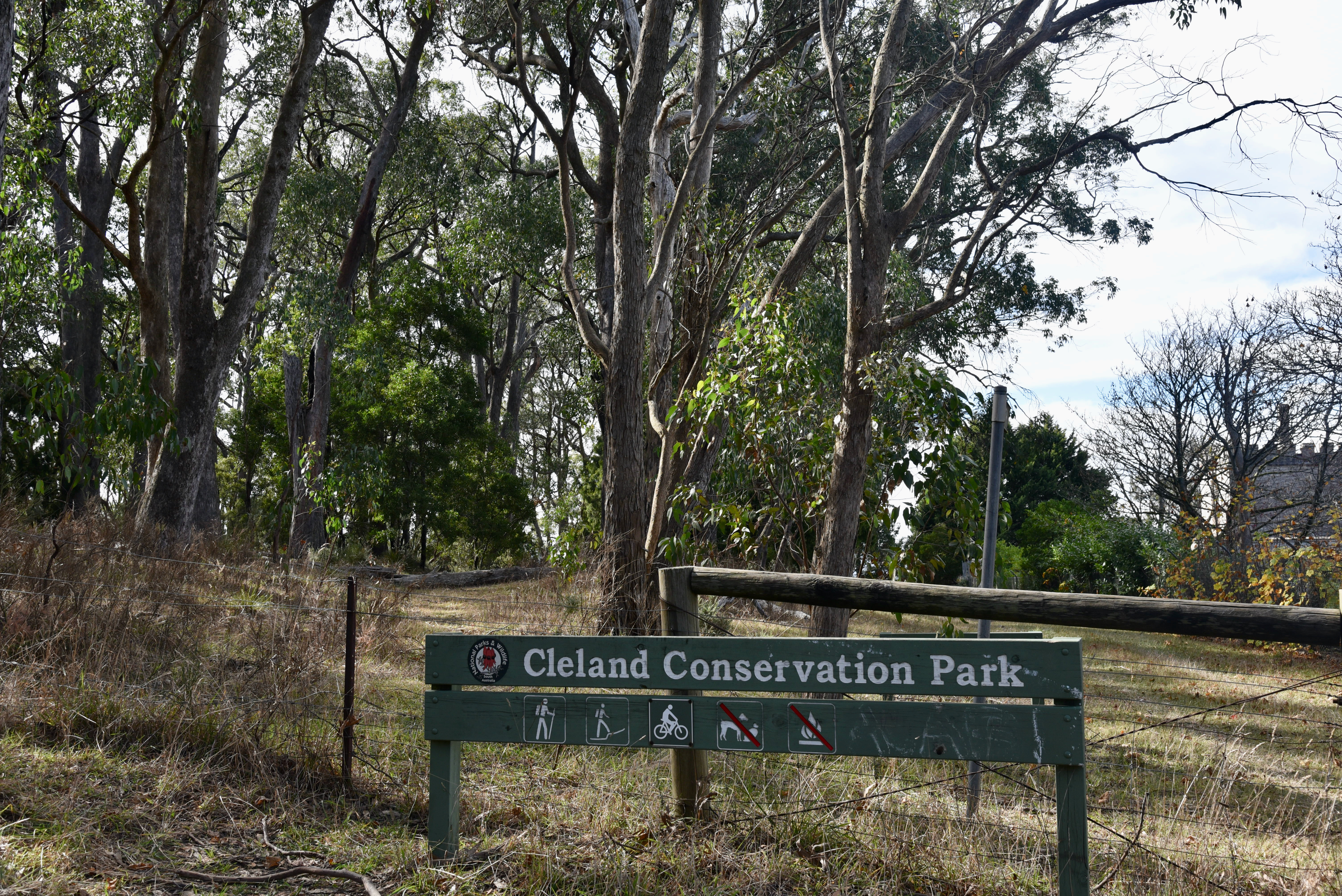
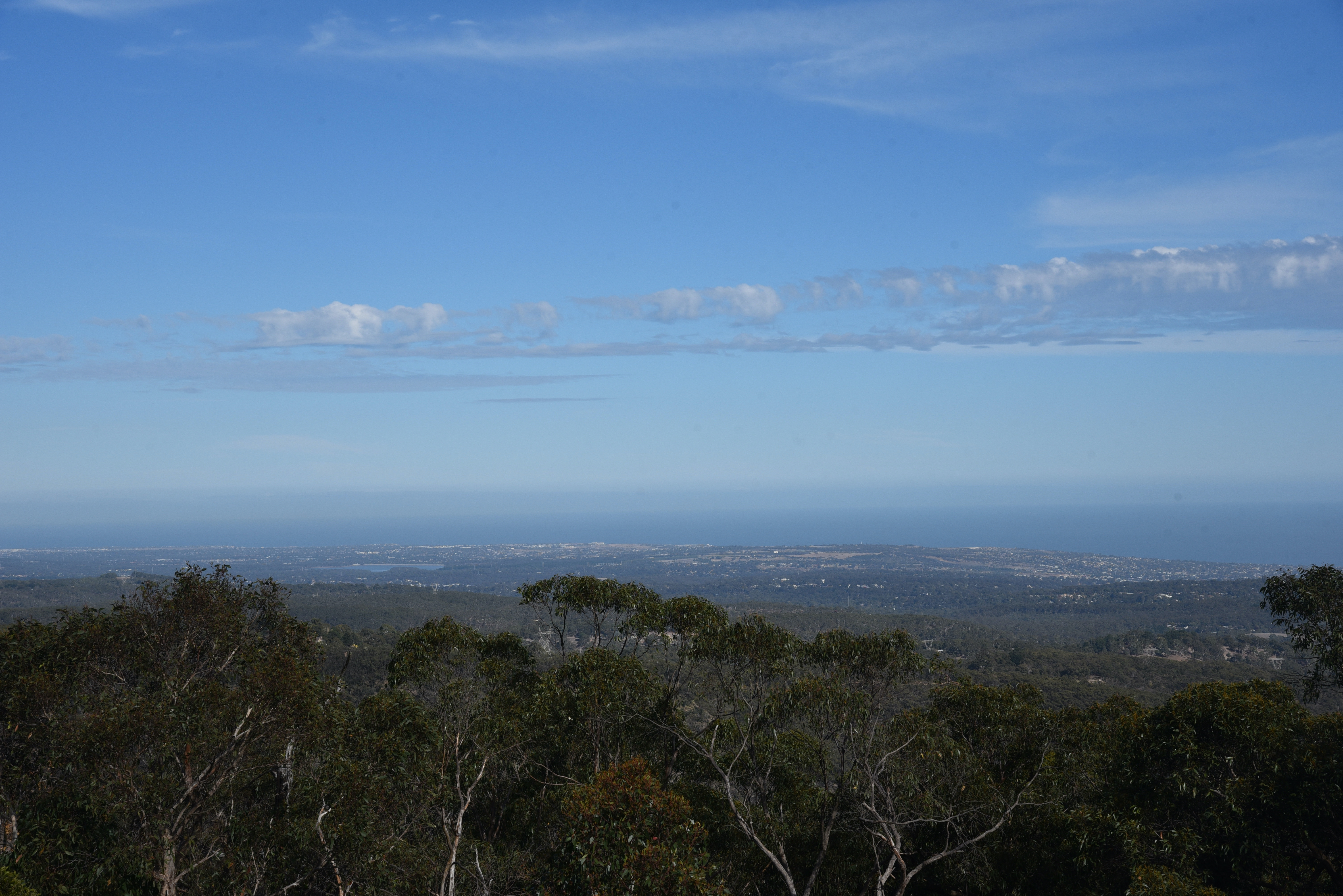
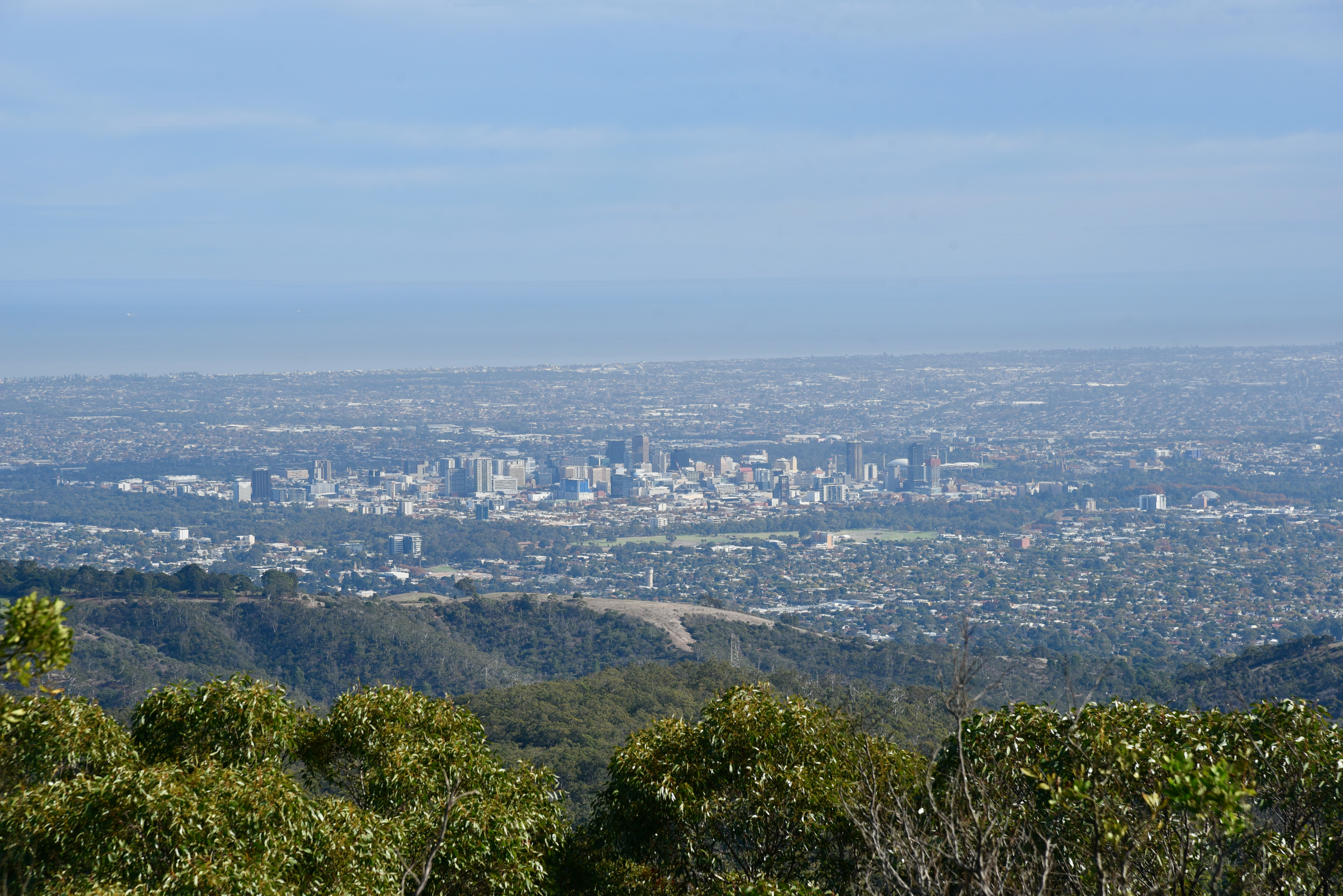
Our SOTA activation was at Mount Lofty VK5/ SE-005 which is located within the Cleland Conservation Park 5CP-042 & VKFF-778. We made a total of 48 QSOs on 20, 40, & 80m SSB into VK1, VK2, VK4, VK4, VK5, VK6, VK7, and New Zealand.
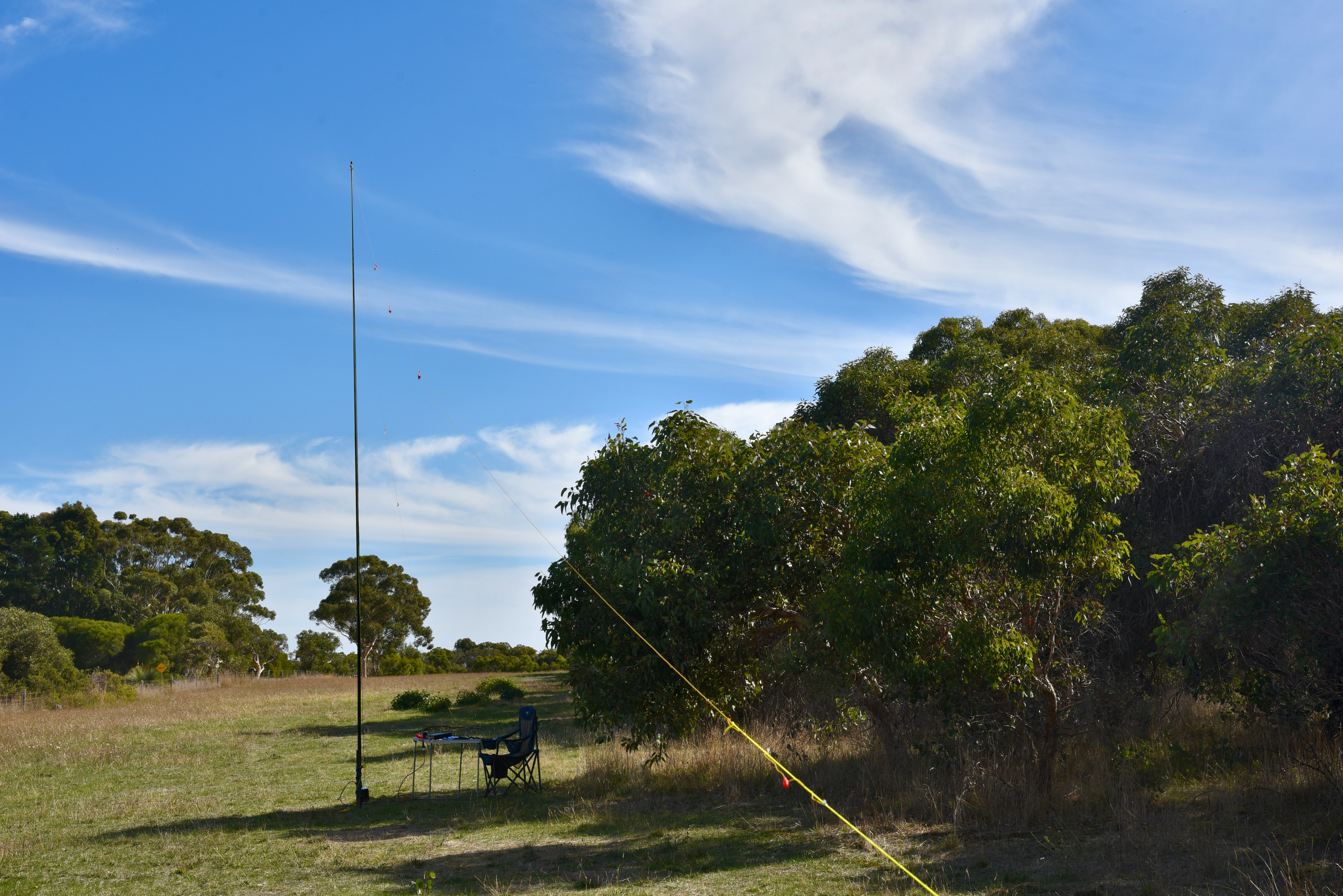
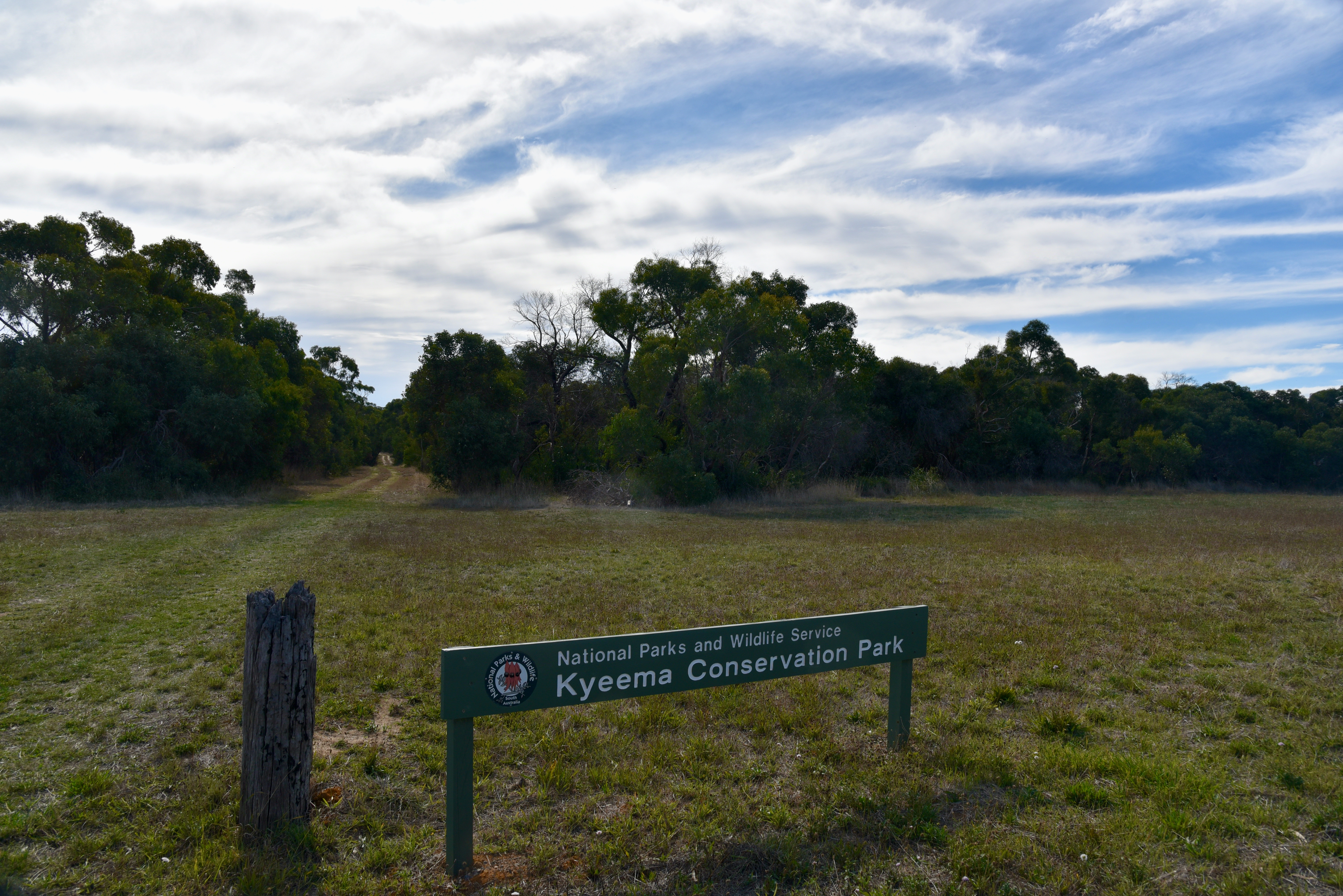
Our second park activation for the day was at the Kyeema Conservation Park 5CP-107 & VKFF-0826 where we made a total of 48 QSOs into VK2, VK3, VK4, VK5, VK6, VK7, and Indonesia.
On Thursday 29th and Friday 30th April 2021, Marija and I used the VI100AF call for 2 days. VI100AF is one of two special event calls to celebrate the 100 year anniversary of the Royal Australian Air Force.
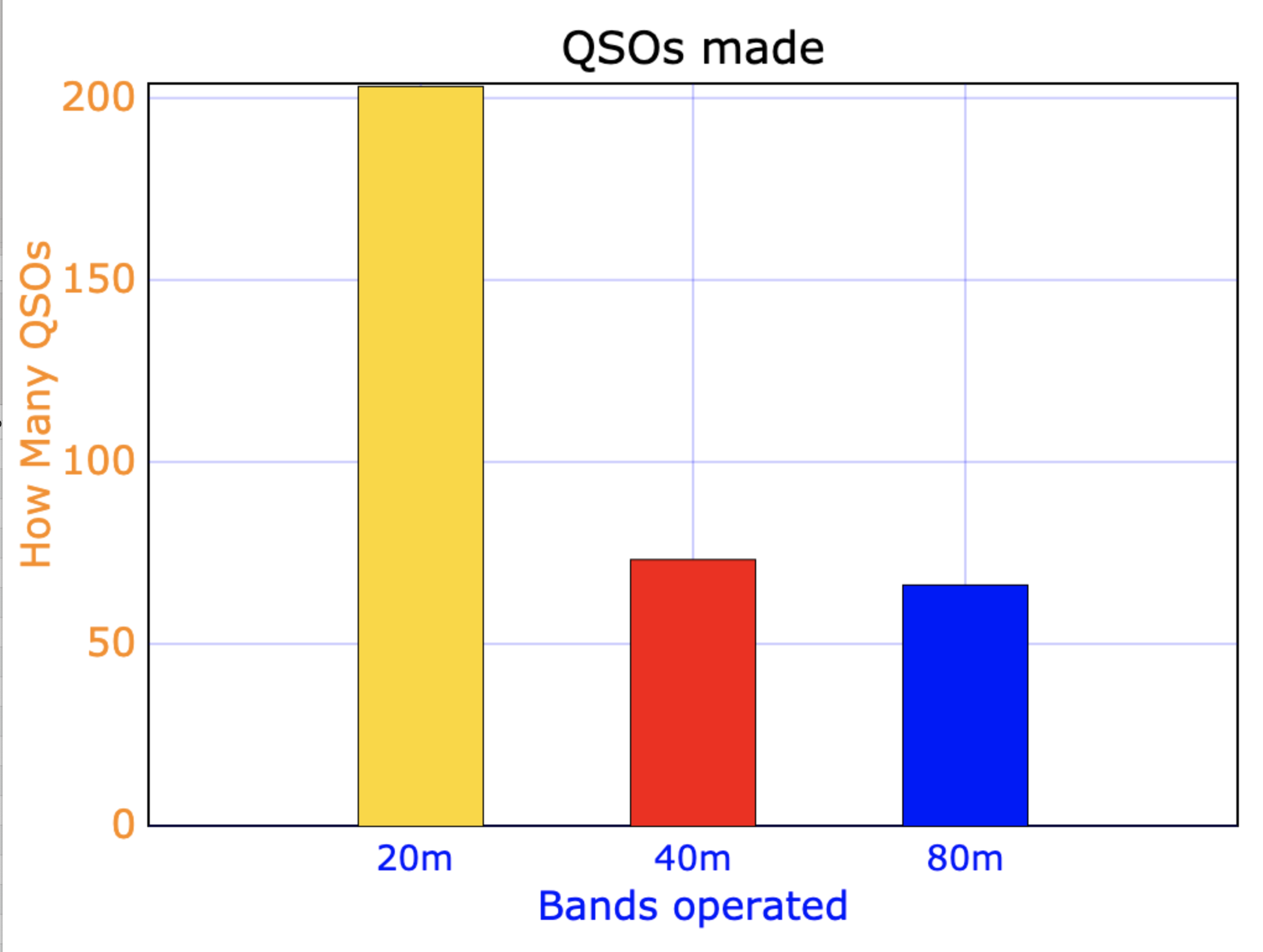
Over the 2 day period we made a total of 342 QSOs on 20m, 40m, & 80m SSB
20m……….203 QSOs
40m……….73 QSOs
80m……….66 QSOs
I did put out CQ calls on 10m and 15m but had no takers on those bands.
Above:- Graph showing our contacts per bands.
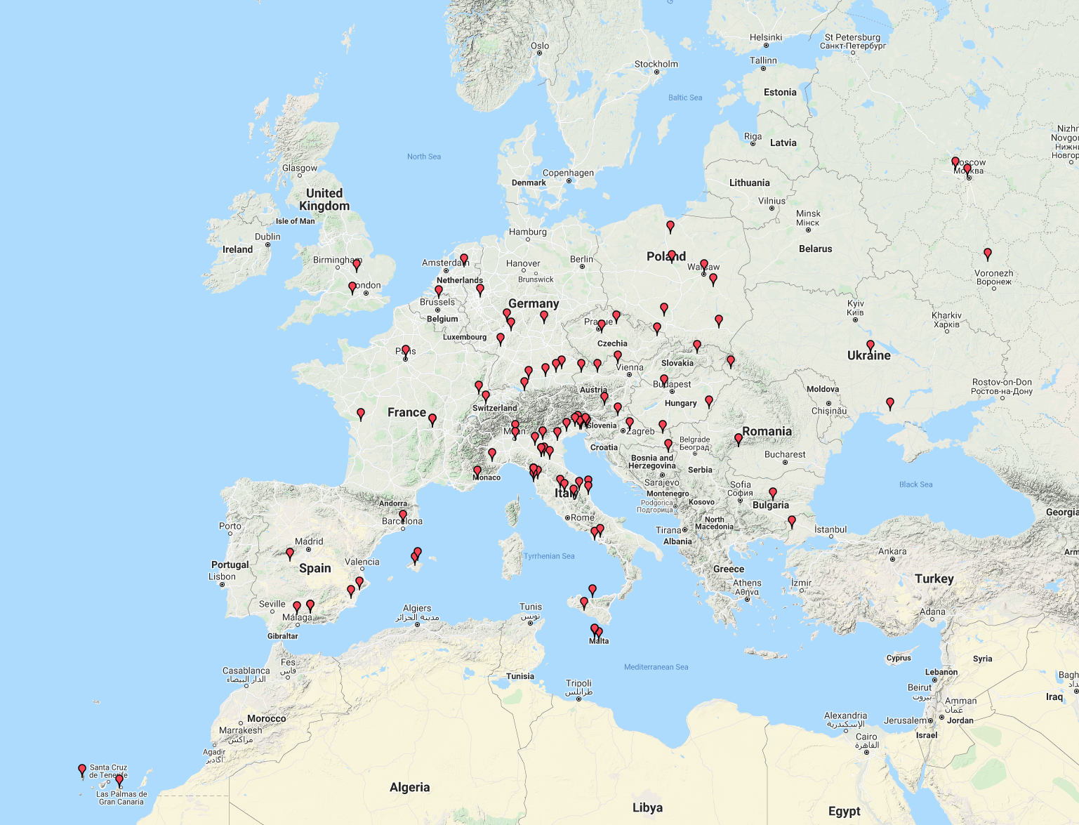
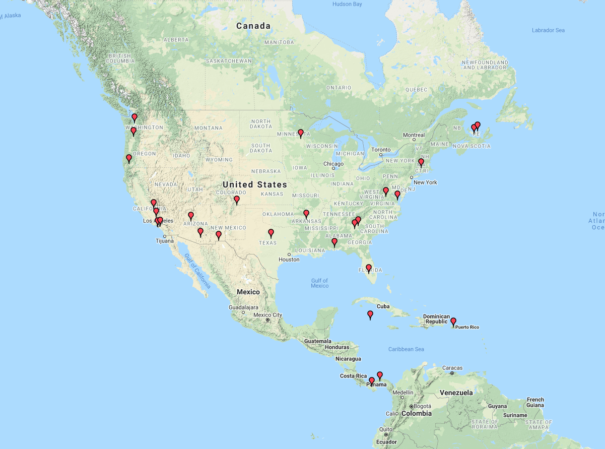
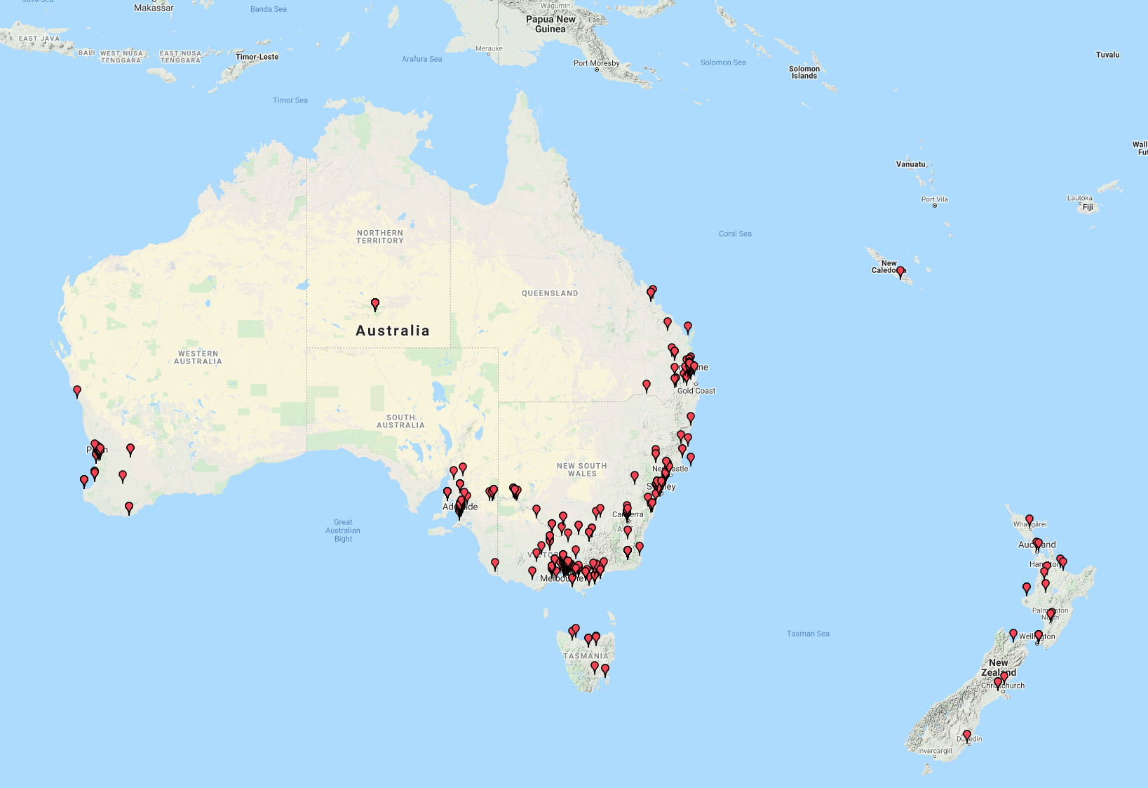
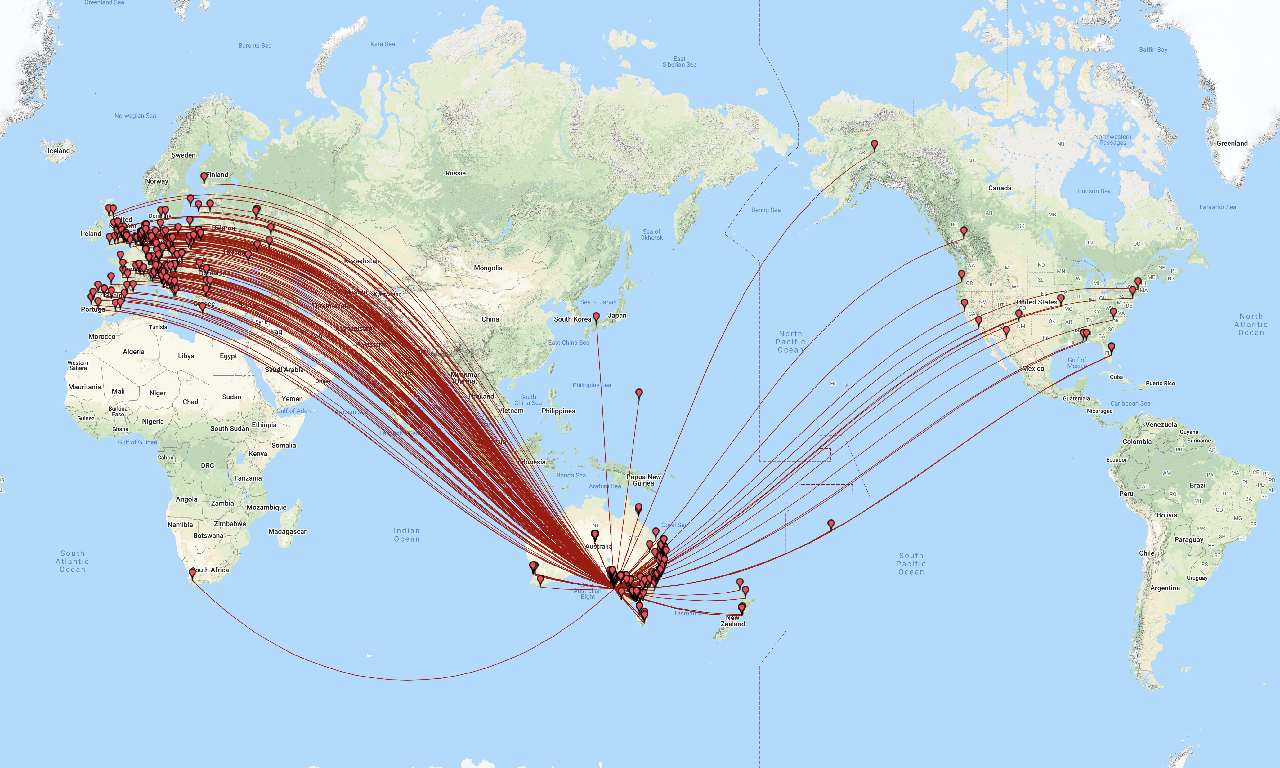
The map below shows our contacts around the world over the 2 day period. We worked a total of 33 different DXCC entities as follows:-
Alaska
Australia
Austria
Belgium
Bulgaria
Canada
Czech Republic
Denmark
England
European Russia
Germany
Finland
France
Greece
Italy
Japan
Latvia
Lord Howe Island
Netherlands
New Zealand
Poland
Portugal
Romania
Scotland
Slovenia
South Africa
South Cook Islands
Spain
Sweden
Switzerland
Ukraine
USA
Wake Island
Above:- Map showing our contacts around the world over the 2 day period.
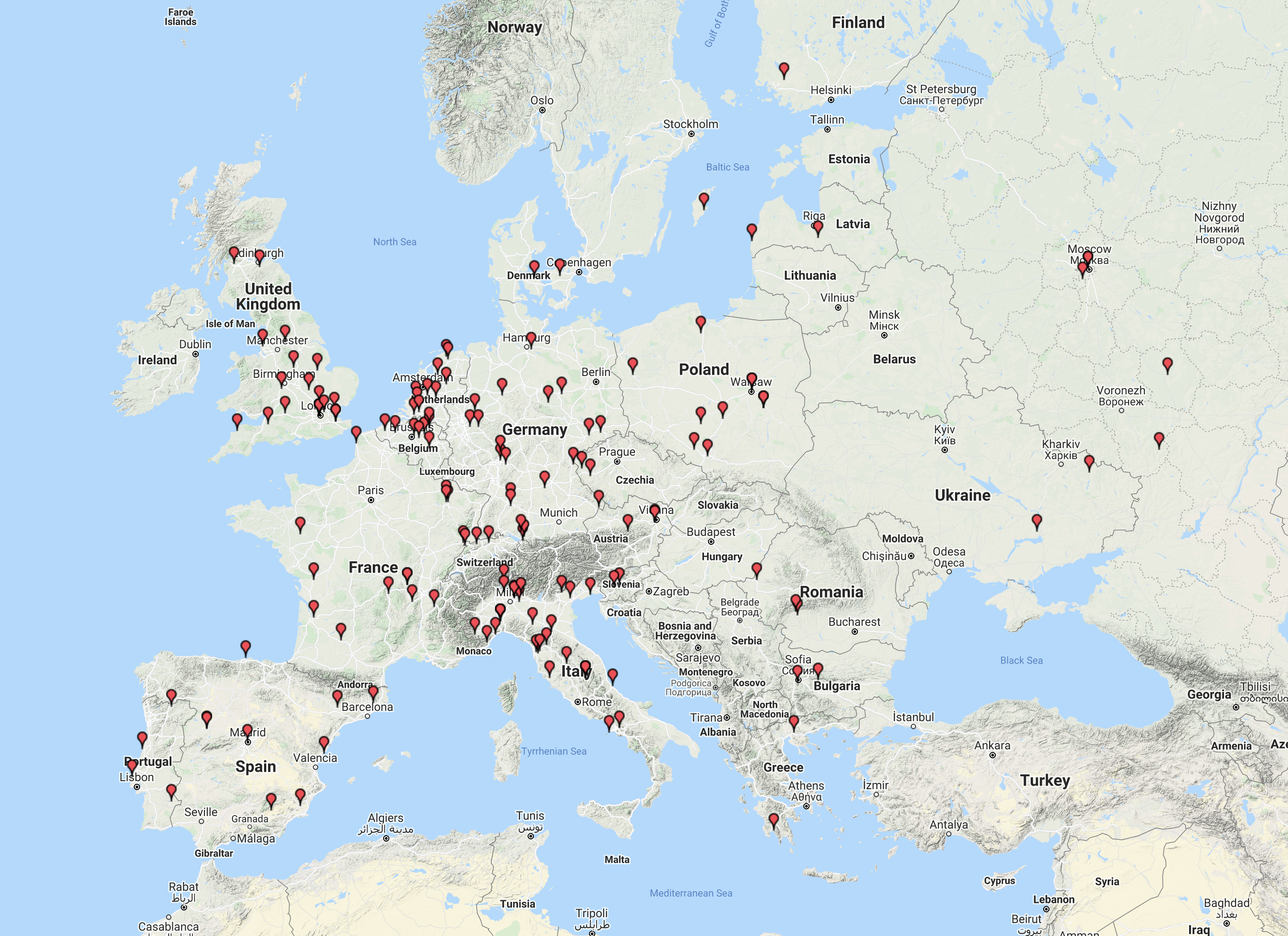
Each afternoon we had a nice (but short) opening on 20m long path into Europe and the United Kingdom. The map below shows our contacts to that part of the world.
Above:- Map showing our contacts around Europe.
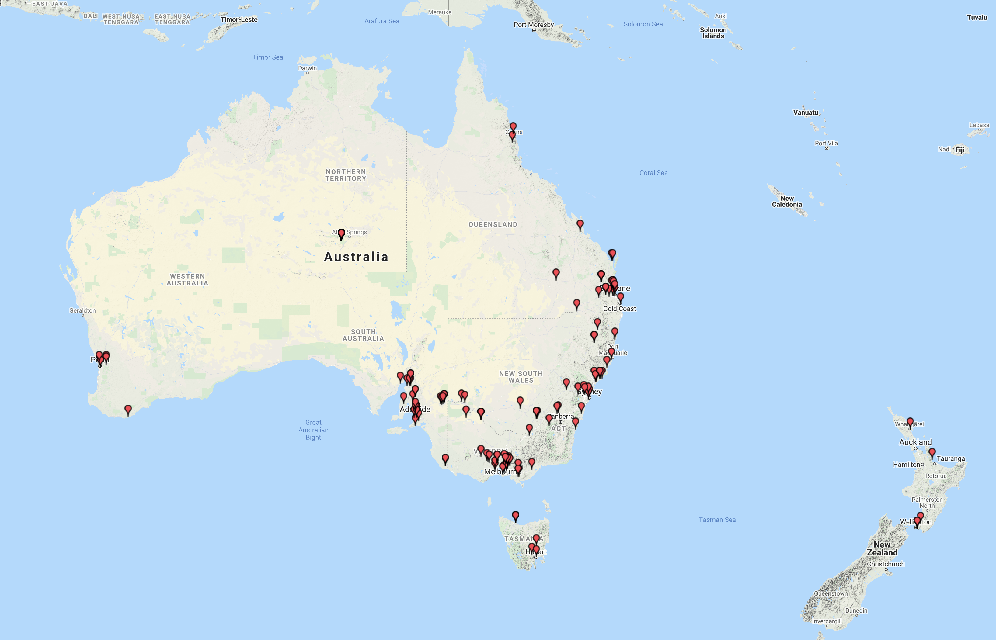
Callers from VK and ZL had slowed down a bit from our first activation as VI100AF back in March. The map below shows our contacts around Australia and New Zealand.
Above:- Map showing our contacts around Australia and to New Zealand.