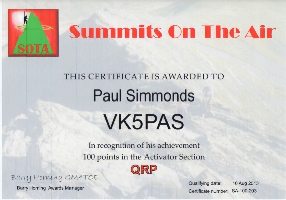
After returning from the ILLW at the Cape Willoughby lighthouse on Kangaroo Island, I checked my 400 odd e-mails and there was my certificate for 100 points as an Activator (endorsed QRP).
A long road ahead before I get to Mountain Goat !

After returning from the ILLW at the Cape Willoughby lighthouse on Kangaroo Island, I checked my 400 odd e-mails and there was my certificate for 100 points as an Activator (endorsed QRP).
A long road ahead before I get to Mountain Goat !
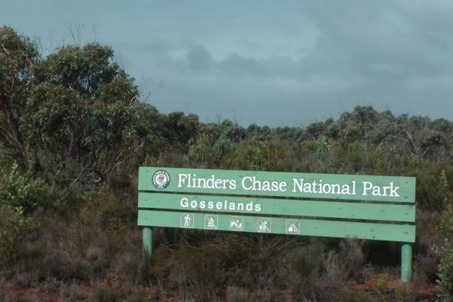
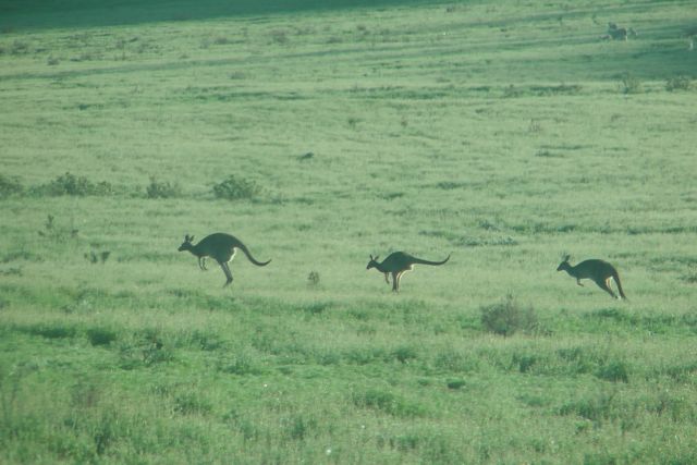
On Sunday, 18th August, 2013, Andy VK5AKH and I drove down to the western end of Kangaroo Island, OC-139, and activated an un-named summit, VK5/ SE-018 which is contained within the Flinders Chase National Park.
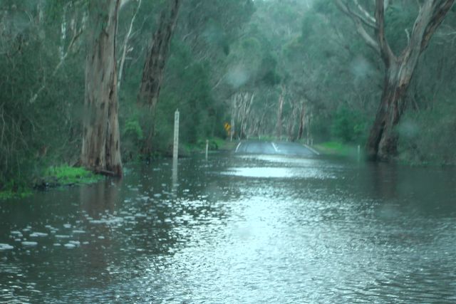
It was a 2 hour drive from the Cape Willoughby lighthouse at the eastern end of the island, where we were staying as part of the International Lighthouse & Lightship Weekend (ILLW). The weather on Friday and Saturday had been very severe, with heavy rain, hail, lightning and very strong winds. In fact the wind speeds had gusted to 140 kph on the Saturday. The road from the lighthouse back to Penneshaw was totally impassable by 2wd traffic, so Andy and I had to take some dirt backroads, to get onto the bitumised Hog Bay Road, and then the Playford Highway. In fact some parts of the main bitumen roads were also flooded, and there was lots of debris on the road.
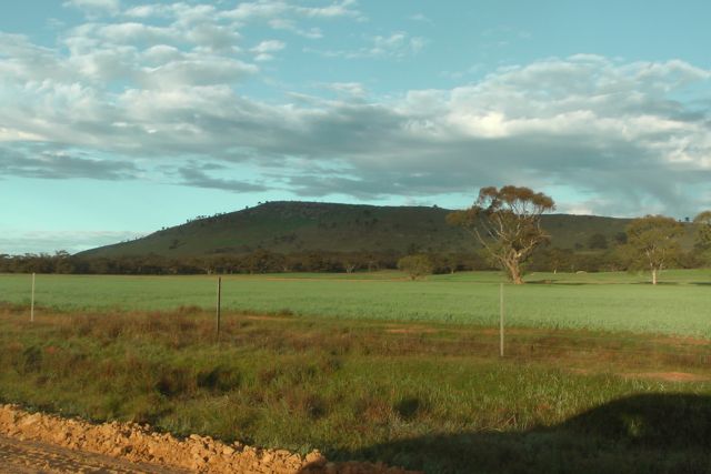
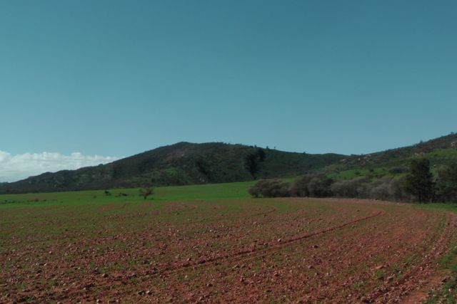
We drove west along Playford Highway, through Parndana and continued on passed the West End Highway, following the northern side of the Flinders Chase National Park.
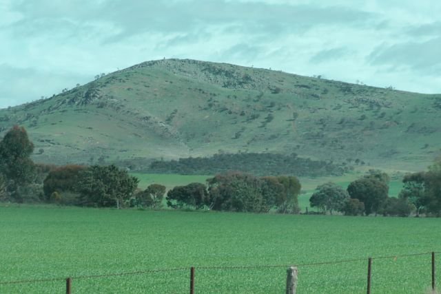
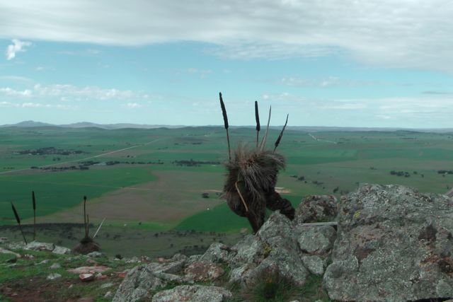
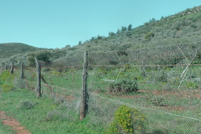
The Flinders Chase National Park is a vast area of wilderness which features the spectacular Remarkable Rocks and Admirals Arch as well as a colony of New Zealand fur-seals at Cape du Couedic. A network of walking trails and boardwalks enable you to enjoy the park and its diverse wildlife. The park which was established in 1919, is 328 km2 in size. It is situated about 110 km west of Kingscote, the largest town on Kangaroo Island. A large amount of wildlife can be located in the park including kangaroos, echidnas, koalas, platypus, and wallabies. About 267 species of birds have been recorded.
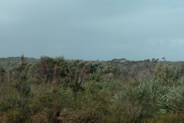
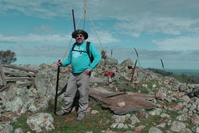
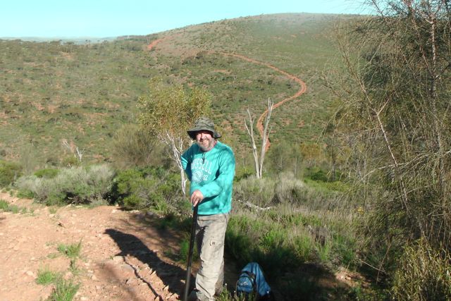
Andy I parked the car on the Playford Highway and walked 100 metres or so to the south, into the thick scrub of the park. We found a clearing and this is where we decided to set up, as there was a bit of room to stretch out the antenna. We didn’t want to go to far, because the weather was very threatening. As much as I wanted to test out my new bothy bag, the thought of cuddling up close to Andy in an enclosed space didn’t really appeal.
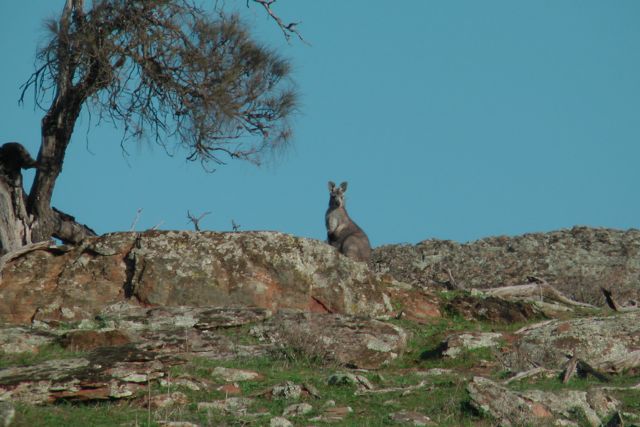
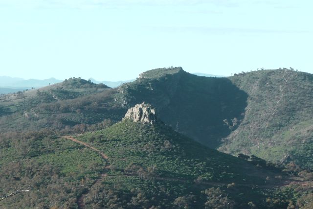
The summit is not really a traditional summit. It is simply the highest point on the island. VK5/ SE-018 is about 310 metres above sea level and is worth just 1 point. It is situated on the southern side of the Playford Highway and is contained within the Flinders Chase NP.
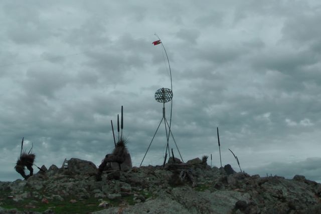
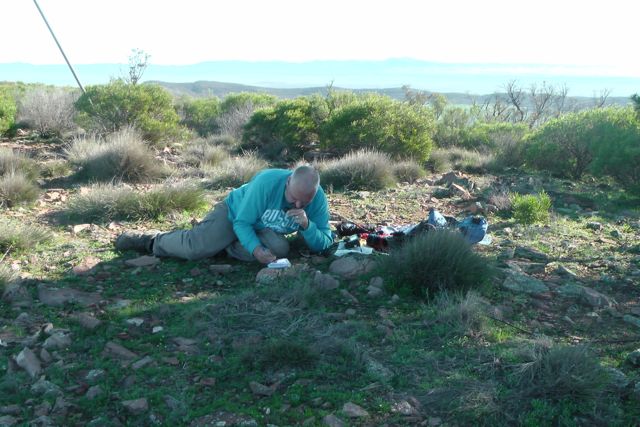
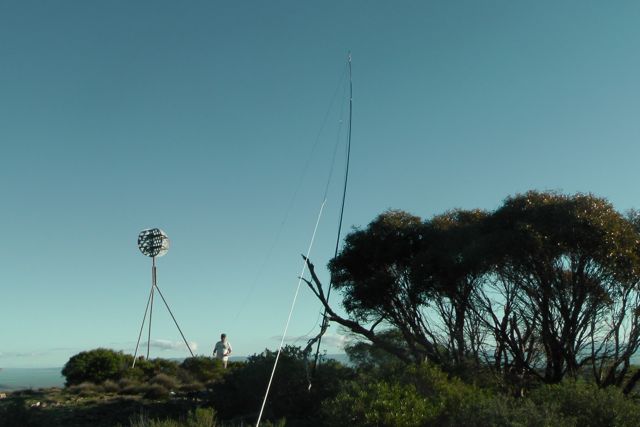
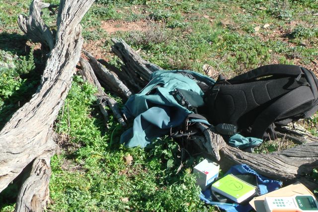
We hastily set up my Yaesu FT-817nd, and my 40m/20m linked dipole. There were no rocks present which we could use to support the 7m squid pole, so we quickly attached it to a small nearby gum tree using about 4 octopus straps. The weather was getting worse and it was very windy. The squid pole was on a real lean.
We turned the radio on to 40m, and went to 7.090 and I put out a call, only to be greeted with a massive pile up of hungry Chasers. Initially Andy and I operated by swapping the mic, but there were so many calling that we decided to work 10 and then swap operators.
My first 4 QSO’s were with Brian VK5FMID; Larry VK5LY; Gary VK5ZK; and Andy VK5LA, all of whom had very strong 5/9 signals.
Things were going great guns, but that was not to last long. A combination of antenna problems and poor weather put a quick halt to our activation. The BNC connection on my dipole gave up the ghost and signal strengths went down the gurglar.
I ended up with 19 QSO’s on 40m SSB.
I worked the following stations:- Brian VK5FMID; Larry VK5LY; Gary VK5ZK; Andy VK5LA; Ian VK5CZ; Mal VK3AZZ; Trevor VK5BAR (at the Cape Willoughby lighthouse); Tom VK5EE; Col VK5HCF; Nev VK5WG; Nick VK3ANL; Marc VK3OHM; Ernie VK3DET; Warren VK3BYD; Graham VK5KGP; Roy VK5NRG/p; Colin VK3UBY; Tony VK3CAT; and James VK2IB/p (qrp).
Apologies to all those that were calling and who missed out. The wet weather and a very sick antenna lead had triumphed.
I have added a video to You Tube of the activation.
On Friday morning, 16th August, 2013, myself and 7 other amateurs ventured over to Kangaroo Island, OC-139 for the annual International Lighthouse & Lightship weekend.
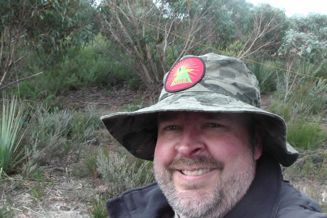
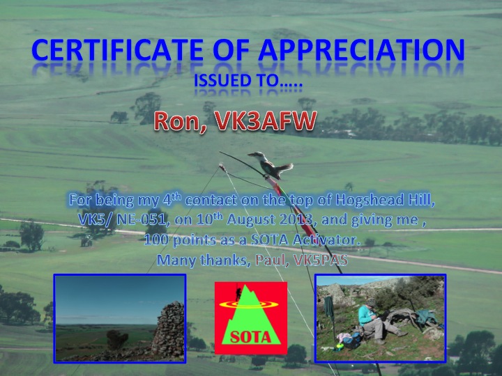
On Sunday morning, my 4th QSO on Hogshead Hill, VK5/ NE-051, was with Ron, VK3AFW. By working Ron I qualified for the summit, and in turn surpassed the 100 point mark as an Activator. I have applied for the certificate from SOTA and really look forward to receiving it.
I started activating back in March this year and in the past 6 months I have activated 35 unique summits on the Fleurieu Peninsula, in the Adelaide Hills, on the Eyre Peninsula, in the Mid North, and up in the Flinders Ranges. I’ve had a ball. I’ve visited places that ordinarily I probably wouldn’t have gone to.
It has not been easy. Most South Aussie’s are geographically challenged when it comes to SOTA. Unfortunately because of where our summits are located, a lot of driving is involved for the vast majority of us. In fact my last SOTA trip, on the weekend, probably involved about 1,000 km of travel. And to make it a little bit more difficult, most of the summits are on private property, which requires a bit of digging around.
But fortunately almost all of the farmers have been terrific and very helpful. Ian VK5CZ and I are slowly building up a database of land owners and creating partnerships with them, so it will be easier for the next lot of keen VK5 activators that come along.
It has been great to be able to combine a love for the bush, some exercise (it doesn’t seem to be paying off on my waistline), and the hobby of amateur radio. Even my wife Marija is happy, and she has accompanied me on quite a few activations.
Thanks to everyone who has called me whilst I’ve been on a summit. I’ve worked into all the States of Australia and quite a bit of DX on 40m & 20m, which is always a thrill with just 5 watts & a simple dipole antenna.
A long, long, long road ahead before I get even close to Mountain Goat. But I’m up for the challenge.
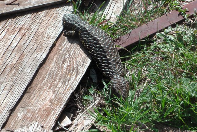
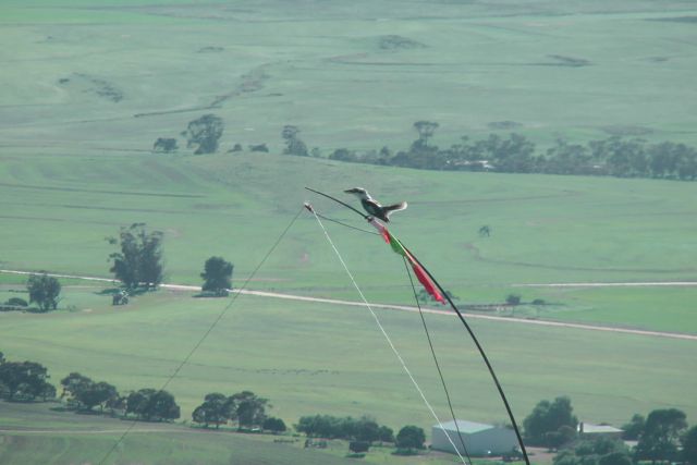
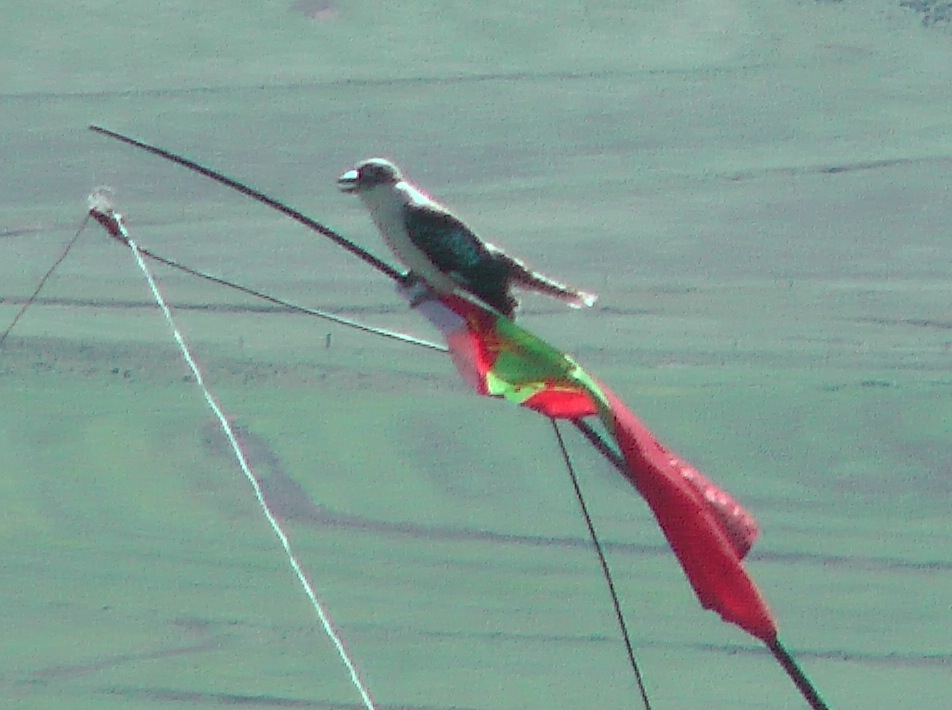
Below is a certificate I made up and have sent to Ron VK3AFW, thanking him for tipping me over the 100 points. The photo is of a Kookaburra that decided to perch itself on the top of the squid pole.
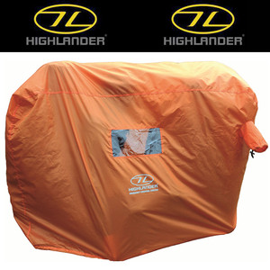
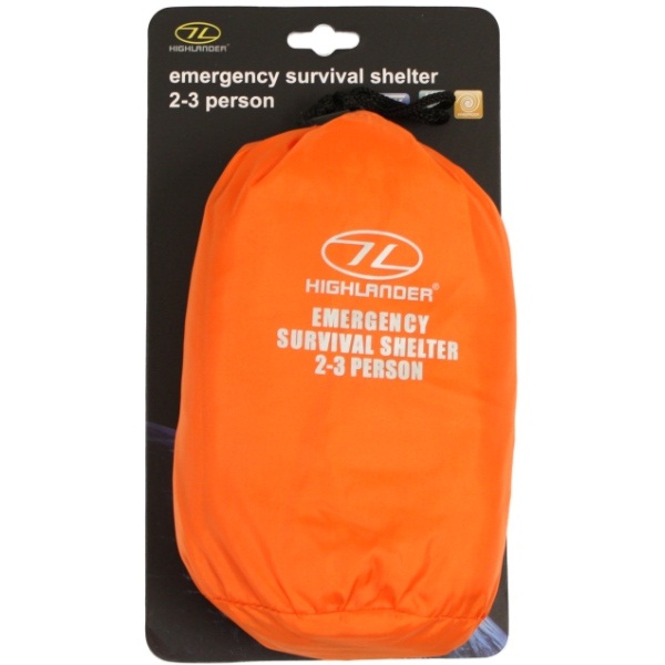
My new Highlander Emergency Survival Shelter ‘Bothy bag’ has arrived from the UK. I purchased a 2-3 person version via e-bay for about $50.00 including postage.
After getting caught out in the drizzle a few times over on the Eyre Peninsula back in June, I decided to buy one to try to keep myself and the radio dry.
It is made of 3000 mm HH waterproof and windproof AB-TEX fabric. It is high visibility orange and measures 142 cm (length) X 47 cm (width) X 92 cm (height). Its weight is just 340 grams. It has some PVC clear windows and a breathing hole with an integrated draw cord. It is really compact and lightweight, and folds away into a small bag 10 X 22 cm.
The last summit of the weekend was Maurice Hill, VK5/ NE-049, which is a very short distance from the previous summit, Hogshead Hill. In fact it is about 8 km as the crow flies or about 15 km by road. Maurice Hill is about 782 metres above sea level, and is worth 4 points. It is situated just a few km south west of the little town of Pekina, which in turn is about 272 kms north of Adelaide. More information on the interesting history of Pekina can be found in the previous Hogshead Hill blog.
Maurice Hill was named after Mr Price Maurice, who was a large landowner and successful pastoralist.
The summit is located on private property, and Ian and I had obtained permission from the landowner, Tony Mannion, about 2 weeks prior to the activation. In fact I had met Tony in the Orroroo pub the night before the activation, and introduced myself.
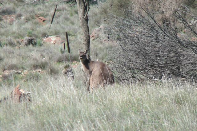
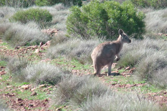
We met Tony at a gate on the new bitumen road between Pekina and Wepowie. There is an old pumping station here with a windmill lying on its side. I parked my Ford Falcon just inside the gate and jumped into Ian’s 4WD. From here, Tony led us through his paddocks, and then up a 4WD track which followed a saddle between the summit and an adjacent hill. When the track started to get rough, Tony kindly allowed us onto the back tray of his 4WD and we were driven up closer to the summit itself. Otherwidee the climb would have taken hours. On the drive up, there were numerous kangaroos and euros (wallaroos) seen.
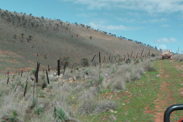
We were dropped off by Tony about 400 metres away from the summit and had a chat to Tony, explaining to him the SOTA program and the hobby of amateur radio in general. Ian and I then packed up our gear and made our way on foot into the activation zone along the rocky 4WD track. Ian and I finally reached the trig point at the very top. There was also the ruins of a wooden shack, which Tony earlier had explained to us had previously been used as a fire spotting shack. All that was left now were bits of rusting metal and old wooden panels.
Ian and I set up right alongside of the trig point. We utilised part of the old wooden hut as protection from the wind which was roaring in from the west. The day’s eathr had changed from bright sunshine to an overcast afternoon with the threat of some rain. There was a convenient star dropper which we utilised to secure the 7 metre squid pole to with some octopus straps.
My first contact on the hill was another summit to summit QSO. This time with Kevin VK3KAB who was portable on the top of Mount Torbreck, VK3/ VN-001. This was followed by the regular crowd of Chasers. Larry VK5LY, Ron VK3AFW, and Colin VK3UBY made up my 4 required QSO’s and all had excellent 5/9 + signals.
Congratulations to Tony VK3CAT who was my 9th contact on the summit. By contacting me, Tony had acquired his 1,000 points and had become a Shack Sloth. Well done Tony and I was really happy that I was the Activator that got you across the line. Tony was operating QRP and had an excellent 5/7 signal.
I was also fortunate to make contact with David VK5KC and John VK5BJE, who were both operating portable from the Ferries McDonald Conservation Park, as part of the VK5 National & Conservation Parks Award. A good 5/7 signal from both of them with their QRP setup.
I also managed a few other summit to summit QSO’s including an enjoyable chat with Michelle VK3FEAT and Terry VK3UP, who were on the top of Mount Buninyong, VK3/ VC-018, operating with just 4 watts (5/7 sent and 5/8 received).
This was followed by a summit to summit with Peter VK3PF who was on top of Hyde Hill, VK3/ VC-008. Not the strongest signal that I’ve heard from Peter, but still a good 5/4 and very readable, with a 5/7 signal report returned by Peter.
A few QSO’s later I spoke with Col, VK5HCF and Tom VK5EE, who were both portable in the Tantanoola Caves Conservation Park, as part of the VK5 National & Conservation Parks Award (5/8 sent and 5/4 received). Col & Tom had activated their first ever SOTA peak earlier in the day, at Mount Burr in the south east of South Australia. But alas, Ian and I had missed them by about one hour. Congratulations to both Col & Tom. Be careful, the SOTA bug bites hard !
My last QSO on the hill was another summit to summit. This time with Rik VK3KAN who was on top of Talbot Peak, VK3/ VT-010. This was a little bit of a struggle, but we managed to get through. Rik’s signal was down considerably at only 4/2, and I received a 4/3 in return from Rik. Thanks for picking us up out of your pile up Rik.
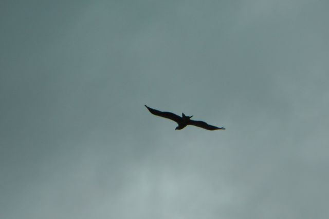
Whilst on top of the hill we were fortunate enough to have our own mascot, a Shingleback lizard which was enjoying the sunshine. At one point we also had an eagle soaring above us in the breeze. Maybe he was watching the lizard ?
Ian had just started working some DX on 20m CW when the weather forced us to pack up and head back down the hill to the 4WD. We could see it slowly moving in from the west across Mount Remarkable and every now & again we were hit by light showers. So we didn’t want to push our luck and get caught in the rain, as we had a few km to get back to Ian’s 4WD.
Between the 2 of us, Ian and I ended up with 46 QSO’s on 2m FM, 30m SSB, & 20m CW.
I worked the following stations:- VK3KABB/p (SOTA); Larry VK5LY; Ron VK3AFw; Colin VK3UBY; Grant VK5VGC; Nev VK5WG; Ernie Vk3DET; Phil VK3BHR; Tony VK3CAT; Ian VK3TCX; Ian VK3VIN; Shaun VK5FAKV; Ian VK5IS; David VK5KC/p(VK5 Parks); John VK5BJE/p (VK5 Parks); Michelle VK3FEAT/p (SOTA); Terry VK3UP/p (SOTA); Peter VK3PF/p (SOTA); Bernard VK3AMB; Albert VK3KLB; Col VK5HCF/p (VK5 Parks); Tom VK5EE/p (VK5 Parks); Peter VK3FPSR; & Rik VK3KAN/p (SOTA).
This was our last activation for the weekend. Ian headed home to Clare & I headed back to the Adelaide Hills, about 3 hours away. A really enjoyable weekend and many fond memories. My top 5 memories will be:-
1. Leaving my prescription glassed behind on the top of Olladie Hills. $200.00 later and an angry wife !
2. All of the summit to summit QSO’s. For me a total of 22 S2S QSO’s in 3 days. A S2S fiesta !
3. Reaching my 100 points as an Activator. A hard slog but have enjoyed every minute of it !
4. Working Tony VK3CAT and giving him his 1,000 point as a Shack Sloth.
5. The really hard slog to get to Stokes Hill. Now this is a very hard earned 4 points !
I have posted a video of the activation on You Tube.
My third planned summit of the weekend with Ian VK5CZ, was Hogshead Hill, VK5/ NE-051, which is situated about 7 km south east (as the crow flies) of the little town of Pekina in the Flinders Ranges, or about 272 km north of Adelaide. Hogshead Hill is about 770 metres above sea level and is worth 4 SOTA points. The summit is situated on private property owned by Gary Hawthorne.
Again it was an early start for me. I had stayed overnight at the Orroroo Hotel, and had enjoyed the cold beer and a good feed the night before. In fact probably a bit too much beer, as I was feeling a bit weary. I got up to the horrible sound of the alarm at 6.00 a.m. and almost felt like rolling over and going back to sleep. But after a nice warm shower and a hearty breakfast I was starting to fire on all 8 cylinders. Ian met me at 7.00 a.m. outside the hotel. It was a fresh morning again, but did not as cold and certainly not the low lying fog as was the case the day before on the Saturday morning.
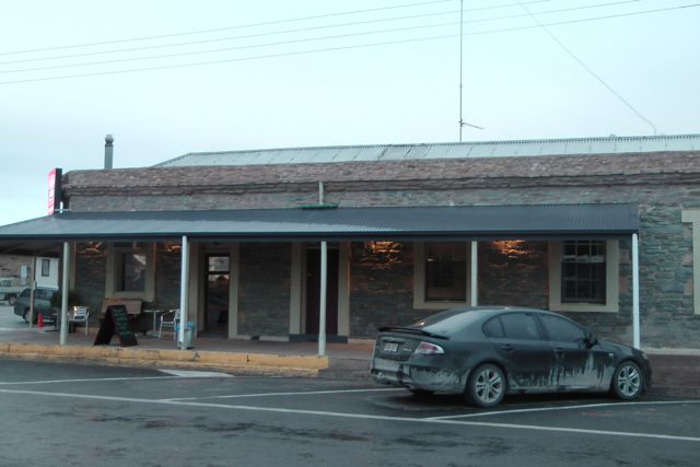
I would highly recommend the Orroroo Hotel, which was established in 1877. The owners Warren & Liz Campbell are very friendly. There are 2 hotels in the town, but the Orroroo is referred to as the ‘top pub’. More info on the pub can be found at…..
http://www.orroroohotel.com.au
As we were going to be travelling south out of Orroroo, Ian and I decided to take both cars. That way at the end of the 2 activations, Ian could head home to Clare, and I could head home to the Adelaide Hills. So we checked our gear and drove south out of Orroroo on the Orroroo to Pekina Road, towards the little township of Pekina.
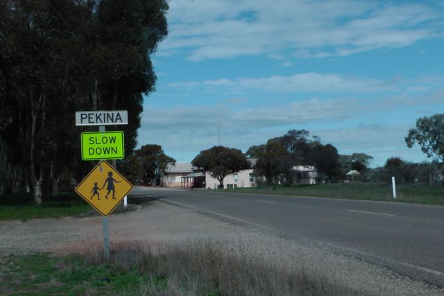
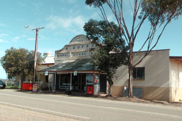
Pekina township is located about 14 km south of Orroroo. It is a tiny town with a population of only 172 people that live in the town itself, and the surrounding district. Nowadays the town consists basically of a general store, established in 1874, and a hotel which was established in 1877. The name of the town is thought to derive from the local Aboriginal word for “creek water” .
European settlement in the Pekina district began in earnest in 1846 when Price Maurice brought 3000 sheep to the district. The Pekina station was one of the most profitable sheep runs in South Australia. Pekina became a stopping-point for coaches on the run between the mining towns of Blinman and Burra to the north. By 1871, the station was resumed and broken up for closer settlement. The Pekina region was settled by German and especially Irish migrant farmers. However, problems with drought, rust (fungus), and locusts during the 1880s meant the town grew slowly with only around 75 residents at the turn of the 20th century.
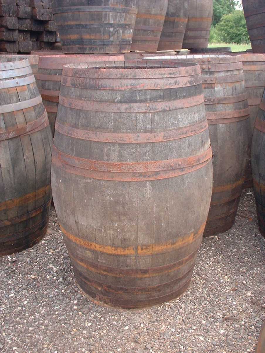
As we approached Pekina, Hogshead Hill summit to the east & the adjacent summit, Maurice Hill to the west, were clearly visible on either side of the Pekina Road. Hogshead Hill was named by Johnson Frederick ‘Fred’ Hayward in 1846 after the resemblance of the northern end of the hill to to a hogshead barrel. A hogshead is a large cask of liquid, or less often, of a food commodity. More specifically, it refers to a specified volume, measured in either imperial or US customary, primarily applied to alcoholic beverages such as wine , ale or cider. Below is a photo of a Hogshead barrel. Hayward was the Manager of Pekina Station at the time and was one of South Australia’s early pastoralists. In an 1865 article in The Register newspaper relating to the death of his wife, Hayward was referred to as ‘a fine type of English gentleman’. I kept looking at the hill to see the similarities between it and a barrel, but I could not see it myself. Maybe I didn’t have enough beers at the hotel the night before.
We continued south out of Pekina on the Pekina to Tarcowie Road. A few km out of Pekina, we turned left onto Stokes Hill Road which is a dirt toad, and then right onto Hogshead Road, another dirt road. We travelled along the Hogshead Road for about 5 km, up over a rise and into the scrub on either side of the road. Soon after we passed Naren Road on our left, and shortly after there was an old house ruin on the left. Directly opposite the ruin is a farmers gate. This is the access point to the summit. Please note that the summit is located on private property. So please obtain permission before entering onto the land.
I parked my Falcon just inside the gate, and Ian and I then drove through the mallee scrub and into the paddock following the track alongside the creekline. There was a large number of ewes in the paddock with their lambs. Many of those were very young. We reached a fenceline at the western end of the paddock, and parked the 4WD here and unloaded our backpacks from the car. We then scrambled over the barbed wire fence, ensuring we didn’t do ourselves an injury in the process. We walked the rest of the way to the summit, a distance of about 1 km.
The walk to to the top of the hill is not too strenuos and took us about 45 minutes. We tried to follow the sheep tracks as they always seem to know the easiest way along the hills. The hill is covered in moss rocks, so it was a slow and steady climb. While climbing the eastern side of the hill, there were very nice views out to the east towards Peterborough and Black Rock, and north towards Orroroo.
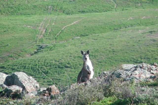
On our climb up we spotted a number of Euros (wallaroos). But one in particular appeared to be more interested in us, than we were of him. Rather than bounding away up into the rocks like his mates did when they spotted us, this little guy kept coming closer and closer to us, to find out who was encroaching on his territory. Eventually he became camera shy and bounded off, up to the top of the summit to join his friends.
The climb up to the summit was no less rewarding than any other summit that I’ve climbed since starting SOTA in March this year. There are terrific views from the top in all directions.
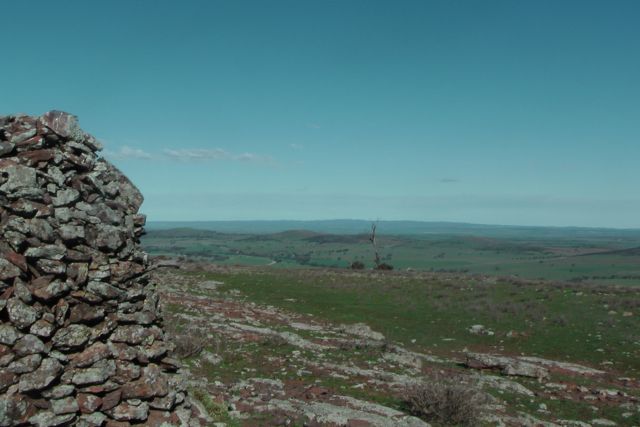
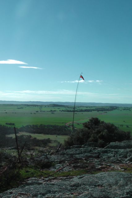
The top of Hogshead Hill is unique, in that it is relatively flat, and is similar to a plateau. It is rocky up the top with a few small trees and shrubs. But is is quite exposed and there is no significant cover. Fortunately the day was beautiful, with bright sunshine and a relative wind coming from the west. There isn’t a trig point, but there is a substantial stone cairn. And alongside the cairn is another one which is obviously in the process of having stones & rocks added to it as more people climb up to the summit.
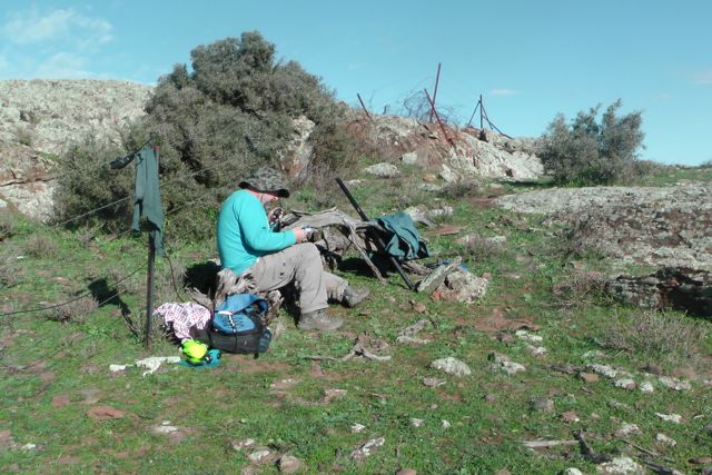
Ian and I set up just down from the summit itself, using a fencline to our advantage, as a support for the squid pole. We found a nice sturdy permapine post and attached the squid pole to this with some octopus straps. We strung out Ian’s home brew 40m/20m linked dipole and weighted down one of the legs with some moss rocks, and tied off the other end to a small shrub. There was certainly no shortage of rocks on the top of this hill.
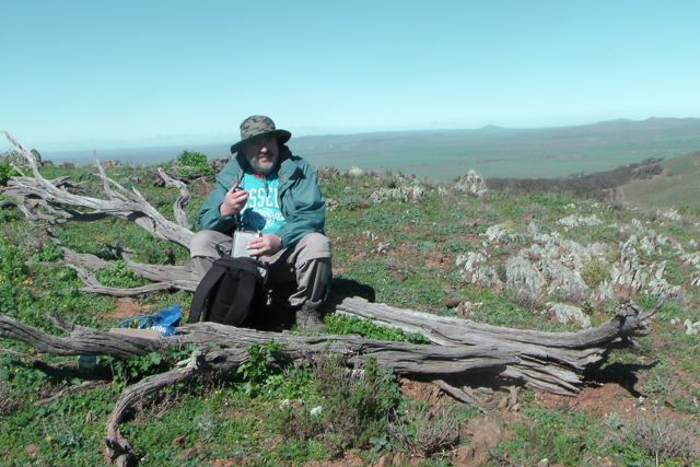
We found a dead tree limb lying on its side alongside the fence, not far from the permapine post, and this looked like a nice seat. I set up my Yaesu FT-817nd, with Ian’s Elecraft KX3 at the ready. During the course of the weekend I had lost the DC cable for the radio, so I was relying on the internal NIMH battteries lasting the distance.
Ian and I had made it to the top of the hill at our expected time, so we stuck to our original plan that I would operate for the first hour on the hill, until the UTC roll over, and Ian would then take over for the new UTC day for all of the Chasers. And this was set to be an exciting activation as the ACT fellas were celebrating their 6 month SOTA anniversary. There was an expected 9 + operators who were activating various VK1 SOTA summits that morning.
My first contact of the morning was on 40m SSB with Al, VK1RX, who was portable on Mount Tuggeranong, VK1/ AC-038. Signal reports were 5/5 both ways. What a great way to start the activation, with a summit to summit QSO between VK5 to VK1. I then QSY’d up the band slightly to 7.095 and put out a call, only to be swamped with the regular pile up of chasers. Andy VK5LA in the Riverland, Colin VK3UBY in Mildura, and Ron VK3AFW in Melbourne, made up my 4 qualifying QSO’s for the summit.
Ron VK3AFW was a memorable contact for me, as my QSO with Ron, pushed me over the 100 point mark as an Activator. Thanks a lot Ron. It has been quite a challenge here to reach the 100 points. The tyrany of distance makes it difficult, but I have enjoyed every minute of my6 months of activating. I’ve printed out a special QSL card and a certificate and I’ve mailed this to Ron to celebrate my 100 Activator points.
In the hour of operating before the UTC rollover I managed a further seven summit to summit contacts with the VK1 guys, as follows:-
Mark, VK1MDC/p, VK1/ AC-040, Mount Ainslie.
Peter, VK1IRC/p, VK1/ AC-040, Mount Ainslie.
Ashley, VK2FAJG/1, VK1/ AC040, Mount Ainslie.
Ed, VK2JI/1, VK1/ AC-037, Mount Taylor.
Jim, VK2LC/1, VK1/ AC-037, Mount Taylor.
Rod, VK2LAX/1, VK1/ AC-037, Mount Taylor.
Ian, VK1DI/p, VK1/ AC-035, One Tree Hill.
Another interesting contact was with Peter VK3YE who was pedestrian mobile on the beach, about 32 km south of Melbourne. Peter was QRP 5 watts and was using a home brew, hand held Magentic loop antenna. Congratulations to Peter who had a terrific 5/6 signal. And a 5/7 signal report was received back from Peter. Peter has posted a terrific video on You Tube of his beach activation on the day and his SOTA contacts.
I had a few more QRP to QRP contacts including Ian VK5IS who was running 5 watts (5/6 sent & 5/4 received), Brendan VK4FADI who was also QRP (5/8 sent & 5/9 received), Steve VK3SE who was running QRP 5 watts (5/9 both ways), and Tom VK2KF, also QRP on 5 watts (5/9 both ways).
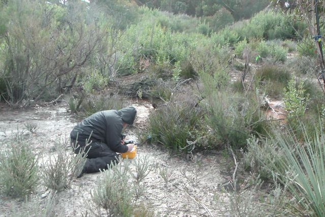
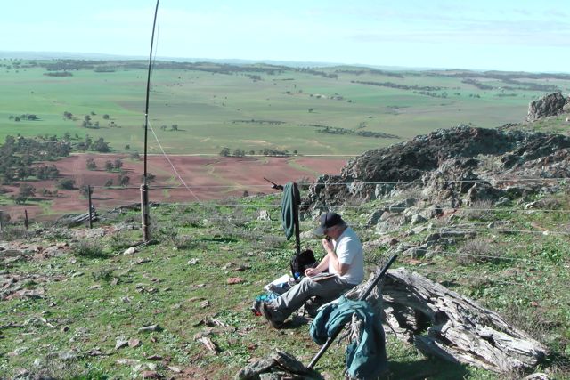
At the strike of 9.30 a.m. local time on my watch, which marked the new UTC day, Ian took over the reigns of the radio, whilst I took the opportunity to stretch my legs as I was getting pins & needles, take some photographs, and explore the summit.
After a little over 30 minutes of exploring the summit, I started walking back towards our operating position and saw a rather large bird fly onto the top of the squid pole. I was in the process of taking a photograph when I saw the bird fly in. I was just far enough away that I couldn’t really tell what type of bird it was, so I zoomed in with the video camera and saw that it was a cheeky kookaburra that had decided to perch itself on the top of the squid pole, a few feet from where Ian was operating. As I got a bit closer, he/she decided to fly off, and as it did it let out its distinctive laughing call. It wasn’t until I got back to our operating spot, that Ian said he had noticed a drop in signal strength and that he hadn’t seen the bird.
I jumped back onto the radio and had a further 9 contacts including a further 6 summit to summit QSO’s as follows:-
Marshall VK3MRG/p, VK3/ VC-014.
Andrew VK1NAM/p, VK1/ AC-032, Castle Hill.
Mark VK1MDC/p, VK1/ AC-040, Mount Ainslie.
Peter VK1IRC/p, VK1/ AC-040, Mount Ainslie.
Peter VK3PF, VK3/ VT-026, Mt Toorongo Range.
Matt VK1MA/p, VK1/ AC-023, Mount Coreee.
My iphone went off with the goat bleating from SOTA Goat and it was a spot for Andrew VK1NAM calling CQ on 6m. Ian and I got quite excited, and we did have a listen and put a call out, but sadly we didn’t hear anything.
After an hour or so of operating on the summit, it was time for us to head down and drive to the next summit. Ian and I had a total of 71 QSO’s in the log, including 20 summit to summit contacts. What a morning ! And congratulations again to the VK1 SOTA Association.
I worked the following stations on 40m SSB:- Al VK1RX/p (SOTA); Andy VK5LA; Colin Vk3UBY; Ron VK3AFW; Ernie VK3DET; Rik VK3KAN/m; Nev VK5WG; Tony VK3CAT; Mark VK1MDC/p (SOTA); Peter VK1IRC/p (SOTA); Ian VK5IS/qrp; VK4FADI/qrp; VK2FAJG/1 (SOTA); Scott VK7FTTT/qrp; Larry VK5LY; Glenn VK3YY; Peter VK3FPSR; Warren VK3BYD; VK5MKA; VK3JM; David VK3KR; Andy VK5AKH; Adam VK2YK; Ed VK2JI/1 (SOTA); Steve VK3SE; Rob VK2FROB; Phil VK3BHR; Tom VK2KF/qrp; VK2LC/1 (SOTA); Shaun VK5FAKV; Brian VK5FMID; Rod VK2LAX/1 (SOTA); Theo VK5MTM; Ewen VK3OW; Peter VK3YE/ped mobile; Ian VK1DI/p (SOTA); Marshall VK3MRG/p (SOTA); Andrew VK1NAM/p (SOTA); Mark VK1MDC/p (SOTA); Peter Vk1IRC/p (SOTA); Peter VK3PF/p (SOTA); VK2FBKT/qrp; Rik VK3KAN; Matt VK1MA/p (SOTA); and Roy VK5NRG.
I have posted a video of the activation on You Tube.
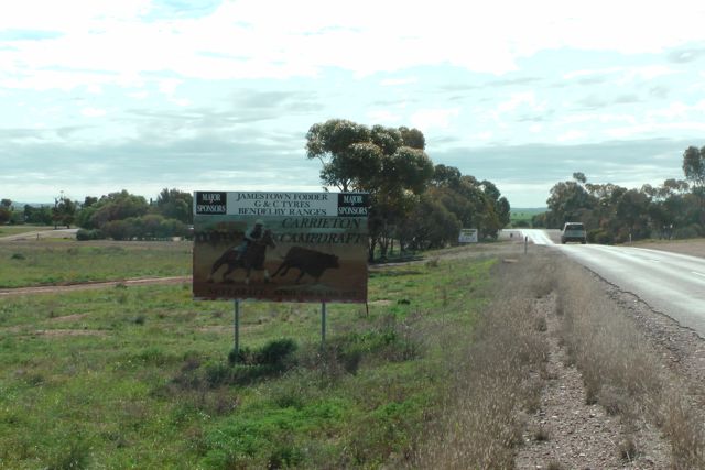
My second summit for the Saturday with Ian, VK5CZ, was Stokes Hill, VK5/ NE-050, which is situated about 330 kms north of Adelaide, and about 20 kms west of the little town of Carrieton in the Flinders Ranges. Stokes Hill is 779 metres above sea level and is worth 4 points. After our journey it should be worth three times that. It was not easy getting there ! Lots of 4WDing and lots of climbing.
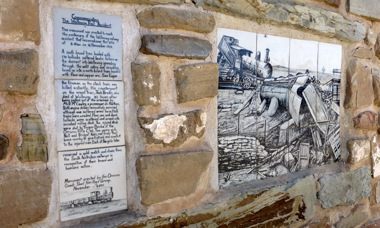
Following our activation of Oladdie Hills, Ian and I headed north on RM Williams Way, through the little towns of Walloway, Eurelia, and Carrieton. The history of these small towns is really quite amazing.
Walloway was the scene of a fatal train accident at about 2.30am on the 16th November 1901. Two trains collided killing the stock train fireman instantly, and later claiming the life of the fireman of the other train due to his injuries. A south bound locomotive travelling with 170 bullocks was to pull into the Walloway siding to enable a north bound train to pass. However to the train To the driver’s horror, the brakes locked up, and the slippery rails caused the wheels to slide. The train continued on passed the station and collided head on with an unsuspecting oncoming northbound train loaded with flour and copper ore, on a bridge over a small creek. Today Walloway is little more than a ghost town.
Eurelia is a tiny town which was once a major centre along the railway. The name is believed to originate from the local Jadliaura aboriginal dialect and translates to “place of the ear”. It is thought that local Dreamtime stories associated with the Ranges locates Eurelia as an “ear” of a prostrate man.
The larger town, Carrieton, has a population of about 50 people and is the home of the Carrieton Rodeo, a highlight event on the Australian rodeo circuit.
Stokes Hill is located on private property owned by Susan and Ben CARN. I met Susan the day before, on the Friday, and collected the key from her to open the padlocks to allow us access to their property. Susan is a lovely lady and had just arrived home with a 4WD full of food and beer for the shearers on her property. It is normally $50.00 per vehicle to access the Horsheshoe Rim 4WD track, but Susan kindly allowed us access for free. Susan & Ben offer quiet and tranquil accomodation in the Horsehoe Range. More information can be found on their website at…..
http://www.horseshoerim.com.au
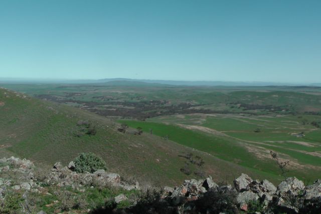
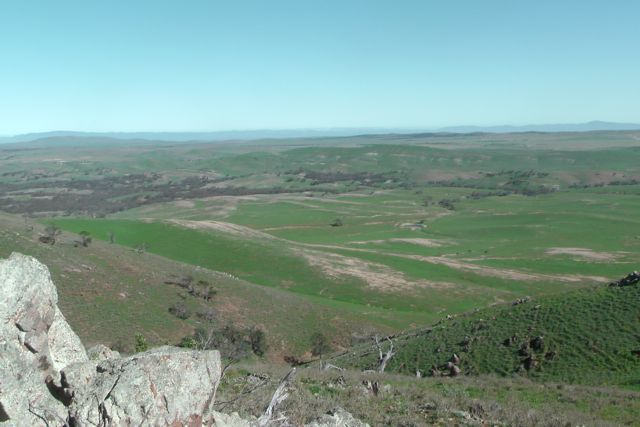
The 4WD track runs around the rim of the Horseshoe Range. There are two loop tracks, one for intermediate and one for experienced 4 wheel drivers. There are magnificent views of the Flinders Ranges from Mt Remarkable in the South to Wilpena Pound in the north, with lookouts along the way providing many spectacular photo opportunities. A highlight is the challenging section to the top of Mt Stokes – the highest point in the Horseshoe Range. And Ian and I certainly found this challenging.
At Carrieton, we turned onto the road to Hammond, which is located directly opposite the Carrieton Hotel, and we headed west. We travelled passed the rodeo grounds and travelled a further 14 km to the west. Here we reached a dirt road which had a signpost for the ‘Horseshoe Rim 4WD track’. We turned right here and travelled north. We passed a house on our right and just after this we came to another dirt road on the left with another ‘Horsehoe Rim 4WD track’ sign. We turned left here, travelling along the dirt road, and over 2 grids.
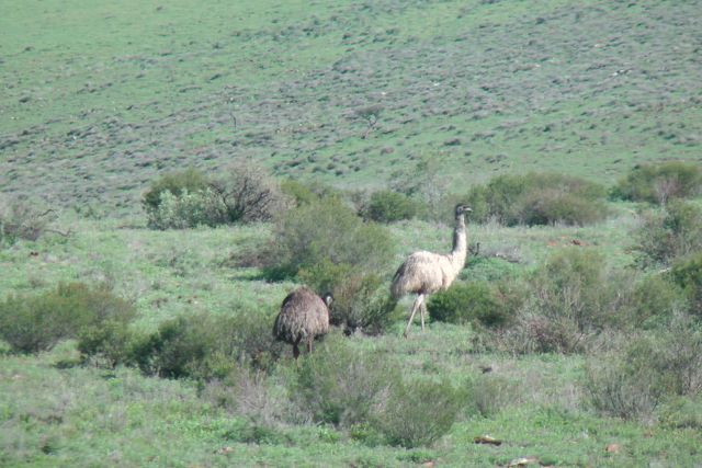
As we entered this area, there were lots of emus and kangaroos to be seen. Please drive carefully through this section as there is cattle grazing in this unfenced section of land.
We then came to a fork in the road. Do not go left here, but follow the road around to the right. This brought us into the spectacular Horseshoe Valley. We then travelled over a third grid, and this is when you are on Susan and Ben CARN’s property. Continue travelling along the dirt road and you reach a gate on your right which is marked number ‘9’. If you reach the double farmers gates with a sign for ‘Wilderness Cabin’, you have travelled to far.
Ian and I unlocked the padlock at gate number ‘9’ and commenced our way up the Horseshoe Rim 4WD track. We followed the old Dingo fence on our right to the next gate and into the paddock. In the 1880’s this paddock was used to lock the dingos inside. Later dogs and guns were used to round up and shoot the dingos.
Ian and I continued to follow the dirt 4WD track alongside the old dingo fence and then up along the ridgeline. The track is rocky so it is slow going, but the views are amazing. We reached a point in the valley where the 4WD track continues on up to the Stokes Hill summit. We had driven a distance of about 4 kms along the track. We parked Ian’s 4WD here and made the rest of the way up the very steep 4WD track to the summit on foot. A distance of about 3 km walking, and it was not easy !
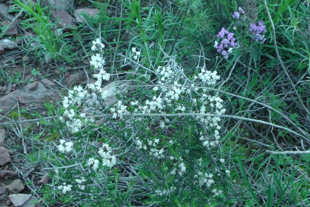
Despite it being hard going, the views were amazing, and there were a large amount of wild flowers on display and plenty of friendly Euros (Wallabies). They were obviously very familiar with all the 4WDers that use the track as they were very tame & inquisitive.
After a considerable climb, Ian and I eventually reached the trig point. One of the legs had been bent out of shape considerably. I can only image it might have been a 4WDer that had reversed into it ? There is also a small rock cairn and a visitor book at the top which I signed. The walk had really taken it out of Ian and he had come down very quickly with a stomach bug. I’ll leave the rest up to your imagtion. Needless to say, Ian was not well.
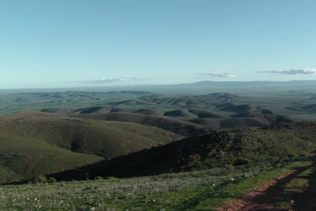
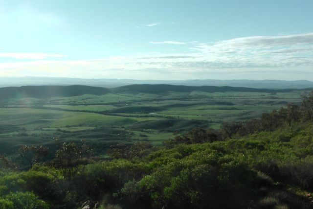
The views from the top are really quite spectacular. Mount Stokes is the highest point in the Horeshoe Range. It is so named because of its shape when viewed from the air. If you look at Google Earth you can certainly see why it was given this name.
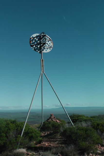
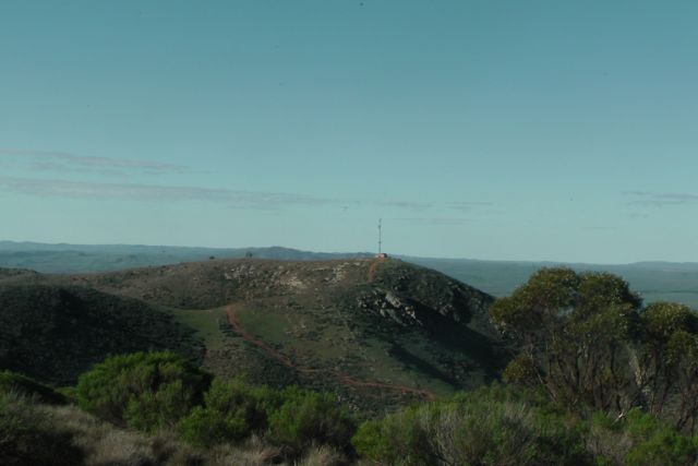
Not far from the Mount Stokes summit is another hill which has a tower on it which in turn services the Police Service and the Next G mobile phone service. An impressive feature is Moockra Tower which is 740 metres above sea level.
Because Ian was not feeling crash hot, we set up just one station. We used Ian’s Elecraft KX3, and his 40m/20m home brew linked dipole. There was a clump of trees not far from the trig point which not only could be used to attach the squid pole to, but also afforded some shade. Although it was not a hot day, there were no clouds in the sky and it was quite warm. In fact I even had to put on suns screen to prevent me from becoming sun burnt.
My first contact on the summit was with Wayne, VK3WAM, who was on the top of Mount Mitchell, VK3/ VN-012. This was a great way to start off, with a summit to summit contact. Wayne had a good strong signal of 5/8, and we received a 5/9 back from Wayne. This was followed by Larry VK5LY, Colin VK3UBY, and Ron VK3AFW, all of whom ahd very strong 5/9 + signals. The usual crowd of Chasers followed.
Just two qrp stations called in this time. Andrew VK2UH who was using just 5 watts had a very nice 5/8 signal from NSW. And Shaun VK5FAKV from the Riverland called in with a very strong 5/9 + signal with just 3 watts.
An interesting QSO was with John VK5AJQ who was using the call VK5BR for the Scouts, and was operating from the Woodhouse scout camp in the Adelaide Hills. I had a short chat with young Tom, a scout, and explained to him about SOTA and where we were located in the Flinders Ranges.
The following stations were worked:- Wayne VK3WAM/p (SOTA); Larry VK5LY; Colin VK3UBY; Ron VK3AFW; Ernie VK3DET; Marc VK3OHM; Col VK5HCF; Brian VK5FMID; Ed VK2JI; Phil VK3BHR; Marshall VK3MRG; Andrew VK2UH; Peter VK3PF; Shaun VK5FAKV; Roy VK5NRG; Rob VK2FROB; Nev VK5WG; Glenn VK3YY; Matt VK1MA; Andy VK5LA; Warren VK3BYD; Rob VK2ZRD; VK3AXH; Ian VK1DI; Mark VK3PI; Mark VK3YN; John VK5BP; and John VK5AJQ.
A challenging but rewarding summit. Time to get Ian off the hill and home to bed early for tomorrow’s 2 summits.
I have posted a video of the activation on You Tube.
My first planned activation for Saturday, 10th August, 2013, was Oladdie Hills, VK5/ NE-068. The summit is located on private property and is situated about 22 kms north of Orroroo. It is about 5 kms east of the little town of Eurelia.
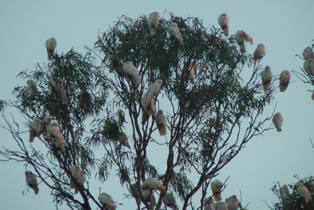
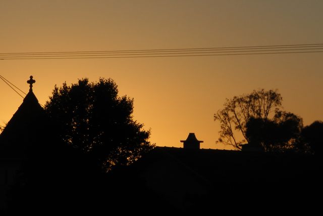
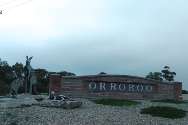
I got up at 6.00 a.m. to a nice warm hotel room, but outside the temperature was below zero, and there was a severe frost. After a warm shower and breakfast and preparing my gear, I headed outside to the cold, and waited for Ian, VK5CZ who was driving up from his home in Clare. Despite it being bitterly cold, there was a spectacular sunrise. And just across from the pub there was a noisy mob of corellas in a gum tree, obviously trying to wake up everyone in Orroroo.
Orroroo is a small town in the southern Flinders Ranges, about 270 kms north of Adelaide. It has a population of about 543. “Orroroo” is generally accepted as being derived from the Aboriginal “oorama” – “rendezvous of the magpie”, although others believe it to mean “early start“. My accomodation for 2 nights was the Orroroo Hotel (highly recommended – good food, cheap accomodation, cold beer, and friendly licencees).
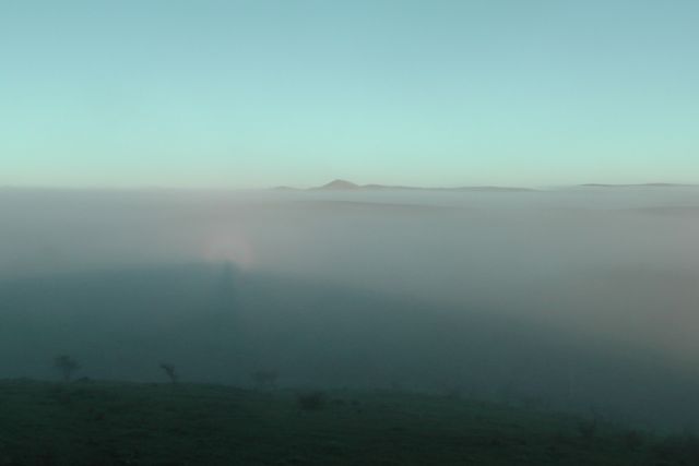
After Ian arrived at the pub to pick me up, we headed first to Tank Hill lookout at Orroroo, before making our way to the summit. Water is gravitated from the concrete tank at the “lookout” to the town. From the tank there is normally an excellent view over the artesian basin in the valley of the Walloway plain, the reservoir and the township of Orroroo. However the whole area this morning was fogged in and it was bitterly cold.
Ian and I then travelled north, out of Orroroo, along RM Williams Way. The road was named after Reginald Murray Williams, widely known as just ‘R.M.’, who was an Australian bushman and entrepreneur who rose from a swagman to a millionaire. He became known for creating an Australian style of bushwear recognised world wide.
The Oladdie Range stretches for quite some distance, north – south. We accessed the summit via private property off Hooper Road. It was quite a significant drive across paddocks (about 4 kms) until we could go no further in the 4WD, and then a 4 km walk to the summit. The drive is strictly 4wd, as the terrain is very rocky in parts and you are required to cross several significant creek beds.
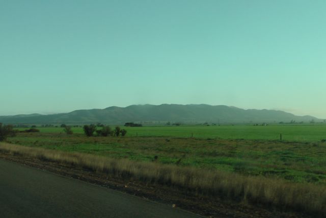
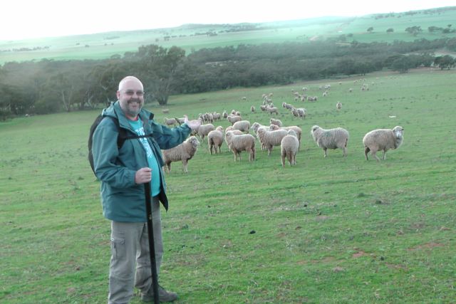
The walk to the summit was quite pleasant. The fog had partially lifted although there was still quite a bit of very low lying club. But the good thing was that the sun was out. There was not a cloud in the sky. The countryside here in the southern Flinders Ranges was very green and lush, due to recent very heavy rainfall. As a consequence the sheep were looking in very good condition. Remember this is private property, so please shut all gates.
Ian and I walked through some fairly thick scrub enroute to the summit. The ground is also very rocky.
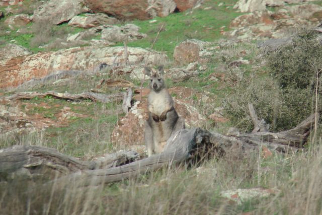
Ian and I saw dozens of kangaroos and euros on our way to the summit. I was recently asked in an e-mail by Ed, VK2JI, as to what a euro was ? The Euro is also referred to as the Common Wallaroo “Macropus robustus”. They are smaller in size to Red or Grey kangaroos. They are also of ‘high’ country, and have a distinct preference for ‘high’ places, and are typically found on rock ledges, escarpments, stony ridges and in fact anywhere where they can get a good view of their surroundings.
As is almost always the case with this SOTA activity, the hard walk was rewarded with spectacular views in all directions. Orroroo is visible down to the south, and the little towns of Walloway, Eurelia and Carrieton to the west. Down to the south west, the imposing Mount Remarkable was able to be clearly seen. Out to the east you could clearly see Black Rock Summit and Depot Hill.
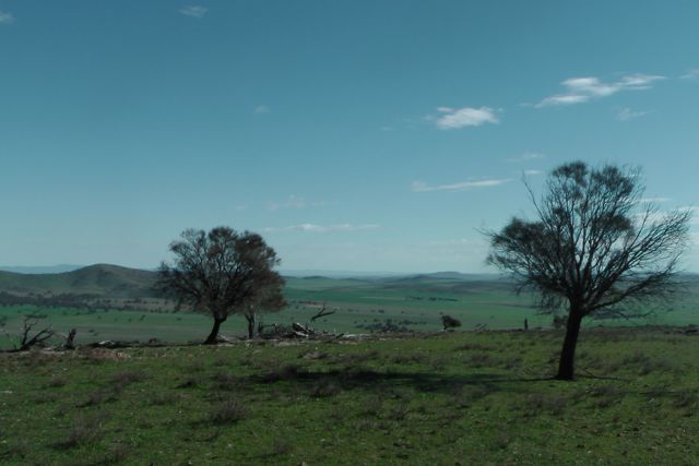
There are no trees on the top of the summit, but I did find a nice fallen log which looked just right as a ‘shack’. I used the log to secure the 7 m squid pole, and stretched out the 40m/20m linked dipole. My transceiver was a Yaesu FT-817nd on the 5 watt output setting. Ian found a nearby dead tree which he used to secure his squid pole, and his chair for the morning was a pile of moss rocks. Ian also used his home brew linked dipole and his Elecraft KX3 transceiver.
My first QSO of the morning was with David VK5KC who was operating from “The Shack” belong to the Adelaide Hills Amateur Radio Society (AHARS). I then worked David as VK5BAR, the AHARS club call. My 3rd QSO was with old time mate Scott, VK7NWT with a good strong signal. And my 4th qualifying contact was with regular ‘Chaser’ Nev, VK5WG with his normal 5/9 +++ signal. This was followed by the regular pile up of SOTA chasers.
This was a fun activation. I spoke with Andrew VK2ONZ, who was operating QRP. Andrew is a regular and keen QRP operator. He was my 8th contact on top of the hill, so following working Andrew I called for more QRP stations, and what was to follow, was a constant stream of QRP ‘Chasers’ which was really pleasing to hear. And they all had terrific signals on top of Olladie Hills.
One other interesting contact was with John, VK5AJQ, who was using the call sign of VK5BP. He was operating from ‘Woodhouse’ scout camp in the Adelaide Hills.
I worked a total of 30 stations in 30 minutes on 40m SSB in VK1, VK2, VK3, & VK5.
The following stations were worked:- David VK5KC; David VK5BAR; Scott VK7NWT; Nev VK5WG; Andy VK5LA; Tony VK3CAT/m; Ed VK2JI; Andrew VK2ONZ/qrp; Col VK5HCF/qrp; Terry VK5ATN/qrp; Glen VK3YY/qrp; Peter VK3PF/qrp; Fred VK3JM/qrp; VK3OHM/qrp; Ernie VK3DET/qrp; Phil VK3BHR/qrp; Wayne VK3WAM/p (SOTA); Brian VK5FMID/qrp; John VK5BP; John VK5AJQ; Larry VK5LY; Andrew VK2UH; Steve VK3MEG; Ian VK3TCX; Rik VK3KAN; Matt VK1MA; Mark VK1MDC; VK3DEE/m; & Rob VK2FROB.
A good fun activation, but not without its associated issues. The signal reports on my last 5 contacts dropped dramatically. Upon checking the antenna, I found that the connection point from the coax to the BNC plug was faulty. The coax is RG174, so it is very lightweight and thin. I think the stress placed on the preterminated point at various windy SOTA activations, has finally taken its toll. Something to look at before my next set of activations.
I have posted a video of the activation on You Tube.
After arriving in Orroroo and booking into the Orroroo pub, I enjoyed a few Bundy & cokes, and a beautiful kangaroo schnitzel. This pub is a terrific little country hotel that was built in 1877. Warren & Liz Campbell are the licensees and they took on the operation of the hotel just 18 months ago. They opened up the accommodation at the hotel, which had not been in operation for about 25-30 years.
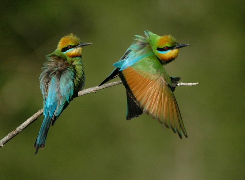
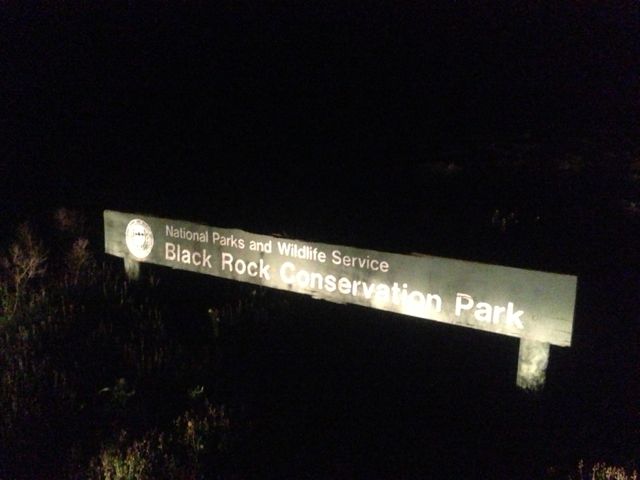
After dinner, I decided to drive 25 kms east out of town to the Black Rock Conservation Park. Access to the park is via the Paratoo Road. The park is 170 hectares in size and has excellent examples of the flora of the area, and is dominated by the Black Oak and Bluebush. The park has several creek beds with steep banks which are perfect nesting places for Red-back Kingfishers and Rainbow Bee Eaters. Unfortunately I didn’t get to see those because it was dark when I arrived. But below is a picture of what a Rainbow Bee Eater looks like. They are a spectacular bird.
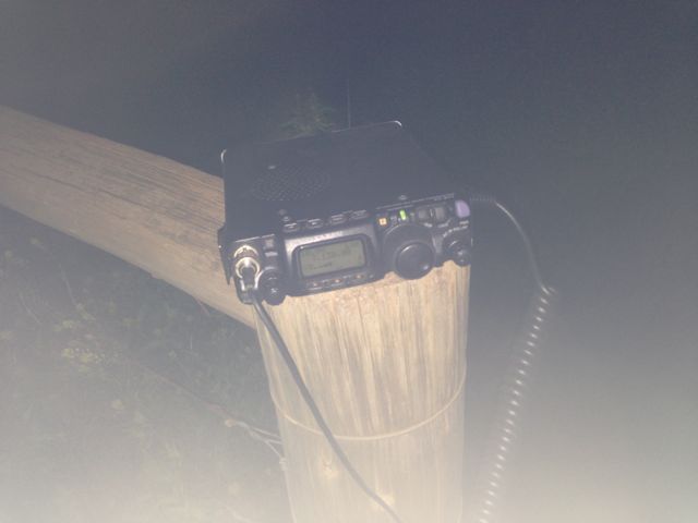
I found an access gate at the south eastern end of the park, which unfortunately was locked. So I put on my headlamp and walked into the park with my gear and my deckchair. I used a permapine log fencepost to prop the radio on and set up my 40m/20m dipole on the 7m squid pole.
I tuned across 40m and could not hear any VK’s at all. I could hear quite a lot of North American DX but knew that with my meager 5 watts and dipole, I would be pushing the proverbial uphill. So I booked in to the 7.130 DX Net. Unfortunately conditions were not great, but I did work Roy VK7ROY; Andy VK4TH in Kingaroy; John VK2FALL; Ian VK2IW who was qrp; and John ZL2BH.
The contact with Ian VK2IN was particularly rewarding though. Ian was using just 6 watts and a vertical whip in the lounge room of his house. He was a good 5/4 signal and I received a 5/7 signal report back from Ian.
I also would like to thank John ZL2BH for his persistance. John and I tried about 6 times during the net to get through to each other, but to no avail until the very end. John was an excellent 5/8 signal and my signal when he first heard me was also strong. But by the time we got to call each other the band conditions had changed and we could not make it. But on our 7th attempt my signal had come back up out of the noise and we managed a good quick QSO, with 5/8 exchanged both ways.
I could hear all of the DX on the net, including William FO5JV in French Polynesia, Bill W1OW in Massachusetts, Juan YV1FPT, and ZL’s.
But sadly, as is the case almost every night on this DX Net, the Indonesians were causing massive QRM. They were playing music, laughing, and burping. There is no doubt that they can hear stations on the DX Net, but they simply do not seem to care which is a real shame. Something really needs to be done to fix this ongoing problem.
At the end of the net, I headed back to Orroroo and enjoyed the rest of the evening watching the AFL and the cricket on TV before getting a good night’s sleep for the next day’s 2 SOTA activations.
Next time I come to this park, will be the day time, so that I can explore the park a bit.
Amateur Radio, Short Wave Listening, travel and history
Amateur radio experiences with VK1DA
Brisbane - Australia
german amateur radio station
Summits On The Air
SOTA on the peaks, wilderness QRP and some bushwalking
A fine WordPress.com site
Amateur Radio Adventures
Summits on the Ai
Radio craft, homebrew, QRP/SOTA, AM
Ego loqui ad viros super montes
My adventures with Amateur Radio and Geocaching!
The rantings of VK2GAZ on his SOTA experiences in Australia
A survivor, with minor cuts and abrasions.
The Art and Craft of Blogging
The latest news on WordPress.com and the WordPress community.
Blog of Justin Giles-Clark VK7TW's SOTA and amateur radio adventures.
Occasional SOTA & Microwave operation
Some accounts of SOTA and other radio outings
