Swan Bay-Edwards Point Wildlife Reserve VKFF-2444

After leaving Salt Lagoon St Leonards Wildlife Reserve (1st March 2023), Marija and I headed to our next park, the Swan Bay-Edwards Point Wildlife Reserve VKFF-2444.

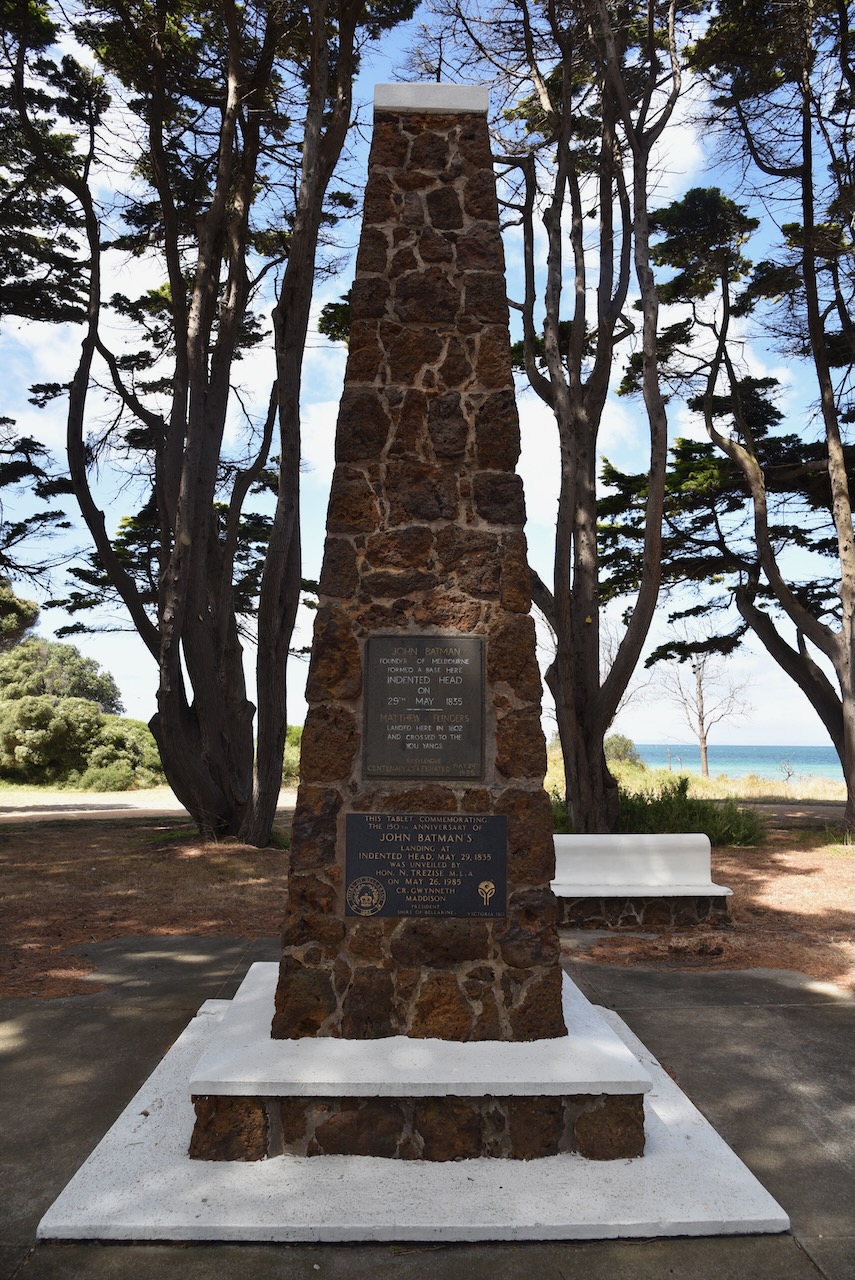
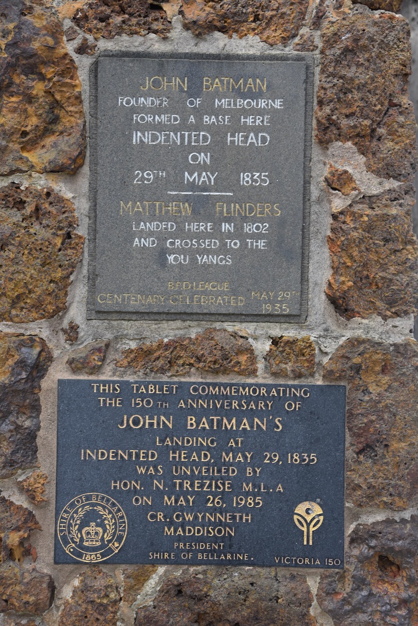
We drove south along The Esplanade and stopped briefly at the William Buckley Memorial and John Batman encampment site. In my previous post about Salt Lagoon St Leonards WR, I spoke about Buckley and Batman.

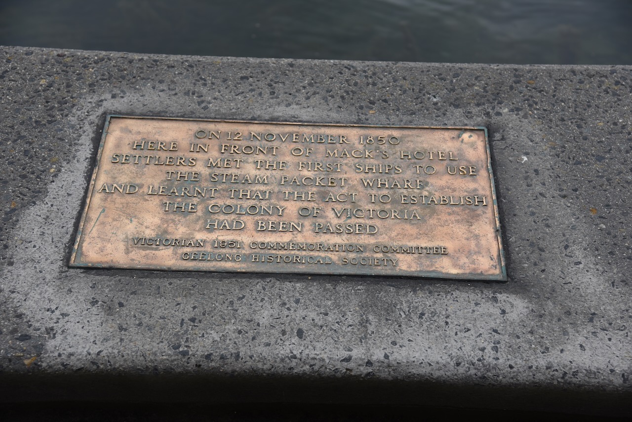
The Buckley monument reads:

“Near this site William Buckley returned to European society after having lived for 32 years with the Wathaurong people. He and about 70 members of the Bengalat Clan of the Wathaurong tribe, whose land this was, spent several months in 1835 with John Batman’s men, before the latter moved their settlement to Melbourne. Buckley was a pioneer in cultural understanding. This place of contemplation is dedicated to his memory.”

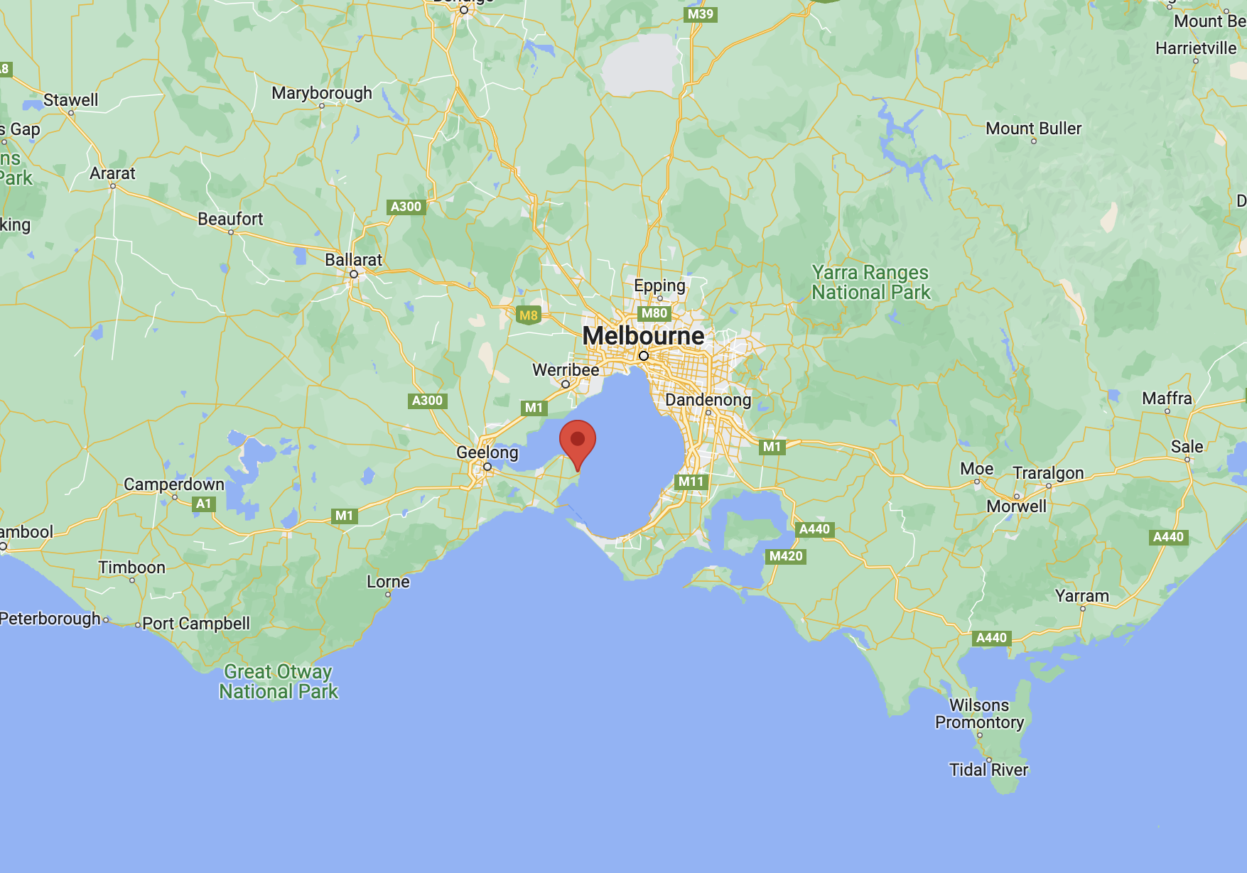
The Swan Bay-Edwards Point Wildlife Reserve is 281 hectares in size and was established on the 20th day of March 1979. It is located on the Bellarine Peninsula, east of Geelong.

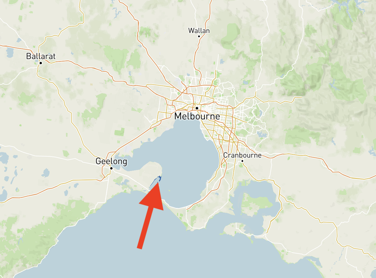
Above:- Map showing the location of the Swan Bay-Edwards Point WR. Map c/o Protected Planet.

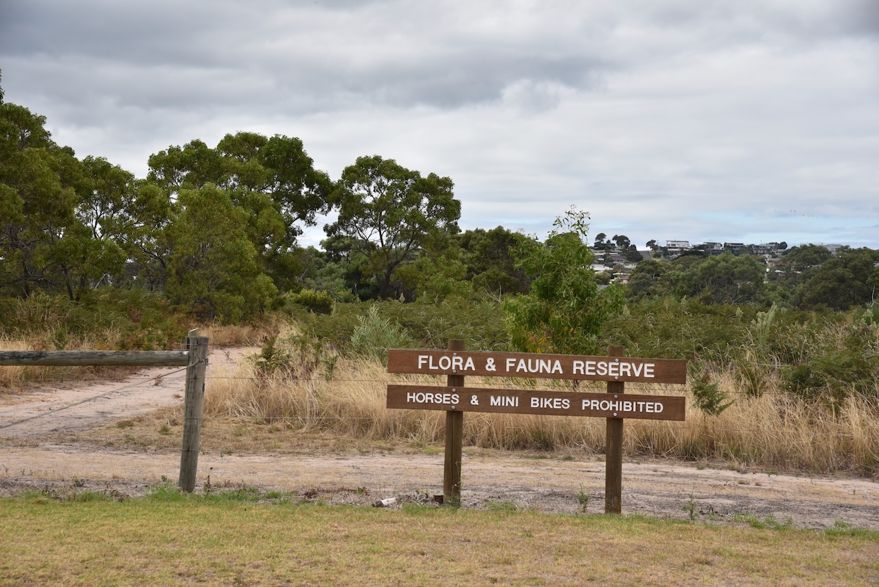
The park is located south of Bluff Road at Leonards, and to the east of Queenscliffe Road. The park follows the coast south to Knights Road. The park appears on maps as Swan Bay-Edwards Point Wildlife Reserve, while the park sign just read Edwards Point Wildlife Reserve.

Above:- Map showing the Swan Bay-Edwards Point WR. Map c/o Protected Planet.

The park was previously known as the Edward Point State Faunal Reserve which was established in March 1971.

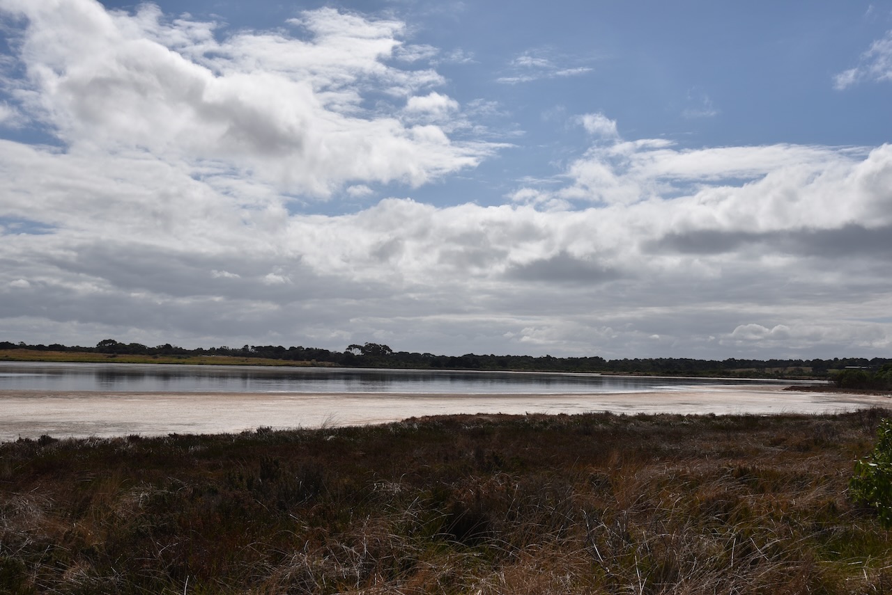
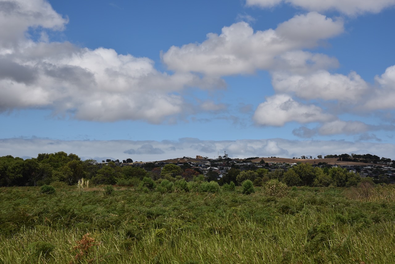
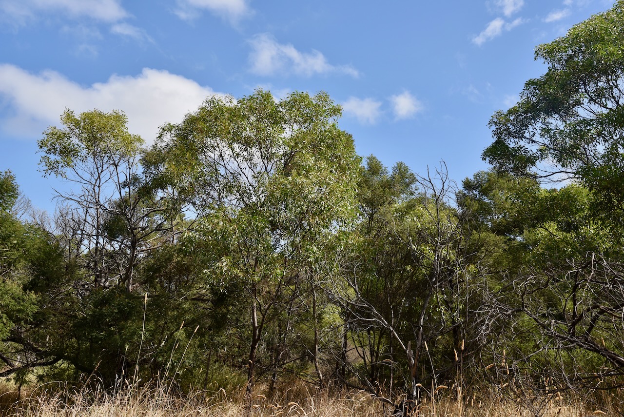
The park protects the last remaining stand of coastal woodland on the Bellarine Peninsula. The park contains a magnificent coastline with remote beaches, cool coastal woodlands, and extensive salt marshes. The park is home to numerous native plants and animals.

The park is part of the Swan Bay and Port Phillip Bay Islands Important Bird Area, which has been identified by BirdLife International. The critically endangered orange-bellied parrot can be found in the park. It also supports over 1% of the Australian population of four wader species: Grey Plover, Pacific Golden Plover, Double-banded Plover, and Eastern Curlew.

Below is a great video showing the park.

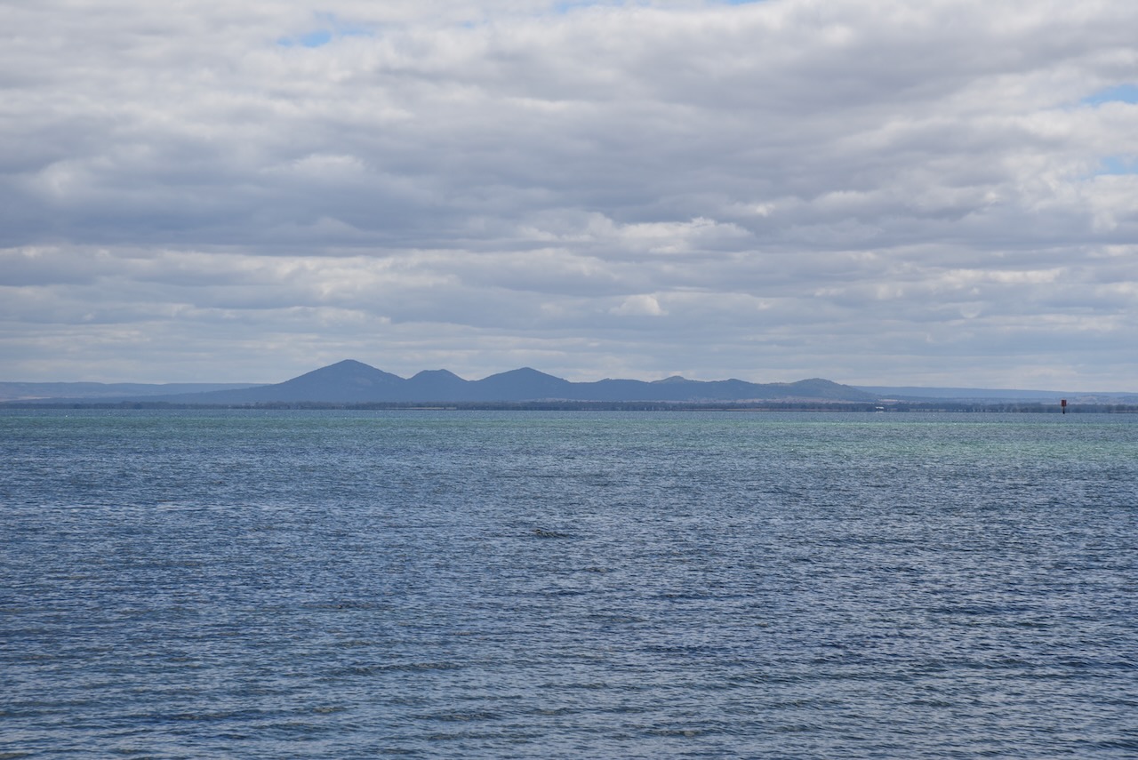
The park is adjacent to Swan Bay, a shallow 30 km2 marine embayment at the eastern end of the Bellarine Peninsula. The bay is partly separated from the much larger Port Phillip Bay, by Swan Island, Duck Island, and Edwards Point. Explorer Captain Matthew Flinders named the bay ‘Swan Ponds’ due to the abundance of black swans in the area. Up to 2,700 black swans can be found here during summer and early autumn.

Above:- Captain Matthew Flinders. Image c/o Wikipedia.

The park includes Edwards Point, which is a 4km long sand spit that extends to the south between Swan Bay and Port Phillip Bay. With Duck Island and Swan Island, it forms the part-barrier which separates Swan Bay from Port Phillip.

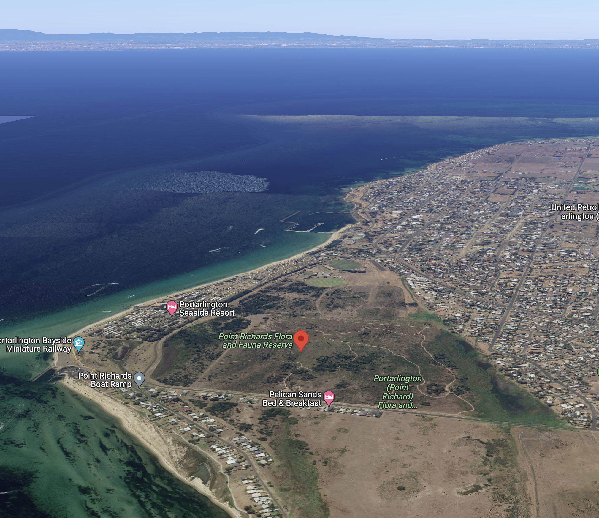
Marija and I set up in the Bluff Road carpark.

Above:- An aerial shot showing our operating spot. Image c/o Google Earth.

Marija worked the following stations on 40m SSB:-

  1. VK3SQ
  2. VK3PWG/p
  3. VK2VH
  4. VK4AAC
  5. VK7QP
  6. VK2EXA
  7. VK3PF
  8. VK5HS
  9. VK3UAO
  10. VK2XSE/p (Fivebough and Tuckerbil Swamps VKFF-3266)
  11. VK3ZPF

I worked the following stations on 40m SSB:-

  1. VK3SQ
  2. VK3PWG/p
  3. VK2VH
  4. VK4AAC
  5. VK7QP
  6. VK2EXA
  7. VK3PF
  8. VK5HS
  9. VK3UAO
  10. VK2XSE/p (Fivebough and Tuckerbil Swamps VKFF-3266)
  11. VK3ZPF
  12. VK3ZSC
  13. VK3CEO
  14. VK1DI
  15. VK4FW
  16. VK8MM
  17. VK3MCK
  18. VK3BBB
  19. VK2CCP
  20. VK5FB
  21. VK5FANA
  22. VK5HAA

I worked the following stations on 20m SSB:-

  1. VK4TJ
  2. VK4SMA
  3. VK4HAT
  4. VK4NH
  5. VK4DXA
  6. VK2LEE
  7. VK2IO
  8. VK5NIG
  9. VK4FW
  10. VK8MM

I worked the following stations on 15m SSB:-

  1. VK4HAT
  2. VK4FFAB
  3. VK4NH
  4. VK4DXA
  5. VK4SMA
  6. VK4TJ
  7. VK2IO
  8. VK1AO
  9. VK2MET
  10. VK4FW
  11. VK8MM

I worked the following stations on 80m SSB:-

  1. VK3ANL
  2. VK3PF

References.

  1. CAPAD 2020.
  2. Parks Victoria, 2023, <https://www.parks.vic.gov.au/places-to-see/sites/edwards-point-two-bays-lookout->, viewed 19th April 2023.
  3. Wikipedia, 2023, <https://en.wikipedia.org/wiki/Swan_Bay>, viewed 19th April 2023.
  4. Wikipedia, 2023, <https://en.wikipedia.org/wiki/Edwards_Point_(Victoria)>, viewed 19th April 2023.

W7KZU Aeronautical mobile

About a week ago, on 30th March 2023, I was on the Southern Cross DX Net on 14.238 mHz on the 20m band, when I worked Troy W7KZU aeronautical mobile.

Troy was flying a Southwest Boeing 737.

I jumped onto the flightradar24 website and was able to track Troy’s flight as he was flying over Arkansas and Oklahoma at 34,000 feet.

Troy was flying from Nashville to Las Vegas.

Troy was an excellent 58 signal and he reciprocated with a 59 signal report for me.

Salt Lagoon St Leonards Wildlife Reserve VKFF-2432

Our next intended park activation was the Salt Lagoon St Leonards Wildlife Reserve VKFF-2432, also located on the Bellarine Peninsula.

Above:- Map showing the location of Salt Lagoon St Leonards Wildlife Reserve. Map c/o Google maps.

After leaving the Point Richards Flora and Fauna Reserve we drove down to the waterfront and enjoyed the views across Port Phillip Bay towards Werribee. The You Yangs were clearly visible across the water.

We drove along The Esplanade following the coastline and stopped at the Batman and Flinders monument at Indented Head.

The monument commemorates the landing of British navigator and cartographer Captain Matthew Flinders (b. 1774. d. 1814) in 1802, and John Batman in 1835. In 1802 Flinders climbed Arthurs Seat and observed the Bellarine Peninsula on the opposite side of the bay. He noted that the peninsula had an indented coastline and as a result, he named it Indented Head.

Above:- Captain Matthew Flinders. Image c/o Wikipedia.

Thirty-three years later, on the 29th day of May 1835, John Batman sailed his 23-ton schooner ‘Rebecca’ into Port Phillip Bay from Van Diemen’s Land. Upon hearing a native dog howling, Batman and his party anchored the Rebecca near Indented Head and let his own dogs off to play with the native dog. It is reported that Batman and his men then drove the native dog into the sea and shot it.

Batmand his men met with the local aboriginal people on a number of occasions, presenting them with gifts including blankets, handkerchiefs, sugar, apples and other goods. Batman and his men in turn received gits of woven baskets and spears. In June 1835, Batman met with elders and signed a land treaty with the local aboriginal people. For a total area of 600,000 acres, including present-day Melbourne, Batman paid 40 pairs of blankets, 42 tomahawks, 130 knives, 62 pairs of scissors, 40 looking glasses, 250 handkerchiefs, 18 shirts, 4 flannel jackets, 4 suits of clothes and 150 lb. of flour.

Above:- the Batman Aboriginal treaty. Image c/o Wikipedia.

William Buckley, aka “wild white man” (b. 1776. d. 1856) was an English bricklayer and served in the military until 1802 when he was convicted of theft, and transported to Australia. In December 1803 he escaped the settlement at Port Phillip Bay. He was presumed dead, but in fact, had commenced living with the local Wallarranga aboriginal people.

For a total of 32 years, Buckley lived with the local aboriginal people on the Bellarine Peninsula. In 1835 Buckley heard that a ship had arrived at Indented Head and that some of the aboriginal people intended to murder the English passengers and rob the ship. On the 6th day of July 1835, Buckley and a party of aboriginal people arrived at the camp site of John Batman and his men.

One of Batman’s men wrote in his journal:

“About 2 o’C. a White Man came walking up to the Native huts, a most surprising hight [sic], Clad the same as the Natives. He seemed highly pleased to see us. We brought him a piece of bread, which he eat very heartily, & told us immedeatily [sic] what it was. He also informs us that he has been above 20 years in the Country, during which time he has been with the Natives….He then told us his name was William Buckley….being so long with the natives he has nearly forgot the English language – but the native languages he can speak fluently.”

Buckley convinced the aboriginal people not to rob and attack the Englishmen. Buckley was subsequently pardoned by John Wedge, a surveyor, explorer, and politician through Lieutenant-Governor George Arthur.​

Above:- a painting by Frederick Woodhouse of the meeting between Buckley and Batman’s party. Image c/o Wikipedia.

The Salt Lagoon St Leonards Wildlife Reserve is located in the suburb of St Leonards on the Bellarine Peninsula. St Leonards was named after St Leonards Station, a pastoral run in the area, which in turn was named after St Leonards in Sussex, England. Prior to European occupation, the land was the home of the Wathaurong aboriginal people.

During the 1840s settlers of Chinese origin settled in the area due to its abundance of fish and seafood. By the 1850s many of them had moved to the Victorian goldfields. Following the gold rush area, settlers returned to the area and commenced growing wheat.

In 1855, George Ward Cole (b. 1793. d. 1879) settled in the area and St Leonards became a source of firewood for Melbourne. Cole built a pier, and by 1858 the town had a hotel, store and six houses. On the 19th day of March 1860, the St Leonards Post office opened. The St Leonards State School No. 866 was opened in October 1874.

Above:- George Ward Cole. Image c/o Wikipedia.

The park’s eastern boundary is The Esplanade, while its western boundary is Ibbotson Street.

Above:- An aerial view of the park, looking north towards Werribee. Image c/o Google maps.

The park is a former marine embayment, isolated by coastal deposition from Port Phillip Bay, and now forms a shallow and hypersaline lake. The park is about 120 acres in size and was established on the 20th day of March 1979.

Marija worked the following stations on 40m SSB:-

  1. VK3SQ
  2. VK3PF
  3. VK3ZSC
  4. VK2EXA
  5. VK7QP
  6. VK3NBL
  7. VK3ZPF
  8. VK3UAO
  9. VK1AO
  10. VK2MET
  11. VK2VH
  12. VK4AAC

I worked the following stations on 40m SSB:-

  1. VK3SQ
  2. VK3PF
  3. VK3ZSC
  4. VK2EXA
  5. VK7QP
  6. VK3NBL
  7. VK3ZPF
  8. VK3UAO
  9. VK1AO
  10. VK2MET
  11. VK2VH
  12. VK4AAC
  13. VK7PAL
  14. VK5FB
  15. VK7HAM
  16. VK4TJ
  17. VK4FW
  18. VK8MM
  19. VK5FANA
  20. VK3MIJ
  21. VK7XX
  22. VK2PKT

I worked the following stations on 20m SSB:-

  1. VK4FW
  2. VK8MM
  3. VK5HS
  4. VK2IO
  5. VK4NH
  6. VK4DXA
  7. VK1AO
  8. VK2MET
  9. VK5PE/m
  10. VK3CEO
  11. VK4SMA
  12. VK4TJ
  13. VK7XX
  14. VK3ZSC

I worked the following stations on 15m SSB:-

  1. VK4SMA
  2. VK4TJ
  3. VK2IO
  4. VK2YAK
  5. VK4YAK
  6. VK4NH
  7. VK4DXA
  8. VK1AO
  9. VK2MET
  10. VK3ZSC
  11. VK3UAO
  12. VK7XX
  13. VK5HS
  14. VK4UTT

References.

  1. CAPAD 2020.
  2. Intown, 2023, <https://intown.com.au/>, viewed 7th April 2023.
  3. Monument Australia, 2023, <https://monumentaustralia.org.au/themes/landscape/exploration/display/33549-john-batman-and-matthew-flinders>, viewed 6th April 2023.
  4. Wikipedia, 2023, <https://en.wikipedia.org/wiki/St_Leonards_Salt_Lagoon>, viewed 6th April 2023.
  5. Wikipedia, 2023, <https://en.wikipedia.org/wiki/St_Leonards,_Victoria>, viewed 7th April 2023.
  6. Wikipedia, 2023, <https://en.wikipedia.org/wiki/Matthew_Flinders>, viewed 7th April 2023.

Point Richards (Port Arlington) Flora and Fauna Reserve VKFF-2423

It was now our first full day in Geelong (1st March 2023). After breakfast, we headed to the Geelong Botanical Gardens. In 1851 the Government set aside 200 acres at the edge of the Geelong settlement for the establishment of a Botanic Garden. Today the gardens are listed on the Victorian Heritage Register. It was a beautiful morning to stroll around the gardens.

We left the Botanical Gardens and drove along the Geelong waterfront, stopping to have a look at the Road Trauma Memorial ‘Solace’. The memorial aimed at giving people a place to reflect on the impact of road trauma and remember those who have lost their lives on Victoria’s roads.

We continued along the waterfront and parked our car and went for a walk along Western Beach Road and The Pier.

There is a monument on the waterfront to commemorate the establishment of the colony of Victoria. The plaque reads:-

“On 12 November 1850 here in front of Mack’s Hotel settlersmet the first ships to use the Steam Packet Wharf and learnt that the Act to establish the Colony of Victoria had been passed”.

We then paid a visit to the Geelong Carousel. This Armitage-Herschell portable steam driven, hand-carved wooden carousel was built on about 1892. It is one of only 200 in operation around the world. It features 36 Dare horses and 2 chariots, and was purchased by the Steampacket Place Development Board in 1996 and painstakingly restored.

It was late morning now, so we decided to get some brunch at the Wharf Shed and had a brilliant breakfast.

We then headed to our first park activation for the day, the Point Richards (Port Arlington Flora and Fauna Reserve VKFF-2423, located on the Bellarine Peninsula, southwest of Melbourne, surrounded by Port Phillip Bay, Corio Bay, and Bass Strait.

Above:- Map showing the location of the park, southwest of Melbourne. Map c/o Google maps.

Prior to European settlement, the Bellarine Peninsula was inhabited by the Wathaurong aboriginal people. Early European settlement of the area was focussed on wheat and grain production, while today the Bellarine Peninsula is a popular tourist destination. The Peninsula takes its name from the Wathaurong aboriginal word ‘Balla-wein’ which refers to ‘balla’ meaning ‘elbow’ or ‘reclining at the elbow’.

The park is located at Port Arlington, which was originally known as Drayton. It was subsequently changed to Portarlington in honour of Sir Henry Bennet, 1st Earl of Arlington. Other theories suggest the area was named after Portarlington in Ireland.

Above:- Henry Bennet, 1st Earl of Arlington. Image c/o Wikipedia.

The park is located on the eastern side of Point Richards Road and the southern side of Boat Road. It is referred to on maps as the Point Richards Flora and Fauna Reserve and the Portarlington Flora and Fauna Reserve.

Above:- An aerial shot of the park, looking east. Image c/o Google maps.

The Point Richard Flora & Fauna Reserve is 62 hectares in size and was established on the 20th day of March 1979. It was originally set aside for the conservation of the Southern Brown Bandicoot. It is one of the largest areas of native bushland and ephemeral wetlands on the Bellarine Peninsula.

The park consists of low, flat grasses and bracken-dominated open woodland, with a diverse shrub and ground layer which is rich in herbs, grasses and orchids. The ephemeral wetlands lie in a series of shallow east-west depressions. ‘Ephemeral’ means the wetlands fill with water in winter and drain in summer.

A total of 55 bird species have been recorded in the park including Smap Harrier, Brown quail and Chestnut Teals. The park attracts international migratory wading birds including Latham’s Snipe. The park is home to at least six species of frog, including the endangered Growling Grass Frog.

Below is a short video of the park.

We set up in the park off Boat Road. We ran the Yaesu FT857, 40 watts, and the 20/40/80m linked dipole.

Marija worked the following stations on 40m SSB:-

  1. VK3SQ
  2. VK3PF
  3. VK2EXA
  4. VK3BEL
  5. VK3ZPF
  6. VK2VH
  7. VK4AAC
  8. VK3UAO
  9. VK7QP
  10. VK5FB
  11. VK5HS

I worked the following stations on 40m SSB:-

  1. VK3SQ
  2. VK3PF
  3. VK2EXA
  4. VK3BEL
  5. VK3ZPF
  6. VK2VH
  7. VK4AAC
  8. VK3UAO
  9. VK7QP
  10. VK5FB
  11. VK5HS
  12. VK5KVA
  13. VK3GH
  14. VK5DJ
  15. VK3ANL
  16. VK3FRC
  17. VK3GB
  18. VK7AN
  19. VK3UH
  20. VK3MIJ
  21. VK3DL
  22. VK3SMW
  23. VK7MAD
  24. VK1AO
  25. VK2MET

I worked the following stations on 20m SSB:-

  1. VK1AO
  2. VK2MET
  3. VK2IO
  4. VK5HS
  5. VK4SMA
  6. VK2BYO
  7. VK4TJ
  8. VK4NH
  9. VK4DXA
  10. VK4FW
  11. VK8MM
  12. VK4HAT

I worked the following stations on 15m SSB:-

  1. VK4NH
  2. VK4DXA
  3. VK3UAO
  4. VK4TJ
  5. VK4FW
  6. VK8MM
  7. VK4HAT

References.

  1. CAPAD 2020.
  2. City of Greater Geelong, 2023, <https://www.geelongaustralia.com.au/gbg/default.aspx>, viewed 6th April 2023.
  3. Intown, 2023, <https://intown.com.au/locals/portarlington/history_portarlington.htm>, viewed 6th April 2023.
  4. Point Richards Flora & Fauna Reserve brochure
  5. Transport Accident Commission, 2023, <https://www.tac.vic.gov.au/about-the-tac/community/road-trauma-memorial>, viewed 6th APril 2023.
  6. Wikipedia, 2023, <https://en.wikipedia.org/wiki/Bellarine_Peninsula>, viewed 6th April 2023.