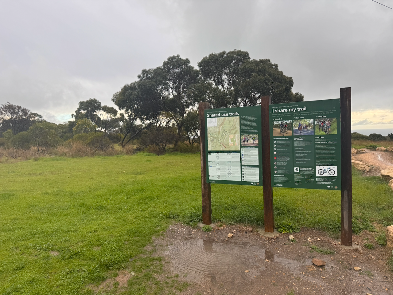
After leaving Glenthorne on Wednesday, the 1st day of July 2026, I headed to the Kauwi-marnirla – Field River Conservation Park VKFF-6415. This was to be another new park for me for the World Wide Flora Fauna (WWFF) program.

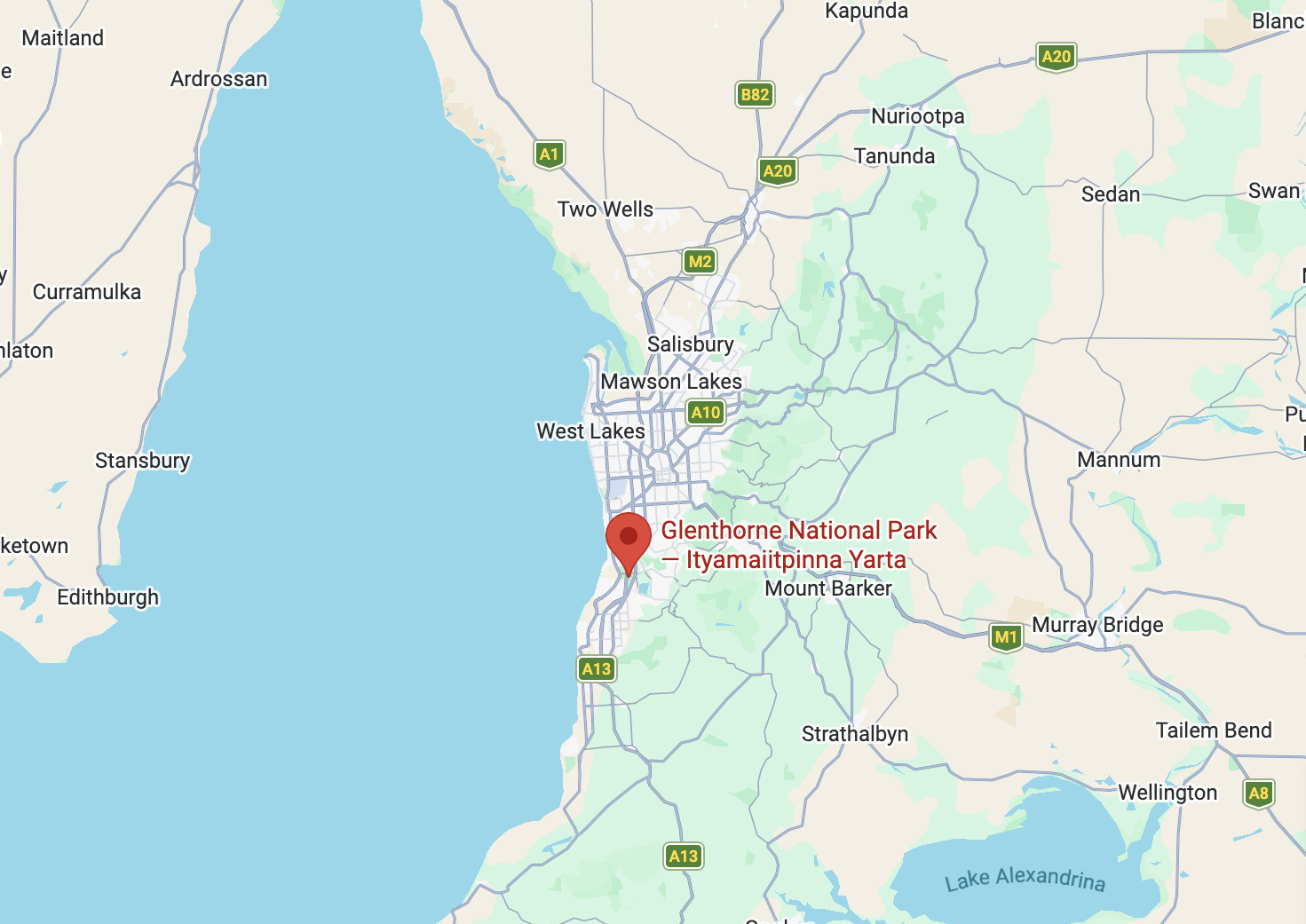
Above: Map showing the location of Field River CP. Map c/o Google Maps
The park is located in the southern suburbs of Adelaide, about 22 km south of the Adelaide CBD. (NPWS 2025)

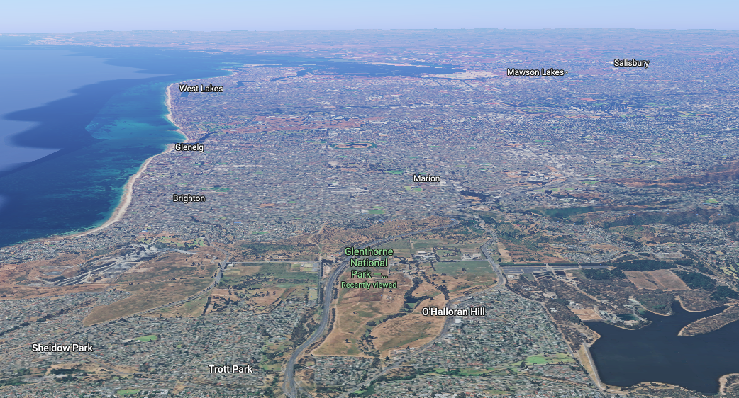
Above: an aerial view of the Field River CP. Image c/o Google Maps
Kauwi-marnirla — Field River Conservation Park is about 177 hectares in size and was established in 2025. (NPWS 2025)


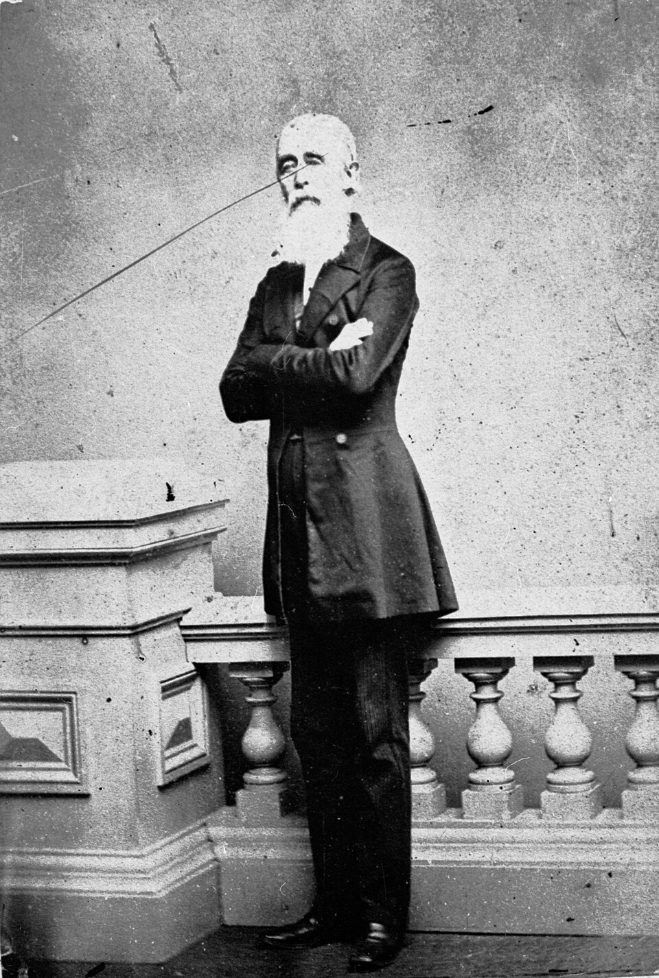
The Field River flows through the park and was named in honour of William George Field, a British naval officer, first mate of HMS Rapid and deputy to William Light, the designer/surveyor of the city of Adelaide. He was born in 1807 and arrived at Kangaroo Island in August 1836. He became the first European man to enter the Port River. Field is credited with introducing orange trees into South Australia. Field died on the 30th day of November 1850. He is buried at Saint Stephens Anglican Cemetery, Willunga, South Australia. (Findagrave 2025) (Nla 2026) (Wikipedia 2001)

Above: the headstone of Lt. William George Field. Image c/o findagrave.com
In 1980, members of the Royal Geographical Society of Australasia discovered Field’s headstone while researching his activities. The headstone was in a considerable state of disrepair. (Nla 2026) (Wikipedia 2001)

Above: Article from the Victor Harbour Times, Wed 21 Jan 1981. Image c/o Trove
The Aboriginal co-name of the park, Kauwi-marnirla, translates to ‘place of two good waters’. It is pronounced ‘Cowee-ma-rni-rla’. (NPWS 2025)
In 1992, the 70,000-year-old fossilised remains of a Diprotodon were discovered in the park. The Diprotodon was the world’s largest marsupial. (Wikipedia 2001)

Above: Diportodon. Image c/o Eleanor (Nellie) Pease Wikipedia
In the 1840s, copper was discovered on land owned by Alfred Hallett, and the Worthing Mine was established. The Field River was used to transport the mined copper ore to the sea. The mine closed in 1856 as a result of no further money being invested in its activities. The ruins of the mine can be seen in the park. (Wikipedia 2001)

Above: Alfred Hallett. Image c/o Old Adelaide & South Australia Album Facebook page
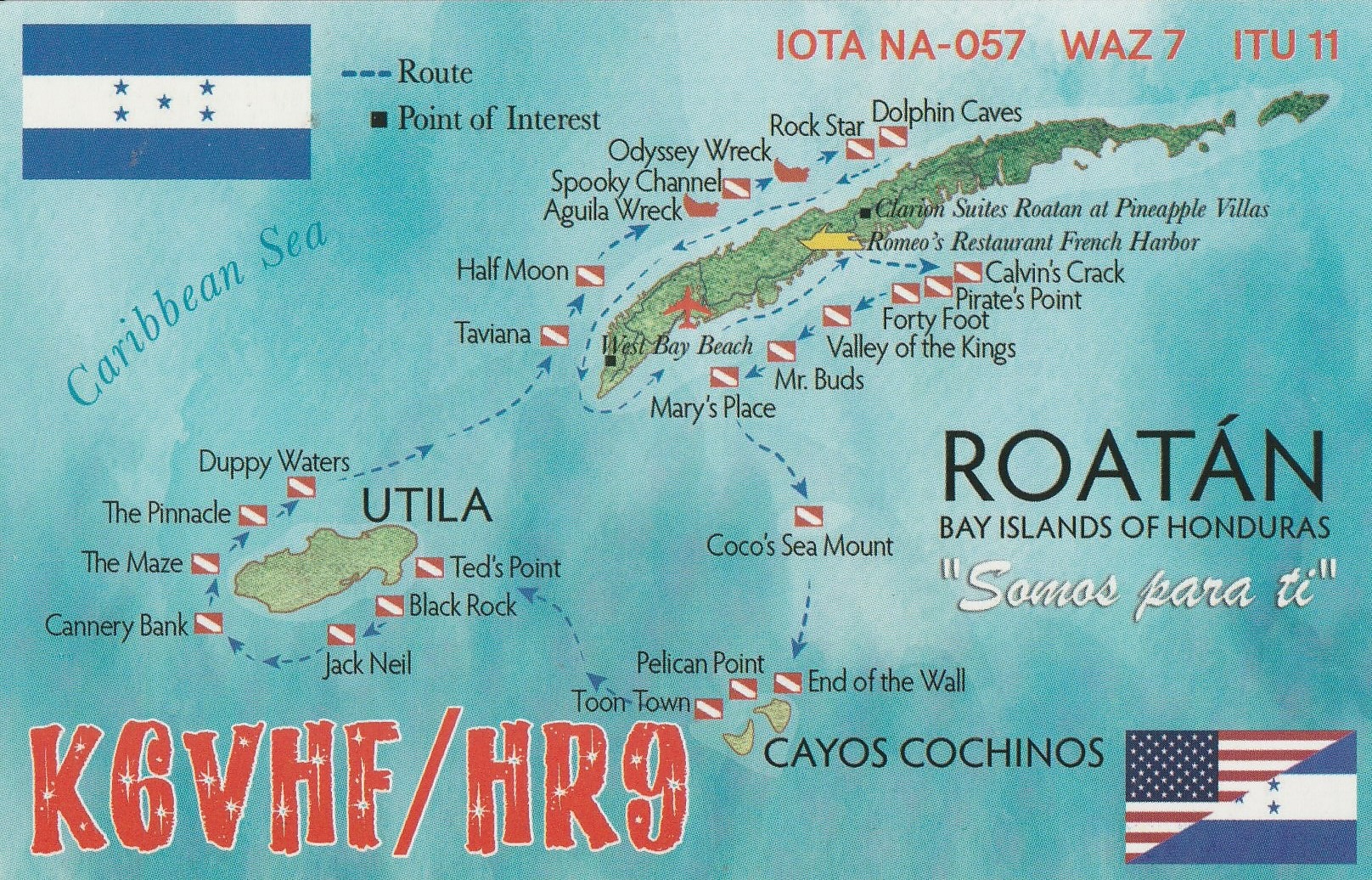
I worked the following stations on 40m SSB:-
- VK3UAO
- VK5MAZ
- VK3UH
- VK3AUX
- VK3PF
- VK3KAI
- VK3VBA
- VK3SQ
- VK3JT
- VK2BD
- VK2PKT
- VK2KFT
- VK5FL
- VK5CHD
- VK3DCQ
- VK2EXA
- VK2IO
- VK2GEZ
- VK2VW
- VK2HFI
- VK2AKA
- VK2BUG
- VK4FW
- VK3KRL
- VK3DL
- VK3CJN
- VK3QHU
- VK3FB/p
- VK3AKD
- VK7AN
I worked the following stations on 15m SSB:-
- VK4KTW
- VK4NH
- VK4DXA
- VK6AAX
- VK4FW
- VK5MAZ
I worked the following stations on 20m SSB:-
- VK6XL
- VK2IO
- VK2GEZ
- VK4KTW
- OH1MM
- VK2NP
- VK4NH
- VK4DXA
- VK5MAZ
References.
- Findagrave.com. (2025). Lt. William George Field (1807-1850) – Find a… [online] Available at: https://www.findagrave.com/memorial/61552409/william-george-field [Accessed 13 July 2026].
- National Parks and Wildlife Service South Australia. (2025). Kauwi-marnirla-Field River Conservation Park. [online] Available at: https://www.parks.sa.gov.au/parks/kauwi-marnirla-field-river-conservation-park [Accessed 13 July 2026].
- Nla.gov.au. (2026). Historic grave at Willunga [online] Available at: https://trove.nla.gov.au/newspaper/article/187380991 [Accessed 13 July 2026].
- Wikipedia (2001). Wikipedia. [online] Wikipedia. Available at: https://en.wikipedia.org [Accessed 13 July 2026].