Linga Bushland Reserve VKFF-4166 and Linga silo VK-LNA3

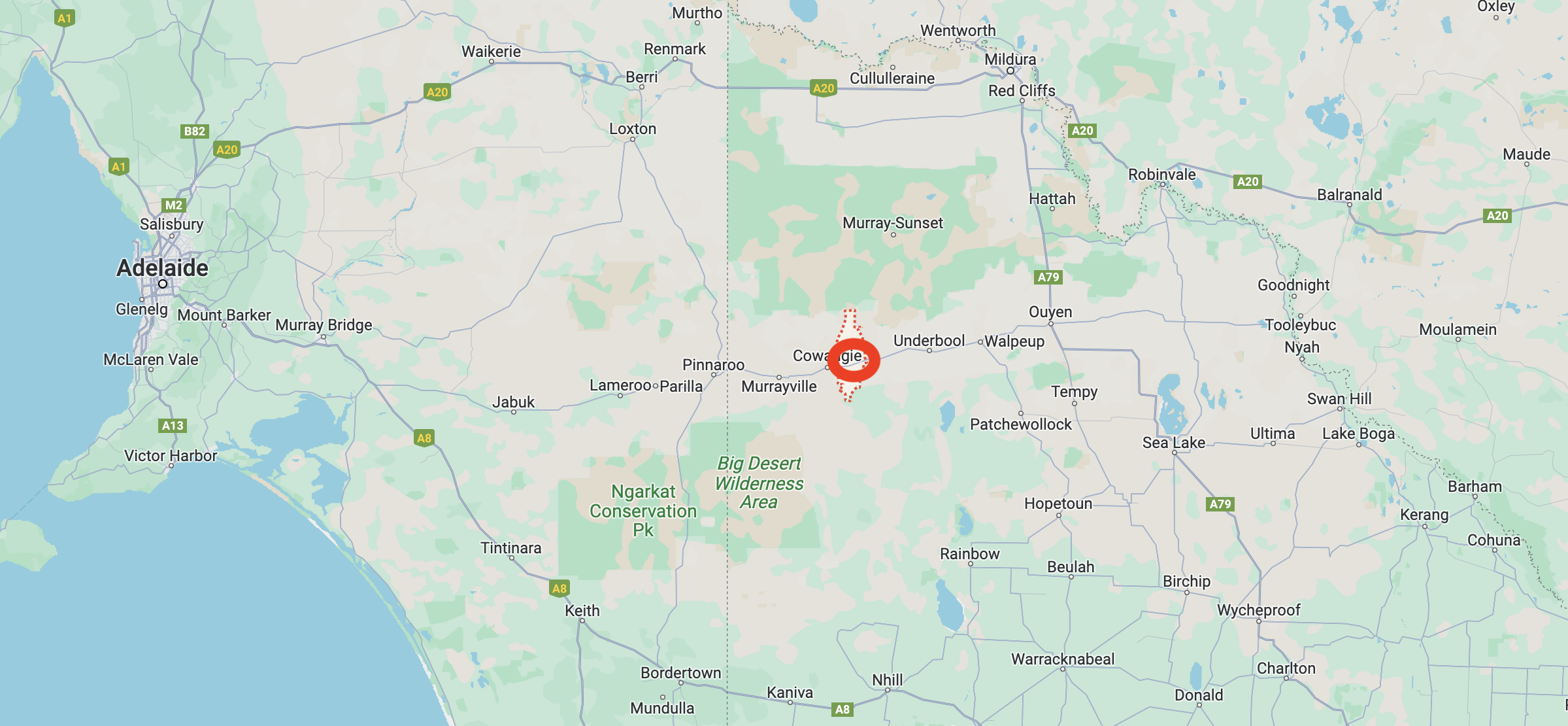
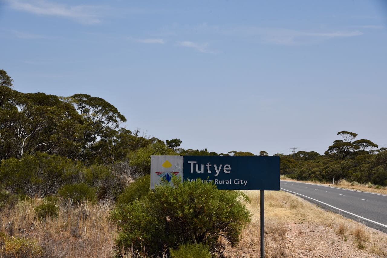
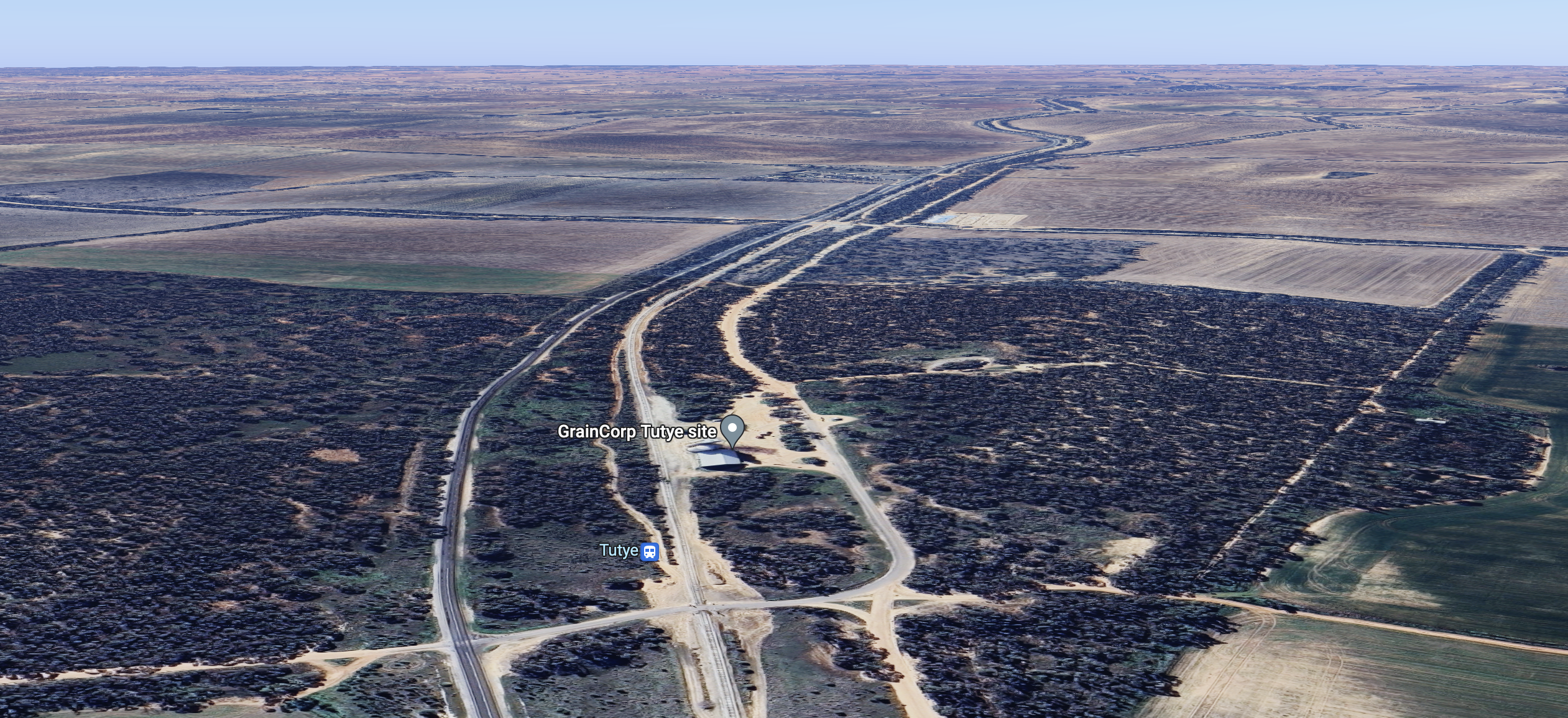
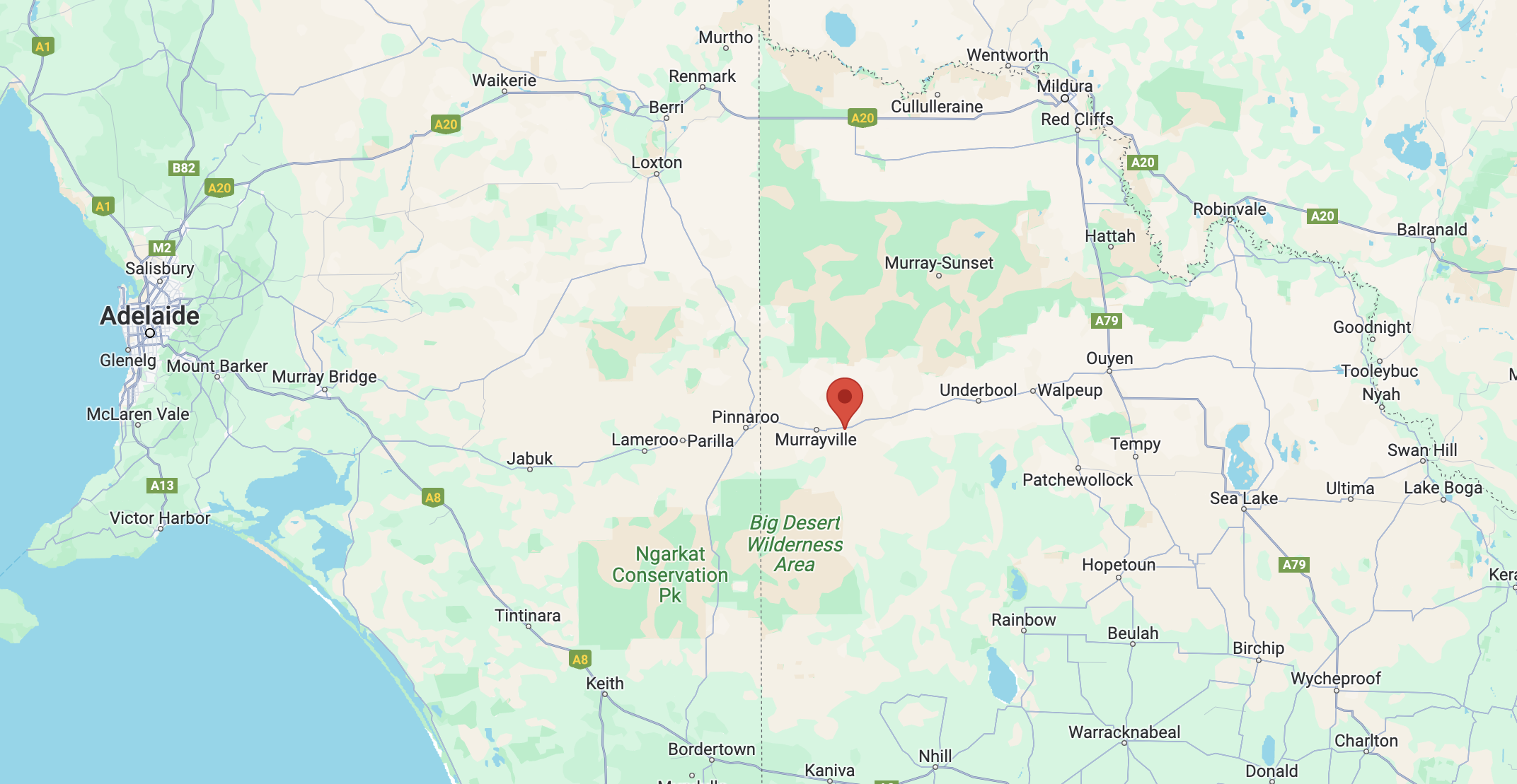
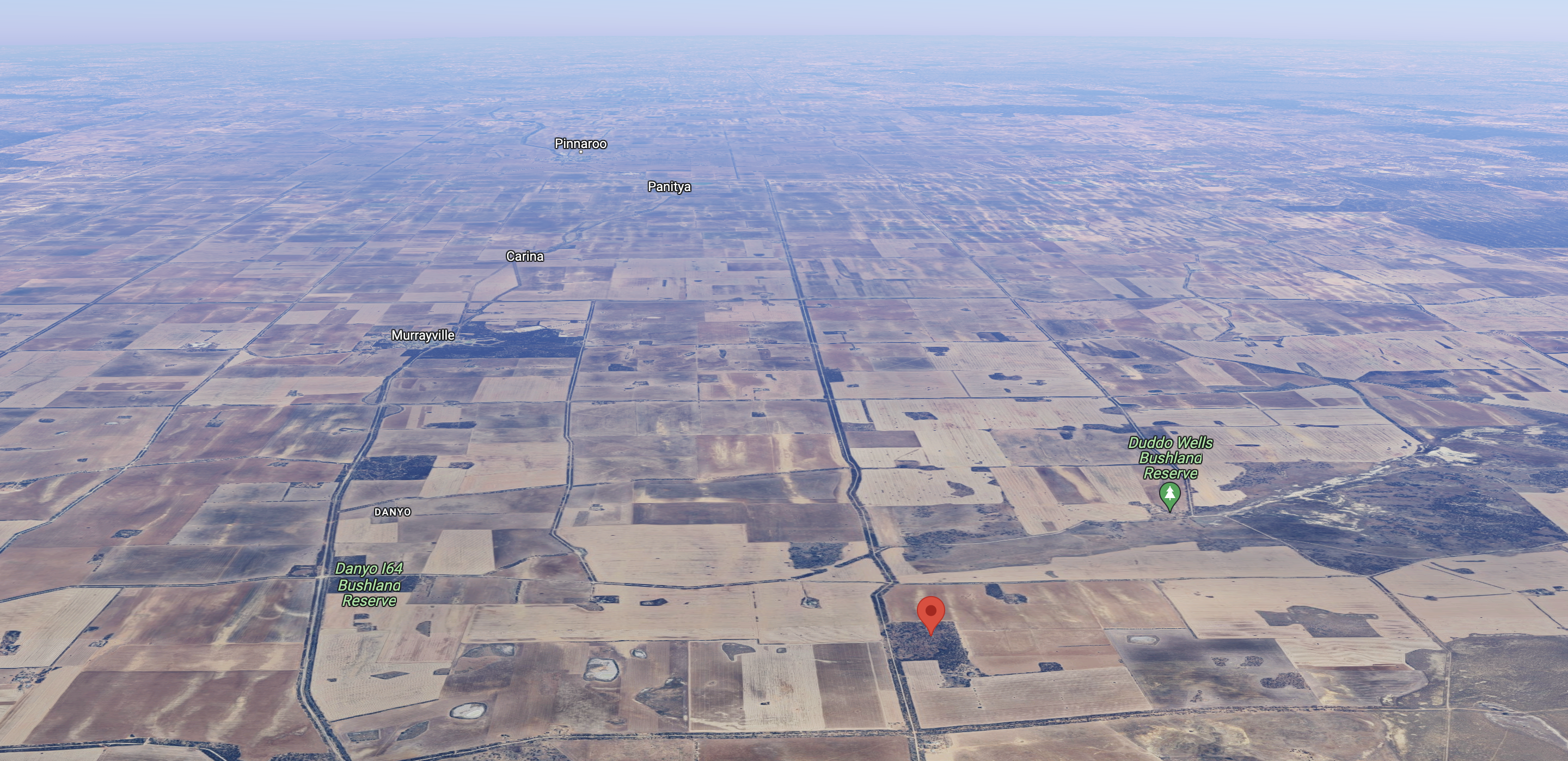
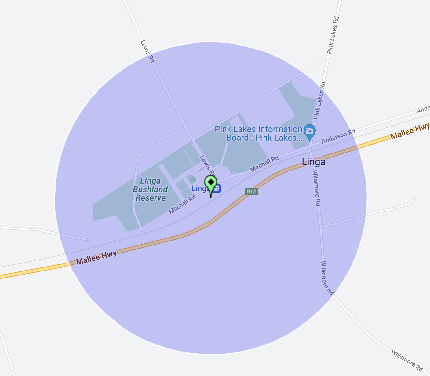
Our next activation for Friday 10th November 2023 was the Linga Bushland Reserve VKFF-4166 and the Linga silo VK-LNA3. Linga is about 60 km west of Ouyen in northwestern Victoria.

This was to be the first activation of this park for the World Wide Flora Fauna (WWFF) program.

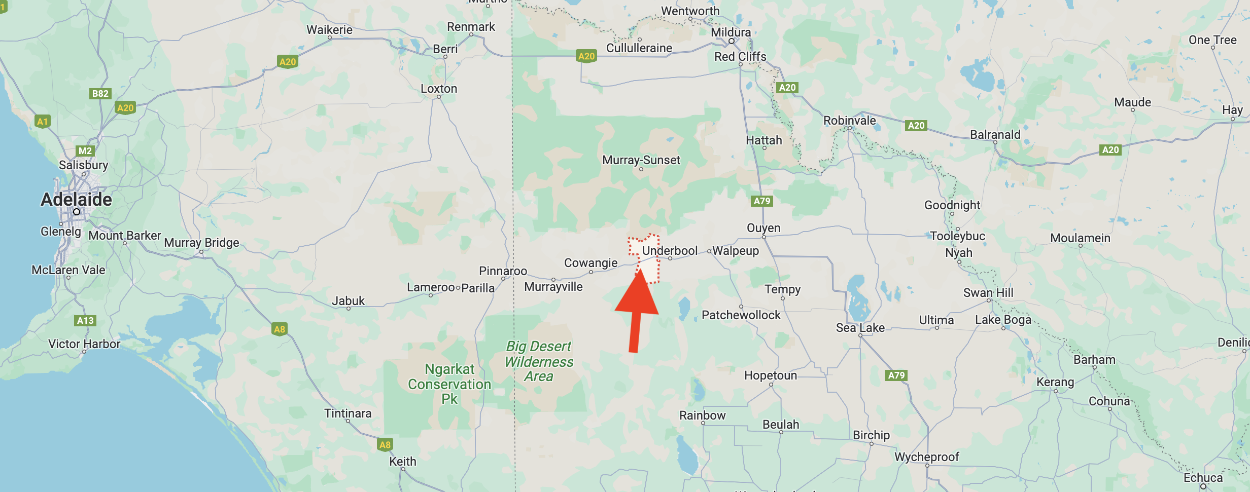
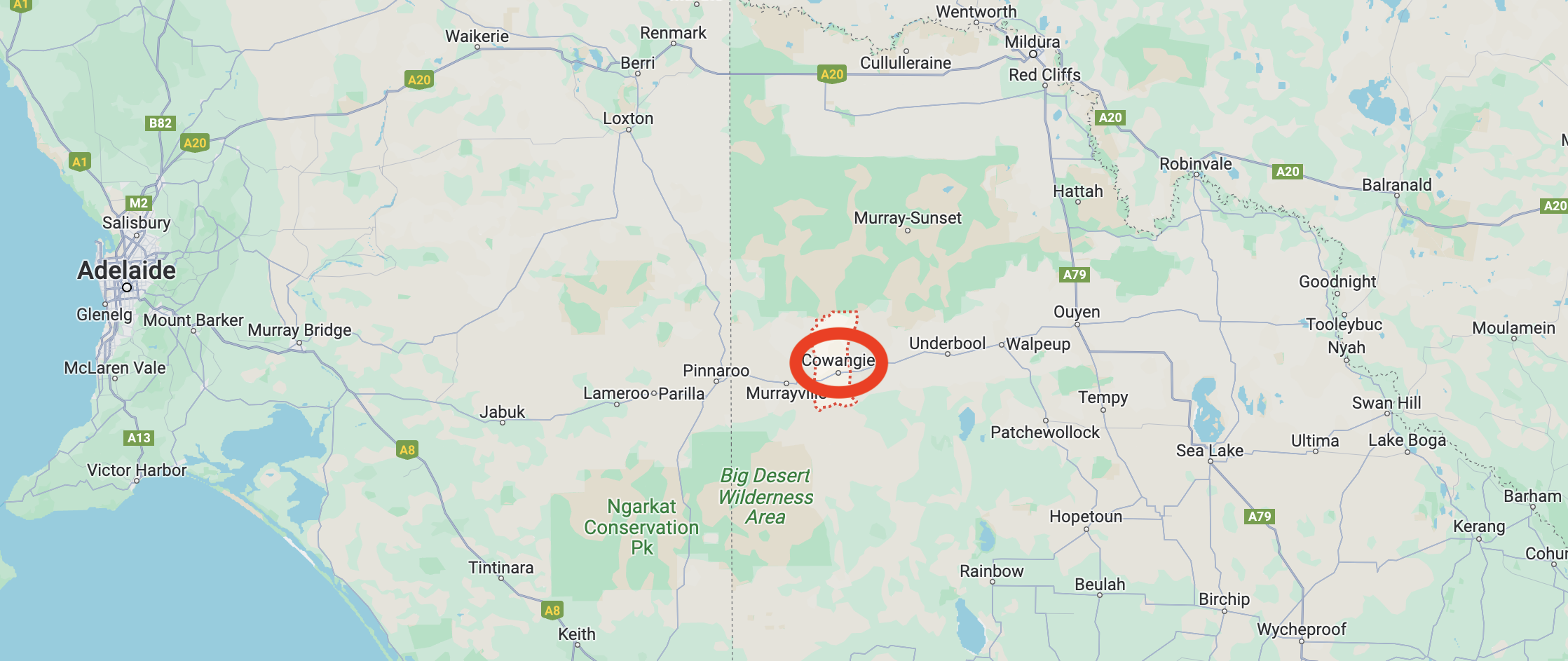
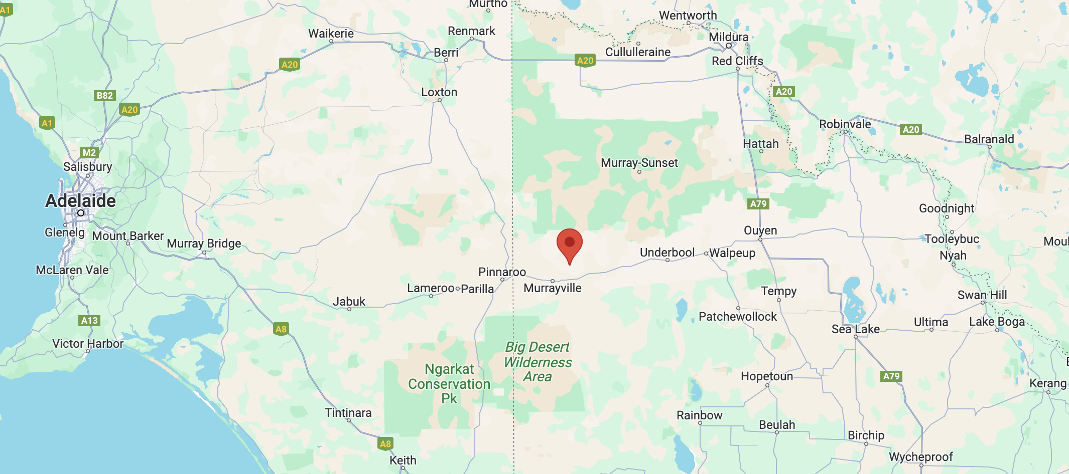
Above:- Map showing the location of Linga in northwest Victoria. Map c/o Google Maps.

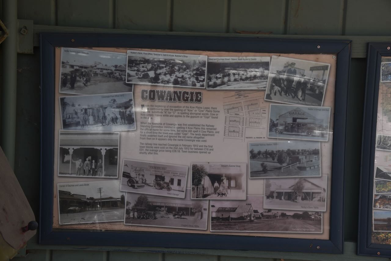
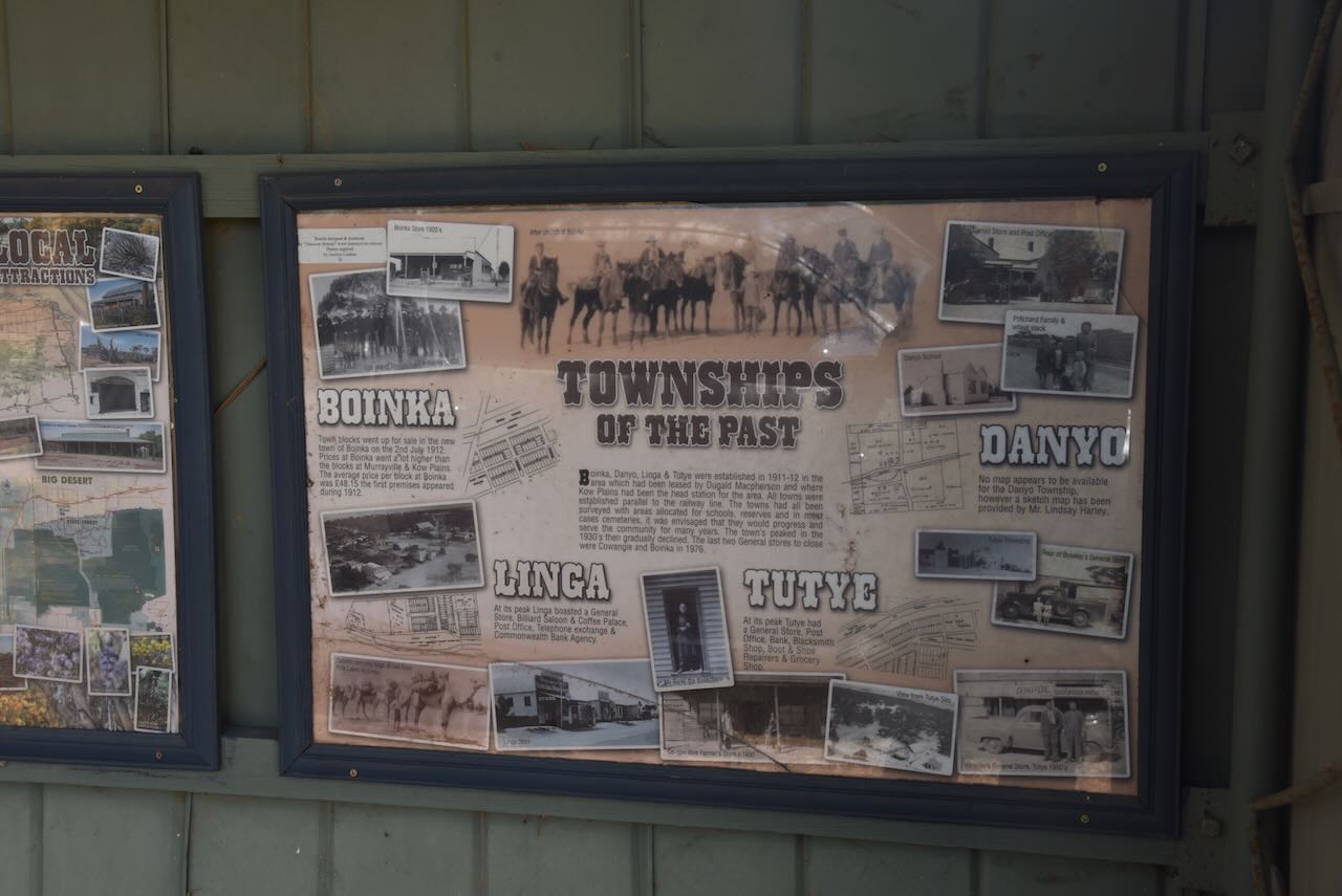
It is believed that Linga is a derivative of the traditional aboriginal word Lar-gni which means ‘camp’ or ‘home’.

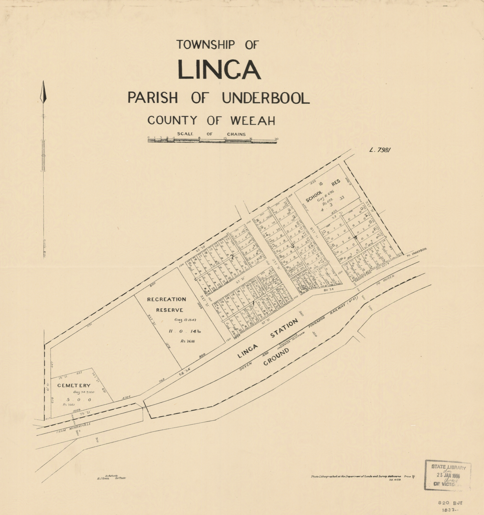
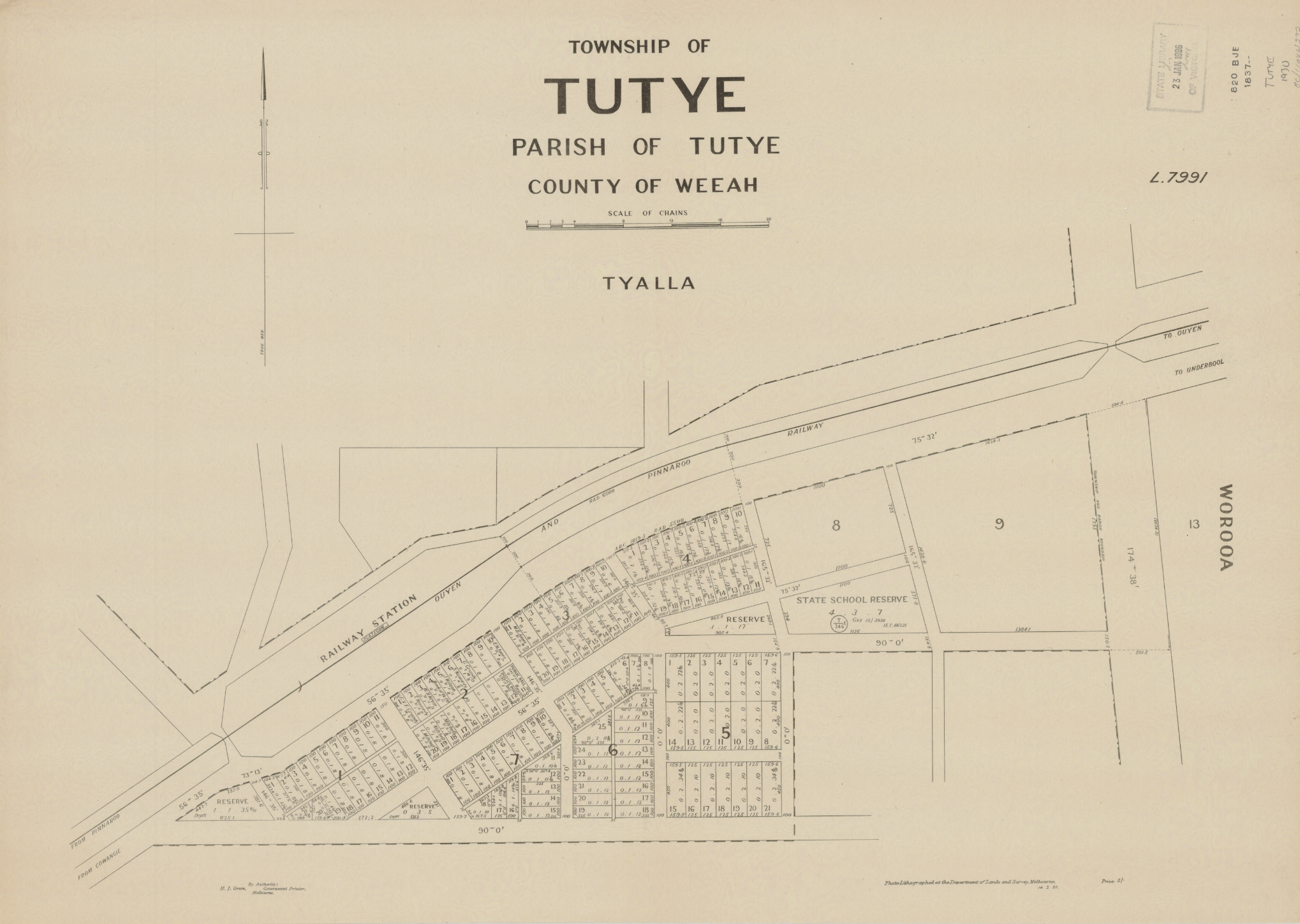
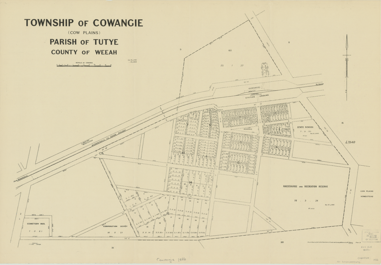
Above:- Plan of the township of Linga. Image c/o State Library Victoria.

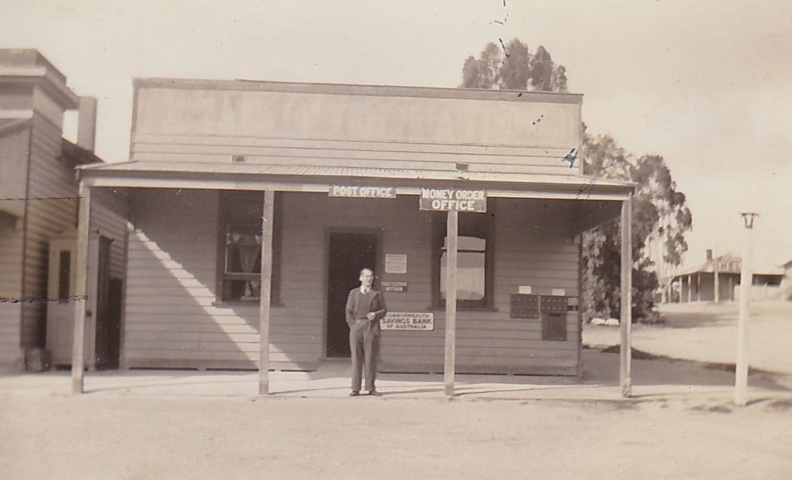
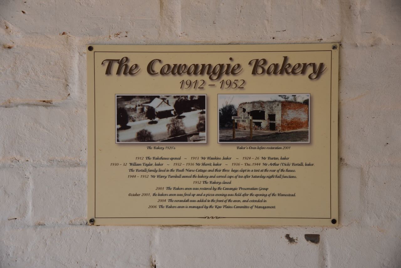
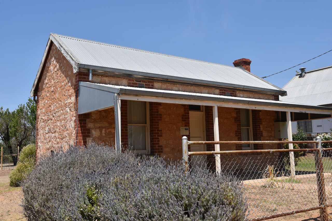
The Post Office opened on the 15th day of July 1912 following the opening of the railway from Ouyen to Murrayville. It was known as Manpy until 1913 and was closed in 1975. The Linga State School (No. 3798) opened on the 31st day of March 1913 in the local hall, with a permanent building erected in 1916. The school closed on the 17th day of December 1970. The Linga South State School (No. 4460) opened on the 30th day of January 1930 and closed in 1949. At its peak, Linga had a general store, billiard saloon and coffee palace, Post office telephone exchange and a Commonwealth Bank Agency.

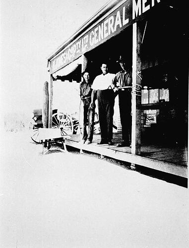
Above:- K. Jones Company Proprietary Limited General Merchant. Image c/o Museums Victoria

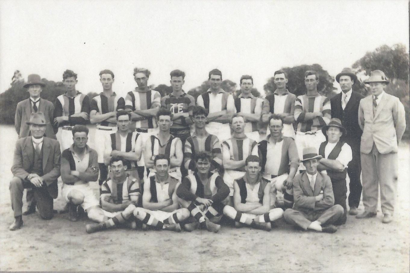
Linga once had a branch of the Victorian Farmers Union, a football club formed in 1913, a tennis club, a basketball club, and a branch of the Catholic Young Mens Society.

In an issue of the 1929 minutes of the Linga Football Club it was moved that ‘a bottle of sherry be procured for the players and officials at half-time.’

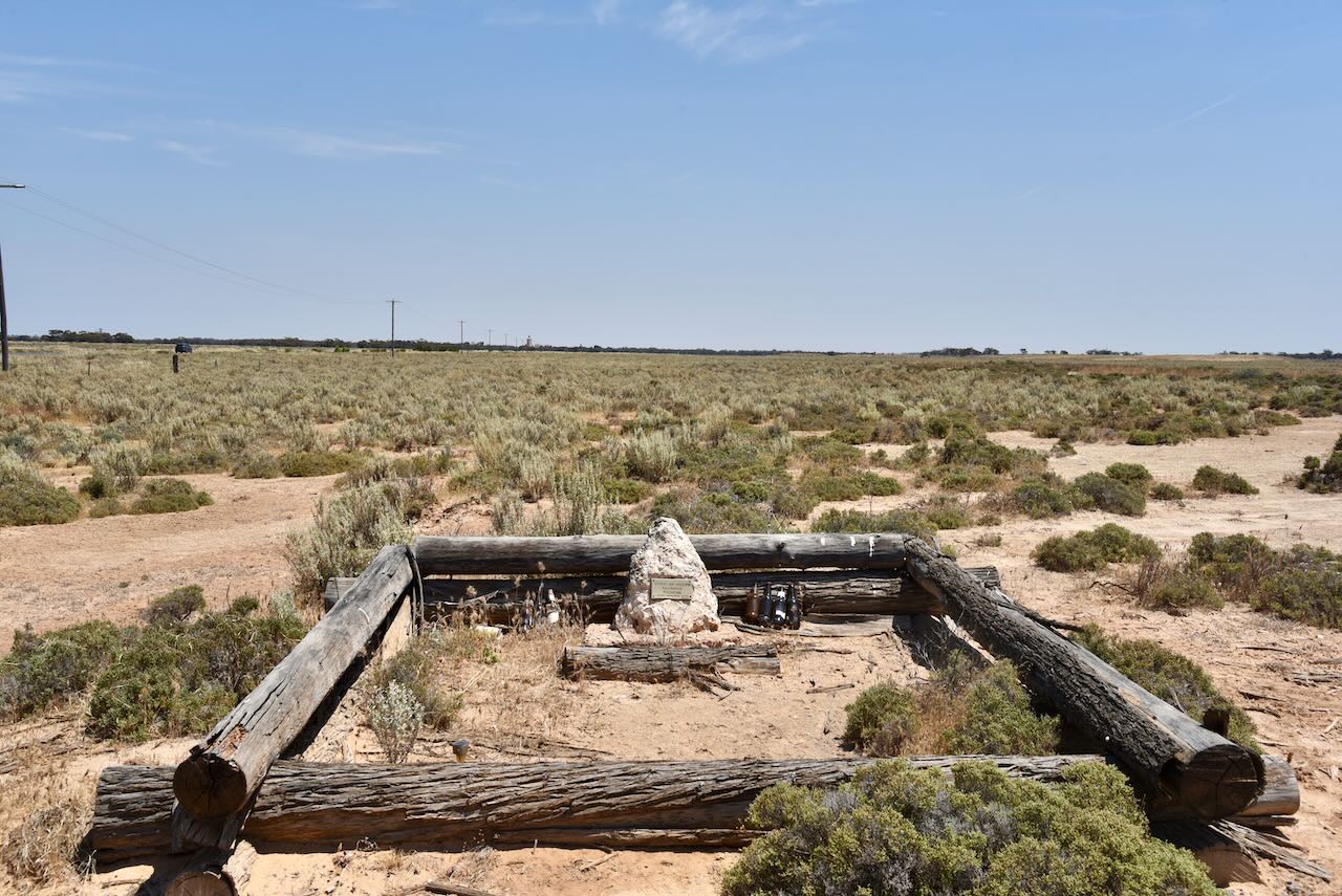
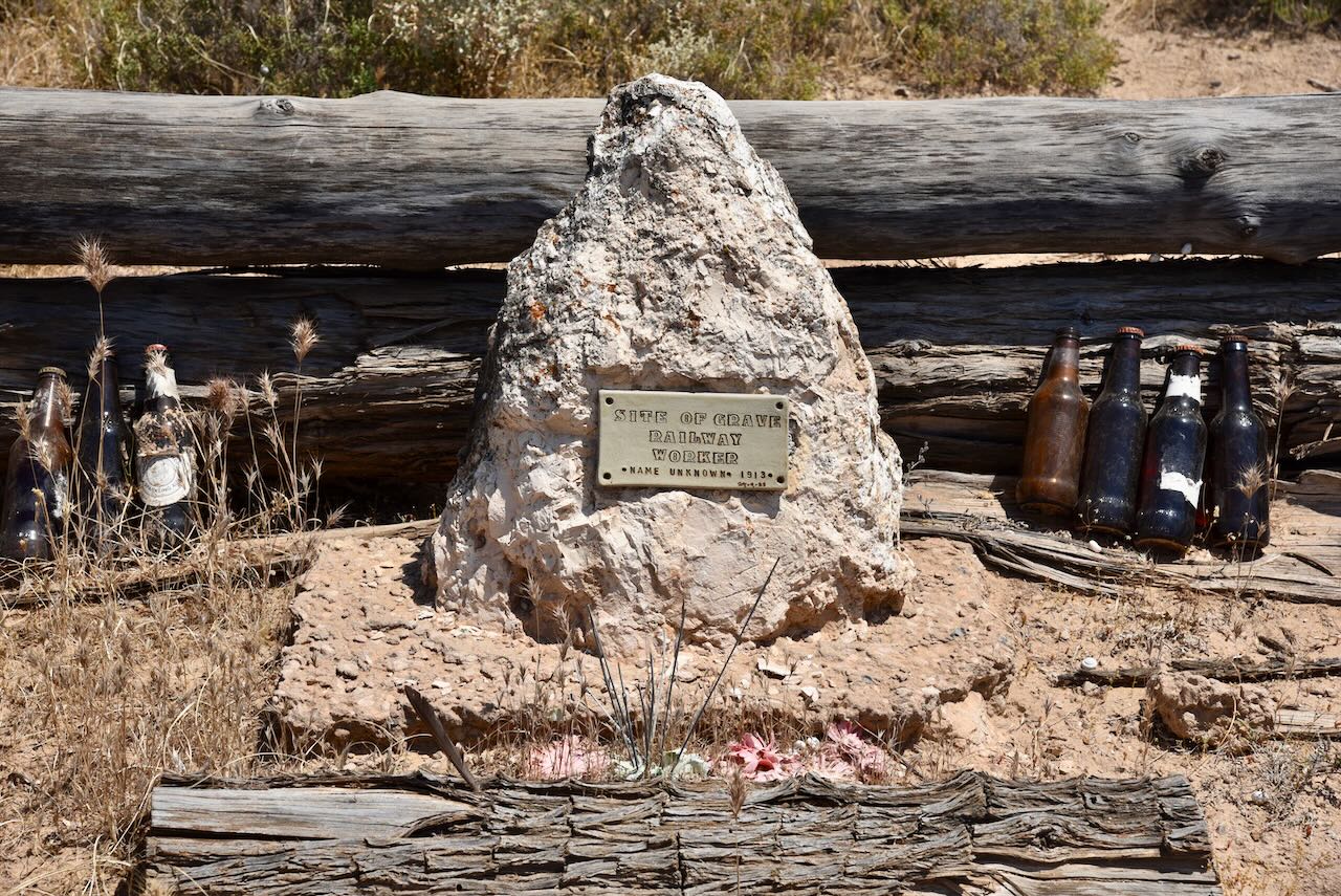
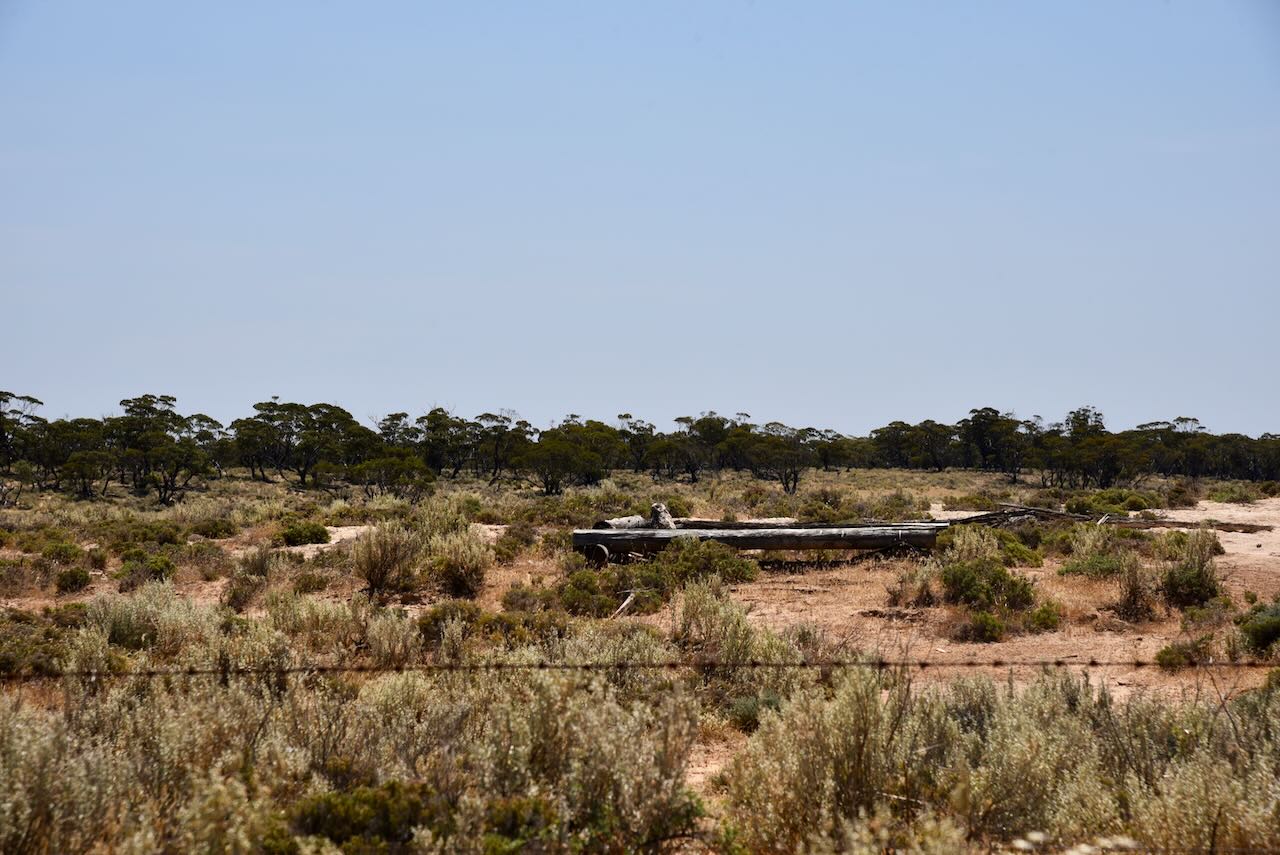
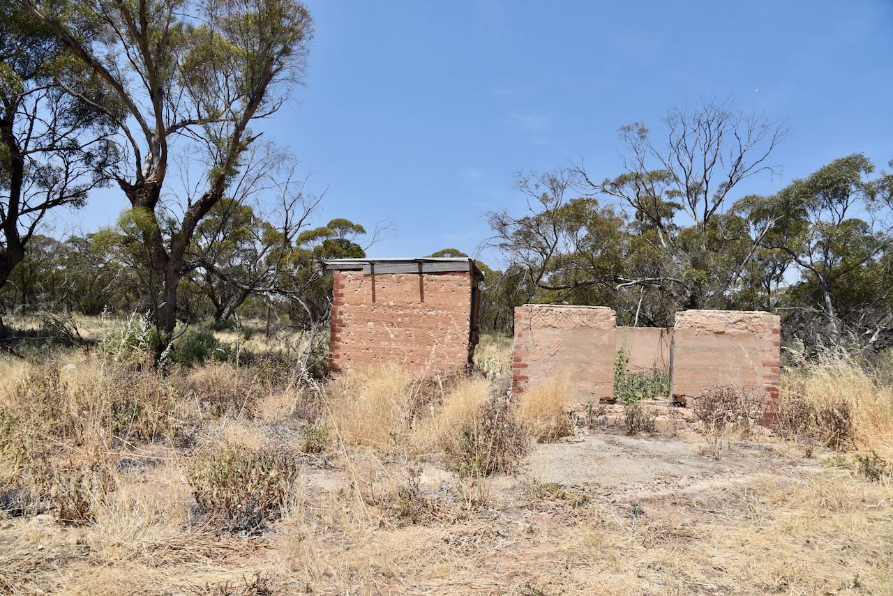
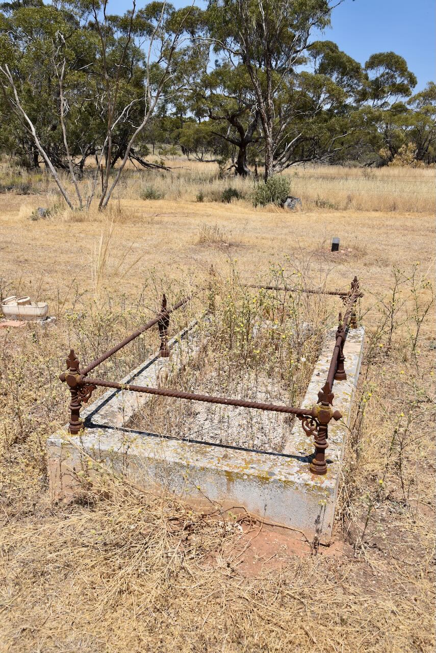
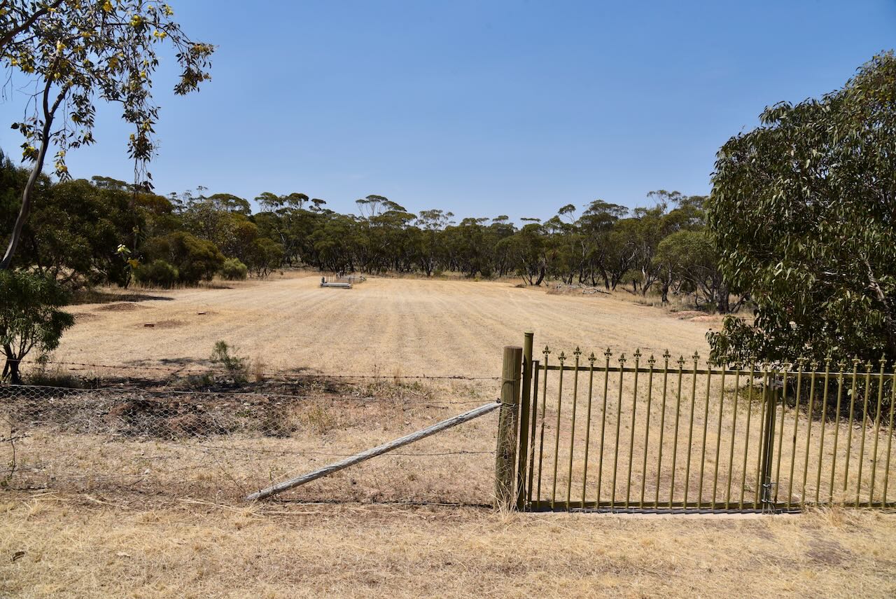
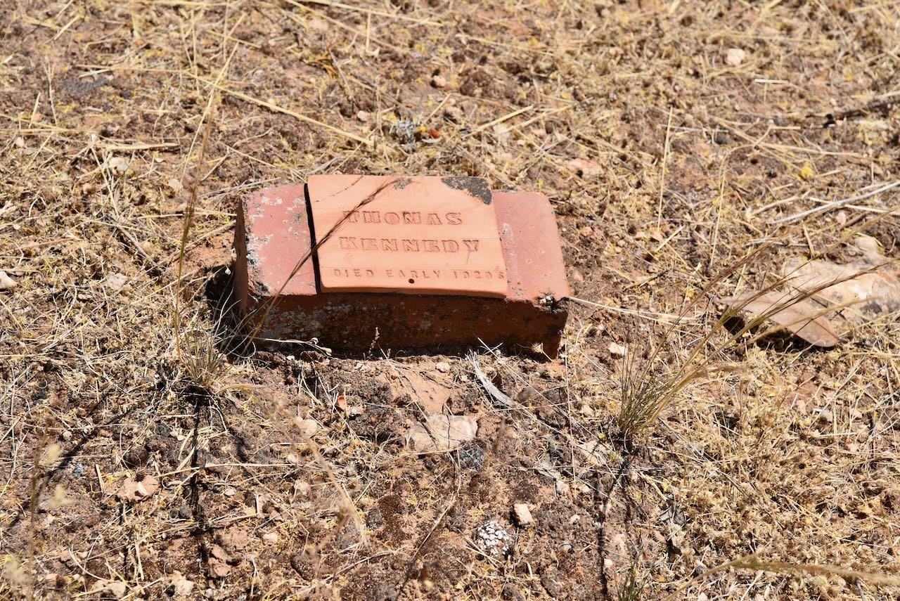
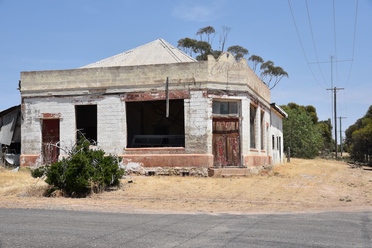
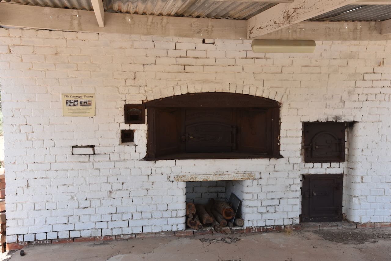
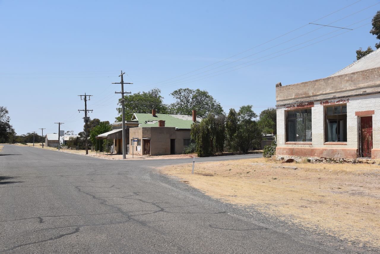
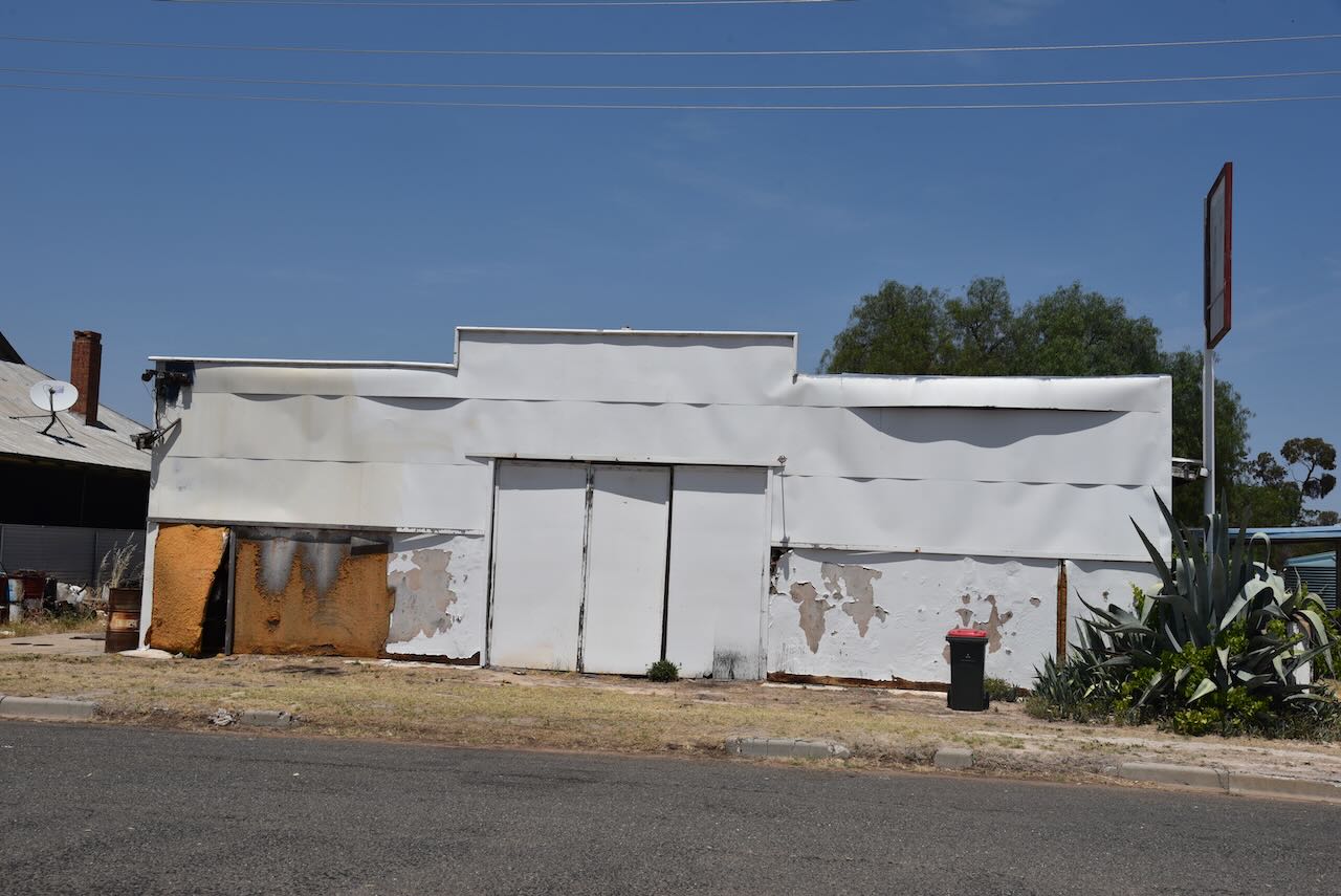
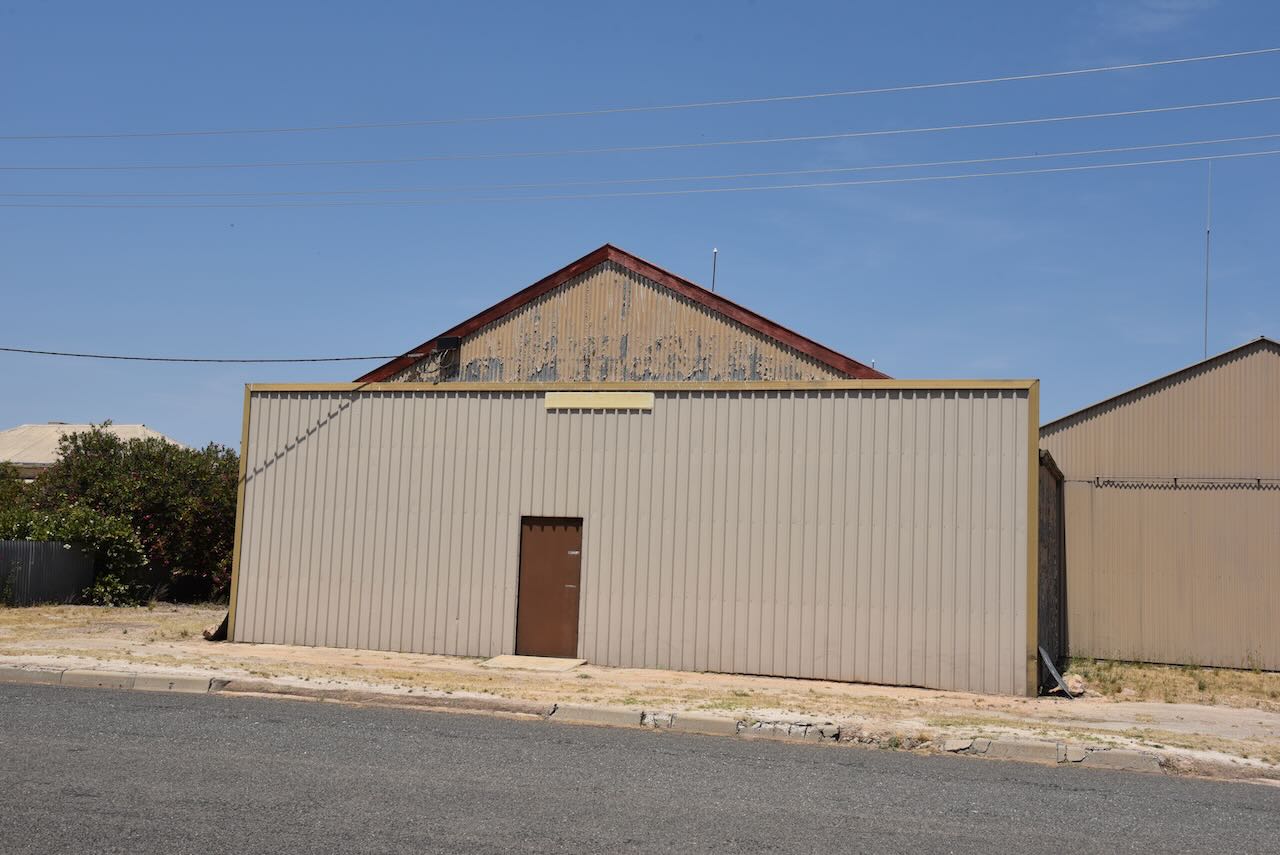
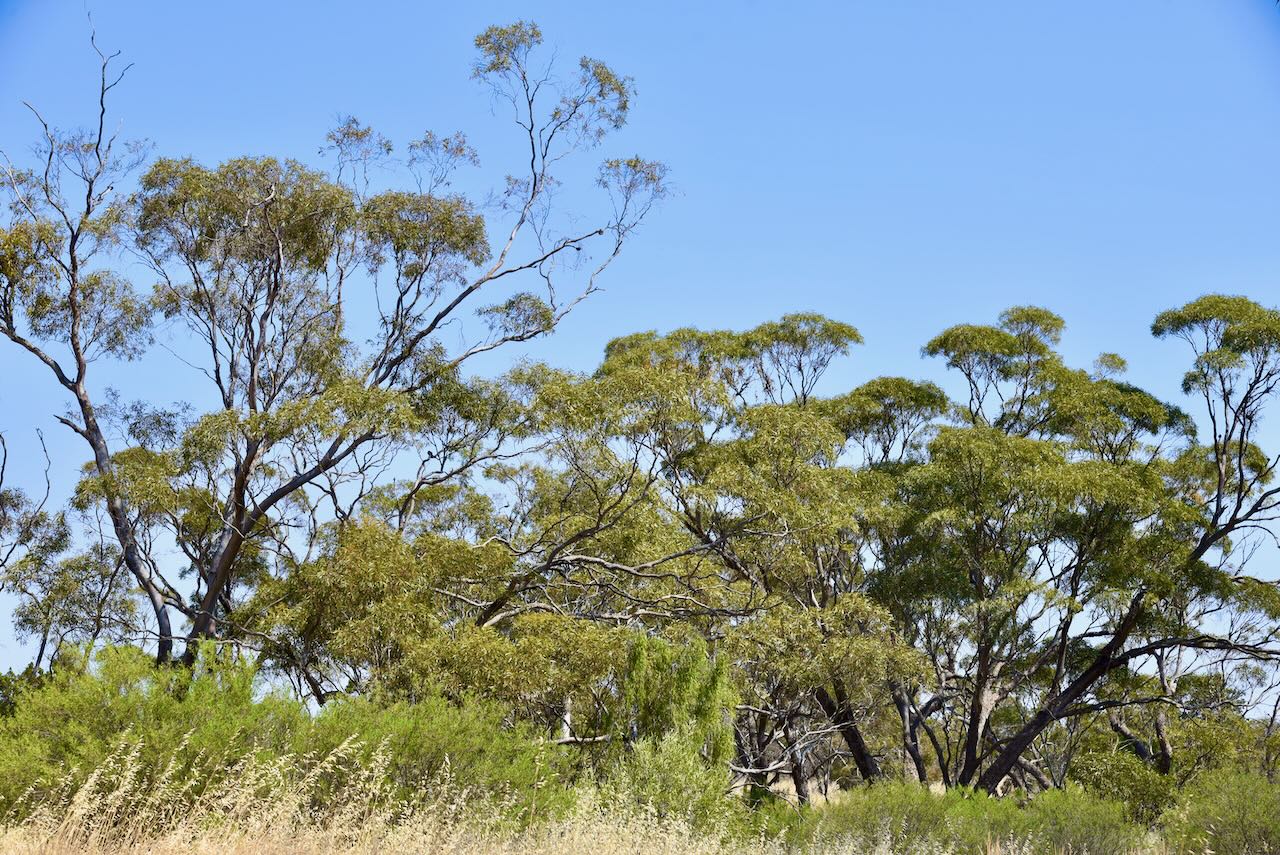
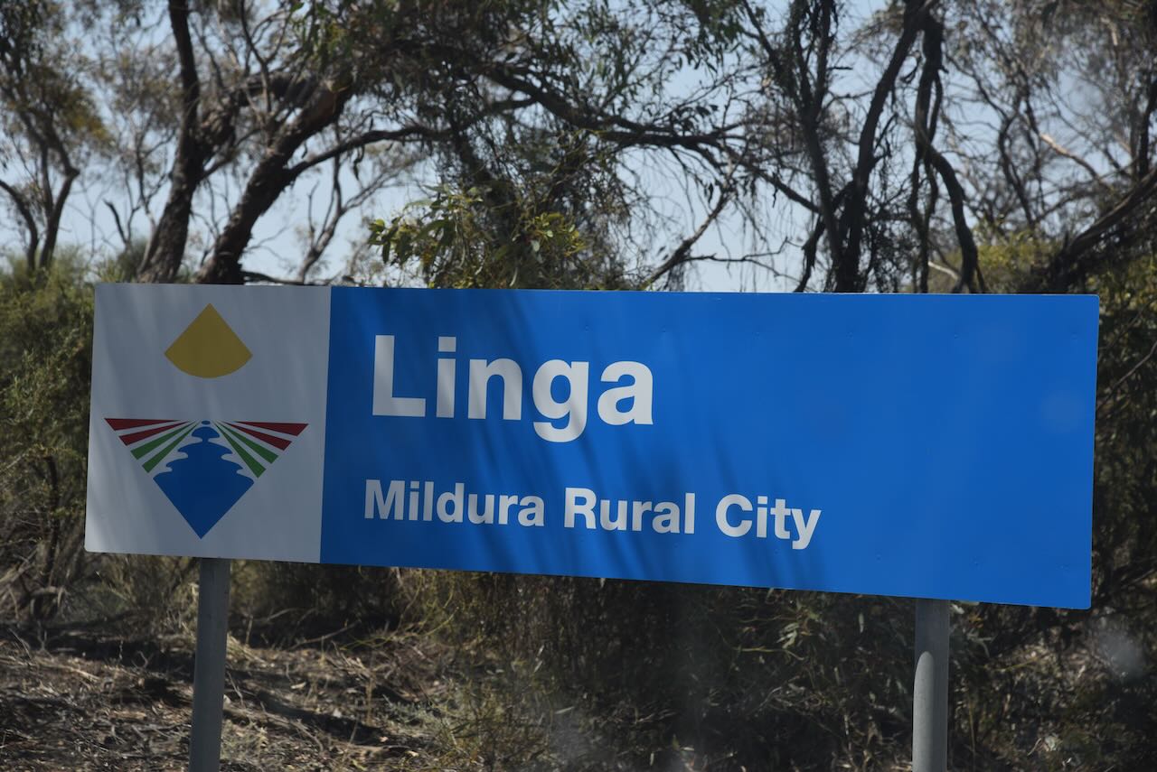
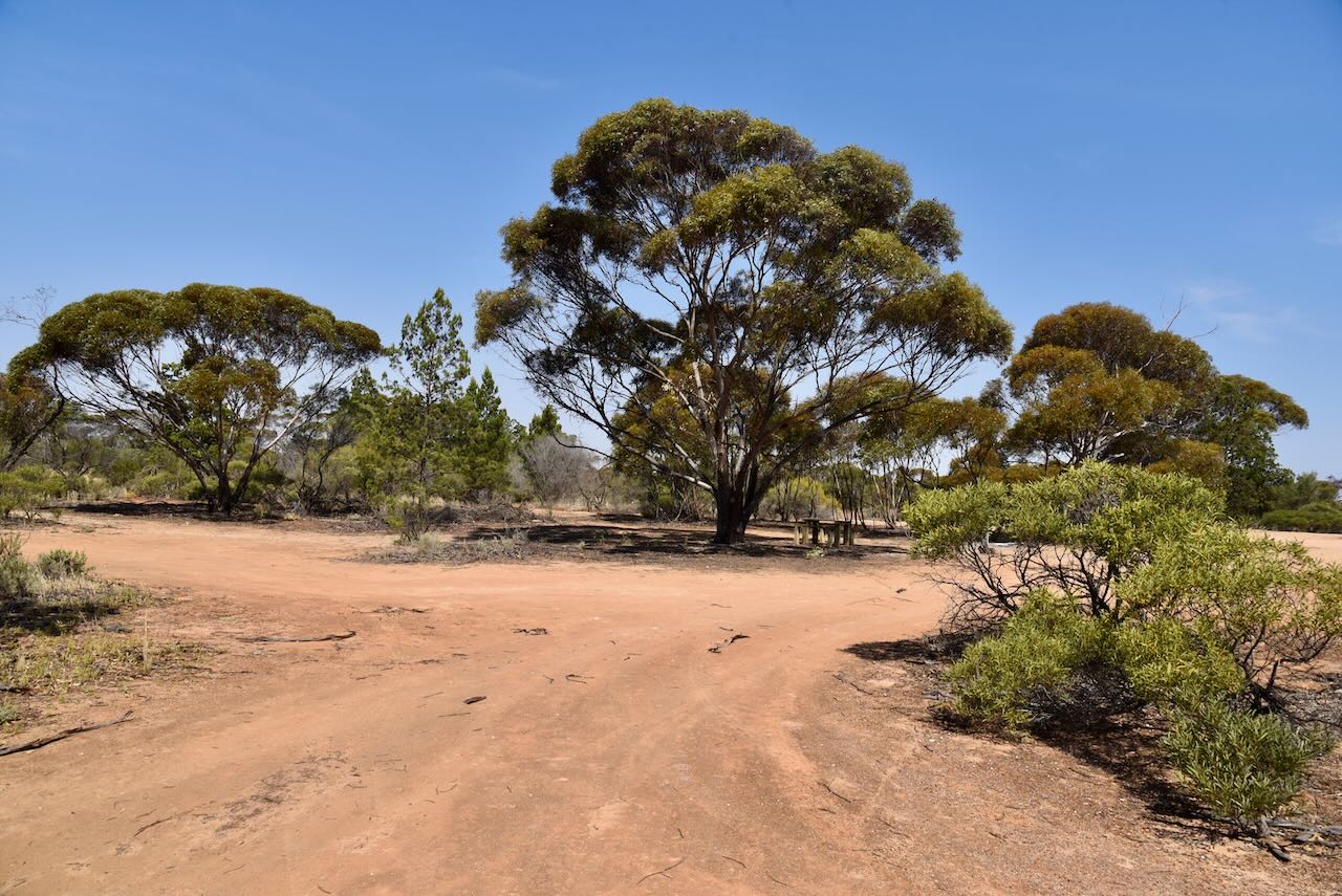
Today very little remains of Linga to indicate that it was once a thriving town.

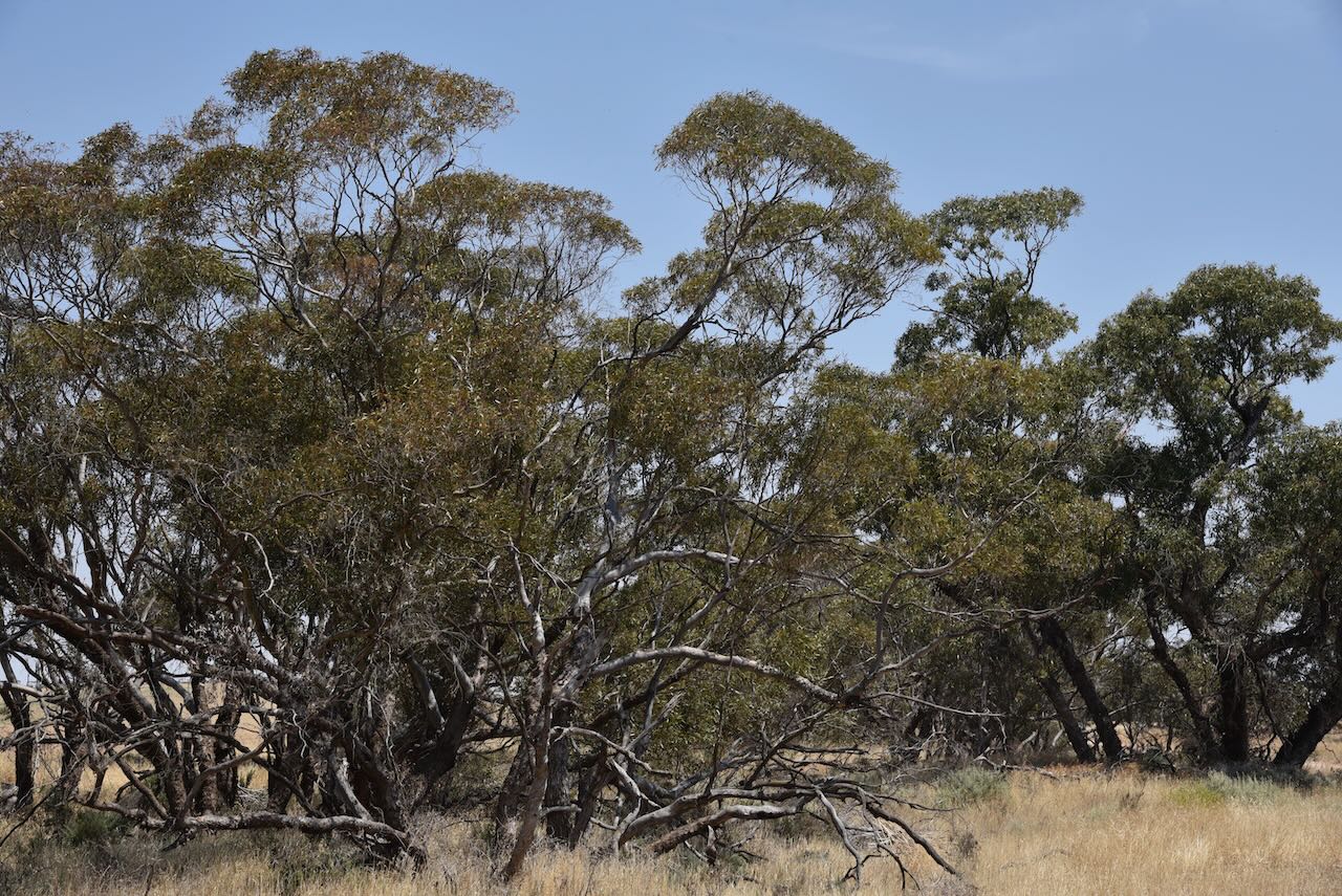
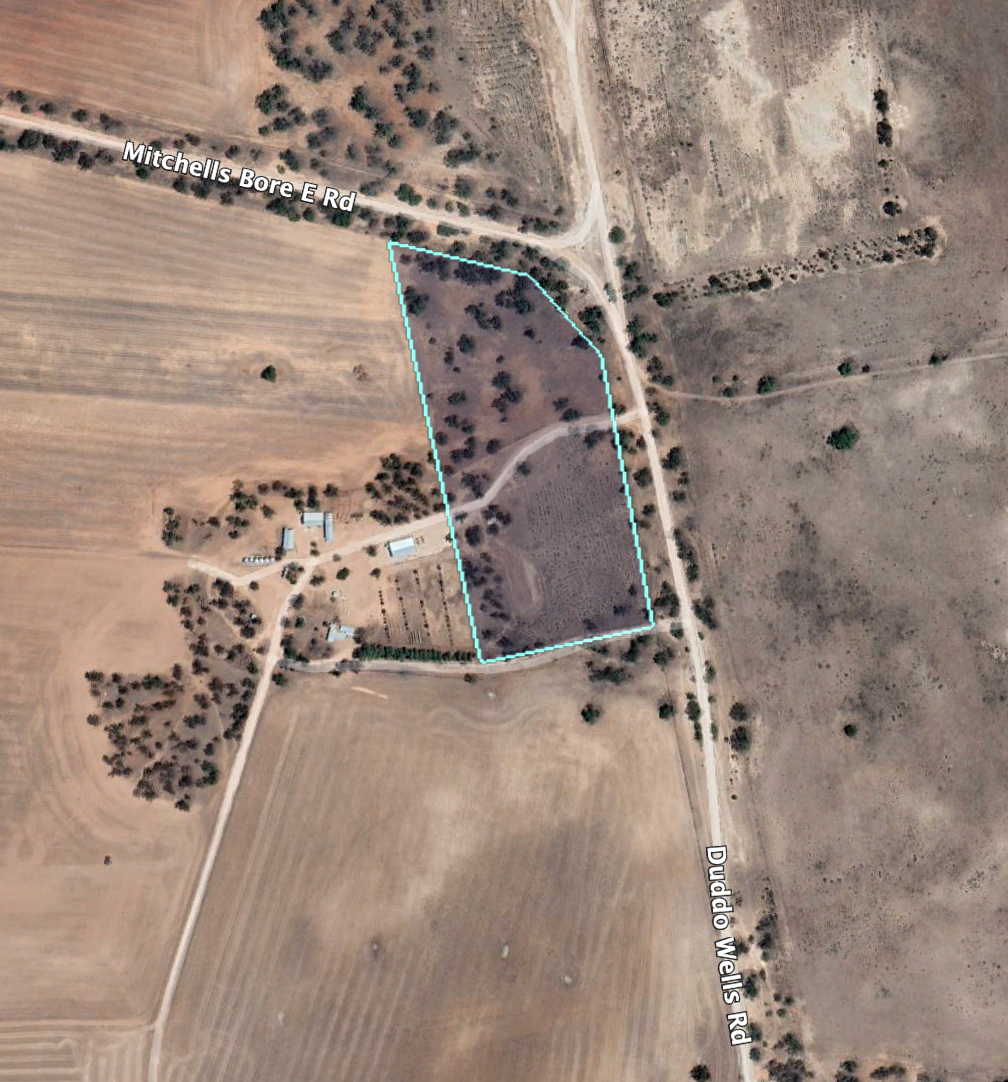
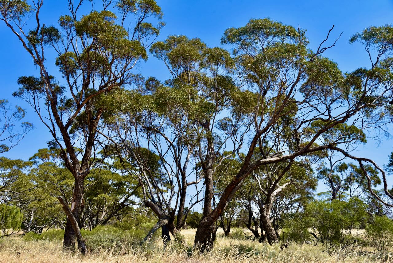
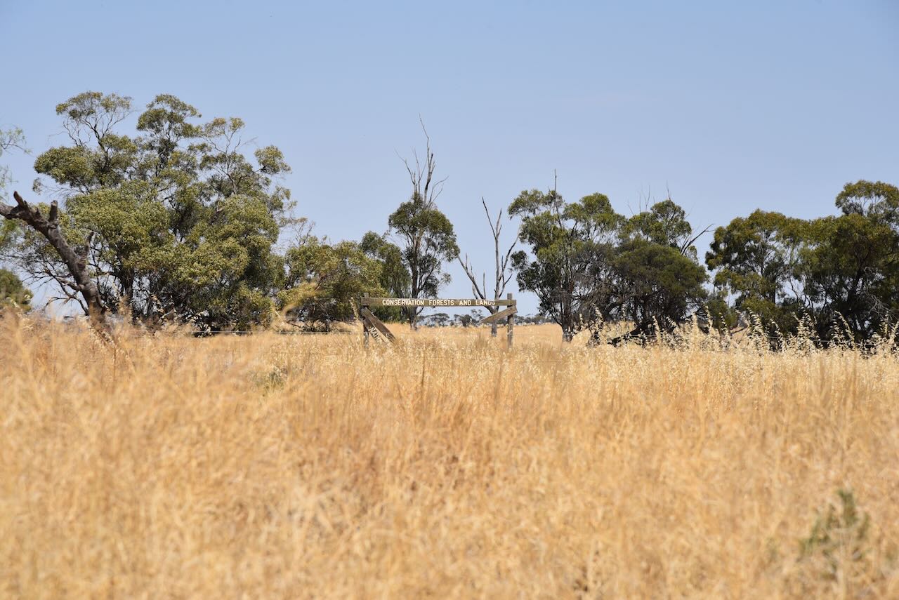
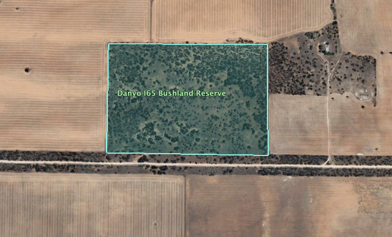
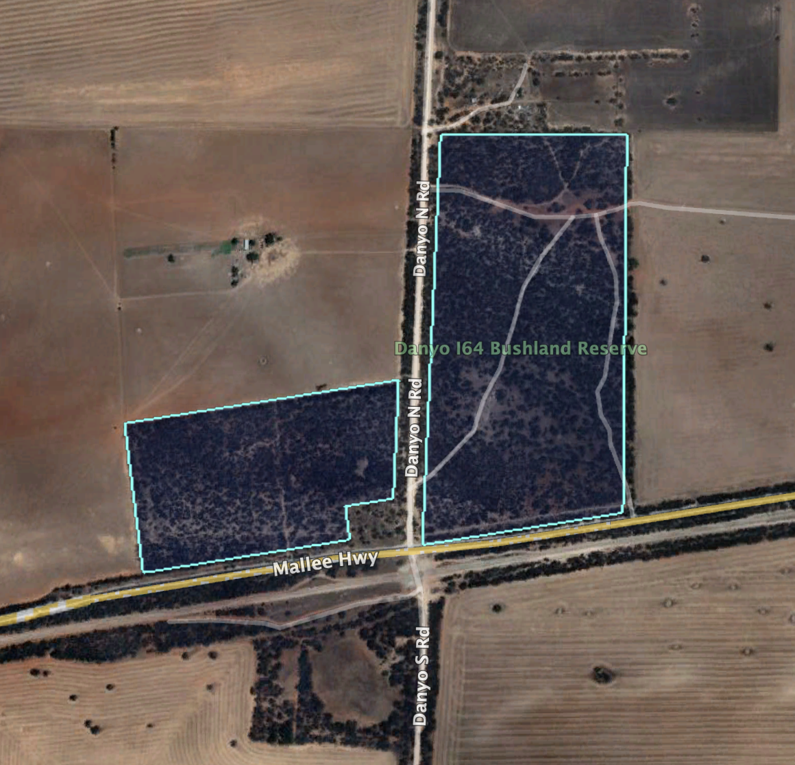
The Linga Bushland Reserve is located on the northern side of Mitchells Road.

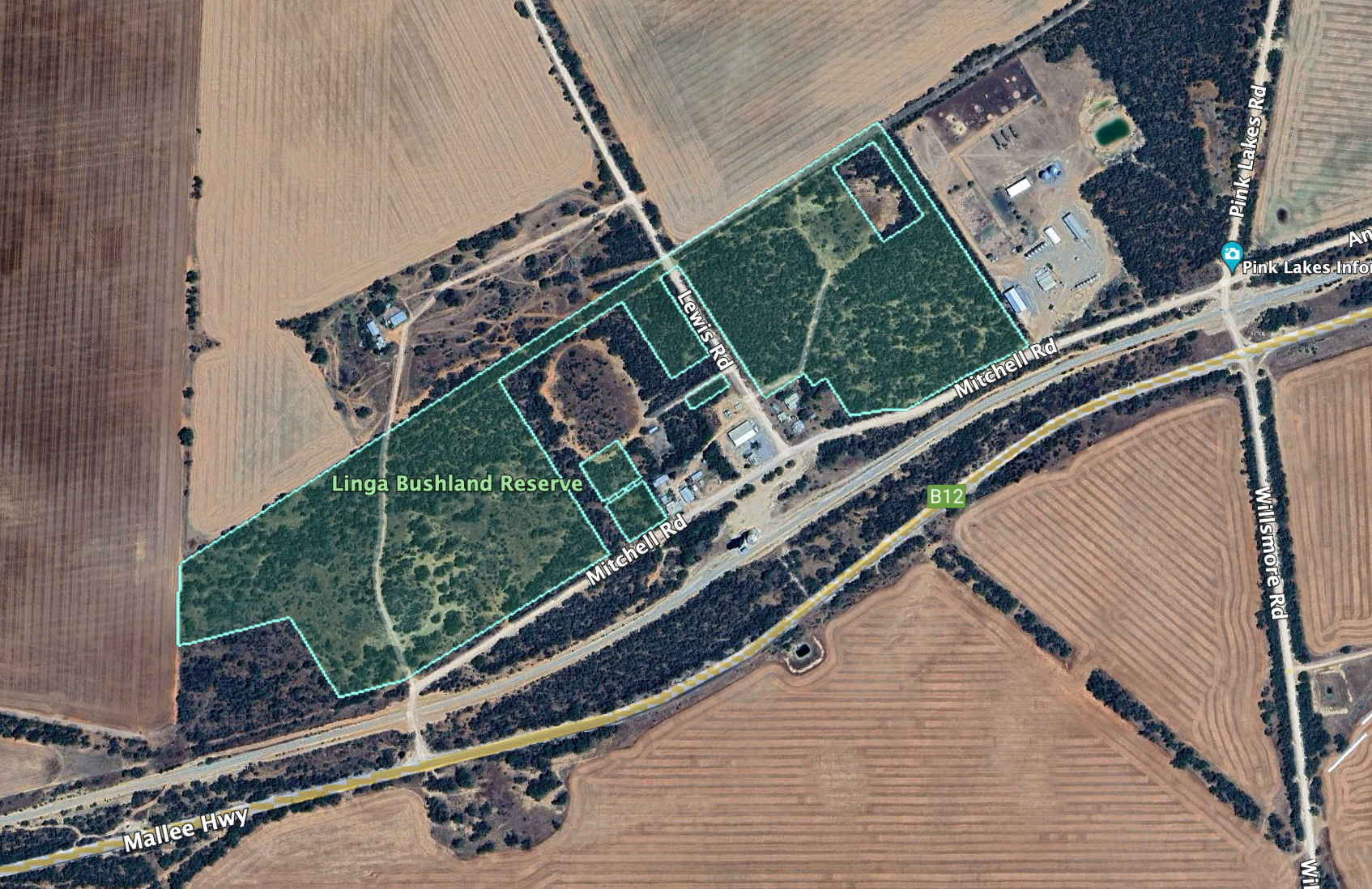
The Linga Bushland Reserve is about 25 hectares in size and was established on the 8th day of May 1990.

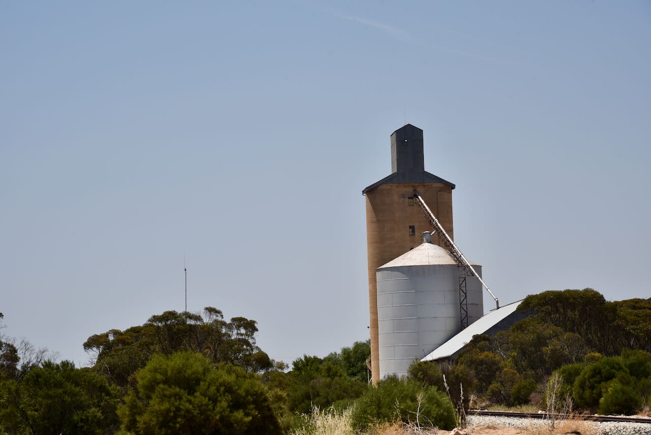
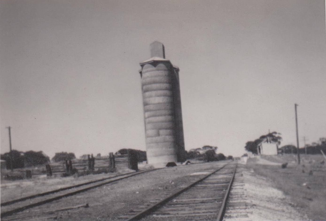
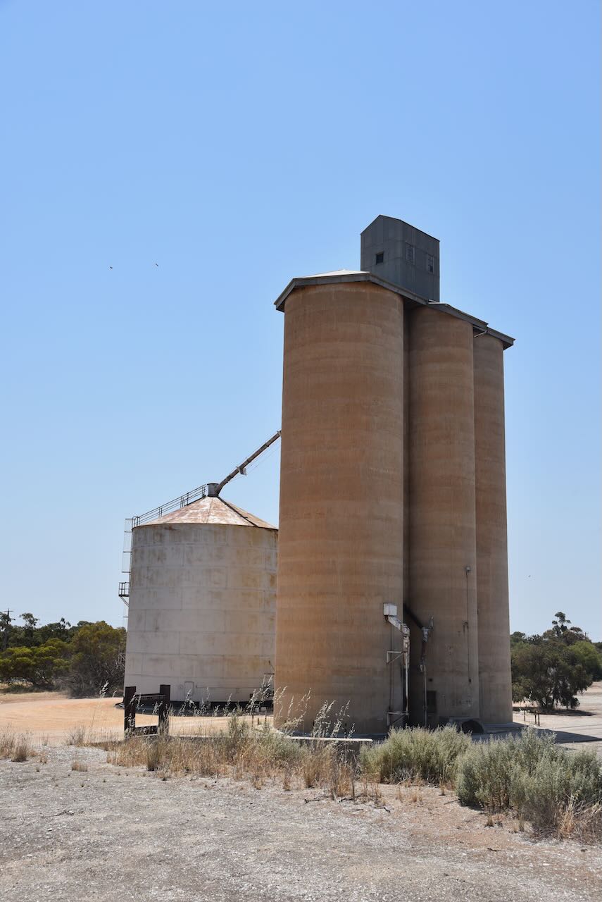
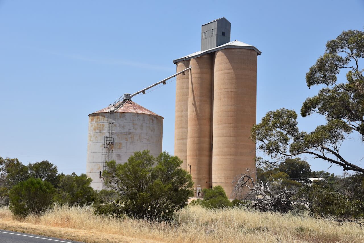
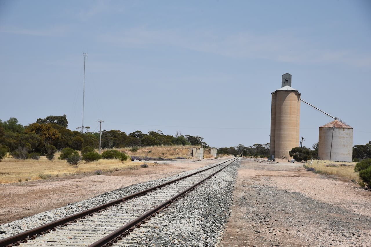
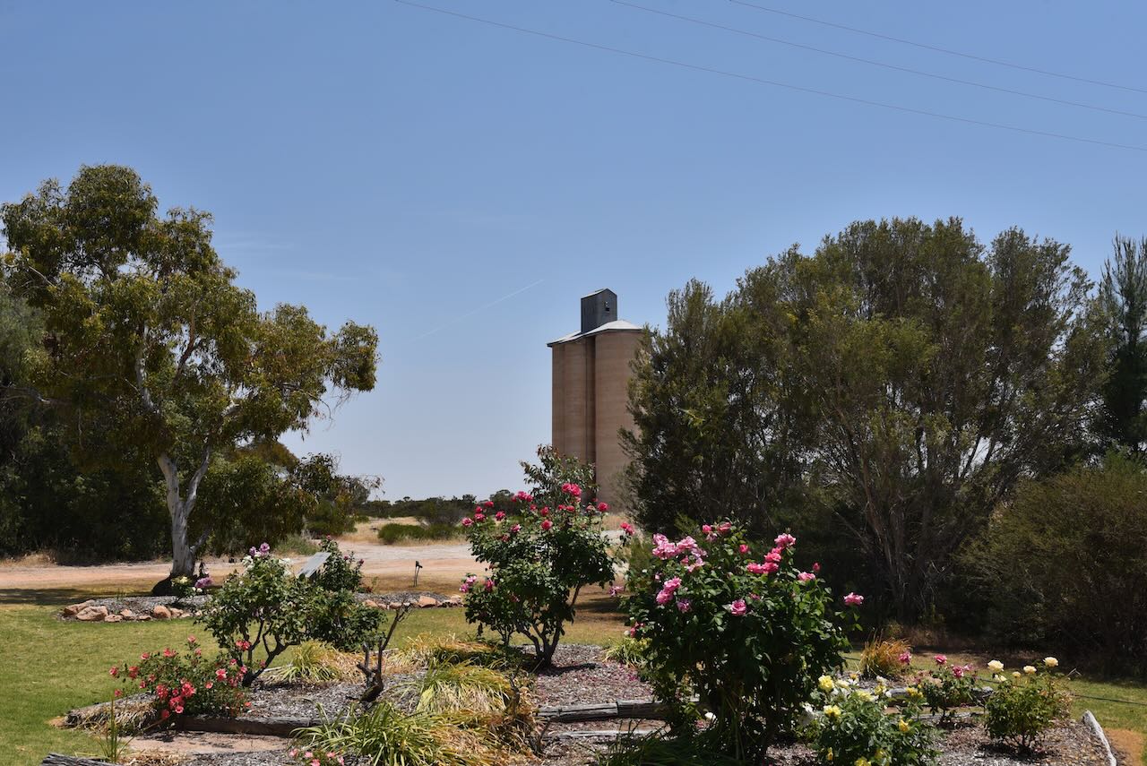
The Linga silo is located on Mitchell Road, alongside the old railway line, on the northern side of the Mallee Highway. 

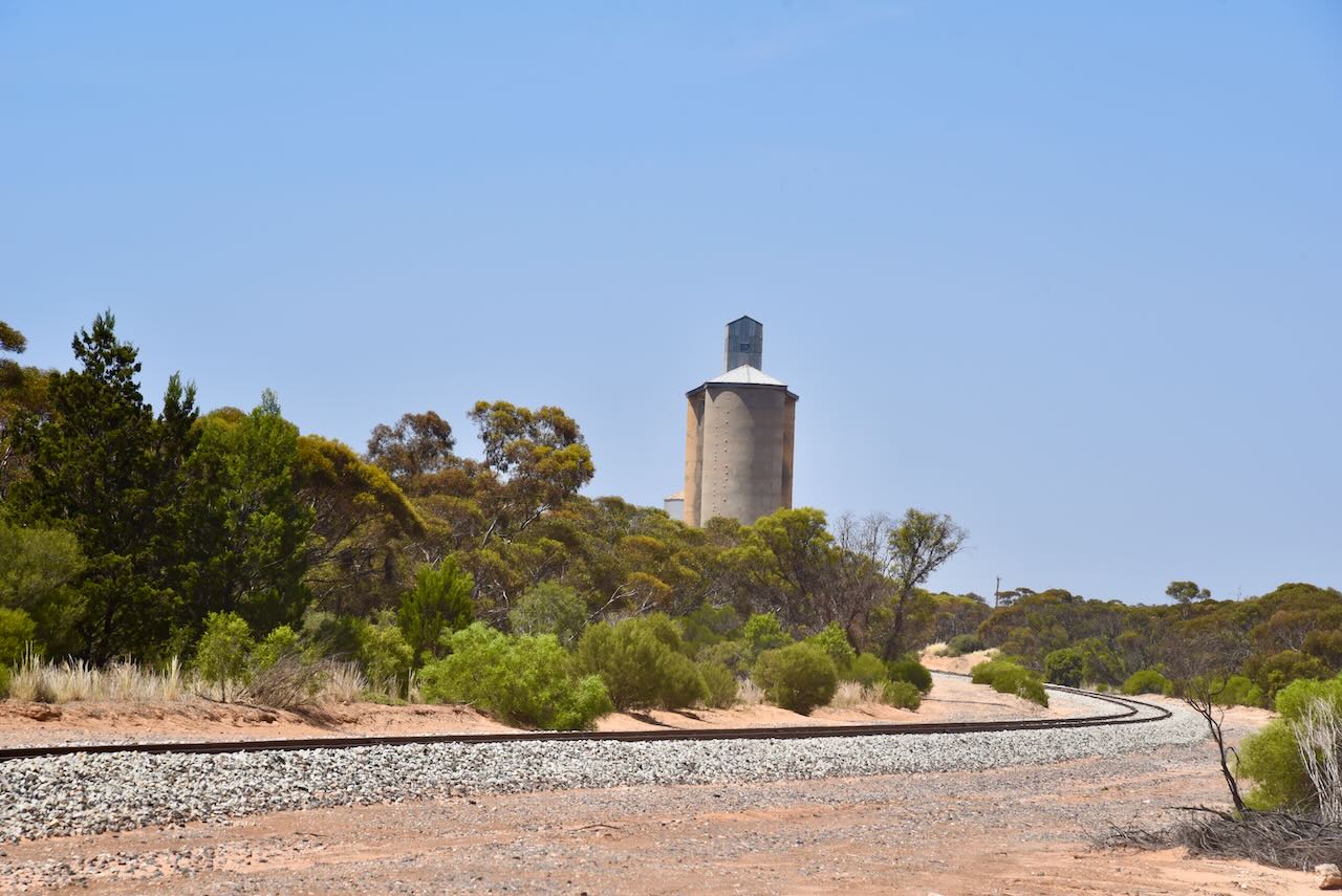
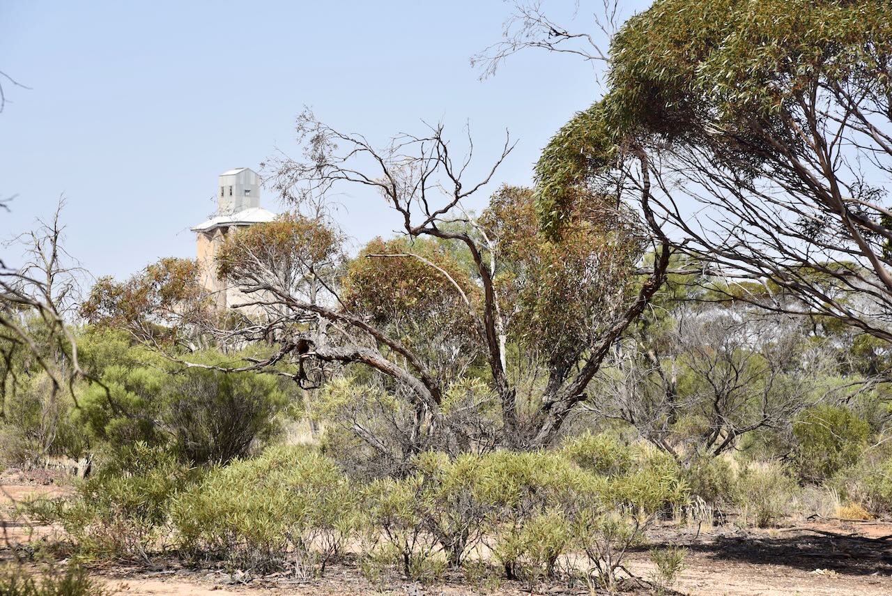
The Linga silo was constructed in the late 1930s.

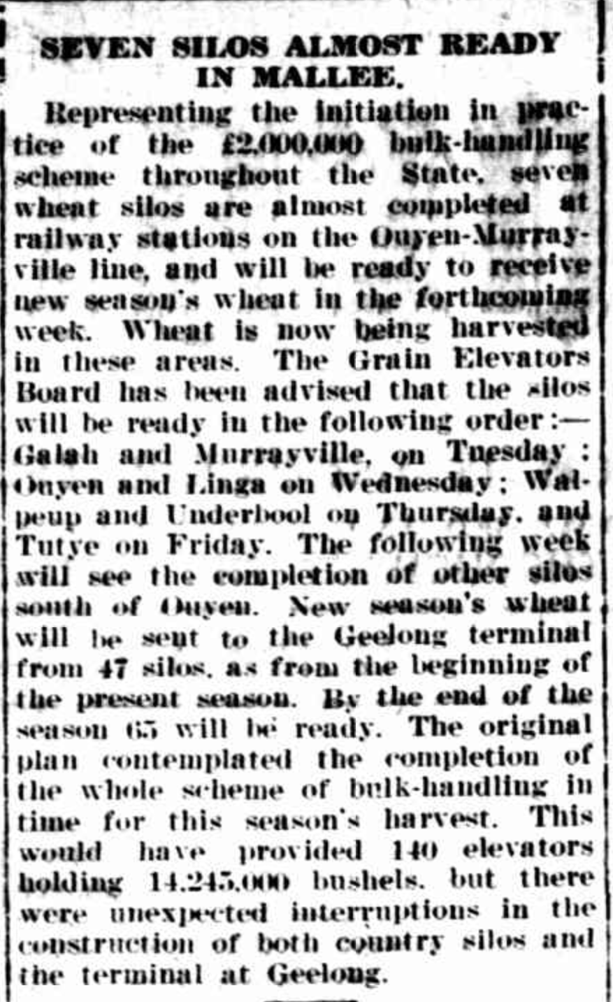
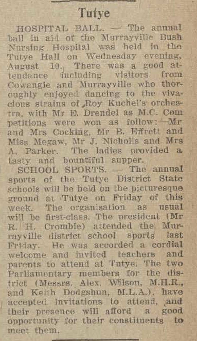
Above:- Article from the Horsham Times, Tues 21 Nov 1939. Image c/o Trove.

We operated within the activation zone of the silo for this activation. We ran the Yaesu FTR857, 40 watts, and the 20/40/80m linked dipole.

All of our contacts were on the 40m band. We tried 20m but had no takers.

Marija worked the following stations on 40m SSB:-

  1. VK3SQ
  2. VK2BD
  3. VK3VIN
  4. VK3APJ
  5. VK3PF
  6. VK3BEL/p (Barmah National Park VKFF-0739)
  7. VK1DI
  8. VK2DG
  9. VK5CZ
  10. VK5FANA
  11. VK3CLD
  12. VK2IO/p (Dering Flora & Fauna Reserve VKFF-2307)
  13. VK3PI/p (Wangaratta Common Nature Conservation Reserve VKFF-2223)

I worked the following stations on 40m SSB:-

  1. VK3SQ
  2. VK2BD
  3. VK3VIN
  4. VK3APJ
  5. VK3PF
  6. VK3BEL/p (Barmah National Park VKFF-0739)
  7. VK1DI
  8. VK2DG
  9. VK5CZ
  10. VK5FANA
  11. VK3CLD
  12. VK1AO
  13. VK2MET
  14. VK3DAC
  15. VK2IO/p (Dering Flora & Fauna Reserve VKFF-2307)
  16. VK3PI/p (Wangaratta Common Nature Conservation Reserve VKFF-2223)
  17. VK3SG
  18. VK2EXA
  19. VK2NP
  20. VK7STO
  21. VK5PL
  22. VK5TN
  23. VK3GRX
  24. VK5KVA
  25. VK3DAI
  26. VK7FLI
  27. VK7MFI
  28. VK1RF
  29. VK2MK
  30. VK4CEE
  31. VK3BBB
  32. VK2CCP
  33. VK5KKT
  34. VK3ANL
  35. VK3BWS
  36. VK1CHW
  37. VK3SO
  38. VK3CEO
  39. VK3BAP
  40. VK4FE/3
  41. VK5IS

I worked the following stations on 40m AM:-

  1. VK3DAC
  2. VK3ANL

I worked the following stations on 40m FM:-

  1. VK3SQ
  2. VK2BD

References.

  1. Blake; L, 1977, Places Names of Victoria.
  2. CAPAD 2022.
  3. Mallee Highway Touring Route, 2023, <https://www.malleehighway.com.au/html/linga.html>, viewed 29th December 2023.
  4. Nickolls; j & Angel, A, 2002, Mallee Tracks.
  5. Wikipedia, 2023, <https://en.wikipedia.org/wiki/Linga,_Victoria>, viewed 29th December 2023.

Tutye silo VK-TTE3

After packing up at the Cowangie silo on Friday 10th November 2023, we headed east on the Mallee Highway to Tutye. Tutye is a locality situated about 80km west of Ouyen in northwest Victoria.

Above:- Map showing the location of Tutye in northwest Victoria. Map c/o Google Maps.

Along the way, we stopped to look at the gravesite of a railway worker. The grave is located about 2.3 km east of Cowangie and is on the northern side of the Mallee Highway. The name of the person is not known but the headstone states that they died in 1913.

We continued east and soon reached Tutye.  Tutye is an aboriginal word meaning ‘rest’.

The Tutye district was opened for selection in 1911. Tutye was once a thriving township, but today very little remains. The Post Office was opened on the 15th day of July 1912 following the opening of the railway line from Ouyen to Murrayville. The Post office closed in 1980. The Tutye General Store opened in 1914 and closed in 1970. The Tutye State School opened in 1920. The town once had several businesses including a blacksmith shop, boot repairer, bank agency, boarding house and telephone exchange.

Above:- Plan of the township of Tutye. Image c/o State Library Victoria.

Tutye once had a football club, a tennis club, a croquet club, a golf club, a racecourse, and a dramatic society.

Above:- the 1928 Tutye football club team. Image c/o Cowangie Danyo Tutye and district Facebook page.

The Tutye Hall hosted numerous events.

Above:- article from the Ouyen Mail, Wed 17th August 1938. Image c/o Trove.

In 1953-54 a processing plant for cruse plaster of Paris was established at Tutye by Associated Plaster and Gypsum. All that remains today are some ramps and sidings which were used for unloading/loading of gypsum on the old railway line/

You can also find a plaque commemorating the Tutye Avenue of Honour which was planted on the 24th day of July 1919 by the Tutye Progress Association as a mark of honour to the men from Tutye who served abroad in the war 1914-1918.

The Tutye silos are located on the southern side of the Mallee Highway on Old Stock Route Road.

Above:- the Tutye silo, c. 1960s. Image c/o Cowangie Danyo Tutye and district Facebook page.

This was a quick activation from the vehicle, running the Icom IC7000, 100 watts, and the Codan 9350 antenna with the 1/5 mere stainless steel whip.

Above:- aerial view of the Tutye silos. Image c/o Google Maps.

Marija worked the following stations on 40m SSB:-

  1. VK3PF
  2. VK2IO/p (Dering Flora & Fauna Reserve VKFF-2307)
  3. VK2TRL
  4. VK1CHW/p (Dunlop Grasslands Nature Reserve VKFF-0839)

I worked the following stations on 40m SSB:-

  1. VK3PF
  2. VK2IO/p (Dering Flora & Fauna Reserve VKFF-2307)
  3. VK2TRL
  4. VK1CHW/p (Dunlop Grasslands Nature Reserve VKFF-0839)

Following our activation of the silo we drove out to the Tutye cemetery to hopefully view some of the graves of the early settlers. Sadly there were not many historic headstones visible in the cemetery.

We then headed east along the Mallee Highway to Linga for our next activation.

References.

  1. Australian Cemeteries, 2023, <https://www.australiancemeteries.com.au/vic/mildura/cowangielone.htm>, viewed 29th December 2023.
  2. Blake, L, 1977, Places Names of Victoria.
  3. Mildura Rural City Council, 2013, Mildura (Former Shire of Walpeup) Heritage Study Stage 2
  4. Wikipedia, 2023, <https://en.wikipedia.org/wiki/Tutye,_Victoria>, viewed 29th December 2023.

Cowangie silo VK-CWE3

After leaving Duddo Wells we headed back to the Mallee Highway and headed east and soon reached the little town of Cowangie where we stopped to activate the Cowangie silo VK-CWE3. Cowangie is located about 20km east of Murrayville.

Above:- Map showing the location of Cowangie. Map c/o Google Maps.

The district of current-day Cowangie was originally known as Kow Plains. Kow is derived from an aboriginal word meaning white clay or gypsum. A gypsum mine exists about 30km north of Cowangie. 

In 1859 Kow Plains pastoral station was established by James Smith. The station covered an area of about 5,000 acres. A track led south to Nhill through the current-day Big Desert. In 1867 Dugald Macpherson took over the station and increased the area to about 81,000 acres. The main homestead was built about 1879.

The very interesting video below shows the history and the restoration of the Kow Plains homestead.

The settlement of Cowangie commenced after it was found that the land to the west of Ouyen was as suitable for farming as the land that had previously been successfully farmed around Pinnaroo in South Australia. It is believed that Cowangie is an aboriginal word meaning fog or mist.

Several test bores were established and this confirmed the availability of water. In 1910-11 catchment tanks were built. The following year the railway es extended from Oyen. By this time farm selections had been taken up in the district. The first town blocks were sold on the 2nd day of July 1912, for between 16 and 31 pounds.

Above:- a plan of the township of Cowangie. Image c/o State Library Victoria.

The Post Office was opened on the 15th day of July 1912. A General store and bakery were built in 1912. In 1913 a public hall was constructed and several stores were opened in the township of Cowangie. The hall was used as a school from 1914 to 1921 when a new school building was built. In 1918 the Bank of Victoria opened a branch in Cowangie. In 1926 a Methodist church was erected. A bush nursing hospital was operational from 1916 to 1923.

Above:- the Cowangie Post Office. Image c/o Cowangie Danyo Tutye and district Facebook page.

Cowangie is the birthplace of V8 Supercar racing legend Larry Perkins.

Many of the buildings in Cowangie are in a state of disrepair. In 2001 the baker’s oven was restored at the Cowangie Bakery. The Cowangie Bush Nursing Centre cottage has also been restored.

In Dayman Street you can find the Cowangie Avenue of Honour. There are also some information boards detailing the history of Cowangie and some of the surrounding towns.

The Cowangie silos are located on the southern side of the Mallee Highway alongside the railway line.

We parked right alongside the silos and operated from the vehicle for this activation, running the Icom IC7000, 100 watts, and the Codan 9350 with the 1.5-metre stainless steel whip.

Marija worked the following stations on 40m SSB:-

  1. VK3PF
  2. VK3SQ
  3. VK2BD
  4. VK3CLD/2

I worked the following stations on 40m SSB:-

  1. VK3PF
  2. VK3SQ
  3. VK2BD
  4. VK3CLD/2
  5. VK3OAK
  6. VK3BEL/p (Barmah National Park VKFF-0739)
  7. VK3SO
  8. VK2IO/p (Patchewollock North Bushland Reserve VKFF-4244)
  9. VK1AD
  10. VK1NAM
  11. VK3ZSC
  12. VK5IS

I worked the following stations on 20m SSB:-

  1. VK4EMP
  2. VK4TI

References.

  1. Discover Mallee Murray, 2023, <http://www.murrayriver.com.au/cowangie/>, viewed 26th December 2023.
  2. Flickr, 2023, <https://www.flickr.com/photos/82134796@N03/43372963170>, viewed 26th December 2023.
  3. Victorian Places, 2023, <https://www.victorianplaces.com.au/cowangie>, viewed 26th December 2023.
  4. Wikipedia, 2023, <https://en.wikipedia.org/wiki/Cowangie>, viewed 26th December 2023.

Duddo Wells Bushland Reserve VKFF-4153

Our next activation for Friday 10th November 2023 was the Duddo Wells Bushland Reserve VKFF-4153. The park is located about 20km (by road) northeast of Murrayville. This was to be a first-time activation of the park for the World Wide Flora Fauna (WWFF) program.

Above:- Map showing the location of the Duddo Wells Bushland Reserve. Map c/o Google Maps.

The Murrayville district contains several smaller areas namely Duddo which had its own Post Office from 1913 to 1918 and Duddo Wells from 1914 to 1950. Duddo was originally an outstation of Brimin. Duddo originally contained a hall, a school and had a Duddo Race Club and the Duddo Red Cross Society.

In 1920 a tragedy occurred at Duddo Wells with the shooting of Mrs. Isabella Morrison by her brother-in-law.

Above: – part of an article from The Register, Adelaide, Mon 22 Nov 1920. Image c/o Trove

The reserve is just a small 6-hectare area of Mallee bushland located on the corner of Duddo Wells Road and Mitchells Bore Road.

It is an interesting park, in that it includes a driveway leading to a farm. The park’s northern section contains some scrub, but the southern section is almost barren. The area surrounding the reserve has been completely cleared for farming.

Above:- An aerial view of the reserve. Image c/o Google Earth.

We found the band conditions to be average. I only managed to get 30 contacts in the log on 20 & 40m. I also tried 10m but had no takers.

Marija worked the following stations on 40m SSB:-

  1. VK3PF
  2. VK2EXA
  3. VK2NP
  4. VK1AO
  5. VK2MET
  6. VK3DAC
  7. VK3VIN
  8. VK3ZSC/p (Dandenong Ranges National Park VKFF-0132)
  9. VK3KMA

Marija worked the following stations on 40m AM:-

  1. VK3PF

I worked the following stations on 40m SSB:-

  1. VK3PF
  2. VK2EXA
  3. VK2NP
  4. VK1AO
  5. VK2MET
  6. VK3DAC
  7. VK3VIN
  8. VK3ZSC/p (Dandenong Ranges National Park VKFF-0132)
  9. VK3KMA
  10. VK7EV
  11. VK7VSG
  12. VK2VAR
  13. VK2GOM
  14. VK1AAF
  15. VK1AD
  16. VK1NAM
  17. VK2SLB
  18. VK2IO/p (Patho Plains Railway Nature Conservation Reserve VKFF-4244)
  19. VK3SG
  20. VK4NH
  21. VK4DXA
  22. VK3ANL
  23. VK3ARK

I worked the following stations on 40m AM:-

  1. VK3PF
  2. VK3ANL

I worked the following stations on 20m SSB:-

  1. VK1AO
  2. VK2MET
  3. VK4NH
  4. VK4DXA
  5. VK4EHO

References.

  1. Blake; L, 1977, Place Names of Victoria.
  2. Trove, 2023, <https://trove.nla.gov.au/newspaper/article/63031301>, viewed
  3. Wikipedia, 2023, <https://en.wikipedia.org/wiki/Murrayville,_Victoria>, viewed

Danyo I65 Bushland Reserve VKFF-4156

Our second park for Friday 10th November 2023 was the Danyo I65 Bushland Reserve VKFF-4156. The park is located about 17 km (by road) northeast of Murrayville in northwestern Victoria.

Above:- Map showing the location of the Danyo I65 Bushland Reserve. Map c/o Google Maps.

The Dano I65 Bushland Reserve is about 40 hectares in size and was established on the 1st day of May 1979

The park is located on the northern side of Five Chain Road, between Danyo North Road and Purdue Road. There is a dilapated park sign which is a bit hard to see from the roadway.

Above:- An aerial view of the reserve. Image c/o Google Earth.

The park is a small piece of remnant mallee scrub and is surrounded by cleared farming land.

Above:- an aerial view of the park and the surrounding countryside looking west. Image c/o Google Maps.

Marija worked the following stations on 40m SSB:-

  1. VK2VAR
  2. VK2GOM
  3. VK3BEL/p (Barmah National Park VKFF-0739)
  4. VK3SO
  5. VK3SQ
  6. VK2BD
  7. VK4NH
  8. VK4DXA
  9. VK2NP
  10. VK2EXA
  11. VK2SKI/p (silo VK-PRS2)
  12. VK2IO/p (Patchewollock North Bushland Reserve VKFF-4244)

I worked the following stations on 40m SSB:-

  1. VK2VAR
  2. VK2GOM
  3. VK3BEL/p (Barmah National Park VKFF-0739)
  4. VK3SO
  5. VK3SQ
  6. VK2BD
  7. VK4NH
  8. VK4DXA
  9. VK2NP
  10. VK2EXA
  11. VK3PF
  12. VK4HMI
  13. VK4EMP
  14. VK4TI
  15. VK3HQZ
  16. VK7JFD
  17. VK3AWA
  18. VK3ACZ
  19. VK2DG
  20. VK3CLD
  21. VK1DI
  22. VK1AAF
  23. VK3ANL
  24. VK3CEO
  25. VK3DAC
  26. VK3TKK/m
  27. VK2IO/m
  28. VK3SG
  29. VK2SKI/p (silo VK-PRS2)
  30. VK5KLV
  31. VK3AMO
  32. VK4FE/3
  33. VK3ACL
  34. VK2IO/p (Patchewollock North Bushland Reserve VKFF-4244)

I worked the following stations on 40m AM:-

  1. VK3SQ
  2. VK2BD
  3. VK3PF
  4. VK3AWA
  5. VK3CLD
  6. VK3DAC
  7. VK3ANL

I worked the following stations on 40m FM:-

  1. VK3SQ
  2. VK2BD

I worked the following stations on 80m SSB:-

  1. VK5HAA
  2. VK5WWW

References.

  1. CAPAD 2022

Danyo I64 Bushland Reserve VKFF-4155

Our first park for Friday 10th November 2023 was the Danyo I64 Bushland Reserve VKFF-4155. The park is about 11 km east of Murrayville.

This was to be a first time activation of the park.

Above:- Map showing the location of the Danyo I64 Bushland Reserve. Map c/o Google Maps.

Danyo is a locality in northwest Victoria on the Mallee Highway between Ouyen and the South Australia/Victoria State border. Danyo is an aboriginal word for eucalyptus.

More information on Danyo can be found on my previous post……

The Danyo I64 Bushland Reserve is about 38 hectares in size and was established on the 1st day of May 1979.

The park is divided into two sections and is located on the northern side of the Mallee Highway. It is divided by Danyo North Road.

Above:- an aerial view of the Danyo I64 Bushland Reserve. Image c/o Google Earth.

The park is a piece of remnant mallee scrub that is surrounded by clearing farming land.

Above:- An aerial view of the park. Image c/o Google Maps.

We found a track leading into the park off Danyo North Road. We ran the Yaesu FT857, 40 watts, and the 20/40/80m linked dipole for this activation.

Unfortunately, there was initially no close in propagation on the 40m band and we did not log any VK3 stations or any VK5 stations. The 80m band was far more reliable.

I was very surprised to work Pasi OH1MM in Finland on the 20m band.

Marija worked the following stations on 40m SSB:-

  1. VK4NH
  2. VK4DXA
  3. VK2NP
  4. VK1AD
  5. VK1NAM
  6. VK1RF
  7. VK2MK
  8. VK4CEE
  9. VK2KET
  10. VK2GWB
  11. VK2CG

Marija worked the following station on 80m SSB:-

  1. VK2IO/p (Timberoo I106 Bushland Reserve VKFF-4201)

I worked the following stations on 40m SSB:-

  1. VK4NH
  2. VK4DXA
  3. VK2NP
  4. VK1AD
  5. VK1NAM
  6. VK1RF
  7. VK2MK
  8. VK4CEE
  9. VK2KET
  10. VK2GWB
  11. VK2CG
  12. VK2CDB
  13. VK3DAC
  14. VK1DI
  15. VK3PF
  16. VK2EXA

I worked the following stations on 80m SSB:-

  1. VK5IS/m
  2. VK3VIN
  3. VK5HS
  4. VK2IO/p (Timberoo I106 Bushland Reserve VKFF-4201)
  5. VK3APJ
  6. VK3PF
  7. VK5NPP
  8. VK5BJE

I worked the following stations on 20m SSB:-

  1. VK4NH
  2. VK4DXA
  3. OH1MM


References.

  1. Blake; L, 1977, Place Names of Victoria.
  2. CAPAD 2022.
  3. Wikipedia, 2023, <https://en.wikipedia.org/wiki/Danyo,_Victoria>, viewed 23rd December 2023.