Manya Bushland Reserve VKFF-4149

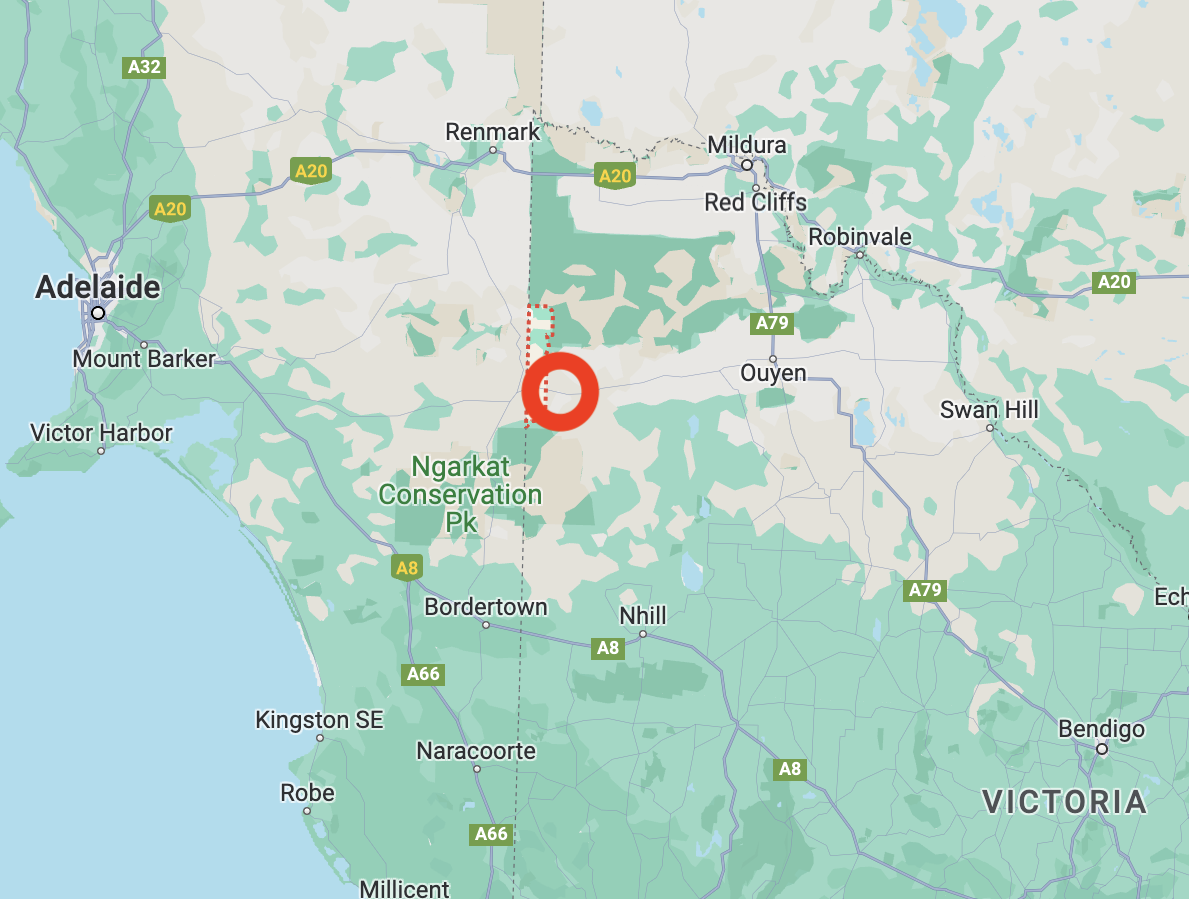
Our second park for Thursday 9th November 2023 was the Manya Bushland Reserve VKFF-4149. This was to be a first-time activation of this park for the World Wide Flora Fauna (WWFF) program. The park is located close to the South Australia/Victoria State Border.

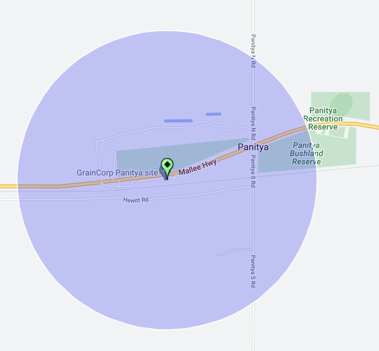
Above:- Map showing the location of the Manya Bushland Reserve. Map c/o Google Maps.

Manya is a locality situated in the Sunraysia region of Victoria, and a short drive over the South Australian State border. Manya is derived from the local Aboriginal word Manja meaning “the hand”.

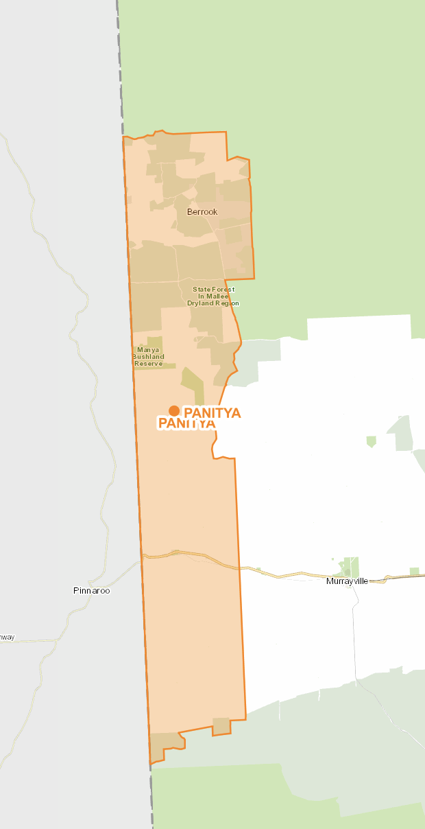
Manya Bushland Reserve is 851 hectares in size and was declared on the 8th day of May 1990. The Reserve’s western border follows the Victoria/South Australian State border.

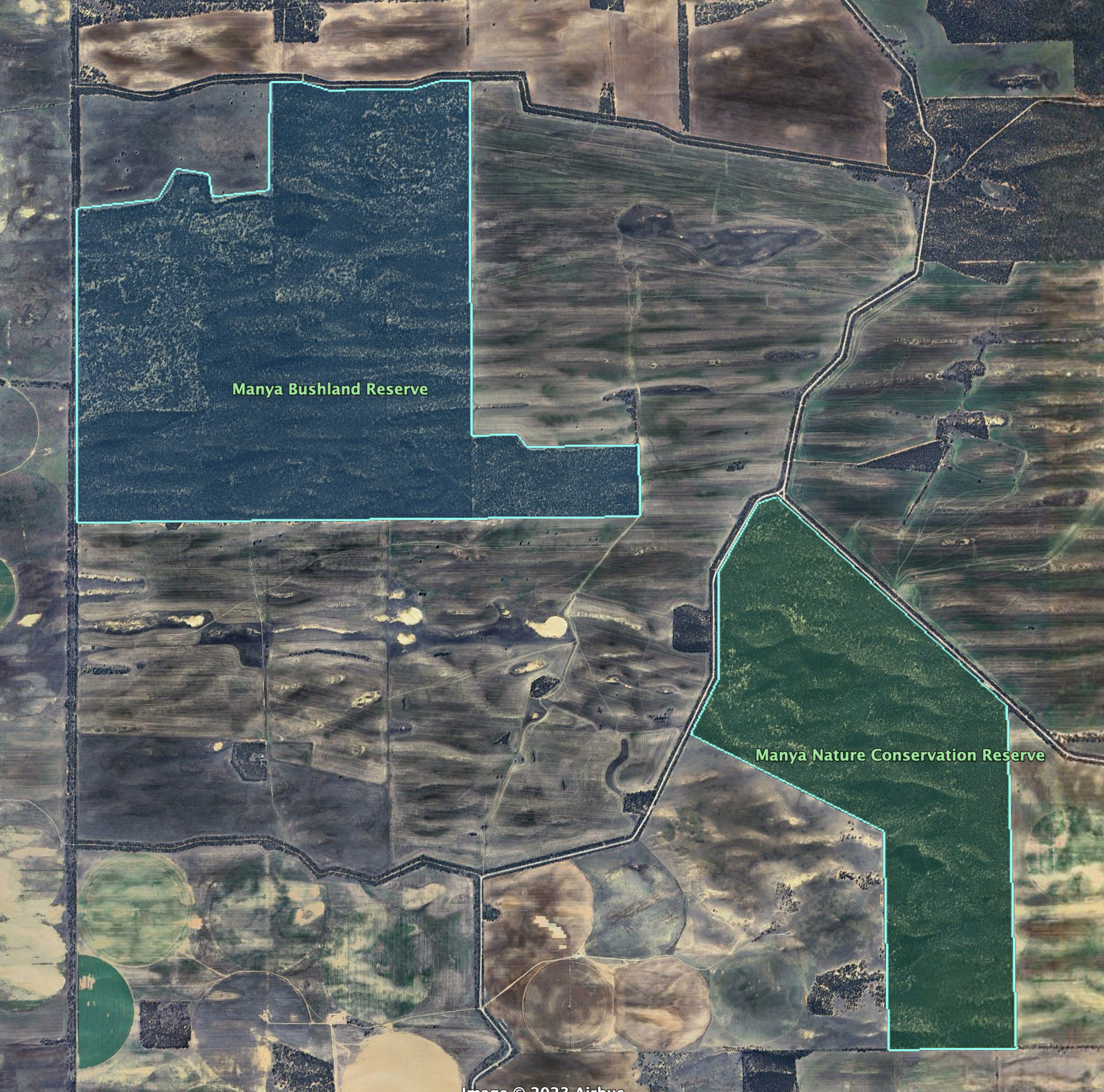
Above:- Map of the Manya Bushland Reserve. Map c/o Google Earth

There is a page on the Parks Victoria website for Manya Bushland Reserve, but it contains no information about the reserve.

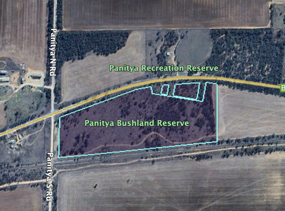
To get to the park we travelled north on Panitya North Road, passing the Manya Nature Conservation Reserve, which we had activated previously. We then turned left onto Alan Road and headed west. We soon reached the northern boundary of the park.

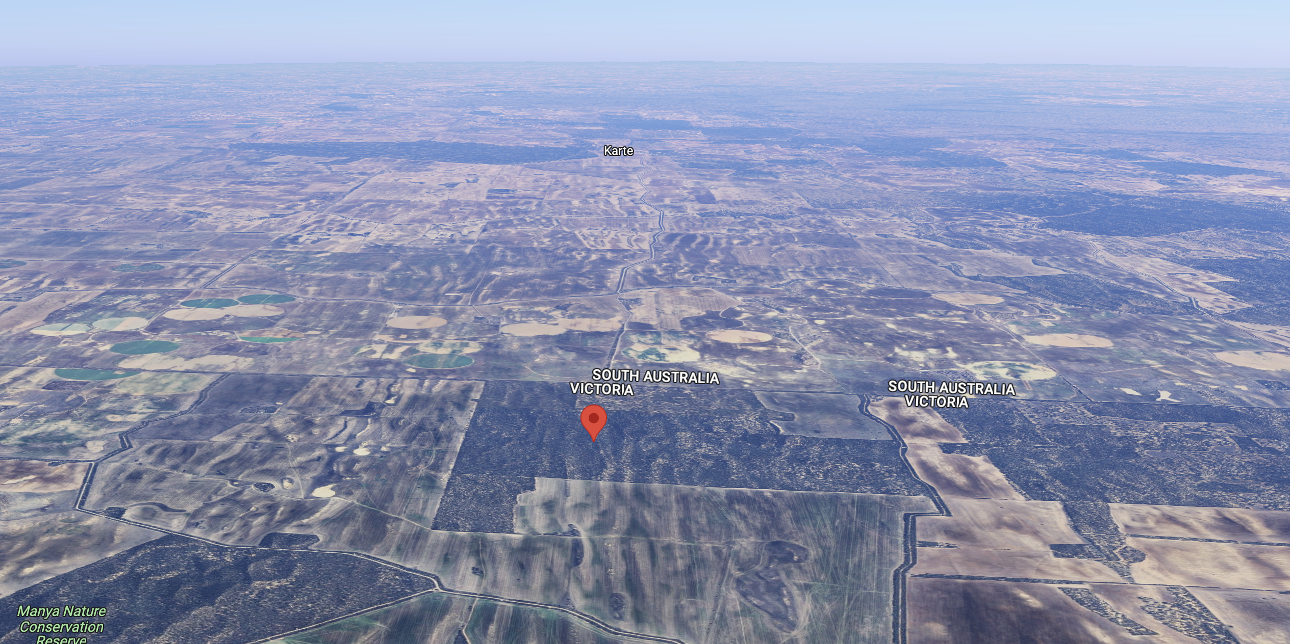
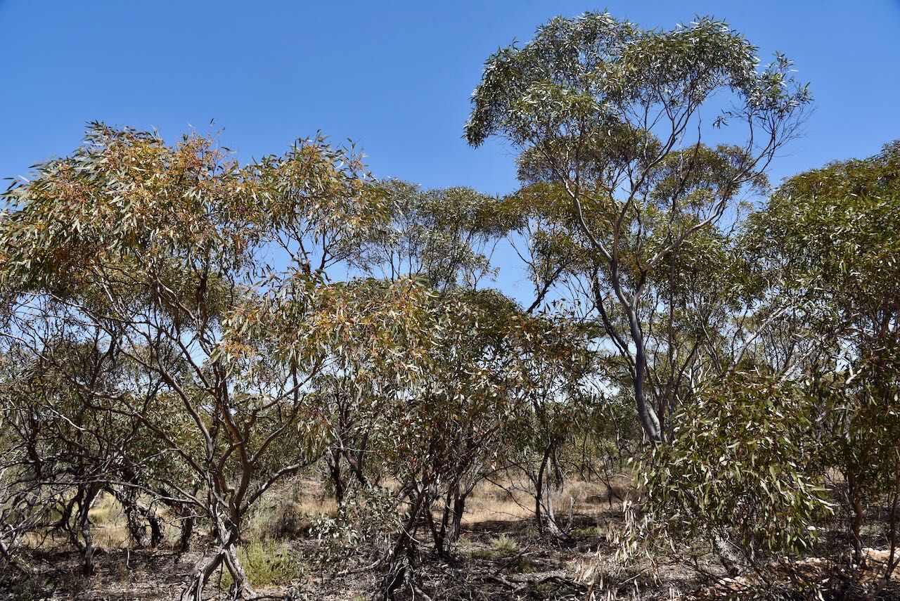
Above:- An aerial view of the park looking west. Image c/o Google Maps.

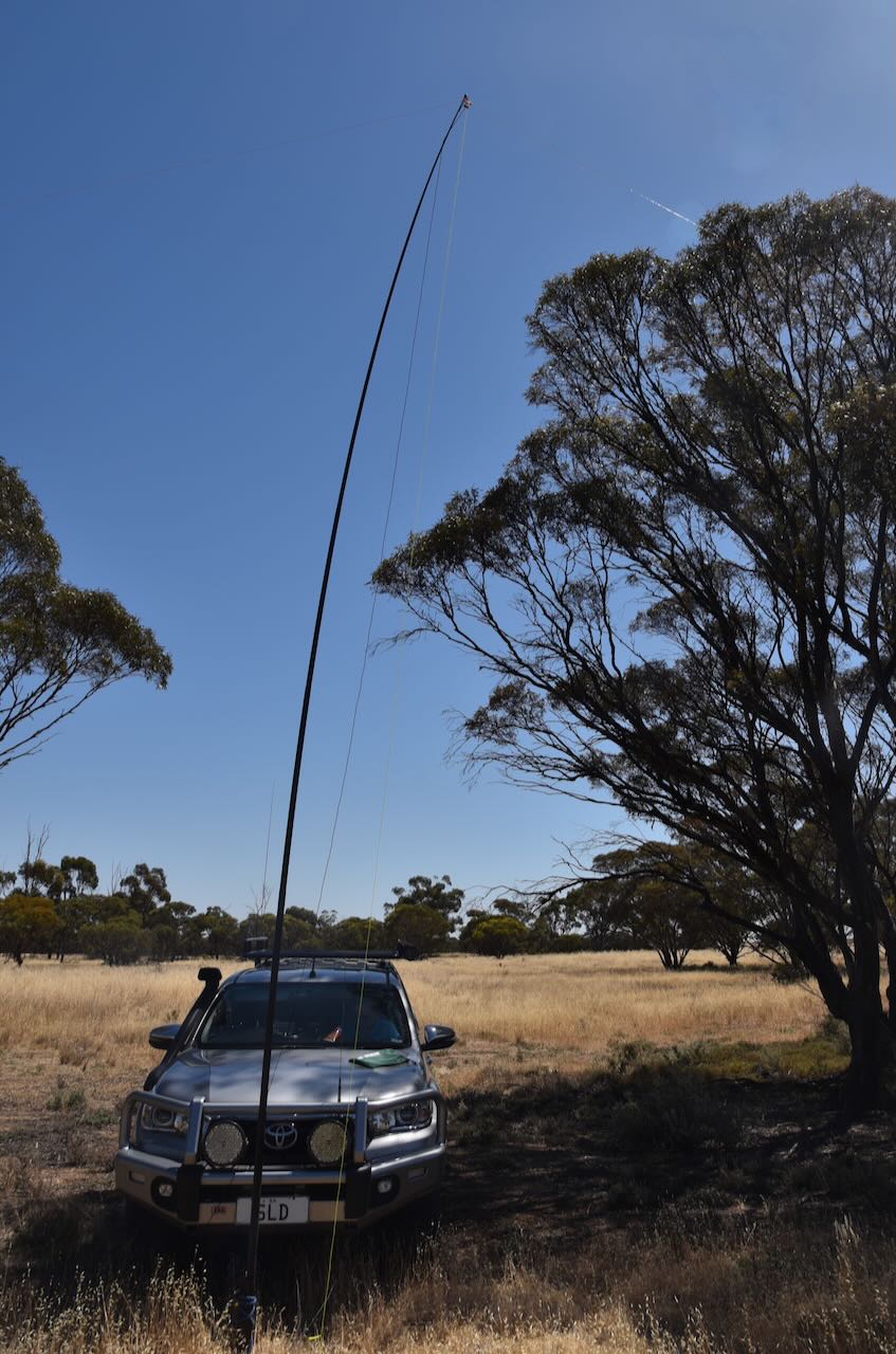
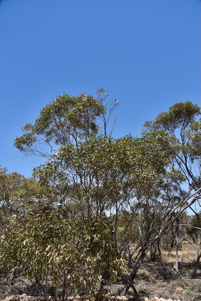
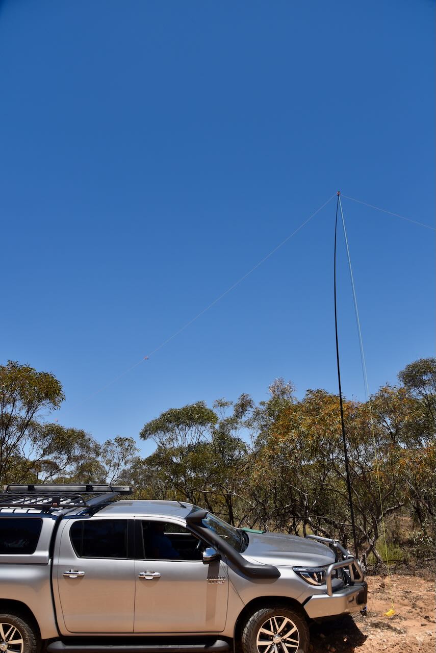
We operated from the vehicle for this activation, running the Yaesu FT857, 40 watts, and the 20/40/80m linked dipole supported by the 7-metre heavy-duty squid pole.

Marija worked the following stations on 40m SSB:-

  1. VK5DU
  2. VK3UAO
  3. VK3MTT
  4. VK3SX
  5. VK5IS
  6. VK3PF
  7. VK3BBB
  8. VK2CCP
  9. VK5HAA
  10. VK5JOS
  11. VK2IO/p (Ouyen I245A Bushland Reserve VKFF-4207)

I worked the following stations on 40m SSB:-

  1. VK5DU
  2. VK3UAO
  3. VK3MTT
  4. VK3SX
  5. VK5IS
  6. VK3PF
  7. VK3BBB
  8. VK2CCP
  9. VK5HAA
  10. VK5JOS
  11. VK5FANA
  12. VK3DCQ
  13. VK3ZSC
  14. VK5FB
  15. VK5PO
  16. VK2IO/p (Ouyen I245A Bushland Reserve VKFF-4207)
  17. VK3ANL
  18. VK7XX
  19. VK5AAY
  20. VK5CZ
  21. VK5GY
  22. VK2KYO
  23. VK3DAC
  24. VK3VIN
  25. VK3SQ
  26. VK2BD
  27. VK2IO/m
  28. VK5KLV
  29. VK3SG
  30. VK3MIJ
  31. VK3KAI/m
  32. VK3CEO
  33. VK3CLD
  34. VK3APJ
  35. VK5MOO
  36. VK2XB/3
  37. VK3BSB/m
  38. VK2EXA

I worked the following stations on 40m AM:-

  1. VK5FB
  2. VK5PO
  3. VK2IO/p (Ouyen I245A Bushland Reserve VKFF-4207)
  4. VK5HAA
  5. VK3ANL
  6. VK5AAY
  7. VK5IS
  8. VK5CZ
  9. VK5GY

I worked the following stations on 20m SSB:-

  1. VK1AO
  2. VK2MET
  3. VK4NH
  4. VK4DXA
  5. VK7XX
  6. VK7AAE

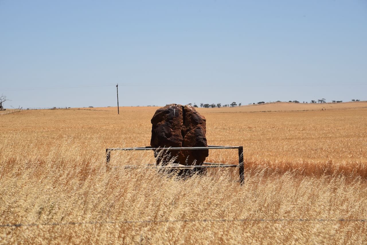
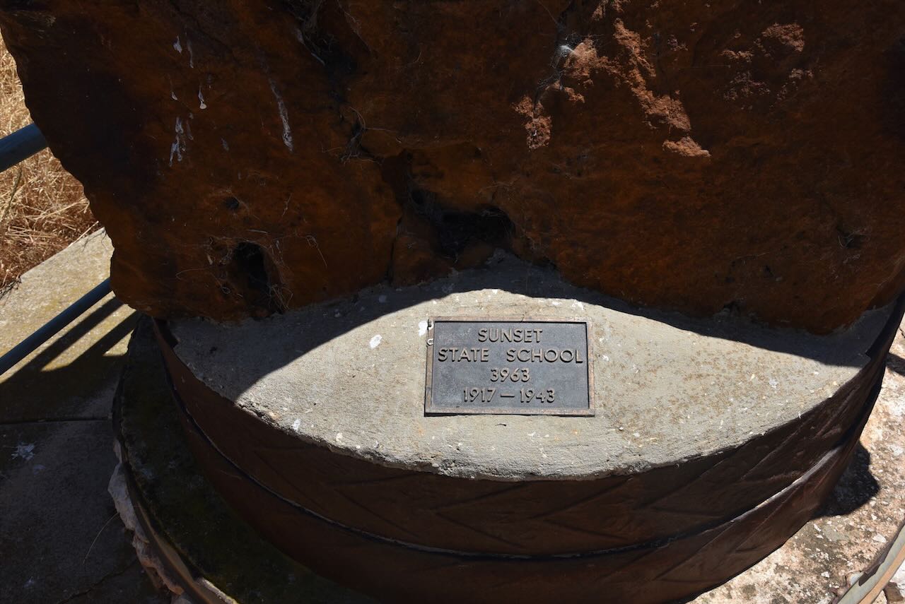
On our way back to the Mallee Highway we stopped briefly on Panitya North Road to have a look at the monument for the old Sunset State School. The school was in operation between 1917-1943.

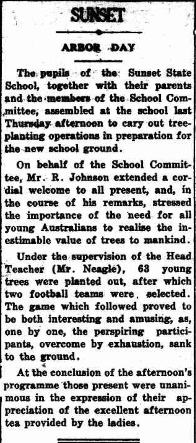
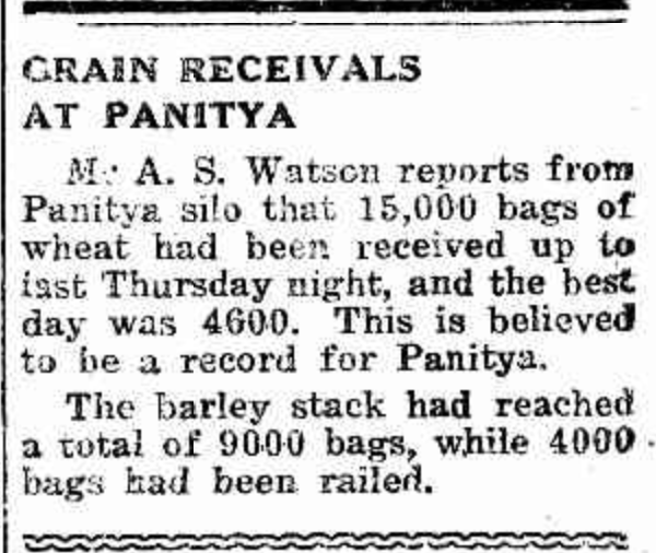
Above: article from the Pinnaroo and Border Times, Fri 4 Jul 1930. Image c/o Trove.

References.

  1. CAPAD 2022
  2. Wikipedia, 2023, <https://en.wikipedia.org/wiki/Manya,_Victoria>, viewed 22nd December 2023.

Panitya Bushland Reserve VKFF-4148 and Panitya silo VK-PNA3

Our next activation for Thursday 9th November 2023 was the Panitya Bushland Reserve VKFF-4148 and the Panitya silo VK-PNA3. This was to be a first-time activation of this park.

Panitya is a locality in the north-western area of Victoria, about 23 km east of the town of Pinnaroo in South Australia.

Above:- Map showing the location of Panitya. Map c/o Google Maps.

Panitya appears to be an aboriginal word meaning ‘area of land.’ The locality of Panitya extends in the south from the Big Desert Wilderness Area to the Murray Sunset National Park in the north.

Above:- The locality of Panitya. Image c/o maps.land.vic.gov.au

The Panitya Post Office opened in 1910 and was closed in 1975. The Panitya railway station was opened for goods in March 1915, and then passengers in July 1915. It was part of the Ouyen to Pinnaroo railway line which closed in 2007.

Above:- a plan of the township of Panitya. Image c/o State Library Victoria.

Above:- article from the Pinnaroo and Border Times, Thu 9 Dec 1954. Image c/o Trove

The Panitya Bushland Reserve is about 14 hectares in size and was declared on the 8th day of May 1990. It is located on the southern side of the Mallee Highway and to the east of Panyita S Road.

Above:- Map of the Panitya Bushland Reserve. Map c/o Google Earth.

There is a page on the Parks Victoria website for the Panitya Bushland Reserve, but it contains no information about the reserve.

Don’t get the reserve confused with the Panitya Recreation Reserve which is located on the northern side of the Mallee Highway.

Adjacent to the reserve is a sign relating to the first sale of allotments in the township of Panitya. There is also an old water tower alongside the old railway line.

The Panitya silos are located on the southern side of the Mallee Highway and to the north of Hewitt Road.

The Panitya silos were constructed during the 1930s and had a capacity of 110,000 bushels.

Above:- The Panitya silos in 1939. Image c/o State Library South Australia (B 69739).

I found an article on Trove that referred to a group of 44 scholars from Oakbank ARea school who travelled to the Pinaroo district in 1948. During their visit, they got to climb the Panitya silo.

Above:- article from the Pinnaroo and Border Times, Thu 22 Jul 1948. Image c/o Trove

We set up in the western section of the Panitya Bushland Reserve which is in the activation zone for the Panitya silo.

The flies were out in force so we operated from the vehicle for this activation. We ran the Yaesu FT857, 40 watts, and the 20/40/80m linked dipole.

Marija worked the following stations on 40m SSB before the UTC rollover:-

  1. VK5HS
  2. VK3VIN
  3. VK3BEL
  4. VK3UAO
  5. VK5KLV
  6. VK5FIVE
  7. VK3PF
  8. VK3BBB
  9. VK2CCP
  10. VK3CJN
  11. VK3MTT
  12. VK2IO/p (Ouyen I245 Bushland Reserve VKFF-4207)

Marija worked the following stations on 40m SSB after the UTC rollover:-

  1. VK2IO/p (Ouyen I245 Bushland Reserve VKFF-4207)

Marija worked the following stations on 20m SSB:-

  1. ZL3RIK/p (Lake Wairarapa Wetland Conservation Area ZLFF-0143)
  2. ZL2ATH/p (Lake Wairarapa Wetland Conservation Area ZLFF-0143)

I worked the following stations on 40m SSB before the UTC rollover:-

  1. VK5HS
  2. VK3BEL
  3. VK3VIN
  4. VK3UAO
  5. VK5KLV
  6. VK3PF
  7. VK5FIVE
  8. VK3BBB
  9. VK2CCP
  10. VK3CJN
  11. VK3MTT
  12. VK3CEO
  13. VK3ANL
  14. VK2IO/p (Ouyen I245 Bushland Reserve VKFF-4207)
  15. VK3APJ
  16. VK3SG
  17. VK3FTOM
  18. VK5FANA
  19. VK2DG
  20. VK3APT
  21. VK5HAA
  22. VK5AAF
  23. VK3DAC
  24. VK5DU
  25. VK5IS
  26. VK3CLD
  27. VK2VAR
  28. VK2GOM
  29. VK3ACZ
  30. VK1AD
  31. VK1NAM

I worked the following stations on 40m SSB after the UTC rollover:-

  1. VK1AD
  2. VK1NAM
  3. VK3CEO
  4. VK3CLD
  5. VK5AV
  6. VK2VAR
  7. VK2GOM
  8. VK3VIN
  9. VK3PF
  10. VK3ACZ
  11. VK3SMR/m
  12. VK5FANA
  13. VK3APT
  14. VK3DAC
  15. VK3SG
  16. VK3CJN
  17. VK7XX
  18. VK5IS
  19. VK5KLV
  20. VK3KRL
  21. VK2IO/p (Ouyen I245 Bushland Reserve VKFF-4207 VKFF-4207)
  22. VK3DCQ
  23. VK5GY

I worked the following stations on 20m SSB:-

  1. ZL3RIK/p (Lake Wairarapa Wetland Conservation Area ZLFF-0143)
  2. ZL2ATH/p (Lake Wairarapa Wetland Conservation Area ZLFF-0143)
  3. VK4NH
  4. VK4DXA
  5. VK1AO
  6. VK2MET
  7. VK4XCS
  8. ZL3MR

References.

  1. CAPAD 2023
  2. Trove, 2023, <https://trove.nla.gov.au/newspaper/article/43200674>, viewed 22nd December 2023.
  3. Trove, 2023, <https://trove.nla.gov.au/newspaper/article/92453423?searchTerm=panitya%20silo>, viewed 22nd December 2023.
  4. Wikipedia, 2023, <https://en.wikipedia.org/wiki/Panitya,_Victoria>, viewed 22nd December 2023.
  5. Wikipedia, 2023, <https://en.wikipedia.org/wiki/Pinnaroo_railway_line,_Victoria>, viewed 22nd December 2023.