Murrayville Flora & Fauna Reserve VKFF-2407 & Murrayville silo VK-MRL3

Our final park for Thursday 9th November 2023 was the Murrayville Flora & Fauna Reserve VKFF-2407 and the Murrayville silo VK-MRL3.

Above:- Map showing the location of Murrayville. Map c/o Google Maps.

This was not a planned activation for us. We decided to head out to activate the park following our evening meal at the Murrayville Hotel.

The Murrayville Flora & Fauna Reserve is about 254 hectares in size and was established on the 8th day of May 1990. The park is also referred to as the Murrayville Nature Conservation Reserve. The park is divided into three sections.

We operated from the southwestern corner of the park.

Above:- Aerial view of the park showing our operating spot. Image c/o Google Earth.

We were in the activation zone of the Murrayville silo.

Above:- the activation zone at the Murrayville silo. Image c/o SiOTA website.

Marija worked the following station on 40m SSB:-

  1. VK3BEL/p (Barmah National Park VKFF-0739)

I worked the following stations on 40m SSB:-

  1. VK3CEO
  2. VK3PF
  3. VK7IAN
  4. VK5LA
  5. VK5KAW
  6. VK3YV
  7. VK2IO/p (Blue Mountain Bushland Reserve VKFF-4220)
  8. VK3BEL/p (Barmah National Park VKFF-0739)
  9. VK1AO
  10. VK2MET
  11. VK3OAK
  12. VK3DCQ
  13. VK4ABK
  14. VK4NH
  15. VK4DXA
  16. VK4PDX
  17. VK4HMI
  18. VK1CHW
  19. VK3UH
  20. VK3CWF
  21. VK4EMP
  22. VK4TI
  23. JF7RJM
  24. VK4AAA
  25. VK3AEI
  26. VK5AAR
  27. VK5GY
  28. VK3BBB
  29. VK2CCP
  30. VK2NEF
  31. VK2GWB
  32. VK5AMH
  33. VK5DW
  34. VK3ACZ
  35. VK3SMW
  36. VK4BU
  37. VK5CZ
  38. VK2EMI
  39. VK7AAE
  40. VK3LOC
  41. VK4ADX
  42. VK2NZ
  43. VK4SMA
  44. VK2EXA
  45. VK3SO

I worked the following stations on 80m SSB:-

  1. VK2EXA
  2. VK2IO/p (Blue Mountain Bushland Reserve VKFF-4220)
  3. VK3LOC
  4. VK3BBB
  5. VK2CCP
  6. VK5GY
  7. VK3ACZ
  8. VK5DW
  9. VK3UAO
  10. VK5AMH

References.

  1. CAPAD 2022

Murrayville Bushland Reserve VKFF-4141 and Murrayville silo VK-MRL3

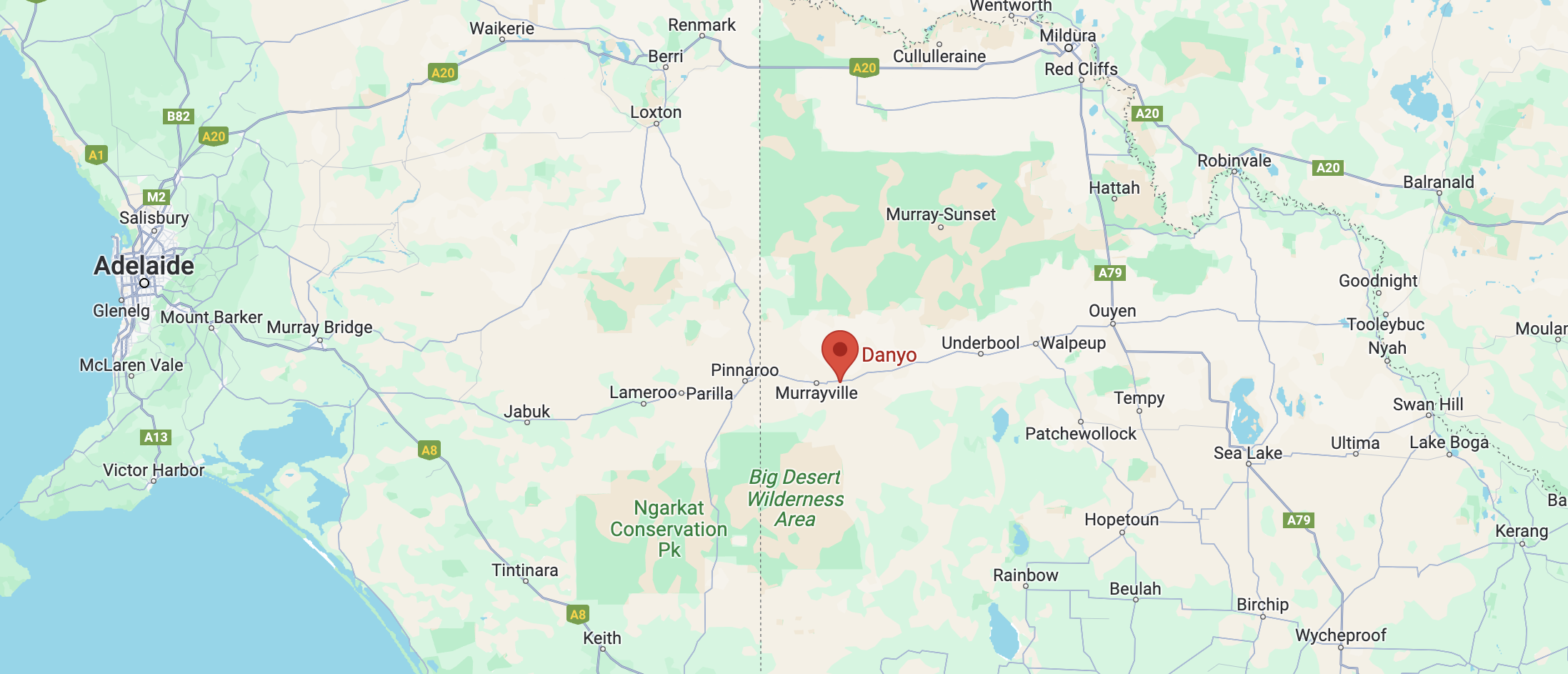
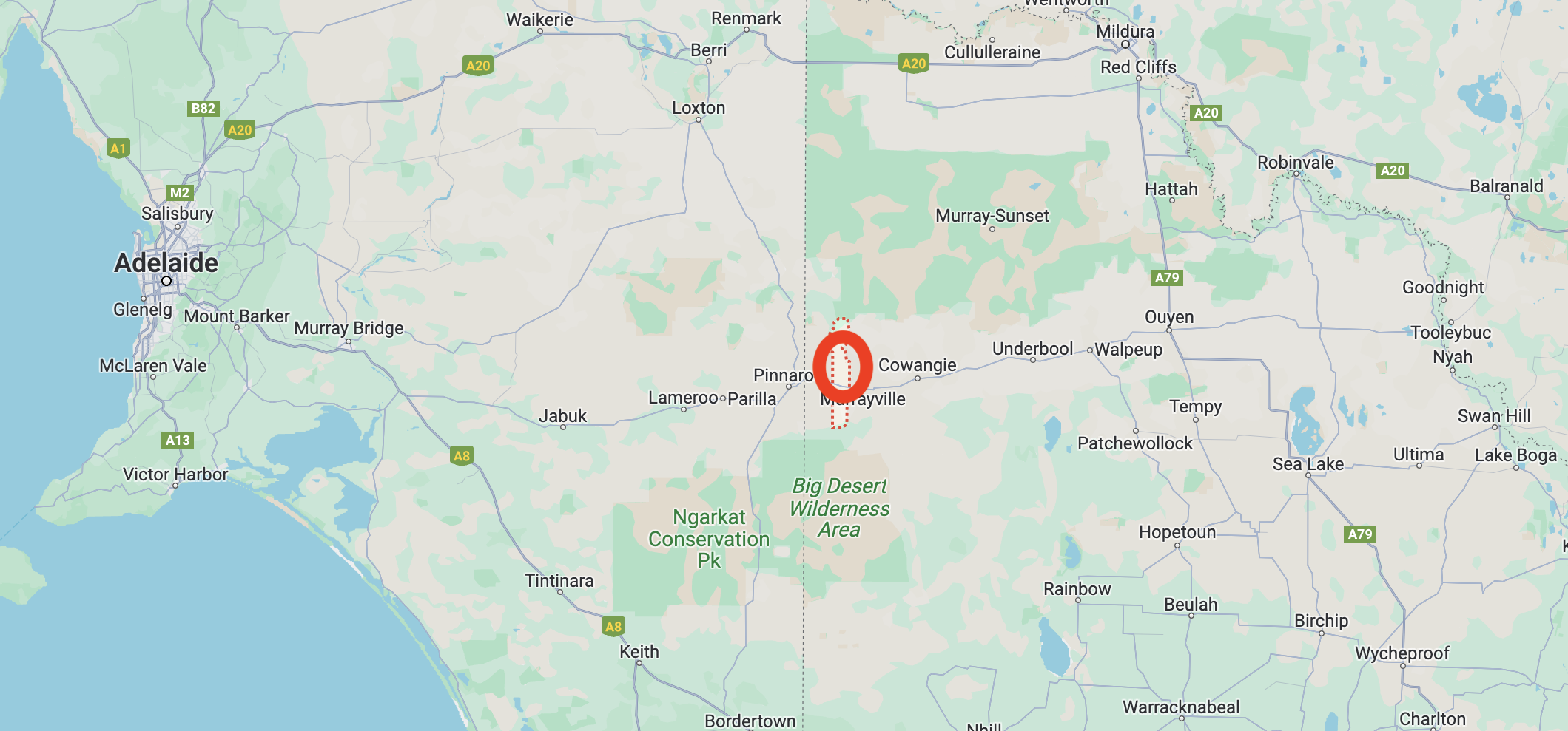
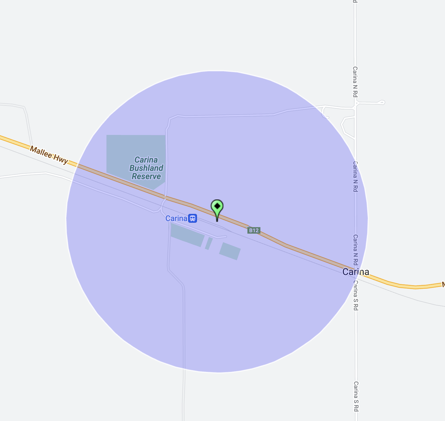
Our next park for Thursday 9th November 2023 was the Murrayville Bushland Reserve VKFF-4141 and the Murrayville silo VK-MRL3. 

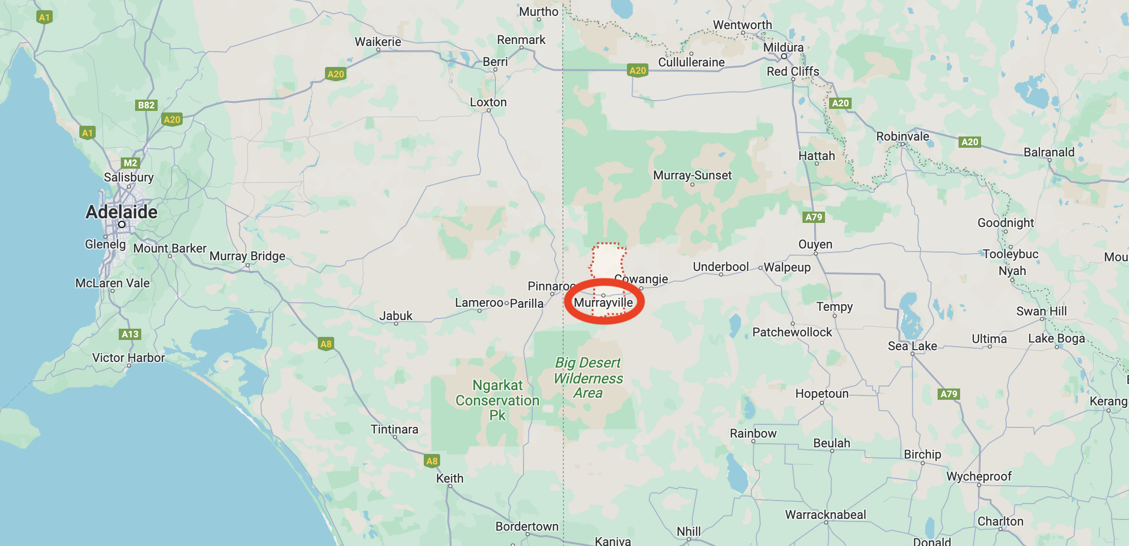
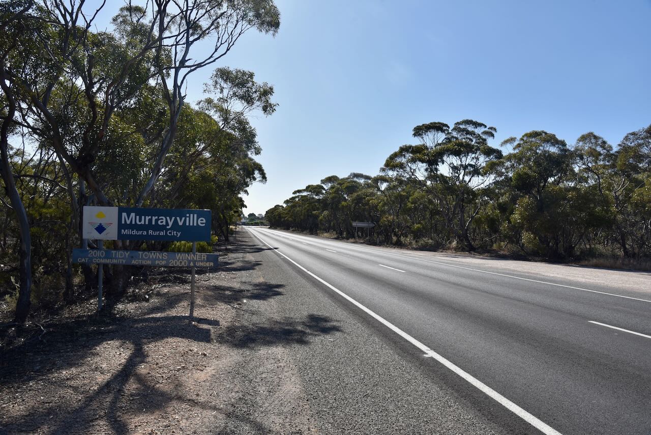
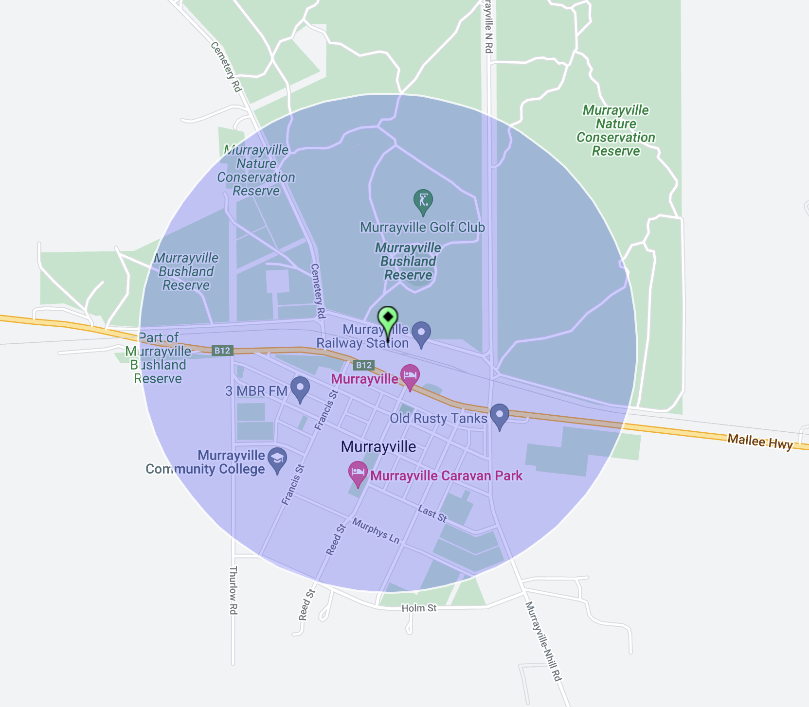
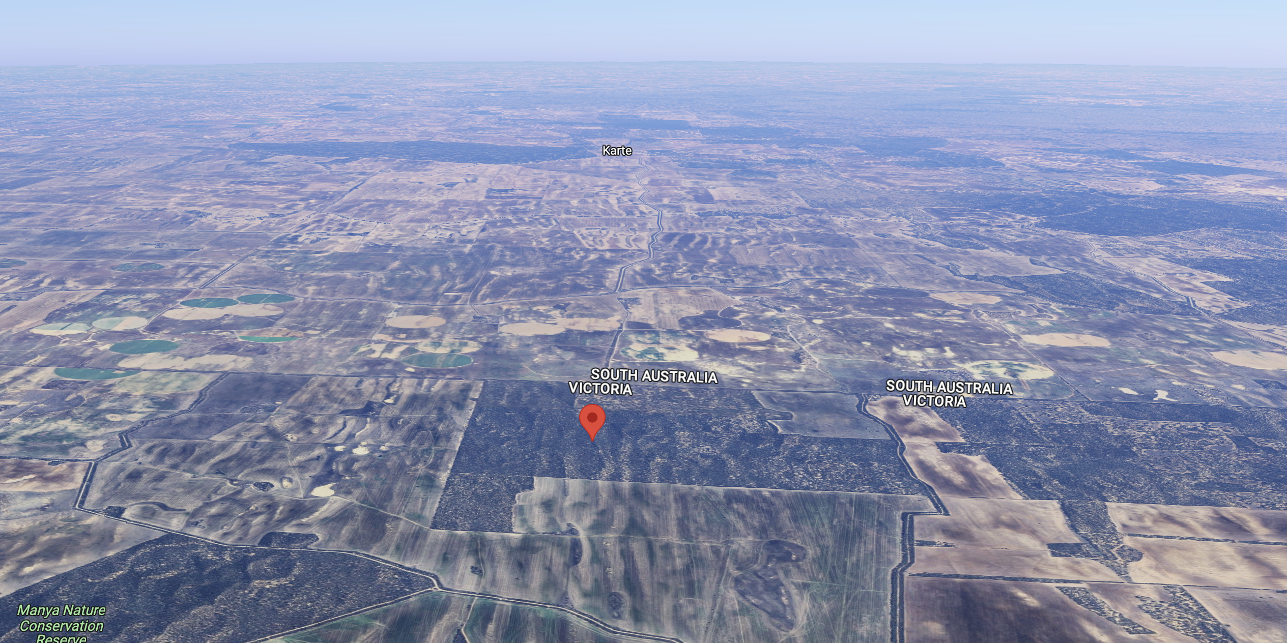
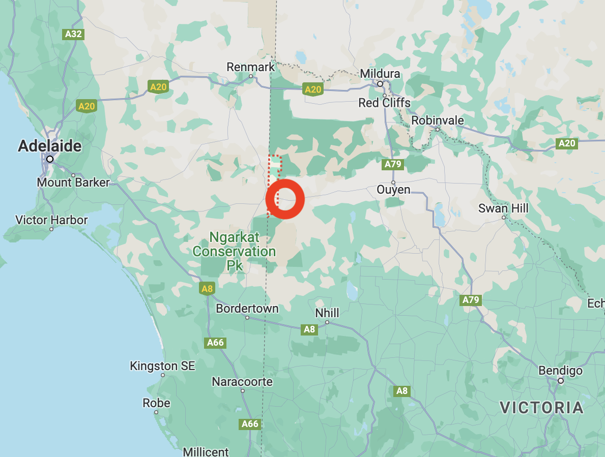
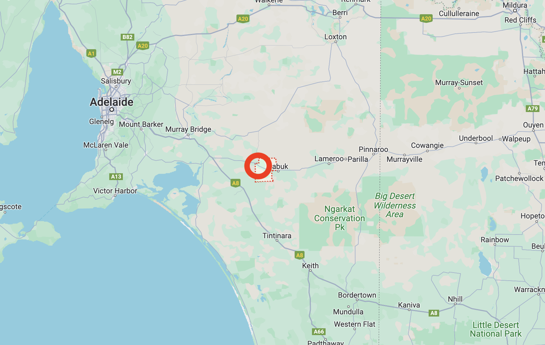
Murrayville is located in northwest Victoria, about 268 km east of Adelaide and about 110 km west of Ouyen.

Above:- Map showing the location of Murrayville. Map c/o Google Maps.

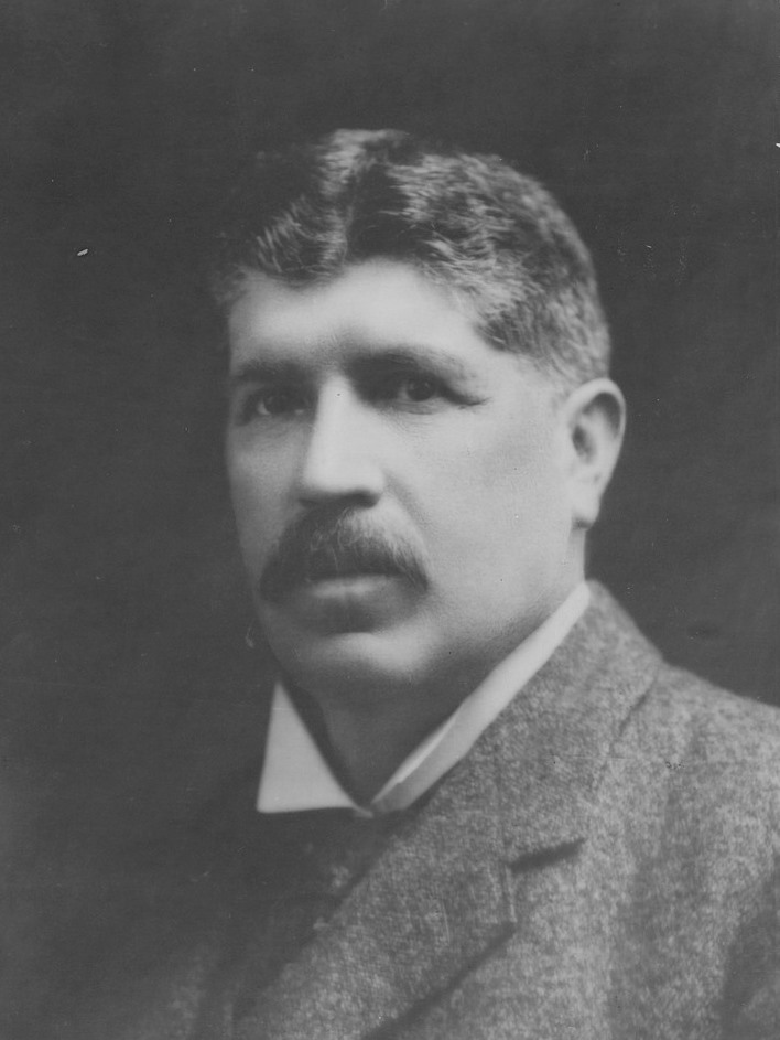
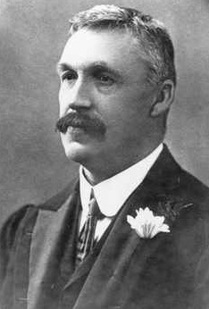
Murrayville is named in honour of John Murray (b. 1851. d. 1916), an Australian politician. He was the 23rd Premier of the State of Victoria (1909-1912).

Above:- John Murray. Image c/o Wikipedia.

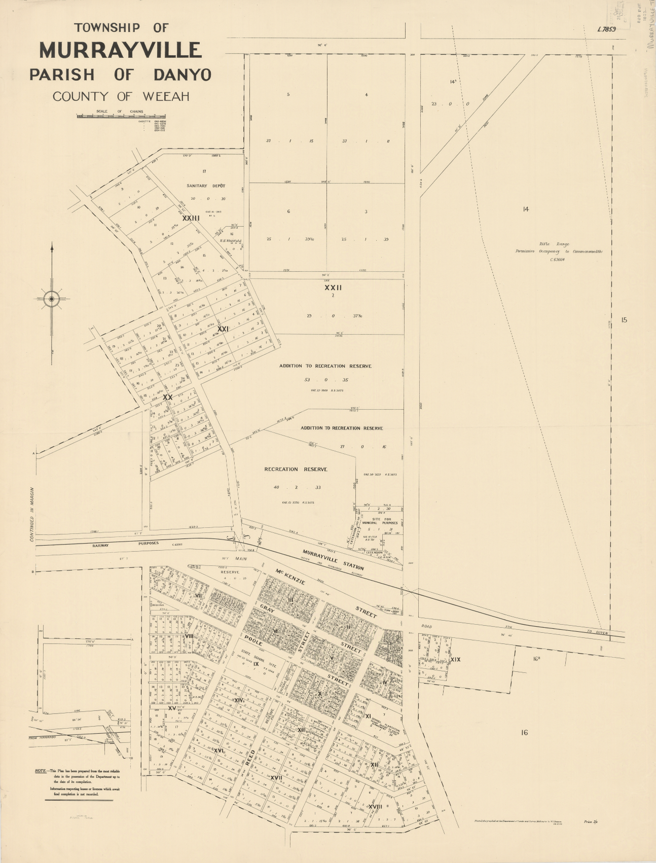
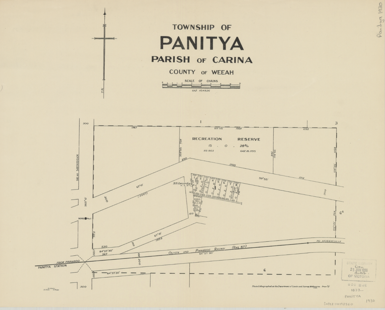
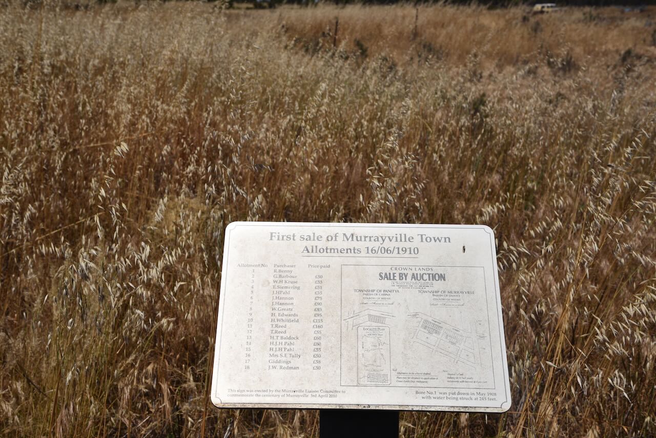
The area around Murrayville was settled in the early 1900s following reports that the country appeared to be equal to that of Pinnarroo where farming had become successful. The town of Murrayville was surveyed in 1909-10.

Above:- Plan of the township of Murrayville. Image c/o Trove.

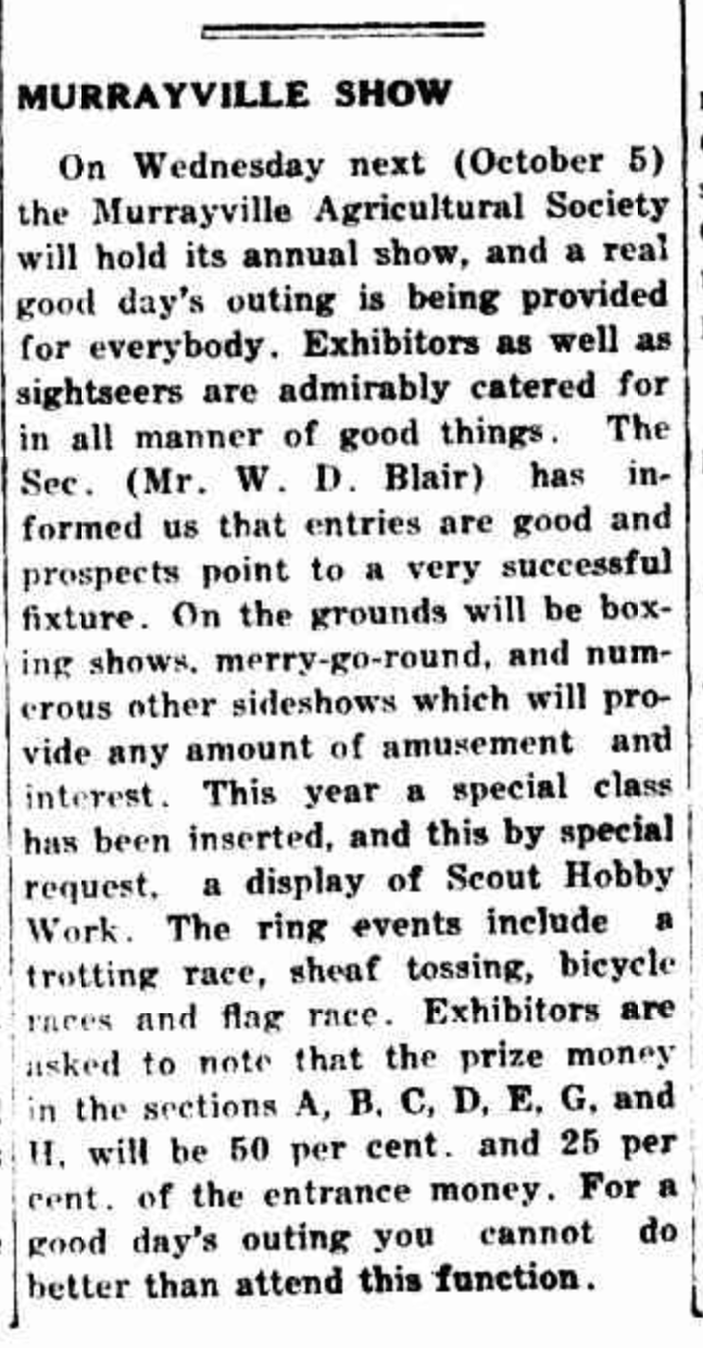
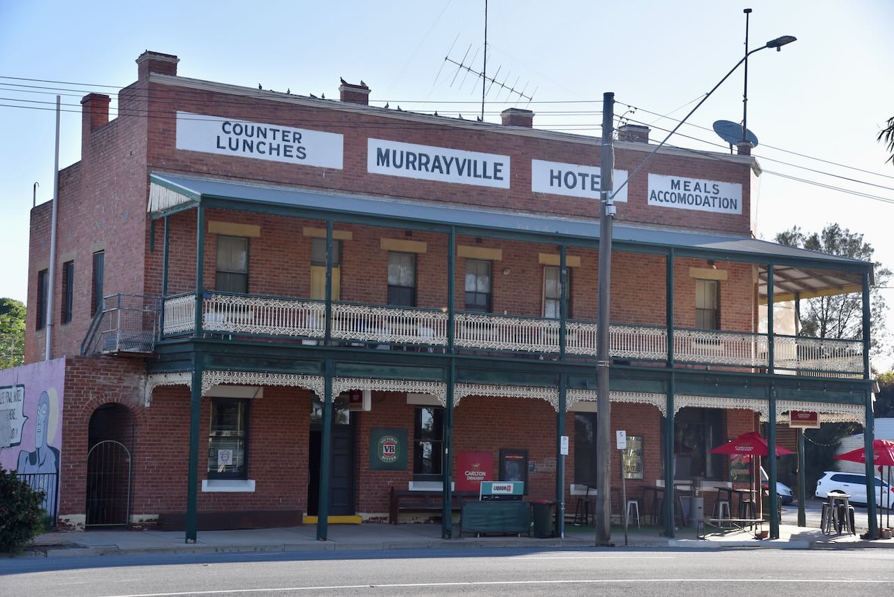
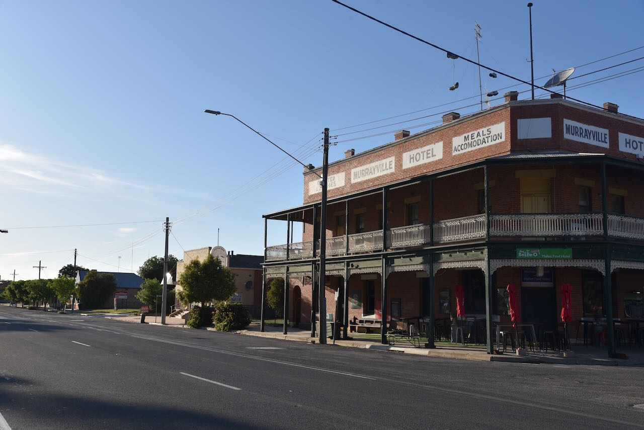
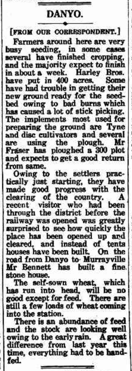
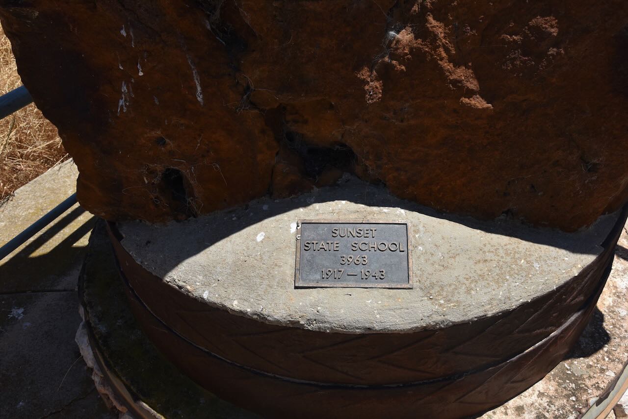
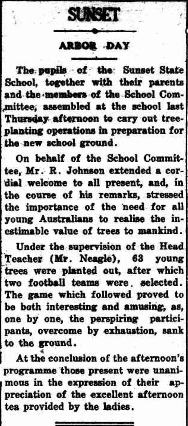
Murrayville became the largest of several townships west of Ouyen. The Murrayville Post office was opened on the 1st day of November 1910. The hotel was built in 1911, a mechanics institute and school in 1912, a Methodist church in 1912 and numerous stores. In 1911 Murayville’s population was 245 people. Between 1917-1939, an agricultural show was held at Murrayville.

Above:- article from the Pinnaroo and Border Times, Fri 30 Sep 1932. Image c/o Trove.

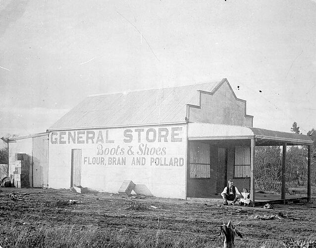
A private hospital was built in 1920, serving Murrayville until the Murrayville Bush Nursing Hospital was opened in 1954. In 1923 Lutheran and Anglican churches were built at Murrayville. By 1933 Murrayville’s population had reached 603 people. A Catholic church was built in 1937. The Murrayville Consolidated School was opened in 1944.

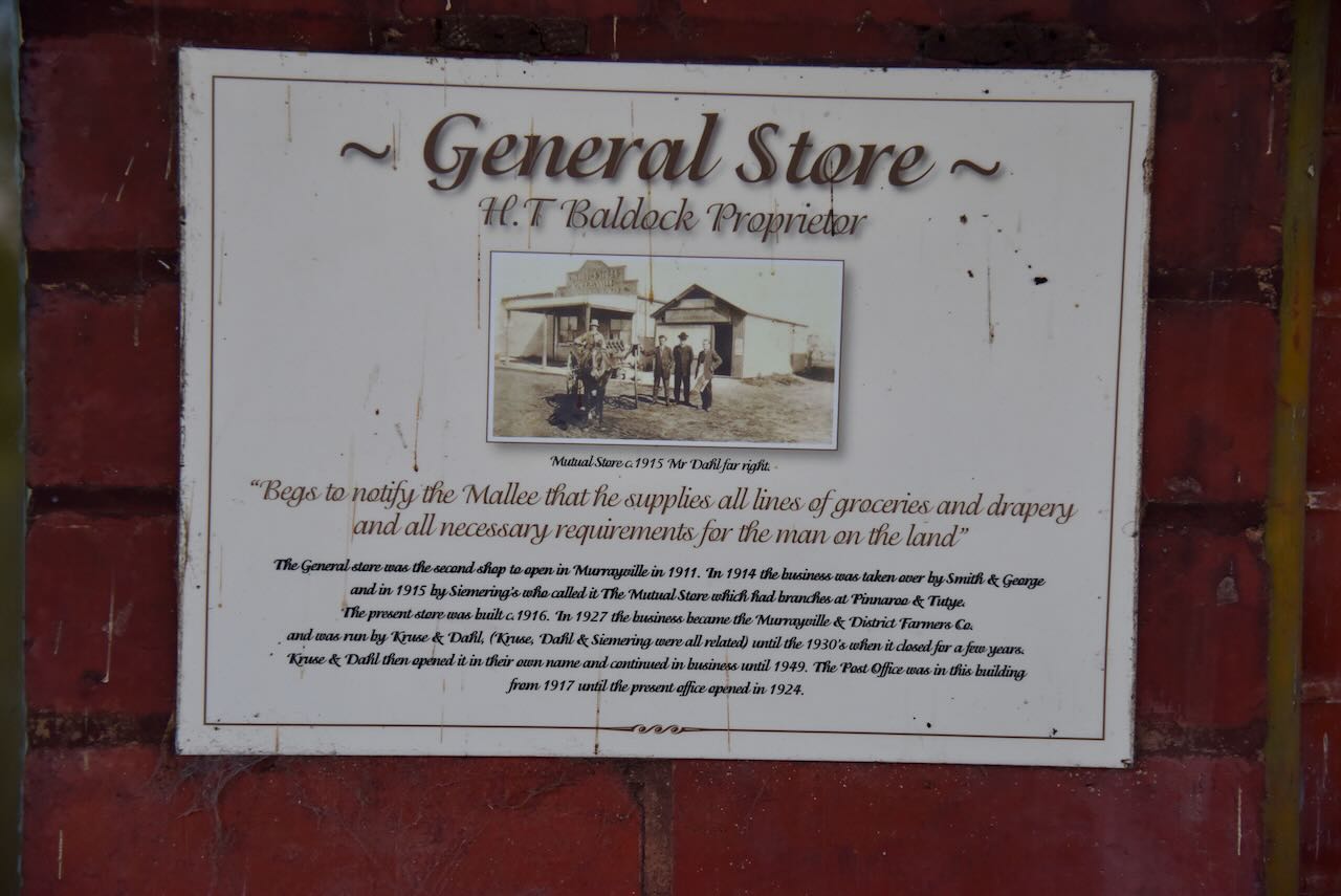
Above: Murrayville General store, c. 1905. Image c/o Museums Victoria.

Murrayville celebrated its centenary during Easter 2010. People from all over Australia visited Murrayville, with about 1,300 dinner meals served on Saturday night and 900 for the Sunday evening meal. The centenary included various antique machinery, a collection of old cars, an animal nursery, a bucking bull and a dual carriage small motorised train.

Above:- Murrayville Centenary. Image c/o http://www.murrayriver.com.au/

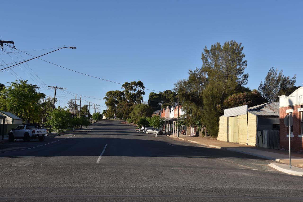
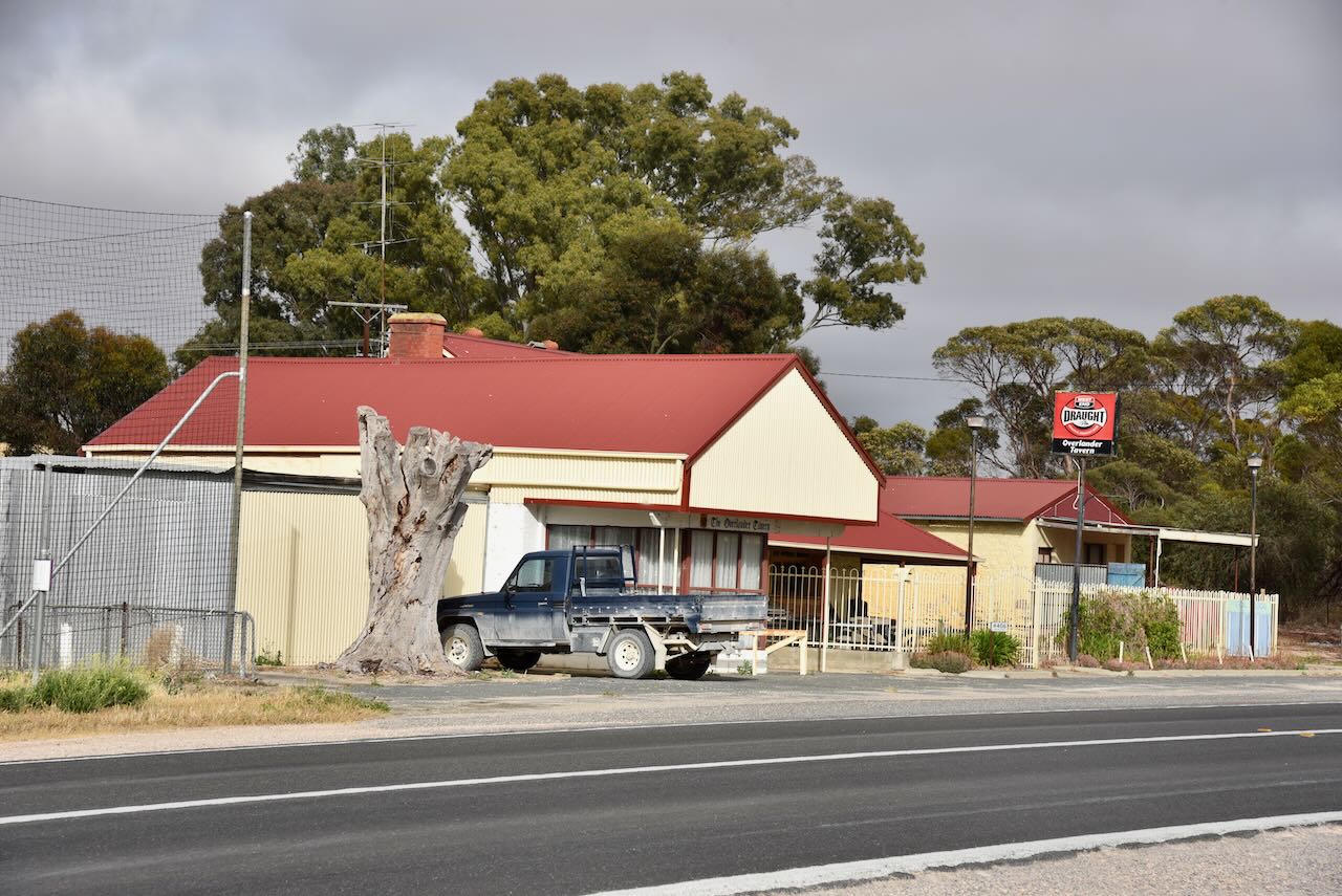
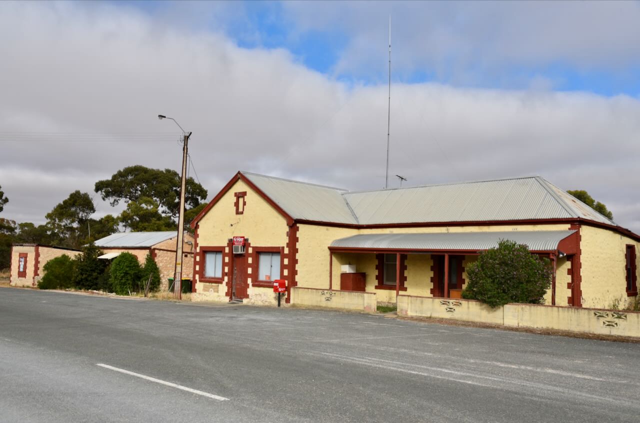
Today Murrayville has a police station, hotel, caravan park, and supermarket. The town’s main industry is cereal crops, sheep and cattle. It is also popular with tourists visiting the Murray Sunset National Park and the Wyperfeld National Park.

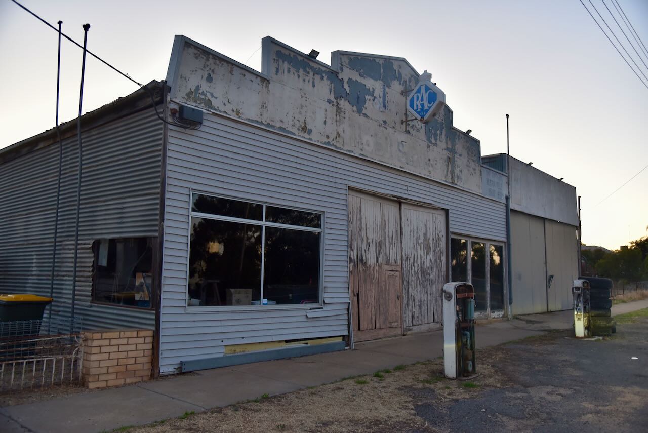
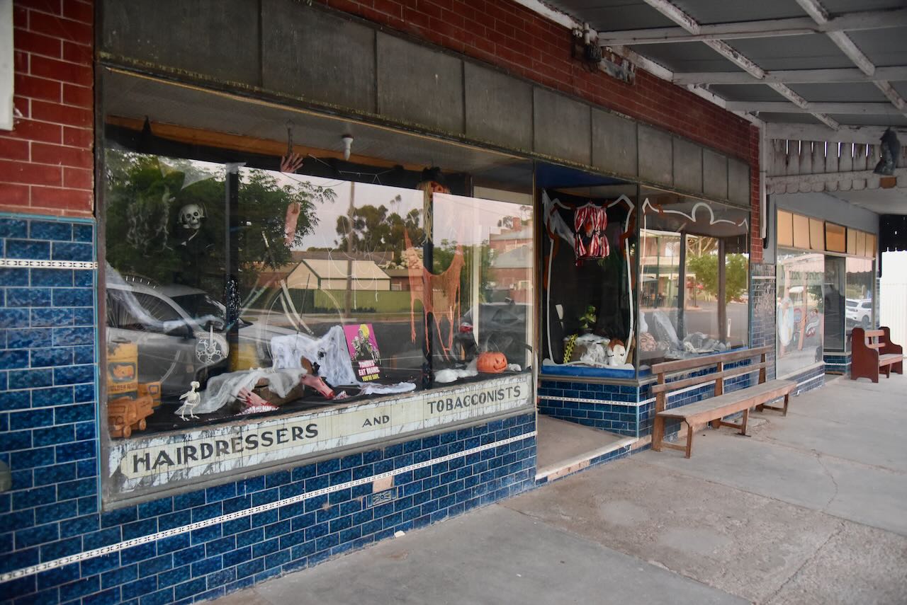
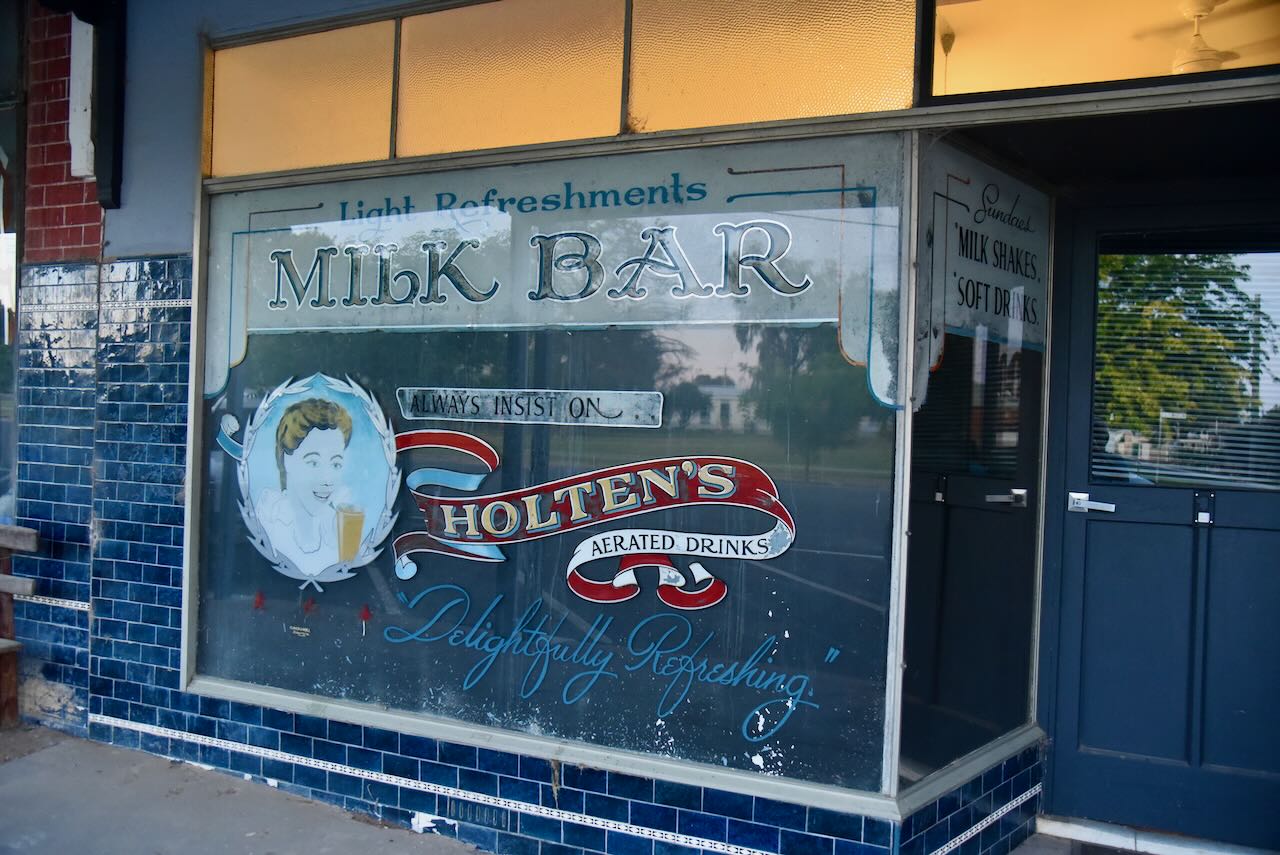
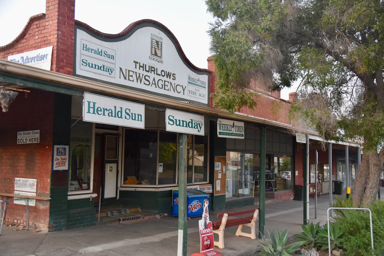
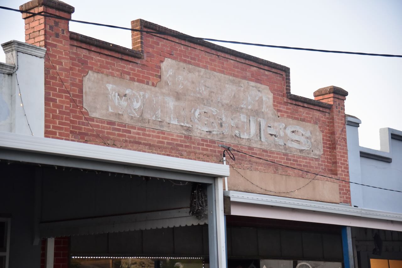
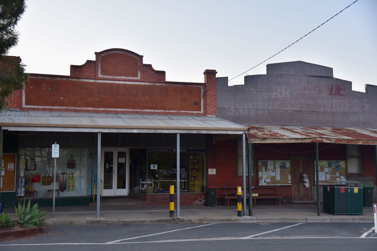
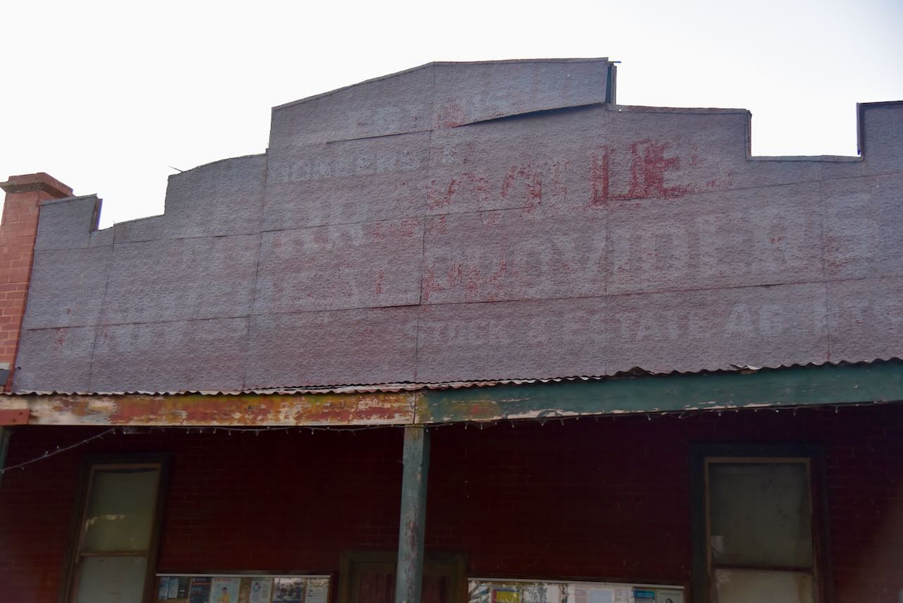
Murrayville’s main street has several historic shop fronts.

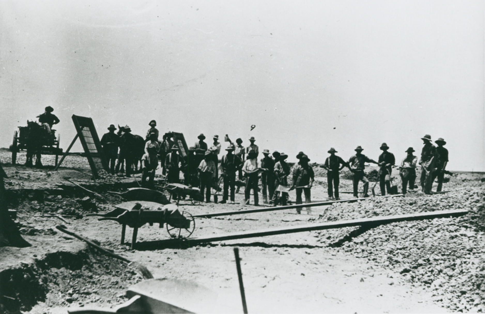
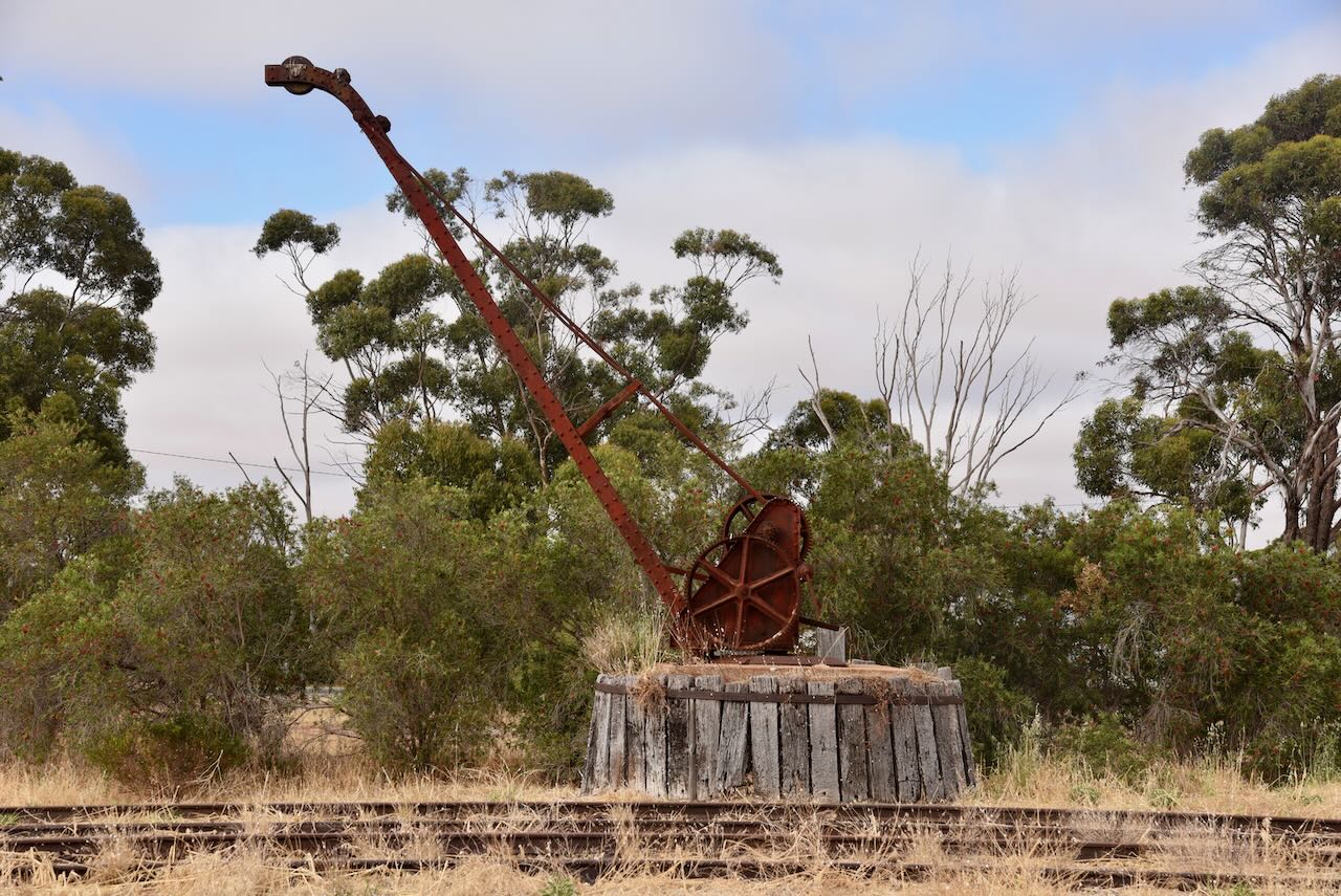
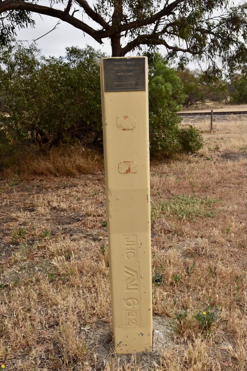
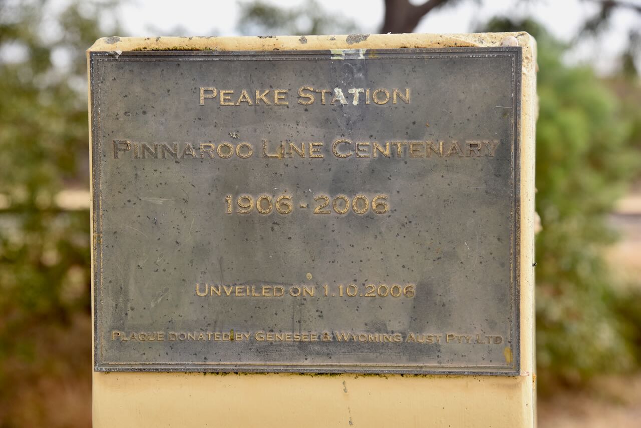
The Pinnaroo Railway Line was a former railway line constructed to service the agricultural districts of the Mallee in Victoria and South Australia. It closed on the 4th day of October 2007. The line between Ouyen to Murrayville was completed in 1912, with the line being extended to Pinnaroo in South Australia in 1915. 

Above:- railway workers on the line. Image c/o State Library South Australia (B1733)

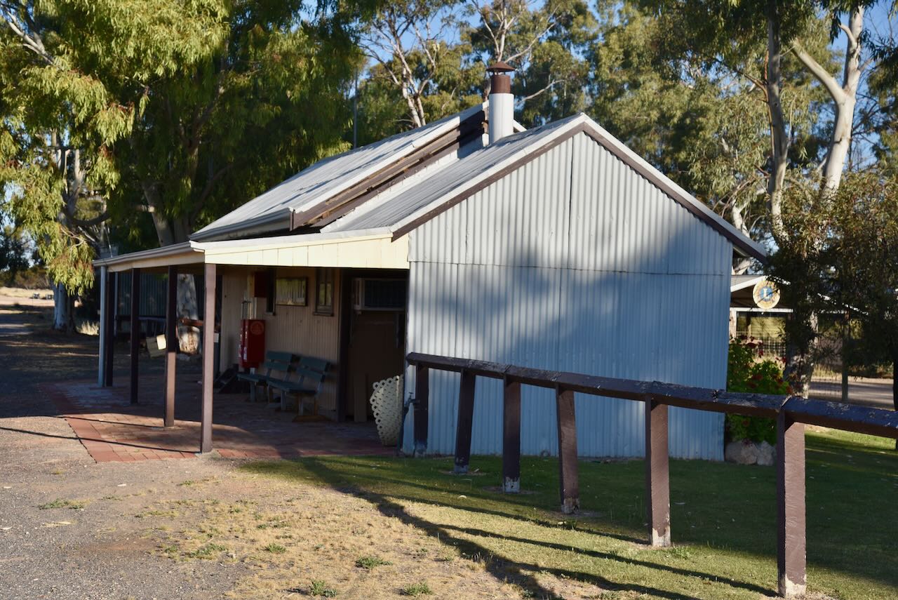
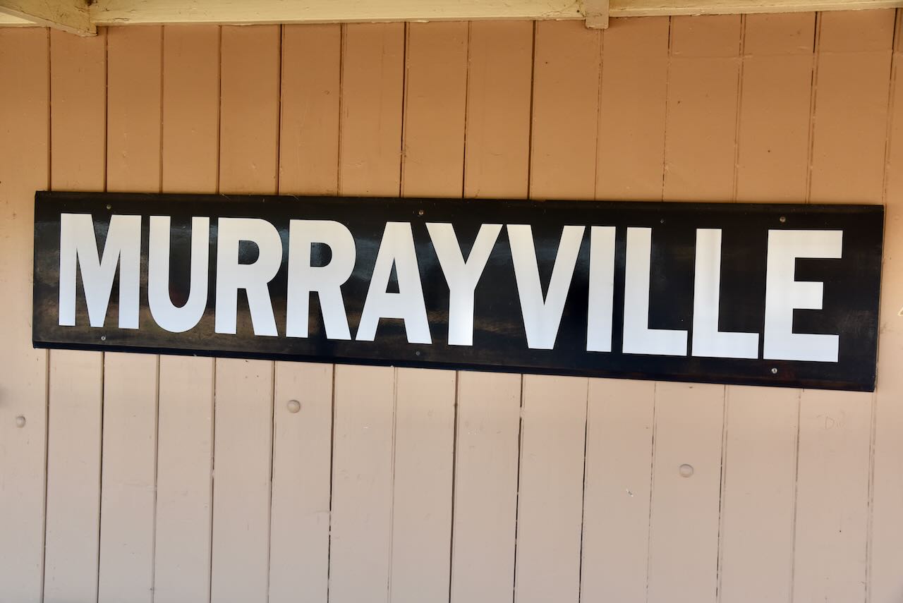
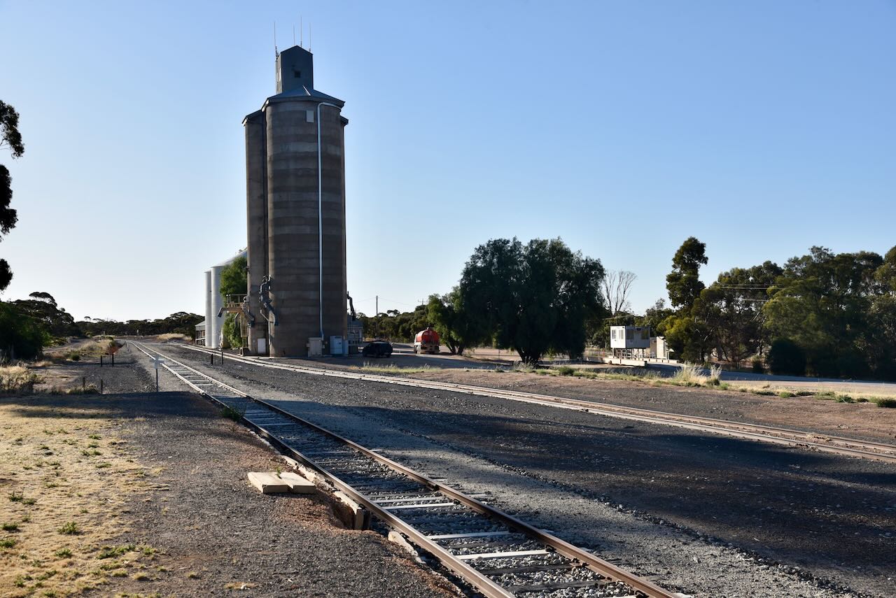
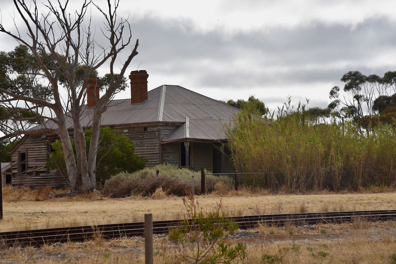
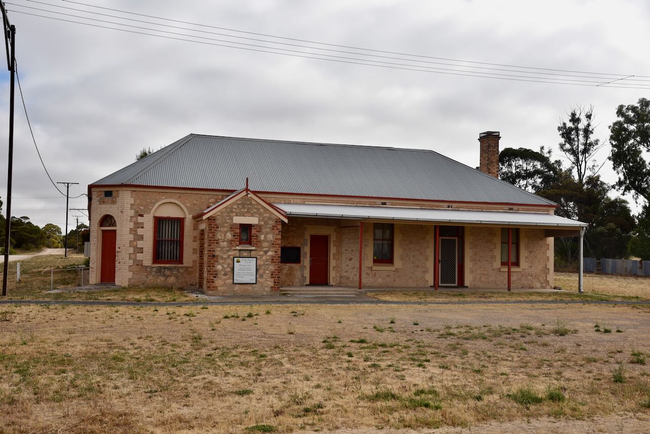
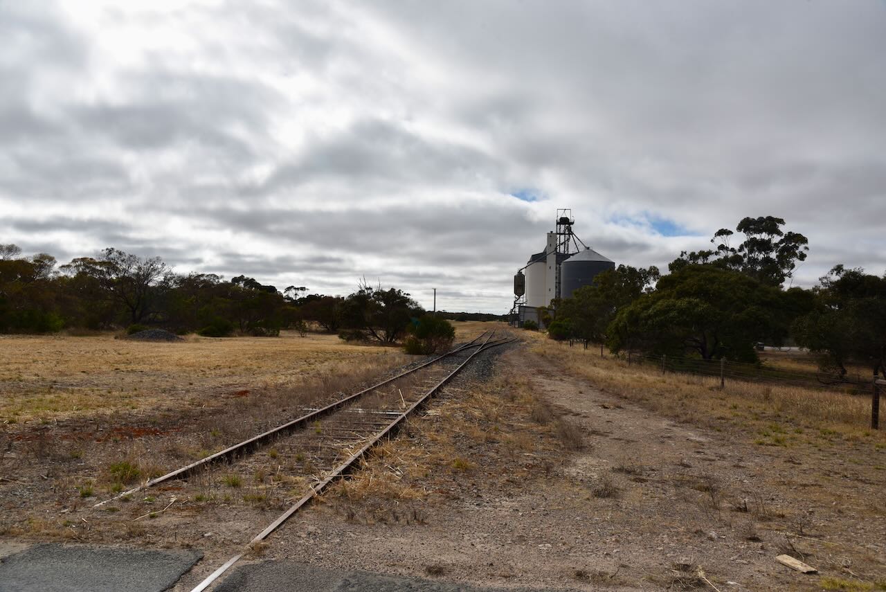
The Murrayville railway station was constructed in 1912 and consists of a standard, single-storey, timber weatherboard portable station building with a ventilated double gable roof and an attached waiting area. The iron-clad goods shed also remains today. The water tower, toilet shed and store have been demolished. The station is now used as a craft and coffee shop.

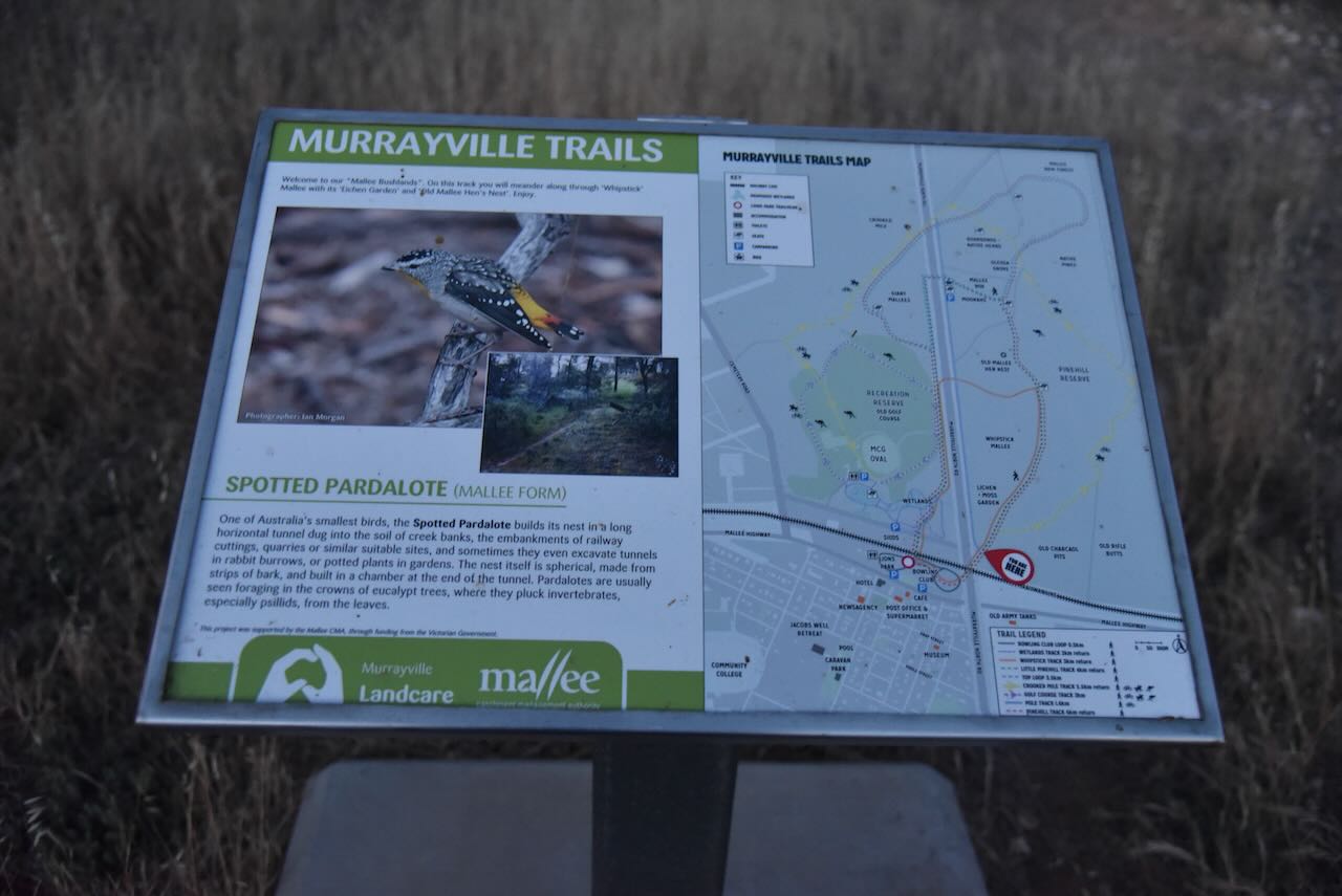
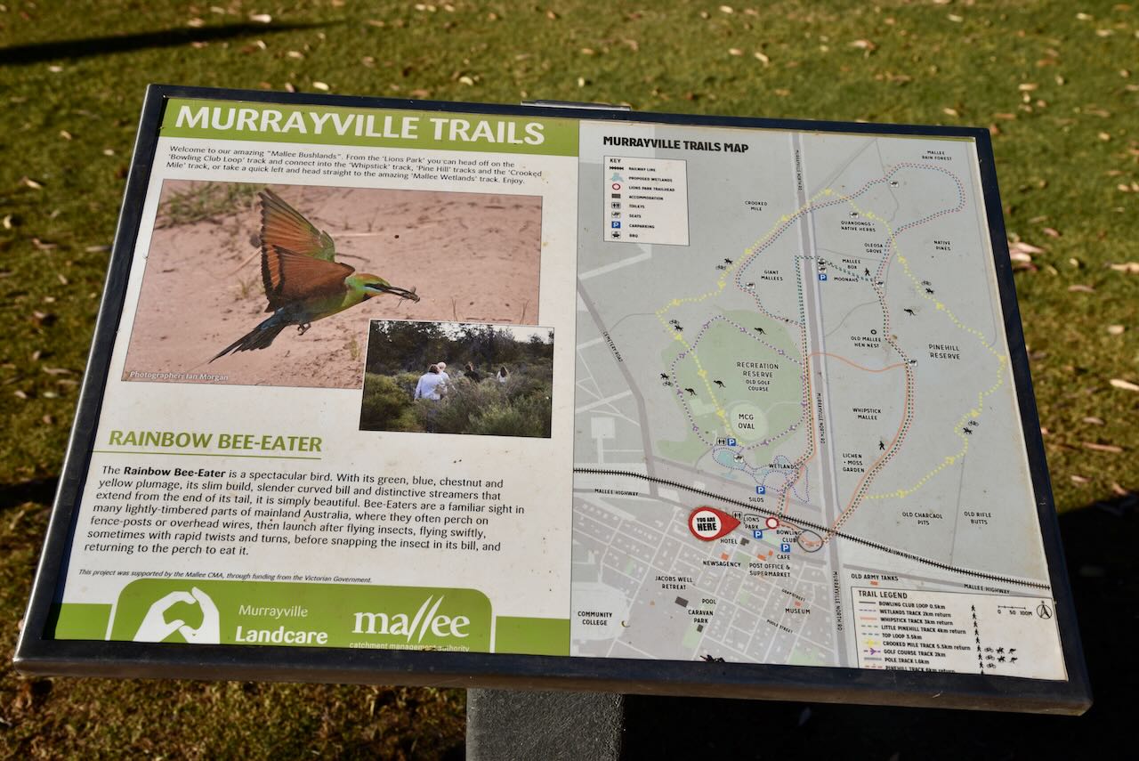
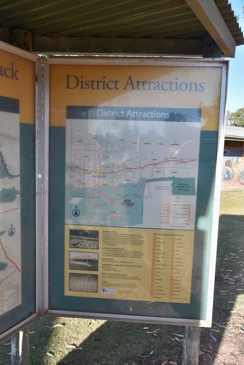
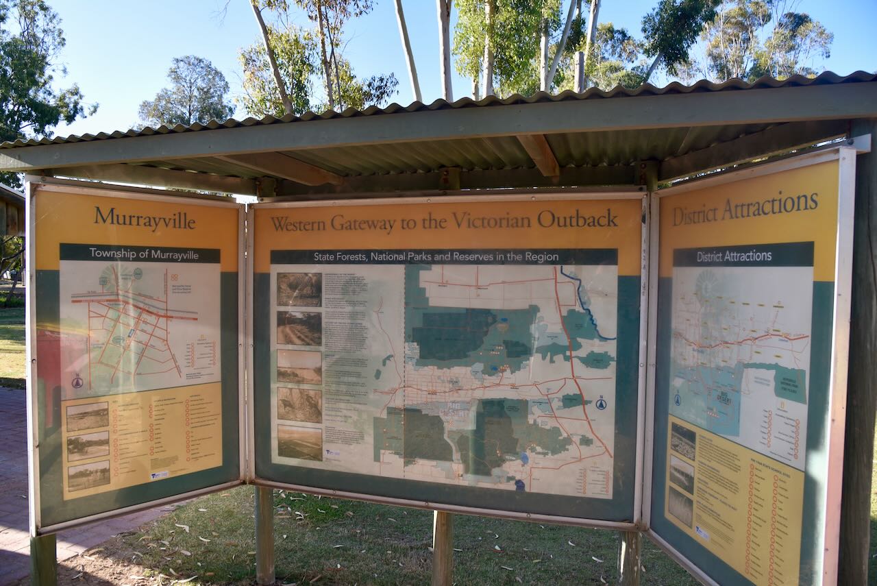
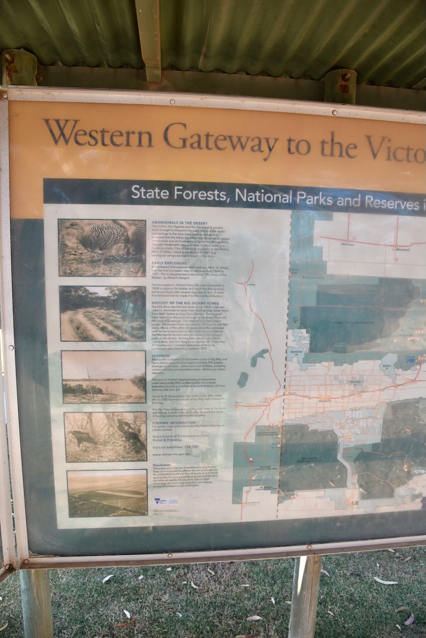
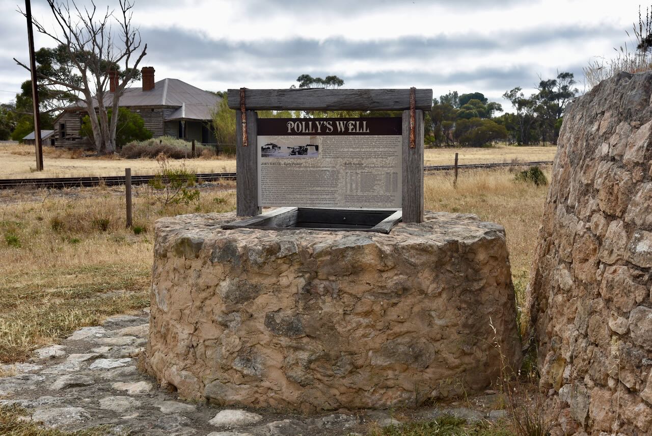
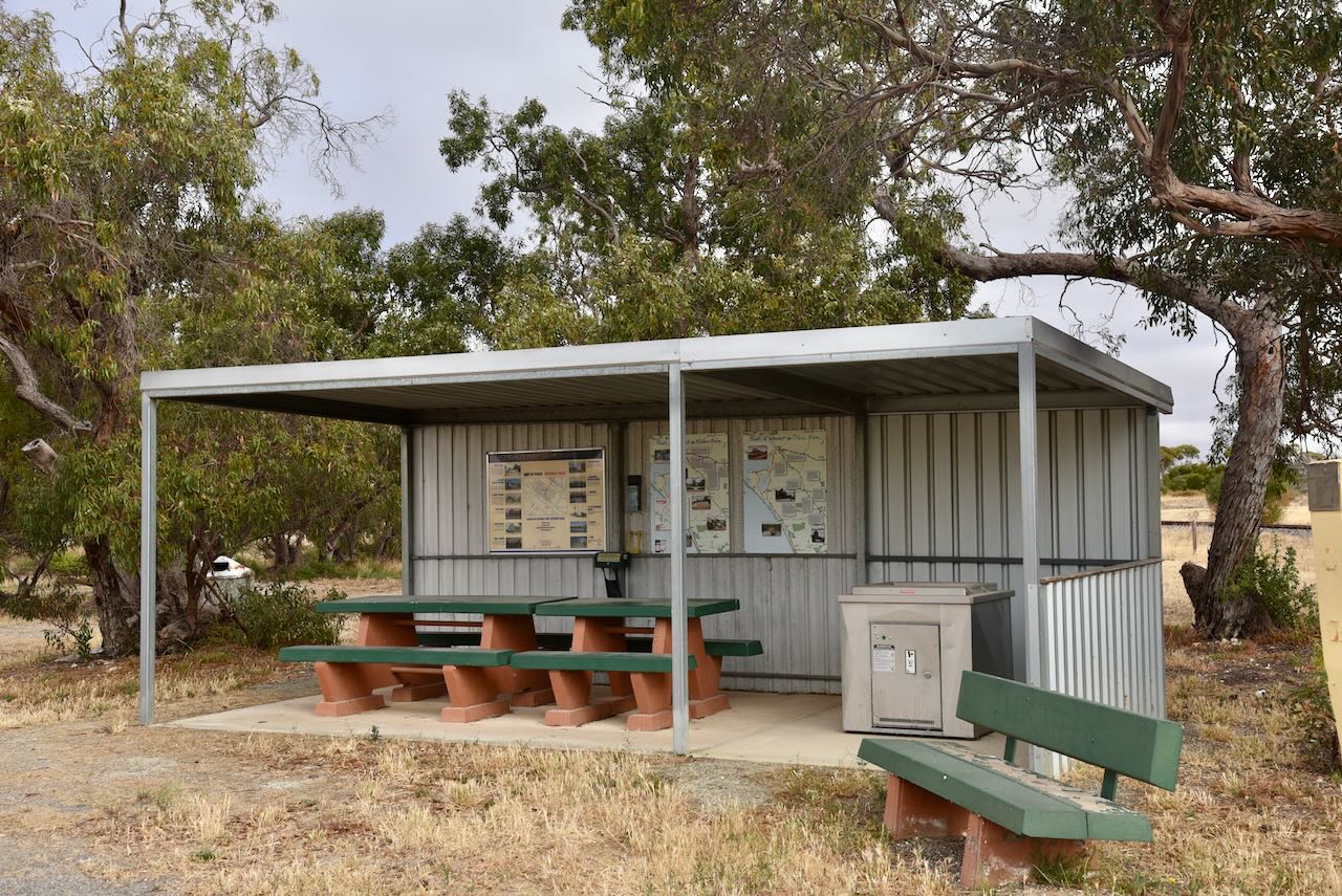
There is an excellent visitor rest stop and information area at Murrayville.

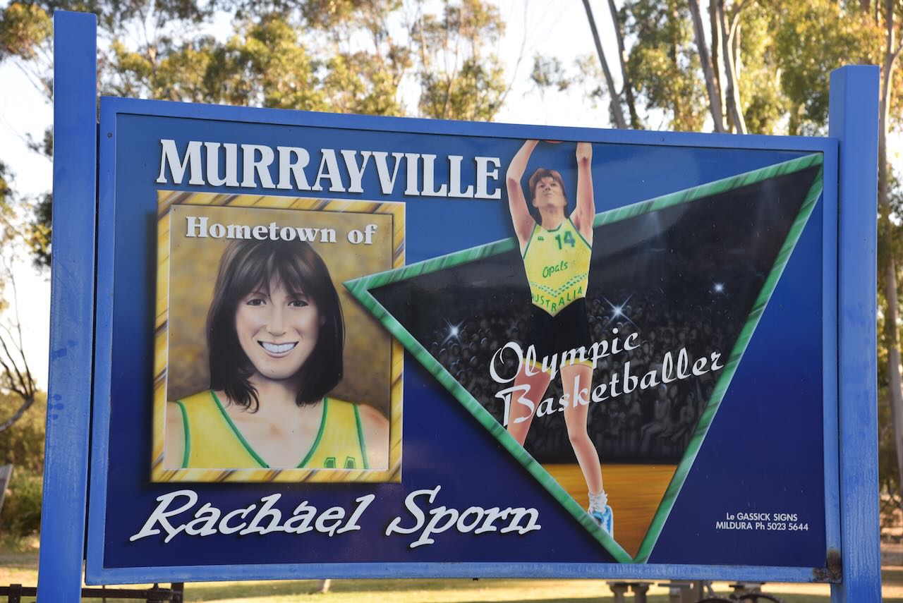
Olympic basketball player Rachael Sporn was born in Murrayville.

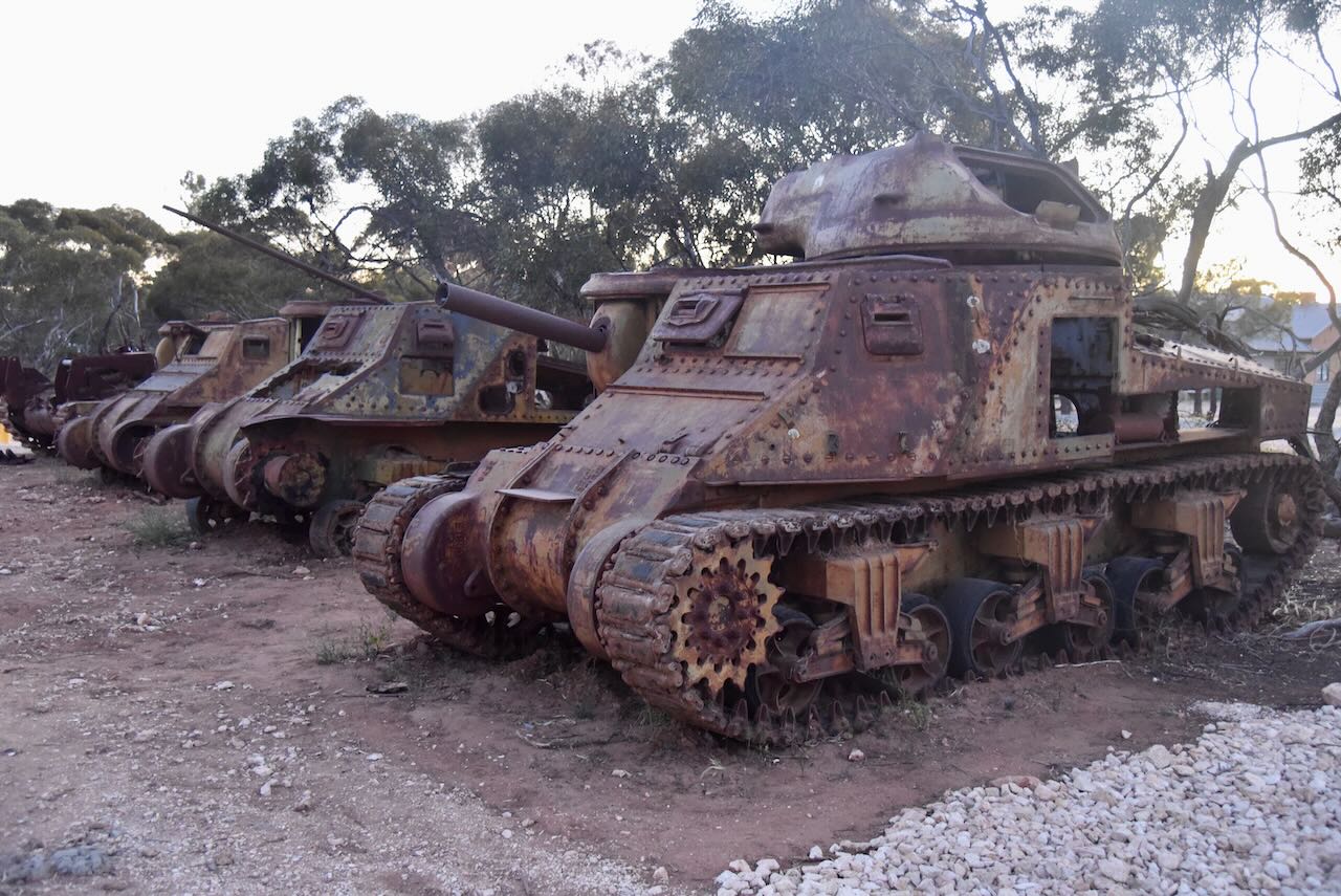
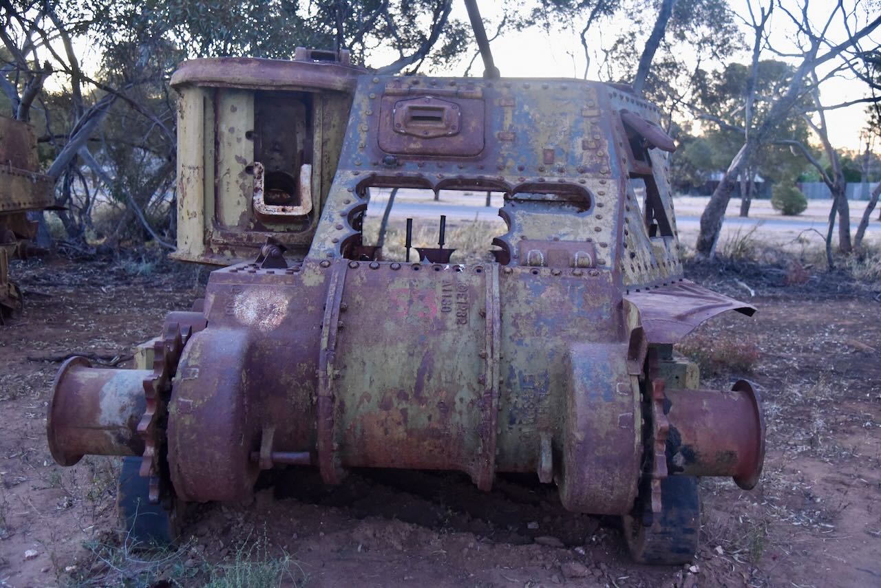
A quirky feature of the town is the collection of old army tanks which you can see at the eastern end of the town. Numerous surplus army tanks were purchased following the war for use on the land as adapted bulldozers and chain clearers.

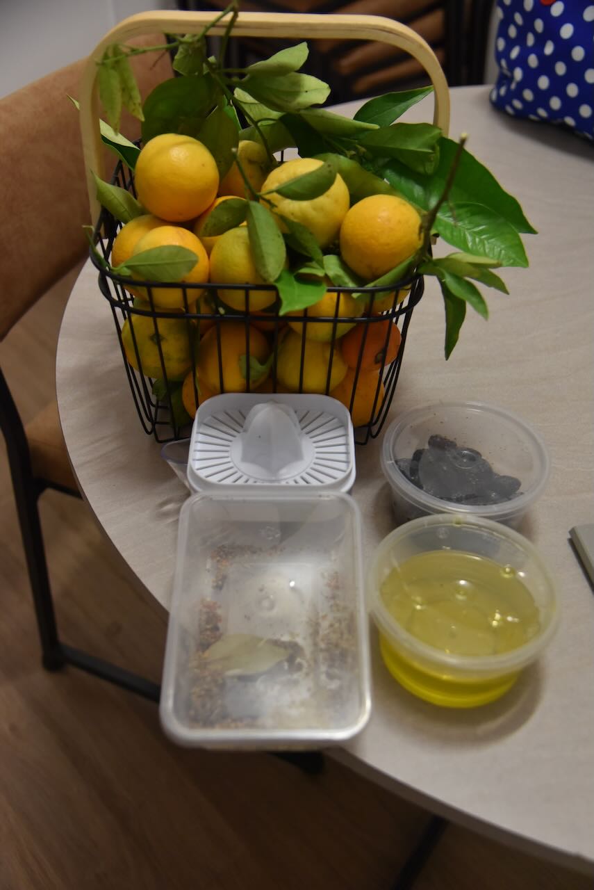
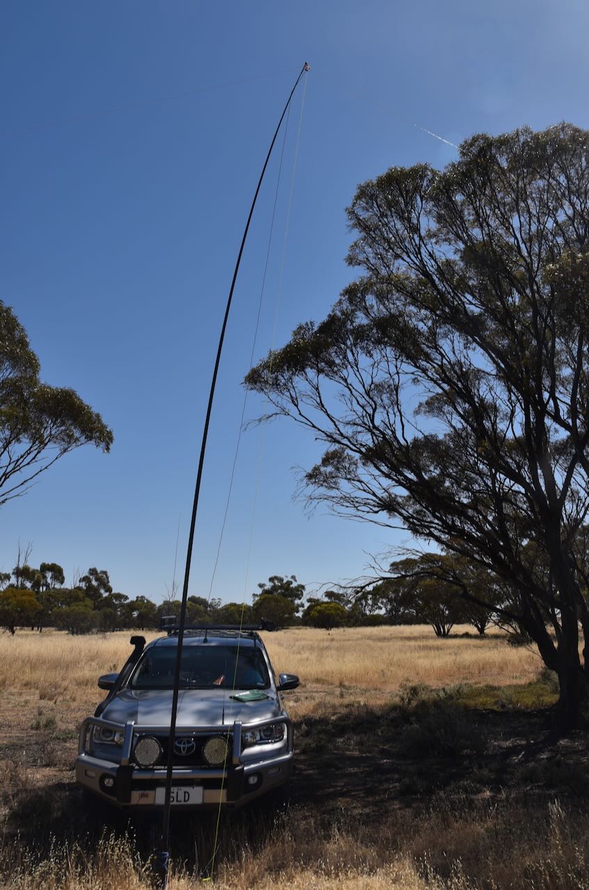
Before heading to the park, we booked in at the Murrayville Caravan Park. We met one of the caretaker’s Darren who kindly provided us with some oranges, a juicer, olive oil, and dukkah. We had a conversation with Darren about the hobby of amateur radio as he had previously been involved with the hobby during his time at school. Darren expressed an interest in obtaining his licence. I put him in contact with Ivan VK5HS, and I am very pleased to report that Darren now holds his Foundation amateur radio licence. Congratulations Darren.

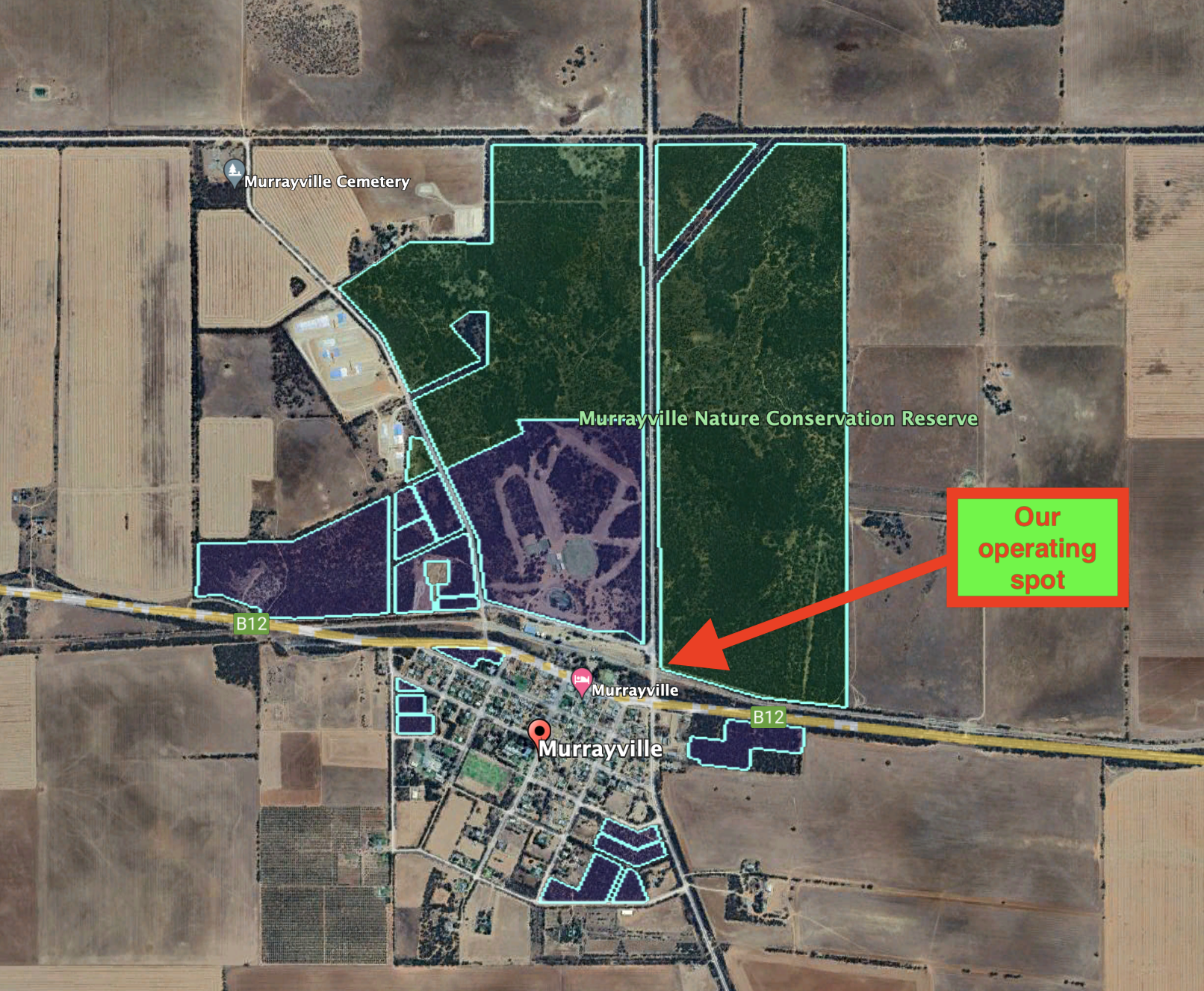
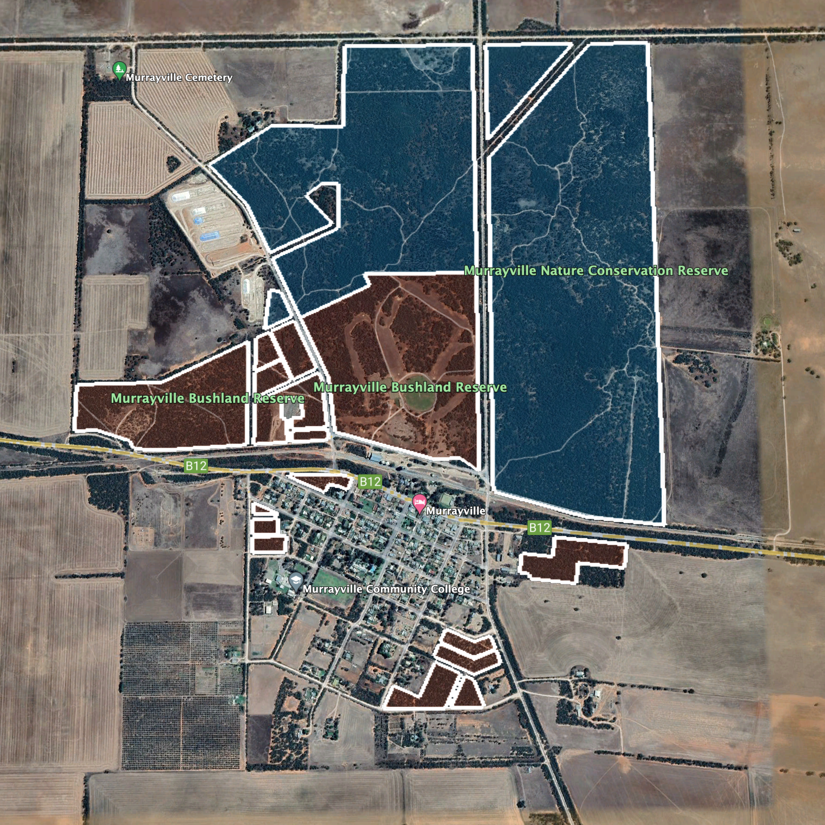
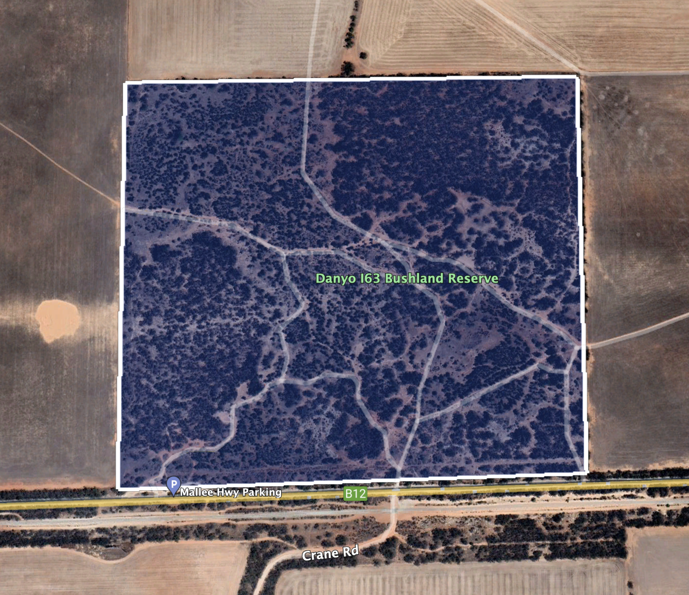
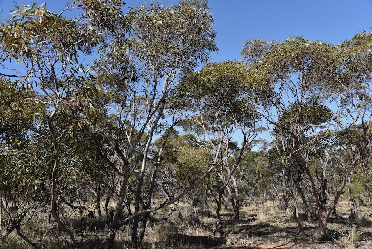
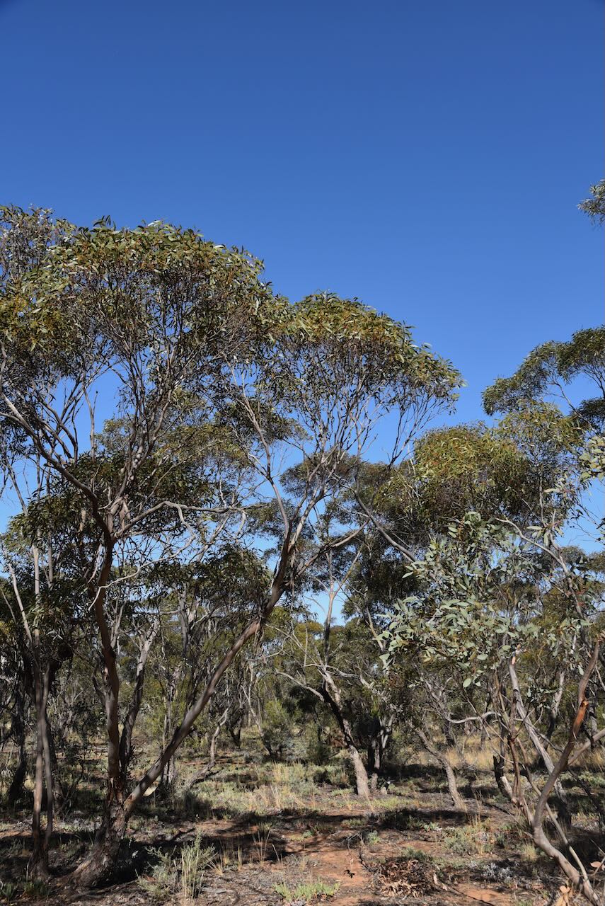
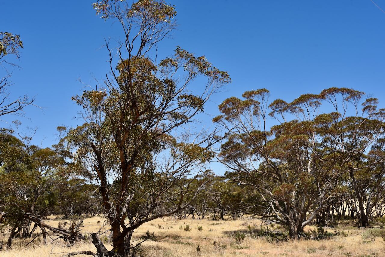
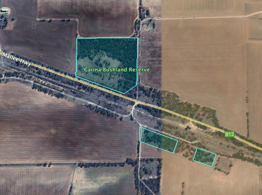
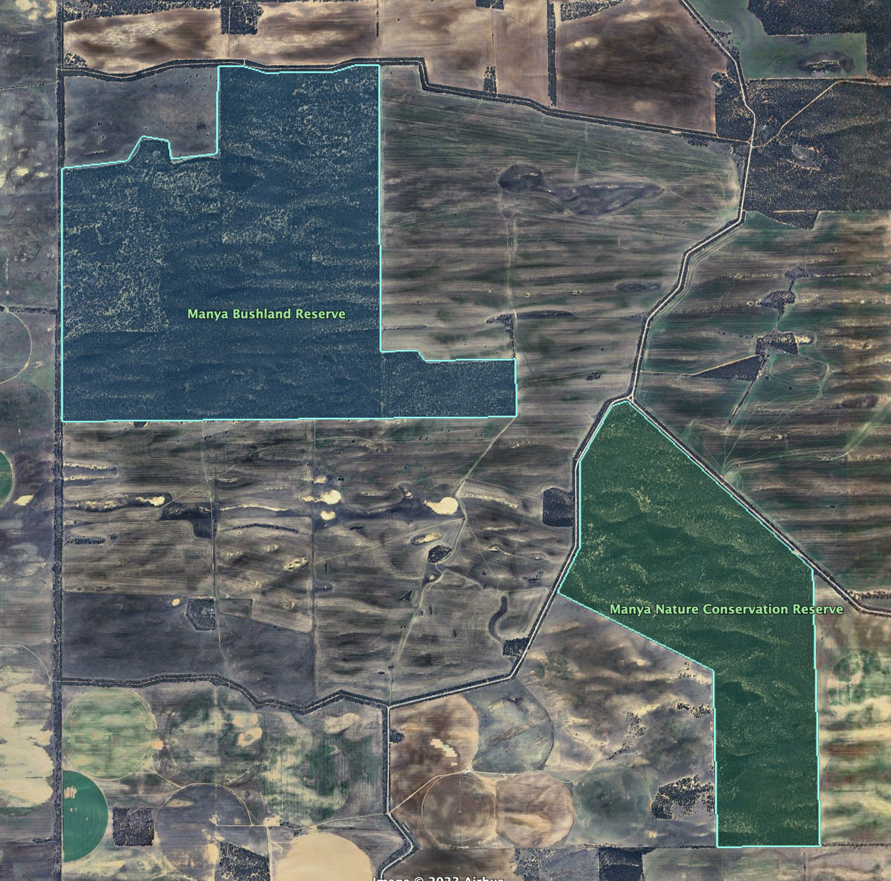
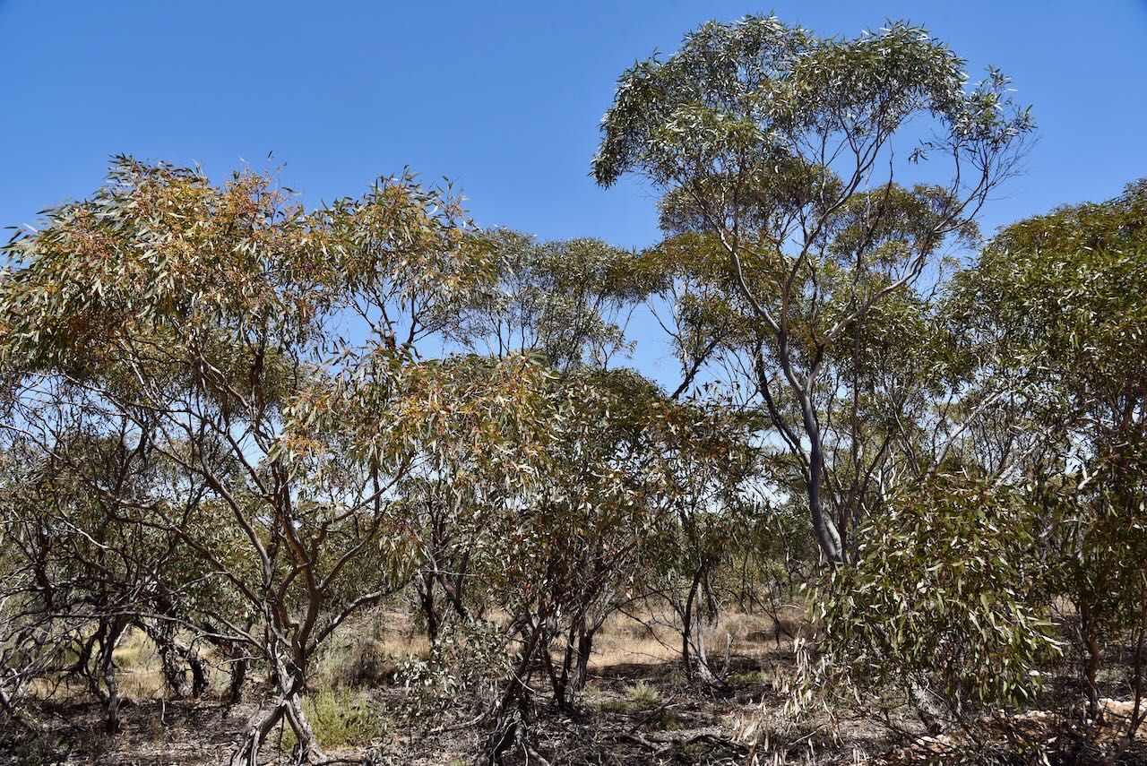
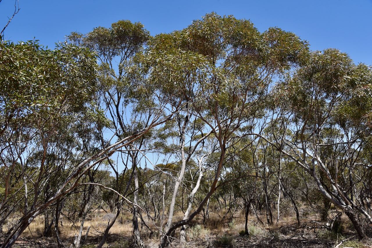
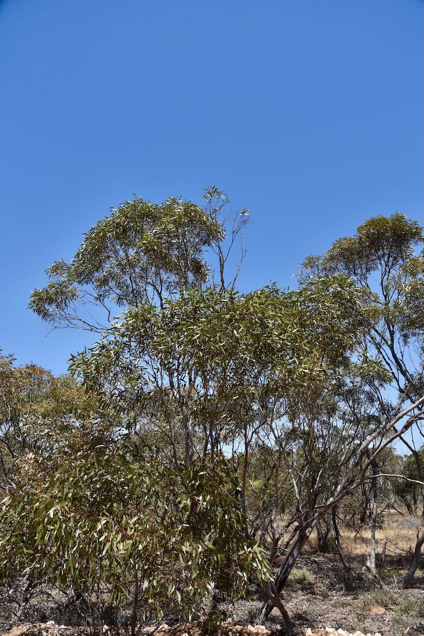
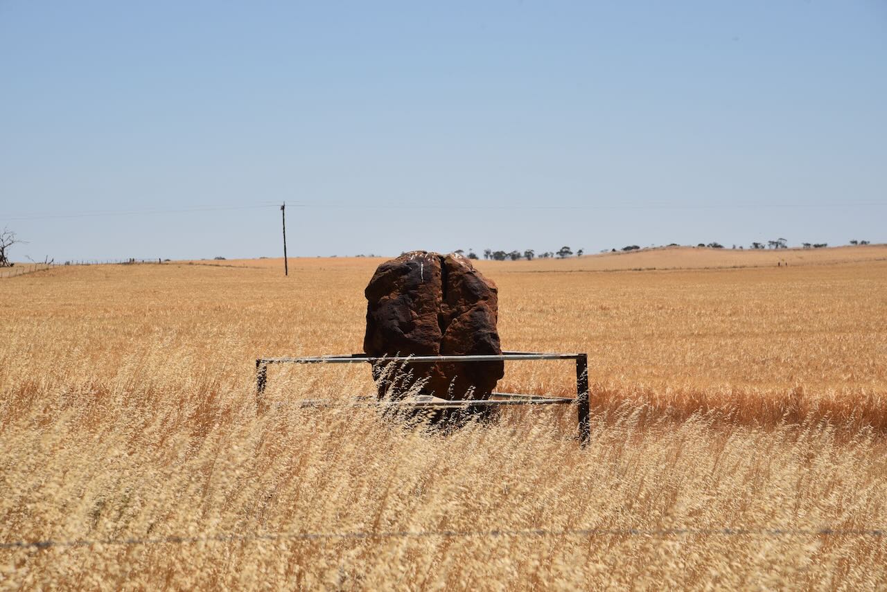
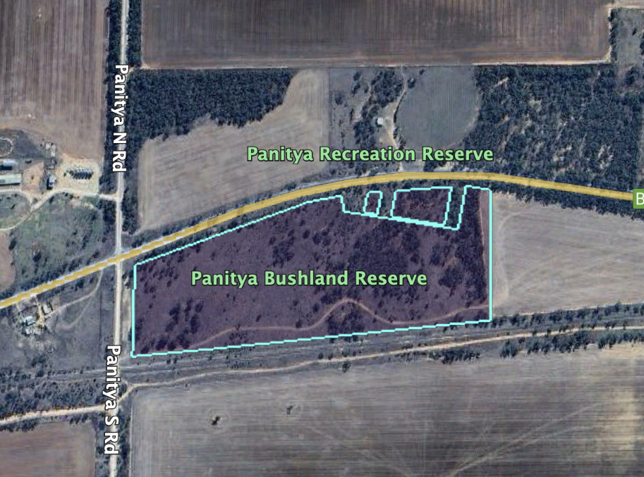
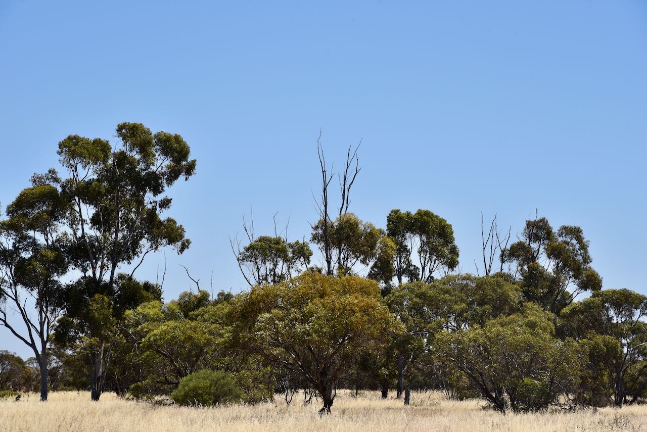
The Murrayville Bushland Reserve is about 105 hectares in size and was established on the 8th day of May 1990. The Parks Victoria website had a page for the reserve but it contains no information other than a park boundary image. Don’t get confused with the larger Murrayville Nature Conservation Reserve.

Above:- an aerial view showing the Murrayville Bushland Reserve and the Murrayville NCR. Image c/o Google Earth.

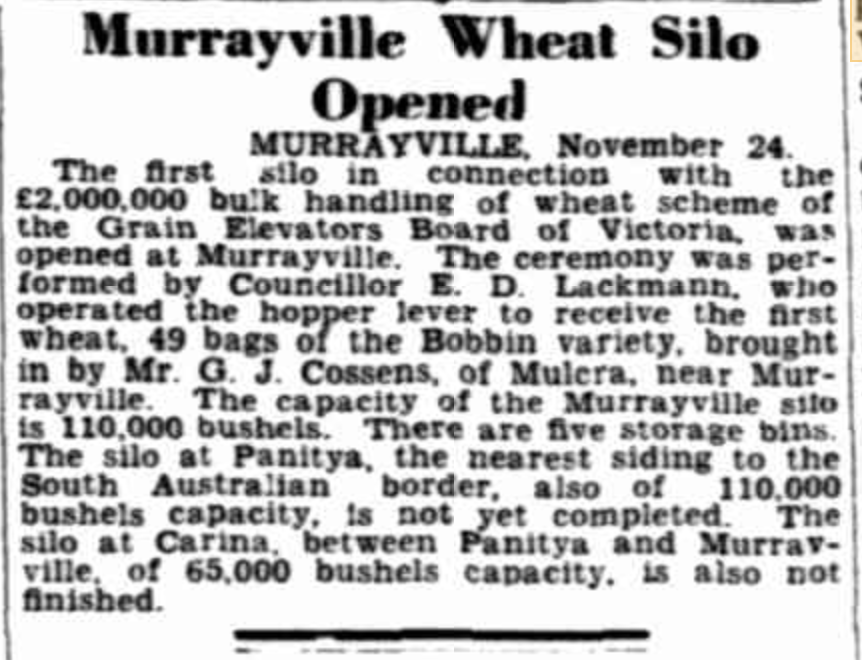
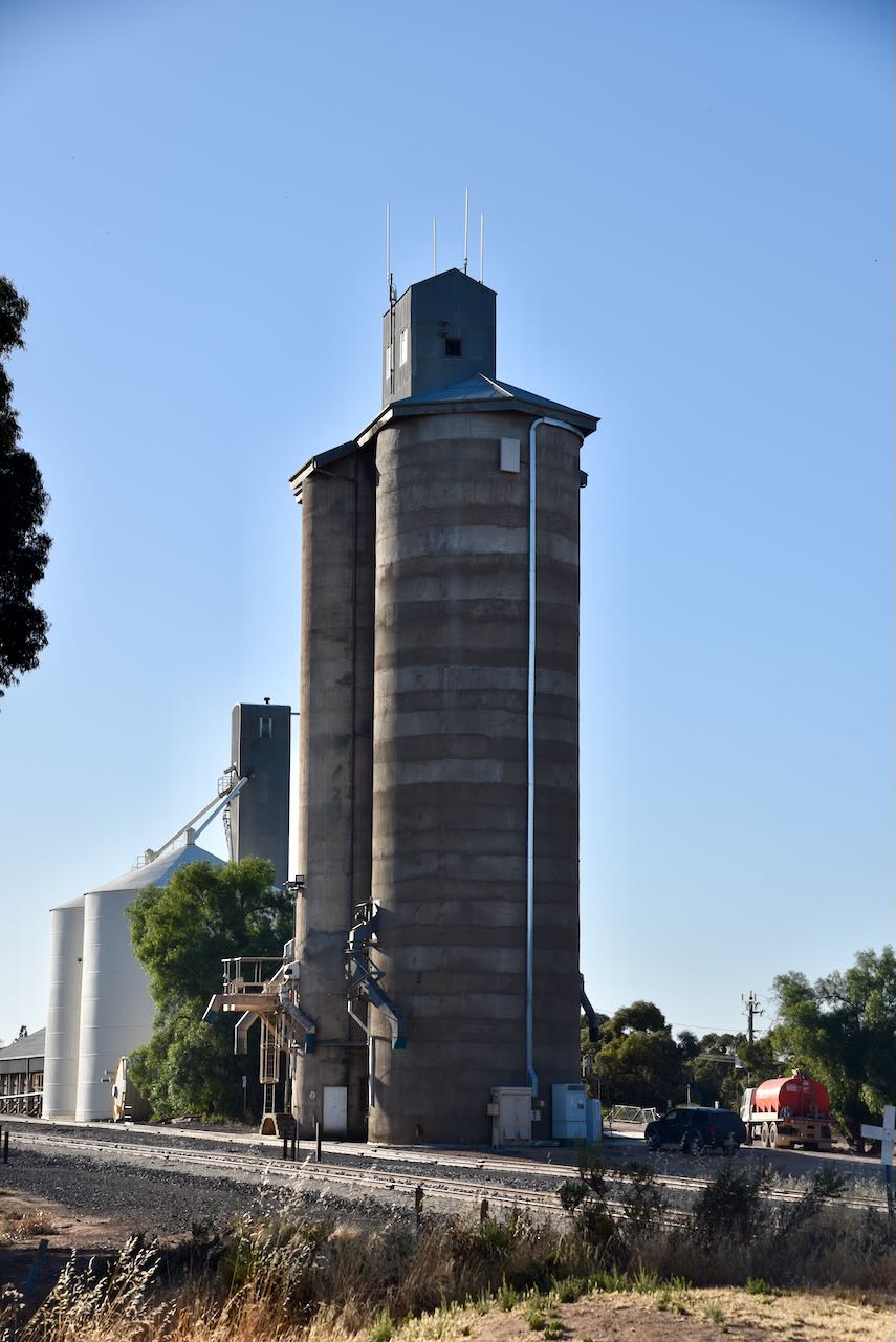
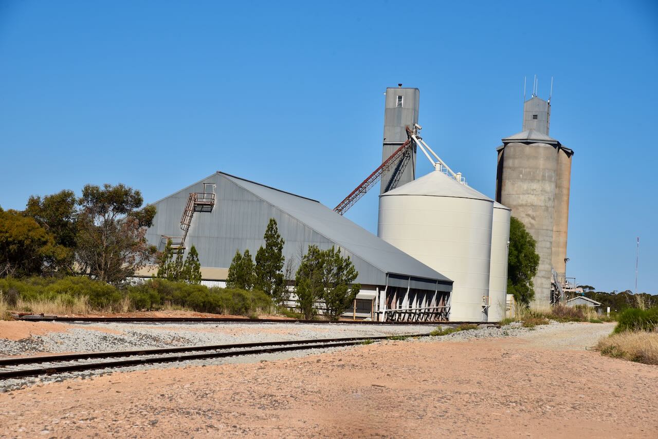
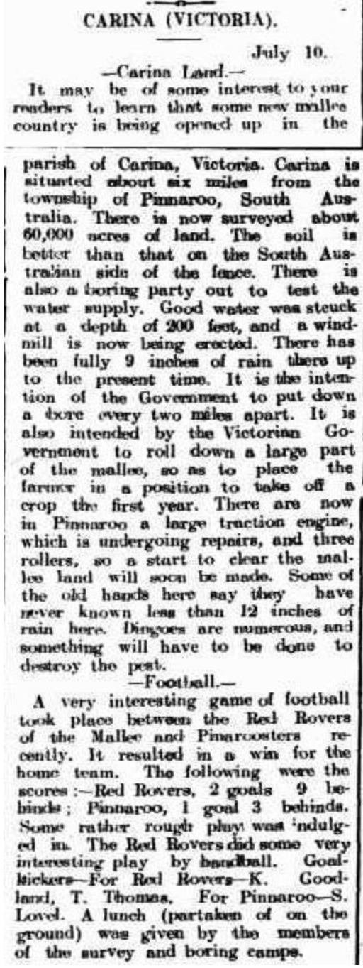
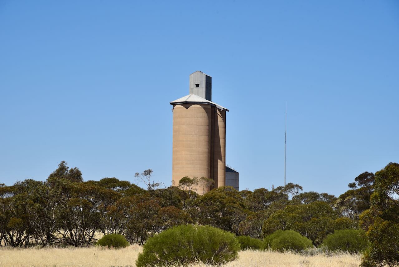
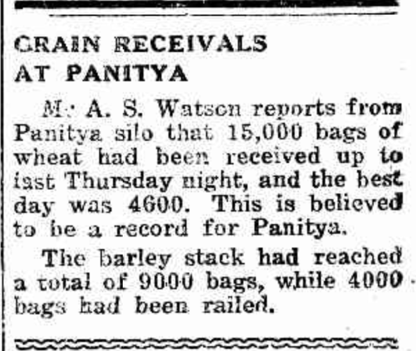
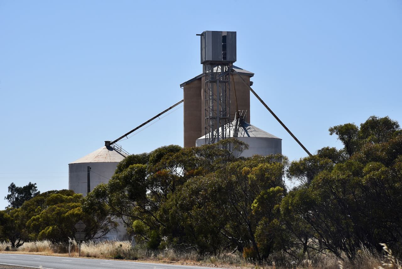
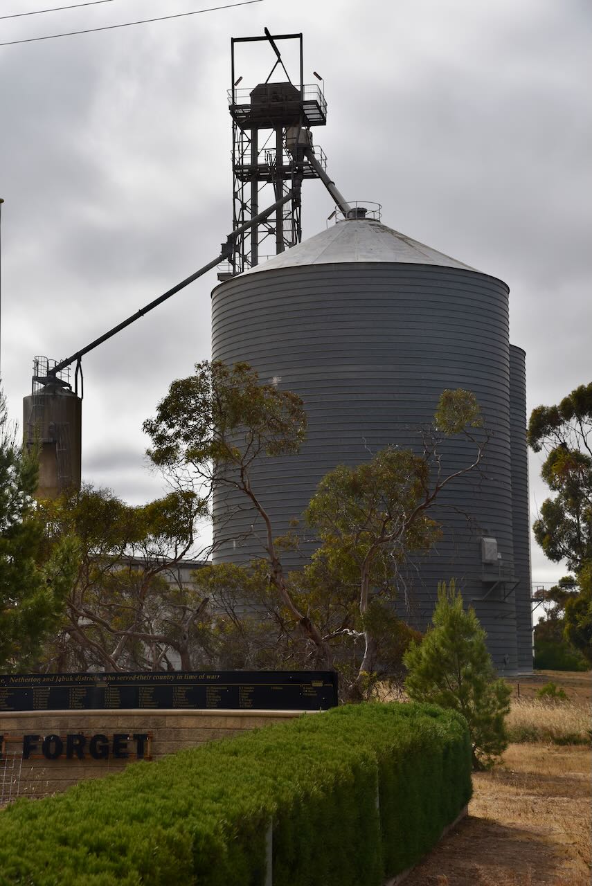
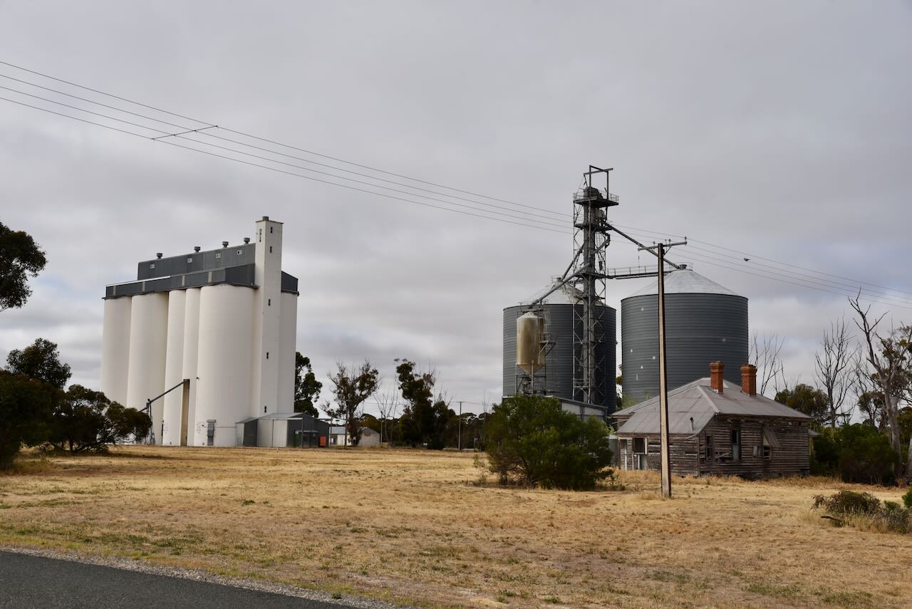
The Murrayville silos were built in 1939. An official opening ceremony took place on 24th November 1939. Their capacity was 110,000 bushels.

Above:- article from The Advertiser, Sat 25 Nov 1939. Image c/o Trove.

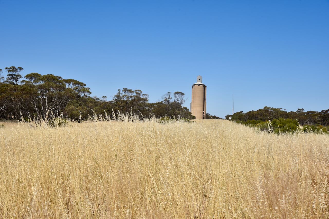
The silos are located alongside the old railway line between Recreation Road and McKenzie Street.

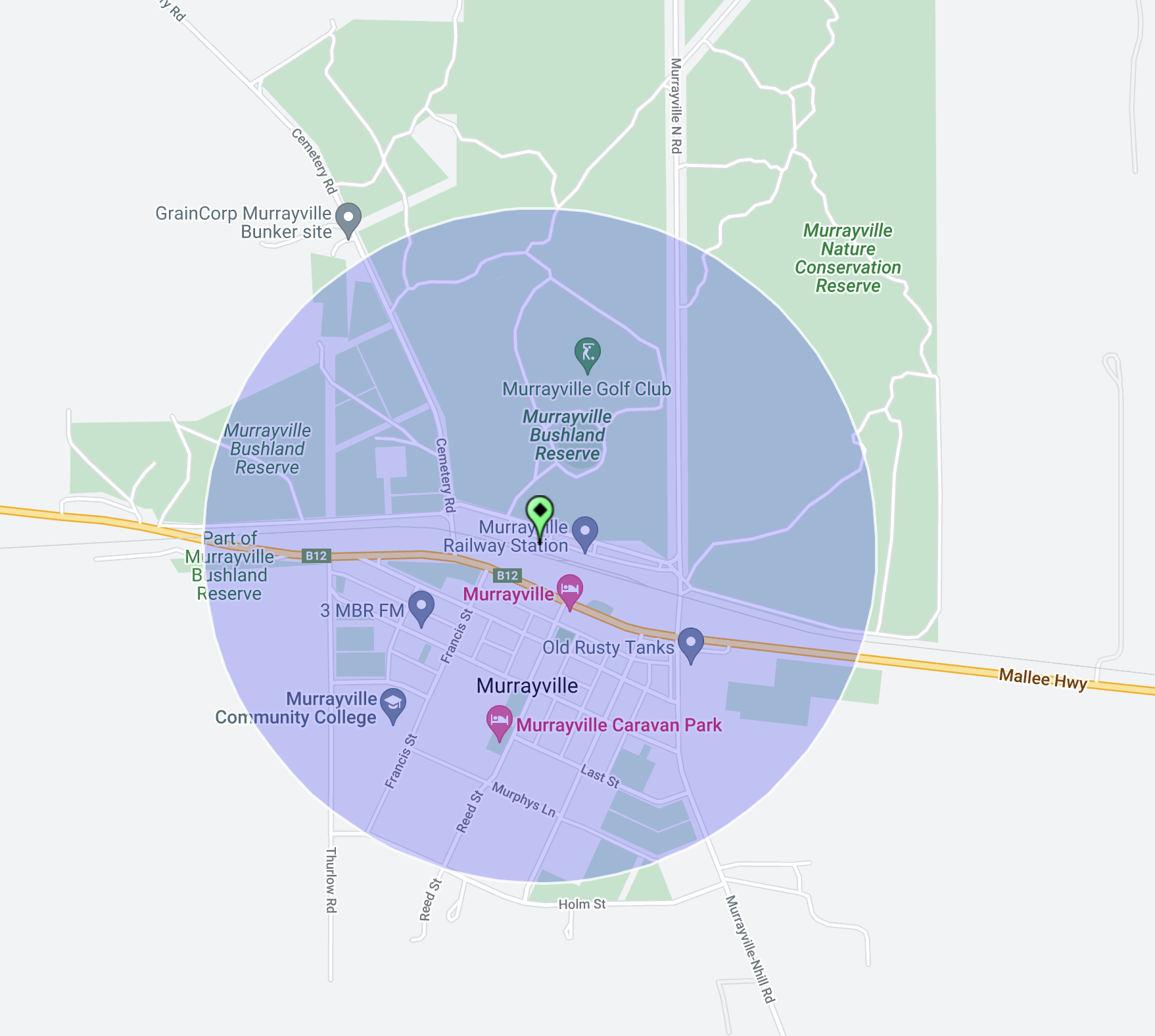
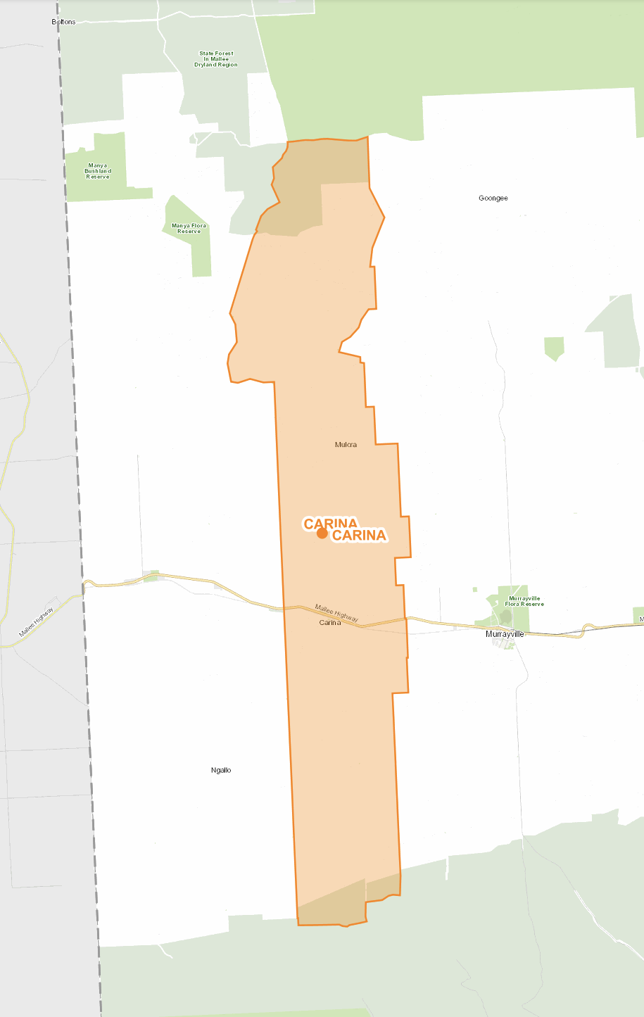
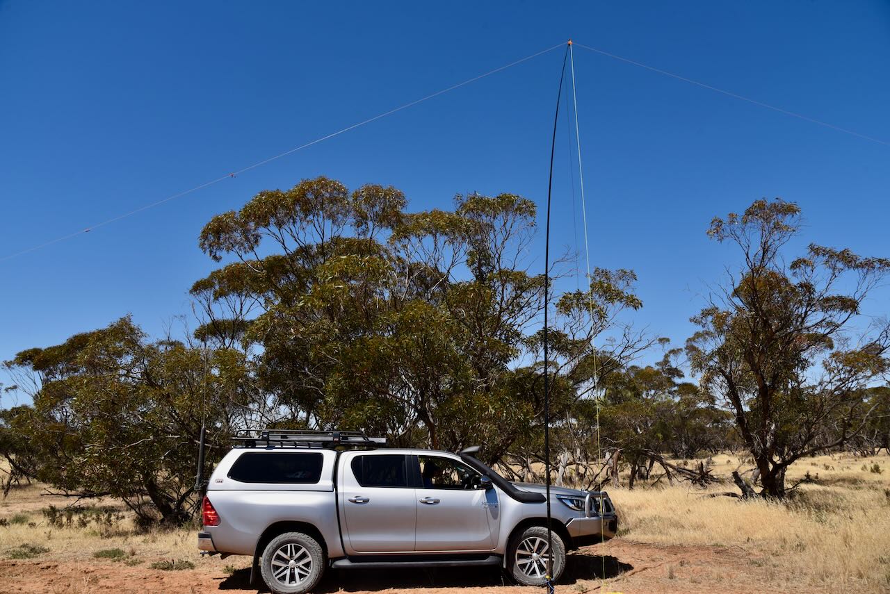
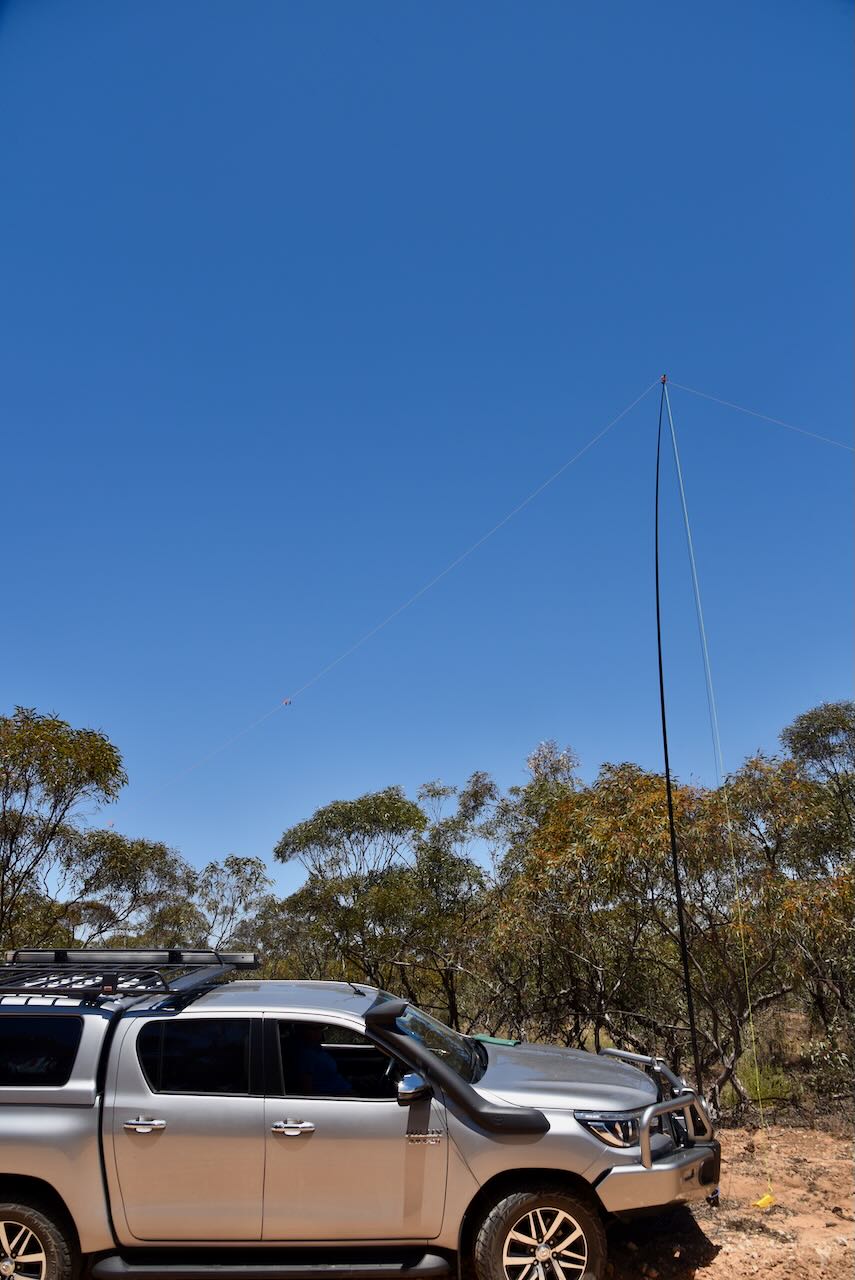
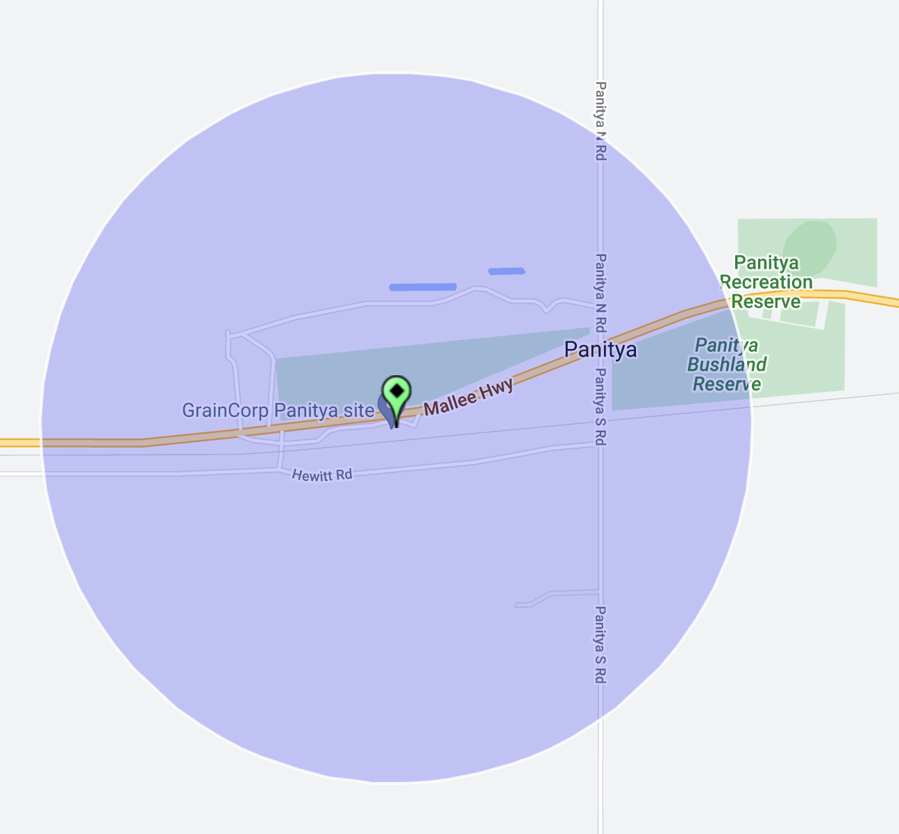
We set up off Cemetery Road within the activation zone for the silo.

Above:- Map showing the activation zone of the Murrayville silo. Image c/o SiOTA website.

Marija worked the following stations on 40m SSB:-

  1. VK3PF
  2. VK3BEL/p (Barmah National Park VKFF-0739)
  3. VK3APJ
  4. VK3SQ
  5. VK2BD
  6. VK3OAK
  7. VK3VIN
  8. VK3YV
  9. VK5TN
  10. VK5HS
  11. VK3PWG/p (Budj Bim National Park VKFF-0345)
  12. VK2IO/p (Boulka I96 Bushland Reserve VKFF-4222)

I worked the following stations on 40m SSB:-

  1. VK3PF
  2. VK3BEL/p (Barmah National Park VKFF-0739)
  3. VK3APJ
  4. VK3SQ
  5. VK2BD
  6. VK3OAK
  7. VK3VIN
  8. VK3YV
  9. VK5TN
  10. VK5HS
  11. VK3DCQ
  12. VK1RF
  13. VK2MK
  14. VK4CEE
  15. VK2YK
  16. VK5GA
  17. VK5GY
  18. VK3PWG/p (Budj Bim National Park VKFF-0345)
  19. VK2EXA
  20. VK3MCK
  21. VK2HHA
  22. VK4NH
  23. VK4DXA
  24. VK5FANA
  25. VK5KLV
  26. VK1AO
  27. VK2MET
  28. VK3EJ
  29. VK3SG
  30. VK3CLD
  31. VK5PET
  32. VK2IO/p (Boulka I96 Bushland Reserve VKFF-4222)
  33. VK3CEO
  34. VK7AAE
  35. VK4HMI
  36. VK3UAO
  37. VK3ZK
  38. VK5HW
  39. VK6HDY/2
  40. VK3IH
  41. VK5ZNP
  42. VK4EHI
  43. VK5HAA
  44. VK7MAT
  45. VK4KTW
  46. VK5DJ
  47. VK5CZ
  48. VK5AAF
  49. VK2MOE
  50. VK3CWF

I worked the following stations on 20m SSB:-

  1. VK4NH
  2. VK4DXA
  3. I4RHP
  4. VK1AO
  5. VK2MET

Following the activation we headed to the Murrayville Hotel for a meal.

References.

  1. Victorian Places, 2023, <https://www.victorianplaces.com.au/murrayville>, viewed 24th December 2023.
  2. Wikipedia, 2023, <https://en.wikipedia.org/wiki/Murrayville,_Victoria>, viewed 24th December 2023.
  3. Wikipedia, 2023, <https://en.wikipedia.org/wiki/John_Murray_(Victorian_politician)>, viewed 24th December 2023.
  4. Wikipedia, 2023, <https://en.wikipedia.org/wiki/Murrayville_railway_station>, viewed 24th December 2023.
  5. Wikipedia, 2023, <https://en.wikipedia.org/wiki/Pinnaroo_railway_line,_Victoria>, viewed 24th December 2023.

Danyo I63 Bushland Reserve VKFF-4154

Our fourth activation for Thursday 9th November 2023 was the Danyo I63 Bushland Reserve VKFF-4154. Danyo is located about 276 km east of Adelaide.

Above:- Map showing the location of Danyo. Map c/o Google Maps.

Danyo is a locality in northwest Victoria on the Mallee Highway between Ouyen and the South Australia/Victoria State border. Danyo is an aboriginal word for eucalyptus.

Above:- article from the Pinnaroo and Border Times, Fri 30 May 1913. Image c/o Trove.

The Danyo Post office opened on the 15th day of July 1912 when a regular mail service was provided following the opening of the Ouyen-Murrayville railway one month earlier. The Post Office closed in 1975.

Danyo once had its own football club. The first football match was played in 1927. It won the premiership in 1933, 1934, 1935, and 1947. Its last season was in 1969. The Danyo State School operated from 1926 to 1943.

Above:- Danyo school students., 1934. Image c/o Cowangie Danyo Tutye and district Facebook page.

The Danyo I63 Bushland Reserve is about 71 hectares in size and was declared on the 1st day of May 1979.

The park is a typical mallee park and is located on the northern side of the Mallee Highway. It is surrounded by cleared cropping land.

We found a dirt track leading into the park off Mallee Highway and set up. We ran the Yaesu FT857, 40 watts, and the 20/40/80m linked dipole for this activation.

Marija worked the following stations on 40m SSB:-

  1. VK3DCQ
  2. VK5TN
  3. VK3CEO
  4. VK3VIN
  5. VK3BEL/p (Barmah National Park VKFF-0739)
  6. VK3SG
  7. VK3PF
  8. VK2HHA
  9. VK3LOC/m
  10. VK3CJN
  11. VK5FANA
  12. VK2IO/p (Nunga Bushland Reserve VKFF-4241 & Nunga silo VK-NNG3)

I worked the following stations on 40m SSB:-

  1. VK3DCQ
  2. VK5TN
  3. VK3CEO
  4. VK3VIN
  5. VK3BEL/p (Barmah National Park VKFF-0739)
  6. VK3SG
  7. VK3PF
  8. VK2HHA
  9. VK3LOC/m
  10. VK3CJN
  11. VK5FANA
  12. VK5HS
  13. VK3BWS
  14. VK2EXA
  15. VK3MIJ
  16. VK3UH
  17. VK5NHG
  18. VK5JOS
  19. VK5WWW
  20. VK5MOO
  21. VK5HAA
  22. VK2XD
  23. VK5IS
  24. VK3ACU/m
  25. VK5GY
  26. VK5KGW
  27. VK3CLD
  28. VK5DW
  29. VK3NBL
  30. VK3APJ
  31. VK3CEO
  32. VK4NH
  33. VK4DXA
  34. VK3MCK
  35. VK3SQ
  36. VK2BD
  37. VK3KAI
  38. VK2IO/p (Nunga Bushland Reserve VKFF-4241 & Nunga silo VK-NNG3)
  39. VK3EY
  40. VK5KVA
  41. VK1AO
  42. VK2MET
  43. VK3KRL

I worked the following stations on 40m AM:-

  1. VK5IS
  2. VK5HAA
  3. VK5DW
  4. VK3APJ
  5. VK3SG
  6. VK3CJN

I worked the following stations on 20m SSB:-

  1. VK4NH
  2. VK4DXA
  3. F1BLL

References.

  1. Blake; L, 1977, Place Names of Victoria.
  2. CAPAD 2022.
  3. Wikipedia, 2023, <https://en.wikipedia.org/wiki/Danyo,_Victoria>, viewed 23rd December 2023.

Carina Bushland Reserve VKFF-4150 and Carina silo VK-CRA3

Our next activation for Thursday 9th November 2023 was the Carina Bushland Reserve VKFF-4150 and the Carina silo VK-CRA3.

Carina is located in northwest Victoria, close to the South Australia/Victoria State border.

Above:- Map showing the location of Carina in Victoria. Map c/o Google Maps.

Carina is a locality in the Sunraysia region of Victoria, on the Mallee Highway, about 14km west of Murrayville. The Carina area contains several smaller areas such as Mulcra which had a post office that was operational from 1910 to 1968, and Boltons Bore.

Above:- Map showing the locality of Carina. Map c/o Mapshare Victoria.

Carina is an aboriginal word meaning water. The area was opened up for farming in the early 1900s.

Above:- Article from the Kapunda Herald, Fri 17 Jul 1908. Image c/o Trove.

The Carina Post Office was opened on the 17th day of June 1923 and closed in 1949.

The Carina Bushland Reserve is about 15 hectares in size and was established on the 8th day of May 1990.

The main section of the reserve is located on the northern side of the Mallee Highway just to the west of Carina North Road. There are two smaller sections on the southern side of the Mallee Highway.

The Carina silos are located on the southern side of the Mallee Highway.

We operated from one of the small sections of the Carina Bushland Reserve within the activation zone of the Carina silo.

We ran the Yaesu FT857, 40 watts, and the 20/40/80m linked dipole for this activation.

Marija worked the following stations on 40m SSB:-

  1. VK5HS
  2. VK3VIN
  3. VK3DAC
  4. VK3CEO
  5. VK3ZSC
  6. VK2IO/p (Ouyen I85 Bushland Reserve VKFF-4212)
  7. VK7ALH
  8. VK3PF
  9. VK3BEL/p (Barmah National Park VKFF-0739)
  10. VK3APJ
  11. VK5FANA
  12. VK5FBIC/p (Fort Glanville Conservation Park VKFF-1031)

I worked the following stations on 40m SSB:-

  1. VK5HS
  2. VK3VIN
  3. VK3DAC
  4. VK3CEO
  5. VK3ZSC
  6. VK2IO/p (Ouyen I85 Bushland Reserve VKFF-4212)
  7. VK7ALH
  8. VK3PF
  9. VK3BEL/p (Barmah National Park VKFF-0739)
  10. VK3APJ
  11. VK5FANA
  12. VK3MHZ
  13. VK5AV
  14. Vk3DCQ
  15. VK3MAP
  16. VK3IDM
  17. VK3SMW
  18. VK3SQ
  19. VK2BD
  20. VK7XX
  21. VK2HHA
  22. VK2EXA
  23. VK3UAO
  24. VK3ACZ
  25. VK5KLV
  26. VK3VPM
  27. VK3KGW
  28. VK5AAF
  29. VK3ZLD
  30. VK5TN
  31. VK5FBIC/p (Fort Glanville Conservation Park VKFF-1031)
  32. VK3KRL
  33. VK3TBS
  34. VK5GY

I worked the following stations on 40m AM:-

  1. VK3MHZ
  2. VK3PF
  3. VK3CEO
  4. VK5HS
  5. VK3KAL
  6. VK3SQ
  7. VK2BD

I worked the following stations on 40m FM:-

  1. VK3SQ
  2. VK2BD
  3. VK3ACZ

I worked the following stations on 20m SSB:-

  1. ZL3MR
  2. VK1AO
  3. VK3MET
  4. VK4NH
  5. VK4DXA

References.

  1. Balek, L, 1977, Place Names of Victoria.
  2. CAPAD 2022
  3. Wikipedia, 2023, <https://en.wikipedia.org/wiki/Carina,_Victoria>, viewed 23rd December 2023.

Manya Bushland Reserve VKFF-4149

Our second park for Thursday 9th November 2023 was the Manya Bushland Reserve VKFF-4149. This was to be a first-time activation of this park for the World Wide Flora Fauna (WWFF) program. The park is located close to the South Australia/Victoria State Border.

Above:- Map showing the location of the Manya Bushland Reserve. Map c/o Google Maps.

Manya is a locality situated in the Sunraysia region of Victoria, and a short drive over the South Australian State border. Manya is derived from the local Aboriginal word Manja meaning “the hand”.

Manya Bushland Reserve is 851 hectares in size and was declared on the 8th day of May 1990. The Reserve’s western border follows the Victoria/South Australian State border.

Above:- Map of the Manya Bushland Reserve. Map c/o Google Earth

There is a page on the Parks Victoria website for Manya Bushland Reserve, but it contains no information about the reserve.

To get to the park we travelled north on Panitya North Road, passing the Manya Nature Conservation Reserve, which we had activated previously. We then turned left onto Alan Road and headed west. We soon reached the northern boundary of the park.

Above:- An aerial view of the park looking west. Image c/o Google Maps.

We operated from the vehicle for this activation, running the Yaesu FT857, 40 watts, and the 20/40/80m linked dipole supported by the 7-metre heavy-duty squid pole.

Marija worked the following stations on 40m SSB:-

  1. VK5DU
  2. VK3UAO
  3. VK3MTT
  4. VK3SX
  5. VK5IS
  6. VK3PF
  7. VK3BBB
  8. VK2CCP
  9. VK5HAA
  10. VK5JOS
  11. VK2IO/p (Ouyen I245A Bushland Reserve VKFF-4207)

I worked the following stations on 40m SSB:-

  1. VK5DU
  2. VK3UAO
  3. VK3MTT
  4. VK3SX
  5. VK5IS
  6. VK3PF
  7. VK3BBB
  8. VK2CCP
  9. VK5HAA
  10. VK5JOS
  11. VK5FANA
  12. VK3DCQ
  13. VK3ZSC
  14. VK5FB
  15. VK5PO
  16. VK2IO/p (Ouyen I245A Bushland Reserve VKFF-4207)
  17. VK3ANL
  18. VK7XX
  19. VK5AAY
  20. VK5CZ
  21. VK5GY
  22. VK2KYO
  23. VK3DAC
  24. VK3VIN
  25. VK3SQ
  26. VK2BD
  27. VK2IO/m
  28. VK5KLV
  29. VK3SG
  30. VK3MIJ
  31. VK3KAI/m
  32. VK3CEO
  33. VK3CLD
  34. VK3APJ
  35. VK5MOO
  36. VK2XB/3
  37. VK3BSB/m
  38. VK2EXA

I worked the following stations on 40m AM:-

  1. VK5FB
  2. VK5PO
  3. VK2IO/p (Ouyen I245A Bushland Reserve VKFF-4207)
  4. VK5HAA
  5. VK3ANL
  6. VK5AAY
  7. VK5IS
  8. VK5CZ
  9. VK5GY

I worked the following stations on 20m SSB:-

  1. VK1AO
  2. VK2MET
  3. VK4NH
  4. VK4DXA
  5. VK7XX
  6. VK7AAE

On our way back to the Mallee Highway we stopped briefly on Panitya North Road to have a look at the monument for the old Sunset State School. The school was in operation between 1917-1943.

Above: article from the Pinnaroo and Border Times, Fri 4 Jul 1930. Image c/o Trove.

References.

  1. CAPAD 2022
  2. Wikipedia, 2023, <https://en.wikipedia.org/wiki/Manya,_Victoria>, viewed 22nd December 2023.

Panitya Bushland Reserve VKFF-4148 and Panitya silo VK-PNA3

Our next activation for Thursday 9th November 2023 was the Panitya Bushland Reserve VKFF-4148 and the Panitya silo VK-PNA3. This was to be a first-time activation of this park.

Panitya is a locality in the north-western area of Victoria, about 23 km east of the town of Pinnaroo in South Australia.

Above:- Map showing the location of Panitya. Map c/o Google Maps.

Panitya appears to be an aboriginal word meaning ‘area of land.’ The locality of Panitya extends in the south from the Big Desert Wilderness Area to the Murray Sunset National Park in the north.

Above:- The locality of Panitya. Image c/o maps.land.vic.gov.au

The Panitya Post Office opened in 1910 and was closed in 1975. The Panitya railway station was opened for goods in March 1915, and then passengers in July 1915. It was part of the Ouyen to Pinnaroo railway line which closed in 2007.

Above:- a plan of the township of Panitya. Image c/o State Library Victoria.

Above:- article from the Pinnaroo and Border Times, Thu 9 Dec 1954. Image c/o Trove

The Panitya Bushland Reserve is about 14 hectares in size and was declared on the 8th day of May 1990. It is located on the southern side of the Mallee Highway and to the east of Panyita S Road.

Above:- Map of the Panitya Bushland Reserve. Map c/o Google Earth.

There is a page on the Parks Victoria website for the Panitya Bushland Reserve, but it contains no information about the reserve.

Don’t get the reserve confused with the Panitya Recreation Reserve which is located on the northern side of the Mallee Highway.

Adjacent to the reserve is a sign relating to the first sale of allotments in the township of Panitya. There is also an old water tower alongside the old railway line.

The Panitya silos are located on the southern side of the Mallee Highway and to the north of Hewitt Road.

The Panitya silos were constructed during the 1930s and had a capacity of 110,000 bushels.

Above:- The Panitya silos in 1939. Image c/o State Library South Australia (B 69739).

I found an article on Trove that referred to a group of 44 scholars from Oakbank ARea school who travelled to the Pinaroo district in 1948. During their visit, they got to climb the Panitya silo.

Above:- article from the Pinnaroo and Border Times, Thu 22 Jul 1948. Image c/o Trove

We set up in the western section of the Panitya Bushland Reserve which is in the activation zone for the Panitya silo.

The flies were out in force so we operated from the vehicle for this activation. We ran the Yaesu FT857, 40 watts, and the 20/40/80m linked dipole.

Marija worked the following stations on 40m SSB before the UTC rollover:-

  1. VK5HS
  2. VK3VIN
  3. VK3BEL
  4. VK3UAO
  5. VK5KLV
  6. VK5FIVE
  7. VK3PF
  8. VK3BBB
  9. VK2CCP
  10. VK3CJN
  11. VK3MTT
  12. VK2IO/p (Ouyen I245 Bushland Reserve VKFF-4207)

Marija worked the following stations on 40m SSB after the UTC rollover:-

  1. VK2IO/p (Ouyen I245 Bushland Reserve VKFF-4207)

Marija worked the following stations on 20m SSB:-

  1. ZL3RIK/p (Lake Wairarapa Wetland Conservation Area ZLFF-0143)
  2. ZL2ATH/p (Lake Wairarapa Wetland Conservation Area ZLFF-0143)

I worked the following stations on 40m SSB before the UTC rollover:-

  1. VK5HS
  2. VK3BEL
  3. VK3VIN
  4. VK3UAO
  5. VK5KLV
  6. VK3PF
  7. VK5FIVE
  8. VK3BBB
  9. VK2CCP
  10. VK3CJN
  11. VK3MTT
  12. VK3CEO
  13. VK3ANL
  14. VK2IO/p (Ouyen I245 Bushland Reserve VKFF-4207)
  15. VK3APJ
  16. VK3SG
  17. VK3FTOM
  18. VK5FANA
  19. VK2DG
  20. VK3APT
  21. VK5HAA
  22. VK5AAF
  23. VK3DAC
  24. VK5DU
  25. VK5IS
  26. VK3CLD
  27. VK2VAR
  28. VK2GOM
  29. VK3ACZ
  30. VK1AD
  31. VK1NAM

I worked the following stations on 40m SSB after the UTC rollover:-

  1. VK1AD
  2. VK1NAM
  3. VK3CEO
  4. VK3CLD
  5. VK5AV
  6. VK2VAR
  7. VK2GOM
  8. VK3VIN
  9. VK3PF
  10. VK3ACZ
  11. VK3SMR/m
  12. VK5FANA
  13. VK3APT
  14. VK3DAC
  15. VK3SG
  16. VK3CJN
  17. VK7XX
  18. VK5IS
  19. VK5KLV
  20. VK3KRL
  21. VK2IO/p (Ouyen I245 Bushland Reserve VKFF-4207 VKFF-4207)
  22. VK3DCQ
  23. VK5GY

I worked the following stations on 20m SSB:-

  1. ZL3RIK/p (Lake Wairarapa Wetland Conservation Area ZLFF-0143)
  2. ZL2ATH/p (Lake Wairarapa Wetland Conservation Area ZLFF-0143)
  3. VK4NH
  4. VK4DXA
  5. VK1AO
  6. VK2MET
  7. VK4XCS
  8. ZL3MR

References.

  1. CAPAD 2023
  2. Trove, 2023, <https://trove.nla.gov.au/newspaper/article/43200674>, viewed 22nd December 2023.
  3. Trove, 2023, <https://trove.nla.gov.au/newspaper/article/92453423?searchTerm=panitya%20silo>, viewed 22nd December 2023.
  4. Wikipedia, 2023, <https://en.wikipedia.org/wiki/Panitya,_Victoria>, viewed 22nd December 2023.
  5. Wikipedia, 2023, <https://en.wikipedia.org/wiki/Pinnaroo_railway_line,_Victoria>, viewed 22nd December 2023.

Peake silo VK-PKE5

We had only been home for a couple of days following our trip to Renmark for the 2023 VKFF National Get-Together, and it was time for Marija and I to hit the road once again. This time our destination was Murrayville in Victoria for 5 nights to coincide with the Keith Roget Memorial National Parks Award Weekend.

We left home (Thursday 9th November 2023) bright and early. Our first stop was the Strathalbyn bakery for a coffee and a bacon & egg roll.

We then headed southeast on the Dukes Highway and then east on the Mallee Highway. Our first stop was at the little town of Peake to stretch our legs. Whilst there we decided to do a quick silo activation of the Peake silo for the Silos On The Air (SiOTA) program.

Peake is located about 146 km southeast of the city of Adelaide

The town of Peake was surveyed in May 1907 and was proclaimed on the 8th day of August 1907. The District Council of Peake was proclaimed in 1911, and properties were assessed and rates levied from 1912.

Above:- The South Australian Government Gazette re the proclamation of the town of Peake. Image c/o Wikipedia.

The town’s name was derived from the cadastral unit of the Hundred of Peake which in turn is named in honour of Archibald Henry Peake (b. 1859. d. 1920), an Australian politician who was the Premier of South Australia on three occasions (1909-1910; 1912-1915; and 1917-1920).

Above:- Archibald Peake. Image c/o Wikipedia.

There are several historic buildings in the town and a historic walk can be undertaken. Details of the walk can be obtained from the information board at the visitor rest stop.

Some of the buildings to view are the old Station Masters built in 1912, the Peake store built in 1937, the Post Office built in 1912, the Bakehourse/church built in 1908, the Peake School built in 1929, the Butcher shop built in the early 1900s, the Saddlery built in 1912, and the old town Garage which was used from 1956 to 1974.

At the rest stop, there is the War Memorial and Lone Pine, remembering those from Peake who lost their lives serving their country. The pine was planted at Peake on the 25th day of April 2009 having been propagated from a pine tree at the War Memorial in Canberra. That particular tree can follow its origins back to Gallipoli, Turkey. The ridges at Gallipoli were once covered with Aleppo Pines. However, these were cut down to line over trenches. Just one solitary pine remained. Lance Corporal B.J. Smith of the 3rd Battalion sent several pine cones back to Australia. Thirteen years later, two seedlings were grown, one of which was planted at the Canberra War Memorial.

One of the stops on the historic walk is Polly’s Well. This is located at the visitor rest stop. 

It was sunk by John Whyte, the first pastoralist and pioneer to stock the surrounding countryside.

In 1877 the well was sunk to a depth of 16.5 metres. The well is timbered to 8.4 metres and in its day had a good supply of water. Water was drawn from the well with the assistance of a horse and buckets. Early settlers depended highly on the well as it would take eight days to travel by bullock wagon from Tailem Bend to Pinnaroo. Water was also taken on here for the steam trains when they commenced operation in the area.

At the visitor rest stop there are a number of information boards detailing the Peake historic walk and points of interest along the Mallee Highway.

You can also find a monument for the Centenary of the Pinnaroo Line (1906-2006). The line opened from Tailem Bend to Pinnaroo on the 14th day of September 1906, and on the 29th July 1915 it extended over the border into Victoria. The line closed in July 2015. It was at this time that Viterra announced that no more grain would be carried by rail after 31st day of July 2015. The 2015 harvest would be entirely transported by road. As the South Australian line closed, the Victorian government was upgrading part of its end of the line for regional freight.

The silos at Peake are both concrete and iron and are operated by Viterra. They are located in between Mallee Highway and Railway Terrace.

We parked in the visitor rest stop and operated from the vehicle for this activation. We ran the Icom IC7000, 100 watts, and the Codan 9350 antenna with the 1/5 metre stainless steel whip.

Marija worked the following stations on 40m SSB:-

  1. VK2IO/p (Ouyen I244 Bushland Reserve VKFF-4208 & Ouyen silo VK-OYN3)
  2. VK3PF
  3. VK3QH
  4. VK5IS
  5. VK5HAA
  6. VK3DAC

I worked the following stations on 40m SSB:-

  1. VK2IO/p (Ouyen I244 Bushland Reserve VKFF-4208 & Ouyen silo VK-OYN3)
  2. VK3PF
  3. VK3QH
  4. VK5IS
  5. VK5HAA
  6. VK3DAC

References.

  1. Discover Murray Mallee, 2023, <http://www.murrayriver.com.au/peake/>, viewed 21st December 2023.
  2. Wikipedia, 2023, <https://en.wikipedia.org/wiki/Peake,_South_Australia>, viewed 21st December 2023.
  3. Wikipedia, 2023, <https://en.wikipedia.org/wiki/Pinnaroo_railway_line,_South_Australia>, viewed 21st December 2023.