Harrisons Basin Bushland Reserve VKFF-4184

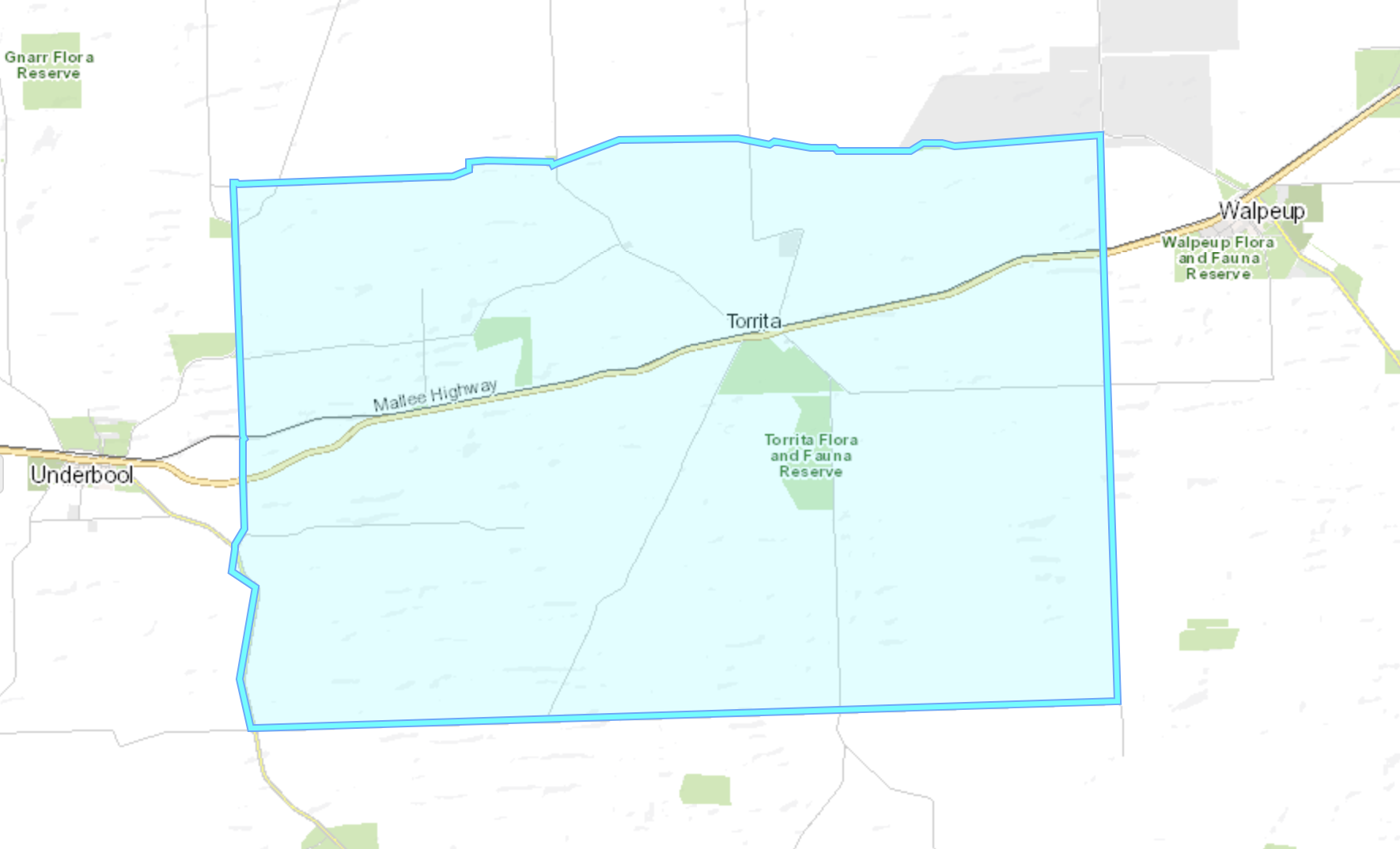
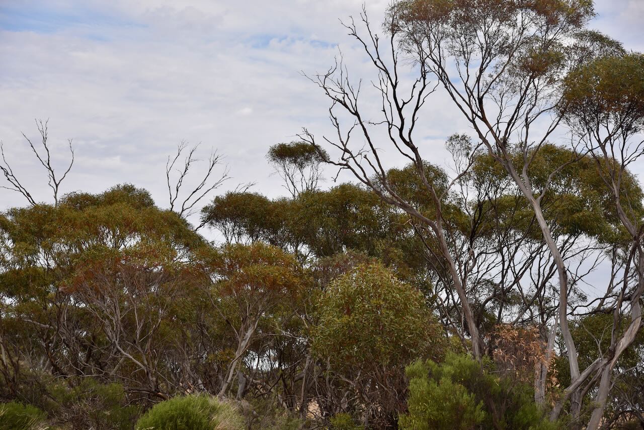
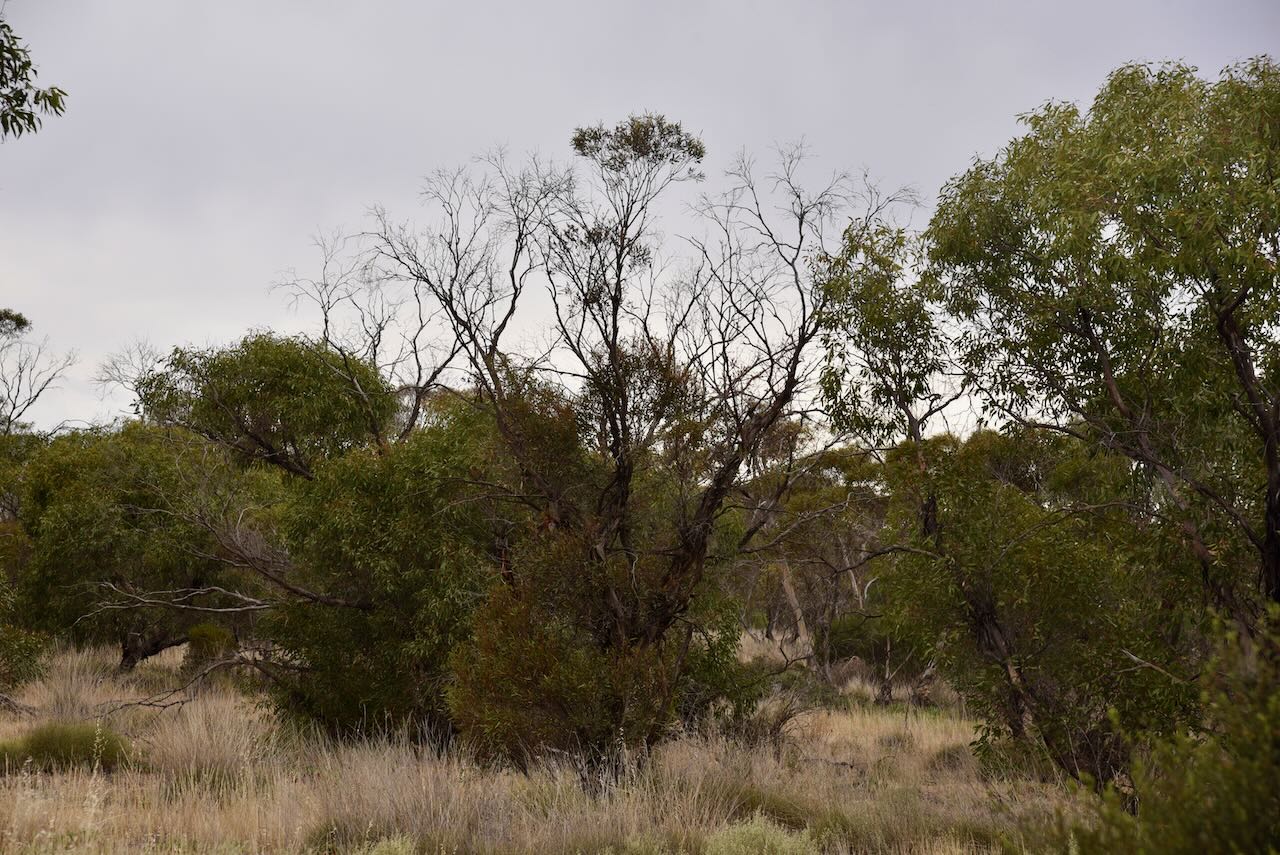
Our second activation for Sunday 12th November 2024, was the Harrisons Basin Bushland Reserve VKFF-4184. The park is located about 46 km west of Ouyen in northwestern Victoria.

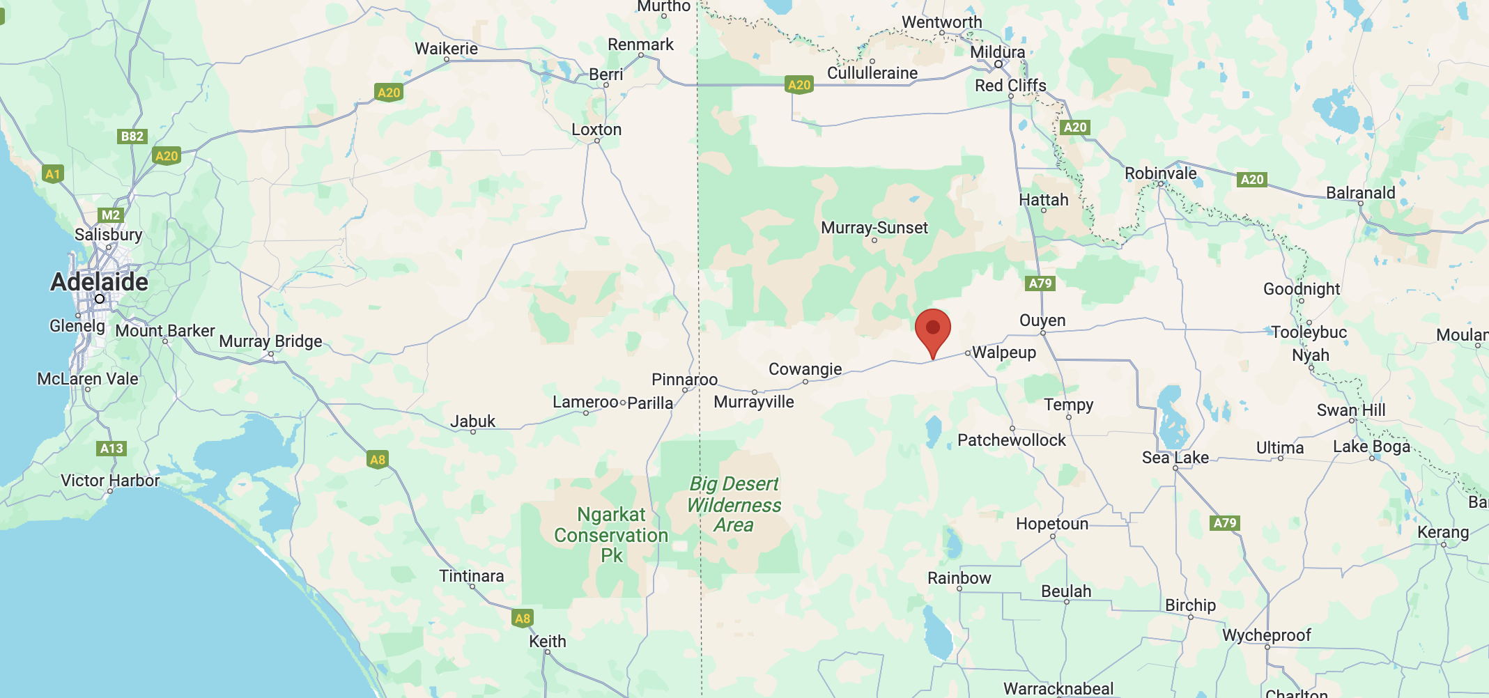
Above:- Map showing the location of Harrisons Basin Bushland Reserve. Map c/o Google Maps.

It was only a short drive to the reserve from our previous activation. As we drove north along McVicar Road we could see the reserve to our east across the paddocks.

The reserve is located on the eastern side of Harrisons Road. There are a number of dirt tracks leading into the reserve.

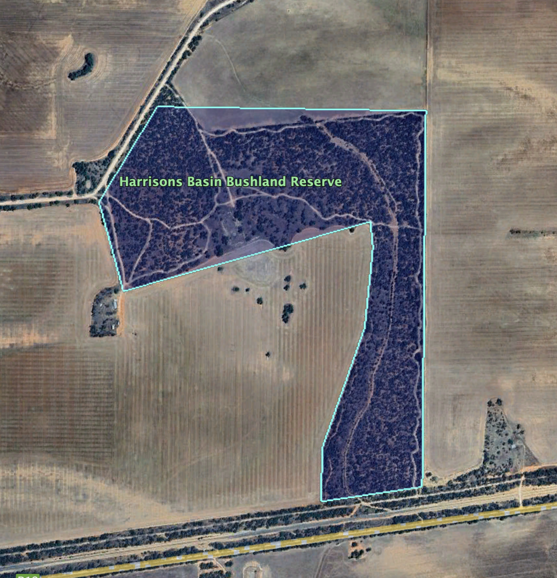
The Parks Victoria website has a page regarding the reserve, but it contains no information other than a boundary image of the reserve.

The reserve is about 57 hectares in size and was established on the 1st day of May 1979.

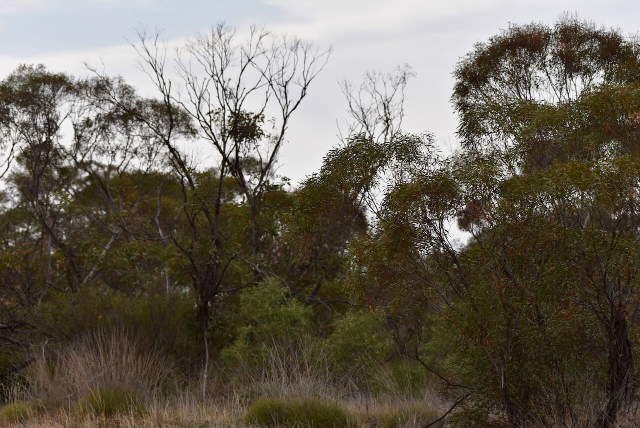
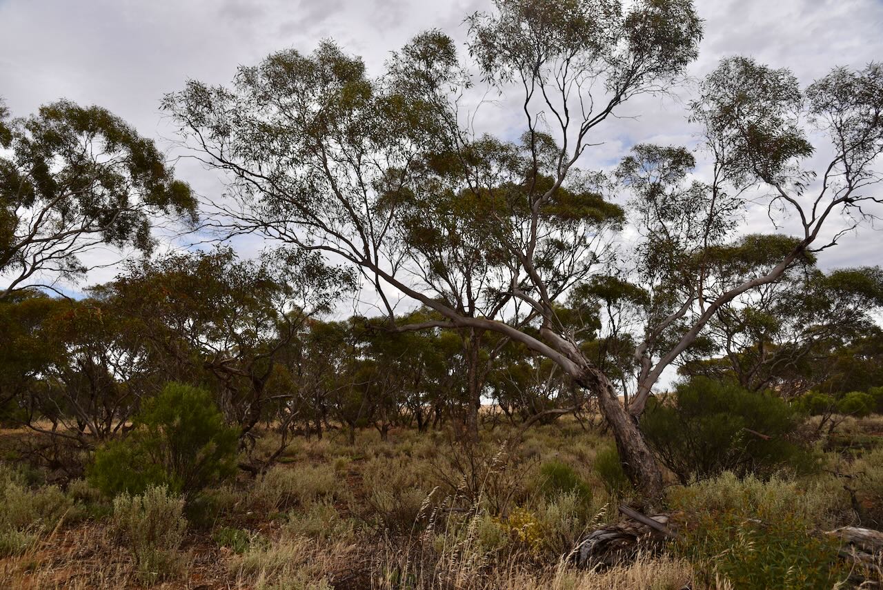
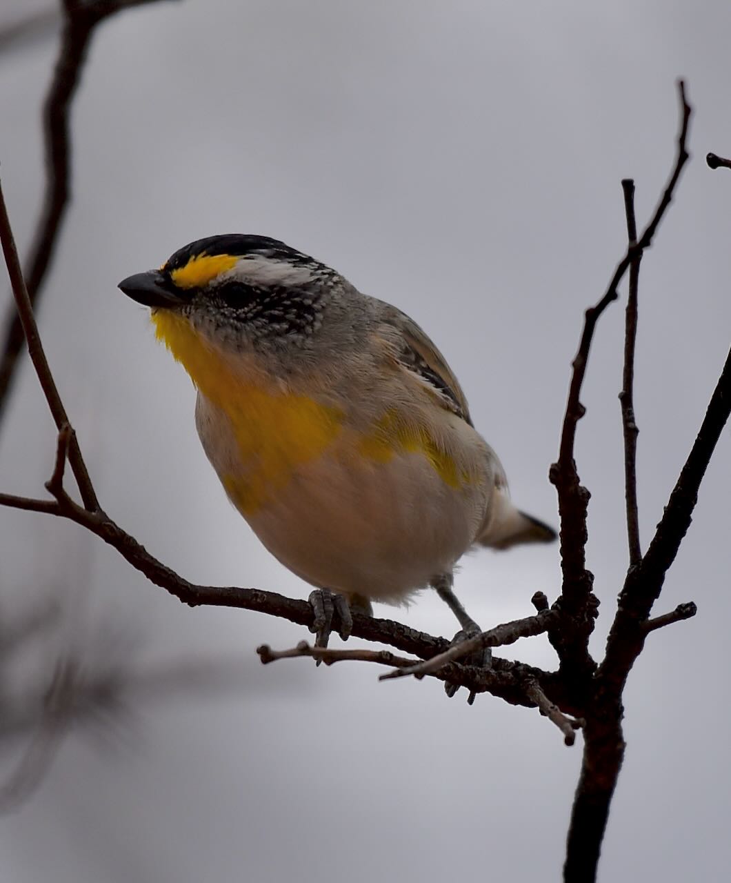
I observed several Rainbow Bee Eaters in the park, but they were too far away and quick for my photographic skills. But I did capture some photos of several Pardolates, a small, brightly coloured little Australian native bird. Pardolate is a Greek word meaning ‘spotted’.

Marija worked the following stations on 40m SSB:-

  1. VK2VH
  2. VK4AAC
  3. VK2IO/p (Dering I254 Bushland Reserve VKFF-4226)
  4. VK3PF
  5. VK3PI
  6. VK2IO/p (Sparas Bushland Reserve VKFF-4245)
  7. VK5MK/p (Scott Creek Conservation Park VKFF-0788)

Marija worked the following stations on 40m AM:-

  1. VK2VH
  2. VK4AAC
  3. VK2IO/p (Dering I254 Bushland Reserve VKFF-4226)
  4. VK3PF
  5. VK3PI

I worked the following stations on 40m SSB:-

  1. VK2VH
  2. VK4AAC
  3. VK2IO/p (Dering I254 Bushland Reserve VKFF-4226)
  4. VK3PF
  5. VK3PI
  6. VK3YV
  7. VK3SQ
  8. VK2BD
  9. VK5GY
  10. VK3GJG
  11. VK5FANA
  12. VK2NP
  13. VK2IO/m
  14. VK5KLV
  15. VK1AD
  16. VK1NAM
  17. VK3VIN
  18. VK2ZL/p
  19. VK2OKR
  20. VK2AUS
  21. VK2YAK
  22. VK4YAK
  23. VK2VRJ
  24. VK3CEO
  25. VK2IO/p (Sparas Bushland Reserve VKFF-4245)
  26. VK3GRX
  27. VK5MK/p (Scott Creek Conservation Park VKFF-0788)
  28. VK1CHW
  29. VK2PKT

I worked the following stations on 40m AM:-

  1. VK2VH
  2. VK4AAC
  3. VK2IO/p (Dering I254 Bushland Reserve VKFF-4226)
  4. VK3PF
  5. VK3PI
  6. VK3YV
  7. VK3SQ
  8. VK2BD
  9. VK5GY
  10. VK3GJG
  11. VK5KLV
  12. VK5FANA
  13. VK1AD
  14. VK1NAM

I worked the following stations on 40m FM:-

  1. VK3SQ
  2. VK2BD
  3. VK3GJG
  4. VK5GY
  5. VK3PF
  6. VK3MCK

I worked the following stations on 20m SSB:-

  1. VK4MUD
  2. ZL1TM
  3. VK4JT
  4. VK1AO
  5. VK2MET
  6. ZL1HIM

References.

  1. CAPAD 2022
  2. Wikipedia, 2024, <https://en.wikipedia.org/wiki/Pardalote>, viewed 8th January 2024.

Nyang I238 Bushland Reserve VKFF-4182

Our first activation for Sunday 12th November 2023 was the Nyang I238 Bushland Reserve VKFF-4182. The park is located about 44 km west of Ouyen in northwestern Victoria.

Above:- Map showing the location of the Nyang I238 Bushland Reserve. Map c/o Google Maps.

Nyang is an area/Parish in northwestern Victoria. Nyang is an aboriginal word meaning request to sit down.

Above:- the parish of Nyang. Image c/o Mapshare Victoria.

Nyang was once a small town. It is not to be confused with Nyang Homestead and Station which is located near the town of Moulamein.

Above:- A plan of the township of Nyang. Image c/o State Library Victoria.

Nyang was once a thriving district and had its own railway station, a Farmers Association, and a Progress Association.

Above:- Article from The Ouyen Mail and Central Mallee Advertiser, Fri 15 Aug 1913. Image co Trove.

The Nyang State School (No. 3871) opened on the 31st day of September 1914 in the Torrita public hall. It was renamed the Torritata State School on the 20th day of October 1921. In 1969 the school closed and the building was moved to Walpeup to be used as an art room.

The Nyang I238 Bushland Reserve is about 2 hectares in size and was established on the 8th day of May 1990. It is located on the northern side of the Mallee Highway at the junction with McVicar Road.

Above:- Aerial shot of the Nyang I238 Bushland Reserve. Image c/o Google Earth.

Parks Victoria has a webpage for this park but it contains no information.

The park has two sections, on either side of McVicar Road. It is a very small piece of remnant mallee scrub and is surrounded by cleared farming land.

We set up the 20/40/80m linked dipole for this activation and ran the Yaesu FT857 and 40 watts output.

Marija worked the following stations on 40m SSB:-

  1. VK3PF
  2. VK3KAI
  3. VK2DG
  4. VK2IO/p (Dering I254 Bushland Reserve VKFF-4226)

Marija worked the following stations on 40m AM:-

  1. VK2DG
  2. VK2PF
  3. VK3KAI
  4. VK3GJG
  5. VK3MAP
  6. VK2EX
  7. VK3MCK

I worked the following stations on 40m SSB:-

  1. VK3PF
  2. VK3KAI
  3. VK2DG
  4. VK2HHA
  5. VK2EX
  6. VK3MCK
  7. VK2NP
  8. VK3DAC
  9. VK3ZK
  10. VK3GJG/m
  11. VK3UP/m
  12. VK7PSJ
  13. VK3AWA
  14. VK3SO
  15. VK7ZGK
  16. VK2EXA
  17. VK3VIN
  18. VK1CHW
  19. VK2IO/p (Dering I254 Bushland Reserve VKFF-4226)
  20. VK1AD
  21. VK1NAM
  22. VK5AAF
  23. VK3SQ
  24. VK2BD
  25. VK1RF
  26. VK2MK
  27. VK4CEE
  28. VK2ZL
  29. VK5KLV
  30. VK2LWK
  31. VK2YAK
  32. VK4YAK
  33. VK2VH
  34. VK4AAC
  35. VK7LTD
  36. VK3BBB
  37. VK2CCP

I worked the following stations on 40m AM:-

  1. VK2DG
  2. VK2PF
  3. VK3KAI
  4. VK3GJG
  5. VK3MAP
  6. VK2EX
  7. VK3MCK
  8. VK3AWA
  9. VK3SQ
  10. VK2BD

I worked the following stations on 40m FM:-

  1. VK3SQ
  2. VK2BD
  3. VK3MAP

I worked the following station on 20m SSB:-

  1. VK2GRA

References.

  1. Blake, L, 1977, Place Names of Victoria.
  2. Wikipedia, 2024, <>, viewed 7th January 2024.