Ngarkat Conservation Park VKFF-0829

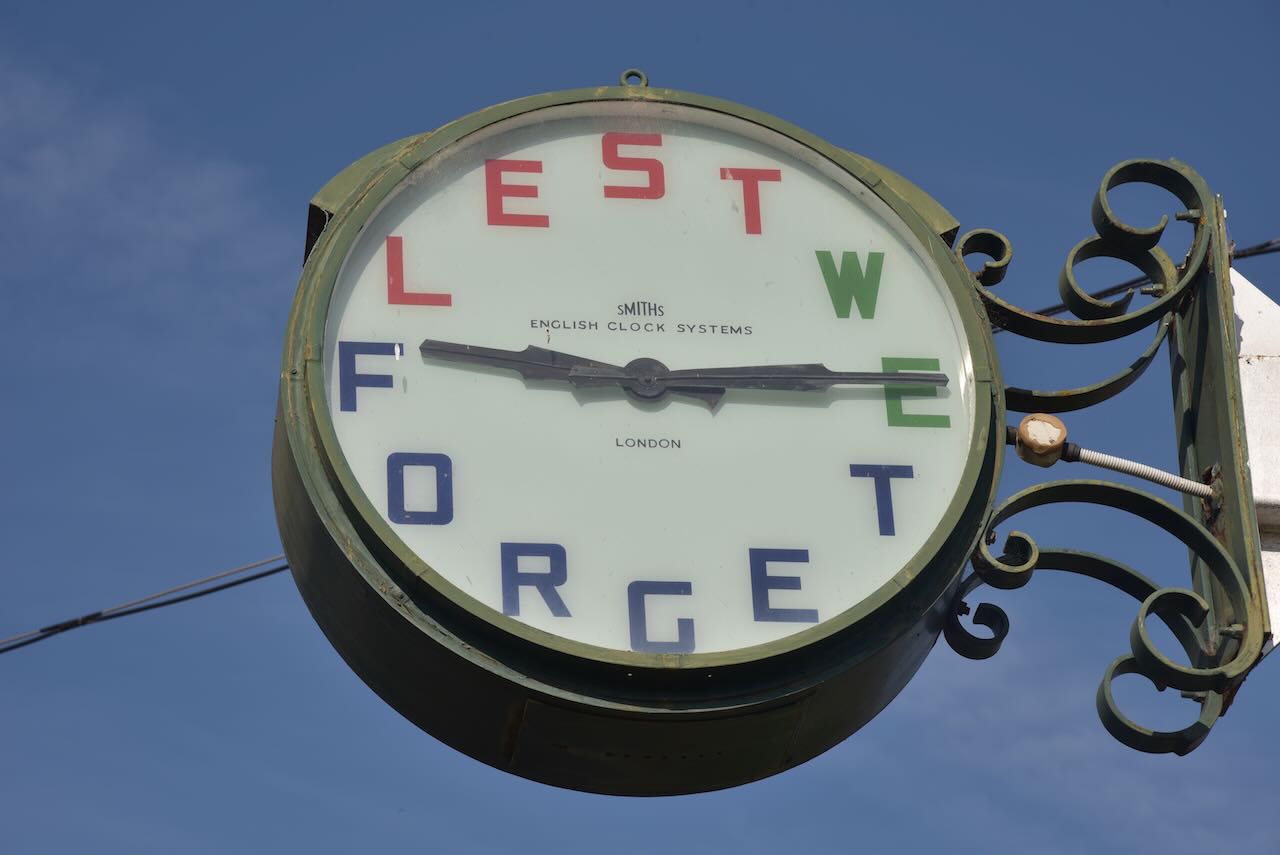
It was now Saturday 11th November 2023 and the very special day, Remembrance Day, and also the Keith Roget Memorial National Parks Award (KRMNPA) activation weekend.

Remembrance Day, also known as Poppy Day, is commemorated in Commonwealth countries and some non-Commonwealth Countries to recall the end of the First World War hostilities. Hostilities ceased ‘at the 11th hour of the 11th day of the 11th month” of 1918.

Every November, the KRMNPA holds a special activation weekend. Marija and I try to take part each year as activators. This year we had planned on activating the Murray Sunset National Park on Saturday and the Wyperfeld National Park on Sunday. However, there was a total fire ban in place on Saturday for the Mallee region of Victoria. This meant no park activations for our region of Victoria. So we had to change our plans. We decided to head over the border into South Australia to activate some parks where there was no fire ban in place.

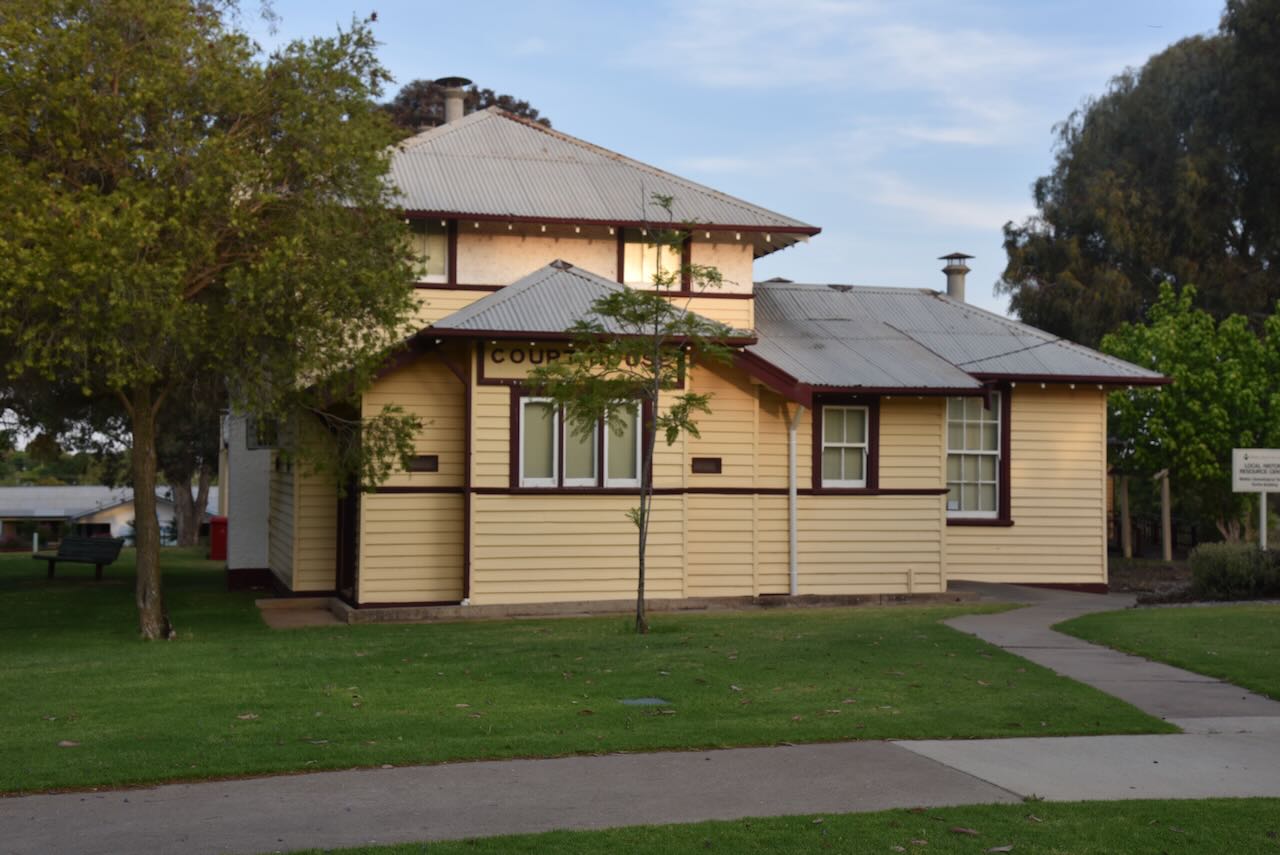
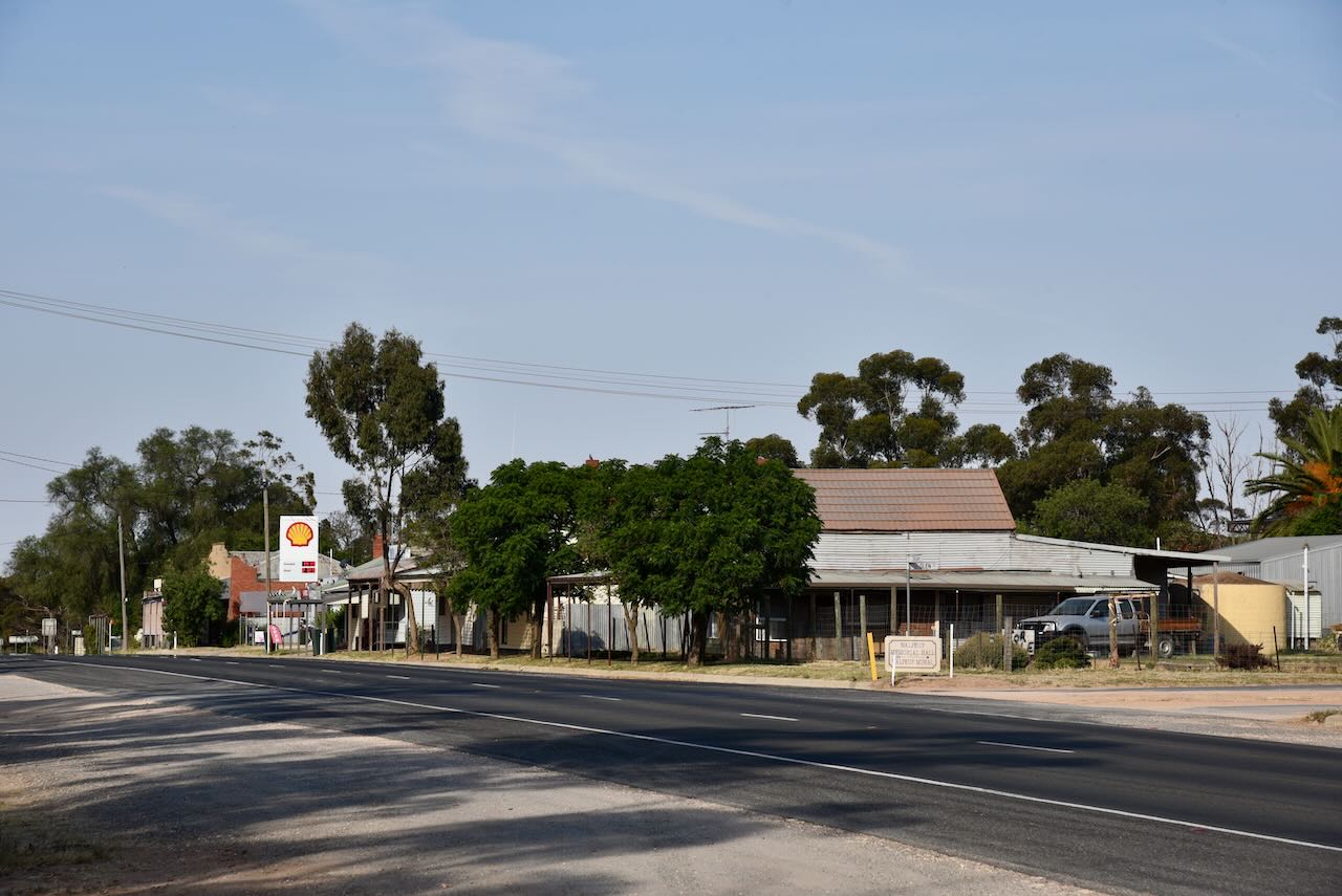
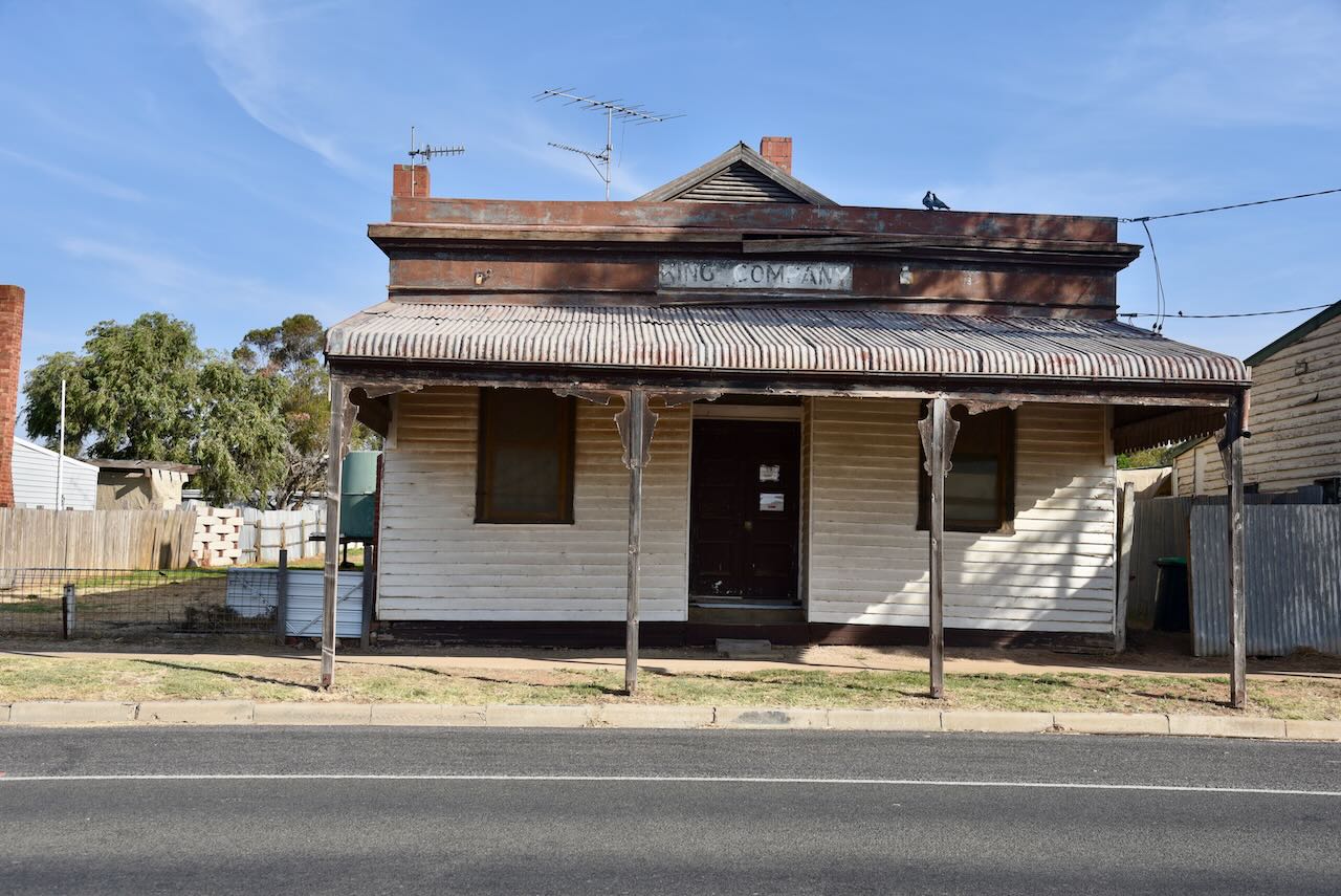
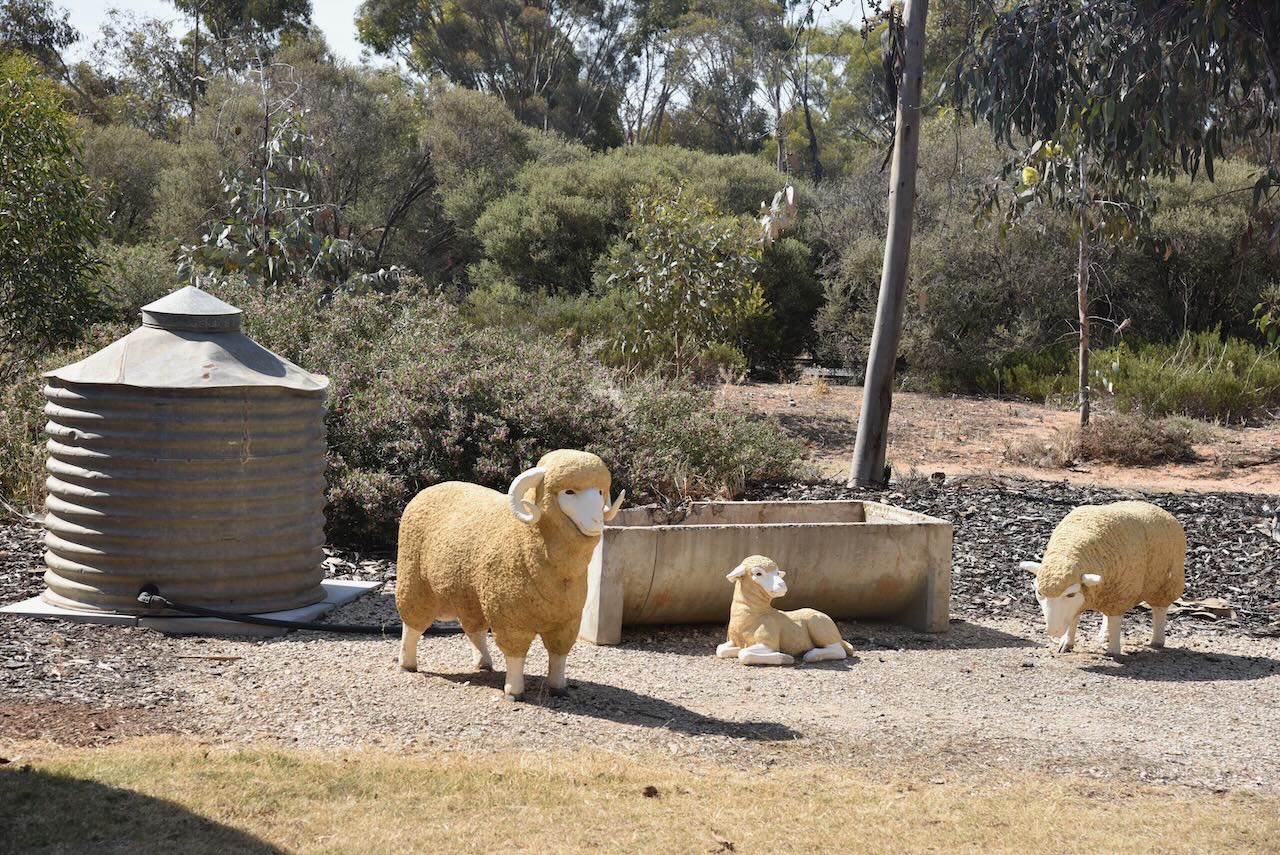
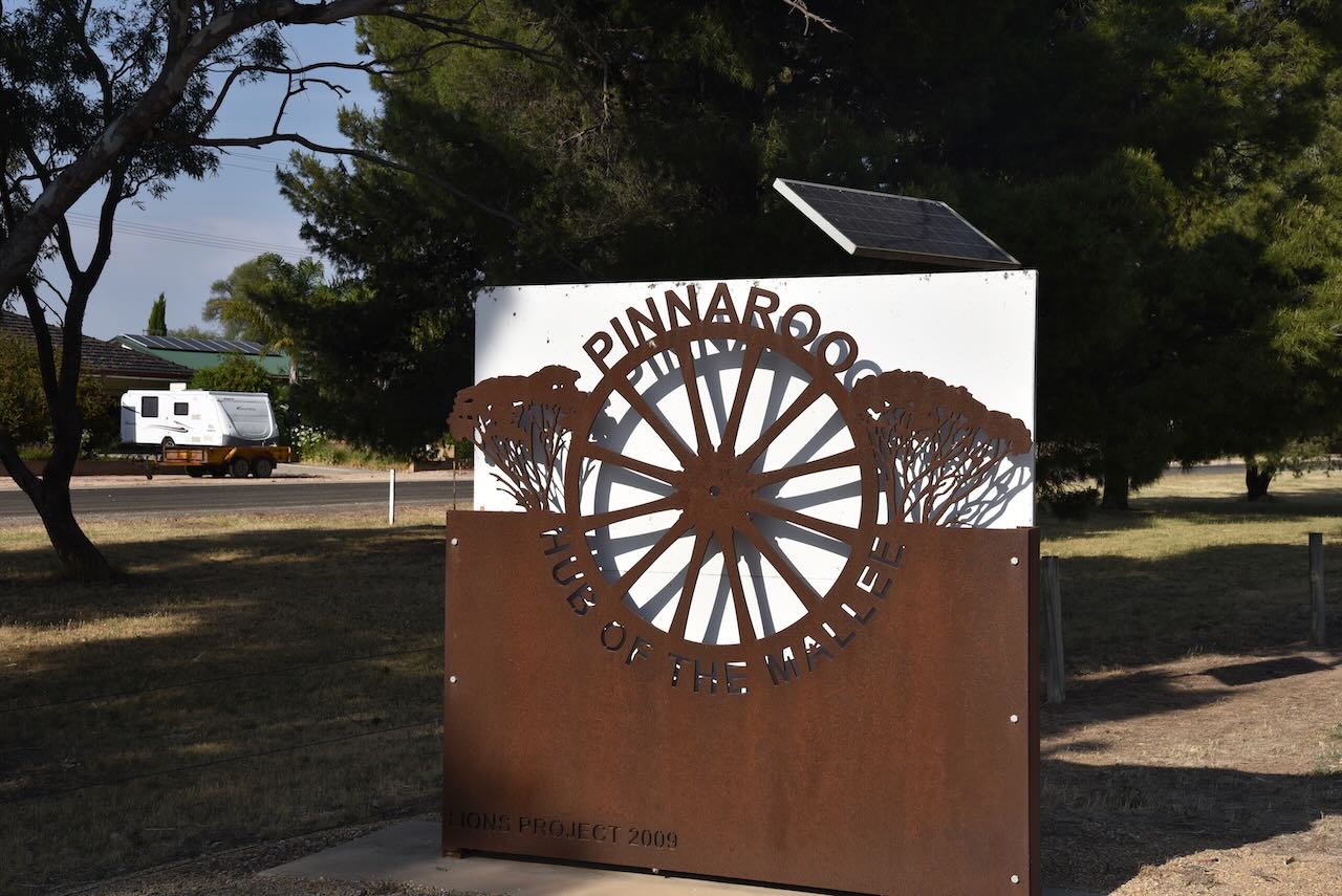
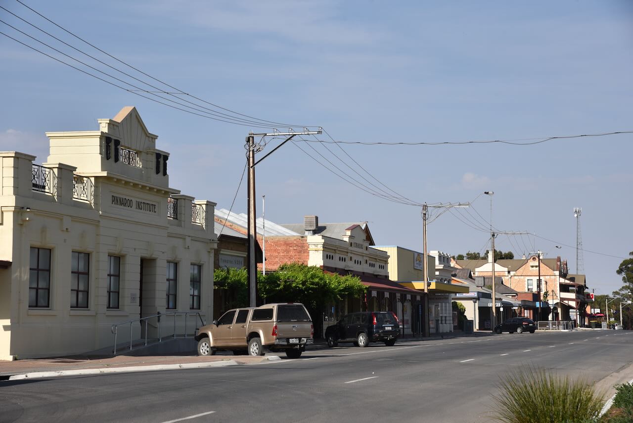
We drove over the South Australia/Victoria border and into the little town of Pinnaroo where we got some breakfast from the local bakery.

Pinnaroo is about 243 km east of Adelaide. The town’s name is derived from an aboriginal word for “big man”.

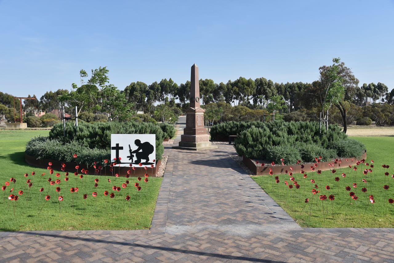
At it was Remembrance Day, Pinnaroo’s War Memorial was set up with poppies for the 1.00 a.m. commemorate ceremony.

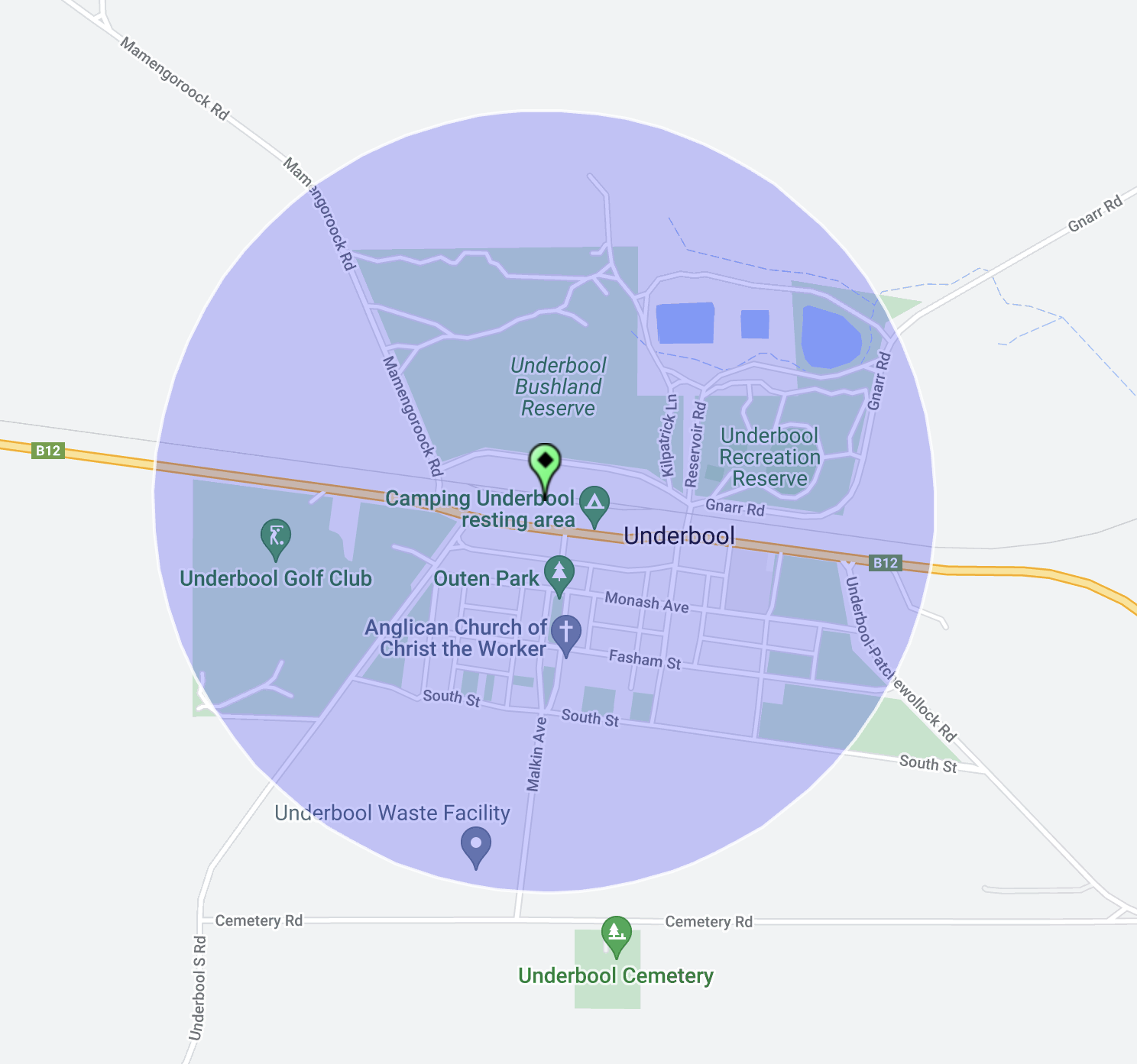
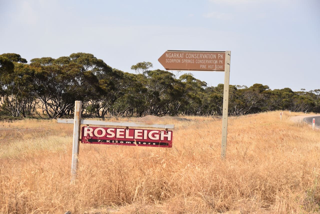
Following breakfast we headed out to the Ngarkat Conservation Park VKFF-0829.

Above:- Map showing the location of the Ngarkat Conservation Park. Map c/o Google Maps.

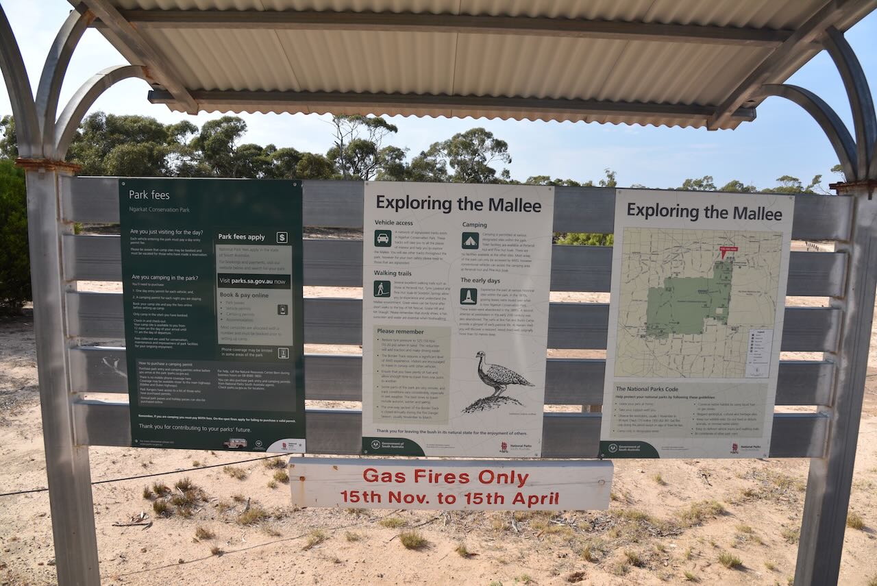
The turn off the Mallee Highway onto Rosy Pine Road to the park is well signposted, although inaccurate as it records Scorpion Springs Conservation Park (see below).

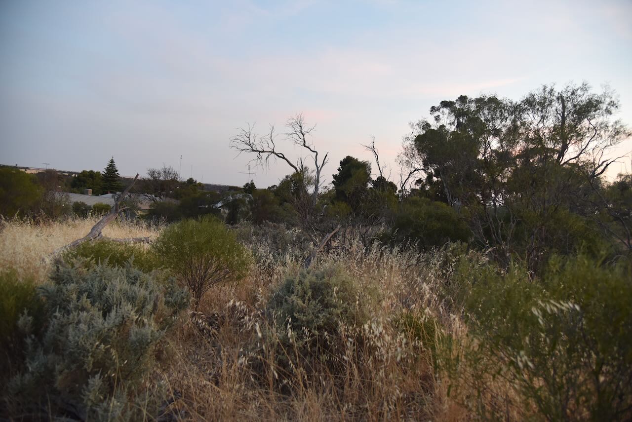
After travelling about 12 km along the dirt on Rosy Pine Road we reached the northern section of Ngarkat Conservation Park. We paid the $13.00 vehicle entry fee to the park at this location.

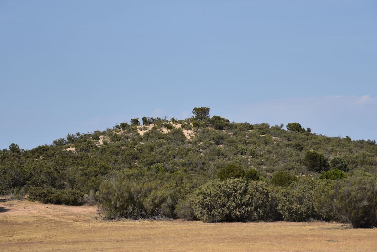
The Ngarkat Conservation Park is about 2,666.23 km2 in size and was established on the 13th day of September 1979 to conserve the mallee habitat of the 90 Mile Desert. 

Above:- The gazettal of the park in the SA Gazette, Sep 13 1979. Image c/o Wikipedia.

A significant portion of the Ninety Mile Desert was transformed into productive farmland now known as Coonalpyn Downs, by the field experiments of Dr. David Riceman of the CSIRO between 1944-1950.

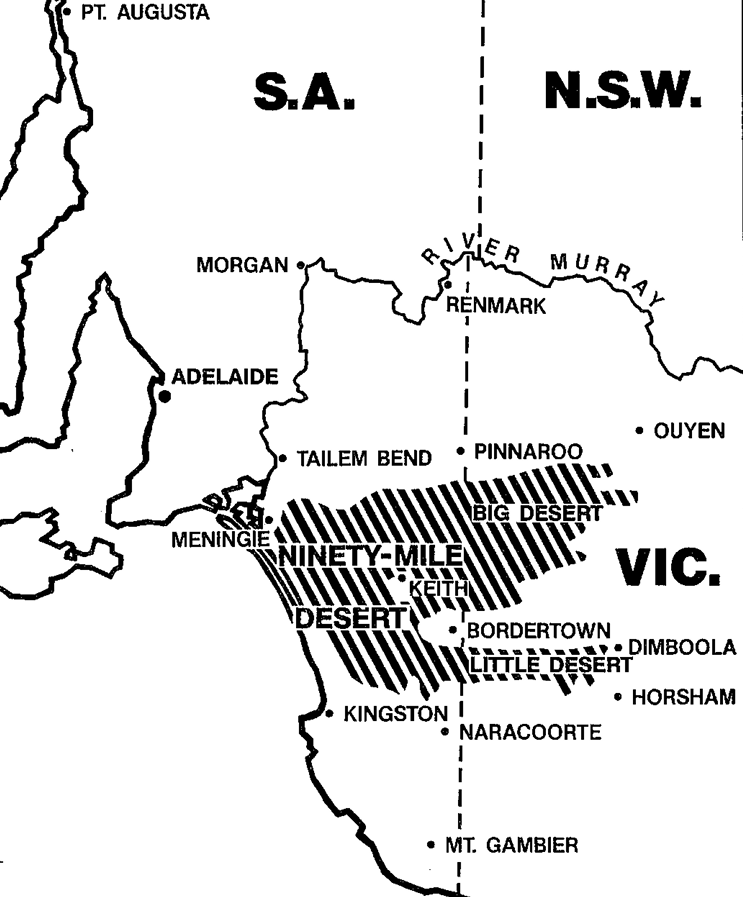
Above:- Map showing the location of the Ninety Mile Desert.

Prior to this, the area had been very remote and dangerous. This is highlighted in the article below which relates to Mr. A.J. Ratten who became bogged in the Ninety Mile Desert in 1924. The article states:

“To travel by motor car outback after nightfall even over some of the best known bush tracks is considered by experienced motorists a risky undertaking and needs a driver of strong mentality…..Mr. E.J. Ratten, who is well known in city commercial circles, decided to take the risk of night travelling and it nearly cost him his life.” 

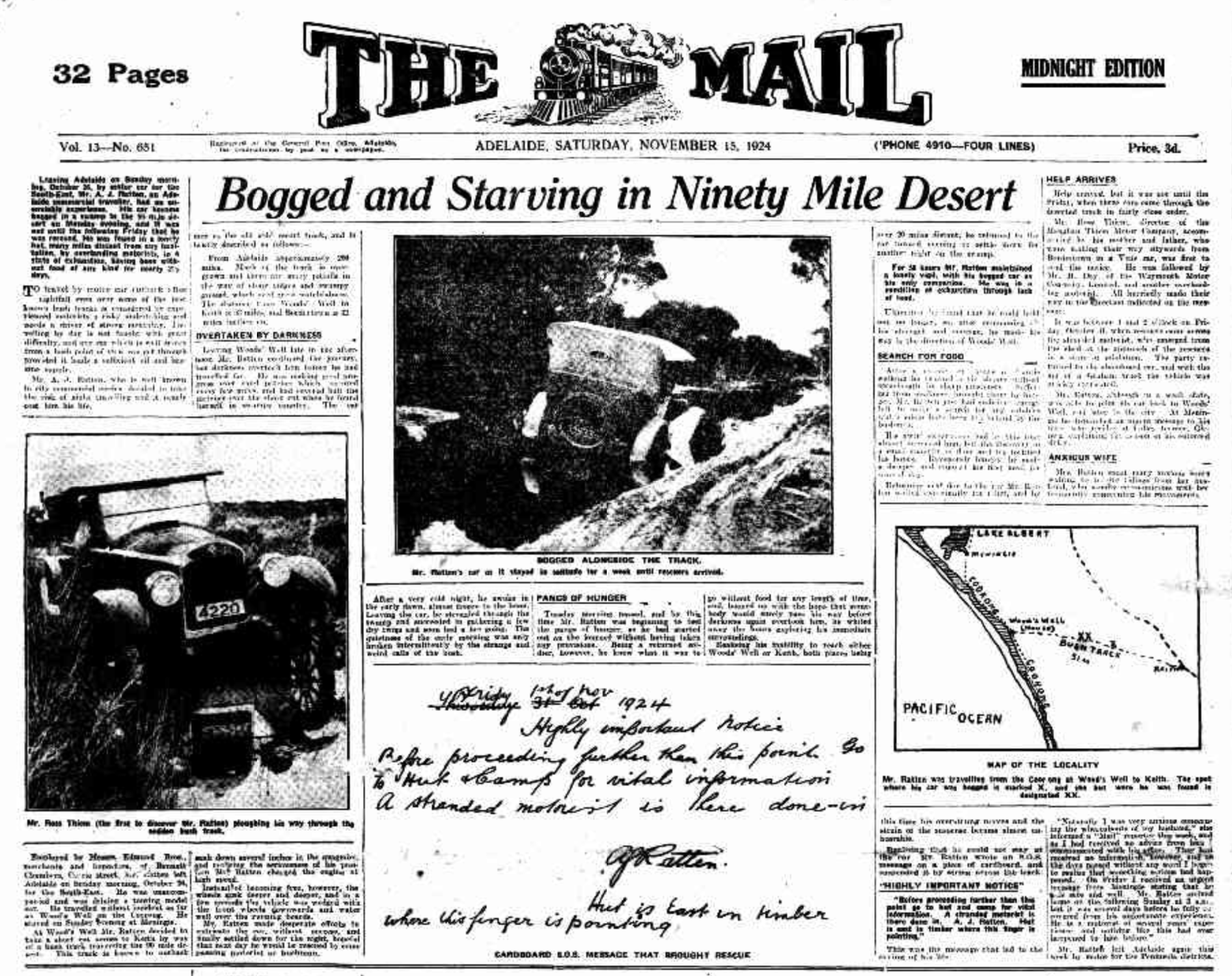
Above:- Article from The Mail, Adelaide, Sat 15 Nov 1924. Image c/o Trove.

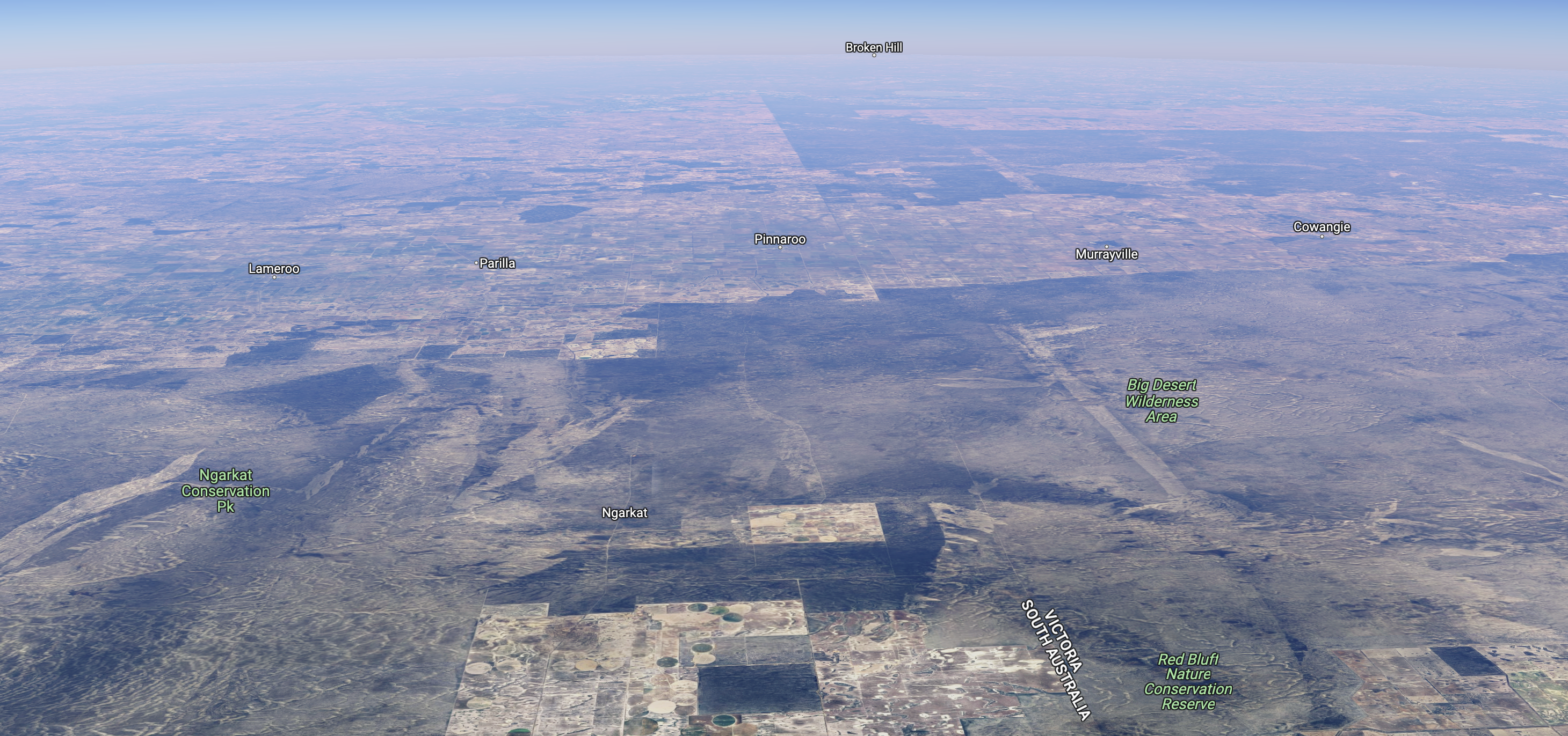
The eastern boundary of Ngarkat Conservation Park adjoins the Victorian State border and Big Desert Wilderness Area.

Above:- The Ngarkat Conservation Park, bordering the Victorian State border. Image c/o Google Earth.

The park takes its name from the Ngarkat aboriginal people who inhabited the Mallee region of South Australia and Victoria. They occupied an area of about 22,600 km2 from south as far as Tintinarra and east of the Murray River to Tatura. Sadly even before direct contact between the European settlers and the aboriginals, European diseases including Smallpox and influenza spread down the Murray River causing significant loss of aboriginal life. By the time that Europeans arrived the Ngarkat people were in decline and soon disappeared rapidly. Today there are no known descendants of the original Ngarkat people.

Above: An aerial view of Ngarkat CP, looking north. Image c/o Google Maps.

On the 27th day of May 2004, three Conservation Parks that adjoined the Ngarkat Conservation Park were abolished and incorporated into the Ngarkat Conservation Park:

  • Scorpion Springs Conservation Park (30,422 hectares)
  • Mount Rescue Conservation Park (28,339 hectares)
  • Mount Shaugh Conservation Park (3,474 hectares)

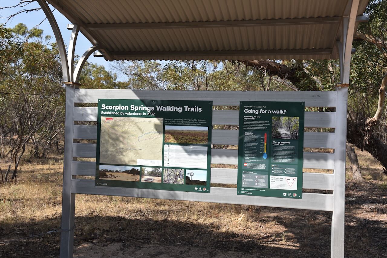
Scorpion Springs Conservation Park was formerly known as the Scorpion Well National Park. The park was established on the 9th day of July 1970. It was reproclaimed as the Conservation Park on the 27th day of April 1972. Its name is derived from ‘Scorpion Soakage’, also known as ‘Scorpion Spring’, a water source used by the Ngarkat aboriginal people.

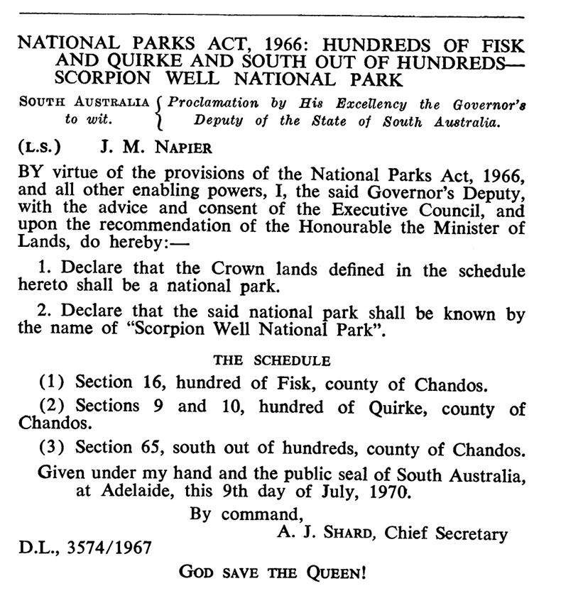
Above:- Declaration of Scorpion Well National Park, SA Govt Gazette, 9 July 1970.

The Mount Rescue Conservation Park was formerly known as the Mount Rescue National Park. It was gazetted on the 9th day of November 1967. Its name was derived from Mount Rescue, a 129 metre hill, located immediately to the east of the park.

The Mount Shaugh Conservation Park was established on the 25th day of November 1971 and was originally known as the Mount Shaugh National Park. It was reconstituted as a Conservation park on the 27th day of Aprul 1972. The park’s name was derived from Mount Shaugh, a hill with a height of 182 metres.

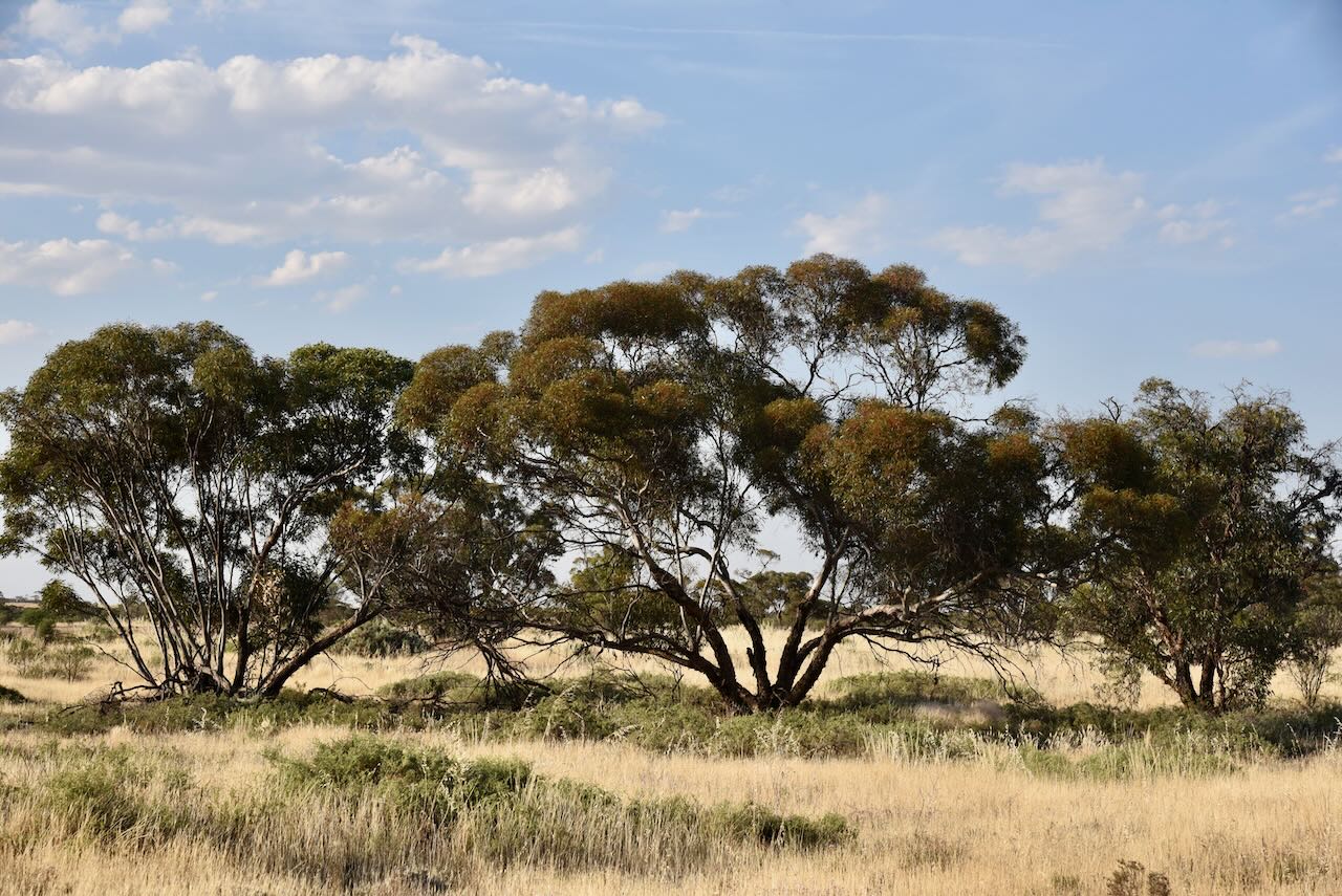
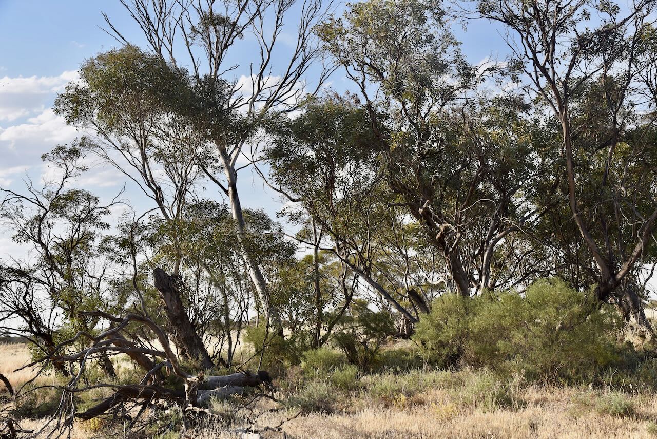
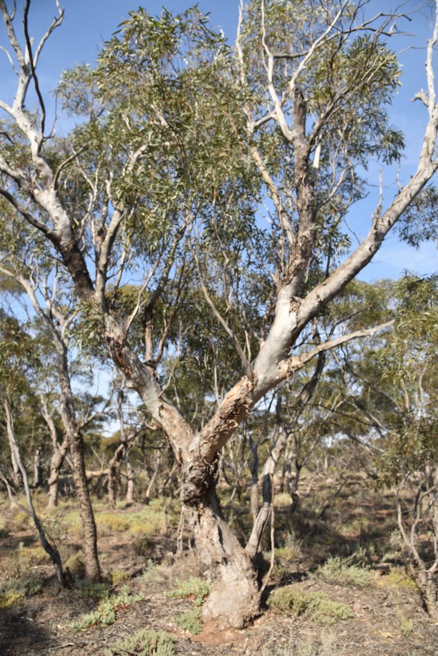
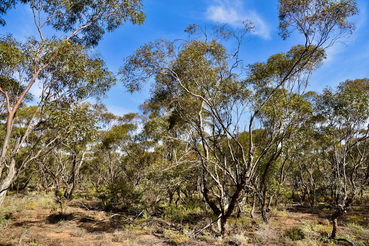
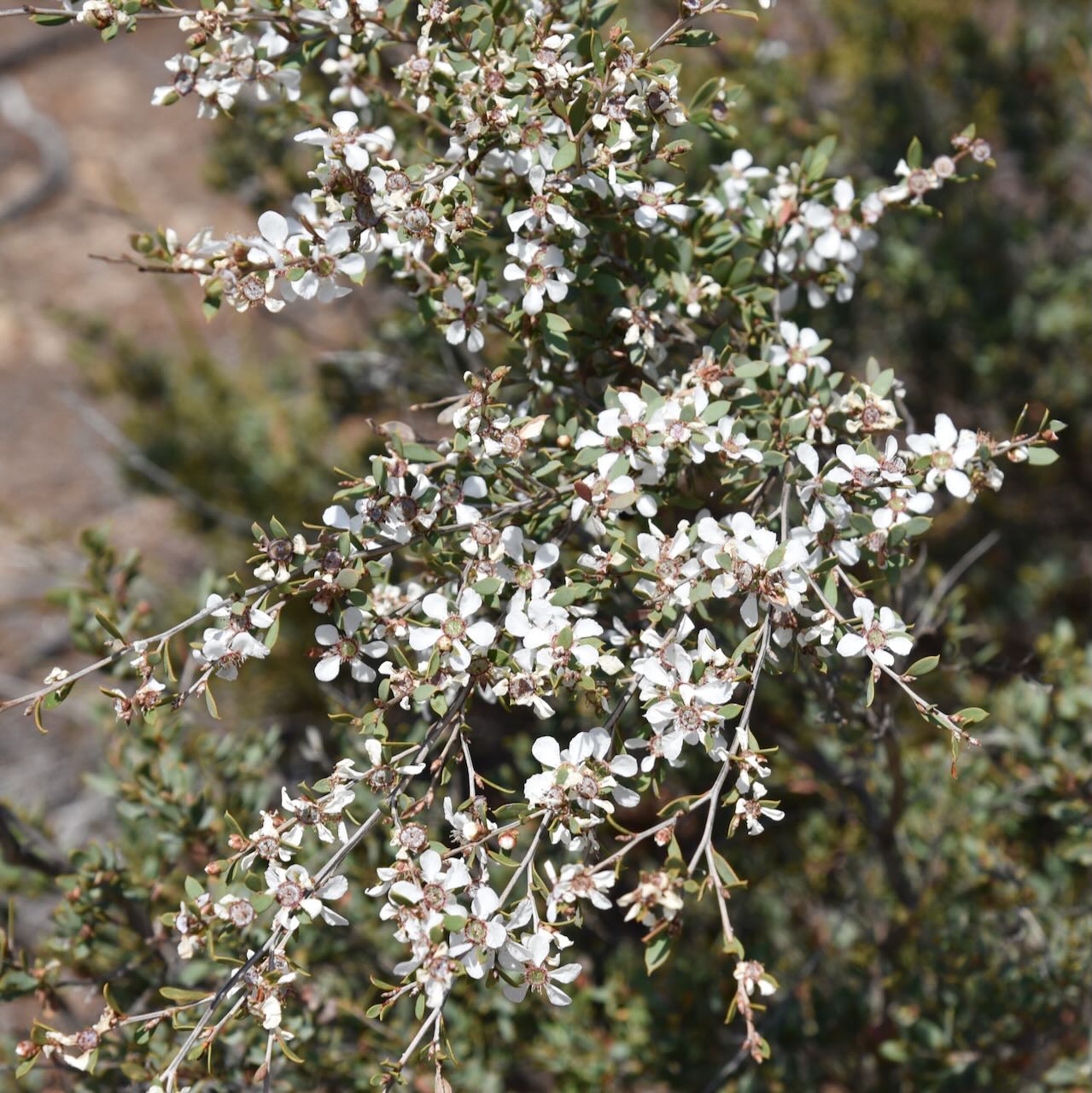
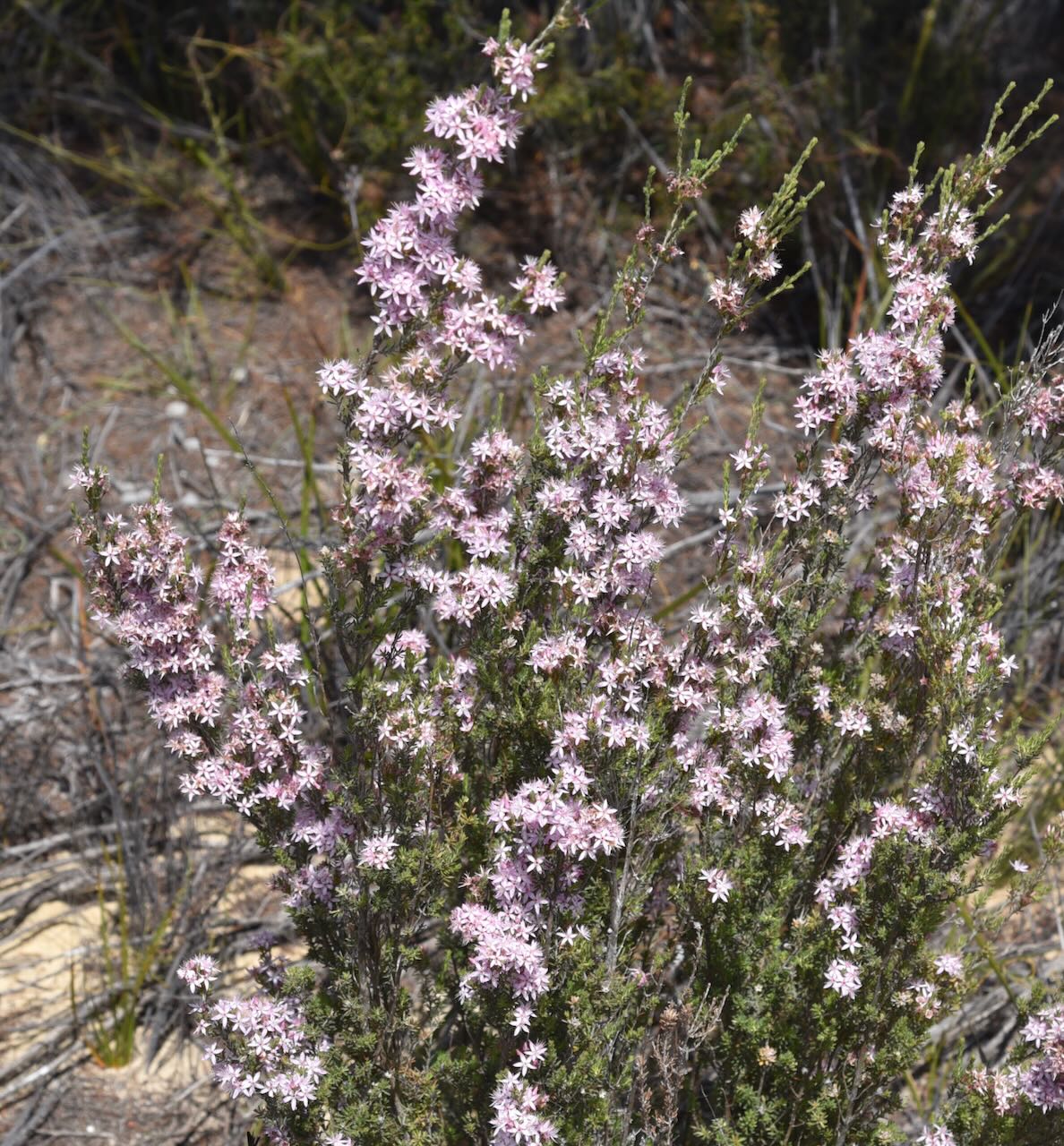
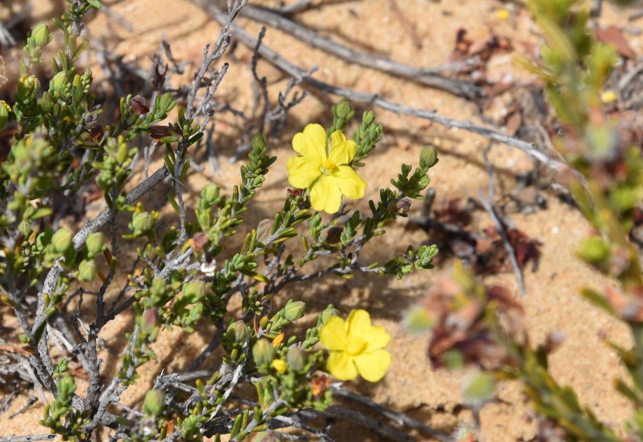
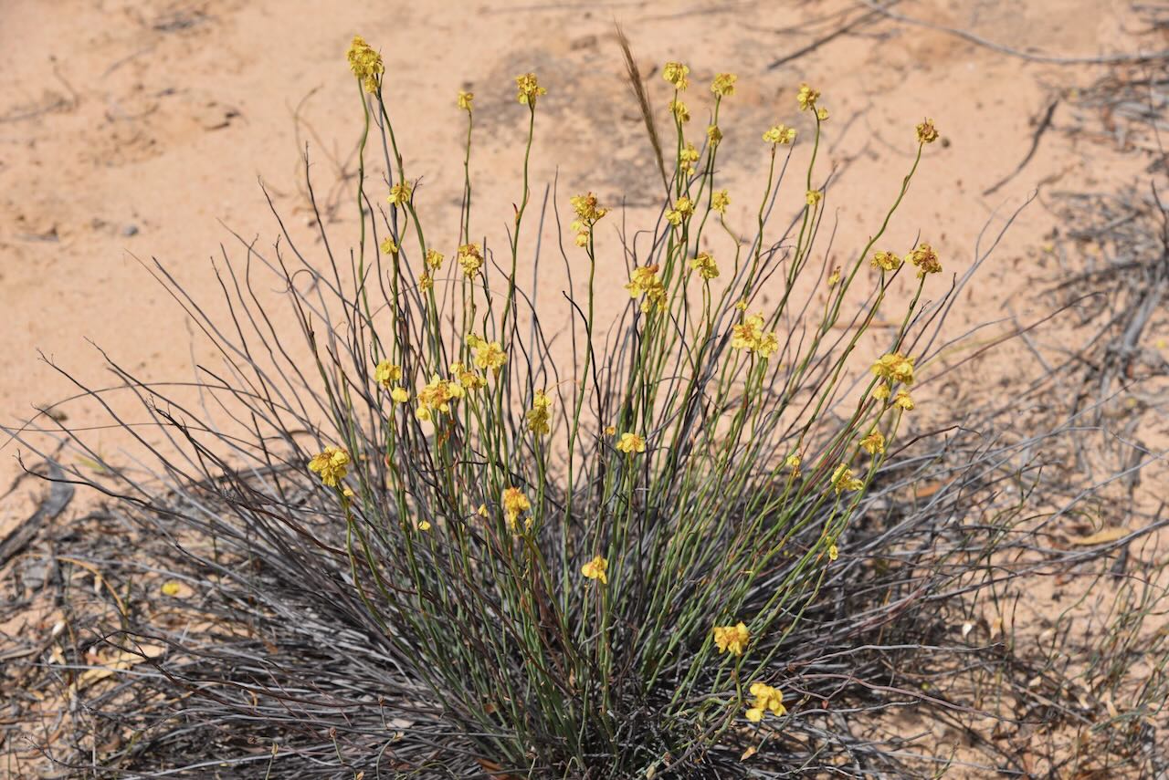
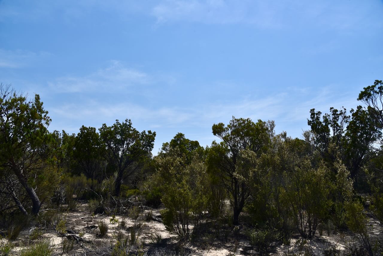
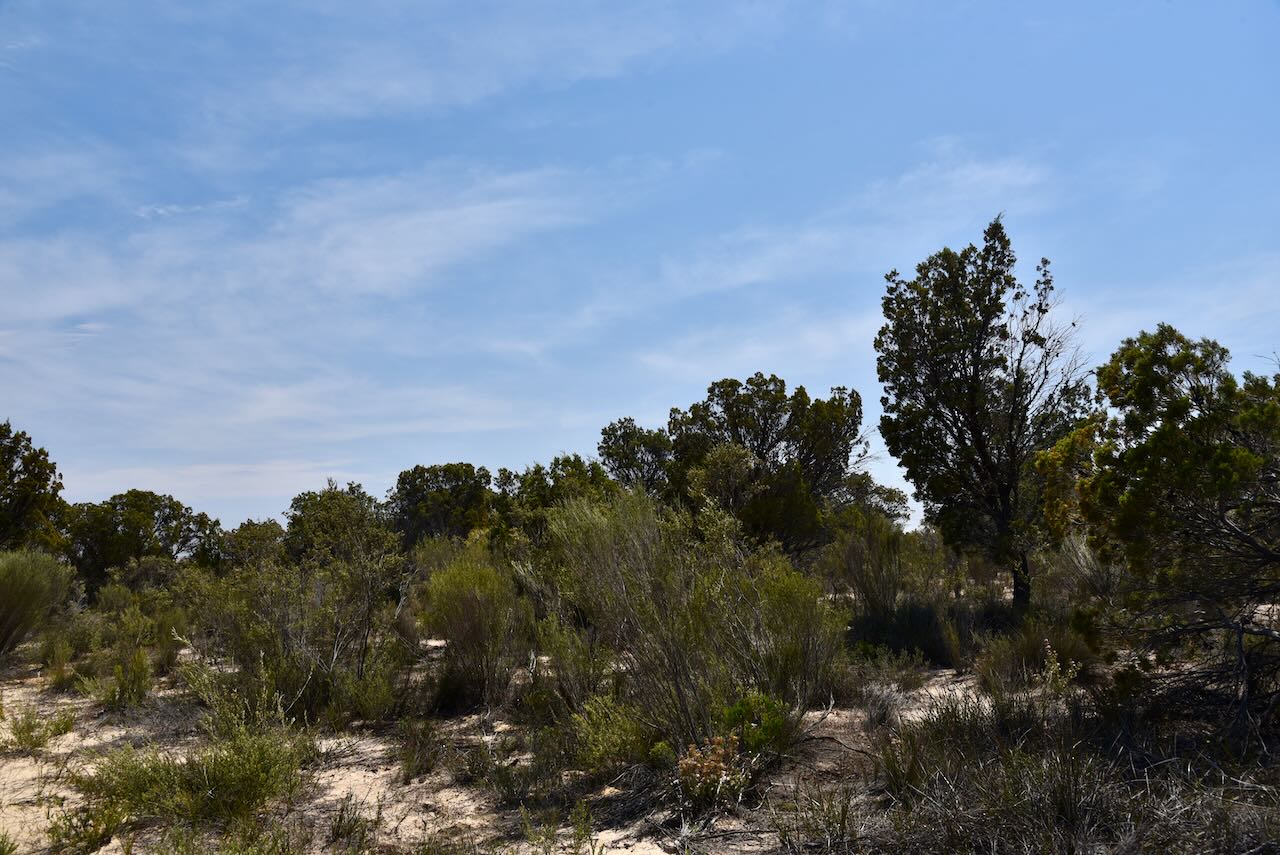
The park contains a wide variety of native animals, birds and reptiles. This includes the nationally vulnerable Malleefowl and the Mallee Emu Wren. Western Grey kangaroos, Common Dunnarts, Short-beaked echidnas, and Mitchell’s Hopping Mouse can be found in the park.

It is believed that explorer Edward John Eyre (b. 1815. d. 1901) was the first European to visit the area now known as Ngarkat, in April 1838.

Eyre recorded that to the European settlers, the area was “barren and worthless” but “to the native the most valuable and productive for here the wallabie, the opossum, the kangaroo rat, the bandicoot, the liepoa [mallee fowl], snakes lizards iguana and many other animals, reptiles, birds etc abound”.

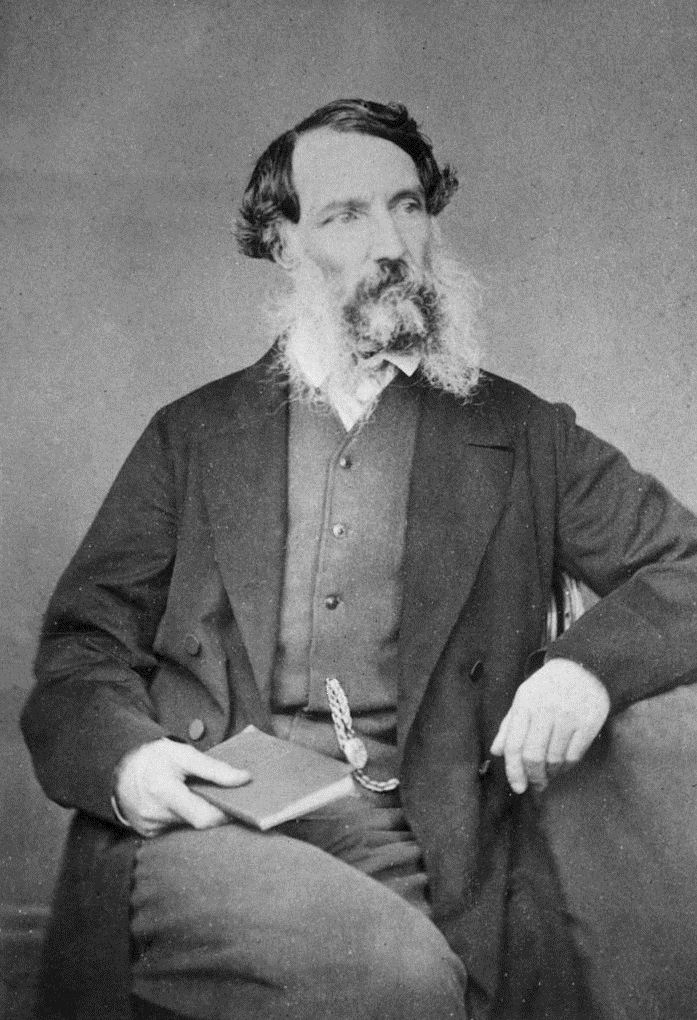
Above:- Edward John Eyre. Image c/o Wikipedia.

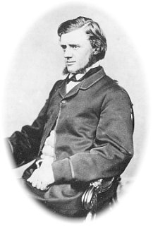
In the summer of 1888, a 16 year old John Shaw Nielson ( b. 1872. d. 1942) and his father were building the border fence at the South Australia/Victoria border when their water supplies ran out. Nielso is known as one of Australia’s finest lyric poets. For two days they travelled the area with their horses and cart looking for water and came across Scorpion Springs. Nielson recaled drinking fourteen pannikins of water and that the horses ‘licked out the dishes like dogs.’

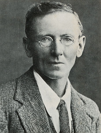
Above:- John Shaw Nielson. Image c/o Wikipedia.

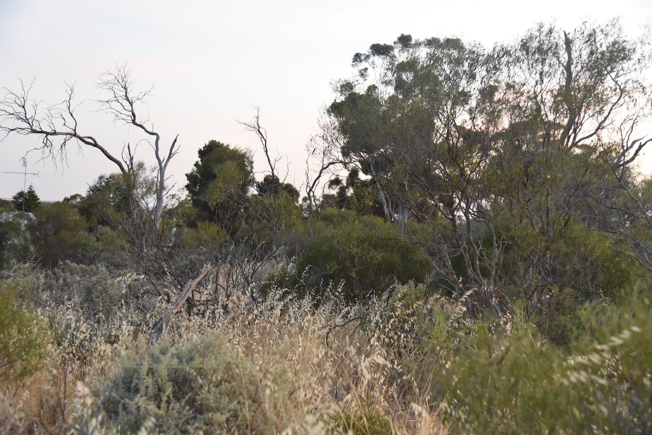
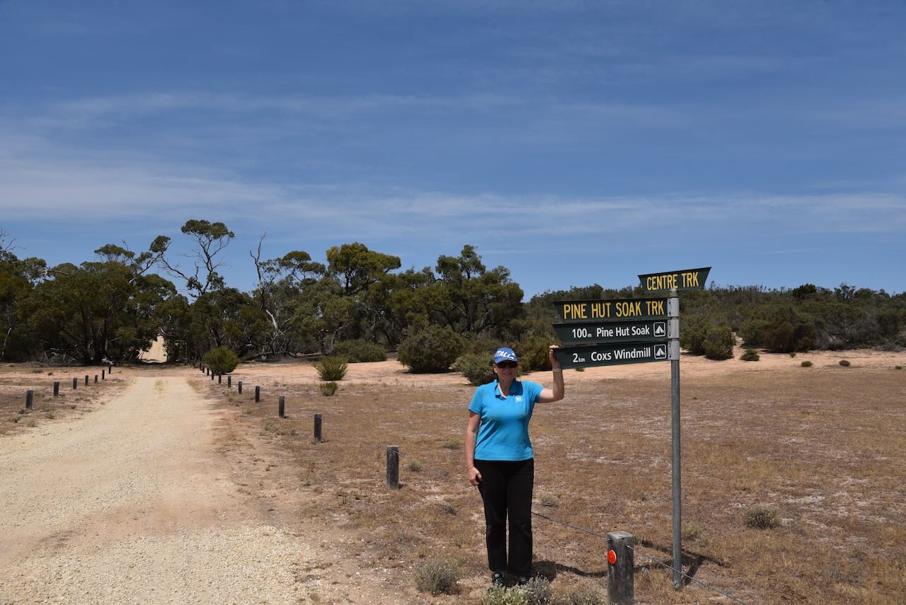
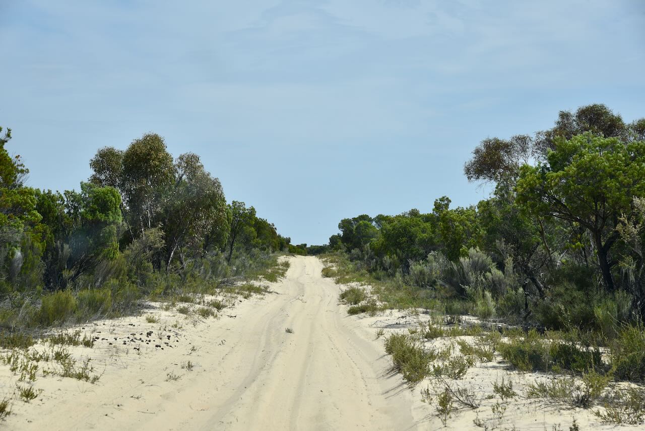
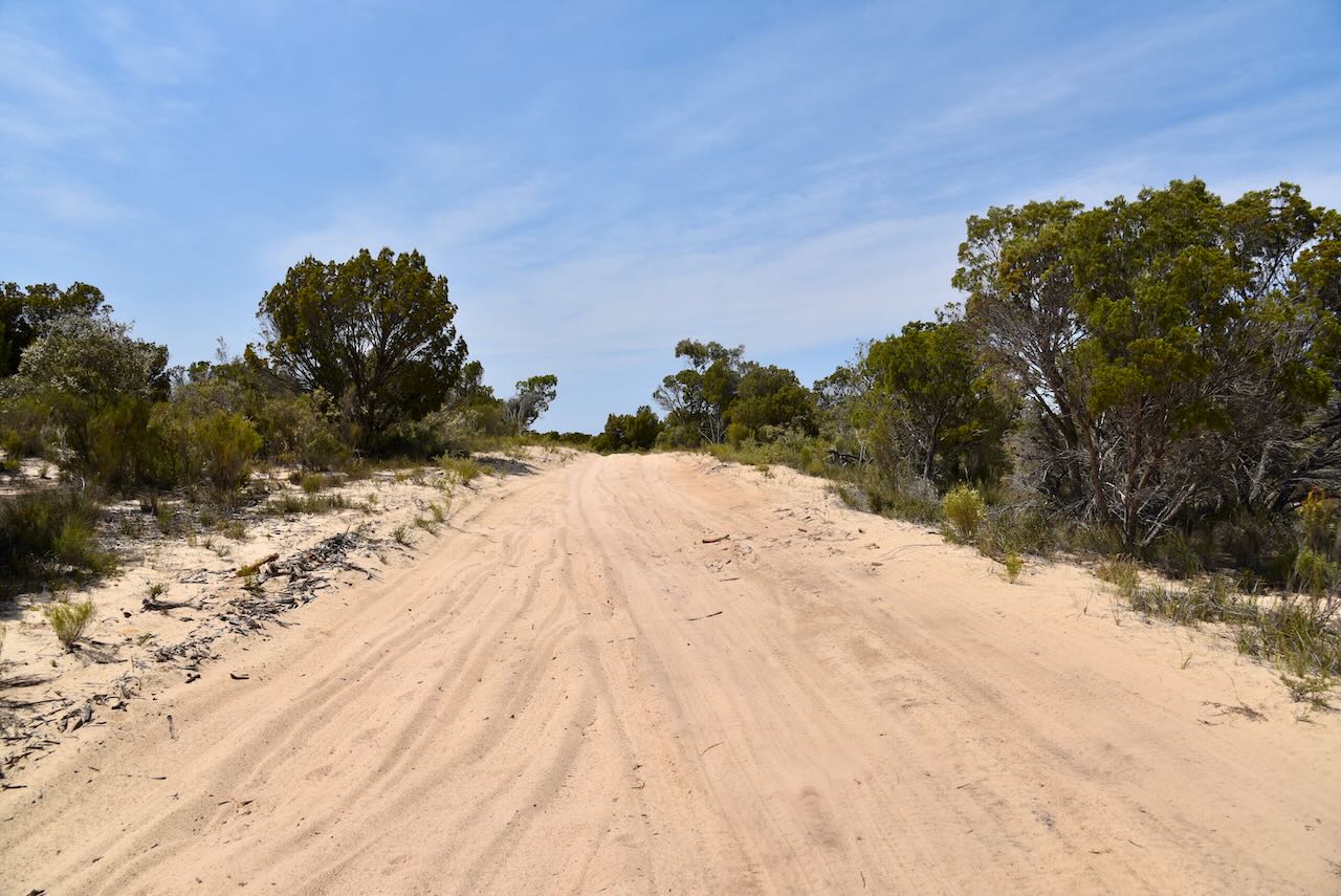
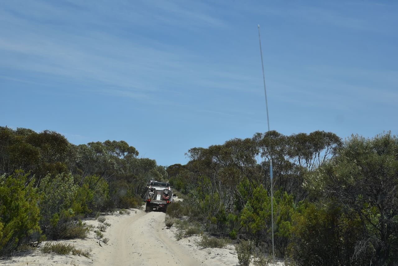
We drove along Pine Hut Soak Track and then along Nanams Well Track, until we reached Scorpion Springs. The track was very sandy and boggy in parts, but for the most part there were no difficulties with the Toyota Hi Lux. Except for a last sandy hill before entering the Scorpion Springs campground area.

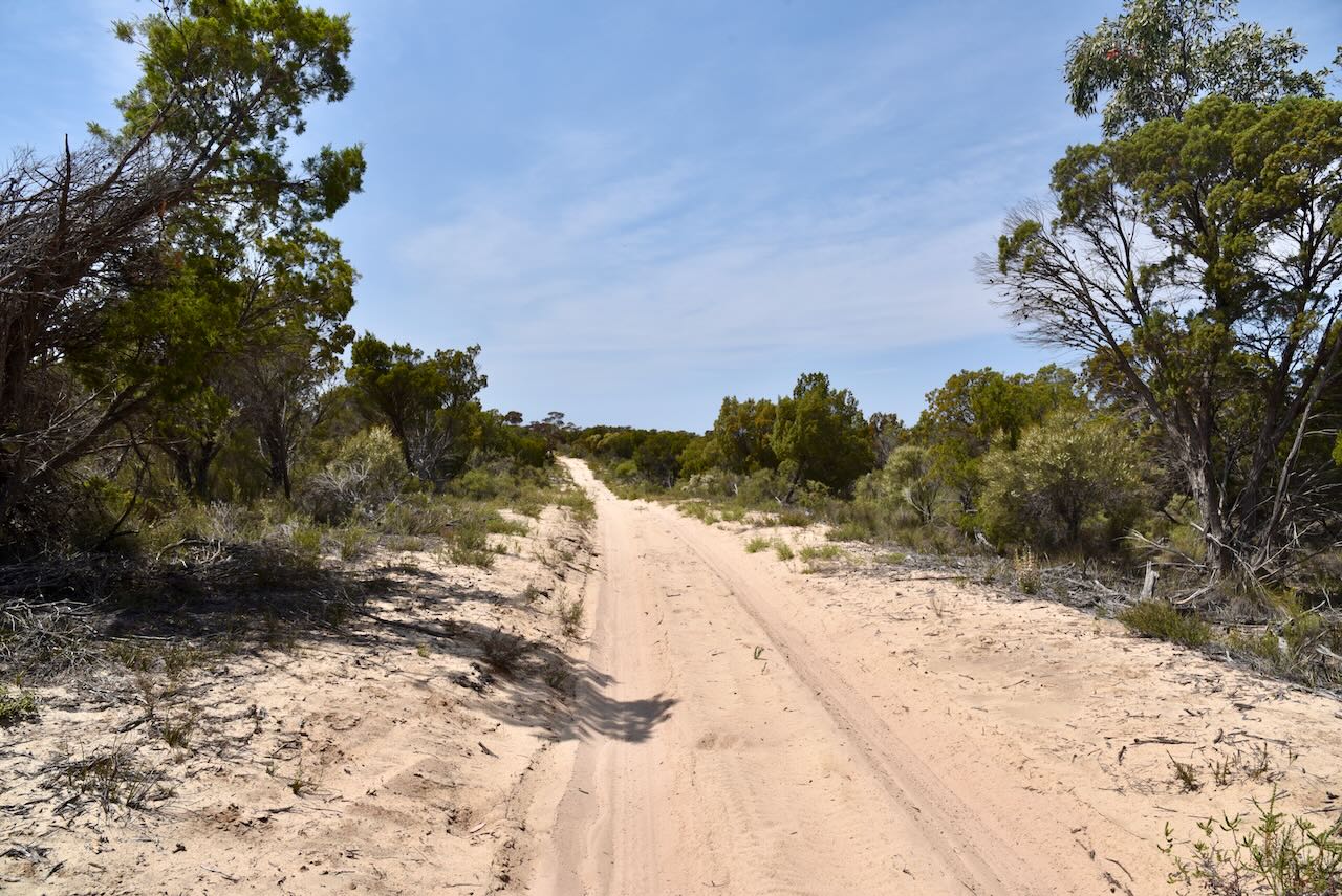
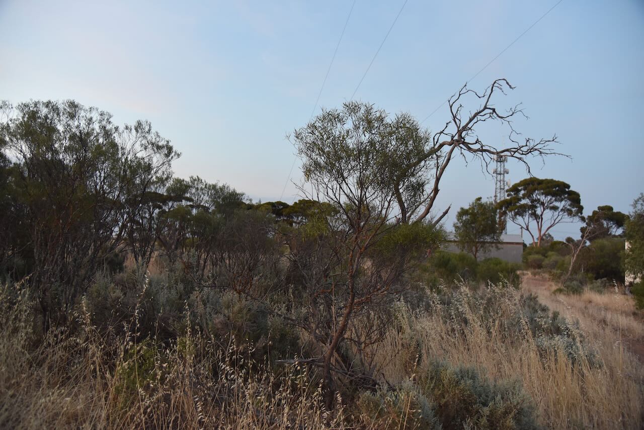
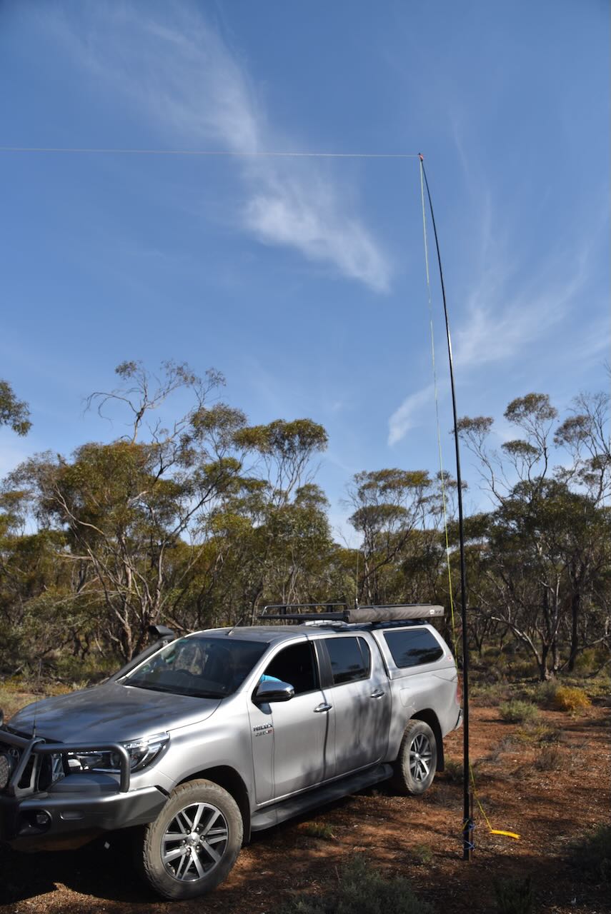
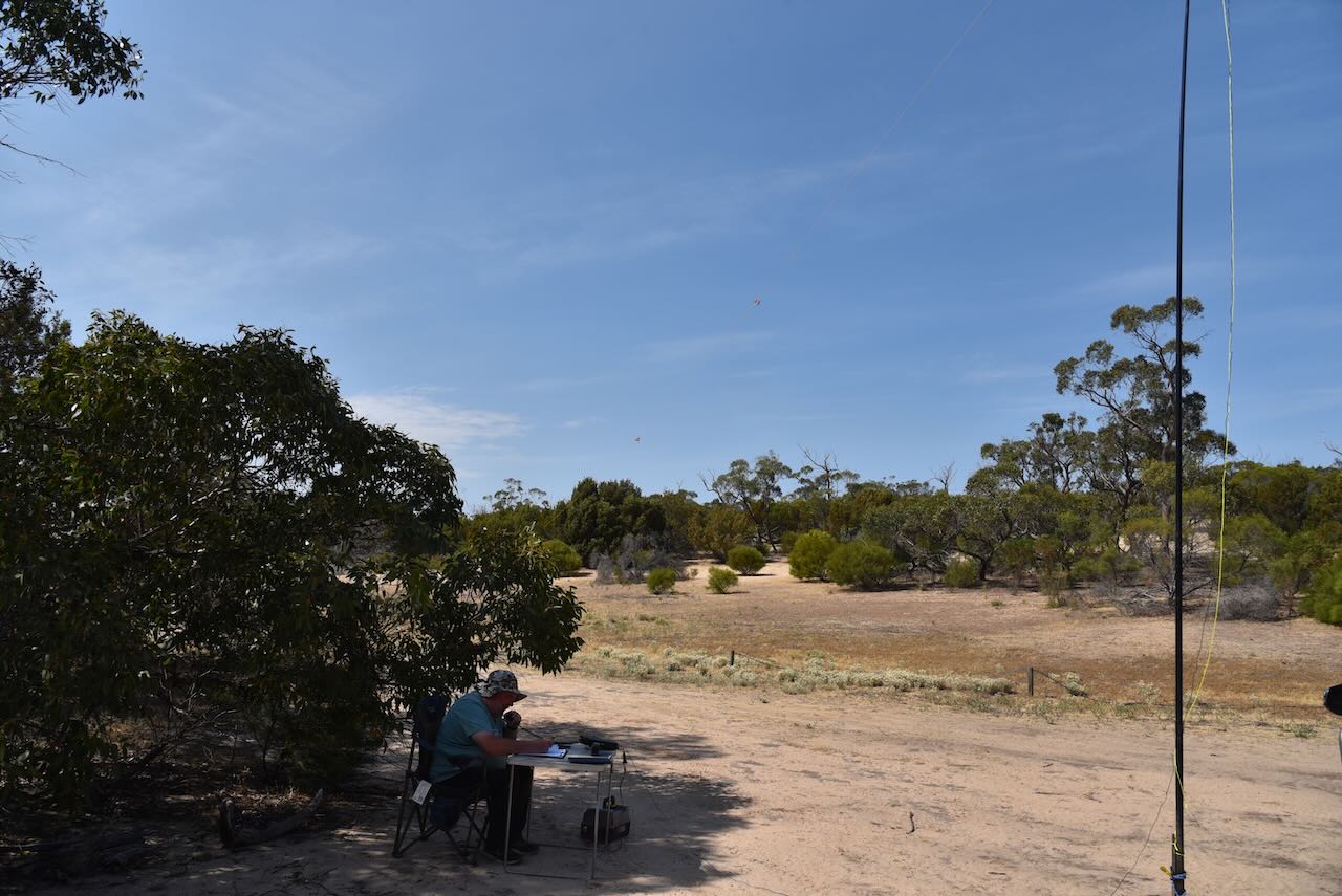
We set up in the Scorpion Springs car park area. We ran the Yaesu FT857, 40 watts, and the 20/40/80m linked dipole for this activation.

Marija worked the following stations on 40m SSB:-

  1. VK3PF
  2. VK3VIN
  3. VK2EXA
  4. VK5IS
  5. VK5ST
  6. VK3DAC
  7. VK3CLD
  8. VK2YAK
  9. VK4YAK
  10. VK1AO
  11. VK2MET
  12. VK7AMP
  13. VK1AD
  14. VK1NAM
  15. VK5DW
  16. VK3PWG/p (Budj Bim National Park VKFF-0345)
  17. VK3WI
  18. VK3VTH
  19. VK3XV
  20. VK2IO/p (Wyperfeld National Park VKFF-0549)

Marija worked the following stations on 40m SSB after the UTC rollover:-

  1. VK2IO/p (Wyperfeld National Park VKFF-0549)VK7XX
  2. VK3TUN/p (Wannon Flora Reserve VKFF-2476)

I worked the following stations on 40m SSB before the UTC rollover:-

  1. VK3PF
  2. VK3VIN
  3. VK2EXA
  4. VK5IS
  5. VK5ST
  6. VK3DAC
  7. VK3CLD
  8. VK2YAK
  9. VK4YAK
  10. VK1AO
  11. VK2MET
  12. VK7AMP
  13. VK1AD
  14. VK1NAM
  15. VK5DW
  16. VK3PWG/p (Budj Bim National Park VKFF-0345)
  17. VK3CEO
  18. VK3APJ
  19. VK1CHW
  20. VK3YV
  21. VK3WI
  22. VK3VTH
  23. VK3XV
  24. VK3KTT
  25. VK3MEG
  26. VK5FANA
  27. VK5KLV
  28. VK2IO/p (Wyperfeld National Park VKFF-0549)
  29. VK7XX
  30. VK2HHA
  31. VK5TN
  32. VK3SQ
  33. VK2BD
  34. VK2CDB
  35. VK3MTT
  36. VK3TUN/p (Wannon Flora Reserve VKFF-2476)
  37. VK5GY
  38. VK3BBB
  39. VK2CCP
  40. VK3GJG
  41. VK5DU
  42. VK2KYO
  43. VK3ZSC
  44. VK1AAF
  45. VK2HAK

I worked the following stations on 40m SSB after the UTC rollover:-

  1. VK3SQ
  2. VK2BD
  3. VK3CLD
  4. VK3ZSC
  5. VK1CHW
  6. VK1AD
  7. VK1NAM
  8. VK3PF
  9. VK5FANA
  10. VK5DW
  11. VK2KYO
  12. VK2IO/p (Wyperfeld National Park VKFF-0549)
  13. VK3TUN/p (Wannon Flora Reserve VKFF-2476)

I worked the following stations on 40m AM:-

  1. VK3SQ
  2. VK2BD

I worked the following stations on 40m FM:-

  1. VK3SQ
  2. VK2BD

I worked the following stations on 20m SSB:-

  1. VK7XX
  2. VK4EW

Whilst we were activating, a group of three 4WD’s came though. One almost became bogged in the spot that we experienced some issues. They returned a short time later and we decied to pack up and follow them back in the event that we experienced any difficulties.

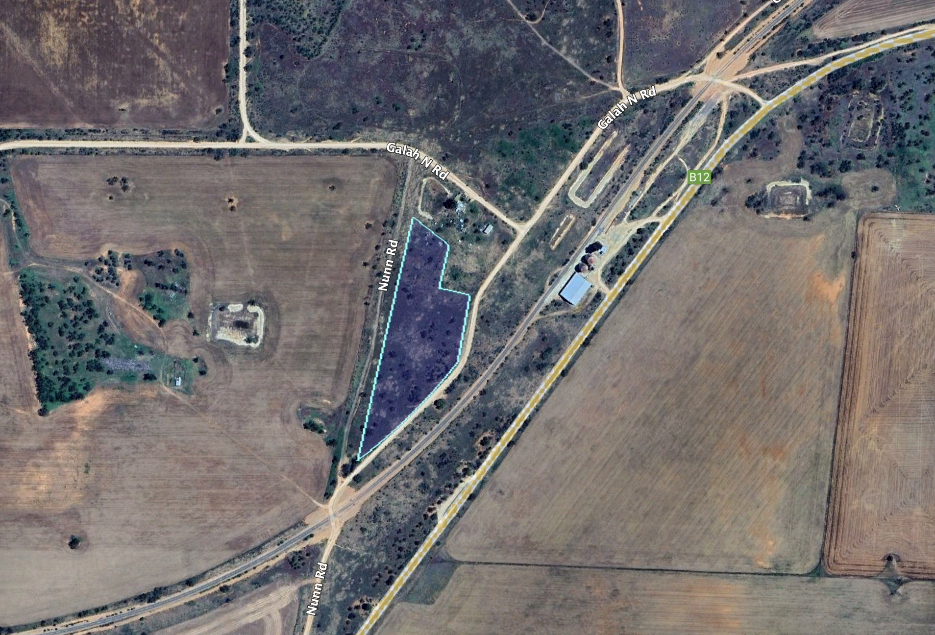
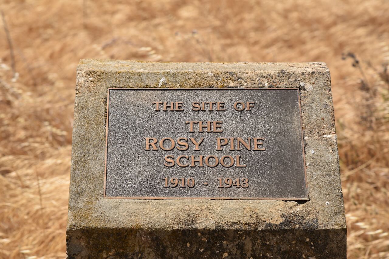
After the activation, we stopped to have a look at the memorial plaque for the Rosy Pine School. The school, along with a number of other outlying schools from the town of Pinnaroo, closed in 1943.  Students from these outlying areas were then required to travel to Pinnaroo by bus.  Today there is nothing left of the school other than the memorial plaque.

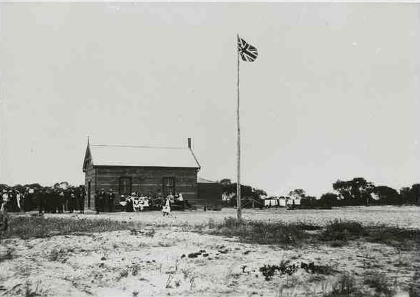
Above:- The Rosy Pine school, c. 1916.  Image courtesy of State Library SA.

We then headed to the Peebinga Conservation Park.

References.

  1. Department for Environment and Heritage, 2004, Ngarkat Complex of Conservation Parks Management Plan.
  2. Department of Primary Industries and Regions, 2023, <https://www.pir.sa.gov.au/__data/assets/pdf_file/0010/368767/DESERT_CONQUEST_-_NS_Tiver_1986.pdf>, viewed 5th January 2023.
  3. Foulkes, J, Gillen, J, 2000, A Biological Survey of the Murray Mallee South Australia
  4. Wikipedia, 2023, <https://en.wikipedia.org/wiki/Remembrance_Day>, viewed 5th January 2023.
  5. Wikipedia, 2023, <https://en.wikipedia.org/wiki/Pinnaroo,_South_Australia>, viewed 5th January 2023.
  6. Wikipedia, 2023, <https://en.wikipedia.org/wiki/Ngarkat_Conservation_Park>, viewed 5th January 2023.
  7. Wikipedia, 2023, <https://en.wikipedia.org/wiki/Ngarkat>, viewed 5th January 2023.
  8. Wikipedia, 2023, <https://en.wikipedia.org/wiki/Shaw_Neilson>, viewed 5th January 2023.
  9. Wikipedia, 2023, <https://en.wikipedia.org/wiki/Mount_Rescue_Conservation_Park>, viewed 5th January 2023.
  10. Wikipedia, 2023, <https://en.wikipedia.org/wiki/Scorpion_Springs_Conservation_Park>, viewed 5th January 2023.
  11. Wikipedia, 2023, <https://en.wikipedia.org/wiki/Mount_Shaugh_Conservation_Park>, viewed 5th January 2023.

Walpeup Flora & Fauna Reserve VKFF-2471 and Walpeup silo VK-WLP3

Our final activation for Friday 10th November 2023 was the Walpeup Flora and Fauna Reserve VKFF-2471 and the Walpeup silo VK-WLP3.

Above:- Map showing the location of Walpeup. Map c/o Google Maps.

‘Walpeup’ is derived from an Aboriginal word with numerous recorded meanings including a ‘stumpy-tailed lizard’ and another is an indigenous acacia.

The township of Walpeup was settled following the arrival of the railway. In 1909 a store opened at Walpeup. In 1911 the Walpeup Shire was proclaimed. Walpeup’s population was 101 people. The Walpeup Primary School opened on the 3rd day of June 1912 in the ‘Little White Hall’. The Post Office opened on the 16th day of December 1912. 

Above: early settlers at Walpeup, c. 1911. Image c/o Museums Victoria.

In 1914 a one-room school building was constructed. A second room was added in 1927. In April 2015 the school closed and the last five students were transferred to the Underbool school.

The Walpeup South State School (No. 3929), also known as Hungry Hut, was opened in 1912 and closed in 1951.  The school building was later moved and served as the dressing shed at the Walpeup Recreation Reserve.

By 1921 Walpeup had a population of about 452 people. The town had a general store, a blacksmith, a butcher, a bank branch and several other businesses. A brick memorial hall replaced the original public hall in 1923.

Above:- Walpeup township, c. 1911. Image c/o Museums Victoria.

We arrived at the park at about 9.00 p.m. and it was completely dark. It was a very hot and humid night and we could hear thunderstorms off in the distance. We ran the Yaesu FT857, 40 watts, and the 20/40/80m linked dipole for this activation. I used the special event callsign of VI10VKFF for this activation.

The Walpeup Flora & Fauna Reserve is also referred to as the Walpeup Nature Conservation Reserve. It is about 178 hectares in size and was established on the 1st day of May 1979.

We operated within the activation zone of the Walpeup silo.

We had viewed the Walpeup silos earlier in the day on our way to Ouyen.

They feature magnificent silo art. One of the best that we have seen during our travels. The silos were painted in June 2023 by Julian Clavijo and Camilo Delgado. They depict the story of Trooper Harold Thomas Bell.

Harold Thomas Bell was born in 1901 at Walpeup. He was just 16 years old when the First World War broke out. He travelled to Mildura and enlisted with the Light Horse Regiment, lying about his age, name and his family circumstances. He claimed to be 21 years old and gave his name as Harold Thomas Wickham.

On the 22nd day of June 1917, he left Australia and arrived in Egypt about 6 weeks later. He was subsequently selected for the Hotchkiss machine gun section.

On the 28th day of October 1917, he was involved in a battle near the town of Beersheva. He was shot in the leg and critically wounded. He died the following day and was laid to rest in the Beersheba War Cemetery.

A telegram was despatched to Harold’s only living uncle, recorded on the enlistment forms, to inform him of Harold’s death. Upon receiving the telegram Thomas Bell replied:

“I don’t have a nephew named Harold. I do have a son by that name, but he couldn’t be in the Army, he’s only 16.”

Tragedy was to strike the family twice. Less than a year following Harold’s death, his father received another telegram to advise of the death of his other son Samuel.

Above:- The attestation document of Harold Thomas Bell @ Harold Thomas Wickham. Image c/o ancestry.com.au

During our activation at Walpeup the lightning activity to the west of us really intensified. We could hear the loud rumble of thunder. And then the fire sirens went off in Walpeup, and we decided to pack up and head back to Murrayville.

Along the way, we observed numerous fires burning in paddocks, the result of lightning strikes. We were passed by a number of fire appliances and police cars heading to the fires with lights and sirens. And the lightning display was absolutely spectacular.

Marija worked the following stations on 40m SSB:-

  1. VK3PF
  2. VK3KAI
  3. VK3SQ
  4. VK2BD
  5. VK3ACZ
  6. VK3CEO
  7. VK3SG
  8. VK1AO
  9. VK2MET
  10. VK2EXA

I worked the following stations on 40m SSB:-

  1. VK3PF
  2. VK3KAI
  3. VK3SQ
  4. VK2BD
  5. VK3ACZ
  6. VK3CEO
  7. VK3SG
  8. VK1AO
  9. VK2MET
  10. VK2EXA
  11. VK7AAE
  12. VK2NZL
  13. VK3YV
  14. VK3EJ
  15. VK1RF
  16. VK2MK
  17. VK4CEE
  18. VK3ZH
  19. VK2CDB
  20. VK2YAK
  21. VK4YAK
  22. VK3APJ
  23. VK5LA
  24. VK5FANA
  25. VK5AAF
  26. VK3ZK
  27. VK4HMI

I worked the following stations on 80m SSB:-

  1. VK3SQ
  2. VK2BD
  3. VK3PF
  4. VK3KAI
  5. VK5KK
  6. VK3ZK
  7. VK2EXA
  8. VK7AAE
  9. VK3APJ
  10. VK5GY
  11. VK3LF
  12. VK3BWM
  13. VK5BRU
  14. VK3GV
  15. VK2IO/p
  16. VK1AO
  17. VK2MET
  18. VK2YAK
  19. VK4YAK

References.

  1. Australian Silo Art Trail, 2023, <https://www.australiansiloarttrail.com/walpeup>, viewed 2nd January 2023.
  2. Victorian Places, 2023, <https://www.victorianplaces.com.au/walpeup>, viewed 2nd January 2023.
  3. Wikipedia, 2023, <https://en.wikipedia.org/wiki/Walpeup>, viewed 2nd January 2023.

Ouyen I244 Bushland Reserve VKFF-4208 and Ouyen silo VK-OYN3

After leaving Galah we headed into Ouyen and went to the local Ouyen Hotel for an evening meal which we were very impressed with. Following our meal we filled up the Toyota Hi-Lux with some diesel. We then headed the Ouyen I244 Bushland Reserve VKFF-4208 and the Ouyen silo VK-OYN3.

The town of Ouyen is located about 105 km south of Mildura and about 441 km northwest of Melbourne. Ouyen has a population of about 1,000 people.

 Above:- Map showing the location of Ouyen. Map c/o Google Maps.

The Ouyen district was first inhabited by the Wegaia aboriginal people. The name Ouyen, pronounced ‘Oh-Yen’, is believed to be derived from the Wegaia word ‘wuya-wuya’ There are differing views on the origin of the name. Some believe it means ‘pink-eared duck’ while others claim it means ‘ghost waterhole’.

In 1903 the railway line was extended from Woomelang, 80 km south of Ouyen, to Mildura. Settlements at Hopetoun and Lascelles, both near Woomerlang, had enhanced the prospects of farming in the Mallee region of Victoria. The opening of the railway line invited settlement along its route. In about 1906 settlers commenced arriving in the Ouyen district. The town of Ouyen was proclaimed in 1909.

Above:- 1920 Victorian railway map. Image c/o vrhistory.com

The town of Ouyen was established around the Ouyen railway station which was built in 1906. The Ouyen Post Office was opened on the 22nd day of July 1907.  Land to the west of Ouyen was found to be suitable for farming and various townships were established. Ouyen became a functioning service centre. In 1909 a school was opened in a coffee palace and public hall. In 1911 Ouyen’s population was 766 people. 

In 1918 a shire hall was constructed. In 1928 a higher education school was opened. In 1929 a district hospital was built. By the 1930s Ouyen had a local court, four banks, an agricultural society, sporting and racing clubs, and local industries such as cordial making, plaster sheet, a freezing works and an electricity generation plant. In 1933 Ouyen’s population was 1,169 people.

Above:- The Ouyen Coffee Palace, c. 1916. Image c/o Museums Victoria.

Above:- The main street of Ouyen, c. 1915. Image c/o Museums Victoria.

Today Ouyen is a rural service centre of the Mallee. It is the gateway to several Mallee parks in Victoria including Murray Sunset National Park, Wyperfeld National Park and Hattah Kulkyne National Park.

Well worth a visit if you are in Ouyen is the community mural in the centre of the business/cafe precinct of Ouyen. It depicts the history of the district.

Following dinner, we headed to the Ouyen I244 Bushland Reserve. The reserve was established on the 8th day of May 1990 and is only 1.5 hectares in size.

We set up within the activation zone of the Ouyen silo.

Above:- the activation zone at the Ouyen silo. Image c/o SiOTA website.

The Ouyen silos are located alongside the railway line on the western side of Rowe Street.

The silos were opened in 1939.

Above:- Article from the Ouyen Mail, Wed 8 Nov 1939. Image c/o Trove.

The Ouyen silo has not been without its accidents.

Above:- Article from the Ouyen Mail, Wed 3 May 1939. Image c/o Trove.

We ran the Yaesu FT857, 40 watts, and the 20/40/80m linked dipole for this activation. I operated with the special call sign of VI10VKFF.

Marija worked the following stations on 40m SSB:-

  1. VK3PF
  2. VK2EXA
  3. VK1AO
  4. VK2MET
  5. VK2YAK
  6. VK4YAK
  7. VK5LA
  8. VK5KAW
  9. VK3BWS
  10. VK5HS
  11. VK3OAK
  12. VK2IO/p (Baring I113 Bushland Reserve VKFF-4218)

I worked the following stations on 40m SSB:-

  1. VK3PF
  2. VK2EXA
  3. VK1AO
  4. VK2MET
  5. VK2YAK
  6. VK4YAK
  7. VK5LA
  8. VK5KAW
  9. VK3BWS
  10. VK5HS
  11. VK3OAK
  12. VK5GY
  13. VK3CEO
  14. VK7KW
  15. VK7AAE
  16. VK3UH
  17. VK2IO/p (Baring I113 Bushland Reserve VKFF-4218)
  18. VK3ACZ
  19. VK2CDB
  20. VK2DG
  21. VK4SMA
  22. VK2LQ
  23. VK2PCT
  24. VK3SQ
  25. VK2BD
  26. VK3CLD
  27. VK3EJ
  28. VK3SO
  29. VK3YUN
  30. VK3HNG
  31. VK3CNC
  32. VK5DW
  33. VK2GWB
  34. VK3ABK
  35. VK3GQ/m
  36. VK2TER
  37. VK2BM

I worked the following stations on 80m SSB:-

  1. VK3APJ
  2. VK3PF
  3. VK3SQ
    VK2BD
  4. VK3ZK
  5. VK3KAI
  6. VK3GV

References.

  1. Victorian Places, 2023, <https://www.victorianplaces.com.au/ouyen>, viewed 2nd December 2023.
  2. Wikipedia, 2023, <https://en.wikipedia.org/wiki/Ouyen>, viewed 2nd December 2023.

Galah Bushland Reserve VKFF-4194 and Galah silo VK-GLA3

Our next activation for Friday 10th November 2023 was the Galah Bushland Reserve VKFF-4194 and the Galah silo VK-GLA3.

We had decided to head to Ouyen for some fuel and to have an evening meal.

Above:- Map showing the location of Galah, Victoria. Map c/o Google Maps.

Along the way, we stopped briefly at Walpeup to view the silo art. For more information on Walpeup, please see my post at….

For more information on the Walpeup silo art please see my post at….

We left Walpeup and continued east along the Mallee Highway and soon reached the district of Galah.

Galah is a locality in northwestern Victoria. It was formerly known as Anderson’s Plains taking its name from a stickman. It is named after the iconic Australian bird, the Galah.

The Galah State School (No. 3955) opened in June 1917. Schooling was initially conducted in the Galah Hall until a school building was erected. In 1933 the school was destroyed by fire and the school returned to the hall until the former Timberoo South School was moved to Galah in 1934. The school closed in 1947.

Above: Article from The Argus, Wed 19 Apr 1933. Image c/o Trove.

The Galah North State School (No. 4262) opened in May 1926 and closed in 1942. At its peak, Galah had a store, a post office, a community hall, and a Sunday school.

Above:- Article from the Ouyen Mail, Fri 20 Oct 1911. Image c/o Trove.

The Galah Bushland Reserve was established on the 8th day of May 1990 and is about 3 hectares in size. It is a very small piece of remnant mallee scrub.

The park is located on the northern side of Galah North Road and the eastern side of Nunn Road.

Above:- An aerial view of the Galah Bushland Reserve. Image c/o Google Earth.

The Galah silos are located on the northern side of the Mallee Highway, alongside the Ouyen-Pinnaroo railway line.

The Galah silos were opened in 1939.

Above:- Article from the Herald Melbourne, Sat 18 Nov 1939. Image c/o Trove.

Marija worked the following stations on 40m SSB:-

  1. VK3PI/p (Fosters Lake Waterhole Nature Conservation Reserve VKFF-2090)
  2. VK3UH
  3. VK1AO
  4. VK2MET
  5. VK3PF
  6. VK3APJ
  7. VK3SQ
  8. VK2BD
  9. VK1DA
  10. VK2DA
  11. VK2IO/p (Spindles Bushland Reserve VKFF-4247)

I worked the following stations on 40m SSB:-

  1. VK3PI/p (Fosters Lake Waterhole Nature Conservation Reserve VKFF-2090)
  2. VK3UH
  3. VK1AO
  4. VK2MET
  5. VK3PF
  6. VK3APJ
  7. VK3SQ
  8. VK2BD
  9. VK1DA
  10. VK2DA
  11. VK3SO
  12. VK2EXA
  13. VK2AB
  14. VK2IO/p (Spindles Bushland Reserve VKFF-4247)
  15. VK5FANA
  16. VK3SG

As it was getting late in the afternoon and we wanted to get to Ouyen for a meal, we did not operate on the 20m band.

References.

  1. Blake; L, 1977, Place Names of Victoria.
  2. CAPAD 2022.
  3. Nickolls; J, Angel, A, 2003, Mallee Tracks.
  4. Wikipedia, 2023, <https://en.wikipedia.org/wiki/Galah,_Victoria>, viewed 2nd January 2024.

Underbool Bushland Reserve VKFF-4171 and Underbool silo VK-UNL3

Our next activation for Friday 10th November 2023 was the Underbool Bushland Reserve VKFF-4171 and the Underbool silo VK-UNL3. This was to be the first time that the park had been activated for the World Wide Flora Fauna (WWFF) program.

Above:- Map showing the location of Underbool. Map c/o Google Maps.

Underbool is a town and district located in the Mallee region of northwest Victoria. Underbool is located about 476 km northwest of Melbourne and about 50km west of Ouyen.

Above:- The locality of Underbool. Image c/o Mapshare Victoria.

During my research of Underbool, I found that there were two possible origins of the name. One is that Underbool originates from an aboriginal word ‘wimbool’, the ear, ‘bool’ means ‘water’, native name of waterholes’. The other is that Underbool comes from the German word underbolt given to the area by surveyor Dr. Georg von Neumayer (b. 1826. d. 1909). During his travels in the area in 1864 Neumayer stated:

“I can readily imagine why most people speak of this part of the country with a certain dread for there is actually no grass and no water to be found.’

Above:- Georg von Neumayer. Image c/o Wikipedia.

Before European settlement, the area around Underbool was occupied by the Wergaia or Werrigia aboriginal people. 

They occupied land in the Mallee and Wimmera area that included Lake Hindmarsh, Lake Albacutya, Pine Plains Lake, Lake Werringrin, Lake Coorong, Warracknabeal, Beulah, Hopetoun, Dimboola, Ouyen, Yanac, Hattah Lakes and the Wimmera River.

Settlers commenced taking up Mallee farms in the Underbool district in the early 1900s. In 1911 the first store was established by J. Cotter in a tent in the railway yard. Settlers could obtain food supplies from the store. In 1911 the Underbool district had a population of 153 people. The Underbool Post Office opened on the 15th day of July 1912. In that same year, the railway line from Ouyen to Pinnaroo opened.

Above:- the Ouyen to Pinarroo railway line. Image c/o Railway Map of Victoria.

In November 1913 the Underbool Primary School (No. 3819) opened. A Bush Nursing Centre was opened in 1917. By 1918 Underbool had several stores and businesses. A police station was established in 1920. In 1921 Underbool’s population was 380 people. However, it did not possess a hotel until 1925. That same year a Methodist church was built. The Underbool Mirror newspaper operated from 1925 to 1957.

The Underbool Football Club was established in 1913. During the 1920s, tennis, cricket, and golf clubs were formed. 

Above:- Article from the Weekly Times Melbourne, Sat 4 Aug 1923. Image c/o Trove.

Underbool is a quaint little Mallee town. Sadly it has many unoccupied shops and the magnificent old two-storey hotel which no longer operates. The hotel was built in 1925 and operated for over 90 years providing bar service, meals and accommodation. It closed in 2016.

Above:- Article from the Geelong Advertiser, Wed 16 Jul 1924. Image c/o Trove.

Above:- Article from the Ouyen Mail, Wed 8 Jun 1927. Image c/o Trove.

Ouyen has a magnificent rest area on the Mallee Highway, with several things to view for the visitor. This includes information boards and the Pioneer & Early Settler Memorial.

There is also an old mallee scrub roller used in the clearing of mallee scrub for the development of agricultural land.

You can also view Underbool’s police cells that were in use from 1919 to 2002.

The Underbool Bushland Reserve consists of several separate portions of land surrounding the township of Underbool.

The reserve is about 49 hectares in size and was established on the 1st day of May 1979.

For this activation we operated within the activation zone of the Underbool silos.

The Underbool silos are located on the northern side of the Mallee Highway.

The silos were built in 1939.

Above:- Article from the Sunraysia Daily Mildura, Wed 19 Apr 1939. Image c/o Trove.

We operated from the vehicle for this activation, running the Yaesu FT857, 40 watts, and the 20/40/80 metre linked dipole.

Marija worked the following stations on 40m SSB:-

  1. VK2IO/p (Patchewollock North Bushland Reserve VKFF-4243)
  2. VK3YV
  3. VK3PF
  4. VK3SMW
  5. VK3BEL/p (Barmah National Park VKFF-0739)
  6. VK5LA
  7. VK5KAW
  8. VK3VIN
  9. VK1AD
  10. VK1NAM
  11. VK3DAC
  12. VK4FE/3

I worked the following stations on 40m SSB:-

  1. VK2IO/p (Patchewollock North Bushland Reserve VKFF-4243)
  2. VK2EXA
  3. VK3YV
  4. VK3PF
  5. VK3SMW
  6. VK3BEL/p (Barmah National Park VKFF-0739)
  7. VK5LA
  8. VK5KAW
  9. VK3VIN
  10. VK1AD
  11. VK1NAM
  12. VK3DAC
  13. VK4FE/3
  14. VK3SQ
  15. VK2BD
  16. VK2VH
  17. VK4AAC
  18. VK3GJG
  19. VK5PET
  20. VK1AO
  21. VK2MET
  22. VK1RF
  23. VK2MK
  24. VK4CEE
  25. VK3APJ
  26. VK3MTT
  27. VK5FANA
  28. VK3SG
  29. VK3AMO
  30. VK3ANL
  31. VK3SO
  32. VK3OAK
  33. VK5TN
  34. VK3PWG/p (Budj Bim National Park VKFF-0345)
  35. VK3BBB
  36. VK2CCP
  37. VK5KLV
  38. VK5HAA
  39. VK2HAK
  40. VK3DCQ
  41. VK3UH
  42. VK2NP
  43. VK5NHG
  44. VK1DI
  45. VK3TKK/m
  46. VK3CLD
  47. VK5MTR

I worked the following stations on 20m SSB:-

  1. F1BLL
  2. ZL4NVW
  3. KG5CIK
  4. VK4JT
  5. VK4MUD
  6. IK1GPG
  7. OH1MM

References.

  1. CAPAD 2022.
  2. Clark, I, Hercus, L, Kostanski, L, 1958, Indigenous and Minority Places Names.
  3. Discover Murray Mallee, 2023, <http://www.murrayriver.com.au/underbool/underbool-pioneer-memorial/>, viewed 1st January 2023.
  4. Underbool Community, 2023, <https://www.underbool.vic.au/directory/local-businesses/underbool-pub-general-store/>, viewed 1st December 2023.
  5. Victorian Places, 2023, <https://www.victorianplaces.com.au/underbool>, viewed 1st January 2023.
  6. Wikipedia, 2023, <https://en.wikipedia.org/wiki/Underbool>, viewed 1st January 2023.
  7. Wikipedia, 2023, <https://en.wikipedia.org/wiki/Georg_von_Neumayer>, viewed 1st January 2023.
  8. Wikipedia, 2023, <https://en.wikipedia.org/wiki/Wergaia>, viewed 1st January 2023.
  9. Wikipedia, 2023, <https://en.wikipedia.org/wiki/Pinnaroo_railway_line,_Victoria>, viewed 1st January 2023.