Parilla silo VK-PRA5

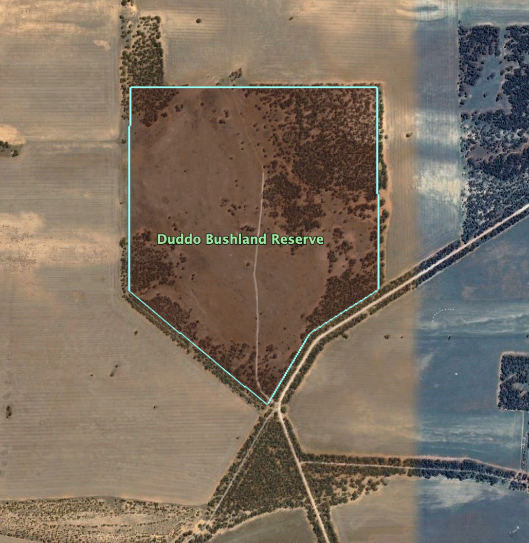
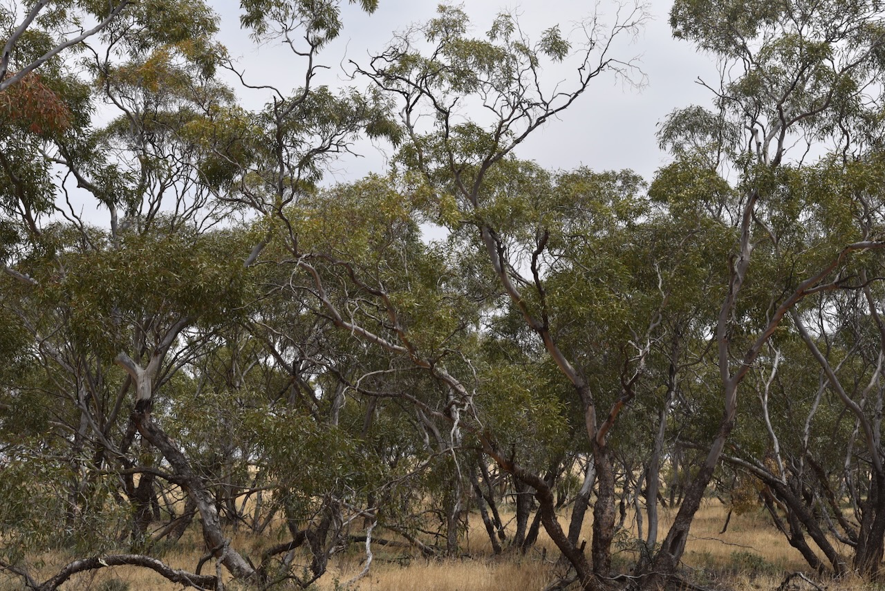
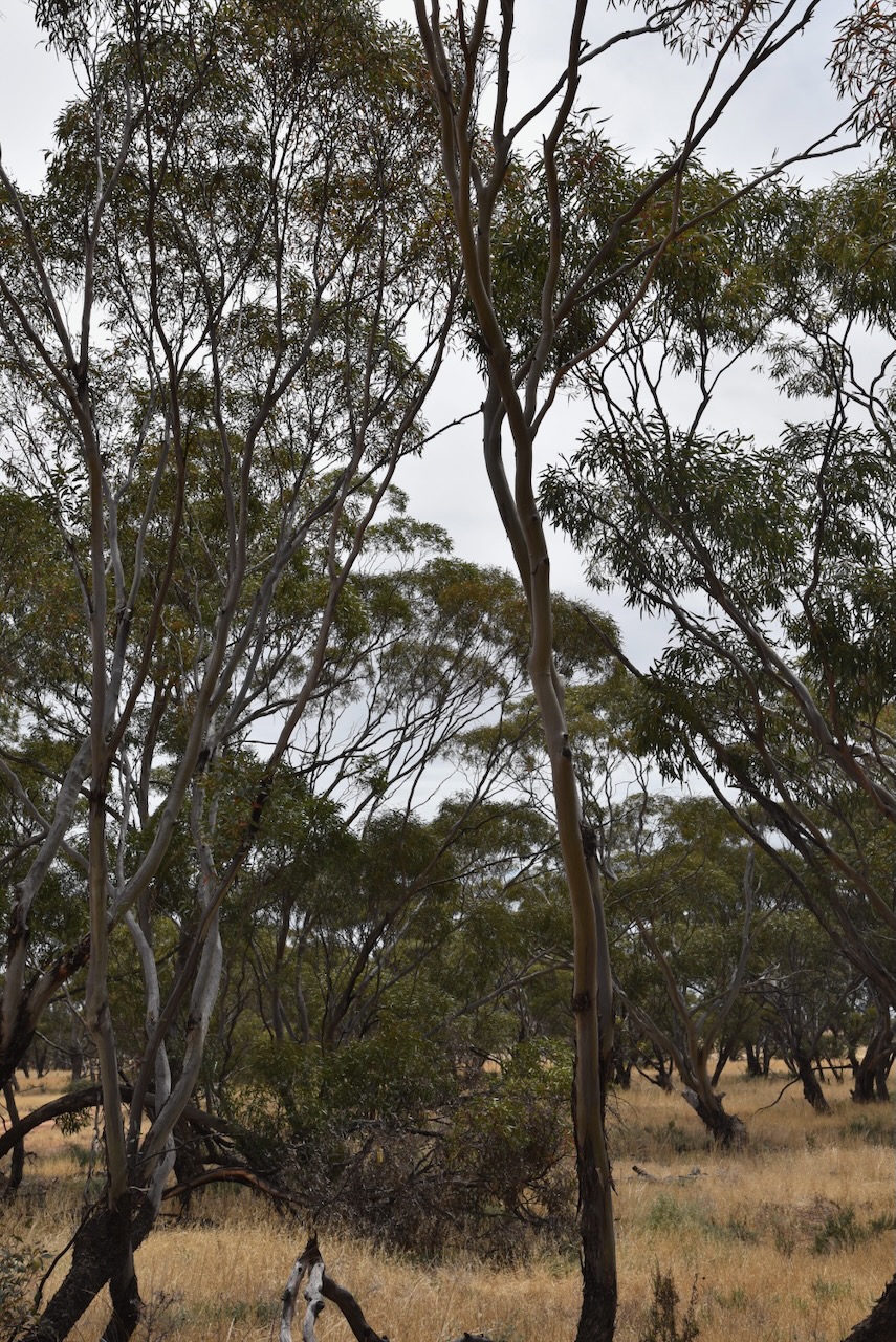
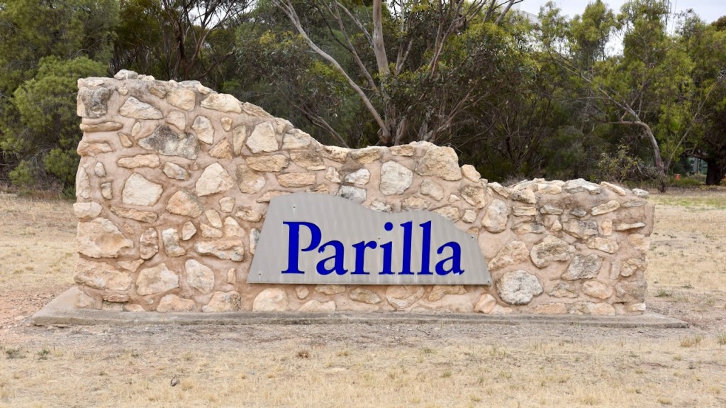
Following our activation of the Duddo Bushland Reserve in Victoria on Tuesday 14th November 2023, Marija and I headed back into South Australia on our way home. We stopped briefly at Parilla to activate the Parilla silo VK-PRA5.

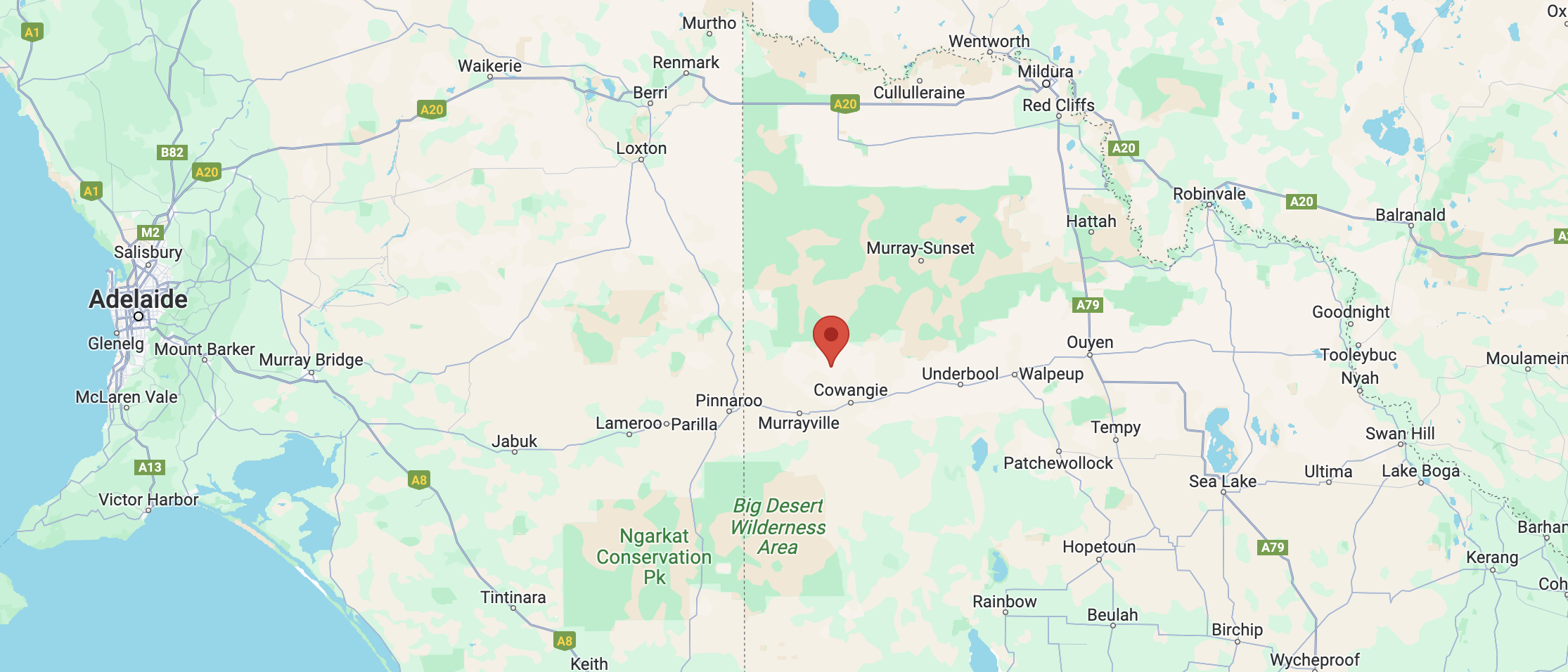
Parilla is about 214 km east of the city of Adelaide and about 14 km east of the town of Lameroo.

Above:- Map showing the location of Parilla. Map c/o Google Maps.

The town of Parilla was surveyed in 1904 and proclaimed as a town on the 1st day of August 1907. The town was named after the Hundred of Parilla. The name Parilla is an aboriginal word meaning ‘cold place’. (Monument Australia 2024) (Southern Mallee 2024)

Above:- 1907 Map of Parilla. Image c/o National Library of Australia.

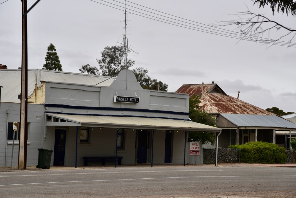
Just one year after being proclaimed a town, the Parilla Hotel opened in 1908. Parilla also had an old gaol, which was opened in 1911. It was located where the current playground is now situated. Parilla once had a hotel, general store, temperance hotel, public hall, school, baker shop, blacksmith shop, butcher, slaughterhouse, gaol, station master’s house, churches, a football club, and a tennis club. (Mallee Tracks 2003)

Above:- A view of Parilla, c. 1912. Image c.o State Library South Australia (B17207).

The first person to be imprisoned in the police cell was Ernest Walters, who was charged with abusive language and causing a disturbance at the hotel. A 1912 news article stated:

“After standing for some months untenanted, the police call has broken its spell as an ornament and has been used for the special purpose for which it was erected.”

Above:- Article from the Pinnaroo and Border Times, Fri 5 Apr 1912. Image c/o Trove.

Today, Parilla is a small town with a population of about 160 people.

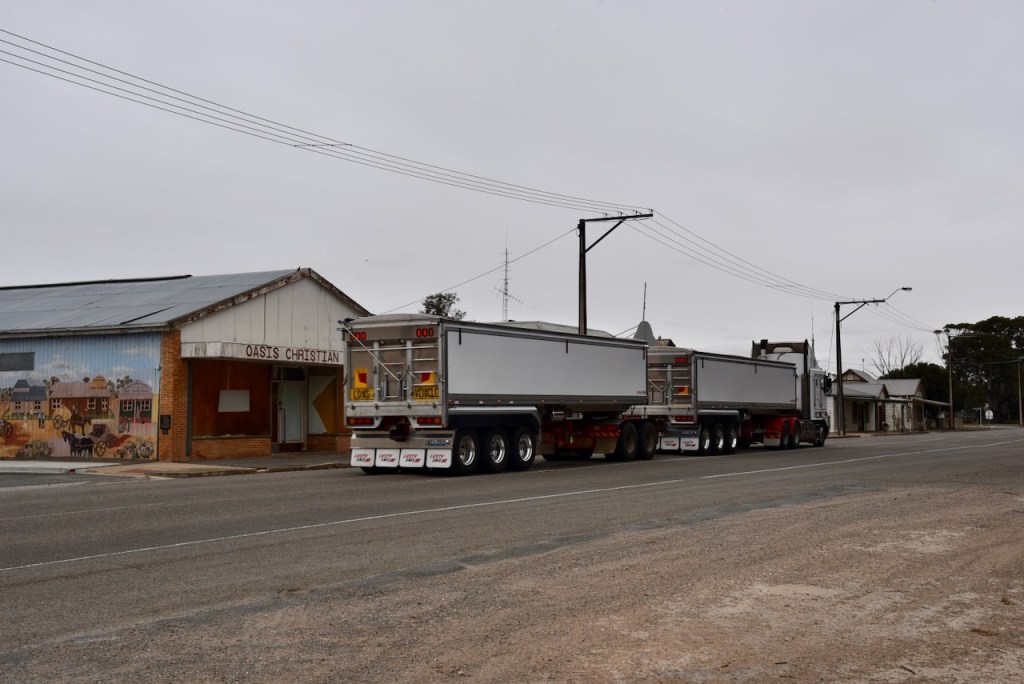
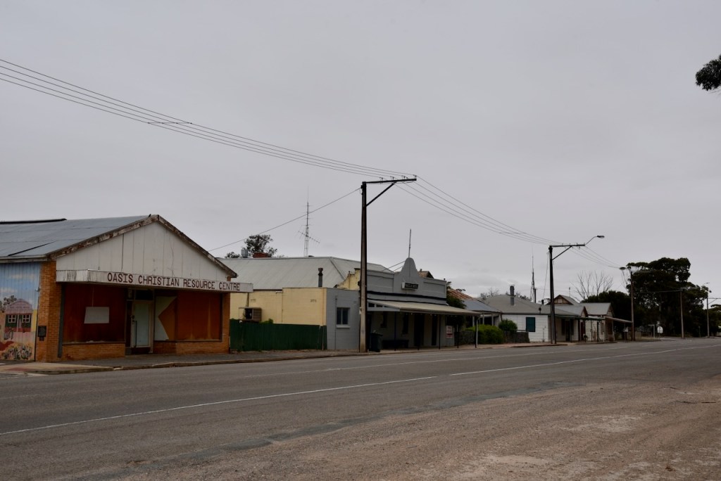
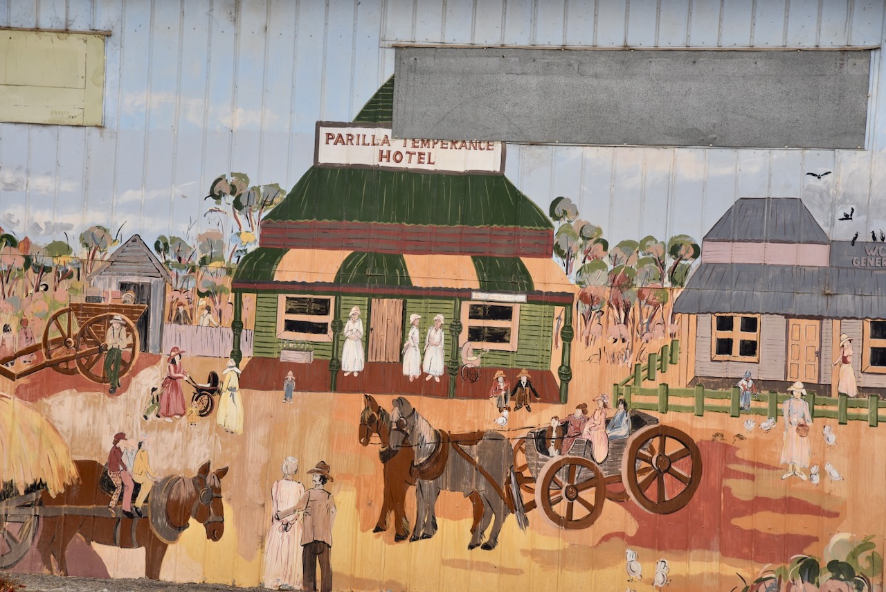
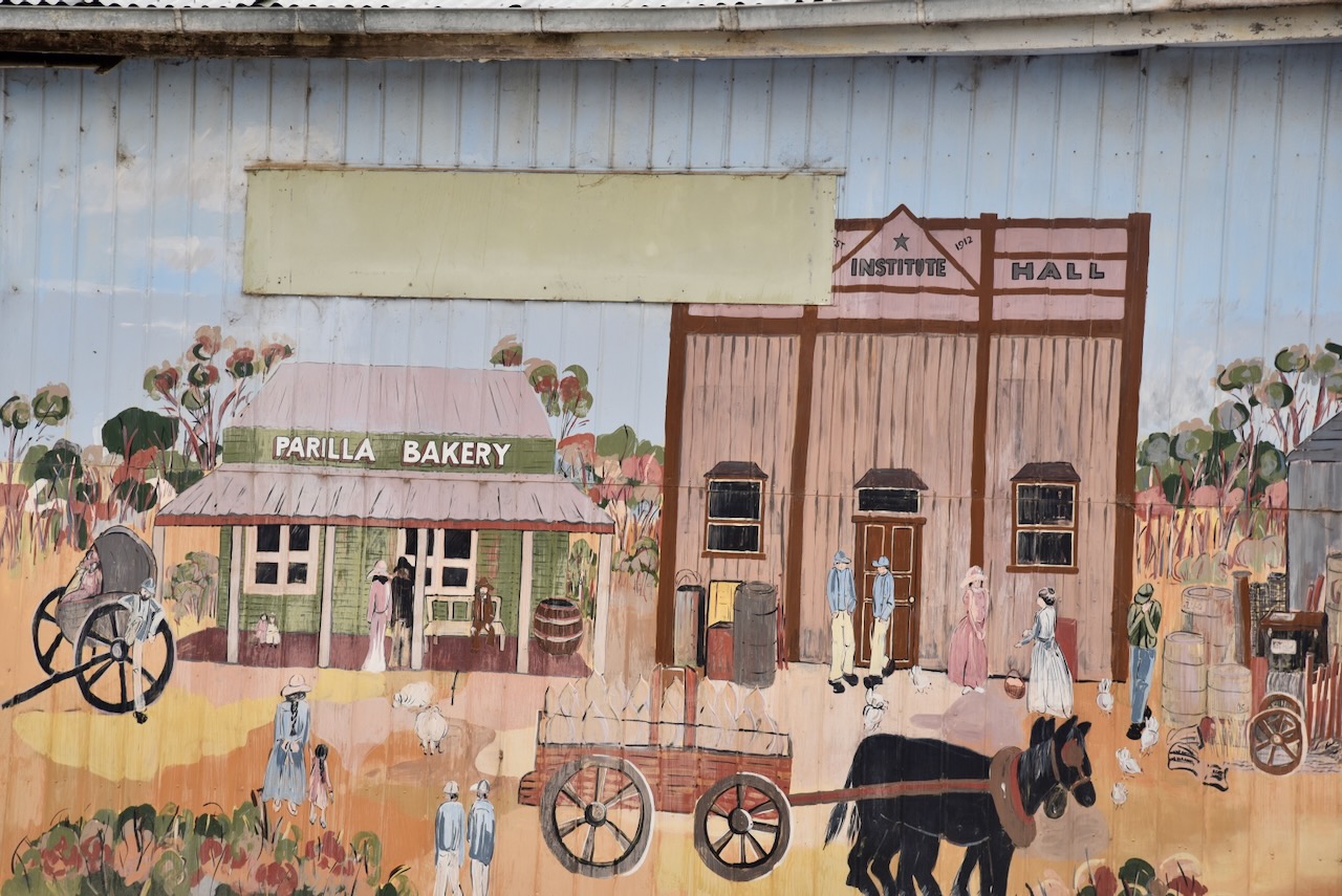
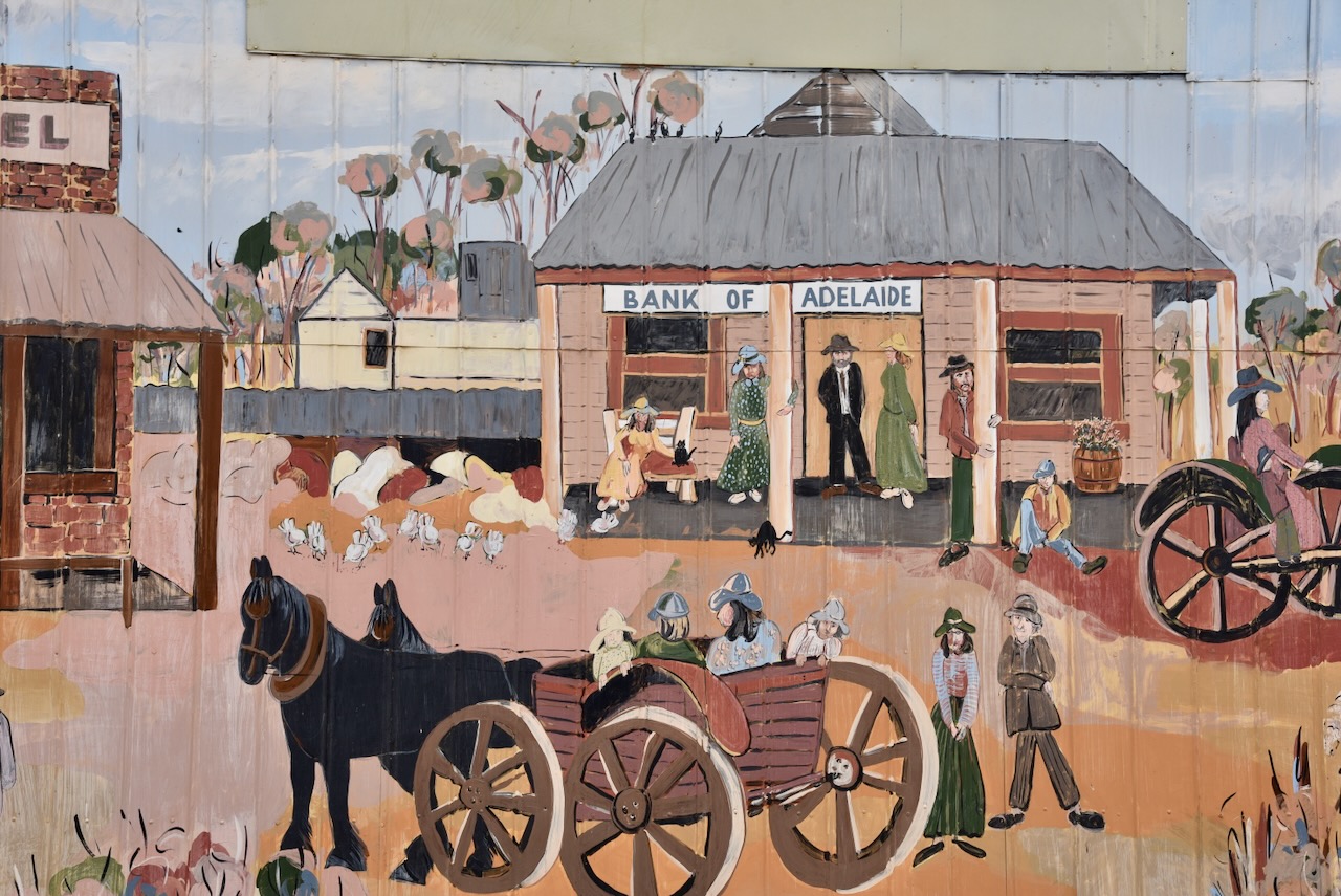
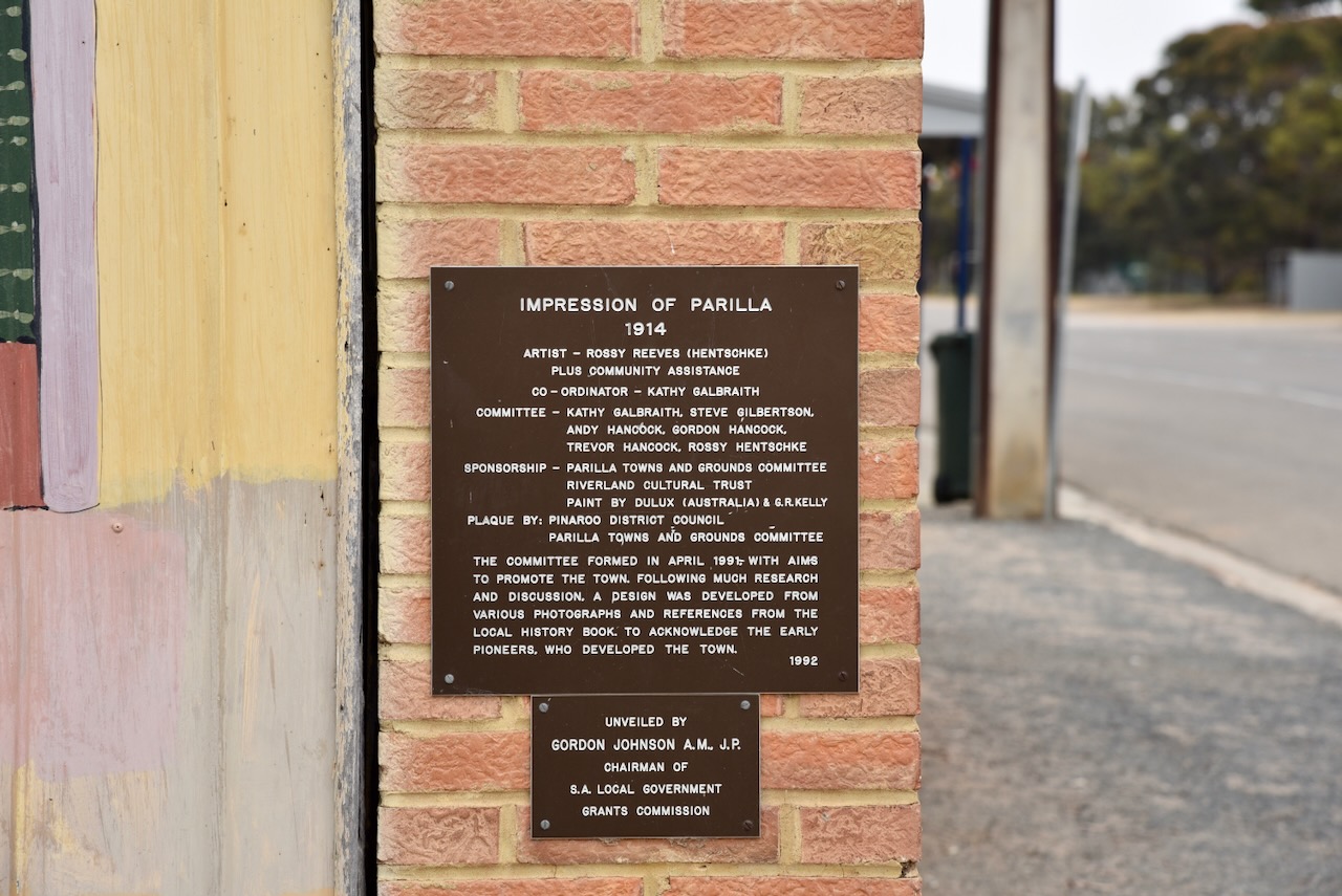
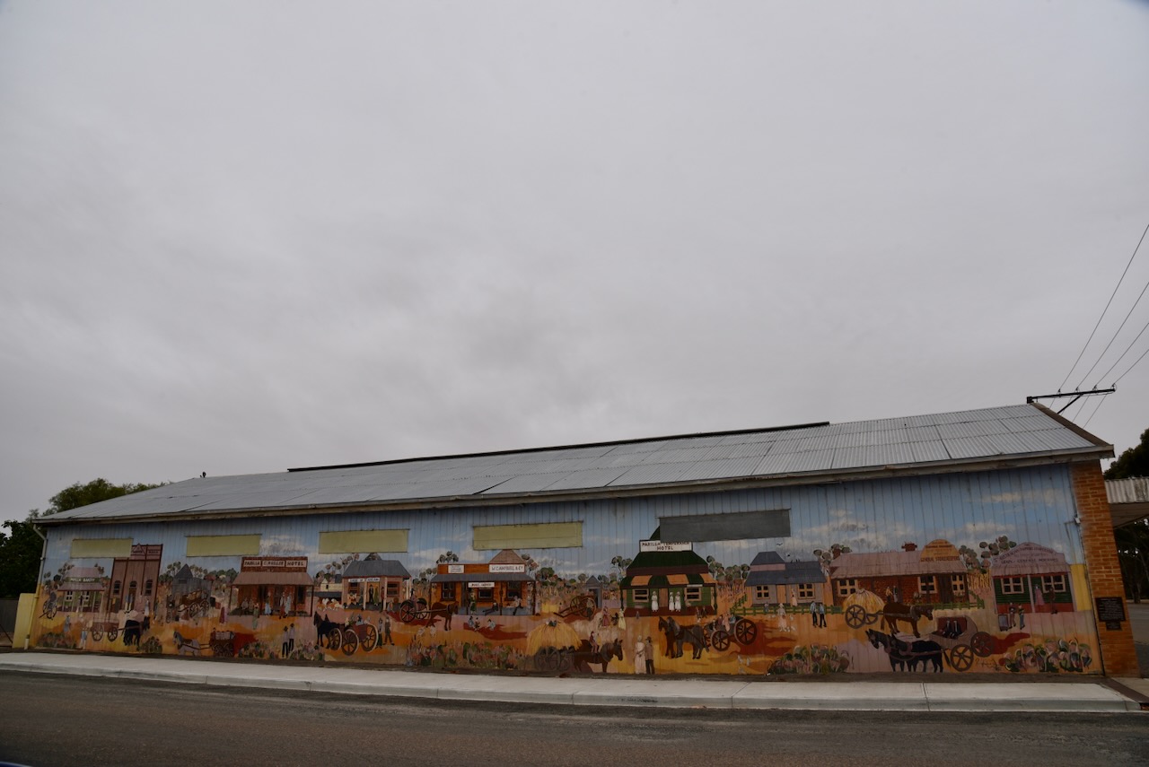
This small town has an excellent mural on the side of one of the buildings on the main street. It depicts Parilla’s early years.

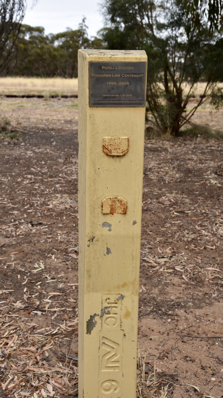
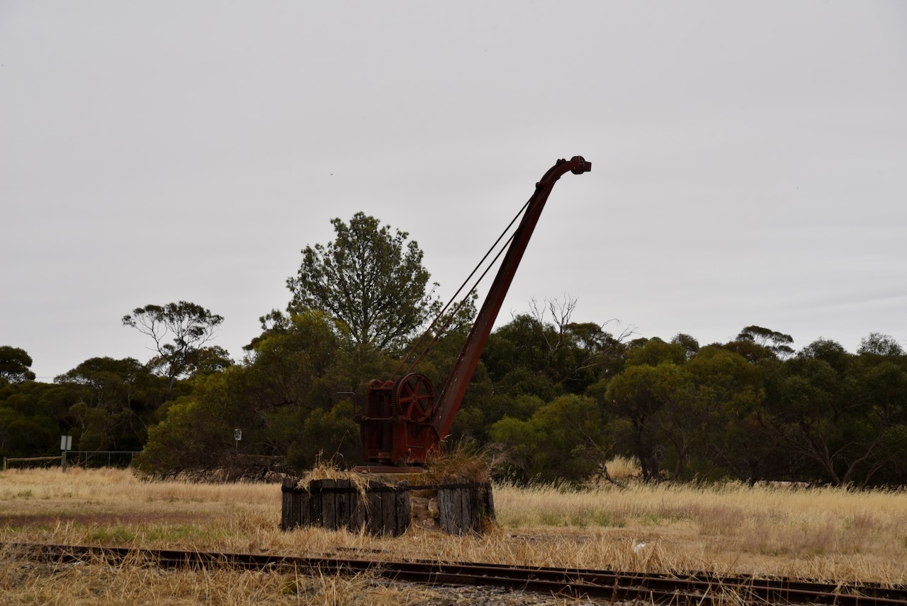
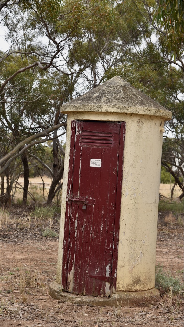
There are also signs of the old railway including a monument for the Pinaroo Line centenary. There was a station at Parilla and the railway line operated from 1906 until 2006.

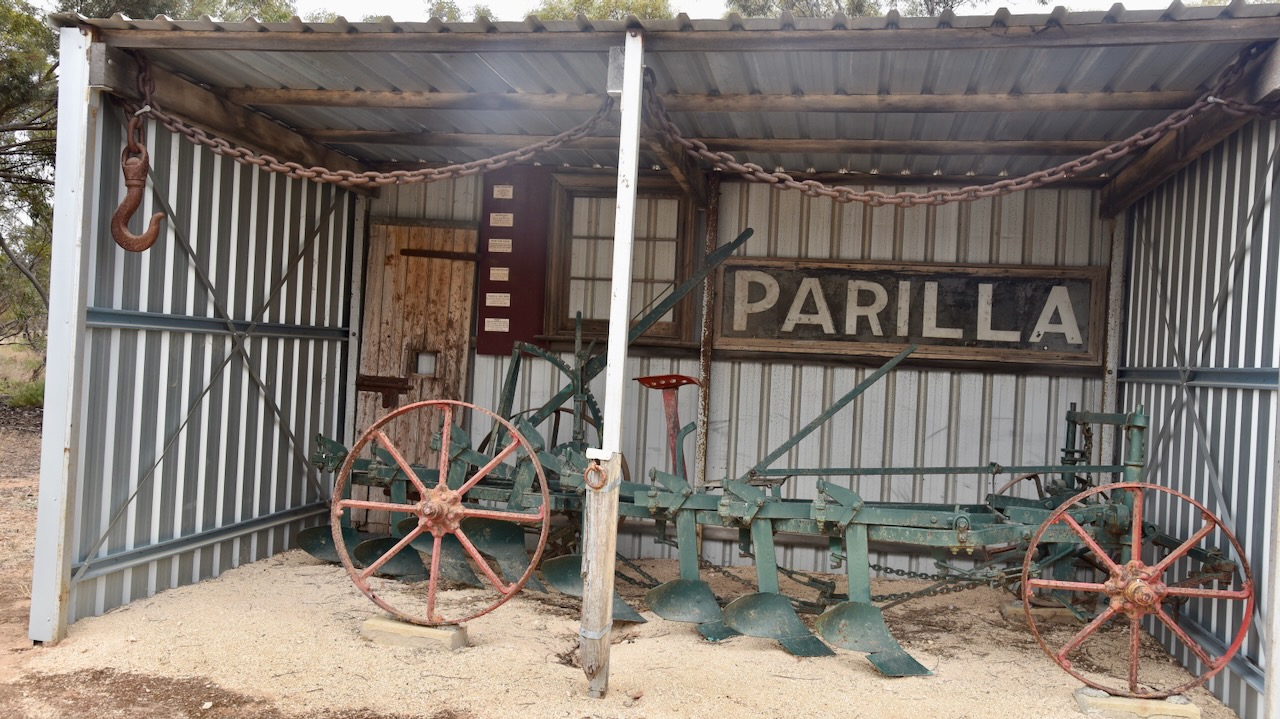
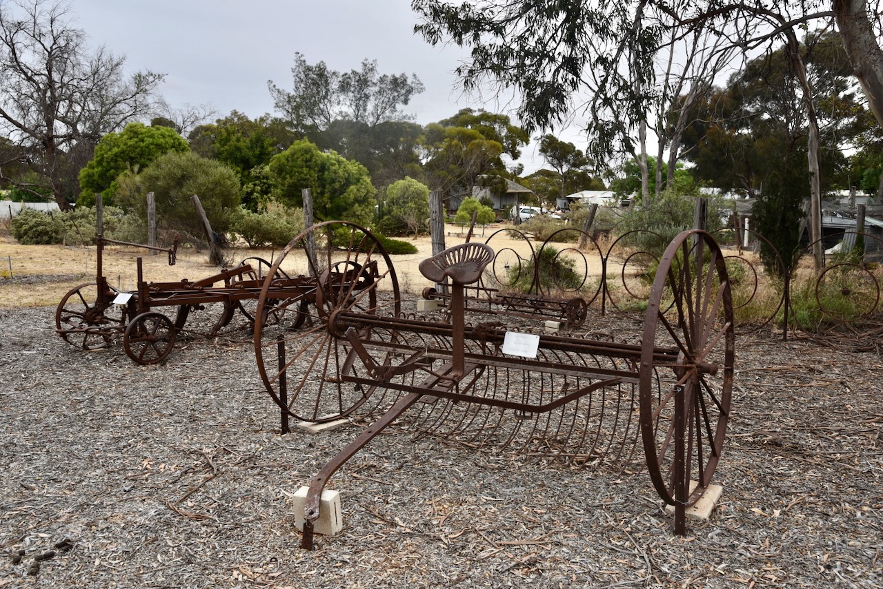
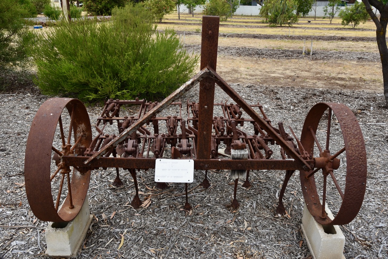
There is also a small display of historic farm machinery.

There is also a small monument to commemorate the Centenary of Federation and International Year of the Volunteer.

Below is a very interesting video on the town of Parilla from a current affair program a number of years ago

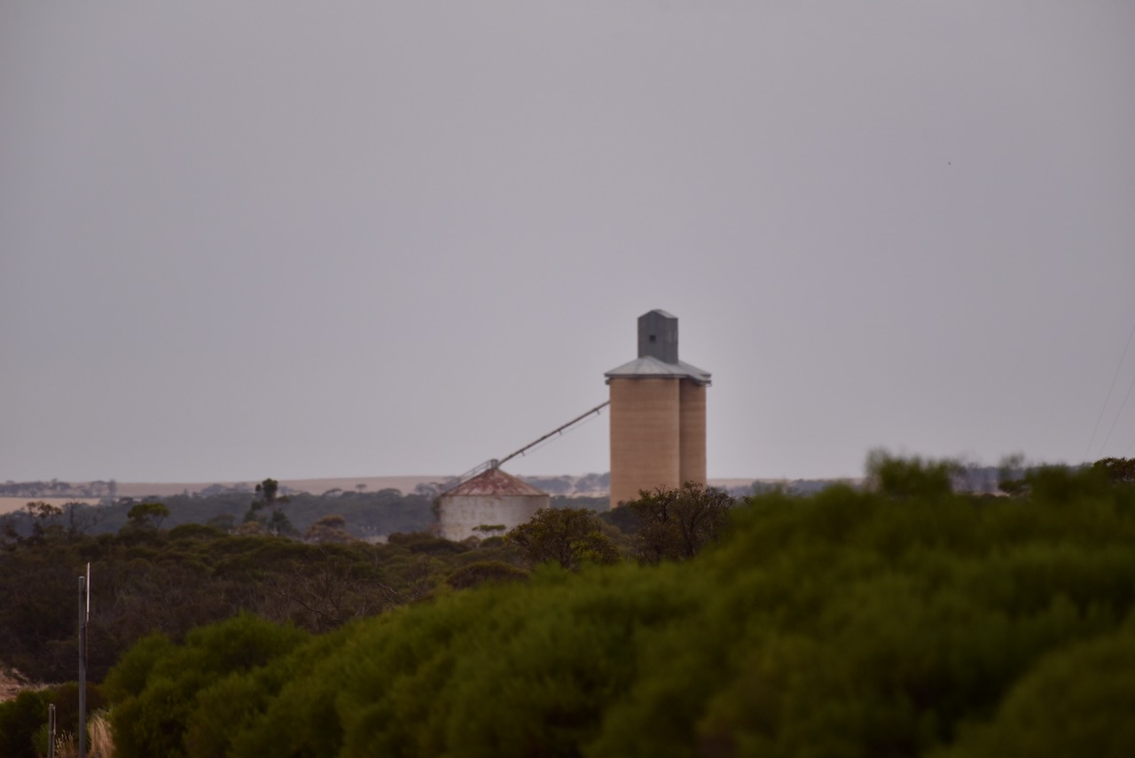
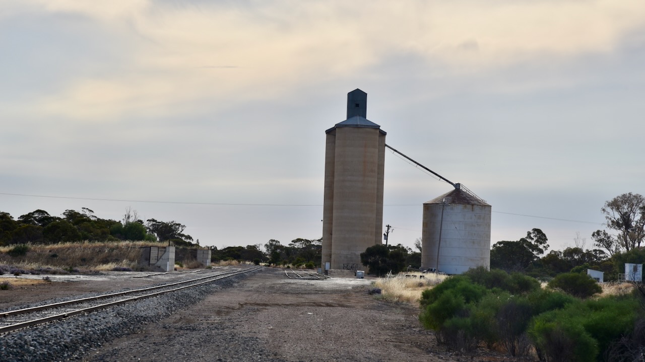
The bulk grain silos at Parilla are located adjacent to the railway line, however, grain is freighted out by the road, as are vegetables.

Marija and I parked right alongside the silos and operated from the 4WD, running the Icom IC7000, 100 watts, and the Codan 930 with the 1.5 metres stainless steel whip.

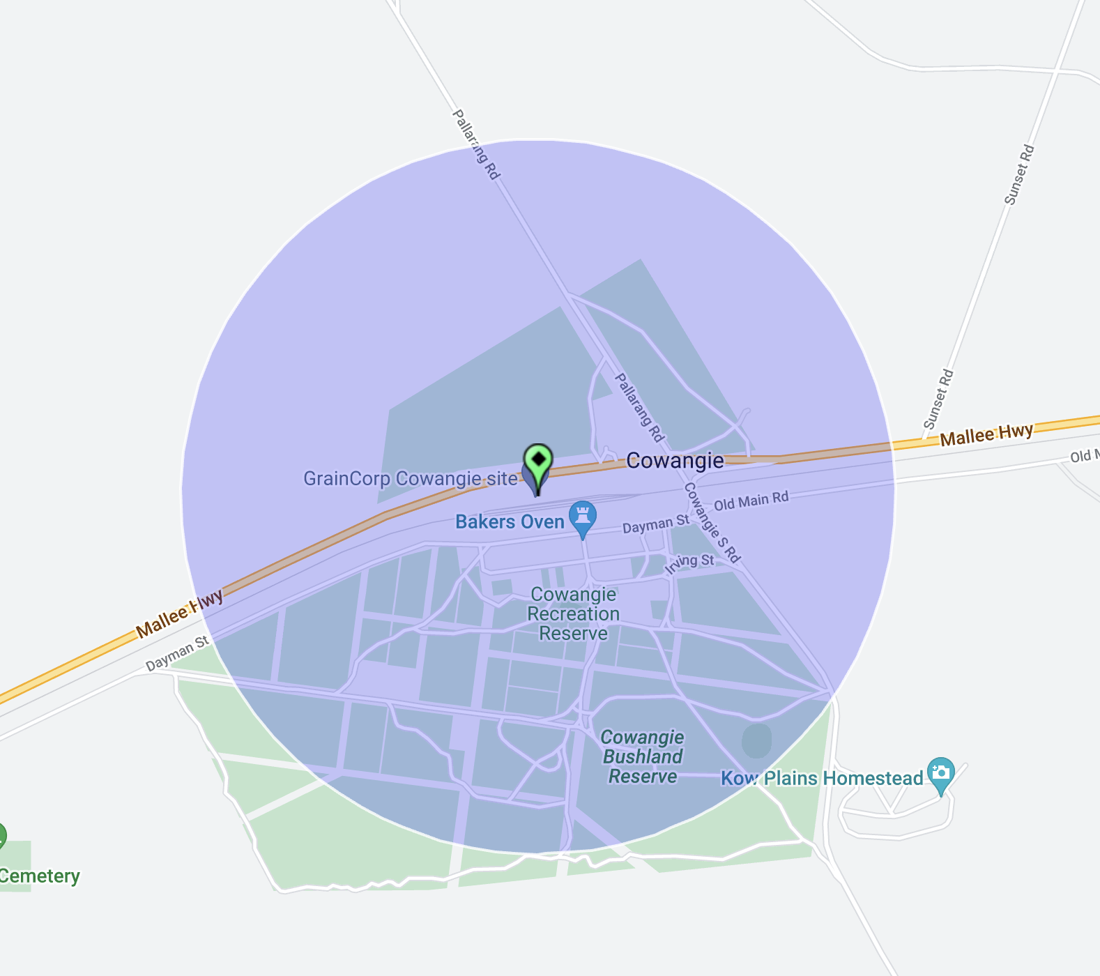
Above:- Map showing the activation zone at the Parilla silo. Image c/o SiOTA website.

Marija worked the following stations on 40m SSB:-

  1. VK3APJ
  2. VK3SQ
  3. VK2BD
  4. VK3OB
  5. VK3ANL
  6. VK2IO/p (Murray Valley National Park VKFF-1178)

I worked the following stations on 40m SSB:-

  1. VK3APJ
  2. VK3SQ
  3. VK2BD
  4. VK3OB
  5. VK3ANL
  6. VK3DAC
  7. VK3UH
  8. VK3SG
  9. VK2IO/p (Murray Valley National Park VKFF-1178)
  10. VK2XSE

I worked the following stations on 20m SSB:-

  1. VK1AO
  2. VK2MET
  3. VK7XX
  4. VK4FO
  5. VK4NH
  6. VK4DXA

References.

  1. Monument Australia, 2024, Impression of Parilla 1914, viewed 4th February 2024.
  2. Nickolls, J, Angeli, A, 2003, Mallee Tracks, Gastrel Printing, South Australia.
  3. Southern Mallee District Council, 2024, Mallee Highway Touring Route, Parilla S.A., viewed 4th February 2024.

Duddo Bushland Reserve VKFF-4152

Our final park for Tuesday 14th November 2023, was the Duddo Bushland Reserve VKFF-4152. This was the first time the reserve had been activated for the World Wide Flora Fauna (WWFF) program.

The reserve is located about 15 km north of the town of Murrayville in northwest Victoria.

Above:- Map showing the location of the Duddo Bushland Reserve. Map c/o Google Maps.

Duddo was originally an outstation of Brimin on Kow Plains. (Blake 1977) More information on Duddo can be found in my post regarding my activation of Duddo Wells Bushland Reserve.

Above:- Map of Duddo. Image c/o State Library Victoria.

Duddo Bushland Reserve is 86 hectares in size and was declared on the 1st day of May 1979. (CAPAD 2022)

Above:- An aerial view of the Duddo Bushland Reserve. Image c/o Google Earth.

The park is located on Forsyth Road and is a piece of remnant mallee scrub surrounded by cleared farming land.

Marija and I found an unlocked gate and entered the reserve via a dirt track. We ran the Yaesu FT857, 40 watts, and the 20/40/80m linked dipole. I used the special callsign of VI10VKFF.

Marija worked the following stations on 40m SSB:-

  1. VK3PF
  2. VK3KAI
  3. VK3BBB
  4. VK2CCP
  5. VK3SQ
  6. VK2BD
  7. VK2IO/m
  8. VK2EXA
  9. VK2IO/p (Murray Valley National Park VKFF-1178)

Marija worked the following stations on 40m AM:-

  1. VK3PF
  2. VK3KAI
  3. VK5HS
  4. VK3SQ
  5. VK2BD
  6. VK2IO/m
  7. VK5GY

I worked the following stations on 40m SSB:-

  1. VK3PF
  2. VK3KAI
  3. VK3BBB
  4. VK2CCP
  5. VK3SQ
  6. VK2BD
  7. VK2IO/m
  8. VK2EXA
  9. VK3VIN
  10. VK3OB
  11. VK2HHA
  12. VK3MTT
  13. VK5HS
  14. VK2KYO
  15. VK3CJN
  16. VK3ANL
  17. VK3SG
  18. VK5PET
  19. VK3CLD
  20. VK2IO/p (Murray Valley National Park VKFF-1178)
  21. VK3BEL
  22. VK3PWG
  23. Vk3MCK
  24. VK5KLV
  25. VK3UP/m
  26. VK3TDX
  27. VK1AD
  28. VK1NAM
  29. VK3CEO
  30. VK3KTT
  31. VK3APT
  32. VK3ZSC

I worked the following stations on 40m AM:-

  1. VK3PF
  2. VK3KAI
  3. VK5HS
  4. VK3SQ
  5. VK2BD
  6. VK2IO/m
  7. VK5GY

I worked the following stations on 20m SSB:-

  1. VK1AO
  2. VK2MET
  3. VK7XX
  4. VK4NH
  5. VK4DXA
  6. VK4MUD
  7. VK2NP
  8. VK7EE
  9. VK7AAE
  10. ZL1TM
  11. ZL4NVW
  12. VK4EMP
  13. VK4TI
  14. VK4FO
  15. VK4EW
  16. G4WAO/VK2
  17. VK4ATM

References.

  1. Australian Government, 2024, Collaborative Australian Protected Areas Database, viewed 4th February 2024.
  2. Blake; L, 1977, Place Names of Victoria, Rigby Limited, Melbourne.

Pallarang Bushland Reserve VKFF-4157

Our second park for Tuesday 14th November 2023 was the Pallarang Bushland Reserve VKFF-4157. This was the first time the reserve had been activated for the World Wide Flora Fauna (WWFF) program.

The reserve is located about 17 km north of the town of Cowangie in northwest Victoria.

Above:- Map showing the location of the Pallarang Bushland Reserve. Map c/o Google Maps.

Pallarang is a district in northwest Victoria. (MapshareVic 2024) Pallarang is an aboriginal word meaning to bow down. (Blake 1977)

Above:- The Pallarang district. Map c/o Map Share Victoria.

The Pallarang Bushland Reserve is about 23 hectares in size and was established on the 1st day of May 1979.

Parks Victoria has a page for Pallarang Bushland Reserve, but it contains no information about the reserve.

Above:- An aerial view of the Pallarang Bushland Reserve. Image c/o Google Earth.

The reserve is located on the eastern side of Chatterton Road, north of Morrison Plain Road.

We ran the Yaesu FT857, 40 watts, and the 20/40/80m linked dipole for this activation. I used the special call of VI10VKFF.

Marija worked the following stations on 40m SSB:-

  1. VK3PF
  2. VK3KAI
  3. VK3SQ
  4. VK2BD
  5. VK3MTT
  6. VK3BBB
  7. VK2CCP
  8. VK2HH
  9. VK3SG
  10. VK3PWG
  11. VK3EJ
  12. VK2ADF

I worked the following stations on 40m SSB before the UTC rollover:-

  1. VK3PF
  2. VK3KAI
  3. VK3SQ
  4. VK2BD
  5. VK3MTT
  6. VK3BBB
  7. VK2CCP
  8. VK2HHA
  9. VK3SG
  10. VK3PWG
  11. VK3EJ
  12. VK2ADF
  13. VK3VIN
  14. VK5FANA
  15. VK3CEO
  16. VK3DAC
  17. VK4FE/3
  18. Vk3ANL
  19. VK3SO
  20. VK2KYO
  21. VK3CJN
  22. VK5GY
  23. VK3NCC/m
  24. VK2EXA
  25. VK3CWF
  26. VK1AO
  27. VK2MET
  28. VK2IO/m
  29. VK3BEL
  30. VK2VAR
  31. VK2GOM
  32. VK5KLV
  33. VK5DW

I worked the following stations on 40m SSB after the UTC rollover:-

  1. VK5DW
  2. VK3TDX
  3. Vk2IO/m
  4. VK3SG
  5. VK3VIN
  6. VK2EXA
  7. VK3DAC
  8. VK4FE/3
  9. VK3PF
  10. VK3KAI
  11. VK2VAR
  12. VK2GOM
  13. VK3SQ
  14. VK5GY
  15. VK3CEO
  16. VK2KYO
  17. VK3CJN
  18. VK3OB
  19. VK3FABS
  20. VK3BEL
  21. VK1AD
  22. VK1NAM
  23. VK3ZSC
  24. VK3MCK

I worked the following stations on 20m SSB:-

  1. VK4EMP
  2. VK4TI
  3. VK1AO
  4. VK2MET
  5. VK4MUD
  6. VK3OB

I worked the following stations on 15m SSB:-

  1. VK4NH
  2. VK4DXA

References.

  1. Australian Government, 2024, Collaborative Australian Protected Areas Database, viewed 4th February 2024.
  2. Blake; L, 1977, Place Names of Victoria, Rigby Limited, Melbourne.
  3. Victoria State Government, 2024, MapshareVic, viewed 4th February 2024.

Cowangie Railway Bushland Reserve VKFF-4158

Our first activation for Tuesday 14th November 2023, was the Cowangie Railway Bushland Reserve VKFF-4158. This was the first time the reserve had been activated for the World Wide Flora Fauna (WWFF) program.

The reserve is located in the Mallee region of northwest Victoria.

Above:- Map showing the location of the Cowangie Railway Bushland Reserve. Map c/o Google Maps.

For a detailed history of Cowangie, please see my previous post.

The Cowangie Railway Bushland Reserve is about 60 hectares and was declared on the 1st day of May 1979. (CAPAD 2022)

The Parks Victoria website has a page about the reserve, but it contains no information other than a park boundary map.

The Reserve consists of part of the old Cowangie railway line,

Above:- An aerial view of the Cowangie Railway Bushland Reserve. Image c/o Google Earth.

The railway line reached Cowangie in February 1912 and was part of the Pinnaroo line. (Kow Plains 2024)

Above:- Cowangie Railway Station c. 1925. Image c/o Museums Victoria.

We found a dirt track off Cemetery Road, which followed the railway line. We ran the Yaesu FT857, 40 watts and the 20/40/80m linked dipole for this activation. I used the special event call of VI10VKFF.

The highlight of this activation was working 4W8X in Timor Leste on 20m SSB.

Marija worked the following stations on 40m SSB:-

  1. VK3VIN
  2. VK1AD
  3. VK1NAM
  4. VK2HHA
  5. VK3SO
  6. VK3BBB
  7. VK2CCP
  8. VK3MTT
  9. VK3MCK
  10. VK3PF
  11. VK3KAI
  12. 4W8X

I worked the following stations on 40m SSB:-

  1. VK3VIN
  2. VK1AD
  3. VK1NAM
  4. VK2HHA
  5. VK3SO
  6. VK3BBB
  7. VK2CCP
  8. VK3MTT
  9. VK3MCK
  10. VK3PF
  11. VK3KAI
  12. VK5FANA
  13. VK2NP
  14. VK5KLV
  15. VK1AO
  16. VK2MET
  17. VK3EJ
  18. VK2EXA
  19. VK1DI
  20. VK3DAC
  21. VK4FE/3
  22. VK3CLD
  23. VKSLB
  24. VK2YAK
  25. VK4YAK
  26. VK2LEE
  27. VK2IO/m
  28. VK1RF
  29. VK2MK
  30. VK4CEE
  31. VK3CEO

I worked the following station on 80m SSB:-

  1. VK2IO/m

I worked the following stations on 20m SSB:-

  1. VK4NH
  2. VK4DXA
  3. ZL3RIK
  4. VK1AO
  5. VK2MET
  6. ZL1TM
  7. VK7XX
  8. VK4EMP
  9. VK4TI
  10. VK2NP
  11. VK7PSJ
  12. VK2LEE
  13. 4W8X

Following our activation we visited the Cowangie cemetery to view some of the old headstones. Many of the native shrubs at the cemetery were in flower.

References.

  1. Australian Government, 2024, Collaborative Australian Protected Areas Database, viewed 4th February 2024.
  2. Kow Plains Homestead Committee, 2024, <http://kowplains.com/cowangie/>, viewed 4th February 2024.

Cowangie Bushland Reserve VKFF-4159 and Cowangie silo VK-CWE3

Our eighth and final activation for Monday 13th November 2023 was the Cowangie Bushland Reserve VKFF-4159 and the Cowangie silo VK-CWE3. This was the first time the reserve had been activated for the World Wide Flora Fauna (WWFF) program.

The reserve is located about 19 km east of Murrayville in northwest Victoria.

Above:- Map showing the location of the Cowangie Bushland Reserve. Map c/o Google Maps.

The Cowangie Bushland Reserve is about 142 hectares in size and was declared on the 1st day of May 1979. (CAPAD 2022)

The Parks Victoria website has a page regarding the reserve but contains no information other than a park boundary map.

The reserve consists of a number of separate pieces of land surrounding the town of Cowangie.

Above:- An aerial view of the Cowangie Bushland Reserve. Image c/o Google Earth.

We set up within the activation zone of the Cowangie silo. We found a dirt track in one of the southern sections of the reserve.

Above:- The activation zone at the Cowangie silo. Image c/o SiOTA website.

We ran the Yaesu FT857, 40 watts, and the 20/40/80m linked dipole for this activation. I used the special event call of VI10VKFF.

We ended up with a total of 56 QSOs on 40m SSB. As it was getting late, we did not operate on the 20m band.

Marija worked the following stations on 40m SSB:-

  1. VK4NH
  2. VK4DXA
  3. VK3BBB
  4. VK2CCP
  5. VK2LEE
  6. VK3PF
  7. VK3KAI
  8. VK3PI
  9. VK2NP
  10. VK2EXA
  11. VK3SG
  12. VK2IO/p (Brimy Bill (5 Mile Lake) Wildlife Reserve VKFF-2277)

I worked the following stations on 40m SSB:-

  1. VK4NH
  2. VK4DXA
  3. VK3BBB
  4. VK2CCP
  5. VK2LEE
  6. VK3PF
  7. VK3KAI
  8. VK3PI
  9. VK2NP
  10. VK2EXA
  11. VK2YAK
  12. VK4YAK
  13. VK3SG
  14. VK2HHA
  15. VK3MTT
  16. VK1AO
  17. VK2MET
  18. VK3MIJ
  19. VK3CEO
  20. VK4SMA
  21. VK5WE
  22. VK3ANL
  23. VK5FANA
  24. VK4HMI
  25. VK3VIN
  26. VK3UH
  27. VK5BJ
  28. Vk3APJ
  29. ZL3MR
  30. VK3BEL
  31. VK7DW
  32. VK4EW
  33. VK3EJ
  34. VK1CHW
  35. VK3GJG
  36. VK4EHO
  37. VK5CZ
  38. VK2IO/p (Brimy Bill (5 Mile Lake) Wildlife Reserve VKFF-2277)
  39. VK4EMP
  40. VK4TI
  41. VK5KLV
  42. VI75G
  43. VK3TU
  44. VK3ATL

I worked the following station on 40m AM:-

  1. VK4EW

References.

  1. Australian Government, 2024, Collaborative Australian Protected Areas Database, viewed 4th February 2024.

Cowangie School Bushland Reserve VKFF-4160

Our seventh activation for Monday 13th November 2023 was the Cowangie School Bushland Reserve VKFF-4160. This was the first time the reserve had been activated for the World Wide Flora Fauna (WWFF) program.

The reserve is located about 15 km (by road) southwest of the town of Cowangie in northwest Victoria.

Above:- Map showing the location of the Cowangie School Bushland Reserve. Map c/o Google Maps.

For a detailed history of Cowangie, please see my previous post.

On our way to the reserve, we stopped at the monument for the former Bunurouk School which operated from 1923 until 1943.

The Cowangie School reserve is 12 hectares in size and was declared on the 8th day of May 1990. (CAPAD 2022)

Above:- An aerial view of the Cowangie School Bushland Reserve. Image c/o Google Earth.

The reserve is located on the southeast corner of South Road and Beer Road. It is a small piece of remnant scrub that is surrounded by cleared farming land.

We ran the Yaesu FT857, 40 watts, and the 20/40/80m linked dipole for this activation. I used the special event callsign of VI10VKFF.

Marija worked the following stations on 40m SSB:-

  1. VK3BEL
  2. VK3PI
  3. VK2HHA
  4. VK3DAC
  5. VK3AFW
  6. VK5FANA
  7. VK3CEO
  8. VK2IO/p (Wangie Wildlife Reserve VKFF-2475)
  9. VK3MTT
  10. VK2IO/p (Wangie Flora & Fauna Reserve VKFF-2474)

I worked the following stations on 40m SSB:-

  1. VK3BEL
  2. VK3PI
  3. VK2HHA
  4. VK3DAC
  5. VK3AFW
  6. VK5FANA
  7. VK3CEO
  8. VK2IO/p (Wangie Wildlife Reserve VKFF-2475)
  9. VK3MTT
  10. VK3APJ
  11. VK3PF
  12. VK3KAI
  13. VK5MK
  14. VK3BBB
  15. VK2CCP
  16. VK2YAK
  17. VK4YAK
  18. VK1AO
  19. VK2MET
  20. VK1RF
  21. VK2MK
  22. VK4CEE
  23. VK2NP
  24. VK3SG
  25. VK5FB
  26. VK5HS
  27. VK5KLV
  28. VK3YV
  29. VK2EXA
  30. VK4NH
  31. VK4DXA
  32. VK2VMG
  33. VK3SO
  34. VK3MCK
  35. VK3AMO
  36. VK2RK
  37. VK2ACR
  38. VK2SKI
  39. VK3ACZ
  40. VK5MSA
  41. VK5KVA
  42. VK3AXK
  43. VK3VIN
  44. VK3UH
  45. VK5DW
  46. VK3CWF
  47. VK3ZK
  48. VK3GQ
  49. VK7AAE
  50. VK2IO/p (Wangie Flora & Fauna Reserve VKFF-2474)

I worked the following stations on 20m SSB:-

  1. ZL1ALF
  2. VK4NH
  3. VK4DXA
  4. VK4EMP
  5. VK4TI
  6. I4RHP
  7. IK4IDF
  8. UT5PI
  9. VK4IDK
  10. IK1GPG
  11. OH6GAZ

References.

  1. Australian Government, 2024, Collaborative Australian Protected Areas Database, viewed 4th February 2024.