Geranium silo VK-GRM5

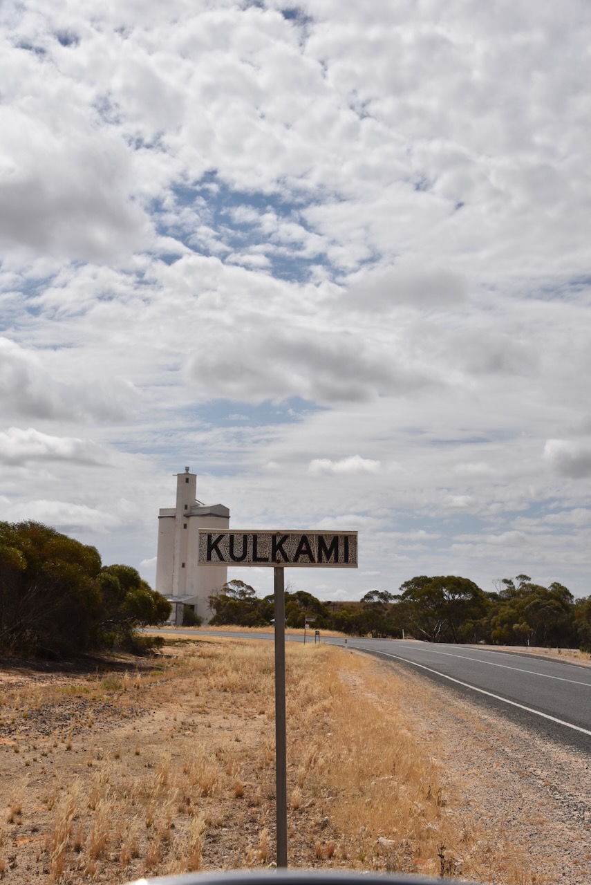
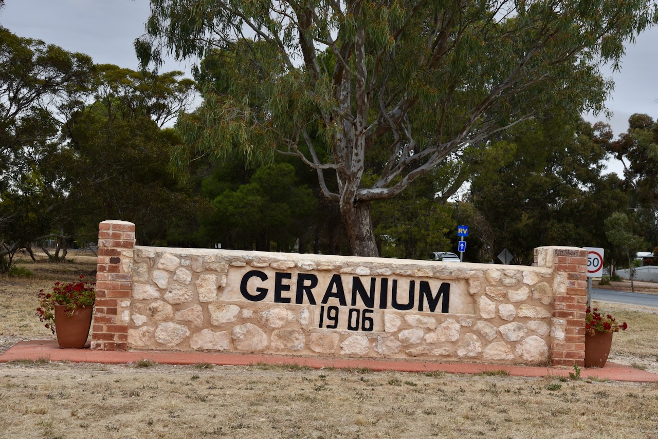
Our fourth and final silo activation for the Silos On the Air (SiOTA) program for Tuesday 14th November 2023 was the Geranium silo VK-GRM5.

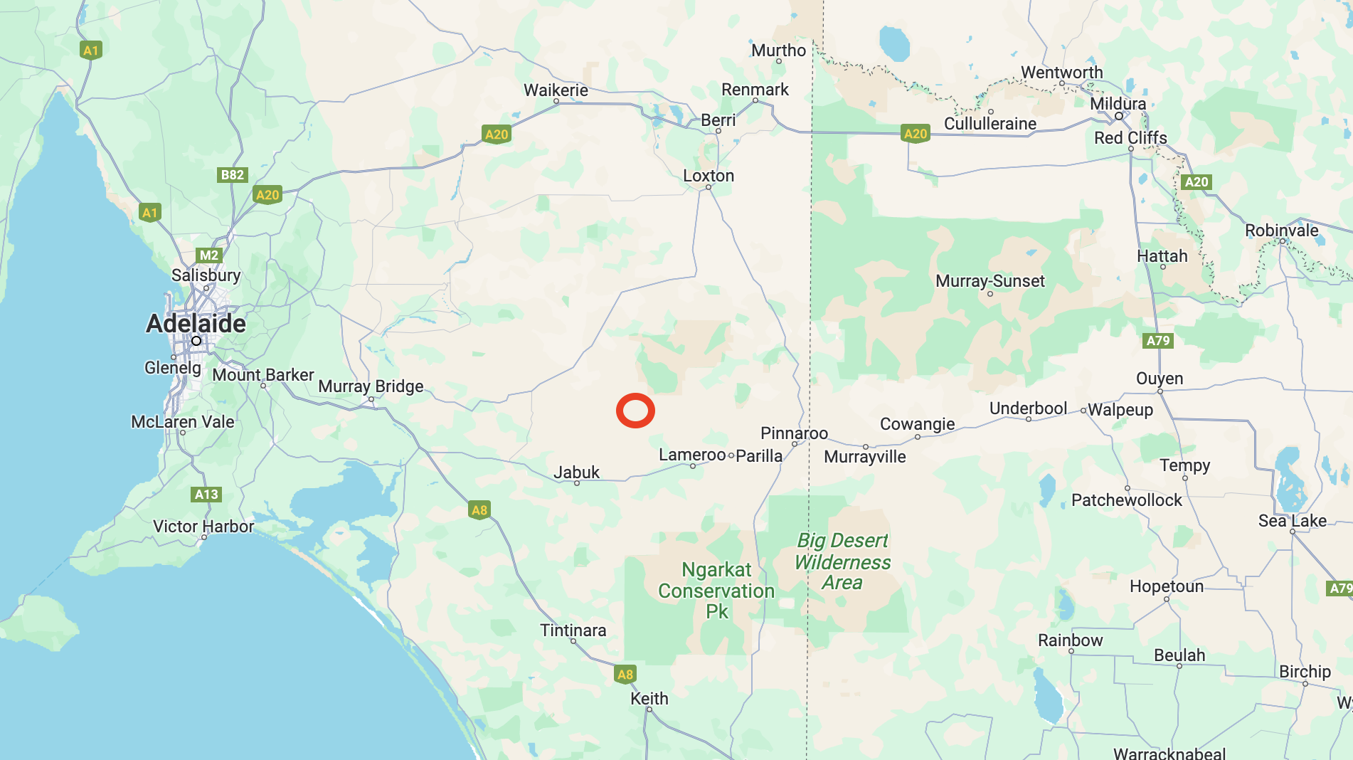
Geranium is about 165 km east of the city of Adelaide.

Above:- Map showing the location of Geranium. Map c/o Google Maps.

The town of Geranium was proclaimed on the 24th day of March 1910 and takes its name from the native plant, Pelargonium australe “Geranium. The plant once grew profusely in the district, however, it is rarely found today due to the clearing of the land for agricultural pursuits. ; it is rarely seen today due to the cultivation of the land. Children once called the plant “knives and forks” due to its unusual seed pod which was three inches long and very pointed. (Manning 2012)

The school was held at Geranium in the local until 1929 when a stone schoolroom was built. Attendances were around 40 children at that time. In 1961 the parents of students at Geranium, and the nearby towns of Peake, Jabuk, and Parrakie, undertook moves to establish an Area School at Geranium. In 1965 the new school opened with a total of 247 students.

Above:- Schoolchildren at Geranium c. 1914. Image c/o State Library South Australia (B46982)

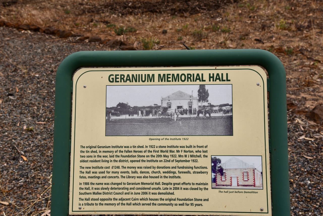
The Geranium Hall was a popular place during the peak of the town of Geranium. Numerous dances and balls were held there.

Above:- Article from the Daily Herald, Wed 22 July 1914. Image c/o Trove.

Although a small town, there is quite a bit to see here. Clearly, the locals are very proud of their heritage. In 2000, Geranium was a National Finalist for the Tidy Towns Award. In 1999 it won an award as South Australia’s Tidest Town. (Mallee Tracks 2003)

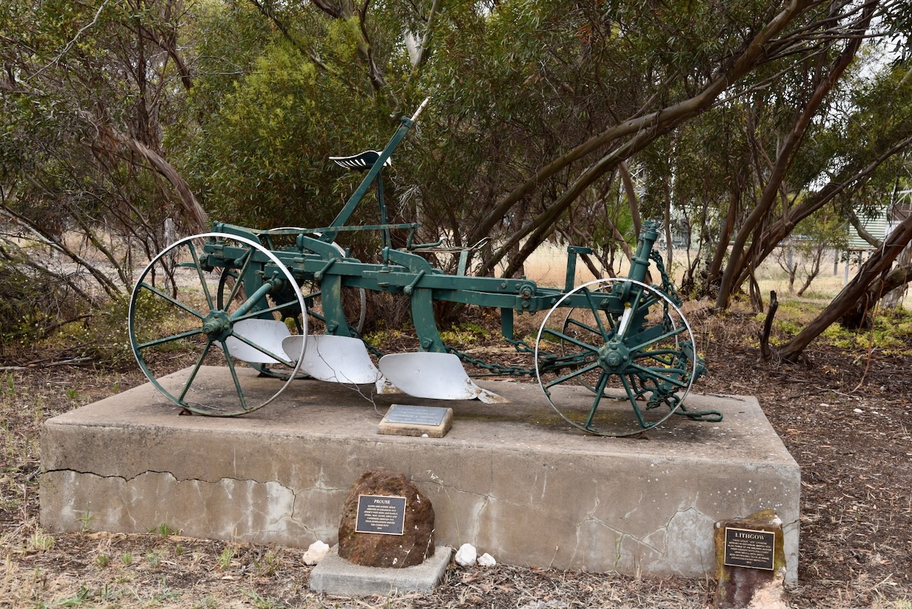
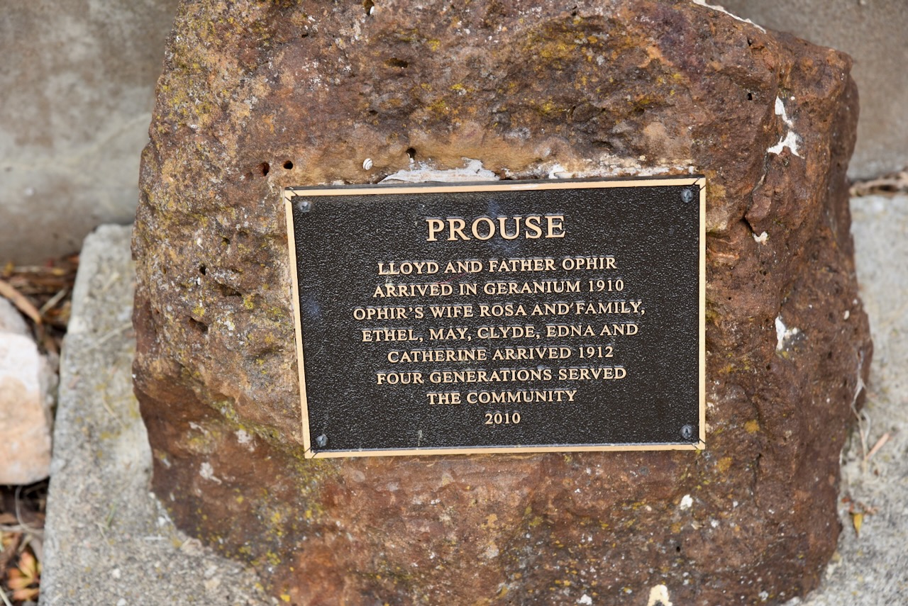
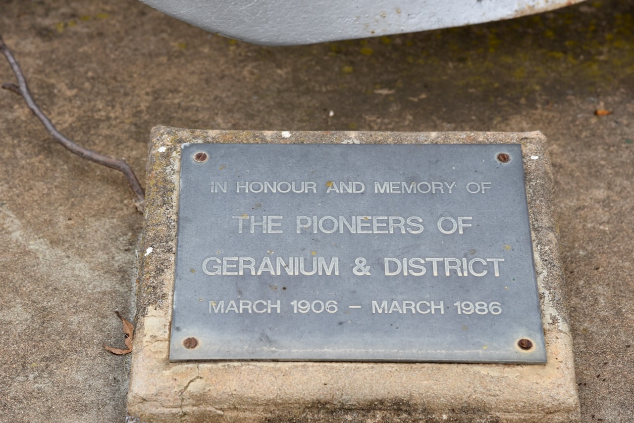
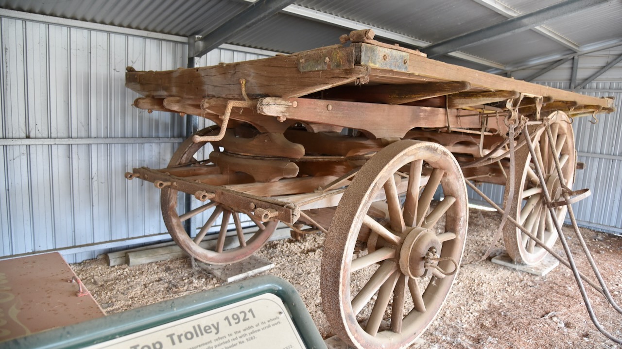
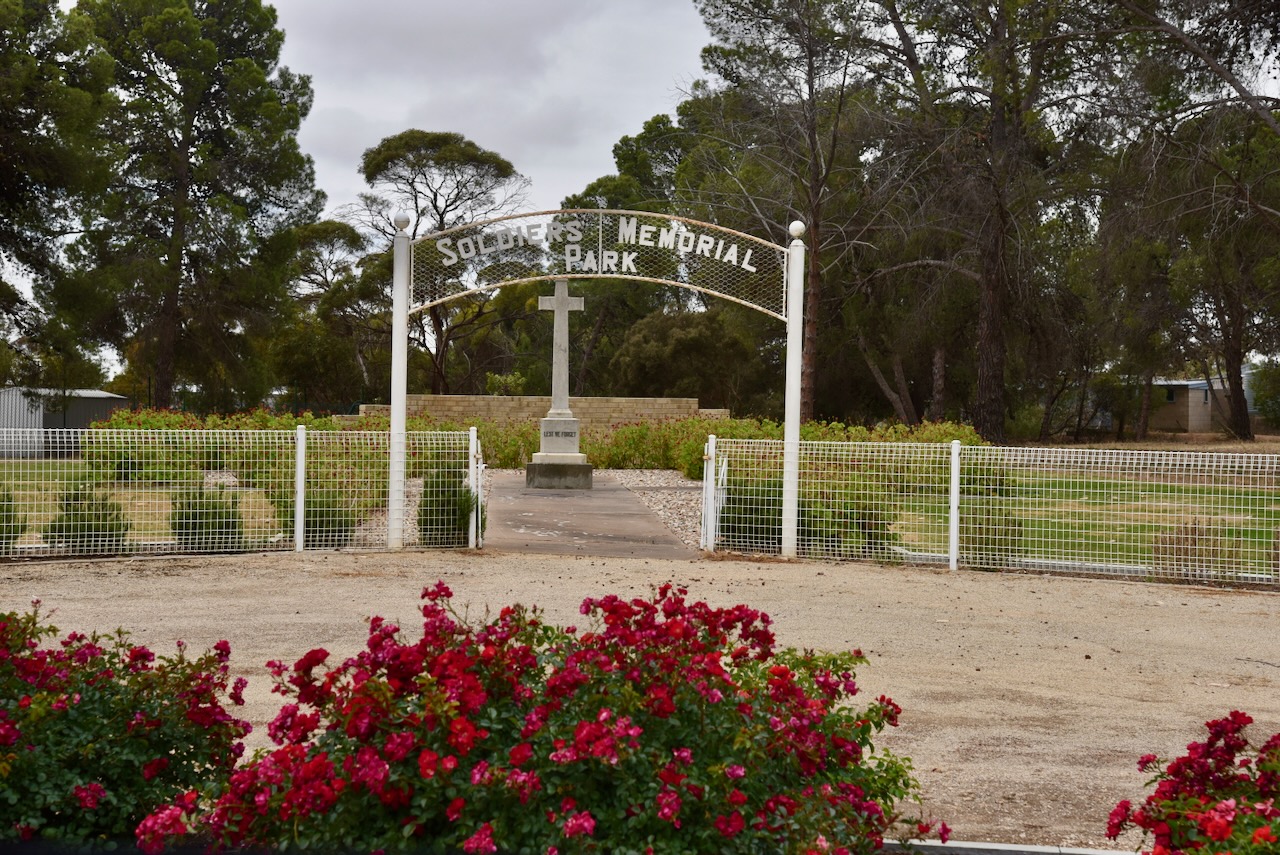
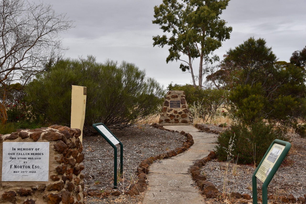
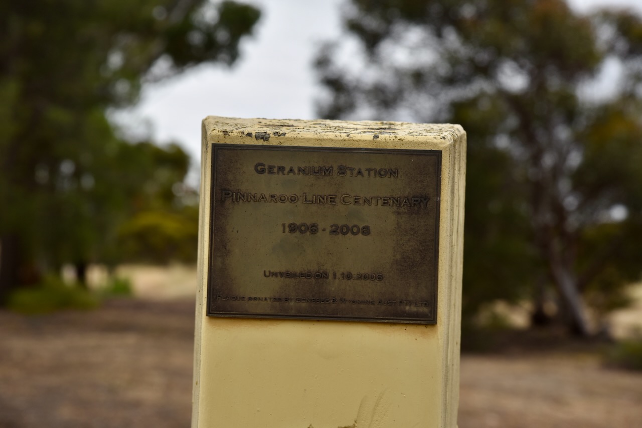
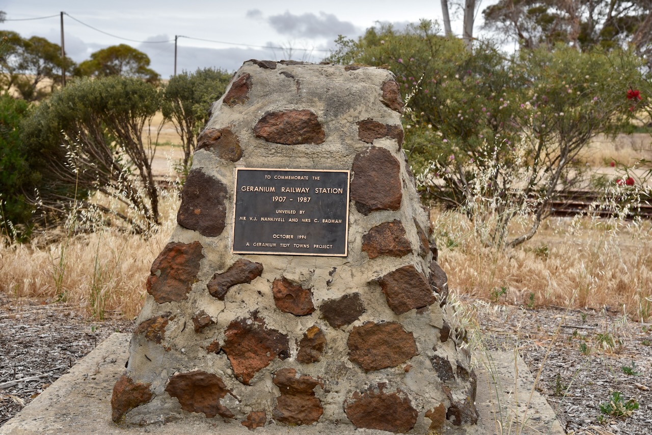
Alongside the silos are some interesting monuments and information boards about the old Geranium railway yards. Geranium was on the Pinaroo line and had a railway station which was operational from 1907 until 1987. The railway was the lifeline of the town with cream, eggs, grain (wheat & barley), stock (sheep & cattle) going out, and supplies for local business, farm machinery and fertilizer coming in. In its heyday, up to two goods trains per day and a passenger train would travel through Geranium.

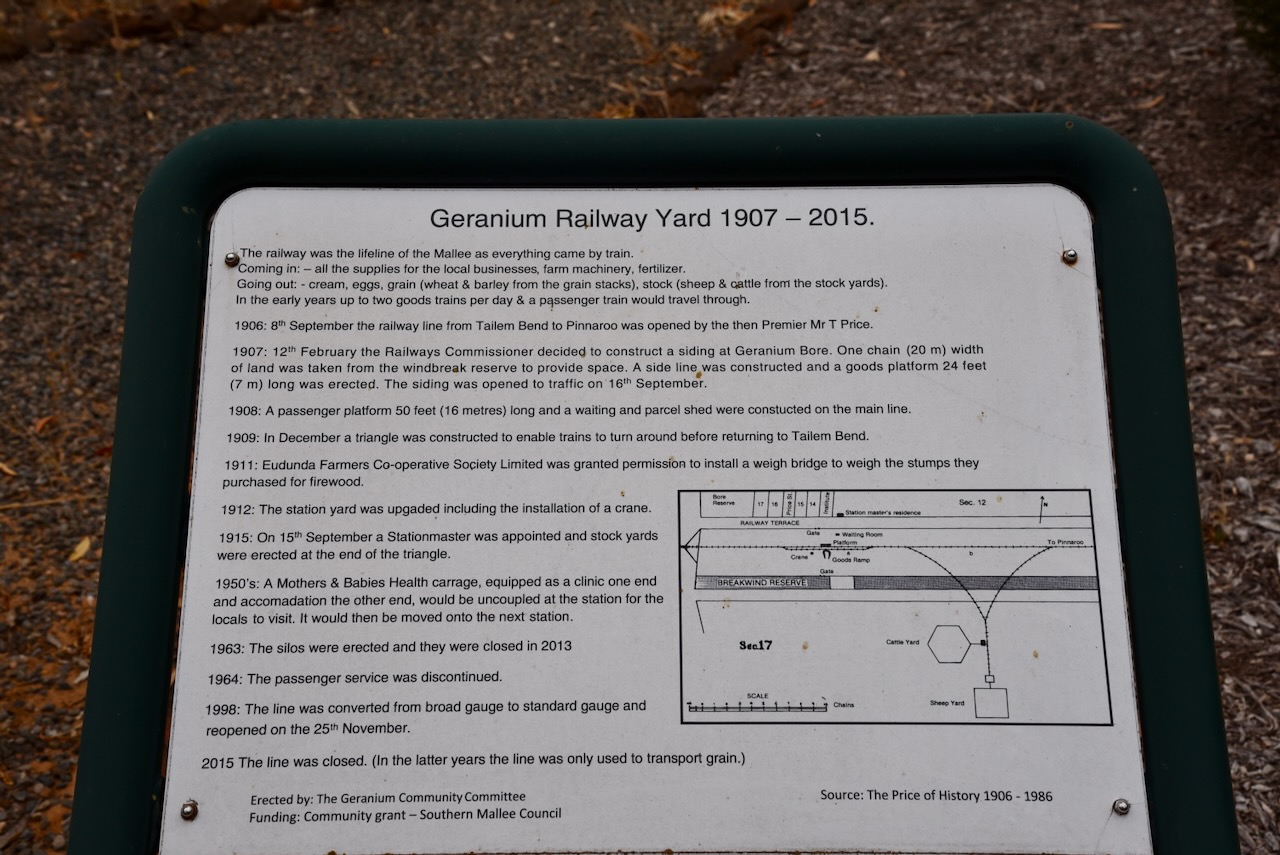
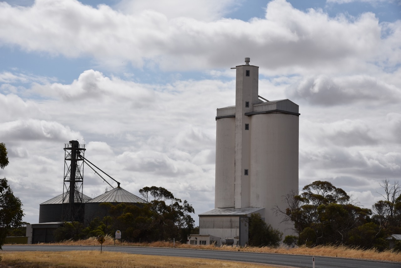
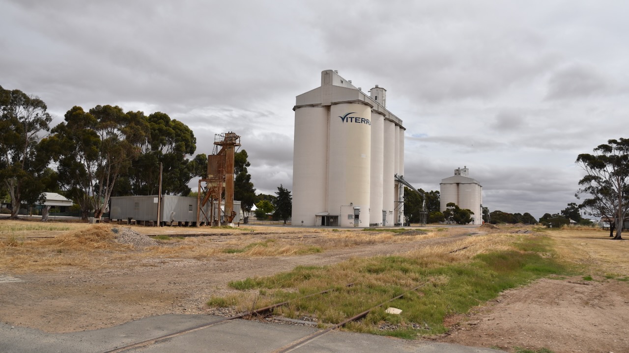
As is often the case in little towns, the silos are located in Railway Terrace. They were erected in 1963 and closed in 2013.

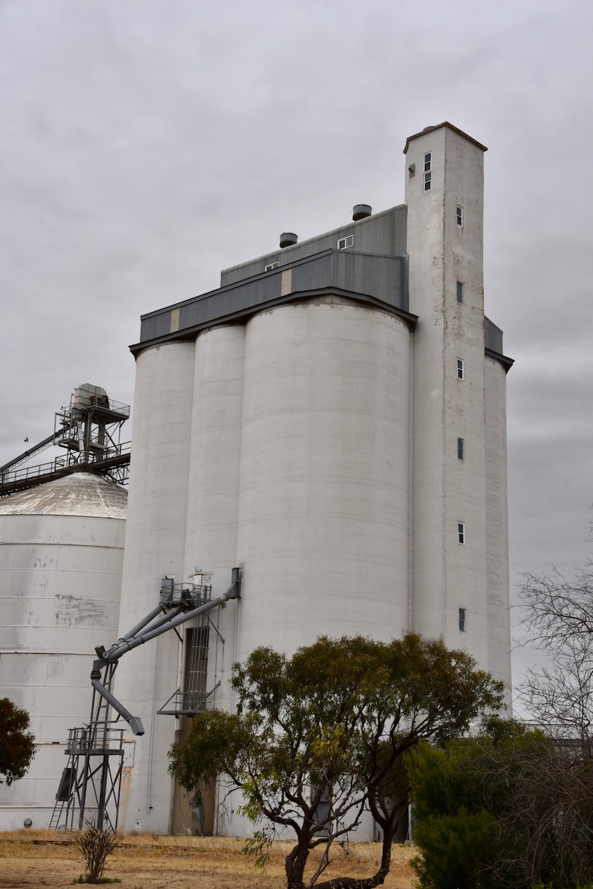
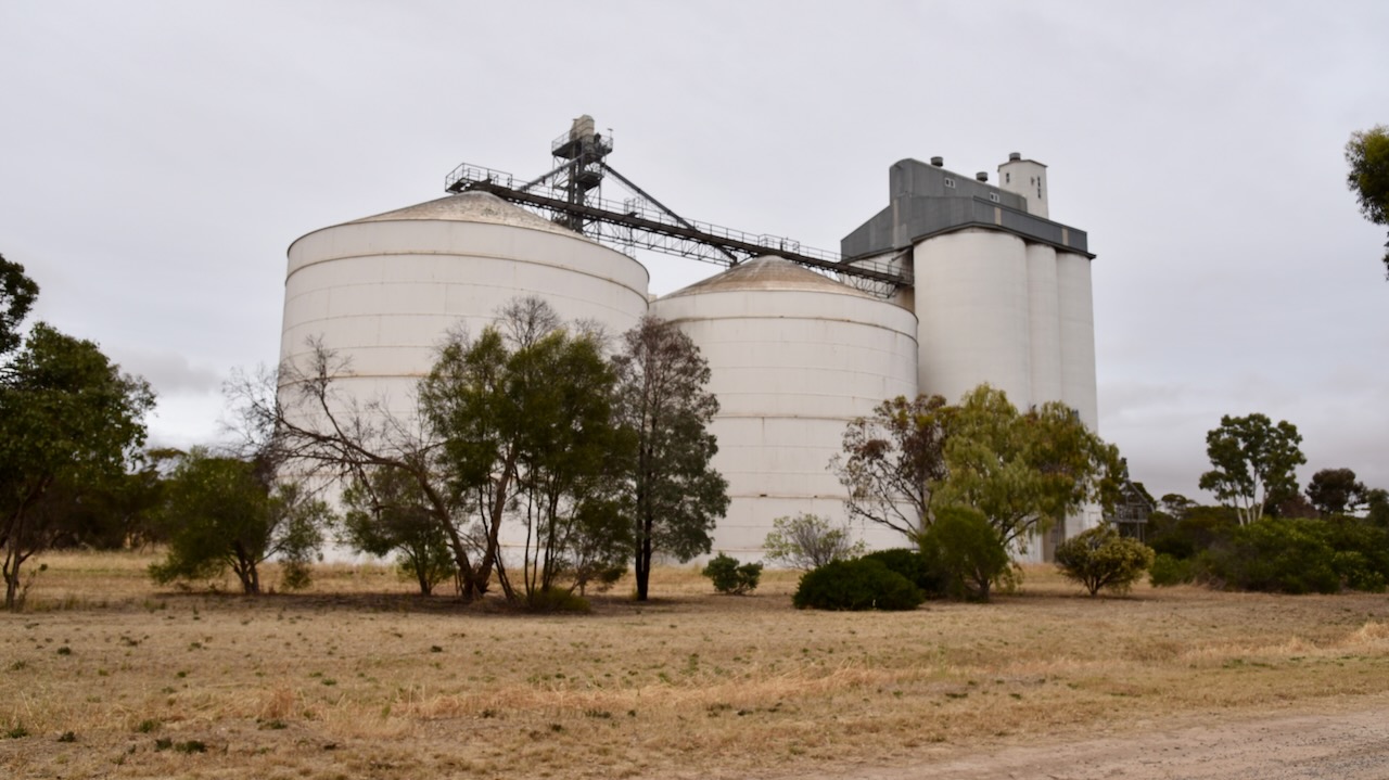
We parked adjacent to the silos and operated from the 4WD running the Icom IC7000, 100 watts, and the Codan 9350 with the 1.5-metre stainless steel whip.

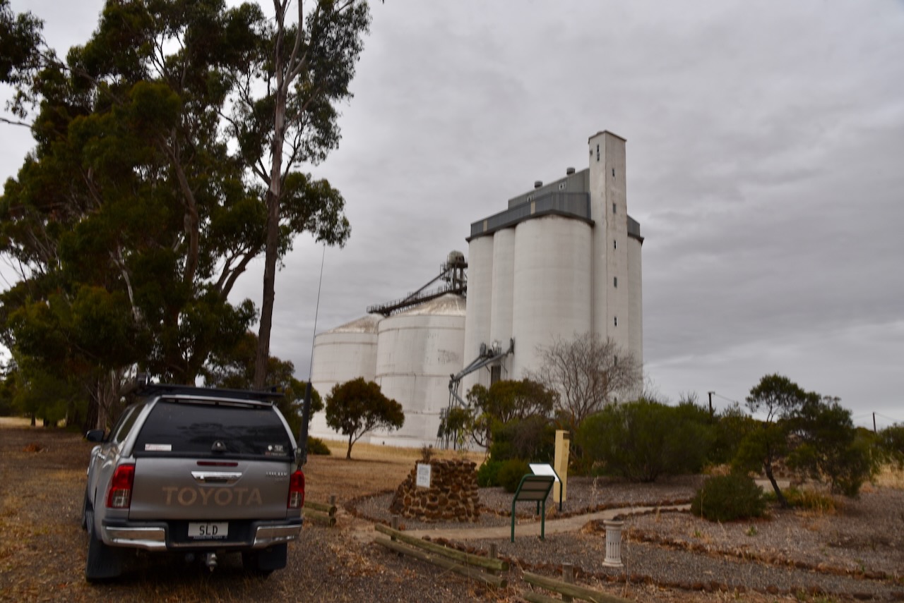
Above:- The activation zone at the Geranium silos. Image c/o SiOTA website.

Marija worked the following stations on 40m SSB:-

  1. VK2IO/p (Murray Valley Regional Park VKFF-1785)
  2. VK3PF
  3. VK3SG
  4. VK3APJ

I worked the following stations on 40m SSB:-

  1. VK2IO/p (Murray Valley Regional Park VKFF-1785)
  2. VK3PF
  3. VK3SG
  4. VK3APJ
  5. VK5TN
  6. VK3YV
  7. VK5FANA
  8. VK3UH
  9. VK1AO
  10. VK2MET

I worked the following stations on 20m SSB:-

  1. VK1AO
  2. VK2MET
  3. VK4NH
  4. VK4DXA

References.

  1. Cockburn, R, 1990, South Australia. What’s in a Name?, Axiom Publishing.
  2. Manning, G, 2012, A Compendium of the Place Names of South Australia, viewed 5th February 2024.
  3. Nickolls, J, Angeli, A, 2003, Mallee Tracks, Gastrel Printing, South Australia.

Lameroo 2 silo VK-LMR5

Our third silo activation for the Silos On the Air (SiOTA) program for Tuesday 14th November 2023 was the Lameroo 2 silo VK-LMR5. Although it is referred to as Lameroo 2, it is actually located in the small town of Kulkami which is 30km northwest of Lameroo.

Kulkami is located about 185 km east of the city of Adelaide.

Above:- Map showing the location of Kulkami. Map c/o Google Maps.

Kulkami is an aboriginal word meaning ‘to wait’. There isn’t much at Kulkami other than the silos, a Country Fire Service station, and some farmhouses.

We parked opposite the silos and operated from the 4WD, running the Icom IC7000, 100 watts, and the Codan 9350 antenna with the 1.5 metre stainless steel whip.

Marija worked the following stations on 40m SSB:-

  1. VK3APJ
  2. VK1AD
  3. VK1NAM
  4. VK5ZNP
  5. VK3PF

I worked the following stations on 40m SSB:-

  1. VK3APJ
  2. VK1AD
  3. VK1NAM
  4. VK5ZNP
  5. VK3PF
  6. VK4NH
  7. VK4DXA
  8. VK2IO/m
  9. VK3BEL

I worked the following stations on 20m SSB:-

  1. VK1AO
  2. VK2MET
  3. VK4NH
  4. VK4DXA
  5. VK4EW

References.

  1. Cockburn, R, 1990, South Australia. What’s in a Name?, Axiom Publishing.

Lameroo silo VK-LMO5

Our second silo activation for the Silos On the Air (SiOTA) program for Tuesday 14th November 2023 was the Lameroo silo VK-LMO5.

Lameroo is located about 200 km east of the city of Adelaide.

Above:- Map showing the location of Lameroo. Map c/o Google Maps.

The first European pastoralist in the Lameroo district was William Butcher. In 1873 he took out pastoral lease no. 2177 when it was described as Winike Berick which is believed to be a corruption of the aboriginal words byrlung byrleck meaning ‘the sea’. In 1849, a group of European settlers were travelling through the Long Desert with their sheep. Whilst camping, some other men were sinking a well that was about 80 feet deep. It was reported that there were beautiful sea shells at the bottom of the well. An aboriginal man named Kropingeri told the settlers that during the life of his great-grandfather Goorapee, the area was covered by the sea. (Place Names SA 2012)

The Aboriginal name for the district was wauwauwe – ‘many kangaroos’. It was called Wowell or Wow Wow Plain by the Europeans. (Place Names 2012)

The first European settler in the district following its survey was Thomas Leckie (b. 1848. d. 1919). He was born in Scotland in 1848 and at age 4 emigrated to Australia with his parents in 1852. He took up a block of 450 acres about ‘half a mile’ from Lameroo in 1896. He cleared and cultivated the land. He lived a remote life, with the nearest European settler’s property being ’60 miles’ away. Every three months, Leckie carted his family provisions from Tailem Bend across the harsh country with no roads. (1919 The Pioneer of Lameroo) (Place Names 2012).

Above:- Thomas Leckie. Image c/o https://www.ancestry.com.au/family-tree/person/tree/42536149/person/19804681998/facts

In 1884 a well was sunk at Wow Wow Plains. The well had a whim and served both the locals and travellers with water for personal use and stock supplies. The well’s measurements were 7 feet by 4 feet in section and 254 feet deep. It was timbered with round Cypress Pine and was dug by pick and shovel. (Mallee Highway 2024)

Following this, settlement on Wow Wow Plain became more permanent. In 1894 the land was surveyed, with the initial survey giving each block some natural open land to start cultivating. In 1894 the town reserve was proclaimed. (Mallee Highway 2024)

The town of Lameroo was proclaimed on the 17th day of November 1904. (Place Names 2012)  

Above:- SA Govt Gazette, Nov 17 1904 re the proclamation of the town of Lameroo.

The name Lameroo was the suggestion of Mr J.M. Johnston, an Inspector in the Post and Telegraph Office who had spent time in the Northern Territory working on the Overland Telegraph Line. He suggested the name after Lameroo Beach in the Northern Territory (Cockburn 1990)

Johnston stated:

“I was at a farmer’s house where Lameroo now is, one evening in 1904, returning from Pinnaroo.I had intended to go on further and camp out, but the farmer (Mr. Byrne) asked me to stay there, as there was a meeting that night to name the place.I attended a fairly large meeting.The settlers could not agree on a name and finally appealed to me, whereupon I suggested Lameroo, which was adopted with only one dissentient.I do not know the meaning of the word. I suggested it because its euphony pleased me and I had so named a little bay in the Northern Territory between the Darwin Hospital and the Gaol.” (Cockburn 1990)

The railway was declared open on the 8th day of September 1906 and the first trains arrived at Lameroo with passengers and goods. Regular train services to Lameroo brought other settlers, building materials, and machinery. By the time the First World War had commenced, every surveyed block at Lameroo was taken. (Mallee Highway 2024)

Above:- Lameroo, c. 1918. Image c/o State Library South Australia (B37383)

Today Lameroo is a vibrant town and service centre for the surrounding farming community.

The Lameroo silos are located in Railway Terrace South and are operational. In late 2023 it was announced that the silos would become part of Australia’s Silo Art Trail. There is a Lameroo Silo Art Project Facebook page.

The bulk grain silo (wheat) opened in Lameroo for the 1959-60 grain harvest. It was the first grain silo outside of Port Adelaide in the Eastern Division. The barley silo opened in 1964. (Discover Murray 2024)

We parked right alongside the silos on Railway Terrace South. We ran the Icom IC7000, 100 watts, and the Codan 9350 antenna with the 1.5 metre stainless steel whip.

Above:- Map showing the activation zone at the Lameroo silo. Image c/o SiOTA website.

Marija worked the following stations on 40m SSB:-

  1. VK2IO/m
  2. VK5FANA
  3. VK3CLD
  4. VK3YV
  5. VK3PF

I worked the following stations on 40m SSB:-

  1. VK2IO/m
  2. VK5FANA
  3. VK3CLD
  4. VK3YV
  5. VK3PF
  6. VK3FABS
  7. VK3OB
  8. VK3TDX
  9. VK3OF
  10. VK2RK
  11. VK2ACR
  12. VK5KLV
  13. VK3DAC
  14. VK3ZSC

I worked the following stations on 20m SSB:-

  1. VK7XX
  2. VK1AO
  3. VK2MET
  4. VK4NH
  5. VK4DXA
  6. VK4EMP
  7. VK4TI
  8. VK4FO

References.

  1. 1919 ‘THE PIONEER OF LAMEROO.’, The Advertiser (Adelaide, SA : 1889 – 1931), 17 November, p. 8. , viewed 05 Feb 2024, http://nla.gov.au/nla.news-article5643454
  2. Cockburn, R, 1990, South Australia. What’s in a Name?, Axiom Publishing.
  3. Discover Murray, 2024, An historical look of the first 100 years of Lameroo, viewed 5th February 2024.
  4. Manning, G, 2012, A Compendium of the Place Names of South Australia, viewed 5th February 2024.
  5. Southern Mallee District Council, 2024, Mallee Highway Touring Route, Lameroo S.A., viewed 5th February 2024.