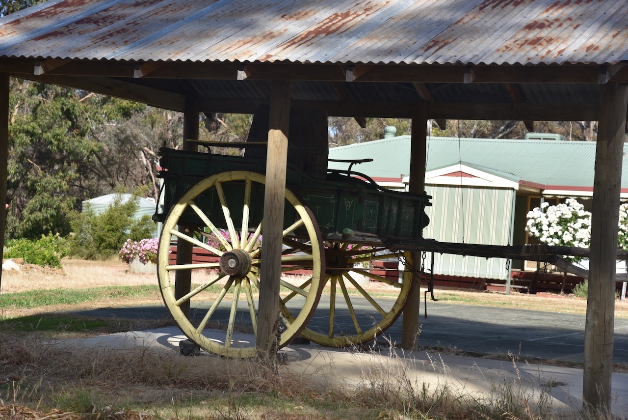
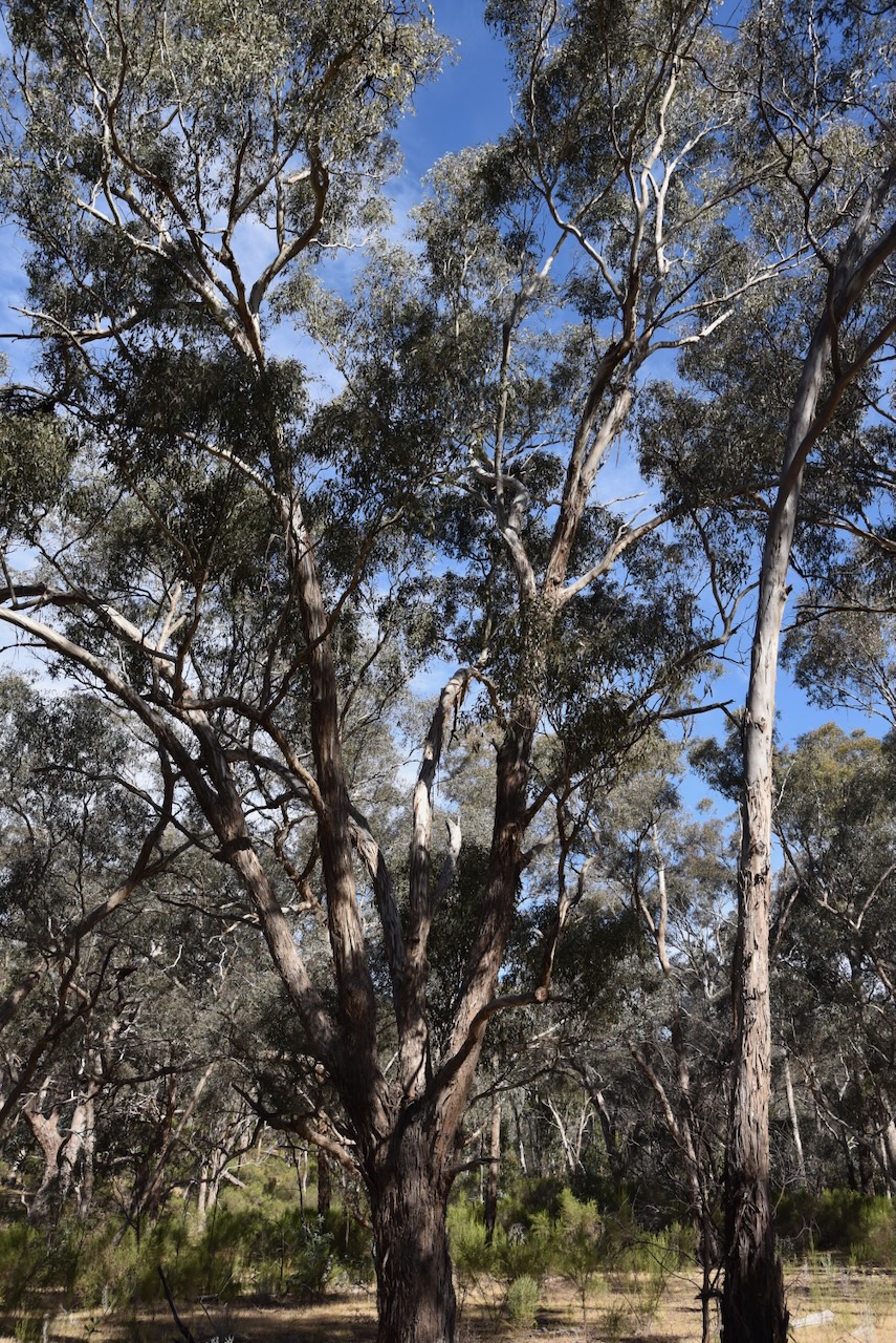
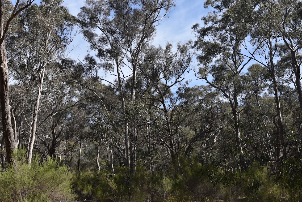
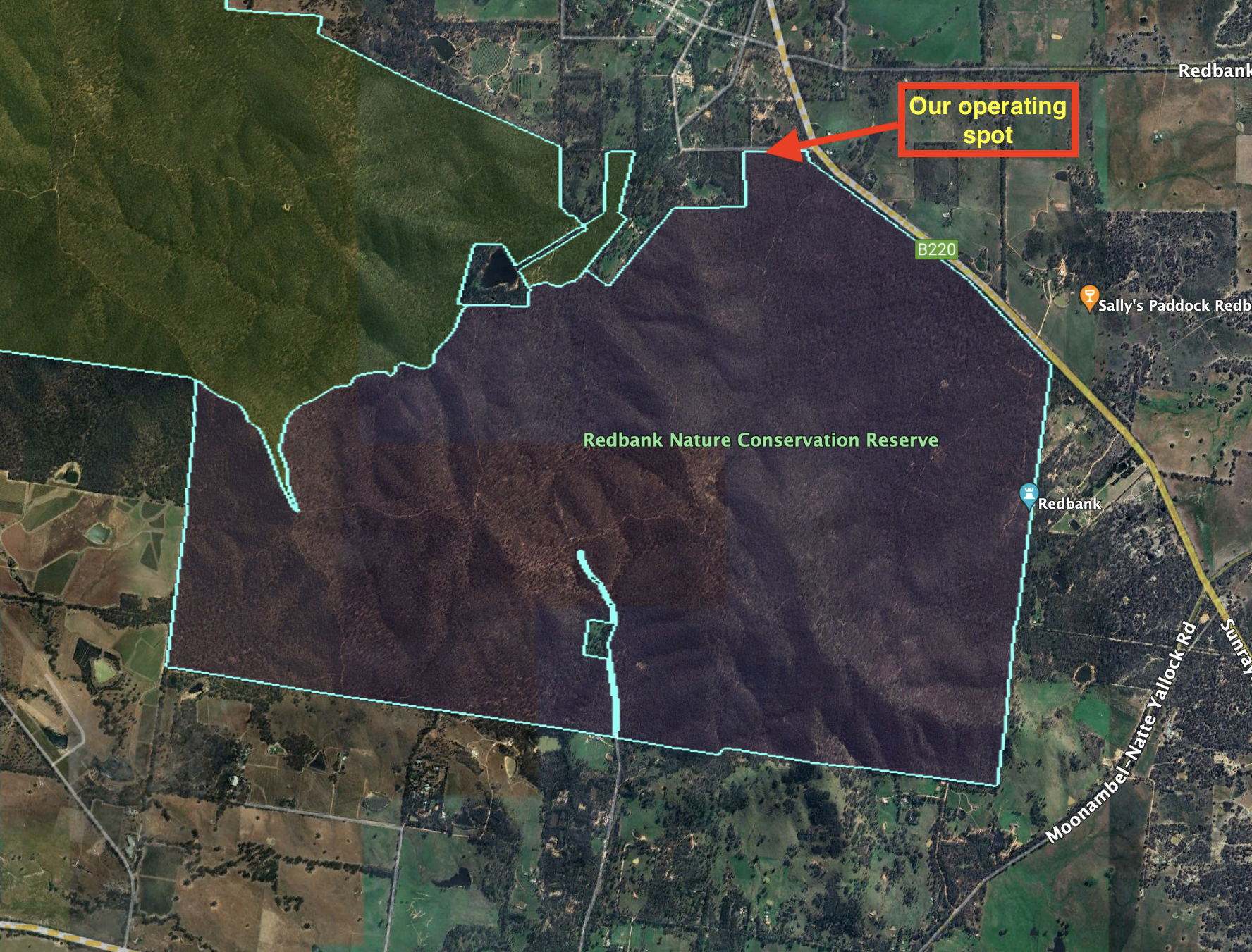
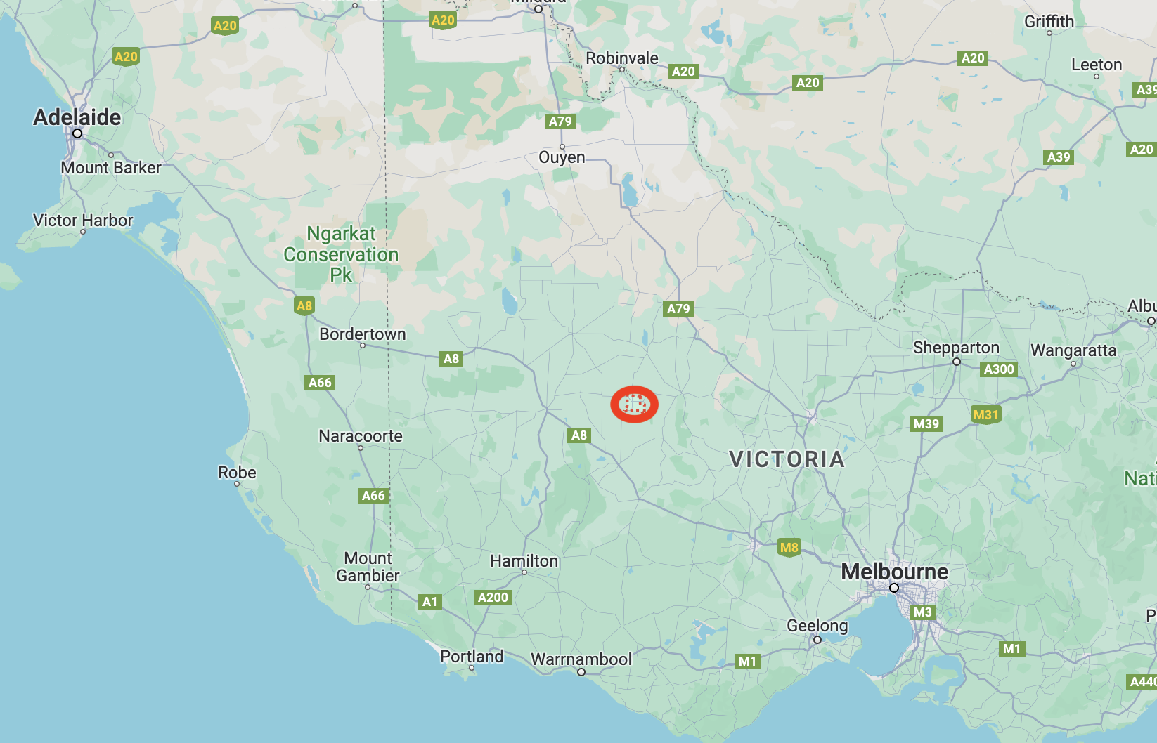
After leaving the Kara Kara National Park, Marija and I headed to our next park activation, the Redbank Nature Conservation Reserve VKFF-2180. The park is located about 204 km north of the city of Melbourne.
Above:- Map showing the location of the Redbank NCR. Map c/o Google Maps.
In 1860 gold was discovered in the area which is now known as Redbank. This resulted in about 2,000 people flooding into the Redbank district. In 1861 the town of Redbank was surveyed. The actual origin of the name is uncertain, but it possibly takes its name from a mine earthworks as there is red clay soil in the area. By 1861 the discovery of gold in other parts of Victoria resulted in a major reduction of Redbank’s population. (Victorian Places 2024)
One of the surviving historic buildings in the district is the Shamrock and Thistle Hotel which was built in 1861. (Victorian Places 2024)
Other historic buildings in the little town include the former St Paul Anglican church that was built c. 1900.
The Redbank NCR is about 1,202 hectares in size and was established on the 26th day of February 2002. (CAPAD 2022)
The park’s northwestern boundary abuts the Kara Kara National Park.
Above: An aerial view of the park. Image c/o Google Maps.
Marija and I travelled a short distance south out of the town of Redbank along High Street and then took Boundary Road.
We ran the Yaesu FT857, 40 watts, and the 20/40/80m linked dipole for this activation.
Above:- An aerial view of the park showing our operating spot. Image c/o Google Earth.
Marija worked the following stations on 40m SSB:-
VK3BEL/p
VK3APJ
VK3PWG
VK3MCK
VK5CZ
VK4NH
VK4DXA
VK3PF
VK3KAI
VK5HS
VK3TKK/p (Clinkers Hill Bushland Reserve VKFF-4288)
I worked the following stations on 40m SSB:-
VK3BEL/p
VK3APJ
VK3PWG
VK3MCK
VK5CZ
VK4NH
VK4DXA
VK3PF
VK3KAI
VK5HS
VK3SQ
VK2BD
VK3CJN
VK3CEO
VK3DAC
VK4FE/3
VK2LEE
VK2IO/m
VK3ZMD
VK3SG
Vk1AO
VK2MET
VK5OUI
VK2EXA
VK3SO
VK3CLD
VK3CRG
VK3LOC/m
VK3TKK/p (Clinkers Hill Bushland Reserve VKFF-4288)
VK3BWS
VK4EW
VK7IAN
VK2HAK
VK2CB
VK3CA
VK3TDX
VK4HAT
I worked the following stations on 20m SSB:-
VK4HAT
VK4NH
VK4DXA
ZL1TM
VK4SMA
VK3TKK/p (Clinkers Hill Bushland Reserve VKFF-4288)
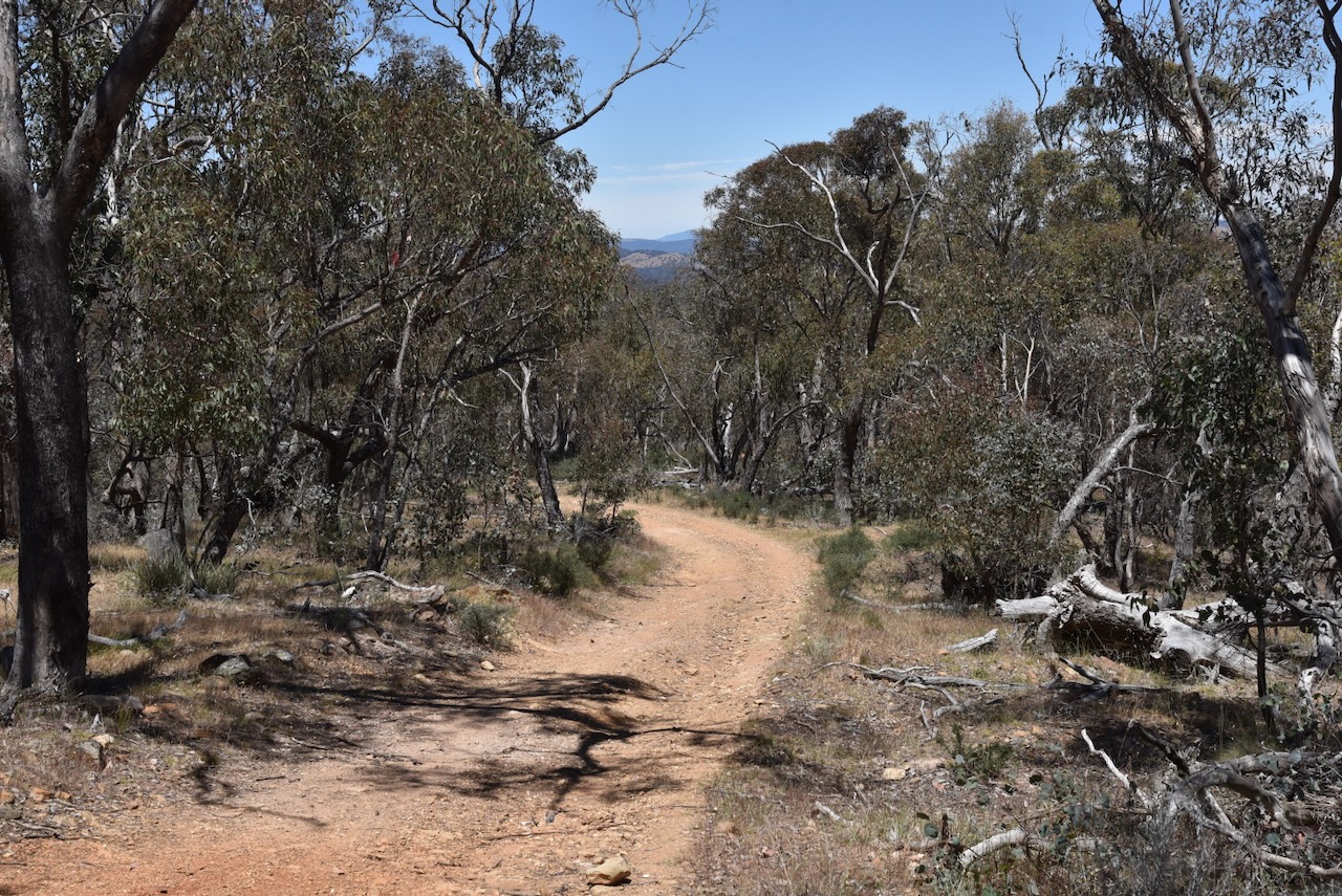
After packing up at the West of England Fire Tower summit, Marija and I headed to our next activation for Saturday 18th November 2023, the West of England Range summit VK3/ VW-013 which is located in the Kara Kara National Park VKFF-0629.
This was the first time that we had activated this summit.
Above:- Map showing the location of the West of England Range summit. Map c/o Google Maps.
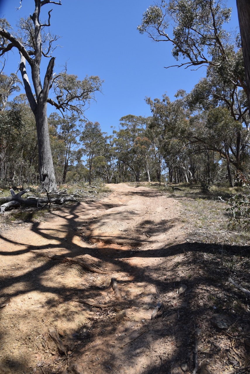
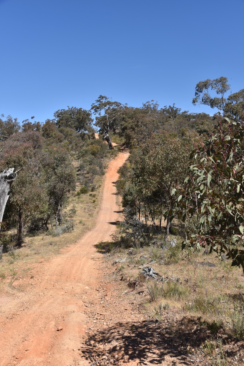
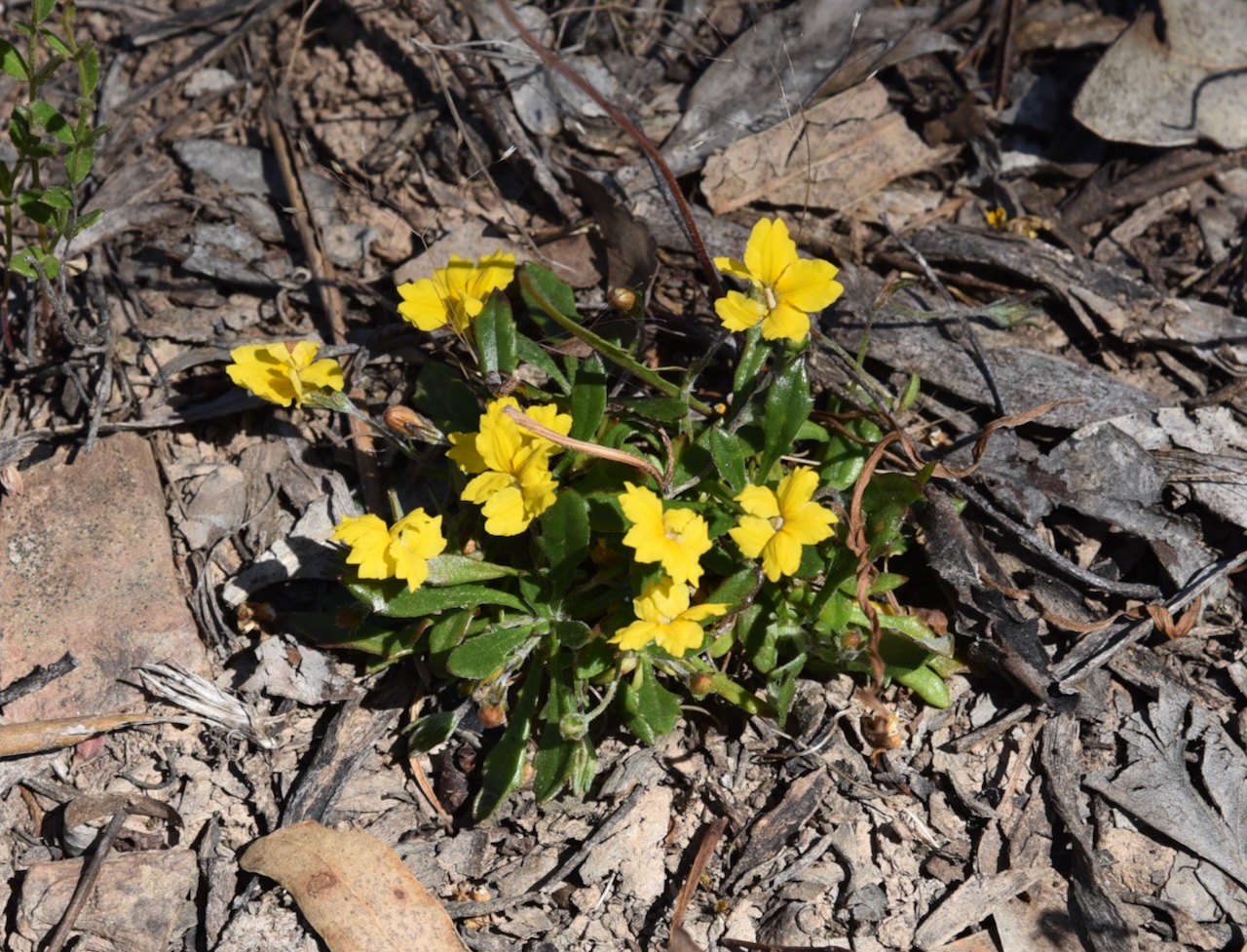
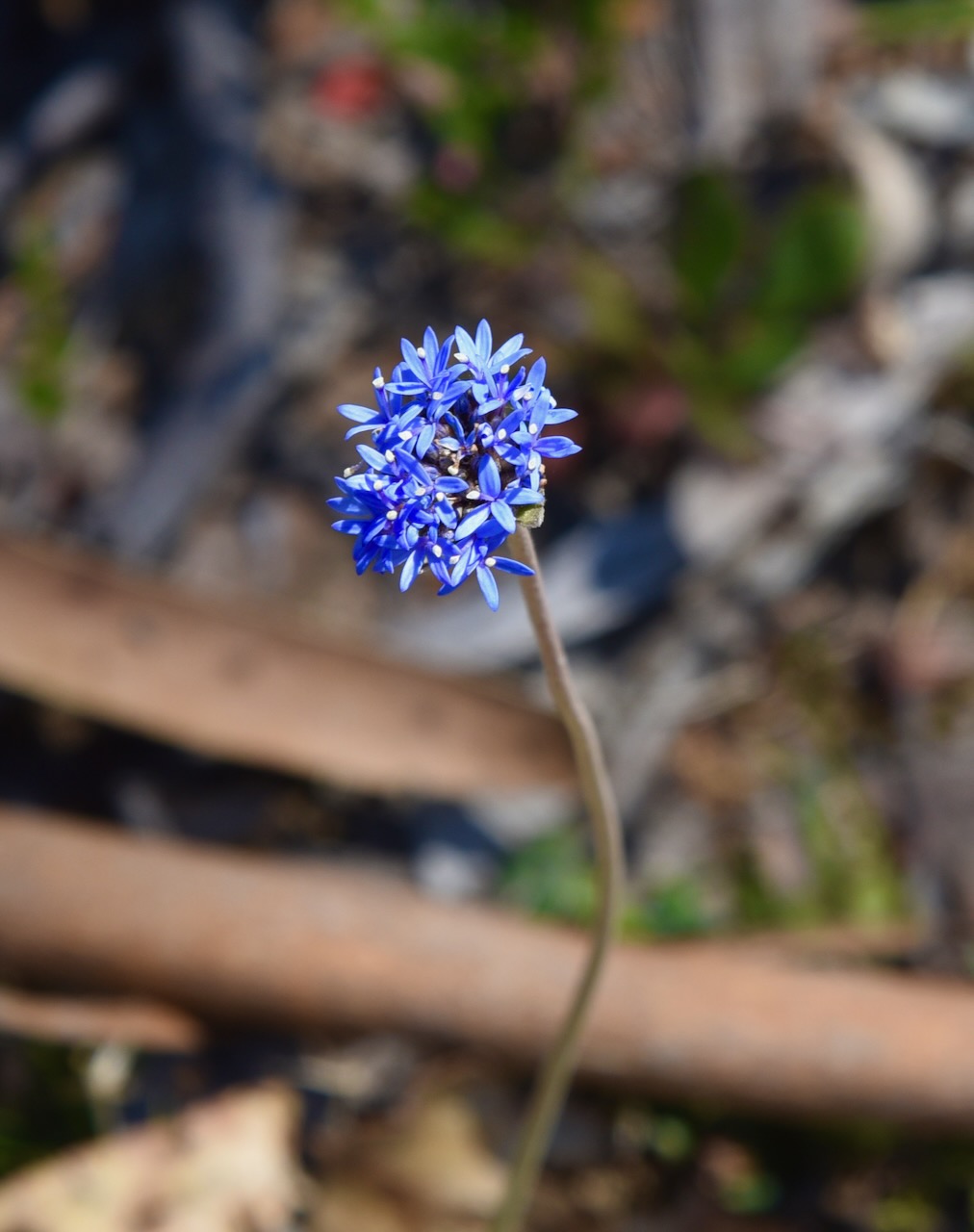
We needed to travel south through the Kara Kara National Park across the West of England Range to reach the summit. It took us a little longer than we expected. The track was quite rough in parts but no challenge for the Toyota Hi-Lux 4WD.
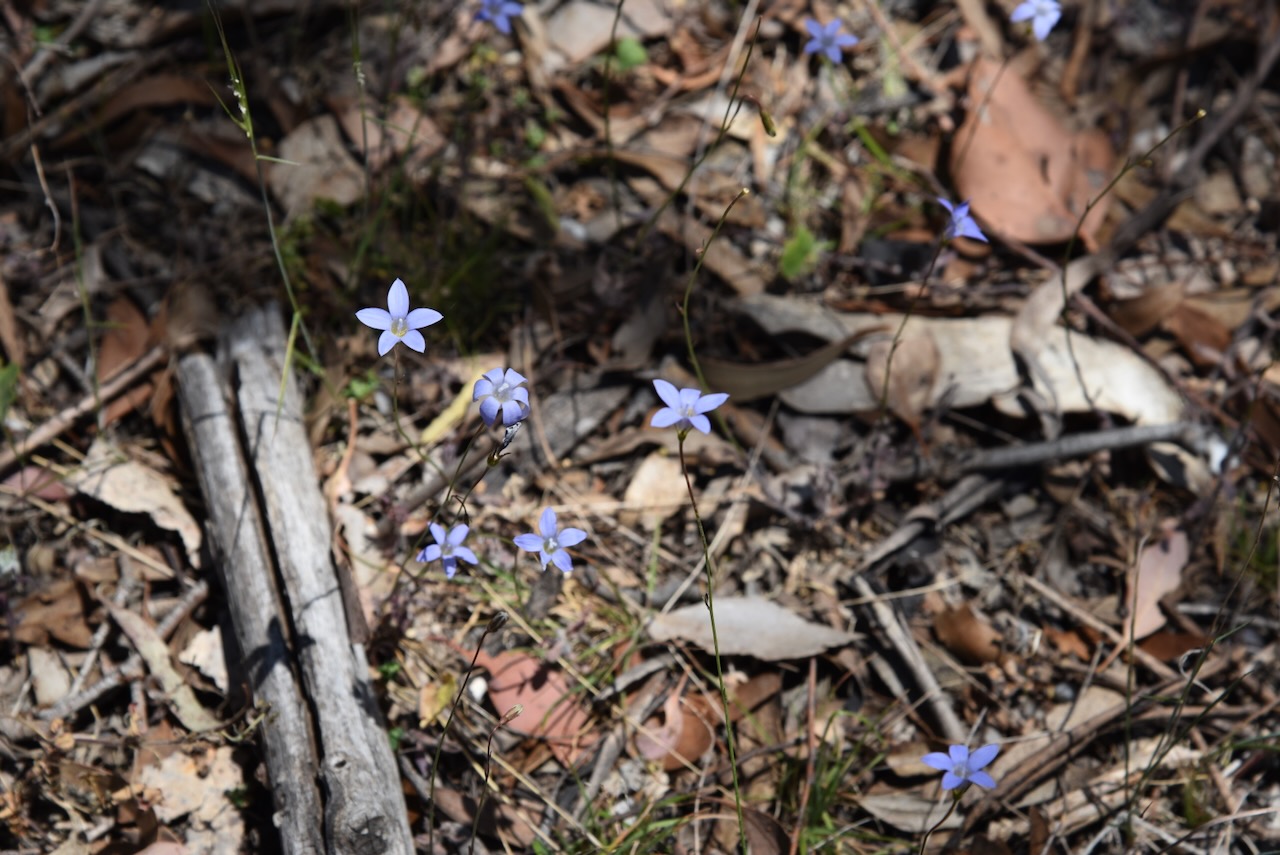
We stopped every now and again to admire some of the beautiful wildflowers and the occasional view through the forest.
The West of England Range summit qualifies for the Summits On The Air (SOTA) program and is worth 2 points. The summit is 617 metres above sea level. It has been activated a total of 13 times. (SOTA 2024)
Above:- An aerial view of the West of England Range summit. Image c/o Google Maps.
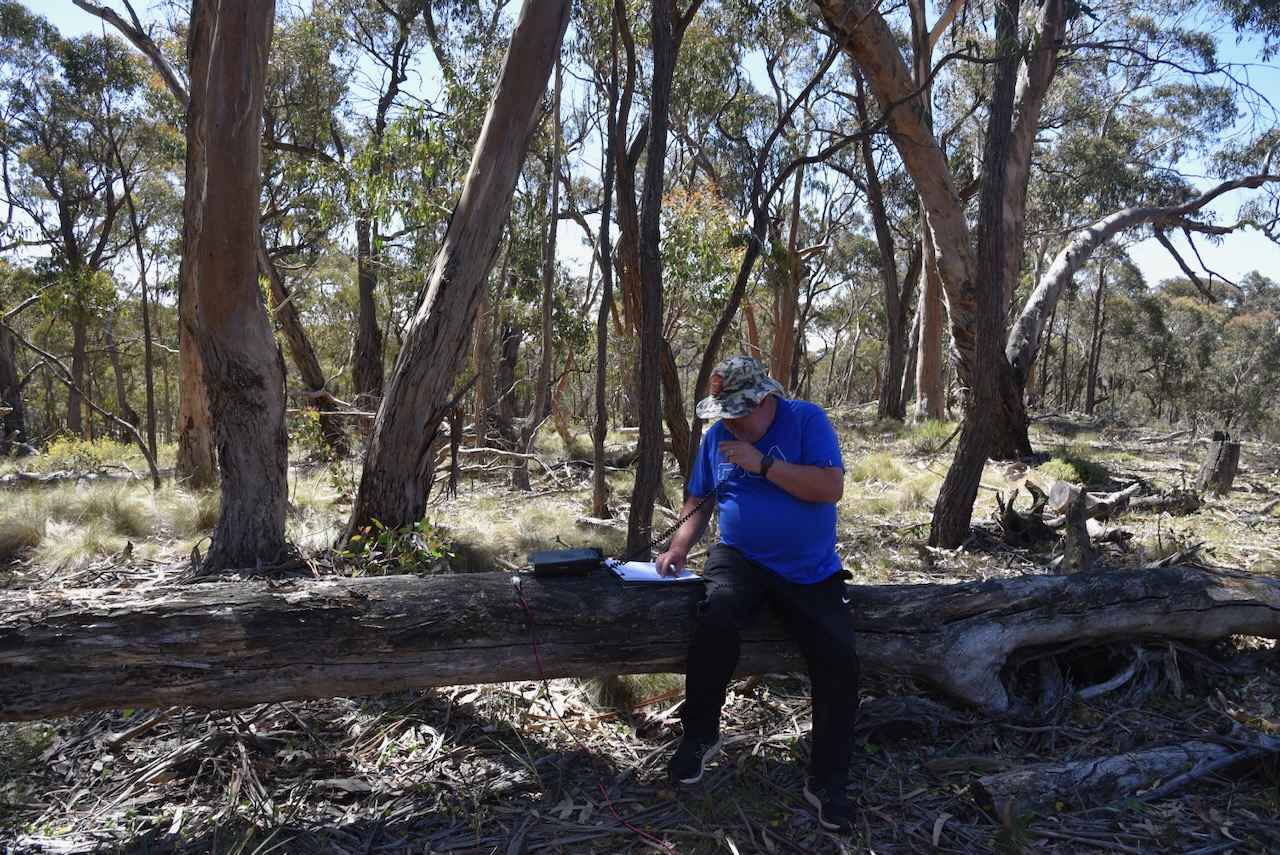
Marija and I parked on the side of Centre Track and walked a little way to the west and found a fallen log which acted as ‘our shack’ for this activation. We ran the Yaesu FT857, 40 watts, and the 20/40/80m linked dipole.
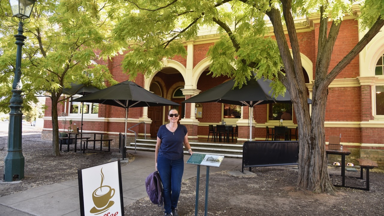
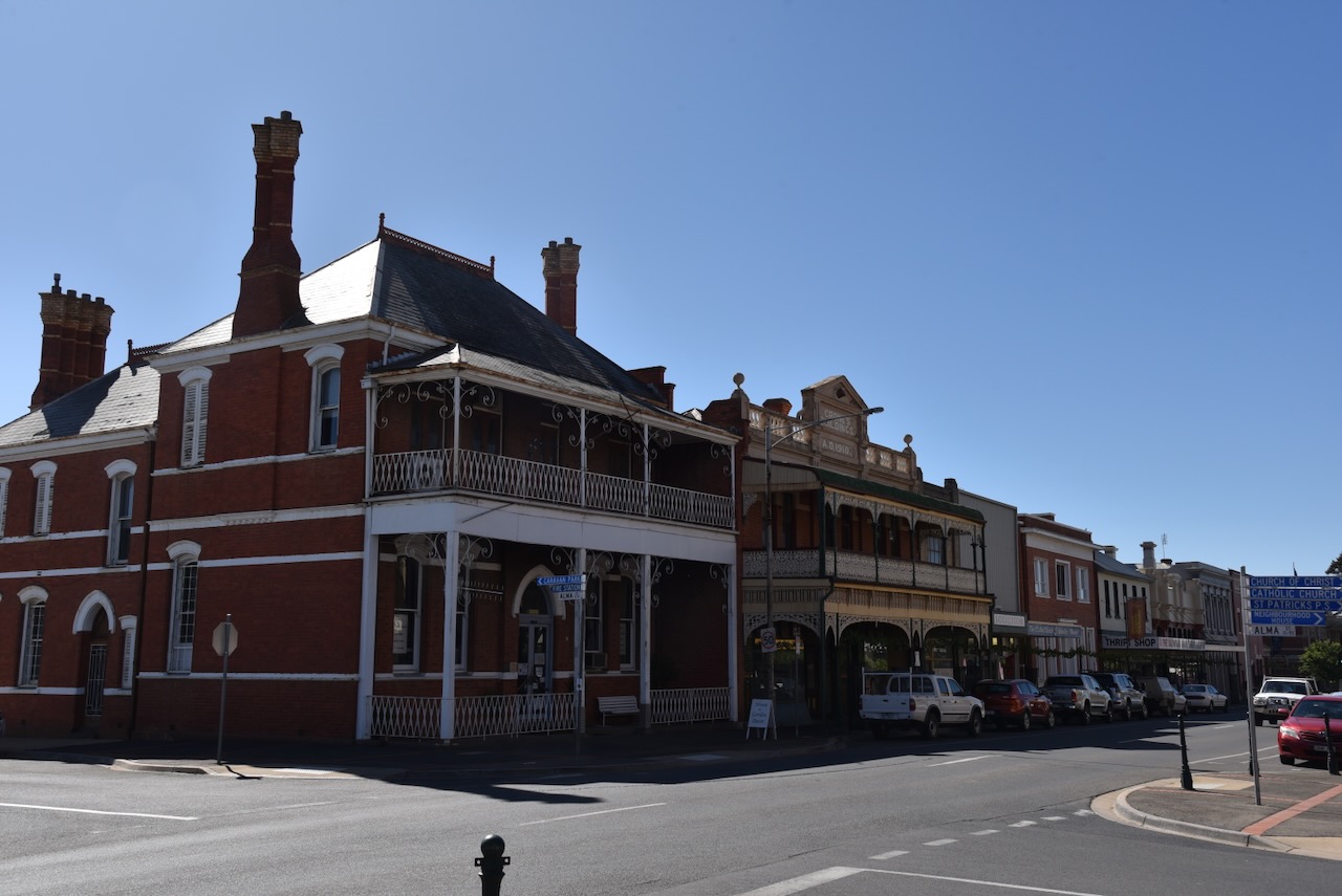
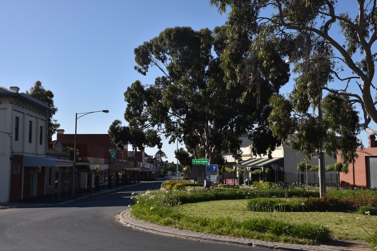
It was now day two of our trip, Saturday 18th November 2023. We had spent a very enjoyable night in St Arnaud and it was time to get stuck into another day of activities. Marija and I headed down the main street of St Arnaud and had a magnificent cooked breakfast at The Shire Cafe which is located in the old Kara Kara Shire Hall.
Kara Kara is an aboriginal word believed to mean gold and quartz. (Victorian Places 2024) The Shire Offices which are now the cafe, were built in 1902 and served as the administration centre of the Kara Kara Shire until 1996. The Federation era building contained the council chambers, a public office and smaller offices for the Shire Secretary and President. (Aussie Towns 2024)
In January 1855 gold was discovered at a sandy knoll which was called Bakery Hill, on the northern outskirts of St Arnaud. The goldfields became known as New Bendigo. (Victorian Places 2024)
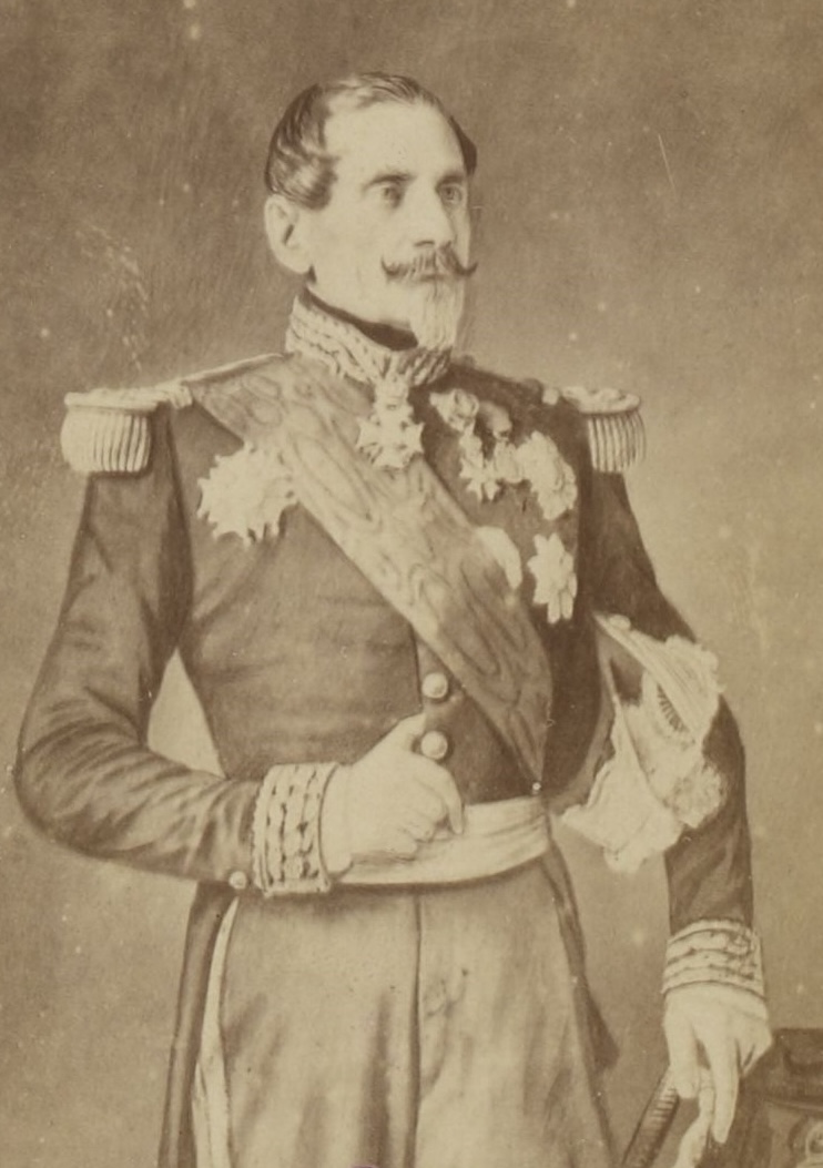
The township of St Arnaud was surveyed in 1856 and is named after Jacques Leroy de Saint-Arnaud (b. 1798. d. 1854), a French soldier and Marshal of France. He served as French Minister of War until the Crimean War when he became Commander-in-chief of the Army of the East and fought alongside the British as the Commander-in-Chief. (Aussie Towns 2024)
Above:- Jacques Leroy de Saint Arnaud. Image c/o Wikipedia.
Below is a very informative video on the township of St Arnaud and its gold mining history.
The St Arnaud Court House was constructed during the 1870s. The courthouse is built in what is known as the Victorian Free Classical style. It originally contained a single courtroom and three adjoining rooms. In 1882-1883 new rooms for the Judge, barristers and witnesses were added, along with a jury box and retiring room. A verandah and double entry were also added to the building. (Aussie Towns 2024)
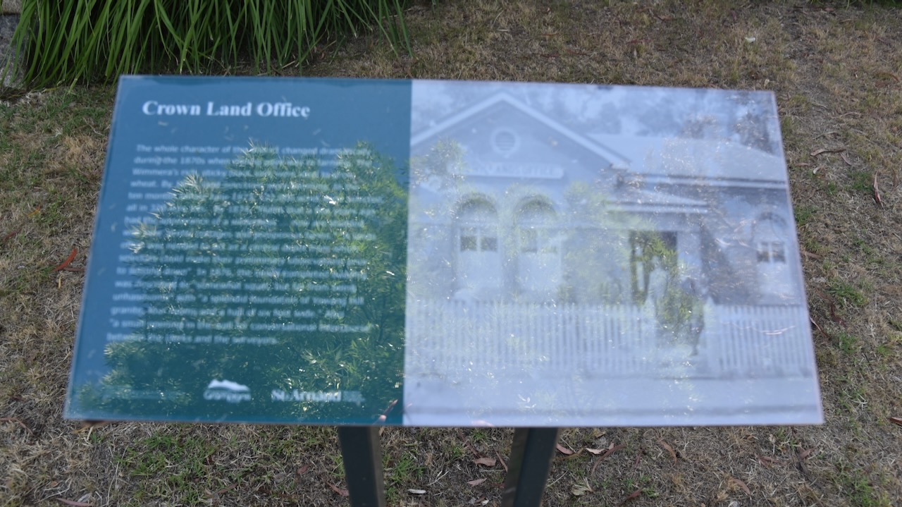
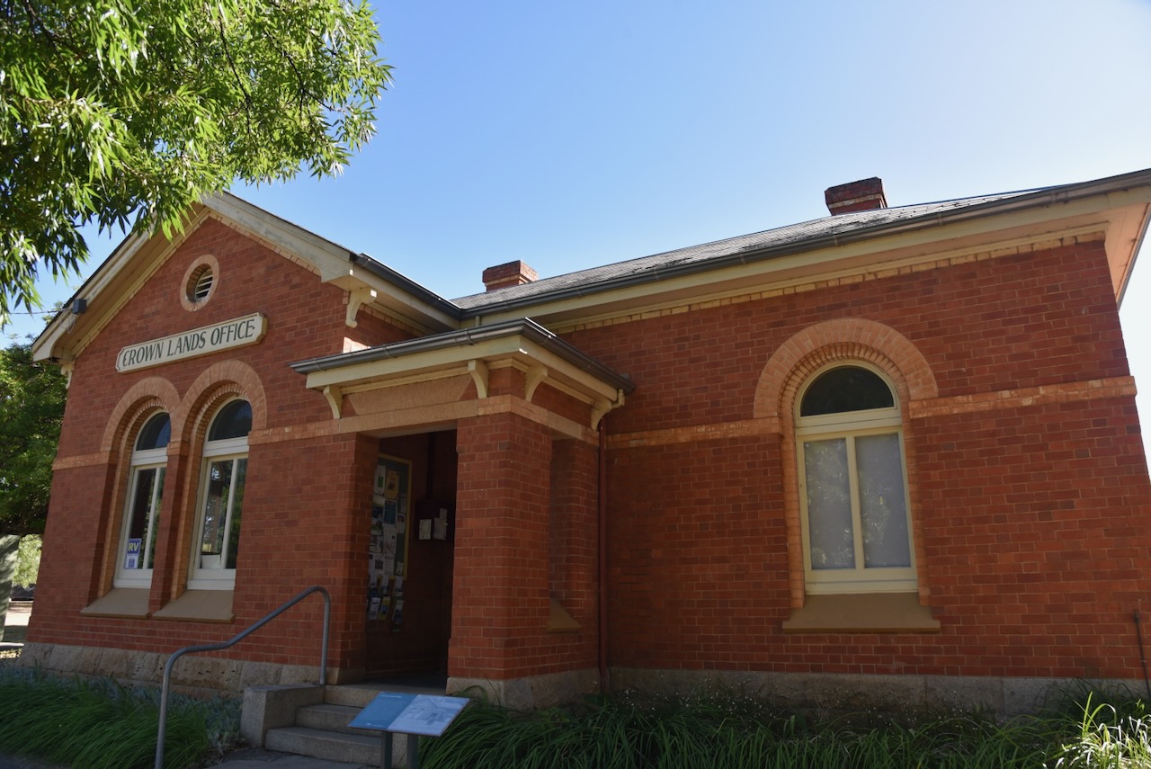
The old Crowns Lands Office is now the Visitor Information Centre. The building was completed in 1876 and at the time was described as ‘a splendid foundation of Yawong Hill granite, four rooms and a hall six feet wide.’ (Aussie Towns 2024)
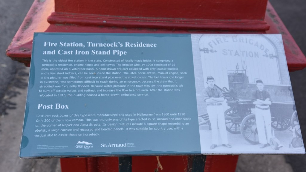
Adjacent to the old Fire Station is a historic cast rin post box which was built during the 1860s. There are only 200 of these historic post boxes remaining in Victoria. (Aussie Towns 2024)
And of course St Arnaud has a Bills Horse Trough. See my previous post about these.
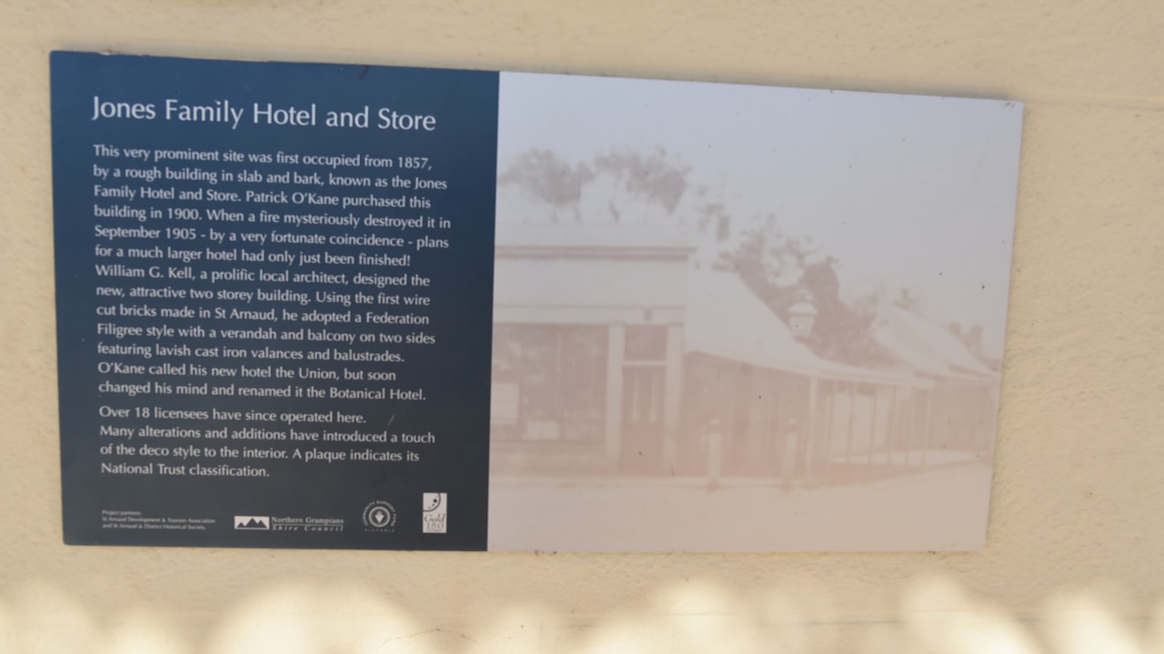
The Botanical Hotel is located adjacent to King Georges Park. The site on which the hotel now stands was first occupied from 1857 and consisted of a rough building in slab and bark and was known as the Jones Family Hotel and Store. It was destroyed by fire in September 1905. The current hotel was designed by William G. Kell, a prolific local architect. The hotel was initially known as the Union, but soon became known as the Botanical Hotel.
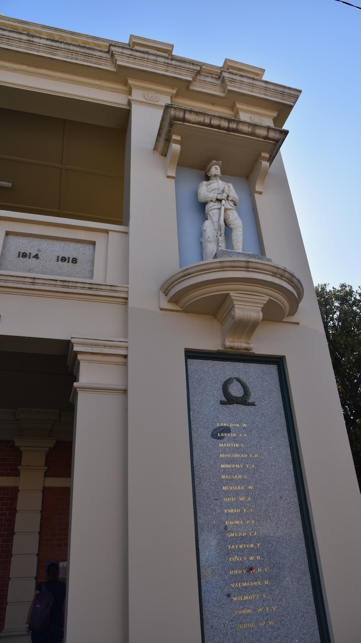
The Town Hall’s foundation stone was laid by Cr. James Stewart on the 28th day of August 1869. The formal opening was celebrated with a grand ball, including dancing until 6am the following day. (Aussie Towns 2024)
St Arnaud contains several murals, the work of St Arnaud based artist, Kyle Torney. The murals tell local stories with intricate detail. (Australian Silo Art Trail 2024)
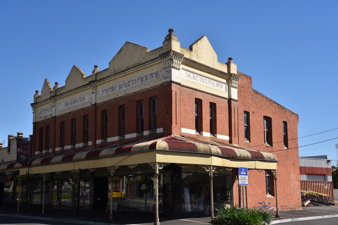
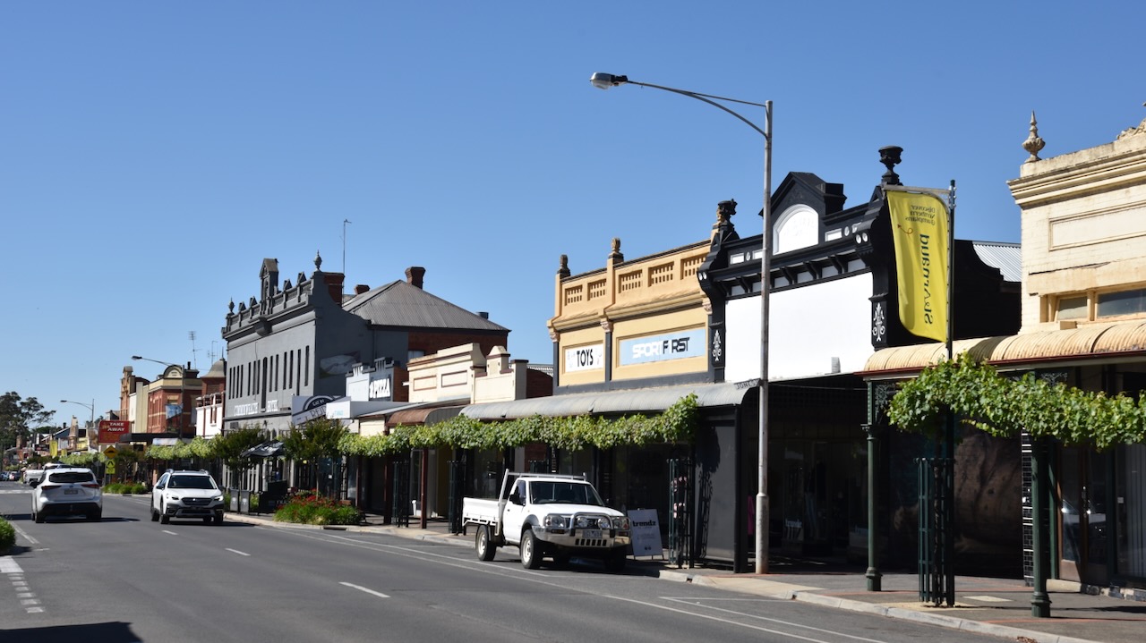
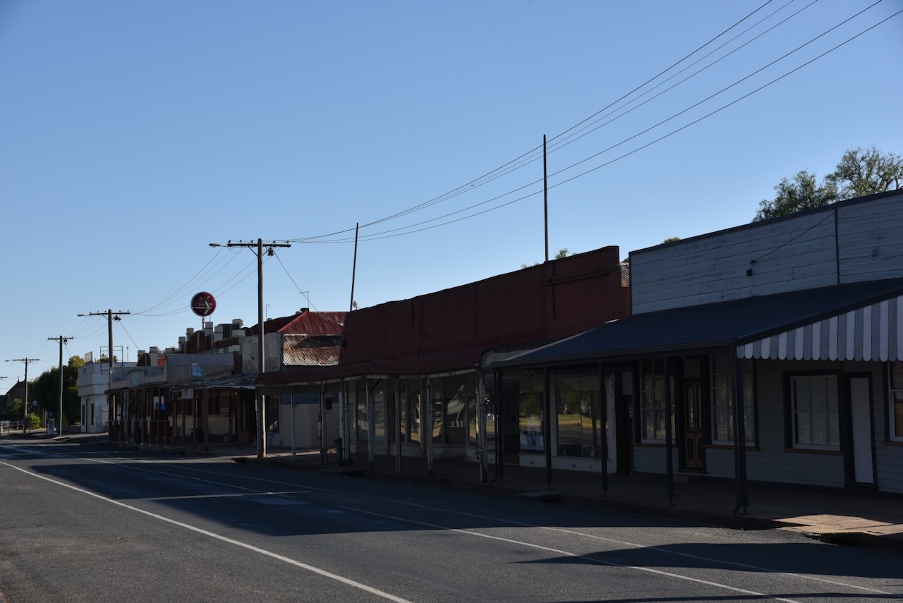
St Arnaud is one of my favourite towns. The main street has a magnificent feel and contains numerous historic buildings from the gold rush era.
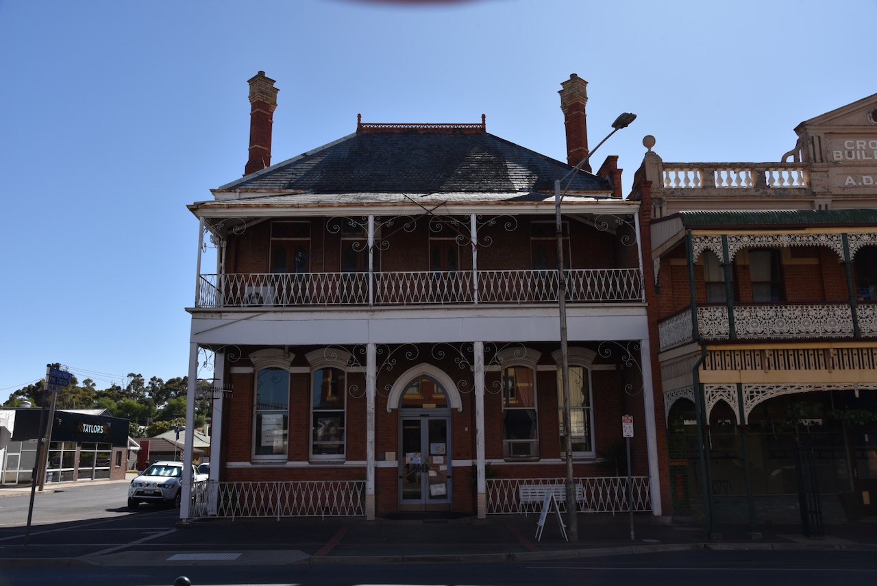
The former Bank of New South Wales building can be found in the main street. The building has Esdt 1817 above its entry doors, the year the bank was established. The building itself was built in 1873 and underwent rennovations in 1888. (Sydney Morning Herald 2024)
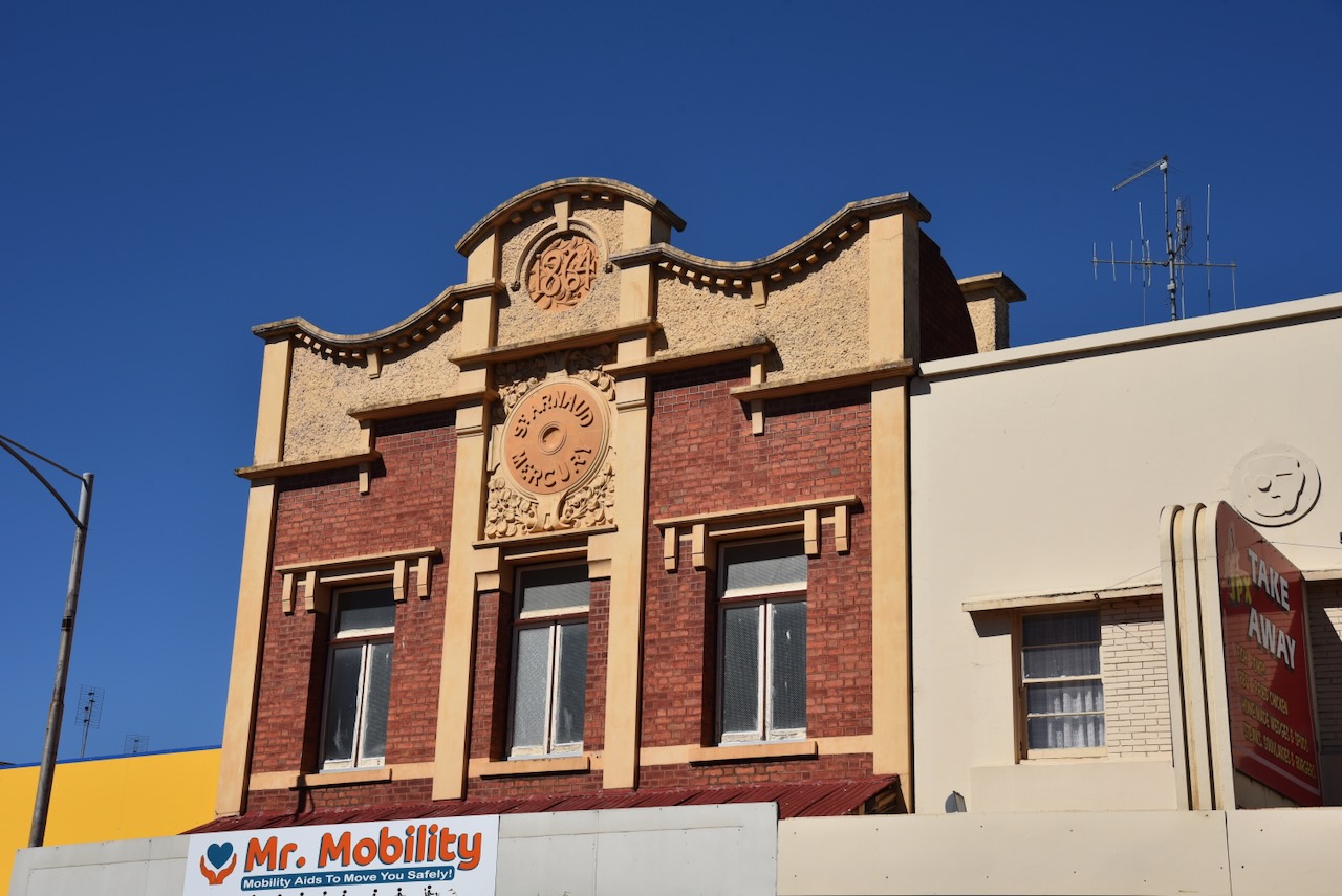
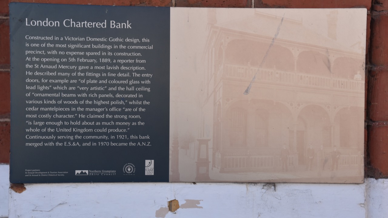
The London Chartered Bank was constructed in a Victorian Domestic Gothic design. It was opened on the 5th day of February 1889. At its opening a reporter from the St Arnaud Mercury newspaper described the entry doors as being ‘of plate and coloured glass with lead lights’ which are ‘very artistic.’
The Old Victoria Inn was and is noted for its original bullnosed verandah and magnificent cast iron lacework. The old Inn still has the original horse and carriage entrance with cast iron gates. (Aussie Towns 2024)
The grain store was built in 1879 by Joseph Read, an early pioneer of the district and distinguished councillor.
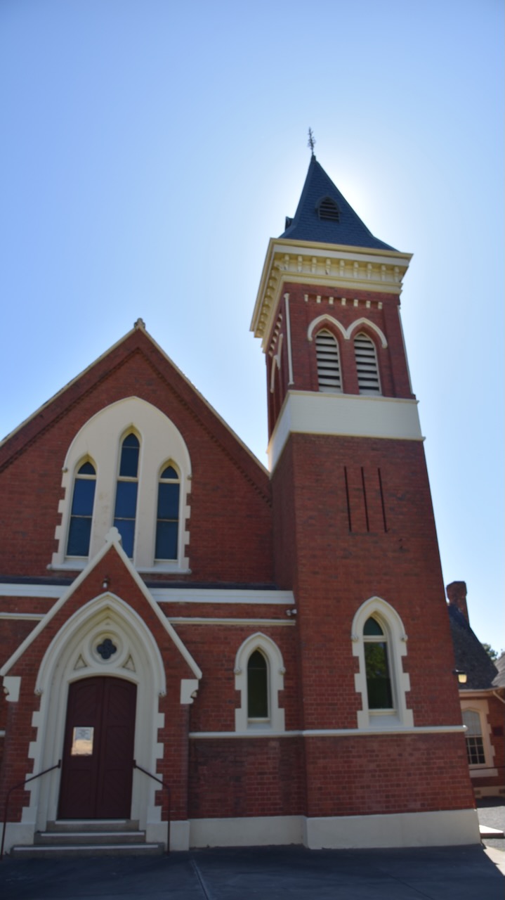
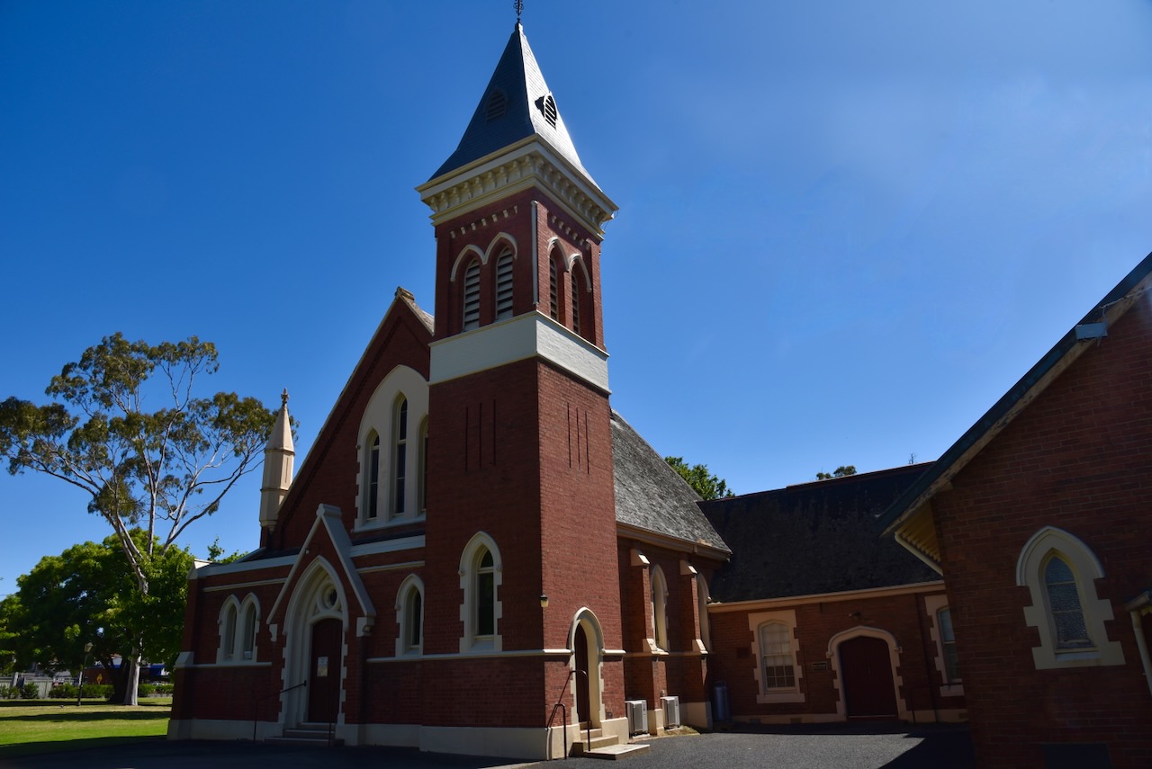
Scots Church was built as the local Presbyterian Church and was designed by Charles Vickers. It features an impressive bell tower and spire. In 1977 following the union of the Presbyterian, Methodist and Congregational Churches, the church became the St. Arnaud Uniting Church. (Aussie Towns 2024)
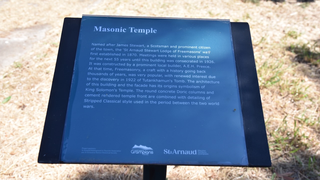
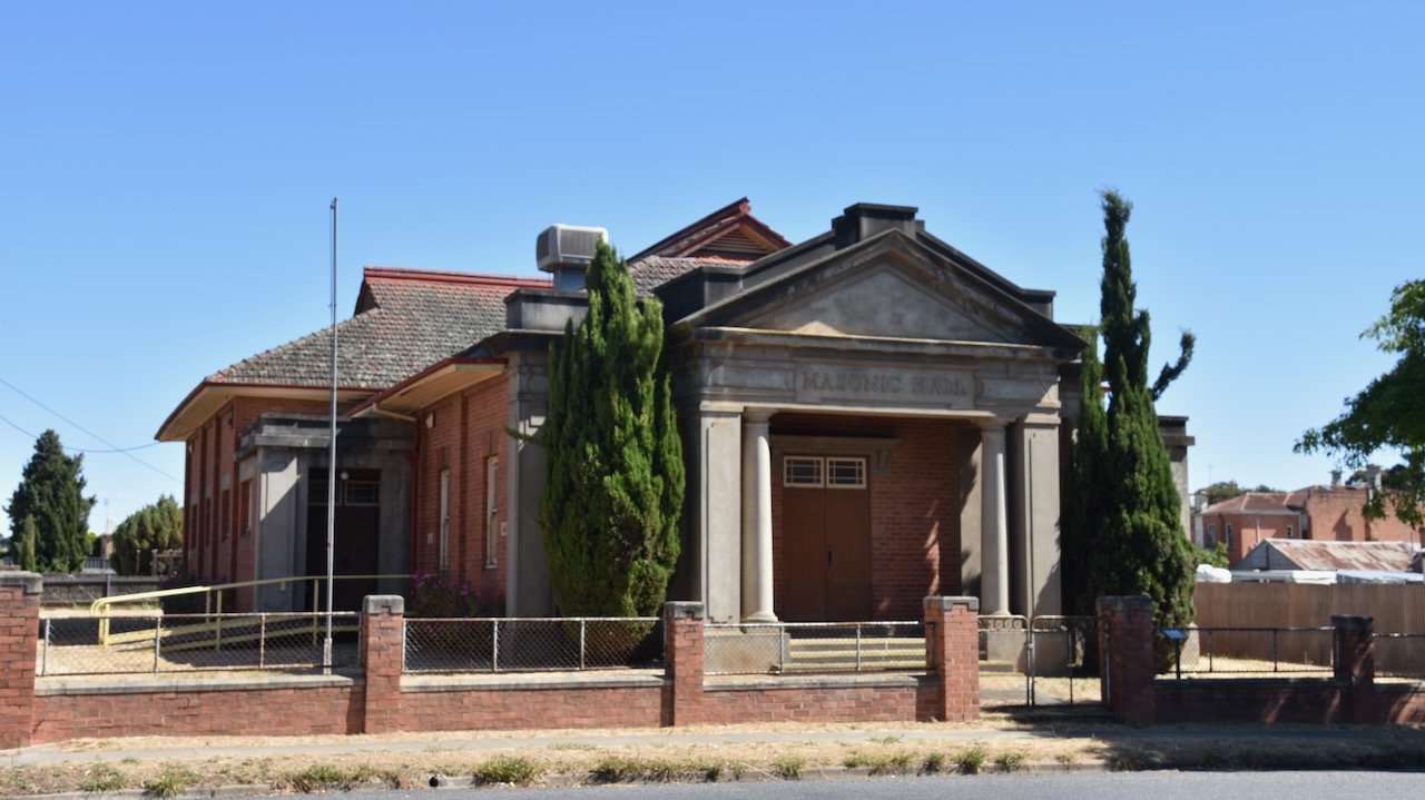
The St Arnaud Masonic Temple was constructed in 1926, however the Freemasons had been operating in St Arnaud since 1870. The St Arnaud Stewart Lodge of Freemasons was named after James Stewart, a Scotsman and prominent St Arnaud citizen. Prior to the construction of the building, meetings were held in various locations. The Masonic Temple waas constructed by A.E.H. Preece, a prominent local builder. The architecture of the building and the facade has its origins symbolism of King Solomon’s Temple. (Aussie Towns 2024)
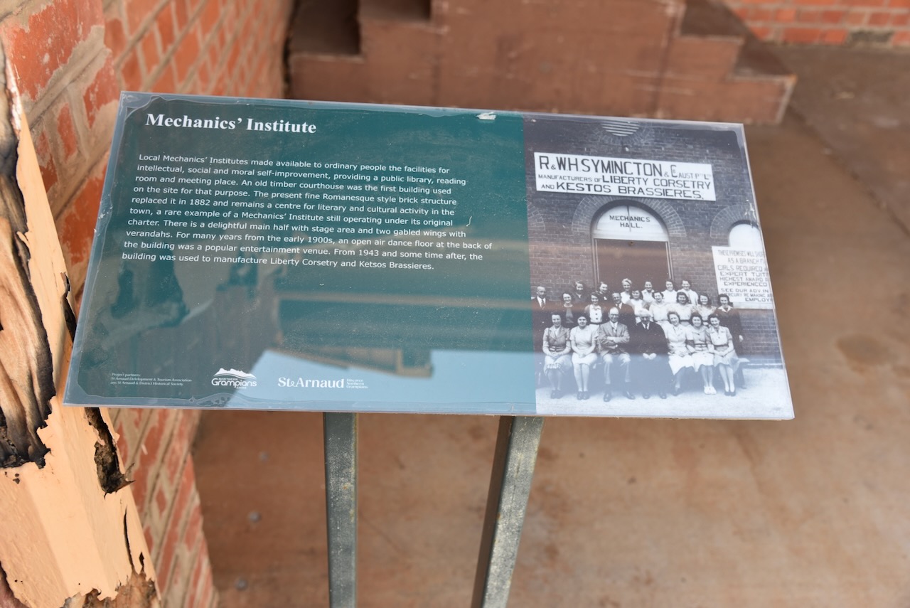
The St Arnauds Mechanics Institute was built in 1882. (Aussie Towns 2024)
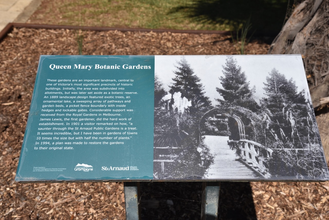
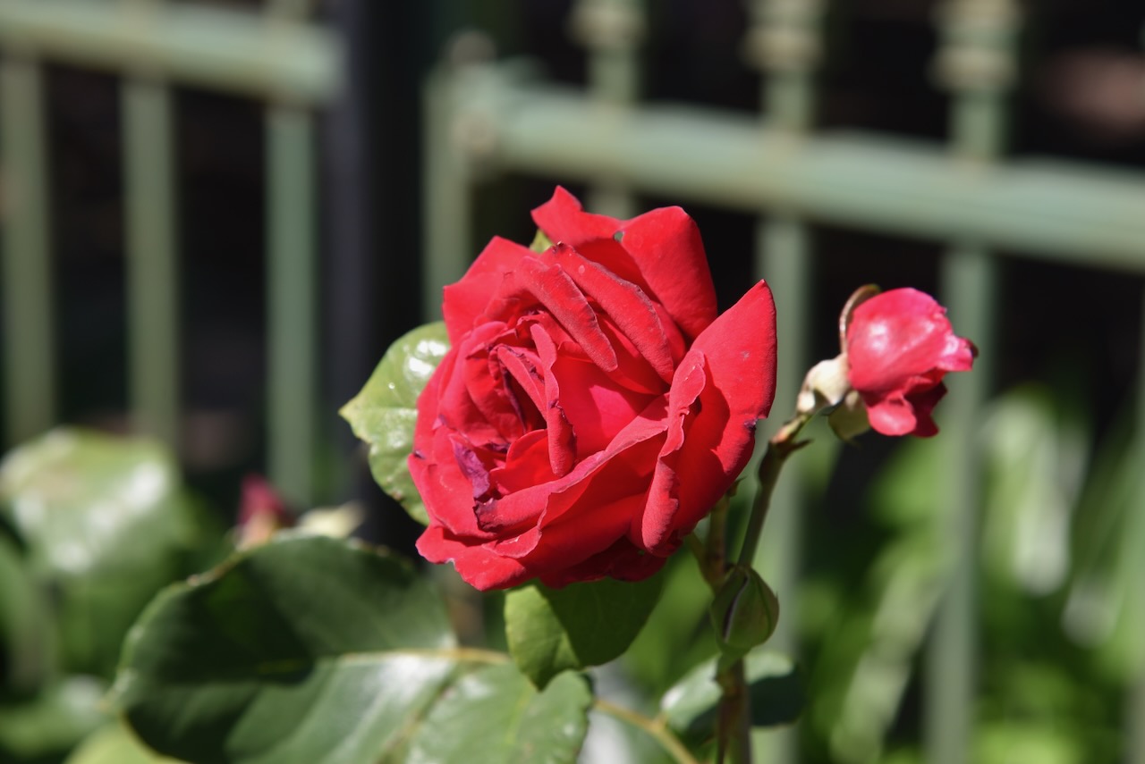
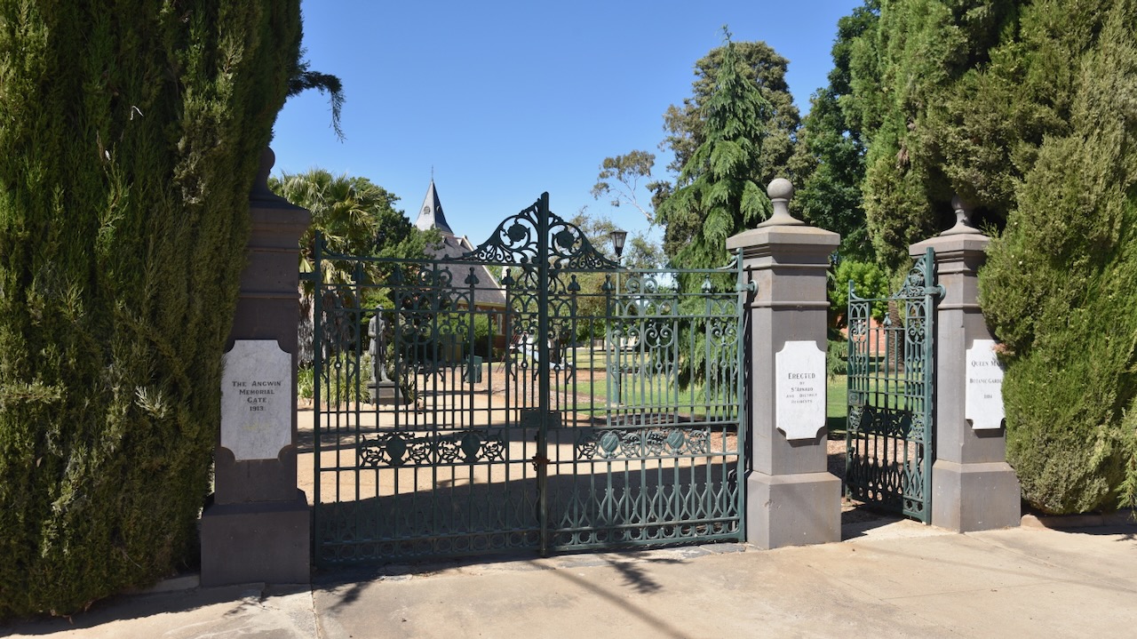
A beautiful area in St Arnaud is the Queen Mary Botanic Gardens and King Georges Park. Marija and I enjoyed a beautiful stroll around the gardens on this glorious sunny morning in St Arnaud.
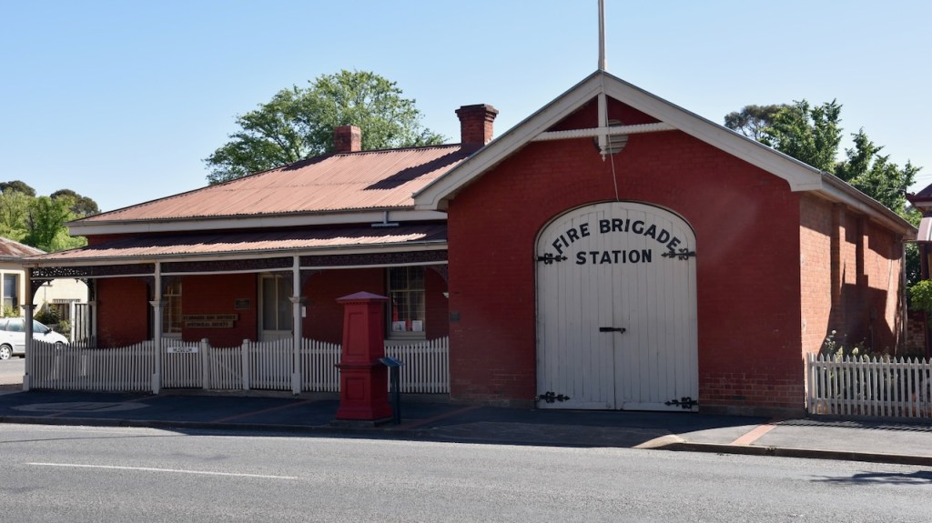
Victoria’s oldest Fire station can be found in St Arnaud. It dates from 1883 and is located on the corner of Napier and Inkerman Streets. The building includes the turnock’s residence. A turncock was employed to maintain the flow of water by adjusting the valves and controlling the flow of water. The original hand pulled ladder cart can be seen inside the station. (Aussie Towns 2024)
After spending a beautiful morning in St Arnaud, Marija and I headed to our first activation of the day, the Kara Kara National Park VKFF-0629 and the West of England Fire Tower summit VK3/ VW-016.
Above:- The Kara Kara National Park. Image c/o Google Earth.
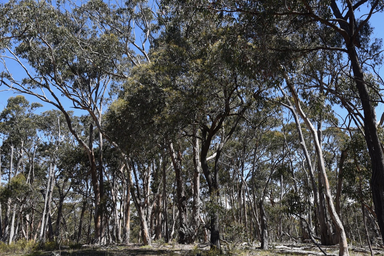
The Kara Kara National Park is about 13,990 hectares (34,600 acres) in size and was established on the 30th day of October 2002. It was original known as the St Arnaud Range National Park. The park consists of forest and open woodlands and contains about 275 species of native plants. (Parks Victoria 2024)
The Kara Kara National Park is within the St Arnaud Box-Ironbark Region Important Bird Area, which was identified by BirdLife International due to its importance for Swift parrots and other woodland birds. (BirdLife 2024)
Other birds and animals that call the park home include Barking Owls, Powerful Owls, kookaburras, Crimson Rosellas, Swift Parrots, possums, Yellow-footed Antechinus, Squirrel Gliders, Brush-tailed Phascogale and bats. (Parks Victoria 2024)
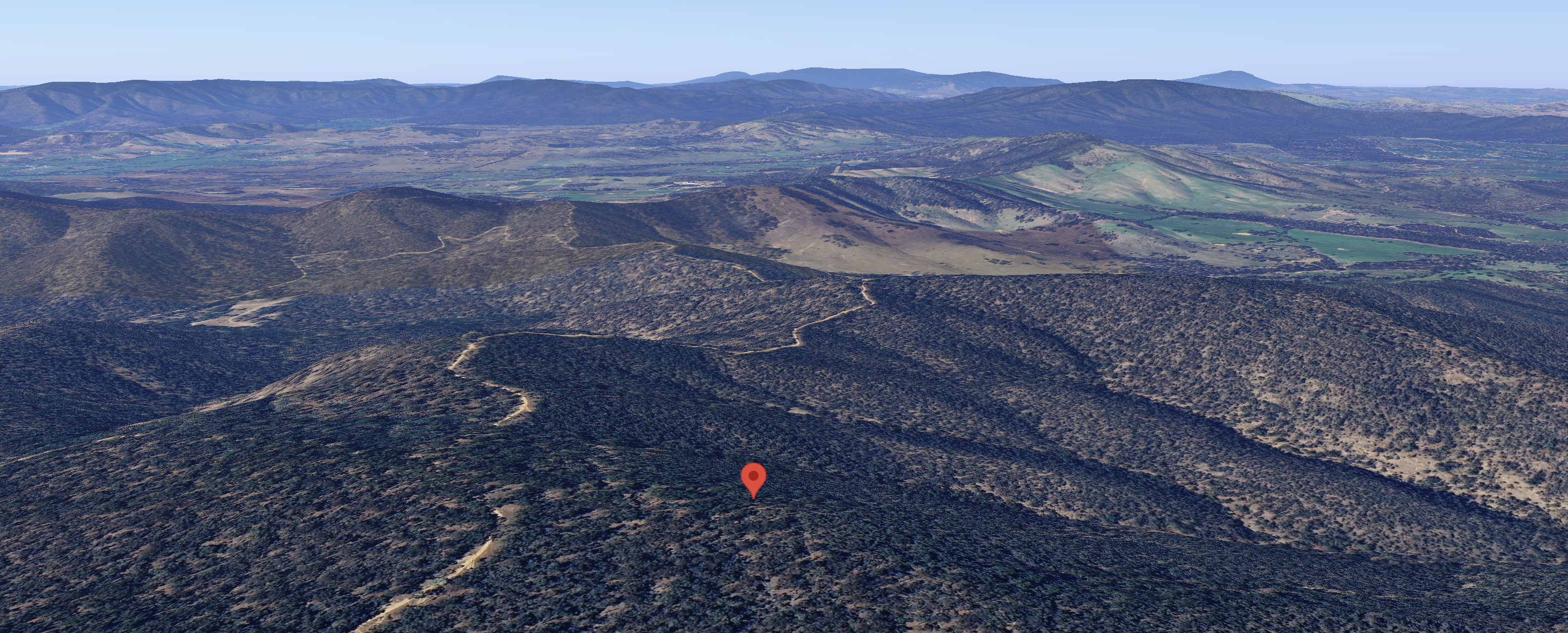
The West of England Fire Tower summit VK3/ VW-016 qualifies for the Summits On The Air (SOTA) program. It is 525 metres above sea level and is worth 2 points in the SOTA program. It has been activated a total of 20 times. It was first activated in March 2012 by Allen VK3HRA. (SOTA 2024)
Above:- An aerial view of the West of England Fire Tower summit. Image c/o Google Maps.
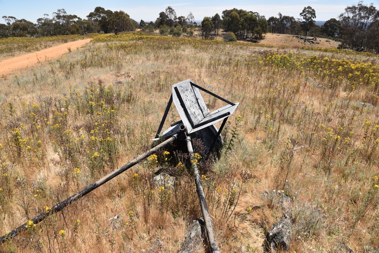
As the name implies, there is a fire tower at the summit.
There is a trig point at the summit, but it is in a poor state of repair and is lying on its side.
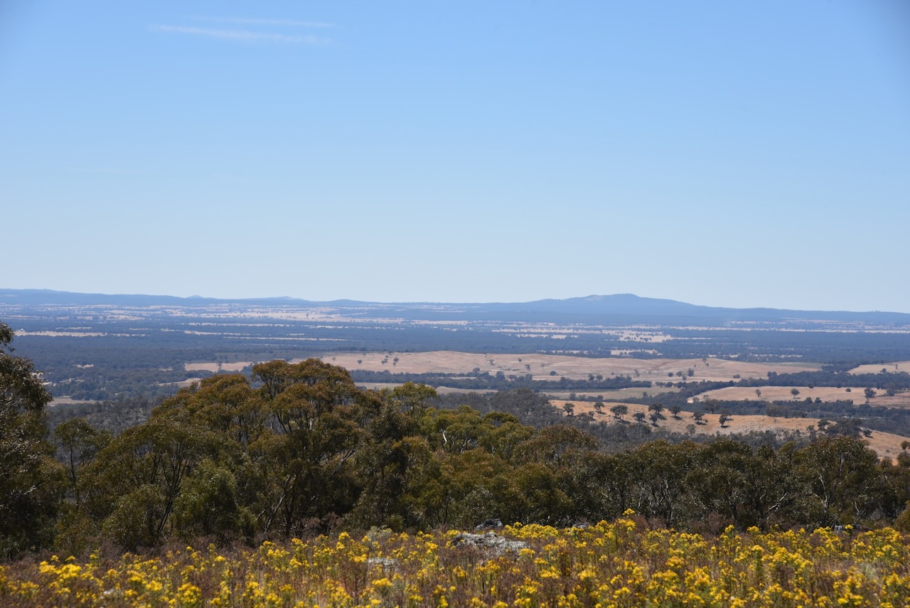
There are some very nice views to be enjoyed from the summit.
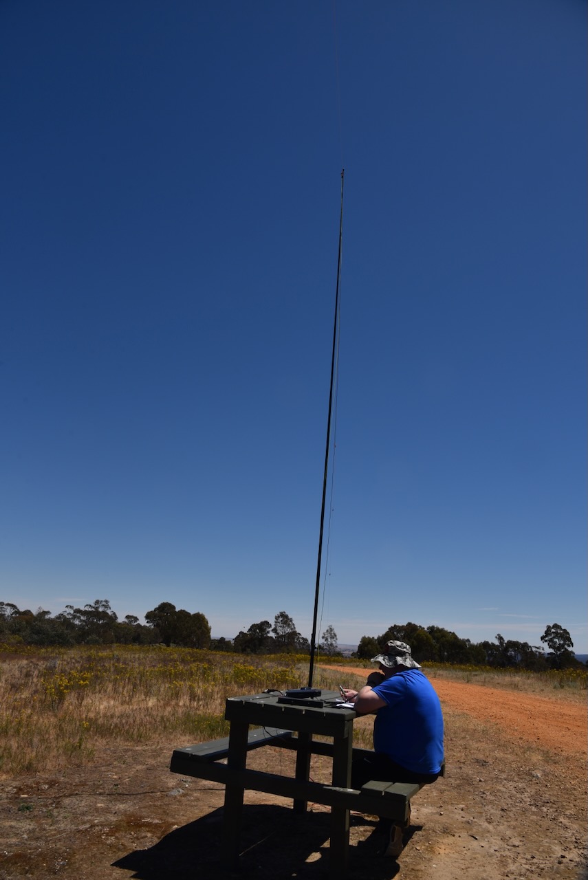
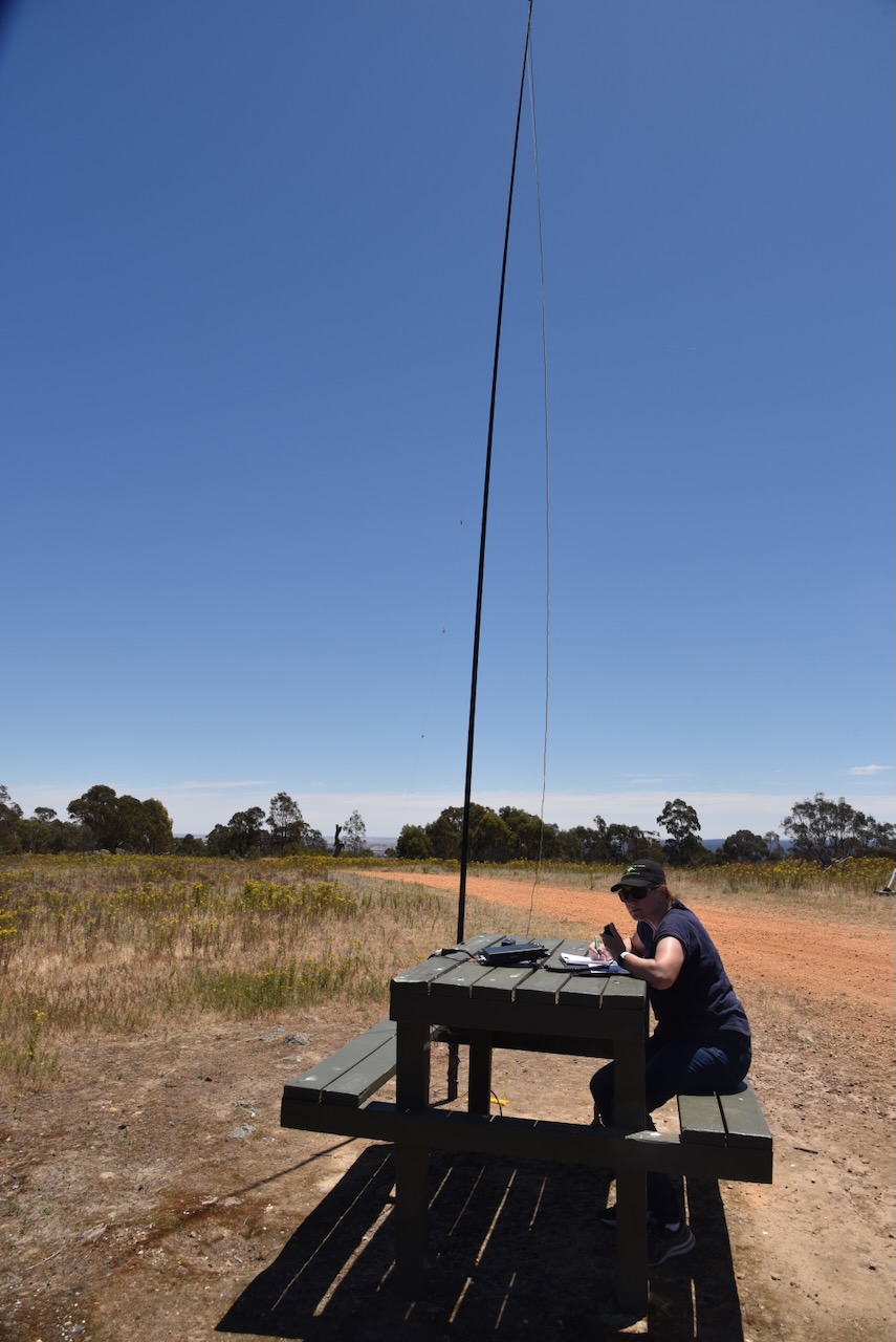
Conveniently there is a wooden table and benches at the summit. We ran the Yaesu FT857, 40 watts, and the 20/40/80 m linked dipole, supported by the 7-metre heavy-duty telescopic squid pole.
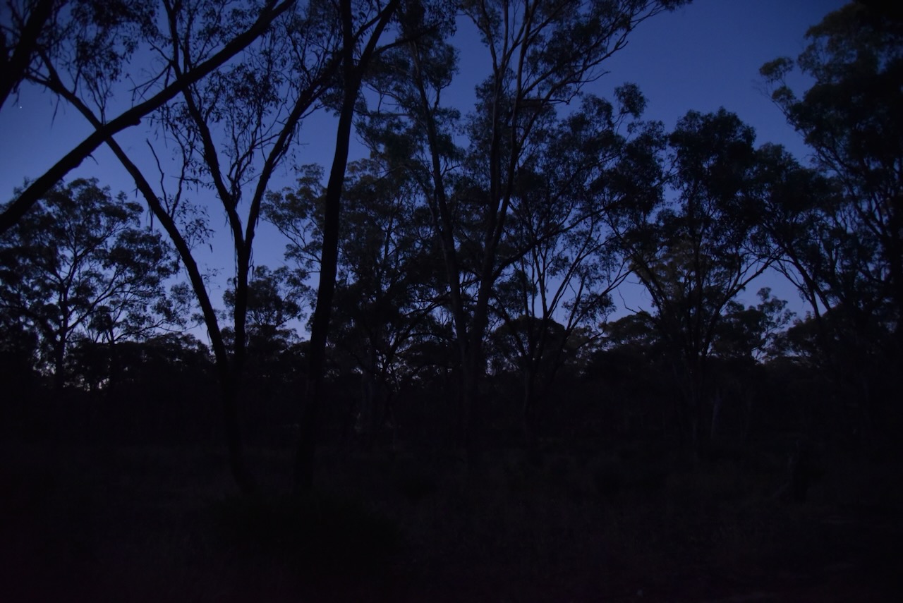
Following a very nice evening meal at Farmers Arms Hotel at St Arnaud, Marija and I headed to the Association Gully Bushland Reserve VKFF-4261. This would be our last activation for Friday 17th November 2023.
Above:- Map showing the location of Association Gully Bushland Reserve. Map c/o Google Maps.
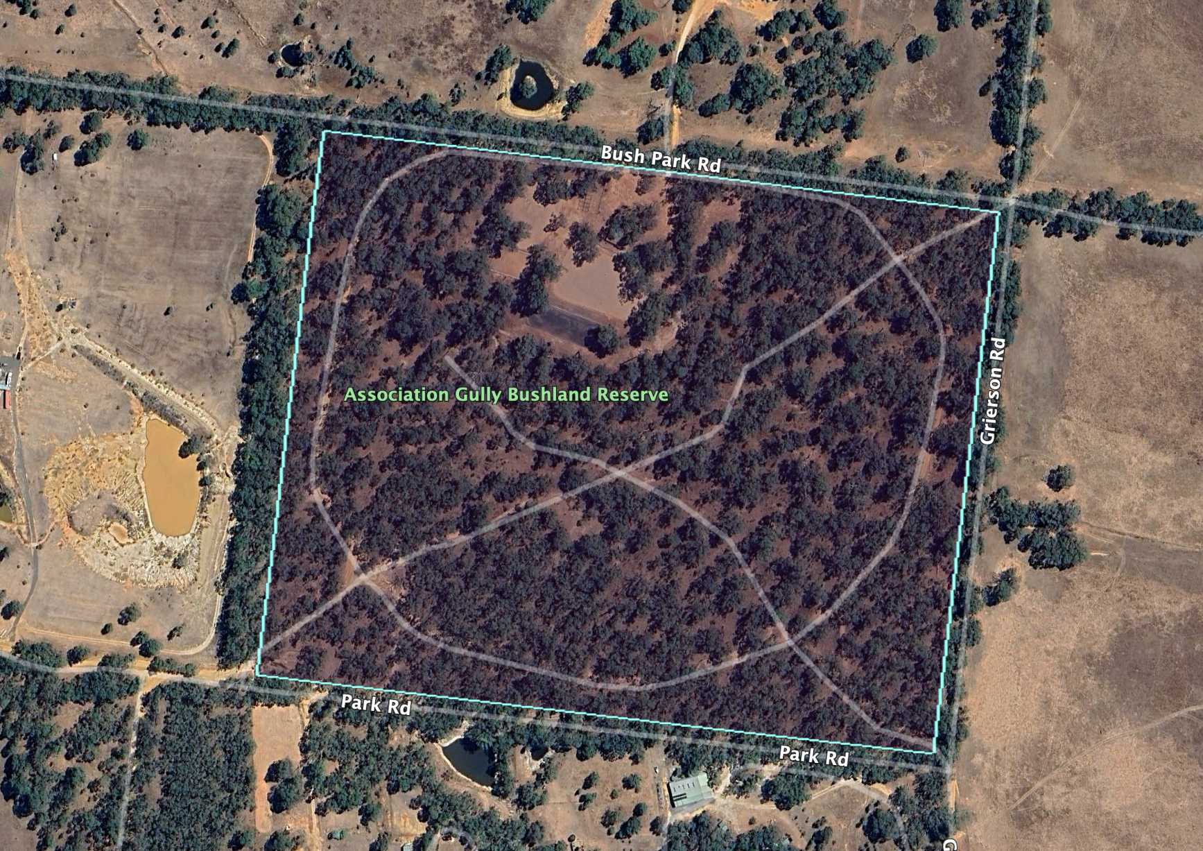
The Association Gully Bushland Reserve is about 20 hectares in size and was established on the 26th day of February 2002. (CAPAD 2022)
Above:- An aerial view of the Association Gully Bushland Reserve. Image c/o Google Earth.
Gold was once mined in this area. Unfortunately Marija and I did not strike it rich during our visit.
Above:- An 1890’s mine map showing St Arnaud and Association Gully. Image c/o State Library Victoria.
We accessed the reserve via Grierson Road which runs north off the Wimmera Highway. Several dirt tracks pass through the park.
Above:- An aerial view of the reserve with the town of St Arnaud in the background. Image c/o Google Maps.
As it was dark by the time we reached the park, Marija and I decided to operate from the 4WD for this activation. We ran the Icom IC-7000, 100 watts, and the Codan 9350 antenna with the 1.5 metre stainless steel whip.
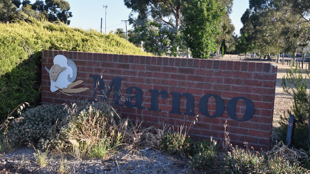
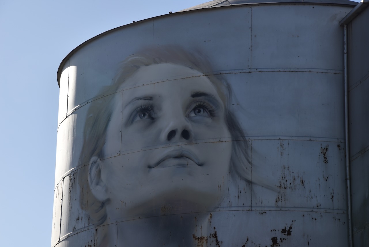
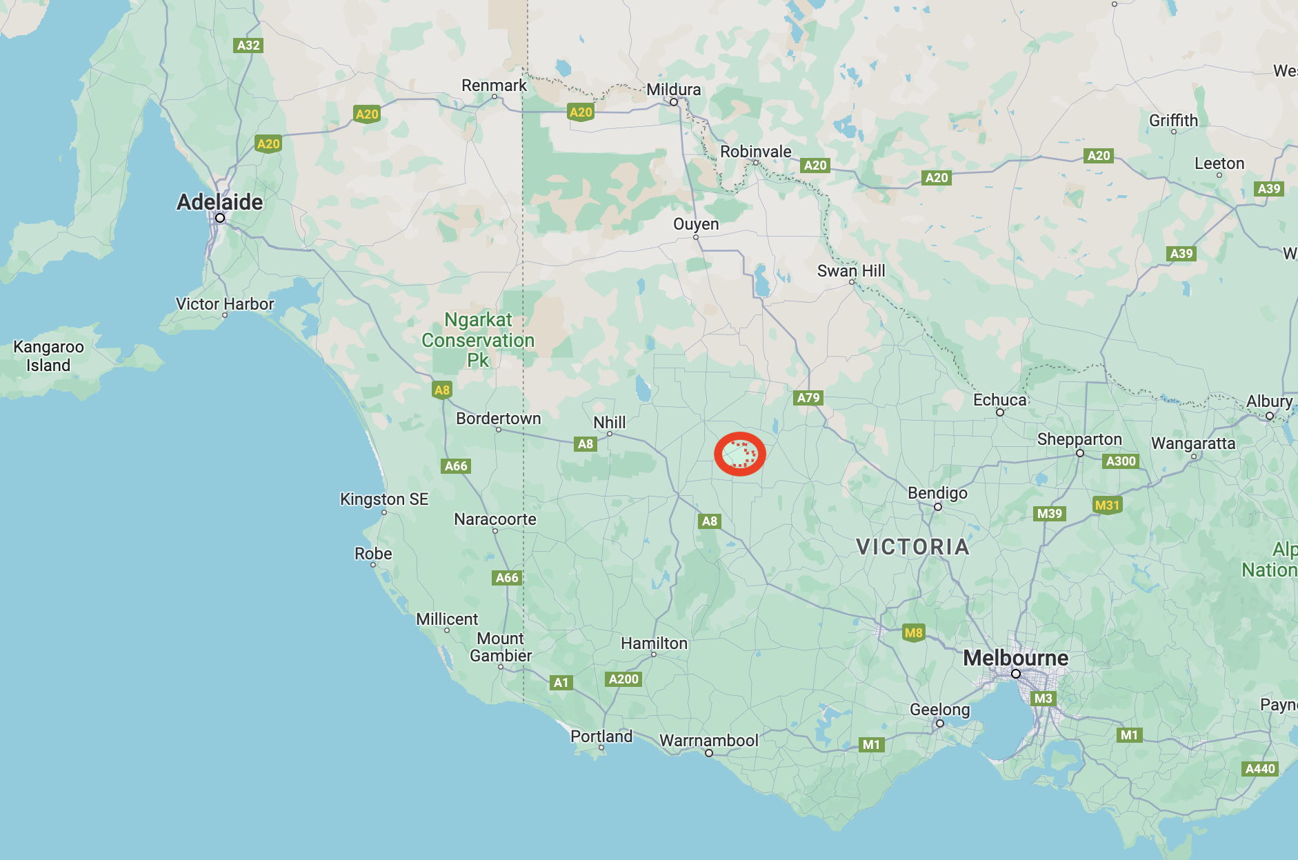
Our final silo activation for Friday 17th November 2023 was the Marnoo silo VK-MRO3. Marno is located about 281 km northwest of the city of Melbourne.
Above:- Map showing the location of Marnoo in Victoria. Map c/o Google Maps.
It is believed that Marnoo is an aboriginal word meaning finger or hand. (Victorian Places 2024)
The first European settler to be credited as living at Marnoo and giving Marnoo its name is Martin Shanahan. Shanahan was born in Ireland in c. 1820. He emigrated to Australia. He worked as a shepherd for a squatter in the Western District of Victoria. The squatter could not pay Shanahan his wages so he offered him 1,000 breeding ewes in place of the money. Shanahan accepted the offer and he drove the mob of sheep into the Wimmera, following the Richardson River until he located suitable grazing land at the junction of the Wallaroo Creek and the Richardson River. The ewes commenced to lamb and as a result, Shanahan was forced to squat in the area. The Marno pastoral run comprising 34,650 acres was taken up in July 1845 by Martin Shanahan. In 1846 Shanahan was married in Melbourne to Judith Pound. Following his marriage he returned to Marnoo. Shanahan is recorded in the 1849 Squatters Directory as having 6,000 sheep on the property. The Marnoo homestead was located near the Richardson River and the Wallaroo Creek junction. Martin Shanahan died in June 1882 and is buried at the St Arnaud cemetery. In honour of Shanahan, you can find Shanahan Park in Park Road, Marnoo. (Port Philip 2024) (Victorian Places 2024)
Above:- Article from The Argus, Melbourne, Wed 14 Jun 1882. Image c/o Trove.
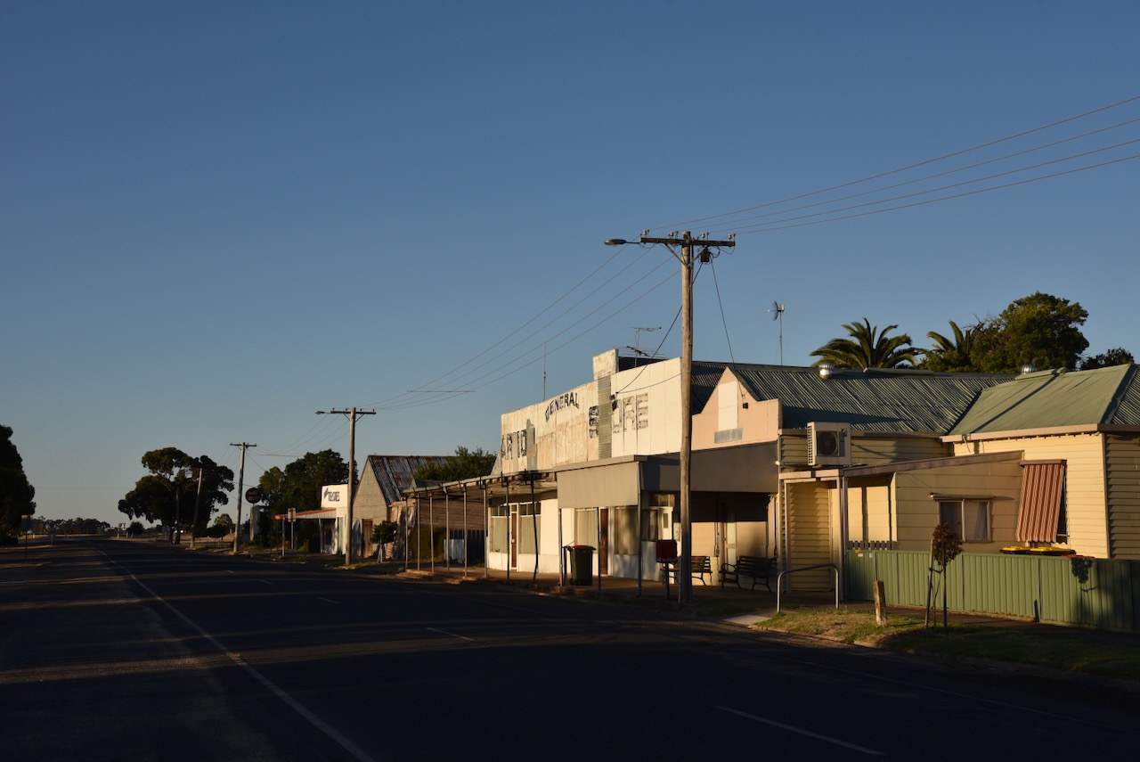
By 1873 the land in the Marnoo district became available for farm selections. Many of the settlers were Presbyterian. The first public public building constructed in 1875 was used for Presbyterian services and as a school. Prior to the extension of the railway line in 1909 from Rupanyup to Marnoo in 1909 there were very few buildings in the town. However following the arrival of the railway, Marnoo grew and had two general stores, a coffee palace and a public hall. The first store a Marnoo was established in 1909 by Coulton’s of Rupanyup. The Marnoo Hotel was built c. 1910 and was initially used as a Coffee Palace. A wine license was later issued and eventually a hotel license. The hotel burnt down on the 16th day of February 1957. In 1959 a new hotel was built and opened. In 1911 Marnoo’s population was 360 people. The Marnoo Police Station was opened on the 10th day of April 1927 with the first five Constables appointed being mounted police. (Victorian Places 2024)
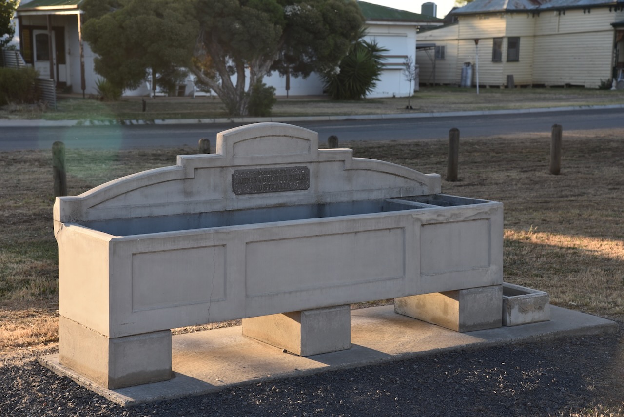
Marnoo contains a ‘Bills Horse trough’. For more information on these please have a look at my previous post regarding the Werrimul Bushland Reserve.
In the main street of Marnoo, you can find a monument celebrating the centenary (1873-1973) of settlement in the Marnoo district.
The Marnoo silos are located between the Wimmera Highway and Station Street, near the old Marnoo railway station. The railway line closed in 1983. The Marnoo silos were built in 1941. The silos are listed on the Victorian Heritage Database. (Victorian Places 2024) (Vic Heritage Database 2024)
Marija and I parked on the Wimmera Highway and operated from the 4WD for this activation. We ran the Icom IC-7000, 100 watts, and the Codan 9350 antenna with the 1.5-metre stainless steel whip.
Above:- the activation zone at the Marnoo silo. Image c/o SiOTA website.
Marija worked the following stations on 40m SSB:-
VK2IO/p (Trinkey State Conservation Area VKFF-1382)
VK3PF
VK5HS
I worked the following stations on 40m SSB:-
VK2IO/p (Trinkey State Conservation Area VKFF-1382)
VK3PF
VK5HS
VK5FANA
VK5FTOM
VK1AO
VK2MET
VK3UZI
VK3BPH
VK5MSA
VK5WF
We then headed off to St Arnaud where we booked into our accommodation, the Motel St Arnaud.
After we had qualified the Rupanyup silo, Marija and I activated the Rupanyup 2 silo VK-RPU3. We didn’t have to move location as we were parked in the activation zone of both silos.
Above:- The activation zones of the two silos at Rupanyup. Image c/o SiOTA website.
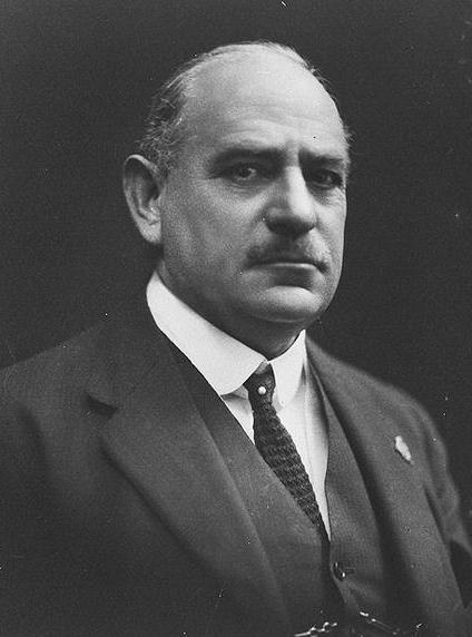
The Rupanyup 2 silo is in fact the old Wimmera Flour Mill & wheat silo that is located at the end of Gibson Street, Rupanyup, opposite the oval. The silos are a rare example of a portable mill of galvanized iron construction and were designed by General Sir John Monash and erected in 1909. (Yarriambiack Shire 2024)
Above:- General Sir John Monash. Image c/o Wikipedia.
General Sir John Monash, GCMG, KCB, VD, was born in June 1865 in West Melbourne. He was an Australian civil engineer and a military commander in WWI. He died in October 1931. Monash features on the Australian $100 note, and his name endures in many places including Monash University, the City of Monash, and the Monash Freeway.
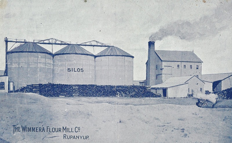
In 1906 the four-storey timber and iron Rupanyup flour mill on a brick base was constructed for the flour miller George Frayne (b. 1864. d. 1936).
Above:- The Wimmera Flour Mill Co site at Rupanyup. Image c/o Rupanyup & District Historical Society Facebook page.
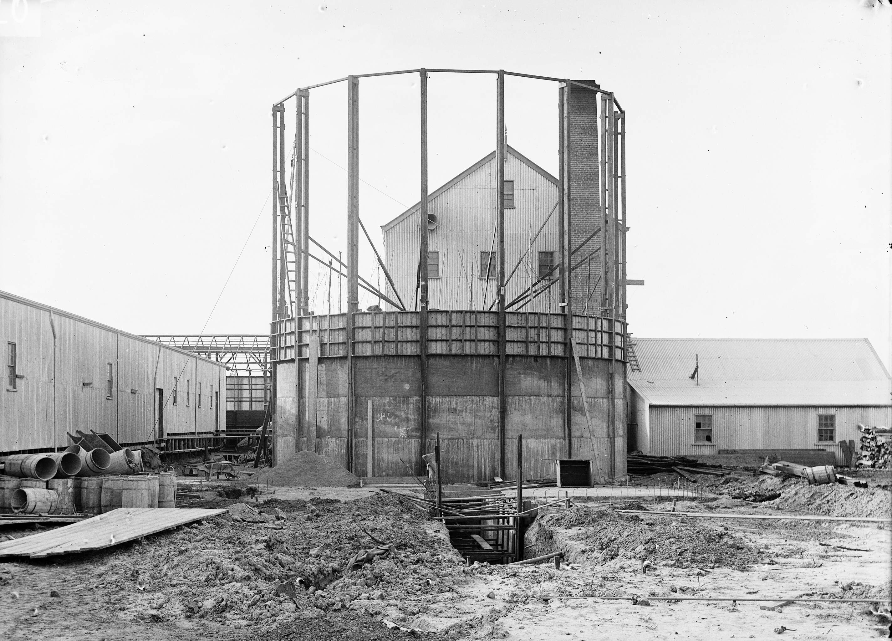
In 1907 John Monash was commissioned to design three reinforced concrete silos for the mill. The silos were completed in April 1908 by contractors Schumacher Mill Furnishing Works Pty Ltd. The three reinforced concrete silos were the first of concrete construction for the bulk storage of grain in Victoria. At the time they were believed to be the largest grain stores in Australia. (Victorian Heritage Database 2024)
Above:- the construction of the Rupanyup silo. Image c/o
The site is listed on the Victorian Heritage Database and they are of Victorian State significance as the first reinforced concrete bulk wheat storage silos to be constructed and operated in Victoria. They are also significant as the first application of the Monier principle of concrete construction. (Victorian Heritage Database 2024)
Above:- The Wimmera Flour Mill Co site at Rupanyup, c. early 1900s. Image c/o Rupanyup & District Historical Society Facebook page.
Above:- Article from The Age, Melbourne, Tue 18 Jun 1907. Image c/o Trove
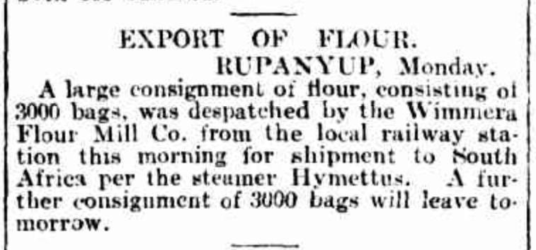
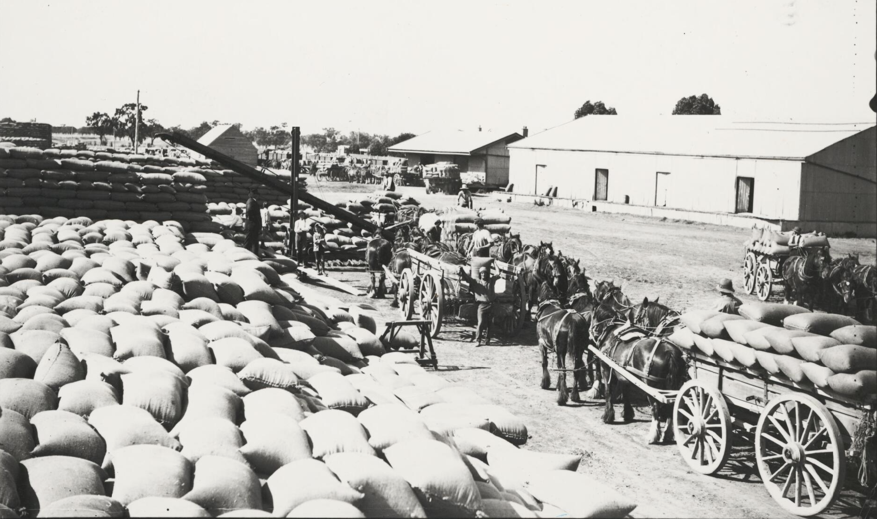
The silos had a capacity of 145,000 bushels. In 1920 the silos were taken over by R. Brunton and Co. In 1925 it was reported that the Rupanyup silos employed 20 men constantly and 40 during the height of the wheat season. The mill handled 120,000 bags of wheat each year, of which 85,000 bags were delivered by farmer’s teams. (Trove 2024)
Above:- Article from The Horsham Times, Tue 20 Jan 1920. Image c/o Trove
We operated from the 4WD, running the Icom IC-7000, 100 watts, and the Codan 9350 antenna with the 1.5-metre stainless steel whip.
Marija worked the following stations on 20m SSB:-
VK1AO
VK2MET
VK4NH
VK4DXA
I worked the following stations on 20m SSB:-
VK1AO
VK2MET
VK4NH
VK4DXA
Marija worked the following stations on 20m SSB:-
VK3PF
ZL4NVW/p (Mount Aspiring National Park ZLFF-0006)
I worked the following stations on 40m SSB:-
VK3PF
VK3UH
VK3AHR
VK3APJ
VK4NH
VK4DXA
VK5KKT
VK2RK
VK2ACR
Vk2HAK
VK3WAR
VK7KT
VK3ACZ
VK2IO/p (Wereboldera State Conservation Area VKFF-1392)
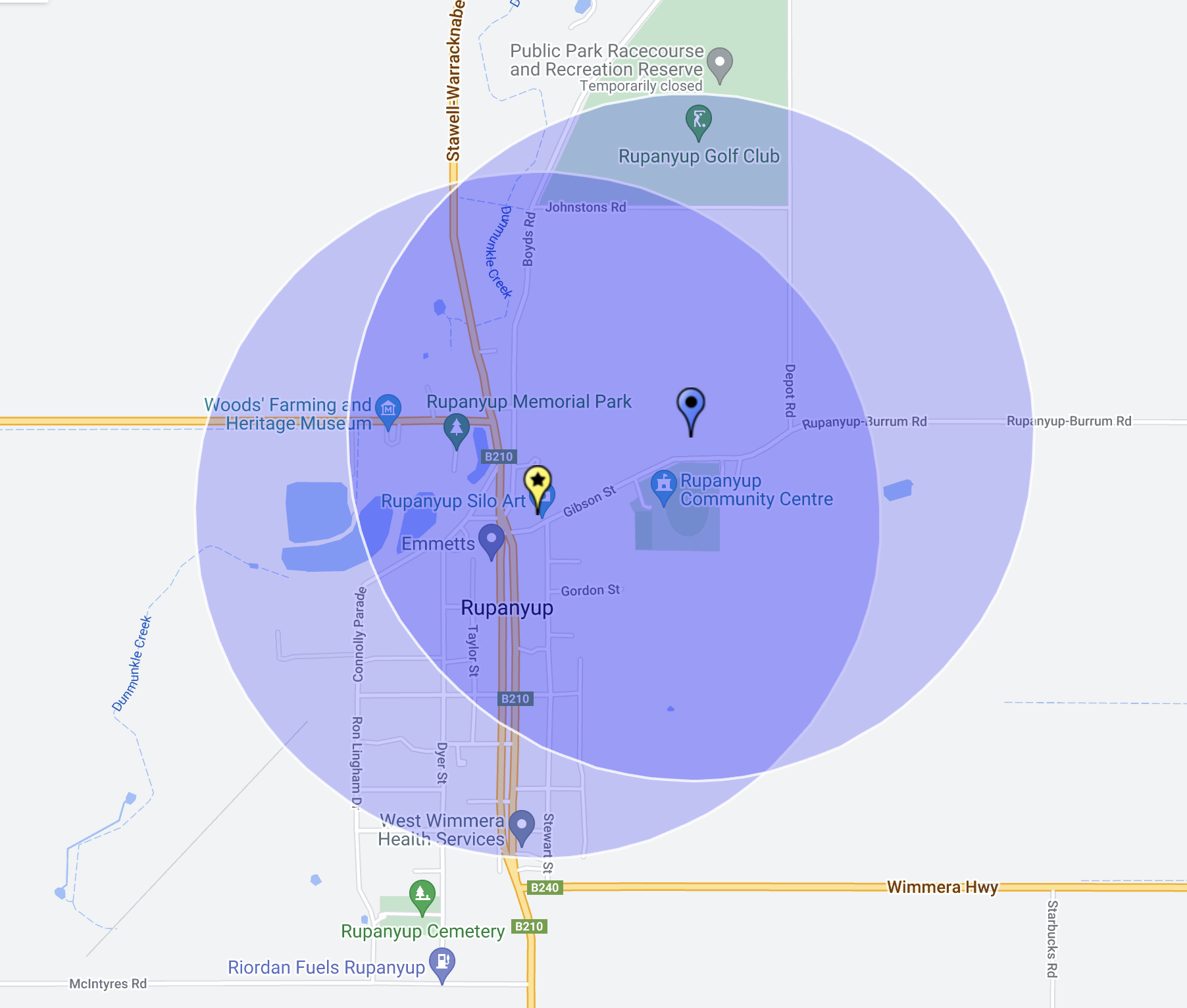
After leaving Sheep Hills (17th November 2023), Marija and I headed to our next silo activation for the Silos On The Air (SiOTA) program, the Rupanyup silo VK-RPP3.
Above:- Map showing the location of Rupanyup. Map c/o Google Maps.
Prior to European settlement, the Rupanyup district was home to the Wergaia and Wotjobaluk aboriginal people. (Aussie Towns 2024)
The first European settlers in the Rupanyup district established the Warranooke pastoral run in 1845 which comprised 64,000 acres on the Richardson River at Glenorchy, south of Rupanyup. The run was occupied by Alexander Ayrey, James Robson Darnell, and Henry Nichol. (Aussie Towns 2024) (SLV 2024)(Young 1926)
Above:- The Warranooke woolshed, c. 1871. Image c/o National Library Australia.
Alexander Ayrey was born in March 1807 in Southwark, Surrey, England. Together with his close friend and business partner Henry Nicholl, they arrived at Port Phillip, Victoria in August 1845 aboard the Archilles. (Ancestry 2024)
Ayrey died in May 1865 due to injuries sustained three weeks previous, when a limb of a falling tree stuck him at Warranooke. Upon his death, he left his portion of Warranooke to his nephew Charles Ayrey. (Ancestry 2024) (Young 1926)
Above:- Article from The Herald, Melbourne, Mon 15 May 1865. Image c/o Trove.
The township of Rupanyup, located on the Dunmunkle Creek, was surveyed in 1873. At that time it was known as Karkarooc. About one mile from the settlement a flour mill was constructed. In 1874 a Presbyterian church was built. By 1875 the settlement was known as Lallat. In that year a school opened as did the Post office which was still using the name Kakarooc. By 1876 the settlement was known as Rupanyup, an aboriginal word meaning “branch hanging over water”. In 1878 a local newspaper commenced publication. By the mid-1880s Rupanyup had three hotels. In 1887 a railway line from Lubeck to Rupanyup was completed, and in that same year, a second flour mill was constructed. (Aussie Towns 2024) (Yarriambiack 2024)
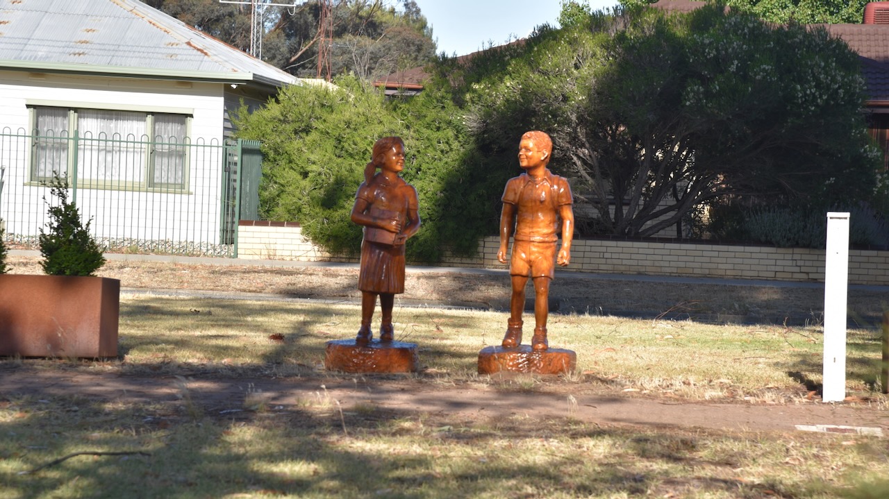
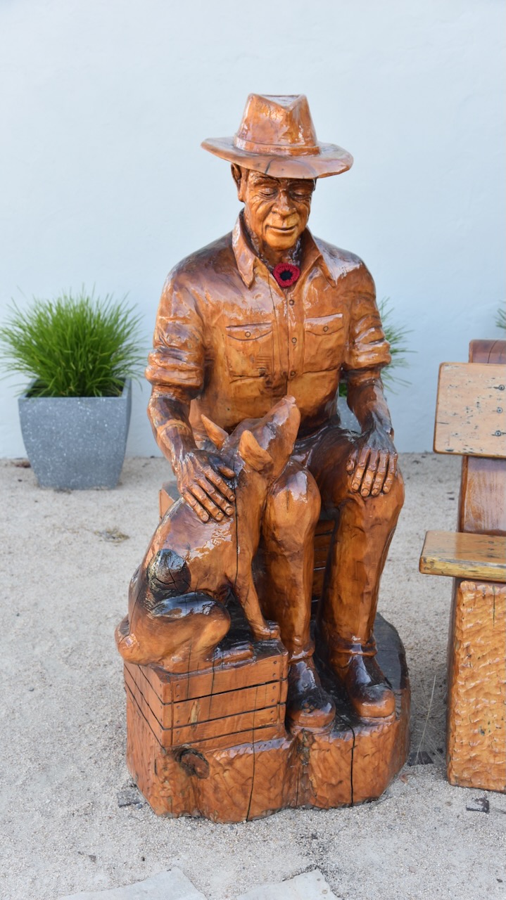
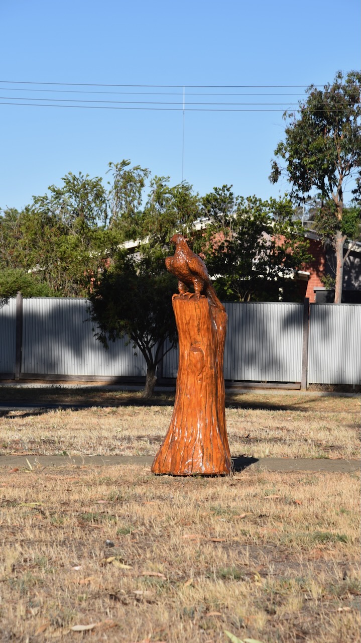
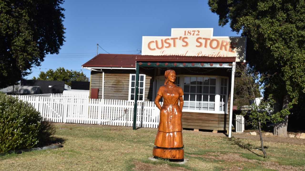
Rupanyup has some very interesting chainsaw sculptures. There are six of these along the main street of Rupanyup. The project was initiated in 2019 and was completed by Gippsland chainsaw artist John Brady. The sculptures include a gonna, two eagles, children, a farmer sitting on a seat, and a Rupanyup lady. (Weekly Advertiser 2024)
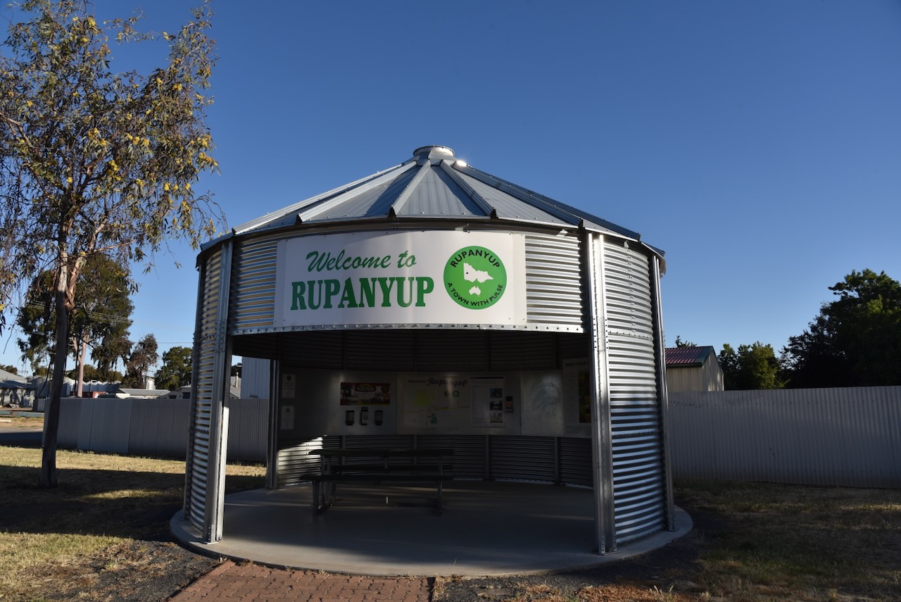
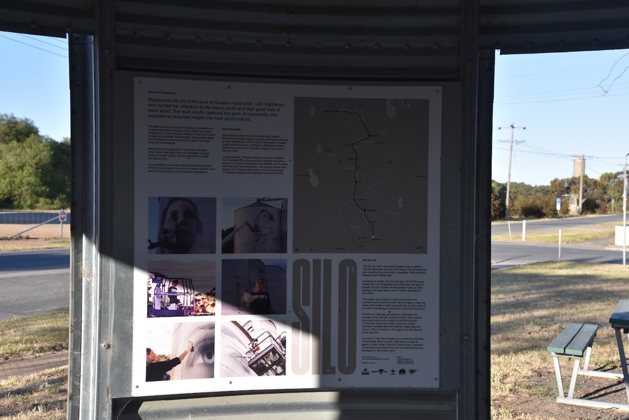
On Gibson Street, you can find an excellent information shelter that contains a vast amount of information regarding Rupanyup and the surrounding district.
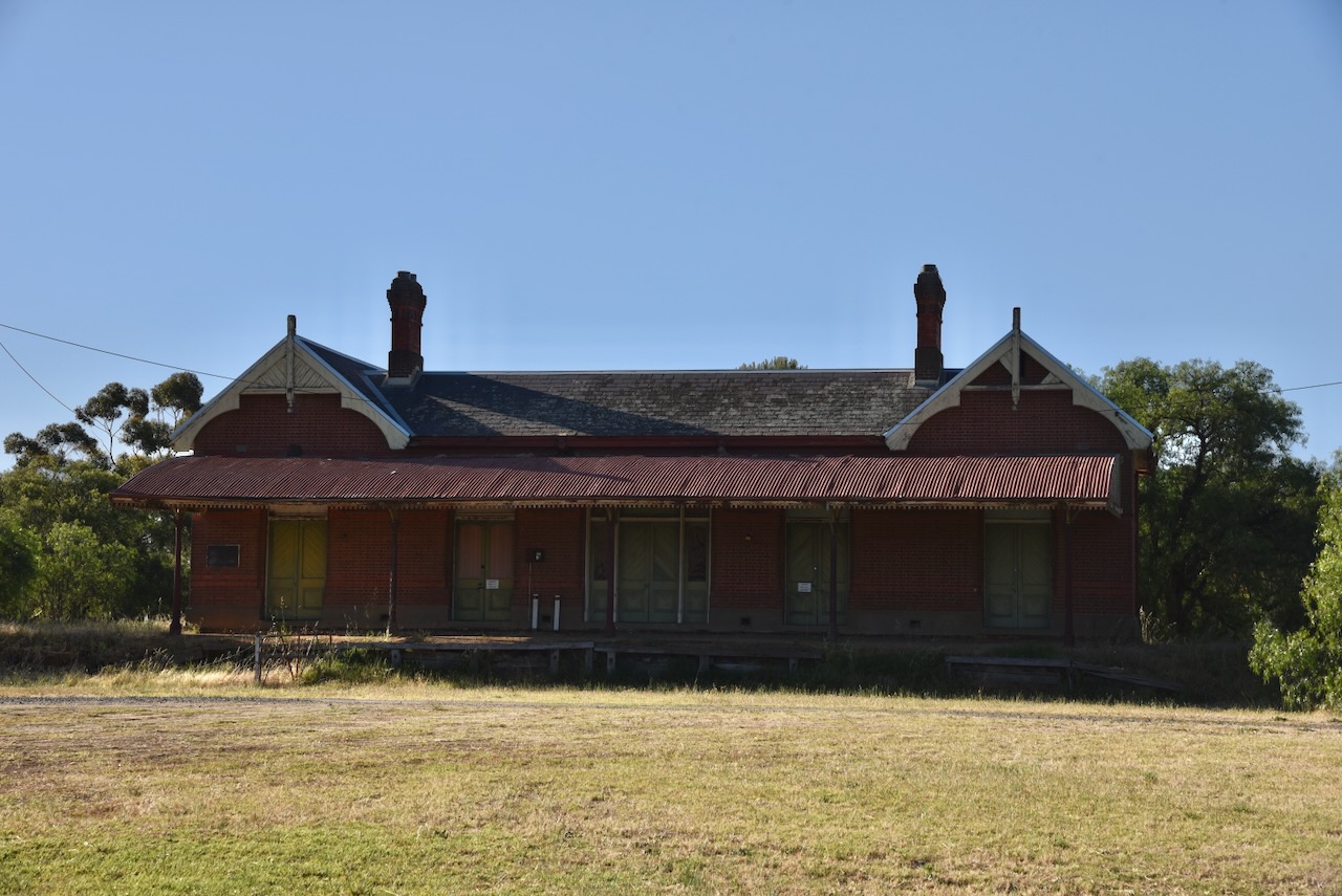
The Rupanyup Railway Station was built in 1890 by Sutcliffe & Hartley. It was located on the Lubec-Bolangum line for the Victorian Railways. The railway station building comprises a single-storey Gothic style brick building with a slate hip and gable roof. The building is listed on the Victorian Heritage Database. (Vic Heritage Database 2024)
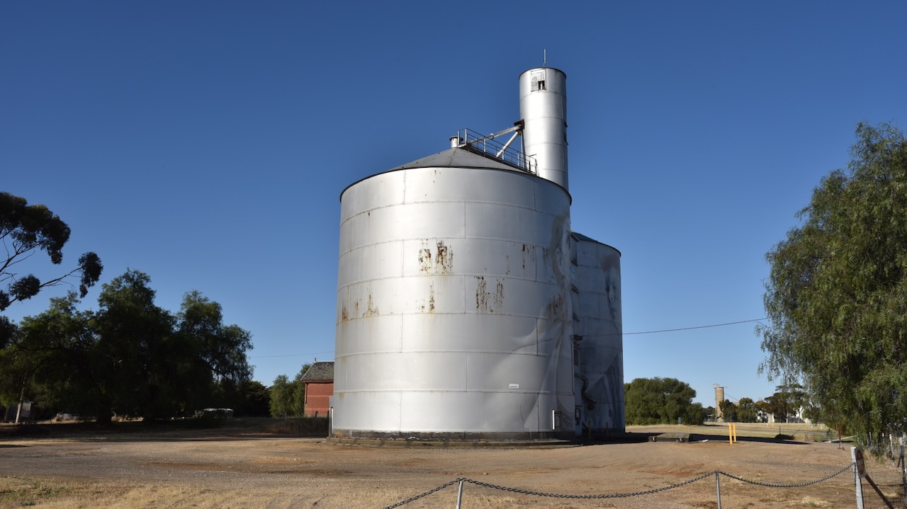
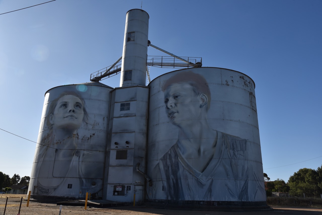
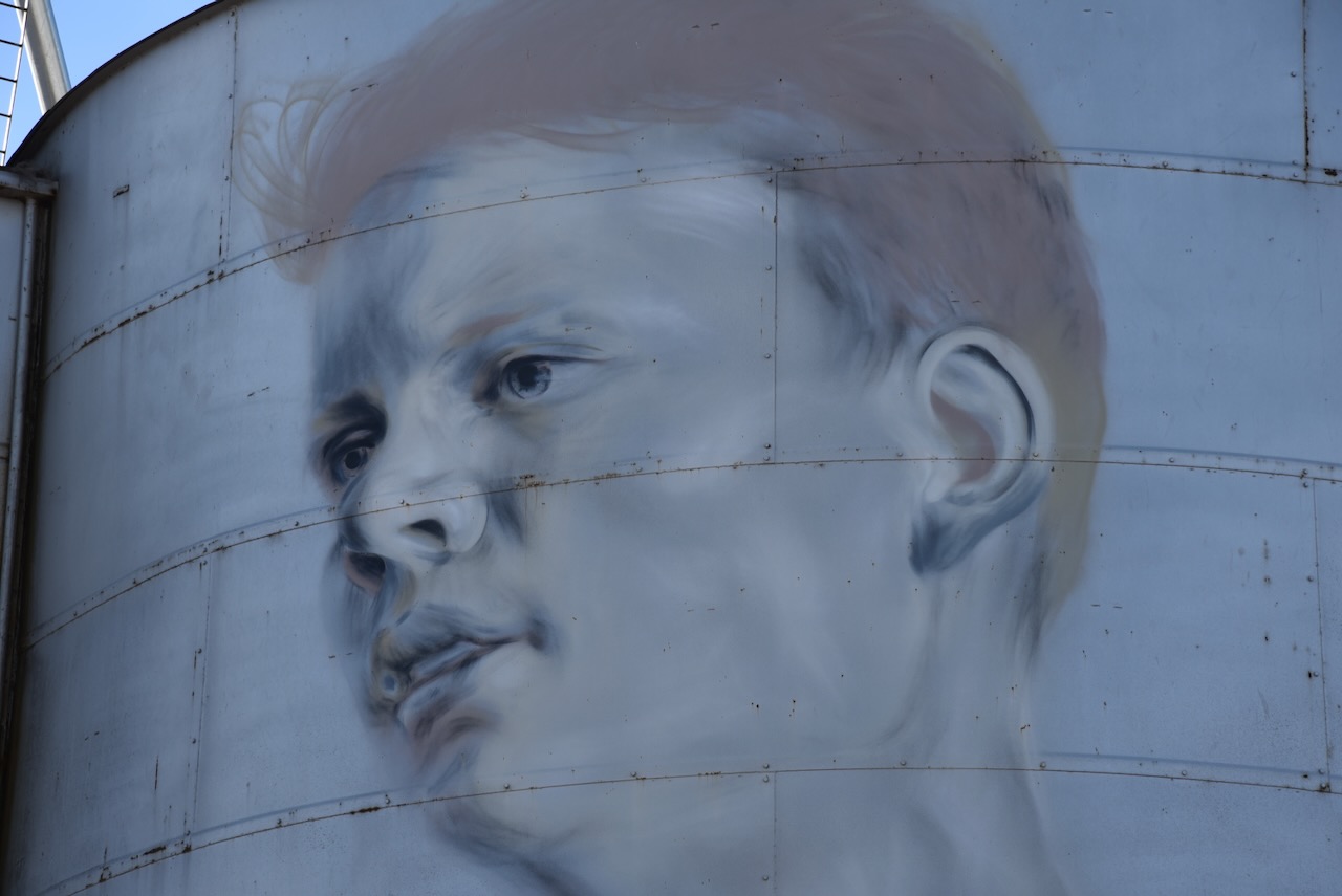
The Rupanyup silo is part of the Australian Silo Art Trail. It is the beginning of the trail when arriving from the direction of Melbourne. The Rupanyup silo art is the work of Julia Volchkova, a Russian mural artist. The faces featured on the silo are those of Rupanyup residents and local sporting team members. The work was completed in 2017. (Australian Silo Art Trail 2024)
There are two silos in Rupanyup that qualify for the Silos On The Air program. Marija and I parked in Gibson Street which was in the activation zone for both silos. However, after some discussion on air about the rules being unclear, we decided to err on the side of caution and activate one silo at a time.
We operated from the 4WD, running the Icom IC-7000, 100 watts, and the Codan 9350 antenna with the 1.5-metre stainless steel whip.
Above:- Map showing the activation zone at the Rupanyep silo. Image c/o SiOTA website.
Marija worked the following stations on 40m SSB:-
VK3PF
VK3OAK
VK2IO/p (Wereboldera State Conservation Area VKFF-1392)
VK3CLD/p (Kosciuszko National Park VKFF-0269)
Marija worked the following stations on 20m SSB:-
VK1AO
VK2MET
VK4NH
VK4DXA
I worked the following stations on 40m SSB:-
VK3PF
VK3OAK
VK2IO/p (Wereboldera State Conservation Area VKFF-1392)
After leaving Minyip (17th November 2023), Marija and I headed to our next Silos On The Air (SiOTA) activation, the Sheep Hills silo VK-SHS3.
Sheep Hills is located about 16 km south of the town of Warracknabeal in western Victoria.
Above:- Map showing the location of Sheep Hills. Map c/o Google Maps.
The original inhabitants of the Sheep Hills district were the Wotjobaluk aboriginal people. They occupied about 12,00 square kilometres, inclusive of the Wimmera River, Outlet Creek, and Lakes Hindmarsh and Albacutya. Their southern border included Dimboola, Kaniva and Servicetown. To the west their land reached Yanac and to the east as far as Warracknabeal and Lake Korong. Their northern borders reached Pine Plains.
The district of Sheep Hills takes its name from the Sheep Hills pastoral run of 1847, owned by Archibald McMillan (b. 1789. d. 1863). McMillan was born in Sadell, Skipness, Argyll, Scotland in 1789. He emigrated to Australia in October 1839 aboard the David Clarke.
In 1860 a homestead was built on the property by George McMillan. It was called Kingungwell and is reported to have been named after Aungwill, the ‘king’ of the local aboriginal people. (Historical Rat Bag 2024) The Sheep Hills Homestead cost 25,000 pounds to build, a substantial amount of money for the mid-1800s. All of the bricks were constructed on-site and laid by John Candy. The homestead had two custom-built Italian marble fireplaces which cost 70 pounds each. (AusTech Forums 2024)
Above:- The Sheep Hills Homestead. Photo c/o Austech Forums
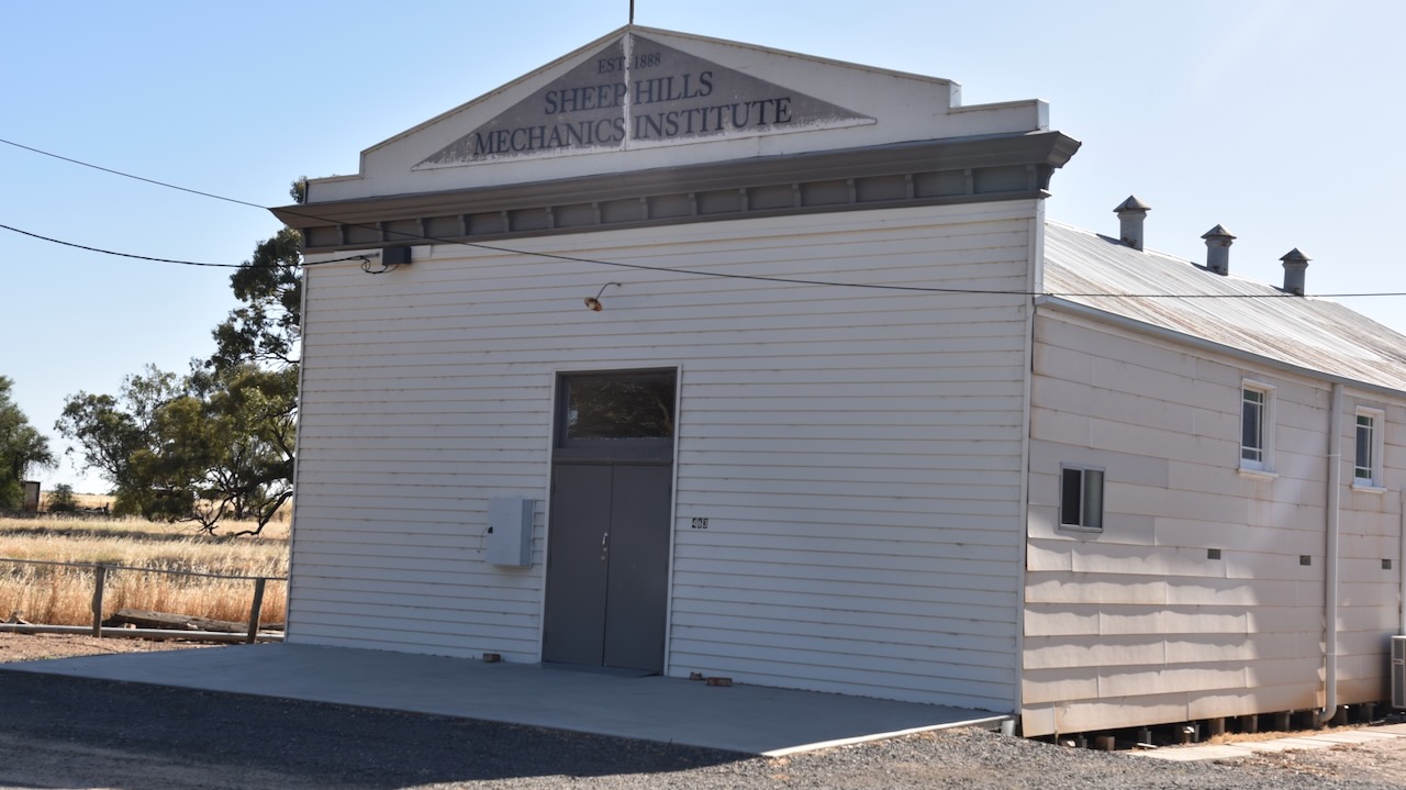
During the mid-1870s farm allotments were taken up in the district. Many of the settlers were from the Kingdom of Prussia and were of Lutheran faith. The area was known as Bangerang, the name of the Lutheran school which was established in 1875. It was also known as Tarkedia, the name of a State School that was opened in 1877. In 1886 the railway from Minyip to Warracknabeal was extended. The settlement which grew at the railway siding was named Sheep Hills. In 1888 a mechanics institute was opened, and in following years the town had a hotel and several stores. (Aussie Towns 2024) (Visit Wimmera 2024)
Above:- Bags of wheat being brought to the railway siding at Sheep Hills, c. 1928. Image c/o National Library.
In 1903 Sheep Hills had a population of 350 people. (Aussie Towns 2024) The Australian Handbook of 1903 described Sheep Hills as follows:
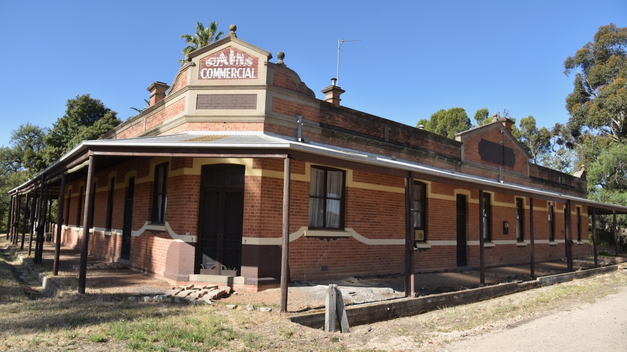
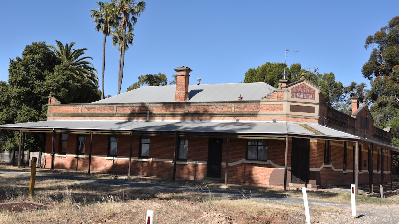
One of the old historic buildings to be found at Sheep Hills is the old Commercial Hotel. The hotel was constructed in 1884 and was first known as Jenkins Hotel. From 1903 the hotel was known as the Railway Hotel. From 1915 it was known as the Commercial Hotel. (Victorian Collections 2024)
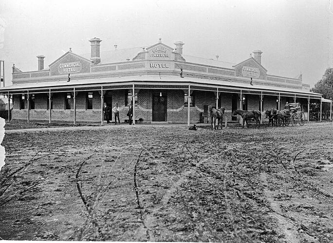
Above:- the Commercial Hotel, c. 1920. Image c/o Museums Victoria.
Today not much remains at Sheep Hills. Once horse-drawn and rail transport was replaced by road transport, Sheep Hills gradually declined. Sadly, in 1953, the Sheep Hills homestead which was built in 1866, was demolished. The school closed in 1985. The Anglican church building was moved to Halls Gap in 1970. (Victorian Places 2024)
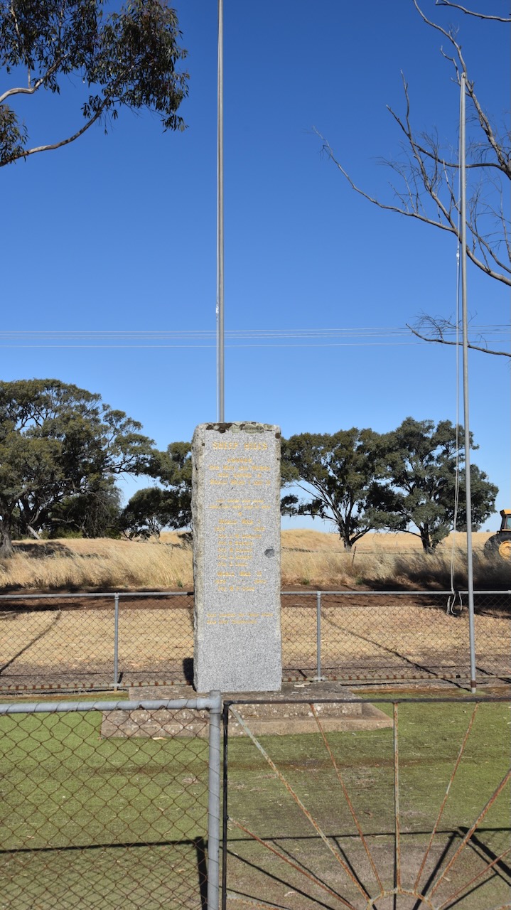
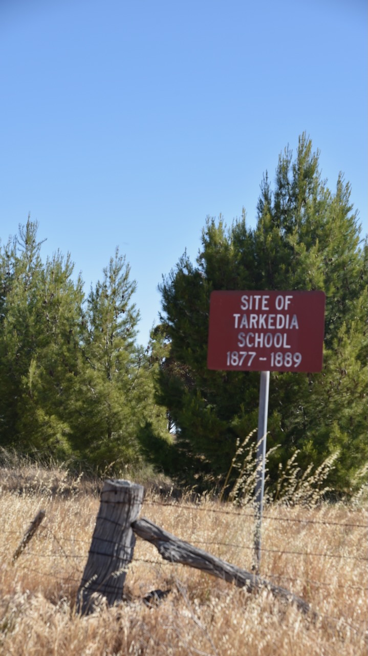
Sheep Hills has a monument for those from the district who served during WWI and WWII. You can also view the old Mechanics Institute built in 1888. There is also a sign at the site of the old Takerdia school that operated from 1877 until 1889.
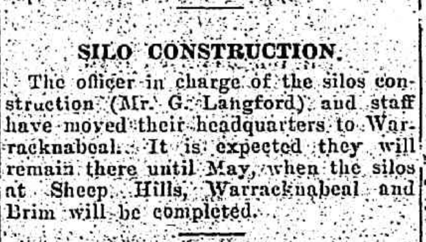
Construction on the silos at Sheep Hills commenced in 1939. They were opened in 1940. (Aussie Towns 2024)
Above:- Article from The Horsham Times, Tues 9 Jan 1940. Image c/o Trove.
The Grain Corp bulk grain silos at Sheep Hills were closed in 2003. (Victorian Places 2024).
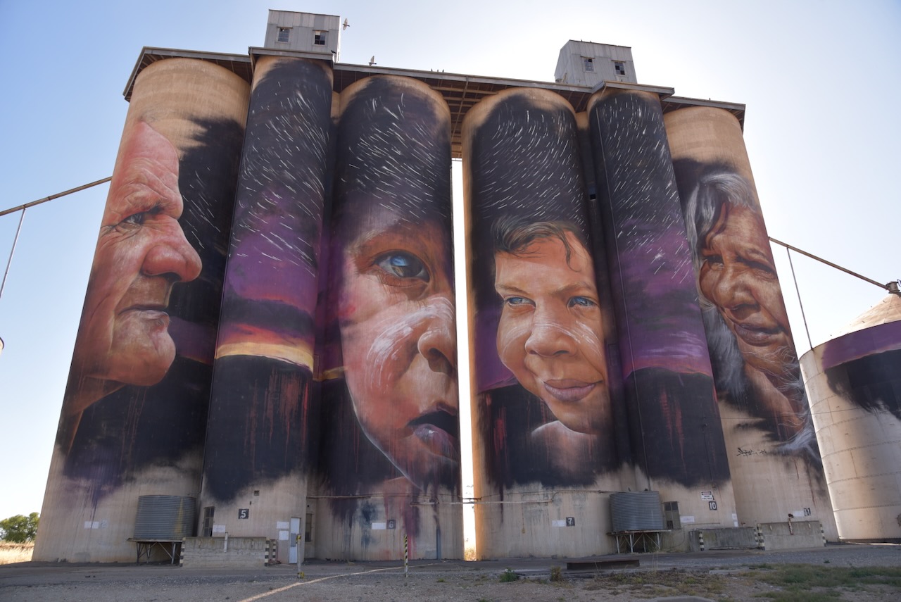
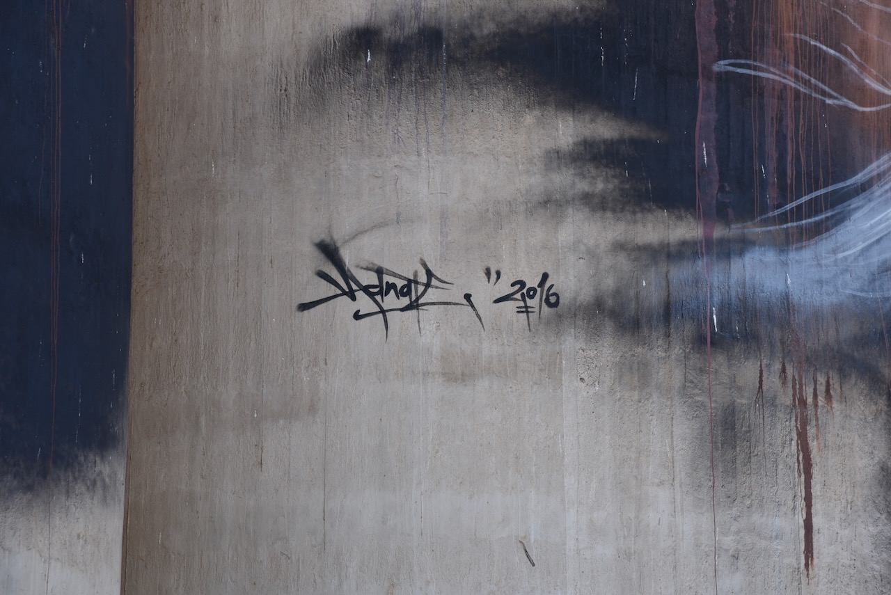
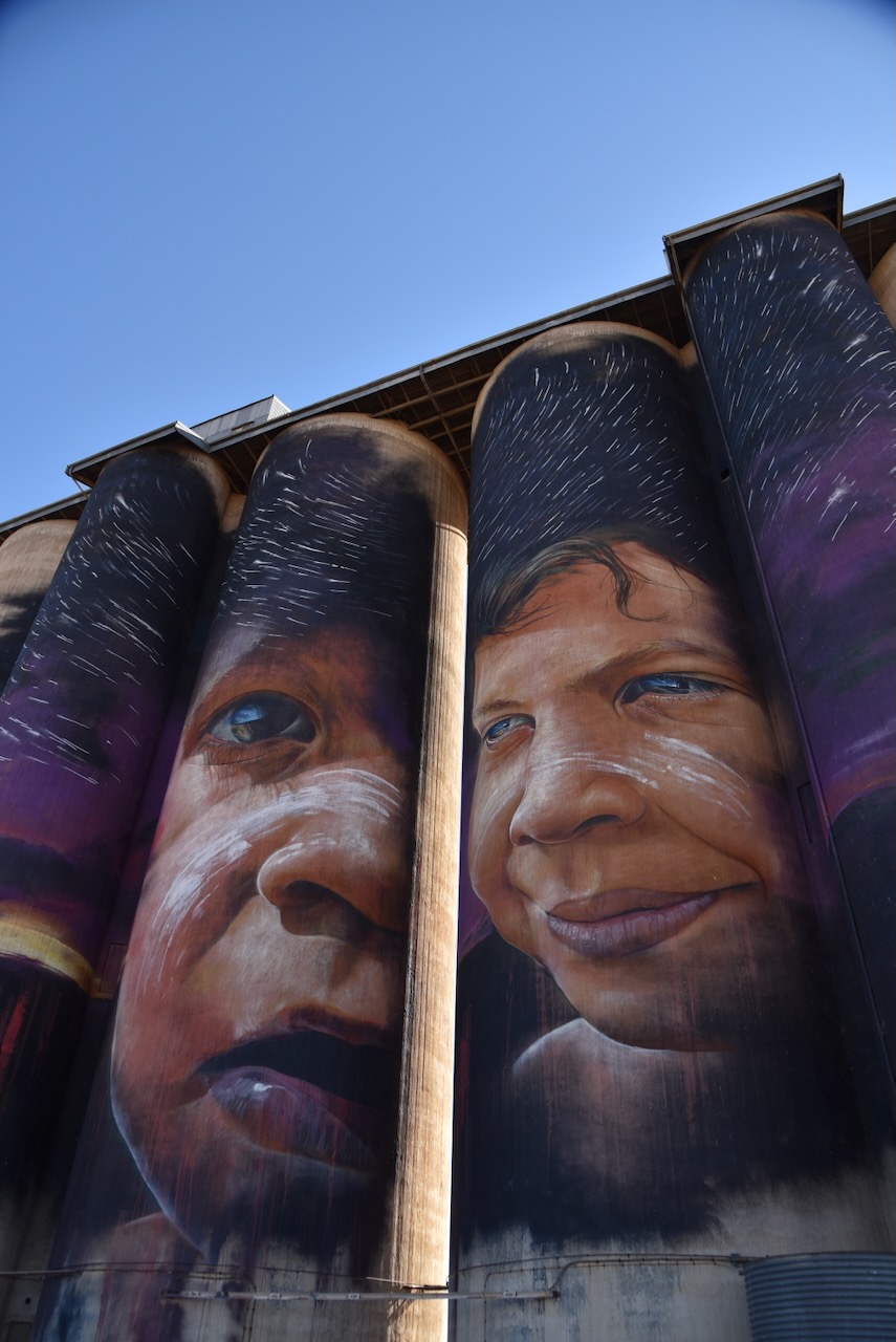
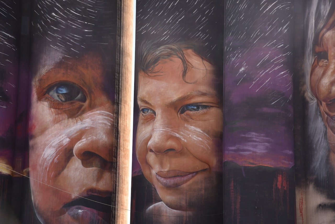
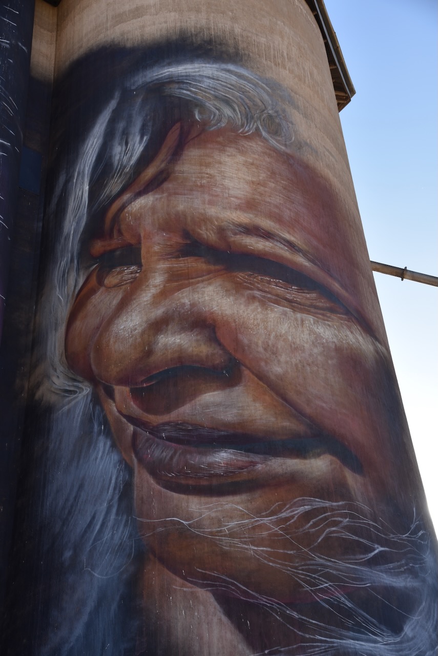
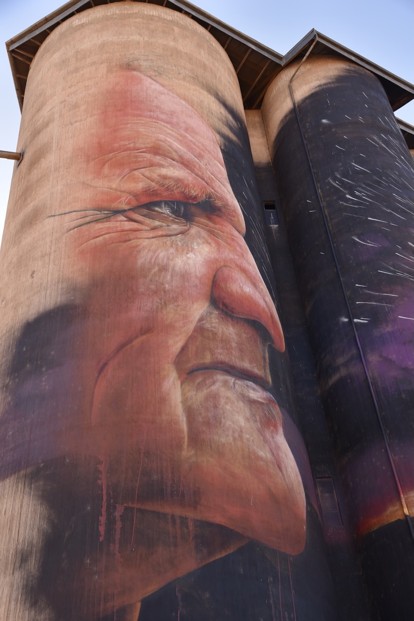
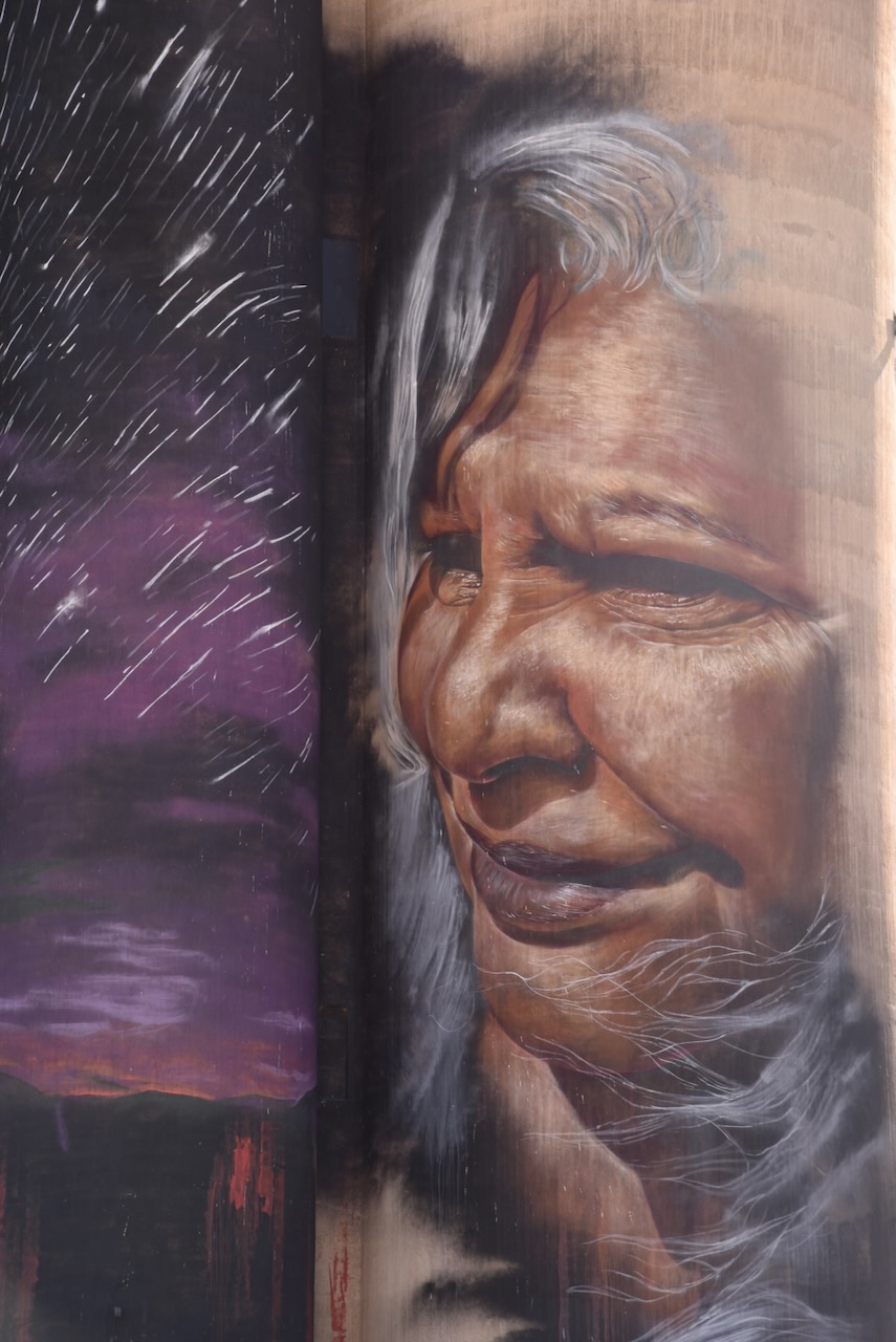
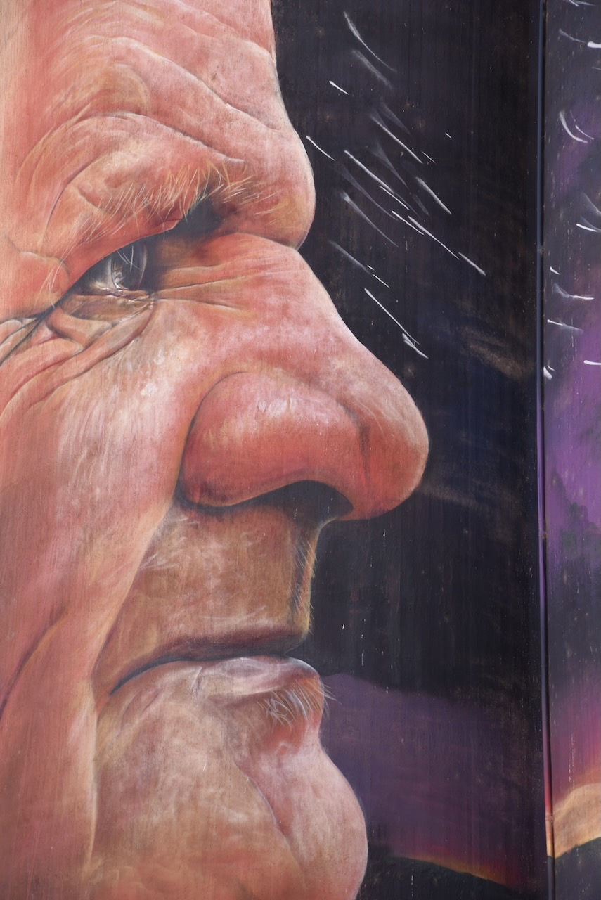
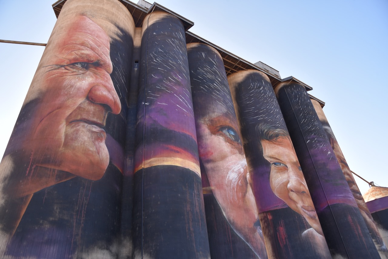
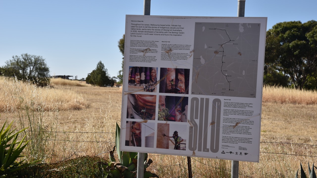
The Sheep Hill silos are reputed to be the most colourful piece of silo art on the Silo Art Trail in the Wimmera Mallee. (Aussie Towns 2024). They were the fifth silos to be included in the Australian SIlo Art Trail, and they were the third in the Wimmera Mallee region of Victoria. Melbourne-based artist Adnate completed the silo art at Sheep Hills over a four-week period in 2016. The silo art features a Wergaia Elder Uncle Ron Marks, a Wotjobaluk Elder Aunty Regina Hood, and two young children. (Silo Art Trail 2024)
Below is a great video about the Sheep Hills silo.
Marija and I operated from the silo car park. We ran the Icom IC-7000, 100 watts, and the Codan 9350 with the 1.5-metre stainless steel whip.
Above:- The activation zone at the Sheep Hills silo. Image c/o SiOTA website.
Marija worked the following stations on 40m SSB:-
VK5WY/m
VK3BWS
VK4NH
VK4DXA
VK1AO
VK2MET
Marija worked the following stations on 20m SSB:-
VK4NH
VK4DXA
I worked the following stations on 40m SSB:-
VK5WY/m
VK3BWS
VK4NH
VK4DXA
VK1AO
VK2MET
VK3PF
VK1CHW
I worked the following stations on 20m SSB:-
VK4NH
VK4DXA
After leaving Sheep Hills Marija and I headed to Rupanyep. Along the way we observed many farmers out in their fields with their harvesters at work.
Tindale, Norman Barnett (1974). “Wotjobaluk (VIC)”. Aboriginal Tribes of Australia: Their Terrain, Environmental Controls, Distribution, Limits, and Proper Names. Australian National University Press.
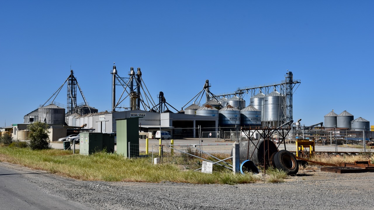
We left the Minyip silo and headed to the nearby Wimpak silo VK-WMK3 in Minyip in western Victoria.
Above:- Map showing the location of Minyip. Map c/o Google Maps.
The silo complex is located on R Learmonth Road in Minyip. The Wimpak company was formed in 1998 in Minyip by a small group of farmers and investors.
Wimpak was formed in Minyip in 1998 by a small group of ten farmers and investors, looking to add value to locally produced commodities. Their vision was a specialist pulse-type grain packing and cleaning facility within the Wimmera region to add value to their crops and to cut out the ‘middleman’. Pulses are the edible seeds of plants in the legume family. ETG Australia purchased Wimpak in September 2019. Each year about 55,000 tones of pulse-type crops are sold to customers in the United States of America, New Zealand, the Middle East and the Indian subcontinent. (Wimpak 2024) (National Bank 2024)
Marija and I parked on the Stawell-Warracknabeal Road and operated from the 4WD for this activation. We ran the Icom IC-7000, 100 watts, and the Codan 9350 antenna with the 1.5 metre stainless steel whip.
Above:- The activation zone at the Wimpak silo. Image c/o SiOTA website.