It was now Saturday 25th November 2023, and day one of the 2023 VKFF Activation Weekend for the World Wide Flora Fauna (WWFF) program. The VKFF Activation Weekend was initiated in 2015. The weekend is designed to promote the World Wide Flora Fauna (WWFF) program in Australia, by encouraging amateurs to get out into the field and operate portable from a qualifying VKFF reference area. It is generally a very popular weekend.
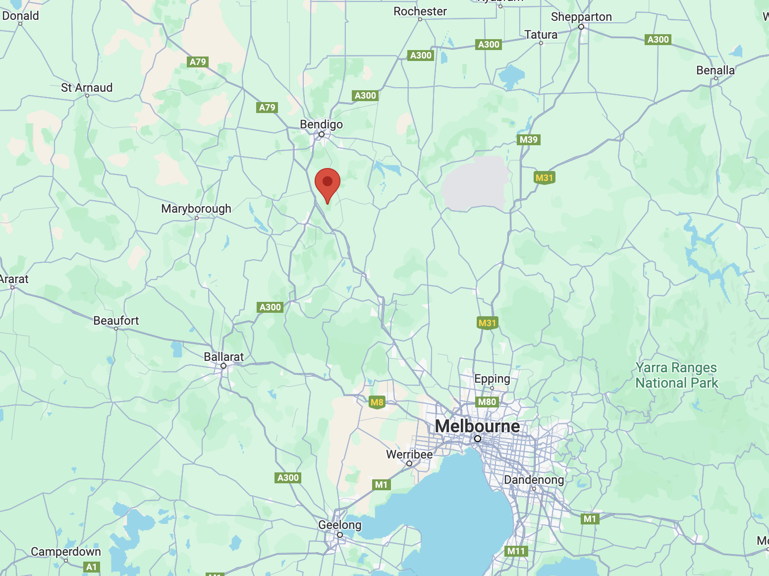
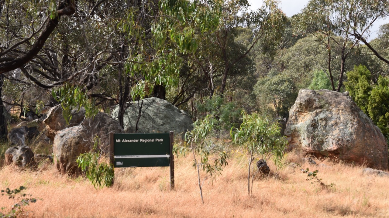
Our first activation of the day was the Mount Alexander Regional Park VKFF-0973 and the SOTA summit Mount Alexander VK3/ VN-016.
The park is about 19 km (by road) northeast of Castlemaine and about 125 km northwest of Melbourne.
Above:- Map showing the location of Mount Alexander. Map c/o Google Maps.
The Mount Alexander region is the traditional home of the Jaara Jaara aboriginal people. The summit of Mount Alexander is known as Lanjanuc or Lenganook and was the location of a sacred ceremonial ground and was used as an outlook due to its high vantage point. (Mt Alexander Regional Park Visitor Guide 2010)
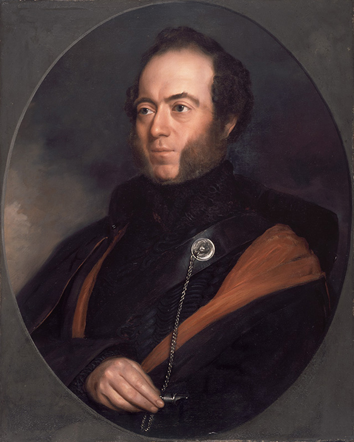
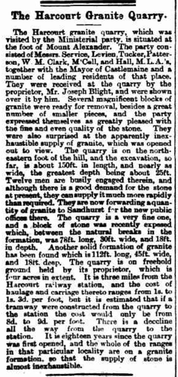
The first European to climb Mount Alexander was the explorer Major Thomas Livingstone Mitchell (b. 1792. d. 1855). He conquered the mountain on the 28th day of September 1836 during his Australia Felix journey.
Above:- Major Thomas Mitchell. Image c/o Wikipedia.
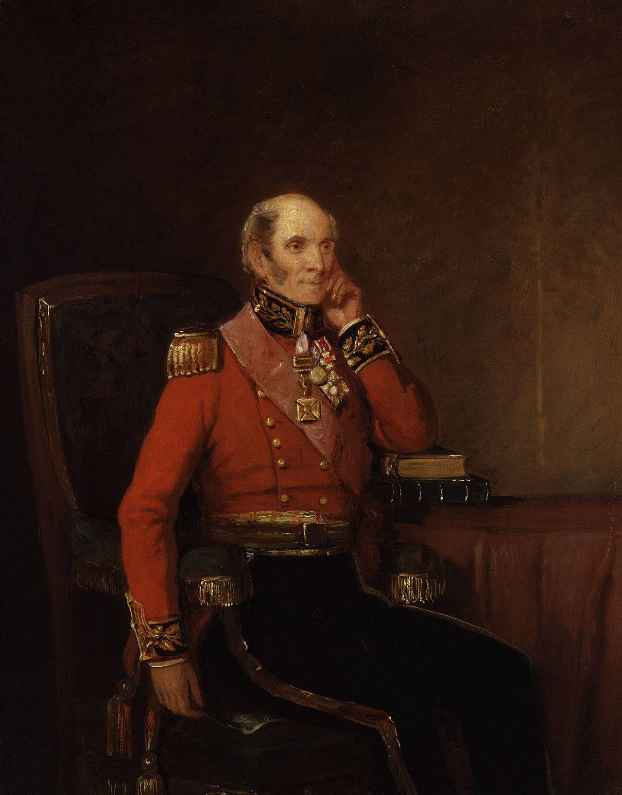
Mitchell initially named the mountain Mount Byng in honour of John Byng, 1st Earl of Strafford, a Field Marshal during the Peninsular War. (Victorian Places 2024)
Above:- John Byng. Image c/o Wikipedia.
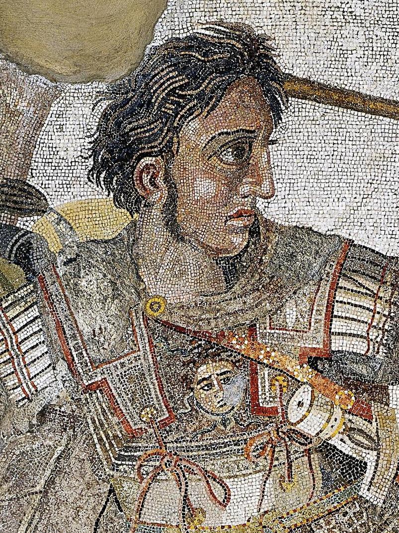
The mountain’s name was changed to Mount Alexander in honour of Alexander the Great, emperor of ancient Macedonia. (Victorian Places 2024)
Above:- Alexander the Great. Image c/o Wikipedia.
A few years later, on the 8th day of February 1838, explorer Edward John Eyre (b. 1815. d. 1901), camped on the northwest slope of Mount Alexander. (Waterhouse)
Above:- Edward John Eyre. Image c/o Wikipedia.
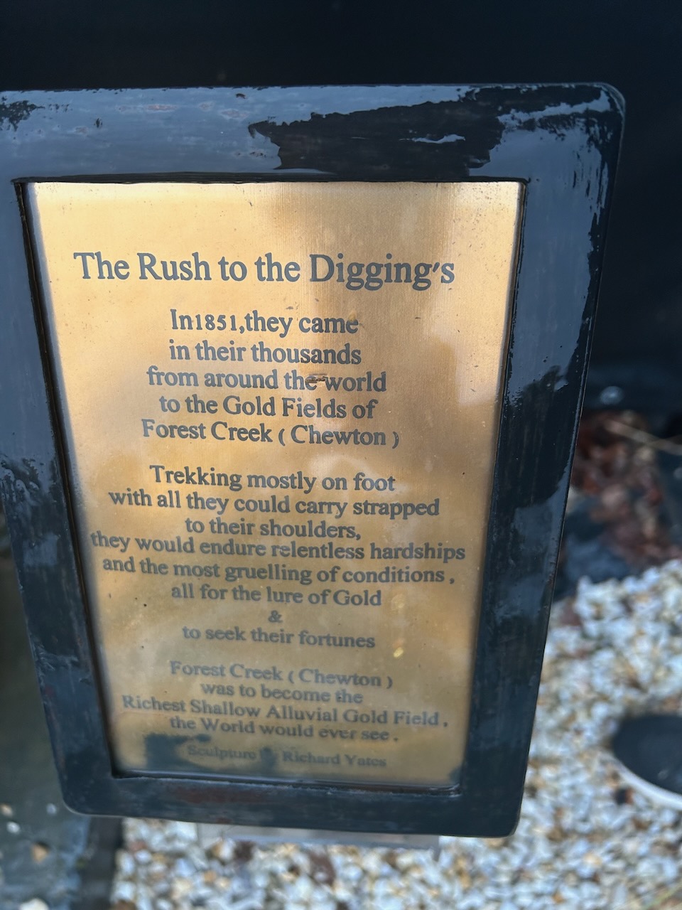
In 1851 gold was discovered close to Mount Alexander and tales that the area was the new ‘Eldorado’ swept across the world. The goldfields became known as Forest Creek or Castlemaine and they became the richest shallow alluvial goldfields in the world and one of the largest goldrush areas of the 1800s. (Mt Alexander Regional Park Visitor Guide 2010)
Gold was first discovered on the 20th day of July 1851 at Specimen Gully on Barkers Creek by a shepherd, Christopher Thomas Peters. He worked for Dr. William Barker on his Mount Alexander Run. When the gold was shown, Peters was mocked as it was believed the gold was ‘fool’s gold’ and it was thrown away. Dr. Barker did not want his workers to abandon his sheep.
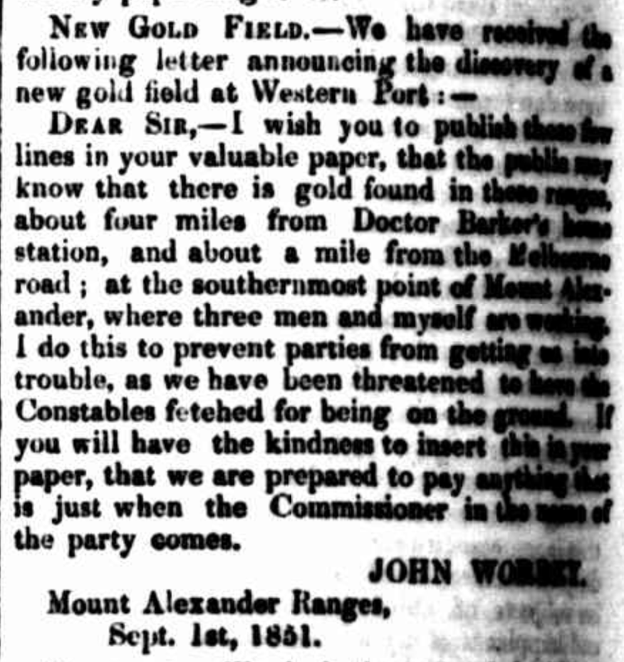
In September 1851 the workers sent a letter to The Argus declaring the ‘new goldfield’.
Above:- Letter from The Argus, Melbourne, Mon 8 Sep 1851. Image c/o Trove.
Within a month, about 8,000 miners were working on the alluvial gold fields at Mount Alexander. By the end of 1851, an estimated 25,000 diggers were working on the gold fields.
Above:- The Mount Alexander Gold diggings. Image c/o State Library Victoria.
During the 1850s a gold escort route was established by Alexander Tolmer (b. 1815. d. 1890) between Mount Alexander and Adelaide, South Australia. Tolmer would later become the Commissioner of Police in South Australia.
Above:- Alexander Tolmer. Image c/o Wikipedia.
The first escort undertaken contained about 270 kg of gold and arrived in Adelaide on the 20th day of March 1852. The second escort contained even more gold, about 730 kg of gold.
Above:- Gold escort 1852. Image c/o Wikipedia.
About 110,00 kg of gold was extracted from the Mount Alexander goldfields in the first 2 years of the gold rush.
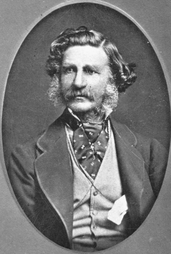
By the 1860s, quarries had opened at Mount Alexander to provide stone for the Northern Railway (Melbourne to Echuca Railway). Granite was subsequently used for buildings in Melbourne. One of those involved in this industry was Joseph Blight (b. 1832. d. 1897), a Cornish quarryman who had been involved in quartz reef mining at Eureka Reef. He commenced work at Blight’s Quarry in 1862. By the 1870s Mount Alexander had been stripped of vegetation to provide timber for the goldfields. (Ancestry.com.au 2024) (Mt Alexander Regional Park Visitor Guide 2010)
Above:- An article from the Weekly Times, Melbourne, Sat 24 Mar 1883. Image c/o Trove.
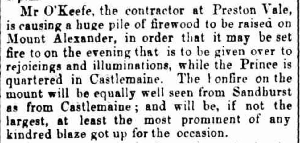
In 1867, a huge bonfire was constructed on the top of Mount Alexander to be lit in honour of the visit of the Duke of Edinburgh. (Mt Alexander Mail 1867)
Above:- Article from the Mount Alexander Mail, Sat 23 Nov 1867. Image c/o Trove.
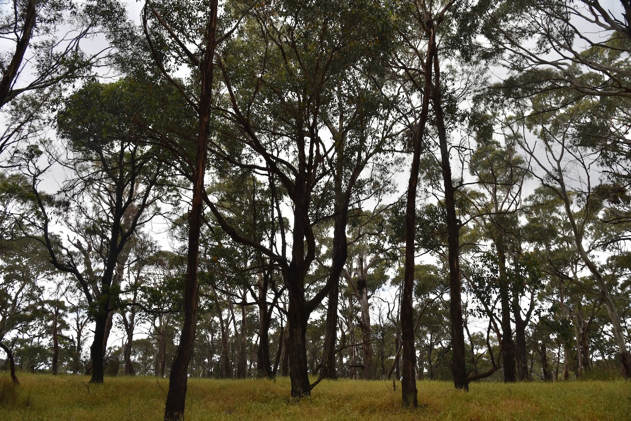
The Mount Alexander Regional Park is about 1,400 hectares in size and lies within the Harcourt granite intrusion that is believed to be about 367 million years old. You can view numerous rock boulders in the park. The park has steep slopes, tall trees and rocky outcrops. (Mt Alexander Regional Park Visitor Guide 2010)
Native animals that can be found in the park include koalas, Eastern Grey kangaroos, echidnas, Brushtail and Ringtail possums, Sugar Gliders and the Brush Tailed Phascogale. (Mt Alexander Regional Park Visitor Guide 2010)
A popular abseiling spot in the park is Dog Rocks, a large outcrop of granite boulders on the western slopes of Mount Alexander. In 1846, Lockhart Moton, the manager of Sutton Grange Station, named the rocks as they were a favourite lair of a pack of dingoes. (Gold Fields Guide 2024)
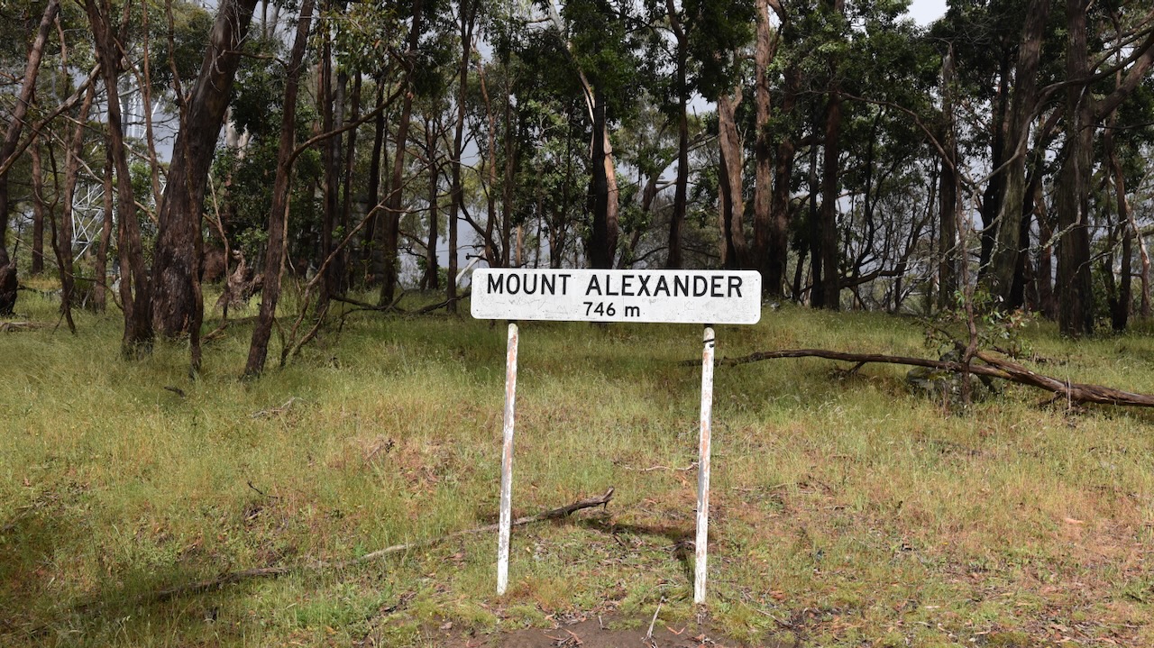
The Mount Alexander summit is 741 metres above sea level and is worth 4 points in the Summits On The Air (SOTA) program. It has been activated a total of 111 times. It was first activated on the 13th day of May 2012 by Wayne VK3WAM. (SOTA 2024)
Above:- An aerial view of Mount Alexander looking towards Bendigo. Image c/o Google Maps.
Although there are communication equipment towers on the top of Mount Alexander, Marija and I did not experience any interference.
Marija and I drove along Joseph Young Drive and found a clearing in the scrub, south of the communication towers and within the activation zone.
Joseph Young Drive is named in honour of long-serving Metcalfe Shire councillor Joseph Young. The road was pioneered by a group who wanted a tourist road constructed across the top of Mount Alexander. In 1928, Colonel James H. Lang the Vice President of the Royal Automobile Club of Victoria (RACV) pushed for the road to be constructed.
In June 1928, James Lang and his 24-year-old son Alan Lang in a Buick, and the Mayor of Councillor. J.R. Duggan in a Chevrolet accompanied by Mr A.S. Collings Borough Surveyor and the Hon. S.W. Lawson, drove across Mount Alexander in a zig-zag fashion to prove that a tourist road was feasible. In 1930 the road was constructed for £23.
Above:- Article from The Argus, Melbourne, Mon 15 Dec 1930. Image c/o Trove.
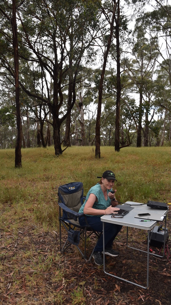
For this activation, we ran the Yaesu FT857, 40 watts, and the 20/40/80m linked dipole. I used the special event callsign of VI10VKFF.
As this was a ‘drive-up’ SOTA summit we had the luxury of a fold-up table and deck chair. We were also set up before the ‘UTC rollover’.
We logged a total of 78 QOS, including 28 Park to Park contacts.
Marija worked the following stations on 40m before the UTC rollover:-
VK3GJG/p (Sassafras Creek Nature Conservation Reserve VKFF-2187)
VK2YAK/p (Barrington Tops National Park VKFF-0017)
VK2PKT/p (South West Woodland Nature Reserve VKFF-2724)
VK7PAL
VK3GTV
VK21IO/m
VK3SO
VK3UAO
I worked the following station on 40m AM:-
VK3BEL
I worked the following stations on 20m SSB before the UTC rollover:-
VK4NH
VK4DXA
VK3GTV
ZL3MR
VK4FO
VK6LMK
ZL4NVW
VK4FOX
I worked the following stations on 20m SSB after the UTC rollover:-
VK4FOX
VK6LMK
VK4FO
References.
Ancestry.com.au. (2016). Ancestry® | Genealogy, Family Trees & Family History Records. [online] Available at: https://www.ancestry.com.au/ [Accessed 1 Apr. 2024].
Autobiographical Narrative of Residence and Exploration in Australia 1832–1839 by Edward John Eyre. Edited by Jill Waterhouse, published by Caliban Books Page 127
Harcourt News The Core, Edition 93, May 2022
Parks Victoria, 2010, Mount Alexander Regional Park Visitor Guide.
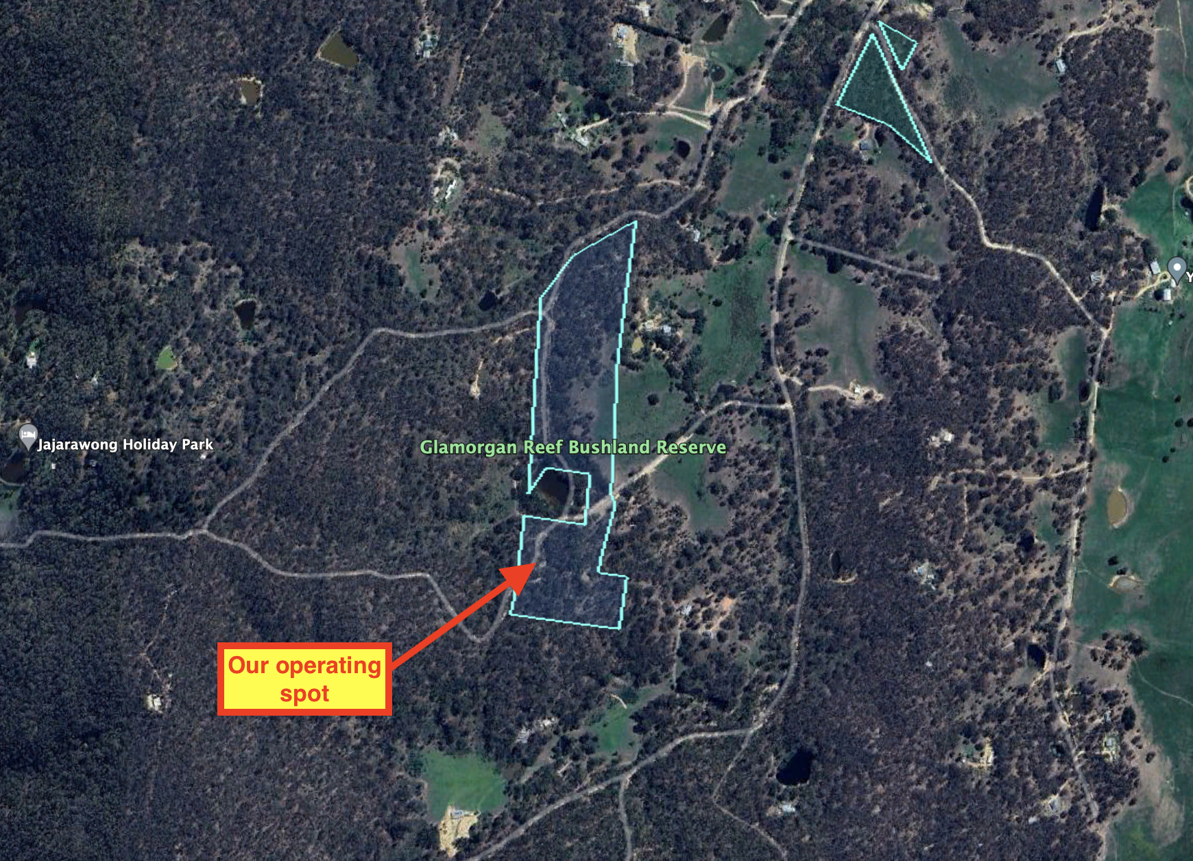
Our final park activation for Friday 24th November 2023 was the Glamorgan Reef Bushland Reserve VKFF-4279. The park is about 20 km south of Newstead and about 130 km northwest of Melbourne.
Above:- Map showing the location of the Glamorgan Reef Bushland Reserve. Map c/o Google Maps.
The Glamorgan Reef Bushland Reserve is about 9 hectares in size and was established on the 26th day of February 2002. (CAPAD 2022)
The reserve takes its name from the Glamorgan Reef gold mine which opened in 1859. (South West Victoria Historic Mining Plots 1980)
Above:- Part of an article from The Age, Melbourne, Thu 5 Aug 1858. Image c/o Trove.
We found a little track running off Glamorgan Road. We ran out the 20/40/80m linked dipole and used the Yaesu FT857 and 40 watts output. I used the special call of VI10VKFF.
Above:- An aerial view of the Glamorgan Reef Bushland Reserve, showing our operating position. Image c/o Google Earth.
Marija worked the following stations on 40m SSB:-
VK3PF
VK3KAI
VK4SMA
VK3VIN
VK5PE/m
VK1AO
VK2MET
VK3CEO
VK3SG
VK4NH
VK4DXA
VK2IO/p (Molonglo Gorge Nature Reserve VKFF-0991)
I worked the following stations on 40m SSB:-
VK3PF
VK3KAI
VK4SMA
VK3VIN
VK5PE/m
VK1AO
VK2MET
VK3CEO
VK3SG
VK4NH
VK4DXA
KD1CT
ZL3ASN
VK3CLD/2
VK5LA
VK5KAW
VK5FANA
VK3APJ
VK5KLV
VK7HBR
VK7JGD
VK2IO/p (Molonglo Gorge Nature Reserve VKFF-0991)
VK2PBC
VK4HMI
VK7AAE
VK3EJ
VK3SO
VK3EI
VK3UAO
VK4GJW
VK5VST
VK3ZK
VK2AX
JF7RJM
VK3BLG
VK5DW
VK5VK
I worked the following stations on 40m AM:-
VK3CEO
VK2IO/p (Molonglo Gorge Nature Reserve VKFF-0991)
VK5DW
I worked the following stations on 80m SSB:-
VK3PF
VK3KAI
VK2IO/p (Molonglo Gorge Nature Reserve VKFF-0991)
VK5DW
VK5VK
References.
Bannear; D, 1980, South West Victoria Historic Mining Plots
The Yandoit Bushland Reserve VKFF-4280 was an unplanned and quick activation for Friday 24th November 2024.
Yandoit is located about 17 km northwest of Daylesford and about 110 km northwest of Melbourne.
Above:- Map showing the location of Yandoit. Map c/o Google Maps.
Yandoit is believed to be an aboriginal word meaning ‘travel’.
The first European settler in the area was John Stuart Hepburn. He was born in 1803 in Scotland and emigrated to Australia.
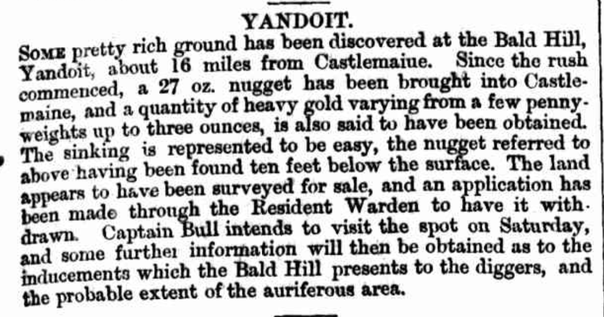
In 1854 gold was discovered in a gully about 2 km northwest of Yandoit. (Victorian Places 2024)
Above:- An article from The Colonial Mining Journal, Thu 7 Jul 1859. Image c/o Trove.
By the following year, 1855, farm allotments in the district were offered for sale. Many of the settlers in the district were of Swiss-Italian background. One of those was the Gervasoni family who emigrated to Australia in the 1850s. Carlo Gervasoni built the homestead that included wine and cheese cellars, stables and farm buildings. The ruins of their large homestead are on the Victorian Heritage Register. (Victorian Heritage Database 2024) (Victorian Places 2024)
Above:- The Gervasoni homestead. Image c/o Heritage Council Victoria.
Below is an excellent video on the Gervasoni family estate.
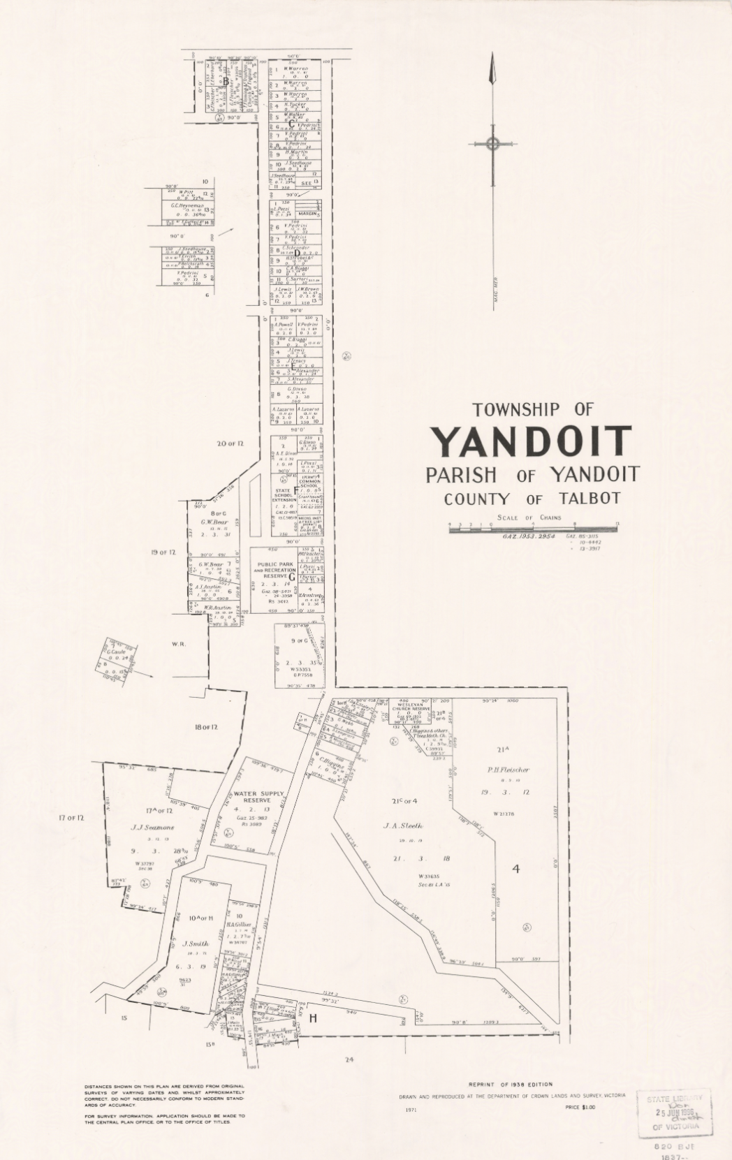
In 1861 Yandoit was surveyed. In that same year, a school was opened at Yandoit, and Yandoit’s population was about 232 people. By 1865 Yandoit had four hotels and an estimated population of about 950 people. Yandoit was proclaimed in 1885. (egold 2015) (Victorian Places 2024)
Above:- a plan of the town ship of Yandoit. Image c/o State Library Victoria.
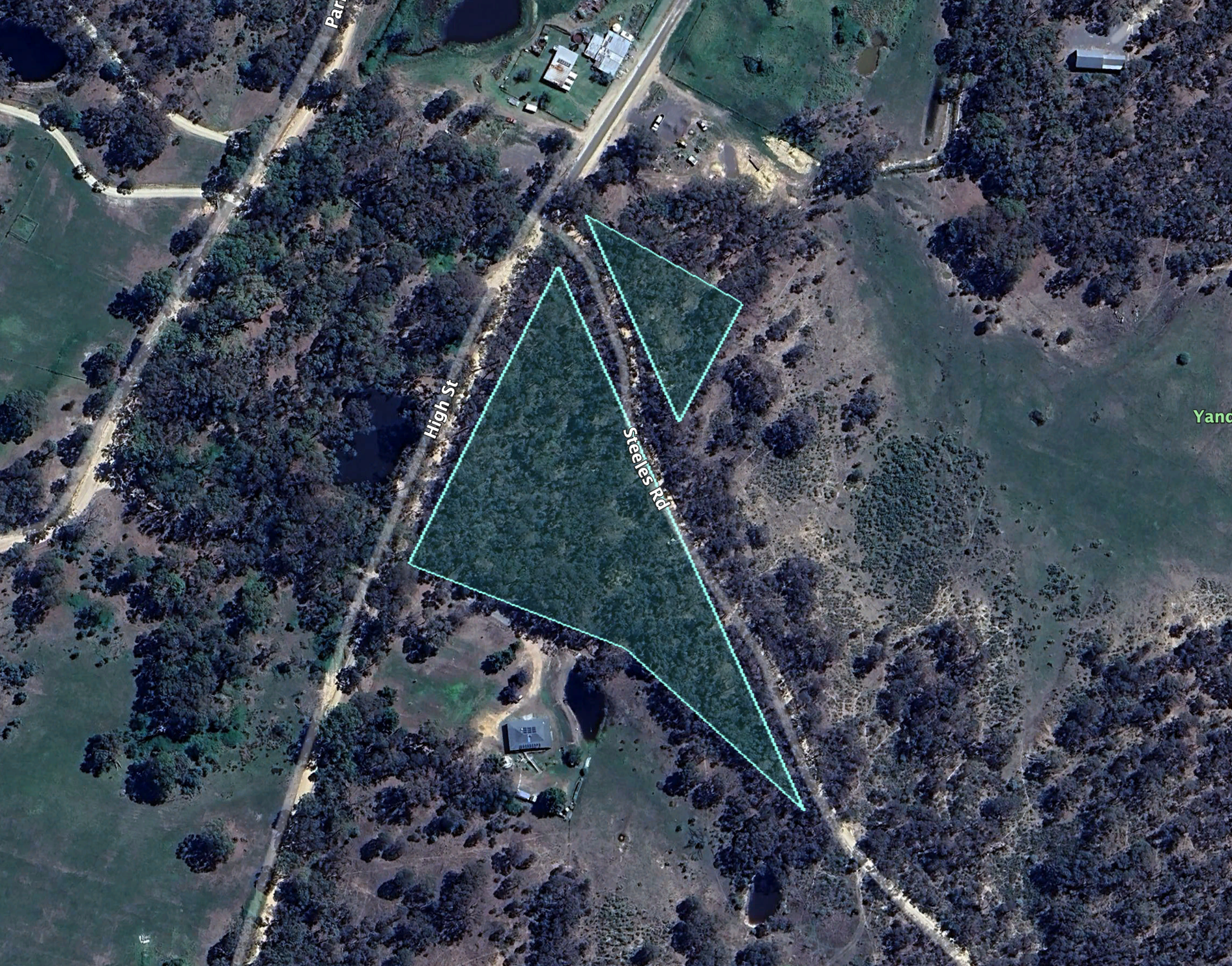
The Yandoit Bushland Reserve is small, comprising just 1.5 acres of remnant bushland. It was established on the 13th day of June 2006. (CAPAD 2022)
Above:- An aerial view of the Yandoit Bushland Reserve. Image c/o Google Earth.
It was completely dark by the time we arrived at the park. We found a break in the scrub and ran out the 20/40/80m linked dipole. We ran the Yaesu FT857 and 40 watts. I used the special callsign of VI10VKFF.
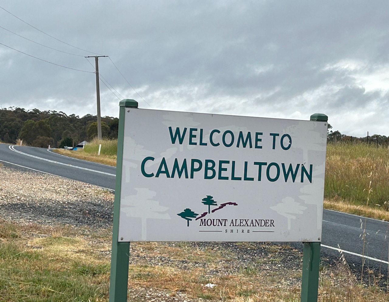
Our next destination for Friday 24th November 2023 was the town of Guildford. Marija and I travelled back into Clunes and headed northeast on Glengower Road. Along the way, we passed through the little town of Campbelltown. Don’t blink….there is not much here nowadays.
One of the historic buildings that does remain is the Black Duck Hotel. Originally known as the Campbell Town Hotel, it was built in 1871. It is the only surviving hotel from this once thriving town. (State Library Victoria 2024)
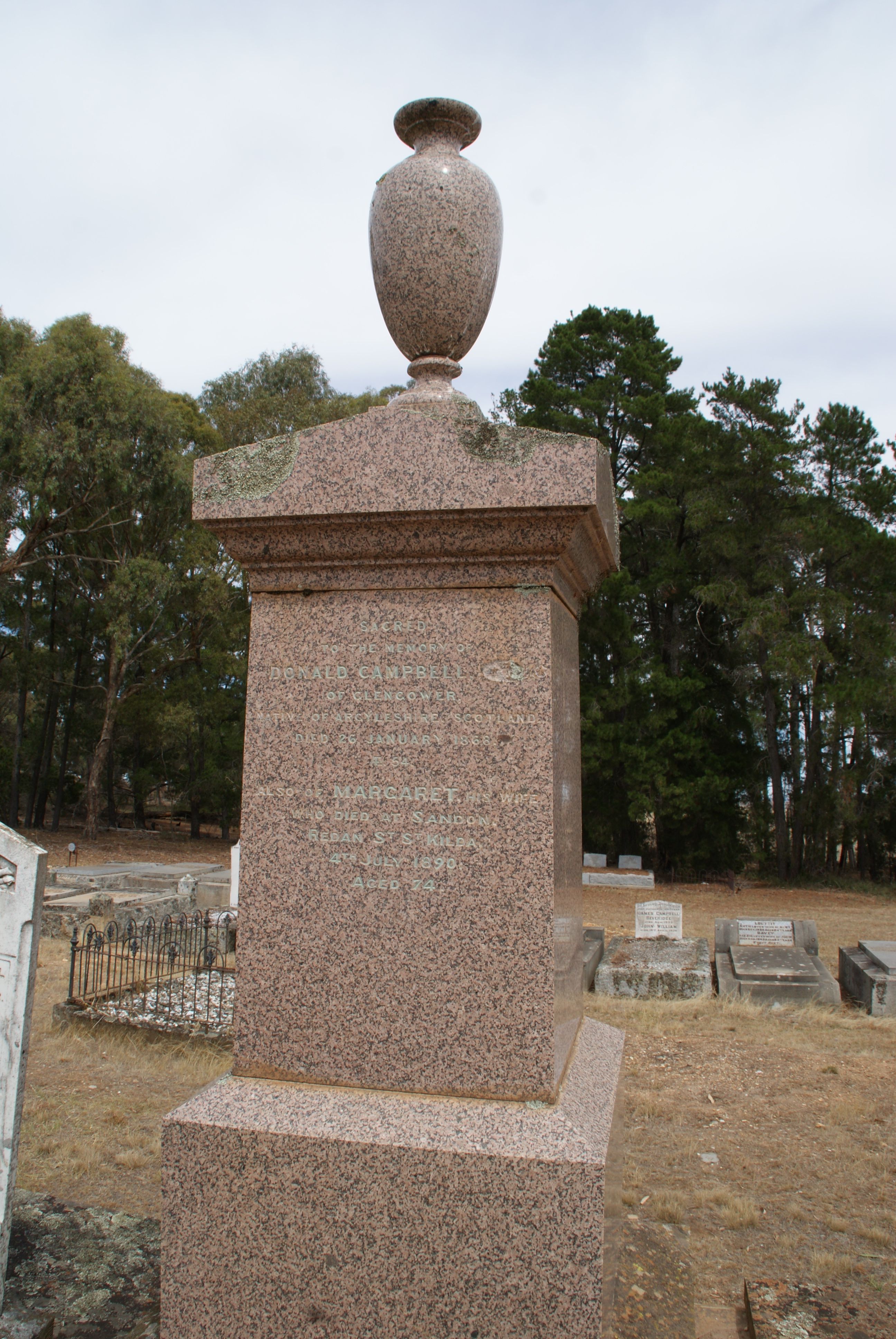
Campbelltown takes its name from Donald Campbell (b. 1813. d. 1868) who settled in the area following his emigration from Scotland to Australia. Donald arrived in Sydney in November 1841 aboard the Trinidad as a bounty immigrant. In 1842 he overlanded to Gippsland with sheep and squatted at Bullock Creek, near current day Bendigo. He opened Campbell’s (or Bullock Creek) Camping Ground and Inn. In 1851 he married Margaret Sinclair in Melbourne. By 1854, Hugh Glass employed Campbell to manage Glengower pastoral run, a 44,000-acre property. At the time, Glass was one of the richest men in Victoria. In February 1866, Campbell acquired Glengower from Glass. Campbell built the Glengower Hotel catering for miners from the nearby goldfields. Campbell died suddenly in January 1868 leaving an estate valued for probate at £18,000. He is buried at the Campbelltown cemetery. (Ancestry.com.au 2024) (Andrew Warland 2024) (Aust Dict of Biography 2024) (Blake 1998)
Above:- the headstone of Donald Campbell. Image c/o Find a Grave
We continued to Guildford, about 126 km northwest of Melbourne and about 10 km south of Castlemaine.
It is believed that the name comes from Guildford in Surrey, England (geltford meant a crossing where a toll was paid). Prior to European settlement, the area was inhabited by the Jaara Jarra aboriginal people who called the area ‘Yarrayne’. The first known European settler in the Guildford area was John Stuart Hepburn (b. 1803. d. 1860).
Above:- John Stuart Hepburn. Image c/o WIkipedia.
Gold was discovered in the Guildford area during the early 1850s. In 1860 a school was opened. The Guildford borough was created in November 1866. (Amcestry.com.au 2024) (Aussie Towns 2024) (Victorian Places 2024)
Guildford is another small Victorian town whose many historic buildings have survived.
The Guildford Hotel was built in 1856 for Joseph Sherer (b. 1829. d. 1898). Sherer had acquired an acre of land in 1859 and the eleven-room hotel was built. In 1857 the hotel was offered for lease and it was described as having a large bar, parlours, dining rooms and bedrooms, and a newly erected concert hall and stable which could accommodate 16 horses. (Victorian Heritage Database Report 2007)
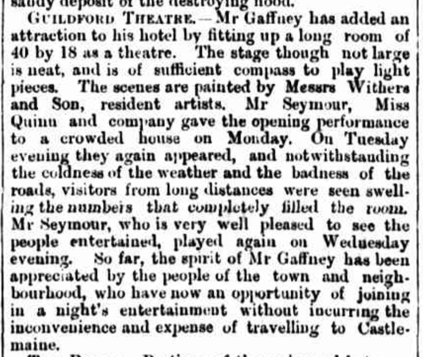
In 1861 William Gaffney became the hotel licensee. The hotel was reported as having stabling for 50 horses and a long room fitted as a theatre. It was used as a Cobb & Co coach office. (Victorian Heritage Database Report 2007)
The Mount Alexander Mail, Friday 7th August 1863 reported:
“…the spirit of Mr Gaffney has been appreciated by the people of the town and neighbourhood, who have now an opportunity of joining in a night’s entertainment without incurring the inconvenience and expense of travelling to Castlemaine.” (Mount Alexander Mail 1863, Trove)
Above:- Article from the Mount Alexander Mail, Fri 7 Aug 1863. Image c/o Trove.
In 1865 the hotel was sold to Giles Church who was a local hotelier. Guildford Borough Council meetings were held at the hotel. An ornamental verandah was added to the hotel in 1885 by the new owner, Wearn Dunstan. The hotel was known as Dunstan’s Family Hotel. (Victorian Heritage Database Report 2007)
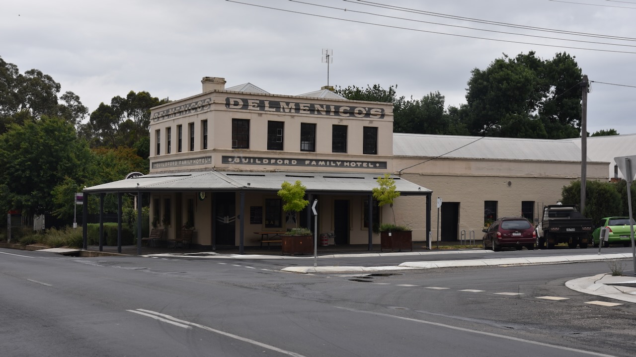
During the early 1920s, Pasqual Delmenico (b. 1872. d. 1948) purchased the Guildford Hotel. His family had arrived in Guildford in 1855 as part of a significant number of Swiss immigrants who settled in the Guildford district. The hotel remained with the Delmenico family until 1922. (Banjo Jamboree 2022)
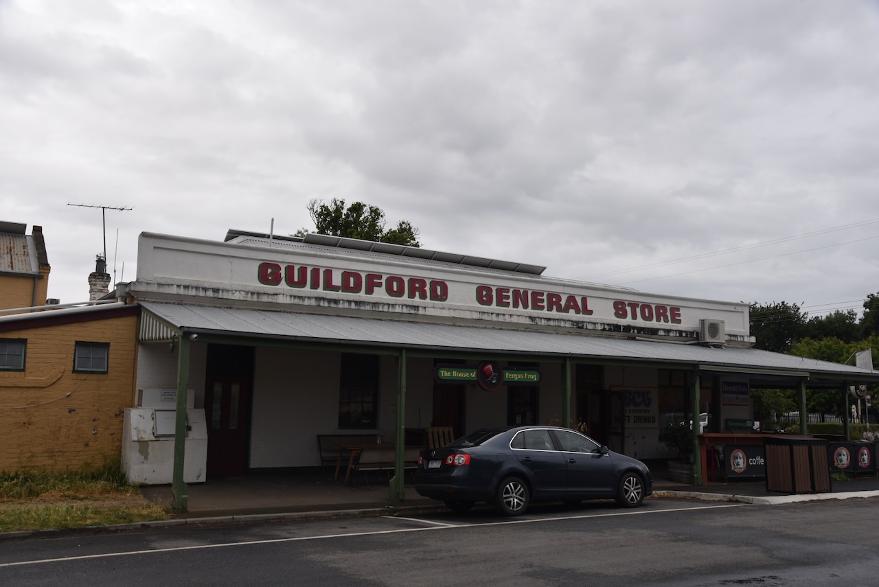
The Commercial Hotel was built in 1865 and now serves as the Guildford general store. On its northern side are the stables and outbuildings of a large department store that burned down in 1916. (Aussie Towns 2024)
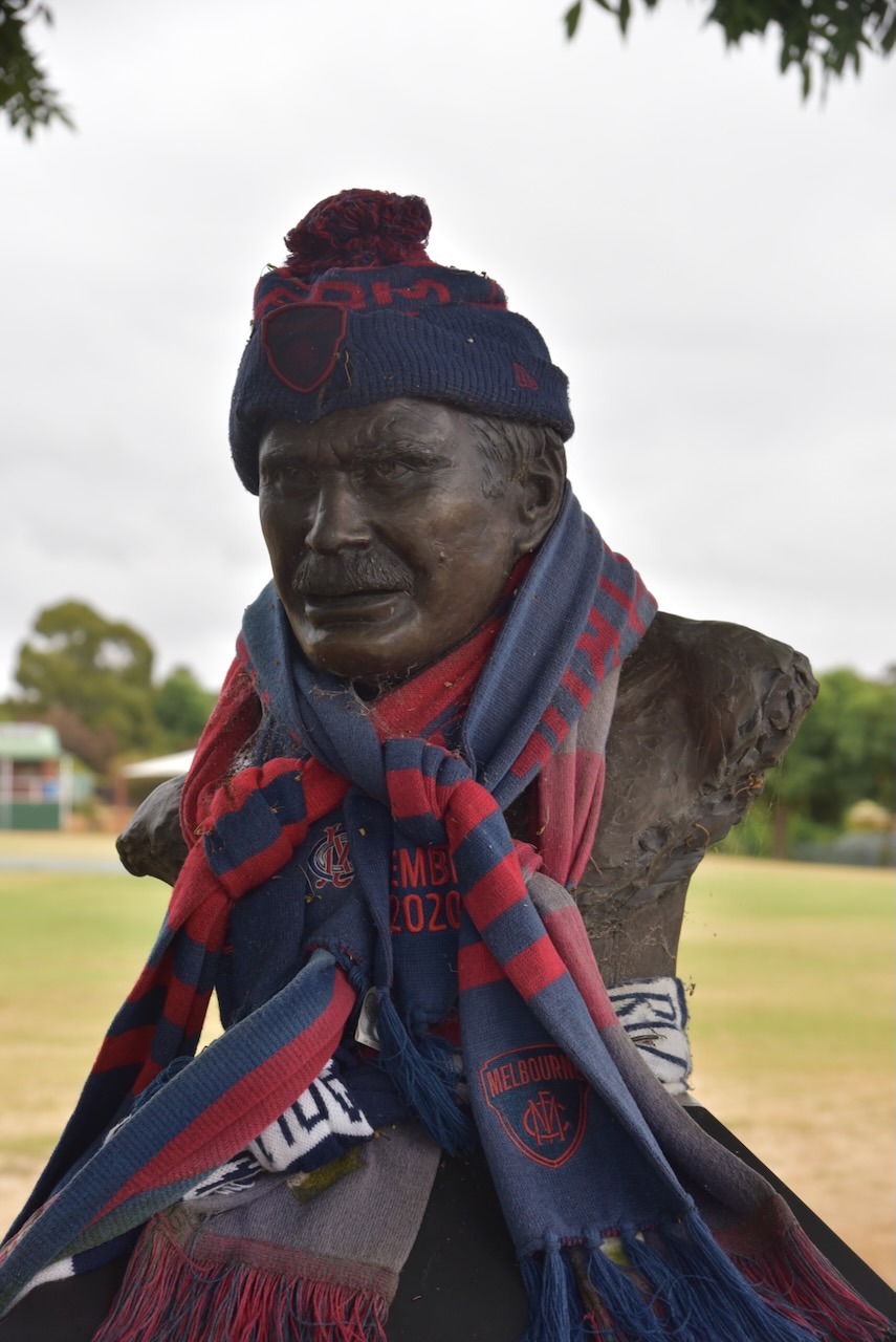
Several Swiss-Italian families settled in Guildford. Perhaps the most famous descendant of those settlers is Ronald Dale Barassi AM, an Australian Rules footballer, coach, and media personality. Barassi was a third-generation Australian. He was born in nearby Castlemaine in 1936. He spent a significant part of his early years and attended school at Guildford. (Victorian Places 2024) (Wikipedia 2024)
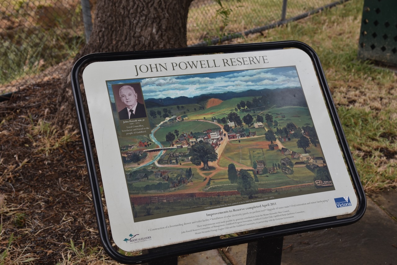
We then visited John Powell Reserve at Guildford. The park is named in honour of John Powell MBE, JP (b. 1889. d. 1973) who was a local Councillor, benefactor and friend to the people of Guildford.
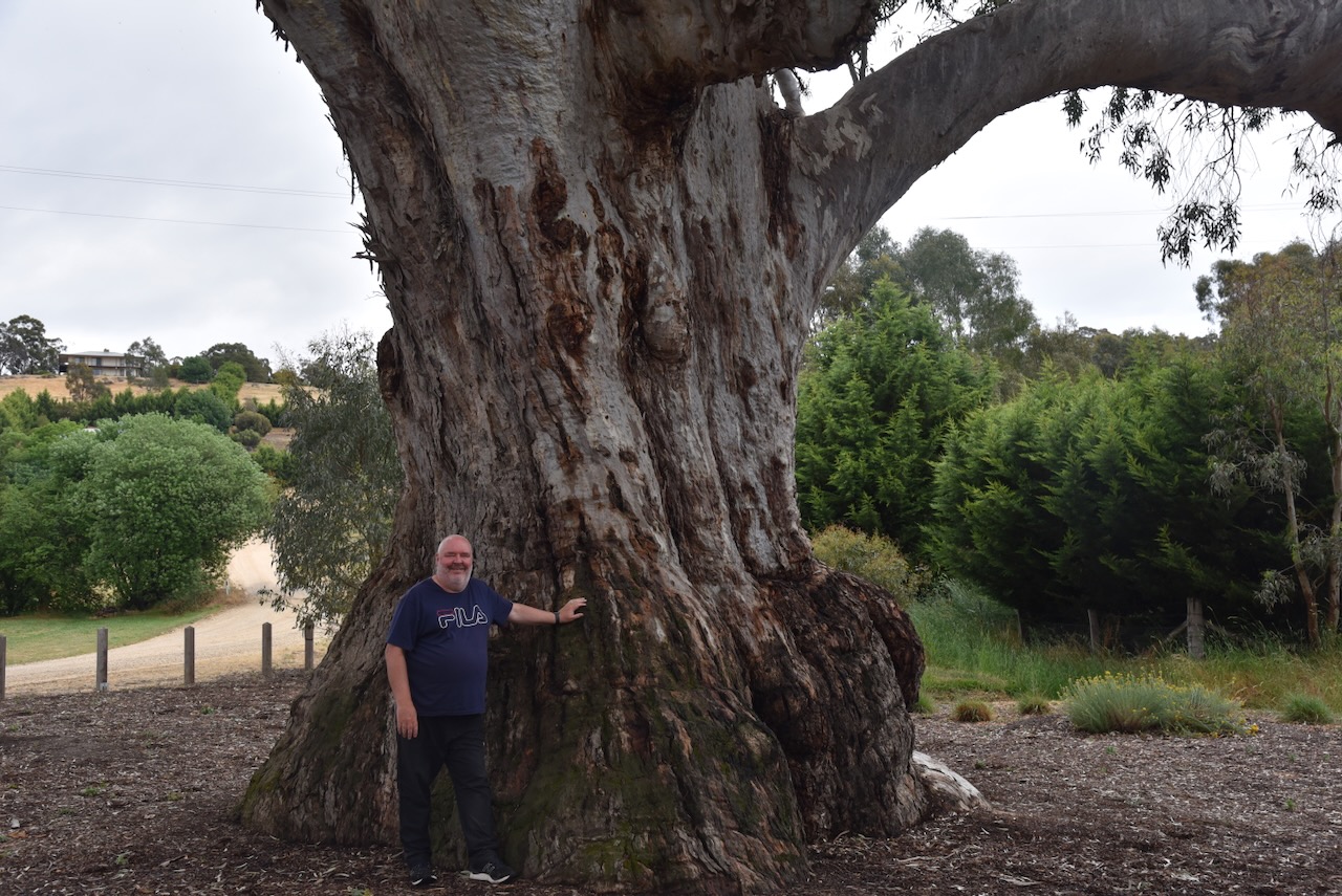
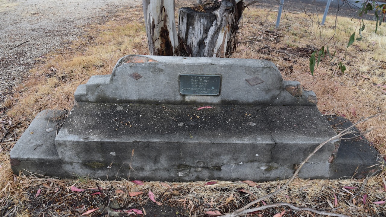
If you are in Guildford, you can’t miss a visit to ‘The Big Tree’ (Eucalyptus camaldulensis). It is located at the intersection of Fryers Street and Ballarat Street. The Big Tree is a large River Red Gum which is believed to be the largest of its species in the state of Victoria. Its base is 12.8 metres while its height is 25.9 metres. It is believed that Buke and WIlls camped beneath the tree on their journey from Melbourne to the Gulf of Carpenteria. (Aussie Towns 2024)
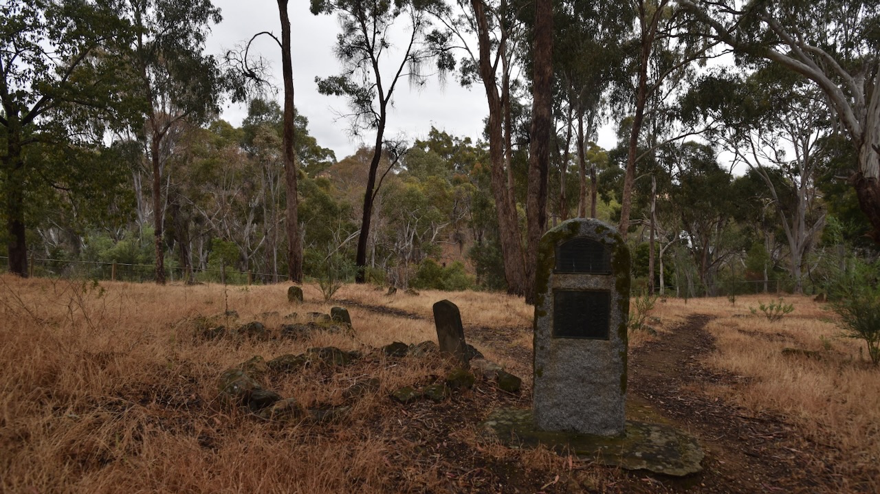
After leaving Guildford we visited the old Chinese cemetery at Vaughan Springs. The cemetery was established during the great Mount Alexander gold rush during the early 1850s. The cemetery is located on a small hill overlooking one of the richest locations on the goldfields. It was located at this position as gold was not likely to be discovered at this spot. The cemetery was used until 1857. (Goldfields Guide 2024)
We also got a glimpse of the old bridge between Vaughan and Tarilta. The bridge was built in 1868 and was closed in September 2012. (stackunderflow.com 2023)
One of the impressive surviving historic buildings in Vaughan is the Bank of Victoria building, built in the early 1850s. It is now a private residence.
Marija and I then stopped at the former site of Ball & Welch Ltd. The company was a prominent department store in Melbourne from the 1800s through to the 1970s. In its heyday, the company was Melbourne’s leading family draper.
In May 1862 Charles Ball married Tabitha Reardon. About 3 weeks later her sister Eliza married William Welch. In some sources, Charles and Williams are credited as forming Ball & Welch. Other sources, including one of Tabitha’s daughters, claim that Tabitha and Eliza were responsible for starting the drapery store as they imported ‘silks and fashionable furbelows’ from London and their lady friends in Vaughan would often ask for some themselves. Charles and William had been drapers and silk mercers in England and were apparently encouraged by their wives to commence the business. (Inner City News 2024)
Above:- Advertisement from The Herald, Melbourne, Mon 24 Dec 1906. Image c/o Trove.
We stopped to have a look at the cliffs at Vaughan known as Red Knob. These red cliffs are the result of hydraulic sluicing operations during the mid-1900s. (Goldfields Guide 2024)
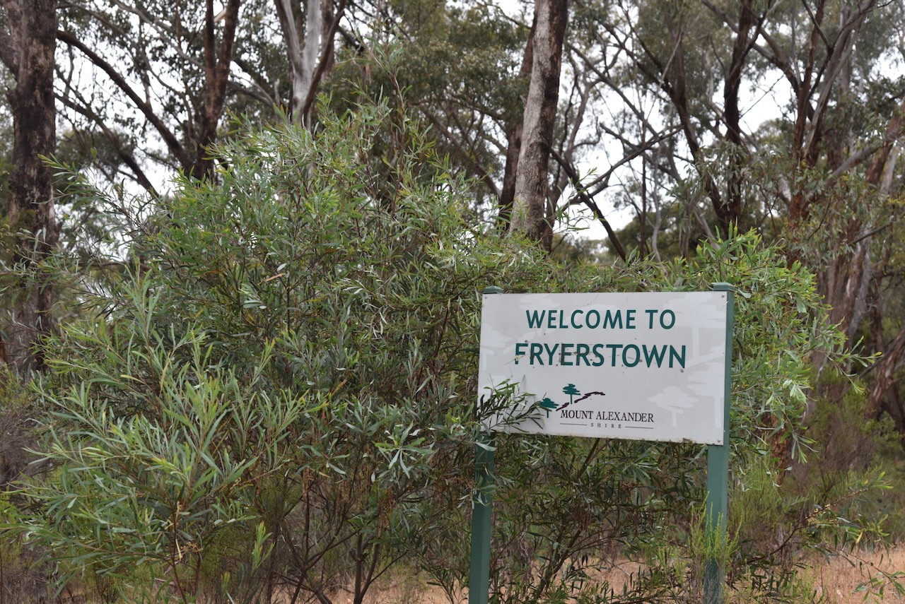
We then drove on to the little town of Fryerstown, about 10km southeast of Castlemaine.
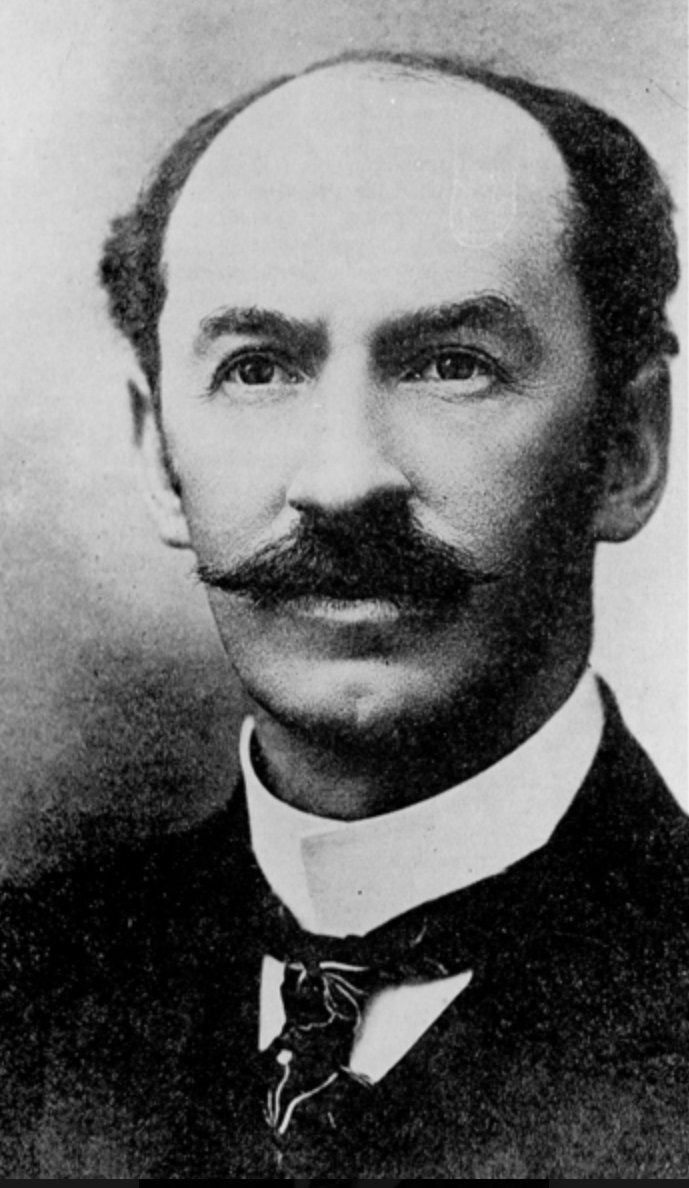
The town is located on the banks of Fryers Creek, a tributary of the Loddon River, and was named after pastoralist Peter Fryer who settled in the area during the 1840s. In October 1851 gold was discovered in Fryers Creek, with a significant number of the miners being of Metholidst faith. By 1853 a school had opened. One of the school’s most famous students was Frank Tate (b. 1864. d. 1939). He was born in Mopoke Gully, east of Fryserstown. He was Director of Education from 1902 to 1928. (Victorian Places 2024)
Above:- Frank Tate. Image c/o Victorian Collections.
The Post Office opened on the 19th day of April 1854 as Fryer’s Creek, and in 1856 was renamed Fryerstown. It closed in 1975. The old Methodist church at Fryerstown was opened in 1861. The Anglican church was also opened in that year. The predominant mining method in the area by the 1860s was auriferous quartz mining. However, Chinese miners continued with alluvial gold mining and formed a substantial portion of the Fryerstown community. (Phoenix 2005) (Victorian Places 2024)
Some historic buildings remain at Fryerstown. This includes the Fryerstown mechanics institute.
The locals of Fryerstown decided to construct a memorial mechanics institute for the explorers Burke and Wills. In November 1861 they raised £300 and the institute was built. In Mid 1863 the foundation stone was laid and the building was completed about 4 months later. (burkeandwills.net.au 2024)
Above:- part of an article from the Mount Alexander Mail, Thu 9 April 1863. Image c/o Trove.
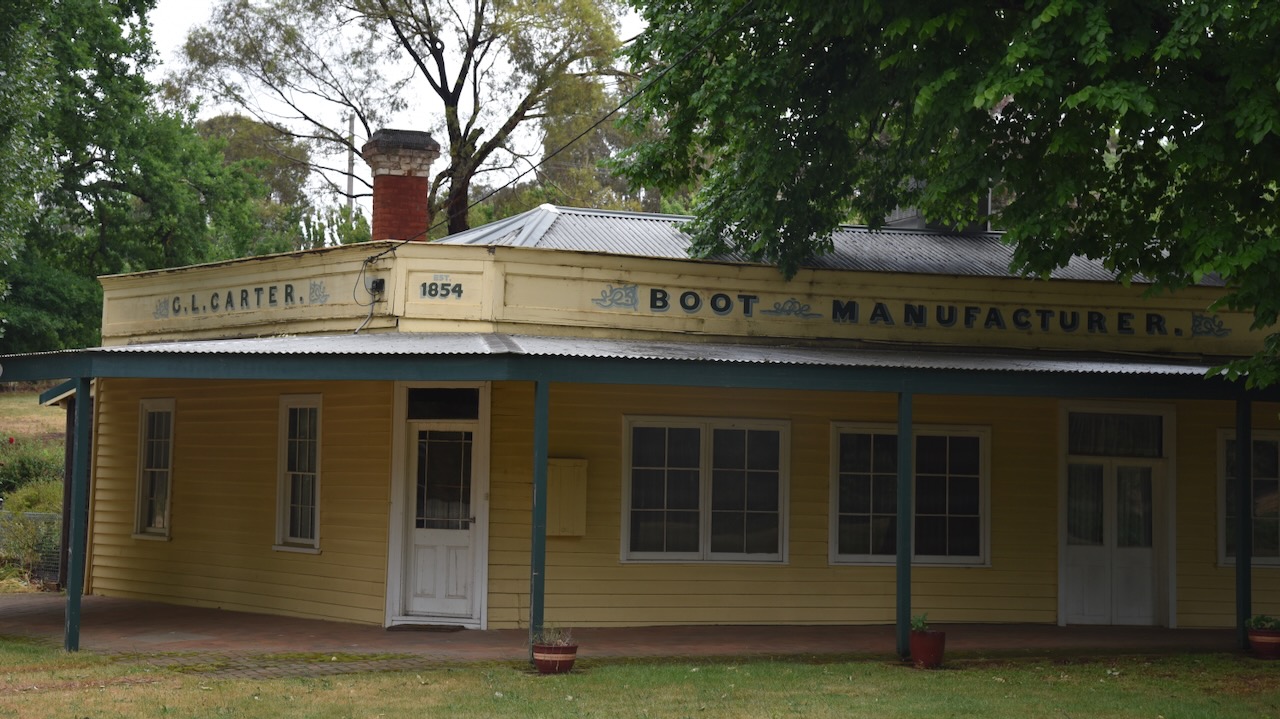
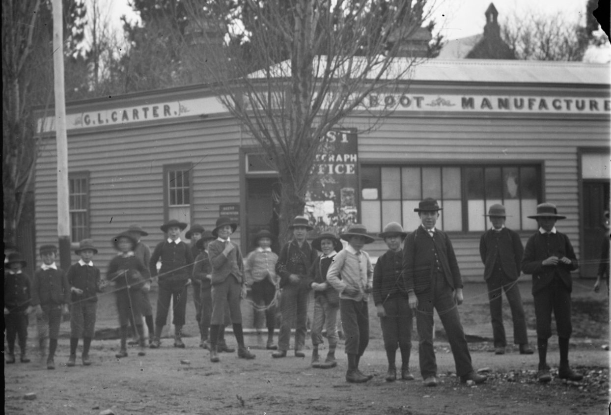
Another historic building is the old boot manufacturer building built in 1854, run by George Levi Carter. George was born in 1845 in Middlesex, England and emigrated to Australia. He established a boot manufacturing business. He died in 1941 at Fryserstown. (ancestry.com.au 2024)
Above:- a groupf of boys in front of the shop (between 1870-1910. Image c/o State Library Victoria.
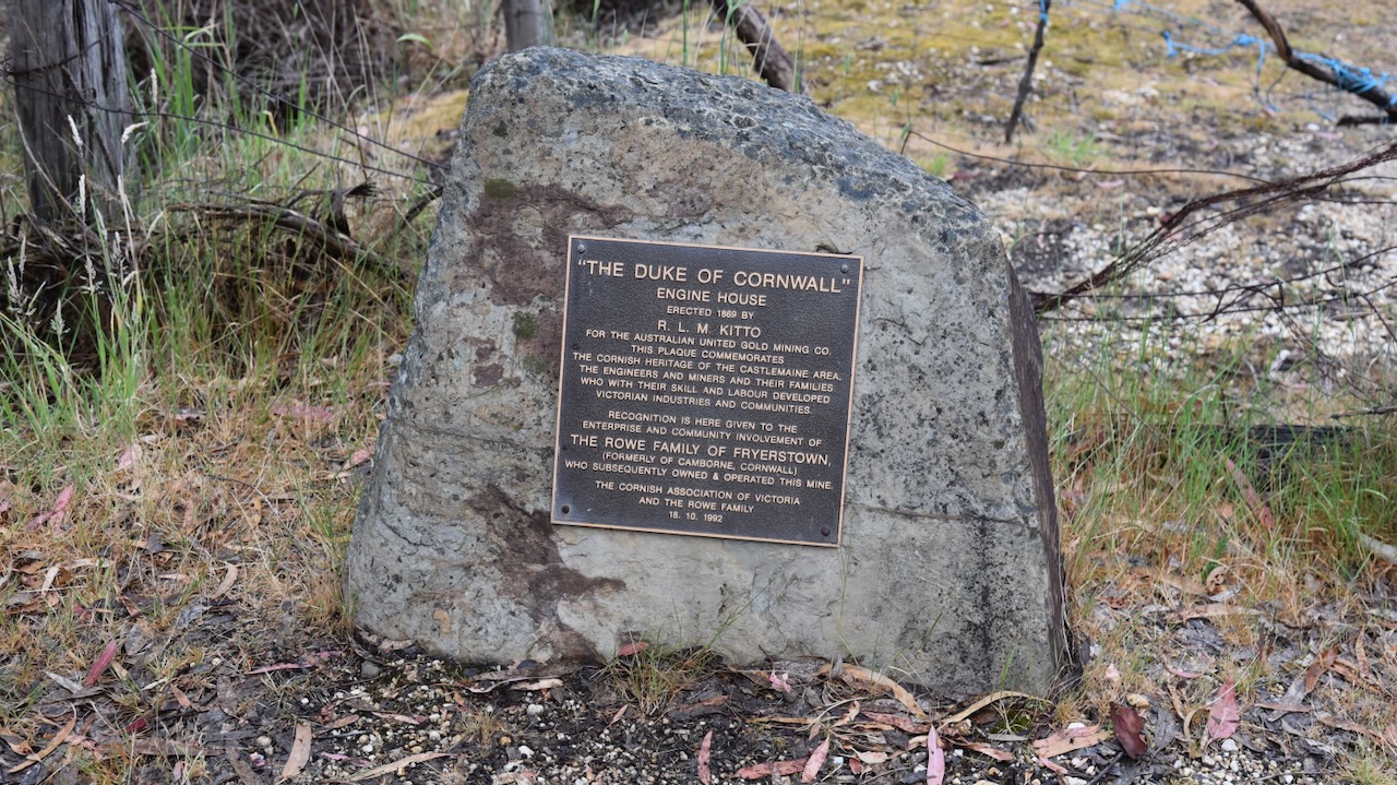
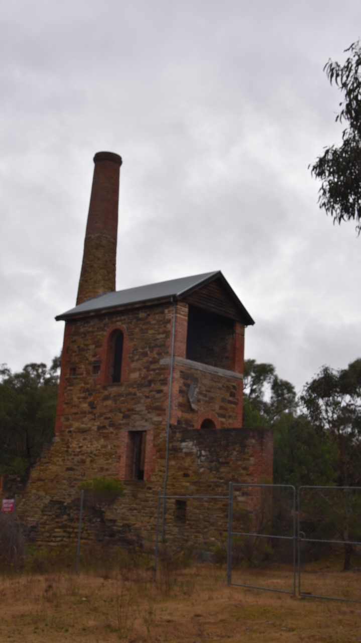
The Duke of Cornwall mine engine house was built c. 1865. The ruin is now on the Victorian and Australian historic buildings registers. (Victorian Places 2024)
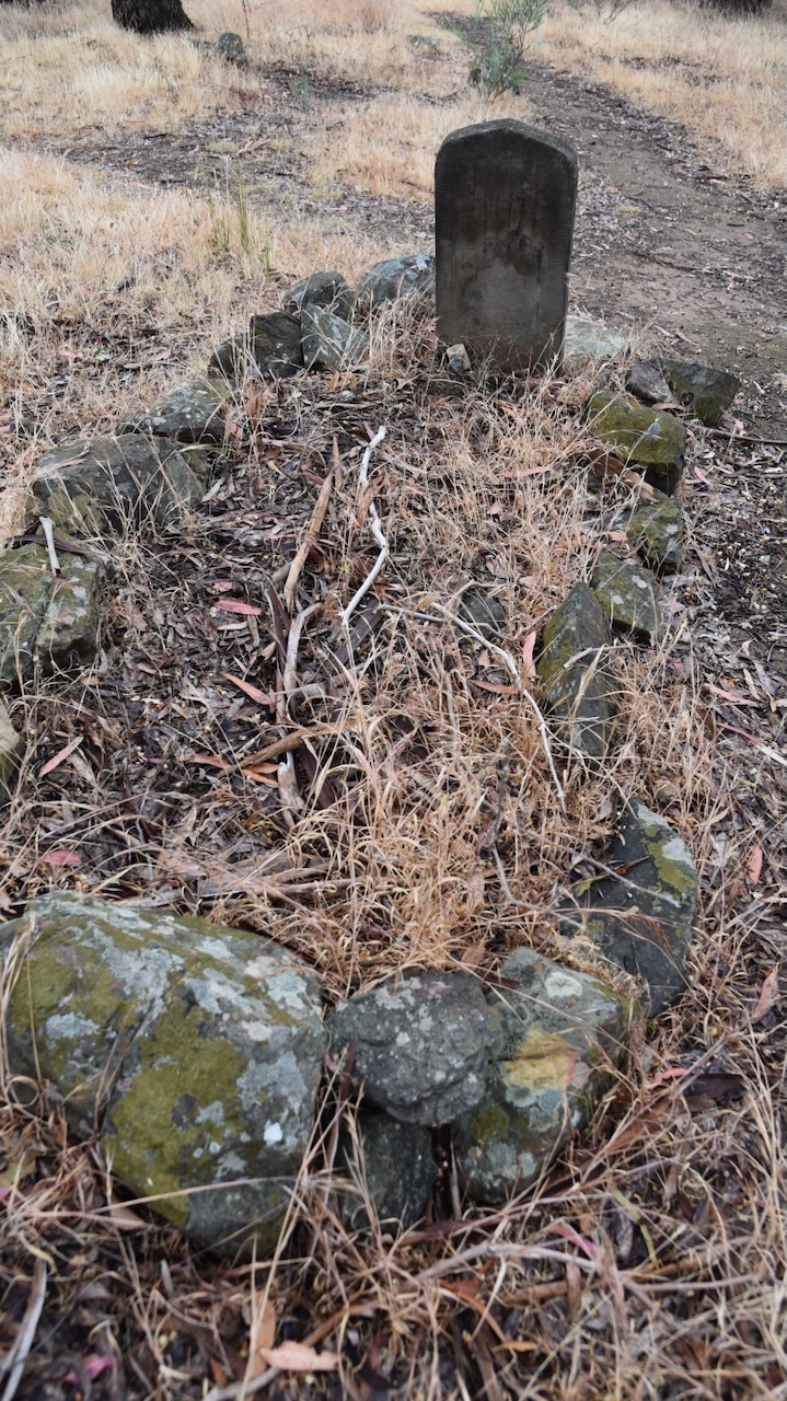
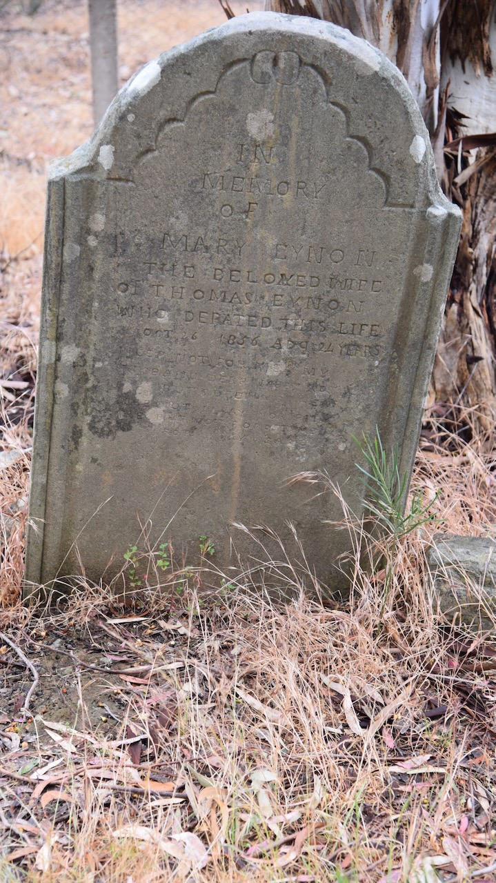
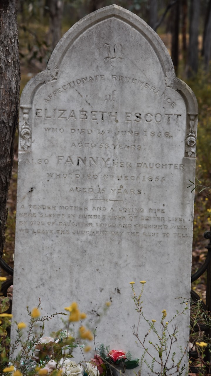
We then visited the remote gravesite of Elizabeth and Fanny Escott. It is located on Evanmore Track in Chewton.
Elizabeth Bruford was born in August 1803 in Somerset, England. In 1825 she married Thomas Escott. Following his death, Elizabeth emigrated to Australia in 1853 with her children. Upon arrival in Australia they headed to Fryerstown in the goldfields. Sadly, after only a few years in Australia, Elizabeth’s daughter Fanny died in Decenber 1855. Six months later in June 1856, Elizabeth also died. (Ancestry.com.au).
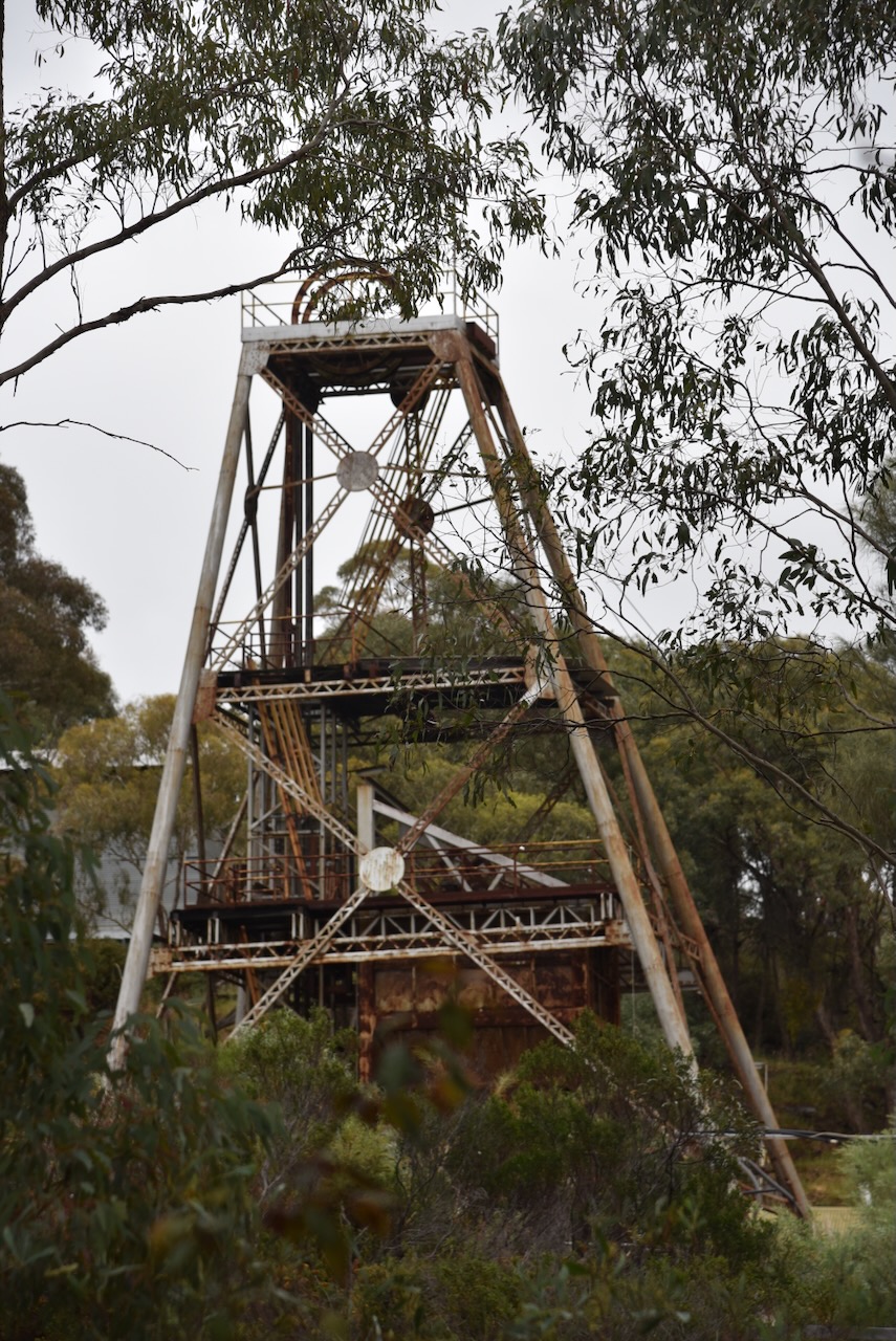
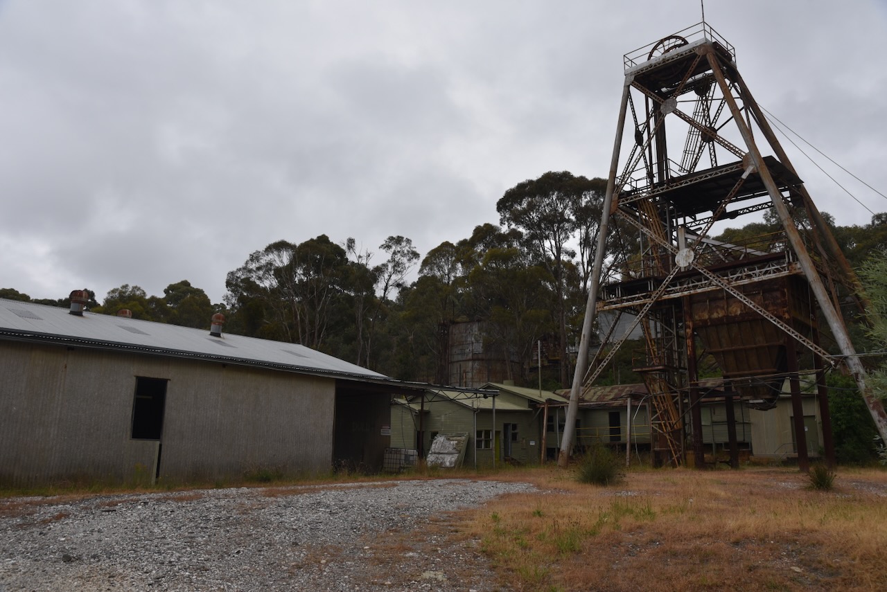
Our next stop was the Wattle Gully Mine at Chewton.
Wattle Gully was first worked in 1853. The miners located large amounts of alluvial gold, and also unearthed a quartz reef studded with gold. (FOMAD 2010)
About 80 years after the first discover of gold, a shaft was sunk in 1934 from the bottom of an old 1890s shaft to intersect the gold reef. However, when the correct depth was reached scarcely any gold was found. A survey was conducted and this found that the drill had been deflected westwards and struck a new lode of gold. By chance, the area’s largest and richest quartz gold deposit had been located. Over the next 30 years the mine would yield 350,000 ounces of gold worth about $140 million. (FOMAD 2010)
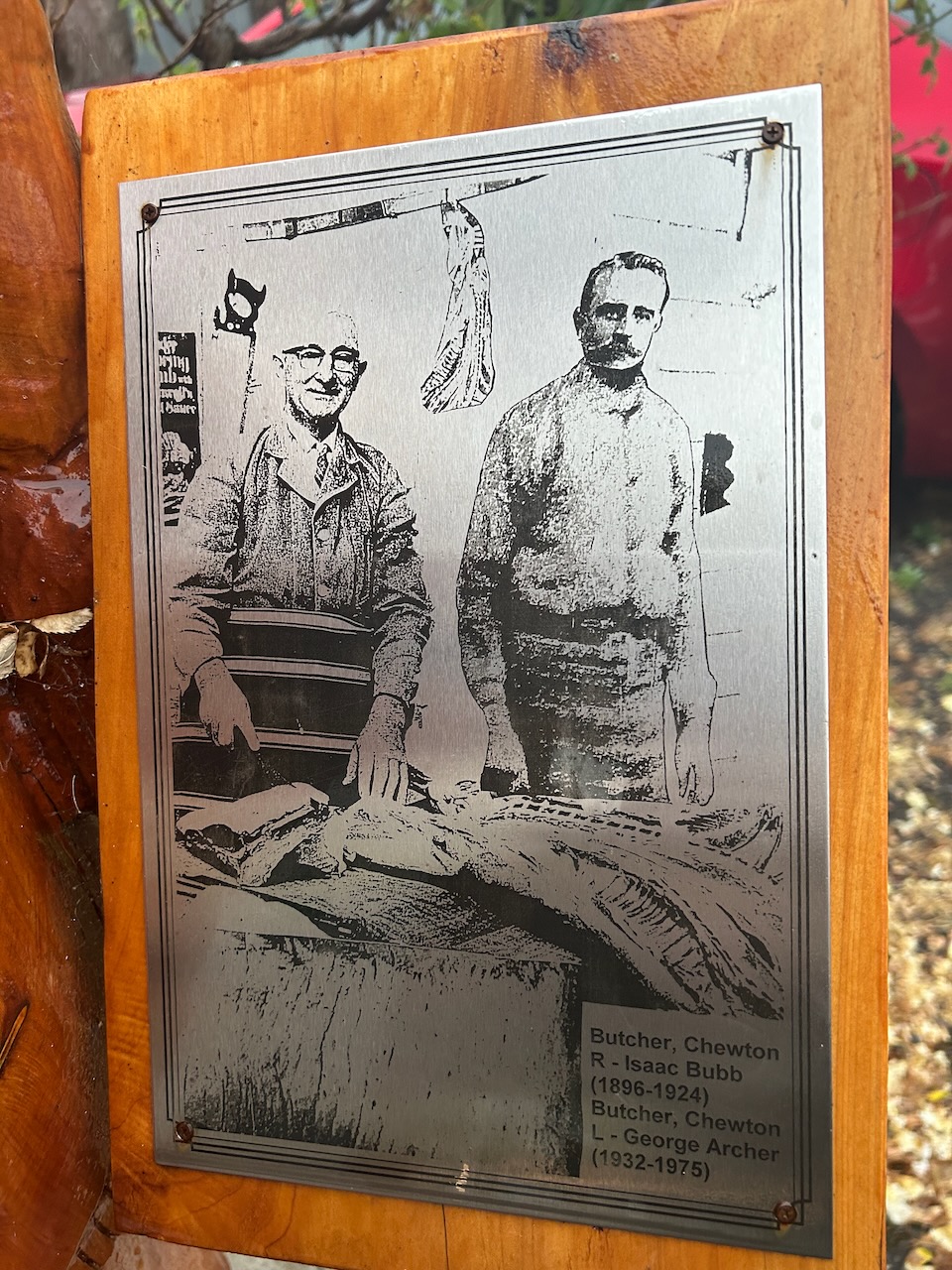
As we drove along Fryers Road we came across the old Blackwall Arms Hotel & Store that was built c. 1865. It was established by John Lockwood Westoby (b. 1827. d. 1880) and serviced the miners of the Chewton goldfields. Westoby was born in London, England in Decenber 1827 and emigrated to Australia in 1852. In 1911 George Archer purchased the property and it remained with the family until 2014. (Ancestry.com.au 2024) (Real Estate 2023)
As we approached Chewton we drove under the historic granite and red brick railway bridge.
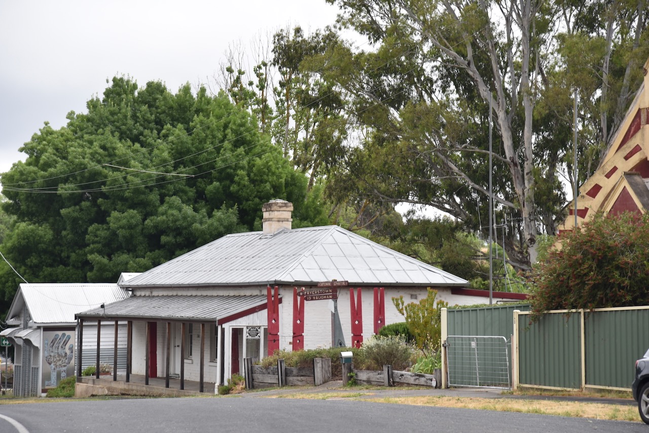
We then reached the town of Chewton, about 4 km east of Castlemaine.
Chewton was first known as Forest Creek, named after Forest Creek which flows from Chewton to Castlemaine. The name was changed to Chewton, in honour of Lord Chewton, an acquaintance of Lady Castlemaine. Chewton initially started as a canvas town with gold miners and soon became a brick and timber township. Several of the town’s historic 1860 and 1870 buildings still remain. During the 1860s Chewton had a court, a mining survey office, two banks, 14 hotels, butchers, grocers and blacksmiths. In December 1860, Chewton had been proclaimed a borough. (Victorian Places 2024)
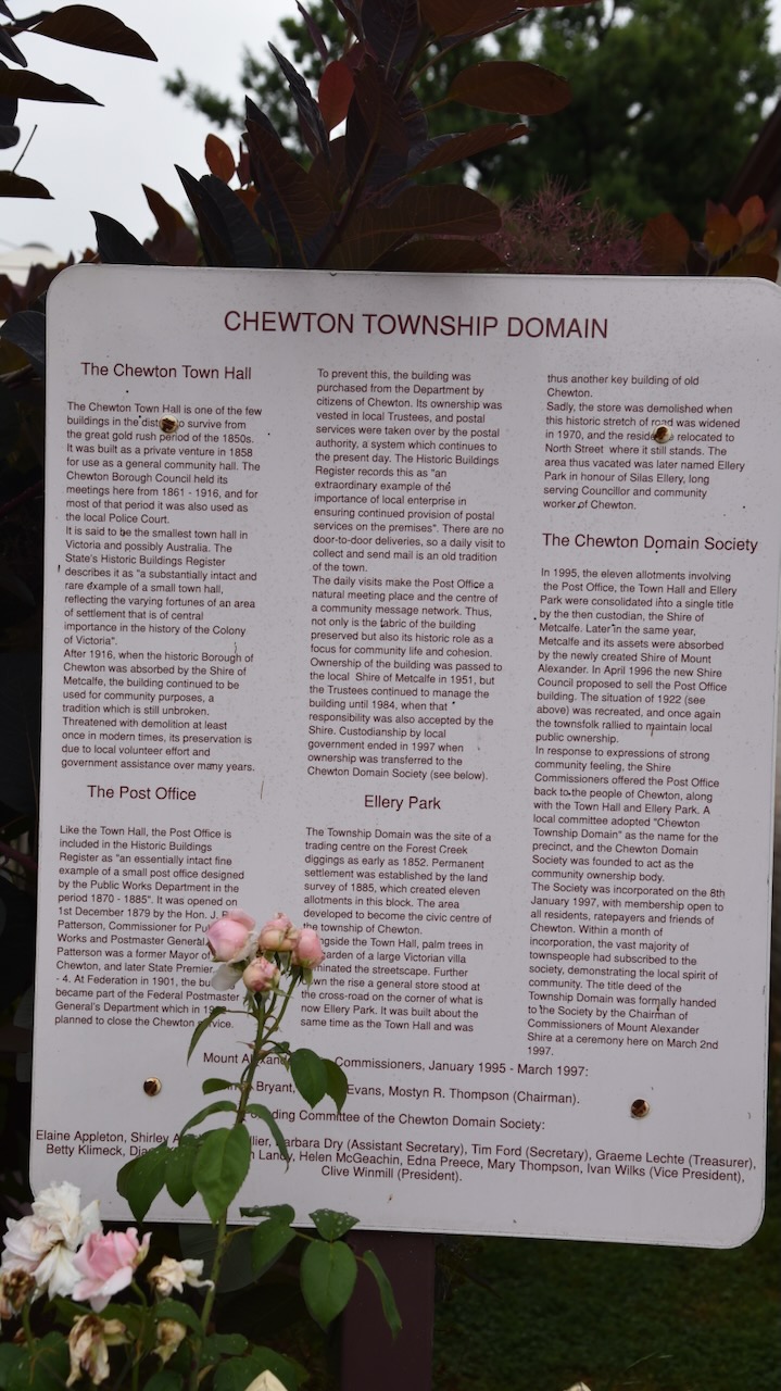
The old Chewton Town Hall was built in 1858 as a private venture for use as a general community hall. From 1861 to 1916 the Chewton Borough Council held its meetings in the building. During that time it was also used as a local Police Court. (chewton.net 2024)
The Chewton Post Office was opened on the 1st day of December 1879 by Victoria’s Commissioner for Public Works, the Hon. J.B. Patterson, formerly a Mayor of the Borough of Chewton, and later a Premier of Victoria from 1893 to 1894. In 1901 at Federation the building became part of the Postmaster-General’s Department. In 1922 there were plans to close the Post Office, but this was overcome by the purchase of the building by the citizens of Chewton. (chewton.net 2024)
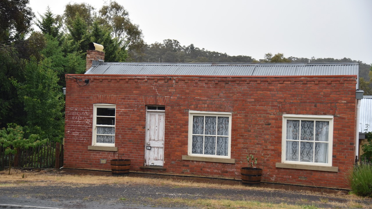
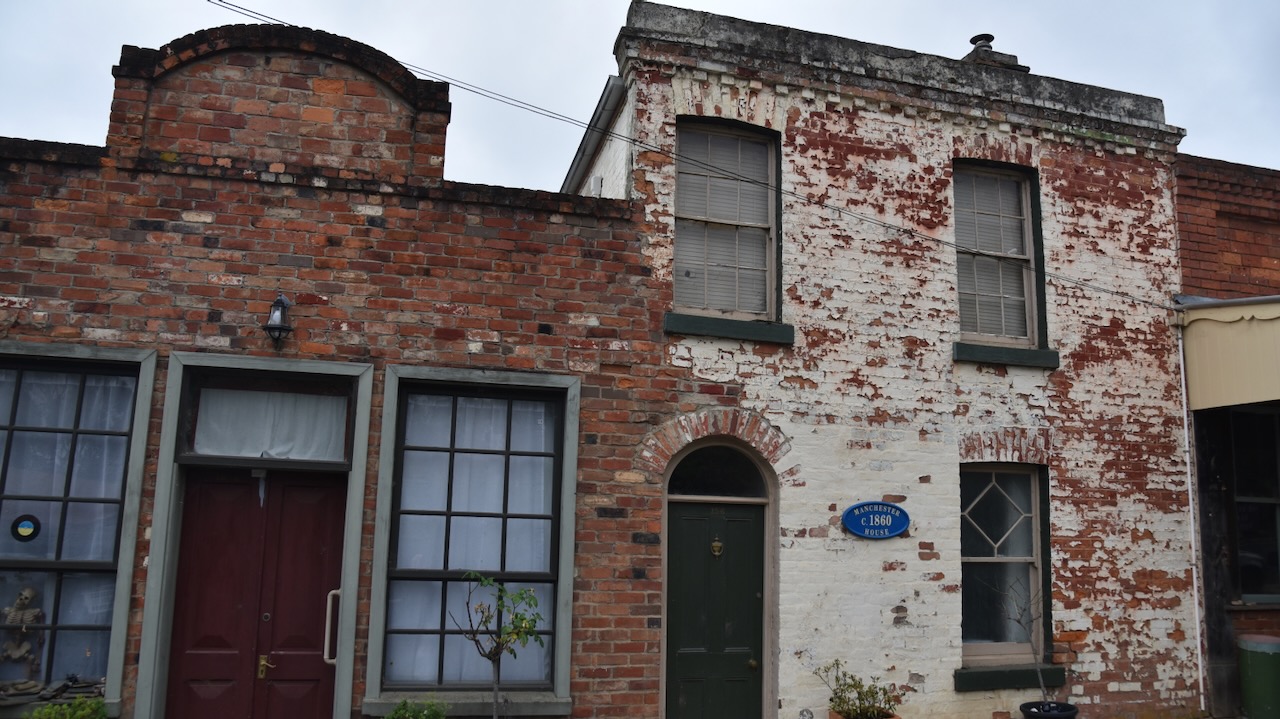
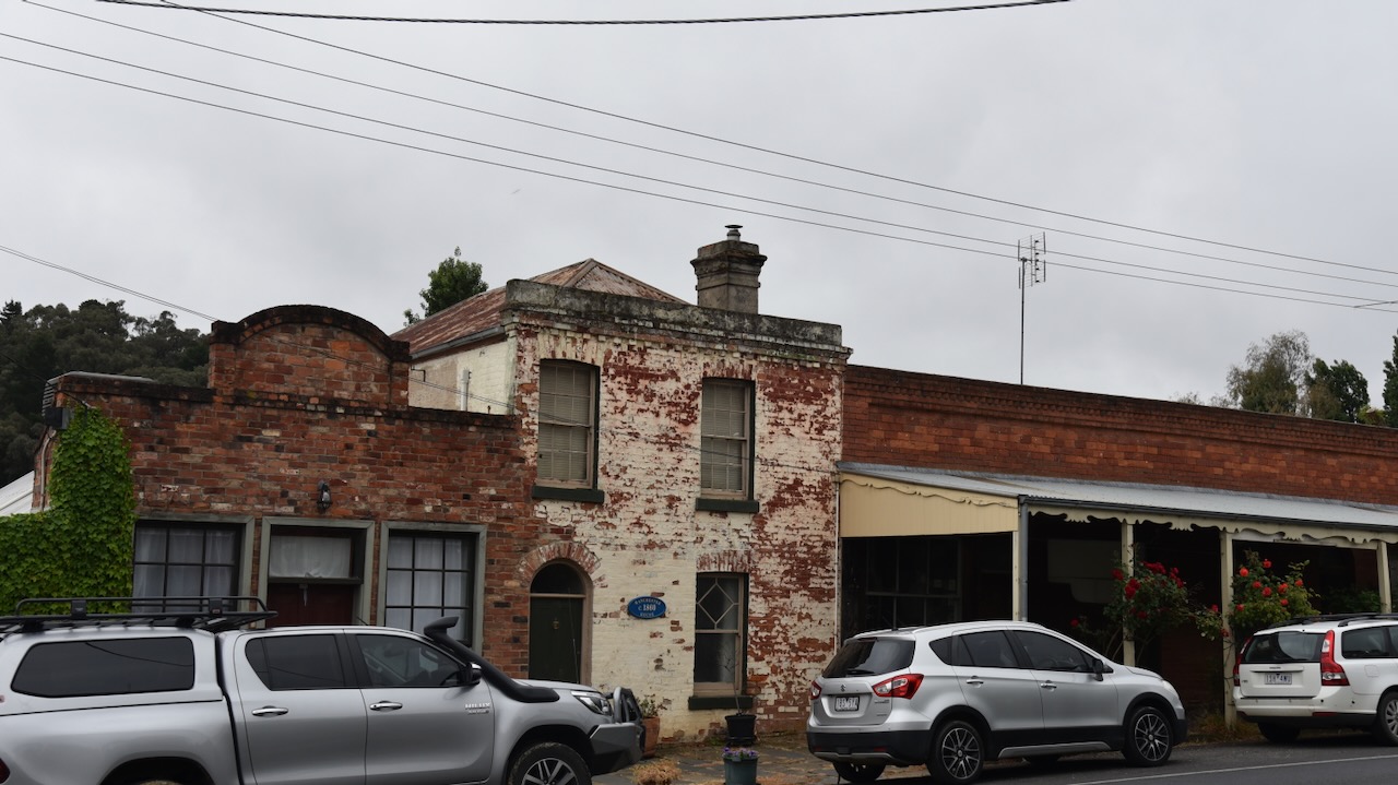
The Chewton bakery building was built in 1858/1859. C. McDonald, a photographic artist was one of the first owners of the building, who conducted a photography business from the building for a short time.
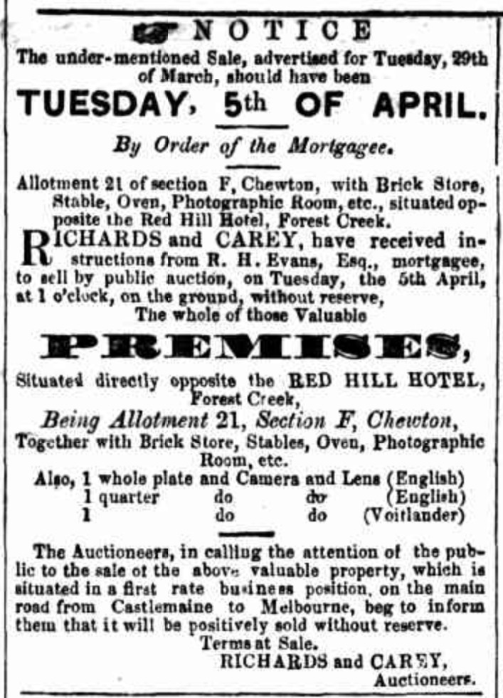
In 1859 the Mount Alexander Mail listed a mortgagee’s auction of the property as a brick store, stables, oven, and photographic room. (Trove, Mount Alexander Mail 1859)
Above:- Article from the Mount Alexander Mail, Fri 1 Apr 1859. Image c/o Trove.
During the 1860s the building was referred to as ‘Manchester House’ and was used for board and lodgings.
In the 1870s Robert Penney (b. 1848. d. 1932) purchased the building and ran his ‘Bread and Biscuit Baker, Confectioner & General Grocer’ business for about 50 years.
Above:- Advertisement in the Mount Alexander Mail, Thu 9 Apr 1903. Image c/o Trove.
In 1912 the building was sold to John White, and then to William Minhan in 1926. In 1955 it was purchased by Earl Ralph and it operated as a bakery until 1976. Following this the building functioned as a Tea Rooms, an Antique store, and a private residence
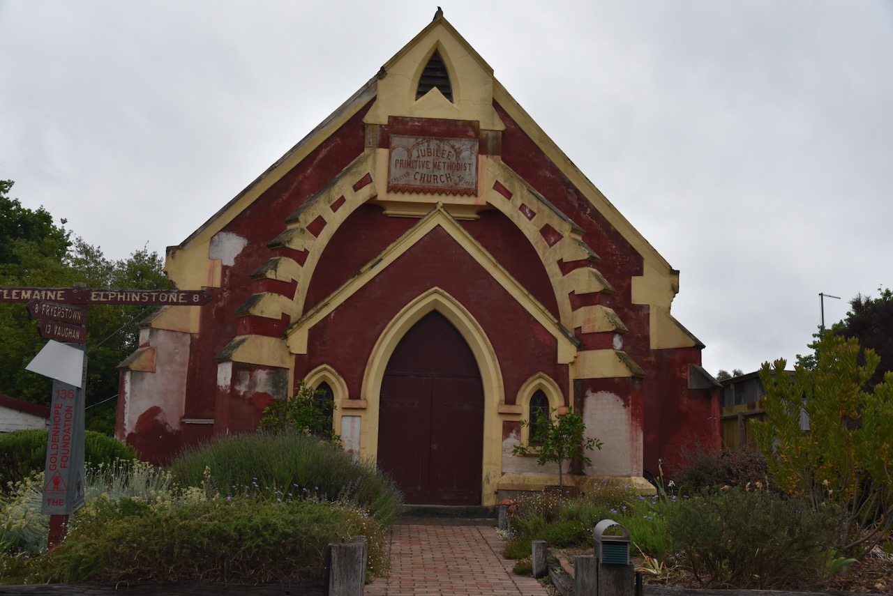
The former Primitive Methodist Church was built in 1860 and was designed by Crouch and Wilson. The church is an unusually early use of the Gothic style by the Primitive Methodists. (Victorian Heritage Database 1989)
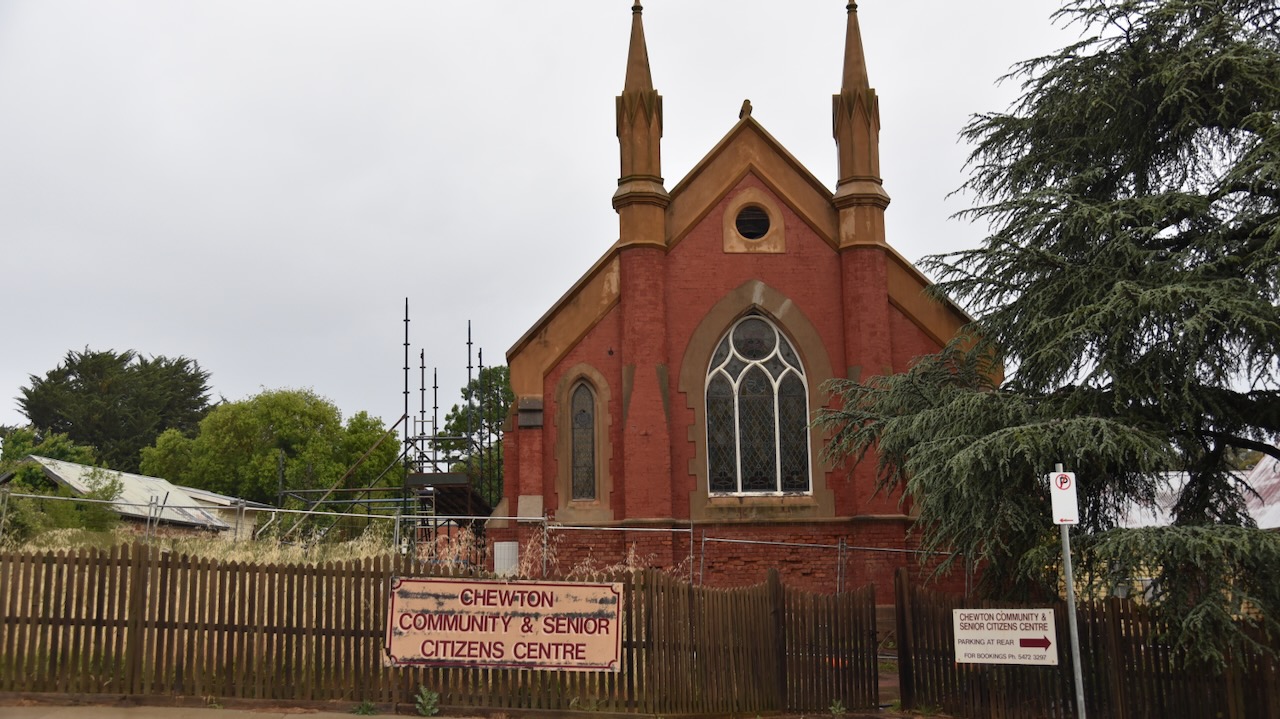
The former Wesleyan church at Chewton was opened in 1861.
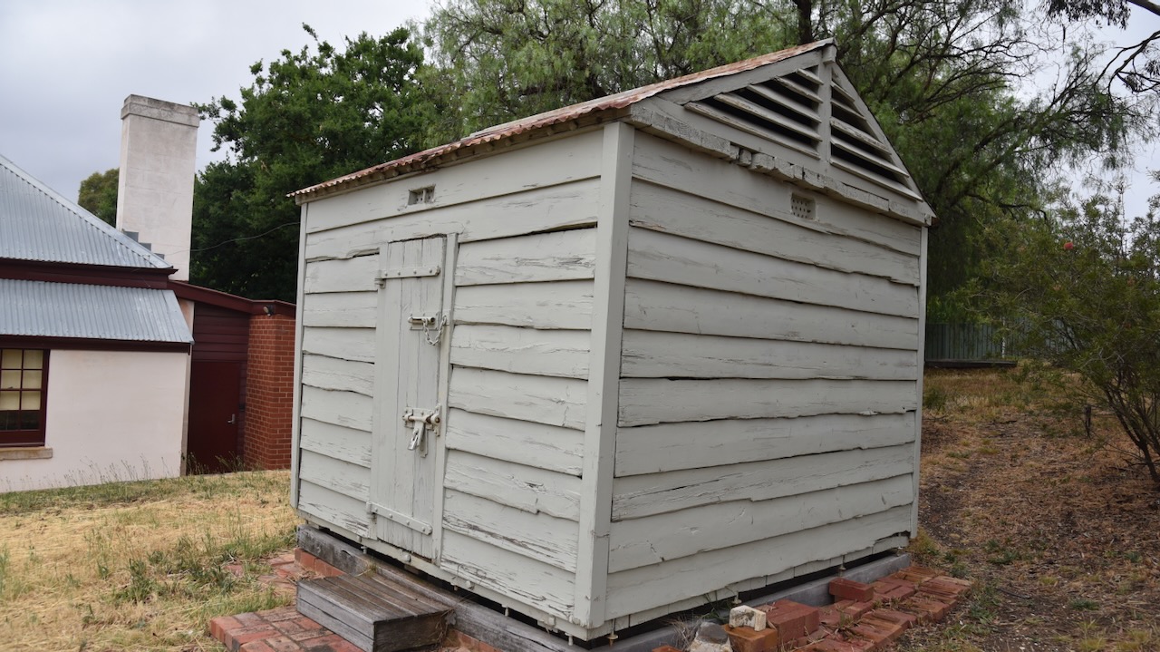
One of the oldest portable police lockups can be found in Chewton. It was built in the 1860s and was relocated from the former police quarters behind the town hall following restoration in 1994/1995.
In June 1948, a Chewton resident miraculously survived a freak accident at her home. Mrs. Frances White was at her home in Main Road Chewton, when part of her backyard suddenly caved in and left her hanging precariously at the edge of a hole 80 feet deep and 8 feet in diameter. Her home was located on an old disused Gold mine shaft.
There is a magnificent wooden sculpture of Mrs. White at this location.
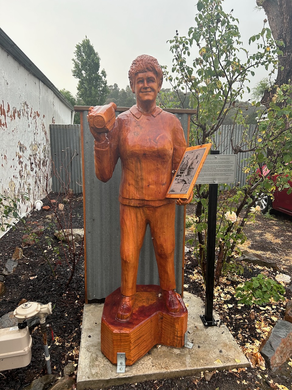
Another wooden sculpture to be found in the town is that of Elaine Mary Appleton who has been passionate in capturing Cheston’s history.
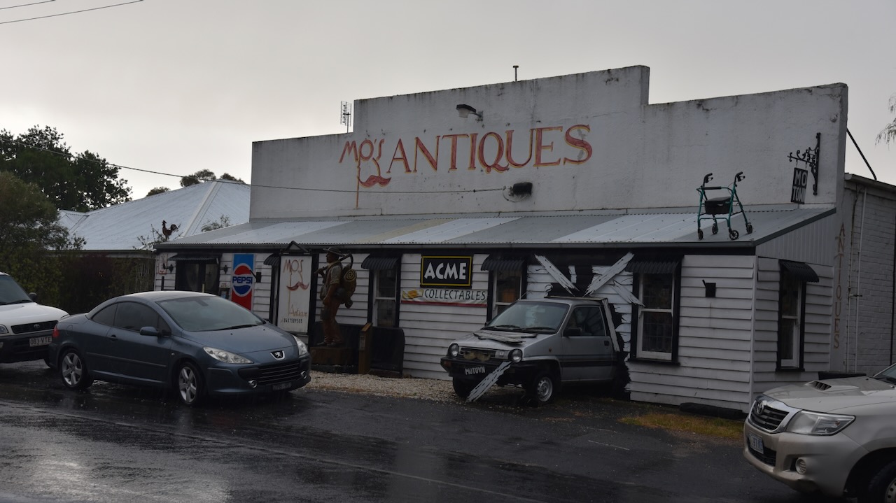
Mo’s Antiques is a unique building where you can view a car that appears to have crashed through the building’s front wall from inside the building. Outside Mo’s is the Mo the Miner sculpture, an 1850s gold miner. The sculpture was commissioned in 2015 by Gerald ‘Mo’ St John and was created by local sculptor Richard Yates. (Goldfields Guide 2024)
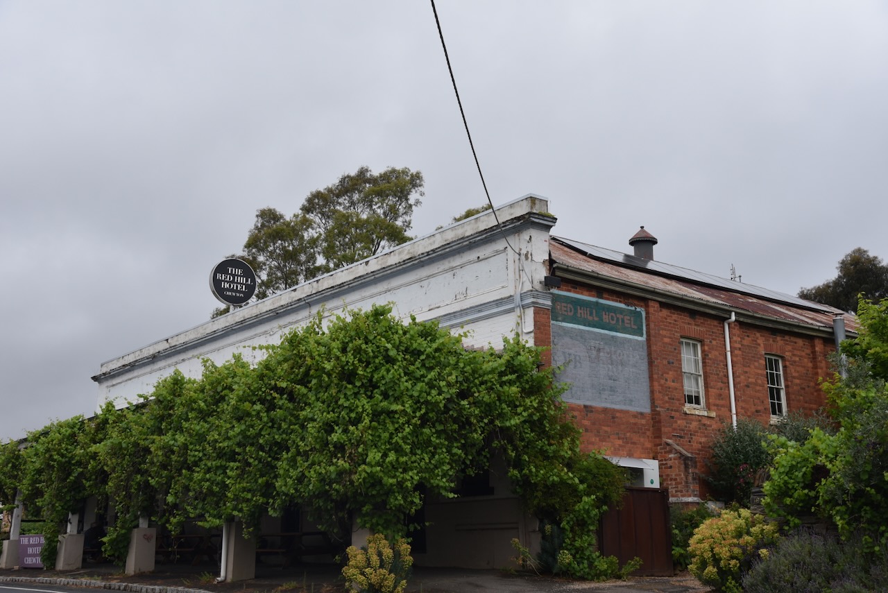
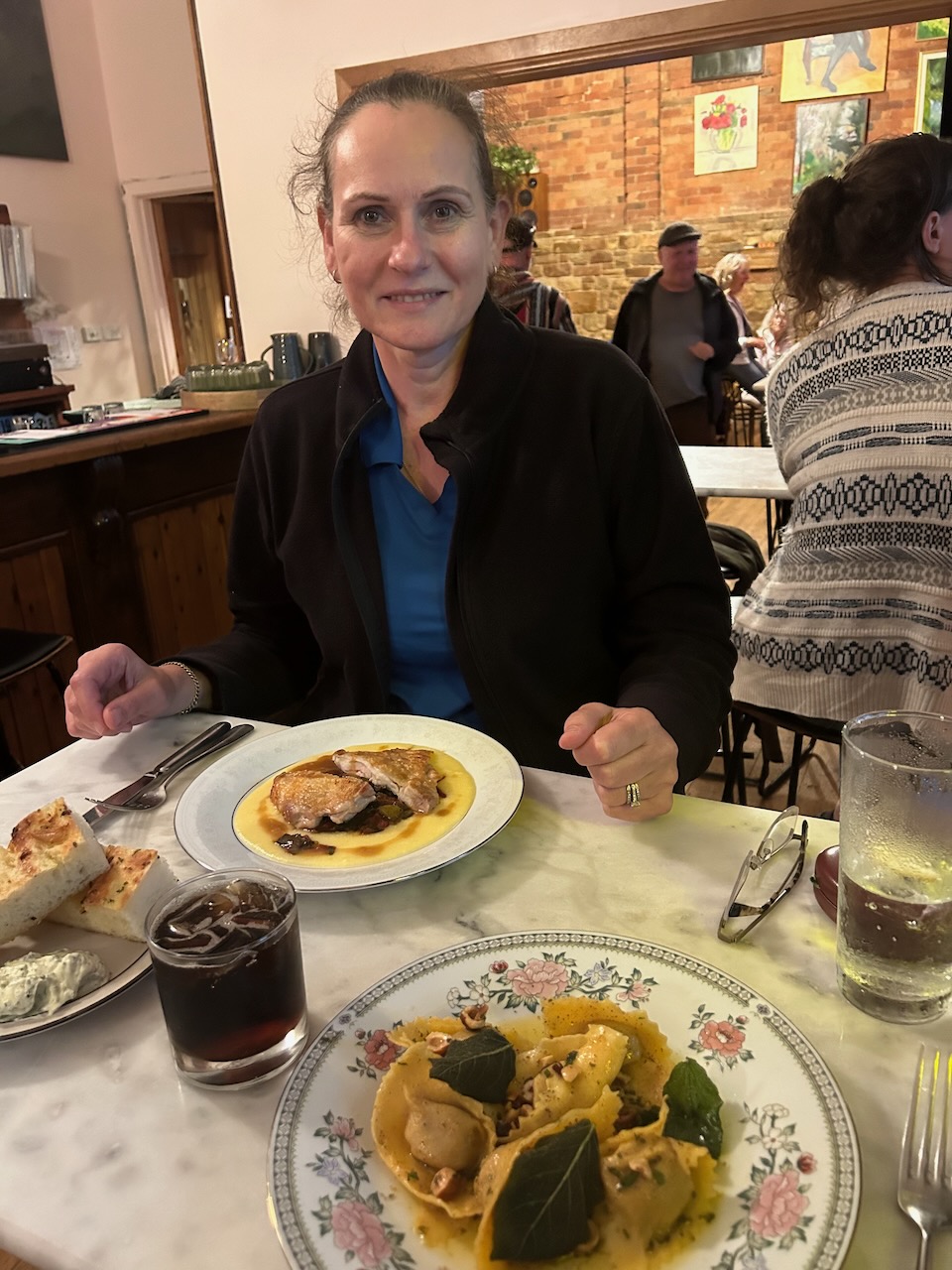
It was dinner time so we headed to the Red Hill Hotel. This historic hotel was opened in 1854.
We enjoyed a very nice meal and a few quiet drinks.
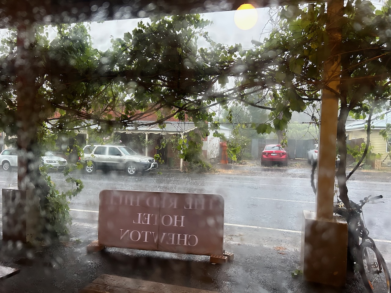
Whilst we were at the hotel, the heavens opened up and Chewton had torrential rain. Even the pub experienced flooding.
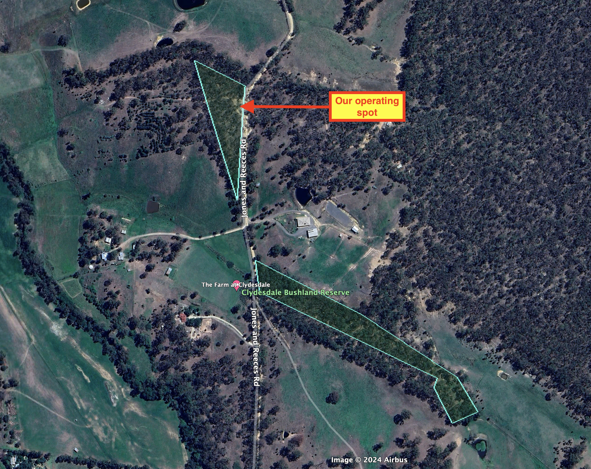
The weather had cleared a little, so we decided to activate the Clydesdale Bushland Reserve VKFF-4278.
The reserve is located in two parts on the eastern and western sides of Jones and Rece Road at Clydesdale. The reserve is about 3.5 hectares in size and was established on the 23rd day of August 1988. (Blake 1978) (CAPAD 2022)
Clydesdale takes its name from Clyesdale, near Mossend, North Lanark, Scotland. (Blake 1978)
We found a dirt track running off Jones and Reece Road. We ran the Yaesu FT857, 40 watts, and the 20/40/80m linked dipole for this activation. I used the special event callsign of VI10VKFF to celebrate the 10 year anniversary of the World Wide Flora Fauna program in Australia.
Above:- An aerial view of the reserve showing our operating spot. Image c/o Google Earth.
Marija worked the following stations on 40m SSB:-
VK1AO
VK2MET
VK3YV
VK3YNL
VK3APJ
VK4SMA
VK2IO/p (Molonglo Gorge Nature Reserve VKFF-0991)
VK2KET
VK2YW
VK3PF
VK3KAI
KG5CIK
VK3BBB
VK2CCP
VK3CEO
VK2MOE/p (Coolah Tops National Park VKFF-0111)
I worked the following stations on 40m SSB:-
VK1AO
VK2MET
VK3YV
VK3YNL
VK3APJ
VK4SMA
VK2IO/p (Molonglo Gorge Nature Reserve VKFF-0991)
VK2KET
VK2YW
VK3PF
VK3KAI
KG5CIK
VK3BBB
VK2CCP
VK3CEO
VK2MOE/p (Coolah Tops National ParkcVKFF-0111)
VK4NH
VK4DXA
VK3SO
VK2GWB
VK3EJ
VK7MAT
VK5HW
VK1CHW
VK2MOP
VK2PBC
VK3VIN
VK3CLD/p
VK3SMW
VK3UAO
VK2DHN
VK5HS
VK5AEZ
VK3SG
VK1CT
VK1KAZ
I worked the following stations on 40m AM:-
VK5HS
VK3CEO
I worked the following stations on 80m SSB:-
VK3PF
VK3KAI
VK5HS
I worked the following stations on 20m SSB:-
VK4SMA
IK4IDF
References.
Ancestry.com.au. (2016). Ancestry® | Genealogy, Family Trees & Family History Records. [online] Available at: https://www.ancestry.com.au/ [Accessed 28 Mar. 2024].
Real estate (2023). Real Estate, Property & Homes for Sale – realestate.com.au. [online] Realestate.com.au. Available at: https://www.realestate.com.au. [Accessed 28 Mar. 2024].