
It was now Saturday 25th November 2023, and day one of the 2023 VKFF Activation Weekend for the World Wide Flora Fauna (WWFF) program. The VKFF Activation Weekend was initiated in 2015. The weekend is designed to promote the World Wide Flora Fauna (WWFF) program in Australia, by encouraging amateurs to get out into the field and operate portable from a qualifying VKFF reference area. It is generally a very popular weekend.
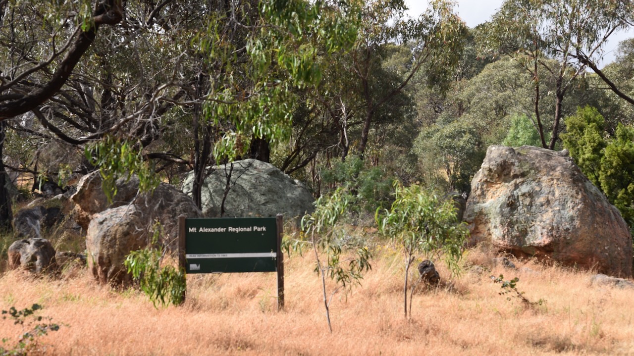
Our first activation of the day was the Mount Alexander Regional Park VKFF-0973 and the SOTA summit Mount Alexander VK3/ VN-016.
The park is about 19 km (by road) northeast of Castlemaine and about 125 km northwest of Melbourne.
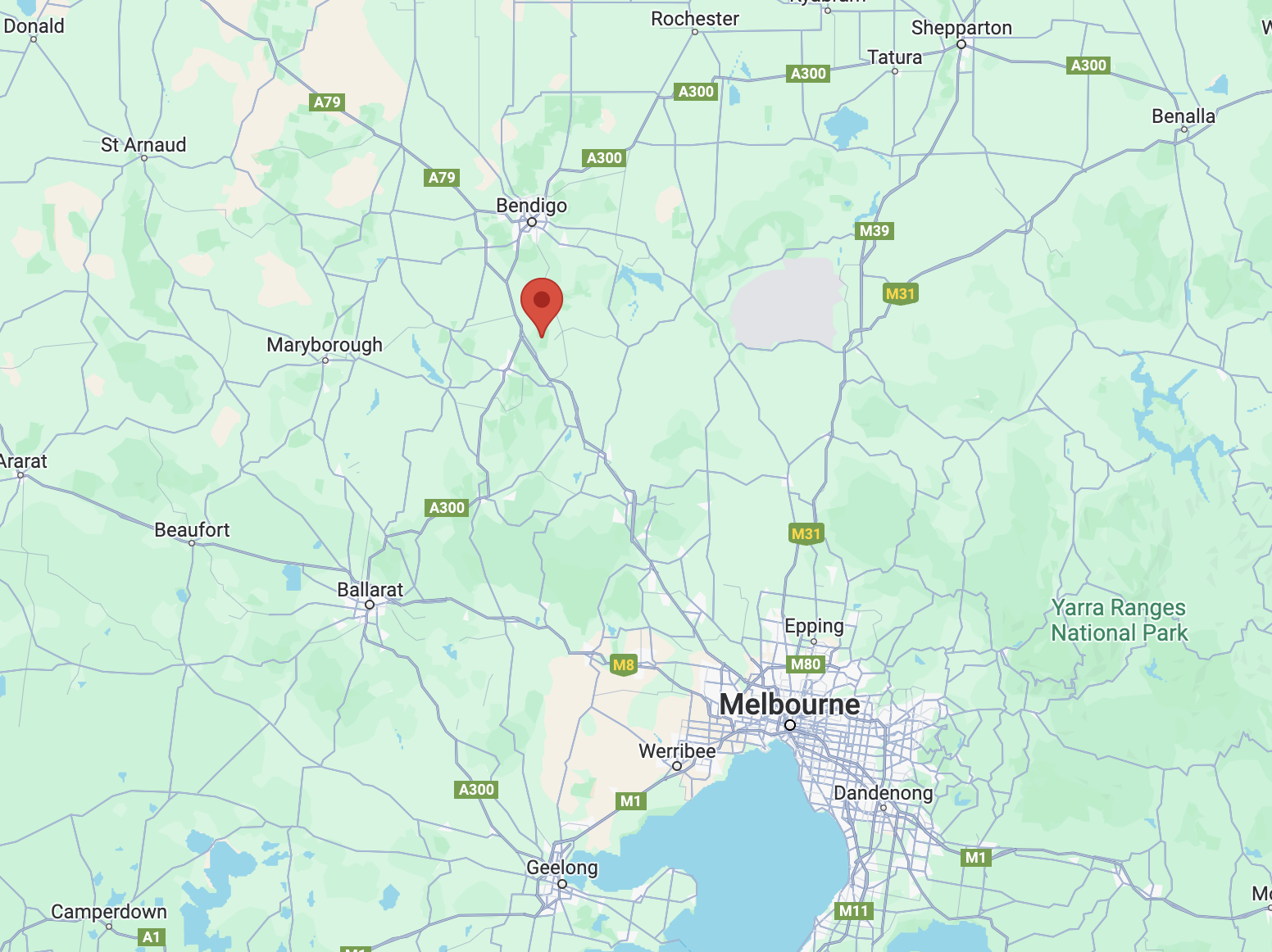
Above:- Map showing the location of Mount Alexander. Map c/o Google Maps.
The Mount Alexander region is the traditional home of the Jaara Jaara aboriginal people. The summit of Mount Alexander is known as Lanjanuc or Lenganook and was the location of a sacred ceremonial ground and was used as an outlook due to its high vantage point. (Mt Alexander Regional Park Visitor Guide 2010)
The first European to climb Mount Alexander was the explorer Major Thomas Livingstone Mitchell (b. 1792. d. 1855). He conquered the mountain on the 28th day of September 1836 during his Australia Felix journey.
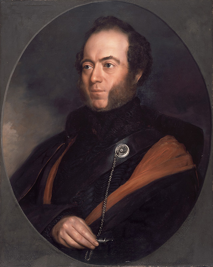
Above:- Major Thomas Mitchell. Image c/o Wikipedia.
Mitchell initially named the mountain Mount Byng in honour of John Byng, 1st Earl of Strafford, a Field Marshal during the Peninsular War. (Victorian Places 2024)
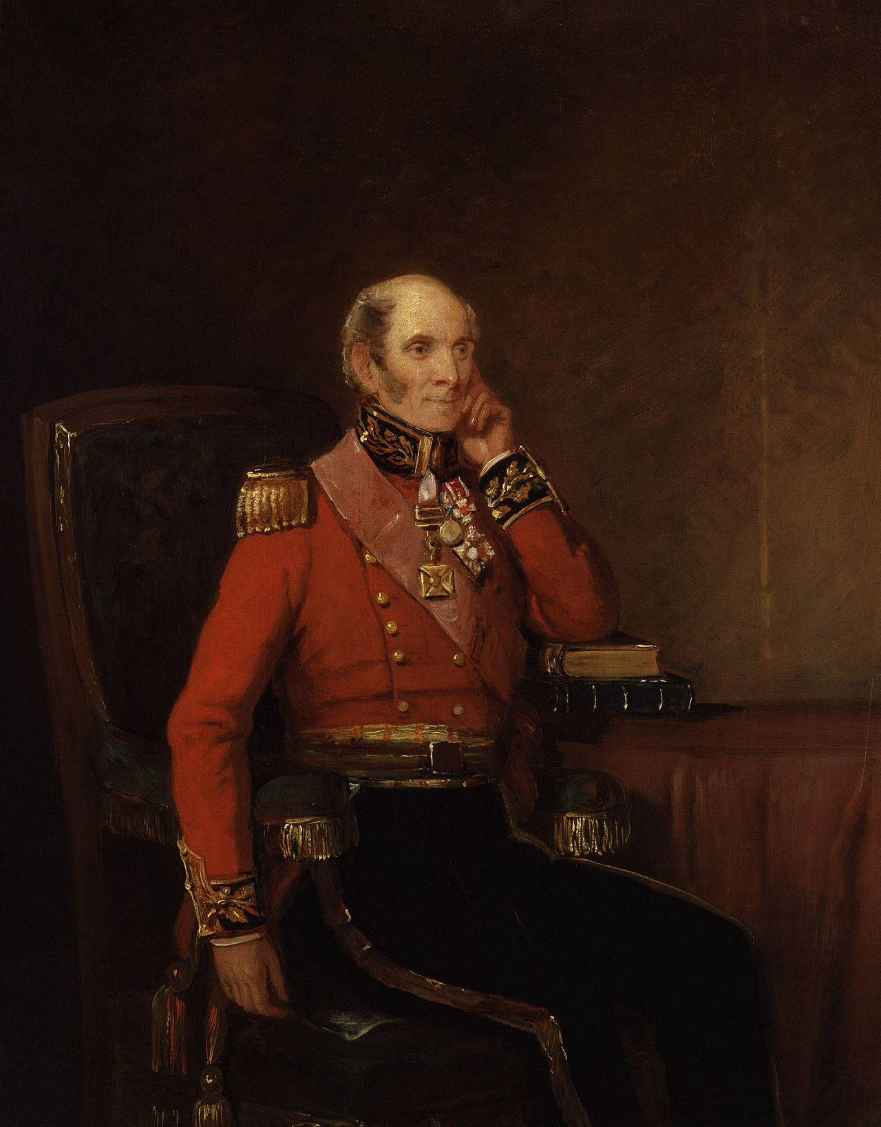
Above:- John Byng. Image c/o Wikipedia.
The mountain’s name was changed to Mount Alexander in honour of Alexander the Great, emperor of ancient Macedonia. (Victorian Places 2024)
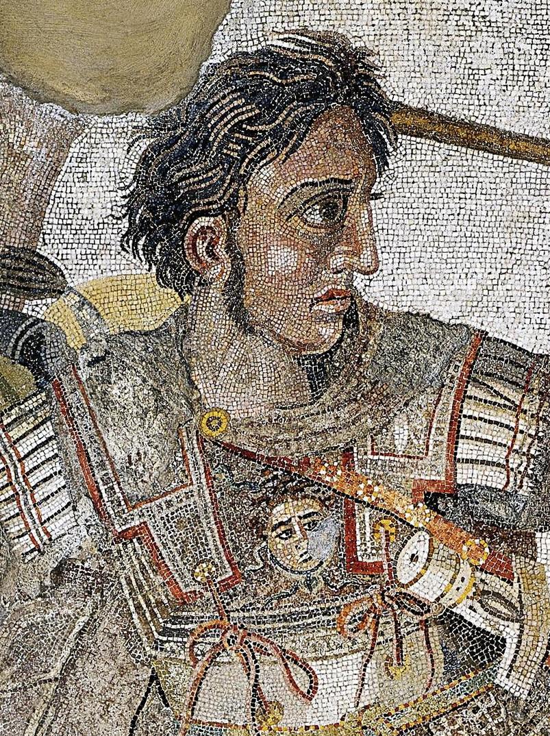
Above:- Alexander the Great. Image c/o Wikipedia.
A few years later, on the 8th day of February 1838, explorer Edward John Eyre (b. 1815. d. 1901), camped on the northwest slope of Mount Alexander. (Waterhouse)

Above:- Edward John Eyre. Image c/o Wikipedia.
In 1851 gold was discovered close to Mount Alexander and tales that the area was the new ‘Eldorado’ swept across the world. The goldfields became known as Forest Creek or Castlemaine and they became the richest shallow alluvial goldfields in the world and one of the largest goldrush areas of the 1800s. (Mt Alexander Regional Park Visitor Guide 2010)
Gold was first discovered on the 20th day of July 1851 at Specimen Gully on Barkers Creek by a shepherd, Christopher Thomas Peters. He worked for Dr. William Barker on his Mount Alexander Run. When the gold was shown, Peters was mocked as it was believed the gold was ‘fool’s gold’ and it was thrown away. Dr. Barker did not want his workers to abandon his sheep.
In September 1851 the workers sent a letter to The Argus declaring the ‘new goldfield’.
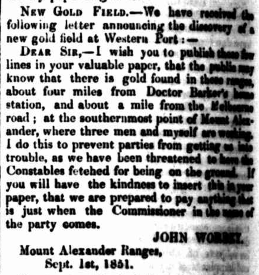
Above:- Letter from The Argus, Melbourne, Mon 8 Sep 1851. Image c/o Trove.
Within a month, about 8,000 miners were working on the alluvial gold fields at Mount Alexander. By the end of 1851, an estimated 25,000 diggers were working on the gold fields.

Above:- The Mount Alexander Gold diggings. Image c/o State Library Victoria.
During the 1850s a gold escort route was established by Alexander Tolmer (b. 1815. d. 1890) between Mount Alexander and Adelaide, South Australia. Tolmer would later become the Commissioner of Police in South Australia.
Above:- Alexander Tolmer. Image c/o Wikipedia.
The first escort undertaken contained about 270 kg of gold and arrived in Adelaide on the 20th day of March 1852. The second escort contained even more gold, about 730 kg of gold.

Above:- Gold escort 1852. Image c/o Wikipedia.
About 110,00 kg of gold was extracted from the Mount Alexander goldfields in the first 2 years of the gold rush.
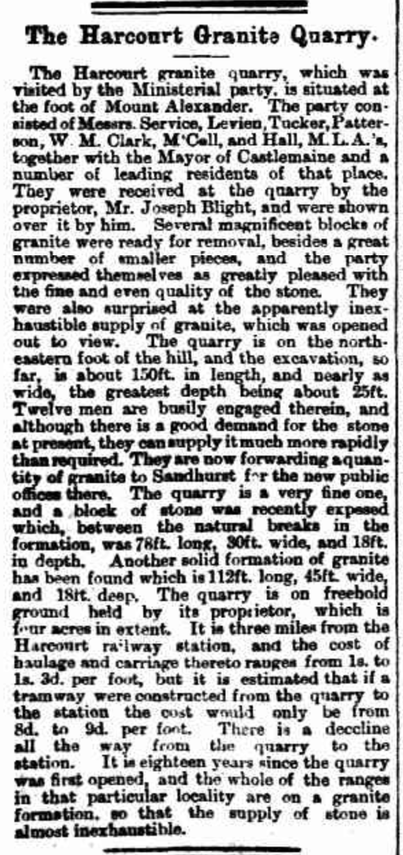
By the 1860s, quarries had opened at Mount Alexander to provide stone for the Northern Railway (Melbourne to Echuca Railway). Granite was subsequently used for buildings in Melbourne. One of those involved in this industry was Joseph Blight (b. 1832. d. 1897), a Cornish quarryman who had been involved in quartz reef mining at Eureka Reef. He commenced work at Blight’s Quarry in 1862. By the 1870s Mount Alexander had been stripped of vegetation to provide timber for the goldfields. (Ancestry.com.au 2024) (Mt Alexander Regional Park Visitor Guide 2010)
Above:- An article from the Weekly Times, Melbourne, Sat 24 Mar 1883. Image c/o Trove.
In 1867, a huge bonfire was constructed on the top of Mount Alexander to be lit in honour of the visit of the Duke of Edinburgh. (Mt Alexander Mail 1867)
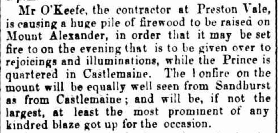
Above:- Article from the Mount Alexander Mail, Sat 23 Nov 1867. Image c/o Trove.
The Mount Alexander Regional Park is about 1,400 hectares in size and lies within the Harcourt granite intrusion that is believed to be about 367 million years old. You can view numerous rock boulders in the park. The park has steep slopes, tall trees and rocky outcrops. (Mt Alexander Regional Park Visitor Guide 2010)


Native animals that can be found in the park include koalas, Eastern Grey kangaroos, echidnas, Brushtail and Ringtail possums, Sugar Gliders and the Brush Tailed Phascogale. (Mt Alexander Regional Park Visitor Guide 2010)
A popular abseiling spot in the park is Dog Rocks, a large outcrop of granite boulders on the western slopes of Mount Alexander. In 1846, Lockhart Moton, the manager of Sutton Grange Station, named the rocks as they were a favourite lair of a pack of dingoes. (Gold Fields Guide 2024)


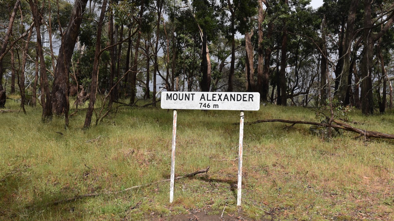
The Mount Alexander summit is 741 metres above sea level and is worth 4 points in the Summits On The Air (SOTA) program. It has been activated a total of 111 times. It was first activated on the 13th day of May 2012 by Wayne VK3WAM. (SOTA 2024)

Above:- An aerial view of Mount Alexander looking towards Bendigo. Image c/o Google Maps.
Although there are communication equipment towers on the top of Mount Alexander, Marija and I did not experience any interference.


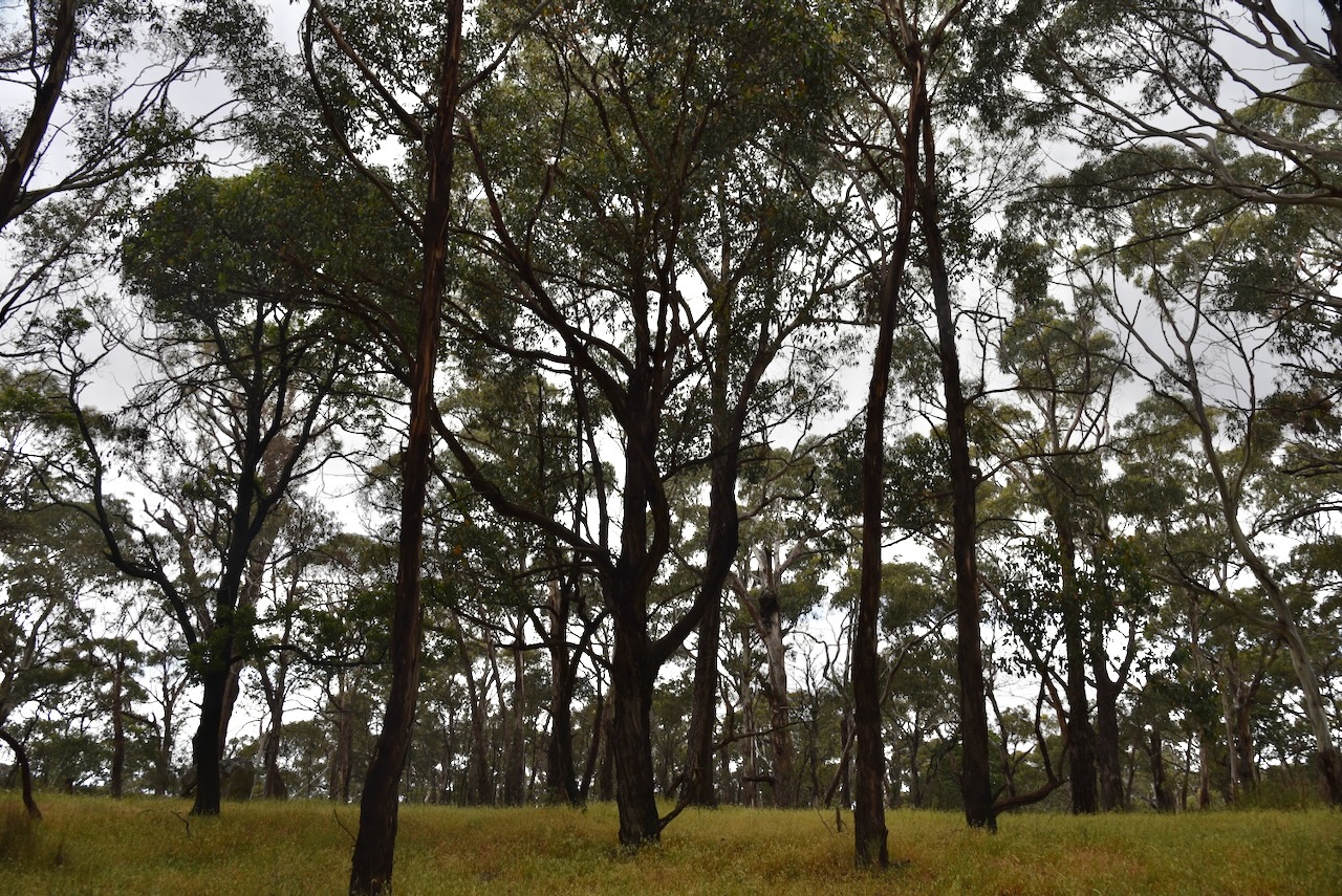
Marija and I drove along Joseph Young Drive and found a clearing in the scrub, south of the communication towers and within the activation zone.
Joseph Young Drive is named in honour of long-serving Metcalfe Shire councillor Joseph Young. The road was pioneered by a group who wanted a tourist road constructed across the top of Mount Alexander. In 1928, Colonel James H. Lang the Vice President of the Royal Automobile Club of Victoria (RACV) pushed for the road to be constructed.
In June 1928, James Lang and his 24-year-old son Alan Lang in a Buick, and the Mayor of Councillor. J.R. Duggan in a Chevrolet accompanied by Mr A.S. Collings Borough Surveyor and the Hon. S.W. Lawson, drove across Mount Alexander in a zig-zag fashion to prove that a tourist road was feasible. In 1930 the road was constructed for £23.

Above:- Article from The Argus, Melbourne, Mon 15 Dec 1930. Image c/o Trove.
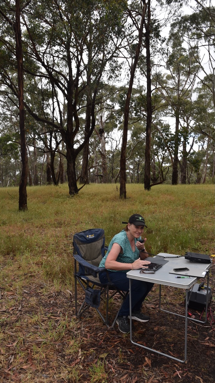
For this activation, we ran the Yaesu FT857, 40 watts, and the 20/40/80m linked dipole. I used the special event callsign of VI10VKFF.
As this was a ‘drive-up’ SOTA summit we had the luxury of a fold-up table and deck chair. We were also set up before the ‘UTC rollover’.

We logged a total of 78 QOS, including 28 Park to Park contacts.
Marija worked the following stations on 40m before the UTC rollover:-
- VK3GJG/p (Sassafras Creek Nature Conservation Reserve VKFF-2187)
- VK2YAK/p (Barrington Tops National Park VKFF-0017)
- VK3UAO
- VK3VIN
- VK3PF
- VK3KAI
- VK2EXA
- VK3APJ
- VK1AO
- VK2MET
- VK5KBJ
- VK1RF/p (Jerrabomberra Wetlands Nature Reserve VKFF-0847)
- VK2IO/p (Kowen Escarpment Nature Reserve VKFF-3182)
- VK2MOE/p (Coolah Tops National Park VKFF-0111)
- VK2BYF/p (Cambewarra Range Nature Reserve VKFF-1903)
- VK2VT/p (Cambewarra Range Nature Reserve VKFF-1903)
- VK2VAR/p (Cambewarra Range Nature Reserve VKFF-1903)
- VK2GOM/p (Cambewarra Range Nature Reserve VKFF-1903)
Marija worked the following stations on 40m after the UTC rollover:-
- VK1CHW/p (Mount Painter Nature Reserve VKFF-0853)
- VK3GJG/p (Sassafras Creek Nature Conservation Reserve VKFF-2187)
- VK2YAK/p (Barrington Tops National Park VKFF-0017)
- VK1RF/p (Jerrabomberra Wetlands Nature Reserve VKFF-0847)
- VK2PKT/p (South West Woodland Nature Reserve VKFF-2724)
I worked the following stations on 40m SSB before the UTC rollover:-
- VK3GJG/p (Sassafras Creek Nature Conservation Reserve VKFF-2187)
- VK2YAK/p (Barrington Tops National Park VKFF-0017)
- VK3UAO
- VK3VIN
- VK3PF
- VK3KAI
- VK2EXA
- VK3APJ
- VK1AO
- VK2MET
- VK5KBJ
- VK3WMD
- VK1RF/p (Jerrabomberra Wetlands Nature Reserve VKFF-0847)
- VK2IO/p (Kowen Escarpment Nature Reserve VKFF-3182)
- VK2MOE/p (Coolah Tops National Park VKFF-0111)
- VK5FANA
- VK3GQ
- VK2DL
- Vk2IMP
- VK7XX
- VK3BEL
- VK3YV/m
- VK3TNL/m
- VK2VAR/p (Cambewarra Range Nature Reserve VKFF-1903)
- VK2GOM/p (Cambewarra Range Nature ReserveVKFF-1903)
- VK2BYF/p (Cambewarra Range Nature Reserve VKFF-1903)
- VK2VT/p (Cambewarra Range Nature Reserve VKFF-1903)
I worked the following stations on 40m SSB after the UTC rollover:-
- VK1CHW/p (Mount Painter Nature Reserve VKFF-0853)
- VK3GJG/p (Sassafras Creek Nature Conservation Reserve VKFF-2187)
- VK2YAK/p (Barrington Tops National Park VKFF-0017)
- VK2EXA
- VK3PF
- VK3KAI
- VK3SMW
- VK3BEL
- VK3CEO
- VK1RF/p (Jerrabomberra Wetlands Nature Reserve VKFF-0847)
- VK2PKT/p (South West Woodland Nature Reserve VKFF-2724)
- VK7PAL
- VK3GTV
- VK21IO/m
- VK3SO
- VK3UAO
I worked the following station on 40m AM:-
- VK3BEL
I worked the following stations on 20m SSB before the UTC rollover:-
- VK4NH
- VK4DXA
- VK3GTV
- ZL3MR
- VK4FO
- VK6LMK
- ZL4NVW
- VK4FOX
I worked the following stations on 20m SSB after the UTC rollover:-
- VK4FOX
- VK6LMK
- VK4FO
References.
- Ancestry.com.au. (2016). Ancestry® | Genealogy, Family Trees & Family History Records. [online] Available at: https://www.ancestry.com.au/ [Accessed 1 Apr. 2024].
- Autobiographical Narrative of Residence and Exploration in Australia 1832–1839 by Edward John Eyre. Edited by Jill Waterhouse, published by Caliban Books Page 127
- Harcourt News The Core, Edition 93, May 2022
- Parks Victoria, 2010, Mount Alexander Regional Park Visitor Guide.
- Trove. (n.d.). Mount Alexander Mail (Vic. : 1854 – 1917) – 23 Nov 1867 – p2. [online] Available at: https://trove.nla.gov.au/newspaper/page/21589673?searchTerm=mount%20alexander%20bonfire [Accessed 1 Apr. 2024].
- www.goldfieldsguide.com.au. (n.d.). Dog Rocks. [online] Available at: https://www.goldfieldsguide.com.au/explore-location/366/dog-rocks/ [Accessed 1 Apr. 2024].
- www.sotadata.org.uk. (n.d.). Sotadata3. [online] Available at: https://www.sotadata.org.uk/en/summit/VK3/VN-016 [Accessed 1 Apr. 2024].
- www.victorianplaces.com.au. (n.d.). Mount Alexander Shire | Victorian Places. [online] Available at: https://www.victorianplaces.com.au/mount-alexander-shire [Accessed 1 Apr. 2024].
