
After leaving Dublin (Wednesday 10th April 2024) I travelled north along Port Wakefield Road-Highway A1 reaching the town of Port Wakefield. I then continued north along the Augusta Highway. I stopped at the little town of Lochiel to stretch my legs.
Lochiel is about 125 km north of Adelaide and lies on the western edge of Lake Bumbunga and at the eastern foot of the Hummocks Range.

Above:- Map showing the location of Lochiel. Map c/o Google Maps.
The town of Lochiel was surveyed in 1869. The South Australian Governor Sir James Fergusson (b. 1832. d. 1907) gave the Scottish name Lochiel to the site of the town. It is the name given to the senior line of Chiefs of Clan Cameron, a West Highland Scottish clan. Lochiel’ comes from the Gaelic ial – ‘gleam of sunshine’. The town of Lochiel is situated in the Hundred of Cameron, named after pioneer Hugh Cameron. (Cockburn 1984) (Manning 2024)

Above:- Sir James Fergusson. Image c/o Wikipedia.
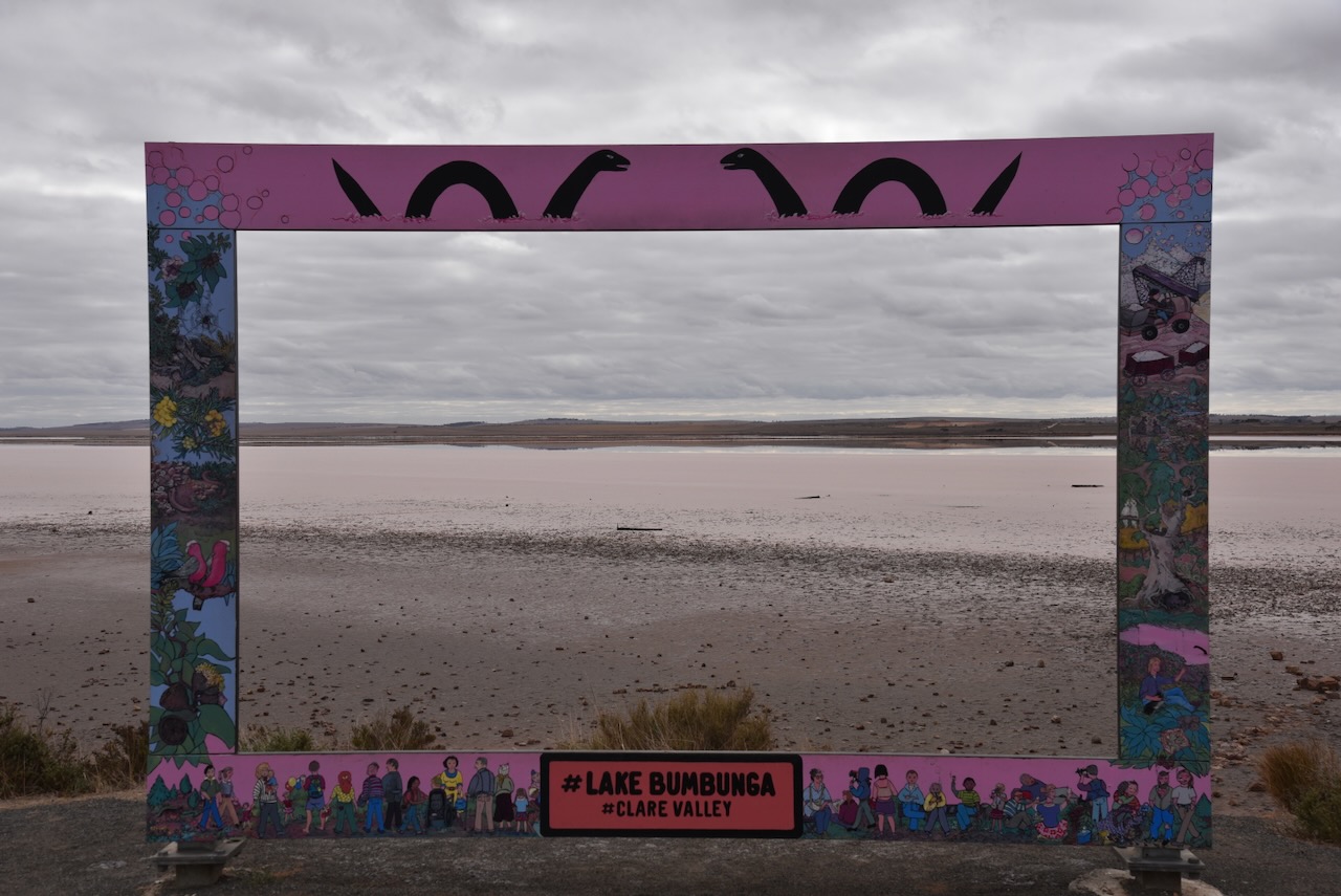
One of Lochiel’s tourist attractions is Lake Bumbunga, a salt lake with a surface area of about 13.88 km2. The lake often appears to be a bright pink colour due to certain algae. Lake Bumbunga is the largest of a system of saline lakes extending about 30 km north of Lochiel, draining an area to the east of the Barunga Range, where it merges with the Hummock Range. (Hough 2008)
Salt has been mined at Lake Bumbunga since 1881. By 1910 there were at least three lease-holders scraping thousands of tons of salt at Lake Bumbunga. The Australian Salt Company held the lake leases from 1913 to 1971 when the company became a wholly owned subsidiary of Cheetham Salt Company Ltd (now Cheetham Salt Ltd), Australia’s largest producer and refiner of solar salt.
In 1926, a branch line was constructed from the Salisbury railway line, allowing salt transport directly to Port Adelaide. (Fuss 2012)

Above:- Part of an article from The Register, Thu 18 Nov 1926. Image c/o Trove.
Salt was required for munitions manufacture during World War II, and this resulted in employment rising from 30 to 100 workers. There were three shifts a day with two trains a week transporting salt in bags to Port Adelaide. By 1967 a total of 1,000 tonnes were harvested a day. This was at a time when South Australia was pricing 80% of Australia’s salt. Between 1996 to 2012 the salt works were closed. (Fuss 2012)
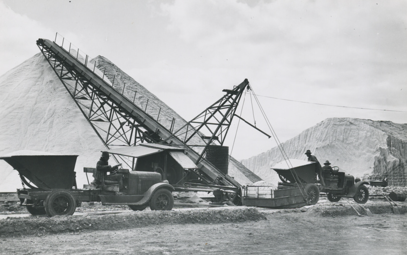
Above:- Salt heaps at Lochiel, c. 1930. Image c/o State Library South Australia.
Bumbunga is believed to be derived from the aboriginal word parnpangka meaning ‘rainwater lake’. (Place Names 2024)
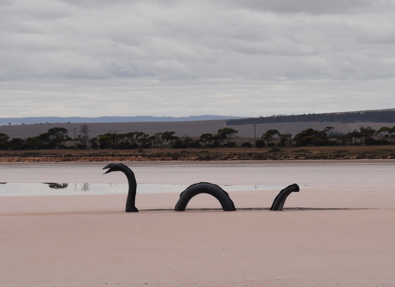
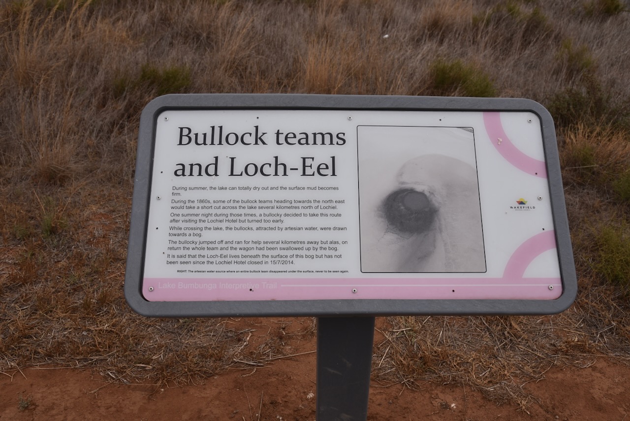
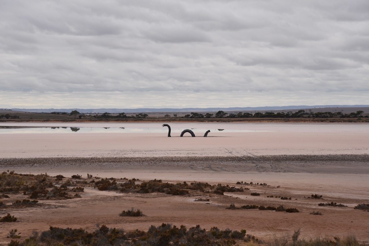
One of the reasons why tourists stop at Lochiel is to view the fibreglass structure ‘Loch Eel Monster’ which is located in the middle of the lake. The original monster was built from old rubber tyres and plastic by a local man Gary Taylor and his friends. It was named ‘Loch Eel’ a humorous take on Scotland’s infamous Loch Ness Monster. In 2017 the head was stolen, and work commenced on a fibreglass replacement. But why a monster in the middle of the lake? In the late 1880s bullock teams were common in the area. Legend has it that a team of bullocks were walking over the lake when they were ‘spooked by some sort of monster.’ (Escape to Lochiel 2021)
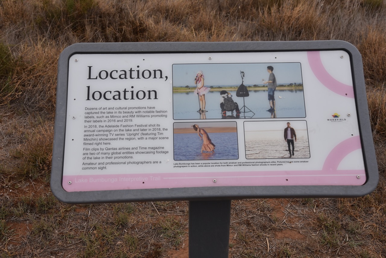
Lake Bumbunga has been used as a background for various advertising over the years including R.M. Williams, Mercedes Benz, and Foxtel. Fashion shoots for the Adelaide Fashion Festival have also been held at the lake. The TV series Upright used Lake Bumbunga as a filming location. (ABC 2023) (Escape to Lochiel 2021)
I then drove a further 19km to the north and reached the town of Snowtown, where I stopped to activate the silo for the Silos On The Air (SiOTA) program.


Snowtown is about 145 km north of Adelaide in the Mid North of South Australia.

Above:- Map showing the location of Snowtown, South Australia. Map c/o Google Maps.
The traditional owners of the area around Snowtown are the Kaurna aboriginal people. European pioneers commenced arriving in the district during the 1840s. The area saw the rapid expansion of grazing and farming. In 1847 pastoral lease 395 was granted to Edward Burton ‘Paddy’ Gleeson. The area was known as Black Point due to the hill to the east of Snowtown, Black Point Hill and the nearby Black Point Lagoon. Gleeson built a homestead at Black Point. (Snowtown Museum 2020)
Above:- Edward ‘Paddy’ Gleeson. Image c/o State Library South Australia.
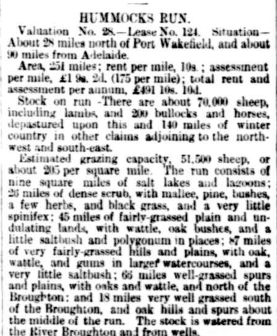
Pioneer John Ellis leased the large Hummocks Run to the west of Black Hill. He built a stone homestead at Barunga Station between 1860-1863. In 1864, the South Australian Register referred to ‘Hummock Run’ containing the head station at Barunga, and two subhead stations at Bumbunga and Wokurna. The land was described as consisting of salt lakes, lagoons and dense scrub. (Hummocks Run 1864) (Snowtown Museum 2024)
Above:- Part of an article from the South Australian Register, Tue 27 Sep 1864. Image c/o Trove.
From the early 1860s, European settlers and graziers campaigned for more suitable transport routes from Black Point to Kadina for wool and wheat. In 1867 a Parliamentary Enquiry delivered a report which recommended the Clare to Wallaroo railway be built at a cost of £144.15s. Following the arrival of the influential Robert Barr Smith at the Hummocks Run in 1870, surveyors arrived in the district. A paved road was constructed in 1874, followed by the railway in 1878 from Kadina to Barunga, now Barunga Gap. (Weekly Chronicle 1864)

Above:- Article from the South Australian Weekly Chronicle, Sat 12 Apr 1862. Image c/o Trove.
On the 25th day of September 1877, the Commissioner for Crown Lands Hon. J. Carr, agreed that a township should be established at Black Point. It was at this time that the railway was extended from Barunga Gap to Black Point.

Above:- Article from The Express and Telegraph, Adelaide, Tue 25 Sep 1877. Image c/o Trove.
Snowtown was proclaimed on the 19th day of December 1878 by Governor William Jervois who named the town after one of the members of the Snow family who were his cousins who resided on the Yorke Peninsula. It is believed the town was named in honour of Thomas Snow, who became Jervois’s aide de camp when he received his posting in South Australia.

Above:- William Jervois. Image c/o Wikipedia.
The town boundaries were defined as an approximate rectangle immediately adjacent to section 114 in the Hundred of Barunga northeast of Barunga Creek, northwest of Salt Lagoon and south of Boundary Creek. On the 16th day of January 1879, the first town allotments were sold for cash only. (SA Govt Gazette 1878)

Above:- The proclamation of Snowtown, SA Govt Gazette, 19 Dec 1878.
As you drive into Snowtown, there is an excellent information board with some history on Snowtown.


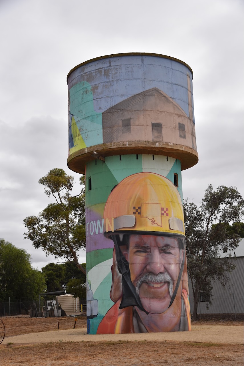
In 2017 the Snowtown community commissioned a mural to be painted by Joel Van Moore ‘Van the Omega’ on the Snowtown water tower in Railway Terrace. The murals on the tower feature local volunteers and sports stars. (Australian SIlo Art 2024)
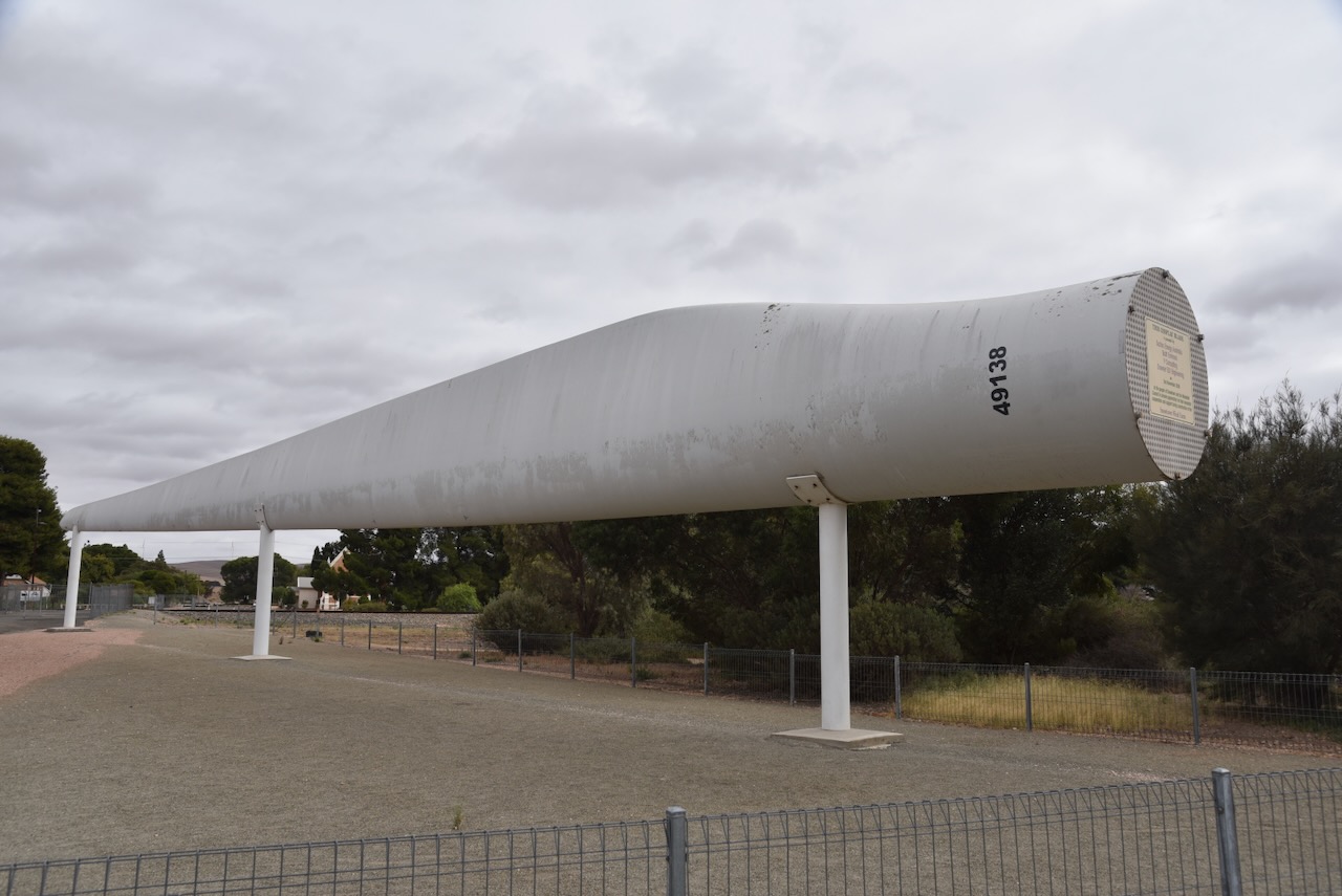
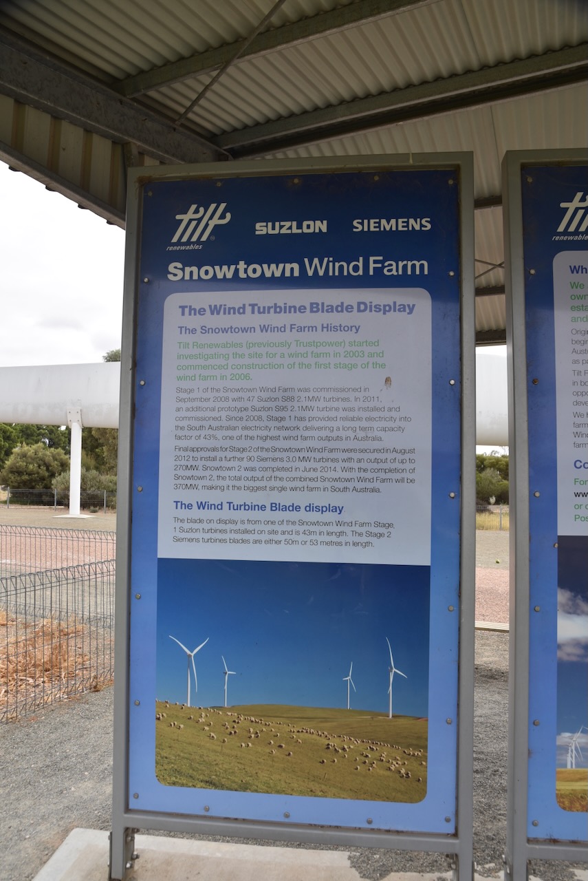
The Snowtown Wind Farms were commissioned in September 2008, with 47 wind turbines. In 2011 an additional 90 turbines were installed. The two independently run wind farms produce an annual combined total output of about 1350GWh, enough to power 230,000 South Australian homes.


Snowtown contains several historic buildings.

The Snowtown Soldiers Memorial Hall commemorates those who served in World War One. The foundation stone was laid on the 4th day of October 1924 by Governor Sir Tom Bridges with the official opening in May 1925 by Major W. F. J. McCann D.S.O., M.C., in May 1925. (Monument Australia 2024)

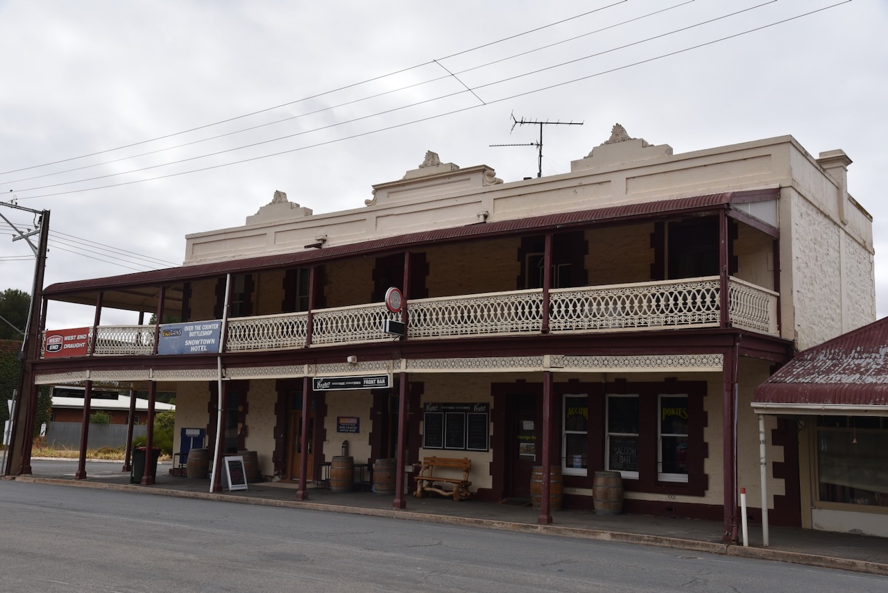
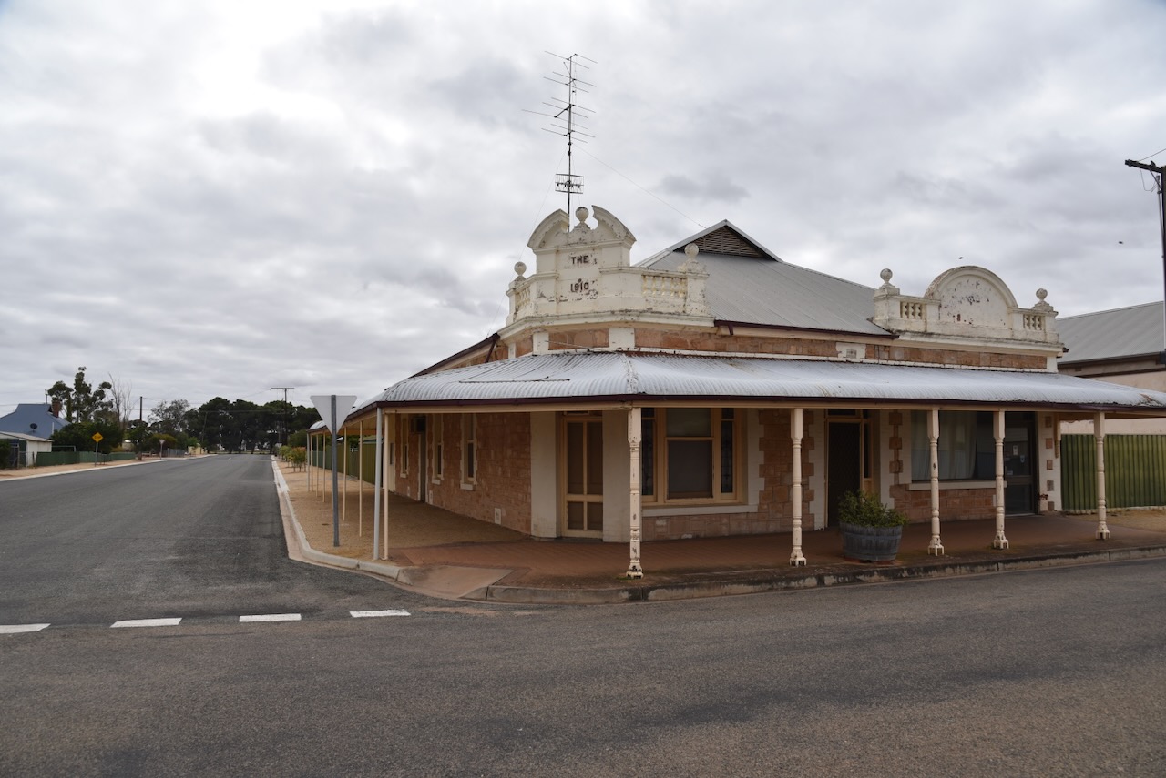
One of the first buildings to be constructed in Snowtown was the hotel in 1879. It was constructed by Mr. Richard Hazelgrove who paid £171 for block 160 on which he built the hotel. It was extended in 1913. (Snowtown Museum 2024)
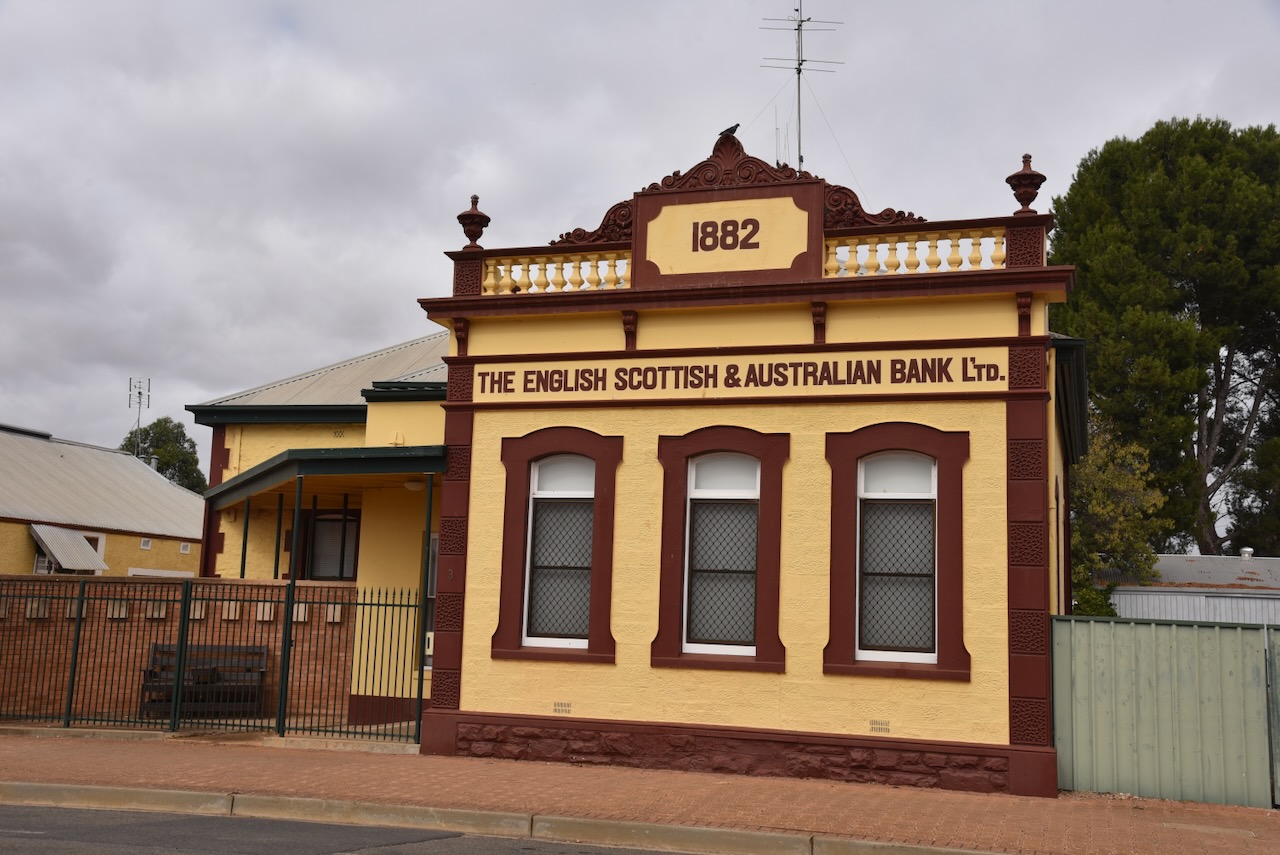
Located at Fourth Street is the old English Scottish and Australian Bank. The building was constructed in 1882 and has been restored and repainted in heritage colours. (Aussie Towns 2024)
The old butcher and bakery business commenced in 1889. The corner shop was added to the original shop in 1910. (Flickr 2024)
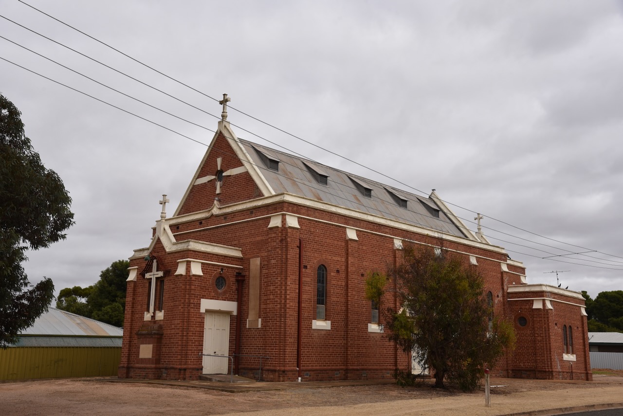
The former St Canice’s Catholic Church is located in Railway Terrace West. The Foundation stone was laid on the 11th day of August 1935 by Bishop Killian. The architect was H H Jory. The church opened on the 26th day of January 1936. (Churches Australia 2024) (Flickr 2024)

After having a look around Snowtown, I drove to the Snowtown silos VK-SNN5 to activate the silos for the Silos On The Air (SiOTA) program.

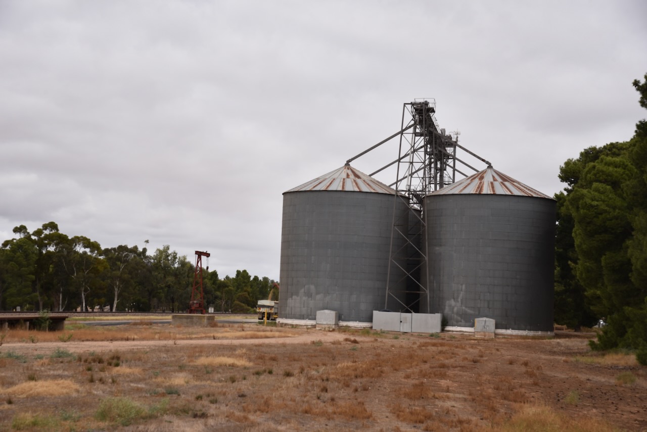
I parked in Railway Terrace West and operated from the 4WD, running the Icom IC-7000, 100 watts, and the Codan 9350 antenna with the 1.5 metre stainless steel whip.

Above:- the activation zone at the Snowtown silos. Image c/o SiOTA website.
I worked the following stations on 40m SSB:-
- VK3BEL
- VK5GY/p
- VK3PF/m
- VK2VAR
- VK2GOM
I worked the following stations on 20m SSB:-
- VK5IS
- VK2VAR
- VK2GOM
- VK1AO
- VK2MET
- VK2IO/m
- VK1ARQ
- VK1VIC/p (VKFF-3991)
References.
- aquilareen (2013). Snowtown St Canice’s Catholic church. [online] Flickr. Available at: https://www.flickr.com/photos/31967465@N04/10697050075 [Accessed 11 May 2024].
- Behind the brilliant bubblegum colour of one of South Australia’s most photographed attractions. (2023). ABC News. [online] 16 Feb. Available at: https://www.abc.net.au/news/2023-02-16/why-is-lake-bumbuga-pink-lochiel-sa-tourism/101973202 [Accessed 10 May 2024].
- Cockburn, R. (1984). What’s in a Name?.
- denisbin (2009). Snowtown. This butcher and bakery business began in 1889. This corner shop was added to the original shop in 1910. The original shop in the Victorian style shop next door just visible. [online] Flickr. Available at: https://www.flickr.com/photos/82134796@N03/46474359425 [Accessed 11 May 2024].
- Design, U.W. (n.d.). St Canice’s Catholic Church – Former | Churches Australia. [online] http://www.churchesaustralia.org. Available at: https://www.churchesaustralia.org/list-of-churches/locations/south-australia/n-s-towns/directory/6095-st-caniceand%2339%3Bs-catholic-church-former [Accessed 11 May 2024].
- Fuss, Eloise (1 March 2012). “Lochiel lake harvest stirs salty memories”. ABC North and West SA. Australian Broadcasting Corporation.
- “Heritage survey of the Lower North (Region 8 – South Australia) – Part Two: 17. D.C. Snowtown”
- Hough, Joanne K. (September 2008). “Salt Production In South Australia”. MESA Journal. 50. Parkside, SA: [Department of] Mines and Energy South Australia.
- Jones, K. (2021). Escape to Lochiel, South Australia: Great for crowds and pink lake pics for the socials. [online] Domain. Available at: https://www.domain.com.au/news/escape-to-lochiel-where-insta-happy-tourists-come-to-meet-a-headless-monster-in-a-pink-lake-1038611/ [Accessed 10 May 2024].
- LOCHIEL-BUMBUNGA. (1926). Register. [online] 18 Nov. Available at: https://trove.nla.gov.au/newspaper/article/54831064 [Accessed 10 May 2024].
- manning.collections.slsa.sa.gov.au. (n.d.). Lobethal – Lofty, Mount. [online] Available at: https://manning.collections.slsa.sa.gov.au/pn/l/l4.htm#lochiel [Accessed 11 May 2024].
- monumentaustralia.org.au. (n.d.). Snowtown Soldiers Memorial | Monument Australia. [online] Available at: https://monumentaustralia.org.au/themes/culture/display/51701-snowtown-soldiers-memorial [Accessed 10 May 2024].
- published.collections.slsa.sa.gov.au. (n.d.). A Compendium of the Place Names of South Australia. [online] Available at: https://published.collections.slsa.sa.gov.au/placenamesofsouthaustralia/ [viewed 10 May 2024]
- Snowtown Museum. (n.d.). Paddy Gleeson. [online] Available at: https://www.snowtownmuseum.org/paddy-gleeson-of-clare [Accessed 10 May 2024].
- Snowtown Museum. (n.d.). History. [online] Available at: https://www.snowtownmuseum.org/history [Accessed 11 May 2024].
- Trove. (n.d.). HUMMOCKS RUN. – South Australian Register (Adelaide, SA : 1839 – 1900) – 27 Sep 1864. [online] Available at: https://trove.nla.gov.au/newspaper/article/39127422 [Accessed 10 May 2024].
- Trove. (n.d.). South Australian Weekly Chronicle (Adelaide, SA : 1858 – 1867) – 12 Apr 1862 – p3. [online] Available at: https://trove.nla.gov.au/newspaper/page/8357993? [Accessed 10 May 2024].
- http://www.australiansiloarttrail.com. (n.d.). Snowtown Water Tower Art. [online] Available at: https://www.australiansiloarttrail.com/snowtown [Accessed 11 May 2024].
