Buckleboo Conservation Reserve VKFF-1689 and Buckleboo silo VK-BCO5

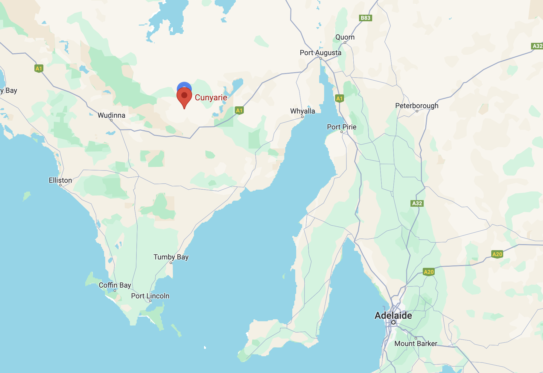
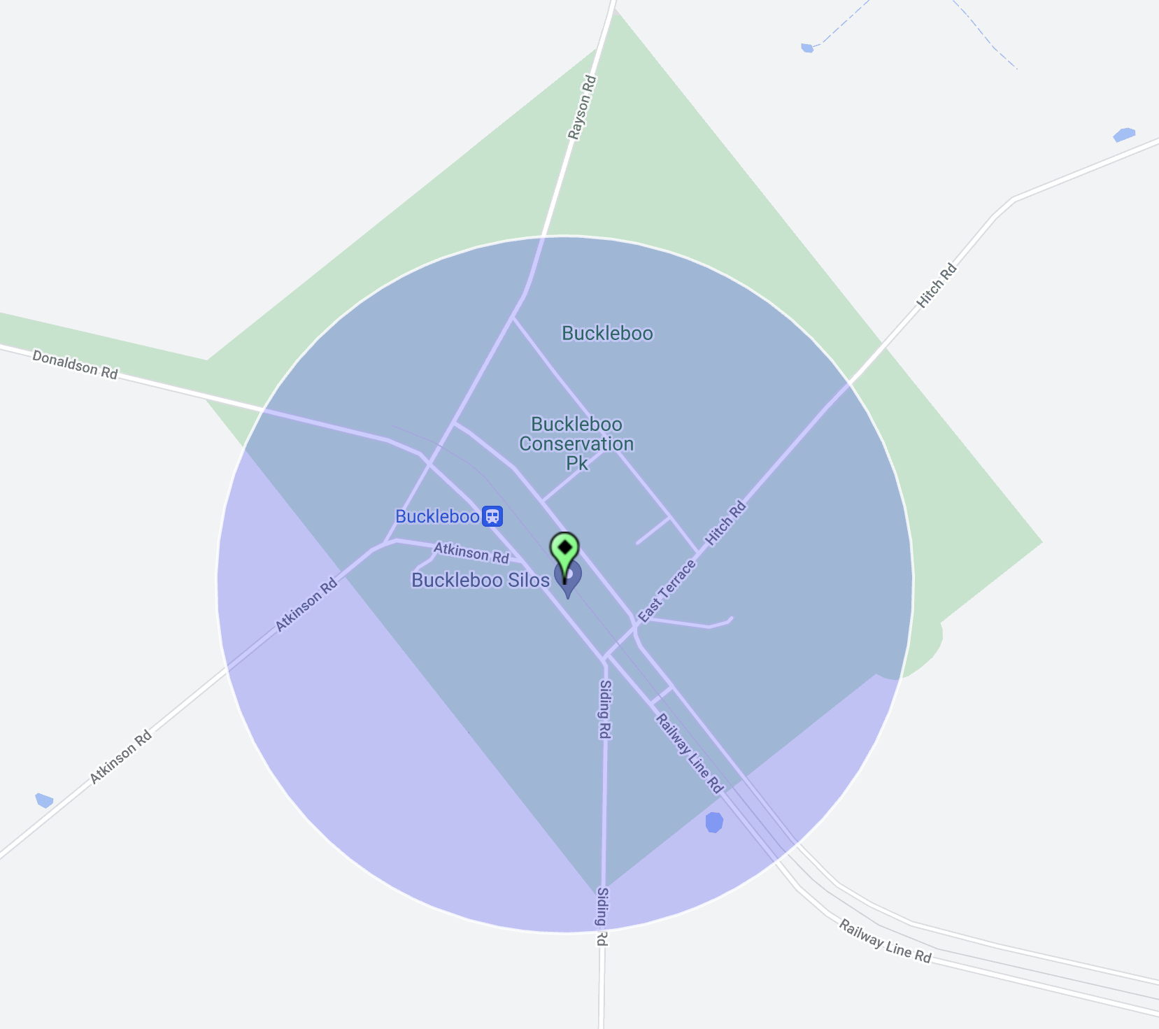
My next activation for Thursday 11th April 2024 was the Buckleboo Conservation Reserve VKFF-1689 and the Buckleboo silo VK-BCO5. Buckleboo is about 32 km northwest of Kimba and about 495 km from Adelaide.

Above:- Map showing the location of the Buckleboo Conservation Reserve. Map c/o Google Maps.

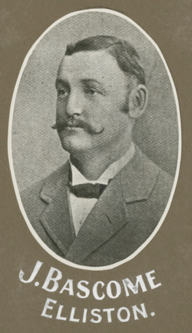
The Hundred of Buckleboo was proclaimed on the 1st day of June 1922. The name was adopted from an adjacent pastoral run held by John Love and R Love from 1864.

Above:- John Love. Image c/o State Library South Australia.

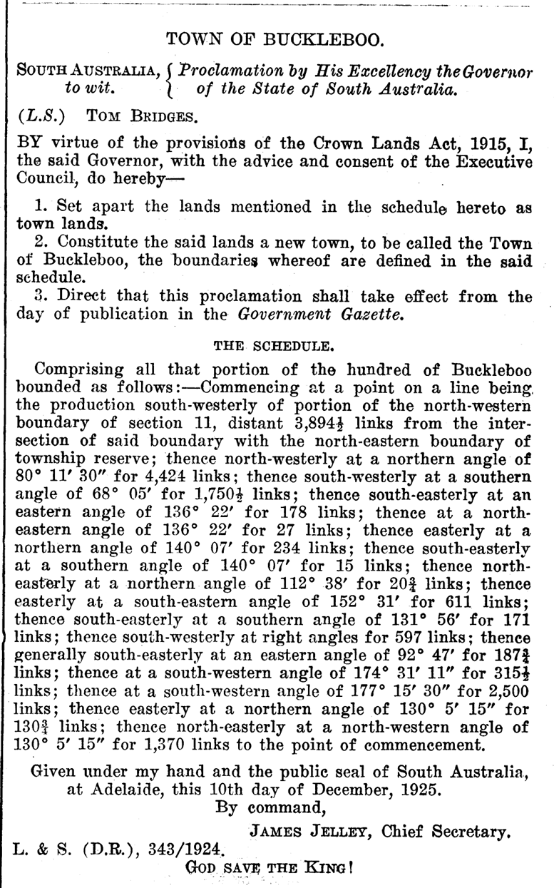
The government town of Buckleboo was surveyed in November 1924 and proclaimed on the 17th day of December 1925 by Tom Bridges, the Governor of South Australia. The Buckleboo school opened in 1929 and closed in 1949. (Place Names 2012)

Above:- Proclamation of the town of Buckleboo. Image c/o SA Govt Gazette, Dec 17, 1925.

The railway line reached Kimba in 1913, two years before the town was declared. In 1926 the line was extended north to Buckleboo. Until 2005, Buckleboo was the railhead for one branch of the Eyre Peninsula Railway, a narrow gauge railway that principally hauled grain via Kimba and Cummins to Port Lincoln for export. The last train to Buckleboo was in 2005. (Kimba Visitor Guide 2019)

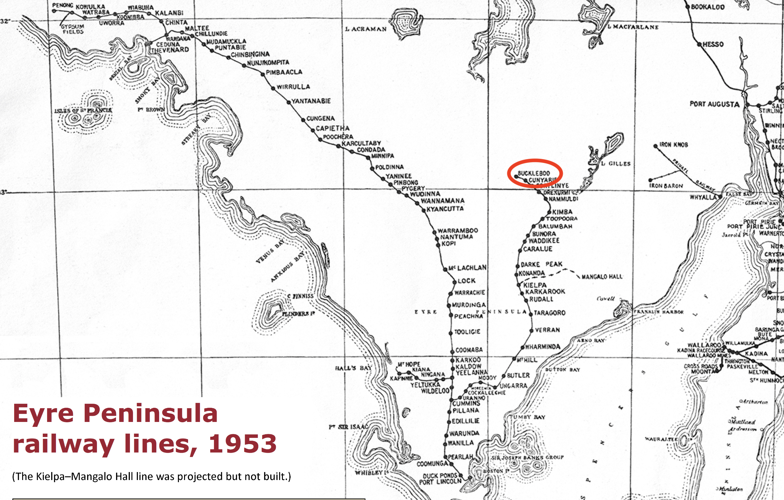
Above:- Railway lines of the Eyre Peninsula, 1953. Image c/o Wikipedia.

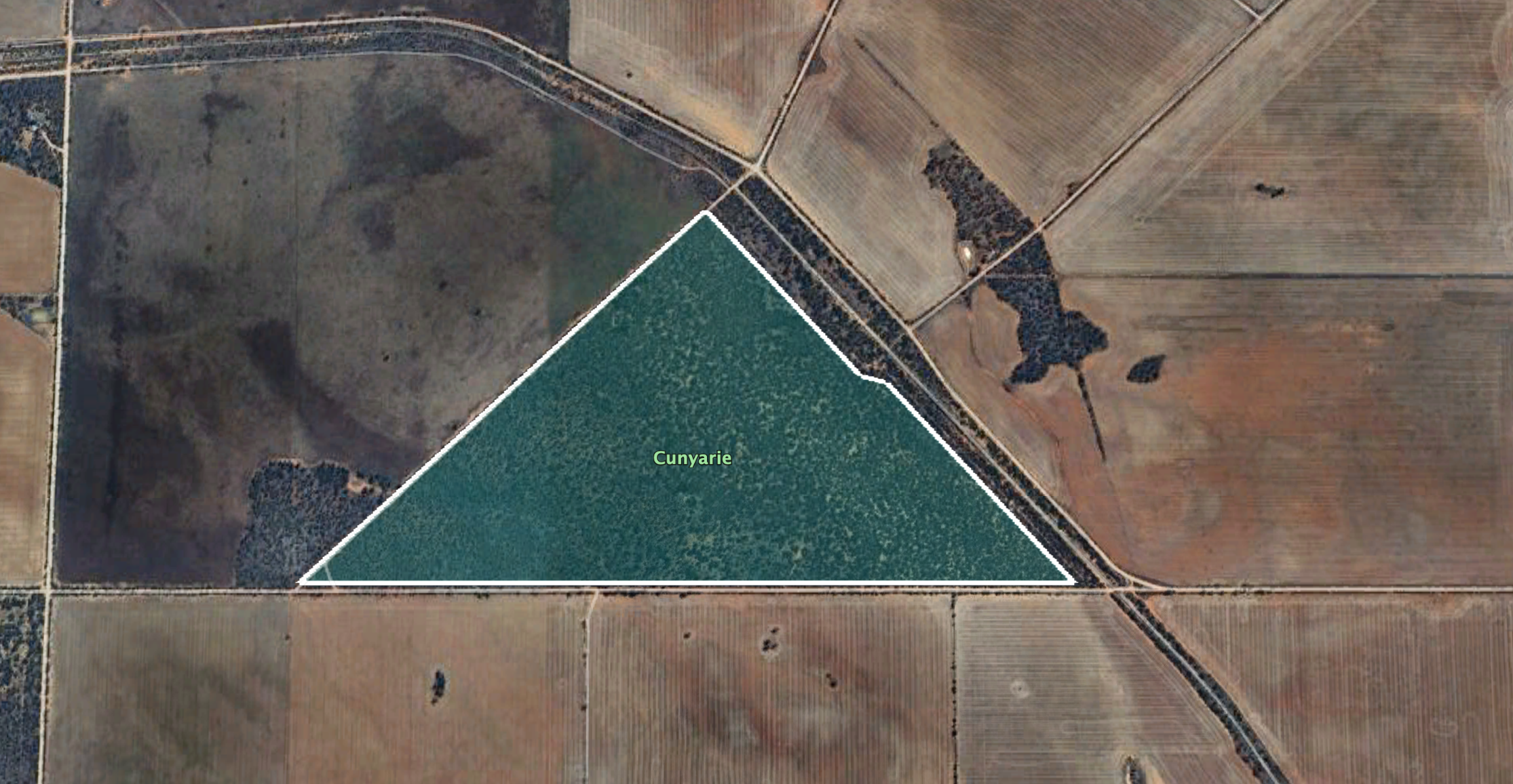
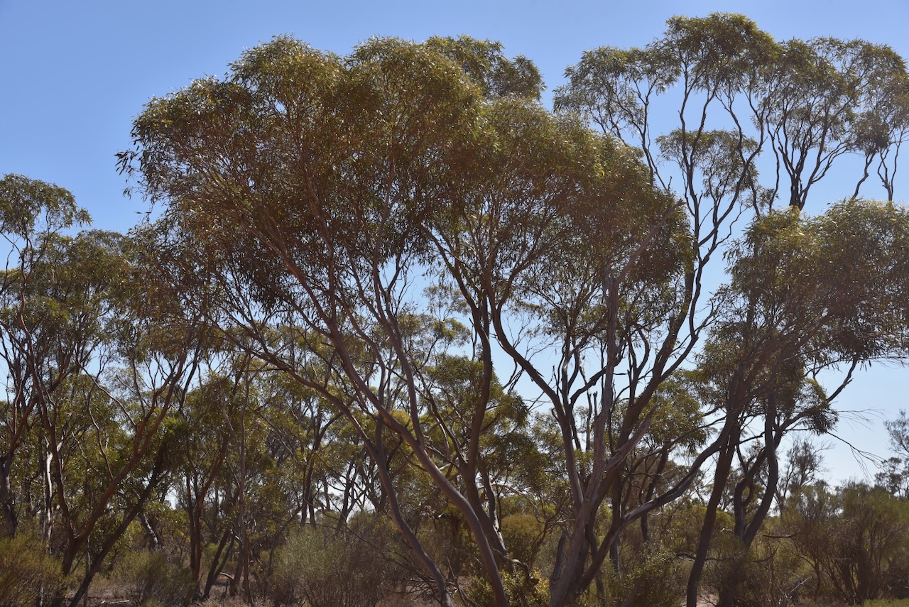
The Buckleboo Conservation Reserve is separated into seven sections around the old town of Buckleboo.

Above:- An aerial view of the Buckleboo Conservation Reserve. Image c/o Google Earth.

The reserve is about 281 hectares in size and was established on the 13th day of September 1990. (CAPAD 2022)

The Buckleboo silos are located alongside the old railway line, between Donaldson Road and Railway Terrace.

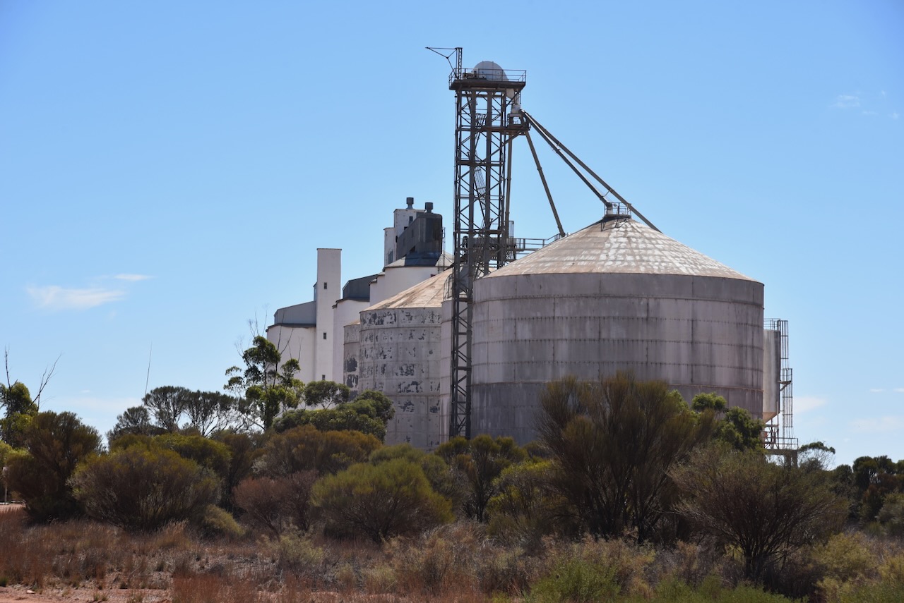
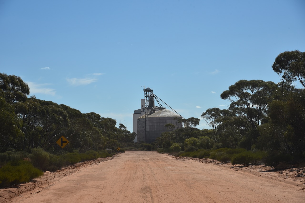
I parked on Donaldson Road within the activation zone of the silo. I ran the Yaesu FT857, 40 watts, and the 20/40/80m linked dipole.

Above:- the activation zone at the Buckleboo silos. Image c/o SiOTA website.

I worked the following stations on 40m SSB:-

  1. VK8ZWM
  2. VK5MAZ
  3. Vk3PF
  4. VK2USH/p (Mole Creek Karst National Park VKFF-0322)
  5. VK3BBB
  6. VK2CCP
  7. VK2IO/p (Deua National Park VKFF-0138)
  8. VK5TUX
  9. VK5FB
  10. VK5IS
  11. VK5KLD
  12. VK5LA
  13. VK5KAW
  14. VK3CEO
  15. Vk3PJR
  16. VK3DL
  17. VK5AHA
  18. Vk5AUS
  19. VK5IU

I worked the following stations on 20m SSB:-

  1. VK7XX
  2. VK1AO
  3. VK2MET
  4. VK5MAZ
  5. VK7HBR
  6. VK3EJ
  7. Vk5QA/p
  8. VK3CLD/p
  9. KG5CIK
  10. VK4NH
  11. VK4DXA
  12. OH1MM
  13. VK3SQ
  14. VK2BD
  15. VK3PF
  16. VK3KAI
  17. VK3CEO
  18. VK6LK/p (Penguin Island Conservation Park VKFF-1436)
  19. VK3DL
  20. VK2VW
  21. VK2HFI
  22. VK2AKA
  23. Vk2BUG
  24. VK4MUD
  25. VK4EMP
  26. VK4TI
  27. VK4PDX
  28. VK3SX
  29. OH1PA
  30. VK2QM
  31. VK2IO/p (Deua National Park VKFF-0138)
  32. VK3EY
  33. VK3APJ

References.

  1. Dcceew.gov.au. (2023). Collaborative Australian Protected Areas Database (CAPAD) 2022 – DCCEEW. [online] Available at: https://www.dcceew.gov.au/environment/land/nrs/science/capad/2022.
  2. Kimba Visitor Guide, 2019
  3. published.collections.slsa.sa.gov.au. (n.d.). A Compendium of the Place Names of South Australia. [online] Available at: https://published.collections.slsa.sa.gov.au/placenamesofsouthaustralia/.

Cunyarie Conservation Reserve VKFF-1702

After leaving Cortinlye Conservation Reserve on Thursday 11th April 2024 I headed to my next park activation for the day, the Cunyarie Conservation Reserve VKFF-1702.

Above:- Map showing the location of the Cunyarie Conservation Reserve. Map c/o Google Maps.

Before reaching the park I stopped at the Bascombe Rocks Lookout on Buckleboo Road.

Bascombe Rocks is situated in the Hundred of Cortlinye and was first named Cortlinye Waterhole. Cortlinye is an aboriginal word for black oak, which portrayed the land at the time. The surveyors watered their horses at this location and the locales referred to it as ‘The Soak’. It always had water in it although only drinkable for stock. The area was named after Mr John Bascombe who held a pastoral lease in 1874 and the area was called the ‘Cortlinye Run.’

Above:- John Bascombe. Image c/o State Library South Australia.

Then Bascombe Rocks was situated on the dirt track to station country, where people would use it as a rest stop. Bascombe Rocks was also the site for some of the first tennis courts in the district. ‘The Rocks’ became part of the water runs for the government dam situated to the west.

Above:- Article from the Kimba Dispatch, Fri 6 Apr 1928. Image c/o Trove.

The lookout has a shelter with a table and benches, an information board, and a cairn.

There are some nice views of the surrounding countryside from the lookout.

Cunyarie is an aboriginal word for rockholes that are located in the district. The Hundred of Cunyarie was proclaimed on the 1st day of June 1922. The Cunyarie School opened in 1927 and closed in 1936. The town of Cunyarie was proclaimed on the 16th day of February 1928. (Place Names 2012)

Above:- A plan of Cunyarie. Image c/o Trove.

The Cunyarie Conservation Road is triangular in space and is bordered by Bucklebood Hundred Line Road to the south, Cunyarie Dam Road to the west, and Railway Line Road to the east.

Above:- Map showing the Cunyarie Conservation Reserve. Image c/o Google Earth.

The reserve is about 94 hectares in size and was established on the 24th day of October 1985. (CAPAD 2022)

I ran the Yaesu FT857, 40 watts, and the 20/40/80m linked dipole for this activation.

I worked the following stations on 40m SB:-

  1. VK5MAZ
  2. VK5TUX
  3. VK3PF
  4. VK3BBB
  5. VK2CCP
  6. VK5WU
  7. VK5HS
  8. VK5AYL
  9. VK3CEO
  10. VK2USH/p (Mole Creek Karst National Park VKFF-0322)
  11. VK8ZWM
  12. VK2YW
  13. VK5LA
  14. VK5KAW
  15. VK5FR/m
  16. VK5CZ
  17. VK5AHA

I worked the following stations on 20m SSB:-

  1. VK3SQ
  2. VK2BD
  3. VK7XX
  4. VK7HBR
  5. VK2IO/p (Gourock National Park VKFF-0212 & VK2/ SM-052)
  6. VK1AO
  7. VK2MET
  8. VK3APJ
  9. VK3PF
  10. VK4NH
  11. VK4DXA
  12. VK5QA
  13. VK3CLD
  14. VK3CEO
  15. VK3EJ
  16. VK7AAE
  17. VK3UAO
  18. KG5CIK
  19. VK4MUD
  20. VK5MAZ
  21. VK5CZ
  22. VK2VIN
  23. VK3ZLD
  24. VK2VAR
  25. VK2GOM
  26. VK2BW
  27. VK3SX
  28. VK2VW
  29. VK2HFI
  30. VK2AKA
  31. VK2BUG
  32. VK3ZSC
  33. VK1ARQ

References.

  1. Dcceew.gov.au. (2023). Collaborative Australian Protected Areas Database (CAPAD) 2022 – DCCEEW. [online] Available at: https://www.dcceew.gov.au/environment/land/nrs/science/capad/2022.
  2. published.collections.slsa.sa.gov.au. (n.d.). A Compendium of the Place Names of South Australia. [online] Available at: https://published.collections.slsa.sa.gov.au/placenamesofsouthaustralia/.