
After our activation of the Investigator Marine Park, Adam VK2YK and I headed back to the homestead on Flinders Island and had some lunch. We then jumped into the operator chairs of VK5FIL.
Later that afternoon Adam and I headed out to activate Heritage Agreement VKFF-4307 located on the northwestern side of Flinders Island.
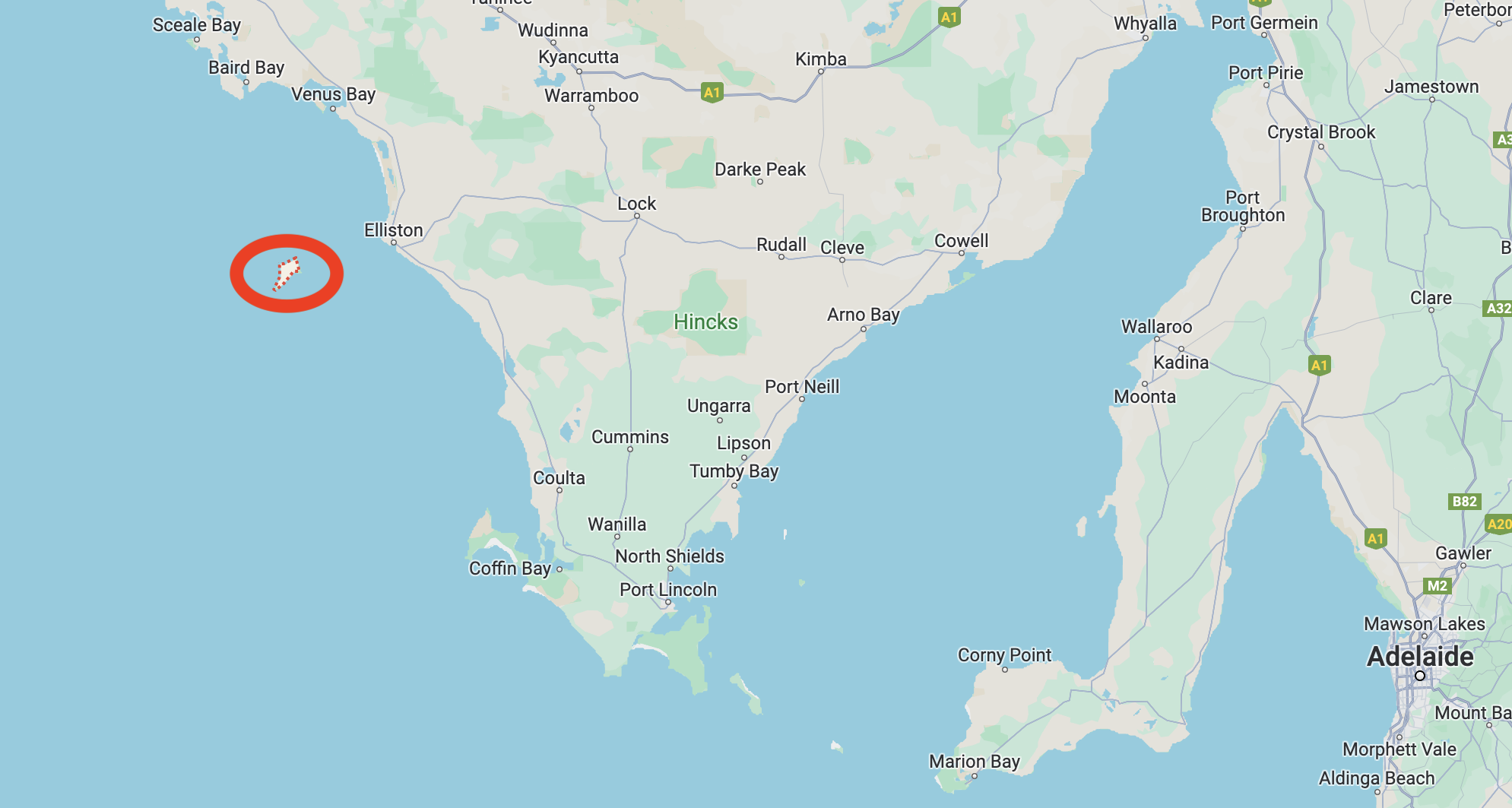
Above:- Map showing the location of Flinders Island. Map c/o Google Maps.
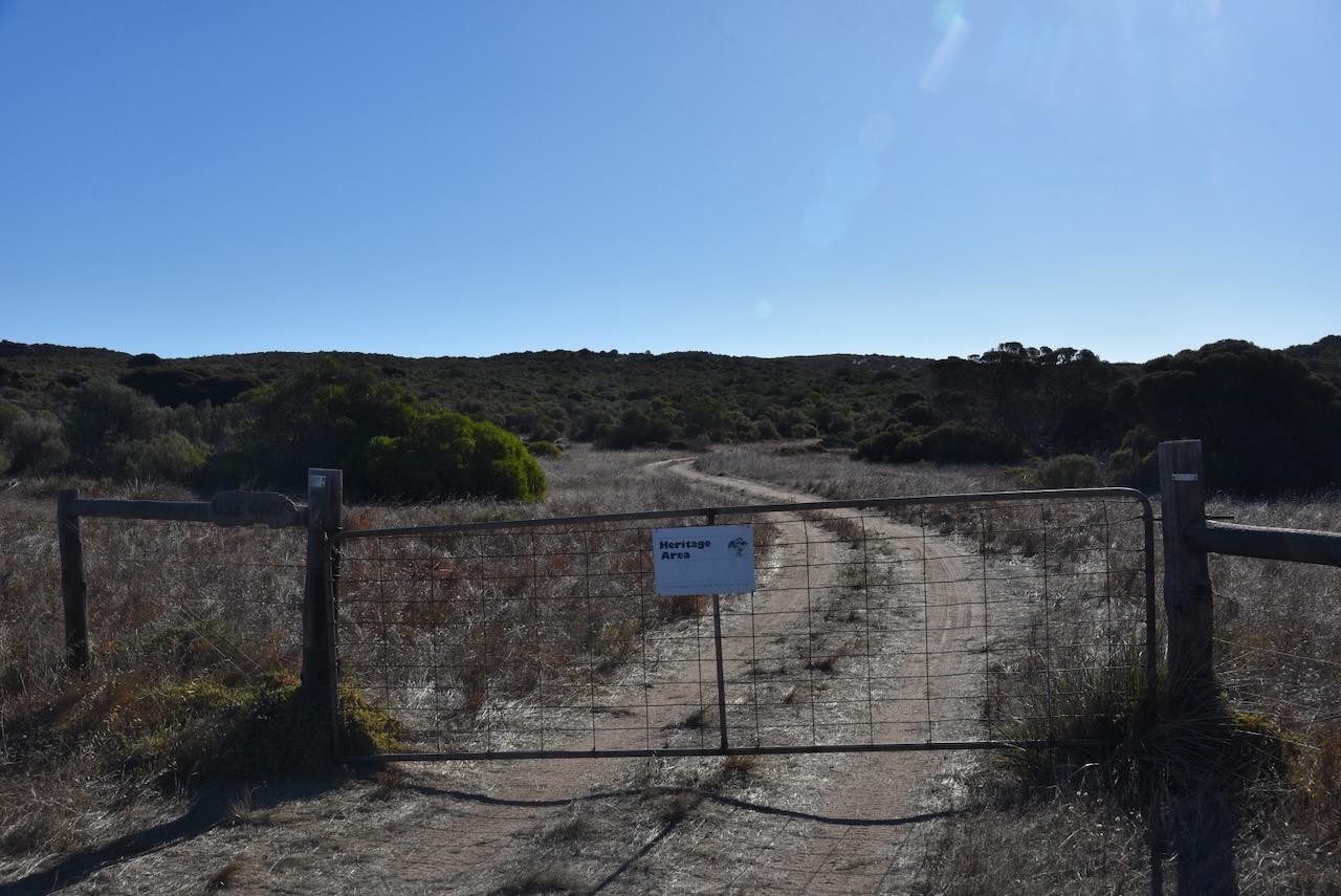
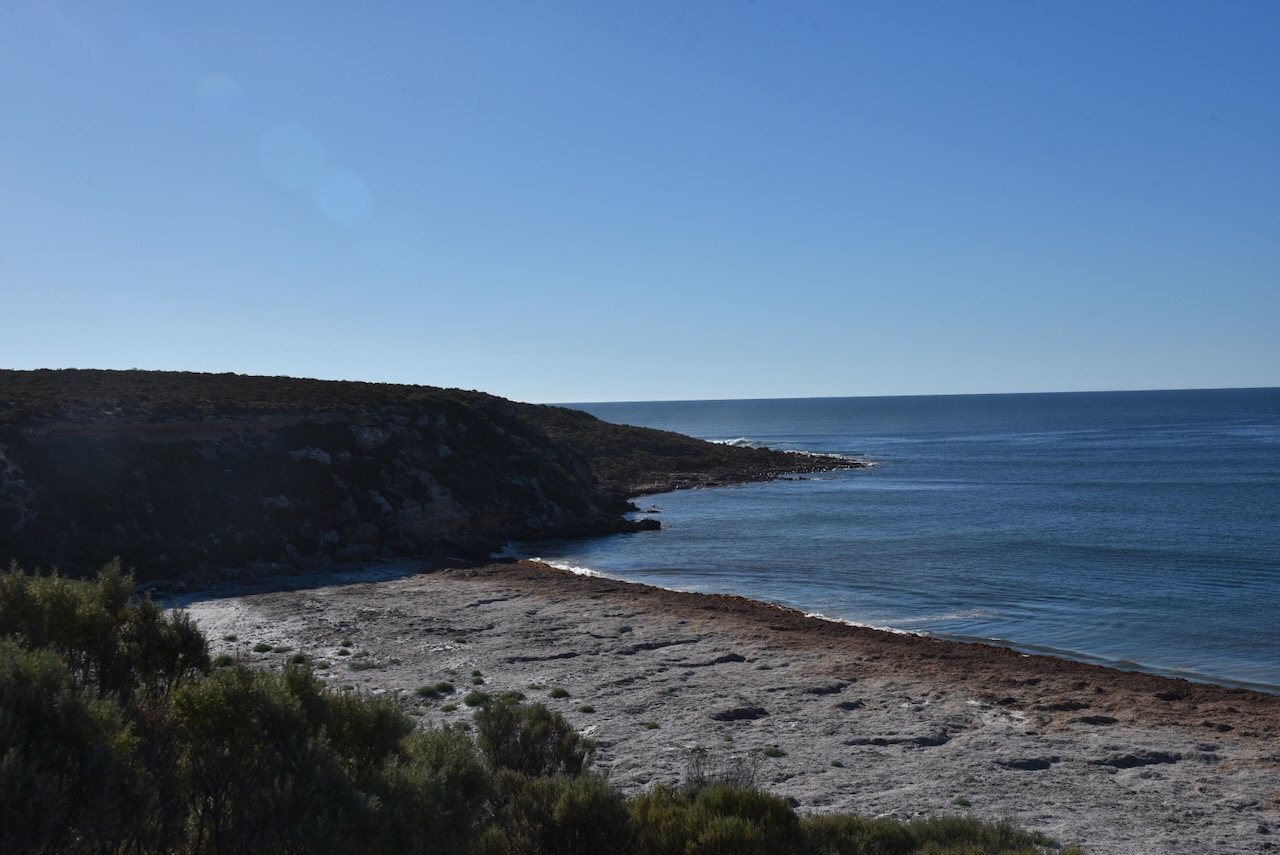
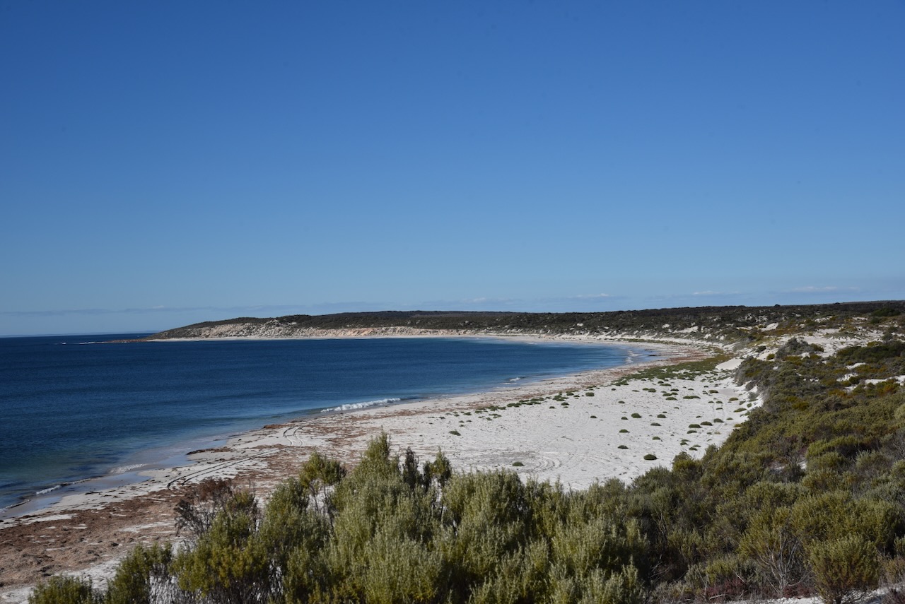
To access the park we headed northwest on one of the dirt tracks on the island. We soon reached a gate that had a ‘Heritage Area’ sign. We followed that 4WD track down to Gem Beach.
The Heritage Agreement extends from Gem Point to Pont Malcom.
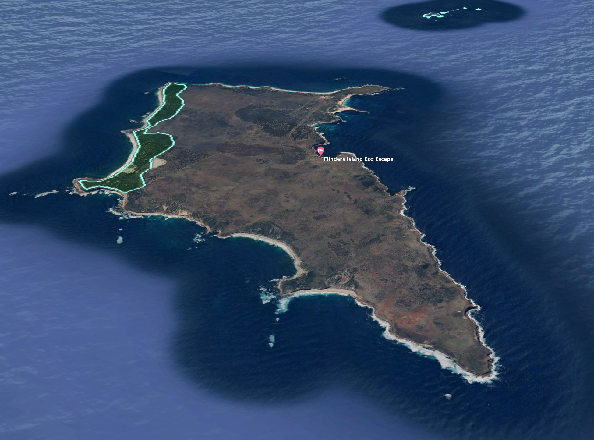
Above:- An aerial view showing the Heritage Agreement. Image c/o Google Earth.
The park is about 280 hectares in size and was established on the 29th day of August 1995. (CAPAD 2022)
I ran the Yaesu FT857, 40 watts and the 20/40/80m linked dipole for this activation.
I logged a total of 152 stations on 20m SSB & 40m SSB. This included a large amount of DX on 20m.
I worked the following stations on 20m SSB:-
- VK3ACZ
- VK6NWF
- VK7UK
- VK7HBR
- VK3SPG
- VK1AO
- ZL4NVW
- VK2MG
- VK3PWG
- ZL2STR
- VK6LK
- VKLMK
- VK3BEL
- VK4FO
- VK3DL
- VK3VIN
- ON3UA
- SP7MW
- VK2IO/m
- VK3SO
- VK4MUD
- UT5PI
- VK3GB
- OH6GAZ
- VK4NH
- VK4DXA
- VK3KTT
- VK3MEG
- VK2MOR
- VK3EJ
- DL2ND
- IW2BNA
- F4HRG
- ON4VT
- MW0RLJ
- F1BLL
- VK2HAK
- OH1MM
- VK3TKK/p
- OZ5HP
- IV3YIB
- VK7KT
- VK1DI
- VK3GJG
- VK4DNO
- VK3VBC
- I0KNQ
- KA4UOA
- IK2YGZ
- F4WBN
- KH6KW
- VK2EXA
- VK4HAT
- F4HZR
- SP2EWQ
- VK4JT
- IK1GPG
- IW1DAL
- VK3ANL
- VK6XL
- DK8MZ
- VK4BT
- VK3ZPF
- VK3DKE
- ON4BB
- VK4PDX
- S58N
- HB9FBG
- DL1EBR
- VK6MUR
- SP6JOE
- M0ZNK
- VK3PF
- VK3KAI
- VK3MCK
- VK3CEO
- HB9AFI
- HB9JOE
- VK6NU
- ON3YB
- VK3MLT
- OH2CGU
- VK3YV
- VK3TNL
- VK4SMA
- VK7AAE
- G3SVD
- VK2USH/p (VKFF-2913)
- VK2EG
- VK3BY
- ON6YH
- VK2VW
- VK2HFI
- VK2AKA
- VK2BUG
- JF7RJM
- VK2LP
- DL3JON
- VK5QA
- VK3SQ
- VK2BD
- JA6WJL
- VK6HDY
- VK2XGB
- ZL1TM
- VK3ALF
- VK6VOX
I worked the following QSOs on 40m SSB:-
- VK5TUX
- VK3PRG/5
- VK5AYL
- VK3NBL
- VK5DW
- VK2EG
- VK5WU
- VK6LK
- VK6LMK
- VK5AAF
- VK3PF
- VK3KAI
- VK3ABQ
- VK4DNO
- VK3ENI/p
- VK2EXA
- VK2EFM
- VK5SFA
- VK3HJW
- VK5PL
- VK4HAT
- VK4SMA
- VK4HMI
- VK2FALL
- VK4KDT
- VK4KD
- VK5FANA
- VK5RJ
- VK2XGB
- VK3MLT
- VK3LF
- VK2HAK
- VK3BWS
- VK3SPG
- VK7DHT
- VK2OKR
- VK3GJG
- VK4NXD
- VK3SQ
- VK2BD
- VK3EY
- VK1AO
- VK2MET
- VK5MAZ
- VK3DX
References.
- Dcceew.gov.au. (2023). Collaborative Australian Protected Areas Database (CAPAD) 2022 – DCCEEW. [online] Available at: https://www.dcceew.gov.au/environment/land/nrs/science/capad/2022.
