
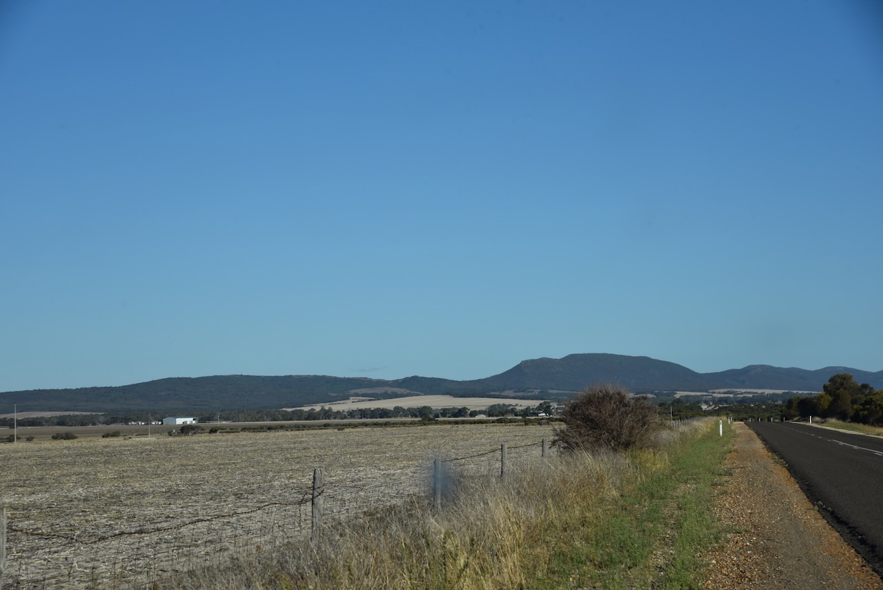
It was time for me to leave Elliston (Sunday 21st April 2024) and head south to Port Lincoln where I planned to stay for 3 nights.
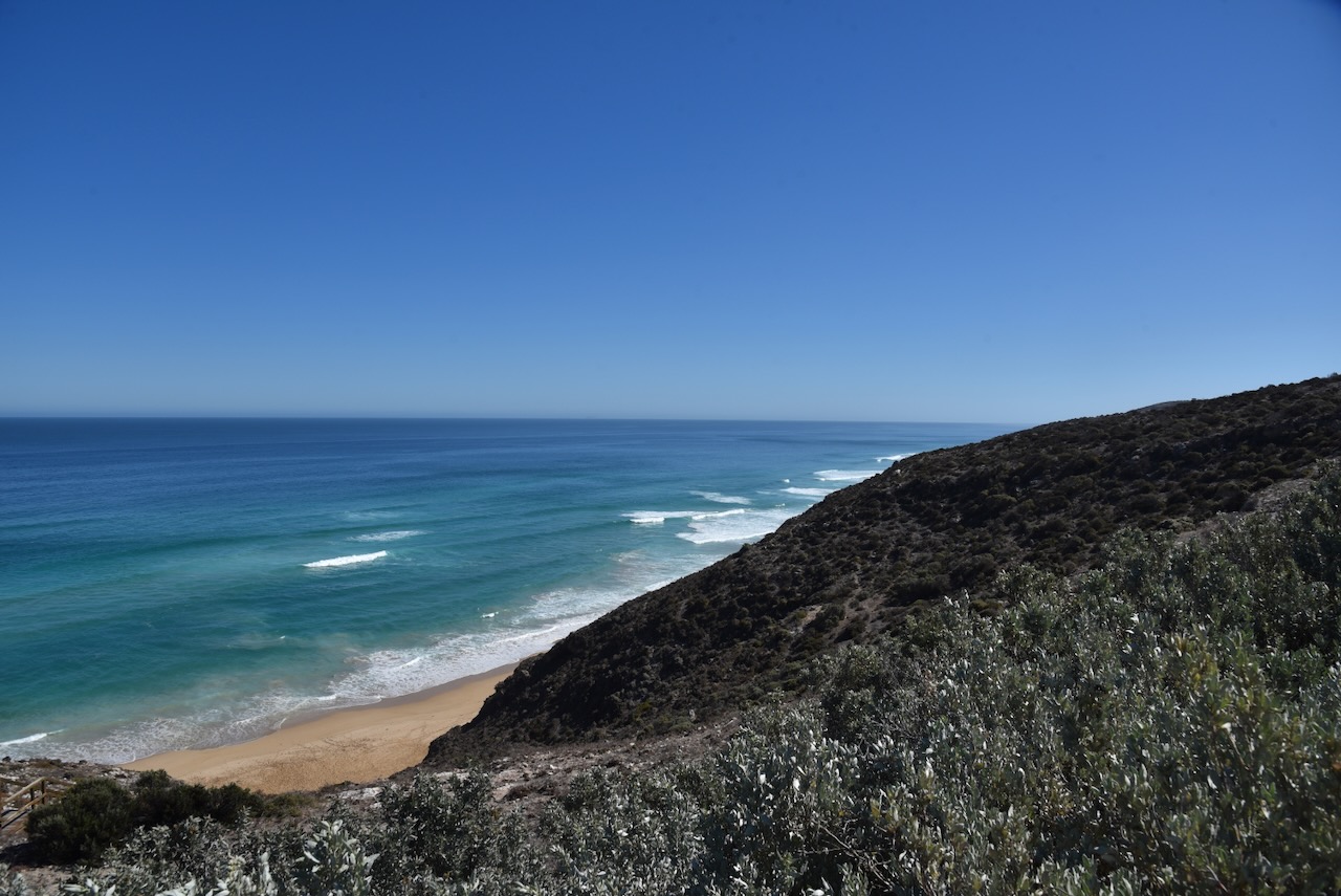
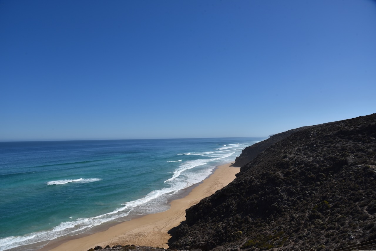
My first stop along Flinders Highway after leaving Elliston, was Locks Well. This is one of the most reliable locations in South Australia for catching Australian salmon and is located about 16km south of Elliston. Locks Well Roads leads to a ‘top’ car park for caravans and motorhomes. There is a lower car park for other vehicles. There is a viewing platform which offers spectacular views along the coast. There is a 60-metre drop from the car park down to the beach, which is accessible via a 120-metre wooden staircase. Locks Well takes its name after a driller who sunk a bore/well at this location during the 1950s. He went down to a depth of 50 metres but did not find water. (Elliston 2024)
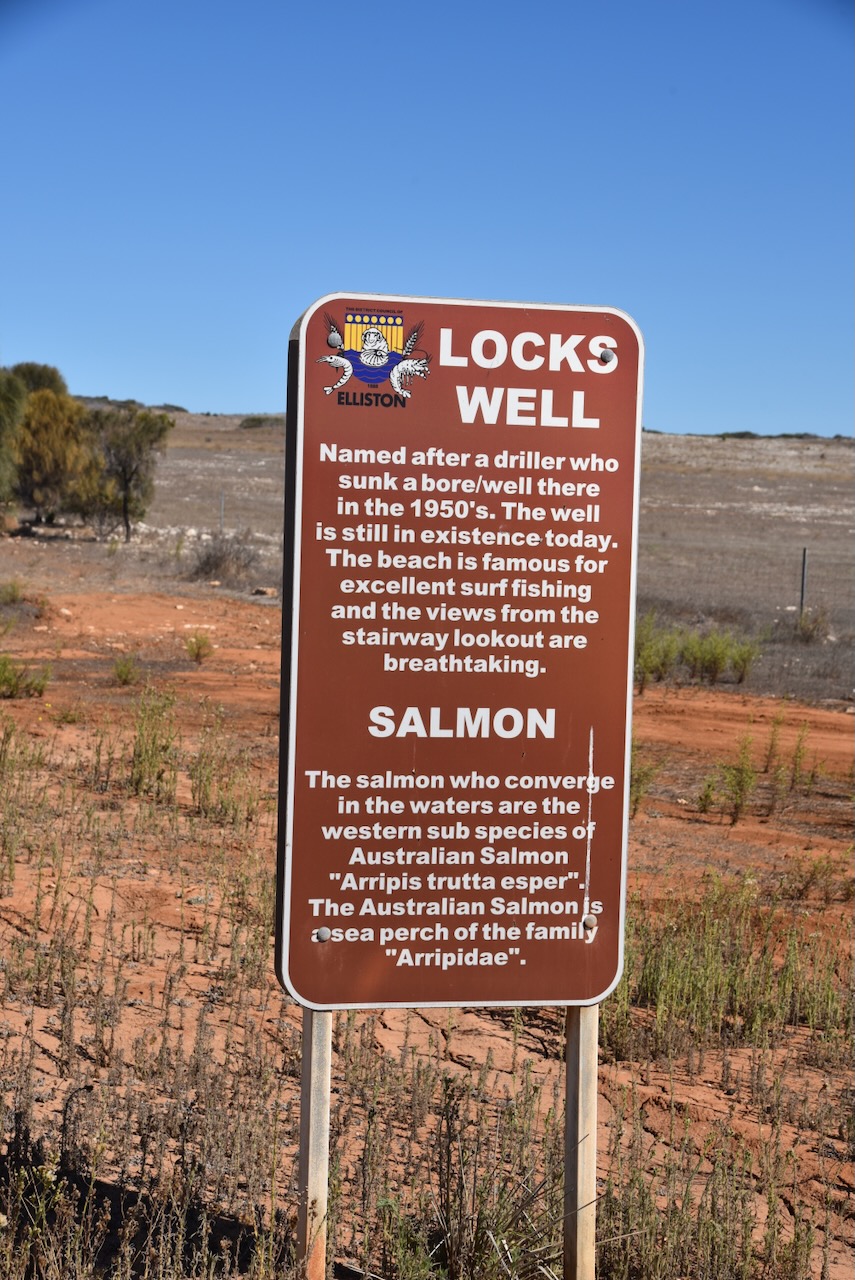
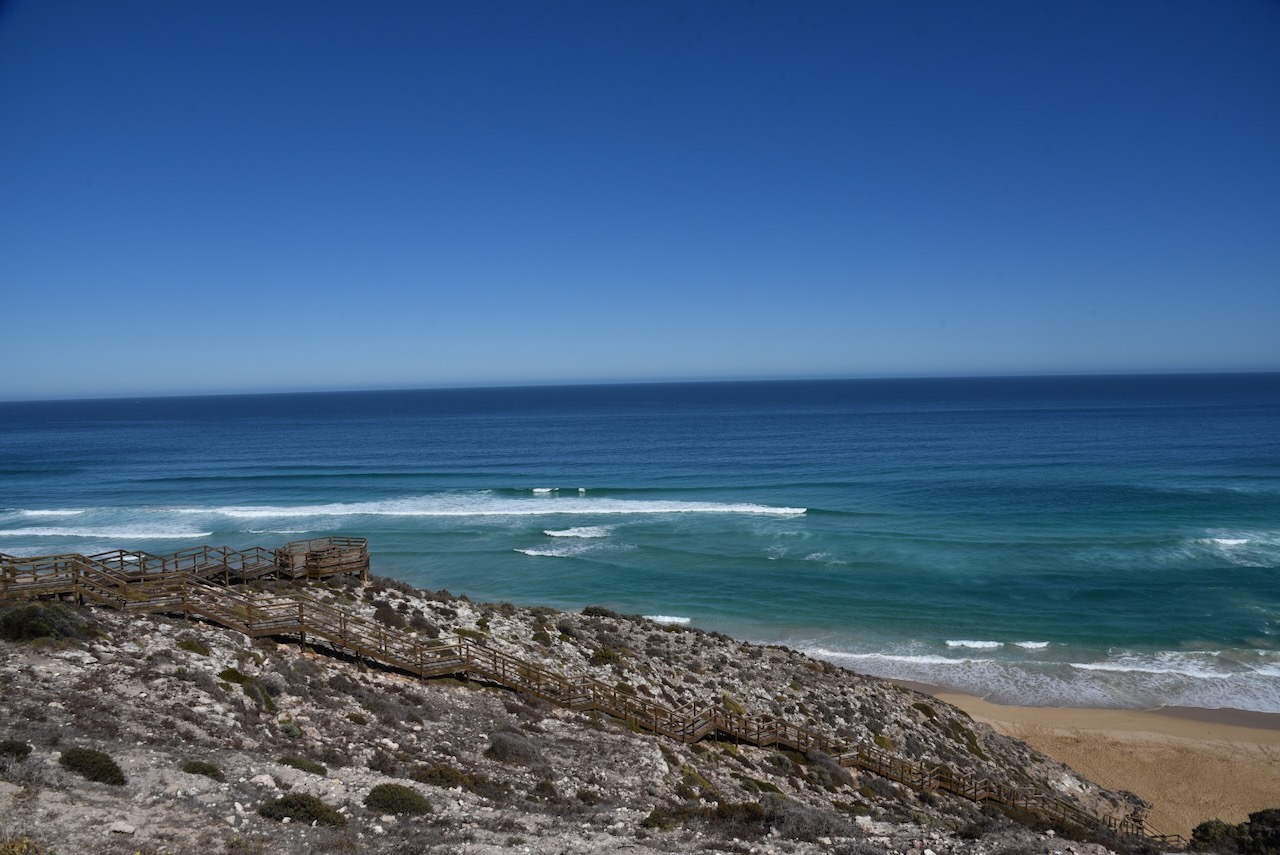

The staircase down to the beach was completed in late 1997. Prior to this the only access to the beach was a rugged and steep stoney track dropping 60 metres to the beach. (Port Lincoln Times 1997)

Above:- Article from the Port Lincoln Times, Tue 2 Dec 1997. Image c/o Trove.
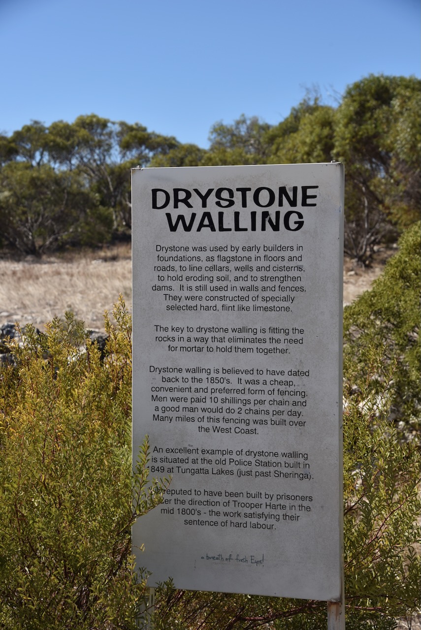
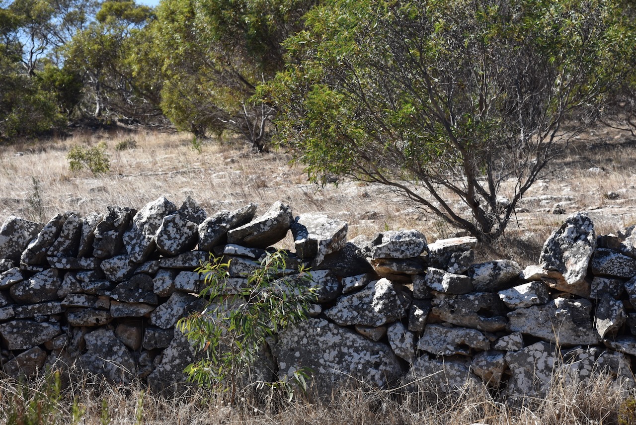
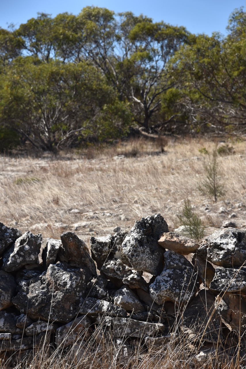
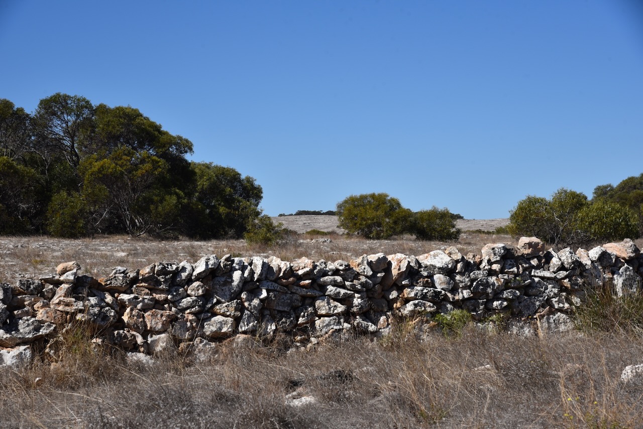
I continued south on Flinders Highway and then stopped to have a look at the drystone wall near Tungatta Lakes, about 22 km south of Elliston. Drystone was used by early builders in foundations, as flagstone in floors and roads, to line cellars, wells and cisterns, to hold eroding soil, and to strengthen dams. It is still used in walls and fences. This particular wall is believed to have been built by prisoners under the direction of Police Trooper Harte who was stationed at the nearby Tungatta Police Station. (Aussie Towns 2024)
A little further along Flinders Highway at the intersection with Sheringa Beach Road is a monument to commemorate the old Sheringa Methodist Church.
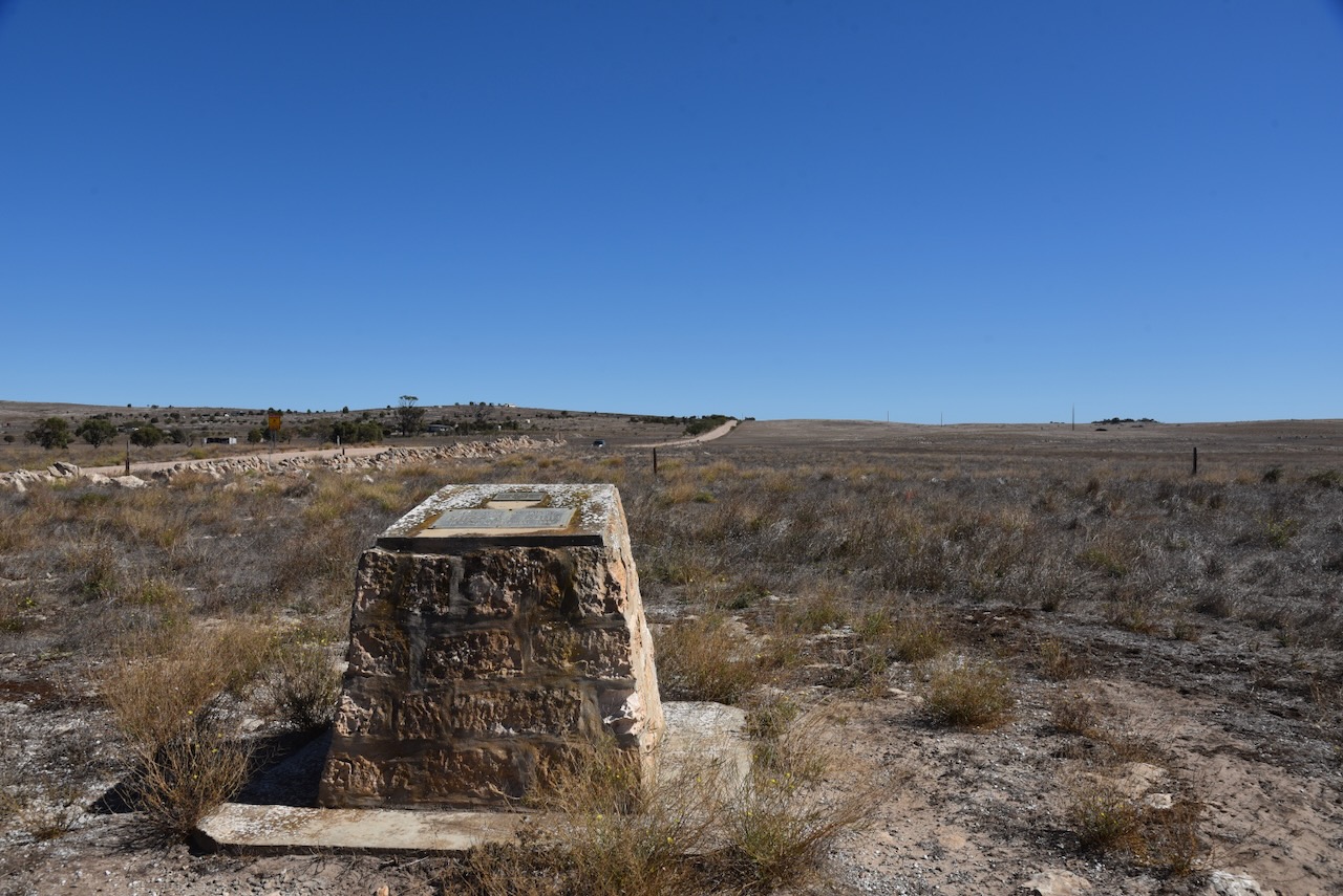
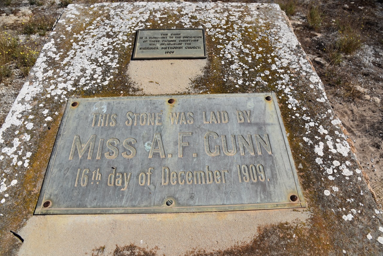
The church had been built on land donated by Mr WiIlliam Gunn of Lairg Station. The foundation stone for the church was laid on the 16th day of December 1909 by his daughter Annie Flora Gunn (Miss A.F. Gunn). The church opened on the 20th day of June 1910 by Rev A.W. Wellington. The church closed in 1962 and sadly was demolished in 1973. (ancestry.com.au) (Churches Australia 2024)

Above:- W. Gunn. Image c/o State Library South Australia.
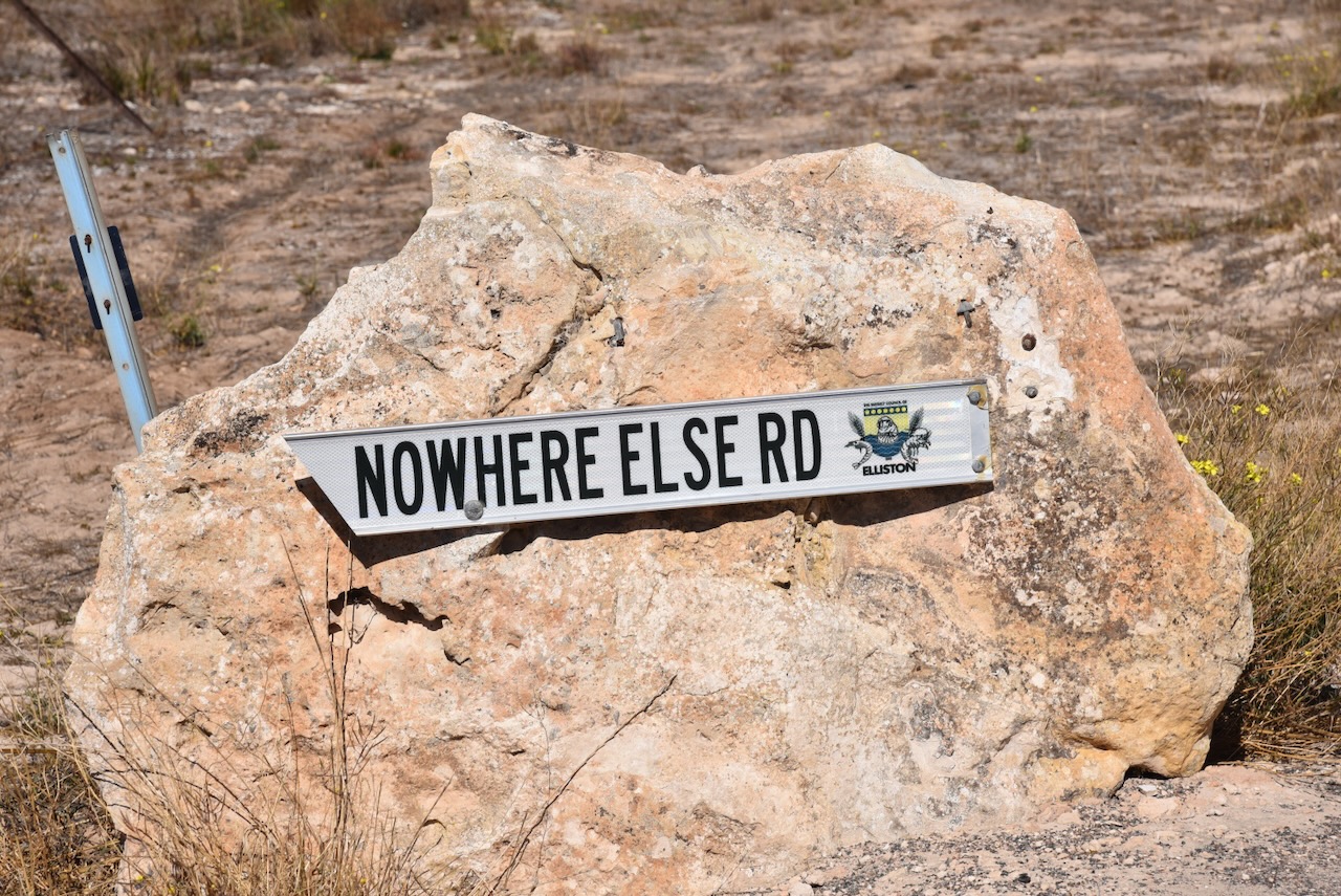
Opposite the church cairn is the sign for Nowhere Else Road. During the 1850’s, landowner Price Maurice employed two builders to construct a hut on his large tract of land. Upon completion of the hut, an inspection was required by the head station manager prior to the bill being paid. It is reported that a party set off to view the hut, but as the land was heavily timbered with shea-oaks, the men were unable to locate the hut. It is reported that the station manager commented: ‘Well, if it’s not over this hill, it’s nowhere else!’ The men climbed over the hill and located the hut. Payment was made and the locality was named ‘Nowhere Else’. (Monument Australia 2024) (Place Names 2012)
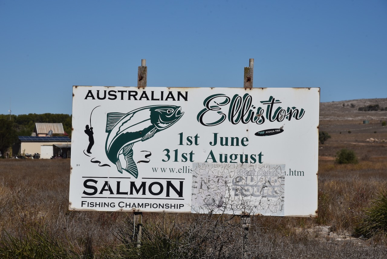
At this intersection is a sign for the Australian Salmon Fishing Championship which is held annually each year from 1st June to 31st August.
I drove down to Sheringa Beach at the bottom of Sheringa Beach Road.
Sheringa is a corruption of the aboriginal word tjeiringa given to a type of yam plant. The first land in the area was held under a lease of 71 square miles by Mr. B. Vaux in 1847. Mr John Haigh and Mr, William R Mortlock then took up ‘Sheringa Run’ which comprised 92 square miles with 8,500 sheep. In 1851-52, Mr Price Maurice purchased the run for 2 /6d. He had 29,000 sheep and 250 horses on the property. (Aust Dict of Biography 2024) (Place Names 2012) (Register Nomination Report 1984)
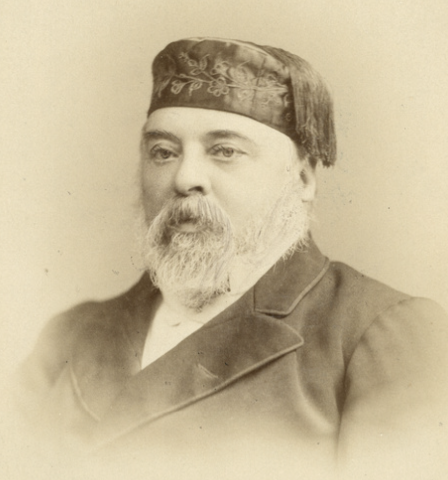
Above:- Price Maurice. Image c/o State Library South Australia.
The town of Sheringa was proclaimed as Holsworthy on the 19th day of April 1883. It was named by Governor Jervois after Holsworthy in Devonshire, England where Jervois had a family affiliation. It became ‘Sheringa’ on the 23rd day of August 1883 following a petition from local residents requesting the adoption of ‘the well-known native name by which the locality, ever since the settlement of Port Lincoln, has been and is still known.’ (Place Names 2012)
In 1886 the Sheringa school opened as ‘Hundred of Way’. It became Sheringa school in 1906 and closed in 1953. At its peak the town of Sheringa included a temperance hotel, general store and blacksmith’s shop under one roof, and a public building which was used as a church, a school and a dancing room. (Place Names 2012)

Above:- Group of people standing in front of the Sheringa Boarding House, taken on the occasion of their annual sports event.. Image c/o State Library South Australia.
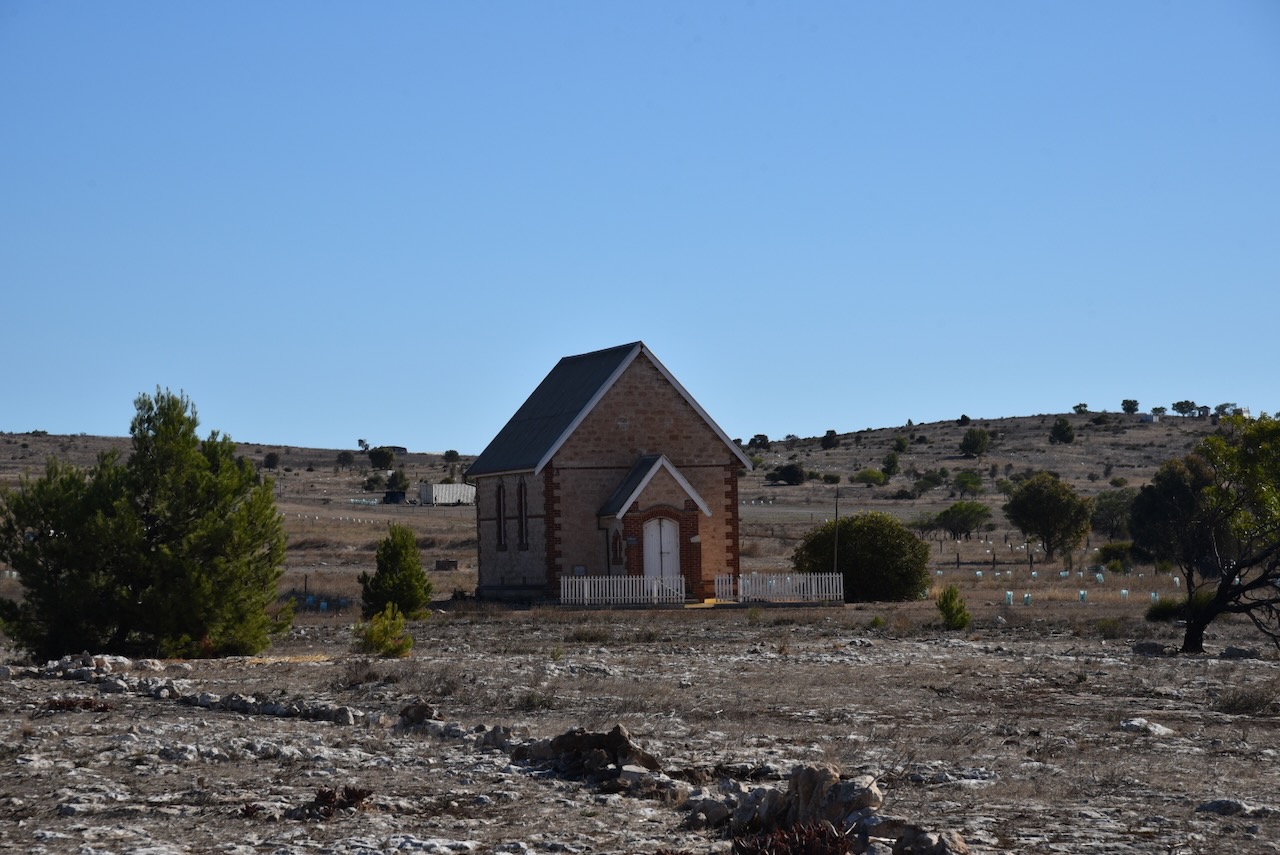
Not much remains at Sheringa nowadays. The St John Anglican church built in 1910 still stands. It is located in a paddock off Flinders Highway.
The Sheringa Public Hall was built in 1888. Over the years it has been used as a school, for public meetings and for worship services by the Methodist, Anglican and Catholic Churches. (Churches Australia 2024)

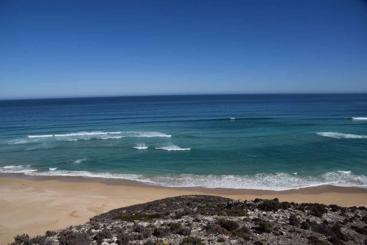
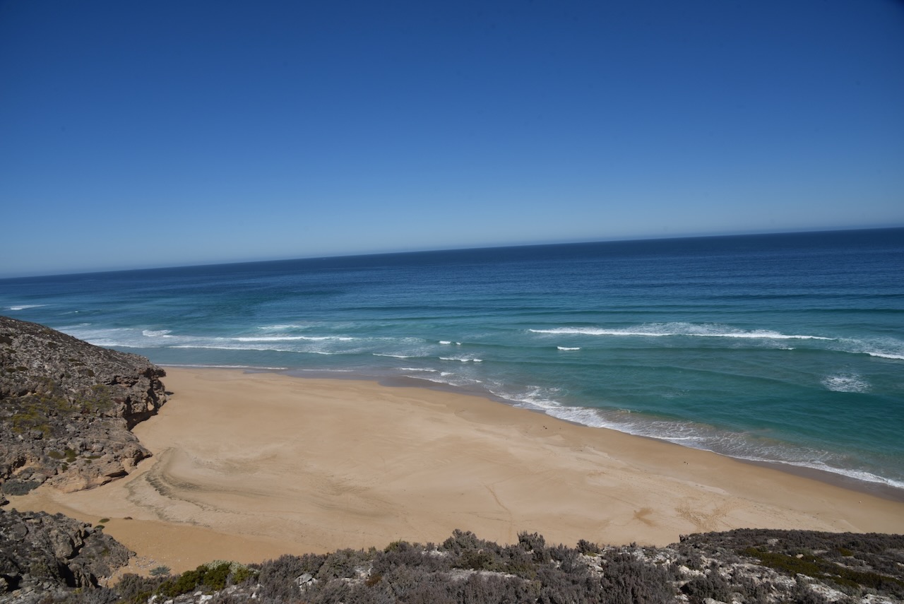
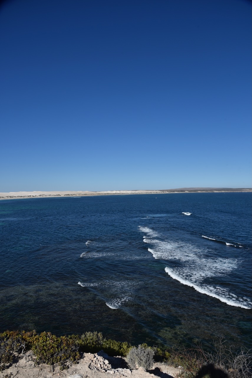
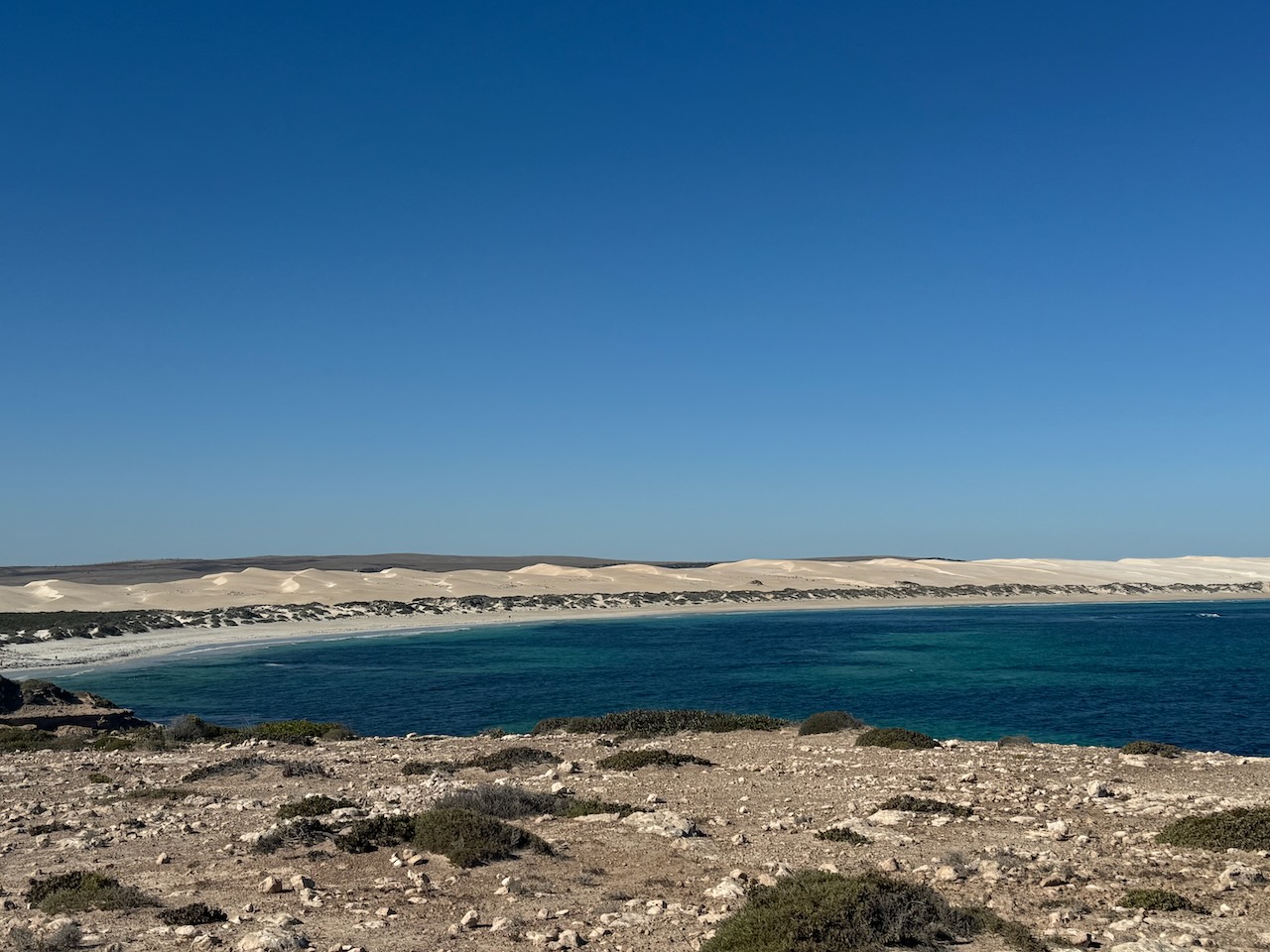
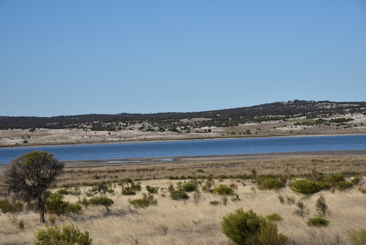
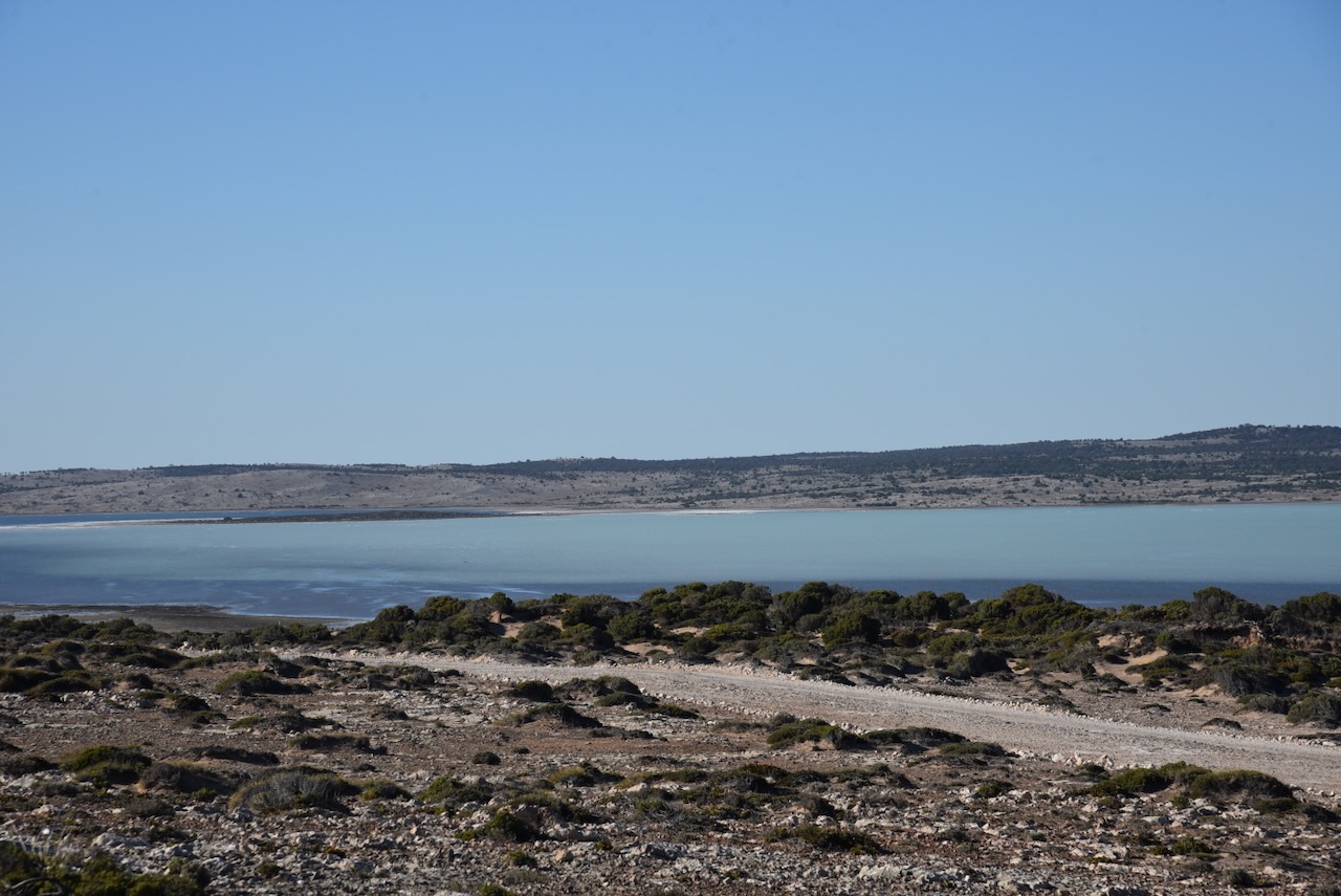
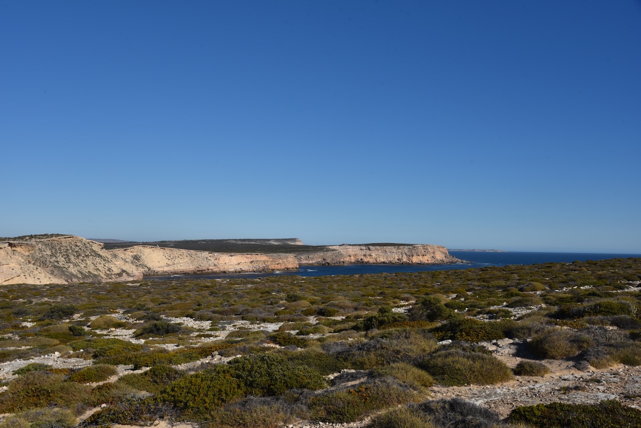
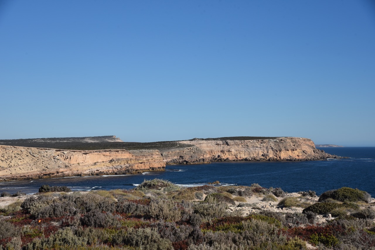
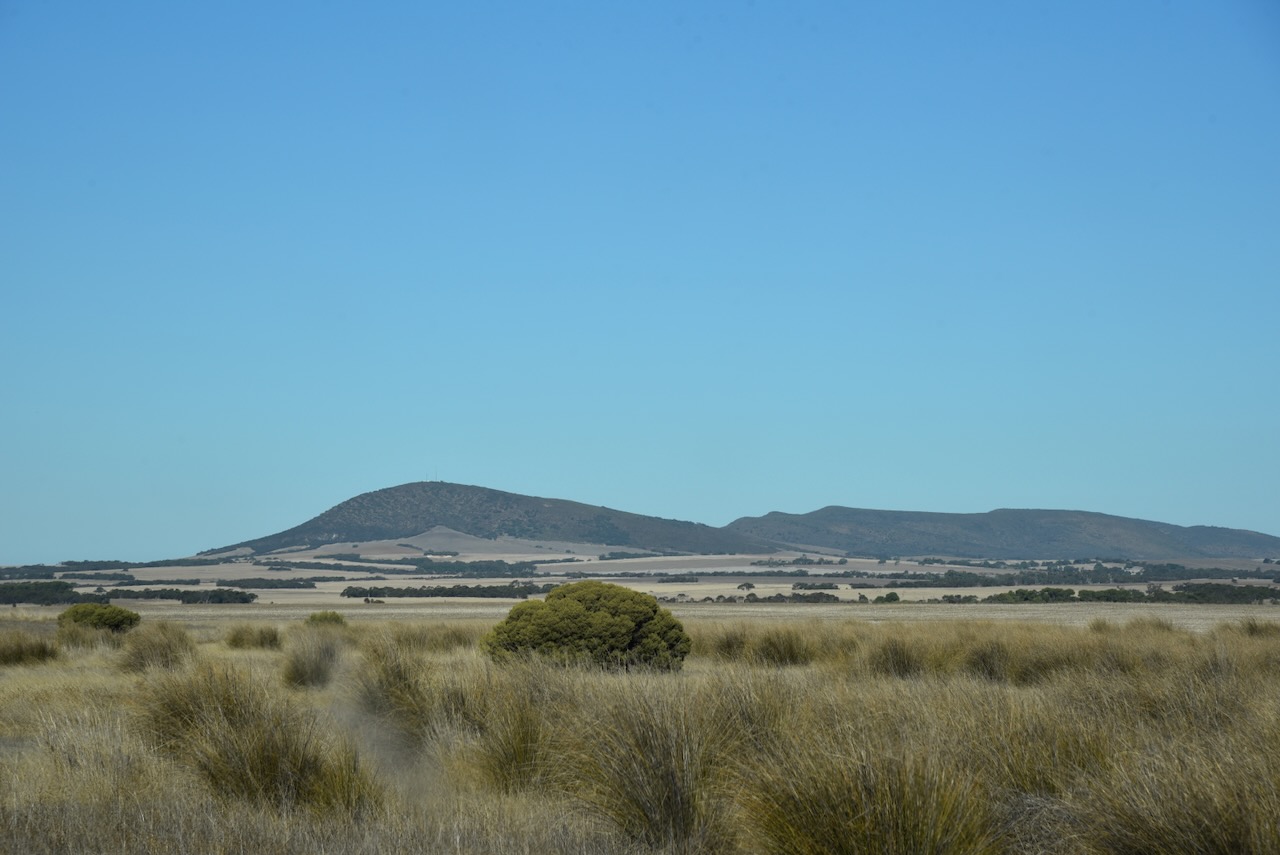
Sheringa Beach is truly spectacular. There was not a cloud in the sky and a gentle breeze blowing. It was a perfect afternoon.
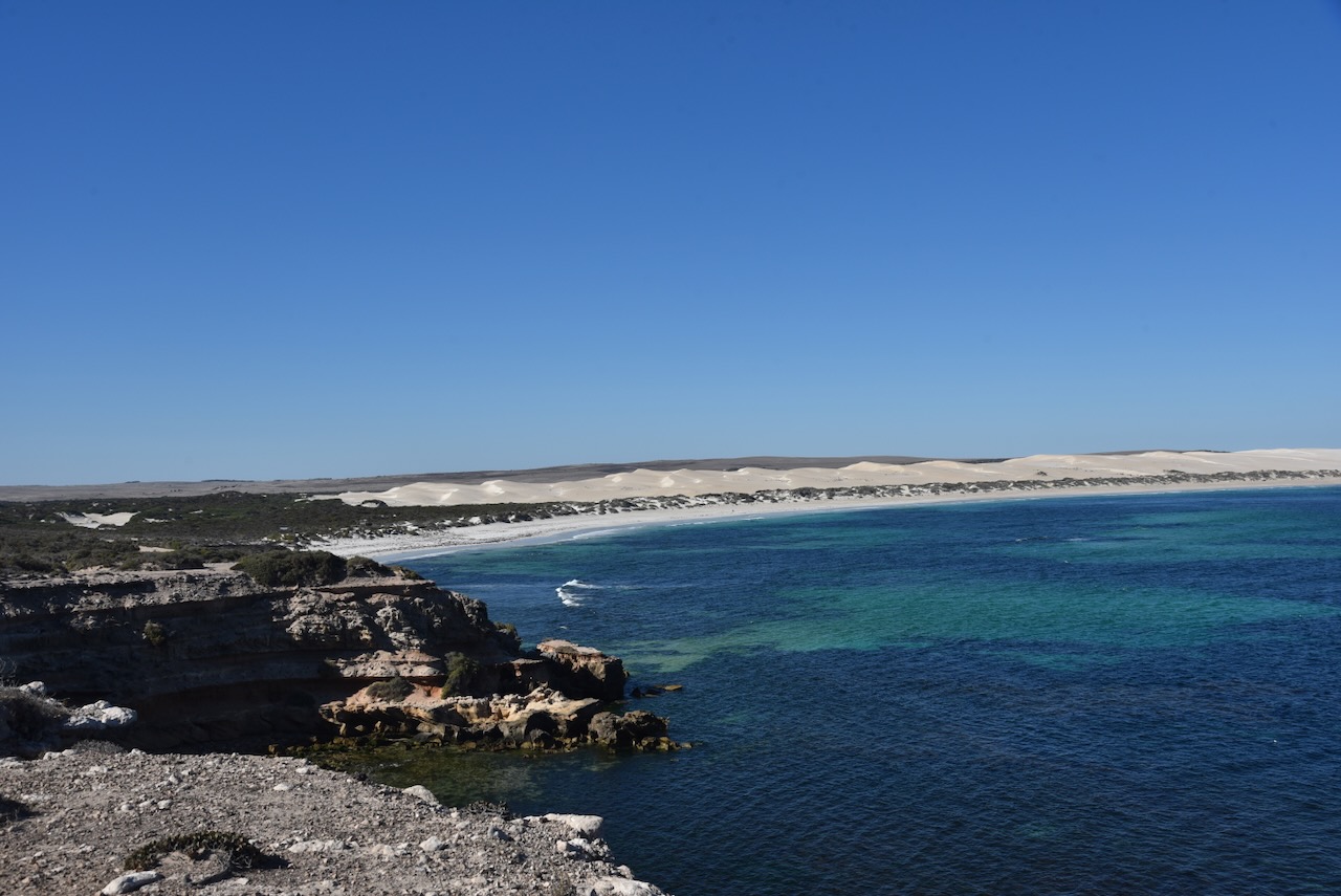
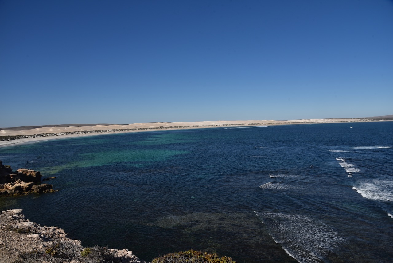
Although I had activated the Investigator Marine Park previously during this trip, it was such a lovely day and such a beautiful location, that I decided on a quick activation of the park.

Above:- Map of the Investigator Marine Park, showing my operating spot at Sheringa Beach. Map c/o Dept for Environment & Water SA.
I operated from the vehicle, using the Icom IC-7000, 100 watts, and the Codan 9350 antenna with the 1.5 metre stainless steel whip.
I logged a total of 52 stations in just under an hour.
I worked the following stations on 40m SSB:-
- VK3YV/p (Picnic Point Streamside Reserve VKFF-3832)
- VK3TNL/p (Picnic Point Streamside Reserve VKFF-3832)
- VK5KVCA
- VK5MAZ
- VK5FANA
- VK5TUX
- VK5TRM
- VK5VGC
- VK3UCD
- VK7IAN/p
- VK5ST
- VK7MAD
- VK5ZX
- VK5KG
I worked the following stations on 20m SSB:_
- VK4MUD
- VK5QA
- VK3CLD
- VK7XX
- ZL3ASN
- VK7JGD
- I4RHP
- OH1XT
- VK3PWG
- VK3TTK
- VK7HBR
- VK4KLA
- VK3ZSC
- VK4SMA
- VK2IO
- UT5PI
- VK3APJ
- Vk1AO
- VK2MET
- VK3CEO
- VK3TUN/p (Grampians National Park VKFF-0213 & SOTA VK3/ VW-003)
- VK7AAE
- Vk6DS
- VK2OZI
- OH1MM
- VK3SO
- VK3EY
- IK1GPG
- VK4XCS
- KG5CIK
- F1BLL
- VK3CWF
- VK3DCQ
- F5PYI
- VK3SQ
- VK2BD
- DL2ND
- IW2NXI
Following the activation I visited the Sheringa cemetery.
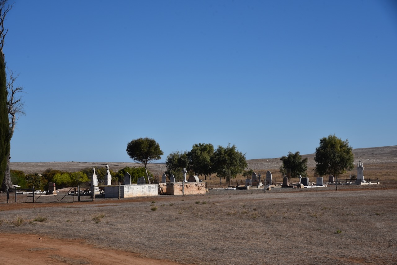
An extremely interesting story associated with the cemetery is that of Joseph Francis Cummins @ Joseph Francis Cummings, George Cummings and Samuel Fones @ Samuel Harris, Richard Harris.
Cummins was born in 1827 in Manchester, Lancashire, England. Harris was born in c. 1829 in Buffalo New York, USA. At some point, both emigrated to Australia. (ancestry.com.au)
By 1843 the pair were involved in the whaling industry at Fowlers Bay on the far west coast of South Australia. Prior to 1850, there were at least 17 shore-based whaling stations in South Australia. This included Hobart-based whalers who were active at Fowlers Bay, St Peter’s Island, and Streaky Bay. (Staniforth 2001)
Fowlers Bay is about 330 km east of South Australia’s border with Western Australia and 120 kilometres west of the township of Ceduna.
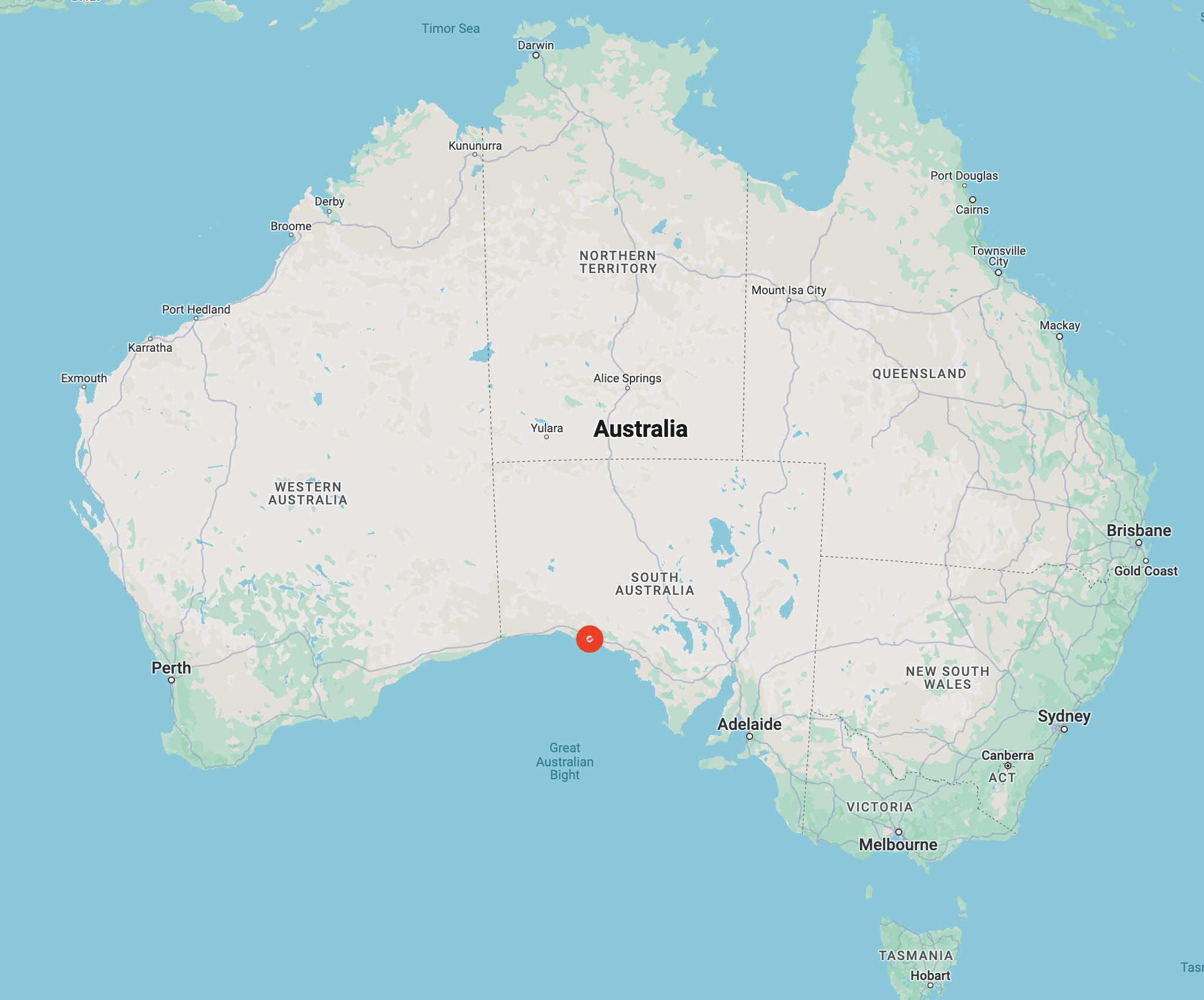
Above:- Map showing the location of Fowlers Bay. Map c/o Google Maps.
Captain Richard Copping of Hobart Town who was involved in the whaling trade out of Hobart Town from 1833 to 1852. In his reminiscences, Copping made the following comments about whaling activities at Fowlers Bay in 1843:
“We now started for Fowlers Bay at the head of the Great Australian Bight to whale for the winter….we got to Fowlers Bay after some time hunting after it; here moored the ship, sent all our yards and topmasts down on deck so as to be prepared for bad weather as we were going to lay here all the winter. Here we took about 70 tons of oil during four months. In September we left to go to Portland Bay…” (Parkinson 1997)
He also recorded the following about the 1843 whaling season:
“…we started for Fowlers Bay to winter….We moored as usual and commenced whaling and secured about 90 tons…While we were here this season we had killed a whale a long distance from the ship late in the evening. The next morning went to tow the whale to the ship….” (Parkinson 1997)
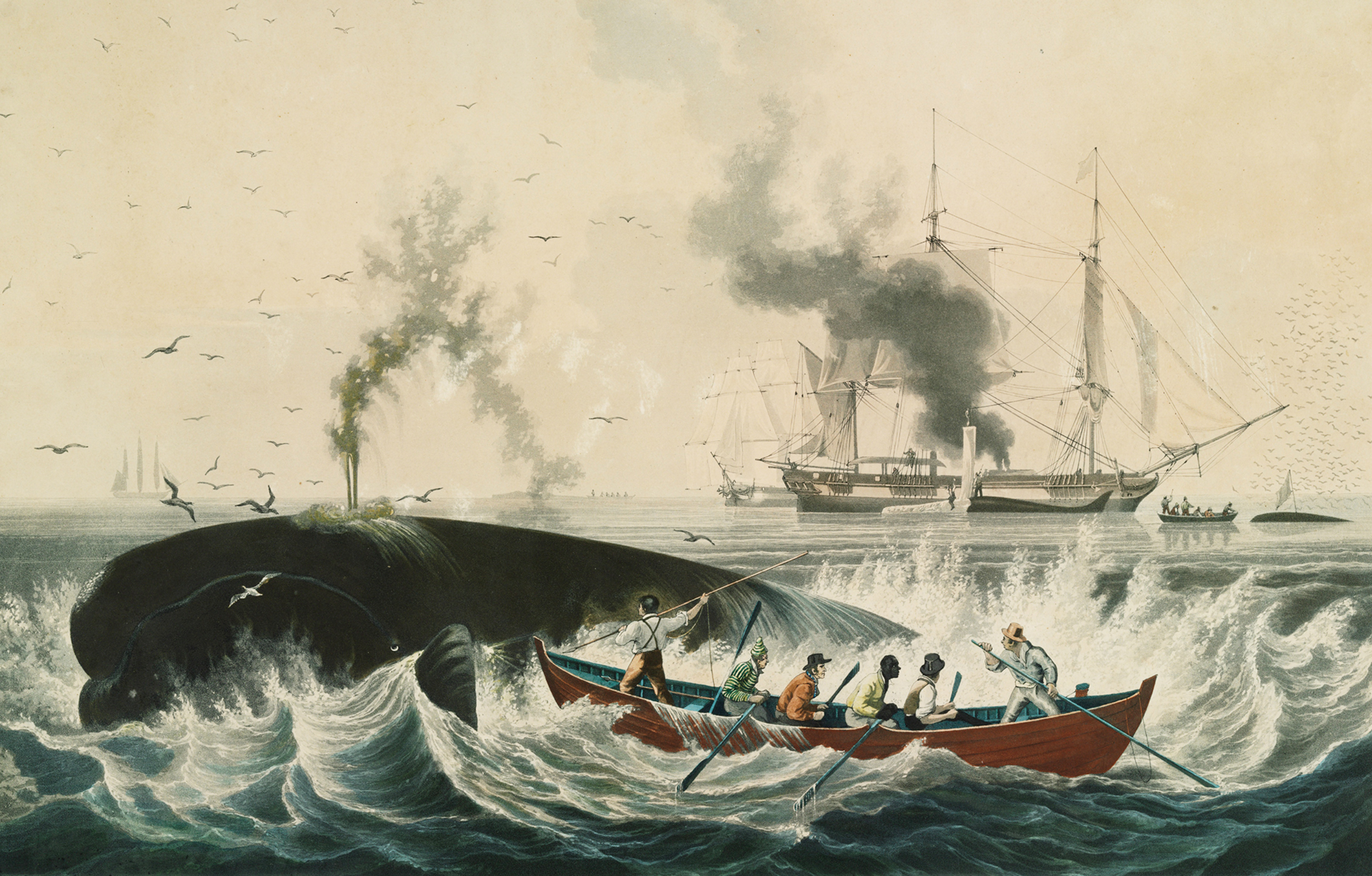
Above:- Capturing and rendering whales, 1835. Image c/o Wikipedia.
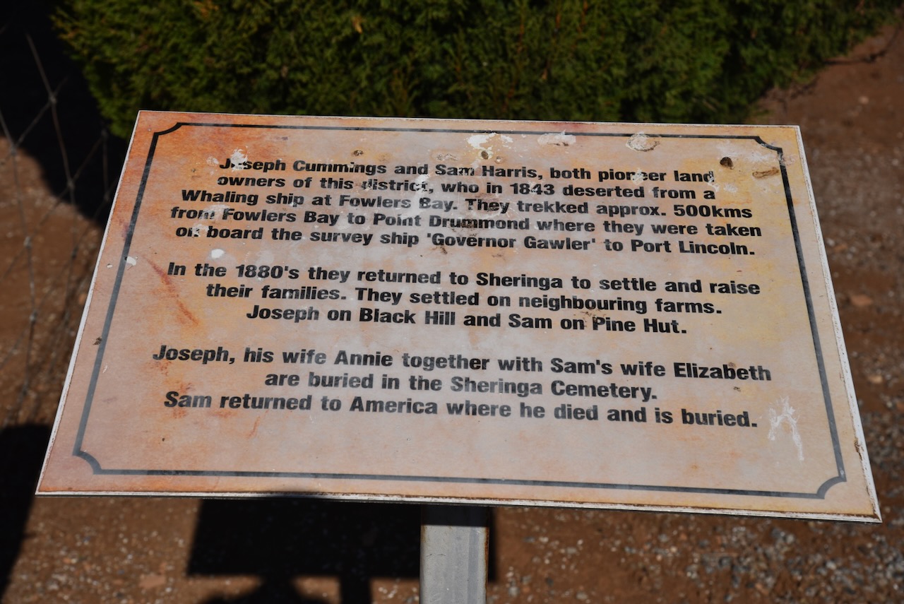
In August 1843 the two boys deserted from a whaling ship at Fowlers Bay. Joseph was 16 years old, while Samuel was just 14 years old. They set out to reach Port Lincoln which they had seen whilst sailing from Hobart Town to Fowlers Bay. The two boys had calculated the distance to be ‘two hundred miles’. The reality was that it was twice this distance. They were equipped with ten days provisions comprising just two small wooden water barrels and a small amount of food. (ABC Eyre Peninsula Facebook) (ancestry.com.au) (South Australian 1843)
During their journey, the two boys were able to quench their thirst by finding water left in the wheel ruts in the ground from Edward Eyre’s 1843 expedition. Harris recorded that they only encountered ‘seven natives’ on their journey, and that two of these had shown them a water hole. It is suspected that this was a well used during Eyre’s exploration. Harris also stated that they killed a large brown kangaroo which they roasted just as their provisions were failing. (ABC Eyre Peninsula Facebook) (South Australian 1843)
They trekked about 500 km from Fowlers Bay to Point Drummond where they were taken on board the survey ship Governor Gawler to Port Lincoln. Upon reaching Port Lincoln, the two boys were arrested and appeared before the court charged with being illegal immigrants. (ABC Eyre Peninsula Facebook) (WikiTree 2018)
Interestingly Fones was recorded in newspapers at the time as Richard Harris, while Cummins was recorded as George Cummings.

Above:- part of a newspaper article from the South Australian, Fri 15 Dec 1843. Image c/o Trove.
By 1858, Samuel Fone had changed his name to Samuel Harris. It is believed that Harris may have been the maiden name of his father’s first wife. Why he was recorded in newspaper articles in the 1840s as Richard Harris is not known. (ABC Eyre Peninsula Facebook) (ancestry.com.au)
By 1861 Joseph Francis Cummins had changed his name to Joseph Francis Cummings. Why he was referred to as George Cummings in newspaper articles in the 1840s is not known.
Fone married Elizabeth Lowe in 1858 in Adelaide, South Australia. Cummins married Ann Morris Oakley (b. 1830) in June 1861 at St Pauls Church, Adelaide, South Australia.
By the 1860s they had returned to the Eyre Peninsula to settle and raise their families on neighbouring farms. Joseph Cummings settled on Black Hill. He and Ann had four children. While Sam Harris settled on Pine Hut. He and Elizabeth had one child. (ancestry.com.au)
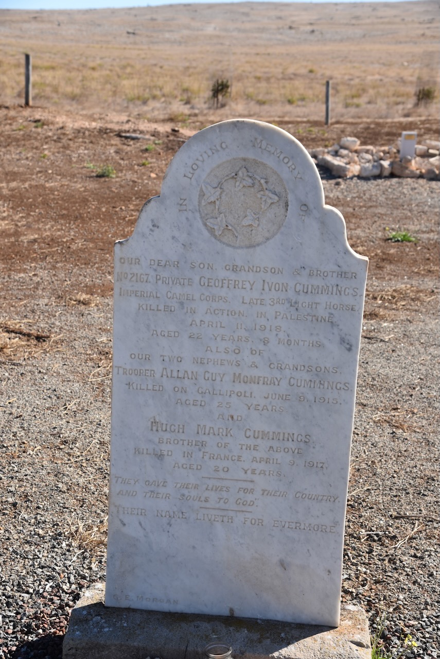
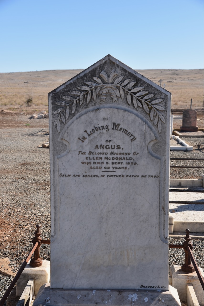
Joseph died in June 1907 while his wife Annie died in 1920. Joseph Cummings, his wife Annie, and Sam Harris’ wife Elizabeth are buried in the Sheringa cemetery. Sam Harris returned to the USA in 1899, where he died in May 1914 in Minnesota, USA. (ancestry.com.au)

Above:- Headstone of Joseph Francis Cummings (Cummins).
Cummings and Harris were only the second known Europeans to travel across the previously unexplored country known as ‘the country to the westward of Port Lincoln’. (South Australian 1843)
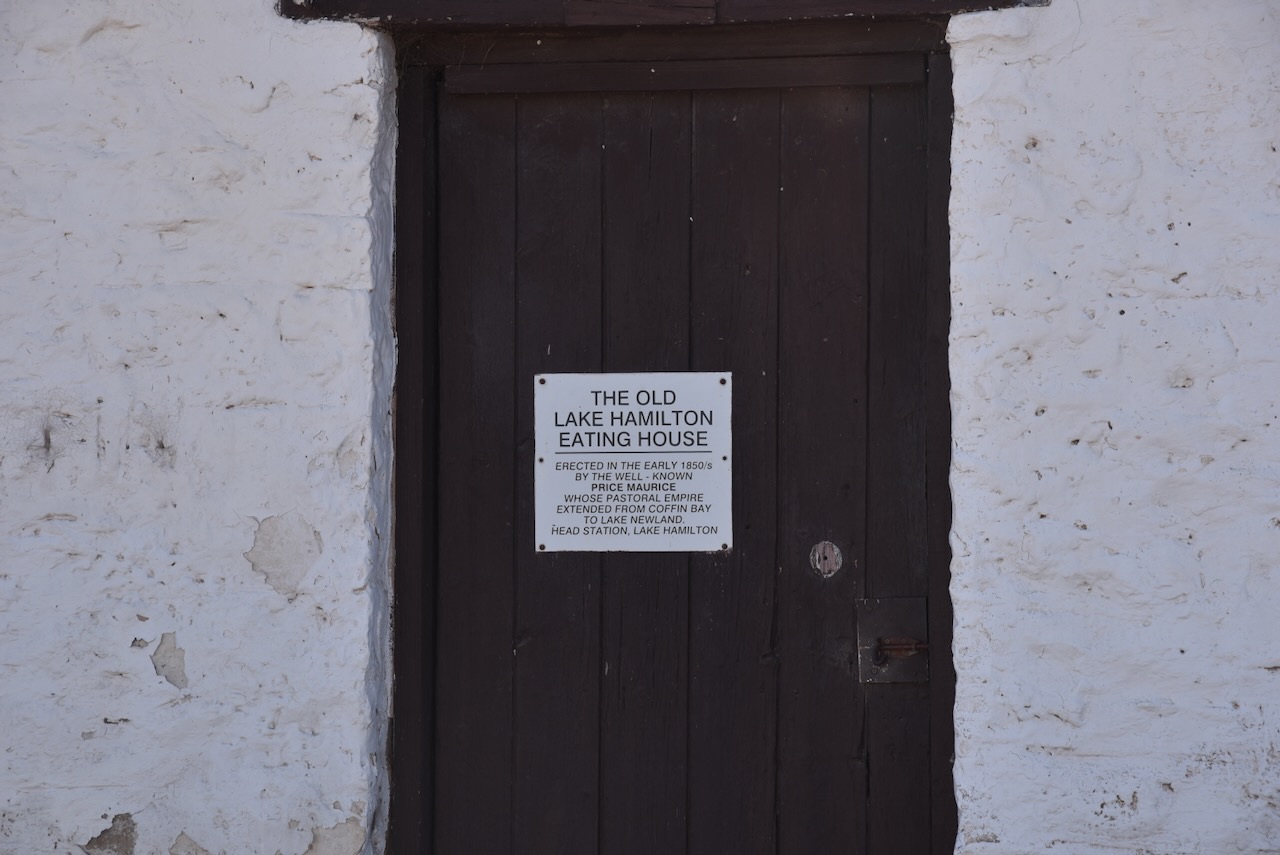
I then visited the Lake Hamilton Eating House on Flinders Highway. The building was constructed between 1851-1857 by Price Maurice who had Sheringa Run. The Eating House was used as a stopping place for coaches and travellers passing through to more distant areas until the 1880s. Granny Rowan was the last person to run the Eating House. She was reputed to brew homemade ale.
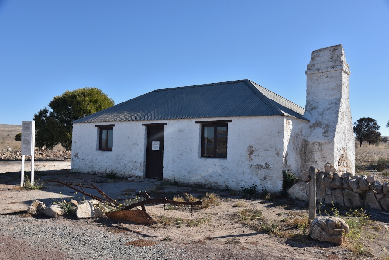
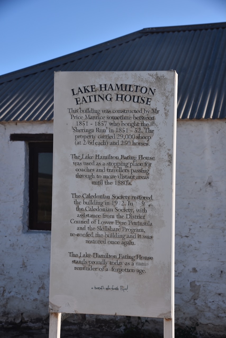
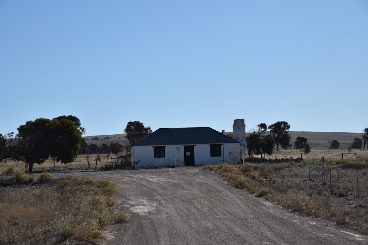
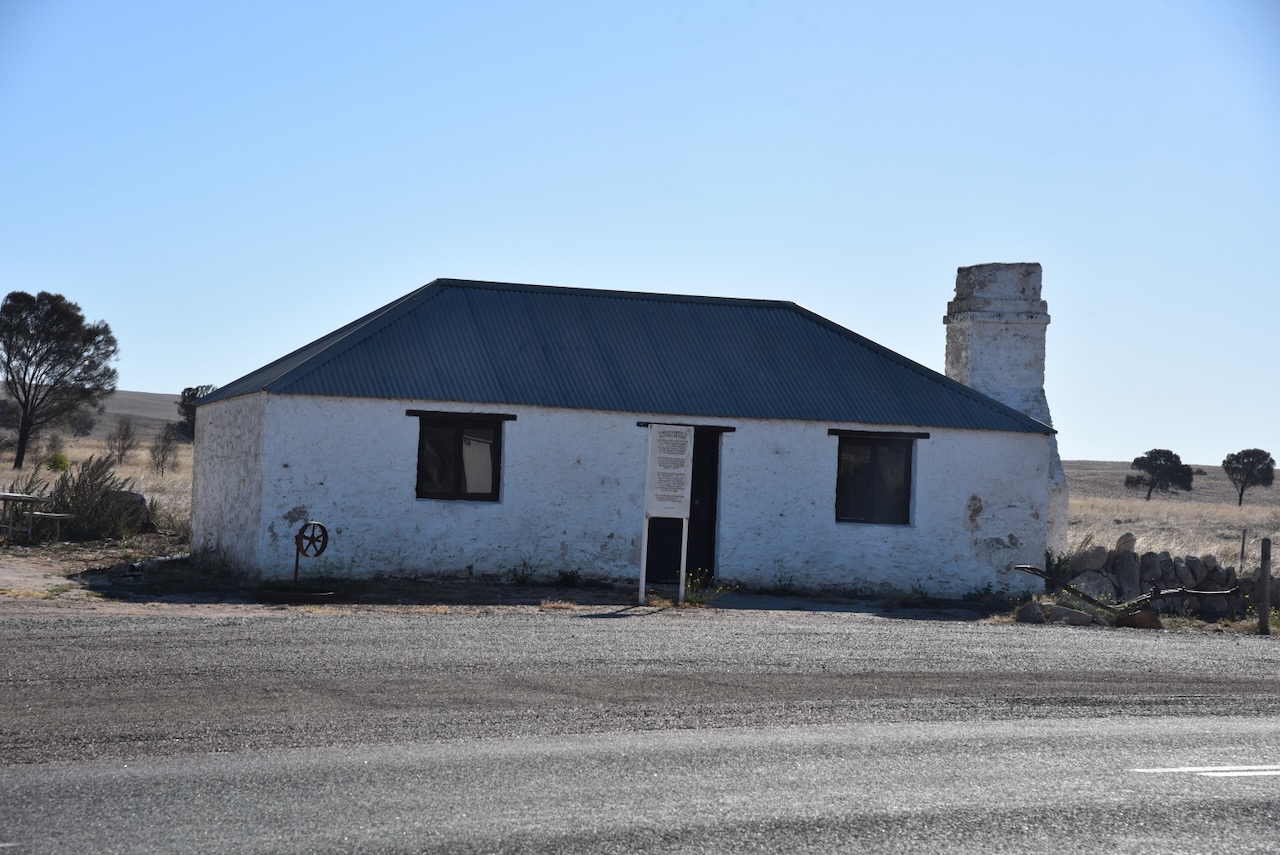
In 1972 the Caledonian Society restored the building. In 1996, the building was further restored by the Caledonian Society with the assistance of the District Council of Lower Eyre Peninsula.

Above:- Article from the Port Lincoln Times, Thu 7 Jun 1973. Image c/o Trove.
I drove along Pine Grove Road to the old Lake Hamilton cemetery. The first recorded burial in the cemetery was in 1849. The cemetery was in use until 1880 when the Sheringa cemetery was established. It is believed that many children are buried at the cemetery due to the high child mortality rate in the late 1800s. (Lake Hamilton Cemetery Survey)
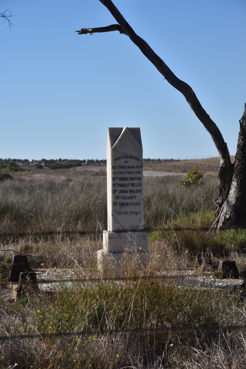
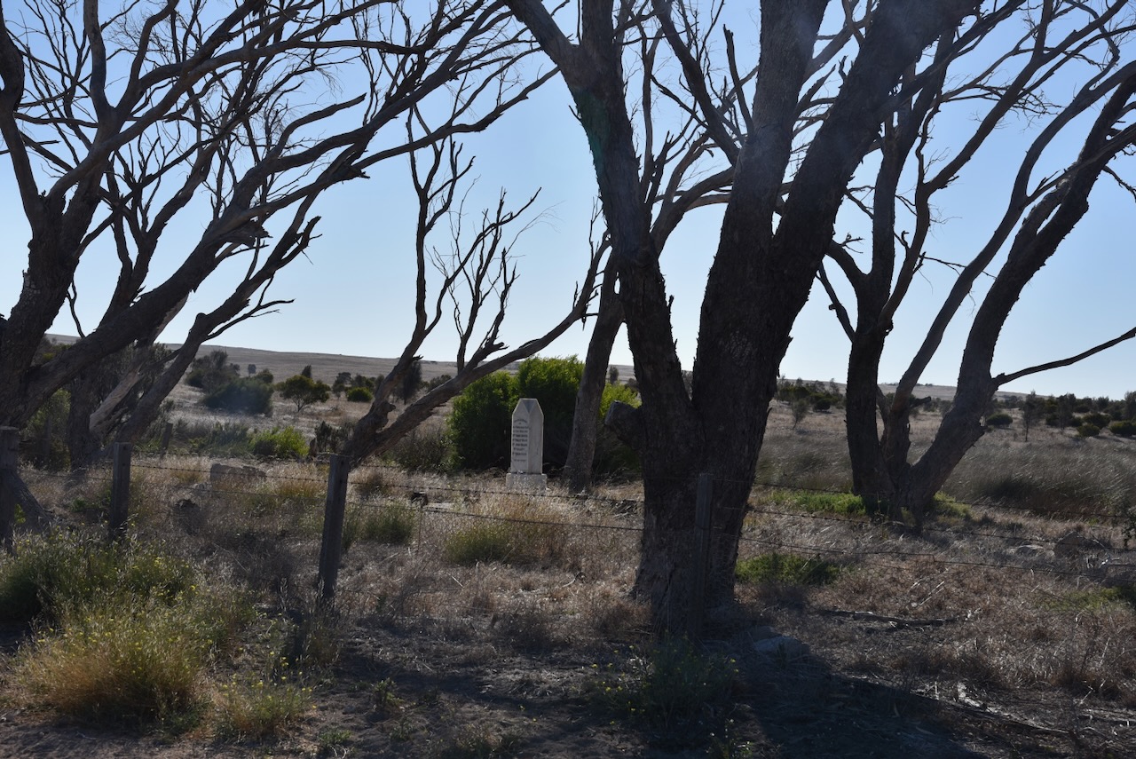
There is a memorial located in the centre of the cemetery and this contains five names. Those names are Mrs Annie Easton, Mr. Phillip Welch, Mr John Walker, Mr. Callopy, and Mr David Allen. (Lake Hamilton Cemetery Survey)
I continued south on Flinders Highway passing Lake Hamilton on my left.
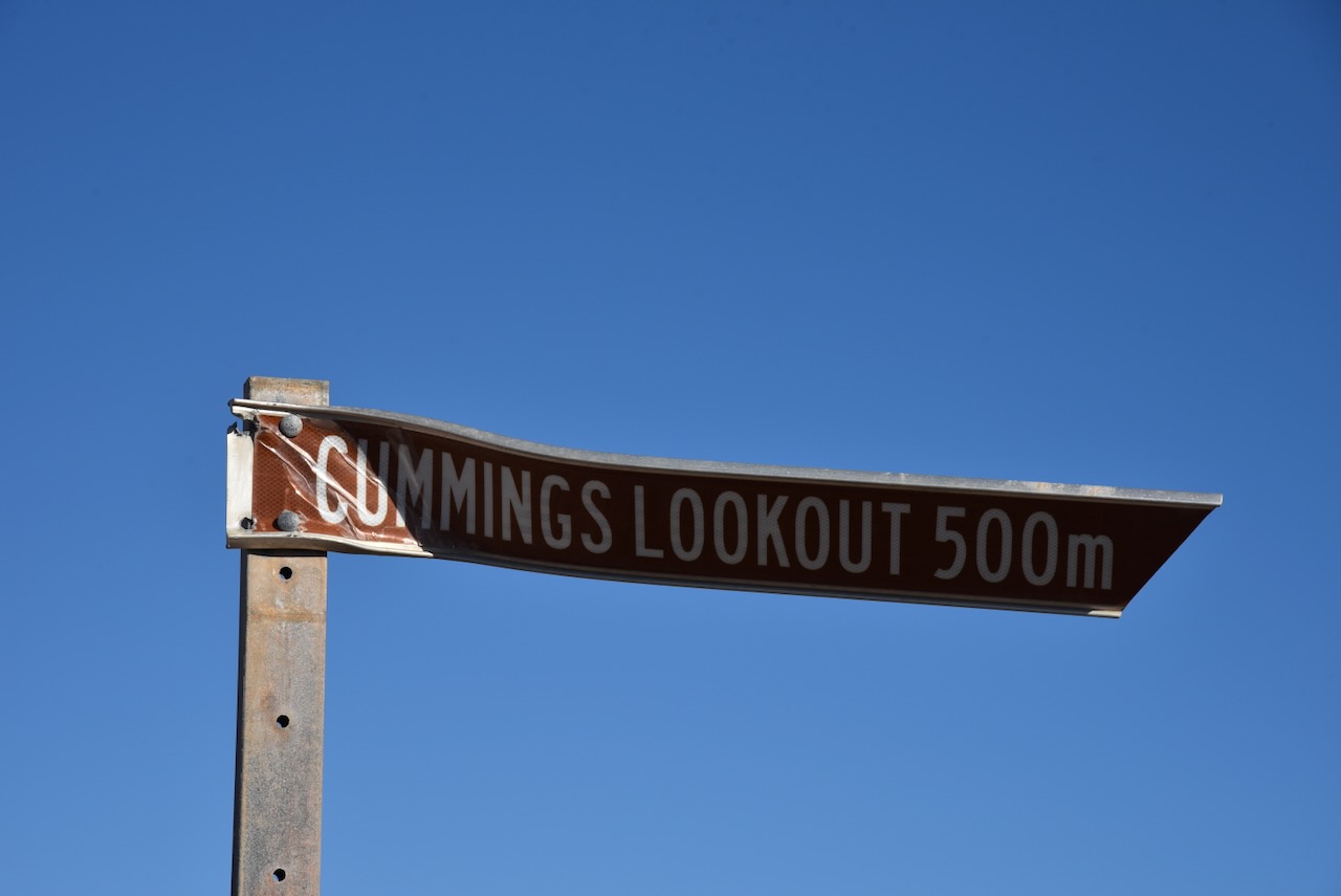
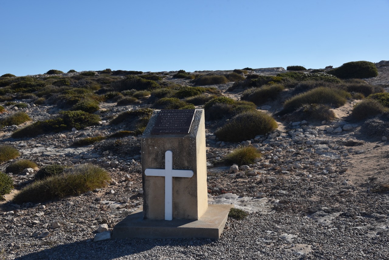
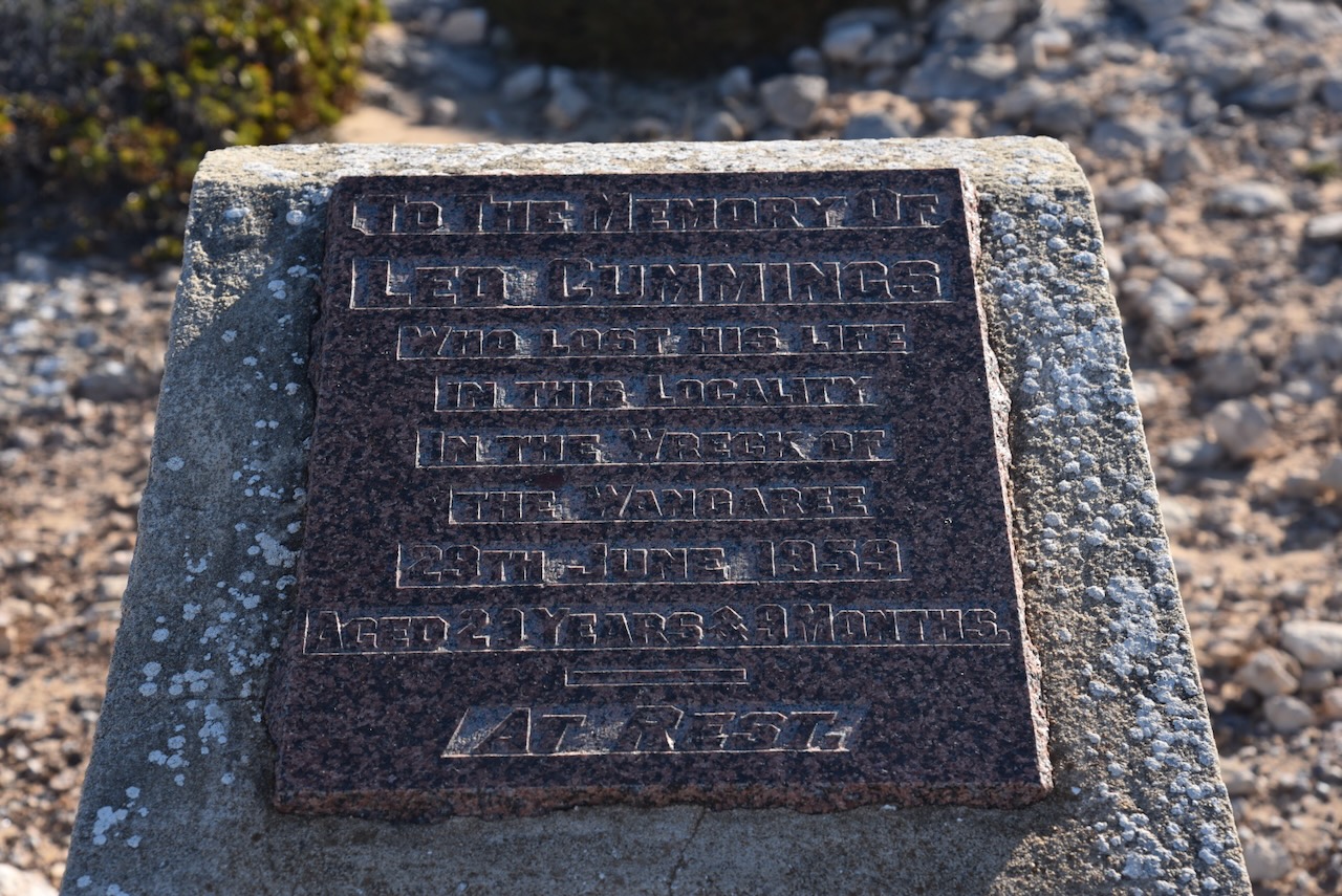
I then stopped at Cummings Lookout. On the 29th day of June 1959, the fishing cutter ‘Wangaree’ was wrecked whilst retrieving craypots with the loss of crew member Leo ‘Lew’ Cummings. The other two crew members, Eric Tapley and son Barry made it ashore and were later rescued.
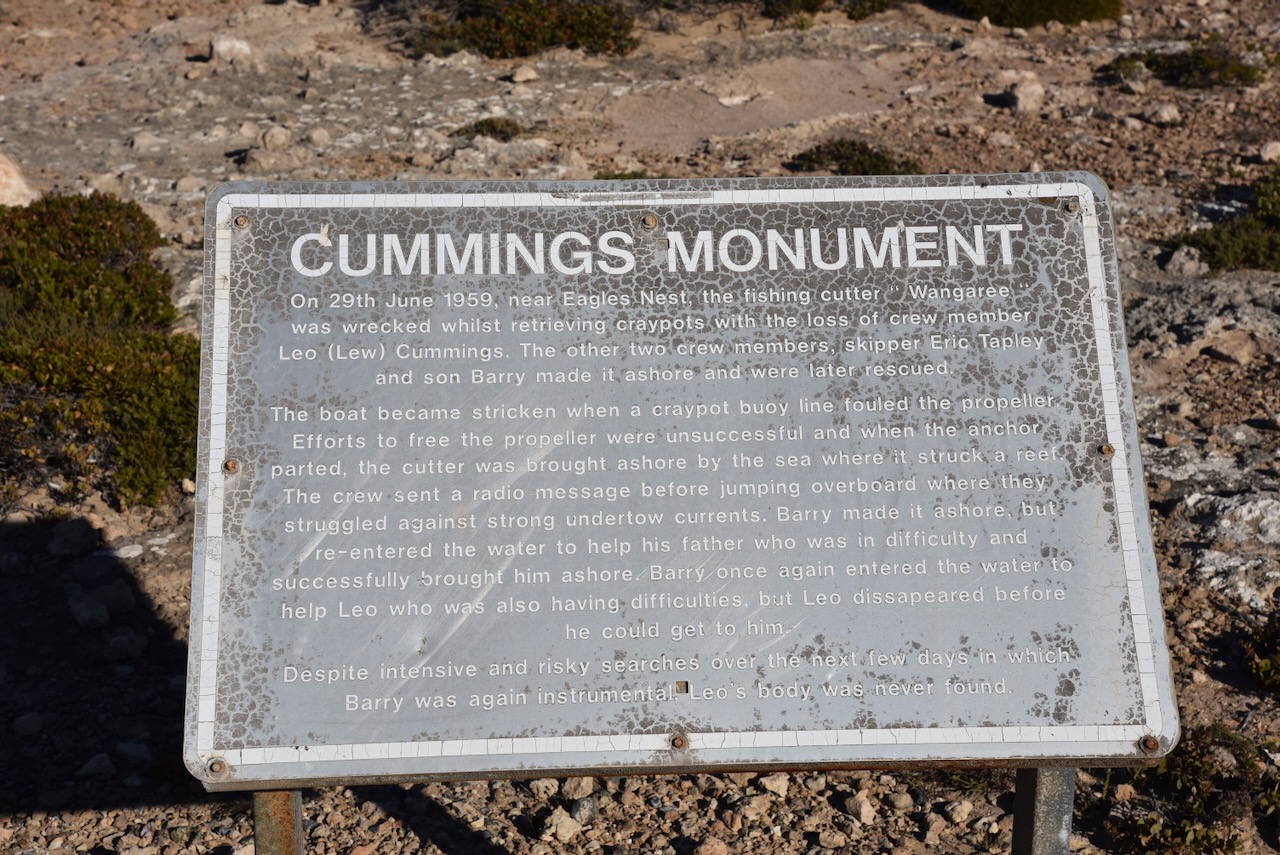
The boat became stricken when a craypot buoy line fouled the propeller. Efforts to free the propeller were unsuccessful and when the anchor parted, the cutter was brought ashore by the sea where it struck a reef.
The crew sent an SOS radio message that was received by the BCA’s Flying Medical Service Station at Ceduna, and a whaling ship at Albany, Western Australia. The message briefly stated how the boat was drifting with a stalled engine and that the three men aboard were about to swim ashore. Mr. Ken Bassham from Port Lincoln, operator of VH5BA attempted to pick up messages. (Port Lincoln Times 1959)
The crew then jumped overboard where they struggled against strong undertow currents. Barry Tapley made it ashore but re-entered the water to help his father who was in difficulty and successfully brought him ashore. Barry once again entered the water to help Leo who was also having difficulties. However, Leo disappeared before he could get to help him. Despite intensive and risky searches over the next few days, Leo’s body was never located.

Above:- part of an article from the Port Lincoln Times, Thu 2 Jul 1959. Image c/o Trove.
Following this incident, the South Australian Fishermen’s Co-operative Ltd (SAFCOL) made representations to improve ship-to-shore communications for boats operating out of Port Lincoln. Mr Bassham had operated a limited coast radio station at Port Lincoln for several years with the base station VH5BA. The Co-Operative took over the operation of VH5BA from a new site at the SAFCOL Fish Factory which was about 200m above sea level. The VH5BA station at that time comprised a commercial three-band Electrosound receiver, with a locally constructed transmitter that had a 6V6 tube feeding two 807 vacuum tubes. These were modulated by a 6SJ7 tube, 6V6 tube, and a pair of 807’s. The station had an external antenna tuning unit and an Acos type crystal microphone. The output power was about 43 watts. (A History of Radio in South Australia 1978)
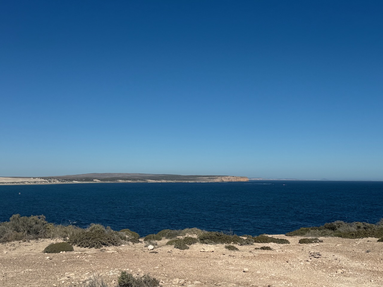
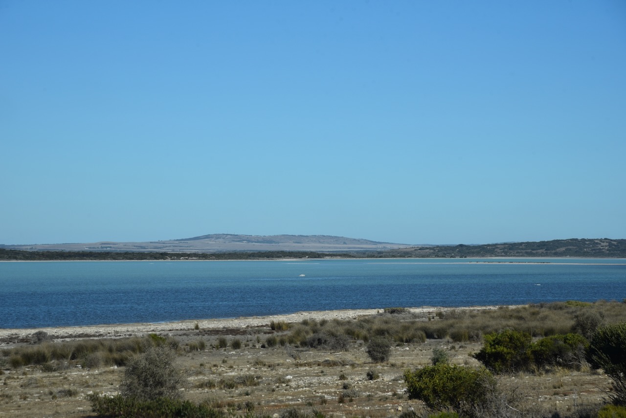
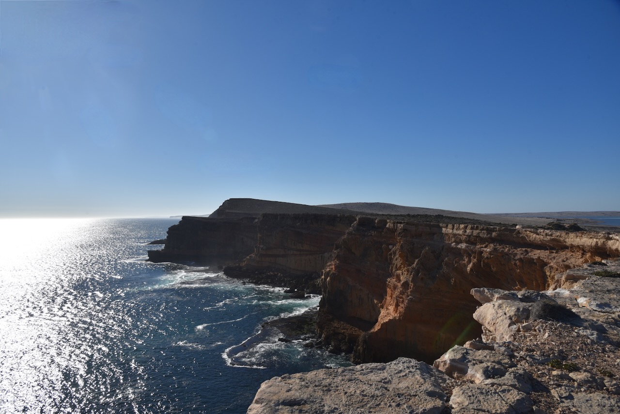
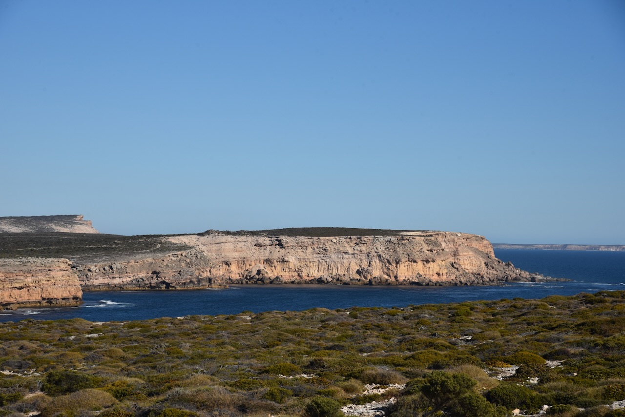
This is a spectacular coastline and the day I was here was fine and sunny. But if you close your eyes, you can imagine how rough these waters can become.
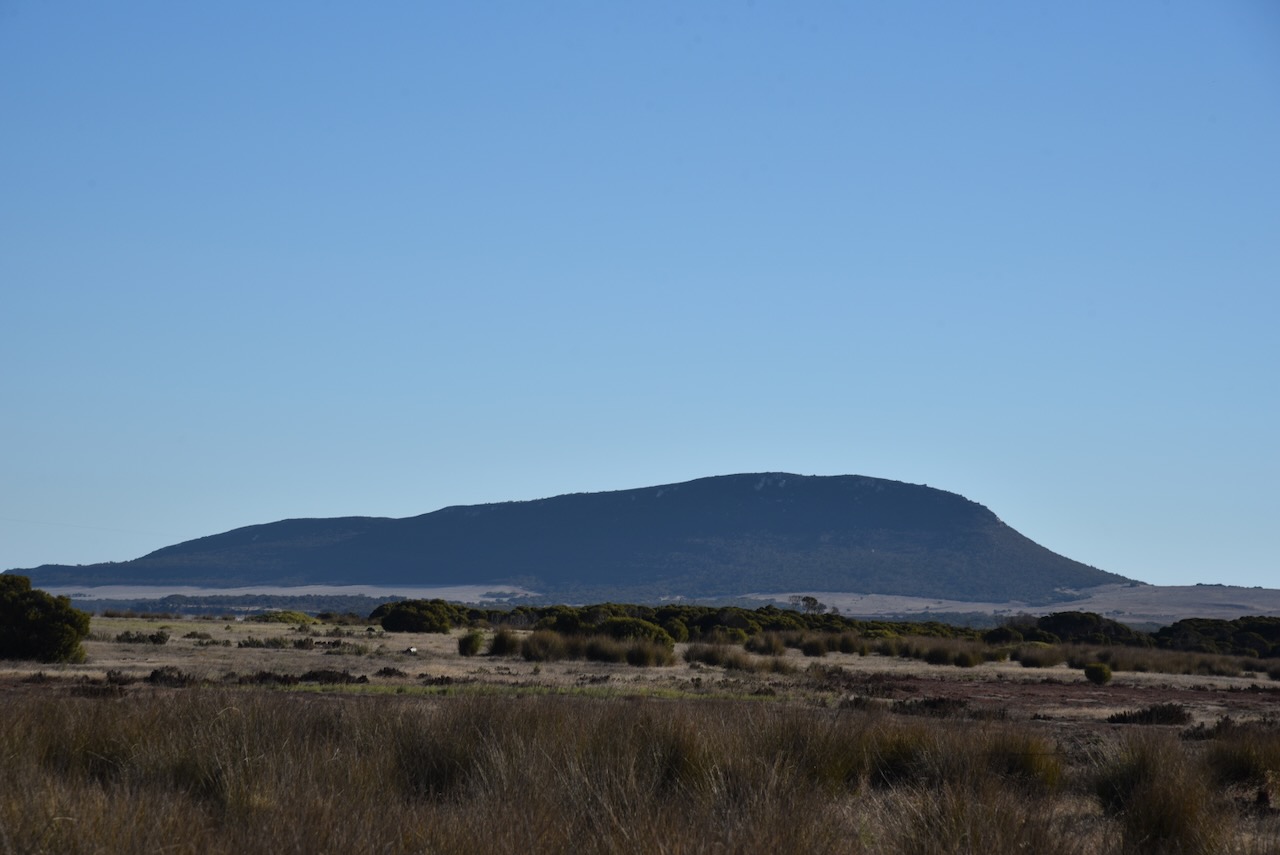
My next stop was at Mount Hope, about 75 km south of Elliston. The Mount Hope School opened in 1911 and closed in 1974. The town was proclaimed on the 30th day of November 1916 with the initial proposed name being Mount Woakwine. (Place Names 2012)

Above:- Students at the Mount Hope School with Teacher Miss Oswald, c. 1915. Image c/o State Library South Australia.
Mount Hope was once the terminus of a branch of the Eyre Peninsula Railway from Yeelanna from 1914. The line was closed and dismantled in 1966.

Above:- The Eyre Peninsula Railway, showing Mount Hope. Image c/o Wikipedia.
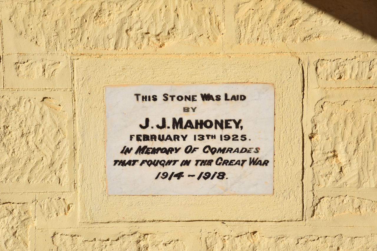
Not much remains here nowadays. One of the surviving buildings is the Soldiers Memorial Hall. The foundation stone was laid by J.J. Mahoney on the 13th day of February 1925. The hall was erected in ‘memory of comrades that fought in the Great War 1914-1918’.
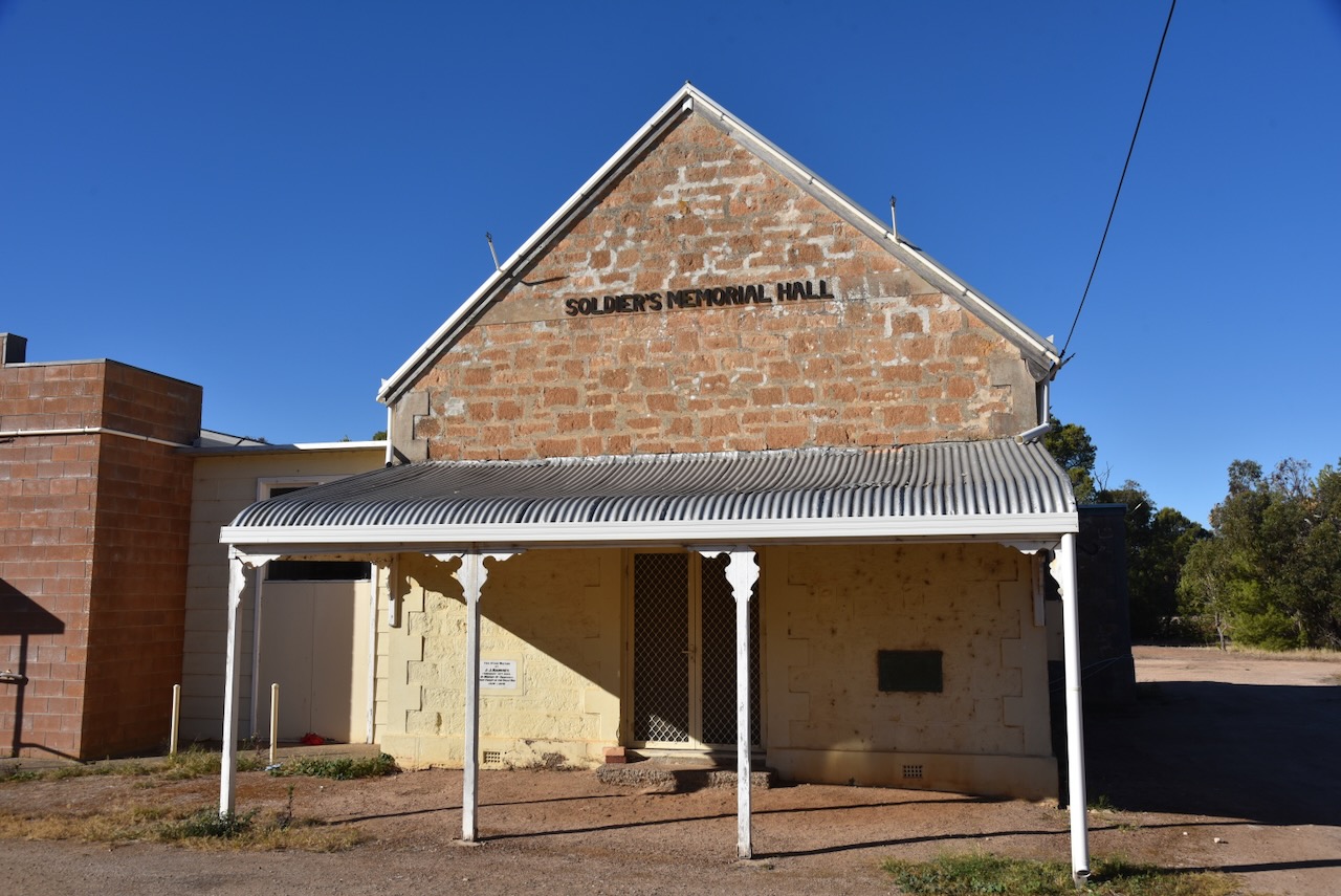
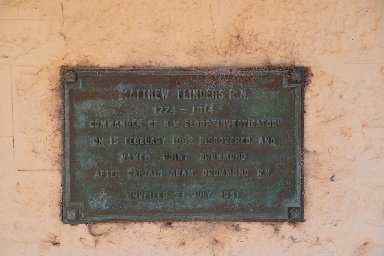
To the west of Mount Hope is Point Drummond. On the wall of the Soldiers Memorial Hall is a plaque which reads:
“Matthew Flinders R.N. 1774-1814. Commander of H.M. Sloop Investigator on 15 February 1802 discovered and named Point Dummond after Captain Adam Drummond R.N.”

Above:- Matthew Flinders. Image c/o Wikipedia.
I then continued south on Flinders Highway passing several summits that qualify for the Summits On The Air (SOTA) program. Unfortunately, I did not have the time to activate them.
I then reached Port Lincoln and booked into my accommodation at Boston House.
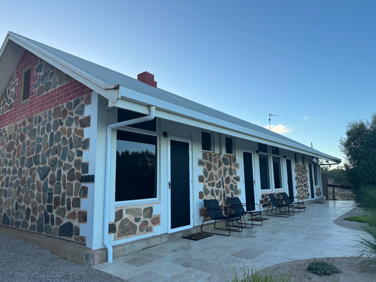
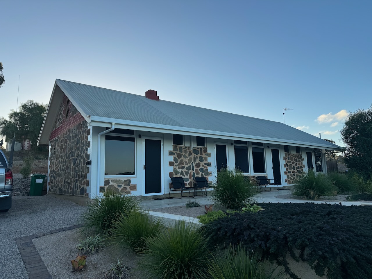
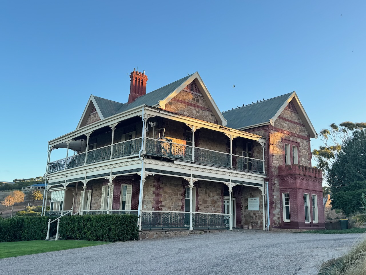
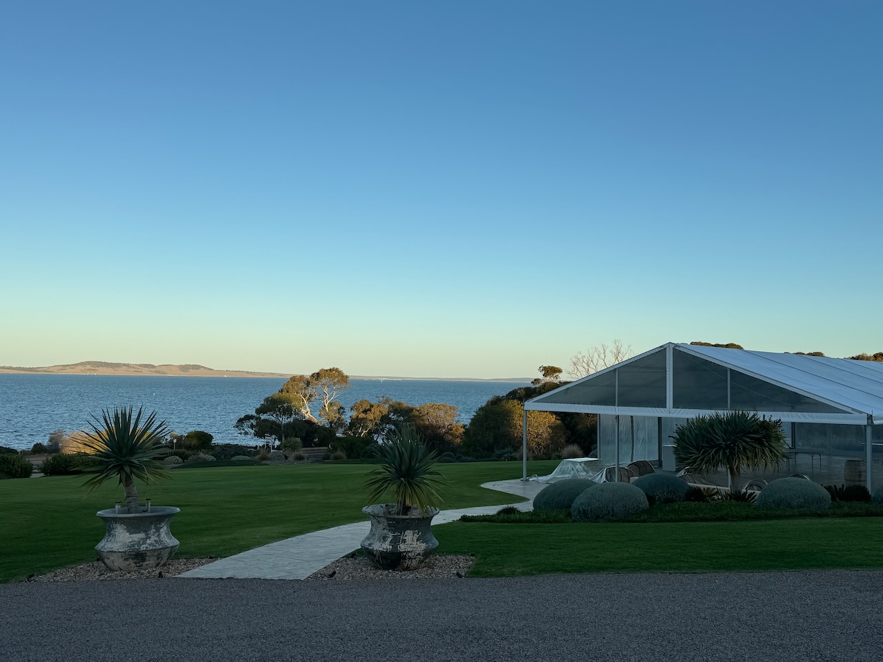
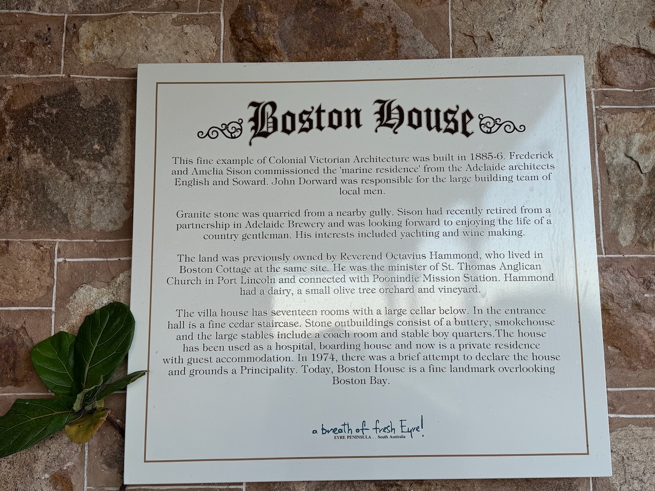
Boston House was built in 1885-1886. Frederick Samuel Sison (b. 1832. d. 1891) commissioned the marine residence from the Adelaide architects English and Soward. Sison had recently retired from a partnership in Adelaide Brewery and was looking forward to the life of a country gentleman. The granite stone was quarried from a nearby gully. The house has seventeen rooms with a large cellar. The entrance hall has a fine cedar stairhouse. There are several stone outbuildings including a buttery, smokehouse and stables. The house has been used as a hospital and boarding house.
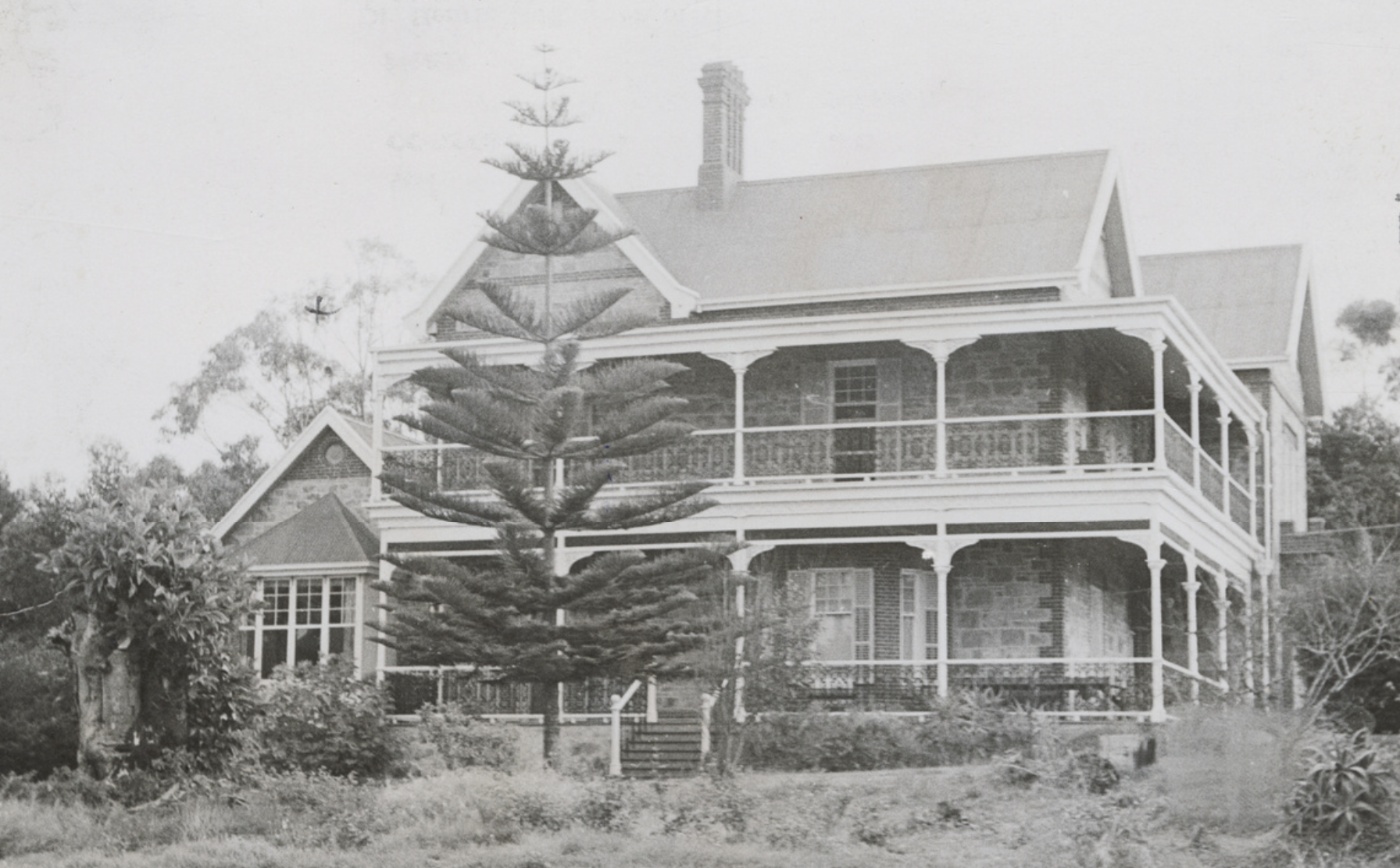
Above:- Boston House, c. 1900. Image c/o State Library South Australia.
References.
- Ancestry.com.au. (2016). Ancestry® | Genealogy, Family Trees & Family History Records. [online] Available at: https://www.ancestry.com.au/. [Accessed 17 Jul. 2024].
- Aussie Towns. (n.d.). Elliston, SA. [online] Available at: https://www.aussietowns.com.au/town/elliston-sa [Accessed 17 Jul. 2024].
- Australian Dictionary of Biography. (n.d.). Price Maurice (1818–1894). [online] Available at: https://adb.anu.edu.au/biography/maurice-price-4176 [Accessed 18 Jul. 2024].
- Design, U.W. (n.d.). Sheringa Methodist Church – Site | Churches Australia. [online] http://www.churchesaustralia.org. Available at: https://www.churchesaustralia.org/list-of-churches/denominations/methodist-wesleyan-and-other/directory/10571-sheringa-methodist-church-site [Accessed 17 Jul. 2024].
- Design, U.W. (n.d.). Sheringa Public Hall | Churches Australia. [online] http://www.churchesaustralia.org. Available at: https://www.churchesaustralia.org/list-of-churches/locations/south-australia/all-towns/directory/10356-sheringa-public-hall [Accessed 18 Jul. 2024].
- FISHERMEN’S FIGHT FOR LIFE IN GRIM SEA DRAMA. (1959). Port Lincoln Times. [online] 2 Jul. Available at: https://trove.nla.gov.au/newspaper/article/266937250/29971506 [Accessed 18 Jul. 2024].
- https://elliston.com.au/. (n.d.). Welcome. [online] Available at: https://elliston.com.au/attractions/locks-well/ [Accessed 17 Jul. 2024].
- Lake Hamilton Cemetery Survey, 2019
- monumentaustralia.org.au. (n.d.). Nowhere Else | Monument Australia. [online] Available at: https://monumentaustralia.org.au/themes/landscape/settlement/display/51694-nowhere-else [Accessed 17 Jul. 2024].
- Parkinson, C, 1997, Land Based Whaling Activities On The West Coast of South Australia.
- PORT LINCOLN. (1843). Southern Australian. [online] 15 Dec. Available at: https://trove.nla.gov.au/newspaper/article/71618735?searchTerm=richard%20harris%20%2B%20port%20lincoln [Accessed 18 Jul. 2024].
- published.collections.slsa.sa.gov.au. (n.d.). A Compendium of the Place Names of South Australia. [online] Available at: https://published.collections.slsa.sa.gov.au/placenamesofsouthaustralia/. [Accessed 17 Jul. 2024].
- Register Nomination Report, 1984, Lake Hamilton Eating House.
- Ross; J, 1978, A History of Radio in South Australia 1897-1977
- Staniforth, M., Briggs, S., & Lewczak, C., (2001). Unearthing the Invisible People. Mains’l Haul: A Journal of Pacific Maritime History, 36 (3) pp 12-19.
- Trove. (n.d.). Port Lincoln Times (SA : 1927 – 1986; 1992 – 2002) – 2 Dec 1997 – p4. [online] Available at: https://trove.nla.gov.au/newspaper/page/30006701?searchTerm=locks%20well [Accessed 19 Jul. 2024].
- www.wikitree.com. (1827). Joseph Francis Cummings (1827-1907) | WikiTree FREE Family Tree. [online] Available at: https://www.wikitree.com/wiki/Cummings-4251 [Accessed 18 Jul. 2024].
