
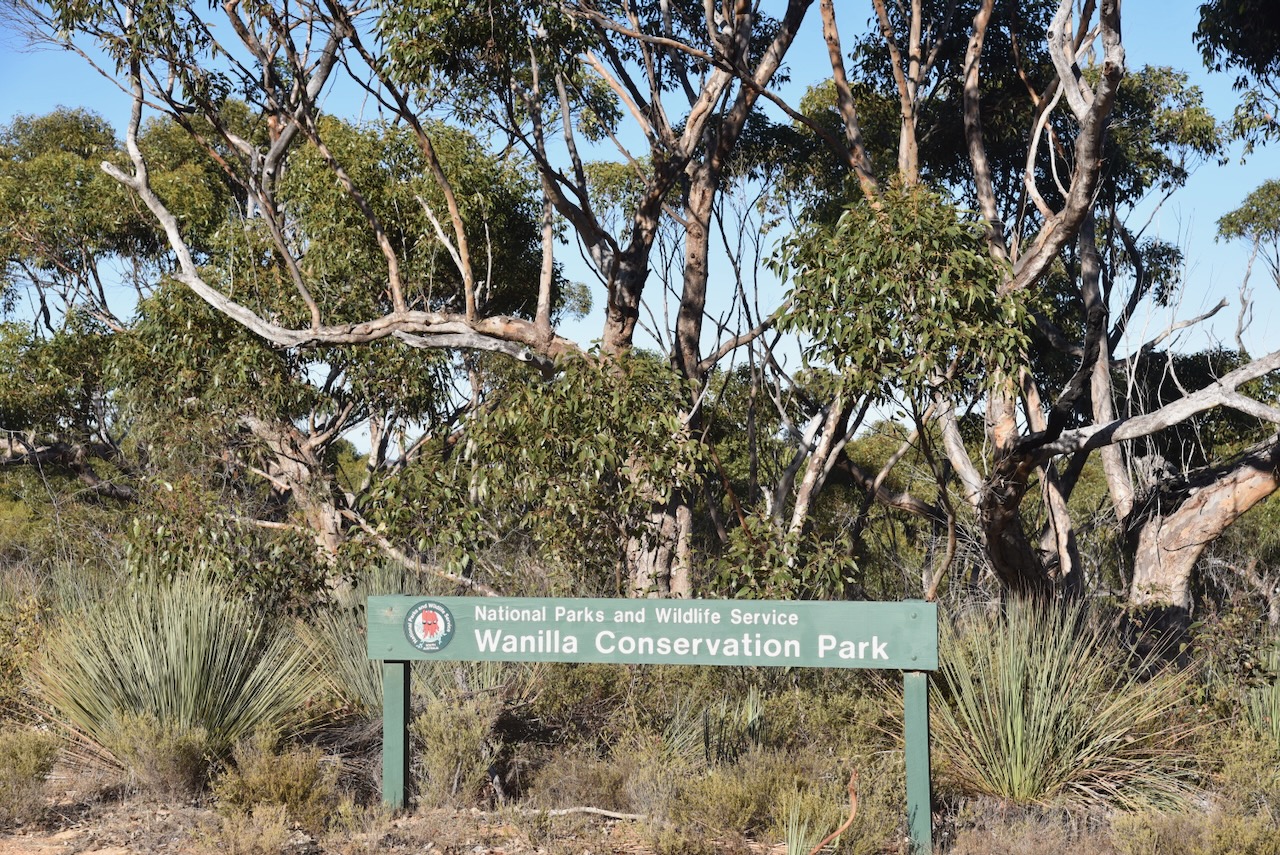
My first park activation for the World Wide Flora Fauna (WWFF) on 22nd April 2024 was the Wanilla Conservation Park VKFF-1117. The park is located about 37 km northwest of Port Lincoln on the Eyre Peninsula.

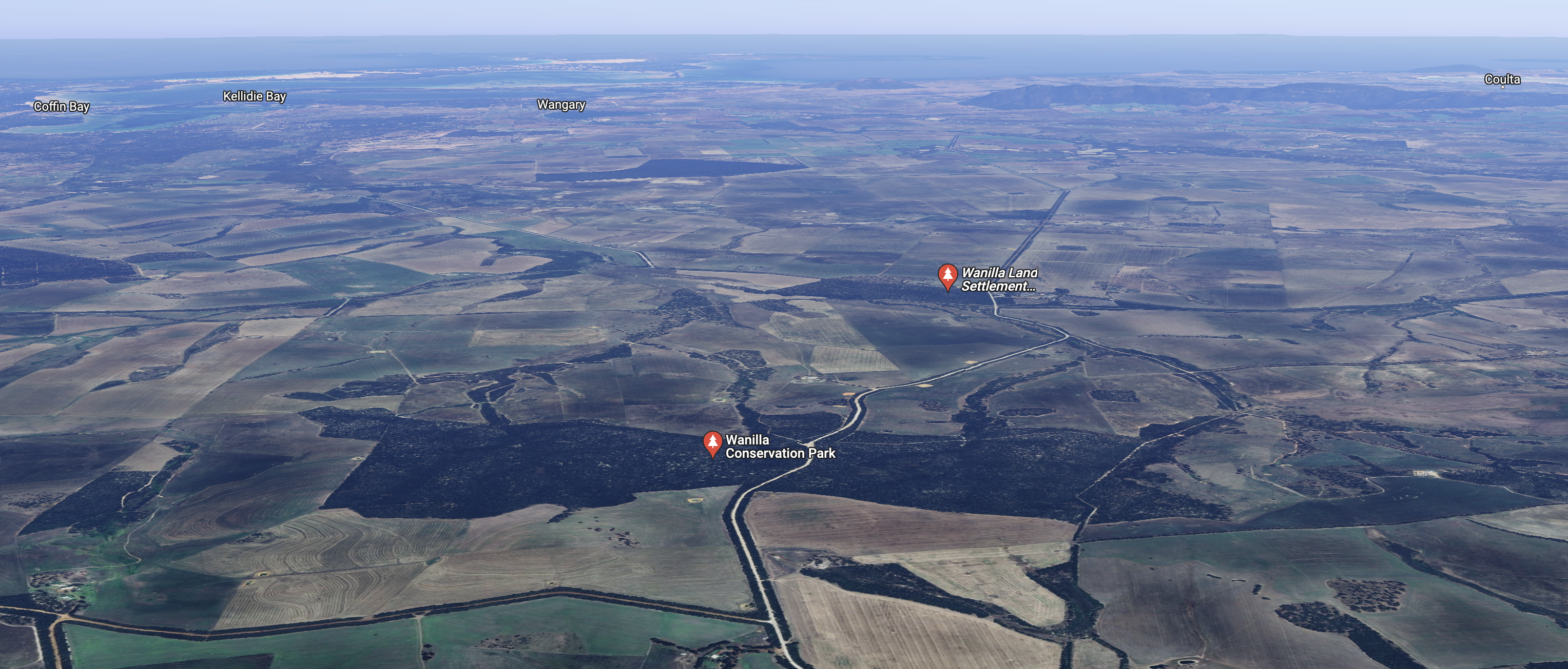
Above:- Map showing the location of the Wanilla Conservation Park. Map c/o Google Maps.
On the way to the park, I stopped at the Hawson Monument. On the 5th day of October 1840, 12-year-old Francis Tapley Hawson was fatally speared by aboriginals whilst hut keeping for his brother.
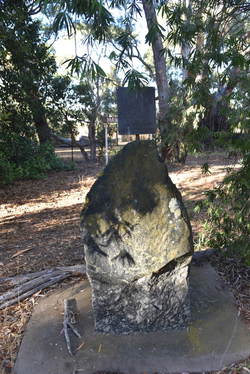
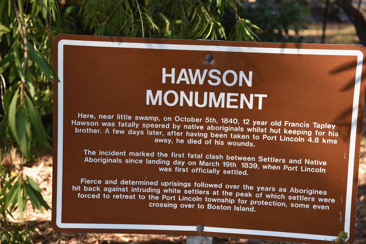
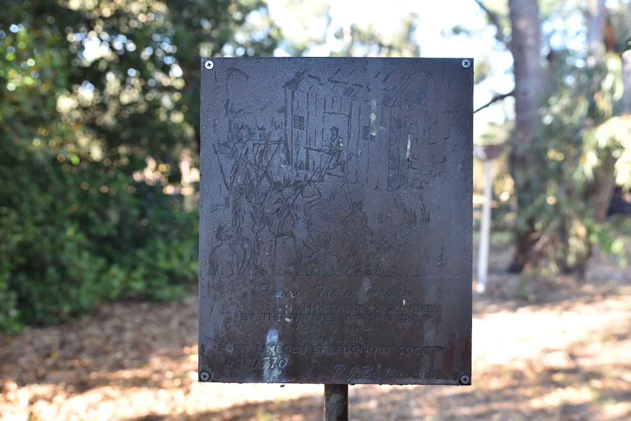
Francis Hawson did not die immediately. He was taken to Port Lincoln about 4.8 kms away and died of his wounds there on the 10th day of October 1840. (Port Lincoln Times 1938)
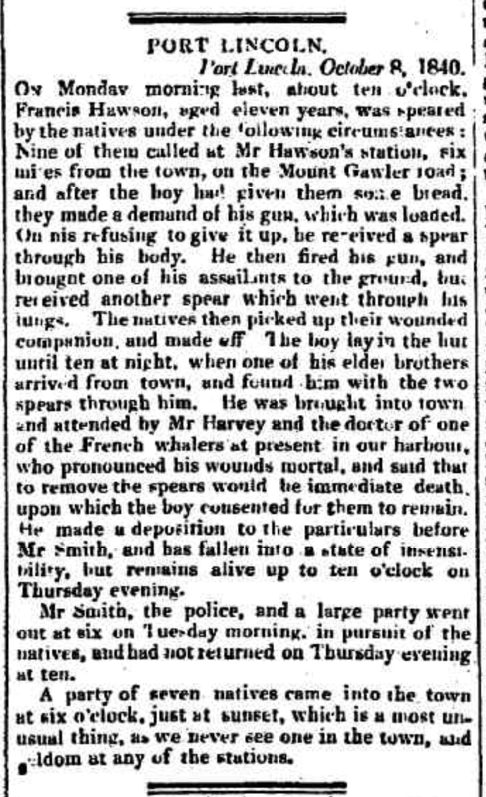
Above:- Article from the Adelaide Chronicle, Wed 14 Oct 1840. Image c/o Trove.
The incident marked the first fatal clash between European settlers and aboriginal people since landing day on 19th March 1839, when Port Lincoln was first officially settled. Fierce and determined uprisings followed over the years as aboriginal people hit back against the European settlers at the peak of which settlers were forced to retreat to the Port Lincoln township for protection, some even crossing over to Boston Island.
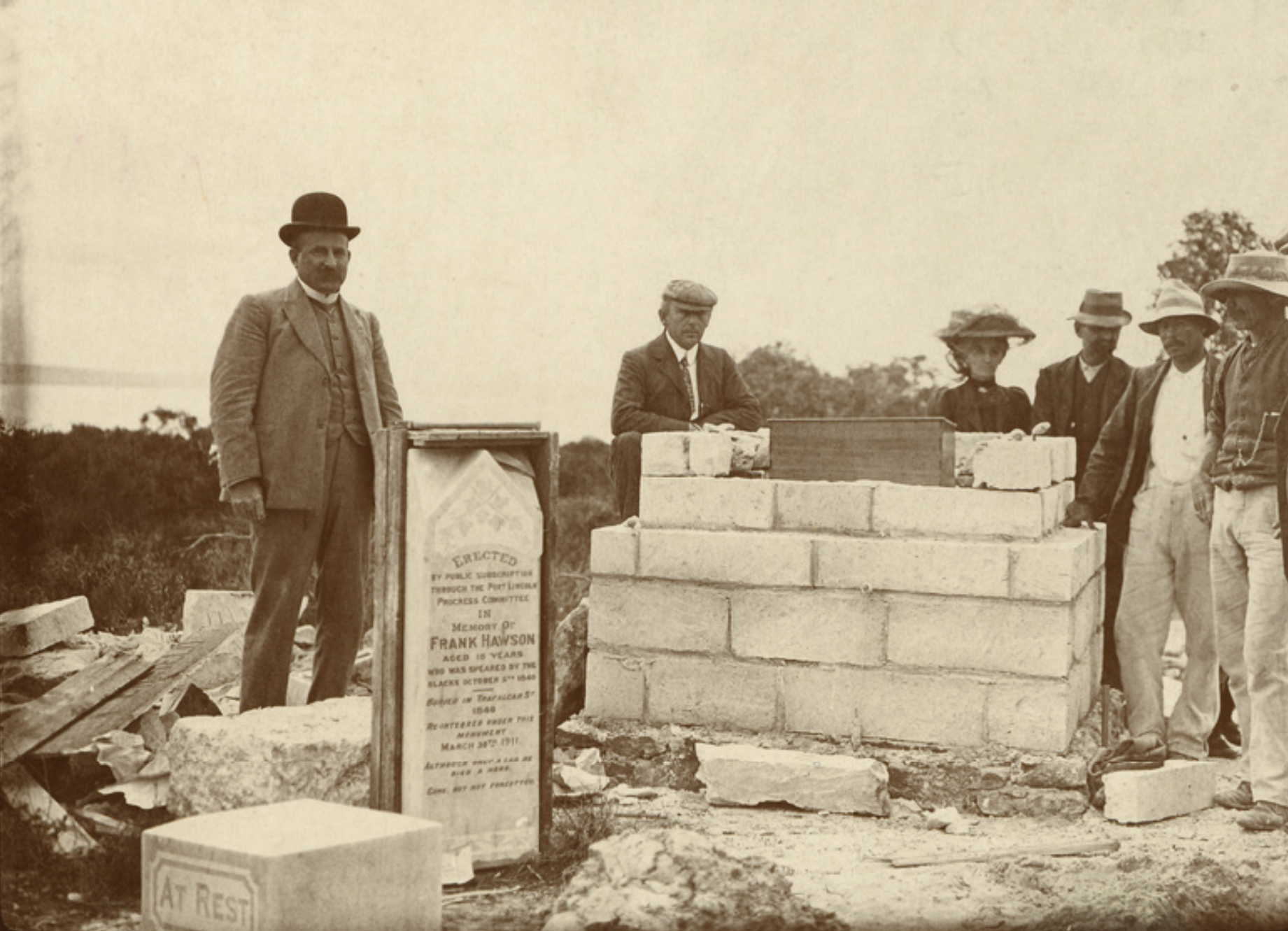
Above:- Monument erected at Port Lincoln in honour of Frank Hawson, c. 1911. mage c/o State Library South Australia
Wanilla is an aboriginal word for ‘water spring’. The ‘Wanilla Run’ was named by G.W. Bagot c. 1888. The land had previously been held by Price Maurice and W.R. Mortlock. (Place Names 20212)
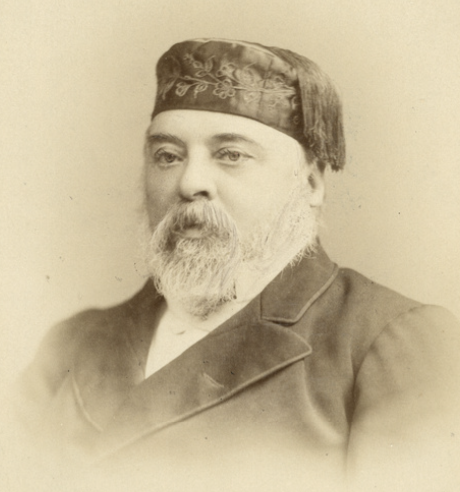
Above:- Price Maurice. Image c/o State Library South Australia.
The Hundred of Wanilla, County of Flinders, was proclaimed on the 10th day of August 1871. In 1882 the town of Wanilla was surveyed by H.J. Cant. The Wanilla School was opened in 1950 and closed in 1990. (Place Names 2012)
The Wanilla Conservation Park is about 281 hectares in size and was proclaimed on the 27th day of April 1978. It was established to protect Sugar Gum woodland habitat. (Eyre Pen Man Plan 2007)
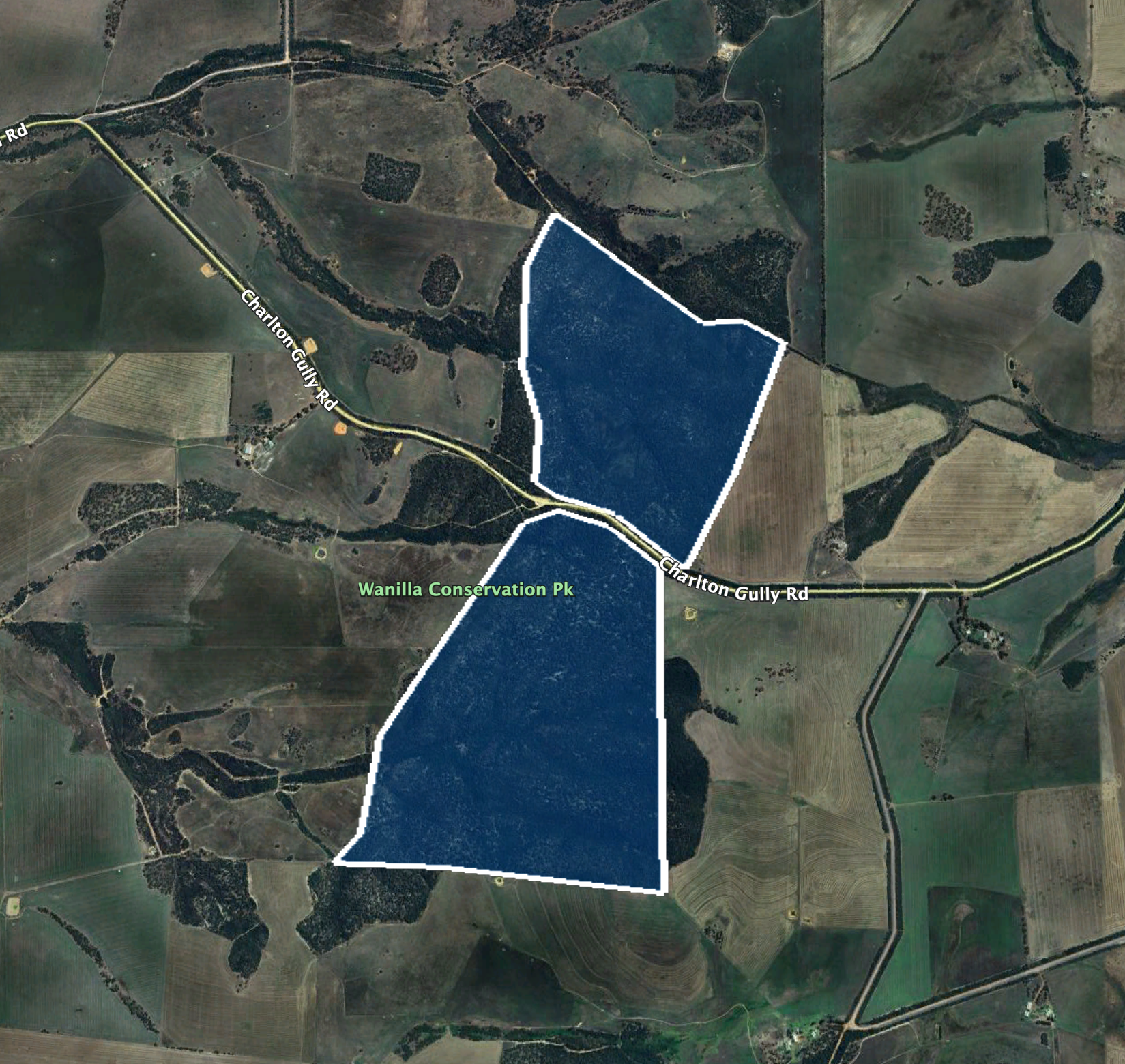
Above:- An aerial view of the park showing its boundaries. Image c/o Google Earth.
The park is directed by Charlton Gully Road.
Above:- An aerial view of the Wanilla Conservation Park. Image co Google Maps.
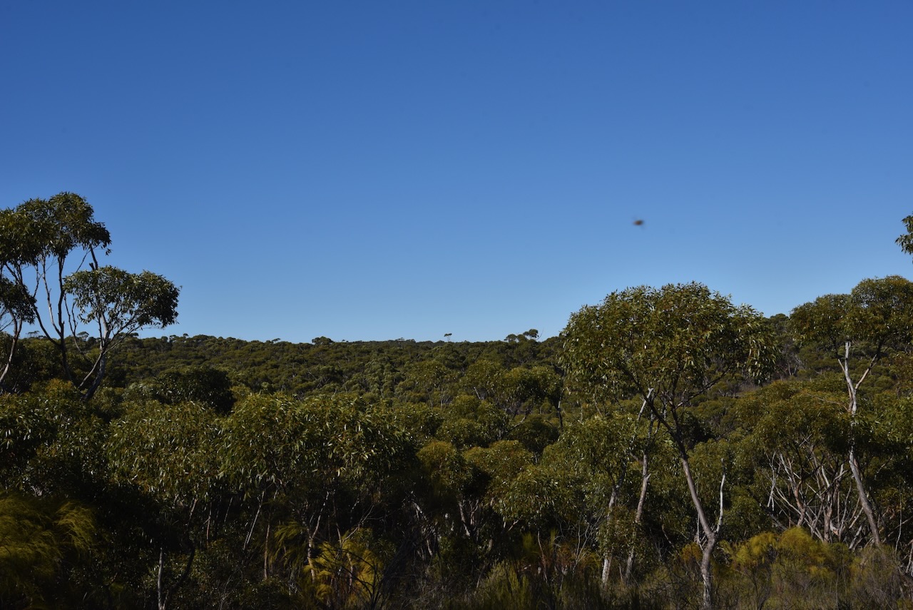
Wanilla Conservation Park is dominated by Sugar Gum woodland with heath understorey. The park is characterised by rolling hills and relatively steep gullies. (Eyre Pen Man Plan 2007)
Western Grey Kangaroos, Painted Button Quail, and Yellow Tailed Black Cockatoos call the park home. (Eyre Pen Man Plan 2007)


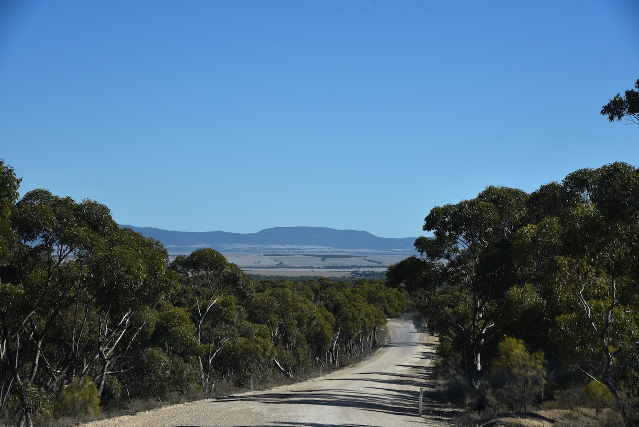
For this activation, I ran the Yaesu FT857, 40 watts, and the 20/40/80m linked dipole. I set up on a little track running off Charlton Gully Road.
I worked the following stations on 40m SSB before the UTC rollover:-
- VK3PF
- VK3KAI
- VK5MAZ
- VK5AYL
- VK5GY
- VK3HJW
- VK3CEO
- VK3VIN
- VK2YK
- VK5GA
- VK3BEL
- VK3MTT
- VK2USH
I worked the following stations on 40m SSB after the UTC rollover:-
- VK3PF
- VK3KAI
- VK5FIVE
- VK3CEO
- VK5MAZ
- VK5GY
- VK5MK/m
- VK5WE
- VK3HJW
- VK3WSG
- VK3VIN
- VK3LK
- VK2YK
- VK5GA
- VK5FANA
- VK5HS
- VK5AAF
- VK5IS/m
- VK5LA
I worked the following stations on 20m SSB:-
- VK2IO
- VK3PF
- VK3KAI
- VK1AO
- Vk2MET
- VK5HS
- VK5MAZ
- VK3CEO
- VK3SQ
- VK2BD
I worked the following stations on 20m FT8:-
- VK3SQ
- VK3CEO
- VK1AO
- VK2MET
- VK2IO
- VK5LA
References.
- Department for Environment and Heritage, 2007, Management Plan Conservation Parks of Lower Eyre Peninsula.
- Hawson’s monument January, 1938. (1986). Port Lincoln Times. [online] 19 Feb. Available at: https://trove.nla.gov.au/newspaper/article/276097624 [Accessed 2 Aug. 2024].
- published.collections.slsa.sa.gov.au. (n.d.). A Compendium of the Place Names of South Australia. [online] Available at: https://published.collections.slsa.sa.gov.au/placenamesofsouthaustralia/. [Accessed 2 Aug. 2024]
