Arno Bay silo VK-ARY5

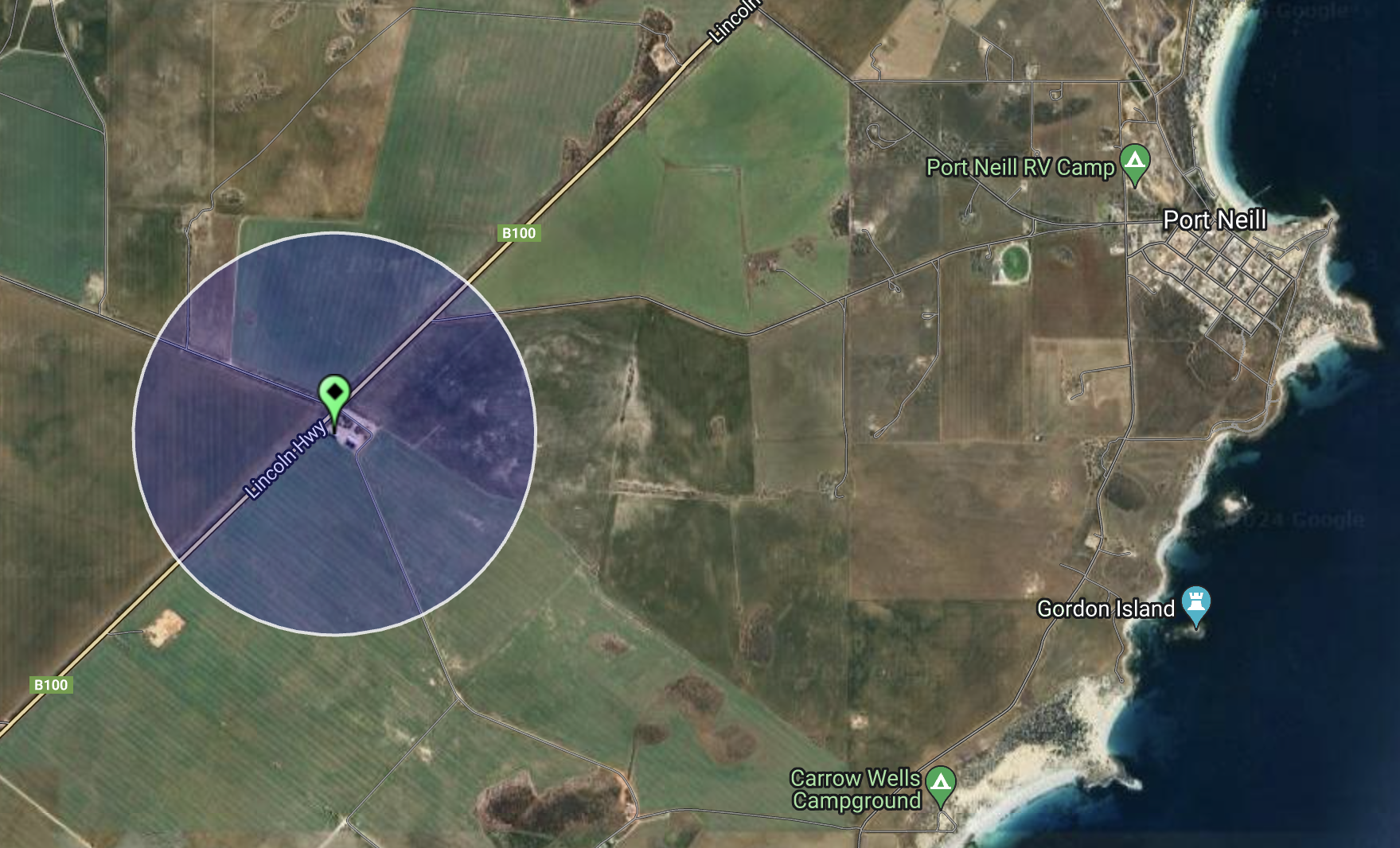
My next planned stop was Arno Bay to activate the Arno Bay silo VK-ARY5 for the Silos On The Air (SiOTA) program. Arno Bay is about 535 km (by road) from Adelaide.

Above:- Map showing the location of Arno Bay. Map c/o Google Maps.

As I left Port Neill I stopped on the Lincoln Highway to view the Robert Bratten monument. It commemorates Robert Bratten, the Overseer of Workds for the District Council of Tumby Bay. (Monument Australia 2024)

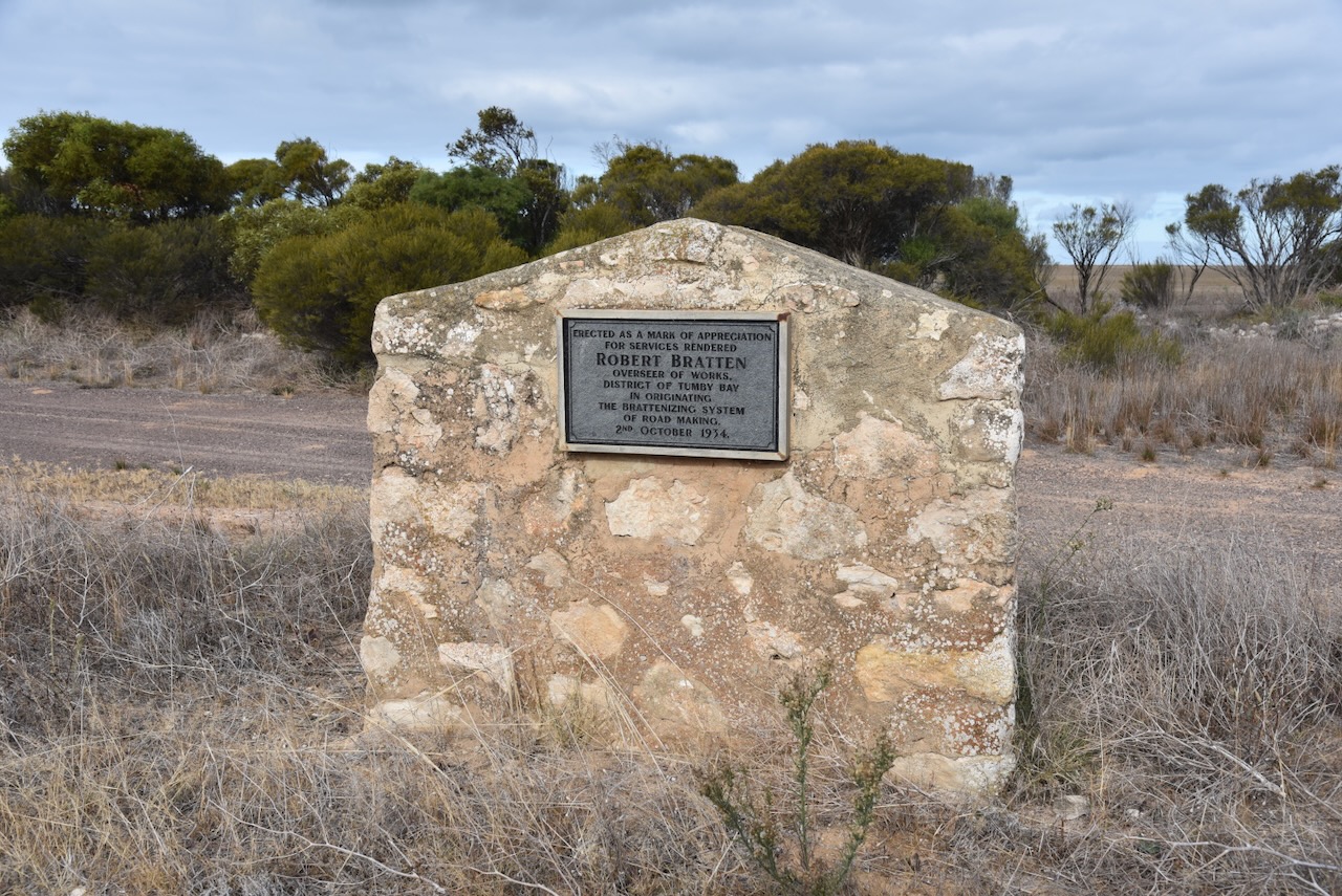
Robert Bratten was born in January 1862 in Ireland. In 1882 at the age of 20, he emigrated to Australia. In 1906 he was appointed to the position of Overseer at a time when the council received many petitions for new roads to be opened. The first roads on the Eyre Peninsula were manually cleared through scrub. The roads were macadamised, a process where big stones were broken with a hammer until they were small enough to pass through a 2.5 inch ring. (Monument Australia 2024)

This initially sufficed until motor vehicles required a stronger surface for speed and weight. Large sheet limestone was a major problem so a special plough was designed to plough the stones to the surface. The larger stones were disposed of, while the smaller ones were crushed and used. The road was formed by a grader and the roller with a heavy roller. This method was called Brattenising. (Monument Australia 2024)

Above:- Robert Bratten. Image c/o ancestry.com.au

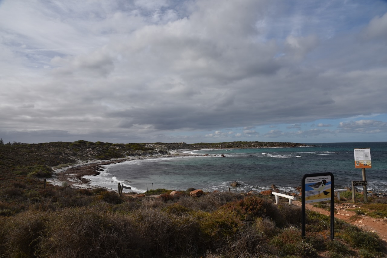
Prior to European occupation, the Arno Bay district was the home of the Banggarla aboriginal people. (Aussie Towns 2024)

The Arno Bay district was opened up by pastoralists in 1863. The area was named ‘Salt Creek Cove’. The town was initially proclaimed in 1882 by G.H. Ayliffe under the name ‘Bligh’, after Vice Admiral William Bligh who is best known for the mutiny on HMS Bounty. Locals resisted the name change and referred to the town as Arno Bay until its official name change. (Wikipedia 2024)

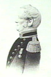
Above:- Rear Admiral Bligh. Image c/o Wikipedia.

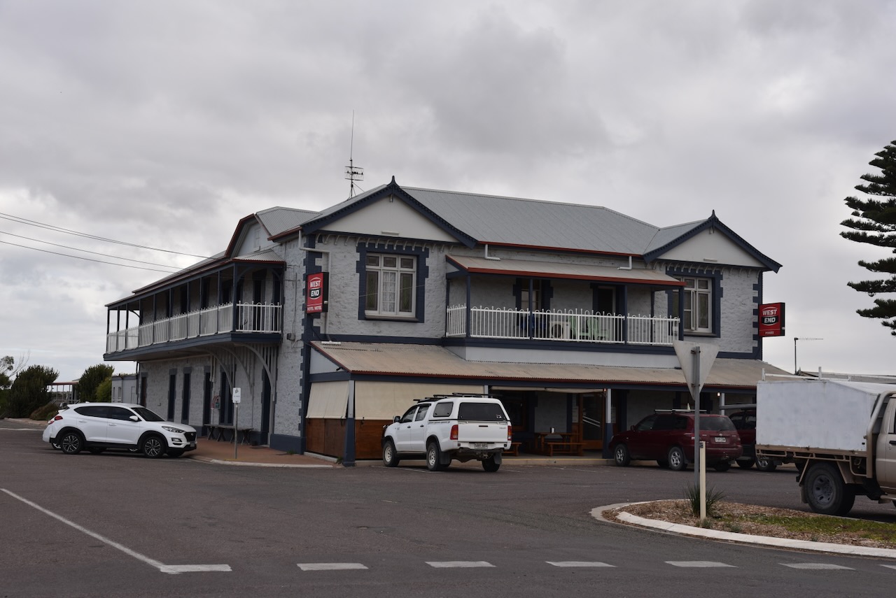
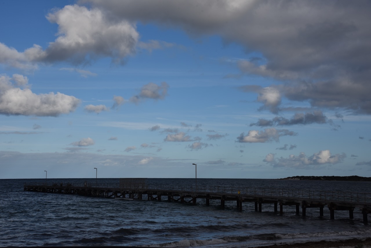
It was expected that the town would become a port, and as a result, a jetty was constructed in 1880. Although not large, the port of Arno Bay imported fertilisers and exported cereal crops grown in the district. By 1911 the town had a school, post office, hotel and a hall. (Wikipedia 2024)

By 1940, the port was exporting 11,000 tonnes of grain. It was in that year that the decision was made to officially change the town’s name to Arno Bay. There are two theories on the origin of the name. Some claim the town was named after the Arno River in Italy. While others claim it took its name from Sandhill Well and that the aboriginal name for that place was ‘arno’. (Aussie Towns 2024) (Wikipedia 2024)

In 1963 the storage silos were constructed and this saw ocean shipping becoming redundant. It spelt the end of Arno Bay as a port. (Wikipedia 2024)

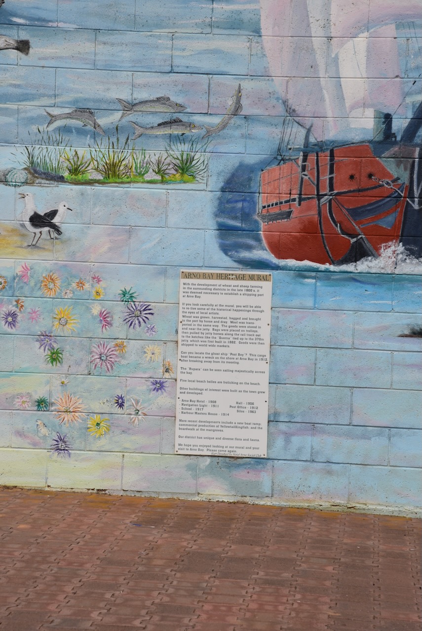
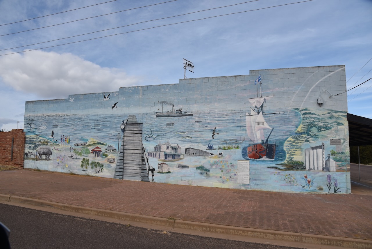
One of the must-sees in the town is the Arno Bay Heritage Mural, painted on the side of a building.

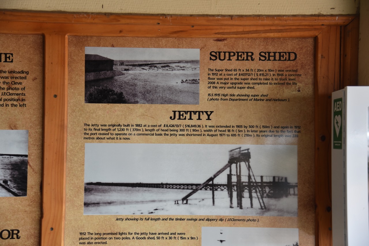
The Arno Bay Super Shed was built in 1912. It ceased being used for bagged grain/super in 1964. It now contains various tourist information and a large amount of history about Arno Bay and the district.

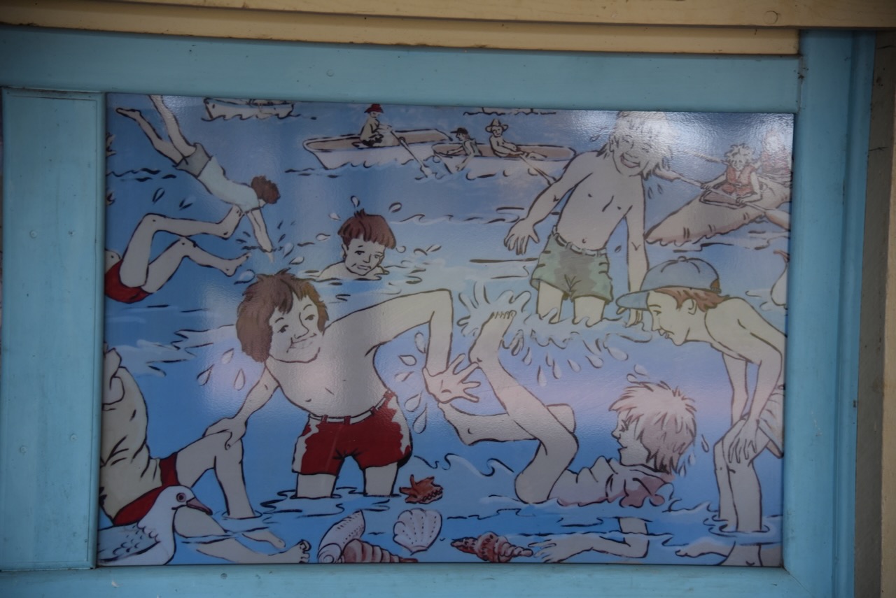
The Super Shed also features some artwork by artist Monique Van Eyk, and was completed in 1995.

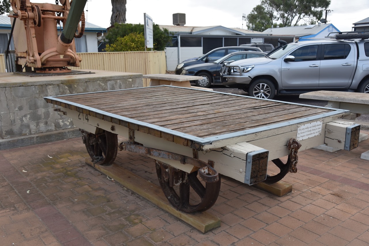
Alongside the Super Shed is a jetty trolley.

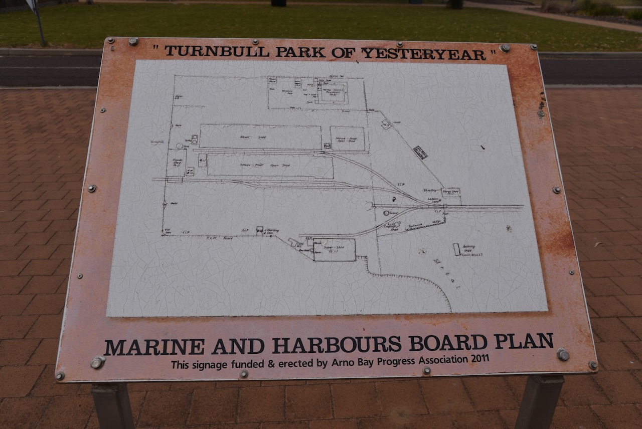
There is also an old crane and an information board for the Marine and Harbours Board.

The Arno Bay silo is located on the eastern side of Lincoln Highway, opposite Schmitt Road. It is an operational silo, operated by Viterra.

I parked on Schmitt Road and operated from the 4WD, running the Icom IC-7000, 100 watts, and the Codan 9350 antenna with the 1.5-metre stainless steel whip.

Above:- Map showing the activation zone of the Arno Bay silo. Map c/o SiOTA website.

I worked the following stations on 20m SSB:-

  1. VK7XX
  2. VK4JT
  3. VK5QA
  4. VK4NH
  5. Vk4DXA
  6. VK2HDT
  7. VK5MAZ
  8. VK4EMP
  9. VK4TI
  10. VK1AO
  11. VK2MET
  12. VK3APJ
  13. VK3DWL
  14. Vk3CEO
  15. VK3BBB
  16. VK2CCP
  17. ZL1HIM
  18. VK2IO
  19. VK4TMZ
  20. VK2VW
  21. VK2HFI
  22. VK3VIN
  23. VK2COS

I worked the following stations on 40m SSB:-

  1. VK5MAZ
  2. VK5GY
  3. VK5AAF
  4. VK3APJ
  5. VK5IS
  6. VK7DHT

References.

  1. Tollenaar, R. (n.d.). Arno Bay, SA. [online] Aussie Towns. Available at: https://www.aussietowns.com.au/town/arno-bay-sa. [Accessed 14 Aug. 2024].‌
  2. ‌UBC Web Design (2014). Robert Bratten | Monument Australia. [online] Monumentaustralia.org.au. Available at: https://monumentaustralia.org.au/themes/people/government—state/display/102067-robert-bratten/ [Accessed 14 Aug. 2024].‌
  3. Wikipedia Contributors (2024). Arno Bay, South Australia. [online] Wikipedia. Available at: https://en.wikipedia.org/wiki/Arno_Bay [Accessed 14 Aug. 2024].‌
  4. Wikipedia. (2020). William Bligh. [online] Available at: https://en.wikipedia.org/wiki/William_Bligh.‌ [Accessed 14 Aug. 2024].‌

Port Neill silo VK-PRL5

I left Tumby Bay on Wednesday 24th April 2024 and continued north along the Lincoln Highway towards my next planned stop at Port Neill.

Along the way, I stopped at Lipson, about 11 km north of Tumby Bay.

Lipson was named in honour of Captain Thomas Lipson, an officer in the Royal Navy and the first Harbour Master in South Australia. Lipson was born in c. 1784 in Dartmouth, England. He entered the Royal Navy in 1794 at only 9-10 years old. In 1836 he emigrated to the colony of South Australia as a Naval Officer. Not long after his arrival, he was appointed Collector of Customs and Harbour Master at Port Adelaide. Over the following 20 years, Lipson made several coastal surveys. Upon his retirement in 1855, he was presented with a silver tea service by the residents of Port Adelaide. (Place Names 2012) (Wikipedia 2024)

Above:- Thomas Lipson. Image c/o Wikipedia.

The Hundred of Yaranyacka, in which Lipson is contained, was proclaimed on the 20th day of June 1872. Yaranyacka is from the Narranga aboriginal word ‘yakkara’ (or jakara) meaning plain or level country.

Above:- Proclamation of the Hundred of Yaranyacka in the SA Govt Gazette, 20 Jun 1872.

A Post Office opened in November 1873 as ‘Yarandale’ on section 219 Hundred of Yaranyacka. It closed in 1909 becoming Lipson. In March 1875 the town of Lipson was surveyed by Thomas Evan. In 1881 a school was opened as ‘Yaranyacka’ and closed in 1950. (Place Names 2012)

Above:- Article from the Adelaide Observer, Sat 25 Jul 1885. Image c/o Trove.

Mines close to Lipson produced some of the finest talc in the world. Lipson was also the centre of the copper mining industry on the Eyre Peninsula. Many of the miners were of Cornish origin and had headed to the Eyre Peninsula following the closure of the Burra mines. Following the closure of the mines, the town of Lipson went into decline. (Port Lincoln Times 1973) (Wikipedia 2024)

Several historic buildings remain in Lipson. They include the second Lipson Hall, built in 1910 and officially opened by the Premier the Hon John Verran MP on the 22nd day of February 1911.

I then visited the historic Lipson cemetery that was established in the early 1870s. Until the 1900s, the nearest doctor was in Port Lincoln, and many families lost loved ones to diphtheria, whooping cough and women died during childbirth.

I then drove down to Lipson Cove. This is a beautiful tranquil sandy bay. It has been featured in the book ‘Best Australian Beaches’. Lipson Island lies about 150 metres out from the Lipson Cove beach. It can be accessed when the tide is low. The island is declared as the Lipson Island Conservation Park. It was proclaimed in 1967 as it is an important rookery for roosting sea birds including colonies of Black-faced Cormorant, Crested Tern and Little Penguin. The park is also home to Sooty oystercatchers and New Zealand Fur Seals. (Wikipedia 2024)

I left Lipson Cove and drove to Port Neill. The town is named in honour of Andrew Sinclair Neill, Warden of the Marine Board, South Australia. Neill was born in June 1837 in Kilmarnock, Ayreshire Scotland. Until 1888 he was manager of Elder Smith and Co. He was then appointed Railway Commissioner for South Australia. Neil then commenced his own accounting business. From 1897 he was the consul for Sweden. He was the Warden of the Marine Board of South Australia from 1895. He died in 1915 at his residence in North Adelaide. (ancestry.com.au) (flickr 2024)

Above:- Mr. A.S. Neill. Image c/o State Library SA.

Port Neill is a popular coastal holiday town and is renowned for its incredibly white sandy beaches. (Aussie Towns 2024)

On the foreshore, you can find a monument for the Lady Kinnaird, a three-masted iron barque of 680 tones and 190 feet long. She was built in Dundee Scotland in 1877 by Brown & Simpson for W.B. Ritchie. She operated between the United Kingdom and the Australian colonies. (Wikipedia 2024)

Above:- The Lady Kinnaird.

With a crew of 18, under the command of Captain Alexander Laws, she sailed from Port Pirie on the 19th day of January 1880, bound for the United Kingdom with a cargo of about 8,400 bags of wheat. At midnight on the 20th day of January 1880, she was wrecked off Cape Burr, after being battered by gale-force winds. The Captain and crew abandoned the ship in lifeboats and made it to shore. Fortunately, no lives were lost. (Wikipedia 2024)

Captain Laws was charged with misconduct in connection with the wreck of the Lady Kinnaird. In January 1880 he was acquitted on the grounds that he had taken proper care in the navigation of his vessel. (SA Chronicle 1880)

Above:- Part of an article from the SA Chronicle, Sat 6 Mar 1880. Image c/o Trove.

In March 1979 the main anchor was lifted from the wreck site.  In June 1979, it was towed ashore and lifted by a mobile crane into a tank made of concrete. The tank was built into the ground and was specifically designed for the purpose of conserving the anchor. On the 20th day of January 1980, the conserved anchor was unveiled on the Port Neill foreshore in front of a crowd of about 800 people. (Wikipedia 2024)

The Port Neill silo is located on the eastern side of Lincoln Highway adjacent to Brooker Road. It is an operational silo run by Viterra.

I parked on Brooker Road and activated the silo from the 4WD. I ran the Yaesu FT857, 40 watts, and the Codan 9350 antenna with the 1/5 metre stainless steel whip.

Above:- An aerial view showing the activation zone of the Port Neill silo. Image c/o SiOTA website.

I worked the following stations on 40m SSB:-

  1. VK5MAZ
  2. VK3PF
  3. VK3KAI
  4. VK5FB
  5. VK3APJ
  6. VK5LEX
  7. VK5GY
  8. VK3UCD
  9. VK5CZ
  10. VK5WE

I worked the following stations on 20m SSB:-

  1. VK7XX
  2. VK3UCD
  3. VK1AO
  4. VK2MET
  5. VK3VIN
  6. VK3CEO
  7. VK2IO
  8. VK3APJ
  9. VK3PF
  10. VK3KAI
  11. VK4NH
  12. VK4DXA
  13. VK3DCQ
  14. I4RHP
  15. VK2HRX
  16. VK3ZSC
  17. VK2VW
  18. VK2HFI
  19. VK2XD

Following the activation of the silo I headed to the Port Neill lookout. It was erected in 1990 to honour the late Roger Cox who had a vision for constructing a lookout in the area.

References.

  1. Ancestry.com.au. (2016). Ancestry® | Genealogy, Family Trees & Family History Records. [online] Available at: https://www.ancestry.com.au/. [Accessed 14 Aug. 2024].‌
  2. ‌Aussie Towns. (2021). Port Neill, SA – Aussie Towns. [online] Available at: https://www.aussietowns.com.au/town/port-neil-sa [Accessed 14 Aug. 2024].
  3. ‌Flickr. (2024). Mr. A.S. Neill. [online] Available at: https://www.flickr.com/photos/paelocalhistory/14952208071 [Accessed 14 Aug. 2024].
  4. ‌published.collections.slsa.sa.gov.au. (n.d.). A Compendium of the Place Names of South Australia. [online] Available at: https://published.collections.slsa.sa.gov.au/placenamesofsouthaustralia/. [Accessed 14 Aug. 2024]‌
  5. Trove. (2014). MINING LEFT ITS MARK ON EYRE PENINSULA – Port Lincoln Times (SA : 1927 – 1988; 1992 – 2002) – 14 Jun 1973. [online] Available at: https://trove.nla.gov.au/newspaper/article/270065512 [Accessed 14 Aug. 2024].
  6. ‌Trove. (2014). THE LADY KINNAIRD. – South Australian Chronicle and Weekly Mail (Adelaide, SA : 1868 – 1881) – 6 Mar 1880. [online] Available at: https://trove.nla.gov.au/newspaper/article/95040985?searchTerm=lady%20kinnaird [Accessed 14 Aug. 2024].
  7. ‌Wikipedia Contributors (2023). Thomas Lipson. [online] Wikipedia. Available at: https://en.wikipedia.org/wiki/Thomas_Lipson [Accessed 14 Aug. 2024].‌
  8. Wikipedia Contributors (2021). Hundred of Yaranyacka. [online] Wikipedia. Available at: https://en.wikipedia.org/wiki/Hundred_of_Yaranyacka [Accessed 14 Aug. 2024].‌
  9. Wikipedia Contributors (2023). Lipson Cove. [online] Wikipedia. Available at: https://en.wikipedia.org/wiki/Lipson_Cove [Accessed 14 Aug. 2024].‌
  10. Wikipedia Contributors (2023). Lady Kinnaird (1877). [online] Wikipedia. Available at: https://en.wikipedia.org/wiki/Lady_Kinnaird_(1877) [Accessed 14 Aug. 2024].‌