Cowell silo VK-CWL5

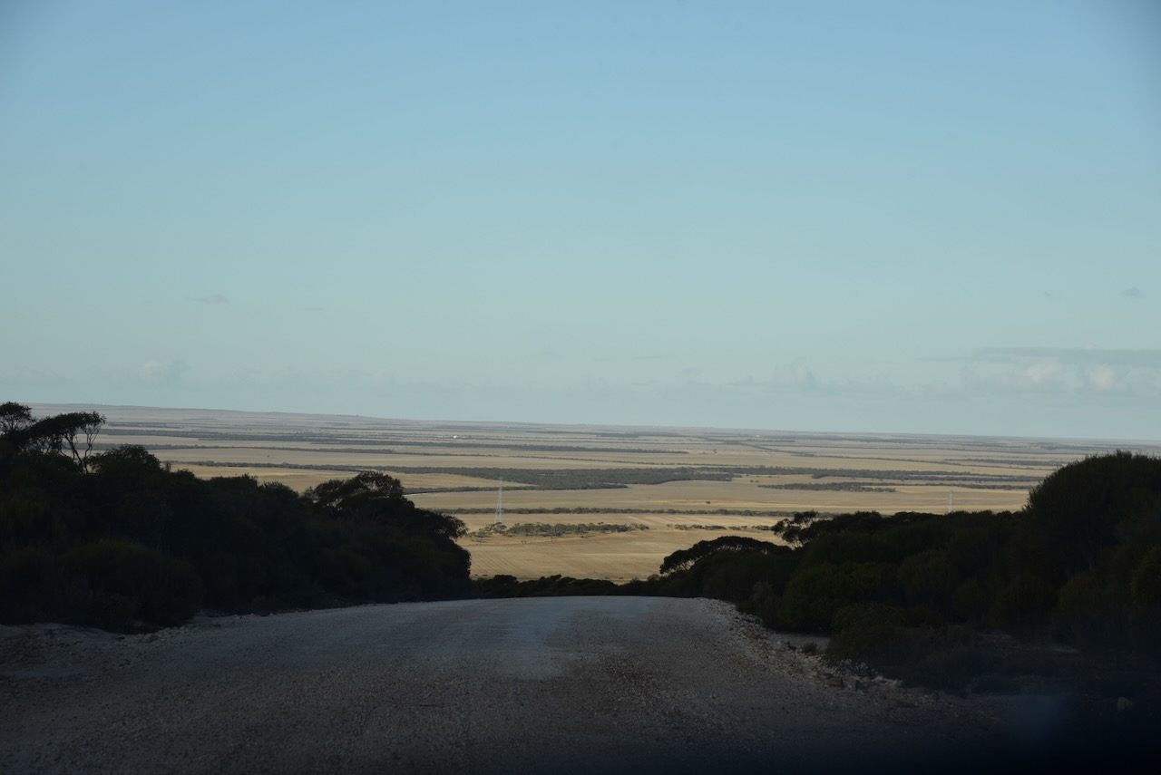
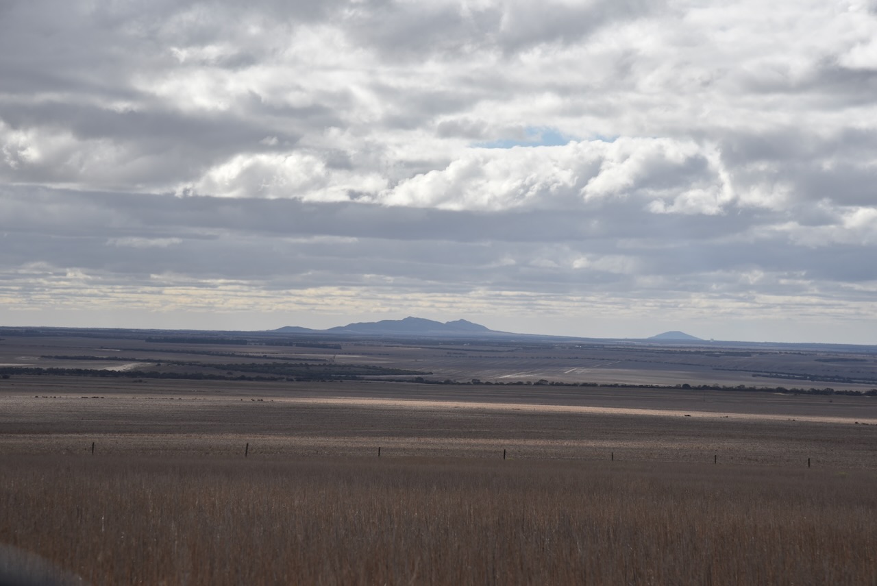
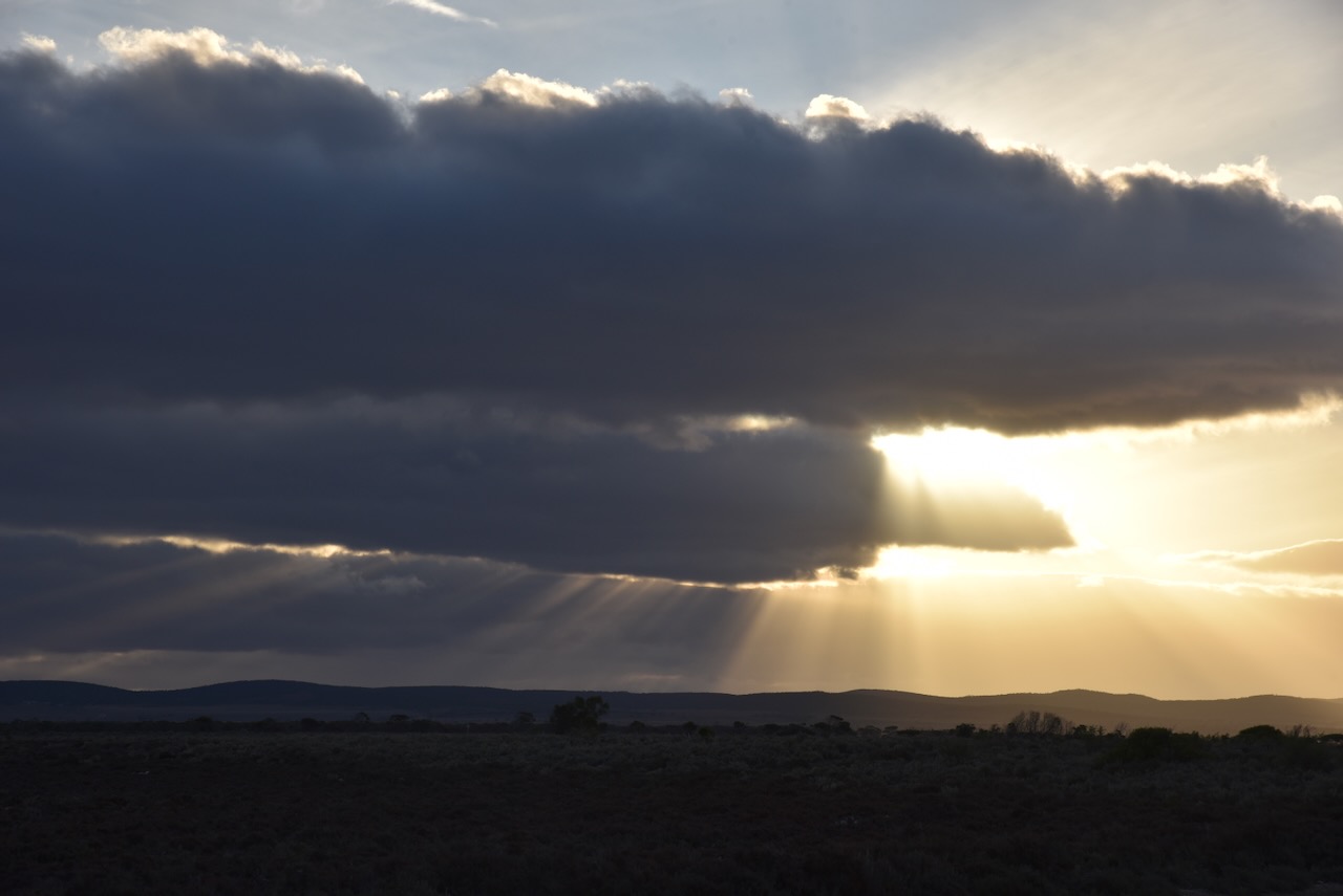
It was now Friday 26th April 2024, and time for me to head home. I had enjoyed a magnificent 2 weeks away including the DXpedition to Flinders Island as VK5FIL. I had really enjoyed my time in Cowell, and before leaving I planned on activating the Cowell silo and have a quick look around the town.

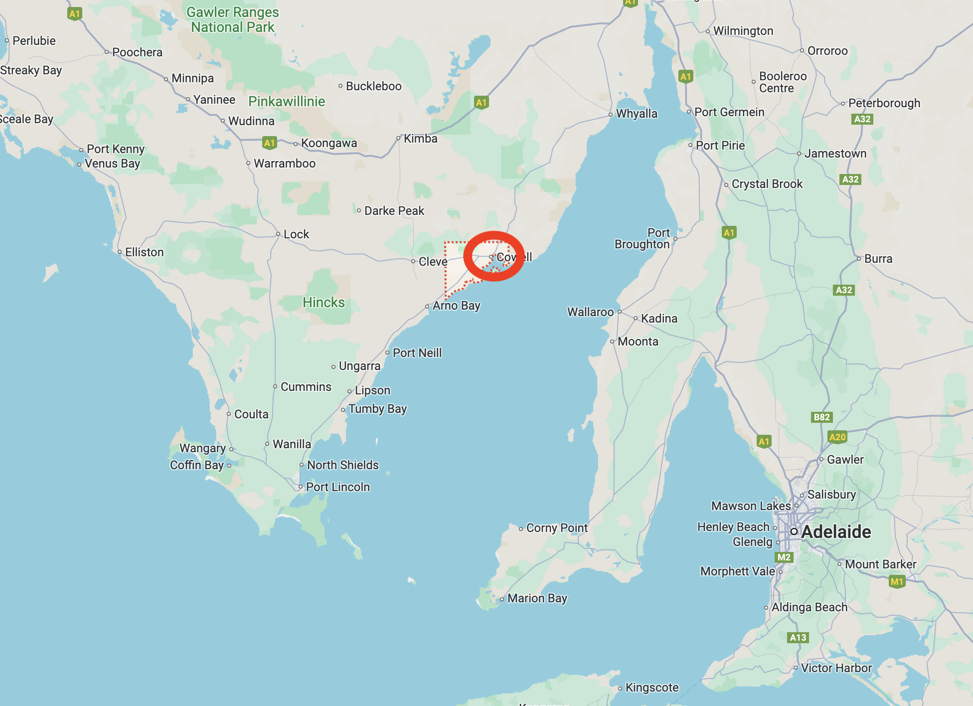
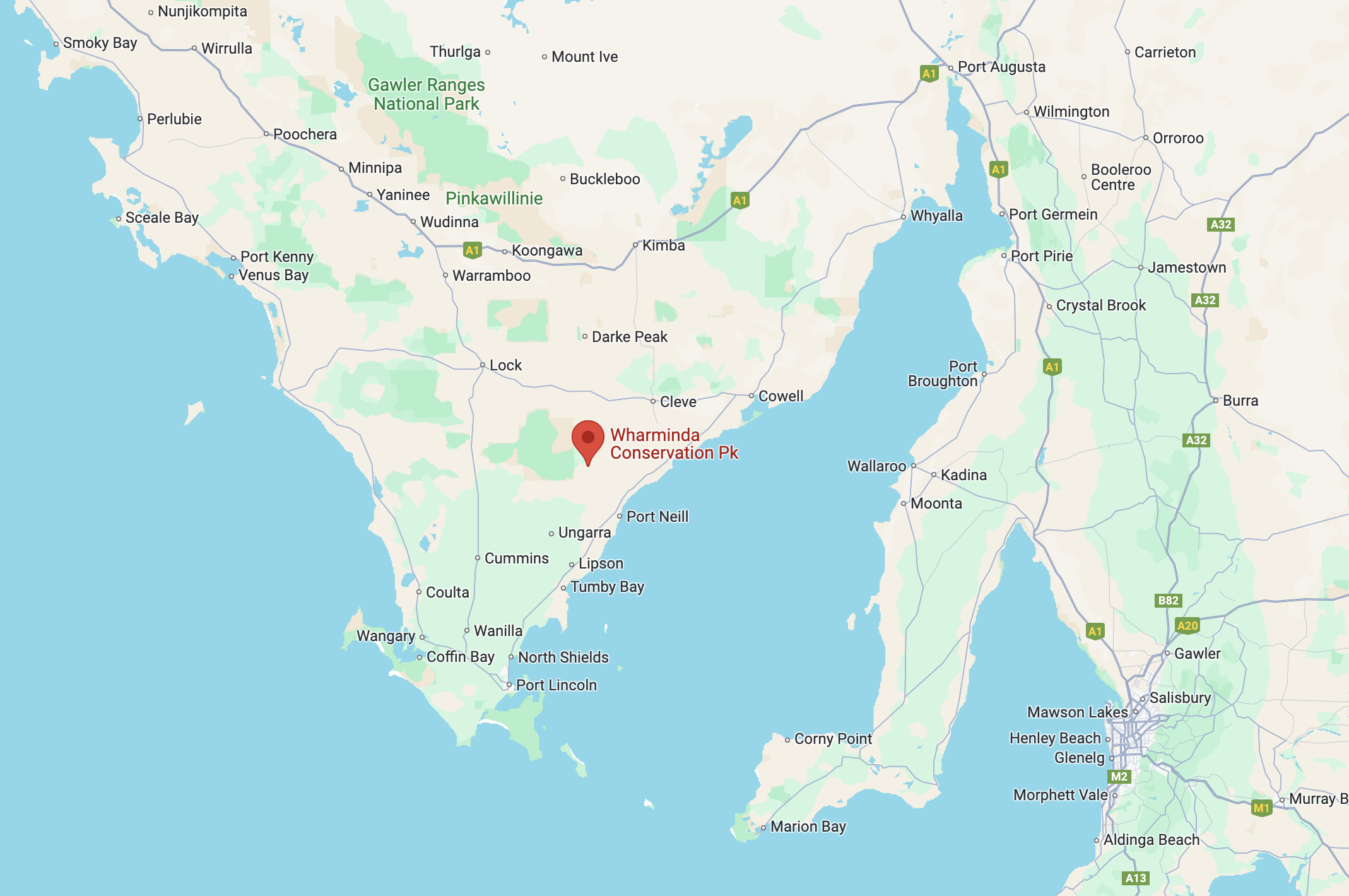
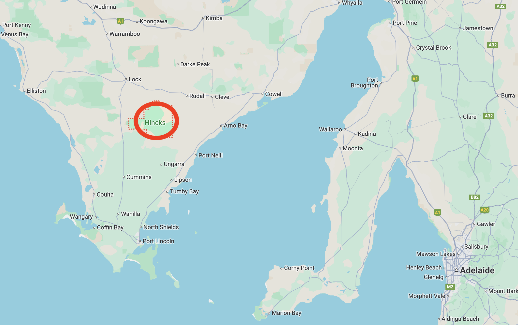
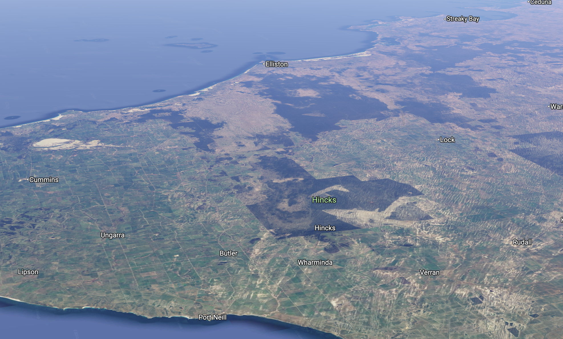
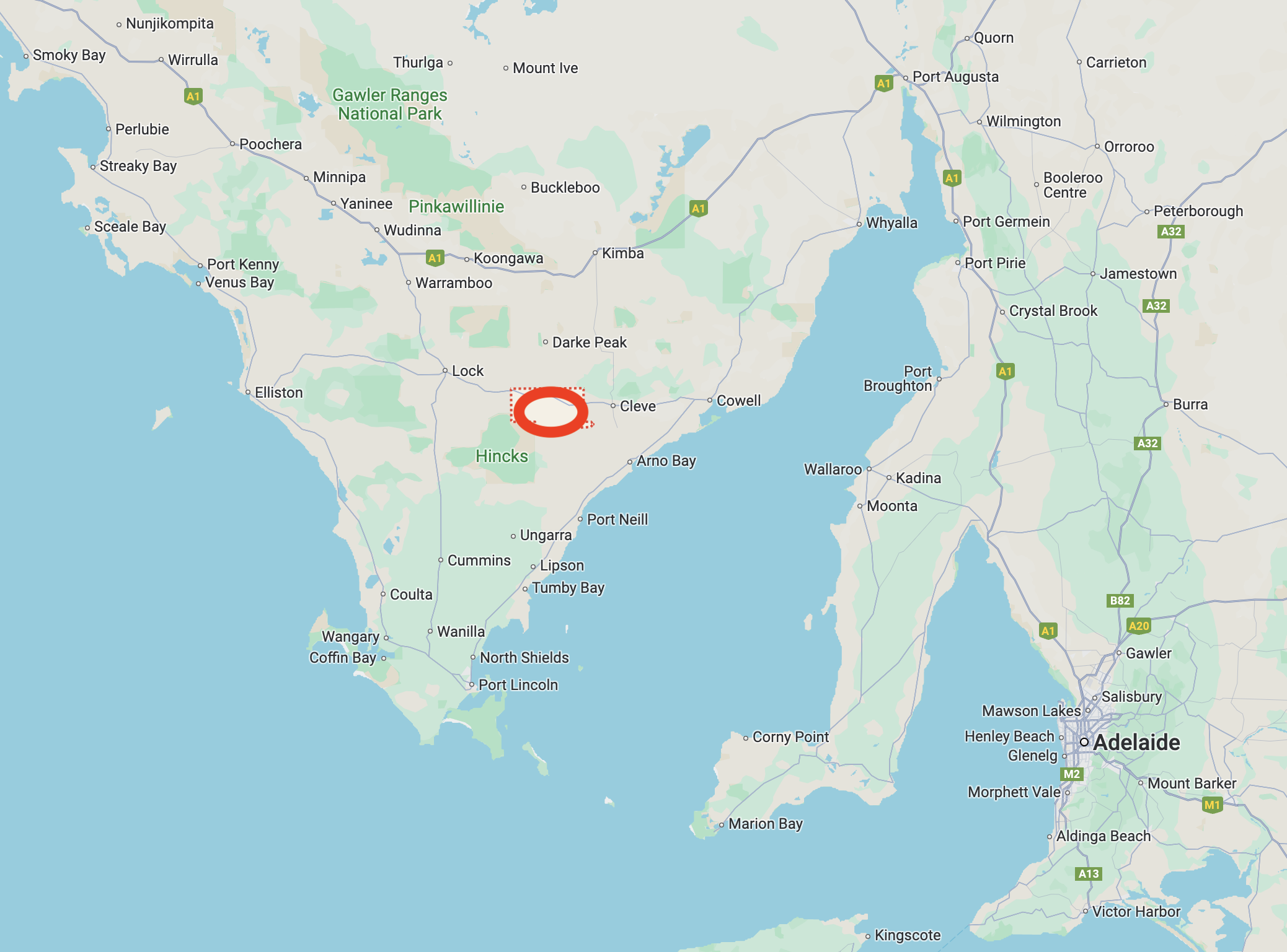
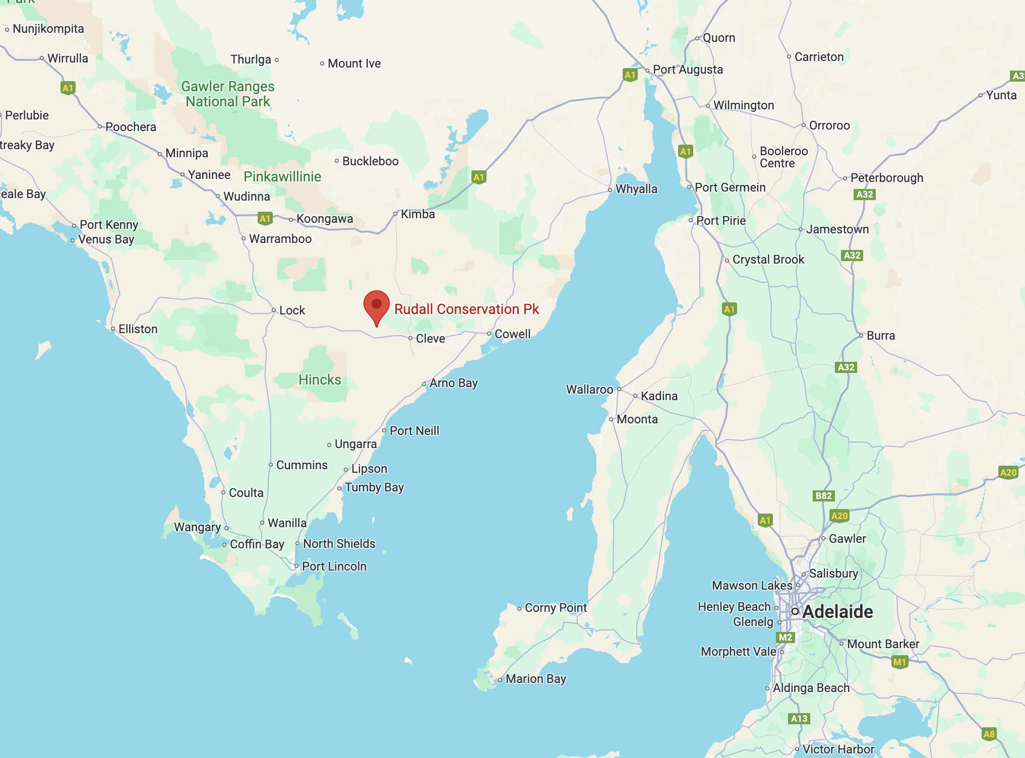
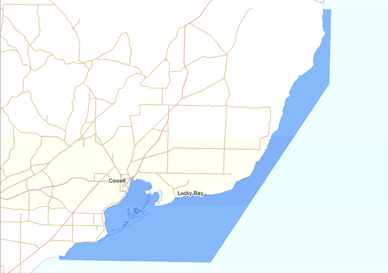
Above:- Map showing the location of Cowell, South Australia. Map c/o Google Maps.

Prior to European settlement, the land around Cowell was the traditional home of the Narangga aboriginal people. (Aussie Towns 2024)

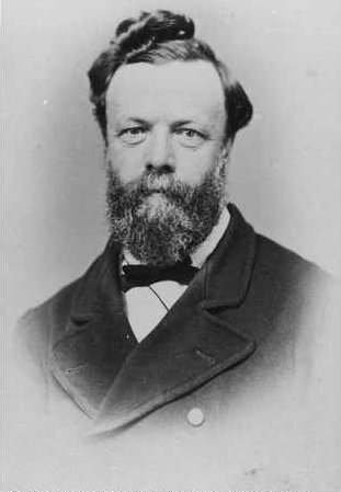
The first European to sight Franklin Harbour was explorer and navigator Captain Matthew Flinders. He mistook the harbour as a large lagoon and decided it was not worth naming.

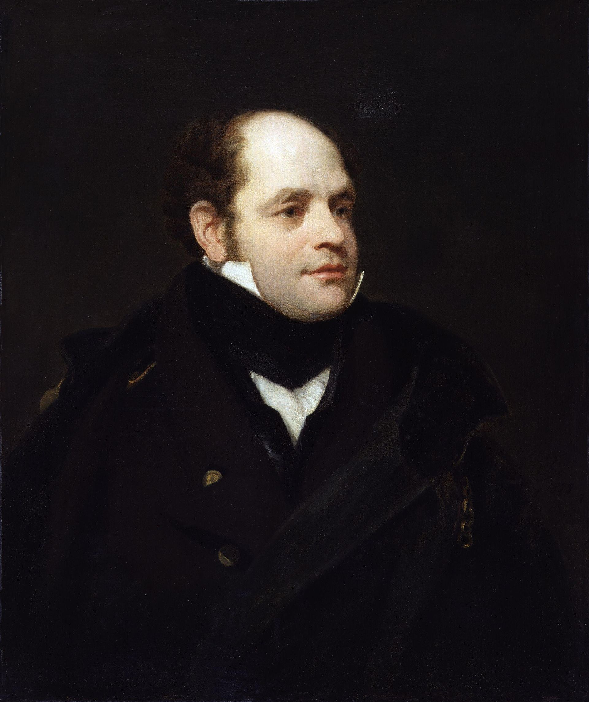
Above:- Matthew Flinders. Image c/o Wikipedia.

Franklin Harbour was named in 1840 by Governor Gawler in honour of Sir John Franklin, the Governor of Tasmania and famous Arctic explorer. As it so happens, Franklin was a midshipman on Flinder’s vessel the Investigator, when he unwittingly mistook the harbour as a lagoon in 1802. (Aussie Towns 2024)

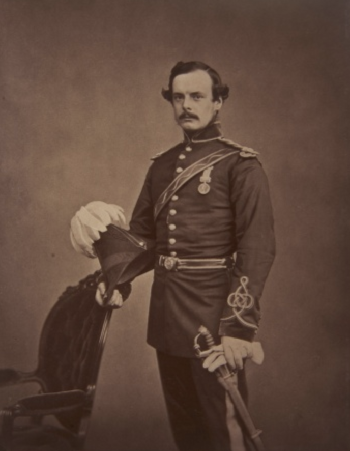
Above:- John Franklin. Image c/o Wikipedia.

European settlement of the Cowell district commenced in 1853 when the McKechnie brothers took up land. Franklin Harbour became a place where ships were loaded for the export of wheat and wool. As a result, a small settlement commenced. (Wikipedia 2024)

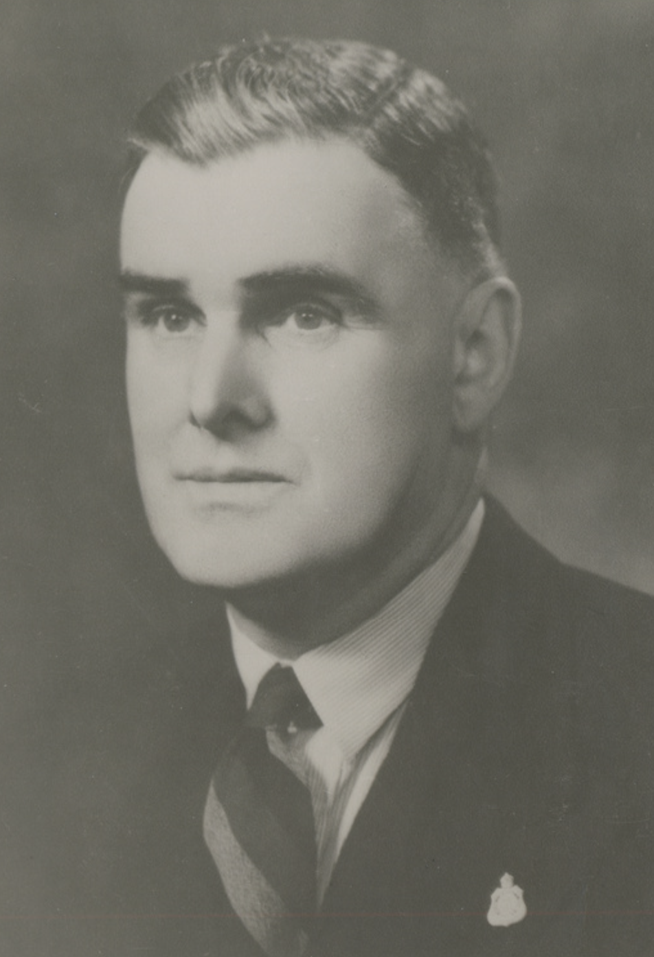
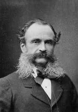
The town of Cowell was surveyed in July 1880 and was proclaimed on the 28th day of October 1880. It was named by Governor Jervois in honour of Sir John Clayton Cowell, PC, KCB, Master of the Household of Queen Victoria, Lieut-Governor of Windsor Castle and member of Governor Jervois’ corps, the Royal Engineers. (Place Names 2012) (Wikipedia 2024)

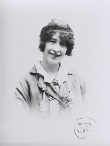
Above:- Sir John Clayton Cowell. Image c/o Find a Grave

The Cowell Post office opened in 1882. In 1892 the Cowell School opened. (Aussie Towns 2024)

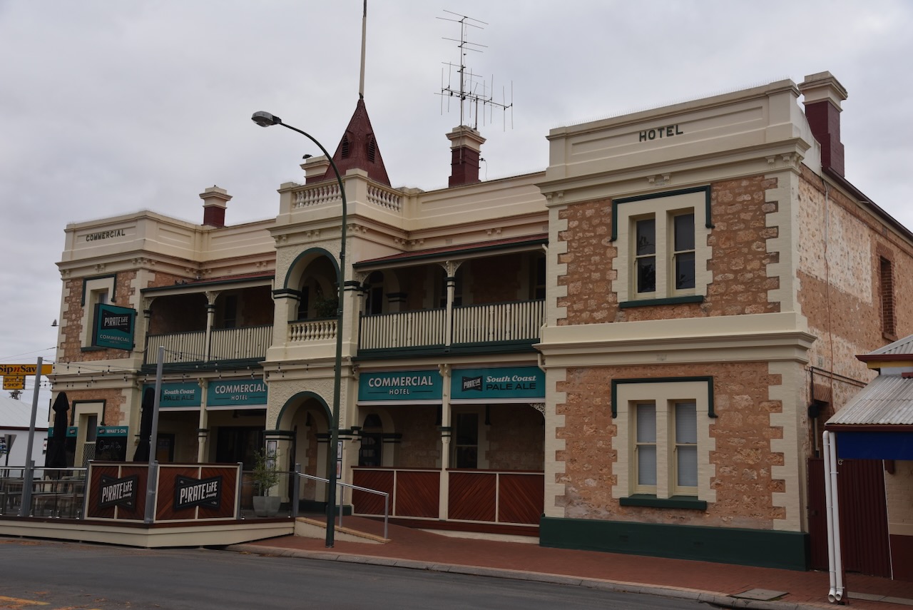
Several historic buildings remain in Cowell. They include the Franklin Harbour Hotel. In 188, the single storey was constructed. Mr. Edward Speed purchased the Hotel in 1897 and a second storey was completed in 1907. Some of the first church services were held in the Hotel prior to the establishment of a church. (Walking SA 2024)

The Commercial Hotel was built in 1910 by Edward Speed in 1910. He was also the owner of the Franklin Harbour Hotel, but with the expansion of the town, he saw the need for a second hotel. (Walking SA 2024)

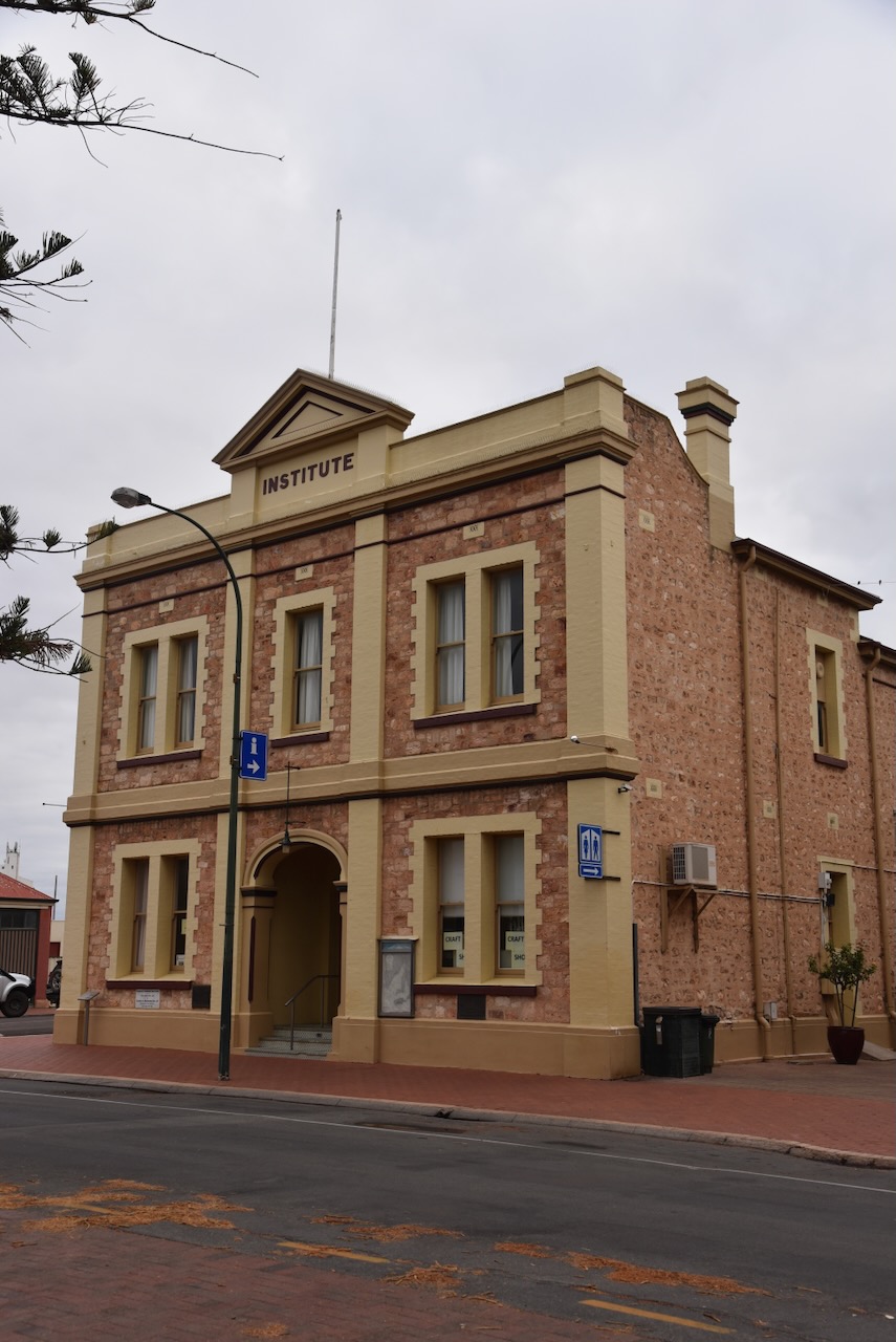
The Institute building was completed by December 1893. It has been used as a Council Office, Court Office, Social Functions, Theatrical/Musical Performances, and Sunday School & Church Services. In 1911 a second storey was added. (Walking SA 2024)

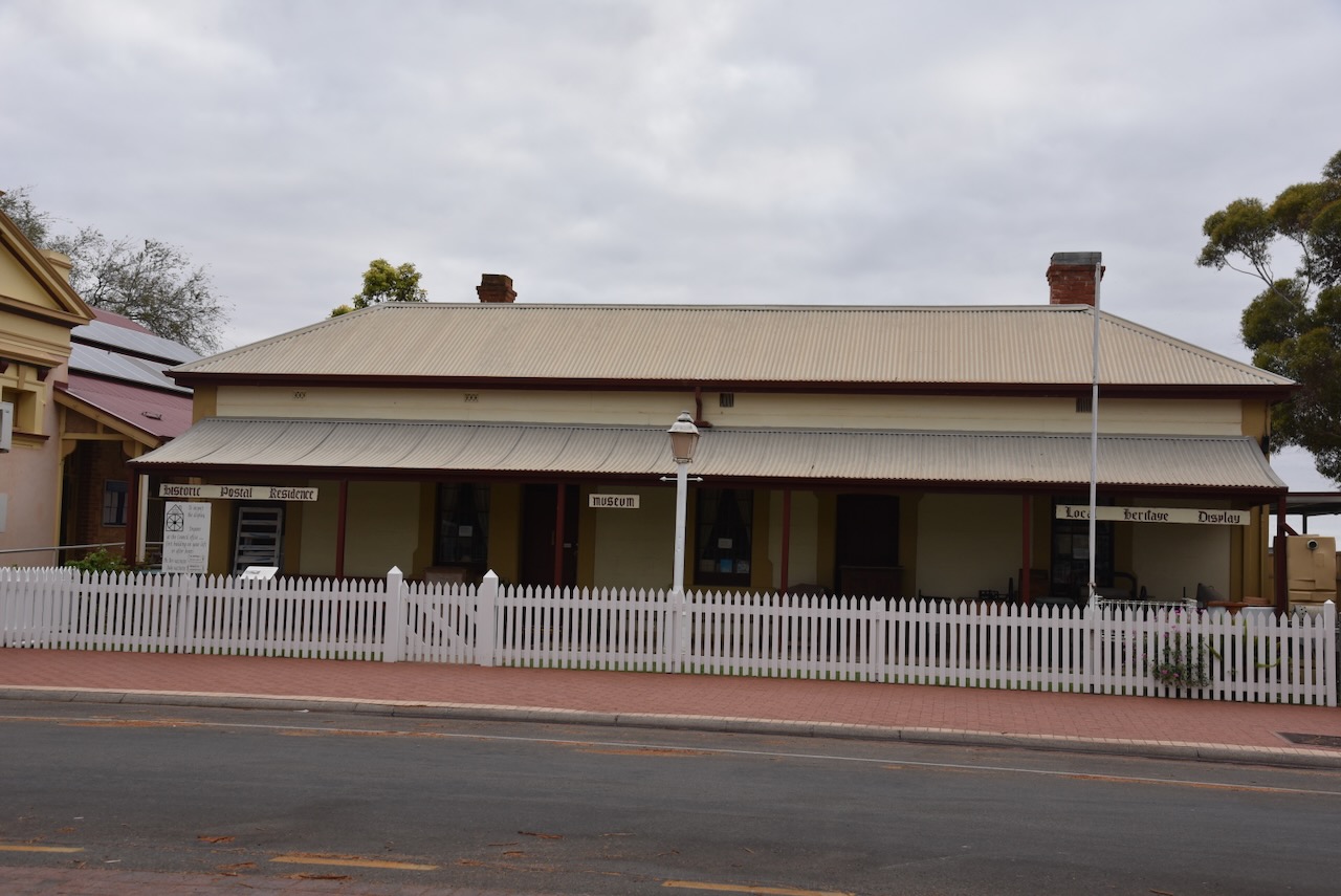
The old Post & Telegraph Office and Post Master’s residence was constructed in 1888. It now functions as a museum. (Walking SA 2024)

The District Council of Franklin Harbour Council Chambers were built in 1912 as a National Bank. By 1928 it was used by the Commercial Bank. In 1941 the CWA Rest Rooms utilised the building. In 1985 it was purchased by the Council and used as a Council Chambers. (Walking SA 2024)

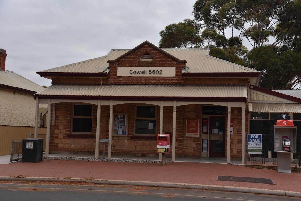
The Cowell Post office building was built in 1910. In 1922 a telephone exchange was introduced with 5 subscribers, progressing to 200 lines, manually operated in 1967. At this time 10 staff were employed at the Post Office until 1979 when the exchange became automatic. (Walking SA 2024)

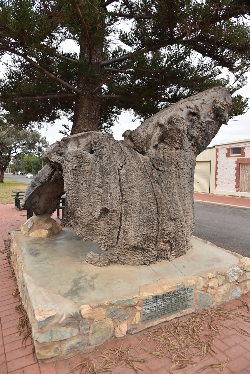
On the corner of Main Street and High Street, you can find ‘The Black Stump’. As a New Year prank in 1972, a large stump was placed between two hotels on which signs read ‘Best pub this side of the black stump’. The original stump was stolen. Also paying tribute to the pioneer land clearing battles after several fires.” (Aussie Towns 2024)

Below is a short video on Cowell.

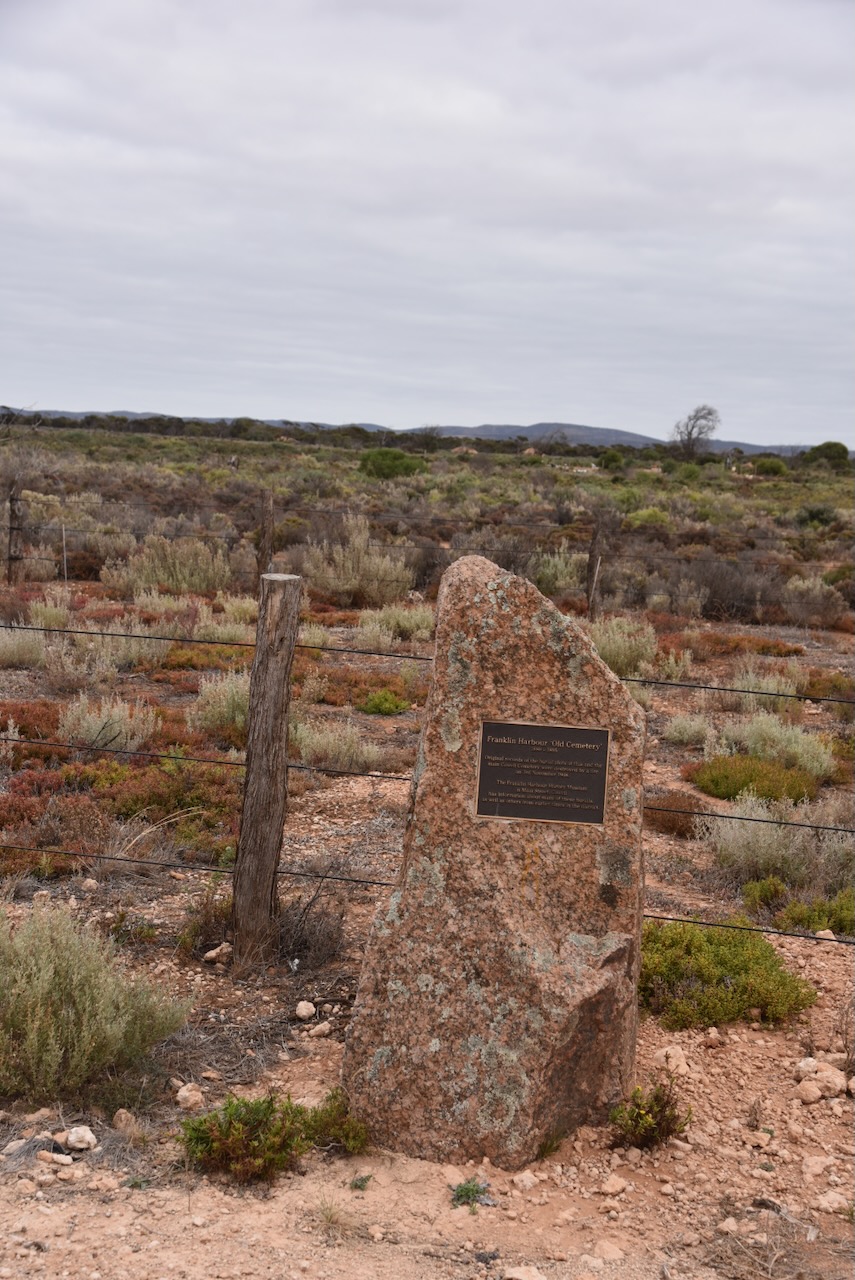
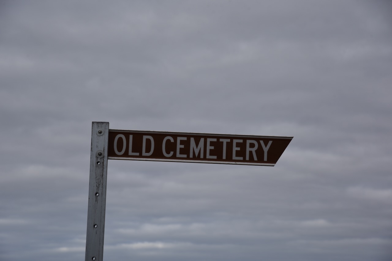
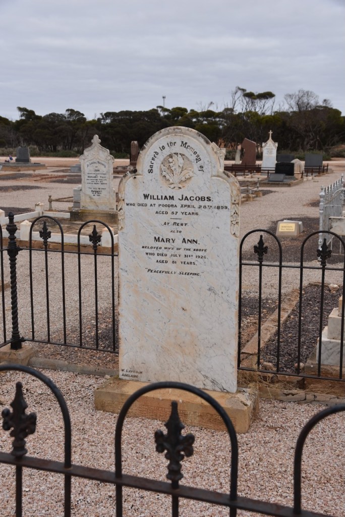
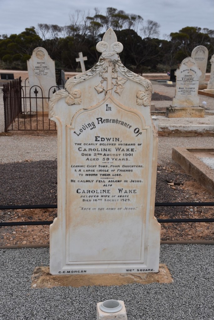
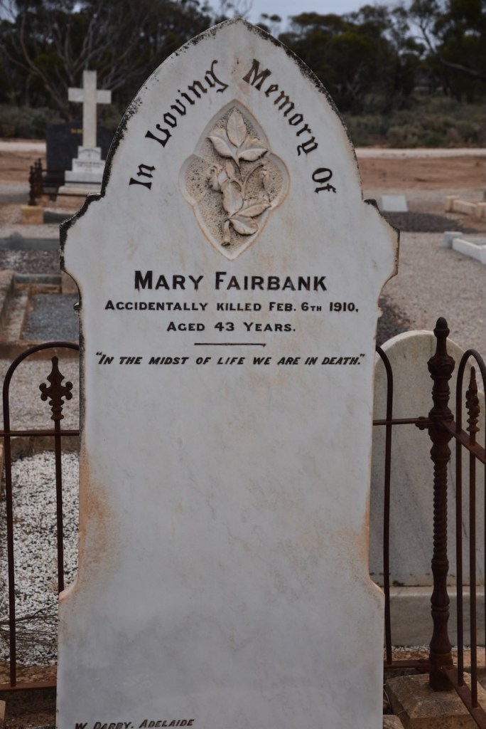
I then visited the old Cowell Cemetery on Beach Road. It was in use from 1880 to 1895. Sadly the burial records were destroyed in a fire in 1908.

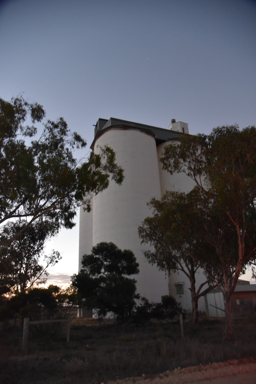
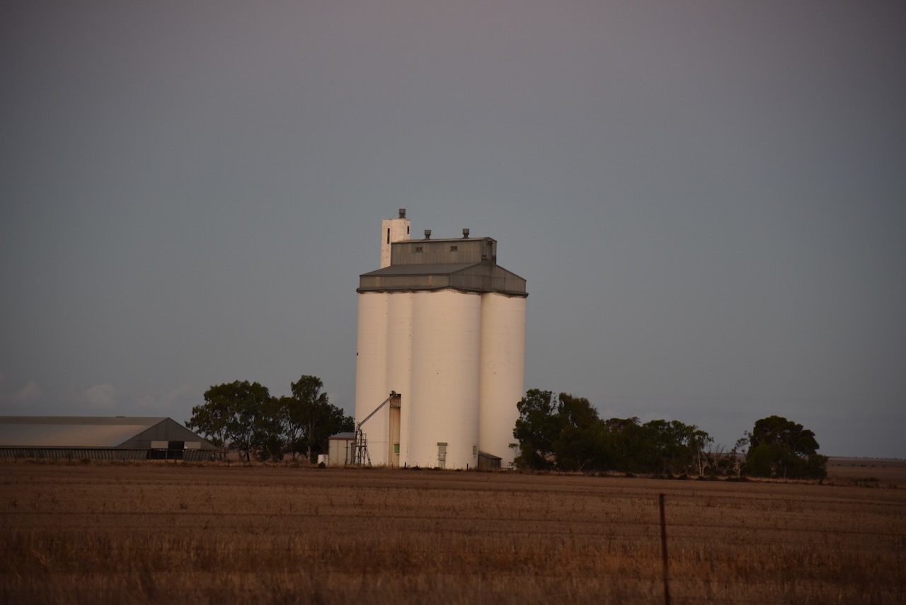
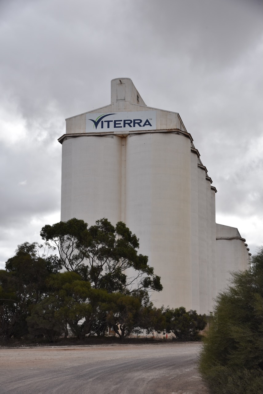
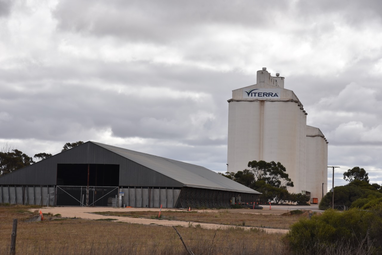
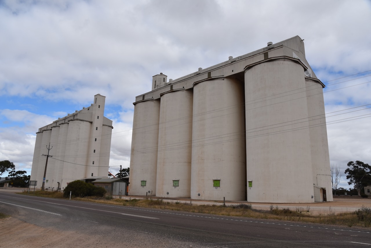
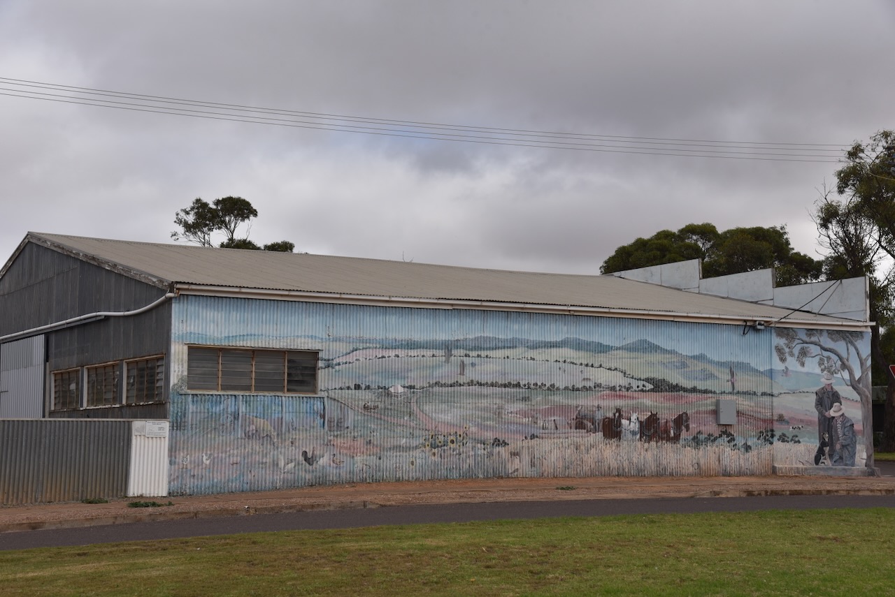
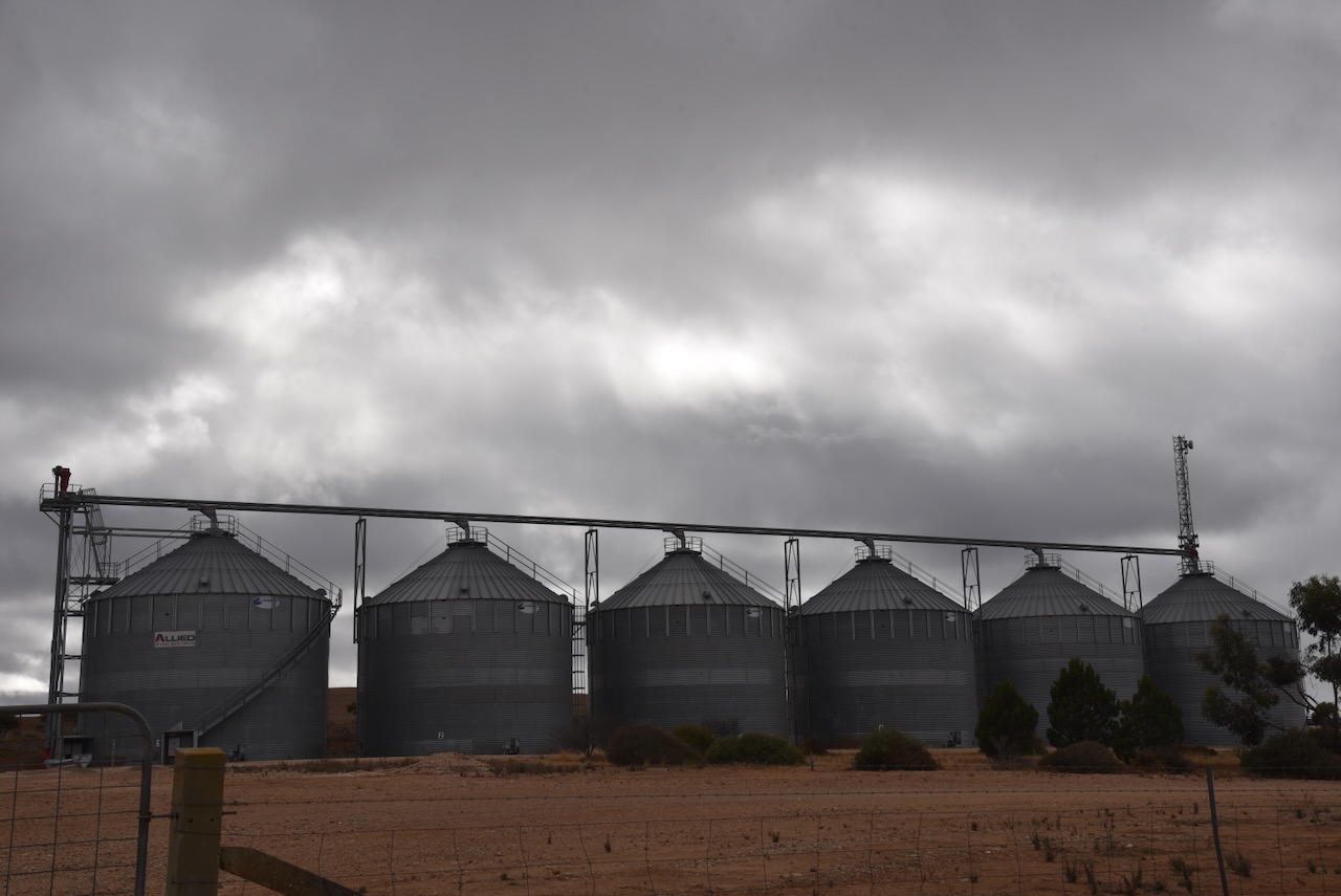
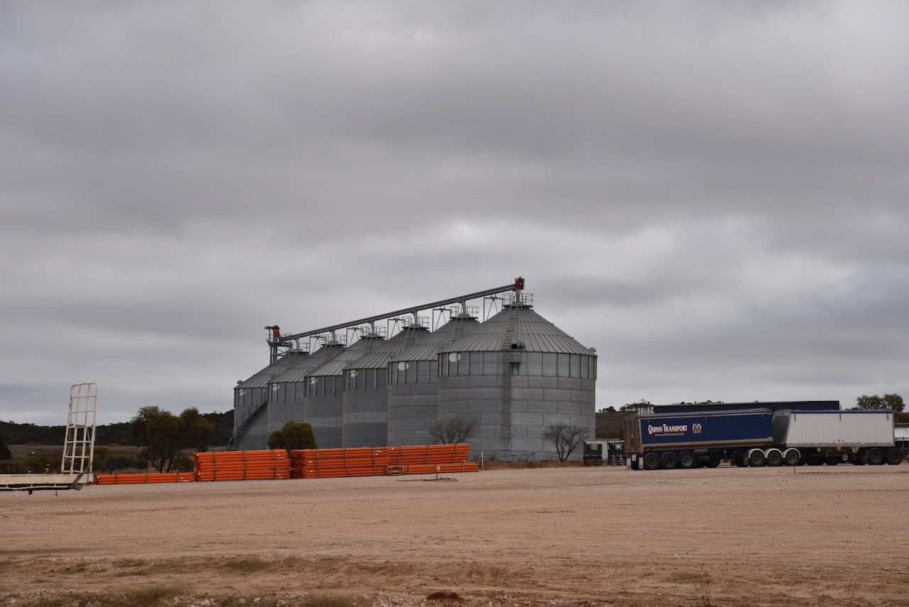
Initial impressions from the road of the Cowell silos are just a plain set of silos. The first silos here in Cowell were built in 1961. (Walking SA 2024)

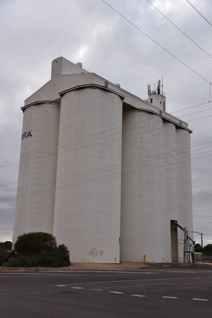
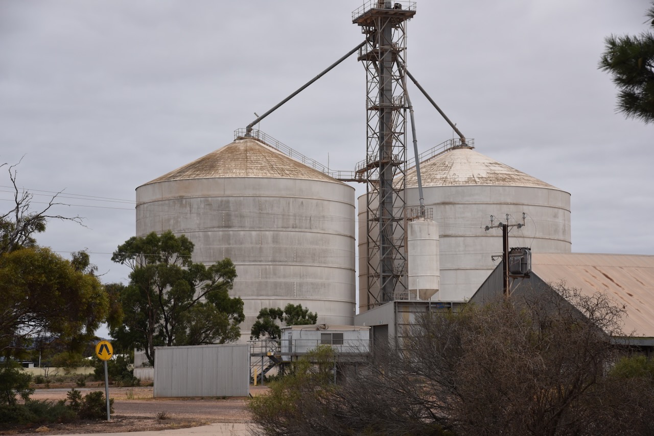
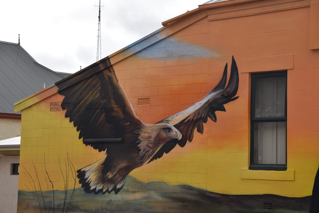
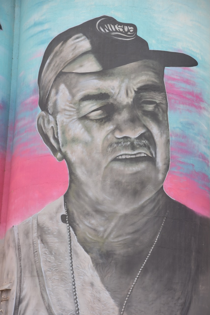
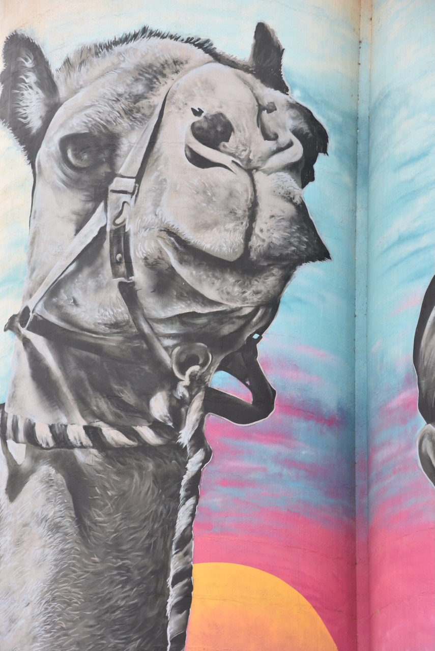
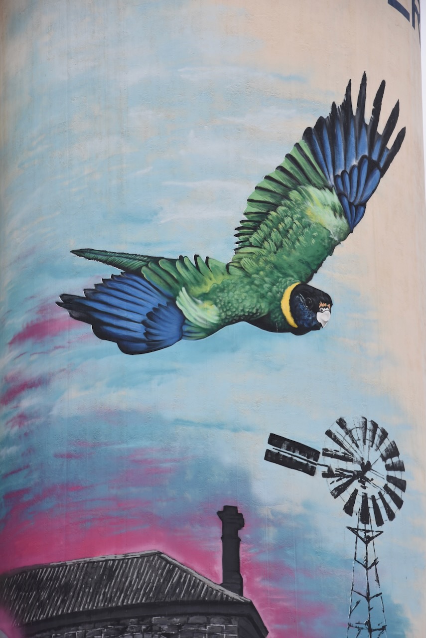
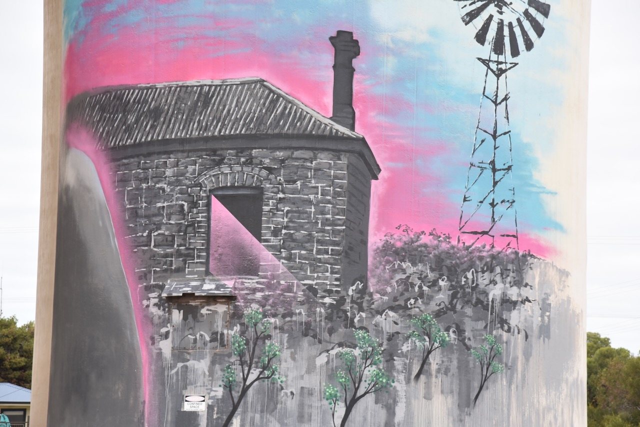
The Cowell silos were completed in September 2019 and are the work of artist Austin ‘! N I T S U A’ Moncrieff. He was assisted by Micheal ‘Schmick’ Motteran-Smith. The main feature of the silo art is that of local Cowell identity Lionel Deer and his camel Diamantina. He has been bringing his camels to the Cowell Christmas pageant for over 30 years. The mural also features a Port Lincoln Parrot and a farmhouse ruin. (Aust SIlo Art 2024)

Below is some drone footage from YouTube of the silo.

I worked the following stations on 40m SSB:-

  1. VK5MAZ
  2. VK2VW
  3. VK2HFI
  4. VK2AKA
  5. VK2BUG
  6. VK3CJN
  7. VK4NH
  8. VK4DXA
  9. VK3CEO
  10. VK3WSG
  11. VK3VIN
  12. VK3PF
  13. VK3NBL

I worked the following stations on 20m SSB:-

  1. VK7XX
  2. VK5MAZ
  3. VK1AO
  4. VK2MET
  5. VK3PF
  6. VK3CJN
  7. VK3QHU
  8. VK7MD/m
  9. VK2IO
  10. VK2VW
  11. VK2HFI
  12. VK2AKA
  13. VK2BUG
  14. VK3CEO
  15. VK3QH
  16. VK4NH
  17. VK4DXA
  18. ZL1HIM
  19. VK3FWR
  20. VK3MAP

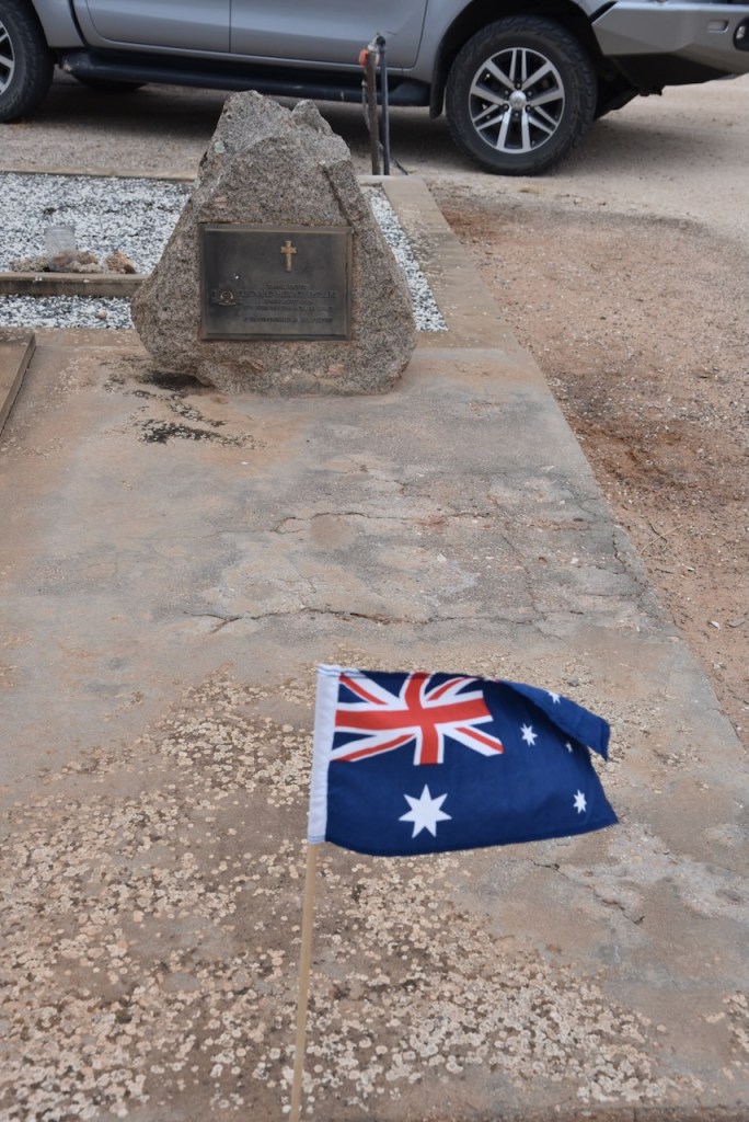
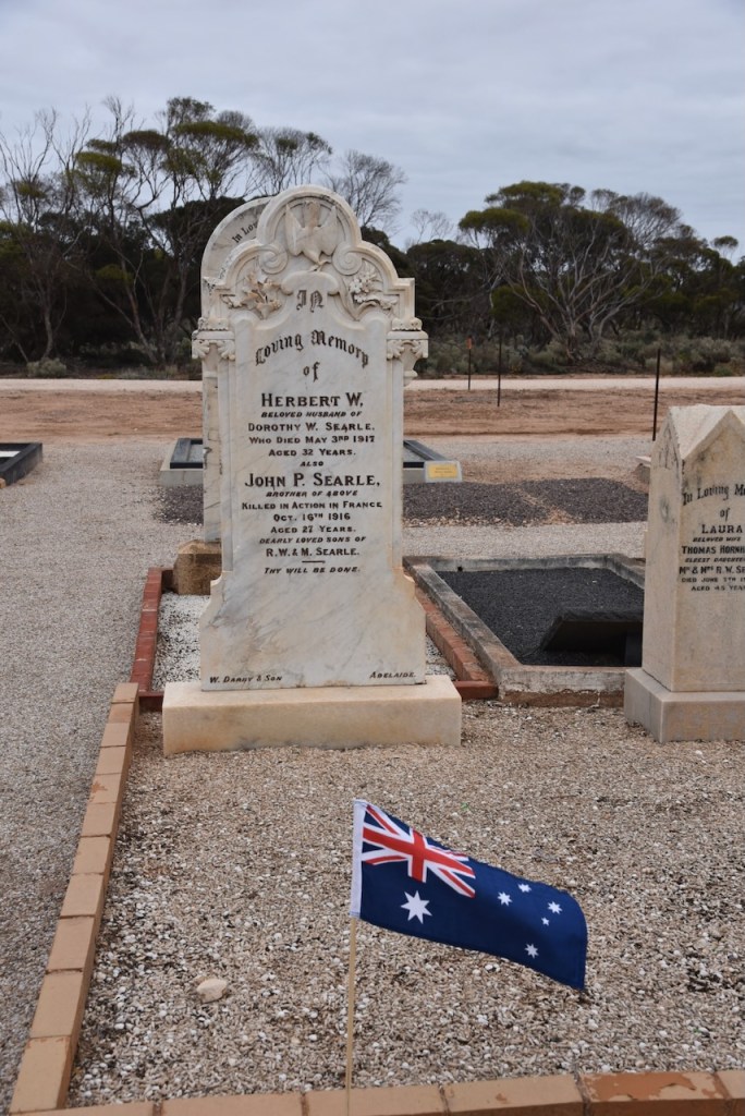
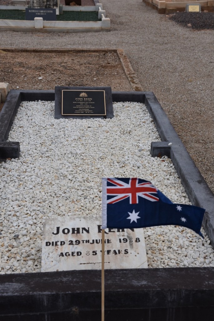
Following my activation of the silo, I paid a quick visit to the Cowell Cemetery. As it was the day after ANZAC Day, numerous burial plots and headstones had the Australian flag flying. It was a reminder of the impact that wars have had on little towns like Cowell.

    References.

    1. Australiansiloarttrail.com. (2024). Cowell Silo Art. [online] Available at: https://www.australiansiloarttrail.com/cowell [Accessed 15 Aug. 2024].
    2. ‌published.collections.slsa.sa.gov.au. (n.d.). A Compendium of the Place Names of South Australia. [online] Available at: https://published.collections.slsa.sa.gov.au/placenamesofsouthaustralia/. [Accessed 15 Aug. 2024]‌
    3. Walking SA. (2018). Cowell Township Historical Walk | Eyre Peninsula | Walking SA. [online] Available at: https://www.walkingsa.org.au/walk/find-a-place-to-walk/cowell-township-historical-walk/ [Accessed 15 Aug. 2024].
    4. ‌Wikipedia. (2023). Cowell. [online] Available at: https://en.wikipedia.org/wiki/Cowell.‌ [Accessed 15 Aug. 2024]‌

    Wharminda silo VK-WHA5

    My final activation for Thursday 25th April 2024 was the Wharminda silo VK-WHA5. It was just a short drive from the Wharminda Conservation Park down to the little town of Wharminda.

    Blink and you will miss Wharminda. There is not much here nowadays apart from the Wharminda War Memorial Hall.

    The Wharminda silos are located on Wharminda Road.

    I parked on Wharminda Road right alongside the silo and operated from the 4WD. I ran the Icom IC-7000, 100 watts, and the Codan 9350 antenna with the 1.5-metre stainless steel whip.

    Above:- The activation zone at the Wharminda silo. Image c/o SiOTA website.

    I worked the following stations on 40m SSB:-

    1. VK5MAZ
    2. AX5MAZ
    3. VK5TUX
    4. VK1AO
    5. VK2MET
    6. AX1AO
    7. AX2MET
    8. VK3APJ
    9. VK4FOX
    10. VK4SMA
    11. VK2IO
    12. VK3GJG/p
    13. VK7PJM
    14. VK3PF
    15. VK3DFG
    16. VK2GMC/1
    17. AX7WN
    18. VK3EJ

    After my activation, I went to the Arno Bay Hotel for a very enjoyable meal and then returned to my accommodation at Cowell.

    References.

    1. x

    Wharminda Conservation Park VKFF-1120

    My last park for ANZAC Day, 25th April 2024, was the Wharminda Conservation Park VKFF-1120. The park is located about 334 km west of Arno Bay on the Eyre Peninsula.

    Above:- Map showing the location of the Wharminda Conservation Park. Map c/o Google Maps.

    Wharminda is an aboriginal word meaning ‘a range of hills’. In 1914 the Wharminda Post Office opened. In that same year, the Wharminda Siding School opened. (Place Names 2012)

    I headed down Range Road from Hincks and enjoyed some nice views of the surrounding countryside.

    The park is about 662 acres in size and was established on the 7th day of November 1985. (Wikipedia 2024)

    Above:- An aerial view of the park showing its boundaries. Image c/o Google Earth.

    The park was gazetted to “conserve remnant vegetation” which is “dominated by mallee and shrubland”. The park has native plants within that are considered as ‘state and regionally rare.’ (Wikipedia 2024)

    I ran the Yaesu FT857, 40 watts, and the 20/40/80m linked dipole for this activation.

    I worked the following stations on 40m SSB:-

    1. VK5MAZ
    2. AX5MAZ
    3. VK3CEO
    4. VK1AO
    5. VK2MET
    6. AX1AO
    7. AX2MET
    8. VK7AAE
    9. VK4NH
    10. VK4DXA
    11. AX4NH
    12. AX4DXA
    13. VK4SMA
    14. VK3AOJ
    15. VK3EJ
    16. VK2VW
    17. VK2HFI
    18. VK2AKA
    19. VK2BUG
    20. VK4EMP
    21. VK4TI
    22. AX4EMP
    23. AX4TI
    24. VK5HS
    25. AX5HS
    26. VK3PI
    27. VK3SO
    28. VK3SFG
    29. VK5LA
    30. VK5KAW
    31. AX3NFS
    32. VK5FANA
    33. AX5FANA
    34. VK5WU
    35. VK4HNS
    36. AX4HNS
    37. VK3PMC
    38. VK5TUX
    39. VK5AYl
    40. VK2IO
    41. VK7MAD
    42. VK3ZPF
    43. VK2LQ
    44. VK2PCT
    45. VK3VIN
    46. VK4CZ
    47. VK5EMI
    48. VK5AAY
    49. VK3ANL
    50. AX3ANL
    51. VK2EG
    52. VK2KJJ

    I worked the following stations on 20m SSB:-

    1. AX7MAD
    2. VK3ANL
    3. AX3ANL
    4. VK3DCQ
    5. OH1XT
    6. VK1AO
    7. VK2MET
    8. AX1AO
    9. AX2MET
    10. VK4EMP
    11. VK4TI
    12. AX4EMP
    13. AX4TI
    14. VK2USH
    15. KG5CIK
    16. ZL3MR
    17. VK2HAK
    18. VK3SQ
    19. VK2BD
    20. VK4NH
    21. VK4DXA
    22. AX4NH
    23. AX4DXA
    24. VK4SMA
    25. IW2BNA
    26. ON4VT
    27. UT5PI
    28. VK3EJ
    29. DK4RM
    30. VK4FOX
    31. VK3PF
    32. VK2IO
    33. IK4IDF
    34. VK7AAE
    35. VK7IAN
    36. VK4ABH
    37. VK5MAZ
    38. AX5MAZ
    39. OH1MM
    40. IW2NXI
    41. VK4LA
    42. OH5M

    References.

    1. published.collections.slsa.sa.gov.au. (n.d.). A Compendium of the Place Names of South Australia. [online] Available at: https://published.collections.slsa.sa.gov.au/placenamesofsouthaustralia/. [Accessed 15 Aug. 2024]‌
    2. Wikipedia Contributors (2024). Wharminda Conservation Park. [online] Wikipedia. Available at: https://en.wikipedia.org/wiki/Wharminda_Conservation_Park [Accessed 15 Aug. 2024].‌

    Hincks Wilderness Protection Area VKFF-1715

    My next activation for ANZAC Day, 25th April 2024, was the Hinks Wilderness Protection Area VKFF-1715. The park is located on the Eyre Peninsula.

    This was one of those parks, that had I not activated it and researched it, I probably would not have learnt about the remarkable man that the park is named in honour of.

    Above:- Map showing the location of the Hincks Wilderness Protection Area. Map c/o Google Maps.

    The Hundred of Hincks in the County of Jervois was proclaimed on the 31st day of October 1957. It was named in honour of Sir Cecil Stephen Hincks, an Australian politician who was a member of the South Australian House of Assembly. He was Minister of Lands, Irrigation and Repatriation in Thomas Playford’s government. Hincks was born in February 1894 in Maitland, South Australia. In 1914 he was considered to try out for the Port Adelaide Football Club, but this was cancelled due to the outbreak of the First World War. (Place Names 2012) (Wikipedia 2024)

    Above:- Cecil Hincks. Image c/o State Library SA

    Hincks served with the 10th Battalion in the Gallipoli campaign, landing at Anzac Cove on 25th April 1915. After developing influenza and an intestinal disease he was evacuated to Mudros and admitted to hospital. About one year later he was discharged from hospital and returned to rejoin his unit on the Western Front. (Wikipedia 2024)

    In 1917 at the Battle of Lagnicourt, Hincks received gunshot wounds to his legs and chest. He was evacuated to England. His injured leg was amputated. (Wikipedia 2024)

    During the Second World War, he served as an Australian Army recruiting officer. (Wikipedia 2024)

    Upon his discharge from the Australian Army, Hincks worked for the Wheat Harvest Board. He then set up his own grain and insurance management business and set up a farm. Hincks was a member of several charitable organisations and a State Councillor in the Returned Sailors Soldiers (and Airmens ) Imperial League (RSL).

    In August 1941 at the South Australian State election, Hincks was elected to the South Australian House of Assembly and represented the electoral district of Yorke Peninsula for the Liberal and Country League. In 1946 he was assigned the portfolio Minister of Lands, Irrigation and Repatriation.

    He was made a Knight Bachelor in January 1960 for service as Minister of Lands and Repatriation in South Australia. Hincks died from cancer on the 1st day of January 1963. (Wikipedia 2024)

    Above:- Sir Cecil Stephen Hincks. Image c/o Wikipedia.

    The Hincks Wilderness Protection Area is 16,471 acres in size and was proclaimed under the Wilderness Protection Act 1992 on the 30th day of September 2004 on land excised from the Hincks Conservation Park. The land was originally set aside as a Flora & Fauna Reserve in 1941. (Wikipedia 2024)

    Above:- An aerial view of the park. Image c/o Google Maps.

    The Hincks Wilderness Protection Area is one of the largest expanses of Mallee on the Eyre Peninsula. About 420 species of native plants have been recorded in the park, including 28 orchids. Of the 420 species, 91 (including four species of orchid) had not previously been recorded on any other reserve in South Australia. The wilderness protection area is dominated by Mallee, with a small portion covered by forest, woodland, or shrubland. (Wikipedia 2024)

    Above:- An aerial view of the park showing its boundaries.

    I accessed the park via its eastern side. I ran the Yaesu FT857, 40 watts, and the 20/40/80m linked dipole.

    I made a total of 100 QSOs including quite a bit of DX.

    I worked the following stations on 20m SSB:-

    1. VK7XX
    2. VK3UAO
    3. VK5MAZ
    4. AX5MAZ
    5. VK4EW
    6. AX4EW
    7. OH1MM
    8. ON3YB
    9. VK4NH
    10. VK4DXA
    11. AX4NH
    12. AX4DXA
    13. ON4VT
    14. OH1XT
    15. VK3PWG
    16. VK3ZPF
    17. VK2IO
    18. VK3DL
    19. VK3EJ
    20. IZ5JMZ
    21. VK3VIN
    22. AX3PF/p (Traralgon South Flora & Fauna Reserve VKFF-2464)
    23. ZL1TM
    24. UT5PI
    25. IK1GPG
    26. VK2VW
    27. VK2HFI
    28. VK3CEO
    29. VK3GJG
    30. VK3SPG
    31. AX7MAD
    32. AX5HS
    33. VK4MUD
    34. VK3APJ
    35. SQ2WKQ
    36. F1BLL
    37. S52KM
    38. PH9HB
    39. OH2LIO
    40. OG7J
    41. IW2BNA
    42. OH2CGU
    43. EA5JMN
    44. VK1AO
    45. VK2MET
    46. AX1AO
    47. AX2MET
    48. VK4CZ
    49. VK3CWF
    50. VK3PI
    51. VK3SQ
    52. VK2BD
    53. KG5CIK
    54. IU3GKJ
    55. VK2HAK
    56. VK3SO
    57. VK3SFG
    58. VK2USH
    59. SQ9CWO
    60. VK4EMP
    61. VK4TI
    62. IZ2ZPT
    63. AX3ACZ
    64. DJ1SD

    I worked the following stations on 40m SSB:-

    1. VK5MAZ
    2. AX5MAZ
    3. AX3PF/p (Traralgon South Flora & Fauna Reserve VKFF-2464)
    4. VK3ZPF
    5. VK5HS
    6. AX5HS
    7. VK1AO
    8. VK2MET
    9. AX1AO
    10. AX2MET
    11. VK4EMP
    12. VK4TI
    13. AX7MAD
    14. VK4NH
    15. VK4DXA
    16. AX4NH
    17. AX4DXA
    18. VK2MO
    19. AX2MOE
    20. AX5FANA
    21. VK5LA
    22. VK5KAW
    23. VK3BBB
    24. VK2CCP
    25. VK3APJ
    26. VK2HAK
    27. VK5DOG
    28. VK2IO
    29. VK3PI
    30. VK5TUX
    31. VK3EJ
    32. VK3DCQ
    33. VK4SMA
    34. VK2GMC/1
    35. VK7MAT/p
    36. VK2DG

    References.

    1. Wikipedia Contributors (2023). Cecil Hincks. [online] Wikipedia. Available at: https://en.wikipedia.org/wiki/Cecil_Hincks [Accessed 15 Aug. 2024].‌

    Verran Tanks Conservation Park VKFF-1112

    My next activation for 25th April 2024 was the Verran Tanks Conservation Park VKFF-1112. The park is located about 35 km west of Arno Bay on the Eyre Peninsula.

    Above:- Map showing the location of the Verran Tanks Conservation Park. Map c/o Google Maps.

    I headed south from Rudall and soon reached the little town of Verran. The town takes its name from the Hundred of Verran which in turn was named in honour of John Verran, an Australian politician and trade unionist. He served as Premier of South Australia from 1910 to 1912. (Cleve 2020) (Wikipedia 2024)

    Above:- John Verran. Image c/o Wikipedia.

    Verran has the Driver River Uniting Church and a monument to mark the site of the Verran SIding School which operated from 1913 to 1941. (Cleve 2020)

    As I travelled to the park I could see some of the summits that qualify for Summits On The Air (SOTA) in the distance. Unfortunately, I did not have the time to activate them.

    The park is about 294 acres in size and was 28th July 1983. The park was originally a water reserve. It takes its name from a water storage facility known as the “Verran Tank.” (Wikipedia 2024)

    The park is on the northwestern side of Pahls Hill Road.

    Above:- An aerial view of the Verran Tanks Conservation Park. Image c/o Google Earth.

    Verran Tanks Conservation Park consists of mallee scrub.

    I ran the Yaesu FT857, 40 watts, and the 20/40/80 m linked dipole.

    I worked the following stations on 20m SSB:-

    1. VK7XX
    2. ZL2GLG
    3. VK2HDT
    4. AX5QA
    5. AX4DXA
    6. AX4NH
    7. VK4NH
    8. VK4DXA
    9. AX4EI
    10. VK4PDX
    11. I4RHP
    12. IW2NXI
    13. M7CBI
    14. OH1MM
    15. VK5MAZ
    16. AX3PF/p (Traralgon South Flora & Fauna Reserve VKFF-2464)
    17. HB9RDE
    18. OH1XT
    19. VK1AO
    20. Vk2MET
    21. AX1AO
    22. AX2MET
    23. K5RX
    24. KG5CIK
    25. ZL1TM
    26. DL1YEQ
    27. AX4DNO
    28. VK4DNO
    29. AX3TKK/p (Wyberjong Streamside ReserveVKFF-3924)
    30. VK3TKK/p (Wyberjong Streamside Reserve VKFF-3924)
    31. VK3APJ
    32. Vk2IO
    33. AX3YV/p (Bunyip G13 Streamside Reserve VKFF-3631)
    34. VK3TNL/p (Bunyip G13 Streamside Reserve VKFF-3631)
    35. OH6GAZ
    36. VK3PWG
    37. VK3DL
    38. ON3YB
    39. DK4RM
    40. VK6JK
    41. ON4VT
    42. OH2CGU
    43. VK4EMP
    44. VK4TI
    45. IK4IDF
    46. VK2VW
    47. VK2HFI
    48. PD4US
    49. F5PYI
    50. UT5PI
    51. DL1EBR
    52. VK4SYD/p (Noosa National Park VKFF-0391)
    53. VK4EW
    54. OM5TX
    55. SQ9FMC
    56. SQ9CWO
    57. VK3EJ
    58. VK3CWF
    59. VK3ZSC
    60. VK3GJG
    61. M1TES/m
    62. VK3DCQ
    63. VK6NU/p (Monadnocks Conservation Park VKFF-1459 & SOTA VK6/ SW-031)
    64. VK6BAP/p (Monadnocks Conservation Park VKFF-1459 & SOTA VK6/ SW-031)
    65. VK4MUD
    66. AX4MUD
    67. AX7MAD
    68. VK3ZPF
    69. EA5UJ
    70. IW2BNA

    I worked the following stations on 40m SSB:-

    1. VK5FA NA
    2. VK5TUX
    3. VK5FR/m
    4. VK5MAZ
    5. VK5AYL
    6. VK3UP
    7. AX7MAD
    8. VK3NDG/p (Glenmaggie Regional Park VKFF-1877)
    9. AX4DNO
    10. VK4DNO
    11. VK5DW
    12. AX5DW
    13. VK4PDX
    14. AX3PF/p (Traralgon South Flora & Fauna Reserve VKFF-2464)
    15. VK3APJ
    16. VK3DL
    17. VK5IS/m
    18. AX7WN

    References.

    1. Cleve, D.C. of (2020). LOCAL HISTORY. [online] District Council of Cleve. Available at: https://www.cleve.sa.gov.au/community/history. [Accessed 15 Aug. 2024]‌
    2. Wikipedia Contributors (2024). John Verran. [online] Wikipedia. Available at: https://en.wikipedia.org/wiki/John_Verran [Accessed 15 Aug. 2024].‌

    Rudall silo VK-RDA5

    After packing up at the Rudall Conservation Park (25th April 2024), I headed into the little town of Rudall to activate the Rudall silo VK-RDA5.

    Above:- Map showing the location of Rudall. Map c/o Google Maps.

    The Hundred of Rudall, County of Jervois, was proclaimed on the 3rd day of February 1910. The town of Rudall was proclaimed on the 4th day of June 1914. The Hundred of Rudall School opened in 1917 and closed in 1949. In 1921 the Rudall Centre School opened and closed in 1946. (Place Names 2012)

    Above:- Proclamation of the town of Rudall in the SA Govt Gazette, 4 Jun 1914.

    The town is named in honour of Samuel Bruce Rudall, a lawyer and politician. Samuel was the elder surviving son of John Rudall, the first town clerk of Gawler, and the first solicitor to practise there. (Wikipedia 2024)

    Above:- Samuel Bruce Rudall. Image c/o gawlerhistory.com

    Today Rudall is a tiny little town with a population of about 70 people (Wikipedia 2024)

    The Rudall silo is located on the southwestern side of Birdseye Highway.

    I set up on the side of Birdseye Highway and ran the Icom IC-7000, 100 watts, and the Codan 9350 antenna with the 1.5-metre stainless steel whip.

    Above:- The activation zone at the Rudall silo. Image c/o SiOTA website.

    I worked the following stations on 40m SSB:-

    1. VK5MAZ
    2. AX5MAZ
    3. AX3UCD
    4. VK3BEL

    I worked the following stations on 20m SSB:-

    1. VK7XX
    2. AX3TKK/p (Wyberjong Streamside Reserve VKFF-3924)
    3. VK3PWG
    4. AX3UCD
    5. VK2IO
    6. VK4NH
    7. VK4DXA
    8. AX4NH
    9. AX4DXA
    10. VK1AO
    11. VK2MET
    12. AX1AO
    13. AX2MET
    14. VK7HBR
    15. AX3JBL/p (SOTA VK3/ VC-037)
    16. VK3APT
    17. VK4SMA
    18. VK3OAK
    19. VK7PAL
    20. VK3DCQ
    21. AX3PF/p (Traralgon South Flora & Fauna Reserve VKFF-2464)
    22. ZL3MR
    23. VK3ZSC
    24. VK4EMP
    25. VK4TI

    References.

    1. ‌published.collections.slsa.sa.gov.au. (n.d.). A Compendium of the Place Names of South Australia. [online] Available at: https://published.collections.slsa.sa.gov.au/placenamesofsouthaustralia/. [Accessed 15 Aug. 2024]‌
    2. Wikipedia Contributors (2023). Samuel Bruce Rudall. [online] Wikipedia. Available at: https://en.wikipedia.org/wiki/Samuel_Bruce_Rudall [Accessed 15 Aug. 2024].‌
    3. Wikipedia Contributors (2024). Rudall, South Australia. [online] Wikipedia. Available at: https://en.wikipedia.org/wiki/Rudall [Accessed 15 Aug. 2024].‌

    Rudall Conservation Park VKFF-1091

    My next activation for ANZAC Day 25th April 2024, was the Rudall Conservation Park VKFF-1091. The park is located on the Eyre Peninsula, about 23 km (by road) northwest of Cleve.

    Above:- Map showing the location of the Rudall Conservation Park. Map c/o Google Maps.

    On the way to the park, I stopped at the Goyders Line Monument and the Wheat Crop monument.

    In 1865 Surveyor General George Woodroofe Goyder, marked on a map of South Australia, a line delineating drought-affected country. The line which passes through this area became an important factor in settlement in the state of South Australia. The line was regarded as an indication of the limits of lands considered safe for agricultural development.

    Above:- George Goyder. Image c/o Wikipedia.

    The wheat crop monument commemorates the first wheat crop grown on Section 65 Hundred Yadnarie by E. Bradley in 1879.

    The park is located at the southeastern corner of the intersection of Old Darke Peake Roaad and Syvertsen Road.

    Above:- An aerial view of the park showing its boundaries. Image c/o Google Earth.

    The park is about 882 acres in size and was proclaimed on the 16th day of August 1973.

    Above:- An aerial view of the park looking east. Image c/o Google Maps.

    I ran the Yaesu FT857, 40 watts, and the 20/40/80m linked dipole for this activation.

    I worked the following stations on 40m SSB:-

    1. AX5MAZ
    2. VK5MAZ
    3. VK3BEL
    4. VK5DW
    5. AX5DW
    6. VK5IS
    7. VK5LA
    8. VK5KAW
    9. VK5KFG
    10. VK3PF
    11. VK3KAI
    12. VK5PZ
    13. VK5UW
    14. VK5HS/m
    15. AX5HS/m
    16. AX3TKK/p (Wyberjong Streamside Reserve VKFF-3924)
    17. VK3TKK/p (Wyberjong Streamside Reserve VKFF-3924)
    18. AX5AAF

    I worked the following stations on 40m FT8:-

    1. VK5UW
    2. VK3F
    3. VK3APJ
    4. VK3KAI
    5. VK3CEO
    6. VK3ANL

    I worked the following stations on 20m FT8:-

    1. VK4EMP
    2. VK3ZPF
    3. VK3CEO
    4. VK4TI
    5. VK7XX
    6. VK2IO
    7. VK3APJ
    8. VK1AO
    9. VK5MK
    10. VK3SQ
    11. VK4TMZ

    I worked the following stations on 20m SSB:-

    1. VK7XX
    2. VK1AO
    3. VK2MET
    4. AX1AO
    5. AX2MET
    6. VK4NH
    7. VK4DXA
    8. AX4NH
    9. AX4DXA
    10. VK5MAZ
    11. AX5MAZ
    12. Vk2VW
    13. VK2HFI
    14. VK2AKA
    15. VK2BUG
    16. AX3EY
    17. AX3TKK/p (Wyberjong Streamside Reserve VKFF-3924
    18. AX4MWL
    19. AX4FE/p (Daintree National Park VKFF-0130)
    20. AX5QA/p
    21. AX3CLD
    22. VK3VIN
    23. VK3CEO
    24. VK2USH
    25. VK2IO
    26. ZL1HIM
    27. KG5CIK
    28. AX3SPG
    29. VK4EMP
    30. VK4TI
    31. VK4MUD
    32. VK3BBB
    33. VK2CCP
    34. VK3DWL
    35. VK3CWF

    References.

    1. Wikipedia Contributors (2021). Rudall Conservation Park. [online] Wikipedia. Available at: https://en.wikipedia.org/wiki/Rudall_Conservation_Park [Accessed 15 Aug. 2024].‌

    Cleve silo VK-CLV5

    I was getting towards the end of my trip and it was now ANZAC Day, the 25th day of April 2024.ANZAC stands for Australian and New Zealand Army Corps. It is one of Australia’s most important national occasions. It is Australia’s national Day of Remembrance.

    After breakfast, I headed out towards Cleve. I had planned on activating several parks and silos during the day.

    My first stop was the site of the old Mindrow Creek School on Birdeye Highway. The school opened in 1913 and closed in 1938.

    During its life, the school had a total of 13 teachers.

    Above:- The Mindorw Creek school, c. 1916. Image c/o State Library SA.

    I continued on to the May Gibbs monument.

    Cecilia May Gibbs MBE (b. 1877. d. 1969) was an Australian children’s author, illustrator, and cartoonist. She is best known for her Gumnut babies and the book Snugglepot and Cuddlepie. Her first Australian home was near the site in 1881. (Wikipedia 2024)

    Above:- May Gibbs. IMage c/o Wikipedia.

    My next brief stop was at Crossville Corner. about 11 km east of Cleve. A school was opened here in 1909 and closed in 1947. It was named after a local homestead. The former St Pauls Lutheran church was built in 1927 and closed in 1960. (Flickr 2024) (Place Names 2012)

    I continued on to the town of Cleve. European occupation of the Cleve district commenced in about 1855 with Dr James McKechnie (b. 1810. d. 1869) and his two brothers Donald and Peter, holding pastoral lease no. 401. In 1877 much of the land in the district had been resumed by the government.

    The town of Cleve was proclaimed on the 6th day of March 1879. It was named by Governor William Jervois after a property in Devonshire, England, held by the Snow family who were related to the Governor.

    Above:- Governor WIlliam Jervois. Image c/o Wikipedia.

    Today Cleve is located in sheep and wheat growing country and services the surrounding farmers. I stopped off at a local cafe to get a bite to eat and a coffee.

    Below is a short video on Cleve and its surroundings.

    An interesting attraction in Cleve is the brilliant mural painted on the side of the Cleve Institute building. It is the work of artist Patrycja Hannagan, @ Mural Nomad. The mural was part of Hannigan’s mission to paint 100 murals around Australia, with $100.00 from each commission committed to the Black Dog Institute. (5cc 2024)

    Another interesting attraction is Redgie the Wedgie, a sculpture of a Wedge Tailed Eagle. It is the work of Peter Crosby.

    And there is Bonnie the Clydesdale.

    The Cleve silo is located on the northern side of Birdseye Highway on the western side of Cleve.

    I parked on the side of Birdseye Highway and operated from the 4WD. I ran the Icom IC-7000, 100 watts, and the Codan 9350 antenna with the 1.5-metre stainless steel whip. As this was ANZA Day, I was permitted to use the special AX prefix.

    Above:- Map showing the activation zone at the Cleve silo. Image c/o SiOTA website.

    I worked the following stations on 40m SSB:-

    1. AX5AAF/p (Pike River Conservation Park VKFF-0831)
    2. AX5HS/p (Chowilla Regional Reserve VKFF-1698)
    3. VK5LA
    4. VK5KAW
    5. VK3PF
    6. VK5AYL
    7. VK5MAZ
    8. AX5MAZ
    9. AX5QA
    10. AX3CLD
    11. AX5AV
    12. VK5KVA
    13. AX3SPG

    I worked the following stations on 20m SSB:-

    1. VK7XX
    2. VK1AO
    3. VK2MET
    4. AX1AO
    5. AX2MET
    6. VK3PF
    7. VK3DCQ
    8. VK5MAZ
    9. VK4NH
    10. VK4DXA
    11. VK2IO
    12. AX5QA
    13. AX3CLD
    14. AX3SPG
    15. AX7MAD
    16. AX3IFR/am
    17. VK3MCK
    18. VK3APT
    19. AX3VIN
    20. VK2ZRD
    21. VK2VW
    22. VK2HFI
    23. AX4MWL
    24. VK5LRB
    25. ZL1XS
    26. AX3UCD
    27. AX1AD

    References.

    1. Flickr. (2024). Crossville Corner South Australia. The former St Pauls Lutheran Church built 1927. Closed 1960 Now a private residence. [online] Available at: https://www.flickr.com/photos/82134796@N03/31899908188 [Accessed 15 Aug. 2024].
    2. ‌Hall, A. (2024). Pop of colour in the heart of Cleve – 5CC. [online] 5CC. Available at: https://www.5cc.com.au/local-news/pop-of-colour-in-the-heart-of-cleve/ [Accessed 15 Aug. 2024].
    3. ‌published.collections.slsa.sa.gov.au. (n.d.). A Compendium of the Place Names of South Australia. [online] Available at: https://published.collections.slsa.sa.gov.au/placenamesofsouthaustralia/. [Accessed 15 Aug. 2024]‌
    4. Wikipedia Contributors (2019). May Gibbs. [online] Wikipedia. Available at: https://en.wikipedia.org/wiki/May_Gibbs.‌[Accessed 15 Aug. 2024]

    Franklin Harbor Marine Park VKFF-1709

    After leaving Arno Bay I headed to Cowell where I booked into my accomodation, a cabin at the Cowell Foreshore Caravan Park. I then headed next door for a meal at the Cowell Hotel.

    After dinner I decided to head out to activate a park rather than spend the evening in the cabin watching television. I drove out to the Franklin Harbour Marine Park VKFF-1709.

    The Franklin Harbor Marine Park covers 636 km2 and is located on the central western side of Spencer Gulf, between Gibbon Point and Munyaroo Conservation Park. The park supports a variety of marine and coastal species, including several commercial fish species such as King George whiting, southern sea garfish, mullet, blue crabs and western king prawns. (Man. Plan 2012)

    Above:- Map showing the location of the Franklin Harbour Marine Park. Image c/o DEWNR.

    Franklin Harbor is named in honour of Sir John Franklin, Governor of Tasmania (1837-1843). He was previously a midshipman on the Investigator. (Place Names 2012)

    Above:- Sir John Franklin. Image c/o Wikipedia.

    It was almost dark by the time I had reached the park. I drove along Beach Road and took a 4WD running off the eastern side of the road. I ran the Yaesu FT857, 40 watts, and the 20/40/80m linked dipole for this activation.

    I worked the following stations on 20m SSB:-

    1. VK4EMP
    2. VK4TI
    3. VK5MAZ
    4. VK2VW
    5. VK2HFI
    6. VK2AKA
    7. VK2BUG
    8. VK1AO
    9. VK2MET
    10. VK5LA
    11. VK5KAW
    12. IK1GPG
    13. VK4NH
    14. VK4DXA
    15. VK3CWF
    16. OH1MM
    17. VK2IO
    18. VK3PF
    19. VK3KAI
    20. VK3APJ
    21. DL1EBR
    22. IW2BNA
    23. VK2USH/p
    24. IK4IDF
    25. VK6NU
    26. ZL3MR
    27. VK4KK/m
    28. OH1XF
    29. UT5PI
    30. VK4SYD
    31. OH5EP
    32. SQ9FMC
    33. PD4US
    34. VK1ARQ
    35. ON3YB
    36. VK6XL
    37. VK2HBO
    38. DK4RM
    39. OM5TX
    40. VK3EJ
    41. ZL1TM
    42. DL1ASF
    43. JF7RJM
    44. VK4SMA

    I worked the following stations on 20m FT8:-

    1. JA1NLX
    2. JF7RJM
    3. VK3PF
    4. CT1GFK
    5. VK5LA
    6. VK5KAW
    7. VK3CEO
    8. VK3KAI
    9. 7M4HOA
    10. EA3EDU
    11. LU2BA
    12. VK3APJ
    13. JH6XOD
    14. LW2DLY
    15. N9IBM

    I worked the following stations on 40m SSB:-

    1. VK5MAZ
    2. VK2IO
    3. VK1AO
    4. VK2MET
    5. VK3CEO
    6. VK4SMA
    7. VK2FALL
    8. VK5WU
    9. VK8CWR
    10. VK3SO
    11. VK3SFG

    References.

    1. Department of Environment Water and Natural Resources, 2012, Franklin Harbour Marine Park Managaement Plan.
    2. published.collections.slsa.sa.gov.au. (n.d.). A Compendium of the Place Names of South Australia. [online] Available at: https://published.collections.slsa.sa.gov.au/placenamesofsouthaustralia/. [Accessed 15 Aug. 2024]‌