Tumby Bay silo VK-TMY5

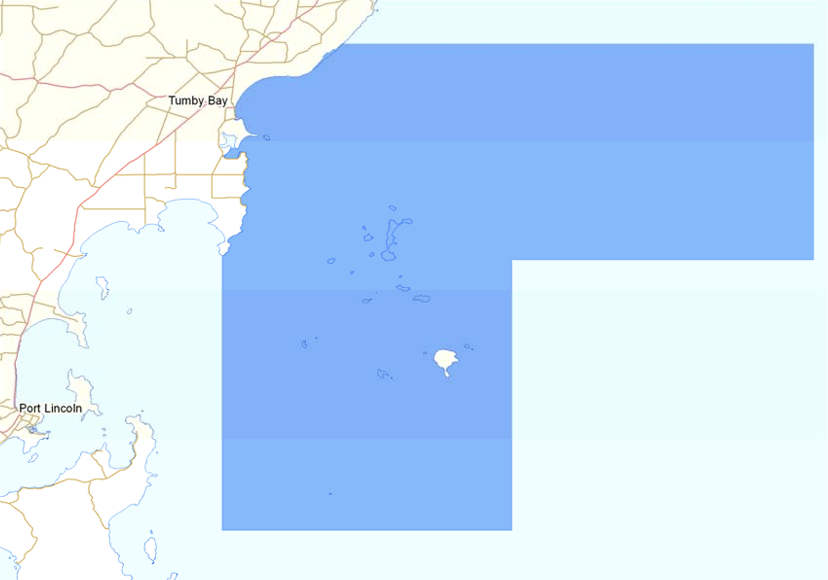
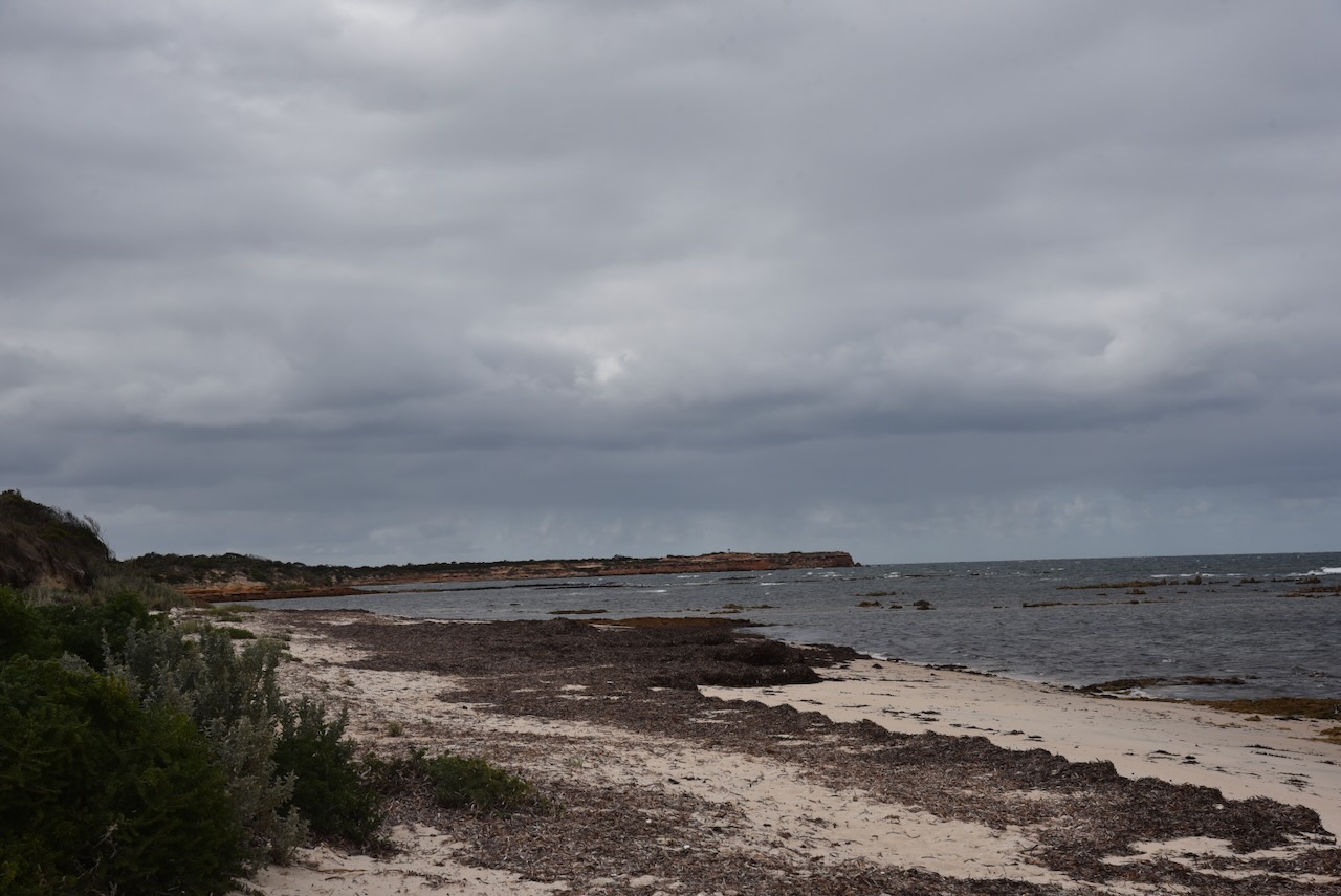
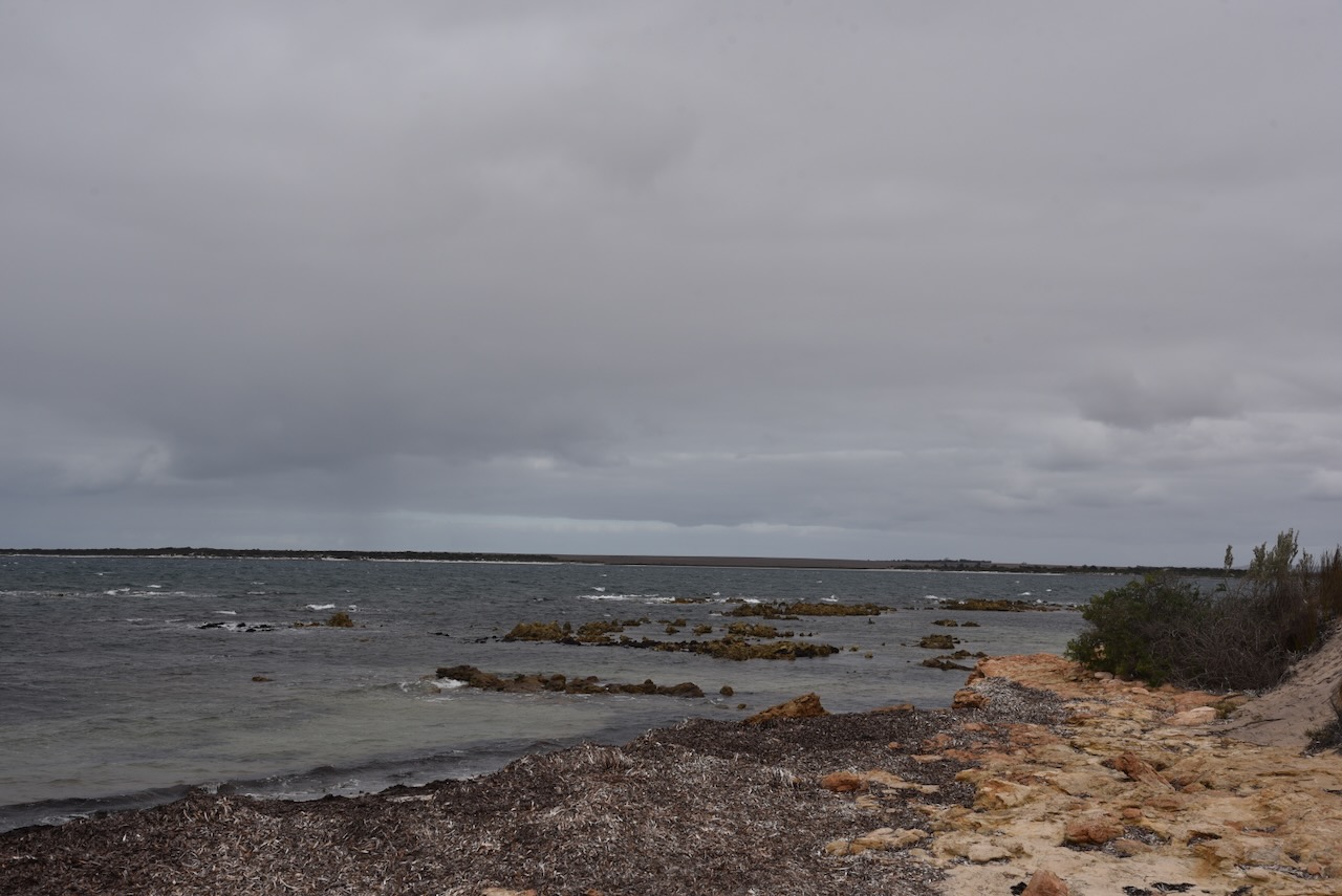
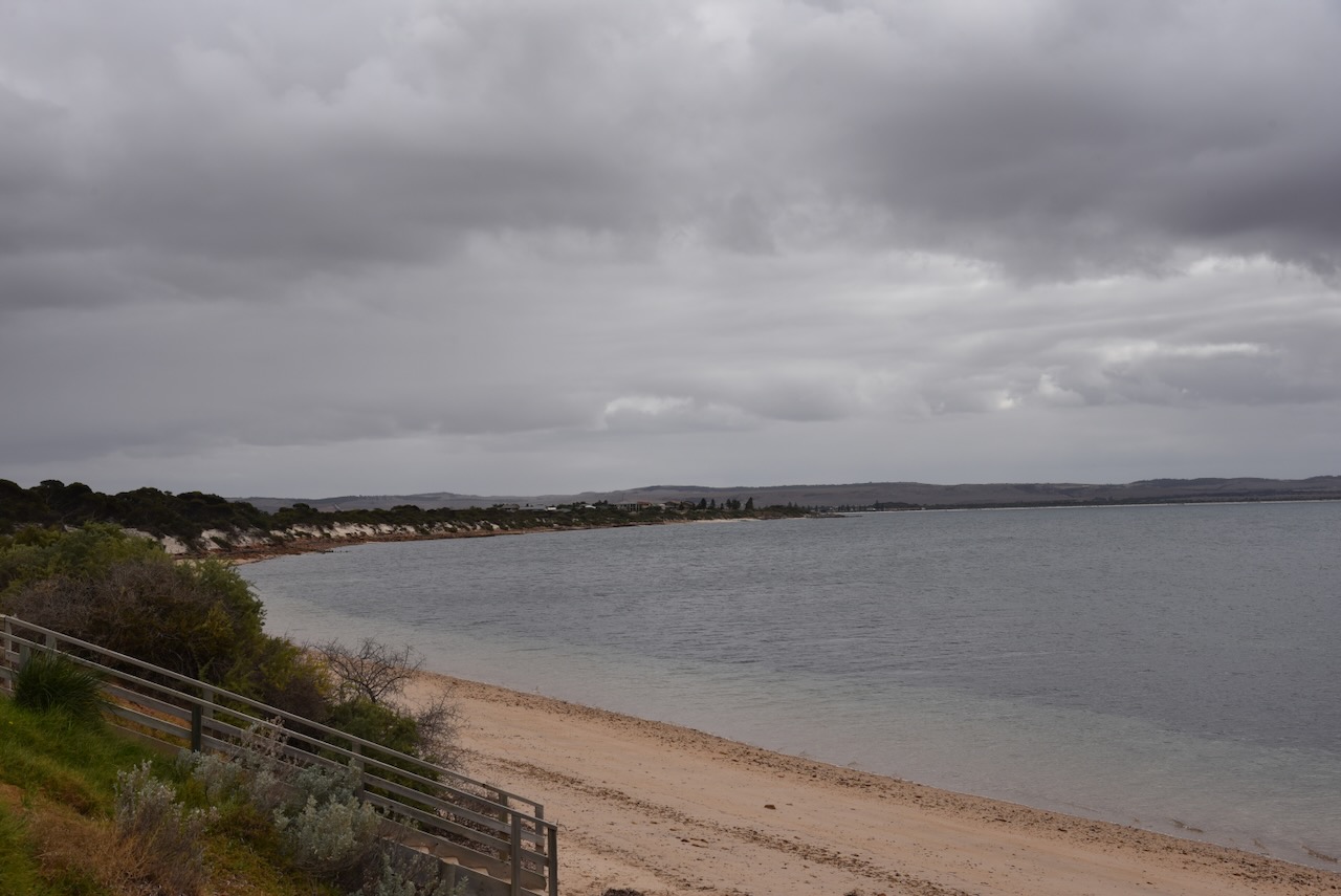
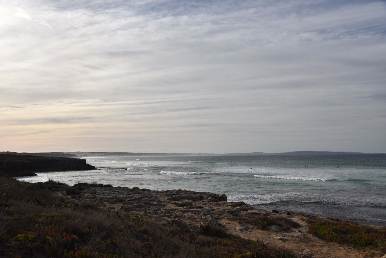
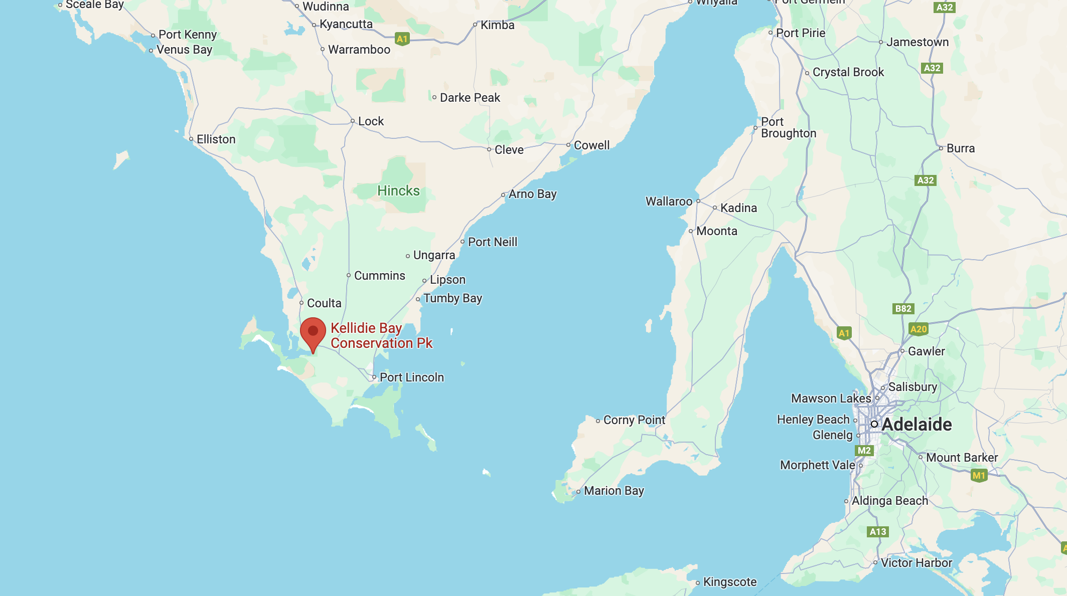
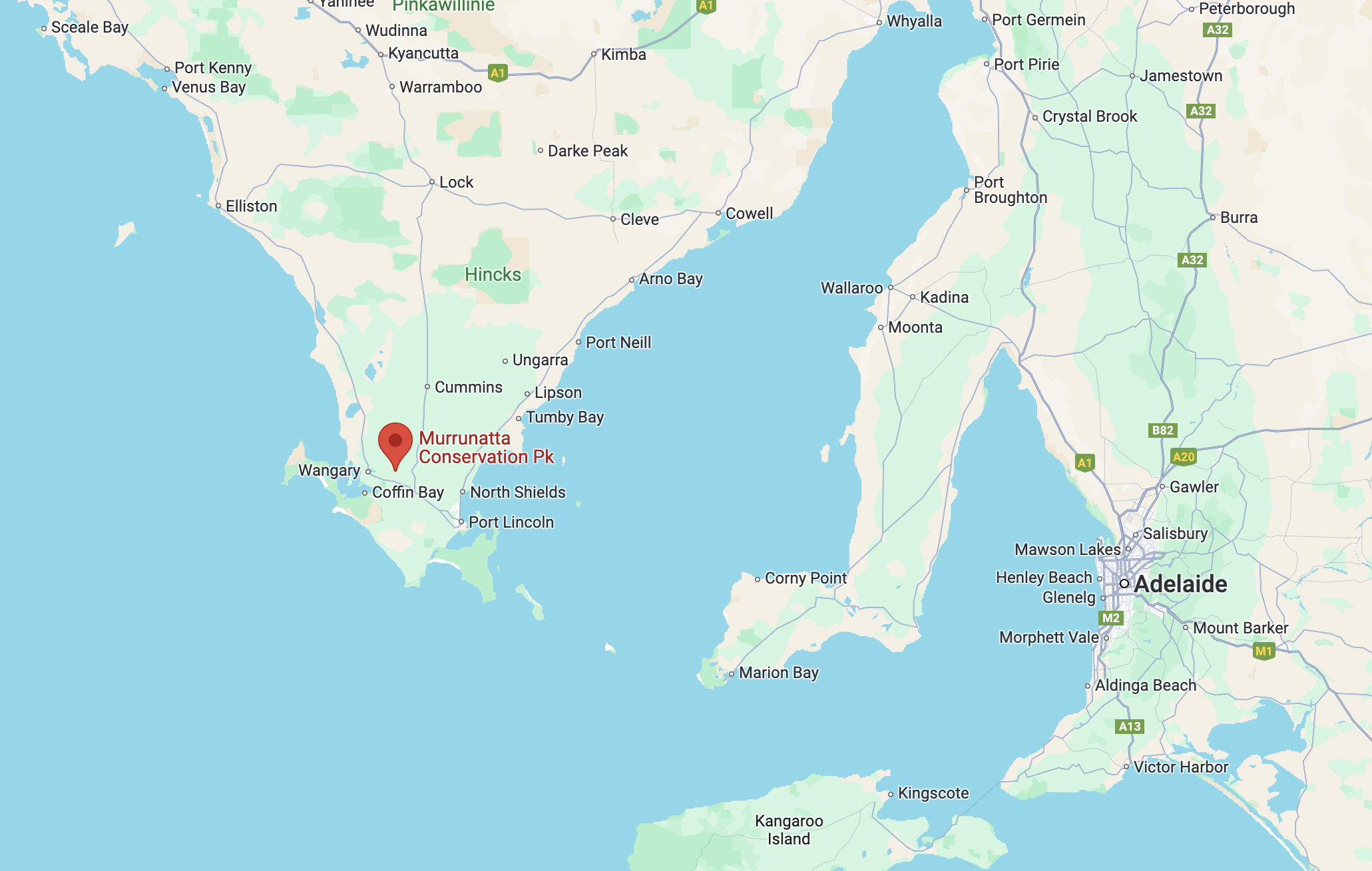
My next activation for Wednesday 24th April 2024 was the Tumby Bay silo VK-TMY5. Tumby Bay is located on the eastern side of the Eyre Peninsula, about 604 km (by road) from Adelaide.

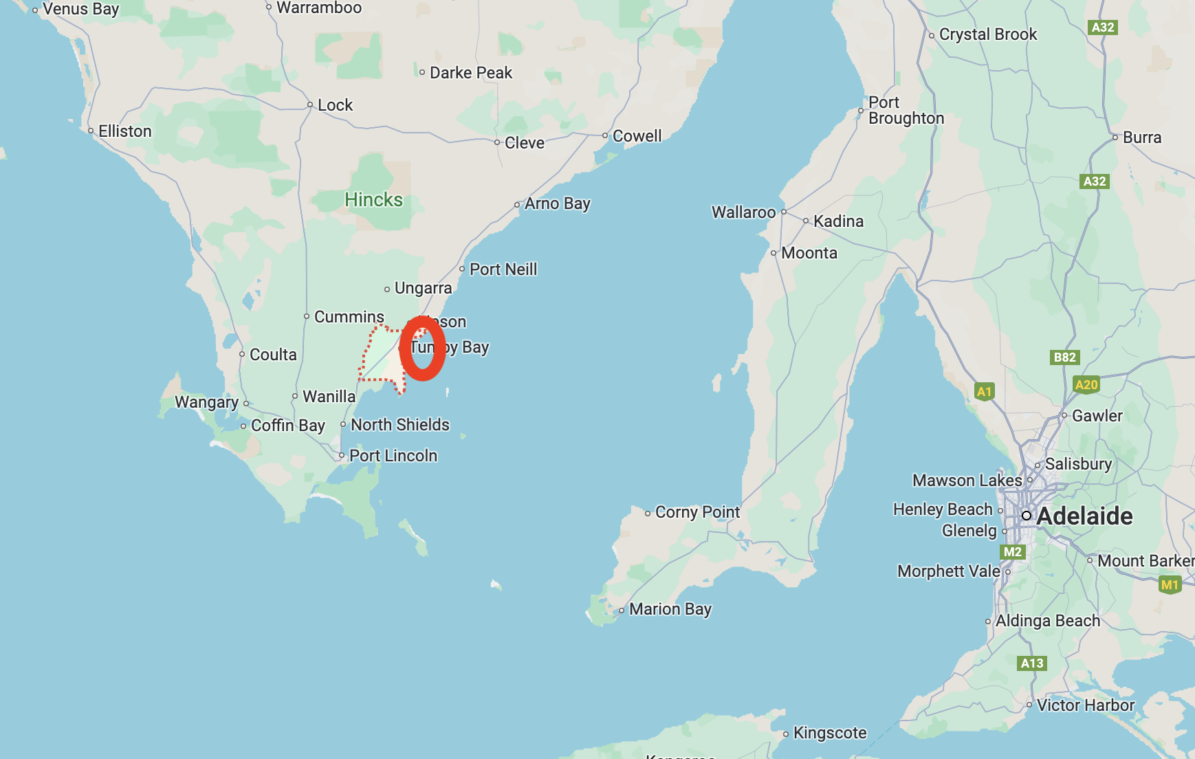
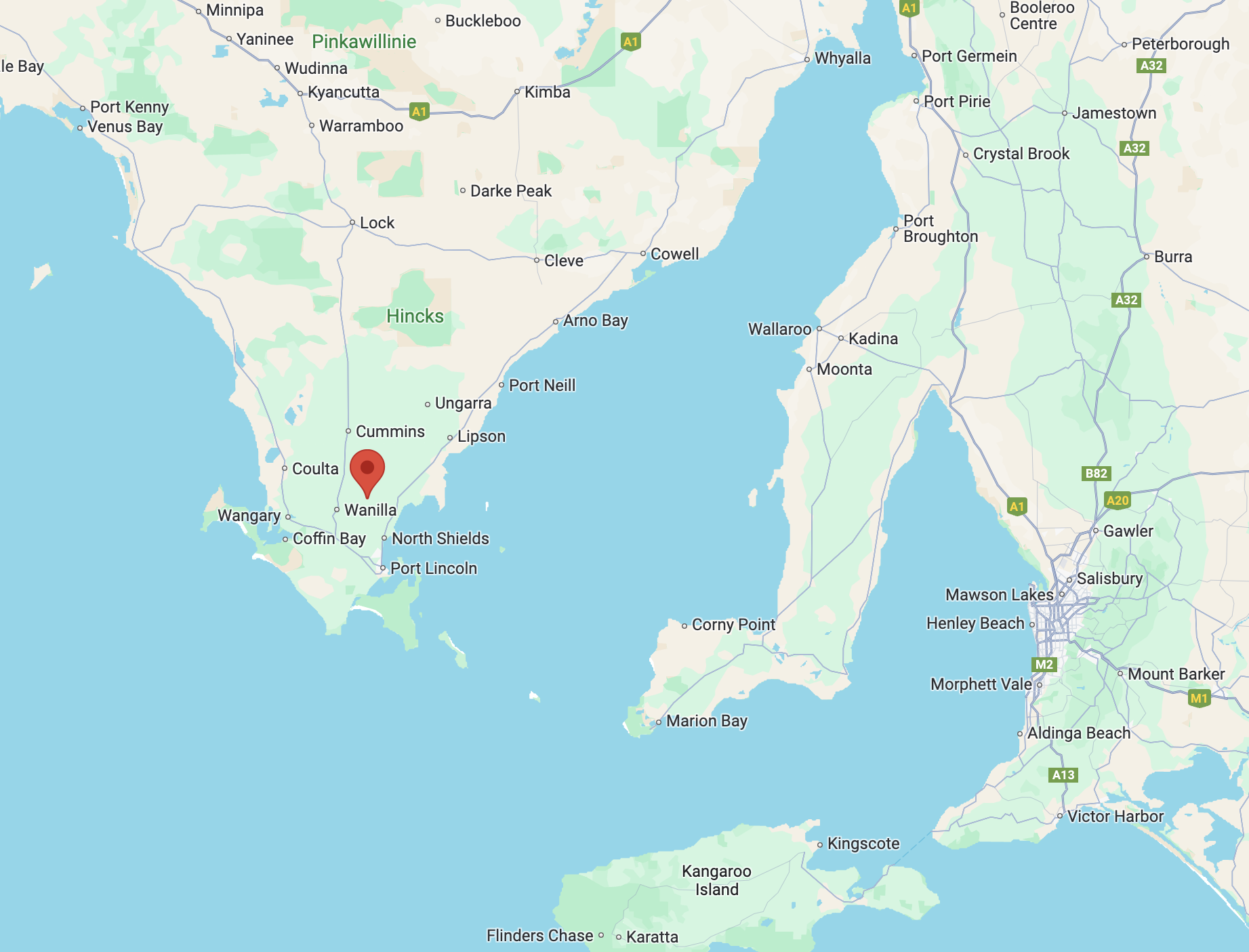
Above:- Map showing the location of Tumby Bay. Map c/o Google Maps.

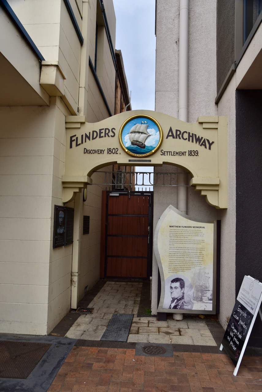
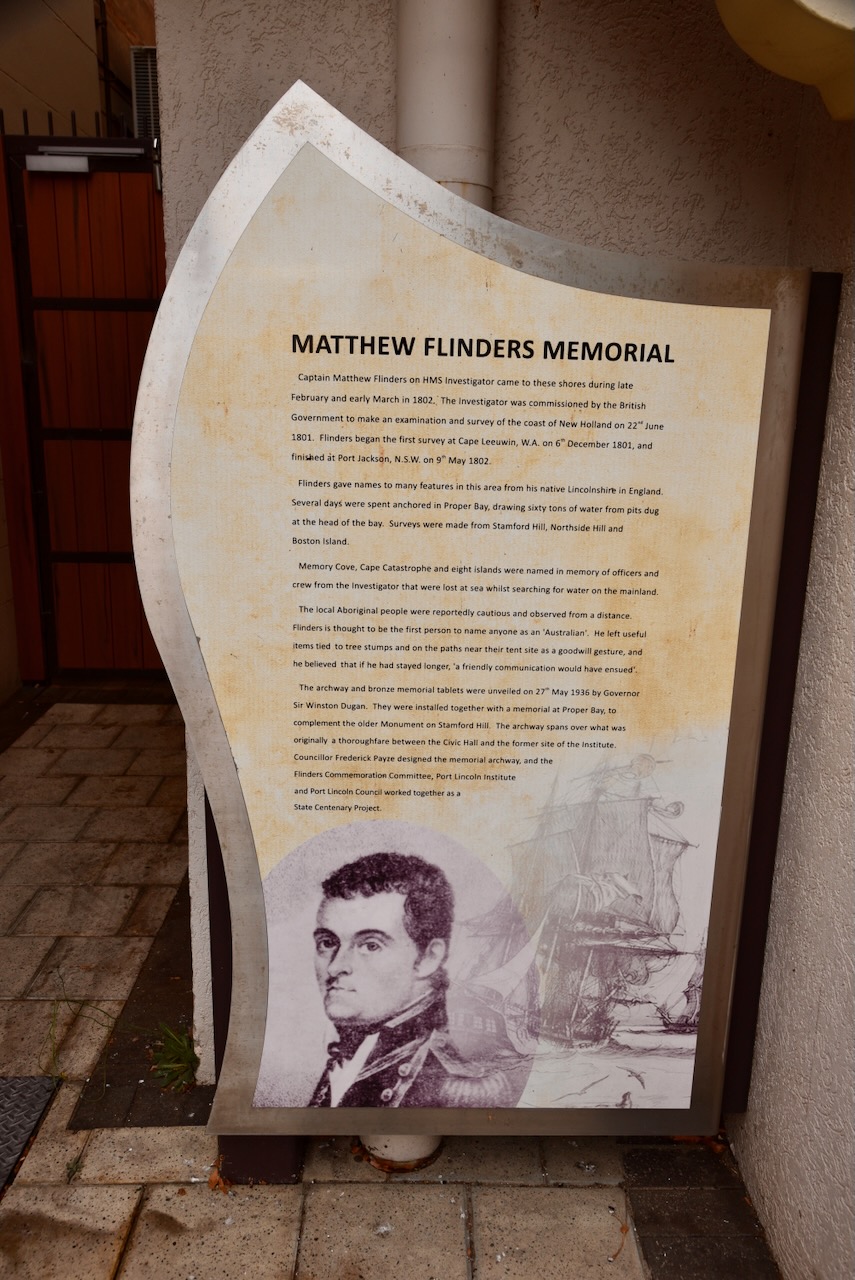
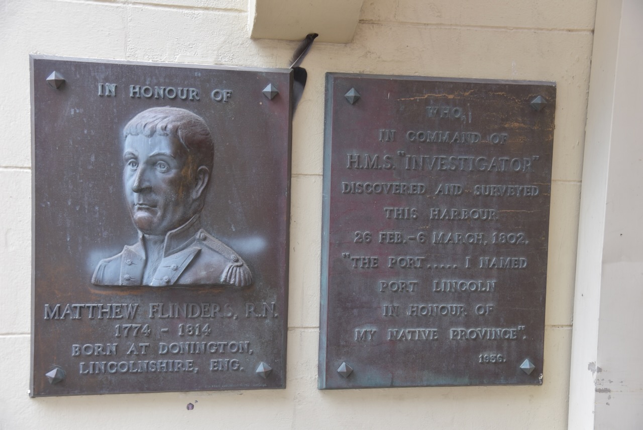
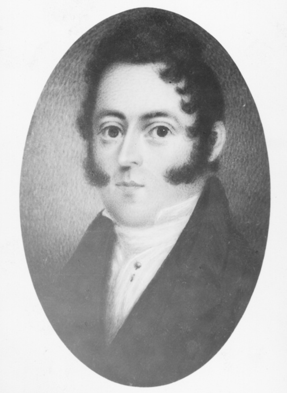
Tumby Bay was named in 1802 by explorer and navigator Captain Matthew Flinders, in honour of a Lincolnshire village close to the Parish of Revesby. ‘Tumby’ is an Old English word meaning ‘fenced village’.

Above:- Map showing the location of Tumby, England. Map c/o Google Maps.

It was named ‘Harvey’s Bay’ by Governor Gawler in 1840. Fourteen years later in 1854, Joseph Provis took up land in the district and built a home near the current day rifle range. By 1856 a small farming community had developed with some of the early settlers being Joseph Provis, John Harvey, Charles Johns and Charles Thorpe. By 1874 a jetty had been constructed. By the late 1890s, the settlement had a blacksmith, a coach-building business, and a general store. (Place Names 2012) (Pt Lincoln Times 1982)

The town was surveyed, and the first 16 allotments were offered at auction in 1900. Only 2 of these were sold. Mr. W.T. Mortlock purchased the blocks and paired 10 pounds five shillings for allotment 1 and five pounds five shillings for allotment 9. (Pt Lincoln Times 1982)

Governor Tennyson renamed the area Tumby Bay during his term of office from 1899-1902. The town of Tumby was proclaimed on the 15th day of November 1900.

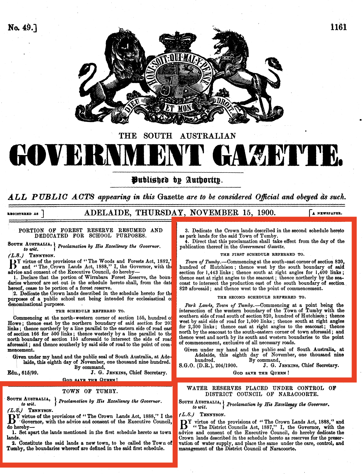
Above:- The proclamation of the town of Tumby in the SA Govt Gazette, Thu Nov 15, 1900.

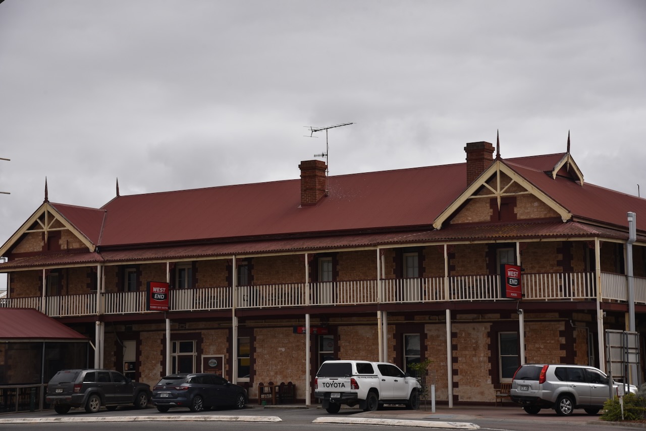
In 1901, 14 allotments were offered for sale, with 11 of those being sold. In 1902 a bakery commenced and in 1904 a builder and carpenters business was established. A butcher shop was also opened in 1904 along with the Tumby Bay Hotel. In 1905 the Bank of Adelaide commenced business. In 1906 a flour mill commenced operation. On the 14th day of June 1984, it officially became known as Tumby Bay. (Place Names 2012) (Pt Lincoln Times 1982)

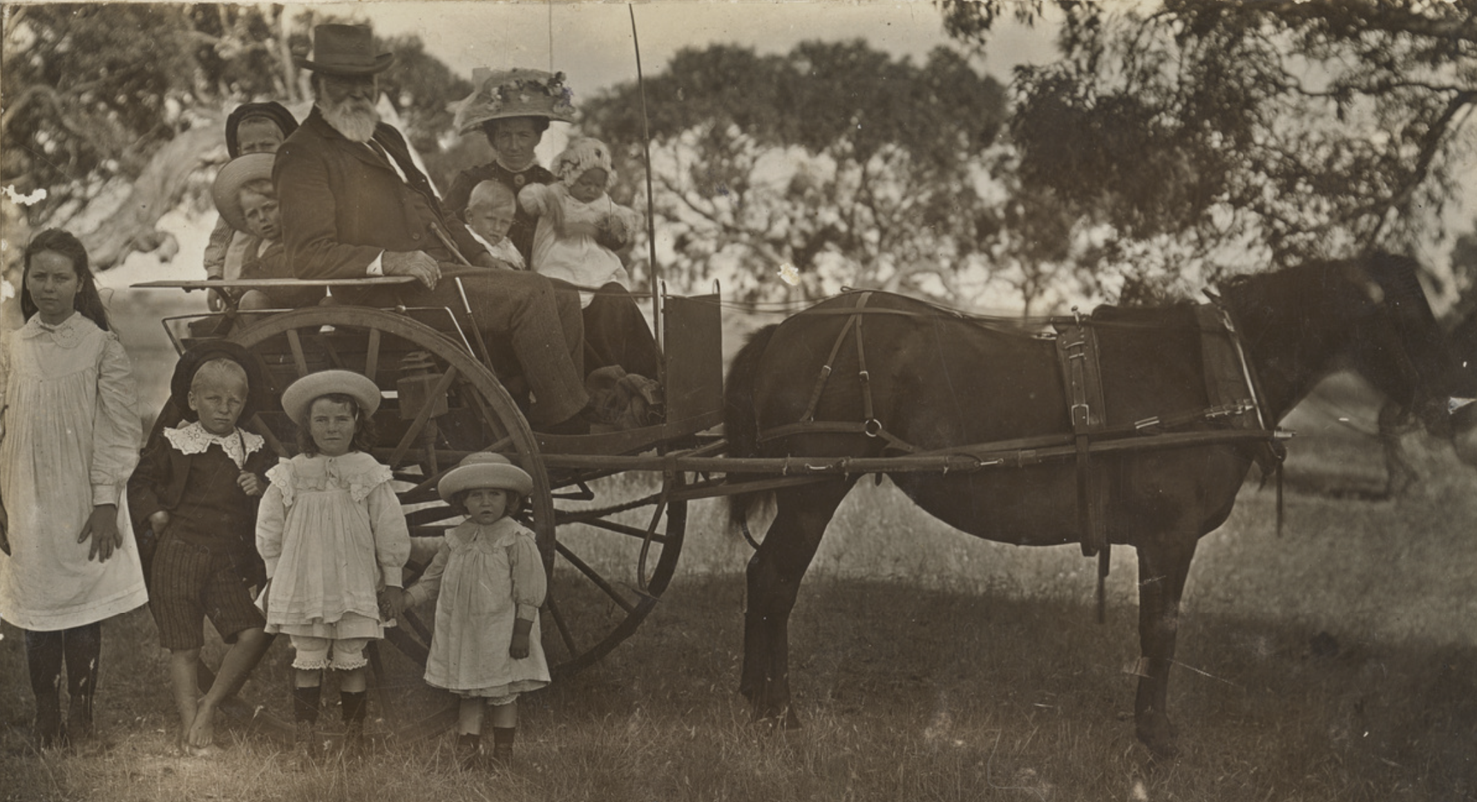
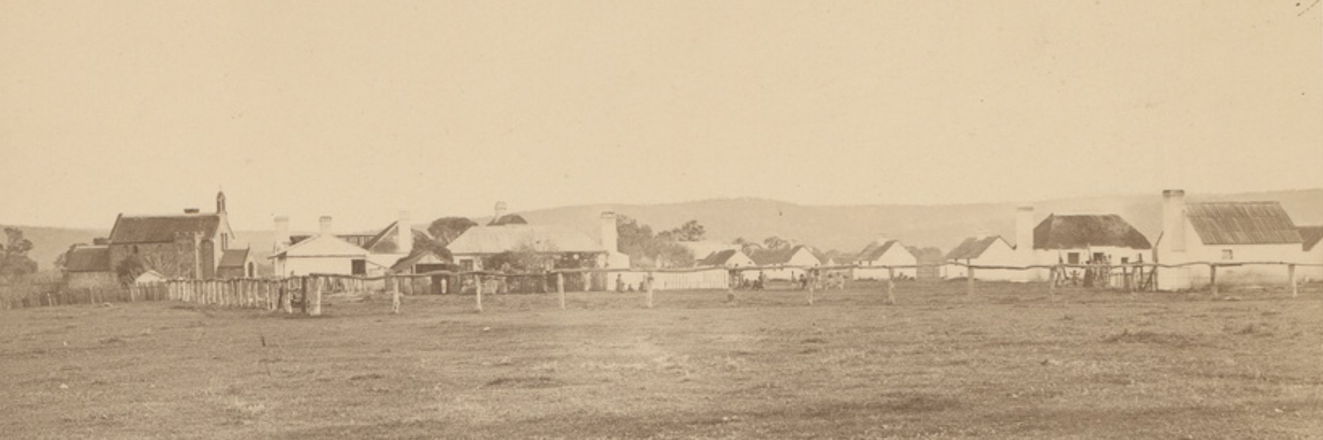
Above:- The Tumby Bay Hotel, c. 1912. Image c/o State Library SA.

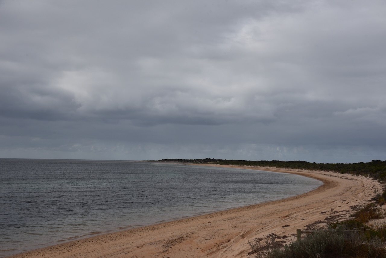
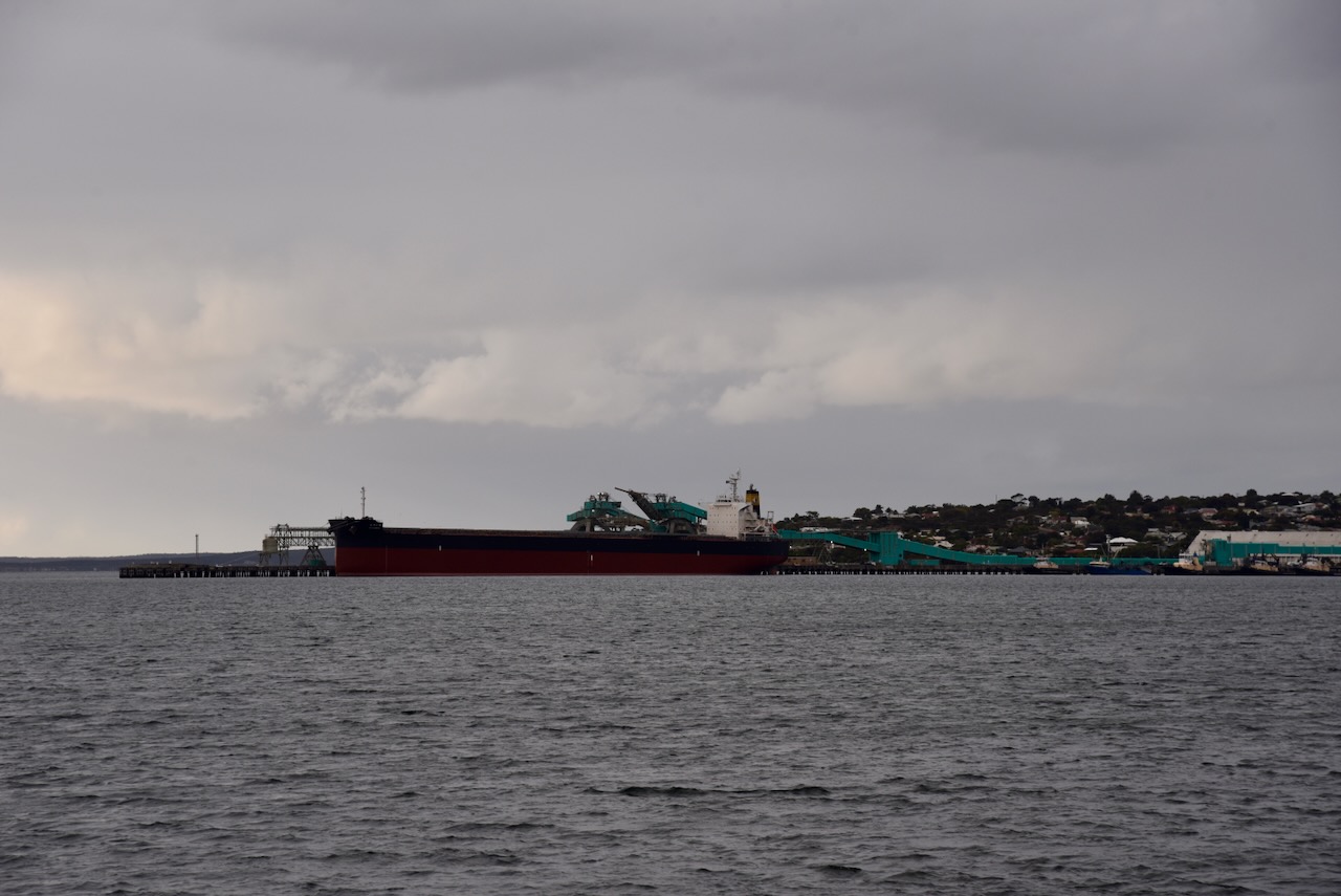
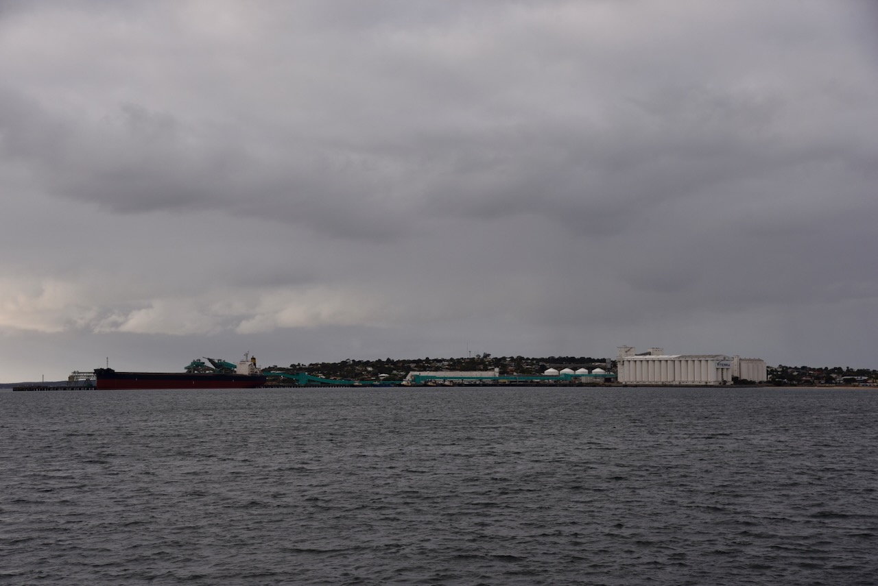
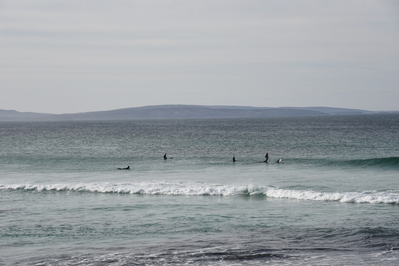
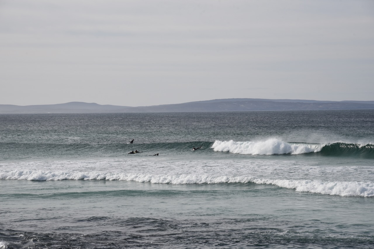
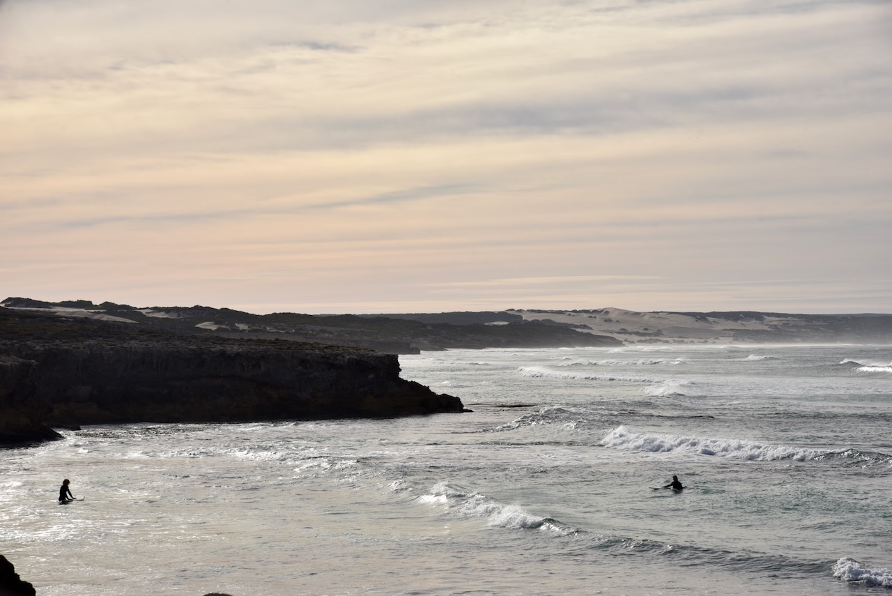
Today, Tumby Bay is the centre of an agricultural district for cereal crops and sheep. It is a popular holiday destination during the summer months. It is a very popular fishing location with King George Whiting and Snapper being some fish species caught. (Wikipedia 2024)

The short video below gives you a good feel about this beautiful little town.

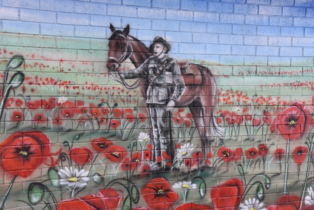
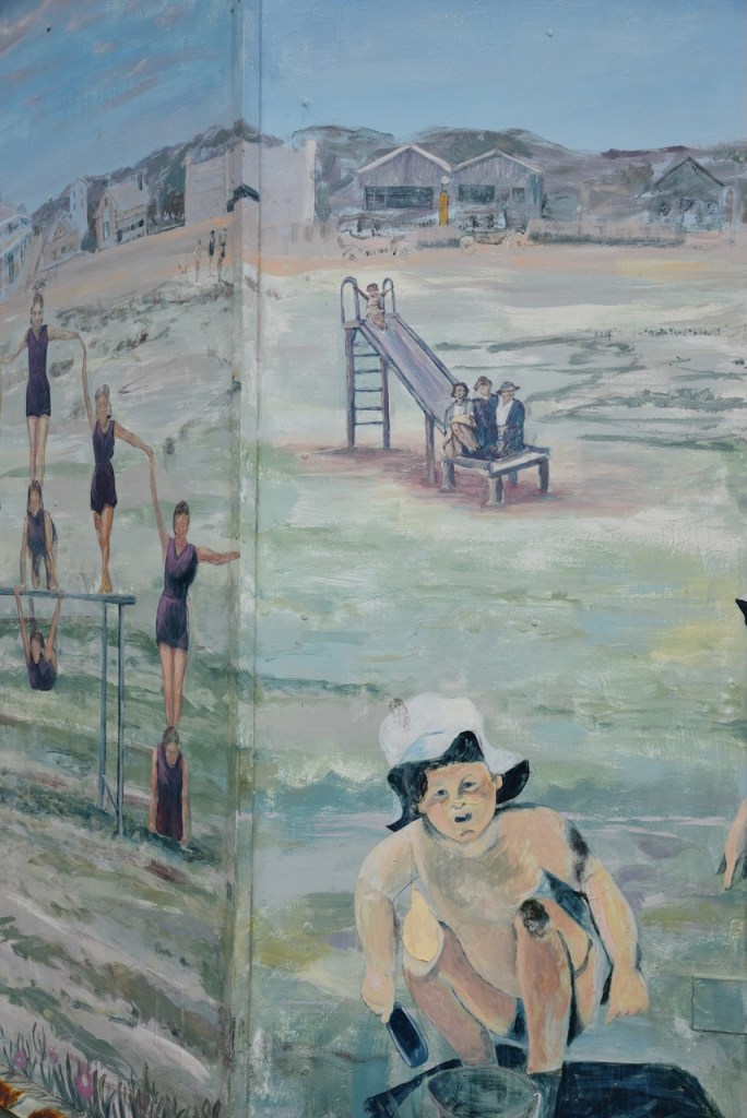
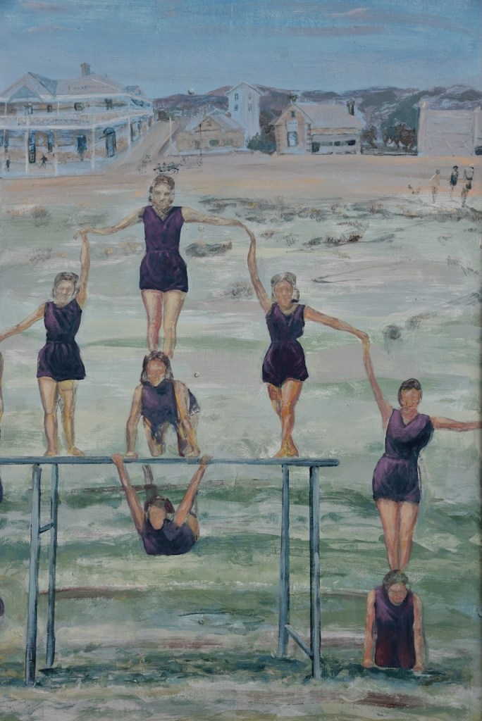
On a building on the foreshore, you can find a magnificent mural to honour servicemen and servicewomen. It is the work of artist Simon White and depicts the red poppies of Flanders Fields battlegrounds in the First World War. (ABC 2024)

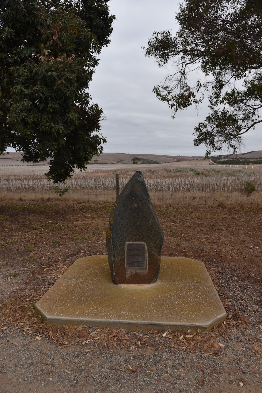
On Tumby Terrace you can find a monument that commemorates the pioneers of the Tumby Bay district.

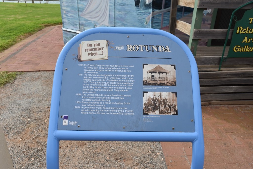
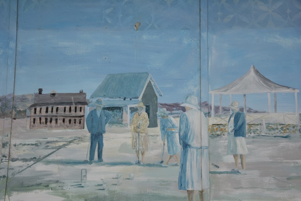
A Brass Band was formed at Tumby Bay in 1908 by Edward Gregurke. By 1910 a band rotunda had been built by the Tumby Bay Hotel publican. In 1983 it was turned into an art gallery. In 2004 a mural was painted on the outside walls. (Aussie Towns 2024)

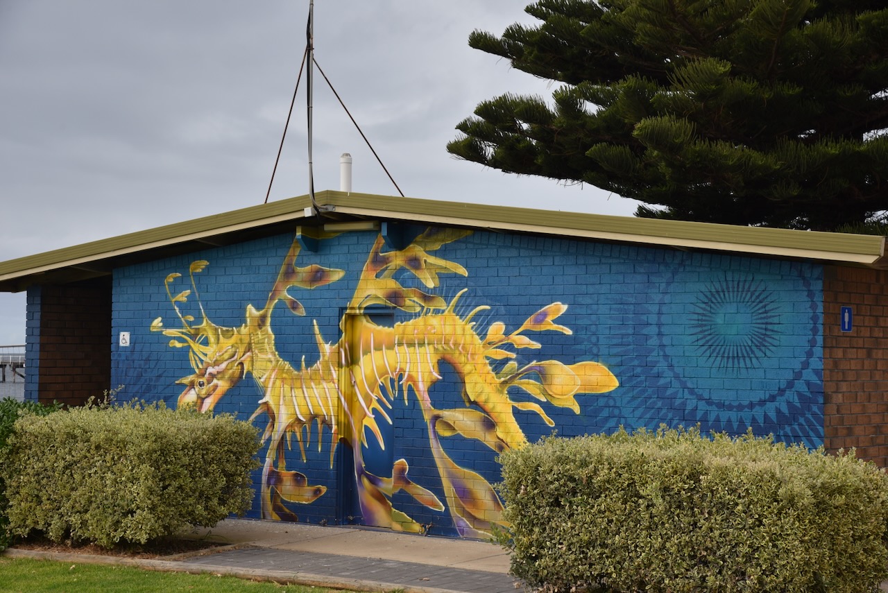
Another mural to be found is that of the Leafy Sea-dragon. It was painted by Masher Designs in 2023. (ABC 2024)

On Tumby Terrace you can find a monument with a miniature plough. The monument is to honour Robert Bratton, Overseer of Works at Tumby Bay. Bratton used this version of the plough which had been invented by a local tractor driver called Ferguson. It was used to build roads through the harsh mallee of the Eyre Peninsula. It became known as the Brattonising system of road making. (Aussie Towns 2024)

Along the Tumby Bay foreshore, there is also a dolphin sculpture.

On Lipson Road, you can find a monument located at the cemetery that commemorates the pioneers of Tumby Bay.

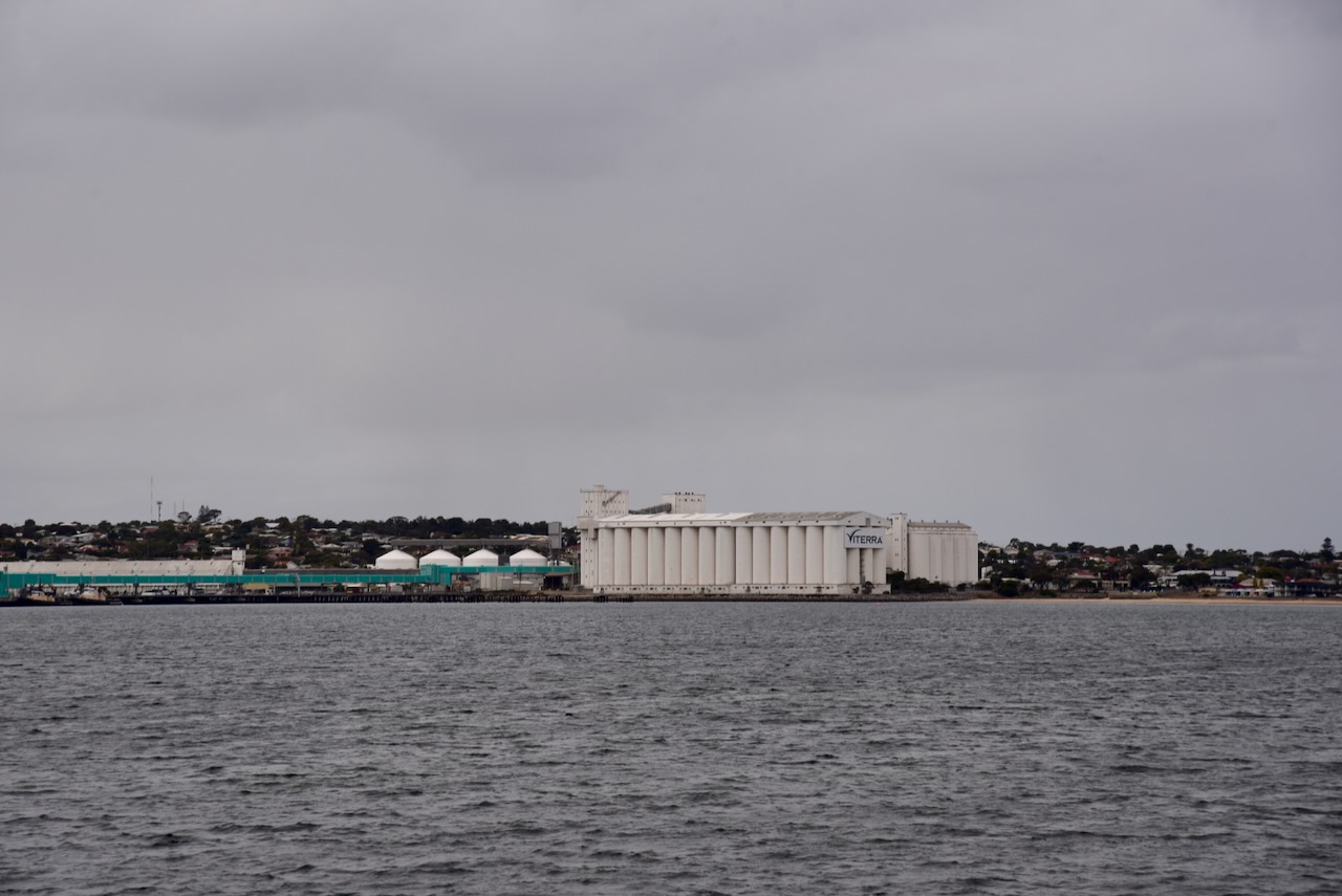
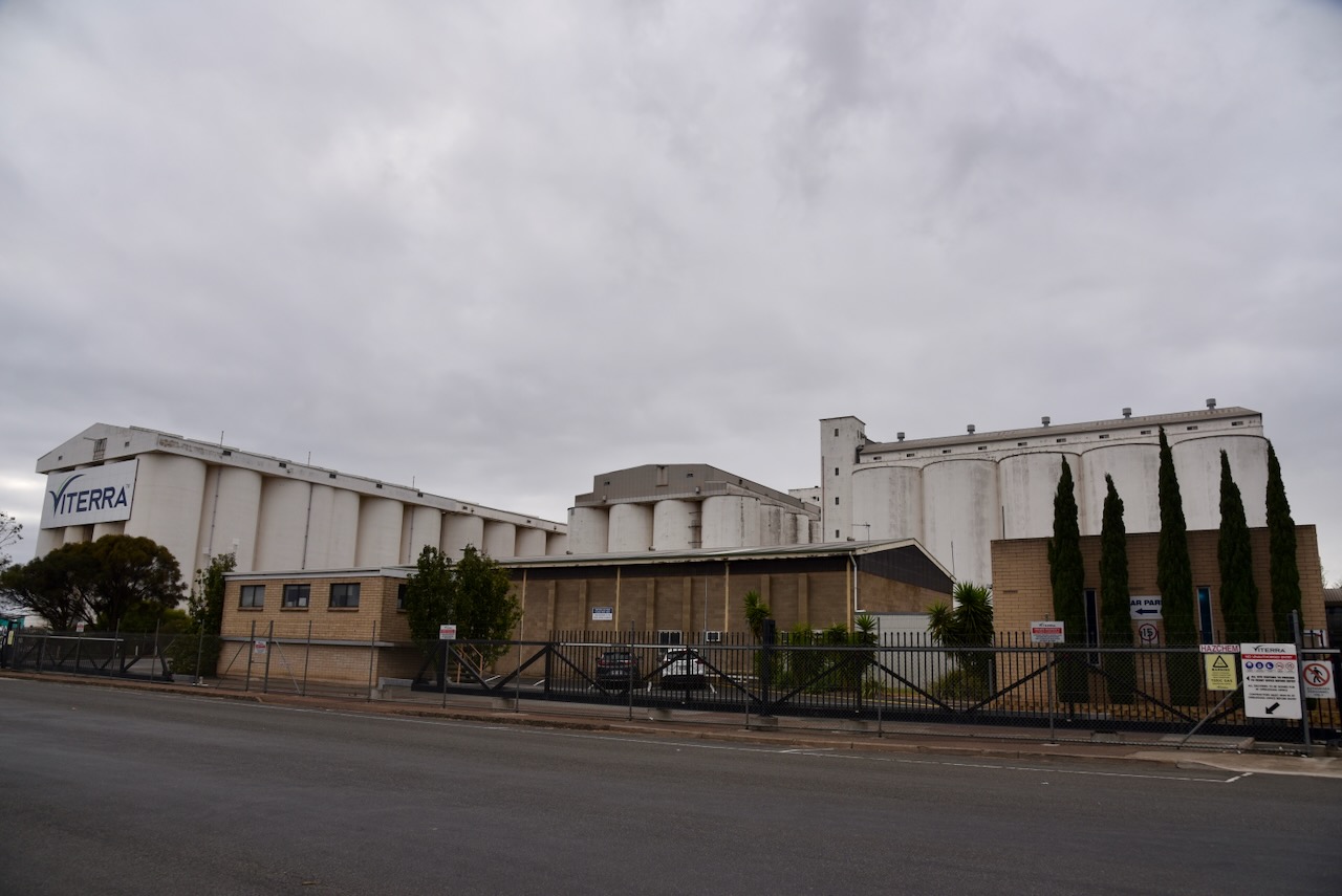
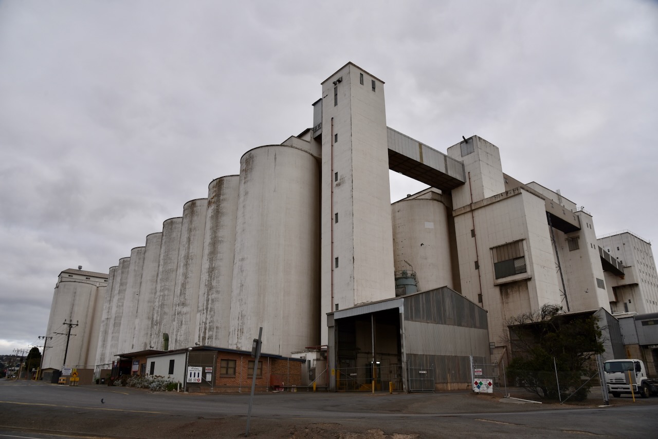
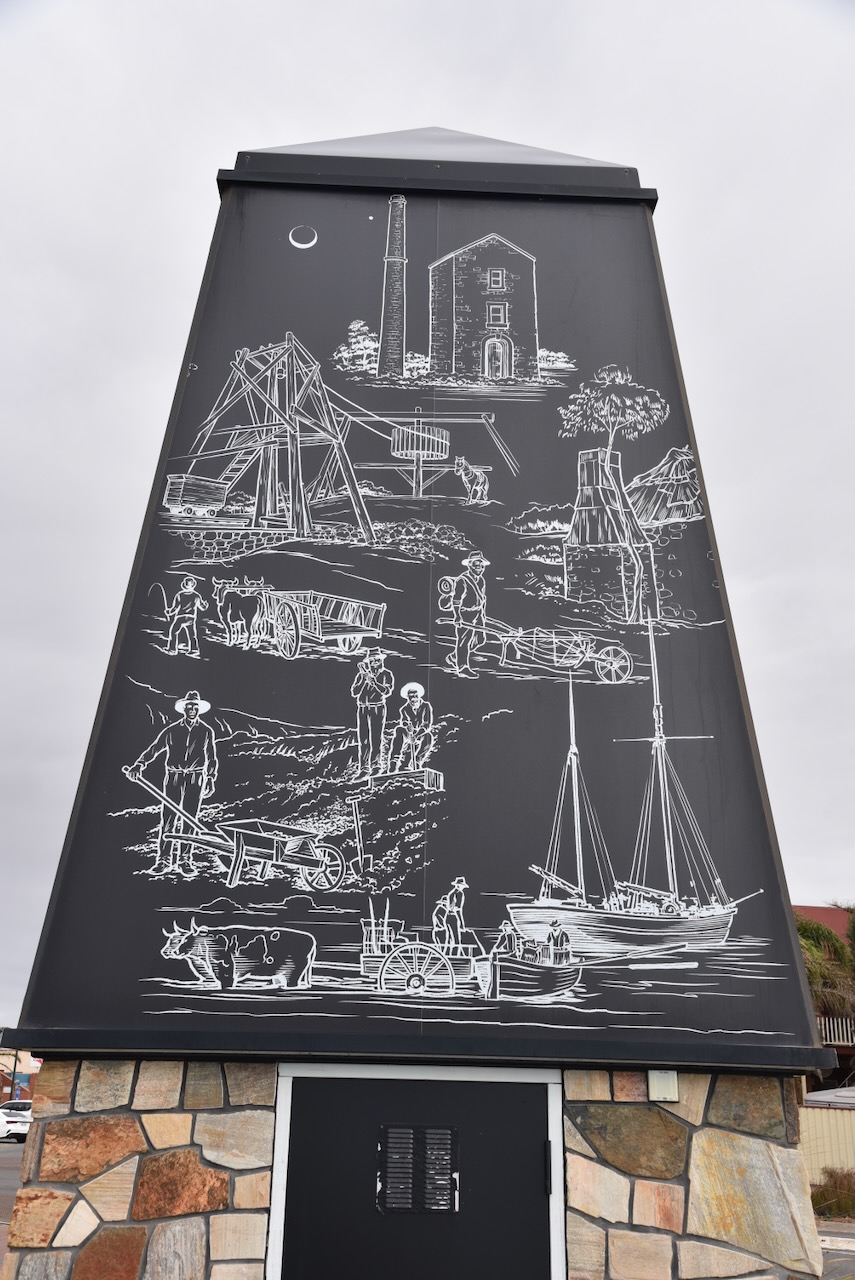
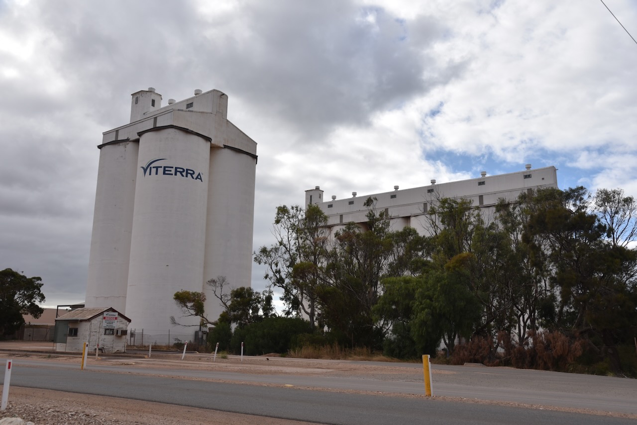
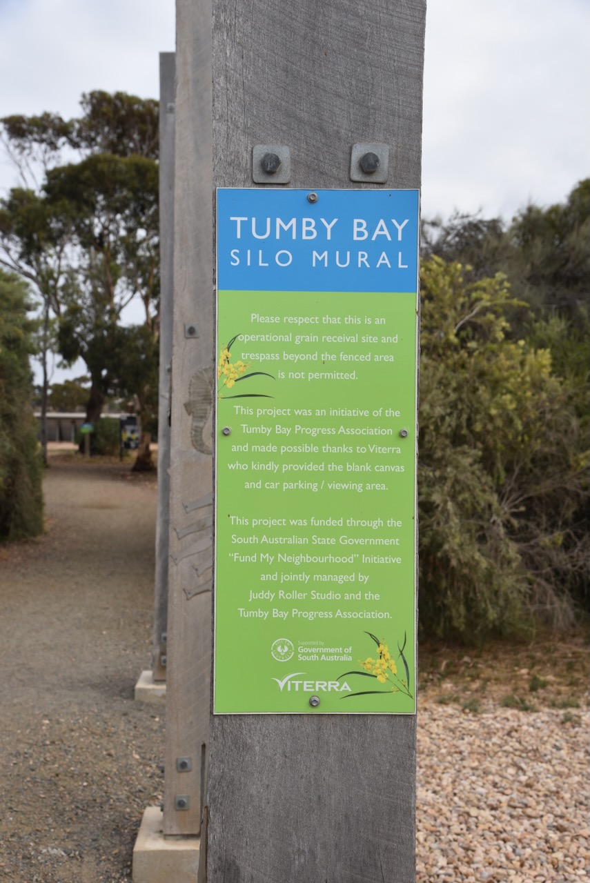
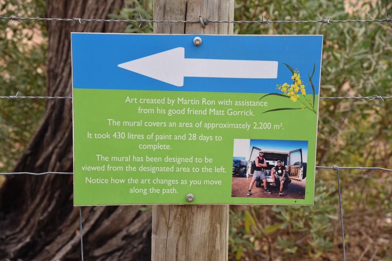
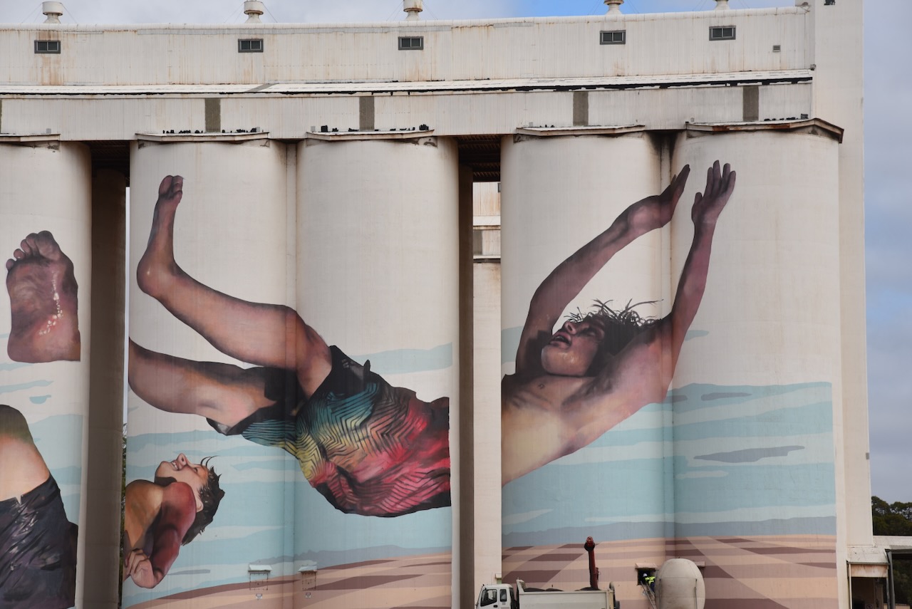
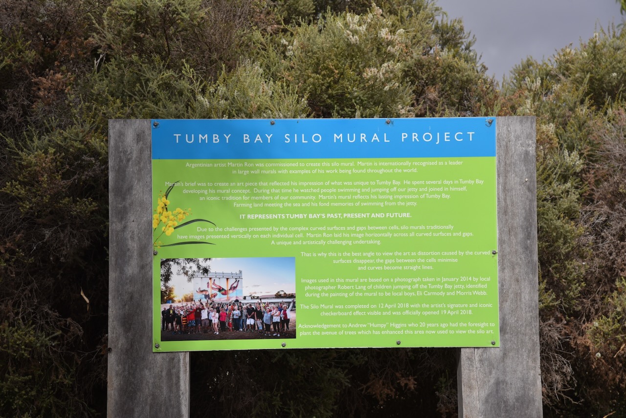
The Tumby Bay silos are part of the Australian SIlo Art Trail. They were their third silos to be painted in South Australia and were completed on the 13th day of April 1908. The silo art depicts two boys jumping off the Tumby Bay jetty. The silo art is the work of Argentinian-born artist Martin Ron and his assistant Matt Gorrick whose inspiration came from seeing people dive off the jetty into the ocean. (Australian Silo Art 2024) (YouTube 2024)

The video below is a timelapse of the Tumby Bay silo.

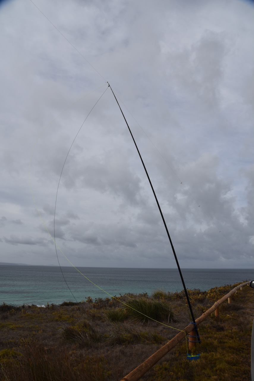
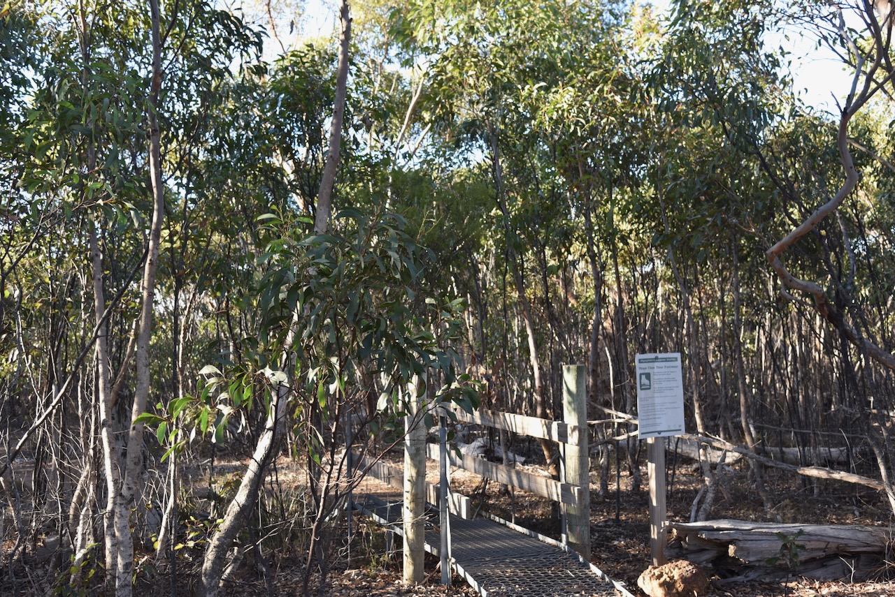
I parked in the silo car park off Bratten Roaad and operated from the 4WD. I ran the Icom IC7000, 100 watts, and the Codan 9350 antenna with the 1.5-metre stainless steel whip.

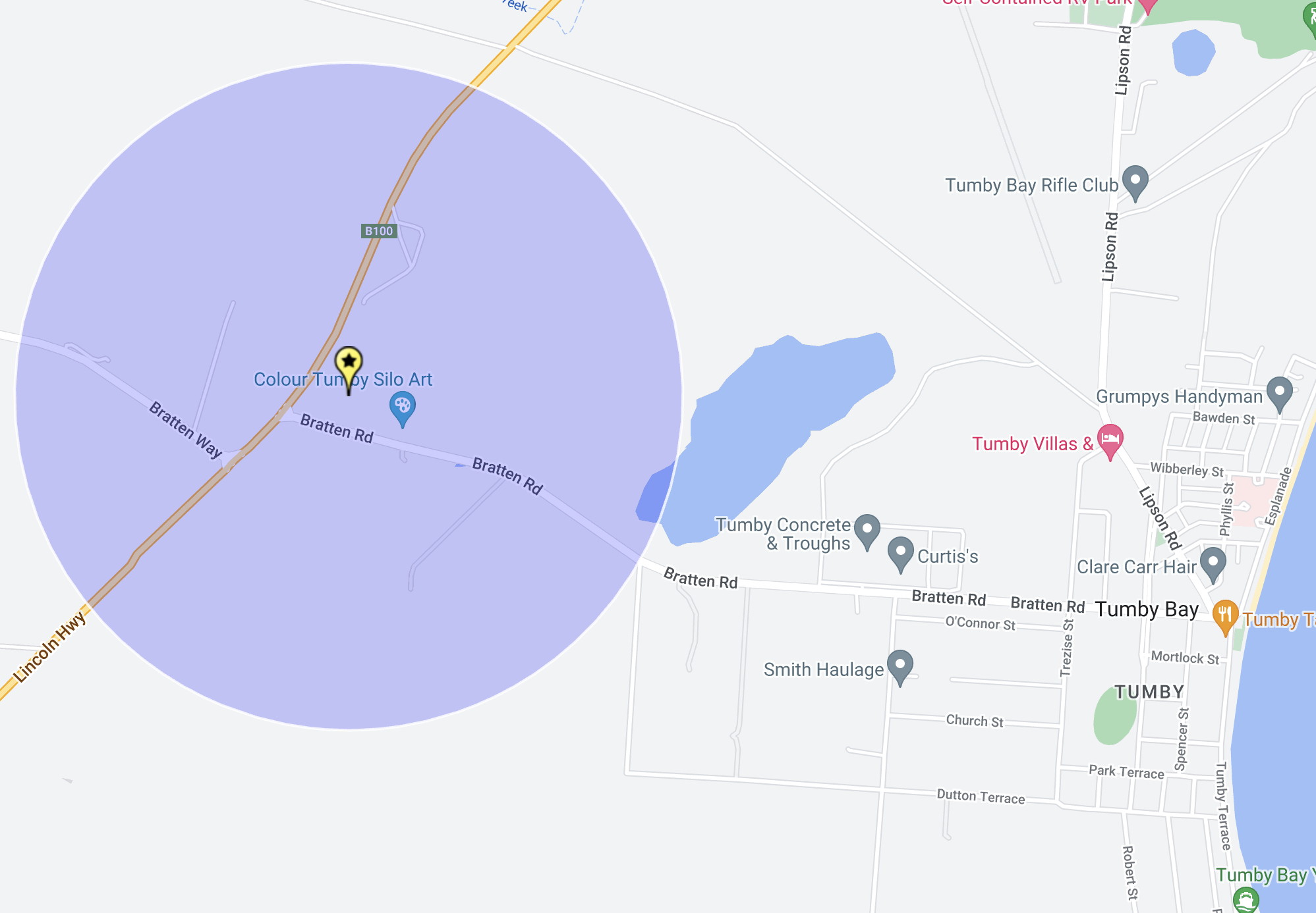
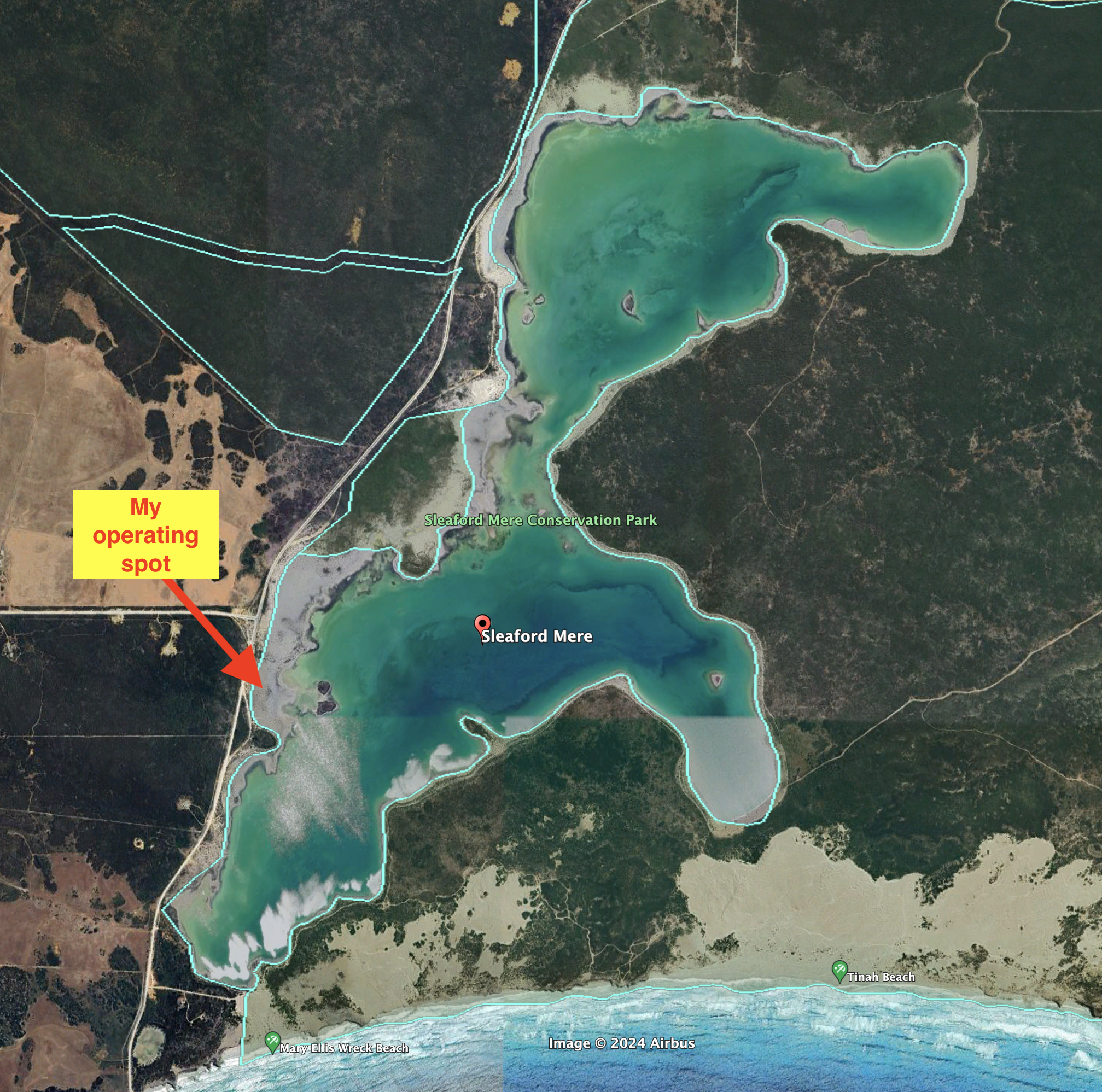
Above:- The activation zone at the Tumby Bay silo. Map c/o SiOTA website.

I worked the following stations on 40m SSB:-

  1. VK5MAZ
  2. VK5GY
  3. VK3PF
  4. VK3KAI
  5. VK5QA/p

I worked the following stations on 20m SSB:-

  1. VK7XX
  2. VK3APJ
  3. VK3TX
  4. VK1AO
  5. VK2MET
  6. VK2IO
  7. VK3CEO
  8. VK4EMP
  9. VK4TI
  10. VK2VW
  11. VK2HFI
  12. VK2COS
  13. VK2XD

References.

  1. Aussie Towns. (n.d.). Tumby Bay, SA. [online] Available at: https://www.aussietowns.com.au/town/tumby-bay-sa. [Accessed 2 Aug. 2024]‌
  2. ‌Australiansiloarttrail.com. (2024). Tumby Bay. [online] Available at: https://www.australiansiloarttrail.com/tumby-bay [Accessed 12 Aug. 2024].
  3. ‌Colour Tumby art festival sees Flanders Fields, leafy seadragon murals added to Tumby Bay walls – ABC News. (2023). ABC News. [online] 13 Mar. Available at: https://www.abc.net.au/news/2023-03-13/colour-tumby-2023-flanders-fields-leafy-seadragon-murals/102088546 [Accessed 12 Aug. 2024].
  4. ‌On Eyre Media (2018). Tumby Bay Silo Timelapse – Ron Muralist. [online] YouTube. Available at: https://www.youtube.com/watch?v=bm8Ik2W0nQM [Accessed 12 Aug. 2024].
  5. ‌published.collections.slsa.sa.gov.au. (n.d.). A Compendium of the Place Names of South Australia. [online] Available at: https://published.collections.slsa.sa.gov.au/placenamesofsouthaustralia/. [Accessed 2 Aug. 2024]‌
  6. Trove. (2014). Tumby Bay: 180 years since Capt. Flinders – Port Lincoln Times (SA : 1927 – 1988; 1992 – 2002) – 5 Mar 1982. [online] Available at: https://trove.nla.gov.au/newspaper/article/276039438 [Accessed 13 Aug. 2024].‌
  7. Wikipedia Contributors (2024). Tumby Bay, South Australia. [online] Wikipedia. Available at: https://en.wikipedia.org/wiki/Tumby_Bay [Accessed 13 Aug. 2024].‌

Sir Joseph Banks Group Marine Park VKFF-1746

After leaving Port Lincoln on Wednesday 24th April 2024, I headed north along the Lincoln Highway to my first park activation of the day, the Sir Joseph Banks Group Marine Park VKFF-1746.

Above:- Map showing the location of the Sir Joseph Banks Group Marine Park. Map c/o Google Maps.

Prior to reaching Tumby Bay, I had a quick look at North Shields, about 11 km north of Port Lincoln.

North Shields was a 1907 subdivision of sections 189 and 387, Hundred of Louth, By George D. Dorward. He was born in 1842 and arrived in Australia in 1863 aboard the Seashell. (Place Names 2012)

Above:-  Mr George Dorward of “Clifton”, North Shields, and his daughter Mrs Hage with her children in a dog cart. Image co State Library South Australia.

The North Shields Post Office opened in 1908 and this was followed by North Shields School in 1911. The school closed in 1970. The town’s jetty opened on the 12th day of November 1906. Two historic buildings that remain are the Wheatsheaf Hotel and the Soldiers Memorial Hall. (Place Names 2012)

I then stopped at The Black Stump monument. It marks the lands of the former Poonindie Mission Station that operated from 1850-1896. It stands as a tribute to the pioneers of the district. The former ‘Black Stump’ was damaged by the bushfire in January 2005 and was replaced by a piece of fireproof black rock in 2006.

Poonindie was established in 1850 by Adelaide Archdeacon Matthew Hale. It was used as a ‘training institution’ for young Aboriginal families. They were expected to live a Christian lifestyle and learn domestic and agricultural skills. (Aboriginal Missions 2024)

The Sir Joseph Banks Group Marine Park spans waters from just north of Bergs Beach to Point Bolingbroke and includes the islands of the Sir Joseph Banks Group and Dangerous Reef. (Management Plan 2012)

Above:- Map showing the boundaries of the Marine Park. Map c/o WEWNR.

The park takes its name from Sir Joseph Banks. He was born in 1743 in London England. Banks was an English naturalist, botanist and patron of the natural sciences. (Wikipedia 2024)

Above:- Sir Joseph Banks. Image c/o Wikipedia.

Below is an excellent short video on the life of Sir Joseph Banks narrated by Sir David Attenborough.

The park is 2,627 km2 and is adjacent to Tumby Bay. It overlays two other protected areas, the Tumby Island Conservation Park and the Sir Joseph Banks Group Conservation Park. Dangerous Reef hosts one of the largest breeding colonies of Australian sea lions in the world. Pregnant female White Pointer sharks are often found in these waters, most likely due to the high sea lion population. (Management Plan 2012)

I drove down to the end of Harvey Drive and set up on a 4WD track leading to the beach. I ran the Yaesu FT857, 40 watts and the 20/40/80m linked dipole for this activation.

I worked the following stations on 40m SSB:-

  1. VK5MAZ
  2. VK5GY
  3. VK5HS
  4. VK5IS
  5. VK3BEL
  6. VK5AAF
  7. VK3PF
  8. VK3KAI
  9. VK5WE
  10. VK5MK
  11. VK5LA
  12. VK5KAW

I worked the following stations on 40m FT8:-

  1. VK3PF
  2. VK5LA
  3. VK5KAW
  4. VK3KAI
  5. VK3APJ
  6. VK2IO
  7. VK7XX
  8. VK3UAO
  9. VK5MK

I worked the following stations on 20m FT8:-

  1. VK3PF
  2. VK3CEO
  3. VK1AO
  4. VK7XX
  5. VK3KAI
  6. VK5MK
  7. VK3APJ
  8. VK2MET
  9. VK5LA
  10. VK5KAW
  11. VK4EMP
  12. VK4MUD
  13. VK4TI
  14. VK2IO

I worked the following stations on 20m SSB:-

  1. VK1AO
  2. VK2MET
  3. VK4NH
  4. VK4DXA
  5. VK5MAZ
  6. VK3PF
  7. VK3KAI
  8. VK3TX
  9. VK2VW
  10. VK2HFI
  11. VK2AKA
  12. Vk2BUG
  13. VK2IO
  14. VK5DW
  15. VK7ZA
  16. VK3APJ
  17. VK3MAP
  18. VK3CEO
  19. VK7EE
  20. VK3SO
  21. VK3SFG
  22. UT5PI

References.

  1. Department of Environment Water & Natural Resources, 2012, Sir Joseph Banks Group Marine Park Management Plan
  2. Russell, S. (n.d.). LibGuides: Aboriginal missions in South Australia: Poonindie. [online] guides.slsa.sa.gov.au. Available at: https://guides.slsa.sa.gov.au/Aboriginal_Missions/Poonindie. [Accessed 12 Aug. 2024].‌‌
  3. ‌Wikipedia. (2020). Joseph Banks. [online] Available at: https://en.wikipedia.org/wiki/Joseph_Banks.[Accessed 12 Aug. 2024].‌‌

Port Lincoln silo VK-PRN5

It was now Wednesday 24th April 2024. Today I would leave Port Lincoln and head down to Cowell.

Above:- Map showing the location of Porrt Lincoln. Map c/o Google Maps.

Although I had been to Port Lincoln several times previously, I decided to have a quick look around. My first stop was the Axel Stenross Maritime Museum. The museum celebrates the life of Finnish boat builders Axel Stenross and Frank Laakso who lived in Port Lincoln. I have visited this museum previously and it is well worth a visit if you are in Port Lincoln. But I was running a bit short of time, so this time I just wandered around some of the boats on the outside of the museum. (Axel Strenross 2024)

I then visited the Makybe Diva statue on the Port Lincoln foreshore. Makybe Diva is a champion Australian Thoroughbred racehorse who is the only horse to win three Melbourne Cups and the only mare to win it more than once. (Wikipedia 2024)

Also on the Port Lincoln foreshore is The Tuna Poler monument. It commemorates all who took part in the pioneering form of fishing for tuna. By the late 1970’s the tuna fishing industry had transitioned from poling tune to purse seine fishing which allowed the tune fleet to catch more tuna. (Monuments Australia 2024)

Another interesting monument in Port Lincoln is that of Captain Matthew Flinders and Trim the cat who accompanied Flinders on his voyages to circumnavigate and map the coastline of Australia in 1801–1803.(Monuments Australia 2024)

Adjacent is Flinders Archway which commemorates Matthew Flinders.

There is also a plaque to commemorate John Charles Darke and his journey of exploration to the Gawler Ranges. Please have a look at my previous post on Darke Peake silo for more information.

I then undertook a quick activation of Port Lincoln silos VK-PRN5.

The silos were built in 1959 and are 47 metres tall. They store wheat and Barley from Eyre Peninsula’s harvest until being loaded onto bulk grain carriers. (flickr 2024)

Above:- Article from the Port Lincoln Times Thu 5 Dec 1957. Image c/o Trove.

I parked in the Kirton Point jetty car park and operated from the 4WD. I ran the Icom IC-7000, 100 watts and the Codan 9350 with the 1.5-metre stainless steel whip.

Above:- The activation zone at the Port Lincoln silos. Map c/o SiOTA website.

I worked the following stations on 40m SSB:-

  1. VK5MAZ
  2. VK3PF
  3. VK3VIN
  4. VK5AAF
  5. VK3HBG
  6. VK5LEX
  7. VK3CJN
  8. VK5HS
  9. VK4NH
  10. VK4DXA
  11. VK3APJ
  12. VK3KTT
  13. VK3MEG
  14. VK3FABS

I worked the following stations on 20m SSB:-

  1. VK3PF
  2. VK4NH
  3. VK4DXA
  4. VK7XX
  5. VK2VIN

References.

  1. Axel Stenross. (2018). Axel Stenross. [online] Available at: https://axelstenross.com.au/ [Accessed 12 Aug. 2024].
  2. ‌Flickr. (2024). Port Lincoln silos. [online] Available at: https://www.flickr.com/photos/31967465@N04/49931861851 [Accessed 12 Aug. 2024].
  3. ‌UBC Web Design (2020). The Tuna Poler | Monument Australia. [online] Monumentaustralia.org.au. Available at: https://monumentaustralia.org.au/themes/technology/industry/display/116869-the-tuna-poler [Accessed 12 Aug. 2024].
  4. ‌UBC Web Design (2017). Captain Matthew Flinders & Trim | Monument Australia. [online] Monumentaustralia.org.au. Available at: https://monumentaustralia.org.au/themes/people/exploration/display/110407-captain-matthew-flinders-and-trim [Accessed 12 Aug. 2024].
  5. ‌Wikipedia Contributors (2023). Makybe Diva. [online] Wikipedia. Available at: https://en.wikipedia.org/wiki/Makybe_Diva [Accessed 12 Aug. 2024].‌

Thorny Passage Marine Park VKFF-1751

It was now Tuesday afternoon 23rd April 2024 and I had activated three parks for the day. I wanted to have a look at the Dutton Bay Woolshed so I headed to Mount Dutton Bay.

My first stop along the way was the St Matthias Anglican Church on Farm Beach Road, Wangarry. The foundation stone was laid in 1900. The church was used as a school from 1901-1919. (Churches Australia 2024)

I then drove into the little town of Mount Dutton Bay which takes its name from the body of water known as Mount Dutton Bay. It in turn was named after Charles Christian Dutton, a South Australian pastoralist.

Dutton was born in Middlesex England in February 1812 and emigrated to Australia in 1833. He initially ran a store in New South Wales with his brother Henry Pelerim Dutton. In March 1838 he arrived in South Australia. He was appointed clerk of the Supreme Court and in May 1838 became a Sheriff. (ancestry.com.au) (Pastoral Pioneers 1925) (Wikipedia 2024)

In March and early April 1839, Dutton together with Captain Hawson, and Messrs. Mitchell, R. Stevens, Dennis, Thos Wybell, Thos Harrison and T. Hawson explored the country between Port Lincoln and Coffin Bay and then on to Mount Gawler. (Pastoral Pioneers 1925)

Above:- Henry Hawson. Image c/o State Library SA.

Dutton wrote:

“I certainly never saw finer agricultural land in New Holland. The undulating hills, which bound the valleys, covered with a light soil, shaded with gum and sheoak trees, are peculiarly adapted for sheep runs, and, as wool always partakes of the nature of the soil over which it runs, a fine bright description of the staple may be grown here partaking of the Saxon character and certainly equal to the Bathurst and Argyle wool. Any quantity of cattle would find excellent feed in the valleys and water in abundance…” (Pastoral Pioneers 1925)

Following his expedition, Dutton established a cattle station called ‘Pillawarta’ near Port Lincoln. However, local aboriginal people were undertaking violent raids on the pastoralists in the district. As a result, Governor George Grey despatched Lieutenant Hugonin, one sergeant, one corporal, and sixteen privates from the 16th Regiment to Port Lincoln for the purpose of protecting the settlers. By early 1842 he decided to abandon the property due to fears of the local aboriginal people who were undertaking raids. (Pastoral Pioneers 1925)

Above:- Governor Grey. Image c/o Wikipedia.

There had been ongoing violence in the Port Lincoln district. In April 1842 Mr Rolles Biddell, his housekeeper Mrs. Elizabeth Stubbs, and his shepherd James Fastings were murdered by local aboriginal people.

Above:- part of an article from the South Australian, Tue 12 Apr 1842. Image c/o Trove.

Dutton took his wife and family back to Adelaide. He then arranged for a team to drive his cattle overland to safety near Adelaide. Whilst away, three soldiers were placed in charge at Pillaworta. Despite this, local aboriginal people attacked the station. (Pastoral Pioneers 1925)

James McLean of the Mounted Police Force and a Sherrif’s Officer wrote of his experiences. He stated:-

“A few mornings after this we were surprised to see the three soldiers we left in charge of the stores at Pillawarta, one without his boots, the other two bare-headed, having been attacked by the natives, when they ran for it like good soldiers!”

When next visited, it was found that Pillawarta had been plundered of all of its stores. McLean and a team of police and soldiers under the command of Alexander Tolmer commenced a search and soon found trails from sacks of wheat that had been stolen. They came across a camp where they discovered goods stolen from Dutton’s cattle station and also property belonging to Biddell and Stubbs. One man was apprehended by Lieutenant Hugonin. (Recollections of Old Colonists)

Dutton’s the team consisted of Graham, Cox, Haldane, Brown. On the 20th day of June 1842, they set out from Pillaworrta with 250 cattle towards present day Port Augusta. Their equipment for this arudous journey consisted of two horses, a team of six bullocks, tea and sugar, and some wheat with a hand mill to grind it. They were accompanied on the first day by Lieutenant Hugonin of the 96th Regiment of Foot and a detachment of soldiers as an armed escort. and were never seen again. It is believed they were murdered by Barngarla aboriginal people near current-day Whyalla. (Pastoral Pioneers 1925)

When Dutton’s party did not arrive in Adelaide as expected, Governor Grey ordered for a search party to be despatched. Police Inspector Alexander Tolmer was in charge search, with Corporals McLean, Rose, McMahon, Spencer, Brooks, Look, and Barber. A party of four young pastoralists, Charles Hawker, his brother James Hawker, William Peters, and James Baker also joined. (Recollections of Old Colonists)

Above:- Alexander Tolmer. Image c/o Wikipedia.

During the search, displeasure grew between the members of the search party. The four young men did not like taking orders from Tolmer. It was reported that they would not sit at the same campfire with Tolmer. As a result, Tolmer and his men returned to Adelaide. (Recollections of Old Colonists)

Governor Grey ordered Tolmer to return to the search, but this time under the command of Edward John Eyre, supported by Deputy Surveyor Thomas Burr. No trace was found by the search party of Dutton and his party. However, some tracks of the men were located, along with some of their belongings. (Recollections of Old Colonists)

Above:- Edward John Eyre. Image c/o Wikipedia.

One of the five men had kept a journal and from this journal, it appears that Dutton and Cox rose ahead of the group and on one evening discovered a group of Aboriginal women. Dutton and Cox were keen to find out if there was a nearby water supply, however most of the aboriginal women fled into the scrub. One however was held by the wrists by Dutton and she let out a cry. A number of aboriginal males then appeared and Dutton and Cox were ‘waddied’. Haldane then approached the site and met the same fate. (Pastoral Pioneers 1925)

Following the disappearance of Dutton, retribution killings were undertaken by soldiers of aboriginal people in retribution.

Twenty years after Dutton and his team went missing, a riding whip and human bones believed to be that of Dutton were located close to the southern edge of Lake Torrens close to what is called Dutton’s Bluff. (Pastoral Pioneers 1925)

One of the remaining historic buildings in Mount Dutton Bay is the former Methodist church built c. 1890s.

Sadly, I found the woolshed closed despite the website stating that it would be on.

The Mount Dutton woolshed was built by pioneer pastoralist Price Maurice in 1875 to service his extensive holdings. The timber trusses used to build the woolshed were transported from Oregon in the United States of America. The stone used was found on site and also around the district of Wangary. (Dutton Bay Woolshed 2024)

Above:- Price Maurice. Image c/o State Library SA.

In its peak during the 1890s, over 20,000 sheep were short within the shed with up to 100,00 fleeces being baled and loaded onto sketches at the adjacent jetty. The Price Maurice Run stretched from Mount Dutton Bay to as far as Lake Newland Station north of Elliston. The woolshed ceased operations as a shearing shed during the 1970s. The woolshed was almost demolished during the 1980s, but fortunately was placed under Syate Heritage Listing in 1984, along with the hetty. (Dutton Bay Woolshed 2024)

The Dutton Bay jetty was originally only one-third of its present length and was built to service the woolshed opposite. It was extended to 680 feet in 1910. Flat-bottomed sketches exported wool and grain and imported flour, sugar, tea and tobacco from ports such as Port Adelaide and Melbourne.

Feeling a little dejected that the woolshed was closed, I decided to activate the Thorny Passage Marine Park once again. I operated from the vehicle, running the Icom IC-7000, 100 watts, and the Codan 9350 with the 1.5- metre stainless steel whip.

I logged 67 contacts, all on 20m SSB, including quite a bit of DX.

I worked the following stations on 20m SSB:-

  1. VK4TM
  2. VK5QA/m
  3. VK4NH
  4. VK4DXA
  5. VK4VCO
  6. VK3ACZ
  7. VK4GRZ
  8. VK2COS/p
  9. VK3SX
  10. G1SDK
  11. VK2HDT
  12. ZLK2GLG
  13. VK4JT
  14. VK3RH
  15. VK3IDM
  16. VK4EMP
  17. VK4TI
  18. VK3PF/p (VKFF-3759 & Silo VK-TNR3)
  19. VK2USH
  20. M1TES/m
  21. UT5PI
  22. OH1XT
  23. OH1MM
  24. Vk3PWG
  25. I4RHP
  26. ZL1TM
  27. OH6GAZ
  28. IK1GPG
  29. ON3YB
  30. DL2ND
  31. VK2IO
  32. OM5TX
  33. F1EMX
  34. EA3MP
  35. VK4FW
  36. VK8MM
  37. VK3CLD
  38. M7CBI
  39. I5JMZ
  40. OH5EP
  41. EA5UJ
  42. OZ7P
  43. HB9EFJ
  44. YL2BJ
  45. ON6ZV
  46. HB9RL
  47. DK3DUA
  48. HB9WFF
  49. IW2NXI
  50. PA5WK
  51. RA1QGN
  52. VK2ZRD
  53. MM0KTC
  54. IW2BNA
  55. VK4HNS
  56. VK3DL
  57. DM3KP
  58. SP8KP
  59. DL1EBR
  60. SQ9CWO
  61. EB3AM
  62. IZ4EFP
  63. IZ8EFD
  64. DK4RM
  65. IW1GGR
  66. ON4VT
  67. VK4MUD

Later that evening I headed to a great mate’s house at Port Lincoln and had a BBQ.

References.

  1. Ancestry.com.au. (2016). Ancestry® | Genealogy, Family Trees & Family History Records. [online] Available at: https://www.ancestry.com.au/. [Accessed 12 Aug. 2024].
  2. ‌Cockburn, R, 1925, Pastoral Pioneers of South Australia.
  3. Design, U.W. (n.d.). Home | Churches Australia. [online] http://www.churchesaustralia.org. Available at: https://www.churchesaustralia.org/.‌ [Accessed 12 Aug. 2024].
  4. Dutton (2024). Dutton Bay Woolshed – Woolshed History. [online] Duttonbay.com. Available at: https://www.duttonbay.com/woolshed-museum/woolshed-history [Accessed 12 Aug. 2024].
  5. ‌Wikipedia Contributors (2024). Charles Christian Dutton. [online] Wikipedia. Available at: https://en.wikipedia.org/wiki/Charles_Christian_Dutton [Accessed 12 Aug. 2024].‌

Lincoln Conservation Park VKFF-1050

My next park for Tuesday 23rd April 2024 was the Lincoln Conservation Park VKFF-1050. The park is located at the bottom of the Eyre Peninsula and is about 672 km (by road) from the city of Adelaide.

Above:- Map showing the location of the Lincoln Conservation Park. Map c/o Google Maps.

The Lincoln Conservation Park is about 255 acres in size. It is divided into three sections, with the park being split by Tramline Track. (Wikipedia 2024)

Above:- An aerial view of the park showing its boundaries. Image c/o Google Earth

The park was formerly known as the Lincoln Conservation Reserve. It was proclaimed as the Lincoln Conservation Park on the 7th day of December 2006. The park consists of mallee vegetation, with Coastal White Mallee being the dominant species. The regionally rare Purple flowered Mallee can be found in the park. (Wikipedia 2024)

The park takes its name from the town of Port Lincoln. Explorer Captain Matthew Flinders sailed his vessel HMS Investigator into the harbour at Port Lincoln in February 1802, which he named after the city of Lincoln in Lincolnshire England. (WIkipedia 2024)

Above:- Captain Matthew Flinders. Image c/o Wikipedia.

I set up in a clearing in the scrub on Tramine Track. I ran the Yaesu FT857, 40 watts, and the 20/40/80m linked dipole.

I worked the following stations on 40m SSB:-

  1. VK5TUX
  2. VK5GY
  3. VK5MAZ
  4. VK5MK
  5. VK5FANA
  6. VK2YK
  7. VK5GA
  8. VK3CEO
  9. VK3DL
  10. VK3MCA/p (SOTA VK3/ VC-014)
  11. VK5FIVE

I worked the following stations on 40m FT8:-

  1. VK5ZSH
  2. VK5GY
  3. VK5LA
  4. VK5KAW

I worked the following stations on 20m FT8:-

  1. VK7XX
  2. VK1AO
  3. VK2IO
  4. VK5LA
  5. VK2MET
  6. VK5KAW
  7. VK3CEO

I worked the following stations on 20m SSB:-

  1. VK3PF
  2. VK3KAI
  3. VK7XX
  4. VK2VW
  5. VK2HFI
  6. VK2AKA
  7. VK2BUG
  8. VK4NH
  9. VK4DXA
  10. VK4EMP
  11. VK4TI
  12. VK5MAZ
  13. KG5CIK
  14. ZL1TM
  15. VK1AO
  16. VK2MET
  17. VK4HNS
  18. VK3EJ
  19. VK2IO
  20. VK3DL
  21. VK3ANL
  22. VK3VMM
  23. VK7AAE
  24. VK4YJM
  25. VK3CEO
  26. VK3PWG
  27. VK3MUD
  28. VK2NP

References.

  1. Wikipedia Contributors (2024). Lincoln Conservation Park. [online] Wikipedia. Available at: https://en.wikipedia.org/wiki/Lincoln_Conservation_Park [Accessed 11 Aug. 2024].‌
  2. Wikipedia Contributors (2019). Port Lincoln. [online] Wikipedia. Available at: https://en.wikipedia.org/wiki/Port_Lincoln. [Accessed 11 Aug. 2024].‌‌

Sleaford Mere Conservation Park VKFF-1102

My second activation for Tuesday 23rd April 2024 as the Sleaford Mere Conservation Park VKFF-1102. The park is located on the Eyre Peninsula about 669 km (by road) from the city of Adelaide.

Above:- Map showing the location of the Sleaford Mere Conservation Park. Map c/o Google Maps.

The park is about 1,470 acres in size and was established on the 20th day of November 1969. The park was originally known as the Sleaford Mere National Park. The park comprises Sleaford Mere which is a permanent saline lake, and surrounding land. It shares a boundary with the Lincoln National Park. (Wikipedia 2024)

Captain Matthew Flinders named Sleaford Bay in 1802 after a town in Lincolnshire, meaning ‘ford over the River Slea’, while other sources claim the meaning is ‘mullet river’ or ‘slow river’. (Place Names 2012)

Above:- Captain Matthew Flinders. Image c/o Wikipedia.

French explorer Nicholas Thomas Baudin called Sleaford Ance des Nerlans. (Wikipedia 2024)

Above:- Nicholas Baudin. Image c/o Wikipedia.

French naval officer and explorer Louis de Freycinet called it Baie Lavoisier. (Wikipedia 2024)

Above:- Louis de Freycinet. Image co Wikipedia.

In 1837 a whaling station was established in 1837. By 1839 it was maintained jointly by the South Australian Company and the firm of Hack & Co. In that year 1,500 gallons of oil and three tons of whale bone were obtained. The whaling station was abandoned in 1841 following the 1841 season being a great failure. It was reported that whales appeared less frequently in the bay. The Sleaford Bay shore party consisting of 30 men with three boats had to face the competition of a whaling ship from Sydney (Pt Lincoln Times 1934) (Wikipedia 2024)

Above:- part of an article from The COlonist, Sat 20 Jan 1838. Image c/o Trove.

The Hundred of Sleaford, County of Flinders, was proclaimed on the 10th day of August 1871. In 1919 the Sleaford School opened. It closed in 1920. (Wikipedia 2024)

Above:- A picnic at Sleaford Bay, c. 1926. Image c/o State Library SA.

I did look at travelling down to Wreck Beach, but I could not be bothered lowering the tyre pressure for the sandy track that leads down to the beach.

I took a 4WD track off Proper Bay Road and set up my station. The weather had rolled in and it was extremely windy. I was very surprised during the activation that the squid pole did not snap. I ran the Yaesu FT857, 40 watts, and the 20/40/80m linked dipole.

Above:- An aerial view of the park showing its boundaries. Image c/o Google Earth.

I worked the following stations on 40m SSB:-

  1. VK5MAZ
  2. VK5IS
  3. VK3ZSC/p (Mernda Streamside Reserve VKFF-3764)
  4. VK5AYL
  5. VK2YK
  6. VK5GA
  7. VK5QA/m
  8. VK3CLD/m
  9. VK3MTT
  10. VK5LA
  11. VK5KAW
  12. VK3BEL
  13. VK3ANL

I worked the following stations on 40m AM:-

  1. VK5LA
  2. VK5KAW
  3. VK3BEL

I worked the following stations on 40m FT8:-

  1. VK5LA
  2. VK5KAW
  3. VK3ANL
  4. VK7XX
  5. VK3CEO
  6. VK2IO
  7. VK3MCK

I worked the following stations on 20m FT8:-

  1. VK7XX
  2. VK3APJ
  3. VK1AO
  4. VK2IO
  5. VK5LA
  6. VK5KAW
  7. VK3CEO
  8. VK3ANL

I worked the following stations on 20m SSB:-

  1. VK7XX
  2. VK1AO
  3. VK2MET
  4. Vk4EMP
  5. VK4TI
  6. VK2BRG/m
  7. Vk4NH
  8. VK4DXA
  9. VK3PF/p (Silo VK-MFA3)
  10. VK3KAI/p (SIlo VK-MFA3)
  11. VK3APJ
  12. VK2VW
  13. VK2HFI
  14. VK2AKA
  15. VK2BUG
  16. VK3EJ
  17. VK3VIN
  18. VK6XL
  19. VK2IO
  20. VK4MUD
  21. VK5IS
  22. VK3TKK/p (Silo VK-WYE3)
  23. VK4TMZ

References.

  1. published.collections.slsa.sa.gov.au. (n.d.). A Compendium of the Place Names of South Australia. [online] Available at: https://published.collections.slsa.sa.gov.au/placenamesofsouthaustralia/. [Accessed 11 Aug. 2024]‌
  2. Trove. (2014). EARLY WHALING OPERATIONS AT SLEAFORD BAY – Station Established there in 1837 Historical Review of Western Coastline – Port Lincoln Times (SA : 1927 – 1988; 1992 – 2002) – 15 Jun 1934. [online] Available at: https://trove.nla.gov.au/newspaper/article/96616607 [Accessed 11 Aug. 2024].
  3. ‌Wikipedia Contributors (2021). Sleaford Mere Conservation Park. [online] Wikipedia. Available at: https://en.wikipedia.org/wiki/Sleaford_Mere_Conservation_Park [Accessed 11 Aug. 2024].‌

Thorny Passage Marine Park VKFF-1751

My first park for Tuesday 23rd April 2024 was the Thorny Passage Marine Park VKFF-1751 on the Eyre Peninsula. This was my first activation of this park for the World Wide Flora Fauna (WFF) program.

After breakfast, I headed out of Port Lincoln. My first stop was the monument for Captain Matthew Flinders on Proper Bay Road. The cairn commemorates Flinders and his ship’s company’s first visit for water in 1802. The cairn was unveiled in 1939 during the Port Lincoln Centenary.

This area is part of the Encounter 2002 Walking Trail. The trail was developed to commemorate the charting of the Eyre Peninsula and Port Lincoln area by Matthew Flinders.

Flinders Well is located in close proximity. On the 26th day of February 1802, FLinders wrote “Fresh water at this time being the most pressing or our wants”. Flinders climbed Stamford Hill looking for the eight seamen missing from the capsized cutter. From there he saw a lake or mere to the south of his ship. His party went to Sleaford Mere ‘but to our mortification, the after was brackish and not drinkable’. They returned and, attracted by swans and other sea birds and finding a ‘moist place’, his sailors dug for water about 100 metres from the head of South West (Proper) Bay. The well, of clay-bottomed soil, produced some water.

According to Flinders ‘water flowed and though whitish in colour, and at first somewhat thick-it was well tasted.’ Flinders needed 60 tonnes of after and it took days to fill the casks from the slow-flowing spring and load them onto his ship Investigator. On the 4th day of March 1802, Flinders prepared to leave the anchorage, waiting ‘only for the observation of a solar eclipse, announced in the nautical ephemeris.’ After a morning of clouds and some rain, he observed the eclipse with a refracting 46-inch telescope with ‘satisfaction’.

Above:- Captain Matthew Flinders. Image c/o Wikipedia.

The Thorny Passage Marine Park covers 2,472 km2 and is located in the Eyre Bioregion. The park includes the waters off the lower Eyre Peninsula, extending from Frenchman Bluff to Memory Cove. It also includes both Rocky and Greenly Islands. (DEWNR 2012).

Above:- Map showing the boundaries of the Thorny Passage Marine Park. Map c/o Parks SA.

The park comprises various habitats including sheltered bays and inlets, reefs, seagrass meadows, tidal sandflats, rugged rocky coastlines, surf beaches, and offshore islands. Wildlife includes White Pointer sharks, Australian Sea Lions, Southern Bluefin tuna, 13 whale species, various reef fish including Western Blue Gropef, and several nationally and internationally protected shorebirds and seabirds. (DEWNR 2012).

Above:- An aerial view of the park. Image c/o Google Maps.

I stopped at the carpark at Lolo Beach where you can find an information board regarding the wreck of the Mary Ellis.

The Mary Ellis was a trading ketch that worked in South Australian waters from 1899 to 1907. It undertook voyages to the West Coast and regularly called into ports such as Venus Bay, Sceale Bay, Streaky Bay, Denial Bay, Fowlers Bay, Elliston and Point Sinclair. (Aust Govt 2024)

Above:- Part of an article from the Observer, Sat 13 Apr 1907. Image c/o Trove.

In April 1907 it was caught in a gale during its journey from Port Adelaide and Venus Bay.

Above:- The wreck of the Mary Ellis, c. 1911. Image c/o State Library SA.

There is also a sign here detailing the journey of the Southern Right Whale.

This is beautiful coastline. There were several surfers in the water.

I drove up to Lone Pine Lookout and set up my station comprising the Yaesu FT857, 40 watts, and the 20/40/80m linked dipole.

I worked the following stations on 40m SSB before the UTC rollover:-

  1. VK5MAZ
  2. VK5IS
  3. VK5HS/m
  4. VK3PF
  5. VK3KAI
  6. VK3MCK
  7. VK2MOE
  8. VK5LA
  9. VK5KAW
  10. VK3EJ
  11. VK5AYL
  12. VK3AWA
  13. VK5FIVE
  14. VK6DS
  15. VK2YK
  16. VK5GA

I worked the following stations on 40m SSB after the UTC rollover:-

  1. VK2YK
  2. VK5GA
  3. VK5FIVE
  4. VK5IS
  5. VK5MAZ
  6. VK3PF/m
  7. VK3KAI/m
  8. VK5LA
  9. VK5KA
  10. VK5HS/m
  11. VK3FQSo
  12. VK3SO
  13. VK3SFG
  14. VK3BEL
  15. VK5GY

I worked the following stations on 20m SSB:-

  1. VK3BEL
  2. VK5LA
  3. VK5KAW
  4. VK5MAZ
  5. VK1AO
  6. VK2MET
  7. VK3SO
  8. VK3SFG
  9. Vk4NH
  10. VK4DXA
  11. VK2IO
  12. VK3CEO
  13. VK2VW
  14. VK2HFI
  15. VK2AKA
  16. VK2BUG
  17. VK2ADF
  18. Zl2STR
  19. VK5QA/m
  20. Vk3CLD/m
  21. VK4HNS
  22. VK3DCQ
  23. VK5IS
  24. VK7QP
  25. KG8P
  26. VK3ANL
  27. VK4JG
  28. KG5CIK
  29. VK2YK
  30. VK5GA

I worked the following stations on 20m FT8:-

  1. VK3CEO
  2. VK6DS
  3. VK3SQ
  4. VK3DWL
  5. VK3APJ
  6. VK7XX

I worked the following stations on 40m FT8:-

  1. VK7XX
  2. VK5MAZ
  3. VK2IO

References.

  1. Department of Environment Water and Natural Resources, 2012, Thorny Passage Marine Park Management Plan
  2. Environment.gov.au. (2024). SHIPWRECKS – View. [online] Available at: https://www.environment.gov.au/shipwreck/public/wreck/wreck.do?key=5579 [Accessed 11 Aug. 2024].‌

Kellidie Bay Conservation Park VKFF-1042

My final activation for Monday 22nd April 2024 was the Kellidie Bay Conservation Park VKFF-1042. The park is located at the bottom of the Eyre Peninsula, about 681 km (by road) from the city of Adelaide.

Above:- Map showing the location of the Kellidie Bay Conservation Park. Map c/o Google Maps.

The Kellidie Bay Conservation Park is divided into three sections by Coffin Bay Road. Its western boundary is Kellidie Bay.

Above:- An aerial view of the Kellidie Bay CP showing its boundaries. Image c/o Google Earth.

The park is about in size and was proclaimed on the 30th day of September 1958. (Wikipedia 2024)

Above:- An aerial view of the park looking towards Coffin Bay. Image c/o Google Maps.

The park was originally proclaimed in 1954 in order ‘to conserve wildlife and the natural features of the land.’ On the 9th day of November 1967, the park was proclaimed under the National Parks Act 1966 as the Kellidie Bay National Park. On the 27th day of April 1972, it was reconstituted as Kellidie Bay Conservation Park.

Above:- Item from the SA Govt Gazette, Nov 9 1967.

Henry Hawson first explored the area in 1839. In 1847 he was issued a pastoral lease and named the area Kellidie, in some writings it was “Of The Keltie”. (Aussie Towns 2024)

Hawson was baptised in November 1791 at Dartmouth England. In 1814 he married Elizabeth Cowell. He moved to Canada where he was a merchant banker. Hawson made the decision to emigrate to Australia. In 1836 he departed Newfoundland aboard the steamship ‘Abeona’. By 1839 he had moved to Port Lincoln on the Eyre Peninsula. (State Library 2024)

John Mortlock acquired and developed the Kellidie Bay station. In 1866 he built a house on its shore. (Aussie Towns 2024)

Above:- Henry Hawon. Image c/o State Library SA.

By the time I had reached the park it was totally dark, so I did not get to enjoy the views.

I found a 4Wd track on the northern side of Coffin Bay Road and set up. I ran the Yaesu FT857, 40 watts, and the 20/40/80m linked dipole for this activation.

I worked the following stations on 40m SSB:-

  1. VK5MAZ
  2. VK5TUX
  3. VK3PF
  4. VK3KAI
  5. VK1AO
  6. VK2MET
  7. VK5GY
  8. VK3CEO
  9. VK4EMP
  10. VK4TI
  11. VK5HYZ
  12. VK3EJ
  13. VK3APJ
  14. VK3ANL
  15. VK4NH
  16. VK4DXA
  17. VK2DG
  18. VK3SO
  19. VK3SFG
  20. VK3VIN
  21. VK5MSA
  22. VK4PDX
  23. VK2DHN
  24. JF7RJM
  25. VK2IO
  26. VK7PJM
  27. VK3TZT
  28. VK3SPG
  29. VK4ABK
  30. VK3CWF
  31. VK3KRL
  32. VK3SQ
  33. VK2BD
  34. VK5LRB
  35. VK3SX
  36. VK2XRC/p
  37. VK5LA
  38. VK5KAW
  39. VK3DVL
  40. VK3BBB/p
  41. VK2CCP/p
  42. VK2ICW
  43. VK4IDK
  44. VK5HS
  45. VK2MG
  46. VK3FABS
  47. VK2FALL
  48. VK5FANA
  49. VK6MGB

I worked the following stations on 40m FT8:-

  1. VK3APJ
  2. VK3CEO
  3. VK5HS
  4. VK5LA
  5. VK5KAW
  6. N0FW
  7. VK5ZKJ
  8. VK2IO
  9. 3D2USU
  10. VE3BVA
  11. JA2HYD
  12. VK6GC

References.

  1. Otieno, C. (n.d.). Coffin Bay, SA. [online] Aussie Towns. Available at: https://www.aussietowns.com.au/town/coffin-bay-sa. [Accessed 10 Aug. 2024].‌
  2. ‌State Library of South Australia. (2024). Henry Hawson. [online] Available at: https://collections.slsa.sa.gov.au/resource/B+7029 [Accessed 10 Aug. 2024].
  3. ‌Wikipedia Contributors (2024). Kellidie Bay Conservation Park. [online] Wikipedia. Available at: https://en.wikipedia.org/wiki/Kellidie_Bay_Conservation_Park [Accessed 10 Aug. 2024].‌

Murrunatta Conservation Park VKFF-1066

After leaving the Tucknott Scrub Conservation Park on 22nd April 2024, I headed to the Murrunatta Conservation Park VKFF-1066. The park is located on the bottom of the Eyre Peninsula, about 677 km (by road) from the city of Adelaide.

Above:- Map showing the location of the Murrunatta Conservation Park. Map c/o Google Maps.

Murrunatta Conservation Park is about 516 hectares in size and was proclaimed on the 29th day of March 1984. The park consists of two parcels of land located on either side of Settlers Road. The northern section is about 424 hectares in size while the southern section is about 92 hectares in size. Murrunatta is derived from two aboriginal words – “’murra’ meaning sand and ‘natta’ meaning ridge.” (Cons Parks Lower Eyre Pen 2007) (Wikipedia 2024)

Above:- An aerial view of the Murrunatta CP showing the 2 sections. Image c/o Google Earth.

The northern section of land was proclaimed in March 1984 for the purpose of conserving “a small area of remnant mallee vegetation dominated by Coast Ridge-fruited Mallee. The southern section of land was originally Crown land proclaimed under the Crown Lands Act 1929 on the 11th day of November 1993 as a conservation reserve for the purpose of conserving “small area of mallee vegetation dominated by Swamp Paperbark. It was added by proclamation on the 7th day of December 2006 to the Murrunatta Conservation Park. (Wikipedia 2024)

The nationally vulnerable Eyre Peninsula Southern Emu Wren can be found in the park. (Cons Parks Lower Eyre Pen 2007)

I set up in a clearing in the scrub on the western side of Settlers Road. I ran the Yaesu FT857, 40 watts, and the 20/40/80m linked dipole.

I worked the following stations on 20m SSB:-

  1. VK5MAZ
  2. VK7AAE
  3. VK1AO
  4. VK2MET
  5. IK4IDF
  6. VK4NH
  7. VK4DXA
  8. OH5EP
  9. VK4HNS
  10. UT5PI
  11. Dl1EBR
  12. VK2IO
  13. VK4EMP
  14. VK4TI
  15. SP7MW
  16. DK4RM
  17. OH1MM
  18. OH5M
  19. VK4SMA
  20. IW2BNA
  21. VK3APJ
  22. VK3PF
  23. VK3KAI
  24. F4HZR
  25. VK3BEL
  26. VK5AYL

I worked the following stations on 20m FT8:-

  1. F6FDY
  2. CT3IQ
  3. VK3PF
  4. K3RH
  5. VK3KAI
  6. HB9RJD
  7. VK6DS
  8. VK3APJ
  9. JM8MGU
  10. JF7RJM
  11. W4NEG
  12. K9HOU
  13. KD8LO
  14. KT7G
  15. K2OF
  16. VK2HAK
  17. F1HFP
  18. NP3Y
  19. JA9IFF
  20. K4QAL

I worked the following stations on 40m SSB:-

  1. VK5MAZ
  2. VK5TUX
  3. VK4SMA
  4. VK3VIN
  5. VK5ADPF
  6. VK5HS
  7. VK3SPG
  8. VK5GY
  9. VK2YK
  10. VK5GA
  11. VK3GJG
  12. VK3APJ
  13. VK4HNS
  14. VK2IO
  15. VK5LA
  16. Vk5KAW
  17. VK4HMI
  18. VK4NH
  19. VK4DXA
  20. VK3PF
  21. VK3KAI
  22. VK3SQ
  23. VK2BD
  24. VK5FB
  25. VK6DS
  26. VK3ANL
  27. VK2LWK
  28. VK4EMP
  29. VK4TI
  30. VK5PL
  31. VK1AO
  32. VK2MET
  33. VK3KRL
  34. VK3HJW
  35. VK3SX
  36. VK2MG
  37. VK3BSF
  38. VK7PJM
  39. VK6KHZ
  40. VK5KVA
  41. VK4LES
  42. VK4WTZ
  43. VK6JQ
  44. VK3CEO
  45. VK3EJ

References.

  1. Department for Environment and Heritage, 2007, Conservation Parks of Lower Eyre Peninsula.
  2. Wikipedia Contributors (2021). Murrunatta Conservation Park. [online] Wikipedia. Available at: https://en.wikipedia.org/wiki/Murrunatta_Conservation_Park [Accessed 10 Aug. 2024].‌

Tucknott Scrub Conservation Park VKFF-1109

My Next activation for 22nd April 2024 was the Tucknott Scrub Conservation Park VKFF-1109. The park is located on the Eyre Peninsula, about 651 km (by road) from Adelaide.

Above:- Map showing the location of the Tucknott Scrub Conservation Park. Map c/o Google Maps.

As I drove towards the park I saw a fairly large smoke plume that appeared to be coming from the vicinity of the park. Fortunately, it turned out to be a controlled burn in another area of scrub. The Tucknott Scrub Conservation Park was affected by fire during the devastating January 2005 Wangary bushfire. (Cons Parks Lower Eyre Pen 2007)

The Tucknott Scrub Conservation Park is about 360 hectares in size and was proclaimed on the 12th day of January 2006. The park takes its name from the Tucknott family who owned the land. (Birds SA 2024) (Wikipedia 2024)

Above:- Article from the Port Lincoln Times, Thu 10 Oct 2002. Image c/o Trove.

The park is the largest area of Sugar Gum woodland in the Koppio Hills region of the Eyre Peninsula. Birds SA have recorded a total of 23 native birds in the park including the Brown Currawong, Port Lincoln Parrot, Scarlet Robin, and White-throated Geryhone. (Birds SA 2024)

I set up in the southern section of the park and ran the Yaesu FT857, 40 watts, and the 20/40/80m linked dipole.

I worked the following stations on 20m SSB:-

  1. VK3IDM
  2. VK7XX
  3. VK5QA
  4. Vk2COS
  5. VK4GRZ
  6. VK4NH
  7. VK4DXA
  8. VK4XCS
  9. VK2HDT
  10. ZL2GLG
  11. VK4TM
  12. VK4JT
  13. ZL2BAQ
  14. VK3ACZ
  15. VK5MAZ
  16. UT5PI
  17. IW2BNA
  18. VK3PF
  19. VK3KAI
  20. SM1ALH
  21. Vk4FO
  22. VK1DI
  23. VK3VIN
  24. VK4EMP
  25. VK4TI
  26. VK5QA/p
  27. VK3CLD/p
  28. ZL1TM
  29. ON4VT
  30. VK3CEO
  31. OH6GAZ
  32. VK2IO
  33. IK1GPG
  34. IK4IDF
  35. OH1XT
  36. DL2ND
  37. Vk4HNS
  38. OH1MM
  39. OH2CGU
  40. I4RHP
  41. IZ5JMZ
  42. M1TES/m
  43. Vk3CWF
  44. VK2HAK
  45. VK1AO
  46. VK2MET
  47. VK4EHI
  48. SM5CBN
  49. VK5HS
  50. F4HZR
  51. VK4KBA
  52. VK3APJ
  53. VK2GOM/p (VKFF-2517)
  54. VK2VAR/p (VKFF-2517)
  55. DK4RM
  56. VK3MCK
  57. VK6DS
  58. VK3SPG
  59. VK2MG
  60. G0VWP
  61. VK3GB
  62. VK3CJN
  63. VK3QHU
  64. OH1CM
  65. SQ9FMC
  66. F1BLL
  67. ON3YB
  68. VK3ANL
  69. VK2IO
  70. SQ9CWO
  71. OG7J
  72. VK3DWL
  73. F6EOC
  74. ZL3MR
  75. IW2NXI
  76. OM5TX
  77. SP7MW

I worked the following stations on 40m SSB:-

  1. VK5GY
  2. VK5LA
  3. Vk5KAW
  4. VK3PF
  5. VK3KAI
  6. VK4DNO
  7. VK1AO
  8. VK2MET
  9. Vk4HNS
  10. VK2IO
  11. VK3KRL
  12. VK7AAE
  13. VK2YK
  14. VK5GA
  15. VK5FANA
  16. VK3APJ
  17. VK5KBJ
  18. VK5TUX
  19. VK4NH
  20. VK4DXA
  21. VK2FALL/p
  22. VK3CEO
  23. VK3SPG
  24. VK5PL
  25. VK4EMP
  26. VK4TI
  27. VK3HJW

References.

  1. Birdssa.asn.au. (2021). Tucknott Scrub Conservation Park – Birds SA. [online] Available at: https://birdssa.asn.au/location/tucknott-scrub-conservation-park/ [Accessed 10 Aug. 2024].‌
  2. Department for Environment and Heritage, 2007, Conservation Parks of Lower Eyre Peninsula.
  3. Wikipedia Contributors (2021). Tucknott Scrub Conservation Park. [online] Wikipedia. Available at: https://en.wikipedia.org/wiki/Tucknott_Scrub_Conservation_Park [Accessed 10 Aug. 2024].‌