
After leaving Galga on Saturday 17th August 2024, I headed to the Mantung Conservation Park VKFF-1055, to activate the park for the World Wide Flora Fauna (WWFF) program.
Prior to activating the park, I stopped to have a look around the little town of Mantung which is located about 140 km east of Adelaide.
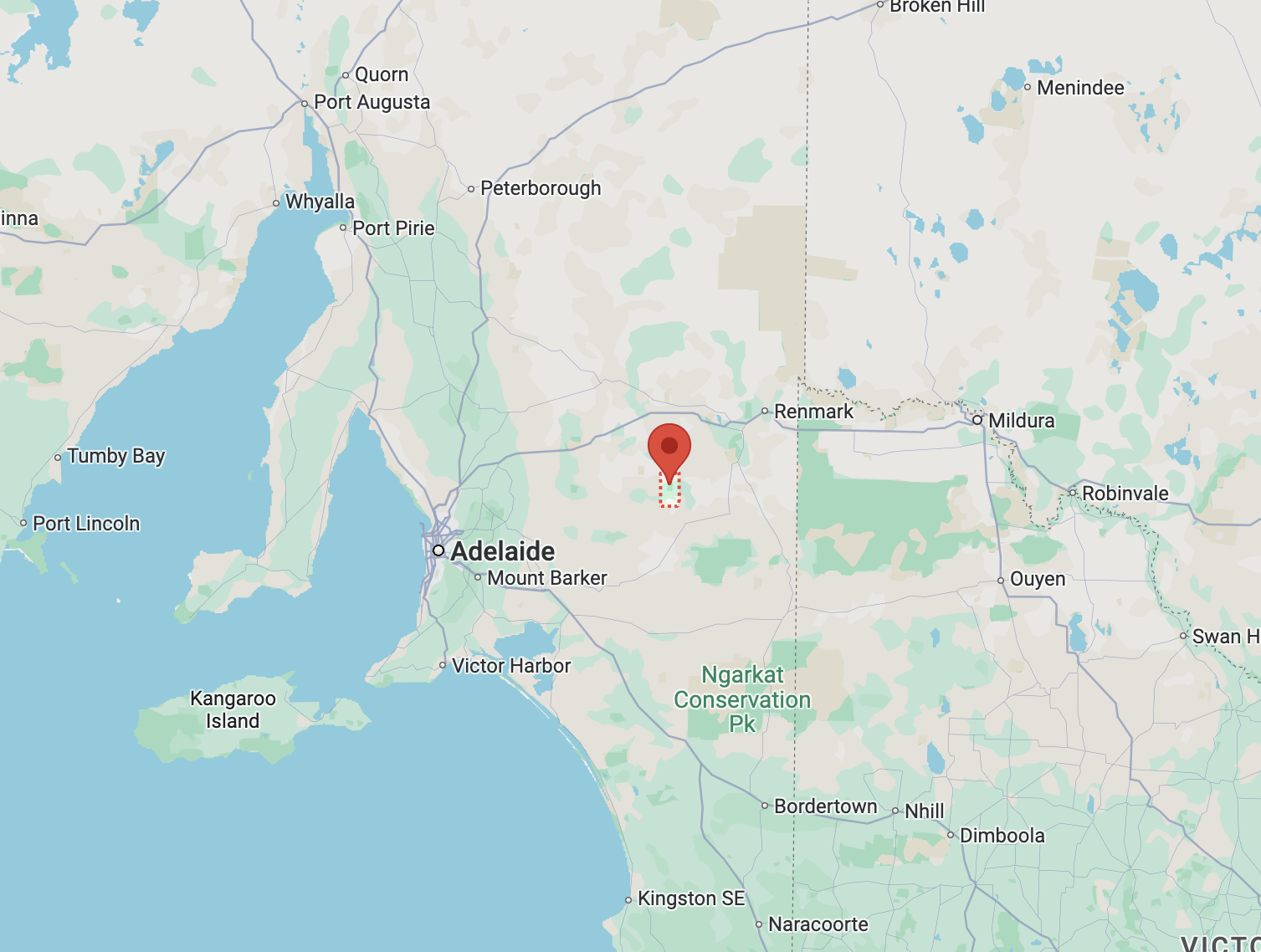
Above:- Map showing the location of Mantung. Map c/o Google Maps.
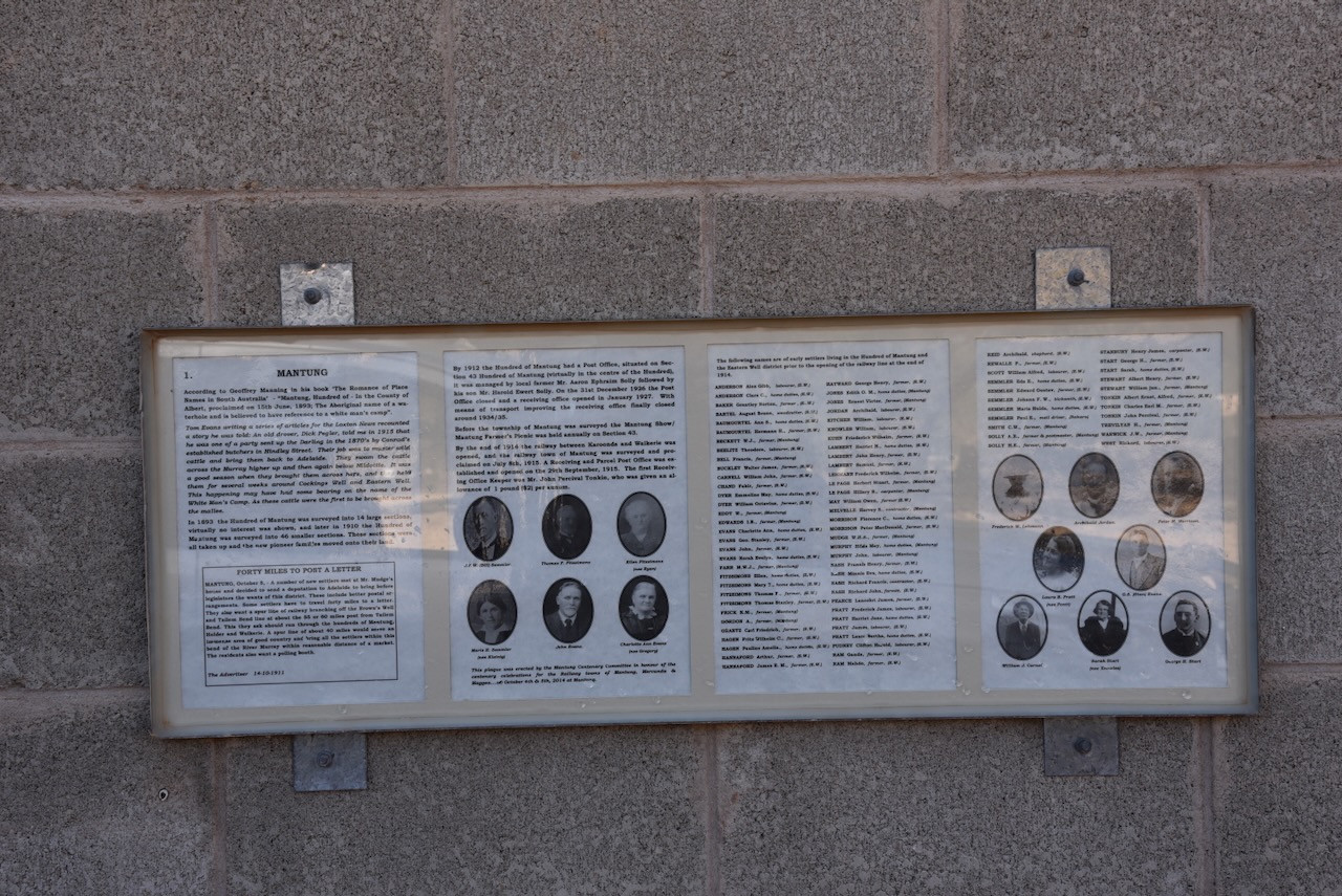
Mantung is an aboriginal word meaning ‘water on a native road’. Nomadic aboriginal people followed sandhills from near Swan Reach via Bakara to Loxton in the Riverland region, obtaining water from mallee trees. The sandhills also contained root foods. When the Hundred of Mantung was proclaimed on the 15th day of June 1893, the name was shown as an Aboriginal waterhole on an 1864 land tenure plan. (Place Names 2012)
The town of Mantung was proclaimed on the 8th day of July 1915. The Post Office was opened as Mantung Railway in September 1915. It became Mantung on the 1st day of September 1966. The Mantung School opened in 1921 and closed in 1944. The school reopened in 1961 and was conducted in the Mantung Hall. (Place Names 2012)
The town was one of several towns along the Waikerie railway line following its opening in 1914. The line branched from the Barmera railway line at Karoonda, which was also the junction for the Peebinga railway line. It extended north, northeast, and north again to Waikerie. (Wikipedia 2024)
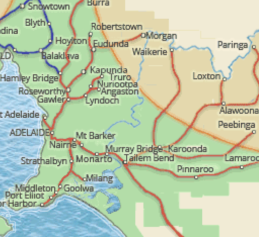
Above:- 1914 map of railway lines in South Australia, showing the Waikerie line. Image c/o railmapsa.au
Mantung once had its own Agricultural Show.
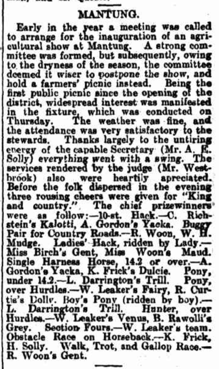
Above:- Article from the Observer, Adelaide, Sat 10 Oct 1914. Image c/o Trove.
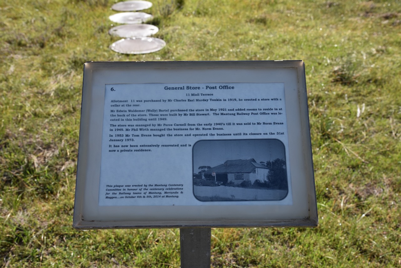
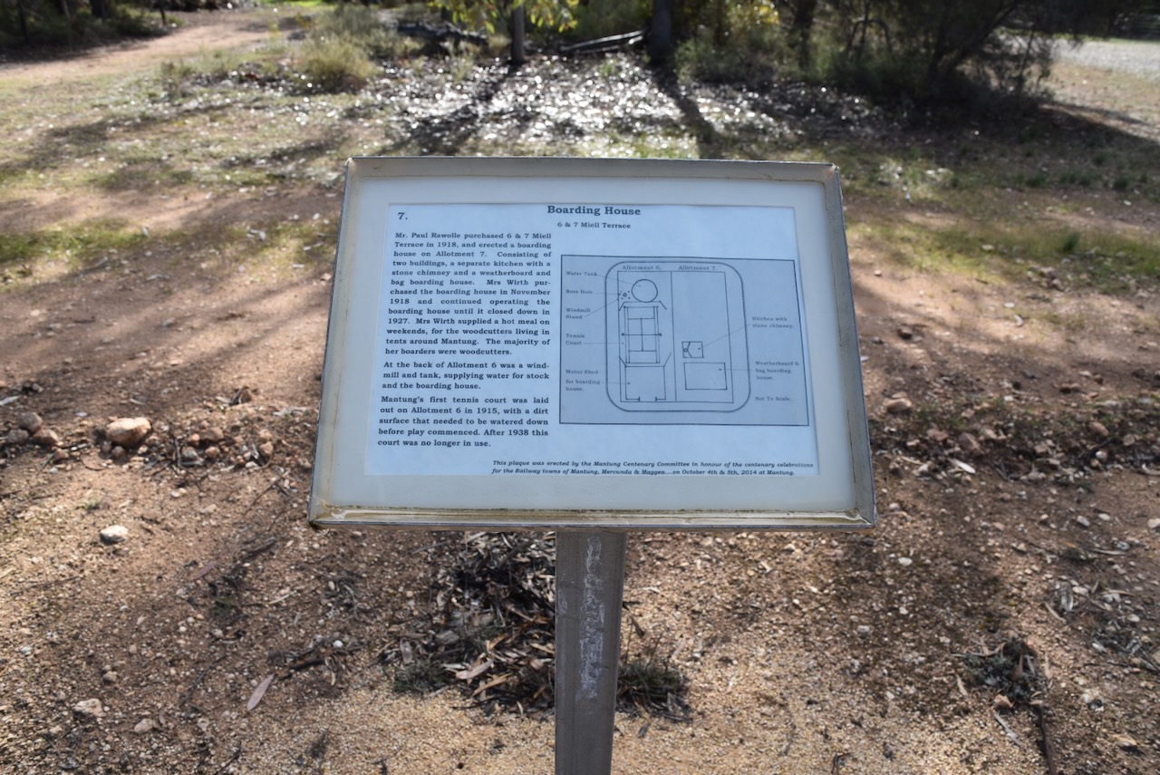
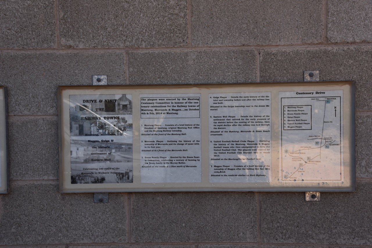
If you are in the district, please take the time to have a look around Mantung. There are several information signs detailing the history of the town and some of the remaining historic buildings.
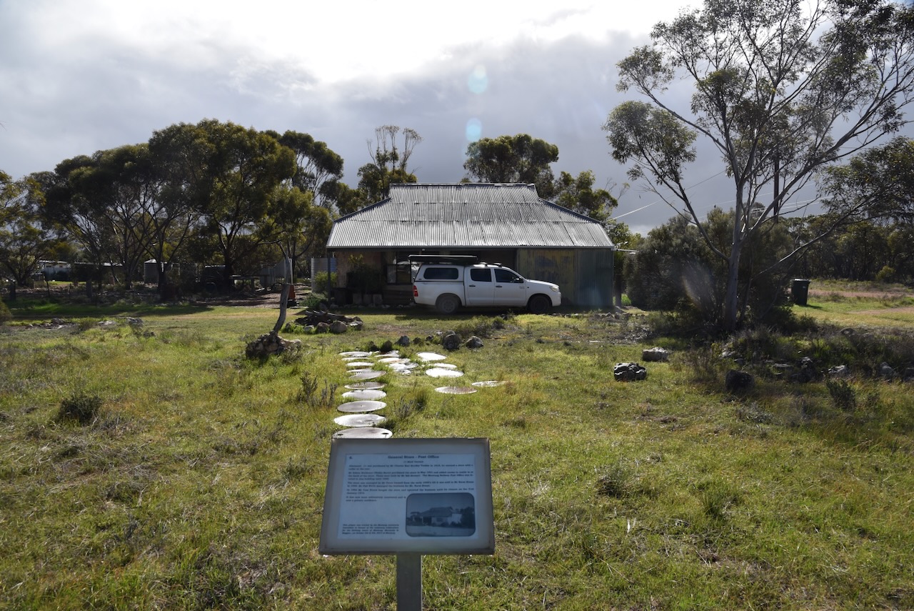
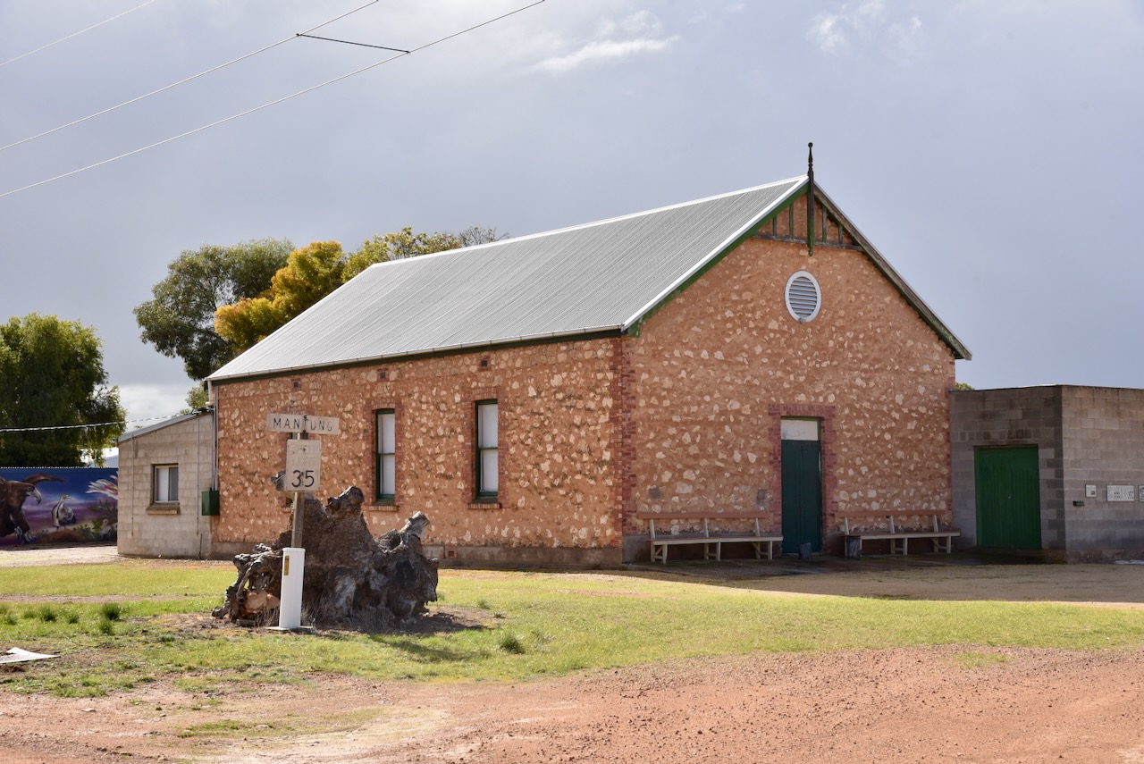
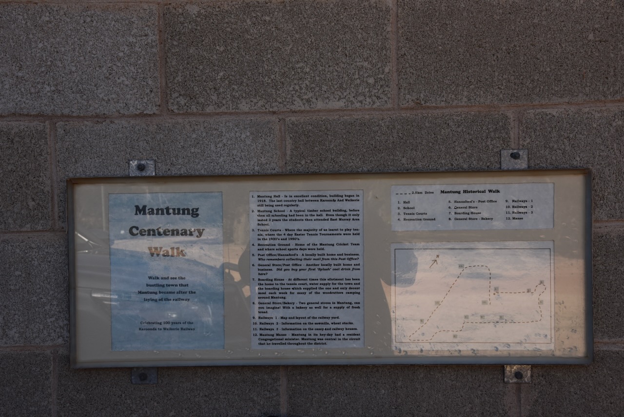
At the Mantung Hall, you can pick up a ‘Mantung Centenary Walk’ brochure that details a very interesting walk around what was once a bustling town.
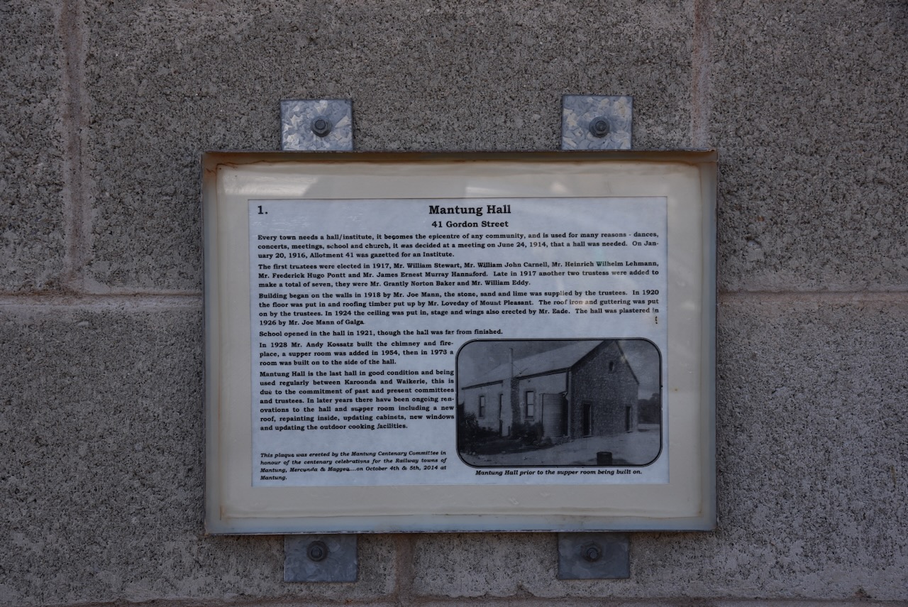
The Mantung Hall was built in 1918. It is the last country hall between Karoonda and Waikerie that is still being used regularly.
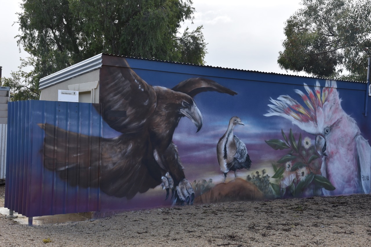
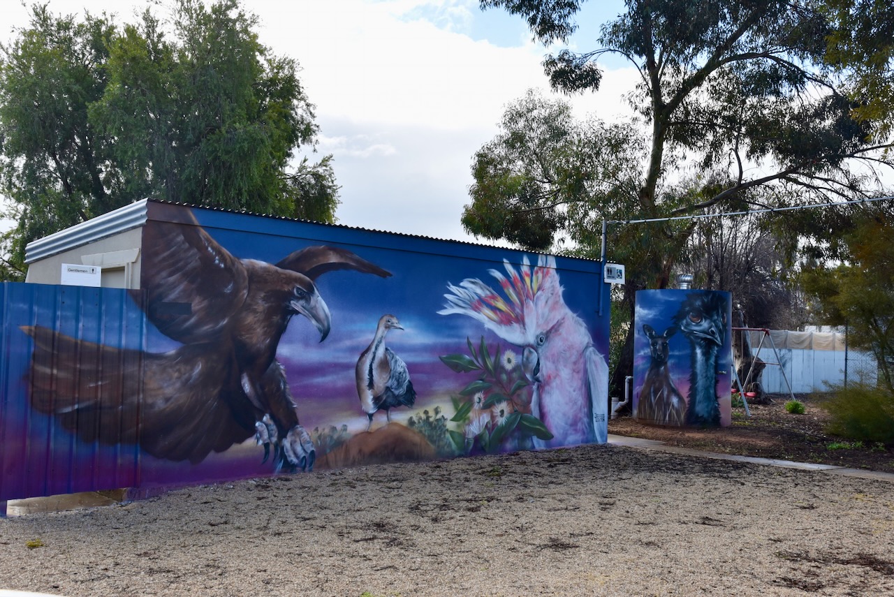
The community hall toilet block at the rear of the hall has been painted by Jarrod Loxton. It features some of the local wildlife including a Wedge Tailed Eagle, Mallee fowl, and a Major Mitchell Cockatoo. (Karoonda 2024)
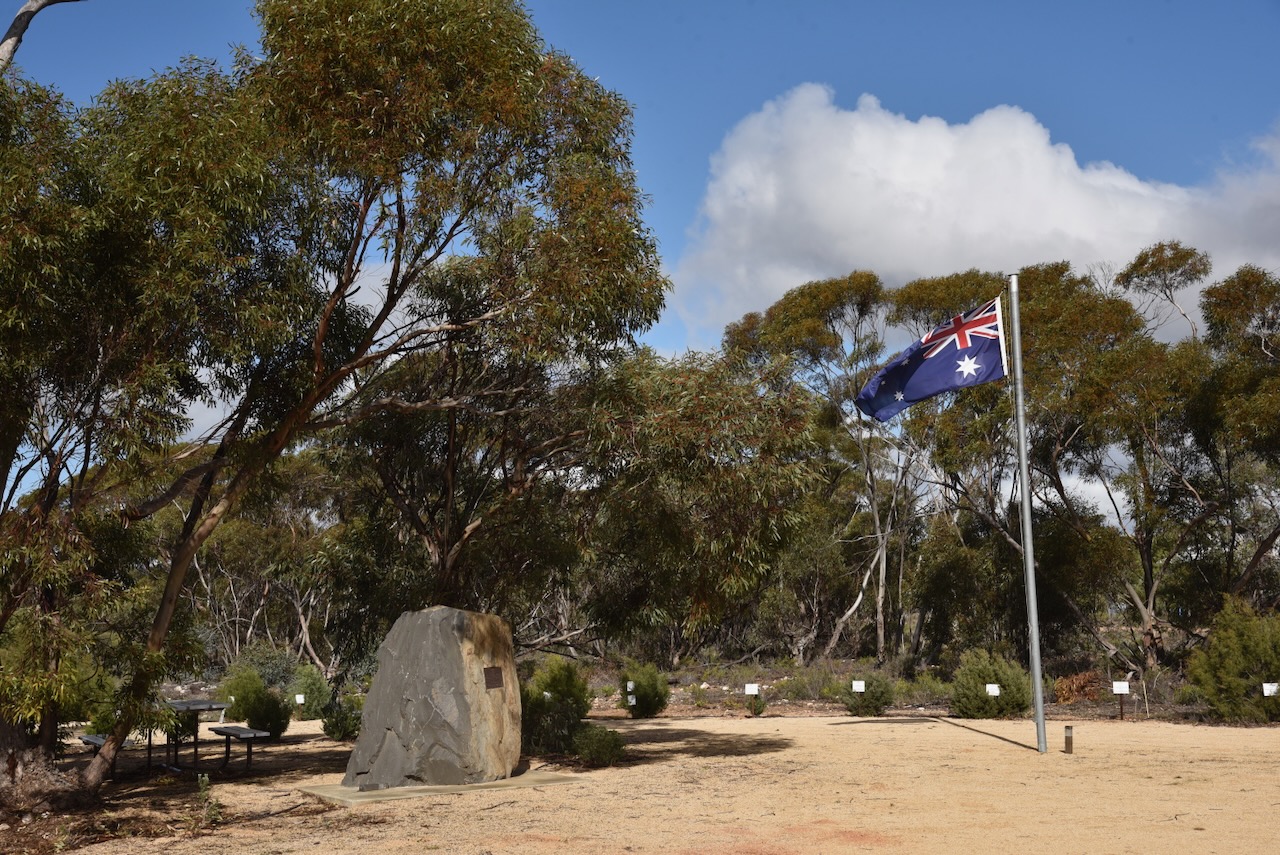
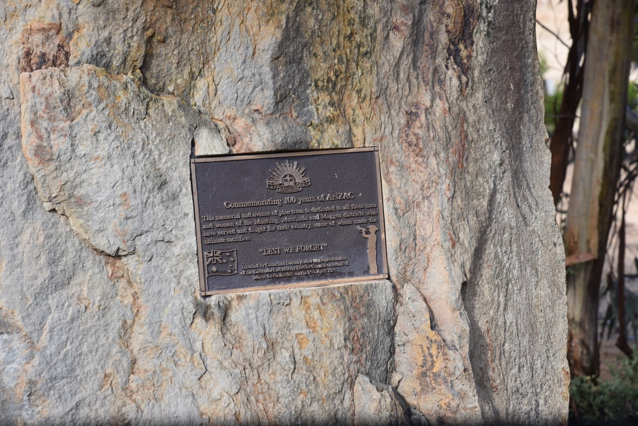
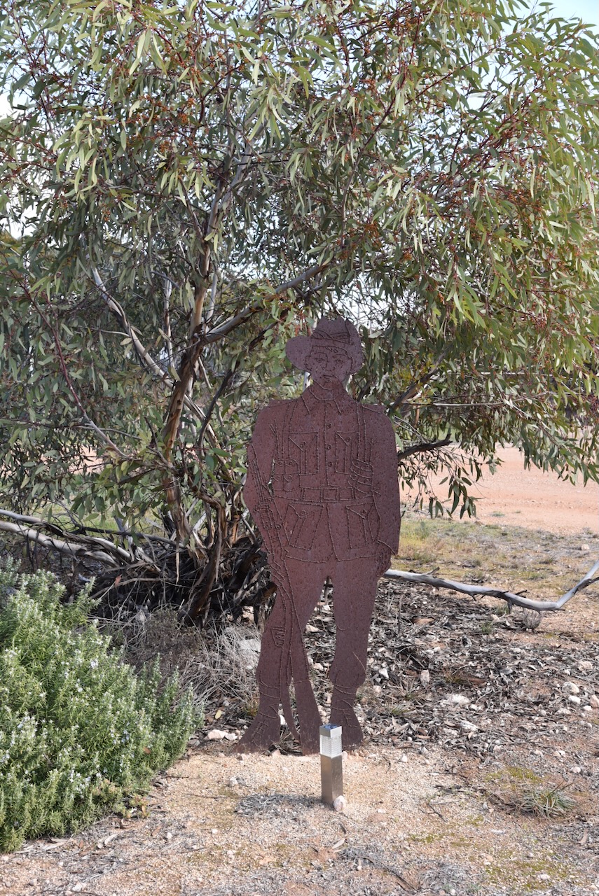
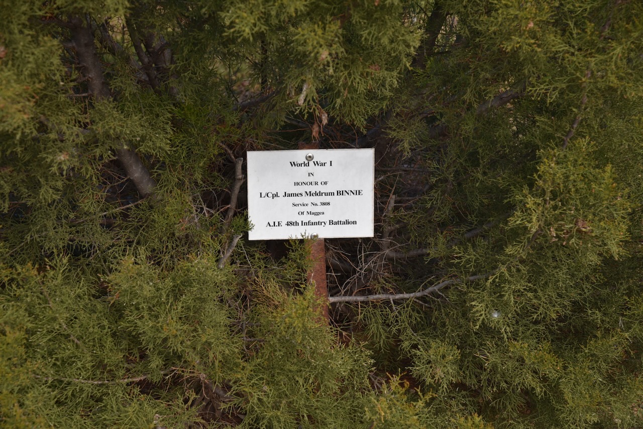
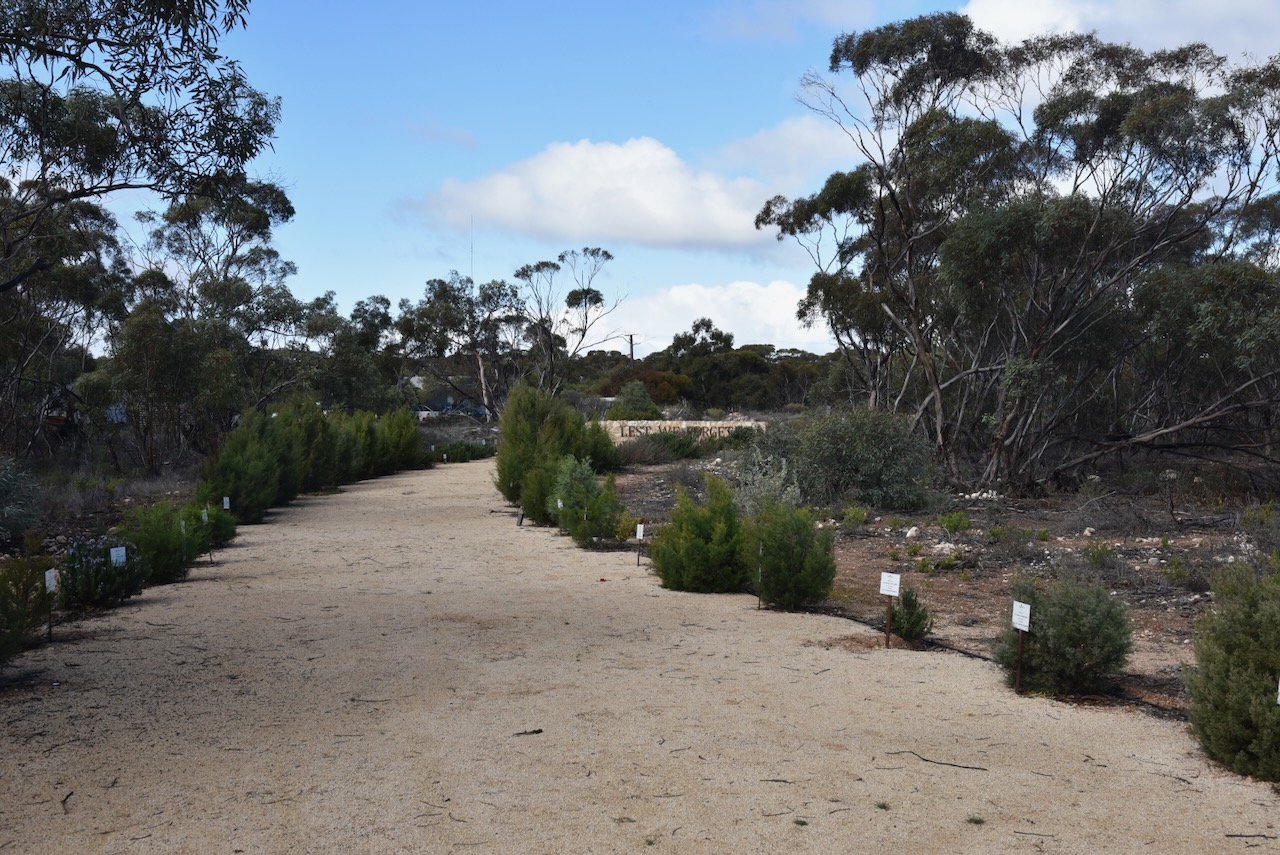
Adjacent to the hall is the Mantung War Memorial. It includes an avenue of pine trees to commemorate the men and women of the district who have served in the various conflicts in which Australia has been involved (Monument Australia 2024)
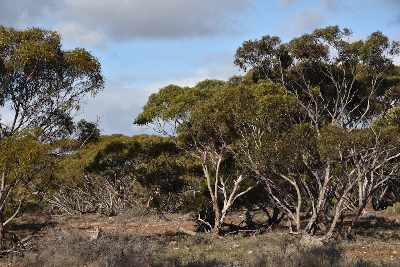
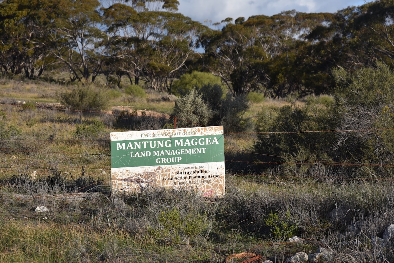
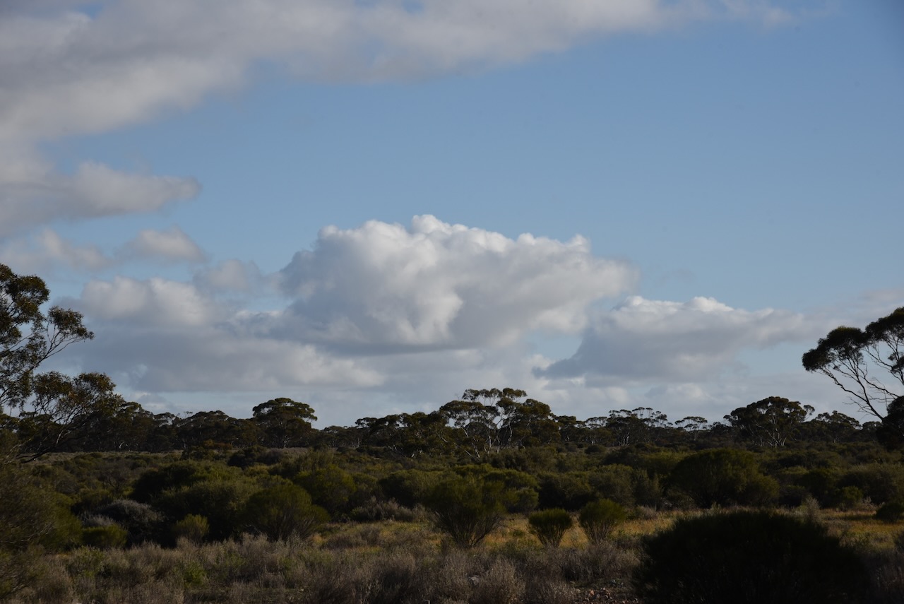
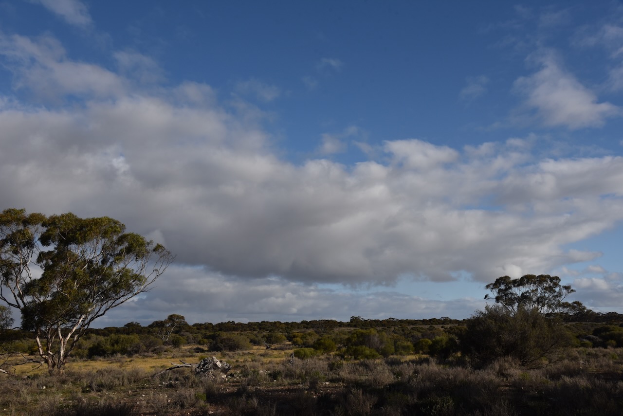
The Mantung Conservation Park is about 1,695 hectares in size and was proclaimed on the 16th day of October 2014. (Wikipedia 2024)
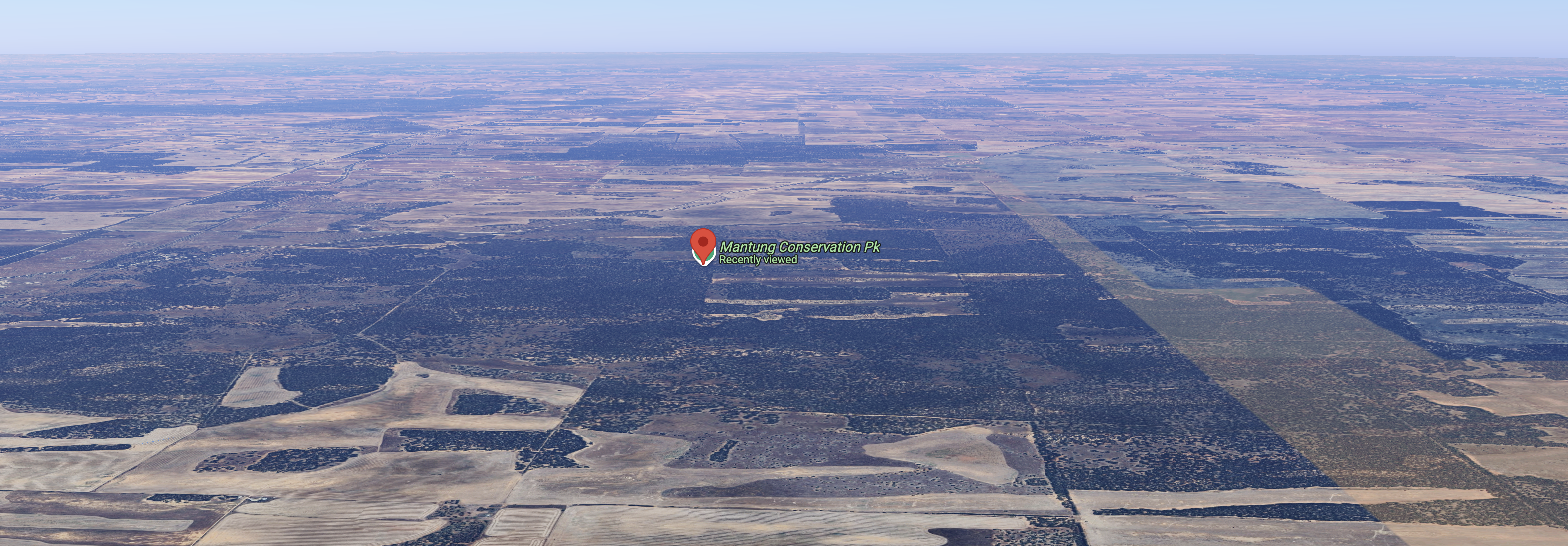
Above:- An aerial view of the park looking north. Image c/o Google Maps.
The park contains the largest intact remnant of deep sand habitat in the Northern Murray Mallee. It supports several rare plant species including the rasp daisy bush. It is also contains significant habitat for several endangered bird species including malleefowl, southern scrub-robin, shy heathwren, inland thornbill, white-browed babbler and purple-gaped honeyeater. (Nat Resources 2014)
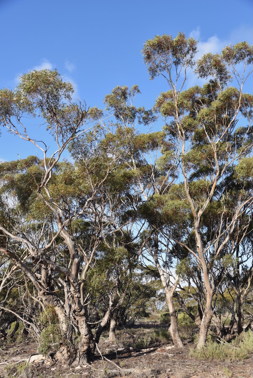
I set up in a cleared area of the scrub and ran the Yaesu FT857, 40 watts, and the 20/40/80m linked dipole for this activation.
I ended up logging a total of 91 QSOs including 9 Park to Park contacts.
I worked the following stations on 40m SSB:-
- VK3VIN
- Vk3ACZ
- VK3FAR
- VK2SLB
- VK2BRN
- VK2KBT
- VK5FD
- VK5HS
- VK3PWG
- VK2R/p (Sydney Harbour National Park VKFF-0473 & lighthouse AU-0041)
- VK5PE
- VK4DNO
- VK5DW
- VK1AAF
- VK2GOM/p (Meroo National Park VKFF-0312)
- VK2VAR/p (Meroo National Park VKFF-0312)
- VK5FBIC
- VK3OAK
- VK5STU
- VK3ASU
- VK3CAT
- VK2PKT
- VK3KRL
- VK3SCS
- VK5LA
- VK5KAW
- VJ5Z
- VK5DC
- VK2VW
- VK2HFI
- VK2AKA
- VK2BUG
- VK5PL
- VK5AYL
- VK5CHD
- VK3PF/p (Moorabbee Shoreline Geological Reserve VKFF-3774)
- VK5TR
- VK4FDJL
- VK4WAB
- VK5FANA
I worked the following stations on 20m SSB:-
- ZL6CC (Lighthouse ZL-0001)
- ZL4KD
- VK7AAE
- KG5CIK
- VK5HS
- VK6JK
- VK5QA/4
- VK3CLD/4
- VK1AO/8
- VK2MET/8
- VK3PF/p (Moorabbee Shoreline Geological Reserve VKFF-3774)
- VK4HNS
- VK3AWA
- IK4IDF
- DL2ND
- OH6GAZ
- DL1EBR
- OH1CM
- SQ9CWO
- OH5TQ
- OH1XT
- IZ5JMZ
- VK3ZPF/p (Upper Beaconsfield Nature Conservation Reserve VKFF-2219)
- VK5DW
- OH5EP
- OH1MM
- EC4AT
- VK4FOX
- VK8HPB/p
- F4JJS
- SQ2LKY
- HB0OAB
- ON4VT
- VK2GOM/p (Meroo National Park VKFF-0312)
- VK2VAR/p (Meroo National Park VKFF-0312)
- IK1GPG
- DL7CX
- GI0CWV/p
- DK4RM
- EA5GVV
- ZL2UGL
- F1BLL
- DJ6EA
- VK2R/P (Sydney Harbour National Park VKFF-0473 & lighthouse AU-0041)
- OE6BFF
- M7YET
- S58AL
- VK4PDX
- VK4GHL (Lighthouse AU-0019)
- VK3SX
- VK2CQ
References.
- Karoonda. (2022). Mantung Painted Mural. [online] Available at: https://www.karoonda.com/see-do/art-galleries-sculptures/mantung-painted-mural [Accessed 1 Sep. 2024].
- UBC Web Design (2021). Mantung War Memorial | Monument Australia. [online] Monumentaustralia.org.au. Available at: https://monumentaustralia.org.au/themes/conflict/multiple/display/117619-mantung-war-memorial-/ [Accessed 1 Sep. 2024].
- Water (DEW), D. for E. and (2014). Select a region. [online] http://www.naturalresources.sa.gov.au. Available at: http://www.naturalresources.sa.gov.au. [Accessed 1 Sep. 2024].
- Wikipedia Contributors (2024). Waikerie railway line. [online] Wikipedia. Available at: https://en.wikipedia.org/wiki/Waikerie_railway_line [Accessed 1 Sep. 2024].
- Wikipedia Contributors (2024). Mantung Conservation Park. [online] Wikipedia. Available at: https://en.wikipedia.org/wiki/Mantung_Conservation_Park [Accessed 1 Sep. 2024].
