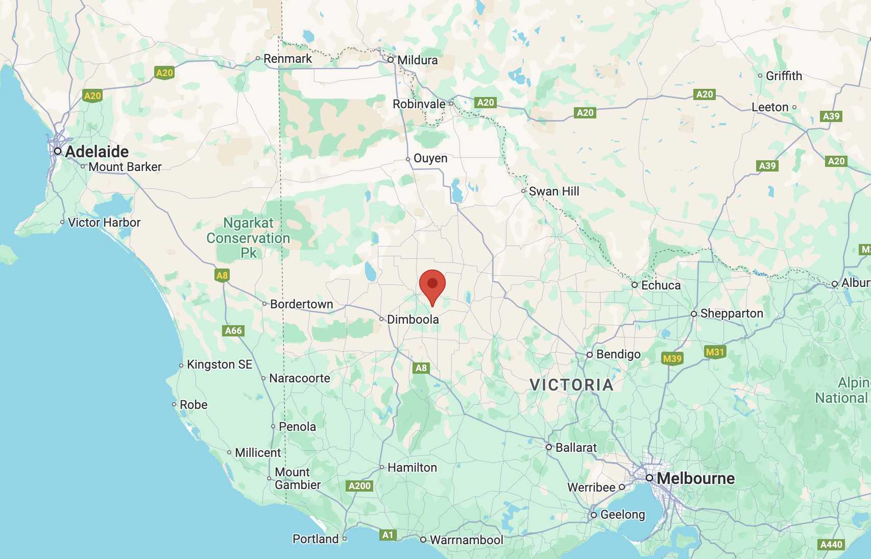
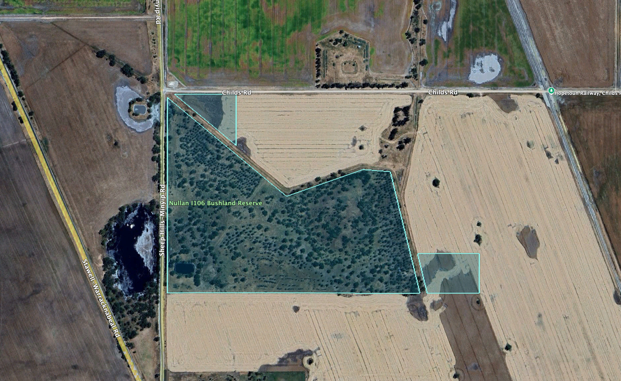
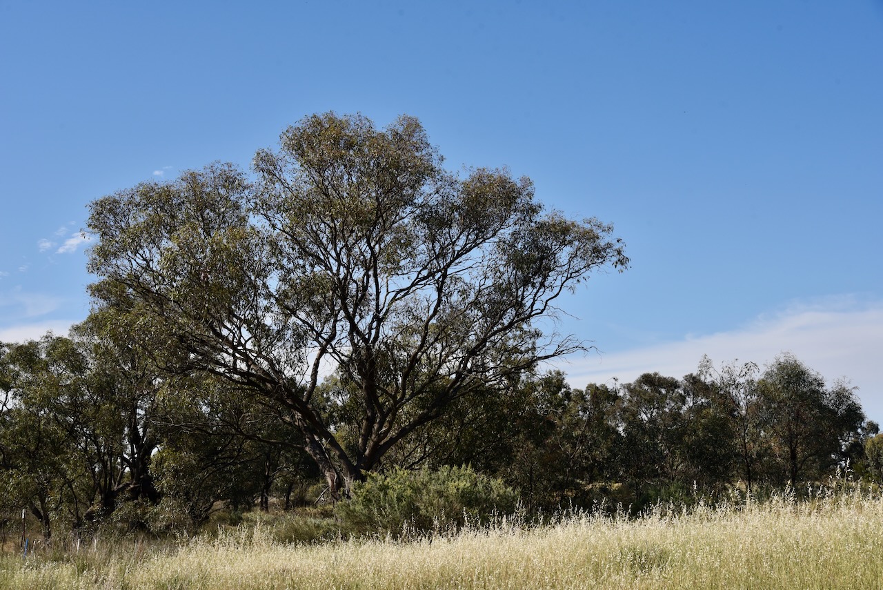
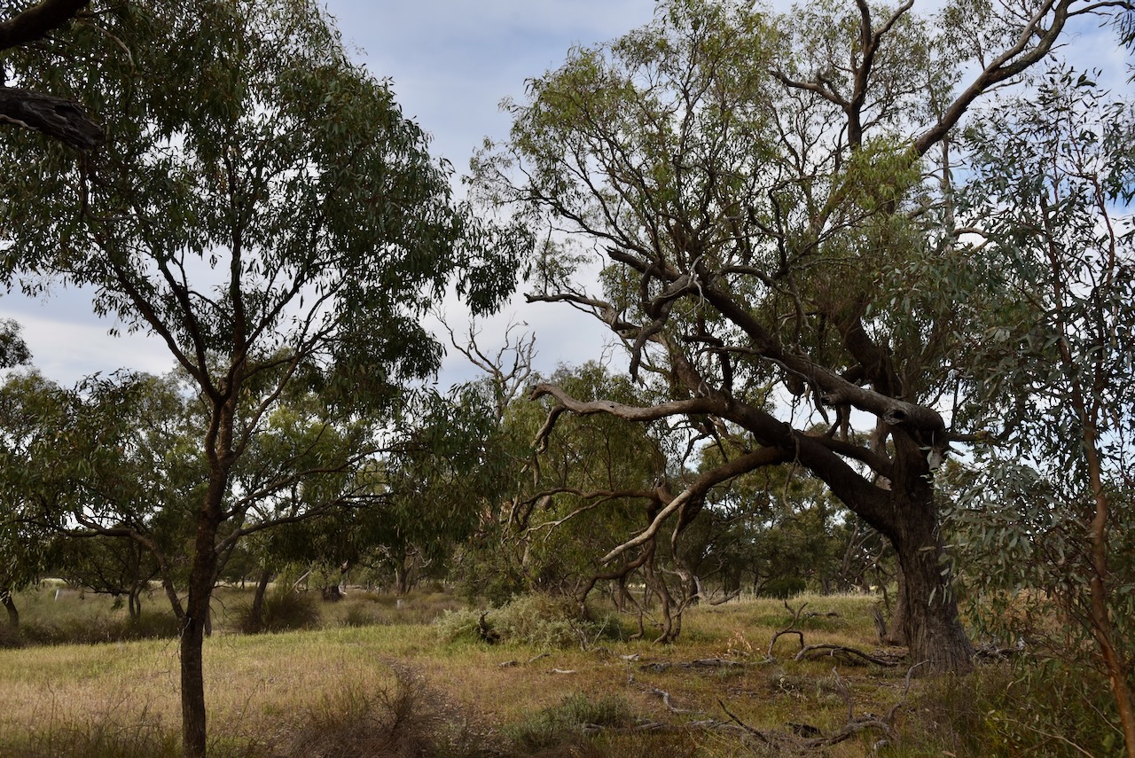
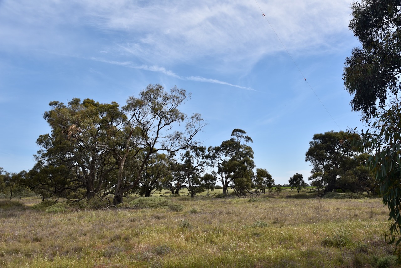
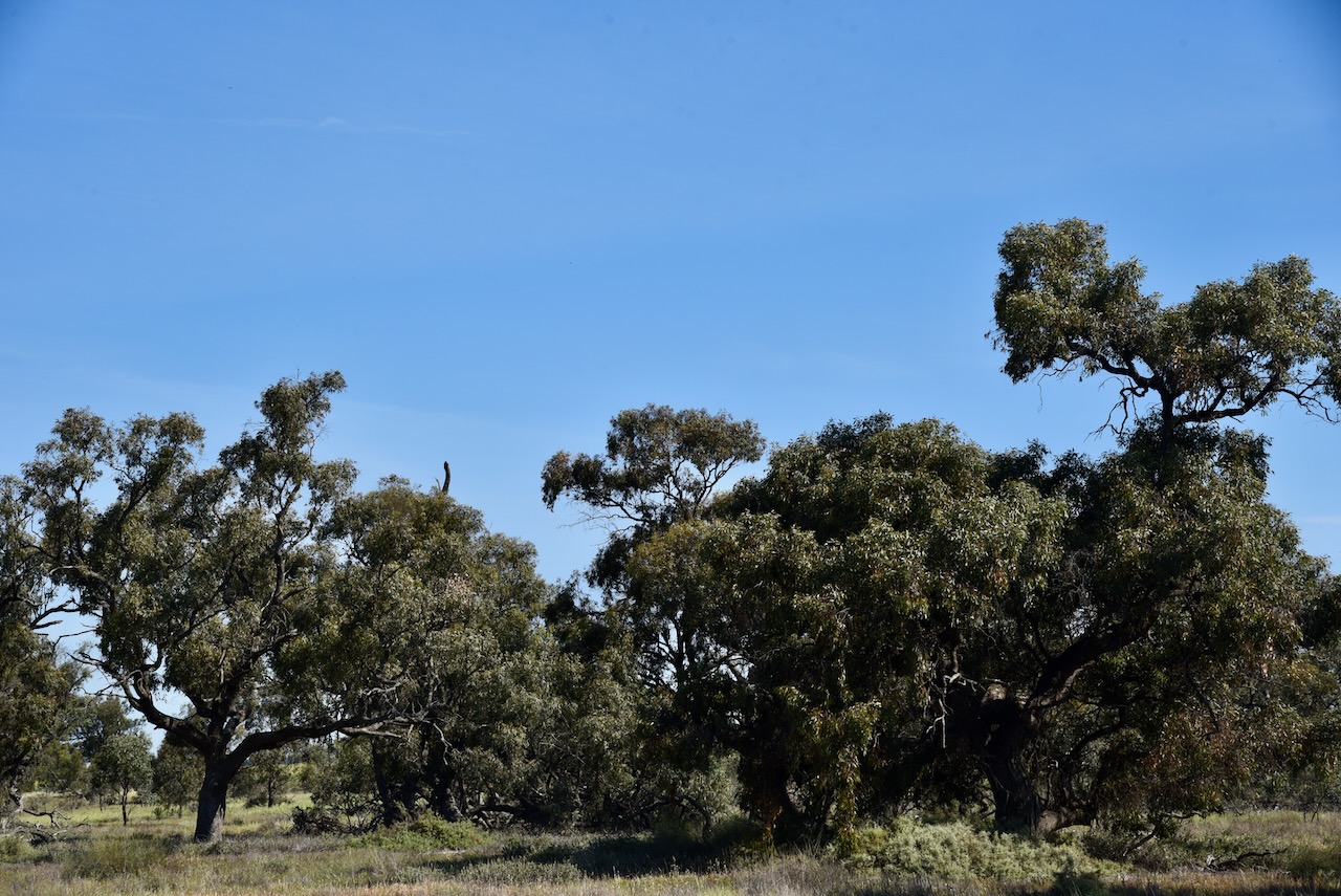
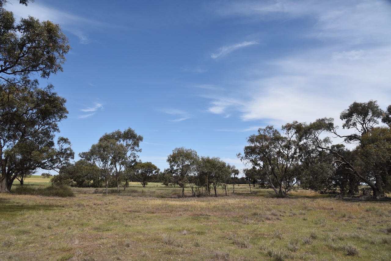
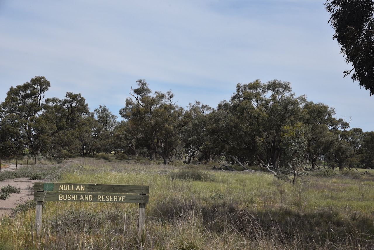
Our third park for Monday 21st October 2024 was the Nullan I106 Bushland Reserve VKFF-5671, also known as the Tarkedia Bushland Reserve.
The park is located about 21 km southeast of Warracknabeal.
Above:- Map showing the location of the Nullan I106 Bushland Reserve. Map c/o Google Maps.
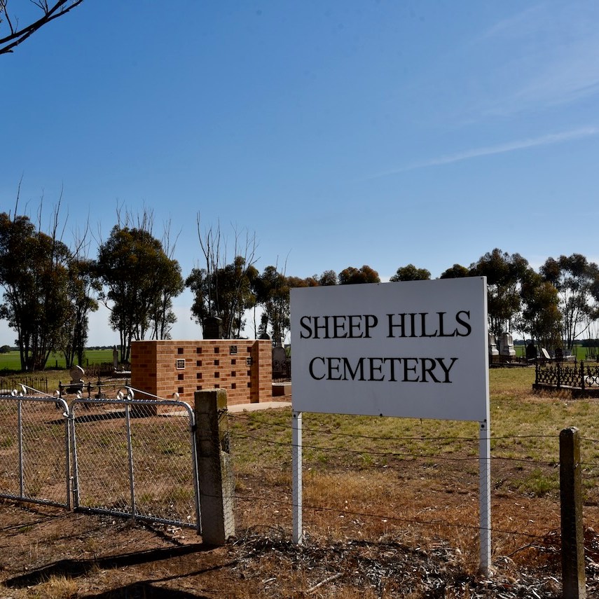
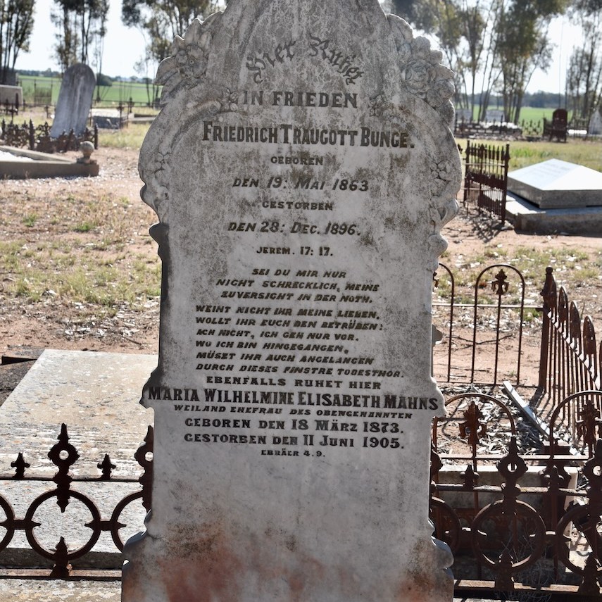
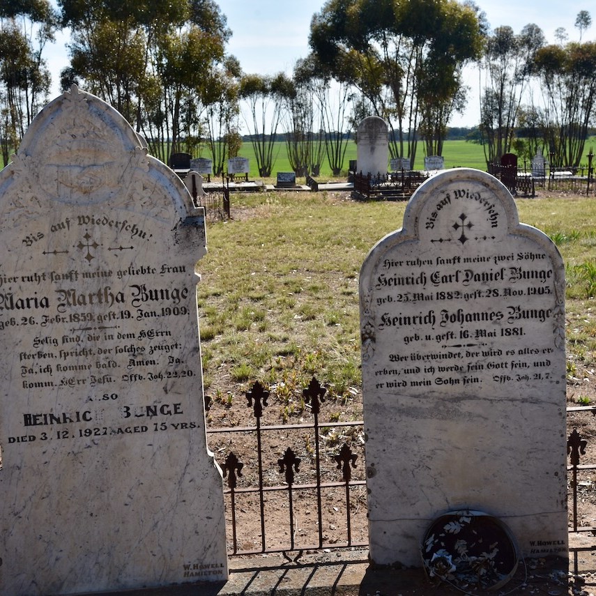
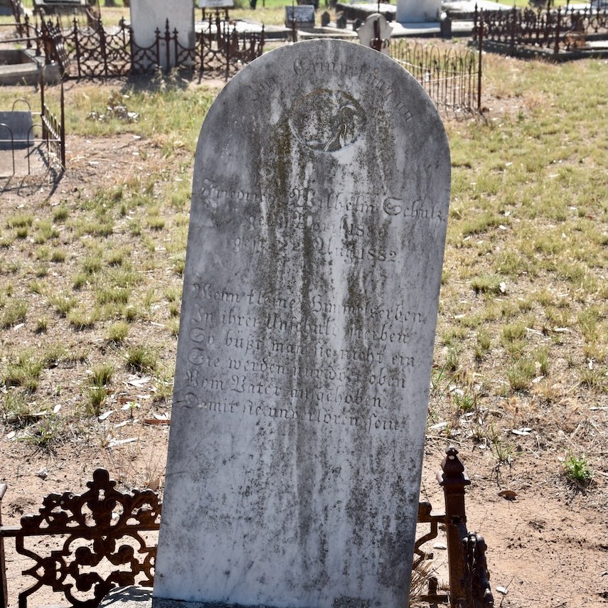
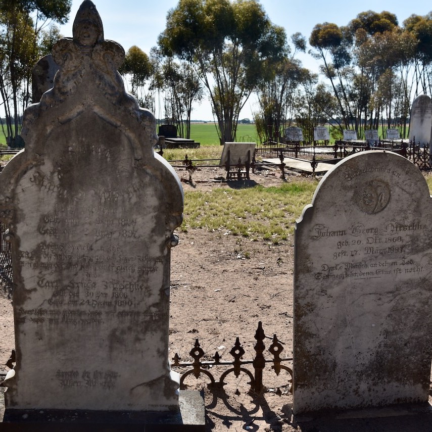
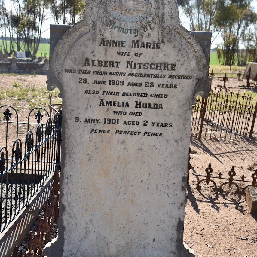
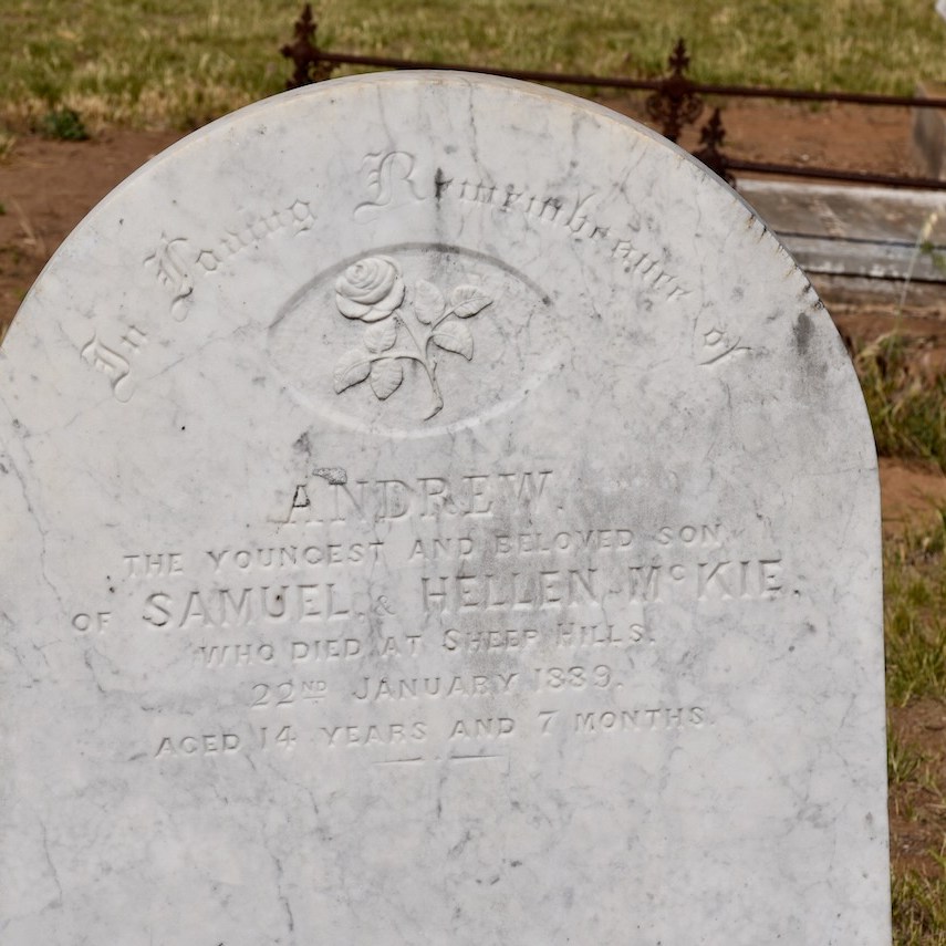
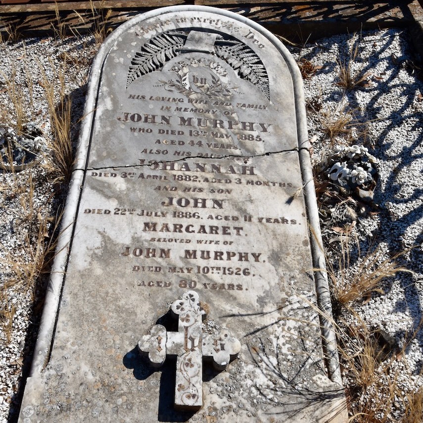
Prior to activating the park, Marija and I paid a quick visit to the Sheep Hills cemetery. This historic cemetery features the headstones of numerous Prussian settlers. People often refer to these settlers as German, however this is not quite true. There was no such place as Germany at that time. The Kingdom of Prussia includes parts of modern-day Germany, Poland and the Czech Republic.
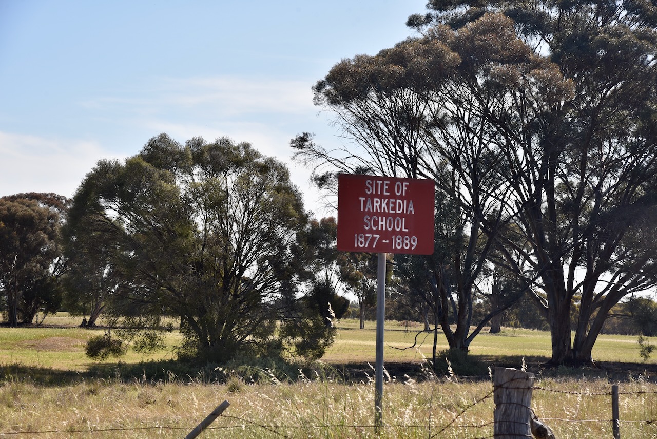
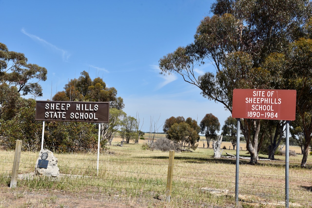
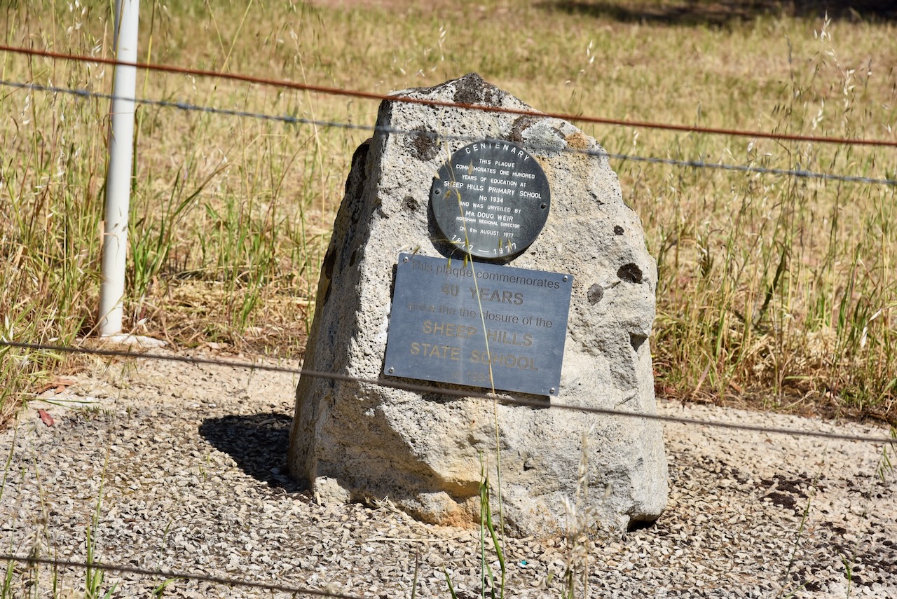
We continued on to the park, stopping briefly at the site of the old Tarkedia School which operated from 1877 to 1889.
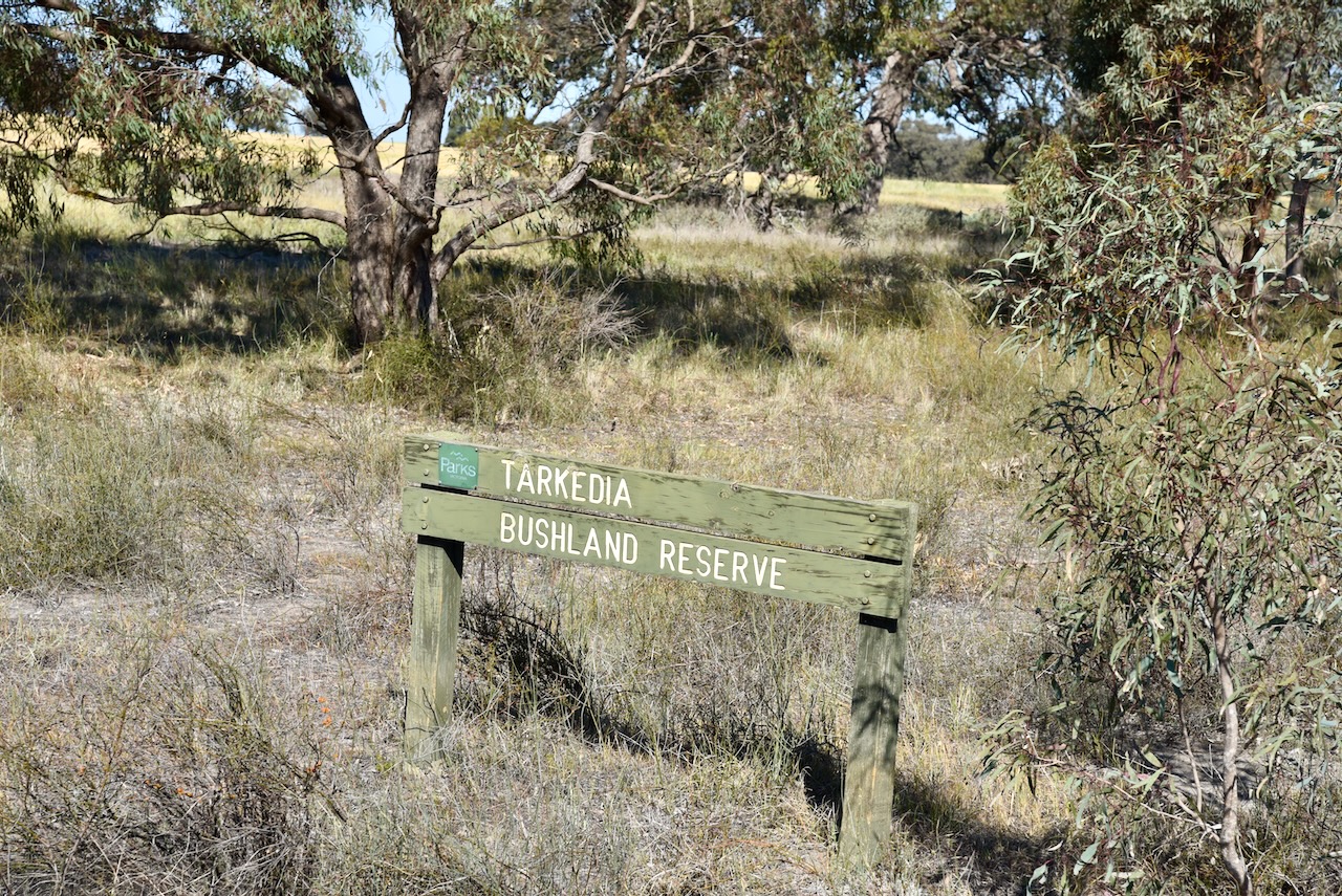
Tarkedia is the former name of Sheep Hills. It is believed that Tarkedia is derived from the aboriginal word tarkeeth meaning swamp. (Blake 1978)
The reserve is located on the southeast corner of Childs Road and Sheep Hills-Minyip Road.
Above:- An aerial view of the Nullan I106 Bushland Reserve. Image c/o Google Earth.
The reserve is about 29 hectares in size and was established on the 22nd day of September 1987. (CAPAD 2022)
We started off on 20m and were rewarded with some European DX on the long path. We ran the Yaesu FT857, 40 watts, and the 20/40/80m linked dipole.
Marija worked the following stations on 20m SSB:-
VK2VW
VK2HFI
VK2AKA
VK2BUG
VK1AO
VK2MET
ZL1TM
VK4NH
VK4DXA
VK4EMP
VK4TI
VK4GKO
VK3MCA/p (Langley I96 Bushland Reserve VKFF-5340)
Marija and I ran the Yaesu FT857, 40 watts, and the 20/40/80m linked dipole for this activation.
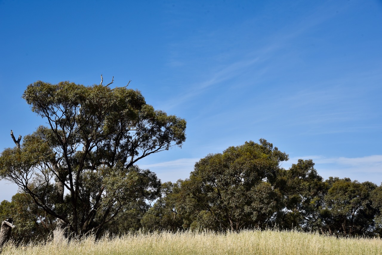
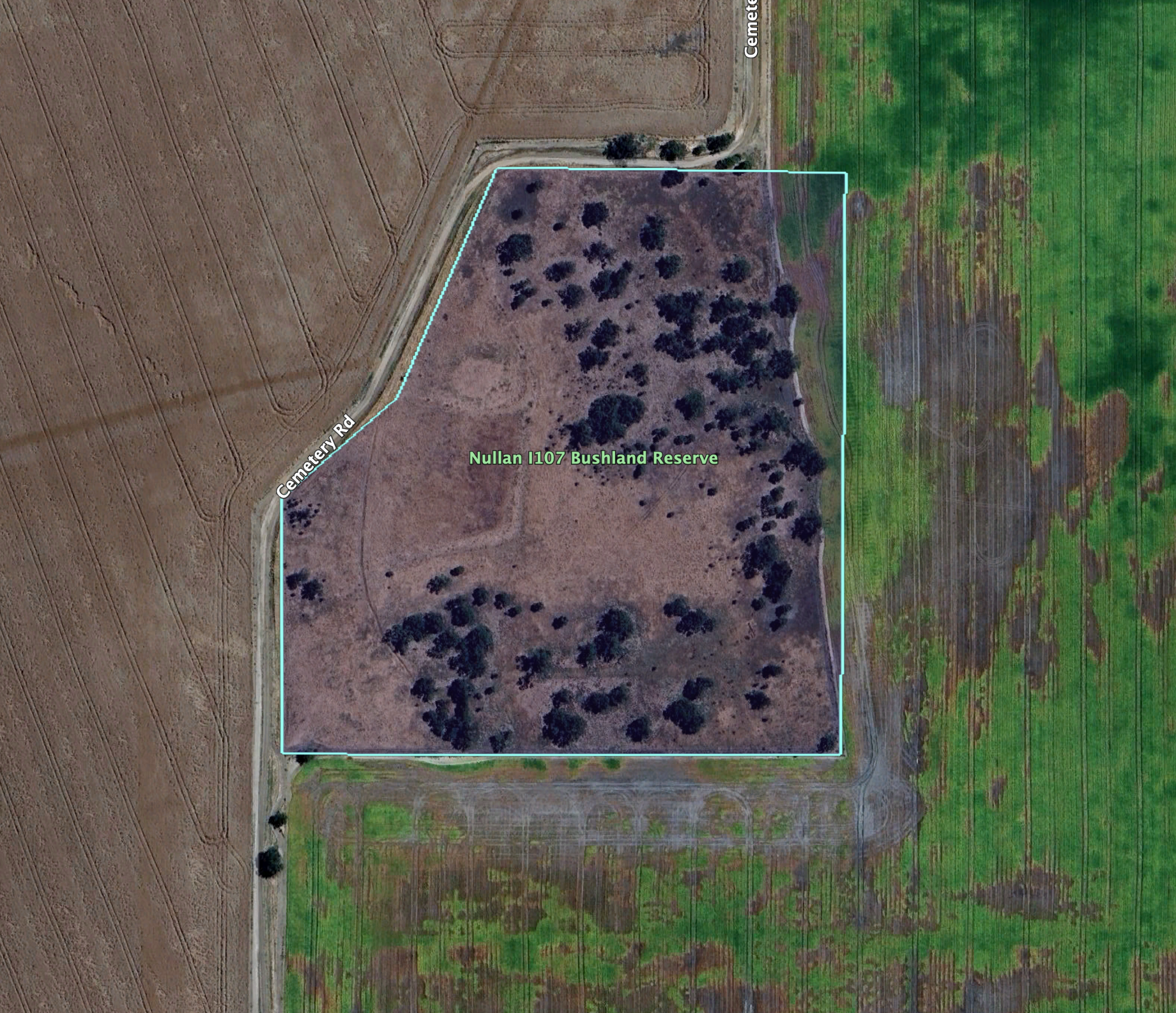
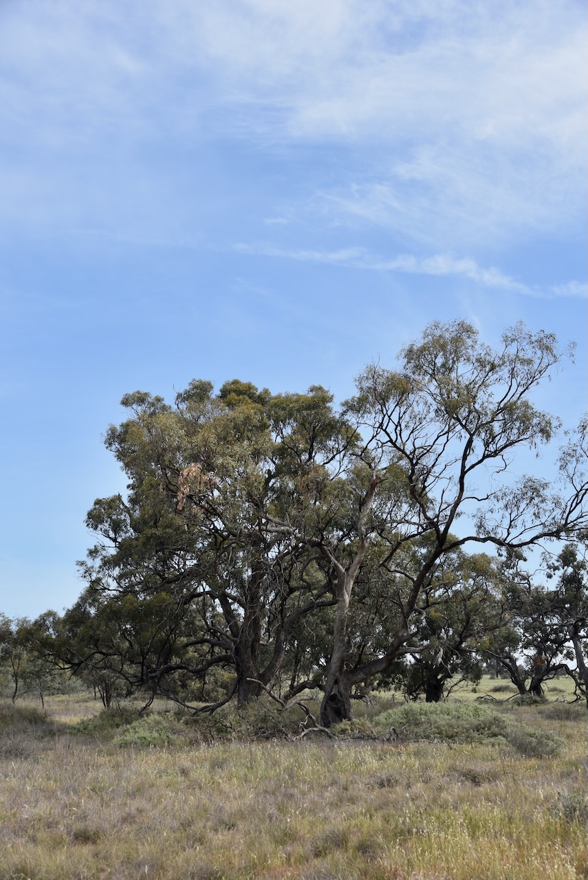
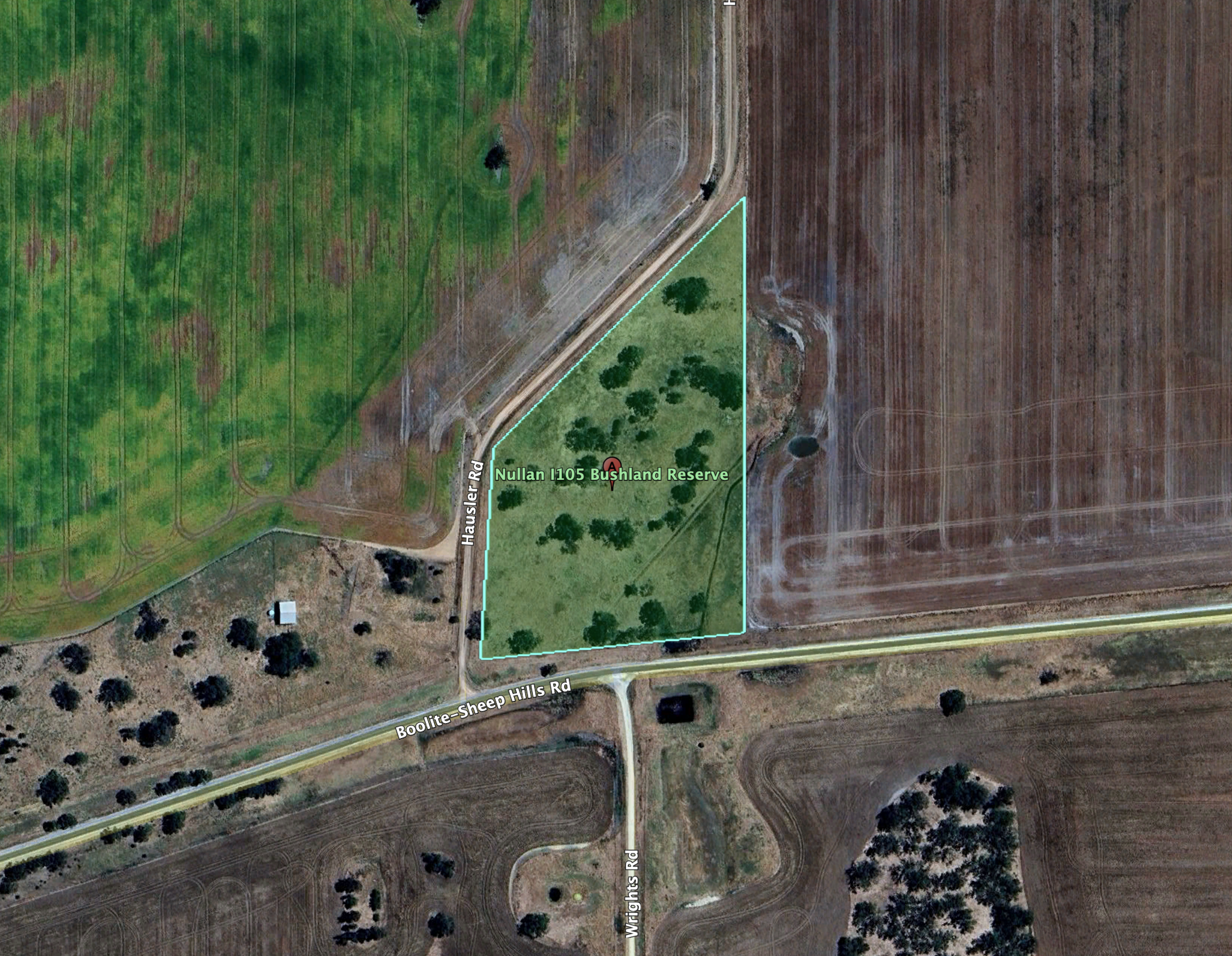
Our next activation on Monday 21st October 2024 was the Nullan I105 Bushland Reserve VKFF-5670.
The park is located about 21 km southeast of Warracknabeal.
Above:- Map showing the location of the Nullan I105 Bushland Reserve. Map c/o Google Maps.
The reserve is located on the corner of Boolite-Sheep Hills Road and Hausler Road.
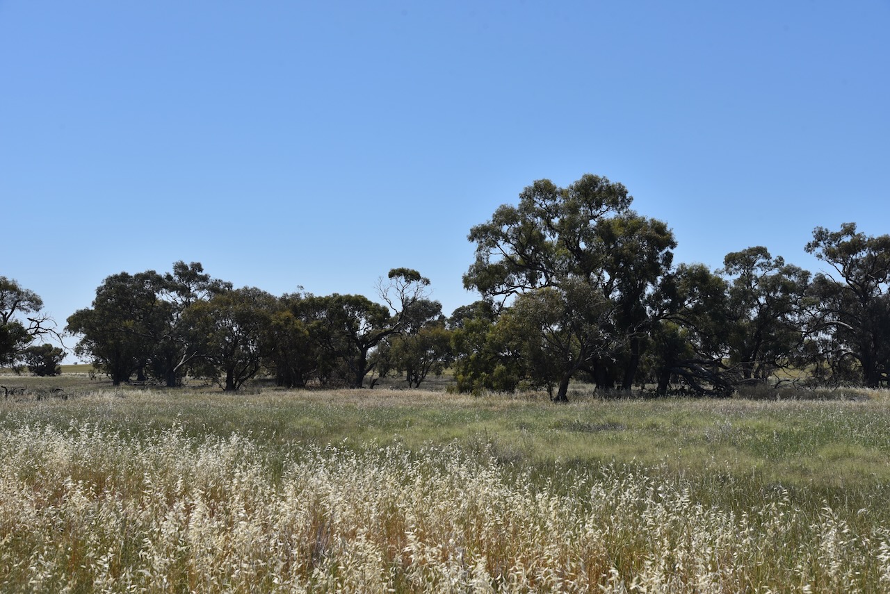
Above:- Aerial view of the Nullan I105 Bushland Reserve. Image c/o Google Earth.
Nullan is a derivative of the aboriginal words nullan nullan meaning blows (with a club). (Blake 1978)
The reserve is about 3.3 hectares in size and was established on the 22nd day of September 1987. (CAPAD 2022)
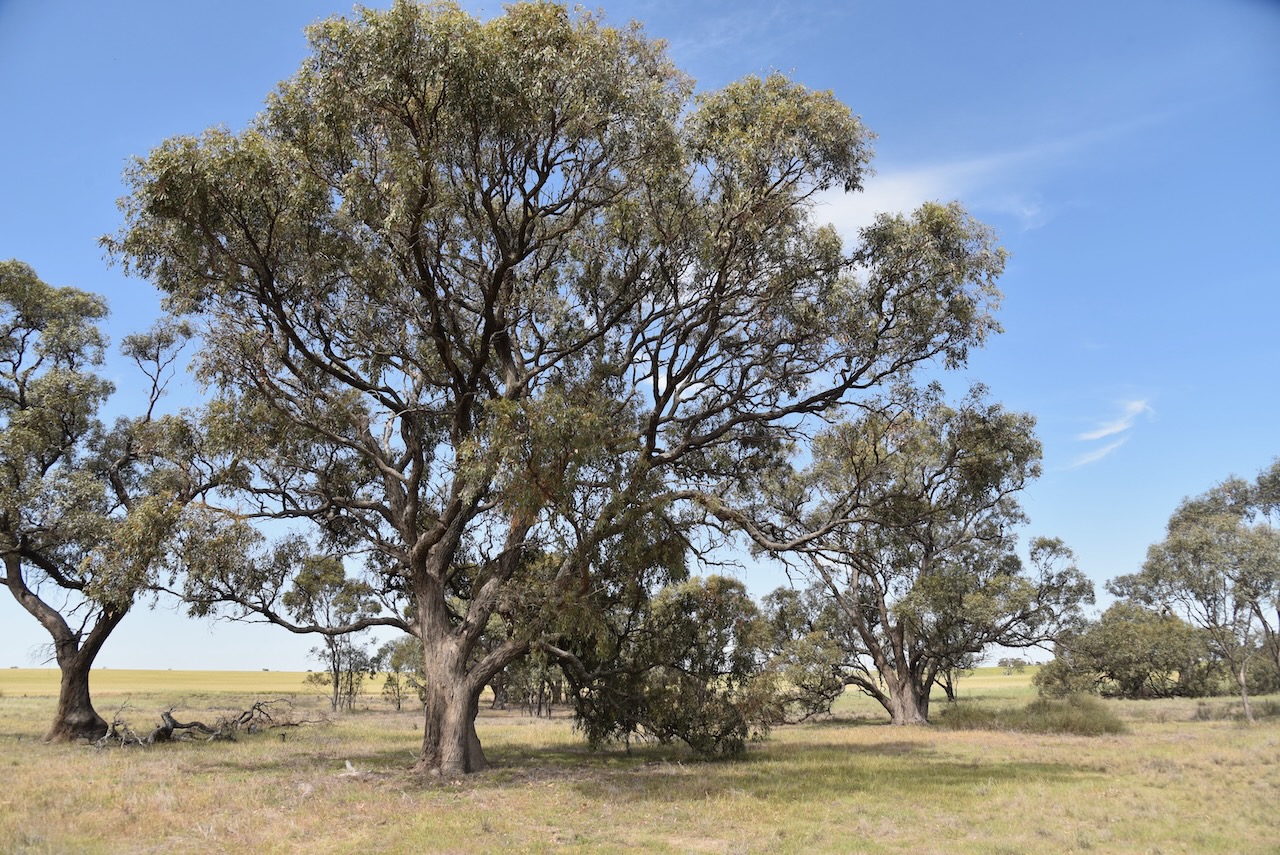
This was an easy park to access. There was no fencing, so we drove in and set up. We ran the Yaesu FT857, 40 watts, and the 20/40/80m linked dipole supported by the 7-metre telescopic squid pole.
The band conditions were quite good and we both qualified the park easily with 10 QSOs. I went on to get 44 to qualify the park for the global WWF program.
On Monday 21st October 2024, Marija and I headed down the main street of Warracknabeal to one of the local cafes for a cooked breakfast and some coffee.
After breakfast, we decided to have a good look around Warracknabeal before doing any park or silo activations.
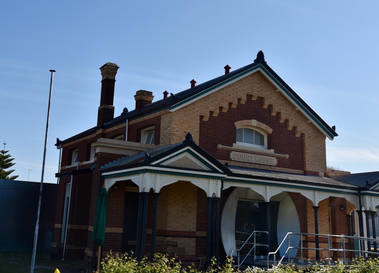
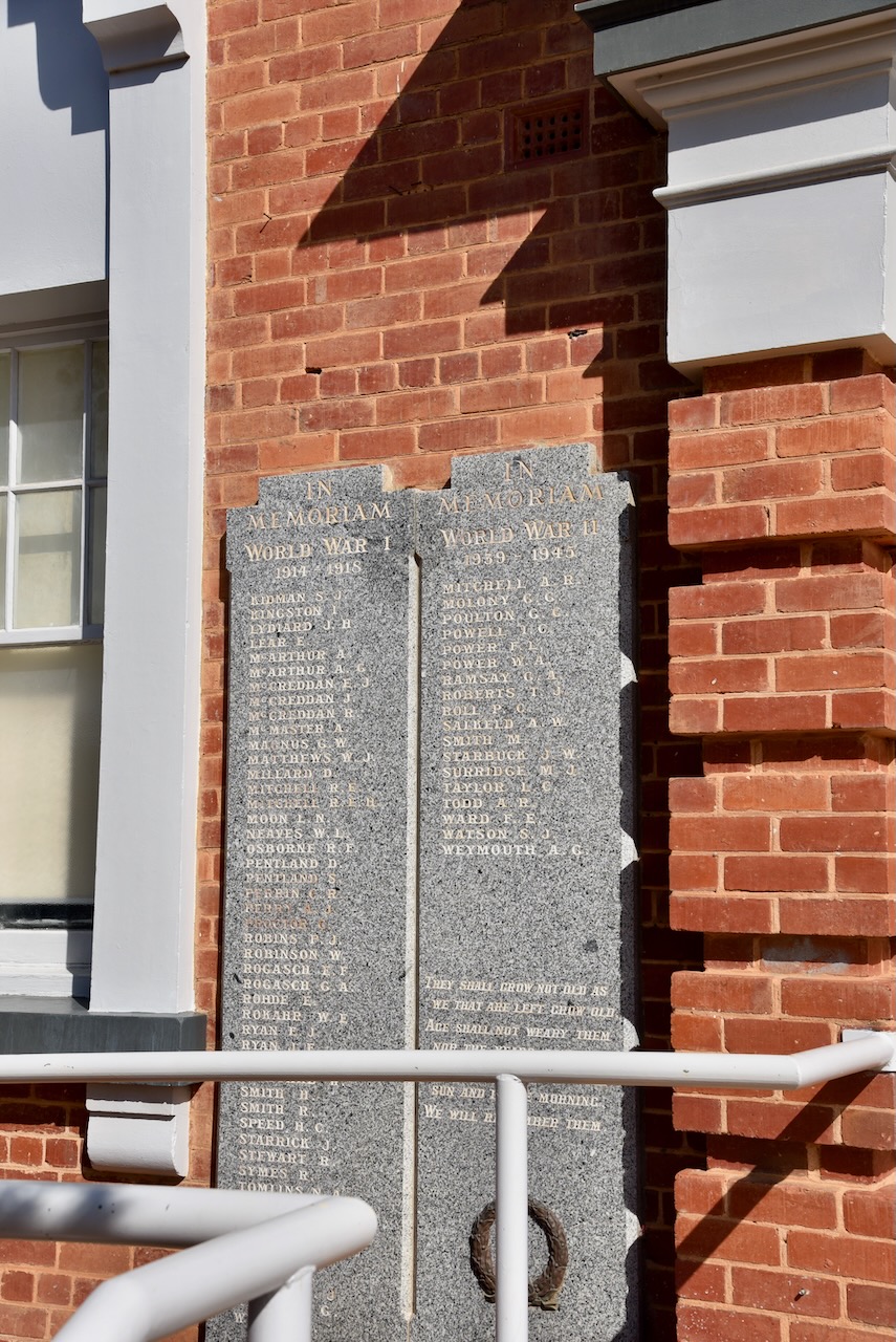
Our first stop was the old Warracknabeal Court House which was constructed in 1889/1890. The building of the Court House followed a population boom in northwest Victoria during the 1870s to 1880s. The building has stepped brickwork in the principal gable, a transverse verandah, an elaborate frieze, and gabled end pavilions. The Court House commenced its life as a Court of Petty Sessions. It continued to function as a courthouse until 1989. Since that time the building has been used by the Lands and Survey Department, an Infant Welfare service, and the Warracknabeal Historical Society. It is currently occupied by Working Heritage. (Vic.gov.au 2017) (Working Heritage 2022)
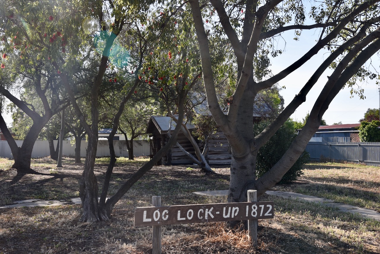
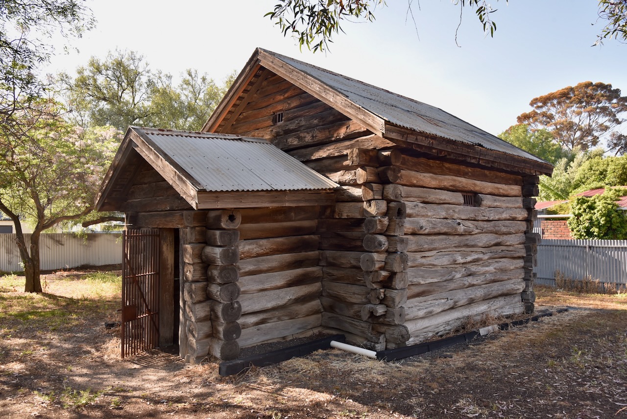
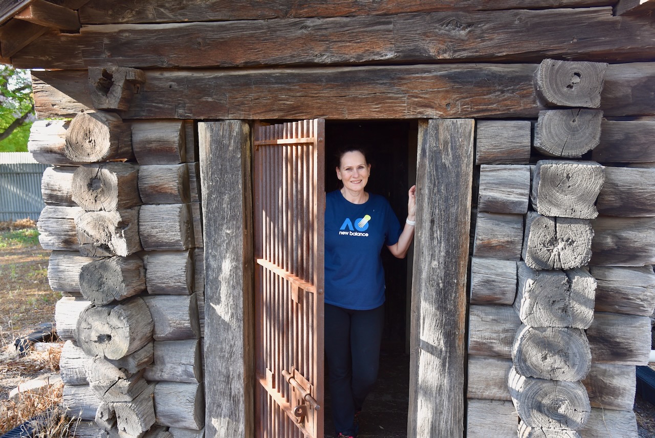
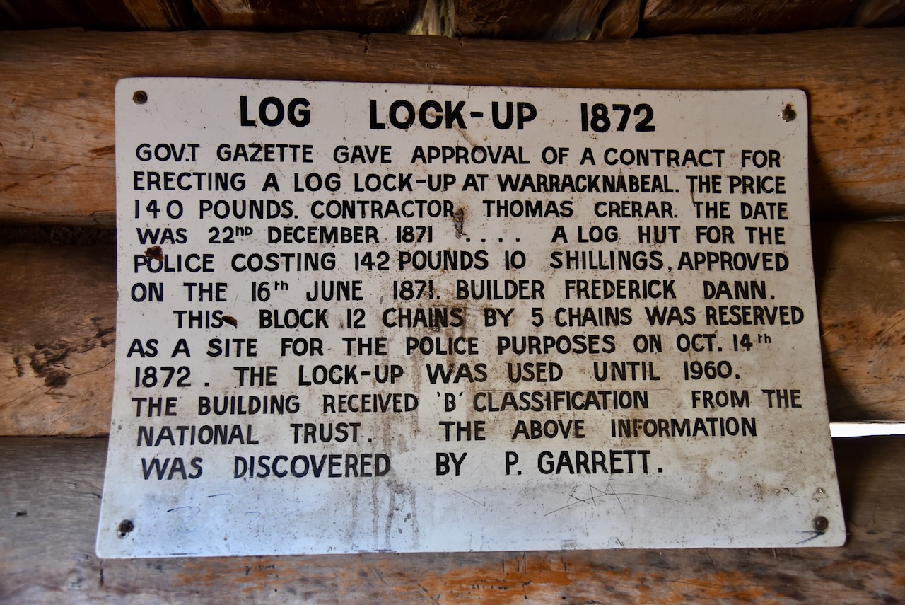
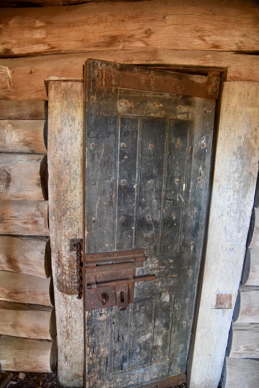
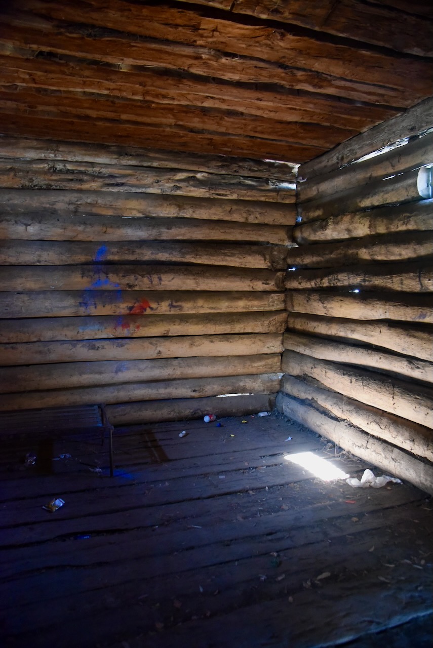
Our next stop was the old Warracknabeal log lockup in Devereux Street. On the 22nd day of December 1871, the Government Gazette gave approval of a contract for erecting a log lockup at Warracknabeal. The price was 140 pounds with the contractor being Thomas Crerar. On the 16th day of June 1871, a log hut for the police costing 142 pounds 10 shillings was approved. The builder was Frederick Dann. The block on which it is located was 12 chains by 5 chains and was reserved as a site for police purposes on the 14th day of October 1872. The lock-up was used until 1960.
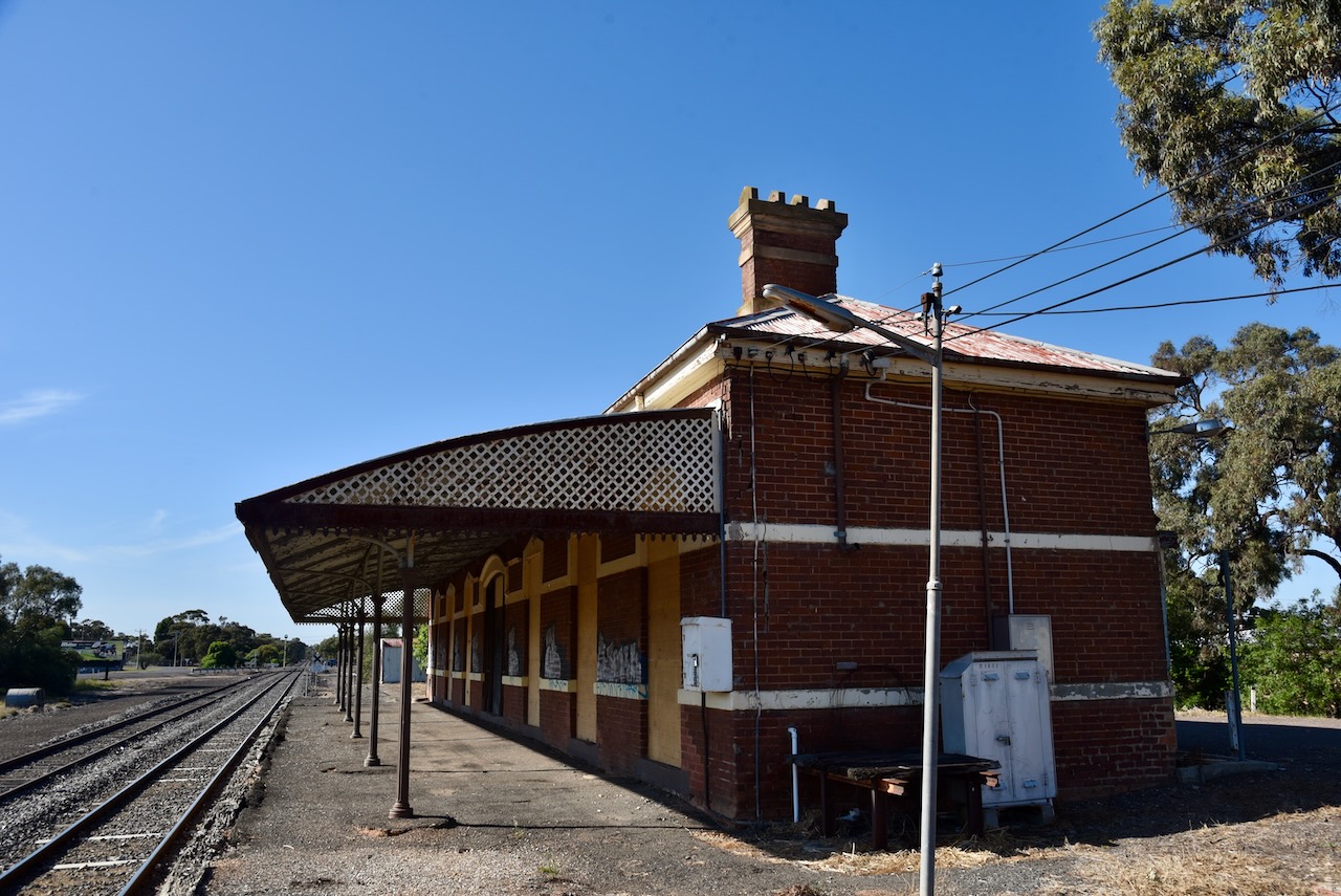
We then visited the old Warracknabeal railway station. The railway arrived at Warracknabeal in 1885. It was part of the Patchewollock railway line, also known as the Hopetoun railway line. The line was opened in stages from Murtoa to Warracknabeal in May 1886, and reached Patchewollock in May 1925. It was one of two-grain lines that were changed from broad gauge to standard gauge simultaneously as the main line into South Australia. During the 1980s the line was truncated to Hopetoun, with the tracks beyond Hoeptoun removed. (Aussie Towns 2024) (Vicsig.net 2023) (Vicrailstations.com 2024)
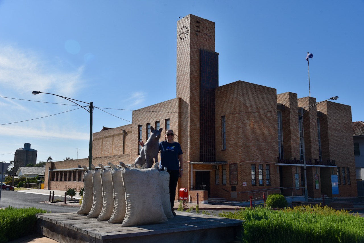
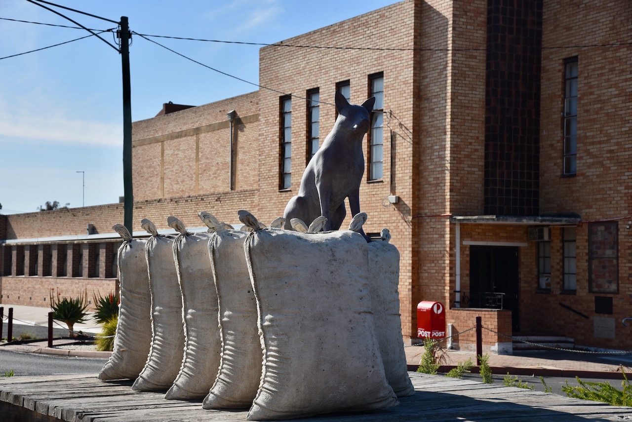
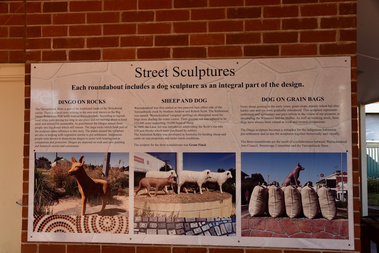
We then visited the Dog on the Wheat Bag sculpture. It was constructed in 2001 to commemorate Federation and features a Kelpie sitting on some wheatbags.
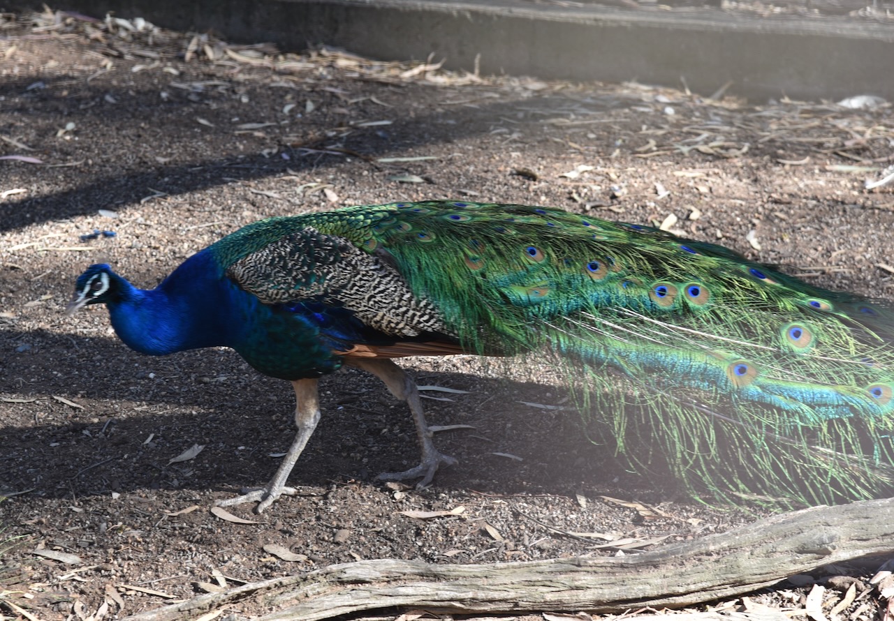
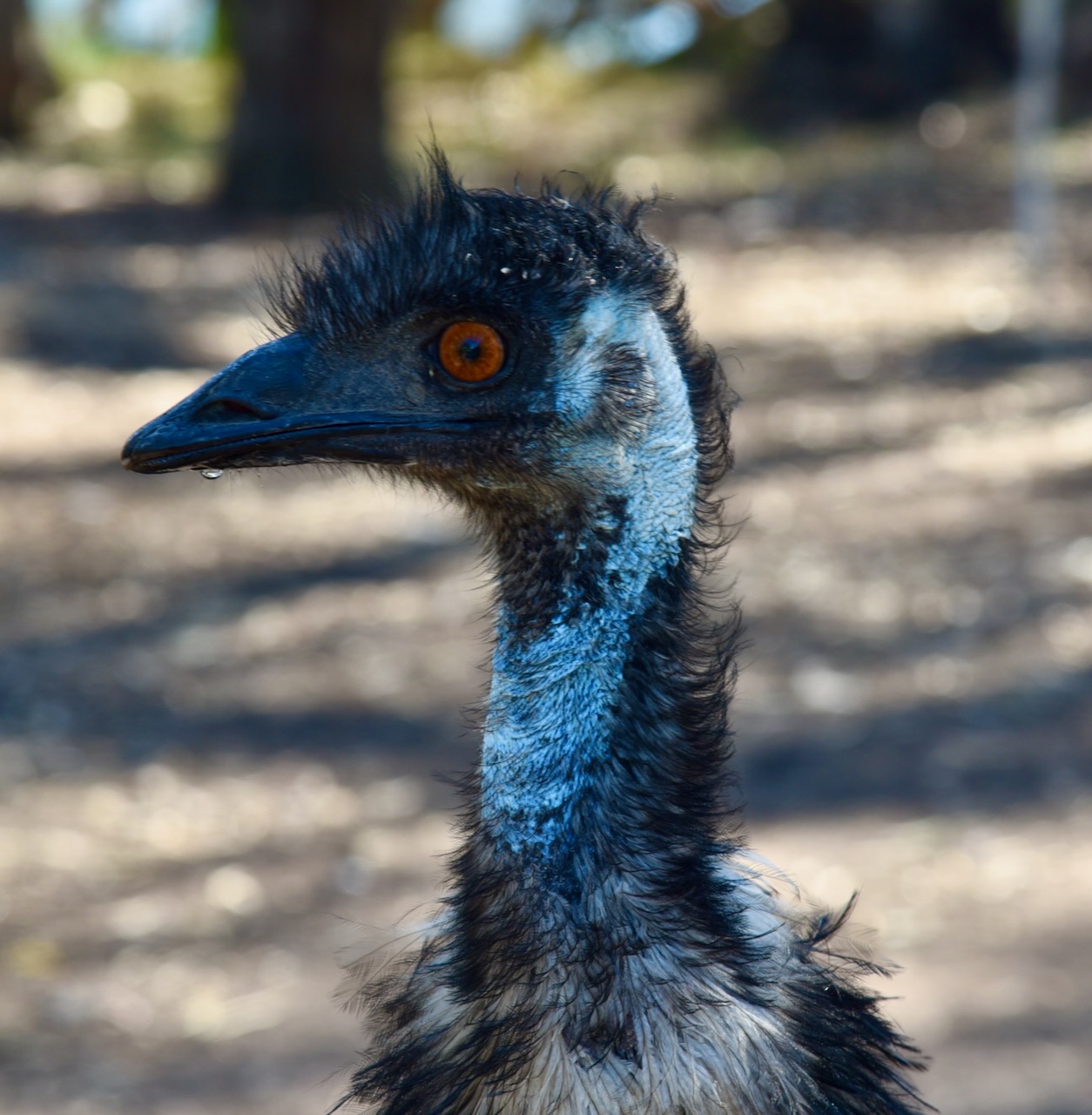
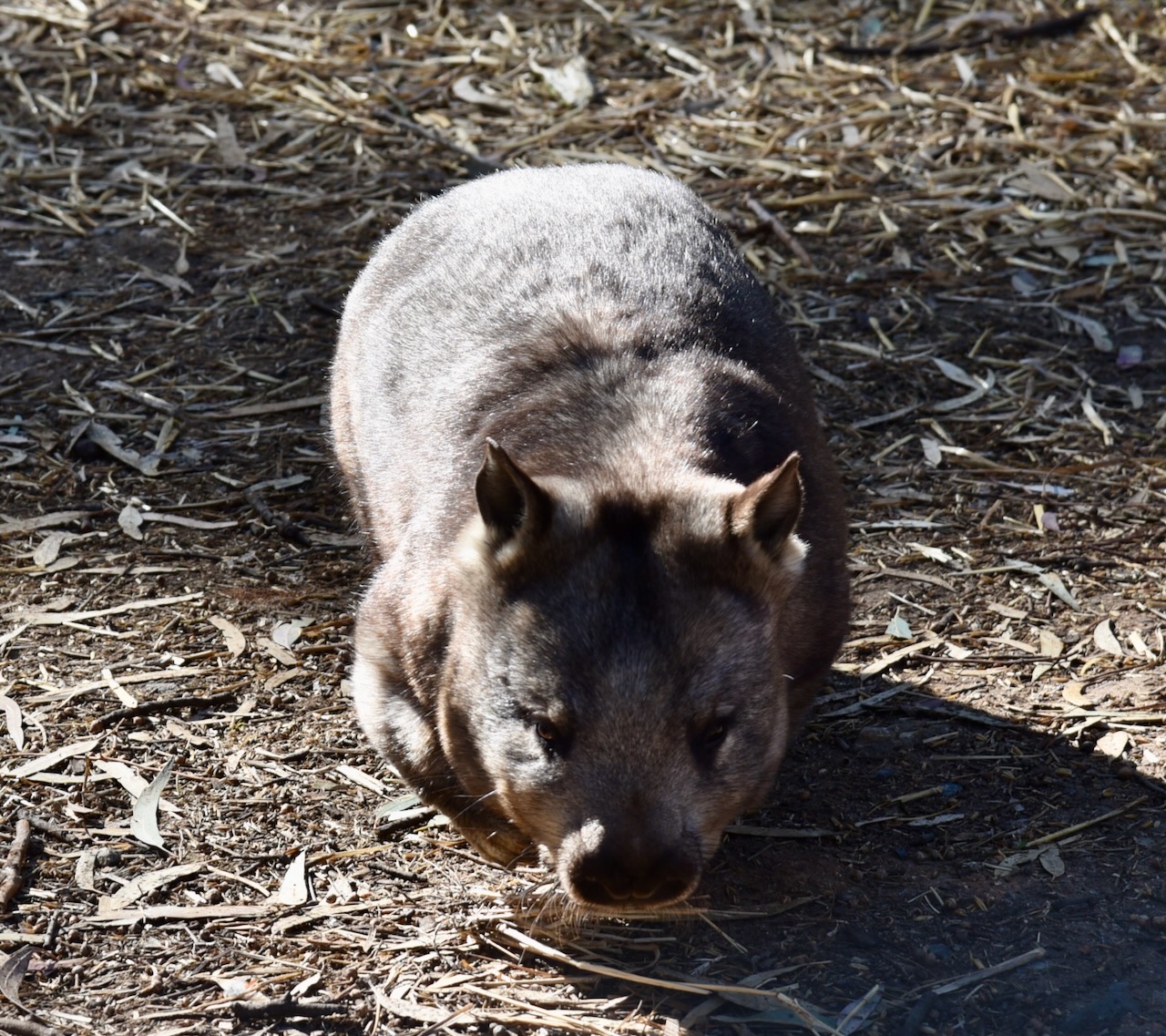
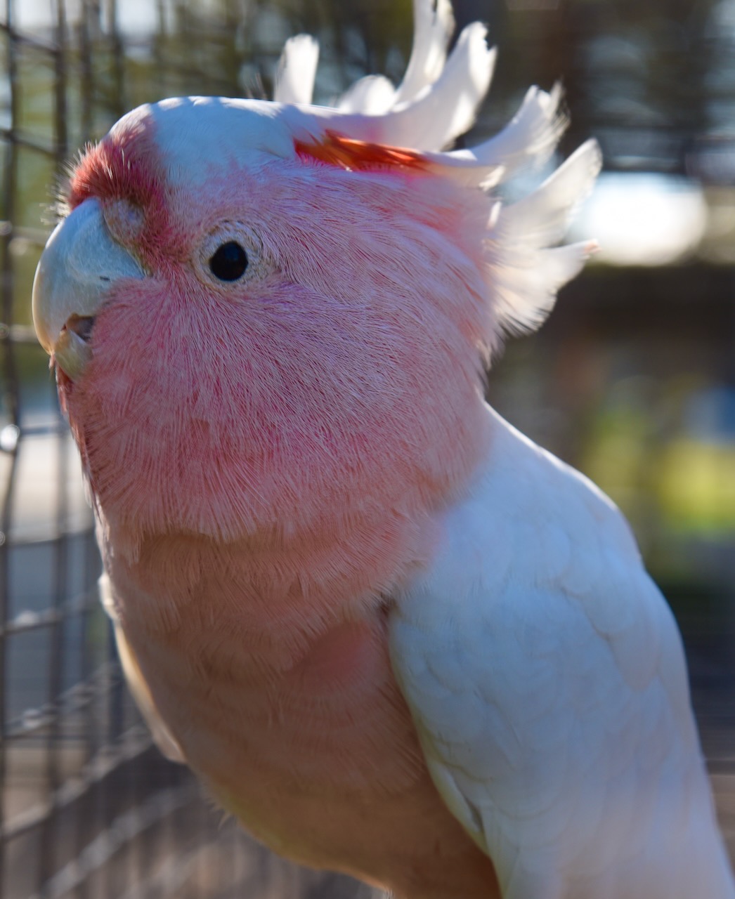
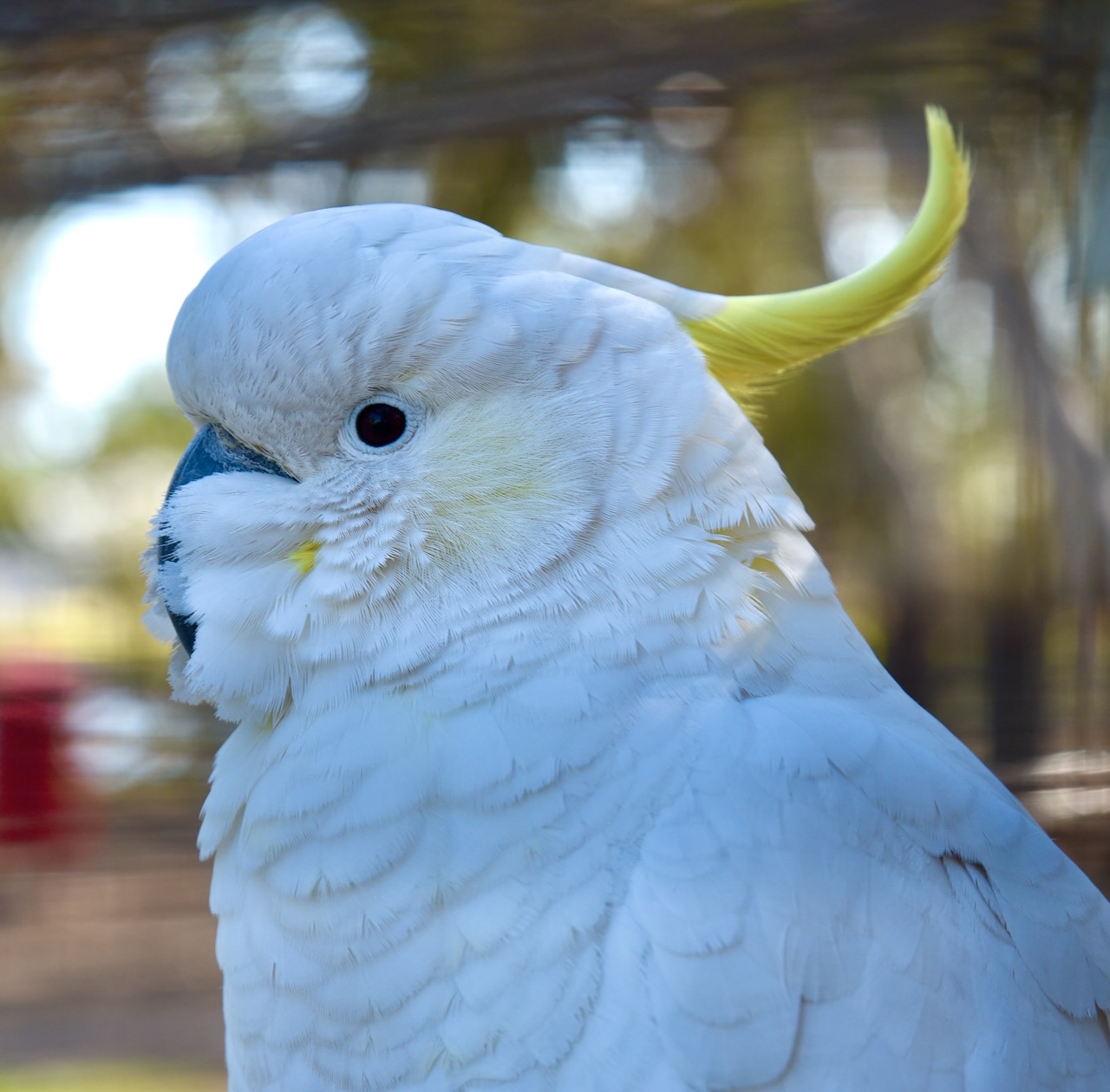
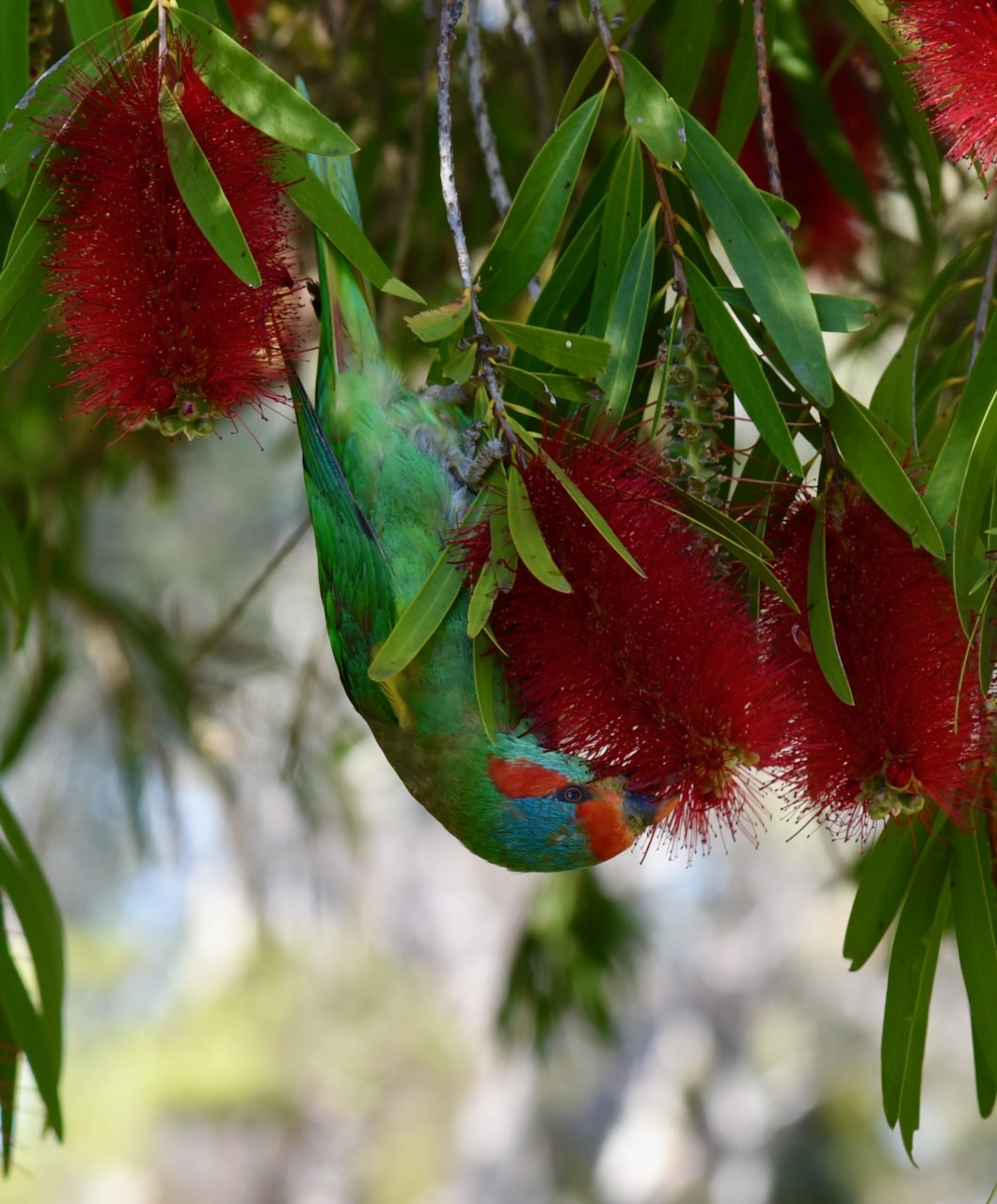
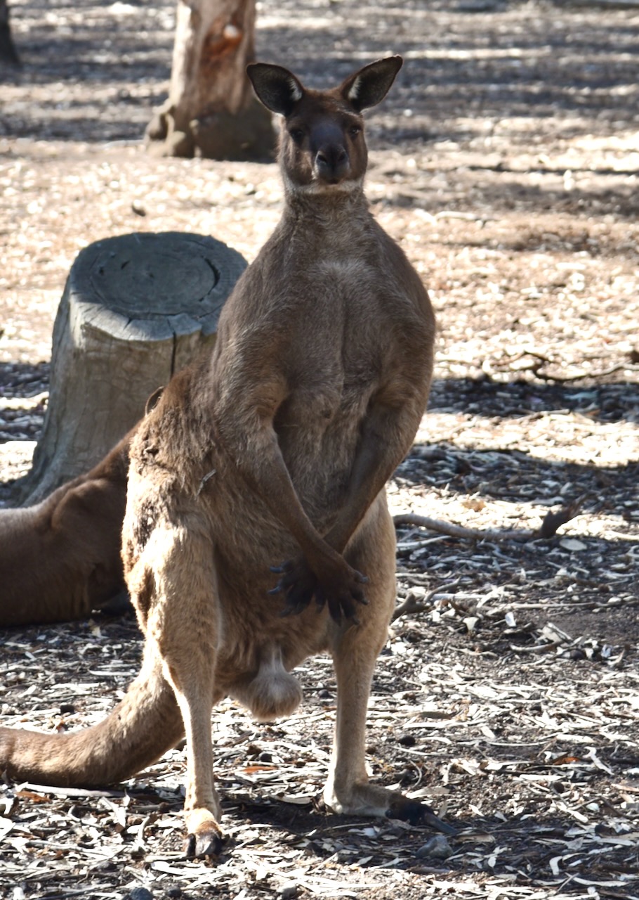
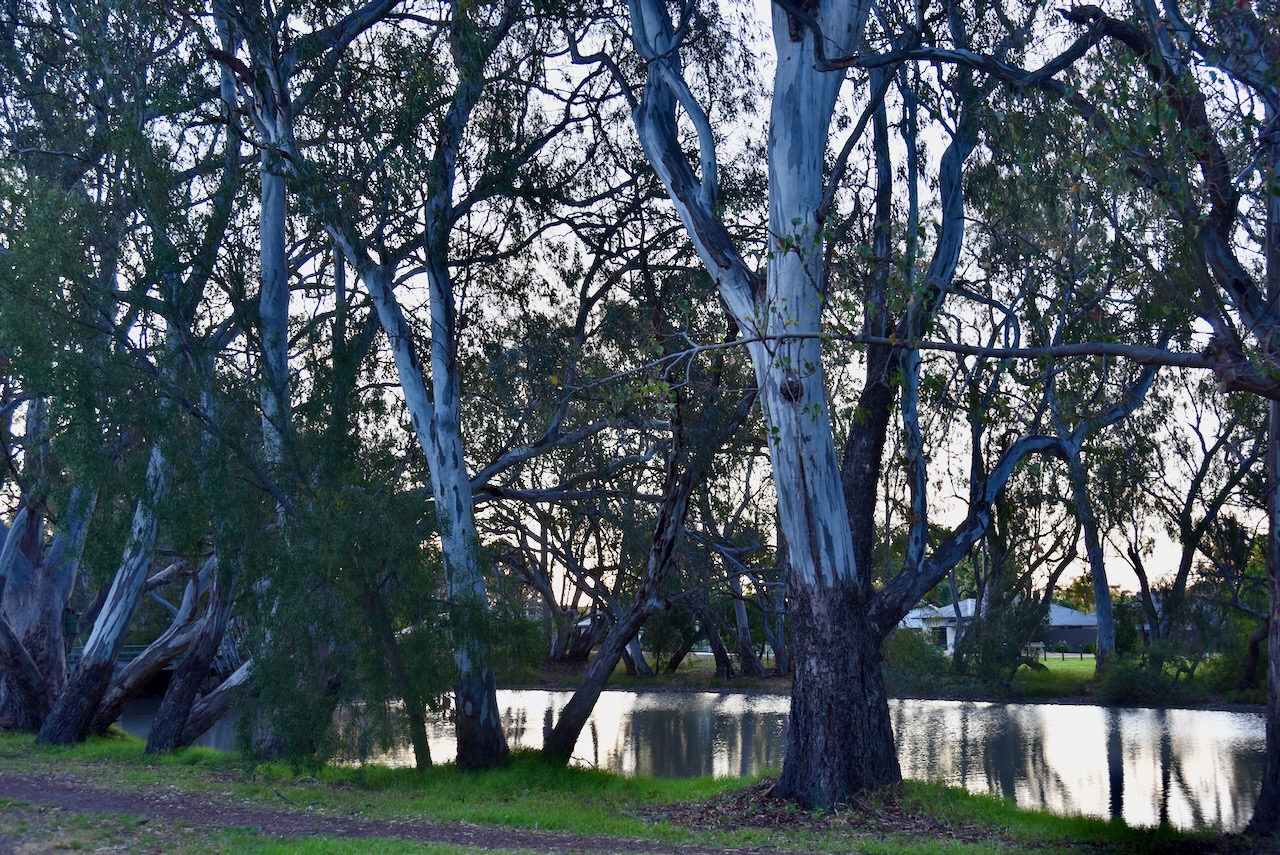
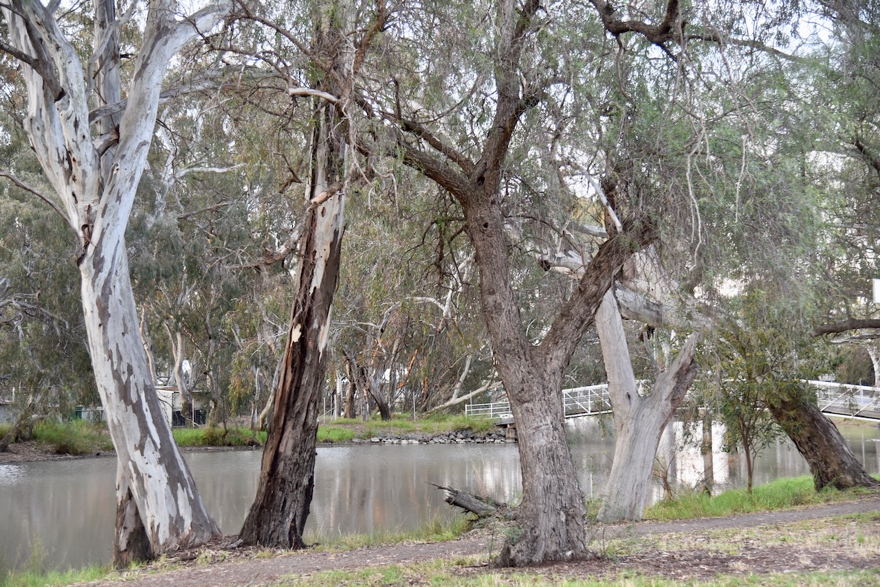
We then took a stroll around the Warracknabeal Fauna Park. The park was created and is maintained by the local Lions Club. During our visit there were some volunteers present feeding the birds. The park is located on the banks of the Yarriambiack Creek and has a picnic area, BBQ facilities and a children’s playground. The Fauna Park features kangaroos, emus, and various other native birds.
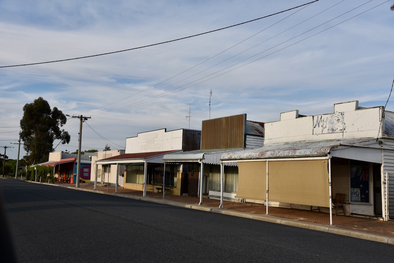
Marija and I then strolled up and down the main street of Warracknabeal. Many of the surviving historic buildings have information signs detailing their history.
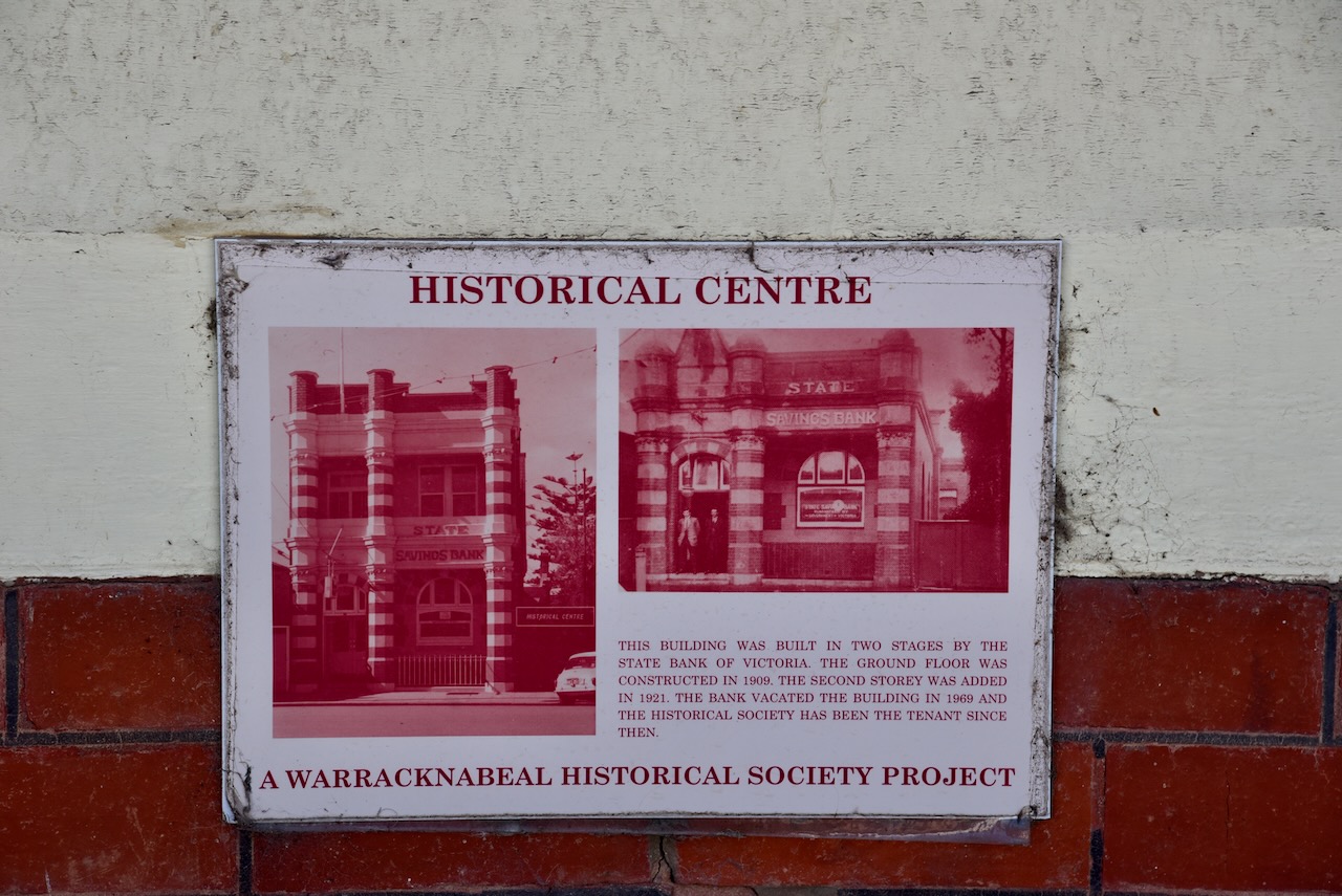
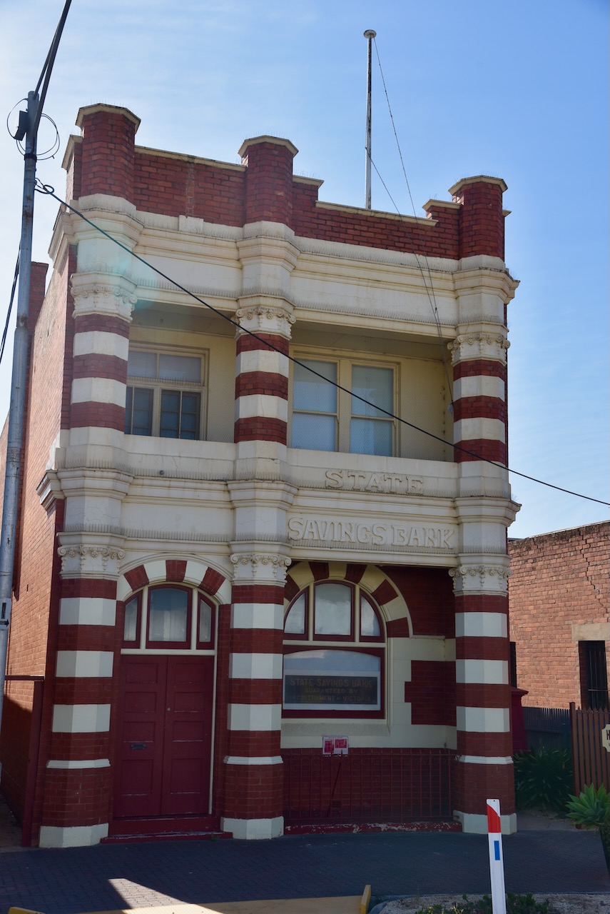
The old State Savings Bank was constructed in two stages. The ground floor was built in 1909 while the second storey was added in 1921. The State Bank of Victoria vacated the building in 1969.
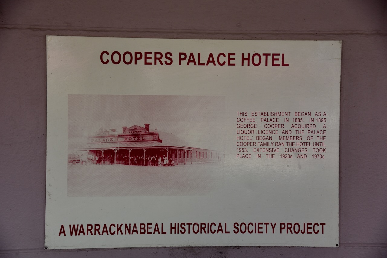
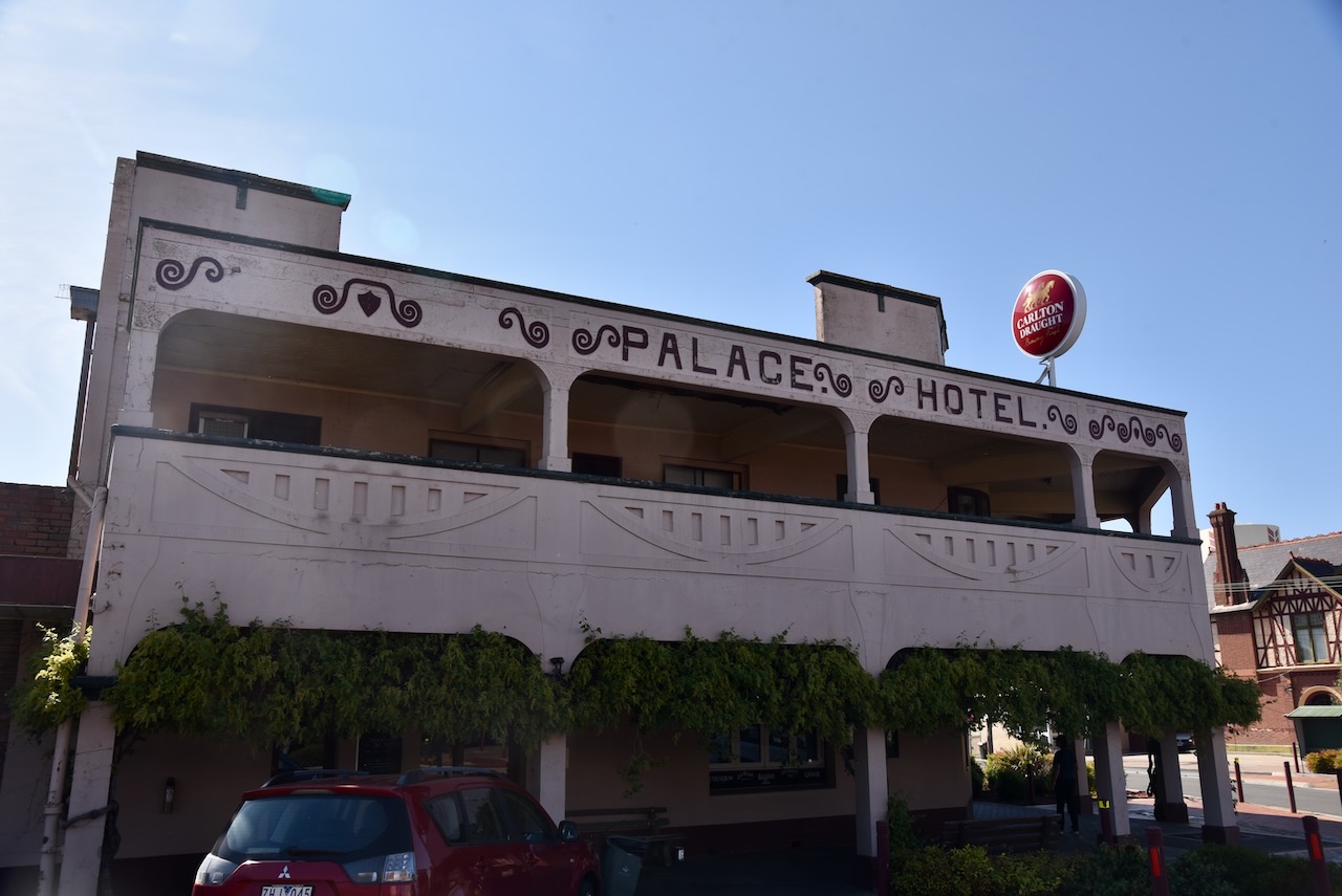
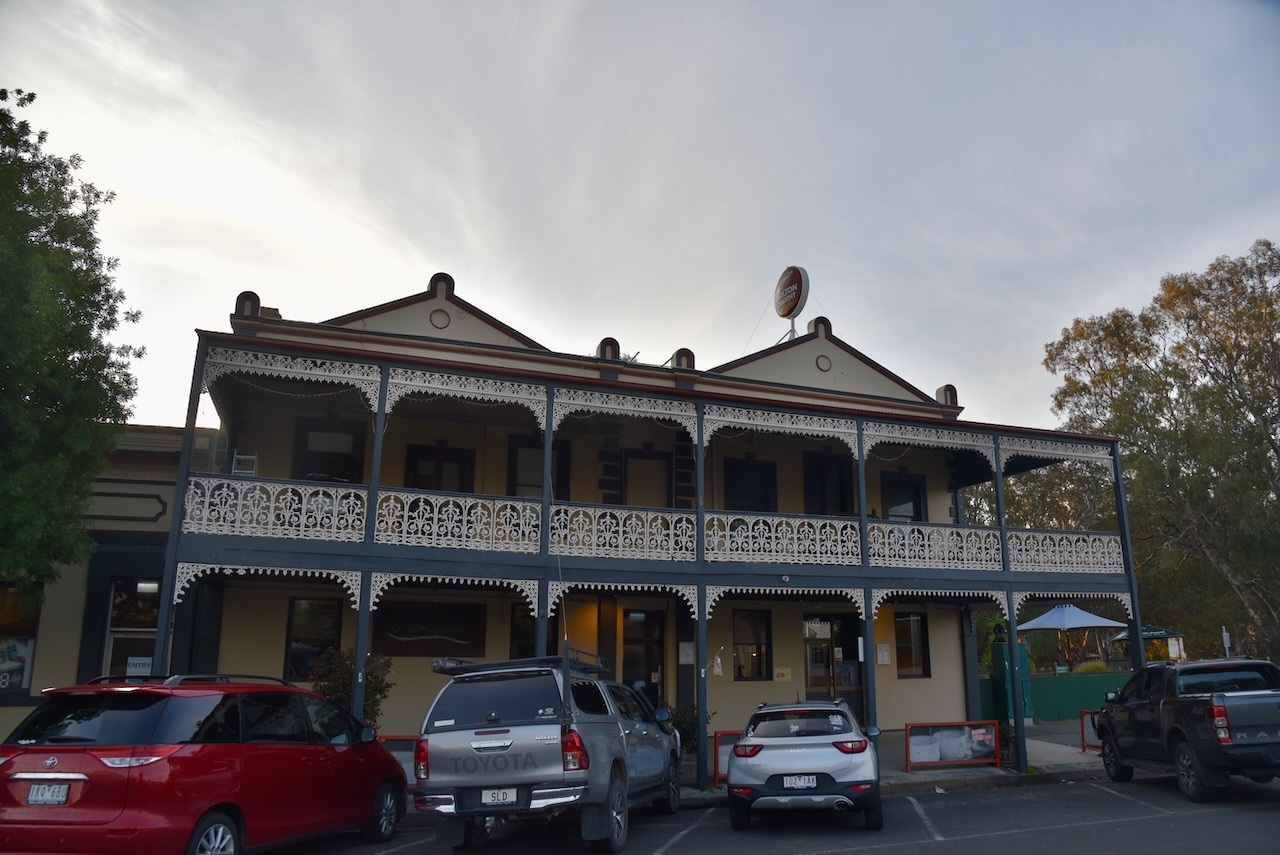
Coopers Palace Hotel commenced as a coffee palace in 1885. By 1895, George Cooper had acquired a liquor licence and the Palace Hotel was opened. The hotel was run by members of the Cooper family until 1953.
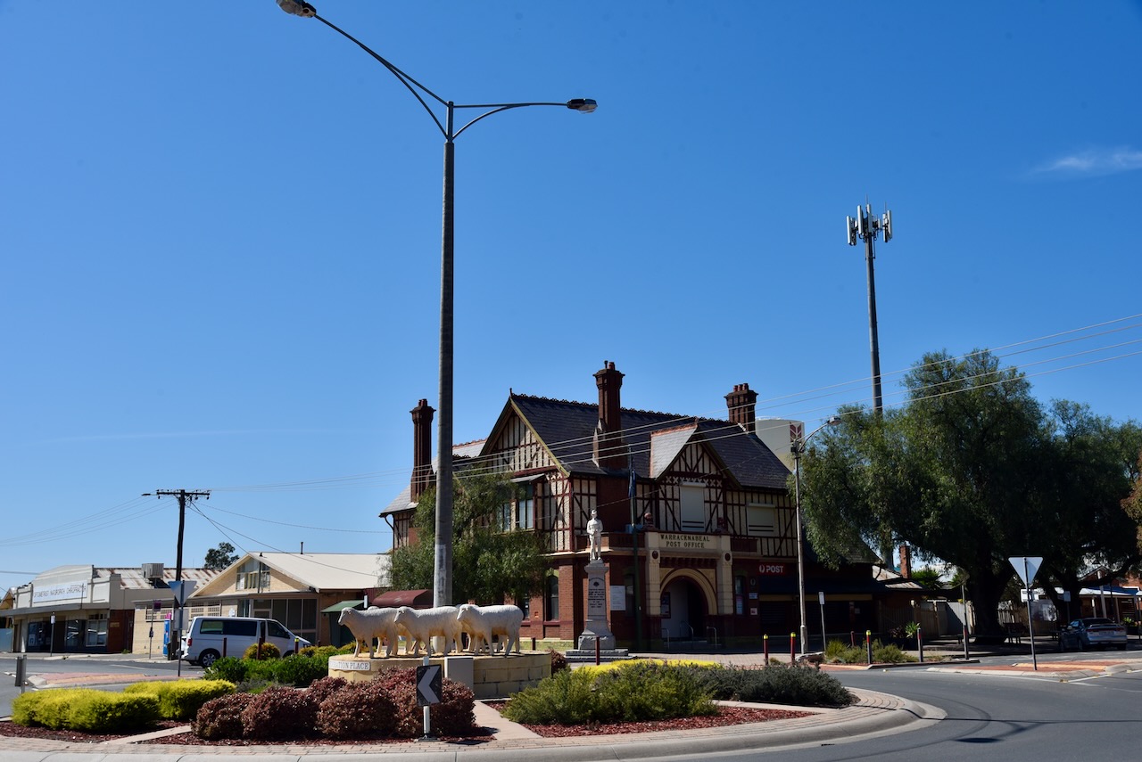
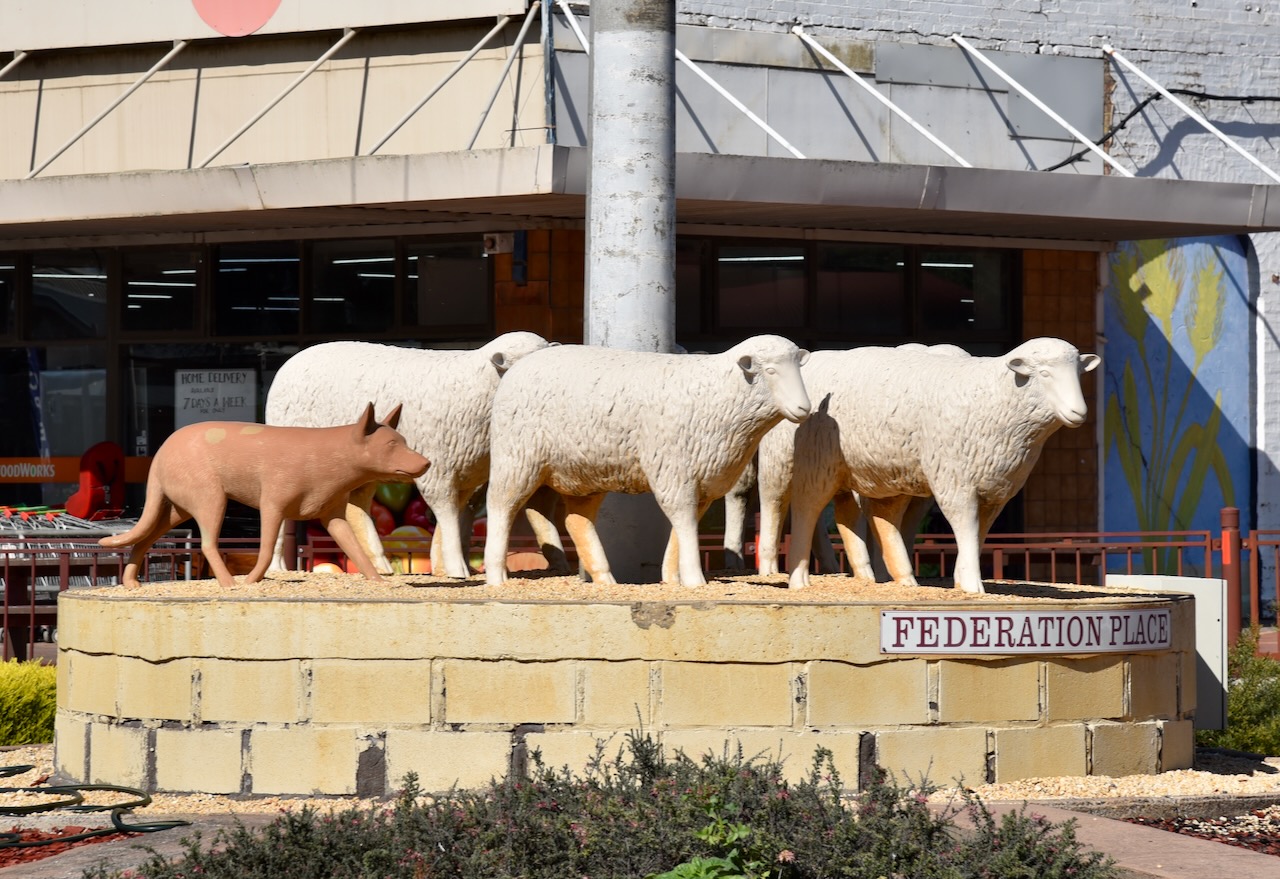
In Federation Place there was another sculpture featuring a Kelpie dog and sheep.
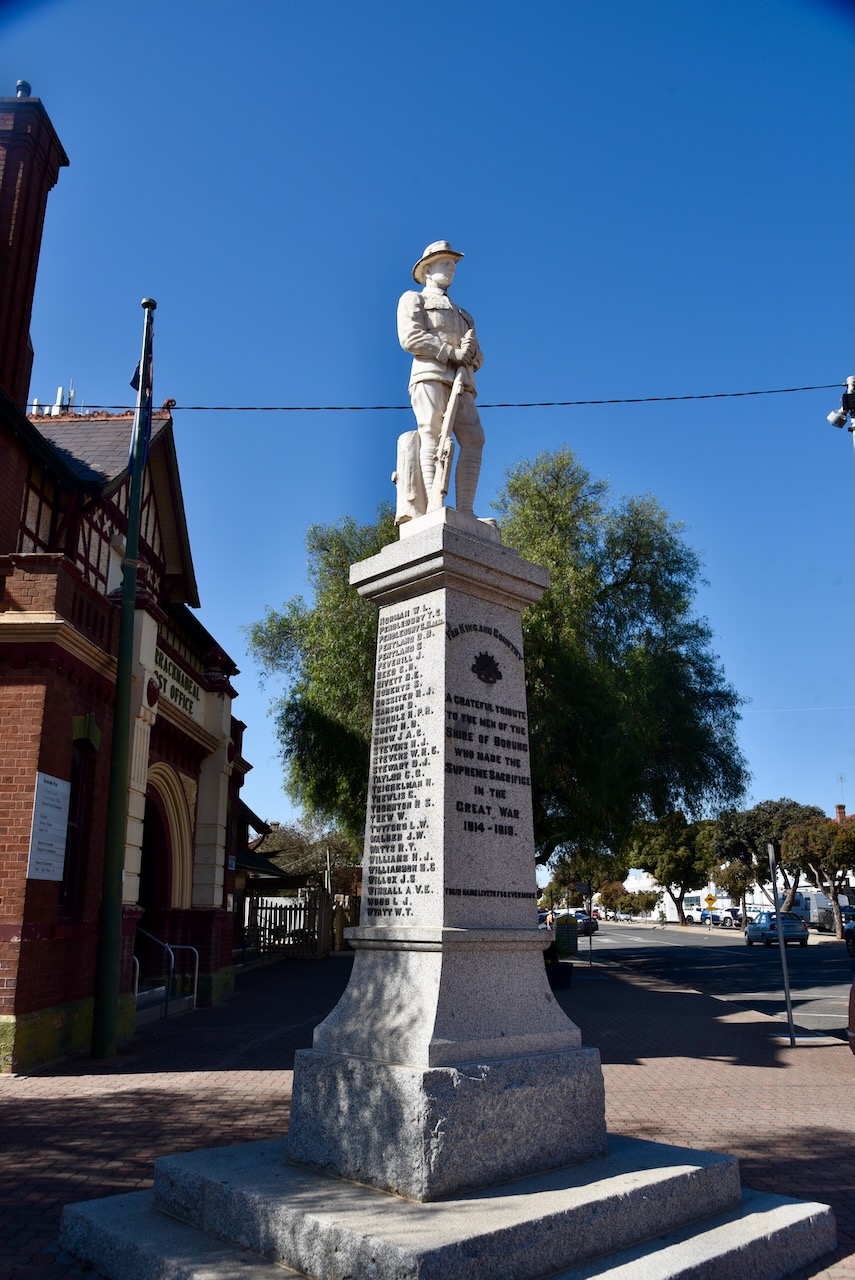
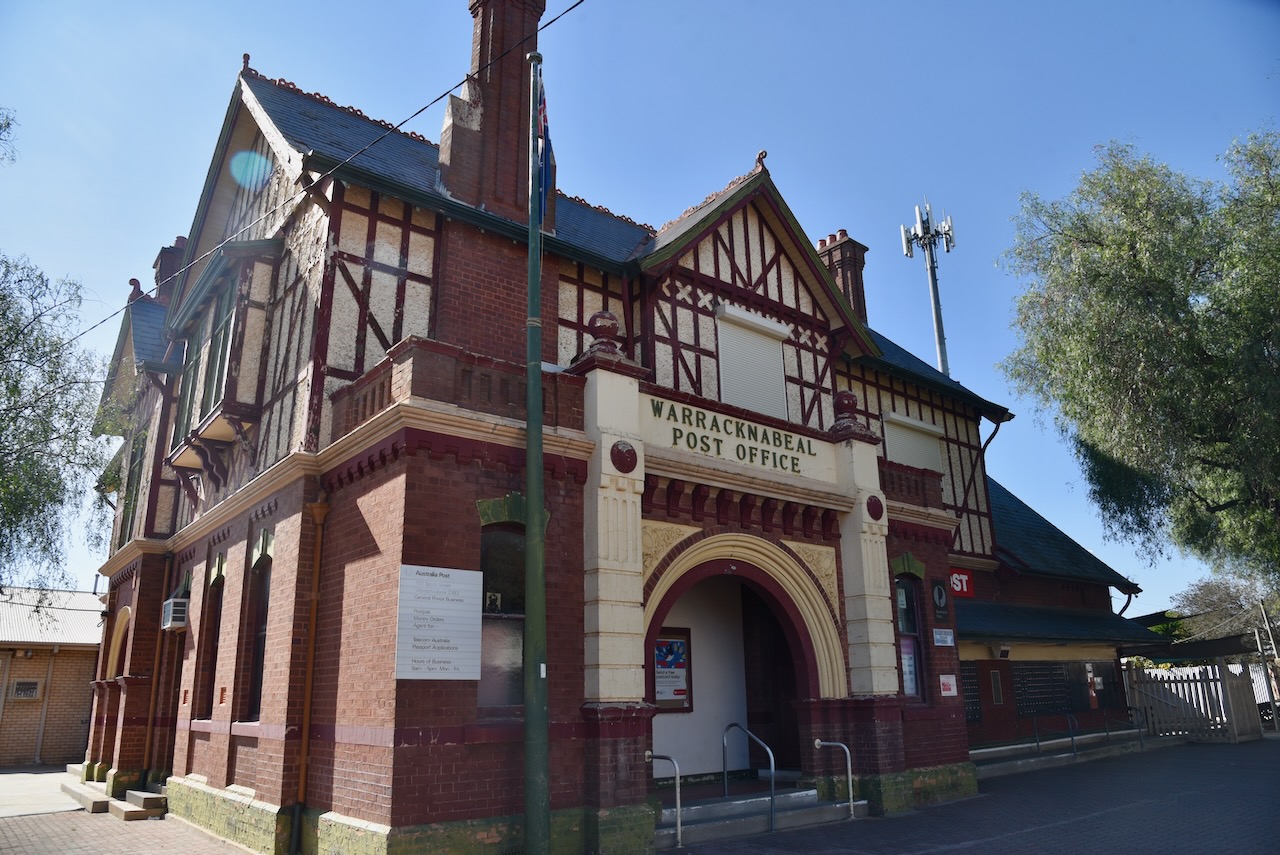
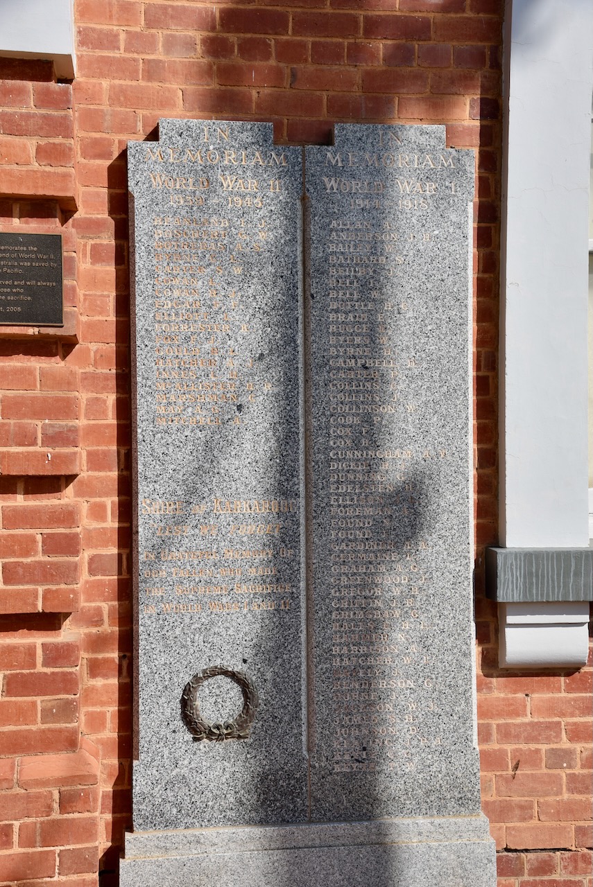
Adjacent to the Post Office is the War monument, a tribute to all those from Warracknabeal and the surrounding district who fought during the First World War.
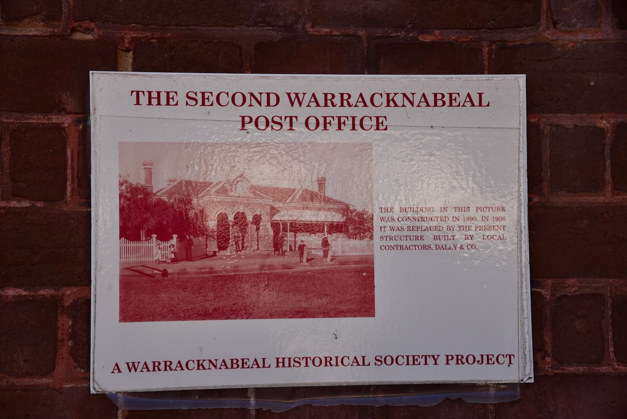
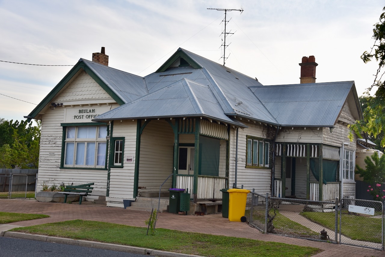
The current Post Office was constructed in 1906 by local contractors Dally & Co. It replaced the Post Office built on the site in 1890.
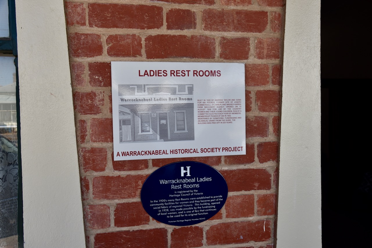
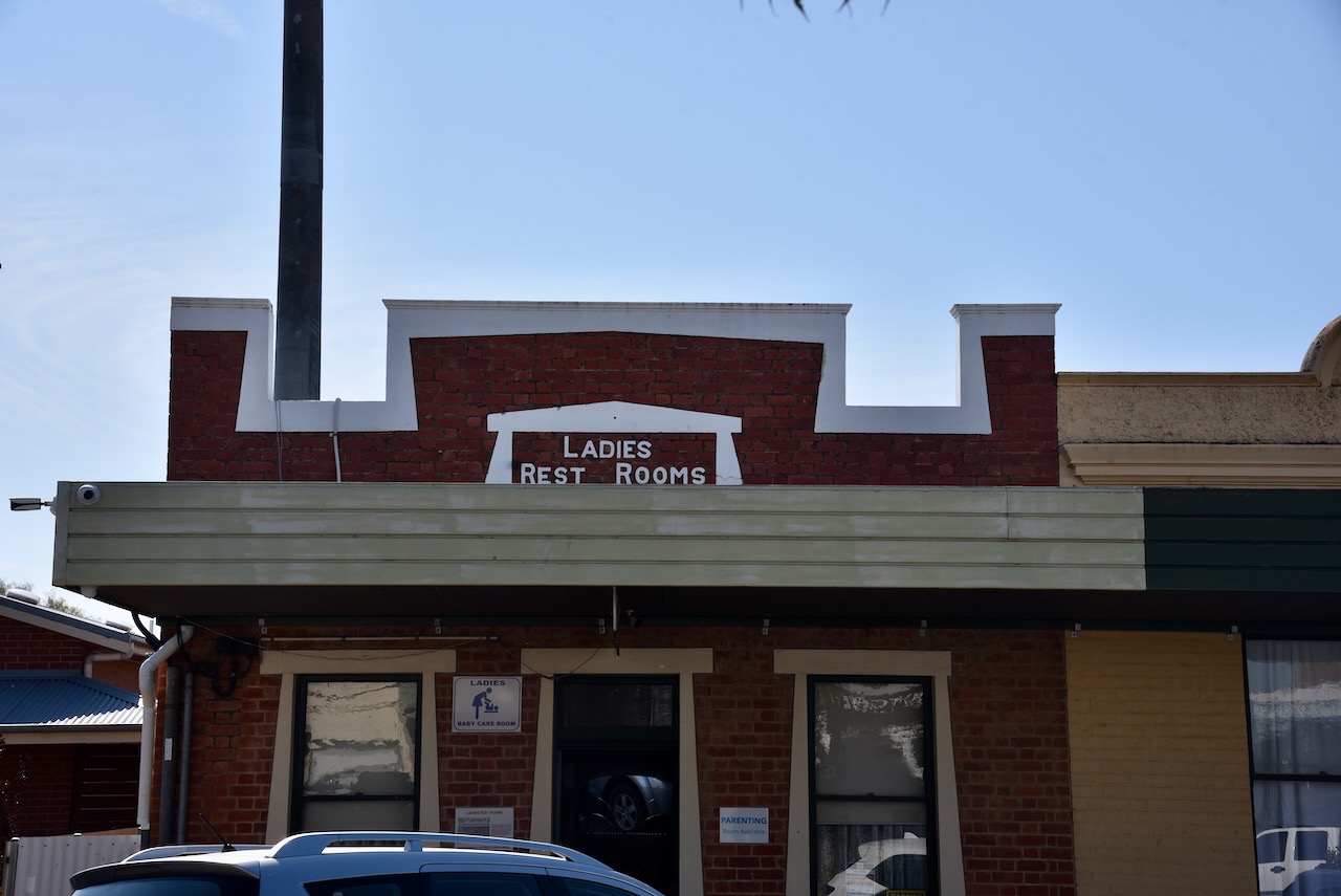
During the 1920s many Rest Rooms were established to provide community facilities for women. They became part of the social fabric of regional Victoria. The Warracknabeal Ladies Rest Rooms were built in 1928 by Andrew Taylor and Sons for 680 pounds.
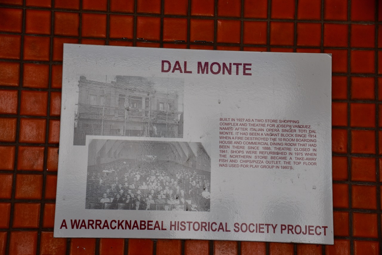
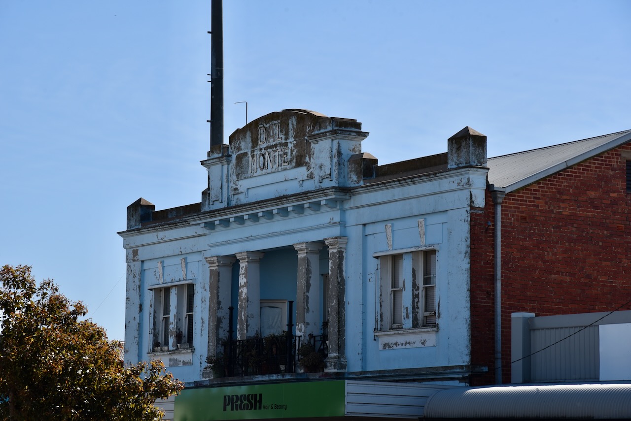
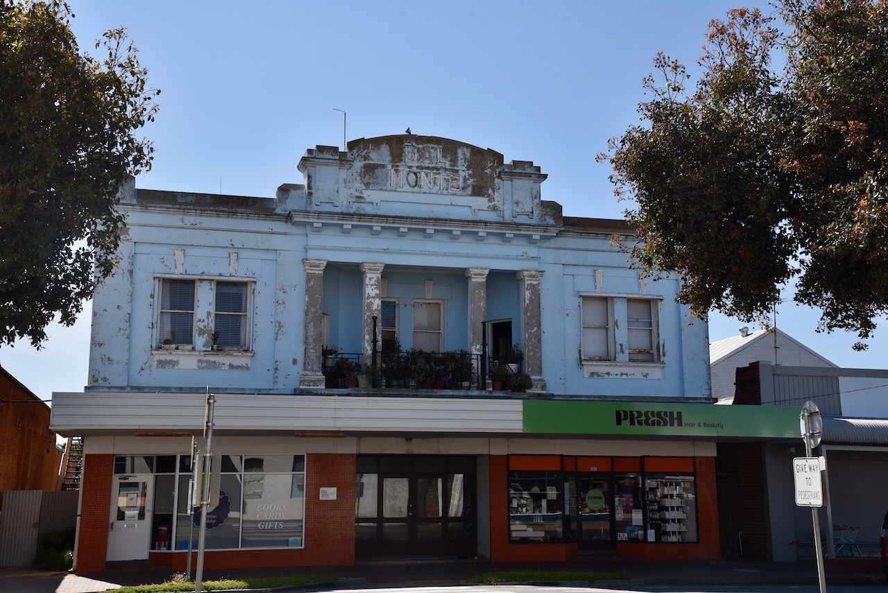
Dal Monte was built in 1927 as a two-storey shopping complex and theatre for Joseph Vasquez. The building was named after Italian opera singer Toti Dal Monte. The theatre closed in 1941.
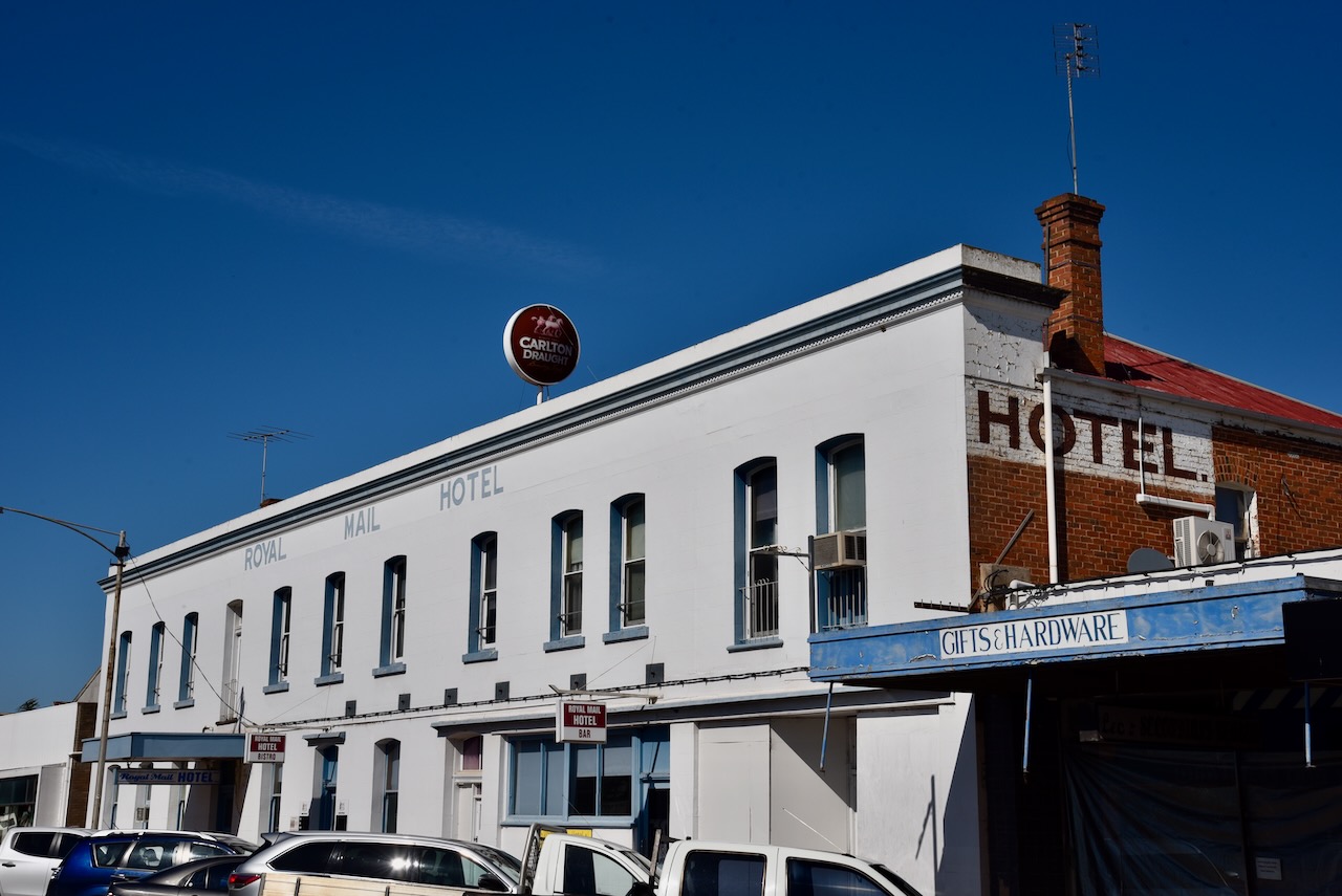
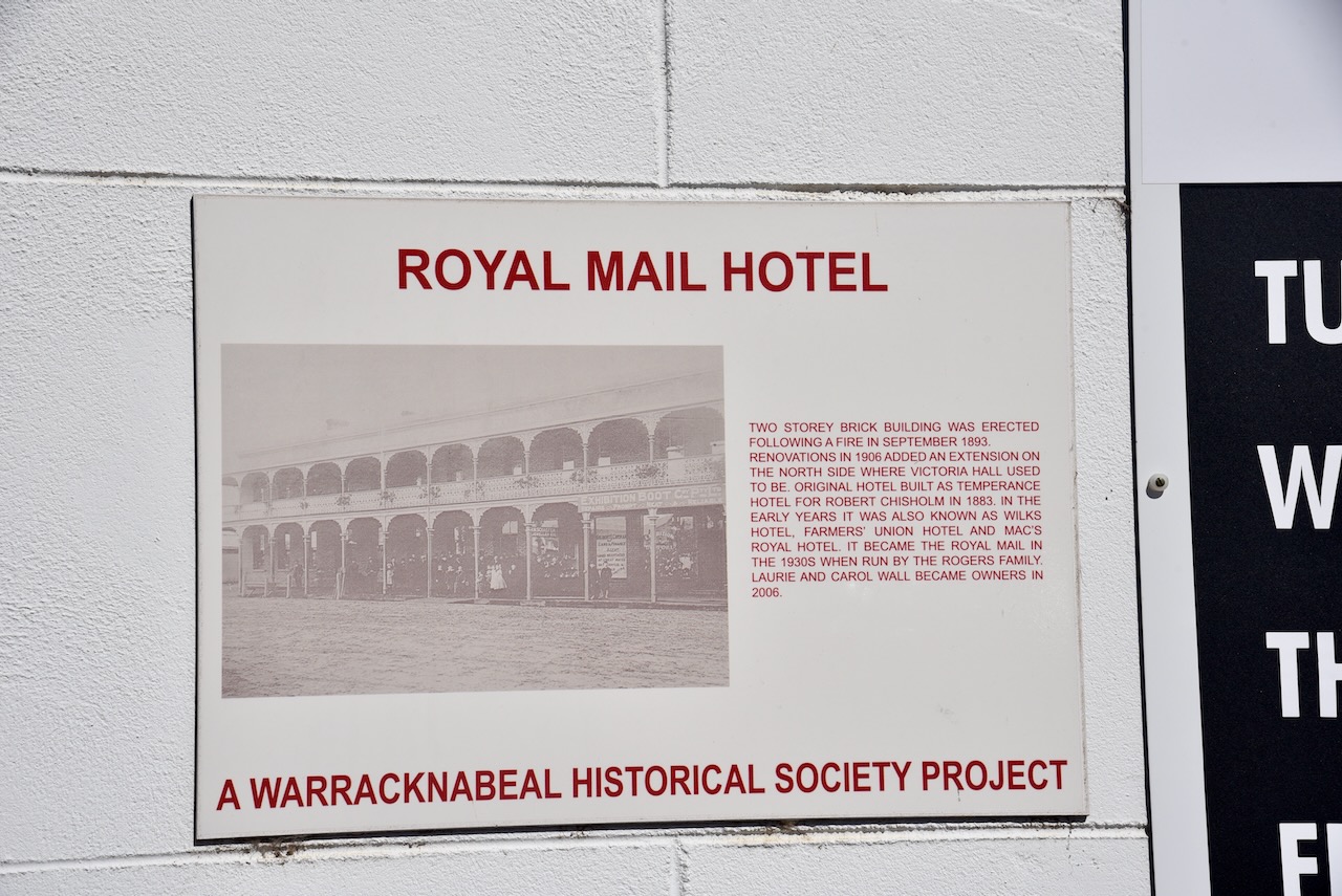
The two-storey brick building, Royal Mail Hotel, was built following a fire in September 1893. The original hotel was built as a Temperance Hotel for Robert Chisholm in 1883.
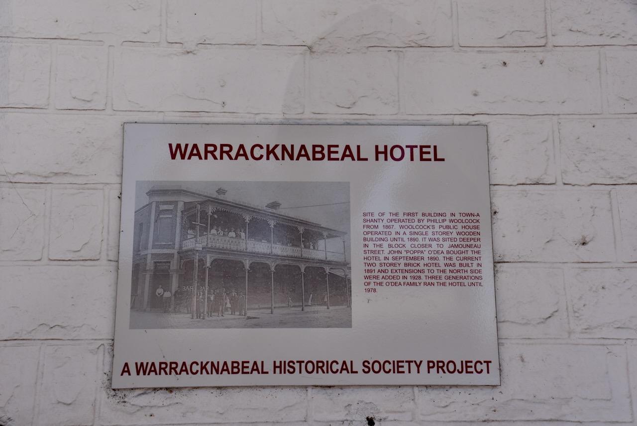
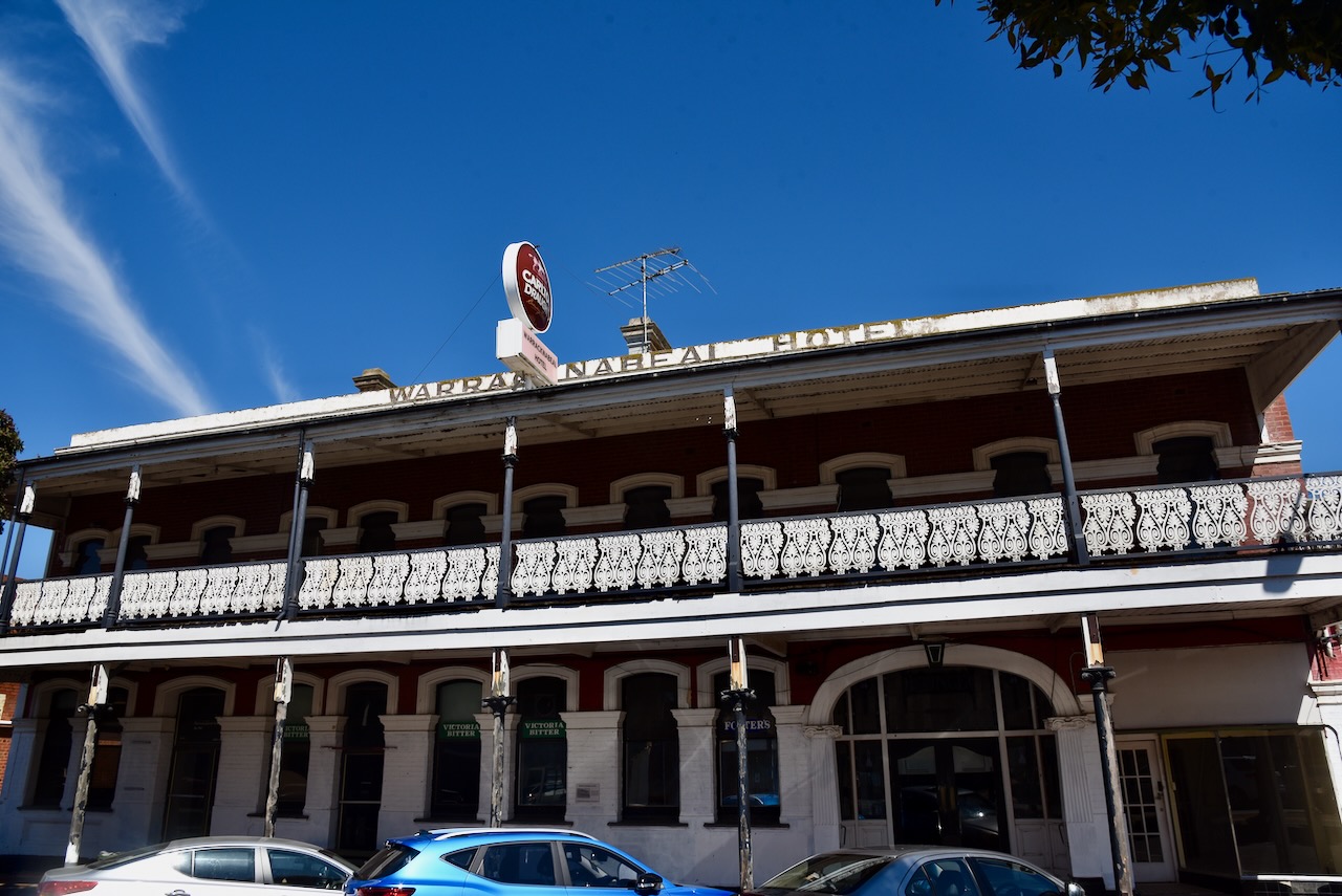
The Warracknabeal Hotel was built in 1891. Extensions were added in 1928. It had been purchased in September 1890 by John ‘Poppa’ O’Dea. Three generations of the O’Dea family ran the hotel until 1978.
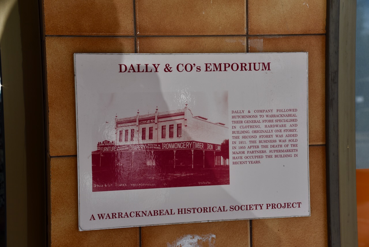
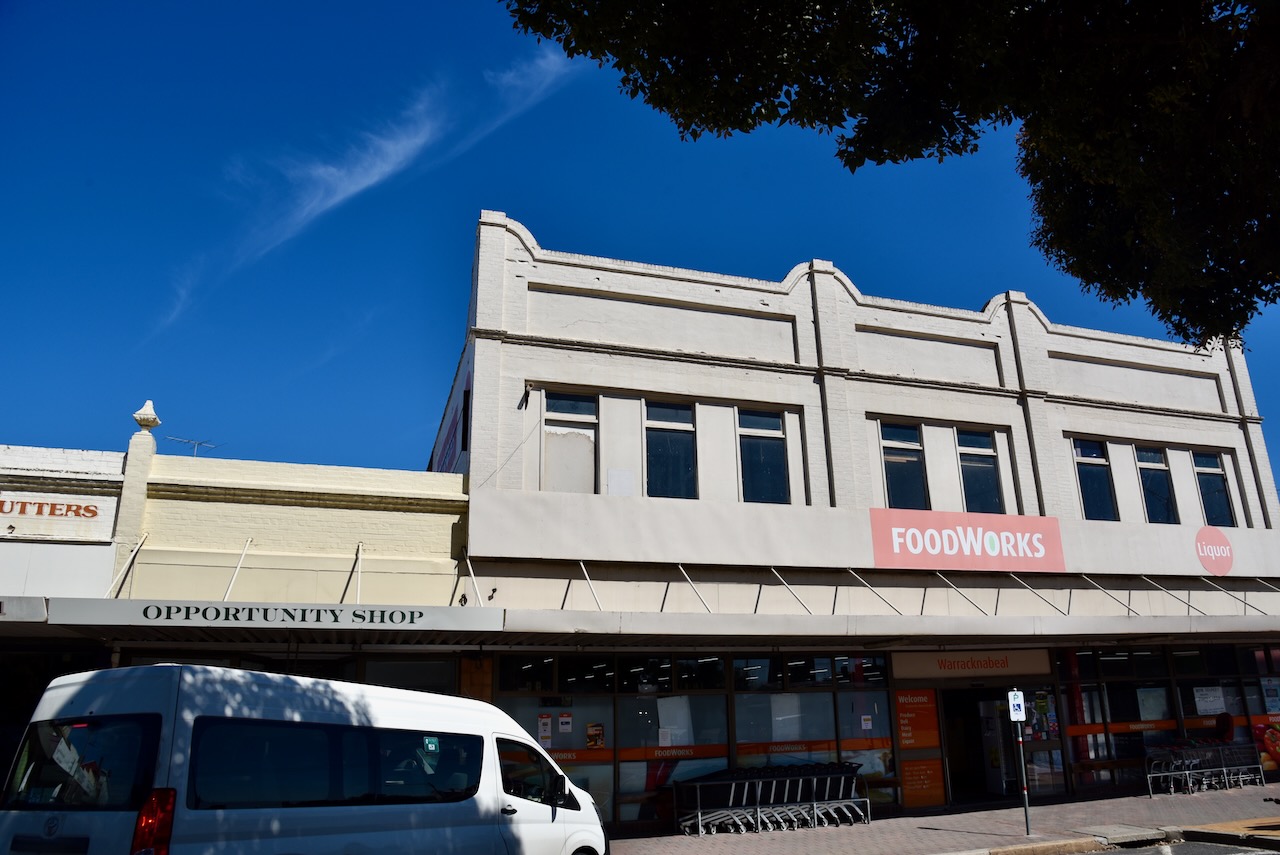
Dally & Company followed Hutchinsons to Warracknabeal. Their general store specialised in clothing, hardware and building. The building was originally one storey with the second storey being added in 1911. In 1955 the business was sold. Following the death of the major partners, supermarkets have occupied the site.
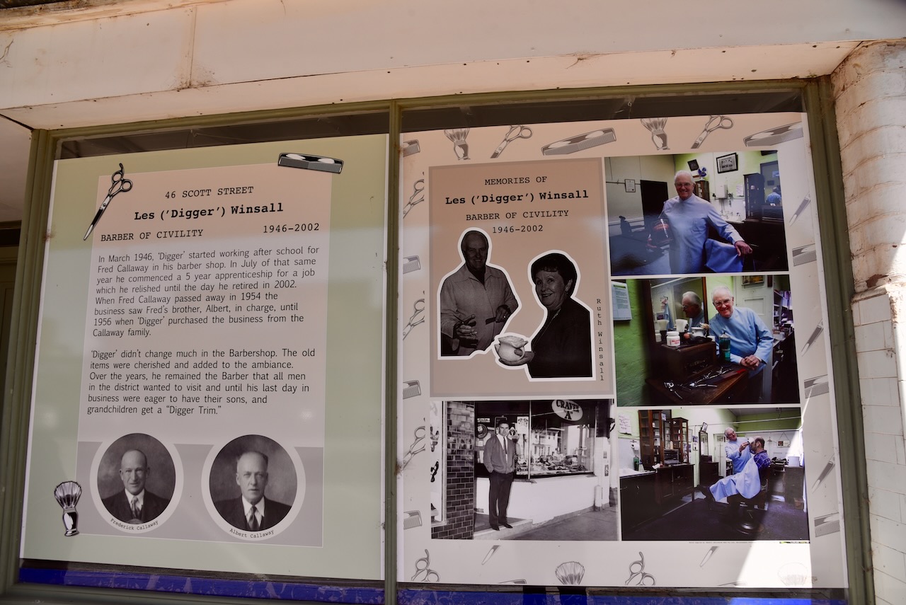
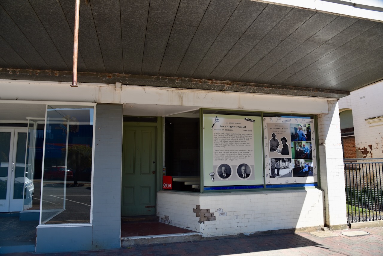
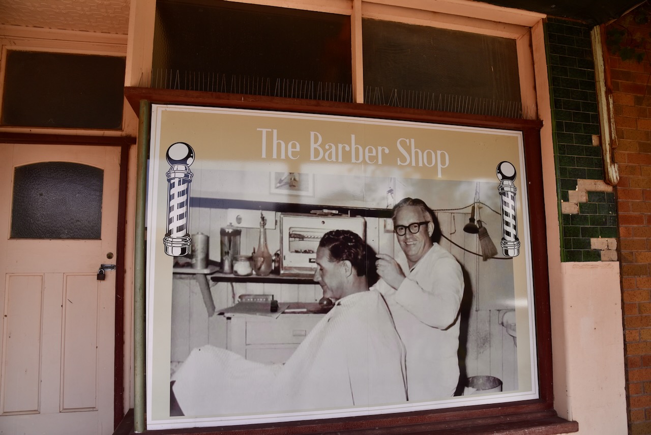
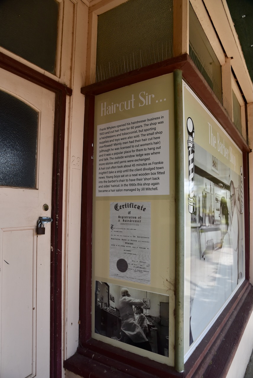
Les ‘Digger’ Winsall’s barber shop is particularly interesting. In March 1946 he commenced working after school for Fred Callaway in his barber shop. In July that year, he commenced a 5 year apprenticeship. Callaway passed away in 1954 and the barber shop was run by the brother of Les, Alber Winsall. In 1956 Les purchased the business from the Callaway family. He operated as a barber until his retirement in 2002.
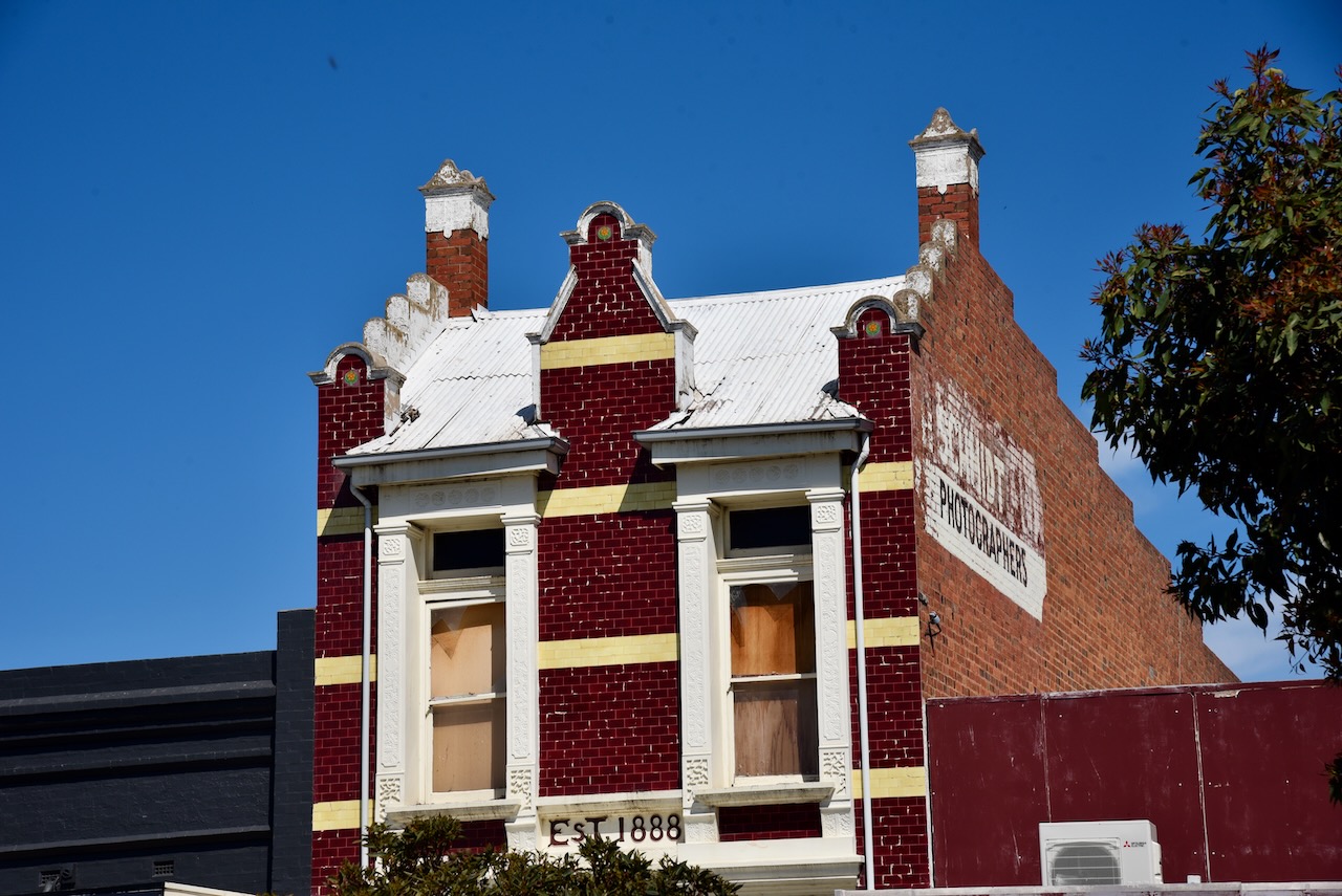
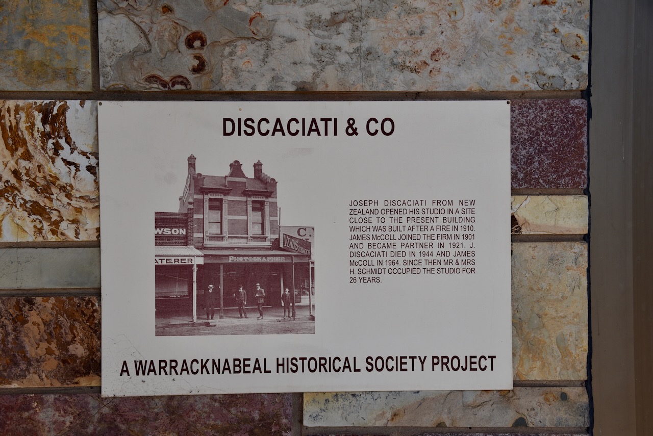
Joseph Discaciati was from New Zealand. He opened his studio in a site close fo the present building which was built in 1910 following a fire. In 1901 James McColl joined the firm and became a partner in 1921. In 1944 Disaciati died, followed by McColl in 1964.
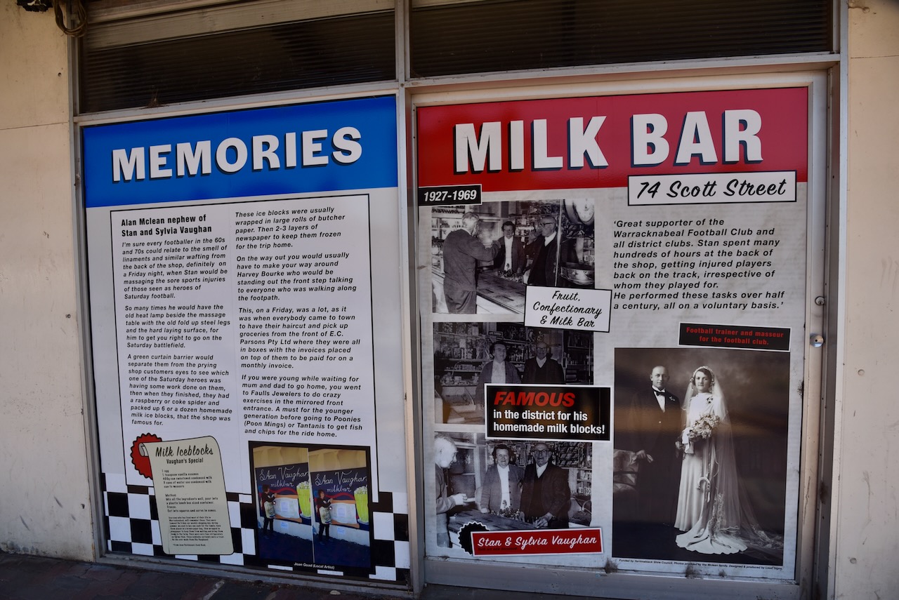
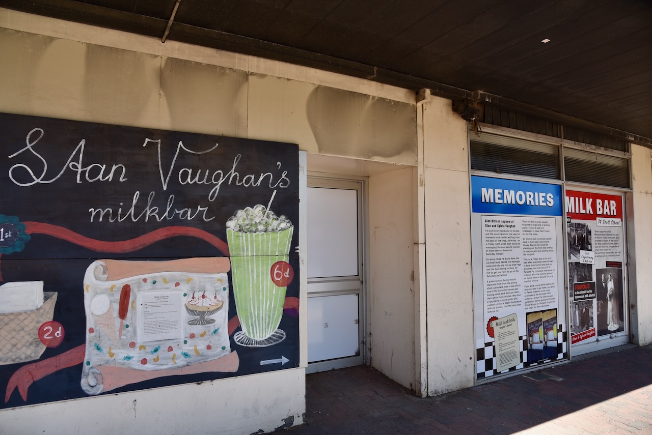
Stan and Sylvia Vaughan’s old Milk Bar can be found at 74 Scott Street.
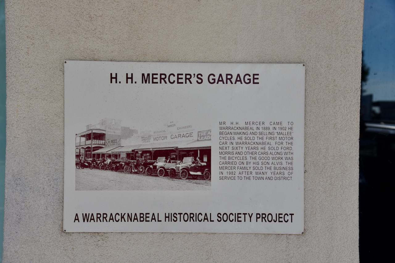
Mr. H.H. Mercer arrived in Warracknabeal in 1899. In 1902 he commenced making and selling ‘Mallee’ cycles. He sold the first motor car in Warracknabeal. For 60 years he sold Ford, Morris and other motor vehicles along with the bicycles. His son Alvis carried on the business. The Mercer family sold the business in 1982.
We then called into the Warracknabeal Visitor Information Centre. There are a number of information boards outside the centre which contain interesting facts and history about Warracknabeal.
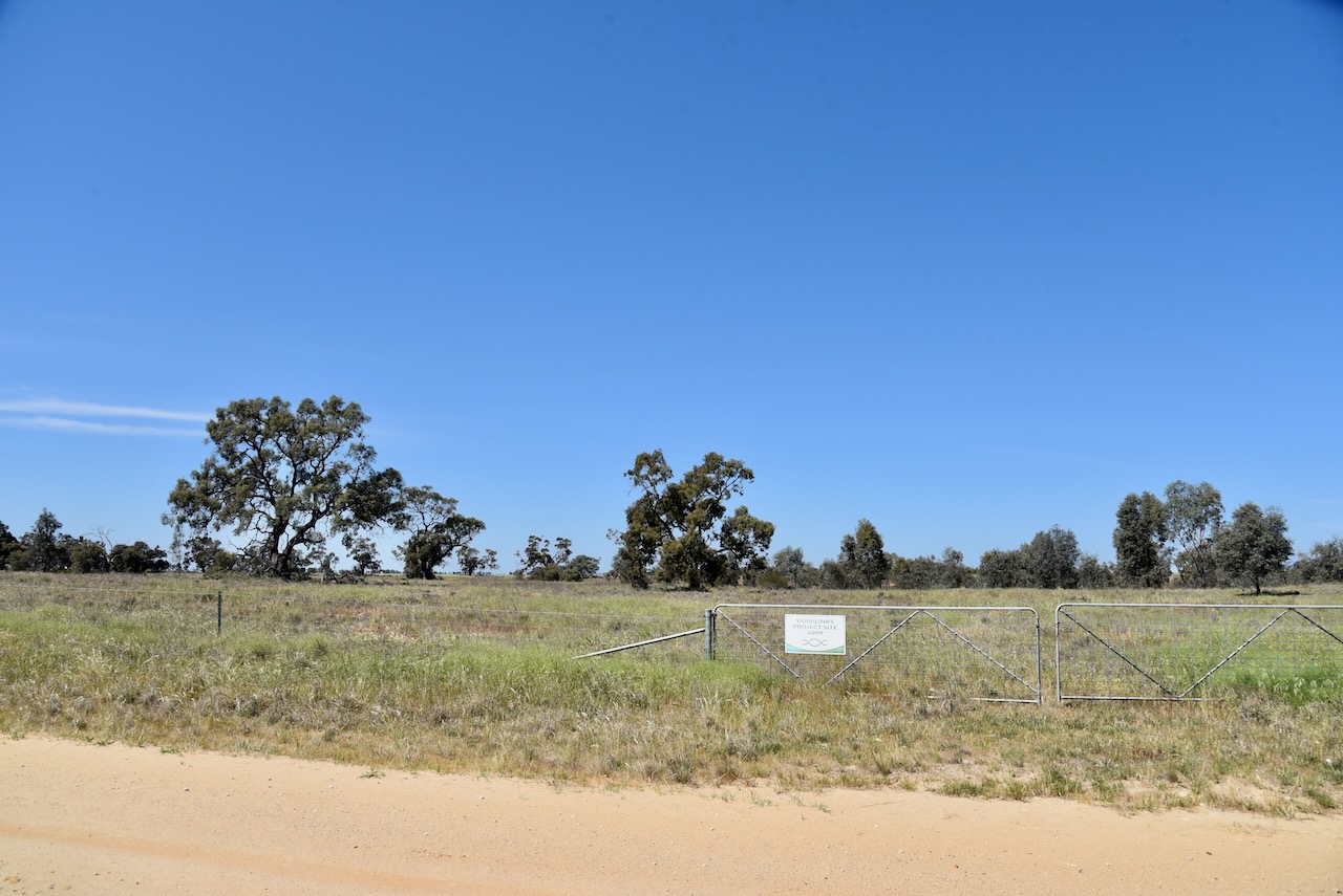
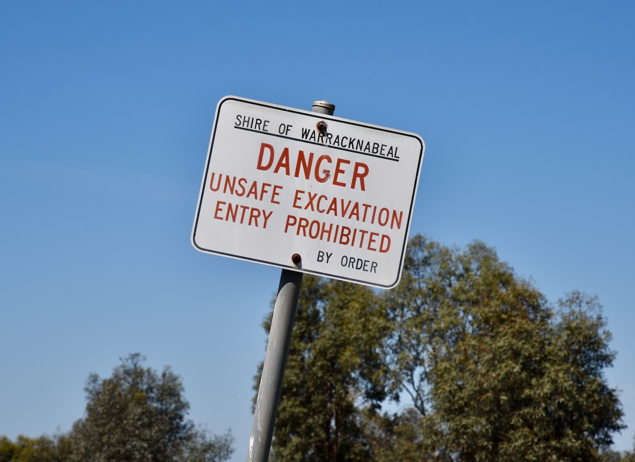
Marija and I left Warracknabeal and headed to the Nullan I104 Bushland Reserve VKFF-5669. Unfortunately, we encountered a sign which read ‘Danger. Unsafe Excavation. Entry Prohibited’. A check of Mapshare Victoria also showed that access was not allowed.
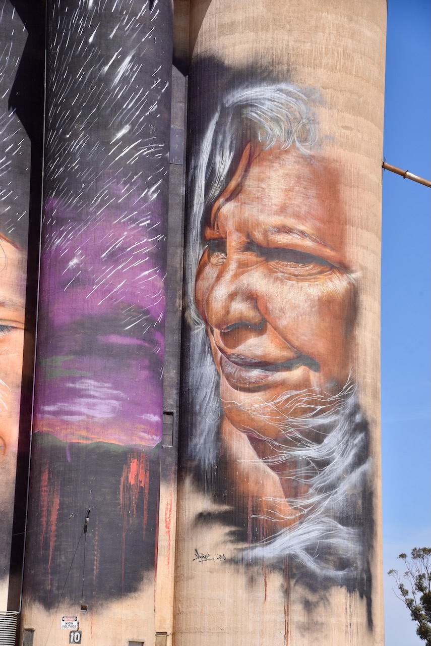
So it was off to option two, the Sheep Hills silo.
Sheep Hills takes its name from the Sheep Hills pastoral run in 1847 owned by Archibald McMillan. By 1866 a large homestead had been built on the property. By the 1870s the area had been divided into smaller holdings of land, several of which were taken up by Prussian Lutherans who had moved to Victoria from South Australia. (Aussie Towns 2024)
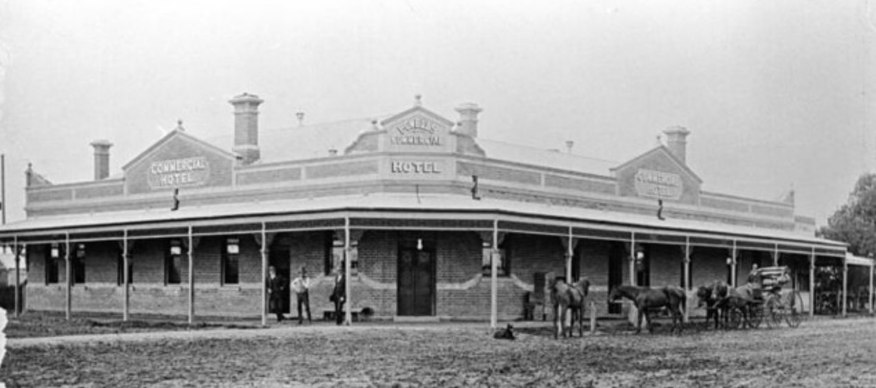
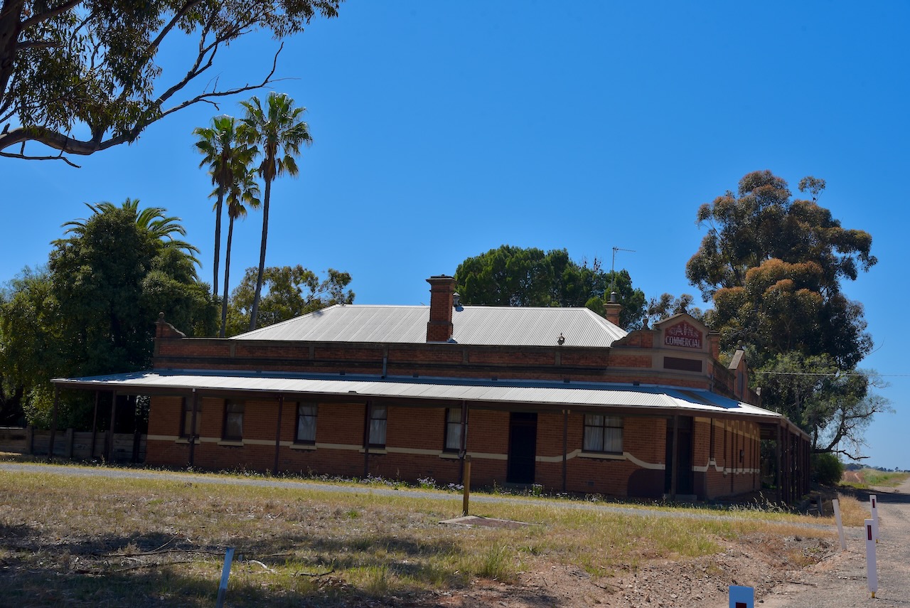
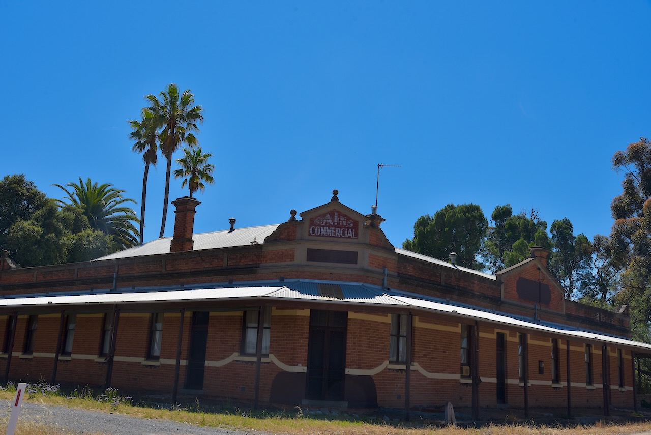
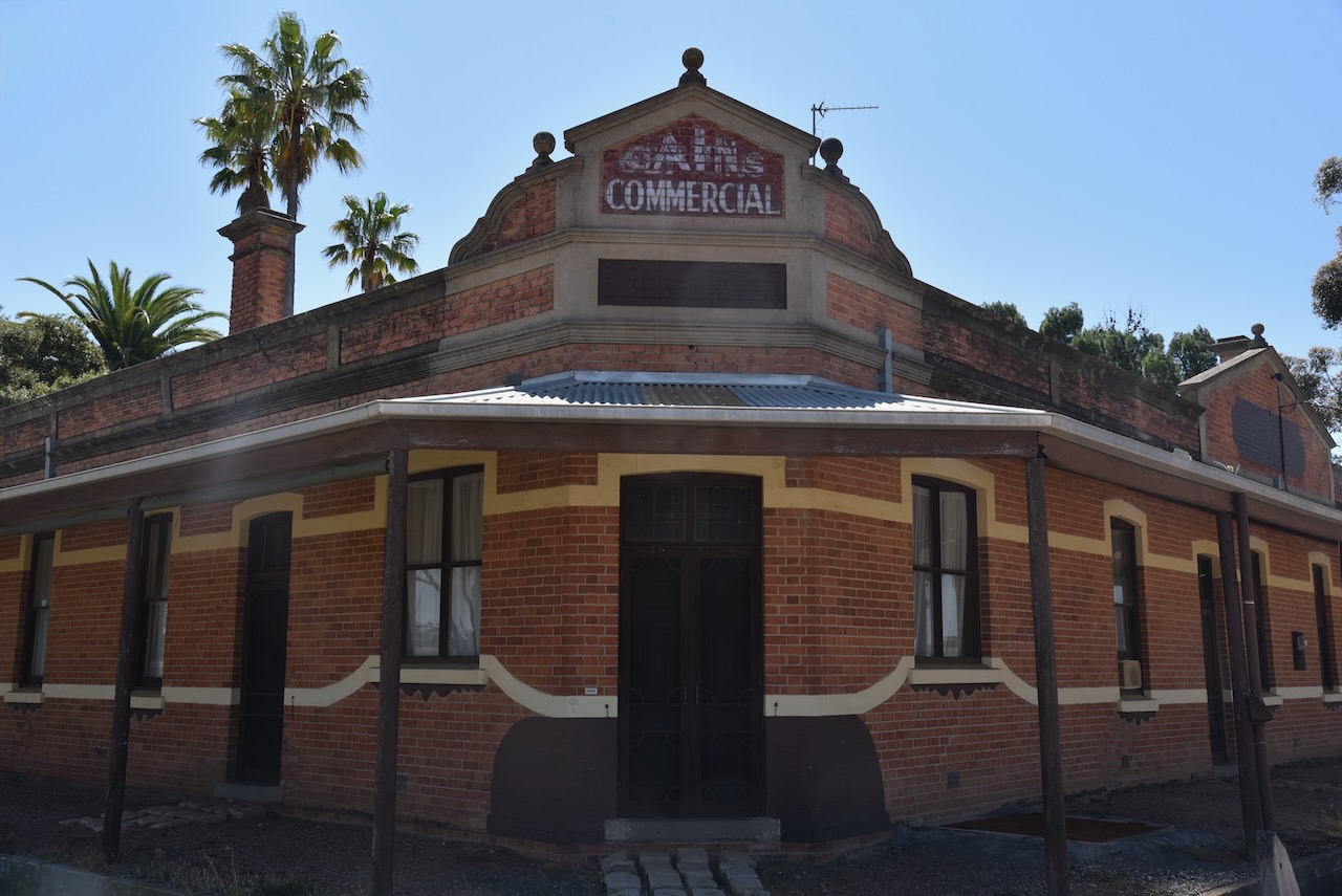
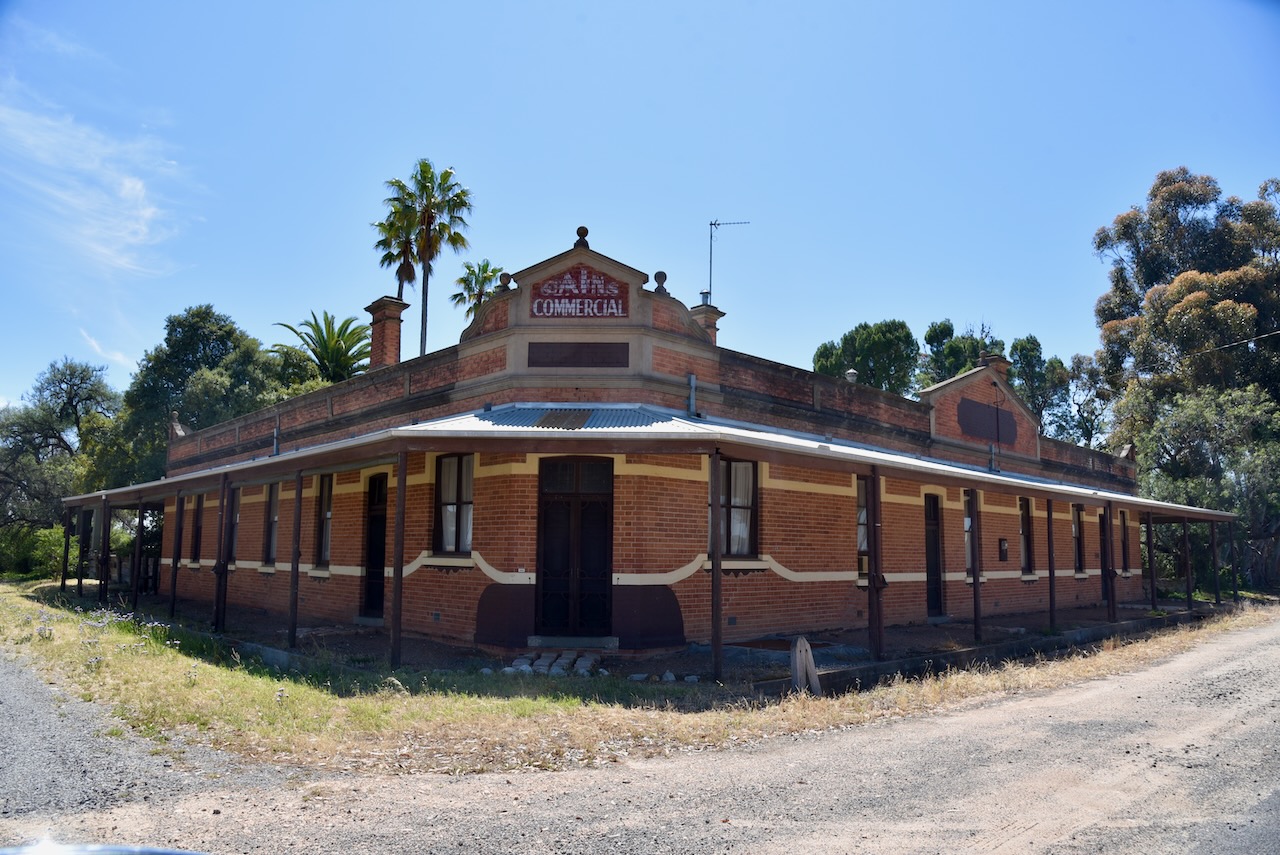
The most impressive building at Sheep Hills is the old hotel that was built in 1884 and was originally owned by Mr. D.Jenkins and was known as Jenkins Hotel. By 1903 it was known as the Railway Hotel. From 1915 it became the Commercial Hotel and was owned by Mr. John Vaughan. (Trove 2014) (Victorian Collections n.d.)
The old hotel at Sheep Hills, c. 1900. Image c/o Flickr.
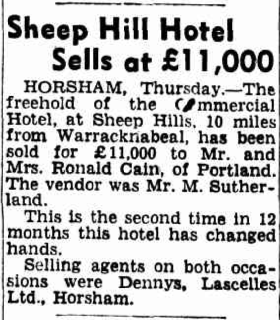
In 1950 the hotel was sold for 11,000 ponds to Mr and Mrs. Ronald Cain of Portland. It was the second time in 12 months that the hotel had changed hands.
Above:- Article from The Age Melbourne, Fri 27 Oct 1950. Image c/o Trove
Today this impressive old building is a private residence.
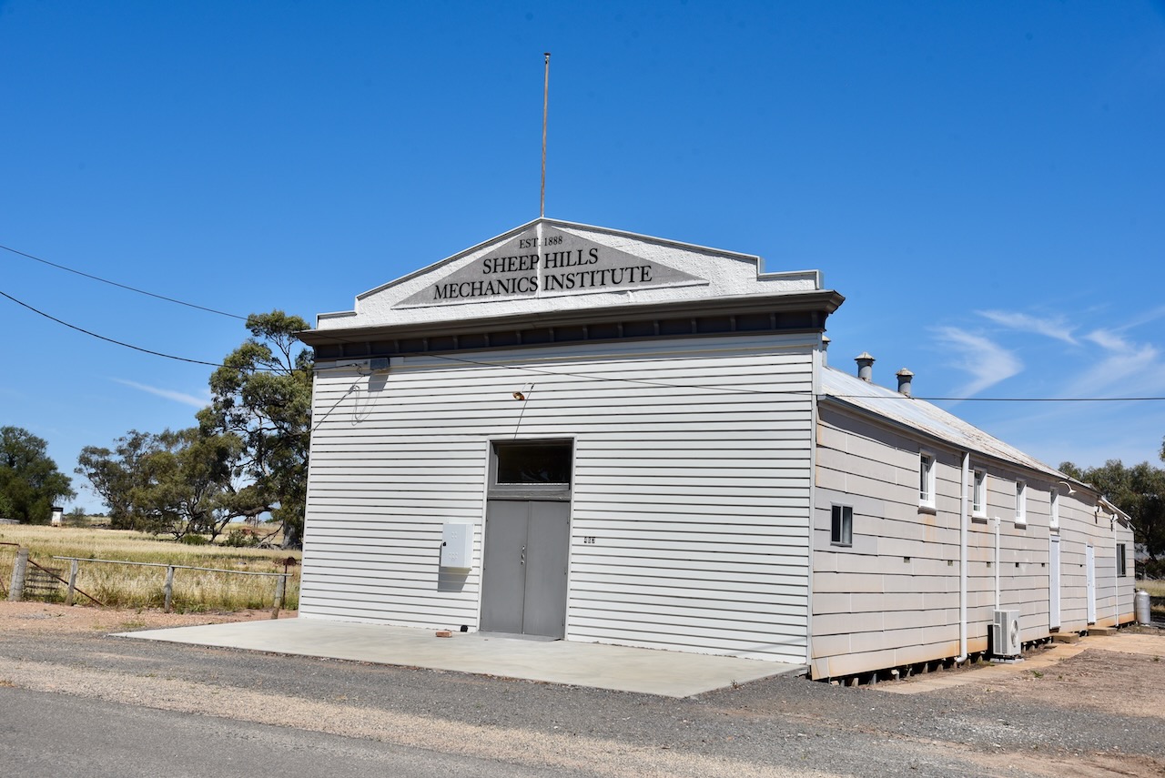
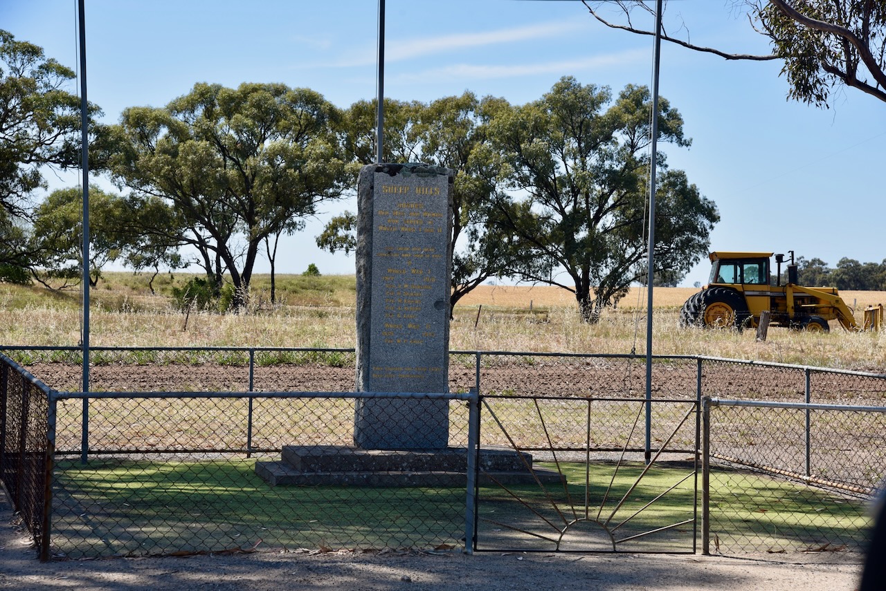
Other than the old hotel, not much remains at Sheep Hills. There is the Sheep Hills Mechanics Insitute which was established in 1888 and the Sheep Hills War Memorial.
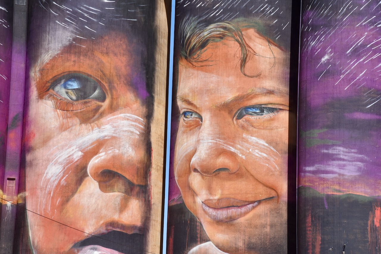
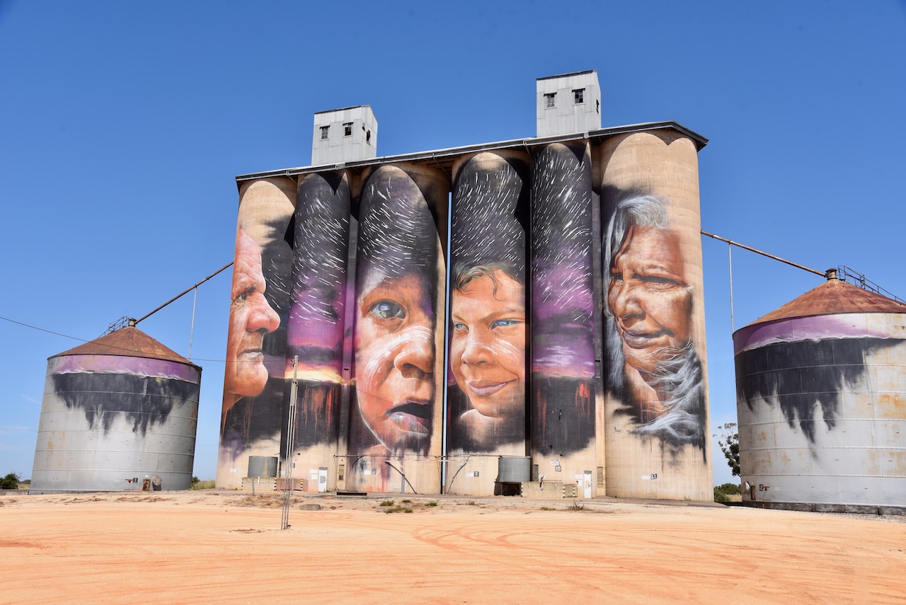
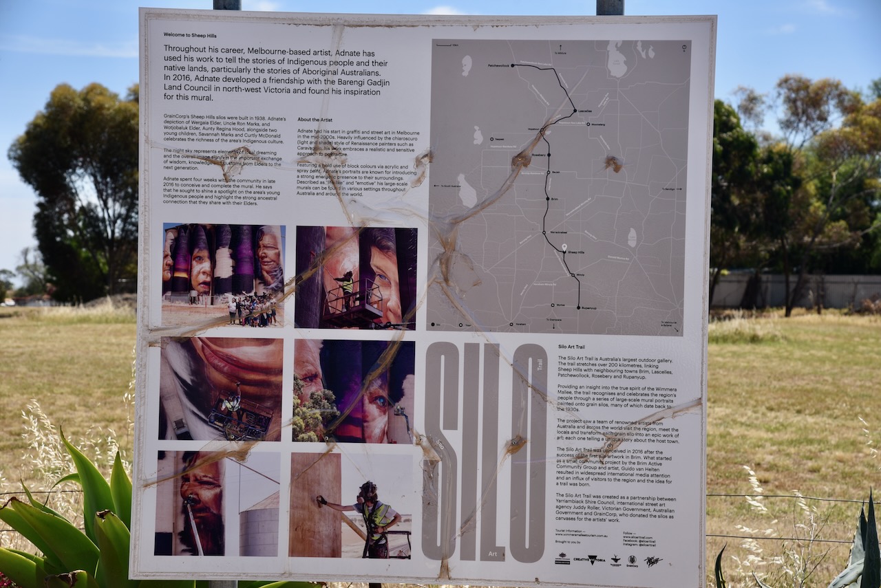
We then activated the Sheep Hills silo VK-SHS3. This was the second time that Marija and I had activated the silo for the Silos On The Air (SiOTA) program.
We parked in the silo carpark and operated from the 4WD, running the Icom IC-7000, 100 watts, and the Codan 9350 antenna with the 1.5-metre stainless steel whip.
Above:- The activation zone at the Sheep Hills silo. Image c/o SiOTA website.
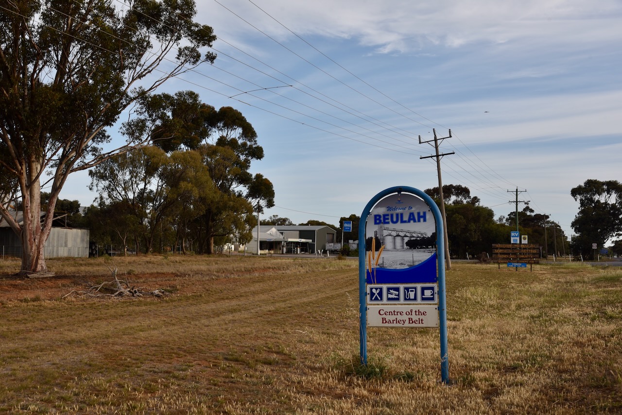
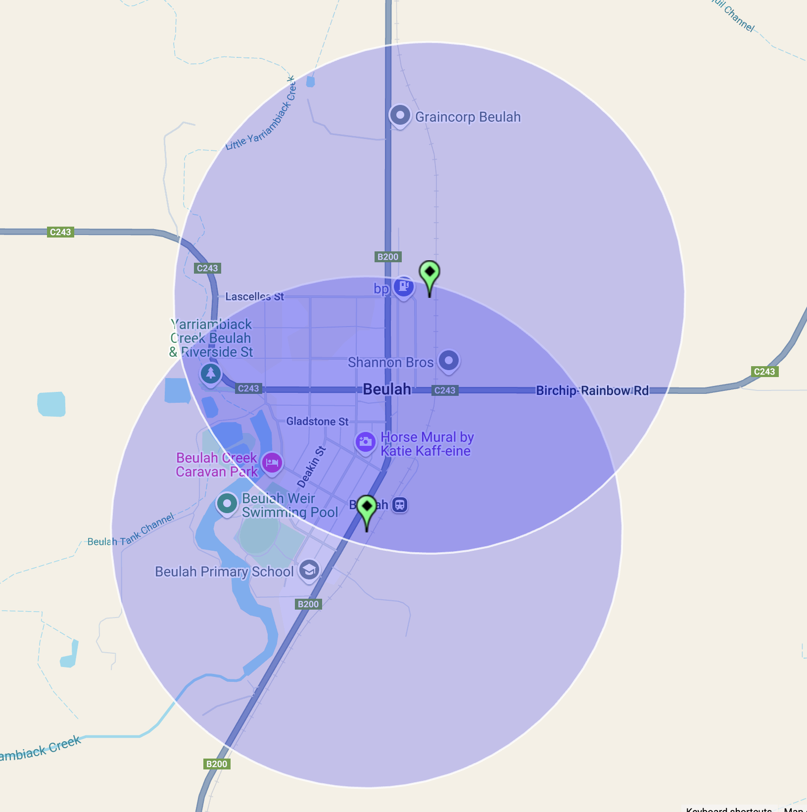
After leaving Rosebery on 20th October 2024, Marija and I headed south along the Henty Highway, with our next stop being the little town of Beulah.
Beaulah is located about 360 km northwest of Melbourne in northwest Victoria.
Above:- Map showing the location of Beaulah, Victoria. Map c/o Google Maps.
The origin of the name of this town is very interesting. The McKenzie family from Scotland subdivided land in the district in 1890. A survey was conducted and the town of Beulah was officially proclaimed in 1891. The McKenzie family were devout Presbyterians and Isaiah 62:4 was their inspiration in gaming the town:
“Thou shalt no more be termed Forsaken; neither shall thy land any more be termed Desolate: but thou shalt be called Hephzibah, and thy land Beulah: for the Lord delighteth in thee, and thy land shall be married.” (Aussie Towns 2024)
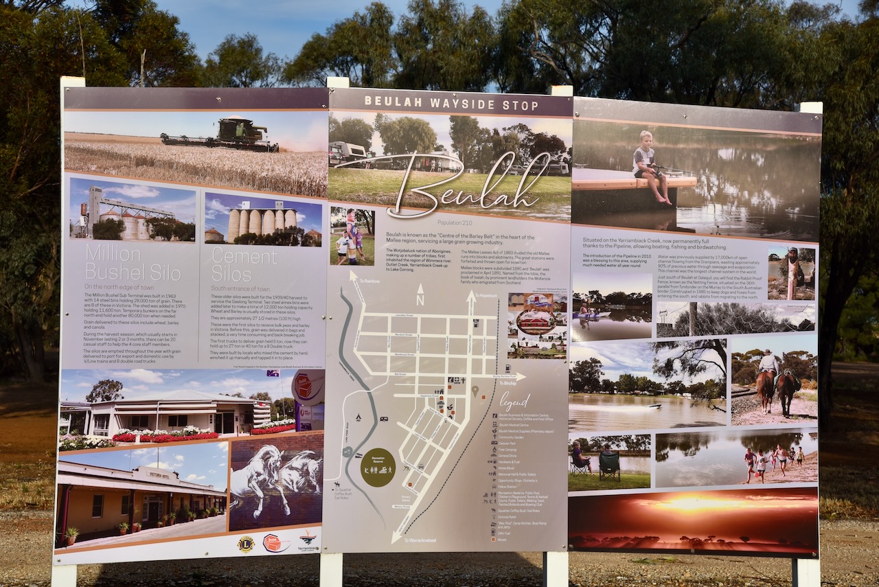
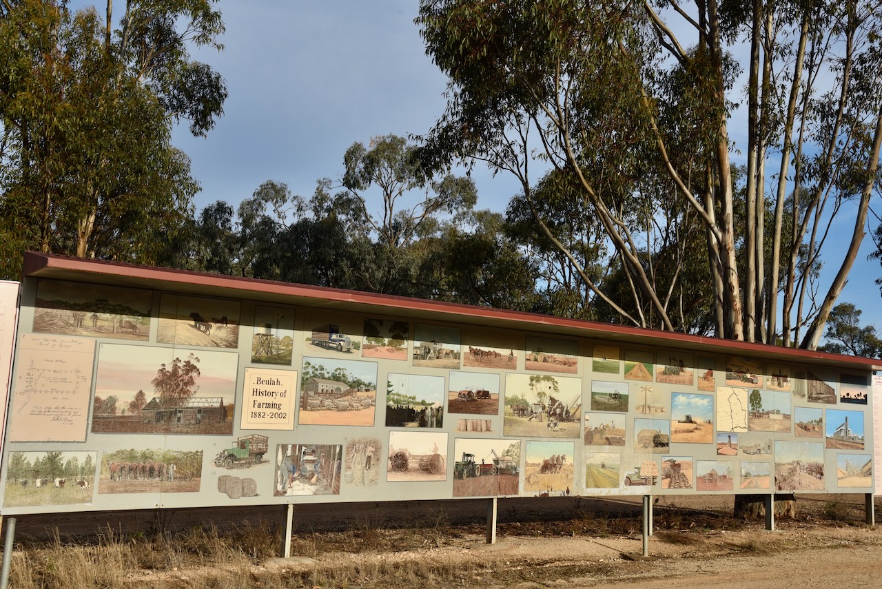
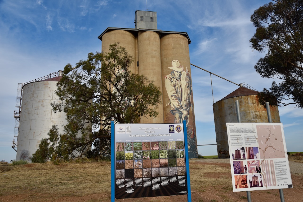
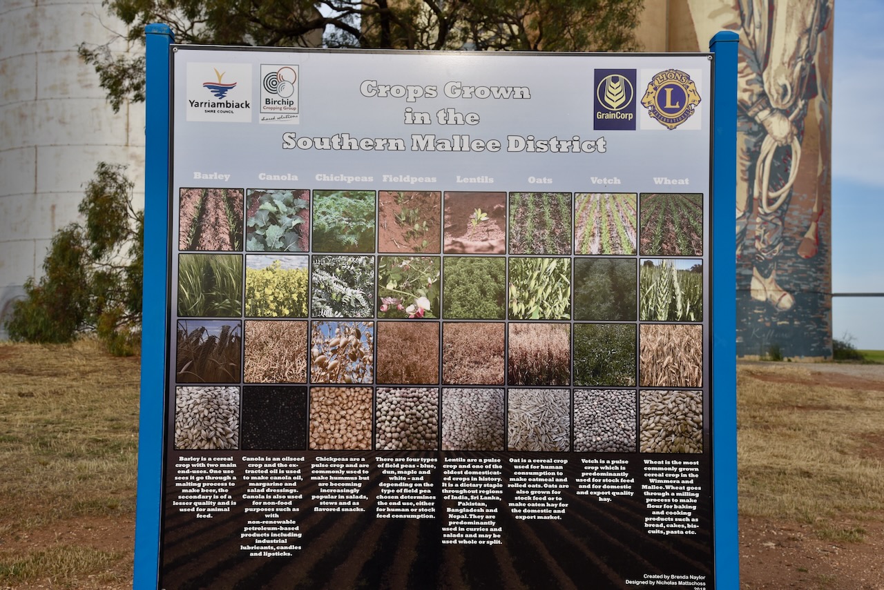
Today Beulah is known as the ‘Centre of the Barley Belt.’ As you enter the town there is an excellent information board and also a pictorial board of the history of farming in the Beulah district from 1882-2002.
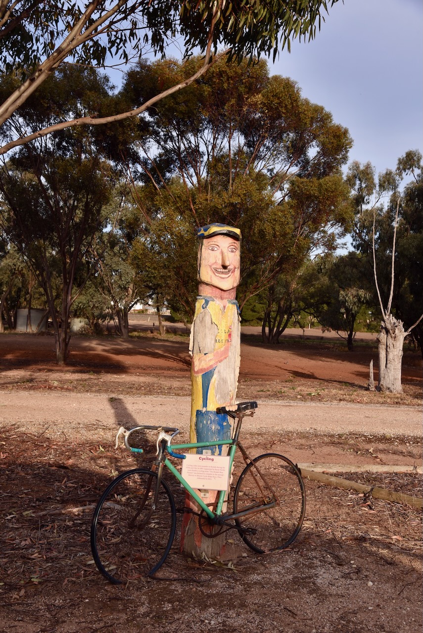
Close by is a wooden engraving of a cyclist and a bicycle. Cycling clubs were popular in Beulah during the 1920s and 1930s. In 2001 a cycling team called ‘The Beulah Blue Flames’ was formed to compete in the annual Murray to Moyne Cycle Relay Race. Sadly they disbanded in 2011.
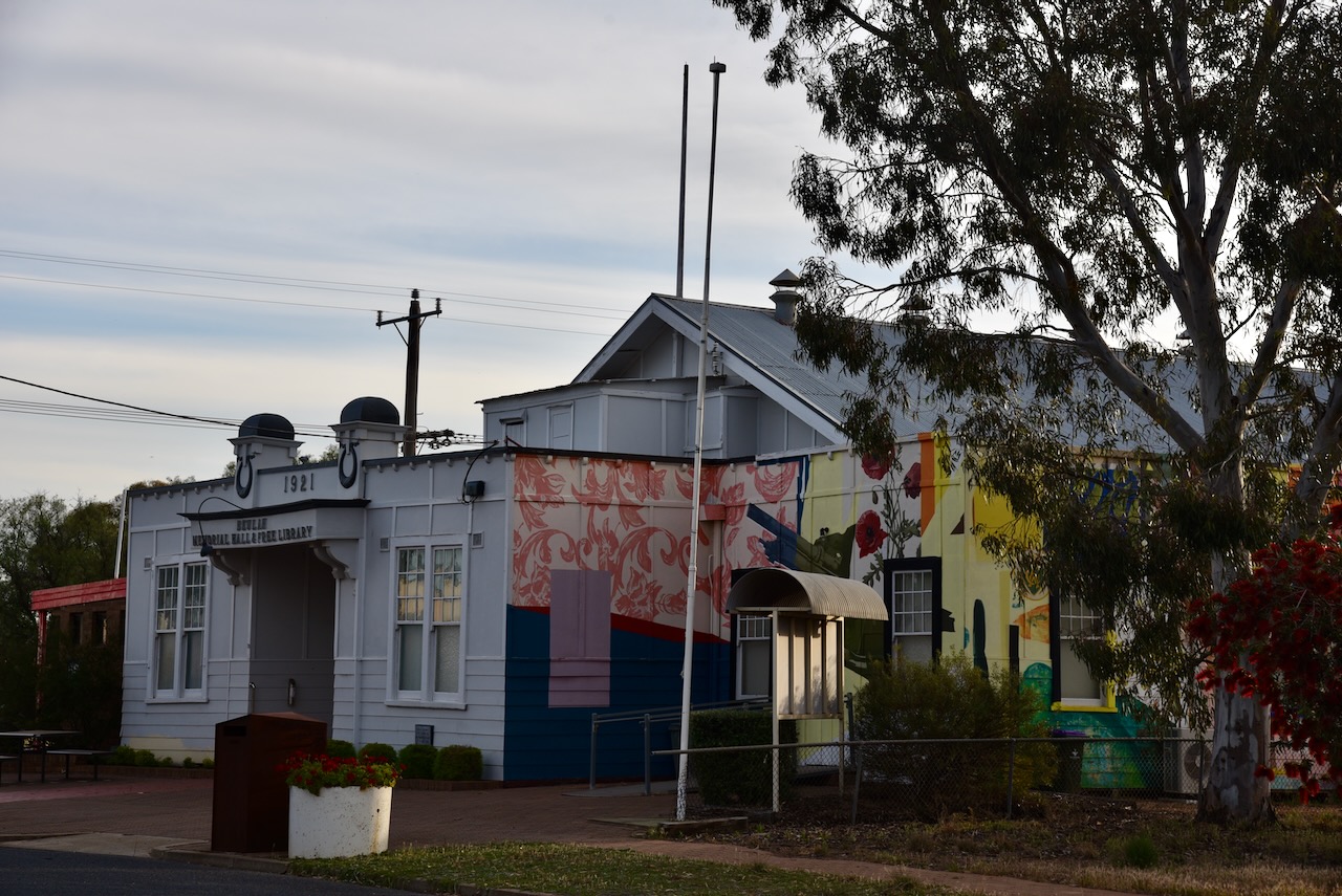
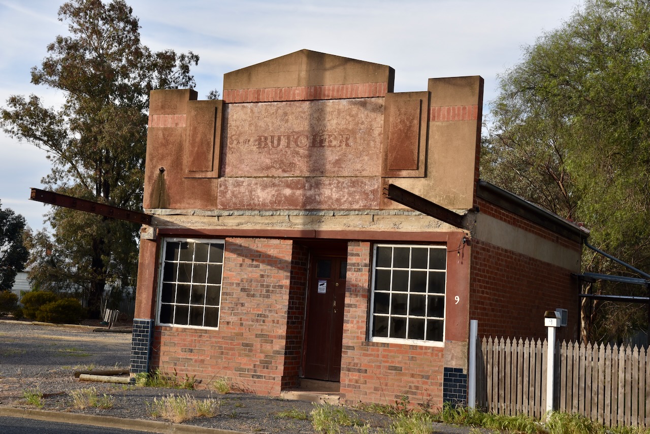
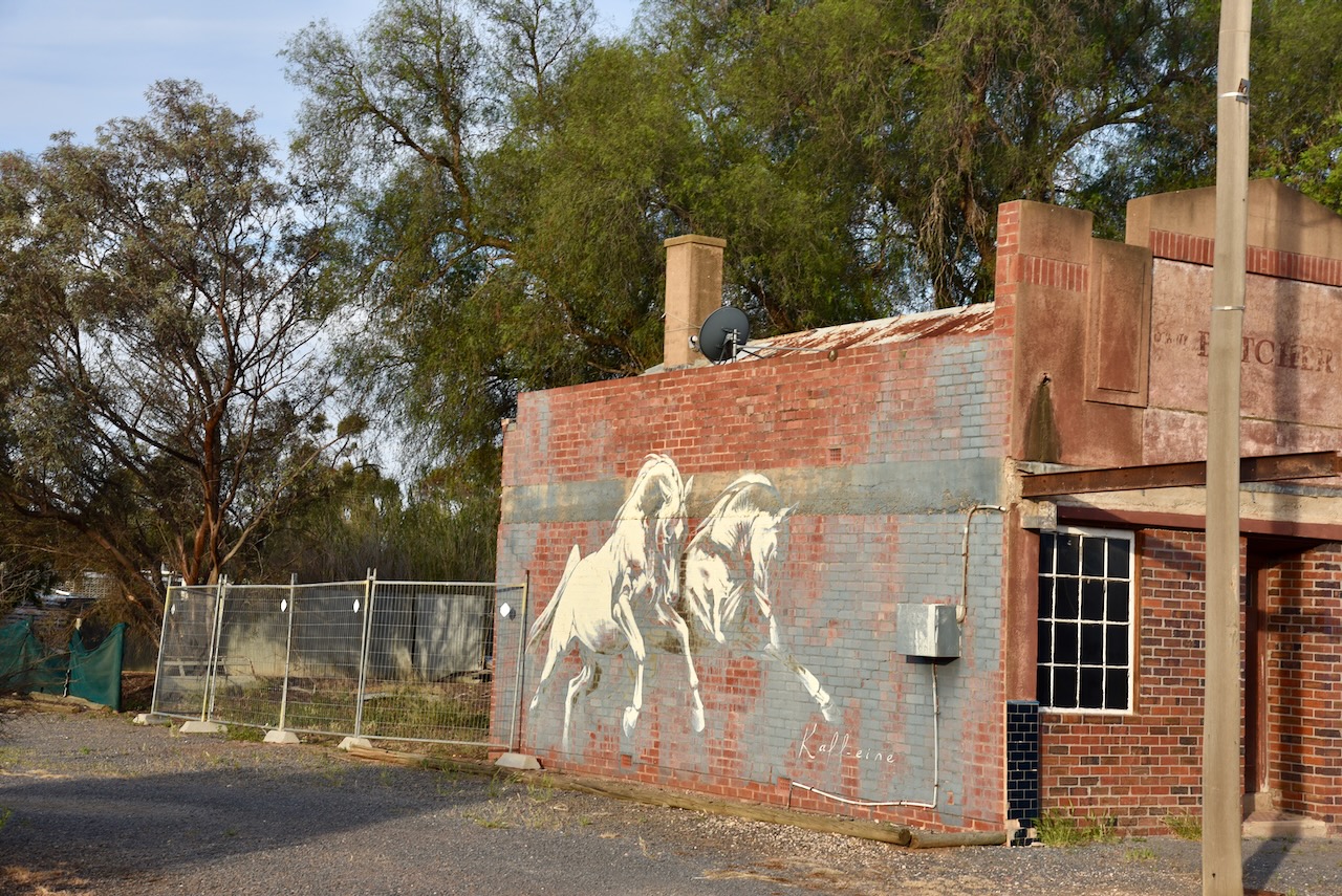
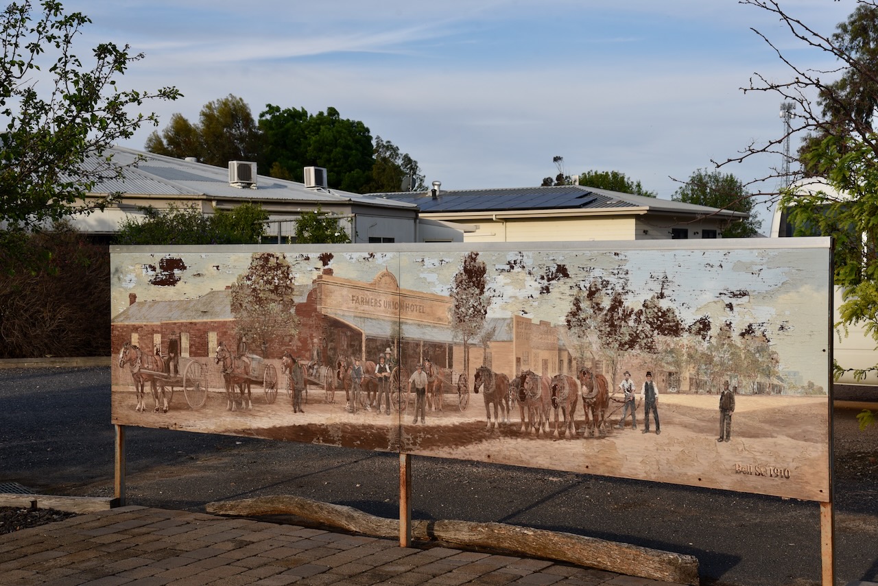
The main street of Beulah contains a number of historic buildings and sadly many empty shops.
On the side of the old butcher shop is a mural of two horses. The mural was pained by Kaff-eine, the same artist who painted the Rosebey silo. (White 2024)
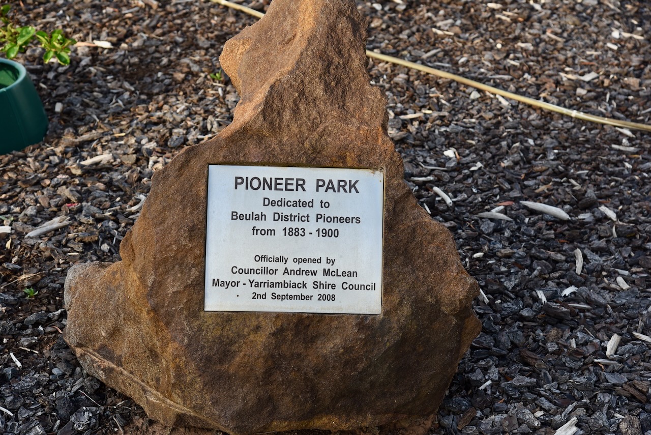
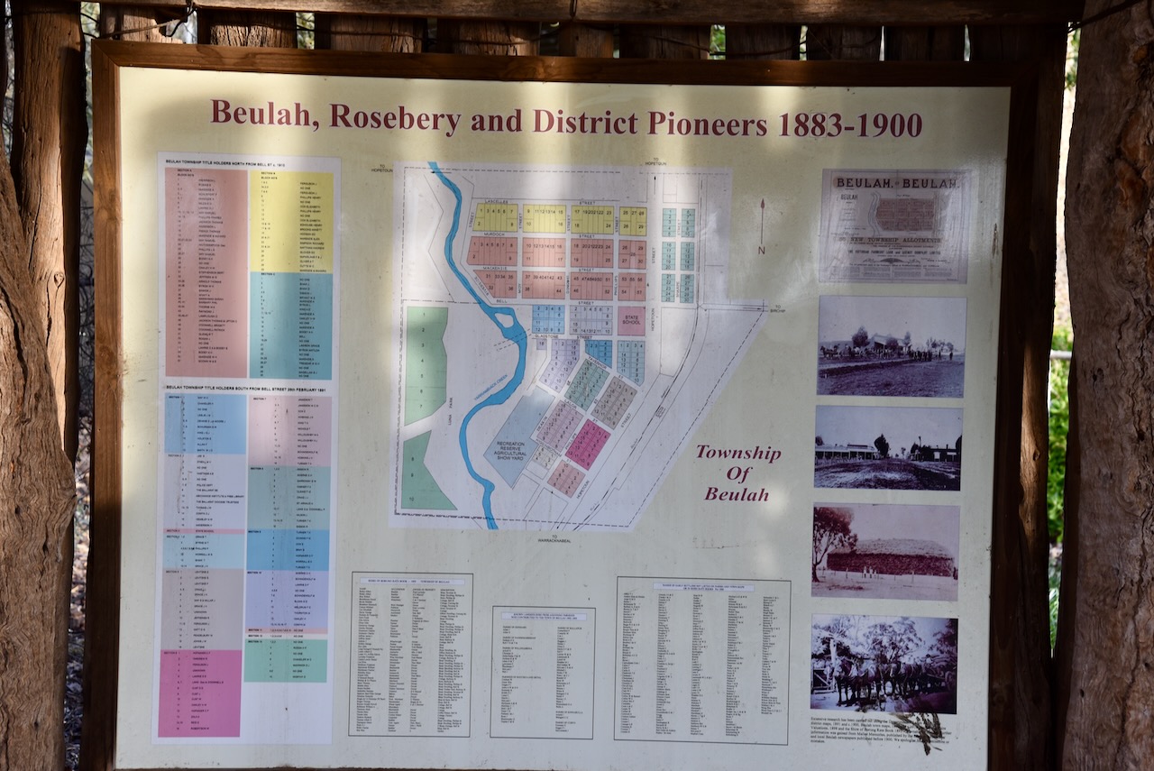
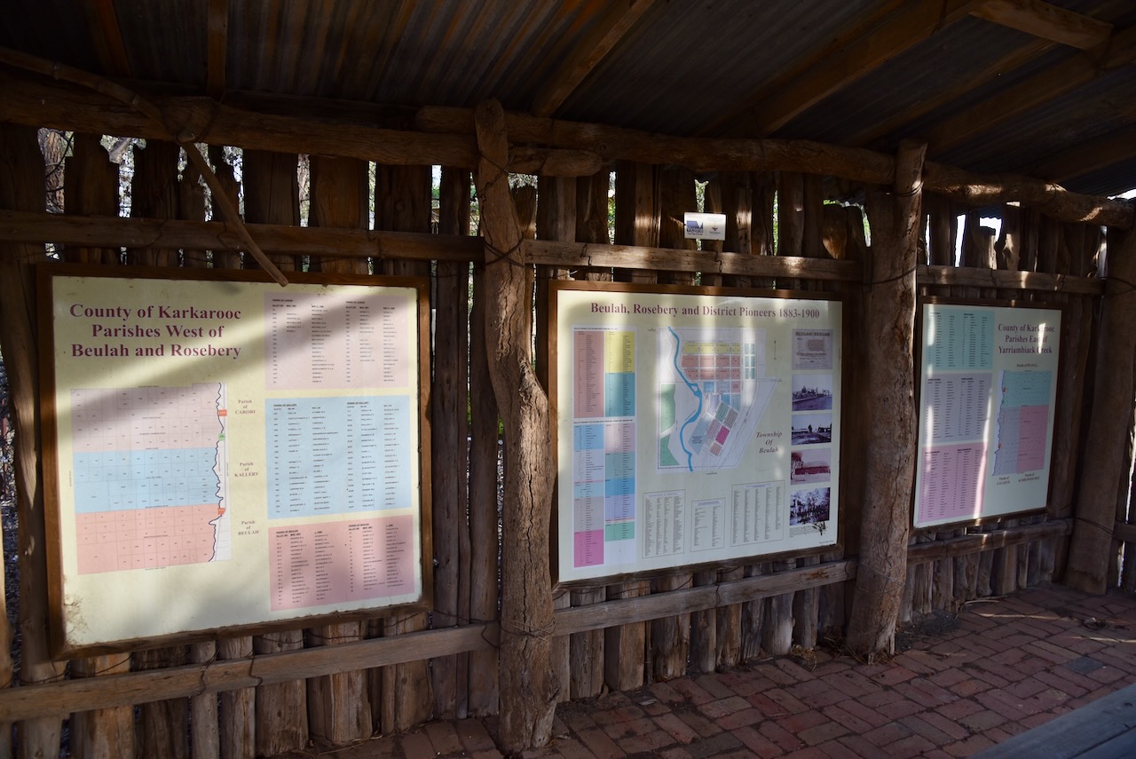
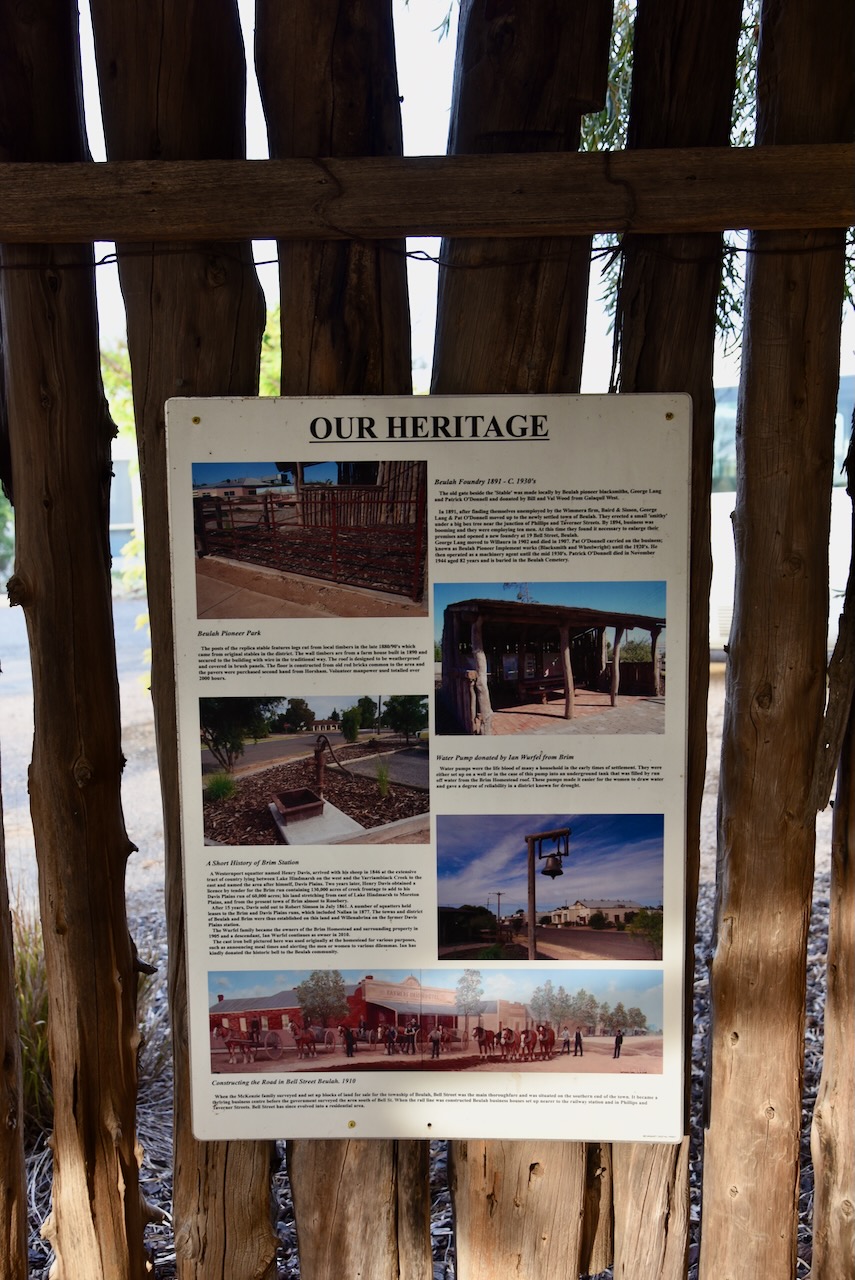
Pioneer Park in Beulah is well worth a visit. It is dedicated to the Beulah district pioneers.
There are information boards that detail the history of the district including a list of the original pioneers.
During 2019 Beaulah was one of 17 regional Victorian locations where ‘The Dry’ was filmed. The movie is a screen adaptation of Jane Harper’s best-selling novel. (ABC 2021)
Below is the official trailer for The Dry.
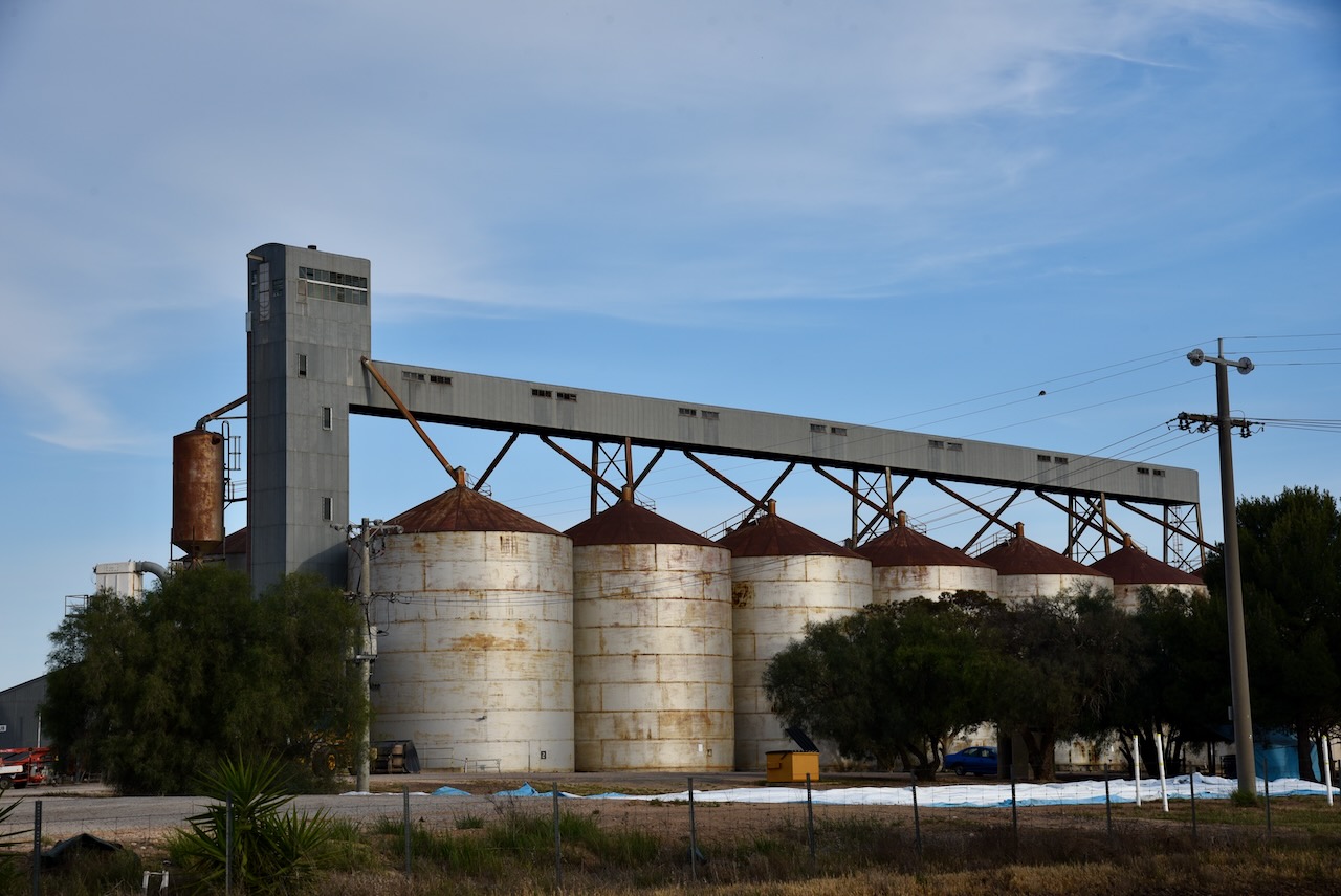
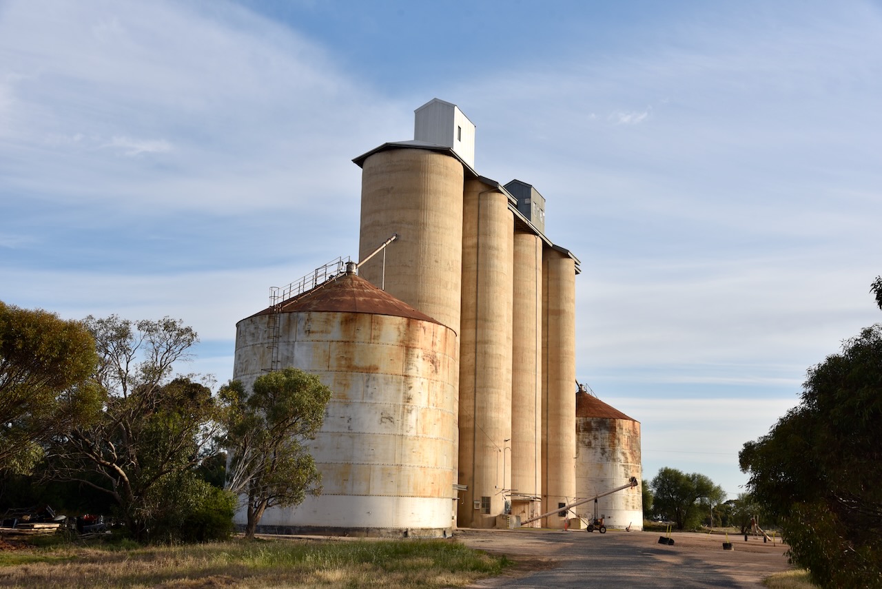
Beaulah has two sets of silos. On the northern edge of town you can find the Million Bushel Silo that was built in 1963. It has 14 steel bins holding 28,000 ton of grain. There are 8 of these in Victoria. The shed was added in 1970 holding 11,600 ton. Temporary bunkers on the far north end hold another 80,000 ton when needed. Grain delivered to these silos include wheat, barley and canola.
On the south entrance of the town are the older cement silos that were built for the 1839/1940 harvest to service the Geelong Terminal. Two steel annex bins were added later to make a total of 12,000-ton holding capacity. Wheat and barley is usually stored in these silos. These were the first silos to receive bulk peas and barley in Victoria. Before this, grain was delivered in bags and stacked, a very time- consuming and back-breaking job.
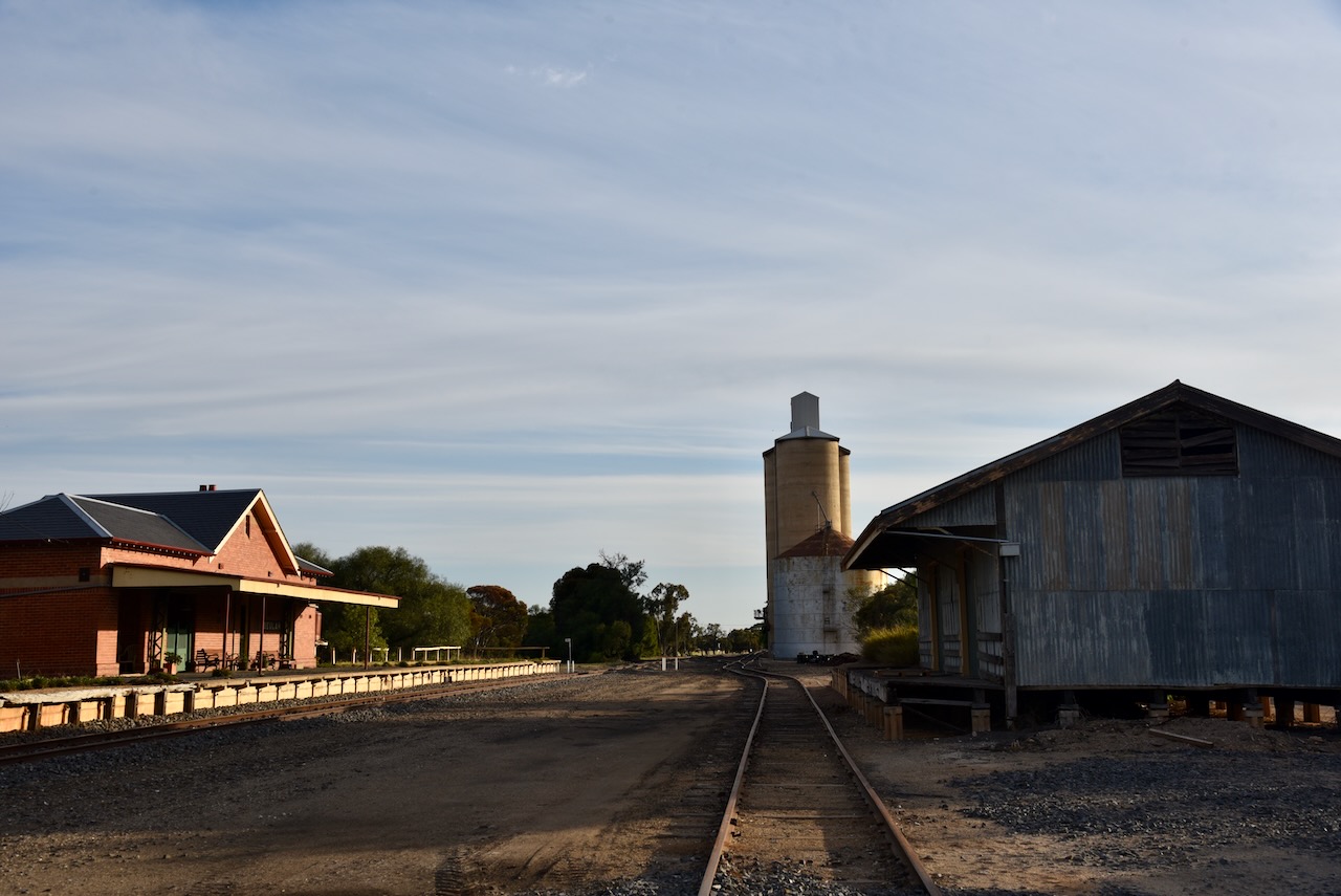
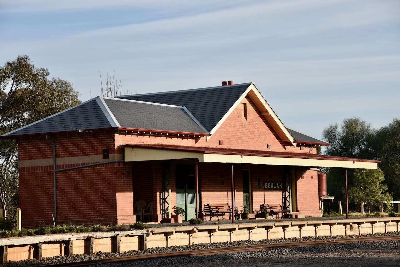
Adjacent to the cement silos is the old Beulah railway station. The railway line from Warracknabeal reached here in 1893.
We parked on the Henty Highway and operated from the 4WD for this activation. We ran the Icom IC-7000, 100 watts, and the Codan 930 antenna with the 1/5 metre stainless steel whip.
Above:- the activation zone at the two silos at Beulah. Image c/o SiOTA website.
Marija worked the following stations on 40m SSB:-
VK3WSG
VK1AO
VK2MET
VK3MRG
VK2LEE
I worked the following stations on 40m SSB:-
VK7PJM
VK3WSG
VK1AO
VK2MET
VK3MRG
VK2LEE
VK3APJ
VK4SMA
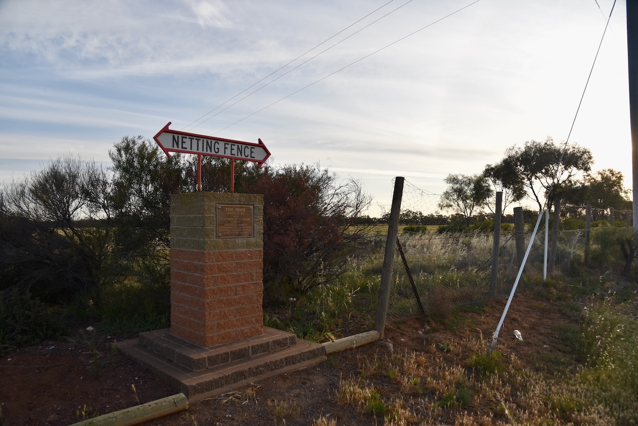
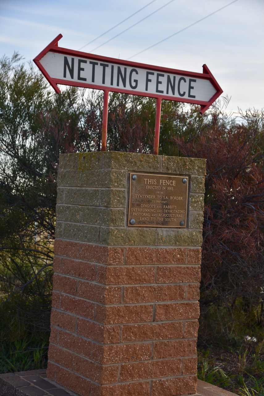
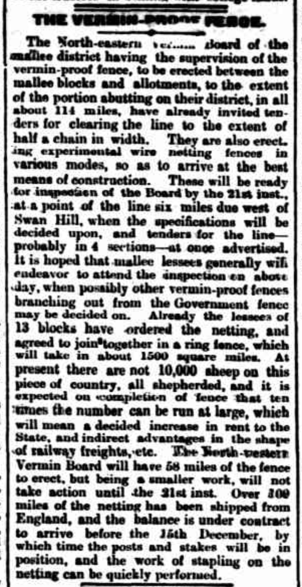
Marija and I left Beulah and stopped at the Netting Fence monument. The fence was erected in 1885 from Tyntynder in Victorian to the South Australian border to prevent dingoes and rabbits over running and devastating pastoral and agricultural land to the south.
The cost of erection of the fence was 70 pounds ($140.00) per mile (1.6 km). The fence was generally known as the Wimmera Wild Dog Fence. In 1959 all Government funding towards the maintenance of the fence was cased as it was considered the fence had outlasted its purpose. The wild dogs had been poisoned and trapped.
Above:- Article from the Kerang Times & Swan Hill Gazette, Tues 11 Aug 1885. Image c/o Trove
We soon reached Warracknabeal and headed to one of the local hotels, The Creekside Hotel, where we enjoyed a very nice meal.
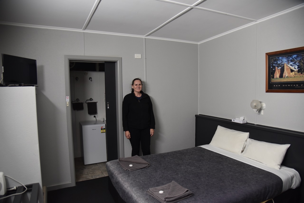
Marija and I then headed to our accommodation at the Warrack Motel.
Our next activation was the Rosebery silo VK-RSY3.
Rosebery is located about 371 km northwest of Melbourne in northwest Victoria.
Above:- Map showing the location of Rosebery. Map c/o Google Maps.
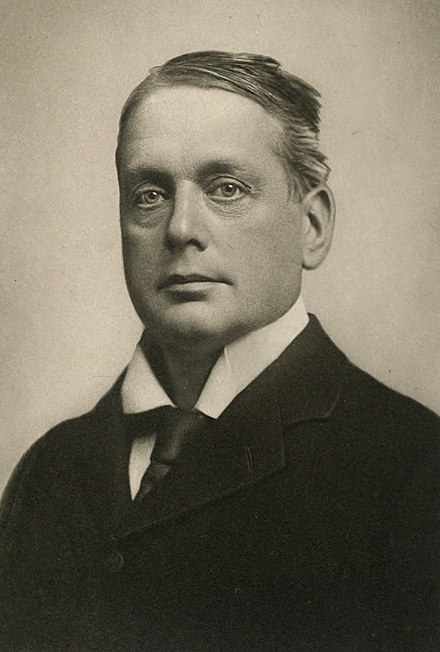
The town of Rosebery was named after Archibald Philip Primrose, 5th Earl of Rosebery. Between September 1883 to January 1884 he toured Australia. He later became the British Prime Minister from 1894 to 1895. (Aussie Towns 2024)
Above:- Archibald Philip Primrose. Image c/o Wikipedia.
European settlement in the Rosebery area commenced in the 1870s. It had a hotel and a general store. By 1887 a school had opened. By 1894 the railway had reached Rosebery. It was also in this year that the local football club was formed. It remained in existence until 1970. By 1900 Rosebery had a general store, a blacksmith, a public hall, a hotel, and a Presbyterian church. Three years later in 1903, Rosebery’s population was 100 people. (Aussie Towns 2024)
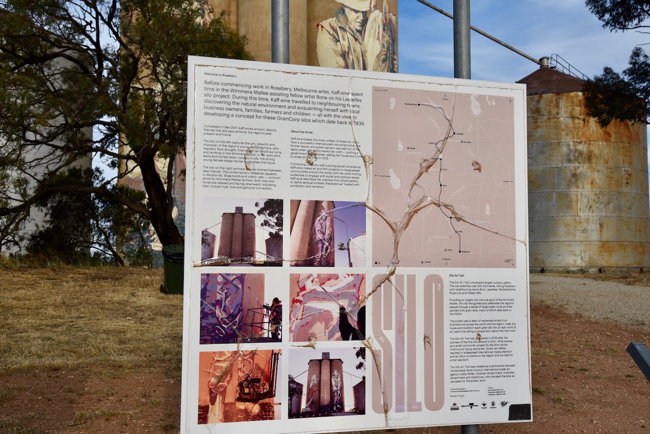
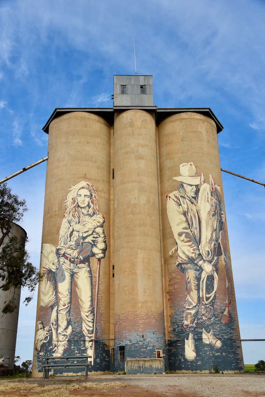
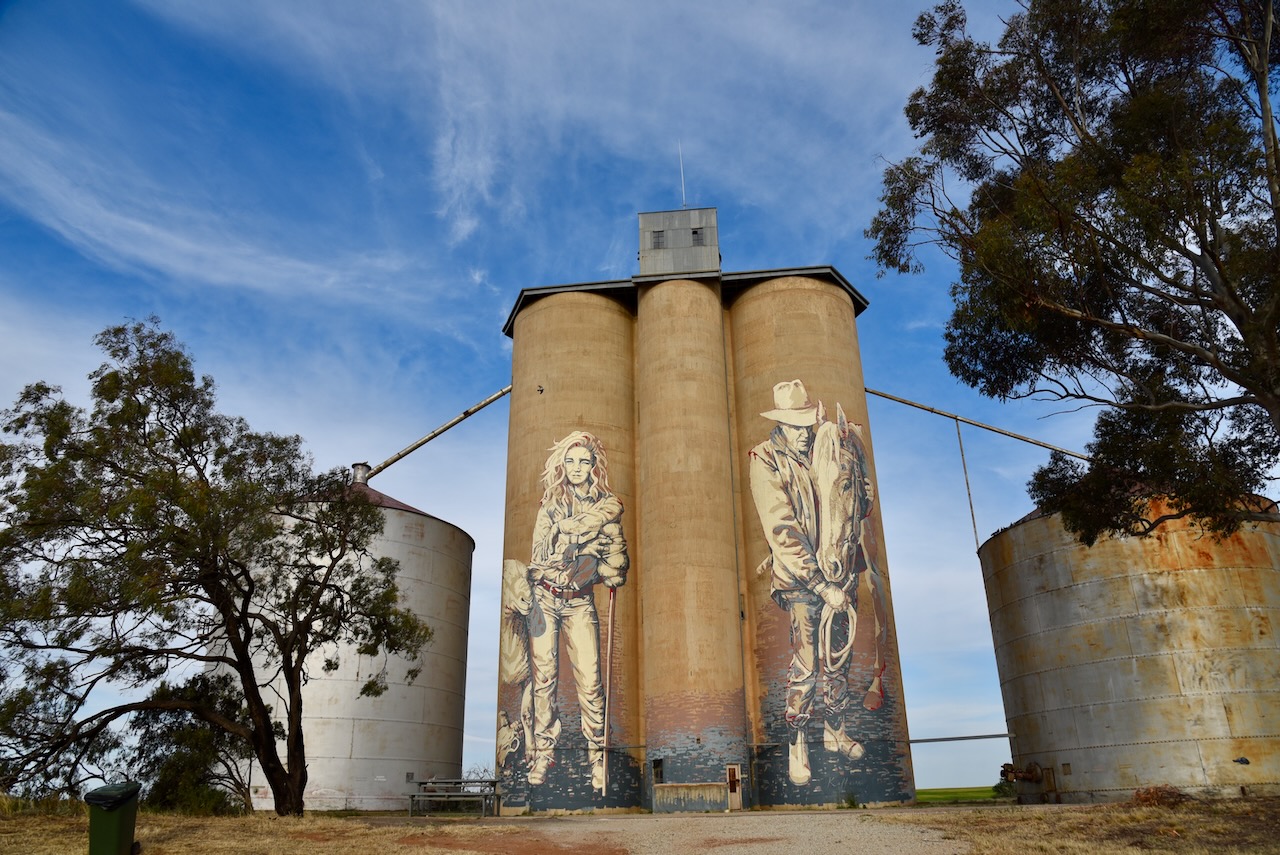
The grain silos at Rosebery were built in 1939. (Aussie Towns 2024)
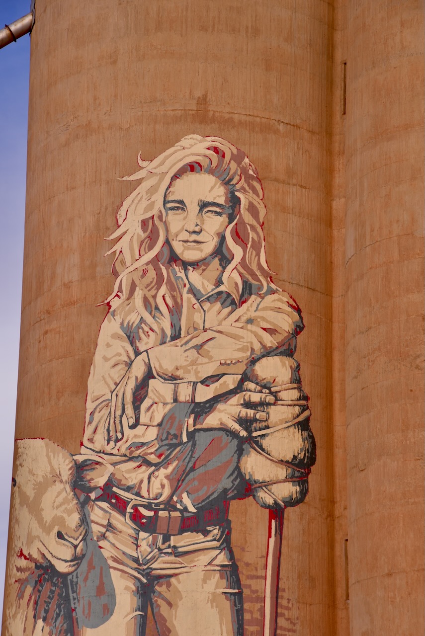
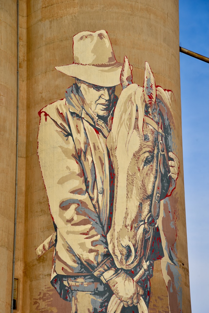
In late 2017 the Rosebery silos became part of the Australian silo art trail. Arist Kaff-eine painted the image of a young female farmer. On the adjacent silo, Kaff-eine painted a stockman and his horse. (Australiansiloarttrail.com, 2024)
Below is a great video on Rosebery and the Rosebery silo.
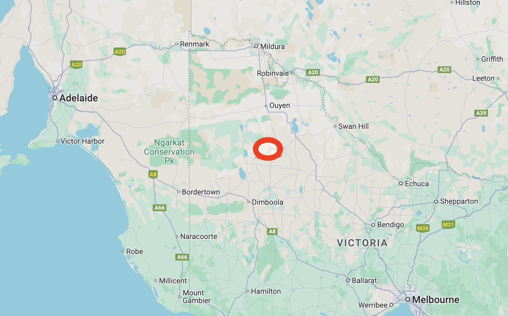
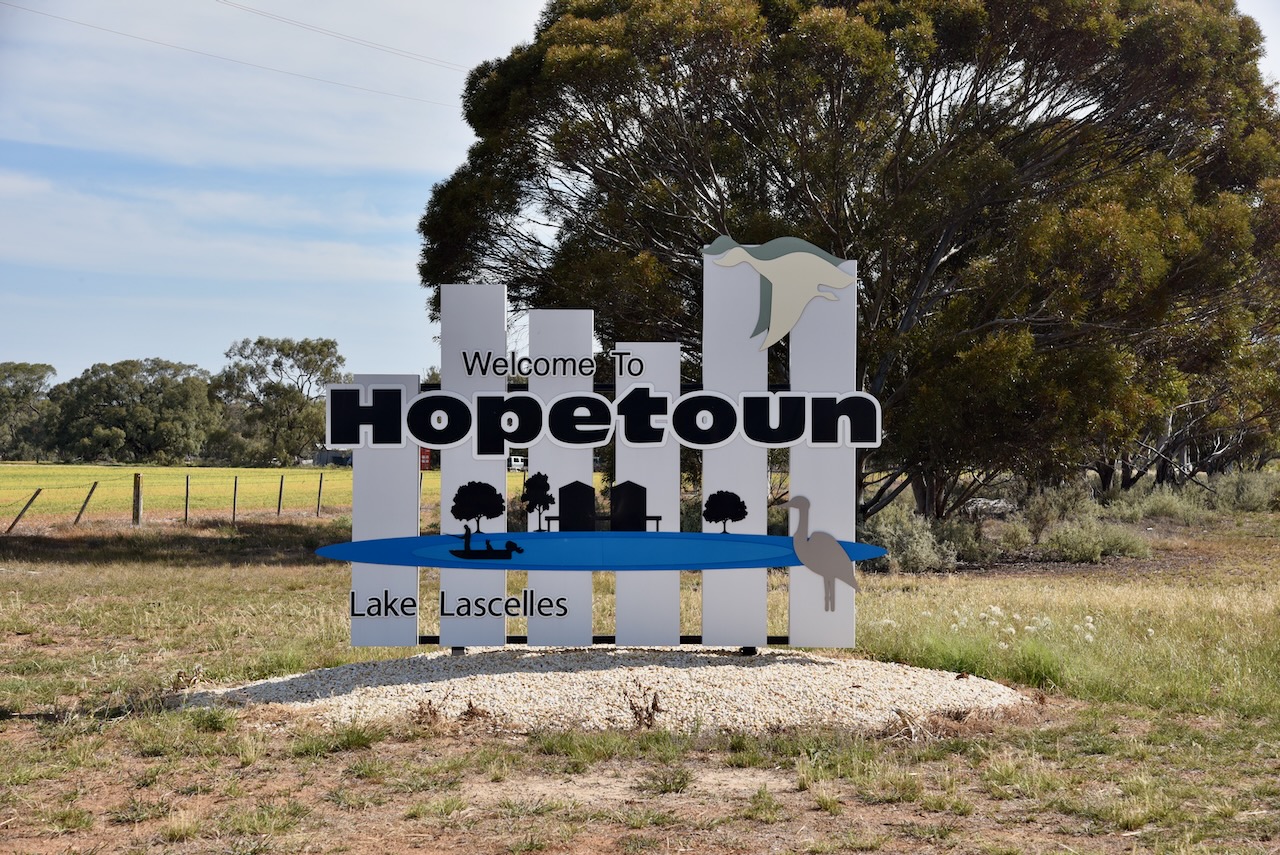
After leaving the Patchewollock North Bushland Reserve on Thursday 20th October 2024, Marija and I headed south to our next stop, the little town of Hopetoun. We had planned on activating the two silos there for the Silos On The Air (SiOTA) program.
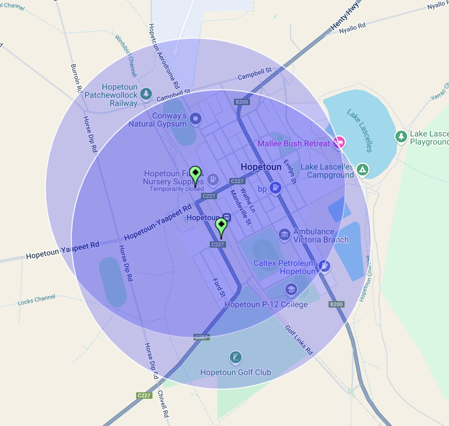
Hopetoun is located about 385 km northwest of Melbourne in the Mallee region of northwest Victoria.
Above:- Map showing the location of Hopetoun in northwest Victoria. Map c/o Google Maps.
Prior to European settlement, the area was inhabited by the Yarrikaluk aboriginal people. The Wotjobaluk and Wergaia aboriginal people were also in the area. (Aussie Towns 2024)
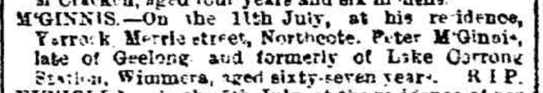
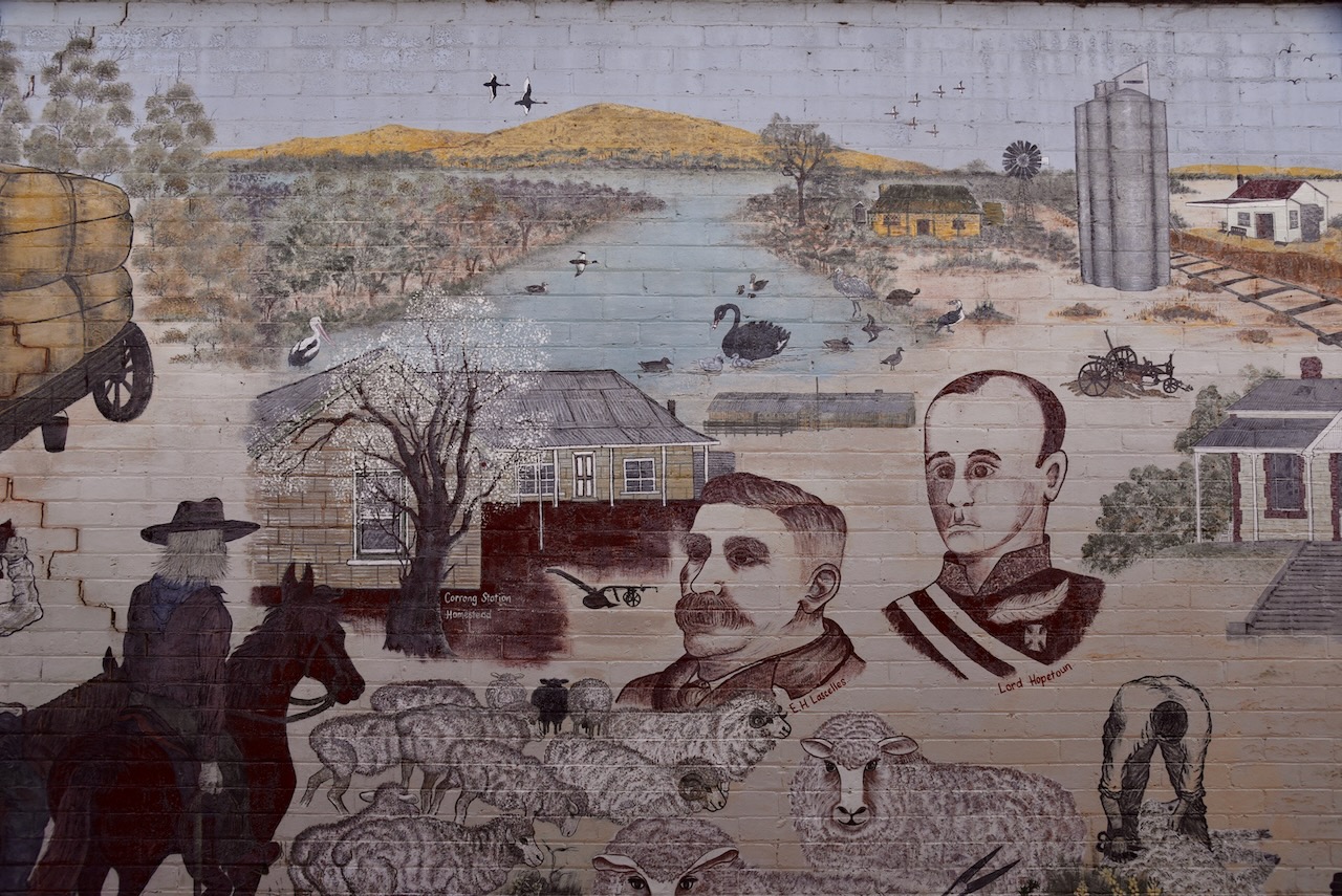
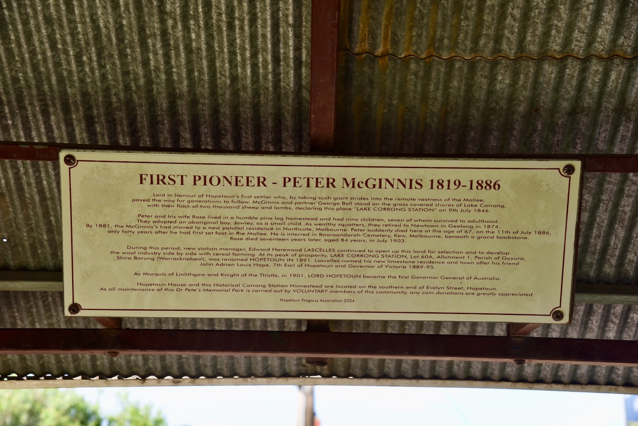
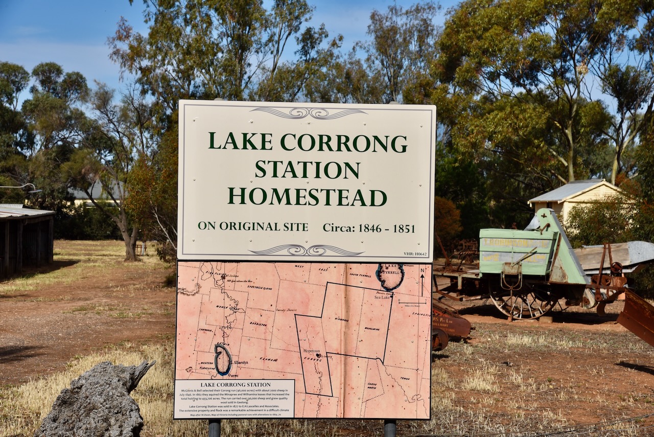
The first European to call the area home was Peter McGinnis (b. 1819. d. 1886). He was born in 1819 in Country Armagh, Ireland. He married Rose Lappin. Peter and Rose emigrated to Australia in 1841. In July 1846 he established a sheep run called ‘Lake Corrong.’ They lived in a humble pine log homestead and had nine children. They also adopted an aboriginal boy, Jowley. McGinnis became a wealthy squatter and in 1874 retired to Newtown in Geelong. By 1881 they had moved to Northcote, Melbourne. Peter died in 1886, aged just 67 years of age. (ancestry.com.au) (Aussie Towns 2024)
Above:- Article from the Weekly TImes Melbourne, Sat 17 Jul 1886. Image c/o Trove.
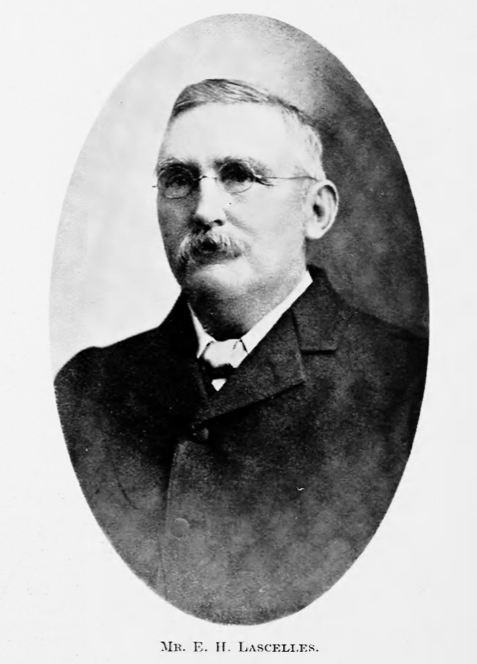
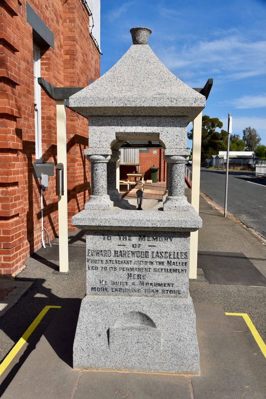
The town of Hopetoun was named by Edward Harewood Lascelles (b. 1847. d. 1917) who was a pastoralist and businessman and was known as the ‘Father of the Mallee’. He purchased ‘Lae Corrong’ from McGinnis. He named his house Hopetoun and subsequently the town. Hopetoun was the name of the seventh Earl of Hopetoun, Lord Hopetoun. He was the Governor of Victoria from 1889-1895 and the first Governor General of Australia from 1901-1903. Hoeptoun was a friend of Lascelles and visited Lascelles’ house frequently. (Aussie Towns 2024) (Wessels 1974)
Above:- Edward Harewood Lascelles. Image c/o The Pastoral Review, 15 Mar 1915.
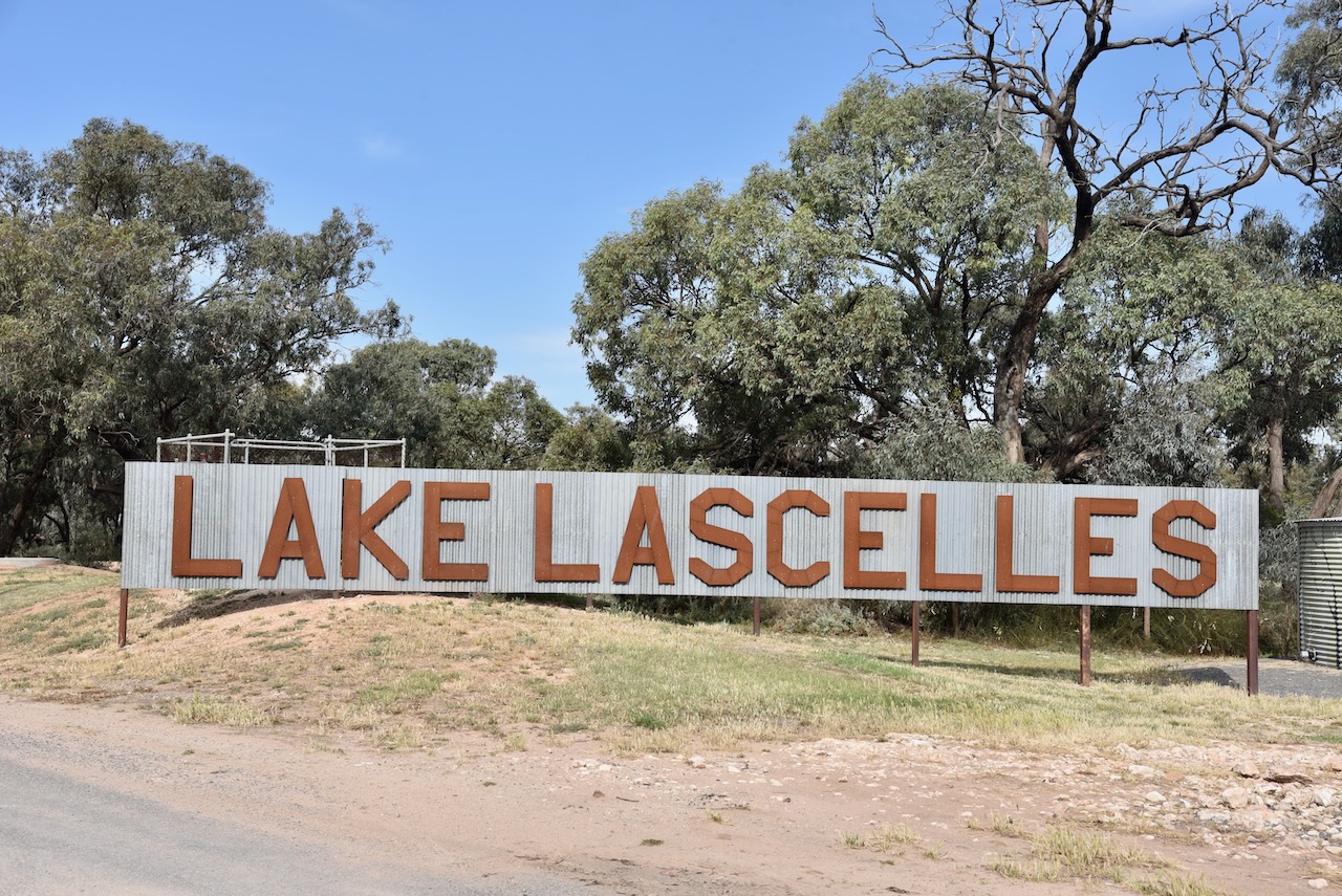
Hopetoun is located on Yarriambiac Creek and the beautiful Lake Lascelles.
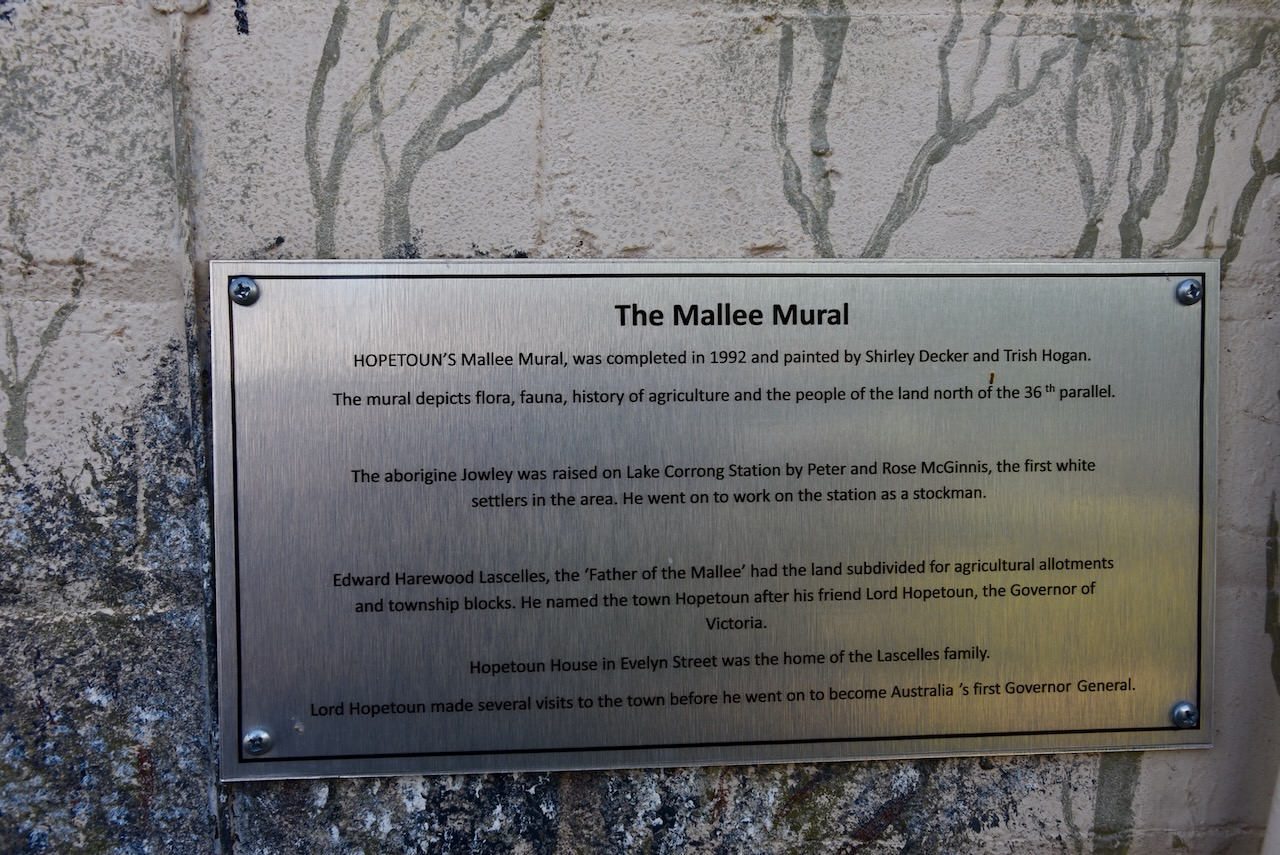
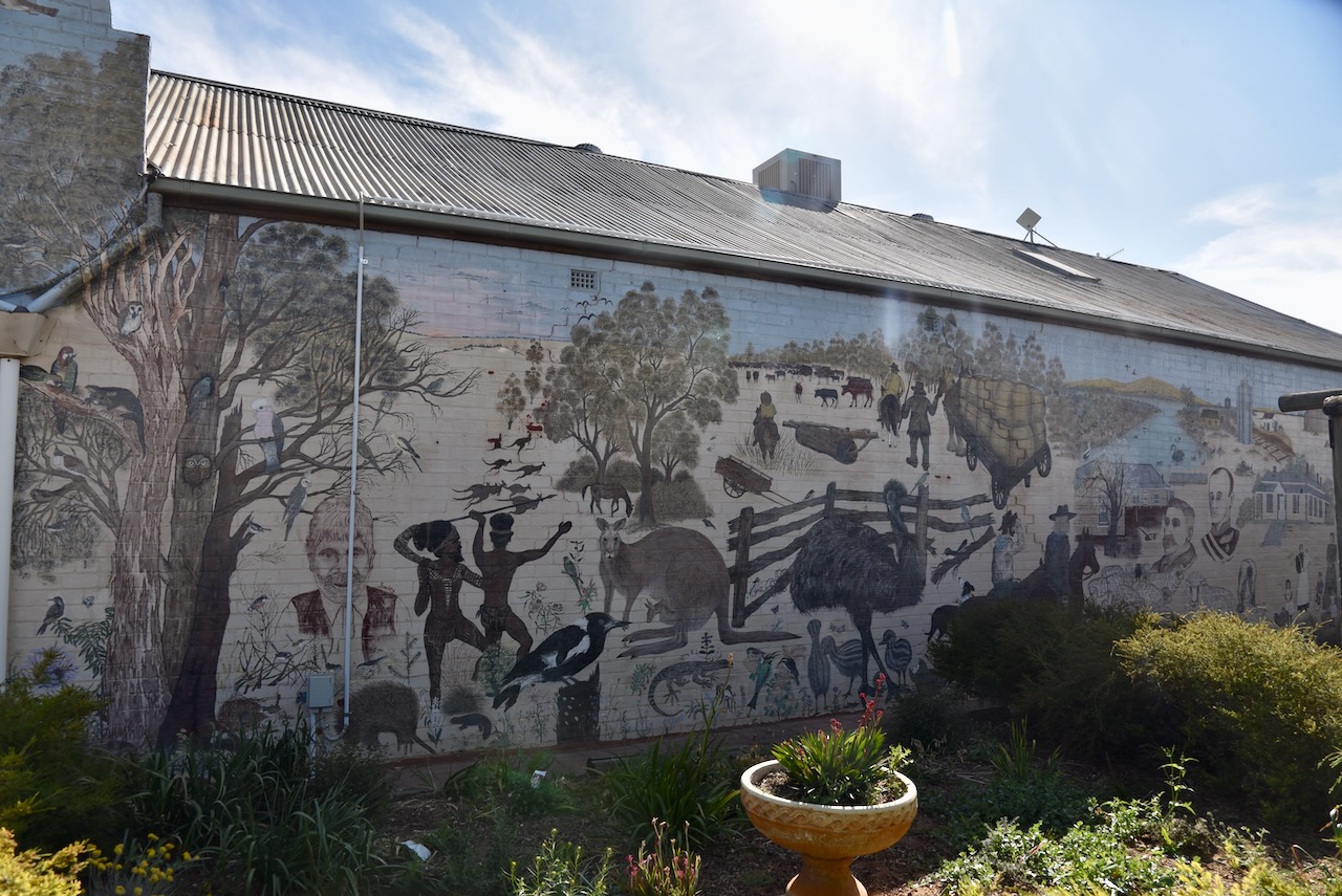
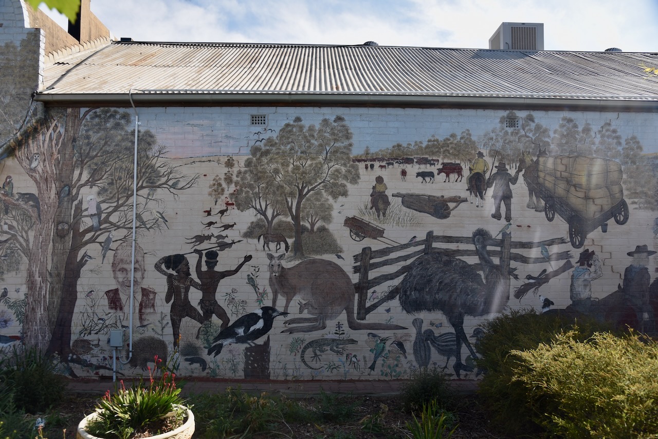
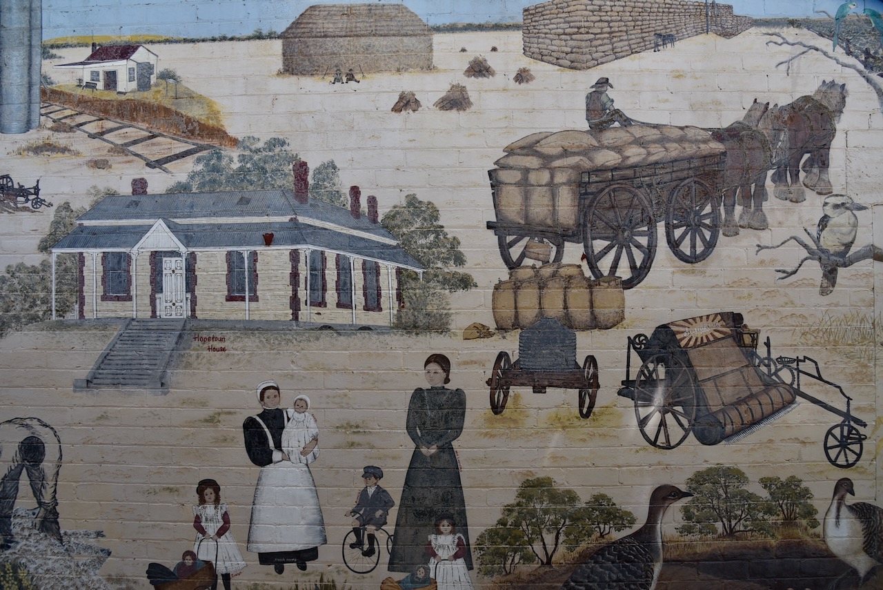
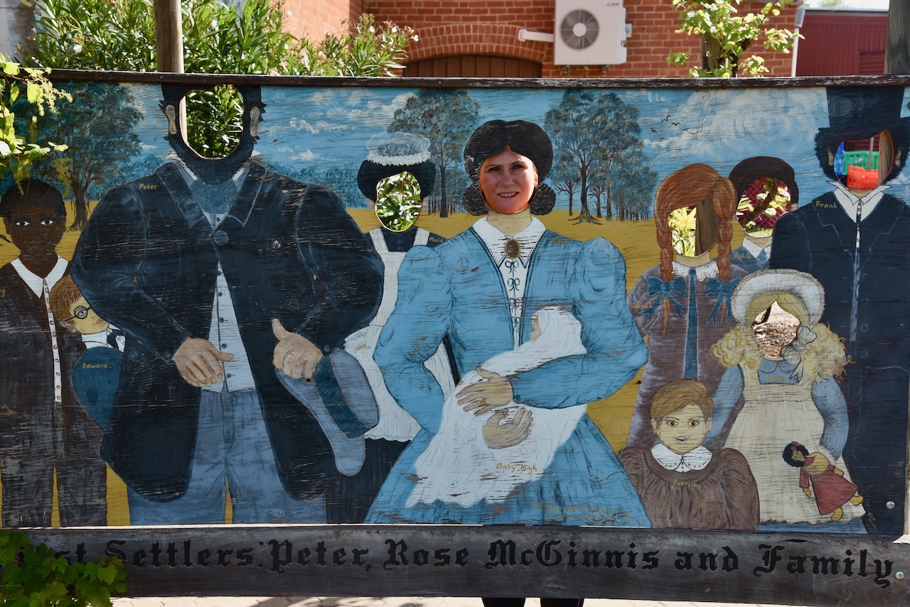
The town has a very impressive mural that depicts all aspects of local history in the area. The mural features a stump jump lough, wool bales, drovers, the Mallee roller, local birds and wildflowers. It was completed by local artists Shirley Decker and Trish Hogan.
Adjacent to the mural is an information board that tells the story of Peter McGinnis (b. 1819. d. 1886)
Marija posed for a photograph at the McGinnis mural.
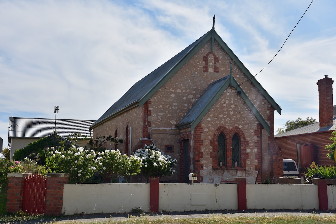
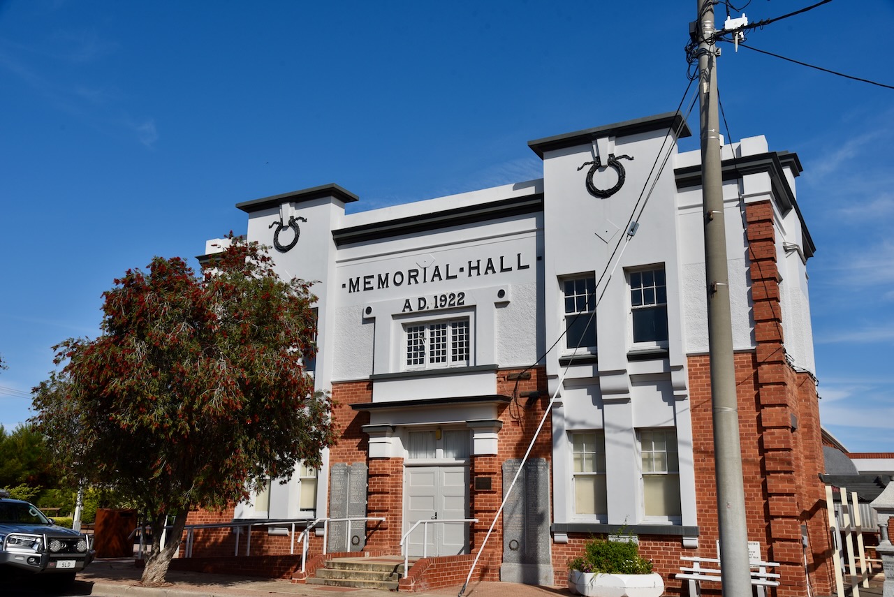
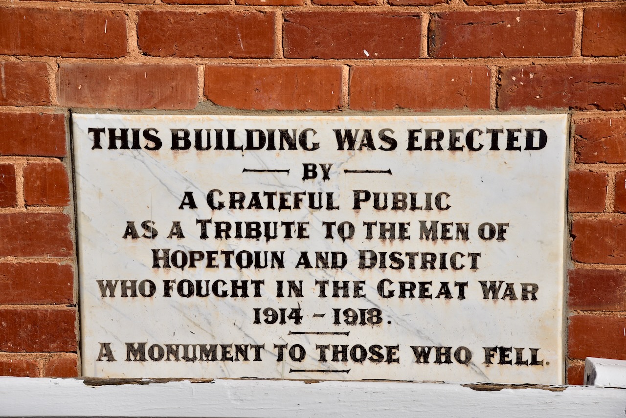
We then took a short walk around this historic town. Our first stop was the Hopetoun Memorial Hall which was erected as a tribute to the men of Hopetoun and the district who fought during World War One.
Nearby is the memorial fountain, erected in 1929 as a tribute to Lascelles.
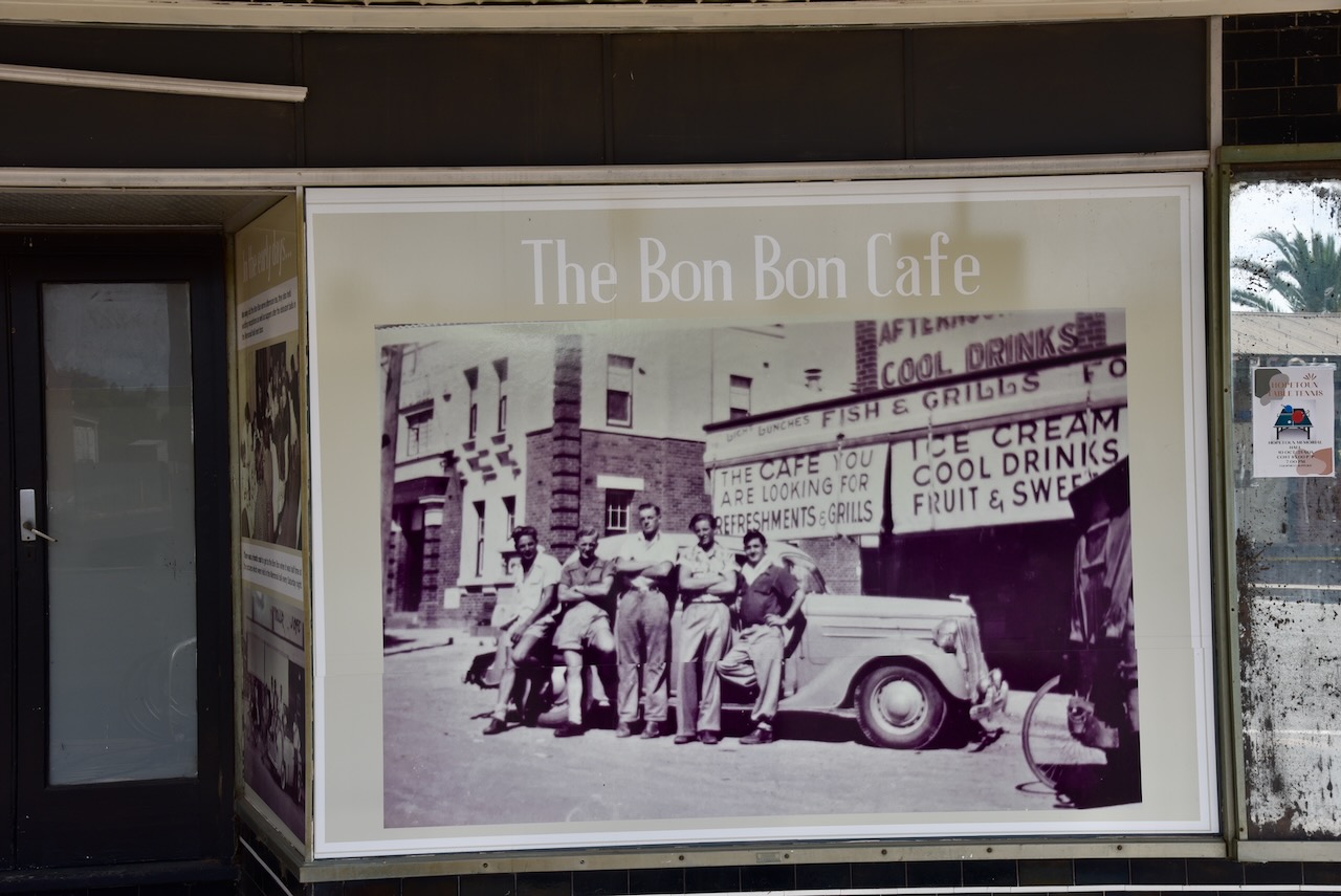
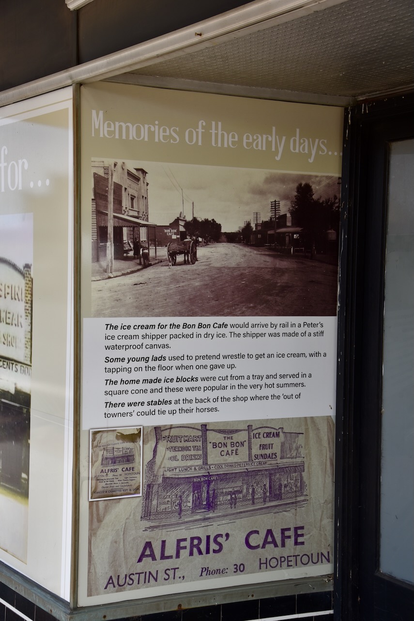
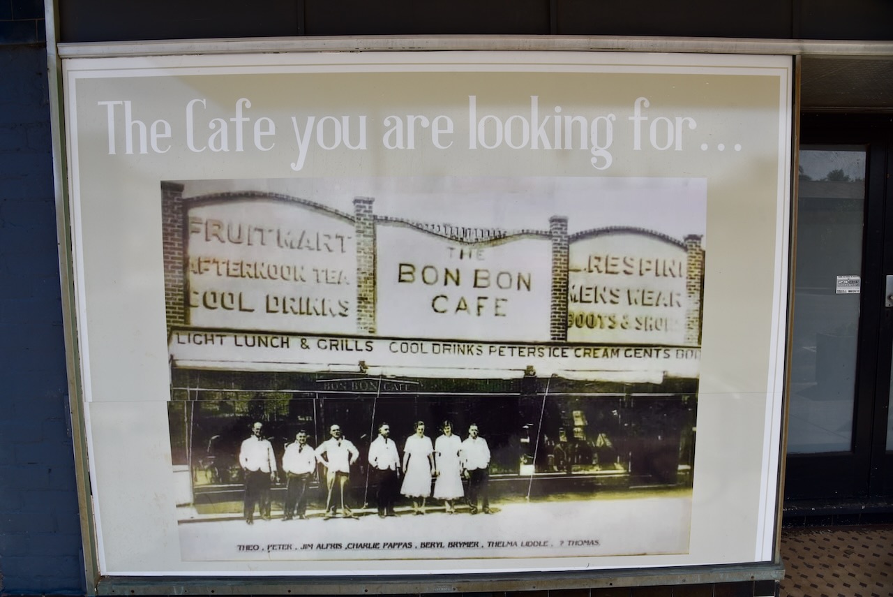
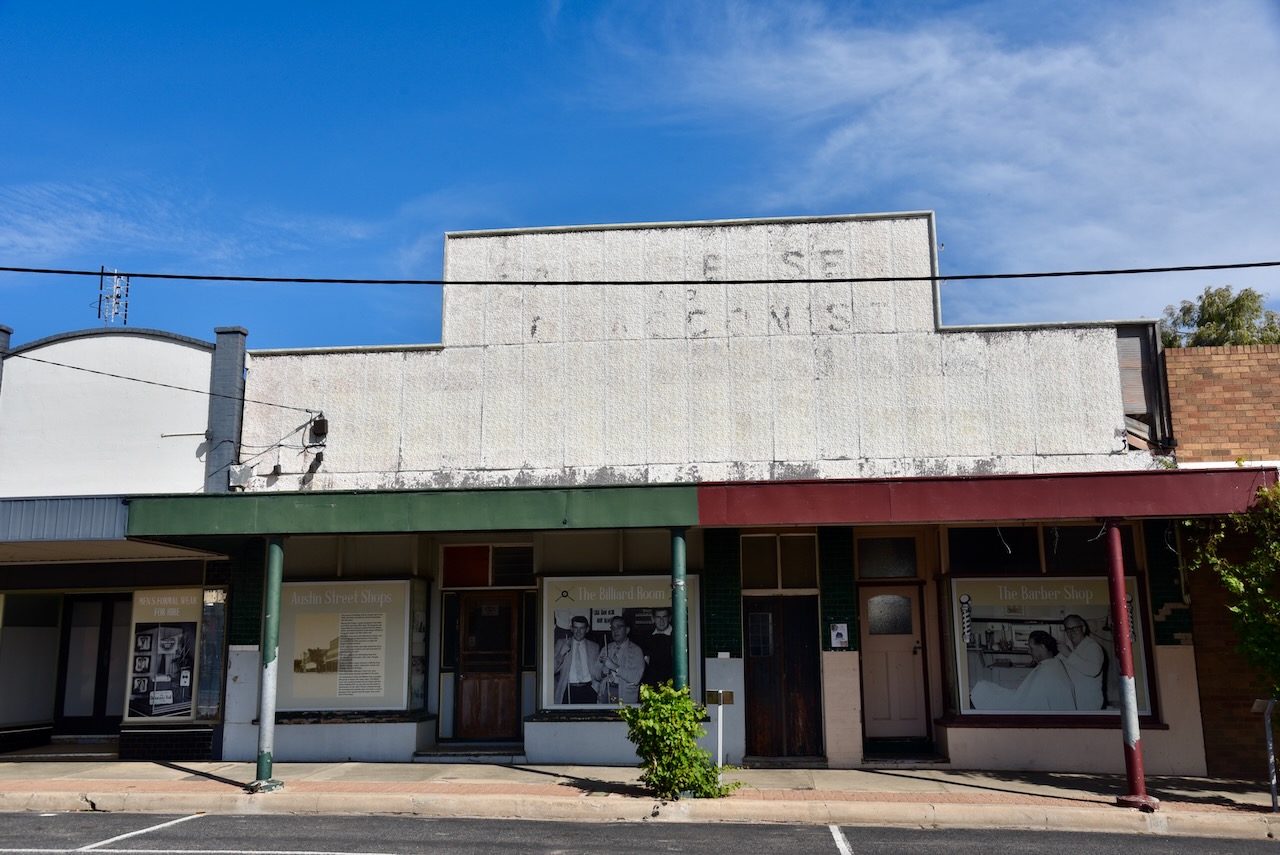
Hopetoun is clearly a town that takes pride in its history. There are several information boards on the old shops in the main street, detailing the history of the shops.
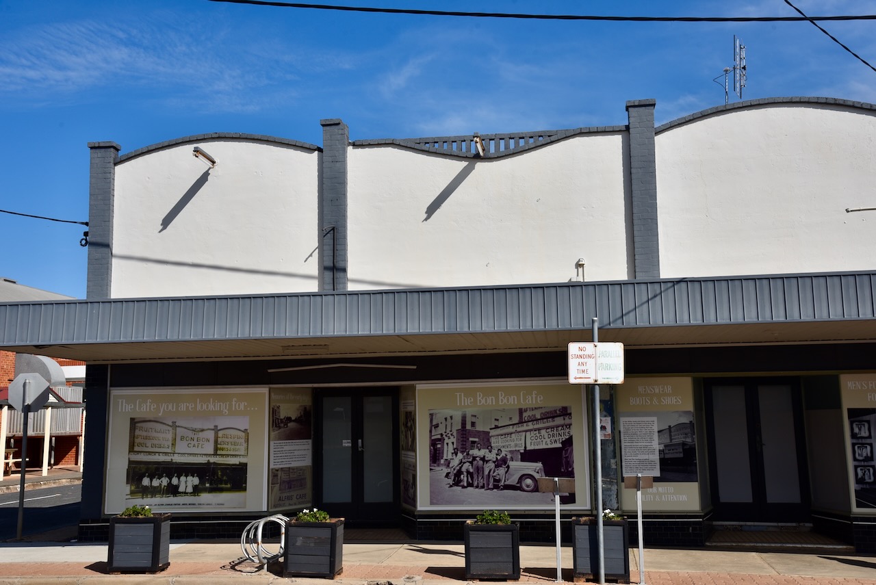
The Bon Bon Cafe closed in 2017. The ice cream for the Bon Bon cafe would arrive by rail in a Peter’s ice cream shipper made of stiff waterproof canvas that was packed in dry ice. Stables once existed at the rear of the shop where visitors to the town could tie up their horses. (Werner 2017)
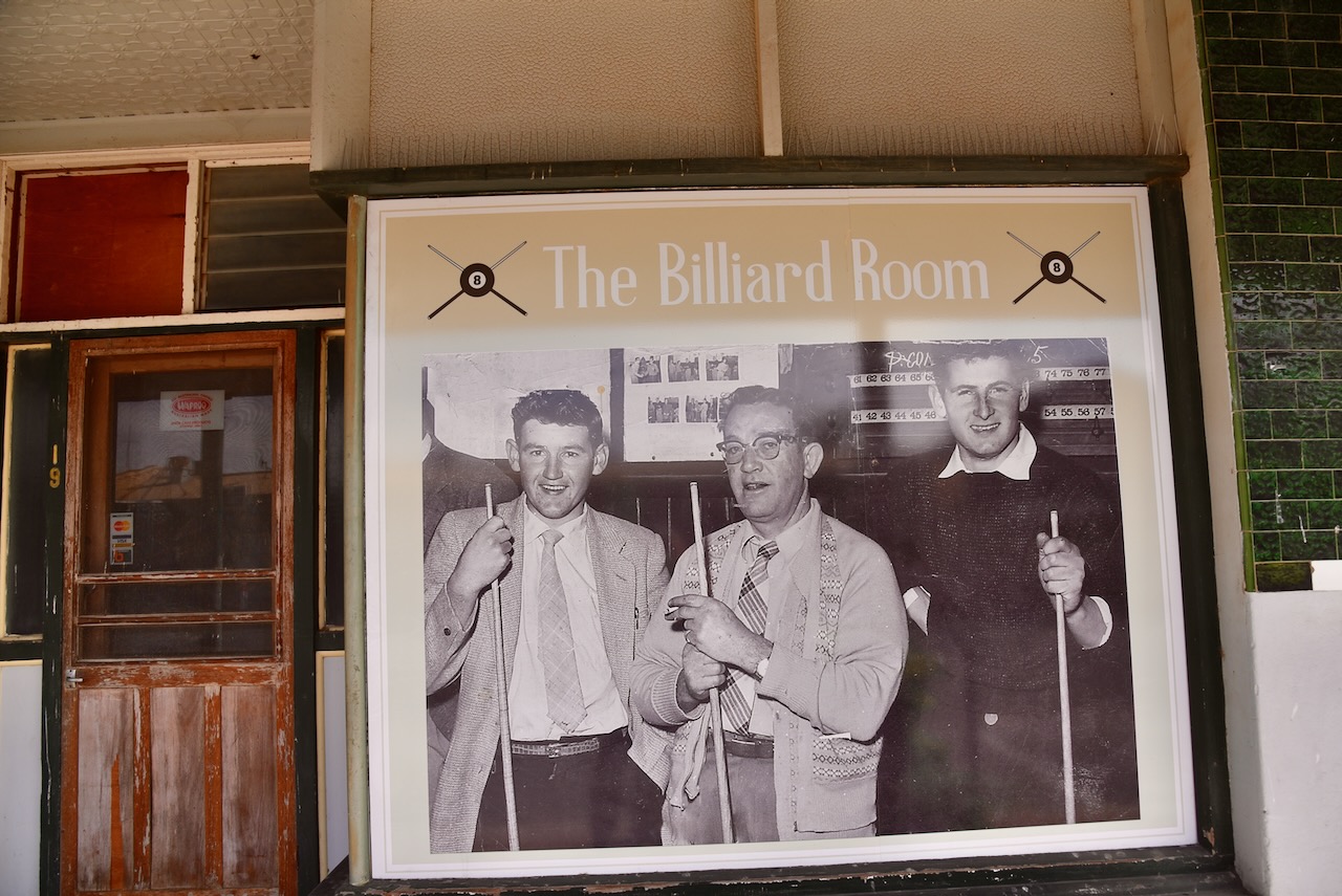
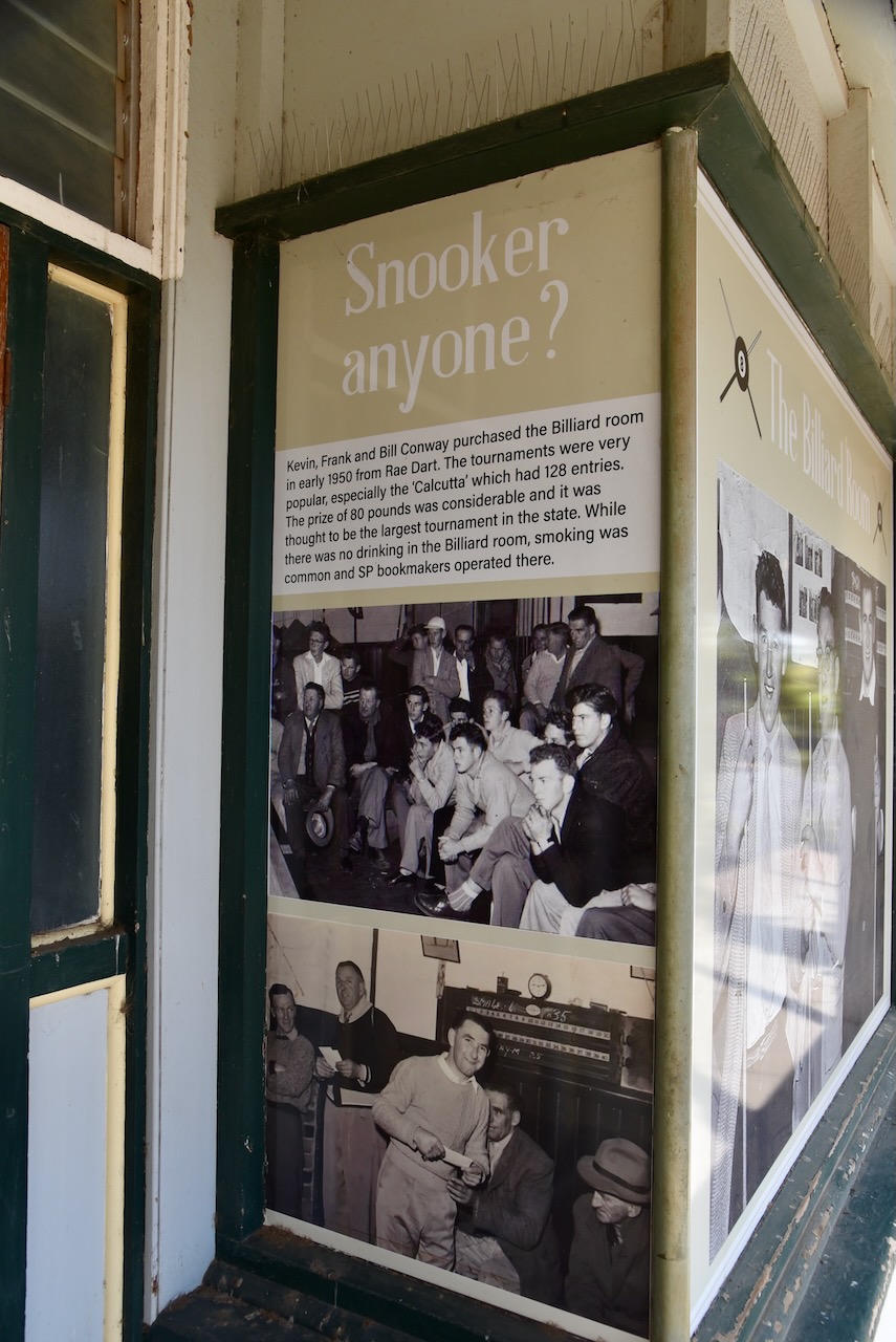
Next door is the billiard room and barber shop. In 1950 Kevin, Frank and Bill Conway purchased the billiard room from Rae Dart. Billiard tournaments were held including the ‘Calcutta’ which had 128 entries and a prize of 80 pounds. Frank Whykes opened his hairdresser business in 1933. It operated for 60 years. The shop was also a tobacconist and sporting supplies and toys were also sold.
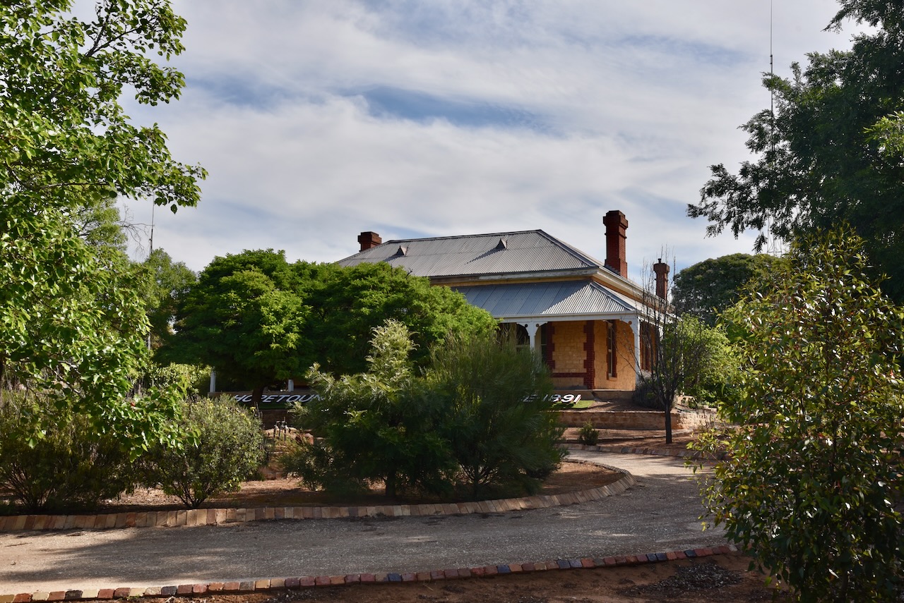
We then drove to Hopetoun House on Evelyn Street. It was built in 1891 by Edward Lascelles. Unfortunately, there was not much of a view to the trees and shrubs in the front yard. (Aussie Towns 2024)
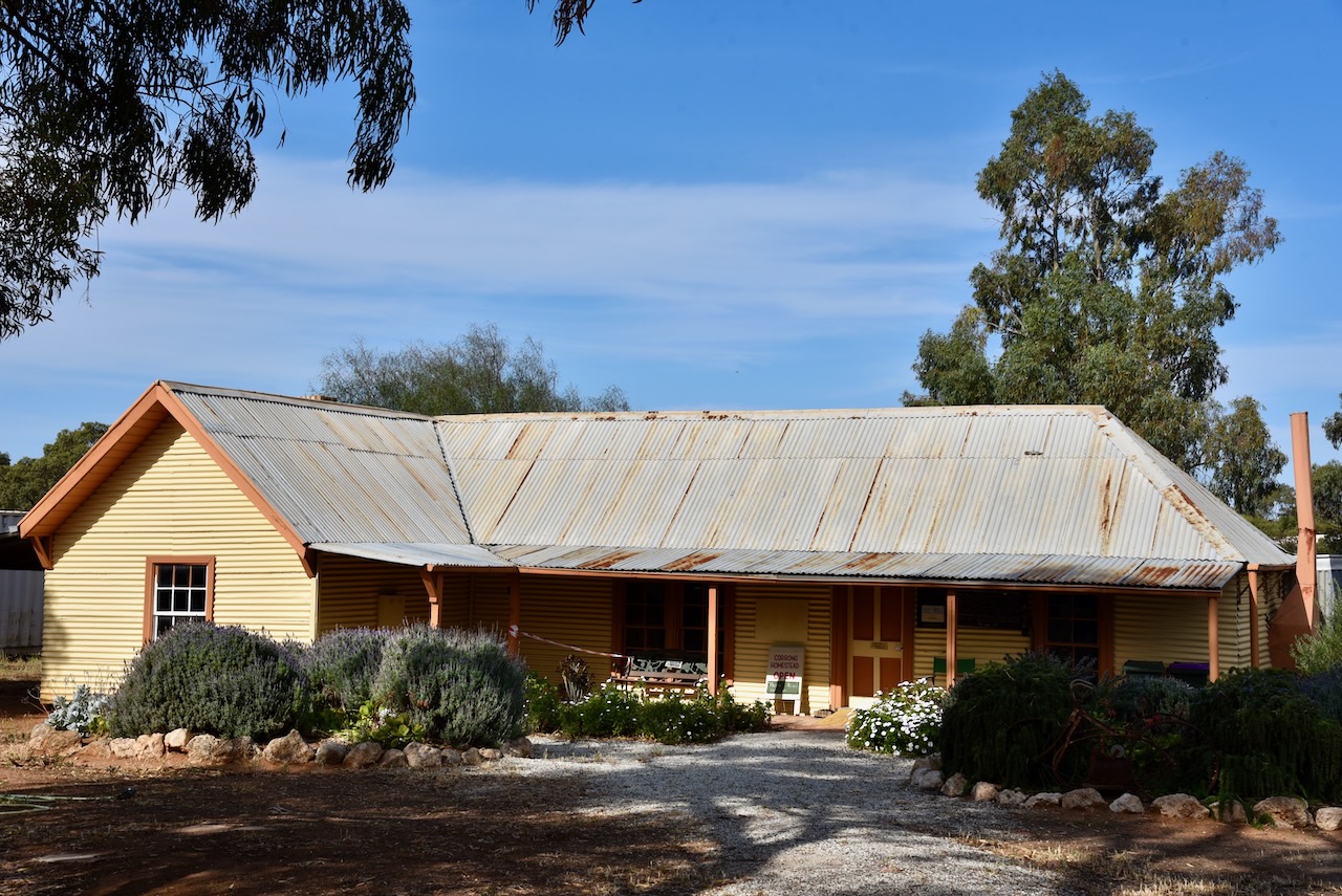
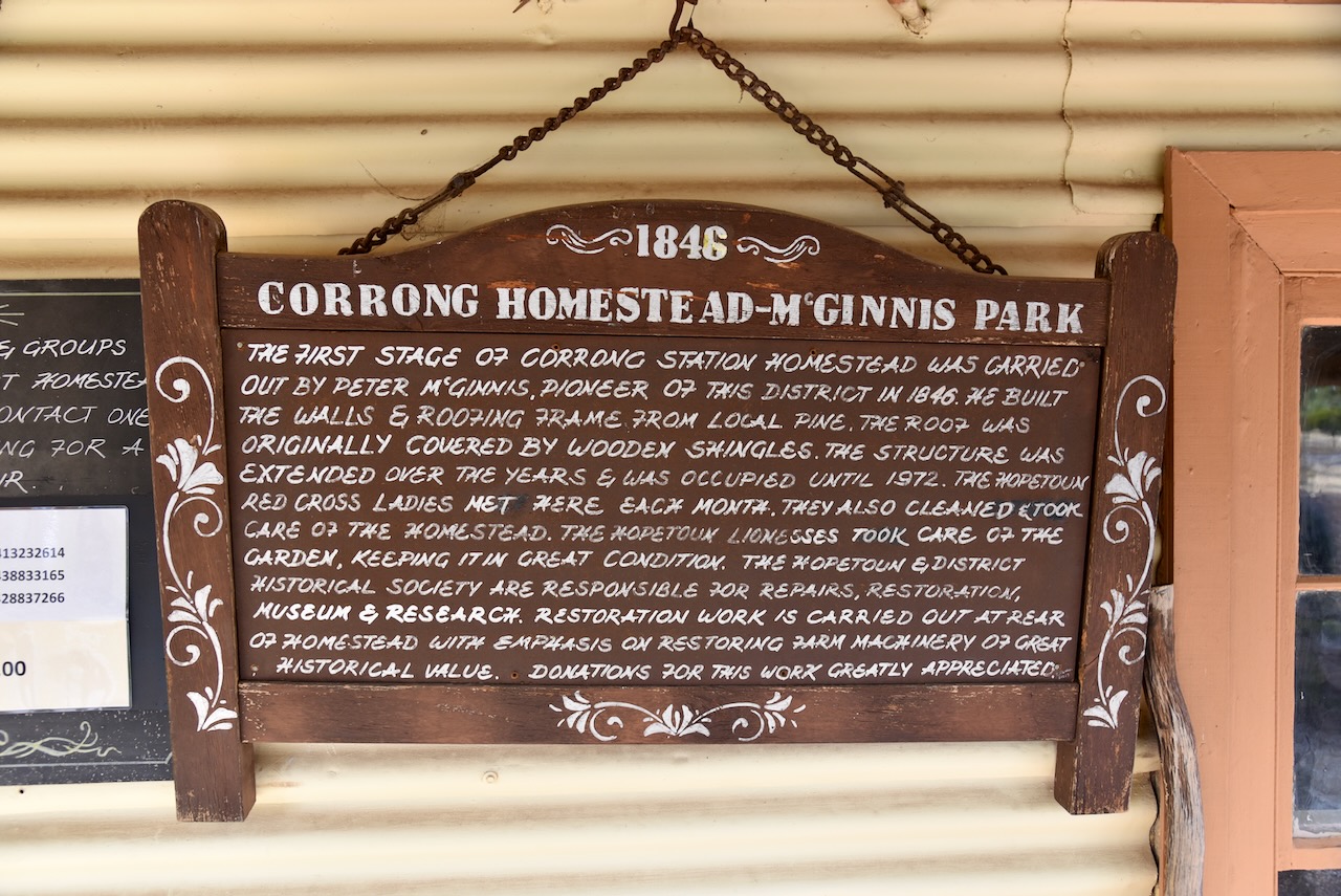
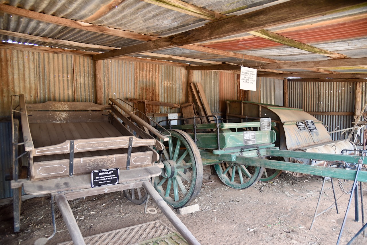
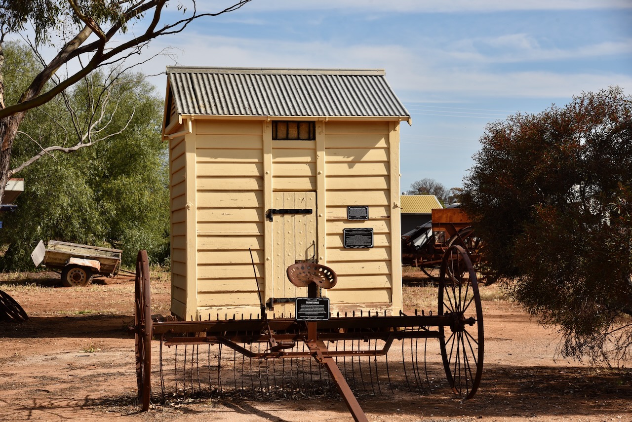
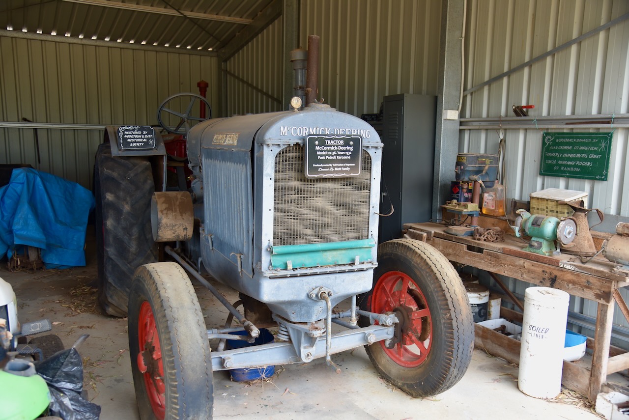
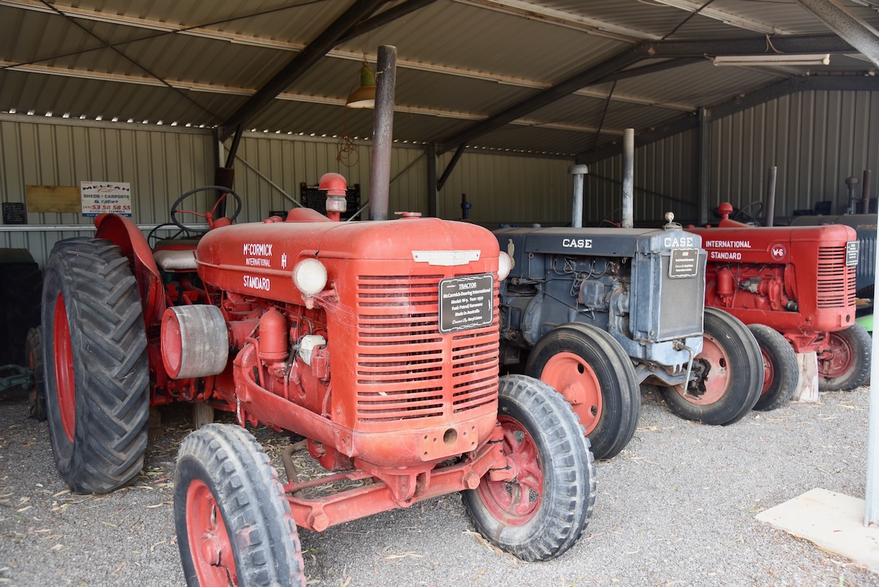
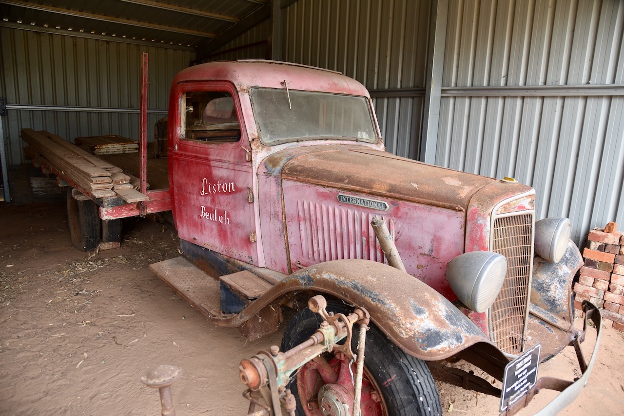
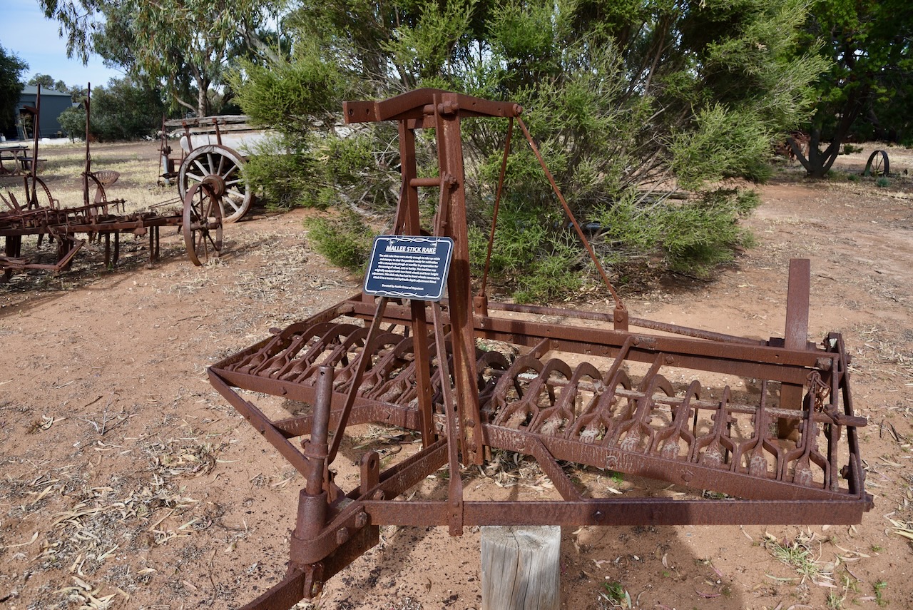
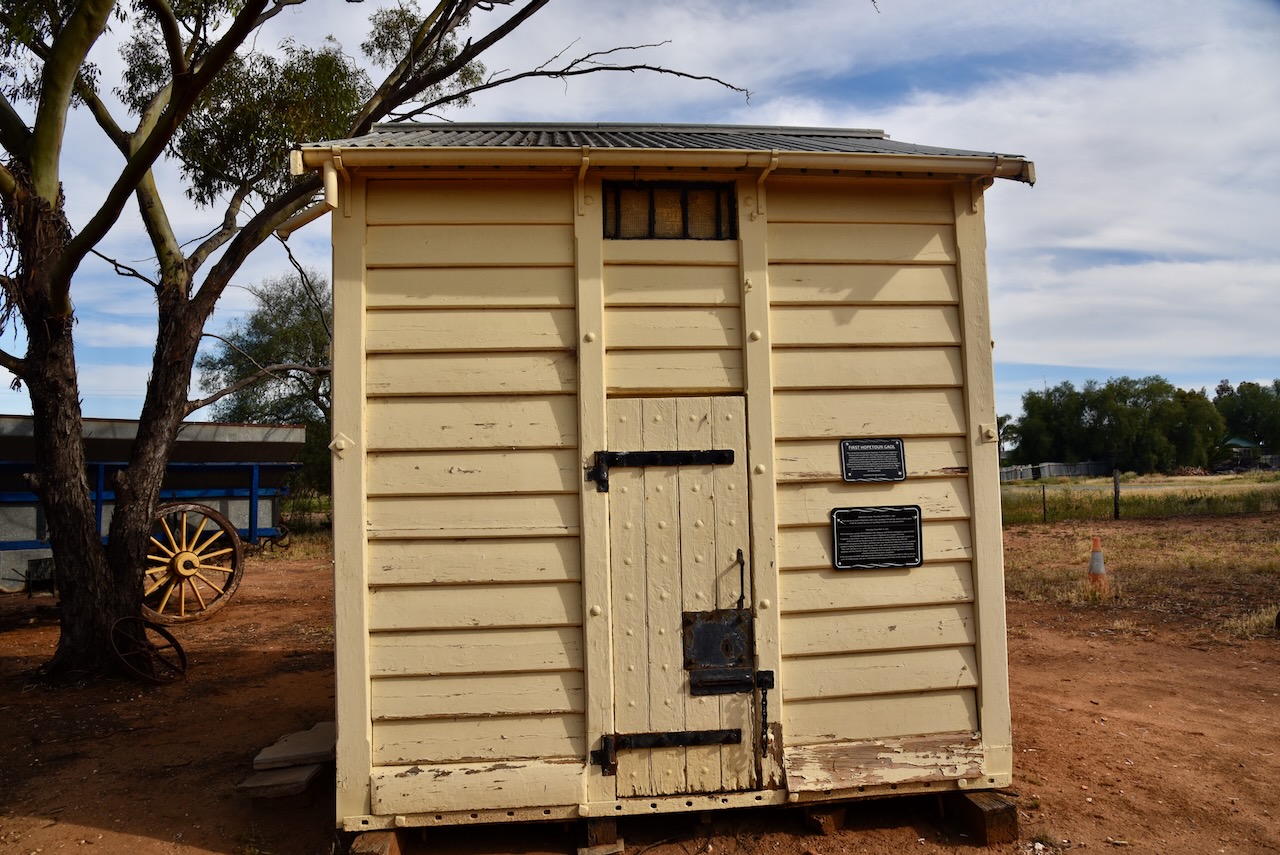
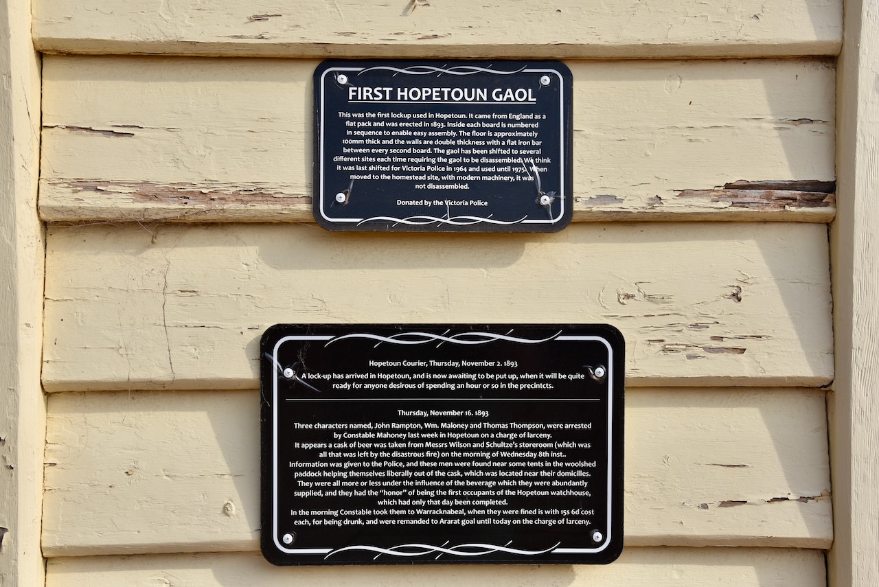
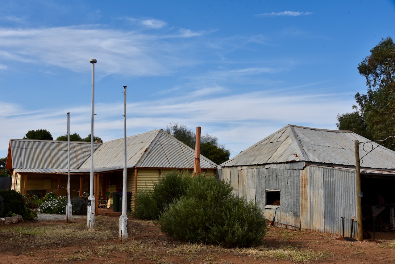
Although we had been there previously, Marija and I stopped over to have a look at Corrong Station Homestead. This is well worth visiting and is just a gold coin donation. The pine and corrugated iron hut was built in 1846 by Peter McGinnis. McGinnis lived in the hut with his wife, seven children, and their adopted aboriginal child, Joweley who was also known as ‘Black Peter’. The grounds also contain historic farm machinery and the old local police lockup. (Aussie Towns 2024)
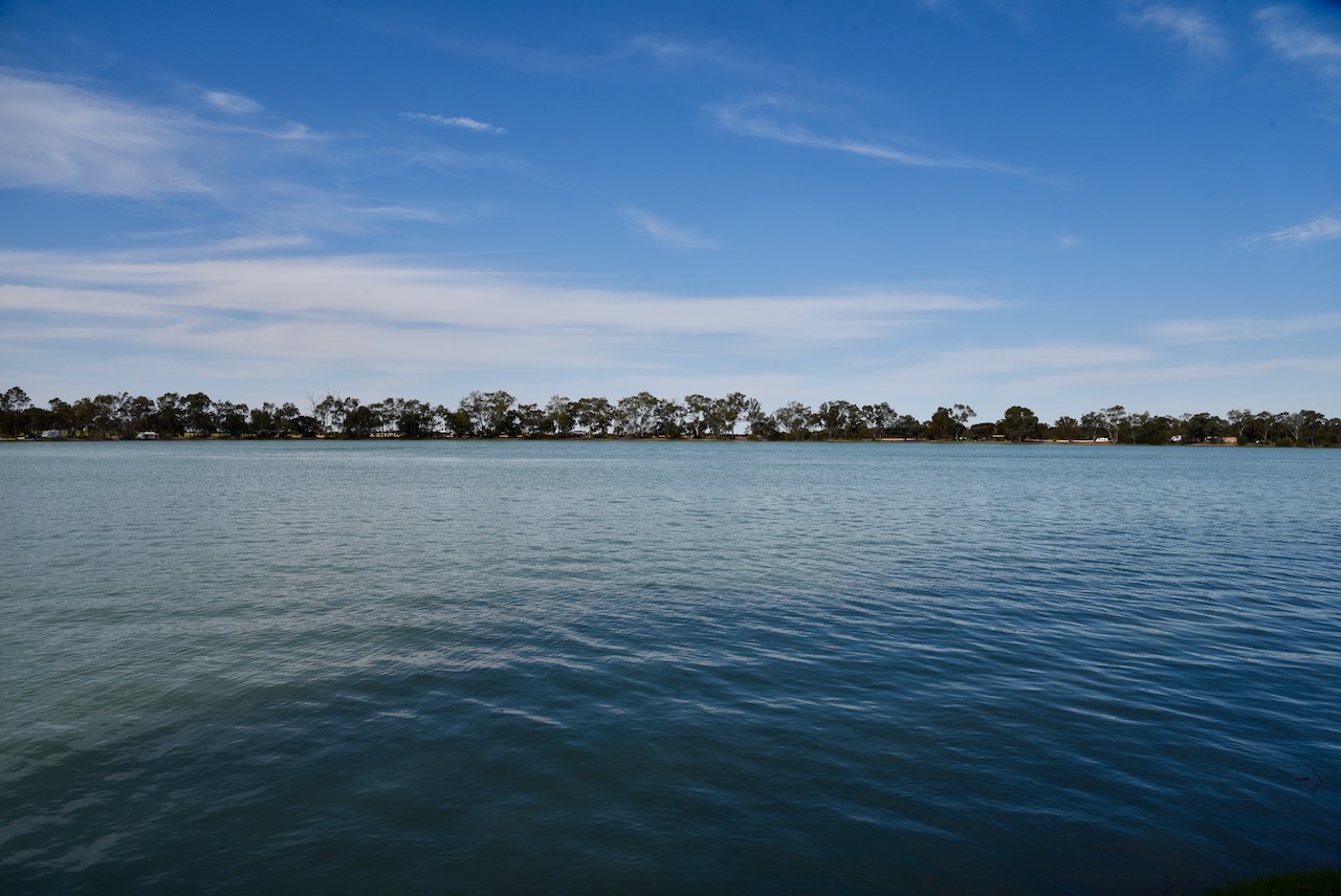
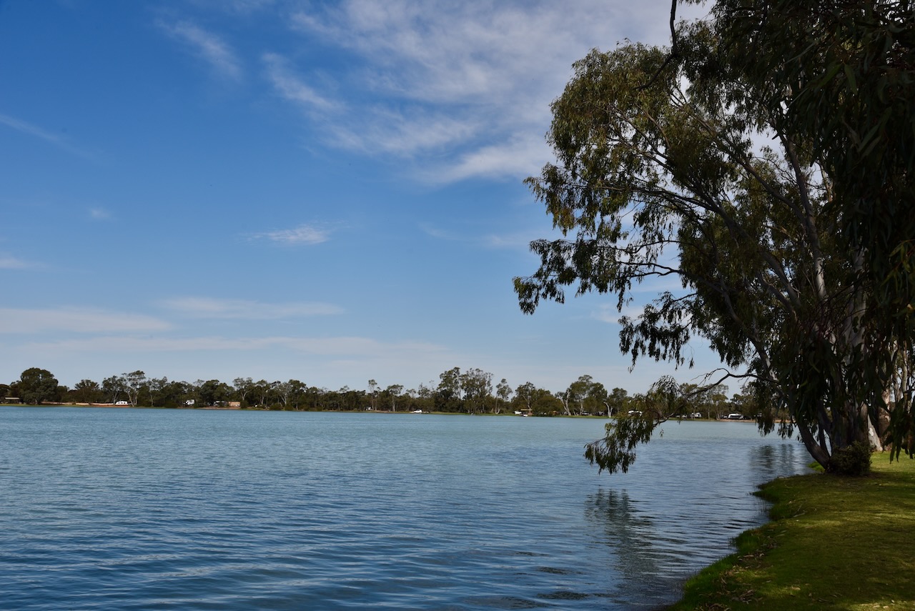
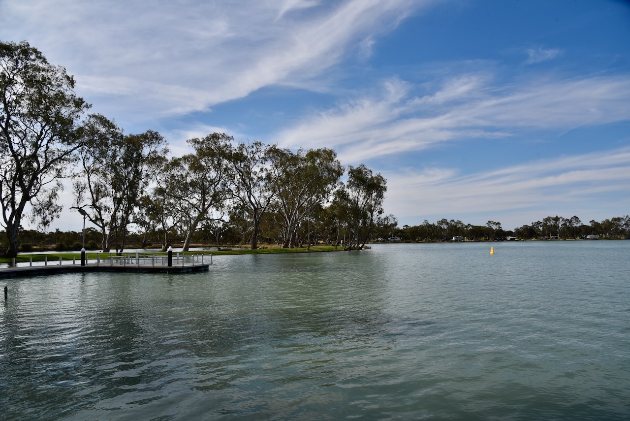
Marija and I then drove down to nearby Lakes Lascelles. The lake is popular with walkers, swimmers, fishermen, boating enthusiasts and bird watchers.
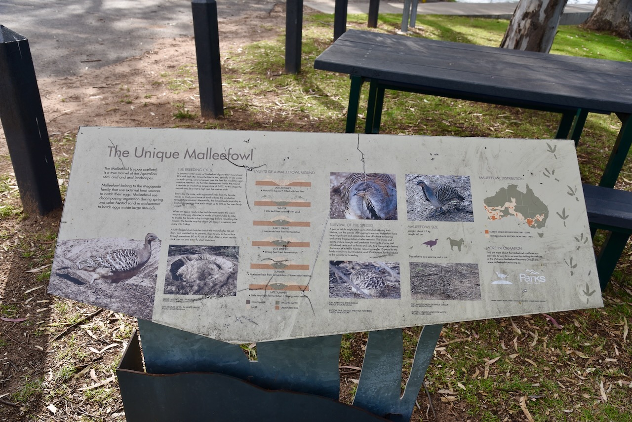
At the lake, there is an information board about the nationally vulnerable Malleefowl.
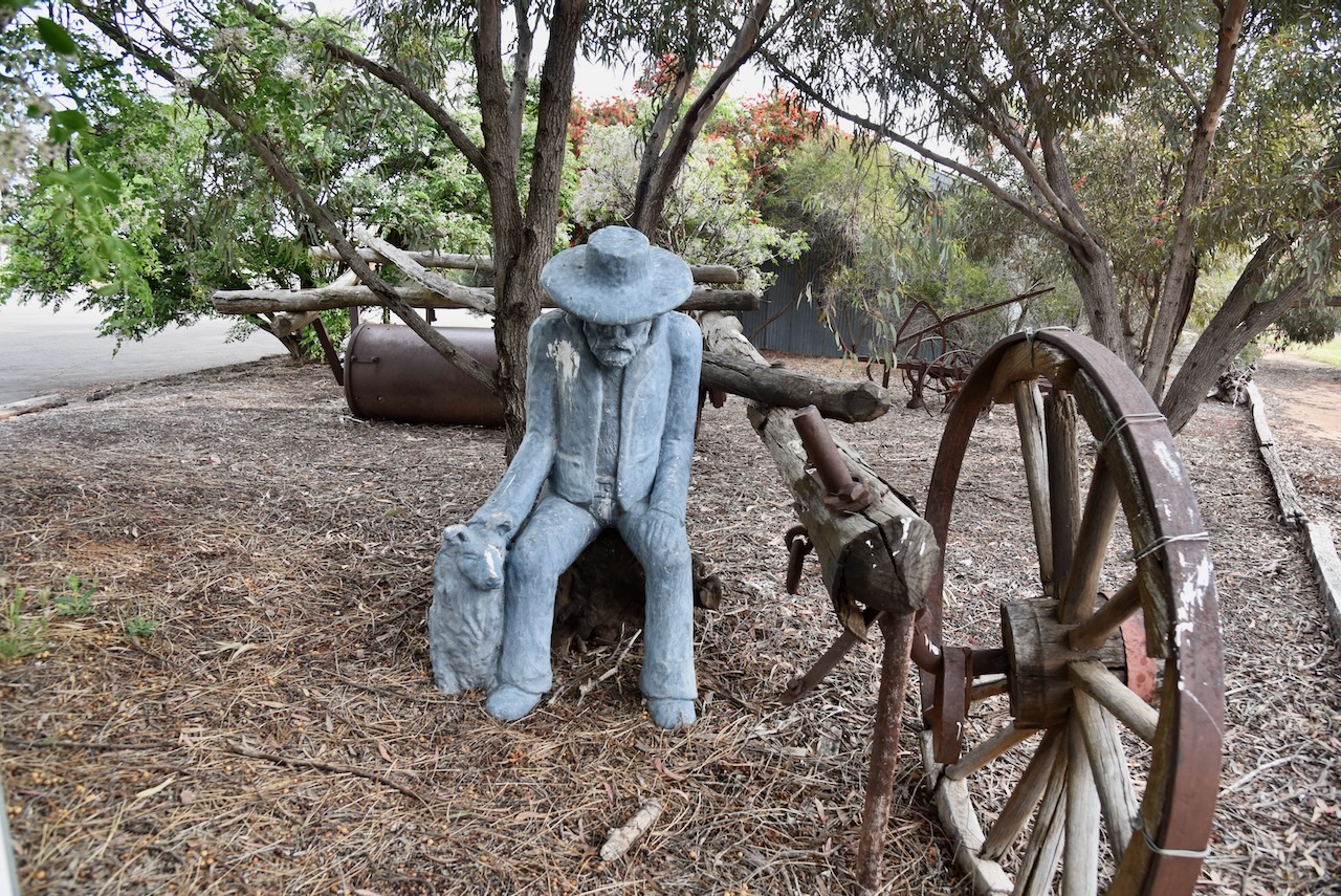
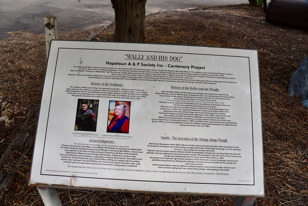
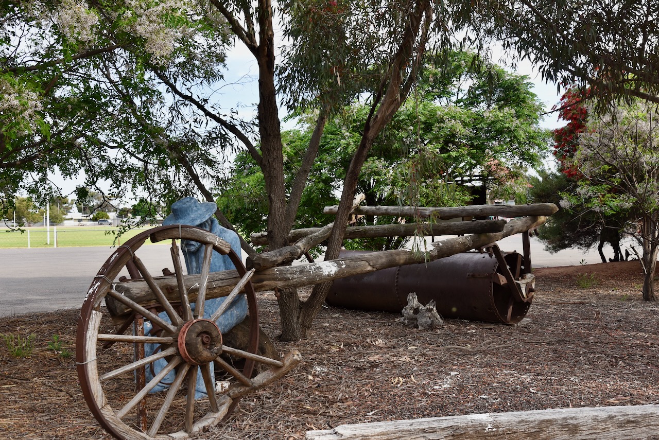
Another point of interest is ‘Wally and His Dog’ located at the entrance gates of the Hopetoun Showground.
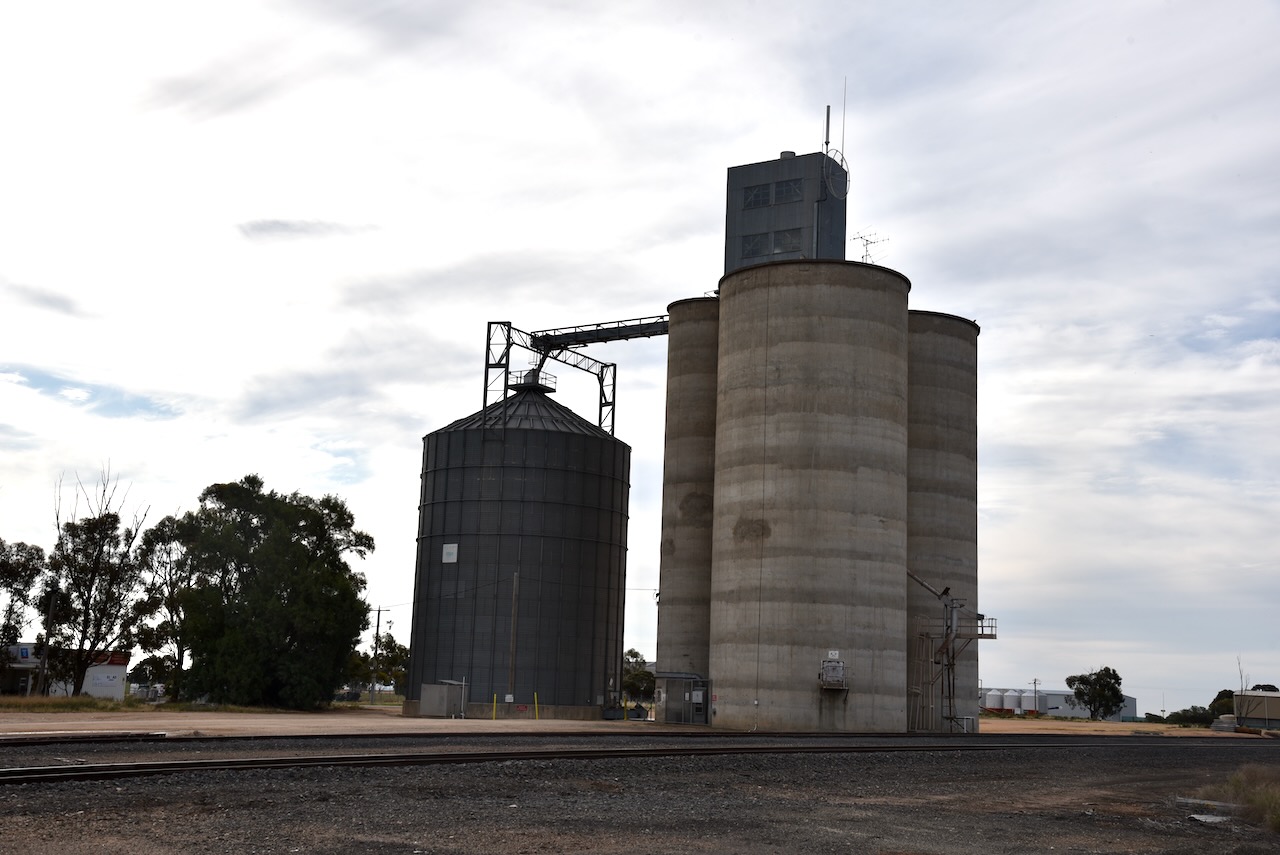
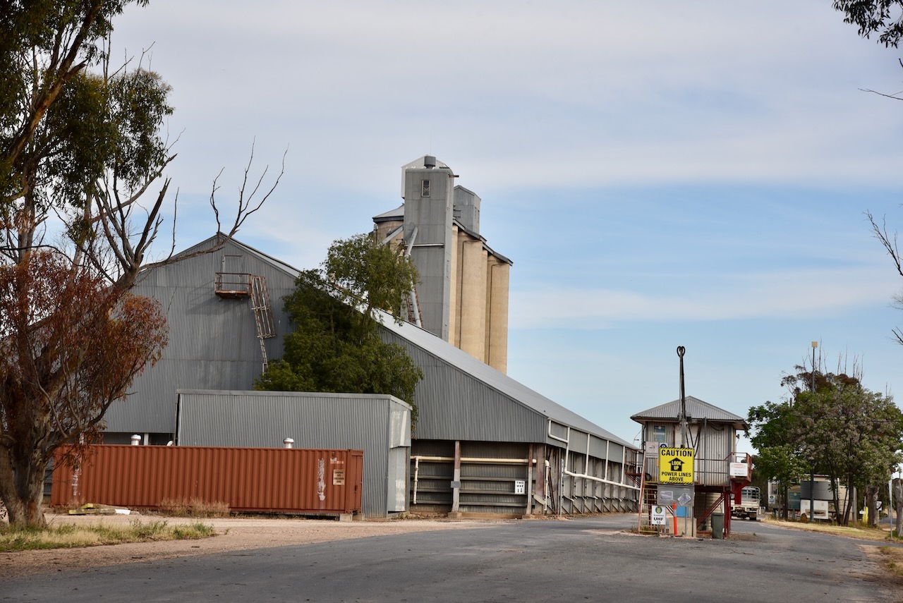
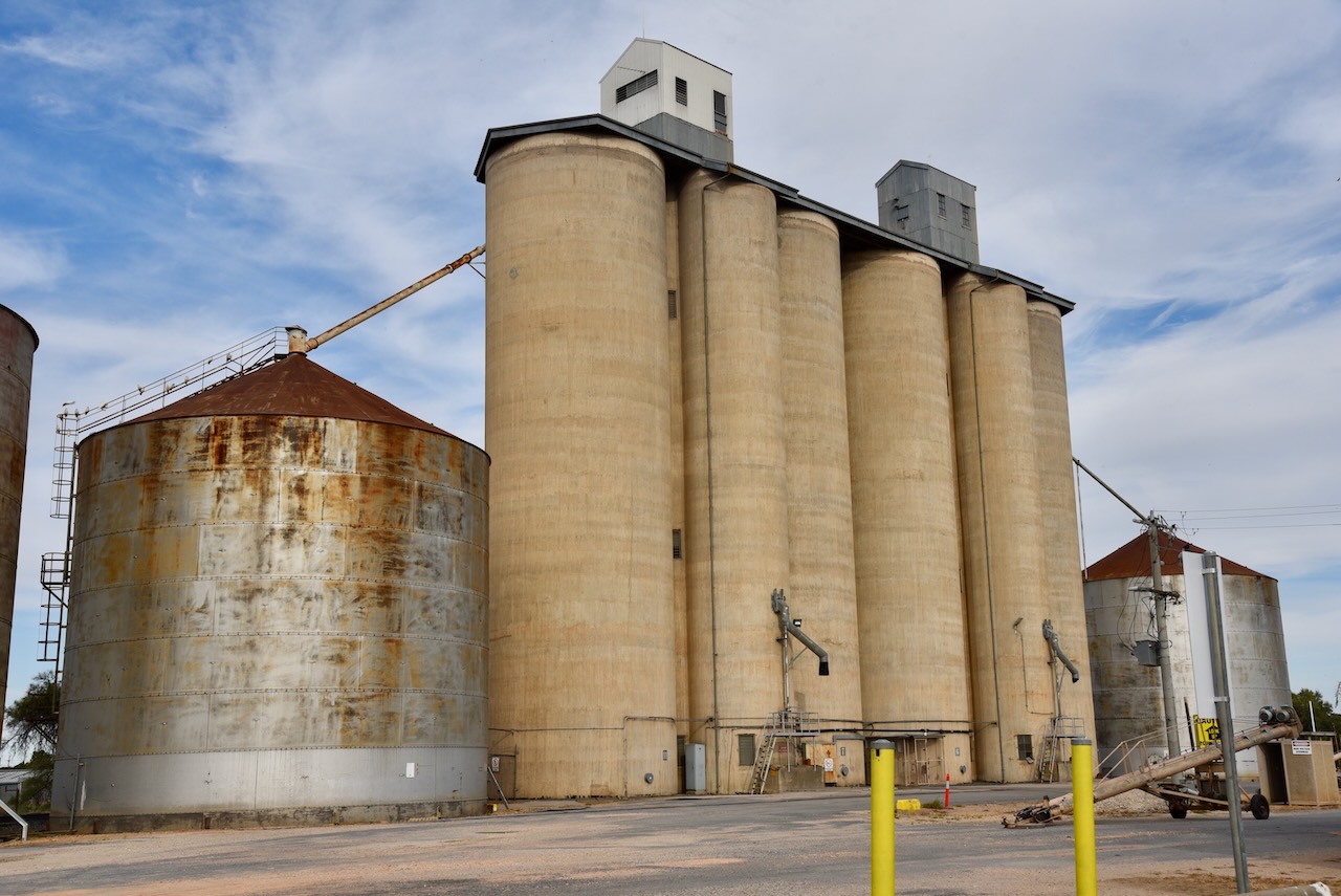
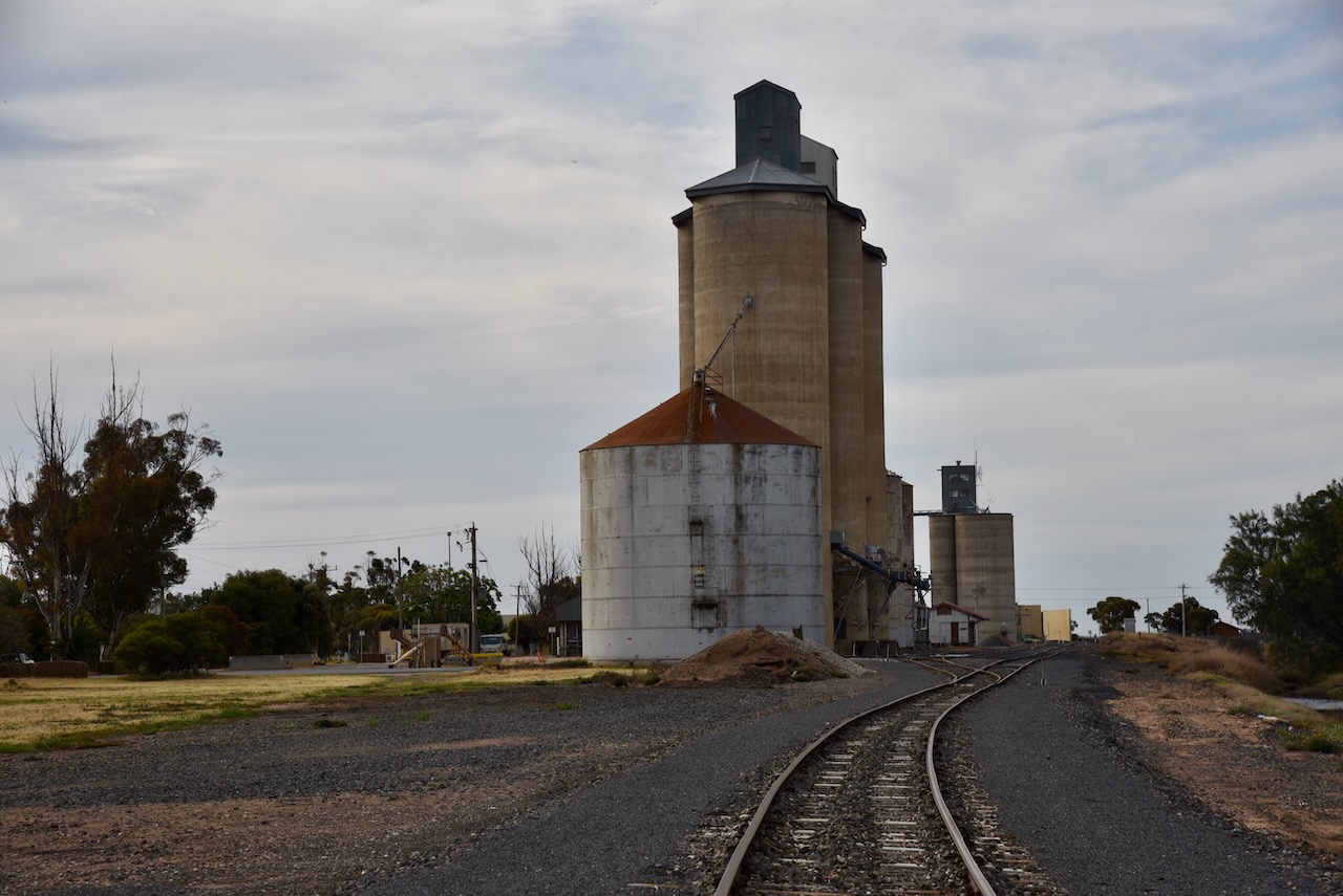
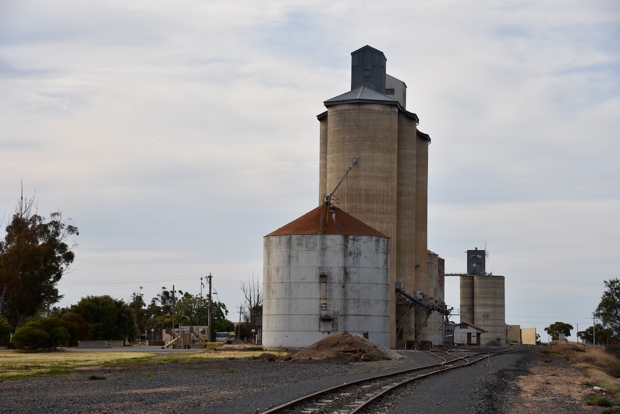
The Hopetoun silo is located along the railway on the northeastern side of Hopetoun W Road. The Hopetoun 2 silo is located further south along the railway line on the northeastern side of Garrard Street.
Marija and I parked on Hopetoun-Yaapeet Road in the activation zone of both silos. We operated from the 4WD running the Icom IC-7000, 100 watts, and the Codan 9350 antenna with the 1.5 metre stainless steel whip.
Above:- the activation zones at the two silos at Hopetoun. Image c/o SiOTA website.