My final activation for Thursday 22nd August 2024 was the Drendles Bushland Reserve VKFF-4161.
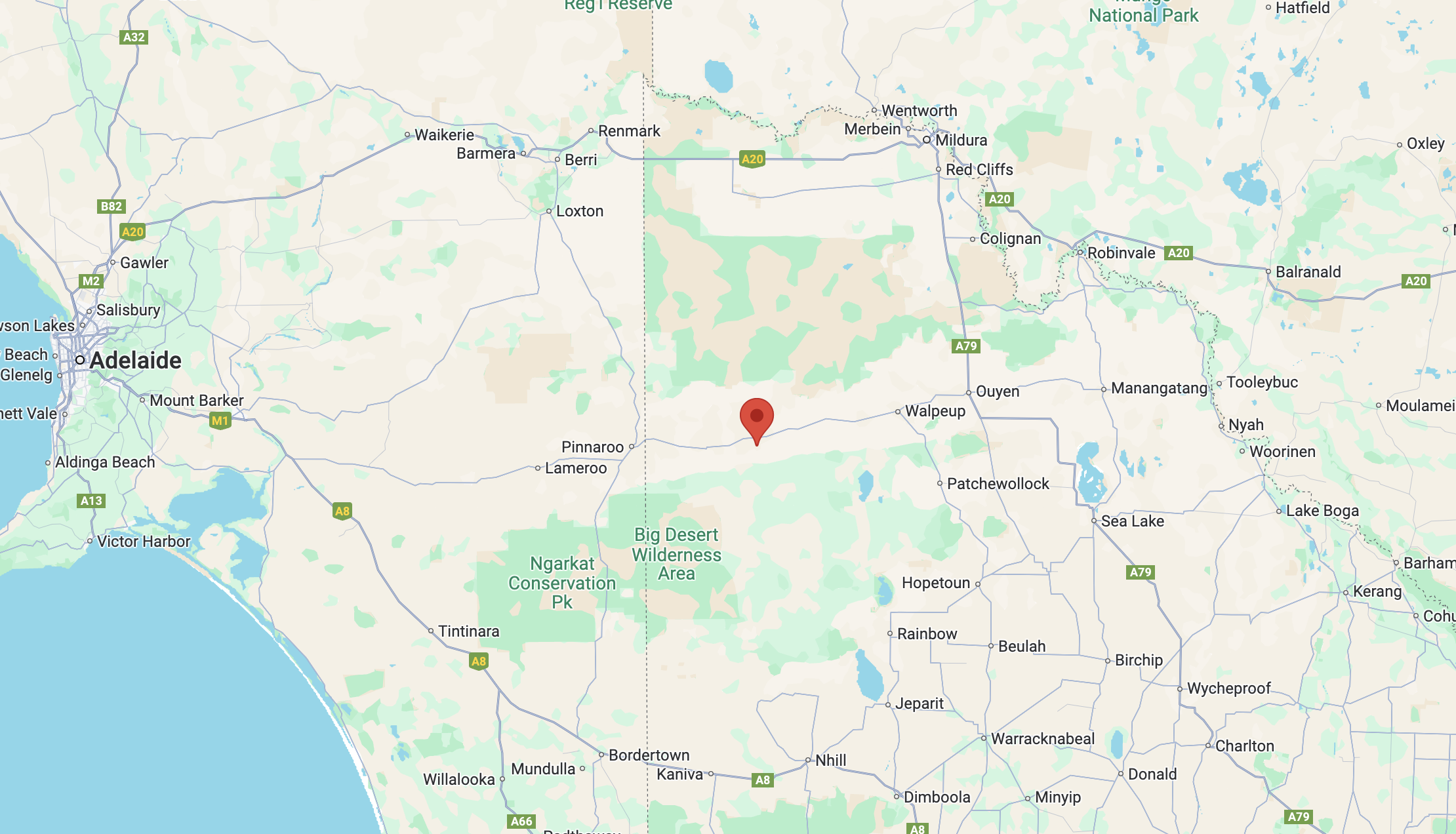
The reserve is located about 27 km east of Murrayville in northwest Victoria.
Above:- Map showing the location of Drendles Bushland Reserve. Map c/o Google Maps.
The park is at the end of a dirt track that runs off the Mallee Highway’s southern side.
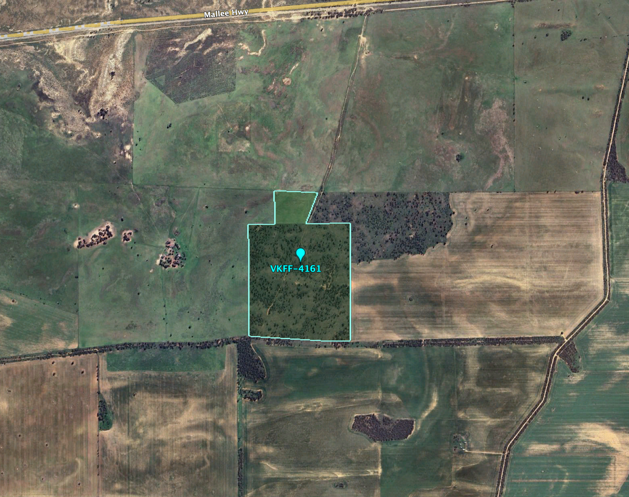
Above:- Aerial view of the Drendles Bushland Reserve. Image c/o Google Earth.
By the time I reached the park it was dark.
I ran out the 20/40/80m linked dipole in the dark with my head torch. I ran the Yaesu FT857 and 40 watts output.
It was a beautiful balmy evening and no mosquitoes. My location was quite remote, with the Big Desert Wilderness Area and North Wyperfeld Wilderness Area to my south. To my north was the vast Murray Sunset National Park.
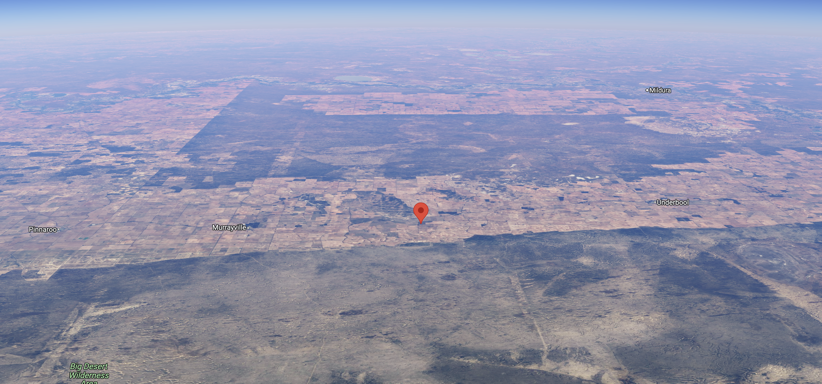
Above:- An aerial view of the Drendles Bushland Reserve looking north. Image c/o Google Maps.
I worked the following stations on 40m SSB:-
- VK5MAZ
- VK3PF
- VK7UK
- VK2EXA
- VK4SMA
- VK4FDJL
- VK4WAB
- VK3APJ
- VK5WU
- VK3HJW
- VK3SO
- VK3SFG
- VK6DS
- VK3SQ
- VK2BD
- VK4EMP
- VK4TI
- VK4GKO
- VK3EJ
- VK3VIN
- VK5PE
- VK4HNS
- VK2IO
- VK2GEZ
- KG5CIK
- VK7PJM
- VK4HMI
- VK5HS
- VK3MAW
- VK6JK
- VK5AKR
- VK2OKR
- VK5ZNP
- VK2FSAA
I worked the following stations on 80m SSB:-
- VK3PF
- VK3APJ
- VK2OKR
- VK2AUS
- VK4EMP
- VK4TI
- VK4GKO
- VK2YAK
- VK4YAK
- VK4HNS
- VK7HAM
- VK5LA
- VK5KAW
- VK5MAZ
- VK5PE
- VK2IO
- VK2GEZ
- VK5HS
- VK5ZNP
References.
- Dcceew.gov.au. (2023). Collaborative Australian Protected Areas Database (CAPAD) 2022 – DCCEEW. [online] Available at: https://www.dcceew.gov.au/environment/land/nrs/science/capad/2022 [Accessed 3 Dec. 2024].