
On Saturday 19th October 2024, Marija VK5MAZ and I drove up to Renmark on the first leg of our trip to Bendigo for the 2024 VKFF National Get-Together. The reason for us heading to Rthe Riverland first was to pick up a raffle prize from my good mate Danny VK5DW who owns RivComm Radio Solutions. And secondly to get my other great mate Ivan VK5HS to have a look at my Icom IC-7000 in the 4WD which was intermittently cutting out.
Marija and I called in to see Danny VK5DW at Loxton and enjoyed a coffee and a chat. We also picked up a UHF CB starter kit that Danny had donated. This was the second year that Danny had kindly donated a prize for the raffle at the VKFF National Get-Together. Thanks so much for your generosity Danny.
We then headed off to Renmark and caught up with Ivan VK5HS. After some problem-solving, it turned out that the voltage on my secondary battery in the 4WD was low and this was the cause of the intermittent drop outs on the IC-7000. Thanks for your time Ivan.
That evening Marija and I stayed in Renmark at our regular overnight spot, the Citrus Valley Motel.
The next day, Sunday 20th October 2024, Marija and I made our way to Warracknabeal where we planned to stay for three nights. It was a drive of about 394 km to get to Warracknabeal.
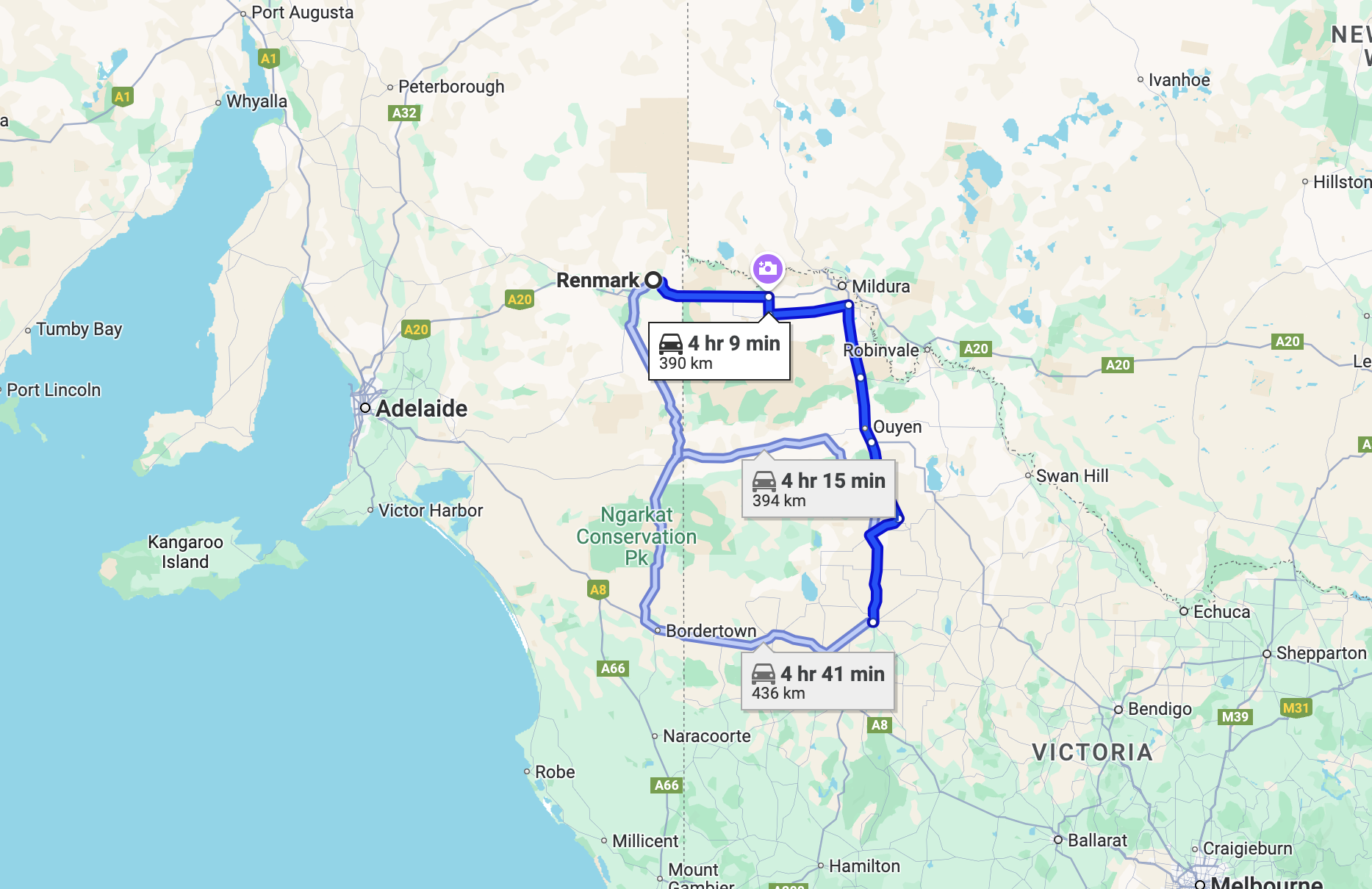
Above:- Map showing our route from Renmark to Warracknabeal. Map c/o Google Maps.
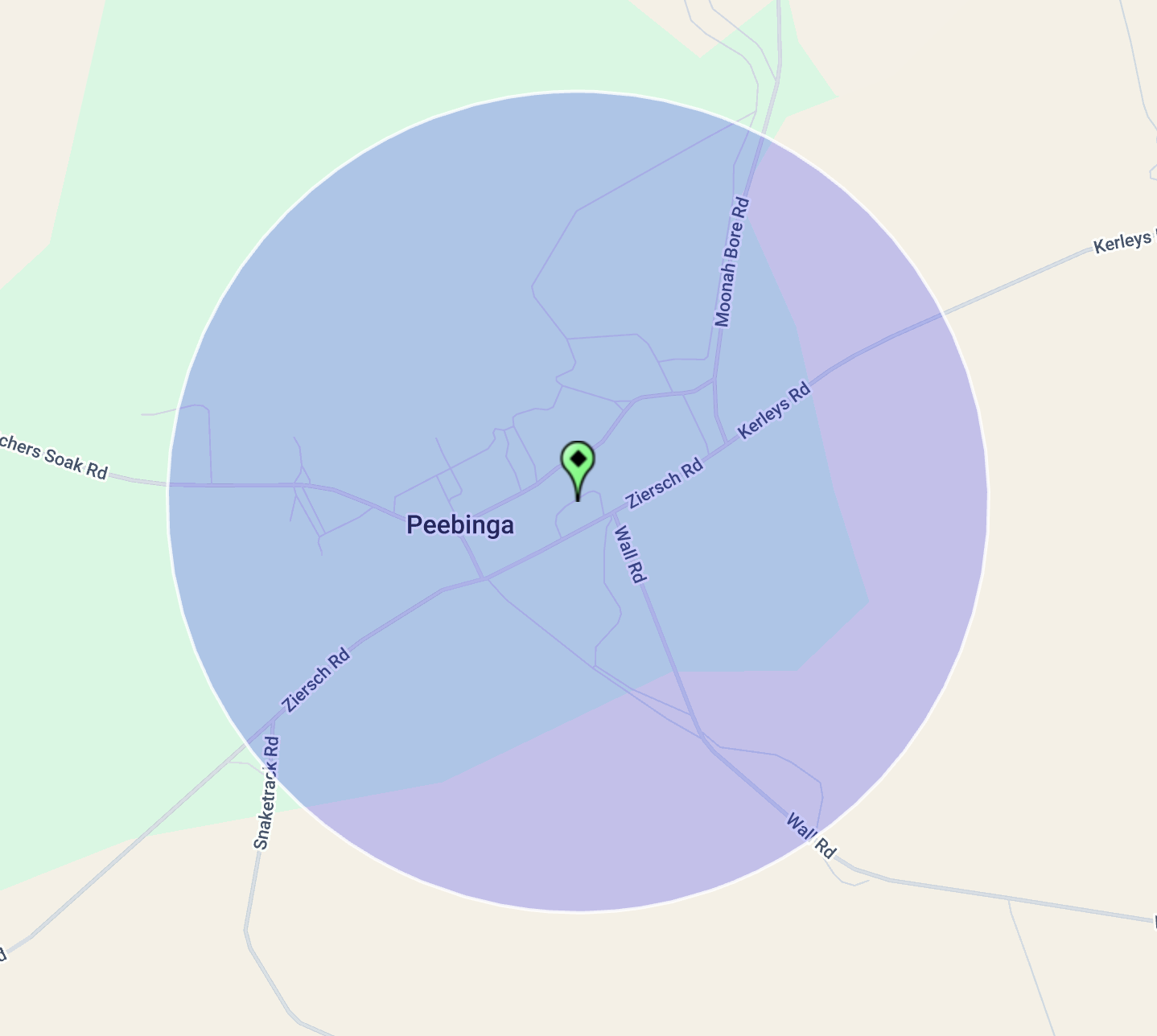
Along the way, Marija and I decided to activate the Peebinga silo VK-PBA5 for the Silos On The Air (SiOTA) program. Peebinga is located about 273 km east of Adelaide and just 5 km from the South Australia/Victoria state border.
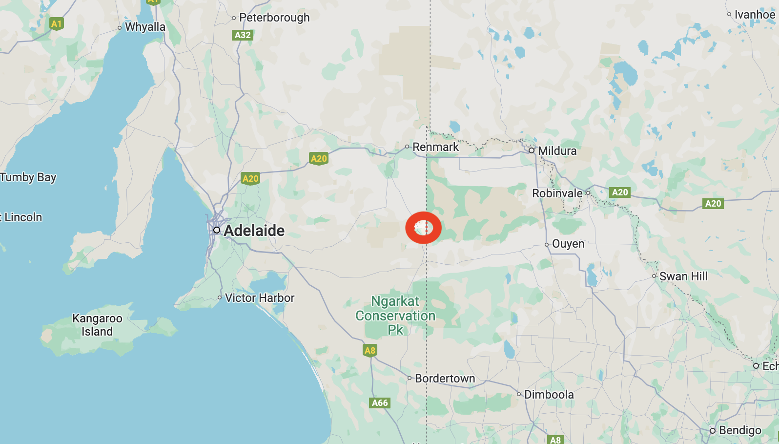
Above:- Map showing the location of Peebinga. Map c/o Google Maps.
Before European settlement, the Peebinga area was home to the Ngarkat (pronounced Narr-kat) aboriginal people. (Tracks of the Mallee)
Pichinga is the aboriginal name for a rock hole in the area. Pinchinga means ‘place of pines’. It is believed that Peebinga is a corruption of the aboriginal word pichinga. Peebinga was formerly known as Butcher Soak, Butcher Rockhole and Butcher Springs. It is reported that you can dig 5 feet and find water below the sand. Butcher’s Spring was named after a local early pastoralist. It is one of only two permanent water supplies in the Murray Mallee region. (Sa.gov.au, 2024) (Trove 2024)
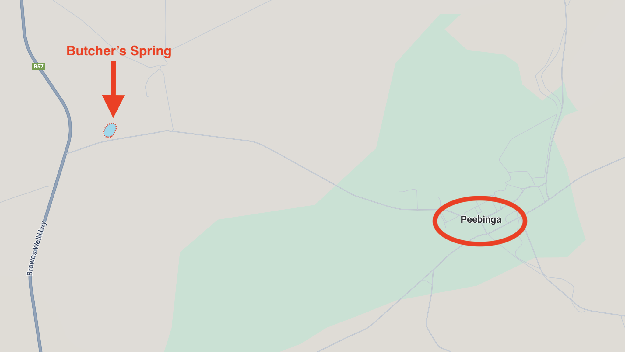
Above:- Map showing the location of Butcher’s Spring and Peebinga. Map c/o Google Maps.
In 1912 an article appeared in The Register which referred to “The settlers of the district of Butcher’s Soak object to the name of the place…..’Pichinga’ is the native name of the rockhole or soak known as Butcher’s Soak. It is highly desirable that the aboriginal nomenclature should be retained, and I suggest that the euphonious and appropriate native appellation of ‘Pichinga’ be substituted for the uncouth and commonplace name of Butcher’s Soak.” (Trove 2024)
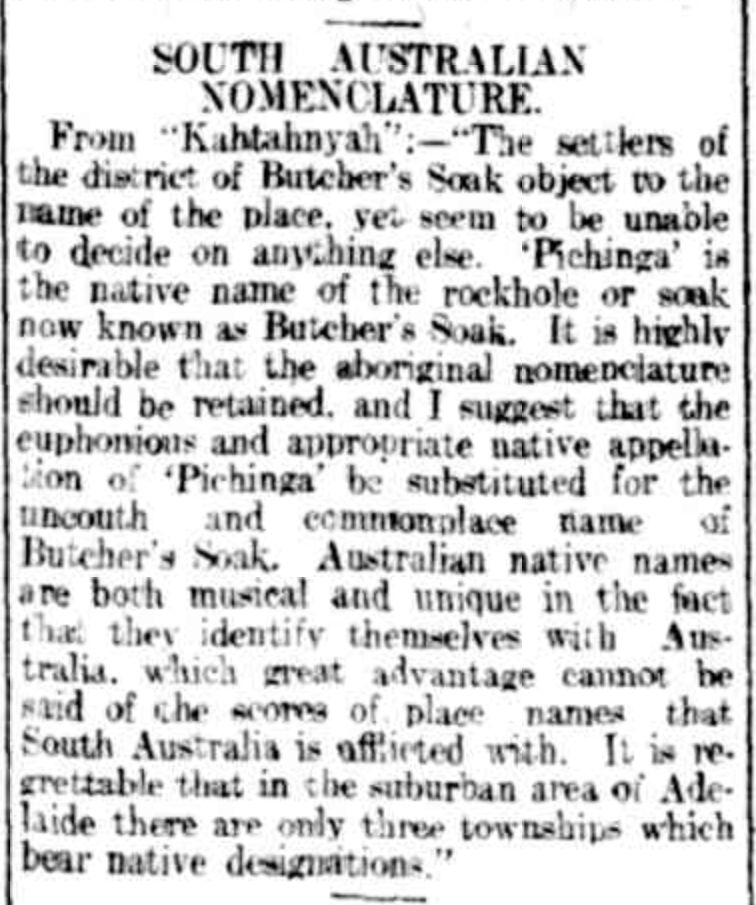
Above:- Article from The Register, Wed 31 Jul 1912. Image c/o Trove
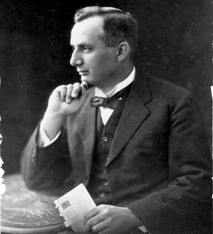
The Hundred of Peebinga was declared in 1912 by Governor Sir Day Hort Bosanquet (b. 1843. d. 1923). (Howell 1979)

Above:- Admiral Sir Day Hort Bosanquet. Image c/o Wikipedia.
The town of Peebinga was surveyed in 1924. It was named by Tom Bridges, the Governor of South Australia. The town was designed by Charles Compton Read (b. 1880. d. 1933). He had designed Colonel Light Gardens and Barmera. Read used the ‘garden city’ principle. He was active in the Garden Cities and Town Planning Association of Great Britain. (Flickr 2024)
Above:- Charles Read. Image c/o Wikipedia
Read produced a magnificent plan for the township of Peebinga, with curved streets and parks and shrubbery borders. Right-angle corners were avoided. Read included a small semi-circular village green as the focal point of the township. Read’s plan catered for several hundred town blocks, however only 14 were purchased in 1924 and few were built upon. (Flickr 2024)
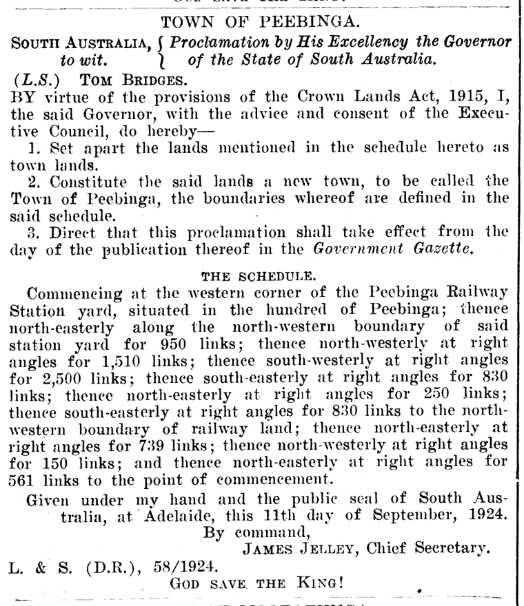
Above:- Proclamation of the town of Peebinga, SA Govt Gazette, 25 Sep 1924.
The Peebinga Post Office opened in 1926 and closed in 1986.
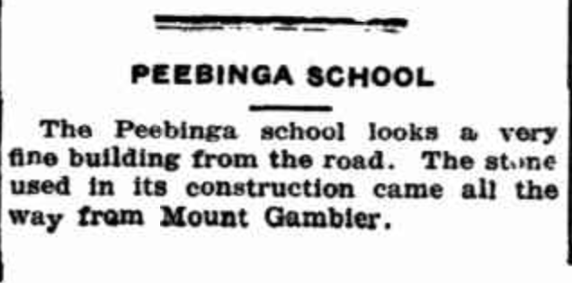
The Peebinga school opened in 1925 and closed in 1965. From 1925, the government school operated in the Peebinga Hall. In 1927 the Mount Gambier limestone schoolroom was constructed. Mr. WIlliam Wilshire was the last teacher who taught at Peebinga from 1946 to 1965. There was also a government school a short distance away at Butcher’s Soak which opened in 1922 and closed in 1926 when the new stone school at Peebinga opened in February 1927. (Flickr 2024)
Above:- Article from the Murray Pioneer, Fri 17 May 1929. Image c/o Trove
During the 1920, Peebinga was serviced by a Methodist minister who visited the town once a fortnight. He conducted church services in a house. Following the opening of the Peebinga Hall in 1925, Lutheran, Catholic, Methodist, and Anglican church services were held in the hall. In 1968 the Peebinga Hall was demolished and replaced with a galvanised iron hall. This hall closed in 2002 and is now a private residence. Peebinga only ever had one church building. That was a transportable building used by the Methodist faith. (Flickr 2024)
By the 1920’s Peebinga had two general stores. One of these continued to operate until the 1980s. (Flickr 2024)
Peebinga was the terminus of the Peebinga railway line that was constructed in 1914. The line opened on the 18th day of December 1914. It originated from a junction with the Barmera line at Karoonda and extended through the Murray Mallee region ending at Peebinga. (Wikipedia 2024)
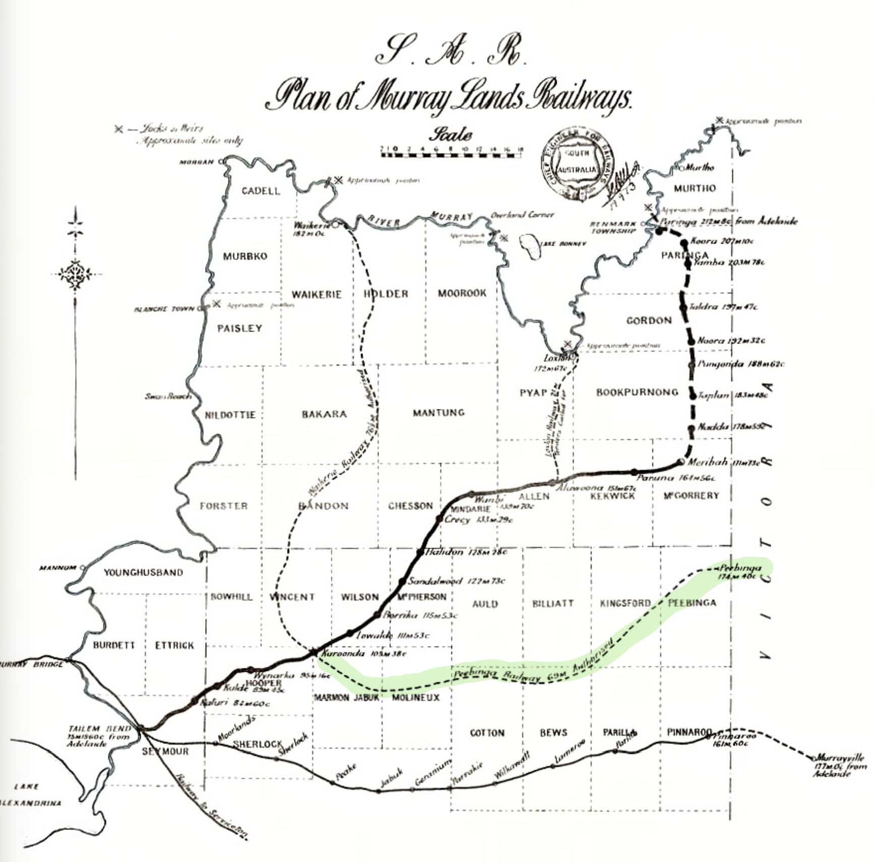
Above:- A 1913 map of Murrayland railway lines in South Australia. Image c/o Wikipedia.
The railway was officially closed on the 7th day of December 1990. (Wikipedia 2024)
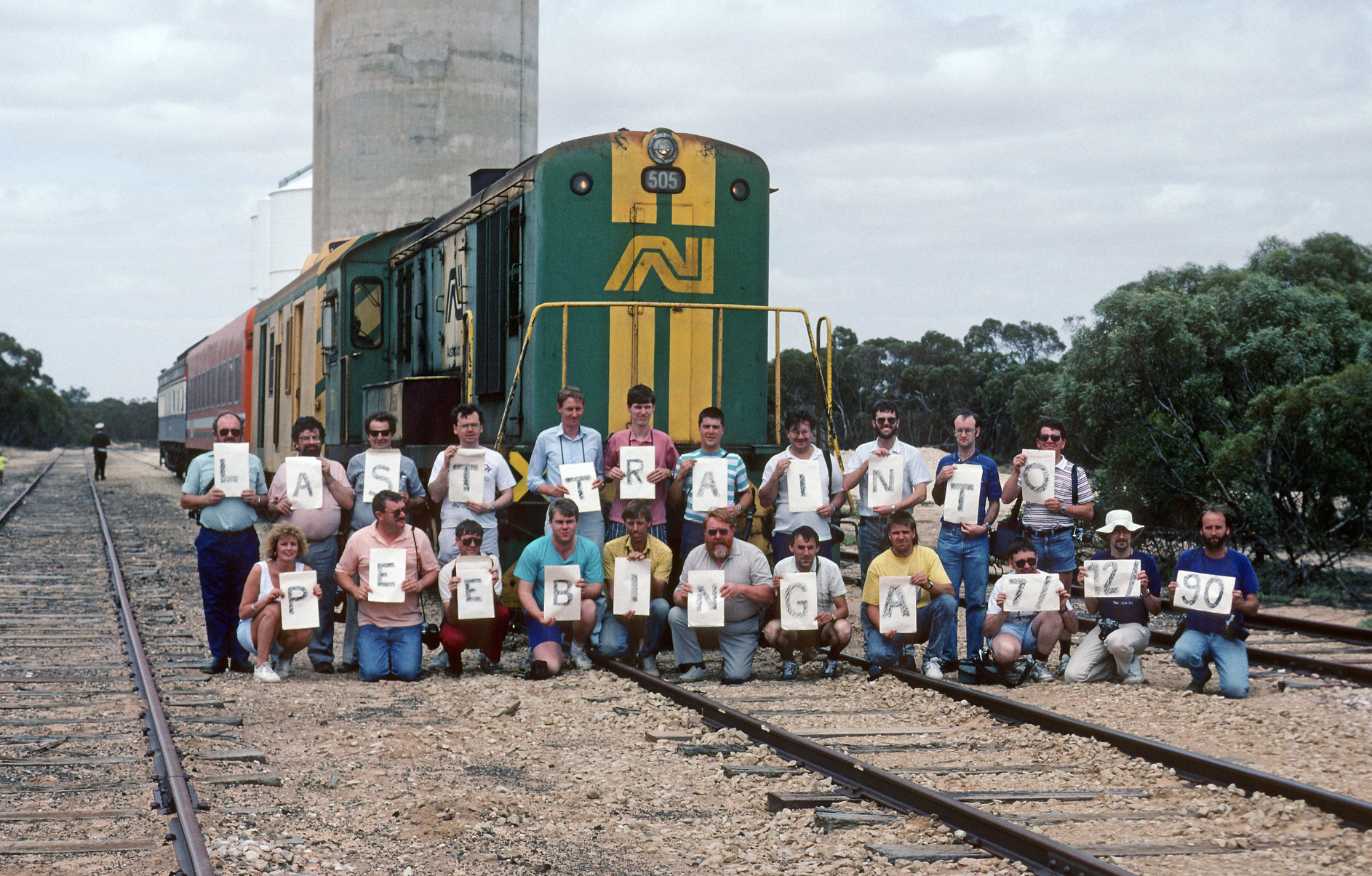
Above:- An Railway Tourist Association group with the last passenger train to Peebinga, South Australia, 7 Dec. 1990. Image c/o Flickr
Below is an excellent video on the old railway lines in the Murray Mallee.
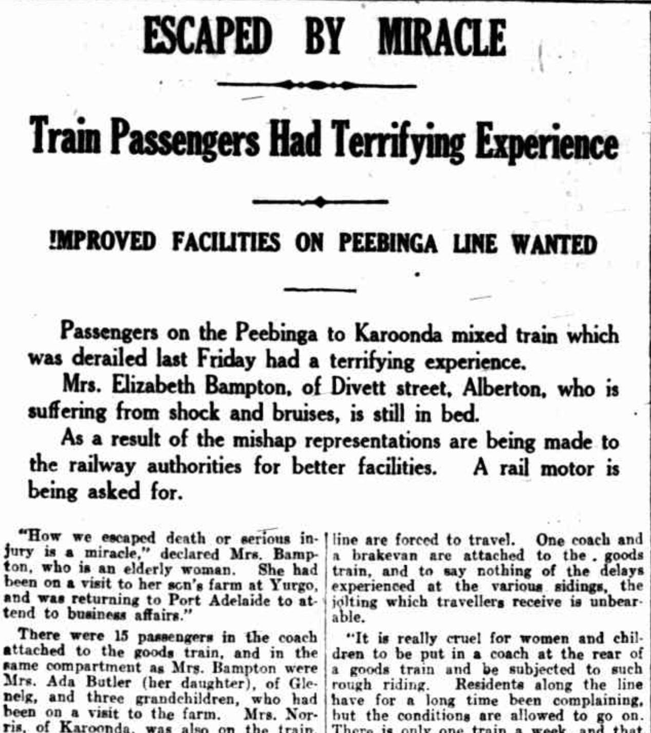
During the early-1920s, Peebinga locals complained about the line. This culminated in a derailment in 1924.
The mixed goods/passenger train was replaced with a motorised Brill car of Bullwell Bull car. This operated for passengers until 1940. Passenger train services to Peebinga ceased in the 1960s. (Flickr 2024)
Above:- Part of an article from The News Adelaide, Thu 18 Sep 1924. Image c/o Trove.
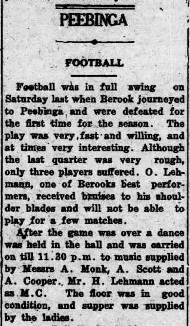
During the Great Depression of the 1920s, many farmers left the Peebinga district. However, Peebinga still had football, netball, and tennis teams. (Flickr 2024)
Above:- Article from the Pinnaroo and Border Times, Fri 8 Jul 1932. Image c/o Trove.
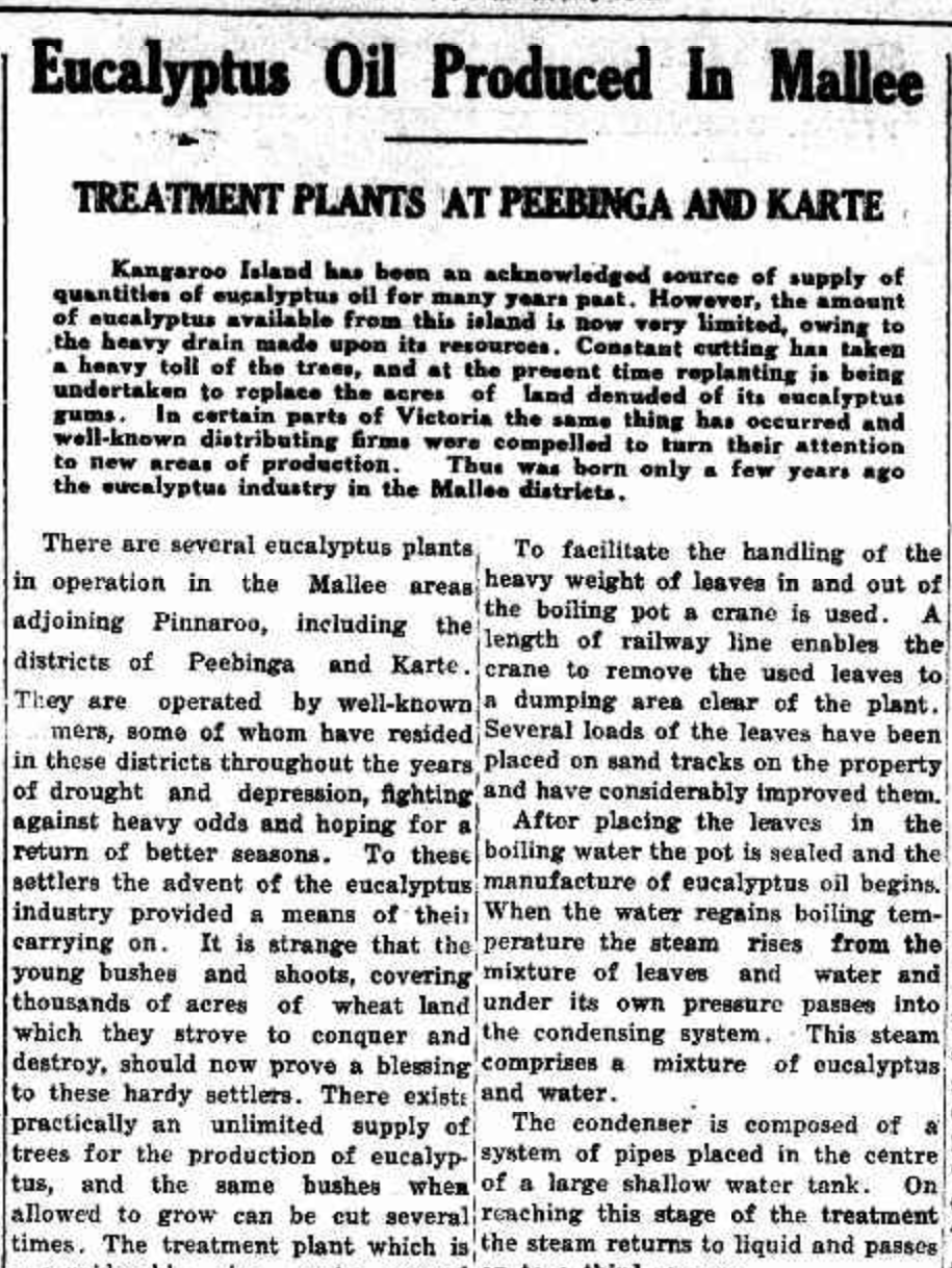
Between the 1930s and the early 1970s, several farmers in the Peebinga district had eucalyptus distilleries on their properties. The local eucalypts that grew in the area were high in oil content. The eucalyptus oil was sold to Faulding and Co. (Flickr 2024)
Above:- Part of an article from the Pinnaroo & Border Times, Thu 27 Nov 1941. Image c/o Trove
Today, not much remains at Peebinga, other than the hall, the old Post Office, the silos, and some houses.

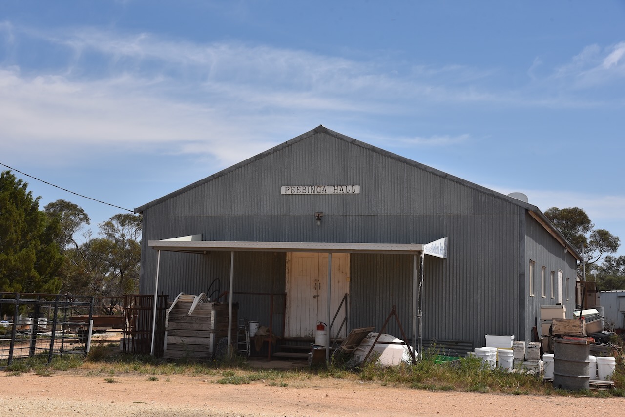
The silos at Peebinga were erected in 1964 and are still used by Viterra. Rail services ceased from the Peebinga silos in 1990. (Flickr 2024)

Marija and I parked on Kerleys Road within the activation zone and operated from the 4WD. We ran the Icom IC-7000, 100 watts, and the Coadn 9350 antenna with the 1.5 metres stainless steel whip.
Above:- The activation zone at the Peebinga silo. Map c/o SiOTA website.
We found band conditions to be absolutely terrible. And combined with the fact that we had no internet coverage, this was a hard activation.
Marija worked the following stations on 40m SSB:-
- VK3TKK/p (Goldie Flora Reserve VKFF-6217)
- VK5IS
- VK3UP/p
- VK3WSG
- VK3MCA
- VK3SMW
- VK3PF
- VK3APJ
I worked the following stations on 40m SSB:-
- VK3TKK/p (Goldie Flora Reserve VKFF-6217)
- VK5IS
- VK3UP/p
- VK3WSG
- VK3MCA
- VK3SMW
- VK3PF
- VK3APJ
References.
- Department for Environment and Heritage, 2005, Tracks of the Mallee
- Flickr. (2024). Peebinga. It has the railway to nowhere. The first Peebinga Hall opened in 1925. It was used for Lutheran, Catholic, Methodist and Anglican Church services. This second Hall opened in 1968 and closed 2002.. [online] Available at: https://www.flickr.com/photos/82134796@N03/53398632749/in/photostream/ [Accessed 17 Dec. 2024].
- Flickr. (2024). Peebinga. SA. Butchers Soak. Known by the Ngarkat Aboriginal people. Local historial cairn with historical information on Peebinga and other railway sidings. [online] Available at: https://www.flickr.com/photos/82134796@N03/53413379180/in/photostream/ [Accessed 17 Dec. 2024].
- Howell, P.A. (1979). Bosanquet, Sir Day Hort (1843–1923). [online] Anu.edu.au. Available at: https://adb.anu.edu.au/biography/bosanquet-sir-day-hort-5298 [Accessed 17 Dec. 2024].
- Sa.gov.au. (2024). Peebinga – Penrice. [online] Available at: https://manning.collections.slsa.sa.gov.au/pn/p/p4.htm [Accessed 17 Dec. 2024].
- Trove. (2024). The Register (Adelaide, SA : 1901 – 1929) – 31 Jul 1912 – p11. [online] Available at: https://trove.nla.gov.au/newspaper/page/4512001?searchTerm=butchers%20soak [Accessed 17 Dec. 2024].
- Wikipedia Contributors (2024). Peebinga railway line. Wikipedia.
