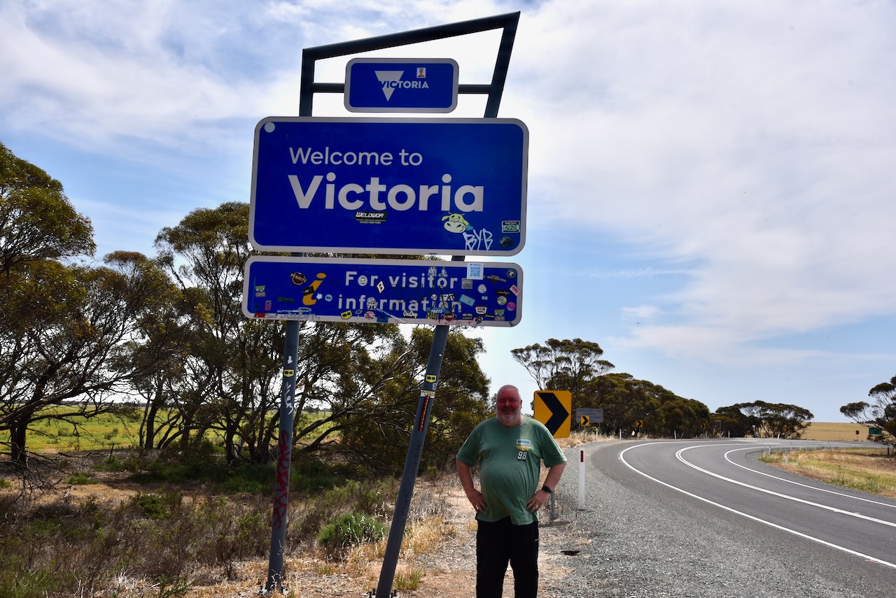
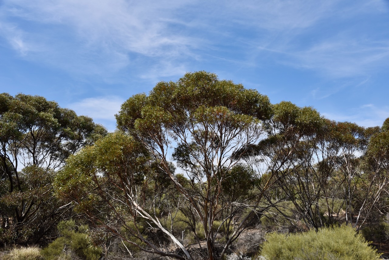
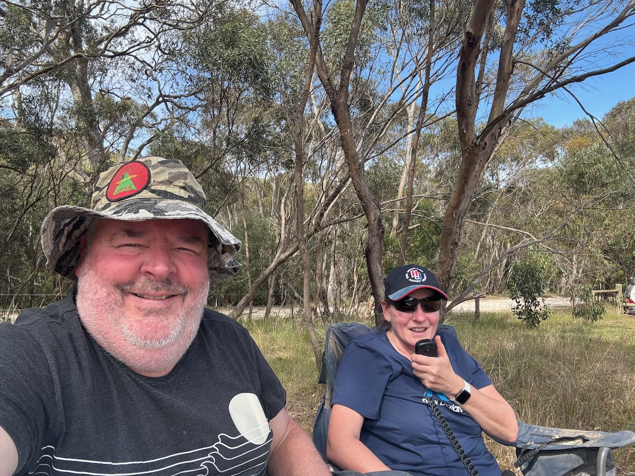
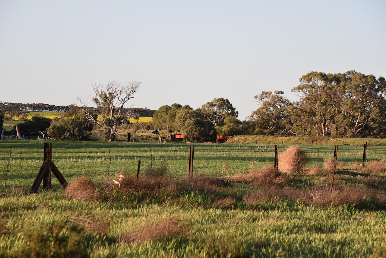
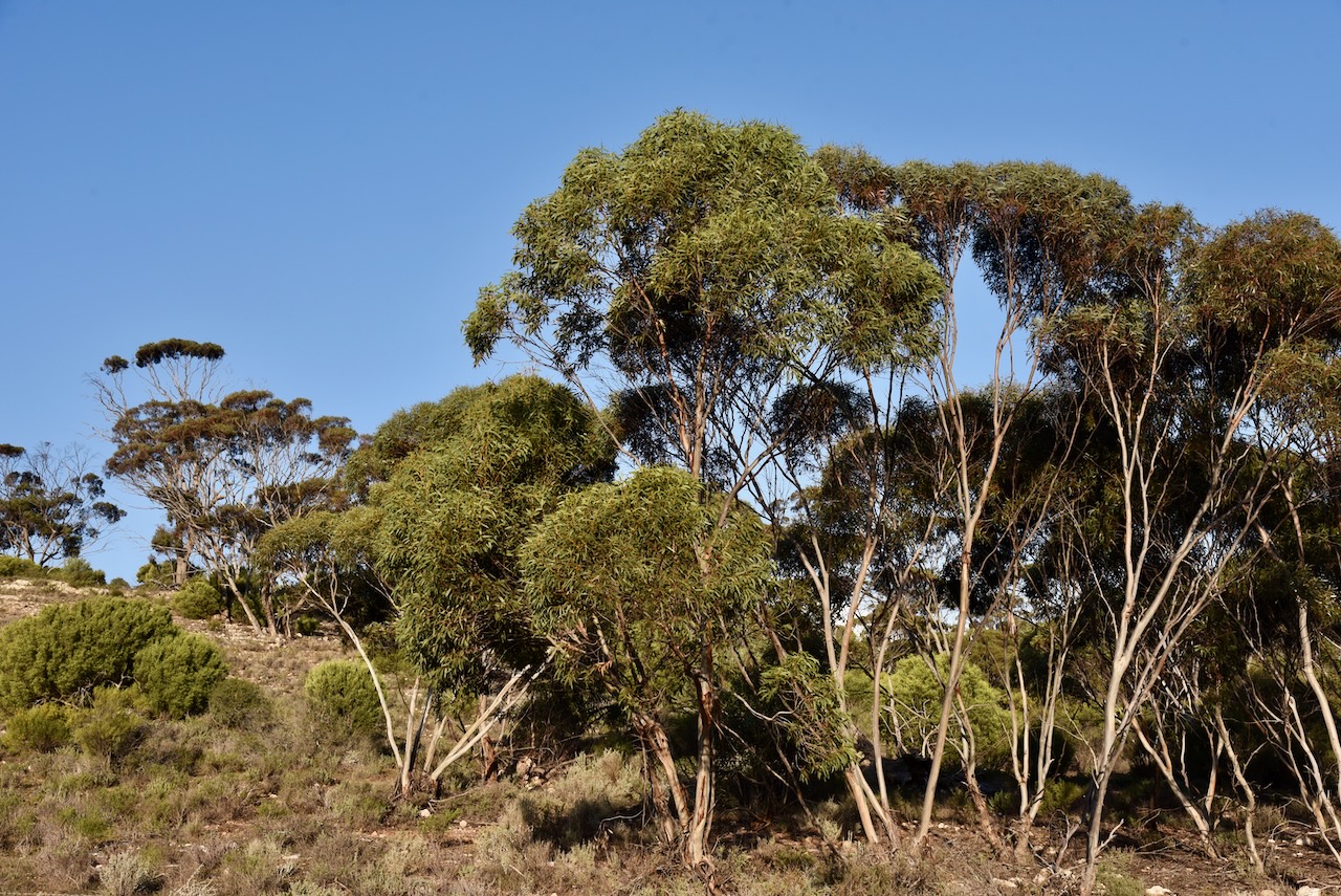
Our next planned activation for the trip on Thursday 20th October 2024 was the Patchewollock North Bushland Reserve VKFF-4244.
The park is located between Walpeup and Patchewollock in northwest Victoria. It is about 436 km northwest of Melbourne.
Above:- Map showing the location of the Ptachewollock North Bushland Reserve. Map c/o Google Maps.
Marija and I drove down to Pinnaroo where we stopped briefly for something to eat and a coffee. We then travelled east and crossed over the State border into Victoria.
We continued east along the Mallee Highway, which we had driven along dozens of times previously. Many people would probably find this drive boring, but there is a lot of history to be seen along the way. At Walpeup we turned right onto the Hopetoun-Walpeup Road and headed south.
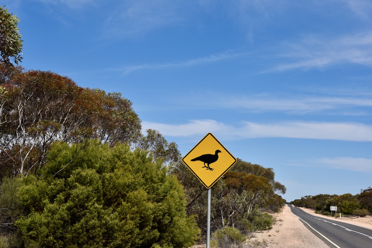
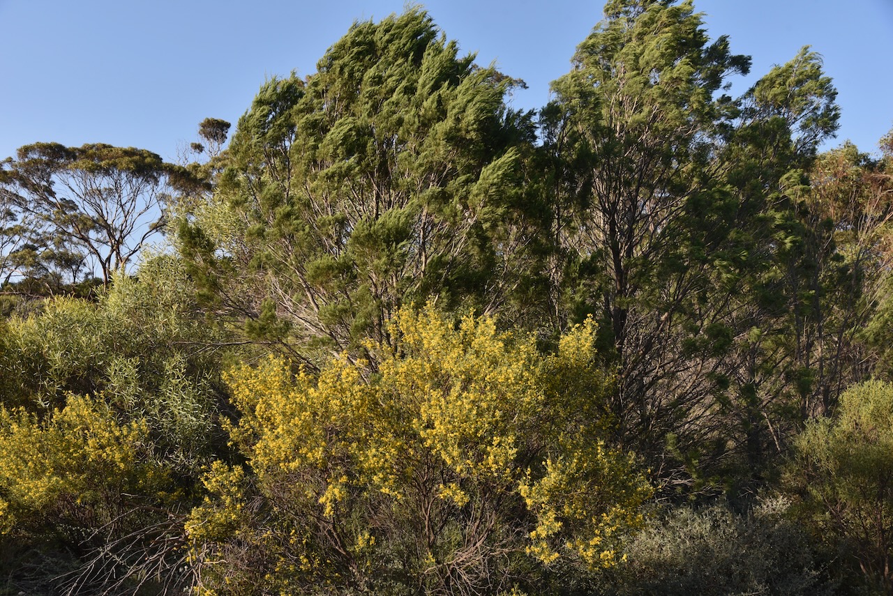
Along the way, there were signs warning drivers to take care of Malleefowl. The Malleefowl, also known as Gnow, Lowan and Mallee Hen, is a ground-dwelling bird that is seldom seen and is shy. They are listed as Vulnerable nationally. And we were lucky enough to see one on the side of the road as we approached the park. (Bush Heritage 2024)
Unfortunately by the time we had pulled over and turned around, a truck came by and scared the Mallefowl into the scrub. Despite being unable to get a photograph, Marija and I were very excited. It was the first time that Marija had seen a Malleefowl and only my second time. (Bush Heritage 2024)
Below is an excellent video on the Malleefowl.
Marija and I had been to the town of Patchewollock previously and we were running short of time, so this time around we did not visit the town.
Patchewollock is believed to be the corruption of two aboriginal words, ‘putje’ meaning ‘plenty’ and ‘wallah’ meaning ‘porcupine grass’. Thus ‘the place of plenty porcupine grass’. Prior to European settlement of the district, the land was occupied by the Wegaia aboriginal people. By 1747 European settlers had commenced grazing on the land. In 1914 the town of Patchewollock was established as a town surrounded by soldier settlement farms. (Aussie Towns 2024)
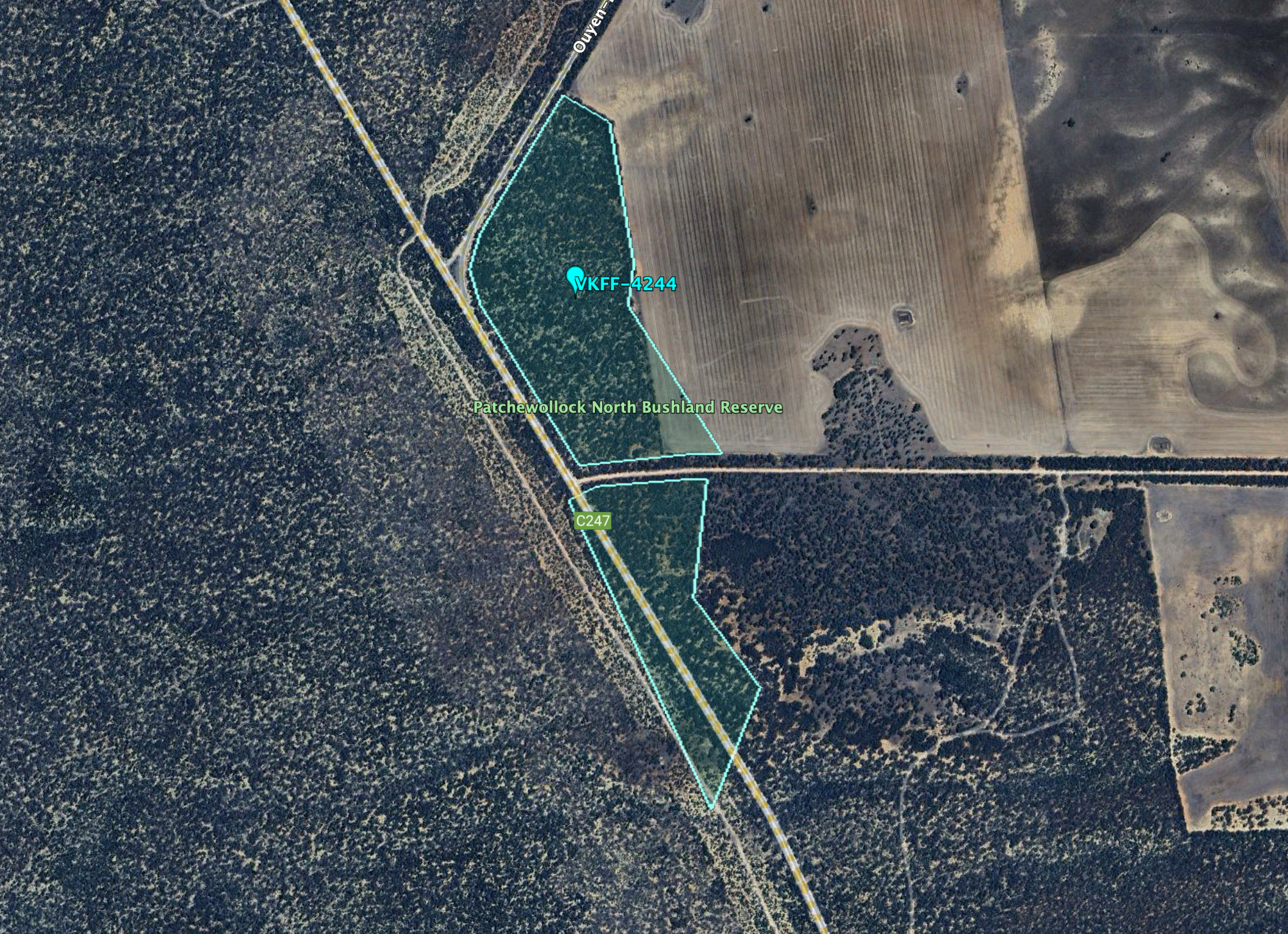
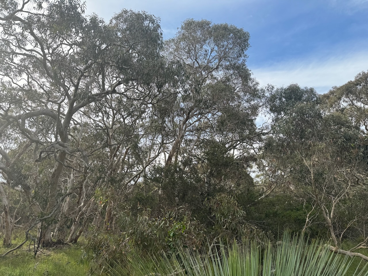
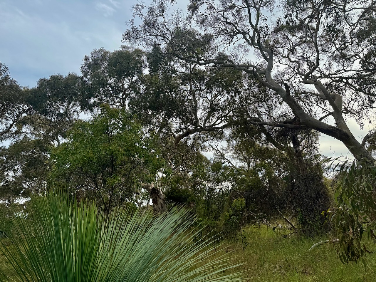
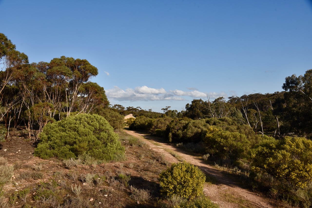
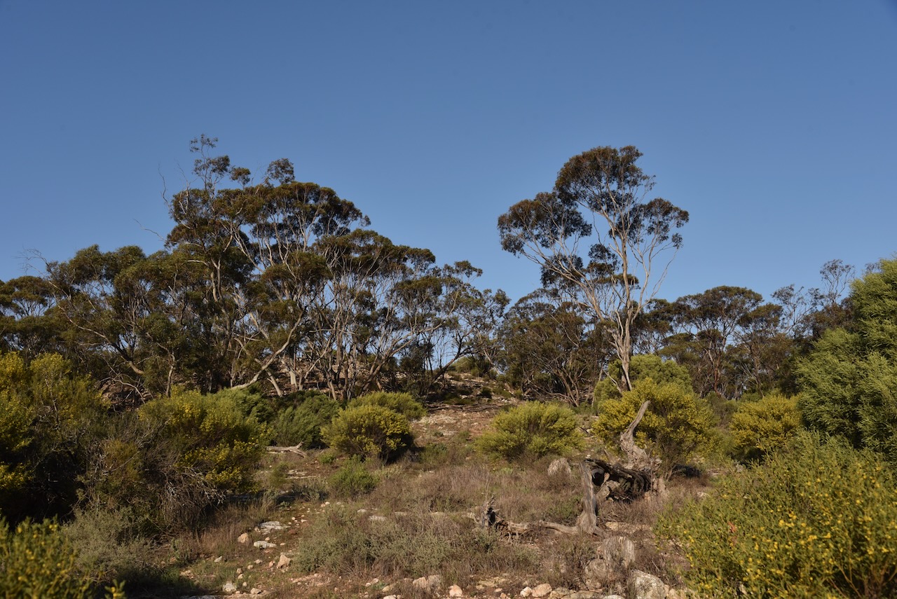
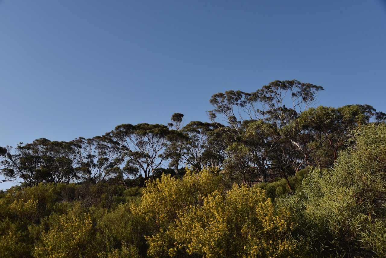
The Patchewollock North Bushland Reserve is located on the eastern side of the Hopetoun-Walpeup Road at the junction of the Ouyen-Patchewollock Road. Crane Road also divides the park into two sections, the northern section and the southern section.
Above:- An aerial view of the reserve. Image c/o Google Earth.
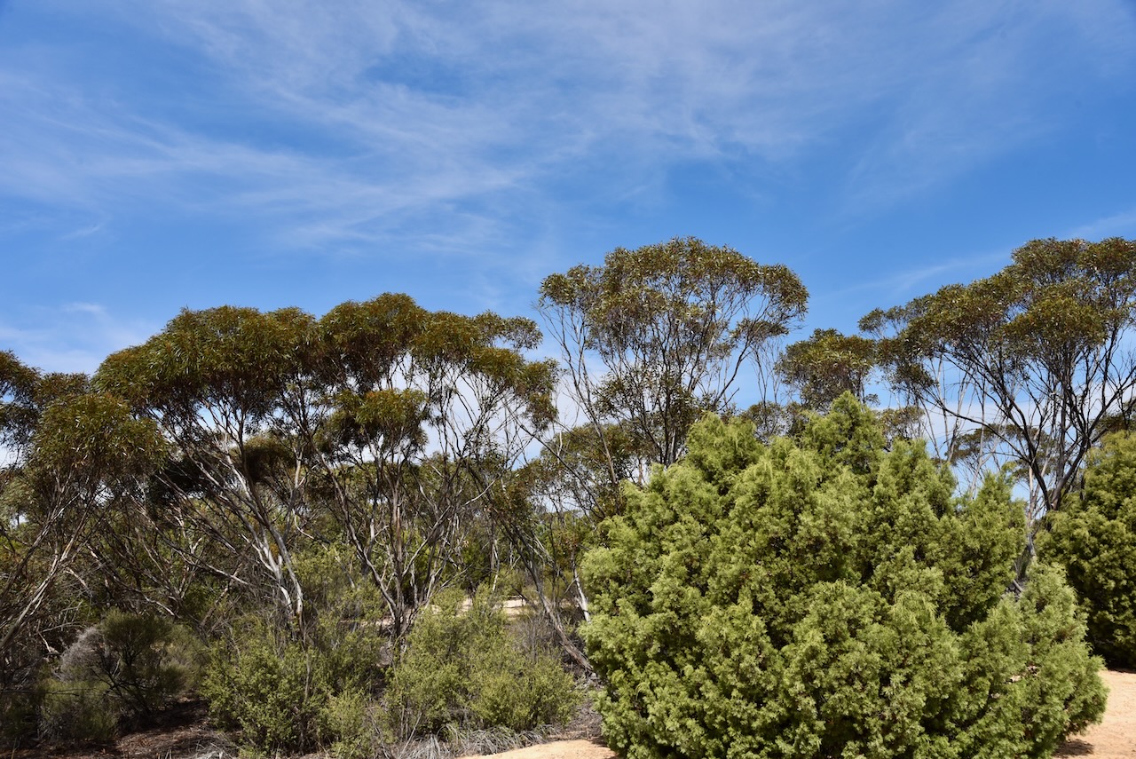
The reserve is about 40 hectares in size and was established on the 1st day of May 1979. (CAPAD 2022)
We were running a bit short of time, so we both qualified the park for VKFF with at least 10 QSOs, and then headed off. This is a park we will need to return to with the aim of getting 44 QSOs to qualify the park for the WWFF global program.
On Saturday 19th October 2024, Marija VK5MAZ and I drove up to Renmark on the first leg of our trip to Bendigo for the 2024 VKFF National Get-Together. The reason for us heading to Rthe Riverland first was to pick up a raffle prize from my good mate Danny VK5DW who owns RivComm Radio Solutions. And secondly to get my other great mate Ivan VK5HS to have a look at my Icom IC-7000 in the 4WD which was intermittently cutting out.
Marija and I called in to see Danny VK5DW at Loxton and enjoyed a coffee and a chat. We also picked up a UHF CB starter kit that Danny had donated. This was the second year that Danny had kindly donated a prize for the raffle at the VKFF National Get-Together. Thanks so much for your generosity Danny.
We then headed off to Renmark and caught up with Ivan VK5HS. After some problem-solving, it turned out that the voltage on my secondary battery in the 4WD was low and this was the cause of the intermittent drop outs on the IC-7000. Thanks for your time Ivan.
That evening Marija and I stayed in Renmark at our regular overnight spot, the Citrus Valley Motel.
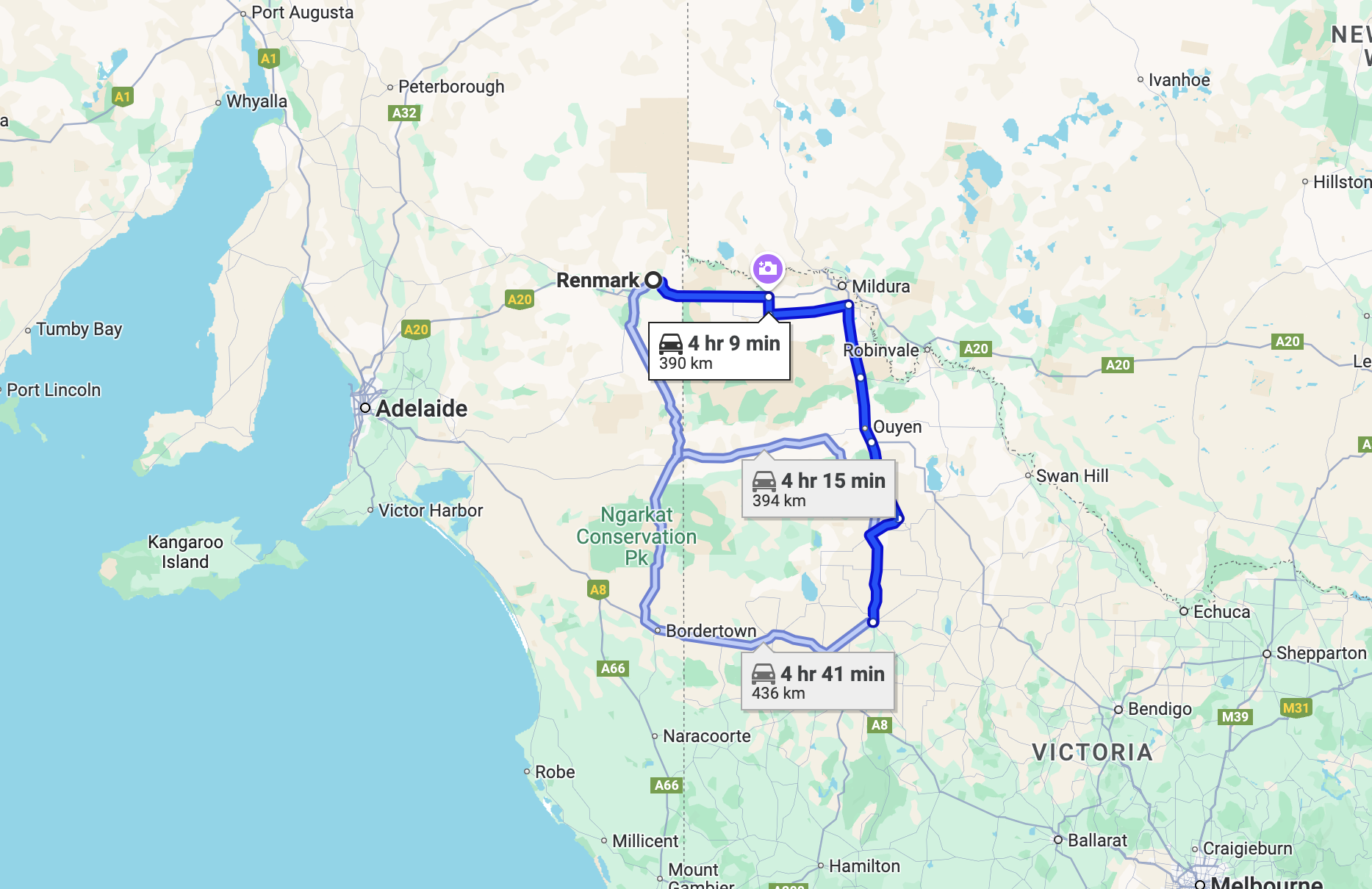
The next day, Sunday 20th October 2024, Marija and I made our way to Warracknabeal where we planned to stay for three nights. It was a drive of about 394 km to get to Warracknabeal.
Above:- Map showing our route from Renmark to Warracknabeal. Map c/o Google Maps.
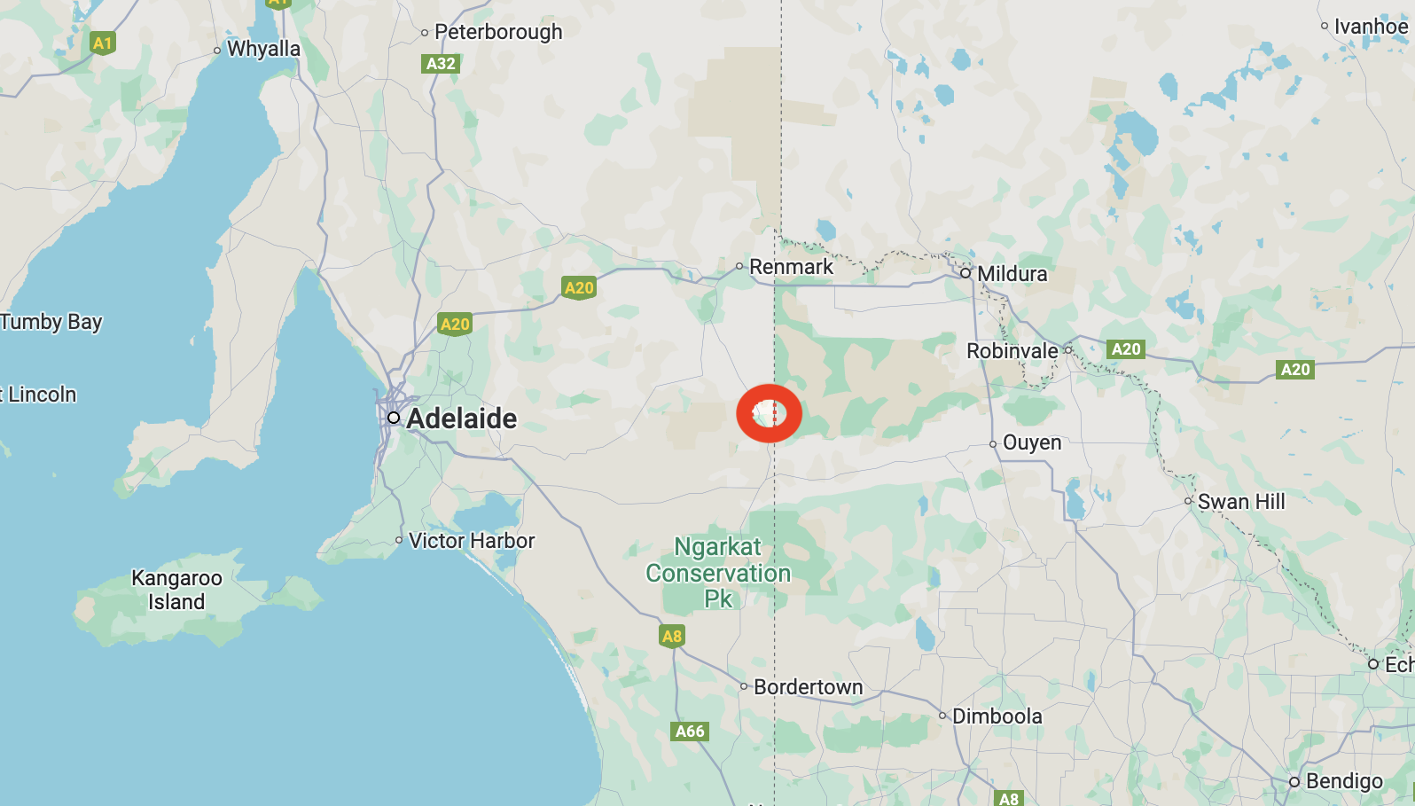
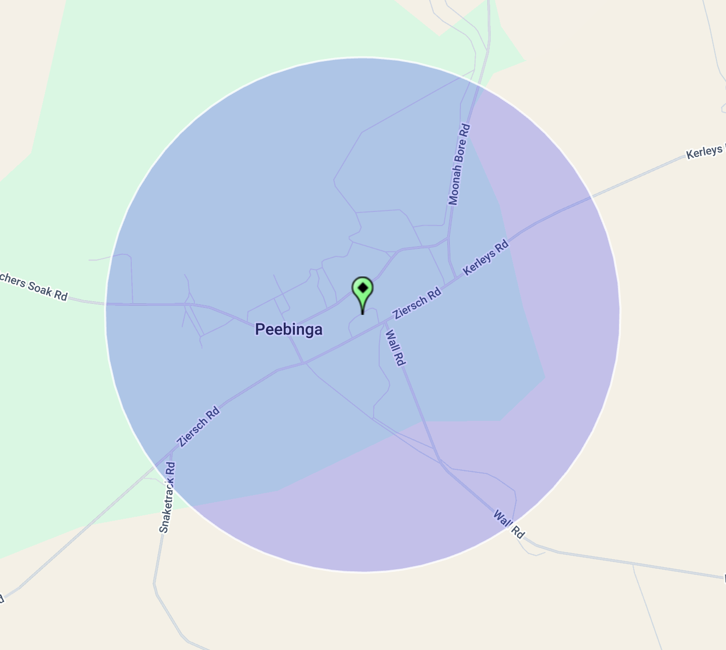
Along the way, Marija and I decided to activate the Peebinga silo VK-PBA5 for the Silos On The Air (SiOTA) program. Peebinga is located about 273 km east of Adelaide and just 5 km from the South Australia/Victoria state border.
Above:- Map showing the location of Peebinga. Map c/o Google Maps.
Before European settlement, the Peebinga area was home to the Ngarkat (pronounced Narr-kat) aboriginal people. (Tracks of the Mallee)
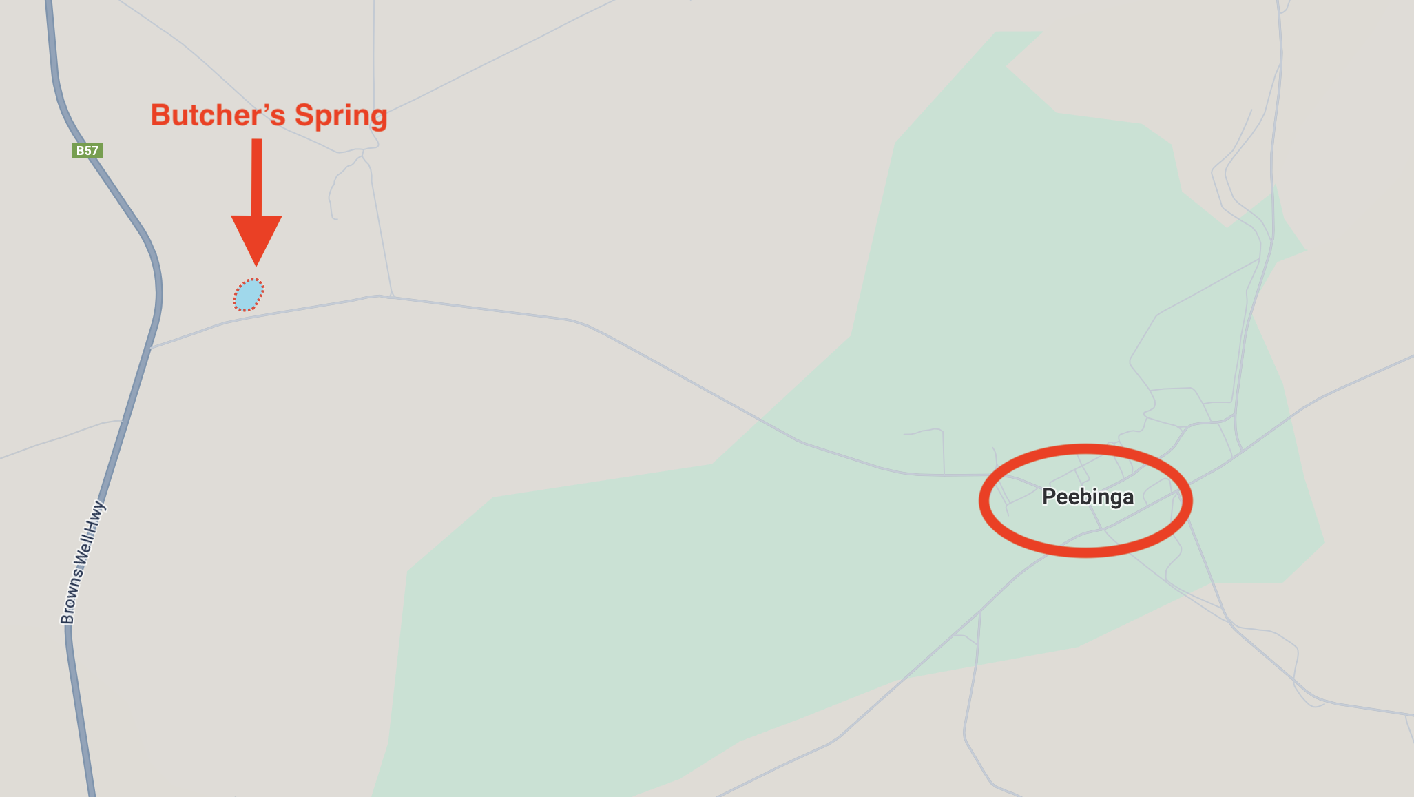
Pichinga is the aboriginal name for a rock hole in the area. Pinchinga means ‘place of pines’. It is believed that Peebinga is a corruption of the aboriginal word pichinga. Peebinga was formerly known as Butcher Soak, Butcher Rockhole and Butcher Springs. It is reported that you can dig 5 feet and find water below the sand. Butcher’s Spring was named after a local early pastoralist. It is one of only two permanent water supplies in the Murray Mallee region. (Sa.gov.au, 2024) (Trove 2024)
Above:- Map showing the location of Butcher’s Spring and Peebinga. Map c/o Google Maps.
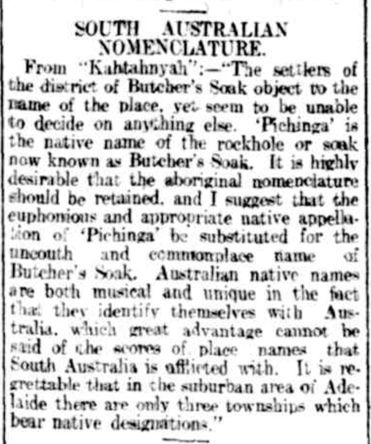
In 1912 an article appeared in The Register which referred to “The settlers of the district of Butcher’s Soak object to the name of the place…..’Pichinga’ is the native name of the rockhole or soak known as Butcher’s Soak. It is highly desirable that the aboriginal nomenclature should be retained, and I suggest that the euphonious and appropriate native appellation of ‘Pichinga’ be substituted for the uncouth and commonplace name of Butcher’s Soak.” (Trove 2024)
Above:- Article from The Register, Wed 31 Jul 1912. Image c/o Trove
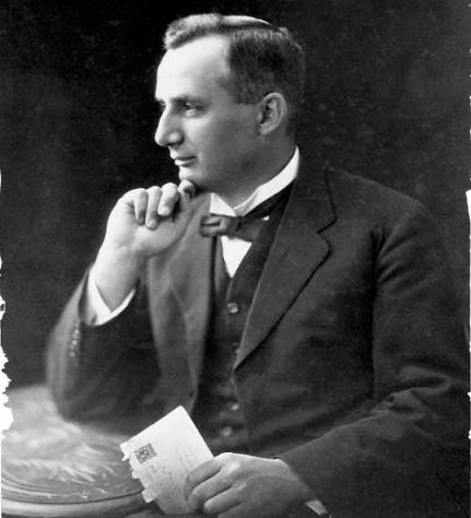
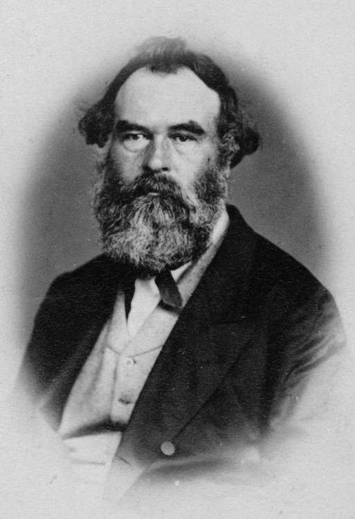
The Hundred of Peebinga was declared in 1912 by Governor Sir Day Hort Bosanquet (b. 1843. d. 1923). (Howell 1979)
Above:- Admiral Sir Day Hort Bosanquet. Image c/o Wikipedia.
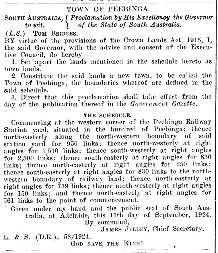
The town of Peebinga was surveyed in 1924. It was named by Tom Bridges, the Governor of South Australia. The town was designed by Charles Compton Read (b. 1880. d. 1933). He had designed Colonel Light Gardens and Barmera. Read used the ‘garden city’ principle. He was active in the Garden Cities and Town Planning Association of Great Britain. (Flickr 2024)
Above:- Charles Read. Image c/o Wikipedia
Read produced a magnificent plan for the township of Peebinga, with curved streets and parks and shrubbery borders. Right-angle corners were avoided. Read included a small semi-circular village green as the focal point of the township. Read’s plan catered for several hundred town blocks, however only 14 were purchased in 1924 and few were built upon. (Flickr 2024)
Above:- Proclamation of the town of Peebinga, SA Govt Gazette, 25 Sep 1924.
The Peebinga Post Office opened in 1926 and closed in 1986.
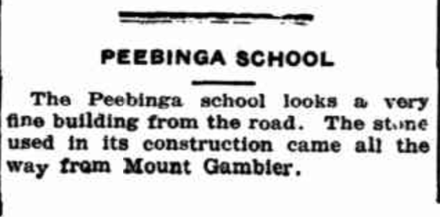
The Peebinga school opened in 1925 and closed in 1965. From 1925, the government school operated in the Peebinga Hall. In 1927 the Mount Gambier limestone schoolroom was constructed. Mr. WIlliam Wilshire was the last teacher who taught at Peebinga from 1946 to 1965. There was also a government school a short distance away at Butcher’s Soak which opened in 1922 and closed in 1926 when the new stone school at Peebinga opened in February 1927. (Flickr 2024)
Above:- Article from the Murray Pioneer, Fri 17 May 1929. Image c/o Trove
During the 1920, Peebinga was serviced by a Methodist minister who visited the town once a fortnight. He conducted church services in a house. Following the opening of the Peebinga Hall in 1925, Lutheran, Catholic, Methodist, and Anglican church services were held in the hall. In 1968 the Peebinga Hall was demolished and replaced with a galvanised iron hall. This hall closed in 2002 and is now a private residence. Peebinga only ever had one church building. That was a transportable building used by the Methodist faith. (Flickr 2024)
By the 1920’s Peebinga had two general stores. One of these continued to operate until the 1980s. (Flickr 2024)
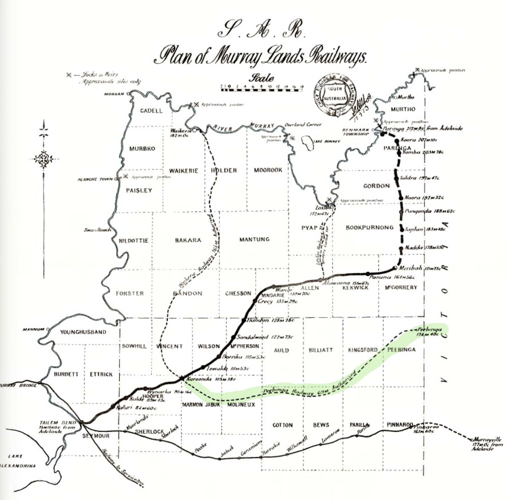
Peebinga was the terminus of the Peebinga railway line that was constructed in 1914. The line opened on the 18th day of December 1914. It originated from a junction with the Barmera line at Karoonda and extended through the Murray Mallee region ending at Peebinga. (Wikipedia 2024)
Above:- A 1913 map of Murrayland railway lines in South Australia. Image c/o Wikipedia.
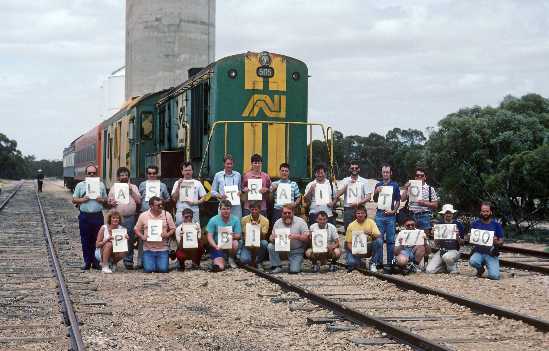
The railway was officially closed on the 7th day of December 1990. (Wikipedia 2024)
Above:- An Railway Tourist Association group with the last passenger train to Peebinga, South Australia, 7 Dec. 1990. Image c/o Flickr
Below is an excellent video on the old railway lines in the Murray Mallee.
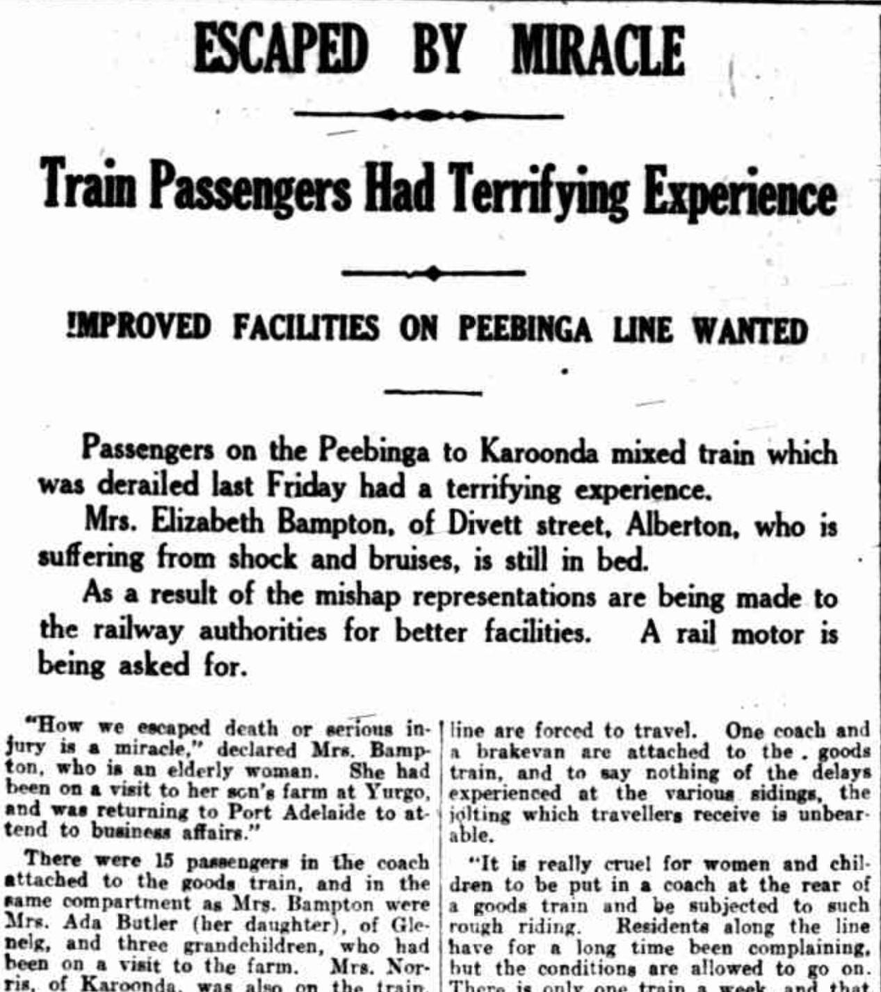
During the early-1920s, Peebinga locals complained about the line. This culminated in a derailment in 1924.
The mixed goods/passenger train was replaced with a motorised Brill car of Bullwell Bull car. This operated for passengers until 1940. Passenger train services to Peebinga ceased in the 1960s. (Flickr 2024)
Above:- Part of an article from The News Adelaide, Thu 18 Sep 1924. Image c/o Trove.
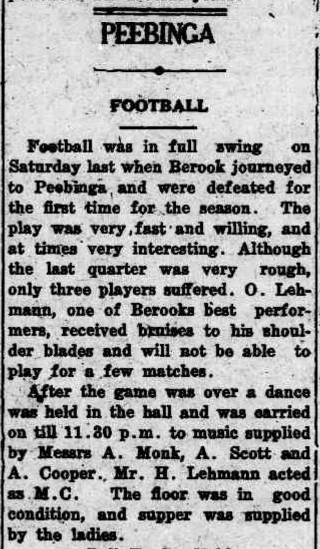
During the Great Depression of the 1920s, many farmers left the Peebinga district. However, Peebinga still had football, netball, and tennis teams. (Flickr 2024)
Above:- Article from the Pinnaroo and Border Times, Fri 8 Jul 1932. Image c/o Trove.
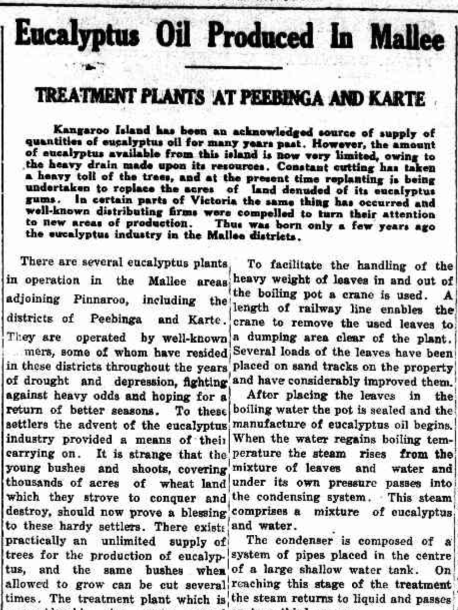
Between the 1930s and the early 1970s, several farmers in the Peebinga district had eucalyptus distilleries on their properties. The local eucalypts that grew in the area were high in oil content. The eucalyptus oil was sold to Faulding and Co. (Flickr 2024)
Above:- Part of an article from the Pinnaroo & Border Times, Thu 27 Nov 1941. Image c/o Trove
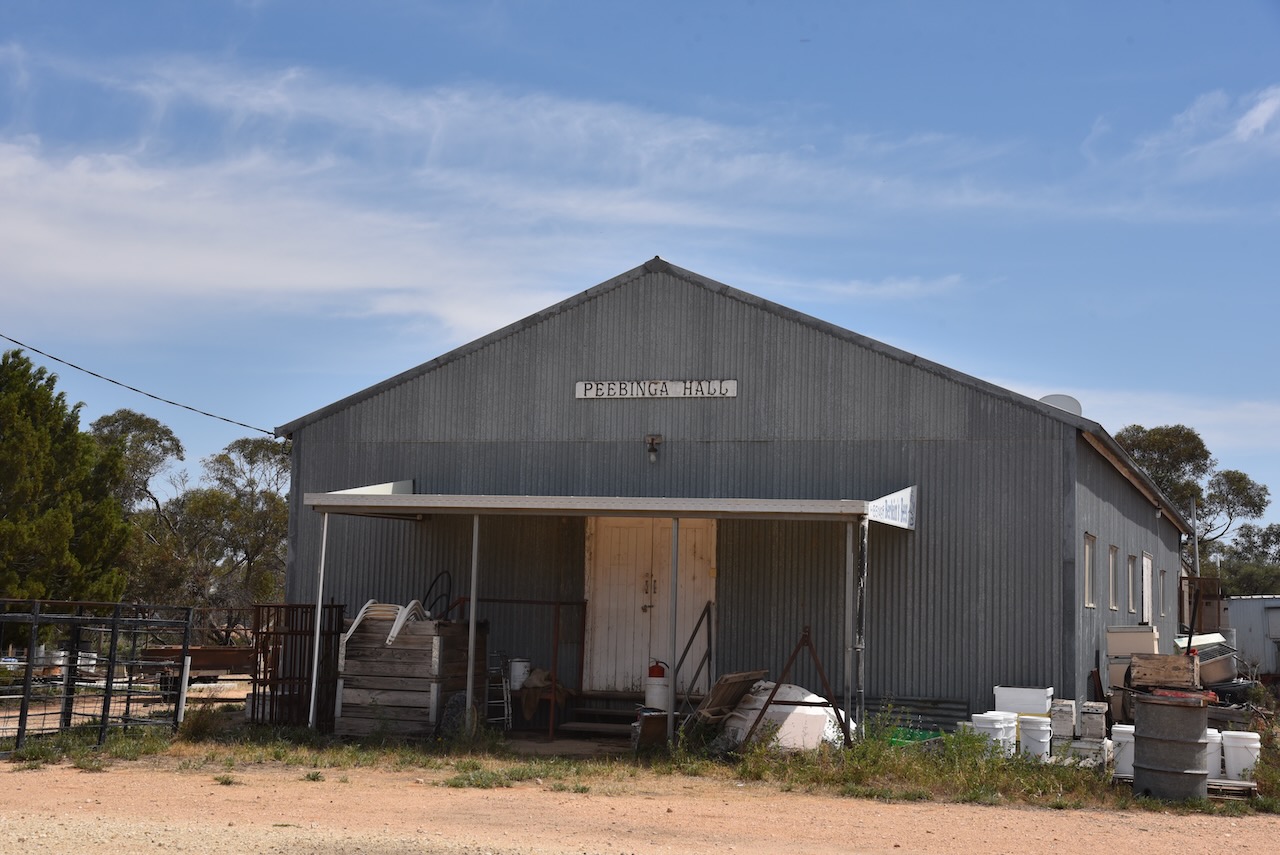
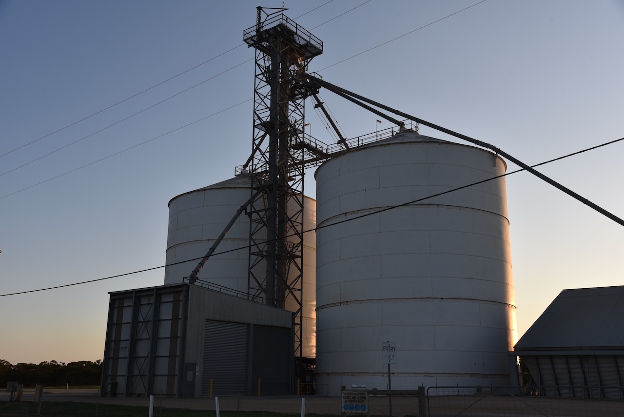
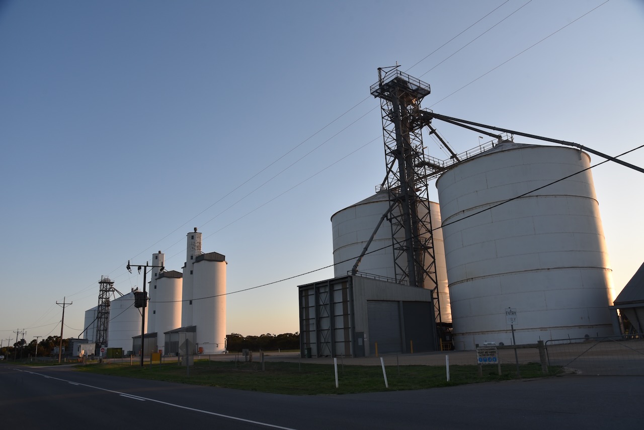
Today, not much remains at Peebinga, other than the hall, the old Post Office, the silos, and some houses.
The silos at Peebinga were erected in 1964 and are still used by Viterra. Rail services ceased from the Peebinga silos in 1990. (Flickr 2024)
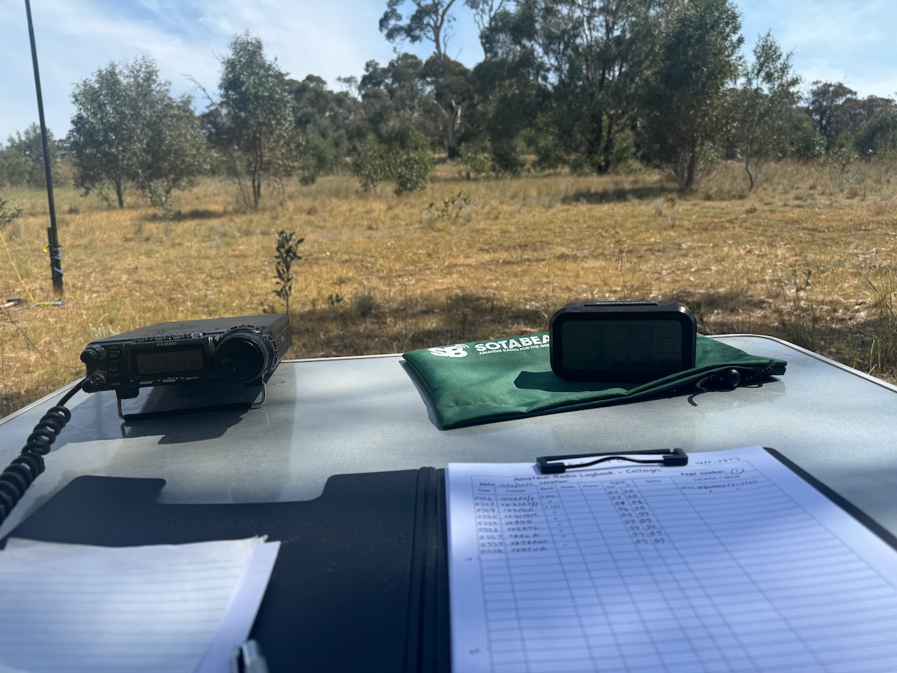
Marija and I parked on Kerleys Road within the activation zone and operated from the 4WD. We ran the Icom IC-7000, 100 watts, and the Coadn 9350 antenna with the 1.5 metres stainless steel whip.
Above:- The activation zone at the Peebinga silo. Map c/o SiOTA website.
We found band conditions to be absolutely terrible. And combined with the fact that we had no internet coverage, this was a hard activation.
Marija worked the following stations on 40m SSB:-
VK3TKK/p (Goldie Flora Reserve VKFF-6217)
VK5IS
VK3UP/p
VK3WSG
VK3MCA
VK3SMW
VK3PF
VK3APJ
I worked the following stations on 40m SSB:-
VK3TKK/p (Goldie Flora Reserve VKFF-6217)
VK5IS
VK3UP/p
VK3WSG
VK3MCA
VK3SMW
VK3PF
VK3APJ
References.
Department for Environment and Heritage, 2005, Tracks of the Mallee
Flickr. (2024). Peebinga. It has the railway to nowhere. The first Peebinga Hall opened in 1925. It was used for Lutheran, Catholic, Methodist and Anglican Church services. This second Hall opened in 1968 and closed 2002.. [online] Available at: https://www.flickr.com/photos/82134796@N03/53398632749/in/photostream/ [Accessed 17 Dec. 2024].
Flickr. (2024). Peebinga. SA. Butchers Soak. Known by the Ngarkat Aboriginal people. Local historial cairn with historical information on Peebinga and other railway sidings. [online] Available at: https://www.flickr.com/photos/82134796@N03/53413379180/in/photostream/ [Accessed 17 Dec. 2024].
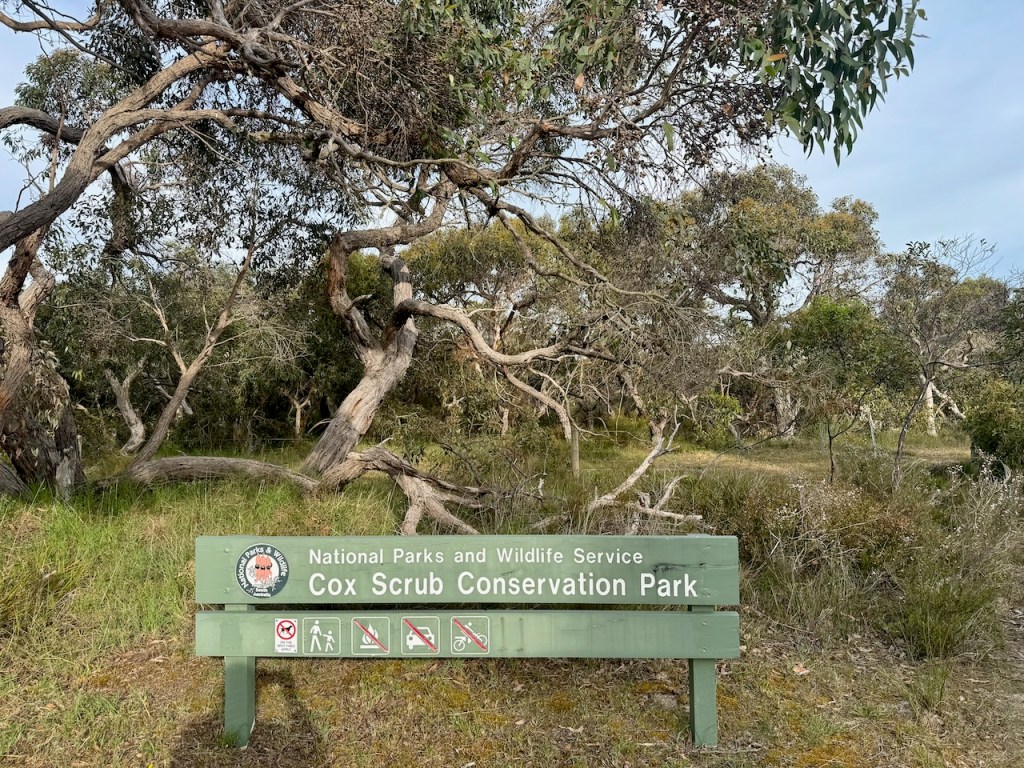
Our third and final park for the 2024 VKFF Team Championship on Saturday 12th October 2024, was the Cox Scrub Conservation Park VKFF-0824.
Above:- Map showing the location of the Cox Scrub Conservation Park. Map c/o Google Maps.
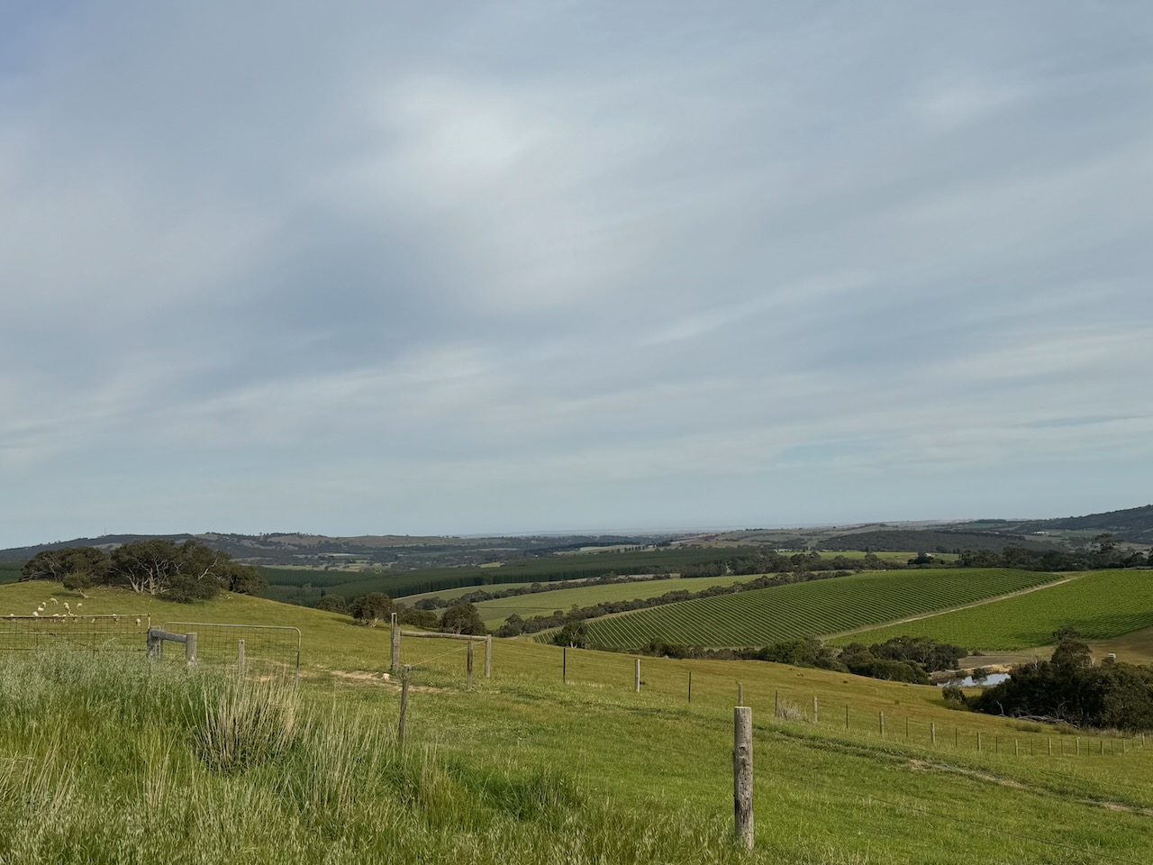
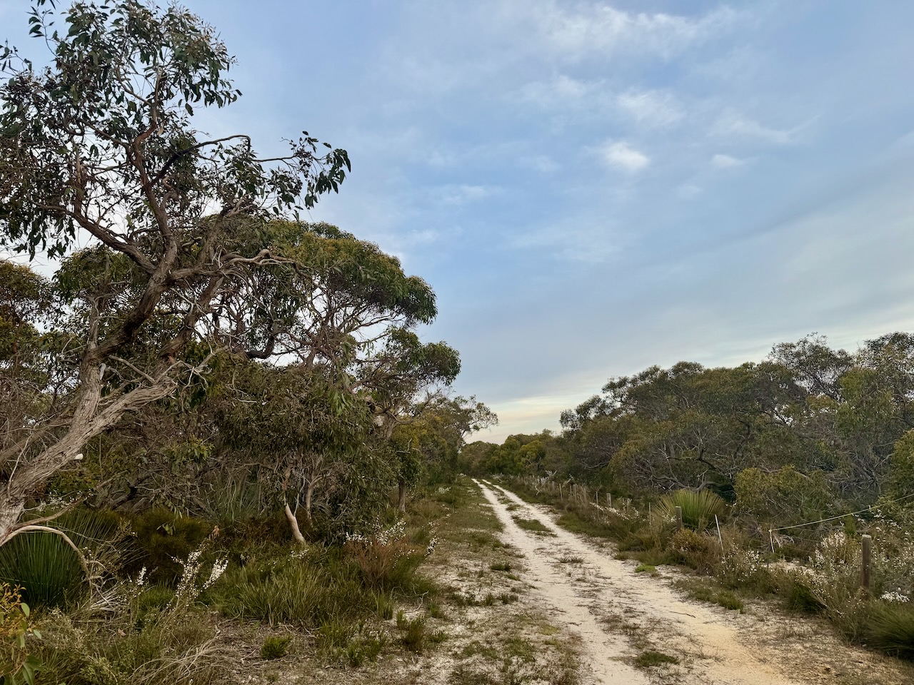
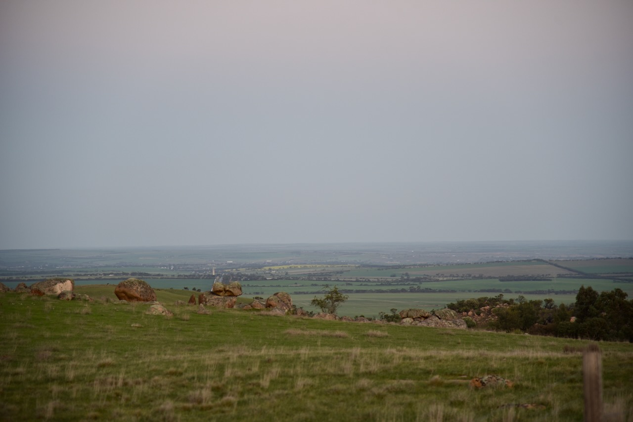
Due to a previous poor encounter with a park ranger at this park, Marija and I decided to activate the park on its western side. To get there we travelled along Ridge Road and were rewarded with some very nice views of the surrounding countryside.
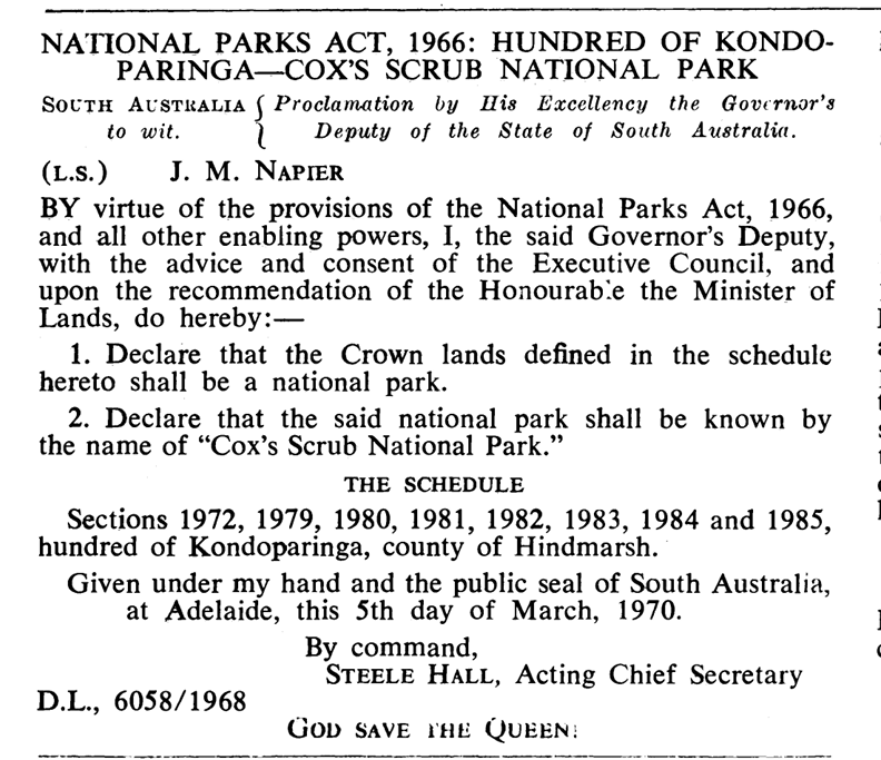
Cox Scrub Conservation Park is about 563 hectares in size and was established on the 5th day of March 1970. It is one of the larger parks that are located on the Fleurieu Peninsula, south of Adelaide. (CAPAD 2022) (NPWS 2024)
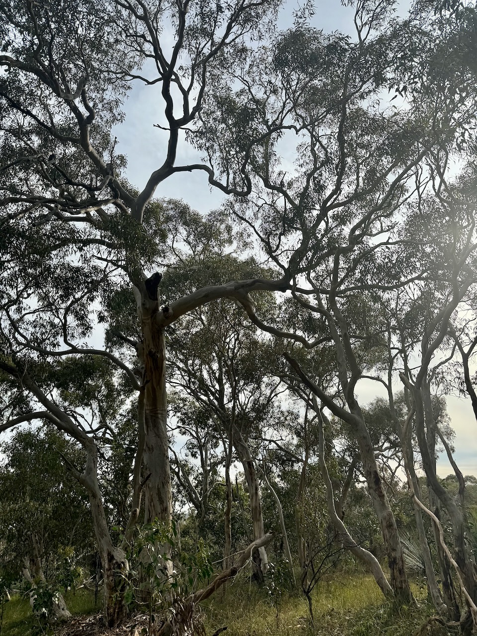
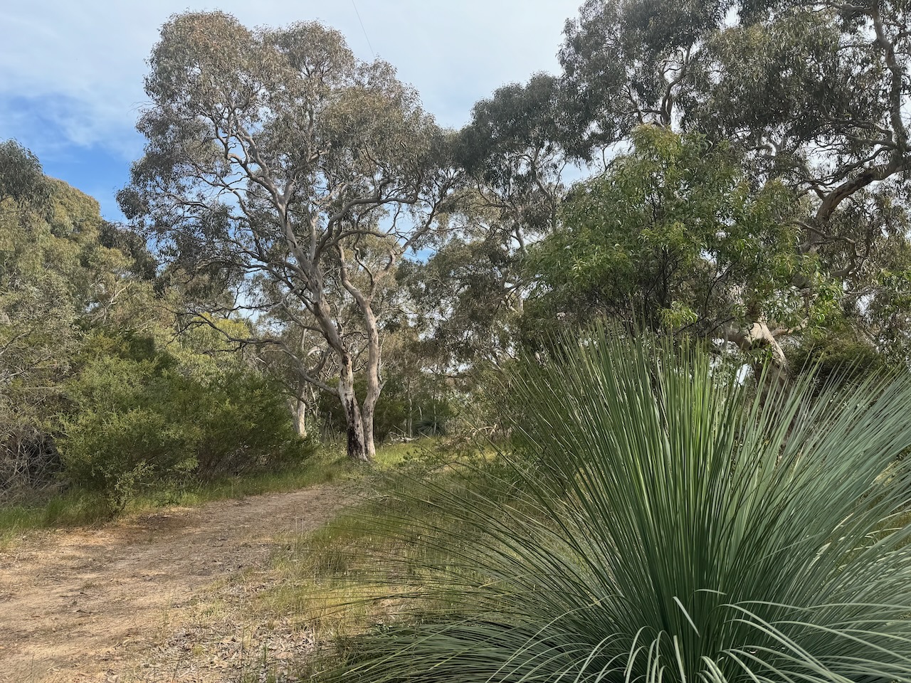
The park contains open stands of stringybark with banksia understory. The park consists of gently undulating land. It also includes a short section of the Finniss River. There is also a steep-sided valley in the southeastern corner of the park that contains a spring-fed creek. (Friends of Cox Scrub) (NPWS 2024)
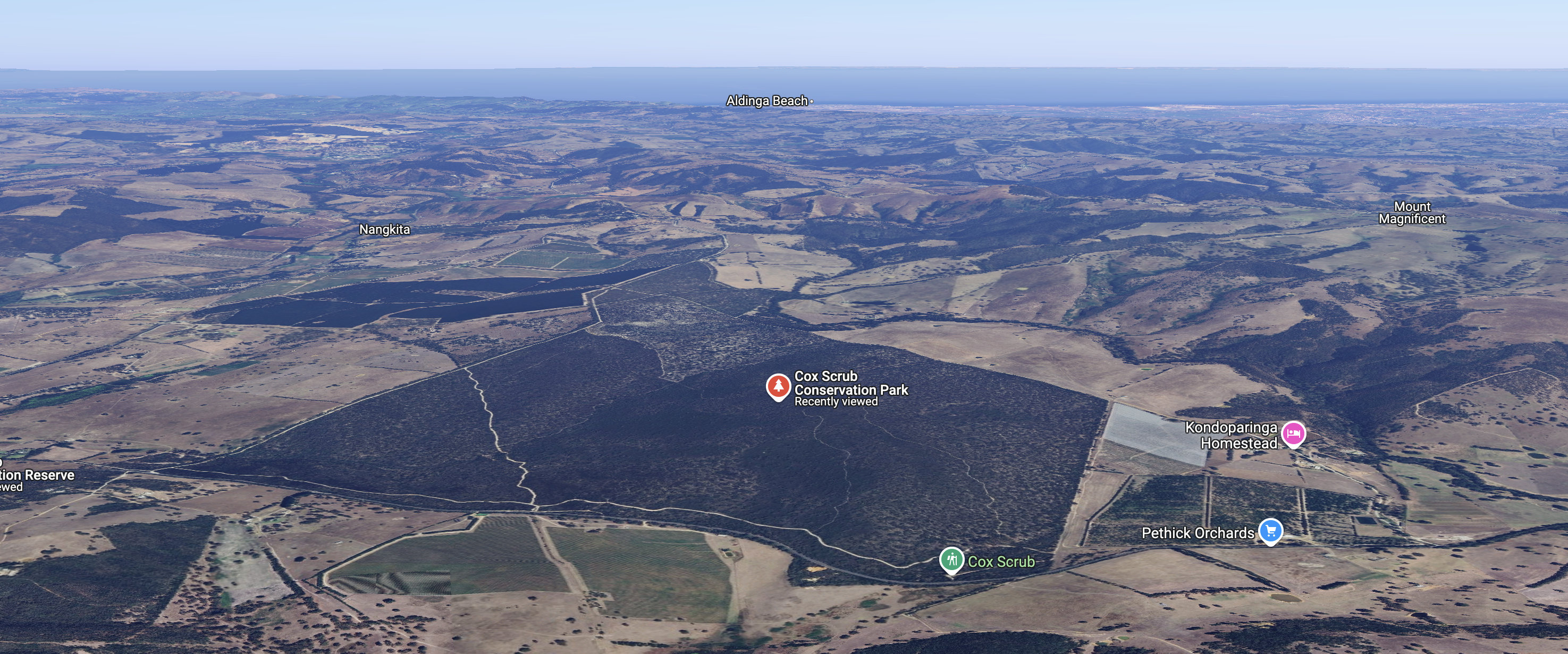
Above:- An aerial view of the Cox Scrub Conservation Park. Image c/o Google Maps.
Over 80 species of birds, 15 species of mammals, 11 species of reptiles, and 6 species of frog can be found in the park. Over 350 plant species have been recorded in the park including the vulnerable Marsh Gum. (Friends of Cox Scrub)
The park is home to some vulnerable and endangered species. These include Southern-brown Bandicoot, Rosenberg’s Goanna, and Southern Emu-wren. (Friends of Cox Scrub)
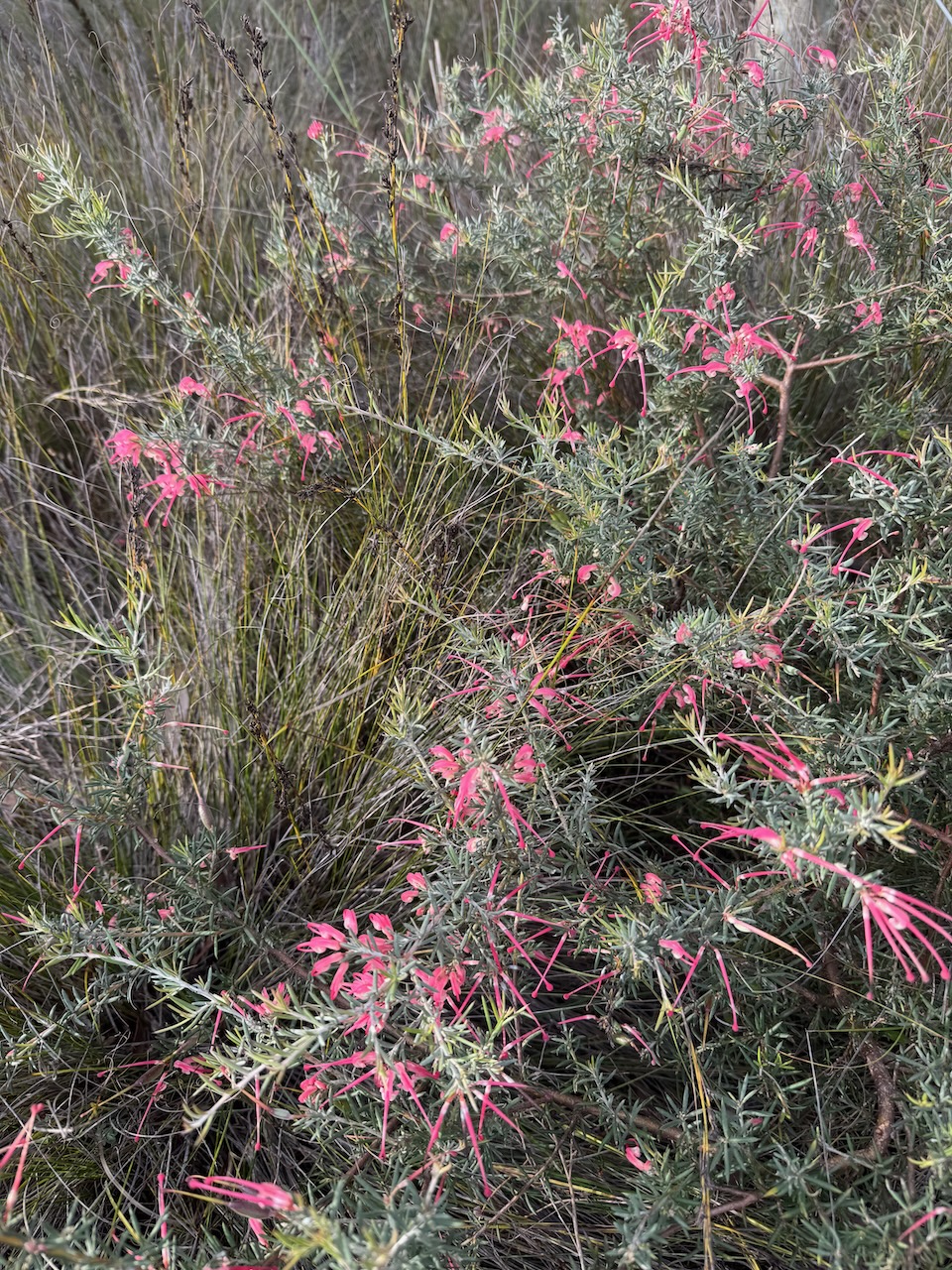
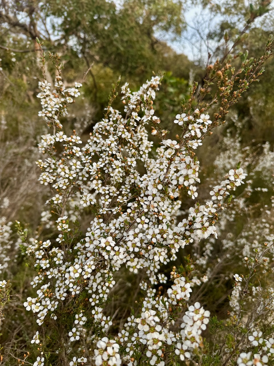
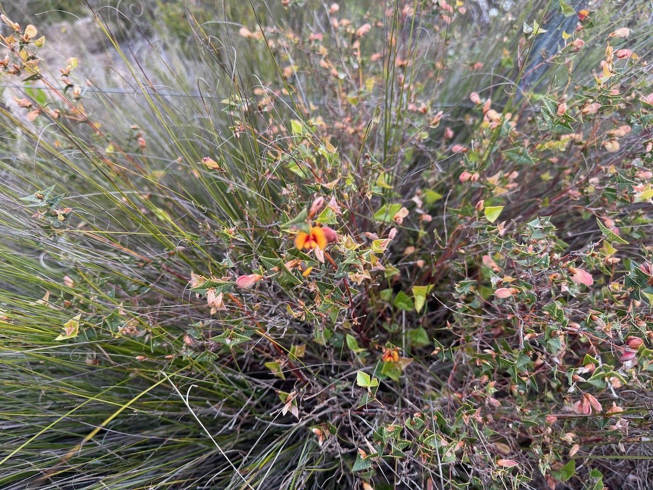
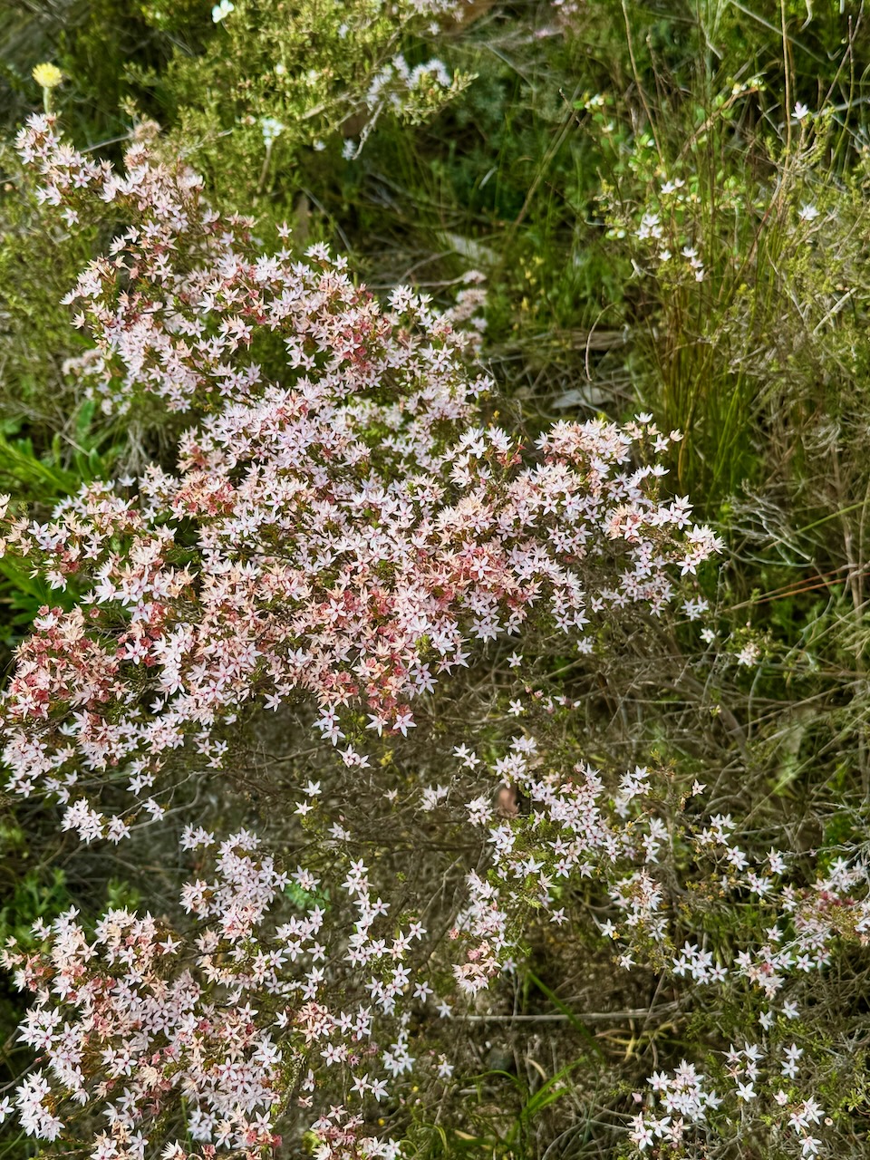
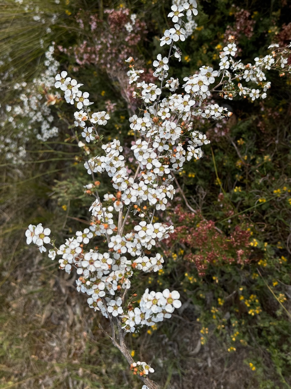
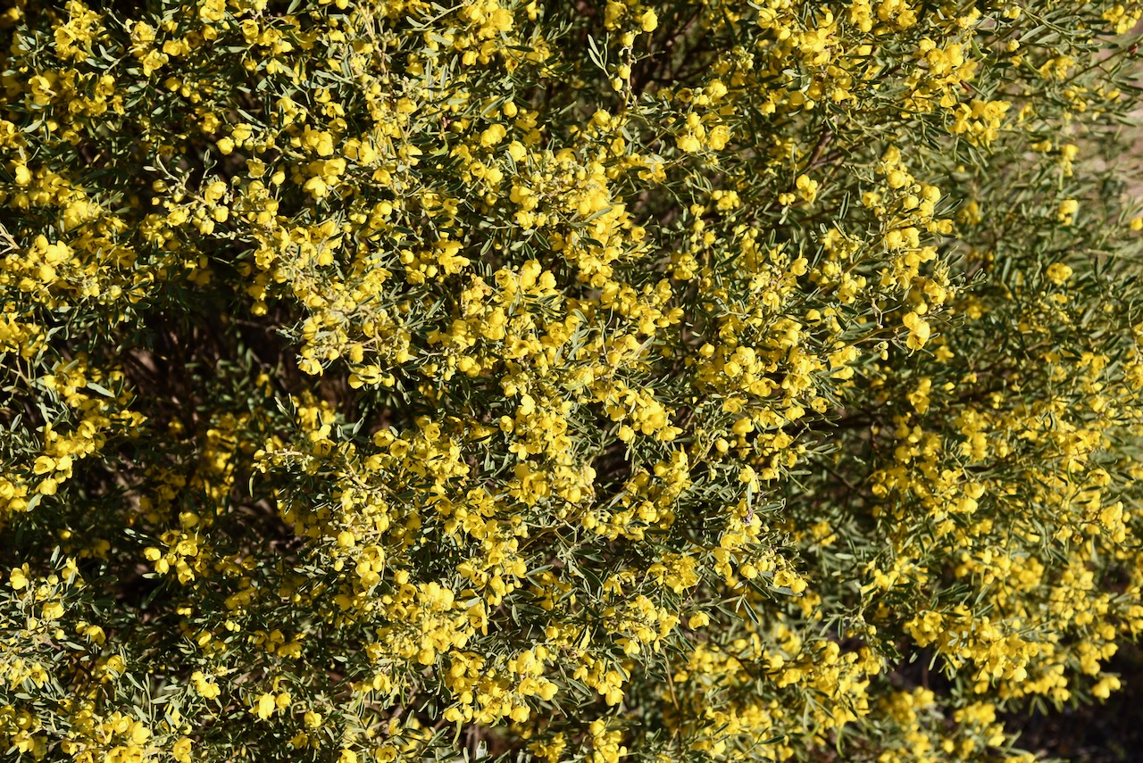
A number of the native plants in the park were flowering during our visit.
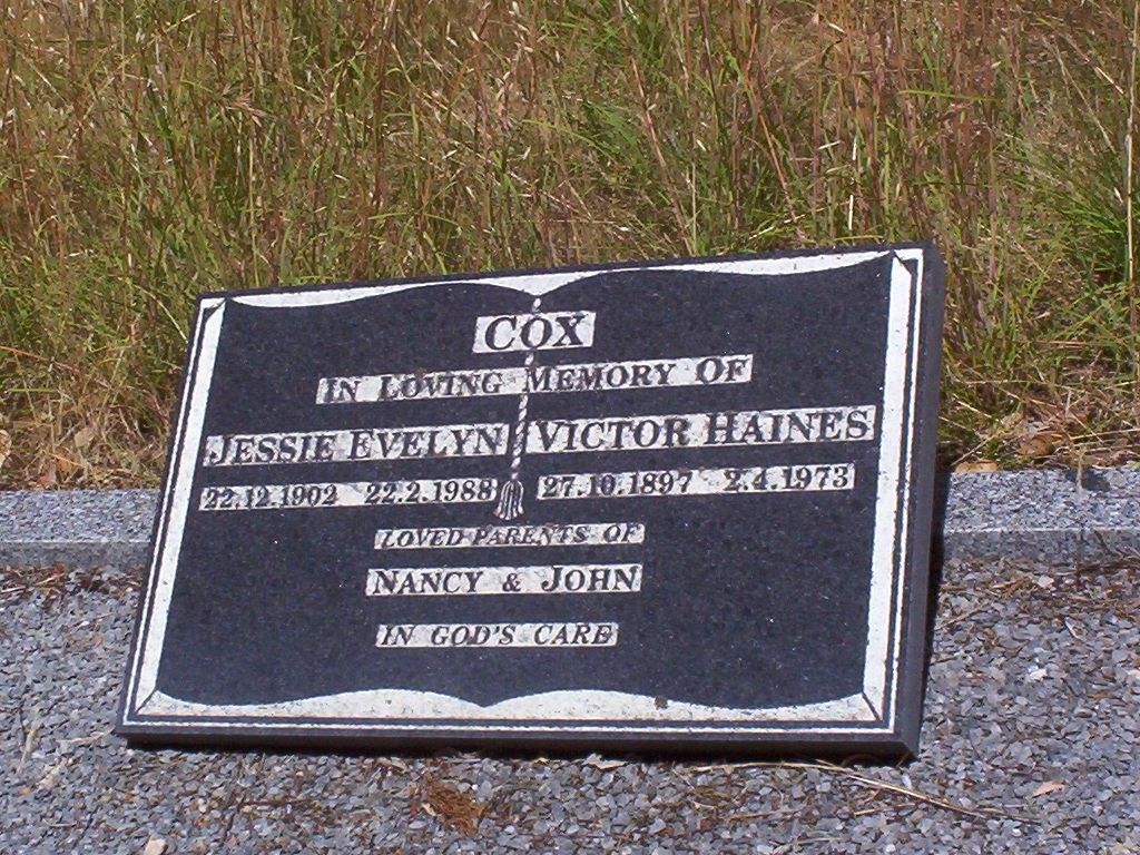
Most of the Cox Scrub Conservation Park was previously owned by the late Mr Victor Cox of Ashbourne. He preserved the area in a natural state for overwintering his honey bees. In 1969 the land was purchased from Mr Cox, on the condition that he was permitted to keep bees in the park for as long as he required. This agreement was upheld until his passing. (NPWS 2024)
Victor Haines Cox was born on the 27th day of October 1987 at Strathalbyn. In 1935 he married Jessie Evelyn Moore at Victor Harbour, South Australia. They had two children. Victor died on the 2nd day of April 1973 at Giles Flat, South Australia. He is buried at the Ashbourne cemetery, South Australia. (ancestry.com.au)
Above: the headstone of Victor Haines Cox at the Ashbourne cemetery. Image c/o Find a Grave
The park was proclaimed on the 5th day of March 1970 as Cox’s Scrub National Park. On the 27th day of April 1972, the park was reconstituted as Cox Scrub Conservation Park. In 1977, and then again in 1982, further smaller additions were added to the park. (NPWS 2024) (Wikipedia)
Above:- Proclamation of the Cox Scrub National Park, SA Govt Gazette, 5 March 1970
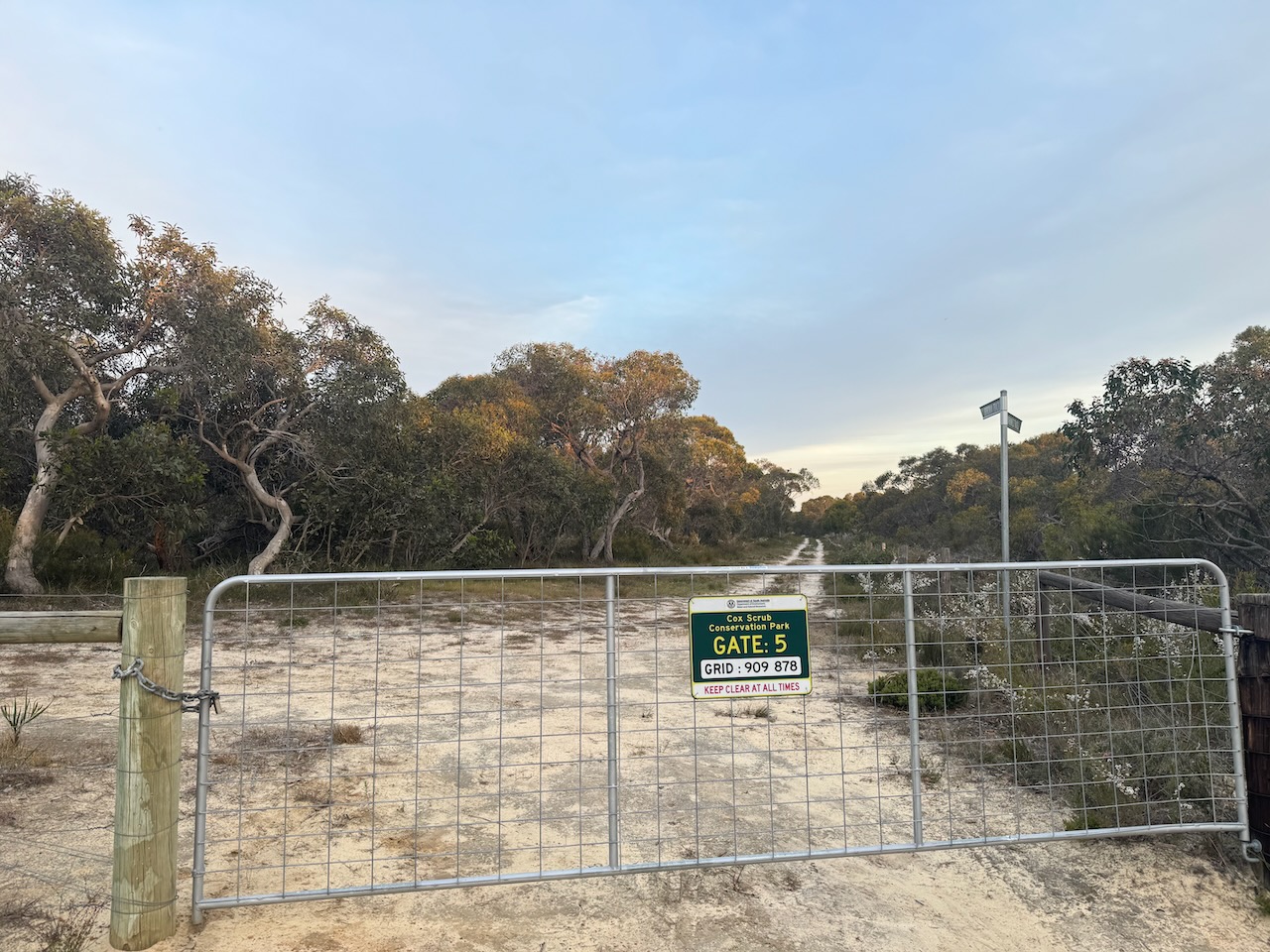
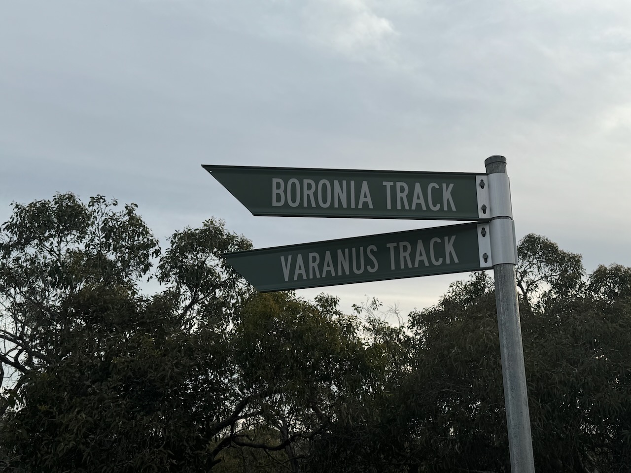
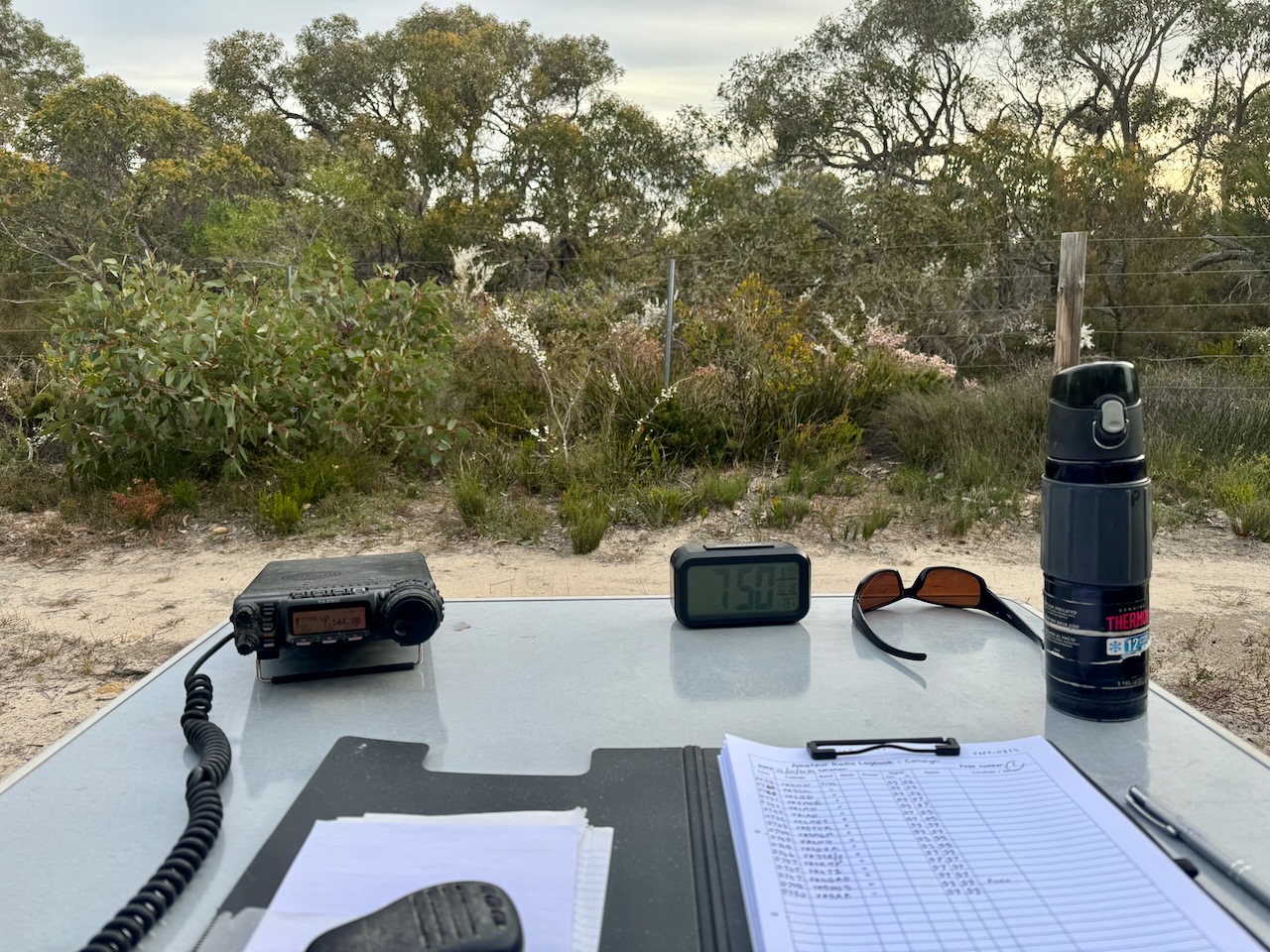
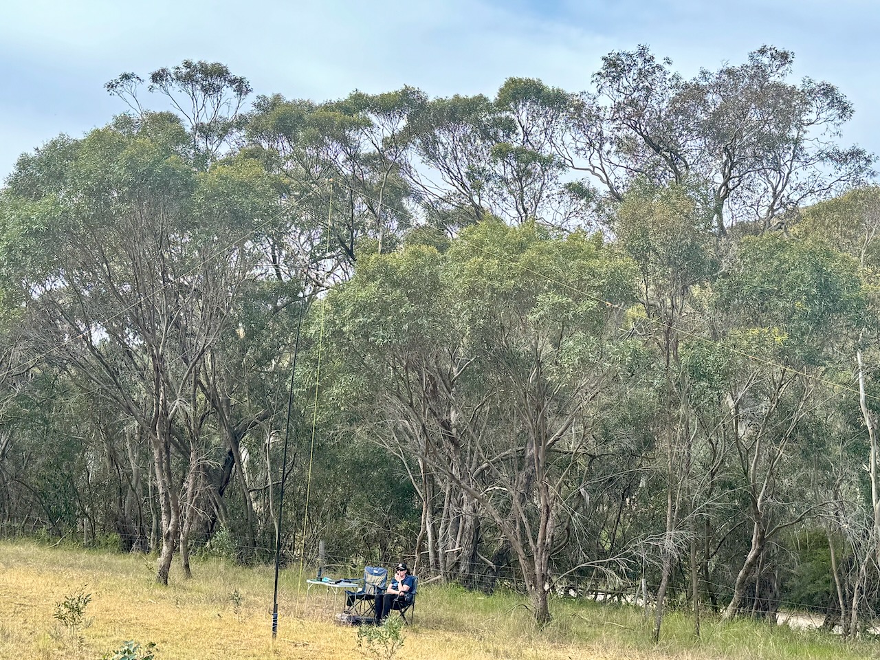
Marija and I set up just inside the gate at gate 5 on Boronia Track. We ran the Yaesu FT857, 40 watts, and the 20/40/80m linked dipole.
We logged a total of 72 stations before packing up and heading off for dinner at the Greenman Inn at Ashbourne.
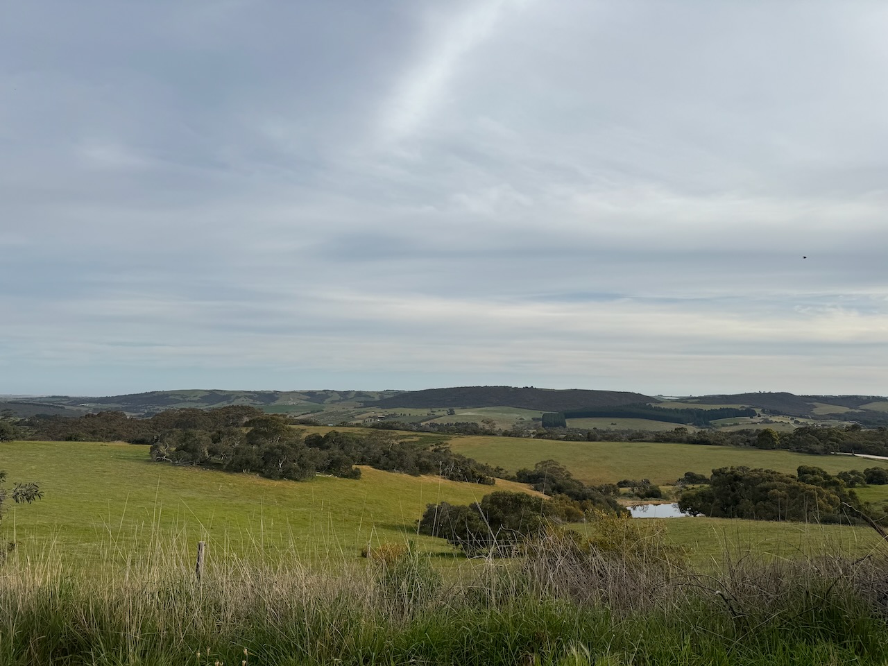
Our second park for Saturday 12th October 2024, and the 2024 VKFF Team Championship, was the Cox Scrub Conservation Reserve VKFF-1701.
The park is located about 66 km south of Adelaide on the Fleurieu Peninsula.
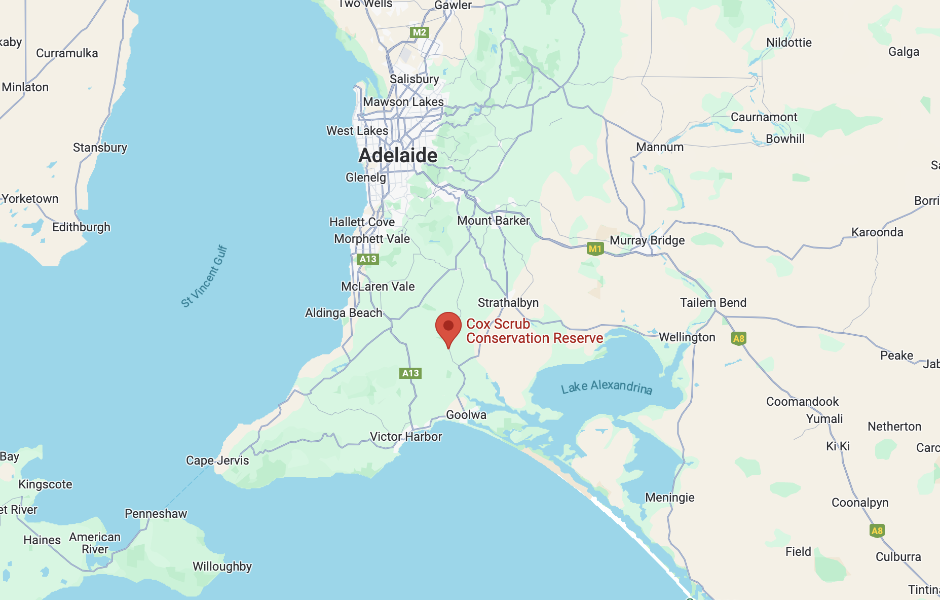
Above:- Map showing the location of the Cox Scrub Conservation Reserve. Map c/o Google Maps.
If you did not know this little park was here, you would drive straight past it. It is located on the western side of Bull Creek Road, adjacent to the much larger Cox Scrub Conservation Park. There are no signs.
The reserve is just 1 hectare in size and was established on the 11th day of November 1993. (CAPAD 2022)
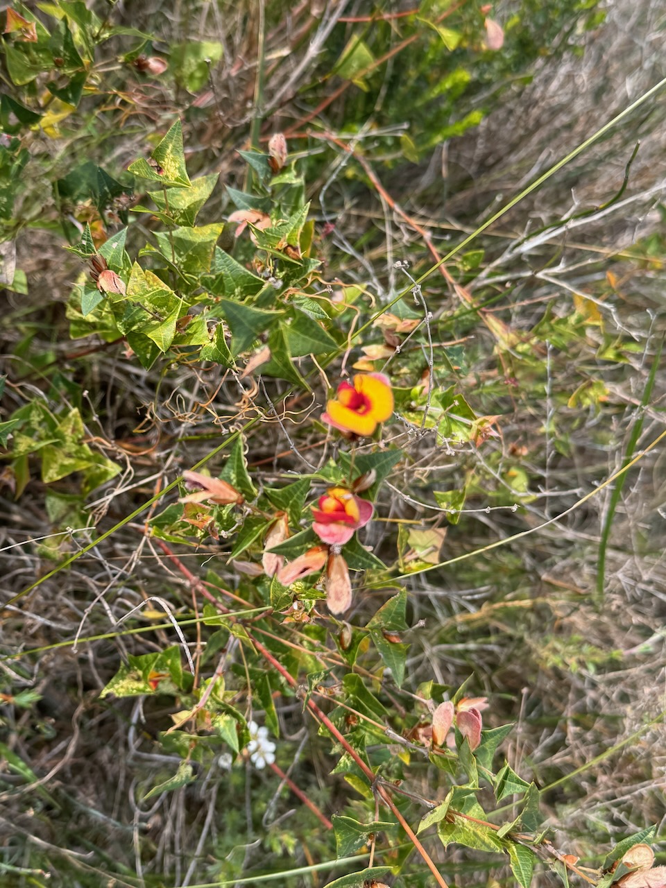
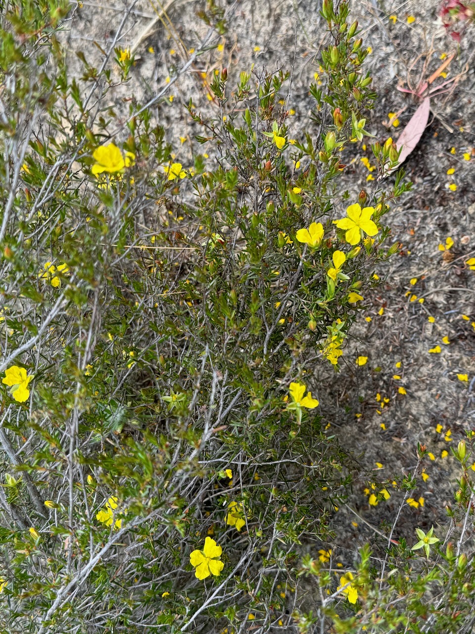
There were several native plants in flower during our visit.
We set up in a clearing amongst the scrub and ran the Yaesu FT857, 40 watts, and the 20/40/80m linked dipole.
We found the 40m band had improved a little since our first activation at Bullock Hill. We made a total of 104 QSOs on 40m SSB & 80m SSB.
The 2024 VKFF Team Championship was held on Saturday 12th October 2024. This is a fun event that is held each year in October for the World Wide Flora Fauna (WWFF) program.
Marija VK5MAZ and I headed out to activate three local parks for the Championship. Our team name was ‘The Walky Talkies’.
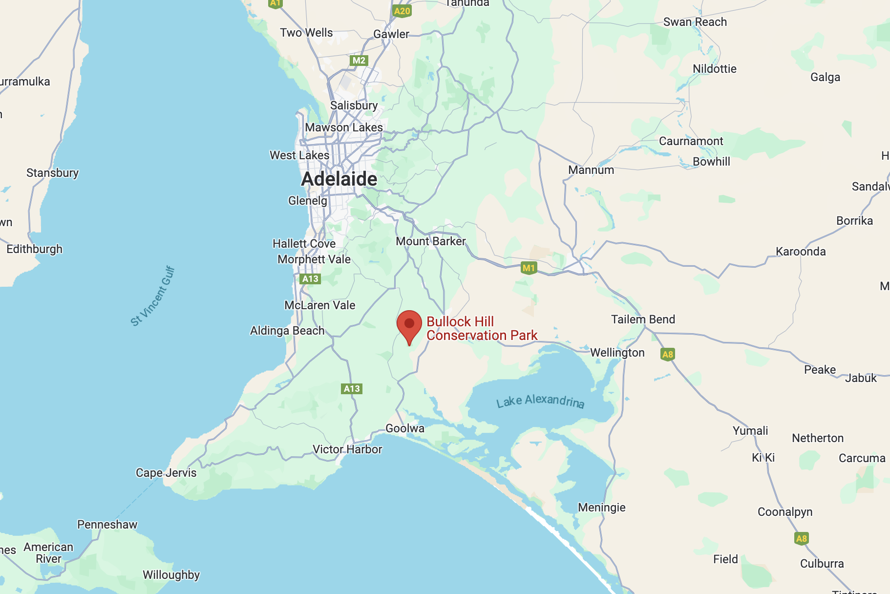
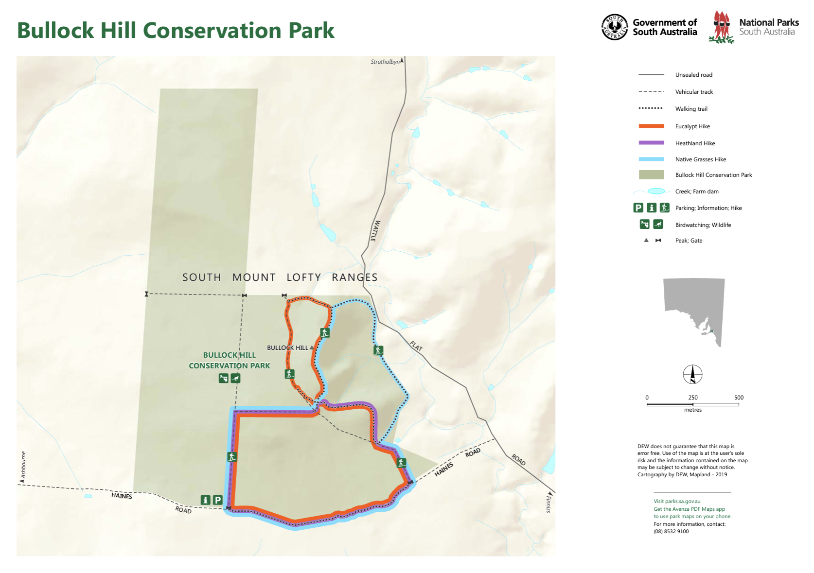
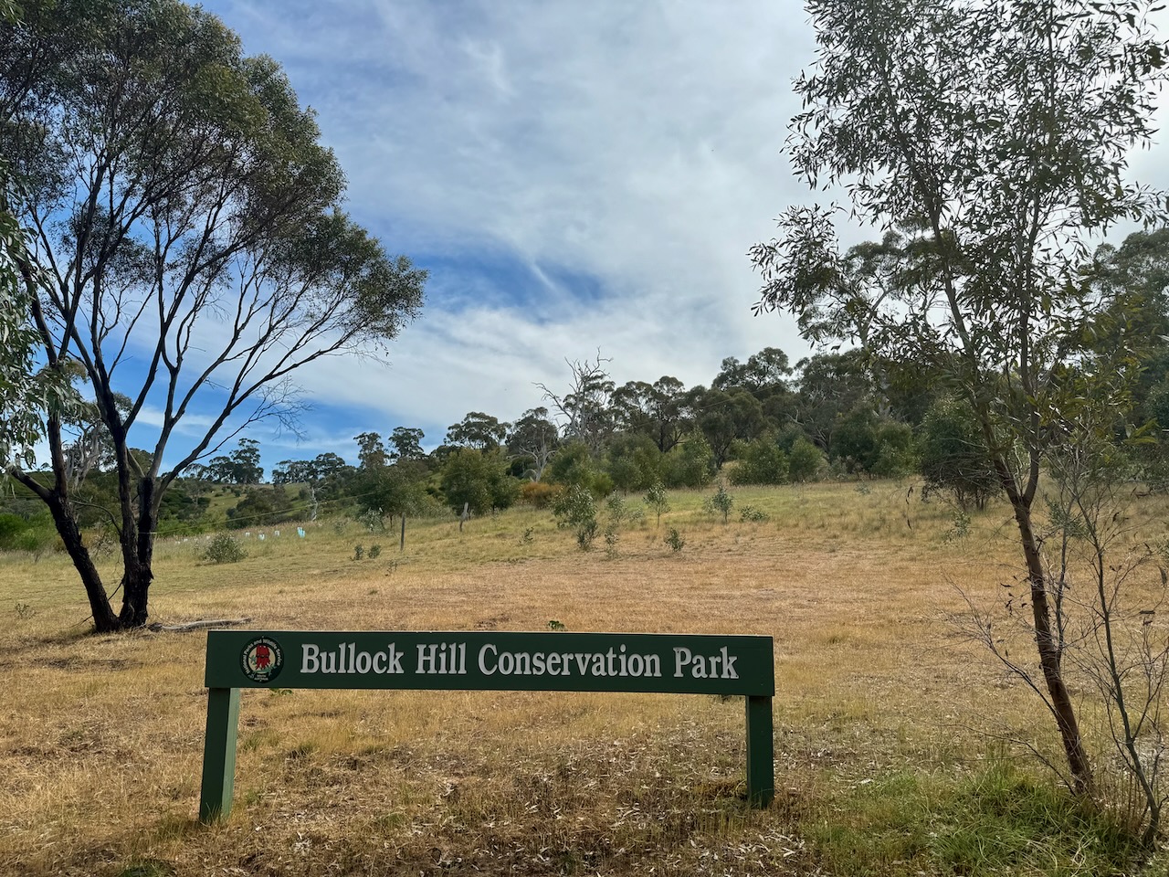
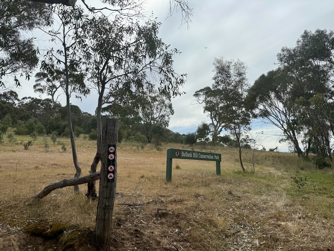
The first was the Bullock Hill Conservation Park VKFF-0873. Marija and I have activated this park several times previously. The park is located about 65 km southeast of Adelaide on the Fleurieu Peninsula.
Above:- Map showing the location of the Bullock Hill Conservation Park. Map c/o Google Maps.
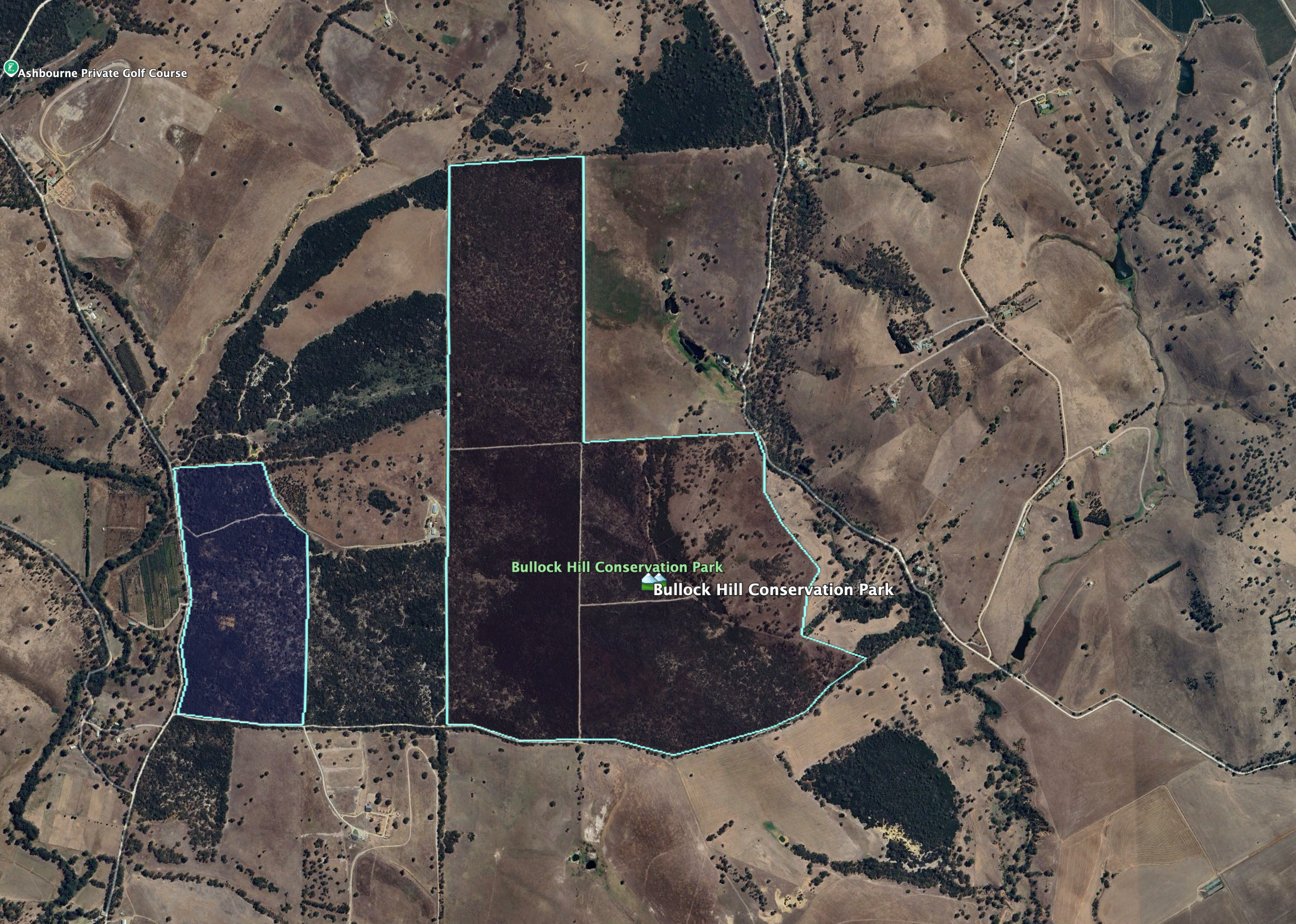
The park’s eastern boundary is Wattle Flat Road. Its southern boundary is Haines Road. A heritage agreement exists on the western side of the park. It takes its name from Bullock Hill, a hill rising 188 metres above sea level.
Above:- An aerial view of the Bullock Hill Conservation Park. Image c/o Google Earth.
The park is about 221 hectares in size and was established on the 30th day of January 2014. Bullock Hill is an undulating park with several vegetation types including tall stands of eucalyptus, including pink gum and cup gum through to native grasslands in the east. Eucalypt woodlands can be found on the western side of the park which have a dense understory of acacia and mixed heath. (CAPAD 2022) (NPWS 2024)
Above:- An aerial view of the park looking west. Image c/o Google Maps.
There are three hikes in the park and these are covered well on the Walking SA website. National Parks SA also has a map (show below) which shows the three hikes.
Above:- Map showing the three hikes in the park. Map c/o National Parks SA.
Birds SA have recorded a total of 95 native birds in the park. Common species include Common Bronzewing, Superb Fairywren, Brown-headed Honeyeater, Red Wattlebird, Brown Thornbill, Grey Shrikethrush. Rainbow Bee-eaters have also been sighted. (Birds SA)
The park is also home to Western Grey kangaroos. These can be sighted regularly at dawn and dusk in the park’s eastern grassland area. (NPWS 2024)
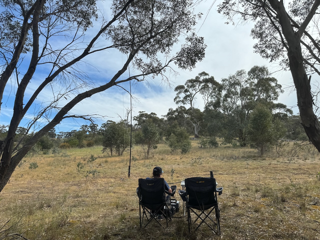
Marija and I set up on the Wattle Flat Road side of the park. We ran the Yaesu FT857, 40 watts, and the 20/40/80m linked dipole.
We found the band conditions to be poor. We managed 72 contacts. All of those excluding 2, were made on 40m SSB. We did not try 20m as we were entered in the 40/80m section for the Team Championship.
It was nice to log Ian Vk5CZ & Gordon VK5GY who were taking part as ‘No flies on us’, and Chris VK1CHW & Jared VK2LDJ who were taking part as the ‘Bandwidth Bandits’.
Marija worked the following stations on 40m SSB:-
VK3ZPF/p (SOTA VK3/ VN-020 & Kinglake National Park VKFF-0264)
VK3SRT/p (SOTA VK3/ VN-020 & Kinglake National Park VKFF-0264)
VK3MCA
VK3VMM
VK5HS
VK5AYL
VK5LA
VK5KAW
VK5TUX
VK5DMR
VK5TRM
VK3ZK/P (Tocumwal Regional Park VKFF-0978)
VK3PWG
VK3KR/P (SOTA VK3/ VC-027)
VK5GVV
VK2EXA
VK5ALM
VK5PCM
VK5GY/P (Caroona Creek Conservation Park VKFF-0875)
VK5CZ/P (Caroona Creek Conservation Park VKFF-0875)
VK1CHW/P (Mount Ainslee Nature Reserve VKFF-0850)
VK2LDJ/P (Mount Ainslee Nature Reserve VKFF-0850)
VK5ZRY
VK5ZNP
VK3UP
VK3UN
VK3DL
VK5GMH
VK3ZSJ
VK3SQ
VK2BD
VK3VIN
VK3TDX
VK5DW
VK3MIJ
Marija worked the following station on 80m SSB:-
VK5TUX
I worked the following stations on 40m SSB:-
VK3ZPF/p (SOTA VK3/ VN-020 & Kinglake National Park VKFF-0264)
VK3SRT/p (SOTA VK3/ VN-020 & Kinglake National Park VKFF-0264)
VK3MCA
VK3VMM
VK5HS
VK5AYL
VK5LA
VK5KAW
VK5TUX
VK5DMR
VK5TRM
VK3ZK/P (Tocumwal Regional Park VKFF-0978)
VK3PWG
VK3KR/P (SOTA VK3/ VC-027)
VK5GVV
VK2EXA
VK5ALM
VK5PCM
VK5GY/P (Caroona Creek Conservation Park VKFF-0875)
VK5CZ/P (Caroona Creek Conservation Park VKFF-0875)
After leaving Lenger Reserve on 1st September 2024, Marija and I headed along Dennis Road towards home. We were lucky to see a Kite soaring close to the ground in a paddock adjacent to the road. Unfortunately I did not have my zoom lens but I did snap a few photographs.
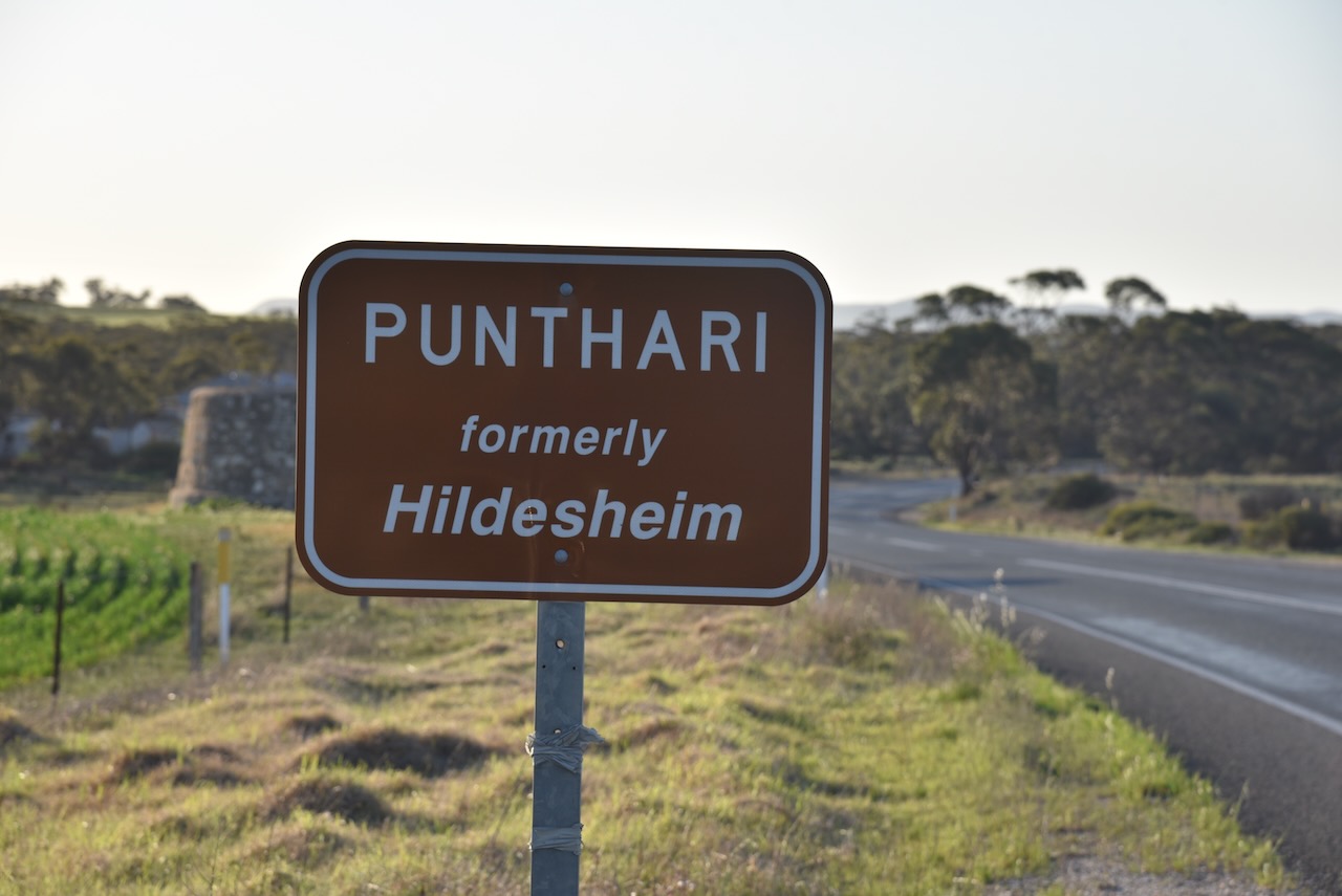
We then drove into the little town of Punthari which was originally called Finnis Vale. It was named after Boyle Travers Finniss (b. 1807. d. 1893), the first Premier of South Australia. (Wikipedia 2024)
Following the opening of the Post Office the Postmaster General suggested a name change to Nuske. The local settlers did not agree. The name of Hildesheim was adopted. (Cockburn 1990)
During the First World War, many German place names in South Australia were changed due to anti-German sentiment. A Nomenclature Committee was given the task of finding German names. A total of 67 were found. This included Hildesheim. The name was changed to Punthari, an aboriginal word meaning ‘scrub’. (Cockburn 1990)
I was keen to have a look at the Saunders Creek rail bridge, so we headed north. Unfortunately, we could not get close to the bridge as private land had to be accessed to reach it.
We then drove south, enjoying the very picturesque countryside.
As we approached the silos at Apamurra, we decided to stop briefly to activate the silos for the Silos On The Air (SiOTA) program.
Aparmurra is an aboriginal word for ‘fresh water’. (Cockburn 1990)
Apamurra was on the Monarto to Sedan railway line, a branch line of main south line from Adelaide. It commenced art Monarto South and stretched for 70km to Sedan in the north. The line which opened in 1919, had eight stations and goods sidings. The line from Cambrai to Sedan closed in the late 1960s. The Cambrai to Apamurra section closed in 1987. The line between Apamurra to Monarto closed in 2005. (G, M 2021)
Below is an excellent video on the old Monarto to Sedan railway line.
We operated from the 4WD, running the Icom IC-7000, 100 watts, and the Codan 9350 antenna with the 1.5 metre stainless steel whip.
I worked the following stations on 40m SSB:-
VK2YK/p (Waite Conservation Reserve VKFF-4060)
VK5FANA
VK4SMA
VK4NH
VK4DXA
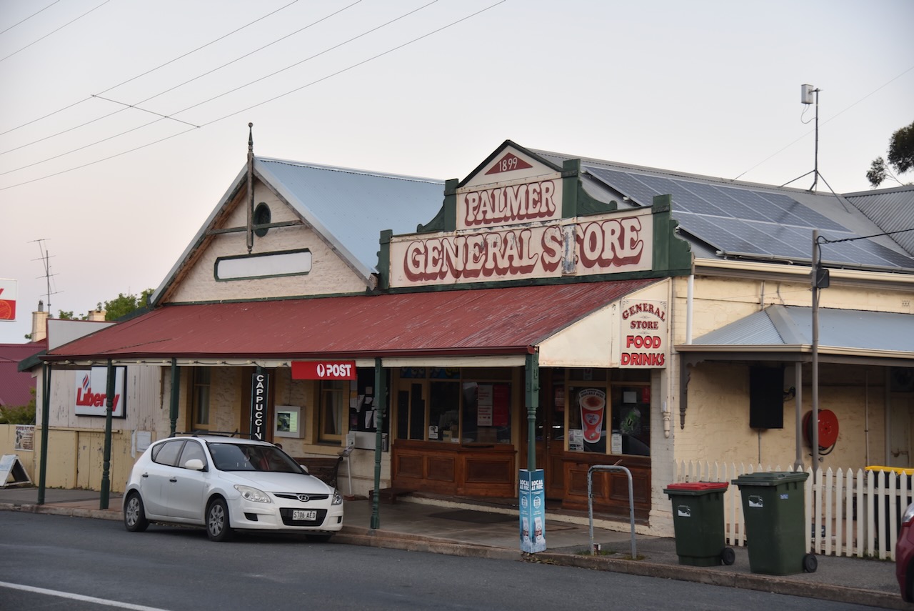
It was getting a bit late and we were feeling hungry, so we headed into the town of Palmer, hoping that the hotel might be open. Sadly it wasn’t.
The town of Palmer was laid out in 1868 by the Australian Mining Company. Its railway station was called Apamurra. The town was named in honour of Colonel George Palmer, a South Australian Colonisation Commissioner, and a Director of the mining company. (Place Names SA 2012)
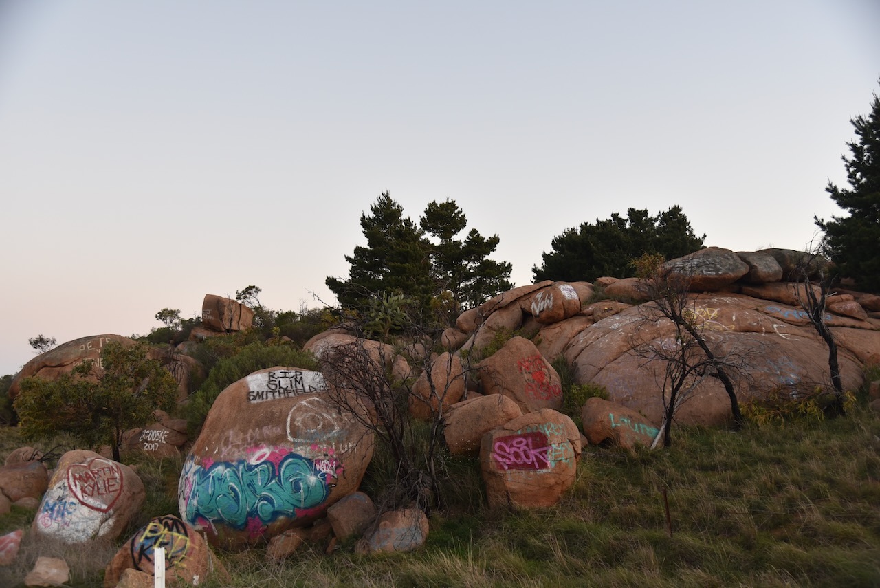
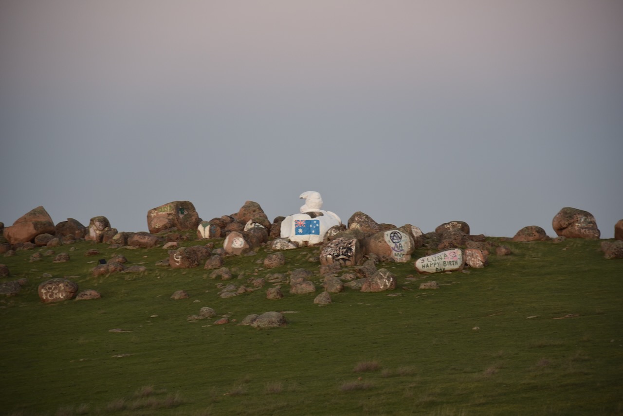
We continued west out of Palmer along Randell Road. This area is very rocky and features a unique rock called Bear Rock as it has the appearance of a Polar Bear.
On the way home we stopped off at the Commercial Hotel at Strathalbyn for a meal. And a very nice meal it was.
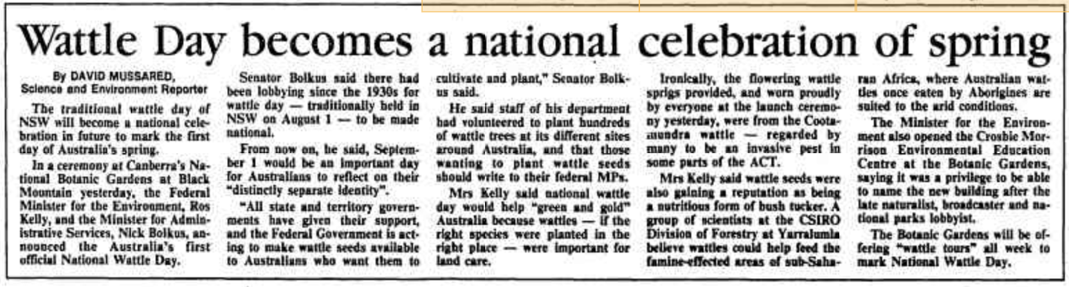
Every year on the 1st day of September, National Wattle Day is celebrated in Australia. This is the start of the Australian spring season. It is a time when several Acacia species, commonly called Wattle, are in flower.
The first National Wattle Day was held in 1992. Prior to this, Wattle Day was celebrated on different days by each of the Australian States and Territories. (Wattle Assoc 2024)
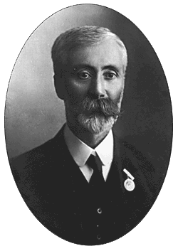
In 1899 the ‘Wattle Club’ was formed in Victoria. It was the initiative of Archibald James Campbell who was a leading ornithologist and field naturalist. He had a particular passion for Australian wattles. For many years the Wattle Club would organise outings on the 1st day of September. (Wikipedia 2024)
Above:- Archibald Campbell. Image c/o Wikipedia.
In September 1908, Campbell delivered a speech and made the very first suggestion of a dedicated Wattle Day in Australia. (Wikipedia 2024)
In September 1909, the Wattle Day League was formed in Sydney. Joseph Henry Maiden, the Director of the Sydney Botanic Gardens was the President. The purpose of the Wattle Day League was to present to the various Australian state governments, the need for a national Wattle Day. In 1910 the League agreed on the 1st day of September and there were celebrations on three Australian States including South Australia. (Wikipedia 2024)
Above:- Joseph Henry Maiden. Image c/o Wikipedia
During the 1980s there was a campaign led by Maria Hitchcock for National Wattle Day. She is known as the ‘Wattle Lady’. She was successful in 1988 for having the Golden Wattle Acacia pycnantha gazetted as Australia’s National Floral Emblem in 1988 and the introduction of National Wattle Day in 1992. (Authors Agent 2024)
On 23 June 1992, Governor-General Bill Hayden declared that “1 September in each year shall be observed as ‘National Wattle Day’ throughout Australia and in the external Territories of Australia”. (ANBG 2024)
Above:- Article from The Canberra Times, Wed 2 Sept 1992. Image c/o Trove.
The Wattle Association Inc. website states that we celebrate National Wattle Day for the following reasons:-
National Wattle Day includes everyone
Golden Wattle (Acacia pycnantha) is our national floral emblem. It is a symbol that comes directly from our land;
Golden Wattle is a unifying symbol of Australia and Australians. There is no other symbol that says so much about what it takes to survive and thrive in this ancient land;
Wattles are Australian with great diversity (more than 1,075 described Acacia species) and resilience like our people;
Wattle welcomes the spring, and is among the first plants to regenerate after fire, reminding us of the importance of renewal as it paints our national colours across our landscapes; and
All wattles remind us of Australia and Australians. (Wattle Assoc 2024)
Below is an interview that appeared on ABC Radio about 6 years ago about Wattle Day.
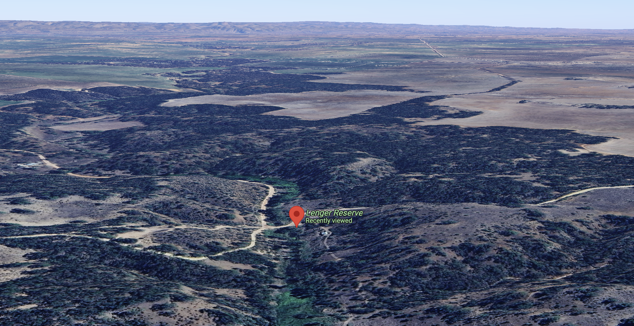
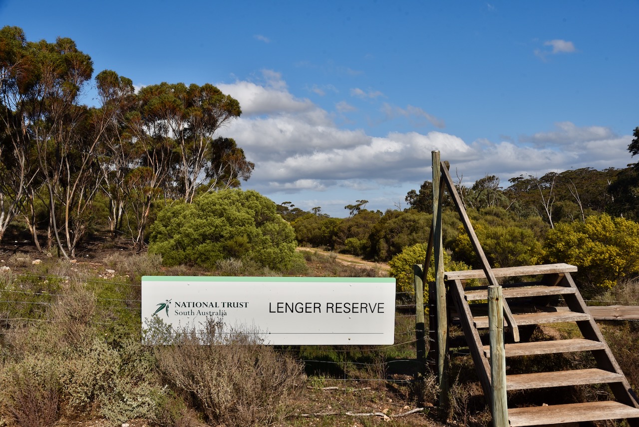
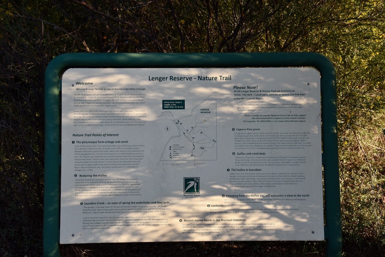
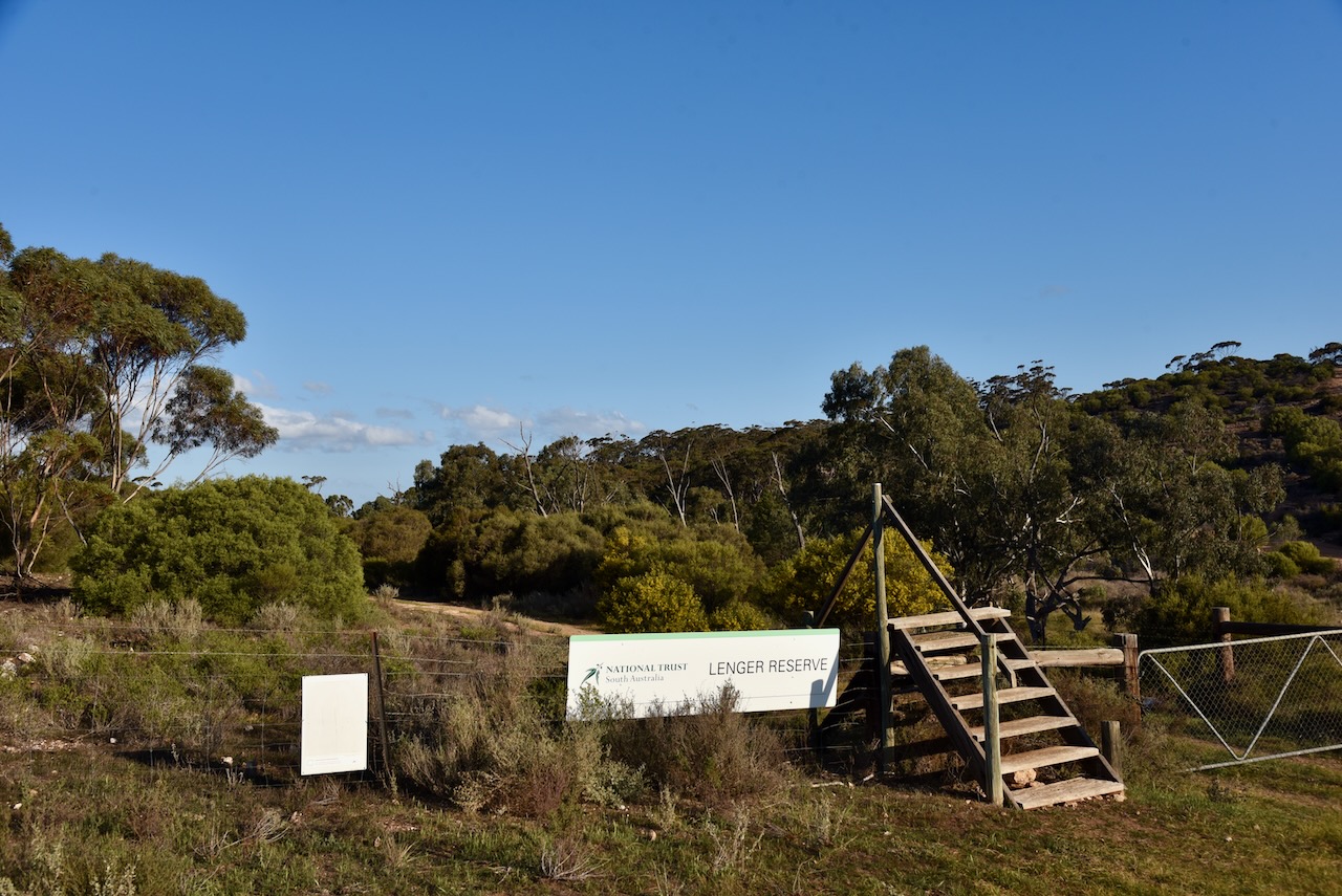
Marija VK5MAZ and I headed to Lenger Reserve VKFF-4039 which is located about 17 km north of Mannum in the Murray Mallee region of South Australia.
Above:- Map showing the location of Lenger Reserve. Map c/o Google Maps.
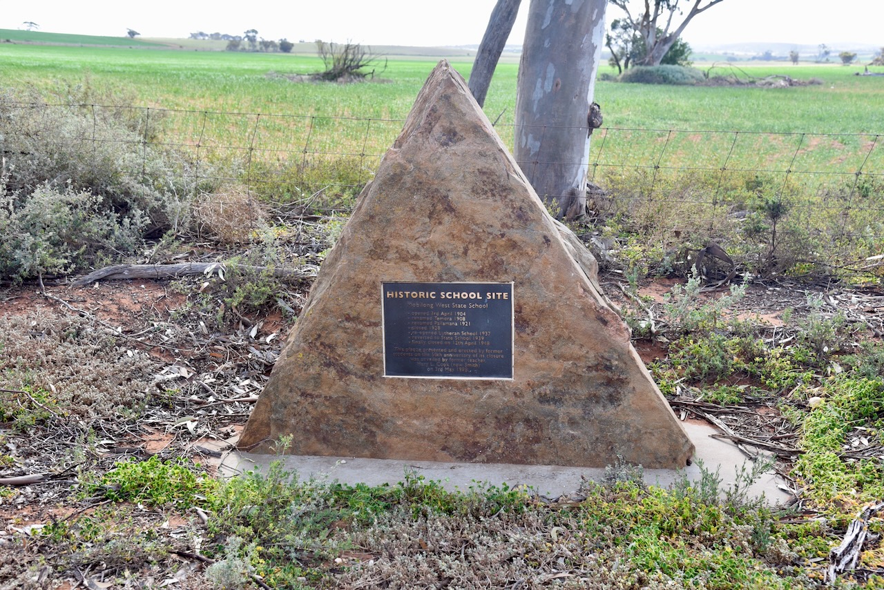
Along the way, we stopped off to look at the monument for Mobilong West State School, located at the intersection of Pallamana Road, Reedy Creek Road, and Wagenknecht Road, Pallamana.
The school opened on the 3rd day of April 1904. It was renamed Temora in 1908. In 1921 it was renamed Pallamana. The school closed in 1928. In 1937 it was reopened as a Lutheran school. Just 2 years later in 1939, it reverted to a State School. It finally closed on the 12th day of April 1948.
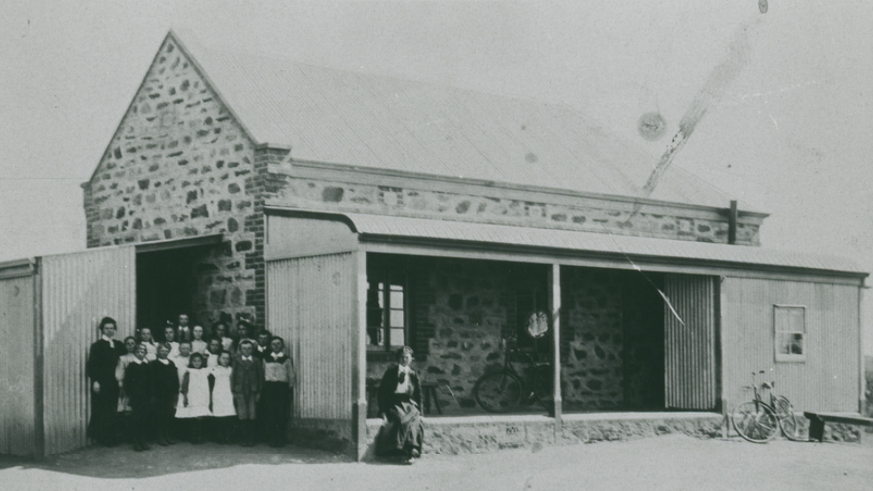
Above:- The Pallamana School, early 1900s. Image c/o State Library South Australia.
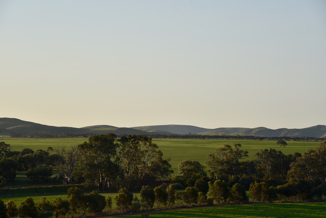
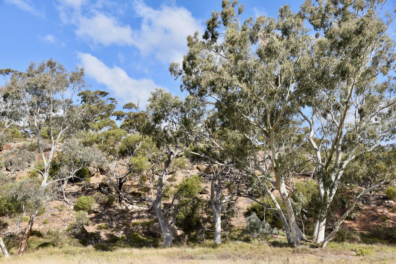
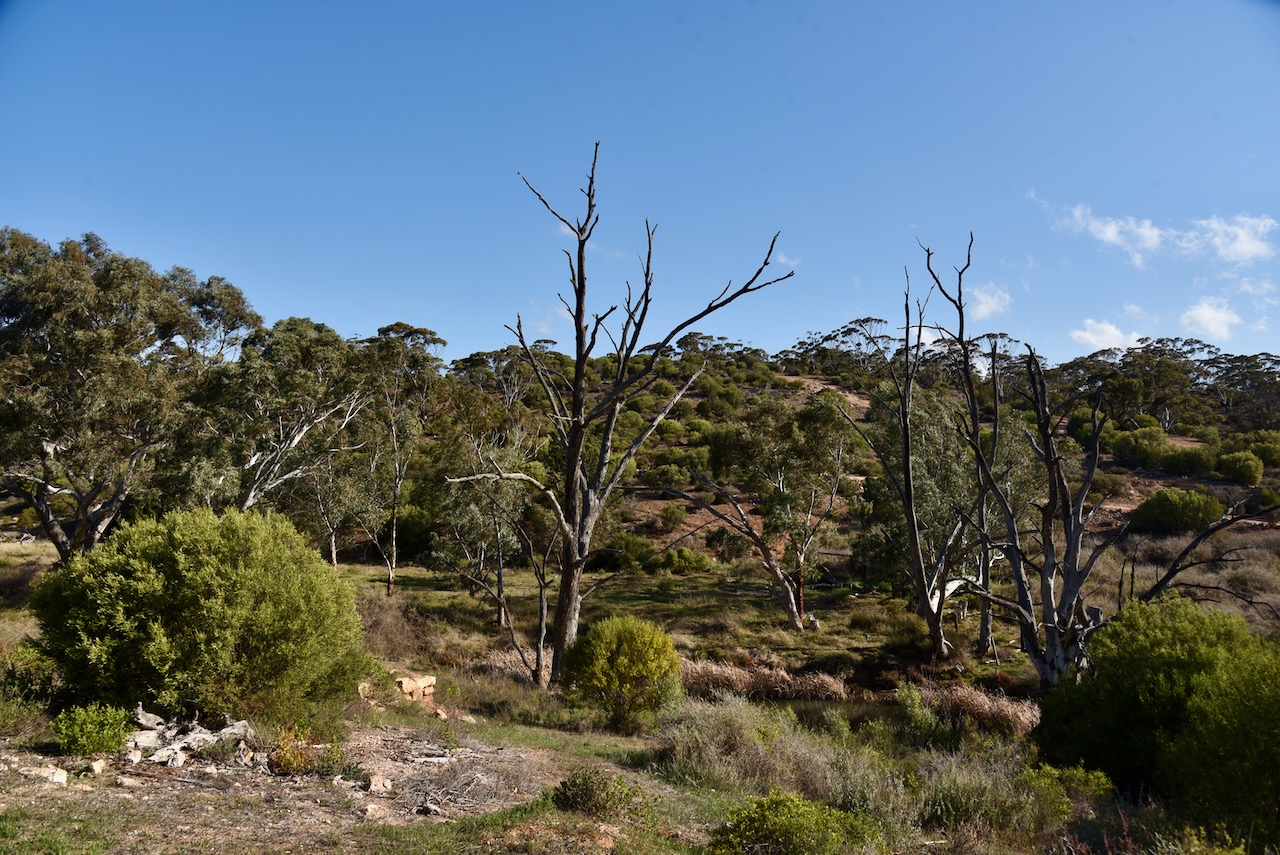
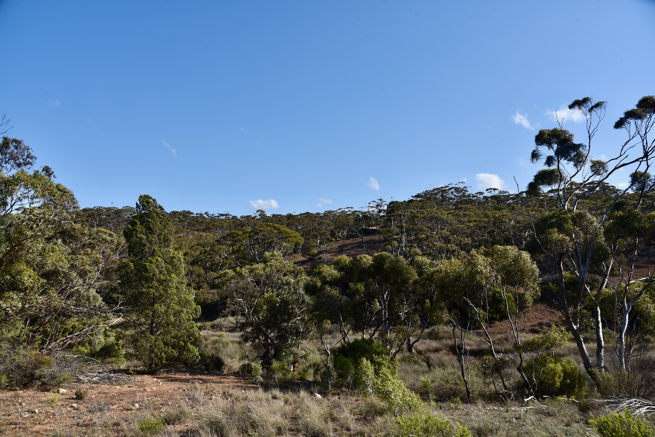
As we approached the park, the surrounding countryside became quite spectacular, compared to the cleared farming land that we had experienced earlier in the trip. It is about a 100km drive to the park from our home on the Fleurieu Peninsula, south of Adelaide.
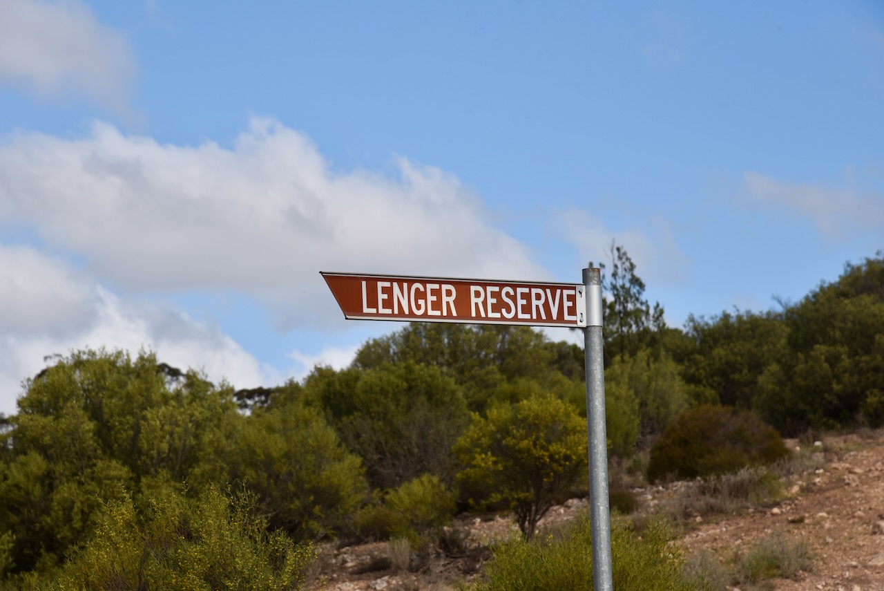
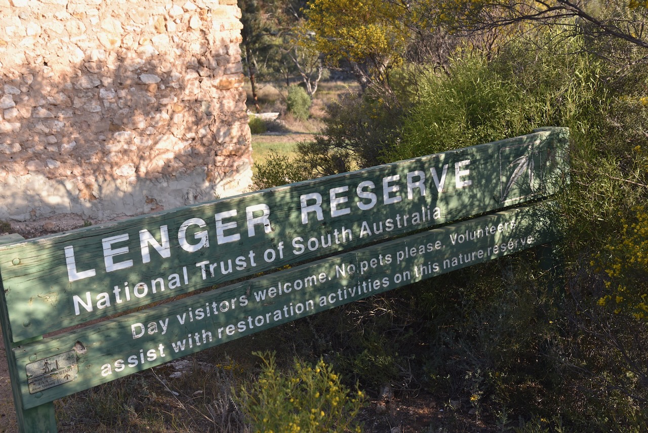
What we did find was the park was well-signposted. There wasn’t just one sign, there was a number, that directed you towards Lenger Reserve.
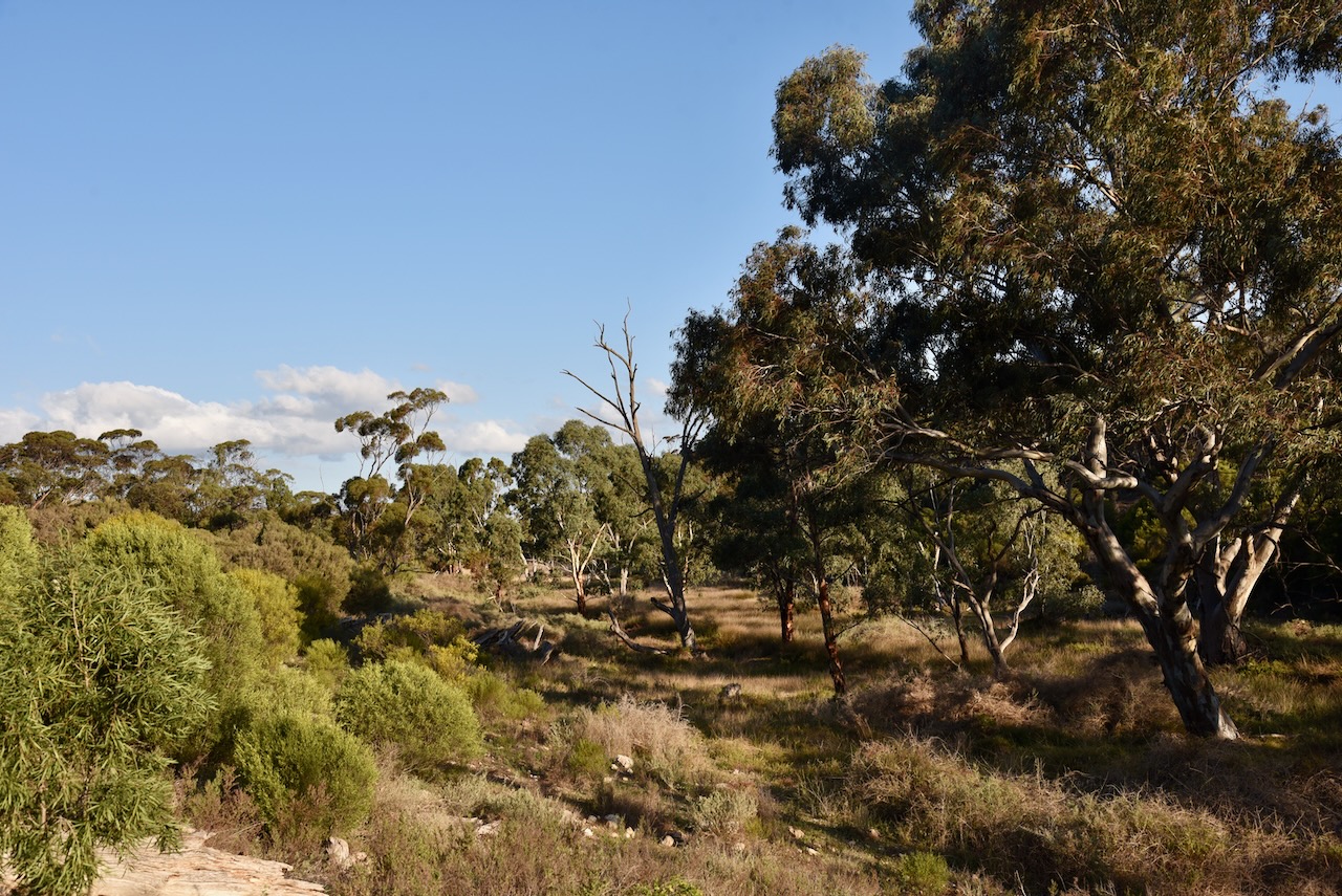
Lenger Reserve is located at 884 Springs Road, Mannum. It is owned by the National Trust of SOuth Australia. The reserve is about 95 hectares and contains steep limestone/calcrete hills that follow Saunders Creek. The creek has cut a narrow valley through the plain. There are several permanent spring-fed waterholes. The reserve also contains majestic River Red Gums. (National Trust 2024)
Above:- An aerial view of Lenger Reserve. Image c/o Google Maps.
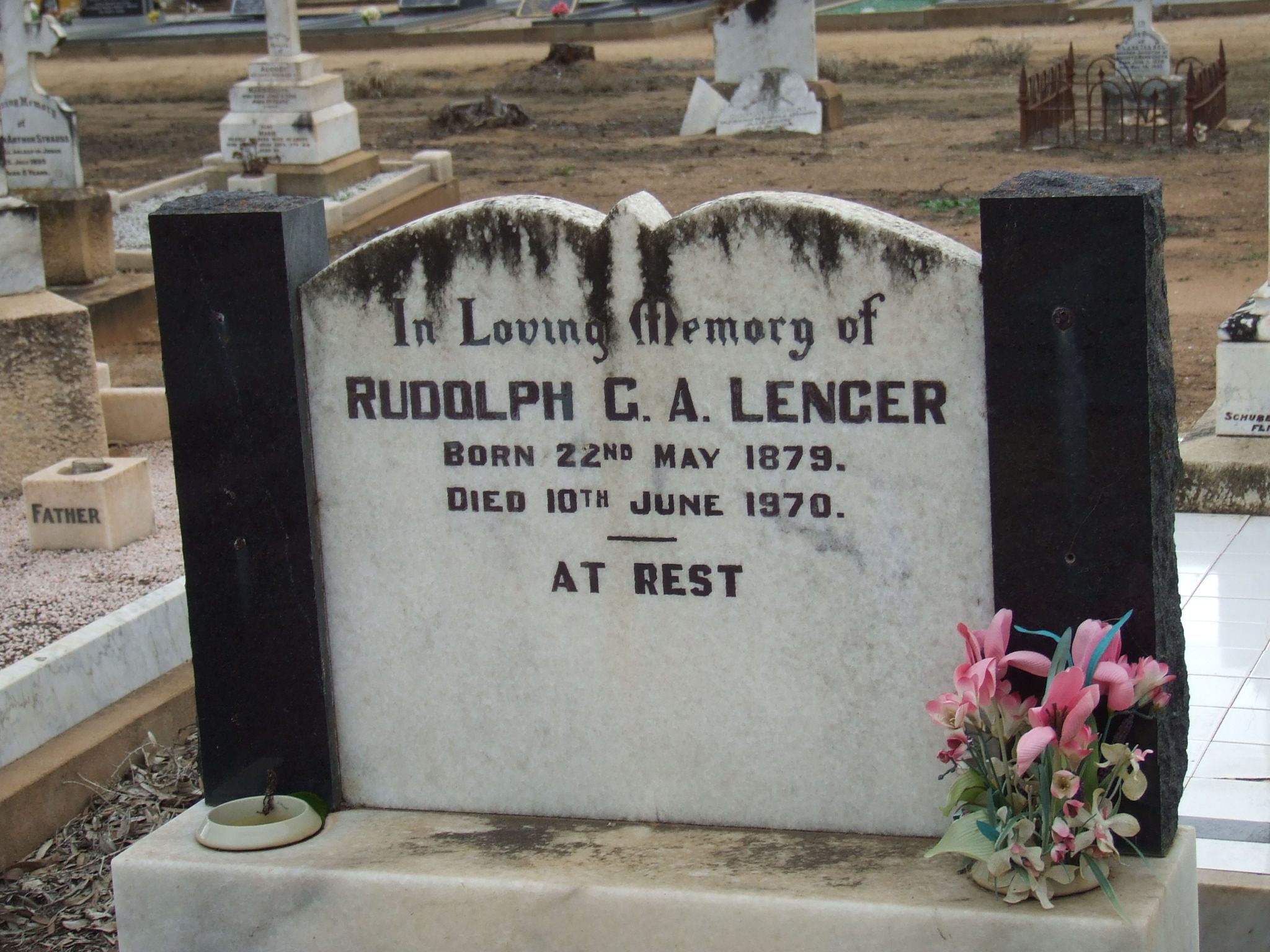
Rudolph Gustav Lenger gifted the reserve to the National Trust of South Australia in 1978 to be used as a bird sanctuary. (National Trust 2024)
Rudolph Gustav Albert Lenger was born on the 22nd day of May 1879 in Finniss, South Australia. His parents were Albert Gustav Lenger and Emma Augusta Louise Lenger nee Heidrich. His parents had arrived in South Australia in 1857 aboard the Heinrich from the Kingdom of Prussia. Rudolph was their tenth and final child. (ancestry.com.au)
Rudolph was a farmer at Mannum. He died on the 10th day of June 1970 at Norwood, South Australia. He is buried at the Mannum District Cemetery. (ancestry.com.au) (Find a Grave 2024)
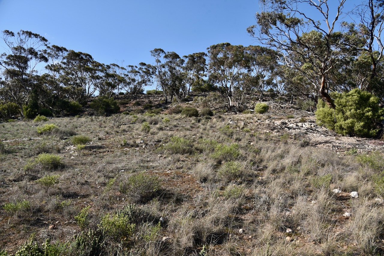
The vegetation in Lenger Reserve is predominantly mallee with shrub and chenopod understoreys. By 1992 an extensive plant list had been undertaken by botanists. Today, about 208 indigenous flora species have been identified in the reserve. Of those, 26 are of particular conservation significance including the nationally significant Rohrlach’s bluebush. (National Trust 2010) (National Trust 2024)
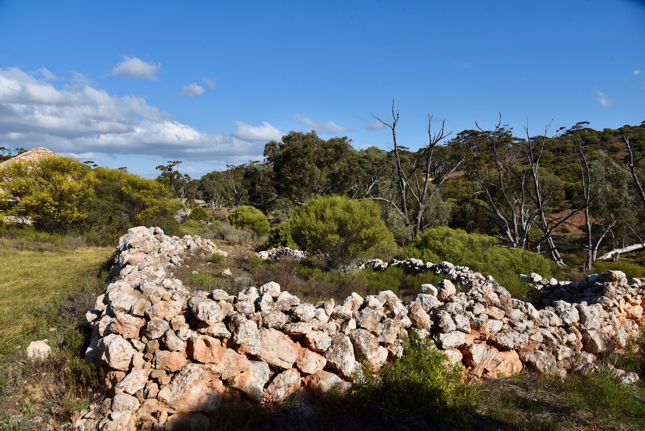
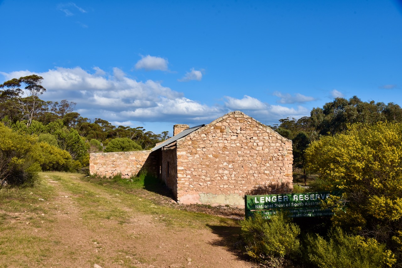
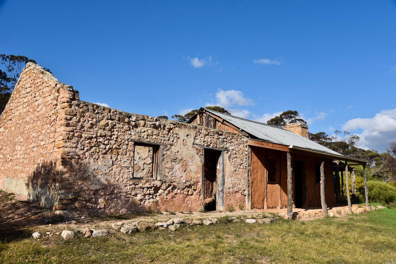
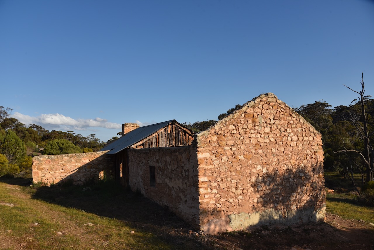
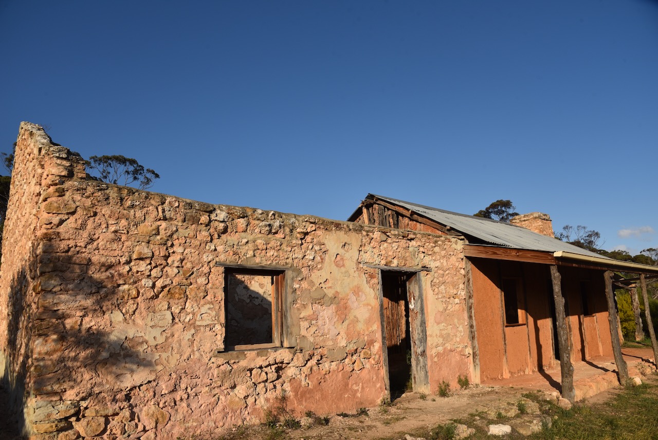
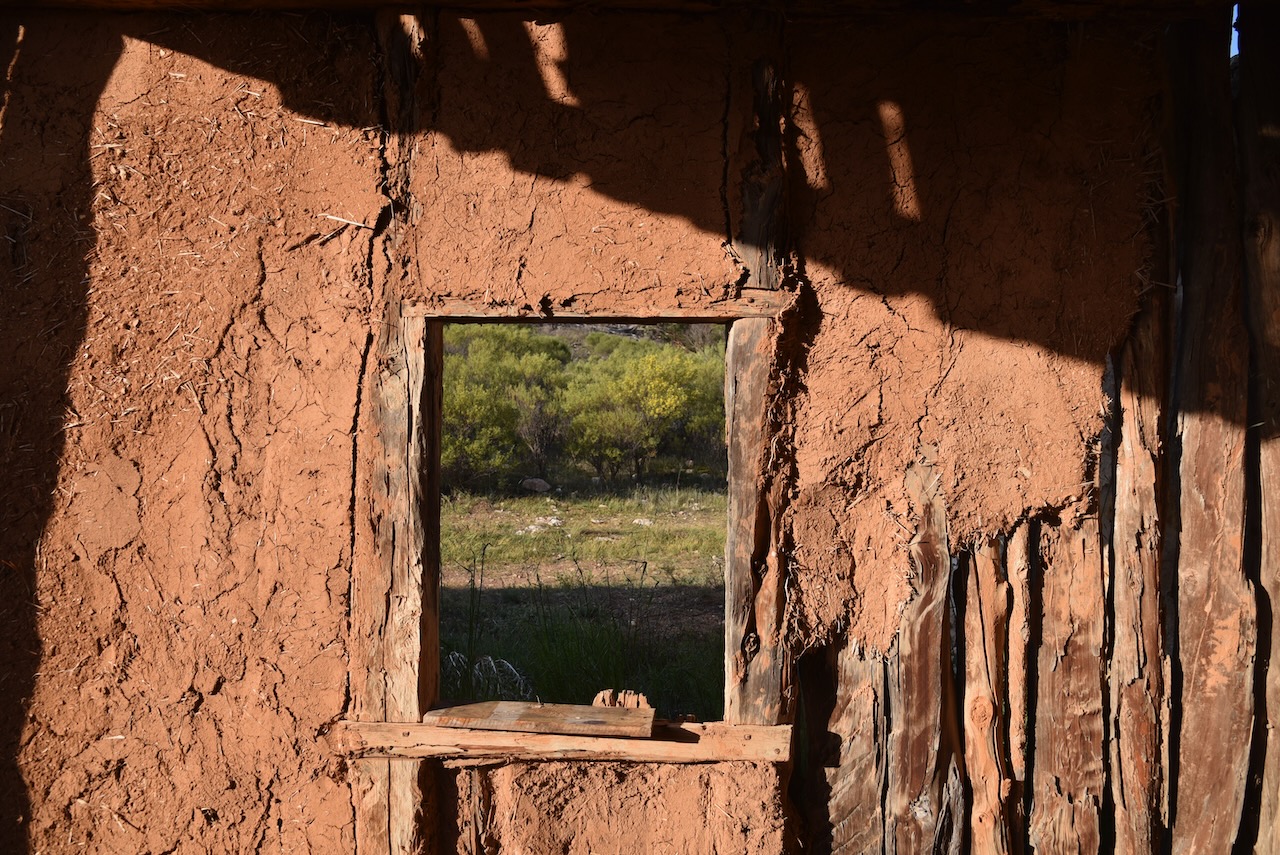
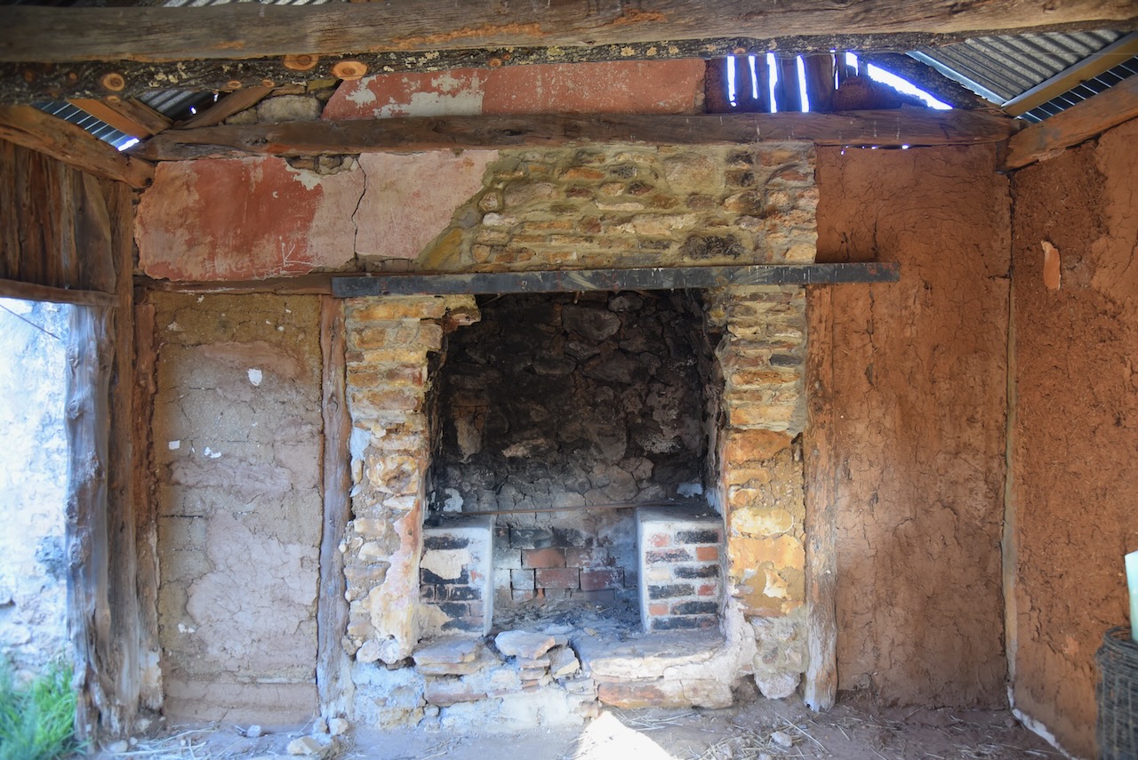
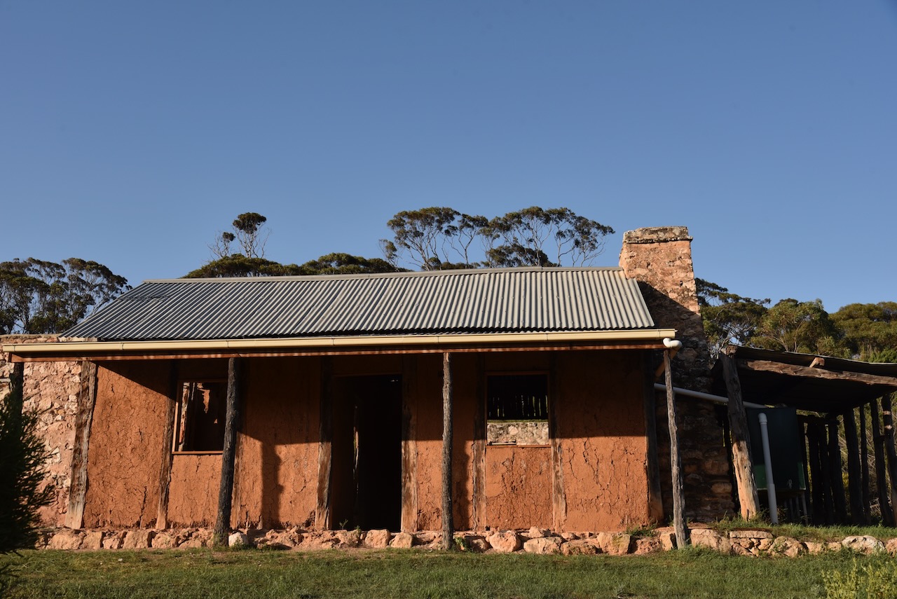
The reserve contains a c. 1900 pug and pine and stone cottage. The rooms are constructed of a mixture of clay, cut straw, fresh manure and water that are packed between the native cypress pine posts. In 2001 volunteers commenced work on establishing and renovating the cottage ruin. (National Trust 2010)
Between 1912 to 1924, the land was owned by Fredrick Pese. It is believed that he added the stone section of the cottage. William Fredrick Theordor Pese was born in 1876 at Birdwood, South Australia. His grandparents had emigrated to Australia from the Kingdom of Prussia. He died in 1947 at Mannum, South Australia, aged 47 years. (ancestry.com.au) (National Trust 2010)
It was not until 1999 that a thorough bird survey was undertaken in the reserve. Birds SA have recorded 100 native birds in the reserve, and 9 have conservation status at the state or regional level. Common species of bird found in the reserve include Brown Treecreeper, Spiny-cheeked Honeyeater, Weebill, White-browed Babbler, Grey Shrike-thrush, White-browed Babbler (Birds SA 2024) (National Trust 2010) (National Trust 2024)
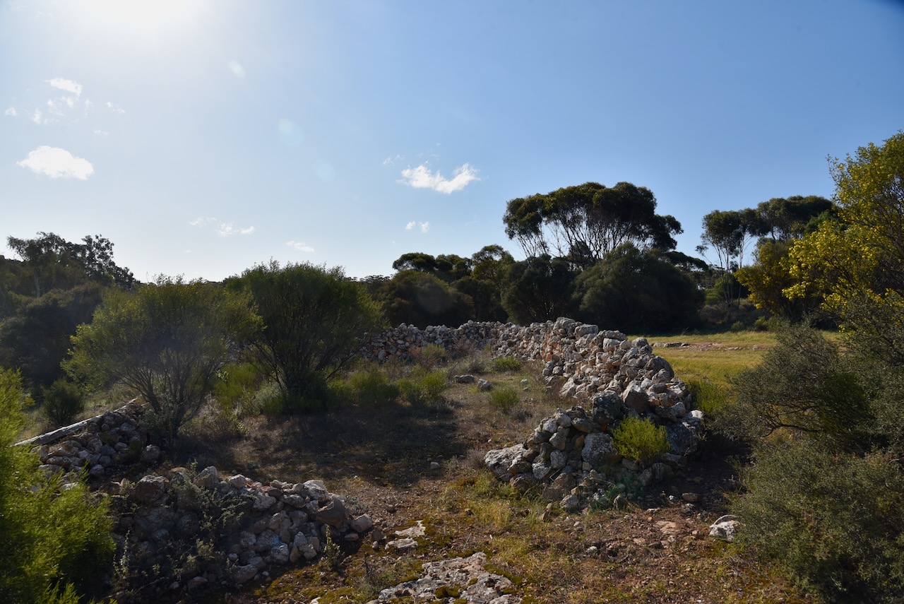
Lenger Reserve was previously cleared and cropped by farmers and used for grazing. Grassland species are regenerating in these areas. Volunteers have also stabilised the cottage, repaired fencing, cleared rubbish, established a hiking track and prepared an information brochure. (National Trust 2024)
Marija and I set up just inside the gate. We ran the Yaesu FT857, 40 watts, and the 20/40/80m linked dipole.
I worked the following stations on 40m SSB:-
VK3VIN
VK3HJW
VK5KLD
VK5LA
VK5KAW
VK3APJ
VK3DCQ
VK2EG/P (Glenrock State Conservation Area VKFF-1319)
VK3PF/P (Traralgon South Flora Reserve VKFF-2465)
VK5CZ
VK2SLB
VK2BRN
VK2KBT
VK3KRL
VK3CJN
VK3QHU
VK2VW
VK2HFI
VK2AKA
VK2BUG
VK3CEO
VK7HAM
VK5HW
VK2YK/P (Belair National Park VKFF-0022)
VK3YV
VK4SUN
VK3BBB/m
VK2CCP/m
VK3MGM
VK5MSA
VK4NH
VK4DXA
F5PYI
VK1DI/p (The Pinnacle Nature Reserve VKFF-0862)
VK2IO/p (Pitt Town Nature Reserve VKFF-1984)
VK2GEZ/p (Pitt Town Nature Reserve VKFF-1984)
VK3ACZ
VK3WRD
VK2EXA
VK3SG
VK5GY
VK1CHW
VK1RF
VK2MK
VK4CEE
VK4CZ
VK7PJM
VK2EBN
VK4HBT
VK4DNO
VK2XD
VK3MCA
VK5HMB
VK3ALF
VK3IFR
I worked the following station on 40m AM:-
VK3CJN
I worked the following stations on 20m SSB:-
VK2EG/P (Glenrock State Conservation Area VKFF-1319)