Here is a selection of some of the latest QSL cards received for VK5MAZ and VK5PAS.

Here is a selection of some of the latest QSL cards received for VK5MAZ and VK5PAS.
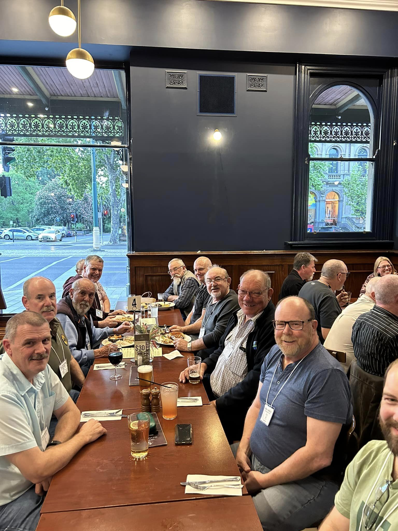
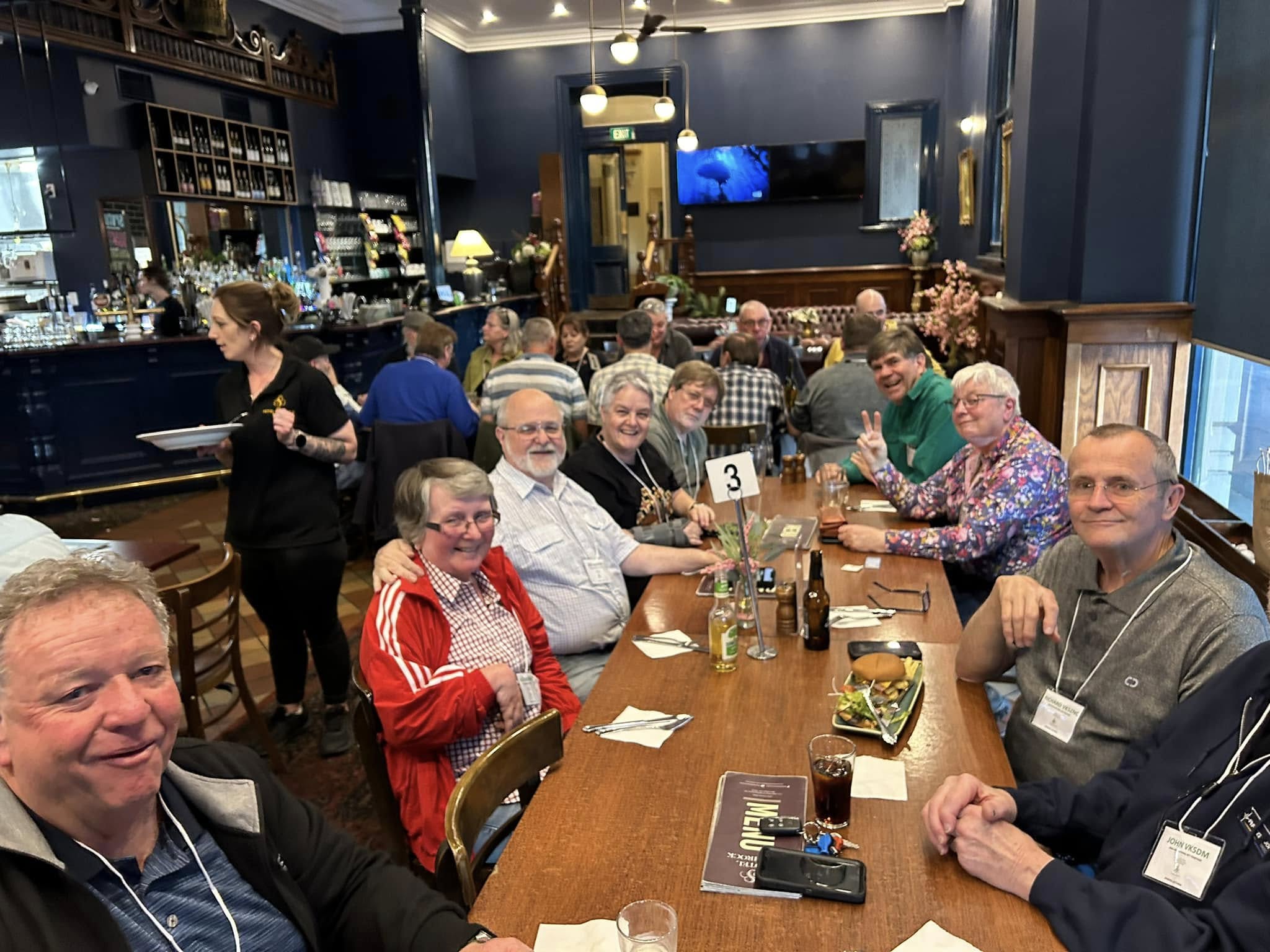
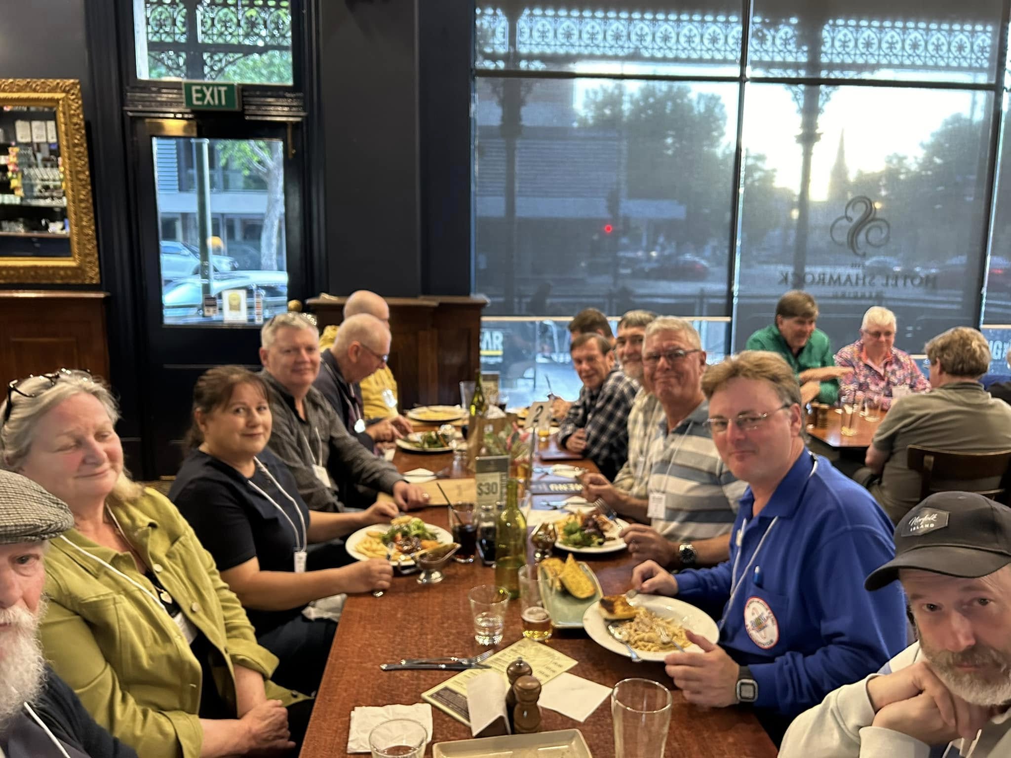
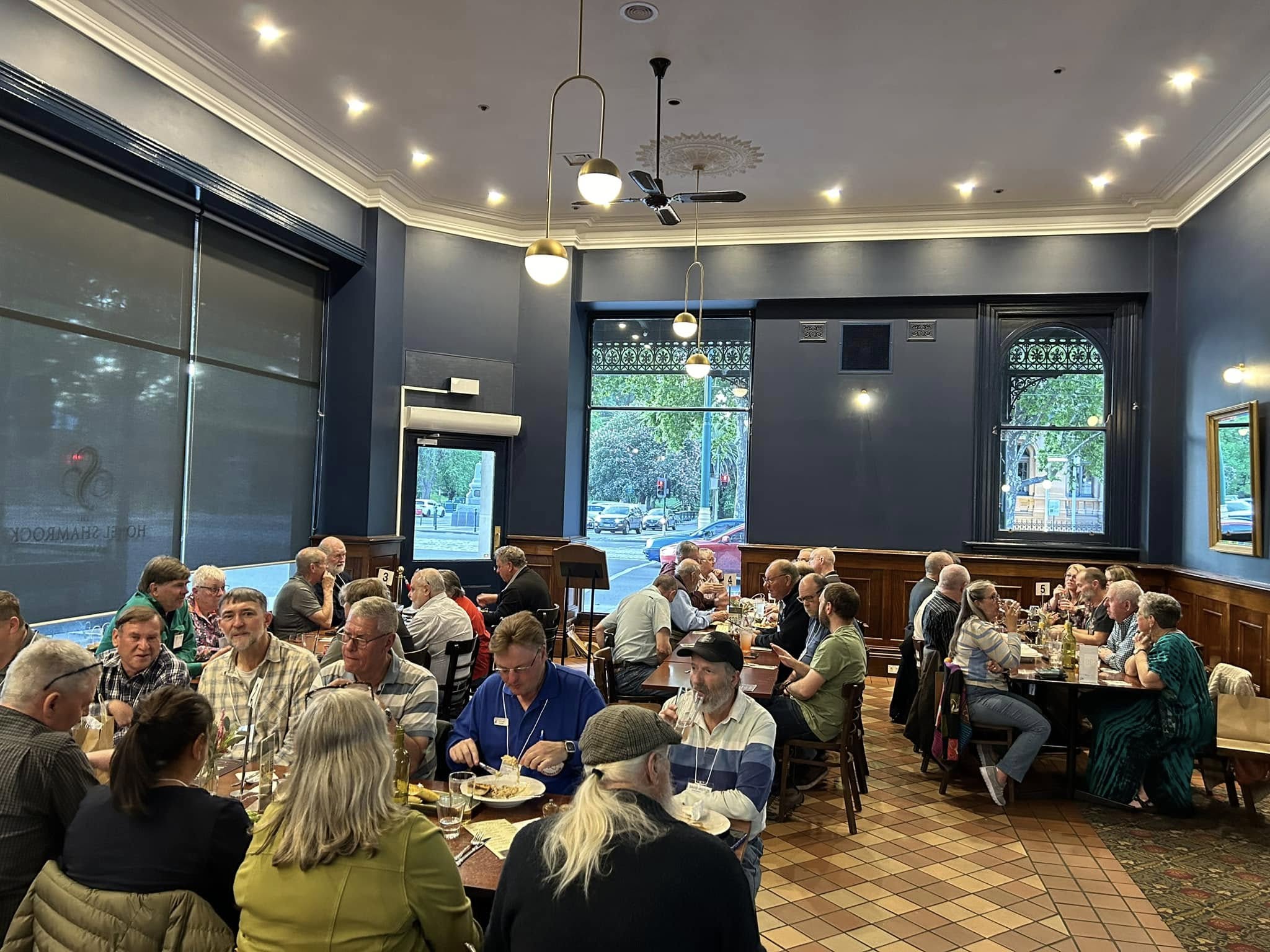
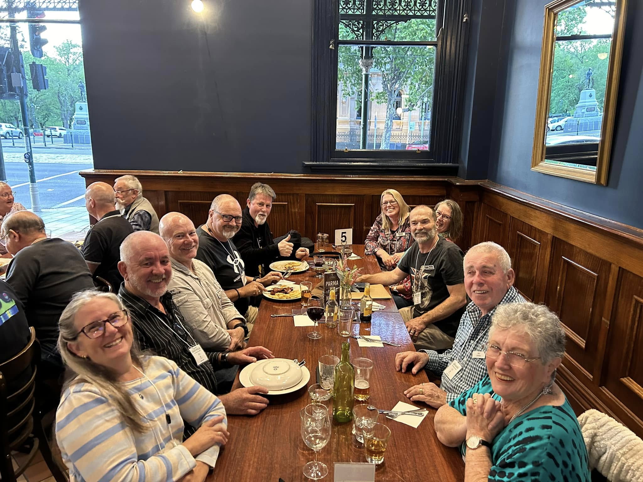
On Friday evening 25th October 2024, the 2024 VKFF National Get-Together kicked off with a dinner at the Hotel Shamrock in Bendigo.
There were about 50 people in attendance.
Those who attended were issued with their Welcome pack (a bag full of goodies) and the merchandise that they had previously ordered, e.g. VKFF Get Together caps, polo shirts, etc.
It was a great night, with a few of us kicking on after the meal.
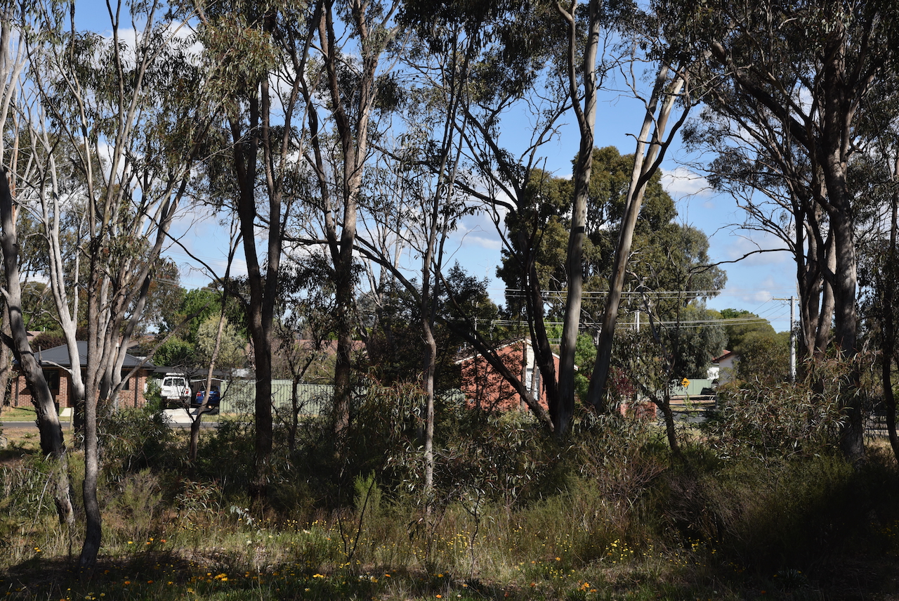
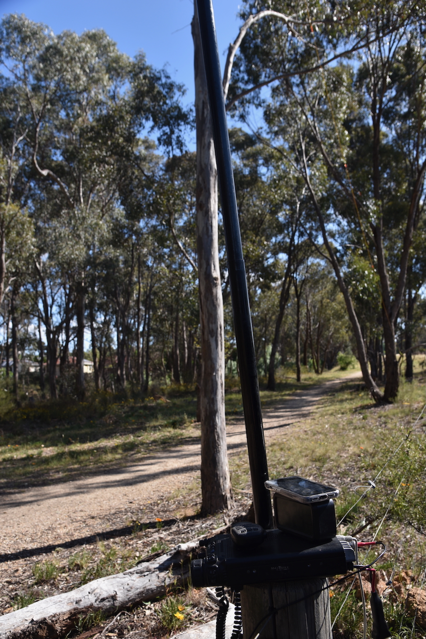
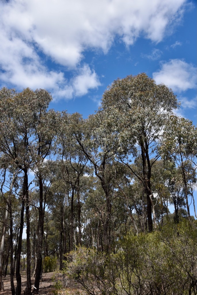
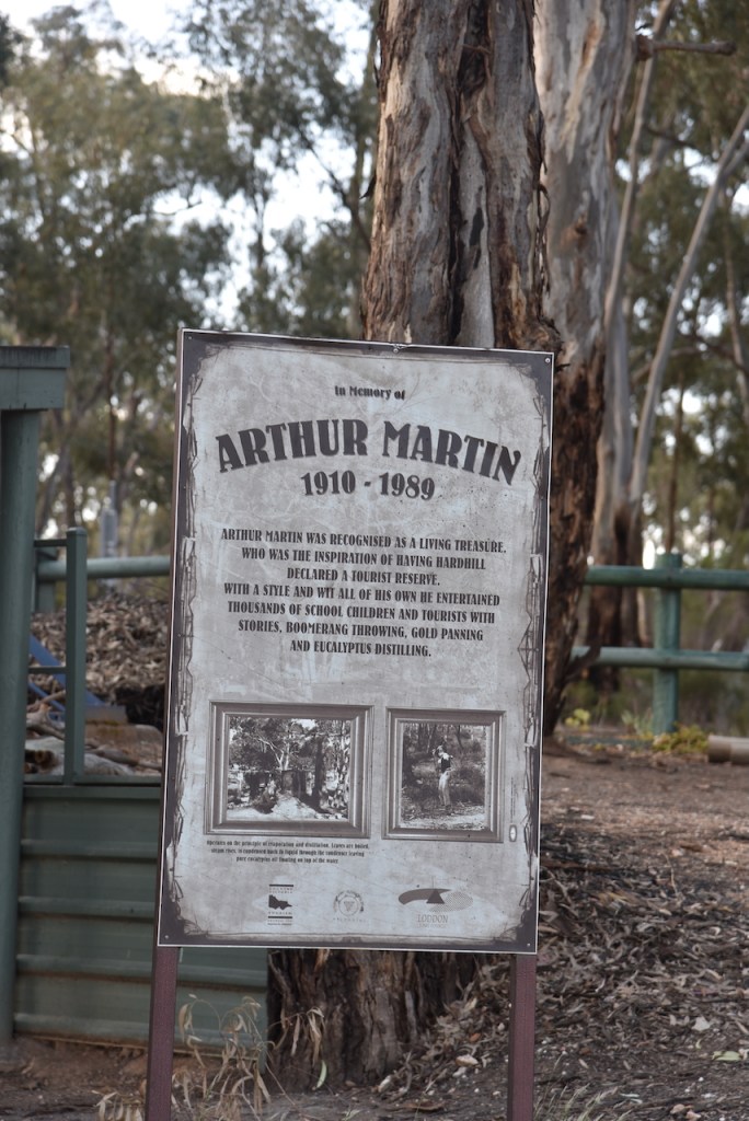
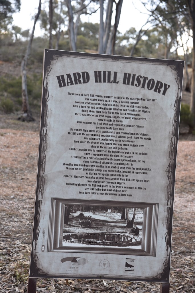
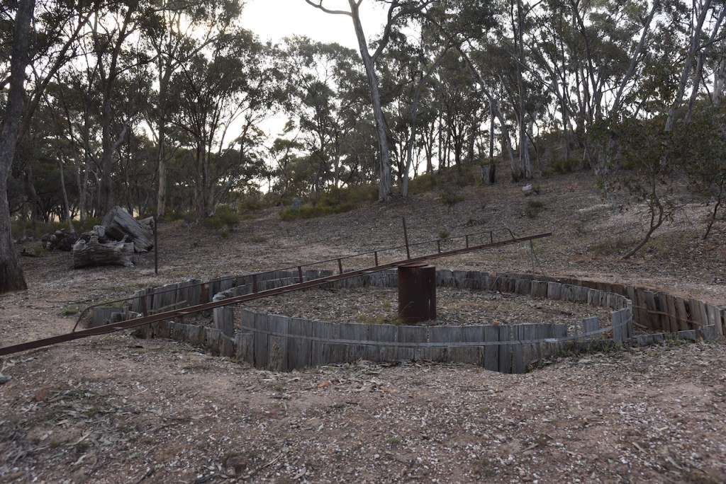
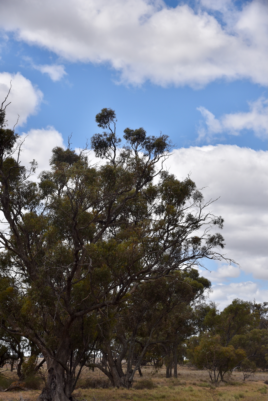
My final activation for Friday 25th October 2024 was Jobs Gully Bushland Reserve VKFF-5172, located in Bendigo, Victoria.
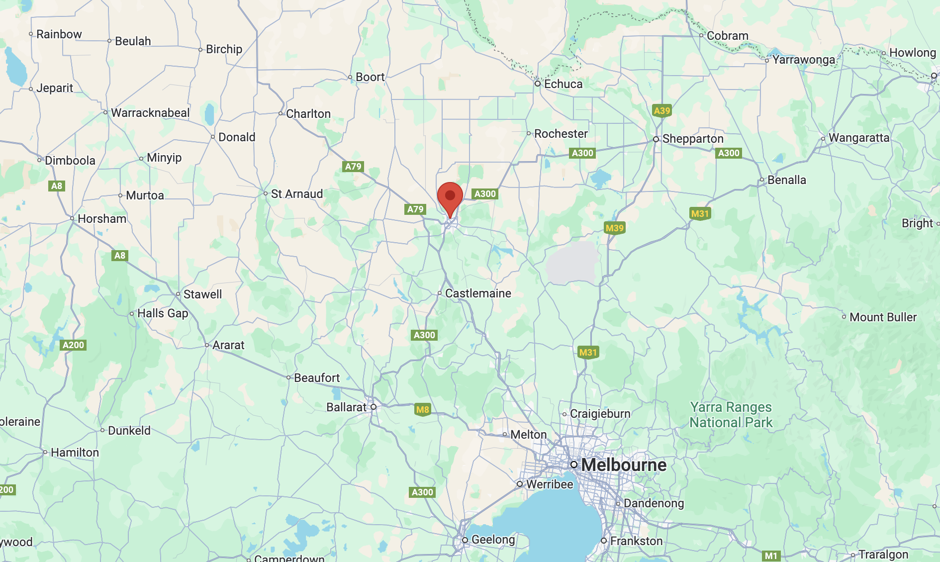
The reserve is located on the southern side of Jobs Gully Road, Eaglehawk, a suburb of Bendigo.
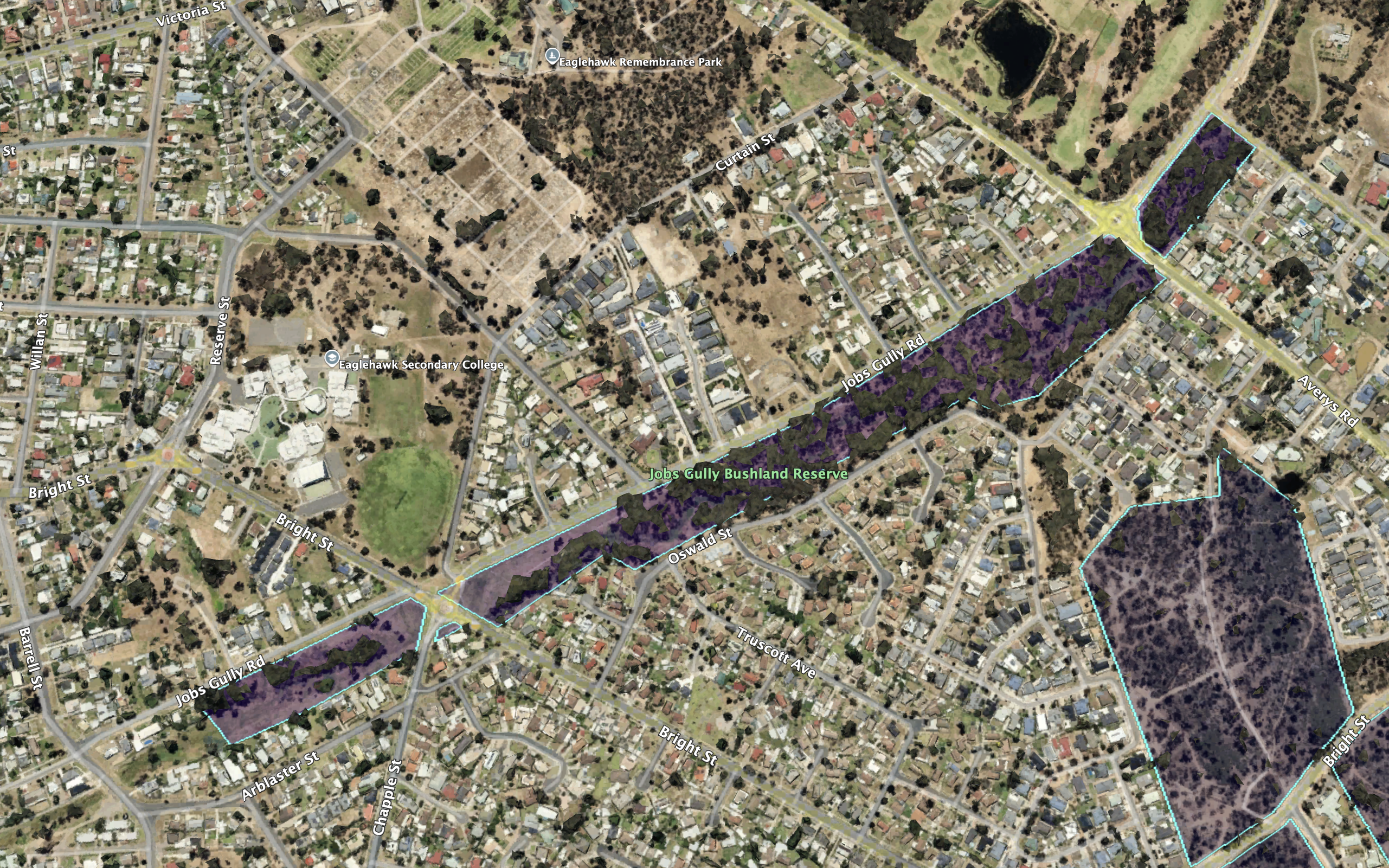
The reserve is about 11 hectares in size and was established on the 5th day of August 1980. (CAPAD 2022)
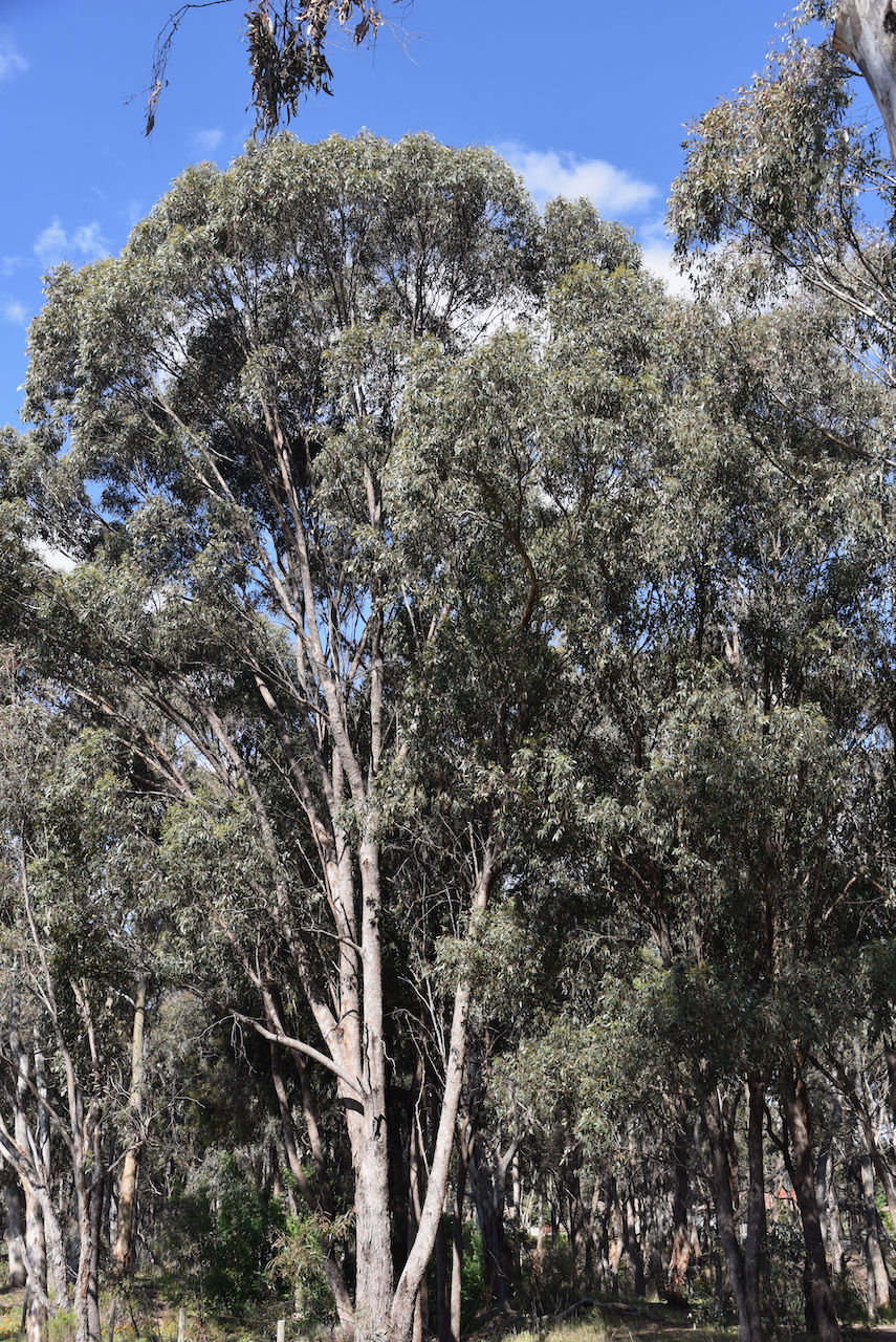
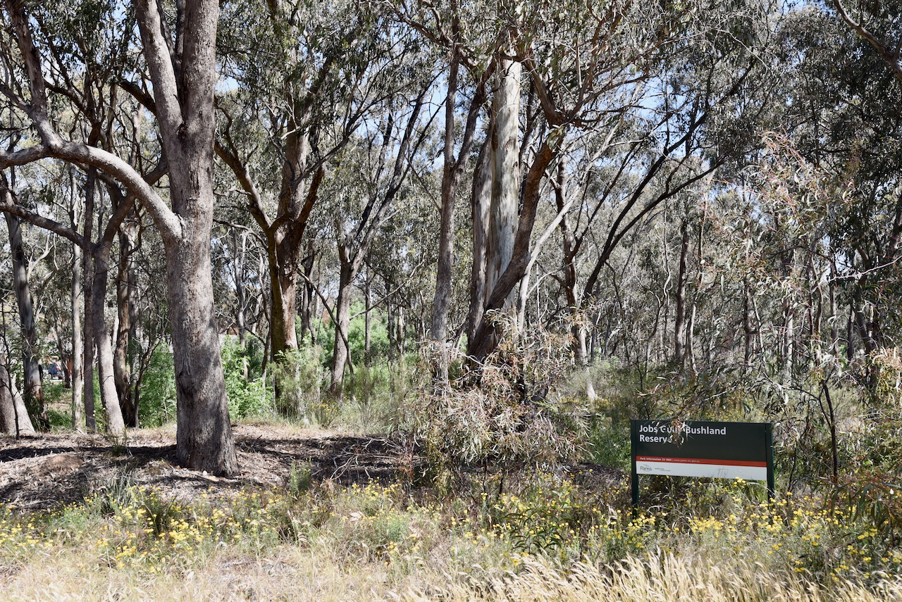
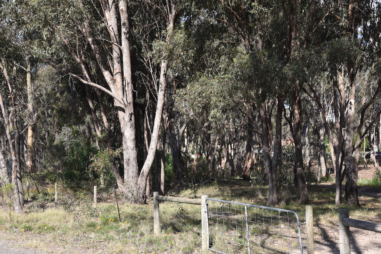
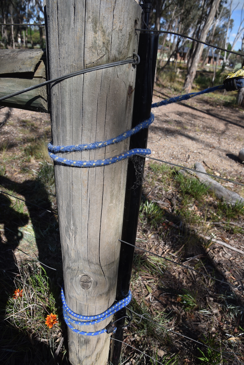
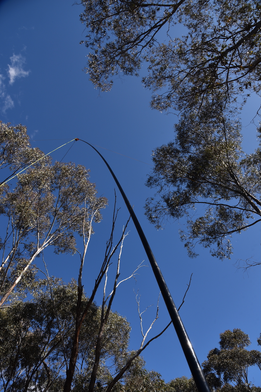
There was no vehicular access to this park. I set up just inside one of the access gates to the reserve. I strapped the 7-metre telescopic squid pole to a permapine fence post with an octopus strap. I ran the Yaesu FT857 and 40 watts and the 20/40/80m linked dipole.
As this was a built-up residential area I received lots of unusual looks and was approached by a handful of people asking me what I was doing. It was a good opportunity to promote the hobby of amateur radio to those who spoke with me.
I worked the following stations on 40m SSB:-
I worked the following stations on 20m SSB:-
I packed up and headed back to the motel to have a shower and freshen up for the evening’s dinner at the Hotel Shamrock as part of the 2024 VKFF National Get-Together.
References.
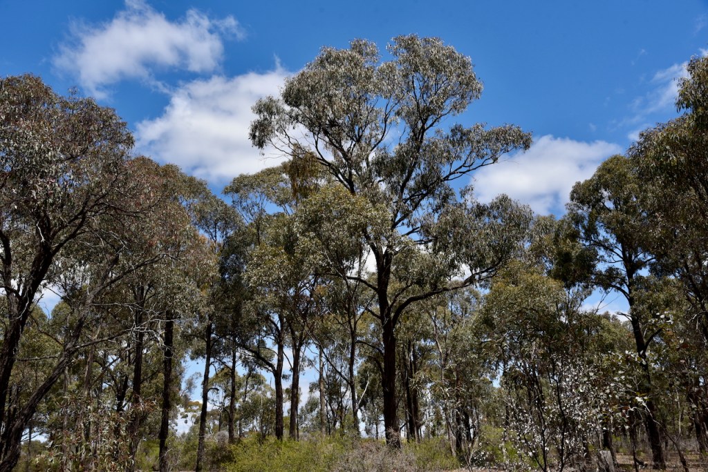
After packing up at the California Gully Bushland Reserve on 25th October 2024, I drove the short distance to my next park activation at the Jackass Flat Nature Conservation Reserve VKFF-2114.
The park is located in Bendigo, Victoria.
Jackass Flat is a suburb of Bendigo, about 6.5 km north of the Bendigo CBD. The park is located between Crane Street, Prouses Road, and Holdsworth Road.
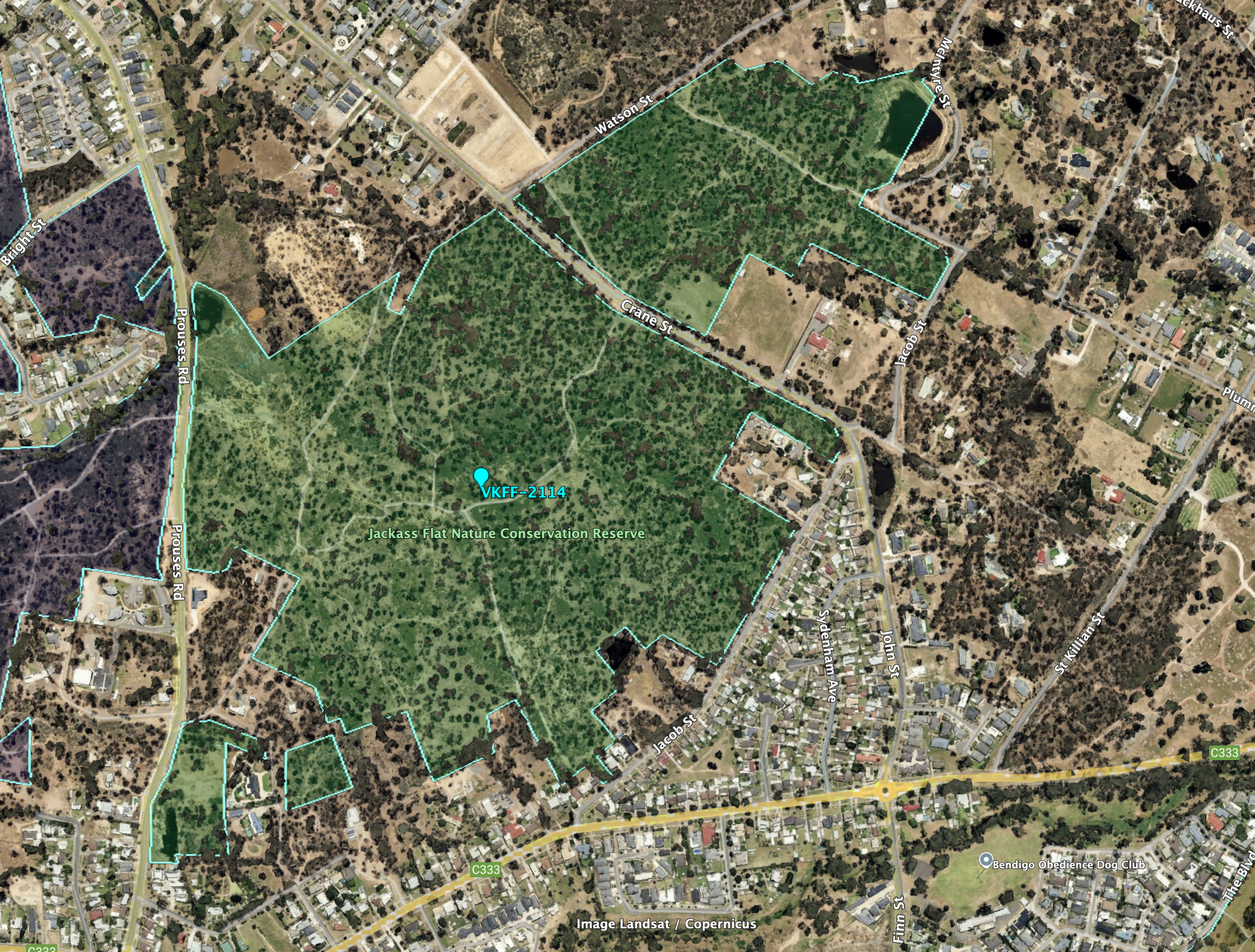
Above:- Aerial view of the Jackass Flat NCR. Image c/o Google Earth.
The reserve is about 73 hectares in size and was established on the 27th day of May 1980. (CAPAD 2022)
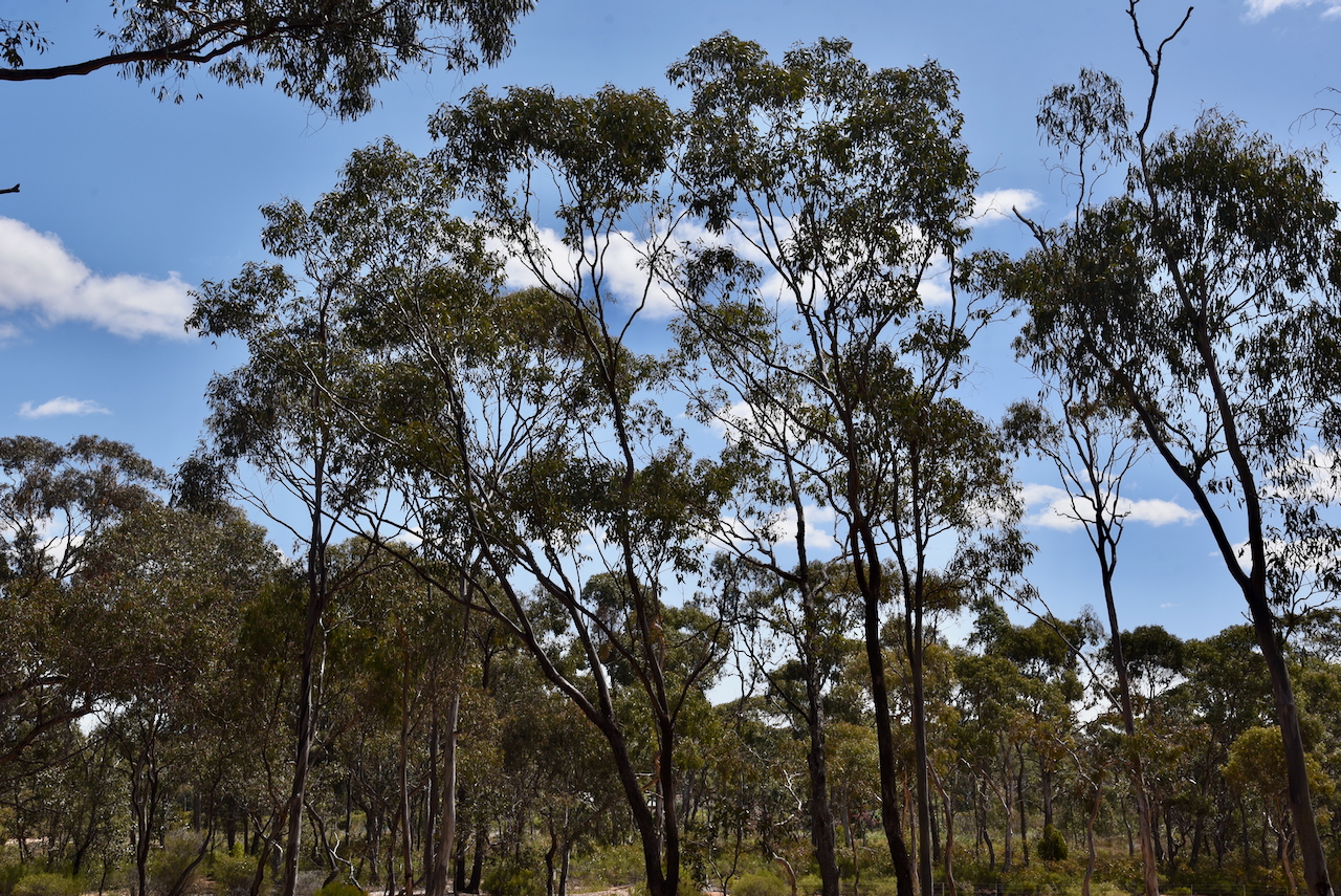
This was another easy park to access. I drove along a 4WD track and set up in a clearing amongst the scrub. I ran the Yaesu FT857, 40 watts, and the 20/40/80m linked dipole.
I worked the following stations on 40m SSB:-
I worked the following stations on 40m FT8:-
I worked the following stations on 20m SSB:-
References.
It was now Friday 25th October 2024, with the 2024 VKFF National Get-Together commencing with a Friday evening dinner.
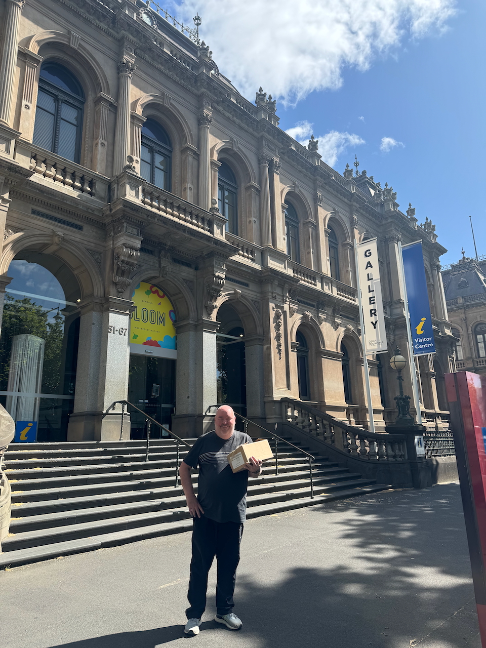
After breakfast Marija and I headed to the Bendigo Visitor Centre to collect some tourist brochures that we had arranged to pick up for the Get-Together attendee pack.
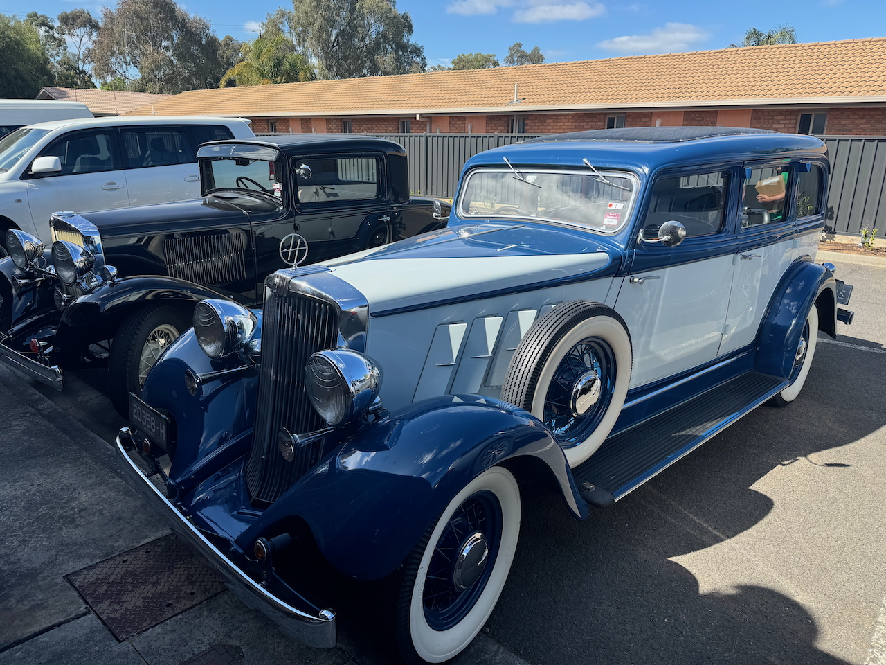
We headed back to the motel, admiring some of the collectable cars that were parked in the carpark.
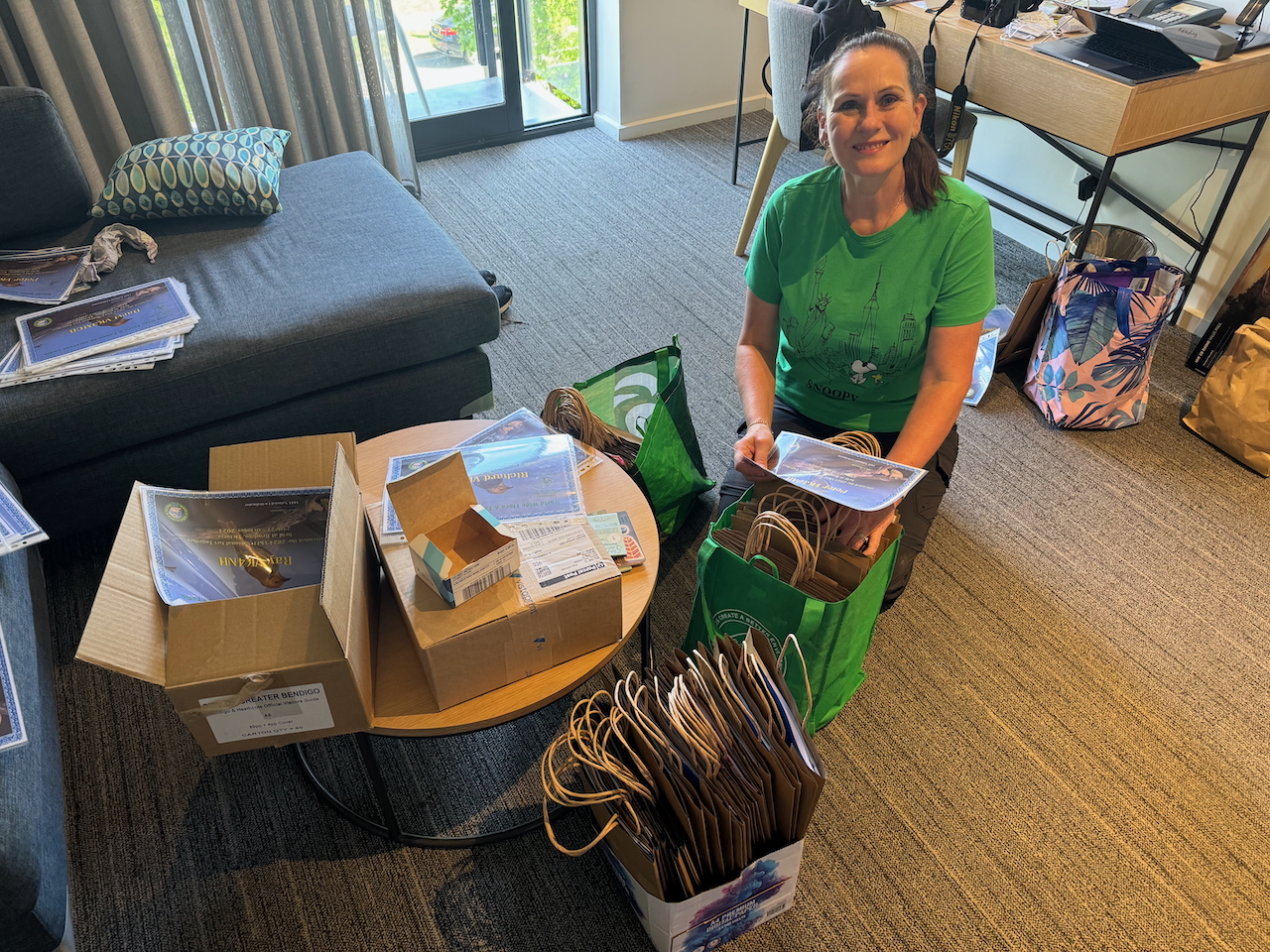
We then commenced to pack the welcome packs for all of the attendees.
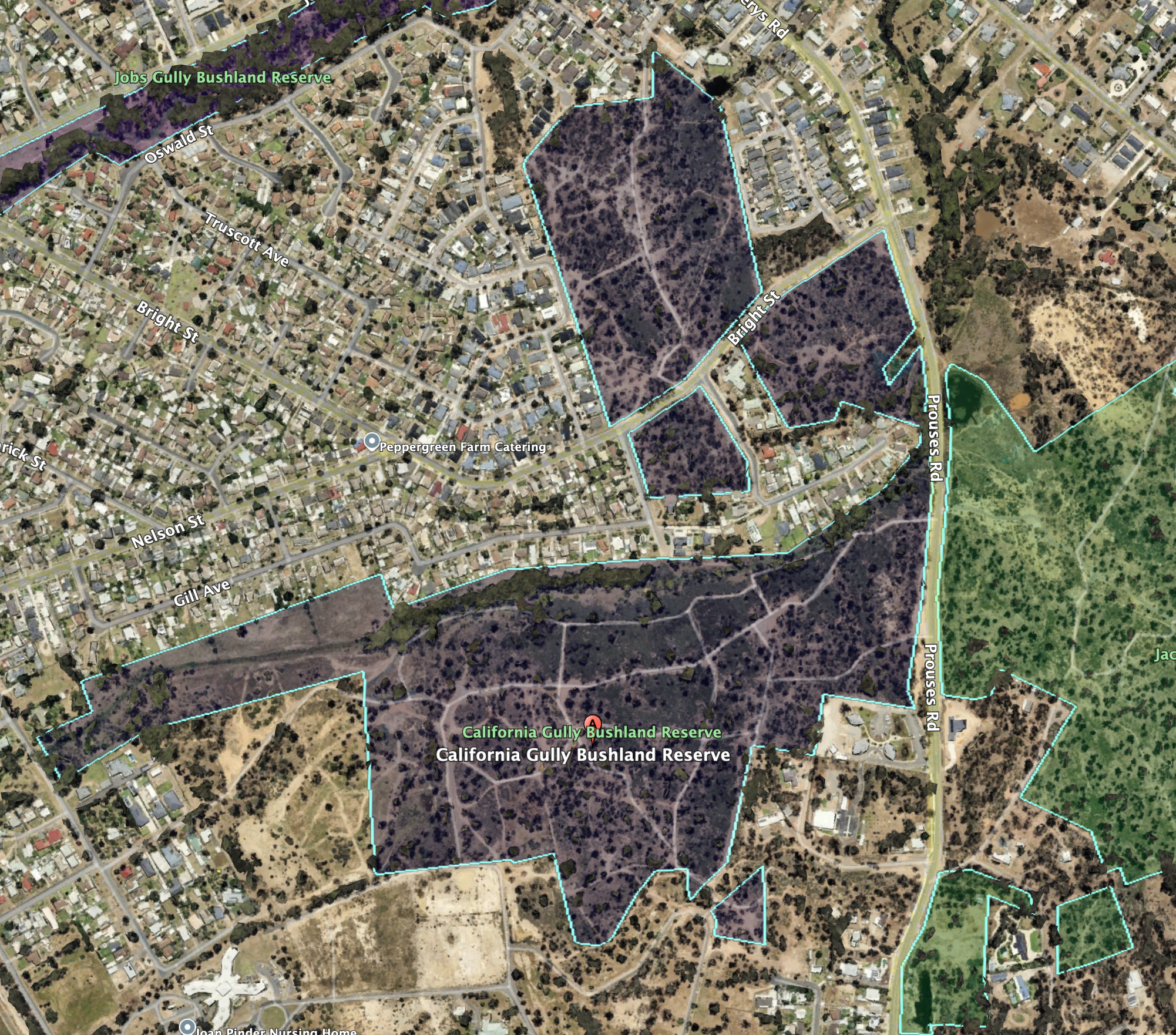
Marija decided to stay back in the motel to rehearse her presentation, while I headed out to activate the California Gully Bushland Reserve VKFF-4723.
Above:- Map showing the location of the California Gully Bushland Reserve. Map c/o Google Maps.
The reserve is located in the Bendigo suburb of California Gully, about 4 km northwest of Bendigo city centre. In April 1852 gold was discovered in California Gully and a rush followed of miners from the Californian gold diggings. About 18,000 miners from California came to the area. As a result, the area was known as California Gully. (Victorianplaces.com.au, 2015)
By the 1870s the area saw a large influx of Cornish miners. A township was formed on Eaglehawk Road. The White Horse Hotel was built during the 1870s. In 1883 a large school was built on the west side of the town on an elevated site known as Bell Topper Hill. Its name comes from the English miners making a bonfire on their bell topper hats. (Victorianplaces.com.au, 2015)
The mines at California Gully had a long production period. One of those was the North Johnson group which operated from 1861 to 1920 and yielded over 320,000 oz. of gold and £334,020 dividends, after commencing in 1853. (Heritage, 2017) (Victorianplaces.com.au, 2015)
Above:- California Gully, c. 1895. Image c/o Museums Victoria.
Sadly, as I drove into the reserve I noticed rubbish everywhere. Clearly some of the good people of Bendigo use the reserve as a dumping point for their rubbish.
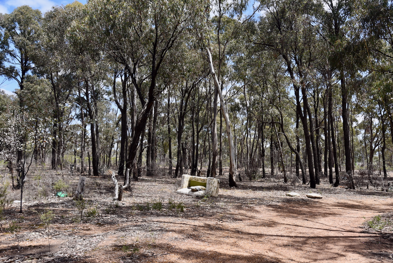
The reserve is located between Prouses Road, Holdsworth Road, Sandhurst Road and Jobs Gully Road.
Above:- Aerial view of the California Gully Bushland Reserve. Image c/o Google Earth
The reserve is about 48 hectares in size and was established on the 26th day of February 2002. (CAPAD 2022)
I drove into the park via a 4WD track. I ran the Yaesu FT857, 40 watts, and the 20/40/80m linked dipole for this activation.
I logged a total of 46 stations including 8 Park to Park QSOs.
It was a pleasure to log Lew VK5DU at his very first park activation.
I worked the following stations on 40m SSB:-
I worked the following stations on 40m AM:-
I worked the following stations on 40m FT8:-
I worked the following stations on 20m SSB:-
I worked the following station on 20m FT8:-
References.
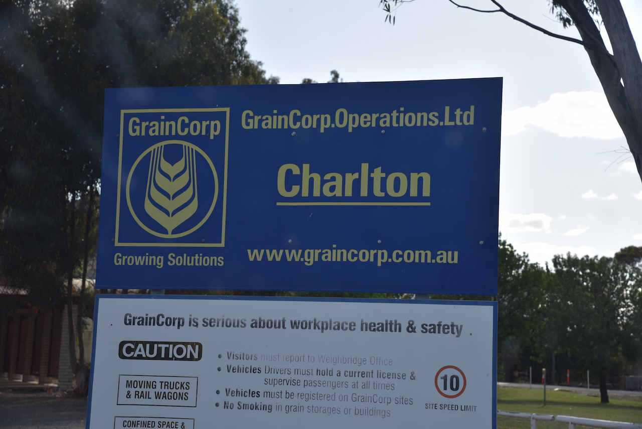
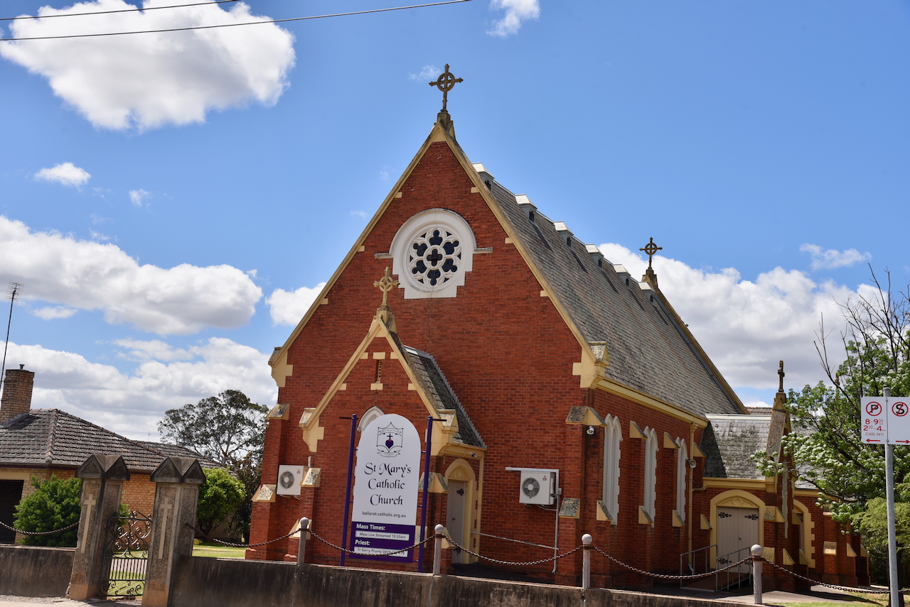
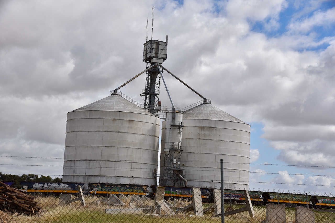
Our next activation for Thursday 24th October 2024, was the two silos at Charlton, Victoria, for the Silos On The Air (SiOTA) program.
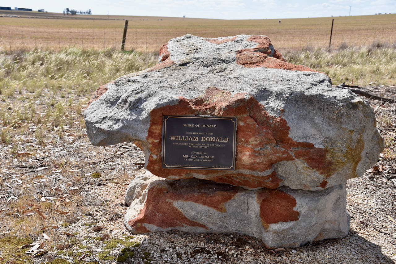
As we left the town of Donald, we stopped briefly at the William Donald monument. It commemorates the establishment of the first white settlement in the district by WIlliam Donald.
We then stopped to look at the monument for the old Jeffcott North Mechanic Institute. Jeffoctt is named in honour of Sir William Jeffcott who served as a Judge of the Supreme Court of Port Phillip from 1843-1845. (Blake 1978)
The monument was unveiled in November 2016 by members of the Donald History and Natural History Group.
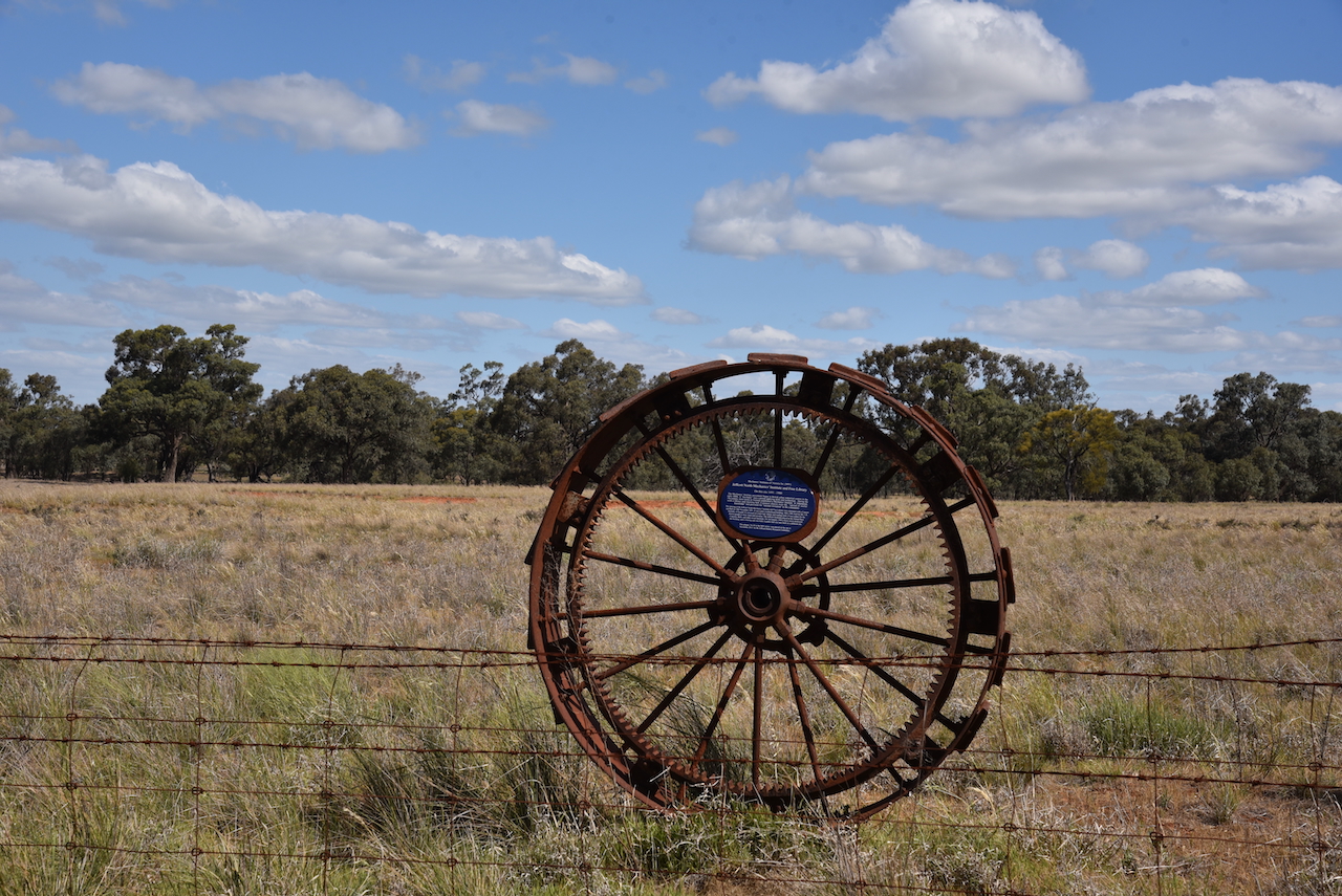
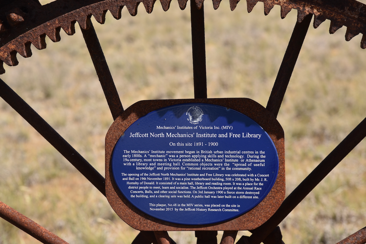
The Jeffcott North Mechanics’ Institute was opened on the 19th day of November 1891. A concert and ball was held to honour the occasion. The building was constructed of timber and took only one week to build. The Institute building was used regularly for dances. On the 3rd day of January 1900, a severe storm struck the area and the Institute building was totally destroyed. Materials from the Institute were salvaged and sold. The Mechanics Institute was never rebuilt.
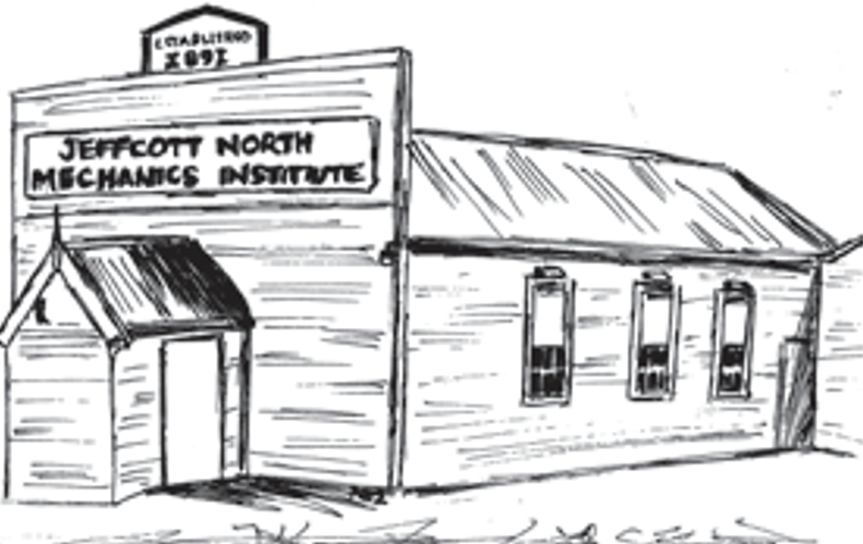
Above:- Image c/o ‘Useful Knowledge’ magazine
Charlton is a small town located on the banks of the Avoca River. It is about 245 km northwest of Melbourne.
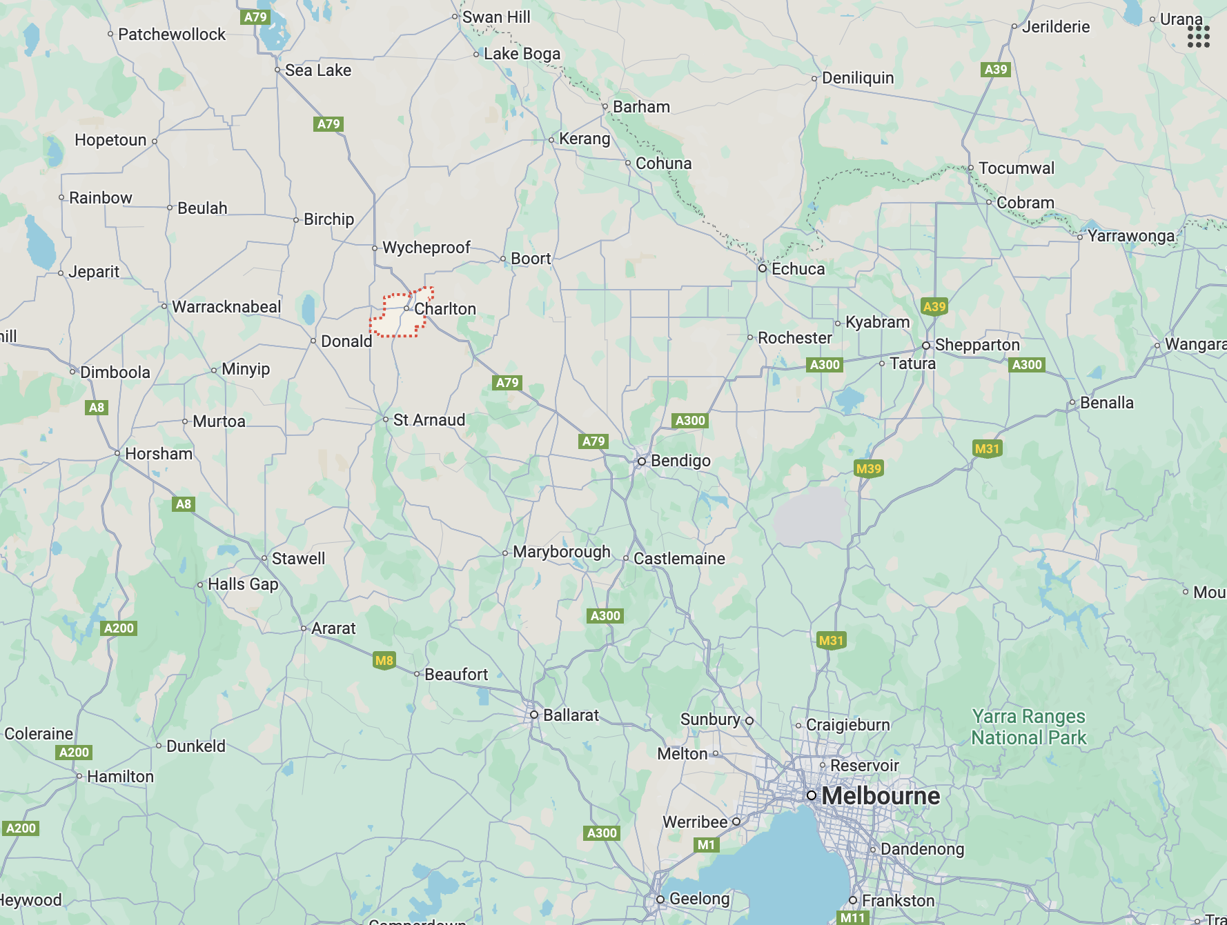
Above:- Map showing the location of Charlton, Victoria. Map c/o Google Maps.
Prior to European occupation of the area, the Charlton district was home to the Jaara aboriginal people. In 1848, Robert Cay and William Kaye established ‘Charlton’ station, named after Charlton, a small town (now suburb) of London. Their run was divided into East Charlton and West Charlton and was separated by the Avoca River. (Aussie Towns 2018) (Museums Victoria Collections, 2025)
A town developed on the eastern side of the river and it was known as East Charlton after the pastoral run on which it was situated. By 1863 an Inn had been built by Mr. John Flug. In 1867 a bridge was constructed across the Avoca River and this allowed the growth of settlement on either side of the river. James Patterson of Wedderburn was contracted to build the bridge. (Charlton.vic.au, 2014) (Museums Victoria Collections, 2025)
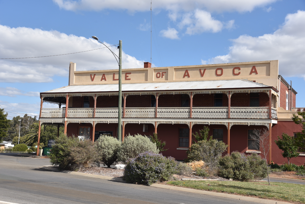
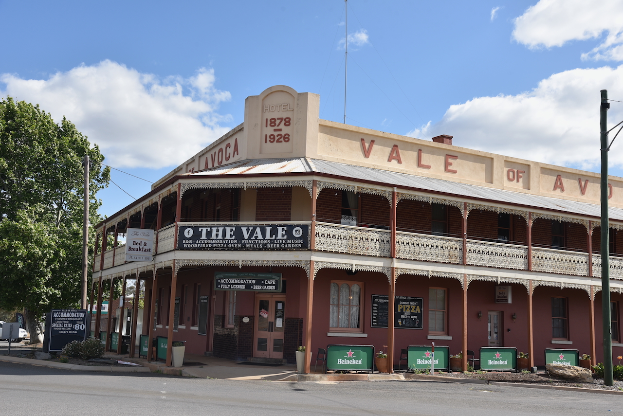
By the 1870s large holdings of land were opened up to selectors. Two flour mills were built. In 1876 the East Charlton Post Office was opened. In that same year the Tribune newspaper commenced. In 1879 The Vale of Avoca was opened. In that year another town in Victoria called Charlton changed its name to Chute. As a result, East and West Charlton ceased, and the town was known as Charlton. (Museums Victoria Collections, 2025)
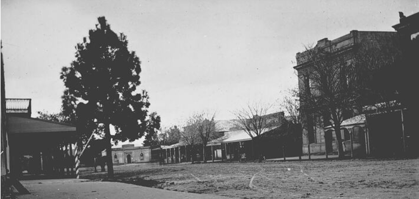
Above:- High Street Charlton, c. 1898. Image c/o Museums Victoria.
Today, Charlton has a population of about 1,200 people. The Charlton distirct is a cropping area where cereal grains and legumes are grown. The district is also well known for wool production and prime lamb. (Charlton.vic.au, 2014)
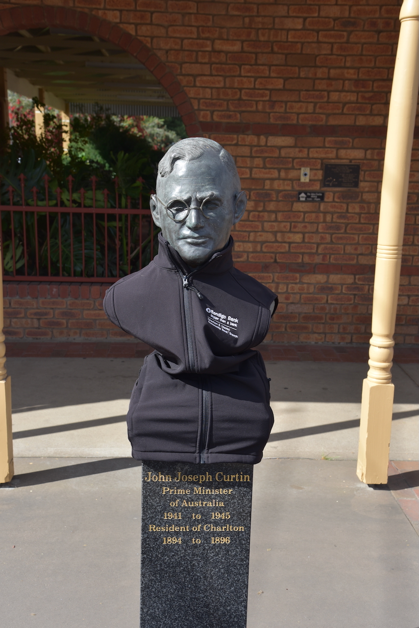
Former Australian Prime Minister John Joseph Curtin was a resident of Charlton from 1894 to 1896.
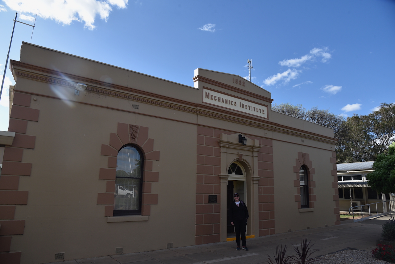
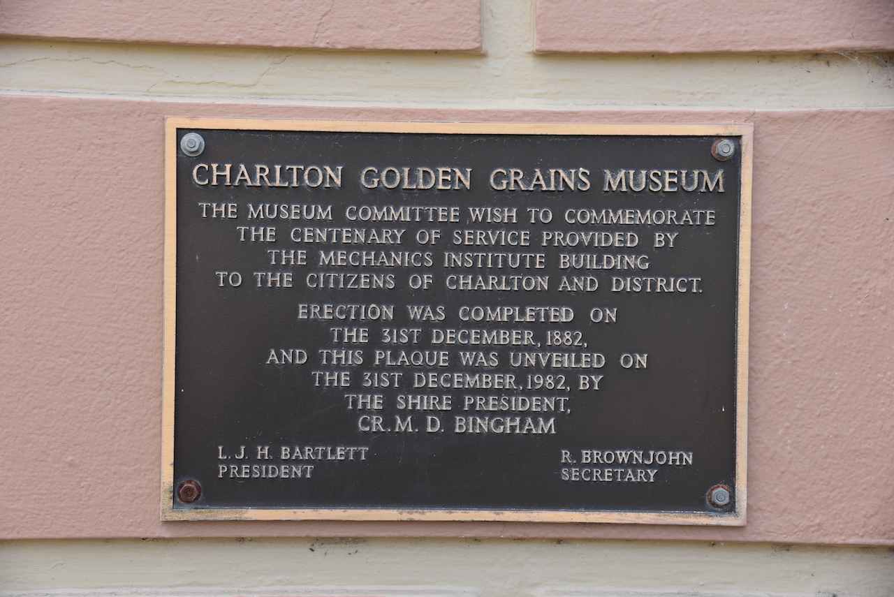
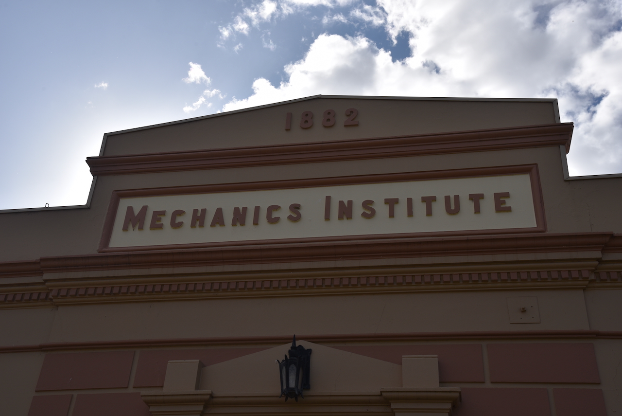
The former Charlton Mechanics Institute built in 1882, is now the home of the Charlton Golden Grains Museum. It is located on High Street. (Aussie Towns 2018)
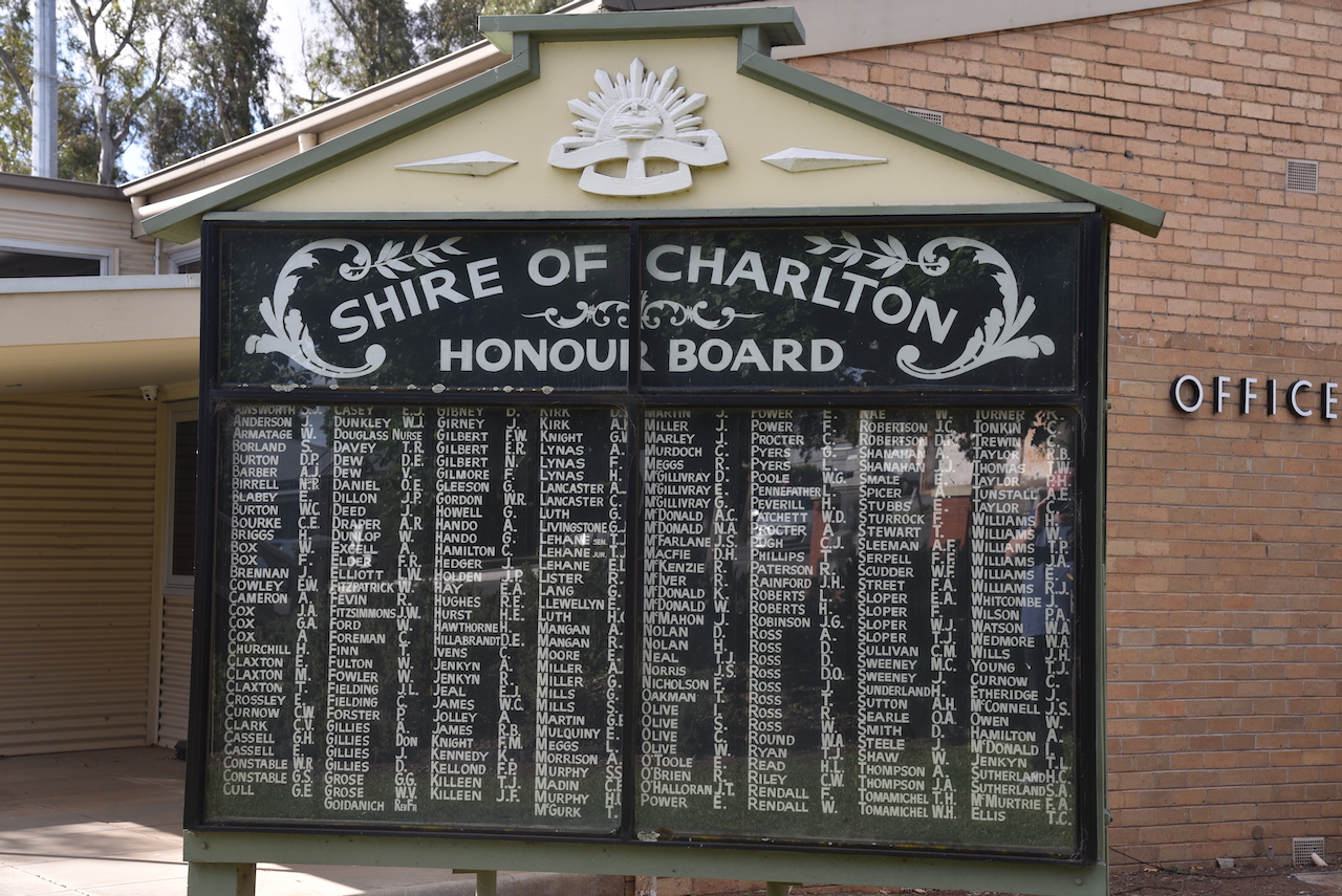
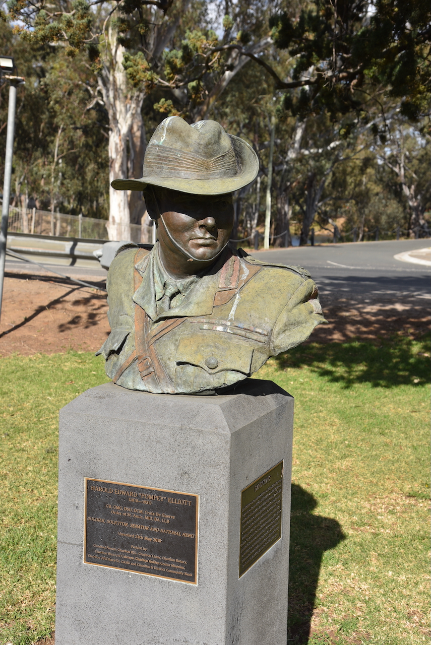
Nearby you can find Elliott Gardens. They contain the Shire of Charlton Honour Board.
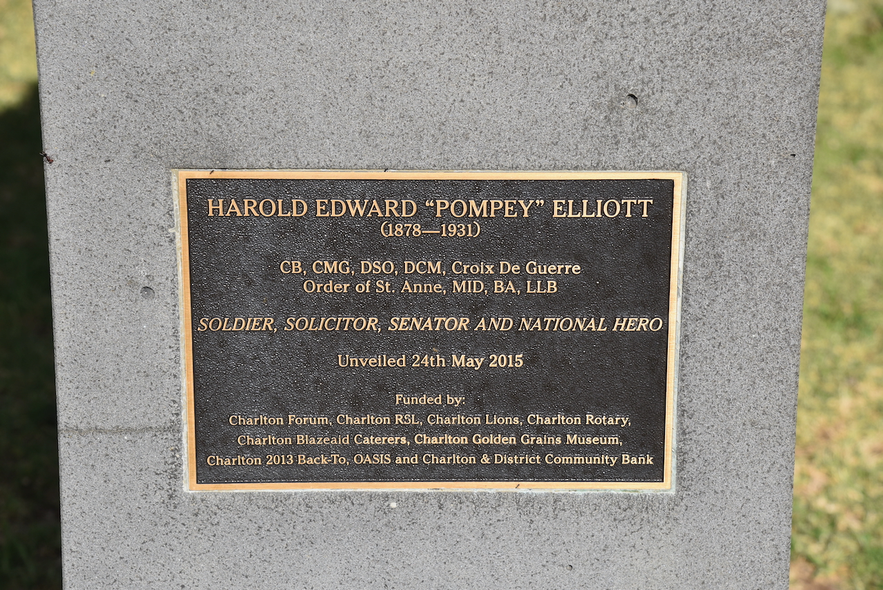
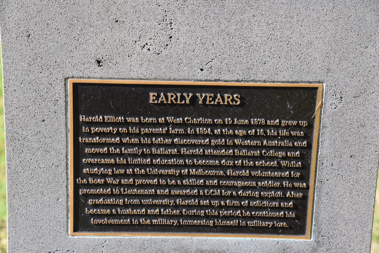
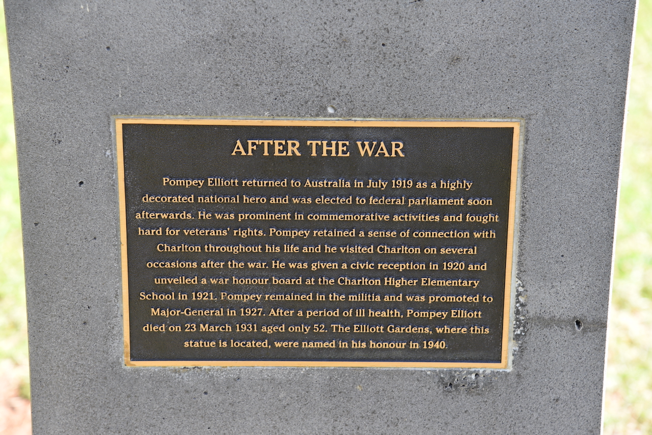
In Elliott Gardens is a monument for Harold Edward ‘Pompey’ Elliott (b. 1878. d. 1931), a soldier, solicitor, senator and national hero.
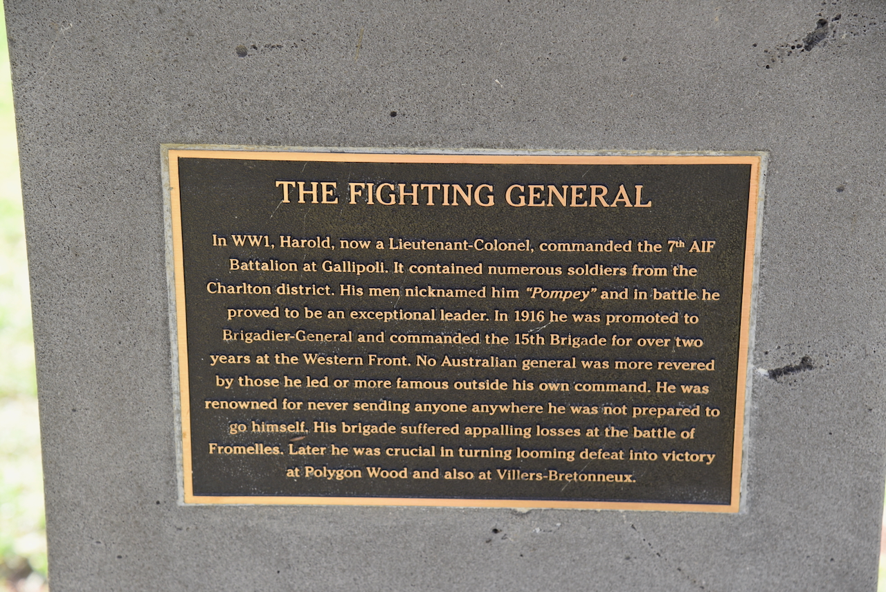
Below is a video on the life of ‘Pompey’ Elliott.
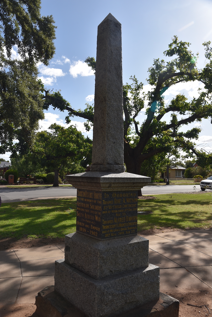
In the park there is also a small oblisque to commemorate those from the district who were killed in the Second Boer War.
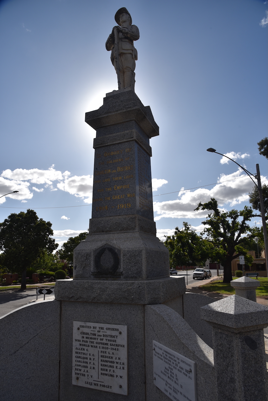
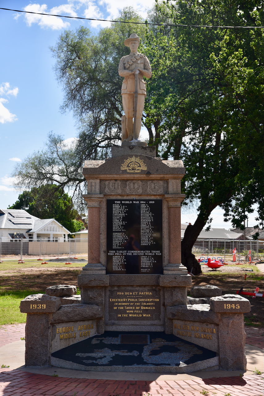
At the end of High Street is the very prominent War Memorial which was unveilled in 1923 to honour the men from the district who lost their lives during the First World. Subsequently the names of those who were killed durring the Second World War were added to the memorial. A total of 60 names can be found on the memorial.
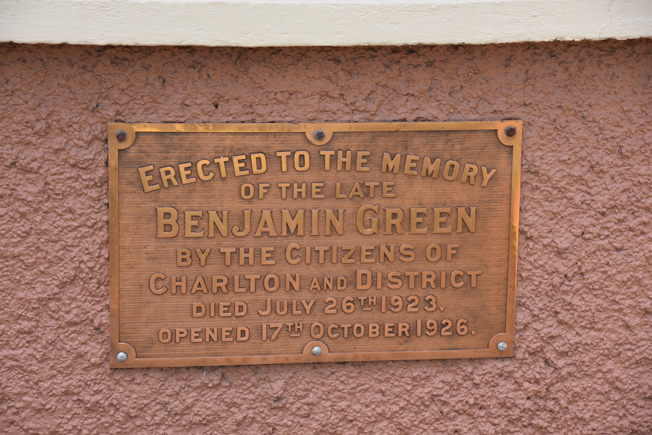
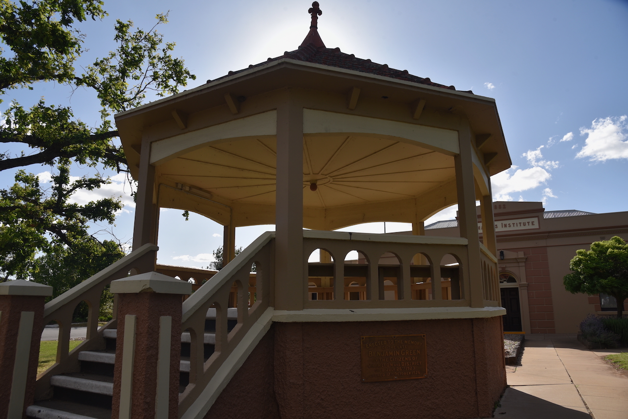
The nearby rotunda was opened in 1926 and was erected to the memory of the late Benjamin Green by the citizens of Charlton and district. Green was a solicitor in Charlton and a former lawn tennis player of Australia. (UBC Web Design 2025)
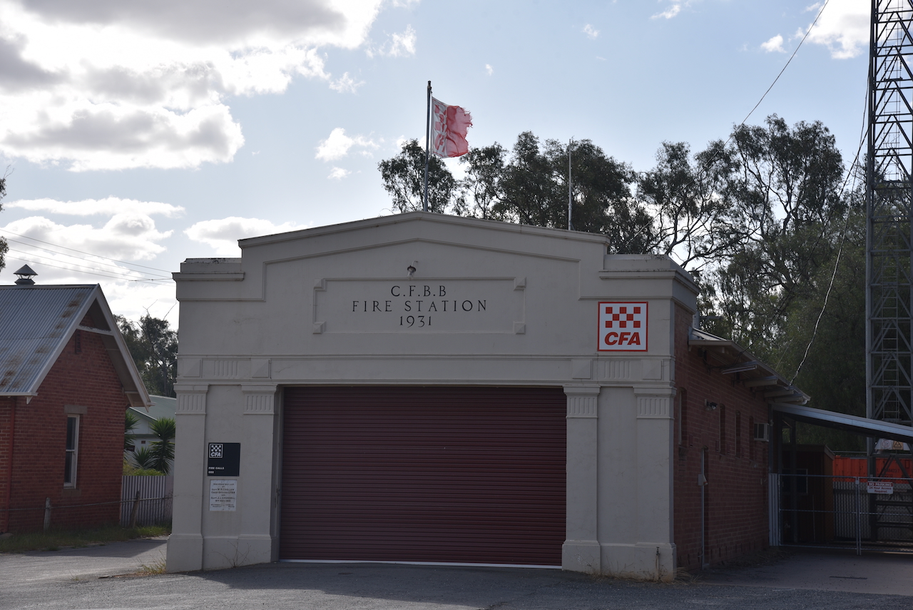
In Halliday Street you can find the historic Fire Station built in 1931.
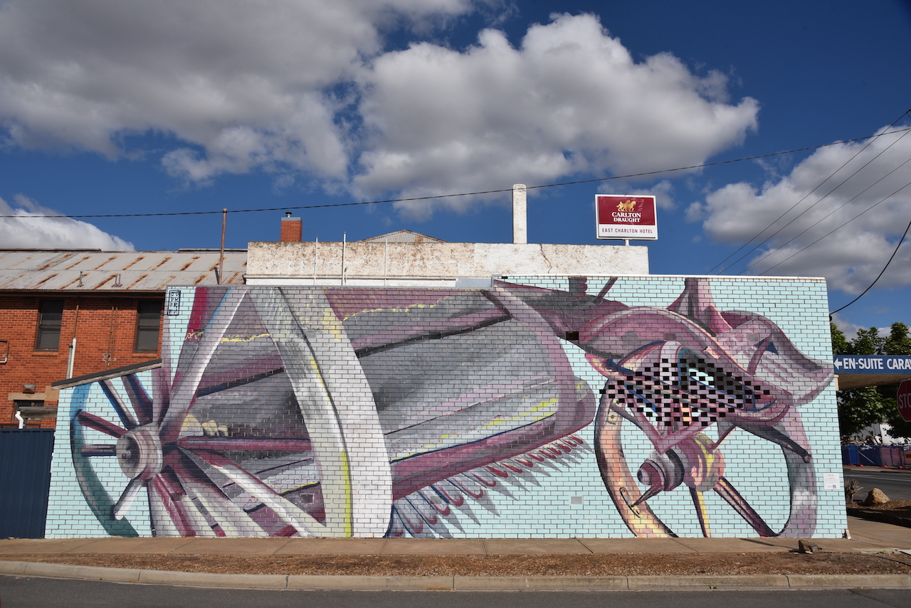
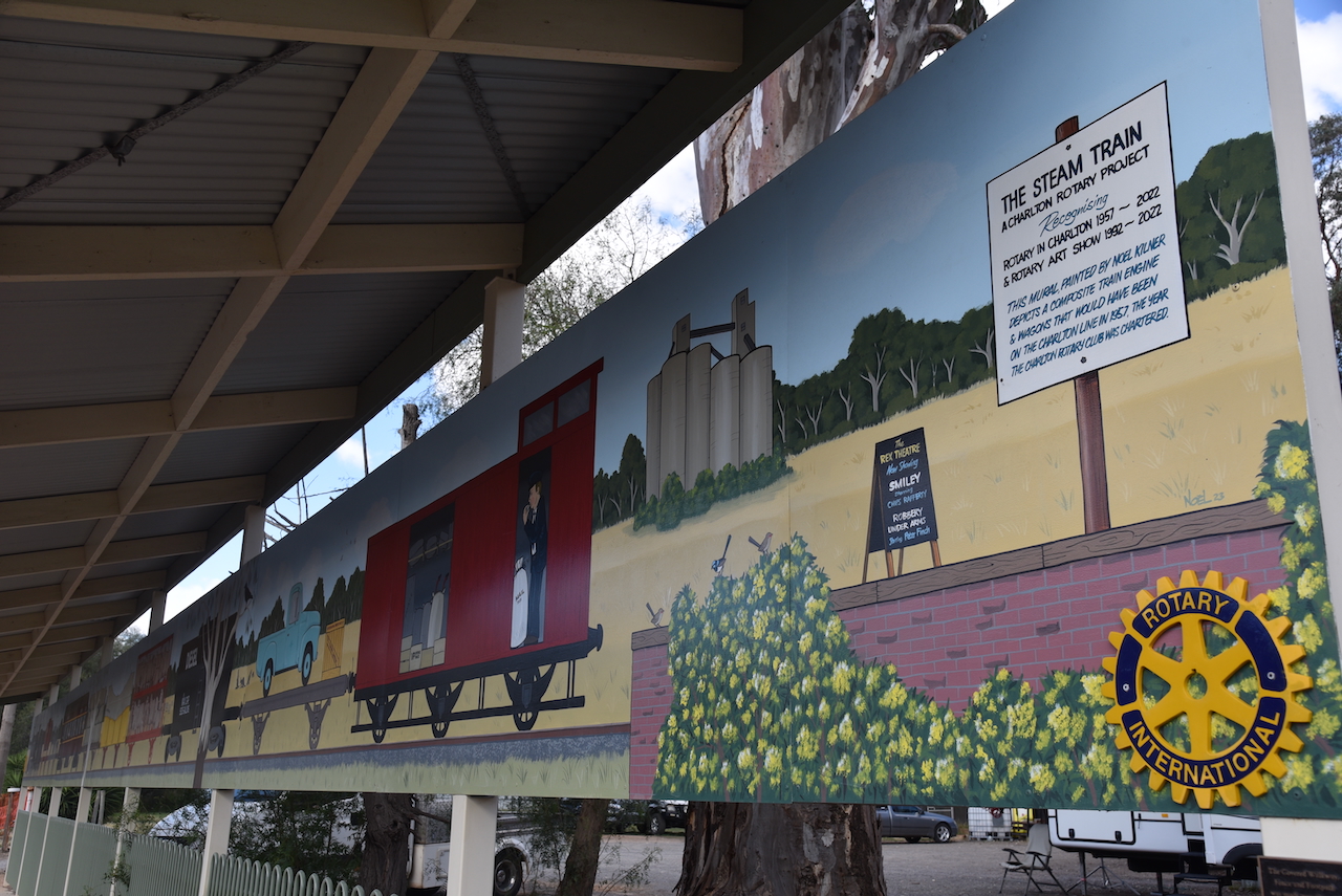
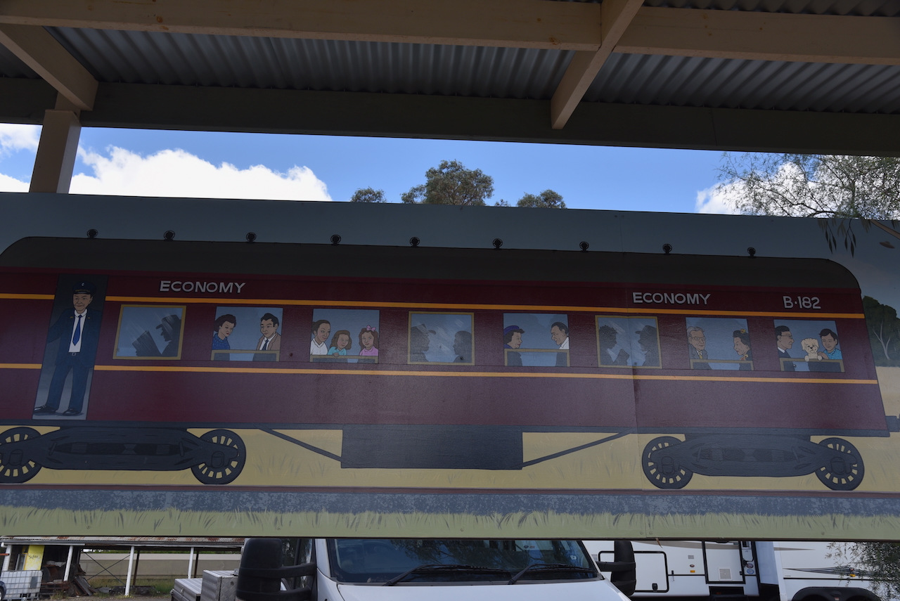
Charlton contains several murals that are all within walking distance.
Jack Fran from Adelaide painted the Permier harvester. His mural can be found at 40 High Street, Charlton. (WALLS 2021)
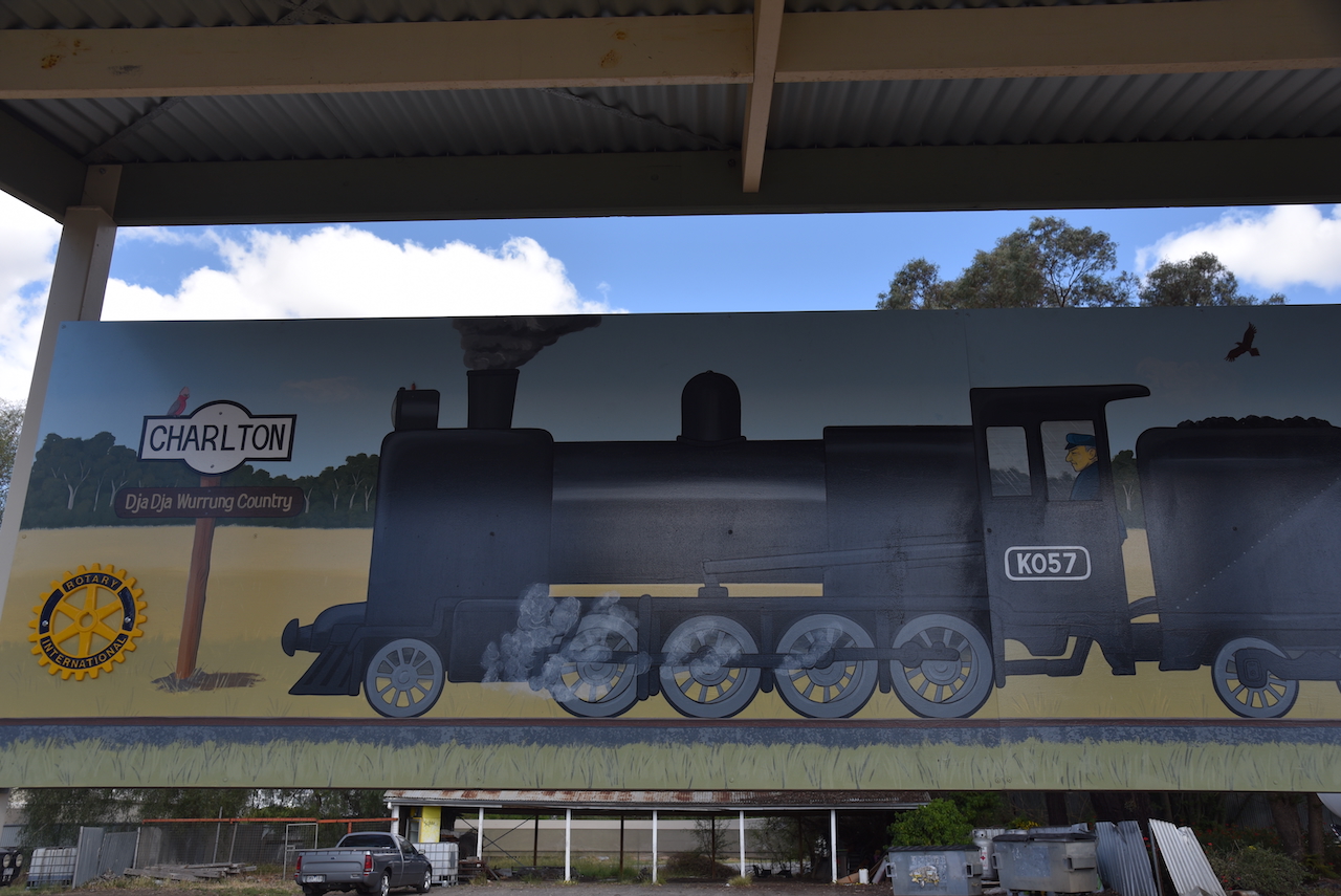
Adjacent to the bus station is a magnificent train mural. It was painted by Moel Kilner and depicts a composite train engine and wagons that would have been on the Charlton line in 1957, the year that the Charlton Rotary Club was chartered.
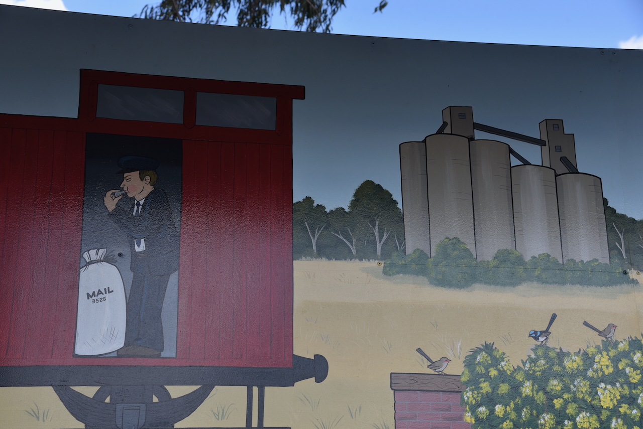
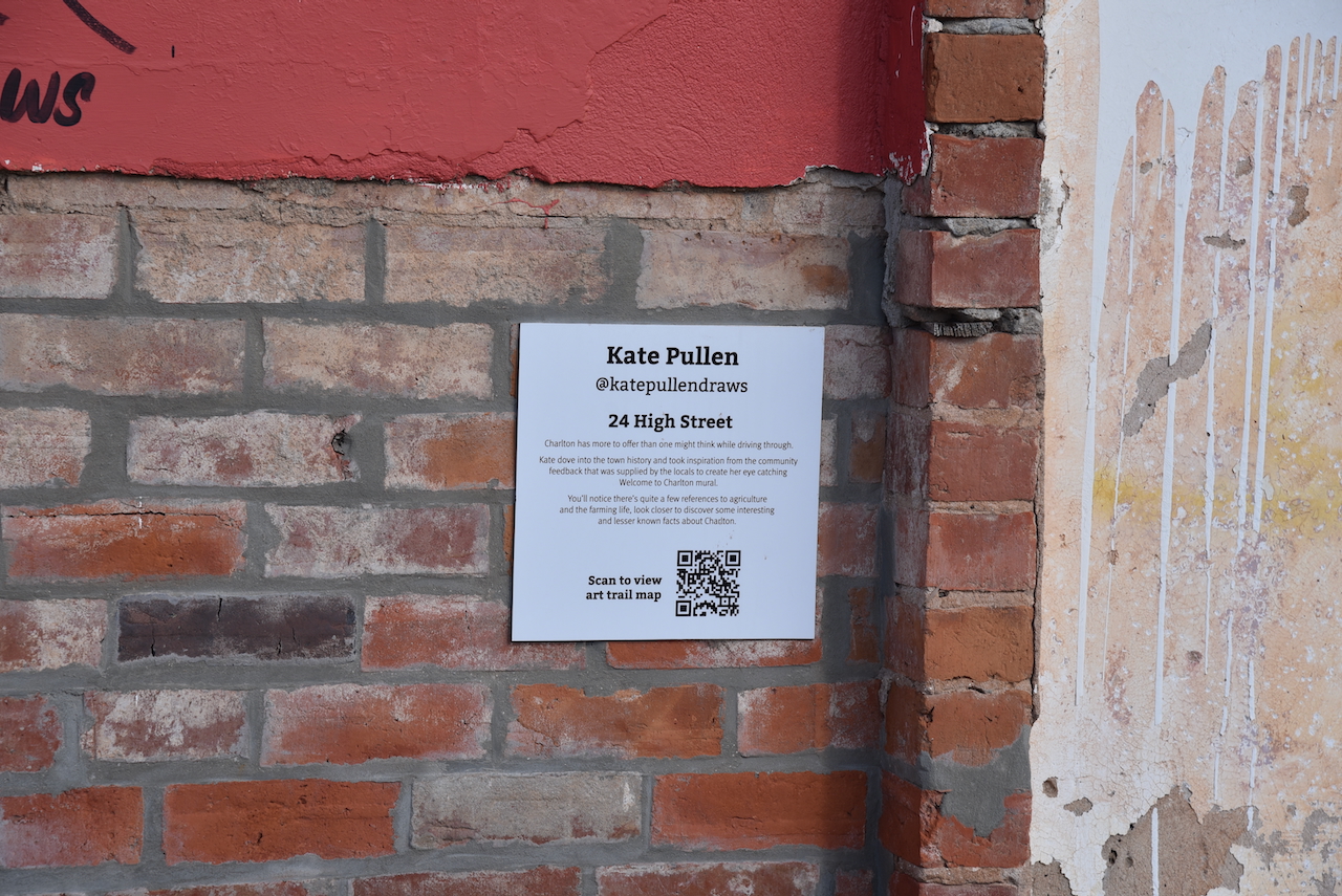
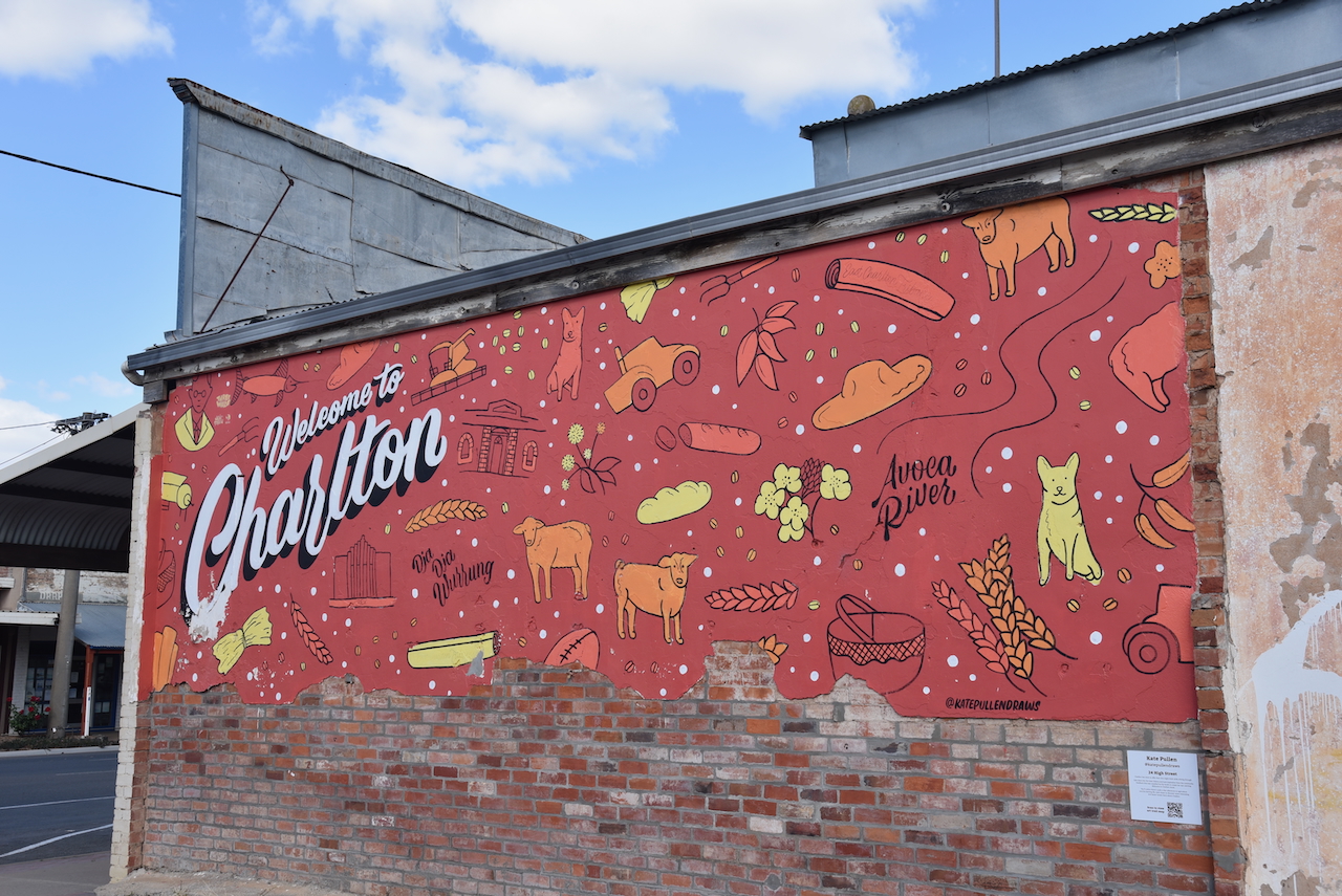
Located at 24 High Street is a mural welcoming visitors to Charlton. The mural features sheep and grain which reflects the district’s industry and is the work of Kate Pullen. (WALLS 2021)
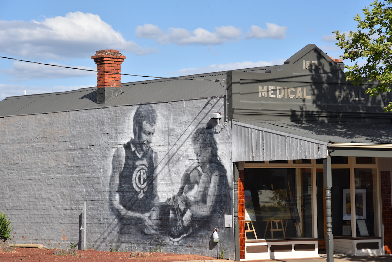
Located at 5 High Street is a football mural, the work of Kyke Torney. (WALLS 2021)
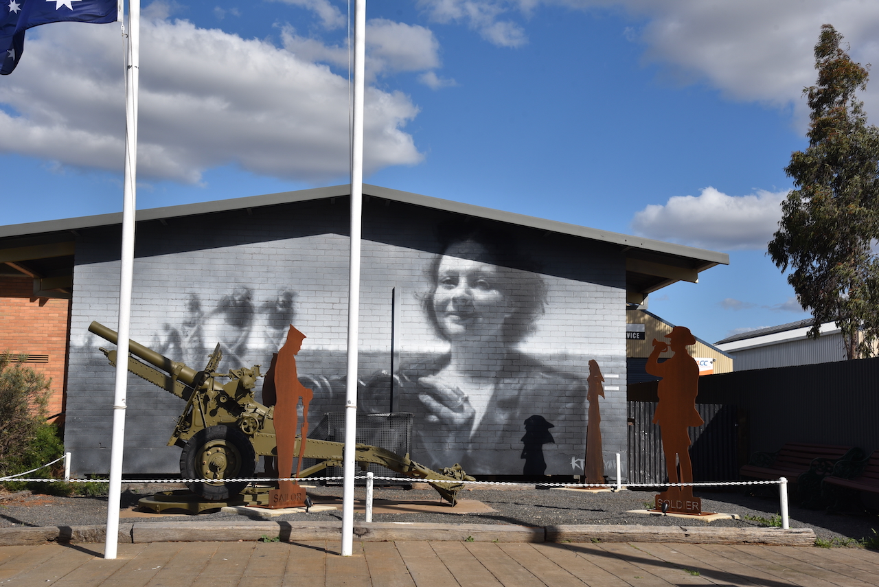
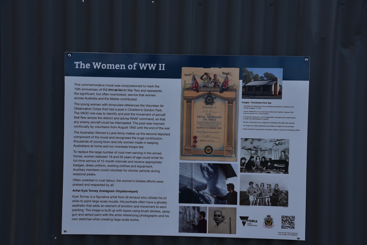
On Armstrong Street is a mural dedicated to the women of World War Two.
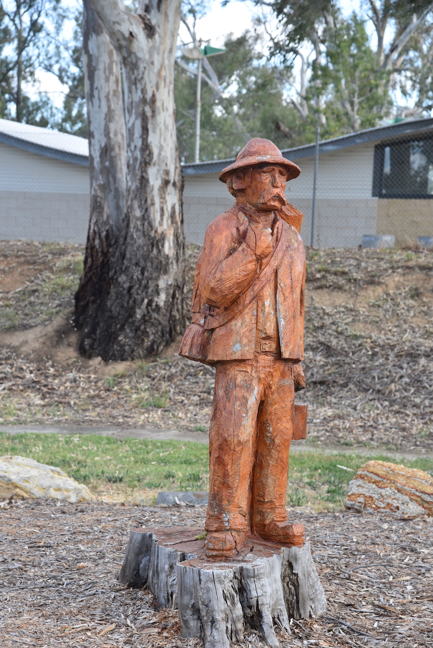
Next to the town’s playground and swimming pool is a wood carving
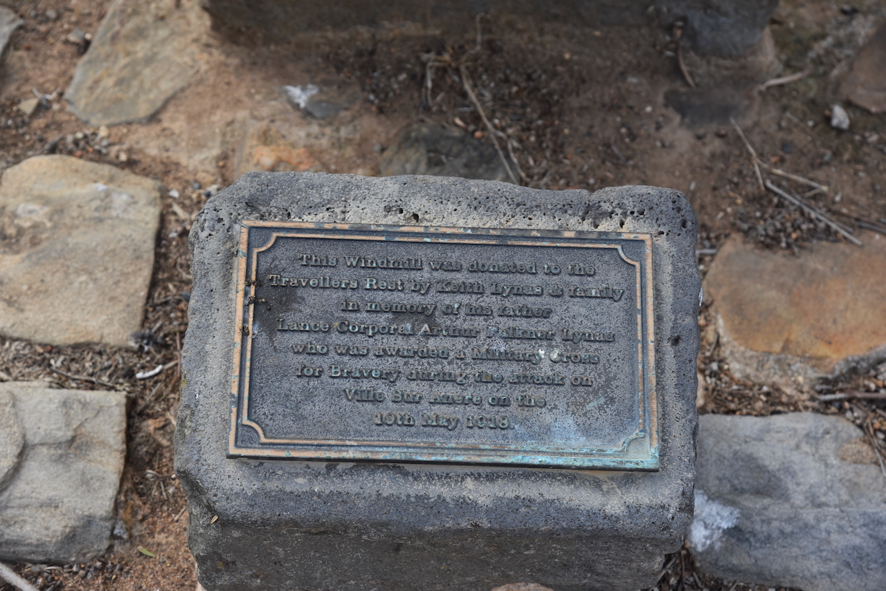
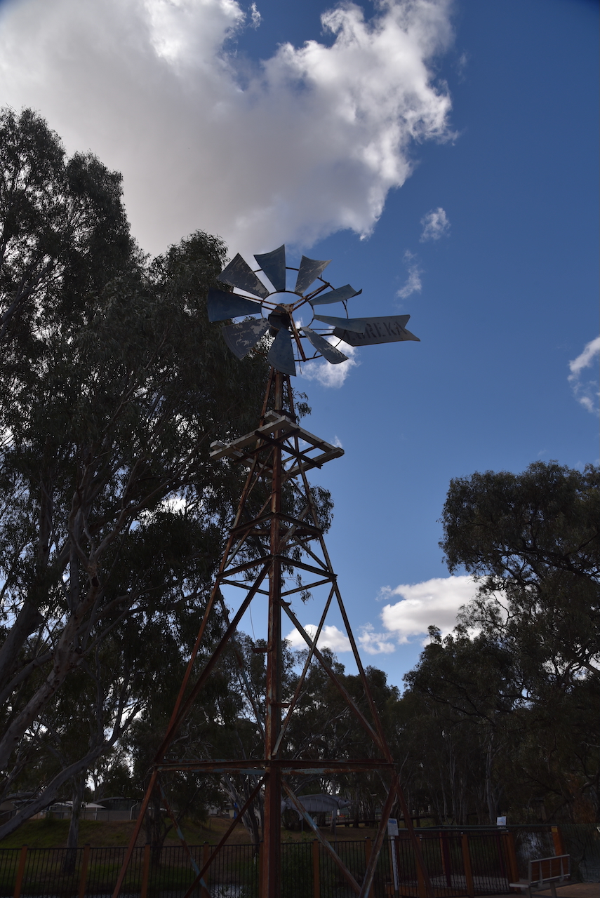
At Travellers Rest you can find an old windmill that was donated to the Travellers Rest by Keith Lynas and their family. It is in memory of his father Lance Corporal Arthur Falkner Lynas who was awarded a Military Cross for bravery during the First World War.
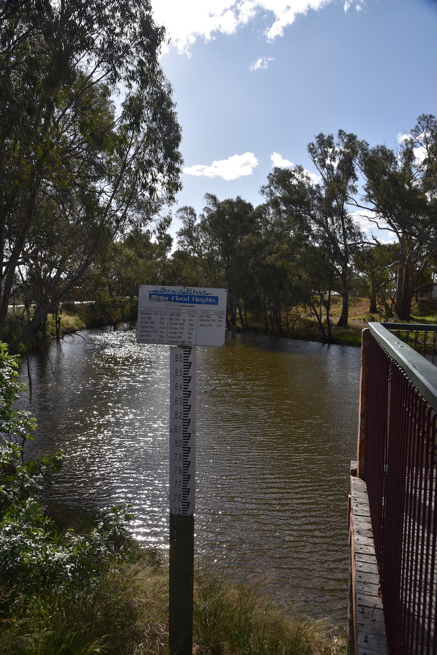
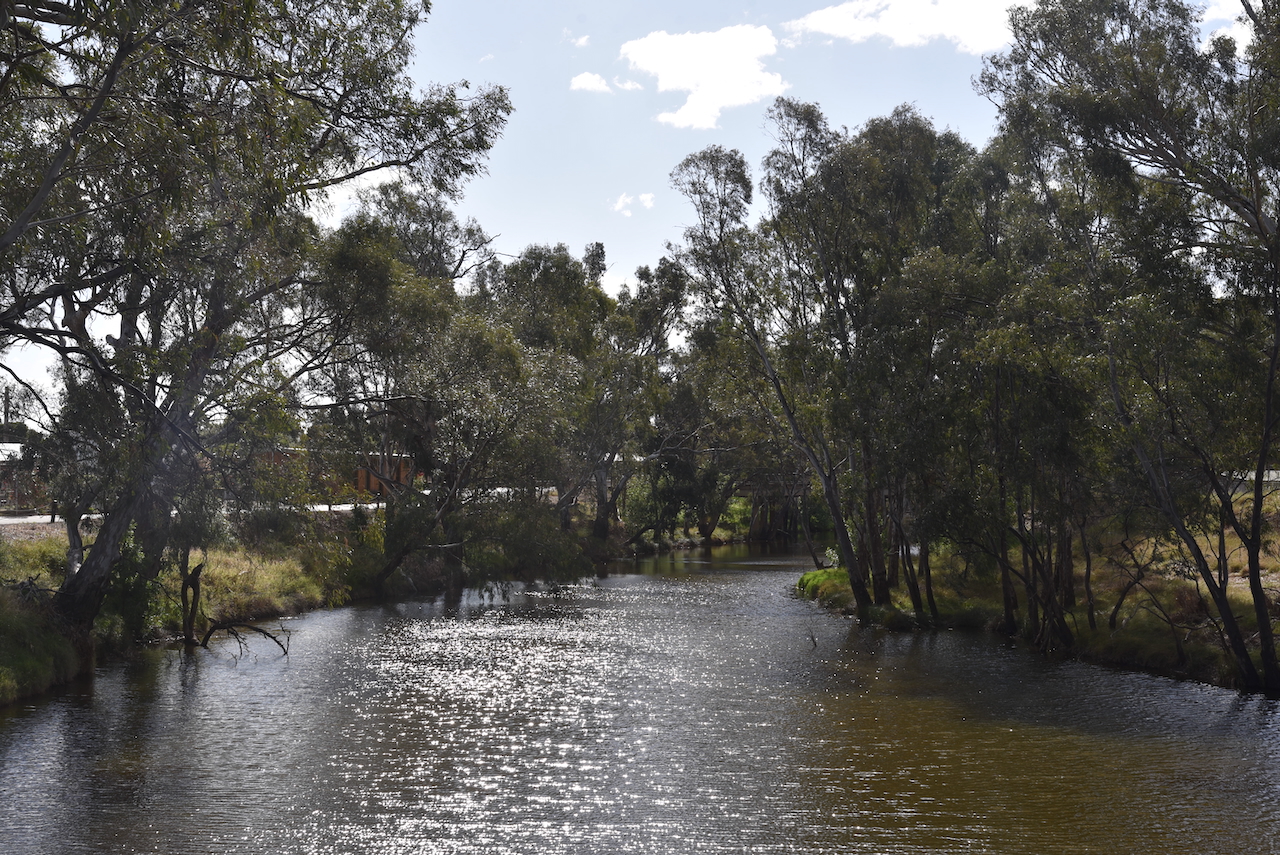
There are some nice views of the Avoca River here, including a flood marker. Charlton was flooded to record levels in January 2011. (Aussie Towns 2018)
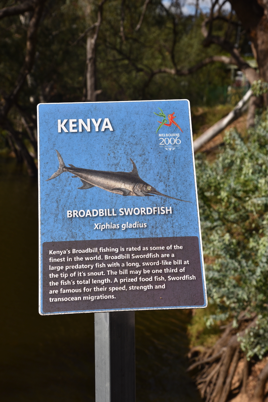
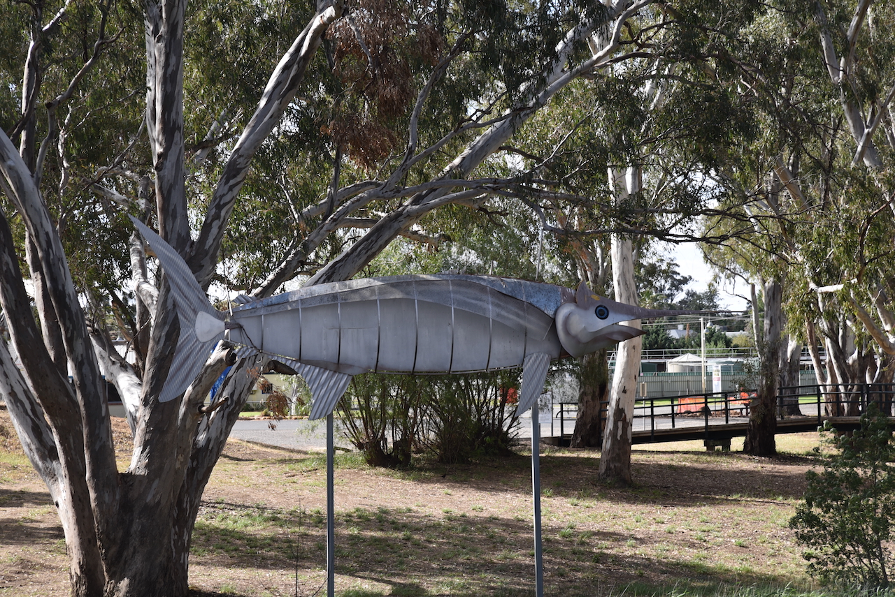
At this point across the river you can view ‘The Big Fish’, a Kenya Broadbill Swordfish which is a memento of the 2006 Commonwealth Games.
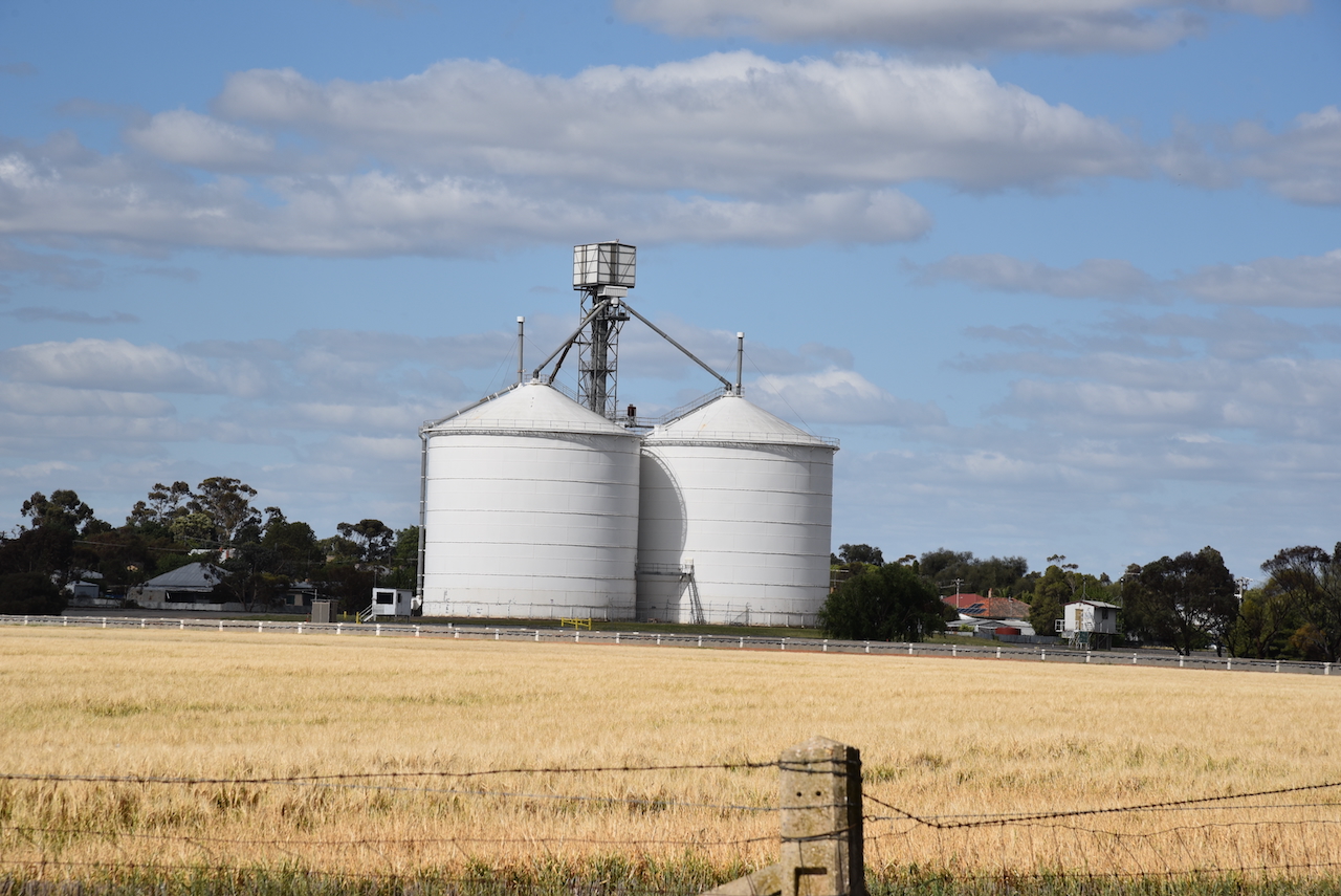
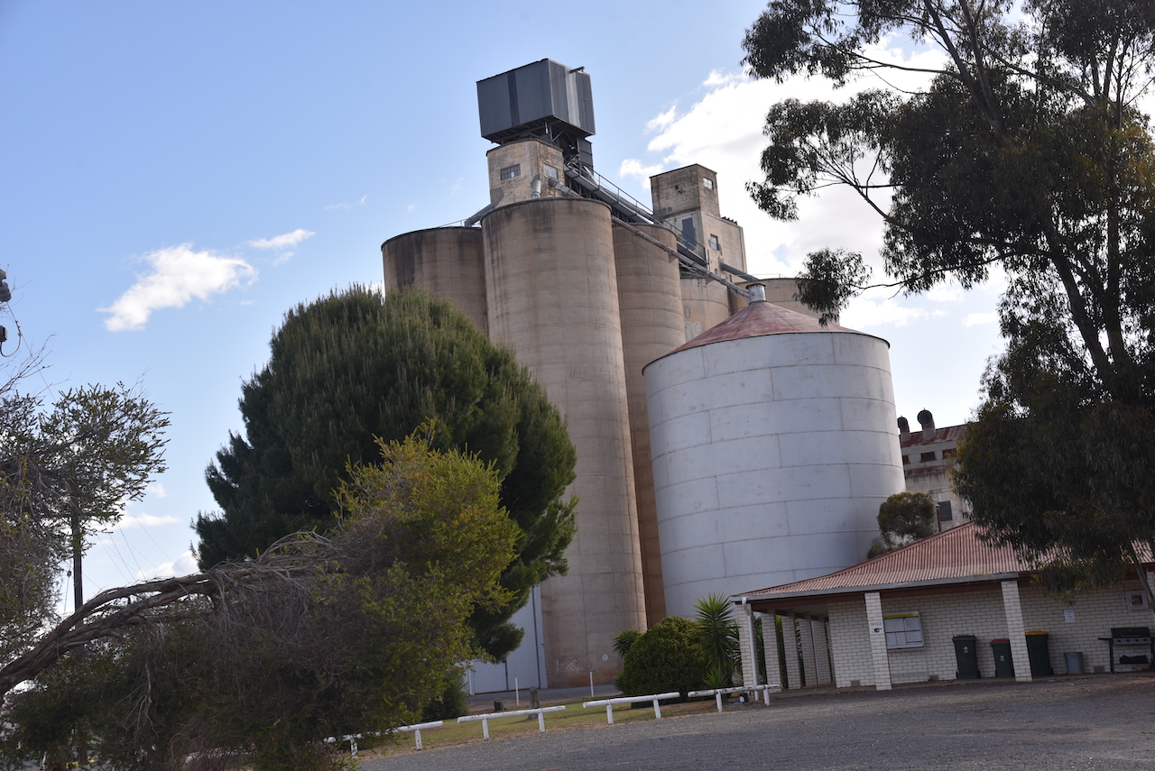
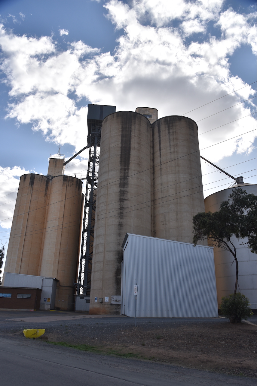
The Charlton silo VK-CHN3 is located in Kaye Street. It is operated by GrainCorp. Charlton NW silo VK-CHW3 is located on the northern side of Borung Highway in the northwest area of Charlton.
In 1876 a mill was built on the banks of the Avoca River by Mr. W.E. Foreman. (Victorian Collections, 2025)
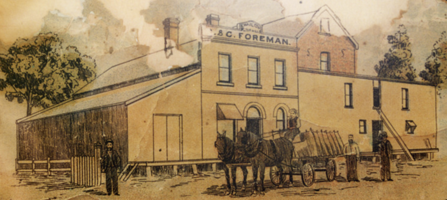
Above:- Charlton Steam Power flour Mill. Image c/o Victorian Collections.
It was acquired by the Noske brothers in 1919. A replacement mill was construced by the Noske’s and was opened on May 1927. By the 1970s it had been taken over by the Grain Elevator Board in the 1970s. (Victorian Collections, 2025)
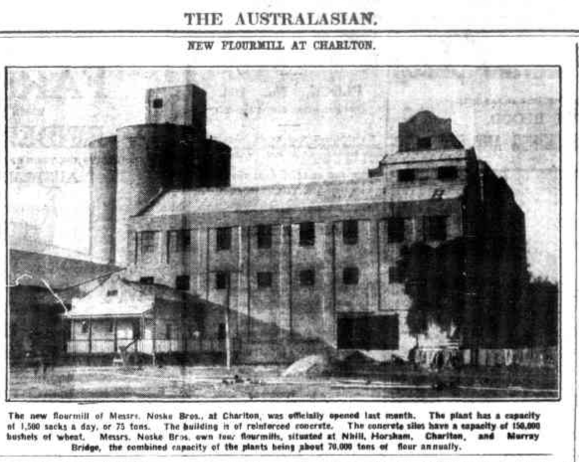
Above:- Article from The Australasian, Sat 2 Jul 1927. Image c/o Trove
Marija and I parked at Travellers Rest in the activation zone of both silos. We operated from the 4WD running the Icom Ic-7000, 100 watts, and the Codan 9350 antenna with the 1.5 metre stainless steel whip.
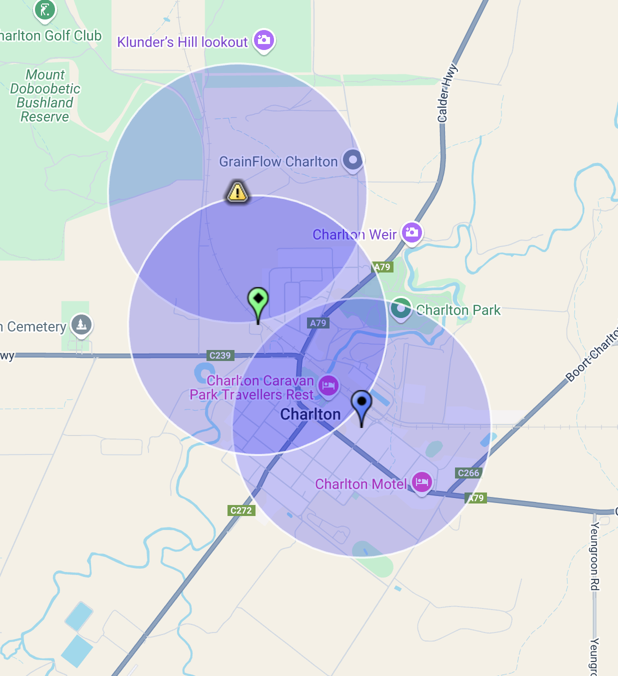
Above:- The activation zones of the two silos in Charlton. Image c/o SiOTA website.
The band conditions had not improved since our activation atDonald, and we just scraped by with three contacts each, qualifying the silos.
Marija worked the following stations on 40m SSB:-
I worked the following stations on 40m SSB-
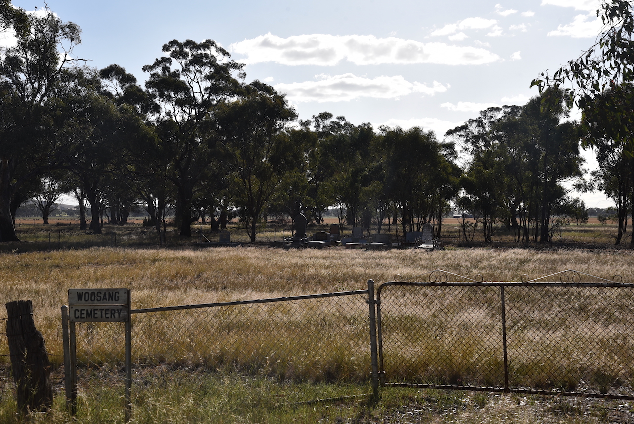
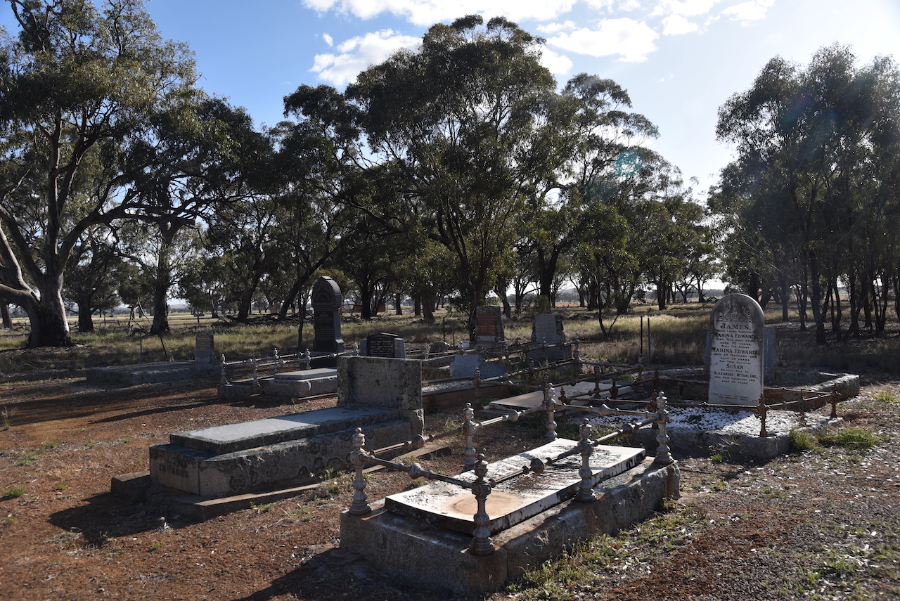
We left Charlton and headed to Bendigo about 106 km to the southeast. Along the way we stopped briefly at the Woosang cemetery which contains a number of historical graves.
We continued along the Calder Highway and soon reached the town of Wedderburn, about 70 km northwest of Bendigo. Gold was first discovered at Wedderburn in 1852. It was one of the most northwesterly goldfields from Melbourne. It is believed that Wedderburn is named after William Wedderburn who served on the goldfields in the Mounted Police. (Victorianplaces.com.au, 2015)

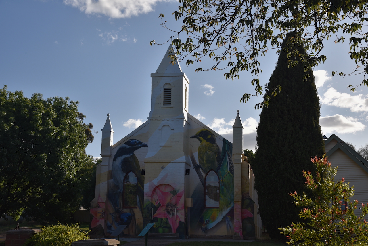
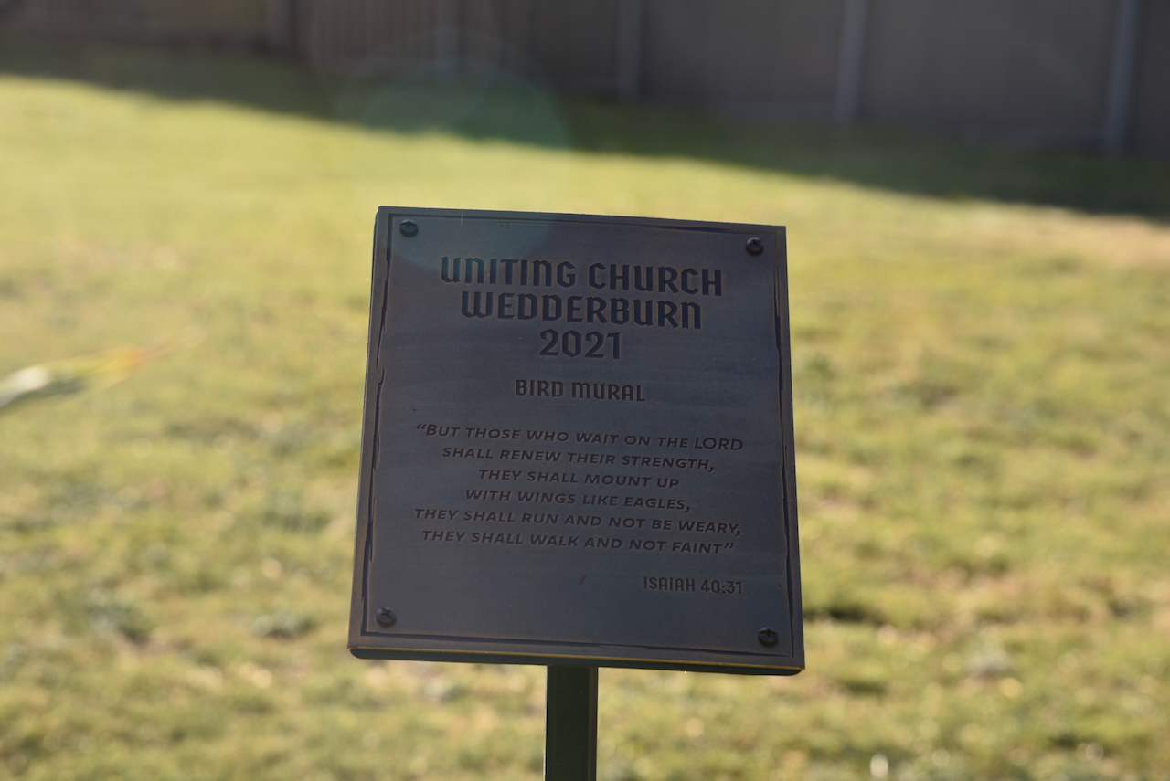
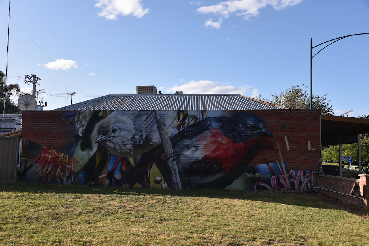
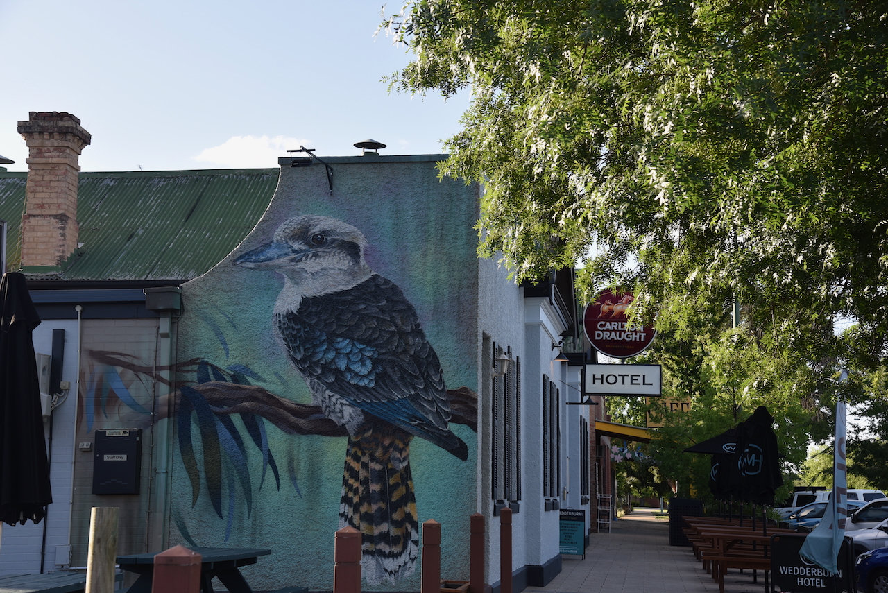
Wedderburn contains the ‘Birds Eye View’ murals. There are five large murals painted throughout the town that feature different bird species native to the district.
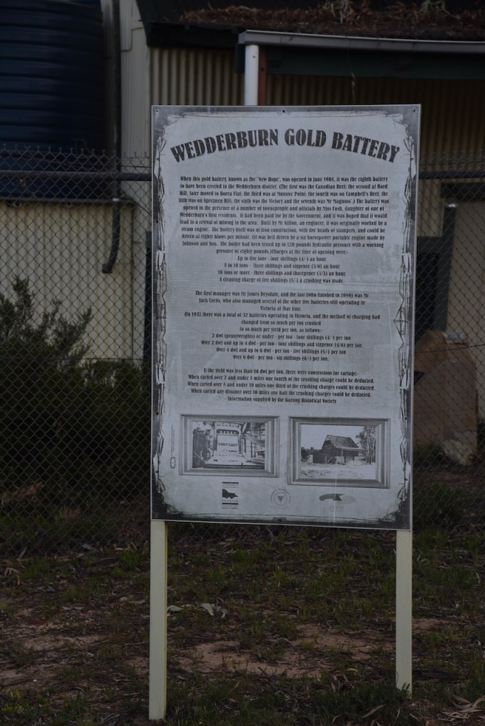
After looking at the impressive murals, we drove up to the site of the old Wdderburn god battery. It was opened in June 1905 and was known as ‘New Hope’.
Our next stop was the Wedderburn War Memorial located in Soldier’s Memorial Park at the corner of High and Chapel Streets.
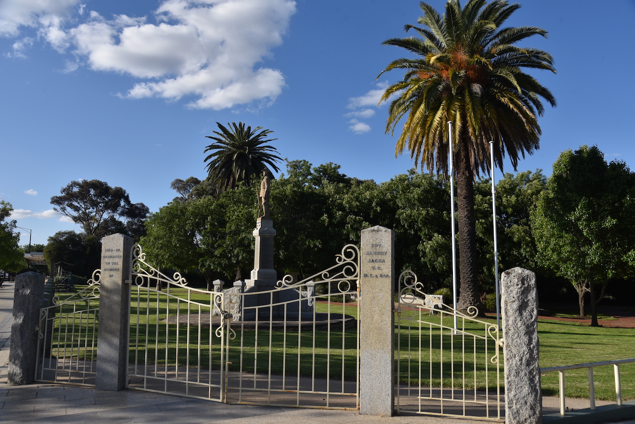
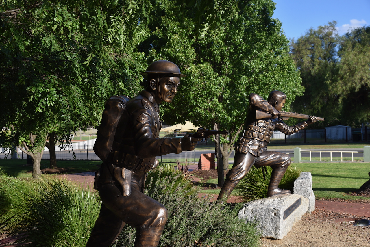
The park also features a monument to Captain Albert Jacka who was awarded the Victoria Cross. He was the first Australian in the war to earn the honour.
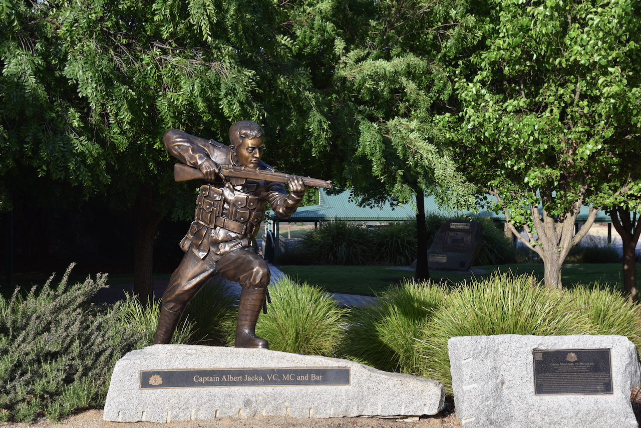
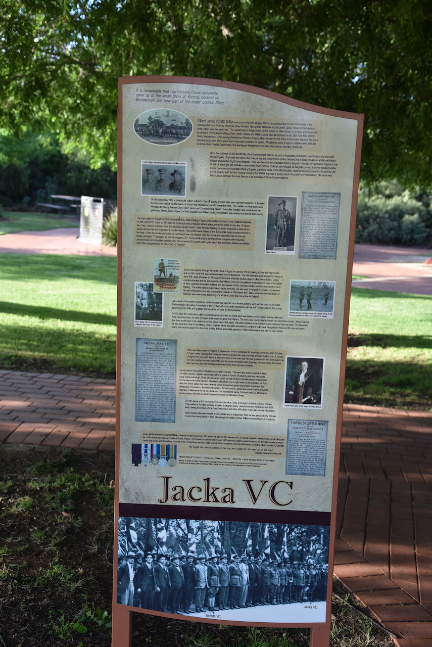
Below is an excellent video on Albert Jacka.
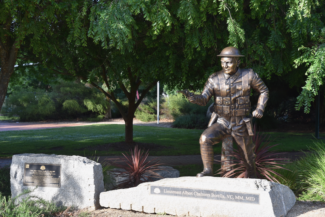
There is also a monument for Liutenant Albert Chalmers Borella, another Victoria Cross recipient.
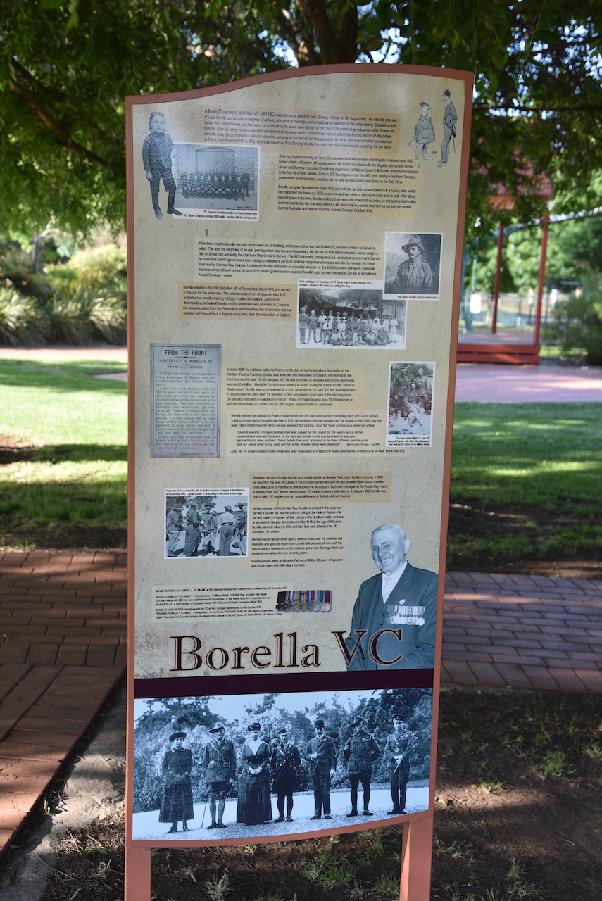
Below is a video on the life of Albert Borella.
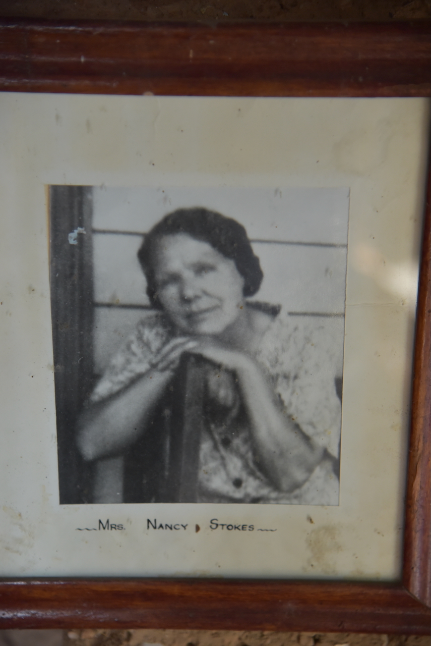
Marija and I then visited Nancy Stokes Cottage built during the 1930s by Nancy Stokes and 11-year-old Brce Robertson, following the death of Nancy’s husband. Nancy continued to live in the little cottage until 1979. She passed away in 1982 at age 93. (Raftis 2023)
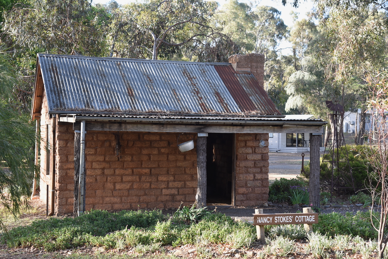
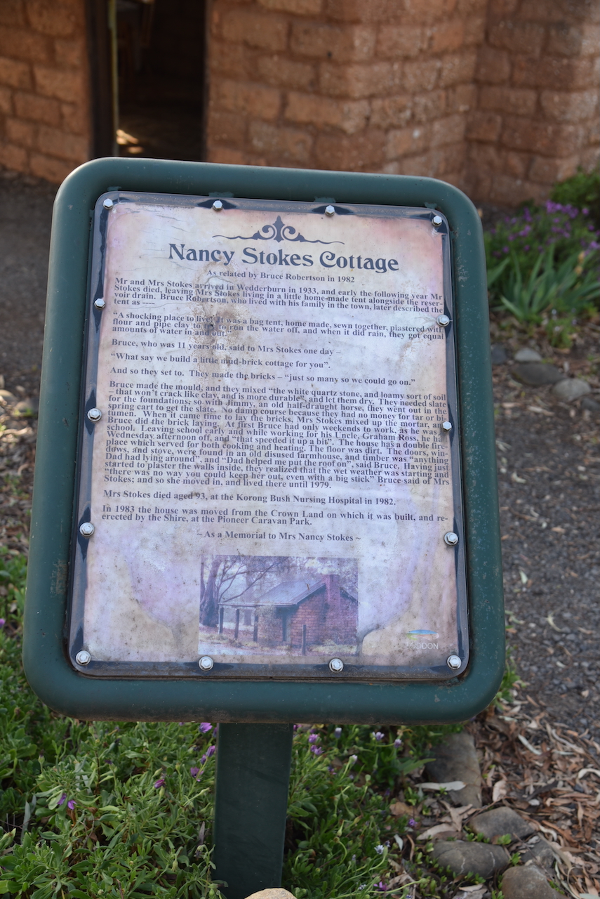
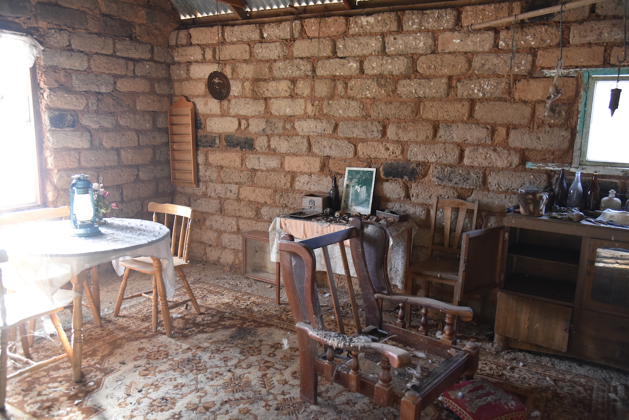
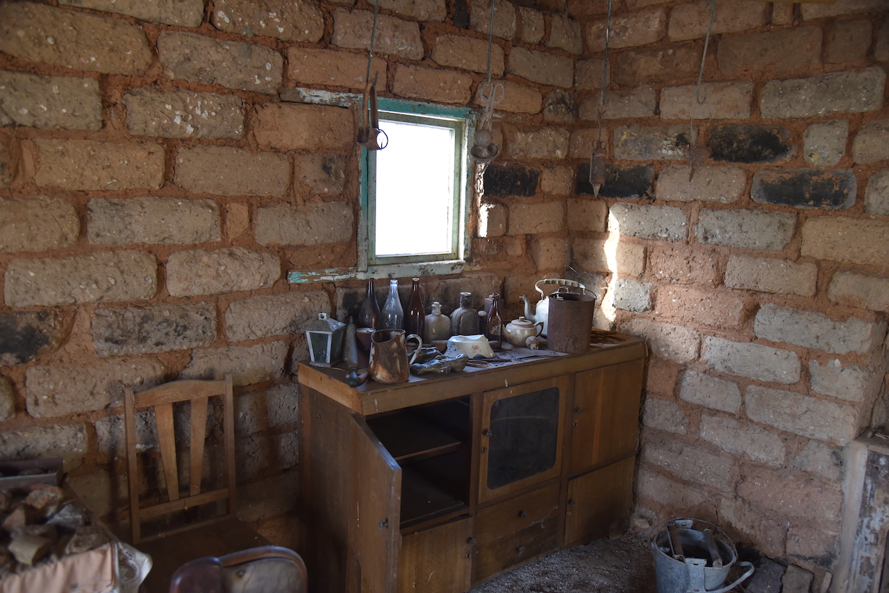
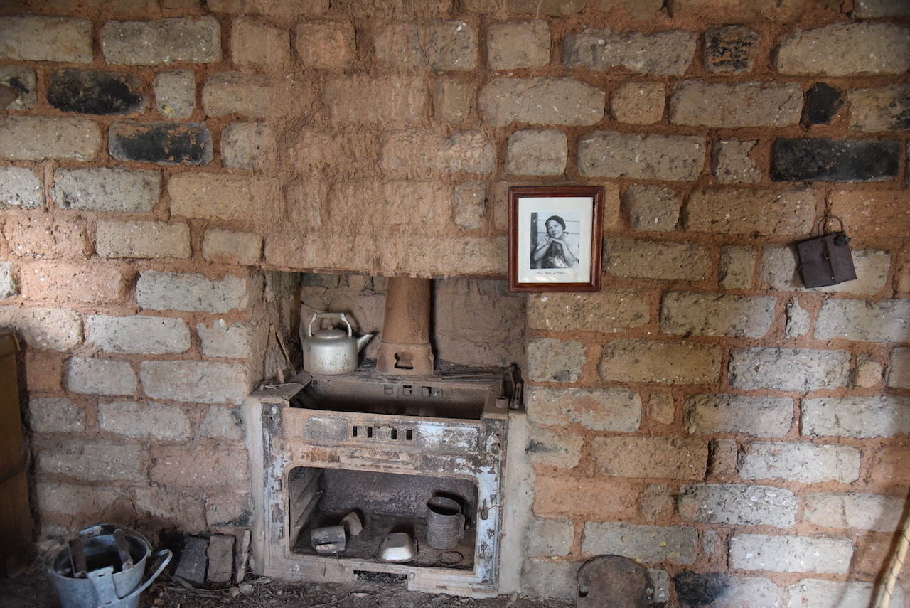
Nancy continued to live in the little cottage until 1979. She passed away in 1982 at age 93. (Raftis 2023)
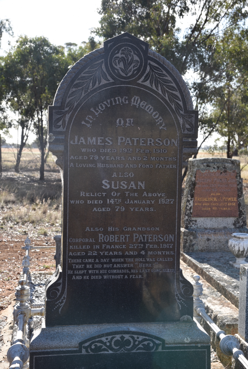
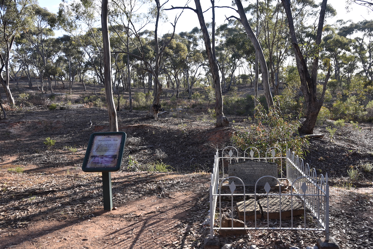
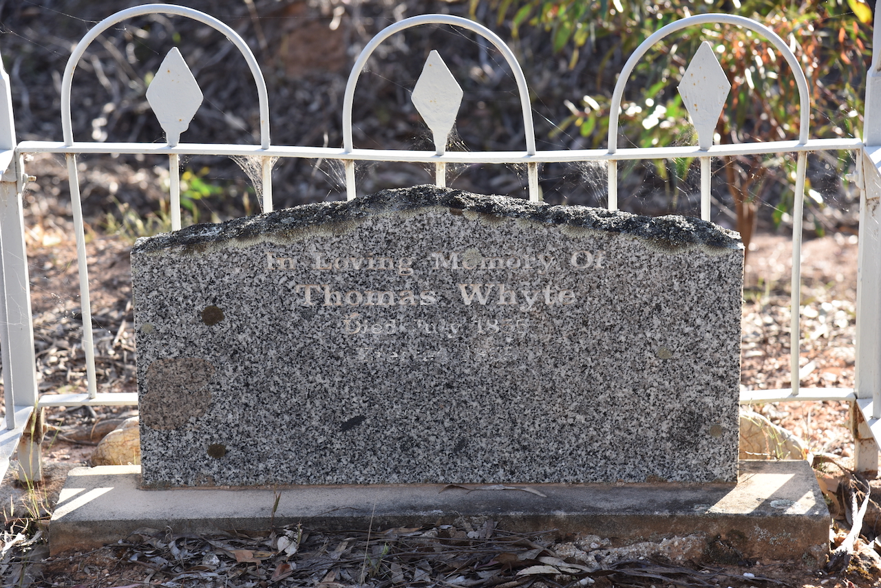
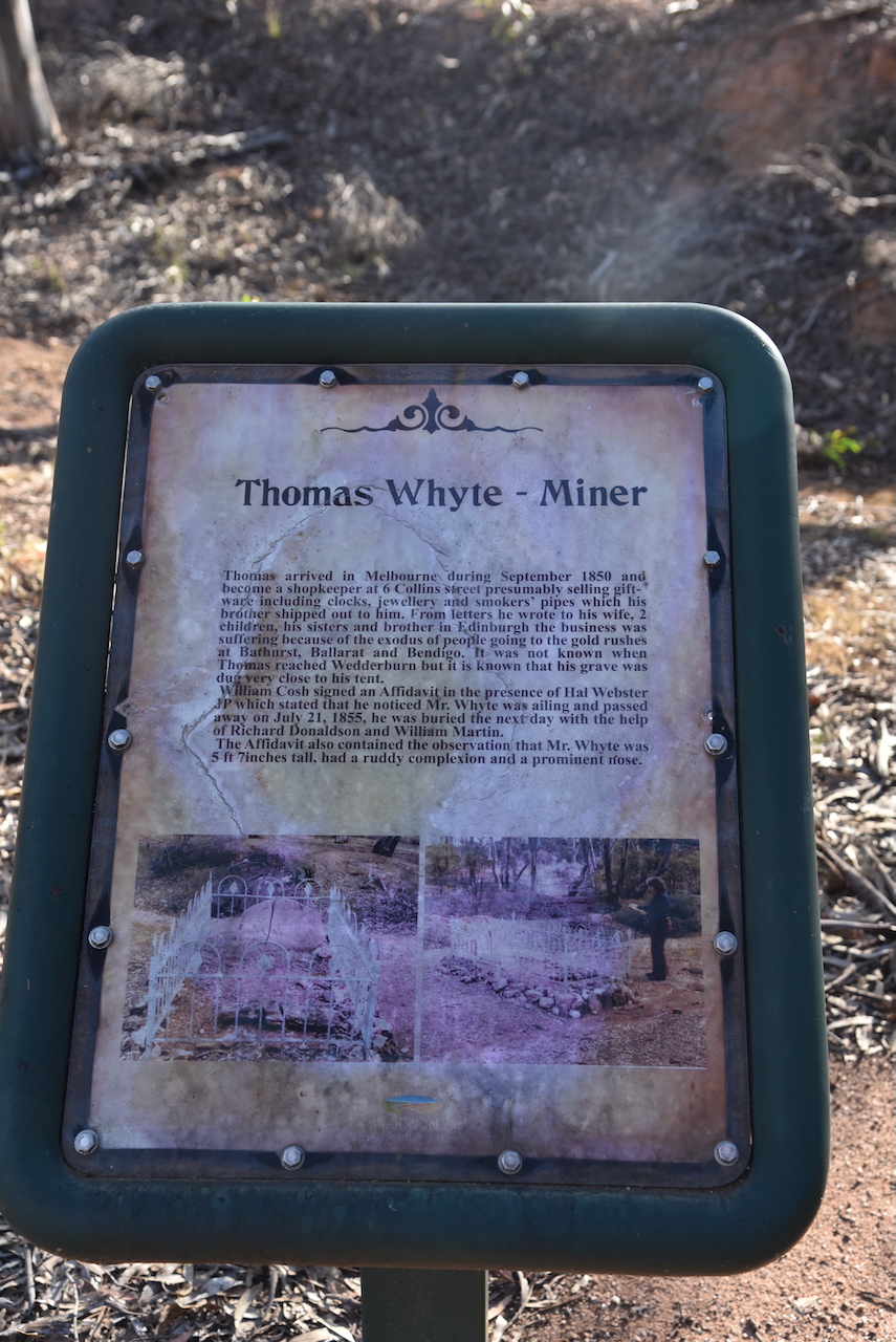
We then visited the headstone of Thomas Whyte, a miner who arrived in Melbourne in 1859. He initially was a shopkeeper in Collins Street He wrote letters to his family in Edinburgh advising that his business was suffering due to the exodus of people to the goldfields. Thomas in turn travelled to Wedderburn and died on the 21st day of July 1855.
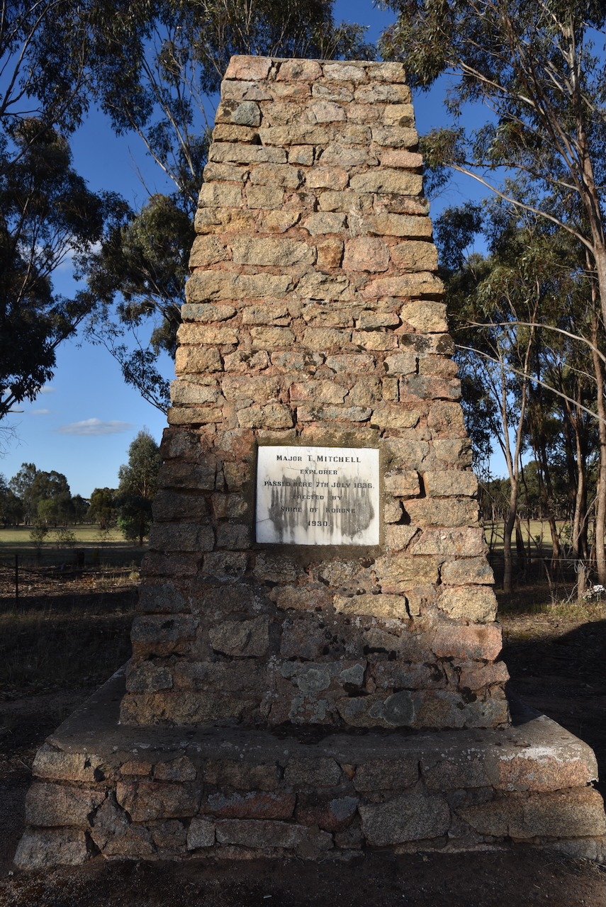
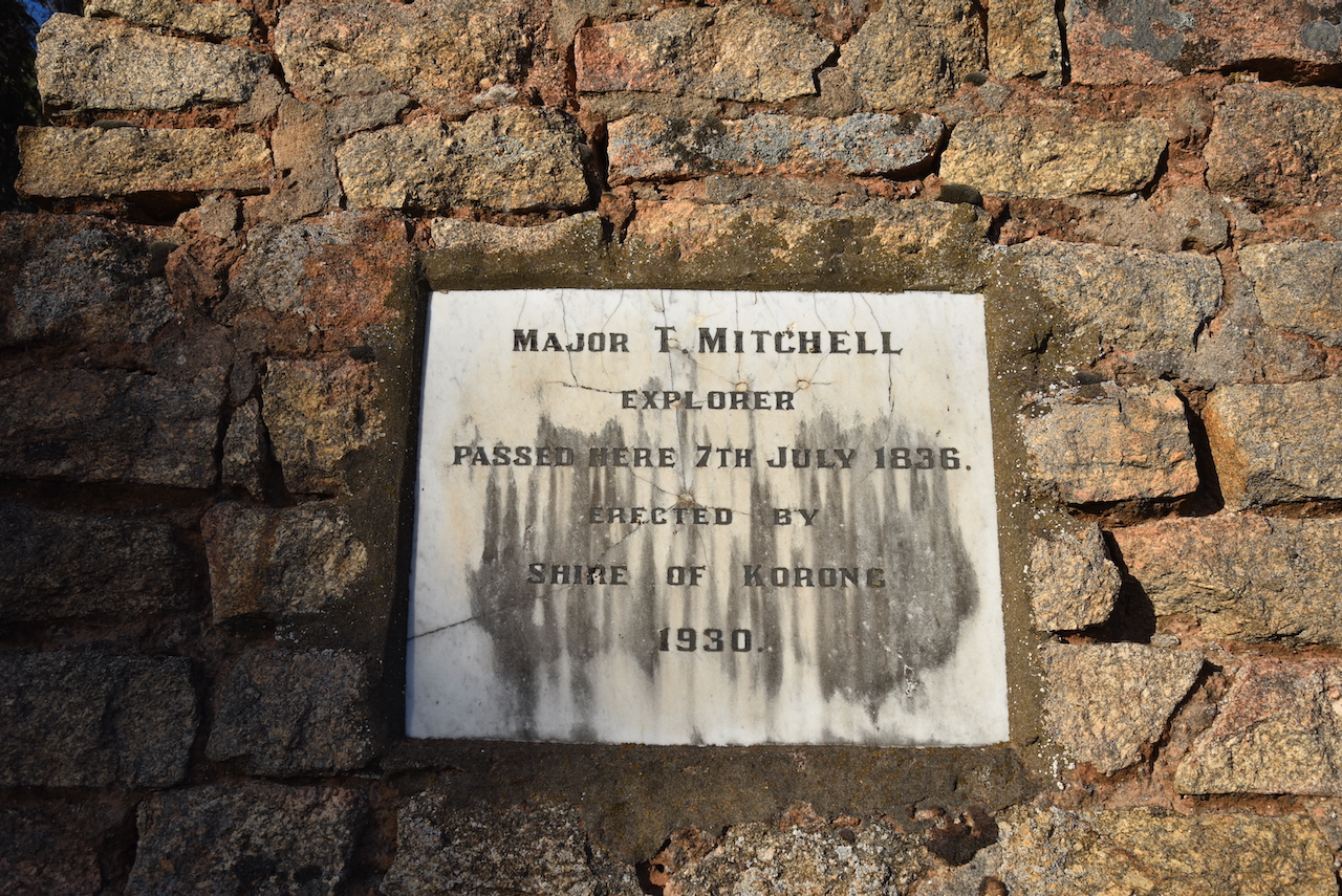
Our final stop before reaching Bendigo was the Major Mitchell monument on the Calder Highway, about 5 km south of Wedderburn. Mitchell passed this location on the 7th day of July 1836.
We then drove into Bendigo and booked into our accomodation at the Quality Hotel Lakeside.
That evening we enjoyed a very nice meal at the hotel before heading back to the motel room for some preparation for the 2024 VKFF National Get Together.
References.
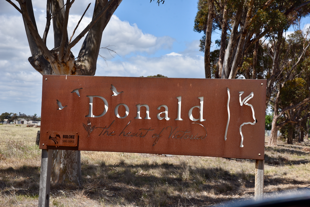
After leaving the Carron I124 Bushland Reserve on 24th October 2024, Marija and I travelled to Donald where we intended to activate the two silos, Donald silo VK-DND3 and Donald South silo VK-DNT3.
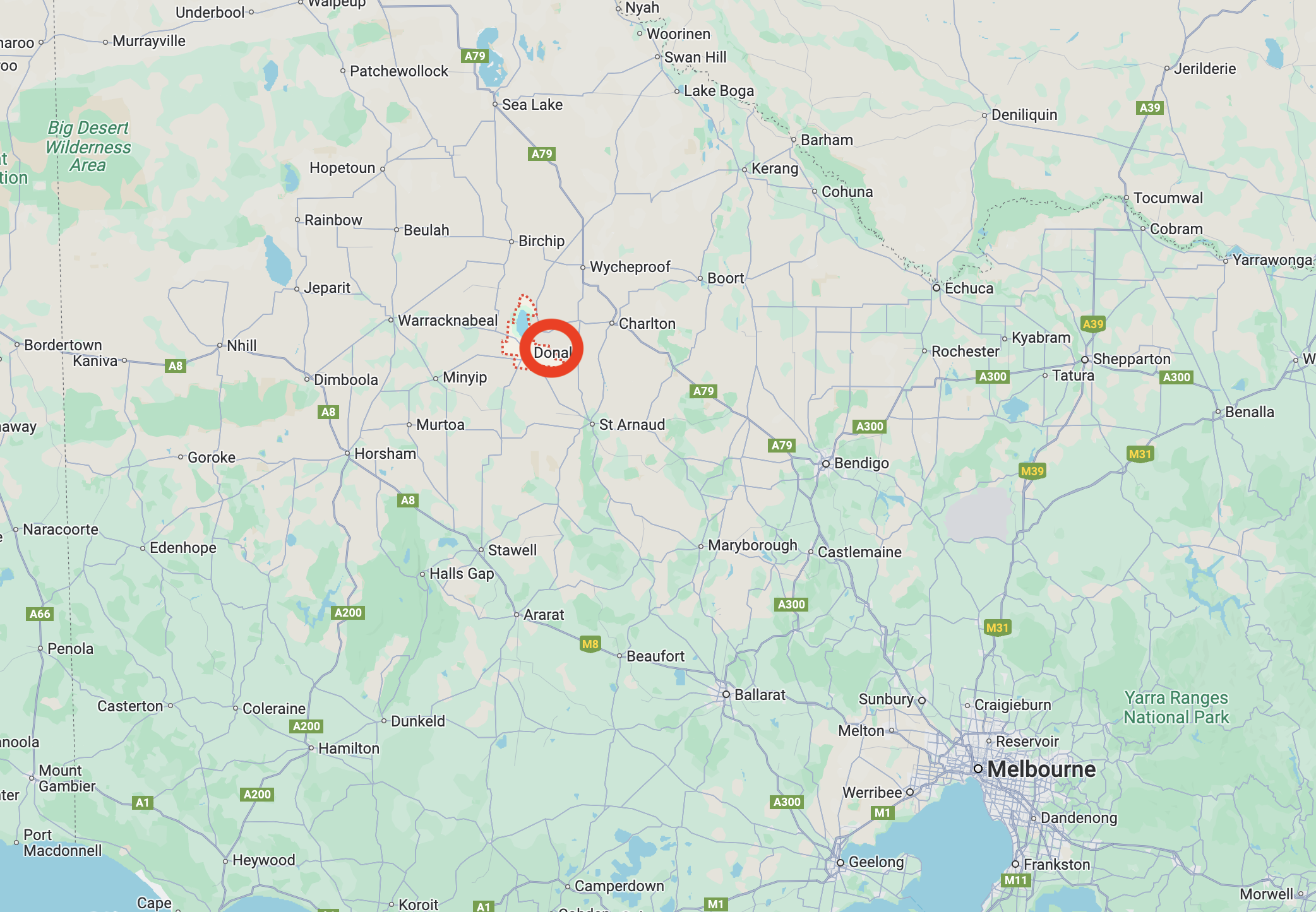
Donald is a town of about 1,400 people and is a service centre for the surrounding district which grows wheat, barley, peas, lentils, canola, safflower and lambs and wool. The town lies on the banks of the Richardson River. Donald is known as the ‘Home of the Duck’ due to the large number of waterbirds located on the local waterways. (Aussie Towns 2018)
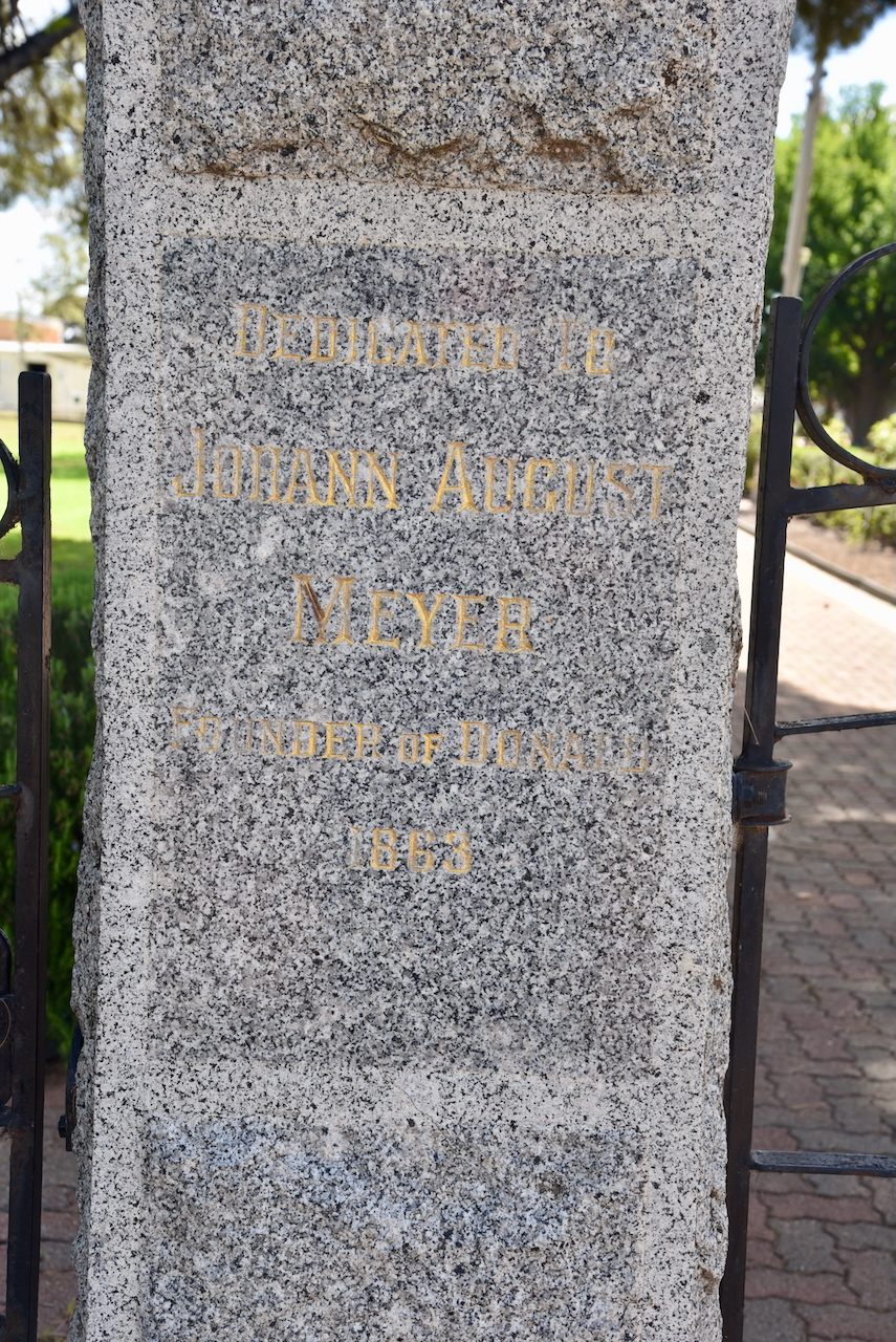
The town was named after the Donald family from Scotland. In 1844 William, John and James Donald established ‘Banyenong’ pastoral run. Banyenong was an aboriginal word meaning ‘plenty of water’. By 1863 a store and liquor shanty had been established alongside of a bridge crossing the Richardson River, upstream from Benyenong homestead. The proprietor was Johann August Meyer. His establishment was met with strong disapproval by William Donald and other pastoralists in the district. (Donaldhistory.org.au 2018) (Trove 2025)
The following year in 1864 the bridge was relocated and Meyer constructed a weatherboard store and hotel at the site of the present Mount Jeffcott Hotel. Edward Miller then built the Royal Hotel and the town became known as Richardson Bridge. Two years later, the name ‘Donald’ appeared on survey maps. (Donaldhistory.org.au 2018)
By the 1870s the town had several stores, blacksmiths, bakers, and flour mills. The railway reached the town in 1882. (Donaldhistory.org.au 2018)
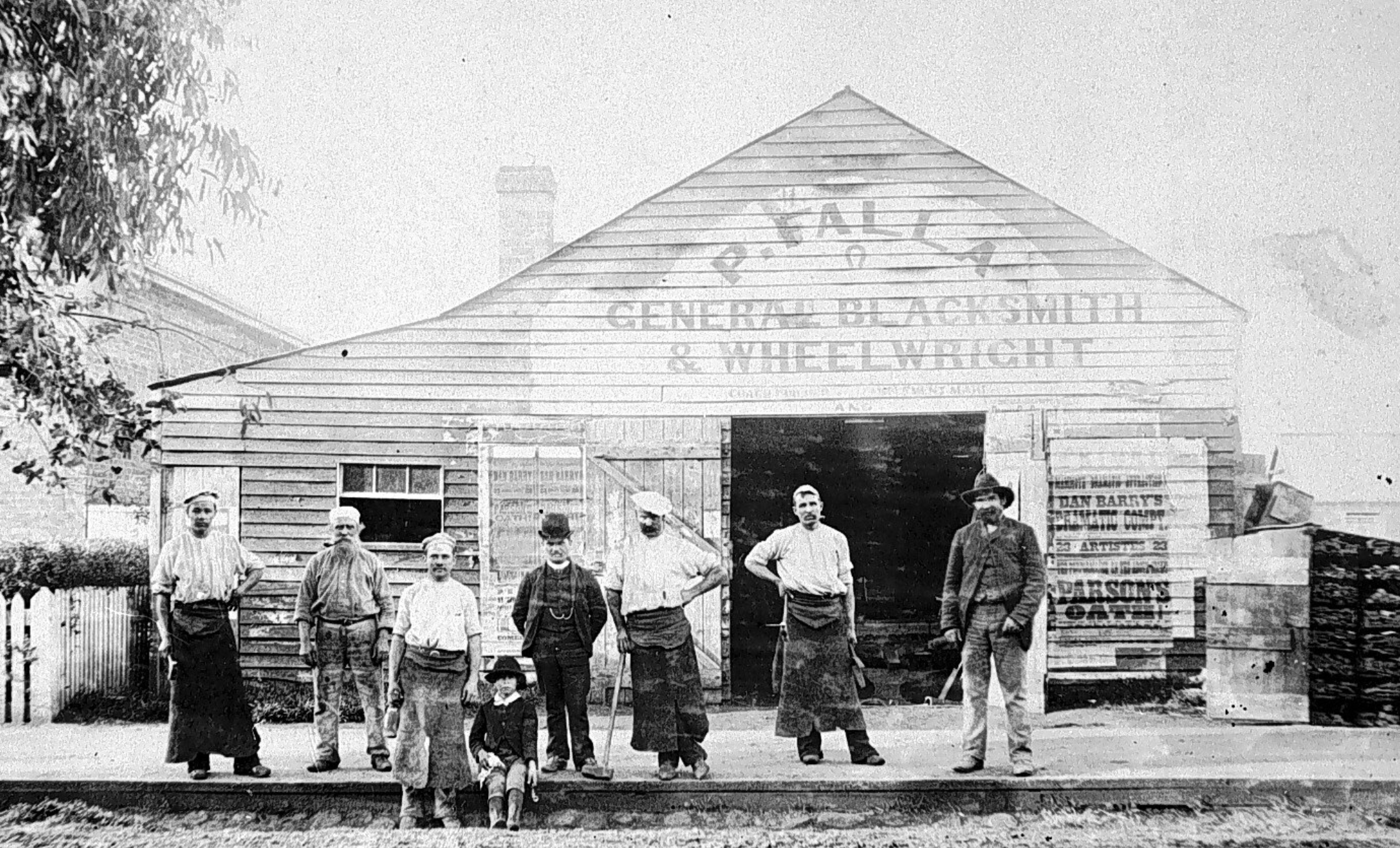
Above:- Falla General Blacksmith & Wheel-Wright, c. 1895. Image c/o Lost Country Victoria Facebook page
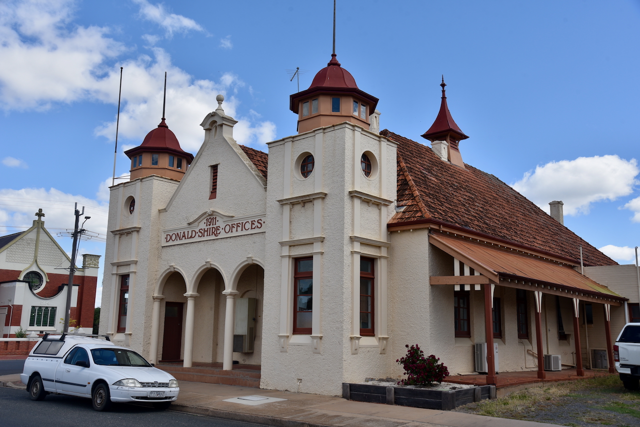
Donald is a beautiful little town with lots of historic buildings.
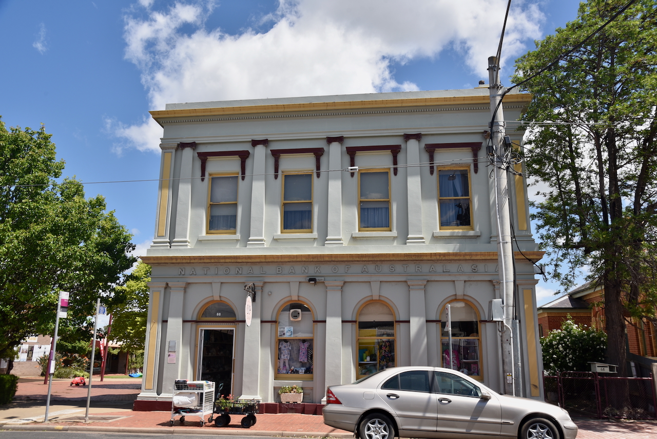
The old National Bank building is located in Wood Street. It as built in 1885 by the Colonial Bank. The manager’s residence was above the bank chambers. In 1918 the Colonial Bank was amalgamated with the National Australia Bank (NAB) in 1918 it became a NAB bank. The NAB later amalgamated with the CBC and the building was sold. (Aussie Towns 2018)
The M.E. Morgans building on the main street of Donald was built in 1906. (Aussie Towns 2018)

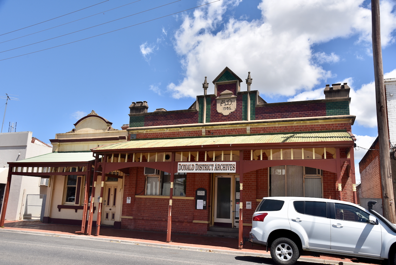
The old Oakley Thompson building on Woods Street was built in 1906. It is now the Donald District Archive. (Aussie Towns 2018)
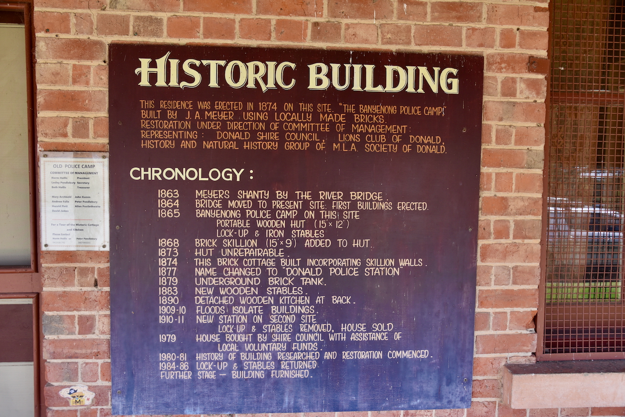
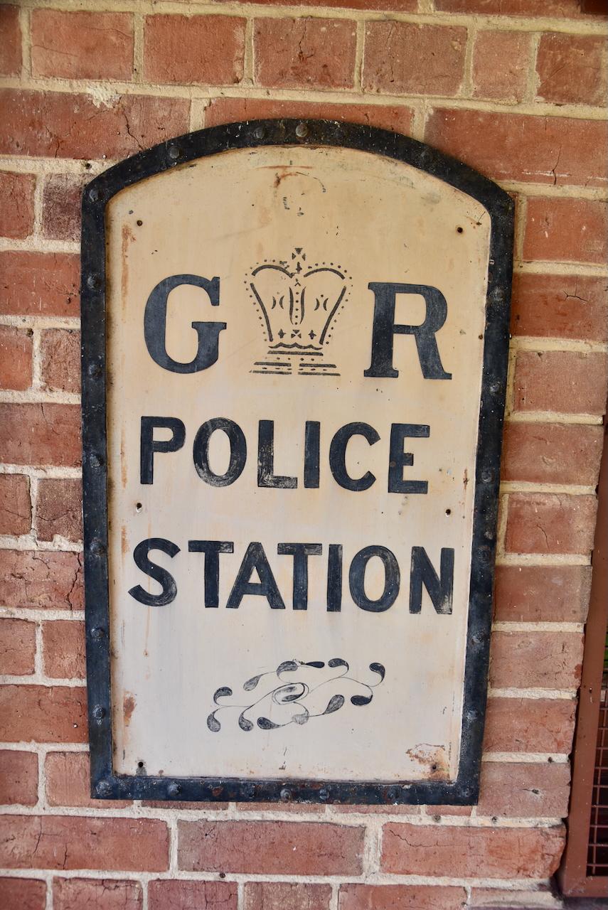
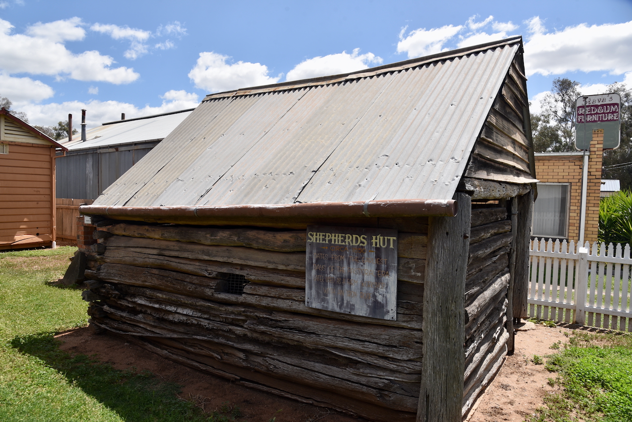
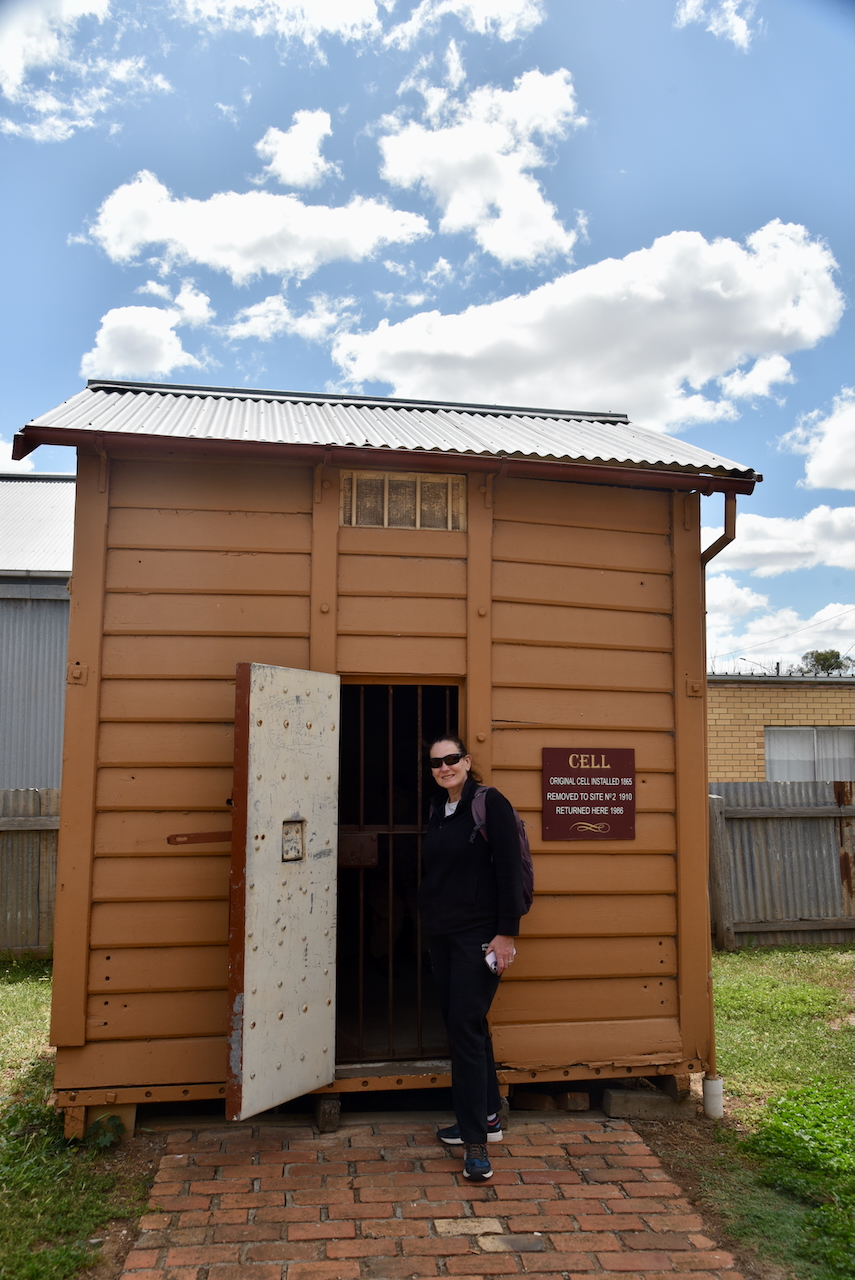
After having a quick look around the town, Marija and I visited the Old Police Camp. This was the first police station in the Donald district. It is located on Wood Street and was known as Richardson Crossing. The police building is a small four-roomed house constructed in 1869. It was established to control the drunken behaviour of shepherds. (Donaldlearninggroup.com.au, 2024)
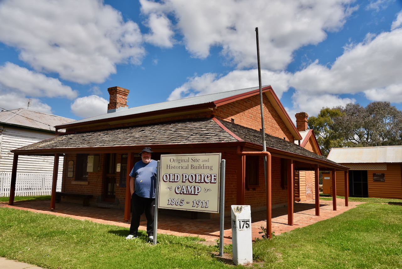
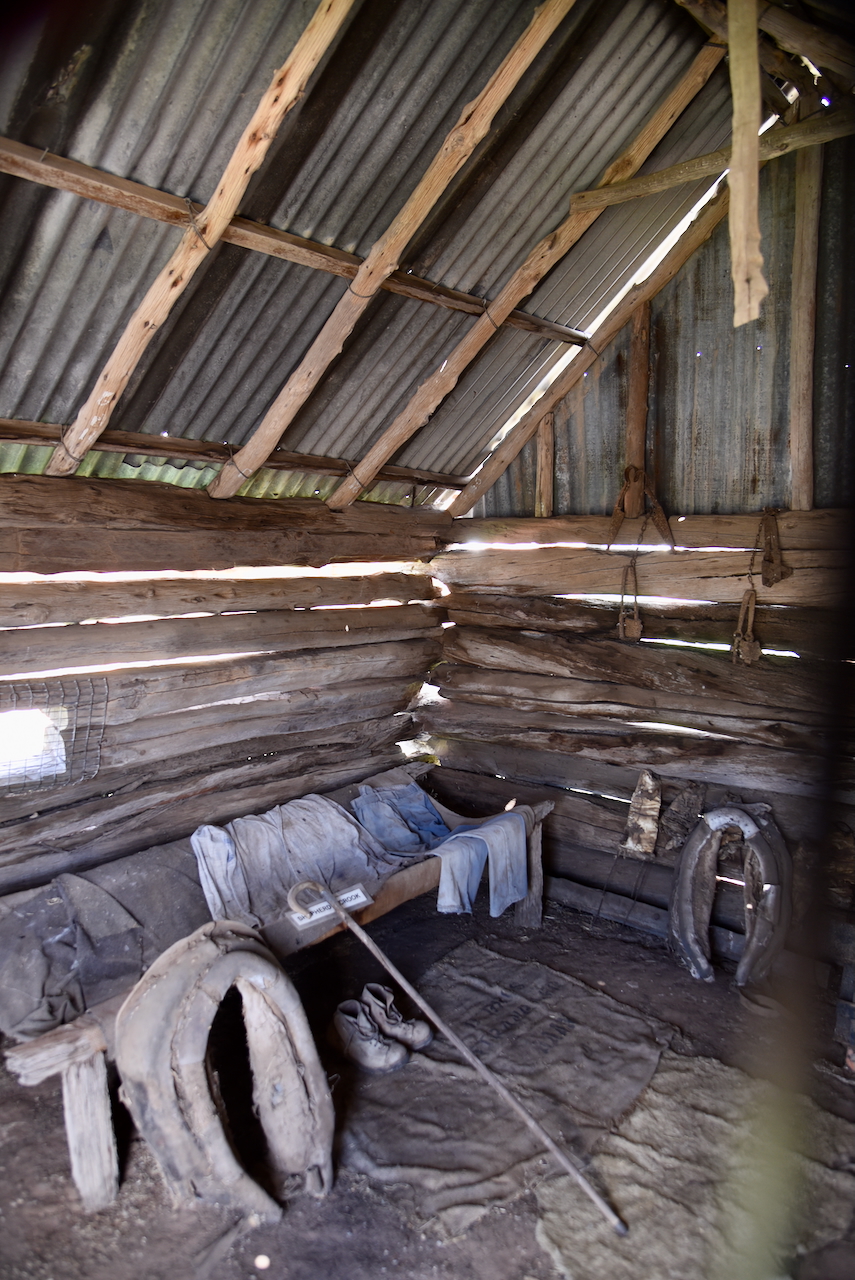
The site contains other historical buildings that have been relocated from farms in the district. This includes an old shepherd’s hut from the 1840s. (Donaldlearninggroup.com.au, 2024)
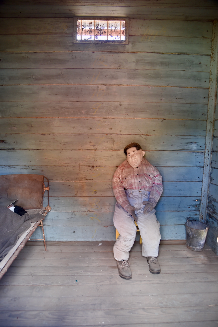
The park contains the original cell from 1865.
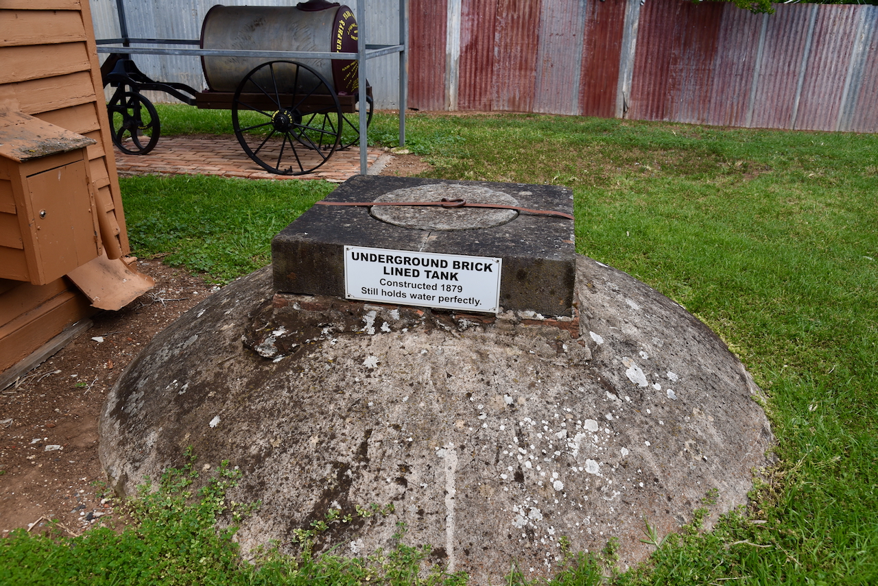
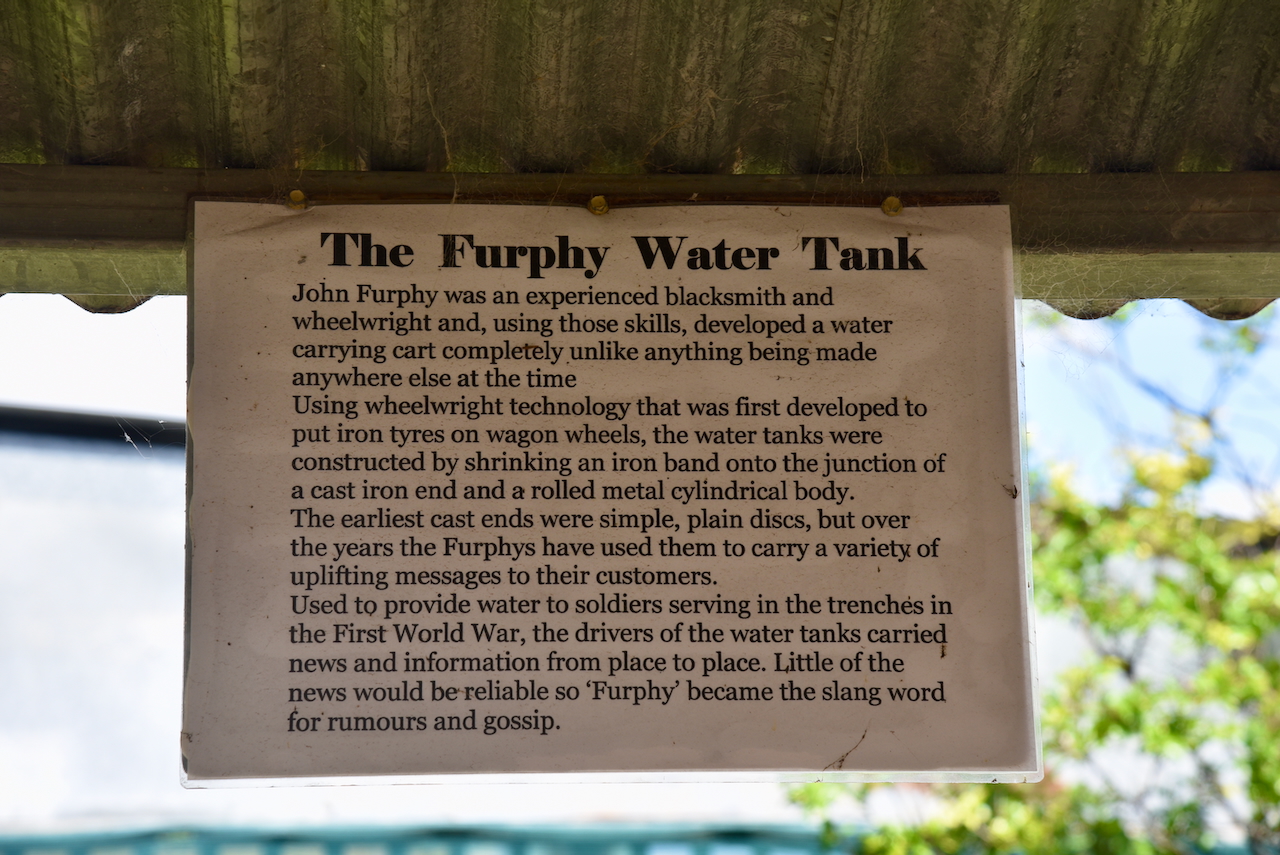
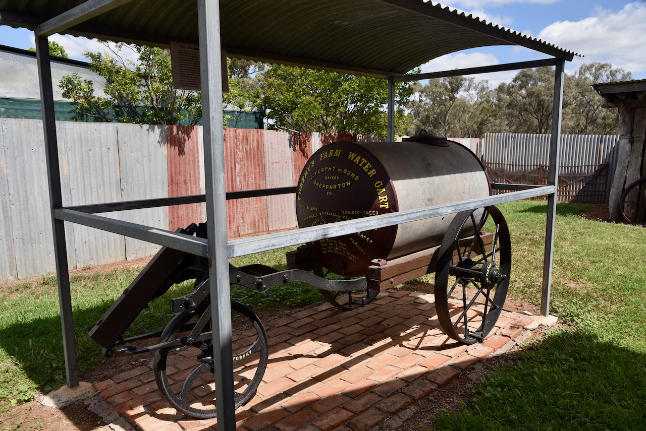
You can also locate an old Furphy water tank. They were invented by John Furphy, an experienced blacksmith and wheelwright. They were used to provide water to soldiers serving in the trenches during the First World War.
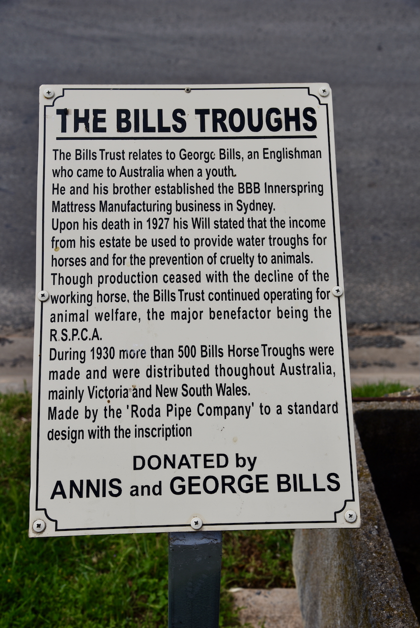
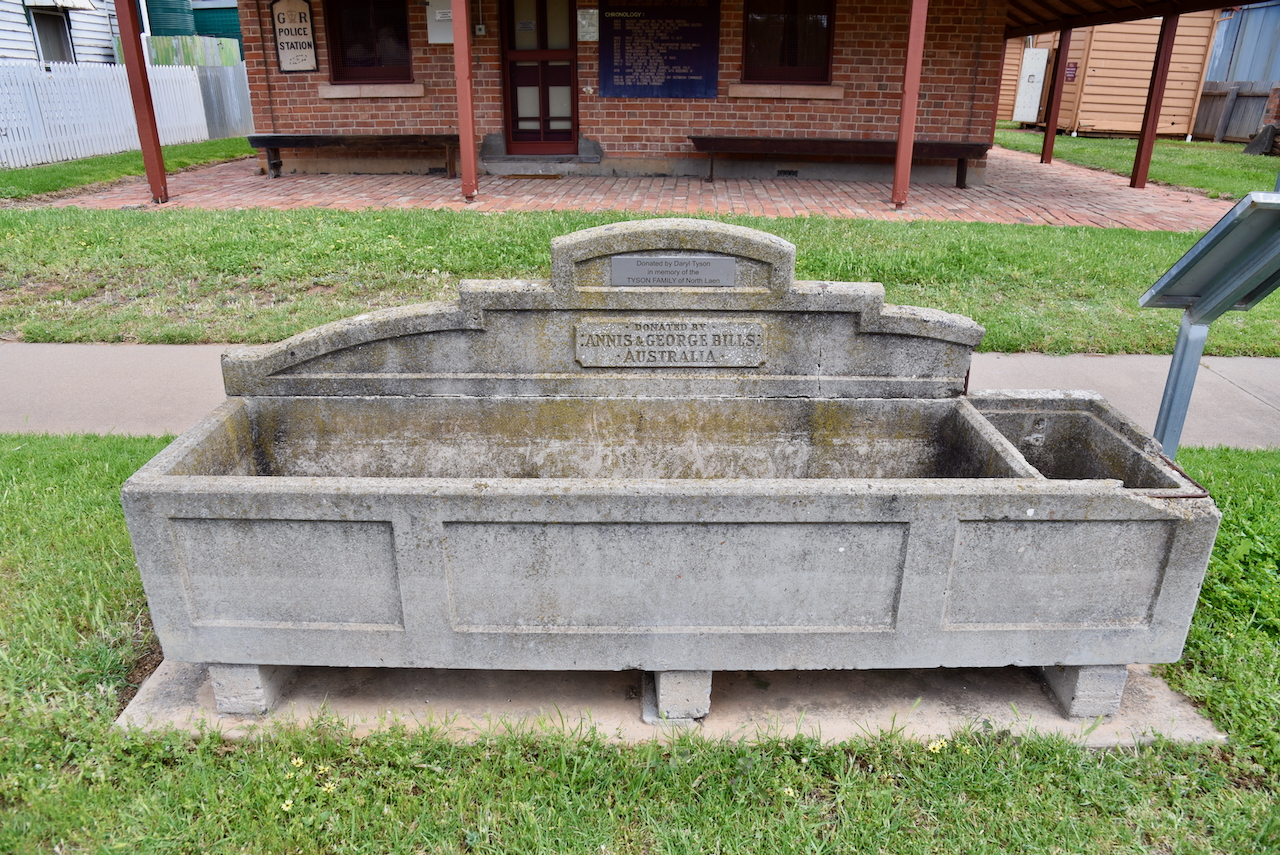
Located in front of the Old Police Camp is a Bill’s Horse Trough. I have written about Bills Horse troughs before and it can be found at https://vk5pas.org/2023/12/17/werrimul-bushland-reserve-vkff-4122-and-werrimul-silo-vk-wru3/
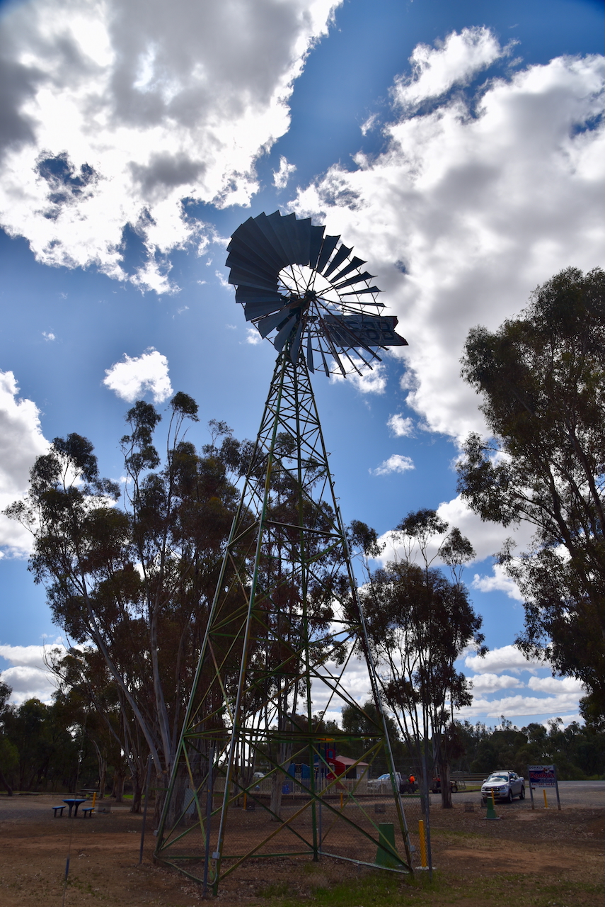
We then headed to Apex Park and viewed the giant windmill measuring 7.62 metres. It was originally installed at the Donald pumping station in 1913. It was later used for irrigation on Glengar station before being donated. (Aussie Towns 2018) (Donaldlearninggroup.com.au, 2024)
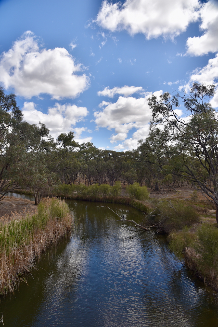
We then drove down to the Richardson River which passes through Donald. The river rises on the northern slopes of the Great Dividing Range and flows north for about 119 km and drains into Lake Buloke. It is named after John Matthew Richardson who fell from his horse during the 1836 expedition of Major Thomas Mitchell. (Wikipedia 2023)
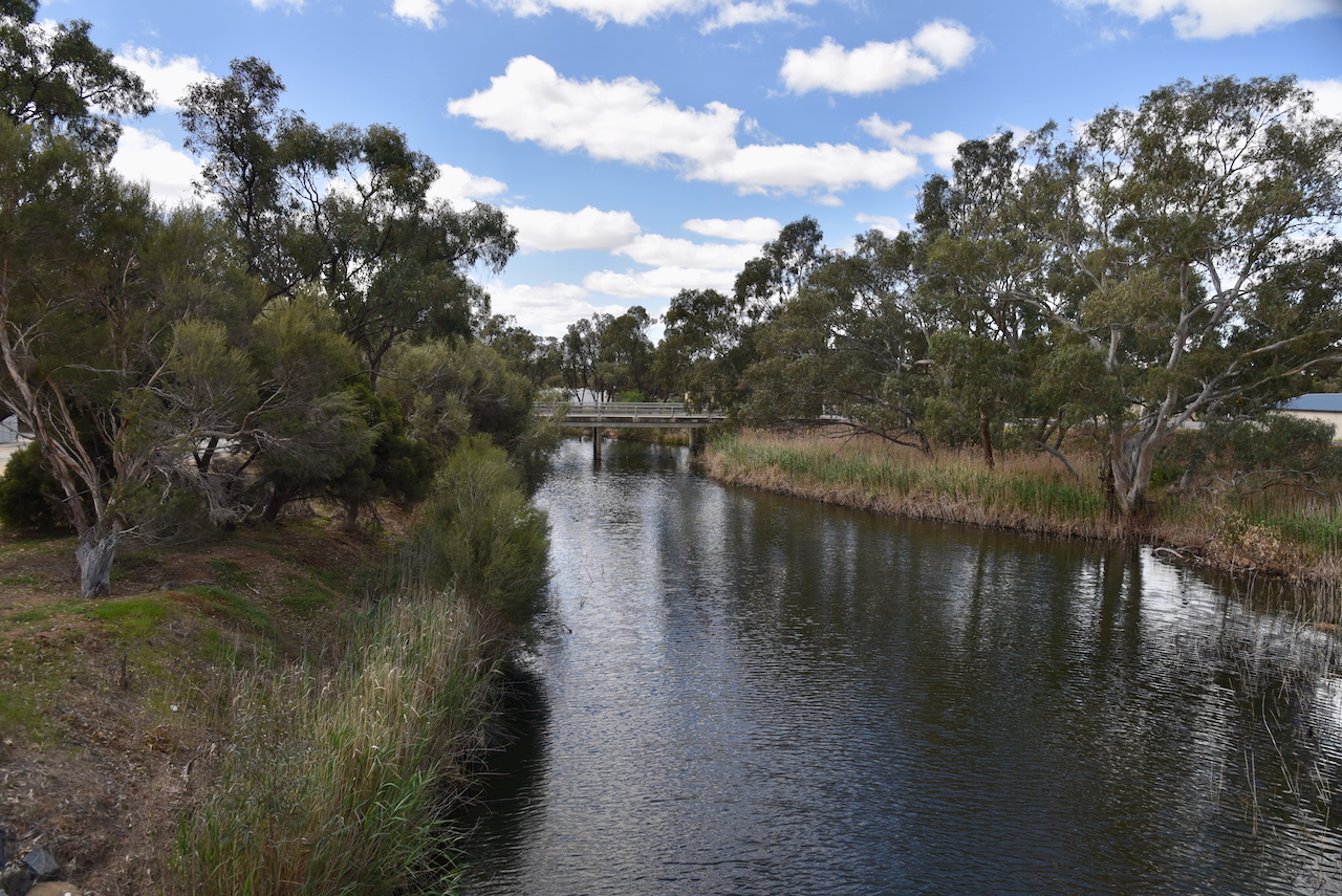
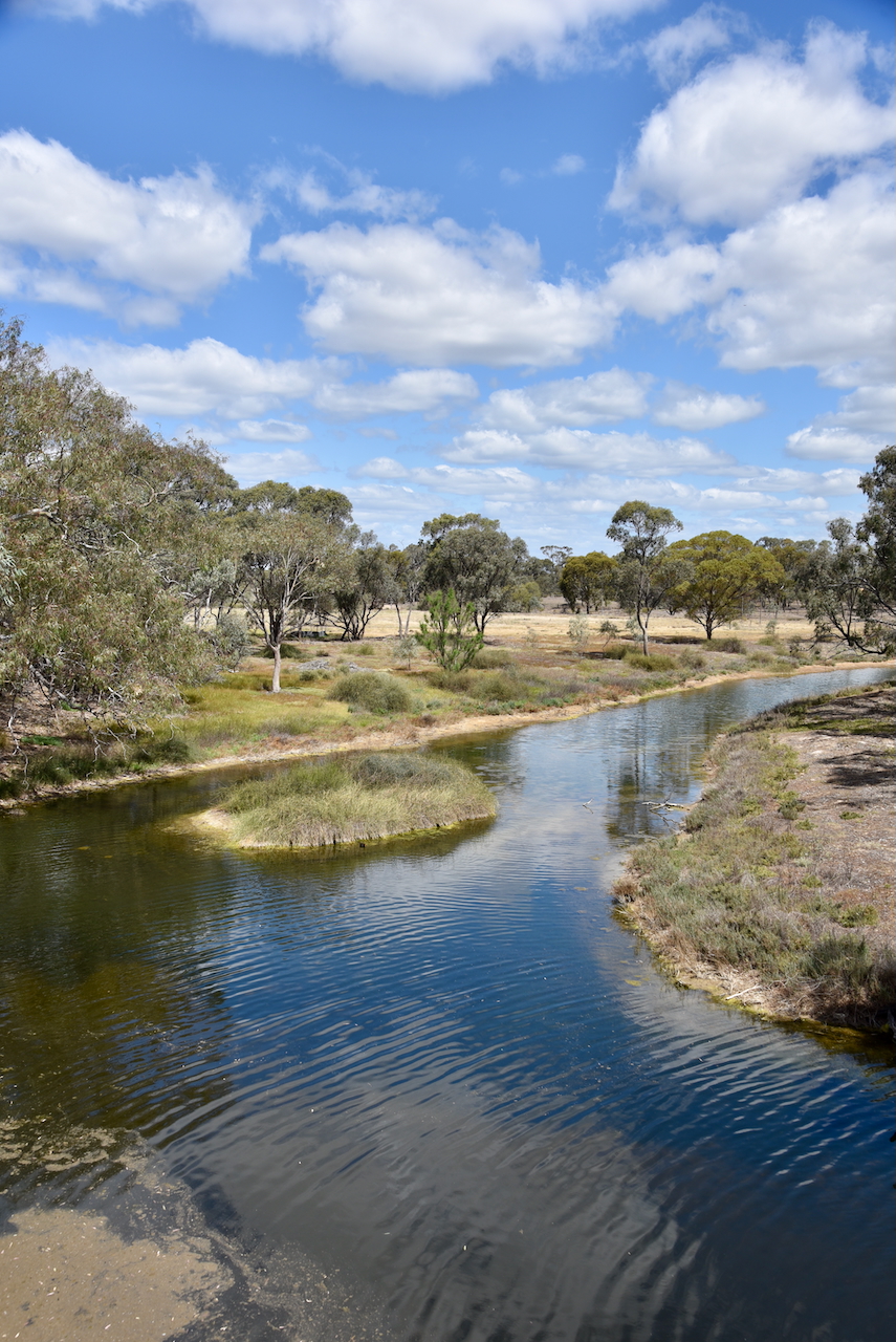
We then viewed Bullock’s Head on the Richardson River in Byrne Street. It is a natural formation on an old gum tree that is strikingly similar to that of a Bullock’s Head. Donald has been the subject of several floods where the water has reached the ‘mouth of Bullock’s Head. (Aussie Towns 2018 (Donaldlearninggroup.com.au, 2024)
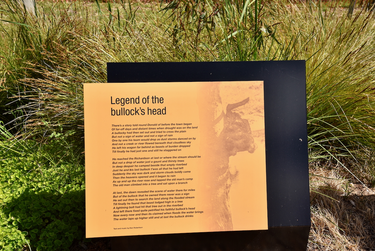
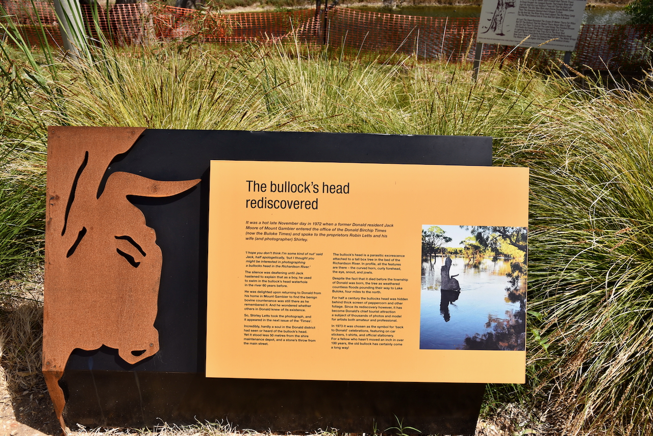
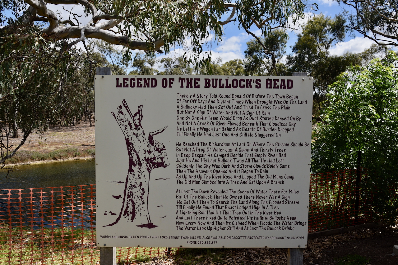
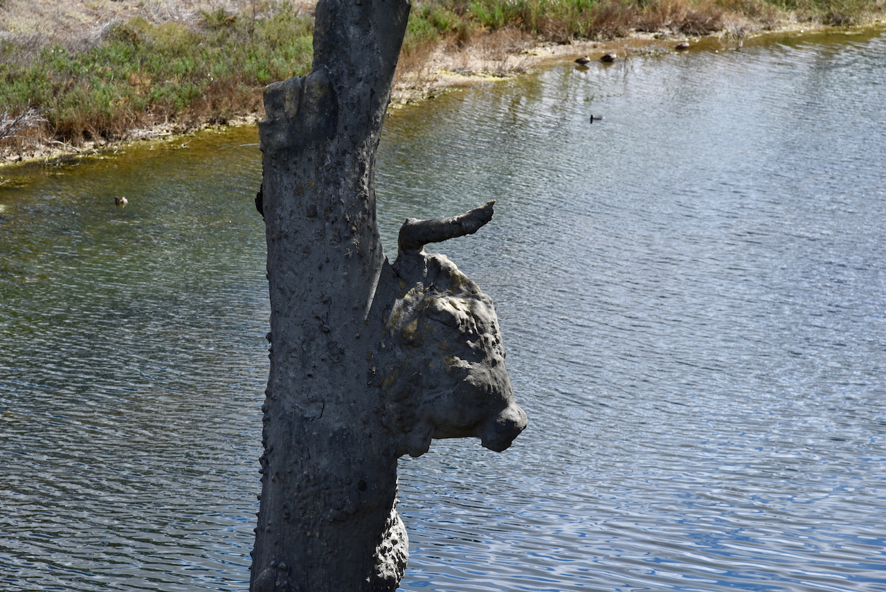
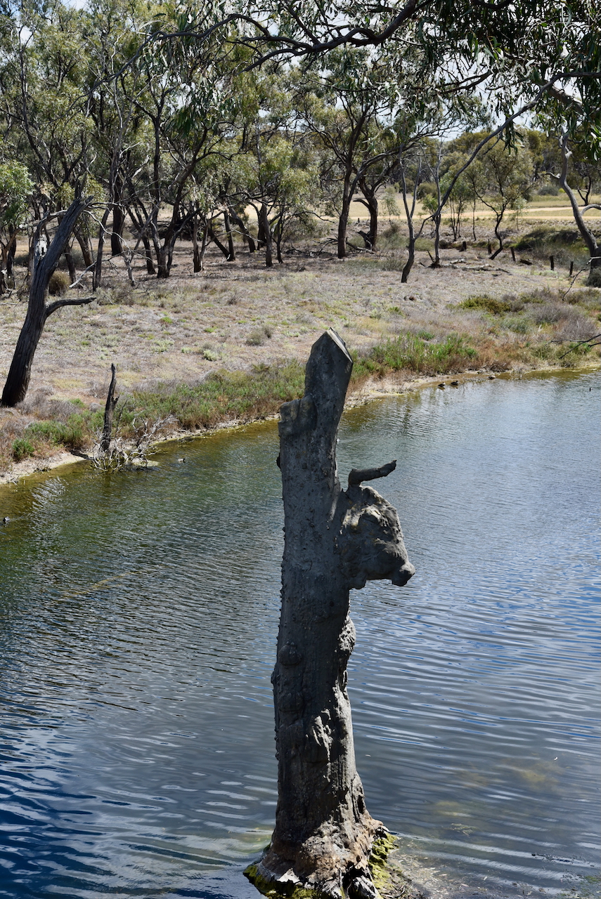
Significant floods have occurred in 1909, 1918, 1956, 1975, 1992, and 2011. The most severe flood was in January 2011 when the tops of the horns of the Bullock’s Heads were just visible. A viewing platform and information boards can be found here. (Aussie Towns 2018 (Donaldlearninggroup.com.au, 2024)
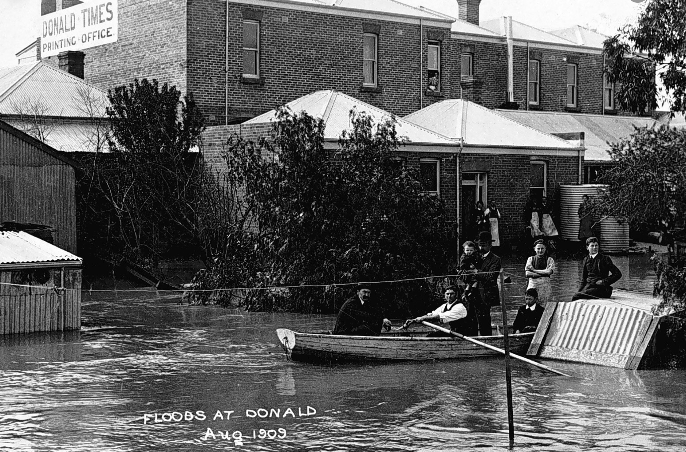
Above:- Floods at Donald, 1909. Image c/o Lost Country Victoria Facebook page.
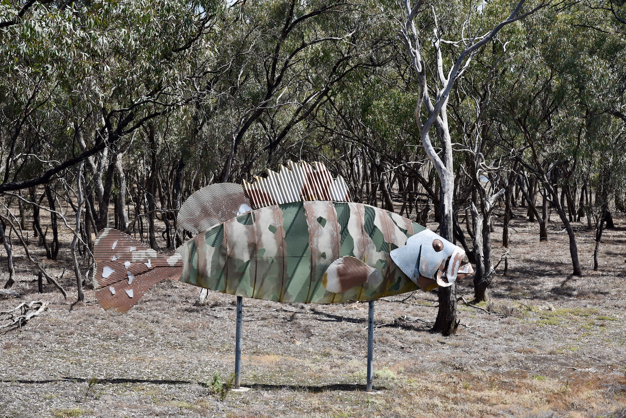
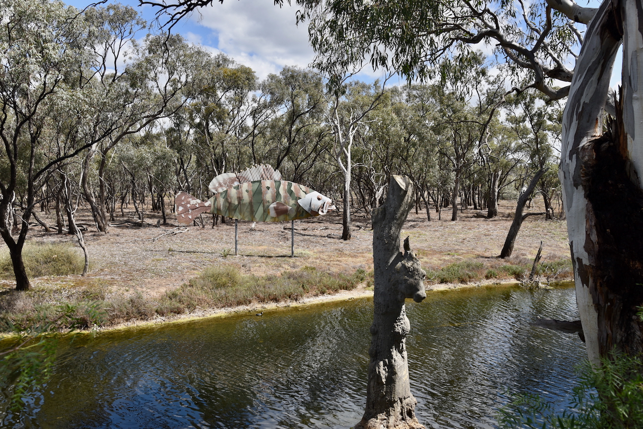
On the opposite side of the Richardson River is a large metal sculpture of a Nassau Grouper. It was used in the 2006 Melbourne Commonwealth Games ceremony and later donated to Buloke Shire. (Aussie Towns 2018) (Donaldlearninggroup.com.au, 2024)
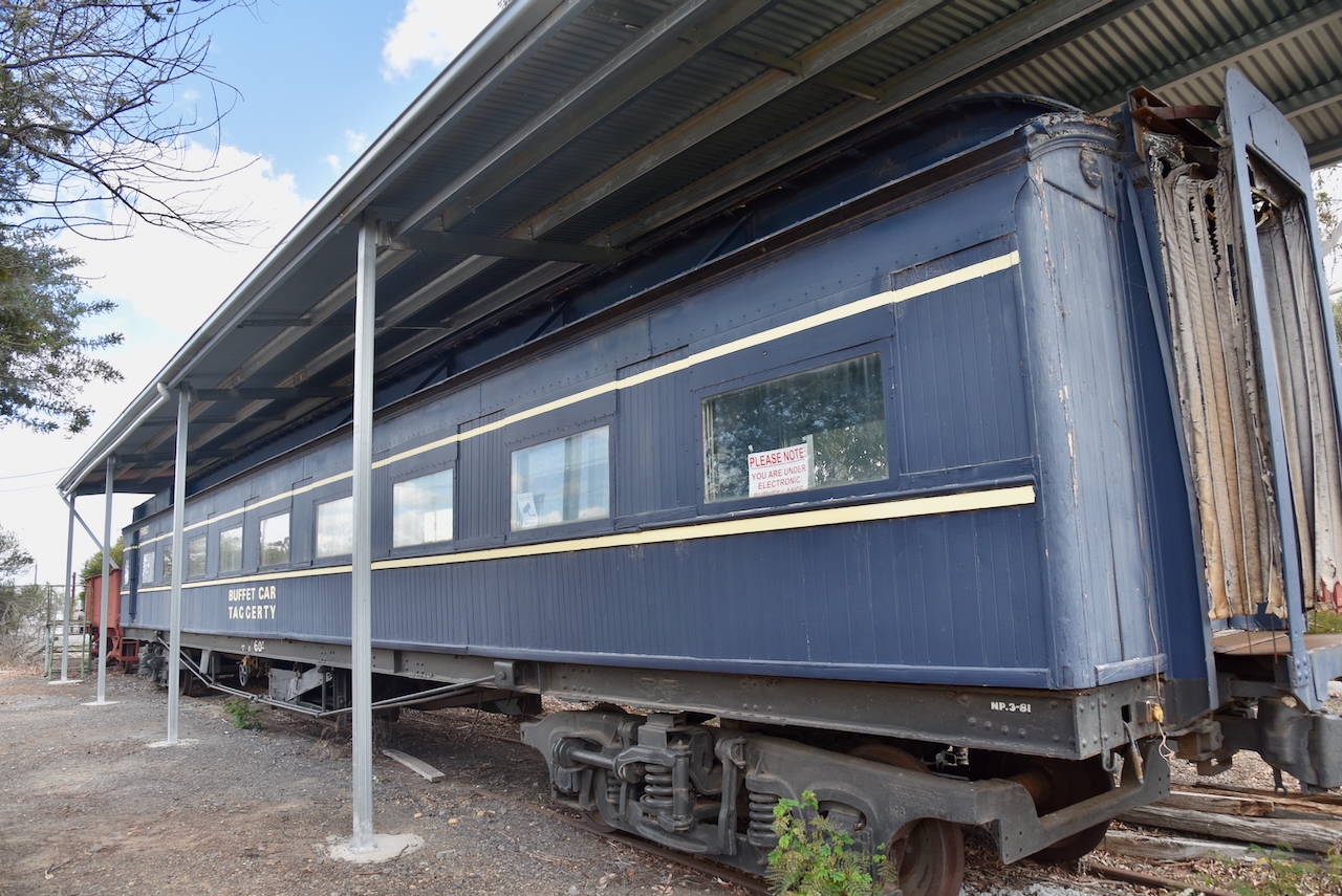
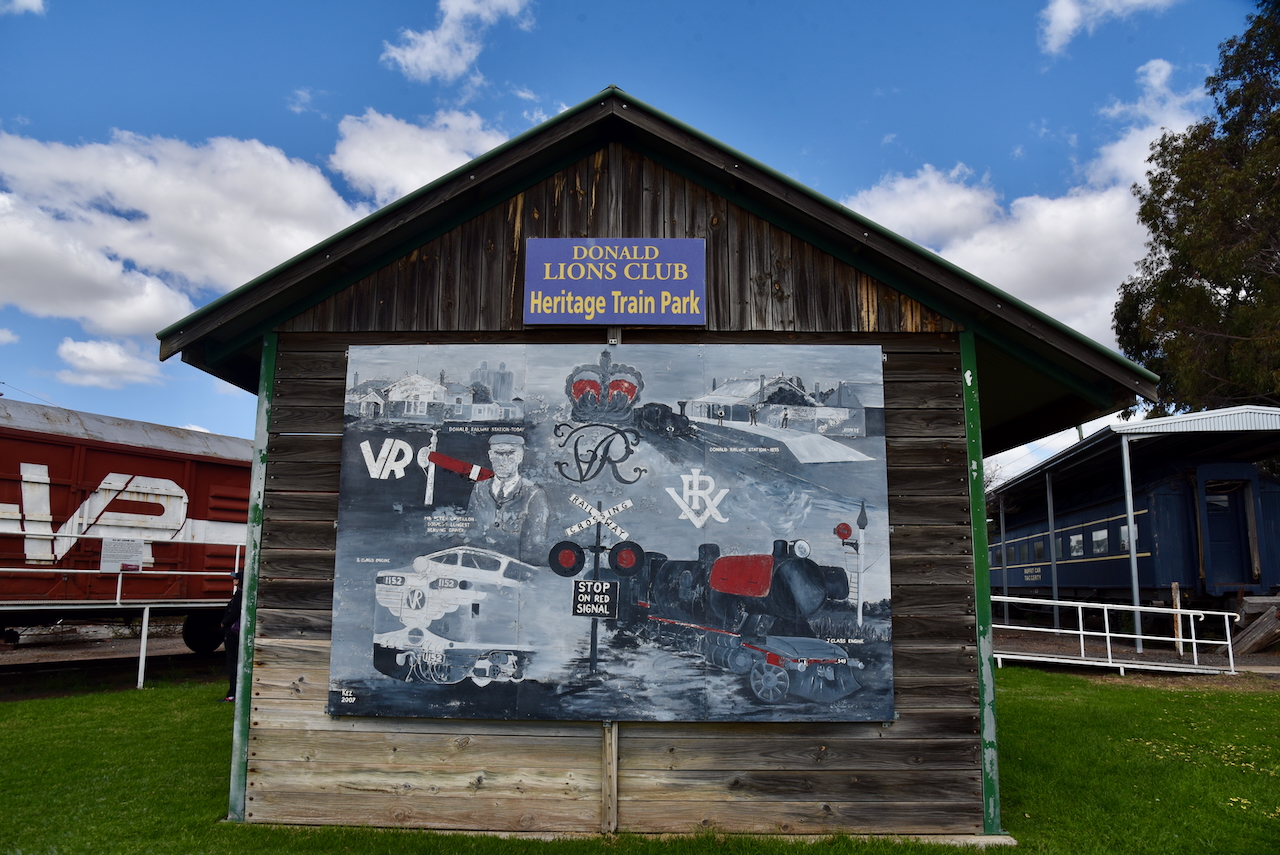
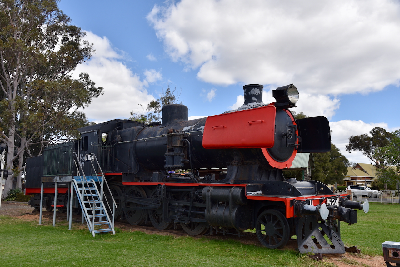
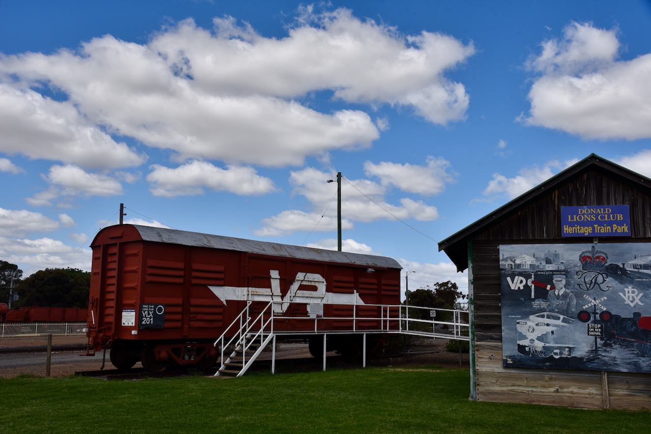
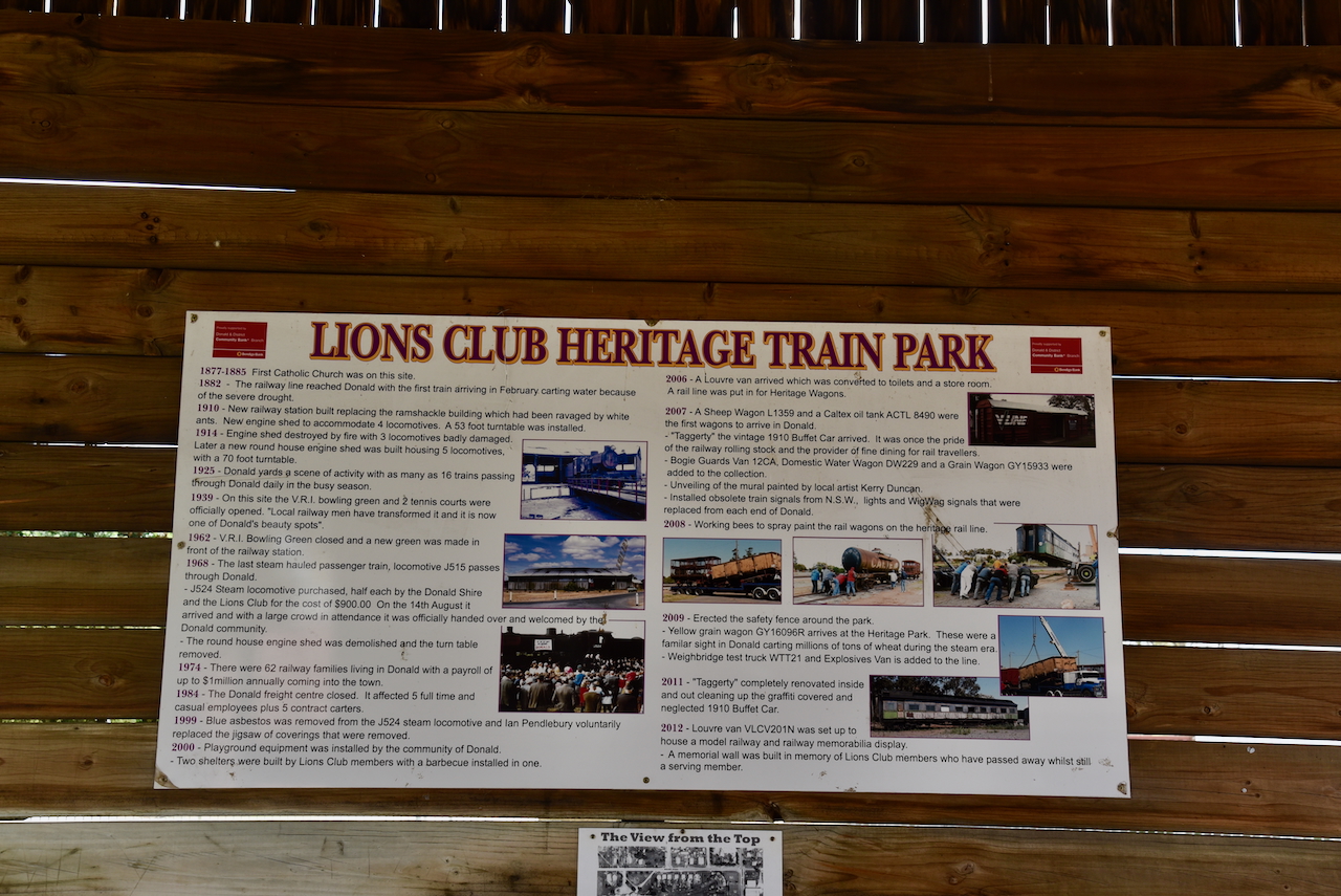
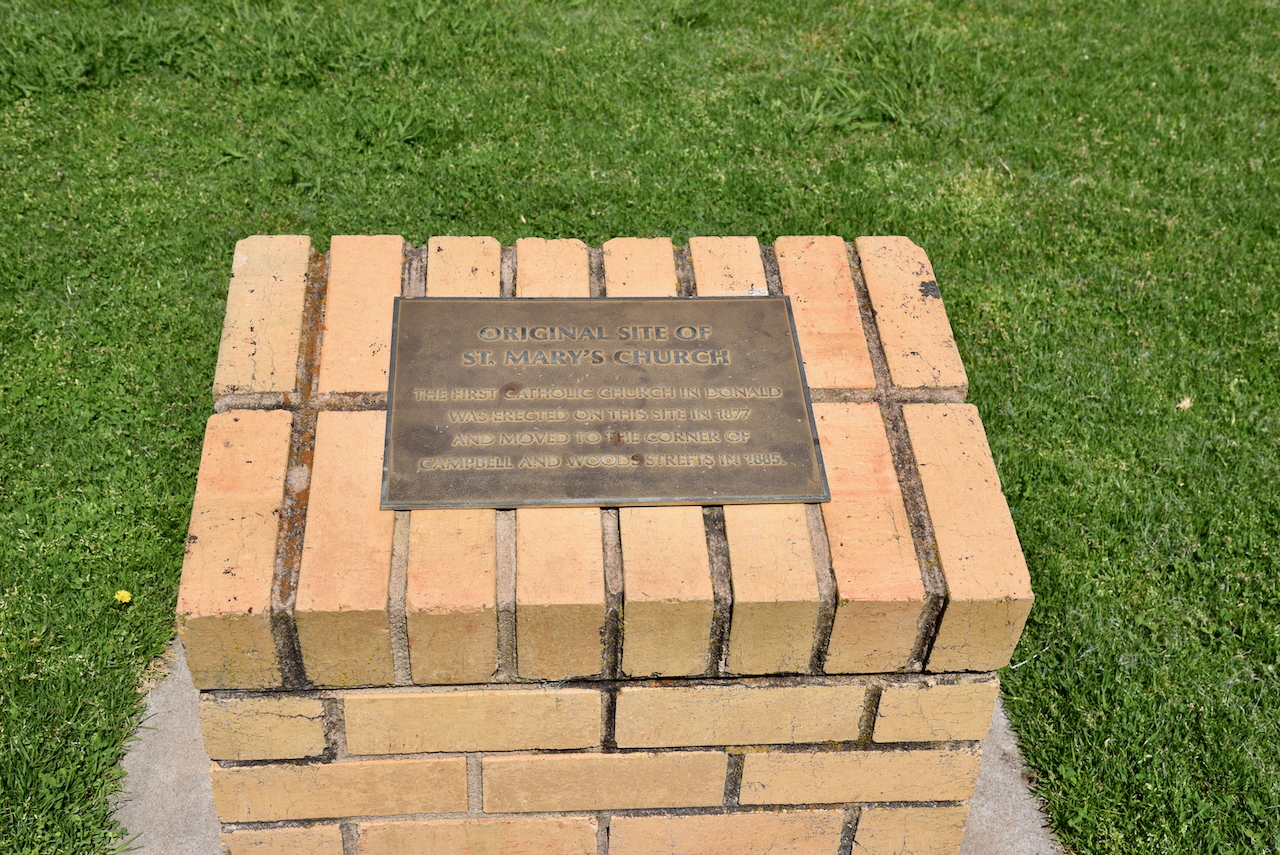
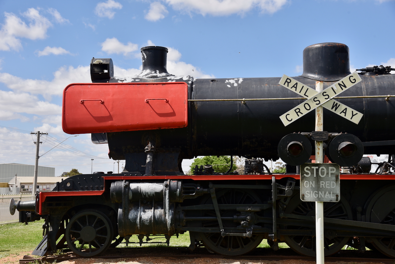
Our next stop in Donald was Heritage Train Park on Hammill Street. The park features an old J524 steam train and other rolling stock. (Aussie Towns 2018)
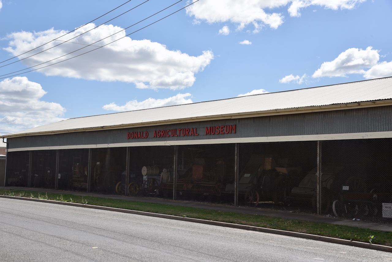
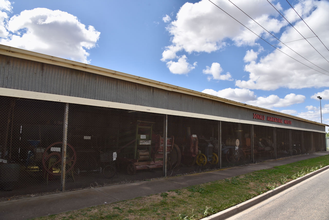
We then had a quick look at the Agricultural Museum that is located in front of the Donald Showground in Hammill Street. It features a collection of historic agricultural machinery.
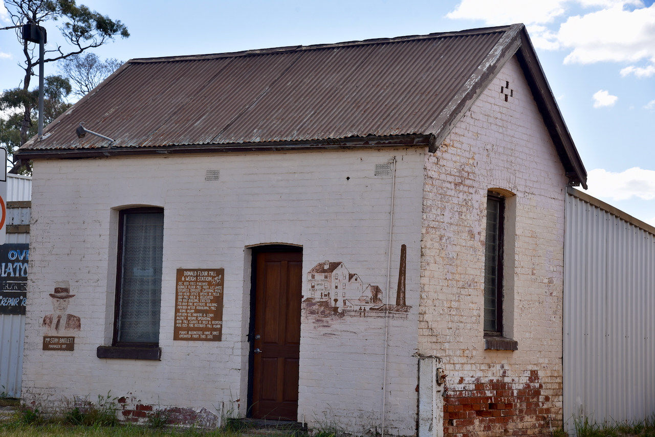
Opposite is the old Donald flour mill and weigh station that was built in 1878
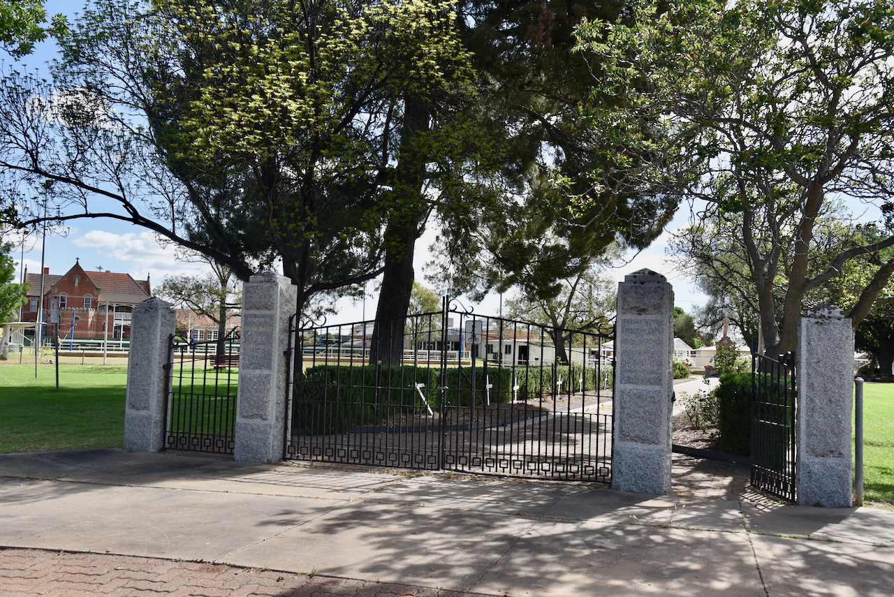
We then visited Donald Memorial Park located on the corner of Houston Street and Campbell Street. This was Donald’s first park. It contains a memorial to remember all those from the district who served in the various conflicts. It was originally erected to commemorate those killed during the First World War. (Aussie Towns 2018) (Monument Australia 2025)
The park also has memorial gates to commemorate the founder of Donald, Johann August Meyer. The gates were erected in 1963. (Monument Australia 2025)
The Donald silos VK-DND3 are located in Mill Street.
Marija and I parked on Racecourse Road within the activation zone of the two silos. We operated from the 4WD, running the Icom IC-7000, 100 watts, and the Codan 9350 antenna with the 1.5-metre stainless steel whip.
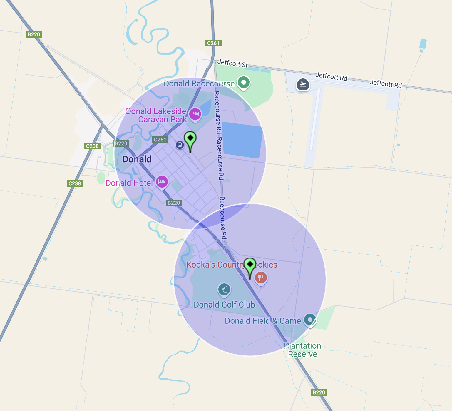
Above:- The activation zones of the two silos at Donald, Victoria. Map c/o SiOTA website.
This was probably the worst band conditions Marija and I had ever experienced. There had been a large X-class flare. We called CQ for about 10 minutes on 40m and had absolutely no takers. Fortunately, we were able to get a handful of stations each on the 20m band.
Marija worked the following stations on 20m SSB:-
I worked the following stations on 20m SSB:-
References.
On 24th October 2024, after leaving the Litchfield silo, Marija and I drove to our next activation for the day, the Carron I124 Bushland Reserve VKFF-4749.
The reserve is located about 43 km east of Warracknabeal and about 305 km northwest of Melbourne
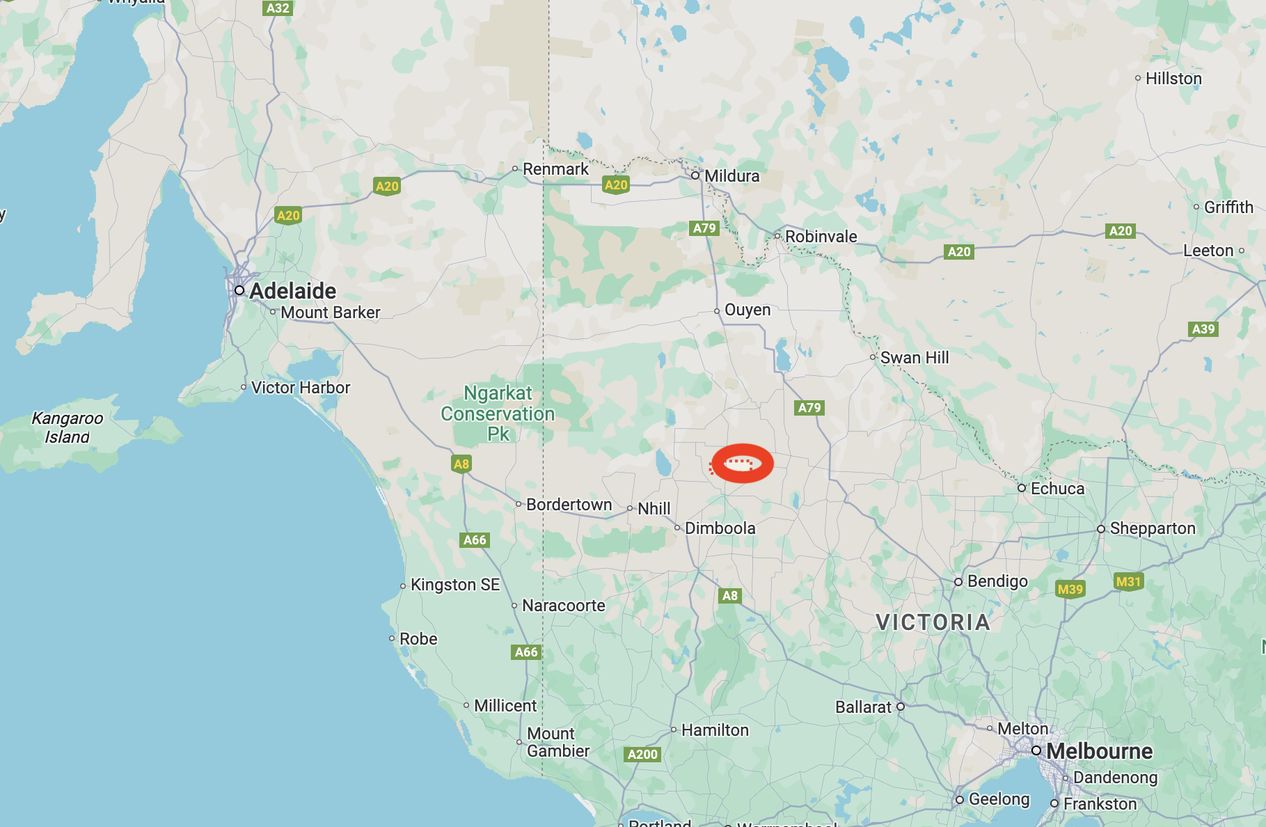
Above:- Map showing the location of the Carron I124 Busland Reserve. Map c/o Google Maps.
The reserve is located on the southern side of Pearse Road.
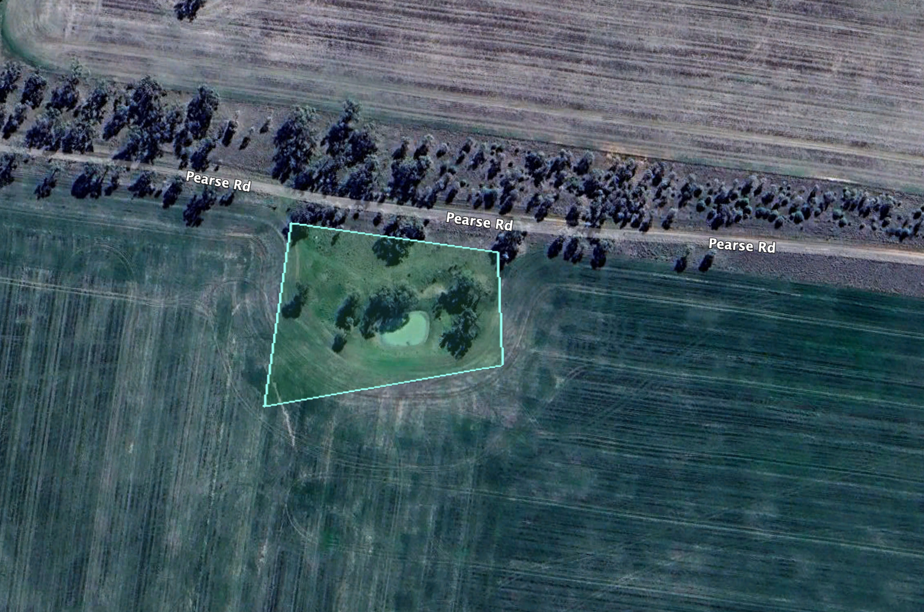
Above:- An aerial view of the Carron I124 Bushland Reserve. Image c/o Google Earth
The district of Carron takes its name from the village of Carron in Stirlingshire, Scotland. This is a small reserve, only about 1 hectare in size. It was established on the 22nd day of September 1987. (CAPAD 2022)
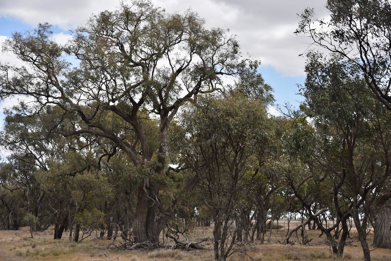
This was an easy park to access with no fences. We ran the Yaesu FT857, 40 watts, and the 20/40/80m linked dipole supported on the 7-metre telescopic squid pole.
It was incredibly windy, and our squid pole snapped during this activation. We also experienced a solar flare, with the noise on the band going from zero to strength 8 and then back down to zero after a few seconds.
Marija worked the following stations on 40m SSB:-
I worked the following stations on 40m SSB:-
I worked the following stations on 40m FT8:-
I worked the following stations on 20m FT8:-
I worked the following stations on 20m SSB:-
References.
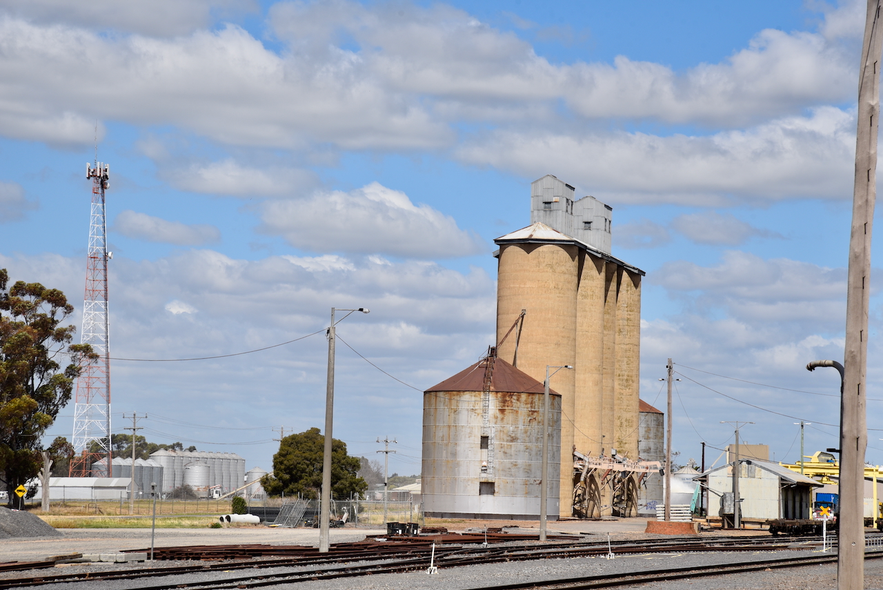
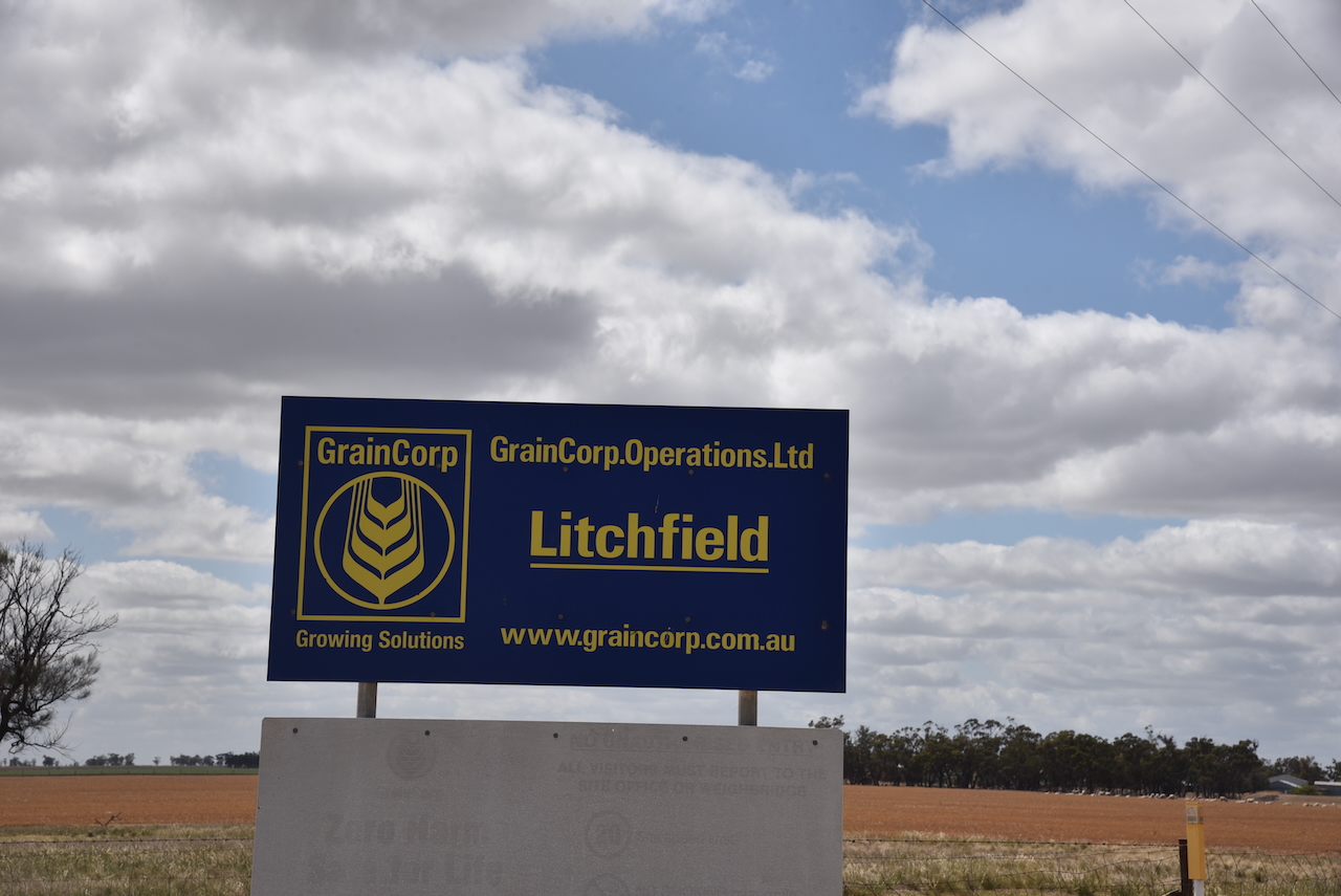
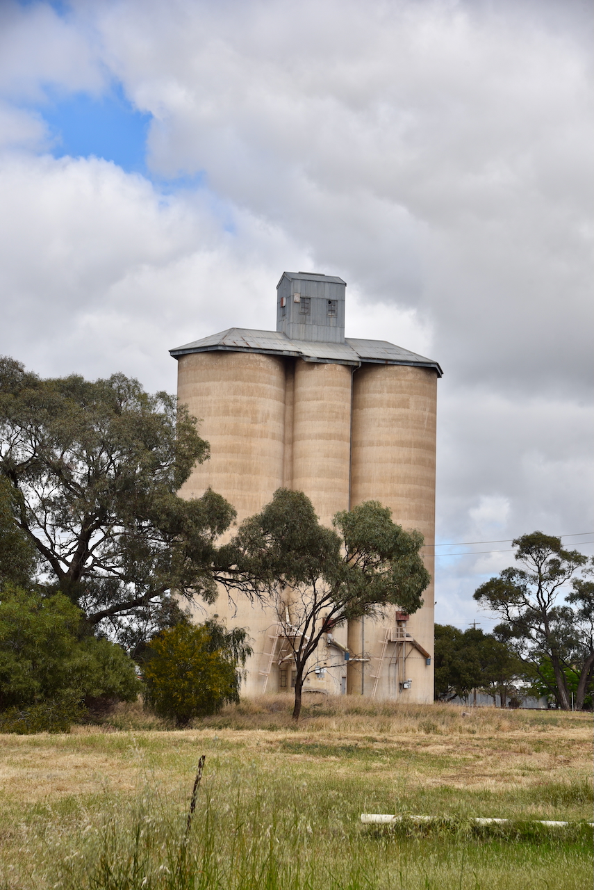
Our next activation for 24th October 2024, was the Litchfield silo VK-LTD3 for the Silos On The Air (SiOTA) program.
Litchfield is located about 43 km east of Warracknabeal and about 295 km northwest of Melbourne.
Above:- Map showing the location of Litchfield, Victoria. Map c/o Google Maps.
European settlers commenced establishing properties in the district during the mid 1840s. In 1845, Charles Wedge established ‘Banyenong West’ run. In 1846 the run was owned by Robert Macredie and was divided into ‘Carron’ and ‘Papp’ runs. These were both subsequently acquired by George Pyers. (Donaldhistory.org.au 2018)
Following the 1869 Land Act, which allowed the district to be opened up to smaller selectors, about 14 selectors took up about 4,000 acres of land in the Parish of Witchipool. (Donaldhistory.org.au 2018)
The area around Litchfield was originally known as Witchipool, named after the Parish. It was taken up for farm selections between 1873 and 1876. In 1877 the Witchipool Post Office was opened. In 1879 the Witchippol East school was opened. This was followed by the Witchipool West School in 1880 and Carron in 1881. In 1882, the district’s hotel was opened at Carron. (Victorianplaces.com.au 2015)
In 1893, the railway was extended from Donald to Birchip. A station was erected near a general store that was operated by Joseph Litchfield. The station was named after Litchfield. For several years, both names were used. In 1907, the Witchipool Post Office and school were named Litchfield. (Victorianplaces.com.au 2015)
Above:- Article from the Sunraysia Daily, Tue 30 Jun 1925. Image c/o Trove.
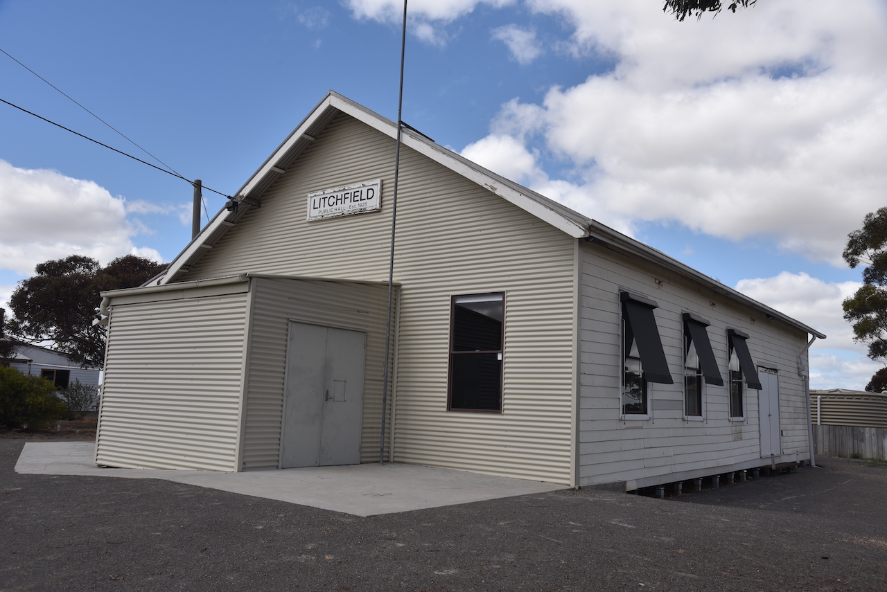
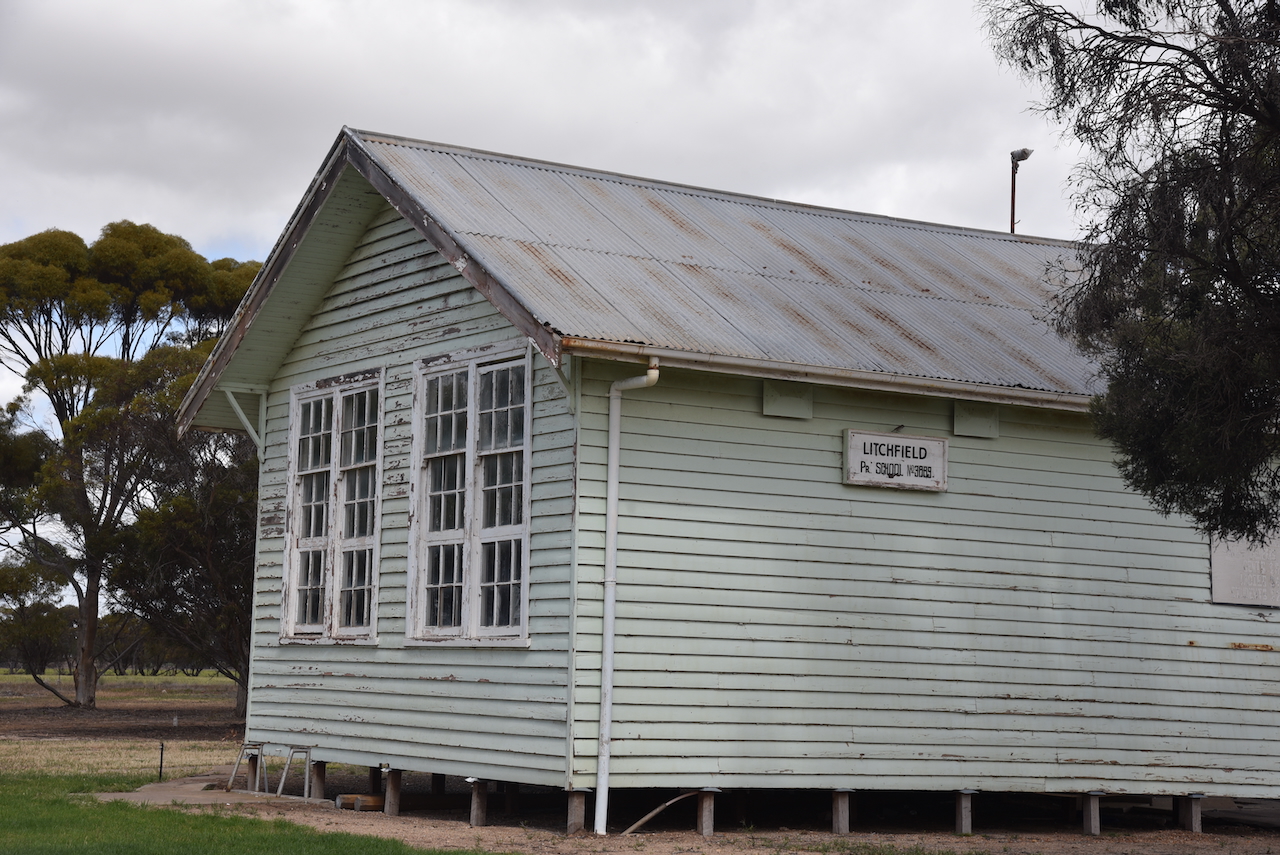
Today the Litchfield Public Hall and one of the schools remain.
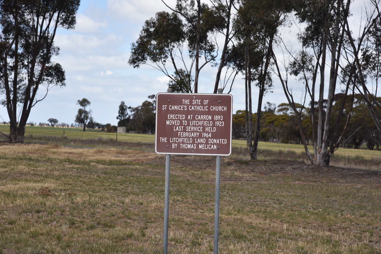
During the 1920s, the Carron Catholic church building, which was constructed in 1893, was moved to Litchfield. (Victorianplaces.com.au 2015)
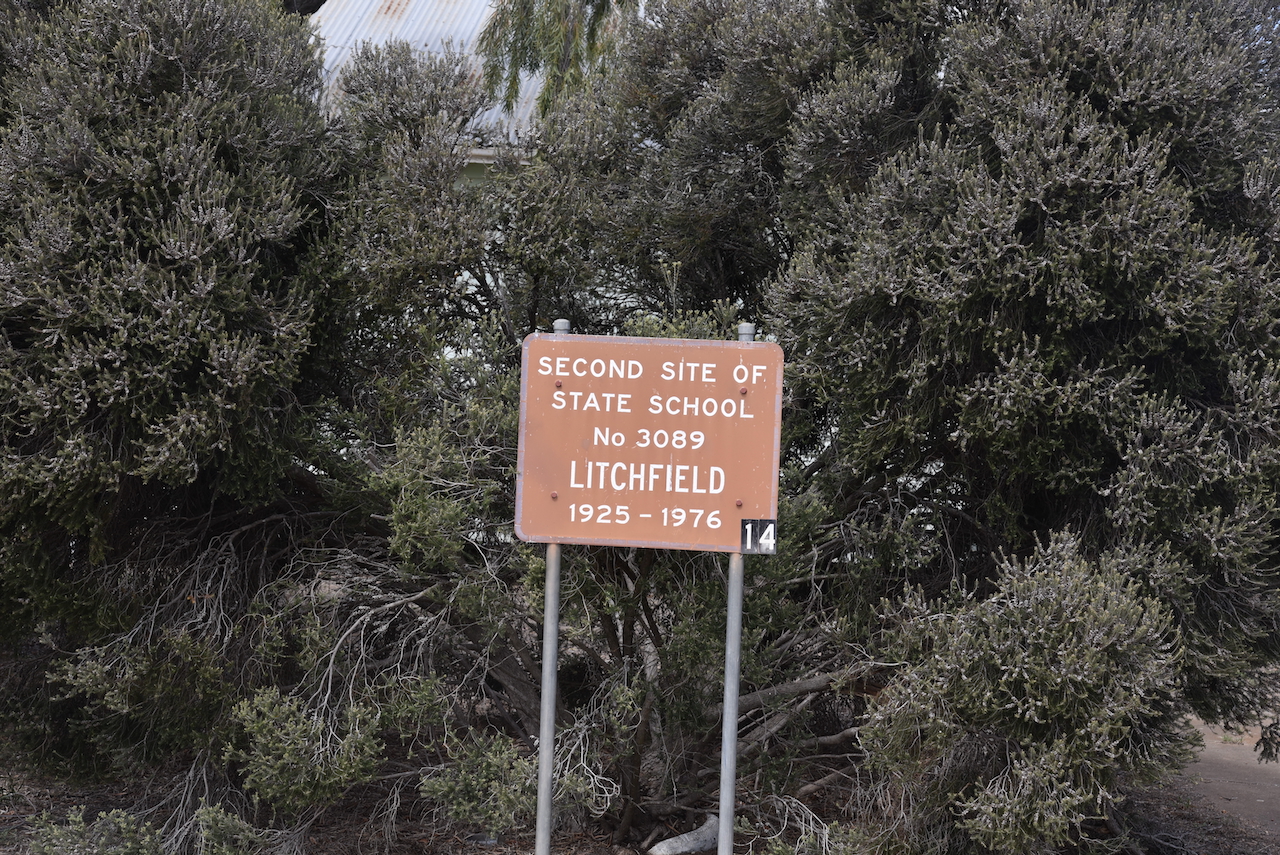
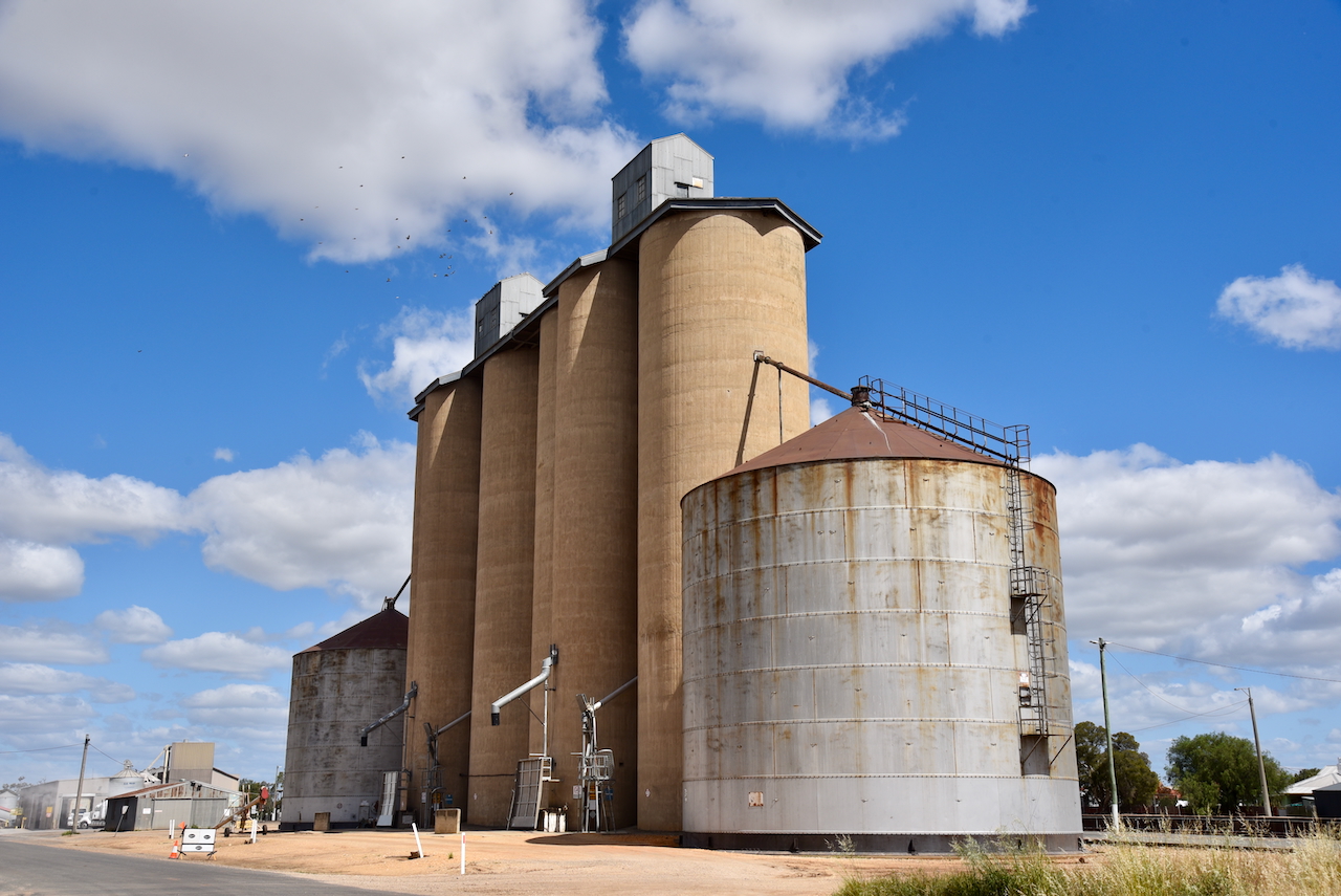
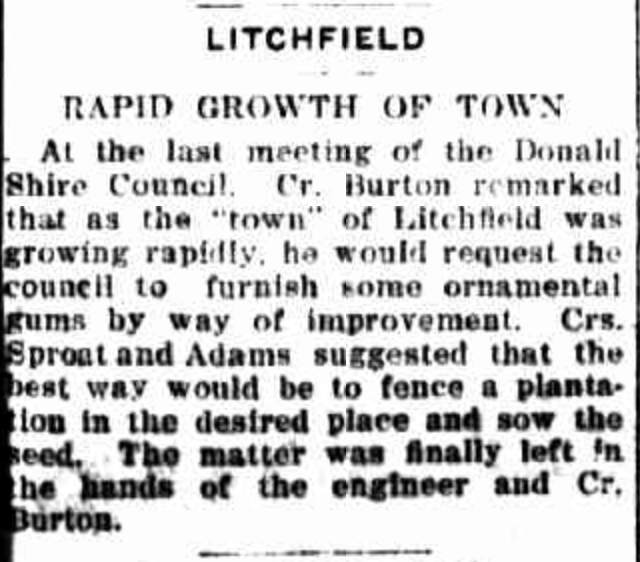
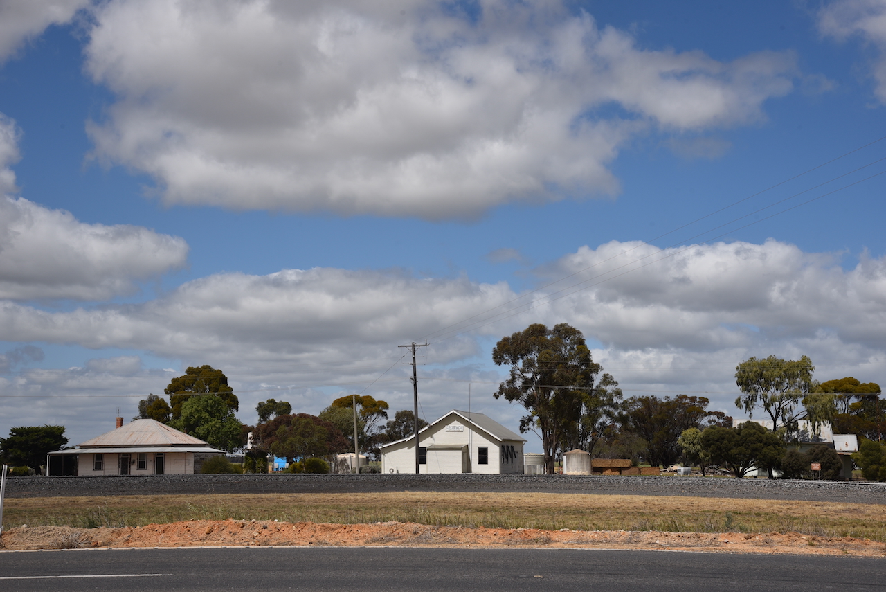
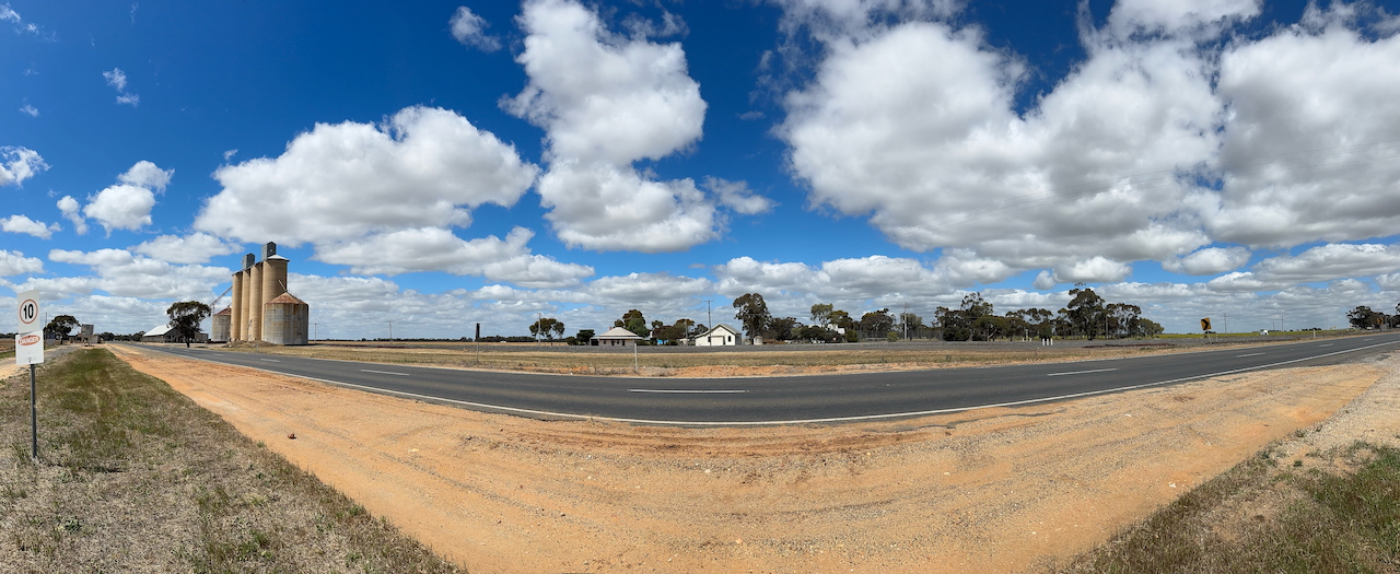
Not much remains at Litchfield today. If it were not for the imposing silos, you might not even notice the little town.
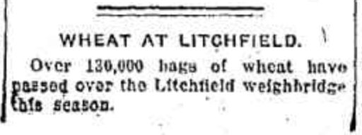
Litchfield was a large wheat-receiving point for the district. (Victorianplaces.com.au 2015)
Above:- Article from the Warracknabeal Herald, Tue 14 Mar 1916. Image c/o Trove
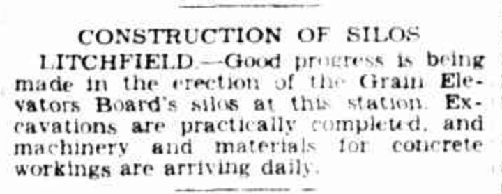
In 1939-40 silos replaced the shed that was used for storing bagged grain. (Victorianplaces.com.au 2015)
Above:- Article from The Argus, Melbourne, Tue 21 Mar 1939. Image c/o Trove
The Litchfield silos are located on the southern side of Sunraysia Highway.
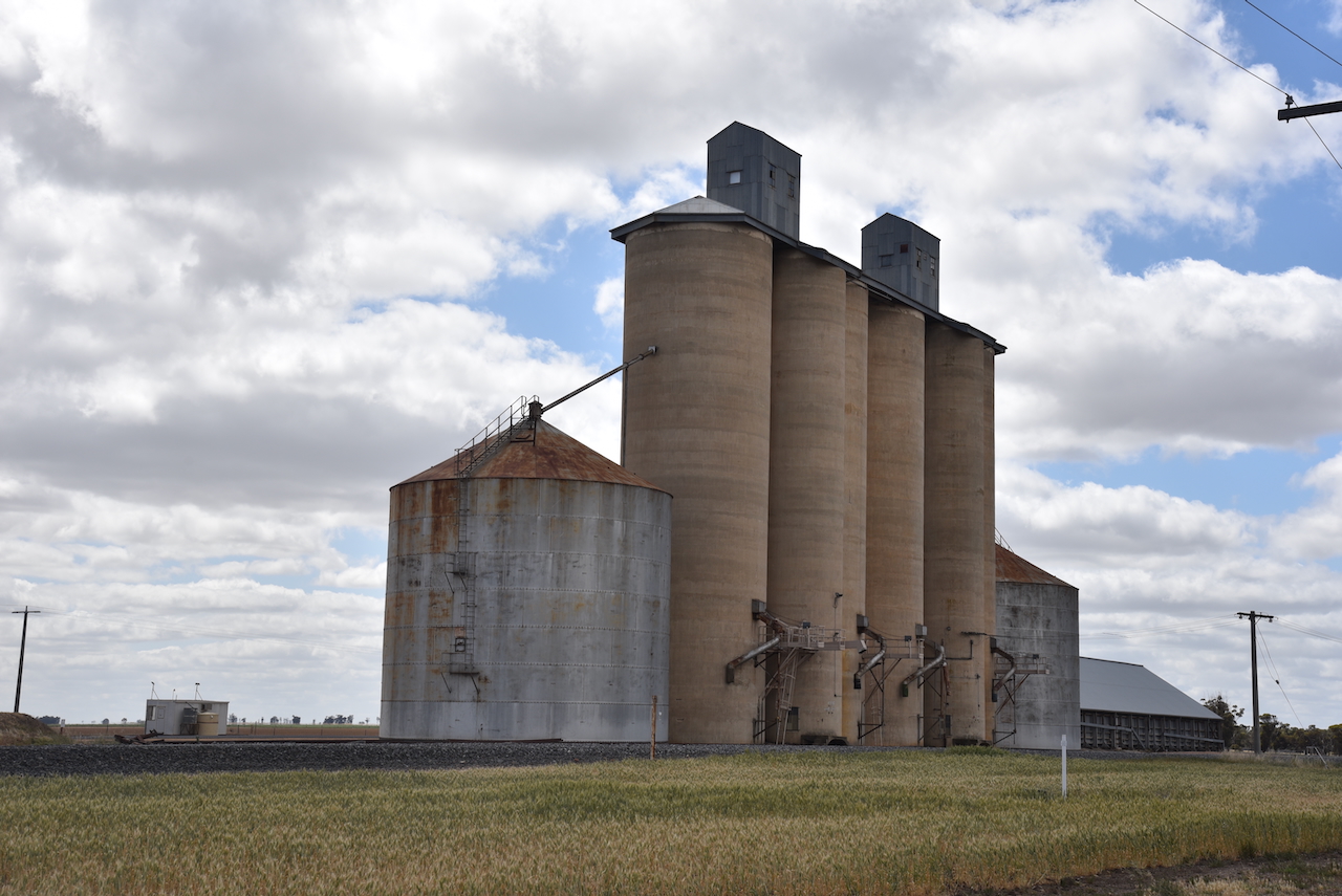
Marija and I parked alongside of the silos and operated from the 4WD. We ran the Icom IC-7000, 100 watts, and the Codan 9350 antenna with the 1.5 metre stainless steel whip.
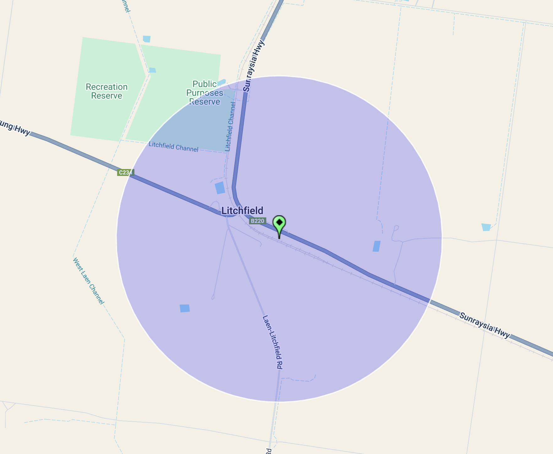
Above:- The activation zone at the Litchfield silo. Image c/o SiOTA website.
Marija worked the following stations on 40m SSB:-
Marija worked the following stations on 20m SSB:-
I worked the following stations on 40m SSB:-
References.
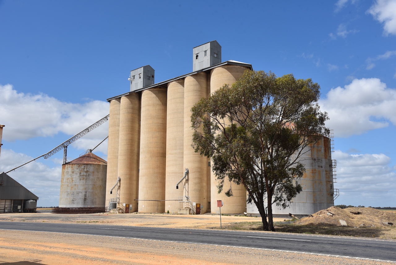
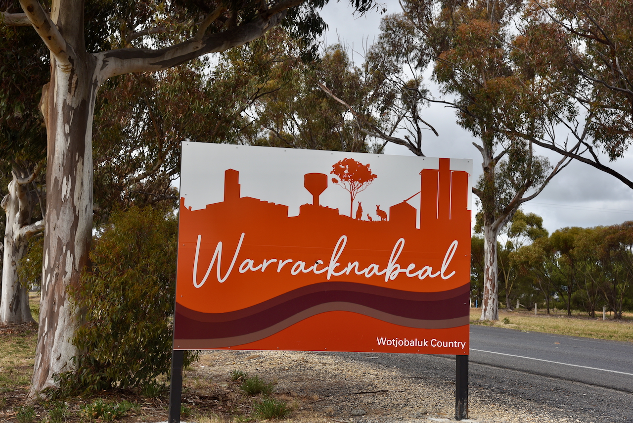
After leaving Brim (24th October 2024), Marija and I drove back into Warracknabeal, where we activated the Warracknabeal silo VK-WRL3 and the Warracknabeal North silo VK-WRT3.
Warracknabeal is about 338 km northwest of Melbourne.
It is believed that Warracknabeal is derived from the Wotjobaluk aboriginal language to describe the impressive river redgums that line the banks of the Yarriambiack Creek. (Aussie Towns 2016)
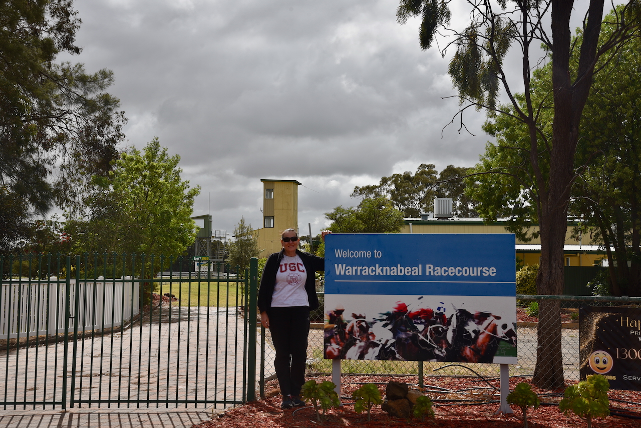
Before activating the silos, we visited the Warracknabeal racecourse. I have placed a few bets on horses running at this racecours over the years.
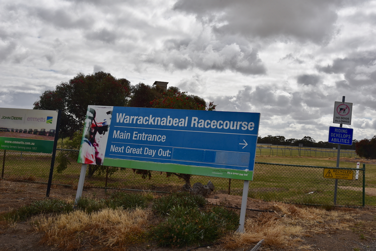
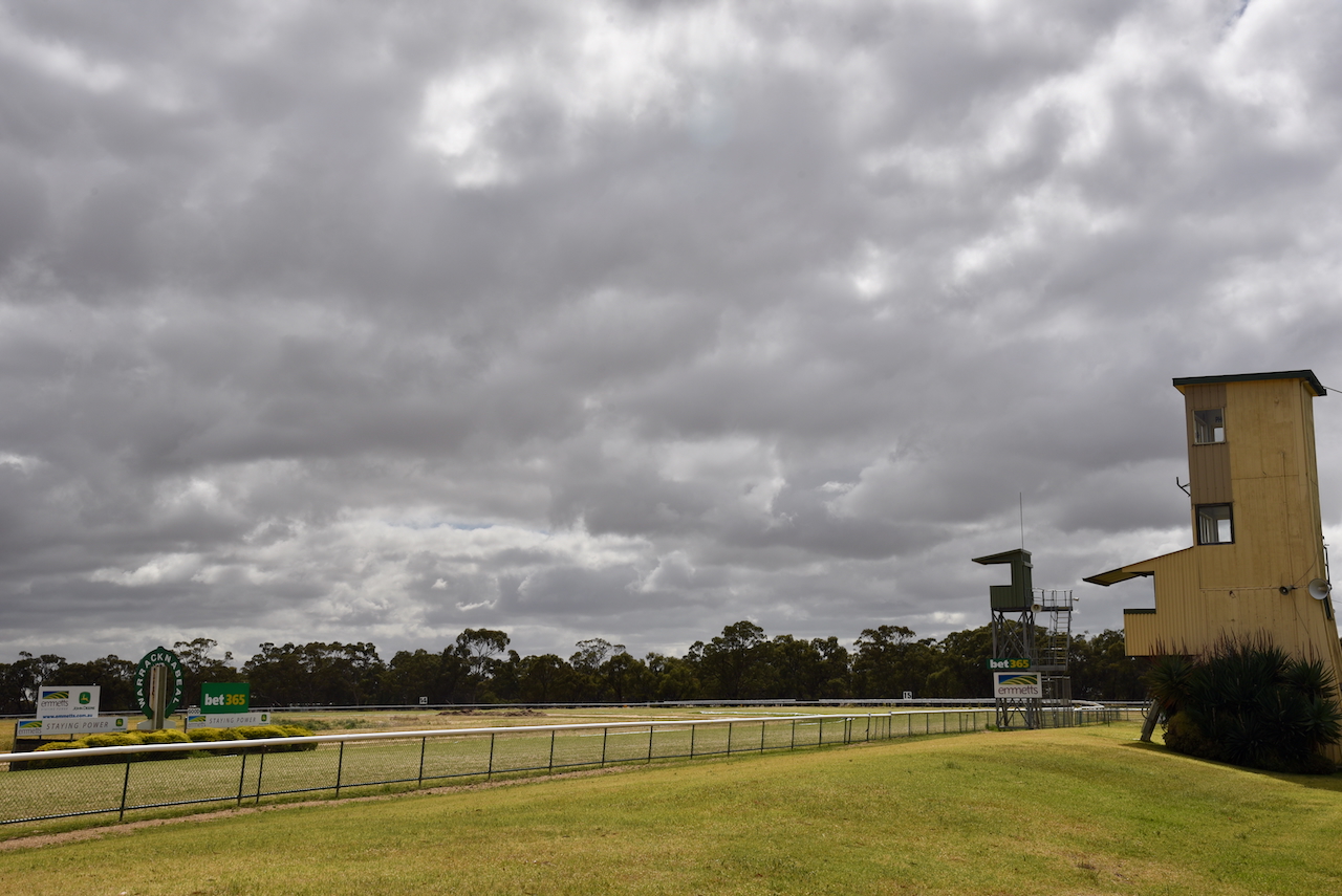
We could clearly see the concrete silos of VK/WRL3 from the racecourse.
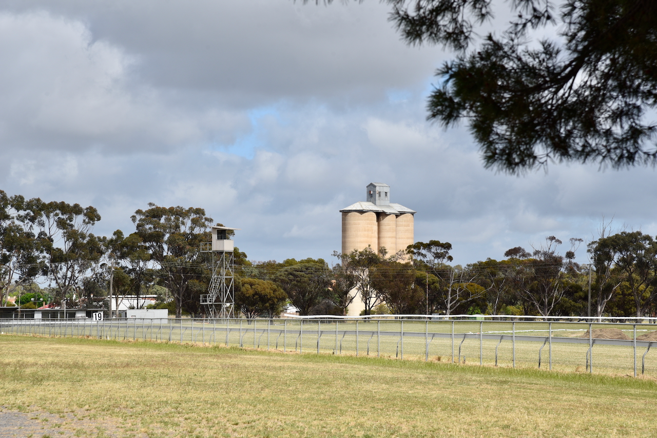
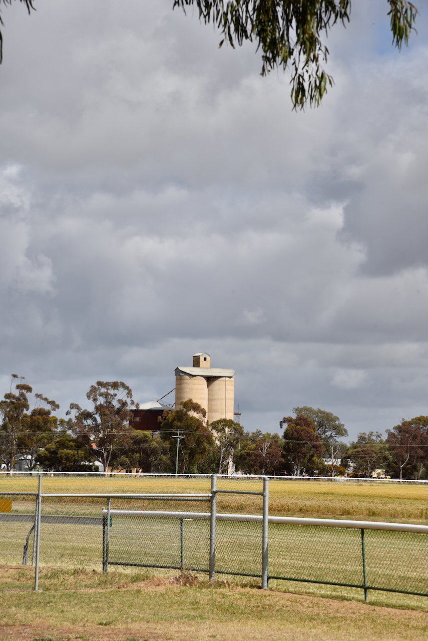
The Warracknabeal North silos VK-WRT3 are located on the western side of the Henty Highway, on the northern side of Warracknabeal. They are operated by GrainCorp.
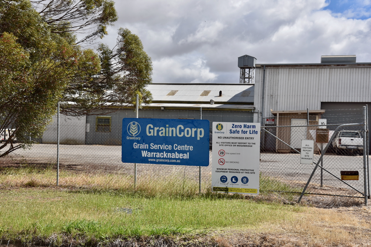
The Warracknabeal silos VK-WRL3 are located at the end of Duncan Street.
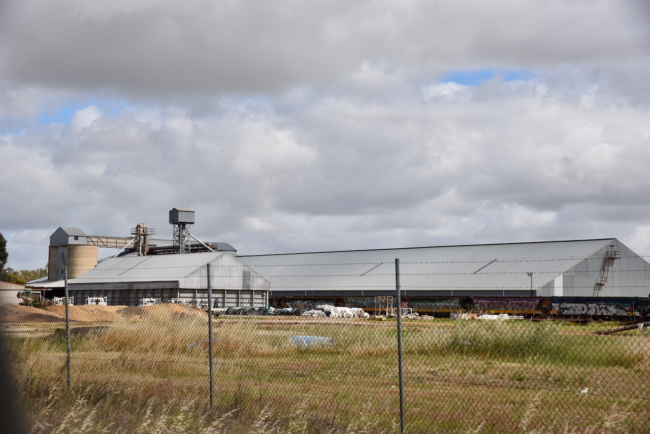
The silos are located at the site of the old flour mill which was owned by W.C. Thomas and operated until the mid 1960s. The mill prospered once the railway line from Murtoa and Minyip reached Warracknabeal. (Flickr 2025)
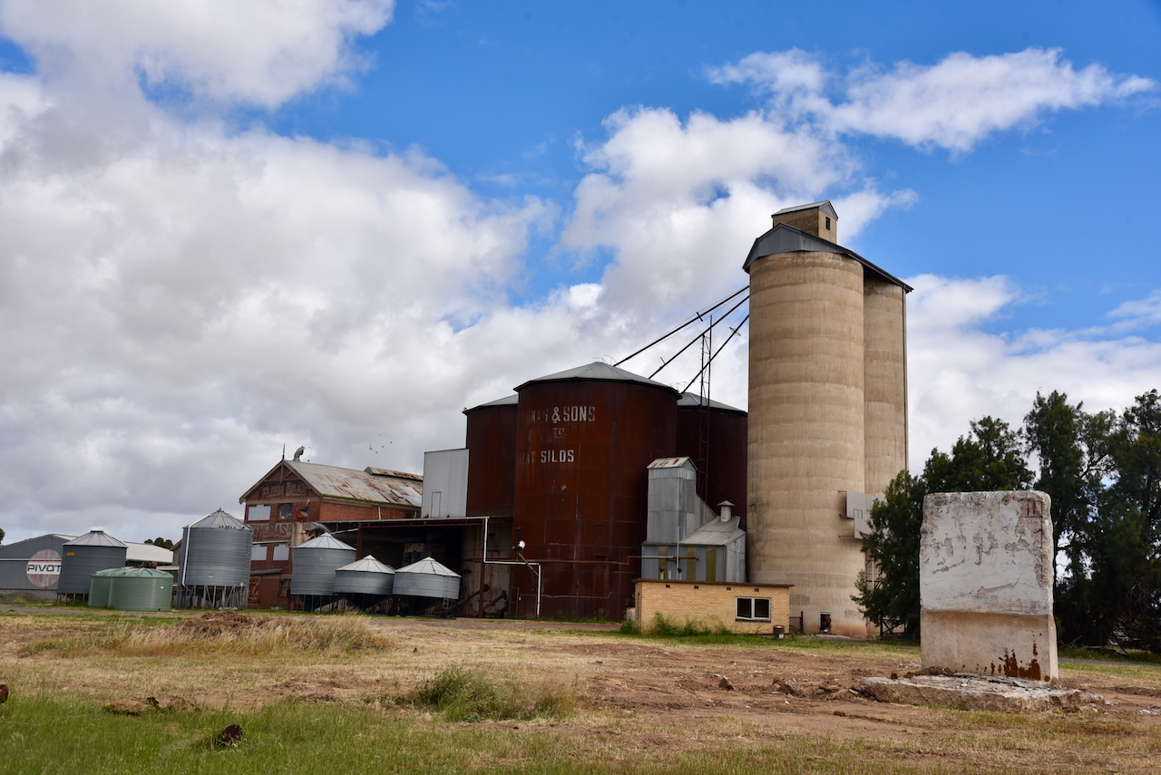
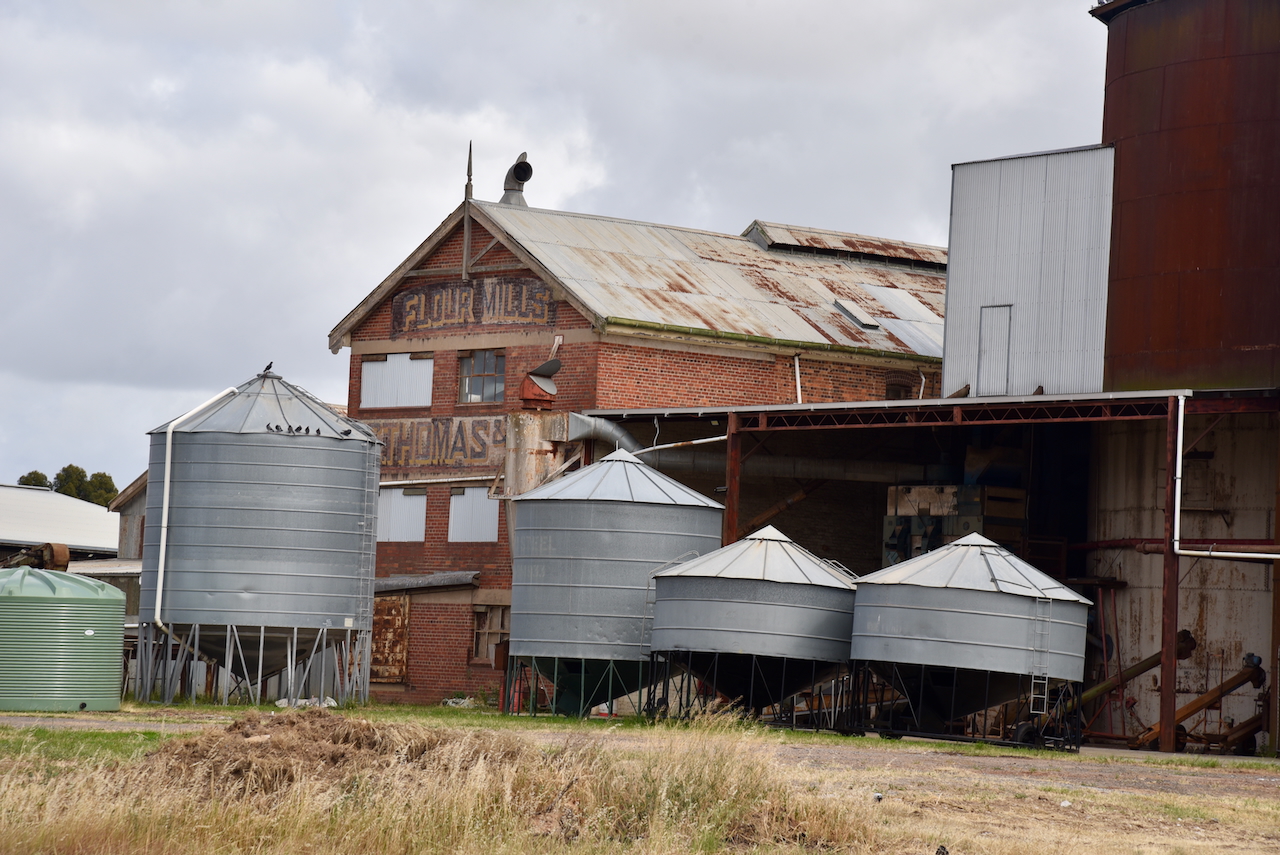
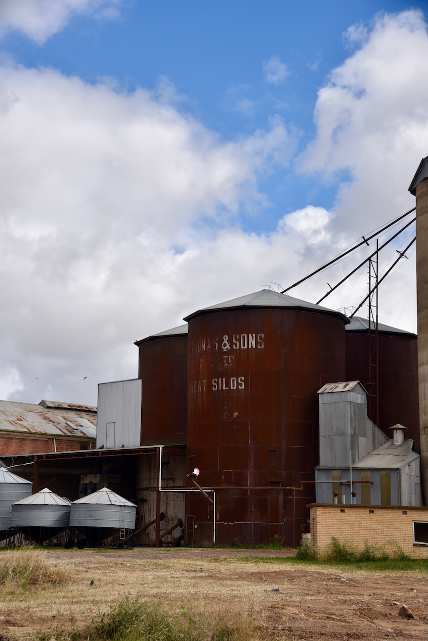
W.C. Thomas ran several flour mills throughout Victoria. This included the Warracknabeal mill which operated from 1884 to 1964. (Victorian Collections 2018)
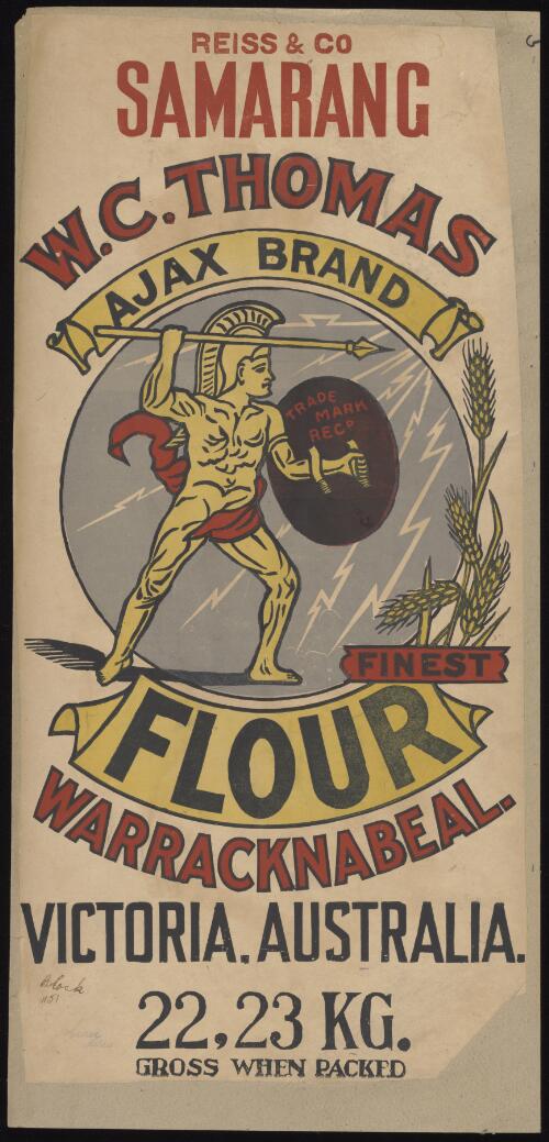
Above:- W.C. Thomas & Sons advertisement. Image c/o National Library of Australia.
We parked on Borung Highway in the activation zone of the two silos, and operated from the 4WD. We ran the Icom IC-7000, 100 watts, and the Codan 9350 antenna with the 1.5 metre stainless steel whip.
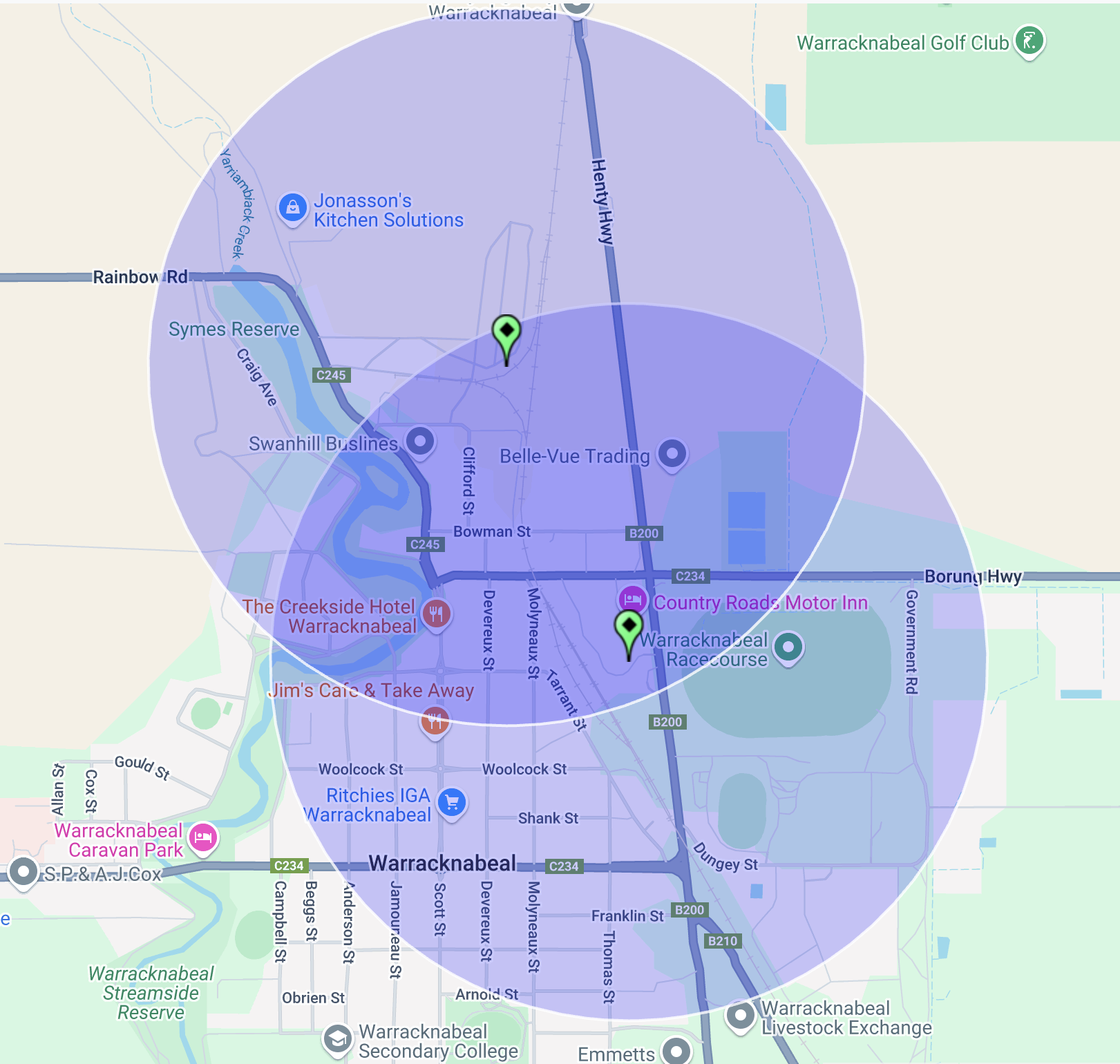
Above:- the activation zone at the two silos in Warracknabeal. Image c/o SiOTA website.
Marija logged the following stations on 40m SSB:-
I logged the following stations on 40m SSB:-
I worked the following stations on 20m SSB:-
References.
Amateur Radio, Short Wave Listening, travel and history
Amateur radio experiences with VK1DA
Brisbane - Australia
german amateur radio station
Summits On The Air
SOTA on the peaks, wilderness QRP and some bushwalking
A fine WordPress.com site
Amateur Radio Adventures
Summits on the Ai
Amateur radio station from Belgium
Radio craft, homebrew, QRP/SOTA, AM
Ego loqui ad viros super montes
My adventures with Amateur Radio and Geocaching!
The rantings of VK2GAZ on his SOTA experiences in Australia
A survivor, with minor cuts and abrasions.
The Art and Craft of Blogging
The latest news on WordPress.com and the WordPress community.
Blog of Justin Giles-Clark VK7TW's SOTA and amateur radio adventures.
Occasional SOTA & Microwave operation
