Litchfield silo VK-LTD3

Our next activation for 24th October 2024, was the Litchfield silo VK-LTD3 for the Silos On The Air (SiOTA) program.

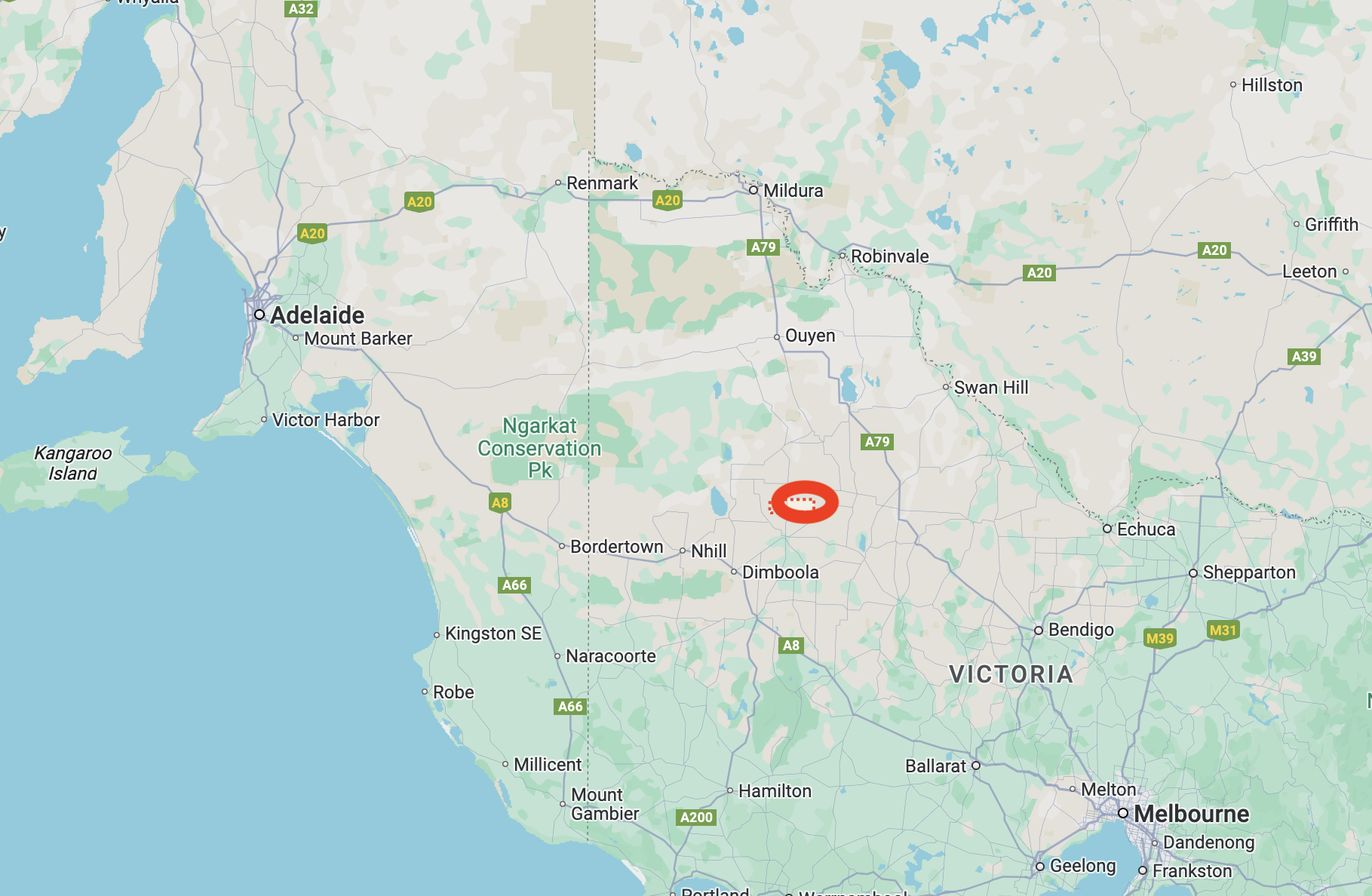
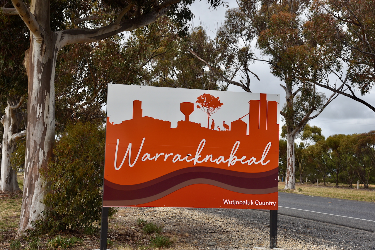
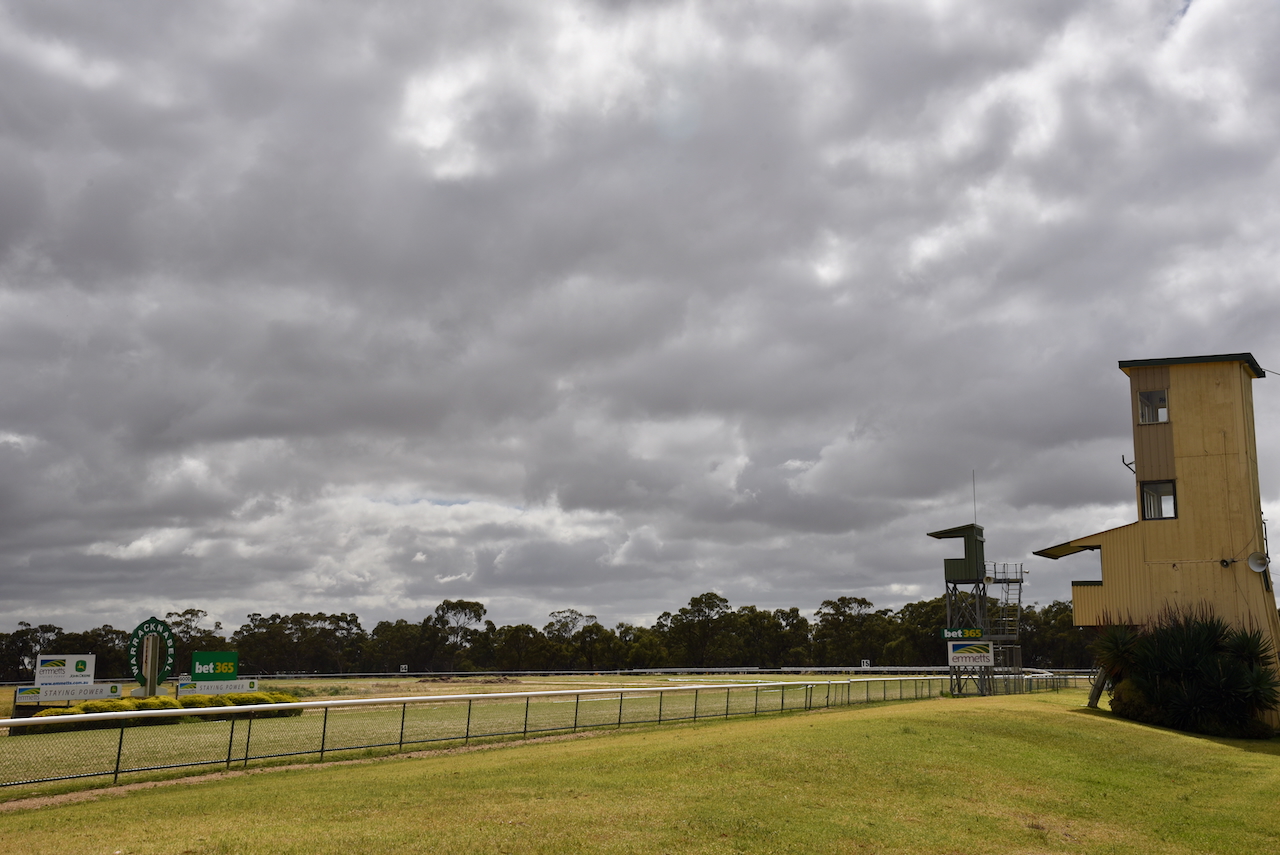
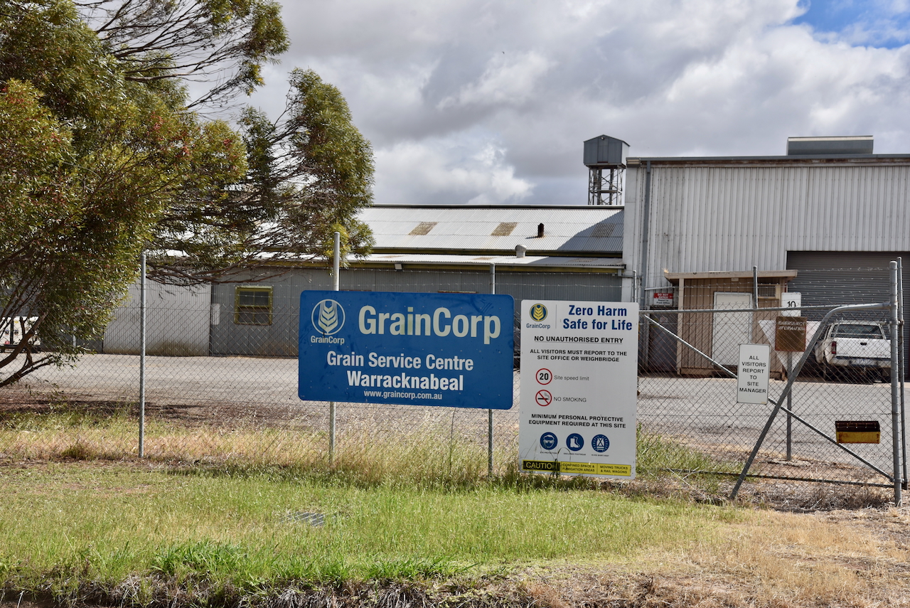
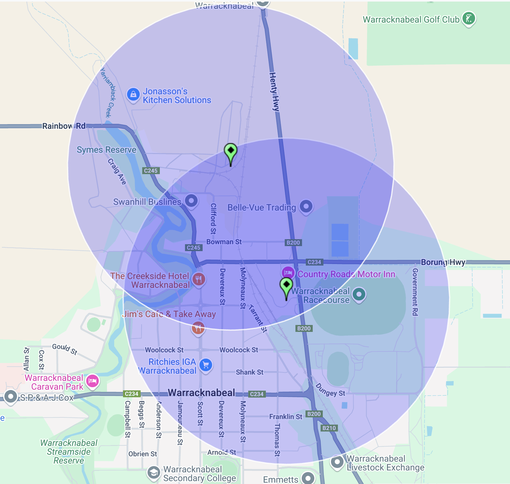
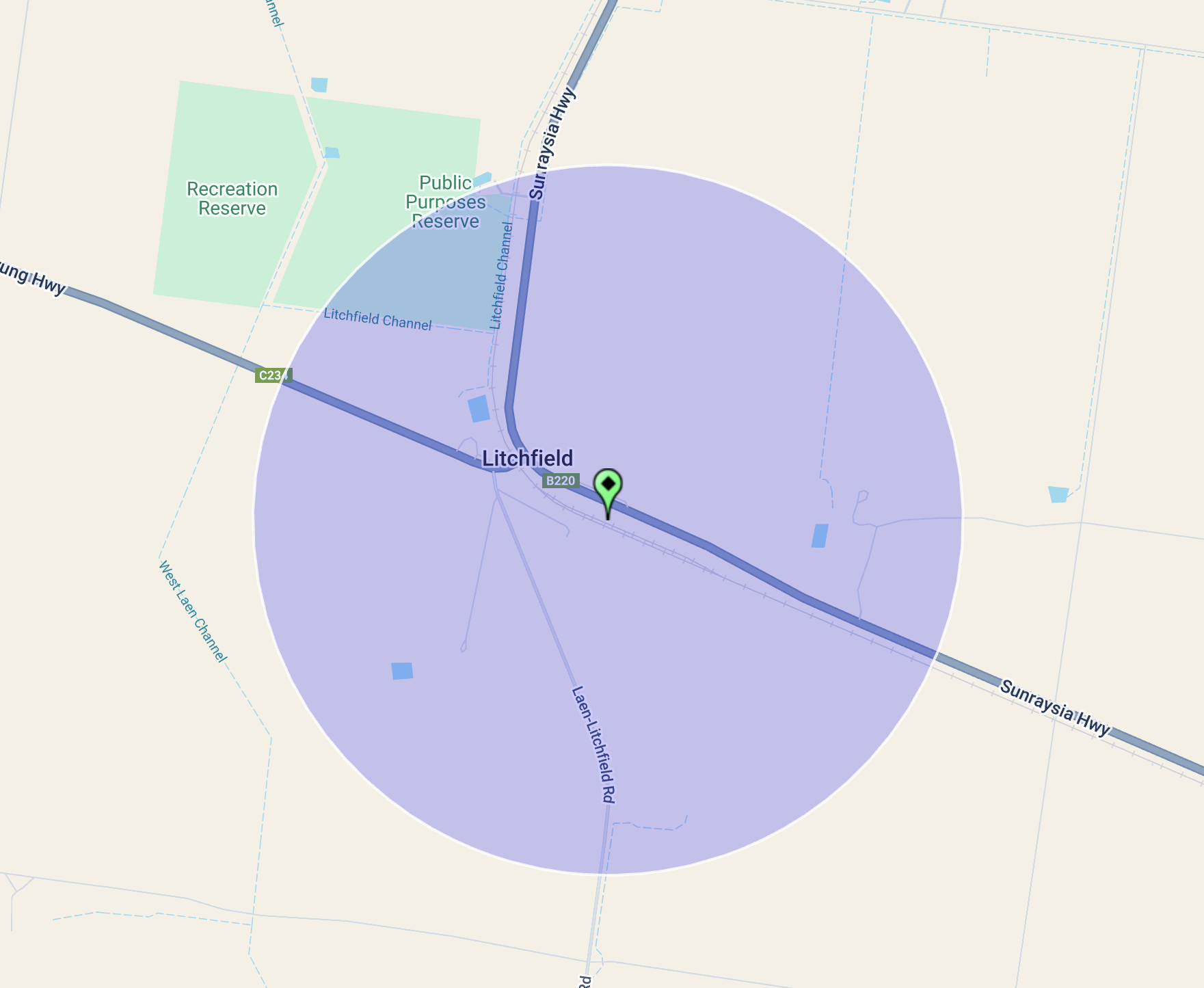
Litchfield is located about 43 km east of Warracknabeal and about 295 km northwest of Melbourne.

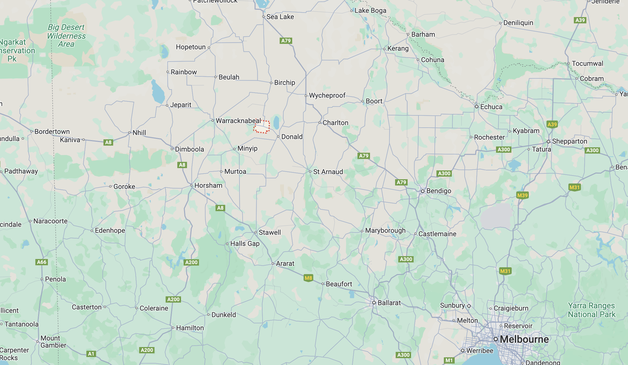
Above:- Map showing the location of Litchfield, Victoria. Map c/o Google Maps.

European settlers commenced establishing properties in the district during the mid 1840s. In 1845, Charles Wedge established ‘Banyenong West’ run. In 1846 the run was owned by Robert Macredie and was divided into ‘Carron’ and ‘Papp’ runs. These were both subsequently acquired by George Pyers. (Donaldhistory.org.au 2018)

Following the 1869 Land Act, which allowed the district to be opened up to smaller selectors, about 14 selectors took up about 4,000 acres of land in the Parish of Witchipool. (Donaldhistory.org.au 2018)

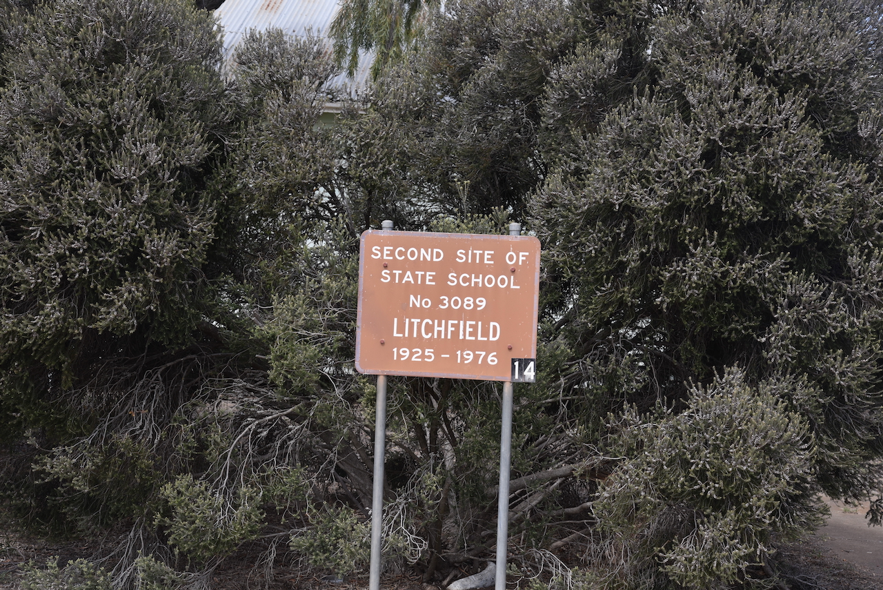
The area around Litchfield was originally known as Witchipool, named after the Parish. It was taken up for farm selections between 1873 and 1876. In 1877 the Witchipool Post Office was opened. In 1879 the Witchippol East school was opened. This was followed by the Witchipool West School in 1880 and Carron in 1881. In 1882, the district’s hotel was opened at Carron. (Victorianplaces.com.au 2015)

In 1893, the railway was extended from Donald to Birchip. A station was erected near a general store that was operated by Joseph Litchfield. The station was named after Litchfield. For several years, both names were used. In 1907, the Witchipool Post Office and school were named Litchfield. (Victorianplaces.com.au 2015)

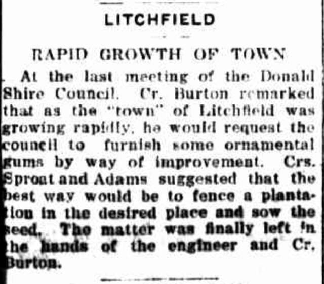
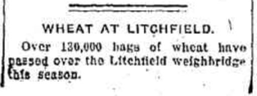
Above:- Article from the Sunraysia Daily, Tue 30 Jun 1925. Image c/o Trove.

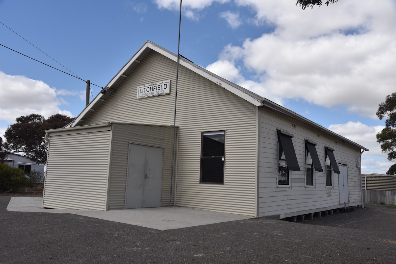
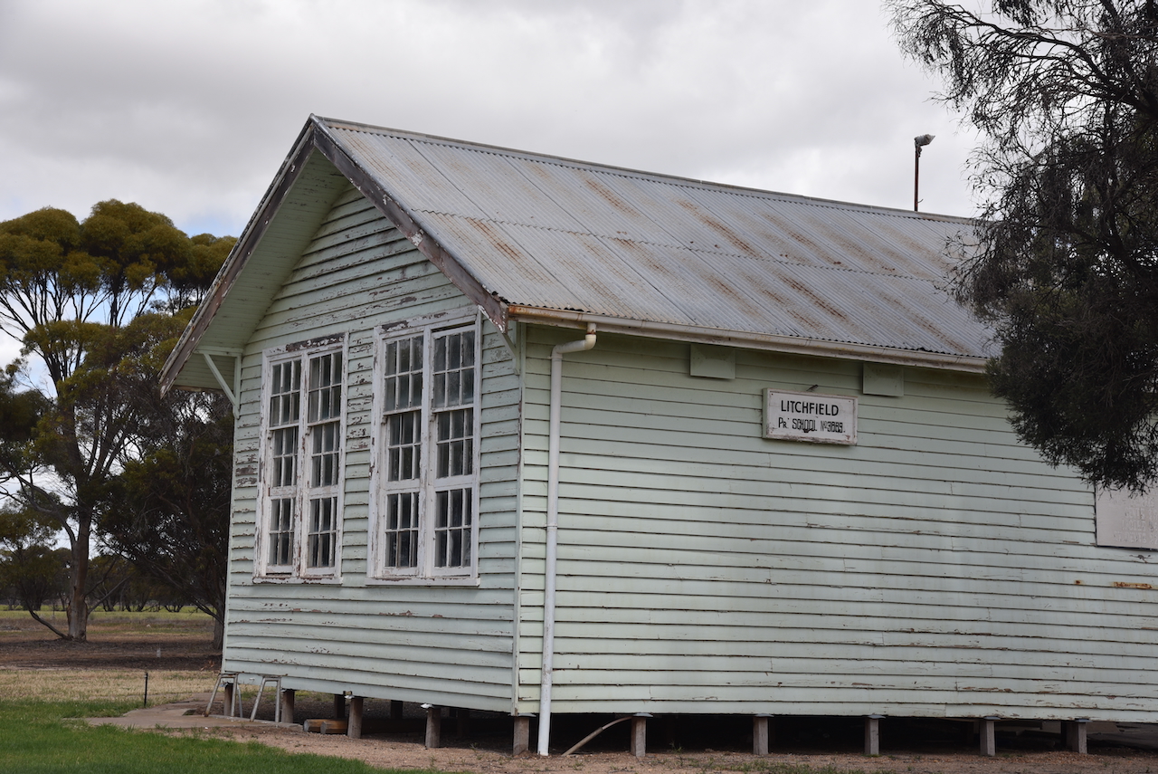
Today the Litchfield Public Hall and one of the schools remain.

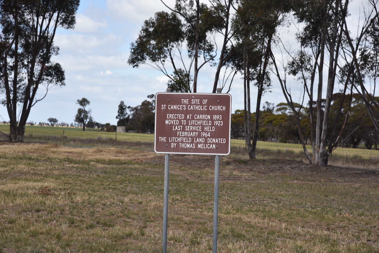
During the 1920s, the Carron Catholic church building, which was constructed in 1893, was moved to Litchfield. (Victorianplaces.com.au 2015)

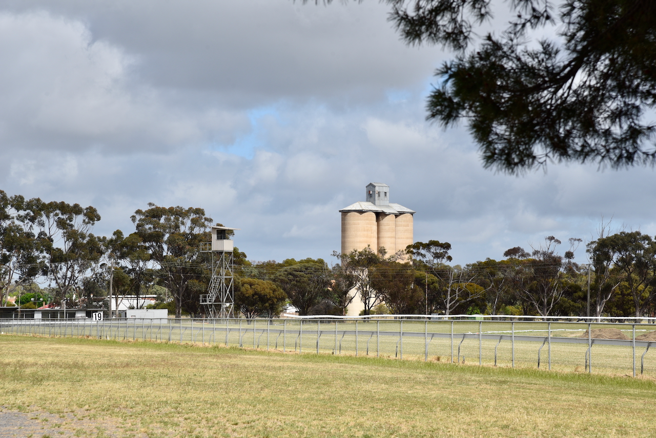
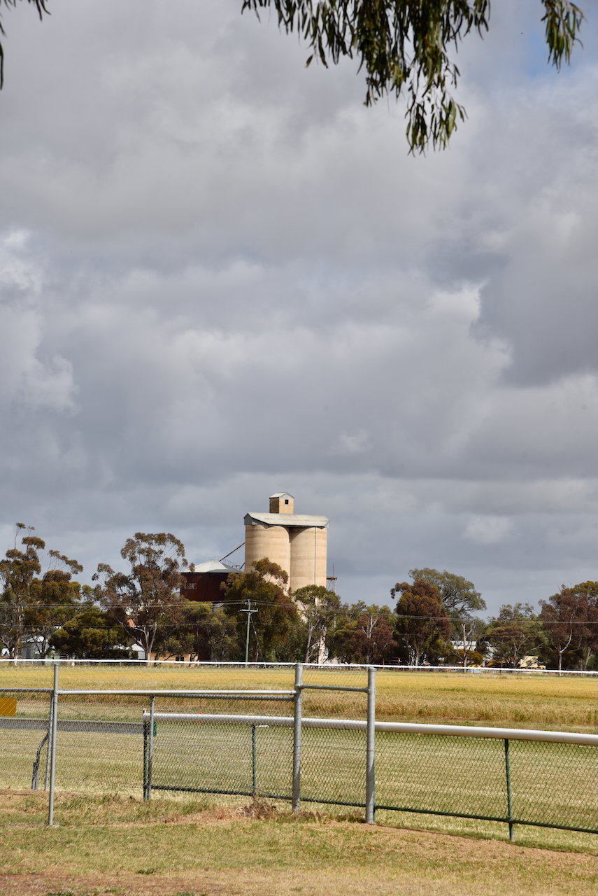
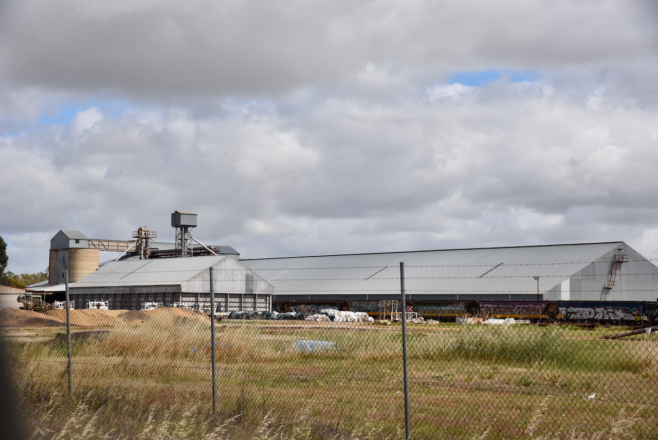
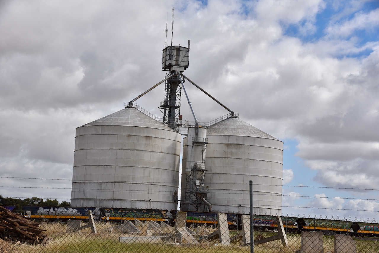
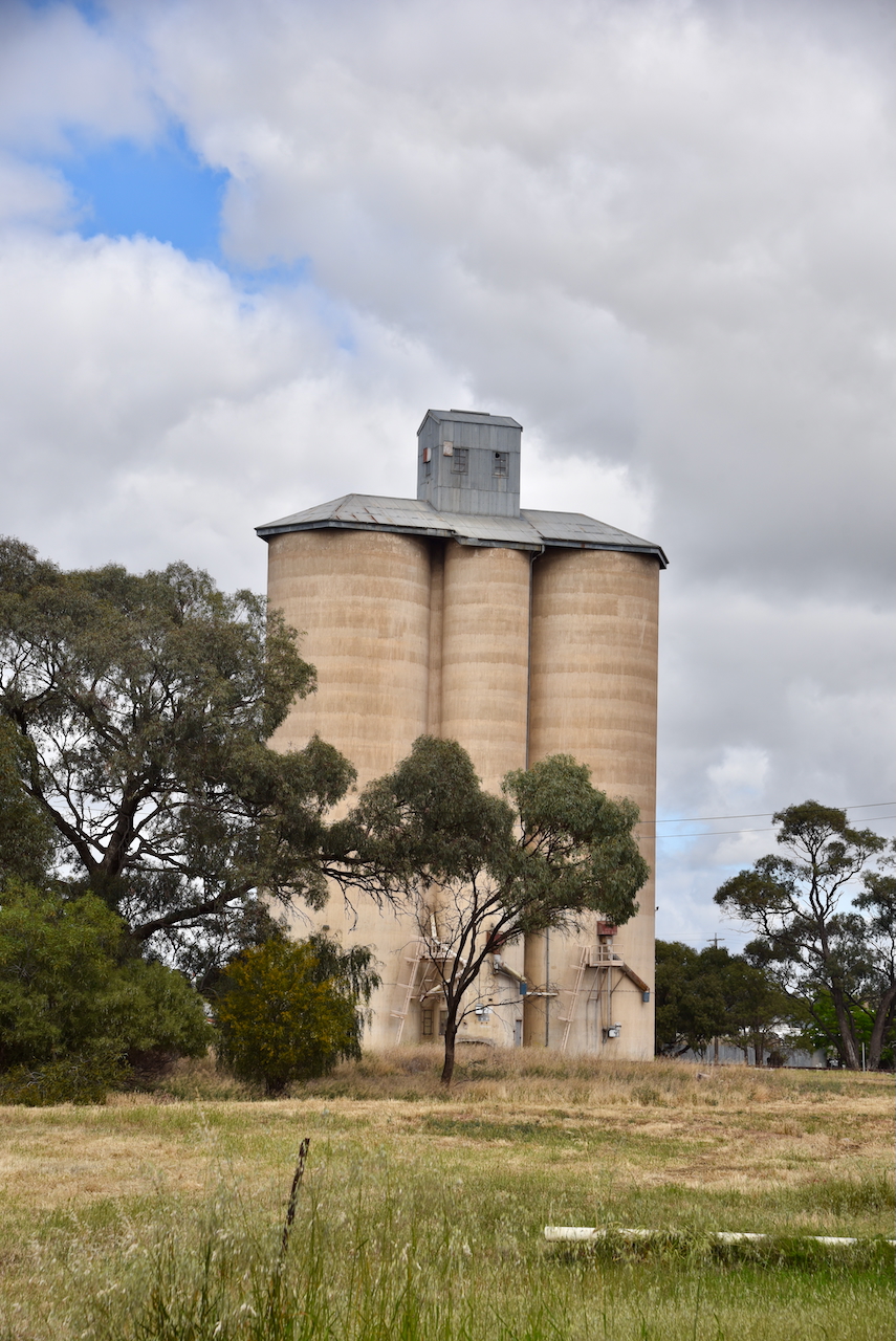
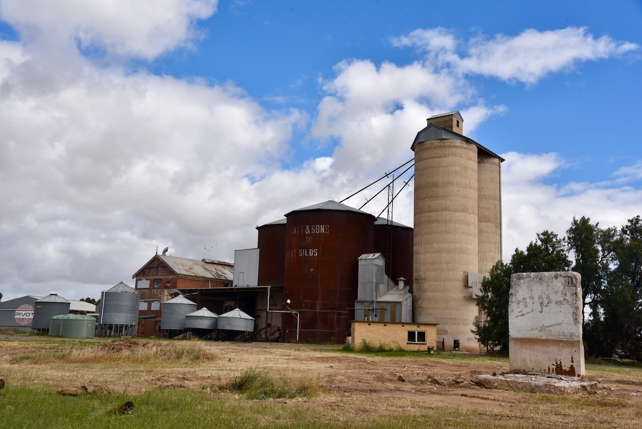
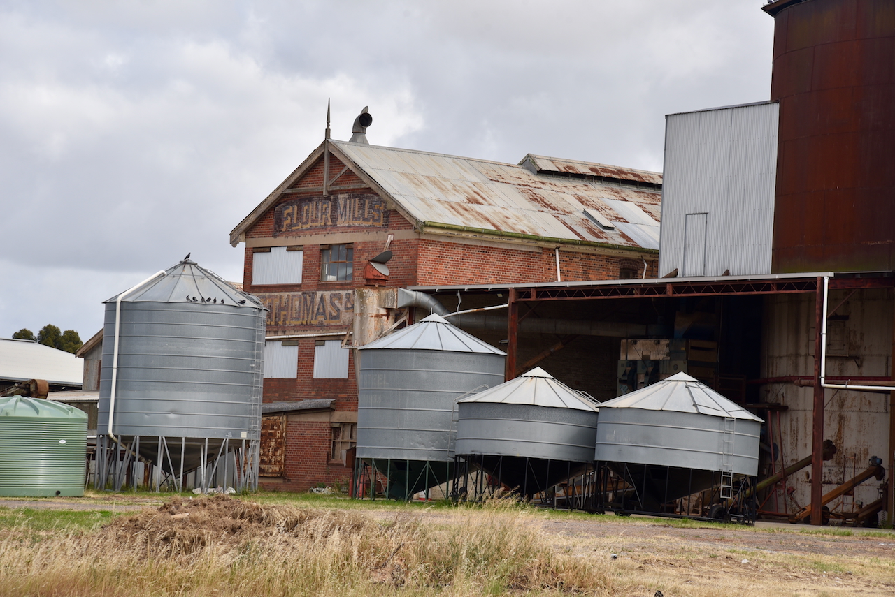
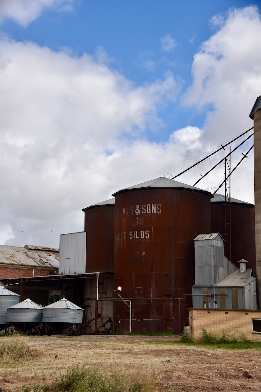
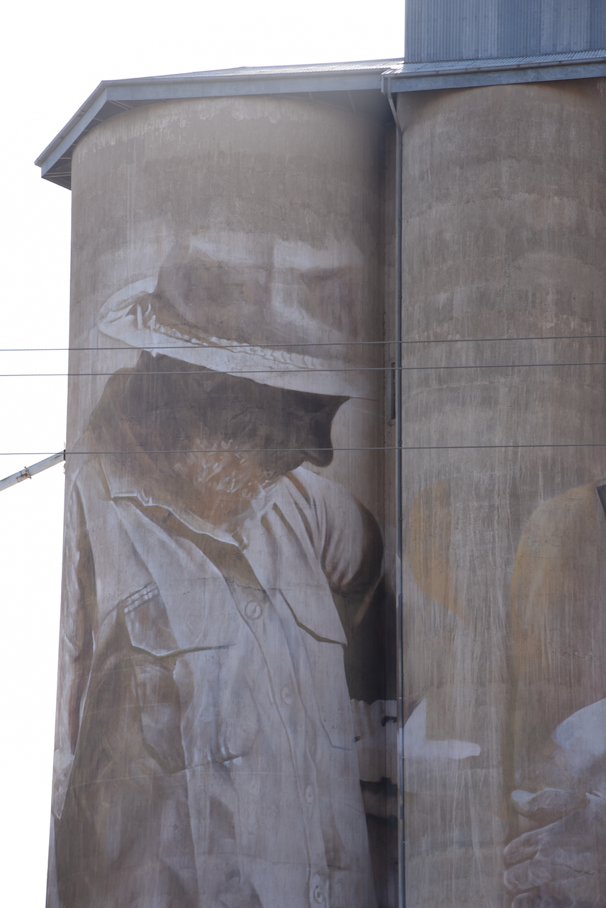
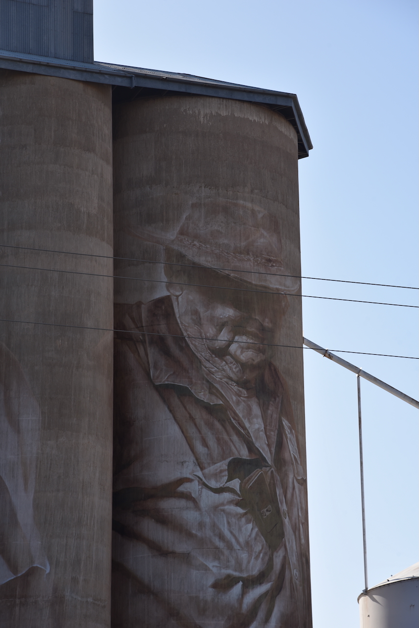
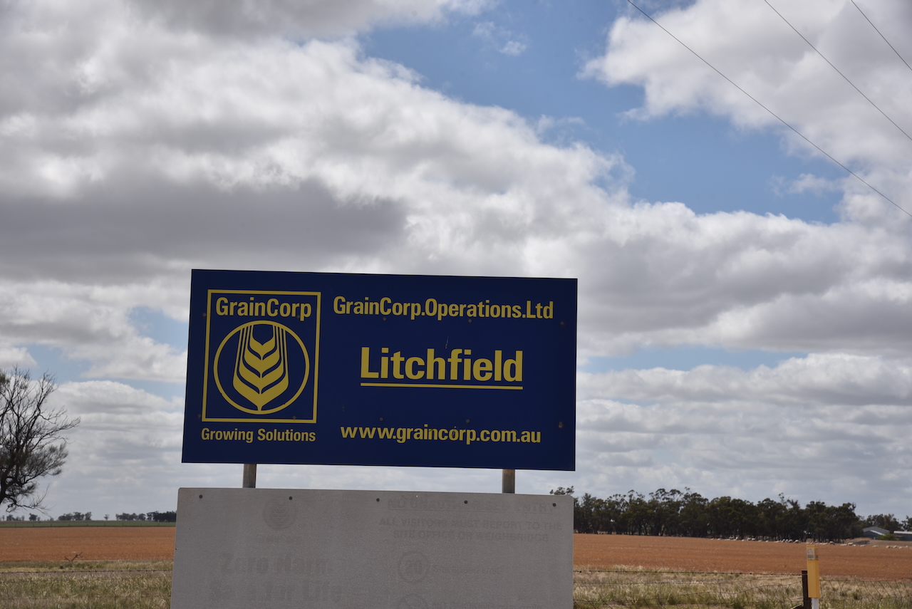
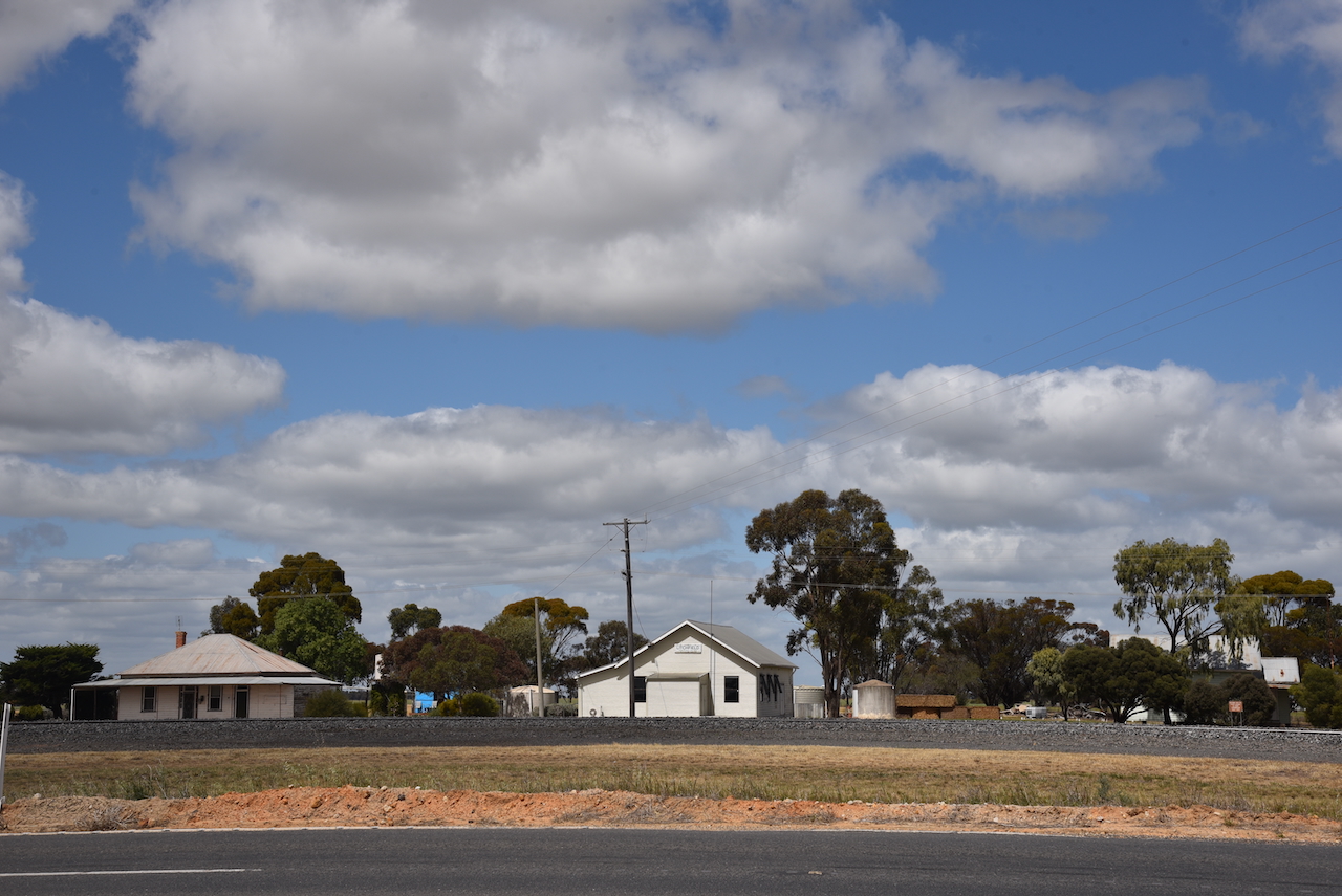
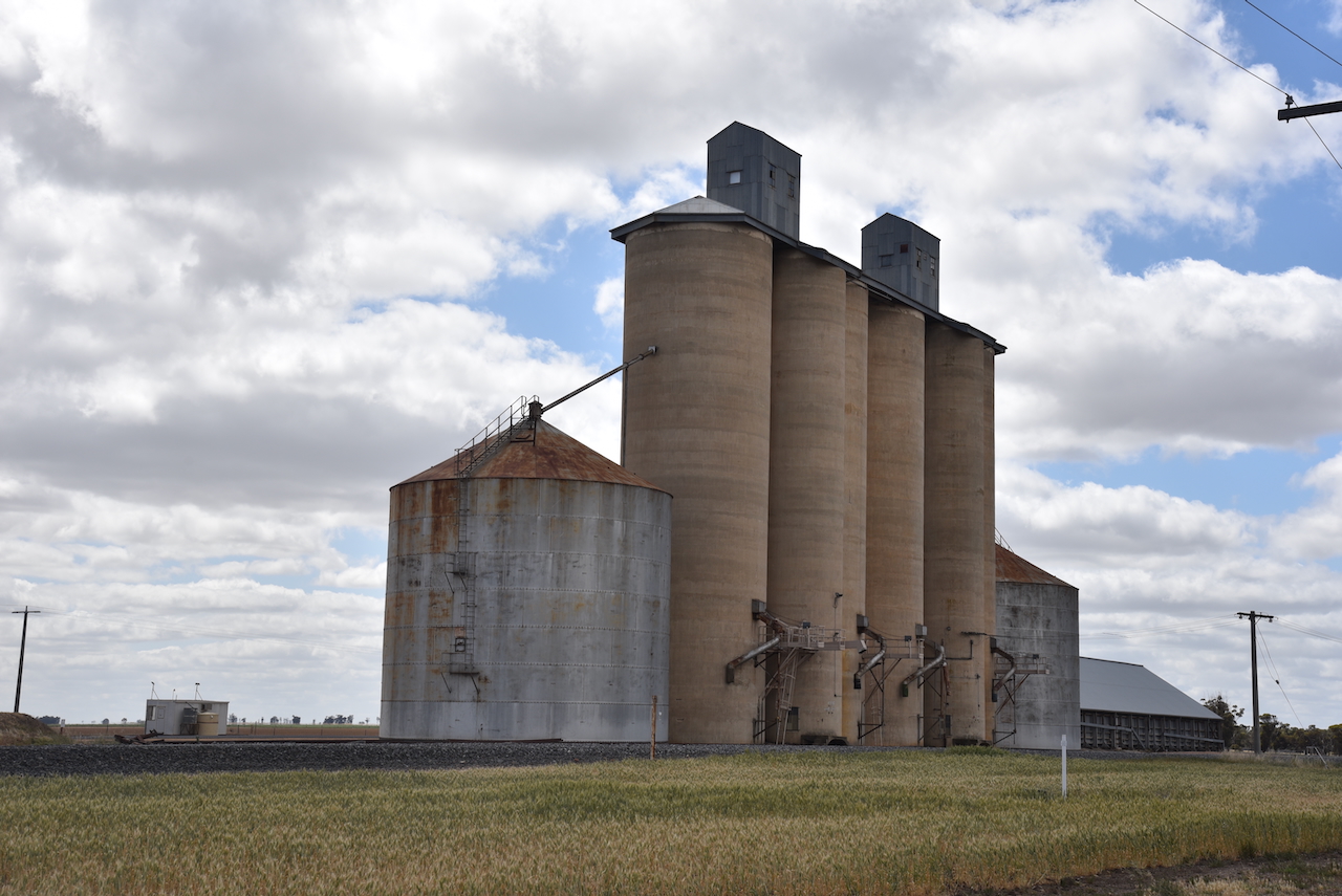
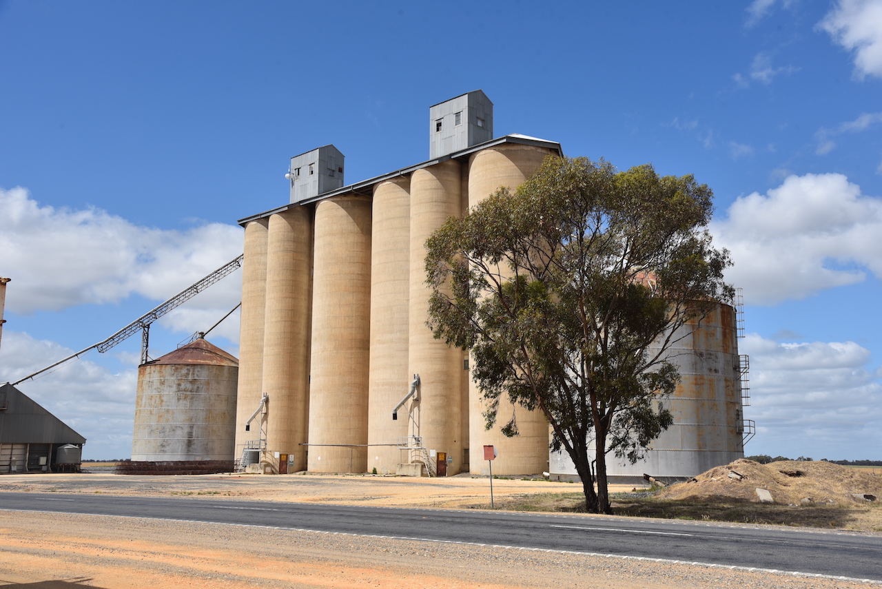
Not much remains at Litchfield today. If it were not for the imposing silos, you might not even notice the little town.

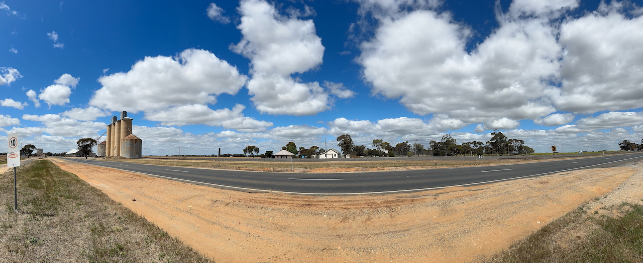
Litchfield was a large wheat-receiving point for the district. (Victorianplaces.com.au 2015)

Above:- Article from the Warracknabeal Herald, Tue 14 Mar 1916. Image c/o Trove

In 1939-40 silos replaced the shed that was used for storing bagged grain. (Victorianplaces.com.au 2015)

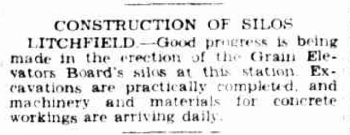
Above:- Article from The Argus, Melbourne, Tue 21 Mar 1939. Image c/o Trove

The Litchfield silos are located on the southern side of Sunraysia Highway.

Marija and I parked alongside of the silos and operated from the 4WD. We ran the Icom IC-7000, 100 watts, and the Codan 9350 antenna with the 1.5 metre stainless steel whip.

Above:- The activation zone at the Litchfield silo. Image c/o SiOTA website.

Marija worked the following stations on 40m SSB:-

  1. VK3PF
  2. Vk3APJ
  3. VK3WSG/M

Marija worked the following stations on 20m SSB:-

  1. VK1AO
  2. VK2MET
  3. VK4MGL

I worked the following stations on 40m SSB:-

  1. VK3PF
  2. VK3APJ
  3. VK3WSG
  4. VK2UW/M
  5. VK2SLO/M
  6. VK3MCA
  7. VK5KVA

References.

  1. Donaldhistory.org.au. (2018). Litchfield | Donald History Society Inc. [online] Available at: https://donaldhistory.org.au/welcome/rich-avon/ [Accessed 16 Mar. 2025].
  2. ‌Victorianplaces.com.au. (2015). Litchfield | Victorian Places. [online] Available at: https://www.victorianplaces.com.au/litchfield [Accessed 16 Mar. 2025].‌

Warracknabeal silo VK-WRL3 and Warracknabeal North silo VK-WRT3

After leaving Brim (24th October 2024), Marija and I drove back into Warracknabeal, where we activated the Warracknabeal silo VK-WRL3 and the Warracknabeal North silo VK-WRT3.

Warracknabeal is about 338 km northwest of Melbourne.

It is believed that Warracknabeal is derived from the Wotjobaluk aboriginal language to describe the impressive river redgums that line the banks of the Yarriambiack Creek. (Aussie Towns 2016)

Before activating the silos, we visited the Warracknabeal racecourse. I have placed a few bets on horses running at this racecours over the years.

We could clearly see the concrete silos of VK/WRL3 from the racecourse.

The Warracknabeal North silos VK-WRT3 are located on the western side of the Henty Highway, on the northern side of Warracknabeal. They are operated by GrainCorp.

The Warracknabeal silos VK-WRL3 are located at the end of Duncan Street.

The silos are located at the site of the old flour mill which was owned by W.C. Thomas and operated until the mid 1960s. The mill prospered once the railway line from Murtoa and Minyip reached Warracknabeal. (Flickr 2025)

W.C. Thomas ran several flour mills throughout Victoria. This included the Warracknabeal mill which operated from 1884 to 1964. (Victorian Collections 2018)

Above:- W.C. Thomas & Sons advertisement. Image c/o National Library of Australia.

We parked on Borung Highway in the activation zone of the two silos, and operated from the 4WD. We ran the Icom IC-7000, 100 watts, and the Codan 9350 antenna with the 1.5 metre stainless steel whip.

Above:- the activation zone at the two silos in Warracknabeal. Image c/o SiOTA website.

Marija logged the following stations on 40m SSB:-

  1. VK3WSG
  2. VK3PF
  3. VK5FB
  4. VK2IO/P (VKFF-2186)
  5. VK3APJ
  6. VK5TN
  7. VK2VAR
  8. VK2GOM

I logged the following stations on 40m SSB:-

  1. VK3WSG
  2. VK3PF
  3. VK5FB
  4. VK2IO/P (VKFF-2186)
  5. VK3APJ
  6. VK5TN
  7. VK2VAR
  8. VK2GOM
  9. VK2KA
  10. VK3ZSC
  11. VK3BAP

I worked the following stations on 20m SSB:-

  1. VK2LEE
  2. ZL2AJ
  3. VK1AO
  4. VK2NET
  5. VK4EHI
  6. VK4EMP
  7. VK4TI
  8. VK4GKO

References.

  1. Aussie Towns. (2016). Warracknabeal, VIC – Aussie Towns. [online] Available at: https://www.aussietowns.com.au/town/warracknabeal [Accessed 16 Mar. 2025].
  2. ‌Flickr. (2025). Warracknabeal. Flourmill of W C Thomas. This flour mill operated till the mid 1960s. [online] Available at: https://www.flickr.com/photos/82134796@N03/49544569406 [Accessed 16 Mar. 2025].‌
  3. Victorian Collections. (2018). Textile – Flour bag – W.C.Thomas, Warracknabeal. [online] Available at: https://victoriancollections.net.au/items/6747afcb64783dd9b2988f6e [Accessed 16 Mar. 2025].‌

Brim silo VK-BRM3

Our first activation for Thursday 24th October 2024, was the Brim silo VK-BRN, for the Silos On The Air (SiOTA) program.

Brim is located about 21 km north of Warracknabeal, and about 357 km northwest of Melbourne.

Above:- Map showing the location of Brim, Victoria. Map c/o Google Maps.

Prior to European settlement, the area around Brim was home to the Wergaia and Wotjobaluk aboriginal people. It is thought that Brim is a local First Nations word meaning “a spring” or “a well”. (Aussie Towns 2023)

The first European to settle in the area was Henry Davis in 1848. During the 1870s, more European settlers moved into the district. In 1870 Brim station homestead was built. In 1890, a school was opened in Brim and this was followed by a Post office. By 1893 the railway between Warracknabeal and Bealuh had opened, and the railway line passed through Brim. (Aussie Towns 2023)

In Simson Street, Brim, you can find the headstone of James Simson. Brime Station had a burial ground and one with a headstone survived, that of James Simson. It was moved to Simson Street. (Findagrave.com 2021)

Simson was formerly a Commander in the Honourable East India Company Service. He died in 1858 after being gored by a bullock. (Vic.gov.au 2015)

The Brim silos are part of the Australian SIlo Art Trail. They were painted in 2016 by the world-renowned Australian artist Guido Van Helten. The silos feature the anonymous faces of Victorian farmers. (Australiansiloarttrail.com 2022) 

There are excellent information boards at the silo detailing the silo art.

Below is an excellent video on Brim and the Brimi silo art.

Marija and I parked in the silo carpark and operated from the vehicle. We ran the Icom IC-7000, 100 watts, and the Codan 9350 antenna with the 1.5 metre stainless steel whip.

Above:- Map showing the activation zone at the Brim silo. Image c/o SiOTA website.

Marija worked the following stations on 40m SSB:-

  1. VK3PF
  2. VK7PJM
  3. VK2VAR
  4. VK2GOM
  5. VK2IO/P (Ryans Lagoon NCR VKFF-2186)

Marija worked the following stations on 20m SSB:-

  1. VK4CEG
  2. VK2VW
  3. VK2HFI
  4. VK2AKA
  5. VK2BUG

I worked the following stations on 40m SSB:-

  1. VK3PF
  2. VK7PJM
  3. VK2VAR
  4. VK2GOM
  5. VK2IO/P
  6. VK3VMM
  7. VK3UP/M
  8. VK3EI
  9. VK3DX
  10. VK1AO
  11. VK2MET
  12. VK3WSG
  13. VK3CR
  14. VK3APJ
  15. VK5MOS
  16. VK3NDG
  17. VK3CJN
  18. VK3QHU
  19. VK3HO
  20. VK2IO/P (Ryans Lagoon NCR VKFF-2186)

I worked the following stations on 20m SSB:-

  1. VK4CEG
  2. VK2VW
  3. VK2HFI
  4. VK2AKA
  5. VK2BUG

References.

  1. Aussie Towns. (2023). Brim, VIC – Aussie Towns. [online] Available at: https://www.aussietowns.com.au/town/brim-vic [Accessed 16 Mar. 2025].
  2. Australiansiloarttrail.com. (2022). \r\n \n Brim Silo Art\n \r\n. [online] Available at: https://www.australiansiloarttrail.com/brim [Accessed 16 Mar. 2025].
  3. ‌‌Findagrave.com. (2021). James Simson (1821-1858) – Find a Grave Memorial. [online] Available at: https://www.findagrave.com/memorial/227832483/james-simson [Accessed 16 Mar. 2025].
  4. ‌Vic.gov.au. (2015). Brim. [online] Available at: https://www.yarriambiack.vic.gov.au/Discover-Yarriambiack/Towns-To-Visit/Brim-Town [Accessed 16 Mar. 2025].