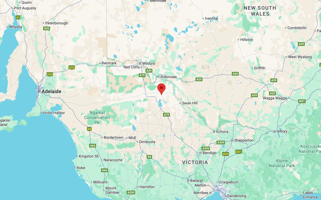
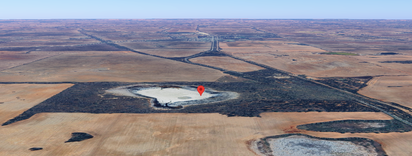
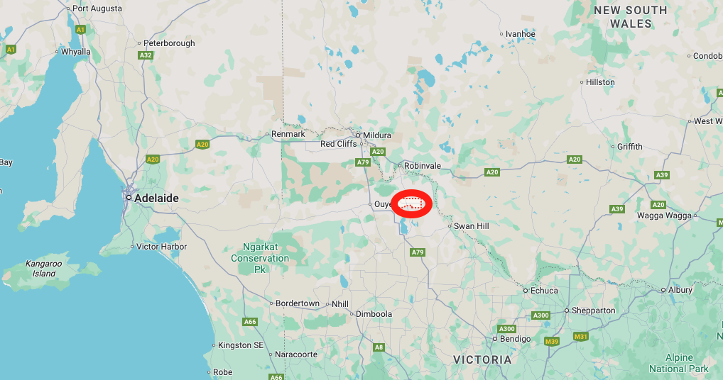
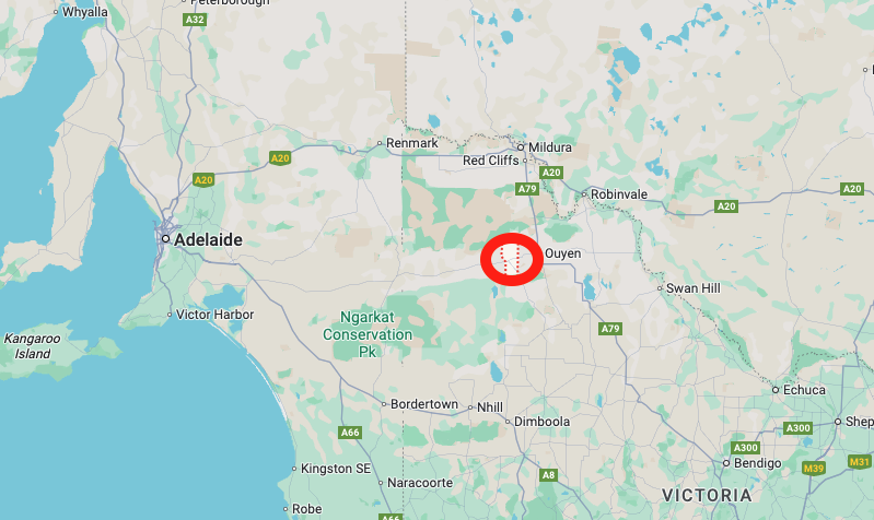
Our next park for Friday, 17th October 2025, was the Degraves Tank Flora Reserve VKFF-2305. The reserve is located about 408 km northwest of Melbourne and about 5 km south of Manangatang.
Above: Map showing the location of the Degraves Tank Flora Reserve. Map c/o Google Maps.
This was only the second time that the park had been activated for the World Wide Flora Fauna (WWFF) program. Mike VK6MB (now a silent key) first activated the reserve back in 2019.
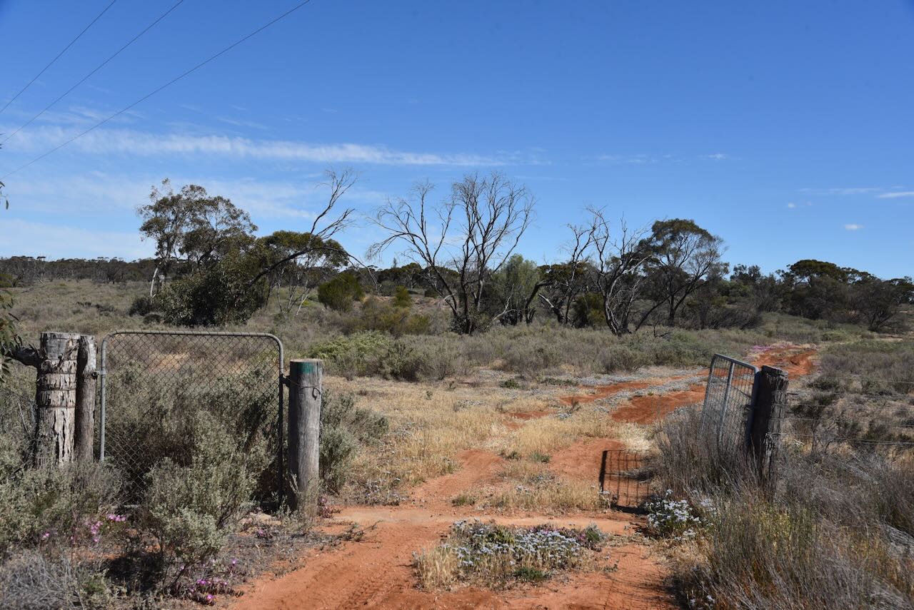
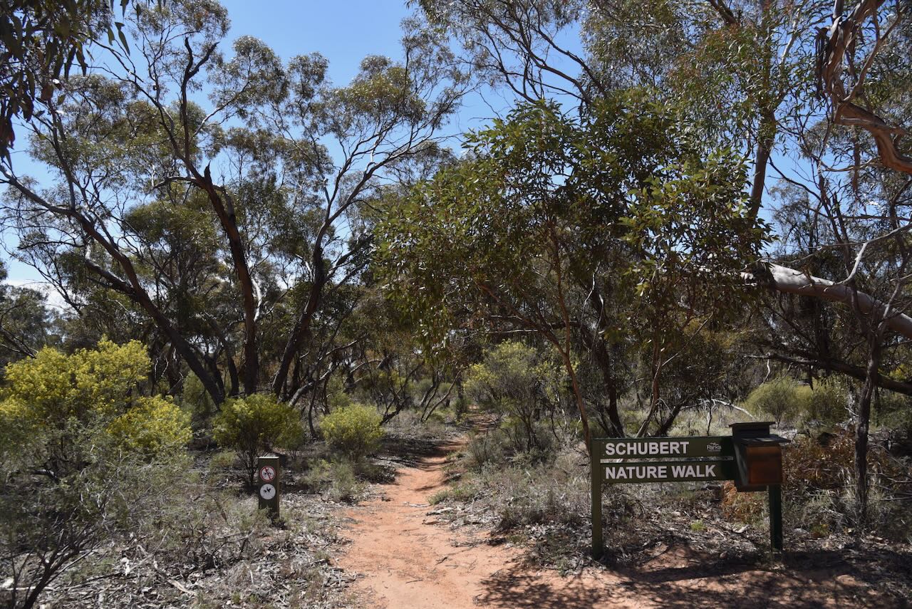
The reserve was easily accessible, with an open gate and a dirt track just to the south of Ridley Road.
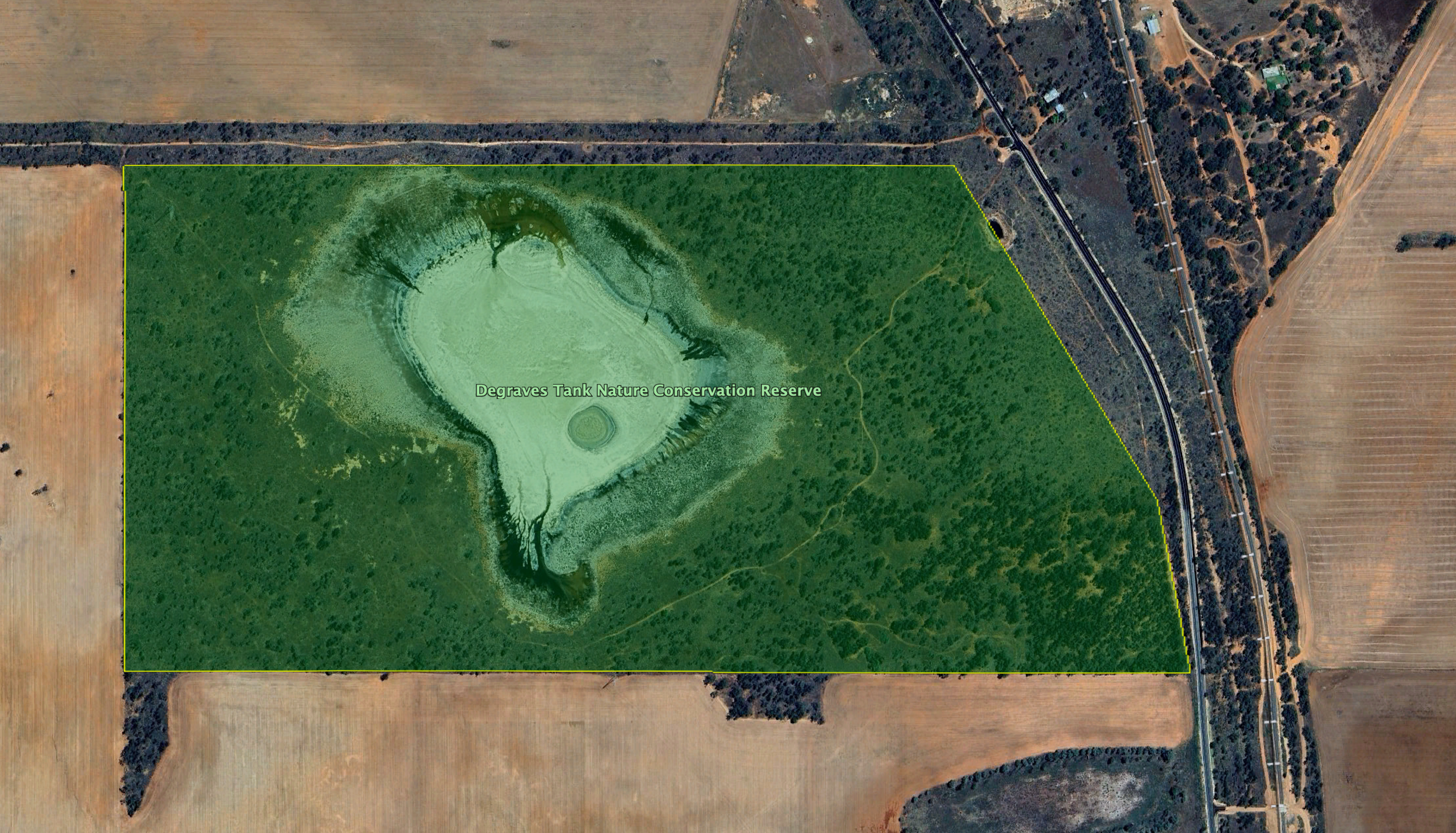
The reserve is bordered by Ridley Road to the north, the Robinvale-Sea Lake Road to the east, and private land to the west and the south.
Above:- An aerial view of the reserve showing its boundaries. Image c/o Google Earth.
Parks Victoria has minimal information about this reserve on their website. The reserve is approximately 108 hectares in size and was established on May 8, 1990. (CAPAD 2024)
Above: An aerial view of the park looking north towards Manangatang. Image c/o Google Maps.
The park is located in the locality of Cocamba, which is derived from an Aboriginal word kookimbo meaning kookaburra. (Blake 1977)
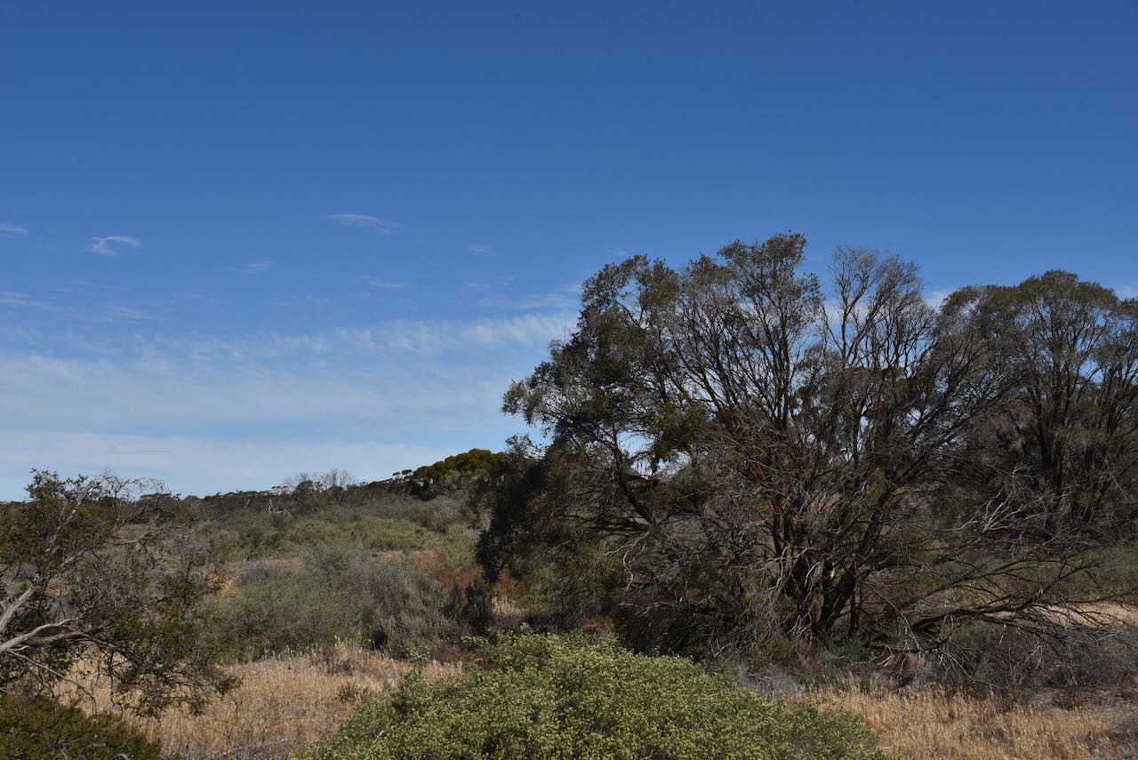
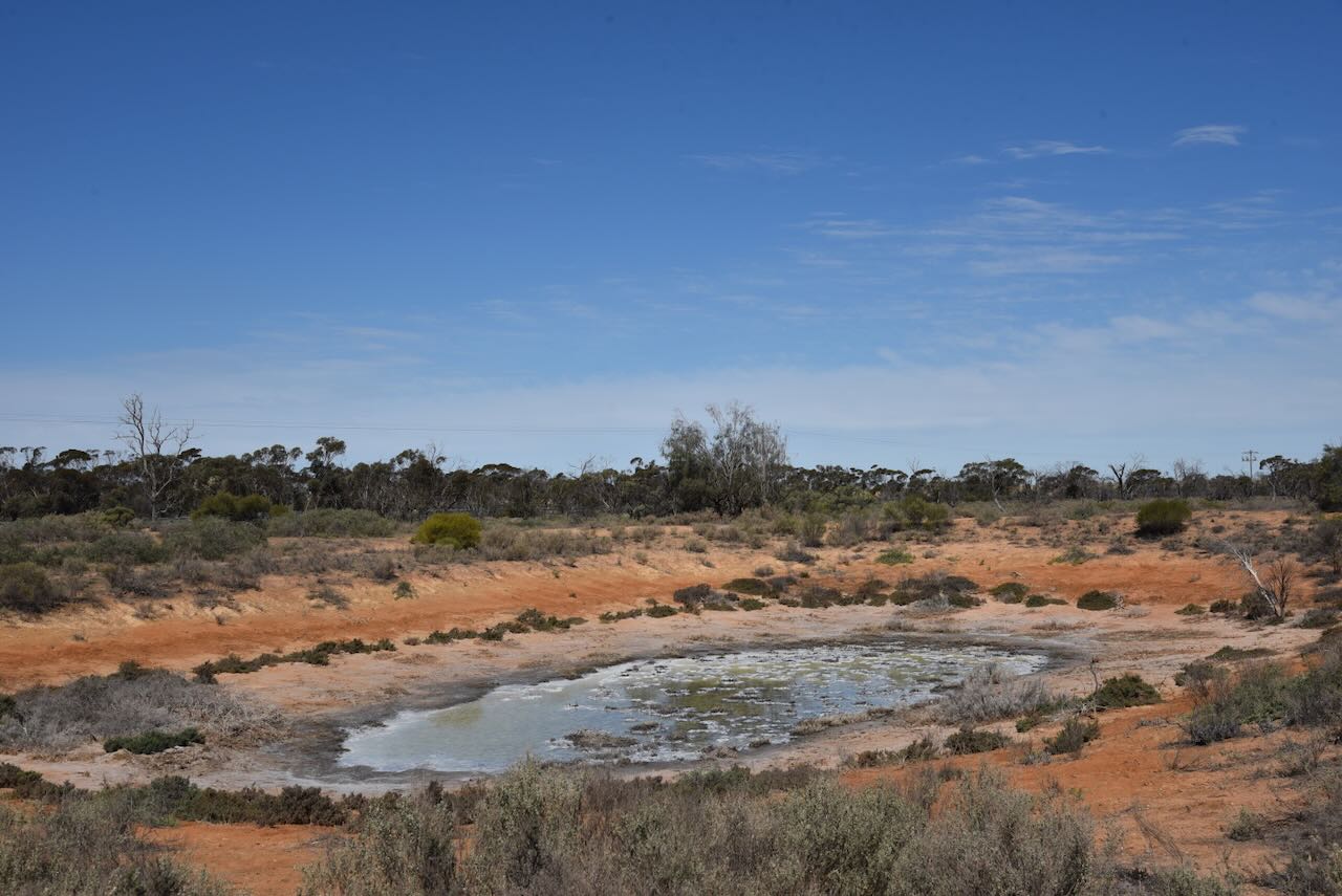
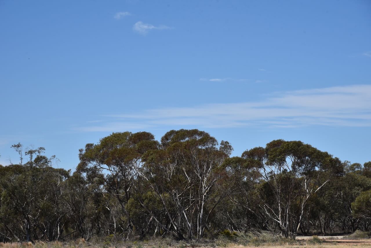
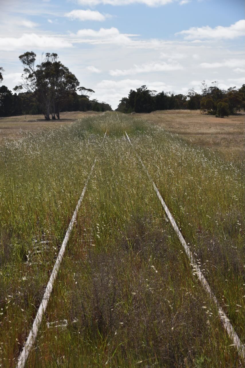
The dam ‘tank’ in the reserve was quite dry during our visit.
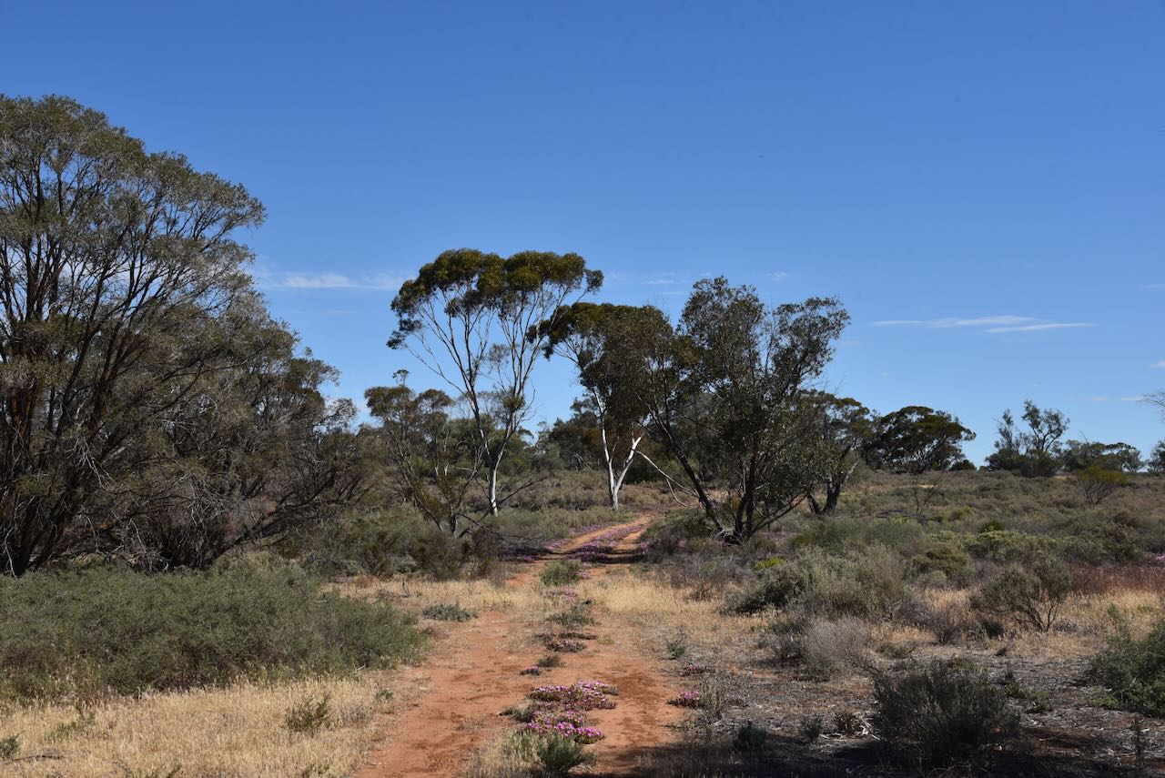
Marija and I set up on the side of the dirt track in the park. We ran the Yaesu FT857, 40 watts, and the 20/40/80m linked dipole.
We made a total of 101 QSOs on 40m SSB. Unfortunately, we were running short of time and did not get a chance to operate on the 20m band.
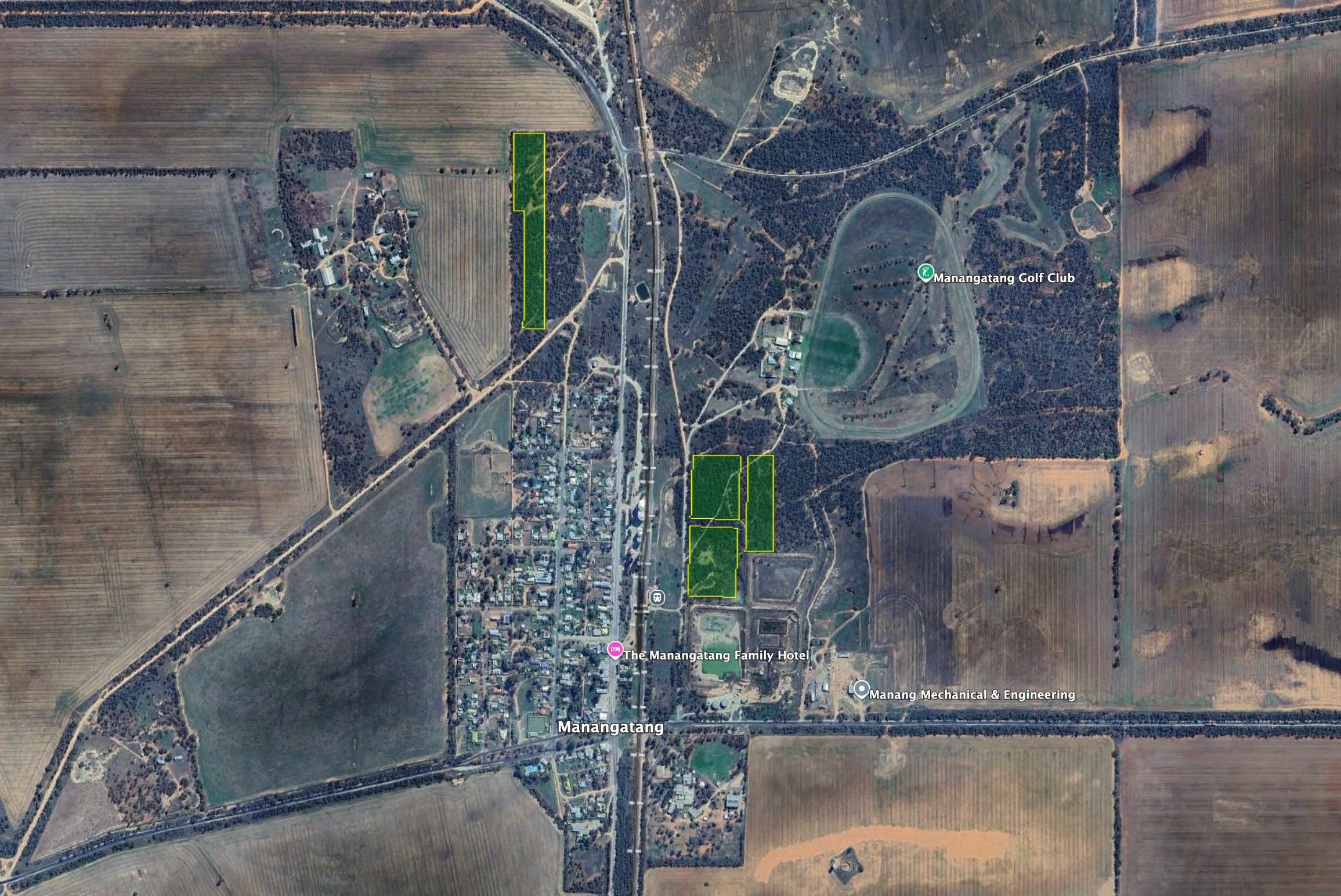
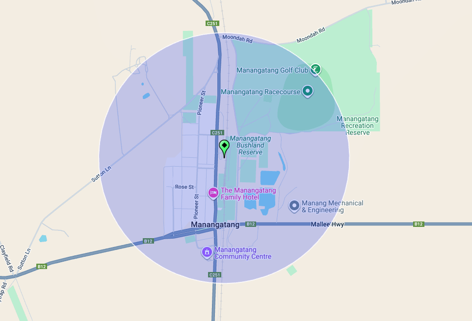
Our next activation on Friday, 17th October 2025, was the Manangatang Bushland Reserve VKFF-5428 & Manangatang silo VK-MNG3.
Manangatang is about 54 km east of Ouyen and about 412 km northwest of Melbourne.
Above: Map showing the location of Mangatang, Victoria. Map c/o Google Maps.
Manangatang is derived from the Aboriginal words ‘manang‘, meaning land and ‘kaaiti’, meaning water. (Wikipedia 2025)
In about 1890, Mr. A.T. Creswick purchased Bumbang Station, which had a ’15 mile’ frontage on the southern side of the Murray River near Robinvale. He owned a hut near the site of the present township of Mangatang. (Robinvaleeuston.com 2016)
In 1911, surveyed blocks, each of about one square mile, were made available. A store was opened in 1912, and on the 6th day of January 1913, the post office was opened. In 1914, a school was opened in a Methodist Hall. In 1915, the town of Mangatang was proclaimed. In January 1919, a police station was established with mounted Constable E.E. Dunkley in charge. (Victorian Places 2015) (Wikipedia 2025)
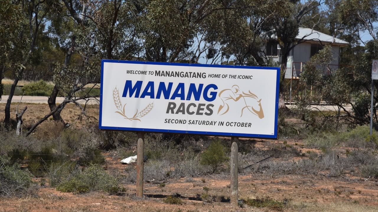
Manangatang has its own horse racing club and a race meeting, the Mangatang Cup, is held each year in October.
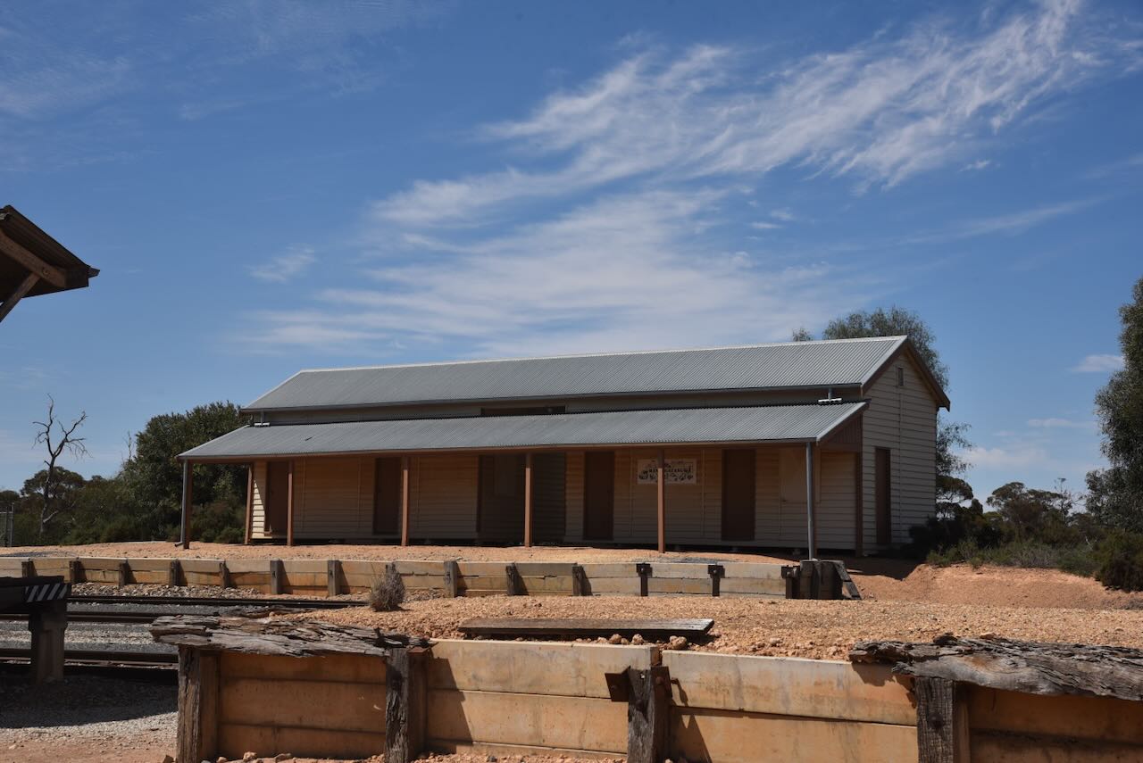
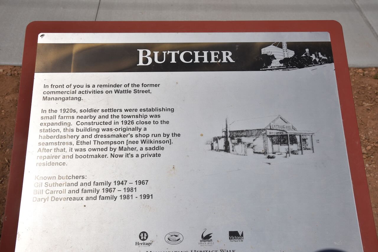
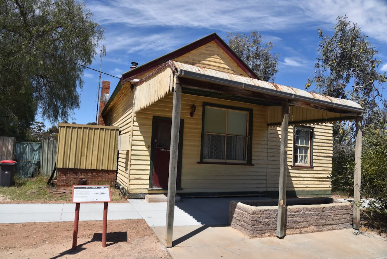
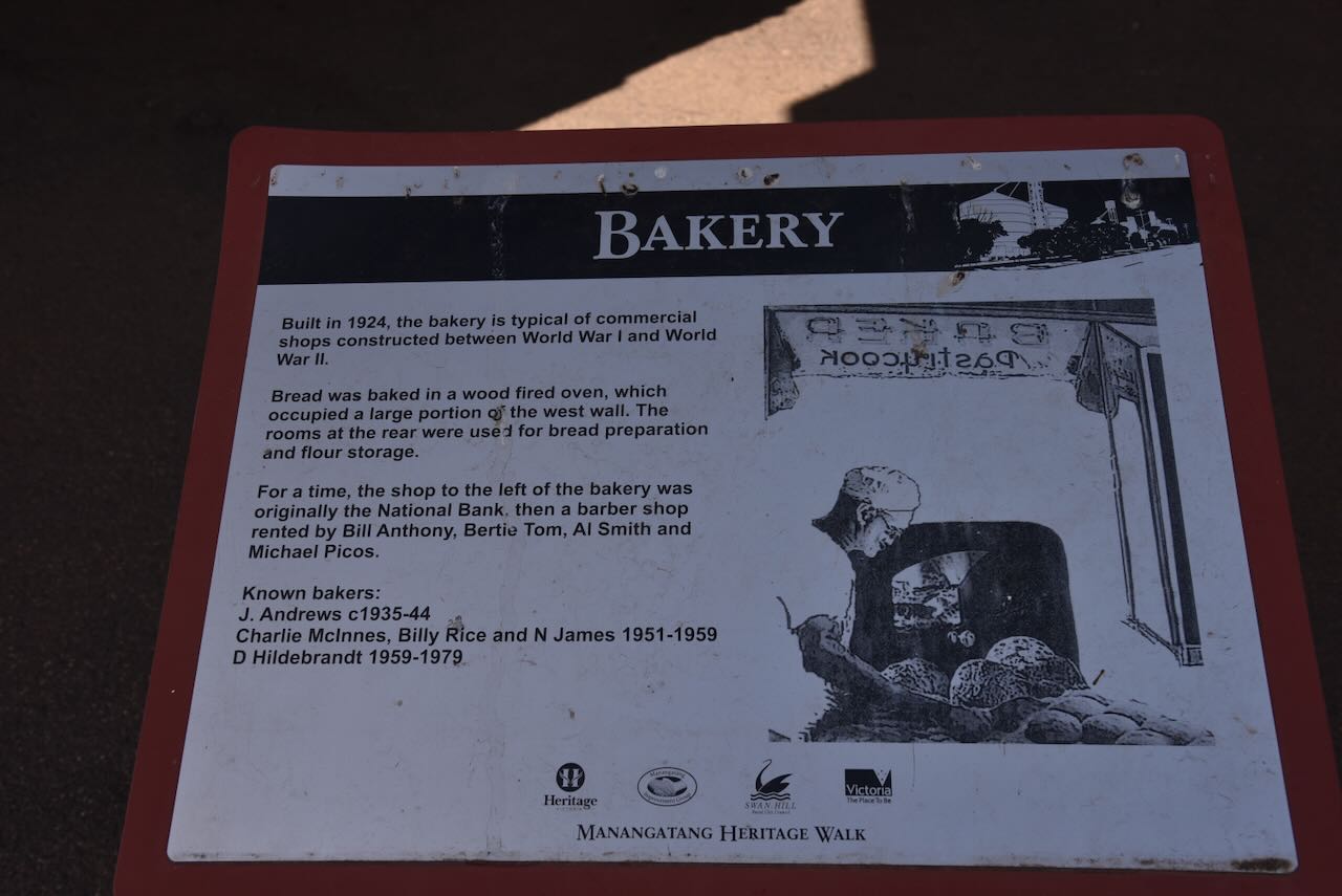
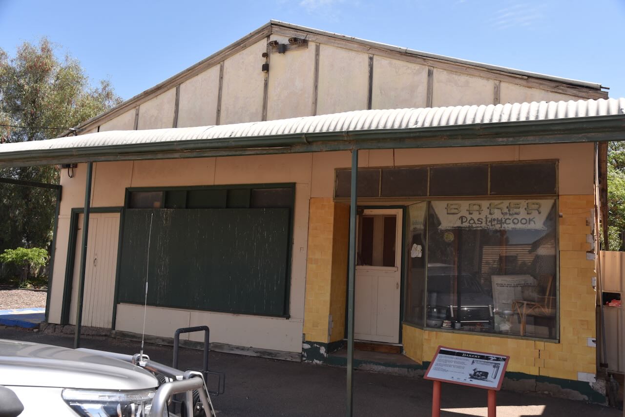
Several historic buildings remain in Manangatang. This includes the railway station, the old butcher shop, and the bakery.
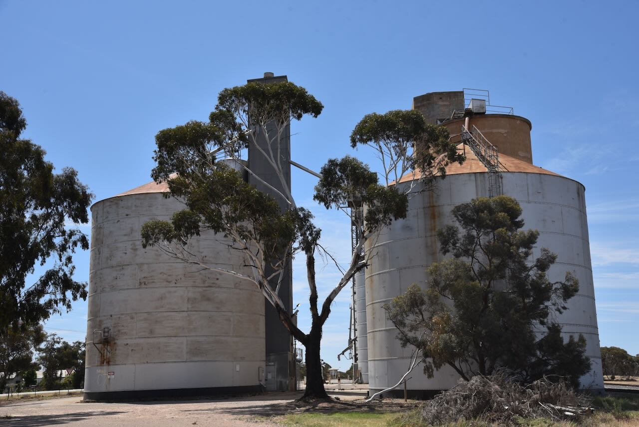
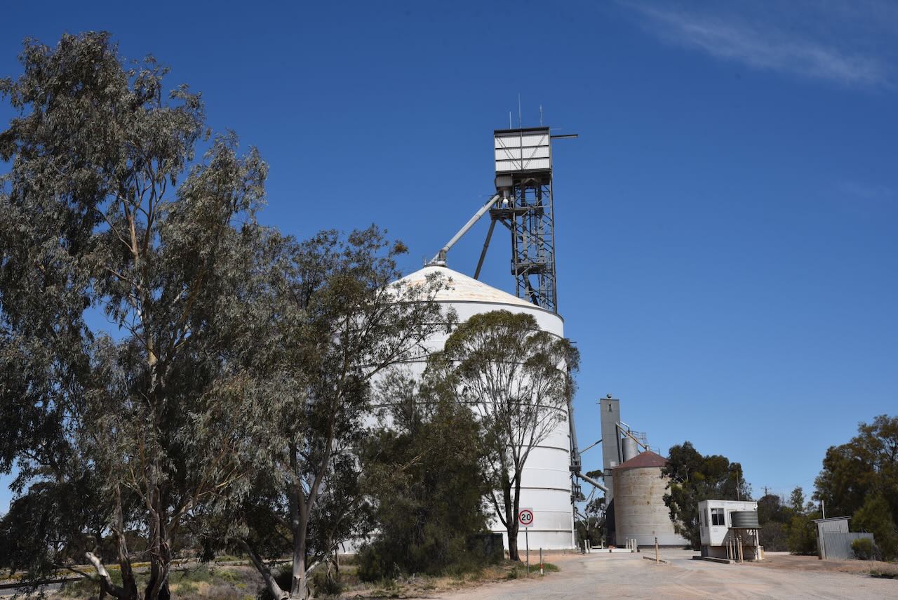
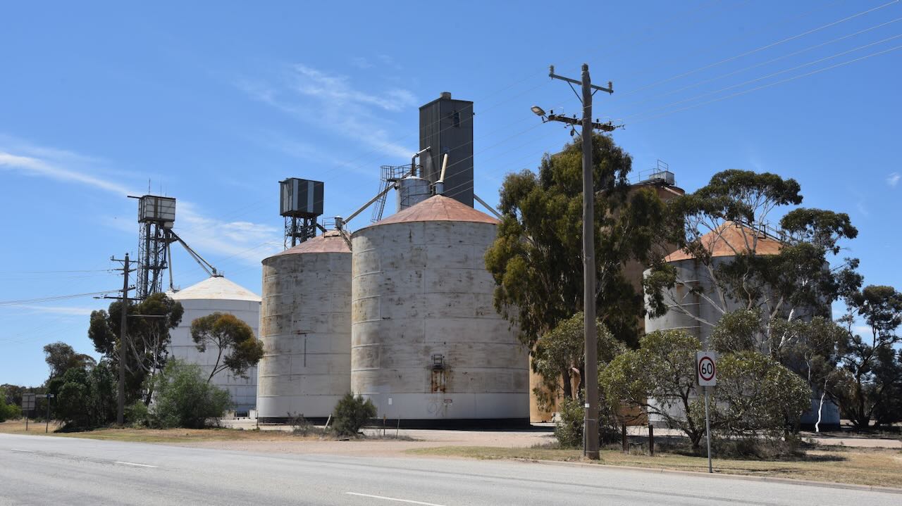
The Mangatang silos are located on the eastern side of Wattle Street, the main street of Manangatang.
The Manangatang Bushland Reserve is split into five different sections with a total of about 9.5 hectares. The reserve is located on the eastern side and northwestern side of the town. (CAPAD 2024)
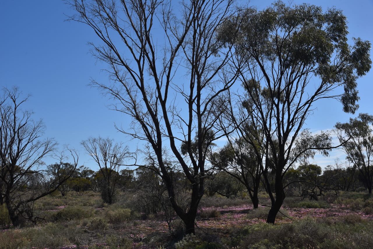
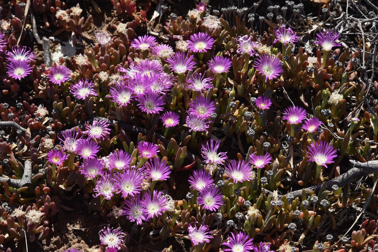
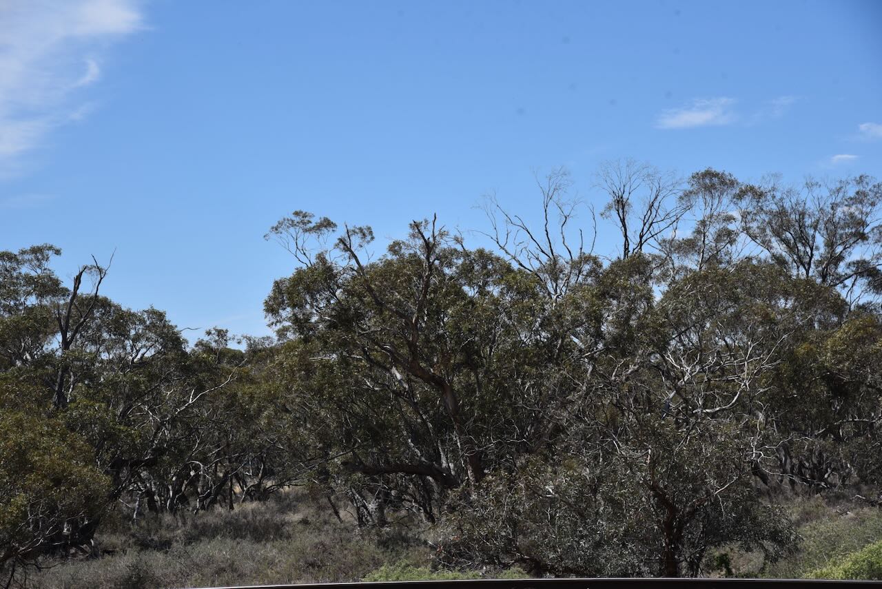
The reserve was established on the 8th day of May 1990. It comprises typical mallee scrub. (CAPAD 2024)
Marija and I operated from the eastern section of the bushland reserve, in the activation zone of the silo. We ran the Yaesu FT857, 40 watts, and the 20/40/80m linked dipole.
Above: the activation zone at the Manangatang silos. Image c/o SiOTA website.
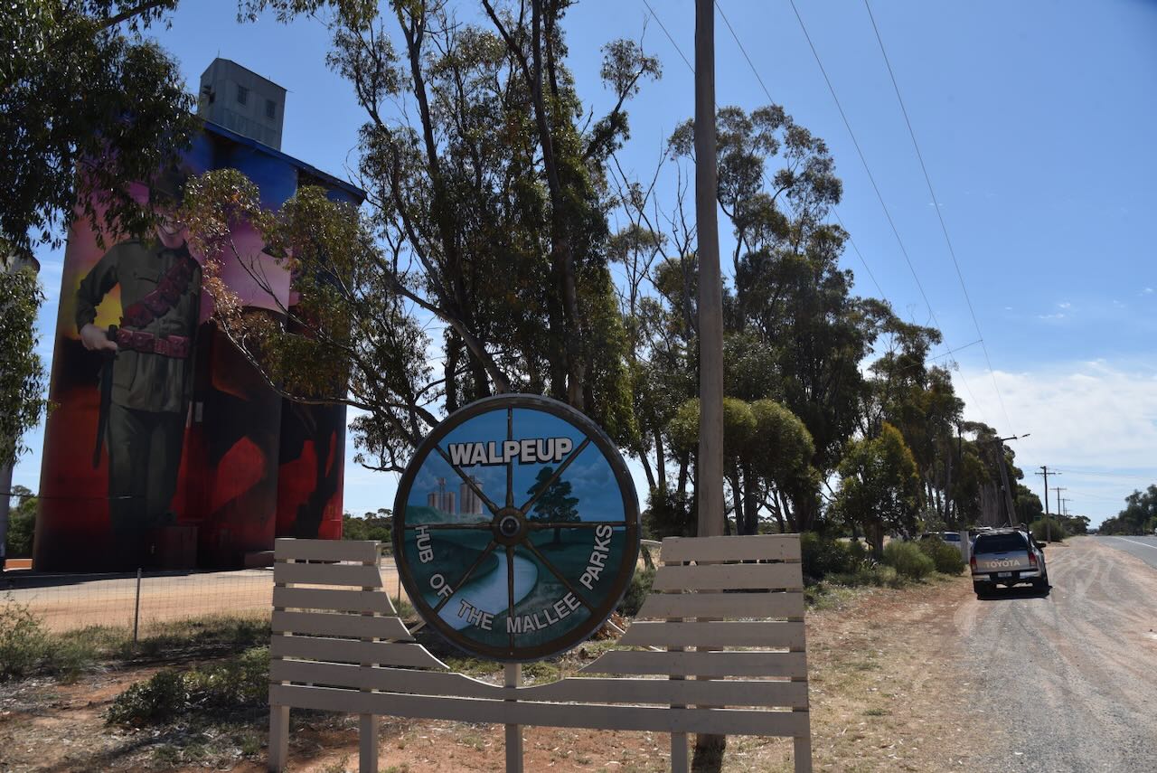
Our next activation for Friday 17th October 2025, was the Walpeup Nature Conservation Reserve VKFF-2471 and the Walpeup silo VK-WLP3.
Walpeup is a small town located about 347 km east of Adelaide and about 30 km west of Ouyen/
Walpeup is pronounced wol’pee’UP. Walpeup is derived from an Aboriginal word with several reported meanings, including a stumpy-tailed lizard, another is an indigenous acacia, while another source suggests ‘big smoke’. (Malleehighway.com.au 2025) (Victorian Places 2014) (Walpeup & Dist Comm Plan 2023)
In 1909, a store was opened at Walpeup by Ben Oke. In 1911, the Walpeup shire was proclaimed, with the administrative centre being in Ouyen. Council meetings alternated between Ouyen and Murrayville. On the 3rd day of June 1912, the Walpeup Primary School opened in the ‘Little White Hall’. In 1914, a one-room school building was built, and in 1927, a second room was added. The school was closed in 2015. The Walpeup South State School No. 3929, also known as Hungry Hut, was opened in 1912 and closed in 1951. On the 16th day of December 1912, the post office was opened. Matchett’s brick store was opened in 1918 and was also utilised as a post office. Also in 1918, the Bank of Victoria was opened, and in 1923, the Walpeup Memorial Hall was opened. (Mildura Council 2013) (Victorian Places 2014) (Wikipedia 2024)
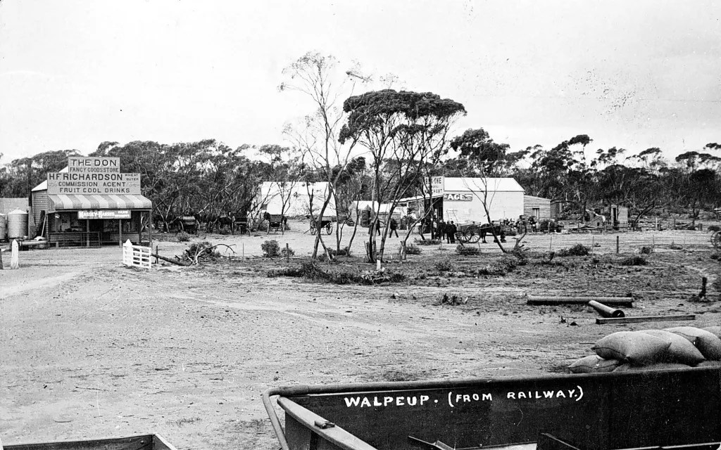
Above:- Walpeup township, c. 1911. Image c/o Museums Victoria.
By 1920, Walpeup was a thriving community with a population of about 400 people. The town had a general store, a blacksmith, a butcher, a bank branch and several other businesses. (Victorian Places 2014)
By the early 1930s, the Mallee region was growing about 45% of Victoria’s wheat. There was a desire by local farmers to have a research farm established that was specifically devoted to Mallee conditions. The Walpeup Research Station was opened in 1932 and closed in December 2009. (Victorian Places 2014) (Walpeup & Dist Comm Plan 2023)
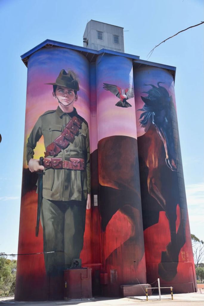
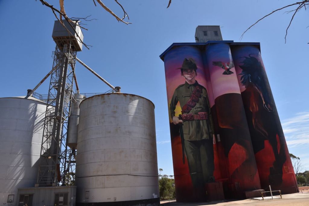
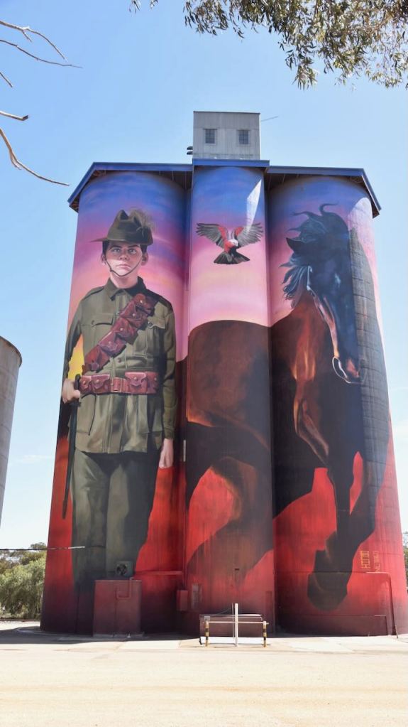
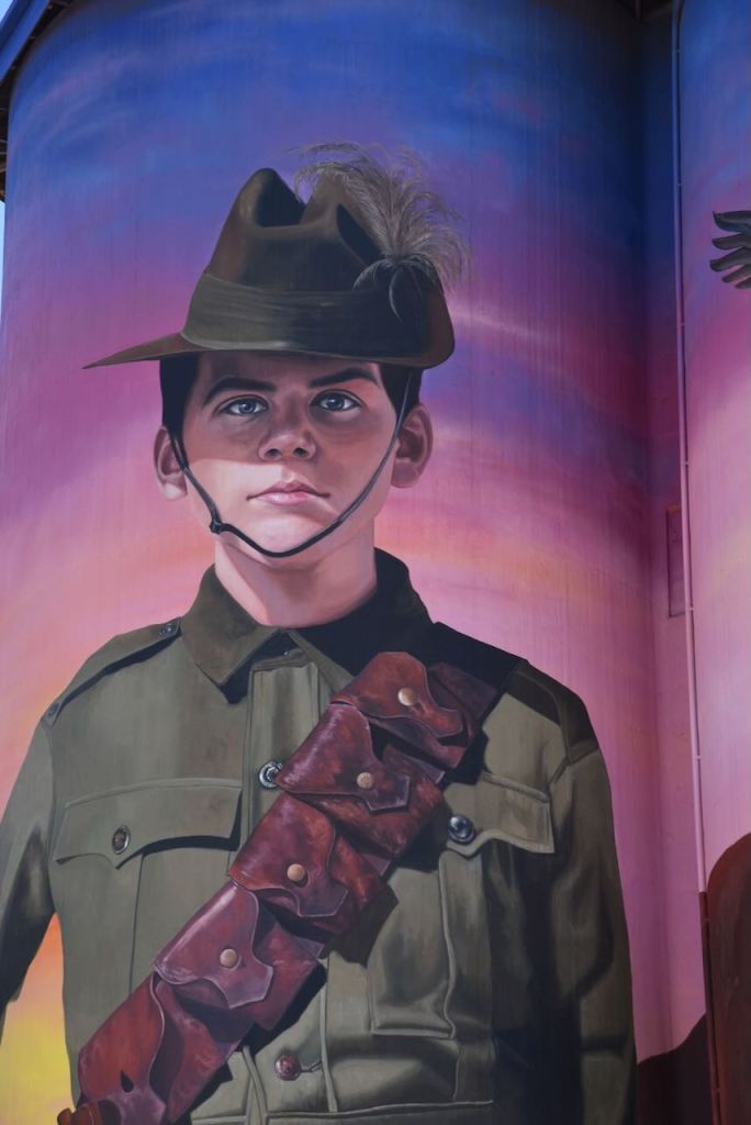
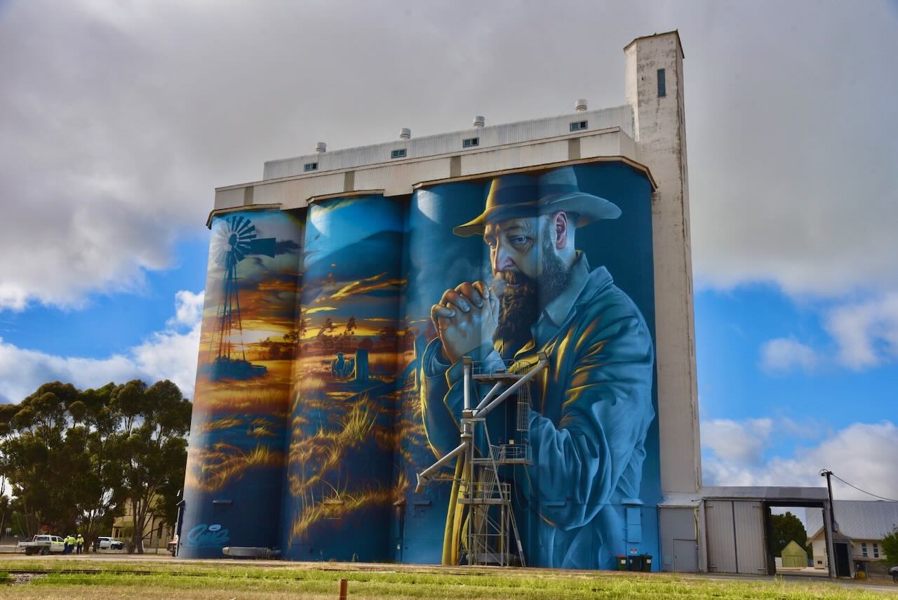
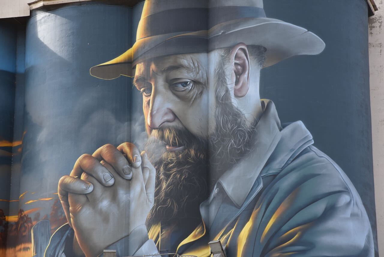
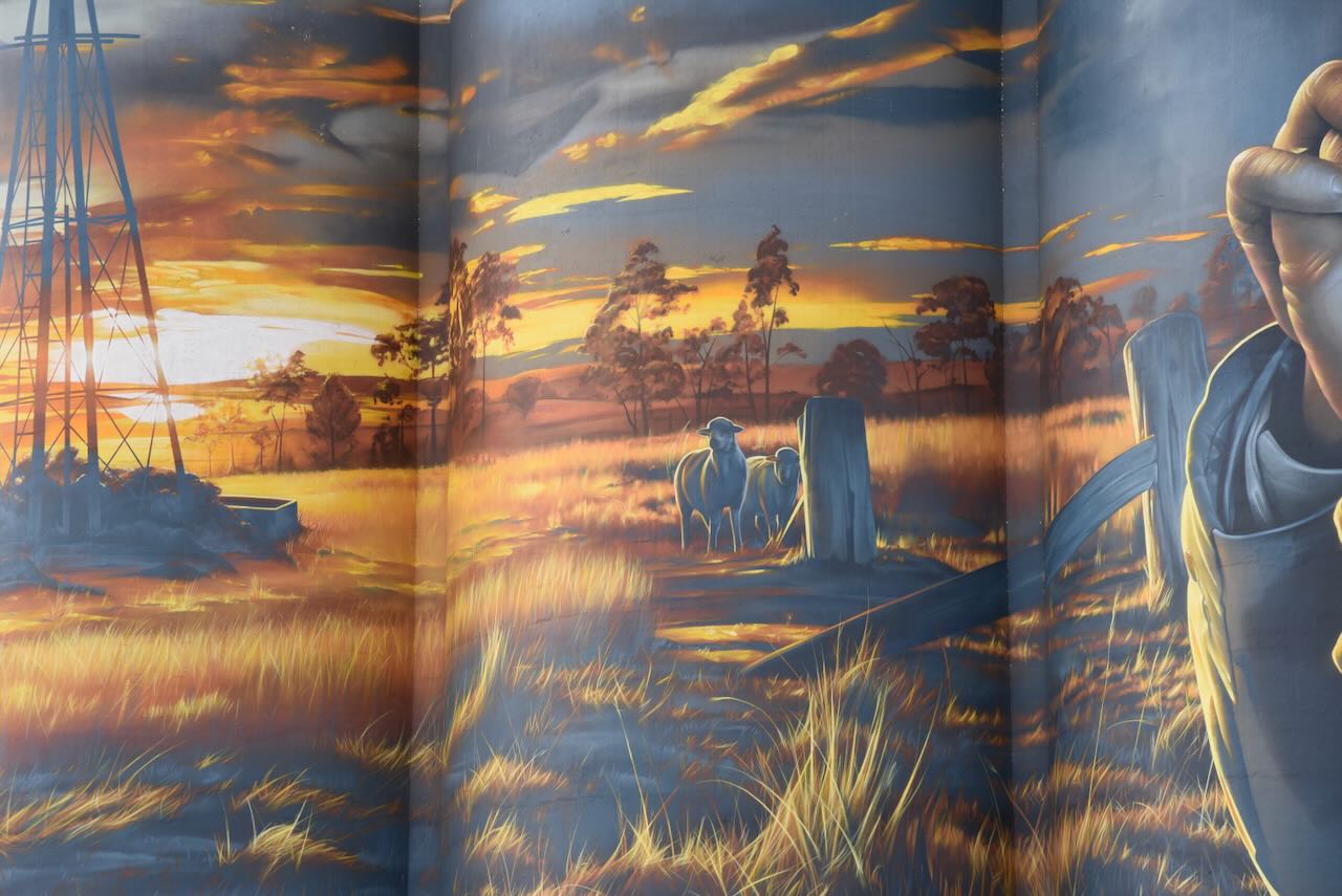
The Walpeup silos were painted in June 2023 by Julian Clavijo and Camilo Delgado. They depict the story of Trooper Harold Thomas Bell. (Australiansiloarttrail.com 2022)
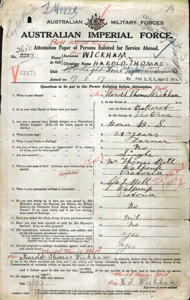
Harold Thomas Bell was born in 1901 at Walpeup. He was just 16 years old when the First World War broke out. He travelled to Mildura and enlisted with the Light Horse Regiment, lying about his age, name and his family circumstances. He claimed to be 21 years old and gave his name as Harold Thomas Wickham. (Australiansiloarttrail.com 2022)
Above:- The attestation document of Harold Thomas Bell @ Harold Thomas Wickham. Image c/o ancestry.com.au
On the 22nd day of June 1917, he left Australia and arrived in Egypt about 6 weeks later. He was subsequently selected for the Hotchkiss machine gun section. On the 28th day of October 1917, he was involved in a battle near the town of Beersheva. He was shot in the leg and critically wounded. He died the following day and was laid to rest in the Beersheba War Cemetery. (Australiansiloarttrail.com 2022)
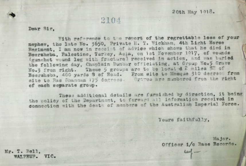
A telegram was dispatched to Harold’s only living uncle, recorded on the enlistment forms, to inform him of Harold’s death.
Above:- the telegram sent to Thomas Bell. Image c/o National Archives of Australia
Upon receiving the telegram, Thomas Bell replied:
“I don’t have a nephew named Harold. I do have a son by that name, but he couldn’t be in the Army, he’s only 16.”
Tragedy was to strike the family twice. Less than a year following Harold’s death, his father received another telegram to advise of the death of his other son, Samuel. (Australiansiloarttrail.com 2022)
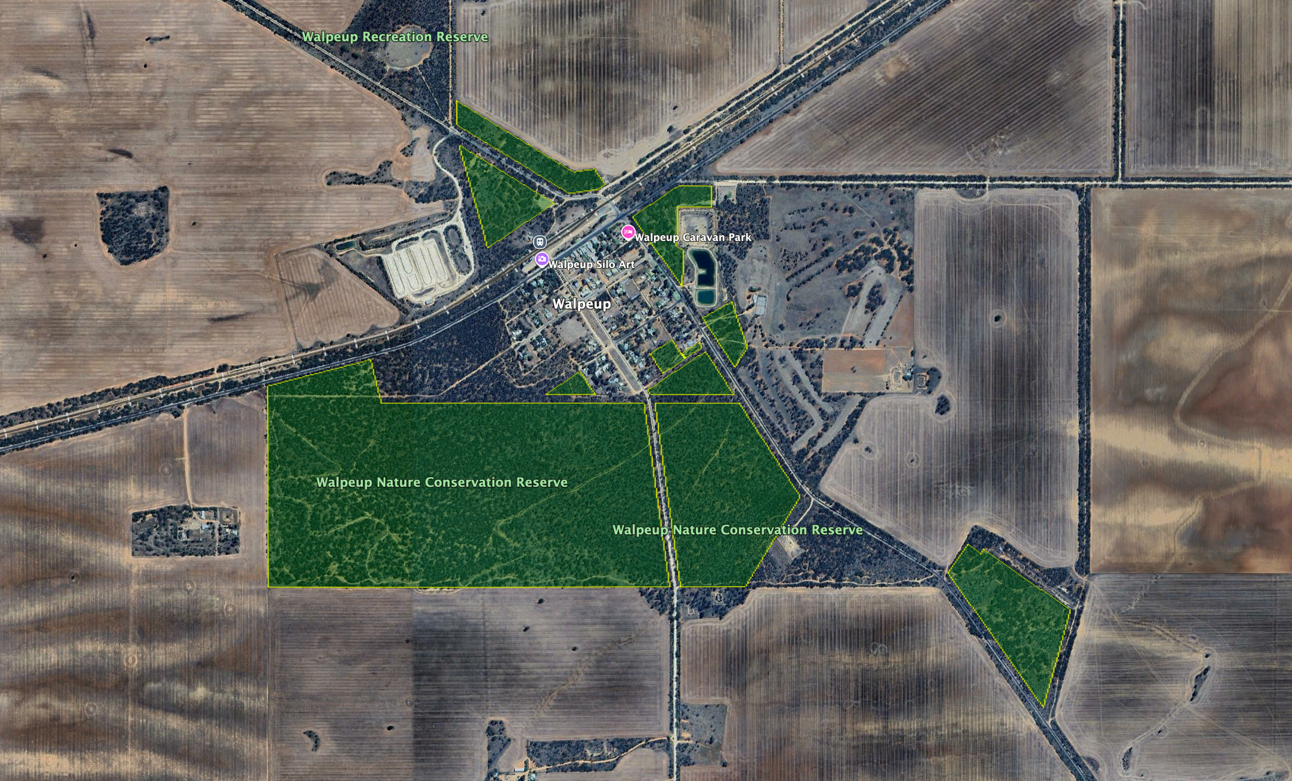
The Walpeup Nature Conservation Reserve is about 177 hectares in size and was established on the 1st day of May 1979. (CAPAD 2024)
Above: the boundaries of the Walpeup Nature Conservation Reserve. Image c/o Google Earth
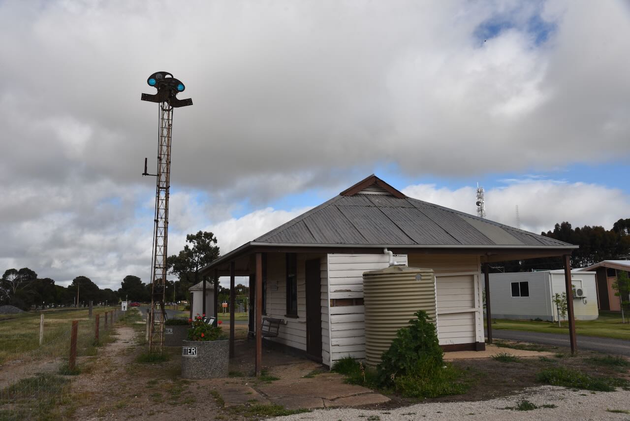
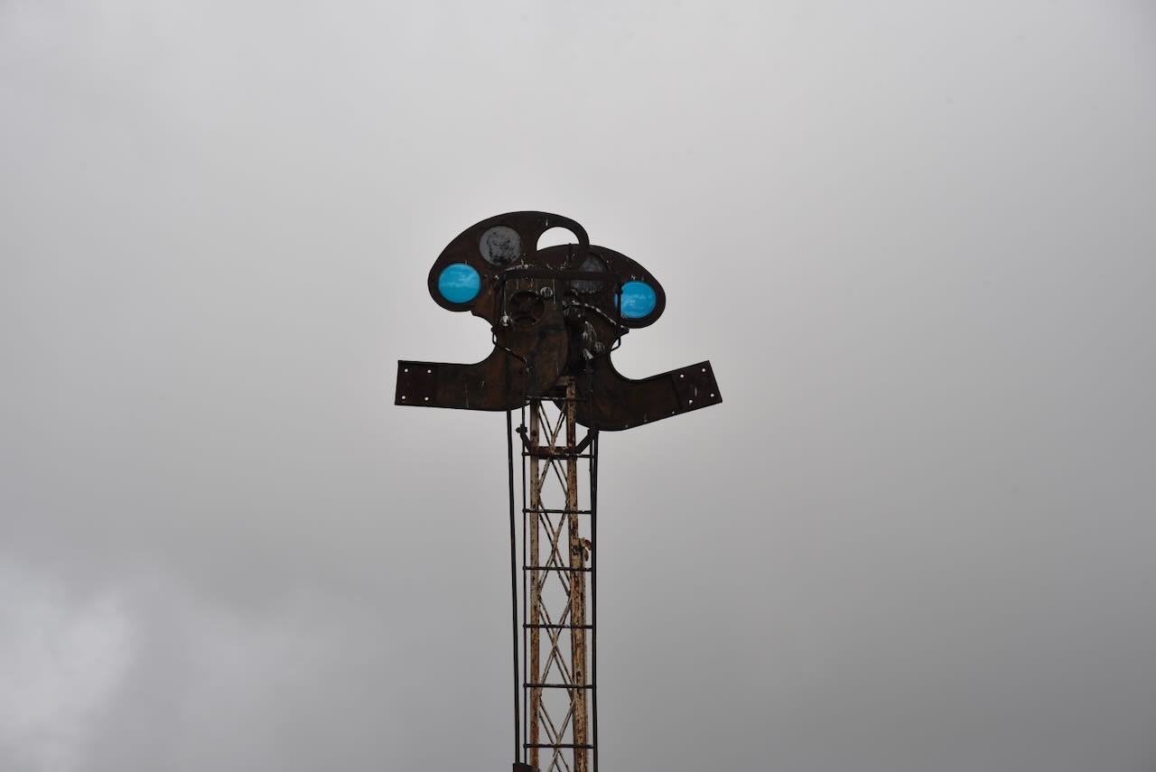
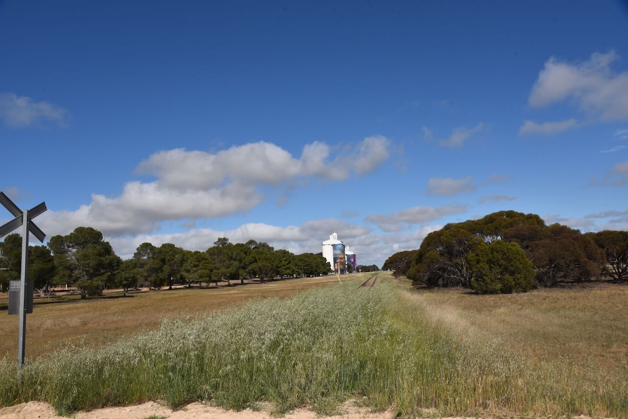
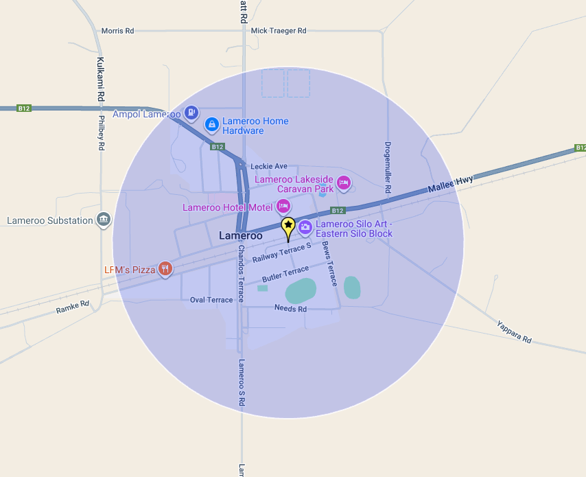
Our next activation for Friday, 17th October 2025, was the Lameroo silo VK-LMO5 for the Silos On The Air (SiOTA) program. Marija and I have previously activated this silo, but we wanted to put it on the air again, as the silo art here is amazing.
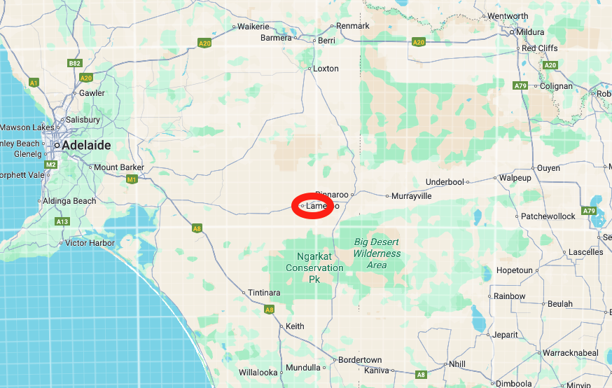
Lameroo is located in the Mallee region of South Australia, about 200 km east of the city of Adelaide, and about 40 km west of the South Australia and Victoria border.
Above:- Map showing the location of Lameroo in South Australia. Map c/o Google Maps
The first European pastoralist in the area was William Butcher, who in 1873, took out pastoral lease no. 2122. The area was then known as Winike Berick, New S.E. District. It is believed that Winike Berick is a corruption of the Aboriginal words byrlung byrleck, meaning ‘the sea’. It was reported that in 1840, a group of European settlers were travelling through the ‘Long Desert’ with their sheep, and that whilst camping, a well was sunk. Beautiful sea shells were found at the bottom of the well. An aboriginal man named Kropingeri told the settlers that during the life of his great-grandfather, Goorapee, the area was covered by the sea. (Place Names SA 2012) (s.l.s.a. n.d)
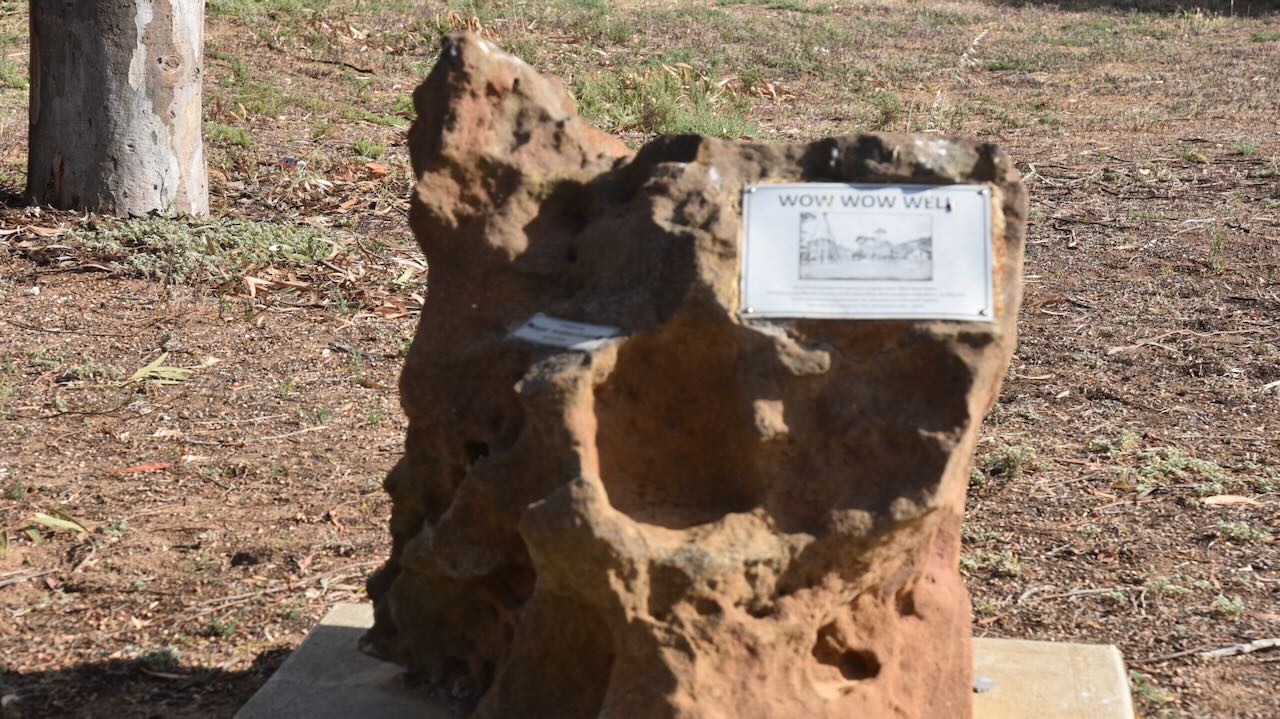
The Aboriginal name for the land in the Lameroo region was wauwauwe, meaning ‘many kangaroos.’ The Europeans called the area Wow Wow Plain or Wowell. In 1884, a well was dug at Wow Wow Plain. A monument for this can be found in Lameroo. (s.l.s.a. n.d)
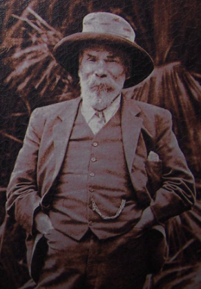
The first settler in the district, following the survey, was Thomas Leckie. In 1896, he took up a block of about 450 acres, about 1 km from the current Lameroo township. Leckie was born in August 1848 in Falkirk, Stirlingshire, Scotland. He emigrated to Australia in 1852 with his parents and two siblings aboard the ‘Marco Polo‘. By 1874, he had arrived in South Australia. Leckie was initially employed at Coonalpyn Station before moving to Lameroo. (ancestry 2016) (s.l.s.a. n.d)
Above: Thomas Leckie. Image c/o ancestr.com.au
Leckie died in November 1919 at Lameroo. Following his death, The Advertiser reported the following:
“Mr. Leckie took up absolutely the first block in the district, an area of 450 acres, which he cleared and cultivated under extreme difficulties. He was the only dweller in the wilderness of Mallee, his nearest white neighbour being about 6 miles distant. His faith in the district as an agricultural area was unwavering, and it was never shaken up to the time of his death. It was he who blazed the trail into Pinnaroo lands, and it was through his faith and courage and his determination not to suffer defeat that the district became the producing centre it is today…” (Trove 2025)
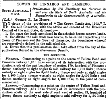
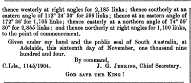
The town of Lameroo was proclaimed on the 17th day of November 1904. (s.l.s.a. n.d)
The town was named Lameroo at the suggestion of J. McL. Johnston, an Inspector in the Post and Telegraph Service. Jhnston had worked on the Overland Telegraph Line, and whilst in Darwin, he had heard of Lameroo Beach, and liked the sound of the word. Johnston attended a meeting in 1904 of local settlers, and he suggested the name and which was subsequently adopted. (Sydney Morning Herald 2004)
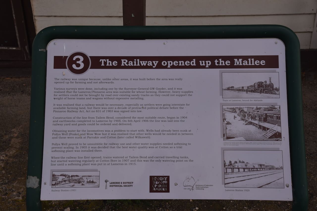
The railway was declared open on the 8th day of September 1906, and the first trains arrived at Lameroo with passengers and goods. Regular train services to Lameroo brought other settlers, building materials, and machinery. (Mallee Highway 2024)
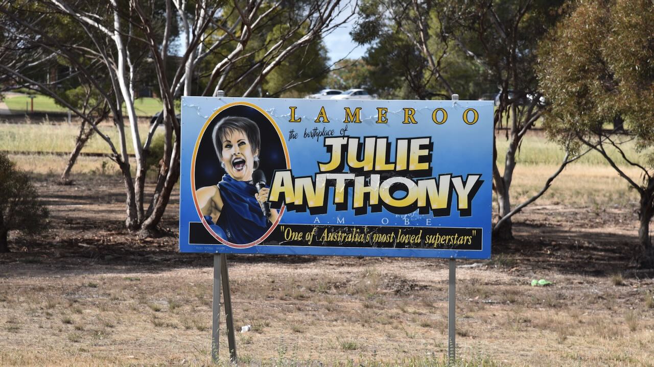
Lameroo is home to singer and entertainer Julie Moncrieff Anthony AM OBE.
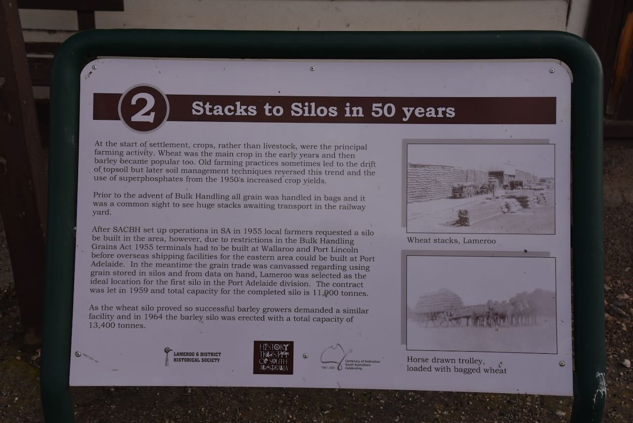
The bulk grain silo (wheat) opened in Lameroo for the 1959-60 grain harvest. It was the first grain silo outside of Port Adelaide in the Eastern Division. The barley silo opened in 1964. (Discover Murray 2024)
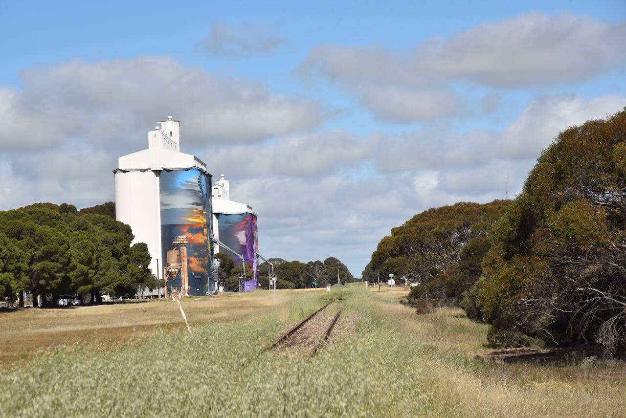
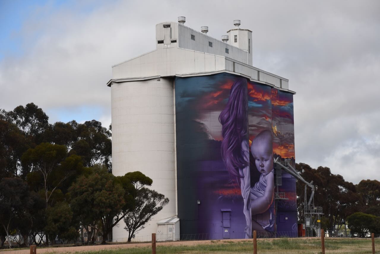
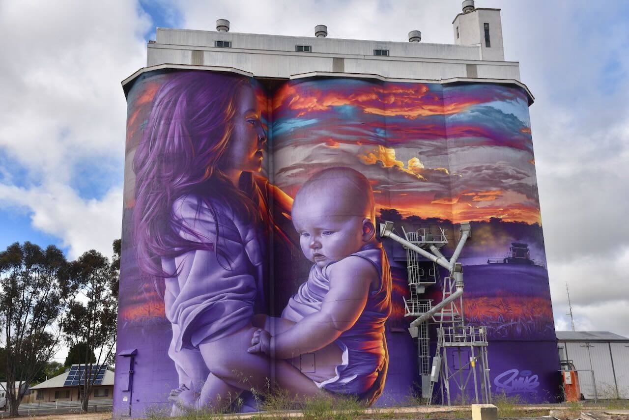
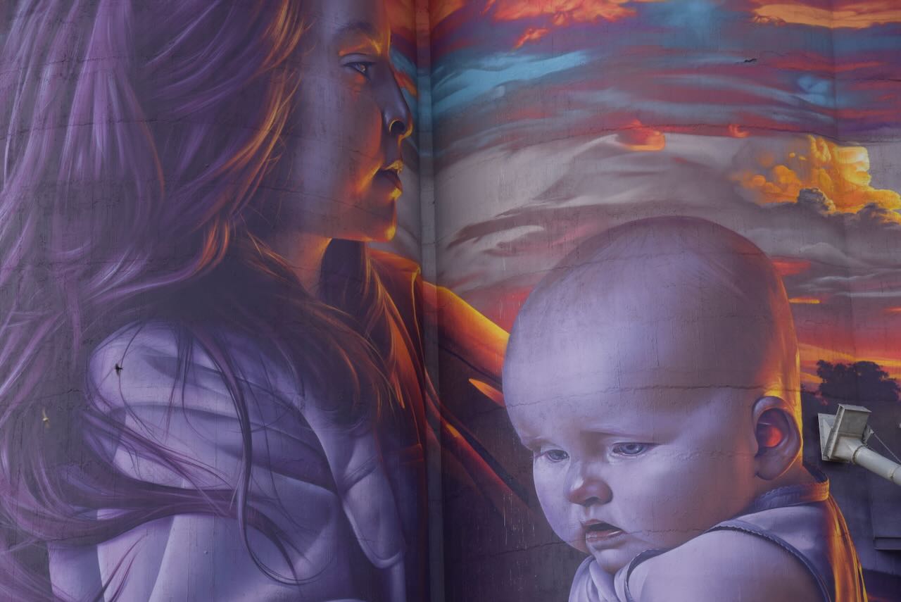
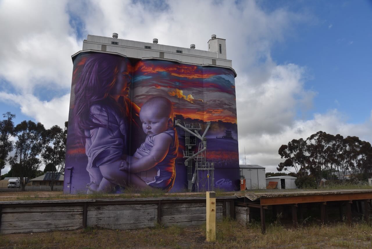
The Lameroo silos are part of the Australian silo art trail. The art on the first silo was completed in April 2024 and is the work of Sam Bates @ Smug. The second silo was completed in May 2025 and is the work of Smug. (Australiansiloarttrail.com, 2024) (Viterra.com.au 2025)
The artwork on the first silo features a Mallee Farmer.
The second silo features a young woman with a baby in her arms, looking out into a field of grain being harvested at sunset. (Viterra.com.au 2025)
Below is an excellent video from YouTube with drone footage of the two silos.
Marija and I parked alongside the first silo and operated from the 4WD. We ran the Icom IC7000, 100 watts, and the Codan 9350 with the 1.5 metre stainless steel whip.
Above: the activation zone at Lameroo. Image c/o SiOTA website.
Marija worked the following stations on 40m SSB:-
VK3PF
VK5WU
VK3ZSC
VK3CJN
VK3QHU
VK1AO/P (VKFF-1381)
VK2MET/P (VKFF-1381)
VK2VAR
VK2GOM
VK3WSG
VK3VIN
VK5AYL
Marija worked the following stations on 20m SSB:-
VK1AO/P (VKFF-1381)
VK2MET/P (VKFF-1381)
I worked the following stations on 40m SSB:-
VK3PF
VK5WU
VK3ZSC
VK3CJN
VK3QHU
VK1AO/P (VKFF-1381)
VK2MET/P (VKFF-1381)
VK2VAR
VK2GOM
VK3WSG
VK3VIN
VK3SQ
VK3JT
VK2BD
VK2DA
VK1DA
VK5AYL
VK3ALF/P
I worked the following stations on 20m SSB:-
VK1AO/P (VKFF-1381)
VK2MET/P (VKFF-1381)
VK2IO
References.
ancestry (2016). Ancestry® | Genealogy, Family Trees & Family History Records. [online] Ancestry.com.au. Available at: https://www.ancestry.com.au/ [accessed 17 Nov. 2025]
Trove. (2025). THE PIONEER OF LAMEROO. – DEATH OF MR. LECKIE. – The Advertiser (Adelaide, SA : 1889 – 1931) – 17 Nov 1919. [online] Available at: https://trove.nla.gov.au/newspaper/article/5643454 [Accessed 17 Nov. 2025].