This morning, I downloaded my certificate for VK5COP for the 2026 World Wide Award (WWA).
During January, numerous special event stations around the world with the WWA suffix were on air. The WWA event will be back from 29th June to 5th July 2026. It is a lot of fun chasing these stations, so why not give it a go?
I worked 39 of the special event stations during January 2026 on 5 bands with 3 different modes.
This morning, I downloaded my certificate for VK5IPA for the 2026 World Wide Award (WWA).
During January, numerous special event stations around the world with the WWA suffix were on air. The WWA event will be back from 29th June to 5th July 2026. It is a lot of fun chasing these stations, so why not give it a go?
I worked 38 of the special event stations during January 2026 on 5 bands with 3 different modes.
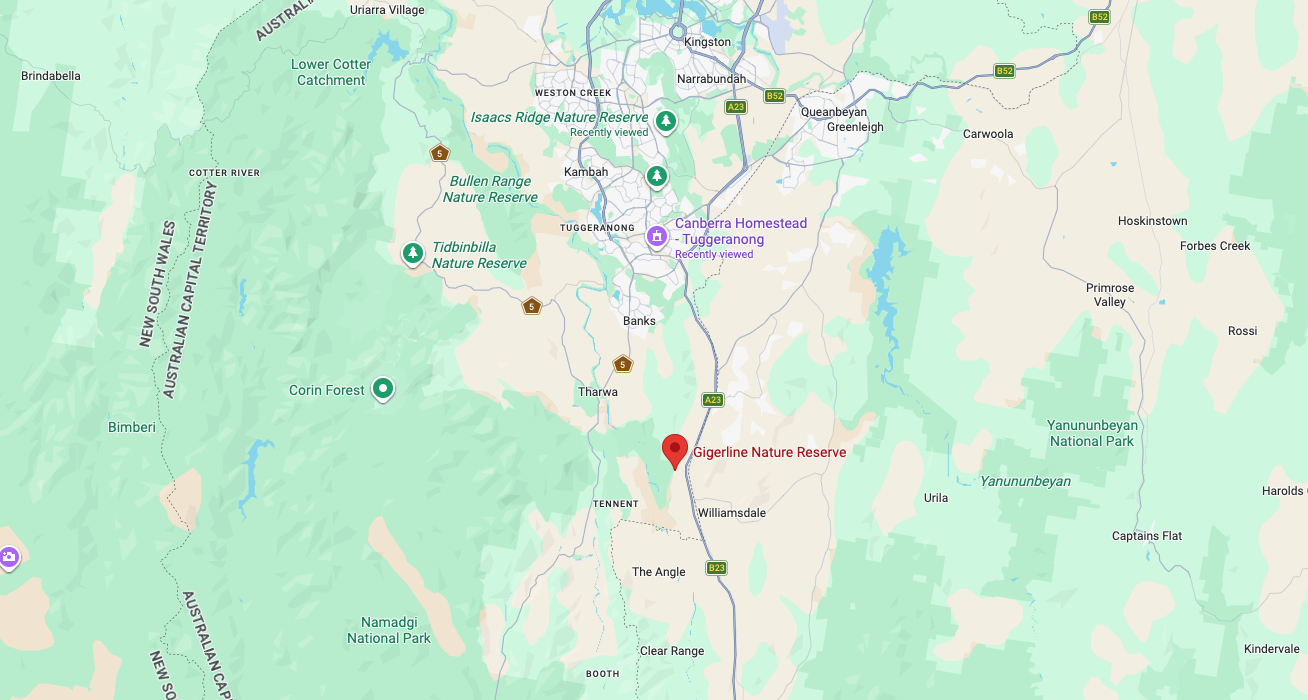
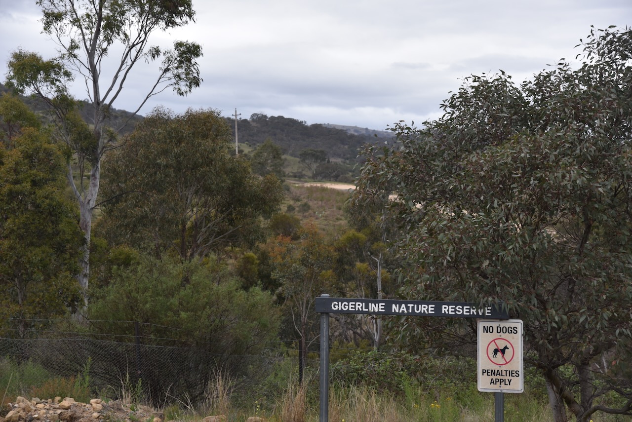
Our final activation for Tuesday, 28th October 2025, was the Gigerline Nature Reserve VKFF-0985. The reserve is about 40 km south of Canberra.
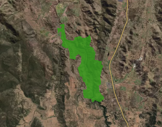
Above: Map showing the location of Gigerline Nature Reserve. Map c/o Google Maps
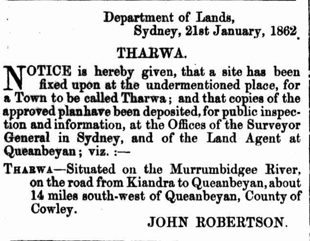
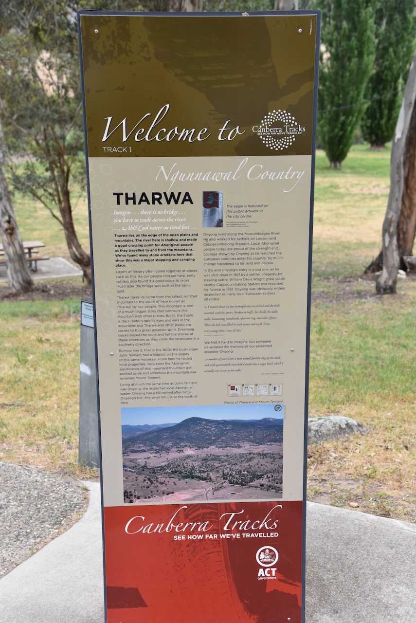
Marija and I drove south on Tharwa Drive until we reached the little town of Tharwa. Tharwa is the oldest official settlement in the Australian Capital Territory. It was proclaimed a settlement in 1862.
Tharwa is the Aboriginal word for nearby Mount Tennent, which is located in the Namadgi National Park. Mount Tennant is named after the bushranger John Tennant. (Wikipedia n.d.)
I have posted a significant amount of information about John Tennant in my previous post about Mount Ainslie…….
The town of Tharwa has a population of about 82 people (at the 2021 census). It contains a general store, a church, a community hall, a cemetery, and tennis courts. (Wikipedia n.d.)
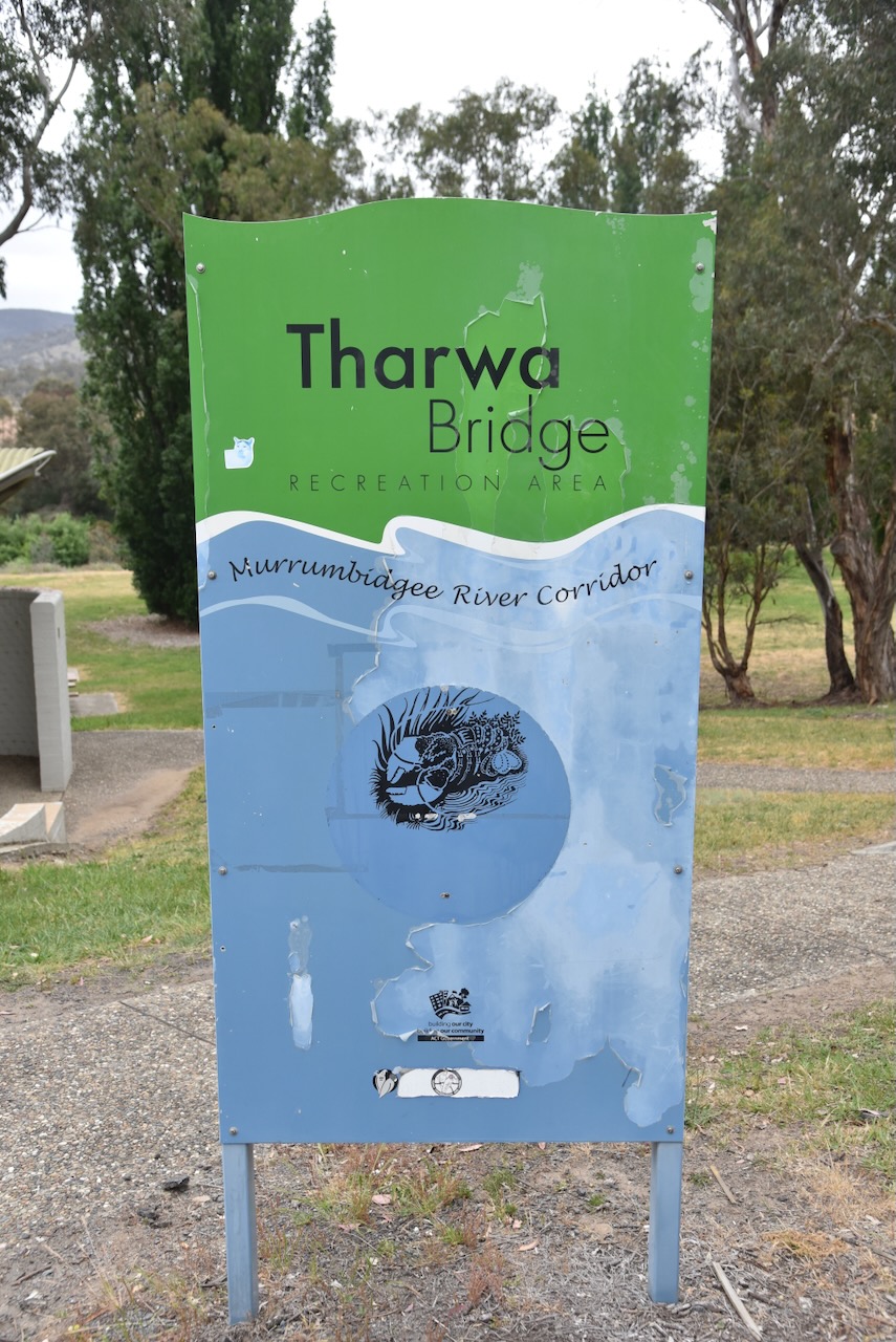
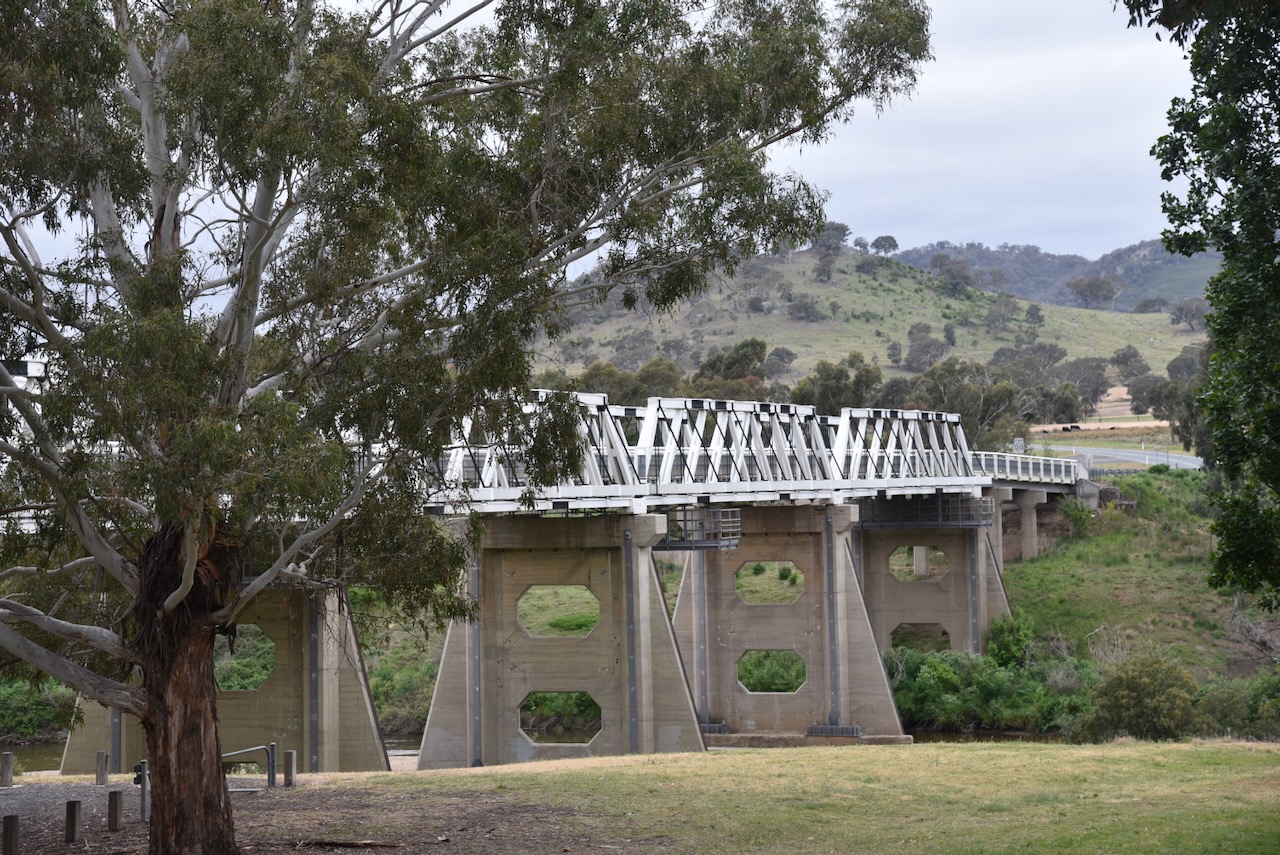
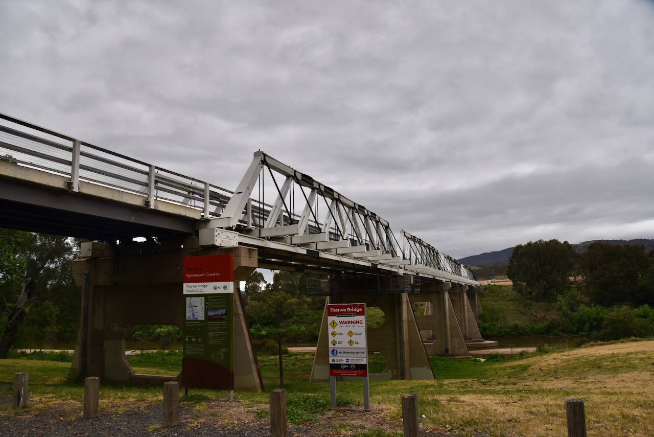
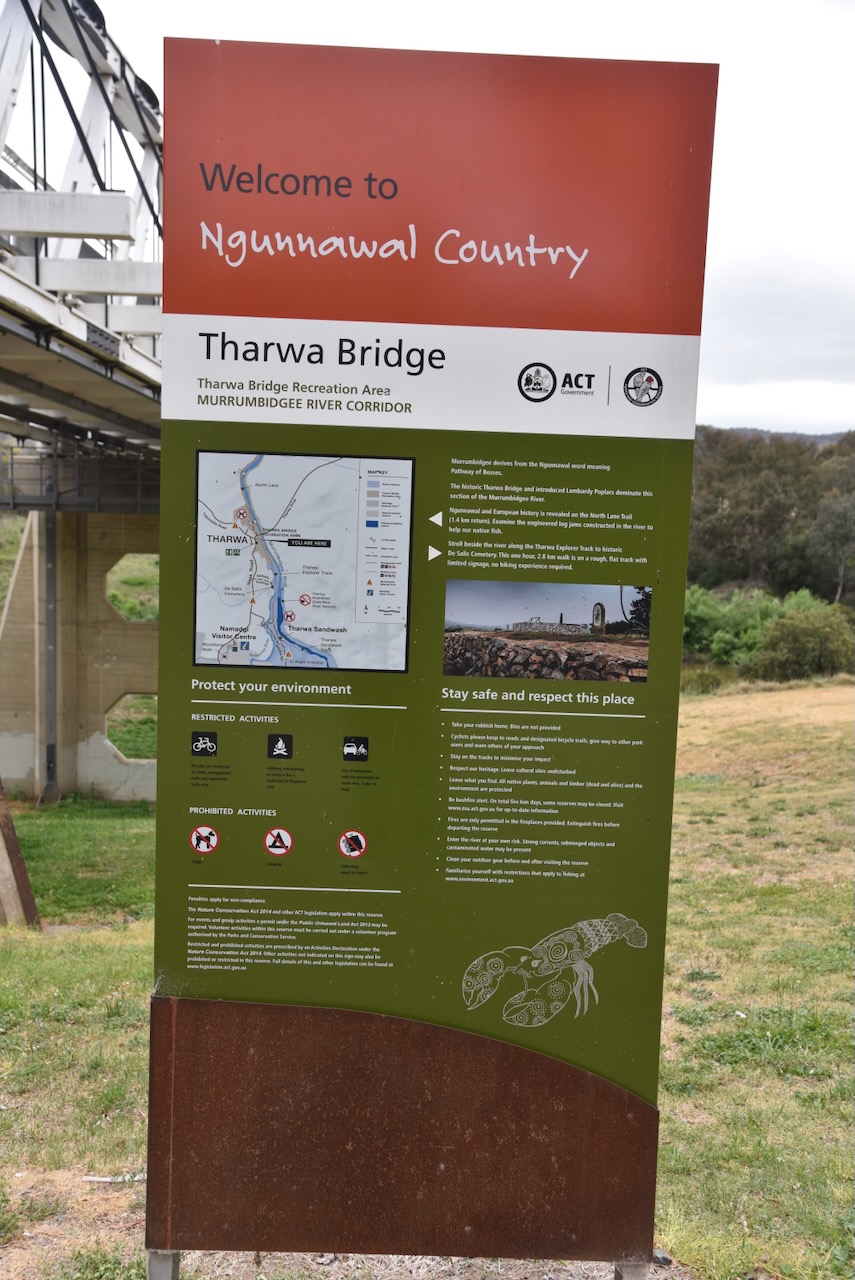
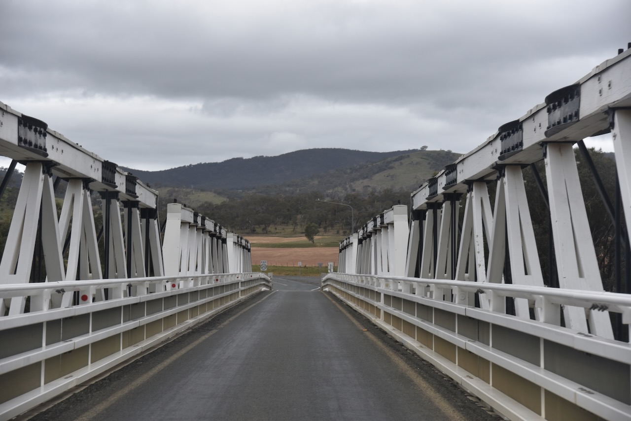
Marija and I stopped to admire the Tharwa Bridge, which was opened on the 27th day of March 1895, and crosses the Murrumbidgee River.
The Tharwa Bridge is a four-span Allan truss bridge and is the oldest surviving bridge in the Australian Capital Territory. A truss bridge is composed of a truss, which is a structure of connected elements, usually forming triangular units. The Allan truss was designed by Percy Allan, an Australian civil engineer who designed many public works, including the design of 583 bridges. (Wikipedia 2021) (Wikipedia 2026)
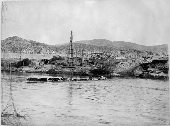
Above: Construction of Tharwa Bridge in 1893. Image c/o Wikipedia
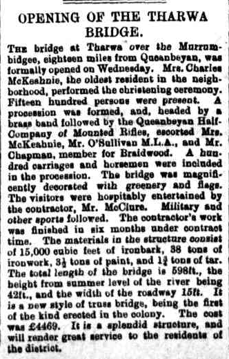
When the bridge was opened in 1895, a public holiday was declared in the region. A parade was held in Tharwa, and about 1,500 people watched the official opening. The oldest resident of the district performed the christening ceremony In 1998, the bridge was entered in the ACT Heritage Register. It is also listed in the National Trust of Australia. (Wikipedia 2021)
Above: Article from the Goulburn Herald, Fri 29 Mar 1895. Image c/o Trove
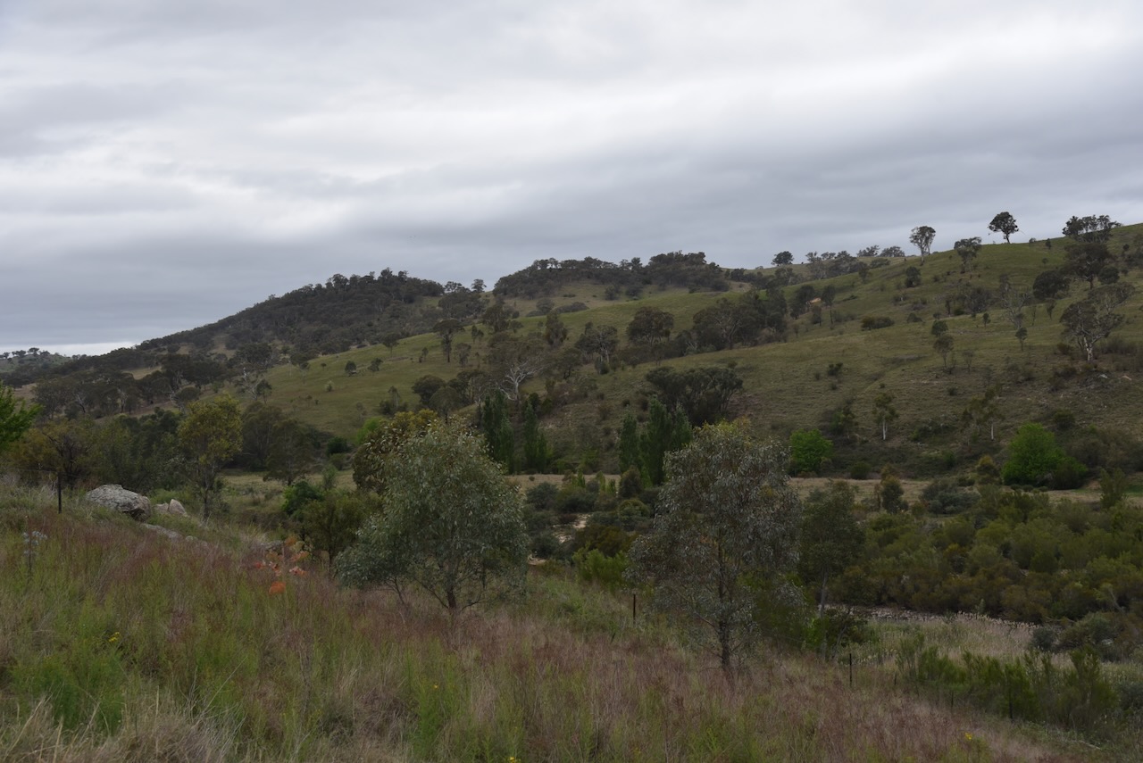
Marija and I continued along Naas Road and then Smiths Road, crossing over Gudgenby River. Its confluence with the Murrumbidgee River is a short distance away.
We soon reached the western boundary of the Gigerline Nature Reserve.
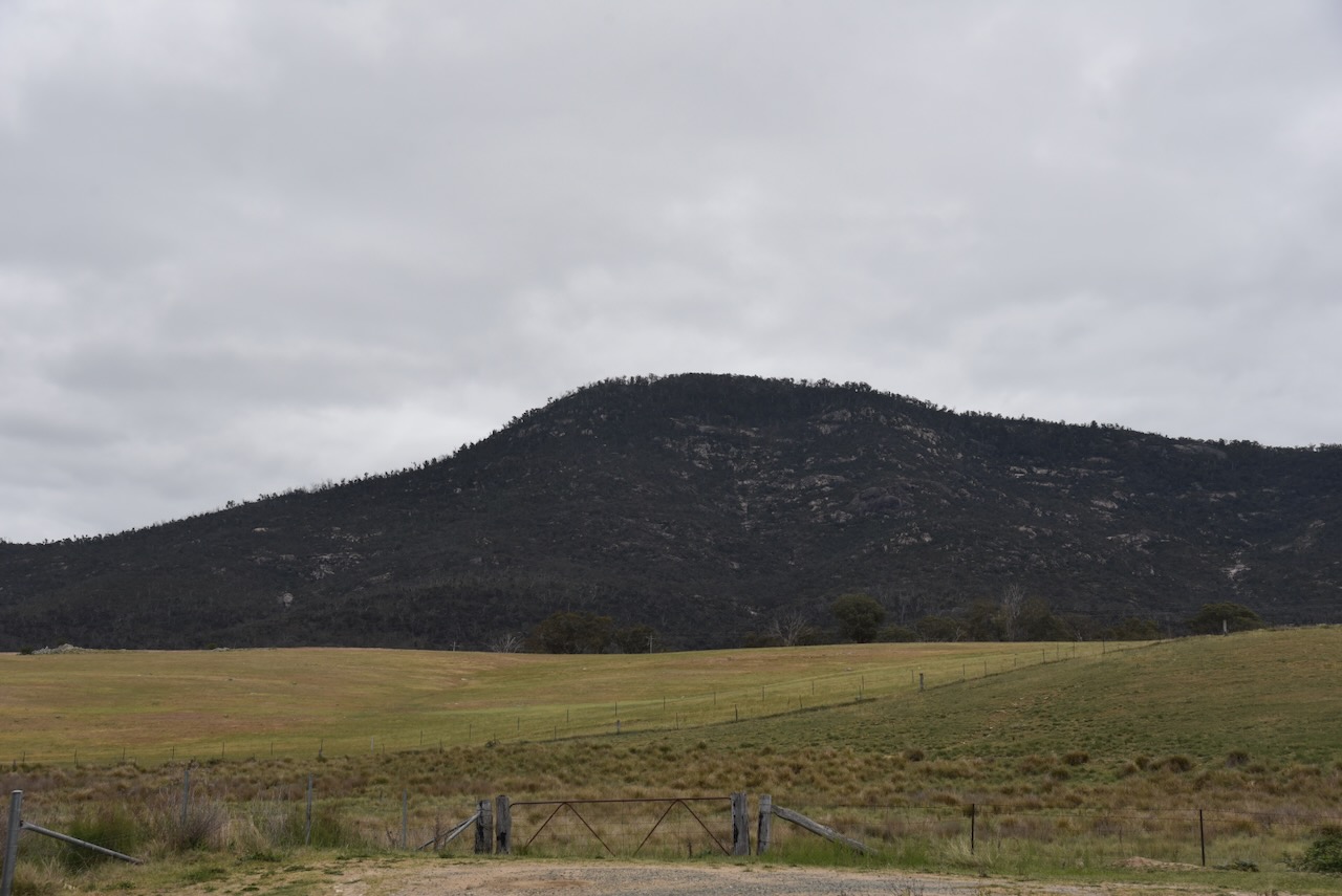
Mount Tennent was clearly visible as we drove along Smiths Road.
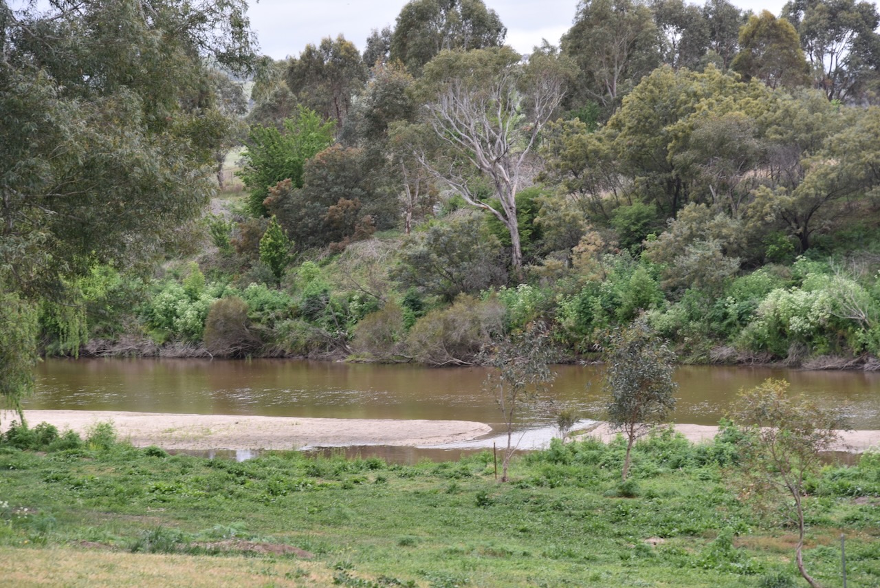
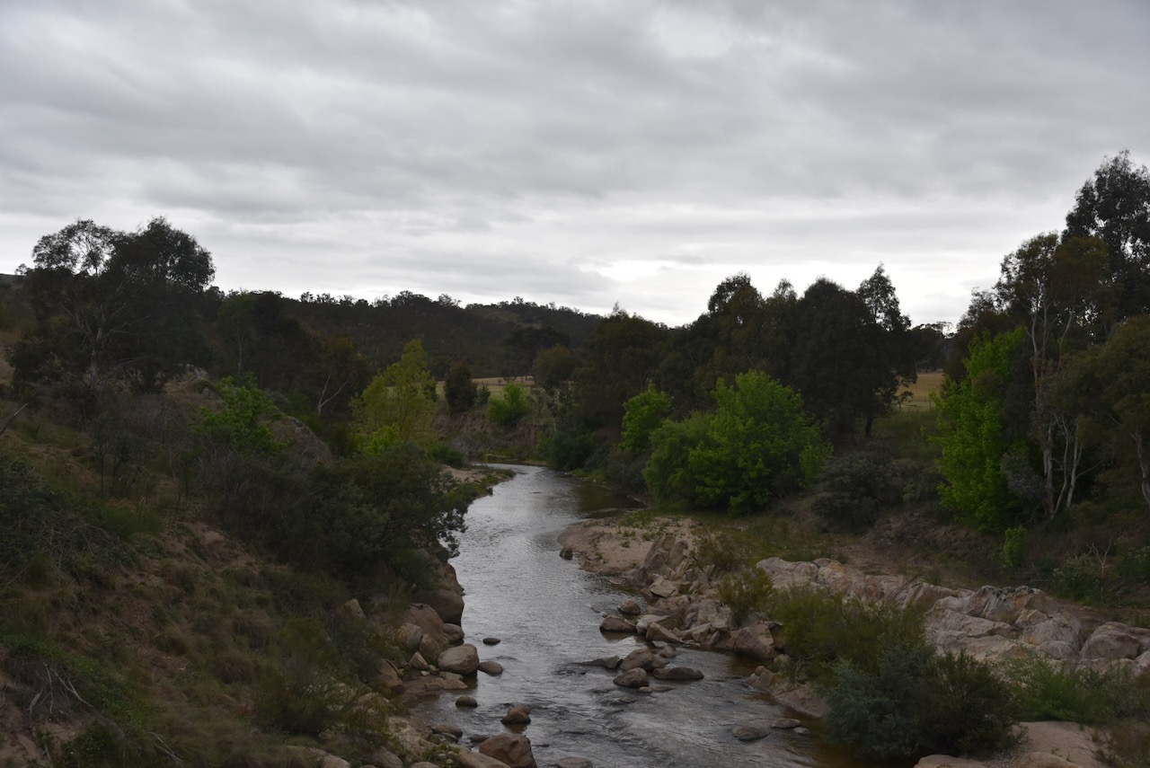
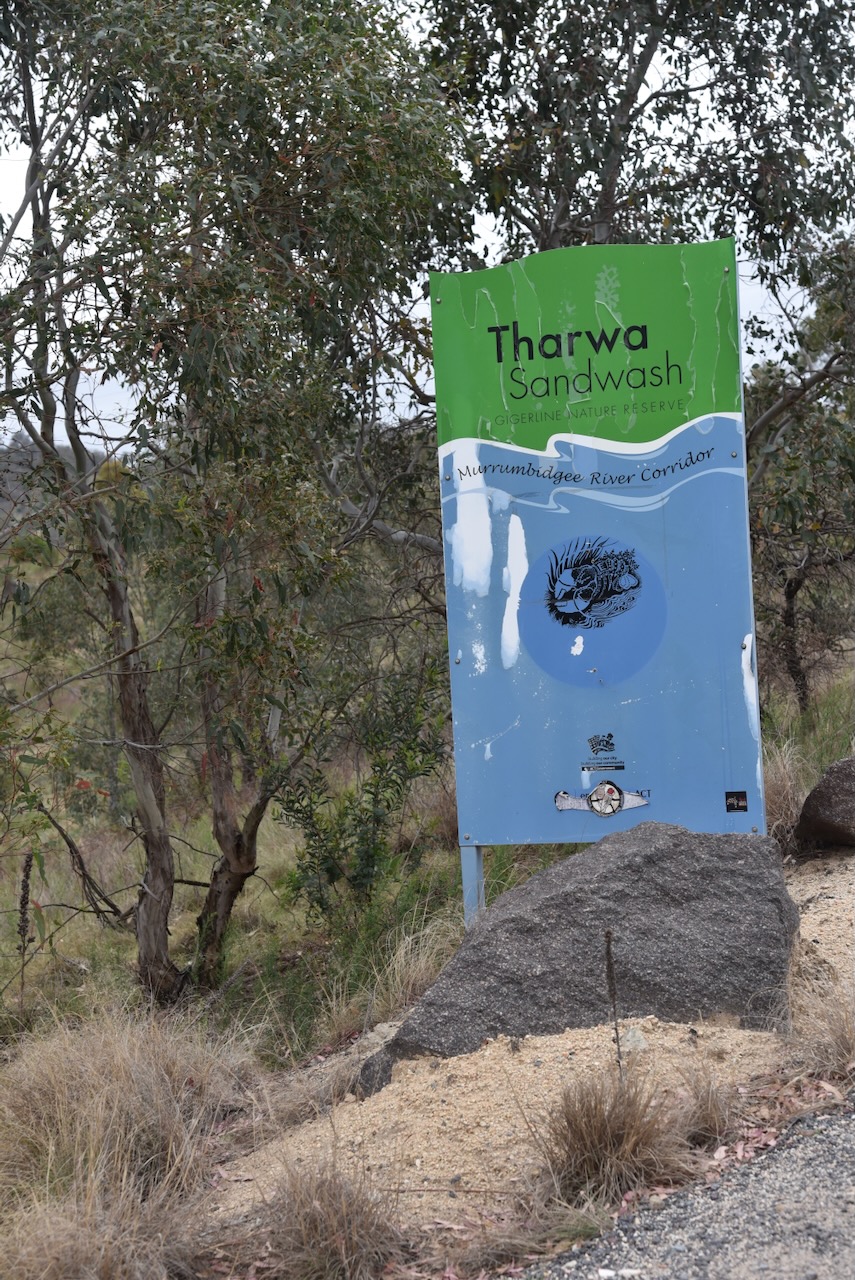
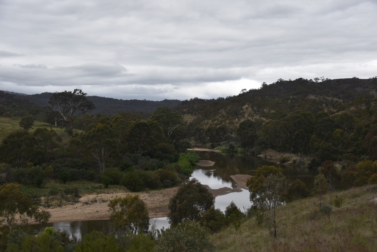
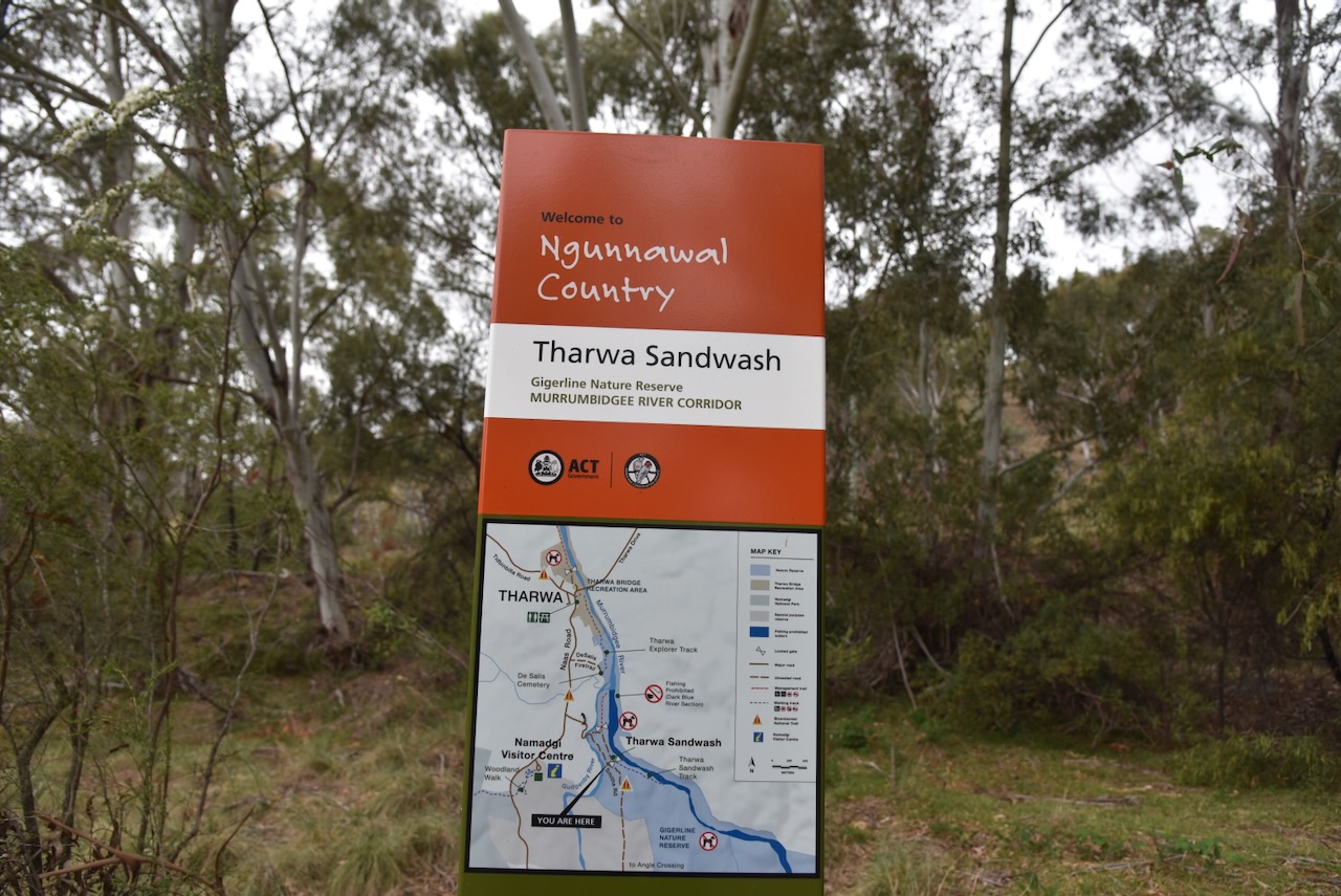
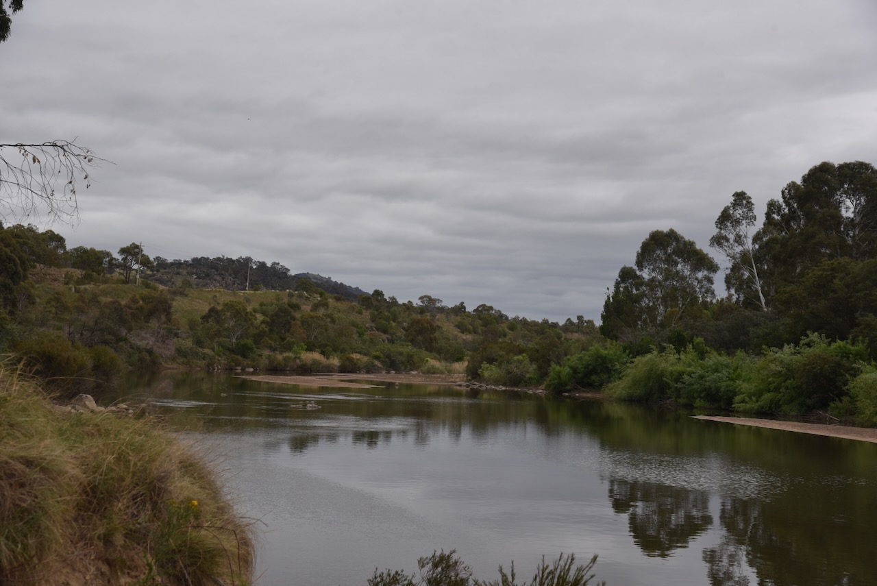
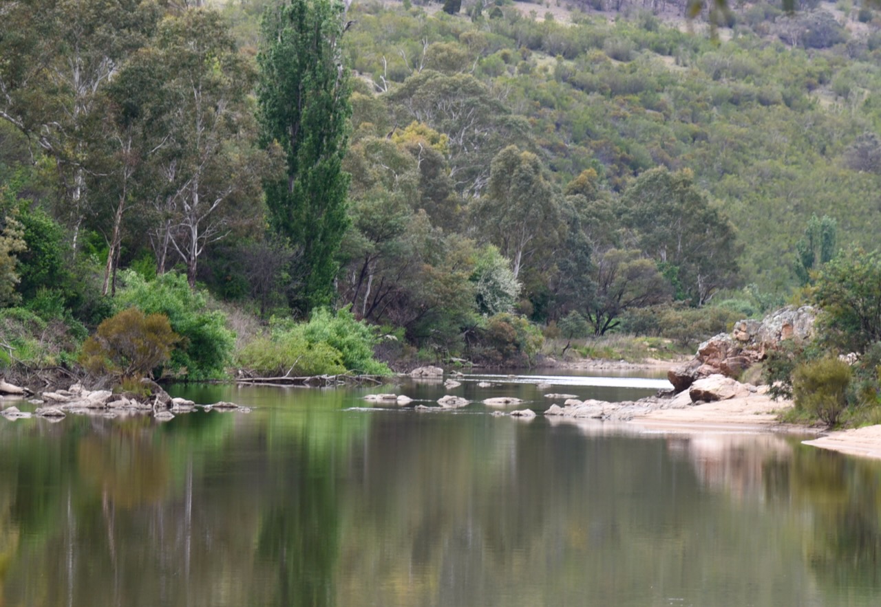
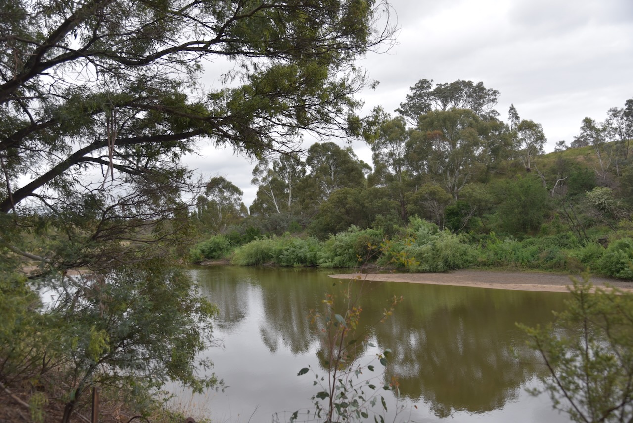
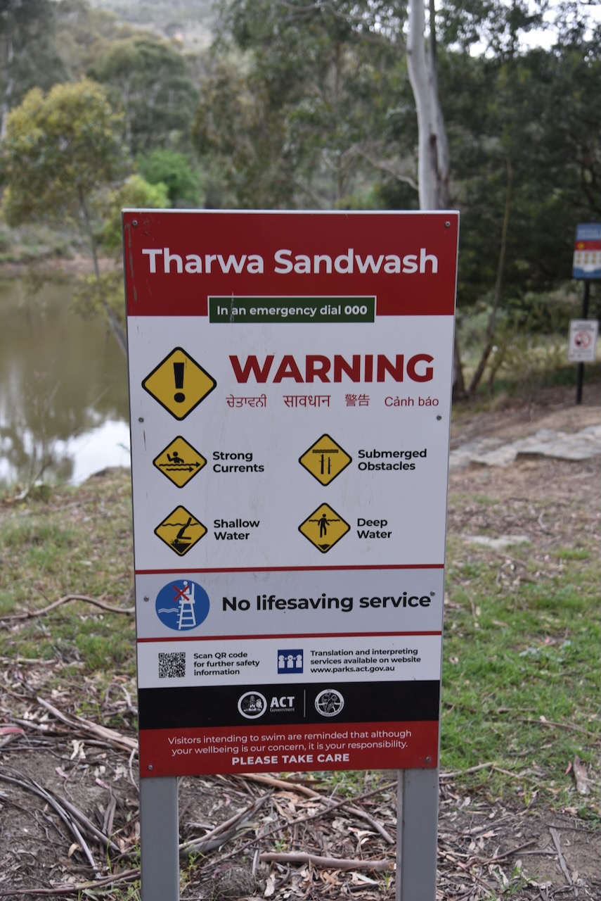
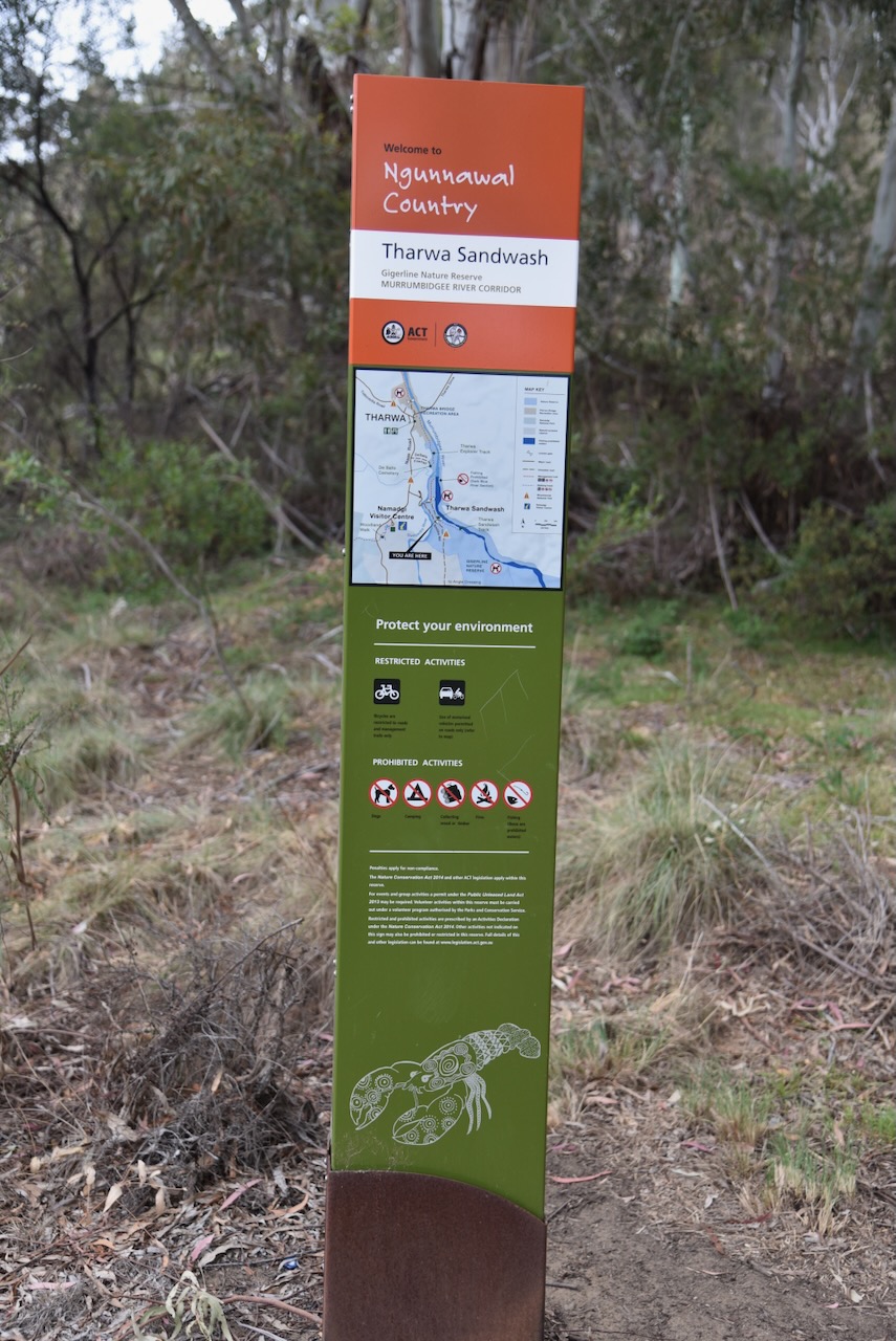
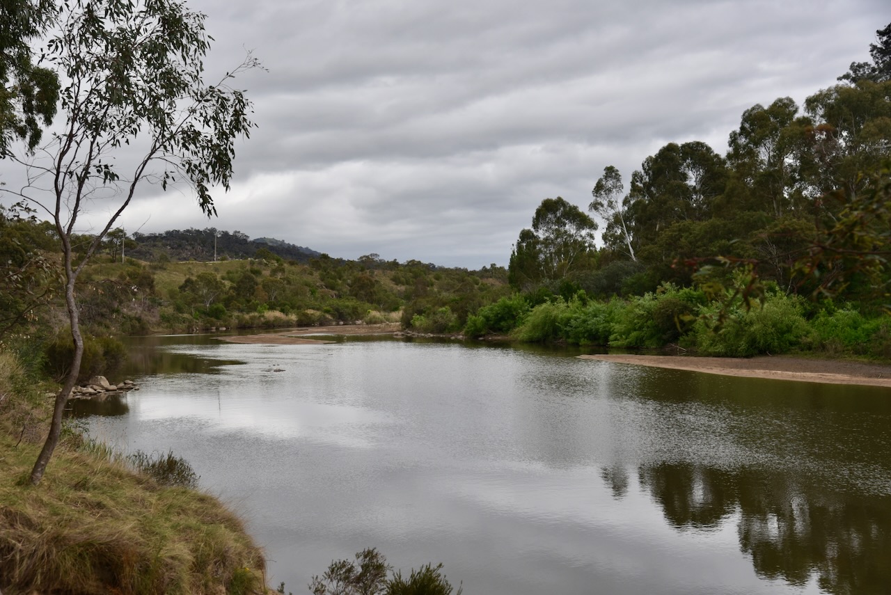
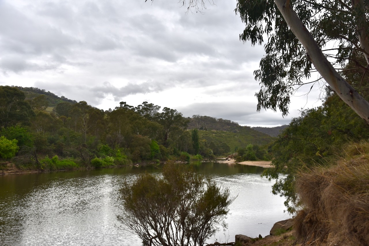
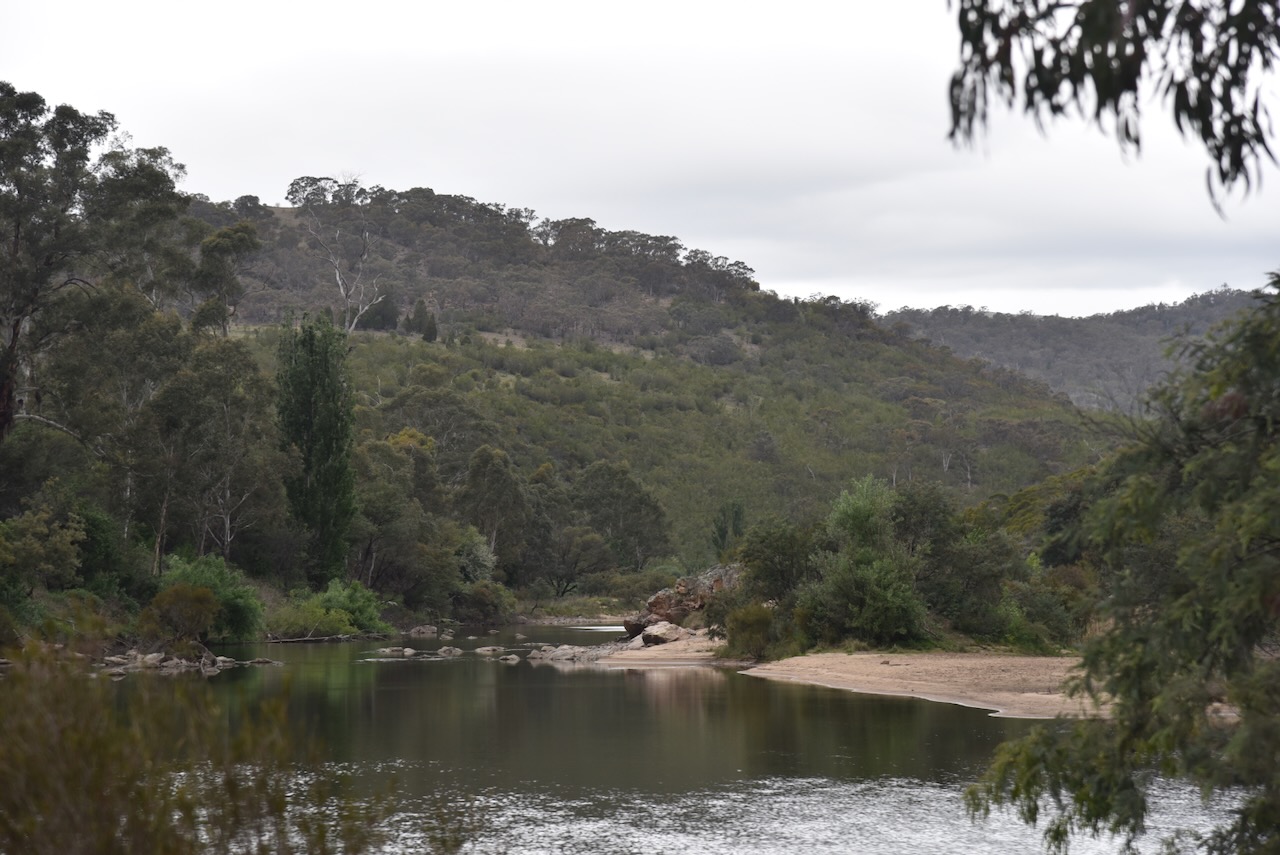
Not far along Smiths Road, Marija and I reached the sign for Tharwa Sandwash. This is beautiful countryside, and we were rewarded with some very nice views of the Murrumbidgee River.
Tharwa Sandwash is located in the Gigerlone Nature Reserve. The Sandwash is a beautiful picnic spot on the banks of the Murrumbidgee River.
The Murrumbidgee River is a major tributary of the Murray River. The name originates from the Wiradjuri Aboriginal language, meaning ‘big water.’ The river flows for a distance of 1,485 km. The first European to see the river was the explorer Charles Throsby in April 1821. Two years later, Brigade-Major John Ovens and Captain Mark Currie reached the upper Murrumbidgee. In 1829, Captain Charles Sturt and his party rowed down the lower half of the Murrumbidgee River. (Wikipedia 2020)
Above: Captain Charles Sturt. Image c/o Wikipedia
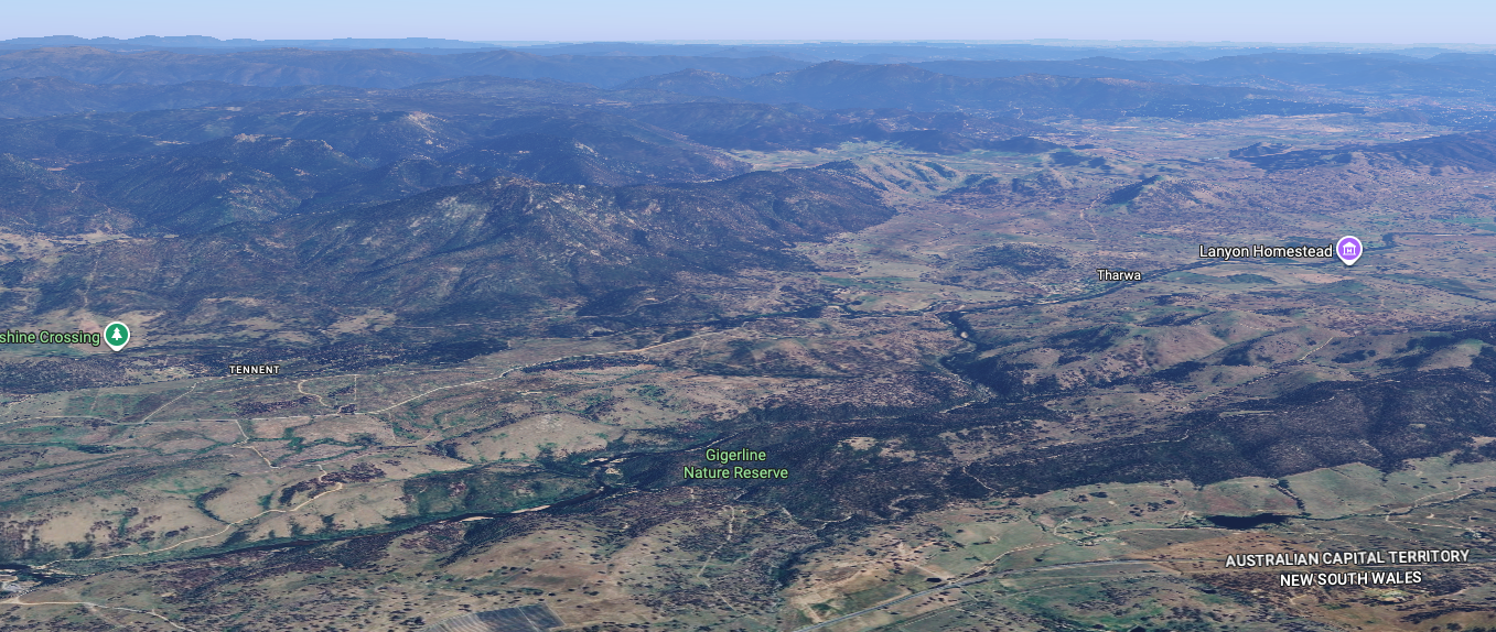
The Gigerline Nature Reserve is located just to the west of the New South Wales & ACT State/Territory border.
Above: An aerial view of the reserve showing its boundaries. Image c/o Protected Planet.
The reserve is about 1,500 hectares in size and was established in 1993. (Protected Planet 2026)
Above: An aerial view of the Gigerline Nature Reserve. Image c/o Google Maps
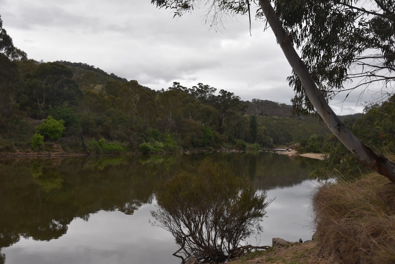
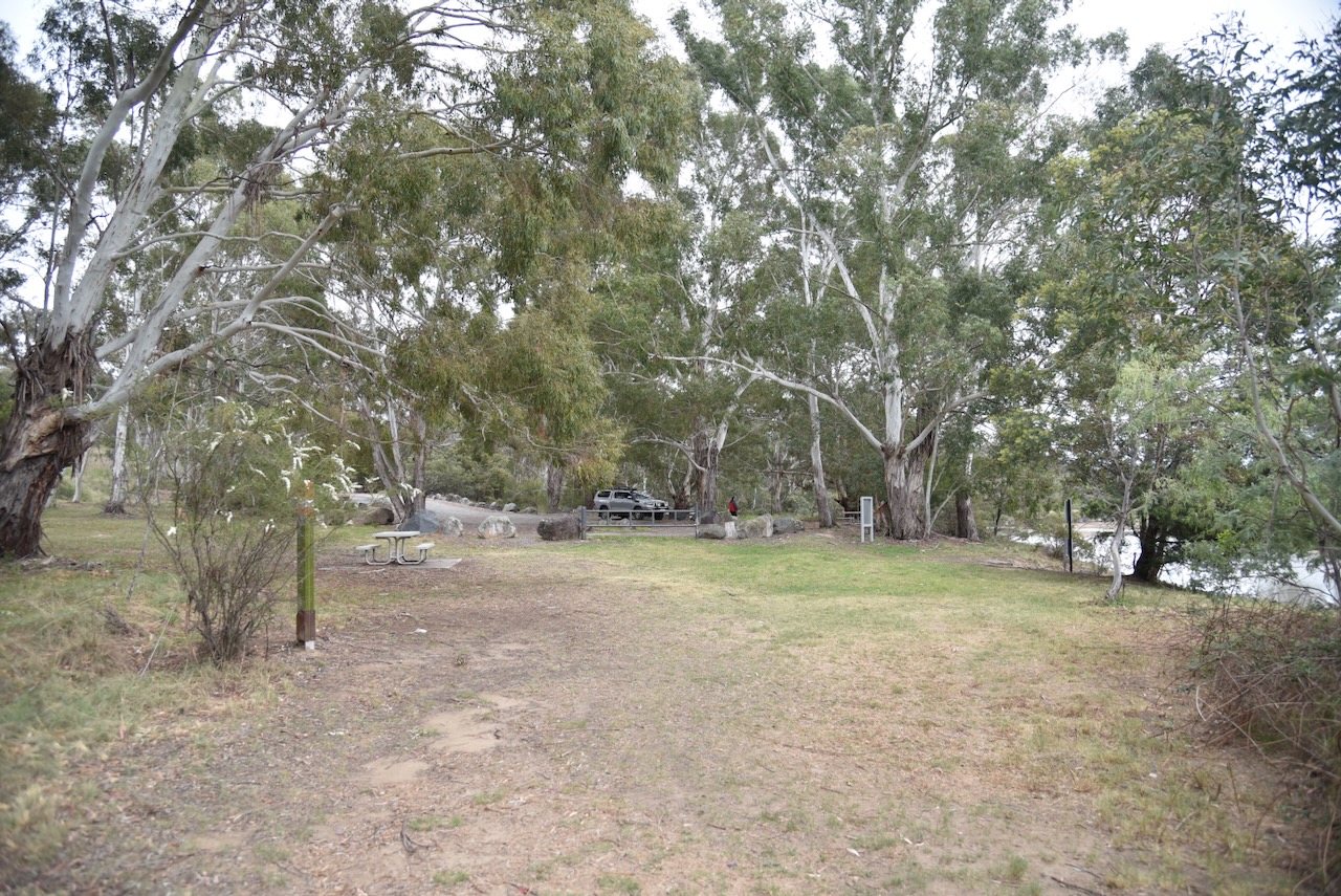
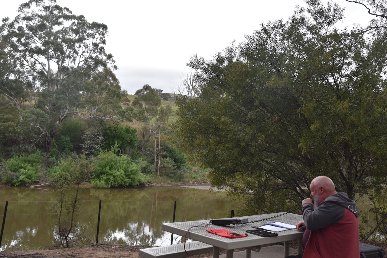
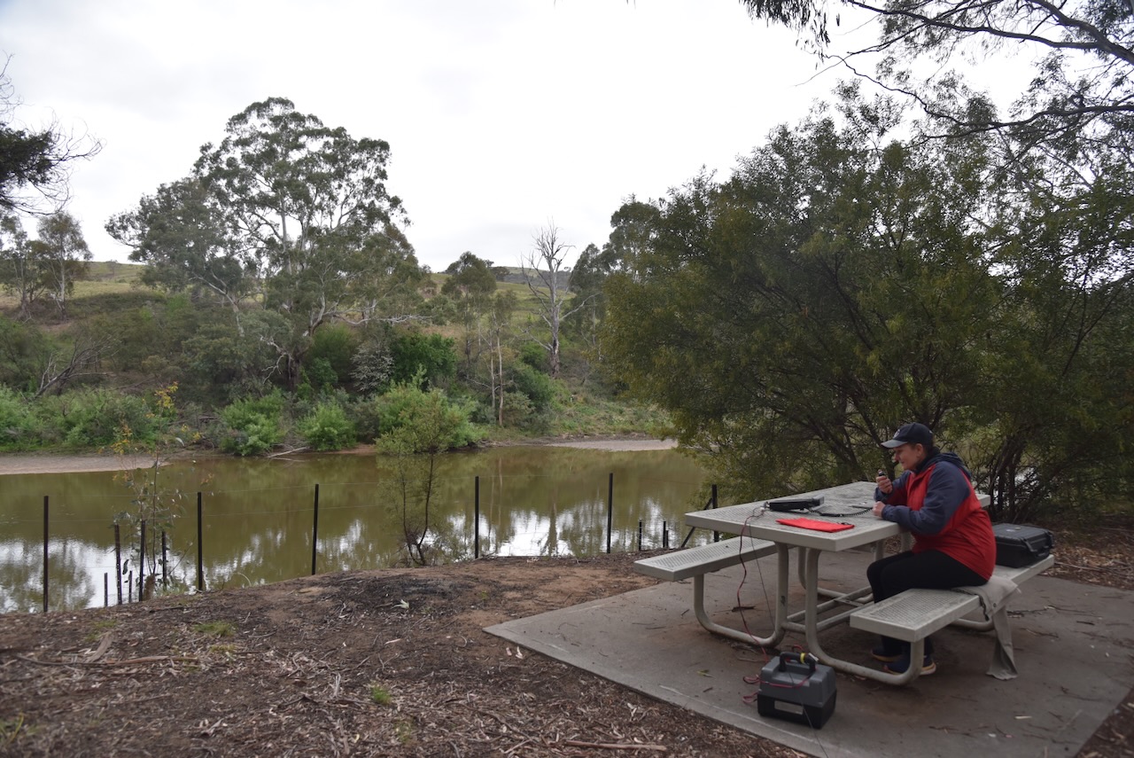
Marija and I set up in the Tharwa Sandwash picnic grounds.
We ran the Yaesu FT857, 40 watts, and the 20/40/80m linked dipole.
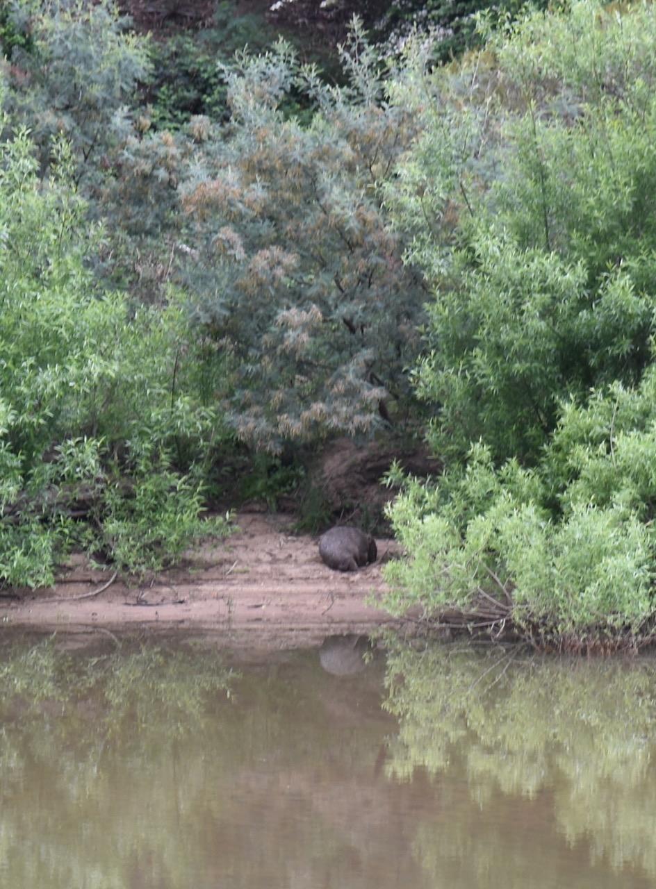
During our activation, we watched a wombat on the opposite bank of the Murrumbidgee River.