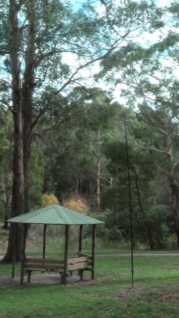
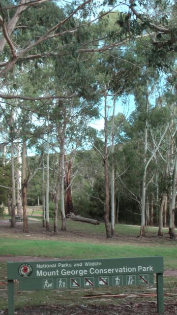
On 10th May, 2013, I activated the Mount George Conservation Park, which is located in the ‘Adelaide Hills’ Mount Lofty Ranges, about 21 kms east of Adelaide.
I have lived in the hills for about 25 years and have driven passed this park probably thousands of times, but have only ever visited it about 2-3 times. And after spending an enjoyable couple of hours there yesterday, I am going to visit there more often. It is a beautiful park with access via Mount George Road.
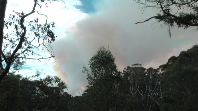
When I left home from Mount Barker in the hills which is only 20kms away from the park, I could see the huge plume of smoke from the nearby Cherryville bushfire. The park is about 7 kms south of the fire, but the smell of smoke was really strong in the air.
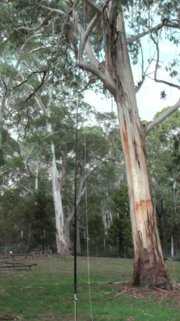
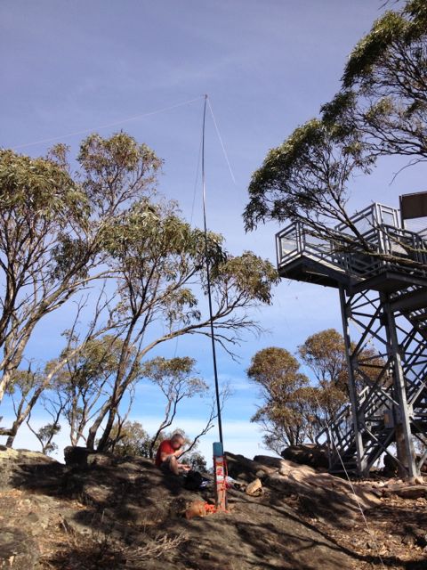
As per usual, I set up the Yaesu FT-817nd, and my BandHopper 40m/20m linked dipole on the 7m squid pole.
I ended up with 10 QSO’s on 40m and 20m. Conditions were a bit of a struggle, probably due to the time of the day.
QSO’s with the following:- Ray VK3NBL; Dave VK3ADM/m; Col VK5HCF; Victor VK2KVH; Alan VK5FADP; Dave VK3VCE; Graham VK5JD; Mike VK5MCB; Lyn VK4SWE; & John VK4LJ.
An enjoyable time in this park. And I left with a few unexpected additions…..some scratches to the car. A fella was walking his dog (a blue heeler) through the park and when they returned the dog mistook my car for theirs, and decided to jump up into my car through the open drivers window. Lesson learnt ! Never leave your car window down.
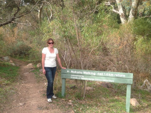
I activated the Telowie Gorge Conservation Park on Sunday 5th May, 2013, on my way back home from the Flinders Ranges (after activating 3 SOTA summits up there).
The Telowie Gorge Conservation Park is situated about 249 kms north of Adelaide, and about 25 kms north east from Port Pirie, off Highway 1. The park is the home to a colony of yellow-footed rock-wallabies, however I did not see any. We did however, see quite a few feral goats. The gorge has been created by Telowie Creek, which over time has cut a deep gorge through the range.
There are 2 camping grounds adjacent to the main entrance road. The distance to the park is shown as 500 metres, but this would have been the longest 500 m I have ever driven. It is more like 1 km. There are no toilet facilities or drinking water in the park.
There are several walking trails in the park. The ‘Nukunu Trail’ takes you along the base of the Telowie Gorge. This walk is spectacular. It is only short…2kms return (40 minutes return).
I set up in the bottom carpark at the start of the walking trail. My operation attracted quite a bit of attention by caravaners who were walking the gorge.
I used my Yaesu FT-817nd, 5 watts, and my BandHopper 40m/20m linked dipole on the 7m squid pole.
I managed 10 QSO’s on 40m & 20m into VK3, VK4, & VK5, and spent a relaxing hour or so in the deck chair. A couple of bonuses of the afternoon were working Will VK5AHV in the Sandy Creek CP & Marshall VK3MRG/p who was on the top of Federation Range summit in VK3.
Stations worked were:- Will, VK5AHV/p in the Sandy Creek Conservation Park; Brian VK5FMID; Ian VK5CZ; Mike VK5MCB; Rod VK5FTTC; Marshall VK3MRG/p (SOTA – VK3/VN-003); Dave VK3VCE; Rex VK5FRCP; Alan VK3DXE/m; & Peter VK4AAV.
I put together a short video of me activating here in the park. It can be found on You Tube at…..
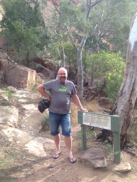
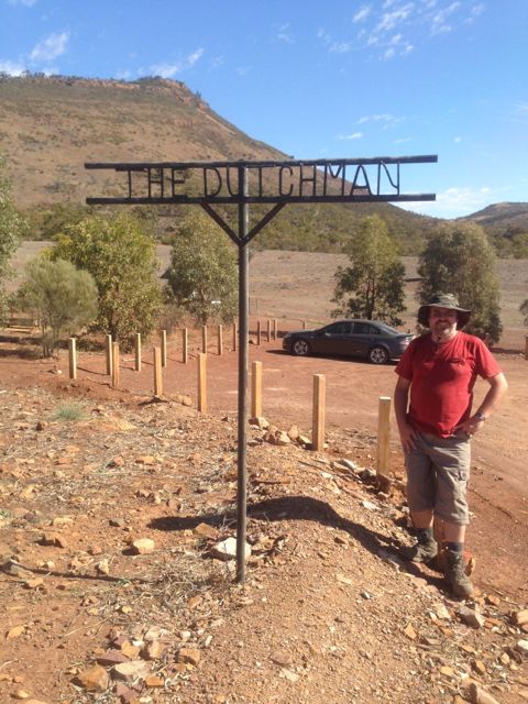
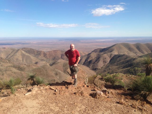
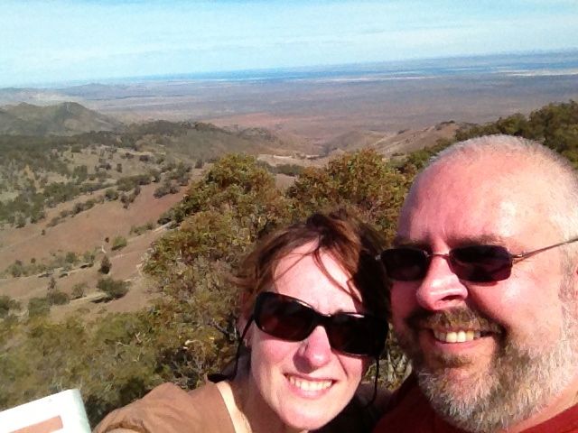
I activated The Dutchman’s Stern summit and the Dutchman’s Stern Conservation Park on Saturday 4th May, 2013. My wife, Marija did the walk/climb with me, which took us about 90 minutes to get to the top.
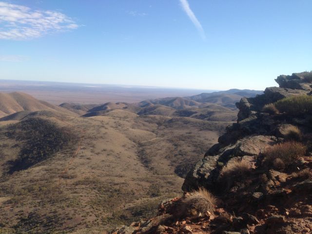
The Dutchman’s Stern summit is 855 metres ASL, and is worth 6 points.
It is situated within the 3,532 hectare Dutchman’s Stern Conservation Park, in the southern Flinders Ranges. The park gets its name from the bluff’s similarity to Dutch sailing ships of the 18th century. The rocky outcrops and slopes appear to resemble the reverse stern of these ships. The bluff was named by Captain Matthew Flinders who chartered the nearby Spencer Gulf in 1802.
Access is from the Arden Vale Road. The signposted turn-off to the park is 6.5 kms from the Port Augusta road intersection in Quorn. It is then a further 3 km to The Dutchman car park. All walking trails commence at the carpark.
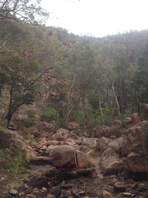
The track leading to the summit is very well maintained and signed. It is a 8.2 km return hike (4 hours return). It took Marija and I about 90 minutes to reach the summit and about 60 minutes back down. There are markers all along the way showing your progress.
We commenced this walk early in the morning and there were kangaroos everywhere. Both Western Greys and Red Kangaroos.
Upon reaching the summit, the views are sensational.
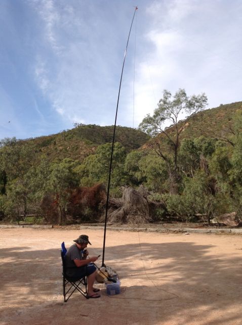
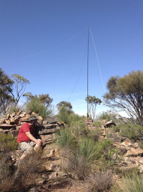
I used my Yaesu FT-817nd, 5 watts, and my BandHopper 40m/20m linked dipole on a 7m squid pole (inverted vee formation).
I used a distance marker post to secure my squid pole to. There is a rock formation with plenty of comfortable large rocks to sit on (if you can get comfortable rocks).
I managed 26 QSO’s on 40m, including a Summit to Summit with Rik, VK3KAN/p.
Stations worked were:- Dave VK3VCE; Glen VK3YY; Peter VK3ZPF; Ian VK1DI; Graham VK5KGP; Allen VK3HRA; Marshall VK3MRG; Mal VK3AZZ; Trevor VK5ATW; Larry VK5LY; Roy VK5NRG; Rik VK3KAN/p (SOTA VK3/ VC-005); Ian VK5CZ; Rex VK5FRCP; Warren VK3BYD; Ernie VK3DET; Steve VK3MEG; Kas VK5ZKT; David VK5KC; Bill VK5FWMA; John VK5FTCT; Peter VK3RV; Peter VK2NEO; Rod VK5FTTC, Jenny VK3WQ; and John VK2PBC/p.
More information can be found on PeakClimbs, at…..
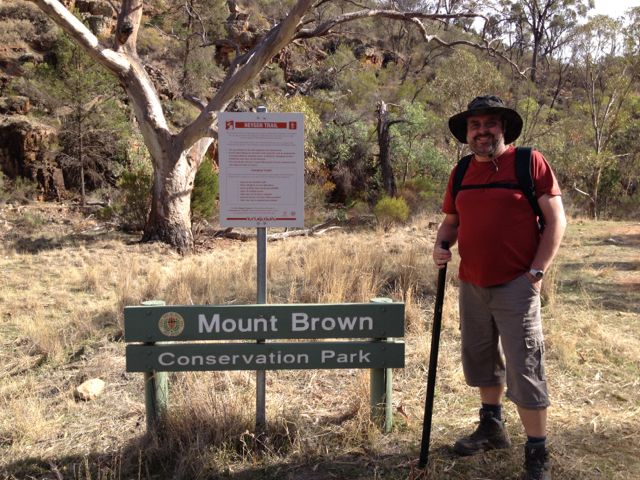
I activated the Mount Brown summit and Mount Brown Conservation Park on Saturday, the 3rd May, 2013.
Mount Brown summit is 951 metres ASL and is worth 8 points.
The Mount Brown summit is situated within the Mount Brown Conservation Park, and is located in the Southern Flinders Ranges, about 300 kms north of Adelaide, and about 14 kms south of Quorn.
Mount Brown is named in honour of Robert Brown, the botanist aboard Matthew Flinder’s survey ship HMS Investigator, who climbed the mountain and viewed Willochra Plain.
Access to the park is from Quorn township. At the Quorn Mill, travel south following the signs to Richman Valley and Waukarie Falls. Drive to the southern end of Richman Valley Road, a total distance of about 14 kms. The hike starts at the Olive Grove Trailhead, situated 200 metres from Olive Grove gate.
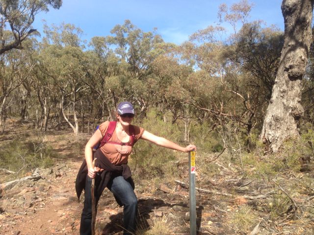
Walk down 50 metres from the Olive Grove Trailhead to checkpoint 1 near Waukarie Falls. Distance measurement markers start from here and are placed every 200 metres along the trail.
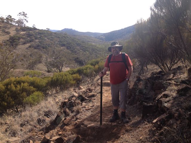
My wife Marija accompanied me on this hike which is about 11.6 km return, and took us about 2 hours to reach the summit. It is a moderate hike but is certainly challenging. The first 2 kms are quite flat and follow the creek line, but soon you are climbing up the tracks and it progressively gets steeper.
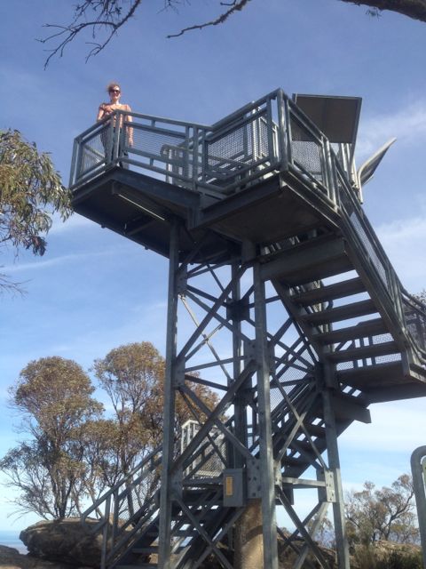
There is a small commemorative lookout at the summit which you can climb to see the spectacular 360 degree views. There are some great interpretaive signs on the lookout as well, which explain about the area & Robert Brown.
There are also some small antenna installations here and some solar panels, which I think were causing a little bit of noise interference, but nothing too drastic.
There are quite a few large gum trees at the summit which afford some shade, and lots of large rocks to sit on or to use to support a squid pole.
At the top of the summit we met a group of volunteers who were maintaing the track leading to the summit. They were extremely interested in the SOTA program and watched with interest as I made a few QSO’s.
I used my Yaesu FT-817nd, 5 watts, and my BandHopper 40m/20m linked dipole supported on the 7m squid pole which I secured to a distance marker.
I managed 17 QSO’s on 40m and 20m. It was a bit of a struggle into VK3 from here. Got in some DX contacts on 20m into Austria, Croatia, & France. Peter VK2NEO, had such a strong signal on 40m he nearly knocked me off the edge of the cliff face.
Stations worked were:- Peter VK3FPSR; John VK5EMI; Ernie VK3DET; David VK5KC; Rob VK2ZRD; Peter VK3PF; Peter VK2NEO; Larry VK5LY; Ron VK3AFW; Paul VK5FUZZ; Mark VK5QI; Rod VK5KFB; Don VK3MNZ/p; OE3DIA; Emil 9A9A; Pierre F8DHE; and Matt VK1MA.
It took about 90 minutes to climb back down to the bottom carpark.
For more information on Mount Brown, have a look at PeakClimbs…..