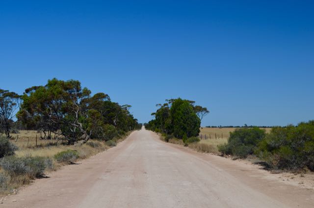
As a result of the proposed addition of some more South Australian parks for the World Wide Flora and Fauna (WWFF) program, I decided to review my list and compare it with official information. This is a follow up to an old post back in June 2014.
https://vk5pas.org/2014/06/27/parks-in-south-australia/
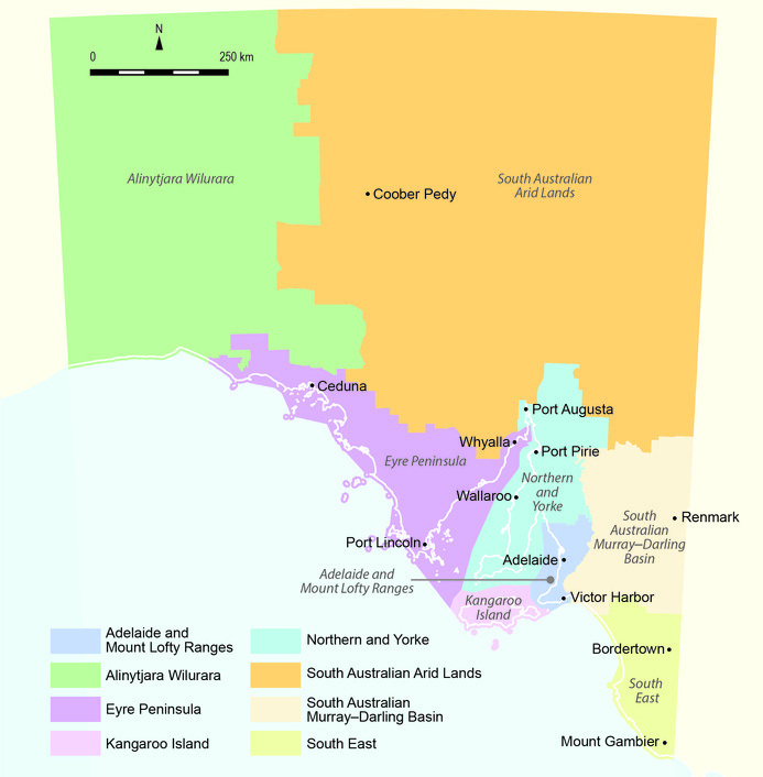
The State of South Australia (S.A.) has a total of 21 National Parks and 271 Conservation Parks. These parks are managed by the Department of Environment Water and Natural Resources (DEWNR). SA is currently divided into 8 different Natural Resource Management regions (NRM). They are as follows:
- Adelaide and Mount Lofty Ranges
- Alinytjara Wilurara
- Eyre Peninusla
- Kangaroo Island
- Northern and Yorke
- South Australian Arid Lands
- South Australian Murray-Darling Basin
- South East
This is a relatively new group of regions which commenced in about July, 2013. The seven old regions were as follows:
- Adelaide
- Kangaroo Island
- Murraylands
- Northern and Yorke
- Outback
- South East
- West
Above:- Map showing the eight DEWNR Regions. Courtesy of http://www.naturalresources.sa.gov.au
Adelaide and Mount Lofty Ranges.
This region’s total area is approximately 11,200 square kilometres. Around 59% of that is land and 41% marine waters. It supports around 1.3 million people which equates to 80 % of South Australia’s population. The region includes metropolitanAdelaide and the western side of the Mount Lofty Ranges, extending from Mallala and the Barossa in the north, to the Fleurieu Peninsula in the south. The region also extends up to 30km into the marine environment. The region supports remnant busland, agriculture and horticulture, urban areas, beaches, spectacular coastal scenery and marine environments.
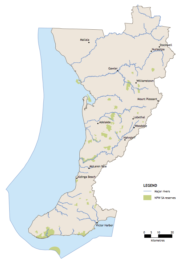
Above:- Map showing the Adelaide & Mt Lofty boundaries. Image courtesy of http://www.environment.sa.gov.au
The Region is divided into seven subregions as follows:
- Metropolitan Adelaide
- Northern Coast and Plains
- Northern Hills
- Central Hills
- Willunga Basin
- Fleurieu Peninsula
- Marine
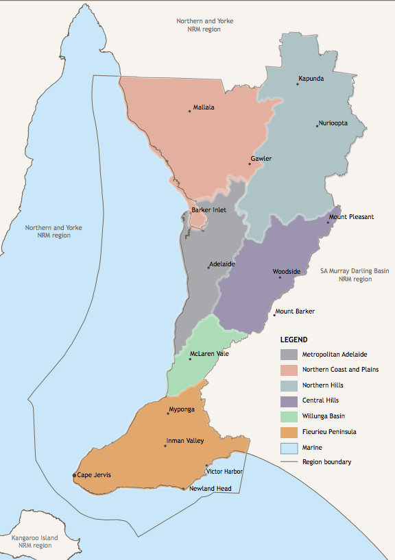
Above:- Map showing the subregions of the Adelaide and Mount Lofty Ranges NRM. Image courtesy of http://www.environment.sa.gov.au
There are a total of 46 parks in this region, comprising of 2 National Parks, and 44 Conservation Parks. Parks in this region comprise nearly 17% of all parks in the State. The parks in this Region are as follows:
- Aldinga Scrub Conservation Park
- Angove Conservation Park
- Belair National Park.
- Black Hill Conservation Park
- Charleston Conservation Park
- Cleland Conservation Park
- Cromer Conservation Park
- Cudlee Creek Conservation Park
- Deep Creek Conservation Park
- Eric Bonython Conservation Park
- Eurilia Conservation Park
- Ferguson Conservation Park
- Fort Glanville Conservation Park
- Giles Conservation Park
- Gum Tree Gully Conservation Park
- Hale Conservation Park
- Hallett Cove Conservation Park
- Horsnell Gully Conservation Park
- Kaiserstuhl Conservation Park
- Kenneth Stirling Conservation Park
- Marino Conservation Park
- Mark Oliphant Conservation Park
- Moana Sands Conservation Park
- Montacute Conservation Park
- Morialta Conservation Park
- Mount Billy Conservation Park
- Mount George Conservation Park
- Mylor Conservation Park
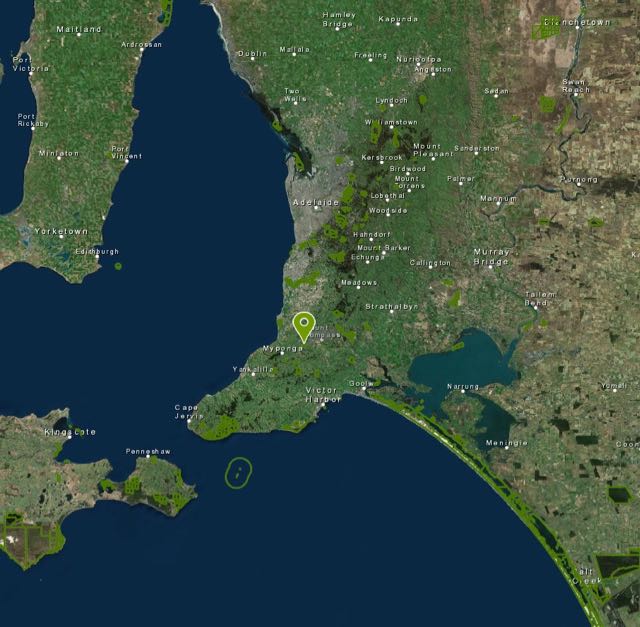
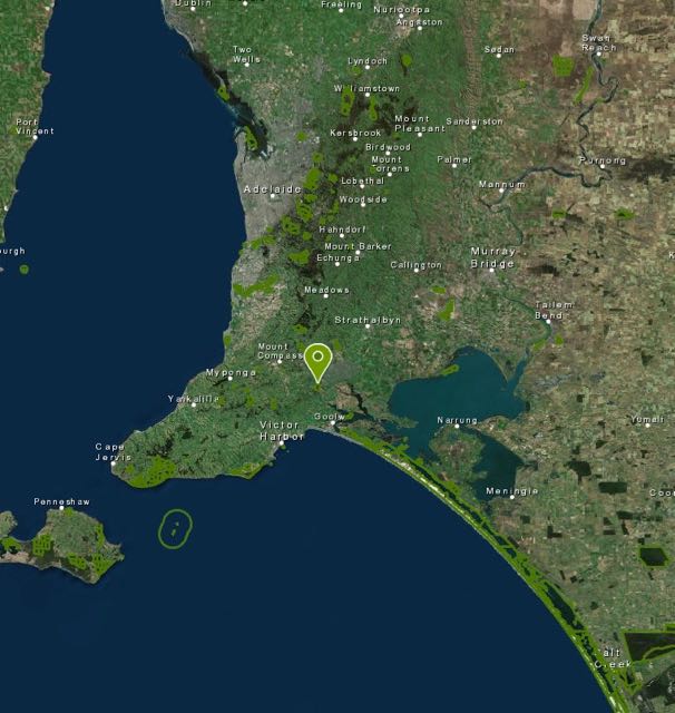
- Myponga Conservation Park
- Newland Head Conservation Park
- Nixon Skinner Conservation Park
- Onkaparinga River National Park.
- Port Gawler Conservation Park
- Porter Scrub Conservation Park.
- Pullen Island Conservation Park
- Sandy Creek Conservation Park
- Scott Creek Conservation Park
- Spring Mount Conservation Park
- Stipturus Conservation Park
- Talisker Conservation Park
- The Knoll Conservation Park
- Torrens Island Conservation Park (administered by the Adelaide Dolphin Sanctuary)
- Waitpinga Conservation Park
- Warren Conservation Park
- West Island Conservation Park
- Yulte Conservation Park

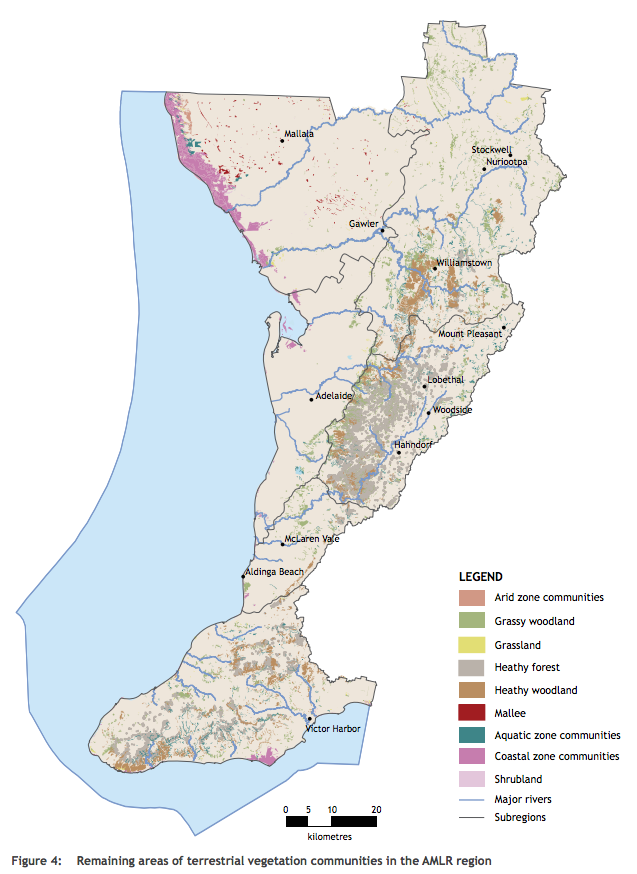
Above:- Map showing the vegetation types in the Region. Image courtesy of http://www.environment.sa.gov.au
For more information please see…..
http://www.naturalresources.sa.gov.au/adelaidemtloftyranges/home
Alinytjara Wilurara
The Alinytjara Wilurara (AW) natural resource management (NRM) region covers the north west third of South Australia. In Pitjantjatjara, ‘alinytjara’ means ‘north’ and ‘wilurara’ means ‘west’. The AW NRM region covers more than 250,000 square kilometres, stretching from the Northern Territory and West Australian borders south to the Great Australian Bight. The regional boundary extends to the edge of the State Waters (three nautical miles off-shore) in the Great Australian Bight and includes the South Australian part of the Great Australian Bight Marine Park. The land and its 340 kilometres of coastline are mostly dedicated to conservation and traditional Aboriginal use and occupation. The homelands and community townships are inhabited by approximately 4,000 people.
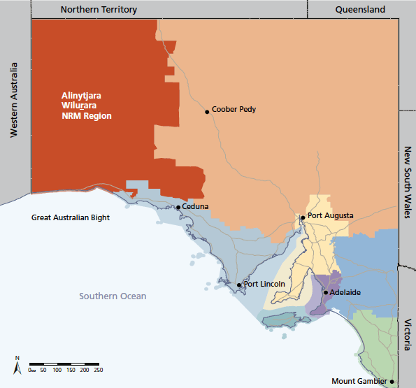
Above:- Map showing the Alinytjara Wilurara NRM Region. Image courtesy of http://www.environment.sa.gov.au
There are a total of 5 parks in this region, comprising of 1 National Park, and 4 Conservation Parks in this region. They are as follows:
- Mamungari Conservation Park
- Nullabor National Park
- Pureba Conservation Park
- Tallaringa Conservation Park
- Yumbarra Conservation Park
For more information please see….
http://www.naturalresources.sa.gov.au/alinytjara-wilurara/home
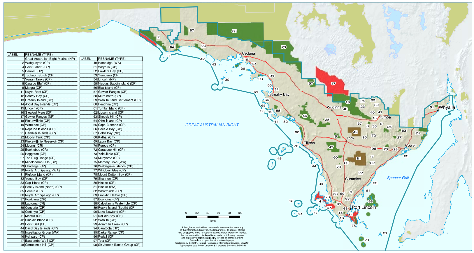
Eyre Peninsula.
The Eyre Peninsula region covers a significant area of South Australia (80,000 square km / 8 million ha) and includes part of the upper Spencer Gulf, the City of Whyalla, across the southern boundaries of the Gawler Ranges, past Ceduna to the edge of the Nullarbor Plain and south to the fishing hub of Port Lincoln. Native vegetation covers about 44% of the land mass. The coastline in this region stretches for about 2,475 km in length. The region supports a population of about 55,000 people.
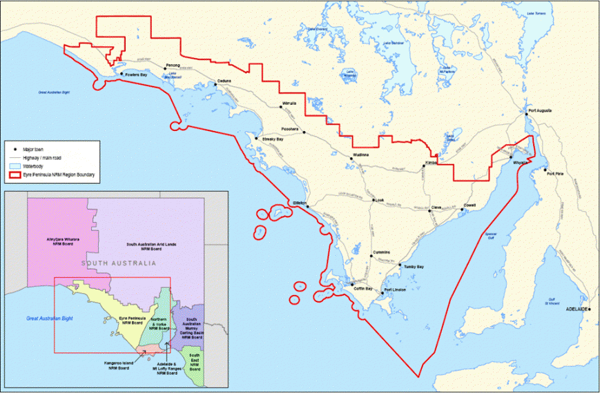
Above:- Map showing the Eyre Peninsula NRM Region. Image courtesy of http://www.environment.sa.gov.au
There are a total of 75 parks in this region, which comprises about 27 % of all of the parks in South Australia. Here are the parks in the Eyre Peninsula Region:
- Acraman Creek CP
- Avoid Bay Islands CP
- Baird Bay Islands CP
- Barwell CP
- Bascombe Well CP
- Boondinna CP
- Calpatanna Waterhole CP
- Cap Island CP
- Cape Blanche CP
- Caralue Bluff CP
- Carapee Hill CP
- Chadinga CP
- Cocata CP
- Coffin Bay NP
- Corrobinnie Hill CP
- Darke Range CP
- Eba Island CP
- Fowlers Bay CP
- Franklin Harbor CP
- Gambier Islands CP
- Gawler Ranges CP
- Great Australian Bight National Park
- Greenly Island CP
- Heggarton CP
- Hincks CP
- Ironstone Hill Conservation Park
- Kathai CP
- Kellidie Bay CP
- Kulliparu CP
- Lake Gilles CP
- Lake Newland CP
- Laura Bay CP
- Lincoln NP
- Lincoln CP
- Lipson Island CP
- Malgra CP
- Middlecamp Hills CP
- Moody Tank CP
- Mount Dutton Bay CP
- Munyaroo CP
- Murrunatta CP
- Neptune Islands CP
- Nicholas Baudin Island CP
- Nuyts Archipelago CP
- Nuyts Reef CP
- Olive Island CP
- Peachna CP
- Pigface Island CP
- Pinkawillinie CP
- Point Bell CP
- Point Labbatt CP
- Rocky Island (North) CP
- Rocky Island (South) CP
- Ruddall CP
- Sceale Bay CP
- Searcy Bay CP
- Shannon CP
- Sheoak Hill CP
- Sinclair Island CP
- Sir Joseph Banks Group CP
- Sleaford Mere CP
- The Plug Range CP
- Tucknott Scrub CP
- Tumby Island CP
- Venus Bay CP
- Verran Tanks CP
- Wahgunyah CP
- Waldegrave Islands CP
- Wanilla CP
- Wanilla Land Settlement CP
- Wharminda CP
- Whidbey Isles CP
- Whyalla CP
- Wittelbee CP
- Yeldulknie Conservation Park
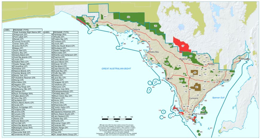
Above:- Parks on the Eyre Peninsula. Image courtesy of http://www.environment.sa.gov.au
For more information please see….
http://www.naturalresources.sa.gov.au/eyrepeninsula/home
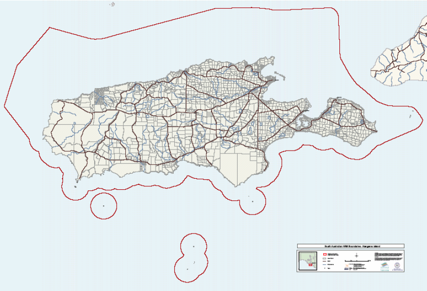
Kangaroo Island
Kangaroo Island (KI) lies approximately 15 kilometres off the Fleurieu Peninsula in southern South Australia. The island covers an area of 4,370 square kilometres and is home to approximately 4,400 people who reside primarily in the four townships, the largest being Kingscote. The island welcomes more than 160,000 visitors each year, one third of whom are international guests.
KI contains the highest proportion of remnant vegetation of all South Australian agricultural regions. Around 40% of the island is covered by native vegetation, maintaining significant areas of relatively intact ecosystems.
The region is noted for its abundant wildlife, thanks to relatively few predators and extensive native habitats. Kangaroo Island and its marine waters are home to:
- 18 species of terrestrial mammals
- 255 recorded bird species
- 18 reptile species
- 6 frog species
- 231 recorded fish species
- 5 kinds of seagrass
- up to 600 species of marine algae.
Above:- Map showing Kangaroo Island Rehion boundaries. Image courtesy of Kangaroo Island NRM Plan 2009
Kangaroo Island has a total of 22 parks, consisting of 1 National Park, and 21 Conservation Parks.
- Baudin CP
- Beatrice Islet CP
- Beyeria CP
- Busby Islet CP
- Cape Gantheaume CP
- Cape Willoughby CP
- Cygnet Estuary CP
- Dudley CP
- Flinders Chase NP
- Kelly Hill CP
- Lashmar CP
- Lathami CP
- Lesueur CP
- Mount Taylor CP
- Nepean Bay CP
- Parndana CP
- Pelican Lagoon CP
- Seal Bay CP
- Seddon CP
- Simpson CP
- The Pages CP
- Vivonne Bay CP
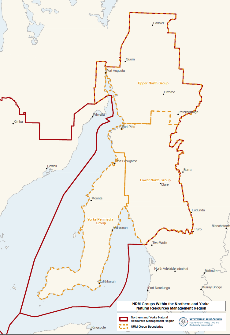
Northern and Yorke.
The Northern and Yorke (NY) natural resources management region extends for 34,500 square kilometres, or more than three million hectares. It is a varied and productive portion of South Australia and includes 1,350km of coastline and adjacent marine areas.
The region encompasses the Yorke Peninsula, the northern Mount Lofty Ranges, the southern Flinders Ranges and significant areas of Spencer Gulf and Gulf St Vincent.
The region supports a population of approximately 95,000 people who reside in agricultural, coastal and urban communities. It welcomes a large number of visitors each year to destinations that include Innes National Park, the Clare Valley and the Southern Flinders Ranges.
The region includes traditional Aboriginal lands of the Kaurna, Narrunga, Nukunu, Ngadjuri, Meru, Danggali, Barngala and Adnyamathanha people.
The major urban centres are the cities of Port Pirie, Port Augusta, Clare, Kadina, Moonta and Wallaroo.
Natural resources underpin a range of industries. Approximately 80% of the region is under agricultural cropping and grazing production contributing a quarter of the South Australia’s agricultural earnings. The region embraces the major Clare Valley wine growing area, and supports significant mining and mineral processing activities, fishing, aquaculture, forestry, horticulture and tourism.
Northern and Yorke and its marine waters are home to:
- 1,299 native species of vascular terrestrial plants
- 33 native species of terrestrial mammals
- 304 recorded native bird species
- 91 native reptile species
- 9 frog species.
Above:- Map of the Northern & Yorke NRM Region. Image courtesy of http://www.environment.sa.gov.au
This region is divided into three districts as follows:
- Upper North
- Lower North
- Yorke Peninsula
There are a total of 24 parks in this region, comprising of 2 National Parks, and 22 Conservation Parks. They are as follows:
- Althorpe Islands CP
- Bird Islands CP
- Black Rock CP
- Carribie CP
- Clements Gap CP
- Clinton CP
- Goose Island CP
- Innes NP
- Leven Beach CP
- Martindale Hall CP
- Minlacowie CP
- Mount Brown CP
- Mount Remarkable NP.
- Mount Brown CP
- Point Davenport CP
- Ramsay CP
- Spring Gully CP
- Telowie Gorge CP
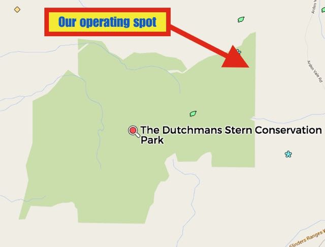
- The Dutchmans Stern CP
- Troubridge Island CP
- Warrenben CP
- Wills Creek CP
- Winninowie CP
- Yalpara CP
For more information please see…..
http://www.naturalresources.sa.gov.au/northernandyorke/home
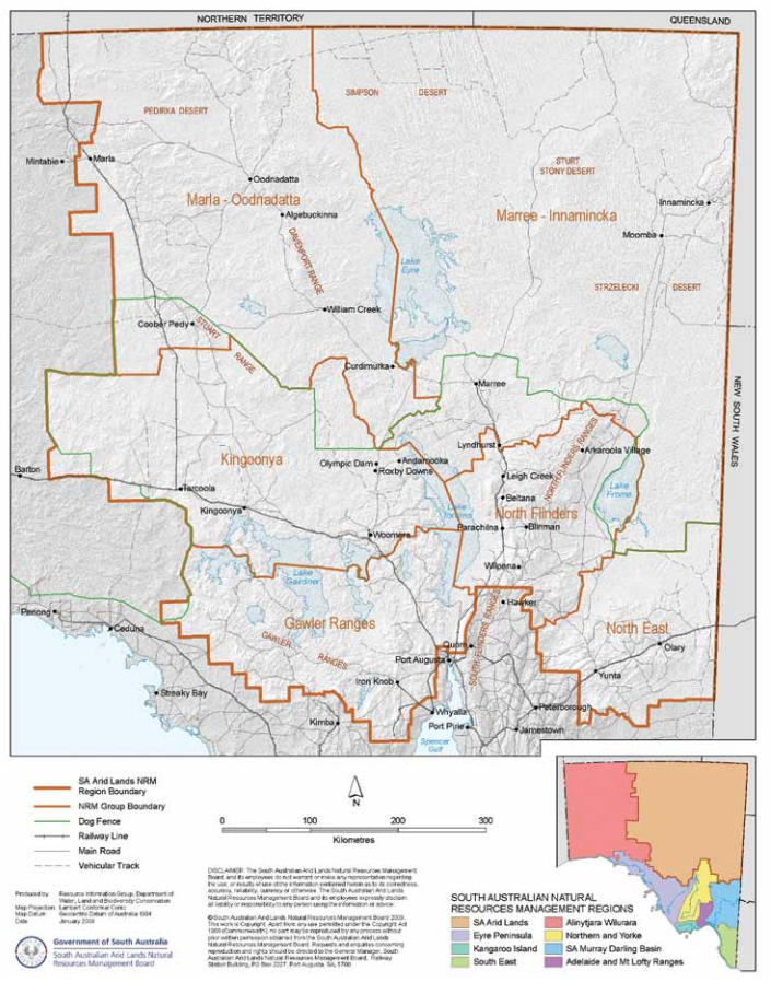
South Australian Arid Lands.
The SA Arid Lands region cover over half of South Australia, taking up the state’s north-east corner to its borders with New South Wales, Queensland and the Northern Territory. The region’s environmental processes are determined by irregular rainfall and other episodic weather events that rarely follow predictable annual cycles. The region includes some of the driest parts of South Australia and has the largest percentage of intact ecosystems and natural biodiversity in the state. These iconic terrestrial ecosystems – including sandy deserts, stony plains, and the Gawler, Flinders and Olary ranges – are home to a range of unique plants and animals, many of which are only found within the region.
The human population in this semi arid region is small (less than 2% of the state) and geographically dispersed. The largest towns, Coober Pedy and Roxby Downs, are both associated with mining and are home to less than 5000 people, while the remaining scattered towns all have less than 1000 occupants.
Pastoralism is the most dominant land use, with over 400,000 square kilometres taken up by sheep and cattle stations. Large mining and petroleum companies also operate in the arid lands. Aboriginal land holdings are diverse and include pastoral leases, community managed land, indigenous protected areas and co-managed parks.
The region contains some of the state’s most environmentally significant natural resources including conservation reserves and National Parks, as well as two great inland water systems: Kati Thanda – Lake Eyre and the Great Artesian Basin.
Above:- Map showing the SA Arid Lands NRM Region. Image courtesy of http://www.environment.sa.gov.au
This region is divided into the following 6 districts:
- Gawler Ranges
- Kingoonya
- Marla-Oodnadatta
- Marree-Innamincka
- North Flinders
- North East
There are a total of 16 parks in this region, comprising of 7 National Parks, and 8 Conservation Parks in this region. They are as follows:
- Bimbowrie CP
- Breakaways CP
- Ediacara CP
- Elliott Price CP
- Flinders Ranges NP.
- Gawler Ranges National Park
- Ironstone Hill CP
- Kati Thanda-Lake Eyre NP
- Lake Gairdner NP
- Lake Torrens NP
- Malkumba-Coongie Lakes NP.
- Pualco Range CP
- Simpson Desert CP
- Vulkathunha-Gammon Ranges NP
- Wabma Kadarbu Mound Springs CP
- Witjira NP
For more information please see…..
http://www.naturalresources.sa.gov.au/aridlands/home
South Australia Murray Darling Basin
The SA Murray-Darling Basin region extends from where the River Murray crosses the border from Victoria into South Australia, down to where it meets the sea at the Coorong. It covers 70,000 square kilometres and includes six distinct ecological areas:
- River Murray
- Coorong and Lower Lakes
- Murray Mallee
- Murray Plains
- Eastern Mount Lofty Ranges
- South Olary Plains.
The region’s natural resources support a wide range of human activities. The River Murray supplies the majority of the water needs for the capital city of Adelaide as well as other towns in the state. The natural resources also support tourism, recreation and manufacturing, as well as one of the most productive agricultural areas in South Australia. About 82% of the land in the region is used for primary production, including pastoral lands, dryland cropping, grazing, horticulture, irrigation and dairy farming.
Within the region, there are ecosystems that are of state, national and international significance, including the Ramsar-listed Chowilla Floodplain and the Coorong and Lower Lakes. As a result, there are large areas of National Parks dedicated to nature conservation.
The region is also home to a diverse range of native plants and animals, many of them under threat:
- 95 species of native mammal, of which 45 are under threat
- 110 species of native reptiles, of which two are endangered and five are vulnerable
- 13 species of native frogs, with the Golden Bell Frog considered nationally vulnerable
- 31 species of native freshwater fish, with four listed as threatened
- 3 species of threatened native estuarine fish.
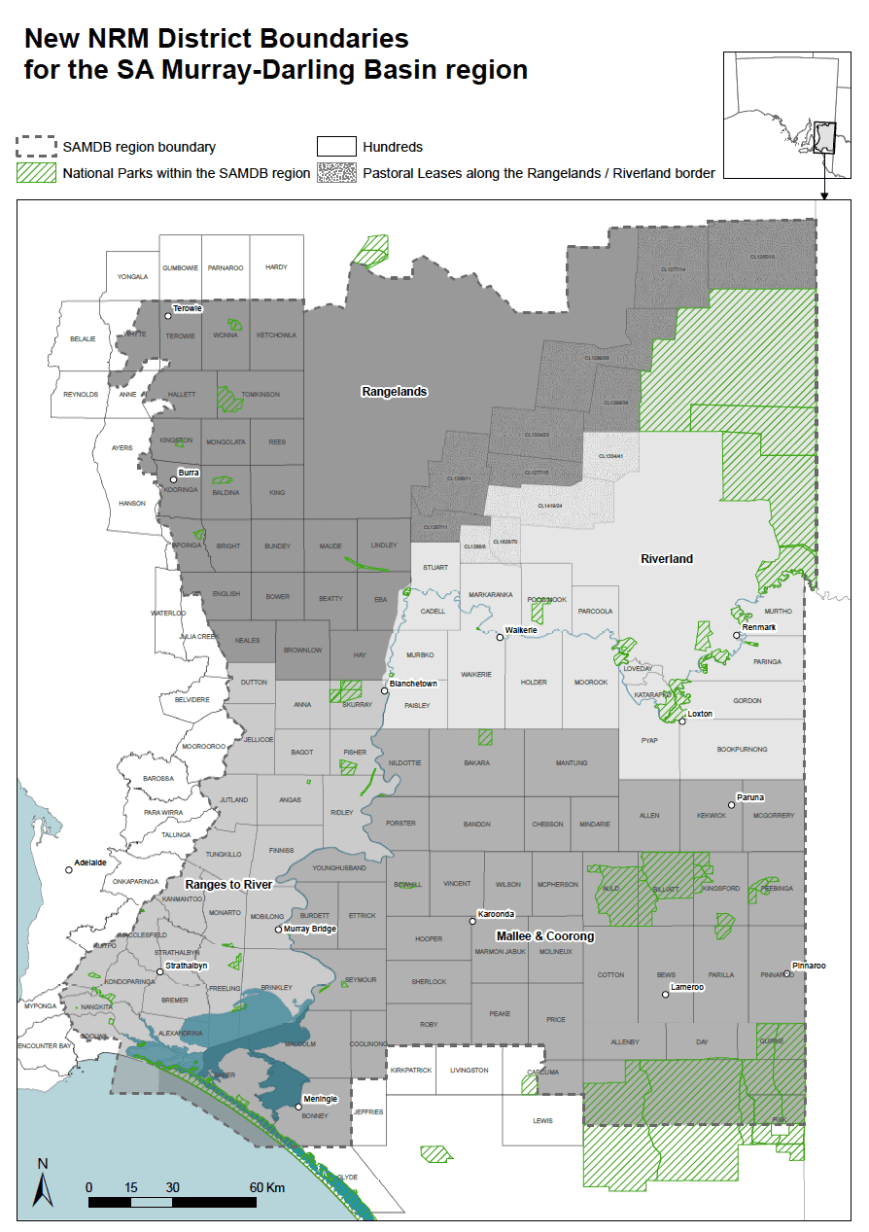
Above:- Map of the Region. Image courtesy of http://www.environment.sa.gov.au
The region is divided into the following 4 districts:
- Rangelands
- Ranges to River
- Riverland
- Mallee & Coorong
There are a total of 47 parks in this region, comprising 2 National Parks, and 44 Conservation Parks. This consists of nearly 17% of the parks located in South Australia. The region’s parks are as follows:
- Bakara CP
- Bandon CP
- Billiatt CP
- Brookfield CP
- Bullock Hill CP
- Carcuma CP
- Caroona Creek CP
- Cooltong CP
- Coorong NP
- Cox Scrub CP
- Danggali CP
- Ettrick CP
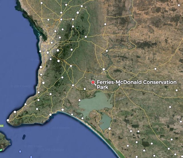
- Ferries McDonald CP
- Finnis CP
- Hesperilla CP
- Hogwash Bend CP
- Hopkins Creek CP
- Kapunda Island CP
- Karte CP
- Kyeema CP
- Lowan CP
- Maize Island CP
- Marne Valley CP
- Media Island CP
- Mimbara Conservation Park
- Mokota CP
- Monarto CP
- Morgan CP
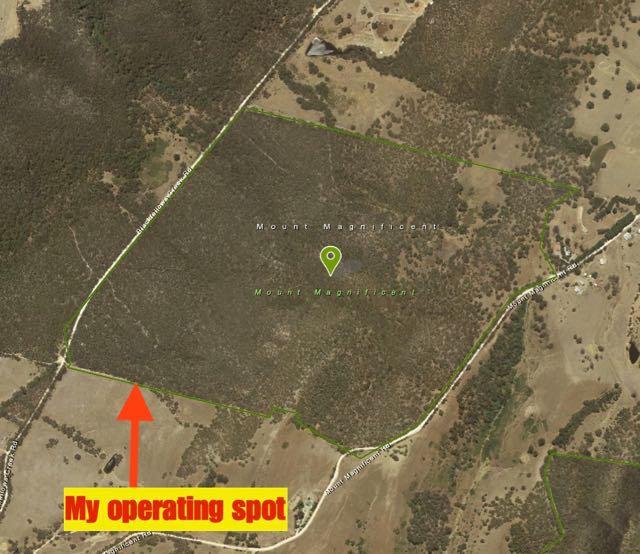
- Mount Magnificent CP
- Mowantjie Willauwar CP
- Murray River NP
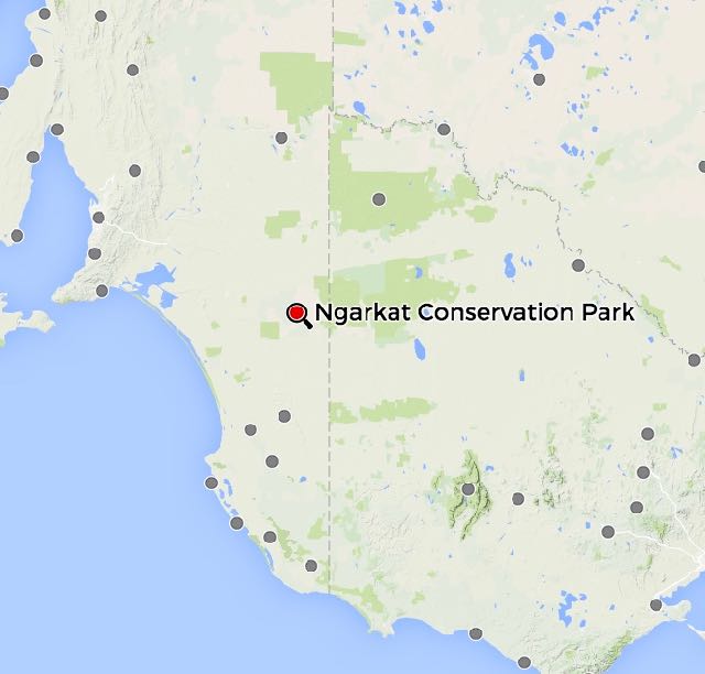
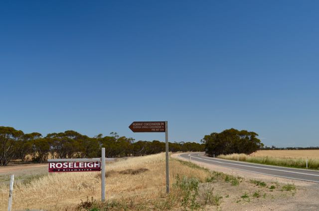
- Ngarkat CP
- Ngaut Ngaut CP
- Pandappa CP
- Peebinga CP
- Pike River CP
- Pooginook CP
- Poonthie Ruwe CP
- Ramco Point CP
- Red Banks CP
- Ridley CP
- Rilli Island CP
- Roonka CP
- Salt Lagoon Islands CP
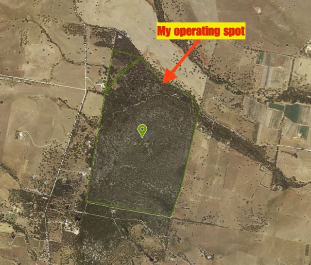
- Scott CP
- Swan Reach CP
- White Dam CP
For more information please see…..
http://www.naturalresources.sa.gov.au/samurraydarlingbasin/home
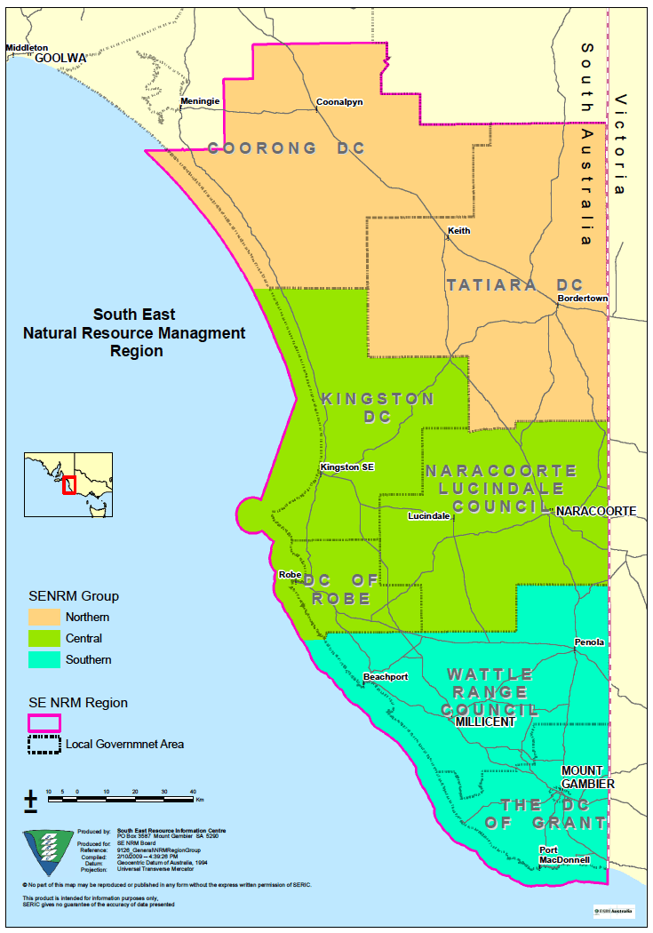
South East
The South East Natural Resources Management (SE NRM) region covers an area of approximately 28,000 square kilometres and is bounded by the Victorian border to the east, the Southern Ocean to the south and the Coorong to the west. This area of South Australia is commonly referred to as the Limestone Coast due to its proximity to the coast and the abundance of limestone located under the soil, which acts as a filter to produce high quality water.
The climate of the region is characterised by cool wet winters and mild to hot, dry summers. Average annual rainfall varies considerably within the region, from approximately 850mm in the south to 450mm in the north of the region. With a favourable climate, suitable soils and underground water, the South East has a strong history as a highly productive area that supports a diverse and profitable industry base. The region contributes about $5 billion per annum towards the South Australian GDP with more than 30% of the State’s GDP produced by the South East’s agricultural sector. The key economic activities in the region supported by natural resources include plantation forestry, wine/viticulture, agriculture, dairy, potatoes, fishing/aquaculture and their associated industries.
The region is distinguished by a series of stranded dunes that rise between 20-50 metres above interdunal plains. These plains can be inundated over winter and host a variety of internationally-recognised wetland systems, including the Ramsar-listed Bool and Hacks lagoons and part of the Coorong and Lower Lakes Wetlands. The region also hosts and extensive network of limestone sink holes and caves, which include the World Heritage Listed Naracoorte Caves.

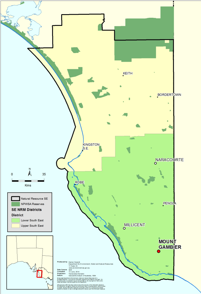
Above:- Map showing the South East boundaries. Image courtesy of http://www.naturalresources.sa.gov.au
The South East Region is divided into three SENRM groups:
- Northern
- Central
- Southern
Above:- Map showing the South East NRM Groups; Northern, Central & Southern. Image courtesy of http://www.naturalresources.sa.gov.au
There are a total of 57 parks in the South East region, comprising 2 National Parks, and 55 Conservation Parks. This is about 21% of the total parks in South Australia. The parks are as follows:
- Aberdour Conservation Park
- Bangham Conservation Park
- Baudin Rocks Conservation Park
- Beachport Conservation Park
- Belt Hill Conservation Park
- Big Heath Conservation Park
- Butcher Gap Conservation Park
- Calectasia Conservation Park
- Canunda National Park
- Carpenter Rocks Conservation Park
- Christmas Rocks Conservation Park
- Custon Conservation Park
- Desert Camp Conservation Park
- Dingley Dell Conservation Park
- Douglas Point Conservation Park
- Ewens Ponds Conservation Park
- Fairview Conservation Park
- Furner Conservation Park
- Geegeela Conservation Park
- Glen Roy Conservation Park
- Gower Conservation Park
- Grass Tree Conservation Park
- Guichen Bay Conservation Park
- Gum Lagoon Conservation Park
- Hacks Lagoon Conservation Park
- Hanson Scrub Conservation Park
- Jip Jip Conservation Park
- Kelvin Powrie Conservation Park
- Kungari Conservation Park
- Lake Frome Conservation Park
- Lake Hawdon South Conservation Park
- Lake St Clair Conservation Park
- Little Dip Conservation Park
- Lower Glenelg River Conservation Park
- Martin Washpool Conservation Park
- Mary Seymour Conservation Park
- Messent Conservation Park
- Mount Boothby Conservation Park
- Mount Monster Conservation Park
- Mount Scott Conservation Park
- Mullinger Swamp Conservation Park
- Narracoorte Caves National Park
- Nene Valley Conservation Park
- Padthaway Conservation Park
- Penambol Conservation Park
- Penguin Island Conservation Park
- Penola Conservation Park
- Piccaninnie Ponds Conservation Park
- Pine Hill Soak Conservation Park
- Reedy Creek Conservation Park
- Talapar Conservation Park
- Tantanoola Caves Conservation Park
- Telford Scrub Conservation Park
- Tilley Swamp Conservation Park
- Vivigani Ardune Conservation Park
- Woakwine Conservation Park
- Wolsley Common Conservation Park
For more information please see……
http://www.naturalresources.sa.gov.au/southeast/home
Resources.
Department of Environment, Water and Natural Resources, http://www.environment.sa.gov.au/Home Natural Resources,


")