New Campbell Hill, VK5/ SE-007

Our second activation of the day was New Campbell Hill, VK5/ SE-007.  Ian had already activated this hill, but that was last year in 2012, so it was some more Activator points for him as well.  We had about a 60 km drive to the north west to get to New Campbell Hill from Hallett Hill.  We cut across to the west to Spalding and then travelled north up the RM Williams Way.

RM Williams Way is named after Reginald Murray Williams, AO, CMG (born in 1908 – died in 2003), who was an Australian bushman and entrepreneur who rose from a swagman to a millionaire.  He was widely known as just ‘R.M.’, and was born at Belalie North near Jamestown.   He became known for creating an Australian style of bushwear recognised world wide.

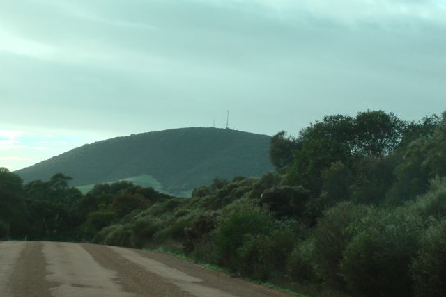
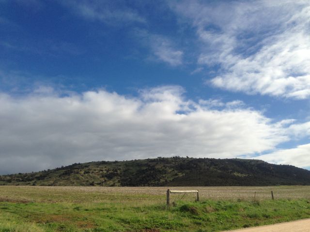
New Campbell Hill is situated close to the Bundaleer Forrest Reserve in South Australia’s mid-north, to the south of the township of Jamestown.  It is about 220 kms north of Adelaide.  The hill is 714 metres above sea level and is worth 4 points.

IMGA0064

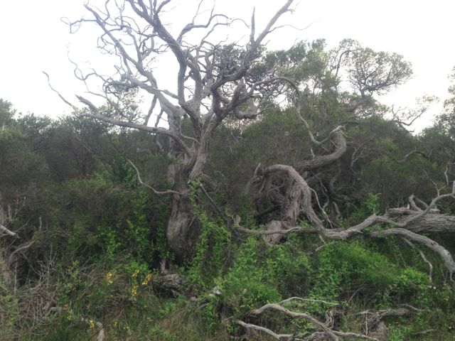
Bundaleer Forest was Australia’s first plantation forest.  The forest is the birthplace of the Australian forest industry.  It is just 10 kilometres south of Jamestown, and offers magnificent scenery and walks.  The Heysen trail (for hikers) and Mawson trail (for mountain bikers) take in the Bundaleer Forest.  The Arboretum on Georgetown Road contains a range of native and exotic tree species.  The Conservator’s Hut – formerly the exclusive residence of the Conservator of Forests – is on the Conservator’s Trail.  Picnics can be enjoyed in the picnic grounds all year round, except for days of extreme fire danger.

By the 1870’s, much of South Australia’s native trees had been wiped out by eager pioneers in their rush to find materials for buildings, railway sleepers, jetty pylons and supports for mining shafts and tunnels.  The need to find a suitable forestry timber species was crucial.  By 1876, Bundaleer had been chosen as the site for the first trial plantings of commercial forestry trees from Europe, North America and all over Australia.

It was soon discovered the Californian radiata pine was the best species suited to forestry in Australia and this species went on to become the mainstay of not only Australian forestry, but also forestry in Chile, New Zealand and South Africa.  The Woods and Forests Department (now Forestry SA) was formed in 1882 and the Bundaleer Forest Reserve was established with the planting of 400 ha (1000 acres) of forest.

Bundaleer’s timber became known for its high grade, a result of its slow growth (radiata plantations in SA’s South-East grow three times as fast).  Throughout its history, Bundaleer timbers has been used for housing and structural timbers, furniture, packaging and shipping, ply-board manufacture, and for the pallet market. Milling of much of the timber occurs locally and is a vital industry to the town and region today.

Today, Bundaleer is the state’s smallest forest with about 1,500 hectares of plantations.

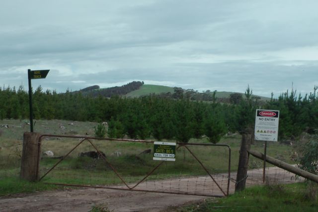
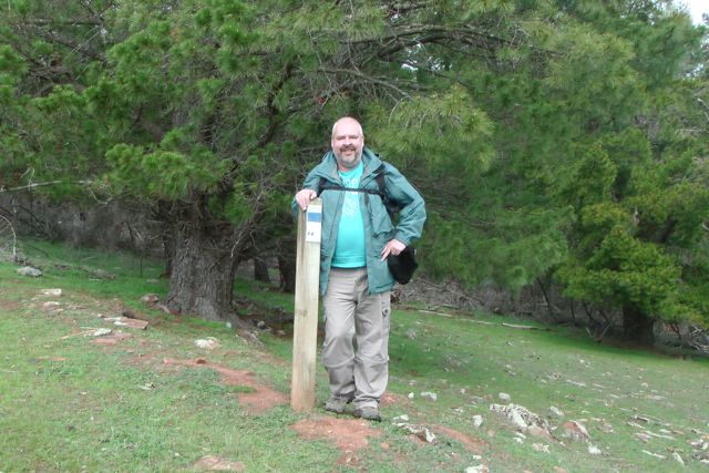
Ian and I travelled north on RM Williams Way and then turned left onto Bundaleer Gardens Road.  We parked the car at the locked gate on Neindorf Road.  The gate has a sign on it “Gate: BG 5″.  There is also a sign saying ‘Bore Track”.

IMGA0065

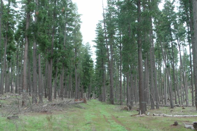
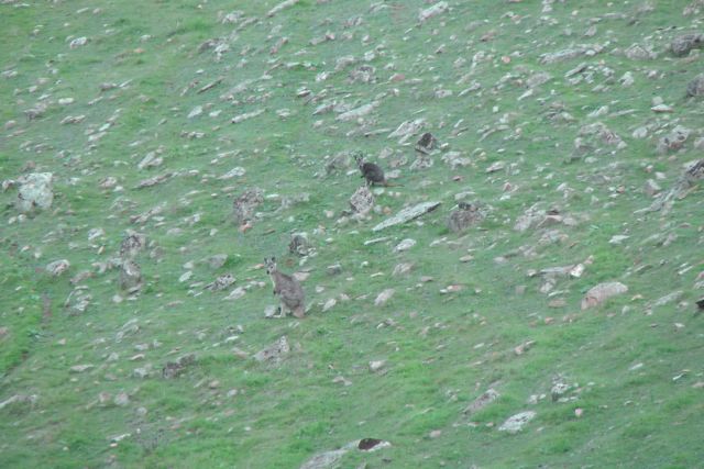
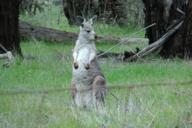
We then commenced our 4km walk from there to the summit.  The first section of the walk is along a nicely graded dirt access road to the forest (called Bore Track).  There is virtually no incline on the road, but there is worse to come.  As Ian and I strolled along the road, we saw a few wild deer and a large number of kangaroos and euros.  We even saw a cheeky fox which bounded off in a hurry when he heard our approaching voices.

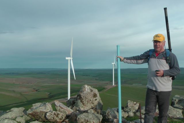
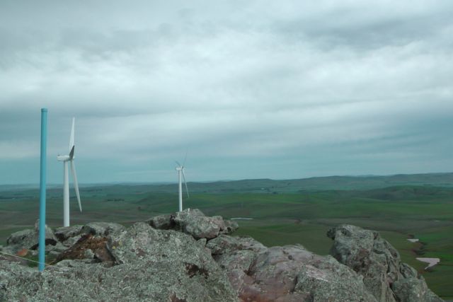
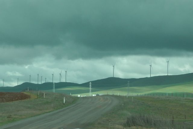
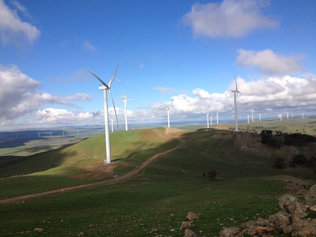
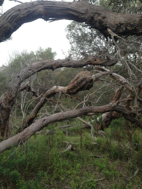
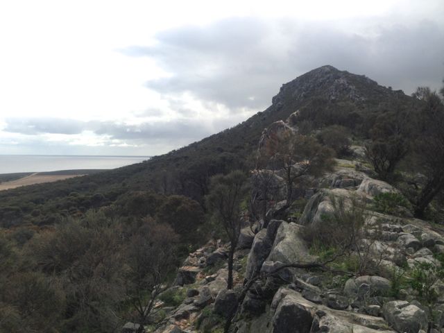
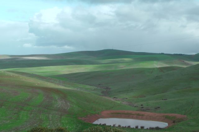
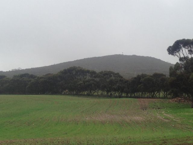
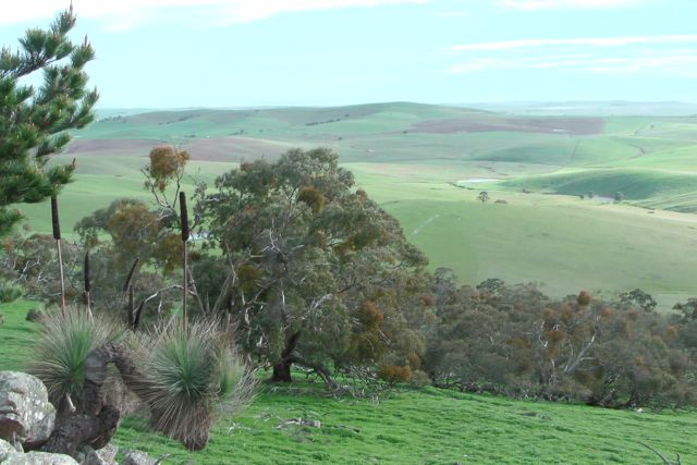
The track takes you passed a few small pine plantations and some native scrub, with some great views back to the east of the Hallett wind farms.  You then enter the mature pine forest.  We took a track through the forest up towards the summit.  It was certainly very wet underfoot as we had received plenty of rain the previous weekend.  In fact this area was covered in snow last weekend.

IMGA0069      IMGA0073_2

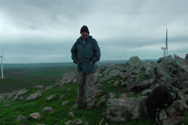
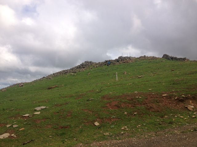
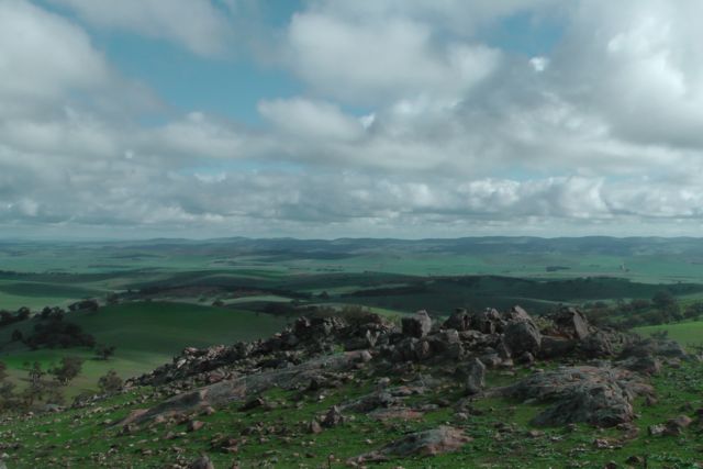
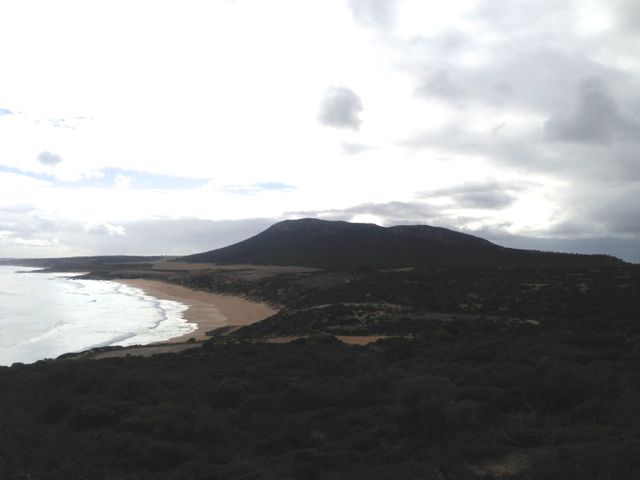
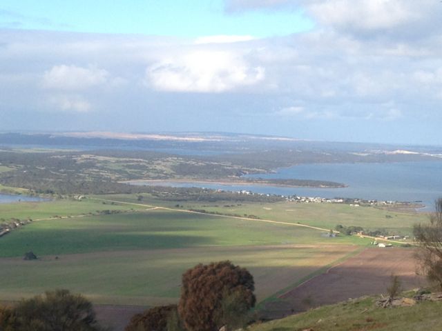
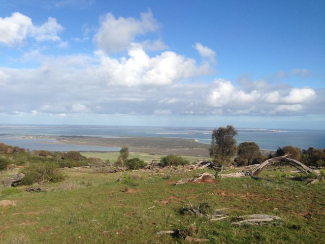
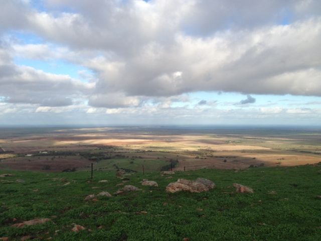
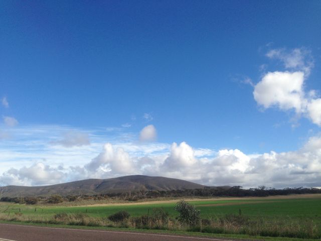
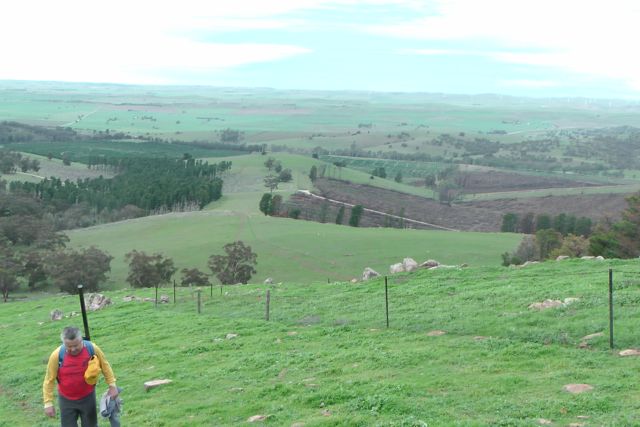
I enjoyed a beautiful walk through the forest, but Ian had warned me that the hard part of the walk was about to start.  We exited the forest and could see a cleared area and the summit with the tower on the top.  This part of the walk rises over vertical 150 metres in under 500 metres.  So we commenced the walk which is a real calf burner, with a few rests along the way.  The area is very rocky so you need to be a bit careful underfoot.  But the climb is well worth it, as the views become increasingly more spectaular as you rise in elevation.  Mount Remarkable and Mount Brown in the Flinders Ranges were visible to the north west.

IMGA0081_2

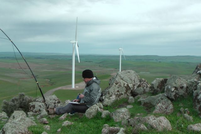
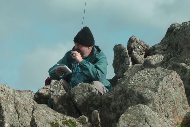
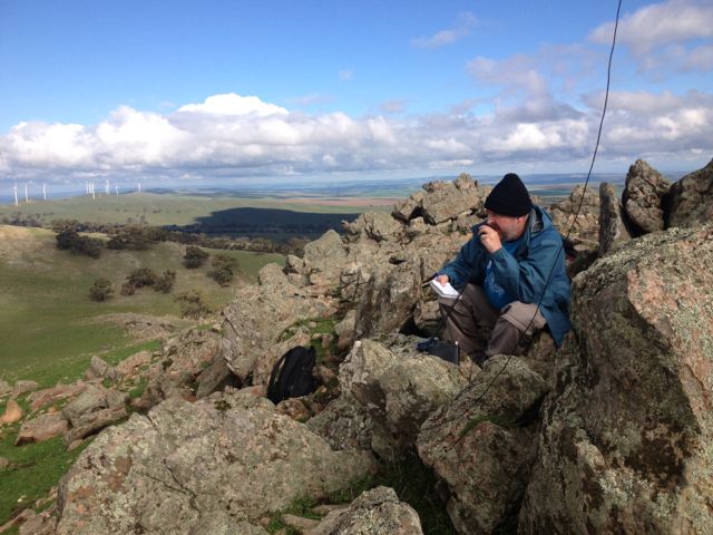
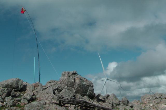
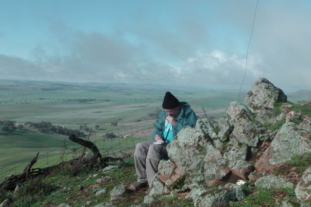
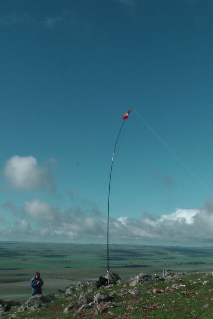
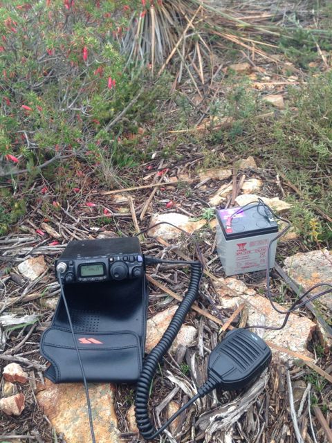
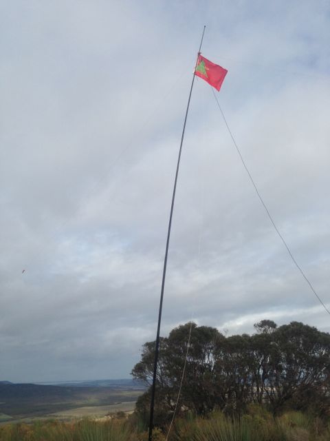
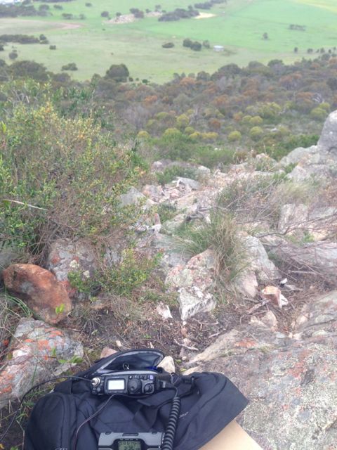
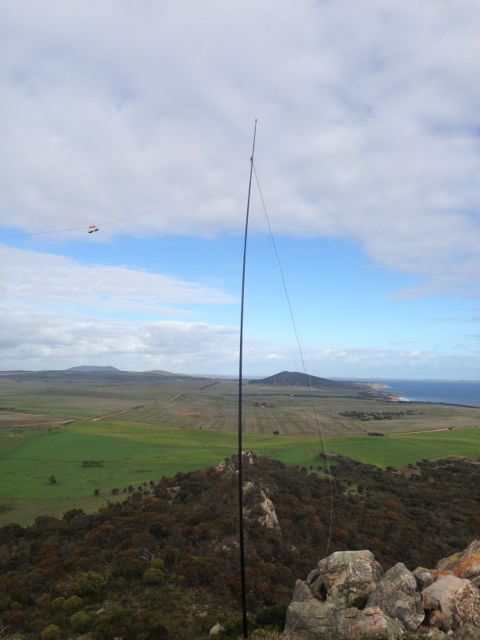
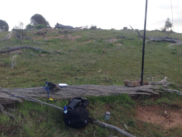
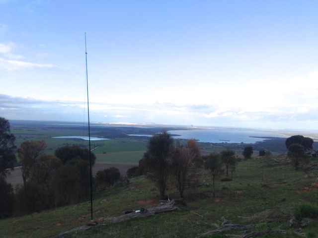
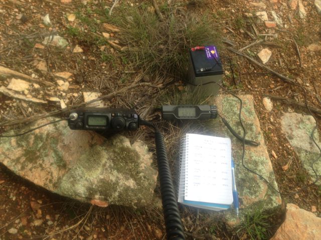
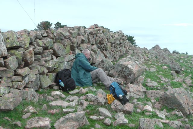
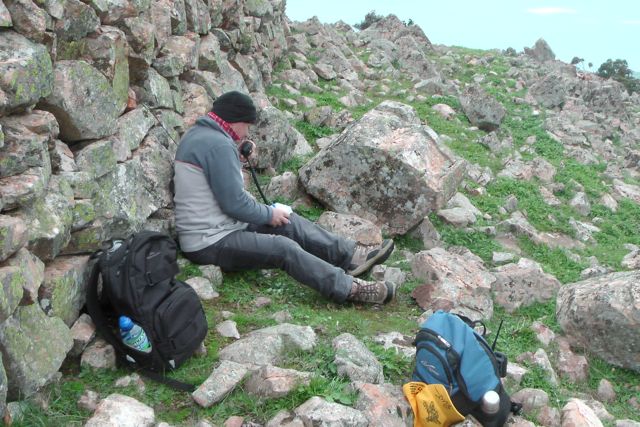
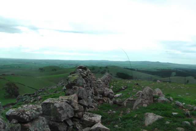
Once we reached the top I was a bit surprised to see that the wind was coming in from the north east, and not from the west.  The wind was quite strong, so we set up behind a dry stone wall which runs north-south at the top.  Local legend has it that these stone walls were made by Italian inturnees during World War Two.  We attached the squid pole to a wire fenceline which runs parallel to the wall, using a couple of octopus straps.  And then ran the coax through a gap in the rocks to the western side of the wall.  The area is heavily covered in moss rocks.

IMGA0084_2      IMGA0090_2

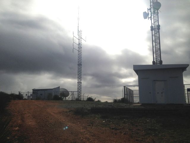
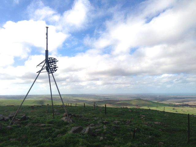
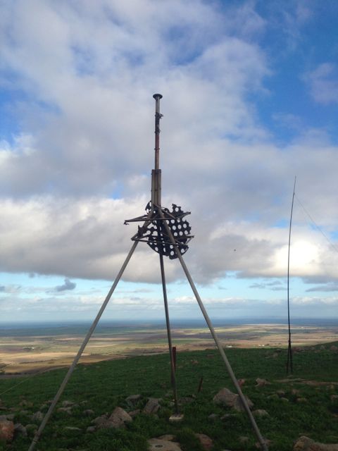
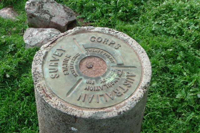
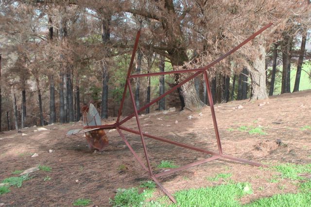
There is a trig point at the summit, just to the south of the tower.  The actual trig station has collapsed and has lies on its side, slowly rusting away, about 5 metres away from the trig point which is a concrete column with a plaque on the top.  The plaque on the trig point shows that it was erected by the Royal Australian Survey Corps, and there is the warning of a twenty pound fine for interference with the trig.

  IMGA0110    IMGA0112

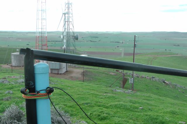
There is also a 4 stage guyed tower at the summit which doesn’t look to be in terrific condition.  The top sections have a bit of a lean.  There appears to be some sort of small VHF/UHF antenna on the top of the tower.  In any event it caused no interference and the noise floor was virtually non existant.

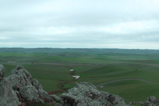
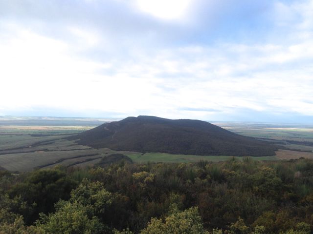
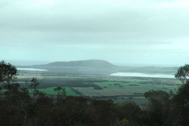
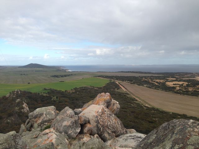
The views from the summit are quite spectacular in all directions.  This includes great view of the Bundaleer Forest that was unfortunately devasted by a large bushfire in January 2013.

IMGA0115     IMGA0104

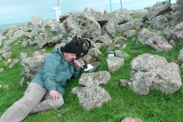
My first contact of the morning was with Col VK5HCF who was QRP with just 5 watts.  Larry VK5LY then called in and this was followed by an interesting contact with Marshall VK3MRG who was bicycle mobile in Kew.  My fourth contact was with Peter VK3FPSR.  This was followed by many of the regular Chasers.

My last contact before stretching the legs and Ian taking over, was with Peter VK3ZPF who was portable on Sugerload Peak, VK3/ VN-011.  So I was very happy to put another Summit to Summit in the log.  I then took a walk through the forest and up along the stone wall, while Ian jumped onto the radio.

After about a half hour walk I came back and worked a few more stations on 40m including Brooke VK4RZ and also John VK5BJE who was portable in the Danggali Conservation Park, as part of the VK5 National and Conservation Parks Award.  Ian and I decided to have a quick listen on 20m.  I had a good QSO with my mate Jesse VK6JES on 20m SSB and this was followed by a contact with Jordi, EA3PT.

Ian and I then packed up and took a different route back to the car.

The hill was full of Kangaroos and Euros who were quite inquisitive.

IMGA0124      IMGA0125

All in all, another very enjoyable afternoon on a summit.

I managed a total of 27 QSO’s on 40m SSB, and 2 QSO’s on 20m SSB.

I worked the following stations on 40m SSB:- Col VK5HCF/qrp; Larry VK5LY’ Marshall VK3MRG/bicycle mobile; Peter VK3FPSR; Nev VK5WG; Ian VK3TB/p; Ian VK3OHM; Warren VK3BYD; Brian VK5FMID; Rhett VK3GHZ; Allen VK3HRA; Nick VK3ANL; Matt VK1MA; Ian VK3TCX; Ernie VK3DET; Peter Vk5NAQ; Peter VK3ZPF/p (SOTA); Mal VK3AZZ; Ron VK3JP; Andrew VK2ONZ/qrp; Terry VK5ATN; Paul VK5FUZZ; Brooke VK4RZ; Bill VK3LY; Graham VK5KGP; and John VK5BJE/p.

I worked the following stations on 20m SSB:- Jesse VK6JES; and Jordi EA3PT.

I have posted a video of the activation on You Tube.

Hallett Hill, VK5/ SE-003

During the week I had planned a 4 summit – weekend activation with Ian VK5CZ.  The 4 summits were all located in the mid north of South Australia, about 200 kms – 250 kms north of my home.  Ian lived a little closer in beautiful Clare, a great wine growing region, so I decide to stay with Ian and his wife Halima for 2 nights over the weekend.  The 4 summits would push me into the 90 point bracket as an activator.

So Friday afternoon after my 2 park activations at Mt Magnificent Conservation Park and Finniss Conservation Park, I packed up my gear and headed north to Clare.  I travelled up Main North Road through the wine growing towns of Auburn, Leasingham, Watervale, Penwortham, Sevenhill and arrived at Ian’s place at Clare, late afternoon. I enjoyed a good meal at Ian and Halima’s, and a quiet night playing on the radio and having a chat.

Ian and I got up nice and early on the Saturday morning at about 5.30 a.m. and enjoyed a cooked breakfast of bacon and eggs and then loaded the car and headed north to our first activation, Hallett Hill, VK5/ SE-003.  We travelled along the Clare-Farrell Flat Road to Burra, and then north on the Barrier Highway to the little town of Mount Bryan.  The sunrise was spectacular, despite the temperature being very nippy.

IMGA0009

Mount Bryan which is located at the northern end of the Mount Lofty Ranges, was named after the nearby peak, Mount Bryan, which was discovered in December 1839 by Governor George Gawler.  He named it in honour of Henry Bryan, a young man who became lost and perished of thirst during Gawler’s expedition.  Mount Bryan was once the heart of a thriving farming community, including some of Australia’s best known Merino sheep studs.  Today it has a population of about 130 people, with the most prominent building being the old pub, the Mount Bryan Hotel.

After leaving Mount Bryan, and travelling north along the Barrier Highway, we could clearly see the two towers on the top of Hallett Hill, amongst the wind farm.

IMGA0010

Hallett Hill is 758 metres above sea level and is worth 4 points.  It is situated in the Hallett Range amongst a wind farm, about 5 kms north west of Mount Bryan.  The wind farm which is one of five in the area, is referred to as Hallett 2 Wind Farm, and is also known as Hallett Hill Wind Farm.  It was completed in late 2009 and consists of 34 Suzlon turbines each 2.1 MW, giving an installed capacity of 71.4 MW.  It produces enough energy to power about 40,000 homes.  In December 2010, AGL Energy Limited identified that under certain wind conditions tones from the wind turbines were audible at the nearest residence.  Resonance dampers have since been installed to address this tonality issue with the wind turbines.  Noise testing has confirmed that this permanent acoustic treatment has fixed the tonality issue.

The summit is located on private property owned by Bill Gebhardt.  Bill is a very friendly fella, and allowed us access.  Please contact him prior to entering onto his land.  I have placed his contact details on the SOTA site.

To gain access to the summit, travel through Mount Bryan on the Barrier Highway, and then turn left onto Petherton Road, about 3 kms north of the town.  Travel up Petherton Road heading west, and on your left you will see an unlocked entrance gate to the windfarm.  Please shut the gates as you find them, as there are sheep grazing & lambing on the property.

Ian and I drove along the dirt access road which was in very good condition and parked the car down hill from the summit, and then walked about 1 km up to the actual summit.   The weather was atrocious on the top of the range.  It was extremely cold (probably below 0 degrees C – wind chill) and the wind was vicious (most likely over 60 kph).  Ian and I both agreed this was the windiest and coldest summit we had activated.

IMGA0059     IMGA0017

We got to the top of the summit and I set up at what was left of the trig point, just 3 blue painted metal poles amongst a pile of rocks, which afforded a little bit of shelter from the unrelenting wind which was absolutely belting in from the west.  Ian set up close by, also sheltering behind some rocks.  I used one of the blue upright poles to secure the squid pole.  This was the first time I had to use 3 octopus straps to secure the squid pole in place.

IMGA0019     IMGA0031

I operated first and put a call out on 7.090 on 40m SSB.  The first cab off the rank for the day was Nev VK5WG who had a ‘cracking’ signal as always.  I then spoke with Tony VK3CAT who was operating QRP with just 5 watts.  Tony had a beautiful 5/8 signal.  Half way through my third QSO with Warren VK3BYD, I heard a terrible cracking sound coming from behind me and ended up with my squid pole on top of me.  Unfortunately it had completely snapped off in the wind !

Lesson learnt……if you are going to secure your squid pole to a solid metal object such as a pole in very windy conditions, try to secure the squid pole on the opposite side from where the wind is coming.  After looking at my squid pole secured to the metal pole, it appeared to Ian and I that it had no flexibility and it snapped off at the weakest point, at the top of the metal pole in the very severe wind.

IMGA0018

So Ian and I tried to put it together as best we could but it didn’t last long, as the wind was so severe that the squid pole snapped again.  Again it was pulled down and resecured to the pole, and luckily it lasted me for the duration of the activation.  But it certainly had seen better days and wasn’t going to be accompanying me on any more SOTA trips.  Another one is on order from Haverfords in NSW.

I had some good QRP contacts whilst on top of the hill.  As mentioned Tony VK3CAT using just 5 watts had a good strong 5/8 signal.  I also worked Ian VK3FD who was QRP with a great signal, Andrew VK2ONZ, and Andrew VK4DNA who was QRP with just 5 watts (5/2 signal but perfectly readable).

I would encourage more people to try QRP out of interest as ‘Chasers’, because as Andrew VK1NAM has pointed out previously, on the top of most of these summits the noise floor is non existant.  So if you can hear me, I will more likely than not be able to hear you quite well.  It is always a thrill to work QRP to QRP.

I also managed one Summit to Summit QSO with Mike, VK3XL/p, who was operating from VK3/ VG-099.  Mike was 5/5 and I received 5/9 back from Mike.

I ended up with a total of 27 QSO’s on 40m SSB into VK1, VK3, VK4, & VK5.

Ian then took over after the UTC roll over and had a further 14 QSO’s, whilst I went for a walk and explored the hill.  There are terrific views from the top in all directions.  I find it amazing that every hill is different, with varied challenges and views.  I think that for me is one of the attractions of SOTA.

IMGA0036      IMGA0056

I worked the following stations:- Nev VK5WG; Tony VK3CAT/qrp; Warren VK3BYD; Ron VK3AFW; Mal VK3AZZ; Max VK3MCX; Peter VK3FPSR; Tom VK5EE; Brian VK3MCD; Rhett VK3GHZ; Nick VK3ANL; Glenn VK3YY; Bernard VK3AMB; Allen VK3HRA; Col VK5HCF; Ian VK3FD/qrp; Andrew VK2ONZ; Andrew VK4DNA; Ian VK3TCX/m; Ed VK2JI; Ernie VK3DET; Rob VK2FROB; Leon VK3VGA; Brian VK5FMID; Al V1RX; Ian VK3TB/p; and Mike VK3XL /p (SOTA).

Time to pack up and head off this freezing blowy hill, and on to the next summit….New Campbell Hill VK5/ SE-007, about an hour’s drive away to the north west.

I have posted a You Tube video of the activation of Hallett Hill.

Brown Hill Range, VK5/ SE-004

After our activation at Mount Ngadjuri, Marija and I drove back down into Jamestown, and then out on the Jamestown-Hallett Road, heading for Brown Hill Range, VK5/ SE-004, which is 755 metres ASL and is worth 4 points.  About 5 kms out of Jamestown, we turned right onto the Booborowie Road and travelled south.  About 5 kms along this road, you will see a sign for the Hallett Power Station, which is a further 4.5 kms west along this dirt road.  At the end of the road you will come to a T junction.  Turn left and about 50 metres down on your right is a set of double gates.

IMGA0097     IMGA0098

The summit is located on private property (owned by Mr. Vaughan Semler) amongst the wind farm, and I had sought permission from the land owner prior to entry.

Enter the paddock through the gates.  There is a dirt road leading all the way to the top.  Please remember to shut all gates, as at the time I activated this summit, it was lambing season.  Marija and I drove up this road and parked the car at the top of the ridge line at the next set of gates.  To get to the actual summit you need to go south along the ridgeline.  We walked about 1.5 km south along the dirt road, until we reached the actual summit.  The trig point consists of 4 light blue metal poles and a pile of rocks on the top of a sharp rise, directly underneath one of the wind turbines.

IMG_0445     IMGA0105

We set up the equipment on the eastern side of the rocks as there was a wild westerly wind blowing.  It was incredibly windy as you would expect amongst a wind farm.  I used one of the blue metal poles to secure the squid pole with 2 octopus straps.  I strapped the SOTA flag to the squid pole, along with the dipole and hoisted it up into the air.  The SOTA flag certainly got a work out that day.

Much to my disappointment, when I turned on the radio onto 40m, there was a terrible squealing noise which was between strength 3 to 4.  Not sure where it was coming from, but it was only on 40m.  I have done activations before amongst wind farms, but this was the first time I had experienced such a noise, so I am not sure where it was coming from.  Anyway, there was not much I could do.  I didn’t really feel like taking down the squid pole and relocating, so I decided to ‘box on’ where I was.

IMG_0457     IMGA0120

My first QSO was again with Nev, VK5WG.  Nev must have been there patiently waiting for me to come up.  Second QSO was with Ernie VK3DET with a strong signal as always.  Third was a summit to summit with Brian VK3MCD who was on VK3/ VE-080.  And my fourth QSO was with Col VK5HCF with his normal good signal from the south east.

This was followed by the regular crowd of SOTA ‘chasers’ from VK1, VK3, VK5, & VK7.

After 40m had gone quiet, I decided to go over to 20m to have a listen and my first contact there was with Wayne VK7NET with a very strong signal out of Tasmania.

I forgot that the IARU HF Championships were on, and 20m was alive with very strong signals from Europe, despite the fact that it was still very early on in the afternoon.  I heard a Spanish station calling CQ Contest so I decided to try my luck and to my surprise he answered.  This was followed by DX contacts into Austria, Croatia, Slovenia, Romania, Serbia, Hungary, Slovak Republic, and the USA.

I also spoke with VK1, VK3, VK6, & VK7 on 20m SSB.  Things were going really well until a Russian station came up alongside of me, just 1 kc away, and that was the end of that !  Anyway, it was time to pack up.  I had pushed my luck enough with Marija sitting on the top of 2 hills in the cold and the wind.  So we packed the gear up and headed to Clare and stopped in to have a coffee with Ian, VK5CZ, before heading back home to the Adelaide Hills, some 200 plus kms away.

IMG_0459     IMGA0116

The following stations were worked on 40m SSB:- Nev VK5WG; Ernie VK3DET; Brian VK3MCD (summit to summit); Col VK5HCF; Allen VK3HRA; Steve VK5ST; Ian VK5IS; Fred VK3JM; Rhett VK3GHZ; Matt VK1MA; Tony VK3CAT; Rick VK3KAN/m; Rod VK5FTTC; Brian VK5FMID; Peter VK3FPSR; Ian VK5CZ; Paul VK7CC, Andrew VK1NAM/p; Ian VK5IS; Nick VK3ANL/m; Mark VK1MDC; Robin VK5TN; John VK5FMJC; Graham VK3JE; Roger VK5NWE; Larry VK5LY/qrp; Al VK7AN/p; Chuck VK2SS/p; Mark VK5QI, and Andy VK5AKH.

The following stations were worked on 20m SSB:- Wayne VK7NET; EF1HQ; OE1A; 9A28HQ; S50HQ; YR8D; YT0HQ; Albert VK3KLB; Andrew VK2ONZ/qrp; Roy VK7ROY; Al VK1RX; Ian VK1DI; Rhett VK3GHZ; Mike VK6MB; Glen VK3YY/m; HG3R; OL3HQ; HG7T; and K5TR.

The end of an enjoyable day.  Some terrific views can be had from the top of this summit, and it is very easy to access.

I have placed a video on You Tube of this activation.

Mount Ngadjuri, VK5/ NE-058

Early Sunday morning, 14th July, 2013, my wife Marija and I left home at Mount Barker in the Adelaide Hills, and ventured up to the mid north of South Australia.  It was about a 250 km drive north.  We intended to climb 2 hills, Mount Ngadjuri, VK5/ NE-058 first, and then Brown Hill Range.  It was dark when we left home just after 6.00 a.m. but by the time we got north of Adelaide, the sun was coming up and the sunrise was spectacular.

IMGA0033

We drove north along the Horrocks Highway through the Clare Valley wine region, through the beautiful little towns of Leasingham, Watervale, Penwortham, Sevenhill, & Clare.  And then further north along RM Williams Way to Jamestown.

Mount Ngadjuri is 755 metres above sea level, is worth 4 points, and is located on private property.  It is incorrectly spelt on the SOTA site as ‘Nadjuri’.  It is correctly spelt as ‘Ngadjuri’, after the local Aboriginal tribe of the mid north of South Australia.

The summit is located on private property owned by Mike Nunan.  Please contact him prior to access.  His contact details are on the SOTA database.

Access to the summit is via Slant Road, which runs off RM Williams Way.  Travel north out of Jamestown along RM Williams Way for a distance of about 13 kms.  Then turn left onto Slant Road (a dirt road), and travel up towards the hills, and through the cutting.  You travel passed a beautiful homestead on your left.  On the right at the top of the hill there is a small parking area and a gate which has the rapid number ‘730 403’ on it.  Another 100 metres in the paddock from this gate is another gate.  We parked the car at this second gate and then walked to the summit from there.  It is about a 1.5 km walk to the top and is quite easy.  Just follow the track.  Please remember to shut all gates s you found them.  There were sheep and lambs in the paddocks.

It was quite an easy walk but was eery at the same time.  Fog completely covered the summit and it was extremely cold and windy.  The low fog was rolling across the hills like a scene from a cheap Dracula movie.

IMGA0046     IMGA0052

There is no trig point at the summit, however there is a large pile of rocks, which formed a good break from the icy wind.  There is a strange set up in the rock pile.  There is a circular piece of metal, which looks a little like a truck rim.  And in the centre was a ceramic pot with a lid, which was partially buried.  Ian VK5CZ had told me about this and he had thought it might be someone’s ashes so he was loathed to lift the lid to have a look.  But curiosity got the better of me and I lifted the lid, only to find that the ceramic pot was full of water.  So what purpose it serves is still a mystery !

This is where Marija and I set up.  We used a heap of large rocks to hold the squid pole in place and tied if off, simply because the wind was so strong.  I propped myself up behind the pile of rocks to get out of the strong westerly wind.

IMGA0067     IMGA0081

I was running a bit late, because the drive from home had taken longer than I thought.  So I was 30 minutes behind schedule.  I turned the Yaesu FT-817nd onto 7.090 mhz and asked if the frequency was in use, only to be greeted by Nev, VK5WG, with a great signal.  Nev has become a frequent ‘Chaser’ for SOTA, and ‘Hunter’ for the VK5 National & Conservation Parks Award.  This was followed by Matt VK1MA, Marshall VK3MRG, and Fred VK3JM, who made up my 4 qualifying QSO’s.  I could breath a sigh of relief.

IMGA0080     IMGA0063

Following this a heap of the regular SOTA chasers followed including Rick VK3KAN/m, Brian VK5FMID, Rhett VK3GHZ, Ernie VK3DET, Tony VK3CAT, Mark VK1MDC, Allen VK3HRA, and others.

Had some great QRP QSO’s with Glen VK3YY who was using just 4 watts (5/6 sent & 5/4 received).  Larry VK5LY who was using just 8 watts (5/6 sent & 5/7 received).  Col VK5HCF who was using 5 watts (5/3 sent & 5/8 received).

I spoke with Brian VK3MCD who was about to get mobile on his way to his SOTA summit for the day.

I also had an enjoyable chat with Ken, VK5ASY, who is 90 years old, and still going strong,  Ken had a terrific signal, and I think from memory I was his first ever SOTA contact.

Conditions into the eastern states seemed average to poor, with below average signal reports being received.  However conditions within VK5 were extremely good.

I worked a total of 22 stations in VK1, VK2, VK3, & VK5, on 40m SSB.

The following stations were worked:- Nev VK5WG; Matt VK1MA; Marshall VK3MRG; Fred VK3JM; Rick VK3KAN/m; Brian VK5FMID; Rhett VK3GHZ; Ernie VK3DET; John VK2YW; Ian VK3TCX; Tony VK3CAT; Mark VK1MDC; Brian VK3MCD; Allen VK3HRA; Glen VK3YY/qrp; Ken VK5AKY; Larry VK5LY/qrp; Col VK5HCF/qrp; Robin VK5TN; Ian VK5IS; Grant VK5VGC; and Steve VK3MEG.

An enjoyable walk and great company of my beautiful wife, Marija.

I have posted a video on You Tube of the activation.

North Block, VK5/ SW-024

On Saturday 16th June, 2013, I activated North Block, VK5/ SW-024, which is situated about 55 kms north west of Port Lincoln.  The summit is situated about halfway between the little towns of Coulta and Edilillie.  North Block is 365 metres above sea level and is worth 1 point.  It is about 700 kms from Adelaide.

I had based myself in Port Lincoln for 2 nights, so it was another early start from Lincoln.  I got up at about 6.00 a.m. and drove out along the Flinders Highway, through the town of Wangary, and then further north to the little town of Coulta.  A few kms north of Coulta, I turned right onto Gap Road.  The road is aptly named because it takes you right between North Block & South Block, which stand very close together.

IMGA0002_6

The summit is located on private property owned by Darrell & Isobel PUCKRIDGE, who are a very friendly couple.  I called in there first to say hello and collect the key which is required to undo one of the padlocks on the gate to gain access to the summit.  There is an Air Australia navigation facility and a radio tower on the top of the summit, so there are a few locks on the gate which belong to each of the stakeholders.  Whilst there I was introduced to Darrell & Isobel’s young kangaroo, which clearly thinks it is a dog.

IMG_3155

The gate to gain access to the summit is located a few hundred metres west of Darrell & Isobel’s property, back down Gap Road.  There is a dirt road, which is in good condition, which leads all the way up to the summit.  After travelling through the paddock, there is a sharply rising section of the track.  I parked my car at the top of this and then walked the rest of the way to the summit, which was probably about a 1 km walk.

At the top there is an Air Australia air navigation system and a very large radio communications tower.  The weather looked really lousy all the way around me, particularly to the east of me.  After setting up my gear and turning the radio on, I was saddened to hear a noise floor of about signal strength 7.  But I had already set up and the weather was threatening, so I decided to hang in there and work as many as I could for as long as I could, before having to dash back to the car.

IMG_3182

There are some spectacular views from the top of the summit in all directions.  It was just a pity about the gloomy weather, but I guess that’s what you expect for June.  South Block is the closest imposing feature, rising 391 metres ASL, and is in very close close proximity to North Block, just to the south.

IMG_3167

Out to the west, you can clearly see Mount Greenly & Mount Dutton, both of which I had climbed and activated the day previous.  To the south west, was the imposing Marble Range, which is on my list of summits to do on my next Eyre Peninsula trip.  Many of the winter flowers were out on the top of the summit, including the beautiful correas and the flame heath.

IMGA0004_6

My first QSO of the morning was with Peter VK3PF, who had his normal strong signal.  This was followed by a few of the regular ‘Chasers’ and some not so regulars.  It was great to hear a few new calls.  I spoke with Ian VK5CZ, who was portable on Brown Hill Range, VK5/ SE-004.  I managed two s2s contacts with Ian, before & after the UTC rollover.  And to my listening pleasure, the noise floor dramatically dropped on 40m after about 10 minutes.

IMG_3172     IMG_3170

Andrew VK1NAM had put out a challenge during the week for ‘Chasers’ to try operating over the weekend with QRP.  I had a few good QRP to QRP contacts with Ernie VK3DET who was using just 5 watts.  Each time I spoke with Ernie he was a very comfortable copy (5/7 both ways).  I also spoke with Andrew VK2UH, who was initially using 5 watts and was a good 5/7 signal.  He then lowered his power output down to 1 watt and I was able to clearly hear him, signal report 5/5 with some QSB.  I also spoke with Jim VK5JW who was also using just 5 watts.

I ended up with a total of 45 QSO’s  All on 40m SSB.  I managed 22 QSO’s before the UTC rollover, and a further 23 QSO’s following the UTC rollover.

The following stations were worked before the UTC rollover:- Peter VK3PF; Warren VK3BYD/p; Steve VK3MEG; John VK5EMI; Darrel VK5JDS; Col VK5HCF; Nev VK5WG; Fred VK3JM; Andy VK5AKH; Peter VK3ZPF; David VK5UG; Ian VK5CZ/p (SOTA); Dave VK3VCE; Ed VK2JI; David VK5KC; Rhett VK3GHZ; Ernie VK3DET; VK3UBY; James VK1DR, Nick VK3ANL; Rik VK3KAN/m, & Mark VK7FMPR.

The following stations were worked after the UTC rollover:- Mark VK7FMPR; David VK5UG; Fred VK3JM; Nev VK5WG; Rhett VK3GHZ; Peter VK3PF; Dale VK5DC; Andrew VK2UH; Col VK5HCF; Rik VK3KAN; Tony VK3CAT/m; Nik VK3ANL; Brian VK5FMID; Ian VK5CZ/p (SOTA); Ernie VK3DET; Ron VK3AFW/m, Allen VK3HRA; Glenn VK3YY; Andy VK5LA; Jim VK5JW; Ted VK5KBM; Trevor VK5ZTJ/m; & Bob VK5ZRJ.

I would have stayed longer except for the weather.  At the last minute the showers started to come in and I was forced to go QRT rather quickly, disassemble the antenna and do a mad dash back to the car.  Sorry to anyone who may have been calling.

More information on PeakClimbs at…..

http://www.peakclimbs.com/peak/North-Block/207/view/#climb_id_322

Below is a video of my activation, which I have placed on You Tube.

Mount Greenly, VK5/ SW-033

Mount Greenly, VK5/ SW-033, was my 2nd summit for Friday 14th June, 2013.

Mt Greenly is 305 metres above sea level and is worth 1 point.  It is located about 5 kms north west of the little town of Coulta on the lower Eyre Peninsula, and about 705 kms from Adelaide.  The summit overlooks the large salt lake, Lake Greenly to the east and the Great Australian Bight to the west, and is surrounded on 3 sides by picturesque sheep and cereal farming country.

I brought forward the activation time of this summit by one hour, simply because of the weather which was pretty lousy.  Rain and showers had been hanging around all day, and I was quite keen to get the summit under my belt and head back to the motel room.

Mount Greenly was named by Captain Matthew Flinders on the 16th February, 1802, after the fiancee of Sir Isaac Coffin who aided Flinders in the selection and fitting out of the Investigator.

The summit itself is located on private property owned by Peter & Louise PUCKRIDGE.  I contacted them prior to climbing the hill, and they were very friendly and helpful.

There is a hill, located 4 km to the south of Mount Greenly, which can be confused for Mount Dutton.  The hill is named Frenchman, and is 168 metres high.  It takes its name from the French whalers who used it as a lookout during the early 1800’s.  Although imposing in itself, it does not qualify for SOTA as it does not have sufficient prominence.

Access to the Mount Greenly summit is via Coles Point Road, which runs off the Flinders Highway,about 3 kms before the town of Coulta.  You can’t miss seeing the summit, as it is an imposing figure in a relatively flat lanscape.  The name ‘Coulta’ is derived from the local Aboriginal people who called a nearby spring ‘Koolta’.  Travel west along Coles Point Road for a distance of about 10 kms, and then turn right into Greenly Beach Road.  Almost immediately after turning right you will find another dirt road on your right which leads you to a parking area.  I parked the car at the end of that dirt road, and walked the rest of the way to the summit, which was about 3 kms to the top.

Prior to climbing the hill I drove down to Coles Point to look at the rugged coastline and the Great Australian Bight. There is a monument here to a young gentleman who drowned here back in 1941.  There are also terrific view back to the western side of Mount Greenly.  It is well worth a drive down to the coastline to have a look.  The beach is often frequented by surfers, although the area also has a reputation for its man eating Great White sharks.  Greenly Beach made it into the top 101 beaches of Australia.

IMG_3037

The first part of the walk to the summit is certainly not easy.  There is no track.  You need to make your way through some pretty thick scrub to the low ridgeline on the southern side of the summit.  This was certainly the hardest part of the walk.

IMG_3049

Once I reached the ridgeline it was much easier going from there, but still a challenge.  The ridegline is very rocky and has quite a bit of thick vegetation in parts.  But it is a slow and steady incline up to the actual peak of Mount Greenly.  There were quite a few plants that were in flower on the summit.  They included correas, grevillias, wattles, flame heath, and gums.  And the rock formations are truly quite amazing.

IMG_3040

Once you reach the actual summit, there is no trig point.  There is a pile of rocks which has gradually been growing, as more and more people climb this hill.  There was very little room to move right up the top, so I climbed back down a little bit and set up on the southern side of the summit.

The view on the top is quite impressive.  To the south you can see Mount Dutton and the nearby Frenchman & Mena Hill, and beautiful lush green crops in between.  To the north are also lush green crops.  To the east you can see North & South Block and Lake Greenly, lying just below the summit.  And to the west you have the wilds of the Great Australian Bight and Greenly Beach.

IMG_3063     IMG_3087

The weather on the top of the hill was pretty wild and woolly.  I guess that’s what you would expect when it is the middle of winter, and you have the Great Australian Bight just over your shoulder.  I managed to secure the squid pole to a bush using 2 octopus straps, but the wind was so strong that at one stage it collapsed on itself.  Apparently they hang glide from this hill.

IMG_3086     IMG_3094

Sadly I didn’t get any summit to summit QSO’s.  I was carefully watching SotaWatch hoping that Ian VK1DI was going come up.  Ian had planned to activate The Dutchman’s Stern in the Flinders Ranges, whilst over here on holidays in South Australia.  Ian did give me a call but advised that he had not reached the actual summit of The Dutchmans Stern, so no s2s.

During my time on the hill I had a friendly Wedge Tailed eagle constantly soaring in the wind above the summit.

24_web20|watermark_530xheight_flying-wedge-tailed-eagle-1680x1050

I managed a total of 19 QSO’s on 40m SSB.

The following stations were worked:- Col VK5HCF; Brian VK5FMID; Paul VK5FUZZ; Tony VK3CAT/m; Andrew VK2UH; Ernie VK3DET; John VK2YW; VK3JP; Rik VK3KAN/m; Bernard VK3AMB; Glenn VK3YY; John VK5FTCT; Ron VK3AFW/m; Ian VK1DI/5; Peter VK3PF; Rhett VK3GHZ; Jim VK5JW; Bill VK5MBD;  and Mark VK7FMPR.

More information on PeakClimbs…..

http://www.peakclimbs.com/peak/Mount-Greenly/206/view/#climb_id_321

The following is a video of my activation which I have uploaded to You Tube.

Mount Dutton, VK5/ SW-035

On Friday morning, 14th June, 2013, I got up bright and early and headed for Mount Dutton, VK5/ SW-035, which is situated about 48 kms north west of Port Lincoln on the lower Eyre Peninsula.

Mount Dutton was named after Charles Christian DUTTON, an explorer, who in 1839, led a small expedition from Port Lincoln to Coffin Bay.  DUTTON was an early Sheriff of the Province and then settled in the Port Lincoln district.  He died at age 32 in 1842.

I travelled out along the Flinders Highway towards the town of Wangary, and watched the spectacular sunrise.  And at the same time keeping a close watch for kangaroos.  There are plenty of roos over here on the Eyre Peninsula.

IMGA0001_5

At Wangary, turn left into Farm Beach Road and travel west towards the ocean.

It is worth a quick detour down to Farm Beach and Gallipoli Beach, which featured in Peter WEIR’s Australian movie ‘Gallipoli’.

After travelling down Farm Beach Road for about 5 kms turn right into Broccabruna Drive.  There is a brown sign here saying ‘Frenchman 14’.  Travel about 1 km along Broccabruna Dr and then veer left onto Mena Road.  There is a brown sign here saying ‘Frenchman 13’.  About 3 kms up Mena Road, you will see an old derelict cottage just set off the road amongst trees and shrubs.  There is a large tall palm tree here as well to keep an eye out for.

IMG_3022

Directly opposite this, you will see a large cocky’s gate.  I travelled from here through the paddock to the base of the hill.  It is about a 3 km walk from there to the summit.  The first part of this walk is a bit of a challenge.  There is no track and the scrub is quite thick in parts.  It is pretty easy to get disorientated.

IMG_2981

Once you do reach the top there are spectacular views out in all directions.  Particularly to the south.  The views of Mount Dutton Bay, Coffin Bay, and the Coffin Bay National Park are truly amazing.  The hill is surrounded by lush sheep and cereal farming land.  The walk along the ridgeline on the top of the hill is quite easy, and there are plenty of spots to explore.

During the late 1800’s, nearby Dutton Bay was a valuable ‘land-sea link’, as a jetty was built adjacent to the large Dutton Bay woolshed.  At its peak, over 20,000 sheep were shorn within the woolshed.  Up to 100,000 fleeces were baled and loaded onto ketches from the adjoining jetty, for overseas markets.

IMG_3006     IMG_3014

There are quite a few trees and shrubs and rocks on the  top, so plenty of options in securing the ends of the dipole.  I set up the 40m/20m linked dipole on the 7m squid pole, using a fallen tree and some rocks to secure it into place.  The tree made a good bench.

IMG_2995     IMG_2998

I put a CQ call out, and worked a total of 15 stations before the UTC rollover, and a total of 24 stations after the UTC rollover.

Stations worked before the UTC rollover were:- Ian VK5CZ; Roger VK5NWE; Peter VK3PF; Glenn VK3YY; Rik VK3KAN/m; David VK3VDL/m; Ron VK3AFW/m; Tony VK3CAT; David VK5UG; Nev VK5WG; David VK5LSB; Ernie VK3DET; Urey VK3ATA; Dennis VK5LDM; and Mike VK5MCB.

Stations worked after the UTC roll over were:- Rik VK3KAN/m; David VK5UG; Nev VK5WG; Ron VK3AFW/m; Peter VK3PF; Col VK5HCF; David VK5LSB; Les VK5KLD; Mike VK5MCB; Tony VK3CAT/m; Ernie VK3DET; Rhett VK3GHZ;  VK3JP; Ian VK5CZ; David VK3VDL; VK3JM; Glenn VK3YY; Dennis VK5LDM; Jim VK5JW; Colin VK3NCC/2; Urey VK3ATA; Brian VK5FMID; John VK5FTCT, and Mark VK7FMPR.

More information on PeakClimbs at…..

http://www.peakclimbs.com/peak/Mount-Dutton/205/view/#climb_id_320

Below is a video of my activation, which I have posted on You Tube.

Pillaworta Hill, VK5/ SW-028

My only planned summit activation for Thursday 13th June, 2013, was Pillaworta Hill, VK5/ SW-028.

Pillaworta Hill is located about 14 kms south west of Tumby Bay on the southern Eyre Peninsula in the Koppio Range.  The summit is situated on private property owned by Emmie BORTHWICK.  The 1,400 hectare ‘Pillaworta’ property has been in Emie’s family for six generations.  Today the farm consists of merino sheep, and crops of oats and barley.

‘Pillaworta’ station was founded by Charles Christian DUTTON during the early 1840’s.  It is associated with one of the worst conflicts between the European settlers and the native aboriginals, during the pastoral pioneer days of the Eyre Peninsula.  DUTTON was apparently so hampered by the aborigines, that he and four other men cleared out on the 20th June, 1842, with the intention of driving several hundred head of cattle around the top of the Gulf to the mainland.  A detachment of English soldiers, under Lieutenant HUGONIN, accompanied the party for the first day, but after that they were never seen again.  It is believed they were massacred by the local aborigines.

Following arriving at the property I checked in with Andrew, who is the share farmer on the property.  He gave me directions on how to access the summit.

Access to the summit is via Bratten Way which runs off the Lincoln Highway at Tumby Bay.  Travel west along Bratten Way up through the hills, and then turn left into Pillaworta Road and travel south.  About 5 kms up the road you will see on your left a dirt road with a red ‘Fire Track’ sign.  This is the track you need to take, and this will take you to the top of the summit.

IMGA0030_2

Follow the dirt track leading through the paddocks all the way to the summit.  Despite it being winter time, the track was in good condition.  There are a few gates to travel though, before reaching the summit.  I parked the car at the final gate and walked the rest of the way to the summit.

There is a trig point which had seen better days.  There is also a large communications tower and an amateur repeater at the site, VK5RAC.  The view from the top is terrific, particularly out to the west over the Spencer Gult towards the Yorke Peninsula.

IMG_2909     IMG_2919

I attached the 7m squid pole to a fence post with an octopus strap, and one end of the dipole I tied off to the trig point, and the other end to a fencepost.

My first contact was a summit to summit QSO with Ron VK3AFW who was portable on the top of Mount Lofty, VK5/ SE-005.  Ron had a good strong signal over onto the Eyre Peninsula (5/8 both ways), and was braving the elements on the top of Mt Lofty where it was windy & wet.

I decided to have a quick listen on 20m SSB, and managed to work two DX stations: Ralph H44IOTA and Roger ON7TQ.   I also spoke with Ed VK2JI; Peter VK3PF, Barrie VK2ABD; & Ray VK4NH.  During the afternoons, I always try to get onto 20m to work some of the more distant VK fellas, and hopefully a little bit of DX.

IMG_2915

By the end of the afternoon I had worked a total of 28 stations.

I packed up my gear and headed to Port Lincoln.  On the way I stopped off at the service station/take away food place at North Shields.  Had one of the best hamburgers and chips, I’ve had in a long time.  Well worth a visit if you’re down that way and feeling hungry.

Stations worked were:- Ron VK3AFW/p (SOTA); Bill VK5MBD; Ernie VK3DET; Col VK5HCF; Nev VK5WG; Rik VK3KAN/m; Peter VK3FPSR; Brian VK5FMID; John VK5BJE; Ed VK2JI; John VK5FTCT; Jim VK5KOB; David VK5UG; Marshall VK3MRG; Peter VK1IRC; Peter VK3PF; Bernard VK3AMB; Peter VK3BSF; Paul VK7CC; Tony VK3CAT/m; Doug VK3FJAE; Ian VK5CZ; Ed VK2JI (20m); Peter VK3PF (20m); Ralph H44IOTA (20m);  Roger ON7TQ (20m); Barrie VK2ABD (20m); & Ray VK4NH (20m).

More information on PeakClimbs…..

http://www.peakclimbs.com/peak/Pillaworta-Hill/204/view/#climb_id_319

Below is a video of my activation which I have placed on You Tube.

Carprie Puntha Hill, VK5/ SW-003

My first activation for Wednesday, 12th June, 2013, was Carprie Puntha Hill, VK5/ SW-003.

I had to leave earlier than planned this morning, due to staying att Whyalla overnight and not at Iron Knob.  Unfortunately there was just so much rain that the 6km road out to my friend’s station’ Cooyerdoo’ at Iron Knob was impassable.

Carprie Puntha is aboriginal for ‘plenty of water’, and this was certainly the case for the Eyre Peninsula in the past few days.   The summit is located on private property owned by Brian PETERS.  Access to the summit is through paddocks off the northern side of Hicks Road.

IMG_2848

The weather was absolutely lousy this morning.  Very wet and windy.  Many of the local dirt roads in the area were impassable in a 2wd vehicle.  It was a very slow drive out to Brian’s property.  There is normally an excellent view from the top of the summit, but the rain and the fog put pay to that.

IMG_2836

I set up the 7m squid pole using some moss rocks as support at the base, and tied the ends of the dipole off to the shrubs on the top of the summit.  Because the weather was so terrible, I didn’t really plan hanging around for long.  I had to ‘hide’ underneath some trees and shrubs to get out of the showers.  Must invest in one of those ‘bothie’ bags.  But I had plenty of ‘Chasers’ so I stayed around for the UTC rollover.

IMG_2838

I ended up with a total of 23 QSO’s on 40m SSB.

Stations worked before the UTC rollover were:- David VK3VDL/m; Ron VK3AFW/m; Ed VK2JI; David VK5KC; Ernie VK3DET; Shaun VK5FAKV; Ian VK5CZ; Peter VK3PF; Col VK5HCF; Fred VK3JM; Nick VK3ANL; John VK5BJE; David VK5LSB; & Peter VK3FPSR.

Stations worked after the UTC rollover were:- Peeter VK3FPSR; Fred VK3JM; Ed VK2JI; Ron VK3AFW/m; Peter VK3PF; Col VK5HCF; David VK5KC; David VK5LSB; and Ian VK5CZ.

More information can be found on PeakClimbs at…..

http://www.peakclimbs.com/peak/Carprie-Puntha-Hill/203/view/#climb_id_318

Below is a video I compiled of the activation which I have placed on You Tube.

Darke Peak, VK5/ SW-006

My 2nd summit for Tuesday 11th June, 2013, was Darke Range, VK5/ SW-006.

The Darke Range summit is situated in the Darke Range, in close proximity to the little town of Darke Peak, and about 53 kms south of Kimba.

IMG_2787

The town takes its name from the explorer John Charles Darke, who was injured in a spear attack by Aborigines in the vicinity of the peak on 24 October 1844.  He died the next day and was buried at the foot of the large peak.  His grave can be located on the western side of the Darke Range.  In 1910, the South Australian State Government erected a memorial at the site.

Governor Grey expressed a wish that some landform in the region of the grave should be named to honour him.  In 1865 surveyor Thomas Evans who was performing a trigonometrical survey of the Gawler Ranges, and named the 1,564 ft (477 m) high mount, ‘Darke’s Peak’.

IMG_2796

I gained access to the summit via the southern side.  There is a track that will take you al the way to the summit, but this is for 4wd only, so I drove as far as I could and then walked the rest of the way.  It is quite a few kms to the actual summit.

IMG_2821

Fortunately the weather held off for me and I ended up with 22 QSO’s.  The majority of these were on 40m SSB, but I did work some stations on 20m SSB, including some DX: England, New Zealand, French Polynesia, Hawaii.  They were a bit of a struggle, but nether the less, they are in the log.

Stations worked were:- Peter VK3PF; Rod VK5FTTC; Ernie VK3DET; Peter VK3FPSR; Bill VK5MBD; John VK2YW; Nev VK5WG; Grant VK5VGC; Roger VK5NWE; Ian VK1DI/3; John VK5FTCT; Dale VK5DC; Andrew VK5ARP; Keith VK5FEKH; Paul VK2HMV; Don G0RQL; Rob ZL1RD; William FO5JV; Owen ZL2GLG; Ray VK4NH; Clem VK4XCS; and Jamie KH6KW.

More information on PeakClimbs…..

http://www.peakclimbs.com/peak/Darke-Peak/202/view/#climb_id_317

Below is a video I put together of the activation, which I have placed on You Tube.