
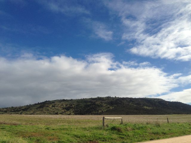
On Friday morning, 14th June, 2013, I got up bright and early and headed for Mount Dutton, VK5/ SW-035, which is situated about 48 kms north west of Port Lincoln on the lower Eyre Peninsula.
Mount Dutton was named after Charles Christian DUTTON, an explorer, who in 1839, led a small expedition from Port Lincoln to Coffin Bay. DUTTON was an early Sheriff of the Province and then settled in the Port Lincoln district. He died at age 32 in 1842.
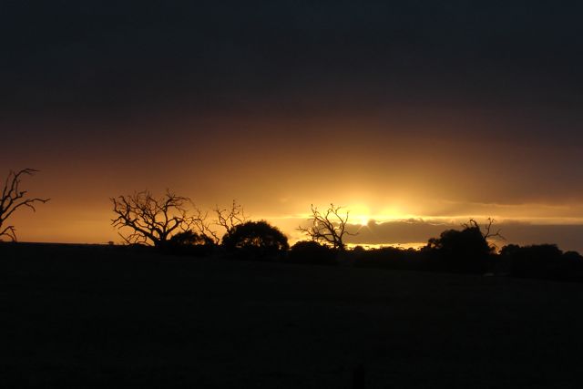
I travelled out along the Flinders Highway towards the town of Wangary, and watched the spectacular sunrise. And at the same time keeping a close watch for kangaroos. There are plenty of roos over here on the Eyre Peninsula.
At Wangary, turn left into Farm Beach Road and travel west towards the ocean.
It is worth a quick detour down to Farm Beach and Gallipoli Beach, which featured in Peter WEIR’s Australian movie ‘Gallipoli’.
After travelling down Farm Beach Road for about 5 kms turn right into Broccabruna Drive. There is a brown sign here saying ‘Frenchman 14’. Travel about 1 km along Broccabruna Dr and then veer left onto Mena Road. There is a brown sign here saying ‘Frenchman 13’. About 3 kms up Mena Road, you will see an old derelict cottage just set off the road amongst trees and shrubs. There is a large tall palm tree here as well to keep an eye out for.
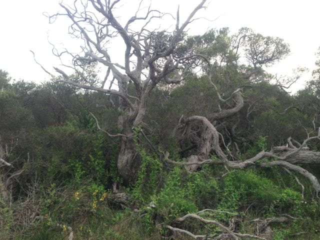
Directly opposite this, you will see a large cocky’s gate. I travelled from here through the paddock to the base of the hill. It is about a 3 km walk from there to the summit. The first part of this walk is a bit of a challenge. There is no track and the scrub is quite thick in parts. It is pretty easy to get disorientated.
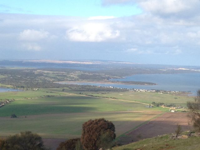
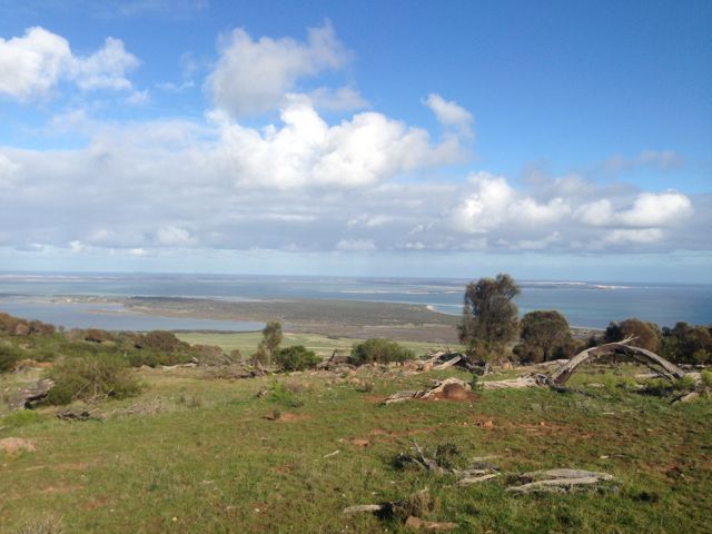
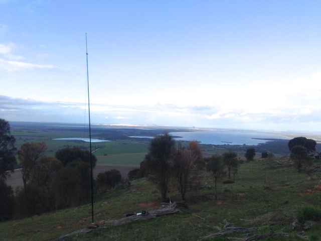
Once you do reach the top there are spectacular views out in all directions. Particularly to the south. The views of Mount Dutton Bay, Coffin Bay, and the Coffin Bay National Park are truly amazing. The hill is surrounded by lush sheep and cereal farming land. The walk along the ridgeline on the top of the hill is quite easy, and there are plenty of spots to explore.
During the late 1800’s, nearby Dutton Bay was a valuable ‘land-sea link’, as a jetty was built adjacent to the large Dutton Bay woolshed. At its peak, over 20,000 sheep were shorn within the woolshed. Up to 100,000 fleeces were baled and loaded onto ketches from the adjoining jetty, for overseas markets.
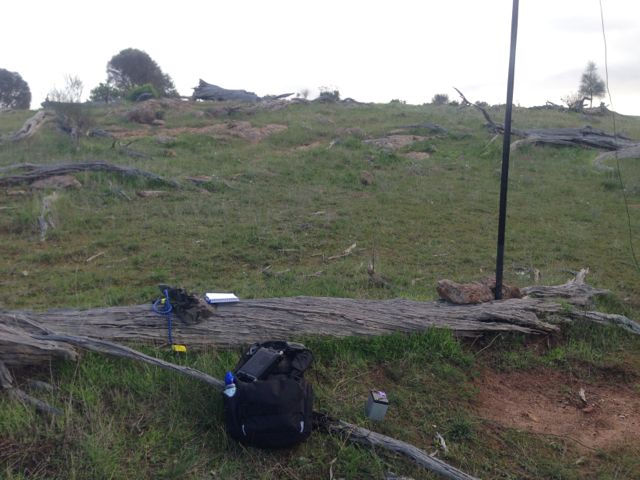
There are quite a few trees and shrubs and rocks on the top, so plenty of options in securing the ends of the dipole. I set up the 40m/20m linked dipole on the 7m squid pole, using a fallen tree and some rocks to secure it into place. The tree made a good bench.
I put a CQ call out, and worked a total of 15 stations before the UTC rollover, and a total of 24 stations after the UTC rollover.
Stations worked before the UTC rollover were:- Ian VK5CZ; Roger VK5NWE; Peter VK3PF; Glenn VK3YY; Rik VK3KAN/m; David VK3VDL/m; Ron VK3AFW/m; Tony VK3CAT; David VK5UG; Nev VK5WG; David VK5LSB; Ernie VK3DET; Urey VK3ATA; Dennis VK5LDM; and Mike VK5MCB.
Stations worked after the UTC roll over were:- Rik VK3KAN/m; David VK5UG; Nev VK5WG; Ron VK3AFW/m; Peter VK3PF; Col VK5HCF; David VK5LSB; Les VK5KLD; Mike VK5MCB; Tony VK3CAT/m; Ernie VK3DET; Rhett VK3GHZ; VK3JP; Ian VK5CZ; David VK3VDL; VK3JM; Glenn VK3YY; Dennis VK5LDM; Jim VK5JW; Colin VK3NCC/2; Urey VK3ATA; Brian VK5FMID; John VK5FTCT, and Mark VK7FMPR.
More information on PeakClimbs at…..
http://www.peakclimbs.com/peak/Mount-Dutton/205/view/#climb_id_320
Below is a video of my activation, which I have posted on You Tube.
